


You also want an ePaper? Increase the reach of your titles
YUMPU automatically turns print PDFs into web optimized ePapers that Google loves.
SOUTH DOWNS<br />
NATIONAL PARK<br />
From rolling hills to bustling market towns, the<br />
South Downs National Park’s landscapes cover<br />
1,600km² of breathtaking views, hidden gems<br />
and quintessentially English scenery. A rich<br />
tapestry of wildlife, landscapes, tranquillity and<br />
visitor attractions, weave together a story of<br />
people and place in harmony.<br />
For your guide to everything there is to<br />
see and do in the National Park visit<br />
southdowns.gov.uk/discovery-map<br />
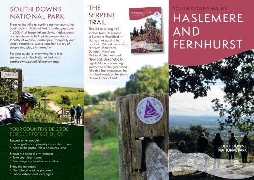
THE<br />
SERPENT<br />
TRAIL<br />
This 64-mile long trail<br />
snakes from Haslemere<br />
in Surrey to Petersfield in<br />
Hampshire passing by<br />
Liphook, Milland, Fernhurst,<br />
Petworth, Fittleworth,<br />
Duncton, Heyshott,<br />
Midhurst, Stedham and<br />
Nyewood. Designated to<br />
highlight the outstanding<br />
landscape of the greensand<br />
hills this Trail showcases the<br />
rich heathlands of the South<br />
Downs National Park.<br />
© Peter Robinson<br />
SOUTH DOWNS WALKS<br />
<strong>HASLEMERE</strong><br />
<strong>AND</strong><br />
<strong>FERNHURST</strong><br />
YOUR COUNTRYSIDE CODE:<br />
RESPECT. PROTECT. ENJOY.<br />
Respect other people<br />
• Leave gates and property as you find them<br />
• Keep to the paths unless on Access Land<br />
Protect the natural environment<br />
• Take your litter home<br />
• Keep dogs under effective control<br />
Enjoy the outdoors<br />
• Plan ahead and be prepared<br />
• Follow advice and local signs
A model of Fernhurst Furnace<br />
©SDNPA/Bruce Middleton<br />
Belted-Galloway cattle<br />
©Mark Monk-Terry Sussex Wildlife Trust<br />
WINCHESTER<br />
<strong>HASLEMERE</strong><br />
PETERSFIELD<br />
GODALMING<br />
National Park Area<br />
Railway<br />
Station<br />
MIDHURST<br />
SOUTHAMPTON<br />
LEWES<br />
PORTSMOUTH<br />
BOGNOR<br />
REGIS<br />
BRIGHTON<br />
& HOVE<br />
FIND YOUR WAY<br />
Follow the arrows on waymarkers.<br />
Footpath<br />
Bridleway<br />
Restricted byway<br />
POINTS OF INTEREST<br />
Byway<br />
Open access land<br />
<br />
National Trail Acorn<br />
<strong>FERNHURST</strong><br />
FURNACE<br />
The remains of Fernhurst<br />
Furnace, also known as<br />
North Park Furnace, are<br />
some of the best preserved<br />
in the Sussex Weald. It is<br />
believed the site was in use<br />
between 1614 until 1777<br />
when the iron industry<br />
flourished here in the<br />
17th and 18th centuries<br />
using local ore, charcoal<br />
and water power.<br />
The untouched nature of<br />
the site and the rural<br />
surrounding make it hard<br />
to imagine the production<br />
of cast iron, tools and<br />
cannon once happened<br />
here. It was effectively the<br />
beginning of the Industrial<br />
Revolution and even<br />
though there are many<br />
‘hammer/furnace’ ponds<br />
throughout East and West<br />
Sussex, many people know<br />
little about the great<br />
historical and social<br />
importance of this<br />
bygone industry.<br />
BLACK DOWN<br />
This is the highest hill in<br />
Sussex standing at 280<br />
metres (918 feet) and is<br />
second only to Leith Hill<br />
(295 metres, 968 feet) in<br />
the south-east of England.<br />
It is also the highest point<br />
in the South Downs<br />
National Park and its pine<br />
and heather covered<br />
slopes are grazed by a<br />
herd of friendly<br />
belted-Galloway cattle.<br />
Looming over much of the<br />
Low Weald of West Sussex<br />
and south-west Surrey,<br />
Black Down is geologically<br />
part of the greensand<br />
ridge and is situated about<br />
1.2 miles (1.9 km) south of<br />
Haslemere. Flint artefacts<br />
show there has been<br />
settlement on Black Down<br />
since the mesolithic period,<br />
around 6000BC<br />
Aside from its height and<br />
its wild beauty, Black Down<br />
is best known as the site of<br />
Tennyson’s house,<br />
Aldworth. Tennyson<br />
purchased Black Down<br />
and built Aldworth in<br />
1869. With magnificent<br />
views over the Weald, the<br />
French-style Gothic house<br />
was designed by Sir James<br />
Knowles and built using<br />
local sandstone. Lord<br />
Tennyson used Aldworth as<br />
his summer residence and<br />
died in the house on 6<br />
October 1892. Black<br />
Down was then passed<br />
between various<br />
landowners until W.E.<br />
Hunter donated it to the<br />
National Trust in the 1940s<br />
as a memorial to his wife.<br />
The National Trust still own<br />
the site and the Hunter<br />
family are remembered<br />
by an inscribed stone<br />
seat at the Temple of the<br />
Winds viewpoint.<br />
TAKE THE LEAD<br />
For a safe and fun visit with your dog please remember<br />
to keep them on a lead around livestock and wildlife.<br />
Always bag and bin your dog poo – any public bin will do!<br />
GETTING HERE<br />
By bus: There are regular<br />
services to Liphook and<br />
Haslemere, visit<br />
traveline.info/se<br />
By rail: The nearest<br />
railway stations are Liphook<br />
and Haslemere. Visit<br />
nationalrail.co.uk<br />
SOUTHDOWNS.GOV.UK<br />
CONTACT<br />
© SDNPA/Sam Moore<br />
South Downs National<br />
Park Authority:<br />
01730 814810<br />
@SDNPA<br />
/SDNPA<br />
Printed on FSC certified paper. Details correct at time of going to print. Please<br />
be aware that routes are shared with other users (vehicles, pedestrians, dogs,<br />
horses etc.) and users of this route do so at their own risk. We do not accept<br />
any responsibility for loss, damage or injury, however caused, arising directly<br />
or indirectly from use of this leaflet. Contains Ordnance Survey data © Crown<br />
copyright and database right 2013.<br />
SDNPA/The Way Design/January ‘16. © SDNPA Crown copyright<br />
Please<br />
recycle me<br />
after use
LIPHOOK TO <strong>FERNHURST</strong><br />
LIPHOOK<br />
GOLF<br />
CLUB<br />
PORTSMOUTH ROAD<br />
MILL<strong>AND</strong> LANE<br />
KEY:<br />
Point of interest<br />
Pub<br />
LIPHOOK<br />
1<br />
SHUFFLESHEEPS<br />
4<br />
2<br />
SUSSEX BORDER PATH<br />
Refreshments<br />
Toilets<br />
Bus stop<br />
Parking<br />
Trail point<br />
Road<br />
Long Distance Path<br />
3<br />
10<br />
Bridleway<br />
Footpath<br />
IRON HILL<br />
CAR PARK<br />
HIGHFIELD LANE<br />
Woodland<br />
Buildings<br />
Open access land<br />
(in shaded area)<br />
IRON HILL<br />
STANLEY<br />
COMMON<br />
PARKGATE<br />
COPSE<br />
NEW LIPHOOK WAY<br />
5<br />
STANLEY<br />
FARM<br />
PARKGATE<br />
ROUGH<br />
TAYLORS<br />
COPSE<br />
GOLDEN<br />
VALLEY<br />
9<br />
HARLEY GREEN<br />
COPSE<br />
6<br />
MINEPIT<br />
COPSE<br />
8<br />
7<br />
LOWER<br />
LODGE FARM<br />
OAKREEDS<br />
WOOD<br />
1<br />
Exit Liphook Station bearing left<br />
on the road. Turn left on the<br />
Portsmouth Road.<br />
2<br />
After the Links Tavern turn left<br />
onto the byway. At the other<br />
side of the railway bridge continue<br />
straight ahead on the footpath,<br />
then turn left on the Sussex Border<br />
Path. At the fork turn left and<br />
continue to the road.<br />
3<br />
Cross the road and continue<br />
on Highfield Lane turning right<br />
onto the first bridleway.<br />
4<br />
Turn right onto the Serpent<br />
Trail and follow Trail markers<br />
to Iron Hill car park. Turn left, then<br />
right at the bridleway T-junction<br />
and continue to the road.<br />
5<br />
Turn left along the road, taking<br />
the first footpath right and<br />
continue into the woods. Turn<br />
left at the footpath junction, then<br />
right at the bridleway. Cross a<br />
small brook and continue until the<br />
bridleway bears right.<br />
6<br />
Take the footpath left through<br />
the gate. Continue along the<br />
field edge, through a gate and<br />
merge onto the bridleway.<br />
7<br />
Continue across the Fernhurst<br />
Furnace dam, along the<br />
bridleway to the wood and out<br />
into a narrow field. Continue until<br />
you emerge beside Lower Lodge<br />
Farm and the candle factory.<br />
8<br />
Turn right at the road and at<br />
the next junction follow the<br />
road to Lynchmere. After 600<br />
metres turn left on the footpath,<br />
then left at the footpath T-junction.<br />
Continue through the woods<br />
passing a cottage, then at the<br />
T-junction turn left and follow the<br />
path.<br />
9<br />
Turn right at the next junction<br />
and continue up the hill.<br />
Pass Stanley Farm and continue<br />
through the gate beside the cattle<br />
grid. At the bridleway T-junction<br />
turn left and follow bridleway<br />
signs until you reach the road.<br />
10<br />
Cross the road and<br />
follow the pavement back<br />
to Liphook, cross the railway<br />
footbridge and turn right down<br />
the steps to return to the station.<br />
Discover<br />
the wooded<br />
weald and the<br />
remnants of an<br />
iron cannon<br />
making era.<br />
TRAIL:<br />
DISTANCE:<br />
7.25 miles (11.7km)<br />
ALLOW:<br />
3.5–4 hours<br />
GRADIENT:<br />
One steep hill at<br />
Stanley Hanger.<br />
PATH:<br />
Mainly forested paths<br />
(muddy when wet) and<br />
public roads. One stile.<br />
<strong>FERNHURST</strong><br />
FURNACE<br />
S<br />
W<br />
E<br />
N<br />
0 ¼ mile<br />
500m
10<br />
11<br />
12<br />
8<br />
7<br />
6<br />
5<br />
MIDHURST ROAD<br />
TO <strong>FERNHURST</strong><br />
SHEETL<strong>AND</strong><br />
ABESTERS<br />
COPSE<br />
NORTH<br />
COPSE<br />
VALEWOOD<br />
PARK<br />
<strong>HASLEMERE</strong><br />
HASTE<br />
HILL<br />
BLACK DOWN<br />
LYTHEHILL<br />
HOUSE<br />
SUSSEX BORDER PATH<br />
SERPENT TRAIL<br />
RED<br />
LION<br />
HOME<br />
WOOD<br />
SERPENT TRAIL<br />
TEMPLE OF<br />
THE WINDS<br />
1<br />
WADESMARSH<br />
FARMHOUSE<br />
VALEWOOD<br />
FARMHOUSE<br />
3<br />
PETWORTH ROAD<br />
TENNYSON’S LANE<br />
HIGH BARN<br />
FARM<br />
4<br />
2<br />
14<br />
13<br />
15<br />
MAP REF:<br />
Find these<br />
areas on OS<br />
Explorer 133<br />
9<br />
FERNDEN LANE<br />
S<br />
W<br />
E<br />
N<br />
0 ¼ mile<br />
500m<br />
<strong>HASLEMERE</strong><br />
TO <strong>FERNHURST</strong><br />
TRAIL:<br />
1<br />
Turn left out of the station and follow<br />
the road into Haslemere. Turn left<br />
onto the high street. At the pedestrian<br />
crossing look for the Serpent Trail<br />
marker on the traffic lights. Cross over,<br />
turn left and follow the marker right<br />
onto Well Lane.<br />
2<br />
Follow the path into Swan Barn<br />
Farm, through two gates and left<br />
on the track. Follow the Serpent Trail<br />
markers along the track, across fields<br />
and over a bridge.<br />
3<br />
Turn right and follow the path to the<br />
road. Cross over and follow the Trail<br />
marker along Pine Springs Valley. Bear<br />
left where the road forks.<br />
4<br />
Continue into the wood, pass through<br />
a gate and continue on the Serpent<br />
Trail passing High Barn Farm. Pass<br />
through a gate and turn left on the track.<br />
5<br />
Continue to follow the Serpent Trail<br />
turning right onto the road.<br />
DISTANCE:<br />
8 miles (12.9 km)<br />
ALLOW:<br />
4–4.5 hours<br />
GRADIENT:<br />
A couple of steady climbs.<br />
PATH: Wooded paths with<br />
a mix of gates and stiles.<br />
Explore hidden<br />
tracks and the<br />
highest point in<br />
the South Downs.<br />
6<br />
Just before Black Down car park turn<br />
left and follow the Trail markers to<br />
the Temple of the Winds. Bear left and<br />
follow the path to the viewpoint.<br />
7<br />
Continue through the woods, turn<br />
left at the T-junction and pass<br />
through the gate.<br />
8<br />
At the road turn right then<br />
immediately left onto a bridleway.<br />
Bear left at the end of the tarmac into<br />
woodland. Turn left at the fork, then at<br />
the crossroads follow the way marker<br />
straight ahead.<br />
9<br />
Bear left where the path joins a<br />
track. At the road turn right along<br />
the footpath and follow way markers<br />
until you emerge beside the Red Lion<br />
pub in Fernhurst.<br />
10<br />
Cross the road and turn right<br />
uphill. At the left hand bend<br />
cross the road and take the signposted<br />
footpath. Continue onto a path and<br />
over a stile.<br />
11<br />
Continue over two stiles crossing<br />
a small lane into a field to<br />
another stile. Continue straight ahead<br />
on the footpath.<br />
12<br />
Turn right at the road, passing<br />
houses on your left, and join<br />
the restricted byway. At the fork bear<br />
right downhill and follow the track as it<br />
becomes a footpath.<br />
13<br />
At the T-junction continue on the<br />
restricted byway, then turn left<br />
at the road. At the T-junction turn left<br />
then just past Wadesmarch Farmhouse<br />
turn right on the bridleway and enter<br />
Valewood Park.<br />
14<br />
Continue along the bridleway to<br />
the road. Turn left and at the mini<br />
roundabout turn right passing Stedland<br />
Farm, then bear left uphill on the byway.<br />
15<br />
At the road turn left and then right<br />
onto the signposted footpath.<br />
Continue to the main road, turn left and<br />
follow the road back to the railway station.