


You also want an ePaper? Increase the reach of your titles
YUMPU automatically turns print PDFs into web optimized ePapers that Google loves.
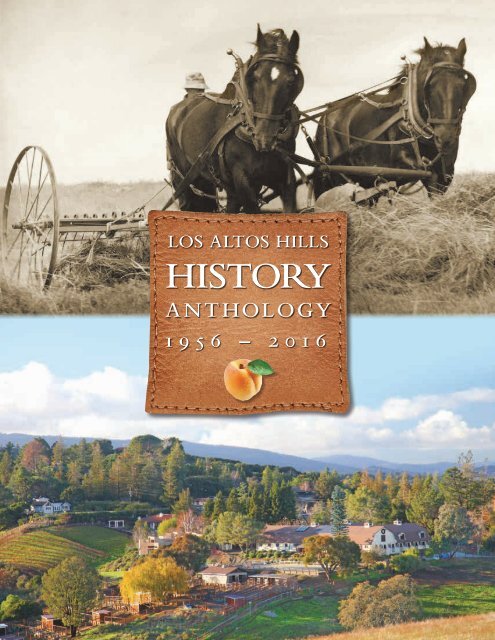
LOS ALTOS HILLS<br />
<strong>HISTORY</strong><br />
ANTHOLOGY<br />
1956 – 2016
Our Heritage<br />
To paraphrase Robert Kennedy, few will have the<br />
greatness to bend history itself; but each of us can<br />
work to change a small portion of events, and in the<br />
total, of all those acts will be written the history of<br />
our town. This anthology weaves together a colorful,<br />
historical tapestry to celebrate the 60th anniversary of Los Altos<br />
Hills. Stories and images recount the experience of everyday people,<br />
farmers, writers, entrepreneurs, innovators, and philanthropists<br />
whose lives have influenced the character of our town. From decade<br />
to decade, residents exhibit a spirit of independence, an appreciation<br />
for nature and wildlife, a high regard for quality public education,<br />
and a deep commitment to volunteerism and community service.<br />
Taken together, these values form our heritage. This<br />
heritage can be a source of pride, yet it is fragile —<br />
always on the brink of being compromised or<br />
lost. The goal of this anthology<br />
is to inspire an appreciation<br />
of our past and encourage<br />
participation in the small<br />
events that make our<br />
town unique.<br />
Ruth McMahon<br />
and her horse<br />
Poncho went door<br />
to door “aback” to<br />
obtain signatures<br />
for the petition to<br />
incorporate.<br />
Alexander Atkins<br />
Editor and Designer
God’s Little Acre
The bucolic little hillside town that started 60 years ago as a<br />
few hundred redwood ranch homes with roses around the<br />
door, averaging about 3,000-square-feet in floor area, is today<br />
dotted with far more majestic residences, with floor plans up<br />
to 20,000-square-feet or even greater. Wealth, the reward of the energy of<br />
brilliant entrepreneurs and gifted technical minds, has arrived.<br />
The founders of the town<br />
expressed their dream of a<br />
quiet bucolic community,<br />
free from the constraints of<br />
county government, in two<br />
key founding documents:<br />
the so-called “Green<br />
Sheets” and the “Platform<br />
for Incorporation.” It was acclaimed writer<br />
and Stanford professor Wallace Stegner<br />
who dubbed the town “God’s Little Acre.”<br />
Members of the founding committee,<br />
including representatives from six neighborhoods,<br />
along with Stegner and other<br />
key residents helped lead a few hundred<br />
residents to vote the town into existence.<br />
The early days of the town, were characterized<br />
by the utmost simplicity in government,<br />
minimum bureaucracy and many,<br />
many horses. The residents went happily<br />
about their daily round, content in the<br />
achievement of their dream.<br />
But time did not stand still, and in<br />
adjacent Silicon Valley, a technical revolution<br />
that was to affect deeply the town<br />
as well as the entire world, was taking<br />
place. Fortunes were being made on an<br />
unimaginable scale, and the new captains<br />
of industry were searching for somewhere<br />
to plant their roots in settings of quiet and<br />
beauty. The Town of Los Altos Hills, with<br />
its seductive rural countenance, beckoned.<br />
Alarmed longtime residents, mindful of<br />
the promise of the founding documents<br />
saw the invading bulldozers and graders<br />
as evidence of visitation by others with<br />
no regard for the sanctity of the<br />
unique environment, and thus<br />
protested. But as time went by,<br />
it became clear that many of the<br />
invaders were going to extraordinary<br />
lengths to build in harmony<br />
with their surroundings, and<br />
reaching out to recognize the<br />
concerns of their new neighbors. As in<br />
every community, there were a few with<br />
poor aesthetic taste or even disregard for<br />
others, but the new generation, with its<br />
optimistic take on human affairs, seems<br />
eager to maintain, in its own special way,<br />
the early objectives of the founders.<br />
And just how successful are they in this<br />
endeavor? The Green Sheets called for<br />
the area to “remain residential, quiet, and<br />
reasonably rural... We want to walk around<br />
our house without knocking our heads on<br />
our neighbor’s eaves... We want roads that<br />
are content to remain country lanes... [We]<br />
want at least one acre of land.”<br />
It would be hard to deny that these<br />
desirable characteristics endure today.<br />
And there are still no sidewalks, no streetlights;<br />
the town’s police and fire protection<br />
services are borrowed from outside.<br />
The new Town Hall is a model of sensitive<br />
rural design and environmental respect.<br />
Sixty years after the founding of the<br />
town, despite many changes and growth,<br />
residents can be grateful that “God’s Little<br />
Acre” has been preserved.<br />
Bob Johnson is a former Los Altos Hills mayor and<br />
councilmember.
Timeline<br />
1776 The Declaration of Independence was signed<br />
Lt. Colonel Juan Bautista de Anza expedition traveled through Santa Clara Valley<br />
1777 Pueblo San Jose became first civil settlement in Alta California<br />
Santa Clara Mission was founded<br />
1822 California became a province of Mexico<br />
1833 Secularization Law turned over all mission properties to civil authorities<br />
1834 Land grant of 4,436 acres was given to Ohlone father and son Jose Gorgonio and Jose Ramon<br />
1839 Land grant of 4,438 acres was awarded to Don Juan Prado Mesa<br />
1840 Gorgonio land grant was formally signed by Governor Juan B. Alvarado<br />
1844 Juana Briones de Miranda purchased Gorgonio land and named it Rancho La Purísima<br />
Concepción<br />
1845 Juan Prado Mesa died<br />
1846 Mexican-American War; United States claimed California<br />
1848 The California Gold Rush began when gold was found at Sutter’s Mill in Coloma<br />
1850 California became a state<br />
1857 Juana Briones de Miranda sold 3,000 acres of Rancho la Purisima Concepcion to<br />
Martin Murphy, Jr.<br />
1887 Otto Arnold purchased 600 acres of Hidden Villa<br />
1889 Juana Briones died<br />
1901 The Purissima School District was formed<br />
The single-building Purissima Schoolhouse, with one room, was built on two acres of Taaffe land<br />
Griffin House was built for Willard Griffin, a founder of Del Monte Packing Company.<br />
1916 Lantarnam Hall, later called Morgan Manor, was built by Percy Morgan Jr.<br />
1918 School was delayed a week “on account of the prune crop not being all gathered”<br />
1924 Frank and Josephine Duveneck purchased Hidden Villa<br />
1925 A resolution was passed by the Purissima School Board allowing the teacher to retain her job<br />
upon marriage<br />
1936 Children’s “interracial” camp established at Hidden Villa<br />
1937 First Youth Hostel in California built at Hidden Villa<br />
1944 Henry Waxman purchased Adobe Creek Lodge<br />
1952 John Carter Ford moved the Ford Country Day School, a private K-6 school, from Los Altos to<br />
Morgan Manor<br />
1955 Purissima Hills Water District was incorporated
1956 The Town of Los Altos Hills was incorporated<br />
The Palo Alto Unified School District (PAUSD) purchased land at 26800 Fremont Road to build and<br />
open Fremont Hills Elementary School<br />
1957 The Foothill Community College District was formed<br />
1958 Alan Cranston was elected state controller<br />
1960 David Bellucci Sr. bought Adobe Creek Lodge on Moody Road and converted it into a private<br />
country club<br />
The Los Altos School District (LASD) purchased land near Elena Road to build and open Purissima<br />
Hills School<br />
LASD built and opened Eastbrook Elementary School on 11311 Mora Drive to serve the south part<br />
of town<br />
1961 The First Master Path Plan was adopted<br />
Foothill College opened<br />
1962 Committee for Green Foothills was founded<br />
West Fremont K-6 School, managed by LASD, opens on 25890 Fremont Road; the school is<br />
soon renamed Bullis School to honor Gardner Bullis, one of the leading proponents of the town’s<br />
incorporation<br />
1963 Committee for Green Foothills was founded<br />
1966 Mary Davey is the first woman elected to town council<br />
Purissima Schoolhouse purchased for $24,000 by the Episcopal Layman’s group of Los Altos and<br />
restored as the Little Chapel in the Hills<br />
1967 Dr. Albert Barnitz Byrne donated the 55-acre parcel of Byrne land off Altamont Road to Nature<br />
Conservancy<br />
Interstate 280 completed up to Page Mill Road<br />
1968 Town of Los Altos Hills purchased the 55-acre Byrne Park Preserve from Nature Conservancy as<br />
permanent open space<br />
Alan Cranston won first term as California Senator<br />
1971 An Ohlone village site was unearthed near El Monte and Summerhill Avenues<br />
The town council agreed to lease/purchase the Little League Fields (7.5 acres) from PAUSD<br />
1972 The Midpeninsula Regional Open Space District was created<br />
1975 Griffin House was placed on the National Register of Historic Places<br />
Countess Margit Bessenyey donated Westwind Barn to the Town
1976 Florence Fava published her history of the Town: Los Altos Hills: The Colorful Story<br />
Anza Corner was dedicated by Mayor Robert C. Cheney<br />
Purissima Hills School closed; Bullis School was renamed Bullis-Purissima School<br />
Fremont Hills Elementary School closed<br />
1977 Josephine and Frank Duveneck donated 430 acres of Hidden Villa Ranch to the Midpeninsula<br />
Regional Open Space District<br />
PAUSD leases the 5-acre Fremont Hills Elementary School site to Pinewood School, a private<br />
school<br />
1978 Eastbrook Elementary School closed; the land is sold to developers<br />
The 4-H Therapeutic Horseriding Program for Physically Handicapped Children was established<br />
at Westwind Barn<br />
1981 The Town celebrated its 25th Anniversary<br />
The Master Path Plan was revised<br />
1985 An arsonist set fire to a dry grass field along Arastradero Road that scorched 150 acres and<br />
destroyed 10 homes on Liddicoat Lane<br />
1988 Ford Country Day School closed; the property now known as Stonebrook Court is sold to a<br />
private party<br />
1989 Loma Prieta earthquake caused millions of dollars of damages to homes<br />
1996 Developer John Vidovich received approval to build Quarry Hills, the last large subdivision to be<br />
built in the Hills<br />
2000 Town of Los Altos Hills Recreation Program established at Westwind Barn<br />
2002 Town Council agreed to accept provisions of the residents’ “Open Space Initiative”<br />
Los Altos Hills City Clerk Patricia Dowd retired after 23 years of service<br />
The historic Winbigler house is demolished without town approval<br />
2003 Bullis-Purissima School closed<br />
2004 Bullis Charter School opened in portables located at Egan Junior High School in Los Altos<br />
From 2004 to 2008, Los Altos Hills did not have any public schools within the town’s borders<br />
The old Town Hall was demolished in July<br />
2005 The Master Path Plan (major portions) was revised<br />
New Town Hall opened in May
2006 The Town celebrated its 50th Anniversary<br />
2007 The Town annexed 62 parcels in the West Loyola area<br />
Foothill College opened new campus center, student services building, life sciences building,<br />
and theatre<br />
2008 Gardner Bullis Elementary School was opened after $11 million renovation<br />
Voters passed a $378 million bond to address enrollment growth and improvements to Gunn<br />
High School<br />
Westwind Barn came under Town management<br />
Town began extensive renovations to Westwind Barn and Purissima Park<br />
The Los Altos Hills County Fire District began offering free Personal Emergency Preparedness<br />
classes<br />
Residents collaborated with Town staff and a number of agencies to restore Adobe Creek to<br />
prevent bank erosion and flooding<br />
2009 Renovated Purissima Park opened<br />
2010 Renovated Westwind Barn opened<br />
Community Donor Wall was completed<br />
In response to severe drought, Town adopted a Water Efficient Landscape ordinance<br />
PG&E installed SmartMeters in all homes<br />
2011 Town worked with wireless companies to install cell towers near Town Hall and Westwind Barn<br />
A Russian billionaire investor purchased a 17-acre, 25,500-square-foot French-style chateau for<br />
$100 million<br />
Karen Jost retired after working for Town as Assistant to the City Engineer and Office Manager<br />
(1990-1993) and City Clerk (2002-2011)<br />
2012 Town began the Fremont Road Safe Route to School project that is completed in one year<br />
Town annexed 50 parcels located on La Loma, Olive Tree, and Mora Drive<br />
As a result of the drought and disease, thousands of evergreen and oak trees died all around<br />
town<br />
2013 The Public Art Committee was formed to accept and place donated sculptures around town<br />
Foothill College opened new physical sciences and engineering center<br />
2014 Voters passed $150 million bond measure to address enrollment growth and a final school site<br />
for Bullis Charter School<br />
2015 The average listing price for a home in town reached $4.05 million<br />
Jeanne Evilsizer retired after working for Town for 39 years (Assistant to City Engineer, Assistant<br />
to Planning Department, Building Technician); Bill Carino retired after working for Town for 27<br />
years as Building Official<br />
Foothill College began $10.5 million renovation of campus<br />
library and a 50,000-square-foot education facility in Sunnyvale<br />
Foothill College offered a bachelor’s degree<br />
in dental hygiene
First<br />
Famılies<br />
The story of the first families to settle in Los<br />
Altos Hills begins with with Martin and Mary<br />
Murphy’s quest for religious and educational<br />
freedom which leads the Catholic-Irish immigrants<br />
to Mexican California six years before the Gold<br />
Rush, where they rise from humble farmers to influential<br />
figures during California’s formative period. Much of the<br />
state’s commerce, agriculture and education start on their<br />
Santa Clara Valley ranch that encompasses Los Altos Hills.<br />
A Family of Pioneers<br />
The Murphy family’s California<br />
legacy begins in 1844 when<br />
the pioneers establish the first<br />
wagon route to California over<br />
the Sierra Nevada Mountains,<br />
opening the California Trail<br />
for thousands of other<br />
immigrants. Although<br />
this route is now<br />
called Donner Pass,<br />
it was the Murphy-<br />
Townsend-Stephens<br />
Party who pioneered<br />
this crossing.<br />
The Murphy’s eldest daughter,<br />
Elizabeth “Lizzie” Yuba Murphy-<br />
Taaffe, who later receives Los<br />
Altos Hills as a wedding present<br />
from her parents, is born near the<br />
summit of the Sierra<br />
Nevada Mountains<br />
during the trek,<br />
earning her the<br />
distinction of<br />
being the first<br />
American child<br />
born in California,<br />
according<br />
to California
★ ★ ★ ★<br />
Murphy<br />
FIRSTS<br />
• Members of the first pioneer wagon<br />
train to cross over the summit of the<br />
Sierra Nevada Mountains<br />
• First child born of English-speaking<br />
immigrants in California<br />
• First overt act against the Mexican<br />
government during the Bear Flag<br />
Revolt occurred on the Murphy’s<br />
property in Sonoma<br />
• Planted first wheat orchards in the<br />
Sacramento Valley<br />
• Helped establish the first schools of<br />
higher education: The couple gave<br />
the money and land needed to open<br />
Santa Clara College and The College<br />
of Notre Dame.<br />
• First to import American cattle and<br />
Norman horses to California<br />
• First to import farm machinery from<br />
the East via Panama to use in the<br />
Santa Clara Valley<br />
• First English-speaking family to<br />
settle in Santa Clara Valley<br />
• Built first wood frame house in<br />
Santa Clara Valley: Martin had the<br />
home prefabricated, disassembled,<br />
and shipped around the Horn to Bay<br />
View Ranch.<br />
• Planted the first orchards in Santa<br />
Clara Valley<br />
• Built the first brick building in San<br />
Jose<br />
• First Supreme Court of California<br />
convened at Murphy’s Bay View<br />
Ranch in Sunnyvale<br />
• The family is credited with founding<br />
the cities of Los Altos Hills,<br />
Sunnyvale, Murphys, Morgan Hill,<br />
Milpitas and San Martin<br />
• Local streets in Sunnyvale and Los<br />
Altos Hills that bear family names,<br />
include: Mary, Mathilda, Bernardo,<br />
Frances, Martin, Taaffe, and Murphy<br />
avenues, Yuba Drive, Elsie Way,<br />
Taaffe and Elena roads and Via<br />
Arline.<br />
folklore. She is born in the same<br />
cabin that the ill-fated Donner<br />
Party uses two years later<br />
during their journey west.<br />
Once in California, the<br />
family experiences tremendous<br />
success: The Bear Flag Revolt<br />
that helps the United States<br />
gain control of California takes<br />
Mrs. Martin Murphy’s<br />
good sense and<br />
knowledge beat all the<br />
lawyers and judges<br />
and legal appliances<br />
known to the practice<br />
of the law to clear<br />
(Murphy’s) ranch of<br />
squatters. She secured<br />
by kindness what the<br />
iron hand of the law<br />
was trying to achieve.<br />
JUDGE C.T. RYLAND, 1881<br />
place on their Sonoma property;<br />
Martin and Mary help establish<br />
the first schools, including Santa<br />
Clara University; and operate<br />
the first successful wheat<br />
ranch in the state. Some family<br />
members become state senators.<br />
Others end up owning some of<br />
the most successful gold mines<br />
in the state.<br />
Collectively, the family<br />
becomes the largest private<br />
landowners in world. Before<br />
his death 40 years later, Martin<br />
owns 10 million acres in California,<br />
making it possible to<br />
travel from Sacramento to San<br />
Luis Obispo without leaving his<br />
property. When Martin’s widow<br />
Mary dies in 1892, her share<br />
of the estate alone is worth $5<br />
million.<br />
Better Than Gold: Bay View Ranch<br />
(1849-1863)<br />
Martin and Mary settle in Santa<br />
Clara Valley during the Gold<br />
Rush after Martin discovers the<br />
area during a business trip to<br />
purchase cattle that he plans to<br />
sell to miners in the gold fields<br />
near his Sacramento ranch.
Left: Valley Destination: Bay View home becomes the<br />
valley’s social, political and religious center during the<br />
Gold Rush. This shows Martin and Mary (center)<br />
with the Taaffe grandchildren at Bay View circa<br />
1876. Mary and Mathilda are on the right, holding<br />
a jump rope on each side of the baby carriage, and<br />
Martin and William are standing on the far left.<br />
Lower tight: Elizabeth “Lizzie” Yuba Murphy-Taaffe.<br />
His plans change when he<br />
sees the Valley with its rolling<br />
hills, oak orchards and open<br />
fields along the San Francisco<br />
Bay. He uses the cash he’s<br />
carrying to purchase the<br />
4,800-acre Rancho Pastoria<br />
de las Borregas (Sunnyvale).<br />
This property becomes his<br />
permanent home and the<br />
headquarters for his vast wheat<br />
ranching operations.<br />
Here, he establishes Bay View<br />
Ranch, builds California’s first<br />
wood-frame house and plants<br />
the Valley’s first orchards.<br />
In 1855, he expands Bay View<br />
to include the 3,000 acres of<br />
adjacent grazing pastures he had<br />
been leasing called Rancho La<br />
Purisima Concepcion (Los Altos<br />
Hills). He pays Juana Briones<br />
$7,000 (or about ($2.33 per acre)<br />
for the land. Denied a formal<br />
education and the ability to<br />
write, Murphy seals the deal<br />
with his customary “X” on the<br />
land deed.<br />
Bay View becomes the<br />
Valley’s political, social and<br />
religious center during the<br />
Gold Rush. California’s first<br />
Supreme Court is established<br />
at the home, and San Francisco’s<br />
first Archbishop Joseph<br />
Alemany performs marriage<br />
ceremonies and other religious<br />
services there. In 1881, the home<br />
becomes the site of California’s<br />
largest celebration at the time<br />
when the Murphys publish<br />
an open invitation for their<br />
golden wedding anniversary in<br />
newspapers statewide. More<br />
than 7,000 guests attend the<br />
three-day event.<br />
A $14 Billion Wedding Present:<br />
Taaffe Ranch (1863-1875)<br />
In 1863, Martin and Mary give<br />
2,800 acres of the Rancho La<br />
Purisima Concepcion (Los Altos<br />
Hills) portion of their ranch to<br />
their daughter Elizabeth Yuba<br />
as a wedding present when she<br />
marries San Francisco dry goods<br />
merchant William Post Taaffe.<br />
The couple builds a home on the<br />
site where Foothill College is<br />
located today, and the property<br />
becomes Taaffe Ranch.<br />
According to family folklore,<br />
Murphy considers this property<br />
less desirable for his wheat operations<br />
than the rest of his Bay<br />
View ranch. He possibly gives<br />
this land to Elizabeth knowing<br />
that William is a merchant and<br />
won’t likely use the property for<br />
commercial ranching. This “less<br />
desirable” land is worth about<br />
$14 billion today, based on 2015<br />
median property values in the<br />
2,800-acre tract.<br />
William expands his San<br />
Francisco dry goods business<br />
to San Jose, but the couple does<br />
not live on the ranch for long.<br />
Less than five years after their<br />
marriage, both die a few years<br />
apart from illnesses, leaving<br />
Mary and Martin Murphy<br />
to raise their four children,<br />
William, Martin and twins<br />
Mary and Mathilda.<br />
It became strenuous<br />
exercise getting off<br />
Rose Hill to the school<br />
room. There were<br />
horses to ride, but<br />
they had to be caught<br />
first, and that wasn’t<br />
always easy.<br />
BESSIE TAAFFE, CIRCA 1902
This 1904 map shows how the ranch was divided among the four Taaffe<br />
children. Section 1 (which included the area near today’s Byrne Preserve)<br />
belonged to Martin and his wife Rose, whose handwritten notes show what<br />
pieces of property she planned to keep and which ones she planned to sell in<br />
the years following Martin’s death. Sections 2 and 4 belonged to twins Mary<br />
and Mathilda, and are the last portions of the ranch to be subdivided. Section<br />
3 (which includes the area along Purissima Road) belonged to William, who<br />
lost his entire inheritance in foreclosure in 1897. As a result, his portion of<br />
land was the first section of Los Altos Hills to be subdivided.
Inheritance: Taaffe Ranch (1880-<br />
1930s)<br />
The four Taaffe children inherit<br />
equal shares of Taaffe Ranch,<br />
which evolves from rolling<br />
pastures to a stock and grain<br />
ranch. This generation, however<br />
does not share the same success<br />
as their grandparents, and life<br />
on the ranch is marked with<br />
hardships and tragedy.<br />
William “Will” Taaffe<br />
becomes one of the most<br />
extensive farmers in Santa<br />
Clara Valley after graduating<br />
from Santa Clara College in<br />
1884. He supervises operations<br />
at his grandparents’ 4,800-acre<br />
ranch and manages the entire<br />
3,000-acre Taaffe Ranch until<br />
his younger brother finishes<br />
school. He and his wife, Mary<br />
Dunne, build a country home<br />
on his portion of the ranch (near<br />
today’s Purissima Road) called<br />
Oakdale Villa. By 1897, Will is<br />
divorced and he has lost much<br />
of his money to his uncle’s San<br />
Jose Commercial and Savings<br />
Bank that failed during the<br />
Panic of 1893. He loses his ranch<br />
property in a foreclosure suit. He<br />
continues to operate his other<br />
ranch in San Luis Obispo and<br />
serves as deputy city treasurer in<br />
San Jose until a crippling illness<br />
confines him to his home. He<br />
dies in 1905.<br />
Twin sisters Mary (Mollie)<br />
and Mathilda (Mattie) are the<br />
youngest of the Taaffe children,<br />
born in the house their parents<br />
built on the ranch. Their story<br />
is the most tragic of the four<br />
siblings. Shortly after both of<br />
their brothers die, the unmarried<br />
twins are deemed incompetent<br />
for mismanaging their finances<br />
and institutionalized in separate<br />
There seemed to be a very<br />
close relationship between<br />
my twin aunts and my<br />
father because he always<br />
seemed so happy after a<br />
visit to their home in spite<br />
of all my pranks. Sliding<br />
down the banisters from<br />
the attic did not seem to<br />
be too awful even though<br />
quite risky.<br />
BESSIE TAAFFE<br />
insane asylums, where they<br />
spend the rest of their lives<br />
and die virtually anonymous<br />
inmates. An appointed guardian<br />
liquidates the twins’ massive<br />
land holdings inherited from<br />
their grandparents, which<br />
included a portion of Taaffe<br />
Ranch, Asuncion Ranch and a<br />
portion of Sunnyvale.<br />
Martin Joseph Taaffe is the<br />
only sibling who makes the<br />
ranch his permanent home.<br />
A Stock and Grain Ranch: Rose<br />
Hill (1888-1930s)<br />
Martin Taaffe calls his 1,100-<br />
acre tract of land Rose Hill after<br />
his bride Rose Hoffman, who is<br />
the niece of General Jose Castro,<br />
former governor of Mexican<br />
California. He builds a 12-room<br />
home at the top of today’s<br />
Taaffe Road. From 1887 to 1901,<br />
he operates a stock and grain<br />
ranch there. The Hills’ microclimate<br />
create conditions perfect<br />
for growing a special kind of<br />
hay for racehorses in San Mateo.<br />
Life on the ranch appears<br />
to be idyllic for the couple and<br />
their five children in the early<br />
years until Martin experiences<br />
a series of hardships beginning<br />
in 1894, when an engine used to<br />
pump well water explodes and<br />
sears Martin’s lungs. Rose pulls<br />
him from the explosion and<br />
saves his life, but his health is<br />
permanently impacted.<br />
Martin’s father-in-law<br />
Charlie Hoffman convinces<br />
Martin that Mexico’s warm<br />
climate will help his condition<br />
and brings him to work on
Top: William and his sister Elena prepare to<br />
pick fruit on Rose Hill sometime after 1910.<br />
Right: The four Taaffe daughters from left<br />
are: Marie, Elena, Elizabeth (Bessie) and<br />
Martina (front), who was named after her<br />
father when the couple gives up all hope on<br />
ever having a son. They also had two sons,<br />
Martin and William Charles.
Left: Martin Joseph and Rose. Right: Martin J.<br />
Taaffe II. Lower right: Members of the Taaffe<br />
and Hoffman families shown in front of a<br />
typical rustic summer house (circa 1890).<br />
his coffee plantation. Martin’s<br />
condition only worsens and he<br />
returns home two years later<br />
in 1900 unable to work the<br />
ranch. To make matters worse,<br />
an unprecedented rain on the<br />
Fourth of July, ruins the wheat<br />
that was cut and drying in the<br />
fields. Two weeks later, some<br />
hunting ammunition ignites,<br />
catching the family home on<br />
fire. The home is saved, but<br />
other ranch buildings are lost.<br />
During the same time period,<br />
union workers stage the largest<br />
strike in California history at<br />
that time, delaying Martin’s<br />
shipment of fruit and grain.<br />
With money becoming<br />
scarce, Martin begins to lose<br />
land to foreclosure. He dies<br />
of Tuberculosis on his 36th<br />
birthday on Thanksgiving Day,<br />
1901. Rose is left with enormous<br />
debt and five children to raise.<br />
She establishes a real estate and<br />
insurance company in Mountain<br />
View to generate income but the<br />
business plummets<br />
after the 1906<br />
Earthquake, which<br />
unnerved many<br />
potential clients.<br />
Rose packs her bags<br />
and moves to Texas<br />
to be closer to her<br />
parents who live<br />
across the border in Mexico<br />
where they own silver mines.<br />
Bittersweet Homecoming<br />
Rose returns to Rose Hill<br />
sometime after 1916 with her<br />
sons Martin and Charles. With<br />
the main house still badly<br />
damaged rom the 1906 Earthquake,<br />
the family takes up<br />
residence in one of the smaller<br />
worker cottages on the property.<br />
The two Taaffe brothers start<br />
a construction company and<br />
life on the ranch seems to be<br />
going well until another tragedy<br />
occurs.<br />
The family home burns to<br />
the ground in front of Rose’s<br />
eyes. Then, she loses the ranch<br />
in foreclosure during The Great<br />
Depression. Ironically, a short<br />
time later, Rose finds a long-lost<br />
bank book for an account that<br />
has been accruing interest since<br />
1901. The account belonged<br />
to Martin’s uncle, who named<br />
him as an heir to<br />
his estate. Rose,<br />
who had never<br />
filed Martin’s<br />
will, inherits the<br />
forgotten money,<br />
but it is too late to<br />
protect Rose Hill<br />
from foreclosure.<br />
From Ranching to Construction<br />
After the family loses Rose Hill,<br />
Martin Jr. purchases 11 acres<br />
of property that once belonged<br />
to his uncle Will on Purissima<br />
Road, and establishes M.J.<br />
Taaffe Company.<br />
The construction<br />
company becomes<br />
one of two commercial<br />
businesses in Los<br />
Altos Hills history<br />
to be permitted to<br />
operate in the residential-only<br />
town. Adobe Creek Lodge is the<br />
other business.<br />
Town founders allow the<br />
family business, which is passed<br />
down to his children Arline,<br />
Marty and Jim, to continue<br />
indefinitely. Much of the area’s<br />
roads and driveways are built<br />
and maintained by M.J. Taaffe<br />
Co., including the Town Hall,<br />
Little League Fields, Los Altos<br />
parking alleys and Covington<br />
Pool.<br />
After operating for more than<br />
six decades, M.J. Taaffe Co.<br />
shuts down in the early 1990s.<br />
Marty’s son Ben starts the next<br />
generation of the business under<br />
the name M.B. Taaffe Co.,<br />
which is still in operation.<br />
Linda Taaffe is the great-great-greatgranddaughter<br />
of Martin Murphy Jr. and the<br />
daughter of James Taaffe. Information for this<br />
article was taken from family and state records<br />
and other published historical accounts.
In the 1950s, most of Los<br />
Altos Hills looked like this —<br />
a blanket of apricot orchards<br />
draped over gently rolling<br />
hills, as far as the eyes could<br />
see. This is a view of La<br />
Paloma Road, looking toward<br />
Purissima Road.
Barn<br />
Westwind<br />
The colorful history of Westwind Barn dates<br />
back to the mid-1940s when, after purchasing<br />
some 30 acres between Altamont Road and<br />
Central Drive, Frank Ellithorpe built a six-stall<br />
barn for Morgan and Arabian horses. The original<br />
six-stall barn resembled the gambrel-roofed barns found<br />
in New England. Gambrel-roofed barns, with two<br />
slopes on each side, allow more hay storage area under<br />
the roof than a gabled-roof design. Ellithorpe sold the<br />
land in 1965 to Robert D. Clement, who added 17 stalls,<br />
a tack room and a riding arena.<br />
The property was sold in 1971<br />
to the Countess Margit Bessenyey<br />
as a California extension of her<br />
Montana stud farm, where she<br />
raised Hungarian thoroughbred<br />
horses. The Countess, whose late<br />
husband was Hungarian ambassador<br />
to the United States,<br />
met the well-known<br />
horsewoman Linda<br />
Tellington-Jones in<br />
Badger, Cal. Bessenyey<br />
and Tellington-Jones<br />
moved the renowned<br />
Pacific Coast School of Horsemanship<br />
from Badger to Los Altos<br />
Hills, combining the training of<br />
Hungarian horses with a general<br />
equine education. Under Tellington-Jones’<br />
management and Jim<br />
Forderer’s instruction, the Pacific<br />
Coast School grew, drawing<br />
students from all over the<br />
country and Europe.<br />
The Countess added<br />
a third wing and other<br />
elegant touches to<br />
the barn, including
the ornate double oak door<br />
entry (carved in Mexico) and<br />
the elaborate spiral stairway<br />
(imported from France). A fullsized<br />
dressage ring was built<br />
and a difficult cross-country<br />
course was added to the<br />
growing complex.<br />
In 1975, Los Altos Hills<br />
acquired a portion of the<br />
property for $25,000, and<br />
Countess Bessenyey bequeathed<br />
the town the remaining<br />
13-1/2 acres of land and the<br />
24,000-square-foot barn. After<br />
more than a year discussing<br />
the best use of the barn, the<br />
town council approved a<br />
proposal presented by Friends<br />
of Westwind to lease the barn<br />
as a cooperative facility, leading<br />
to the formation in May 1977 of<br />
Friends of Westwind, Inc.<br />
A therapeutic horse-riding<br />
program for physically handicapped<br />
children was established<br />
in 1978. Westwind 4-H Riding<br />
for the Handicapped has served<br />
hundreds of children since its<br />
founding in October 1978.<br />
Thousands of volunteers have<br />
donated countless hours, many<br />
of them high school students<br />
fulfilling community service<br />
requirements.<br />
The establishment<br />
of a<br />
riding program<br />
for disabled<br />
children was<br />
created in<br />
response to<br />
the council’s<br />
concern that<br />
the Westwind<br />
Community<br />
Barn serve “the broader<br />
community.”<br />
Westwind Community Barn<br />
is also home to the Pacific Ridge<br />
Chapter of the United States<br />
Pony Club. Many Los Altos Hills<br />
youngsters have been given the<br />
opportunity through the Pony<br />
Club to learn good horsemanship,<br />
team skills and leadership.<br />
The rigorous national program<br />
has spawned many members<br />
of the U.S. Olympic Equestrian<br />
Team.<br />
In 2000, the Los Altos Hills<br />
Parks and Recreation Program<br />
established horse-related activities<br />
at Westwind Barn, including<br />
classes in horse management, a<br />
summer riding camp and a yearround<br />
riding program.<br />
After 30 years of operation<br />
by the Friends of Westwind,<br />
the town in 2008 took over the<br />
management of its landmark<br />
equestrian facility. A number<br />
of improvements were made<br />
to address safety issues,<br />
landscape screening to create a<br />
more inviting entrance to the<br />
Barn, and new organizational
measures were put in place.<br />
While the Westwind 4-H<br />
Riding Program for disabled<br />
children continued to flourish —<br />
offering its program to children<br />
ages 5 to 18 — the year-round<br />
riding program for the public<br />
at large (operated through the<br />
Los Altos Hills Parks and Recreation<br />
Department) expanded its<br />
programs, involving more and<br />
more children and families in<br />
the local area.<br />
Soon after the town took over<br />
the running of the Barn from<br />
Friends of Westwind, the need<br />
became apparent to bring the<br />
Barn and its foundation up to<br />
modern structural standards.<br />
After completion of the seismic<br />
retrofit, the town began to<br />
consider different operating<br />
models. In 2014 the Town<br />
changed from managing the<br />
Barn itself to having it run under<br />
a concessionaire<br />
model operated<br />
by an independent<br />
professional.<br />
In 2014,<br />
Torie Dye<br />
Equestrian was<br />
selected by the<br />
Town Council<br />
to operate<br />
Westwind as<br />
a Community<br />
Barn that would continue its<br />
public riding program and<br />
traditional events — such as<br />
the Hoedown, Christmas<br />
Barn Lighting, and Earth Day<br />
Celebration — while “striving<br />
to create a fun, community<br />
gathering location in which<br />
adults and children from Los<br />
Altos Hills and surrounding<br />
communities can find opportunities<br />
to safely connect around<br />
horses and nature.”<br />
Today Westwind Community<br />
Barn is a thriving enterprise<br />
that fulfills the dreams of its<br />
founders – to be a focal point<br />
for the entire town in one of the<br />
most beautiful settings in the<br />
Bay Area.<br />
Nancy Couperus was a prominent activist in the<br />
campaign that convinced the town council to retain<br />
Westwind Barn as a horse facility when it was first<br />
donated to the town. She is a former board member<br />
of Friends of Westwind, Inc. In 1978, she founded<br />
Westwind 4H Riding for the Handicapped, where<br />
she still plays a prominent role.
Byrne<br />
Preserve<br />
In May 1967, Dr. Albert Byrne, a Los Altos<br />
Hills native, donated a 55-acre nature<br />
preserve to be used in establishing the<br />
Albert Byrne Charitable Foundation of<br />
the Nature Conservancy. In appreciation of his<br />
generosity, the Nature Conservancy established<br />
the Albert Barnitz Byrne Preserve.<br />
Byrne’ personal history is both colorful and<br />
interesting. The son of pioneer residents of the<br />
Los Altos Hills area, Byrne left home as a young<br />
man to mine silver in Nevada and later to do<br />
surveying in Oregon. In his 30s, he attended<br />
college and became a doctor. After practicing<br />
as a physician for a time, he volunteered for<br />
service in the Republican Army during the<br />
Spanish Civil War. When he returned to the<br />
United States, he served for many years as a
doctor on Indian reservations before he retired<br />
in Texas.<br />
In January 1968 the Town of Los Altos Hills<br />
agreed to the purchase of the land subject to<br />
the stipulation of Nature Conservancy that it<br />
remain in its natural state.<br />
One of the conditions of approval was the<br />
agreement by the town that it would provide a<br />
connecting corridor linking it with Duveneck’s<br />
Hidden Villa Ranch and its associated<br />
open space. Through the efforts of<br />
local residents, a 21-acre corridor<br />
was purchased that fulfilled<br />
this requirement.<br />
Commenting on the<br />
acquisition of the corridor,<br />
renowned conservationist<br />
and author Wallace Stegner said, “This corridor<br />
will be of inestimable value to the whole<br />
community, for it will provide open space,<br />
erosion control, walking and horse trails and<br />
that intangible but indispensable benefit we<br />
call ‘visual amenity’ — the pure pleasure of<br />
seen beauty.”<br />
The Byrne Preserve open space is available<br />
for grazing of a limited number of horses on a<br />
year-round basis. Together with neighboring<br />
Westwind Barn, it offers the community<br />
— strollers, serious hikers, joggers or<br />
merely those seeking a moment of<br />
solitude in a pastoral setting —<br />
a welcome refuge from the<br />
hectic pressures of Silicon<br />
Valley.
Winbigler Ma
The original Los Altos Hills was a farm and<br />
orchard community with each farm consisting<br />
of many acres of land and a manor house.<br />
The manor houses ranged from simple but sturdy<br />
(often adobe) farmhouses to true manor homes, such as<br />
the Winbigler manor. The Winbigler manor, a beautiful<br />
French chateau-style estate, was located at the corner<br />
of Fremont Road and Campo Vista Drive, and has a<br />
history that mirrors the town’s history and culture.<br />
nor<br />
Early records show the current seven-acre property was<br />
originally a part of the Rancho La Purísima Concepción land<br />
grant. The land passed through many hands until William<br />
Cranston, a prominent Los Altos realtor, bought the 20-acre<br />
parcel in 1914. The property included an old shingled<br />
farmhouse and a conspicuous red barn and was collectively<br />
known as the red barn house. The Cranstons moved in with<br />
their baby, Alan, and his sister Eleanor. Future U.S. Senator<br />
Alan Cranston spent the first eight years of his life in the red<br />
barn house.<br />
In 1922, the Cranstons sold the property to Dr. C.C.<br />
Crane, who demolished the old farmhouse and built the<br />
French chateau. The Winbiglers purchased the home from Dr.<br />
Crane in 1946. Dr. Donald Winbigler was dean of students at<br />
Stanford University. His wife, Mary Elizabeth, was a classical<br />
Spanish dancer who studied in Spain and toured America<br />
professionally as Marie Isabel before retiring to the bucolic life<br />
of Los Altos Hills. The Winbiglers lived in the house for more<br />
than 50 years.<br />
The Winbigler property, resplendent in apricot and plum<br />
blossoms each spring, became a popular venue<br />
for local artists — it was common to find four or<br />
five artists painting the scene on a sunny spring<br />
weekend.<br />
In the 1960s, one of the Winbiglers’ apricot trees<br />
next to Fremont Road died and shed most of its<br />
branches, leaving only a bowed trunk and a stubble<br />
of twigs that resembled a reindeer. Mary Elizabeth<br />
and nearby neighbors decorated the tree, affectionately<br />
known as Rudolph, for seasonal occasions from<br />
Christmas to Saint Patrick’s Day to Thanksgiving.<br />
The house was sold in 2002 to a private party.<br />
That same year, the manor was razed without town<br />
approval.<br />
Jim Steiner (1926-2010) was an active member of the community, named<br />
Volunteer of the Year in 2008.
Pathways<br />
Pathways are a valuable feature of our community.<br />
Long-time residents will tell you that though<br />
there are fewer people on horses, the paths themselves<br />
are getting more use than ever. Paths were<br />
fundamental to the vision of the town’s founding residents,<br />
and they remain on the agenda as new neighborhoods are<br />
added to the town’s boundaries.<br />
In the 1950s, residents<br />
were alarmed by the<br />
rapid urbanization of<br />
neighboring communities<br />
and the threat<br />
such development<br />
posed to the rural<br />
character of what<br />
became Los Altos Hills.<br />
The founders designed a<br />
system of roads with multiple<br />
cul-de-sacs to minimize the<br />
intrusion of cars, maintain privacy<br />
and conform to the hilly, wooded<br />
terrain. Integral to this plan was<br />
the system of pathways, roadside<br />
and off-road, which provided<br />
safety for residents walking along<br />
the narrow roads and vital<br />
connections between<br />
neighborhoods.<br />
Visionaries such as<br />
Artemis Ginzton, Irma<br />
Goldsmith and Bob<br />
and Mary Stutz helped<br />
formulate the regulations.<br />
Through the years,<br />
the Pathway Element of the<br />
General Plan has been updated<br />
and refined, and a major update<br />
of the maps is underway. Yet the<br />
original principles supporting the<br />
pathway system remain constant.<br />
The first goal of the Pathway<br />
Element states: All residents of<br />
the town shall have immediate
access adjacent to or across the street from their<br />
residence to a pathway or pathways, for safe<br />
and convenient pedestrian and other non-vehicular<br />
travel along town roads and to schools and<br />
community facilities, and for the recreational<br />
enjoyment of the natural amenities of the<br />
community. Another important function of<br />
paths is included in the second goal: Pathways<br />
shall also serve to provide access to and from<br />
neighborhoods in the event of an emergency.<br />
Although the pathways have been envisioned<br />
as a complete system, the “system”<br />
will always be a work in progress. Easements<br />
for the paths are obtained incrementally at<br />
the time of subdivision or site development.<br />
For this reason, years may pass before all the<br />
segments for a path are secured. Additional<br />
time may pass before a path is constructed over<br />
the easements. Paths along roads are typically<br />
located within or adjacent to the road right-of-
way. Off-road paths generally follow property<br />
lines, connecting neighborhoods for the safety<br />
and enjoyment of residents. Whether roadside<br />
or off-road, all paths receive multiple layers<br />
of review before they are built. The process<br />
involves town planning staff, the Pathways<br />
Committee, the Planning Commission and<br />
the City Council. This public process allows<br />
residents multiple opportunities to participate.<br />
The town pathway system provides a vital<br />
service by giving us a low-cost, accessible way<br />
to connect with the outdoors. The pathways<br />
contribute to our town’s open, rural character<br />
and provide all of us with an escape from<br />
the motorized, electronic focus of our lives.<br />
Pathways are a gift we care for and expand on<br />
for future generations.<br />
Ann Duwe is chair of the Pathways Committee.
Mayors<br />
On the rainy night of Tuesday, January 10, 1956,<br />
the votes were cast and the polls closed at 7:00<br />
p.m. By a close vote of 424 yes to 339 no votes<br />
the Town of Los Altos Hills emerged as Santa<br />
Clara County’s 14th city. In the town of 2,500, 65 percent<br />
of 1,200 total registered voters had cast their ballots.<br />
When the town was<br />
incorporated, the old<br />
Purissima School served<br />
as a makeshift town<br />
hall (see opposite page,<br />
bottom). The original<br />
single-building school<br />
was built in 1901 for<br />
$1,051. It was sold<br />
in the mid-1960s and<br />
renovated to become<br />
the Little Chapel in the<br />
Hills. It is now known<br />
as St. Luke’s Chapel<br />
in the Hills.<br />
State Supreme Court<br />
Justice John Shenk officiated<br />
at the swearing-in<br />
ceremony of the first<br />
Town Council, and<br />
the official date of the<br />
Town’s incorporation<br />
became January 27, 1956.<br />
The first Town<br />
Council (shown on<br />
opposite page, top)<br />
consisted of Sidney W. Treat,<br />
retired executive and teacher, first<br />
officiating Mayor; T. A. Dungan,<br />
Bechtel Corporation chemical<br />
engineer, deputy Mayor; C. Easton<br />
Rothwell, director of the Stanford<br />
University Hoover Institute and<br />
former Secretary-General of the<br />
U.S. delegation to the United<br />
Nations; Leighton M. Bledsoe,<br />
attorney; and Arthur E. Fowle,<br />
philanthropist, replaced by son<br />
John “Jack” Fowle.<br />
Arthur Fowle,<br />
at age 85, polled the<br />
highest number of<br />
votes in the race<br />
and was slated to<br />
become the Town’s<br />
first mayor. When<br />
he suffered a heart<br />
attack and had to<br />
resign on the advice<br />
of his physician, he<br />
appointed his son, John, to take his<br />
place on the council.<br />
The Town Council immediately<br />
voted to continue existing<br />
county services, with the<br />
exception of the County Planning<br />
Commission. The original Town<br />
Planning Commission consisted<br />
of Richard S. Bullis, Richard S.<br />
Dawson, Raymond O. Hoefler,<br />
Proctor Melquist, Thomas<br />
Sherlock, William Simrell, Jr., and<br />
James Stedman.
MAYOR<br />
TERM OF OFFICE<br />
Sidney W. Treat 1956-58<br />
John M. Fowle 1958-61<br />
William B. Clayton 1961-65<br />
Albert T. Henley 1965-68<br />
William Ross Aiken 1968-70<br />
Walter A. Benson 1970-72<br />
Leslie Helgesson 1972-74<br />
Stanley Grabowski 1974-76<br />
Robert Cheney 1976-77<br />
Keith Brown 1977-78<br />
Lucille T. Hillestad 1978-79<br />
Thomas P. McReynolds 1979-80<br />
James C. Nystrom 1980-81<br />
David G. Proft 1981-82<br />
William A. Perkins 1982-83<br />
Mary van Tamelen 1983-84<br />
Andrew Allison 1984-85<br />
Louise Dronkert 1985-86<br />
Mary van Tamelen 1986-87<br />
Barbara Tryon 1987-88<br />
Bob Johnson 1988-89<br />
Toni Casey 1989-90<br />
William Siegel 1990-91<br />
Sid Hubbard 1991-92<br />
Barbara Tryon 1992-93<br />
Bob Johnson 1993-94<br />
Elayne Dauber 1994-95<br />
William Siegel 1995-96<br />
Sid Hubbard 1996-97<br />
Toni Casey 1997-98<br />
Bob Johnson 1998-99<br />
Elayne Dauber 1999-00<br />
Steve Finn 2000-01<br />
Toni Casey 2001-02<br />
Bob Fenwick 2002-03<br />
Emily Cheng 2003-04<br />
Mike O’Malley 2004-05<br />
Breene Kerr 2005-06<br />
Dean Warshawsky 2006-07<br />
Craig A. T. Jones 2007-08<br />
Jean Mordo 2008-09<br />
Dean Warshawsky 2009-10<br />
Breene Kerr 2010-10<br />
Ginger Summit 2010-11<br />
Rich Larsen 2012<br />
Gary Waldek 2013<br />
John Radford 2014<br />
Courtenay C. Corrigan 2015<br />
John Harpootlian 2016<br />
MAJOR ISSUES<br />
W<br />
hen<br />
Mary van Tamelen<br />
1983-84, 1986-87<br />
I was elected, our first and foremost issue was<br />
setting up staff. Our manager resigned immediately<br />
(we were elected to see that he did), and so the number one<br />
task was acquiring a new one. None of us knew much about<br />
hiring city managers, much less directing them. Our initial<br />
choice proved inappropriate, and so in my second year,<br />
when I served my first term as mayor, we had to correct our<br />
mistake: fire and rehire. Plus there were several other staff<br />
changes, many questionable actions and tense relationships<br />
to be corrected.<br />
The top issue in town was — and always will be residential<br />
development. Houses were increasing in size at that<br />
time, and it took many planning and study sessions to set<br />
up standards that would preserve the town’s rural character<br />
while allowing adequate land use. Our town had been<br />
founded on environmental principles spelled out in the early<br />
Green Sheets. I saw my job as not only welcoming new<br />
residents, but also preserving the setting for the original<br />
residents.<br />
PROUDEST ACCOMPLISHMENT<br />
I’m proudest of the work I did on the ordinances, making<br />
them fair and reasonable. Also, when I was elected, Los<br />
Altos and Los Altos Hills had a terrible relationship. Our<br />
managers were not speaking to each other and the councils<br />
never approached each other. When Jane Reed was mayor<br />
of Los Altos and I was mayor of Los Altos Hills, we<br />
decided to change that. One of our ideas was the<br />
Joint Awards luncheon in which unsung volunteers<br />
in both towns would be honored. We set<br />
the program up — and it is still going strong;<br />
the program celebrated the work of volunteers for<br />
the 30th consecutive year.<br />
MOST ENDURING LESSON<br />
The enduring lesson I learned from being mayor is to listen<br />
— to seek out opinions and really listen to them.
MAJOR ISSUES<br />
W<br />
hile<br />
running for council the first time in 1988,<br />
I vigorously opposed Measure B, which would<br />
have abolished the one acre minimum. I was elected,<br />
immediately appointed mayor, and the one acre<br />
minimum survived.<br />
In the middle of my 12 years on council, we<br />
persuaded Sacramento to allow us to count secondary<br />
dwellings to satisfy the state’s mandatory affordable<br />
housing quota, which would otherwise have been<br />
subject to heavy fines. The town now has many<br />
secondary dwellings.<br />
During my third term as mayor in January 1999, I<br />
had the swing vote on a sharply divided council, and I<br />
was able to force through a staff recommendation for<br />
what became known as the Fast Track system, which<br />
allowed staff to bypass the Planning Commission.<br />
Today a majority of building applications are fast<br />
tracked, saving applicants thousands of dollars, and<br />
much delay, and inconvenience.<br />
PROUDEST ACCOMPLISHMENT<br />
I am proudest of the implementation of Fast Track<br />
legislation, even though the basic idea came from<br />
Planning Director Curtis Williams.<br />
MOST ENDURING LESSON<br />
Bob Johnson<br />
1988-89, 1993-94,<br />
1988-89<br />
The most enduring personal insight gained was the<br />
enormous value of having warring neighbors compromise<br />
over divisive issues. This, I believe, is one of the<br />
most important functions of successful local government.<br />
MAJOR ISSUES<br />
D<br />
uring<br />
Sid Hubbard<br />
1991-92,<br />
1996-97<br />
my term in 1991-92, one of<br />
the major issues was overseeing the<br />
development of the 360 acre Neary Quarry<br />
subdivision (Quarry Hills) which involved<br />
implementing the voter’s desire (passage of<br />
Measure B) to minimize ridge line development<br />
and maintain and expand the trail<br />
system in the area. Mid-Peninsula Open<br />
Space District and the owner (John Vidovich)<br />
negotiated the transfer of 280 acres to the<br />
District.<br />
PROUDEST ACCOMPLISHMENT<br />
I helped create an atmosphere of trust and<br />
cooperation between the citizens, staff<br />
and Council. Clear guidelines were established<br />
which clarified the Town’s building<br />
ordinances which in turn expedited project<br />
approvals.<br />
Another accomplishment was organizing a<br />
special meeting to address the lessons learned<br />
from the 1991 Oakland fire. A special council<br />
meeting was held with representative from<br />
the fire department, sheriff’s office, and<br />
others. Many improvements were implemented<br />
as a result of this meeting to help the<br />
Town respond better to a fire emergency.<br />
MOST ENDURING LESSON<br />
It was important to create an atmosphere of<br />
trust and goodwill by being supportive of our<br />
staff and by truly listening to and respecting<br />
our citizens.
Street Names<br />
Street names reveal a great deal about a town’s history. In Los Altos Hills,<br />
the name of many streets date back to the names of early settlers. Other<br />
names were chosen by land developers (in some cases using the names<br />
of their wives, children, or relatives) while a few were named in a more<br />
whimsical vein. Regardless of how the streets were named, their stories paint a<br />
colorful portrait of a small rural town as it grew over the decades.<br />
Adobe Creek Lodge Road<br />
The road takes its name from the<br />
recreational property that formerly<br />
surrounded it. It was forced out of<br />
business by the town’s prohibition<br />
on commercial enterprises. The<br />
name Adobe Creek came from<br />
the north flowing stream that<br />
originated on Black Mountain and<br />
flowed through Los Altos Hills, Los<br />
Altos, and Palo Alto.<br />
Alexander Place<br />
Named after Alexander Berger.<br />
Altamont Road<br />
Originally Elizabeth Avenue.<br />
The name was changed by town<br />
council in 1962.<br />
Alto Verde Lane<br />
Spanish for “Green Hill.” The street<br />
was named by town council on<br />
October 6, 1958.<br />
Arastradero Road<br />
This road was originally a cattle<br />
trail. It is the Spanish word for a<br />
road used for logging or pulling a<br />
dead bull with a rope.<br />
Aric Lane<br />
Named after the son, Aric, of<br />
Maurice Johnson, a subdivision<br />
builder.<br />
Avila Court<br />
Named for the property owner<br />
who owned a cattle ranch and kept<br />
many horses on the property.<br />
Baker Lane<br />
Named by the owner, Mr. Baker.<br />
He gave part of the property to<br />
his daughter, Mrs. Anderson, who<br />
lived at the top of the street.<br />
Baleri Ranch Road<br />
Named for early town residents.<br />
Beatrice Lane<br />
Named for Beatrice Fretz, wife of<br />
Paul Fretz, a real estate agent who<br />
with Mr. Cicerone, subdivided<br />
the seven acres around the Laura<br />
Bergner house.<br />
Beaver Lane<br />
Named for Dr. Beaver, a general<br />
practitioner who lived in the area.<br />
The property was originally an<br />
orchard and grazing field. The<br />
property was divided and the stable<br />
was remodeled into two houses.<br />
Foreman’s house was torn down.<br />
Dr. Beaver was on the freeway<br />
committee for the town.<br />
Bentley Court<br />
Named for Professor Rufus<br />
Clarence Bentley and his wife<br />
Ellen Hart Bentley. They bought a<br />
ten-acre apricot ranch at the south<br />
east corner of Burke Avenue and<br />
Fremont Road in the early 1930s<br />
after his retirement from Stanford<br />
University. The ranch was sold<br />
around 1945 and Bentley Court<br />
was subsequently subdivided.
Black Mountain Road<br />
Originally named Yuba Avenue<br />
and a portion of Elena Avenue.<br />
The name was changed by town<br />
council in 1962.<br />
Bledsoe Court<br />
Named for a councilmember soon<br />
after the incorporation of the town<br />
in 1956.<br />
Briones Court and Way<br />
Named after Juana Briones who<br />
purchased the Rancho, La Purisima<br />
Concepcion, in 1844. It later<br />
became a major portion of Los<br />
Altos Hills, stretching from Adobe<br />
Creek to Arastradero Creek.<br />
Burke Road and Lane<br />
Named for Jeret T. Burke who<br />
owned 60 acres in 1930.<br />
Canario Way<br />
Originally Arroyo Way. The name<br />
was changed by town council on<br />
October 6, 1958.<br />
Carrington Circle<br />
Alma Carrington Taylor requested<br />
the name in honor of her parents<br />
who bought 6.5 acres in 1920. The<br />
tract was subdivided by Bob Owen.<br />
Christopher Lane<br />
Named for Phyllis White’s son<br />
Christopher. White lived on Jabil<br />
Lane in Los Altos Hills.<br />
Cicerone Lane<br />
Named for the family that initially<br />
developed the subdivision.<br />
Concepcion Road<br />
Named after Rancho La Purísima<br />
Concepción the name of the rancho<br />
that Juana Briones purchased from<br />
Jose Gorgonio in 1844. Translated<br />
from Spanish, it means “the land of<br />
the immaculate conception,” based<br />
on the teaching of the Catholic<br />
Church. Specifically it refers to the<br />
conception of Mary who is born<br />
free of original sin. The ranch was<br />
named by the Catholic priests who<br />
ran Mission Santa Clara de Asis.<br />
In 1840 Governor Juan Alvarado<br />
granted the land to Ohlone Indians<br />
Jose Gorgonio and his son, Ramon.
CREDITS<br />
Editor<br />
ALEXANDER ATKINS<br />
Design, Photo Retouching, and Production<br />
ALEXANDER ATKINS DESIGN, INC.<br />
Principal Photography<br />
JITZE COUPERUS<br />
Project Coordinator<br />
DOROTHY DUFFY PRICE<br />
A project of this scope could not have been completed without the invaluable<br />
contributions and generous support of many individuals and organizations.<br />
The editor would like to thank the following:<br />
CONTRIBUTORS<br />
Bruce Barton<br />
David Bergman<br />
Mark Breier<br />
Robin Chapman<br />
Jan Clayton<br />
Jitze Couperus<br />
Nancy Couperus<br />
Carol Crites<br />
Jean Danver<br />
Ann Duwe<br />
Kathy Evans<br />
Peter Evans<br />
Jeanne Evilsizer<br />
Florence Fava<br />
Nancy Fouquet<br />
Sarah Gualtieri<br />
Andrea Hanstein<br />
Doni Hubbard<br />
Bob Johnson<br />
Los Altos Hills History Committee<br />
Los Altos Hills Town Council<br />
Los Altos Hills Town Staff<br />
Los Altos History Museum<br />
Los Altos Town Crier<br />
Paul Nyberg<br />
Deborah Padovan<br />
Dorothy Duffy Price<br />
John Ralston<br />
Lana Ralston<br />
Heather Rose<br />
Marc Sidel<br />
Linda Taaffe<br />
Vicki Gardiner Taylor<br />
Scott Vanderlip<br />
Jolon Wagner<br />
UNDERWRITERS<br />
Courtenay & Sean Corrigan<br />
Jitze & Nancy Couperus<br />
Hills 2000 – Friends of the Hills<br />
Dorothy Duffy Price<br />
Pamela and Ed Taft<br />
Town of Los Altos Hills<br />
EXCERPT<br />
E D I T I O N<br />
This excerpt of the History Anthology of Los Altos Hills copyright 2016 by Los Altos Hills. No part of this book may be used or reproduced<br />
in any manner whatsoever without written permission except in the case of reproductions in the context of reviews. The editor has created<br />
this work in collaboration with many individuals and organizations that have shared archival material and/or recollections. As such, the<br />
anthology reflects the imperfections inherent in the source material. In the case of oral tradition or memories, objective and accurate<br />
published sources may not exist for fact-checking. Although every precaution has been taken in the preparation of this anthology, the<br />
editor assumes no responsibility for errors or omissions. The editor apologizes for any unintentional errors or omissions, which will be<br />
corrected in future editions of this work. Please email any corrections to the city clerk of Los Altos Hills via the town’s website.