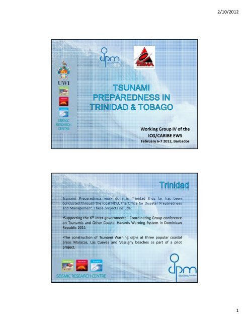
2/10/2012 1 Working Group IV of the ICG/CARIBE EWS
2/10/2012 1 Working Group IV of the ICG/CARIBE EWS
2/10/2012 1 Working Group IV of the ICG/CARIBE EWS

You also want an ePaper? Increase the reach of your titles
YUMPU automatically turns print PDFs into web optimized ePapers that Google loves.
<strong>Working</strong> <strong>Group</strong> <strong>IV</strong> <strong>of</strong> <strong>the</strong><br />
<strong>ICG</strong>/<strong>CARIBE</strong> <strong>EWS</strong><br />
February 6-7 <strong>2012</strong>, Barbados<br />
Tsunami Preparedness work done in Trinidad thus far has been<br />
conducted through <strong>the</strong> local NDO, <strong>the</strong> Office for Disaster Preparedness<br />
and Management. These projects include:<br />
•Supporting <strong>the</strong> 6 th Inter-governmental Coordinating <strong>Group</strong> conference<br />
on Tsunamis and O<strong>the</strong>r Coastal Hazards Warning System in Dominican<br />
Republic 2011<br />
•The construction <strong>of</strong> Tsunami Warning signs at three popular coastal<br />
areas Maracas, Las Cuevas and Vessigny beaches as part <strong>of</strong> a pilot<br />
project.<br />
2/<strong>10</strong>/<strong>2012</strong><br />
1
Image Showing Tsunami Information Sign at Maracas Bay Trinidad<br />
• In March 2011 <strong>the</strong> ODPM conducted a National Tsunami Adaptation<br />
Protocol and Testing Workshop and participated in Caribe Wave/<br />
Lantex 2011 immediately after.<br />
• The CORE Project <strong>of</strong> <strong>the</strong> ODPM sensitizes residents in coastal areas<br />
on <strong>the</strong> possibility <strong>of</strong> Tsunami inundation.<br />
2/<strong>10</strong>/<strong>2012</strong><br />
2
• ODPM toge<strong>the</strong>r with <strong>the</strong> San Fernando City Corporation Disaster<br />
Management Unit is working to develop an Egress (Evacuation)<br />
Policy for <strong>the</strong> city and environs. Included in this plan are an All<br />
Hazards Early Warning System which includes Tsunami warnings<br />
and signage showing Tsunami inundation areas and escape routes.<br />
This plan will be used as a template to develop o<strong>the</strong>r coastal areas.<br />
• The ODPM is currently engaging contractors with RFP’s (Requests for<br />
Proposals) for supply and installation <strong>of</strong> Early Warning Systems in<br />
coastal and/or vulnerable areas.<br />
• The ODPM has conducted three Disaster Risk Reduction workshops<br />
with primary and secondary school teachers which include modules<br />
on Tsunami preparedness.<br />
• The ODPM is currently working on Tsunami Presentations for<br />
educational purposes. Currently <strong>the</strong> target group is those in disaster<br />
management positions, but this will be expanded later.<br />
• The ODPM is working with <strong>the</strong> Information Communication<br />
Technology group <strong>of</strong> <strong>the</strong> Ministry <strong>of</strong> National Security to establish an<br />
internal earthquake information and tsunami warning system,<br />
using e-mail messaging to laptops and Blackberrys.<br />
2/<strong>10</strong>/<strong>2012</strong><br />
3
UPGRADE TO THE EARLY WARNING SYSTEMS<br />
– There are two early warning systems found in <strong>the</strong> south-western end <strong>of</strong> <strong>the</strong> Island.<br />
These systems were strategically located here, because it is low lying, major industries<br />
and services are located here, such as <strong>the</strong> ANR Robinson Airport, NP Plant, Cove<br />
Industrial estate and major shopping and housing areas. The Early warning system<br />
makes all in <strong>the</strong> south west aware <strong>of</strong> an encroaching danger through a series <strong>of</strong> tones<br />
and sirens. The upgrade <strong>of</strong> <strong>the</strong> system allows key persons to activate <strong>the</strong>se systems<br />
with <strong>the</strong> use <strong>of</strong> a cell phone and VHF radios.<br />
The system was tested with <strong>the</strong> help <strong>of</strong> <strong>the</strong> primary schools in <strong>the</strong> area (Dec 2011)<br />
2/<strong>10</strong>/<strong>2012</strong><br />
4
SCARBOROUGH EVACUATION MAP<br />
– This map was prepared to make persons in <strong>the</strong><br />
Scarborough area aware <strong>of</strong> <strong>the</strong> areas to be affected<br />
by a tsunami likely <strong>of</strong> 75 ft. It also notifies <strong>the</strong><br />
inhabitants <strong>of</strong> <strong>the</strong> Evacuation muster points. The<br />
flyers “Scarborough Emergency Evacuation Guide”<br />
is and will be distributed in all and critical areas<br />
around <strong>the</strong> island. Likewise, <strong>the</strong> “Scarborough<br />
Evacuation Map’ has been and is being distributed<br />
continually in <strong>the</strong> form <strong>of</strong> posters throughout<br />
Scarborough.<br />
2/<strong>10</strong>/<strong>2012</strong><br />
5
INUNDATION MAPS<br />
– Since <strong>the</strong> recent mapping <strong>of</strong> Special Needs persons across <strong>the</strong> island, it was<br />
decided that hazard maps should be created for areas greatly impacted by<br />
natural disasters. A Hazard map was created specific to <strong>the</strong> Charlotteville area<br />
(pilot), showing areas that are prone to landslides, floods and an inundation zone<br />
<strong>of</strong> <strong>10</strong>0ft. The map shows that many <strong>of</strong> <strong>the</strong> special needs persons are found in <strong>the</strong><br />
hazard prone areas.<br />
2/<strong>10</strong>/<strong>2012</strong><br />
6
FUTURE PLANS<br />
•To continue <strong>the</strong> hazard mapping <strong>of</strong> critical communities across <strong>the</strong><br />
island based on <strong>the</strong> <strong>10</strong>0ft elevation zone, especially with Special<br />
Needs persons in mind<br />
•Test <strong>the</strong> Scarborough Evacuation Plan, with an actual evacuation<br />
drill<br />
•Continue <strong>the</strong> distribution <strong>of</strong> flyers and maps<br />
•Place more early warning systems around Tobago especially in <strong>the</strong><br />
Scarborough area (funding needed)<br />
Office Of Disaster Preparedness and Management<br />
4A Orange Grove Road,<br />
Trinicity, Tacarigua,<br />
Republic <strong>of</strong> Trinidad and Tobago<br />
Office: (868) 640-1285<br />
Fax: (868) 640-8988<br />
Emergency: 800 ODPM (6376)<br />
Email: publicinfo.odpm@gmail.com<br />
Tobago Emergency Management<br />
Agency (TEMA) Fairfield Complex,<br />
Bacolet Street, Scarborough, Tobago.<br />
Tel- (868) 660-7489<br />
Fax- (868) 660-7657<br />
2/<strong>10</strong>/<strong>2012</strong><br />
7
2/<strong>10</strong>/<strong>2012</strong><br />
8