

VFR Mag

Create successful ePaper yourself
Turn your PDF publications into a flip-book with our unique Google optimized e-Paper software.
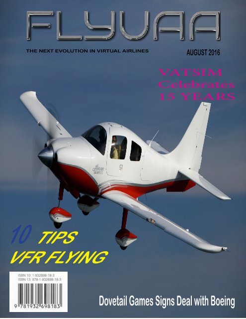
THE NEXT EVOLUTION IN VIRTUAL AIRLINES<br />
AUGUST 2016<br />
VATSIM<br />
Celebrates<br />
15 YEARS<br />
10 TIPS<br />
<strong>VFR</strong> FLYING<br />
Dovetail Games Signs Deal with Boeing
5 Route around big cities whenever possible. Traffic is usually lighter, smog isn’t as much of a problem, fuel, ramp and parking prices generally<br />
are lower in the boonies, and you’re less likely to receive vectors away from your course line or altitude restrictions to deal with.<br />
6 Be smart about descents, and don’t automatically start down at 500 fpm (as I did for years). In winter, you may want to stay high as long<br />
as possible to maximize the effects of tailwinds. Similarly, hot surface temps in summer may dictate the same technique to avoid the heat and<br />
convective turbulence down low. If there are gathering clouds ahead, you may want to descend early to make certain you don’t get trapped on<br />
top.<br />
7 Temper your judgment about flying in high-mountain terrain at all, if you can avoid it. Yes, it’s beautiful, especially with popcorn cumulus<br />
floating by, but there may be little margin for error if you accidently enter a cloud. A while back, two good friends, both excellent IFR-rated<br />
pilots, flew a new Caravan straight into the side of a hill near Palm Springs, apparently another CFIT (controlled flight into terrain) accident.<br />
A 180-degree turn won’t necessarily solve your problem—it may make it worse if clouds have closed in behind you—but it’s a far safer bet than<br />
continuing without a clearance or any idea where the tall rocks live.<br />
8 Avoid flying at any limit speed. Vne is the obvious worst one, but there are a dozen others. Vle, max landing gear extension speed, is often<br />
specified to save the gear doors. Violate it consistently, and those doors may eventually fail. It’s the same with flap extension speed, Vfe. If you<br />
use gear and flaps to decelerate, do so only well within the specified limit speeds.<br />
10 Tips<br />
<strong>VFR</strong> Flying<br />
9 Even if you’re not IFR rated, consider carrying a set of low-altitude en route charts for the trips you make most often. A low-altitude chart<br />
can provide you with IFR MEAs, an instant measure of safe altitude along established routes. You’ll also have an easy reference to leg distances<br />
between VORs and airports (sometimes). IFR charts also provide sector frequencies in case you need help and there’s no one awake on 122.8<br />
mHz.<br />
10 Everyone knows you should scan the airspace around you for other traffic, but the most neglected quadrant of see-and-be-seen is directly<br />
behind you. Studies of mid-air collisions have shown that the most likely risk is from the rear. That’s especially true during descents when a<br />
following aircraft overruns preceding traffic. If you’re descending, try throwing in some slight turns occasionally and check six for what might<br />
be gaining on you.<br />
1 Despite the near-universal adoption of GPS for enroute navigation, resist the temptation to simply dial up the identifier of your<br />
destination and fly direct. Consider instead putting together a flight plan that includes slight deviations to stay near highways,<br />
airports or flat terrain. You’d be amazed how far you can deviate from a Great Circle route without adding significantly to total<br />
distance.<br />
2 Think twice about cruise altitude. On short trips, the tendency is often to level at 4,000 to 7,000 AGL. Higher is nearly always<br />
better, for several reasons. Fuel burn is less, the airplane may actually be faster up high, and range will be extended. Most general<br />
aviation airplanes can reach 8,000 to 10,000 feet in only five to seven minutes more, and they’ll be above much of the other traffic,<br />
benefit from longer radio range, usually operate above the convection layer in smoother air and have a larger pad of sky beneath<br />
them in the event of a problem.<br />
3 While it’s true you don’t always have to fill the tanks, and tankering six hours of fuel for a one-hour flight is excessive—you have<br />
to burn fuel to carry fuel—remember the catch phrase of many fighter pilots: The only time you can have too much fuel is when<br />
you’re on fire. You may never know what circumstances will dictate the need for more fuel, but if you don’t have any extra, it won’t<br />
matter. It’s nearly always a good idea to carry as much fuel as possible, cabin payload and CG permitting, of course.<br />
4 It’s only good sense to use flight following whenever you can, especially around heavily congested airspace. The FF controller<br />
has some very sophisticated radar at his disposal, very likely more exotic than the TIS/TCAS you have on your panel (if you’re that<br />
lucky). Flight following can be especially valuable if your trip is a long one, over water or remote terrain. If you have a problem,<br />
you won’t need to scramble to find the proper frequency. (Out in the boonies, I keep one radio set on 122.8 mHz anyway, in case I<br />
or someone else needs help.) A flight-following controller can also keep you clear of restricted or prohibited zones and advise when<br />
they’re “hot.” Also, each subsequent controller will automatically update the altimeter setting with every handoff.
<strong>VFR</strong> Flight planning with VATSIM<br />
<strong>VFR</strong> flight planning can sometimes be much less involved<br />
than IFR flight planning, depending on a couple aspects.<br />
First step in preparing a <strong>VFR</strong> flight plan you need to<br />
understand a couple things. First thing you need to ask<br />
yourself, the airport I am going to depart from VMC (Visual<br />
Metrological Conditions) also the same for the airport<br />
I am arriving at. Weather plays a key role in <strong>VFR</strong> flying.<br />
Now if you ever find yourself flying and the weather<br />
changes you may change your flight plan from <strong>VFR</strong> to<br />
IFR as long as you communicate with ATC. Consult an<br />
airspace/weather minimums chart for the specific <strong>VFR</strong><br />
weather minimums for the airspace you are flying within.<br />
Weather minimums are usually expressed in clearance<br />
from clouds and visibility. At no time may a <strong>VFR</strong> aircraft<br />
fly into a cloud for any reason. You may go below, above<br />
or beside the cloud. Let’s look at some of the weather<br />
limitations for the United States. When flying <strong>VFR</strong> below<br />
10,000ft AMSL visibility must be at least 3sm, or if you<br />
are fling <strong>VFR</strong> above 10,000ft AMSL visibility must be at<br />
least 5sm. You must stay 500ft below, 1,000ft above,<br />
and 2,000ft aside, any clouds. Now since there are no<br />
instruments in your aircraft that tells you this information<br />
you will have to use sound judgments to abide by these<br />
rules. <strong>VFR</strong> operations are the basic procedures used by<br />
all pilots. It is expected that pilots will operate utilizing<br />
<strong>VFR</strong> procedures until they have sufficient knowledge and<br />
expertise in the use of instruments only techniques.<br />
<strong>VFR</strong> refers to a minimum weather condition that must be<br />
present in order to operate under visual conditions. In<br />
the United States, those weather conditions vary depending<br />
on the type of airspace involved and pertain to<br />
visibility requirements and distance to be kept away from<br />
clouds:<br />
Class........Flight Visibility.....Distance from Clouds<br />
Class B.....3 statute miles.....clear of clouds<br />
Class C.....3 statute miles.....500’ below/1000’ above/2000’<br />
laterally<br />
Class D.....3 statute miles.....500’ below/1000’ above/2000’<br />
laterally<br />
Class E.....less than 10,000’ MSL<br />
..............3 statute miles.....500’ below/1000’ above/2000’<br />
laterally<br />
Class E.....at or above 10,000’ MSL<br />
..............5 statute miles.....1000’ below/1000’ above/1 statute<br />
mile laterally.<br />
Don’t forget to plan proper fuel to use. A nice little tool<br />
to use for fuel planning you can find at http://fuelplanner.<br />
com/. This will help you to plan accordingly. Declaring a<br />
fuel emergency in VATSIM is really an admission of poor<br />
flight planning and should be avoided. Next we will select a<br />
runway to use. It is very important to make sure the length<br />
of the runway will support your aircraft. Another key fact<br />
in selecting the runway has to do with wind direction. You<br />
always want to take off into the wind. This will provide<br />
your aircraft with more lift and a shorter takeoff roll out.<br />
Now that we are ready to taxi to the numbers and takeoff<br />
we need to contact the controller, or use 122.8 unicom to<br />
state our intentions, and our squawk code on our transponder<br />
should be set to 1200. This will let the controller know<br />
that we are a <strong>VFR</strong> aircraft. <strong>VFR</strong> flights should contact<br />
controllers when in their airspace near airports, especially<br />
when departing or planning to land. <strong>VFR</strong> flights should<br />
contact approach controllers between 20-30 NM from their<br />
airspace and state intentions. Towered airports without<br />
approach controllers should be contacted about 20 NM out.<br />
Class B airspace requires a specific permission/clearance to<br />
enter while Class C/D airport only require that radio communications<br />
are established. Class E and G airports do not<br />
have controllers so no controller contact is required. The<br />
communication component can be met by tuning the COM<br />
radio to 122.8 which is the UNICOM frequency (in the<br />
United States). This channel is used for pilots to announce<br />
traffic movements “in the blind”, meaning that pilots are not<br />
expected to reply to UNICOM broadcasts, the broadcasts<br />
are intended to be informative and because of its use over a<br />
wide geographical area, there are certain conventions that<br />
should be followed:<br />
UNICOM transmissions should be in text.<br />
UNICOM messages should be as short as possible “arriving runway<br />
12”, “entering downwind 9L”, “clear of 9L”, etc<br />
UNICOM transmissions should follow a specific format:<br />
/location/message/location example: KMIA traffic departing 9R<br />
KMIA<br />
This leaves no doubt as to what airport is involved<br />
The limitation of a UNICOM transmission is that there is no assurance<br />
that other pilots in the vicinity are tuned to UNICOM or<br />
paying attention to it. There is no easy remedy for this other than<br />
for pilots to maintain their vigilance and be pessimistic; assuming<br />
that the transmissions have not been received. Broadcasting one’s<br />
intentions on UNICOM is not the same as having clearance or authorization<br />
to conduct a maneuver or activity and does not relieve<br />
a pilot of the responsibility to see and avoid other aircraft.<br />
For the most part, when flying <strong>VFR</strong>, separation of your aircraft<br />
from all other aircraft is solely the pilot’s responsibility. Pilots are<br />
responsible to maintain visual separation until flight paths (altitudes<br />
and/or courses) diverge for any traffic in the area. Normally<br />
though, one aircraft keeps a safe distance from another. One of<br />
the closest spots <strong>VFR</strong> aircraft come to each other is in airport patterns.<br />
Make sure to leave enough distance such that you can make<br />
a safe landing behind another aircraft, giving them enough time to<br />
land and clear the runway before you land.<br />
Enroute <strong>VFR</strong> flights can request Flight Following, where a radar<br />
controller provides traffic advisories. VATSIM <strong>VFR</strong> pilots are<br />
encouraged to request and use Flight Following when flying<br />
cross-country flights on the network. It adds that next level of<br />
realism for everyone. Basic radar services for <strong>VFR</strong> aircraft shall<br />
include:<br />
•Safety alerts.<br />
•Traffic advisories.<br />
•Limited radar vectoring when requested by the pilot.<br />
•Sequencing at locations where procedures have been established.<br />
A <strong>VFR</strong> aircraft departing an airport located in class C airspace,<br />
normally of lower traffic density and complexity than class B,<br />
would be entitled to radar advisory service until at least 20 miles<br />
after departure because controllers are prohibited from terminating<br />
radar service within the class C outer area without pilot<br />
request. The same services as described above will be available for<br />
the <strong>VFR</strong> pilot if the controller’s workload permits.<br />
An inbound aircraft may request radar services by stating:<br />
•Pilot: “So Cal Approach, Cessna 12345 with request”<br />
•ATC: “Cessna 12345, So Cal Approach, Go ahead”<br />
•Pilot: “So Cal Approach, Cessna 12345 <strong>VFR</strong> over the seal beach<br />
VOR at 6500 enroute to long beach, requesting traffic advisories”<br />
•ATC: “Cessna 12345, So Cal Approach, traffic is a beech airliner<br />
at your 12 o’clock 5 miles north bound, indicating 3500.”<br />
•Pilot: “Cessna 12345 has the traffic in sight”<br />
The controller may issue other advisories if he or she is not busy<br />
with other IFR traffic. If the controller is too busy for you they<br />
will say.<br />
•ATC: “Cessna 12345, So Cal Approach, Unable at this time”<br />
Radar traffic information service (commonly known as <strong>VFR</strong><br />
flight following) is a service provided by air traffic control (ATC)<br />
and available to all <strong>VFR</strong> pilots. It can enhance your flying safety.<br />
While receiving flight following,<br />
you’ll be in radio contact with a radar controller at a Terminal Radar<br />
Approach Control (TRACON) or Air Route Traffic Control Center<br />
(ARTCC). You may receive traffic advisories, enroute safety alerts, and<br />
limited vectoring on a workload permitting basis.<br />
An example call would sound like this:<br />
•Pilot: “LA Center, Mooney 12345 with requests”<br />
•ATC: “Money 12345 LA Center go ahead”<br />
•Pilot: “LA Center, Mooney 12345 is type m20/p 12 miles south of the<br />
twenty nine palms VOR level 7500 enroute to Henderson request Flight<br />
Following”<br />
•ATC: “Mooney 12345, squawk 7312, ident”<br />
•Pilot: “Squawking 7312 and ident, Mooney 12345”<br />
•ATC: “Mooney 12345, Radar contact 12 miles south of the TNP VOR<br />
at 6500. Traffic 2 o’clock 12 miles southbound is a Cessna 172 indicating<br />
4500”<br />
•Pilot: “Mooney 12345, looking for traffic”<br />
While flying <strong>VFR</strong> with Radar service you will be treated much like an<br />
IFR flight except, you must fly at <strong>VFR</strong> cruising altitudes and it’s courteous<br />
to inform ATC of any deviation from your intended route.<br />
Handoffs - When you receive instructions to change to a new frequency,<br />
read back the new frequency to the controller before you change the<br />
frequency selector. This will allow the controller to correct you if you<br />
didn’t hear the new frequency correctly. If you switch frequencies and<br />
are unable to make contact with anyone, you can use your frequency<br />
log to find the last known channel on which you were talking to ATC.<br />
If you don’t have flip-flop radios, or if the flip-flop display dies on you,<br />
your frequency log could save the day. When checking in on the new<br />
frequency, make sure to state your altitude so that the controller can<br />
verify your aircraft’s mode C readout on the radar screen.<br />
For example:<br />
•Pilot: “Los Angeles Center, Cherokee 12345, <strong>VFR</strong> at one zero thousand<br />
five hundred. “<br />
Once we are in the air now we are going to fly our route or navigation.<br />
There are four ways we can navigate using Visual flight rules. Dead<br />
reckoning, Pilotage, Radio navigation, and GPS navigation. It is your<br />
choice on which one you want to use.<br />
The most basic of all <strong>VFR</strong> navigation is Pilotage. Pilotage means look<br />
out the cockpit window and see with your eyes where you are. <strong>VFR</strong><br />
maps are marked with lots of symbols that help find things on the<br />
ground and matching them with the map. In FS the terrain and ground<br />
objects are not exactly just like real life, even with some of the photo-real<br />
scenery. But they are getting closer. You can still fly Pilotage flights<br />
by following major landmarks such as rivers, canyons, shorelines, and<br />
roads (IFR = I Fly by Roadways).<br />
Pilotage is free flight in its most pure, going where the landscape takes<br />
you to see what wonders lie ahead. This does not relieve the pilot from<br />
knowing how much gas to take on board and monitoring it while up<br />
boring holes in the sky. You are welcome to fly Pilotage flights in VAT-<br />
SIM. In the route section of the flight plan put a statement that lets the<br />
controllers know what you’re up to like “Hong Kong Harbor Patrol”, or<br />
“South down the Rhine River”.
Controlling your aircraft is a skill<br />
1. Keep your aircraft under control<br />
FAA RULES<br />
AND<br />
REGULATIONS<br />
By USN0014 Jerry Robinson<br />
One of the most important aspects of flight is control of your aircraft. You may think that an over speed is a small thing but in reality<br />
it shows others that you do not have complete control of your aircraft. It further shows that you have poor piloting skills and in<br />
the real world that is a killer.<br />
There are several ways to show complete control of your aircraft. One is to have no over speeds throughout the flight. Another is to<br />
have landings that reflect your skills and that are consistent. A third is to have very few or no pauses during a flight. Anything short<br />
of these shows a lack of control.<br />
We talked about landings and rates in the last issue and now let us look at control and how not to have over speeds. The first thing<br />
to remember with any aircraft is never climb at the max speed for the aircraft or for flight simulator or for the rules you must follow<br />
at any VA. 250kts under 10,000 is a big one and one most pilots break. Easy to fix. Slow down! Do not climb at more than 240kts<br />
under A/P. Stay at 220kts or less on descent under A/P and with speed brakes on. If weather is an issue turn it off in the climb and<br />
descent or slow down more to compensate for it. Here is the short of it. If you have full control at all times you will not have over<br />
speeds.<br />
So, Keep it simple and keep it under speed!<br />
FARs part91 Section 117 talks about the golden rule of 250kts max below 10,000ft.<br />
a) Unless otherwise authorized by the Administrator, no person may operate an aircraft below 10,000 feet MSL at an indicated airspeed<br />
of more than 250 knots (288 m.p.h.).<br />
(b) Unless otherwise authorized or required by ATC, no person may operate an aircraft at or below 2,500 feet<br />
above the surface within 4 nautical miles of the primary airport of a Class C or Class D airspace area at an<br />
indicated airspeed of more than 200 knots (230 mph.). This paragraph (b) does not apply to any operations<br />
within a Class B airspace area. Such operations shall comply with paragraph (a) of this section.<br />
(c) No person may operate an aircraft in the airspace underlying a Class B airspace area designated for an<br />
airport or in a <strong>VFR</strong> corridor designated through such a Class B airspace area, at an indicated airspeed of more<br />
than 200 knots (230 mph).<br />
JULY Monthly Stats<br />
Flights Flown: 409<br />
Flight Hours: 811.32<br />
Total Pax: 781,310<br />
Avg Landing Rate: -208fpm<br />
Flight Miles: 290,590nm<br />
Fuel used: 6,947,930<br />
JULY Highlights<br />
FLYUAA becomes a partner with VATSIM. The new website design<br />
is re-launched. Facebook, and Twit-ter lands at FlyUAA. It has been<br />
another awesome month with our flight hours are well over 500hrs for<br />
the month. Each month we are growing. However, I would like for<br />
us to start looking at our landing rates. If you have noticed, we have<br />
been in the top 10 at VA Central. One of the governing factors that<br />
determines our ranking is based on Active pilots flying, and landing<br />
rates. Also another great stat that we have achieved is being in the top<br />
10 VA’s on the VA List. Every month we have to remember logging<br />
in at www.va-list.com and voting for our VA. We are getting noticed<br />
and to let you in on a little secret some of the bigger VA’s are starting<br />
to worry what FlyUAA is doing. Thank you for your hard work and all<br />
the special features that we have in our VA is because we listen to our<br />
pilots and we make dreams become reality. Next month you will start<br />
to see a little more changes coming. Some new tours and awards are<br />
coming. Also if you have not seen it we now have the best intro video<br />
out on the market thanks to Brett for all his hard work. Until next<br />
time let’s all get out and return to the flight deck and have fun flying.<br />
Don’t forget we have some Friday night group flights going on too.<br />
Tom West<br />
FlyUAA CEO
Dovetail Games<br />
Signs Deal<br />
with Boeing<br />
Officially licensed content coming soon to Microsoft Flight Simulator X:<br />
Steam Edition.<br />
Dovetail Games has announced it has entered into a licensing agreement with Boeing<br />
to bring officially licensed add-ons to FSX: Steam Edition.<br />
Paul Jackson, CEO of Dovetail Games said: “We recognize that an important part of<br />
creating highly authentic flight simulation experiences is the addition of officially<br />
licensed content. We are therefore delighted to be working in partnership with<br />
Boeing, a highly respected pioneer in the aviation world, to deliver a wide range of<br />
content for FSX: Steam Edition over the coming months.”<br />
As a result of this agreement, the FSX: Steam Edition community can expect to see<br />
licensed Boeing add-ons, as well as content representing aircraft from its subsidiaries,<br />
McDonnell Douglas, North American Aviation and Rockwell International in<br />
the FSX: Steam Edition store in the coming months.
THANK YOU FOR FLYING<br />
SEE YOU SOON