Create successful ePaper yourself
Turn your PDF publications into a flip-book with our unique Google optimized e-Paper software.
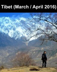
<strong>Tibet</strong> (<strong>March</strong> / <strong>April</strong> <strong>2016</strong>)<br />
Proof Copy: Not optimized for high quality printing or digital distribution
Along the G318 Highway and Qinghai-<strong>Tibet</strong> Railway...<br />
Traversing various canyons, river bends, Mountain pass;<br />
admiring the divine creation and the beauty of the world; and<br />
appreciating the loveliness, tranquility and peacefulness of highland.<br />
Proof Copy: Not optimized for high quality printing or digital distribution
Travel Book<br />
Mar/Apr <strong>2016</strong><br />
西 藏 / <strong>Tibet</strong><br />
by David Cheung<br />
Proof Copy: Not optimized for high quality printing or digital distribution
The night before Easter Friday at the new<br />
Shenzhen BaoAn Airport to Chongqing before<br />
the 6am flight to Nyingchi, <strong>Tibet</strong>.<br />
At 2am on the bench of the departure hall of<br />
Chongqing airport, I remembered the last words<br />
were touts asking people if they still needed<br />
rooms at hotels.....<br />
This page<br />
Bottom Left - Chongqing Airport Departure Lounge<br />
Next page<br />
Right top / left bottom - Shenzhen Baoan Airport Departure Lounge<br />
Right bottom - Departure flight to Nyingchi, <strong>Tibet</strong><br />
Proof Copy: Not optimized for high quality printing or digital distribution
Proof Copy: Not optimized for high quality printing or digital distribution
Proof Copy: Not optimized for high quality printing or digital distribution
Top Left<br />
<strong>Tibet</strong> Airline plane from Chongqing to Nyingchi 林 芝 )<br />
Top Right / Bottom left / Bottom Right<br />
<strong>Tibet</strong>an Plateau from Sichuan Basin<br />
Proof Copy: Not optimized for high quality printing or digital distribution
Left<br />
Nyingchi Airport (2949m)<br />
Right<br />
Peach flower blossom<br />
Opposite page<br />
Yarlung Zangbo Grand Canyon ( 雅 鲁 藏<br />
布 大 峡 谷 ) with Namjagbarwa peak ( 南<br />
迦 巴 瓦 峰 , 7782m), "Father of all<br />
mountains in <strong>Tibet</strong>" ( 西 藏 眾 山 之 父 )<br />
Proof Copy: Not optimized for high quality printing or digital distribution
Proof Copy: Not optimized for high quality printing or digital distribution
Proof Copy: Not optimized for high quality printing or digital distribution
Yarlung Zangbo River - When leaving the <strong>Tibet</strong>an Plateau, the Yarlung<br />
River forms the world's largest and deepest canyon, Yarlung Tsangpo<br />
Grand Canyon. Flowing mainly from west to east and suddenly makes a<br />
U-turn in <strong>Tibet</strong> and exit China to India / Bangladesh and eventually Bay of<br />
Bengal.<br />
Proof Copy: Not optimized for high quality printing or digital distribution
Top<br />
River bank near suosong village ( 索 松 村 ), in the<br />
Yarlung Zangbo Grand Canyon, overseeing<br />
Namjagbarwa peak ( 南 迦 巴 瓦 峰 ), a sacred mountain<br />
for <strong>Tibet</strong>ans<br />
Bottom<br />
Nearby hills<br />
Opposite page<br />
Top<br />
Left - Namjagbarwa Peak<br />
Bottom - <strong>Tibet</strong>an scripture flags<br />
Proof Copy: Not optimized for high quality printing or digital distribution
Proof Copy: Not optimized for high quality printing or digital distribution
Proof Copy: Not optimized for high quality printing or digital distribution
Mountain pass ( 色 季 拉 山 )<br />
Proof Copy: Not optimized for high quality printing or digital distribution
Mountain pass @ 4720m<br />
色 季 拉 山<br />
Opposite Top<br />
Cattle Field at a Valley ( 鲁 朗 林 海 )<br />
Opposite Bottom<br />
Tongmo, narrow pass<br />
Proof Copy: Not optimized for high quality printing or digital distribution
Proof Copy: Not optimized for high quality printing or digital distribution
Top Left / Right<br />
Tongmo ( 通 墨 天 險 ), narrowest path of <strong>Tibet</strong>-Sichuan route.<br />
Bottom left<br />
Bend of Yarlung Tsangbo River<br />
Opposite Page<br />
Canola Flower Field in Nyingchi<br />
Proof Copy: Not optimized for high quality printing or digital distribution
Proof Copy: Not optimized for high quality printing or digital distribution
Top Left & Opposite Page<br />
<strong>Tibet</strong> cattle at GuXiang Lake ( 古 鄉 湖 ), Bomi ( 波 密 ), formed after the mudslide triggered by a glacial activity in<br />
1953.<br />
Top Right<br />
Canola Flower field in Nyingchi.<br />
Bottom Left<br />
Me deep thinking at GuXiang Lake<br />
Bottom Right<br />
<strong>Tibet</strong>an cattle<br />
Proof Copy: Not optimized for high quality printing or digital distribution
Proof Copy: Not optimized for high quality printing or digital distribution
Ranwu Lake ( 然 乌 湖 , 3807m with 27sq. km), a barrier lake formed after landslide, receives melted water from the<br />
nearby glacier, is the largest lake in Eastern <strong>Tibet</strong>.<br />
Proof Copy: Not optimized for high quality printing or digital distribution
Proof Copy: Not optimized for high quality printing or digital distribution
Ranwu Lake ( 然 乌 湖 , 3807m)<br />
Proof Copy: Not optimized for high quality printing or digital distribution
Proof Copy: Not optimized for high quality printing or digital distribution
Top Left<br />
Road leading to Midui Glacier ( 米 堆 冰 川 ), lowest<br />
glacier in the world with its snow line no more than<br />
15,400 feet (4,694 meters) high<br />
Top Right<br />
Small hike towards the mouth of Glacier<br />
Middle Left<br />
Mouth of Glacier<br />
Proof Copy: Not optimized for high quality printing or digital distribution
Proof Copy: Not optimized for high quality printing or digital distribution
Proof Copy: Not optimized for high quality printing or digital distribution
Peach blossom in Peach Gully ( 波 密 桃 花 溝 ) every <strong>March</strong>, when spring arrives Eastern <strong>Tibet</strong> (Nyingchi)<br />
Proof Copy: Not optimized for high quality printing or digital distribution
Proof Copy: Not optimized for high quality printing or digital distribution
Proof Copy: Not optimized for high quality printing or digital distribution
Proof Copy: Not optimized for high quality printing or digital distribution
Proof Copy: Not optimized for high quality printing or digital distribution
Proof Copy: Not optimized for high quality printing or digital distribution
Proof Copy: Not optimized for high quality printing or digital distribution
Top & Opposite Page<br />
Small Village between Nyingchi and Lhasa (peach blossoming)<br />
Bottom Left<br />
Sign leading to Lhasa<br />
Right<br />
Local black piglets ilding on the road<br />
Proof Copy: Not optimized for high quality printing or digital distribution
Proof Copy: Not optimized for high quality printing or digital distribution
Proof Copy: Not optimized for high quality printing or digital distribution
Top (Left / Right)<br />
On the way to Lhasa<br />
Bottom<br />
Climbing towards a<br />
mountain pass<br />
Opposite page (Top /<br />
Bottom Left)<br />
Xiuba castle ( 秀 巴 古 堡 ), built<br />
around Tong Dynasty around<br />
1000 years ago<br />
Proof Copy: Not optimized for high quality printing or digital distribution
Proof Copy: Not optimized for high quality printing or digital distribution
Opposite page<br />
<strong>Tibet</strong>an scriptures in the mountain pass ( 米 拉 山 口 - 5013m)<br />
Top<br />
Right<br />
Making snow angel in the pass<br />
Left<br />
Taizhao Ancient City (located between Nyingchi and Lhasa)<br />
Bottom<br />
Down the Mountain pass to Lhasa<br />
Proof Copy: Not optimized for high quality printing or digital distribution
Proof Copy: Not optimized for high quality printing or digital distribution
Proof Copy: Not optimized for high quality printing or digital distribution
On the way to Lhasa....<br />
Proof Copy: Not optimized for high quality printing or digital distribution
Lhasa .. At last<br />
Proof Copy: Not optimized for high quality printing or digital distribution
Proof Copy: Not optimized for high quality printing or digital distribution
Left<br />
<strong>Tibet</strong>an lady looking at merchandise<br />
Right<br />
<strong>Tibet</strong>an Braids<br />
Opposite page<br />
<strong>Tibet</strong>an Pilgrims spinning the scripture barrel<br />
Proof Copy: Not optimized for high quality printing or digital distribution
Proof Copy: Not optimized for high quality printing or digital distribution
Top Left<br />
Outside Potala Palace, where Dalai Lama used to live and rule. The palace is named after Mount Potalaka, the<br />
mythical abode of the bodhisattva Avalokiteśvara. The 5th Dalai Lama started its construction in 1645 after one<br />
of his spiritual advisers, Konchog Chophel (died 1646), pointed out that the site was ideal as a seat of<br />
government, situated as it is between Drepung and Sera monasteries and the old city of Lhasa. It may overlay<br />
the remains of an earlier fortress called the White or Red Palace on the site, built by Songtsän Gampo in 637.<br />
Top Right<br />
Steps leading up the Palace<br />
Bottom left<br />
Midway<br />
Bottom Right<br />
Back-side panorama<br />
Proof Copy: Not optimized for high quality printing or digital distribution
Proof Copy: Not optimized for high quality printing or digital distribution
Proof Copy: Not optimized for high quality printing or digital distribution
Top<br />
Pond with the shadow of Potala Palace<br />
Opposite page<br />
Top<br />
Pilgrims outside Jokhang ( 大 昭 寺 )<br />
Bottom Left<br />
Square in front of Jokhang<br />
Bottom Right<br />
Candle lights in Jokhang<br />
Proof Copy: Not optimized for high quality printing or digital distribution
Proof Copy: Not optimized for high quality printing or digital distribution
Proof Copy: Not optimized for high quality printing or digital distribution
Opposite<br />
A Pillar on alliance between Tang Dynasty and Tobo (Kingdom ruling <strong>Tibet</strong> at the time)<br />
Top<br />
Pious Pilgrim<br />
Proof Copy: Not optimized for high quality printing or digital distribution
Top Left / Right<br />
Roof of Jokhang ( 大 昭 寺 ). <strong>Tibet</strong>ans, in general, consider this temple as the most sacred and important temple<br />
in <strong>Tibet</strong>. The Jokhang was founded during the reign of King Songtsen Gampo. According to tradition, the<br />
temple was built for the king's two brides: Princess Wencheng of the Chinese Tang dynasty and Princess<br />
Bhrikuti of Nepal. Both are said to have brought important Buddhist statues and images from China and Nepal<br />
to <strong>Tibet</strong>, which were housed here, as part of their dowries. The oldest part of the temple was built in 652.<br />
Bottom Left<br />
Spining Inscribed <strong>Tibet</strong>an Scripts - One revolution means saying the prayer once<br />
Bottom Right<br />
Monks debating<br />
Opposite<br />
Pilgrims outside Jokhang<br />
Proof Copy: Not optimized for high quality printing or digital distribution
Proof Copy: Not optimized for high quality printing or digital distribution
Top<br />
Drepung Monastery ( 哲 蚌 寺 ) is the largest in <strong>Tibet</strong><br />
and is located on the Gambo Utse mountain, five<br />
kilometers from the western suburb of Lhasa.<br />
Bottom Left<br />
Cliff hanging big buddhist "carpet"during special<br />
festival<br />
Bottom Right<br />
Mediating among debating monks<br />
Opposite<br />
Debating monks<br />
Proof Copy: Not optimized for high quality printing or digital distribution
Proof Copy: Not optimized for high quality printing or digital distribution
Top<br />
Outside Potala Palace - holding RMB 50 note with the exact drawing behind me<br />
Proof Copy: Not optimized for high quality printing or digital distribution
Top left<br />
Roof of Ramoche Monastery, the original building complex has a strong Tang architecture influence, for it<br />
was first built by Han Chinese architects in the middle of the 7th century (during the Tong Dynasty). Han<br />
Princess Wencheng took charge of this project and ordered the temple be erected facing east to show her<br />
homesickness.<br />
Top right<br />
Potala Palace at night<br />
Bottom Left<br />
Many Buddhist drawings and sculptures<br />
Proof Copy: Not optimized for high quality printing or digital distribution
Proof Copy: Not optimized for high quality printing or digital distribution
Opposite page<br />
Top - Park near Potala Palace<br />
Left - Monk's residence<br />
Right - Outside Jokhang<br />
Top - Left - Military police paroling in Barkhor Street (shopping street encircling the Jokhang)<br />
Right - Qing Dynasty - <strong>Tibet</strong>an Chief Officer Working Place<br />
Bottom Left - Outside Jokhang with the burning furnace<br />
Right - Another view of Barkhor Street<br />
Proof Copy: Not optimized for high quality printing or digital distribution
Clockwise, Top Left<br />
Roadway to Yamdok Yumco ( 羊 卓 雍 錯 湖 , 4441m with 638 sq.<br />
km). one of the three largest sacred lakes in <strong>Tibet</strong>. According<br />
to local mythology, Yamdok Yumtso lake is the transformation<br />
of a goddess.<br />
Top Right<br />
<strong>Tibet</strong>an Mastiff, extremely loyal and fierce, used by local tribes<br />
of Himachal Pradesh was to protect sheep from wolves,<br />
leopards, bears, large mustelids, and tigers. That said, two of<br />
them can kill a tiger.<br />
Proof Copy: Not optimized for high quality printing or digital distribution
Proof Copy: Not optimized for high quality printing or digital distribution
Proof Copy: Not optimized for high quality printing or digital distribution
Top<br />
Cattle by the lake<br />
Proof Copy: Not optimized for high quality printing or digital distribution
Proof Copy: Not optimized for high quality printing or digital distribution
Proof Copy: Not optimized for high quality printing or digital distribution
Proof Copy: Not optimized for high quality printing or digital distribution
Top<br />
Train on the Qinghai-<strong>Tibet</strong> Railway<br />
Bottom left / Right<br />
Pathway to Namucuo, another scare lake and largest salt lake in <strong>Tibet</strong>.<br />
Opposite<br />
Top Left<br />
Cattle farm along the way to Namucuo<br />
Bottom Left / Right<br />
River Bend / Qinghai-<strong>Tibet</strong> Railway, behind is Nyenchen Tanglha Mountains<br />
Proof Copy: Not optimized for high quality printing or digital distribution
Nyenchen Tanglha Mountains, a 700-kilometre long mountain range. The range is<br />
parallel to the Himalayas and north of the Brahmaputra.<br />
Proof Copy: Not optimized for high quality printing or digital distribution
Proof Copy: Not optimized for high quality printing or digital distribution
Proof Copy: Not optimized for high quality printing or digital distribution
Proof Copy: Not optimized for high quality printing or digital distribution
Proof Copy: Not optimized for high quality printing or digital distribution
Proof Copy: Not optimized for high quality printing or digital distribution
Frozen Namuco lake (4718m with 1920 sq. km)<br />
Proof Copy: Not optimized for high quality printing or digital distribution
Proof Copy: Not optimized for high quality printing or digital distribution
Proof Copy: Not optimized for high quality printing or digital distribution
Proof Copy: Not optimized for high quality printing or digital distribution
Proof Copy: Not optimized for high quality printing or digital distribution
Proof Copy: Not optimized for high quality printing or digital distribution
Top<br />
Cattle settled near the lake<br />
Right<br />
Climbing the mountain pass<br />
Opposite page<br />
At the highest point of mountain pass (5190m)<br />
Proof Copy: Not optimized for high quality printing or digital distribution
Proof Copy: Not optimized for high quality printing or digital distribution
Proof Copy: Not optimized for high quality printing or digital distribution
22 hours of train journey from Lhasa, <strong>Tibet</strong> to Xining, Qinghai province.<br />
The length of the railway is 1,956 km. The line includes the Tanggula Pass, which, at 5,072 m above sea level, is<br />
the world's highest point on a railway. Tanggula railway station at 5,068 m is the world's highest railway station.<br />
More than 960 km , over 80% of the Golmud–Lhasa section, is at an elevation of more than 4,000 m. There are<br />
675 bridges, totaling 159.88 km ; about 550 km (340 mi) of track is laid on permafrost.<br />
Proof Copy: Not optimized for high quality printing or digital distribution
Clockwise, Top Left<br />
Lhasa station interior<br />
Top Right<br />
Bunker Carriage<br />
Middle<br />
View from between and Yangbalin station<br />
Cattle on the way<br />
Bottom Right<br />
Station name<br />
Proof Copy: Not optimized for high quality printing or digital distribution
Proof Copy: Not optimized for high quality printing or digital distribution
Proof Copy: Not optimized for high quality printing or digital distribution
Proof Copy: Not optimized for high quality printing or digital distribution
Proof Copy: Not optimized for high quality printing or digital distribution
Proof Copy: Not optimized for high quality printing or digital distribution
Bottom right<br />
Last town before leaving <strong>Tibet</strong>. Famous for the lake<br />
and special fungus (Ophiocordyceps sinensis, "Winter<br />
Worm and Summer Fungus)<br />
Opposite Page<br />
Cona Lake ( 错 那 湖 , 4650m, 400sq. km), highest<br />
freshwater lake in the world<br />
Proof Copy: Not optimized for high quality printing or digital distribution
Proof Copy: Not optimized for high quality printing or digital distribution
Towards Tanggula Mount pass. Tanggula mountain ( 唐 古 拉 山 )<br />
range is in the central part of the <strong>Tibet</strong>an Plateau in China, where<br />
Yangtze river originates.<br />
Proof Copy: Not optimized for high quality printing or digital distribution
The Qinghai-<strong>Tibet</strong> Highway and the Qinghai-<strong>Tibet</strong> Railway cross the Tanggula Mountains at Tanggula Mountain<br />
Pass. This is the highest point of the Qinghai-<strong>Tibet</strong> Railway, and the highest point of any railway in the world, at<br />
5,072 metres above sea level.<br />
Bottom left - Tanggula mountain hidden behind blizzard.<br />
Proof Copy: Not optimized for high quality printing or digital distribution
Clockwise, Top Left<br />
View as the train descending from Tanggula Mountain<br />
pass and entered Qinghai Province before the night<br />
fell.<br />
Bottom left / Right<br />
Golmud, third largest city in Qinghai province (2809m)<br />
Proof Copy: Not optimized for high quality printing or digital distribution
Peering the Qinghai lake from a distance, the largest lake in China (saline lake - 4,317 sq. km)<br />
Proof Copy: Not optimized for high quality printing or digital distribution
Proof Copy: Not optimized for high quality printing or digital distribution
Final Destination - Xining Station after 22 hours<br />
Opposite<br />
Bottom left - Panel with temperature (interior and exterior), air pressure (interior and exterior), altitude<br />
Bottom right - Temporary card to exchange train ticket upon disembark.<br />
Proof Copy: Not optimized for high quality printing or digital distribution
Top<br />
Xining Mosque<br />
Opposite<br />
Ancient temple and grotto in the nearby hill<br />
Proof Copy: Not optimized for high quality printing or digital distribution
Proof Copy: Not optimized for high quality printing or digital distribution
Proof Copy: Not optimized for high quality printing or digital distribution
Proof Copy: Not optimized for high quality printing or digital distribution
Top<br />
Pagoda<br />
Bottom left<br />
Funny ad<br />
Bottom Right<br />
Yummy Yogurt<br />
Opposite<br />
Bazaar with local delicacies and souvenirs<br />
Proof Copy: Not optimized for high quality printing or digital distribution
Proof Copy: Not optimized for high quality printing or digital distribution
Proof Copy: Not optimized for high quality printing or digital distribution
As the plane took off from The Xining airport, I was telling myself, "I<br />
will be back for the Dali route Of the Himalayan region which passes by<br />
the Mount Everest dividing China and Nepal, the Mount Kailash where<br />
pious <strong>Tibet</strong>an pilgrims encircle the sacred peak, and the Mount K2 (2nd<br />
highest peak after Everest) dividing China and Pakistan. Desolate but<br />
you feel closer to the sky....."<br />
Proof Copy: Not optimized for high quality printing or digital distribution
<strong>Tibet</strong> - <strong>March</strong> / <strong>April</strong> <strong>2016</strong><br />
Proof Copy: Not optimized for high quality printing or digital distribution