

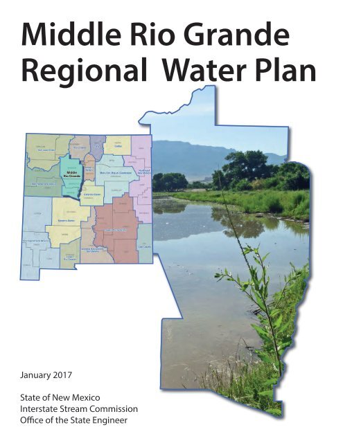
Middle Rio Grande Regional Water Plan
2iUWd5b
2iUWd5b

Create successful ePaper yourself
Turn your PDF publications into a flip-book with our unique Google optimized e-Paper software.
<strong>Middle</strong> <strong>Rio</strong> <strong>Grande</strong><br />
<strong>Regional</strong> <strong>Water</strong> <strong>Plan</strong><br />
January 2017<br />
State of New Mexico<br />
Interstate Stream Commission<br />
Office of the State Engineer
Cover photograph: <strong>Rio</strong> <strong>Grande</strong> upstream of embayment
Table of Contents<br />
Executive Summary ................................................................................................................................ ES-1<br />
1. Introduction ............................................................................................................................................ 1<br />
2. Public Involvement in the <strong>Plan</strong>ning Process .......................................................................................... 4<br />
2.1 The New Mexico Interstate Stream Commission’s Role in Public Involvement in the<br />
<strong>Regional</strong> <strong>Water</strong> <strong>Plan</strong> Update Process ............................................................................................. 5<br />
2.2 Public Involvement in the <strong>Middle</strong> <strong>Rio</strong> <strong>Grande</strong> <strong>Plan</strong>ning Process .................................................. 6<br />
2.2.1 Identification of <strong>Regional</strong> Steering Committee Members ................................................. 7<br />
2.2.2 <strong>Regional</strong> <strong>Water</strong> <strong>Plan</strong> Update Meetings .............................................................................. 8<br />
2.2.3 Current and Future Ideas for Public Outreach during Implementation of the<br />
<strong>Regional</strong> <strong>Water</strong> <strong>Plan</strong> Update ............................................................................................ 16<br />
3. Description of the <strong>Plan</strong>ning Region ..................................................................................................... 16<br />
3.1 General Description of the <strong>Plan</strong>ning Region................................................................................ 16<br />
3.2 Climate ......................................................................................................................................... 18<br />
3.3 Major Surface <strong>Water</strong> and Groundwater Sources .......................................................................... 18<br />
3.4 Demographics, Economic Overview, and Land Use ................................................................... 19<br />
4. Legal Issues .......................................................................................................................................... 23<br />
4.1 Relevant <strong>Water</strong> Law ..................................................................................................................... 23<br />
4.1.1 State of New Mexico Law ............................................................................................... 23<br />
4.1.2 State <strong>Water</strong> Laws and Administrative Policies Affecting the Region ............................. 36<br />
4.1.3 Federal <strong>Water</strong> Laws ......................................................................................................... 39<br />
4.1.4 Tribal Law ....................................................................................................................... 43<br />
4.1.5 Local Law ........................................................................................................................ 43<br />
4.2 Relevant Environmental Law ....................................................................................................... 49<br />
4.2.1 Species Protection Laws .................................................................................................. 49<br />
4.2.2 <strong>Water</strong> Quality Laws ......................................................................................................... 53<br />
4.3 Legal Issues Unique to the Region and Local Conflicts Needing Resolution ............................. 57<br />
4.3.1 Ongoing or Threatened Litigation that May Affect <strong>Water</strong> Management ........................ 57<br />
5. <strong>Water</strong> Supply ........................................................................................................................................ 58<br />
5.1 Summary of Climate Conditions .................................................................................................. 64<br />
5.1.1 Temperature, Precipitation, and Drought Indices ............................................................ 64<br />
5.1.2 Recent Climate Studies .................................................................................................... 76<br />
5.2 Surface <strong>Water</strong> Resources ............................................................................................................. 78<br />
5.3 Groundwater Resources ............................................................................................................... 88<br />
5.3.1 <strong>Regional</strong> Hydrogeology ................................................................................................... 96<br />
5.3.2 Aquifer Conditions .......................................................................................................... 96<br />
5.4 <strong>Water</strong> Quality ............................................................................................................................... 99<br />
5.4.1 Potential Sources of Contamination to Surface and Groundwater ................................ 102<br />
<strong>Middle</strong> <strong>Rio</strong> <strong>Grande</strong> <strong>Regional</strong> <strong>Water</strong> <strong>Plan</strong> 2017<br />
i
5.5 Administrative <strong>Water</strong> Supply ..................................................................................................... 141<br />
5.5.1 2010 Administrative <strong>Water</strong> Supply ............................................................................... 142<br />
5.5.2 Drought Supply .............................................................................................................. 142<br />
6. <strong>Water</strong> Demand .................................................................................................................................... 143<br />
6.1 Present Uses ............................................................................................................................... 144<br />
6.2 Demographic and Economic Trends .......................................................................................... 153<br />
6.2.1 Sandoval County ............................................................................................................ 154<br />
6.2.2 Bernalillo County ........................................................................................................... 155<br />
6.2.3 Valencia County ............................................................................................................ 158<br />
6.3 Projected Population Growth ..................................................................................................... 159<br />
6.4 <strong>Water</strong> Conservation .................................................................................................................... 161<br />
6.5 Projections of Future <strong>Water</strong> Demand for the <strong>Plan</strong>ning Horizon ................................................ 172<br />
6.5.1 <strong>Water</strong> Demand Projection Methods ............................................................................... 172<br />
6.5.2 <strong>Middle</strong> <strong>Rio</strong> <strong>Grande</strong> Projected <strong>Water</strong> Demand ............................................................... 177<br />
7. Identified Gaps between Supply and Demand ................................................................................... 181<br />
8. Implementation of Strategies to Meet Future <strong>Water</strong> Demand ............................................................ 184<br />
8.1 Implementation of Strategies Identified in Previously Accepted <strong>Regional</strong> <strong>Water</strong> <strong>Plan</strong>s ........... 184<br />
8.2 <strong>Water</strong> Conservation .................................................................................................................... 185<br />
8.3 Proposed Strategies (<strong>Water</strong> Programs, Projects, or Policies) ..................................................... 185<br />
8.3.1 Comprehensive List of Projects, Programs and Policies ............................................... 187<br />
8.3.2 Key Strategies for <strong>Regional</strong> Collaboration .................................................................... 188<br />
8.3.3 Key Program and Policy Recommendations ................................................................. 191<br />
References ................................................................................................................................................. 192<br />
<strong>Middle</strong> <strong>Rio</strong> <strong>Grande</strong> <strong>Regional</strong> <strong>Water</strong> <strong>Plan</strong> 2017<br />
ii
List of Figures<br />
1-1 Location of <strong>Middle</strong> <strong>Rio</strong> <strong>Grande</strong> <strong>Water</strong> <strong>Plan</strong>ning Region................................................................. 2<br />
3-1 <strong>Regional</strong> Map ................................................................................................................................. 17<br />
3-2 Land Ownership ............................................................................................................................. 22<br />
4-1 NMOSE-Declared Groundwater Basins and Groundwater Models .............................................. 37<br />
5-1 Climate Stations ............................................................................................................................. 67<br />
5-2 Average Temperature, Jemez Springs and Albuquerque WSFO Airport Climate Stations ........... 69<br />
5-3 Average Annual Precipitation (1980 to 2010) ............................................................................... 70<br />
5-4 Annual Precipitation, Jemez Springs and Albuquerque WSFO Airport Climate Stations ............ 71<br />
5-5 Snow Depth and Snow <strong>Water</strong> Equivalent for April .................................................... Not applicable<br />
5-6a Palmer Drought Severity Index, New Mexico Climate Divisions 2 and 4 .................................... 74<br />
5-6b Palmer Drought Severity Index, New Mexico Climate Divisions 5 and 6 .................................... 75<br />
5-7 Major Surface Drainages, Stream Gages, Reservoirs, and Lakes .................................................. 79<br />
5-8 Minimum and Median Yield 1950 through 2013 .......................................................................... 89<br />
5-9a Annual Streamflow for Selected Gaging Stations on the <strong>Rio</strong> <strong>Grande</strong> ........................................... 90<br />
5-9b Annual Streamflow for Selected Gaging Stations on the <strong>Rio</strong> <strong>Grande</strong> and Jemez River ............... 91<br />
5-9c Annual Streamflow for Selected Gaging Station on the <strong>Rio</strong> Puerco ............................................. 92<br />
5-10a Geology and Physiographic Provinces .......................................................................................... 97<br />
5-10b Geology Explanation ..................................................................................................................... 98<br />
5-11 U.S. Geological Survey Wells and Recent Groundwater Elevation Change ............................... 100<br />
5-12 Hydrographs of Selected Wells ................................................................................................... 101<br />
5-13 <strong>Water</strong> Quality-Impaired Reaches ................................................................................................. 103<br />
5-14 Potential Sources of Contamination ............................................................................................. 116<br />
6-1a Sandoval County <strong>Water</strong> Demand, 2010 ....................................................................................... 146<br />
6-1b Bernalillo County <strong>Water</strong> Demand, 2010...................................................................................... 147<br />
<strong>Middle</strong> <strong>Rio</strong> <strong>Grande</strong> <strong>Regional</strong> <strong>Water</strong> <strong>Plan</strong> 2017<br />
iii
6-1c Torrance County <strong>Water</strong> Demand, 2010 ....................................................................................... 148<br />
6-1d Valencia County <strong>Water</strong> Demand, 2010 ....................................................................................... 149<br />
6-1e Total <strong>Regional</strong> <strong>Water</strong> Demand by Sector, 2010 .......................................................................... 150<br />
6-1f Total <strong>Regional</strong> <strong>Water</strong> Demand by County, 2010 ......................................................................... 151<br />
6-2 Groundwater Points of Diversion ................................................................................................ 152<br />
7-1 Available Supply and Projected Demand .................................................................................... 183<br />
List of Tables<br />
2-1 Steering Committee Members, <strong>Middle</strong> <strong>Rio</strong> <strong>Grande</strong> <strong>Water</strong> <strong>Plan</strong>ning Region .................................. 9<br />
2-2 <strong>Middle</strong> <strong>Rio</strong> <strong>Grande</strong> Region Public Meetings ................................................................................. 10<br />
3-1 Summary of Demographic and Economic Statistics for the <strong>Middle</strong> <strong>Rio</strong> <strong>Grande</strong> <strong>Water</strong><br />
<strong>Plan</strong>ning Region ............................................................................................................................. 20<br />
5-1 <strong>Middle</strong> <strong>Rio</strong> <strong>Grande</strong> Climate Stations ............................................................................................. 65<br />
5-2 Temperature and Precipitation for Selected Climate Stations, <strong>Middle</strong> <strong>Rio</strong> <strong>Grande</strong> <strong>Water</strong><br />
<strong>Plan</strong>ning Region ............................................................................................................................. 68<br />
5-3 Palmer Drought Severity Index Classifications ............................................................................. 72<br />
5-4a USGS Stream Gage Stations .......................................................................................................... 80<br />
5-4b USGS Stream Gage Annual Statistics for Stations with 10 or More Years of Record .................. 85<br />
5-5 USGS Stream Gage Average Monthly Streamflow for Stations with 10 or More Years of<br />
Record ............................................................................................................................................ 86<br />
5-6 Reservoirs and Lakes (greater than 5,000 acre-feet) in and Supplying the <strong>Middle</strong> <strong>Rio</strong> <strong>Grande</strong><br />
<strong>Water</strong> <strong>Plan</strong>ning Region .................................................................................................................. 93<br />
5-7 Dams with Dam Safety Deficiency Rankings ................................................................................ 94<br />
5-8 Total Maximum Daily Load Status of Streams in the <strong>Middle</strong> <strong>Rio</strong> <strong>Grande</strong> <strong>Water</strong> <strong>Plan</strong>ning<br />
Region .......................................................................................................................................... 104<br />
5-9 Municipal and Industrial NPDES Permittees in the <strong>Middle</strong> <strong>Rio</strong> <strong>Grande</strong> <strong>Water</strong> <strong>Plan</strong>ning<br />
Region .......................................................................................................................................... 115<br />
5-10 Groundwater Discharge Permits in the <strong>Middle</strong> <strong>Rio</strong> <strong>Grande</strong> <strong>Water</strong> <strong>Plan</strong>ning Region .................. 117<br />
5-11 Superfund Sites in the <strong>Middle</strong> <strong>Rio</strong> <strong>Grande</strong> <strong>Water</strong> <strong>Plan</strong>ning Region ............................................ 123<br />
<strong>Middle</strong> <strong>Rio</strong> <strong>Grande</strong> <strong>Regional</strong> <strong>Water</strong> <strong>Plan</strong> 2017<br />
iv
5-12 Leaking Underground Storage Tank Sites in the <strong>Middle</strong> <strong>Rio</strong> <strong>Grande</strong> <strong>Water</strong> <strong>Plan</strong>ning Region ... 124<br />
5-13 Landfills in the <strong>Middle</strong> <strong>Rio</strong> <strong>Grande</strong> <strong>Water</strong> <strong>Plan</strong>ning Region ....................................................... 138<br />
6-1 Total Withdrawals in the <strong>Middle</strong> <strong>Rio</strong> <strong>Grande</strong> <strong>Water</strong> <strong>Plan</strong>ning Region in 2010 .......................... 145<br />
6-2 Comparison of Projected and Actual 2010 Population ................................................................ 159<br />
6-3 <strong>Middle</strong> <strong>Rio</strong> <strong>Grande</strong> Population Projections, July 1, 2010 to July 1, 2060 ................................... 162<br />
6-4 2010 <strong>Water</strong> Withdrawals for Drinking <strong>Water</strong> Supply Systems and Rural Self-Supplied<br />
Homes .......................................................................................................................................... 163<br />
6-5 Projected <strong>Water</strong> Demand, 2020 through 2060, <strong>Middle</strong> <strong>Rio</strong> <strong>Grande</strong> <strong>Water</strong> <strong>Plan</strong>ning Region ..... 178<br />
8-1a Summary of the Ten Most Effective Strategies Implemented from the 2004 <strong>Middle</strong> <strong>Rio</strong><br />
<strong>Grande</strong> <strong>Regional</strong> <strong>Water</strong> <strong>Plan</strong> ....................................................................................................... 186<br />
8-1b High Priority Strategies for Continued Implementation .............................................................. 186<br />
8-2 Key Collaborative Programs, Projects and Policies for Project Implementation, 2016 <strong>Middle</strong><br />
<strong>Rio</strong> <strong>Grande</strong> <strong>Regional</strong> <strong>Water</strong> <strong>Plan</strong> ................................................................................................. 189<br />
List of Appendices<br />
2-A Master Stakeholder List<br />
2-B Summary of Comments on Technical and Legal Sections (Single Comment Document) and<br />
Other Public Comments<br />
6-A List of Individuals Interviewed<br />
6-B Projected Population Growth Rates, 2010 to 2040<br />
8-A Steering Committee Review of the 2004 Strategies<br />
8-B Recommended Projects, Programs, and Policies<br />
8-C Infrastructure Capital Improvement and <strong>Water</strong> Trust Board Projects<br />
Note: Appendix designations indicate corresponding section in plan<br />
.<br />
<strong>Middle</strong> <strong>Rio</strong> <strong>Grande</strong> <strong>Regional</strong> <strong>Water</strong> <strong>Plan</strong> 2017<br />
v
List of Acronyms<br />
°F degrees Fahrenheit<br />
ABCWUA<br />
ac-ft/yr<br />
AMAFCA<br />
AMO<br />
AWRM<br />
BBER<br />
BLM<br />
CERCLA<br />
CID<br />
COA<br />
CSWCD<br />
CWA<br />
DBS&A<br />
DWP<br />
DWS<br />
EBID<br />
EPA<br />
EPCWID #1<br />
ESA<br />
FY<br />
GIS<br />
gpcd<br />
GWQB<br />
ICIP<br />
IPCC<br />
JRWG<br />
JSAI<br />
KAFB<br />
LQ<br />
Albuquerque Bernalillo County <strong>Water</strong> Utility Authority<br />
acre-feet per year<br />
Albuquerque Metropolitan Arroyo Flood Control Authority<br />
Atlantic multidecadal oscillation<br />
Active <strong>Water</strong> Resource Management<br />
Bureau of Business and Economic Research<br />
Bureau of Land Management<br />
Comprehensive Environmental Response, Compensation, and Liability Act<br />
Carlsbad Irrigation District<br />
City of Albuquerque<br />
Ciudad Soil and <strong>Water</strong> Conservation District<br />
Clean <strong>Water</strong> Act<br />
Daniel B. Stephens & Associates, Inc.<br />
Drinking <strong>Water</strong> Project<br />
Domestic Well Statute<br />
Elephant Butte Irrigation District<br />
U.S. Environmental Protection Agency<br />
El Paso County <strong>Water</strong> Improvement District Number One<br />
Endangered Species Act<br />
fiscal year<br />
geographic information system<br />
gallons per capita per day<br />
Ground <strong>Water</strong> Quality Bureau [New Mexico Environment Department]<br />
Infrastructure Capital Improvement <strong>Plan</strong><br />
Intergovernmental Panel on Climate Change<br />
Jemez River <strong>Water</strong>shed Group<br />
John Shomaker & Associates, Inc.<br />
Kirtland Air Force Base<br />
location quotient<br />
<strong>Middle</strong> <strong>Rio</strong> <strong>Grande</strong> <strong>Regional</strong> <strong>Water</strong> <strong>Plan</strong> 2017<br />
vi
MCL<br />
MCLG<br />
MDWCA<br />
MRCOG<br />
MRGAA<br />
MRGCD<br />
MRGWA<br />
MSA<br />
MSGP<br />
NASS<br />
NCDC<br />
NEPA<br />
NMAC<br />
NMBGMR<br />
NMDOT<br />
NMED<br />
NMISC<br />
NMOSE<br />
NMSA<br />
NMSU<br />
NMWQCC<br />
NOAA<br />
NPDES<br />
NPL<br />
NRCS<br />
NWS<br />
PCB<br />
PDO<br />
PDSI<br />
PPP<br />
PSTB<br />
PVACD<br />
RCRA<br />
RWP<br />
SDWA<br />
SNOTEL<br />
SSPA<br />
maximum contaminant level<br />
maximum contaminant level goal<br />
mutual domestic water consumers association<br />
Mid-Region Council of Governments<br />
<strong>Middle</strong> <strong>Rio</strong> <strong>Grande</strong> Administrative Area<br />
<strong>Middle</strong> <strong>Rio</strong> <strong>Grande</strong> Conservancy District<br />
<strong>Middle</strong> <strong>Rio</strong> <strong>Grande</strong> <strong>Water</strong> Assembly<br />
metropolitan statistical area<br />
Multi-Sector General Permit<br />
National Agricultural Statistics Service<br />
National Climatic Data Center<br />
National Environmental Policy Act<br />
New Mexico Administrative Code<br />
New Mexico Bureau of Geology & Mineral Resources<br />
New Mexico Department of Transportation<br />
New Mexico Environment Department<br />
New Mexico Interstate Stream Commission<br />
New Mexico Office of the State Engineer<br />
New Mexico Statutes Annotated<br />
New Mexico State University<br />
New Mexico <strong>Water</strong> Quality Control Commission<br />
National Oceanic and Atmospheric Administration<br />
National Pollutant Discharge Elimination System<br />
National Priorities List<br />
Natural Resources Conservation Service<br />
National Weather Service<br />
polychlorinated biphenyl<br />
Pacific decadal oscillation<br />
Palmer Drought Severity Index<br />
project, program, and policy<br />
Petroleum Storage Tank Bureau (NMED)<br />
Pecos Valley Artesian Conservancy District<br />
Resource Conservation and Recovery Act<br />
regional water plan<br />
Safe Drinking <strong>Water</strong> Act<br />
snowpack telemetry<br />
S.S. Papadopulos & Associates, Inc.<br />
<strong>Middle</strong> <strong>Rio</strong> <strong>Grande</strong> <strong>Regional</strong> <strong>Water</strong> <strong>Plan</strong> 2017<br />
vii
SWCD<br />
TDS<br />
TMDL<br />
U.S. EPA<br />
UNM<br />
USBR<br />
USDA<br />
USFWS<br />
USGCRP<br />
USGS<br />
USR<br />
UST<br />
UWB<br />
WEG<br />
WQA<br />
WRAS<br />
WRCC<br />
WUA<br />
soil and water conservation district<br />
total dissolved solids<br />
total maximum daily load<br />
U.S. Environmental Protection Agency<br />
University of New Mexico<br />
U.S. Bureau of Reclamation<br />
U.S. Department of Agriculture<br />
U.S. Fish and Wildlife Service<br />
U.S. Global Change Research Program<br />
U.S. Geological Survey<br />
underground storage and recovery<br />
underground storage tank<br />
underground water basin<br />
WildEarth Guardians<br />
<strong>Water</strong> Quality Act (New Mexico)<br />
<strong>Water</strong> Restoration Action Strategy<br />
Western <strong>Regional</strong> Climate Center<br />
water users association<br />
<strong>Middle</strong> <strong>Rio</strong> <strong>Grande</strong> <strong>Regional</strong> <strong>Water</strong> <strong>Plan</strong> 2017<br />
viii
Executive Summary<br />
The <strong>Middle</strong> <strong>Rio</strong> <strong>Grande</strong> <strong>Water</strong> <strong>Plan</strong>ning Region, which includes most of Sandoval and Bernalillo<br />
counties, all of Valencia County, and a very small portion of Torrance County (Figure ES-1), is<br />
one of 16 water planning regions in the State of New Mexico. <strong>Regional</strong> water planning was<br />
initiated in New Mexico in 1987, its primary purpose being to protect New Mexico water<br />
resources and to ensure that each region is prepared to meet future water demands. Between<br />
1987 and 2008, each of the 16 planning<br />
regions, with funding and oversight from<br />
the New Mexico Interstate Stream<br />
Commission (NMISC), developed a plan to<br />
meet regional water needs over the ensuing<br />
40 years. The <strong>Middle</strong> <strong>Rio</strong> <strong>Grande</strong> <strong>Regional</strong><br />
<strong>Water</strong> <strong>Plan</strong> was completed and accepted by<br />
the NMISC in 2004.<br />
The purpose of this document is to provide<br />
new and changed information related to<br />
water planning in the <strong>Middle</strong> <strong>Rio</strong> <strong>Grande</strong><br />
region and to evaluate projections of future<br />
water supply and demand for the region<br />
using a common technical approach<br />
applied to all 16 planning regions<br />
statewide. Accordingly, this regional water<br />
plan (RWP) update summarizes key<br />
information in the 2004 plan and provides<br />
updated information regarding changed<br />
conditions and additional data that have<br />
become available.<br />
Figure ES-1. <strong>Middle</strong> <strong>Rio</strong> <strong>Grande</strong> <strong>Water</strong> <strong>Plan</strong>ning Region<br />
Based on updated water use (Figure ES-2) data from 2010, Figure ES-3 illustrates the total<br />
projected regional water demand under high and low demand scenarios, and also shows the<br />
administrative water supply and the drought-adjusted water supply. The administrative water<br />
supply is based on 2010 withdrawals of water and is an estimate of future water supplies that<br />
considers both physical availability and compliance with water rights policies. Because of its<br />
reliance on surface water, the region has a high degree of vulnerability to drought, especially for<br />
irrigated agriculture, and the estimated annual shortage in drought years is expected to range<br />
from 207,357 to 282,108 acre-feet. Consequently, the region has recommended several highpriority<br />
strategies to meet future demand, including stormwater management, treated effluent<br />
reuse, and watershed management, better management of existing supply through adjudication of<br />
water rights, measuring all water uses and losses, and water resource databases, and supporting<br />
the economy through consistent funding for water projects and building local markets.<br />
<strong>Middle</strong> <strong>Rio</strong> <strong>Grande</strong> <strong>Regional</strong> <strong>Water</strong> <strong>Plan</strong> 2017<br />
ES-1
1%<br />
3% 2%<br />
1%<br />
Commercial (self-supplied)<br />
Domestic (self-supplied)<br />
31%<br />
Industrial (self-supplied)<br />
Irrigated Agriculture<br />
0.1%<br />
0.1%<br />
0.3%<br />
62%<br />
Livestock (self-supplied)<br />
Mining (self-supplied)<br />
Power (self-supplied)<br />
Public <strong>Water</strong> Supply<br />
Reservoir Evaporation<br />
Total usage: 431,640 acre-feet<br />
Figure ES-2. Total <strong>Regional</strong> <strong>Water</strong> Use, 2010<br />
Note: Tribes and Pueblos in New Mexico are not required to provide water use data<br />
to the State. Therefore, tribal water use data are not necessarily reflected in<br />
this figure.<br />
600,000<br />
500,000<br />
Supply / Demand (acre-feet)<br />
400,000<br />
300,000<br />
200,000<br />
Administrative<br />
water supply<br />
Severe drought<br />
adjusted<br />
administrative<br />
water supply *<br />
100,000<br />
0<br />
2020 2030 2040 2050 2060<br />
High demand projection<br />
Low demand projection<br />
* Based on the ratio of the minimum streamflow of record to the 2010 administrative water supply.<br />
Figure ES-3. Available Supply and Projected Demand<br />
Note: Tribes and Pueblos in New Mexico are not required to provide water use data to the State.<br />
Therefore, tribal water use data are not necessarily reflected in this figure.<br />
<strong>Middle</strong> <strong>Rio</strong> <strong>Grande</strong> <strong>Regional</strong> <strong>Water</strong> <strong>Plan</strong> 2017<br />
ES-2
<strong>Plan</strong>ning Method<br />
For this RWP, water supply and demand information was assessed in accordance with a common<br />
technical approach, as identified in the Updated <strong>Regional</strong> <strong>Water</strong> <strong>Plan</strong>ning Handbook: Guidelines<br />
to Preparing Updates to New Mexico <strong>Regional</strong> <strong>Water</strong> <strong>Plan</strong>s (where it is referred to as a common<br />
technical platform) (Handbook). This common technical approach outlines the basis for defining<br />
the available water supply and specifies methods for estimating future demand in all categories<br />
of water use:<br />
• The method to estimate supply (referred to as the administrative water supply in the<br />
Handbook) is based on withdrawals of water as reported in the New Mexico <strong>Water</strong> Use by<br />
Categories 2010 report prepared by the New Mexico Office of the State Engineer<br />
(NMOSE). Use of the 2010 data provides a measure of supply that considers both<br />
physical supply and legal restrictions (i.e., the water is physically available for<br />
withdrawal, and its use is in compliance with water rights policies) and thus reflects the<br />
amount of water available for use by a<br />
region.<br />
• An estimate of supply during future<br />
droughts is also developed by<br />
adjusting the 2010 withdrawal data<br />
based on physical supplies available<br />
during historical droughts.<br />
• Projections of future demand in nine<br />
water use categories are based on<br />
demographic and economic trends and<br />
population projections. Consistent<br />
methods and assumptions for each<br />
category of water use are applied across all planning regions.<br />
Common Technical Approach<br />
To prepare both the regional water plans and the state<br />
water plan, the State has developed a set of methods for<br />
assessing the available supply and projected demand<br />
that can be used consistently in all 16 planning regions<br />
in New Mexico. The objective of applying this<br />
common technical approach is to be able to efficiently<br />
develop a statewide overview of the balance between<br />
supply and demand in both normal and drought<br />
conditions, so that the State can move forward with<br />
planning and funding water projects and programs that<br />
will address the State’s pressing water issues.<br />
Public Involvement<br />
The updated Handbook specifies that the RWP update process “shall be guided by participation<br />
of a representative group of stakeholders,” referred to as the steering committee. Steering<br />
committee members provided direction for the public involvement process and relayed<br />
information about the planning effort to the water user groups they represent and other concerned<br />
or interested individuals.<br />
In addition to the steering committee, the water planning effort included developing a master<br />
stakeholder list of organizations and individuals interested in the water planning update. This list<br />
was developed from the previous round of water planning and then expanded through efforts to<br />
<strong>Middle</strong> <strong>Rio</strong> <strong>Grande</strong> <strong>Regional</strong> <strong>Water</strong> <strong>Plan</strong> 2017<br />
ES-3
identify representatives from water user groups and other stakeholders. Organizations and<br />
individuals on the master stakeholder list were sent announcements of meetings and the RWP<br />
update process and progress.<br />
Over the two-year update process, 18 meetings were held in the <strong>Middle</strong> <strong>Rio</strong> <strong>Grande</strong> region,<br />
including 17 NMISC-facilitated meetings and an additional public forum. These meetings<br />
identified the program objectives, presented draft supply and demand calculations for discussion<br />
and to guide strategy development, and provided an opportunity for stakeholders to provide input<br />
on the strategies that they would like to see implemented. All steering committee meetings were<br />
open to the public and interested stakeholders, and participation from all meeting attendees was<br />
encouraged.<br />
Key <strong>Water</strong> Issues<br />
The key water supply updates and issues currently impacting the <strong>Middle</strong> <strong>Rio</strong> <strong>Grande</strong> region<br />
include the following:<br />
<br />
<br />
<br />
<br />
The climate divisions within the planning region have all experienced drought in recent<br />
years. This is a particular concern for agricultural users that are dependent on surface<br />
water, but drought preparedness is important for each community in the region.<br />
The <strong>Rio</strong> <strong>Grande</strong> Compact requires delivery of specified amounts of water to Elephant<br />
Butte Reservoir based on the annual natural flow of the <strong>Rio</strong> <strong>Grande</strong> at the Otowi gage.<br />
New Mexico’s delivery to Elephant Butte Reservoir under the Compact is dependent, in<br />
part, upon natural and man-caused depletions within parts of the Jemez y Sangre, <strong>Middle</strong><br />
<strong>Rio</strong> <strong>Grande</strong>, and Socorro-Sierra planning regions. This requirement limits combined<br />
depletions in these three regions. When the stored water in Elephant Butte and Caballo<br />
reservoirs legally available for release to the lower <strong>Rio</strong> <strong>Grande</strong> drops below a specified<br />
level, certain provisions of the Compact restrict storage and/or release of stored water in<br />
reservoirs upstream of Elephant Butte constructed after 1929, thus impacting water<br />
operations in the region, perhaps significantly.<br />
The <strong>Rio</strong> <strong>Grande</strong> is the main river in the planning region, and most of the groundwater in<br />
the region is within the <strong>Rio</strong> <strong>Grande</strong> Underground <strong>Water</strong> Basin and is considered to be<br />
stream-connected. The <strong>Rio</strong> <strong>Grande</strong> in the region is considered by the State Engineer to be<br />
fully appropriated, and any new diversion of surface water or stream-connected<br />
groundwater requires the transfer of a valid senior surface water right. The availability of<br />
senior water rights may thus be a limiting factor in meeting the future water needs of the<br />
region.<br />
<strong>Water</strong> users seeking to obtain water rights to meet growing demands, such as municipal<br />
users, are challenged because they must transfer an existing senior water right. No new<br />
<strong>Middle</strong> <strong>Rio</strong> <strong>Grande</strong> <strong>Regional</strong> <strong>Water</strong> <strong>Plan</strong> 2017<br />
ES-4
appropriations are available in the region. After the groundwater basin was closed to new<br />
appropriations in 1956, a number of entities applied for and were issued groundwater<br />
pumping permits with the condition that the effects of the pumping on the river would be<br />
offset when they occur. Municipal return flow, San Juan-Chama Project water, and the<br />
transfer of senior water rights are used as offsets as required by the specific permit<br />
requirements, with return flows comprising the greatest volume of offset. The amount of<br />
senior water rights needed to offset the pumping under these permits when the effects are<br />
fully realized on the river is roughly equal to all of the transferrable senior water rights<br />
from the irrigated land along the <strong>Rio</strong> <strong>Grande</strong> from north of Albuquerque to Elephant<br />
Butte. The total amount of groundwater pumping currently occurring in the planning<br />
region is much less than the total amount permitted.<br />
• Several <strong>Middle</strong> <strong>Rio</strong> <strong>Grande</strong> entities have contract allotments of water from the San Juan-<br />
Chama Project, which brings water from the Colorado River Basin to the <strong>Rio</strong> <strong>Grande</strong><br />
basin. San Juan-Chama Project contractors in the <strong>Middle</strong> <strong>Rio</strong> <strong>Grande</strong> region include the<br />
Albuquerque Bernalillo County <strong>Water</strong> Utility Authority (ABCWUA) (48,200 acre--feet<br />
per year [ac-ft/yr]), <strong>Middle</strong> <strong>Rio</strong> <strong>Grande</strong> Conservancy District (MRGCD)<br />
(20,900 ac-ft/yr), Town of Belen (500 ac-ft/yr), Town of Bernalillo (400 ac-ft/yr), and<br />
Village of Los Lunas (400 ac-ft/yr).<br />
• Since the 2004 plan was completed, the ABCWUA has begun to use surface water from<br />
the San Juan-Chama Project to supplement its water supply. This surface water use<br />
allows groundwater withdrawals to be reduced and is intended to save groundwater for<br />
use as a drought supply when surface water is not available. As a result, ABCWUA,<br />
which holds upward of 70 percent of the permitted post-1956 groundwater pumping<br />
rights in the region, does not need to pursue acquisition of pre-1907 water rights for<br />
offset purposes for several decades. ABCWUA has a goal to manage its existing water<br />
resources over the next hundred years to meet river offset requirements without further<br />
transfer of pre-1907 water rights. Prior to developing its surface diversion infrastructure,<br />
the ABCWUA leased, loaned, or gave portions of its San Juan-Chama Project water to<br />
other parties in the <strong>Middle</strong> <strong>Rio</strong> <strong>Grande</strong> for various uses. The smaller municipalities have<br />
not developed this renewable water supply and instead will likely continue to use their<br />
San Juan-Chama Project water for offset purposes as necessary.<br />
• The NMOSE adopted the <strong>Middle</strong> <strong>Rio</strong> <strong>Grande</strong> Administrative Guidelines in September<br />
2000 for the administration of the <strong>Middle</strong> <strong>Rio</strong> <strong>Grande</strong> Administrative Area (MRGAA).<br />
These guidelines are designed to protect water rights, <strong>Rio</strong> <strong>Grande</strong> Compact compliance,<br />
and the aquifer, and to minimize land subsidence. Under the guidelines new groundwater<br />
appropriations will be approved in the MRGAA only if surface water rights are obtained<br />
and transferred to offset the diversion amount less any flow returned directly to the <strong>Rio</strong><br />
<strong>Grande</strong>. Surface water supplies are fully appropriated, and MRGAA Critical<br />
<strong>Middle</strong> <strong>Rio</strong> <strong>Grande</strong> <strong>Regional</strong> <strong>Water</strong> <strong>Plan</strong> 2017<br />
ES-5
Management Areas, which are now limited to parts of Albuquerque, are closed to<br />
additional pumping.<br />
• The MRGCD has four major river diversion points and a large network of irrigation<br />
canals and drains in the area between Cochiti and the Bosque del Apache National<br />
Wildlife Refuge. Additionally, passive diversion by MRGCD occurs from the river to<br />
the adjacent riverside drains in some reaches. MRGCD coordinates with the Bureau of<br />
Reclamation (USBR), and the NMISC in specific instances, on El Vado Reservoir<br />
operations so that it can provide stored water to its farmers when native flow is<br />
insufficient to meet MRGCD irrigation demand.<br />
• The MRGCD has not yet submitted documentation regarding the water that it has put to<br />
beneficial use since its permit (SP-1690) was issued in 1930. Without such<br />
documentation and critical evaluation of the documentation by the State Engineer, it will<br />
remain unclear what the rights under the permit are. Storage and release from El Vado<br />
Reservoir under the permit is coordinated between MRGCD and USBR.<br />
• The Federal Emergency Management Administration recently released new floodplain<br />
maps of Sandoval, Bernalillo, and Valencia counties. The new maps define hazard areas<br />
and indicate flood insurance rate boundaries. These maps can help to define areas and<br />
infrastructure that are vulnerable to flooding during extreme climate events, thereby<br />
helping the region prepare for extreme precipitation. Communities can work to make<br />
their watersheds more resilient under climate change by assessing the adequacy of<br />
bridges and culverts to sustain peak flow events.<br />
• The existing flood control infrastructure along the <strong>Rio</strong> <strong>Grande</strong> is many decades old and<br />
nearing the end of its design life. In a number of instances the levees were not<br />
engineered and consist simply of excavated materials placed alongside the river when the<br />
riverside drains were constructed. Further, because the bottom of the river is higher than<br />
the floodplain in some areas, failure of a levee in these areas will cause the river to leave<br />
its channel and flood the developed floodplain, including farms, communities, and<br />
irrigation and drainage infrastructure. The cost to replace or reinforce this infrastructure<br />
throughout the <strong>Middle</strong> <strong>Rio</strong> <strong>Grande</strong> valley is estimated at more than $750 million. A task<br />
force of local stakeholder entities has been evaluating the situation, developing reports to<br />
the legislature, and seeking funding for higher-priority projects.<br />
• <strong>Middle</strong> <strong>Rio</strong> <strong>Grande</strong> geomorphology has changed significantly from its unmanaged state<br />
(Mussetter, 2002). Cochiti Reservoir and other flood control features have trapped<br />
sediment, leading to significant and continued channel incising in the upper reaches of<br />
the <strong>Middle</strong> <strong>Rio</strong> <strong>Grande</strong>. Conversely, excessive sedimentation from ephemeral tributaries<br />
south of Albuquerque, combined with surface water withdrawals, results in significant<br />
<strong>Middle</strong> <strong>Rio</strong> <strong>Grande</strong> <strong>Regional</strong> <strong>Water</strong> <strong>Plan</strong> 2017<br />
ES-6
channel aggradation. These changes in the river system impact how water is managed as<br />
the region reacts to endangered species and water delivery mandates.<br />
<br />
<br />
<br />
<br />
<br />
In addition, the river channel has narrowed during the drought and islands have formed<br />
that are now vegetated. These conditions will make it difficult to move water through<br />
some areas when the next big snowmelt runoff occurs. The potential for extreme<br />
precipitation events highlights the need for flood preparation and maintenance of flood<br />
control structures.<br />
The ABCWUA has investigated aquifer storage and recovery (ASR) projects through a<br />
demonstration project at Bear Canyon and obtained the first full-scale underground<br />
storage and recovery permit in the state in August 2014. Between November 2014 and<br />
March 2015, the project recharged 520.6 acre-feet into the aquifer. ABCWUA is<br />
implementing a second ASR demonstration project to store up to 5,000 acre-feet of<br />
treated San Juan-Chama water through injection wells located at the Drinking <strong>Water</strong><br />
Treatment <strong>Plan</strong>t in the <strong>Rio</strong> <strong>Grande</strong> Valley, at an anticipated cost of $5.7 to $5.9 million,<br />
and is currently evaluating other potential projects that would allow them to store more<br />
surface water, building up a drought reserve.<br />
The City of <strong>Rio</strong> Rancho has demonstrated that surface infiltration and direct injection<br />
methods can be used to safely replenish the underlying aquifer with a purified, reclaimed<br />
water source. Projects include a 2-acre surface infiltration system and a direct injection<br />
facility, each of which has the capacity to recharge the underlying aquifer at a rate of<br />
approximately 2 and 3 acre-feet per day, respectively. Full-scale permits for operation of<br />
the direct injection facility have been recently issued by the New Mexico Environment<br />
Department (NMED) and NMOSE.<br />
The <strong>Middle</strong> <strong>Rio</strong> <strong>Grande</strong> region is home to six federally listed endangered and threatened<br />
species—the <strong>Rio</strong> <strong>Grande</strong> silvery minnow, southwestern willow flycatcher, Jemez<br />
Mountains salamander, New Mexico meadow jumping mouse, western yellow-billed<br />
cuckoo, and Mexican spotted owl—and water demand for these species has resulted in<br />
changes in some water operations in the region in recent years. Litigation is occurring on<br />
a federally mandated Biological Opinion from 2003 for all <strong>Middle</strong> <strong>Rio</strong> <strong>Grande</strong> water<br />
operations that specifies instream flow targets to assist in the recovery of the silvery<br />
minnow. The 2003 Biological Opinion was replaced in December 2016, when a new<br />
Biological Opinion was issued for <strong>Water</strong> Operations and River Maintenance actions of<br />
USBR, the Bureau of Indian Affairs, MRGCD, and the State. The litigation on the 2003<br />
Biological Opinion is currently stayed to allow the parties to evaluate the changed<br />
situation relative to the litigation complaints.<br />
The congressionally authorized <strong>Middle</strong> <strong>Rio</strong> <strong>Grande</strong> Endangered Species Collaborative<br />
Program has provided funding at a 75 percent federal and 25 percent non-federal cost<br />
<strong>Middle</strong> <strong>Rio</strong> <strong>Grande</strong> <strong>Regional</strong> <strong>Water</strong> <strong>Plan</strong> 2017<br />
ES-7
share to address endangered species and water user conflicts and maintain Endangered<br />
Species Act compliance for New Mexico water users above Elephant Butte Reservoir.<br />
The Collaborative Program has coordinated efforts by federal, state, and local<br />
government and Native American and private entities and expended more than $150<br />
million since 2001. The NMISC has provided approximately 90 percent of the required<br />
non-federal cost share. Although litigation is underway, Endangered Species Act<br />
compliance has been maintained since 2003 and many projects benefiting the endangered<br />
species have been completed.<br />
<br />
<br />
<br />
<br />
<br />
<br />
Pueblo water rights have not been fully characterized or quantified, yet they constitute the<br />
most senior water claims in the basin.<br />
Sandia and Isleta pueblos have EPA-approved water quality standards, which means that<br />
upstream discharges, including treated wastewater return flows from Bernalillo, <strong>Rio</strong><br />
Rancho, and Albuquerque, must meet Pueblo standards.<br />
The <strong>Middle</strong> <strong>Rio</strong> <strong>Grande</strong> <strong>Water</strong> Assembly, a non-profit organization dedicated to<br />
educating residents of the <strong>Middle</strong> <strong>Rio</strong> <strong>Grande</strong> about relevant water issues, developed a<br />
water budget for the <strong>Middle</strong> <strong>Rio</strong> <strong>Grande</strong> as part of the original water planning effort.<br />
Though this document uses a different approach from the common technical approach for<br />
all planning regions, the original water budget is still a useful tool that helps describe the<br />
water balance in the <strong>Middle</strong> <strong>Rio</strong> <strong>Grande</strong>. The budget has recently been updated by the<br />
<strong>Middle</strong> <strong>Rio</strong> <strong>Grande</strong> <strong>Water</strong> Assembly <strong>Water</strong> Budget Task Force.<br />
Due to the large amount of forested land within and upstream of the region, coupled with<br />
the recent drought conditions, the threat of wildfire and subsequent sedimentation<br />
impacts on streams and reservoirs remains a key planning issue. Continued and<br />
expanded efforts to reduce catastrophic fire risk through forest management, as well as<br />
additional information on the quantitative benefits of various management techniques, are<br />
needed.<br />
The Nature Conservancy is working to develop the <strong>Rio</strong> <strong>Grande</strong> <strong>Water</strong> Fund, which if<br />
funded, will generate sustainable income for a 10- to 30-year forest restoration program<br />
through a multi-party effort. Models of debris flow risk after high-severity fire indicate<br />
that key water sources are at risk, and the goal of the program is to reduce the risk of<br />
catastrophic wildfire and subsequent sedimentation and localized water quality impacts to<br />
protect the region’s water supply.<br />
The U.S. Air Force, under direction from the NMED, is cleaning up a jet fuel spill at<br />
Kirtland Air Force Base. Plume assessment and interim remediation measures are in<br />
place, and a final remediation strategy will be developed under the Resource<br />
Conservation and Recovery Act.<br />
<strong>Middle</strong> <strong>Rio</strong> <strong>Grande</strong> <strong>Regional</strong> <strong>Water</strong> <strong>Plan</strong> 2017<br />
ES-8
In 2014, the U.S. Environmental Protection Agency issued a National Pollutant<br />
Discharge Elimination System <strong>Water</strong>shed Based MS4 Permit NMR04A000, which<br />
covers the <strong>Middle</strong> <strong>Rio</strong> <strong>Grande</strong> watershed. The watershed based MS4 Permit replaces an<br />
earlier MS4 Permit NMS000101 for four co-permittees that have been participating under<br />
a 2003 cooperative agreement to jointly conduct stormwater quality monitoring. The<br />
NMISC is concerned that compliance with the permit will reduce the amount of water<br />
reaching the river because, unless a flood control purpose is present, the permit requires<br />
retention of water on newly developed and redeveloped sites as opposed to detention,<br />
treatment, and release.<br />
While the largest urban populations are served by municipal suppliers, there are many<br />
small and rural drinking water systems in the region, outside of these urban areas. These<br />
small systems face challenges in financing infrastructure maintenance and upgrades and<br />
complying with water quality monitoring and training standards. Many smaller<br />
communities in the region do not have adequate wastewater treatment facilities.<br />
The East Mountain area (east of the Sandia Mountains in the central part of the planning<br />
region) is supplied largely by domestic wells and small water systems. Yields are low in<br />
some areas, shallow wells are vulnerable to drought, and septic systems can impact water<br />
quality. Bernalillo County groundwater level monitoring has shown significant water<br />
level declines in some areas.<br />
Between 2006 and 2008, 35 entities filed notices of intent to drill more than 420 deep<br />
wells in the <strong>Middle</strong> <strong>Rio</strong> <strong>Grande</strong> for the withdrawal of more than 1.14 million acre-feet<br />
per year of nonpotable groundwater. Two test wells were drilled and tested for this<br />
purpose in Sandoval County. No other wells have been drilled associated with these<br />
notices, and no water has been put to beneficial use under any of these notices. These<br />
proposed groundwater withdrawals from deep aquifers have the potential to affect<br />
shallow freshwater aquifers and the surface water of the <strong>Rio</strong> <strong>Grande</strong> stream system.<br />
Strategies to Meet Future <strong>Water</strong> Demand<br />
An important focus of the RWP update process is to both identify strategies for meeting future<br />
water demand and facilitate their implementation. To help address the implementation of new<br />
strategies, a review of the implementation of previous strategies was first completed.<br />
The 2004 <strong>Middle</strong> <strong>Rio</strong> <strong>Grande</strong> <strong>Regional</strong> <strong>Water</strong> <strong>Plan</strong> recommended the following strategies for<br />
meeting future water demand:<br />
<br />
Urban and rural conservation<br />
Establish a domestic well policy<br />
Outdoor conservation programs<br />
<strong>Middle</strong> <strong>Rio</strong> <strong>Grande</strong> <strong>Regional</strong> <strong>Water</strong> <strong>Plan</strong> 2017<br />
ES-9
Rainwater harvesting<br />
Conversion to low flow appliances<br />
Urban water pricing<br />
Greywater reuse<br />
Controlled growth of parks and golf courses<br />
• <strong>Water</strong> resources planning and management<br />
<br />
<br />
<br />
<br />
<br />
<br />
<br />
<br />
<br />
<br />
<br />
<br />
Adjudication of water rights<br />
Conjunctive use management<br />
Funding source for water activities<br />
Elephant Butte loss accounting<br />
Active administration<br />
<strong>Water</strong> resource database<br />
<strong>Water</strong>shed management plans<br />
Comprehensive, integrated and continued water planning<br />
Stormwater management plans<br />
Cooperative regional water management<br />
<strong>Water</strong> banking<br />
Land use management and planning<br />
• <strong>Water</strong> monitoring and measurement<br />
<br />
Measure all water uses<br />
• Agriculture<br />
<br />
<br />
<br />
<br />
Upgrade agricultural conveyance systems<br />
Level irrigated fields<br />
Establish a local marketing infrastructure<br />
Acequia program<br />
• <strong>Water</strong> quality<br />
<br />
<br />
<br />
Mitigate septic tank impacts<br />
Improved water quality and sampling<br />
Protect water from contamination<br />
<strong>Middle</strong> <strong>Rio</strong> <strong>Grande</strong> <strong>Regional</strong> <strong>Water</strong> <strong>Plan</strong> 2017<br />
ES-10
• Bosque and other riparian habitats<br />
<br />
<br />
<br />
Riparian habitat restoration<br />
Constructed wetlands<br />
River restoration<br />
• <strong>Water</strong> storage to reduce evaporation<br />
<br />
<br />
<br />
<br />
Implement upstream surface water storage<br />
Implement upstream aquifer water storage<br />
Implement aquifer storage and recovery for drought<br />
<strong>Water</strong> modeling<br />
• Desalination and transfer of water<br />
<br />
<br />
<br />
Develop new water supplies through desalination<br />
Investigate the potential for importing water<br />
Undeclared water<br />
• Public education<br />
<br />
<br />
Develop a water education curriculum for schools<br />
Implement adult public education programs<br />
The steering committee reviewed each of the strategies and indicated that they are all still<br />
relevant, though some are being refocused as new recommended strategies.<br />
During the two-year update process the <strong>Middle</strong> <strong>Rio</strong> <strong>Grande</strong> Steering Committee and stakeholders<br />
identified projects, programs, and policies (PPPs) to address their water issues. Some water<br />
projects were already identified through the State of New Mexico Infrastructure Capital<br />
Improvement <strong>Plan</strong>, <strong>Water</strong> Trust Board, Capital Outlay, and NMED funding processes; these<br />
projects are also included in a comprehensive table of PPP needs. The information was not<br />
ranked or prioritized; it is an inclusive table of all of the PPPs that regional stakeholders are<br />
interested in pursuing. In the <strong>Middle</strong> <strong>Rio</strong> <strong>Grande</strong> region, projects identified on the PPP table are<br />
primarily drinking water, wastewater, and stormwater infrastructure, rural community and<br />
acequia support, and watershed or riparian restoration projects.<br />
At steering committee meetings held in 2015 and 2016, the group discussed projects that would<br />
have a larger regional or sub-regional impact and for which there is interest in collaboration to<br />
seek funding and for implementation. The following key collaborative projects were identified<br />
by the steering committee and <strong>Middle</strong> <strong>Rio</strong> <strong>Grande</strong> region stakeholders:<br />
<strong>Middle</strong> <strong>Rio</strong> <strong>Grande</strong> <strong>Regional</strong> <strong>Water</strong> <strong>Plan</strong> 2017<br />
ES-11
• <strong>Water</strong>shed management<br />
• Treated effluent reuse<br />
• <strong>Water</strong> resources database<br />
• Stormwater management<br />
• <strong>Regional</strong> collaboration for drinking water systems<br />
The 2016 RWP characterizes supply and demand issues and identifies strategies to meet the<br />
projected gaps between water supply and demand. This plan should be added to, updated, and<br />
revised to reflect implementation of strategies, address changing conditions, and continue to<br />
inform water managers and other stakeholders of important water issues affecting the region.<br />
<strong>Middle</strong> <strong>Rio</strong> <strong>Grande</strong> <strong>Regional</strong> <strong>Water</strong> <strong>Plan</strong> 2017<br />
ES-12
1. Introduction<br />
The <strong>Middle</strong> <strong>Rio</strong> <strong>Grande</strong> <strong>Water</strong> <strong>Plan</strong>ning Region is one of 16 water planning regions in the State<br />
of New Mexico. The region includes most of Sandoval and Bernalillo counties, all of Valencia<br />
County, and a very small portion of Torrance County (Figure 1-1). Because there was no<br />
significant use in the part of the region located in Torrance County, the original plan focused just<br />
on the other three counties. <strong>Regional</strong> water planning was initiated in New Mexico in 1987, its<br />
primary purpose being to protect New Mexico water resources and to ensure that each region is<br />
prepared to meet future water demands. Between 1987 and 2008, each of the 16 planning<br />
regions, with funding and oversight from the New Mexico Interstate Stream Commission<br />
(NMISC), developed a plan to meet regional water needs over the ensuing 40 years. The <strong>Middle</strong><br />
<strong>Rio</strong> <strong>Grande</strong> <strong>Regional</strong> <strong>Water</strong> <strong>Plan</strong>, 2000-2050 was completed and accepted by NMISC in 2004<br />
(MRCOG and MRGWA, 2004).<br />
The purpose of this document is to provide new and changed information related to water<br />
planning in the <strong>Middle</strong> <strong>Rio</strong> <strong>Grande</strong> region, as listed in the bullets below, and to evaluate<br />
projections of future water supply and demand for the region using a common technical approach<br />
applied to all 16 planning regions statewide. Accordingly, the following sections summarize key<br />
information in the 2004 regional water plan (2004 RWP) and provide updated information<br />
regarding changed conditions and additional data that have become available. Specifically, this<br />
update:<br />
<br />
<br />
<br />
<br />
Identifies significant new research or data that provide a better understanding of current<br />
water supplies and demands in the <strong>Middle</strong> <strong>Rio</strong> <strong>Grande</strong> region.<br />
Presents recent water use information and develops updated projections of future water<br />
demand using the common technical approach developed by the NMISC, in order to<br />
facilitate incorporation into the New Mexico State <strong>Water</strong> <strong>Plan</strong>.<br />
Identifies strategies, including infrastructure projects, conservation programs, watershed<br />
management policies, or other types of strategies that will help to balance supplies and<br />
projected demands and address the <strong>Middle</strong> <strong>Rio</strong> <strong>Grande</strong> region’s future water management<br />
needs and goals.<br />
Discusses other goals or priorities as identified by stakeholders in the region.<br />
The water supply and demand information in this regional water plan (RWP) is based on current<br />
published studies and data and information supplied by water stakeholders in the region. Tribes<br />
and pueblos in New Mexico are not required to provide water use data to the State, and so tribal<br />
water use data are not necessarily reflected in this RWP update.<br />
<strong>Middle</strong> <strong>Rio</strong> <strong>Grande</strong> <strong>Regional</strong> <strong>Water</strong> <strong>Plan</strong> 2017 1
SAN JUAN<br />
San Juan Basin<br />
RIO ARRIBA<br />
<strong>Rio</strong> Chama<br />
TAOS<br />
Taos<br />
COLFAX<br />
Colfax<br />
UNION<br />
MCKINLEY<br />
SANDOVAL<br />
<strong>Middle</strong><br />
<strong>Rio</strong> <strong>Grande</strong><br />
LOS<br />
ALAMOS<br />
Jemez y<br />
Sangre<br />
SANTA FE<br />
MORA<br />
HARDING<br />
Mora-San Miguel-Guadalupe<br />
SAN MIGUEL<br />
Northeast<br />
New Mexico<br />
Northwest New Mexico<br />
BERNALILLO<br />
QUAY<br />
CIBOLA<br />
VALENCIA<br />
Estancia Basin<br />
TORRANCE<br />
GUADALUPE<br />
CURRY<br />
DE BACA<br />
S:\PROJECTS\WR12.0165_STATE_WATER_PLAN_2012\GIS\MXDS\FIGURES_2017\MIDDLE_RIO_GRANDE\FIG1-1_LOCATION.MXD 12/21/2016<br />
CATRON<br />
Southwest New Mexico<br />
HIDALGO<br />
GRANT<br />
LUNA<br />
N<br />
0 25 50<br />
Miles<br />
SOCORRO<br />
Socorro-Sierra<br />
SIERRA<br />
DONA ANA<br />
Lower<br />
<strong>Rio</strong> <strong>Grande</strong><br />
OTERO<br />
LINCOLN<br />
Tularosa-Sacramento-<br />
Salt Basins<br />
Explanation<br />
<strong>Water</strong> planning region<br />
county<br />
CHAVES<br />
Lower Pecos Valley<br />
EDDY<br />
ROOSEVELT<br />
LEA<br />
Lea County<br />
MIDDLE RIO GRANDE<br />
REGIONAL WATER PLAN 2017<br />
Location of <strong>Middle</strong> <strong>Rio</strong> <strong>Grande</strong><br />
<strong>Water</strong> <strong>Plan</strong>ning Region<br />
Figure 1-1
The organization of this update follows the template provided in the Updated <strong>Regional</strong> <strong>Water</strong><br />
<strong>Plan</strong>ning Handbook: Guidelines to Preparing Updates to New Mexico <strong>Regional</strong> <strong>Water</strong> <strong>Plan</strong>s<br />
(NMISC, 2013) (referred to herein as the Handbook):<br />
• Information regarding the public<br />
involvement process followed<br />
during development of this RWP<br />
update and entities involved in the<br />
planning process is provided in<br />
Section 2.<br />
• Section 3 provides background<br />
information regarding the<br />
characteristics of the <strong>Middle</strong> <strong>Rio</strong><br />
<strong>Grande</strong> planning region, including<br />
an overview of updated population<br />
and economic data.<br />
• The legal framework and constraints<br />
that affect the availability of water<br />
are briefly summarized in Section 4,<br />
with recent developments and any<br />
new issues discussed in more detail.<br />
Common Technical Approach<br />
To prepare both the regional water plans and the state<br />
water plan, the State has developed a set of methods for<br />
assessing the available supply and projected demand<br />
that can be used consistently in all 16 planning regions<br />
in New Mexico. This common technical approach<br />
outlines the basis for defining the available water<br />
supply and specifies methods for estimating future<br />
demand in all categories of water use:<br />
▪ The method to estimate the available supply (referred<br />
to as the administrative water supply in the<br />
Handbook) is based on withdrawals of water as<br />
reported in the NMOSE <strong>Water</strong> Use by Categories<br />
2010 report,* which provide a measure of supply that<br />
considers both physical supply and legal restrictions<br />
(i.e., the diversion is physically available for<br />
withdrawal, and its use is in compliance with water<br />
rights policies) and thus reflects the amount of water<br />
available for use by a region. An estimate of supply<br />
during future droughts is also developed by adjusting<br />
the 2010 withdrawal data based on physical supplies<br />
available during historical droughts.<br />
• A water budget that included<br />
surface and groundwater terms,<br />
along with general information on<br />
water quality issues, was included in<br />
the 2004 RWP; key information<br />
from that plan is summarized in<br />
Section 5, with new information that<br />
has become available since 2004<br />
incorporated as applicable. In<br />
addition, Section 5 presents updated<br />
monitoring data for temperature,<br />
precipitation, drought indices,<br />
streamflow, groundwater levels, and<br />
water quality, and an estimate of the<br />
administrative water supply including an estimate of drought supply.<br />
▪ Projections of future demands in nine categories of<br />
water use are based on demographic and economic<br />
trends and population projections. Consistent<br />
methods and assumptions for each category of water<br />
use are applied across all planning regions.<br />
The objective of applying this common technical<br />
approach is to be able to efficiently develop a statewide<br />
overview of the balance between supply and demand in<br />
both normal and drought conditions, so that the State<br />
can move forward with planning and funding water<br />
projects and programs that will address the State’s<br />
pressing water issues.<br />
* Tribes and Pueblos in New Mexico are not required to provide<br />
water use data to the State. Therefore, tribal water use data are not<br />
necessarily reflected in this plan.<br />
• The information regarding historical water demand in the planning region, projected<br />
population and economic growth, and projected future water demand was discussed in<br />
<strong>Middle</strong> <strong>Rio</strong> <strong>Grande</strong> <strong>Regional</strong> <strong>Water</strong> <strong>Plan</strong> 2017 3
detail in the 2004 RWP. Section 6 provides updated population and water use data,<br />
which are then used to develop updated projections of future water demand.<br />
• Based on the current water supply and demand information discussed in Sections 5 and 6,<br />
Section 7 updates the projected gap between supply and demand of the planning region.<br />
• Section 8 outlines new strategies (water programs, projects, or policies) identified by the<br />
region as part of this update, including additional water conservation measures.<br />
<strong>Water</strong> supply and demand information (Sections 5 through 7) is assessed in accordance with a<br />
common technical approach, as identified in the Handbook (NMISC, 2013) (where it is referred<br />
to as a common technical platform). This common technical approach is a simple methodology<br />
that can be used consistently across all regions to assess supply and demand, with the objective<br />
of efficiently developing a statewide overview of the balance between supply and demand for<br />
planning purposes.<br />
Four terms frequently used when discussing water throughout this plan have specific definitions<br />
related to this RWP:<br />
• <strong>Water</strong> use is water withdrawn from a surface or groundwater source for a specific use. In<br />
New Mexico water is accounted for as one of the nine categories of use in the New<br />
Mexico <strong>Water</strong> Use by Categories 2010 report prepared by the New Mexico Office of the<br />
State Engineer (NMOSE).<br />
• <strong>Water</strong> withdrawal is water diverted or removed from a surface or groundwater source for<br />
use.<br />
• Administrative water supply is based on the amount of water withdrawals in 2010 as<br />
outlined in the New Mexico <strong>Water</strong> Use by Categories 2010 report.<br />
• <strong>Water</strong> demand is the amount of water needed at a specified time.<br />
2. Public Involvement in the <strong>Plan</strong>ning Process<br />
During the past two years, the regional water planning steering committees, interested<br />
stakeholders, NMISC, and consultants to the NMISC have worked together to develop regional<br />
water plan updates. The purpose of this section is to describe public involvement activities<br />
during the regional water plan update process, guided by the Handbook, which outlined a public<br />
involvement process that allowed for broad general public participation combined with<br />
leadership from key water user groups.<br />
<strong>Middle</strong> <strong>Rio</strong> <strong>Grande</strong> <strong>Regional</strong> <strong>Water</strong> <strong>Plan</strong> 2017 4
2.1 The New Mexico Interstate Stream Commission’s Role in Public Involvement<br />
in the <strong>Regional</strong> <strong>Water</strong> <strong>Plan</strong> Update Process<br />
The NMISC participated in the public involvement process through a team of contractors and<br />
NMISC staff that assisted the regions in conducting public outreach. The NMISC’s role in this<br />
process consisted of certain key elements:<br />
• Setting up and facilitating meetings to carry out the regional water plan update process.<br />
• Working with local representatives to encourage broad public involvement and<br />
participation in the planning process.<br />
• Working to re-establish steering committees in regions that no longer had active steering<br />
committees.<br />
• Supporting the steering committees once they were established.<br />
• Facilitating input from the stakeholders and steering committees in the form of compiling<br />
comments to the technical sections drafted by the State and developing draft lists of<br />
projects, programs, and policies (PPPs) based on meeting input, with an emphasis on<br />
projects that could be implemented.<br />
• Finalizing Section 8, Implementation of Strategies to Meet Future <strong>Water</strong> Demand, by<br />
writing a narrative that describes the key collaborative strategies based on steering<br />
committee direction.<br />
This approach represents a change in the State’s role from the initial round of regional water<br />
planning, beginning in the1990s through 2008, when the original regional water plans were<br />
developed. During that phase of planning, the NMISC granted regions funding to form their<br />
own regional steering committees and hire consultants to write the regional water plans, but<br />
NMISC staff were not directly involved in the process. Over time and due to lack of resources,<br />
many of the regional steering committees established for the purpose of developing a region’s<br />
water plan disbanded. Funding for regional planning decreased significantly, and regions were<br />
not meeting to keep their plans current.<br />
In accordance with the updated Handbook (NMISC, 2013), the NMISC re-established the<br />
regional planning effort in 2014 by working with existing local and regional stakeholders and<br />
organizations, such as regional councils of government, water providers, water user<br />
organizations, and elected officials. The NMISC initiated the process by hosting and facilitating<br />
meetings in all 16 regions between February and August of 2014. During these first months, and<br />
through its team of consultants working with contacts in the regions, the NMISC prepared<br />
“master stakeholder” lists, comprised of water providers and managers, local government<br />
representatives, and members of the public with a general interest in water, and assisted in<br />
<strong>Middle</strong> <strong>Rio</strong> <strong>Grande</strong> <strong>Regional</strong> <strong>Water</strong> <strong>Plan</strong> 2017 5
developing updated steering committees based on criteria from the Handbook and<br />
recommendations from the stakeholders. (The steering committee and master stakeholder lists<br />
for the <strong>Middle</strong> <strong>Rio</strong> <strong>Grande</strong> region are provided in Section 2.2.1 and Appendix 2-A, respectively.)<br />
These individuals were identified through research, communication with other water user group<br />
representatives in the region, contacting local organizations and entities, and making phone calls.<br />
Steering committee members represent the different water users groups identified in the<br />
Handbook and have water management expertise and responsibilities.<br />
The steering committee was tasked with four main responsibilities:<br />
• Provide input to the water user groups they represent and ensure that other concerned or<br />
interested individuals receive information about the water planning process and meetings.<br />
• Provide direction on the public involvement process, including setting meeting times and<br />
locations and promoting outreach.<br />
• Identify water-related PPPs needed to address water management challenges in the region<br />
and future water needs.<br />
• Comment on the draft <strong>Middle</strong> <strong>Rio</strong> <strong>Grande</strong> <strong>Regional</strong> <strong>Water</strong> <strong>Plan</strong> 2017, as well as gather<br />
public comments. (Appendix 2-B includes a summary of comments on the technical and<br />
legal sections of the document that were prepared by the NMISC [Sections 1, 3,4,5,6,<br />
and7] and comments received from the public on Section 8.)<br />
In 2016, the NMISC continued to support regional steering committees by facilitating three<br />
additional steering committee meetings open to the public in each of the 16 regions. The<br />
purpose of these meetings was to provide the regions with their draft technical sections that the<br />
NMISC had developed and for the regions to further refine their strategies for meeting future<br />
water challenges.<br />
Throughout the regional water planning process all meetings were open to the public. Members<br />
of the public who have an interest in water were invited directly or indirectly through a steering<br />
committee representative to participate in the regional water planning process<br />
Section 2.2 provides additional detail regarding the public involvement process for the <strong>Middle</strong><br />
<strong>Rio</strong> <strong>Grande</strong> 2017 regional water plan.<br />
2.2 Public Involvement in the <strong>Middle</strong> <strong>Rio</strong> <strong>Grande</strong> <strong>Plan</strong>ning Process<br />
This section documents the steering committee and public involvement process used in updating<br />
the plan and documenting ideas generated by the region for future public involvement in the<br />
implementation of the plan.<br />
<strong>Middle</strong> <strong>Rio</strong> <strong>Grande</strong> <strong>Regional</strong> <strong>Water</strong> <strong>Plan</strong> 2017 6
2.2.1 Identification of <strong>Regional</strong> Steering Committee Members<br />
The Handbook (NMISC, 2013) specifies that the steering committee membership include<br />
representatives from multiple water user groups. Some of the categories may not be applicable<br />
to a specific region, and the regions could add other categories as appropriate to their specific<br />
region. The steering committee representation listed in the Handbook includes:<br />
<br />
<br />
<br />
<br />
<br />
<br />
<br />
<br />
<br />
<br />
<br />
<br />
Agricultural – surface water user<br />
Agricultural – groundwater user<br />
Municipal government<br />
Rural water provider<br />
Extractive industry<br />
Environmental interest<br />
County government<br />
Local (retail) business<br />
Tribal entity<br />
<strong>Water</strong>shed interest<br />
Federal agency<br />
Other groups as identified by the steering committee<br />
The Mid-Region Council Governments (MRCOG), representing the <strong>Middle</strong> <strong>Rio</strong> <strong>Grande</strong> region<br />
and including the municipalities within the region, has been working to preserve and protect<br />
water resources through a concerted effort in conservation and efficient use of water by all<br />
communities. The MRCOG Board of Directors created the <strong>Water</strong> Resources Board as an<br />
advisory body on planning and management of regional water resources. The <strong>Water</strong> Resources<br />
Board meets quarterly and transmits reports and recommendations regarding water policies,<br />
planning, and management to the MRCOG Board of Directors. The <strong>Water</strong> Resources Board<br />
took the lead on supporting the regional water planning effort by naming individuals to the<br />
<strong>Middle</strong> <strong>Rio</strong> <strong>Grande</strong> Steering Committee following the NMISC RWP Handbook template. With<br />
the exception of U.S. Fish and Wildlife Service, the steering committee did not identify any<br />
additional resource agencies to be part of the steering committee. In addition, the steering<br />
committee did utilize the knowledge and plan development of the previous effort led by the <strong>Rio</strong><br />
<strong>Grande</strong> <strong>Water</strong> Assembly in the current effort to update the <strong>Middle</strong> <strong>Rio</strong> <strong>Grande</strong> RWP. The<br />
Assembly organized a well-attended public meeting to gather additional information for the<br />
strategies.<br />
<strong>Middle</strong> <strong>Rio</strong> <strong>Grande</strong> <strong>Regional</strong> <strong>Water</strong> <strong>Plan</strong> 2017 7
Other steering committee members were identified and asked to participate through<br />
recommendations and outreach to specific interests such as tribal entities. Tribal governments<br />
were invited to attend in whatever capacity was appropriate to them. Through this outreach, the<br />
<strong>Middle</strong> <strong>Rio</strong> <strong>Grande</strong> region established a representative steering committee, the members of<br />
which are listed in Table 2-1.<br />
The steering committee includes several individuals who are generally knowledgeable about<br />
water issues in the region and are involved with many of the PPPs related to water management<br />
in the region. The list also includes non-profit groups who are involved in local water-related<br />
initiatives. The steering committee identified a chair and co-chair as follows: Ron Brown, of<br />
AMAFCA, and Steven Perich, of the Association of Commerce & Industry of New Mexico.<br />
These leaders were chosen because of their knowledge about the region, and have helped to<br />
maintain an active steering committee with regular meetings. The steering committee was<br />
supported by MRCOG planning staff, who sent out information and letters of invitation to tribes,<br />
pueblos and other stakeholders.<br />
2.2.2 <strong>Regional</strong> <strong>Water</strong> <strong>Plan</strong> Update Meetings<br />
The steering committee met every other week from February 17, 2015 through June 9, 2015 at<br />
the offices of Dekker/Perich/Sabatini office located in Albuquerque, New Mexico. Meetings<br />
were not publicly advertised due to budget limitations but were open to the public, and<br />
representatives of interested groups frequently attended the meetings. Each steering committee<br />
member was encouraged to select an alternate to represent their organization in the event the<br />
primary member was unable to attend a meeting. A telephone call-in number was created so that<br />
any interested parties or committee members unable to attend in person had the opportunity to<br />
teleconference the meeting if they so wished. Generally, steering committee members were<br />
asked that they ensure other concerned or interested individuals received the announcements and<br />
recommended key contacts to add to the master stakeholder list throughout the planning process.<br />
During the first few meetings, the steering committee discussed and reached consensus on what<br />
could and could not be accomplished in the limited time period and with the limited funds<br />
available. Given the extensive process and evaluations done for the 2004 RWP, the committee<br />
concluded that the 2017 RWP should include a progress report of Chapter 10's<br />
Recommendations. The product would be (1) an assessment of what has been implemented in<br />
the past ten years and (2) a prioritization of the unfinished recommendations over the next five<br />
years plus other strategies to address the current information provided in the technical platform<br />
developed by the State.<br />
Over the two-year update process, 17 NMISC-facilitated meetings were held in the <strong>Middle</strong> <strong>Rio</strong><br />
<strong>Grande</strong> region with an additional public meeting sponsored by the <strong>Rio</strong> <strong>Grande</strong> <strong>Water</strong> Assembly<br />
that brought together water experts to discuss future strategies. A summary of each of the<br />
meetings is provided in Table 2-2.<br />
<strong>Middle</strong> <strong>Rio</strong> <strong>Grande</strong> <strong>Regional</strong> <strong>Water</strong> <strong>Plan</strong> 2017 8
Table 2-1.<br />
Steering Committee Members, <strong>Middle</strong> <strong>Rio</strong> <strong>Grande</strong><br />
<strong>Water</strong> <strong>Plan</strong>ning Region<br />
<strong>Water</strong> User Group Name Organization / Representation<br />
Agricultural – user Janet Jarrett Land owner and water rights holder<br />
Agricultural – acequias Gilbert Sandoval Jemez Springs<br />
Agricultural – surface<br />
water user<br />
Rural water provider John Chavez<br />
Sandia Peak Utility<br />
Guy Jackson<br />
<strong>Water</strong>shed Interest<br />
Federal agency Paul Tashjian U.S. Fish & Wildlife Service<br />
Dagmar Llewellyn Bureau of Reclamation<br />
Local agency Lynn Montgomery Coronado Soil & <strong>Water</strong> Conservation District<br />
Conservation<br />
Sharon Wirth<br />
Audubon<br />
organization<br />
Business Interest<br />
Local business Steven Perich Association of Commerce & Industry of New Mexico<br />
Business Michelle Henrie New Mexico Business Task Force<br />
Municipal Governments<br />
City government Kevin Daggett City of Albuquerque<br />
Marian Wrage City of <strong>Rio</strong> Rancho FY 2016<br />
Larry Webb City of <strong>Rio</strong> Rancho FY 2015<br />
County government Dan McGregor Bernalillo County<br />
Jacobo Martinez Valencia County<br />
Sandoval County<br />
City/County<br />
Katherine Yuhas Albuquerque Bernalillo County <strong>Water</strong> Utility Authority<br />
government<br />
Flood control Ron Brown Albuquerque Metropolitan Arroyo Flood Control<br />
Authority (AMFCA)<br />
Tribal Governments / Observers<br />
Tribal Jessica Tracy Pueblo of Sandia<br />
Tribal Sharon Hausam Pueblo of Laguna<br />
Tribal Myron Armijo Pueblo of Santa Ana (Invited)<br />
Tribal Genevieve McGeisey Pueblo of Zia (Invited)<br />
Tribal Edwin Jaramillo Pueblo of Isleta (Invited)<br />
Tribal Kenneth Lovato Pueblo of Santo Domingo (Invited)<br />
Other Interests Identified by the Steering Committee<br />
<strong>Rio</strong> Jemez <strong>Water</strong> Users<br />
<strong>Rio</strong> Puerco <strong>Water</strong>shed<br />
<strong>Middle</strong> <strong>Rio</strong> <strong>Grande</strong> <strong>Regional</strong> <strong>Water</strong> <strong>Plan</strong> 2017 9
Table 2-2.<br />
<strong>Middle</strong> <strong>Rio</strong> <strong>Grande</strong> Region Public Meetings<br />
Page 1 of 6<br />
Date Location Purpose Meeting Summary<br />
FY 2014<br />
04/02/2014 Mid-Region Council of<br />
Governments<br />
Albuquerque, NM<br />
FY 2015<br />
01/23/2015 Mid-Region Council of<br />
Governments<br />
Albuquerque, NM<br />
02/17/2015 Dekker / Perich / Sabatini<br />
office<br />
Albuquerque, NM<br />
<strong>Middle</strong> <strong>Rio</strong> <strong>Grande</strong> <strong>Regional</strong> <strong>Water</strong> <strong>Plan</strong> 2017<br />
NMISC-facilitated kickoff meeting to present<br />
the regional water planning update process to<br />
the region and continue to conduct outreach<br />
to begin building the steering committee.<br />
NMISC-facilitated meeting to present the<br />
technical data compiled and synthesized for<br />
the region.<br />
NMISC-facilitated steering committee meeting<br />
to review the update process and the timeline<br />
for completing the regional water plan (RWP)<br />
update. Set up meeting times and locations<br />
for future meetings.<br />
Representatives from many of the water user<br />
groups attended the meeting and were<br />
instrumental in identifying other individuals as<br />
potential representatives for a particular group.<br />
Many of the meeting attendees were not on the<br />
master stakeholder list, and those individuals<br />
were added to the list.<br />
Data presented included population and economic<br />
trends through a series of tables, the<br />
administrative water supply, the projected future<br />
water demand, and the gap between supply and<br />
demand for both normal and drought years. In<br />
addition, the presentation reaffirmed the<br />
development of a steering committee to guide the<br />
process as outlined in the Handbook.<br />
The steering committee membership and<br />
leadership were affirmed, with alternates named<br />
as appropriate. The group decided that future<br />
meetings would be held every other Tuesday at<br />
the Dekker/Perich/Sabatini office in Albuquerque<br />
from 1:30 to 3:00 p.m. A conference call number<br />
was also set up so that members could join the<br />
meeting by phone. A worksheet to help gather<br />
ideas and data about updated/new projects,<br />
policies, and programs (PPPs) was distributed<br />
and strategies for completing it were discussed.<br />
The group discussed the public welfare statement<br />
from the 2004 RWP and decided there was not<br />
enough time to craft a new one that truly reflected<br />
regional input.
Table 2-2.<br />
<strong>Middle</strong> <strong>Rio</strong> <strong>Grande</strong> Region Public Meetings<br />
Page 2 of 6<br />
Date Location Purpose Meeting Summary<br />
03/03/2015 Dekker / Perich / Sabatini<br />
office<br />
Albuquerque, NM<br />
03/14/2015 Dekker / Perich / Sabatini<br />
office<br />
Albuquerque, NM<br />
03/21/2015 University of New Mexico<br />
Albuquerque, NM<br />
NMISC-facilitated steering committee meeting<br />
to develop a plan for reviewing the 2004 RWP<br />
alternatives.<br />
NMISC-facilitated steering committee meeting<br />
to learn from committee members about the<br />
status of ongoing projects in the area.<br />
Public meeting organized by the <strong>Middle</strong> <strong>Rio</strong><br />
<strong>Grande</strong> <strong>Water</strong> Assembly to gather new<br />
strategies for the plan update.<br />
A <strong>Water</strong> Assembly representative provided the<br />
group a review of the 2004 RWP including<br />
recommendations that had been enacted to date.<br />
The group discussed concerns with the water<br />
budget data, but determined that they didn’t have<br />
the resources or capability to update the regional<br />
water budget at this time. The committee decided<br />
that it would rate the 2004 strategies by<br />
effectiveness (or how successfully each was<br />
implemented) and the priority moving forward.<br />
Each alternative was rated from 1 to 5 with 1<br />
being the least effective and lowest priority and 5<br />
being the highest. The group also noted if the<br />
alternative was complete.<br />
Members of the committee presented information<br />
on projects completed and in progress, including<br />
a progress report from <strong>Rio</strong> Rancho, and an<br />
update from ABCWUA. A recommendation<br />
assessment was submitted by another steering<br />
committee member.<br />
The <strong>Middle</strong> <strong>Rio</strong> <strong>Grande</strong> <strong>Water</strong> Assembly held a<br />
forum on Climate Disruption & Our <strong>Water</strong> Future;<br />
Mitigate, Adapt, or Suffer – A Call for New<br />
Strategies. This was not a steering committee<br />
meeting, but a public meeting focused on<br />
discussion about water issues. A summary of key<br />
issues and proposed strategies was summarized<br />
and presented to the steering committee at the<br />
June 9th meeting.<br />
<strong>Middle</strong> <strong>Rio</strong> <strong>Grande</strong> <strong>Regional</strong> <strong>Water</strong> <strong>Plan</strong> 2017
Table 2-2.<br />
<strong>Middle</strong> <strong>Rio</strong> <strong>Grande</strong> Region Public Meetings<br />
Page 3 of 6<br />
Date Location Purpose Meeting Summary<br />
03/31/2015 Dekker / Perich / Sabatini<br />
office<br />
Albuquerque, NM<br />
04/14/2015 Dekker / Perich / Sabatini<br />
office<br />
Albuquerque, NM<br />
04/28/2015 Dekker / Perich / Sabatini<br />
office<br />
Albuquerque, NM<br />
05/12/2015 Dekker / Perich / Sabatini<br />
office<br />
Albuquerque, NM<br />
NMISC-facilitated steering committee meeting<br />
to continue to learn about projects in the<br />
region. Begin reviewing/rating the 2004 RWP<br />
alternatives from Chapter 8.<br />
NMISC-facilitated steering committee meeting<br />
to continue to learn about projects in the<br />
region and rate the 2004 RWP alternatives<br />
from Chapter 8.<br />
NMISC-facilitated steering committee meeting<br />
to discuss alternatives in Chapter 10 of the<br />
2004 RWP and in the sub-region plans.<br />
NMISC-facilitated steering committee meeting<br />
to complete the review of 2004 alternatives.<br />
UNM Professor Bruce Thomson gave a<br />
presentation to the committee about how the<br />
water supply data for the 2004 RWP was<br />
developed. The URGSiM model was created<br />
using actual diversion and pumping data when<br />
available and then balancing the model to<br />
determine the unknowns like evaporation and<br />
riparian transpiration. After the presentation, the<br />
committee began rating the alternatives in<br />
Chapter 8 of the 2004 RWP.<br />
The meeting included a presentation on MRGCD<br />
activities, including modernization of the MRGCD<br />
water management that has reduced diversions<br />
from the river almost in half over the last 25 years.<br />
NMISC gave a presentation on the status of the<br />
RWP process and the NMISC work plan for the<br />
remainder of the planning process.<br />
A table of combined alternatives from Chapters 8<br />
and 10 of the 2004 RWP had been distributed to<br />
the group by a <strong>Water</strong> Assembly representative.<br />
There was concern that the sub-regions of <strong>Rio</strong><br />
Jemez and <strong>Rio</strong> Puerco, which are discussed in<br />
Chapter 12, are not being covered in this review<br />
due to a lack of steering committee members from<br />
those areas. Ideas for outreach to these subregions<br />
was discussed.<br />
The group completed the review and prioritization<br />
of the Chapter 8 and Chapter 10 alternatives at<br />
this meeting. The group was encouraged to bring<br />
new project ideas to discuss at the next meeting.<br />
<strong>Middle</strong> <strong>Rio</strong> <strong>Grande</strong> <strong>Regional</strong> <strong>Water</strong> <strong>Plan</strong> 2017
Table 2-2.<br />
<strong>Middle</strong> <strong>Rio</strong> <strong>Grande</strong> Region Public Meetings<br />
Page 4 of 6<br />
Date Location Purpose Meeting Summary<br />
05/26/2015 Dekker / Perich / Sabatini<br />
office<br />
Albuquerque, NM<br />
06/09/2015 Dekker / Perich / Sabatini<br />
office<br />
Albuquerque, NM<br />
NMISC-facilitated meeting to review the RWP<br />
status and deadlines. Begin review of new<br />
projects or programs.<br />
NMISC-facilitated steering committee meeting<br />
to complete review of new project information<br />
and the draft public involvement plan.<br />
The meeting began with a short presentation from<br />
Eastern Sandoval County Arroyo Flood Control<br />
Authority describing new projects that they are<br />
working on. A discussion on the status of the<br />
RWP process was led by NMISC, and deadlines<br />
for submitting new material were discussed. The<br />
plan for reviewing the draft and the public<br />
involvement plan for the next 12 months were<br />
reviewed. The steering committee began to<br />
review the ICIP data for this region.<br />
The draft public involvement plan was provided to<br />
the group for review. The group strategized on<br />
methods that would increase participation in the<br />
<strong>Rio</strong> Puerco and <strong>Rio</strong> Jemez sub-regions. The<br />
alternatives from Chapter 12 were not evaluated<br />
as there was not sufficient participation from these<br />
sub-regions. There was also concern that the<br />
plan can easily become urban-centric, and<br />
increased outreach in rural areas is needed. A<br />
summary of information compiled by the <strong>Water</strong><br />
Assembly was forwarded to members for more<br />
detailed review. After again reviewing ICIP and<br />
<strong>Water</strong> Trust Board data, the steering committee<br />
felt it would be more beneficial to point the<br />
readers of the water plan to the appropriate<br />
agency websites, as any static table of projects<br />
would quickly become outdated.<br />
<strong>Middle</strong> <strong>Rio</strong> <strong>Grande</strong> <strong>Regional</strong> <strong>Water</strong> <strong>Plan</strong> 2017
Table 2-2.<br />
<strong>Middle</strong> <strong>Rio</strong> <strong>Grande</strong> Region Public Meetings<br />
Page 5 of 6<br />
Date Location Purpose Meeting Summary<br />
FY 2016<br />
02/09/2016 New Mexico Office of the<br />
State Engineer / Interstate<br />
Stream Commission<br />
Albuquerque, NM<br />
03/15/2016 Dekker / Perich / Sabatini<br />
office<br />
Albuquerque, NM<br />
03/21/2016 Jerry Cline Tennis Center<br />
Albuquerque, NM<br />
04/12/2016 Dekker / Perich / Sabatini<br />
office<br />
Albuquerque, NM<br />
NMISC-facilitated meeting to review the<br />
update process and timeline for completion.<br />
Review steering committee makeup.<br />
NMISC-facilitated meeting to discuss how<br />
comments would be documented.<br />
NMISC-facilitated meeting to refine the key<br />
collaborative PPP recommendations specific<br />
to Section 8.<br />
NMISC-facilitated steering committee meeting<br />
The draft plan that had been e-mailed to the MRG<br />
distribution list in January 2016 was discussed.<br />
The consultants affirmed the next steps for the<br />
RWP update effort and the timeline for meetings.<br />
The group reviewed the steering committee<br />
membership and discussed additional members<br />
to fill vacancies and decided that steering<br />
committee leadership would continue as is for<br />
now.<br />
NMISC and consultants worked with the steering<br />
committee to affirm the process for consolidation<br />
of comments and to report on how the comments<br />
would be addressed.<br />
Using the rating information from previous<br />
meetings, the group identified a number of<br />
programs that would potentially have greater<br />
interest and benefit multiple stakeholders, and<br />
added additional information in a small group<br />
format using worksheets.<br />
The steering committee began reviewing<br />
comments on the plan. There was not enough<br />
time at this meeting to get through all of the<br />
comments. The group will continue their review<br />
after the May 18th meeting.<br />
<strong>Middle</strong> <strong>Rio</strong> <strong>Grande</strong> <strong>Regional</strong> <strong>Water</strong> <strong>Plan</strong> 2017
Table 2-2.<br />
<strong>Middle</strong> <strong>Rio</strong> <strong>Grande</strong> Region Public Meetings<br />
Page 6 of 6<br />
Date Location Purpose Meeting Summary<br />
5/17/2016 Jerry Cline Tennis Center<br />
Albuquerque, NM<br />
06/14/2016 Dekker / Perich / Sabatini<br />
office<br />
Albuquerque, NM<br />
NMISC-facilitated meeting to review the<br />
Public Involvement section (2) and the<br />
Section 8 key strategies and PPP list.<br />
Finalize NMISC-facilitated steering committee<br />
comments on Sections 2 and 8.<br />
Steering committee and interested stakeholders<br />
discussed and made significant changes to all of<br />
the documents presented. Consultants reviewed<br />
the acceptance criteria for the RWP and affirmed<br />
presentation to the NMISC by the chair and cochair<br />
in November. A conference call will be set<br />
up to review the presentation. The steering<br />
committee leadership suggested that June 14<br />
would be the ideal time to review the suggested<br />
changes to specific sections.<br />
Consensus was reached on Section 2 and 8 after<br />
much discussion. Some of the background<br />
information requested by a member of <strong>Water</strong><br />
Assembly will be reviewed, and the steering<br />
committee will determine if this is to be included in<br />
the appendix of the plan.<br />
<strong>Middle</strong> <strong>Rio</strong> <strong>Grande</strong> <strong>Regional</strong> <strong>Water</strong> <strong>Plan</strong> 2017
2.2.3 Current and Future Ideas for Public Outreach during Implementation of the <strong>Regional</strong><br />
<strong>Water</strong> <strong>Plan</strong> Update<br />
The steering committee discussed and made the following recommendations regarding meeting<br />
times and locations that would maximize public involvement:<br />
• Albuquerque remains the preferred location, but Belen or San Isidro are also options.<br />
• Public meeting advertisement would include radio, and flyers in rural locations like feed<br />
stores, post offices, and grocery stores.<br />
• Weekends or evening should be considered to ease participation from those who can’t<br />
miss work hours.<br />
• Be considerate of conflicts with local events when planning public meetings.<br />
• Consider a website where the public can submit comments on the plan and suggest new<br />
alternatives.<br />
• Steering committee members will continue to assist with outreach.<br />
3. Description of the <strong>Plan</strong>ning Region<br />
This section provides a general overview of the <strong>Middle</strong> <strong>Rio</strong> <strong>Grande</strong> <strong>Water</strong> <strong>Plan</strong>ning Region.<br />
Detailed information, including maps illustrating the land use and general features of the region,<br />
was provided in the 2004 RWP; that information is briefly summarized and updated as<br />
appropriate here. Additional detail on the climate, water resources, and demographics of the<br />
region is provided in Sections 5 and 6.<br />
3.1 General Description of the <strong>Plan</strong>ning Region<br />
The <strong>Middle</strong> <strong>Rio</strong> <strong>Grande</strong> <strong>Water</strong> <strong>Plan</strong>ning Region, located in central New Mexico, encompasses<br />
Valencia County, most of Bernalillo and Sandoval counties, and a small part of Torrance<br />
County. The region is bounded on the north by the San Juan and <strong>Rio</strong> Chama planning regions<br />
(<strong>Rio</strong> Arriba and the northern part of Sandoval counties), on the west by the San Juan and<br />
Northwest planning regions (McKinley and Cibola counties), on the south by the Socorro-Sierra<br />
planning region (Socorro County), and on the east by the Jemez y Sangre and Estancia planning<br />
regions (Torrance, Santa Fe, and Los Alamos counties) (Figure 3-1).<br />
The total area of the planning region is approximately 5,472 square miles, distributed among the<br />
four counties as follows:<br />
• Sandoval County: 3,284 square miles<br />
• Bernalillo County: 1,054 square miles<br />
<strong>Middle</strong> <strong>Rio</strong> <strong>Grande</strong> <strong>Regional</strong> <strong>Water</strong> <strong>Plan</strong> 2017 16
Jicarilla Apache<br />
Nation Reservation<br />
La Jara<br />
Source:<br />
Tribal boundaries from U.S. Census Bureau, 2015.<br />
S:\PROJECTS\WR12.0165_STATE_WATER_PLAN_2012\GIS\MXDS\FIGURES_2017\MIDDLE_RIO_GRANDE\FIG3-1_REGIONAL_MAP.MXD 12/21/2016<br />
N<br />
0 8 16<br />
Miles<br />
Wash<br />
San Isidro<br />
Navajo Nation<br />
Reservation<br />
Torreon<br />
Canon<br />
Sa<br />
Tapia<br />
Laguna<br />
Pueblo<br />
lad o Creek<br />
del Ojo<br />
Canada<br />
<strong>Rio</strong> San Jose<br />
Arroyo Comanche<br />
Cuba<br />
Laguna<br />
Pueblo<br />
550<br />
Navajo Nation<br />
Reservation<br />
Laguna<br />
Pueblo<br />
Jemez<br />
Pueblo<br />
Zia<br />
Pueblo<br />
<strong>Rio</strong> Sa<br />
<strong>Rio</strong> Puerco<br />
do<br />
la<br />
40<br />
Isleta Pueblo<br />
Bernalillo<br />
Valencia<br />
Los Lunas<br />
Belen<br />
Jemez<br />
Springs<br />
<strong>Rio</strong><br />
Jemez<br />
Pueblo<br />
Explanation<br />
Stream (dashed<br />
where intermittent)<br />
Lake<br />
City<br />
County<br />
<strong>Water</strong> planning region<br />
Tribal boundary<br />
Cebolla<br />
Jemez River<br />
Zia Reservoir<br />
Jemez River<br />
Zia Pueblo<br />
<strong>Rio</strong> <strong>Grande</strong><br />
Ponderosa<br />
Creek<br />
Vallecito<br />
Borreg<br />
Jemez Canyon<br />
Reservoir<br />
Albuquerque<br />
25<br />
o<br />
Jemez Pueblo<br />
Canyon<br />
Valencia<br />
Torrance<br />
Cochiti<br />
Lake<br />
<strong>Rio</strong> <strong>Grande</strong><br />
Cedar Crest<br />
Sante Fe River<br />
Galisteo Creek<br />
25<br />
Santa Ana Pueblo<br />
550<br />
Placitas<br />
San Felipe<br />
<strong>Rio</strong> Rancho<br />
Pueblo<br />
Sandia<br />
Sandoval<br />
Pueblo<br />
Bernalillo<br />
Elevation (ft msl)<br />
4,000 - 6,000<br />
6,000 - 8,000<br />
8,000 - 10,000<br />
>10,000<br />
40<br />
MIDDLE RIO GRANDE<br />
REGIONAL WATER PLAN 2017<br />
<strong>Regional</strong> Map<br />
Figure 3-1
• Valencia County: 1,068 square miles<br />
• Torrance County: 66 square miles<br />
The terrain of the planning region ranges from relatively flat terrain along the <strong>Rio</strong> <strong>Grande</strong> valley<br />
to the mountainous areas of the Sandia and Manzano Mountains to the east and the Jemez<br />
Mountains to the west. There are 11 Native American tribes in the region, listed below, and<br />
different types of federally owned land. The largest urban area in New Mexico, the Albuquerque<br />
metropolitan area, is located in the <strong>Middle</strong> <strong>Rio</strong> <strong>Grande</strong> region.<br />
• Cochiti • San Felipe<br />
• Isleta • Sandia<br />
• Jemez • Santa Ana<br />
• Jicarilla Apache Nation • Santo Domingo<br />
• Laguna • Zia<br />
• Navajo Nation (Tohajiilee)<br />
3.2 Climate<br />
The climate of the planning region is semiarid and variable, with higher temperatures and lower<br />
precipitation in the valleys than in the mountains. Long-term average annual temperatures in the<br />
region are around 50 to 55 degrees Fahrenheit. Average annual precipitation varies from 8 to<br />
12 inches along the <strong>Rio</strong> <strong>Grande</strong> Valley to more than 30 inches at the highest elevations.<br />
3.3 Major Surface <strong>Water</strong> and Groundwater Sources<br />
The <strong>Rio</strong> <strong>Grande</strong> is the principal surface water source in the <strong>Middle</strong> <strong>Rio</strong> <strong>Grande</strong> region; other<br />
sources include two tributaries to the <strong>Rio</strong> <strong>Grande</strong>, the <strong>Rio</strong> Jemez and <strong>Rio</strong> Puerco, and water from<br />
the San Juan-Chama Project (Figure 3-1). The <strong>Rio</strong> <strong>Grande</strong> is shared with five other water<br />
planning regions: Taos, <strong>Rio</strong> Chama, Jemez y Sangre, Socorro-Sierra, and Lower <strong>Rio</strong> <strong>Grande</strong>. In<br />
addition, the planning region’s share of the river is governed by the <strong>Rio</strong> <strong>Grande</strong> Compact<br />
between Colorado, New Mexico, and Texas, which NMISC administers on behalf of New<br />
Mexico.<br />
The <strong>Middle</strong> <strong>Rio</strong> <strong>Grande</strong> water planning region falls almost entirely within the middle portion of<br />
the <strong>Rio</strong> <strong>Grande</strong> Underground <strong>Water</strong> Basin (UWB), commonly referred to as the <strong>Middle</strong> <strong>Rio</strong><br />
<strong>Grande</strong> UWB. (A declared UWB is an area of the state proclaimed by the State Engineer to be<br />
underlain by a groundwater source having reasonably ascertainable boundaries. By such<br />
proclamation the State Engineer assumes jurisdiction over the appropriation and use of<br />
groundwater from the source.) Along its eastern boundary, however, a small portion of the<br />
<strong>Middle</strong> <strong>Rio</strong> <strong>Grande</strong> water planning region falls instead within the Sandia UWB. The <strong>Middle</strong> <strong>Rio</strong><br />
<strong>Grande</strong> water planning region shares the <strong>Middle</strong> <strong>Rio</strong> <strong>Grande</strong> UWB primarily with the Socorro-<br />
<strong>Middle</strong> <strong>Rio</strong> <strong>Grande</strong> <strong>Regional</strong> <strong>Water</strong> <strong>Plan</strong> 2017 18
Sierra water planning region. Geographically, the Northwest New Mexico and Estancia Basin<br />
regions also overlie the <strong>Middle</strong> <strong>Rio</strong> <strong>Grande</strong> UWB, but these regions rely on groundwater sources<br />
that are hydrologically separate from the <strong>Middle</strong> <strong>Rio</strong> <strong>Grande</strong> UWB. A map showing the UWBs<br />
in the region is provided in Section 4.1.2.2.<br />
Additional information on administrative basins and surface and groundwater resources of the<br />
region is included in Section 4 and Sections 5.2 and 5.3, respectively.<br />
3.4 Demographics, Economic Overview, and Land Use<br />
The <strong>Middle</strong> <strong>Rio</strong> <strong>Grande</strong> region consists primarily of the entirety of Valencia County and most of<br />
Bernalillo and Sandoval counties. The 2013 population of Bernalillo County was 674,221, while<br />
there were 136,575 people residing in Sandoval County and 76,284 in Valencia (U.S. Census<br />
Bureau, 2014a).<br />
As shown in Table 3-1, all three counties experienced a high rate of population growth from<br />
2000 to 2010; however, since 2010, growth has slowed in Bernalillo and Sandoval counties and<br />
declined slightly in Valencia County. The boundaries of the <strong>Middle</strong> <strong>Rio</strong> <strong>Grande</strong> roughly<br />
coincide with the Albuquerque Metropolitan Statistical Area (MSA), which also includes a small<br />
part of Torrance County.<br />
The largest employment categories in the region are education/healthcare, professional services,<br />
retail trade, and tourism-related services (arts, entertainment, recreation, hospitality, and food<br />
services). Manufacturing and construction are also important. Agriculture is the largest water<br />
user in Sandoval and Valencia counties, while public water supply is the largest water user in<br />
Bernalillo County.<br />
Land in the <strong>Middle</strong> <strong>Rio</strong> <strong>Grande</strong> <strong>Water</strong> <strong>Plan</strong>ning Region is owned by various federal, tribal, state,<br />
and private entities, as illustrated on Figure 3-2 and outlined below:<br />
• Federal agencies: 1,710 square miles<br />
• Tribes: 1,623 square miles<br />
• State agencies: 205 square miles<br />
• Private entities: 1,934 square miles<br />
Current statistics on the economy and land use in each county were compiled from the U.S.<br />
Census Bureau and the New Mexico Department of Workforce Solutions and are summarized in<br />
Table 3-1. Additional detail on demographics, economics, and land use within the region is<br />
provided in Section 6.<br />
<strong>Middle</strong> <strong>Rio</strong> <strong>Grande</strong> <strong>Regional</strong> <strong>Water</strong> <strong>Plan</strong> 2017 19
Table 3-1. Summary of Demographic and Economic Statistics for the<br />
<strong>Middle</strong> <strong>Rio</strong> <strong>Grande</strong> <strong>Water</strong> <strong>Plan</strong>ning Region<br />
Page 1 of 2<br />
a. Population<br />
2010<br />
County 2000 Total Within Region a 2013<br />
Bernalillo 556,678 662,564 656,267 674,221<br />
Sandoval 89,908 131,561 130,529 136,575<br />
Valencia 66,152 76,569 76,569 76,284<br />
Total Region 712,738 870,694 863,365 887,080<br />
Source: U.S. Census Bureau, 2014a, unless otherwise noted.<br />
a<br />
U.S. Census Bureau, 2010<br />
b. Income and Employment<br />
2008-2012 Income a Labor Force Annual Average 2013 b<br />
Per Percentage of Number of Number Unemployment<br />
County Capita ($) State Average Workers Employed Rate (%)<br />
Bernalillo 26,766 113 299,939 279,142 6.9<br />
Sandoval 26,848 113 55,971 51,509 8.0<br />
Valencia 20,416 86 28,887 27,547 7.8<br />
a U.S. Census Bureau, 2014c, American Community Survey 5-Year Estimate<br />
b NM Department of Workforce Solutions, 2014<br />
c. Business Environment<br />
County<br />
Bernalillo<br />
Sandoval<br />
Industry<br />
Number<br />
Employed<br />
Number of<br />
Businesses<br />
2008-2012 a 2012<br />
Education/Healthcare<br />
78,101<br />
Professional, scientific, management<br />
42,805<br />
Retail trade<br />
34,184 15,810<br />
Entertainment, recreation, arts, hospitality,<br />
restaurant<br />
33,768<br />
Education/Healthcare<br />
12,628<br />
Retail trade<br />
7,213<br />
Professional, scientific, management<br />
6,234<br />
1,652<br />
Entertainment, recreation, arts, hospitality,<br />
5,933<br />
restaurant<br />
Manufacturing<br />
5,739<br />
<strong>Middle</strong> <strong>Rio</strong> <strong>Grande</strong> <strong>Regional</strong> <strong>Water</strong> <strong>Plan</strong> 2017 20
Table 3-1. Summary of Demographic and Economic Statistics for the<br />
<strong>Middle</strong> <strong>Rio</strong> <strong>Grande</strong> <strong>Water</strong> <strong>Plan</strong>ning Region<br />
Page 2 of 2<br />
c. Business Environment (continued)<br />
County<br />
Valencia<br />
Number<br />
Industry<br />
Employed<br />
2008-2012 a 2012<br />
Education/Healthcare<br />
6,828<br />
Retail trade<br />
3,866<br />
Construction<br />
3,127<br />
2,910<br />
896<br />
Public administration<br />
Entertainment, recreation, arts, hospitality,<br />
restaurant<br />
2,574<br />
Number of<br />
Businesses<br />
a U.S. Census Bureau, 2014b<br />
d. Agriculture<br />
Farms / Ranches a<br />
Acreage<br />
County Number Total Average<br />
Most Valuable<br />
Agricultural Commodities b<br />
Bernalillo 1,006 350,658 349 Livestock, poultry<br />
Nursery, greenhouse<br />
Other crops and hay<br />
Sandoval 1,029 950,133 923 Cattle and calves<br />
Other crops and hay<br />
Valencia 1,607 669,727 417 Milk from cows<br />
Other crops and hay<br />
Cattle and calves<br />
a USDA NASS, 2014, Table 1<br />
b USDA NASS, 2014, Table 2<br />
<strong>Middle</strong> <strong>Rio</strong> <strong>Grande</strong> <strong>Regional</strong> <strong>Water</strong> <strong>Plan</strong> 2017 21
La Jara<br />
Source: BLM, 2016 and U.S. Census Bureau, 2015<br />
Wash<br />
San Isidro<br />
Torreon<br />
Cuba<br />
<strong>Rio</strong><br />
Cebolla<br />
Jemez<br />
Springs<br />
550<br />
Jemez River<br />
Ponderosa<br />
Creek<br />
Vallecito<br />
Cochiti<br />
Lake<br />
<strong>Rio</strong> Sa<br />
Borreg<br />
Canon<br />
Tapia<br />
do<br />
la<br />
Zia Reservoir<br />
Jemez River<br />
o<br />
Canyon<br />
Fe River<br />
Sante<br />
Galisteo Creek<br />
<strong>Rio</strong> <strong>Grande</strong><br />
Jemez Canyon<br />
Reservoir<br />
25<br />
S:\PROJECTS\WR12.0165_STATE_WATER_PLAN_2012\GIS\MXDS\FIGURES_2017\MIDDLE_RIO_GRANDE\FIG3-2_LAND_OWNERSHIP.MXD 12/21/2016<br />
N<br />
0 8 16<br />
Miles<br />
Explanation<br />
Stream (dashed<br />
where intermittent)<br />
Lake<br />
City<br />
County<br />
<strong>Water</strong> planning region<br />
Sa<br />
lad o Creek<br />
del Ojo<br />
Canada<br />
<strong>Rio</strong> San Jose<br />
Arroyo Comanche<br />
Sandoval<br />
<strong>Rio</strong> Puerco<br />
Bernalillo<br />
40<br />
Bernalillo<br />
Valencia<br />
Los Lunas<br />
Belen<br />
25<br />
<strong>Rio</strong> <strong>Grande</strong><br />
Land surface ownership<br />
Bureau of Land<br />
Management<br />
Department of<br />
Defense<br />
Department of Energy<br />
National Forest<br />
Service<br />
National Park Service<br />
550<br />
<strong>Rio</strong> Rancho<br />
Albuquerque<br />
Placitas<br />
Valencia<br />
Torrance<br />
Cedar Crest<br />
Other federal agency<br />
Private<br />
State<br />
State Game and Fish<br />
State Park<br />
Tribal<br />
MIDDLE RIO GRANDE<br />
REGIONAL WATER PLAN 2017<br />
Land Ownership<br />
Figure 3-2
4. Legal Issues<br />
4.1 Relevant <strong>Water</strong> Law<br />
4.1.1 State of New Mexico Law<br />
The 2004 RWP, and supporting documents H-5 and H-6 to the 2004 RWP, includes a very<br />
comprehensive discussion of water law applicable to the region. However, since the accepted<br />
regional water plan for the <strong>Middle</strong> <strong>Rio</strong> <strong>Grande</strong> <strong>Water</strong> <strong>Plan</strong>ning Region was published in 2004,<br />
there have been significant changes in New Mexico water law through case law, statutes, and<br />
regulations. These changes address statewide issues including, but not limited to, domestic well<br />
permitting, the State Engineer’s authority to regulate water rights, administrative and legal<br />
review of water rights matters, use of settlements to allocate water resources, the rights<br />
appurtenant to a water right, and acequia water rights. New law has also been enacted to address<br />
water project financing and establish a new strategic water reserve. These general state law<br />
changes are addressed by topic area below. State law more specific to the <strong>Middle</strong> <strong>Rio</strong> <strong>Grande</strong><br />
region is discussed in Section 4.1.2.<br />
4.1.1.1 Regulatory Powers of the NMOSE<br />
Several cases have addressed the regulatory powers of the NMOSE. In 2003, the New Mexico<br />
Legislature enacted NMSA 1978, § 72-2-9.1, relating to the administration of water rights by<br />
priority date. The legislature recognized that “the adjudication process is slow, the need for<br />
water administration is urgent, compliance with interstate compacts is imperative and the state<br />
engineer has authority to administer water allocations in accordance with the water right<br />
priorities recorded with or declared or otherwise available to the state engineer.” Section 72-2-<br />
9.1(A)). The statute authorized the State Engineer to adopt rules for priority administration in a<br />
manner that does not interfere with future or pending adjudications, creates no impairment of<br />
water rights other than what is required to enforce priorities, and creates no increased depletions.<br />
Based on Section 72-2-9.1, the State Engineer promulgated the Active <strong>Water</strong> Resource<br />
Management (AWRM) regulations in December 2004. The regulation’s stated purpose is to<br />
establish the framework for the State Engineer “to carry out his responsibility to supervise the<br />
physical distribution of water to protect senior water right owners, to assure compliance with<br />
interstate stream compacts and to prevent waste by administration of water rights.” 19.25. 13.6<br />
NMAC. In order to carry out this purpose, the AWRM regulations provide the framework for<br />
the promulgation of specific water master district rules and regulations. No district-specific<br />
AWRM regulations have been promulgated in the <strong>Middle</strong> <strong>Rio</strong> <strong>Grande</strong> region at the time of<br />
writing.<br />
The general AWRM regulations set forth the duties of a water master to administer water rights<br />
in the specific district under the water master’s control. Before the water master can take steps to<br />
<strong>Middle</strong> <strong>Rio</strong> <strong>Grande</strong> <strong>Regional</strong> <strong>Water</strong> <strong>Plan</strong> 2017 23
manage the district, AWRM requires the NMOSE to determine the “administrable water rights”<br />
for purposes of priority administration. The State Engineer determines the elements, including<br />
priority date, of each user’s administrable water right using a hierarchy of the best available<br />
evidence, in the following order: (A) a final decree or partial final decree from an adjudication,<br />
(B) a subfile order from an adjudication, (C) an offer of judgment from an adjudication, (D) a<br />
hydrographic survey, (E) a license issued by the State Engineer, (F) a permit issued by the State<br />
Engineer along with proof of beneficial use, and (G) a determination by the State Engineer using<br />
“the best available evidence” of historical beneficial use. Once determined, this list of<br />
administrable water rights is published and subject to appeal, 19.25.13.27 NMAC, and once the<br />
list is finalized, the water master may evaluate the available water supply in the district and<br />
manage that supply according to users’ priority dates.<br />
The general AWRM regulations also allow for the use of replacement plans to offset the<br />
depletions caused by out-of-priority water use. The development, review, and approval of<br />
replacement plans will be based on a generalized hydrologic analysis developed by the State<br />
Engineer.<br />
The general AWRM regulations were unsuccessfully challenged in court in Tri-State Generation<br />
and Transmission Ass’n, Inc. v. D’Antonio, 2012-NMSC-039. In this case, the New Mexico<br />
Supreme Court analyzed whether Section 72–2–9.1 provided the State Engineer with the<br />
authority to adopt regulations allowing it to administer water rights according to interim priority<br />
determinations developed by the NMOSE.<br />
In Tri-State the Court held that (1) the Legislature delegated lawful authority to the State<br />
Engineer to promulgate the AWRM regulations, and (2) the regulations are not unconstitutional<br />
on separation of powers, due process, or vagueness grounds. Specifically, the Court found that<br />
establishing such regulations does not violate the constitutional separation of powers because<br />
AWRM regulations do not go beyond the broad powers vested in the State Engineer, including<br />
the authority vested by Section 72–2–9.1. The Court further found that the AWRM regulations<br />
did not violate the separation of powers between the executive and the judiciary despite the fact<br />
that the regulations allow priorities to be administered prior to an inter se adjudication of<br />
priority. Rather, the Legislature chose to grant quasi-judicial authority in administering priorities<br />
prior to final adjudication to the NMOSE, which was well within its discretion to do.<br />
The Court further held that the AWRM regulations do not violate constitutional due process<br />
because they do not deprive the party challenging the regulations of a property right. As<br />
explained by the Court, a water right is a limited, usufructuary right providing only a right to use<br />
a certain amount of water established through beneficial use. As such, based on the longstanding<br />
principle that a water right entitles its holder to the use of water according to priority,<br />
regulation of that use by the State does not amount to a deprivation of a property right.<br />
<strong>Middle</strong> <strong>Rio</strong> <strong>Grande</strong> <strong>Regional</strong> <strong>Water</strong> <strong>Plan</strong> 2017 24
In addition to Tri-State, several cases that address other aspects of the regulatory powers of the<br />
NMOSE have been decided recently. Priority administration was addressed in a case concerning<br />
the settlement agreement entered into by the United States, New Mexico (State), the Carlsbad<br />
Irrigation District (CID), and the Pecos Valley Artesian Conservancy District (PVACD) related<br />
to the use of the waters of the Pecos River. State ex rel. Office of the State Engineer v. Lewis,<br />
2007-NMCA-008, 140 N.M. 1. The issues in the case revolved around (1) the competing claims<br />
of downstream, senior surface water users in the Carlsbad area and upstream, junior groundwater<br />
users in the Roswell Artesian Basin and (2) the competing claims of New Mexico and Texas<br />
users. Through the settlement agreement, the parties sought to resolve these issues through<br />
public funding, without offending the doctrine of prior appropriation and without resorting to a<br />
priority call. The settlement agreement was, in essence, a water conservation plan designed to<br />
augment the surface flows of the lower Pecos River in order to (1) secure the delivery of water<br />
within the CID, (2) meet the State’s obligations to Texas under the 1948 Pecos River Compact<br />
(Compact) and the 1988 U.S. Supreme Court Decree, and (3) limit the circumstances under<br />
which the United States and CID would be entitled to make a call for the administration of water<br />
right priorities. The agreement included the development of a well field to facilitate the physical<br />
delivery of groundwater directly into the Pecos River under certain conditions, the purchase and<br />
transfer to the well field of existing groundwater rights in the Roswell UWB by the State, and the<br />
purchase and retirement of irrigated land within PVACD and CID.<br />
The Court of Appeals framed the issue as whether the priority call procedure is the exclusive<br />
means under the doctrine of prior appropriation to resolve existing and projected future water<br />
shortage issues. The Court held that Article XVI, Section 2 of the Constitution, which states that<br />
“[p]riority of appropriation shall give the better right,” and Article IX of the Compact, which<br />
states that “[i]n maintaining the flows at the New Mexico-Texas state line required by this<br />
compact, New Mexico shall in all instances apply the principle of prior appropriation within<br />
New Mexico,” do not require a priority call as the sole response to water shortage concerns. The<br />
Court found it reasonable to construe these provisions to permit flexibility within the prior<br />
appropriation doctrine in attempting to resolve longstanding water issues. Thus, the more<br />
flexible approach pursued by the settling parties through the settlement agreement was not ruled<br />
out in the Constitution, the Compact, or case precedent.<br />
In relation to the NMOSE’s regulatory authority over supplemental wells, in Herrington v. State<br />
of New Mexico ex rel. State Engineer, 2006-NMSC-014, 139 N.M. 368, the New Mexico<br />
Supreme Court clarified certain aspects of the Templeton doctrine. The Templeton doctrine<br />
allows senior surface water appropriators impaired by junior wells to drill a supplemental well to<br />
offset the impact to their water right. See Templeton v. Pecos Valley Artesian Conservancy<br />
District, 1958-NMSC-131, 65 N.M. 59. According to Templeton, drilling the supplemental well<br />
allows the senior surface right owner to keep their surface water right whole by drawing upon<br />
groundwater that originally fed the surface water supply. Although the New Mexico prior<br />
appropriation doctrine theoretically does not allow for sharing of water shortages, the Templeton<br />
<strong>Middle</strong> <strong>Rio</strong> <strong>Grande</strong> <strong>Regional</strong> <strong>Water</strong> <strong>Plan</strong> 2017 25
doctrine permits both the aggrieved senior surface appropriator and the junior user to divert their<br />
full share of water. The requirements for a successful Templeton supplemental well include (1) a<br />
valid surface water right, (2) surface water fed in part by groundwater (baseflow), (3) junior<br />
appropriators intercepting that groundwater by pumping, and (4) a proposed well that taps the<br />
same groundwater source of the applicant’s original appropriation.<br />
In Herrington the Court clarified that the well at issue would meet the Templeton requirements if<br />
it was dug into the same aquifer that fed the surface water. The Court also clarified whether a<br />
Templeton well could be drilled upstream of the surface point of diversion. The Court<br />
determined that the proper placement of a Templeton well must be considered on a case-by-case<br />
basis, and that these supplemental wells are not necessarily required to be upstream in all cases.<br />
Lastly, the Court addressed the difference between a Templeton supplemental well and a<br />
statutory supplemental well drilled under NMSA 1978, Sections 72–5–23, -24 (1985). The<br />
Court found that a statutory transfer must occur within a continuous hydrologic unit, which<br />
differs from the narrow Templeton same-source requirement. Although surface to groundwater<br />
transfers require a hydrologic connection, this may be a more general determination than the<br />
Templeton baseflow source requirement. Further, Templeton supplemental wells service the<br />
original parcel, while statutory transfers may apply to new uses of the water, over significant<br />
distances.<br />
Also related to the NMOSE’s regulatory authority, the Court of Appeals addressed unperfected<br />
water rights in Hanson v. Turney, 2004-NMCA-069, 136 N.M. 1. In Hanson, a water rights<br />
permit holder who had not yet applied the water to beneficial use sought to transfer her<br />
unperfected water right from irrigation to subdivision use. The State Engineer denied the<br />
application because the water had not been put to beneficial use. The permit holder argued that<br />
pursuant to NMSA 1978, Section 72-12-7(A) (1985), which allows the owner of a "water right"<br />
to change the use of the water upon application to the State Engineer, the State Engineer had<br />
wrongly rejected her application. The Court upheld the denial of the application, finding that<br />
under western water law the term “water right” does not include a permit to appropriate water<br />
when no water has been put to beneficial use. Accordingly, as used in Section 72-12-7(A) the<br />
term “water right” requires the perfection of a water right through beneficial use before a transfer<br />
can be allowed.<br />
Finally, and of great importance to the <strong>Middle</strong> <strong>Rio</strong> <strong>Grande</strong> region, the State Engineer’s power to<br />
deny an application without holding an evidentiary hearing was addressed in a case involving the<br />
application filed by Augustin Plains Ranch, LLC (Applicant) to divert and use water from the<br />
San Agustin Basin in Catron County, New Mexico. Augustin Plains Ranch, LLC, v. Verhines<br />
and Kokopelli Ranch, No. D-728-CV-2012-008, Memorandum Decision on Motion for<br />
Summary Judgment (11/14/2012). The Applicant sought to appropriate 54,000 acre-feet of<br />
groundwater per year for a wide variety of purposes within the broad areas of Catron, Sierra,<br />
<strong>Middle</strong> <strong>Rio</strong> <strong>Grande</strong> <strong>Regional</strong> <strong>Water</strong> <strong>Plan</strong> 2017 26
Socorro, Valencia, Bernalillo, Sandoval, and Santa Fe counties. After notice of the application<br />
was published, several protestants filed a motion to dismiss the application, arguing that it was<br />
too broad in scope and did not adequately meet the requirements of a water rights application.<br />
The State Engineer denied the application without an evidentiary hearing, holding that the<br />
application did not sufficiently describe the place of use and the beneficial use to which the water<br />
would be applied. On appeal the district court addressed whether the State Engineer was<br />
justified in denying the application without holding an evidentiary hearing. The district court<br />
affirmed the State Engineer’s denial of the application, agreeing that the application failed to<br />
specify the beneficial purpose and place of use of water, contrary to statute. The court also<br />
found that the application contradicted the New Mexico Constitution’s declaration that water is<br />
owned by the public, not individuals, and failed to clearly demonstrate the water would be put to<br />
beneficial use, which is the basis of a water right.<br />
4.1.1.2 Legal Review of NMOSE Determinations<br />
In Lion’s Gate <strong>Water</strong> v. D’Antonio, 2009-NMSC-057, 147 N.M. 523, the Supreme Court<br />
addressed the scope of the district court’s review of the State Engineer’s determination that no<br />
water is available for appropriation. In Lion’s Gate, the applicant filed a water rights application,<br />
which the State Engineer rejected without publishing notice of the application or holding a<br />
hearing, finding that no water was available for appropriation. The rejected application was<br />
subsequently reviewed in an administrative proceeding before the State Engineer’s hearing<br />
examiner. The hearing examiner upheld the State Engineer’s decision on the grounds that there<br />
was no unappropriated water available for appropriation.<br />
This ruling was appealed to the district court, which determined that it had jurisdiction to hear all<br />
matters either presented or that might have been presented to the State Engineer, as well as new<br />
evidence developed since the administrative hearing. The NMOSE disagreed, arguing that only<br />
the issue of whether there was water available for appropriation was properly before the district<br />
court. The Supreme Court agreed with the NMOSE. The Court found that the comprehensive<br />
nature of the water code’s administrative process, its mandate that a hearing must be held prior to<br />
any appeal to district court, and the broad powers granted to the State Engineer clearly express<br />
the Legislature’s intent that the water code provide a complete and exclusive means to acquire<br />
water rights. Accordingly, the NMOSE was correct that the district court’s de novo review of the<br />
application was limited to what the State Engineer had already addressed administratively, in this<br />
case whether unappropriated water was available.<br />
The Court also held that the water code does not require publication of an application for a<br />
permit to appropriate if the State Engineer determines no water is available for appropriation,<br />
because no third-party rights are implicated unless water is available. If water is deemed to be<br />
available, the State Engineer must order notice by publication in the appropriate form.<br />
<strong>Middle</strong> <strong>Rio</strong> <strong>Grande</strong> <strong>Regional</strong> <strong>Water</strong> <strong>Plan</strong> 2017 27
Based in large part on the holding in Lion’s Gate, the New Mexico Court of Appeals in Headon<br />
v. D’Antonio, 2011-NMCA-058, 149 N.M. 667, held that a water rights applicant is required to<br />
proceed through the administrative process when challenging a decision of the State Engineer.<br />
In Headon the applicant challenged the NMOSE’s determination that his water rights were<br />
forfeited. To do so, he filed a petition seeking declaratory judgment as to the validity of his<br />
water rights in district court, circumventing the NMOSE administrative hearing process. 2011-<br />
NMCA-058, 2-3. The Court held that the applicant must proceed with the administrative<br />
hearing, along with its de novo review in district court, to challenge the findings of the NMOSE.<br />
Legal review of NMOSE determinations was also an issue in D’Antonio v. Garcia, 2008-<br />
NMCA-139,145 N.M. 95, where the Court of Appeals made several findings related to NMOSE<br />
administrative review of water rights matters. Garcia involved an NMOSE petition to the<br />
district court for enforcement of a compliance order after the NMOSE hearing examiner had<br />
granted a motion for summary judgment affirming the compliance order. 2008-NMCA-139,<br />
2-5. The Court first found that the right to a hearing granted in NMSA 1978, § 72-2-16<br />
(1973), did not create an absolute right to an administrative hearing. Rather, the NMOSE<br />
hearing contemplated in Section 72-2-16 could be waived if a party did not timely request such a<br />
hearing. Id. 9. In Garcia the defendant had not made such a timely request and therefore was<br />
not entitled to a full administrative hearing prior to issuance of an order by the district court.<br />
The Court also examined the regulatory powers of the NMOSE hearings examiner, specifically,<br />
whether 19.25.2.32 NMAC allows the hearing examiner to issue a final order without the express<br />
written consent of the State Engineer. Id. 11-15. The Court held that the regulation allowed<br />
the hearing examiner to dismiss a case without the express approval of the State Engineer. Id.<br />
14. Finally, the Court held that the NMOSE hearing examiner may dismiss a case without full<br />
hearing when a party willfully fails to comply with the hearing examiner’s orders. Id. 17-18.<br />
Accordingly, the Court in Garcia upheld the NMOSE hearing examiner’s action to issue a<br />
compliance order without a full administrative hearing or final approval by the State Engineer.<br />
As such, the district court had the authority to enforce that compliance order.<br />
4.1.1.3 Beneficial Use of <strong>Water</strong> – Non-Consumptive Use<br />
Carangelo v. Albuquerque-Bernalillo County <strong>Water</strong> Utility Authority, 2014-NMCA-032,<br />
addressed whether a non-consumptive use of water qualifies as a beneficial use under New<br />
Mexico law and, accordingly, can be the basis for an appropriation of such water. In Carangelo,<br />
the NMOSE granted the Albuquerque-Bernalillo County <strong>Water</strong> Utility Authority’s (Authority’s)<br />
application to divert approximately 45,000 acre-feet per year of <strong>Rio</strong> <strong>Grande</strong> surface water, to<br />
which the Authority had no appropriative right. The Authority intended to use the water for the<br />
non-consumptive purpose of “carrying” the Authority’s own San Juan-Chama Project water,<br />
Colorado River Basin water to which the Authority had contracted for use of, to a water<br />
treatment plant for drinking water purposes. The Court of Appeals found the NMOSE erred in<br />
granting the application because the application failed to seek a new appropriation. The<br />
<strong>Middle</strong> <strong>Rio</strong> <strong>Grande</strong> <strong>Regional</strong> <strong>Water</strong> <strong>Plan</strong> 2017 28
Authority’s application sought to divert water, to which the Authority asserted no prior<br />
appropriative right, which required a new appropriation. Moreover, the Authority affirmatively<br />
asserted no beneficial use of the water. The Court remanded the matter to the NMOSE to issue a<br />
corrected permit.<br />
The Court’s decision included the following legal conclusions:<br />
• A new non-consumptive use of surface water in a fully appropriated system requires a<br />
new appropriation of water. A “non-consumptive use” is a type of water use where either<br />
there is no diversion from a source body or there is no diminishment of the source.<br />
Neither the New Mexico Constitution nor statutes governing the appropriation of water<br />
distinguish between diversion of water for consumptive and non-consumptive uses.<br />
Because both can be beneficial uses, New Mexico’s water law applies equally to either.<br />
• The Authority did not need to file for a change in place or purpose of use for the<br />
diversion of its San Juan-Chama Project water. The Court stated that the San Juan-<br />
Chama Project water does not come from the <strong>Rio</strong> <strong>Grande</strong> Basin, and the Authority’s<br />
entitlement to its beneficial use is not within the administrative scope of the <strong>Rio</strong> <strong>Grande</strong><br />
Basin. Accordingly, the Authority already had an appropriative right to that water and<br />
did not need to file an application with the NMOSE for its use.<br />
4.1.1.4 Impairment<br />
Montgomery v. Lomos Altos, Inc., 2007-NMSC-002, 141 N.M. 21, involved applications to<br />
transfer surface water rights to groundwater points of diversion in the fully appropriated <strong>Rio</strong><br />
<strong>Grande</strong> stream system. In order for a transfer to be approved, an applicant must show, among<br />
other factors, that the transfer will not impair existing water uses at the move-to location. In<br />
Lomos Altos, several parties protested the NMOSE’s granting of the applications, arguing that<br />
surface depletions at the move-to location caused by the applications should be considered per se<br />
impairment of existing rights. The Court found that questions of impairment are factual and<br />
cannot be decided as a matter of law, but must be determined on a case-by-case basis. In doing<br />
so, the Court held that surface depletions in a fully appropriated stream system do not result in<br />
per se impairment, but the Court noted that under some circumstances, even de minimis<br />
depletions can lead to a finding of impairment. The Court further found that in order to<br />
determine impairment, all existing water rights at the “move-to” location must be considered.<br />
4.1.1.5 Rights Appurtenant to <strong>Water</strong> Rights<br />
The New Mexico Supreme Court has issued three recent opinions dealing with appurtenancy.<br />
Hydro Resources Corp. v. Gray, 2007-NMSC-061, 143 N.M. 142, involved a dispute over<br />
ownership of water rights developed by a mining lessee in connection with certain mining claims<br />
owned by the lessor. The Supreme Court held that under most circumstances, including mining,<br />
water rights are not considered appurtenant to land under a lease. The sole exception to the<br />
<strong>Middle</strong> <strong>Rio</strong> <strong>Grande</strong> <strong>Regional</strong> <strong>Water</strong> <strong>Plan</strong> 2017 29
general rule that water rights are separate and distinct from the land is water used for irrigation.<br />
Therefore, a lessee can acquire water rights on leased land by appropriating water and placing it<br />
to beneficial use. Those developed rights remain the property of the lessee, not the lessor, unless<br />
stipulated otherwise in an agreement.<br />
In a case examining whether irrigation water rights were conveyed with the sale of land or<br />
severed prior to the sale (Turner v. Bassett, 2005-NMSC-009, 137 N.M. 381), the Supreme Court<br />
examined New Mexico’s transfer statute, NMSA 1978, Section 72-5-23 (1941), along with the<br />
NMOSE regulations addressing the change of place or purpose of use of a water right,<br />
19.26.2.11(B) NMAC. In Turner the Court found that the statute, coupled with the applicable<br />
regulations and NMOSE practice, requires consent of the landowner and approval of the transfer<br />
application by the State Engineer for severance to occur. The issuance of a permit gives rise to a<br />
presumption that the water rights are no longer appurtenant to the land. A landowner who holds<br />
water rights and follows the statutory and administrative procedures to effect a severance and<br />
initiate a transfer may convey the land severed from its former water rights, without necessarily<br />
reserving those water rights in the conveyance documents.<br />
In Walker v. United States, 2007-NMSC-038, 142 N.M. 45, the New Mexico Supreme Court<br />
examined the issue of whether a water right includes an implicit right to graze. After the U.S.<br />
Forest Service canceled the Walkers’ grazing permits, the Walkers filed a complaint arguing that<br />
the United States had taken their property without just compensation in violation of the Fifth<br />
Amendment to the United States Constitution. The Walkers asserted a property right to the<br />
allotments under New Mexico state law. Specifically, the Walkers argued that the revocation of<br />
the federal permit resulted in the loss of “water, forage, and grazing” rights based on New<br />
Mexico state law and deprived them of all economically viable use of their cattle ranch.<br />
The Court found that a stock watering right does not include an appurtenant grazing right. In<br />
doing so, the Court addressed in depth the long understood principle in western water law that<br />
water rights, unless utilized for irrigation, are not appurtenant to the land on which they are used.<br />
The Court also clarified that the beneficial use for which a water right is established does not<br />
guarantee the water right owner an interminable right to continue that same beneficial use. The<br />
Walkers could have transferred their water right to another location or another use if they could<br />
not continue with the original uses. For these reasons, the Court rejected the Walkers attempt to<br />
make an interest in land incident or appurtenant to a water right.<br />
4.1.1.6 Deep, Non-Potable Aquifers<br />
In 2009 the New Mexico Legislature amended NMSA 1978, Section 72-12-25 (2009), to provide<br />
for administrative regulation of deep, non-potable aquifers. These groundwater basins are<br />
greater than 2,500 feet deep and contain greater than 1,000 parts per million of total dissolved<br />
solids. Drilling wells into such basins had previously been unregulated. The amendment<br />
<strong>Middle</strong> <strong>Rio</strong> <strong>Grande</strong> <strong>Regional</strong> <strong>Water</strong> <strong>Plan</strong> 2017 30
equires the NMOSE to conduct hydrologic analysis on well drilling in these basins. The type of<br />
analysis required by the NMOSE depends on the use for the water.<br />
4.1.1.7 Domestic Wells<br />
New Mexico courts have recently decided several significant cases addressing domestic well<br />
permitting, and the NMOSE also recently amended its regulations governing domestic wells.<br />
In Bounds v. State ex rel. D’Antonio, 2013-NMSC-037, the New Mexico Supreme Court upheld<br />
the constitutionality of New Mexico’s Domestic Well Statute (DWS), NMSA 1978, Section 72–<br />
12–1.1 (2003). Bounds, a rancher and farmer in the fully appropriated and adjudicated Mimbres<br />
basin, and the New Mexico Farm and Livestock Bureau (Petitioners), argued that the DWS was<br />
facially unconstitutional. The DWS states that the NMOSE “shall issue” domestic well permits,<br />
without determining the availability of unappropriated water or providing other water rights<br />
owners in the area the ability to protest the well. The Petitioners argued that this practice<br />
violated the New Mexico constitutional doctrine of prior appropriation to the detriment of senior<br />
water users, as well as due process of law. The Court held that the DWS does not violate the<br />
doctrine of prior appropriation set forth in the New Mexico Constitution. The Court also held<br />
that Petitioners failed to adequately demonstrate any violation of their due process rights.<br />
In addressing the facial constitutional challenge, the Court rejected the Petitioners’ argument that<br />
the New Mexico Constitution mandates that the statutory requirements of notice, opportunity to<br />
be heard, and a prior determination of unappropriated waters or lack of impairment be applied to<br />
the domestic well application and permitting process. The Court reasoned that the DWS creates<br />
a different and more expedient permitting procedure for domestic wells and the constitution does<br />
not require a particular permitting process, or identical permitting procedures, for all<br />
appropriations. While holding that the DWS was valid in not requiring the same notice, protest,<br />
and water availability requirements as other water rights applications, the court confirmed that<br />
domestic well permits can be administered in the same way as all other water rights. In other<br />
words, domestic wells do not require the same rigors as other water rights when permitted but,<br />
when domestic wells are administered, constitutionally mandated priority administration still<br />
applies. Thus the DWS, which deals solely with permitting and not with administration, does not<br />
conflict with the priority administration provisions of the New Mexico Constitution.<br />
The Court also found that the Petitioners failed to prove a due process violation because they did<br />
not demonstrate how the DWS deprived them of their water rights. Specifically, Bounds failed<br />
to show any actual impairment, or imminent future impairment, of his water rights. Bounds<br />
asserted that any new appropriations must necessarily cause impairment in a closed and fully<br />
appropriated basin, and therefore, granting any domestic well permit had the potential to impair<br />
his rights. The Court rejected this argument, finding that impairment must be proven using<br />
scientific analysis, not simply conclusory statements based on a bright line rule that impairment<br />
always occurs when new water rights are permitted in fully appropriated basins.<br />
<strong>Middle</strong> <strong>Rio</strong> <strong>Grande</strong> <strong>Regional</strong> <strong>Water</strong> <strong>Plan</strong> 2017 31
Two other significant domestic well decisions addressed domestic well use within municipalities.<br />
In Smith v. City of Santa Fe, 2007-NMSC-055, 142 N.M. 786, the Supreme Court examined the<br />
authority of the City of Santa Fe to enact an ordinance restricting the drilling of domestic wells.<br />
The Court held that under the City’s home rule powers, it had authority to prohibit the drilling of<br />
a domestic well within the municipal boundaries and that this authority was not preempted by<br />
existing state law.<br />
Then in Stennis v. City of Santa Fe, 2008-NMSC-008, 143 N.M. 320, Santa Fe’s domestic well<br />
ordinance was tested when a homeowner (Stennis) applied for a domestic well permit with the<br />
NMOSE, but did not apply for a permit from the City. In examining the statute allowing<br />
municipalities to restrict the drilling of domestic wells, the Court found that municipalities must<br />
strictly comply with NMSA 1978, Section 3–53–1.1(D) (2001), which requires cities to file their<br />
ordinances restricting the drilling of domestic water wells with the NMOSE. On remand, the<br />
Court of Appeals held that Section 3-53-1.1(D) does not allow for substantial compliance.<br />
Stennis v. City of Santa Fe, 2010-NMCA-108, 149 N.M. 92. Rather, strict compliance is<br />
required and the City must have actually filed a copy of the ordinance with the NMOSE.<br />
In addition to the cases addressing domestic wells, the regulations governing the use of<br />
groundwater for domestic use were substantially amended in 2006 to clarify domestic well use<br />
pursuant to NMSA 1978, Section 72-12-1.1. 19.27.5.1 et seq. NMAC. The regulations:<br />
1. Limit the amount of water that can be used pursuant to a new domestic well permit to:<br />
• 1.0 acre feet per year (ac-ft/yr) for a single household use (can be increased to up to<br />
3.0 ac-ft/yr if the applicant can show that the combined diversion from domestic wells<br />
will not impair existing water rights).<br />
• 1.0 ac-ft/yr for each household served by a well serving more than one household, with a<br />
cap of 3.0 ac-ft/yr if the well serves three or more households.<br />
• 1.0 ac-ft/yr for drinking and sanitary purposes incidental to the operations of a<br />
governmental, commercial, or non-profit facility as long as no other water source is<br />
available. The amount of water so permitted is subject to further limitations imposed by<br />
a court or a municipal or county ordinance.<br />
The amount of water that can be diverted from a domestic well can also be increased by<br />
transferring an existing water right to the well. 19.27.5.9 NMAC.<br />
2. Require mandatory metering of all new domestic wells under certain conditions, such as<br />
when wells are permitted within a domestic well management area, when a court imposes a<br />
metering requirement, when the water use is incidental to the operations of a governmental,<br />
commercial, or non-profit facility, and when the well serves multiple households.<br />
19.27.5.13(C) NMAC.<br />
<strong>Middle</strong> <strong>Rio</strong> <strong>Grande</strong> <strong>Regional</strong> <strong>Water</strong> <strong>Plan</strong> 2017 32
3. Allow for the declaration of domestic well management areas when hydrologic conditions<br />
require added protections to prevent impairment to valid, existing surface water rights. In<br />
such areas, the maximum diversion from a new domestic well cannot exceed, and may be<br />
less than, 0.25 ac-ft/yr for a single household and up to 3.0 ac-ft/yr for a multiple household<br />
well, with each household limited to 0.25 ac-ft/yr. The State Engineer has not declared any<br />
domestic well management areas in the planning region.<br />
4.1.1.8 <strong>Water</strong> Project Financing<br />
The <strong>Water</strong> Project Finance Act, Chapter 72, Article 4A NMSA 1978, outlines different<br />
mechanisms for funding water projects in water planning regions. The purpose of the Act is to<br />
provide for water use efficiency, resource conservation, and the protection, fair distribution, and<br />
allocation of New Mexico’s scarce water resources for beneficial purposes of use within the<br />
state. The <strong>Water</strong> Project Finance Act creates two funds: the <strong>Water</strong> Project Fund, NMSA 1978,<br />
Section 72-4A-9 (2005), and the Acequia Project Fund, NMSA 1978, Section 72-4A-9.1 (2004).<br />
Both funds are administered by the New Mexico Finance Authority. The <strong>Water</strong> Trust Board<br />
recommends projects to the Legislature to be funded from the <strong>Water</strong> Project Fund.<br />
The <strong>Water</strong> Project Fund may be used to make loans or grants to qualified entities (broadly<br />
defined to include public entities and Indian tribes and pueblos). To qualify for funding, the<br />
project must be approved by the <strong>Water</strong> Trust Board for one of the following purposes:<br />
(1) storage, conveyance or delivery of water to end users, (2) implementation of federal<br />
Endangered Species Act of 1973 collaborative programs, (3) restoration and management of<br />
watersheds, (4) flood prevention, or (5) water conservation or recycling, treatment, or reuse of<br />
water as provided by law. NMSA 1978, § 72-4A-5(B) (2011). The <strong>Water</strong> Trust Board must give<br />
priority to projects that (1) have been identified as being urgent to meet the needs of a regional<br />
water planning area that has a completed regional water plan accepted by the NMISC, (2) have<br />
matching contributions from federal or local funding sources, and (3) have obtained all requisite<br />
state and federal permits and authorizations necessary to initiate the project. NMSA 1978,<br />
§ 72-4A-5.<br />
The Acequia Project Fund may be used to make grants to acequias for any project approved by<br />
the Legislature.<br />
The <strong>Water</strong> Project Finance Act directed the <strong>Water</strong> Trust Board to adopt regulations governing<br />
the terms and conditions of grants and loans recommended by the Board for appropriation by the<br />
Legislature from the <strong>Water</strong> Project Fund. The Board promulgated implementing regulations,<br />
19.25.10.1 et seq. NMAC, in 2008. The regulations set forth the procedures to be followed by<br />
the Board and New Mexico Finance Authority for identifying projects to recommend to the<br />
Legislature for funding. The regulations also require that financial assistance be made only to<br />
entities that agree to certain conditions set forth in the regulations.<br />
<strong>Middle</strong> <strong>Rio</strong> <strong>Grande</strong> <strong>Regional</strong> <strong>Water</strong> <strong>Plan</strong> 2017 33
4.1.1.9 The Strategic <strong>Water</strong> Reserve<br />
In 2005, the New Mexico Legislature enacted legislation to establish a Strategic <strong>Water</strong> Reserve,<br />
NMSA 1978, Section 72-14-3.3 (2007). Regulations implementing the Strategic <strong>Water</strong> Reserve<br />
statute were also implemented in 2005. 19.25.14.1 et seq. NMAC.<br />
The statute authorizes the Commission to acquire water rights or storage rights to compose the<br />
reserve. Section 72-14-3.3(A). <strong>Water</strong> in the Strategic <strong>Water</strong> Reserve can be used for two<br />
purposes: (1) to comply with interstate stream compacts and (2) to manage water for the benefit<br />
of endangered or threatened species or to avoid additional listing of species. Section 72-14-<br />
3.3(B). The NMISC may only acquire water rights that have sufficient seniority and consistent,<br />
historical beneficial use to effectively contribute to the purpose of the Reserve. The NMISC<br />
must annually develop river reach or groundwater basin priorities for the acquisition of water<br />
rights for the Strategic <strong>Water</strong> Reserve. The <strong>Middle</strong> <strong>Rio</strong> <strong>Grande</strong> is a priority basin for the<br />
NMISC.<br />
4.1.1.10 Ditch and Acequia <strong>Water</strong> Use<br />
Two recent cases by New Mexico courts address the issue of acequia water use. Storm Ditch v.<br />
D’Antonio, 2011-NMCA-104, 150 N.M. 590, examined the process for transferring a<br />
landowner’s water rights from a community acequia to a municipality. The Court found that<br />
actual notice of the transfer application to the acequia was not mandated by statute; instead,<br />
publication of the landowner’s transfer application provided sufficient notice to the acequia to<br />
inform it of the proposed transfer. Further, the statute requiring that the transfer applicant file an<br />
affidavit stating that no rules or bylaws for a transfer approval had been adopted by the acequia<br />
was not intended to prove notice. Rather, the statute was directed at providing the State Engineer<br />
with assurance that the applicant had met all requirements imposed by acequia bylaws before<br />
action was taken on the application, not in providing notice.<br />
Pena Blanca Partnership v. San Jose Community Ditch, 2009-NMCA-016, 145 N.M. 555,<br />
involved attempts to transfer water rights from agricultural uses appurtenant to lands served by<br />
two acequias to non-agricultural uses away from the acequias. The acequias denied the water<br />
rights owners’ (Owners) requests to make these changes pursuant to their authority under NMSA<br />
1978, Section 73-2-21(E) (2003). The Owners appealed the acequias decision to district court.<br />
On appeal, the standard of review listed in Section 73–2–21(E) only allowed reversal of the<br />
acequia commissioners if the court found they had acted fraudulently, arbitrarily or capriciously,<br />
or not in accordance with law.<br />
The Owners challenged this deferential standard of review in the Court of Appeals based on two<br />
grounds. First, the Owners argued that the de novo review standard in Article XVI, Section 5 of<br />
the New Mexico Constitution applied to the proposed transfers at issue, not the more deferential<br />
standard found in Section 73-2-21(E). The Court disagreed and found that the legislature<br />
<strong>Middle</strong> <strong>Rio</strong> <strong>Grande</strong> <strong>Regional</strong> <strong>Water</strong> <strong>Plan</strong> 2017 34
provided for another review procedure for the decisions of acequia commissioners by enacting<br />
Section 73–2–21(E).<br />
The Owners second assertion was that the deferential standard of review in Section 73-2-21(E)<br />
violated the equal protection clause of Article II, Section 18 of the New Mexico Constitution.<br />
The Owners argued that their equal protection guarantees were violated because water rights<br />
transfers out of acequias were treated differently than other water rights transfers. The court<br />
again disagreed, finding that although other determinations of water rights are afforded a de novo<br />
hearing in the district court, since the Owners still had access to the courts and the right of<br />
appeal, there were no equal protection violations.<br />
4.1.1.11 <strong>Water</strong> Conservation<br />
Guidelines for drafting and implementing water conservation plans are set forth in NMSA 1978,<br />
Section 72-14-3.2 (2003). By statute, neither the <strong>Water</strong> Trust Board nor the New Mexico<br />
Finance Authority may accept an application from a covered entity (defined as municipalities,<br />
counties, and any other entities that supply at least 500 acre-feet per annum of water to its<br />
customers, but excluding tribes and pueblos) for financial assistance to construct any water<br />
diversion, storage, conveyance, water treatment, or wastewater treatment facility unless the<br />
entity includes a copy of its water conservation plan.<br />
The water conservation statute primarily supplies guidance to covered entities, as opposed to<br />
mandating any particular action. For example, the statute provides that the covered entity<br />
determines the manner in which it will develop, adopt, and implement a water conservation plan.<br />
The statute further states that a covered entity “shall consider” either adopting ordinances or<br />
codes to encourage conservation, or otherwise “shall consider” incentives to encourage voluntary<br />
compliance with conservation guidelines. The statute then states that covered entities “shall<br />
consider, and incorporate in its plan if appropriate, . . . a variety of conservation measures,”<br />
including, in part, water-efficient fixtures and appliances, water reuse, leak repairs, and water<br />
rate structures encouraging efficiency and reuse. Section 72-14-3.2(D). Also, pursuant to NMSA<br />
1978, §§ 72-5-28(G) (2002) and 72-12-8(D) (2002), when water rights are placed in a State<br />
Engineer-approved water conservation program, periods of nonuse of the rights covered in the<br />
plan do not count toward the four-year forfeiture period.<br />
4.1.1.12 Municipal Condemnation<br />
NMSA 1978, Section 3-27-2 (2009) was amended in 2009 to prohibit municipalities from<br />
condemning water sources used by, water stored for use by, or water rights owned or served by<br />
an acequia, community ditch, irrigation district, conservancy district, or political subdivision of<br />
the state.<br />
<strong>Middle</strong> <strong>Rio</strong> <strong>Grande</strong> <strong>Regional</strong> <strong>Water</strong> <strong>Plan</strong> 2017 35
4.1.1.13 Subdivision Act<br />
The Subdivision Act, NMSA 1978, Section 47-6-11.2 (2013), was amended in 2013 to require<br />
proof of water availability prior to final approval of a subdivision plat. Specifically, the<br />
subdivider must present the county with (1) NMOSE-issued water use permits for the<br />
subdivision or (2) proof that the development will hook up to a water provider along with an<br />
opinion from the State Engineer that the subdivider can fulfill the water use requirements of the<br />
Subdivision Act. Previously the county had discretion to approve subdivision plats without such<br />
proof that the water rights needed for the subdivision were readily available. These water use<br />
requirements apply to all subdivisions of ten or more lots. The Act was also amended to prohibit<br />
approval of a subdivision permit if the water source for the subdivision is domestic wells.<br />
4.1.2 State <strong>Water</strong> Laws and Administrative Policies Affecting the Region<br />
In New Mexico, water is administered generally by the State Engineer, who has the “general<br />
supervision of waters of the state and of the measurement, appropriation, distribution thereof and<br />
such other duties as required.” NMSA 1978, § 72-2-1 (1982). To administer water throughout<br />
the state the State Engineer has several tools at its disposal, including designation of water<br />
masters, declaration of UWBs, and use of the AWRM rules, all of which are discussed below,<br />
along with other tools used to manage water within regions.<br />
4.1.2.1 <strong>Water</strong> Masters<br />
The State Engineer has the power to create water master districts or sub-districts by drainage<br />
area or stream system and to appoint water masters for such districts or sub-districts. NMSA<br />
1978, § 72-3-1 (1919). <strong>Water</strong> masters have the power to apportion the waters in the water<br />
master's district under the general supervision of the State Engineer and to appropriate, regulate,<br />
and control the waters of the district to prevent waste. NMSA 1978, § 72-3-2 (2007). In the<br />
<strong>Middle</strong> <strong>Rio</strong> <strong>Grande</strong> planning region, water masters have been appointed for the Jemez and<br />
<strong>Middle</strong> <strong>Rio</strong> <strong>Grande</strong> basins.<br />
4.1.2.2 Groundwater Basin Guidelines<br />
The NMOSE has declared UWBs and implements guidelines in those basins for the purpose of<br />
carrying out the provisions of the statutes governing underground waters. See NMAC 19.27.48.6.<br />
The groundwater basin guidelines applicable to the <strong>Middle</strong> <strong>Rio</strong> <strong>Grande</strong> region are discussed at<br />
length in the 2004 RWP, Section 5.7.1, and the 2003 Overview, Supporting Document H-6,<br />
Section II(C). The declared UWBs in the region are the <strong>Middle</strong> <strong>Rio</strong> <strong>Grande</strong> and Sandia<br />
(Figure 4-1). In the <strong>Rio</strong> <strong>Grande</strong> UWB, groundwater appropriations are administered through the<br />
<strong>Middle</strong> <strong>Rio</strong> <strong>Grande</strong> Administrative Guidelines for Review of <strong>Water</strong> Right Applications (NMOSE,<br />
2000). There are no specific guidelines governing groundwater appropriations in the Sandia<br />
UWB.<br />
<strong>Middle</strong> <strong>Rio</strong> <strong>Grande</strong> <strong>Regional</strong> <strong>Water</strong> <strong>Plan</strong> 2017 36
Source: NMOSE, 2014a and 2014c<br />
La Jara<br />
Wash<br />
San Isidro<br />
Torreon<br />
Cuba<br />
550<br />
Jemez<br />
Springs<br />
<strong>Rio</strong><br />
Cebolla<br />
Jemez River<br />
Ponderosa<br />
Creek<br />
Vallecito<br />
<strong>Rio</strong><br />
<strong>Grande</strong><br />
(Northern)<br />
Cochiti<br />
Lake<br />
Canon<br />
Tapia<br />
<strong>Rio</strong> Sa<br />
do<br />
la<br />
<strong>Rio</strong> <strong>Grande</strong><br />
(<strong>Middle</strong>)<br />
Zia Reservoir<br />
Jemez River<br />
Borreg<br />
o<br />
Canyon<br />
Jemez Canyon<br />
Reservoir<br />
25<br />
Sante Fe River<br />
Galisteo Creek<br />
S:\PROJECTS\WR12.0165_STATE_WATER_PLAN_2012\GIS\MXDS\FIGURES_2017\MIDDLE_RIO_GRANDE\FIG4-1_GW_BASINS_MODELS.MXD 12/21/2016<br />
N<br />
0 8 16<br />
Miles<br />
Sa<br />
lad o Creek<br />
del Ojo<br />
Canada<br />
<strong>Rio</strong> San Jose<br />
40<br />
Arroyo Comanche<br />
Explanation<br />
Sandoval<br />
<strong>Rio</strong> Puerco<br />
Bernalillo<br />
Bernalillo<br />
Valencia<br />
Los Lunas<br />
Stream (dashed<br />
where intermittent)<br />
Lake<br />
City<br />
County<br />
Belen<br />
<strong>Water</strong> planning region<br />
<strong>Rio</strong> <strong>Grande</strong><br />
550<br />
<strong>Rio</strong> Rancho<br />
25<br />
Placitas<br />
Cedar<br />
Sandia<br />
Albuquerque<br />
Crest<br />
<strong>Rio</strong> <strong>Grande</strong><br />
MIDDLE RIO GRANDE<br />
REGIONAL WATER PLAN 2017<br />
NMOSE-Declared Groundwater Basins and Groundwater Models<br />
40<br />
Valencia<br />
Torrance<br />
NMOSE groundwater<br />
model<br />
Estancia<br />
Hearne<br />
Mcada Wasiolek<br />
<strong>Middle</strong> <strong>Rio</strong> <strong>Grande</strong><br />
NMOSE-declared<br />
groundwater basin<br />
<strong>Rio</strong> <strong>Grande</strong><br />
Sandia<br />
Figure 4-1
4.1.2.3 AWRM Implementation in the Basin<br />
The <strong>Middle</strong> <strong>Rio</strong> <strong>Grande</strong> River Basin has not been designated as a high priority for implementing<br />
AWRM regulations.<br />
4.1.2.4 Special Districts in the Basin<br />
Special districts are various districts within the region having legal control over the use of water<br />
in that district. All are subject to specific statutes or other laws concerning their organization and<br />
operation, found in Chapter 73 of the New Mexico Statutes. The most important special district<br />
in relation to water use in the <strong>Middle</strong> <strong>Rio</strong> <strong>Grande</strong> planning region is the <strong>Middle</strong> <strong>Rio</strong> <strong>Grande</strong><br />
Conservancy District. Additionally, in the planning region there are acequias, mutual domestic<br />
water associations, and other forms of special districts. These special districts are discussed in<br />
detail in the 2004 RWP, Section 5.8.1, and the 2003 Overview, Supporting Document H-6,<br />
Section II(E).<br />
4.1.2.5 State Court Adjudications in the Basin<br />
Section II(F) of the 2003 Overview, Supporting Document H-6 to the 2004 RWP, provides a<br />
discussion of adjudications and final decrees.<br />
In September 2002, the Court granted the joint motion of the State and the United States to<br />
establish an expedited inter se subproceeding (Subproceeding 1) to adjudicate the water rights of<br />
Acoma Pueblo and Laguna Pueblo based on past and present uses of water. Discovery began in<br />
Subproceeding 1 in 2007 and concluded in November 2013. After the conclusion of discovery<br />
and before the filing of dispositive motions on significant legal issues, settlement discussions<br />
began in March 2014 involving New Mexico, the United States, Acoma and Laguna Pueblos,<br />
and other significant water users in the <strong>Rio</strong> San Jose stream system. Trial was scheduled to<br />
begin in July 2014, but the Special Master ordered a stay in the litigation schedule through<br />
calendar year 2014 to allow settlement discussions to continue. Due to the parties failing to<br />
reach a settlement, the Special Master in December 2014 denied a further stay of the<br />
Subproceeding 1 litigation schedule. New Mexico, the United States, Acoma Pueblo, and<br />
several other parties filed dispositive motions in May 2015, which were argued to the Special<br />
Master in October 2015. Subsequently, the Special Master has granted multiple stays in the<br />
litigation to allow for continued settlement discussions. Concurrently from late 2016 through<br />
early 2017 the Special Master will be hearing the trial testimony of four expert witnesses for Tri-<br />
State Generation and Transmission Association, Inc. New Mexico, the United States, Acoma<br />
and Laguna Pueblos, and several other significant water users continue to participate in regular<br />
mediation sessions in the hope of reaching settlement on the matter.<br />
No adjudication is in progress for the <strong>Middle</strong> <strong>Rio</strong> <strong>Grande</strong> (includes the mainstem pueblos).<br />
<strong>Middle</strong> <strong>Rio</strong> <strong>Grande</strong> <strong>Regional</strong> <strong>Water</strong> <strong>Plan</strong> 2017 38
4.1.3 Federal <strong>Water</strong> Laws<br />
The law of water appropriation has been developed primarily through decisions made by state<br />
courts. Since the accepted plan was published in 2004 several federal cases have been decided<br />
examining various water law questions. These cases are too voluminous to include here, and<br />
many of the issues in the cases will not apply directly to the region. However, New Mexico is a<br />
party to one original jurisdiction case in the U.S. Supreme Court involving the <strong>Rio</strong> <strong>Grande</strong><br />
Compact and waters of the Lower <strong>Rio</strong> <strong>Grande</strong>. Because of its importance to the entire state,<br />
especially those regions that include the <strong>Rio</strong> <strong>Grande</strong> as a surface water source like the <strong>Middle</strong><br />
<strong>Rio</strong> <strong>Grande</strong>, it is included here.<br />
In Texas v. New Mexico and Colorado, No. 141 Original (U.S. Supreme Court, 2014), Texas<br />
alleges that New Mexico has violated the <strong>Rio</strong> <strong>Grande</strong> Compact by intercepting water Texas is<br />
entitled to under the Compact through groundwater pumping and surface diversions downstream<br />
of Elephant Butte Reservoir but upstream of the New Mexico-Texas state line. Colorado is also<br />
a defendant in the lawsuit as it is a signatory to the <strong>Rio</strong> <strong>Grande</strong> Compact. The United States has<br />
intervened as a Plaintiff in the case. Elephant Butte Irrigation District and El Paso County <strong>Water</strong><br />
Improvement District Number One have both sought to intervene in the case as well, claiming<br />
that their interests are not fully represented by the named parties. The motions to intervene along<br />
with a motion to dismiss filed by New Mexico are currently pending.<br />
4.1.3.1 Federal Reservations<br />
The doctrine of federally reserved water rights was developed over the course of the 20th<br />
Century. Simply stated, federally reserved rights are created when the United States sets aside<br />
land for specific purposes, thereby withdrawing the land from the general public domain. In<br />
doing so, there is an implied, if not expressed, intent to reserve an amount of water necessary to<br />
fulfill the purpose for which the land was set aside. Federally reserved water rights are not<br />
created, or limited, by state law.<br />
Federally reserved water rights on Indian lands are known as "Winters reserved rights." The<br />
Winters Doctrine provides that at the time the United States established an Indian reservation, it<br />
also reserved sufficient water to provide for the reservation as a permanent homeland. Winters v.<br />
United States, 207 U.S. 564 (1908). Neither the priority date nor the amount of Winters reserved<br />
rights is based on the historical actual beneficial use of water. Under the Winters Doctrine, the<br />
priority date is based on the date the federal government established the Indian reservation. A<br />
Winters reserved right is quantified based on the amount of water needed to make the reservation<br />
a permanent homeland and to fulfill the purposes of the reservation.<br />
Several courts have held that Winters rights are unique federally reserved rights because of the<br />
many purposes served by federally created Indian reservations. In 1963, the United States<br />
Supreme Court adopted the "practically irrigable acreage" standard for quantifying federal Indian<br />
<strong>Middle</strong> <strong>Rio</strong> <strong>Grande</strong> <strong>Regional</strong> <strong>Water</strong> <strong>Plan</strong> 2017 39
eserved water rights through a determination of the number of acres that can be practically or<br />
feasibly irrigated on the reservation. Arizona v. California, 376 U.S. 546 (1963). In New<br />
Mexico, courts have faced a different question in the determination of Pueblo Indian water<br />
rights. Although one federal district court recognized historically irrigated acreage as the basis<br />
for determining the quantity of a pueblo’s water right, there is no established law for determining<br />
Pueblo Indian water rights. See New Mexico ex rel. State Engineer v. Aamodt, et al., 6:6-CV-<br />
6639 (D.N.M.).<br />
Section IV(A) of the 2003 Overview, Supporting Document H-6 to the 2004 RWP, provides a<br />
detailed discussion of federal reserved water rights. Lands with federal reserved rights or<br />
aboriginal rights within the <strong>Middle</strong> <strong>Rio</strong> <strong>Grande</strong> planning region include the following:<br />
• The nine Pueblos in the region:<br />
Isleta<br />
Cochiti<br />
Sandia<br />
Santo Domingo<br />
San Felipe<br />
Santa Ana<br />
Jemez<br />
Laguna<br />
Zia<br />
• Jicarilla Apache Tribe<br />
• Tohajiilee Navajo Indian Reservation<br />
• Kirtland Air Force Base<br />
• Santa Fe National Forest<br />
• Cibola National Forest<br />
• National Forest Service Wilderness Areas<br />
• Kasha-Katuwe Tent Rocks National Monument<br />
• Bureau of Land Management lands<br />
4.1.3.2 Interstate Stream Compacts<br />
Interstate compacts become federal law once ratified by Congress. Three compacts allocate<br />
water in the region—the <strong>Rio</strong> <strong>Grande</strong>, Upper Colorado River, and Colorado River compacts—and<br />
are discussed in detail in the 2004 RWP, Section 5.4.3, and 2003 Overview, Supporting<br />
Document H-6, Section VII(B).<br />
<strong>Middle</strong> <strong>Rio</strong> <strong>Grande</strong> <strong>Regional</strong> <strong>Water</strong> <strong>Plan</strong> 2017 40
As discussed above, the three party states to the <strong>Rio</strong> <strong>Grande</strong> Compact are currently involved in<br />
litigation over allegations by Texas that New Mexico has violated the terms of the Compact.<br />
The allegations primarily involve actions in the Lower <strong>Rio</strong> <strong>Grande</strong> of New Mexico. However,<br />
the outcome of the suit may affect the upper reaches of the <strong>Rio</strong> <strong>Grande</strong> in New Mexico,<br />
especially as related to storage and relinquishment credits, which would directly affect water<br />
users in the <strong>Middle</strong> <strong>Rio</strong> <strong>Grande</strong> planning region.<br />
4.1.3.3 Treaties<br />
One treaty indirectly governs water use in the <strong>Middle</strong> <strong>Rio</strong> <strong>Grande</strong> planning region: the<br />
Convention with Mexico, May 21, 1906, 34 Stat. 2953, T.S. No. 455, 1 Malloy 1202. This<br />
Treaty provides for the distribution between the United States and Mexico of the waters of the<br />
<strong>Rio</strong> <strong>Grande</strong> in the international reach of the river between the El Paso-Juárez Valley and Fort<br />
Quitman, Texas. Although this reach is below the region, any use of water upstream of this<br />
reach may impact the downstream distribution of water. The treaty is addressed briefly in the<br />
2004 RWP, Section VII(B)(1).<br />
Also of importance to water rights administration in the region, is the treaty of Guadalupe<br />
Hidalgo, entered into on February 2, 1848 between the United States and Mexico. 9 Stat. 922.<br />
The treaty provides that “property of every kind” of the Mexicans shall be “inviolably<br />
respected,” including water rights in the region established prior to 1848. The treaty is<br />
mentioned briefly in the 2004 RWP, Section III(B), and more substantially in Section 12.11.<br />
4.1.3.4 Federal <strong>Water</strong> Projects<br />
The San Juan-Chama Project and the <strong>Middle</strong> <strong>Rio</strong> <strong>Grande</strong> Project are extremely important federal<br />
projects in the planning region. The San Juan-Chama Project is discussed in depth in the 2004<br />
RWP, Section 5.5.4, and 2003 Overview, Supporting Document H-6, Section V.<br />
The 2004 RWP and 2003 Overview do not discuss in depth the <strong>Middle</strong> <strong>Rio</strong> <strong>Grande</strong> Project, the<br />
other major federal project in the region. In 1947 the U.S. Bureau of Reclamation (USBR) and<br />
the U.S. Army Corps of Engineers (Corps) completed a comprehensive plan intended to improve<br />
and stabilize the <strong>Rio</strong> <strong>Grande</strong>’s <strong>Middle</strong> Valley reaches. The plan included dams for flood and<br />
sediment control that were intended to improve operation of the <strong>Rio</strong> <strong>Grande</strong> and to ensure<br />
deliveries under the <strong>Rio</strong> <strong>Grande</strong> Compact. The plan also offered the possibility of a federal loan<br />
to rehabilitate the irrigation and drainage systems of the <strong>Middle</strong> <strong>Rio</strong> <strong>Grande</strong> Conservancy<br />
District (MRGCD).<br />
Congress authorized the <strong>Middle</strong> <strong>Rio</strong> <strong>Grande</strong> Project in 1948. Flood Control Acts of 1948 and<br />
1950 (Pub. L. No. 80-855; Pub. L. No. 81-516) (“The Act”). Congress also authorized the Corps<br />
to construct flood control reservoirs and levees for flood protection. The Act authorized the<br />
USBR to undertake the rehabilitation of the MRGCD works and to pay off outstanding MRGCD<br />
bond indebtedness.<br />
<strong>Middle</strong> <strong>Rio</strong> <strong>Grande</strong> <strong>Regional</strong> <strong>Water</strong> <strong>Plan</strong> 2017 41
In exchange for USBR rehabilitating the MRGCD works and paying its debts, the MRGCD<br />
entered into a repayment contract with the USBR in 1951. As security for the loan to pay off the<br />
MRGCD debt and to ensure payment of the long-term costs of rehabilitation, the MRGCD<br />
agreed to transfer assets to the United States as needed to fully protect its security interests.<br />
Pursuant to the terms of the 1951 contract, the MRGCD was to assign its water rights to the<br />
United States as needed by the Secretary of Interior, but no beneficial use rights by individual<br />
irrigators on the land were assigned. Ultimately in 1963, the MRGCD transferred to the USBR<br />
only the right to store water in El Vado Reservoir. The MRGCD has repaid the 1951 contract,<br />
but there has been litigation between the MRGCD and the USBR over the title to certain parcels<br />
and works within the project for a number of years.<br />
Regarding operation of the irrigation works, the USBR operated the MRGCD works for a period<br />
of time in order to protect its security interest and to ensure that the contract was repaid. In the<br />
1970s, the USBR transferred these duties associated with the diversion dams back to the<br />
MRGCD. As part of the transfer, the USBR and the MRGCD agreed that for purposes of<br />
efficiency, and because El Vado Reservoir operations were coordinated with operations of other<br />
reservoirs on the <strong>Rio</strong> <strong>Grande</strong>, the USBR would operate El Vado Reservoir to provide releases of<br />
water for irrigation purposes with the MRGCD. Thus, the Project requires coordination between<br />
the MRGCD and USBR.<br />
4.1.3.5 Federal Adjudications in the Basin<br />
Section II(F) of the 2003 Overview, Supporting Document H-6 to the 2004 RWP, provides a<br />
discussion of adjudications and final decrees.<br />
The Decrees that have been entered in adjudication courts in the region are:<br />
• Jemez Decree (United States v. Abousleman, 83cv01041)<br />
<br />
<br />
<br />
Partial Final Judgment and Decree on Non-Pueblo, Non-Federal Proprietary <strong>Water</strong><br />
Rights (12/01/2000)<br />
Partial Final Judgment and Decree of United States’ Wild and Scenic River Act<br />
Reserved <strong>Water</strong> Right (10/03/2008)<br />
Adjudication resuming to litigate the claims of Pueblos of Jemez, Zia, and Santa Ana<br />
for historical, existing, and future uses (see below)<br />
• Jicarilla Decree: <strong>Water</strong> rights of Jicarilla resolved pursuant to Jicarilla Apache <strong>Water</strong><br />
Rights Settlement Act of October 23, 1992, 106 Stat. 2237, and the Act of June 13, 1962,<br />
76 Stat. 96)<br />
One adjudication in the region is still pending: the Jemez adjudication (non-Indian claims<br />
adjudicated; currently litigating claims of Pueblos of Jemez, Zia, and Santa Ana for historical,<br />
<strong>Middle</strong> <strong>Rio</strong> <strong>Grande</strong> <strong>Regional</strong> <strong>Water</strong> <strong>Plan</strong> 2017 42
existing, and future uses). No adjudication is in progress for the mainstem <strong>Middle</strong> <strong>Rio</strong> <strong>Grande</strong><br />
(includes the mainstem pueblos).<br />
4.1.4 Tribal Law<br />
There are 11 Indian nations in the <strong>Middle</strong> <strong>Rio</strong> <strong>Grande</strong> region, and several are administered with a<br />
tribal water code, however some do not have such codes. Within the region, the Pueblos of<br />
Cochiti, Isleta, Sandia, San Felipe, Santa Ana, Santo Domingo (the mainstem pueblos), Jemez,<br />
and Zia do not have water codes. <strong>Water</strong> codes for the other tribes in the region are described<br />
below:<br />
• The Pueblo of Laguna restricts the drilling of domestic wells in the areas of Encinal<br />
Canyon and the sub-village of Philadelphia. These areas are considered “water control<br />
and pollution control areas,” and domestic wells can be drilled only with the permission<br />
of the Tribal Council. See Pueblo of Laguna, New Mexico Tribal Code: Title IX, Chap. 2<br />
(Domestic <strong>Water</strong> Control).<br />
• <strong>Water</strong> use on the Jicarilla Apache Nation is governed by its <strong>Water</strong> Code, Title 21. The<br />
Jicarilla <strong>Water</strong> Code is administered by a <strong>Water</strong> Commission. See Title 21, Chap. 3, § 6.<br />
The Code includes provisions for the use and permitting of groundwater and surface<br />
water, Chap. 4, §§ 5-6 and Chap. 7, §§ 3-4; the transfer of permitted water uses,<br />
Chap. 10; water marketing, Chap. 15; conservation, Chap. 16, § 5; and priority<br />
enforcement, Chap. 17.<br />
• The Jicarilla Apache Nation also has a <strong>Water</strong> and Wastewater Utility Code, which<br />
includes provisions for conservation. See Title 24, Chap. 3, § 6.<br />
• The Navajo Nation <strong>Water</strong> Code applies to water use on the Tohajiilee Navajo Indian<br />
Reservation. See 22 N.N.C. §§ 1101 et seq. (1984). The Code is applicable to “all the<br />
waters of the Navajo Nation,” which include all surface and groundwater. The Code<br />
further declares that “. . . [I]t shall be unlawful for any person . . . to . . . make any use of<br />
. . . water within the territorial jurisdiction of the Navajo Nation unless . . . this Code<br />
[has] been complied with. No right to use water, from whatever sources, shall be<br />
recognized, except use rights obtained under and subject to this Code.”<br />
4.1.5 Local Law<br />
Local laws addressing water use have been implemented by both municipalities and counties<br />
within the planning region.<br />
<strong>Middle</strong> <strong>Rio</strong> <strong>Grande</strong> <strong>Regional</strong> <strong>Water</strong> <strong>Plan</strong> 2017 43
4.1.5.1 Bernalillo County<br />
<strong>Water</strong> use in Bernalillo County is regulated by ordinances, and guided by a <strong>Water</strong> Conservation<br />
<strong>Plan</strong> and the Albuquerque/Bernalillo County Comprehensive <strong>Plan</strong> (City of Albuquerque, as<br />
amended through 2013 [further updating is currently in progress]).<br />
The Bernalillo County Code of Ordinances has a number of provisions relating to water use.<br />
• Section 30-153 of the Code establishes a combined city, water authority, and county<br />
board called the <strong>Water</strong> Protection Advisory Board, the purpose of which is to advise the<br />
three governmental entities on surface and groundwater protection concerns, including<br />
policies necessary to enhance protection of surface and groundwater quality, oversee<br />
implementation of the groundwater protection policy and action plan, promote<br />
consistency in city, authority, and county actions to protect surface and groundwater<br />
quality, and advocate effective protection of surface and groundwater quality.<br />
• Section 30-241 of the Code sets forth water conservation requirements in order to reduce<br />
per capita water use, encourage responsible use of water, reduce water waste, require<br />
conservation measures for new developments, and preserve water supplies within the<br />
County.<br />
• Section 30-247 outlines outdoor water restrictions.<br />
• Section 30-248 prohibits water waste.<br />
• Section 30-249 sets forth design and construction requirements for new developments.<br />
The Subdivision Code, Sections 74-96 and 97 outlines the water availability assessments for<br />
subdivisions.<br />
Bernalillo County’s <strong>Water</strong> Conservation <strong>Plan</strong> (04/21/2006) sets for the following initial goals for<br />
the plan and its implementation:<br />
• Evaluate current water usage.<br />
• Evaluate mandatory, voluntary, and other conservation measures for the <strong>Water</strong><br />
Conservation <strong>Plan</strong>.<br />
• Determine resource levels for the water conservation program.<br />
• Determine sources of funding for the water conservation program.<br />
• Develop priorities.<br />
• Set measurement goals and criteria.<br />
• Improve baseline information on County water usage and update annually.<br />
<strong>Middle</strong> <strong>Rio</strong> <strong>Grande</strong> <strong>Regional</strong> <strong>Water</strong> <strong>Plan</strong> 2017 44
• Gather information on domestic well permits and domestic well usage on an ongoing<br />
basis.<br />
• Gradually develop appropriate ordinance(s) from the <strong>Water</strong> Conservation <strong>Plan</strong>.<br />
The Albuquerque/Bernalillo County Comprehensive <strong>Plan</strong> (COA, 2013) includes policy goals for<br />
both water quality and water management. See Sections II(C)(2) and II(D)(2). The water quality<br />
goal is to maintain a dependable, high-quality supply of water for the urbanized area’s needs.<br />
The policies for meeting this goal are to minimize the potential for contaminants entering the<br />
community water supply, minimize water quality degradation resulting from on-site liquid waste<br />
disposal systems, and minimize water quality contamination from solid waste disposal. The<br />
water management goal is efficient water management and use. The polices for meeting this<br />
goal are to adopt measures to discourage wasteful water use, encourage maximum absorption of<br />
precipitation through retention of natural arroyos and other means of runoff conservation, and<br />
protect existing water rights and acquire new rights to meet increasing population needs.<br />
4.1.5.2 Albuquerque Bernalillo County <strong>Water</strong> Utility Authority<br />
The Albuquerque Bernalillo County <strong>Water</strong> Utility Authority regulates water use through its<br />
<strong>Water</strong> Waste Ordinance. Sections 4-1-3 and 5 of the ordinance define and prohibit water waste,<br />
and Section 4-1-4 imposes certain watering restrictions, such as time of day and, under certain<br />
conditions set forth in its Drought Management Strategy, day of the week restrictions. The<br />
Authority also has a conservation plan and has numerous restrictions on how new development is<br />
serviced.<br />
4.1.5.3 City of Albuquerque<br />
The City of Albuquerque Code of Ordinances includes a <strong>Water</strong> Conservation Landscaping and<br />
<strong>Water</strong> Waste Ordinance. This ordinance prohibits the waste of water, Section 6-1-1-6, imposes<br />
time of day water restrictions, Section 6-1-1-5, and imposes water budgets for golf courses and<br />
city parks and fields, as well as planting restrictions for new developments, Section 6-1-1-8. The<br />
code also includes a <strong>Water</strong> Conservation Large Users Ordinance, which imposes certain<br />
requirements on large users, Section 6-1-4-5. The City’s subdivision regulations mandate an<br />
adequate water supply for subdivisions, Section 14-14-1-3.<br />
4.1.5.4 Sandoval County<br />
<strong>Water</strong> use in Sandoval County is governed through subdivision regulations and guided by the<br />
Sandoval County Comprehensive <strong>Plan</strong> (Sandoval County, 2013).<br />
The County’s subdivision regulations mandate that sufficient water be available for subdivisions<br />
and that a subdivision’s water requirements be quantified, Sections 4.3, 8.6, and 8.7.<br />
The comprehensive plan sets forth a number of policies relating to water use in Sections I(C)(1)<br />
through (5):<br />
<strong>Middle</strong> <strong>Rio</strong> <strong>Grande</strong> <strong>Regional</strong> <strong>Water</strong> <strong>Plan</strong> 2017 45
• The conservation of water resources is a primary consideration for any new development<br />
or changes to land use.<br />
• The augmenting of water resources will be promoted through various strategies to be<br />
developed as the need arises.<br />
• Efforts will be made to require community water supply and liquid waste disposal<br />
systems in order to ensure safe drinking water for residents.<br />
• Protective zones will be established to ensure that critical areas along the <strong>Rio</strong> <strong>Grande</strong> and<br />
Jemez River are not negatively impacted by development.<br />
• Critical natural areas will be identified and regulations for their protection adopted where<br />
appropriate.<br />
4.1.5.5 <strong>Rio</strong> Rancho<br />
<strong>Water</strong> use in <strong>Rio</strong> Rancho is regulated through the <strong>Rio</strong> Rancho Municipal Code and the <strong>Rio</strong><br />
Rancho Comprehensive <strong>Plan</strong> (City of <strong>Rio</strong> Rancho, 2015).<br />
• The <strong>Rio</strong> Rancho Code prohibits the waste of water, Section 52.04, and imposes time of<br />
day watering restrictions, Section 52.05. It also sets forth emergency water shortage<br />
response stages, Section 52.24. The Code further mandates that a city domestic well<br />
permit be obtained prior to obtaining a domestic well permit from the State Engineer,<br />
Section 53.02. A domestic will permit will be denied by the City if the proposed well is<br />
within 300 feet of water distribution system, Section 53.04(E).<br />
• The <strong>Rio</strong> Rancho Comprehensive <strong>Plan</strong> addresses water quality, water availability, and<br />
water conservation and reuse, and sets as goals preserving water resources and<br />
identifying and securing a long-term water supply. See City of <strong>Rio</strong> Rancho, 2015,<br />
Sections 2.3.2, 4.2.3, 4.2.4, and 8.2.5.2.<br />
4.1.5.6 Town of Bernalillo<br />
The Town of Bernalillo regulates water use through its Ordinance No. 198, <strong>Water</strong> Conservation,<br />
Emergency Response and Drought Management Ordinance.<br />
4.1.5.7 Torrance County<br />
<strong>Water</strong> use in Torrance County is guided by the Torrance County Comprehensive <strong>Plan</strong> (MRCOG,<br />
2003b) and regulated through its subdivision regulations.<br />
The comprehensive plan recognizes that there is no regional authority to manage the<br />
consumptive use of water resources in the County, with many decisions affecting water resources<br />
in the County made by individual local governments and by private sector water providers. The<br />
<strong>Middle</strong> <strong>Rio</strong> <strong>Grande</strong> <strong>Regional</strong> <strong>Water</strong> <strong>Plan</strong> 2017 46
plan recognizes that water is easily the most serious issue affecting the County and sets forth a<br />
goal of balancing the needs of a growing population while retaining the rural residential<br />
character and culture of the County. The plan also sets as a goal ensuring an adequate and<br />
sustainable supply of high-quality water for current and future needs of the County. The plan<br />
outlines the following objectives to meet these goals:<br />
• Administer water rights in the Estancia Basin as a Special Groundwater Management<br />
Area.<br />
• Educate water users about the necessity of water conservation, while offering<br />
conservation techniques.<br />
• Protect groundwater by preventing land uses that pollute the groundwater.<br />
• Support a Basin-wide program of comprehensive monitoring, metering, and ongoing<br />
investigation of water resources in the Estancia Basin.<br />
• Promote the efficient use of centralized water and wastewater systems in the urbanizing<br />
areas of the county.<br />
Torrance County subdivision regulations require that subdivisions containing 20 or more parcels<br />
with at least 1 parcel of 2 acres or less must have a State Engineer permit to appropriate for or<br />
transfer water to the subdivision. See Section 5.7.<br />
4.1.5.8 Valencia County<br />
The only specific water ordinance for Valencia County is related to subdivision water use.<br />
Title XV of the county ordinances (Land Usage), §151.066, requires a State Engineer permit if<br />
insufficient water is available to fulfill the maximum water requirement for the subdivision.<br />
<strong>Water</strong> use in Valencia County is primarily guided by the Comprehensive Land Use <strong>Plan</strong> for<br />
Valencia County, New Mexico (Valencia County, 2005). This plan sets forth the following<br />
goals:<br />
• Encouraging the preservation of the water resources of the County for future generations<br />
by protecting to the extent possible all surface waters for agricultural production,<br />
recreational activities, ecosystem management, and aquifer recharge<br />
• Promoting water conservation and drought preparedness programs throughout the County<br />
• Supporting restoration of the <strong>Rio</strong> <strong>Grande</strong> Bosque to be maintained as a healthy riparian<br />
ecosystem<br />
<strong>Middle</strong> <strong>Rio</strong> <strong>Grande</strong> <strong>Regional</strong> <strong>Water</strong> <strong>Plan</strong> 2017 47
• Establishing and maintaining a water budget for the County that seeks to balance the<br />
relationship between the water inflow, local consumptive use or depletion, and the water<br />
outflow<br />
• Protecting and improving the quality of water resources available to the County by<br />
<br />
<br />
<br />
<br />
Developing and implementing a groundwater protection plan and program<br />
Identifying sources and constituents of “non-point source” pollution in the County,<br />
and developing a plan and program to mitigate the contamination of water resources<br />
Identifying and protecting designated wetlands in the County<br />
Evaluating the feasibility of constructed wetlands and vegetation filters for purposes<br />
of water treatment<br />
The plan also encourages the establishment of water conservation guidelines for water systems in<br />
the unincorporated areas of the County.<br />
4.1.5.9 City of Belen<br />
<strong>Water</strong> use in the City of Belen is regulated through its code of ordinances and guided by the City<br />
of Belen Comprehensive Land Use <strong>Plan</strong> (MRCOG, 2003a).<br />
The Belen Code of Ordinances includes Chapter 13.16 (water waste restrictions) and Chapter<br />
16.24.010 (transfer of water rights by applicant for subdivision approval).<br />
The City of Belen’s Comprehensive Land Use <strong>Plan</strong> sets as a policy that an adequate supply of<br />
high-quality water for current and future needs of the City be ensured. To meet this goal, the<br />
plan sets the following objectives:<br />
• Aggressively acquire and secure water rights to meet projected future demands.<br />
• Adopt and maintain a water conservation program that measures residential and business<br />
water consumption, offers conservation incentives, and includes a drought contingency<br />
plan.<br />
• Educate water users about the benefits of water conservation and other specific water<br />
conservation techniques and practices.<br />
• Develop a groundwater protection plan in cooperation with neighboring communities to<br />
reduce the potential for groundwater contamination from on-site liquid waste disposal<br />
systems, leaking underground storage tanks, and improper handling or disposal of<br />
hazardous materials.<br />
<strong>Middle</strong> <strong>Rio</strong> <strong>Grande</strong> <strong>Regional</strong> <strong>Water</strong> <strong>Plan</strong> 2017 48
• Protect groundwater by preventing land uses that pollute the groundwater from locating<br />
in floodplains, groundwater recharge areas, and wellhead protection zones.<br />
The plan also sets as a goal preparing and implementing a water management program for the<br />
City to ensure that the future water supply for the community is secure by adopting and<br />
maintaining an active water management program that includes water rights acquisition,<br />
conservation strategies, a drought contingency plan, and a groundwater protection plan.<br />
4.1.5.10 Village of Los Lunas<br />
<strong>Water</strong> use in the Village of Los Lunas is regulated through its Code of Ordinances and guided by<br />
the Village of Los Lunas 2035 Comprehensive <strong>Plan</strong> (Village of Los Lunas, 2013).<br />
• The Los Lunas, New Mexico Code of Ordinances includes Chapter 13.20 (emergency<br />
water shortage plan) and Chapter 16.40.010 (transfer of water rights by applicant for<br />
subdivision approval).<br />
• The comprehensive plan sets forth the goal of maintaining a dependable, high-quality<br />
water supply through reducing the potential for groundwater contamination. It also sets<br />
forth the goal of managing water resources efficiently and providing incentives for water<br />
conservation by pursuing the acquisition of water rights, promoting water conservation,<br />
and investigating the potential of using surface water to augment groundwater supplies.<br />
4.2 Relevant Environmental Law<br />
4.2.1 Species Protection Laws<br />
4.2.1.1 Federal Endangered Species Act<br />
The Endangered Species Act (ESA) can have a tremendous influence on the allocation of water,<br />
especially of stream and river flows. 16 U.S. C.§§ 1531 to 1544. The ESA was enacted in 1973<br />
and, with limited exceptions, has remained in its current form since then. The goal of the Act is<br />
to protect threatened and endangered species and the habitat on which they depend. 16 U.S.C.<br />
§ 1531(b). The Act's ultimate goal is to “recover” species so that they no longer need protection<br />
under the Act.<br />
The ESA provides several mechanisms for accomplishing these goals. It authorizes the U.S.<br />
Fish and Wildlife Service (USFWS) to list “threatened” or “endangered” species, which are then<br />
protected under the Act, and to designate “critical habitat” for those species. The Act makes it<br />
unlawful for anyone to “take” a listed species unless an “incidental take” permit or statement is<br />
first obtained from the Department of the Interior. 16 U.S.C. §§ 1538, 1539. To “take” is<br />
defined as “to harass, harm, pursue, hunt, shoot, wound, kill, trap, capture, or collect or to<br />
attempt to engage in any such conduct.” 16 U.S.C. § 1532(19).<br />
<strong>Middle</strong> <strong>Rio</strong> <strong>Grande</strong> <strong>Regional</strong> <strong>Water</strong> <strong>Plan</strong> 2017 49
In addition, federal agencies must use their authority to conserve listed species. 16 U.S.C.<br />
§ 1536(a)(1). They must make sure, in consultation with USFWS, that their actions do not<br />
jeopardize the continued existence of listed species or destroy or harm habitat that has been<br />
designated as critical for such species. 16 U.S.C. § 1536(a)(2). This requirement applies<br />
whenever a private or public entity undertakes an action that is “authorized, funded, or carried<br />
out,” wholly or in part by a federal agency. Id. As part of the consultation process, federal<br />
agencies must usually prepare a biological assessment to identify endangered or threatened<br />
species and determine the likely effect of the federal action on those species and their critical<br />
habitat. 16 U.S.C. § 1536(c). At the end of the consultation process, the USFWS prepares a<br />
biological opinion stating whether the proposed action will jeopardize the species or destroy or<br />
adversely modify its critical habitat. 16 U.S.C. § 1536(c)(4). USFWS may also recommend<br />
reasonable alternatives that do not jeopardize the species. Id.<br />
The animal species in the planning region that are subject to protection under the ESA are:<br />
• Yellow-billed cuckoo (threatened): Bernalillo, Sandoval, Torrance, and Valencia<br />
counties<br />
• Mexican spotted owl (threatened; implementation of final recovery plan): Bernalillo,<br />
Sandoval, Torrance, and Valencia counties<br />
• Southwestern willow flycatcher (endangered; implementation of final recovery plan):<br />
Bernalillo, Sandoval, and Valencia counties<br />
• Sprague’s pipit (candidate): Bernalillo County<br />
• <strong>Rio</strong> <strong>Grande</strong> silvery minnow (endangered; implementation of final recovery plan):<br />
Bernalillo, Sandoval, and Valencia counties<br />
• Jemez Mountains salamander (endangered): Sandoval County<br />
• New Mexico meadow jumping mouse (endangered): Bernalillo, Sandoval, and Valencia<br />
counties<br />
There is also a threatened riparian plant species with critical habitat in the planning region, the<br />
Pecos sunflower (Helianthus paradoxus). Management of the critical habitat area for the<br />
sunflower may impact water use in the planning region.<br />
There has been significant litigation in the <strong>Middle</strong> <strong>Rio</strong> <strong>Grande</strong> planning region regarding the<br />
ESA. The Legal Issues memo, Supporting Document H-5 to the 2004 RWP, Section III(C),<br />
discusses the original silvery minnow case in depth. In short, in this case environmental groups<br />
challenged the validity of a Biological Opinion issued by the USFWS concerning the effects of<br />
federal water project activities on the silvery minnow, arguing that the Biological Opinion did<br />
<strong>Middle</strong> <strong>Rio</strong> <strong>Grande</strong> <strong>Regional</strong> <strong>Water</strong> <strong>Plan</strong> 2017 50
not adequately consider all of the water in the <strong>Rio</strong> <strong>Grande</strong>, including water under San Juan-<br />
Chama Project contracts. The court vacated all rulings in the case, and issues raised about the<br />
federal use of water for endangered species remain unresolved. The protection of the silvery<br />
minnow is guided by the Recovery <strong>Plan</strong> for <strong>Rio</strong> <strong>Grande</strong> Silvery Minnow. 75 FR 7625 (February<br />
22, 2010).<br />
Two new cases regarding ESA issues in the <strong>Middle</strong> <strong>Rio</strong> <strong>Grande</strong> region were filed recently. In<br />
the first case, the WildEarth Guardians (WEG) filed a Petition for Review of Agency Action,<br />
against the U.S. Army Corps of Engineers (Corps) and the USFWS in the San Acacia Reach of<br />
the <strong>Rio</strong> <strong>Grande</strong> regarding the San Acacia Levee Project (Levee Project). WildEarth Guardians v.<br />
U.S. Army Corps of Engineers and U.S. Fish and Wildlife Service, Case No. 1:15-cv-00159-<br />
SMV-KBM (filed 02/24/2015). The Petition alleges that the Corps’ authorization of the Levee<br />
Project violates the National Environmental Policy Act (NEPA), 42 U.S.C. §4321 et seq., and the<br />
Administrative Procedure Act (APA), 5 U.S.C. 701 et seq. Specifically, the WEG alleges that<br />
the Corps violated NEPA by failing to take a hard look at the direct, indirect and the cumulative<br />
impacts of the Levee Project to endangered species. WEG alleges further that the USFWS’s<br />
Biological Opinion for the Levee Project violates the ESA and the APA. The case has been<br />
stayed and no further action has been taken.<br />
In a second case, the WEG filed a complaint against the Corps and the Bureau of Reclamation<br />
(USBR) alleging, among other things, that<br />
• The USBR’s operations and activities in the <strong>Middle</strong> <strong>Rio</strong> <strong>Grande</strong> result in jeopardy to the<br />
<strong>Rio</strong> <strong>Grande</strong> silvery minnow and the southwestern willow flycatcher, and also result in the<br />
adverse modification and/or destruction of the species’ designated critical habitat in<br />
violation of the substantive requirements of ESA §7(a)(2).<br />
• The USBR’s operations and activities in the <strong>Middle</strong> <strong>Rio</strong> <strong>Grande</strong> have caused, and<br />
continue to cause, the incidental take of silvery minnows in violation of ESA § 9.<br />
• The Corps’ failure to consult with the USFWS to the full extent of its discretionary<br />
authorities over operations and activities has resulted in the adverse modification and/or<br />
destruction of the species’ designated critical habitat in the <strong>Middle</strong> <strong>Rio</strong> <strong>Grande</strong>, in<br />
violation of the procedural requirements of ESA § 7(a)(2).<br />
• The USBR failed to consult with the USFWS as to the full extent of its discretionary<br />
authorities over operations and activities in the <strong>Middle</strong> <strong>Rio</strong> <strong>Grande</strong> when needed to<br />
assure compliance with the ESA in violation of the procedural requirements of ESA<br />
§7(a)(2).<br />
The <strong>Middle</strong> <strong>Rio</strong> <strong>Grande</strong> Conservancy District (MRGCD) intervened as a defendant in the case.<br />
The Federal defendants and the MRGCD filed a motion to dismiss. The federal district court<br />
<strong>Middle</strong> <strong>Rio</strong> <strong>Grande</strong> <strong>Regional</strong> <strong>Water</strong> <strong>Plan</strong> 2017 51
filed a Memorandum Opinion and Order on September 23, 2015 granting in part and denying in<br />
part the motion to dismiss. The court dismissed WEG’s claim that the USBR violated the<br />
procedural requirements of ESA § 7(a)(2). However, the court also determined that the WEG’s<br />
claim that the USBR violated the substantive provisions of ESA § 7(a)(2) was justiciable.<br />
The district court issued a second Memorandum Opinion and Order on September 23, 2015<br />
related to the WEG’s claims against the Corps. The district court did not dismiss the WEG’s<br />
claims against the Corps. In the decision the court found that the Corps does engage in<br />
affirmative actions relating to the operation of its <strong>Middle</strong> <strong>Rio</strong> <strong>Grande</strong> dams and reservoirs, and<br />
accordingly, the agency has sufficient discretionary authority to modify its actions to benefit<br />
endangered species.<br />
The case is currently pending before the federal district court.<br />
4.2.1.2 New Mexico Wildlife Conservation Act<br />
The New Mexico Wildlife Conservation Act, enacted in 1974, provides for the listing and<br />
protection of threatened and endangered wildlife species in the state. NMSA 1978, §§ 17-2-37 to<br />
17-2-46. In enacting the law, the Legislature found that indigenous New Mexico species that are<br />
threatened or endangered “should be managed to maintain and, to the extent possible, enhance<br />
their numbers within the carrying capacity of the habitat.” NMSA 1978, § 17-2-39(A).<br />
The Act authorizes the New Mexico Department of Game and Fish to conduct investigations of<br />
indigenous New Mexico wildlife species suspected of being threatened or endangered to<br />
determine if they should be listed. NMSA 1978, § 17-2-40(A). Based on the investigation, the<br />
director then makes listing recommendations to the Game and Fish Commission. Id. The Act<br />
authorizes the Commission to issue regulations listing wildlife species as threatened or<br />
endangered based on the investigation and recommendations of the Department. NMSA 1978,<br />
§ 17-2-41(A). Once a species is listed, the Department of Game and Fish, “to the extent<br />
practicable,” is to develop a recovery plan for that species. NMSA 1978, § 17-2-40.1. The Act<br />
makes it illegal to “take, possess, transport, export, process, sell or offer for sale[,] or ship” any<br />
listed endangered wildlife species. NMSA 1978, § 17-2-41(C).<br />
Pursuant to the Act, the Commission has listed over 100 wildlife species—mammals, birds, fish,<br />
reptiles, amphibians, crustaceans, and mollusks—as endangered or threatened. 19.33.6.8 NMAC.<br />
As of August 2014, 62 species were listed as threatened, and 56 species were listed as<br />
endangered. Id. In the <strong>Middle</strong> <strong>Rio</strong> <strong>Grande</strong> <strong>Water</strong> <strong>Plan</strong>ning Region, all of the federally listed<br />
species discussed above are protected also under the New Mexico Act.<br />
<strong>Middle</strong> <strong>Rio</strong> <strong>Grande</strong> <strong>Regional</strong> <strong>Water</strong> <strong>Plan</strong> 2017 52
4.2.2 <strong>Water</strong> Quality Laws<br />
4.2.2.1 Federal Clean <strong>Water</strong> Act<br />
The most significant federal law addressing water quality is the Clean <strong>Water</strong> Act (CWA),<br />
33 U.S.C. §§ 1251 to 1387, which Congress enacted in its modern form in 1972, overriding<br />
President Nixon’s veto. The stated objective of the CWA is to “restore and maintain the<br />
chemical, physical and biological integrity” of the waters of the United States. 33 U.S.C.<br />
§ 1251(a). The Clean <strong>Water</strong> Act (CWA), 33 U.S.C. §§ 1251 to 1387—including the National<br />
Pollutant Discharge Elimination System (NPDES) permitting program (Section 402) and the<br />
dredge and fill permit program (Section 404)—is discussed in detail in Section 5.5.1 of the 2004<br />
RWP and Section VIII(A) of the 2003 Overview, Supporting Document H-6.<br />
4.2.2.1.1 <strong>Water</strong>s of the United States<br />
The term “waters of the United States” delineates the scope of CWA jurisdiction, both for the<br />
Section 402 NPDES permit program, and for the Section 404 dredge and fill permit program.<br />
The term is not defined in the CWA, but is derived from the definition of “navigable waters,”<br />
which means “waters of the United States including the territorial seas.” 33 U.S.C. § 1362(7). In<br />
1979, the U.S. Environmental Protection Agency (EPA) promulgated regulations defining the<br />
term “waters of the United States.” See 40 C.F.R. § 230.3(s) (2014) (between 1979 and 2014, the<br />
term remained substantially the same). This definition, interpreted and implemented by both<br />
EPA and the Corps, remained settled for many years.<br />
In 2001, however, the Supreme Court began to cast doubt on the validity of the definition as<br />
interpreted by EPA and the Corps. The Court took up a case in which the Corps had asserted<br />
CWA jurisdiction over an isolated wetland used by migratory birds, applying the Migratory Bird<br />
Rule. The Court ruled that the Corps had no jurisdiction under the CWA, emphasizing that the<br />
CWA refers to “navigable waters,” and that the isolated wetland had no nexus to any navigablein-fact<br />
water. Solid Waste Agency of Northern Cook County v. U.S. Army Corps of Engineers,<br />
531 U.S.159 (2001).<br />
The Court muddied the waters further in its 2006 decision in Rapanos v. United States, 547 U.S.<br />
715 (2006) (consolidated with Carabell v. U.S. Army Corps of Engineers). Both these cases<br />
challenged the Corps’ assertion of CWA jurisdiction over wetlands separated from traditional<br />
navigable waters by a man-made ditch. In a fractured 4-1-4 decision, the Court ruled that the<br />
Corps did not have CWA authority to regulate these wetlands. The plurality opinion, authored<br />
by Justice Scalia, held that CWA jurisdiction extends only to relatively permanent standing or<br />
flowing bodies of water that constitute rivers, streams, oceans, and lakes. Id. at 739.<br />
Nevertheless, jurisdiction extends to streams or lakes that occasionally dry up, and to streams<br />
that flow only seasonally. Id. at 732, n.3. And jurisdiction extends to wetlands with a continuous<br />
surface connection to such water bodies. Id. at 742. The concurring opinion, written by Justice<br />
Kennedy, stated that CWA jurisdiction extends to waters having a “significant nexus” to a<br />
<strong>Middle</strong> <strong>Rio</strong> <strong>Grande</strong> <strong>Regional</strong> <strong>Water</strong> <strong>Plan</strong> 2017 53
navigable water, but the Corps had failed to show such nexus in either case. Id. at 779-80. In<br />
dissent, Justice Stevens would have found CWA jurisdiction in both cases. Id. at 787.<br />
There has been considerable confusion over the proper application of these opinions. Based on<br />
this confusion, EPA and the Corps recently amended the regulatory definition of “waters of the<br />
United States” to conform to the Northern Cook County and Rapanos decisions. Final Rule, 80<br />
Fed. Reg. 37054 (June 29, 2015) codified at 33 C.F.R. pt 328; 40 C.F.R. pts 110, 112, 116, 117,<br />
122, 230, 232, 300, 302, and 401. The new definition covers (1) waters used for interstate or<br />
foreign commerce, (2) interstate waters, (3) the territorial seas, (4) impounded waters otherwise<br />
meeting the definition, (5) tributaries of the foregoing waters, (6) waters, including wetlands,<br />
adjacent to the foregoing waters, (7) certain specified wetlands having a significant nexus to the<br />
foregoing waters, and (8) waters in the 100-year floodplain of the foregoing waters. 40 C.F.R. §<br />
302.3.<br />
Several states and industry groups have challenged the new definition in federal district courts<br />
and courts of appeal. In one such challenge, the district court granted a preliminary injunction<br />
temporarily staying the rule. North Dakota v. EPA, 127 F. Supp. 3d 1047 (D.N.D. 2015).<br />
Because the New Mexico Environment Department (NMED) and the NMOSE are plaintiffs in<br />
this case, the stay is effective—and the new definition does not now apply—in New Mexico.<br />
The United States has filed a motion asking the district court to dissolve the injunction and<br />
dismiss the case. This case is likely to be appealed.<br />
4.2.2.2 Federal Safe Drinking <strong>Water</strong> Act<br />
Enacted in 1974, the Safe Drinking <strong>Water</strong> Act (SDWA) regulates the provision of drinking water<br />
in the United States. 42 U.S.C. §§ 300f to 300j-26. The act’s overriding purpose is “to insure the<br />
quality of publicly supplied water.” Arco Oil & Gas Co. v. EPA, 14 F.3d 1431, 1436 (10th Cir.<br />
1993). Sections 5.5.1 of the 2004 RWP and VIII(B)(1) of the 2003 Overview provide detailed<br />
discussions of the SDWA. The SDWA protects the quality of drinking water in the United<br />
States (42 U.S.C. § 300f et seq. (2002)). This law focuses on all waters actually or potentially<br />
designed for drinking use, whether from above-ground or underground sources. The Act<br />
authorizes EPA to establish safe standards and requires all owners or operators of public water<br />
systems to comply with the standards. New Mexico has promulgated drinking water regulations<br />
that adopt, in part, federal drinking water standards. See NMAC 20.7.10.<br />
4.2.2.3 Federal Comprehensive Environmental Response, Compensation, and Liability Act<br />
Congress enacted the Comprehensive Environmental Response, Compensation, and Liability Act<br />
(CERCLA), or the “Superfund” law, in 1980 to address the burgeoning problem of uncontrolled<br />
hazardous waste sites. 42 U.S.C. §§ 9601 to 9675. CERCLA authorizes EPA to prioritize<br />
hazardous waste sites according to the degree of threat they pose to human health and the<br />
environment, including surface water and groundwater. EPA places the most serious sites on the<br />
<strong>Middle</strong> <strong>Rio</strong> <strong>Grande</strong> <strong>Regional</strong> <strong>Water</strong> <strong>Plan</strong> 2017 54
National Priorities List (NPL). 42 U.S.C. § 9605. Sites on the NPL are eligible for federal funds<br />
for long-term remediation, which most often includes groundwater remediation.<br />
4.2.2.4 New Mexico <strong>Water</strong> Quality Act<br />
The most important New Mexico law addressing water quality is the New Mexico <strong>Water</strong> Quality<br />
Act (WQA), NMSA 1978, §§ 74-6-1 to 74-6-17. The New Mexico Legislature enacted the<br />
WQA in 1967. The purpose of the WQA is “to abate and prevent water pollution.” Bokum Res.<br />
Corp. v. N.M. <strong>Water</strong> Quality Control Comm’n, 93 N.M. 546, 555, 603 P.2d 285, 294 (1979).<br />
The WQA created the <strong>Water</strong> Quality Control Commission to implement many of its provisions.<br />
NMSA 1978, § 74-6-3. The WQA authorizes the Commission to adopt state water quality<br />
standards for surface and groundwaters and to adopt regulations to prevent or abate water<br />
pollution. NMSA 1978, § 74-6-4(C) and (D). The WQA also authorizes the Commission to<br />
adopt regulations requiring persons to obtain from the NMED a permit for the discharge into<br />
groundwater of any water contaminant. NMSA 1978, § 74-6-5(A). The Department must deny a<br />
discharge permit if the discharge would cause or contribute to contaminant levels in excess of<br />
water quality standards “at any place of withdrawal of water for present or reasonably<br />
foreseeable future use.” NMSA 1978, § 74-6-5(E)(3). The WQA also authorizes the<br />
Commission to adopt regulations relating to monitoring and sampling, record keeping, and<br />
Department notification regarding the permit. NMSA 1978, § 74-6-5(I). Permit terms are<br />
generally limited to five years. NMSA 1978, § 74-6-5(H).<br />
Accordingly, the Commission has adopted groundwater quality standards, regulations requiring<br />
discharge permits, and regulations requiring abatement of groundwater contamination. 20.6.2<br />
NMAC. The water quality standards for groundwater are published at Sections 20.6.2.3100<br />
through 3114 NMAC, and the regulations for discharge permits are published at Sections<br />
20.6.2.3101 to 3114 NMAC.<br />
An important part of these regulations are those addressing abatement. 20.6.2.4101 - .4115<br />
NMAC. The purpose of the abatement regulations is to “[a]bate pollution of subsurface water so<br />
that all groundwater of the State of New Mexico which has a background concentration of<br />
10,000 milligrams per liter or less total dissolved solids is either remediated or protected for use<br />
as domestic or agricultural water supply.” 20.6.2.4101.A(1) NMAC. The regulations require that<br />
groundwater pollution must be abated to conform to the water quality standards. 20.6.2.4103.B<br />
NMAC. Abatement must be conducted pursuant to an abatement plan approved by the<br />
Department, 20.6.2.4104.A NMAC, or pursuant to a discharge permit, 20.6.2.3109.E NMAC.<br />
In addition, the Commission has adopted standards for surface water. 20.6.1 NMAC. The<br />
objective of these standards, consistent with the federal Clean <strong>Water</strong> Act (Section 4.2.2.1) is “to<br />
establish water quality standards that consist of the designated use or uses of surface waters of<br />
the [S]tate, the water quality criteria necessary to protect the use or uses[,] and an<br />
<strong>Middle</strong> <strong>Rio</strong> <strong>Grande</strong> <strong>Regional</strong> <strong>Water</strong> <strong>Plan</strong> 2017 55
antidegradation policy.” 20.6.4.6.A NMAC. The standards include designated uses for specific<br />
bodies of water within the state, 20.6.4.50 to 20.6.4.806 NMAC; general water quality criteria,<br />
20.6.4.13 NMAC; water quality criteria for specific designated uses, 20.6.4.900 NMAC; and<br />
water quality criteria for specific bodies of water, 20.6.4.50 to 20.6.4.806 NMAC. The standards<br />
also include an antidegradation policy, applicable to all surface waters of the state, to protect and<br />
maintain water quality. 20.6.4.8 NMAC. The antidegradation policy sets three levels of<br />
protection, closely matched to the federal regulations.<br />
Lastly, the Commission has also adopted regulations limiting the discharge of pollutants into<br />
surface waters. 20.6.2.2100 to 2202 NMAC.<br />
4.2.2.5 New Mexico Drinking <strong>Water</strong> Standards<br />
The New Mexico Environmental Improvement Act created an Environmental Improvement<br />
Board, and it authorizes the Board to promulgate rules and standards for water supply. NMSA<br />
1978, § 74-1-8(A)(2). The Board has accordingly adopted state drinking water standards for all<br />
public water systems. 20.7.10 NMAC. The state regulations incorporate by reference the federal<br />
primary and secondary drinking water standards, 40 C.F.R. parts 141 and 143, established by the<br />
EPA under the Safe Drinking <strong>Water</strong> Act (Section 4.2.2.2). 20.7.10.100 NMAC, 20.7.10.101<br />
NMAC.<br />
4.2.2.6 Tribal Law<br />
The Clean <strong>Water</strong> Act, discussed in Section 4.2.2.1, affords Native American tribes the same<br />
status as states for purposes of implementing the Act’s regulatory and permitting programs.<br />
Thus, a tribe can receive from EPA delegated authority to implement the Section 402 NPDES<br />
permit program and the Section 404 dredge and fill permit program. 33 U.S.C. § 1377(e). A<br />
tribe can also adopt water quality standards for EPA approval. Section 1377(e).<br />
Several of the tribal nations within the <strong>Middle</strong> <strong>Rio</strong> <strong>Grande</strong> region have adopted water quality<br />
standards under the federal Clean <strong>Water</strong> Act, and they monitor water quality on a regular basis.<br />
• The Pueblo of Isleta adopted surface water quality standards on January 24, 1992,<br />
amended March 18, 2002. They were approved by EPA on December 24, 1992.<br />
• The Pueblo of Sandia has also adopted surface water quality standards, which EPA<br />
approved on August 10, 1993. Sandia adopted revised standards on January 31, 2008,<br />
approved by the tribal council on November 13, 2009. EPA approved the revised<br />
standards on March 9, 2010.<br />
• Laguna Pueblo has adopted surface water quality standards, which are set forth in the<br />
Pueblo of Laguna Code, Title XI, Chapter 2 (<strong>Water</strong> Quality Standards) (May 21, 2013).<br />
EPA approval of the standards is currently pending.<br />
<strong>Middle</strong> <strong>Rio</strong> <strong>Grande</strong> <strong>Regional</strong> <strong>Water</strong> <strong>Plan</strong> 2017 56
• The Jicarilla Apache Nation Code, Title 14, Section 5 adopts the State of New Mexico<br />
surface and groundwater quality standards.<br />
• The Navajo Nation adopted surface water quality standards on May 13, 2008. See Navajo<br />
Nation Surface <strong>Water</strong> Quality Standards 2007 (adopted 2008).<br />
4.3 Legal Issues Unique to the Region and Local Conflicts Needing Resolution<br />
4.3.1 Ongoing or Threatened Litigation that May Affect <strong>Water</strong> Management<br />
State of New Mexico v. U.S. Bureau of Reclamation, et al., No. 1:2011-cv-00691-JB-ACT<br />
(D.N.M. filed August 8, 2011) involves the 2008 Operating Agreement for the <strong>Rio</strong> <strong>Grande</strong><br />
Project. The Operating Agreement was developed during settlement of litigation between the<br />
Elephant Butte Irrigation District (EBID), El Paso County <strong>Water</strong> Improvement District Number<br />
One (EPCWID #1), and the U.S. Bureau of Reclamation (USBR). The State of New Mexico<br />
asserts that implementation of this agreement appears to have reduced EBID’s allocation of <strong>Rio</strong><br />
<strong>Grande</strong> Project water in full-supply years by more than 150,000 acre-feet. Furthermore, the<br />
State of New Mexico asserts that the USBR illegally took New Mexico credit water as allocated<br />
under the <strong>Rio</strong> <strong>Grande</strong> Compact and violated NEPA in implementing the agreement. The<br />
MRGCD has sought to intervene in the case because of the impacts the Operating Agreement<br />
have on upstream storage and relinquishment related to the <strong>Rio</strong> <strong>Grande</strong> Compact and,<br />
accordingly, on the water users in the middle-valley. The case is currently stayed pending action<br />
by the U.S. Supreme Court in Texas v. New Mexico and Colorado, No. 220141 Original (U.S.<br />
Supreme Court).<br />
In addition, as discussed in Section 4.1.3, the of Texas v. New Mexico and Colorado, No. 220141<br />
Original (U.S. Supreme Ct.), may impact water use in the region.<br />
Additionally, on March 21, 2016, WEG filed another lawsuit of importance to the region.<br />
WildEarth Guardians v. Tom Blaine, in his capacity as the New Mexico State Engineer, the<br />
MRGCD, and Reclamation, No D-101-CV-2016-00734, N.M. Dist. Santa Fe, N.M. In this case<br />
WEG seeks an Alternative Writ of Mandamus directing the New Mexico State Engineer to<br />
perform his nondiscretionary duty to either set a due date for the MRGCD and the USBR to<br />
demonstrate proof of beneficial use for Permit Nos. 0620 and 1690 or cancel the permits. The<br />
outcome of the case could impact major water users in the region.<br />
Other matters of importance to water users in the region are the outcomes of the Jemez and <strong>Rio</strong><br />
San Jose adjudications, as well as the Agustin Plains Ranch water rights transfer application.<br />
Other key issues including conflicts in the region identified by the region are summarized in<br />
Section 5.<br />
<strong>Middle</strong> <strong>Rio</strong> <strong>Grande</strong> <strong>Regional</strong> <strong>Water</strong> <strong>Plan</strong> 2017 57
5. <strong>Water</strong> Supply<br />
This section provides an overview of the water supply in the <strong>Middle</strong> <strong>Rio</strong> <strong>Grande</strong> <strong>Water</strong> <strong>Plan</strong>ning<br />
Region, including climate conditions (Section 5.1), surface water and groundwater resources<br />
(Sections 5.2 and 5.3), water quality (Section 5.4), and the administrative water supply used for<br />
planning purposes in this regional water plan update (Section 5.5). Additional quantitative<br />
assessment of water supplies is included in Section 7, Identified Gaps between Supply and<br />
Demand.<br />
The Handbook specifies that each of the 16 regional water plans briefly summarize water supply<br />
information from the previously accepted plan and provide key new or revised information that<br />
has become available since submittal of the accepted regional water plan. The information in<br />
this section regarding surface and groundwater supply and water quality is thus drawn largely<br />
from the accepted <strong>Middle</strong> <strong>Rio</strong> <strong>Grande</strong> <strong>Regional</strong> <strong>Water</strong> <strong>Plan</strong>, 2000-2050 (MRCOG and<br />
MRGWA, 2004) and, where appropriate, updated with more recent information and data from a<br />
number of sources, as referenced throughout this section.<br />
Currently some of the key water supply updates, including recent projects and studies, and issues<br />
impacting the <strong>Middle</strong> <strong>Rio</strong> <strong>Grande</strong> region are:<br />
• The climate divisions within the planning region have all experienced drought in recent<br />
years. This is a particular concern for agricultural users that are dependent on surface<br />
water, but drought preparedness is important for each community in the region.<br />
• The <strong>Rio</strong> <strong>Grande</strong> Compact requires delivery of specified amounts of water to Elephant<br />
Butte Reservoir based on the annual natural flow of the <strong>Rio</strong> <strong>Grande</strong> at the Otowi gage.<br />
New Mexico’s delivery to Elephant Butte Reservoir under the Compact is dependent, in<br />
part, upon natural and man-caused depletions within parts of the Jemez y Sangre, <strong>Middle</strong><br />
<strong>Rio</strong> <strong>Grande</strong>, and Socorro-Sierra planning regions. This requirement limits combined<br />
depletions in these three regions. When the stored water in Elephant Butte and Caballo<br />
reservoirs legally available for release to the lower <strong>Rio</strong> <strong>Grande</strong> drops below a specified<br />
level, certain provisions of the Compact restrict storage and/or release of stored water in<br />
reservoirs upstream of Elephant Butte constructed after 1929, thus impacting water<br />
operations in the region, perhaps significantly.<br />
• The <strong>Rio</strong> <strong>Grande</strong> is the main river in the planning region, and most of the groundwater in<br />
the region is within the <strong>Rio</strong> <strong>Grande</strong> UWB and is considered to be stream-connected. The<br />
<strong>Rio</strong> <strong>Grande</strong> in the region is considered by the State Engineer to be fully appropriated, and<br />
any new diversion of surface water or stream-connected groundwater requires the transfer<br />
of a valid senior surface water right. The availability of senior water rights may thus be a<br />
limiting factor in meeting the future water needs of the region.<br />
<strong>Middle</strong> <strong>Rio</strong> <strong>Grande</strong> <strong>Regional</strong> <strong>Water</strong> <strong>Plan</strong> 2017 58
• <strong>Water</strong> users seeking to obtain water<br />
rights to meet growing demands, such<br />
as municipal users, are challenged<br />
because they must transfer an existing<br />
senior water right. No new<br />
appropriations are available in the<br />
region. After the groundwater basin<br />
was closed to new appropriations in<br />
1956, a number of entities applied for<br />
and were issued groundwater pumping<br />
permits with the condition that the<br />
effects of the pumping on the river<br />
would be offset when they occur.<br />
Municipal return flow, San Juan-<br />
Chama Project water, and the transfer<br />
of senior water rights are used as<br />
offsets as required by the specific<br />
permit requirements, with return flows<br />
comprising the greatest volume of<br />
offset. The amount of senior water<br />
rights needed to offset the pumping<br />
under these permits when the effects<br />
are fully realized on the river is roughly<br />
equal to all of the transferrable senior<br />
water rights from the irrigated land<br />
along the <strong>Rio</strong> <strong>Grande</strong> from north of<br />
Albuquerque to Elephant Butte<br />
(Schmidt-Petersen, 2011). The total<br />
amount of groundwater pumping<br />
currently occurring in the planning<br />
region is much less than the total<br />
amount permitted.<br />
• Several <strong>Middle</strong> <strong>Rio</strong> <strong>Grande</strong> entities<br />
have contract allotments of water from<br />
the San Juan-Chama Project, which<br />
brings water from the Colorado River<br />
Basin to the <strong>Rio</strong> <strong>Grande</strong> basin. San<br />
Juan-Chama Project contractors in the<br />
<strong>Middle</strong> <strong>Rio</strong> <strong>Grande</strong> region include the<br />
<strong>Rio</strong> <strong>Grande</strong> Compact<br />
Signed in 1938 between Colorado, New Mexico, and<br />
Texas, and approved by Congress in 1939, the <strong>Rio</strong><br />
<strong>Grande</strong> Compact apportions the surface waters of the <strong>Rio</strong><br />
<strong>Grande</strong> Basin above Ft. Quitman, Texas, among the three<br />
states. The <strong>Rio</strong> <strong>Grande</strong> Compact establishes, among<br />
other things, annual water delivery obligations and<br />
depletion entitlements for Colorado and New Mexico.<br />
The Compact is administered by a commission consisting<br />
of one representative from each state and one from the<br />
federal government.<br />
The Compact provides for debits and credits to be carried<br />
over and accrued from year to year until extinguished<br />
under provisions of the Compact. Annual Compact<br />
accounting, based on flows at index gaging stations and<br />
changes in reservoir storage determines Colorado’s and<br />
New Mexico’s delivery obligations each year.<br />
The Compact affects water planning in New Mexico in<br />
several ways:<br />
▪ The Compact established limitations on the amount of<br />
water available for depletion in the northern portion of<br />
the Basin in New Mexico. It also requires that a<br />
portion of the water that enters the <strong>Middle</strong> <strong>Rio</strong> <strong>Grande</strong><br />
valley be delivered to Elephant Butte Reservoir.<br />
These requirements limit depletions in the <strong>Rio</strong> Chama,<br />
Taos, Jemez y Sangre, <strong>Middle</strong> <strong>Rio</strong> <strong>Grande</strong>, and<br />
Socorro-Sierra planning regions.<br />
▪ When the stored water in Elephant Butte drops below<br />
specified levels, certain provisions of the Compact<br />
restrict storage in reservoirs upstream of Elephant<br />
Butte constructed after 1929, thus impacting water<br />
operations in the region. Additionally, should New<br />
Mexico end the year with an accrued debit balance, it<br />
is required to retain in storage an amount of water<br />
equivalent to that total debit.<br />
In 1938, in Hinderlider v La Plata River and Cherry<br />
Creek Ditch Co., the U.S. Supreme Court ruled that<br />
compliance with the terms of an interstate stream<br />
compact have the highest priority within a stream system.<br />
Thus, from a regional water planning perspective, the<br />
waters of the <strong>Rio</strong> <strong>Grande</strong> Basin above Elephant Butte<br />
Reservoir are a singular supply shared among the <strong>Rio</strong><br />
Chama, Taos, Jemez y Sangre, <strong>Middle</strong> <strong>Rio</strong> <strong>Grande</strong>, and<br />
Socorro-Sierra planning regions, the use of which is<br />
constrained by the terms of the Compact.<br />
<strong>Middle</strong> <strong>Rio</strong> <strong>Grande</strong> <strong>Regional</strong> <strong>Water</strong> <strong>Plan</strong> 2017 59
Albuquerque Bernalillo County <strong>Water</strong> Utility Authority (ABCWUA) (48,200 ac-ft/yr),<br />
<strong>Middle</strong> <strong>Rio</strong> <strong>Grande</strong> Conservancy District (MRGCD) (20,900 ac-ft/yr), Town of Belen<br />
(500 ac-ft/yr), Town of Bernalillo (400 ac-ft/yr), and Village of Los Lunas (400 ac-ft/yr).<br />
• Since the 2004 RWP was completed, the ABCWUA has begun to use surface water from<br />
the San Juan-Chama Project to supplement its water supply. This surface water use<br />
allows groundwater withdrawals to be reduced, and is intended to save groundwater for<br />
use as a drought supply when surface water is not available. As a result, ABCWUA,<br />
which holds upward of 70 percent of the permitted post-1956 groundwater pumping<br />
rights in the region, does not need to pursue acquisition of pre-1907 water rights for<br />
offset purposes for several decades. ABCWUA has a goal to manage its existing water<br />
resources over the next hundred years to meet river offset requirements without further<br />
transfer of pre-1907 water rights. Prior to developing its surface diversion infrastructure,<br />
the ABCWUA leased, loaned, or gave portions of its San Juan-Chama Project water to<br />
other parties in the <strong>Middle</strong> <strong>Rio</strong> <strong>Grande</strong> for various uses. The smaller municipalities have<br />
not developed this renewable water supply and instead will likely continue to use their<br />
San Juan-Chama Project water for offset purposes as necessary.<br />
• The NMOSE adopted the <strong>Middle</strong> <strong>Rio</strong> <strong>Grande</strong> Administrative Guidelines in September<br />
2000 for the administration of the <strong>Middle</strong> <strong>Rio</strong> <strong>Grande</strong> Administrative Area (MRGAA).<br />
These guidelines are designed to protect water rights, <strong>Rio</strong> <strong>Grande</strong> Compact compliance,<br />
and the aquifer, and to minimize land subsidence. Under the guidelines new groundwater<br />
appropriations will be approved in the MRGAA only if surface water rights are obtained<br />
and transferred to offset the diversion amount less any flow returned directly to the <strong>Rio</strong><br />
<strong>Grande</strong> (guidelines Section 5.a). Surface water supplies are fully appropriated, and<br />
MRGAA Critical Management Areas, which are now limited to parts of Albuquerque, are<br />
closed to additional pumping.<br />
• The MRGCD has four major river diversion points and a large network of irrigation<br />
canals and drains in the area between Cochiti and the Bosque del Apache National<br />
Wildlife Refuge. Additionally, passive diversion by MRGCD occurs from the river to<br />
the adjacent riverside drains in some reaches. MRGCD coordinates with the USBR, and<br />
the NMISC in specific instances, on El Vado Reservoir operations so that it can provide<br />
stored water to its farmers when native flow is insufficient to meet MRGCD irrigation<br />
demand.<br />
• The MRGCD has not yet submitted documentation regarding the water that it has put to<br />
beneficial use since its permit (SP-1690) was issued in 1930. Without such<br />
documentation and critical evaluation of the documentation by the State Engineer, it will<br />
remain unclear what the rights under the permit are. Storage and release from El Vado<br />
Reservoir under the permit is coordinated between MRGCD and the U.S. Bureau of<br />
Reclamation (USBR).<br />
<strong>Middle</strong> <strong>Rio</strong> <strong>Grande</strong> <strong>Regional</strong> <strong>Water</strong> <strong>Plan</strong> 2017 60
• The Federal Emergency Management Administration recently released new floodplain<br />
maps of Sandoval, Bernalillo, and Valencia counties. The new maps define hazard areas<br />
and indicate flood insurance rate boundaries. These maps can help to define areas and<br />
infrastructure that are vulnerable to flooding during extreme climate events, thereby<br />
helping the region prepare for extreme precipitation. Communities can work to make<br />
their watersheds more resilient under climate change by assessing the adequacy of<br />
bridges and culverts to sustain peak flow events.<br />
• The existing flood control infrastructure along the <strong>Rio</strong> <strong>Grande</strong> is many decades old and<br />
nearing the end of its design life. In a number of instances the levees were not<br />
engineered and consist simply of excavated materials placed alongside the river when the<br />
riverside drains were constructed. Further, because the bottom of the river is higher than<br />
the floodplain in some areas, failure of a levee in these areas will cause the river to leave<br />
its channel and flood the developed floodplain, including farms, communities, and<br />
irrigation and drainage infrastructure. The cost to replace or reinforce this infrastructure<br />
throughout the <strong>Middle</strong> <strong>Rio</strong> <strong>Grande</strong> valley is estimated at more than $750 million. A task<br />
force of local stakeholder entities has been evaluating the situation, developing reports to<br />
the legislature, and seeking funding for higher-priority projects.<br />
• <strong>Middle</strong> <strong>Rio</strong> <strong>Grande</strong> geomorphology has changed significantly from its unmanaged state<br />
(MEI, 2002). Cochiti Reservoir and other flood control features have trapped sediment,<br />
leading to significant and continued channel incising in the upper reaches of the <strong>Middle</strong><br />
<strong>Rio</strong> <strong>Grande</strong>. Conversely, excessive sedimentation from ephemeral tributaries south of<br />
Albuquerque, combined with surface water withdrawals, results in significant channel<br />
aggradation. These changes in the river system impact how water is managed as the<br />
region reacts to endangered species and water delivery mandates.<br />
• In addition, the river channel has narrowed during the drought and islands have formed<br />
that are now vegetated. These conditions will make it difficult to move water through<br />
some areas when the next big snowmelt runoff occurs. The potential for extreme<br />
precipitation events highlights the need for flood preparation and maintenance of flood<br />
control structures.<br />
• The ABCWUA has investigated aquifer storage and recovery (ASR) projects through a<br />
demonstration project at Bear Canyon and obtained the first full-scale underground<br />
storage and recovery (USR) permit in the state in August 2014. Between November<br />
2014 and March 2015, the project recharged 520.6 acre-feet into the aquifer. ABCWUA<br />
is implementing a second ASR demonstration project to store up to 5,000 acre-feet of<br />
treated San Juan-Chama water through injection wells located at the Drinking <strong>Water</strong><br />
Treatment <strong>Plan</strong>t in the <strong>Rio</strong> <strong>Grande</strong> Valley, at an anticipated cost of $5.7 to $5.9 million<br />
(DBS&A, 2016), and is currently evaluating other potential projects that would allow<br />
them to store more surface water, building up a drought reserve.<br />
<strong>Middle</strong> <strong>Rio</strong> <strong>Grande</strong> <strong>Regional</strong> <strong>Water</strong> <strong>Plan</strong> 2017 61
The City of <strong>Rio</strong> Rancho has demonstrated that surface infiltration and direct injection<br />
methods can be used to safely replenish the underlying aquifer with a purified, reclaimed<br />
water source. Projects include a 2-acre surface infiltration system and a direct injection<br />
facility, each of which has the capacity to recharge the underlying aquifer at a rate of<br />
approximately 2 and 3 acre-feet per day, respectively. Full-scale permits for operation of<br />
the direct injection facility have been recently issued by the NMED and NMOSE.<br />
The <strong>Middle</strong> <strong>Rio</strong> <strong>Grande</strong> region is home to six federally listed endangered and threatened<br />
species—the <strong>Rio</strong> <strong>Grande</strong> silvery minnow, southwestern willow flycatcher, Jemez<br />
Mountains salamander, New Mexico meadow jumping mouse, western yellow-billed<br />
cuckoo, and Mexican spotted owl—and water demand for these species has resulted in<br />
changes in some water operations in the region in recent years. Litigation is occurring on<br />
a federally mandated Biological Opinion from 2003 for all <strong>Middle</strong> <strong>Rio</strong> <strong>Grande</strong> water<br />
operations that specifies instream flow targets to assist in the recovery of the silvery<br />
minnow. The 2003 Biological Opinion was replaced in December 2016, when a new<br />
Biological Opinion was issued for <strong>Water</strong> Operations and River Maintenance actions of<br />
USBR, the Bureau of Indian Affairs, MRGCD, and the State. The litigation on the 2003<br />
Biological Opinion is currently stayed to allow the parties to evaluate the changed<br />
situation relative to the litigation complaints.<br />
The congressionally authorized <strong>Middle</strong> <strong>Rio</strong> <strong>Grande</strong> Endangered Species Collaborative<br />
Program has provided funding at a 75 percent federal and 25 percent non-federal cost<br />
share to address endangered species and water user conflicts and maintain Endangered<br />
Species Act compliance for New Mexico water users above Elephant Butte Reservoir.<br />
The Collaborative Program has coordinated efforts by federal, state, and local<br />
government and Native American and private entities and expended more than $150<br />
million since 2001. The NMISC has provided approximately 90 percent of the required<br />
non-federal cost share. Although litigation is underway, Endangered Species Act<br />
compliance has been maintained since 2003 and many projects benefiting the endangered<br />
species have been completed.<br />
Pueblo water rights have not been fully characterized or quantified, yet they constitute the<br />
most senior water claims in the basin.<br />
Sandia and Isleta pueblos have EPA-approved water quality standards, which means that<br />
upstream discharges, including treated wastewater return flows from Bernalillo, <strong>Rio</strong><br />
Rancho, and Albuquerque, must meet Pueblo standards.<br />
The <strong>Middle</strong> <strong>Rio</strong> <strong>Grande</strong> <strong>Water</strong> Assembly, a non-profit organization dedicated to<br />
educating residents of the <strong>Middle</strong> <strong>Rio</strong> <strong>Grande</strong> about relevant water issues, developed a<br />
water budget for the <strong>Middle</strong> <strong>Rio</strong> <strong>Grande</strong> as part of the original water planning effort.<br />
Though this document uses a different approach from the common technical approach for<br />
all planning regions, the original water budget is still a useful tool that helps describe the<br />
<strong>Middle</strong> <strong>Rio</strong> <strong>Grande</strong> <strong>Regional</strong> <strong>Water</strong> <strong>Plan</strong> 2017 62
water balance in the <strong>Middle</strong> <strong>Rio</strong> <strong>Grande</strong>. The budget has recently been updated<br />
(Thomson et al., 2014) by the <strong>Middle</strong> <strong>Rio</strong> <strong>Grande</strong> <strong>Water</strong> Assembly <strong>Water</strong> Budget Task<br />
Force.<br />
<br />
<br />
<br />
<br />
<br />
<br />
Due to the large amount of forested land within and upstream of the region, coupled with<br />
the recent drought conditions, the threat of wildfire and subsequent sedimentation<br />
impacts on streams and reservoirs remains a key planning issue. Continued and<br />
expanded efforts to reduce catastrophic fire risk through forest management, as well as<br />
additional information on the quantitative benefits of various management techniques, are<br />
needed.<br />
The Nature Conservancy is working to develop the <strong>Rio</strong> <strong>Grande</strong> <strong>Water</strong> Fund, which if<br />
funded, will generate sustainable income for a 10- to 30-year forest restoration program<br />
through a multi-party effort. Models of debris flow risk after high-severity fire indicate<br />
that key water sources are at risk, and the goal of the program is to reduce the risk of<br />
catastrophic wildfire and subsequent sedimentation and localized water quality impacts to<br />
protect the region’s water supply. Details of the program plan are included in the <strong>Rio</strong><br />
<strong>Grande</strong> Fund, Comprehensive <strong>Plan</strong> for Wildfire and <strong>Water</strong> Source Protection (Nature<br />
Conservancy, 2015).<br />
The U.S. Air Force, under direction from the NMED, is cleaning up a jet fuel spill at<br />
Kirtland Air Force Base. Plume assessment and interim remediation measures are in<br />
place, and a final remediation strategy will be developed under the Resource<br />
Conservation and Recovery Act (RCRA) (KAFB, 2015).<br />
In 2014, the U.S. EPA issued a National Pollutant Discharge Elimination System<br />
(NPDES) <strong>Water</strong>shed Based MS4 Permit NMR04A000, which covers the <strong>Middle</strong> <strong>Rio</strong><br />
<strong>Grande</strong> watershed. The watershed based MS4 Permit replaces an earlier MS4 Permit<br />
NMS000101 for four co-permittees that have been participating under a 2003 cooperative<br />
agreement to jointly conduct stormwater quality monitoring. The NMISC is concerned<br />
that compliance with the permit will reduce the amount of water reaching the river<br />
because, unless a flood control purpose is present, the permit requires retention of water<br />
on newly developed and redeveloped sites as opposed to detention, treatment, and release.<br />
While the largest urban populations are served by municipal suppliers, there are many<br />
small and rural drinking water systems in the region, outside of these urban areas. These<br />
small systems face challenges in financing infrastructure maintenance and upgrades and<br />
complying with water quality monitoring and training standards. Many smaller<br />
communities in the region do not have adequate wastewater treatment facilities.<br />
The East Mountain area (east of the Sandia Mountains in the central part of the planning<br />
region) is supplied largely by domestic wells and small water systems. Yields are low in<br />
some areas, shallow wells are vulnerable to drought, and septic systems can impact water<br />
<strong>Middle</strong> <strong>Rio</strong> <strong>Grande</strong> <strong>Regional</strong> <strong>Water</strong> <strong>Plan</strong> 2017 63
quality. Bernalillo County groundwater level monitoring has shown significant water<br />
level declines in some areas (McGregor, 2008).<br />
<br />
Between 2006 and 2008, under Section 72-12-25 NMSA, 35 entities filed notices of<br />
intent to drill more than 420 deep wells in the <strong>Middle</strong> <strong>Rio</strong> <strong>Grande</strong> for the withdrawal of<br />
more than 1.14 million acre-feet per year of nonpotable groundwater. Two test wells<br />
were drilled and tested for this purpose in Sandoval County. No other wells have been<br />
drilled associated with these notices, and no water has been put to beneficial use under<br />
any of these notices. These proposed groundwater withdrawals from deep aquifers have<br />
the potential to affect shallow freshwater aquifers and the surface water of the <strong>Rio</strong><br />
<strong>Grande</strong> stream system.<br />
5.1 Summary of Climate Conditions<br />
The 2004 RWP (MRCOG and MRGWA, 2004) included a graph of long-term variations in<br />
precipitation in the Southwest based on reconstructed tree-ring records, and precipitation in the<br />
region was reflected in the regional water budget through tributary and storm drain inflows. This<br />
section provides an updated summary of temperature, precipitation, snowpack conditions, and<br />
drought indices pertinent to the region (Section 5.1.1), to be consistent with the common<br />
technical approach for regional water planning. Studies relevant to climate change and its<br />
potential impacts to water resources in New Mexico and the <strong>Middle</strong> <strong>Rio</strong> <strong>Grande</strong> region are<br />
discussed in Section 5.1.2.<br />
5.1.1 Temperature, Precipitation, and Drought Indices<br />
Table 5-1 lists the periods of record for weather stations in the <strong>Middle</strong> <strong>Rio</strong> <strong>Grande</strong> region and<br />
identifies two stations, Jemez Springs and the Albuquerque airport, that were used for analysis of<br />
weather trends. These two stations were selected based on location, how well they represented<br />
conditions in their respective counties, and completeness of their historical records (Table 5-1).<br />
The locations of the climate stations for which additional data were analyzed are shown in<br />
Figure 5-1.<br />
Long-term minimum, maximum, and average temperatures for the climate stations are detailed in<br />
Table 5-2, and average summer and winter temperatures for each year of record are shown on<br />
Figure 5-2.<br />
The average precipitation distribution across the entire region is shown on Figure 5-3, and<br />
Table 5-2 lists the minimum, maximum, and long-term average annual precipitation (rainfall and<br />
snowmelt) at the two representative stations in the planning region. The variability in total<br />
annual precipitation for the selected climate stations is shown in Figure 5-4 and is also reflected<br />
in the drought indices discussed below. In addition to annual variability, monthly variability in<br />
precipitation and resulting streamflow also presents a challenge since snowmelt and/or monsoon<br />
flows may not occur at times when water is most needed for agriculture or other uses.<br />
<strong>Middle</strong> <strong>Rio</strong> <strong>Grande</strong> <strong>Regional</strong> <strong>Water</strong> <strong>Plan</strong> 2017 64
Table 5-1. <strong>Middle</strong> <strong>Rio</strong> <strong>Grande</strong> Climate Stations<br />
Page 1 of 2<br />
Precipitation<br />
Temperature<br />
Climate Stations a Latitude Longitude Elevation Data Start Data End Data Start Data End<br />
Sandoval County<br />
Bernalillo 1 NNE 35.32 –106.55 5,052 5/1/1895 8/31/1982 6/1/1895 8/31/1982<br />
Cabezon 5 SW 35.58 –107.17 6,053 10/1/1939 9/30/1951 — —<br />
Cochiti Dam 35.64 –106.33 5,560 2/1/1975 Present 2/1/1975 Present<br />
Corrales 35.25 –106.60 5,026 10/31/1982 Present 10/31/1982 Present<br />
Cuba 36.01 –106.97 7,045 9/1/1938 Present 9/1/1938 Present<br />
Jemez Dam 35.39 –106.54 5,388 9/1/1953 Present 9/1/1953 Present<br />
Jemez Springs 35.78 –106.69 6,262 5/1/1910 Present 10/1/1910 Present<br />
Johnson Rch 35.95 –107.09 7,203 7/1/1944 Present 3/1/2013 Present<br />
Lee Rch 35.83 –106.50 8,694 10/1/1923 9/30/1941 10/1/1923 9/30/1941<br />
Pena Blanca 35.58 –106.33 5,233 8/1/1958 1/31/1968 8/1/1958 1/31/1968<br />
Penistaja 35.90 –107.15 6,965 9/1/1943 12/31/1955 6/1/1953 9/30/1955<br />
Placitas 4W 35.30 –106.50 5,515 1/1/1992 Present 1/1/2006 Present<br />
Regina 36.18 –106.95 7,454 7/1/1914 8/31/1969 10/1/1914 8/31/1969<br />
Selsor Rch 35.97 –106.78 8,005 6/1/1912 Present 12/1/1912 Present<br />
Torreon Navajo Mission 35.80 –107.18 6,700 1/1/1961 Present 1/1/1961 Present<br />
Vallecitos 35.65 –106.67 5,900 1/1/1920 6/30/1974 — —<br />
Wolf Canyon 35.95 –106.75 8,220 6/1/1912 Present 12/1/1912 Present<br />
Bernalillo County<br />
Albuquerque Fthills NE 35.13 –106.49 6,120 10/1/1991 Present 10/1/1991 Present<br />
Albuquerque Valley 35.02 –106.69 4,955 10/1/1991 Present 10/1/1991 Present<br />
Albuquerque WSFO Airport 35.04 –106.61 5,310 8/1/1946 10/1/2001 1/1/1897 Present<br />
Bernalillo County (cont.)<br />
Source: WRCC, 2014 — = Information not available<br />
a Stations in bold type were selected for analysis of weather trends. WSFO = Weather Service Forecast Office<br />
<strong>Middle</strong> <strong>Rio</strong> <strong>Grande</strong> <strong>Regional</strong> <strong>Water</strong> <strong>Plan</strong> 2017 65
Table 5-1. <strong>Middle</strong> <strong>Rio</strong> <strong>Grande</strong> Climate Stations<br />
Page 2 of 2<br />
Precipitation<br />
Temperature<br />
Climate Stations a Latitude Longitude Elevation Data Start Data End Data Start Data End<br />
Exp Farm 35.02 –106.68 4,934 12/1/1938 7/31/1957 10/1/1938 7/31/1957<br />
Petroglyph Natl Mon 35.14 –106.71 5,121 4/1/1994 Present 4/1/1994 Present<br />
Sandia Crest 35.22 –106.45 10,686 12/1/1953 4/30/1979 12/1/1953 4/30/1979<br />
Sandia Park 35.21 –106.37 7,030 1/1/1939 2/28/2009 1/1/1939 2/28/2009<br />
Tijeras Rs 35.07 –106.38 6,306 4/1/1910 12/31/1974 4/30/1915 12/31/1974<br />
Valencia County<br />
Belen 34.67 –106.77 4,803 11/1/1941 5/31/1976 11/30/1941 5/31/1976<br />
Los Lunas 34.80 –106.73 4,892 12/1/1892 7/31/1958 12/1/1892 7/31/1958<br />
Los Lunas 3 SSW 34.77 –106.76 4,840 7/1/1957 Present 7/1/1957 Present<br />
Source: WRCC, 2014<br />
a Stations in bold type were selected for analysis of weather trends..<br />
— = Information not available<br />
<strong>Middle</strong> <strong>Rio</strong> <strong>Grande</strong> <strong>Regional</strong> <strong>Water</strong> <strong>Plan</strong> 2017 66
Sources:<br />
1. WRCC, 2014<br />
2. NWS, 2005<br />
La Jara<br />
Wash<br />
San Isidro<br />
Torreon<br />
Cuba<br />
Jemez<br />
Springs<br />
JEMEZ SPRINGS<br />
<strong>Rio</strong><br />
Cebolla<br />
Jemez R<br />
Ponderosa<br />
Cochiti<br />
Lake<br />
Creek<br />
Vallecito<br />
Canon<br />
Tapia<br />
<strong>Rio</strong> Sa<br />
do<br />
la<br />
Zia Reservoir<br />
Jemez River<br />
Borreg<br />
o<br />
Canyon<br />
<strong>Rio</strong><br />
<strong>Grande</strong><br />
Sante Fe River<br />
Galisteo Creek<br />
Jemez Canyon<br />
Reservoir<br />
S:\PROJECTS\WR12.0165_STATE_WATER_PLAN_2012\GIS\MXDS\FIGURES_2017\MIDDLE_RIO_GRANDE\FIG5-1_CLIMATE_STATIONS.MXD 12/21/2016<br />
N<br />
0 8 16<br />
Miles<br />
Sa<br />
lad o Creek<br />
Explanation<br />
del Ojo<br />
Canada<br />
<strong>Rio</strong> San Jose<br />
Arroyo Comanche<br />
<strong>Rio</strong> Puerco<br />
Sandoval<br />
Bernalillo<br />
Bernalillo<br />
Valencia<br />
Los Lunas<br />
Stream (dashed<br />
where intermittent)<br />
Lake<br />
City<br />
County<br />
<strong>Water</strong> planning region<br />
NOAA climate station<br />
Selected station<br />
NOAA climate station<br />
Belen<br />
<strong>Rio</strong> <strong>Grande</strong><br />
<strong>Rio</strong> Rancho<br />
Albuquerque<br />
Climate division<br />
1<br />
2<br />
4<br />
5<br />
6<br />
Placitas<br />
ALBUQUERQUE WSFO AP<br />
Valencia<br />
Torrance<br />
Cedar Crest<br />
1<br />
4<br />
8<br />
5<br />
MIDDLE RIO GRANDE<br />
REGIONAL WATER PLAN 2017<br />
2<br />
New Mexico Climate Divisions<br />
6<br />
Climate Stations<br />
7<br />
3<br />
Figure 5-1
Table 5-2. Temperature and Precipitation for Selected Climate Stations<br />
<strong>Middle</strong> <strong>Rio</strong> <strong>Grande</strong> <strong>Water</strong> <strong>Plan</strong>ning Region<br />
Precipitation (inches)<br />
Temperature<br />
Average<br />
% of Possible<br />
Average (°F) % of Possible<br />
Station Name Annual a Minimum b Maximum b Observations c Annual d Minimum e Maximum e Observations c<br />
Jemez Springs 16.96 6.17 28.72 98.1 51.7 37.0 66.4 97.6<br />
Albuquerque WSFO AP 8.65 3.29 15.88 96.6 56.6 43.3 69.9 91.2<br />
Source: Statistics computed by Western <strong>Regional</strong> Climate Center (2014)<br />
ft amsl = Feet above mean sea level<br />
a Average of annual precipitation totals for the period of record at each station.<br />
°F = Degrees Fahrenheit<br />
b Minimum and maximum recorded annual precipitation amounts for each station.<br />
c Amount of completeness in the daily data set that was recorded at each station (e.g., 99% complete means there is a 1% data gap).<br />
d Average of the daily average temperatures calculated for each station.<br />
e Average of the daily minimum (or maximum) temperature recorded daily for each station.<br />
<strong>Middle</strong> <strong>Rio</strong> <strong>Grande</strong> <strong>Regional</strong> <strong>Water</strong> <strong>Plan</strong> 2017 68 DRAFT
Jemez Springs<br />
Temperature (°F)<br />
90<br />
85<br />
80<br />
75<br />
70<br />
65<br />
60<br />
55<br />
50<br />
45<br />
40<br />
35<br />
30<br />
25<br />
20<br />
15<br />
10<br />
5<br />
0<br />
Note: Incomplete temperature record for Summer 1947, 1974, 1975, 1984 and Winter 2013.<br />
Temperature (°F)<br />
90<br />
85<br />
80<br />
75<br />
70<br />
65<br />
60<br />
55<br />
50<br />
45<br />
40<br />
35<br />
30<br />
25<br />
20<br />
15<br />
10<br />
5<br />
0<br />
1895<br />
1900<br />
1905<br />
1910<br />
1915<br />
1920<br />
1925<br />
1930<br />
1935<br />
1910<br />
1915<br />
1920<br />
1925<br />
1930<br />
1935<br />
1940<br />
1945<br />
1950<br />
1955<br />
Albuquerque WSFO Airport<br />
Average summer temperature (June, July, August)<br />
1940<br />
1960<br />
1945<br />
1965<br />
1970<br />
1975<br />
1980<br />
1985<br />
1990<br />
1995<br />
2000<br />
2005<br />
2010<br />
2015<br />
P:\_NM15-203\RWPs_2016\12_MRG\Figures\Fig5-02_Reg 12_Temp.docx 12/20/16<br />
Average winter temperature (December, January, February)<br />
Note: No temperature data recorded for Summer 1909-1918 and Winter 1909-1919.<br />
1950<br />
1955<br />
1960<br />
1965<br />
1970<br />
1975<br />
1980<br />
1985<br />
MIDDLE RIO GRANDE<br />
REGIONAL WATER PLAN 2017<br />
Average Temperature, Jemez Springs and<br />
Albuquerque WSFO Airport Climate Stations<br />
1990<br />
1995<br />
2000<br />
2005<br />
2010<br />
2015<br />
Figure 5-2
La Jara<br />
Source: PRISM, 2012<br />
Canon<br />
Wash<br />
San Isidro<br />
Torreon<br />
Tapia<br />
Cuba<br />
550<br />
<strong>Rio</strong> Sa<br />
do<br />
la<br />
Jemez<br />
Springs<br />
<strong>Rio</strong><br />
Cebolla<br />
Jemez River<br />
Zia Reservoir<br />
Jemez River<br />
Ponderosa<br />
Creek<br />
Vallecito<br />
Borreg<br />
Cochiti<br />
Lake<br />
Zia Pueblo<br />
Jemez Canyon<br />
Reservoir<br />
25<br />
o<br />
Canyon<br />
Sante Fe River<br />
Galisteo Creek<br />
<strong>Rio</strong> <strong>Grande</strong><br />
Sa<br />
lad o Creek<br />
550<br />
<strong>Rio</strong> Rancho<br />
Placitas<br />
S:\PROJECTS\WR12.0165_STATE_WATER_PLAN_2012\GIS\MXDS\FIGURES_2017\MIDDLE_RIO_GRANDE\FIG5-3_PRECIP.MXD 12/21/2016<br />
N<br />
0 8 16<br />
Miles<br />
del Ojo<br />
Canada<br />
<strong>Rio</strong> San<br />
Jose<br />
Arroyo Comanche<br />
Explanation<br />
Sandoval<br />
<strong>Rio</strong> Puerco<br />
Bernalillo<br />
40<br />
Bernalillo<br />
Valencia<br />
Los Lunas<br />
Belen<br />
Stream (dashed<br />
where intermittent)<br />
Lake<br />
City<br />
County<br />
<strong>Water</strong> planning region<br />
<strong>Rio</strong> <strong>Grande</strong><br />
Albuquerque<br />
25<br />
40<br />
Valencia<br />
Torrance<br />
Cedar Crest<br />
MIDDLE RIO GRANDE<br />
REGIONAL WATER PLAN 2017<br />
Average Annual Precipitation (1980 to 2010)<br />
66<br />
Normal annual precipitation (in/yr)<br />
8 - 10 19 - 20<br />
11 - 12 21 - 30<br />
13 - 14 31 - 33<br />
15 - 18<br />
Figure 5-3
Jemez Springs<br />
Precipitation (inches)<br />
30<br />
28<br />
26<br />
24<br />
22<br />
20<br />
18<br />
16<br />
14<br />
12<br />
10<br />
8<br />
6<br />
4<br />
2<br />
0<br />
1910<br />
1914<br />
1918<br />
1922<br />
1926<br />
1930<br />
1934<br />
1938<br />
1942<br />
1946<br />
1950<br />
1954<br />
1958<br />
1962<br />
1966<br />
Note: Incomplete data for 1910, 1911, 1947,<br />
1951, 1973, 1974, 1975, 1979, 1981, 1982, 1984,<br />
2008, 2013 (1 to 4 months missing).<br />
1970<br />
1974<br />
1978<br />
1982<br />
1986<br />
1990<br />
1994<br />
1998<br />
2002<br />
2006<br />
2010<br />
Albuquerque WSFO Airport<br />
P:\_ NM15-203\RWPs_2016\12_<strong>Middle</strong> <strong>Rio</strong> <strong>Grande</strong>\Figures\Fig5-04_Reg 12_Precip.docx 12/20/16<br />
Precipitation (inches)<br />
30<br />
28<br />
26<br />
24<br />
22<br />
20<br />
18<br />
16<br />
14<br />
12<br />
10<br />
8<br />
6<br />
4<br />
2<br />
0<br />
Note: Incomplete data for 1898, 1904, 1905,<br />
1906, 1908, 1909, 1910, 1912, 1914, 1915,<br />
1916 (1 to 6 months missing).<br />
1897<br />
1901<br />
1905<br />
1909<br />
1913<br />
1917<br />
1921<br />
1925<br />
1929<br />
1933<br />
1937<br />
1941<br />
1945<br />
1949<br />
1953<br />
1957<br />
1961<br />
1965<br />
1969<br />
1973<br />
1977<br />
1981<br />
1985<br />
1989<br />
1993<br />
1997<br />
2001<br />
2005<br />
2009<br />
2013<br />
MIDDLE RIO GRANDE<br />
REGIONAL WATER PLAN 2017<br />
Annual Precipitation, Jemez Springs and<br />
Albuquerque WSFO Airport Climate Stations<br />
Figure 5-4
Snowpack is an indicator of potential streamflow trends, but no Natural Resources Conservation<br />
Service (NRCS) SNOTEL or snow course stations are located in the planning region. Snow<br />
depth and snow water equivalent data are collected by the NRCS (2014a) at stations north of the<br />
region, and these data are used by water managers in the <strong>Middle</strong> <strong>Rio</strong> <strong>Grande</strong> region to anticipate<br />
spring snowmelt. The snow water equivalent is the amount of water, reported in inches, within<br />
the snowpack, or the amount of water that would result if the snowpack were instantly melted<br />
(NRCS, 2014b). The end of season snowpack is a good indicator of the runoff that will be<br />
available to meet water supply needs.<br />
Another way to review long-term variations in climate conditions is through drought indices. A<br />
drought index consists of a ranking system derived from the assimilation of data—including<br />
rainfall, snowpack, streamflow, and other water supply indicators—for a given region. The<br />
Palmer Drought Severity Index (PDSI) was created by W.C. Palmer (1965) to measure the<br />
variations in the moisture supply and is calculated using precipitation and temperature data as<br />
well as the available water content of the soil. Because it provides a standard measure that<br />
allows comparisons among different locations and months, the index is widely used to assess the<br />
weather during any time period relative to historical conditions. The PDSI classifications for dry<br />
to wet periods are provided in Table 5-3.<br />
Table 5-3. Palmer Drought Severity Index Classifications<br />
PDSI Classification<br />
Description<br />
+ 4.00 or more Extremely wet<br />
+3.00 to +3.99 Very wet<br />
+2.00 to +2.99 Moderately wet<br />
+1.00 to +1.99 Slightly wet<br />
+0.50 to +0.99 Incipient wet spell<br />
+0.49 to –0.49 Near normal<br />
–0.50 to –0.99 Incipient dry spell<br />
–1.00 to –1.99 Mild drought<br />
–2.00 to –2.99 Moderate drought<br />
–3.00 to –3.99 Severe drought<br />
–4.00 or less Extreme drought<br />
There are considerable limitations when using the PDSI, as it may not describe rainfall and<br />
runoff that varies from location to location within a climate division and may also lag in<br />
indicating emerging droughts by several months. Also, the PDSI does not consider groundwater<br />
or reservoir storage, which can affect the availability of water supplies during drought<br />
conditions. However, even with its limitations, many states incorporate the PDSI into their<br />
<strong>Middle</strong> <strong>Rio</strong> <strong>Grande</strong> <strong>Regional</strong> <strong>Water</strong> <strong>Plan</strong> 2017 72
drought monitoring systems, and it provides a good indication of long-term relative variations in<br />
drought conditions, as PDSI records are available for more than 100 years.<br />
The PDSI is calculated for climate divisions throughout the United States. The <strong>Middle</strong> <strong>Rio</strong><br />
<strong>Grande</strong> region falls within five New Mexico Climate Divisions (1, 2, 4, 5, and 6), though only a<br />
very small part of Division 1, located in the northwest corner of the region (Figure 5-1). The<br />
chronological history of drought, as illustrated by the PDSI for Climate Divisions 2, 4, 5, and 6,<br />
indicates that the most severe droughts in the last century occurred in the early 1900s, the 1950s,<br />
the early 2000s, and in recent years (2011 to 2013) (Figure 5-6a and 5-6b).<br />
The 2004 RWP referenced a long-term tree ring study (Grissino-Mayer, 1996) which indicates<br />
that recent precipitation at the time the plan was prepared was higher than the long-term average<br />
and that extrapolation for the future from water budget data may yield an overly optimistic<br />
picture.<br />
The likelihood of drought conditions developing in New Mexico is influenced by several<br />
weather patterns:<br />
• El Niño/La Niña: El Niño and La Niña are characterized by a periodic warming and<br />
cooling, respectively, of sea surface temperatures across the central and east-central<br />
equatorial Pacific. Years in which El Niño is present are more likely to be wetter than<br />
average in New Mexico, and years with La Niña conditions are more likely to be drier<br />
than average, particularly during the cool seasons of winter and spring.<br />
• The Pacific Decadal Oscillation (PDO): The PDO is a multi-decadal pattern of climate<br />
variability caused by shifting sea surface temperatures between the eastern and western<br />
Pacific Ocean that cycle approximately every 20 to 30 years. Warm phases of the PDO<br />
(shown as positive numbers on the PDO index) correspond to El Niño-like temperature<br />
and precipitation anomalies (i.e., wetter than average), while cool phases of the PDO<br />
(shown as negative numbers on the PDO index) correspond to La Niña-like climate<br />
patterns (drier than average). It is believed that since 1999 the planning region has been<br />
in the cool phase of the PDO.<br />
• The Atlantic Multidecadal Oscillation (AMO): The AMO refers to variations in surface<br />
temperatures of the Atlantic Ocean which, similarly to the PDO, cycle on a multi-decade<br />
frequency. The pairing of a cool phase of the PDO with the warm phase of the AMO is<br />
typical of drought in the southwestern United States (McCabe et al., 2004; Stewart,<br />
2009). The AMO has been in a warm phase since 1995. It is possible that the AMO may<br />
be shifting to a cool phase but the data are not yet conclusive.<br />
<strong>Middle</strong> <strong>Rio</strong> <strong>Grande</strong> <strong>Regional</strong> <strong>Water</strong> <strong>Plan</strong> 2017 73
Climate Division 2<br />
14<br />
12<br />
10<br />
8<br />
6<br />
PDSI<br />
4<br />
2<br />
0<br />
-2<br />
-4<br />
-6<br />
-8<br />
1900<br />
1905<br />
1910<br />
1915<br />
1920<br />
1925<br />
1930<br />
1935<br />
1940<br />
1945<br />
1950<br />
1955<br />
1960<br />
1965<br />
1970<br />
1975<br />
1980<br />
1985<br />
1990<br />
1995<br />
2000<br />
2005<br />
2010<br />
2015<br />
Climate Division 4<br />
14<br />
12<br />
10<br />
8<br />
6<br />
P:\_NM15-203\RWPs_2016\12_MRG\Fig5-06a_Reg 12_PDSI Div 2&4.docx 12/20/16<br />
PDSI<br />
4<br />
2<br />
0<br />
-2<br />
-4<br />
-6<br />
-8<br />
1900<br />
1905<br />
1910<br />
1915<br />
1920<br />
1925<br />
1930<br />
1935<br />
1940<br />
1945<br />
Note: Blue indicates wetter than average conditions and<br />
red indicates drier than average conditions, as<br />
described on Table 5-3.<br />
1950<br />
1955<br />
1960<br />
1965<br />
1970<br />
1975<br />
1980<br />
1985<br />
1990<br />
MIDDLE RIO GRANDE<br />
REGIONAL WATER PLAN 2017<br />
Palmer Drought Severity Index<br />
New Mexico Climate Divisions 2 and 4<br />
1995<br />
2000<br />
2005<br />
2010<br />
2015<br />
Figure 5-6a
Climate Division 5<br />
14<br />
12<br />
10<br />
8<br />
6<br />
4<br />
2<br />
0<br />
-2<br />
-4<br />
-6<br />
-8<br />
14<br />
12<br />
10<br />
8<br />
6<br />
PDSI<br />
4<br />
2<br />
0<br />
-2<br />
1900<br />
1905<br />
1910<br />
PDSI<br />
1915<br />
1920<br />
1925<br />
1930<br />
1935<br />
1940<br />
1945<br />
1950<br />
1955<br />
1960<br />
1965<br />
1970<br />
1975<br />
1980<br />
1985<br />
1990<br />
1995<br />
2000<br />
2005<br />
2010<br />
2015<br />
Climate Division 6<br />
P:\_ NM15-203\RWPs_2016\12_MRG\Fig5-06b_Reg 12_PDSI Div 5&6.docx 12/20/16<br />
-4<br />
-6<br />
-8<br />
1900<br />
1905<br />
1910<br />
1915<br />
1920<br />
1925<br />
1930<br />
1935<br />
1940<br />
1945<br />
Note: Blue indicates wetter than average conditions and<br />
red indicates drier than average conditions, as<br />
described on Table 5-3.<br />
1950<br />
1955<br />
1960<br />
1965<br />
1970<br />
1975<br />
1980<br />
1985<br />
1990<br />
1995<br />
MIDDLE RIO GRANDE<br />
REGIONAL WATER PLAN 2017<br />
Palmer Drought Severity Index<br />
New Mexico Climate Divisions 5 and 6<br />
2000<br />
2005<br />
2010<br />
2015<br />
Figure 5-6b
• The North American Monsoon is characterized by a shift in wind patterns in summer,<br />
which occurs as Mexico and the southwest U.S. warm under intense solar heating. As<br />
this happens, the flow reverses from dryland areas to moist ocean areas. Low-level<br />
moisture is transported into the region primarily from the Gulf of California and eastern<br />
Pacific. Upper-level moisture is transported into the region from the Gulf of Mexico by<br />
easterly winds aloft. Once the forests of the Sierra Madre Occidental green up from the<br />
initial monsoon rains, evaporation and plant transpiration can add additional moisture to<br />
the atmosphere that will then flow into the region. If the Southern Plains of the U.S. are<br />
unusually wet and green during the early summer months, that area can also serve as a<br />
moisture source. This combination causes a distinct rainy season over large portions of<br />
western North America (NWS, 2015).<br />
5.1.2 Recent Climate Studies<br />
New Mexico’s climate has historically exhibited a high range of variability. Periods of extended<br />
drought, interspersed with relatively short-term, wetter periods, are common. Historical periods<br />
of high temperature and low precipitation have resulted in high demands for irrigation water and<br />
higher open water evaporation and riparian evapotranspiration. In addition to natural climatic<br />
cycles (i.e., El Niño/La Niña, PDO, AMO [Section 5.1.1]) that affect precipitation patterns in the<br />
southwestern United States, there has been considerable recent research on potential climate<br />
change scenarios and their impact on the Southwest and New Mexico in particular.<br />
The consensus on global climate conditions is represented internationally by the work of the<br />
Intergovernmental Panel on Climate Change (IPCC), whose Fifth Assessment Report, released in<br />
September 2013, states, “Warming of the climate system is unequivocal, and since the 1950s<br />
many of the observed changes are unprecedented over decades to millennia. The atmosphere<br />
and ocean have warmed, the amounts of snow and ice have diminished, sea level has risen, and<br />
the concentrations of greenhouse gases have increased” (IPCC, 2013). Atmospheric<br />
concentrations of greenhouse gases are rising so quickly that all current climate models project<br />
significant warming trends over continental areas in the 21st century.<br />
In the United States, regional assessments conducted by the U.S. Global Change Research<br />
Program (USGCRP) have found that temperatures in the southwestern United States have<br />
increased and are predicted to continue to increase, and serious water supply challenges are<br />
expected. <strong>Water</strong> supplies are projected to become increasingly scarce, calling for trade-offs<br />
among competing uses and potentially leading to conflict (USGCRP, 2009). Most of the major<br />
river systems in the southwestern U.S. are expected to experience reductions in streamflow and<br />
other limitations to water availability (Garfin et al., 2013).<br />
Although there is consensus among climate scientists that global temperatures are warming,<br />
there is considerable uncertainty regarding the specific spatial and temporal impacts that can be<br />
<strong>Middle</strong> <strong>Rio</strong> <strong>Grande</strong> <strong>Regional</strong> <strong>Water</strong> <strong>Plan</strong> 2017 76
expected. To assess climate trends in New Mexico, the NMOSE and NMISC (2006) conducted<br />
a study of observed climate conditions over the past century and found that observed wintertime<br />
average temperatures had increased statewide by about 1.5°F since the 1950s. Predictions of<br />
annual precipitation are subject to greater uncertainty “given poor representation of the North<br />
American monsoon processes in most climate models” (NMOSE/NMISC, 2006).<br />
A number of other studies predict temperature increases in New Mexico from 5° to 10°F by the<br />
end of the century (Forest Guild, 2008; Hurd and Coonrod, 2008; USBR, 2011). Predictions of<br />
annual precipitation are subject to greater uncertainty, particularly regarding precipitation during<br />
the summer monsoon season in the southwestern U.S.<br />
Based on these studies, the effects of climate change that are likely to occur in New Mexico and<br />
the planning region include (NMOSE/NMISC, 2006):<br />
• Temperature is expected to continue to rise.<br />
• Higher temperatures will result in a longer and warmer growing season, resulting in<br />
increased water demand on irrigated lands and increased evapotranspiration from riparian<br />
and forested areas, grasslands, and forests, and thus less recharge to aquifers.<br />
• Reservoir and other open water evaporation are expected to increase. Soil evaporation<br />
will also increase.<br />
• Precipitation is expected to be more concentrated and intense, leading to increased<br />
frequency and severity of flooding.<br />
• Streamflows in major rivers across the Southwest are projected to decrease substantially<br />
during this century (e.g., Christensen et al., 2004; Hurd and Coonrod, 2008; USBR,<br />
2011, 2013) due to a combination of diminished cold season snowpack in headwaters<br />
regions and higher evapotranspiration in the warm season. The seasonal distribution of<br />
streamflow is projected to change as well: flows could be somewhat higher than at<br />
present in late winter, but peak runoff will occur earlier and be diminished. Late<br />
spring/early summer flows are projected to be much lower than at present, given the<br />
combined effects of less snow, earlier melting, and higher evaporation rates after<br />
snowmelt.<br />
• Forest habitat is vulnerable to both decreases in cold-season precipitation and increases in<br />
warm-season vapor pressure deficit (Williams et al., 2010). Stress from either of these<br />
factors leave forests increasingly susceptible to insects, forest fires, and desiccation.<br />
Greater temperatures increase insect survivability and fire risk.<br />
<strong>Middle</strong> <strong>Rio</strong> <strong>Grande</strong> <strong>Regional</strong> <strong>Water</strong> <strong>Plan</strong> 2017 77
To minimize the impact of these changes, it is imperative that New Mexico plan for variable<br />
water supplies, including focusing on drought planning and being prepared to maximize storage<br />
from extreme precipitation events while minimizing their adverse impacts. MRGCD is leading a<br />
consortium of non-federal partners to develop a proposal to the USBR’s <strong>Water</strong>SMART program<br />
for a regional scale Basin Study of the <strong>Middle</strong> <strong>Rio</strong> <strong>Grande</strong> Basin. The study objective is to<br />
evaluate the impacts of climate change and help ensure sustainable water supplies by identifying<br />
strategies to address imbalances in water supply and demand.<br />
5.2 Surface <strong>Water</strong> Resources<br />
Surface water supplies approximately 70 percent of the water currently diverted in the <strong>Middle</strong><br />
<strong>Rio</strong> <strong>Grande</strong> <strong>Water</strong> <strong>Plan</strong>ning Region, with its primary uses being for irrigated agriculture<br />
followed by public water supply. The dominant waterways flowing in the region are the <strong>Rio</strong><br />
<strong>Grande</strong> and its tributaries the Jemez River and the <strong>Rio</strong> Puerco. Major surface drainages<br />
(including both perennial and intermittent streams) and watersheds in the planning region are<br />
shown on Figure 5-7.<br />
When evaluating surface water information, it is important to note that streamflow does not<br />
represent available supply, as there are also water rights and interstate compact limitations. The<br />
administrative water supply discussed in Section 5.5 is intended to represent supply considering<br />
both physical and legal limitations; however, it does not address possible constraints that might<br />
be imposed upon this supply due to the need to comply with certain provisions of the <strong>Rio</strong> <strong>Grande</strong><br />
Compact. The information provided in this section is intended to illustrate the variability and<br />
magnitude of streamflow, and particularly the relative magnitude of streamflow in recent years.<br />
Tributary flow is not monitored in every subwatershed in the planning region. However,<br />
streamflow data are collected by the U.S. Geological Survey (USGS) and various cooperating<br />
agencies at stream gage sites in the planning region. Table 5-4a lists the locations and periods of<br />
record for data collected at stream gages in the region, as well as the drainage area and estimated<br />
irrigated acreage for surface water diversions upstream of the station. Table 5-4b provides the<br />
minimum, median, and maximum annual yield for all gages that have 10 or more years of record.<br />
In addition to the large variability in annual yield, streamflow also varies from month to month<br />
within a year, and monthly variability or short-term storms can have flooding impacts, even<br />
when annual yields are low. Table 5-5 provides monthly summary statistics for each of the<br />
stations with 10 or more years of record. These data indicate that most of the streamflow occurs<br />
in the March to June snowmelt period, with secondary peaks occurring at some gages in August<br />
and September as a result of monsoon flows.<br />
<strong>Middle</strong> <strong>Rio</strong> <strong>Grande</strong> <strong>Regional</strong> <strong>Water</strong> <strong>Plan</strong> 2017 78
<strong>Rio</strong> Chama<br />
La Jara<br />
JEMEZ RIVER<br />
NEAR JEMEZ, NM<br />
RIO PUERCO ABV ARROYO<br />
CHICO NR GUADALUPE, NM<br />
Canon<br />
Wash<br />
San Isidro<br />
Tapia<br />
Cuba<br />
550<br />
Arroyo Chico<br />
Torreon<br />
<strong>Rio</strong> Sa<br />
do<br />
la<br />
<strong>Rio</strong><br />
Jemez<br />
Cebolla<br />
<strong>Rio</strong> <strong>Grande</strong><br />
Jemez<br />
Springs<br />
Jemez River<br />
Zia Reservoir<br />
Jemez River<br />
<strong>Rio</strong> <strong>Grande</strong>-<br />
Santa Fe<br />
Ponderosa<br />
Cochiti<br />
Lake<br />
Creek<br />
Vallecito<br />
Borreg<br />
o<br />
Canyon<br />
Upper <strong>Rio</strong> <strong>Grande</strong><br />
RIO GRANDE AT OTOWI BRIDGE, NM<br />
Sante Fe River<br />
Galisteo Creek<br />
<strong>Rio</strong> <strong>Grande</strong><br />
RIO GRANDE AT SAN FELIPE, NM<br />
Jemez Canyon<br />
Reservoir<br />
25<br />
S:\PROJECTS\WR12.0165_STATE_WATER_PLAN_2012\GIS\MXDS\FIGURES_2017\MIDDLE_RIO_GRANDE\FIG5-7_SURFACE_WATER.MXD 12/21/2016<br />
N<br />
0 8 16<br />
Miles<br />
<strong>Rio</strong> San Jose<br />
Sa<br />
lad o Creek<br />
<strong>Rio</strong> Puerco<br />
del Ojo<br />
Canada<br />
Sandoval<br />
Bernalillo<br />
RIO GRANDE AT<br />
ALBUQUERQUE, NM<br />
<strong>Rio</strong> San Jose<br />
Arroyo Comanche<br />
Explanation<br />
<strong>Rio</strong> Puerco<br />
40 40<br />
Bernalillo<br />
Valencia<br />
Los Lunas<br />
25<br />
Belen<br />
<strong>Rio</strong> <strong>Grande</strong><br />
550<br />
<strong>Rio</strong> Rancho<br />
Albuquerque<br />
Selected USGS stream gage<br />
USGS stream gage<br />
<strong>Rio</strong> <strong>Grande</strong>-<br />
Albuquerque<br />
Stream (dashed where intermittent)<br />
Lake<br />
River basin<br />
<strong>Water</strong>shed<br />
Placitas<br />
Valencia<br />
Torrance<br />
Cedar Crest<br />
Note: Only those USGS stream gages with daily data are shown.<br />
Source: USGS, 2014c and 2014d<br />
City<br />
County<br />
<strong>Water</strong> planning region<br />
MIDDLE RIO GRANDE<br />
REGIONAL WATER PLAN 2017<br />
Major Surface Drainages, Stream Gages, Reservoirs, and Lakes<br />
Figure 5-7
Table 5-4a. USGS Stream Gage Stations<br />
Page 1 of 5<br />
USGS Station a<br />
Elevation<br />
Drainage<br />
Area<br />
Irrigated<br />
Upstream<br />
Land c<br />
Period of Record<br />
Name b Number Latitude Longitude (ft amsl) (sq mi) (acres) Start Date End Date<br />
Santa Fe County<br />
<strong>Rio</strong> <strong>Grande</strong> at Otowi Bridge, NM d 08313000 35.8745 –106.142444 5,488 14,300<br />
620,000 e<br />
f<br />
75,000<br />
2/1/1895 Present<br />
Sandoval County<br />
Rito de los Frijoles in Bandelier Nat Mon,<br />
NM<br />
08313350 35.7763889 −106.268333 6,140 18 NA 2/11/1983 Present<br />
<strong>Rio</strong> <strong>Grande</strong> at Cochiti, NM 08314500 35.6322528 −106.319471 5,225 14,600 — 6/1/1926 10/30/1970<br />
<strong>Rio</strong> <strong>Grande</strong> Below Cochiti Dam, NM 08317400 35.618 −106.323944 5,226 14,900<br />
620,000 e<br />
f<br />
81,000<br />
10/1/1970 Present<br />
Galisteo C at Domingo, NM 08318000 35.5119789 −106.317524 5,256 640 — 10/1/1941 6/30/1971<br />
<strong>Rio</strong> <strong>Grande</strong> at San Felipe, NM 08319000 35.4445833 −106.439833 5,116 16,100 705,000 1/1/1927 Present<br />
Redondo Creek Nr Jemez Springs, NM 08319945 35.8761335 −106.631146 — — — 11/10/1981 9/30/1985<br />
Jemez R Bl East Fork Nr Jemez Springs,<br />
NM<br />
08321500 35.8275234 −106.648091 6,703 173 — 5/14/1951 12/31/1990<br />
<strong>Rio</strong> Guadalupe at Box Canyon Near<br />
Jemez, NM<br />
08323000 35.7311362 −106.762815 6,016 235 — 5/15/1951 9/30/1996<br />
<strong>Rio</strong> Guadalupe N Jemez Sps, NM 08323500 35.7028037 −106.754759 — 230 — 12/23/1938 9/30/1950<br />
Jemez River Near Jemez, NM 08324000 35.6619833 −106.743439 5,622 470 300 10/1/1936 Present<br />
Jemez River Outlet Below Jemez Canyon<br />
Dam, NM<br />
08328950 35.3947588 −106.545305 5,162 1,034 NA 10/1/2009 Present<br />
Jemez River Below Jemez Canyon Dam,<br />
NM<br />
08329000 35.3904167 −106.534611 5,096 1,038 — 4/1/1936 9/30/2009<br />
Source: USGS, 2014c (unless otherwise noted)<br />
a Only those USGS stream gages with daily data are shown. USGS = U.S. Geological Survey NA = Not available<br />
b Bold indicates gages in key locations selected for additional analysis. ft amsl = Feet above mean sea level — = Data not available from current source(s).<br />
c Source: MRCOG and MRGWA, 2004; USGS, 2014a<br />
d Located outside region, included to illustrate the water supply entering the region.<br />
sq mi = Square miles<br />
e In Colorado<br />
r<br />
In New Mexico<br />
<strong>Middle</strong> <strong>Rio</strong> <strong>Grande</strong> <strong>Regional</strong> <strong>Water</strong> <strong>Plan</strong> 2017<br />
80<br />
DRAFT
Table 5-4a. USGS Stream Gage Stations<br />
Page 2 of 5<br />
USGS Station a<br />
Irrigated Period of Record<br />
Name b Number Latitude Longitude<br />
Elevation<br />
(ft amsl)<br />
Drainage<br />
Area<br />
(sq mi)<br />
Upstream<br />
Land c<br />
(acres) Start Date End Date<br />
Sandoval County (cont.)<br />
<strong>Rio</strong> <strong>Grande</strong> Near Bernalillo, NM 08329500 35.2847625 −106.596415 5,031 17,300 — 10/1/1941 9/30/1969<br />
Corrales Riverside Drain Nr Corrales, NM 08329930 35.2053205 −106.642249 — — — 10/1/1996 6/30/1999<br />
<strong>Rio</strong> Puerco at Cabezon, NM 08333500 35.6222498 −107.117265 — 397 — 10/1/1944 9/30/1951<br />
<strong>Rio</strong> Puerco Abv Arroyo Chico Nr<br />
Guadalupe, NM<br />
08334000 35.6008889 −107.166611 5,950 420 3,700 10/1/1951 Present<br />
Arroyo Chico Nr Guadalupe, NM 08340500 35.59225 −107.189444 5,921 1,390 NA 10/1/1943 Present<br />
Bernalillo County<br />
Campus Wash at Albuquerque, NM 08329700 35.0938889 −106.623611 5,143 4 NA 4/20/1982 Present<br />
Embudo Arroyo at Albuquerque, NM 08329720 35.1022222 −106.4925 5,925 4 — 10/1/1998 Present<br />
N. Floodway Channel at Albuquerque,<br />
NM<br />
08329835 35.1175 −106.611667 5,110 40 — 5/19/1982 Present<br />
Sf Hahn Arroyo in Albuquerque, NM 08329838 35.1211111 −106.567778 5,298 2 — 6/12/1992 7/10/2003<br />
Nf Hahn Arroyo in Albuquerque, NM 08329839 35.1266667 −106.566944 5,290 2 — 10/1/2000 7/10/2003<br />
Hahn Arroyo in Albuquerque, NM 08329840 35.1258778 −106.590303 5,190 4 NA 6/21/1978 Present<br />
Grant Line Arroyo at Villa Del Oso, NM 08329860 35.1344897 −106.571691 5,302 0 — 6/21/1976 9/30/1995<br />
Grant Line Arroyo at Albuquerque, NM 08329865 35.1344897 −106.579191 — — — 10/1/1987 9/30/1991<br />
Bear Arroyo at Jefferson St at Albq, NM 08329870 35.1508333 −106.597778 5,130 15 NA 10/1/2003 Present<br />
Pino Arroyo at Ventura at Albq., NM 08329872 35.1544893 −106.540024 5,490 5 — 8/24/1990 9/30/2000<br />
Hoffmantown Church Outlet No. 1 at<br />
Albq., NM<br />
08329873 35.1472672 −106.55058 — 0 — 8/10/1990 9/30/1997<br />
Hoffmantown Church Outlet No. 2 at<br />
Albq., NM<br />
08329874 35.1472672 −106.553357 — 0 — 8/2/1990 9/30/1997<br />
Source: USGS, 2014c(unless otherwise noted)<br />
a Only those USGS stream gages with daily data are shown. USGS = U.S. Geological Survey NA = Not available<br />
b Bold indicates gages in key locations selected for additional analysis. ft amsl = Feet above mean sea level — = Data not available from current source(s).<br />
c Source: MRCOG and MRGWA, 2004; USGS, 2014a<br />
<strong>Middle</strong> <strong>Rio</strong> <strong>Grande</strong> <strong>Regional</strong> <strong>Water</strong> <strong>Plan</strong> 2017<br />
sq mi = Square miles<br />
81<br />
DRAFT
Table 5-4a. USGS Stream Gage Stations<br />
Page 3 of 5<br />
USGS Station a<br />
Elevation<br />
Drainage<br />
Area<br />
Irrigated<br />
Upstream<br />
Land c<br />
Period of Record<br />
Name b Number Latitude Longitude (ft amsl) (sq mi) (acres) Start Date End Date<br />
Bernalillo County (cont.)<br />
Cherry Hills Arroyo No. 1 at Albq., NM 08329875 35.1472672 −106.553357 — 0 — 8/30/1990 9/30/1997<br />
Cherry Hills Arroyo No. 2 at Albq., NM 08329876 35.1472672 −106.556135 — 0 — 8/30/1990 9/30/1997<br />
Pino Arroyo at Wyoming at Albq., NM 08329877 35.1472672 −106.558913 — 6 — 10/1/1990 9/30/1997<br />
Academy Acres Drain In Albuquerque,<br />
NM<br />
08329880 35.1511111 −106.573056 5,305 0 — 6/21/1976 9/30/1991<br />
Pino Arroyo at Jefferson St. at<br />
Albuquerque, NM<br />
08329882 35.1594444 −106.5975 5,119 8 — 10/1/2000 6/30/2011<br />
La Cueva Arroyo Trib (Upper) at Albq.,<br />
NM<br />
08329888 35.1894444 −106.495278 6,080 1 — 5/7/1999 6/13/2011<br />
La Cueva Arroyo Tr Nr Albuquerque, NM 08329890 35.1906 −106.496133 6,100 0 — 5/26/1977 10/27/1995<br />
North Floodway Channel Near Alameda,<br />
NM<br />
08329900 35.1980556 −106.599722 5,015 88 NA 7/1/1968 Present<br />
North Camino Arroyo at Sunset Hills Nr<br />
Albq., NM<br />
08329911 35.1944444 −106.5325 5,645 2 — 10/1/1997 6/13/2011<br />
N Camino Arroyo Tr at Wyo Blvd at<br />
Albuquerque, NM<br />
08329914 35.1964333 −106.566414 5,364 0 — 6/14/1979 9/3/1997<br />
<strong>Rio</strong> <strong>Grande</strong> at Alameda Bridge at<br />
Alameda, NM<br />
08329918 35.1977222 −106.642778 5,050 17,129 — 7/4/2003 Present<br />
<strong>Rio</strong> <strong>Grande</strong> Nr Alameda, NM 08329928 35.182 −106.651944 4,990 17,210 714,000 3/1/1989 Present<br />
Arroyo 19a at Albuquerque, NM 08329935 35.1566667 −106.730556 5,341 2 NA 6/17/1977 Present<br />
Taylor Ranch Drain at Albuquerque, NM 08329936 35.1488889 −106.700833 5,102 0 — 8/18/1978 7/6/1998<br />
Ladera Arroyo at Albuquerque, NM 08329938 35.1155556 −106.746667 5,312 0 — 5/28/1981 6/19/2011<br />
Mirehaven Arroyo Nr Albququerque, NM 08329939 35.1083784 −106.774751 — — — 9/12/1990 9/30/1990<br />
Source: USGS, 2014c(unless otherwise noted)<br />
a Only those USGS stream gages with daily data are shown. USGS = U.S. Geological Survey NA = Not available<br />
b Bold indicates gages in key locations selected for additional analysis. ft amsl = Feet above mean sea level — = Data not available from current source(s).<br />
c Source: MRCOG and MRGWA, 2004; USGS, 2014a<br />
<strong>Middle</strong> <strong>Rio</strong> <strong>Grande</strong> <strong>Regional</strong> <strong>Water</strong> <strong>Plan</strong> 2017<br />
sq mi = Square miles<br />
82<br />
DRAFT
Table 5-4a. USGS Stream Gage Stations<br />
Page 4 of 5<br />
USGS Station a<br />
Elevation<br />
Drainage<br />
Area<br />
Irrigated<br />
Upstream<br />
Land c<br />
Period of Record<br />
Name b Number Latitude Longitude (ft amsl) (sq mi) (acres) Start Date End Date<br />
Bernalillo County (cont.)<br />
<strong>Rio</strong> <strong>Grande</strong> at Albuquerque, NM 08330000 35.0891667 −106.680694 4,946 17,440 718,000 3/1/1942 Present<br />
<strong>Rio</strong> <strong>Grande</strong> at <strong>Rio</strong> Bravo Bridge Near<br />
Albuquerque,NM<br />
08330150 35.0331035 −106.673637 — 17,440 — 1/19/1991 9/30/1995<br />
San Jose Drain at Woodward Rd at Albq.,<br />
NM<br />
08330200 35.0488889 −106.648611 4,946 2 NA 10/1/1993 Present<br />
Tijeras Arroyo at Albuquerque, N. Mex. 08330500 35.0611111 −106.477778 5,660 75 NA 4/1/1943 6/30/1949<br />
Tijeras Arroyo Abv Four Hills Brdg at<br />
Albq., NM<br />
08330505 35.0608813 −106.495022 — — NA 5/11/1989 9/13/1991<br />
Tramway Floodway Channel at<br />
Albuquerque, NM<br />
08330540 35.0783333 −106.496944 5,740 2 — 10/1/1989 6/15/2011<br />
Tijeras Arroyo at KAFB at Albuquerque,<br />
NM<br />
08330560 35.0397707 −106.531967 — 80 — 6/29/1987 9/30/1988<br />
Arroyo Del Coyote at KAFB Nr Albq., NM 08330565 35.015327 −106.538912 — 27 — 9/2/1989 10/23/1995<br />
Arroyo Del Coyote Abv Tijeras Arroyo at<br />
KAFB, NM<br />
08330567 35.0222712 −106.550578 — 28 — 9/2/1989 10/23/1995<br />
Tijeras Arroyo Blw Arroyo Del Coyote at<br />
KAFB, NM<br />
08330569 35.0266444 −106.563942 — 117 — 7/25/1989 9/30/1995<br />
Tijeras Arroyo at Montessa Park Nr<br />
Albuquerque, NM<br />
08330580 35.0219917 −106.595022 — 122 — 10/1/1987 9/30/1995<br />
Tijeras Arroyo Nr Albuquerque, NM 08330600 35.0019444 −106.6575 4,999 128 — 10/1/1982 Present<br />
South Div Channel Abv Tijeras Arroyo Nr<br />
Albq., NM<br />
08330775 35.0027778 −106.657222 4,930 11 NA 6/8/1988 Present<br />
Tijeras Arroyo Bl S Div Inlet Nr<br />
Albuquerque, NM<br />
08330800 35.002549 −106.661969 4,933 190 — 7/1/1974 6/8/1988<br />
Source: USGS, 2014c(unless otherwise noted)<br />
a Only those USGS stream gages with daily data are shown. USGS = U.S. Geological Survey NA = Not available<br />
b Bold indicates gages in key locations selected for additional analysis. ft amsl = Feet above mean sea level — = Data not available from current source(s).<br />
c Source: MRCOG and MRGWA, 2004; USGS, 2014a<br />
<strong>Middle</strong> <strong>Rio</strong> <strong>Grande</strong> <strong>Regional</strong> <strong>Water</strong> <strong>Plan</strong> 2017<br />
sq mi = Square miles<br />
83<br />
DRAFT
Table 5-4a. USGS Stream Gage Stations<br />
Page 5 of 5<br />
USGS Station a<br />
Irrigated Period of Record<br />
Name b Number Latitude Longitude<br />
Elevation<br />
(ft amsl)<br />
Drainage<br />
Area<br />
(sq mi)<br />
Upstream<br />
Land c<br />
(acres) Start Date End Date<br />
Bernalillo County (cont.)<br />
<strong>Rio</strong> <strong>Grande</strong> at Isleta Lakes Nr Isleta, NM 08330875 34.9466667 −106.680278 4,870 17,666 718,000 10/1/2002 Present<br />
Albuquerque Riverside Drain Nr Isleta,<br />
NM<br />
08330915 34.9353288 −106.679192 — — — 10/1/1997 6/30/1999<br />
Atrisco Riverside Drain Nr Isleta, NM 08330940 34.9372731 −106.685859 — — — 10/1/1997 6/30/1999<br />
Barr Chical Drain Nr Isleta, NM 08331105 34.9111628 −106.680025 — — — 10/1/1997 6/30/1999<br />
Amole Del Norte Arroyo at Albuquerque,<br />
NM<br />
08331118 35.0372222 −106.720833 4,997 6 — 4/20/2000 6/16/2011<br />
N Pajarito Arroyo at Pl at Albuquerque,<br />
NM<br />
08331130 35.0094928 −106.747805 5,148 1 — 5/9/1979 9/30/1986<br />
N Pajarito Arroyo at Gb at Albuquerque,<br />
NM<br />
08331140 35.0050486 −106.73586 5,042 1 — 5/9/1979 9/30/1983<br />
Maraposa Div of San Antonio Arr at<br />
Albq., NM<br />
083299375 35.14 −106.704722 5,100 31 NA 10/1/1993 Present<br />
Valencia County<br />
<strong>Rio</strong> <strong>Grande</strong> Near Bosque Farms, NM 08331160 34.8705556 −106.72 4,860 17,718 718,000 3/16/2006 Present<br />
<strong>Rio</strong> <strong>Grande</strong> at State Hwy 346 Near<br />
Bosque, NM<br />
08331510 34.545 −106.763056 — 18,406 718,000 10/1/2005 Present<br />
<strong>Rio</strong> Puerco at <strong>Rio</strong> Puerco, NM 08352500 34.793943 −106.989477 5,009 6,590 — 3/1/1934 12/31/1976<br />
Source: USGS, 2014c (unless otherwise noted)<br />
a Only those USGS stream gages with daily data are shown. USGS = U.S. Geological Survey NA = Not available<br />
b Bold indicates gages in key locations selected for additional analysis. ft amsl = Feet above mean sea level — = Data not available from current source(s).<br />
c Source: MRCOG and MRGWA, 2004; USGS, 2014a<br />
sq mi = Square miles<br />
Source: USGS, 2014c(unless otherwise noted)<br />
a Only those USGS stream gages with daily data are shown. USGS = U.S. Geological Survey NA = Not available<br />
b Bold indicates gages in key locations selected for additional analysis. ft amsl = Feet above mean sea level — = Data not available from current source(s).<br />
c Source: MRCOG and MRGWA, 2004; USGS, 2014a<br />
<strong>Middle</strong> <strong>Rio</strong> <strong>Grande</strong> <strong>Regional</strong> <strong>Water</strong> <strong>Plan</strong> 2017<br />
sq mi = Square miles<br />
84<br />
DRAFT
Table 5-4b. USGS Stream Gage Annual Statistics for<br />
Stations with 10 or More Years of Record<br />
Annual Yield b (acre-feet) Number of<br />
USGS Station Name a Minimum Median Maximum Years c<br />
Santa Fe County<br />
<strong>Rio</strong> <strong>Grande</strong> at Otowi Bridge, NM d 433,584 983,871 1,993,081 43<br />
Sandoval County<br />
Rito de Los Frijoles in Bandelier Nat Mon, NM 919 1,274 3,077 11<br />
<strong>Rio</strong> <strong>Grande</strong> at Cochiti, NM 303,270 848,489 2,672,162 43<br />
<strong>Rio</strong> <strong>Grande</strong> Below Cochiti Dam, NM 323,179 869,484 1,869,283 41<br />
Galisteo C at Domingo, NM 825 5,423 26,352 29<br />
<strong>Rio</strong> <strong>Grande</strong> at San Felipe, NM 398,399 946,225 1,968,466 39<br />
Jemez R Bl East Fork Nr Jemez Springs, NM 11,221 24,217 53,574 26<br />
<strong>Rio</strong> Guadalupe at Box Canyon Near Jemez, NM 18,244 39,601 72,397 14<br />
Jemez River Near Jemez, NM 16,506 46,334 130,748 59<br />
Jemez River Below Jemez Canyon Dam, NM 7,746 39,818 122,930 65<br />
<strong>Rio</strong> <strong>Grande</strong> Near Bernalillo, NM 190,910 620,512 2,119,051 27<br />
<strong>Rio</strong> Puerco Abv Arroyo Chico Nr Guadalupe,<br />
NM<br />
464 8,398 32,506 61<br />
Arroyo Chico Nr Guadalupe, NM 1,861 12,597 50,750 49<br />
Bernalillo County<br />
Campus Wash at Albuquerque, NM 365 582 782 16<br />
N. Floodway Channel at Albuquerque, NM 2,454 5,680 7,674 12<br />
North Floodway Channel Near Alameda, NM 2,823 4,800 10,860 16<br />
<strong>Rio</strong> <strong>Grande</strong> Nr Alameda, NM 416,860 813,015 1,455,897 14<br />
<strong>Rio</strong> <strong>Grande</strong> at Albuquerque, NM 248,321 857,901 1,841,772 39<br />
San Jose Drain at Woodward Rd at Albq., NM 33 144 466 12<br />
Tijeras Arroyo Nr Albuquerque, NM 41 287 1,991 14<br />
South Div Channel Abv Tijeras Arroyo Nr Albq.,<br />
NM<br />
115 314 1,238 19<br />
<strong>Rio</strong> <strong>Grande</strong> at Isleta Lakes Nr Isleta, NM 292,410 516,044 1,165,587 11<br />
Amole Del Norte Arroyo at Albuquerque, NM 70 236 466 10<br />
Maraposa Div of San Antonio Arr at Albq., NM 17 70 329 12<br />
Valencia County<br />
<strong>Rio</strong> Puerco at <strong>Rio</strong> Puerco, NM 9,267 28,560 175,779 42<br />
Source: USGS, 2014c<br />
a Stations with complete years of data only<br />
Bold indicates gages in key locations selected for additional analysis.<br />
b Based on calendar years;<br />
c Number of years used in calculation of annual yield statistics<br />
d Located outside region, included to illustrate the water supply entering the region.<br />
<strong>Middle</strong> <strong>Rio</strong> <strong>Grande</strong> <strong>Regional</strong> <strong>Water</strong> <strong>Plan</strong> 2017 85 DRAFT
Table 5-5.<br />
USGS Stream Gage Average Monthly Streamflow for<br />
Stations with 10 or More Years of Record<br />
Page 1 of 2<br />
Complete<br />
Average Monthly Streamflow c (acre-feet)<br />
USGS Station a Years b Jan Feb Mar Apr May Jun Jul Aug Sep Oct Nov Dec<br />
Santa Fe County<br />
<strong>Rio</strong> <strong>Grande</strong> at Otowi Bridge,<br />
d<br />
NM<br />
43 46,777 47,902 79,199 124,815 206,470 171,277 87,459 59,763 51,517 46,703 52,903 53,785<br />
Sandoval County<br />
Rito de Los Frijoles in<br />
Bandelier Nat Mon, NM<br />
11 75 79 186 325 220 87 121 83 150 79 97 84<br />
<strong>Rio</strong> <strong>Grande</strong> at Cochiti, NM 43 39,991 45,942 62,161 115,940 225,447 160,635 65,537 53,079 39,028 35,349 52,116 46,993<br />
<strong>Rio</strong> <strong>Grande</strong> Below Cochiti<br />
Dam, NM<br />
41 47,639 49,425 71,035 108,625 177,997 155,024 88,937 53,368 40,758 34,875 48,015 52,242<br />
Galisteo C at Domingo, NM 29 17 8 25 174 128 513 1,673 3,099 1,080 548 36 27<br />
<strong>Rio</strong> <strong>Grande</strong> at San Felipe,<br />
NM<br />
39 50,593 52,045 76,433 117,737 187,581 167,103 97,977 61,686 48,334 42,133 49,972 55,612<br />
Jemez R Bl East Fork Nr<br />
Jemez Springs, NM<br />
26 914 1,066 2,797 8,031 4,252 1,285 1,091 1,428 1,164 1,247 1,173 957<br />
<strong>Rio</strong> Guadalupe at Box<br />
Canyon Near Jemez, NM<br />
14 904 1,035 3,637 10,709 12,543 3,709 1,280 1,321 1,106 1,138 1,123 987<br />
Jemez River Near Jemez,<br />
NM<br />
59 1,711 1,907 5,436 14,475 13,153 3,500 1,851 2,596 1,930 2,033 2,090 1,747<br />
Jemez River Below Jemez<br />
Canyon Dam, NM<br />
65 1,427 1,557 4,079 10,623 11,015 4,091 1,455 2,520 1,374 1,781 1,621 1,269<br />
<strong>Rio</strong> <strong>Grande</strong> Near Bernalillo,<br />
NM<br />
27 38,716 45,016 48,210 100,147 179,774 135,143 47,249 44,502 20,238 20,448 52,129 47,313<br />
<strong>Rio</strong> Puerco Abv Arroyo<br />
Chico Nr Guadalupe, NM<br />
61 160 613 904 1,067 2,421 772 1,013 1,432 894 473 152 91<br />
Arroyo Chico Nr Guadalupe,<br />
NM<br />
49 131 619 637 223 145 252 2,639 5,715 2,425 1,015 159 90<br />
Source: USGS, 2014c<br />
a Bold indicates gages in key locations selected for additional analysis.<br />
b Monthly statistics are for complete months with locations where 10 or more years of complete data were available.<br />
USGS = U.S. Geological Survey<br />
c Data from USGS monthly statistics averaged over the entire period of record, converted to acre-feet<br />
(from cubic feet per second) and rounded to the nearest acre-foot.<br />
d Located outside region, included to illustrate the water supply entering the region.<br />
<strong>Middle</strong> <strong>Rio</strong> <strong>Grande</strong> <strong>Regional</strong> <strong>Water</strong> <strong>Plan</strong> 2017 86
Table 5-5.<br />
USGS Stream Gage Average Monthly Streamflow for<br />
Stations with 10 or More Years of Record<br />
Page 2 of 2<br />
Complete<br />
Average Monthly Streamflow c (acre-feet)<br />
USGS Station a Years b Jan Feb Mar Apr May Jun Jul Aug Sep Oct Nov Dec<br />
Bernalillo County<br />
Campus Wash at<br />
Albuquerque, NM<br />
16 21 26 40 45 37 49 97 79 72 63 27 27<br />
N. Floodway Channel at<br />
Albuquerque, NM<br />
12 221 289 284 352 194 281 895 775 750 691 226 280<br />
North Floodway Channel<br />
Near Alameda, NM<br />
16 197 237 365 381 320 400 1,084 1,218 735 744 243 223<br />
<strong>Rio</strong> <strong>Grande</strong> Nr Alameda, NM 14 44,641 42,914 70,154 127,365 178,717 144,127 59,331 42,109 32,600 24,754 44,356 53,126<br />
<strong>Rio</strong> <strong>Grande</strong> at Albuquerque,<br />
NM<br />
39 52,000 52,080 70,844 110,072 176,199 146,553 76,215 44,719 32,753 27,653 50,085 56,724<br />
San Jose Drain at Woodward<br />
Rd at Albq., NM<br />
12 5 7 3 13 10 12 35 44 38 24 9 5<br />
Tijeras Arroyo Nr<br />
Albuquerque, NM<br />
14 9 19 10 20 6 21 120 127 70 47 8 7<br />
South Div Channel Abv<br />
Tijeras Arroyo Nr Albq., NM<br />
19 10 14 18 29 16 24 123 90 67 48 27 12<br />
<strong>Rio</strong> <strong>Grande</strong> at Isleta Lakes Nr<br />
Isleta, NM<br />
11 36,093 36,267 54,561 89,116 133,899 89,712 36,510 29,586 21,957 19,935 33,506 41,997<br />
Amole del Norte Arroyo at<br />
Albuquerque, NM<br />
10 5 5 10 19 16 18 53 39 24 24 8 12<br />
Maraposa Div of San Antonio<br />
Arr at Albq., NM<br />
12 2 3 5 9 1 1 11 21 22 14 3 3<br />
Valencia County<br />
<strong>Rio</strong> Puerco at <strong>Rio</strong> Puerco, NM 42 239 1,052 1,487 1,028 3,209 1,160 5,179 15,947 7,551 3,873 345 69<br />
Source: USGS, 2014c<br />
a Bold indicates gages in key locations selected for additional analysis.<br />
b Monthly statistics are for complete months with locations where 10 or more years of complete data were available.<br />
USGS = U.S. Geological Survey<br />
c Data from USGS monthly statistics averaged over the entire period of record, converted to acre-feet<br />
(from cubic feet per second) and rounded to the nearest acre-foot.<br />
<strong>Middle</strong> <strong>Rio</strong> <strong>Grande</strong> <strong>Regional</strong> <strong>Water</strong> <strong>Plan</strong> 2017 87
For this water planning update, five stream gages, shown on Figure 5-7, were analyzed in more<br />
detail. These stations were chosen because of their locations in the hydrologic system,<br />
completeness of record, and representativeness as key sources of supply. The Otowi gage is<br />
upstream of the <strong>Middle</strong> <strong>Rio</strong> <strong>Grande</strong> planning region, but it is representative of the flow coming<br />
into the region. Figure 5-8 shows the minimum and median annual water yield for these gages.<br />
Figures 5-9a through 5-9c show the annual water yield from the beginning of the period of<br />
record through 2013 for the five gages. As shown in these figures, the annual yield is highly<br />
variable in all locations, but especially in the <strong>Rio</strong> Puerco and Jemez River, where flows are not<br />
moderated by upstream reservoir releases or supplemented with non-native water. The <strong>Rio</strong><br />
<strong>Grande</strong> at Otowi flows shown on Figures 5-8 and 5-9a include non-native flows from the San<br />
Juan-Chama Project.<br />
Though there are several reservoirs that store water supply for <strong>Middle</strong> <strong>Rio</strong> <strong>Grande</strong> users, only<br />
two large reservoirs (i.e., storage capacity greater than 5,000 acre-feet, as reported in the New<br />
Mexico <strong>Water</strong> Use by Categories 2010 report [Longworth et al., 2013]) are present in the<br />
planning region (Figure 5-7). Cochiti Reservoir’s primary purpose is flood control and the<br />
Jemez Canyon Dam is for flood and sediment control; neither are authorized for conservation<br />
storage. Table 5-6 summarizes the characteristics of these two reservoirs as well as the upstream<br />
reservoirs (Heron, El Vado, and Abiquiu) that provide native and San Juan-Chama Project water<br />
to the <strong>Middle</strong> <strong>Rio</strong> <strong>Grande</strong>. As indicated on Table 5-6, El Vado provides water supply storage to<br />
the MRGCD and others, and Heron provides storage for the San Juan-Chama project. In<br />
addition to these large reservoirs, one smaller reservoir (Galisteo Reservoir on Galisteo Creek) is<br />
present in the planning region. Galisteo Reservoir is a flood control reservoir owned and<br />
operated by the U.S. Army Corps of Engineers and is not authorized for conservation storage.<br />
The NMOSE conducts periodic inspections of non-federal dams in New Mexico to assess dam<br />
safety issues. Dams that equal or exceed 25 feet in height that impound 15 acre-feet of storage<br />
or dams that equal or exceed 6 feet in height and impound at least 50 acre-feet of storage are<br />
under the jurisdiction of the State Engineer. These non-federal dams are ranked as being in<br />
good, fair, poor, or unsatisfactory condition. Dams with unsatisfactory conditions are those that<br />
require immediate or remedial action. Dams identified in recent inspections as being deficient,<br />
with high or significant hazard potential, are summarized in Table 5-7. Many of the dams listed<br />
on Table 5-7 are flood control dams so don’t affect the water supply balance in the region<br />
significantly, but they do represent safety hazards.<br />
5.3 Groundwater Resources<br />
Groundwater accounted for about 30 percent of all water diversions in the region in the year<br />
2010 (Longworth et al., 2013). It supplies most of the region’s small drinking water systems and<br />
provides back up supply to the ABCWUA when surface water cannot be diverted while at other<br />
times significantly augmenting supplies even when ABCWUA is diverting surface water. In<br />
2016, about 70 percent of water demand was provided from the San Juan-Chama Drinking <strong>Water</strong><br />
Project (DWP) and 30 percent from groundwater (ABCWUA 2016).<br />
<strong>Middle</strong> <strong>Rio</strong> <strong>Grande</strong> <strong>Regional</strong> <strong>Water</strong> <strong>Plan</strong> 2017 88
1,200,000<br />
1,000,000<br />
Jemez River near Jemez, NM<br />
1950 through 2013<br />
La Jara<br />
1,200,000<br />
1,000,000<br />
<strong>Rio</strong> <strong>Grande</strong> at Otowi Bridge, NM<br />
1950 through 2013<br />
983,871<br />
Annual Streamflow (acre-feet)<br />
800,000<br />
600,000<br />
400,000<br />
Cuba<br />
Annual Streamflow (acre-feet)<br />
800,000<br />
600,000<br />
400,000<br />
433,584<br />
200,000<br />
200,000<br />
16,506 46,334<br />
0<br />
Minimum<br />
Median<br />
Torreon<br />
0<br />
Minimum<br />
Jemez<br />
Springs<br />
Jemez River<br />
Ponderosa<br />
Creek<br />
Vallecito<br />
Median<br />
Cochiti<br />
Lake<br />
<strong>Rio</strong> Sa<br />
do<br />
la<br />
Zia Reservoir<br />
Zia<br />
Pueblo<br />
Jemez<br />
Canyon<br />
Reservoir<br />
Jemez River<br />
Borreg<br />
o<br />
Canyon<br />
Sante Fe River<br />
Galisteo Creek<br />
<strong>Rio</strong> <strong>Grande</strong><br />
S:\PROJECTS\WR12.0165_STATE_WATER_PLAN_2012\GIS\MXDS\FIGURES_2017\MIDDLE_RIO_GRANDE\FIG5-8_STREAMFLOW.MXD 12/21/2016<br />
Annual Streamflow (acre-feet)<br />
1,200,000<br />
1,000,000<br />
800,000<br />
600,000<br />
400,000<br />
200,000<br />
0<br />
<strong>Rio</strong> Puerco Above Arroyo Chico near Guadalupe, NM<br />
1950 through 2013<br />
Annual Streamflow (acre-feet)<br />
1,200,000<br />
1,000,000<br />
800,000<br />
600,000<br />
400,000<br />
200,000<br />
464 8,398<br />
Minimum<br />
0<br />
N<br />
<strong>Rio</strong> <strong>Grande</strong> at Albuquerque, NM<br />
1950 through 2013<br />
248,321<br />
Minimum<br />
0 8 16<br />
Miles<br />
Median<br />
857,901<br />
Median<br />
ada n Ojo<br />
del Ca<br />
Sandoval<br />
Bernalillo<br />
<strong>Rio</strong> Puerco<br />
Bernalillo<br />
Valencia<br />
Los Lunas<br />
Belen<br />
<strong>Rio</strong> <strong>Grande</strong><br />
Explanation<br />
Stream gage<br />
Stream (dashed where<br />
intermittent)<br />
Lake<br />
City<br />
County<br />
<strong>Water</strong> planning region<br />
<strong>Rio</strong> Rancho<br />
Albuquerque<br />
Placitas<br />
Annual Streamflow (acre-feet)<br />
Valencia<br />
Torrance<br />
1,200,000<br />
1,000,000<br />
800,000<br />
600,000<br />
400,000<br />
200,000<br />
0<br />
<strong>Rio</strong> <strong>Grande</strong> at San Felipe, NM<br />
1950 through 2013<br />
398,399<br />
Minimum<br />
946,225<br />
Median<br />
Notes:<br />
1. Years with incomplete data were not included in the analysis.<br />
2. Source is USGS, 2014c.<br />
MIDDLE RIO GRANDE<br />
REGIONAL WATER PLAN 2017<br />
Minimum and Median Yield<br />
1950 through 2013<br />
Figure 5-8
<strong>Rio</strong> <strong>Grande</strong> at Otowi Bridge, NM<br />
2,500,000<br />
2,000,000<br />
1,500,000<br />
1,000,000<br />
500,000<br />
0<br />
1975<br />
1980<br />
1985<br />
1990<br />
1995<br />
2000<br />
2005<br />
2010<br />
2013<br />
Annual Streamflow (acre-feet)<br />
<strong>Rio</strong> <strong>Grande</strong> at San Felipe, NM<br />
2,500,000<br />
Note: One year with incomplete data (2013) has been omitted.<br />
2,000,000<br />
P:\_ NM15-203\RWPs_2016\12_MRG\Figures\Fig5-09a_<strong>Rio</strong> <strong>Grande</strong>.docx 12/20/16<br />
Annual Streamflow (acre-feet)<br />
1,500,000<br />
1,000,000<br />
500,000<br />
0<br />
1975<br />
1980<br />
1985<br />
1990<br />
1995<br />
2000<br />
2005<br />
2010<br />
2013<br />
MIDDLE RIO GRANDE<br />
REGIONAL WATER PLAN 2017<br />
Annual Streamflow for Selected<br />
Gaging Stations on the <strong>Rio</strong> <strong>Grande</strong><br />
Figure 5-9a
<strong>Rio</strong> <strong>Grande</strong> at Albuquerque, NM<br />
2,000,000<br />
1,800,000<br />
Note: One year with incomplete data (2013) has been omitted.<br />
Annual Streamflow (acre-feet)<br />
1,600,000<br />
1,400,000<br />
1,200,000<br />
1,000,000<br />
800,000<br />
600,000<br />
400,000<br />
200,000<br />
0<br />
1975<br />
1980<br />
1985<br />
1990<br />
1995<br />
2000<br />
2005<br />
2010<br />
2013<br />
Jemez River near Jemez, NM<br />
140,000<br />
Note: One year with incomplete data<br />
(2013) has been omitted.<br />
120,000<br />
P:\_ NM15-203\RWPs_2016\12_MRG\Figures\Fig5-09b_<strong>Rio</strong> <strong>Grande</strong>-Jemez.docx 12/20/16<br />
Annual Streamflow (acre-feet)<br />
100,000<br />
80,000<br />
60,000<br />
40,000<br />
20,000<br />
0<br />
1955<br />
1960<br />
1965<br />
1970<br />
1975<br />
1980<br />
1985<br />
1990<br />
1995<br />
MIDDLE RIO GRANDE<br />
REGIONAL WATER PLAN 2017<br />
Annual Streamflow for Selected Gaging Stations<br />
on the <strong>Rio</strong> <strong>Grande</strong> and Jemez River<br />
2000<br />
2005<br />
2010<br />
2013<br />
Figure 5-9b
<strong>Rio</strong> Puerco above Arroyo Chico near Guadalupe, NM<br />
35,000<br />
30,000<br />
Note: One year with incomplete data<br />
(2013) has been omitted.<br />
Annual Streamflow (acre-feet)<br />
25,000<br />
20,000<br />
15,000<br />
10,000<br />
5,000<br />
0<br />
1955<br />
1960<br />
1965<br />
1970<br />
1975<br />
1980<br />
1985<br />
1990<br />
1995<br />
2000<br />
2005<br />
P:\_ NM15-203\RWPs_2016\12_MRG\Figures\Fig5-09c_<strong>Rio</strong> Puerco.docx 12/20/16<br />
2010<br />
2013<br />
MIDDLE RIO GRANDE<br />
REGIONAL WATER PLAN 2017<br />
Annual Streamflow for<br />
Selected Gaging Station on the <strong>Rio</strong> Puerco<br />
Figure 5-9c
Table 5-6.<br />
Reservoirs and Lakes (greater than 5,000 acre-feet) in and Supplying the<br />
<strong>Middle</strong> <strong>Rio</strong> <strong>Grande</strong> <strong>Water</strong> <strong>Plan</strong>ning Region<br />
River<br />
Reservoir<br />
<strong>Rio</strong> Arriba County a<br />
Willow Creek/ Heron Dam<br />
<strong>Rio</strong> Chama<br />
Primary<br />
Purpose<br />
Irrigation<br />
M&I (storage<br />
for SJCP)<br />
Operator<br />
Date<br />
Completed<br />
Total<br />
Authorized<br />
Conservation<br />
Storage<br />
Capacity<br />
(acre-feet)<br />
Surface<br />
Area b<br />
(acres)<br />
Dam<br />
Height<br />
(feet)<br />
Dam<br />
Length<br />
(feet)<br />
Bureau of Reclamation 1970 401,000 5,901 269 1,220<br />
<strong>Rio</strong> Chama El Vado Reservoir Irrigation (for Bureau of Reclamation 1934 180,000 3,100 230 1,326<br />
MRGCD)<br />
Abiquiu Dam Flood control U.S. Army Corps of Engineers 1963 200,000 4,224 354 1,800<br />
Sandoval County<br />
<strong>Rio</strong> <strong>Grande</strong> Cochiti Lake Flood control U.S. Army Corp of Engineers 1975 50,000 c 1,200 251 29,000<br />
Recreation<br />
Jemez River Jemez Canyon<br />
Reservoir (DRY)<br />
Flood control U.S. Army Corp of Engineers 1953 0 0 149 870<br />
Sources: USACE, 1999<br />
a Reservoirs are upstream of <strong>Middle</strong> <strong>Rio</strong> <strong>Grande</strong> region, but are included because of<br />
their relevance to the region.<br />
b Surface area at maximum authorized conservation storage.<br />
c Authorized Cochiti storage is for a permanent recreation pool of 1,200 surface acres.<br />
There is no conservation storage authorized for Cochiti Lake.<br />
M&I = Municipal and industrial<br />
SJCP = San Juan-Chama Project<br />
MRGCD = <strong>Middle</strong> <strong>Rio</strong> <strong>Grande</strong> Conservancy District<br />
<strong>Middle</strong> <strong>Rio</strong> <strong>Grande</strong> <strong>Regional</strong> <strong>Water</strong> <strong>Plan</strong> 2017 93
Table 5-7.<br />
Dams with Dam Safety Deficiency Rankings<br />
Page 1 of 2<br />
Dam<br />
Sandoval County<br />
Condition<br />
Assessment a<br />
Deficiency<br />
Hazard<br />
Potential b<br />
Estimated<br />
Cost to Repair<br />
($)<br />
Fenton Lake Dam Fair Spillway capacity 38% of required High 5,000,000<br />
flood<br />
Woody vegetation<br />
Erosion<br />
Hatch Reservoir Poor Spillway capacity 1% of required flood Significant 3,000,000<br />
Dam<br />
Woody vegetation<br />
Altered spillway<br />
Lower Vallecito Poor Spillway capacity 1% of required flood High 4,500,000<br />
Dam<br />
Spillway deteriorated<br />
Woody vegetation<br />
Bernalillo County<br />
Amole Del Norte<br />
Detention Dam<br />
Arroyo Del Oso<br />
Detention Dam<br />
Black Arroyo<br />
Detention Dam<br />
Fair Spillway capacity 50% of required High 2,000,000<br />
flood<br />
Fair Upstream slope erosion High 30,000<br />
Fair<br />
Spillway capacity 50% of required<br />
flood<br />
High 2,000,000<br />
Embudo Dam Fair Spillway capacity 68% of required High 50,000<br />
flood<br />
Ladera Dam No. 10 Fair Spillway obstructed by development High 400,000<br />
Ladera Dam No. 12 Fair Ladera 10 impacts Ladera 12 High 400,000<br />
Ladera Dam No. 14 Fair Ladera 10 impacts Ladera 14 High 400,000<br />
Ladera Dam No. 15 Fair Ladera 10 impacts Ladera 15 High 400,000<br />
Las Ventanas<br />
Detention Dam<br />
Fair<br />
Spillway capacity 50% of required<br />
flood<br />
High 2,000,000<br />
Mariposa Dam Poor Spillway capacity
Table 5-7.<br />
Dams with Dam Safety Deficiency Rankings<br />
Page 2 of 2<br />
a Condition assessment:<br />
Fair:<br />
Poor:<br />
2008 US Army Corps of Engineers Criteria<br />
(adopted by NM OSE in FY09)<br />
No existing dam safety deficiencies are recognized for normal<br />
loading conditions. Rare or extreme hydrologic and/or seismic<br />
events may result in a dam safety deficiency. Risk may be in<br />
the range [for the owner] to take further action.<br />
A dam safety deficiency is recognized for loading conditions,<br />
which may realistically occur. Remedial action is necessary. A<br />
poor condition is also used when uncertainties exist as to critical<br />
analysis parameters, which identify a potential dam safety<br />
deficiency. Further investigations and studies are necessary.<br />
NMOSE Spillway Risk Guidelines<br />
Spillway capacity < 70% but ≥ 25% of<br />
the SDF.<br />
Spillway capacity < 25% of the SDF.<br />
b Hazard Potential Classifications:<br />
High:<br />
Significant:<br />
Dams where failure or mis-operation would likely result in loss of human life.<br />
Dams where failure or mis-operation would likely not result in loss of human life but could cause economic<br />
loss, environmental damage, disruption of lifeline facilities, or could impact other concerns. Significant<br />
hazard potential classification dams are often located in predominantly rural or agricultural areas but may<br />
be located in populated areas with significant infrastructure.<br />
<strong>Middle</strong> <strong>Rio</strong> <strong>Grande</strong> <strong>Regional</strong> <strong>Water</strong> <strong>Plan</strong> 2017 95 DRAFT
5.3.1 <strong>Regional</strong> Hydrogeology<br />
The accepted <strong>Middle</strong> <strong>Rio</strong> <strong>Grande</strong> <strong>Regional</strong> <strong>Water</strong> <strong>Plan</strong>, 2000-2050 (MRCOG and MRGWA,<br />
2004), did not independently investigate or describe the hydrogeology of the region, but abstracts<br />
to relevant publications (Thorn et al., 1993; McAda and Barroll, 2002; Bartolino and Cole, 2002;<br />
MRCOG and MRGWA, 2001; MRGWA and MRCOG, 2000; SSP&A, 2000; JSAI and Pioneer<br />
West, 2000; NMOSE/NMISC, 2002; Niemi and McGuckin, 1997; Scurlock, 1998) were<br />
included as an appendix. A map illustrating the surface geology of the planning region, derived<br />
from a geologic map of the entire state of New Mexico by the New Mexico Bureau of Geology<br />
& Mineral Resources (2003), is included as Figure 5-10. As shown on this figure, portions of six<br />
physiographic regions exist within the planning region.<br />
The Albuquerque-Belen portion of the <strong>Middle</strong> <strong>Rio</strong> <strong>Grande</strong> Basin, a north-south trending basin in<br />
the <strong>Rio</strong> <strong>Grande</strong> rift, is the primary groundwater supply in the region. The basin is bound on the<br />
north by Cochiti Pueblo, on the south by San Acacia, on the east by the Sandia and Manzano<br />
Mountains, and on the west by Llano de Albuquerque or West Mesa. Sediments that have<br />
accumulated in this basin are part of the Santa Fe Group (Hansen and Gorbach, 1997). Only the<br />
upper part is an important aquifer, and this saturated portion of the upper Santa Fe Group rarely<br />
exceeds 1,000 feet (Hansen and Gorbach, 1997). The Santa Fe Group sediments adjacent to the<br />
<strong>Rio</strong> <strong>Grande</strong> are overlain by 60 to 80 feet of valley-fill sediments, referred to as alluvium or post-<br />
Santa Fe fill (Hansen and Gorbach, 1997). Groundwater is transmitted readily through the<br />
alluvium and the upper portion of the Santa Fe Group. The most productive lithologies are the<br />
fluvial axial channel deposits of the ancestral <strong>Rio</strong> <strong>Grande</strong> and, to a lesser extent, the pediment<br />
slope and alluvial-fan deposits (Thorn et al., 1993).<br />
Outside of the Albuquerque-Belen basin, groundwater supplies are more limited. Volcanic and<br />
alluvial deposits supply small amounts of groundwater in the Jemez Mountains, and sandstone<br />
and limestone supply domestic wells and small water systems in the East Mountain area.<br />
5.3.2 Aquifer Conditions<br />
<strong>Water</strong> enters the Santa Fe Group aquifer system from four main settings: mountain fronts and<br />
tributaries to the <strong>Rio</strong> <strong>Grande</strong>, the inner valley of the <strong>Rio</strong> <strong>Grande</strong>, the <strong>Rio</strong> <strong>Grande</strong>, and subsurface<br />
basin margins. <strong>Water</strong> entering the aquifer from the first three settings is usually termed recharge,<br />
whereas water entering the basin from the subsurface is typically termed underflow.<br />
Groundwater discharges from the Santa Fe Group aquifer system in several ways: pumping from<br />
wells, seepage into the <strong>Rio</strong> <strong>Grande</strong> and riverside drains, spring flow, evapotranspiration, and<br />
subsurface outflow to the Socorro Basin (Bartolino and Cole, 2002).<br />
<strong>Middle</strong> <strong>Rio</strong> <strong>Grande</strong> <strong>Regional</strong> <strong>Water</strong> <strong>Plan</strong> 2017 96
Tsj<br />
Southern<br />
Rocky Mountain<br />
Colorado Plateau<br />
(Navajo Section)<br />
Kkf<br />
Tn<br />
Kls<br />
Toa<br />
Yg<br />
Qbt<br />
Qr<br />
Qbt<br />
Qvr<br />
Qa<br />
Kmf<br />
Km<br />
550<br />
Yg<br />
Xg<br />
Qbt<br />
^c<br />
Tnv<br />
Qbt<br />
Kmm<br />
Jm<br />
^c<br />
Tsf<br />
QTsf<br />
Qa<br />
Qp<br />
Colorado Plateau<br />
(Acoma-Zuni<br />
Section)<br />
Kml<br />
Kml<br />
Qa<br />
Tsf<br />
QTsf<br />
550<br />
Tpb<br />
25<br />
Tsf<br />
S:\PROJECTS\WR12.0165_STATE_WATER_PLAN_2012\GIS\MXDS\FIGURES_2017\MIDDLE_RIO_GRANDE\FIG5-10A_GEOLOGY.MXD 12/21/2016<br />
Colorado Plateau<br />
(Acoma-Zuni<br />
Section)<br />
N<br />
0 8 16<br />
Miles<br />
Qa<br />
*m<br />
Qp<br />
Kcc<br />
Qp<br />
Mexican Highland<br />
(<strong>Rio</strong> <strong>Grande</strong><br />
Subsection)<br />
40<br />
Sandoval<br />
Bernalillo<br />
Bernalillo<br />
Qb<br />
Valencia<br />
QTs<br />
Qe<br />
Qe<br />
Qp<br />
QTs<br />
25<br />
Explanation<br />
Physiographic province<br />
County<br />
<strong>Water</strong> planning region<br />
Qp<br />
Qa<br />
QTs<br />
QTs<br />
QTs<br />
Qp<br />
Qp<br />
Yg<br />
40<br />
Valencia<br />
Torrance<br />
*<br />
*m<br />
*m<br />
^<br />
66<br />
Sources: 1. NMBGMR, 2003<br />
2. DBS&A, 2005<br />
3. Hawley, 1986<br />
Basin and Range<br />
(Mexican<br />
Highland Section)<br />
MIDDLE RIO GRANDE<br />
REGIONAL WATER PLAN 2017<br />
Geology and Physiographic Provinces<br />
Figure 5-10a
Geology Explanation<br />
J - Upper and <strong>Middle</strong> Jurassic rocks,<br />
Qoa - Older alluvial deposits of<br />
upland plains and piedmont areas,<br />
and calcic soils and eolian cover<br />
Qr - Older rhyolite lavas and early<br />
volcaniclastic sedimentary fill<br />
Kkf - Kirtland and Fruitland<br />
Klv - La Ventana Tongue of the Cliff<br />
Qvr - Ring-fracture rhyolite lava<br />
Ti - Tertiary intrusive rocks of<br />
S:\PROJECTS\WR12.0165_STATE_WATER_PLAN_2012\GIS\MXDS\FIGURES_2017\MIDDLE_RIO_GRANDE\FIG5-10B_GEOLOGY_EXPLANATION.MXD 12/28/2016<br />
Kmd - Intertongued Mancos Shale<br />
and Dakota Sandstone of west-<br />
Kmm - Mulatto Tongue of Mancos<br />
Kms - Satan Tongue of Mancos<br />
Kph - Hosta Tongue of Point Lookout<br />
Ku - Upper Cretaceous Rocks of<br />
Psg - San Andres Limestone and<br />
Tnr - Silicic to intermediate volcanic<br />
Tnv - Intermediate to silicic volcanic<br />
Tvs - <strong>Middle</strong> Tertiary volcaniclastic<br />
Xg - Paleoproterozoic granitic<br />
Xpc - Paleoproterozoic calc-alkaline<br />
Xs - Paleoproterozoic<br />
Xvf - Paleoproterozoic rhyolite and<br />
Xvm - Paleoproterozoic mafic<br />
metavolcanic rocks with subordinate<br />
Yg - Mesoproterozoic granitic<br />
Source: NMBGMR, 2003<br />
MIDDLE RIO GRANDE<br />
REGIONAL WATER PLAN 2017<br />
Geology Explanation<br />
Figure 5-10b
In order to evaluate changes in water levels over time, the USGS monitors groundwater wells<br />
throughout New Mexico (Figure 5-11). Hydrographs illustrating groundwater levels versus time,<br />
as compiled by the USGS (2014b), were selected for seven monitor wells with longer periods of<br />
record and are shown on Figure 5-12. A number of wells in the Albuquerque Basin showed<br />
significant declines, but there has been substantial recovery since 2010, when pumping was<br />
replaced by diversion of San Juan-Chama Project water from the river (Figure 5-12). Monitoring<br />
wells closest to pumping wells that have reduced pumping show recovery, while wells in other<br />
parts of the basin are not affected and continue to decline. There are a large number of shallow<br />
domestic and agricultural wells located throughout the region.<br />
The major well fields in the planning region, along with the basins they draw from, are:<br />
• The ABCWUA, <strong>Rio</strong> Rancho, and Belen all have well fields that pump from Santa Fe<br />
Group sediments in the Albuquerque-Belen portion of the <strong>Middle</strong> <strong>Rio</strong> <strong>Grande</strong> Basin. The<br />
ABCWUA well fields are by far the largest producers of the three.<br />
• Smaller communities including Algodones, Bernalillo, San Ysidro, Corrales, Los Lunas,<br />
and Bosque Farms also pump from the Albuquerque-Belen portion of the <strong>Middle</strong> <strong>Rio</strong><br />
<strong>Grande</strong> Basin.<br />
• Small systems in the East Mountain area pump from fractured limestone and sandstone<br />
units.<br />
5.4 <strong>Water</strong> Quality<br />
Assurance of ability to meet future water demands requires not only water in sufficient quantity,<br />
but also water that is of sufficient quality for the intended use. This section summarizes the<br />
water quality assessment that was provided in the 2004 RWP and updates it to reflect new<br />
studies of surface and groundwater quality and current databases of contaminant sources. The<br />
identified water quality concerns should be a consideration in the selection of potential projects,<br />
programs, and policies to address the region’s water resource issues.<br />
Surface water quality in the <strong>Middle</strong> <strong>Rio</strong> <strong>Grande</strong> <strong>Water</strong> <strong>Plan</strong>ning Region is evaluated through<br />
periodic monitoring and comparison of sample results to pertinent water quality standards.<br />
Several reaches of rivers within the planning region have been listed on the 2014-2016 New<br />
Mexico 303(d) list (NMED, 2014a). This list is prepared every two years by NMED and<br />
approved by the New Mexico <strong>Water</strong> Quality Control Commission (NMWQCC) to comply with<br />
Section 303(d) of the federal Clean <strong>Water</strong> Act, which requires each state to identify surface<br />
waters within its boundaries that do not meet water quality standards (see Section 4.2.2.1.1).<br />
<strong>Middle</strong> <strong>Rio</strong> <strong>Grande</strong> <strong>Regional</strong> <strong>Water</strong> <strong>Plan</strong> 2017 99
La Jara<br />
Note: Groundwater elevation change calculated<br />
by comparing median measurements for each well<br />
from the time period 1985 through 1995 with those<br />
from 2005 through 2014.<br />
Wash<br />
San Isidro<br />
Torreon<br />
Cuba<br />
Jemez<br />
Springs<br />
<strong>Rio</strong><br />
Cebolla<br />
Source: USGS, 2014b<br />
Canon<br />
Tapia<br />
550<br />
<strong>Rio</strong> Sa<br />
do<br />
la<br />
Jemez River<br />
Zia Reservoir<br />
Jemez River<br />
Ponderosa<br />
Creek<br />
Vallecito<br />
Borreg<br />
o<br />
Canyon<br />
Cochiti<br />
Lake<br />
<strong>Rio</strong> <strong>Grande</strong><br />
354056106215801<br />
Sante Fe River<br />
Galisteo Creek<br />
Jemez Canyon<br />
Reservoir<br />
25<br />
S:\PROJECTS\WR12.0165_STATE_WATER_PLAN_2012\GIS\MXDS\FIGURES_2017\MIDDLE_RIO_GRANDE\FIG5-11_USGS_WELLS.MXD 12/21/2016<br />
N<br />
0 8 16<br />
Miles<br />
Sa<br />
lad o Creek<br />
del Ojo<br />
Canada<br />
<strong>Rio</strong> San Jose<br />
40<br />
Arroyo Comanche<br />
Explanation<br />
351515106410402<br />
Sandoval<br />
<strong>Rio</strong> Puerco<br />
Bernalillo<br />
Bernalillo<br />
Valencia<br />
25<br />
550<br />
351852106344901<br />
<strong>Rio</strong> Rancho<br />
350837106393801<br />
Los Lunas<br />
Belen<br />
<strong>Rio</strong> <strong>Grande</strong><br />
Selected USGS-monitored well<br />
Other USGS-monitored well<br />
350908106344402<br />
Cedar<br />
Albuquerque<br />
Crest<br />
Valencia<br />
Torrance<br />
343706106422301<br />
Stream (dashed where intermittent)<br />
Lake<br />
City<br />
County<br />
<strong>Water</strong> planning region<br />
Placitas<br />
350602106210401<br />
Groundwater elevation change (ft)<br />
Decreased more than 20 ft<br />
Decreased 10 to 20 ft<br />
Decreased 1 to 10 ft<br />
Changed less than 1 ft<br />
Increased 1 to 10 ft<br />
Increased more than 10 ft<br />
MIDDLE RIO GRANDE<br />
REGIONAL WATER PLAN 2017<br />
U.S. Geological Survey Wells and<br />
Recent Groundwater Elevation Change<br />
Figure 5-11
5,025<br />
5,020<br />
351852106344901<br />
Aquifer not available<br />
La Jara<br />
5,208<br />
5,207<br />
5,207<br />
354056106215801<br />
Notes: Santa Fe Formation<br />
Santa Fe Formation<br />
5,015<br />
5,010<br />
5,005<br />
5,000<br />
351852106344901<br />
1990 2000 2010<br />
351515106410402<br />
4,960<br />
Notes: Santa Fe Formation<br />
Santa Fe Formation<br />
4,955<br />
4,950<br />
4,945<br />
4,940<br />
Wash<br />
San Isidro<br />
Torreon<br />
Cuba<br />
550<br />
<strong>Rio</strong><br />
Sala do<br />
<strong>Rio</strong><br />
Cebolla<br />
Jemez<br />
Springs<br />
Jemez River<br />
Zia Reservoir<br />
Jemez River<br />
Ponderosa<br />
Cochiti<br />
Lake<br />
Pena<br />
Blanca<br />
Creek<br />
Vallecito<br />
Borreg<br />
o<br />
Zia Pueblo<br />
Canyon<br />
5,206<br />
5,206<br />
5,205<br />
5,205<br />
5,204<br />
5,204<br />
354056106215801<br />
1995 2000 2005 2010<br />
Sante Fe River<br />
Galisteo Creek<br />
<strong>Rio</strong> <strong>Grande</strong><br />
S:\PROJECTS\WR12.0165_STATE_WATER_PLAN_2012\GIS\MXDS\FIGURES_2017\MIDDLE_RIO_GRANDE\FIG5-12_USGS_WELLS_HYDROGRAPHS.MXD 12/21/2016<br />
4,935<br />
351515106410402<br />
1995 2004 2015<br />
4,970<br />
4,965<br />
4,960<br />
4,955<br />
4,950<br />
4,945<br />
4,940<br />
4,935<br />
350837106393801<br />
Notes: Alluvium, Bolson Deposits and Other Surface Deposits<br />
350837106393801<br />
4,930<br />
1950 1960 1970 1980 1990 2000 2010<br />
4,796<br />
4,794<br />
4,792<br />
4,790<br />
4,788<br />
4,786<br />
4,784<br />
4,782<br />
4,780<br />
343706106422301<br />
4,778<br />
343706106422301<br />
1980 1989 2000 2009<br />
N<br />
0 8 16<br />
Miles<br />
Alluvium, bolson deposits and<br />
other surface deposits<br />
Santa Fe Formation<br />
Sa<br />
lad o Creek<br />
del Ojo<br />
Canada<br />
<strong>Rio</strong> San Jose<br />
40<br />
Arroyo Comanche<br />
Explanation<br />
<strong>Rio</strong> Puerco<br />
Sandoval<br />
Bernalillo<br />
Bernalillo<br />
Valencia<br />
Los Lunas<br />
25<br />
Belen<br />
<strong>Rio</strong> <strong>Grande</strong><br />
<strong>Rio</strong> Rancho<br />
Jemez Canyon<br />
Reservoir<br />
Albuquerque<br />
Selected USGS-monitored well<br />
Other USGS-monitored well<br />
Stream (dashed where intermittent)<br />
Lake<br />
City<br />
County<br />
<strong>Water</strong> planning region<br />
Placitas<br />
Valencia<br />
Torrance<br />
25<br />
Cedar Crest<br />
350602106210401<br />
350602106210401<br />
6,605<br />
Aquifer not available<br />
6,600<br />
6,595<br />
6,590<br />
6,585<br />
6,580<br />
6,575<br />
6,570<br />
1985 1995 2005<br />
350908106344402<br />
350908106344402<br />
4,900<br />
Santa Fe Formation<br />
4,898<br />
4,896<br />
4,894<br />
4,892<br />
4,890<br />
4,888<br />
4,886<br />
4,884<br />
4,882<br />
Notes: Santa Fe Formation<br />
4,880<br />
1990 2000 2010<br />
Source: USGS, 2014b<br />
Note: Completion aquifer of well noted<br />
on each hydrograph.<br />
MIDDLE RIO GRANDE<br />
REGIONAL WATER PLAN 2017<br />
Hydrographs of Selected Wells<br />
Figure 5-12
Section 303(d) further requires the states to prioritize their listed waters for development of total<br />
maximum daily load (TMDL) management plans, which document the amount of a pollutant a<br />
waterbody can assimilate without violating a state water quality standard and allocates that load<br />
capacity to known point sources and nonpoint sources at a given flow. Figure 5-13 shows the<br />
locations of lakes and stream reaches included in the 303(d) list. Table 5-8 provides details of<br />
impairment for those reaches. Common causes of impairment in the in the <strong>Middle</strong> <strong>Rio</strong> <strong>Grande</strong><br />
region include aluminum, E. coli bacteria, sediment/turbidity, temperature, and biological<br />
indicators and nutrients. Some locations also showed elevated arsenic, boron, mercury,<br />
polychlorinated biphenyls (PCBs), and gross alpha.<br />
In evaluating the impacts of the 303(d) list on the regional water planning process, it is important<br />
to consider that impairments are tied to designated uses. Some problems can be very disruptive<br />
to a healthy aquatic community, while others reduce the safety of water recreation or increase the<br />
risk of fish consumption. Impairments will not necessarily make the water unusable for<br />
irrigation or even for domestic water supply, but the water may need treatment prior to use and<br />
the costs of this should be recognized.<br />
Generally the quality of groundwater in the planning region is good, but there are areas with<br />
naturally occurring elevated arsenic and uranium and isolated areas that have been contaminated<br />
by manmade sources as well. One particular concern in the <strong>Middle</strong> <strong>Rio</strong> <strong>Grande</strong> region is the<br />
Kirtland Air Force Base jet fuel spill that has affected the regional aquifer in the Albuquerque<br />
area. The project is part of the Resource Conservation and Recovery Act (RCRA) with oversight<br />
from NMED (2015c).<br />
Specific types and sources of contaminants that have the potential to impact either surface or<br />
groundwater quality are discussed below. Sources of contamination are considered as one of two<br />
types: (1) point sources, if they originate from a single location, or (2) nonpoint sources, if they<br />
originate over a more widespread or unspecified location. Information on both types of sources<br />
is provided below.<br />
5.4.1 Potential Sources of Contamination to Surface and Groundwater<br />
Specific sources that have the potential to impact either surface or groundwater quality in the<br />
future are discussed below. These include municipal and industrial sources, leaking underground<br />
storage tanks, landfills, and nonpoint sources.<br />
5.4.1.1 Municipal and Industrial Sources<br />
As discussed in Section 4.2.2, a person or facility that discharges a pollutant from a point source<br />
to a surface water that is a water of the United States must obtain an NPDES permit. An NPDES<br />
permit must assure compliance with the New Mexico <strong>Water</strong> Quality Standards. A person or<br />
facility that discharges contaminants that may move into groundwater must obtain a groundwater<br />
discharge permit from the New Mexico Environment Department. A groundwater discharge<br />
permit ensures compliance with New Mexico groundwater quality standards. The NMWQCC<br />
regulations also require abatement of groundwater contamination that exceeds standards.<br />
<strong>Middle</strong> <strong>Rio</strong> <strong>Grande</strong> <strong>Regional</strong> <strong>Water</strong> <strong>Plan</strong> 2017 102
Source: NMED, 2014a and 2014c<br />
Note: See Table 5-8 for IR Category definitions.<br />
La Jara<br />
San<br />
Arroyo Chico<br />
Wash<br />
Isidro<br />
Torreon<br />
Cuba<br />
Puerco<br />
<strong>Rio</strong><br />
Fenton Lake<br />
<strong>Rio</strong> Salado<br />
<strong>Rio</strong><br />
de<br />
las<br />
Vacas<br />
<strong>Rio</strong> Cebolla<br />
Jemez<br />
Springs<br />
Jemez River<br />
Cr<br />
Antonio San<br />
Ponderosa<br />
Cr Vallecito eek<br />
E. Fork Jemez<br />
Cochiti Lake<br />
Jemez Pueblo<br />
<strong>Rio</strong> <strong>Grande</strong><br />
a Borrego C nyon<br />
S:\PROJECTS\WR12.0165_STATE_WATER_PLAN_2012\GIS\MXDS\FIGURES_2017\MIDDLE_RIO_GRANDE\FIG5-13_WQ_IMPAIRED_REACHES.MXD 12/21/2016<br />
N<br />
0 8 16<br />
Miles<br />
Canon<br />
Tapia<br />
Sala d o Creek<br />
Canada<br />
<strong>Rio</strong> San<br />
<strong>Rio</strong> Puerco<br />
Ojo<br />
el d<br />
Jose<br />
Arroyo Comanche<br />
<strong>Rio</strong> Puerco<br />
<strong>Rio</strong> Rancho<br />
Sandoval<br />
Bernalillo<br />
Bernalillo<br />
Valencia<br />
Los Lunas<br />
<strong>Rio</strong> Puerco<br />
Zia Reservoir<br />
Zia Pueblo<br />
Jemez Canyon<br />
Reservoir<br />
Jemez River<br />
y as<br />
Arroyo de los Monto<br />
Albuquerque<br />
Valencia<br />
Torrance<br />
Belen<br />
Explanation<br />
Impaired stream (IR category 4)<br />
Impaired stream (IR category 5)<br />
Impaired lake (IR category 5)<br />
Other stream (dashed where intermittent)<br />
Other lake<br />
City<br />
County<br />
<strong>Water</strong> planning region<br />
<strong>Rio</strong> <strong>Grande</strong><br />
<strong>Rio</strong> <strong>Grande</strong><br />
Las Huertas Cr<br />
<strong>Rio</strong> <strong>Grande</strong><br />
Placitas<br />
Cedar Crest<br />
Sante Fe River<br />
Galisteo Creek<br />
San Pedro Cr<br />
Tijeras Arroyo<br />
MIDDLE RIO GRANDE<br />
REGIONAL WATER PLAN 2017<br />
<strong>Water</strong> Quality-Impaired Reaches<br />
Figure 5-13
Table 5-8.<br />
Total Maximum Daily Load Status of Streams in the<br />
<strong>Middle</strong> <strong>Rio</strong> <strong>Grande</strong> <strong>Water</strong> <strong>Plan</strong>ning Region<br />
Page 1 of 10<br />
<strong>Water</strong>body Name a<br />
(basin, segment)<br />
Sandoval County<br />
Alamo Canyon (<strong>Rio</strong> <strong>Grande</strong> to<br />
headwaters)<br />
American Creek (<strong>Rio</strong> de las<br />
Palomas to headwaters)<br />
Arroyo Chico (<strong>Rio</strong> Puerco to San<br />
Isidro Arroyo)<br />
Arroyo San Jose (<strong>Rio</strong> Puerco to La<br />
Jara Creek)<br />
Canon de Valle (upper LANL bnd<br />
to headwaters)<br />
Canon del Piojo S Fk (main cny to<br />
ranch pond)<br />
Clear Creek (<strong>Rio</strong> de las Vacas to<br />
San Gregorio Lake)<br />
East Fork Jemez (San Antonio<br />
Creek to VCNP bnd)<br />
East Fork Jemez (VCNP to<br />
headwaters)<br />
Fenton Lake NM-2106.B_00 23.81 e Source unknown HQColdWAL Nutrient/eutrophication 5/5C<br />
Biological indicators<br />
Source: NMED, 2014a<br />
a Only waterbodies assigned to IR<br />
c Explanation of uses abbreviations provided at<br />
d Impairment (IR) category definitions are — = No information provided<br />
categories 3 and above are included. the end of this table attached as the last page of this table. (reach was not assessed).<br />
b Unless otherwise noted.<br />
e Acres<br />
<strong>Middle</strong> <strong>Rio</strong> <strong>Grande</strong> <strong>Regional</strong> <strong>Water</strong> <strong>Plan</strong> 2017<br />
Assessment<br />
Unit ID<br />
Affected<br />
Reach<br />
(miles b )<br />
Probable Sources of Pollutant<br />
Uses Not<br />
Fully<br />
Supported c<br />
Specific Pollutant<br />
IR<br />
Category d<br />
NM-2118.A_71 14.65 Not assessed — — 3/3A<br />
NM-2106.A_44 4.8 Not assessed — — 3/3A<br />
NM-98.A_016 32.46 Not assessed — — 3/3A<br />
NM-2107.A_39 6.15 Not assessed — — 3/3A<br />
NM-9000.A_051 3.56 Source unknown MWWAL<br />
LW<br />
Aluminum<br />
Gross alpha<br />
PCB in water column<br />
NM-97.A_016 1.2 Not assessed — — 3/3A<br />
NM-2106.A_54 5.14 Source unknown HQColdWAL Benthic-macroinvertebrate<br />
bioassessments<br />
NM-2106.A_13 10.39 Source unknown HQColdWAL Aluminum<br />
Arsenic<br />
Temperature, water<br />
NM-2106.A_10 8.66 Source unknown<br />
Recreational pollution sources<br />
Silviculture harvesting<br />
Wildlife other than waterfowl<br />
Rangeland grazing<br />
Streambank modifications/destabilization<br />
104<br />
HQColdWAL<br />
Aluminum<br />
Oxygen, dissolved<br />
Temperature, water<br />
Turbidity<br />
pH<br />
5/5C<br />
5/5C<br />
5/5B<br />
5/5C<br />
DRAFT
Table 5-8.<br />
Total Maximum Daily Load Status of Streams in the<br />
<strong>Middle</strong> <strong>Rio</strong> <strong>Grande</strong> <strong>Water</strong> <strong>Plan</strong>ning Region<br />
Page 2 of 10<br />
<strong>Water</strong>body Name a<br />
(basin, segment)<br />
Assessment<br />
Unit ID<br />
Affected<br />
Reach<br />
(miles b )<br />
Probable Sources of Pollutant<br />
Uses Not<br />
Fully<br />
Supported c<br />
Specific Pollutant<br />
IR<br />
Category d<br />
Sandoval County (cont.)<br />
Jaramillo Creek (East Fork Jemez<br />
to headwaters)<br />
NM-2106.A_12 10.03 Source unknown<br />
Wildlife other than waterfowl<br />
Road/bridge runoff<br />
Natural sources<br />
Rangeland grazing<br />
Streambank modifications/destabilization<br />
HQColdWAL<br />
Aluminum<br />
Temperature, water<br />
Turbidity<br />
5/5C<br />
Jemez River (Jemez Pueblo bnd to<br />
<strong>Rio</strong> Guadalupe)<br />
NM-2105_71 1.87 Source unknown ColdWAL<br />
IRR<br />
Aluminum<br />
Arsenic<br />
Boron<br />
Oxygen, dissolved<br />
Turbidity<br />
5/5B<br />
Jemez River (<strong>Rio</strong> Guadalupe to<br />
Soda Dam nr Jemez Springs)<br />
NM-2105.5_10 9.62 Site clearance (new development or infill)<br />
On-site treatment systems (septic)<br />
Recreational pollution sources<br />
Loss of riparian habitat<br />
Road/bridge runoff<br />
Natural sources<br />
Rangeland grazing<br />
Streambank modifications/destabilization<br />
ColdWAL<br />
IRR<br />
Aluminum<br />
Arsenic<br />
Boron<br />
Nutrient/eutrophication<br />
Biological indicators<br />
Temperature, water<br />
Turbidity<br />
4A<br />
Jemez River (Soda Dam nr Jemez<br />
Springs to East Fork)<br />
NM-2106.A_00 3.81 Site clearance (new development or infill)<br />
Source unknown<br />
Recreational pollution sources<br />
Loss of riparian habitat<br />
Road/bridge runoff<br />
Natural sources<br />
Rangeland grazing<br />
Streambank modifications/destabilization<br />
HQColdWAL<br />
DWS<br />
Aluminum<br />
Arsenic<br />
Arsenic<br />
Temperature, water<br />
Turbidity<br />
pH<br />
5/5B<br />
Source: NMED, 2014a<br />
a Only waterbodies assigned to IR<br />
c Explanation of uses abbreviations provided at<br />
d Impairment (IR) category definitions are — = No information provided<br />
categories 3 and above are included. the end of this table attached as the last page of this table. (reach was not assessed).<br />
b Unless otherwise noted.<br />
e Acres<br />
<strong>Middle</strong> <strong>Rio</strong> <strong>Grande</strong> <strong>Regional</strong> <strong>Water</strong> <strong>Plan</strong> 2017<br />
105<br />
DRAFT
Table 5-8.<br />
Total Maximum Daily Load Status of Streams in the<br />
<strong>Middle</strong> <strong>Rio</strong> <strong>Grande</strong> <strong>Water</strong> <strong>Plan</strong>ning Region<br />
Page 3 of 10<br />
<strong>Water</strong>body Name a<br />
(basin, segment)<br />
Sandoval County (cont.)<br />
Jemez River (Zia Pueblo bnd to<br />
Jemez Pueblos bnd)<br />
La Jara Creek (East Fork Jemez to<br />
headwaters)<br />
La Jara Creek (Perennial reaches<br />
abv Arroyo San Jose)<br />
Las Huertas Ck (Perennial prt<br />
Santa Ana Pueblo bnd to hws)<br />
Lummis Canyon (Upper Trail to<br />
headwaters)<br />
Nacimiento Ck (Perennial prt HWY<br />
126 to San Gregorio Rsvr)<br />
Nacimiento Creek (<strong>Rio</strong> Puerco to<br />
HWY 126)<br />
Redondo Creek (Sulphur Creek to<br />
VCNP bnd)<br />
Redondo Creek (VCNP bnd to<br />
headwaters)<br />
Assessment<br />
Unit ID<br />
Affected<br />
Reach<br />
(miles b )<br />
NM-2105_75 1.86 Source unknown<br />
Natural sources<br />
Probable Sources of Pollutant<br />
Uses Not<br />
Fully<br />
Supported c<br />
MWWAL<br />
IRR<br />
Arsenic<br />
Boron<br />
Specific Pollutant<br />
IR<br />
Category d<br />
NM-2106.A_11 5.33 Source unknown HQColdWAL Aluminum 5/5B<br />
NM-2107.A_46 9.86 Source unknown ColdWAL Aluminum, Acute<br />
Aluminum, Chronic<br />
5/5A<br />
NM-2108.5_00 14.06 Source unknown HQColdWAL Nutrient/eutrophication 5/5C<br />
Biological indicators<br />
Turbidity<br />
NM-97.A_001 8.28 Not assessed — — 3/3B<br />
NM-2107.A_42 6.77 Source unknown DWS<br />
ColdWAL<br />
Aluminum, acute<br />
Turbidity<br />
Uranium<br />
NM-2107.A_47 2.06 Not assessed — — 3/3A<br />
NM-2106.A_21 0.73 Loss of riparian habitat<br />
Road/bridge runoff<br />
Rangeland grazing<br />
NM-2106.A_25 5.28 Source unknown<br />
Loss of riparian habitat<br />
Road/bridge runoff<br />
Rangeland grazing<br />
4A<br />
5/5A<br />
HQColdWAL Turbidity 4A<br />
HQColdWAL<br />
Aluminum<br />
Temperature, water<br />
Turbidity<br />
5/5C<br />
Source: NMED, 2014a<br />
a Only waterbodies assigned to IR<br />
c Explanation of uses abbreviations provided at<br />
d Impairment (IR) category definitions are — = No information provided<br />
categories 3 and above are included. the end of this table attached as the last page of this table. (reach was not assessed).<br />
b Unless otherwise noted.<br />
e Acres<br />
<strong>Middle</strong> <strong>Rio</strong> <strong>Grande</strong> <strong>Regional</strong> <strong>Water</strong> <strong>Plan</strong> 2017<br />
106<br />
DRAFT
Table 5-8.<br />
Total Maximum Daily Load Status of Streams in the<br />
<strong>Middle</strong> <strong>Rio</strong> <strong>Grande</strong> <strong>Water</strong> <strong>Plan</strong>ning Region<br />
Page 4 of 10<br />
<strong>Water</strong>body Name a<br />
(basin, segment)<br />
Sandoval County (cont.)<br />
<strong>Rio</strong> Cebolla (Fenton Lake to<br />
headwaters)<br />
<strong>Rio</strong> Chiquito (Cochiti Pueblo bnd to<br />
headwaters)<br />
<strong>Rio</strong> de las Vacas (Clear Creek to<br />
headwaters)<br />
<strong>Rio</strong> de las Vacas (<strong>Rio</strong> Cebolla to<br />
Clear Creek)<br />
<strong>Rio</strong> <strong>Grande</strong> (Cochiti Reservoir to<br />
San Ildefonso bnd)<br />
<strong>Rio</strong> <strong>Grande</strong> (non-pueblo Alameda<br />
Bridge to HWY 550 Bridge)<br />
<strong>Rio</strong> Guadalupe (Jemez River to<br />
confl with <strong>Rio</strong> Cebolla)<br />
Assessment<br />
Unit ID<br />
Affected<br />
Reach<br />
(miles b )<br />
Probable Sources of Pollutant<br />
NM-2106.A_52 14.63 Source unknown<br />
Recreational pollution sources<br />
Aquaculture (permitted)<br />
Road/bridge runoff<br />
Rangeland grazing<br />
Uses Not<br />
Fully<br />
Supported c<br />
HQColdWAL<br />
Specific Pollutant<br />
Aluminum<br />
Sedimentation/siltation<br />
Turbidity<br />
IR<br />
Category d<br />
NM-9000.A_041 3.29 Not assessed — — 3/3A<br />
NM-2106.A_46 10.34 Source unknown HQColdWAL Aluminum 5/5B<br />
NM-2106.A_40 14.35 Loss of riparian habitat<br />
Rangeland grazing<br />
Streambank modifications/destabilization<br />
HQColdWAL<br />
NM-2111_00 22.68 Source unknown WWAL<br />
PC<br />
LW<br />
MCWAL<br />
NM-2105.1_00 11.66 Municipal point source discharges<br />
<strong>Water</strong>fowl<br />
On-site treatment systems (septic)<br />
Source unknown<br />
Wastes from pets<br />
Municipal (high density area)<br />
Impervious surface/parking lot runoff<br />
NM-2106.A_30 12.6 Loss of riparian habitat<br />
Natural sources<br />
MWWAL<br />
LW<br />
WH<br />
PC<br />
HQColdWAL<br />
Nutrient/eutrophication<br />
Biological indicators<br />
Temperature, water<br />
Escherichia coli<br />
Gross alpha<br />
PCB in fish tissue<br />
PCB in water column<br />
Turbidity<br />
Ambient bioassays --<br />
Acute aquatic toxicity<br />
Escherichia coli<br />
Gross lpha<br />
Oxygen, dissolved<br />
PCB in fish tissue<br />
PCB in water column<br />
Aluminum<br />
Temperature, water<br />
5/5B<br />
4A<br />
5/5C<br />
5/5C<br />
4A<br />
Source: NMED, 2014a<br />
a Only waterbodies assigned to IR<br />
c Explanation of uses abbreviations provided at<br />
d Impairment (IR) category definitions are — = No information provided<br />
categories 3 and above are included. the end of this table attached as the last page of this table. (reach was not assessed).<br />
b Unless otherwise noted.<br />
e Acres<br />
<strong>Middle</strong> <strong>Rio</strong> <strong>Grande</strong> <strong>Regional</strong> <strong>Water</strong> <strong>Plan</strong> 2017<br />
107<br />
DRAFT
Table 5-8.<br />
Total Maximum Daily Load Status of Streams in the<br />
<strong>Middle</strong> <strong>Rio</strong> <strong>Grande</strong> <strong>Water</strong> <strong>Plan</strong>ning Region<br />
Page 5 of 10<br />
<strong>Water</strong>body Name a<br />
(basin, segment)<br />
Sandoval County (cont.)<br />
<strong>Rio</strong> Puerco (Arroyo Chijuilla to<br />
northern bnd Cuba)<br />
<strong>Rio</strong> Puerco (non-pueblo <strong>Rio</strong><br />
<strong>Grande</strong> to Arroyo Chico)<br />
<strong>Rio</strong> Puerco (Perennial prt northern<br />
bnd Cuba to headwaters)<br />
Rito de las Palomas (<strong>Rio</strong> de las<br />
Vacas to headwaters)<br />
Rito de los Frijoles (<strong>Rio</strong> <strong>Grande</strong> to<br />
Upper Crossing)<br />
Rito de los Frijoles (Upper<br />
Crossing to headwaters)<br />
Rito de los Indios (San Antonio<br />
Creek to headwaters)<br />
Rito de los Pinos (Arroyo San Jose<br />
to headwaters)<br />
Assessment<br />
Unit ID<br />
Affected<br />
Reach<br />
(miles b )<br />
Probable Sources of Pollutant<br />
Uses Not<br />
Fully<br />
Supported c<br />
NM-2107.A_40 8.46 Channelization<br />
Wildlife other than waterfowl<br />
Drought-related impacts<br />
Loss of riparian habitat<br />
Road/bridge runoff<br />
Natural sources<br />
Rangeland grazing<br />
Streambank modifications/destabilization<br />
WWAL<br />
NM-2105_20 106.58 Source unknown PC<br />
WH<br />
Specific Pollutant<br />
Aluminum<br />
Ammonia (un-ionized)<br />
Nutrient/eutrophication<br />
Biological indicators<br />
Sedimentation/siltation<br />
Escherichia coli<br />
Mercury<br />
IR<br />
Category d<br />
NM-2107.A_44 14.48 Source unknown ColdWAL Sedimentation/siltation 5/5A<br />
NM-2106.A_43 5.58 Source unknown<br />
Loss of riparian habitat<br />
Road/bridge runoff<br />
Rangeland grazing<br />
Streambank modifications/destabilization<br />
HQColdWAL<br />
Sedimentation/siltation<br />
Temperature, water<br />
Turbidity<br />
NM-2118.A_70 7.99 Source unknown HQColdWAL Aluminum<br />
5/5A<br />
DDT<br />
NM-2118.A_74 6.01 Source unknown HQColdWAL Aluminum 5/5A<br />
NM-2106.A_24 4.47 Source unknown HQColdWAL Aluminum 5/5C<br />
NM-2107.A_45 8.78 Not assessed — — 3/3A<br />
4A<br />
5/5C<br />
5/5A<br />
Source: NMED, 2014a<br />
a Only waterbodies assigned to IR<br />
c Explanation of uses abbreviations provided at<br />
d Impairment (IR) category definitions are — = No information provided<br />
categories 3 and above are included. the end of this table attached as the last page of this table. (reach was not assessed).<br />
b Unless otherwise noted.<br />
e Acres<br />
<strong>Middle</strong> <strong>Rio</strong> <strong>Grande</strong> <strong>Regional</strong> <strong>Water</strong> <strong>Plan</strong> 2017<br />
108<br />
DRAFT
Table 5-8.<br />
Total Maximum Daily Load Status of Streams in the<br />
<strong>Middle</strong> <strong>Rio</strong> <strong>Grande</strong> <strong>Water</strong> <strong>Plan</strong>ning Region<br />
Page 6 of 10<br />
<strong>Water</strong>body Name a<br />
(basin, segment)<br />
Sandoval County (cont.)<br />
Rito Penas Negras (<strong>Rio</strong> de las<br />
Vacas to headwaters)<br />
San Antonio Creek (East Fork<br />
Jemez to VCNP bnd)<br />
San Antonio Creek (VCNP bnd to<br />
headwaters)<br />
San Miguel Arroyo (San Pablo<br />
Canyon to headwaters)<br />
San Pedro Creek (San Felipe bnd<br />
to headwaters)<br />
Sulphur Creek (Redondo Creek to<br />
VCNP bnd)<br />
Assessment<br />
Unit ID<br />
Affected<br />
Reach<br />
(miles b )<br />
Probable Sources of Pollutant<br />
NM-2106.A_42 11.8 Source unknown<br />
Loss of riparian habitat<br />
Road/bridge runoff<br />
Rangeland grazing<br />
Streambank modifications/destabilization<br />
NM-2106.A_20 11.19 Site clearance (new development or infill)<br />
Forest roads (road construction and use)<br />
Source unknown<br />
Recreational pollution sources<br />
Loss of riparian habitat<br />
Natural sources<br />
Rangeland grazing<br />
Streambank modifications/destabilization<br />
NM-2106.A_26 15.93 Site clearance (new development or infill)<br />
Forest roads (road construction and use)<br />
Source unknown<br />
Recreational pollution sources<br />
Loss of riparian habitat<br />
Rangeland grazing<br />
Streambank modifications/destabilization<br />
Uses Not<br />
Fully<br />
Supported c<br />
HQColdWAL<br />
DWS<br />
HQColdWAL<br />
HQColdWAL<br />
Specific Pollutant<br />
Nutrient/eutrophication<br />
Biological indicators<br />
Sedimentation/siltation<br />
Temperature, water<br />
Turbidity<br />
Aluminum<br />
Arsenic<br />
Temperature, water<br />
Turbidity<br />
Oxygen, dissolved<br />
Temperature, water<br />
pH<br />
IR<br />
Category d<br />
NM-2107.A_51 9.61 Not assessed — — 3/3A<br />
NM-9000.A_004 24.62 Source unknown ColdWAL Benthic-macroinvertebrate 5/5C<br />
bioassessments<br />
NM-2106.A_22 2.03 Not assessed — — 3/3A<br />
5/5C<br />
5/5B<br />
5/5C<br />
Source: NMED, 2014a<br />
a Only waterbodies assigned to IR<br />
c Explanation of uses abbreviations provided at<br />
d Impairment (IR) category definitions are — = No information provided<br />
categories 3 and above are included. the end of this table attached as the last page of this table. (reach was not assessed).<br />
b Unless otherwise noted.<br />
e Acres<br />
<strong>Middle</strong> <strong>Rio</strong> <strong>Grande</strong> <strong>Regional</strong> <strong>Water</strong> <strong>Plan</strong> 2017<br />
109<br />
DRAFT
Table 5-8.<br />
Total Maximum Daily Load Status of Streams in the<br />
<strong>Middle</strong> <strong>Rio</strong> <strong>Grande</strong> <strong>Water</strong> <strong>Plan</strong>ning Region<br />
Page 7 of 10<br />
<strong>Water</strong>body Name a<br />
(basin, segment)<br />
Assessment<br />
Unit ID<br />
Affected<br />
Reach<br />
(miles b )<br />
Probable Sources of Pollutant<br />
Uses Not<br />
Fully<br />
Supported c<br />
Specific Pollutant<br />
IR<br />
Category d<br />
Sandoval County (cont.)<br />
Sulphur Creek (San Antonio Creek NM-2106.A_27 0.81 Source unknown HQColdWAL Aluminum<br />
5/5B<br />
to Redondo Creek)<br />
Turbidity<br />
Sulphur Creek (VCNP to<br />
NM-2106.A_23 4 Source unknown LAL Aluminum 5/5B<br />
headwaters)<br />
Unnamed tributary (Canon del NM-97.A_017 1.2 Not assessed — — 3/3A<br />
Piojo S Fk to mine outfall)<br />
Vallecito Ck (Jemez Pueblo bnd to NM-2105.5_20 3.03 Not assessed — — 3/3A<br />
Div abv Ponderosa)<br />
Vallecito Ck (Perennial Prt Div abv NM-2105.5_21 11.74 Source unknown ColdWAL Aluminum<br />
5/5B<br />
Ponderosa to headwaters)<br />
Turbidity<br />
Virgin Canyon (<strong>Rio</strong> Guadalupe to NM-2106.A_31 13.1 Not assessed — — 3/3A<br />
headwaters)<br />
Bernalillo County<br />
Conservancy Park Lake NM-9000.B_032 15 e Not assessed — — 3/3A<br />
<strong>Rio</strong> <strong>Grande</strong> (Isleta Pueblo bnd to<br />
Alameda Bridge)<br />
MWWAL<br />
PC<br />
5/5A<br />
NM-2105_50 19.9 Municipal point source discharges<br />
<strong>Water</strong>fowl<br />
On-site treatment systems (septic)<br />
Source unknown<br />
Wastes from pets<br />
Municipal (high density area)<br />
Impervious surface/parking lot runoff<br />
Escherichia coli<br />
Oxygen, dssolved<br />
PCB in fish tissue<br />
Temperature, water<br />
Source: NMED, 2014a<br />
a Only waterbodies assigned to IR<br />
c Explanation of uses abbreviations provided at<br />
d Impairment (IR) category definitions are — = No information provided<br />
categories 3 and above are included. the end of this table attached as the last page of this table. (reach was not assessed).<br />
b Unless otherwise noted.<br />
e Acres<br />
<strong>Middle</strong> <strong>Rio</strong> <strong>Grande</strong> <strong>Regional</strong> <strong>Water</strong> <strong>Plan</strong> 2017<br />
110<br />
DRAFT
Table 5-8.<br />
Total Maximum Daily Load Status of Streams in the<br />
<strong>Middle</strong> <strong>Rio</strong> <strong>Grande</strong> <strong>Water</strong> <strong>Plan</strong>ning Region<br />
Page 8 of 10<br />
<strong>Water</strong>body Name a<br />
(basin, segment)<br />
Bernalillo County (cont.)<br />
<strong>Rio</strong> <strong>Grande</strong> (non-pueblo Alameda<br />
Bridge to HWY 550 Bridge)<br />
<strong>Rio</strong> Puerco (non-pueblo <strong>Rio</strong><br />
<strong>Grande</strong> to Arroyo Chico)<br />
San Pedro Creek (San Felipe bnd<br />
to headwaters)<br />
Tijeras Arroyo (Four Hills Bridge to<br />
headwaters)<br />
Tijeras Arroyo (<strong>Rio</strong> <strong>Grande</strong> to Four<br />
Hills Bridge)<br />
Unnamed tributary (div channel to<br />
Fire Academy outfall)<br />
Unnamed tributary (San Pedro Cr<br />
to PAAKO outfall)<br />
Assessment<br />
Unit ID<br />
Affected<br />
Reach<br />
(miles b )<br />
Probable Sources of Pollutant<br />
NM-2105.1_00 11.66 Municipal point source discharges<br />
<strong>Water</strong>fowl<br />
On-site treatment systems (septic)<br />
Source unknown<br />
Wastes from pets<br />
Municipal (high density area)<br />
Impervious surface/parking lot runoff<br />
Uses Not<br />
Fully<br />
Supported c<br />
MWWAL<br />
LW<br />
WH<br />
PC<br />
NM-2105_20 106.58 Source unknown PC<br />
WH<br />
Specific Pollutant<br />
Ambient bioassays --<br />
Acute aquatic toxicity<br />
Escherichia coli<br />
Gross alpha<br />
Oxygen, dissolved<br />
PCB in fish tissue<br />
PCB in water column<br />
Escherichia coli<br />
Mercury<br />
IR<br />
Category d<br />
NM-9000.A_004 24.62 Source unknown ColdWAL Benthic-macroinvertebrate<br />
bioassessments<br />
5/5C<br />
NM-9000.A_001 15 Source unknown WWAL Benthic-macroinvertebrate 5/5C<br />
bioassessments<br />
Nutrient/eutrophication<br />
Biological indicators<br />
NM-9000.A_070 11.49 Not assessed — — 3/3A<br />
NM-97.A_014 0.6 Not assessed — — 3/3A<br />
NM-97.A_013 0.8 Not assessed — — 3/3A<br />
5/5C<br />
5/5C<br />
Source: NMED, 2014a<br />
a Only waterbodies assigned to IR<br />
c Explanation of uses abbreviations provided at<br />
d Impairment (IR) category definitions are — = No information provided<br />
categories 3 and above are included. the end of this table attached as the last page of this table. (reach was not assessed).<br />
b Unless otherwise noted.<br />
e Acres<br />
<strong>Middle</strong> <strong>Rio</strong> <strong>Grande</strong> <strong>Regional</strong> <strong>Water</strong> <strong>Plan</strong> 2017<br />
111<br />
DRAFT
Table 5-8.<br />
Total Maximum Daily Load Status of Streams in the<br />
<strong>Middle</strong> <strong>Rio</strong> <strong>Grande</strong> <strong>Water</strong> <strong>Plan</strong>ning Region<br />
Page 9 of 10<br />
<strong>Water</strong>body Name a<br />
(basin, segment)<br />
Assessment<br />
Unit ID<br />
Affected<br />
Reach<br />
(miles b )<br />
Probable Sources of Pollutant<br />
Uses Not<br />
Fully<br />
Supported c<br />
Specific Pollutant<br />
IR<br />
Category d<br />
Valencia County<br />
<strong>Rio</strong> <strong>Grande</strong> (<strong>Rio</strong> Puerco to Isleta<br />
Pueblo bnd)<br />
NM-2105_40 35.97 Municipal point source discharges<br />
<strong>Water</strong>fowl<br />
On-site treatment systems (septic)<br />
Source unknown<br />
Wastes from pets<br />
Municipal (high density area)<br />
Impervious surface/parking lot runoff<br />
MWWAL<br />
PC<br />
Escherichia coli<br />
Temperature, water<br />
5/5A<br />
<strong>Rio</strong> Puerco (non-pueblo <strong>Rio</strong><br />
<strong>Grande</strong> to Arroyo Chico)<br />
NM-2105_20 106.58 Source unknown PC<br />
WH<br />
Escherichia coli<br />
Mercury<br />
5/5C<br />
Source: NMED, 2014a<br />
a Only waterbodies assigned to IR<br />
c ColdWAL = Coldwater aquatic life<br />
d Impairment (IR) category definitions are — = No information provided<br />
categories 3 and above are included. DWS = Domestic water supply attached as the last page of this table. (reach was not assessed).<br />
b Unless otherwise noted. HQColdWAL = High quality coldwater aquatic life<br />
e Acres<br />
IRR<br />
LAL<br />
LW<br />
MCWAL<br />
MWWAL<br />
PC<br />
WH<br />
WWAL<br />
= Irrigation<br />
= Limited aquatic life<br />
= Livestock watering<br />
= Marginal coldwater aquatic life<br />
= Marginal warmwater aquatic life<br />
= Primary contact<br />
= Wildlife habitat<br />
= Warm water aquatic life<br />
Source: NMED, 2014a<br />
a Only waterbodies assigned to IR<br />
c Explanation of uses abbreviations provided at<br />
d Impairment (IR) category definitions are — = No information provided<br />
categories 3 and above are included. the end of this table attached as the last page of this table. (reach was not assessed).<br />
b Unless otherwise noted.<br />
e Acres<br />
<strong>Middle</strong> <strong>Rio</strong> <strong>Grande</strong> <strong>Regional</strong> <strong>Water</strong> <strong>Plan</strong> 2017<br />
112<br />
DRAFT
Table 5-8.<br />
Total Maximum Daily Load Status of Streams in the<br />
<strong>Middle</strong> <strong>Rio</strong> <strong>Grande</strong> <strong>Water</strong> <strong>Plan</strong>ning Region<br />
Page 10 of 10<br />
d Impairment (IR) categories are determined for each assessment unit (AU) by combining individual designated use support decisions.<br />
The applicable unique assessment categories for New Mexico (NMED, 2013) are described as follows:<br />
Category 3: No reliable monitored data and/or information to determine if any<br />
designated or existing use is attained. AUs are listed in this<br />
category where data to support an attainment determination for any<br />
use are not available, consistent with requirements of the<br />
assessment and listing methodology.<br />
Category 5A: Impaired for one or more designated or existing uses and a TMDL is underway or<br />
scheduled. AUs are listed in this category if the AU is impaired for one or more designated<br />
uses by a pollutant. Where more than one pollutant is associated with the impairment of a<br />
single AU the AU remains in Category 5A until TMDLs for all pollutants have been<br />
completed and approved by U.S. EPA.<br />
Category 3A: Limited data (n = 0 to 1) available, no exceedences. AUs are listed<br />
in this subcategory when there are no exceedences in the limited<br />
data set. These are considered low priority for follow up monitoring<br />
(NMED, 2013).<br />
Category 3B: Limited data (n = 1) available, exceedence. AUs are listed in this<br />
subcategory when there is an exceedence in the limited data set.<br />
These are considered high priority for follow up monitoring (NMED,<br />
2013).<br />
Category 4A: Impaired for one or more designated uses, but does not require<br />
development of a TMDL because TMDL has been completed. AUs<br />
are listed in this subcategory once all TMDL(s) have been<br />
developed and approved by USEPA that, when implemented, are<br />
expected to result in full attainment of the standard. Where more<br />
than one pollutant is associated with the impairment of an AU, the<br />
AU remains in IR Category 5A (see below) until all TMDLs for each<br />
pollutant have been completed and approved by USEPA.<br />
Category 4C: Impaired for one or more designated uses<br />
but does not require development of a TMDL because impairment<br />
is not caused by a pollutant. AUs are listed in this subcategory if a<br />
pollutant does not cause the impairment. For example<br />
the U.S. Environmental Protection Agency (EPA) considers flow<br />
alteration to be “pollution” vs. a “pollutant.”<br />
Category 5B: Impaired for one or more designated or existing uses and a review of the water quality<br />
standard will be conducted. AUs are listed in this category when it is possible that water<br />
quality standards are not being met because one or more current designated uses are<br />
inappropriate. After a review of the water quality standard is conducted<br />
a use attainability analysis (UAA) will be developed and submitted to U.S. EPA for<br />
consideration<br />
or the AU will be moved to Category 5A and a TMDL will be scheduled.<br />
Category 5C: Impaired for one or more designated or existing uses and additional data will be collected<br />
before a TMDL is scheduled. AUs are listed in this category if there are not enough data to<br />
determine the pollutant of concern or there are not adequate data to develop a TMDL. For<br />
example<br />
AUs with biological impairment will be listed in this category until further research can<br />
determine the particular pollutant(s) of concern. When the pollutant(s) are determined<br />
the AU will be moved to Category 5A and a TMDL will be scheduled. If it is determined that<br />
the current designated uses are inappropriate<br />
it will be moved to Category 5B and a UAA will be developed. If it is determined that<br />
“pollution” is causing the impairment (vs. a “pollutant”)<br />
the AU will be moved to Category 4C.<br />
Source: NMED, 2014a<br />
a Only waterbodies assigned to IR<br />
c Explanation of uses abbreviations provided at<br />
d Impairment (IR) category definitions are — = No information provided<br />
categories 3 and above are included. the end of this table attached as the last page of this table. (reach was not assessed).<br />
b Unless otherwise noted.<br />
e Acres<br />
<strong>Middle</strong> <strong>Rio</strong> <strong>Grande</strong> <strong>Regional</strong> <strong>Water</strong> <strong>Plan</strong> 2017<br />
113<br />
DRAFT
NPDES-permitted discharges in the planning region are summarized in Table 5-9 and shown on<br />
Figure 5-14; details regarding NPDES permits in New Mexico are available on the NMED’s<br />
website (http://www.nmenv.state.nm.us/swqb/Permits/). Most of the permits in the <strong>Middle</strong> <strong>Rio</strong><br />
<strong>Grande</strong> region are for municipal wastewater treatment plants. Other permits types include mine,<br />
fish hatchery, utility, stormwater, and private domestic permits.<br />
A summary list of current groundwater discharge in the planning region is provided in<br />
Table 5-10; their locations are shown in Figure 5-14. Details indicating the status, waste type,<br />
and treatment for discharge permits for industrial and domestic waste can be obtained from the<br />
NMED Ground <strong>Water</strong> Quality Bureau website (https://www.env.nm.gov/gwb/NMED-GWQB-<br />
PollutionPrevention.htm#PPSlist).<br />
5.4.1.2 Remediation Sites<br />
There are four sites in Bernalillo County listed by the U.S. EPA (2014) as Superfund sites. One<br />
additional site in Valencia County is no longer on the Superfund national priorities list<br />
(Table 5-11).<br />
Sites undergoing investigation or cleanup pursuant to other federal authorities or state authority<br />
can be found on the EPA website (https://www.epa.gov/superfund/national-priorities-list-nplsites-state#NM).<br />
5.4.1.3 Leaking Underground Storage Tanks<br />
Leaking underground storage tank (UST) sites present a potential threat to groundwater, and the<br />
NMED maintains a database of registered USTs. Many of the facilities included in the UST<br />
database are not leaking and even leaking USTs may not necessarily have resulted in<br />
groundwater contamination or water supply well impacts. These USTs could, however,<br />
potentially impact groundwater quality in and near the population centers in the future. UST<br />
sites in the <strong>Middle</strong> <strong>Rio</strong> <strong>Grande</strong> region are identified on Figure 5-14. Many of the UST sites<br />
listed in the NMED database require no further action and are not likely to pose a water quality<br />
threat. Sites that are being investigated or cleaned up by the state or a responsible party, as<br />
identified on Table 5-12, should be monitored for their potential impact on water resources.<br />
Additional details regarding any groundwater impacts and the status of site investigation and<br />
cleanup efforts for individual sites can be obtained from the NMED database, which is accessible<br />
on the NMED website (https://www.env.nm.gov/ust/lists.html).<br />
5.4.1.4 Landfills<br />
Landfills used for disposal of municipal and industrial solid waste often contain a variety of<br />
potential contaminants that may impact groundwater quality. Landfills operated since 1989 are<br />
regulated under the New Mexico Solid Waste Management Regulations. Many small landfills<br />
throughout New Mexico, including landfills in the planning region, closed before the1989<br />
regulatory enactment to avoid more stringent final closure requirements. Other landfills have<br />
closed as new solid waste regulations became effective in 1991 and 1995. Within the planning<br />
region, there are 5 operating landfills and 38 closed landfills (Table 5-13, Figure 5-14).<br />
<strong>Middle</strong> <strong>Rio</strong> <strong>Grande</strong> <strong>Regional</strong> <strong>Water</strong> <strong>Plan</strong> 2017 114
Table 5-9. Municipal and Industrial NPDES Permittees in the<br />
<strong>Middle</strong> <strong>Rio</strong> <strong>Grande</strong> <strong>Water</strong> <strong>Plan</strong>ning Region<br />
Permit No Municipality/Industry a Permit Type b<br />
Sandoval County<br />
NM0023485 Bernalillo, City of/WWTP Municipal (POTW)<br />
NM0024848 Cuba, Village of/WWTP Municipal (POTW)<br />
NM0028011 Jemez Springs, Village of/WWTP Municipal (POTW)<br />
NM0028479 Jemez Valley Public Schools Private domestic<br />
NM0030112 NMG&FD/Seven Springs Fish Hatchery Fish hatchery<br />
NM0028169 Resurrection Mining, LLC -- <strong>Rio</strong> Puerco Mine c Mine (Non-Coal)<br />
NM0027987 <strong>Rio</strong> Rancho, City of/No. 2 c Municipal (POTW)<br />
NM0029602 <strong>Rio</strong> Rancho, City of/No. 3 Municipal (POTW)<br />
NM0031011 San Felipe Pueblo Wastewater Treatment <strong>Plan</strong>t Municipal (POTW)<br />
Bernalillo County<br />
NM0022250 Albuquerque, City of/WWTP c Municipal (POTW)<br />
NMS000101 Albuquerque/MS4 c Storm water individual<br />
NM0030376 Delta Person Generating Station Utility<br />
NM0000116 GCC <strong>Rio</strong> <strong>Grande</strong>, Inc. Other<br />
NM0030724 PAA-KO Communities Sewer Association Other<br />
NM0030384 Public Service Co. of NM/Person Station Aquifer remediation<br />
NM0000124 Public Service Co. of NM/Reeves Station —<br />
NM0030686 <strong>Rio</strong> Puerco WWTP —<br />
NM0027863 Sandia Peak Ski Company/Sandia Peak Private domestic<br />
Valencia County<br />
NM0020150 Belen, City of/WWTP c Municipal (POTW)<br />
NM0030279 Bosque Farms, Village of/WWTP Municipal (POTW)<br />
NM0020303 Los Lunas,Village of c Municipal (POTW)<br />
NM0027782 New Mexico <strong>Water</strong> Serv. Co./<strong>Rio</strong> Communities —<br />
NM0030414 NM <strong>Water</strong> Serv. Co. / <strong>Rio</strong> Del Oro WWTF —<br />
Source: NMED, 2016c<br />
a Names appear as listed in the NMED database.<br />
b Facilities and activities covered under the 2015 U.S. EPA NPDES Multi-Sector General Permit (MSGP) for Stormwater<br />
Discharges Associated with Industrial Activity (e.g., mining, timber products, scrap recycling facilities, as listed in Appendix D of<br />
the MSGP [U.S. EPA, 2015]) are not included due to the large number of facilities.<br />
c Major discharger, classified as such by the <strong>Regional</strong> Administrator, or in the case of approved state programs, the <strong>Regional</strong><br />
Administrator in conjunction with the State Director. Major municipal dischargers include all facilities with design flows of greater<br />
than 1 million gallons per day and facilities with U.S. EPA/State approved industrial pretreatment programs. Major industrial<br />
facilities are determined based on specific ratings criteria developed by U.S. EPA/State.<br />
NPDES = National Pollutant Discharge and Elimination System MS4 = Municipal Separate Storm Sewer System<br />
WWTP = Wastewater treatment plant — = Not designated<br />
POTW = Publicly owned treatment works WWTF = Wastewater treatment facility<br />
NMG&FD = New Mexico Game and Fish<br />
<strong>Middle</strong> <strong>Rio</strong> <strong>Grande</strong> <strong>Regional</strong> <strong>Water</strong> <strong>Plan</strong> 2017 115 DRAFT
Sources:<br />
1. NMED, 2014c<br />
2. EPA, 2013<br />
La Jara<br />
Wash<br />
San Isidro<br />
Torreon<br />
Cuba<br />
<strong>Rio</strong><br />
Cebolla<br />
Jemez<br />
Springs<br />
550<br />
Jemez River<br />
Ponderosa<br />
Creek<br />
Vallecito<br />
Canon<br />
Tapia<br />
<strong>Rio</strong> Sa<br />
do<br />
la<br />
Borreg<br />
o<br />
Canyon<br />
Sante Fe River<br />
Galisteo Creek<br />
<strong>Rio</strong> <strong>Grande</strong><br />
Jemez River<br />
S:\PROJECTS\WR12.0165_STATE_WATER_PLAN_2012\GIS\MXDS\FIGURES_2017\MIDDLE_RIO_GRANDE\FIG5-14_CONTAM_SOURCES.MXD 12/21/2016<br />
Albuquerque<br />
40<br />
N<br />
25<br />
0 8 16<br />
Miles<br />
40<br />
Sa<br />
lad o Creek<br />
del Ojo<br />
Canada<br />
<strong>Rio</strong> San Jose<br />
Explanation<br />
40<br />
Arroyo Comanche<br />
Sandoval<br />
<strong>Rio</strong> Puerco<br />
Bernalillo<br />
Bernalillo<br />
Valencia<br />
Los Lunas<br />
Belen<br />
Stream (dashed<br />
where intermittent)<br />
Lake<br />
City<br />
County<br />
<strong>Water</strong> planning region<br />
<strong>Rio</strong> Rancho<br />
25<br />
<strong>Rio</strong> <strong>Grande</strong><br />
Leaking underground storage tank site<br />
Active<br />
No further action<br />
Albuquerque<br />
Placitas<br />
Valencia<br />
Torrance<br />
Superfund site<br />
Groundwater<br />
discharge permit<br />
Permitted active<br />
landfill<br />
Closed landfill<br />
25<br />
Cedar Crest<br />
National Pollutant<br />
Discharge Elimination<br />
System (NPDES) permit<br />
Aquifer remediation<br />
Mine<br />
Federal<br />
Fish hatchery<br />
Municipal (publicly<br />
owned treatment<br />
work)<br />
Domestic<br />
Storm <strong>Water</strong><br />
Individual<br />
Utility<br />
Other<br />
Unknown<br />
MIDDLE RIO GRANDE<br />
REGIONAL WATER PLAN 2017<br />
Potential Sources of Contamination<br />
Figure 5-14
Table 5-10. Groundwater Discharge Permits in the<br />
<strong>Middle</strong> <strong>Rio</strong> <strong>Grande</strong> <strong>Water</strong> <strong>Plan</strong>ning Region<br />
Page 1 of 6<br />
County Facility Name a Permit No. Status b Amount (gpd)<br />
Permitted<br />
Discharge<br />
Sandoval Agronics Mine DP-1247 Active —<br />
Albuquerque Public Schools - Corrales Elementary School DP-1099 Active 13,300<br />
Algodones Elementary School DP-711 Active 6,215<br />
Campbell Ranch DP-1738 Pending —<br />
Chamisa Hills Country Club DP-1629 Active 1,740,000<br />
City of <strong>Rio</strong> Rancho - Mariposa WWTF (<strong>Plan</strong>t #4) and National Guard (<strong>Plan</strong>t #5) DP-1467 Active 677,000<br />
Corrales (Village of) - Recreation Center DP-1139 Active 2,001<br />
Corrales Village Hall Complex DP-1527 Active 2,080<br />
Cuba (Village of) - Wastewater Treatment <strong>Plan</strong>t DP-483 Active 10<br />
Grain Power Tucumcari Ltd DP-1668 Active 43,200<br />
Homestead Village DP-1356 Active 5,720<br />
La Cueva Center Business Owners Association DP-1519 Active 6,000<br />
New Mexico (State of) Army National Guard, <strong>Rio</strong> Rancho Armory DP-906 Active 1,000<br />
Placitas Elementary School DP-687 Active 5,000<br />
Pueblo Los Cerros DP-131 Active 20,000<br />
<strong>Rio</strong> Rancho (City of) - Direct Injection Recharge Demonstration Project DP-1650 Active 1,000,000<br />
<strong>Rio</strong> Rancho (City of) - Wastewater Treatment <strong>Plan</strong>ts 1, 2, 3 and 6 DP-215 Active 8,640,000<br />
<strong>Rio</strong> West <strong>Water</strong> Development DP-1682 Active 234,480<br />
Sandia View Elementary School DP-1563 Active 3,220<br />
US Army Corps Eng-Cochiti Lake DP-271 Active 16,678<br />
Source: NMED, 2014b, 2016b, NMED et al., 2016<br />
a Names appear as listed in the NMED database.<br />
b Facilities with an NMED designated status of active or pending are shown. Inactive facilities are not included;<br />
gpd = Gallons per day<br />
— = Not listed on GWQB web site<br />
they can be identified on the NMED website.<br />
<strong>Middle</strong> <strong>Rio</strong> <strong>Grande</strong> <strong>Regional</strong> <strong>Water</strong> <strong>Plan</strong> 2017<br />
117
Table 5-10. Groundwater Discharge Permits in the<br />
<strong>Middle</strong> <strong>Rio</strong> <strong>Grande</strong> <strong>Water</strong> <strong>Plan</strong>ning Region<br />
Page 2 of 6<br />
County Facility Name a Permit No. Status b Amount (gpd)<br />
Permitted<br />
Discharge<br />
Sandoval Village Pizza DP-1159 Active 4,300<br />
(cont.) Vista Verde Memorial Park DP-140 Active 55,000<br />
Bernalillo AAA Pumping Service Inc DP-1471 Active 74,135<br />
Albuquerque (City of ) -Groundwater Remediation System for former Los Angeles<br />
Landfill<br />
DP-1468 Active 460,000<br />
Albuquerque (City of) - North I-25 Corridor Reclamation and Reuse System DP-1206 Active 8,130,000<br />
Albuquerque Metropolitan Detention Center DP-1329 Active 212,600<br />
Albuquerque North Products Terminal DP-216 Active 8<br />
Albuquerque Public Schools - San Antonito Elementary School DP-989 Active 6,285<br />
American Pumping Service DP-1509 Active —<br />
American Waste Removal DP-658 Active 6,000<br />
Atlas Pumping Company DP-1389 Active 2,900<br />
Bear Canyon Recharge Demonstration Project DP-1626 Active 5,600,000<br />
Bella Vista DP-1450 Active 8,970<br />
Coors Park South Wetland DP-1028 Active 30,000<br />
Delta Person - Generating Station DP-1260 Active 50,400<br />
DPC Industries, Inc DP-406 Active 1,600<br />
Enchanted Trails RV Park and Trading Post DP-1709 Active 13,995<br />
Ever-Ready Oil - Bulk <strong>Plan</strong>t Facility DP-1122 Active 553<br />
Former Digital Equipment Corporation DP-1043 Active 432,000<br />
Source: NMED, 2014b, 2016b, NMED et al., 2016<br />
a Names appear as listed in the NMED database.<br />
b Facilities with an NMED designated status of active or pending are shown. Inactive facilities are not included;<br />
gpd = Gallons per day<br />
— = Not listed on GWQB web site<br />
they can be identified on the NMED website.<br />
<strong>Middle</strong> <strong>Rio</strong> <strong>Grande</strong> <strong>Regional</strong> <strong>Water</strong> <strong>Plan</strong> 2017<br />
118
Table 5-10. Groundwater Discharge Permits in the<br />
<strong>Middle</strong> <strong>Rio</strong> <strong>Grande</strong> <strong>Water</strong> <strong>Plan</strong>ning Region<br />
Page 3 of 6<br />
County Facility Name a Permit No. Status b Amount (gpd)<br />
Permitted<br />
Discharge<br />
Bernalillo Former Gulton Facility DP-1649 Active 800<br />
(cont.) General Electric Aviation DP-1065 Active 1,800,000<br />
Giant Albuquerque Fuel Terminal DP-282 Active 1<br />
Hidden Valley RV Park DP-1402 Active 11,580<br />
High Desert RV Park DP-1314 Active 9,500<br />
Indian Hills DP-1178 Active 7,200<br />
Kirtland Air Force Base DP-1770 Pending —<br />
Leisure Mountain MH and RV Park DP-559 Active 8,800<br />
Lost Horizon DP-1404 Active 7,575<br />
McCatharn Dairy DP-585 Active 0<br />
Mickey's Dairy DP-1233 Active 6,000<br />
Mountain View Nitrate Plume Restoration Project DP-1818 Pending 808,000<br />
Mountain View Remediation Site DP-1179 Active 808,000<br />
Norbertine Wastewater Treatment <strong>Plan</strong>t DP-1628 Active —<br />
Paa Ko Subdivision DP-954 Active 260,000<br />
PNM - Reeves Generating Station DP-68 Active 9,500<br />
Public Service Company of New Mexico - Person Generating Station, UNM Golf<br />
Course<br />
DP-1006 Active 72,000<br />
Ritchie Bros Auctioneers America Inc DP-1337 Active 4,350<br />
Riviera de Sandia DP-1555 Active 25,000<br />
Source: NMED, 2014b, 2016b, NMED et al., 2016<br />
a Names appear as listed in the NMED database.<br />
b Facilities with an NMED designated status of active or pending are shown. Inactive facilities are not included;<br />
gpd = Gallons per day<br />
— = Not listed on GWQB web site<br />
they can be identified on the NMED website.<br />
<strong>Middle</strong> <strong>Rio</strong> <strong>Grande</strong> <strong>Regional</strong> <strong>Water</strong> <strong>Plan</strong> 2017<br />
119
Table 5-10. Groundwater Discharge Permits in the<br />
<strong>Middle</strong> <strong>Rio</strong> <strong>Grande</strong> <strong>Water</strong> <strong>Plan</strong>ning Region<br />
Page 4 of 6<br />
County Facility Name a Permit No. Status b Amount (gpd)<br />
Permitted<br />
Discharge<br />
Bernalillo Sandia Motorsports Park, Inc DP-1278 Active 1,315<br />
(cont.) Sandia National Laboratory DP-530 Active 2,000<br />
Sandia Peak Ski Area DP-996 Active 12,900<br />
Second Chance Detention Center DP-1489 Active 35,000<br />
Southside <strong>Water</strong> Reclamation <strong>Plan</strong>t Reuse System DP-1308 Active 7,500,000<br />
Southvalley Dairy DP-1195 Active 11,999<br />
Sparton Technology DP-1184 Active 972,000<br />
Tablazon Subdivision Wastewater Treatment Facility DP-959 Active 9,000<br />
Thermo Fluids Inc DP-1801 Active 5,049<br />
Tijeras Restaurant LLC - Pete's Restaurant DP-1241 Active 2,922<br />
Turquoise Trail Center DP-1169 Active 4,500<br />
Vanderploeg Dairy DP-568 Active 2,000<br />
Villa Santa Maria DP-1549 Active 4,100<br />
West Mesa Disposal Site DP-521 Active 95,000<br />
Winrock Town Center New Regal Entertainment Group Theater DP-1814 Active 2,400<br />
Valencia A & A Pumping Services Inc DP-1534 Active 8,000<br />
Ann Parish Elementary School DP-456 Active 14,500<br />
Belen National Guard Readiness Center DP-746 Active 2,000<br />
Bnsf Belen Yard DP-1715 Active 216,000<br />
Bosque Farms (Village of) Surface Disposal Facility (Sludge) DP-1244 Active 17,500<br />
Source: NMED, 2014b, 2016b, NMED et al., 2016<br />
a Names appear as listed in the NMED database.<br />
b Facilities with an NMED designated status of active or pending are shown. Inactive facilities are not included;<br />
gpd = Gallons per day<br />
— = Not listed on GWQB web site<br />
they can be identified on the NMED website.<br />
<strong>Middle</strong> <strong>Rio</strong> <strong>Grande</strong> <strong>Regional</strong> <strong>Water</strong> <strong>Plan</strong> 2017<br />
120
Table 5-10. Groundwater Discharge Permits in the<br />
<strong>Middle</strong> <strong>Rio</strong> <strong>Grande</strong> <strong>Water</strong> <strong>Plan</strong>ning Region<br />
Page 5 of 6<br />
County Facility Name a Permit No. Status b Amount (gpd)<br />
Permitted<br />
Discharge<br />
Valencia Bosque Farms Pumping Service DP-605 Active 40,000<br />
(cont.) Burlington Northern Santa Fe - Belen DP-278 Active 8,250<br />
CEMCO Inc DP-1142 Active 2,050<br />
Charlie's Septic Pipe And Drain DP-978 Active 9,380<br />
Cordova Duplexes DP-1556 Pending —<br />
Dennis Chavez Elementary School DP-1242 Active 11,290<br />
Edeal Dairy DP-1034 Active 32,400<br />
Frank's Septic Pumping DP-452 Active 8,000<br />
Former S&L Service Station Remediation DP-1834 Active —<br />
Gil Sanchez Elementary School DP-1243 Active 6,556<br />
Jarratt Dairy DP-1176 Active 2,500<br />
JC Mobile Home Park DP-1621 Active 3,750<br />
La Luz Energy Center DP-1829 Active 45,720<br />
Los Lunas (Village of) - Surface Disposal Facility (Sludge) DP-1053 Active 45,000<br />
Los Lunas Senior Health Care DP-1336 Active 6,000<br />
Los Lunas Silvery Minnow Refugium DP-1748 Active 35,000<br />
Mathews Meat Processing Inc DP-1172 Active 300<br />
Mikes Auto Sales And Service DP-1535 Active 576,000<br />
NMWSC Sludge Disposal Site DP-529 Active 14,000<br />
Othart Dairy #1 DP-190 Active 15,500<br />
Source: NMED, 2014b, 2016b, NMED et al., 2016<br />
a Names appear as listed in the NMED database.<br />
b Facilities with an NMED designated status of active or pending are shown. Inactive facilities are not included;<br />
gpd = Gallons per day<br />
— = Not listed on GWQB web site<br />
they can be identified on the NMED website.<br />
<strong>Middle</strong> <strong>Rio</strong> <strong>Grande</strong> <strong>Regional</strong> <strong>Water</strong> <strong>Plan</strong> 2017<br />
121
Table 5-10. Groundwater Discharge Permits in the<br />
<strong>Middle</strong> <strong>Rio</strong> <strong>Grande</strong> <strong>Water</strong> <strong>Plan</strong>ning Region<br />
Page 6 of 6<br />
County Facility Name a Permit No. Status b Amount (gpd)<br />
Permitted<br />
Discharge<br />
Valencia R & R Ranch Dairy DP-1294 Active 80,000<br />
(cont.) Rasband Dairy DP-1181 Active 2,000<br />
Ray's Septic Pumping DP-549 Active 8,000<br />
<strong>Rio</strong> Del Oro Wastewater Treatment Facility DP-356 Active 300,000<br />
Valley Improvement Association Landscape Irrigation Project DP-1569 Active 300,000<br />
Source: NMED, 2014b, 2016b, NMED et al., 2016<br />
a Names appear as listed in the NMED database.<br />
b Facilities with an NMED designated status of active or pending are shown. Inactive facilities are not included;<br />
gpd = Gallons per day<br />
— = Not listed on GWQB web site<br />
they can be identified on the NMED website.<br />
<strong>Middle</strong> <strong>Rio</strong> <strong>Grande</strong> <strong>Regional</strong> <strong>Water</strong> <strong>Plan</strong> 2017<br />
122
Table 5-11. Superfund Sites in the<br />
<strong>Middle</strong> <strong>Rio</strong> <strong>Grande</strong> <strong>Water</strong> <strong>Plan</strong>ning Region<br />
Site Location Site Name a Site ID EPA ID Status b<br />
Bernalillo County<br />
Albuquerque, NM AT & SF (Albuquerque) NMD980622864 600879 NPL<br />
Fruit Avenue Plume NMD986668911 604068 NPL<br />
Rinchem Co. Inc. NMD085267961 600846 Removed from<br />
NPL c<br />
South Valley NMD980745558 600881 NPL<br />
Valencia County<br />
Los Lunas, NM Pagano Salvage NMD980749980 600907 Deleted from NPL<br />
Source: U.S. EPA, 2016a, 2016b<br />
a Names appear as listed in the NMED database.<br />
b NPL = National Priorities List<br />
c The site has been removed from the NPL before achieving final status.<br />
<strong>Middle</strong> <strong>Rio</strong> <strong>Grande</strong> <strong>Regional</strong> <strong>Water</strong> <strong>Plan</strong> 2017 123
Table 5-12. Leaking Underground Storage Tank Sites in the<br />
<strong>Middle</strong> <strong>Rio</strong> <strong>Grande</strong> <strong>Water</strong> <strong>Plan</strong>ning Region<br />
Page 1 of 14<br />
City a Release/Facility Name b,c ID<br />
Release<br />
Sandoval County<br />
Facility<br />
ID Physical Address c Status d<br />
Bernalillo Franks Conoco 61 26900 656 Camino Del Pueblo Cleanup, State Lead with CAF<br />
Larrys Chevron 75 29027 901 Camino Del Pueblo Aggr Cleanup Completed, Resp Party<br />
Plateau 168, Giant DBA Plateau 51 31832 118 Hwy 44 W Cleanup, Responsible Party<br />
7168<br />
TGAS #220/Thriftway #293 1755 31841 401 Hwy 44 N Investigation, Responsible Party<br />
Velarde Property 2444 31473 373 Hwy 113 Cleanup, Responsible Party<br />
Canon Canon Lumber & Hdwe 2272 27211 10902 Hwy 4 Cleanup, Responsible Party<br />
Corrales Corrales Chevron 76 1165 3745 Corrales Rd Cleanup, Responsible Party<br />
Cuba 7-2-11 No36 4619 26267 Hwy 44 Investigation, Responsible Party<br />
Archies Auto/Old Chevron 2285 28325 6331 Hwy 44 Cleanup, State Lead with CAF<br />
Bar F 3 416 28316 6385 US Hwy 550 South Aggr Cleanup Completed, Resp Party<br />
Circle K 561 2318 1143 6366 Hwy 44 Aggr Cleanup Completed, Resp Party<br />
D & D Self Serve 1838 27604 6442 US Hwy 550 North Investigation, Responsible Party<br />
Gurule Ernest and Robert 3516 28425 6359 US Hwy 550 South Investigation, Responsible Party<br />
Red Mesa Express 519 4076 31835 State Hwy 197 Investigation, Responsible Party<br />
Shell Cuba 178 27585 Hwy 3 Investigation, Responsible Party<br />
Source: NMED, 2014b, 2016a; NMED et al., 2016<br />
a Determined according to latitude/longitude information in NMED<br />
database. In some cases this information was inconsistent with the<br />
facility address, and where such an inconsistency was identified, county<br />
and city were instead determined based on the facility address.<br />
b Sites with No Further Action status (release considered mitigated) are not<br />
included. Information regarding such sites can be found on the NMED<br />
website (http://www.nmenv.state.nm.us/ust/lists.html<br />
c Information appears as listed in the NMED database.<br />
d Pre-Investigation, Suspected Release: Release not confirmed by definition<br />
Pre-Investigation, Confirmed Release: Confirmed release as by definition<br />
Investigation: Ongoing assessment of environmental impact<br />
Cleanup: Physical removal of contamination ongoing<br />
Aggressive Cleanup Completed (Aggr Cleanup Completed): Effective removal of contamination complete<br />
Responsible Party (Resp Party): Owner/Operator responsible for mitigation of release<br />
State Lead: State has assumed responsibility for mitigation of release<br />
Federal Facility: Responsibility under the Federal Govt<br />
CAF: Corrective action fund<br />
<strong>Middle</strong> <strong>Rio</strong> <strong>Grande</strong> <strong>Regional</strong> <strong>Water</strong> <strong>Plan</strong> 2017<br />
124
Table 5-12. Leaking Underground Storage Tank Sites in the<br />
<strong>Middle</strong> <strong>Rio</strong> <strong>Grande</strong> <strong>Water</strong> <strong>Plan</strong>ning Region<br />
Page 2 of 14<br />
City a Release/Facility Name b,c Release<br />
ID<br />
Sandoval County (cont.)<br />
Facility<br />
ID Physical Address c Status d<br />
Jemez Springs High Country Store 1984 28523 13724 Hwy 126 Investigation, State Lead, CAF<br />
Jemez Springs Garage 733 28735 State Route 4 Investigation, Responsible Party<br />
<strong>Rio</strong> Rancho Raindrop Car Wash 4534 53762 Unknown Pre-Investigation, Confirmed Release<br />
San Ysidro Abandoned Station 3186 26361 Corner of Hwy 44 Investigation, Responsible Party<br />
Cordova Feed 1158 27525 24 Hwy 44 Cleanup, Responsible Party<br />
Thriftway 232 4520 1890 E Side Hwy 44 Cleanup, Responsible Party<br />
Torreon Red Mesa Express 520 4053 31838 27 Miles W of Cuba Investigation, Responsible Party<br />
Bernalillo County<br />
Albuquerque A and C Auto, Graves Oil 2185 26314 3400 2nd Northwest Cleanup, Responsible Party<br />
Transfer Yd<br />
A&C Auto 2131 26314 3400 2nd Northwest Cleanup, Responsible Party<br />
Abandoned Plateau,<br />
2531 26353 1720 Central Ave Southwest Cleanup, Responsible Party<br />
Thriftway(Abandoned Plateau)<br />
Allsup 152 2631 26498 2801 Coors Southwest Cleanup, Responsible Party<br />
Allsups 197/Atex 376 27 26501 1525 Arenal Southwest Aggr Cleanup Completed, Resp Party<br />
Anthem Oil 105, Anthem Oil #5<br />
DBA Texaco<br />
4548 29845 9160 Coors Northwest Cleanup, Responsible Party<br />
Source: NMED, 2014b, 2016a; NMED et al., 2016<br />
a Determined according to latitude/longitude information in NMED<br />
database. In some cases this information was inconsistent with the<br />
facility address, and where such an inconsistency was identified, county<br />
and city were instead determined based on the facility address.<br />
b Sites with No Further Action status (release considered mitigated) are not<br />
included. Information regarding such sites can be found on the NMED<br />
website (http://www.nmenv.state.nm.us/ust/lists.html<br />
c Information appears as listed in the NMED database.<br />
<strong>Middle</strong> <strong>Rio</strong> <strong>Grande</strong> <strong>Regional</strong> <strong>Water</strong> <strong>Plan</strong> 2017<br />
d Pre-Investigation, Suspected Release: Release not confirmed by definition<br />
Pre-Investigation, Confirmed Release: Confirmed release as by definition<br />
Investigation: Ongoing assessment of environmental impact<br />
Cleanup: Physical removal of contamination ongoing<br />
Aggressive Cleanup Completed (Aggr Cleanup Completed): Effective removal of contamination complete<br />
Responsible Party (Resp Party): Owner/Operator responsible for mitigation of release<br />
State Lead: State has assumed responsibility for mitigation of release<br />
Federal Facility: Responsibility under the Federal Govt<br />
CAF: Corrective action fund<br />
125
Table 5-12. Leaking Underground Storage Tank Sites in the<br />
<strong>Middle</strong> <strong>Rio</strong> <strong>Grande</strong> <strong>Water</strong> <strong>Plan</strong>ning Region<br />
Page 3 of 14<br />
City a Release/Facility Name b,c Release<br />
ID<br />
Bernalillo County (cont.)<br />
Facility<br />
ID Physical Address c Status d<br />
Albuquerque Anthem Oil 106 4568 1832 8614 Central NE Pre-Investigation, Confirmed Release<br />
(cont.) Atex/Allsups #149 1169 26496 1125 Alameda Northwest Cleanup, Responsible Party<br />
Atex/T-Gas #156 C 2189 26712 3600 Wyoming NE Investigation, Responsible Party<br />
Atex/T-Gas #54 1990 1916 7324 Fourth Northwest Cleanup, Responsible Party<br />
Atex/T-Gas 1315 1170 26706 2448 Isleta Blvd Aggr Cleanup Completed, Resp Party<br />
Atex/T-Gas 380 677 1919 2990 Gun Club Rd Cleanup, Responsible Party<br />
Atrisco 66, Roberts Oil-Central 2792 1741 4617 Central Northwest Aggr Cleanup Completed, Resp Party<br />
Bachechi Victor, Sullivan Stable 400 26828 9521 <strong>Rio</strong> Grand Aggr Cleanup Completed, St Lead, CAF<br />
Bass Service Site 79 26861 4257 Isleta Blvd Southwest Aggr Cleanup Completed, St Lead, CAF<br />
Bern County Yd 67 970 2400 Broadway SE Aggr Cleanup Completed, St Lead, CAF<br />
Bob's Burgers 4677 53737 Unknown Pre-Investigation, Suspected Release<br />
Bonded Plumbing/Heating 2636 27006 721 Fourteenth St Southwest Cleanup, Responsible Party<br />
Brewer ABQ Bulk <strong>Plan</strong>t 2092 835 3200 Candelaria NE Cleanup, Responsible Party<br />
Brewer Gascard 4 1280 1816 Fourth Northwest Aggr Cleanup Completed, St Lead, CAF<br />
Brewer Gascard # 2523 1280 1816 Fourth Northwest Pre-Investigation, Confirmed Release<br />
Brewer Oil Co 1132 835 3200 Candelaria NE Cleanup, Responsible Party<br />
Source: NMED, 2014b, 2016a; NMED et al., 2016<br />
a Determined according to latitude/longitude information in NMED<br />
database. In some cases this information was inconsistent with the<br />
facility address, and where such an inconsistency was identified, county<br />
and city were instead determined based on the facility address.<br />
b Sites with No Further Action status (release considered mitigated) are not<br />
included. Information regarding such sites can be found on the NMED<br />
website (http://www.nmenv.state.nm.us/ust/lists.html<br />
c Information appears as listed in the NMED database.<br />
<strong>Middle</strong> <strong>Rio</strong> <strong>Grande</strong> <strong>Regional</strong> <strong>Water</strong> <strong>Plan</strong> 2017<br />
d Pre-Investigation, Suspected Release: Release not confirmed by definition<br />
Pre-Investigation, Confirmed Release: Confirmed release as by definition<br />
Investigation: Ongoing assessment of environmental impact<br />
Cleanup: Physical removal of contamination ongoing<br />
Aggressive Cleanup Completed (Aggr Cleanup Completed): Effective removal of contamination complete<br />
Responsible Party (Resp Party): Owner/Operator responsible for mitigation of release<br />
State Lead: State has assumed responsibility for mitigation of release<br />
Federal Facility: Responsibility under the Federal Govt<br />
CAF: Corrective action fund<br />
126
Table 5-12. Leaking Underground Storage Tank Sites in the<br />
<strong>Middle</strong> <strong>Rio</strong> <strong>Grande</strong> <strong>Water</strong> <strong>Plan</strong>ning Region<br />
Page 4 of 14<br />
City a Release/Facility Name b,c Release<br />
ID<br />
Bernalillo County (cont.)<br />
Albuquerque<br />
(cont.)<br />
Source: NMED, 2014b, 2016a; NMED et al., 2016<br />
a Determined according to latitude/longitude information in NMED<br />
database. In some cases this information was inconsistent with the<br />
facility address, and where such an inconsistency was identified, county<br />
and city were instead determined based on the facility address.<br />
b Sites with No Further Action status (release considered mitigated) are not<br />
included. Information regarding such sites can be found on the NMED<br />
website (http://www.nmenv.state.nm.us/ust/lists.html<br />
c Information appears as listed in the NMED database.<br />
<strong>Middle</strong> <strong>Rio</strong> <strong>Grande</strong> <strong>Regional</strong> <strong>Water</strong> <strong>Plan</strong> 2017<br />
Facility<br />
ID Physical Address c Status d<br />
Building 1033 3097 28884 Building 1033 Referred to Ground <strong>Water</strong> Quality<br />
Bureau<br />
Carder Concrete A, Brewer 792 27234 2800 2nd St Southwest Investigation, Responsible Party<br />
Hydro-Conduit<br />
Carnue/Deadmans 34 27249 Hwy 66 Carnuel Exit Referred to Ground <strong>Water</strong> Quality<br />
Bureau<br />
CEI Enterprises 802 27280 6501 Broadway SE Pre-Investigation, Confirmed Release<br />
Chevron Isleta (South Valley) 314 30681 3401 Isleta Southwest Aggr Cleanup Completed, St Lead, CAF<br />
Chevron Terminal 1054 26453 3200 S Broadway Referred to Ground <strong>Water</strong> Quality<br />
Bureau<br />
Cigarette Shop 2175 27363 2401 Isleta Southwest Investigation, Responsible Party<br />
Circle K Store #2706334, 3723 47620 7524 Menaul Blvd NE Cleanup, Responsible Party<br />
Formerly Plateau 123<br />
Climate Roofing 1028 27427 2700 Isleta Southwest Cleanup, State Lead with CAF<br />
Conservancy Oil 1662 27501 2220 2nd Southwest Aggr Cleanup Completed, Resp Party<br />
Conservancy Oil 4485 27501 2220 2nd Southwest Aggr Cleanup Completed, Resp Party<br />
Contract Carriers 411 27513 830 Broadway NE Aggr Cleanup Completed, Resp Party<br />
Cook Constr Co 1911 27516 506 Carmony Lane NE Cleanup, Responsible Party<br />
d Pre-Investigation, Suspected Release: Release not confirmed by definition<br />
Pre-Investigation, Confirmed Release: Confirmed release as by definition<br />
Investigation: Ongoing assessment of environmental impact<br />
Cleanup: Physical removal of contamination ongoing<br />
Aggressive Cleanup Completed (Aggr Cleanup Completed): Effective removal of contamination complete<br />
Responsible Party (Resp Party): Owner/Operator responsible for mitigation of release<br />
State Lead: State has assumed responsibility for mitigation of release<br />
Federal Facility: Responsibility under the Federal Govt<br />
CAF: Corrective action fund<br />
127
Table 5-12. Leaking Underground Storage Tank Sites in the<br />
<strong>Middle</strong> <strong>Rio</strong> <strong>Grande</strong> <strong>Water</strong> <strong>Plan</strong>ning Region<br />
Page 5 of 14<br />
City a Release/Facility Name b,c Release<br />
ID<br />
Bernalillo County (cont.)<br />
Facility<br />
ID Physical Address c Status d<br />
Albuquerque D and M , Lee's Conoco #2 4517 27606 3900 Isleta Blvd Southwest Cleanup, Responsible Party<br />
(cont.) Davis Charles, Tito's Garage 688 27641 829 Bridge St Investigation, Responsible Party<br />
East Mountain Const 2330 27830 3625 High St NE Investigation, Responsible Party<br />
Everready Loma 17 29101 400 Lomas NE Cleanup, State Lead with CAF<br />
Fina Oil Lomas 2322 29101 400 Lomas NE Cleanup, State Lead with CAF<br />
Fina Truck Stop 1685 28027 1915 Menaul Blvd NE Cleanup, Responsible Party<br />
Firestone Store 44202, 2845 28045 701 Central Northwest Investigation, Responsible Party<br />
Firestone Store #44w2<br />
Ford Utilities Building 3207 28077 300 University Blvd NE Cleanup, Responsible Party<br />
Former Circle K 479 614 28102 5601 Bluewater Rd Northwest Investigation, Responsible Party<br />
Former Pauls Place 3110 28121 7026 Isleta Blvd Southwest Aggr Cleanup Completed, Resp Party<br />
G&S Community 53 28207 6100 Isleta Blvd Southwest Aggr Cleanup Completed, St Lead, CAF<br />
Gas and Save 4616 31053 2901 Eubank Blvd NE Investigation, Responsible Party<br />
Gas Card 1 3368 1279 3319 Carlisle NE Cleanup, Responsible Party<br />
Gas Card 2C 4527 1280 1816 Fourth Northwest Aggr Cleanup Completed, St Lead, CAF<br />
Gas Man #447 2505 30372 6502 4th St Northwest Cleanup, Responsible Party<br />
Gasamat 552 3304 1283 915 Bridge Southwest Cleanup, Responsible Party<br />
Source: NMED, 2014b, 2016a; NMED et al., 2016<br />
a Determined according to latitude/longitude information in NMED<br />
database. In some cases this information was inconsistent with the<br />
facility address, and where such an inconsistency was identified, county<br />
and city were instead determined based on the facility address.<br />
b Sites with No Further Action status (release considered mitigated) are not<br />
included. Information regarding such sites can be found on the NMED<br />
website (http://www.nmenv.state.nm.us/ust/lists.html<br />
c Information appears as listed in the NMED database.<br />
<strong>Middle</strong> <strong>Rio</strong> <strong>Grande</strong> <strong>Regional</strong> <strong>Water</strong> <strong>Plan</strong> 2017<br />
d Pre-Investigation, Suspected Release: Release not confirmed by definition<br />
Pre-Investigation, Confirmed Release: Confirmed release as by definition<br />
Investigation: Ongoing assessment of environmental impact<br />
Cleanup: Physical removal of contamination ongoing<br />
Aggressive Cleanup Completed (Aggr Cleanup Completed): Effective removal of contamination complete<br />
Responsible Party (Resp Party): Owner/Operator responsible for mitigation of release<br />
State Lead: State has assumed responsibility for mitigation of release<br />
Federal Facility: Responsibility under the Federal Govt<br />
CAF: Corrective action fund<br />
128
Table 5-12. Leaking Underground Storage Tank Sites in the<br />
<strong>Middle</strong> <strong>Rio</strong> <strong>Grande</strong> <strong>Water</strong> <strong>Plan</strong>ning Region<br />
Page 6 of 14<br />
City a Release/Facility Name b,c Release<br />
ID<br />
Bernalillo County (cont.)<br />
Facility<br />
ID Physical Address c Status d<br />
Albuquerque Giant 844, Texaco I 978 30754 2401 San Mateo NE Pre-Investigation, Confirmed Release<br />
(cont.) Giant DBA Gasman 7442, Atex 28 31815 3501 Isleta Blvd Southwest Aggr Cleanup Completed, St Lead, CAF<br />
213<br />
Giant DBA Gasman 7445, Atex 1059 31816 1312 Bridge Southwest Aggr Cleanup Completed, St Lead, CAF<br />
212 (Gasho<br />
Giant DBA Gasman 7446, Atex<br />
218 (Gashouse)<br />
347 31817 937 Isleta Blvd Southwest Aggr Cleanup Completed, Resp Party<br />
Giant Sales Terminal, Tex Term<br />
Ko Tan<br />
Glover Eva and Jim, Yale Auto<br />
Sales<br />
Herrera School Buses and<br />
Coaches Inc 1, Herrera Bus<br />
1242 28322 3209 Broadway SE Referred to Ground <strong>Water</strong> Quality<br />
Bureau<br />
678 1361 523 Yale SE Cleanup, State Lead with CAF<br />
370 28514 1140 Sunset Rd Southwest Aggr Cleanup Completed, St Lead, CAF<br />
Hydro-Conduit 1494 27234 2800 2nd St SW Investigation, Responsible Party<br />
Isleta Chevron, Everready Isleta 78 1421 7630 Isleta Blvd Southwest Cleanup, Responsible Party<br />
ITRI #2 1625 28676 Area Y Bldg 9200 Cleanup, Federal Facility<br />
Jim's Automotive 2048 28759 4411 Lead Ave SE Cleanup, Responsible Party<br />
Jim's Automotive/2 2524 28759 4411 Lead Ave SE Cleanup, Responsible Party<br />
Source: NMED, 2014b, 2016a; NMED et al., 2016<br />
a Determined according to latitude/longitude information in NMED<br />
database. In some cases this information was inconsistent with the<br />
facility address, and where such an inconsistency was identified, county<br />
and city were instead determined based on the facility address.<br />
b Sites with No Further Action status (release considered mitigated) are not<br />
included. Information regarding such sites can be found on the NMED<br />
website (http://www.nmenv.state.nm.us/ust/lists.html<br />
c Information appears as listed in the NMED database.<br />
<strong>Middle</strong> <strong>Rio</strong> <strong>Grande</strong> <strong>Regional</strong> <strong>Water</strong> <strong>Plan</strong> 2017<br />
d Pre-Investigation, Suspected Release: Release not confirmed by definition<br />
Pre-Investigation, Confirmed Release: Confirmed release as by definition<br />
Investigation: Ongoing assessment of environmental impact<br />
Cleanup: Physical removal of contamination ongoing<br />
Aggressive Cleanup Completed (Aggr Cleanup Completed): Effective removal of contamination complete<br />
Responsible Party (Resp Party): Owner/Operator responsible for mitigation of release<br />
State Lead: State has assumed responsibility for mitigation of release<br />
Federal Facility: Responsibility under the Federal Govt<br />
CAF: Corrective action fund<br />
129
Table 5-12. Leaking Underground Storage Tank Sites in the<br />
<strong>Middle</strong> <strong>Rio</strong> <strong>Grande</strong> <strong>Water</strong> <strong>Plan</strong>ning Region<br />
Page 7 of 14<br />
City a Release/Facility Name b,c Release<br />
ID<br />
Bernalillo County (cont.)<br />
Source: NMED, 2014b, 2016a; NMED et al., 2016<br />
a Determined according to latitude/longitude information in NMED<br />
database. In some cases this information was inconsistent with the<br />
facility address, and where such an inconsistency was identified, county<br />
and city were instead determined based on the facility address.<br />
b Sites with No Further Action status (release considered mitigated) are not<br />
included. Information regarding such sites can be found on the NMED<br />
website (http://www.nmenv.state.nm.us/ust/lists.html<br />
c Information appears as listed in the NMED database.<br />
<strong>Middle</strong> <strong>Rio</strong> <strong>Grande</strong> <strong>Regional</strong> <strong>Water</strong> <strong>Plan</strong> 2017<br />
Facility<br />
ID Physical Address c Status d<br />
Albuquerque K & M Construction 1645 28815 1914 Menaul NE Cleanup, Responsible Party<br />
(cont.) KAFB -- Manzano Site 58 914 28919 Manzano Area Cleanup, Federal Facility<br />
KAFB Lovelace 278 28882 E of Lovelace Rd and Cleanup, Federal Facility<br />
Karler Packing 193 28825 9111 Broadway SE Investigation, Responsible Party<br />
Kirtland ANG #112 1636 28929 Building 1070 Pre-Investigation, Suspected Release<br />
Kirtland Food Plaza 3688 28944 1620 Carlisle SE Investigation, Responsible Party<br />
Lee and Blakely Feed Store 3380 29071 3031 Isleta Blvd Southwest Cleanup, Responsible Party<br />
Lee's Conoco 2618 27606 3900 Isleta Blvd Southwest Cleanup, Responsible Party<br />
Loves Budget 715 29166 2201 6th St Northwest Investigation, Responsible Party<br />
Loves Budget Fuel 21 3686 29166 2201 6th St Northwest Cleanup, Responsible Party<br />
Loves Country Store 210 4554 29166 2201 6th St Northwest Cleanup, Responsible Party<br />
Loves Country Store 210 4595 29166 2201 6th St Northwest Investigation, Responsible Party<br />
Manzano Western 2535 29258 615 Wyoming SE Investigation, Responsible Party<br />
NICO Dale St Bulk <strong>Plan</strong>t 4440 52262 105 Dale St SE Investigation, Responsible Party<br />
Old Horn Oil Station Isleta 851 28600 430 Isleta Southwest Aggr Cleanup Completed, St Lead, CAF<br />
Old Town Chevron F#1556 4699 1556 1000 <strong>Rio</strong> <strong>Grande</strong> NW Investigation, Responsible Party<br />
Peligro LLC, Plateau 119a 3130 30001 5565 Fourth St Northwest Aggr Cleanup Completed, Resp Party<br />
d Pre-Investigation, Suspected Release: Release not confirmed by definition<br />
Pre-Investigation, Confirmed Release: Confirmed release as by definition<br />
Investigation: Ongoing assessment of environmental impact<br />
Cleanup: Physical removal of contamination ongoing<br />
Aggressive Cleanup Completed (Aggr Cleanup Completed): Effective removal of contamination complete<br />
Responsible Party (Resp Party): Owner/Operator responsible for mitigation of release<br />
State Lead: State has assumed responsibility for mitigation of release<br />
Federal Facility: Responsibility under the Federal Govt<br />
CAF: Corrective action fund<br />
130
Table 5-12. Leaking Underground Storage Tank Sites in the<br />
<strong>Middle</strong> <strong>Rio</strong> <strong>Grande</strong> <strong>Water</strong> <strong>Plan</strong>ning Region<br />
Page 8 of 14<br />
City a Release/Facility Name b,c Release<br />
ID<br />
Bernalillo County (cont.)<br />
Facility<br />
ID Physical Address c Status d<br />
Albuquerque Phillips 66 Pump And Save #35 4717 1688 4321 Coors Blvd SW Pre-Investigation, Confirmed Release<br />
(cont.) Pit Stop 3379 29986 305 Isleta Blvd Southwest Aggr Cleanup Completed, Resp Party<br />
Plateau #119 12 30001 5565 Fourth St Northwest Aggr Cleanup Completed, Resp Party<br />
Plateau #124/2 2467 30002 2124 San Mateo NE Cleanup, Responsible Party<br />
Pnm Transfer Station 3219 1960 First and Lomas Cleanup, Responsible Party<br />
Pollo Mexicano (Bobs Burger) 189 27164 3627 Isleta Blvd Southwest Aggr Cleanup Completed, Resp Party<br />
Pump N Save 50, Barelas 54 29854 800 Bridge Southwest Aggr Cleanup Completed, St Lead, CAF<br />
Bridge<br />
Quality Pontiac 3534 1696 1300 Lomas Blvd NE Cleanup, Responsible Party<br />
<strong>Rio</strong> <strong>Grande</strong> Oil Co A 4659 30243 Hwy 66 W 12605 Central Pre-Investigation, Confirmed Release<br />
Northwest<br />
Roberts Oil Co Inc Neantu, 2236 1744 2204 Menaul NE Investigation, Responsible Party<br />
Pump N Save<br />
Roberts Oil E 3446 1737 5231 San Mateo NE Investigation, Responsible Party<br />
Roberts Oil J 3235 1746 1001 Coors Blvd Southwest Cleanup, Responsible Party<br />
Rodgers Drilling 407 30287 2615 Isleta Blvd Southwest Aggr Cleanup Completed, St Lead, CAF<br />
Ryder Truck 6 30366 2225 First St Cleanup, Responsible Party<br />
Source: NMED, 2014b, 2016a; NMED et al., 2016<br />
a Determined according to latitude/longitude information in NMED<br />
database. In some cases this information was inconsistent with the<br />
facility address, and where such an inconsistency was identified, county<br />
and city were instead determined based on the facility address.<br />
b Sites with No Further Action status (release considered mitigated) are not<br />
included. Information regarding such sites can be found on the NMED<br />
website (http://www.nmenv.state.nm.us/ust/lists.html<br />
c Information appears as listed in the NMED database.<br />
<strong>Middle</strong> <strong>Rio</strong> <strong>Grande</strong> <strong>Regional</strong> <strong>Water</strong> <strong>Plan</strong> 2017<br />
d Pre-Investigation, Suspected Release: Release not confirmed by definition<br />
Pre-Investigation, Confirmed Release: Confirmed release as by definition<br />
Investigation: Ongoing assessment of environmental impact<br />
Cleanup: Physical removal of contamination ongoing<br />
Aggressive Cleanup Completed (Aggr Cleanup Completed): Effective removal of contamination complete<br />
Responsible Party (Resp Party): Owner/Operator responsible for mitigation of release<br />
State Lead: State has assumed responsibility for mitigation of release<br />
Federal Facility: Responsibility under the Federal Govt<br />
CAF: Corrective action fund<br />
131
Table 5-12. Leaking Underground Storage Tank Sites in the<br />
<strong>Middle</strong> <strong>Rio</strong> <strong>Grande</strong> <strong>Water</strong> <strong>Plan</strong>ning Region<br />
Page 9 of 14<br />
City a Release/Facility Name b,c Release<br />
ID<br />
Bernalillo County (cont.)<br />
Facility<br />
ID Physical Address c Status d<br />
Albuquerque Ryder Truck 2 3551 30366 2225 First St Cleanup, Responsible Party<br />
(cont.) Ryder Truck 3 3552 30366 2225 First St Cleanup, Responsible Party<br />
Sandia National Labs, Building 4452 30432 1515 Eubank SE Investigation Federal Facility<br />
605<br />
SANL 6500 291 27099 PO Box 5800 Investigation Federal Facility<br />
SANL 6587 369 27107 PO Box 5800 Cleanup, Federal Facility<br />
SANL 6596-5 2266 27115 PO Box 5800 Investigation, Responsible Party<br />
SANL 6630-1 2267 27125 PO Box 5800 Investigation Federal Facility<br />
SANL 6720-1 2268 27127 PO Box 5800 Investigation Federal Facility<br />
SANL 9970-1 2269 27150 PO Box 5800 Investigation Federal Facility<br />
SANL CCTF Bldg 9939 - 1 3191 27149 PO Box 5800 Cleanup, Federal Facility<br />
SANL TA3 Bldg 6523 3227 27102 TECH AREA III Cleanup, Federal Facility<br />
SANL/605 672 27095 PO Box 5800 Cleanup, Federal Facility<br />
SANL/6587 2093 27108 PO Box 5800 Investigation Federal Facility<br />
SANL/6597 1811 27117 PO Box 5800 Investigation Federal Facility<br />
SANL/888 673 27137 PO Box 5800 Investigation Federal Facility<br />
Schwartzman Trust A 1160 30515 3301 2nd Street Southwest Cleanup, Responsible Party<br />
Source: NMED, 2014b, 2016a; NMED et al., 2016<br />
a Determined according to latitude/longitude information in NMED<br />
database. In some cases this information was inconsistent with the<br />
facility address, and where such an inconsistency was identified, county<br />
and city were instead determined based on the facility address.<br />
b Sites with No Further Action status (release considered mitigated) are not<br />
included. Information regarding such sites can be found on the NMED<br />
website (http://www.nmenv.state.nm.us/ust/lists.html<br />
c Information appears as listed in the NMED database.<br />
<strong>Middle</strong> <strong>Rio</strong> <strong>Grande</strong> <strong>Regional</strong> <strong>Water</strong> <strong>Plan</strong> 2017<br />
d Pre-Investigation, Suspected Release: Release not confirmed by definition<br />
Pre-Investigation, Confirmed Release: Confirmed release as by definition<br />
Investigation: Ongoing assessment of environmental impact<br />
Cleanup: Physical removal of contamination ongoing<br />
Aggressive Cleanup Completed (Aggr Cleanup Completed): Effective removal of contamination complete<br />
Responsible Party (Resp Party): Owner/Operator responsible for mitigation of release<br />
State Lead: State has assumed responsibility for mitigation of release<br />
Federal Facility: Responsibility under the Federal Govt<br />
CAF: Corrective action fund<br />
132
Table 5-12. Leaking Underground Storage Tank Sites in the<br />
<strong>Middle</strong> <strong>Rio</strong> <strong>Grande</strong> <strong>Water</strong> <strong>Plan</strong>ning Region<br />
Page 10 of 14<br />
City a Release/Facility Name b,c Release<br />
ID<br />
Bernalillo County (cont.)<br />
Albuquerque<br />
(cont.)<br />
Facility<br />
ID Physical Address c Status d<br />
SE Public Service, Joe G 18 28764 523 Commercial St NE Cleanup, Responsible Party<br />
Maloof A<br />
Snodgrass Well 30 27249 Hwy 66 Carnuel Exit Aggr Cleanup Completed, Federal<br />
Facility<br />
Snodgrass Well 30 27249 Hwy 66 Carnuel Exit Referred to Ground <strong>Water</strong> Quality<br />
Bureau<br />
Stewart Site 1228 30784 7540 Isleta Southwest Aggr Cleanup Completed, Resp Party<br />
St Joseph NE Heights Hospital 4714 30385 4701 Montgomery Blvd NE Pre-Investigation, Confirmed Release<br />
Supervalu Bellamah Site 459 30842 1239 Bellamah Ave Northwest Aggr Cleanup Completed, Resp Party<br />
Thriftway Islet 1244 1923 3339 Isleta Blvd Southwest Aggr Cleanup Completed, Resp Party<br />
Truett Conoco 838 31216 4100 Pennsylvania Cleanup, Responsible Party<br />
Travel Centers of America 3742 31184 2501 University NE Investigation, Responsible Party<br />
Truetts Conoco 1271 31216 4100 Pennsylvania Cleanup, Responsible Party<br />
Unocal Plaza 668 31184 2501 University NE Investigation, Responsible Party<br />
Vickers 2494, JKSR LLC DBA 7 31486 2523 4th Northwest Aggr Cleanup Completed, St Lead, CAF<br />
Menaul Gas & Food<br />
Western Mobile 2089 2007 1302 Menaul NE Aggr Cleanup Completed, Resp Party<br />
Source: NMED, 2014b, 2016a; NMED et al., 2016<br />
a Determined according to latitude/longitude information in NMED<br />
database. In some cases this information was inconsistent with the<br />
facility address, and where such an inconsistency was identified, county<br />
and city were instead determined based on the facility address.<br />
b Sites with No Further Action status (release considered mitigated) are not<br />
included. Information regarding such sites can be found on the NMED<br />
website (http://www.nmenv.state.nm.us/ust/lists.html<br />
c Information appears as listed in the NMED database.<br />
<strong>Middle</strong> <strong>Rio</strong> <strong>Grande</strong> <strong>Regional</strong> <strong>Water</strong> <strong>Plan</strong> 2017<br />
d Pre-Investigation, Suspected Release: Release not confirmed by definition<br />
Pre-Investigation, Confirmed Release: Confirmed release as by definition<br />
Investigation: Ongoing assessment of environmental impact<br />
Cleanup: Physical removal of contamination ongoing<br />
Aggressive Cleanup Completed (Aggr Cleanup Completed): Effective removal of contamination complete<br />
Responsible Party (Resp Party): Owner/Operator responsible for mitigation of release<br />
State Lead: State has assumed responsibility for mitigation of release<br />
Federal Facility: Responsibility under the Federal Govt<br />
CAF: Corrective action fund<br />
133
Table 5-12. Leaking Underground Storage Tank Sites in the<br />
<strong>Middle</strong> <strong>Rio</strong> <strong>Grande</strong> <strong>Water</strong> <strong>Plan</strong>ning Region<br />
Page 11 of 14<br />
City a Release/Facility Name b,c Release<br />
ID<br />
Bernalillo County (cont.)<br />
Facility<br />
ID Physical Address c Status d<br />
Canoncito Canoncito Grocery 2284 1018 Canoncito Day School Rd Cleanup, Responsible Party<br />
Tijeras Canyon Auto Ser 1075 27210 844 E Hwy 66 Cleanup, State Lead with CAF<br />
East Mt Fuel Site, East 2563 973 15 S Zamora Road Cleanup, Responsible Party<br />
Command Ctr<br />
Former Havens Trucking Site 4493 54524 State Rd 337 Investigation, Responsible Party<br />
Indian Hills/Canyon Auto 611 28654 800 E Hwy 66 Cleanup, State Lead with CAF<br />
Valencia County<br />
Belen A Market Place 2869 26331 1536 E River Rd Cleanup, State Lead with CAF<br />
Akin Texaco 1071 26411 S Belen At I 25 Cleanup, Responsible Party<br />
Atex/T-Gas #206 2232 26720 1224 S Main St Investigation, Responsible Party<br />
Bacas Auto Sales 1998 26826 1301 S Main Cleanup, Responsible Party<br />
Caldwell Motor Co - Belen 4068 53039 401 N Main Investigation, Responsible Party<br />
Casey Luna 118 27271 Po Drawer 1279 Referred to Ground <strong>Water</strong> Quality<br />
Bureau<br />
Casey Luna Ford 1608 27271 Po Drawer 1279 Aggr Cleanup Completed, Resp Party<br />
Castillo Ready Mix Concrete<br />
Inc.<br />
4574 54663 06 Lopez Loop Investigation, Responsible Party<br />
Source: NMED, 2014b, 2016a; NMED et al., 2016<br />
a Determined according to latitude/longitude information in NMED<br />
database. In some cases this information was inconsistent with the<br />
facility address, and where such an inconsistency was identified, county<br />
and city were instead determined based on the facility address.<br />
b Sites with No Further Action status (release considered mitigated) are not<br />
included. Information regarding such sites can be found on the NMED<br />
website (http://www.nmenv.state.nm.us/ust/lists.html<br />
c Information appears as listed in the NMED database.<br />
<strong>Middle</strong> <strong>Rio</strong> <strong>Grande</strong> <strong>Regional</strong> <strong>Water</strong> <strong>Plan</strong> 2017<br />
d Pre-Investigation, Suspected Release: Release not confirmed by definition<br />
Pre-Investigation, Confirmed Release: Confirmed release as by definition<br />
Investigation: Ongoing assessment of environmental impact<br />
Cleanup: Physical removal of contamination ongoing<br />
Aggressive Cleanup Completed (Aggr Cleanup Completed): Effective removal of contamination complete<br />
Responsible Party (Resp Party): Owner/Operator responsible for mitigation of release<br />
State Lead: State has assumed responsibility for mitigation of release<br />
Federal Facility: Responsibility under the Federal Govt<br />
CAF: Corrective action fund<br />
134
Table 5-12. Leaking Underground Storage Tank Sites in the<br />
<strong>Middle</strong> <strong>Rio</strong> <strong>Grande</strong> <strong>Water</strong> <strong>Plan</strong>ning Region<br />
Page 12 of 14<br />
City a Release/Facility Name b,c Release<br />
ID<br />
Valencia County (cont.)<br />
Facility<br />
ID Physical Address c Status d<br />
Belen (cont.) Chevron 75644 462 27326 701 N Main Cleanup, Responsible Party<br />
Giant DBA Gasman #7283 4605 26720 1224 S Main St Investigation, Responsible Party<br />
Circle K 289 2149 1080 700 N Main St Cleanup, Responsible Party<br />
City of Belen fuel yard 1650 26884 5th and Becker St Aggr Cleanup Completed, Resp Party<br />
Diamond Shamrck 659 29412 1003 S Main Cleanup, State Lead with CAF<br />
Former Fox LP Bell Gas #1187 4618 28156 19514 Hwy 314 Cleanup, Responsible Party<br />
Former Gugguno Property 4017 31021 616 N Main Aggr Cleanup Completed, Resp Party<br />
Fox LP Gas Co Inc 4400 28156 19514 Hwy 314 Cleanup, Responsible Party<br />
Hodges Oil West Chavez Bulk 4543 51213 West Chavez Ave Pre-Investigation, Confirmed Release<br />
<strong>Plan</strong>t<br />
McCasland Motor Chev 227 29311 315 N Main Aggr Cleanup Completed, Resp Party<br />
Mike's Auto Detail 4019 29415 1010 S Main Cleanup, State Lead with CAF<br />
MRGCD Conservation District 361 29505 200 De Soto Cleanup, State Lead with CAF<br />
National Guard Armory , State 351 29554 715 S Main Cleanup, Responsible Party<br />
Army Board<br />
Nmshtd Belen 794 951 22 General E Baca Road Cleanup, Responsible Party<br />
Ortegas Garage 3724 29810 200 E Reinken Investigation, Responsible Party<br />
Source: NMED, 2014b, 2016a; NMED et al., 2016<br />
a Determined according to latitude/longitude information in NMED<br />
database. In some cases this information was inconsistent with the<br />
facility address, and where such an inconsistency was identified, county<br />
and city were instead determined based on the facility address.<br />
b Sites with No Further Action status (release considered mitigated) are not<br />
included. Information regarding such sites can be found on the NMED<br />
website (http://www.nmenv.state.nm.us/ust/lists.html<br />
c Information appears as listed in the NMED database.<br />
<strong>Middle</strong> <strong>Rio</strong> <strong>Grande</strong> <strong>Regional</strong> <strong>Water</strong> <strong>Plan</strong> 2017<br />
d Pre-Investigation, Suspected Release: Release not confirmed by definition<br />
Pre-Investigation, Confirmed Release: Confirmed release as by definition<br />
Investigation: Ongoing assessment of environmental impact<br />
Cleanup: Physical removal of contamination ongoing<br />
Aggressive Cleanup Completed (Aggr Cleanup Completed): Effective removal of contamination complete<br />
Responsible Party (Resp Party): Owner/Operator responsible for mitigation of release<br />
State Lead: State has assumed responsibility for mitigation of release<br />
Federal Facility: Responsibility under the Federal Govt<br />
CAF: Corrective action fund<br />
135
Table 5-12. Leaking Underground Storage Tank Sites in the<br />
<strong>Middle</strong> <strong>Rio</strong> <strong>Grande</strong> <strong>Water</strong> <strong>Plan</strong>ning Region<br />
Page 13 of 14<br />
City a Release/Facility Name b,c Release<br />
ID<br />
Valencia County (cont.)<br />
Source: NMED, 2014b, 2016a; NMED et al., 2016<br />
a Determined according to latitude/longitude information in NMED<br />
database. In some cases this information was inconsistent with the<br />
facility address, and where such an inconsistency was identified, county<br />
and city were instead determined based on the facility address.<br />
b Sites with No Further Action status (release considered mitigated) are not<br />
included. Information regarding such sites can be found on the NMED<br />
website (http://www.nmenv.state.nm.us/ust/lists.html<br />
c Information appears as listed in the NMED database.<br />
<strong>Middle</strong> <strong>Rio</strong> <strong>Grande</strong> <strong>Regional</strong> <strong>Water</strong> <strong>Plan</strong> 2017<br />
Facility<br />
ID Physical Address c Status d<br />
Belen (cont.) <strong>Rio</strong> Commun. SVC Sta 1749 30239 400 <strong>Rio</strong> Communities Way Cleanup, Responsible Party<br />
<strong>Rio</strong> <strong>Grande</strong> Oil Co. 2270 30245 222 N Main Cleanup, Responsible Party<br />
S & L Svc Corp 1194 30370 344 Clara Lane Cleanup, Responsible Party<br />
Shell N. Main 433 30575 500 Block N Main Aggr Cleanup Completed, St Lead, CAF<br />
Tabet Lumber Co 2323 30927 606 Baca Ave Investigation, Responsible Party<br />
Texaco Tonys 432 31153 19 Chavez Rd Aggr Cleanup Completed, Resp Party<br />
Village Market 69 31505 601 Reiken Cleanup, Responsible Party<br />
Bosque Bosque Trading Post 1868 27022 1006 B Old Hwy 85 Investigation, Responsible Party<br />
D&B Glass(Old Akin Texaco) 2412 27602 335 Bosque Farms Blvd Investigation, State Lead, CAF<br />
Didios 3111 27739 16559 B Aggr Cleanup Completed, Resp Party<br />
Bosque Farms Atex/T-Gas #150 2233 30005 650 Bosque Farms Blvd Cleanup, Responsible Party<br />
Former CirclE K #751 2522 1124 Po Box 2455 Cleanup, Responsible Party<br />
Giant Gasamat 889/559 1008 28319 435 Bosque Farms Blvd Aggr Cleanup Completed, Resp Party<br />
Jones Gulf and Pawn 2449 28789 2235 Bosque Farms Blvd Investigation, Responsible Party<br />
Phillips 66 Bosque 2791 1636 1075 Bosque Farms Blvd Investigation, Responsible Party<br />
Jarales Midway Grocery 4098 53478 414 A Jarales Rd Investigation, Responsible Party<br />
Los Chavez Atex 354/Allsps 137 423 9814 4603 Hwy 85 Southwest Aggr Cleanup Completed, Resp Party<br />
d Pre-Investigation, Suspected Release: Release not confirmed by definition<br />
Pre-Investigation, Confirmed Release: Confirmed release as by definition<br />
Investigation: Ongoing assessment of environmental impact<br />
Cleanup: Physical removal of contamination ongoing<br />
Aggressive Cleanup Completed (Aggr Cleanup Completed): Effective removal of contamination complete<br />
Responsible Party (Resp Party): Owner/Operator responsible for mitigation of release<br />
State Lead: State has assumed responsibility for mitigation of release<br />
Federal Facility: Responsibility under the Federal Govt<br />
CAF: Corrective action fund<br />
136
Table 5-12. Leaking Underground Storage Tank Sites in the<br />
<strong>Middle</strong> <strong>Rio</strong> <strong>Grande</strong> <strong>Water</strong> <strong>Plan</strong>ning Region<br />
Page 14 of 14<br />
City a Release/Facility Name b,c Release<br />
ID<br />
Valencia County (cont.)<br />
Facility<br />
ID Physical Address c Status d<br />
Los Lunas Midway Grocery 4098 53478 414 A Jarales Rd Investigation, Responsible Party<br />
Atex 354/Allsps 137 423 9814 4603 Hwy 85 Southwest Aggr Cleanup Completed, Resp Party<br />
MIDWAY GROCERY 4098 53478 414 A Jarales Rd Investigation, Responsible Party<br />
Atex 354/Allsps 137 423 9814 4603 Hwy 85 Southwest Aggr Cleanup Completed, Resp Party<br />
Midway Grocery 4098 53478 414 A Jarales Rd Investigation, Responsible Party<br />
Atex 354/Allsps 137 423 9814 4603 Hwy 85 Southwest Aggr Cleanup Completed, Resp Party<br />
Midway Grocery 4098 53478 414 A Jarales Rd Investigation, Responsible Party<br />
Atex 354/Allsps 137 423 9814 4603 Hwy 85 Southwest Aggr Cleanup Completed, Resp Party<br />
Midway Grocery 4098 53478 414 A Jarales Rd Investigation, Responsible Party<br />
Atex 354/Allsps 137 423 9814 4603 Hwy 85 Southwest Aggr Cleanup Completed, Resp Party<br />
Midway Grocery 4098 53478 414 A Jarales Rd Investigation, Responsible Party<br />
Peralta Peralta Shamrock 833 26788 3655 Hwy 47 Investigation, Responsible Party<br />
Source: NMED, 2014b, 2016a; NMED et al., 2016<br />
a Determined according to latitude/longitude information in NMED<br />
database. In some cases this information was inconsistent with the<br />
facility address, and where such an inconsistency was identified, county<br />
and city were instead determined based on the facility address.<br />
b Sites with No Further Action status (release considered mitigated) are not<br />
included. Information regarding such sites can be found on the NMED<br />
website (http://www.nmenv.state.nm.us/ust/lists.html<br />
c Information appears as listed in the NMED database.<br />
<strong>Middle</strong> <strong>Rio</strong> <strong>Grande</strong> <strong>Regional</strong> <strong>Water</strong> <strong>Plan</strong> 2017<br />
d Pre-Investigation, Suspected Release: Release not confirmed by definition<br />
Pre-Investigation, Confirmed Release: Confirmed release as by definition<br />
Investigation: Ongoing assessment of environmental impact<br />
Cleanup: Physical removal of contamination ongoing<br />
Aggressive Cleanup Completed (Aggr Cleanup Completed): Effective removal of contamination complete<br />
Responsible Party (Resp Party): Owner/Operator responsible for mitigation of release<br />
State Lead: State has assumed responsibility for mitigation of release<br />
Federal Facility: Responsibility under the Federal Govt<br />
CAF: Corrective action fund<br />
137
Table 5-13. Landfills in the <strong>Middle</strong> <strong>Rio</strong> <strong>Grande</strong><br />
<strong>Water</strong> <strong>Plan</strong>ning Region<br />
Page 1 of 2<br />
County Landfill Name a Operating Status<br />
Landfill<br />
Landfill<br />
Closure Date<br />
Sandoval Cochiti Lake Closed —<br />
Cochiti Pueblo Closed —<br />
Cuba Landfill Closed —<br />
Jemez Mountain Closed —<br />
Jemez Pueblo Closed —<br />
Pena Blanca Closed —<br />
<strong>Rio</strong> Rancho Open NA<br />
San Ysidro Landfill Closed —<br />
Sandia Pueblo Closed —<br />
Sandoval County Landfill and Composting Facility Open NA<br />
Santa Ana Pueblo Closed —<br />
Santa Domingo Closed —<br />
Bernalillo Albuquerque Downs Closed —<br />
Atrisco Closed 1969<br />
Belen Landfill Closed —<br />
Cerro Colorado Open NA<br />
City River Closed 1940s<br />
Coronado Closed 1966<br />
Crawford (Dead Mans Curve) Closed 1985<br />
KAFB Closed —<br />
Los Angeles Closed 1983<br />
Mesa del Sol Landfill Closed —<br />
Nazareth Closed 1972<br />
Nine Mile Hill Closed 1978<br />
Riverside Closed 1992<br />
Russ Pitney Closed 1984<br />
Sacramento Closed 1962<br />
San Antonio Closed 1970<br />
Sandia Labs Closed —<br />
Santa Fe Pacific Coal Closed —<br />
Seay Brothers Closed 1995<br />
Sources: MRCOG and MRGWA, 2004; NMED, 2000, 2014b, 2015a, 2015b<br />
a Names appear as listed in the NMED database.<br />
NA = Not applicable<br />
— = Information not available<br />
<strong>Middle</strong> <strong>Rio</strong> <strong>Grande</strong> <strong>Regional</strong> <strong>Water</strong> <strong>Plan</strong> 2017 138
Table 5-13. Landfills in the <strong>Middle</strong> <strong>Rio</strong> <strong>Grande</strong><br />
<strong>Water</strong> <strong>Plan</strong>ning Region<br />
Page 2 of 2<br />
County Landfill Name a Operating Status<br />
Landfill<br />
Bernalillo South Broadway (Mesa del Sol) Closed 1990<br />
(cont.) South Eubank Closed 1978<br />
South Yale Closed 1965<br />
Southwest (LLC) C&D Open NA<br />
Tijeras Canyon (Chamisoso Canyon) Closed 1981<br />
W. W. Cox Closed 1989<br />
Wyndham Hotel Fill Closed —<br />
Valencia Belen Closed —<br />
Isleta Pueblo Closed —<br />
Los Lunas Landfill Closed —<br />
Valencia County Landfill Closed —<br />
Valencia <strong>Regional</strong> Landfill and Recycling Facility Open NA<br />
Landfill<br />
Closure Date<br />
Sources: MRCOG and MRGWA, 2004; NMED, 2000, 2014b, 2015a, 2015b<br />
a Names appear as listed in the NMED database.<br />
NA = Not applicable<br />
— = Information not available<br />
<strong>Middle</strong> <strong>Rio</strong> <strong>Grande</strong> <strong>Regional</strong> <strong>Water</strong> <strong>Plan</strong> 2017 139
5.4.1.5 Nonpoint Sources<br />
Nonpoint source issues in the <strong>Middle</strong> <strong>Rio</strong> <strong>Grande</strong> region have been addressed through various<br />
watershed activities:<br />
<br />
<br />
<br />
<br />
<br />
<br />
In 2006 the Ciudad Soil and <strong>Water</strong> Conservation District prepared a <strong>Water</strong> Restoration<br />
Action Strategy (WRAS) for the <strong>Rio</strong> <strong>Grande</strong> Albuquerque reach. The WRAS was<br />
updated in 2012 (MRG-AR WG, 2012) with a focus on remediating fecal coliform<br />
bacterial contamination as characterized through a bacteria source tracking study<br />
(Parsons, 2005). Best management practices identified in the WRAS for addressing fecal<br />
coliform will also be helpful for addressing other contaminants.<br />
In 2012, the EPA issued National Pollutant Discharge Elimination System (NPDES)<br />
Permit No. NM000101 (U.S. EPA, 2012) for the Albuquerque MS4 co-permittees:<br />
Albuquerque Metropolitan Arroyo Flood Control Authority (AMAFCA), City of<br />
Albuquerque (COA), New Mexico Department of Transportation (NMDOT), and the<br />
University of New Mexico (UNM). These four entities have been participating under a<br />
2003 cooperative agreement to jointly conduct stormwater quality monitoring in<br />
compliance with that permit. The final <strong>Water</strong>shed Based MS4 Permit NMR04A000,<br />
which covers the <strong>Middle</strong> <strong>Rio</strong> <strong>Grande</strong> <strong>Water</strong>shed, was published in December 2014,<br />
replacing the 2012 permit (No. NM000101). As defined by EPA, watershed-based<br />
NPDES permitting emphasizes addressing all stressors within a hydrologically defined<br />
drainage basin, rather than addressing individual pollutant sources.<br />
In a comment letter to the U.S. EPA regarding this permit, the NMISC expressed concern<br />
that ". . . the permit may result in actions that reduce the volume of stormwater that<br />
reaches the channel of the <strong>Rio</strong> <strong>Grande</strong> in parts of Sandoval County and much of<br />
Bernalillo County, New Mexico." The NMISC further notes concern that ". . . the<br />
Permit, as written, will result in increased depletion of water (by evaporation), without<br />
water rights being transferred to offset the new depletions, and thus less water will reach<br />
the river to support compact deliveries." In this letter, the NMISC requests that the U.S.<br />
EPA consider modifying the permit so that stormwater is not retained by water quality<br />
improvement projects, which allow for greater evaporation and/or infiltration and thereby<br />
reduce the volume of stormwater that reaches the <strong>Rio</strong> <strong>Grande</strong>.<br />
The Ciudad Soil and <strong>Water</strong> Conservation District also prepared a WRAS to address<br />
nitrogen and phosphorus loading on Tijeras Creek (CSWCD, 2004).<br />
The <strong>Rio</strong> Puerco Management Committee has been working to reduce erosion and<br />
sediment and to improve vegetative communities along the <strong>Rio</strong> Puerco drainage.<br />
The Jemez River <strong>Water</strong>shed Group has prepared a WRAS that identifies actions to<br />
improve watershed health and reduce contaminant loads on the Jemez River and<br />
tributaries (JRWG, 2005).<br />
<strong>Middle</strong> <strong>Rio</strong> <strong>Grande</strong> <strong>Regional</strong> <strong>Water</strong> <strong>Plan</strong> 2017 140
Runoff, flooding, and debris flows following catastrophic wildfire are also important<br />
nonpoint source issues. The USGS New Mexico <strong>Water</strong> Science Center has developed a<br />
pre-wildfire assessment approach that can be used to decrease the hazard of post-wildfire<br />
debris flows and protect vital watersheds. An evaluation of the Sandia and Manzano<br />
mountains was published in 2014 (Tillery et al., 2014).<br />
In addition to surface water issues, a primary water quality concern in the planning region is<br />
groundwater contamination due to septic tanks. Because septic systems are generally spread out<br />
over rural areas, they are considered a nonpoint source. Collectively, septic tanks and other onsite<br />
domestic wastewater disposal systems constitute the single largest known source of<br />
groundwater contamination in New Mexico (NMWQCC, 2002), with many of these occurrences<br />
in areas with shallow water tables, such as those located along the <strong>Rio</strong> <strong>Grande</strong>. In areas with<br />
shallow water tables or in karst terrain, septic system discharges can percolate rapidly to the<br />
underlying aquifer and increase concentrations of (NMWQCC, 2002):<br />
<br />
<br />
<br />
<br />
<br />
Total dissolved solids (TDS)<br />
Iron, manganese, and sulfides (anoxic contamination)<br />
Nitrate<br />
Potentially toxic organic chemicals<br />
Bacteria, viruses, and parasites (microbiological contamination)<br />
Bernalillo County has implemented a septic tank ordinance, but they remain a water quality<br />
concern, particularly in the East Mountain area and in areas with shallow water tables, such as<br />
Corrales.<br />
5.5 Administrative <strong>Water</strong> Supply<br />
The Handbook describes a common technical approach (referred to there as a platform) for<br />
analyzing the water supply in all 16 water planning regions in a consistent manner. As discussed<br />
in the Handbook (NMISC, 2013), many methods can be used to account for supply and demand,<br />
but some of the tools for implementing these analyses are available for only parts of New<br />
Mexico, and resources for developing them for all regions are not currently available. Therefore,<br />
the State has developed a simple method that can be used consistently across all regions to assess<br />
supply and demand for planning purposes. The use of this consistent method will facilitate<br />
efficient development of a statewide overview of the balance between supply and demand in<br />
both normal and drought conditions, so that the State can move forward with planning and<br />
funding water projects and programs that will address the regions’ and State’s pressing water<br />
issues.<br />
The method to estimate the available supply, referred to as the administrative water supply in the<br />
Handbook, is based on withdrawals of water as reported in the New Mexico <strong>Water</strong> Use by<br />
<strong>Middle</strong> <strong>Rio</strong> <strong>Grande</strong> <strong>Regional</strong> <strong>Water</strong> <strong>Plan</strong> 2017 141
Categories 2010 report, which provide a measure of supply that considers both physical supply<br />
and legal restrictions (i.e., the water is physically available, and its use is in compliance with<br />
water rights policies) and thus reflects the amount of water available for use by a region. An<br />
estimate of supply during future droughts is also developed by adjusting the 2010 withdrawal<br />
data based on physical supplies available during historical droughts, as discussed in<br />
Section 5.5.2.<br />
5.5.1 2010 Administrative <strong>Water</strong> Supply<br />
The administrative water supply (i.e., total withdrawals) in 2010 for the <strong>Middle</strong> <strong>Rio</strong> <strong>Grande</strong><br />
region, as reported in the New Mexico <strong>Water</strong> Use by Categories 2010 report (Longworth et al.,<br />
2013), was 431,640 acre-feet. Of this total, 302,514 acre-feet were surface water withdrawals<br />
and 129,126 acre-feet were groundwater. The breakdown of these withdrawals among the<br />
various categories of use detailed in the New Mexico <strong>Water</strong> Use by Categories 2010 report is<br />
discussed in Section 6.1.<br />
5.5.2 Drought Supply<br />
The variability in surface water supply from year to year is a better indicator of how vulnerable a<br />
planning region is to drought in any given year or multi-year period than is the use of long-term<br />
averages. As discussed in Section 5.1.1, the PDSI is an indicator of whether drought conditions<br />
exist and if so, what the relative severity of those conditions is. For the four main climate<br />
divisions present in the <strong>Middle</strong> <strong>Rio</strong> <strong>Grande</strong> region (divisions 2, 4, 5, and 6), the PDSI<br />
classifications for 2010 were near normal for all four divisions (Figures 5-6a and 5-6b). Given<br />
that the water use data for 2010 represent a normal year, it cannot be assumed that this supply<br />
will be available in all years; it is important that the region also consider potential water supplies<br />
during drought periods.<br />
There is no established method or single correct way of quantifying a drought supply given the<br />
complexity associated with varying levels of drought and constantly fluctuating water supplies.<br />
For purposes of having an estimate of drought supplies for regional and statewide water<br />
planning, the State has developed and applied a method for regions with both stream-connected<br />
and non-stream-connected aquifers. The method adopted for stream-connected aquifers is<br />
described below:<br />
<br />
The drought adjustment is applied only to the portion of the administrative water supply<br />
that derives from surface water, as it is assumed that groundwater supplies will be<br />
available during drought due to the relatively stable thicknesses of groundwater aquifers<br />
that are recharged through their connection to streams. While individual wells may be<br />
depleted due to long-term drought, this drought adjustment does not include an<br />
evaluation of diminished groundwater supplies.<br />
<strong>Middle</strong> <strong>Rio</strong> <strong>Grande</strong> <strong>Regional</strong> <strong>Water</strong> <strong>Plan</strong> 2017 142
• The minimum annual yield for key stream gages on mainstem drainages (Table 5-4b) was<br />
compared to the 2010 yield, and the gage with the lowest ratio of minimum annual yield<br />
to 2010 yield was selected.<br />
• The 2010 administrative surface water supply for the region was then multiplied by that<br />
lowest ratio to provide an estimate of the surface water supply adjusted for the maximum<br />
drought year of record.<br />
For the <strong>Middle</strong> <strong>Rio</strong> <strong>Grande</strong> region, the gage with the minimum ratio of annual yield to 2010<br />
yield is the <strong>Rio</strong> <strong>Grande</strong> at Albuquerque, with a ratio of 0.33 for a minimum annual yield<br />
(248,321 acre-feet in 1977) to 2010 yield (759,441 acre-feet) (USGS, 2014c). Based on the<br />
region’s total administrative surface water supply of 302,514 acre-feet (Section 5.5.1), the<br />
drought-adjusted surface water supply is 99,829 acre-feet. With the 129,126 acre-feet of<br />
groundwater supply, the total drought supply is 228,955 acre-feet, or about 53 percent of a<br />
normal year administrative water supply. Thus, approximately 228,955 acre-feet will be<br />
available to divert in an extreme drought year.<br />
Though the adjustment is based on the minimum year of streamflow recorded to date, it is<br />
possible that drought supplies could be even lower in the future. Additionally, water supplies<br />
downstream of reservoirs may be mitigated by reservoir releases in early drought phases, while<br />
longer-term droughts can potentially have greater consequences. This approach does not<br />
evaluate mitigating influences of reservoir storage in early phases of a drought when storage is<br />
available or potential development of new groundwater supplies. Nonetheless, the adjusted<br />
drought supply provides a rough estimate of what may be available during a severe to extreme<br />
drought year.<br />
6. <strong>Water</strong> Demand<br />
To effectively plan for meeting future water resource needs, it is important to understand current<br />
use trends as well as future changes that may be anticipated. This section includes a summary of<br />
current water use by category (Section 6.1), an evaluation of population and economic trends and<br />
projections of future population (Sections 6.2 and 6.3), a discussion of the approach used to<br />
incorporate water conservation in projecting future demand (Section 6.4), and projections of<br />
future water demand (Section 6.5).<br />
Four terms frequently used when discussing water throughout this plan have specific definitions<br />
related to this RWP:<br />
• <strong>Water</strong> use is water withdrawn from a surface or groundwater source for a specific use. In<br />
New Mexico water is accounted for as one of the nine categories of use in the New<br />
Mexico <strong>Water</strong> Use by Categories 2010 report prepared by the NMOSE.<br />
<strong>Middle</strong> <strong>Rio</strong> <strong>Grande</strong> <strong>Regional</strong> <strong>Water</strong> <strong>Plan</strong> 2017 143
• <strong>Water</strong> withdrawal is water diverted or removed from a surface or groundwater source for<br />
use.<br />
• Administrative water supply is based on the amount of water withdrawals in 2010 as<br />
outlined in the New Mexico <strong>Water</strong> Use by Categories 2010 report.<br />
• <strong>Water</strong> demand is the amount of water needed at a specified time.<br />
6.1 Present Uses<br />
The most recent assessment of water use in the region was compiled by NMOSE for 2010, as<br />
discussed in Section 5.5. The New Mexico <strong>Water</strong> Use by Categories 2010 report (Longworth et<br />
al., 2013) provides information on total withdrawals for nine categories of water use:<br />
• Public water supply<br />
• Domestic (self-supplied)<br />
• Irrigated agriculture<br />
• Livestock (self-supplied)<br />
• Commercial (self-supplied)<br />
• Industrial (self-supplied)<br />
• Mining (self-supplied)<br />
• Power (self-supplied)<br />
• Reservoir evaporation.<br />
The total surface water and groundwater withdrawals for each category of use, for each county,<br />
and for the entire region, are shown on Table 6-1 and Figures 6-1a through 6-1f. The<br />
predominant water use in 2010 in the <strong>Middle</strong> <strong>Rio</strong> <strong>Grande</strong> region was for irrigated agriculture,<br />
followed by public water supply use.<br />
Most of the groundwater use in the <strong>Middle</strong> <strong>Rio</strong> <strong>Grande</strong> region in 2010 was for public water<br />
supply. Groundwater also supplied self-supplied commercial, domestic, industrial, livestock,<br />
mining, and power uses. Groundwater points of diversion are shown in Figure 6-2.<br />
The categories included in the New Mexico <strong>Water</strong> Use by Categories 2010 report and shown on<br />
Figure 6-1 and Table 6-1 represent the total withdrawals in the planning region. Tribes and<br />
Pueblos in New Mexico are not required to provide water use data to the State; therefore, tribal<br />
water use data are not necessarily reflected in this plan. There are also some unquantified<br />
additional categories of water use, including riparian evapotranspiration and instream flow.<br />
<strong>Middle</strong> <strong>Rio</strong> <strong>Grande</strong> <strong>Regional</strong> <strong>Water</strong> <strong>Plan</strong> 2017 144
Table 6-1.<br />
Total Withdrawals in the <strong>Middle</strong> <strong>Rio</strong> <strong>Grande</strong><br />
<strong>Water</strong> <strong>Plan</strong>ning Region in 2010<br />
Withdrawals (acre-feet) a<br />
Sandoval County Bernalillo County Torrance County Valencia County <strong>Plan</strong>ning Region<br />
<strong>Water</strong> Use Category<br />
Surface<br />
<strong>Water</strong><br />
Total<br />
Surface<br />
<strong>Water</strong><br />
Total<br />
Surface<br />
<strong>Water</strong><br />
Total<br />
Surface<br />
<strong>Water</strong><br />
Total<br />
Surface<br />
<strong>Water</strong><br />
Groundwater<br />
Groundwater<br />
Groundwater<br />
Groundwater<br />
Groundwater<br />
Total<br />
Public water supply 219 15,696 15,915 45,152 64,951 110,103 0 0 0 0 6,554 6,554 45,372 87,200 132,572<br />
Domestic (self-supplied) 0 2,544 2,544 0 2,369 2,369 0 0 0 0 3,686 3,686 0 8,599 8,599<br />
Irrigated agriculture 48,322 624 48,946 43,309 2,604 45,913 0 0 0 160,215 11,407 171,622 251,846 14,635 266,481<br />
Livestock (self-supplied) 58 72 130 4 228 232 1 6 7 47 841 888 109 1,147 1,256<br />
Commercial (self-supplied) 17 2,848 2,865 0 8,991 8,991 0 0 0 0 221 221 17 12,060 12,077<br />
Industrial (self-supplied) 0 3,066 3,066 0 1,072 1,072 0 0 0 0 331 331 0 4,469 4,469<br />
Mining (self-supplied) 0 275 275 0 89 89 0 0 0 0 179 179 0 543 543<br />
Power (self-supplied) 0 0 0 0 466 466 0 0 0 0 6 6 0 472 472<br />
Reservoir evaporation 5,170 0 5,170 0 0 0 0 0 0 0 0 0 5,170 0 5,170<br />
Total 53,786 25,125 78,910 88,465 80,770 169,235 1 6 7 160,262 23,225 183,488 302,514 129,126 431,640<br />
Source: Longworth et al., 2013<br />
a Tribes and pueblos in New Mexico are not required to provide water use data to the State.<br />
Therefore, tribal water use data are not necessarily reflected in this table.<br />
<strong>Middle</strong> <strong>Rio</strong> <strong>Grande</strong> <strong>Regional</strong> <strong>Water</strong> <strong>Plan</strong> 2017 145
P:\_NM15-203\RWPs_2016\12_MRG\Figures\Fig6-1a_Demand_Sandoval.docx 12/20/16<br />
Surface <strong>Water</strong> Groundwater Total<br />
0.4%<br />
4% 3% 4%<br />
0.1%<br />
10%<br />
11%<br />
7%<br />
10%<br />
0.3%<br />
20%<br />
90%<br />
62%<br />
12%<br />
0.2%<br />
62%<br />
1%<br />
2%<br />
0.3%<br />
Total usage: 53,786 acre-feet Total usage: 25,125 acre-feet Total usage: 78,910 acre-feet<br />
Explanation<br />
Commercial (self-supplied)<br />
Industrial (self-supplied)<br />
Livestock (self-supplied)<br />
Power (self-supplied)<br />
Reservoir evaporation<br />
Domestic (self-supplied)<br />
Irrigated agriculture<br />
Mining (self-supplied)<br />
Public water supply<br />
Source: Longworth et al., 2013<br />
Notes: 1. Only categories with usage above 0.1% are shown.<br />
2. Tribes and pueblos in New Mexico are not required to<br />
provide water use data to the State. Therefore, tribal<br />
water use data are not necessarily reflected in this figure.<br />
Figure 6-1a<br />
MIDDLE RIO GRANDE<br />
REGIONAL WATER PLAN 2017<br />
Sandoval County <strong>Water</strong> Demand, 2010
P:\_NM15-203\RWPs_2016\12_MRG\Figures\Fig6-1b_Demand_Bernalillo.docx 12/20/16<br />
Surface <strong>Water</strong> Groundwater Total<br />
1% 1%<br />
3% 1%<br />
11%<br />
3%<br />
5%<br />
0.3%<br />
0.1%<br />
51%<br />
49%<br />
1%<br />
27%<br />
80%<br />
65%<br />
0.1%<br />
0.1%<br />
0.3%<br />
Total usage: 88,465 acre-feet Total usage: 80,770 acre-feet Total usage: 169,235 acre-feet<br />
Explanation<br />
Commercial (self-supplied)<br />
Industrial (self-supplied)<br />
Livestock (self-supplied)<br />
Power (self-supplied)<br />
Reservoir evaporation<br />
Domestic (self-supplied)<br />
Irrigated agriculture<br />
Mining (self-supplied)<br />
Public water supply<br />
Source: Longworth et al., 2013<br />
Notes: 1. Only categories with usage above 0.1% are shown.<br />
2. Tribes and pueblos in New Mexico are not required to<br />
provide water use data to the State. Therefore, tribal<br />
water use data are not necessarily reflected in this figure.<br />
Figure 6-1b<br />
MIDDLE RIO GRANDE<br />
REGIONAL WATER PLAN 2017<br />
Bernalillo County <strong>Water</strong> Demand, 2010
P:\_NM15-203\RWPs_2016\12_MRG\Figures\Fig6-1c_Demand_Torrance.docx 12/20/16<br />
Surface <strong>Water</strong> Groundwater Total<br />
4%<br />
4%<br />
100%<br />
96%<br />
96%<br />
Total usage: 1 acre-foot Total usage: 6 acre-feet Total usage: 7 acre-feet<br />
Explanation<br />
Commercial (self-supplied)<br />
Industrial (self-supplied)<br />
Livestock (self-supplied)<br />
Power (self-supplied)<br />
Reservoir evaporation<br />
Domestic (self-supplied)<br />
Irrigated agriculture<br />
Mining (self-supplied)<br />
Public water supply<br />
Source: Longworth et al., 2013<br />
Notes: 1. Only categories with usage above 0.1% are shown.<br />
2. Tribes and pueblos in New Mexico are not required to<br />
provide water use data to the State. Therefore, tribal<br />
water use data are not necessarily reflected in this figure.<br />
Figure 6-1c<br />
MIDDLE RIO GRANDE<br />
REGIONAL WATER PLAN 2017<br />
Torrance County <strong>Water</strong> Demand, 2010
P:\_NM15-203\RWPs_2016\12_MRG\Figures\Fig6-1d_Demand_Valencia.docx 12/20/16<br />
Surface <strong>Water</strong> Groundwater Total<br />
1%<br />
0.5%<br />
0.1% 2%<br />
0.2%<br />
0.1% 4% MIDDLE RIO GRANDE<br />
28%<br />
16% 1%<br />
100%<br />
1%<br />
4%<br />
49%<br />
94%<br />
Total usage: 160,262 acre-feet Total usage: 23,225 acre-feet Total usage: 183,488 acre-feet<br />
Explanation<br />
Commercial (self-supplied)<br />
Industrial (self-supplied)<br />
Livestock (self-supplied)<br />
Power (self-supplied)<br />
Reservoir evaporation<br />
Domestic (self-supplied)<br />
Irrigated agriculture<br />
Mining (self-supplied)<br />
Public water supply<br />
Source: Longworth et al., 2013<br />
Notes: 1. Only categories with usage above 0.1% are shown.<br />
2. Tribes and pueblos in New Mexico are not required to<br />
provide water use data to the State. Therefore, tribal<br />
water use data are not necessarily reflected in this figure.<br />
Figure 6-1d<br />
REGIONAL WATER PLAN 2017<br />
Valencia County <strong>Water</strong> Demand, 2010
P:\_NM15-203\RWPs_2016\12_MRG\Figures\Fig6-1e_Demand_Sector.docx 12/20/16<br />
Surface <strong>Water</strong> Groundwater Total<br />
2%<br />
1%<br />
3% 2%<br />
1%<br />
15%<br />
9%<br />
7% 3%<br />
31%<br />
83%<br />
68%<br />
11%<br />
1%<br />
0.4%<br />
0.1%<br />
0.1%<br />
0.3%<br />
62%<br />
Total usage: 302,514 acre-feet Total usage: 129,126 acre-feet Total usage: 431,640 acre-feet<br />
Explanation<br />
Commercial (self-supplied)<br />
Industrial (self-supplied)<br />
Livestock (self-supplied)<br />
Power (self-supplied)<br />
Reservoir evaporation<br />
Domestic (self-supplied)<br />
Irrigated agriculture<br />
Mining (self-supplied)<br />
Public water supply<br />
Source: Longworth et al., 2013<br />
Notes: 1. Only categories with usage above 0.1% are shown.<br />
2. Tribes and pueblos in New Mexico are not required to<br />
provide water use data to the State. Therefore, tribal<br />
water use data are not necessarily reflected in this figure.<br />
Figure 6-1e<br />
MIDDLE RIO GRANDE<br />
REGIONAL WATER PLAN 2017<br />
Total <strong>Regional</strong> <strong>Water</strong> Demand by Sector, 2010
P:\_NM15-203\RWPs_2016\12_MRG\Figures\Fig6-1f_Demand_County.docx 12/20/16<br />
Surface <strong>Water</strong> Groundwater Total<br />
18%<br />
53%<br />
29%<br />
19%<br />
63%<br />
43%<br />
39%<br />
18%<br />
18%<br />
Total usage: 302,514 acre-feet Total usage: 129,126 acre-feet Total usage: 431,640 acre-feet<br />
Explanation<br />
Source: Longworth et al., 2013<br />
Notes: 1. Due to rounding, the percentages may not add to 100%.<br />
2. Tribes and pueblos in New Mexico are not required to<br />
provide water use data to the State. Therefore, tribal<br />
water use data are not necessarily reflected in this figure.<br />
Figure 6-1f<br />
MIDDLE RIO GRANDE<br />
REGIONAL WATER PLAN 2017<br />
Total <strong>Regional</strong> <strong>Water</strong> Demand by County, 2010
La Jara<br />
Wash<br />
San Isidro<br />
Torreon<br />
Cuba<br />
550<br />
<strong>Rio</strong><br />
Jemez<br />
Springs<br />
Cebolla<br />
Jemez River<br />
Ponderosa<br />
Creek<br />
Vallecito<br />
Cochiti<br />
Lake<br />
<strong>Rio</strong> Sa<br />
do<br />
la<br />
Zia Reservoir<br />
Borreg<br />
o<br />
Canyon<br />
Sante Fe River<br />
Canon<br />
Tapia<br />
Zia Pueblo<br />
Jemez River<br />
Jemez<br />
Canyon<br />
Reservoir<br />
<strong>Rio</strong> <strong>Grande</strong><br />
25<br />
Galisteo Creek<br />
S:\PROJECTS\WR12.0165_STATE_WATER_PLAN_2012\GIS\MXDS\FIGURES_2017\MIDDLE_RIO_GRANDE\FIG6-2_POINTS_OF_DIVERSION.MXD 12/21/2016<br />
N<br />
0 8 16<br />
Miles<br />
Sa<br />
lad o Creek<br />
Canada O<br />
del<br />
Arroyo<br />
Explanation<br />
Sandoval<br />
jo<br />
<strong>Rio</strong> Puerco<br />
Bernalillo<br />
40<br />
Comanche<br />
Bernalillo<br />
Valencia<br />
Los Lunas<br />
Belen<br />
<strong>Rio</strong> Rancho<br />
Stream (dashed where intermittent)<br />
Lake<br />
City<br />
County<br />
<strong>Water</strong> planning region<br />
Source: NMOSE, 2014d<br />
Albuquerque<br />
Placitas<br />
Valencia<br />
Cedar Crest<br />
Torrance<br />
Well (use)<br />
Agriculture/irrigation<br />
Commercial/industrial/recreation<br />
Domestic<br />
Mining/oil/gas<br />
Public water supply<br />
MIDDLE RIO GRANDE<br />
REGIONAL WATER PLAN 2017<br />
Groundwater Points of Diversion<br />
Figure 6-2
• Riparian evapotranspiration: Some research and estimates have been made for riparian<br />
evapotranspiration in selected areas, such as along the middle and lower <strong>Rio</strong> <strong>Grande</strong><br />
(Thibault and Dahm, 2011; Coonrod and McDonnell, Undated; Bawazir et al., 2009), but<br />
riparian evapotranspiration has not been quantified statewide. The New Mexico <strong>Water</strong><br />
Resources Research Institute is currently developing those estimates but the results are<br />
not yet available. Though riparian evapotranspiration is anticipated to consume a<br />
relatively large quantity of water statewide, it will not affect the calculation of the gap<br />
between supply and demand using the method in this report (Section 7), because the gap<br />
reflects the difference between future anticipated demands and present uses, and if both<br />
present and future uses do not include the riparian evapotranspiration category, then the<br />
difference will not be affected. The only impact to the gap calculation would be if<br />
evapotranspiration significantly changes in the future. There is potential for such a<br />
change due to warming temperatures, but anticipated changes have not been quantified<br />
and would be subject to considerable uncertainty. Anticipated changes in riparian and<br />
stream evapotranspiration are areas that should be considered in future regional and state<br />
water plan updates. In the <strong>Middle</strong> <strong>Rio</strong> <strong>Grande</strong> region, the updated water budget<br />
estimated that riparian evapotranspiration in recent years was about 150,000 acre-feet per<br />
year.<br />
• Instream flow: The analysis of the gap between supply and demand relies on the largest<br />
use categories that reflect withdrawals for human use or reservoir storage that allows for<br />
withdrawals downstream upon release of the stored water. It is recognized that there is<br />
also value in preserving instream water for ecosystem, to comply with endangered<br />
species requirements, and for habitat and tourism purposes. Though this value has not<br />
been quantified in the supply/demand gap calculation, it may still be an important use in<br />
the region, and if the region chooses, it may recommend instream flow protections in its<br />
policy, program, and project recommendations.<br />
In addition to the special conditions listed above, the data provided in the New Mexico <strong>Water</strong><br />
Use by Categories 2010 report are available for withdrawals only; depletions have not been<br />
quantified. In many cases, some portion of diverted water returns to surface or groundwater, for<br />
example from agricultural runoff or seepage or discharge from a wastewater treatment plant. In<br />
those locations where there is such return flow, the use of withdrawal data for planning purposes<br />
will add a margin of safety; thus the use of withdrawal data is a conservative approach for<br />
planning purposes.<br />
6.2 Demographic and Economic Trends<br />
To project future water demands in the region, it is important to first understand demographics,<br />
including population growth and economic and land use trends as detailed below. The <strong>Middle</strong><br />
<strong>Rio</strong> <strong>Grande</strong> Region includes the entirety of Valencia County and most of Bernalillo and<br />
<strong>Middle</strong> <strong>Rio</strong> <strong>Grande</strong> <strong>Regional</strong> <strong>Water</strong> <strong>Plan</strong> 2017 153
Sandoval counties. The 2013 populations of Sandoval, Bernalillo, and Valencia counties were<br />
130,529, 656,267, and 76,569, respectively (U.S. Census Bureau, 2014a). As shown in<br />
Table 3-1a, the population all three counties experienced a high rate of population growth from<br />
2000 to 2010; however, since 2010, growth has slowed in Bernalillo and Sandoval counties and<br />
population has declined slightly in Valencia County.<br />
The <strong>Middle</strong> <strong>Rio</strong> <strong>Grande</strong> region is virtually coterminous with the Albuquerque Metropolitan<br />
Statistical Area (MSA), which also includes the small part of Torrance County located in the<br />
<strong>Middle</strong> <strong>Rio</strong> <strong>Grande</strong> region. The Albuquerque MSA is the major wholesale and retail trade center<br />
for the state of New Mexico. It also houses much of the state’s manufacturing, including Intel,<br />
located near <strong>Rio</strong> Rancho. Albuquerque is the state’s largest tourism destination (Tourism<br />
Economics, 2013) and the home to two of its three largest post-secondary institutions: the<br />
University of New Mexico and Central New Mexico Community College.<br />
The largest employment categories in the region are education/healthcare, professional services,<br />
retail trade, and tourism-related services (arts, entertainment, recreation, hospitality, and food<br />
services). Manufacturing and construction are also important. Agriculture is the largest water<br />
user in Sandoval and Valencia counties, while public water supply is the largest sector in<br />
Bernalillo County.<br />
As noted in Table 3-1d, milk from cows is the most valuable agricultural commodity in Valencia<br />
County. Livestock are important commodities in all three counties, with nurseries and<br />
greenhouses important in Bernalillo County. Land use in the region was described in the 2004<br />
RWP and there have not been substantial changes.<br />
Specific information regarding the population and economic trends in each county is provided in<br />
Sections 6.2.1 through 6.2.3. The information provided in these sections was obtained primarily<br />
from telephone interviews with government officials and other parties with knowledge of<br />
demographic and economic trends in Sandoval, Bernalillo, and Valencia counties; the list of<br />
interviewees is provided in Appendix 6-A. The information in these following subsections was<br />
used to project population, economic growth, and future water demand, as presented in<br />
Sections 6.3 and 6.5.<br />
6.2.1 Sandoval County<br />
The City of <strong>Rio</strong> Rancho comprises about 70 percent of the population of Sandoval County.<br />
Sandoval County experienced an explosive rate of growth since 1970, with the population<br />
increasing from 17,492 in 1970 to 63,319 in 1990 and 131,561 in 2010. Since 2010, growth has<br />
been slower, with the population in 2013 estimated at 136,575 (U.S. Census Bureau, 2014a).<br />
Wage and salary employment has increased slightly, from 51,029 in 2010 to 51,509 in 2013.<br />
<strong>Middle</strong> <strong>Rio</strong> <strong>Grande</strong> <strong>Regional</strong> <strong>Water</strong> <strong>Plan</strong> 2017 154
The Arrowhead Center at NMSU analyzed the economy of Sandoval County and identified the<br />
basic industries that support the economy (Arrowhead Center, 2013). Basic industries bring<br />
outside dollars into the economy. A basic industry frequently has a location quotient (LQ)<br />
greater than 1.0, which means that its relative share of the local economy is greater than that<br />
industry’s relative share of the state economy. In Sandoval County, the primary basic industries<br />
in 2011 were manufacturing (LQ of 3.36), information (LQ of 1.75), and arts, entertainment, and<br />
recreation (LQ of 1.40). It should be noted that the LQ for manufacturing dropped from 3.87 in<br />
2007 to 3.36 in 2011; it is likely that manufacturing LQs for more recent years would be<br />
somewhat lower, due to job reduction at Intel.<br />
The economy and housing markets in <strong>Rio</strong> Rancho have slowed in recent years. In 2012, payroll<br />
declined by $315 million from 2011 (U.S. Census Bureau, as cited in Albuquerque Business<br />
First, 2014). Over that same year, 2,283 non-farm jobs were lost. Single-family residential<br />
housing starts peaked at 3,084 in 2005 and have dropped to less than 500 units per year for each<br />
of the past four years (City of <strong>Rio</strong> Rancho, 2014). It is anticipated that housing starts will be at<br />
the level of 500 units for the next few years (Geisel, 2015). Beyond that, the market is expected<br />
to settle at a level of about 1,000 units per year.<br />
Despite the explosion of urban growth in the county, some agricultural activity still takes place.<br />
According to the Census of Agriculture, the most valuable agricultural commodities in Sandoval<br />
County are cattle and calves and hay and other related crops (USDA NASS, 2014). The number<br />
of farms and ranches increased by 58 percent, from 652 in 2007 to 1,029 in 2012, and the<br />
amount of land in farms and ranches increased by 61 percent, from 591,736 acres to 950,133<br />
acres. During that same five-year period, irrigated acreage increased from 8,993 acres to<br />
9,425 acres, a gain of 5 percent. In 2012, farmers participating in governmental agricultural<br />
support programs received an average of $7,913, up 44 percent from 2007, with a total of<br />
$815,000 in government payments going to farmers in Sandoval County. The average farm had<br />
a net cash operating loss of $1,100. The average age of a farmer in 2012 was 60.2.<br />
Alfalfa and pasture grasses are the main crops, with some wheat grown as well. The vast<br />
majority of farms (90 percent) are family-owned and under 20 acres, with the bigger farms<br />
growing alfalfa. Livestock are primarily beef cattle; herds have been reduced by 30 to 50<br />
percent in the southern part of the county in the past two years, but less so in the north. The<br />
majority of farmers are over age 50. Some farmers are looking to alternative crops, such as chile<br />
along the <strong>Rio</strong> <strong>Grande</strong>, while others are leaving their lands fallow.<br />
6.2.2 Bernalillo County<br />
The City of Albuquerque comprises about 82 percent of the population of Bernalillo County.<br />
The county experienced relatively steady growth over the past century, with the population of the<br />
entire county increasing from 23,606 in 1910 to 262,199 in 1960, 480,577 in 1990, and 662,564<br />
in 2010. Since 2010, growth has been slower, and the population in 2013 was estimated to be<br />
<strong>Middle</strong> <strong>Rio</strong> <strong>Grande</strong> <strong>Regional</strong> <strong>Water</strong> <strong>Plan</strong> 2017 155
674,221 (U.S. Census Bureau, 2014a). Wage and salary employment has decreased slightly<br />
during the past three years, from 280,395 in 2010 to 279,142 in 2013.<br />
The Arrowhead Center at NMSU analyzed the economy of Bernalillo County and identified the<br />
basic industries that support the economy (Arrowhead Center, 2013). In Bernalillo County, the<br />
primary basic industries in 2011 were professional, scientific, and technical services (LQ of<br />
1.32), information (LQ of 1.43), accommodations and food services (LQ of 0.98), and federal<br />
government civilian employment (LQ of 1.20). Military employment is also a basic industry;<br />
however, its LQ declined from 0.90 in 2007 to 0.78 in 2011.<br />
The top existing job centers in Albuquerque are the I-25 North Corridor with 38,030 jobs in<br />
2010, the Kirtland Air Force Base area with 30,007 jobs, the downtown area with 24,424 jobs,<br />
the UNM main campus with 14,615 jobs, and the midtown industrial area with 13,056 jobs<br />
(MRCOG, 2010). By 2035 MRCOG projects that the approximate number of jobs in these areas<br />
will increase as follows:<br />
• I-25 North Corridor: 6,000<br />
• Kirtland Air Force Base: 2,000<br />
• Downtown: 1,000<br />
• UNM Main Campus: 4,000<br />
In addition, MRCOG projects that there will be nearly 30,000 jobs at Mesa del Sol by 2035.<br />
Mesa del Sol is a new planned community located south of the Sunport on land that was held by<br />
the State Land Office. The master plan allows for up to 37,500 homes by 2060. It is projected<br />
that 150 to 250 homes will be built per year for the next few years, with an annual average of<br />
600 units after 2017. Currently, 213 lots are completed, with 120 units built or under<br />
construction. The master plan would also allow 18,000,000 square feet of commercial space (but<br />
excludes heavy industrial uses). There will be a 1,485-acre employment center (equivalent to<br />
9,000,000 square feet of space), with absorption projected at 20 to 25 acres per year.<br />
Another large development project is Santolina, on the West Mesa within Western Albuquerque<br />
Land Holdings LLC properties (formerly SunCal’s Westland Development Company). The<br />
master plan for Santolina was approved by the County Commission in June 2015. The master<br />
plan includes residential development for 95,000 people and large-scale commercial<br />
development on tracts of 200 to 2,000 acres. <strong>Water</strong> is expected to be provided by ABCWUA.<br />
City of Albuquerque officials are optimistic about future economic growth and project an annual<br />
2 to 3 percent economic growth rate. Some of the positives include:<br />
• Increasing diversification of the mission at Kirtland Air Force Base<br />
<strong>Middle</strong> <strong>Rio</strong> <strong>Grande</strong> <strong>Regional</strong> <strong>Water</strong> <strong>Plan</strong> 2017 156
• The continued presence of Sandia National Laboratories, with Lockheed Martin under<br />
contract to continue its management role for another three years, along with its support of<br />
science and technology, including cybersecurity<br />
• Growth in regional medical care<br />
• Increasing technology commercialization in support of research and development<br />
• The development of an 86-acre aviation technology park near the Sunport<br />
• A resource management consortium at Mesa del Sol<br />
• A lack of weather-related disasters providing a competitive advantage over locations in<br />
other states<br />
While there are many positives that could support economic growth, there are also a number of<br />
negative factors:<br />
• Albuquerque was unsuccessful in attracting the Tesla battery plant, which is now located<br />
in the Reno, Nevada area.<br />
• Eclipse Aerospace recently announced layoffs, although new hiring could occur when the<br />
economy improves (Santa Fe New Mexican, 2014).<br />
• Forbes Magazine recently reported a new study by Moody’s Investors Service that ranked<br />
Albuquerque number 200 among 200 metro areas in future job growth. Albuquerque is<br />
projected to have annual job growth of 0.2 percent over the next three years.<br />
• EMCORE announced in October 2014 that it will no longer have a presence in New<br />
Mexico once the sale of its space solar photovoltaics division to Veritas is complete.<br />
Veritas has announced that the current 275 Albuquerque employees will retain their jobs,<br />
pay rates, and benefits for at least one year (Mayfield, 2014c).<br />
Although not a basic industry in Bernalillo County, some agricultural activity is present.<br />
According to the Census of Agriculture, the most valuable agricultural commodities in the<br />
county are livestock and poultry, nursery and greenhouse, and hay and other related crops.<br />
(USDA NASS, 2014). From 2007 to 2012 the number of farms and ranches increased by<br />
58 percent, from 635 to 1,006, and the amount of land in farms and ranches grew by 47 percent,<br />
from 237,735 acres to 350,638 acres. This led to a small decrease in average farm size, from<br />
374 acres to 349 acres in 2012. Between 2007 and 2012 irrigated acreage declined from<br />
7,757 acres to 5,283 acres, a decrease of 32 percent. In 2012, farmers participating in<br />
governmental agricultural support programs received an average of $1,982, down 74 percent<br />
from 2007, with a total of $172,000 in government payments going to farmers in Bernalillo<br />
County. The average farm had a net cash operating loss of $4,262. The average age of a farmer<br />
in 2012 was 60.7.<br />
<strong>Middle</strong> <strong>Rio</strong> <strong>Grande</strong> <strong>Regional</strong> <strong>Water</strong> <strong>Plan</strong> 2017 157
In 2013, four dairies, with 2,900 cows, were located in the county, a decrease of one dairy from<br />
2006. Bernalillo County accounts for about 1 percent of the milk production in New Mexico.<br />
The majority of farms in the county are family-owned and under 10 acres in size, with larger<br />
farms mostly for grazing and alfalfa. Farmers are switching to less water intensive crops and<br />
using more greenhouses. Most farmers are in their 50s and 60s or older, but there is a resurgence<br />
of farming among people in their 20s. Increasing urbanization and pressure from developers is<br />
making agriculture more vulnerable, with some water rights being sold off and some farmland<br />
being leased out.<br />
6.2.3 Valencia County<br />
Los Lunas and Belen are the largest municipalities within Valencia County. A portion of<br />
Valencia County was taken to form Cibola County in 1981. From 1990 to 2010, the population<br />
of Valencia County has increased steadily, from 45,325 to 76,569, but since 2010, the population<br />
has declined slightly, with the population in 2013 estimated at 76,284 (U.S. Census Bureau,<br />
2014a). Wage and salary employment has also decreased slightly from 28,104 in 2010 to 27,547<br />
in 2013.<br />
The Arrowhead Center at NMSU analyzed the economy of Valencia County and identified the<br />
basic industries that support the economy (Arrowhead Center, 2013). In Valencia County, the<br />
primary basic industries in 2011 were agriculture (LQ of 1.84), health care and social assistance<br />
(LQ of 1.40), transportation and warehousing (LQ of 3.09), and state government (1.18). The<br />
state government LQ reflects the large employment base of the Central New Mexico<br />
Correctional Facility in Los Lunas.<br />
The Village of Los Lunas and the City of Belen are both pursuing economic development<br />
opportunities, and both of them have been competing for the new Valencia <strong>Regional</strong> Medical<br />
Center, which could provide up to 450 new jobs. Los Lunas also hopes to land a new west side<br />
campus for UNM and to recover jobs that were lost by a cabinet manufacturer. There is the<br />
potential for more retail development in Los Lunas, and three housing developers are active in<br />
the community. Future growth rates in Los Lunas are expected to exceed pre-recession levels.<br />
In addition to competing for the medical center, Belen is adding a larger cross runway to the<br />
airport and will then create a new free trade zone adjacent to the airport. The city is also working<br />
on a downtown master plan. The Rancho Cielo subdivision proposal has been changed to the<br />
multi-modal center and some of the water rights acquired earlier have been transferred, some to<br />
<strong>Rio</strong> Rancho (Hebard, 2016).<br />
According to the Census of Agriculture, the most valuable agricultural commodities in Valencia<br />
County are milk from cows, hay and other related crops, and cattle and calves (USDA NASS,<br />
2014). The number of farms and ranches increased by 78 percent, from 901 in 2007 to 1,607 in<br />
2012, and the amount of land in farms and ranches increased by 32 percent, from 505,682 acres<br />
<strong>Middle</strong> <strong>Rio</strong> <strong>Grande</strong> <strong>Regional</strong> <strong>Water</strong> <strong>Plan</strong> 2017 158
to 669,727 acres. Also, during that same five-year period, irrigated acreage increased from<br />
20,951 acres to 23,106 acres, a gain of 10 percent. In 2012, farmers participating in<br />
governmental agricultural support programs received an average of $6,280, up 467 percent from<br />
2007, with a total of $641,000 in government payments going to farmers in Valencia County.<br />
The average farm had a net cash operating loss of $3,672. The average age of a farmer in 2012<br />
was 57.6, somewhat below the state average.<br />
The major crops grown in the county are alfalfa and pasture grasses. There are also some small<br />
vegetable and chile farms. A family-owned 5-acre farm is typical, but there are many 2-acre<br />
farms as well and a few large ranches of roughly 60,000 acres. There are about an equal number<br />
of beef and dairy cattle. Herds were reduced by about 50 percent during the past two years.<br />
Three-fourths of farmers and ranchers are in their 50s and 60s, and some are selling off their<br />
land.<br />
6.3 Projected Population Growth<br />
The population projections for the 2004 RWP (MRCOG and MRGWA, 2004) encompassed<br />
three forecasts, each covering the period from 2010 through 2050. The projections were based<br />
on county-level population forecasts prepared by the Bureau of Business and Economic Research<br />
(BBER) at the UNM using data and historical trends from 1960 up to the 2000 Census. These<br />
forecasts were made for the entirety of the three counties.<br />
The high projections for Bernalillo and Sandoval County contained in the water plan were<br />
relatively accurate, as compared with 2010 Census data (Table 6-2). The high projection for the<br />
total Bernalillo County 2010 population of 663,050 was very close to the census figure of<br />
662,564. The water plan high projection of a 2010 population of 139,803 for all of Sandoval<br />
County was relatively close to the census figure of 135,383.<br />
Table 6-2.<br />
Comparison of Projected and Actual 2010 Population<br />
2004 <strong>Regional</strong> <strong>Water</strong> <strong>Plan</strong><br />
Projected Population a<br />
County High (Series A) Low (Series C) Entire County<br />
Actual Population<br />
2010 U.S. Census b<br />
County Portion Within<br />
<strong>Plan</strong>ning Region<br />
Sandoval 139,803 123,764 135,383 130,529<br />
Bernalillo 663,050 619,581 662,564 656,267<br />
Valencia 98,083 86,089 76,569 76,569<br />
Total Region 900,936 829,434 874,516 863,365<br />
a MRCOG and MRGWA, 2004 (for entirety of counties)<br />
b U.S. Census Bureau, 2014a<br />
<strong>Middle</strong> <strong>Rio</strong> <strong>Grande</strong> <strong>Regional</strong> <strong>Water</strong> <strong>Plan</strong> 2017 159
Since 2008, drought and the national recession that started in 2007 have resulted in population<br />
growth in Valencia County that was slower than anticipated. Given these changes, the 2004<br />
water plan high and low growth scenarios were each too optimistic for Valencia County<br />
(Table 6-2). The BBER and the <strong>Middle</strong> Region (formerly <strong>Middle</strong> <strong>Rio</strong> <strong>Grande</strong>) Council of<br />
Governments have each continued to revise population projections downward during the past 14<br />
years to reflect slower growth than originally anticipated (BBER, 2008, 2012).<br />
New Mexico has been one of the slowest states to recover from the recession, with much of the<br />
impact of the recession being felt within the <strong>Middle</strong> <strong>Rio</strong> <strong>Grande</strong> region, which comprises a large<br />
portion of the state’s economy. The Albuquerque MSA has continued to lose jobs since the end<br />
of the recession nationally, with 1,578 jobs being lost from 2010 to 2013 (New Mexico<br />
Department of Workforce Solutions, 2014). The unemployment rate has decreased from<br />
8.3 percent in 2010 to 7.2 percent in 2013; however, this decline is due to workers dropping out<br />
of the work force (some of whom have moved out of the state), rather than to increased hiring.<br />
Persons who were interviewed for this project are, on the whole, somewhat pessimistic about the<br />
near-term future of the region’s economy. A researcher who tracks industrial and retail<br />
developments of over 10,000 square feet states that currently, no new office construction, little<br />
industrial construction, and no new major retail projects are expected in 2015, and only a “minor<br />
uptick” in construction activity is expected over the next five years. Whereas the last ten years<br />
saw an average of 400,000 square feet added per year, he projects that there will be an average of<br />
250,000 square feet built during each of the next five years. He does see some potential for<br />
construction of multi-family and assisted living units.<br />
According to MRCOG, the peak year for residential building permits in the region was 2005,<br />
when 10,516 permits were issued. This number has decreased substantially since 2005, with<br />
only 1,710 permits issued in 2011.<br />
The New Mexico Department of Workforce Solutions projected in 2013 that the Albuquerque<br />
MSA would gain 61,320 jobs between 2010 and 2020, an increase of 15.8 percent or about<br />
1.5 percent per year. (Since the region lost 1,578 jobs between 2010 and 2013, this would imply<br />
an addition of 62,898 jobs between 2013 and 2020.) The industries with the greatest growth are<br />
expected to be health care and social assistance (an industry that is growing nationally because of<br />
the Affordable Care Act), tourism, education, retail, administration, and professional and<br />
scientific. Manufacturing is projected to lose 870 jobs, a decline of 5 percent. A more recent<br />
2014 forecast projects a net gain of 56,724 jobs between 2012 and 2022, with a loss of 1,086<br />
jobs in manufacturing.<br />
The MRCOG recognizes that the BBER forecasts of 2012 were probably too optimistic. They<br />
have recommended that counties within the region adjust the BBER forecast for 2035, by<br />
replacing it with the lower BBER forecast for 2025.<br />
<strong>Middle</strong> <strong>Rio</strong> <strong>Grande</strong> <strong>Regional</strong> <strong>Water</strong> <strong>Plan</strong> 2017 160
For this regional water plan update population was projected through 2060 (Table 6-3) under two<br />
scenarios: one based on a moderately optimistic view of the economy for this region over the<br />
long-term and one that portrays a more pessimistic picture. The current (2012) BBER<br />
population projections through 2040 (Appendix 6-B) were used as a starting point for the high<br />
population projections, extrapolated through 2060, except that they were dampened for the 2010<br />
to 2020 period to take into account the actual slower rate of growth that has occurred since 2010<br />
compared to the forecast for 2020. Under these projections, it is assumed that major employers<br />
will create job opportunities within the region. Under the high scenario, population is projected<br />
to reach 1,096,253 in 2060 in Bernalillo County, 311,363 in Sandoval, and 115,943 in Valencia.<br />
The low population projections are lower and assume a loss of the Intel plant and a lower rate of<br />
job growth. Under the low forecast, the population in 2060 is projected to reach 928,487 in<br />
Bernalillo County, 157,144 in Sandoval, and 97,713 in Valencia (Table 6-3).<br />
6.4 <strong>Water</strong> Conservation<br />
<strong>Water</strong> conservation is often a cost-effective and easily implementable measure that a region may<br />
use to help balance supplies with demands. The State of New Mexico is committed to water<br />
conservation programs that encourage wise use of limited water resources. The <strong>Water</strong> Use and<br />
Conservation Bureau of the NMOSE developed the New Mexico <strong>Water</strong> Conservation <strong>Plan</strong>ning<br />
Guide for Public <strong>Water</strong> Suppliers. When evaluating water rights transfers or 40-year water<br />
development plans that hold water rights for future use, the NMOSE considers whether adequate<br />
conservation measures are in place. However, the 40 year water development plans are not<br />
incorporated into the RWP updates, as the resources needed to complete this work are not<br />
currently available. It is therefore important when planning for meeting future water demand to<br />
consider the potential for conservation.<br />
To develop demand projections for the region, some simplifying assumptions regarding<br />
conservation have been made. These assumptions were made only for the purpose of developing<br />
an overview of the future supply-demand balance in the region and are not intended to guide<br />
policy regarding conservation for individual water users. The approach to considering<br />
conservation in each category of water use for developing water demand projections is discussed<br />
below. Specific recommendations for conservation programs and policies for the <strong>Middle</strong> <strong>Rio</strong><br />
<strong>Grande</strong> region, as identified by the regional steering committee, are provided in Section 8.<br />
Public water supply. Public water suppliers that have large per capita usage have a greater<br />
potential for conservation than those that are already using water more efficiently. Through a<br />
cooperative effort with seven public water suppliers, the NMOSE developed a GPCD (gallons<br />
per capita per day) calculation to be used statewide, thereby standardizing the methods for<br />
calculating populations, defining categories of use, and analyzing use within these categories.<br />
The GPCD calculator was used to arrive at the per capita uses for public water systems in the<br />
region, shown in Table 6-4. These rates are provided to assist the regional steering committee in<br />
considering specific conservation measures.<br />
<strong>Middle</strong> <strong>Rio</strong> <strong>Grande</strong> <strong>Regional</strong> <strong>Water</strong> <strong>Plan</strong> 2017 161
Table 6–3.<br />
<strong>Middle</strong> <strong>Rio</strong> <strong>Grande</strong> Population Projections<br />
July 1, 2010 to July 1, 2060<br />
a. Annual Growth Rate<br />
Growth Rate (%)<br />
County Projection 2010-2020 2020-2030 2030-2040 2040-2050 2050-2060<br />
Bernalillo High 1.28 1.28 0.91 0.87 0.82<br />
Low 0.96 0.77 0.68 0.59 0.49<br />
Sandoval High 2.27 2.32 1.83 1.41 0.96<br />
Low 0.00 0.54 0.49 0.44 0.39<br />
Valencia High 0.90 1.10 0.81 0.72 0.63<br />
Low 0.59 0.54 0.49 0.44 0.39<br />
b. Projected Population<br />
Population<br />
County Projection 2010 2020 2030 2040 2050 2060<br />
Bernalillo High 656,267 745,322 846,835 926,946 1,010,371 1,096,253<br />
Low 656,267 721,894 779,645 834,220 884,274 928,487<br />
Sandoval High 130,529 163,357 205,405 246,137 283,058 311,363<br />
Low 130,529 130,529 137,708 144,593 151,100 157,144<br />
Valencia High 76,569 83,782 93,459 101,272 108,867 115,943<br />
Low 76,569 81,163 85,627 89,908 93,954 97,713<br />
Source: Poster Enterprises, 2014<br />
<strong>Middle</strong> <strong>Rio</strong> <strong>Grande</strong> <strong>Regional</strong> <strong>Water</strong> <strong>Plan</strong> 2017 162
Table 6-4.<br />
2010 <strong>Water</strong> Withdrawals for Drinking <strong>Water</strong> Supply Systems and<br />
Rural Self-Supplied Homes<br />
Page 1 of 7<br />
OSE Declared<br />
Groundwater Basin(s) a <strong>Water</strong> Supplier b Population<br />
Sandoval County<br />
Per Capita Use<br />
(gpcd)<br />
Withdrawals (acre-feet)<br />
Surface <strong>Water</strong> Groundwater<br />
<strong>Rio</strong> <strong>Grande</strong>(Northern) Cochiti Lake <strong>Water</strong> System c 114 156 0 20<br />
Pena Blanca MDWCA 465 82 0 42<br />
<strong>Rio</strong> <strong>Grande</strong> (<strong>Middle</strong>) Algodones WUA 675 24 0 18<br />
Anasazi Trails <strong>Water</strong> Cooperative 105 174 0 21<br />
Bernalillo <strong>Water</strong> System 9,200 117 0 1,209<br />
Cañon MDWCA 320 129 0 46<br />
Cedar Creek <strong>Water</strong> Cooperative Inc. 153 39 0 7<br />
Corrales Village c 83 191 0 18<br />
Cuba <strong>Water</strong> System 800 161 0 144<br />
Desert Sky Mountain <strong>Water</strong> Cooperative 114 90 0 11<br />
Hofheins/Marcel Thomas Assoc Coop Inc (<strong>Rio</strong> <strong>Grande</strong>) 83 69 6 0<br />
Homestead Village 120 52 0 7<br />
Jemez Canyon Estates DWCA 250 71 0 20<br />
Jemez Springs MDWCA (<strong>Rio</strong> <strong>Grande</strong>) 1,500 113 110 80<br />
La Jara <strong>Water</strong> Users Association (<strong>Rio</strong> <strong>Grande</strong>) 450 44 22 0<br />
La Mesa <strong>Water</strong> Co-Op 650 121 0 88<br />
La Puerta (<strong>Rio</strong> <strong>Grande</strong>) 30 172 5 0<br />
Las Acequias De Placitas (<strong>Rio</strong> <strong>Grande</strong>) 108 607 73 0<br />
North Ranchos de Placitas 426 98 0 47<br />
Orchard Estates Faculty Lane <strong>Water</strong> Assoc 36 152 0 6<br />
Overlook <strong>Water</strong> Cooperative/ J & J Utilities 122 89 0 12<br />
Source: Longworth et al., 2013, unless<br />
otherwise noted.<br />
<strong>Middle</strong> <strong>Rio</strong> <strong>Grande</strong> <strong>Regional</strong> <strong>Water</strong> <strong>Plan</strong> 2017<br />
a Determined based on NMED Drinking <strong>Water</strong> Bureau water supply source locations (NMOSE<br />
water use database doesn't distinguish groundwater basin).<br />
b For systems supplied by surface water withdrawals, the surface water basin is provided in<br />
parentheses.<br />
c Groundwater basin assumed based on geographical location of water supplier<br />
163<br />
gpcd = Gallons per capita per day<br />
NA = Information not available<br />
DRAFT
Table 6-4<br />
2010 <strong>Water</strong> Withdrawals for Drinking <strong>Water</strong> Supply Systems and<br />
Rural Self-Supplied Homes<br />
Page 2 of 7<br />
OSE Declared<br />
Groundwater Basin(s) a <strong>Water</strong> Supplier b Population<br />
Per Capita Use<br />
(gpcd)<br />
Withdrawals (acre-feet)<br />
Surface <strong>Water</strong> Groundwater<br />
Sandoval County (cont.)<br />
<strong>Rio</strong> <strong>Grande</strong> (<strong>Middle</strong>) Placitas Trails <strong>Water</strong> Co-op 375 105 0 44<br />
(cont.) Placitas West <strong>Water</strong> Co-Op 110 116 0 14<br />
Ponderosa MDWCA 406 91 0 42<br />
Pueblo Los Cerros Browood 200 132 0 30<br />
Ranchos de Placitas Sanitation Dist 300 116 0 39<br />
Regina MDWCA (<strong>Rio</strong> <strong>Grande</strong>) 550 58 2 33<br />
<strong>Rio</strong> Rancho - City of 82,154 147 0 13,563<br />
<strong>Rio</strong> Rancho Estates (Mike Rowland) c 168 46 0 9<br />
San Ysidro 240 113 0 30<br />
Sierra Los Pinos Home Owners Ass 300 80 0 27<br />
Sile MDWCA 168 89 0 17<br />
Vista del Oro de Placitas 72 97 0 39<br />
NA Cielo Vista <strong>Water</strong> Cooperative 50 28 0 2<br />
La Cueva Hermosa 25 265 0 7<br />
Puesta Del Sol 30 77 0 3<br />
Sandoval County public water supply totals 100,952 219 15,696<br />
County-wide public water supply per capita use 141<br />
<strong>Rio</strong> <strong>Grande</strong><br />
Rural self-supplied homes (<strong>Rio</strong> <strong>Grande</strong>) 19,966 80 0 1,789<br />
(<strong>Middle</strong> and Northern)<br />
<strong>Rio</strong> <strong>Grande</strong> (<strong>Middle</strong>) Corrales self-supplied c (<strong>Rio</strong> <strong>Grande</strong>) 8,424 80 0 755<br />
Sandoval County domestic self-supplied totals 28,390 0 2,544<br />
County-wide domestic self-supplied per capita use 80<br />
Source: Longworth et al., 2013, unless<br />
otherwise noted.<br />
<strong>Middle</strong> <strong>Rio</strong> <strong>Grande</strong> <strong>Regional</strong> <strong>Water</strong> <strong>Plan</strong> 2017<br />
a Determined based on NMED Drinking <strong>Water</strong> Bureau water supply source locations (NMOSE<br />
water use database doesn't distinguish groundwater basin).<br />
b For systems supplied by surface water withdrawals, the surface water basin is provided in<br />
parentheses.<br />
c Groundwater basin assumed based on geographical location of water supplier<br />
164<br />
gpcd = Gallons per capita per day<br />
NA = Information not available<br />
DRAFT
Table 6-4<br />
2010 <strong>Water</strong> Withdrawals for Drinking <strong>Water</strong> Supply Systems and<br />
Rural Self-Supplied Homes<br />
Page 3 of 7<br />
OSE Declared<br />
Groundwater Basin(s) a <strong>Water</strong> Supplier b Population<br />
Bernalillo County<br />
Source: Longworth et al., 2013, unless<br />
otherwise noted.<br />
<strong>Middle</strong> <strong>Rio</strong> <strong>Grande</strong> <strong>Regional</strong> <strong>Water</strong> <strong>Plan</strong> 2017<br />
Per Capita Use<br />
(gpcd)<br />
a Determined based on NMED Drinking <strong>Water</strong> Bureau water supply source locations (NMOSE<br />
water use database doesn't distinguish groundwater basin).<br />
b For systems supplied by surface water withdrawals, the surface water basin is provided in<br />
parentheses.<br />
c Groundwater basin assumed based on geographical location of water supplier<br />
Withdrawals (acre-feet)<br />
Surface <strong>Water</strong> Groundwater<br />
Estancia Entranosa <strong>Water</strong> and Wastewater Coop [part] 7,844 59 0 519<br />
<strong>Rio</strong> <strong>Grande</strong> (<strong>Middle</strong>) ABCWUA (<strong>Rio</strong> <strong>Grande</strong>) 606,780 157 45,099 61,618<br />
Baker's/ Hamilton Mobile Home Park 200 133 0 30<br />
Barcelona Mobile Home Park 350 70 0 28<br />
Chamisa Mobile Home Park 55 100 0 6<br />
Coronado Village Country Club 870 97 0 95<br />
Desert Palms Mobile Home Park 210 101 0 24<br />
Green Acres Mobile Home Park 150 133 0 22<br />
Hamilton Mobile Home Park 69 59 0 5<br />
Homestead Mobile Home Community 185 46 0 10<br />
Kirtland Air Force Base 3,560 176 0 702<br />
La Mesa Villa Mobile Home Park, LLC1 85 95 0 9<br />
Mountain View Mobile Home Park 90 97 0 10<br />
NM <strong>Water</strong>works, LLC 115 100 0 13<br />
North Court Mobile Home Park 100 251 0 28<br />
Oakland Heights Homeowners Assn. 31 108 0 4<br />
Paakweree Village <strong>Water</strong> Co-Op Assoc, Inc 110 100 0 12<br />
San Luis Cabezon MDWCA 200 100 0 22<br />
Sandia Peak Utility Company 5,935 146 0 971<br />
South Hills water Company 600 88 0 59<br />
Sunburst Ranch--South Hills Wtr Co. 560 107 0 67<br />
165<br />
gpcd = Gallons per capita per day<br />
NA = Information not available<br />
DRAFT
Table 6-4<br />
2010 <strong>Water</strong> Withdrawals for Drinking <strong>Water</strong> Supply Systems and<br />
Rural Self-Supplied Homes<br />
Page 4 of 7<br />
OSE Declared<br />
Groundwater Basin(s) a <strong>Water</strong> Supplier b Population<br />
Bernalillo County (cont.)<br />
Per Capita Use<br />
(gpcd)<br />
Withdrawals (acre-feet)<br />
Surface <strong>Water</strong> Groundwater<br />
<strong>Rio</strong> <strong>Grande</strong> (<strong>Middle</strong>) Sunset Hills Estates Homeowners Ass 75 375 0 31<br />
(cont.) Tierra Monte WUA 85 71 0 7<br />
Tierra West Estates--MHP 2,000 100 0 224<br />
Tom's Mobile Home Park 50 56 0 3<br />
Tranquillo Pines <strong>Water</strong> System [part] 375 52 0 22<br />
Valle <strong>Grande</strong> Mobile Home Park 137 91 0 14<br />
Ventura Estates 100 215 0 24<br />
<strong>Rio</strong> <strong>Grande</strong> (<strong>Middle</strong>) Tijeras Village 500 49 0 27<br />
Sandia<br />
Sandia Cedar Crest MDWC & SWC 50 188 0 11<br />
Forest Park Property Owners Coop 235 75 0 20<br />
Fox Hills WUA 69 36 0 3<br />
Liesure Mountain Mobile Home Park 162 100 0 18<br />
Old Sandia Park Service CO-OP (<strong>Rio</strong> <strong>Grande</strong>) 200 238 53 0<br />
Sierra Vista Mutual Domestic Association/Sierra Vista 300 127 0 43<br />
Utilidades Co-op<br />
Sierra Vista South <strong>Water</strong> Co-Op 128 88 0 13<br />
The Rincon <strong>Water</strong> Cooperative 392 63 0 27<br />
Tijeras Land Estates <strong>Water</strong> System 170 90 0 17<br />
Vista Bonita <strong>Water</strong> Co-op 45 45 0 2<br />
Vista De Manana 80 50 0 4<br />
Source: Longworth et al., 2013, unless<br />
otherwise noted.<br />
<strong>Middle</strong> <strong>Rio</strong> <strong>Grande</strong> <strong>Regional</strong> <strong>Water</strong> <strong>Plan</strong> 2017<br />
a Determined based on NMED Drinking <strong>Water</strong> Bureau water supply source locations (NMOSE<br />
water use database doesn't distinguish groundwater basin).<br />
b For systems supplied by surface water withdrawals, the surface water basin is provided in<br />
parentheses.<br />
c Groundwater basin assumed based on geographical location of water supplier<br />
166<br />
gpcd = Gallons per capita per day<br />
NA = Information not available<br />
DRAFT
Table 6-4<br />
2010 <strong>Water</strong> Withdrawals for Drinking <strong>Water</strong> Supply Systems and<br />
Rural Self-Supplied Homes<br />
Page 5 of 7<br />
OSE Declared<br />
Groundwater Basin(s) a <strong>Water</strong> Supplier b Population<br />
Bernalillo County (cont.)<br />
Per Capita Use<br />
(gpcd)<br />
Withdrawals (acre-feet)<br />
Surface <strong>Water</strong> Groundwater<br />
NA Juan Road <strong>Water</strong> System 34 69 0 3<br />
La Cueva Estates Community Association 300 144 0 48<br />
Lisa Property <strong>Water</strong> System 50 54 0 3<br />
New Mexico <strong>Water</strong> Service Company/Sandia<br />
1,260 57 0 81<br />
Knolls/Independent Utility Co.<br />
Safariland Mobile Home Park 40 95 0 4<br />
Van Gelder, Charles 20 69 0 2<br />
Western Heights Mobile Home Park 168 250 0 47<br />
Bernalillo County public water supply totals 635,124 45,152 64,951<br />
County-wide public water supply per capita use 155<br />
<strong>Rio</strong> <strong>Grande</strong> (<strong>Middle</strong>) Corrales self-supplied homes [part] c (<strong>Rio</strong> <strong>Grande</strong>) 382 100 0 43<br />
<strong>Rio</strong> <strong>Grande</strong> (<strong>Middle</strong>) Rural self-supplied homes (<strong>Rio</strong> <strong>Grande</strong>) 20,679 100 0 2,326<br />
Sandia<br />
Bernalillo County domestic self-supplied totals 21,061 0 2,369<br />
County-wide domestic self-supplied per capita use 100<br />
Valencia County<br />
<strong>Rio</strong> <strong>Grande</strong> (<strong>Middle</strong>) Belen <strong>Water</strong> System 9,780 165 0 1,813<br />
Bosque Farms <strong>Water</strong> Supply System 4,000 76 0 339<br />
Bosque Gardens MDWCA 140 133 0 21<br />
Central New Mexico Correctional Facility 1,620 52 0 94<br />
Correo <strong>Water</strong> Association 222 100 0 25<br />
Source: Longworth et al., 2013, unless<br />
otherwise noted.<br />
<strong>Middle</strong> <strong>Rio</strong> <strong>Grande</strong> <strong>Regional</strong> <strong>Water</strong> <strong>Plan</strong> 2017<br />
a Determined based on NMED Drinking <strong>Water</strong> Bureau water supply source locations (NMOSE<br />
water use database doesn't distinguish groundwater basin).<br />
b For systems supplied by surface water withdrawals, the surface water basin is provided in<br />
parentheses.<br />
c Groundwater basin assumed based on geographical location of water supplier<br />
167<br />
gpcd = Gallons per capita per day<br />
NA = Information not available<br />
DRAFT
Table 6-4<br />
2010 <strong>Water</strong> Withdrawals for Drinking <strong>Water</strong> Supply Systems and<br />
Rural Self-Supplied Homes<br />
Page 6 of 7<br />
OSE Declared<br />
Groundwater Basin(s) a <strong>Water</strong> Supplier b Population<br />
Valencia County (cont.)<br />
Per Capita Use<br />
(gpcd)<br />
Withdrawals (acre-feet)<br />
Surface <strong>Water</strong> Groundwater<br />
<strong>Rio</strong> <strong>Grande</strong> (<strong>Middle</strong>) D & J Mobile Home Park 17 96 0 2<br />
(cont.) El Shaddai Mobile Home Park 75 130 0 11<br />
Hi Mesa Estates <strong>Water</strong> Coop 134 72 0 11<br />
Highland Meadows Estates MDWCA 61 112 0 8<br />
JC Mobile Home Park 35 92 0 4<br />
Loma Escondida <strong>Water</strong> Association 50 100 0 6<br />
Los Lunas <strong>Water</strong> System 14,284 157 0 2,508<br />
Meadow Lake <strong>Water</strong> System [operator: NMWSC] 2,310 93 0 240<br />
Monterey <strong>Water</strong> Company, Inc. 1,840 49 0 101<br />
New Mexico <strong>Water</strong> Service Company [Cypress<br />
1,448 66 0 107<br />
Gardens <strong>Water</strong> Users Association]<br />
New Mexico <strong>Water</strong> Service Company/<strong>Rio</strong> Del Oro/<strong>Rio</strong> 7,305 152 0 1,245<br />
Communities<br />
Santa Socorro Trailer Park 48 28 0 1<br />
Senior Living Systems, Inc. 50 49 0 3<br />
Silver Spruce Estates <strong>Water</strong> Company 70 130 0 10<br />
Trails End Mobile Home Park 120 28 0 4<br />
Trinity Mobile Home Park 50 30 0 2<br />
Valencia County public water supply totals 43,659 0 6,554<br />
County-wide public water supply per capita use 134<br />
Source: Longworth et al., 2013, unless<br />
otherwise noted.<br />
<strong>Middle</strong> <strong>Rio</strong> <strong>Grande</strong> <strong>Regional</strong> <strong>Water</strong> <strong>Plan</strong> 2017<br />
a Determined based on NMED Drinking <strong>Water</strong> Bureau water supply source locations (NMOSE<br />
water use database doesn't distinguish groundwater basin).<br />
b For systems supplied by surface water withdrawals, the surface water basin is provided in<br />
parentheses.<br />
c Groundwater basin assumed based on geographical location of water supplier<br />
168<br />
gpcd = Gallons per capita per day<br />
NA = Information not available<br />
DRAFT
Table 6-4<br />
2010 <strong>Water</strong> Withdrawals for Drinking <strong>Water</strong> Supply Systems and<br />
Rural Self-Supplied Homes<br />
Page 7 of 7<br />
OSE Declared<br />
Groundwater Basin(s) a <strong>Water</strong> Supplier b Population<br />
Valencia County (cont.)<br />
Per Capita Use<br />
(gpcd)<br />
Withdrawals (acre-feet)<br />
Surface <strong>Water</strong> Groundwater<br />
<strong>Rio</strong> <strong>Grande</strong> (<strong>Middle</strong>) Rural self-supplied homes (<strong>Rio</strong> <strong>Grande</strong>) 32,910 100 0 3,686<br />
Valencia County domestic self-supplied totals 32,910 0 3,686<br />
County-wide domestic self-supplied per capita use 100<br />
Torrance County<br />
<strong>Rio</strong> <strong>Grande</strong> (<strong>Middle</strong>) Rural self-supplied homes (<strong>Rio</strong> <strong>Grande</strong>) 3 80 0 0<br />
Valencia County domestic self-supplied totals 3 0 0<br />
County-wide domestic self-supplied per capita use 80<br />
Source: Longworth et al., 2013, unless<br />
otherwise noted.<br />
a Determined based on NMED Drinking <strong>Water</strong> Bureau water supply source locations (NMOSE<br />
water use database doesn't distinguish groundwater basin).<br />
b For systems supplied by surface water withdrawals, the surface water basin is provided in<br />
parentheses.<br />
c Groundwater basin assumed based on geographical location of water supplier<br />
gpcd = Gallons per capita per day<br />
NA = Information not available<br />
Source: Longworth et al., 2013, unless<br />
otherwise noted.<br />
<strong>Middle</strong> <strong>Rio</strong> <strong>Grande</strong> <strong>Regional</strong> <strong>Water</strong> <strong>Plan</strong> 2017<br />
a Determined based on NMED Drinking <strong>Water</strong> Bureau water supply source locations (NMOSE<br />
water use database doesn't distinguish groundwater basin).<br />
b For systems supplied by surface water withdrawals, the surface water basin is provided in<br />
parentheses.<br />
c Groundwater basin assumed based on geographical location of water supplier<br />
169<br />
gpcd = Gallons per capita per day<br />
NA = Information not available<br />
DRAFT
The system-wide per capita usage for each water supplier includes uses such as golf courses,<br />
parks, and commercial enterprises that are supplied by the system. Hence there can be large<br />
variability among the systems. For purposes of developing projections, a county-wide per capita<br />
rate was calculated as the total public supply use in the county divided by the total county<br />
population (or portion of the county within the region), excluding those served by domestic<br />
wells. For future projections (Section 6.5), a consistent method is being used statewide that<br />
assumes that conservation would reduce future per capita use in each county by the following<br />
amounts:<br />
• For current average per capita use greater than 300 gpcd, assume a reduction in future per<br />
capita use to 180 gpcd.<br />
• For current average per capita use between 200 and 300 gpcd, assume a reduction in<br />
future per capita use to 150 gpcd.<br />
• For current average per capita use between 130 and 200 gpcd, assume a reduction in<br />
future per capita use to 130 gpcd.<br />
• For current average per capita use less than 130 gpcd, no reduction in future per capita<br />
use is assumed.<br />
For the <strong>Middle</strong> <strong>Rio</strong> <strong>Grande</strong> region, Sandoval, Bernalillo, and Valencia counties currently have<br />
per capita use between 130 and 200 gpcd (141, 155, and 134 gpcd respectively [Table 6-4]), so<br />
their future per capita use is assumed to be reduced to 130 gpcd. In the projections, these<br />
reductions are phased in over time.<br />
Self-supplied domestic. Homeowners with private wells can achieve water savings through<br />
household conservation measures. These wells are not metered, and current water use estimates<br />
were developed based on a relatively low per capita use assumption (Table 6-4; Longworth et al.,<br />
2013). Therefore, no additional conservation savings were assumed in developing the water<br />
demand projections. For purposes of developing projections, a county-wide per capita rate was<br />
calculated as the total self-supplied domestic use in the county divided by the total county<br />
population (or portion of the county within the region), excluding those served by a public water<br />
system.<br />
Irrigated agriculture. As the largest water use in the region, conservation in this sector may be<br />
beneficial. However, when considering the potential for improved efficiency in agricultural<br />
irrigation systems, it is important to consider how potential conservation measures may affect the<br />
region's water supply.<br />
Withdrawals in both surface and groundwater irrigation systems include both consumptive and<br />
non-consumptive uses and incidental losses:<br />
<strong>Middle</strong> <strong>Rio</strong> <strong>Grande</strong> <strong>Regional</strong> <strong>Water</strong> <strong>Plan</strong> 2017 170
• Consumptive use occurs when water is permanently removed from the system due to<br />
crop evapotranspiration (i.e., evaporation and transpiration). Evapotranspiration is<br />
determined by factors that include crop and soil type, climate and growing season, onfarm<br />
management, and irrigation practices.<br />
• Non-consumptive use occurs when water is temporarily removed from the stream system<br />
for conveyance requirements and is returned to the surface or groundwater system from<br />
which it was withdrawn.<br />
• Incidental losses from irrigation are irrecoverable losses due to seepage and<br />
evapotranspiration during conveyance that are not directly attributable to crop<br />
consumptive use.<br />
<br />
<br />
Seepage losses occur when water leaks through the conveyance channel or below the<br />
root zone after application to the field and is either lost to the atmosphere or remains<br />
bound in the soil column.<br />
Evapotranspiration occurs as a result of (1) evaporation during water conveyance in<br />
canals or with some irrigation methods (e.g., flood, spray irrigation) and<br />
(2) transpiration by ditch-side vegetation.<br />
Some agricultural water use efficiency improvements (commonly referred to as agricultural<br />
water conservation) reduce the amount of water diverted, but may not reduce depletions or may<br />
even have the effect of increasing consumptive use per acre on farms (Brinegar and Ward, 2009;<br />
Ward and Pulido-Velazquez, 2008). These efforts can result in economic benefits, such as<br />
increased crop yield, but may have the adverse effect of reducing return flows and therefore<br />
downstream water supply. For example, methods such as canal lining or piping may result in<br />
reduction of seepage losses associated with conveyance, but that seepage will no longer provide<br />
return flow to other users. Other techniques such as drip irrigation and center pivots may reduce<br />
the amount of water diverted, but if the water saved from such reductions is applied to on-farm<br />
crop demands, water supplies for downstream uses will be reduced.<br />
Due to the complexities in agricultural irrigation efficiency, no quantitative estimates of savings<br />
are included in the projections. However, the regions are encouraged to explore strategies for<br />
agricultural conservation, especially those that result in consumptive use savings through<br />
changes in crop type or fallowing of land while concentrating limited supplies for greater<br />
economic value on smaller parcels. Section 8 outlines strategies developed by the <strong>Middle</strong> <strong>Rio</strong><br />
<strong>Grande</strong> Steering Committee to achieve savings in agricultural water use within the region.<br />
Self-supplied commercial, industrial, livestock, mining, and power. Conservation programs can<br />
be applicable to these sectors, but require site-specific analyses that are not available; therefore<br />
no additional conservation savings are assumed in the water demand projections.<br />
<strong>Middle</strong> <strong>Rio</strong> <strong>Grande</strong> <strong>Regional</strong> <strong>Water</strong> <strong>Plan</strong> 2017 171
Reservoir evaporation. In many parts of New Mexico, reservoir evaporation is one of the<br />
highest consumptive water uses, but in the <strong>Middle</strong> <strong>Rio</strong> <strong>Grande</strong> region it is relatively low,<br />
5,170 acre-feet in 2010. NMOSE tracks reservoir evaporation only in reservoirs greater than<br />
5,000 acre-feet of storage and assigns the evaporation use to the county in which the reservoir is<br />
located. Therefore, while the <strong>Middle</strong> <strong>Rio</strong> <strong>Grande</strong> region relies on storage in upstream reservoirs<br />
(Heron, El Vado, and Abiquiu) and deliveries are required to Elephant Butte which has very high<br />
evaporation, those uses are not tracked in the region. To reduce usage in this category, some<br />
areas outside of the region have considered aquifer storage and recovery to replace some<br />
reservoir storage, and it may also be possible in some circumstances to gain some reduction in<br />
evaporation by storing more water at higher elevations or constructing deeper reservoirs with<br />
less surface area for evaporation. However, due to the legal, financial, and other complexities of<br />
implementing these techniques, no conservation savings are assumed in developing the reservoir<br />
evaporation demand projections for this region.<br />
6.5 Projections of Future <strong>Water</strong> Demand for the <strong>Plan</strong>ning Horizon<br />
To develop projections of future water demand a consistent method was used statewide.<br />
Section 6.5.1 provides a comprehensive discussion of the methods applied consistently<br />
throughout the state to project water demand in all the categories reported in the New Mexico<br />
<strong>Water</strong> Use by Categories reports, and some of the categories may not be applicable to the <strong>Middle</strong><br />
<strong>Rio</strong> <strong>Grande</strong> region. The projections of future water demand determined using this consistent<br />
method, as applicable, for the <strong>Middle</strong> <strong>Rio</strong> <strong>Grande</strong> region are discussed in Section 6.5.2.<br />
6.5.1 <strong>Water</strong> Demand Projection Methods<br />
The Handbook provides the time frame for the projections; that is, they should begin with 2010<br />
data and be developed in 10-year increments (2020, 2030, 2040, 2050, and 2060). Projections<br />
will be for withdrawals in each of the nine categories included in the New Mexico <strong>Water</strong> Use by<br />
Categories 2010 report (Longworth et al., 2013) and listed in Section 6.1.<br />
To assist in bracketing the uncertainty of the projections, low- and high-water demand estimates<br />
were developed for each category in which growth is anticipated, based on demographic and<br />
economic trends (Section 6.2) and population projections (Section 6.3), unless otherwise noted.<br />
The projected growth in population and economic trends will affect water demand in eight of the<br />
nine water use categories; the reservoir evaporation water use category is not driven by these<br />
factors.<br />
The 2010 administrative water supply (Section 5.5.1) was used as a base supply from which<br />
water demand was projected forward. As discussed in Section 5.5, the administrative water<br />
supply is based on withdrawals of water as reported in the New Mexico <strong>Water</strong> Use by Categories<br />
2010 report, which provide a measure of supply that considers both physical supply and legal<br />
<strong>Middle</strong> <strong>Rio</strong> <strong>Grande</strong> <strong>Regional</strong> <strong>Water</strong> <strong>Plan</strong> 2017 172
estrictions (i.e., the water is physically available for withdrawal, and its use is in compliance<br />
with water rights policies) and thus reflects the amount of water available for use by a region.<br />
The assumptions and methods used statewide to develop the demand projections for each water<br />
use category follow. Not all of these categories are applicable to every planning region. The<br />
specific methods applied in the <strong>Middle</strong> <strong>Rio</strong> <strong>Grande</strong> region are discussed in Section 6.5.2.<br />
Public water supply includes community water systems that rely on surface water and<br />
groundwater diversions other than from domestic wells permitted under 72-12-1.1 NMSA 1978<br />
and that consist of common collection, treatment, storage, and distribution facilities operated for<br />
the delivery of water to multiple service connections. This definition includes municipalities<br />
(which may serve residential, commercial, and industrial water users), mutual domestic water<br />
user associations, prisons, residential and mixed-use subdivisions, and mobile home parks.<br />
For regions with anticipated population increases, the increase in projected population (high and<br />
low) was multiplied by the per capita use from the New Mexico <strong>Water</strong> Use by Categories 2010<br />
report (Longworth et al., 2013) (reduced for conservation as specified above), times the portion<br />
of the population that was publicly supplied in 2010 (calculated from Longworth et al., 2013);<br />
the resulting value was then added to the 2010 public water supply withdrawal amount. Current<br />
surface water withdrawals were not allowed to increase above the 2010 withdrawal amount<br />
unless there is a new source of available supply (i.e., water project or settlement). Both the high<br />
and low projections incorporated conservation for counties with per capita use above 130 gpcd,<br />
as discussed in Section 6.4, on the assumption that some of the new demand would be met<br />
through reduction of per capita use.<br />
For planning purposes, in counties where a decline in population is anticipated (in either the high<br />
or low scenario or both), as a conservative approach it was assumed that public water supply<br />
would remain constant at 2010 withdrawal levels based on the 2010 administrative water supply<br />
(the water is physically available for withdrawal, and its use is in compliance with water rights<br />
policies). Likewise, in regions where the population growth is initially positive but later shows a<br />
decline, the water demand projection was kept at the higher rate for the remainder of the<br />
planning period.<br />
The domestic (self-supplied) category includes self-supplied residences with well permits issued<br />
by the NMOSE under 72-12-1.1 NMSA 1978 (Longworth et al., 2013). Such residences may be<br />
single-family or multi-family dwellings. High and low projections were calculated as the 2010<br />
domestic withdrawal amount plus a value determined by multiplying the projected change in<br />
population (high and low) times the domestic self-supplied per capita use from the New Mexico<br />
<strong>Water</strong> Use by Categories 2010 report (Longworth et al., 2013) times the calculated proportion of<br />
the population that was self-supplied in 2010 (calculated from Longworth et al., 2013). In<br />
counties where the high and/or low projected growth rate is negative, the projection was set<br />
equal to the 2010 domestic withdrawal amount. This allows for continuing use of existing<br />
<strong>Middle</strong> <strong>Rio</strong> <strong>Grande</strong> <strong>Regional</strong> <strong>Water</strong> <strong>Plan</strong> 2017 173
domestic wells, which is anticipated, even when there are population declines in a county. In<br />
regions where the population growth is initially positive but later shows a decline, the water<br />
demand projection was kept at the higher level for the remainder of the planning period, based<br />
on the assumption that domestic wells will continue to be used even if there are later population<br />
declines.<br />
The irrigated agriculture category includes all withdrawals of water for the irrigation of crops<br />
grown on farms, ranches, and wildlife refuges (Longworth et al., 2013). To understand trends in<br />
the agricultural sector, interviews were held with farmers, farm agency employees, and others<br />
with extensive knowledge of agriculture practices and trends in each county. Additionally, the<br />
New Mexico agriculture census data for 2007 and 2012 were reviewed and provided helpful<br />
agricultural data such as principal crops, irrigated acreage, farm size, farm subsidies, and age of<br />
farmers (USDA NASS, 2014). Comparison of the two data sets shows a downward trend in the<br />
agricultural sector across New Mexico. This decline was in all likelihood related at least in part<br />
to the lack of precipitation in 2012: in most of New Mexico 2007 was a near normal<br />
precipitation year (ranging from mild drought to incipient wet spell across the state), while in<br />
2012 the PDSI for all New Mexico climate divisions indicated extreme to severe drought<br />
conditions. Based on the interviews, economic factors are also thought to be a cause of the<br />
decline.<br />
In much of the state, recent drought and recession are thought to be driving a decline in<br />
agricultural production. However, that does not necessarily indicate that there is less demand for<br />
water. In areas where irrigation is supplied by surface water, there are frequent supply<br />
limitations, with many ditches having no or limited supply later in the season. This results in<br />
large fluctuations in agricultural water use and productivity from year to year. While it is<br />
possible that drought will continue over a longer term, it is also likely that drought years will be<br />
interspersed with wetter years, and there is some potential for renewed agricultural activity as a<br />
result. With infrastructure and water rights in place, there is a demand for water if it becomes<br />
available.<br />
In regions that use surface water for agriculture withdrawals, the 2010 administrative water<br />
supply used as the starting point for the projections reflects a near normal water year for the<br />
region. For the 2020 through 2060 projections, therefore, it was generally assumed that the<br />
surface water demand is equal to the 2010 administrative water supply for both the high and low<br />
scenarios. Even if some farmers cease operations or plant less acreage, the water is expected to<br />
be used elsewhere due to surface water shortages. Conversely, if increased agricultural activity<br />
is anticipated, water demand in this sector was still projected to stay at 2010 administrative water<br />
supply levels unless there is a new source of available supply (i.e., water project or settlement).<br />
In areas where 10 percent or more of groundwater withdrawals are for agriculture and there are<br />
projected declines in agricultural acreage, the low projection assumes that there will be a reduced<br />
<strong>Middle</strong> <strong>Rio</strong> <strong>Grande</strong> <strong>Regional</strong> <strong>Water</strong> <strong>Plan</strong> 2017 174
demand in this sector. The amount of decline projected is based on interviews with individuals<br />
knowledgeable about the agricultural economy in each county (Section 6.2). Even in areas<br />
where the data indicate a decline in the agricultural economy, the high projection assumes that<br />
overall water demand will remain at the 2010 administrative water supply levels since water<br />
rights have economic value and will continue to be used.<br />
The livestock category includes water used to raise livestock, maintain self-supplied livestock<br />
facilities, and support on-farm processing of poultry and dairy products (Longworth et al., 2013).<br />
High and low projections for percentage growth or declines in the livestock sector were<br />
developed based on interviews with ranchers, farm agency employees, and others with extensive<br />
knowledge of livestock trends in each county (Section 6.2). The growth or decline rates were<br />
then multiplied by the 2010 water use to calculate future water demand.<br />
The commercial (self-supplied) category includes self-supplied businesses (e.g., motels,<br />
restaurants, recreational resorts, and campgrounds) and public and private institutions (e.g.,<br />
public and private schools and hospitals) involved in the trade of goods or provision of services<br />
(Longworth et al., 2013). This category pertains only to commercial enterprises that supply their<br />
own water; commercial businesses that receive water through a public water system are not<br />
included. To develop the commercial self-supplied projections, it was assumed that commercial<br />
development is proportional to other growth, and the high and low projections were calculated as<br />
the 2010 commercial water use multiplied by the projected high and low population growth<br />
rates. In regions where the growth rate is negative, both the high and low projections were<br />
assumed to stay at the 2010 administrative supply water level, based on water rights having<br />
economic value. In regions where the population growth is initially positive but later shows a<br />
decline, the water demand projection will remain at the higher level for the remainder of the<br />
planning period, again based on the administrative water supply and the value of water rights.<br />
This method may be modified in some regions to consider specific information regarding plans<br />
for large commercial development or increased use by existing commercial water users.<br />
The industrial (self-supplied) category includes self-supplied water used by enterprises that<br />
process raw materials or manufacture durable or nondurable goods and water used for the<br />
construction of highways, subdivisions, and other construction projects (Longworth et al., 2013).<br />
To collect information on factors affecting potential future water demand, economists conducted<br />
interviews with industrial users and used information from the New Mexico Department of<br />
Workforce Solutions (2014) to determine if growth is expected in this sector. Based on these<br />
interviews and information, high and low scenarios were developed to reflect ranges of possible<br />
growth. If water use in this category is low and limited additional use is expected, both the high<br />
and low projections are the same.<br />
The mining category includes self-supplied enterprises that extract minerals occurring naturally<br />
in the earth’s crust, including solids (e.g., potash, coal, and smelting ores), liquids (e.g., crude<br />
<strong>Middle</strong> <strong>Rio</strong> <strong>Grande</strong> <strong>Regional</strong> <strong>Water</strong> <strong>Plan</strong> 2017 175
petroleum), and gases (e.g., natural gas). Anticipated changes in water use in this category were<br />
based on interviews with individuals involved in or knowledgeable about the mining sector. If<br />
water use in this category is low and limited additional use is expected, both the high and low<br />
projections are the same.<br />
The power category includes all self-supplied power generating facilities and water used in<br />
conjunction with coal-mining operations that are directly associated with a power generating<br />
facility that owns and/or operates the coal mines. Anticipated changes in water use in this<br />
category were based on interviews with individuals involved in or knowledgeable about the<br />
power sector. If water use in this category is low and limited additional use is expected, both the<br />
high and low projections are the same.<br />
Reservoir evaporation includes estimates of open water evaporation from man-made reservoirs<br />
with a storage capacity of approximately 5,000 acre-feet or more. The amount of reservoir<br />
evaporation is dependent on the surface area of the reservoir as well as the rate of evaporation.<br />
Evaporation rates are partially dependent on temperature and humidity; that is, when it is hotter<br />
and drier, evaporation rates increase. Surface areas of reservoirs are variable, and during<br />
extreme drought years, the low surface areas contribute to lower total evaporation, even though<br />
the rate of evaporation may be high.<br />
The projections of reservoir evaporation for each region were based on evaporation rates<br />
reported in the Upper <strong>Rio</strong> <strong>Grande</strong> Impact Assessment (USBR, 2013), which evaluated potential<br />
climate change impacts in New Mexico. This report predicted considerable uncertainty, but<br />
some increase in evaporation rates and lower evaporation totals overall due to predicted greater<br />
drought frequency and resultant lower reservoir surface areas. Although it is possible that total<br />
evaporation will be lower in drought years, since the projections are to be compared to 2010 use,<br />
assuming lower reservoir evaporation could give a false impression of excess water. Thus, the<br />
low projection assumes 2010 evaporation amounts. For the high projection, the same surface<br />
areas as 2010 were assumed, but higher evaporation rates, derived from the Upper <strong>Rio</strong> <strong>Grande</strong><br />
Impact Assessment (USBR, 2013), were used to reflect potentially warmer temperatures. The<br />
high scenario projected using this approach represents a year in which there is a normal amount<br />
of water in storage but the evaporation rates have increased due to increasing temperatures.<br />
In reality the fluctuations in reservoir evaporation are expected to be much greater than the<br />
high/low range projected using this method. To evaluate the balance between supply and<br />
demand, the projections are being compared to the administrative water supply, including<br />
reservoir evaporation. It is important to not show an unrealistic scenario of excess available<br />
water. Therefore the full range starting with potentially very low reservoir surface areas was not<br />
included in the projections.<br />
<strong>Middle</strong> <strong>Rio</strong> <strong>Grande</strong> <strong>Regional</strong> <strong>Water</strong> <strong>Plan</strong> 2017 176
6.5.2 <strong>Middle</strong> <strong>Rio</strong> <strong>Grande</strong> Projected <strong>Water</strong> Demand<br />
Table 6-5 summarizes the projected water demands for each water use category for each of the<br />
four counties, which were developed by applying the methods discussed in Section 6.5.1. As<br />
discussed in Section 6.3, in the three main counties population is projected to grow in the high<br />
projection and at a lower rate in the low projection (the Torrance County population in the region<br />
is so small that it did not affect future water demand projections). The total projected water<br />
demand in the county in 2060 ranges from 464,069 to 511,064 acre-feet per year. Surface water<br />
supplies may be considerably lower in drought years, as discussed in Section 5.5.2, but the<br />
demand for water does not necessarily decrease when the supply is diminished.<br />
Demand in the public water supply category is projected to increase under both scenarios,<br />
proportional to the increasing population projections, but the demand increase is moderated by<br />
phased-in conservation, as discussed in Section 6.4.<br />
Projected water demand in the commercial and domestic categories is assumed to be proportional<br />
to the population growth rates. The high projection shows demand almost doubling by 2060 in<br />
these categories, and the low projection shows more moderate growth.<br />
Despite the large urban area in the <strong>Middle</strong> <strong>Rio</strong> <strong>Grande</strong>, the highest water use in the region occurs<br />
in the irrigated agricultural category, and interviews (Section 6.2) indicated that this sector has<br />
trended toward increasing urbanization and pressure from developers. The agricultural<br />
projections are based on the assumption that the current drought and recent recession is thought<br />
to be driving recent declines in agricultural production. While it is possible that drought will<br />
continue over a longer term, it is also likely that drought years will be interspersed with wetter<br />
years, and there is some potential for renewed agricultural activity as a result. With the many<br />
irrigated farms and surface water rights in the region (Section 4), there is clearly a demand for<br />
agricultural water if it is available. Hence, water use in this category is projected to remain<br />
constant at 2010 levels throughout the planning period. This assumption is made recognizing<br />
that the basin is fully appropriated and any new use of water requires a like reduction in use of an<br />
existing water right within the <strong>Middle</strong> <strong>Rio</strong> <strong>Grande</strong> Basin.<br />
The livestock category in the three counties is expected see a decline by 2020, but to recover to<br />
80 to 85 percent of 2010 water usage in the low projection and to 90 to 95 percent in the high<br />
projections. Under the low scenario, it is expected that some ranches will go out of business<br />
because younger people, who do not view ranching as a desirable or economically viable career<br />
choice, will not replace the older generation of ranchers.<br />
Economic activity in the region includes a considerable amount of industrial activity, along with<br />
some power plants and limited mining activity. To project potential future water demand,<br />
economists conducted interviews to determine if growth or decline is expected in these sectors.<br />
Based on these interviews, each of these sectors is discussed below with regard to future water<br />
demand.<br />
<strong>Middle</strong> <strong>Rio</strong> <strong>Grande</strong> <strong>Regional</strong> <strong>Water</strong> <strong>Plan</strong> 2017 177
Table 6-5. Projected <strong>Water</strong> Demand, 2020 through 2060<br />
<strong>Middle</strong> <strong>Rio</strong> <strong>Grande</strong> <strong>Water</strong> <strong>Plan</strong>ning Region<br />
Page 1 of 3<br />
<strong>Water</strong> Demand (acre-feet) a<br />
Use Sector Projection 2010 b 2020 2030 2040 2050 2060<br />
Sandoval County<br />
Public water supply High 15,915 19,822 24,653 29,137 33,004 36,175<br />
Low 15,915 15,915 16,753 17,523 18,220 18,897<br />
Domestic (self-supplied) High 2,544 3,190 4,017 4,818 5,544 6,101<br />
Low 2,544 2,544 2,685 2,821 2,949 3,068<br />
Irrigated agriculture Low/High 48,946 48,946 48,946 48,946 48,946 48,946<br />
Livestock (self-supplied) High 130 91 98 104 110 117<br />
Low 130 65 78 91 98 104<br />
Commercial High 2,865 3,585 4,508 5,402 6,212 6,833<br />
(self-supplied) Low 2,865 2,865 3,022 3,173 3,316 3,449<br />
Industrial (self-supplied) High 3,066 3,066 3,066 3,066 3,066 3,066<br />
Low 3,066 153 307 460 613 766<br />
Mining (self-supplied) Low/High 275 275 275 275 275 275<br />
Power (self-supplied) Low/High 0 0 0 0 0 0<br />
Reservoir evaporation High 5,170 5,220 5,270 5,331 5,411 5,451<br />
Bernalillo County<br />
Low 5,170 5,170 5,170 5,170 5,170 5,170<br />
Public water supply High 110,103 118,564 127,453 133,672 139,531 146,669<br />
Low 110,103 116,338 121,336 125,598 129,052 132,726<br />
Domestic (self-supplied) High 2,369 2,690 3,056 3,346 3,647 3,957<br />
Low 2,369 2,605 2,814 3,011 3,192 3,351<br />
Irrigated agriculture Low/High 45,913 45,913 45,913 45,913 45,913 45,913<br />
Livestock (self-supplied) High 232 162 186 197 209 220<br />
Low 232 139 162 174 186 197<br />
Commercial High 8,991 10,212 11,602 12,700 13,843 15,020<br />
(self-supplied) Low 8,991 9,891 10,682 11,430 12,115 12,721<br />
Industrial (self-supplied) High 1,072 1,340 1,608 1,876 2,144 2,412<br />
Low 1,072 1,126 1,179 1,233 1,286 1,340<br />
Mining (self-supplied) Low/High 89 89 89 89 89 89<br />
a Tribes and pueblos in New Mexico are not required to provide water use data to the State.<br />
Therefore, tribal water use data are not necessarily reflected in this table.<br />
b Actual withdrawals (Longworth et al., 2013)<br />
<strong>Middle</strong> <strong>Rio</strong> <strong>Grande</strong> <strong>Regional</strong> <strong>Water</strong> <strong>Plan</strong> 2017<br />
178
Table 6-5 Projected <strong>Water</strong> Demand, 2020 through 2060<br />
<strong>Middle</strong> <strong>Rio</strong> <strong>Grande</strong> <strong>Water</strong> <strong>Plan</strong>ning Region<br />
Page 2 of 3<br />
<strong>Water</strong> Demand (acre-feet) a<br />
Use Sector Projection 2010 b 2020 2030 2040 2050 2060<br />
Bernalillo County (cont.)<br />
Power (self-supplied) High 466 586 611 696 836 836<br />
Low 466 541 566 641 776 776<br />
Reservoir evaporation Low/High 0 0 0 0 0 0<br />
Valencia County<br />
Public water supply High 6,554 7,166 7,977 8,620 9,234 9,821<br />
Low 6,554 6,944 7,317 7,669 7,997 8,308<br />
Domestic (self-supplied) High 3,686 4,034 4,500 4,876 5,241 5,582<br />
Low 3,686 3,908 4,122 4,329 4,523 4,704<br />
Irrigated agriculture Low/High 171,622 171,622 171,622 171,622 171,622 171,622<br />
Livestock (self-supplied) High 888 533 622 710 755 799<br />
Low 888 444 533 622 666 710<br />
Commercial High 221 242 270 292 314 335<br />
(self-supplied) Low 221 234 247 260 271 282<br />
Industrial (self-supplied) High 331 381 430 480 530 579<br />
Low 331 348 364 381 397 414<br />
Mining (self-supplied) Low/High 179 179 179 179 179 179<br />
Power (self-supplied) High 6 61 61 61 61 61<br />
Low 6 56 56 56 56 56<br />
Reservoir evaporation Low/High 0 0 0 0 0 0<br />
Torrance County<br />
Public water supply Low/High 0 0 0 0 0 0<br />
Domestic (self-supplied) Low/High 0 0 0 0 0 0<br />
Irrigated agriculture Low/High 0 0 0 0 0 0<br />
Livestock (self-supplied) High 7 4 4 5 6 6<br />
Low 7 3 4 4 5 5<br />
Commercial<br />
(self-supplied)<br />
Low/High 0 0 0 0 0 0<br />
Industrial (self-supplied) Low/High 0 0 0 0 0 0<br />
Mining (self-supplied) Low/High 0 0 0 0 0 0<br />
a Tribes and pueblos in New Mexico are not required to provide water use data to the State.<br />
Therefore, tribal water use data are not necessarily reflected in this table.<br />
b Actual withdrawals (Longworth et al., 2013)<br />
<strong>Middle</strong> <strong>Rio</strong> <strong>Grande</strong> <strong>Regional</strong> <strong>Water</strong> <strong>Plan</strong> 2017<br />
179
Table 6-5 Projected <strong>Water</strong> Demand, 2020 through 2060<br />
<strong>Middle</strong> <strong>Rio</strong> <strong>Grande</strong> <strong>Water</strong> <strong>Plan</strong>ning Region<br />
Page 3 of 3<br />
<strong>Water</strong> Demand (acre-feet) a<br />
Use Sector Projection 2010 b 2020 2030 2040 2050 2060<br />
Torrance County (cont.)<br />
Power (self-supplied) Low/High 0 0 0 0 0 0<br />
Reservoir evaporation Low/High 0 0 0 0 0 0<br />
Total region<br />
Public water supply High 132,572 145,553 160,083 171,429 181,770 192,666<br />
Low 132,572 139,197 145,406 150,791 155,268 159,932<br />
Domestic (self-supplied) High 8,599 9,913 11,573 13,039 14,432 15,640<br />
Low 8,599 9,057 9,622 10,160 10,664 11,123<br />
Irrigated agriculture Low/High 266,481 266,481 266,481 266,481 266,481 266,481<br />
Livestock (self-supplied) High 1,250 786 906 1,011 1,074 1,136<br />
Low 1,250 648 773 887 950 1,011<br />
Commercial High 12,077 14,039 16,380 18,394 20,369 22,188<br />
(self-supplied) Low 12,077 12,990 13,951 14,862 15,703 16,452<br />
Industrial (self-supplied) High 4,469 4,787 5,104 5,422 5,740 6,057<br />
Low 4,469 1,627 1,850 2,074 2,296 2,520<br />
Mining (self-supplied) Low/High 543 543 543 543 543 543<br />
Power (self-supplied) High 472 647 672 757 897 897<br />
Low 472 597 622 697 832 832<br />
Reservoir evaporation High 5,170 5,220 5,270 5,331 5,411 5,451<br />
Low 5,170 5,170 5,170 5,170 5,170 5,170<br />
Total regional demand High 431,640 447,972 467,016 482,412 496,723 511,064<br />
Low 431,640 436,313 444,421 451,670 457,911 464,069<br />
a Tribes and pueblos in New Mexico are not required to provide water use data to the State.<br />
Therefore, tribal water use data are not necessarily reflected in this table.<br />
b Actual withdrawals (Longworth et al., 2013)<br />
180<br />
a Tribes and pueblos in New Mexico are not required to provide water use data to the State.<br />
Therefore, tribal water use data are not necessarily reflected in this table.<br />
b Actual withdrawals (Longworth et al., 2013)<br />
<strong>Middle</strong> <strong>Rio</strong> <strong>Grande</strong> <strong>Regional</strong> <strong>Water</strong> <strong>Plan</strong> 2017
Within Bernalillo County, the high scenario for the industrial category is predicated on adding<br />
25 percent of 2010 usage during each decade, while the low is based on adding 5 percent of 2010<br />
usage each decade. In Valencia County, the high scenario assumes an additional 15 percent of<br />
2010 usage during each decade, while the low assumes an additional 5 percent of 2010 usage in<br />
each decade.<br />
The projections for the power plant sector are based on input received from PNM, based on their<br />
proposed Integrated Resource <strong>Plan</strong>, which is currently under review by the New Mexico Public<br />
Regulation Commission. That plan calls for the continued operation of the Reeves gas unit in<br />
Bernalillo County (which currently uses 466 acre-feet of water, of which 250 acre-feet serves the<br />
plant and the balance serves agriculture). <strong>Water</strong> usage by the plant is projected to increase to<br />
516 acre-feet by 2020 under the low scenario and to 556 acre-feet under the high. It is also<br />
assumed that a new plant will be built in Bernalillo County by 2020 and will use an increasing<br />
amount of water over time, reaching 250 acre-feet by 2060 under the low scenario and 280 acrefeet<br />
under the high. Finally, it is assumed that the La Luz gas plant in Valencia County will be<br />
operational by 2020 and will use 50 acre-feet per year under the low scenario and 55 under the<br />
high.<br />
For the mining sector, no change in water usage is projected through 2060. Most of the mines<br />
are relatively small, with the largest being the American Gypsum operation in Valencia County.<br />
The <strong>Middle</strong> <strong>Rio</strong> <strong>Grande</strong> region projections include water use in the reservoir evaporation<br />
category from Cochiti and Jemez Canyon reservoirs. Cochiti is primarily a flood control<br />
reservoir that has little impact on water supply in the region. As discussed in Section 6.5.1, the<br />
projected demand is based on 2010 reservoir surface areas so that it can accurately be compared<br />
to the 2010 administrative water supply, with the high projection reflecting increased<br />
temperatures and evaporation rates. The reservoir evaporation category is included for statewide<br />
accounting, but has little bearing on the supply available to the region.<br />
7. Identified Gaps between Supply and Demand<br />
Estimating the balance between supply and demand requires consideration of several complex<br />
issues, including:<br />
• Because of the nature of the <strong>Rio</strong> <strong>Grande</strong> Compact, the supply available to the <strong>Middle</strong> <strong>Rio</strong><br />
<strong>Grande</strong> region is inextricably linked to that of the Jemez y Sangre and Socorro-Sierra<br />
regions. Issues that affect those regions could affect the <strong>Middle</strong> <strong>Rio</strong> <strong>Grande</strong> and viceversa.<br />
• Both supplies and demands vary considerably over time, and although long-term<br />
balanced supplies may be in place, the potential for drought or, conversely, high flows<br />
and flooding must be considered. In general, storage, including the capture of extreme<br />
flows for future use, is an important aspect of allowing surface water supplies to be used<br />
<strong>Middle</strong> <strong>Rio</strong> <strong>Grande</strong> <strong>Regional</strong> <strong>Water</strong> <strong>Plan</strong> 2017 181
when needed to meet demand during drought periods (i.e., reservoir releases may sustain<br />
supplies during times when surface water supplies are inadequate).<br />
• In wet years when more water is available than in 2010, irrigators can increase surface<br />
water diversions up to their water right and reservoirs will fill when inflow exceeds<br />
downstream demand, provided that compact requirements are satisfied, to increase<br />
storage for subsequent years. Thus, though not quantified, the withdrawals in wet years<br />
may be greater than the high projection.<br />
• Supplies in one part of the region may not necessarily be available to meet demands in<br />
other areas, particularly in the absence of expensive infrastructure projects. Therefore<br />
comparing the supplies to the demands for the entire region without considering local<br />
issues provides only a general picture of the balance.<br />
• As discussed in Section 6.5.1, the fluctuations in reservoir evaporation are expected to be<br />
greater than the projected high/low range developed for this balance. When comparing<br />
the projected demands to the administrative water supply, which is based on 2010 water<br />
withdrawals, 2010 surface areas of reservoirs were used to avoid an unrealistic scenario<br />
of excess available water. The actual amount of water that will be used for reservoir<br />
evaporation is dependent on the surface area of the reservoir and temperatures.<br />
• As discussed in Section 4, there are considerable legal limitations on the development of<br />
new surface and groundwater resources, given that surface and surface-connected<br />
groundwater supplies are fully appropriated, which affects the ability of the region to<br />
prepare for shortages by developing new supplies.<br />
• Besides quantitative estimates of supply and demand, numerous other challenges affect<br />
the ability of a region to have adequate water supplies in place. <strong>Water</strong> supply challenges<br />
include the need for adequate funding and resources for infrastructure projects, water<br />
quality issues, location and access to water resources, limited productivity of certain<br />
aquifers, protection of source water, and limitations inherent to water rights<br />
administration.<br />
Despite these limitations, it is useful to have a general understanding of the overall balance of the<br />
supply and demand. Figure 7-1 illustrates the total projected regional water demand under the<br />
high and low demand scenarios, and also shows the administrative water supply and the droughtadjusted<br />
water supply. As presented in Section 5.5, the region’s administrative water supply is<br />
431,640 acre-feet and the drought supply is 228,955 acre-feet, or about 53 percent of a normal<br />
year administrative water supply. Future water demand projections reflect moderate growth<br />
under the low projection and higher growth in high projection (Figure 7-1). Even without the<br />
projected growth in demand, major supply shortages are indicated in drought years. Because of<br />
its reliance on surface water, the region has a very high degree of vulnerability to drought, and<br />
the estimated annual shortage in drought years is expected to range from 207,357 to<br />
282,108 acre-feet.<br />
<strong>Middle</strong> <strong>Rio</strong> <strong>Grande</strong> <strong>Regional</strong> <strong>Water</strong> <strong>Plan</strong> 2017 182
P:\_NM15-203\RWPs_2016\12_<strong>Middle</strong> <strong>Rio</strong> <strong>Grande</strong>\Figures\Fig7-1_Reg 12_Supply v. Demand.docx 12/20/16<br />
600,000<br />
500,000<br />
Supply / Demand (acre-feet)<br />
400,000<br />
300,000<br />
200,000<br />
Administrative<br />
water supply<br />
Severe drought<br />
adjusted<br />
administrative<br />
water supply *<br />
100,000<br />
0<br />
2020 2030 2040 2050 2060<br />
High demand projection<br />
Low demand projection<br />
* Based on the ratio of the minimum streamflow of record to the 2010 administrative water supply.<br />
Figure 7-1<br />
Note: Tribes and pueblos in New Mexico are not required to provide<br />
water use data to the State. Therefore, tribal water use data are<br />
not necessarily reflected in this figure.<br />
MIDDLE RIO GRANDE<br />
REGIONAL WATER PLAN 2017<br />
Available Supply and Projected Demand
8. Implementation of Strategies to Meet Future <strong>Water</strong> Demand<br />
An objective of the regional water planning update process is to identify strategies that will help<br />
the region prepare to balance the gap between supply and demand and address other future water<br />
management challenges, including infrastructure needs, protection of existing resources and<br />
water quality, and the need to maximize limited resources through water conservation and reuse.<br />
The supply and demand gap developed for this plan is based on withdrawals of water as reported<br />
in the New Mexico <strong>Water</strong> Use by Categories 2010 report prepared by the New Mexico Office of<br />
the State Engineer (NMOSE). The 2004 RWP for the <strong>Middle</strong> <strong>Rio</strong> <strong>Grande</strong> region identified over<br />
40 recommended strategies to address this gap. The steering committee evaluated these<br />
strategies by first discussing the progress made on these recommendations and then rating them<br />
on priority for continued implementation.<br />
This RWP is building on the 2004 RWP and is considering strategies that will enhance and<br />
update, rather than replace, the strategies identified in the accepted water plan. The status of<br />
strategies from the 2004 RWP is assessed in Section 8.1. Additional strategies recommended in<br />
this RWP update—including a comprehensive table of projects, programs, and policies, key<br />
collaborative projects, and recommendations for the state water plan—are discussed in<br />
Section 8.3<br />
8.1 Implementation of Strategies Identified in Previously Accepted <strong>Regional</strong><br />
<strong>Water</strong> <strong>Plan</strong>s<br />
An important focus of the RWP update process is to both identify strategies and facilitate their<br />
implementation. To help address the implementation of new strategies, a review of the<br />
implementation of previous strategies was first completed.<br />
The steering committee carefully reviewed the strategies from Chapter 10 of the 2004 <strong>Middle</strong><br />
<strong>Rio</strong> <strong>Grande</strong> RWP over several meetings in 2015. Surveys were distributed to steering committee<br />
members to gather information on new projects and programs developed since the 2004 RWP<br />
was published. Projects from current <strong>Water</strong> Trust Board and Infrastructure and Capital<br />
Improvement <strong>Plan</strong> (ICIP) databases were also compiled by NMISC consultants.<br />
The 2004 RWP also contains two subregional plans for the <strong>Rio</strong> Puerco and <strong>Rio</strong> Jemez areas.<br />
The steering committee did not specifically evaluate the strategies described in these sub-region<br />
plans due to lack of representation from these areas on the committee.<br />
Each of the 41 strategies was ranked on several criteria:<br />
• Completeness: Y= Yes, complete; N=No, not started; S = Started, or partial achievement<br />
• Progress/Effectiveness: 1 = Little to no progress and not effective 5 = Well<br />
implemented and very effective<br />
<strong>Middle</strong> <strong>Rio</strong> <strong>Grande</strong> <strong>Regional</strong> <strong>Water</strong> <strong>Plan</strong> 2017 184
• Priority for Continued Implementation: 1 = low priority 5 high priority<br />
A summary of that ranking information is shown in Tables 8-1a and 8-1b, and a complete copy<br />
of this ranking is included in Appendix 8-A. Table 8-1a shows the ten projects that were ranked<br />
as having been implemented the most effectively (have made the most progress). Reduction of<br />
water use in the region was a great success over this planning period. Albuquerque-Metro area<br />
water users have consistently been lowering their per capita water usage, despite population<br />
growth. The MRGCD has also reduced water use. Some of these projects were so effective that<br />
the goals have been attained and new water savings are not likely (thus these projects ranked as a<br />
lower priority for continued implementation).<br />
8.2 <strong>Water</strong> Conservation<br />
In the <strong>Middle</strong> <strong>Rio</strong> <strong>Grande</strong> <strong>Water</strong> <strong>Plan</strong>ning Region, many water efficiency programs and practices<br />
are already in place, having been implemented as recommended in the 2004 RWP (Section 8.1).<br />
However, water providers in the region will continue to implement their existing water<br />
conservation programs and drought contingency plans as well as continue implementation of best<br />
management practices in the agricultural sector.<br />
8.3 Proposed Strategies (<strong>Water</strong> Programs, Projects, or Policies)<br />
In addition to continuing with strategies from the 2004 RWP, the steering committee discussed<br />
and compiled new project, program, and policy (PPP) information, identified key collaborative<br />
projects, and provided recommendations for the state water plan. The recommendations<br />
included in this section were prepared by the steering committee and other stakeholders and<br />
reflect their interest and intent. The recommendations made by the steering committee and other<br />
stakeholders have not been evaluated or approved by NMISC. Regardless of the NMISC’s<br />
acceptance of this RWP, inclusion of these recommendations in the plan shall not be deemed to<br />
indicate NMISC support for, acceptance of, or approval of any of the recommendations, PPP<br />
information, and collaborative strategies included by the regional steering committee and other<br />
stakeholders.<br />
As described in Section 8.1, the steering committee revisited the 2004 strategies and ranked them<br />
on (1) progress since 2004 and (2) priority for future implementation. The steering committee<br />
typically ranked projects that support watershed and riverine habitat preservation as a high<br />
priority. Similarly, the tools needed for accurate planning, such as increased data collection,<br />
water modeling, and water resource databases were also a high priority. While Table 8-1b shows<br />
the strategies that rated a “5” for priority, it should be noted that the strategies in Table 8-1a<br />
typically rated a “4” or “5” for priority as well. These two tables combined contain the best<br />
paths for implementation of water saving measures.<br />
<strong>Middle</strong> <strong>Rio</strong> <strong>Grande</strong> <strong>Regional</strong> <strong>Water</strong> <strong>Plan</strong> 2017 185
Table 8-1a. Summary of the Ten Most Effective Strategies Implemented from the<br />
2004 <strong>Middle</strong> <strong>Rio</strong> <strong>Grande</strong> <strong>Regional</strong> <strong>Water</strong> <strong>Plan</strong><br />
Strategy Progress a Priority b<br />
<strong>Water</strong>wise Growth of Parks and Golf Courses (R1-8) 5 1<br />
Conversion to Low Flow Appliances (R1-4) 5 4<br />
Urban <strong>Water</strong> Pricing (R1-5) 4 5<br />
Level Irrigated Fields (R4-2) 5 3<br />
<strong>Water</strong> Modeling (R7-4) 4 4<br />
Outdoor Conservation Programs (A-18) 4 4<br />
Conjunctive Use Management (R2-2) 4 5<br />
Improved <strong>Water</strong> Quality Sampling and Testing (R5-2, R5-3) 4 4<br />
<strong>Water</strong> Education (R9-1, R9-2) 4 4<br />
Undeclared <strong>Water</strong> (R8-3) 5 1<br />
a 1 = Little to no progress and not effective 5 = Well implemented and very effective<br />
b 1 = Low priority 5 = High priority<br />
Table 8-1b. High Priority Strategies for Continued Implementation<br />
Strategy Progress a Priority b<br />
<strong>Water</strong> Resource Database (R2-6) 3 5<br />
<strong>Water</strong>shed Management <strong>Plan</strong>s (R2-7) 3 5<br />
Adjudication and <strong>Water</strong> Rights Settlement (R2-1) 1 5<br />
Treated Effluent Reuse (R1-7) 3 5<br />
Stormwater Management <strong>Plan</strong>s (R2-9) 3 5<br />
Funding Source for <strong>Water</strong> Activities (R2-3) 2 5<br />
Establish a Local Marketing Infrastructure (R4-3) 2 5<br />
Measure All <strong>Water</strong> Uses (R3-1) 2 5<br />
Elephant Butte Loss Accounting (R2-4) 1 5<br />
a 1 = Little to no progress and not effective 5 = Well implemented and very effective<br />
b 1 = Low priority 5 = High priority<br />
<strong>Middle</strong> <strong>Rio</strong> <strong>Grande</strong> <strong>Regional</strong> <strong>Water</strong> <strong>Plan</strong> 2017 186
When the 2004 RWP was developed the strategies were carefully analyzed on several different<br />
feasibility rankings. For more details on the ranking and feasibility analysis in 2004 please refer<br />
to Chapters 8 and 10 of that plan.<br />
8.3.1 Comprehensive List of Projects, Programs and Policies<br />
In addition to reviewing the strategies from the 2004 RWP, information on new projects and<br />
programs that the stakeholders would like to see implemented was also gathered. Steering<br />
committee members were encouraged to discuss new PPPs at the committee meetings and to<br />
supply details for the plan. Surveys were available for steering committee members to provide to<br />
interested stakeholders so that they could also submit project information. A summary of the<br />
PPP information from committee members and interested stakeholders is found in<br />
Appendix 8-B.<br />
The PPP list also contains several watershed restoration projects, including some identified in the<br />
New Mexico Forest Action <strong>Plan</strong>. New Mexico State Forestry Division provides annual updates<br />
to the recommended watershed restoration projects in the New Mexico Forest Action <strong>Plan</strong>, and<br />
the region is supportive of those ongoing watershed restoration projects, even those that are not<br />
specifically identified in the PPP list.<br />
The information in Appendix 8-B has not been ranked or prioritized; it is an inclusive table of all<br />
of the PPPs that regional stakeholders are interested in pursuing. It includes projects both<br />
regional in nature (designated R in Appendix 8-B) and those that are specific to one system<br />
(designated SS in Appendix 8-B). The table identifies each PPP by category, including water<br />
and wastewater system infrastructure, water conservation, watershed restoration, flood<br />
prevention, water reuse, water rights, water quality, and data collection.<br />
Some water projects were already identified through the State of New Mexico Infrastructure and<br />
Capital Improvement <strong>Plan</strong> (ICIP) and <strong>Water</strong> Trust Board, and those projects were collected by<br />
the NMISC consultants and included in the <strong>Middle</strong> <strong>Rio</strong> <strong>Grande</strong> PPP table. The projects included<br />
are from the 2016-2020 and 2017-2021 ICIP list, which is updated on an annual basis. A<br />
summary of these projects is found in Appendix 8-C.<br />
The majority of the projects contained in these tables are infrastructure improvement projects.<br />
Well maintained infrastructure is vital for both small and large water users; however, the steering<br />
committee does not have the resources to evaluate or rank these individual projects. The steering<br />
committee urges decision makers to prioritize funding for projects based on following the<br />
priorities listed in the Tables 8-1a and 8-1b.<br />
These projects represent a combined total in more than $400 million in water and wastewater<br />
projects for the region. Examples of some of the projects include:<br />
<strong>Middle</strong> <strong>Rio</strong> <strong>Grande</strong> <strong>Regional</strong> <strong>Water</strong> <strong>Plan</strong> 2017 187
• Stormwater infrastructure projects (such as the Canyon del Agua East flood control dam,<br />
Black Mesa Drainage Project)<br />
• Tree thinning projects for watershed restoration and wildfire suppression<br />
• Habitat restoration (such as the Pueblo of Sandia Bosque Program addressing river<br />
incising, Department of Game and Fish wetland and riparian restoration, and the Valle<br />
del Oro Project)<br />
8.3.2 Key Strategies for <strong>Regional</strong> Collaboration<br />
Prioritizing projects for funding is done by each funding agency/program, based on their current<br />
criteria, and projects are reviewed in comparison to projects from other parts of the state.<br />
Consequently, the regional water planning update program did not attempt to rank or prioritize<br />
projects that are identified in Appendix 8-B and 8-C. However, identifying larger regional<br />
collaborative projects is helpful to successful implementation of the regional plan. At steering<br />
committee meetings held in 2015 and 2016, the group discussed projects that would have a larger<br />
regional or subregional impact and for which there is interest in collaboration to seek funding<br />
and for implementation.<br />
To determine which projects might have the most momentum for implementation, the steering<br />
committee members identified projects that fit the priorities listed in Tables 8-1a and 8-1b.<br />
Those key collaborative projects identified by the steering committee are shown in Table 8-2.<br />
This exercise identified potential project leads and partners as well as possible funding sources.<br />
The topics identified include:<br />
• <strong>Water</strong>shed Management<br />
• Treated Effluent Reuse<br />
• <strong>Water</strong> Resource Database<br />
• Stormwater Management<br />
• <strong>Regional</strong> Collaboration for Drinking <strong>Water</strong> Systems<br />
In order to move forward with implementing the key collaborative projects, additional technical,<br />
legal, financial, and political feasibility assessment may be required. A detailed feasibility<br />
assessment was beyond the scope and resources for this RWP update.<br />
<strong>Middle</strong> <strong>Rio</strong> <strong>Grande</strong> <strong>Regional</strong> <strong>Water</strong> <strong>Plan</strong> 2017 188
Table 8-2.<br />
Key Collaborative Programs, Projects and Policies for Project Implementation<br />
2016 <strong>Middle</strong> <strong>Rio</strong> <strong>Grande</strong> <strong>Regional</strong> <strong>Water</strong> <strong>Plan</strong><br />
Page 1 of 3<br />
Project Description Project Lead Project Partners<br />
Probable Funding<br />
Source(s)<br />
Cost Range<br />
Major Implementation<br />
Issues<br />
<strong>Water</strong>shed Management<br />
Landscape-scale forest,<br />
watershed, and rangeland<br />
restoration in the <strong>Middle</strong> <strong>Rio</strong><br />
<strong>Grande</strong> to limit catastrophic<br />
fires, mitigate negative<br />
effects of wildfire, and<br />
protect/restore water quality.<br />
The project includes:<br />
• Forest thinning/fuels<br />
reduction<br />
• Invasive species treatment<br />
• Stream and river<br />
restoration<br />
• Rangeland health and<br />
grazing management<br />
• Burn area rehabilitation<br />
• Bernalillo, Sandoval,<br />
and Valencia counties<br />
• East Torrance,<br />
Claunch-Pinto,<br />
Ciudad and Coronado<br />
Soil and <strong>Water</strong><br />
Conservation Districts<br />
(SWCDs)<br />
• Santa Fe and Cibola<br />
National Forests<br />
• Bureau of Land<br />
Management<br />
Albuquerque District<br />
• Pueblos<br />
• New Mexico Forestry<br />
Division<br />
• State Land Office<br />
• National Park<br />
Service<br />
• Local landowners<br />
• New Mexico<br />
Association of<br />
Conservation<br />
Districts<br />
• New Mexico<br />
Coalition of<br />
Conservation<br />
Districts<br />
• U.S. Department<br />
of Agriculture<br />
(USDA) Rural<br />
Development<br />
• Livestock<br />
associations<br />
• Rural water<br />
associations<br />
• Farm Bureau<br />
• Forest Service<br />
Collaborative Forest<br />
Restoration Program<br />
• New Mexico State<br />
Forestry<br />
• New Mexico<br />
Environment<br />
Department (NMED)<br />
319 and River<br />
Stewardship<br />
Program<br />
• <strong>Water</strong> Trust Board<br />
• Restore New Mexico<br />
• State Capital Outlay<br />
• Federal HFR funding<br />
• Natural Resource<br />
Conservation Service<br />
(NRCS)<br />
Environmental<br />
Quality Incentives<br />
Program (EQIP),<br />
Work in Progress<br />
(WIP), and Tribal<br />
EQIP<br />
• Local funding<br />
dedicated from<br />
counties,<br />
municipalities, and<br />
SWCDs to<br />
supplement federal<br />
and state funding.<br />
• Prescription<br />
Fires: $125 to<br />
$200 per acre<br />
• Thinning: $250<br />
to $2,500 per<br />
acre<br />
• Burned Area<br />
Emergency<br />
Response<br />
(BAER): $2,500<br />
per acre<br />
• Environmental<br />
Compliance<br />
Surveys:<br />
$5,000-$30,000<br />
• Lack of consistent<br />
funding<br />
• Engaging landowners,<br />
keeping them interested<br />
• Legal/permitting and<br />
social obstacles to<br />
using prescribed fire<br />
• Climate and weather<br />
(i.e., drought, major<br />
wildfires, flooding)<br />
• The cost of treatments<br />
vs. value of timber<br />
• Lack of biomass<br />
utilization<br />
• Lack of marketing for<br />
wood products<br />
• Complicated<br />
jurisdictions with<br />
checkerboard<br />
ownership<br />
<strong>Middle</strong> <strong>Rio</strong> <strong>Grande</strong> <strong>Regional</strong> <strong>Water</strong> <strong>Plan</strong> 2017<br />
189
Table 8-2.<br />
Key Collaborative Programs, Projects and Policies for Project Implementation<br />
2016 <strong>Middle</strong> <strong>Rio</strong> <strong>Grande</strong> <strong>Regional</strong> <strong>Water</strong> <strong>Plan</strong><br />
Page 2 of 3<br />
Project Description Project Lead Project Partners<br />
Probable Funding<br />
Source(s)<br />
Cost Range<br />
Major Implementation<br />
Issues<br />
Treated Effluent Reuse<br />
Treatment and reuse of<br />
effluent could occur in three<br />
ways:<br />
• As irrigation water<br />
• Indirect potable reuse,<br />
where water will be stored<br />
below ground prior to<br />
being introduced into the<br />
potable water system<br />
• Direct potable reuse where<br />
highly treated effluent is<br />
introduced directly into the<br />
potable water system<br />
<strong>Water</strong> Resource Database<br />
See Section 10.2.2<br />
Alternative R2-6 from 2004<br />
plan.<br />
Key measurements for this<br />
region include Elephant<br />
Butte losses, increased data<br />
on agricultural diversions<br />
and returns, and domestic<br />
pumping.<br />
<strong>Middle</strong> <strong>Rio</strong> <strong>Grande</strong> <strong>Regional</strong> <strong>Water</strong> <strong>Plan</strong> 2017<br />
• Albuquerque<br />
Bernalillo County<br />
<strong>Water</strong> Utility Authority<br />
(ABCWUA)<br />
• City of <strong>Rio</strong> Rancho<br />
(which has already<br />
conducted two pilot<br />
studies injecting up to<br />
1 million gallons per<br />
day)<br />
• Bureau of<br />
Reclamation<br />
• United States<br />
Geological Survey<br />
(USGS)<br />
• <strong>Water</strong> Resources<br />
Research Institute<br />
(WRRI)<br />
• Mid-Region Council<br />
of Governments<br />
(MRCOG)<br />
• University of New<br />
Mexico<br />
• City of <strong>Rio</strong> Rancho<br />
• Bernalillo County<br />
• NMED<br />
• New Mexico Office<br />
of the State<br />
Engineer<br />
• New Mexico<br />
Interstate Stream<br />
Commission<br />
(NMISC)<br />
• Bureau of<br />
Reclamation<br />
• NMISC<br />
• Farm Bureau<br />
• USDA<br />
• Association of<br />
Acequias<br />
• Pueblos<br />
• Municipalities<br />
• SWCDs<br />
• NMED<br />
• Universities in the<br />
region<br />
• U.S. Army Corps<br />
of Engineers<br />
(USACE)<br />
• Environmental<br />
groups<br />
190<br />
• <strong>Water</strong> Trust Board<br />
• Federal grants<br />
• Municipalities<br />
• Bureau of<br />
Reclamation<br />
• USGS<br />
• State<br />
• Federal<br />
Millions (a wide<br />
range of prices<br />
depending on the<br />
project size and<br />
type of<br />
treatment).<br />
Begin the<br />
process by<br />
setting budgets<br />
for inventory of<br />
existing data and<br />
compare<br />
strategies used in<br />
other states for<br />
maintaining this<br />
type of data<br />
• Permitting project to<br />
ensure protection of<br />
health<br />
• Development of reuse<br />
standards by NMED<br />
• These types of projects<br />
usually have a high<br />
benefit to cost ratio for<br />
the volume of water<br />
provided.<br />
• Ambiguity and<br />
inconsistency in what<br />
gets measured (i.e., wet<br />
water, permitted water,<br />
water rights, averages/-<br />
medians, time period of<br />
measurement)<br />
• Adjudication of water<br />
rights
Table 8-2.<br />
Key Collaborative Programs, Projects and Policies for Project Implementation<br />
2016 <strong>Middle</strong> <strong>Rio</strong> <strong>Grande</strong> <strong>Regional</strong> <strong>Water</strong> <strong>Plan</strong><br />
Page 3 of 3<br />
Project Description Project Lead Project Partners<br />
Stormwater Management – Valle Del Oro Stormwater Retention Project<br />
Incorporate stormwater<br />
treatment into refuge<br />
wetlands and associated <strong>Rio</strong><br />
<strong>Grande</strong> floodplain habitat.<br />
This would lead to<br />
incorporation of adjacent<br />
wetland restoration, water<br />
for endangered species,<br />
provide stormwater<br />
education opportunities<br />
U.S. Fish and Wildlife<br />
Service (USFS)<br />
<strong>Regional</strong> Collaboration for Drinking <strong>Water</strong> Systems<br />
This project would involve<br />
collaboration to help small<br />
water systems in the region<br />
build capacity by sharing<br />
resources on issues such as<br />
accounting, use of<br />
equipment, planning, and,<br />
where feasible, water<br />
supply, and to create<br />
drought contingency plans.<br />
• Rural <strong>Water</strong><br />
Providers<br />
• Albuquerque<br />
Metropolitan<br />
Arroyo Flood<br />
Control Authority<br />
(AMAFCA)<br />
• Bernalillo County<br />
• <strong>Middle</strong> <strong>Rio</strong> <strong>Grande</strong><br />
Conservancy<br />
District (MRGCD)<br />
• USACE<br />
• New Mexico State<br />
Land Office<br />
• New Mexico<br />
Department of<br />
Transport<br />
• County emergency<br />
manager<br />
• NMED<br />
• Union of<br />
Concerned<br />
Scientists<br />
Probable Funding<br />
Source(s)<br />
• AMAFCA<br />
• Bernalillo County<br />
• MS4 Permittees<br />
(public education,<br />
alternative projects,<br />
development<br />
community)<br />
• USFWS<br />
• Mesa del Sol<br />
• Via del Sol<br />
• General obligation<br />
bonds<br />
• Community block<br />
grants<br />
Cost Range<br />
$500,000 to<br />
$700,000<br />
Major Implementation<br />
Issues<br />
• <strong>Water</strong> rights associated<br />
with the water<br />
harvested<br />
• National Environmental<br />
Policy Act (NEPA)<br />
review<br />
• Endangered Species<br />
Act protection<br />
• Tribal water quality<br />
standard compliance<br />
State and local Unknown • Population is widespread<br />
across county.<br />
• <strong>Water</strong> treatment issues<br />
can make sharing of<br />
physical resources<br />
difficult.<br />
• Funding, capacity to<br />
move forward.<br />
<strong>Middle</strong> <strong>Rio</strong> <strong>Grande</strong> <strong>Regional</strong> <strong>Water</strong> <strong>Plan</strong> 2017<br />
191
8.3.3 Key Program and Policy Recommendations<br />
The legislation authorizing the state water plan was passed in 2003. This legislation requires that<br />
the state plan shall “integrate regional water plans into the state water plan as appropriate and<br />
consistent with state water plan policies and strategies” (§ 72-14-3.1(C) (10)). For future updates<br />
of the state water plan, NMISC has asked the regions to provide recommendations for larger<br />
programs and policies that would be implemented on a state level. These are distinct from the<br />
regional collaborative projects and PPPs listed in Appendix 8-A, in that they would be<br />
implemented on a state, rather than a regional or system-specific level. The State will consider<br />
the recommendations from all of the regions, in conjunction with state level goals, when<br />
updating the state water plan.<br />
As discussed in Section 8.3.2, there are several high priority strategies developed by the <strong>Middle</strong><br />
<strong>Rio</strong> <strong>Grande</strong> region that should be addressed both statewide and regionally. Examples of both<br />
regional and statewide strategies include:<br />
• <strong>Water</strong> Rights Adjudication<br />
• Increased <strong>Water</strong> Rights Metering<br />
• <strong>Water</strong> Resource Database (both statewide and regionally)<br />
• Reservoir Loss Accounting<br />
• Conjunctive Use Management<br />
• <strong>Water</strong>shed Restoration (as supported by the New Mexico Forest Action <strong>Plan</strong>).<br />
The 2016 <strong>Regional</strong> <strong>Water</strong> <strong>Plan</strong> characterizes supply and demand issues and identifies strategies<br />
to meet the projected gaps between water supply and demand. This plan should be added to,<br />
updated, and revised to reflect implementation of strategies, address changing conditions, and<br />
continue to inform water managers and other stakeholders of important water issues affecting the<br />
region.<br />
References<br />
Albuquerque Bernalillo County <strong>Water</strong> Utility Authority (ABCWUA). 2016. <strong>Water</strong> 2120:<br />
Securing our water future. September 21, 2016. Available at<br />
<br />
Arrowhead Center. 2013. Economic base studies [Bernalillo, Sandoval, and Valencia counties].<br />
New Mexico State University. September 2013. Available at<br />
.<br />
<strong>Middle</strong> <strong>Rio</strong> <strong>Grande</strong> <strong>Regional</strong> <strong>Water</strong> <strong>Plan</strong> 2017 192
Bartolino, James R. and James C. Cole. 2002. Ground-water resources of the <strong>Middle</strong> <strong>Rio</strong> <strong>Grande</strong><br />
Basin, New Mexico. U.S. Geological Survey Circular 1222.<br />
Bawazir, A.S., Z. Samani, M. Bleiweiss, R Skaggs, and T Schmugge. 2009. Using ASTER<br />
satellite data to calculate riparian evapotranspiration in the <strong>Middle</strong> <strong>Rio</strong> <strong>Grande</strong>, New Mexico.<br />
International Journal of Remote Sensing 30(21):5593-5603. November 2009. Available at<br />
.<br />
Brinegar, H.R., and F.A. Ward. 2009. Basin impacts of irrigation water conservation policy.<br />
Ecological Economics 69(2009):414–426.<br />
Bureau of Business & Economic Research (BBER). 2008. A report on historical and future<br />
population dynamics in New Mexico water planning regions. Population Estimates and<br />
Projections Program, BBER, University of New Mexico. Prepared for the New Mexico<br />
Interstate Stream Commission. August 2008. Available at<br />
.<br />
Bureau of Business & Economic Research (BBER). 2012. Projected population, New Mexico<br />
counties, July 1, 2010 to July 1, 2040. University of New Mexico.<br />
. November 2012.<br />
Bureau of Land Management (BLM). 2016. New Mexico statewide spatial data: Surface<br />
ownership. Accessed February 2016.<br />
Christensen, N.S. A.W. Wood, N. Voisin, D.P. Lettenmaier, and R.N. Palmer. 2004. The effects<br />
of climate change on the hydrology and water resources of the Colorado River Basin.<br />
Climatic Change 62:337–363. Available at .<br />
City of Albuquerque (COA) <strong>Plan</strong>ning Department. 2013. Albuquerque/Bernalillo County<br />
comprehensive plan: As amended through 2013. Originally adopted by the Mayor and by<br />
City Council City Enactment No. 138-1988, August 30, 1988. Originally adopted by the<br />
Board of County Commissioners Bernalillo County Resolution No. 103-88, August 23, 1988.<br />
City of <strong>Rio</strong> Rancho. 2015. Comprehensive plan, City of <strong>Rio</strong> Rancho. November 2010. Amended<br />
February 2015.<br />
<strong>Middle</strong> <strong>Rio</strong> <strong>Grande</strong> <strong>Regional</strong> <strong>Water</strong> <strong>Plan</strong> 2017 193
Ciudad Soil and <strong>Water</strong> Conservation District (CSWCD). 2004. <strong>Water</strong>shed restoration action<br />
strategy (WRAS) for the upper Tijeras Creek watershed. June 2004. .<br />
Coonrod, J., and D. McDonnell. Undated. Using remote sensing and GIS to compute<br />
evapotranspiration in the <strong>Rio</strong> <strong>Grande</strong> Bosque.<br />
. Accessed May 2014.<br />
Daniel B. Stephens & Associates, Inc. (DBS&A). 2016. DWTP large-scale recharge<br />
demonstration project capability report. Submitted to the New Mexico Office of the State<br />
Engineer. February 2, 2016.<br />
Domrzalski, D. 2014. Study: New Mexico's manufacturing climate gets a D–. Albuquerque<br />
Business First. June 12, 2014. Available at .<br />
Forest Guild. 2008. Managing forests in the face of climate change: A summary of New Mexico<br />
Forestry and Climate Change Workshop on November 20, 2008 in Albuquerque, New<br />
Mexico. December 2008.<br />
Garfin, G., A. Jardine, R. Merideth, M. Black, and S. LeRoy (eds.). 2013. Assessment of climate<br />
change in the southwest United States: A report prepared for the National Climate<br />
Assessment. A report by the Southwest Climate Alliance. Island Press, Washington, DC.<br />
Geisel, M. 2015. Personal communication from Matt Geisel, Business Relations & CVB<br />
Manager, City of <strong>Rio</strong> Rancho, to Bruce Poster, Poster Enterprises.<br />
Grissino-Mayer, H. 1996. A 2129 year reconstruction of precipitation in northwest New Mexico,<br />
USA. pp. 191-204 In Dean, J.S., D.M. Meko, and T.M. Swetnam (eds.) Tree Rings,<br />
Environment, and Humanity, Proceedings of the International Conference, Tucson, Arizona,<br />
17-21 May 1994.<br />
Gutzler, D. 2003. Drought in New Mexico: History, causes, and future prospects. pp. 101-105 in<br />
Johnson, P., L.A. Land, L.G. Price, and F. Titus. (eds.), <strong>Water</strong> resources of the lower Pecos<br />
region, New Mexico: Science, policy, and a look to the future. Decision-Makers Field<br />
Conference 2003, New Mexico Bureau of Geology and Mineral Resources, Socorro, New<br />
Mexico. Available at Accessed June 2005.<br />
<strong>Middle</strong> <strong>Rio</strong> <strong>Grande</strong> <strong>Regional</strong> <strong>Water</strong> <strong>Plan</strong> 2017 194
Hawley, J.W. 1986. Physiographic provinces [and] landforms of New Mexico. p. 23-31 in<br />
Williams, J.L., ed., New Mexico in Maps (2nd edition). The University of New Mexico Press,<br />
Albuquerque, New Mexico.<br />
Hebard, E. 2016. Comments submitted by Elaine Hebard to the <strong>Middle</strong> <strong>Rio</strong> <strong>Grande</strong> Regions<br />
<strong>Water</strong> <strong>Plan</strong>ning Steering Committee.<br />
Hurd, Brian and Julie Coonrod. 2008. Climate change and its implications for New Mexico's<br />
water resources and economic opportunities. Technical Report 45, New Mexico State<br />
University.<br />
Intergovernmental Panel on Climate Change (IPCC). 2013. Climate change 2013, The physical<br />
science basis. Working Group I Contribution to the Fifth Assessment Report of the<br />
Intergovernmental Panel on Climate Change. Cambridge University Press, Cambridge,<br />
United Kingdom and New York, NY. 1535p. Available at<br />
.<br />
Jemez <strong>Water</strong>shed Group. 2005. Jemez watershed restoration action strategy. Prepared Pursuant<br />
to the Clean <strong>Water</strong> Action <strong>Plan</strong> and Unified Assessment of New Mexico <strong>Water</strong>sheds.<br />
Revised August 2005. Available at<br />
<br />
John Shomaker & Associates, Inc. (JSAI) and PioneerWest. 2000. Historical and current water<br />
use in the <strong>Middle</strong> <strong>Rio</strong> <strong>Grande</strong> region. Prepared for <strong>Middle</strong> <strong>Rio</strong> <strong>Grande</strong> Council of<br />
Governments and <strong>Middle</strong> <strong>Rio</strong> <strong>Grande</strong> <strong>Water</strong> Assembly. June 2000.<br />
Kirtland Air Force Base (KAFB). 2015. Remediation in Action! <br />
Accessed April 2015.<br />
Longworth, J.W., J.M. Valdez, M.L. Magnuson, and K. Richard. 2013. New Mexico water use by<br />
categories 2010. Technical Report 54, New Mexico Office of the State Engineer, October<br />
2013. Available at<br />
.<br />
Mayfield, D. 2014a. Intel <strong>Rio</strong> Rancho GM: ‘In two years, our volumes will roll off.’<br />
Albuquerque Business First. May 28, 2014.<br />
<br />
Mayfield, D. 2014b. Analyst: lack of investment may lead to shutdown for Intel <strong>Rio</strong> Rancho.<br />
Albuquerque Business First. May 29, 2014.<br />
<strong>Middle</strong> <strong>Rio</strong> <strong>Grande</strong> <strong>Regional</strong> <strong>Water</strong> <strong>Plan</strong> 2017 195
Mayfield, D. 2014c. EMCORE moving headquarters to California. Albuquerque Business First.<br />
October 29, 2014. <br />
McAda, D.P. and Peggy Barroll. 2002. Simulation of ground-water flow in the <strong>Middle</strong> <strong>Rio</strong><br />
<strong>Grande</strong> between Cochiti and San Acacia, New Mexico. U.S. Geological Survey <strong>Water</strong>-<br />
Resources Investigations Report 02-4200.<br />
McCabe, G.J., M.A. Palecki, and J.L. Betancourt. 2004. Pacific and Atlantic Ocean influences on<br />
multidecadal drought frequency in the United States. PNAS 101(12): 4136-4141.<br />
McGregor, D.L. 2008. Bernalillo County regional groundwater monitoring report, 2008 update.<br />
Prepared for Bernalillo County Board of Commissioners. <strong>Water</strong> Resources Program<br />
Infrastructure <strong>Plan</strong>ning and Geo-Resources Department, Bernalillo County Public Works<br />
Division. May 2008. Available at <br />
Mid-Region Council of Governments (MRCOG). 2003a. Belen comprehensive land use plan.<br />
Adopted by the City Council, July 22, 2003. Available at < http://www.belennm.gov/departments/community_development/2003Belencompplanweb.pdf>.<br />
Mid-Region Council of Governments (MRCOG). 2003b. Comprehensive land use plan for<br />
Torrance County, New Mexico. Adopted by the County Commission, July 29, 2003.<br />
Available at .<br />
Mid-Region Council of Governments (MRCOG). 2005. Valencia County comprehensive land<br />
use plan. Adopted by the County Commission, October 7, 2005. Available at<br />
.<br />
Mid-Region Council of Governments (MRCOG) and <strong>Middle</strong> <strong>Rio</strong> <strong>Grande</strong> <strong>Water</strong> Assembly<br />
(MRGWA). 2004. <strong>Middle</strong> <strong>Rio</strong> <strong>Grande</strong> regional water plan, 2000-2050. August 2004.<br />
Available at .<br />
<strong>Middle</strong> <strong>Rio</strong> <strong>Grande</strong> Conservancy District (MRGCD). 2015. Welcome to the <strong>Middle</strong> <strong>Rio</strong> <strong>Grande</strong><br />
Conservancy District. Accessed April 2015.<br />
Mid-Region Council of Governments (MRCOG) and <strong>Middle</strong> <strong>Rio</strong> <strong>Grande</strong> <strong>Water</strong> Assembly<br />
(MRGWA). 2001. Future water use projections for the <strong>Middle</strong> <strong>Rio</strong> <strong>Grande</strong> water planning<br />
region, Final draft. September 2001.<br />
<strong>Middle</strong> <strong>Rio</strong> <strong>Grande</strong> <strong>Regional</strong> <strong>Water</strong> <strong>Plan</strong> 2017 196
The <strong>Middle</strong> <strong>Rio</strong> <strong>Grande</strong>-Albuquerque Reach <strong>Water</strong>shed Group (MRG-AR WG). 2012. <strong>Middle</strong><br />
<strong>Rio</strong> <strong>Grande</strong>-Albuquerque reach watershed restoration action strategy (WRAS). Revised June<br />
2012.<br />
<strong>Middle</strong> <strong>Rio</strong> <strong>Grande</strong> <strong>Water</strong> Assembly (MRGWA) and Mid-Region Council of Governments<br />
(MRCOG). 2000. Some statistics on attitudes and preferences of residents of the <strong>Middle</strong> <strong>Rio</strong><br />
<strong>Grande</strong> water planning region regarding water issues. June 2000.<br />
Mussetter Engineering, Inc. (MEI). 2002. Geomorphic and sedimentologic investigations of the<br />
<strong>Middle</strong> <strong>Rio</strong> <strong>Grande</strong> between Cochiti Dam and Elephant Butte Reservoir. Prepared for New<br />
Mexico Interstate Stream Commission. MEI Project Number 00-10 T659. June 2002.<br />
National Climatic Data Center (NCDC). 2014. Divisional data select.<br />
Accessed March 13, 2014.<br />
National Weather Service Climate Prediction Center (NWS). 2005. State maps with counties &<br />
climate divisions.<br />
Last modified January 6, 2005.<br />
National Weather Service (NWS). 2015. An introduction to the North American Monsoon<br />
System. Accessed December<br />
2015.<br />
Nature Conservancy. 2015. <strong>Rio</strong> <strong>Grande</strong> Fund, Comprehensive <strong>Plan</strong> for Wildfire and <strong>Water</strong><br />
Source Protection. .<br />
Natural Resources Conservation Service (NRCS). 2014a. Monthly snow data.<br />
Accessed May<br />
2014.<br />
Natural Resources Conservation Service (NRCS). 2014b. What is snow water equivalent?<br />
<br />
Accessed September 2014.<br />
Navajo Nation Environmental Protection Agency. 2008. Navajo Nation surface water quality<br />
standards 2007. <strong>Water</strong> Quality Program, Window Rock, Arizona. Passed by Navajo Nation<br />
Resources Committee on May 13, 2008. Available at .<br />
New Mexico Bureau of Geology & Mineral Resources (NMBGMR). 2003. Geologic Map of<br />
New Mexico, 1:500,000. 2 sheets. Available at<br />
.<br />
<strong>Middle</strong> <strong>Rio</strong> <strong>Grande</strong> <strong>Regional</strong> <strong>Water</strong> <strong>Plan</strong> 2017 197
New Mexico Department of Workforce Solutions. 2014. Highlights: April 2014 Labor Market<br />
Data. Labor Market Review 43(4).<br />
. Economic Research and<br />
Analysis Bureau, Albuquerque, New Mexico. May 23, 2014.<br />
New Mexico Environment Department. 2000. Solid waste in New Mexico: 2000 Annual report.<br />
December 1, 2000.<br />
New Mexico Environment Department. 2007. New Mexico Solid Waste Facilities Map—Status<br />
2007. .<br />
New Mexico Environment Department (NMED). 2012. 2012 – 2014 State of New Mexico Clean<br />
<strong>Water</strong> Act §303(d)/§305(b) Integrated Report. Surface <strong>Water</strong> Quality Bureau. <strong>Water</strong> Quality<br />
Control Commission approved March 13, 2012. Available at<br />
.<br />
New Mexico Environment Department (NMED). 2013. Procedures for assessing water quality<br />
standards attainment for the State of New Mexico CWA §303(d) /§305(b) integrated report:<br />
Assessment protocol. Surface <strong>Water</strong> Quality Bureau. June 24, 2013. Available at<br />
.<br />
New Mexico Environment Department (NMED). 2014a. 2014 – 2016 State of New Mexico<br />
Clean <strong>Water</strong> Act §303(d)/§305(b) Integrated Report, Appendix A: Final: List of assessed<br />
surface waters. Surface <strong>Water</strong> Quality Bureau. November 18, 2014. Available at<br />
.<br />
New Mexico Environment Department. 2014b. GIS dataset provided to Daniel B. Stephens &<br />
Associates, Inc. by Office of Information Technology, Enterprise GIS Section. March 25,<br />
2014.<br />
New Mexico Environment Department (NMED). 2015a. New Mexico solid waste landfills-<br />
Operating or closure status 2015. August 3, 2015. Available at<br />
.<br />
New Mexico Environment Department (NMED). 2015b. Open permitted landfill list. December<br />
2015. Available at .<br />
New Mexico Environment Department (NMED). 2015c. Kirtland Air Force Base bulk fuels<br />
facility - Jet fuel plume remediation. Accessed March 2015.<br />
<strong>Middle</strong> <strong>Rio</strong> <strong>Grande</strong> <strong>Regional</strong> <strong>Water</strong> <strong>Plan</strong> 2017 198
New Mexico Environment Department (NMED). 2016a. Facilities with active tanks by county.<br />
Updated January 4, 2016..<br />
New Mexico Environment Department (NMED). 2016b. Current list of domestic and industrial<br />
discharge permits. . Updated March 30, 2016.<br />
New Mexico Environment Department (NMED). 2016c. NPDES Permits in New Mexico.<br />
Surface <strong>Water</strong> Quality Bureau, Point Source Regulation Section.<br />
. Accessed May 18, 2016.<br />
New Mexico Environment Department (NMED), New Mexico Bureau of Geology & Mineral<br />
Resources (NMBGMR), and New Mexico Department of Health (NMDH). 2016. New<br />
Mexico source water protection atlas [GIS dataset]. February 10, 2016.<br />
New Mexico Interstate Stream Commission (NMISC). 2013. Updated regional water planning<br />
handbook: Guidelines to preparing updates to New Mexico regional water plans. December<br />
2013.<br />
New Mexico Office of the State Engineer (NMOSE). 2000. <strong>Middle</strong> <strong>Rio</strong> <strong>Grande</strong> administrative<br />
area guidelines for review of water right applications. Prepared for internal use.<br />
September 13, 2000.<br />
New Mexico Office of the State Engineer (NMOSE). 2013. New Mexico water conservation<br />
planning guide for public water suppliers. Technical Report 53. September 2013. Available<br />
at .<br />
New Mexico Office of the State Engineer (NMOSE). 2014a. GIS - Geospatial data and maps.<br />
Accessed March 2014.<br />
New Mexico Office of the State Engineer (NMOSE). 2014b. Dam safety in New Mexico.<br />
Unpublished report provided to Daniel B. Stephens & Associates, Inc. by the NMOSE Dam<br />
Safety Bureau, April 2014.<br />
New Mexico Office of the State Engineer (NMOSE). 2014c. Geographical information system<br />
data provided to Daniel B. Stephens & Associates, Inc. May 13, 2014.<br />
New Mexico Office of the State Engineer (NMOSE). 2014d. New Mexico water rights reporting<br />
system: Point of diversion report selection.<br />
Accessed May 2014.<br />
New Mexico Office of the State Engineer and the Interstate Stream Commission. 2002.<br />
Framework for public input to a state water plan. December 2002.<br />
<strong>Middle</strong> <strong>Rio</strong> <strong>Grande</strong> <strong>Regional</strong> <strong>Water</strong> <strong>Plan</strong> 2017 199
New Mexico Office of the State Engineer (NMOSE) / New Mexico Interstate Stream<br />
Commission (NMISC). 2006. The impact of climate change on New Mexico’s water supply<br />
and ability to manage water resources. July 2006. Available at<br />
<br />
Accessed May 9, 2014.<br />
New Mexico <strong>Water</strong> Quality Control Commission (NMWQCC). 2002. <strong>Water</strong> quality and water<br />
pollution control in New Mexico, 2002: NMED/SWQ-02/1. Available at<br />
. Accessed April 15, 2004.<br />
Niemi, Ernie and Tom McGuckin. 1997. <strong>Water</strong> management study: Upper <strong>Rio</strong> <strong>Grande</strong> Basin.<br />
Report to the Western <strong>Water</strong> Policy Review Advisory Commission. July 1997.<br />
Palmer, W.C. 1965. Meteorological drought. U.S. Department of Commerce Weather Bureau,<br />
Washington, D.C. Research Paper No. 45.<br />
Parsons <strong>Water</strong> & Infrastructure Inc. (Parsons). 2005. <strong>Middle</strong> <strong>Rio</strong> <strong>Grande</strong> microbial source<br />
tracking assessment report. Prepared for New Mexico Environment Department,<br />
Albuquerque Metropolitan Arroyo Flood Control Authority, Bernalillo County. October<br />
2005.<br />
The PRISM Climate Group at Oregon State University (PRISM). 2012. United States average<br />
monthly or annual precipitation, 1981-2010. July 10, 2012.<br />
.<br />
Pueblo of Isleta. 2002. Pueblo of Isleta surface water quality standards. First adopted<br />
January 24, 1992, Tribal Resolution 92-14. Amended March 18, 2002, Tribal Resolution<br />
02-064.<br />
Pueblo of Sandia. 2010. Pueblo of Sandia water quality standards. Revised January 31, 2008,<br />
approved and adopted by Tribal Council Resolution 2009-118 on November 13, 2009.<br />
Further amended on March 9, 2010.<br />
Sandoval County <strong>Plan</strong>ning and Zoning Commission. 2013. Sandoval County comprehensive<br />
plan. Readopted by ordinance February 22, 2013.<br />
Schmidt-Petersen, R. 2011. <strong>Middle</strong> <strong>Rio</strong> <strong>Grande</strong> water use constraints and commitments.<br />
Presentation by Rolf Schmidt-Petersen, <strong>Rio</strong> <strong>Grande</strong> Basin Manager, New Mexico Interstate<br />
Stream Commission. Available at Accessed June 2015.<br />
Scurlock, Dan. 1998. From the <strong>Rio</strong> to the Sierra: An environmental history of the <strong>Middle</strong> <strong>Rio</strong><br />
<strong>Grande</strong> Basin. USDA Forest Service General Technical Report RMRS-GTR-5. May 1998.<br />
<strong>Middle</strong> <strong>Rio</strong> <strong>Grande</strong> <strong>Regional</strong> <strong>Water</strong> <strong>Plan</strong> 2017 200
S.S. Papadopulos & Associates, Inc. (SSPA). 2000. <strong>Middle</strong> <strong>Rio</strong> <strong>Grande</strong> water supply study.<br />
Prepared for U. S. Army Corps of Engineers, Albuquerque District, and New Mexico<br />
Interstate Stream Commission. August 4, 2000.<br />
Stewart, R. 2009. The ocean's influence on North American drought. In Oceanography in the<br />
21st century - An online textbook. .<br />
Thibault, J., and C. Dahm. 2011. Groundwater well data from the <strong>Middle</strong> <strong>Rio</strong> <strong>Grande</strong> riparian<br />
zone (1999- ). Dataset available at . Sevilleta Long-Term<br />
Ecological Research.<br />
Thomson, B., J. Roach, D. Llewellyn, N. Shafike, D. Jordan, and E. Hebard. 2014. <strong>Middle</strong> <strong>Rio</strong><br />
<strong>Grande</strong> water budget - Draft. June 25, 2014.<br />
Thorn, C.R., D.P. McAda, and J.M. Kernodle. 1993. Geohydrologic framework and hydrologic<br />
conditions in the Albuquerque Basin, Central New Mexico. U.S. Geological Survey <strong>Water</strong>-<br />
Resources Investigations Report 93-4149.<br />
Tillery, A.C. and J.R. Haas. 2016. Potential postwildfire debris-flow hazards—A prewildfire<br />
evaluation for the Jemez Mountains, north-central New Mexico. Scientific Investigations<br />
Report 2016–5101, U.S. Geological Survey. Available at .<br />
Tourism Economics. 2013. The economic impact of tourism in New Mexico: 2011 Analysis.<br />
Presentation available at <br />
U.S. Army Corps of Engineers. 1999. National Inventory of Dams (NID) database.<br />
<br />
U.S. Bureau of Reclamation (USBR). 2011. SECURE <strong>Water</strong> Act Section 9503(c) – Reclamation<br />
climate change and water 2011. Prepared for United States Congress. April 2011.<br />
U.S. Bureau of Reclamation (USBR). 2013. USBOR west-wide climate risk assessment: Upper<br />
<strong>Rio</strong> <strong>Grande</strong> impact assessment. Upper Colorado Region, Albuquerque Area Office.<br />
December 2013. Available at <br />
U.S. Census Bureau. 2010. TIGER/Line Shapefile, 2010, 2010 state, New Mexico, 2010 Census<br />
Block State-based. .<br />
U.S. Census Bureau. 2014a. Annual estimates of the resident population: April 1, 2010 to July 1,<br />
2013. American Fact Finder<br />
<strong>Middle</strong> <strong>Rio</strong> <strong>Grande</strong> <strong>Regional</strong> <strong>Water</strong> <strong>Plan</strong> 2017 201
Accessed<br />
May 2014.<br />
U.S. Census Bureau. 2014b. Profile of general population and housing characteristics: 2010.<br />
American Fact Finder.<br />
Accessed May 2014.<br />
U.S. Census Bureau. 2014c. State & county quickfacts: New Mexico. Data derived from<br />
population estimates, American community survey, census of population and housing, state<br />
and county housing unit estimates, county business patterns, nonemployer statistics,<br />
economic census, survey of business owners, building permits.<br />
Last revised July 8, 2014.<br />
U.S. Census Bureau. 2015. TIGER/Line Shapefiles 2015. .<br />
Released August 19, 2015.<br />
U.S. Department of Agriculture National Agricultural Statistics Service (USDA NASS). 2014.<br />
2012 Census of agriculture: New Mexico state and county data. Volume 1, Geographic Area<br />
Series, Part 31, AC-12-A-31. May 2014. Available at<br />
.<br />
U.S. Environmental Protection Agency (EPA). 2013. Superfund National Priorities List (NPL)<br />
sites, EPA Region 6. Vector digital data available at . June 2013.<br />
U.S. Environmental Protection Agency (EPA). 2014. About Superfund: New Mexico site status<br />
summaries. . Accessed June 2014.<br />
U.S. Environmental Protection Agency (EPA). 2015. Final 2015 MSGP documents.<br />
Accessed April 2016.<br />
U.S. Environmental Protection Agency (EPA). 2016a. Deleted National Priorities List (NPL)<br />
sites - by state. <br />
Accessed May 20, 2016.<br />
U.S. Environmental Protection Agency (EPA). 2016b. National Priorities List (NPL) sites - by<br />
state. Accessed<br />
May 20, 2016.<br />
U.S. Geological Survey (USGS). 2014a. Annual water data reports. .<br />
<strong>Middle</strong> <strong>Rio</strong> <strong>Grande</strong> <strong>Regional</strong> <strong>Water</strong> <strong>Plan</strong> 2017 202
U.S. Geological Survey (USGS). 2014b. Groundwater levels for New Mexico.<br />
Accessed April 2014.<br />
U.S. Geological Survey (USGS). 2014c. USGS surface-water data for the nation.<br />
.<br />
U.S. Geological Survey (USGS). 2014d. National hydrography dataset: Get NHD data [NHD<br />
extracts by state]. Accessed August 2014.<br />
U.S. Global Change Research Program (USGCRP). 2009. Global Climate Change Impacts in the<br />
United States: 2009 Report. <br />
Village of Los Lunas. 2013. Village of Los Lunas 2035 comprehensive plan. Adopted<br />
October 10, 2013. Available at .<br />
Ward, F.A., and M. Pulido-Velazquez. 2008. <strong>Water</strong> conservation in irrigation can increase water<br />
use. Proceedings of the National Academy of Sciences 105(47):18215–18220.<br />
Western <strong>Regional</strong> Climate Center (WRCC). 2014. Cooperative climatological data summaries:<br />
NOAA cooperative stations - Temperature and precipitation.<br />
. Data for New Mexico downloaded<br />
May-June 2014.<br />
Weston Solutions (Weston). 2006. <strong>Water</strong> conservation plan, Bernalillo County, New Mexico.<br />
Prepared for Bernalillo County <strong>Water</strong> Resources Program. Document Number:<br />
13531_001_D_001_06. April 21, 2006.<br />
Williams, A.P., C.D. Allen, C. Millar, T. Swetnam, J. Michaelsen, C.J. Still, and S.W. Leavitt.<br />
2010. Forest responses to increasing aridity and warmth in southwestern North America.<br />
Proceedings of the National Academy of Sciences, USA 107(50):21289-21294.<br />
<strong>Middle</strong> <strong>Rio</strong> <strong>Grande</strong> <strong>Regional</strong> <strong>Water</strong> <strong>Plan</strong> 2017 203
Appendix 2-A<br />
Master Stakeholder List
<strong>Middle</strong> <strong>Rio</strong> <strong>Grande</strong> Region 12 RWP Master Stakeholder List<br />
Updated June 23, 2016<br />
Last First Affiliation/Category<br />
Coriz Daniel Governor, Santo Domingo<br />
Daggett Kevin City of ABQ<br />
Dekker<br />
Dale<br />
Dixon Deborah Director, NMISC<br />
Donnelly Carolyn Bureau of Reclamation<br />
Dziuk Tina MD Consulting<br />
Estrada-Lopez Michelle T USBR Pecos Division<br />
Faris Bart City of ABQ<br />
Fahey<br />
James<br />
Fox Ian Cibola National Forest<br />
Gaiser Sandra <strong>Plan</strong>ner, MRCOG<br />
Gallegos Steve City of <strong>Rio</strong> Rancho<br />
Garcia Juanita Bernalillo County<br />
Garlisch John Cooperative Extension Service, NMSU<br />
Gaume<br />
Norm<br />
Gensler David Hydrologist, MRGCD<br />
Glass Steve Ciudad SWCD<br />
Gradi Enrico Bernalillo County<br />
Guerrero Daniel V.<br />
Haines Todd NM State Forestry<br />
Hamman Mike MRGCD<br />
Hart Ted Moriarty<br />
Hausam Sharon Pueblo of Laguna<br />
Haynes Martin BWTF<br />
Hebard Elaine <strong>Water</strong> Assembly<br />
Henrie Michelle Steering Committee Member<br />
Hernandez Danny Board Member, AMAFCA<br />
Hilton Joanne Hydrology Consultant<br />
Jackson<br />
Guy<br />
Jaramillo Edwin Isleta Pueblo <strong>Water</strong> Utilities<br />
Jaramillo Marian Town of Bernalillo<br />
Jarrett<br />
Jensen<br />
Janet<br />
Michael<br />
John Jason Branch Manager, <strong>Water</strong> Management Branch of Navajo Department of<br />
<strong>Water</strong> Resources<br />
Keetso Elroy Pueblo of Laguna<br />
Kennedy Carolyn Coronado SWCD<br />
Note: Those interested in developing collaborative projects or ongoing planning efforts may contact the NMISC <strong>Regional</strong> <strong>Water</strong><br />
<strong>Plan</strong>ning Manager for further information about the region’s stakeholders.
<strong>Middle</strong> <strong>Rio</strong> <strong>Grande</strong> Region 12 RWP Master Stakeholder List<br />
Updated June 23, 2016<br />
Last First Affiliation/Category<br />
Kretzmann Eliza State Forestry<br />
NRCS<br />
Levine Lacey NM Dept. of Agriculture<br />
Llewellyn Dagmar USBR<br />
Lovato Kenneth Santo Domingo Pueblo<br />
Coriz Daniel Governor, Santo Domingo<br />
Lucero Christina Village Clerk, Village of San Ysidro<br />
Lucero Raymond Laguna Pueblo<br />
Lucero Jerome Zia Pueblo<br />
Marcus<br />
Mike<br />
Martinet Maceo US Fish & Wildlife Service<br />
Partners for Fish and Wildlife Program<br />
Martinez Jacobo Public Works Director, Valencia County<br />
McCarthy Laura The Nature Conservancy<br />
<strong>Rio</strong> <strong>Grande</strong> Fund<br />
McCorkindale Edward GenQuest, Inc., Contractor to the Bureau of Land Management<br />
McGeisey Genevieve Director, Pueblo of Zia Environmental Resources<br />
McGregor Dan Bernalillo County<br />
McKenna Yvette Roybal Program/Division Manager, <strong>Water</strong> Management Division<br />
Megan Marsee NMED<br />
Mendelow Marvin Coronado Soil & <strong>Water</strong> Conservation District<br />
Montgomery Lynn Coronado Soil & <strong>Water</strong> Conservation District<br />
Neas<br />
Mike<br />
Oglesby Adrian MRCOG<br />
Ortiz<br />
Debbie<br />
Oweegon Kathleen Bridges of Peace<br />
Pajarito Steven Santo Domingo Pueblo<br />
Park David USFS, Santa Fe NF<br />
Passell Howard Sandia Labs<br />
Pegram Page NMISC<br />
Perich Steve NM ACI<br />
Powell Lisa Bernalillo County<br />
Puelle Mike AGC<br />
Reed Ollie Albuquerque Journal<br />
Reyes Sal Algodones<br />
Rich Susan NM State Forestry<br />
Richardson<br />
Rob<br />
Note: Those interested in developing collaborative projects or ongoing planning efforts may contact the NMISC <strong>Regional</strong> <strong>Water</strong><br />
<strong>Plan</strong>ning Manager for further information about the region’s stakeholders.
Riley<br />
<strong>Middle</strong> <strong>Rio</strong> <strong>Grande</strong> Region 12 RWP Master Stakeholder List<br />
Updated June 23, 2016<br />
Last First Affiliation/Category<br />
Zachary<br />
Rinaldi Maria G.C. Community <strong>Plan</strong>ning and Development, Town of Bernalillo<br />
Ringia Adam Pueblo of Laguna<br />
Rivera Jose UNM<br />
Romero Rosemary Rosemary Romero Consulting<br />
Roth Frank Alb/Bernalillo County <strong>Water</strong> Utility Authority<br />
Rubin Maida MRCOG<br />
Rudy<br />
Donald<br />
Ruiz Carlos OCCAM/EC<br />
Sanchez Blaine NM <strong>Water</strong> Resources Research Institute<br />
Sanchez Mark Executive Director, Abq/Bern <strong>Water</strong> Utility Authority<br />
Sandoval Gilbert NMAA<br />
Sandoval Michael T. Governor, San Felipe Pueblo<br />
Schultz Krista NMED<br />
Sensanbaugher Scott City of <strong>Rio</strong> Rancho<br />
Simmons<br />
Rita-Loy<br />
Singleton Ed Adelante Consulting<br />
Smythe Brenda Edgewood Soil & <strong>Water</strong> Conservation District<br />
Springfield Michael Sandoval County<br />
Steed Anita <strong>Water</strong> Resources Division Manager, Department of Natural Resources,<br />
Pueblo of Santa Ana<br />
Stomp John Albuquerque Bernalillo Public Works<br />
Stover<br />
Debbie<br />
Sturgis Laila Amec Foster Wheeler<br />
Swenka<br />
Arthur<br />
Tafoya Dale Belen<br />
Tarr Dee Claunch Pinto SWCD<br />
Tashijan Paul U.S. Fish and Wildlife<br />
Thomson Bruce AMAFCA<br />
Torres Jack Mayor, Town of Bernalillo<br />
Tovar Yvette Executive Director, The New Mexico <strong>Water</strong> Collaborative<br />
Tracey Jessica Sandia Pueblo<br />
Umshler<br />
VonAncken<br />
Sue<br />
Sean-Paul<br />
Walker LizBeth NRCS<br />
Walker Cody Isleta Pueblo<br />
Wanstall Jim NMDA<br />
Note: Those interested in developing collaborative projects or ongoing planning efforts may contact the NMISC <strong>Regional</strong> <strong>Water</strong><br />
<strong>Plan</strong>ning Manager for further information about the region’s stakeholders.
Ward<br />
Warren<br />
<strong>Middle</strong> <strong>Rio</strong> <strong>Grande</strong> Region 12 RWP Master Stakeholder List<br />
Updated June 23, 2016<br />
Last First Affiliation/Category<br />
Kelly<br />
Heidi<br />
Wrage Marian City of <strong>Rio</strong> Rancho<br />
Wessely Bob <strong>Water</strong> Assembly<br />
Wirth Sharon Audubon<br />
Woodruff Jason USACE<br />
Wrage Marian CORR, <strong>Rio</strong> Rancho<br />
Yuhas Katherine <strong>Water</strong> Conservation Officer , ABCWUA<br />
Zeigler Ken City of Albuquerque<br />
Note: Those interested in developing collaborative projects or ongoing planning efforts may contact the NMISC <strong>Regional</strong> <strong>Water</strong><br />
<strong>Plan</strong>ning Manager for further information about the region’s stakeholders.
Appendix 2-B<br />
Summary of Comments on<br />
Technical and Legal Sections<br />
(Single Comment Document) and<br />
Other Public Comments
<strong>Middle</strong> <strong>Rio</strong> <strong>Grande</strong> <strong>Regional</strong> <strong>Water</strong> <strong>Plan</strong> Comments Last Updated 05/24/2016<br />
<strong>Middle</strong> <strong>Rio</strong> <strong>Grande</strong> <strong>Regional</strong> <strong>Water</strong> <strong>Plan</strong> Comments<br />
Please add your name to your comments so we can follow up if there are questions<br />
Please indicate if the comment addresses a technical correction or a overall planning process comment<br />
Comment Page<br />
Paragraph or<br />
Section<br />
Number Number Number Comment<br />
1 5 This section would be improved with a description of the surface water contribution from the various<br />
forested area within the <strong>Middle</strong> <strong>Rio</strong> <strong>Grande</strong>. This information is already provided in Tables 5‐4 and 5‐5<br />
and in Figure 5‐8, and could be summarized in a bullet. Specifically, add "Streams originating in forested<br />
mountains within the <strong>Middle</strong> <strong>Rio</strong> <strong>Grande</strong> region are another source of surface water. These forests are<br />
primarily National Forest System lands, but also include many Tribal reservations, Bureau of Land<br />
Management and National Park Service holdings, as well as lands managed by New Mexico State Land<br />
Office and Departmen of Game and Fish. The most significant forested areas in the <strong>Middle</strong> <strong>Rio</strong> <strong>Grande</strong><br />
region are in the Jemez Mountains. The East Mountain area also contributes to water supply, through<br />
streamflow, springs and mountain front recharge."<br />
Comment Type<br />
(Technical or<br />
Process) Commenter Steering Committee Comments<br />
Technical<br />
2 5.1.2 Recent Climate Studies would be improved with a brief description of the effect of climate changes on<br />
wildfire timing, duration and severity, as this has a direct impact on forested areas that are important<br />
water sources. This data is already compiled in BOR Upper <strong>Rio</strong> <strong>Grande</strong> Impact Assessment<br />
http://www.usbr.gov/watersmart/wcra/reports/urgia.html. Specifically add a bullet on page 15 "Drought<br />
and higher temperatures lead to tree‐stress and moisture‐deficit, making forests more vulnerable to highseverity<br />
wildfires, leaving burn scars that repel rainwater, and affecting water supplies thorugh ash‐laden<br />
floods and debris flows." The citation is Llewellyn and Vaddey, 2013. Upper <strong>Rio</strong> <strong>Grande</strong> Basin Impact<br />
Assessment: Westwide Climate Risk Assessment. Bureau of Reclamation."<br />
Technical<br />
Nature<br />
Conservancy ‐<br />
Laura McCarthy<br />
Nature<br />
Conservancy ‐<br />
Laura McCarthy<br />
The Steering Committee agrees with Laura's comments in general.<br />
Laura is working directly with the ISC for specific new language to<br />
add.<br />
The Steering Committee agrees with Laura's comments in general.<br />
Laura is working directly with the ISC for specific new language to<br />
add.<br />
3 5.3.1 <strong>Regional</strong> Hydrogeography or Section 5.3.2 Aquifer Conditions would be improved with a clearer<br />
description of the role of mountain front recharge to groundwater. This is important because of the<br />
possibility that these mountain fronts could undergo an ecological type conversion and/or burn in a highseverity<br />
wildfire, potentially changing infiltration and groundwater recharge. Such as: "Recharge along<br />
the mountain front of the Sandias is an important contributor to groundwater, especially from the Sandia<br />
Mountains." But Katherine Yuhas may provide much better language and if she does please replace this<br />
with hers.<br />
Technical<br />
4 5.4 <strong>Water</strong> Quality Assessment has a paragraph on impacts that does not include wildfire impacts, specifically Technical<br />
post‐fire, when rain falls on severely burned areas. The findings of a recent report by the USGS New<br />
Mexico <strong>Water</strong> Science Center analyzing wildfire potential and the probability of post‐fire debris flow for<br />
the Sandia and Manzano Mountains should be incorporated http://pubs.usgs.gov/sir/2014/5161/ . In<br />
addition, a study using the same methodology for the Jemez Mountains will be published in April 2016<br />
and could be incorporated before the <strong>Regional</strong> <strong>Water</strong> <strong>Plan</strong>ning deadline. Specifically add "Another<br />
problem contributing to water quality impairment is runoff, flooding and debris flows from catastrophic<br />
wildfire." (A.C. Tillery, J.R. Haas, L.W. Miller, J.H. Scott, M.P. Thompson. 2014. Potential Postwildfire<br />
Debris‐flow Hazards: A Prewildfire evaluation for the Sandia and Manzano Mountains and Surrounding<br />
Areas, Central New Mexico. USGS. SIR 2014‐5161.)<br />
Please also consult with Page Pegram, ISC, as the source for this sentence: "In some cases after the 2011<br />
Las Conchas Fire, sediment mobilized after wildfire in a tributary canyons was substantial enough to<br />
create a plug of debris that has blocked the <strong>Rio</strong> <strong>Grande</strong>."<br />
Nature<br />
Conservancy ‐<br />
Laura McCarthy<br />
Nature<br />
Conservancy ‐<br />
Laura McCarthy<br />
The Steering Committee agrees with Laura's comments in general.<br />
Laura is working directly with the ISC for specific new language to<br />
add.<br />
The Steering Committee agrees with Laura's comments in general.<br />
Laura is working directly with the ISC for specific new language to<br />
add.<br />
Page 1 of 17
<strong>Middle</strong> <strong>Rio</strong> <strong>Grande</strong> <strong>Regional</strong> <strong>Water</strong> <strong>Plan</strong> Comments Last Updated 05/24/2016<br />
Comment Page<br />
Paragraph or<br />
Section<br />
Number Number Number Comment<br />
5 8.3 Proposed Strategies is currently in a table format. Several watershed restoration projects are considered.<br />
Without specific information about the geographical extent of those projects it is not possible to crossreference<br />
the listed projects with the <strong>Rio</strong> <strong>Grande</strong> <strong>Water</strong> Fund high priority watershed restoration<br />
projects. If not already included, I respectfully request that the following projects be added, and if<br />
needed, I am able to complete a “future strategies checklist” for these projects:<br />
o Cedro Project on Cibola National Forest in the Tijeras <strong>Water</strong>shed<br />
o La Madera Project on Cibola National Forest in Las Huertas <strong>Water</strong>shed<br />
o Southwest Jemez Project on Santa Fe National Forest in the Jemez River <strong>Water</strong>shed<br />
o Las Conchas fire burned area rehabilitation, including Peralta Canyon on BLM land and Cochiti Pueblo<br />
land, and Cochiti and Bland Canyons on Santa Fe National Forest and Cochiti Pueblo and Santo Domingo<br />
Pueblo land.<br />
TNC is adding these to the PPP table.<br />
Comment Type<br />
(Technical or<br />
Process) Commenter Steering Committee Comments<br />
Technical<br />
6 8.3 Proposed Strategies in the table includes 2 watershed restoration policies. I respectfully offer the<br />
following policy recommendations for consideration:<br />
o Headwater sources are critical for sustained streamflow and groundwater recharge. Overgrown forest<br />
conditions create conditions where snow accumulation is reduced and risk of catastrophic wildfire is<br />
increased. The extent and costs of restoring headwater source areas are significant and require<br />
substantial coordination among all levels of government and stakeholders. Federal and state programs<br />
are seeking to leverage investments with local funding match. Specifically:<br />
1. Establish dedicated local funding sources through each County or Soil and <strong>Water</strong> Conservation Districts<br />
for watershed restoration to leverage and match federal and state funding.<br />
2. Advocate for state policies that require agencies to coordinate their investments with each other —<br />
and with federal, local, tribal, and private investment—in priority areas for watershed restoration using<br />
locally‐developed, science‐based landscape restoration plans as a guide.<br />
TNC is adding these to the PPP table.<br />
Technical<br />
7 8 After listening to the discussion among the Steering Committee and stakeholders at the February 9, 2016<br />
meeting and reviewing the draft plan and strategy table, I am wondering if establishment of a<br />
groundwater management district was considered? The San Luis Valley in Colorado created a district that<br />
is leading to cooperative groundwater management, and was presented to a New Mexico audience on<br />
November 12, 2015 (see details at http://waterbank.nmsu.edu/). If this has not been discussed by the<br />
Steering Committee, I respectfully request that the concept be considered as a policy recommendation<br />
for the Santa Fe group aquifer system.<br />
i ddi hi h bl<br />
8 2 Common<br />
Technical<br />
Approach<br />
9 9 Endangered<br />
Species<br />
10 11 Small and Rural<br />
drinking water<br />
systems<br />
Please include some text explaining that because data on tribal diversions is not available, these may not<br />
be accurately reflected in the estimation of supply.<br />
It would be more appropriate to indicate "federally protected species," as, of the four noted, the<br />
western yellow‐billed cuckoo is currently listed as threatened. There are also a variety of protected<br />
plants in the region that are not discussed ‐ the Pecos sunflower for example, present within the MRG<br />
region, could be impacted by changing hydrology, others may be as well. This section should reflect all<br />
the species indicated on pages 25‐6 of the legal section, as well as any other protected plants in the<br />
region.<br />
communities also need to improve community wastewater systems to protect water quality. Please<br />
include some text on this subject.<br />
11 18 Groundwater Groundwater also supplies livestock wells. Please reword the second sentence as follows: "It provides<br />
Resources first back up supply to the ABCWUA when surface water cannot be diverted, and supplies most of the<br />
paragraph region's small drinking water systems and many livestock tanks."<br />
12 24 2010 Please include a note explaining that because data on tribal diversions is not available, these may not be<br />
Administrative accurately reflected in the estimation of the administrative water supply.<br />
<strong>Water</strong> Supply<br />
13 25 Present Uses Please include a note explaining that because data on tribal withdrawals is not available, amounts are<br />
likely to be underestimated.<br />
Technical<br />
Nature<br />
Conservancy ‐<br />
Laura McCarthy<br />
Nature<br />
Conservancy ‐<br />
Laura McCarthy<br />
Nature<br />
Conservancy ‐<br />
Laura McCarthy<br />
Technical Pueblo of Laguna ‐ Steering committee agrees<br />
Sharon Hausam<br />
Technical Pueblo of Laguna ‐ Steering committee agrees<br />
Sharon Hausam<br />
The Steering Committee agrees with Laura's comments in general.<br />
Laura is working directly with the ISC for specific new language to<br />
add.<br />
The Steering Committee agrees with Laura's comments in general.<br />
Laura is working directly with the ISC for specific new language to<br />
add.<br />
The Steering Committee agrees with Laura's comments in general.<br />
Laura is working directly with the ISC for specific new language to<br />
add.<br />
Technical Pueblo of Laguna ‐ Steering committee agrees. Add sentence to end of bullet #3<br />
Sharon Hausam<br />
Technical Pueblo of Laguna ‐ Steering Committee prefers: "It provides supply to the region's<br />
Sharon Hausam municipal water providers and supplies most of the region's small<br />
drinking water systems, livestock tanks, agriculture, and small<br />
Technical Pueblo of Laguna ‐ Perhaps add a clear section (in the Common Technical Platform<br />
Sharon Hausam section) explaining how tribal data was treated and/or missing.<br />
Technical Pueblo of Laguna ‐ Same as Comment 18 ‐ make a clear description on tribal data in<br />
Sharon Hausam the CTP section.<br />
Page 2 of 17
<strong>Middle</strong> <strong>Rio</strong> <strong>Grande</strong> <strong>Regional</strong> <strong>Water</strong> <strong>Plan</strong> Comments Last Updated 05/24/2016<br />
Comment Page<br />
Paragraph or<br />
Section<br />
Comment Type<br />
(Technical or<br />
Number Number Number Comment<br />
Process) Commenter Steering Committee Comments<br />
14 30 Please update the information about the Santolina development. Technical Pueblo of Laguna ‐ Same Comment as Elaine Hebard (#150). Update to show it was<br />
Sharon Hausam approved by County Commission in June 2015.<br />
15 38 <strong>Water</strong> Demand<br />
Projection<br />
Methods<br />
16 40 paragraph on<br />
commercial<br />
self‐supplied<br />
Please include a note explaining that because data on tribal diversions is not available, these may not be<br />
accurately reflected in the estimation of administrative water supply, and thus, the use of administrative<br />
water supply may lead to underestimates of future demand.<br />
Please include text noting that data on tribal commercial self‐supplied wells was not available, and thus<br />
the use of this data may lead to underestimates of future demand.<br />
17 1 Section 2 The chapter should only list the meetings for the region discussed in each plan, not the meetings in all of<br />
the regions, which are not relevant to this specific plan.<br />
18 6 Section 2 Please remove Sharon Hausam's name from the list of steering committee members. Dr. Hausam and<br />
Mr. Adam Ringia have attended regional water planning meetings and provided comments on the<br />
planning process, and wish to continue to receive all information that is provided to the steering<br />
committee; however, the Pueblo of Laguna has not committed to formal representation on the steering<br />
committee, which could be misconstrued as approval of the plan. Furthermore, Dr. Hausam was not<br />
appointed by the Pueblo Governor, and has never stated that she was. We suggest that the plan include<br />
a list of participants in the planning process in lieu of or in addition to the list of steering committee<br />
members.<br />
19 18 Section 4 ‐<br />
Legal<br />
20 18 Section 4 ‐<br />
Legal<br />
21 25 Section 4 ‐<br />
Legal<br />
22 28 Section 4 ‐<br />
Legal<br />
23 Section 8 ‐ PPP<br />
table<br />
The Pueblo of Laguna's water code refers to the "sub‐village," not the Village, of Philadelphia. Please<br />
correct this.<br />
Please provide a description of tribal Treatment as a State under federal law, and its relevance to the<br />
region, in the section on tribal water quality standards.<br />
This section neglects the variety of protected plants that are in the region and may be impacted. Please<br />
update to reflect all of the species protected by the Act, not just the animals.<br />
Please provide a description of tribal Treatment as a State under federal law, and its relevance to the<br />
region.<br />
The Pueblo appreciates the addition of some of the alternatives described in its June 8, 2015 letter.<br />
However, there appears to have been some misinterpretation, and some not included.<br />
Community <strong>Water</strong> System Development: This does not refer solely to converting homeowners on<br />
individual wells to community water systems. It also refers to improvements to existing community<br />
water systems that are prone to leakage and breakage. The subcategory should be "water system<br />
infrastructure."<br />
R2‐9, Storm <strong>Water</strong> Management and Implementation <strong>Plan</strong>s: This should not refer solely to plans, but<br />
also to actual implementation. The suggested wording was "Storm <strong>Water</strong> Management <strong>Plan</strong>ning and<br />
Implementation."<br />
R4‐1: Please edit "Update Agricultural Conveyance" to "Upgrade Agricultural Storage and Conveyance,"<br />
or add an alternative, "Improve Agricultural <strong>Water</strong> Storage," as previously requested. Agricultural<br />
storage facilities such as dams and stock tanks, as well as conveyance facilities, also need upgrades for<br />
water conservations.<br />
<strong>Water</strong> Quality: Please add "<strong>Water</strong> Quality Treatment" and "Community Wastewater System<br />
Development/Improvement," as previously requested. <strong>Water</strong> quality treatment to meet standards for<br />
various uses would improve water availability. Although "Mitigate Septic Tanks" is included, this<br />
does not address the need to improve existing wastewater systems that are prone to leakage and<br />
breakage. Improvements are needed to protect water quality.<br />
Technical Pueblo of Laguna ‐ Same as Comment 18 ‐ make a clear description on tribal data in<br />
Sharon Hausam the CTP section.<br />
Technical Pueblo of Laguna ‐ Same as Comment 18 ‐ make a clear description on tribal data in<br />
Sharon Hausam the CTP section.<br />
Technical Pueblo of Laguna ‐ Steering Committee agrees<br />
Sharon Hausam<br />
Process Pueblo of Laguna ‐ Steering Committee has no comment. She is now listed as an<br />
Sharon Hausam observer on the steering committee list.<br />
Technical Pueblo of Laguna ‐ OK<br />
Sharon Hausam<br />
Technical Pueblo of Laguna ‐ The Steering Committee suggest Sharon speak with the ISC legal<br />
Sharon Hausam department directly on this comment.<br />
Technical Pueblo of Laguna ‐ Steering Committee agrees<br />
Sharon Hausam<br />
Technical Pueblo of Laguna ‐ The Steering Committee suggest Sharon speak with the ISC legal<br />
Sharon Hausam department directly on this comment.<br />
Technical Pueblo of Laguna ‐ Section 8 is still changing. The missing suggestions of <strong>Water</strong><br />
Sharon Hausam System and Agricultural Infrastructure will be corrected. While the<br />
committee does not object to the name changes of the previous<br />
alternatives, the update does not rename the alternatives. The<br />
update assesses the impacts of the 2004 alternatives and lists<br />
current priorities. A clearer description of the priority alternatives<br />
will be in Section 8 narrative.<br />
24 Figures All maps of the region should show the boundaries of tribal lands. Technical Pueblo of Laguna ‐ The Steering Committee agrees, but also realizes that tribal<br />
Sharon Hausam boundaries can be difficult to map. The data is not easy to obtain.<br />
25 Figures In all maps, the heading "explanation" should be changed to "legend." Technical Pueblo of Laguna ‐ The steering committee did not think this was a priority<br />
Sharon Hausam<br />
26 Figures In all maps, the label "city," which is inaccurate for MANY of the jurisdictions in the region, should be<br />
changed. A more appropriate label might be "city/place," reflecting U.S. Census terminology.<br />
Technical Pueblo of Laguna ‐ No comment<br />
Sharon Hausam<br />
Page 3 of 17
<strong>Middle</strong> <strong>Rio</strong> <strong>Grande</strong> <strong>Regional</strong> <strong>Water</strong> <strong>Plan</strong> Comments Last Updated 05/24/2016<br />
Comment Page<br />
Paragraph or<br />
Section<br />
Number Number Number Comment<br />
27 Figures All figures depicting water demand and water supply (6‐la, 6‐lb, 6‐lc, 6‐ld, 6‐le, 6‐lf, 7‐1) should include a<br />
note that estimates of water demand and water supply may not accurately reflect tribal water usage and<br />
systems.<br />
28 Tables Tables displaying diversions (6‐1), withdrawals (6‐4), and demand (6‐5) should include a note that<br />
estimates of diversions may not accurately reflect tribal water usage and systems.<br />
29 Section 8 PPP<br />
table<br />
Proposed Strategies should include the Augustin Plains Ranch project as a <strong>Regional</strong> (R) Project in the<br />
subcategory of Guidance. The Source of the Project Information will be the OSE hearing for the Project.<br />
The project as proposed would provide new water to Region 15 and other regions of the <strong>Rio</strong> <strong>Grande</strong><br />
Basin. This new water would be delivered by pipeline to supplement or offset the effects of existing uses<br />
and new uses over a large part of the Basin, in order to reduce the stress on the current water supply.<br />
The plan should recommend that the ISC and the Region 15 jurisdictions evaluate the impacts of the<br />
project on the region as future supply to meet existing needs and growing demand.<br />
30 general The ISC must be sure to note where pueblo/tribal data was and was not considered. Twelve tribes in the<br />
region encompass a significant land base, and it should be stated when tribal data was used, assumed,<br />
estimated, or excluded. Some specific places where this may apply are described below, but do not<br />
encompass every instance; therefore, this comment should be kept in mind and added by the ISC where<br />
appropriate throughout the plan.<br />
31 2 Section 1 Supply based on diversions excludes tribal water which is largely unmeasured, both physically and<br />
administratively.<br />
Comment Type<br />
(Technical or<br />
Process) Commenter Steering Committee Comments<br />
Technical Pueblo of Laguna ‐<br />
Sharon Hausam<br />
The steering Committee did not agree. Explain this clearly in the<br />
CTP discussion, see Comment #18<br />
Technical Pueblo of Laguna ‐ The steering Committee did not agree. Explain this clearly in the<br />
Sharon Hausam CTP discussion, see Comment #18. Make sure that the new<br />
description explicitly includes references to tables and figures.<br />
Technical Ascendant The Steering Committee felt this falls under the importation of<br />
Program Services ‐ water alternative which they already discussed and do not<br />
Michel Jichlinski generally support. This is also an issue better suited to the State<br />
plan than a regional one.<br />
Technical Sandia Pueblo ‐<br />
Jessica Tracy<br />
Technical Sandia Pueblo ‐<br />
Jessica Tracy<br />
32 2 Section 1 Do projections of future demand include estimates of tribal water right quantification? Please note. Technical Sandia Pueblo ‐<br />
Jessica Tracy<br />
33 2 Section 1 Per the above, include a brief description of limitations to the Common Technical Approach. Technical Sandia Pueblo ‐<br />
Jessica Tracy<br />
34 5 Section 3.4 Does this section include statistical data of the 12 tribes in the study area? Please indicate this. It is<br />
important to know if tribal lands are included as 12 tribes certainly influence the demographics,<br />
economic overview, and land use of the planning region.<br />
35 9 Section 5, first<br />
bullet<br />
36 10 Section 5,<br />
second bullet<br />
Technical Sandia Pueblo ‐<br />
Jessica Tracy<br />
Add a new bullet after the first bullet that states something to the effect of:<br />
“River geomorphology has changed significantly from its natural state. Sediment removal by Cochiti Dam<br />
Reservoir has led to significant and continued incising between the Dam and Albuquerque. This sedimentstarved<br />
reach of the <strong>Rio</strong> <strong>Grande</strong> is threatening bosque and river habitat, as well as infrastructure such as<br />
the Corrales Siphon (an 80‐year old irrigation structure which was originally buried 8 feet below the river<br />
bed and has now become exposed). Conversely, excessive sedimentation south of Albuquerque creates<br />
costly river maintenance challenges. These changes in the river impact how water is managed as the<br />
region reacts to endangered species and water delivery mandates.”<br />
Technical Sandia Pueblo ‐<br />
Jessica Tracy<br />
The significance of uncharacterized tribal water rights is not adequately described here. It is important<br />
that all stakeholders in the region understand that the unknown tribal‐water component in the region<br />
likely causes substantial inaccuracies in data and water planning initiatives presented in the RWP, and<br />
should be plainly stated as such. Suggest rewording to:<br />
“The water rights of the 12 tribes in the planning region have not been fully characterized or quantified,<br />
yet they constitute the most senior water claims in the basin. These rights cannot be lost through<br />
forfeiture, abandonment or other forms of non‐use. Uncertainties about the nature and quantities of<br />
tribal water rights may significantly impair the accuracy of the data and water planning initiatives<br />
presented in this document. ”<br />
Technical Sandia Pueblo ‐<br />
Jessica Tracy<br />
Page 4 of 17
<strong>Middle</strong> <strong>Rio</strong> <strong>Grande</strong> <strong>Regional</strong> <strong>Water</strong> <strong>Plan</strong> Comments Last Updated 05/24/2016<br />
Comment Page<br />
Paragraph or<br />
Section<br />
Number Number Number Comment<br />
37 11 Section 5 new bullets for consideration:<br />
• Tally total number and quantity (acre‐feet) of downstream to upstream water right transfers since the<br />
2004 RWP and how the OSE/ISC accounts for the cumulative effects of those transfers in the affected<br />
reach.<br />
• Add the following, “In 2015 and 2016, a total of 400 ac‐ft of San Juan Chama Project water was donated<br />
or sold by four of the middle <strong>Rio</strong> <strong>Grande</strong> Basin pueblos to Audubon New Mexico for habitat and<br />
environmental purposes; this was the first time water was managed in this way and for this purpose in<br />
the <strong>Middle</strong> <strong>Rio</strong> <strong>Grande</strong>.”<br />
• Consider mentioning <strong>Water</strong>SMART Basin Study initiative currently underway to be led by the <strong>Middle</strong><br />
<strong>Rio</strong> <strong>Grande</strong> Conservancy District and the US Bureau of Reclamation, with the support of many other MRG<br />
stakeholders (which, at one time, included the ISC, City of Santa Fe, ABCWUA, and possibly others); or<br />
add mention of this to Section 5.1.2 (Recent Climate Studies)<br />
Comment Type<br />
(Technical or<br />
Process) Commenter Steering Committee Comments<br />
Technical Sandia Pueblo ‐<br />
Jessica Tracy<br />
38 16‐23 Sections 5.2, Presumably, tribal water is not included in the discussion in these sections. Please make statement to that Technical Sandia Pueblo ‐<br />
5.3, 5.4 affect so that readers know that this is a gap in the data.<br />
Jessica Tracy<br />
39 27 Section 6.2, 1st Does this section include statistical data of the 12 tribes in the study area? Please indicate this. It is Technical Sandia Pueblo ‐<br />
paragraph important to know if tribal lands are included as 12 tribes certainly influence the demographics,<br />
economic overview, and land use of the planning region.<br />
Jessica Tracy<br />
40 28‐32 Sections 6.2.1‐<br />
6.2.3<br />
Do the paragraphs toward the end of each of these sections describing agriculture include tribal Ag<br />
lands? Please specify in the plan. Mention of tribal agriculture recognizes a demographic that<br />
significantly contributes to economic and traditional values of the region, as well as stewardship of the<br />
land and its resources (i.e., water).<br />
41 37 & 39 Section 6.5.1 For the irrigation agriculture category, please define how tribal agriculture is characterized here, if at all.<br />
The paragraph suggests a downward trend in agriculture; however, in the foreseeable future tribal<br />
agriculture is likely to remain stable or increase. This is important to note because an increase in tribal<br />
agriculture could result in a steady or increased water use in the Ag sector, not a decrease as one might<br />
infer by the information presented in this paragraph.<br />
42 41 Section 6.5.1 Add a new paragraph and category for Environmental Use, and add language related to the 2003<br />
Biological Opinion that mandates certain flow criteria, soon to be superseded by a new Biological<br />
Opinion, as discussed in Section 4.2.1.1.<br />
43 45 Section 7 Add a last bullet to include administrative data gaps that result in inaccurate supply and demand data, Common<br />
such as uncharacterized tribal water rights, lack of OSE‐required Proof of Beneficial Use filings, and other Technical<br />
limitations inherent to water right administration (such as incomplete or inaccurate data in OSE’s water Platform<br />
rights database).<br />
44 general Section 4 ‐<br />
legal<br />
The 2004 MRG <strong>Water</strong> <strong>Plan</strong>, Section 5 (Legal Issues), included provisions of the <strong>Rio</strong> <strong>Grande</strong> Compact<br />
described in detail; however, the one provision dealing with tribal water rights was excluded. There<br />
doesn’t seem to be an ideal place to add it in the update; however, Sandia Pueblo urges the New Mexico<br />
Interstate Stream Commission to acknowledge and add the following provision where appropriate in the<br />
update:<br />
ARTICLE XVI Nothing in this Compact shall be construed as affecting the obligations of the United States<br />
of America to Mexico under existing treaties, or to the Indian Tribes, or as impairing the rights of the<br />
Indian Tribes.<br />
Technical Sandia Pueblo ‐<br />
Jessica Tracy<br />
Technical Sandia Pueblo ‐<br />
Jessica Tracy<br />
Technical Sandia Pueblo ‐<br />
Jessica Tracy<br />
Sandia Pueblo ‐<br />
Jessica Tracy<br />
Technical Sandia Pueblo ‐<br />
Jessica Tracy<br />
45 15 Section 4.1.3.1 Santa Clara Pueblo is not listed. Also Kewa is used here while Santo Domingo is used on page 4 of Section Technical Sandia Pueblo ‐<br />
3.1. Please make correction and ensure consistency in nomenclature.<br />
Jessica Tracy<br />
46 Figures Include boundaries of all 12 pueblos/tribes on all figures (or at least on one “master” figure showing the<br />
municipal and political boundaries of the region).<br />
Technical Sandia Pueblo ‐<br />
Jessica Tracy<br />
47 34 Second<br />
Paragraph, 7th<br />
sentence<br />
Technical City of <strong>Rio</strong> Rancho<br />
‐ Marian Wrage<br />
48 1 Subsection 1,<br />
first Paragraph<br />
The sentence reads: “Under these projections, it is assumed that the Intel jobs will be retained and other<br />
major employers will create job opportunities within the region”. Intel has had a sharp decline in<br />
personnel and water use over the past three years and I recommend that reference to Intel be deleted. I<br />
recommend either the sentence be deleted entirely or that it reads “Under these projections, it is<br />
assumed that the major employers will create job opportunities within the region”.<br />
The cited 2004 RWP is not included in the list of references. Technical <strong>Water</strong> Assembly ‐<br />
Bob Wessely<br />
The steering committee discussed the decline at Intel and agrees<br />
the description should be updated.<br />
Page 5 of 17
<strong>Middle</strong> <strong>Rio</strong> <strong>Grande</strong> <strong>Regional</strong> <strong>Water</strong> <strong>Plan</strong> Comments Last Updated 05/24/2016<br />
Comment Page<br />
Paragraph or<br />
Section<br />
Number Number Number<br />
49 1 Subsection 1,<br />
third<br />
paragraph<br />
50 2 Subsection 1,<br />
4th bullet<br />
Comment<br />
information supplied by water stakeholders in the [MRG] region” did not, to our knowledge, include<br />
administrative water supply and demand information.<br />
Why does Section 5 present data items for temp., precip., drought indices, etc., when Sections 5, 6, and 7<br />
direct the use of Administrative <strong>Water</strong> Supply and Demand instead of those data?<br />
Comment Type<br />
(Technical or<br />
Process) Commenter Steering Committee Comments<br />
Technical <strong>Water</strong> Assembly ‐<br />
Bob Wessely<br />
Technical <strong>Water</strong> Assembly ‐<br />
Bob Wessely<br />
51 Section 2 Our comment here contrasts the nature of the public process used in the current “update” effort to that Technical <strong>Water</strong> Assembly ‐<br />
undertaken by the MRG <strong>Water</strong> Assembly in the development of the 2004 RWP.<br />
Here we equate “public involvement” to “public participation,” and define it as the active engagement of<br />
relevant stakeholders in planning, management and evaluation processes (these constitute<br />
“governance”). Effective participation:<br />
• is important for building trust and relationships among stakeholders with differing interests;<br />
• is critical for facilitating the learning and collective action needed to respond to stresses and<br />
disturbances in a social‐ecological system (SES);<br />
• requires negotiation of fair rules for who participates, under which conditions participation is<br />
appropriate, and how participation takes place.<br />
Although government agencies – such as water suppliers and regulators – are well represented on the<br />
MRCOG/WRB‐created “steering committee,” as are business and development interests, other voices<br />
advocating non‐market values are either not at the table or struggle to be heard. Lack of time and<br />
financial resources are offered as reasons for the failure of outreach efforts, but the narrow focus of the<br />
“update” process on “projects” (and, of late, “policies”) precludes exploration of fundamental issues.<br />
Moreover, it convinces some, who might otherwise have reason to participate, that to do so would be<br />
irrelevant or even antithetical to their interests.<br />
For perspective on the update public involvement process, it should be noted that the 2004 RWP<br />
included over 100 general public meetings, 100 briefings to agencies, 60 <strong>Water</strong> Resources Board sessions,<br />
500 <strong>Water</strong> Assembly meetings, and an aggregated 2200 signed in participants. For more, see Public<br />
Participation (DRAFT December 4, 2015) New Mexico <strong>Regional</strong> <strong>Water</strong> <strong>Plan</strong>ning Governance Study Group<br />
Issue Paper at http://nmwaterdialogue.org/library/water‐governance/governance‐study‐group‐issuepapers/<br />
Bob Wessely<br />
52 Section 2 We suggest it necessary to correct some terms that are used inconsistently and incorrectly in this<br />
document. “Previous plan” appears several times on pages 5 and 6, in reference to the existing MRG<br />
RWP. As Rosemary Romero stated at the February 9 meeting of the MRCOG Steering Committee, the<br />
2004 plan remains in effect and will continue to be so except as modified by the update process.<br />
Moreover, it is not the Mid Region <strong>Water</strong> <strong>Plan</strong>. “Mid Region” is the name of the COG, encompassing a<br />
four‐county area. The geographic scope of the water plan for the <strong>Middle</strong> <strong>Rio</strong> <strong>Grande</strong> (MRG) is a threecounty<br />
area (Sandoval, Bernalillo, and Valencia) within the drainage of the <strong>Rio</strong> <strong>Grande</strong>.<br />
Technical <strong>Water</strong> Assembly ‐<br />
Bob Wessely<br />
53 4 Section 3.3 From a hydrology view, does it make sense for several areas to be a “part of the same <strong>Middle</strong> <strong>Rio</strong> <strong>Grande</strong><br />
Underground <strong>Water</strong> Basin” and also be “hydrologically separate”? The sentence as is sounds<br />
counterintuitive.<br />
54 7 Section 4.1.1.4 Montgomery v. Lomos Altos ‐ The NM Supreme Court again recognized the supremacy of the system of<br />
priority administration of water rights. The OSE has an obligation to protect senior rights and their<br />
sources. It cannot determine any aspect of a water right, that task to remain with the Court. The OSE<br />
cannot improvise to administer rights, such as “de minimus” and must follow the letter of the law. The<br />
OSE and the Court are required to consider the criteria of “conservation of the resource” and “public<br />
welfare” in rights transfer cases. Regimens such as drought management paradigms are constitutional;<br />
however, the state already has one of these that is ignored as such: priority administration.<br />
Most of the ruling is ignored. Permits have been let without any analysis of detrimental overall impacts<br />
and the legality of providing water to them. The actual amount of permitted pumping far exceeds the<br />
sustainability of the resource, especially in uplands. The resource and the state’s future are threatened<br />
by this neglect. “Cherry picking” one year wherein there is no “gap” shown is very unscientific and<br />
biased against finding strategies that work. To ask volunteer planners to accept this is patently wrong.<br />
Technical <strong>Water</strong> Assembly ‐<br />
Bob Wessely<br />
Technical <strong>Water</strong> Assembly ‐<br />
Bob Wessely<br />
Page 6 of 17
<strong>Middle</strong> <strong>Rio</strong> <strong>Grande</strong> <strong>Regional</strong> <strong>Water</strong> <strong>Plan</strong> Comments Last Updated 05/24/2016<br />
Comment Page<br />
Paragraph or<br />
Section<br />
Number Number Number Comment<br />
55 8 Section 4.1.1.6 Bounds v. State Engineer ‐ The NM Supreme Court found that the domestic well statute was<br />
constitutional and the OSE must grant a permit when receiving an application. However, the OSE can<br />
disallow or restrict pumping on the permit if, after required analysis, the pumping would impair senior<br />
rights by impairing sources.<br />
The most significant aspect of this ruling is the placing of groundwater pumping within the code of<br />
priority administration, whereby a senior right, ground or surface sourced, can call junior rights, including<br />
wells. The Court remarked that it is difficult to prove impairment when it comes to groundwater<br />
withdrawals, but as more is learned of the nature of the groundwater and aquifers, it could be much less<br />
difficult to do so. The OSE and ISC should be aware that a “calling war” could break out and cause chaos<br />
to water resource administration. Much caution should be shown when granting permits. This is another<br />
reason to stop avoiding adjudication of water rights in the region. The time to end justifying unseemly<br />
withdrawals by not conducting adjudication is here. The situation this creates makes the state vulnerable<br />
to outside interests. Taking destructive amounts of water from the resource must end.<br />
56 Section 4 With the regional water plans supposedly being the basis for the State <strong>Water</strong> <strong>Plan</strong>, the regional planning<br />
process seems to have only selectively followed the requirements of the statutes. Please refer to NMSA<br />
72‐14‐3.1 which contains an extensive litany of requirements for a State <strong>Water</strong> <strong>Plan</strong> (we chose not to relist<br />
that litany here). It’s less than obvious how the current regional water planning process will meet<br />
even a small fraction of those statutory requirements. The final version of this draft plan needs to take<br />
into account this statute more comprehensively.<br />
Present methodology used in the draft plan is very confusing and conflicts with common planning goals.<br />
To have three or four unadvertised tightly controlled meetings expecting large results is unrealistic. Not<br />
letting regions create and use their own data and water budgets is unreasonable. The current approach<br />
used by the ISC implies, perhaps incorrectly, their lack of consideration and respect for local planners<br />
when it force feeds data and budgets to the committee and does not allow consideration of the validity<br />
of doing this. It is insulting to volunteers who devote their valuable time to develop usable regional water<br />
plans, and amounts to deceit. This is not a proper process to achieve a product that goes beyond a<br />
project list (not a basis as called for in the statute) that would give some confidence in our ability to plan<br />
for the future. An example of this is the neglect of public welfare and the obsession of providing water<br />
we don’t have to proposed subdivisions. Another is the complete lack of recognition of climate<br />
disruption threats, which will upend any “planning” desires and could cause the collapse of the resource<br />
and economy. Another is the omission of water for the ESA (or for ecosystem services more broadly).<br />
Another is the tendency to favor large projects that exceed the known capacity of our water supply.<br />
Besides statutory statements, there are ethical and moral considerations: When we consider only<br />
immediate needs and desires, we run the danger of robbing future generations of a decent future‐‐<br />
indeed, any future. By taking all we want, which is what we do now, and justifying it by legal shell gaming<br />
and obfuscation, we deny the intent of the law. It is time for us to start treating ourselves more gently<br />
and altruistically. Public welfare must be taken more seriously. New Mexico needs to turn to the values<br />
contained in its diverse and wise cultures. That is the resource we have ignored. We must develop a<br />
better sense of ethics and morals and begin to show mercy to future generations. Good and decent<br />
planning demands it.<br />
Comment Type<br />
(Technical or<br />
Process) Commenter Steering Committee Comments<br />
Technical <strong>Water</strong> Assembly ‐<br />
Bob Wessely<br />
Process <strong>Water</strong> Assembly ‐<br />
Bob Wessely<br />
57 5 Section 5 <strong>Water</strong> planning needs to consider the water resource as a whole, as a living entity, instead of the<br />
fragmented way it is being treated now. There has been no control over development of the uplands,<br />
groundwater pumping, floodplain connectivity, etc., and the resource continues to deteriorate. Recharge<br />
to the river is diminishing because of this, and in the future will result in a dry riverbed and an impaired<br />
resource. <strong>Plan</strong>ners must have the foresight to address this.<br />
Process <strong>Water</strong> Assembly ‐<br />
Bob Wessely<br />
58 6 Section 5 <strong>Rio</strong> <strong>Grande</strong> Compact sidebar – There’s no indication of information change in the compact description<br />
from 2004. As indicated in above comment on Section 2, including unchanged information suggests this<br />
document is intended to be a replacement, rather than an update of the 2004 RWP<br />
Technical <strong>Water</strong> Assembly ‐<br />
Bob Wessely<br />
59 6‐11 Section 5 Many of the bullets contain no new information since 2004 ‐ for example, bullets 2, 3, 5, 7, 8, 9, 18. As Technical <strong>Water</strong> Assembly ‐<br />
indicated in above comment 5 (on Section 2), including unchanged information suggests this document is<br />
Bob Wessely<br />
intended to be a replacement, rather than an update of the 2004 RWP<br />
Page 7 of 17
<strong>Middle</strong> <strong>Rio</strong> <strong>Grande</strong> <strong>Regional</strong> <strong>Water</strong> <strong>Plan</strong> Comments Last Updated 05/24/2016<br />
Comment Page<br />
Paragraph or<br />
Section<br />
Number Number Number Comment<br />
60 6‐11 Section 5 None of the bullets acknowledge the existence of the <strong>Rio</strong> Puerco and <strong>Rio</strong> Jemez sub‐regions that are also<br />
a part of the <strong>Middle</strong> <strong>Rio</strong> <strong>Grande</strong> Region 12. Either we should look into updating the <strong>Rio</strong> Puerco and <strong>Rio</strong><br />
Jemez plans (Chapter 12 in 2004 RWP) or we should explicitly say that this update excludes those<br />
subregions.<br />
61 11‐25 Section 5 Why does Section 5 present all those data items (temp., precip., drought indices, etc.) when Sections 5, 6,<br />
7 direct the use of Administrative <strong>Water</strong> Supply and Demand only instead of those data?<br />
62 12 5.1.1 It’s inconvenient for the reader to keep three separate documents open so as to see text, tables, and<br />
figures. We assume that the final report version will integrated this information into the appropriate<br />
sections of the text.<br />
63 13 5.1.1, 8th<br />
paragraph<br />
Paragraph is incorrect as it stands. Grissino‐Mayer did not indicate recent precipitation to be lower than<br />
long term average. In fact, Grissino –Mayer showed the last quarter of the 20th century to be far wetter<br />
than the long term average. Grissino‐Mayer said nothing about the future. The 2004 RWP may have<br />
noted that after Grissino‐Mayer data, the precipitation was lower than long term average.<br />
64 14‐16 5.1.2 This paragraph mentions potential future impacts of climate change. Yet, it does not provide an<br />
approach for how New Mexico should plan for climate change impacts when the technical data is simply<br />
the Administrative <strong>Water</strong> Supply.<br />
65 16 5.2, 2nd<br />
Paragraph<br />
66 18 5.3, 1st<br />
paragraph<br />
The phrase “…but excluding potential compact limitations” places unrealistic constraints and extreme<br />
biases on water planning analysis in this draft plan. For the MRG, the RG Compact is one of the major<br />
constraints on supply. Ignoring this in this draft planning analyses would imply that the MRG region need<br />
not consider or contribute to future compact needs in years of shortage. If this is not true, then this<br />
statement and the associated results presented in this draft plan should be extensively revised.<br />
Besides providing backup supplies to ABCWUA when surface water cannot be diverted, groundwater at<br />
other times provides significant augmenting supplies even when ABCWUA is diverting surface water.<br />
67 18‐19 5.3.2 The section talks about major wellfields in the area, but does not acknowledge the significant aggregate<br />
groundwater use by domestic, mutual domestic, and agricultural wells in the region. It is critical that<br />
analyses of these uses be included in any final plan for the region.<br />
68 20 5.4 The entire subsection on water quality does not appear to acknowledge tribal water quality standards,<br />
which have non‐trivial implications for the region’s handling of water.<br />
69 22 5.4.2, last two We commend the authors on finally acknowledging, albeit superficially, the <strong>Rio</strong> Puerco and <strong>Rio</strong> Jemez<br />
bullets Subregions.<br />
70 23 5.5, 2nd<br />
paragraph<br />
In the explanation of Administrative <strong>Water</strong> Supply here, why is it assumed that the 2010 diversions were<br />
“permitted and in compliance with water rights policies”? Our understanding is that many<br />
demands/rights were not met in that year due to insufficient water supplies, that there were many<br />
diversions lacking permission, and, more critically, that water rights in our region are claimed but are not<br />
adjudicated.<br />
71 24‐25 5.3.2 This discussion of “Drought Supply” does not appear to acknowledge the impact of consecutive dry<br />
years, nor does it appear to acknowledge the impacts of RG Compact constraints on deployment of<br />
water. The final plan should include full analyses of these assessment gaps.<br />
72 27 6.1, last<br />
paragraph<br />
73 27 6.2, 2nd<br />
paragraph<br />
The phrase “depletions have not been quantified” is indicative of a key problem in this draft plan. For a<br />
many years the OSE issued depletion reports every five years. Depletions are critically important for the<br />
MRG region that is compact constrained. It is of critical importance that OSE resume issuing depletion<br />
reports.<br />
As we understand, Intel has been “defined” to be located in Sandoval County but not in <strong>Rio</strong> Rancho. If<br />
that is the case, “in” should be changed to “near” on this line of text.<br />
Comment Type<br />
(Technical or<br />
Process) Commenter Steering Committee Comments<br />
Technical <strong>Water</strong> Assembly ‐<br />
Bob Wessely<br />
Technical <strong>Water</strong> Assembly ‐<br />
Bob Wessely<br />
Technical <strong>Water</strong> Assembly ‐<br />
Bob Wessely<br />
Technical <strong>Water</strong> Assembly ‐<br />
Bob Wessely<br />
Technical <strong>Water</strong> Assembly ‐<br />
Bob Wessely<br />
Technical <strong>Water</strong> Assembly ‐<br />
Bob Wessely<br />
Technical <strong>Water</strong> Assembly ‐<br />
Bob Wessely<br />
Technical <strong>Water</strong> Assembly ‐<br />
Bob Wessely<br />
Technical <strong>Water</strong> Assembly ‐<br />
Bob Wessely<br />
Technical <strong>Water</strong> Assembly ‐<br />
Bob Wessely<br />
Technical <strong>Water</strong> Assembly ‐<br />
Bob Wessely<br />
Technical <strong>Water</strong> Assembly ‐<br />
Bob Wessely<br />
Technical <strong>Water</strong> Assembly ‐<br />
Bob Wessely<br />
Technical <strong>Water</strong> Assembly ‐<br />
Bob Wessely<br />
74 6.2.1, 4th and<br />
5th paragraph<br />
The two paragraphs seem to contradict each other. The increases cited in the fourth paragraph vs. the<br />
shrinkages cited in the fifth paragraph need some words of explanation.<br />
Technical <strong>Water</strong> Assembly ‐<br />
Bob Wessely<br />
75 30 6.2.2, 4th<br />
paragraph<br />
To our read, additional explanation or justification is needed here. The projected sudden jumps are<br />
counter‐intuitive. For more than the past decade, a total of 213 homes were built on Mesa del Sol .<br />
Then, according to the draft plan, starting this year, building will jump to 150‐200 homes per year. Then<br />
in 2018 it will again jump to 600 per year. Separately, the aggregate count is not right.<br />
213+(3*200)+(43*600) is only about 70% of the 37,500 home buildout in 2060 that was promised on Line<br />
4 of the paragraph.<br />
Technical <strong>Water</strong> Assembly ‐<br />
Bob Wessely<br />
The steering committee agrees that Intel is not within the <strong>Rio</strong><br />
Rancho city limits ‐ see also the comments from <strong>Rio</strong> Rancho<br />
regarding Intel<br />
Page 8 of 17
<strong>Middle</strong> <strong>Rio</strong> <strong>Grande</strong> <strong>Regional</strong> <strong>Water</strong> <strong>Plan</strong> Comments Last Updated 05/24/2016<br />
Comment Page<br />
Paragraph or<br />
Section<br />
Number Number Number<br />
76 30 6.2.2, 6th<br />
paragraph<br />
77 32 6.2.3, 4th<br />
paragraph<br />
78 34 6.4, 4th<br />
paragraph<br />
79 42 6.5.2, 1st<br />
paragraph<br />
80 43 6.5.2, 4th<br />
paragraph<br />
Comment<br />
The text cites 2‐3% annual economic growth. The last bullet on the page (“Forbes…” ) cites 0.2% annual<br />
growth. Again, for credibility, there should be some words discussing the mismatch in numbers.<br />
Comment Type<br />
(Technical or<br />
Process) Commenter Steering Committee Comments<br />
Technical <strong>Water</strong> Assembly ‐<br />
Bob Wessely<br />
The numbers sound inconsistent on their face. It says 16,000 new homes in 20 years, or 800 homes per<br />
year. It says only 100‐200 permanent new jobs (is that each year or total in 20 years?). Regardless, how is<br />
it possible to get 16,000 families immigrating to Belen without offering them some employment? It not<br />
likely they will all find work outside of Belen, including Albuquerque.<br />
Technical <strong>Water</strong> Assembly ‐<br />
Bob Wessely<br />
Subsubsection entitled “Irrigated Agriculture”, Fourth paragraph, Line 7<br />
– It should probably be noted that changes in crop types, etc. may not be as easy as it is made to sound in<br />
this draft report. There are business operations and capital costs associated with such changes and<br />
soil/irrigation considerations that need to be addressed. To be more symmetric, the plan should include<br />
an assessment of changes in chip type to conserve water at electronics manufacturers.<br />
Technical <strong>Water</strong> Assembly ‐<br />
Bob Wessely<br />
Please clarify throughout whether three or four counties comprise the MRG planning region. Technical <strong>Water</strong> Assembly ‐<br />
Bob Wessely<br />
It does not seem reasonable to keep ag use constant when future water rights are projected by many as<br />
likely to be transferred to urban domestic or industrial use. Adding an assessment of alternative possible<br />
futures would be valuable here.<br />
81 44 7, 2nd bullet It’s not obvious that “long term balanced supplies may be in place” when we consider groundwater<br />
depletions and climate change impacts to surface supply availability. To make this draft credible, the final<br />
should include assessments of how such factor can affect future supplies and demands, including an<br />
array of reasonable potential alternatives.<br />
82 44‐45 7 It is essential that this section include a quantitative assessment of the supply “gap”. Now, this section<br />
has only broadly qualitative statements, lacking reasonable value for planning needs.<br />
83 44‐45 7 There should be added some acknowledgement of the risk from protracted (vice 1‐2 year) drought,<br />
including the degrees of uncertainty related to those projections.<br />
84 general We believe history is not but should be considered in planning for our water. History contains lessons<br />
and omens. We cannot avoid realities including physical water availability above and below ground, the<br />
<strong>Rio</strong> <strong>Grande</strong> Compact, and legally binding senior rights, including those of the pueblos. The lack of<br />
adjudication continues to be an obstacle to coherent water management.<br />
85 previously<br />
submitted<br />
comments<br />
86 previously<br />
submitted<br />
comments<br />
87 previously<br />
submitted<br />
comments<br />
88 previously<br />
submitted<br />
comments<br />
89 previously<br />
submitted<br />
comments<br />
A 2010 tabulation, later submitted to the MRCOG Steering Committee, of the <strong>Water</strong> Assembly’s<br />
perception of key actions or changes that have occurred since the 2004 <strong>Regional</strong> <strong>Water</strong> <strong>Plan</strong> (also<br />
includes list of the RWP recommendation titles):<br />
http://www.waterassembly.org/Archives/<strong>Water</strong>%20Assembly%20Documents/MRG‐RWP‐<br />
Update/RWP10w_1e‐Recommendation%20ActionLists%20.pdf<br />
A December 17, 2013 list of concerns about the impending regional water planning process, submitted to<br />
the ISC Commissioners:<br />
http://www.waterassembly.org/Archives/<strong>Water</strong>%20Assembly%20Documents/MRG‐RWP‐<br />
Update/wa349p‐CommentForISC‐12‐17‐13.pdf<br />
A March 3, 2015 presentation to the MRCOG Steering Committee regarding the nature of the<br />
2004 <strong>Regional</strong> <strong>Water</strong> <strong>Plan</strong> and the approach to updating that plan:<br />
http://www.waterassembly.org/Archives/<strong>Water</strong>%20Assembly%20Documents/MRG‐RWP‐<br />
Update/wa104h‐BriefingToRWP‐SC‐IntroductionToThe2004‐RWP.pdf<br />
A June 19, 2015 memorandum submitted to the MRCOG Steering Committee expressing some concerns<br />
about the RWP update:<br />
http://www.waterassembly.org/Archives/<strong>Water</strong>%20Assembly%20Documents/MRG‐RWP‐ Update/6‐19‐<br />
15%20emh%20Comments.pdf<br />
A June 27, 2015 submission to the MRCOG Steering Committee as an update replacement to an earlier<br />
<strong>Water</strong> Assembly submission. It contains guiding principles for planning, considerations for <strong>Regional</strong><br />
<strong>Water</strong> <strong>Plan</strong> Update, recommended future strategies, technical data, and a summary of the sixteenth<br />
water assembly convocation on climate disruption:<br />
http://www.waterassembly.org/Archives/<strong>Water</strong>%20Assembly%20Documents/MRG‐RWP‐<br />
Update/wa428b‐AggregatedUpdate%20SubmissionToMRG‐RWP‐SC.pdf<br />
Technical <strong>Water</strong> Assembly ‐<br />
Bob Wessely<br />
Technical <strong>Water</strong> Assembly ‐<br />
Bob Wessely<br />
Technical <strong>Water</strong> Assembly ‐<br />
Bob Wessely<br />
Technical <strong>Water</strong> Assembly ‐<br />
Bob Wessely<br />
Technical <strong>Water</strong> Assembly ‐<br />
Bob Wessely<br />
Process <strong>Water</strong> Assembly ‐<br />
Bob Wessely<br />
Process <strong>Water</strong> Assembly ‐<br />
Bob Wessely<br />
Process <strong>Water</strong> Assembly ‐<br />
Bob Wessely<br />
Process <strong>Water</strong> Assembly ‐<br />
Bob Wessely<br />
Process <strong>Water</strong> Assembly ‐<br />
Bob Wessely<br />
Page 9 of 17
<strong>Middle</strong> <strong>Rio</strong> <strong>Grande</strong> <strong>Regional</strong> <strong>Water</strong> <strong>Plan</strong> Comments Last Updated 05/24/2016<br />
Comment Page<br />
Paragraph or<br />
Section<br />
Number Number Number<br />
90 previously<br />
submitted<br />
comments<br />
91 previously<br />
submitted<br />
comments<br />
92 2 Section 1, 4th<br />
bullet<br />
93 Section 1, 4th<br />
bullet<br />
94 Section 1, 4th<br />
bullet<br />
95 1 Section 2,<br />
Table 1<br />
96 2 Section 2.1,<br />
first paragraph<br />
Comment<br />
A December 4, 2015 set of issue papers submitted to the ISC by the Governance Study Group (sponsored<br />
by the New Mexico <strong>Water</strong> Dialogue) regarding recommended improvements for regional water planning:<br />
http://www.waterassembly.org/Archives/<strong>Water</strong>%20Assembly%20Documents/GSG10b‐<br />
Whole%20NM%20RWP%20Governance%20Study%20Group%202015‐12‐04.pdf<br />
A February 9, 2016 submission to the MRCOG Steering Committee and to the ISC at the first of three<br />
“Public” meetings regarding the draft update to the <strong>Regional</strong> <strong>Water</strong> <strong>Plan</strong>:<br />
http://www.waterassembly.org/Archives/<strong>Water</strong>%20Assembly%20Documents/MRG‐RWP‐<br />
Update/wa436k‐Response%20to%20ISC%20MRGRWP%20Program.pdf<br />
Contradicts one from the other. Why include all of the data is we are to use the AWS? Otherwise, why<br />
not provide data for riparian evapotranspiration and other consumptive uses, readily available from BoR<br />
and other agencies?<br />
Comment Type<br />
(Technical or<br />
Process) Commenter Steering Committee Comments<br />
Process <strong>Water</strong> Assembly ‐<br />
Bob Wessely<br />
Process <strong>Water</strong> Assembly ‐<br />
Bob Wessely<br />
Technical<br />
Elaine Hebard<br />
What would be useful would be to say whether there has been a change in the average data sets. Technical Elaine Hebard<br />
What studies have been published since 2004 on riparian evapotranspiration and other components of Technical Elaine Hebard<br />
the water budget in our region?<br />
There is no need for this table to be in the regional plan, only the State <strong>Plan</strong> Technical Elaine Hebard Steering Committee agrees.<br />
Include the Master Email list as an appendix to Section 2. Since the email list changed each time there<br />
was a meeting, every invite list should be included.<br />
Technical<br />
Elaine Hebard<br />
97 Section 2 Often the meetings were announced the day before if not the same day of the meeting. Process Elaine Hebard<br />
98 Section 2.2.1 Detail the "extensive efforts" in putting together the steering committee for this region in an appendix Technical Elaine Hebard<br />
99 Section 2.2.3 The description of Meeting #4 is incorrect. The group did not agree to move forward with the data Technical Elaine Hebard Meeting description changed by Laila Sturgis<br />
provided by the NM ISC. I listened to the tape; this conversation never happened nor was there ever any<br />
agreement to use the AWS data.<br />
100 Section 2.2.3 Correct the description of Meeting #9, 5/12/15. The second sentence implies that the ICIP and WTB Technical Elaine Hebard Meeting description changed by Laila Sturgis<br />
projects were reviewed at this meeting. They were not. Clarify that meeting participants were given a<br />
draft of the table to discuss at the next meeting.<br />
101 Section 2.2.3 Correct the description of Meeting #10. Remove the sentence that says "The ICIP list for this region is Technical Elaine Hebard Meeting description changed by Laila Sturgis<br />
overwhelming and a helpful planning tool." First, the list should be a product of planning as opposed to<br />
used as a planning tool. Secondly, this was not the reasoning of the group. See the emails sent last<br />
summer, or the description of Meeting #11.<br />
102 Section 2 The confusion over the PPP table comes in part from a presentation from Angela included in the 5/26/15 Process Elaine Hebard<br />
meeting report that says "The goal of this regional water plan is to provide guidance to funding agencies<br />
on how to prioritize project applications." However, Chapter 1, the Introduction, states "The purpose of<br />
this document is to update the 2004 RWP to reflect new and changed information related to water<br />
planning in the <strong>Middle</strong> <strong>Rio</strong> <strong>Grande</strong> region, as listed in the bullets below, and to evaluate projections of<br />
future water supply and demand for the region using a common technical platform approach applied to<br />
all 16 planning regions statewide. Accordingly, the following sections summarize key information in the<br />
2004 plan and provide updated information regarding changed conditions and additional data that have<br />
become available. Specifically this update:<br />
Identifies strategies, including infrastructure projects, conservation programs, watershed management<br />
policies, or other types of strategies that will help balance supplies and projected demands and address<br />
the <strong>Middle</strong> <strong>Rio</strong> <strong>Grande</strong> region's future water management needs and goals.<br />
Discuss other goals or priorities as identified by stakeholders in the region."<br />
These are very different purposes. Without evaluating projects, programs and policies using a procedure<br />
similar to that used in the current <strong>Plan</strong>, the Steering Committee would be hard pressed to provide<br />
guidance as to what should be included and why. Considering the Update as a Progress Report allows<br />
the use of the current evaluations and simply a review of what's been done and what should be<br />
emphasized.<br />
103 Section 2.3.2 This language is identical to that in the Taos plan, which did actually have an inclusive process. Technical Elaine Hebard<br />
104 Section 2.3.2 Suggestion: make the May meeting a more advertised meeting at a more centralized location. Process Elaine Hebard<br />
105 1 Section 4.1.1 Add this as sentence 2: "Additional material for the Río Puerco y Río Jemez Subregions can be found in<br />
Section 11 of Chapter 12 together with its corresponding Appendix."<br />
Technical Elaine Hebard<br />
Page 10 of 17
<strong>Middle</strong> <strong>Rio</strong> <strong>Grande</strong> <strong>Regional</strong> <strong>Water</strong> <strong>Plan</strong> Comments Last Updated 05/24/2016<br />
Comment Page<br />
Paragraph or<br />
Section<br />
Number Number Number Comment<br />
106 1 Section 4.1.1 Should include the 40‐yr water plans in the region Technical Elaine Hebard<br />
Technical Elaine Hebard<br />
107 1 Section 4.1.1 Add this information: "In the case filed on March 21, 2016, entitled Wild Earth Guardians, Petitioner, v.<br />
Tom Blaine, in his capacity as the New Mexico State Engineer, Respondent, and the <strong>Middle</strong> <strong>Rio</strong> <strong>Grande</strong><br />
Conservancy District, U.S. Bureau of Reclamation, Real Parties of Interest. No D‐101‐CV‐2016‐00734, N.M.<br />
Dist. Santa Fe, N.M., WEG seeks an Alternative Writ of Mandamus directed to the New Mexico State<br />
Engineer to perform his nondiscretionary duty to either set a due date for the District/Reclamation to<br />
demonstrate proof of beneficial use for Permit Nos. 0620 and 1690 or cancel the permits."<br />
108 14 Section 4.1.2.4 Include Chapter 12 in the list of references in the last sentence of the paragraph Technical Elaine Hebard<br />
109 14 Section 4.1.3 Add a second sentence to the paragraph that says "New Mexico alleges that, since it has made its<br />
required Compact deliveries, any interception due to groundwater pumping allowed by the State<br />
Engineer would be a matter for state courts." Modify the third sentence to say "Colorado is also a<br />
Defendant in the lawsuit solely because as it is a signatory to the <strong>Rio</strong> <strong>Grande</strong> Compact."<br />
Technical Elaine Hebard<br />
Comment Type<br />
(Technical or<br />
Process) Commenter Steering Committee Comments<br />
110 14 Section 4.1.3 This section should say something about New Mexico's position. Technical Elaine Hebard<br />
111 15 Section 4.1.3.1 Define the aboriginal rights in the region Technical Elaine Hebard A list of the Pueblos and Tribal land is given in the next sentence.<br />
Can you clarify what information you would like to see added?<br />
112 16 Section 4.1.3.2,<br />
last paragraph<br />
Add this sentence to the end of the last paragraph; "Deficit consumption in the MRG would aggravate the<br />
situation."<br />
Technical<br />
Elaine Hebard<br />
113 16 4.1.3.3 Add: and more substantially in Chapter 12‐11 Technical Elaine Hebard<br />
114 16 4.1.3.4 Add this information "Abiquiu Dam, operated by Army Corps for flood control, is used for storage Technical Elaine Hebard<br />
purposes by ABCWUA, and through agreement, releases are timed to help recreation between El Vado<br />
and Abiquiu.<br />
Cochiti Dam, also operated by Army Corps for flood control, has a small recreational pool and has<br />
released water to boost the spring runoff for the benefit of the silvery minnow, an endangered species. "<br />
115 17 4.1.3.5 Revise the last bullet regarding the Jemez Pueblo: "Adjudication resuming to litigate the claims of Pueblos Technical Elaine Hebard<br />
of Jemez, Zia and Santa Ana for historic, existing and future uses (see below and Chapter 12‐11 ).<br />
116 18 4.1.4 Do San Ysidro, Cuba, Jemez Springs, etc have any such laws? Technical Elaine Hebard<br />
117 19 4.1.5.1 Add to the end of the first sentence of the section "<strong>Water</strong> use in Bernalillo County is regulated by Technical Elaine Hebard<br />
ordinances, and guided by a <strong>Water</strong> Conservation <strong>Plan</strong> and the Albuquerque/Bernalillo County<br />
Comprehensive <strong>Plan</strong> (City of Albuquerque, as amended through 2013; and which is being updated at this<br />
time ).<br />
118 20 4.1.5.2 add this sentence to the end of the paragraph "It also has a Conservation <strong>Plan</strong> and has numerous Technical Elaine Hebard<br />
restrictions on how new development is serviced."<br />
119 26 4.2.1.1 Add this information "WEG sent a letter to the Secretary of Interior on January 6, 2016, alleging that the Technical Elaine Hebard<br />
Bureau of Reclamation's action in assisting New Mexico's compliance with Compact deliveries by<br />
releasing prior and paramount water contradicts the Bureau of Indian Affairs' responsibility to protect<br />
tribes."<br />
http://www.wildearthguardians.org/site/DocServer/1.6.16_Letter_to_SOI_re_P_P_storage_releases_FIN<br />
AL_and_a.pdf?docID=16985&AddInterest=1484<br />
120 27 4.2.1.2 Long discussion in 4.2.1.2 about the New Mexico Wildlife Conservation Act. What does this mean to the Technical Elaine Hebard<br />
RWP and "gap", water wise?<br />
121 28 4.2.2 No mention of<br />
Technical Elaine Hebard<br />
• paper water permits exceeding available wet water rights.<br />
• requirements to meet the compact and what that means, water wise.<br />
• RPyRJ <strong>Water</strong> Quality in Chapter 12.7 and Appendix 12.7<br />
122 4 Many of the issues raised could be said to be driving forces for water management in the two watersheds Technical Elaine Hebard<br />
comprising the Río Puerco and Río Jemez subregions. Information about Land Grants, United States v.<br />
Abousleman, Nacimiento Community Ditch Association, acequias, and water quality information was<br />
summarized in Chapter 12:11,<br />
http://www.ose.state.nm.us/<strong>Plan</strong>ning/RWP/Regions/12_MRG/2004/SEC12‐11‐<br />
IssuesAndConstraints.pdf, should be included. (Table of contents from Chapter 12‐11 and Appendix 12‐<br />
11 were included in comments) Why not at least acknowledge the existence of the RPyRJ plan?<br />
Page 11 of 17
<strong>Middle</strong> <strong>Rio</strong> <strong>Grande</strong> <strong>Regional</strong> <strong>Water</strong> <strong>Plan</strong> Comments Last Updated 05/24/2016<br />
Comment Page<br />
Paragraph or<br />
Section<br />
Number Number Number<br />
123 7 5, second<br />
bullet<br />
124 1 Intro "• Identifies significant new research or data that provide a better understanding of current water<br />
supplies and demands in the <strong>Middle</strong> <strong>Rio</strong> <strong>Grande</strong> region. "<br />
What? The CTP and the draft chapters do not include such research or data. Suggest deleting sentence<br />
Comment Type<br />
(Technical or<br />
Process) Commenter Steering Committee Comments<br />
Comment<br />
The conclusion drawn from the Schmidt‐Petersen presentation is not true. The citation is for a Technical Elaine Hebard See more detail on this in the notes from Elaine<br />
presentation by Rolf Schmidt‐Petersen in 2011, included below. According to the presentation, the<br />
amount of irrigated lands includes Pueblo and recently reclaimed lands. These lands do not have<br />
"transferrable senior water rights" and are not available to offset effects. How many pre‐1907 acres are<br />
actually available to offset additional urban demands?<br />
Common Elaine Hebard<br />
Technical<br />
Platform<br />
125 1 Intro "The water supply and demand information in this RWP update is based on current published studies and Common<br />
data and information supplied by water stakeholders in the region. "<br />
Technical<br />
Additional information and data was supplied, but was not included. Did not use the 1997 or 2014 <strong>Water</strong> Platform<br />
Budgets done by the Assembly, nor the one prepared for the MRG Basin for the ISC. Suggest including<br />
Technical Data submission from <strong>Water</strong> Assembly as an appendix.<br />
126 Section 5, last<br />
bullet, 3rd<br />
sentence<br />
127 7 Section 5, last<br />
bullet, 3rd<br />
sentence<br />
128 Section 5, last<br />
bullet, 3rd<br />
sentence<br />
129 8 Section 5, 3rd<br />
bullet<br />
130 9 Section 5, 2nd<br />
bullet<br />
131 9 Section 5, 4th<br />
bullet on pg 9<br />
Delete the following text "As a result, ABCWUA, which holds upward of 70 percent of the permitted post‐<br />
1956 groundwater pumping rights in the region, does not need to aggressively pursue acquisition of pre‐<br />
1907 water rights for offset purposes for several decades."<br />
The statement does not follow. It is a conclusion based upon an opinion, and not one which is universally<br />
shared. Pumping rights are not water rights. The ABCWUA only owns ~27 kaf of water rights, with ~ 20<br />
kaf of them being vested and acquired and ~7 kaf being pre‐1907. For the last three years, those rights<br />
have not been sufficient to offset depletions, even with return flow credits. Not to mention, the<br />
ABCWUA is proposing to change the policy from reserving the aquifer for times of drought to managing<br />
the aquifer to a level of 110' below pre‐development levels.<br />
Why not say that ~2% of water demand is met with reused water? It would provide a reason to create a<br />
metric to improve.<br />
The bullet is true but there is a negative light on the irrigation district but not on the urban users. More<br />
over, there is no mention that "Since the accepted plan was completed, the MRGCD has reduced<br />
diversions by some 40%." (add this sentence)<br />
Revise the bullet with the added texts in italics<br />
"• The ABCWUA has investigated aquifer storage and recovery (ASR) projects through a demonstration<br />
project at Bear Canyon and obtained the first full‐scale underground storage and recovery (USR) permit<br />
in the state in August 2014. Using San Juan Chama water otherwise used by non‐potable water users or<br />
available for drinking water purposes, water was stored in Bear Canyon. Between November 2014 and<br />
March 2015, the project recharged 520.6 acre‐feet into the aquifer. ABCWUA is implementing a second<br />
ASR demonstration project to store up to 5,000 acre‐feet of treated San Juan Chama water through<br />
injection wells located at the Drinking <strong>Water</strong> Treatment <strong>Plan</strong>t in the <strong>Rio</strong> <strong>Grande</strong> Valley at a cost of $5.56<br />
million, and is currently evaluating other potential projects that would allow them to store more surface<br />
water, building up a drought reserve. "<br />
Information comes from HB 167 and SB 106.<br />
How much water is need to meet instream flow targets? Example of needed information<br />
132 10 Section 5, 4th<br />
bullet on pg 10<br />
Revise the bullet to read: The <strong>Middle</strong> <strong>Rio</strong> <strong>Grande</strong> <strong>Water</strong> Assembly, a non‐profit organization dedicated to<br />
assuring – through an open, inclusive, and participatory process – the effective implementation,<br />
monitoring and updating of the <strong>Middle</strong> <strong>Rio</strong> <strong>Grande</strong> <strong>Regional</strong> <strong>Water</strong> <strong>Plan</strong>. (cf. Article II Purpose of the<br />
<strong>Water</strong> Assembly...)<br />
133 10 Section 5, 4th Revise the bullet to read: As part of the original water planning effort, the Assembly developed a water<br />
bullet on pg 10 budget for the <strong>Middle</strong> <strong>Rio</strong> <strong>Grande</strong>. Though this document uses a different approach from the common<br />
technical approach for all planning regions, the original water budget is still a useful tool that describes<br />
the water balance of supply and demand ‐‐including open water evaporation and riparian<br />
evapotranspiration‐‐ in the <strong>Middle</strong> <strong>Rio</strong> <strong>Grande</strong>. The budget has recently been updated (Thomson et al.,<br />
2014) by the <strong>Middle</strong> <strong>Rio</strong> <strong>Grande</strong> <strong>Water</strong> Assembly <strong>Water</strong> Budget Task Force. "<br />
Technical<br />
Technical<br />
Technical<br />
Technical<br />
Technical<br />
Common<br />
Technical<br />
Platform<br />
Technical<br />
Elaine Hebard<br />
Elaine Hebard<br />
Elaine Hebard<br />
Elaine Hebard<br />
Elaine Hebard<br />
Elaine Hebard<br />
Elaine Hebard<br />
Elaine Hebard<br />
Page 12 of 17
<strong>Middle</strong> <strong>Rio</strong> <strong>Grande</strong> <strong>Regional</strong> <strong>Water</strong> <strong>Plan</strong> Comments Last Updated 05/24/2016<br />
Comment Page<br />
Paragraph or<br />
Section<br />
Number Number Number Comment<br />
134 11 Section 5, 2nd Why is the last sentence on this bullet included, it should be deleted. There were many concerns (as<br />
bullet on pg 11 there were with the ESA Biological Opinion).<br />
135 15 5.1.2, 2nd<br />
paragraph on<br />
pg<br />
CTP results aren't depicted with the steady decrease (as shown in the URGIA data).<br />
136 24 5.5.2, 1st bullet The sentence "• The drought adjustment is applied only to the portion of the administrative water supply<br />
that derives from surface water " is incorrect. Change to read: "Drought and climate change impact both<br />
groundwater and surface water." New Mexico Universities Working Group on <strong>Water</strong> Supply<br />
Vulnerabilities, Final Report to the Interim Committee on <strong>Water</strong> and Natural Resources, August 31, 2015,<br />
https://www.documentcloud.org/documents/2461621‐droughtworkinggroupreport‐final.html<br />
137 16 5.1.2, 1st bullet<br />
on pg<br />
138 16 5.1 last<br />
paragraph<br />
139 16 5.2, 2nd<br />
Paragraph<br />
If flows are projected to be "much lower" where is that gap reflected? How much is "much lower"?<br />
Comment Type<br />
(Technical or<br />
Process) Commenter Steering Committee Comments<br />
Technical Elaine Hebard<br />
Common<br />
Technical<br />
Platform<br />
Common<br />
Technical<br />
Platform<br />
Common<br />
Technical<br />
Platform<br />
How does this mesh with the CTP? Either we are to plan to a never changing line ‐ drought‐ or a graphic<br />
which says things are okay. How does that help with the "imperative"?<br />
The report states: "When evaluating surface water information, it is important to note that streamflow Common<br />
does not represent available supply, as there are also water rights and interstate compact limitations. The Technical<br />
administrative water supply discussed in Section 5.5 is intended to represent supply considering both Platform<br />
physical and legal limitations, but excluding potential compact limitations."<br />
I'm confused. Does Longworth's 2005 and 2010 reports reflect the physical and legal limitations? If so,<br />
what was the point of creating a CTP? All that was needed was to multiply Longworth's results by the<br />
population estimates. The rest of the information is fairly irrelevant. If Longworth's report does not<br />
include water rights and interstate compact limitations, then how are those to be accounted?<br />
Elaine Hebard<br />
Elaine Hebard<br />
Elaine Hebard<br />
Elaine Hebard<br />
140 5.2 No mention of use of EBR for MRG water rights owners Process Elaine Hebard<br />
141 18 5.3, 1st Change the 1st sentence to read: "Groundwater accounted for about 30 percent of all water diversions in Technical Elaine Hebard other's had the same comment and the wording should be revised<br />
paragraph the year 2010 (Longworth et al., 2013). It supplies most of the region’s small drinking water systems and<br />
provides 40 ‐50% of supply to the ABCWUA"<br />
142 20 5.4, 3rd<br />
paragraph on<br />
pg<br />
143 20 5.4, 3rd<br />
paragraph on<br />
pg<br />
Add this information:<br />
"Another concern has to do with the mixed waste landfill on Kirtland affecting the regional aquifer in the<br />
Albuquerque. The last decade has seen an increasingly rapid growth in the hydraulic fracturing segment<br />
of the oil and gas industry. This new technology requires that unsustainable quantities of clean water be<br />
removed from the natural water cycle to recover previously irretrievable oil and gas in areas once<br />
considered non‐profitable. Due to the lack of oil and gas ordinances in place, there is great potential for<br />
unregulated oil and gas exploration and development in the Albuquerque Basin. Without local regulation,<br />
local governments will not have the ability to regulate their oil and gas and water futures for themselves."<br />
Add this information:<br />
Because of the growing worldwide market from these hydraulically fractured petroleum products, and<br />
the resulting economic pressures, every water plan and policy should include considerations for the<br />
realities of oil and gas production needs versus the essentials for a continuous adequate amount of clean<br />
water necessary for human survival."<br />
144 8 Because of the growing worldwide market for these hydraulically fractured petroleum products, and the<br />
resulting economic pressures, every water plan and policy should include considerations for the realities<br />
of oil and gas production needs verses the essentials for a continuous adequate amount of clean water<br />
necessary for human survival.<br />
145 22 5.4.2, 2nd<br />
bullet on pg<br />
Delete bullet regarding ISC comment. Why is this in the MRG plan? There were lots of comment letters<br />
written, as there are on various actions. If one is included, must include them all. Or make a general<br />
comment regarding the issue.<br />
146 24 5.5.1 "Diversions, which provide a measure of supply that considers both physical supply and legal<br />
restrictions." Is this what Longworth's report measures?<br />
147 5.5.2 "The drought adjustment is applied only to the portion of the administrative water supply that derives<br />
from surface water." Problematic, see comment for 5.1.2 Recent Climate Studies<br />
Technical<br />
Technical<br />
Technical<br />
Technical<br />
Technical<br />
Common<br />
Technical<br />
Platform<br />
Elaine Hebard<br />
Elaine Hebard<br />
Elaine Hebard<br />
Elaine Hebard<br />
Elaine Hebard<br />
Page 13 of 17
<strong>Middle</strong> <strong>Rio</strong> <strong>Grande</strong> <strong>Regional</strong> <strong>Water</strong> <strong>Plan</strong> Comments Last Updated 05/24/2016<br />
Comment Page<br />
Paragraph or<br />
Section<br />
Number Number Number<br />
148 24 5.5.2, last<br />
bullet on pg<br />
149 25 5.5.2, 2nd<br />
paragraph on<br />
pg<br />
150 5.5.2, 2nd<br />
paragraph on<br />
pg<br />
151 26 6.1, bullet on<br />
Riparian ET<br />
Comment<br />
The assumption keeps groundwater demand as a steady figure, but should surface water decline,<br />
groundwater usage is likely to increase. See, "the demand for water does not necessarily decrease when<br />
the supply is diminished." 6.5.1 <strong>Water</strong> Demand Projection Methods<br />
This paragraph describes the kind of data that is needed to provide a more accurate depiction of climate<br />
changes from year to year. Please see attached figure providing more variation than a single line, this is<br />
from the 1997 <strong>Water</strong> Budget, modified to show the predicted effects that a warmer climate will have on<br />
the surface water supplies<br />
Showing more variation than a single line, please see attached figure, modifying the 1997 <strong>Water</strong> Budget<br />
to show the predicted effects that a warmer climate will have on surface water supplies.<br />
Re: not including riparian evapotranspiration in demand. Poof, if not included, it doesn't exist. But we<br />
know it does, and is a large consumptive use. It affects categories of users and thus options. <strong>Plan</strong>ning is<br />
not just to close a gap. It is linked to who is using what so that the gap can be closed. Add text "In the<br />
<strong>Middle</strong> <strong>Rio</strong> <strong>Grande</strong> region, the updated draft water budget estimated that riparian evapotranspiration in<br />
recent years was about 150,000 acre‐feet per year." See additional attached notes.<br />
Comment Type<br />
(Technical or<br />
Process) Commenter Steering Committee Comments<br />
Common<br />
Technical<br />
Platform<br />
Common<br />
Technical<br />
Platform<br />
Common<br />
Technical<br />
Platform<br />
Common<br />
Technical<br />
Platform<br />
152 26 Section 6.1 The CTP also does not include open water evaporation, another large consumer. As mentioned in 6.1,<br />
together in 1995, the two consumptive uses were roughly 44% of our water consumption. These two<br />
Common<br />
Technical<br />
consumptions are not just a drop in the bucket, and they have to be included to be a part of the solution. Platform<br />
153 26 Introduction,<br />
general<br />
154 26 Section 6.1,<br />
bullet on<br />
instream uses<br />
155 27 Section 6.1, 1st<br />
paragraph on<br />
pg<br />
While data and information has been supplied, there is no indication that it has made any difference to<br />
what is included in the draft chapters<br />
("…though this value has not been quantified in the supply/demand gap calculation, it may still be an<br />
important use in the region, and if the region chooses, it may recommend instream flow projections in its<br />
policy, program, and project recommendations.") Delete this bullet. Why is this bullet included in<br />
present uses?<br />
Re: depletions: Shomakers report showed that in 1995, withdrawals equaled 600 kaf and depletions 340.<br />
However, the users' percentages significantly changed. Again, if this is to be a plan to close a gap, one<br />
has to know whose actions are creating the problem and whose water is currently hurting or helping, and<br />
whose water is going to be used to solve it.<br />
156 29 Section 6.2.1,<br />
last sentence<br />
of the section<br />
Remove the sentence that says "Little farmland has been sold, with most farmers and ranchers trying to<br />
hold on." Throughout the document, it is urban centric, and makes conclusions which may or may not be<br />
the case. How does this help the plan?<br />
157 30 Section 6.2.2 Update the information on the Santolina development. "The master plan for Santolina was approved by<br />
the County Commission in June 2015. The master plan will provide for residential development for<br />
95,000 people and large‐scale commercial development on tracts of 200 to 2,000 acres. <strong>Water</strong> is<br />
expected to be provided by ABCWUA."<br />
158 32 Section 6.2.3.,<br />
2nd paragraph<br />
on pg<br />
Change test to: "The Rancho Cielo proposal has been changed to the multi‐modal center and some of the<br />
water rights acquired earlier have been transferred, some to <strong>Rio</strong> Rancho."<br />
Common<br />
Technical<br />
Platform<br />
Technical<br />
Common<br />
Technical<br />
Platform<br />
Technical<br />
Technical<br />
Technical<br />
Elaine Hebard<br />
Elaine Hebard<br />
Elaine Hebard<br />
Elaine Hebard<br />
Elaine Hebard<br />
Elaine Hebard<br />
Elaine Hebard<br />
Elaine Hebard<br />
Elaine Hebard<br />
Elaine Hebard<br />
Elaine Hebard<br />
159 34 Section 6.3, What about MRGOG's 2040 population projections? Technical Elaine Hebard<br />
top of page<br />
160 35 Section 6.4, Per capita use is already 127 for ABCWUA. Technical Elaine Hebard<br />
3rd paragraph<br />
on pg<br />
161 36 Section 6.4 Add this information to the end of the paragraph on irrigated agriculture (top of page 36): "With the loss Common Elaine Hebard<br />
of agriculture, aquifer recharge may be reduced. Loss of agriculture will also result in loss of habitat,<br />
green belt, food security, air quality enhancement, and other benefits."<br />
Technical<br />
Platform<br />
162 36 Section 6.4 Better accounting is available showing recharge benefits and should be incorporated into the CTP. Common<br />
Technical<br />
Platform<br />
Elaine Hebard<br />
Figure attached in notes<br />
Figure attached in notes<br />
See notes for references and further information on ET<br />
Page 14 of 17
<strong>Middle</strong> <strong>Rio</strong> <strong>Grande</strong> <strong>Regional</strong> <strong>Water</strong> <strong>Plan</strong> Comments Last Updated 05/24/2016<br />
Comment Page<br />
Paragraph or<br />
Section<br />
Number Number Number<br />
163 36 Section 6.4,<br />
end of 2nd<br />
paragraph on<br />
pg<br />
164 36 Section 6.4,<br />
last paragraph<br />
on pg<br />
165 37 Section 6.4,<br />
last sentence<br />
on reservoir<br />
evap<br />
166 38 Section 6.5.1,<br />
1st paragraph<br />
pg 38<br />
167 38 Section 6.5.1,<br />
1st paragraph<br />
pg 38<br />
Comment<br />
Modify the last sentence to read "Other techniques such as drip irrigation and center pivots may reduce Technical<br />
the amount of water diverted, but if the water saved from such reductions is applied to on‐farm crop<br />
demands, water supplies for future uses and downstream uses will be reduced.<br />
Data exists to show much the benefits (of agricultural irrigation efficiency) and as such, would be helpful<br />
to have in order to plan.<br />
Whose plan is this? 100‐150 kaf evaporative loss, charged against total Compact consumption, and no<br />
change is assumed? How can we justify planning to reduce the consumptive use, perhaps with our<br />
neighbors?<br />
The statement "..but the demand for water does not necessarily decrease when the supply is<br />
diminished" contradicts the extreme drought supply, 5.5.2, which assumes that demand stays the same.<br />
"Therefore, for planning purposes, it is assumed that existing rights, reflected in the administrative water<br />
supply, will be exercised by the owner when needed or may be leased to other users." This statement<br />
depends on who owns those rights and how they are currently being used.<br />
Comment Type<br />
(Technical or<br />
Process) Commenter Steering Committee Comments<br />
Common<br />
Technical<br />
Platform<br />
Common<br />
Technical<br />
Platform<br />
Technical<br />
Technical<br />
Elaine Hebard<br />
Elaine Hebard<br />
Elaine Hebard<br />
Elaine Hebard<br />
Elaine Hebard<br />
168 40 Section 6.5.1, If water use changes (due to decline in the agricultural economy) the ways to plan for it will change too. Technical Elaine Hebard<br />
2nd paragraph,<br />
last sentence<br />
169 41 Section 6.5.1,<br />
paragraph on<br />
reservoir evap<br />
How does the reduction in reservoir size ‐ ie less evaporation ‐ help or hinder the region, Compact‐wise? Technical Elaine Hebard<br />
170 42 Section 6.5.1,<br />
top of pg 42<br />
171 42 Section 6.5.1,<br />
2nd paragraph<br />
of pg<br />
Why report the range of projections for reservoir evaporation? If not included to begin with, we don't<br />
have to account for it, right?<br />
If the "..fluctuations in reservoir evap are expected to be much greater than the high/low range<br />
projected using this method.." than what method should be used? How much is the range? How is that<br />
reflected in the CTP?<br />
172 general Section 6.5.1 Where are the climate change impacts? Drought is included but the steady decline of surface water<br />
supplies, the change in snow melt, ‐‐both amount and timing, the increase in ground temperatures<br />
represent information we need to plan for any gap and is not calculated in the CTP.<br />
173 42 6.5.2,2nd<br />
paragraph of<br />
section<br />
Second paragraph of Section 6.5.2 states "Demand in the public water supply category is projected to<br />
increase under both scenarios, proportional to the increasing population projections, but the demand<br />
increase is moderated by phased‐in conservation, as discussed in Section 6.4." How does the<br />
moderation impact the proportional increase? Remember the ABCWUA is already below 130 gpcd.<br />
174 42 6.5.2, last Earlier, the Update draft says that farmers are already selling out. What this seems to say is that those<br />
sentence on pg water rights will still be used, even if transferred. However, if transferred to urban groundwater use, the<br />
impacts and thus the solutions are quite different. What are the projections for such transfers?<br />
175 43 6.5.2, 2nd<br />
paragraph on<br />
pg<br />
Delete text: "Under the low scenario, it is expected that some ranches will go out of business because<br />
younger people, who do not view ranching as a desirable or economically viable career choice, will not<br />
replace the older generation of ranchers." Another example of urban‐centric. The farm data provided<br />
shows an increase in acreage under production. Perhaps, given the exodus from Albuquerque, the plan<br />
should say, in a different section, that … because younger people, who do not view New Mexico as a<br />
desirable or economically viable career choice, will not replace the older generation of urban dwellers?<br />
Common<br />
Technical<br />
Platform<br />
Common<br />
Technical<br />
Platform<br />
Common<br />
Technical<br />
Platform<br />
Technical<br />
Technical<br />
Technical<br />
Elaine Hebard<br />
Elaine Hebard<br />
Elaine Hebard<br />
Elaine Hebard<br />
Elaine Hebard<br />
Elaine Hebard<br />
176 7 First part is not gaps but issues Technical Elaine Hebard<br />
177 44 Section 7, 1st The RG Compact affects the JyS and S/S regions also. What does this bullet mean? What should we do Technical Elaine Hebard<br />
bullet with this insight that the regions are linked?<br />
178 44 Section 7, 3rd What proof is there that there will be "wet years beyond when more water is what was available than in Technical Elaine Hebard<br />
bullet 2010"?<br />
179 44 Section 7, 4th<br />
bullet<br />
Where are the subregional plans for the other two basins? Technical Elaine Hebard<br />
Page 15 of 17
<strong>Middle</strong> <strong>Rio</strong> <strong>Grande</strong> <strong>Regional</strong> <strong>Water</strong> <strong>Plan</strong> Comments Last Updated 05/24/2016<br />
Comment Page<br />
Paragraph or<br />
Section<br />
Comment Type<br />
(Technical or<br />
Number Number Number Comment<br />
Process) Commenter Steering Committee Comments<br />
180 45 Section 7, 1st These challenges are some of the information we need to be able to plan. Where is the section on Technical Elaine Hebard<br />
bullet on pg funding?<br />
181 45 Section 7, last "Even without the projected growth in demand, major supply shortages are indicated in drought years" Technical Elaine Hebard<br />
paragraph In 2010 this "shortage" didn't exist, making this not a useful number (referring to the estimated annual<br />
shortage of 207,357‐282,108 af in the text).<br />
182 general What does the observed increased evaporation and thus consumption at Elephant Butte Reservoir Technical Elaine Hebard see attached notes<br />
mean? See submitted notes and figures showing this data.<br />
183 Table Table 5‐2 keep in text Technical Elaine Hebard<br />
184 Table Table 5‐1, 5‐3 move to an appendix. What would be interesting to know is whether there are any differences between Technical Elaine Hebard<br />
through 5‐5 the "Data from USGS monthly statistics averaged over the entire period of record" in 2004 versus in<br />
2016.<br />
185 Table Table 5‐6 keep in text Technical Elaine Hebard<br />
186 Table Table 5‐7 keep in text Technical Elaine Hebard<br />
187 Table Table 5‐8 to move to an appendix and summarize in text Technical Elaine Hebard<br />
the end of the<br />
chapter<br />
188 Table Table 6‐1 keep in text (total diversions, surface and groundwater) Technical Elaine Hebard<br />
189 Table Table 6‐4 move to an appendix and summarize Technical Elaine Hebard<br />
190 Table Table 6‐5 Projected <strong>Water</strong> Demand, 2020 through 2060 ‐ add surface and groundwater. Needs more explanation Technical Elaine Hebard<br />
in text.<br />
191 Figure Figure 3‐1 add Pueblo/Tribal Jurisdictions Technical Elaine Hebard<br />
192 Figure Figure 4‐1 either define the various maps (Hearn, etc) or omit them. Technical Elaine Hebard<br />
193 Figure Figures 5‐1 to 5‐keep in text Technical Elaine Hebard<br />
4<br />
194 Figure Figures 5‐5 to 5‐put in an appendix, together with table5‐1 Technical Elaine Hebard<br />
6b<br />
195 Figure Figures 5‐7 to 5‐useful but text will be needed to explain their import. How does the variability at Otowi affect the Technical Elaine Hebard<br />
14<br />
amount available for demand? Has the past 10 years seen a difference in flows as compared with the last<br />
30? If so, that should be noted.<br />
196 Figure Figures 6‐1a to are very helpful. Given that Torrance County gets a chart for 7 acre feet, the <strong>Rio</strong> Puerco and the <strong>Rio</strong> Technical Elaine Hebard<br />
f<br />
Jemez merit at least one each.<br />
197 Figure Figure 7‐1 graph the future demand between counties and between uses, like 6‐1a to f (data is in first two pages of Technical Elaine Hebard<br />
Table 6‐5), and between surface and groundwater.<br />
198 Figure general Consider using some of the example figures contained in the submitted notes. Technical Elaine Hebard see attached notes<br />
199 PPP table The New Mexico Energy, Minerals, and Natural Resources Department, Forestry Division and its partners<br />
are constantly identifying new projects for future funding. It can take months (and in some cases such as<br />
on federal lands, more than a year) to complete planning and environmental and cultural clearances and<br />
secure funding for these projects. The list of out‐year projects ready for funding is updated regularly.<br />
Therefore, the <strong>Middle</strong> <strong>Rio</strong> <strong>Grande</strong> <strong>Regional</strong> <strong>Water</strong> <strong>Plan</strong> ‐ and all <strong>Regional</strong> <strong>Water</strong> <strong>Plan</strong>s ‐ should include by<br />
reference any future projects designed to meet watershed objectives and priorities in the New Mexico<br />
Forest Action <strong>Plan</strong>.<br />
Technical<br />
Susan Rich, New<br />
Mexico Energy,<br />
Minerals and<br />
Natural Resources<br />
Department,<br />
Forestry Division<br />
Page 16 of 17
<strong>Middle</strong> <strong>Rio</strong> <strong>Grande</strong> <strong>Regional</strong> <strong>Water</strong> <strong>Plan</strong> Comments Last Updated 05/24/2016<br />
Comment Page<br />
Paragraph or<br />
Section<br />
Number Number Number Comment<br />
200 general Attached are two publications for consideration as a reference leading to the final <strong>Middle</strong> <strong>Rio</strong> <strong>Grande</strong> and<br />
NM State <strong>Water</strong> <strong>Plan</strong> update. The first publication titled Renewable Resource Journal; Congress on<br />
Sustaining Western <strong>Water</strong> recently published by The Renewable Natural Resources Foundation (RNRF) is<br />
an I.R.C. §501(c) (3) nonprofit, public policy research organization, founded in 1972. It is a consortium of<br />
scientific, professional, educational, design and engineering organizations whose primary purpose is to<br />
advance science, the application of science, and public education in managing and conserving renewable<br />
natural resources. The second publication for consideration is Measuring What Matters; Setting<br />
Measurable Objectives to Achieve Sustainable Groundwater Management in California , published by the<br />
Union of Concerned Scientists (UCS). UCS uses science to solve problems. Staff experts believe that<br />
rigorous analysis is the best way to understand the world’s pressing problems and develop effective<br />
solutions to them. Hope you find these two publications useful as water planning efforts unfold. We<br />
hope they are applicable to our regional and state wide water planning on‐going challenges and New<br />
Mexico’s very limited and available resources for water planning efforts.<br />
201 general The report titled Confronting Climate Change in New Mexico was distributed at the May 17th meeting<br />
and is included in the comment appendices<br />
Comment Type<br />
(Technical or<br />
Process) Commenter Steering Committee Comments<br />
Technical<br />
Technical<br />
Theresa<br />
Cardenas, Union<br />
of Concerned<br />
Scientists<br />
Theresa<br />
Cardenas, Union<br />
of Concerned<br />
Scientists<br />
see attached reports<br />
see attached reports<br />
Page 17 of 17
Appendix 6-A<br />
List of Individuals Interviewed
Appendix 6-A. List of Individuals Interviewed<br />
<strong>Middle</strong> <strong>Rio</strong> <strong>Grande</strong> <strong>Water</strong> <strong>Plan</strong>ning Region<br />
Name Title Organization City<br />
John Garlisch Extension Agent USDA Albuquerque<br />
Edwin Kitzes Assistant Conservationist USDA NCRS Los Lunas<br />
Steve Lucero Director USDA Cooperative Extension Cuba<br />
Program<br />
Dierdre Firth <strong>Plan</strong>ner City of Albuquerque Economic Albuquerque<br />
Development<br />
Ralph Mims Manager Los Lunas Economic Development Los Lunas<br />
Steve Tomita Director Belen <strong>Plan</strong>ning & Economic Belen<br />
Development<br />
Kendra Watkins Socioeconomic Program MRCOG<br />
Albuquerque<br />
Manager<br />
Matt Geisel<br />
Business Relations & CVB City of <strong>Rio</strong> Rancho<br />
<strong>Rio</strong> Rancho<br />
Manager<br />
Manny Barrera Director of Engineering Mesa Del Sol Albuquerque<br />
Marisa de Aragon Research Director Albuquerque Economic<br />
Albuquerque<br />
Development Inc.<br />
Lynn Anderson Executive Director NAIOP Albuquerque<br />
Ken Schaefer Research Director Colliers International Albuquerque<br />
Jim Chynoweth Managing Director CB Richard Ellis Albuquerque<br />
Mark Lautman Principal Lautman Economic Architecture<br />
Partners, LLC<br />
Albuquerque<br />
Mike Puelle<br />
Mike Greene<br />
Director of Public<br />
Policy/Govt. Relations<br />
Project Manager,<br />
Generation Asset<br />
Management<br />
Associated General Contractors of<br />
NM<br />
PNM<br />
Albuquerque<br />
Albuquerque<br />
Mark Cubbage <strong>Plan</strong>t Manager American Gypsum Albuquerque<br />
Robert Hagevoort Extension Dairy Specialist NMSU Agricultural Science Center Clovis<br />
and Associate Professor<br />
<strong>Middle</strong> <strong>Rio</strong> <strong>Grande</strong> <strong>Regional</strong> <strong>Water</strong> <strong>Plan</strong> 2017
Appendix 6-B<br />
Projected Population<br />
Growth Rates, 2010 to 2040
Appendix 6-B. BBER Projected Five-Year Population Growth Rates, 2010 to 2040<br />
<strong>Middle</strong> <strong>Rio</strong> <strong>Grande</strong> <strong>Water</strong> <strong>Plan</strong>ning Region<br />
Five-Year Growth Rate (%)<br />
County 2010-2015 2015-2020 2020-2025 2025-2030 2030-2035 2035-2040<br />
Bernalillo 8.50 8.19 7.06 6.13 5.14 4.11<br />
Sandoval 16.32 14.43 12.86 11.41 10.04 8.90<br />
Valencia 7.70 6.94 6.05 5.19 4.42 3.77<br />
Source: New Mexico County Population Projections, July 1, 2010 to July 1, 2040.<br />
Geospatial and Population Studies Group, Bureau of Business & Economic Research,<br />
University of New Mexico. Released November 2012.<br />
<strong>Middle</strong> <strong>Rio</strong> <strong>Grande</strong> <strong>Regional</strong> <strong>Water</strong> <strong>Plan</strong> 2017
Appendix 8-A<br />
Review of 2004 Strategies
Appendix 8-A. Steering Committee Review of the 2004 Strategies<br />
Page 1 of 24<br />
The 2004 strategies for meeting water demand were reviewed in 2015 Steering Committee meetings. The strategies were ranked<br />
based on the following criteria:<br />
Project Complete: Y = Yes, N = No, S = started Progress: 1 = Not effective, 5 = Very effective Priority: 1 = Low priority; 5 = High priority<br />
2004<br />
Strategy<br />
Name<br />
2015<br />
rankings<br />
Complete a<br />
Progress b<br />
Priority c<br />
Strategy Description from Chapter 10.2 of 2004 <strong>Plan</strong><br />
a Y = Yes, N = No, S = started<br />
b Progress: 1 = Not effective, 5 = Very effective<br />
c Priority: 1 = Low priority; 5 = High priority<br />
2015 Steering Committee Comments<br />
Urban and Rural Conservation Activities<br />
In these 2004 recommendations, separate policies were needed for residential, industrial, municipal, institutional and commercial uses.<br />
Recommendations R1-4, R1-5, and R1-7 within this category serve to protect the aquifers at the cost of making <strong>Rio</strong> <strong>Grande</strong> Compact deliveries more<br />
problematical.<br />
R1-1—<br />
Establish a<br />
Domestic<br />
Well Policy<br />
(A-61)<br />
R1-2—<br />
Outdoor<br />
Conservation<br />
Programs<br />
(A-18, A-22)<br />
Y 3 3 The region is seen to be significantly increasing its draw upon<br />
water resources in many areas due to the installation of new<br />
domestic wells and their associated consumptions. The State<br />
Engineer should establish a policy to reduce pumping from<br />
domestic wells and restrict drilling of domestic wells where<br />
surface waters or the aquifer could be impaired.<br />
Y 4 4 Most of the urban and suburban consumptive use of water<br />
comes from outdoor uses, particularly lawns and trees. This<br />
recommendation is for local governments to implement<br />
incentive, regulatory, and/or public education policies so as to<br />
reduce high-water use landscaping and convert to xeriscaping<br />
to the greatest extent possible. It is recommended that existing<br />
programs are strengthened and that new programs broaden<br />
the geographical coverage so as to meet the target<br />
percentages provided in the Preferred Scenario in residential,<br />
municipal, industrial, commercial and institutional uses across<br />
the region.<br />
Since 2004, the OSE has reduced domestic permits from<br />
3 to 1 acre-feet, increased fees and restricted placement<br />
of domestic wells. The issue is important, the policy is<br />
good in theory, and public education has increased, but<br />
since overuse is difficult to monitor it has not had the<br />
successful impact it could have. The City of <strong>Rio</strong> Rancho<br />
has a domestic well ordinance.<br />
Standards, such as Bernalillo County's <strong>Water</strong><br />
Conservation Standards and Guidelines for Multi-Family<br />
Residential; Commercial, Office, Institutional and<br />
Industrial Land Uses; and Residential Subdivisions with<br />
Less than Five Units, have been adopted. Incentives to<br />
conserve water have been very successful in some parts<br />
of this planning region. More effort and increased<br />
incentives are needed to bring these programs to the<br />
remaining areas in the planning region.<br />
<strong>Middle</strong> <strong>Rio</strong> <strong>Grande</strong> <strong>Regional</strong> <strong>Water</strong> <strong>Plan</strong> 2017
Appendix 8-A. Steering Committee Review of the 2004 Strategies<br />
Page 2 of 24<br />
2004<br />
Strategy<br />
Name<br />
R1-3—<br />
Rainwater<br />
Harvesting<br />
(A-44)<br />
R1-4—<br />
Conversion<br />
to Low Flow<br />
Appliances<br />
(A-18)<br />
R1-5—Urban<br />
<strong>Water</strong> Pricing<br />
(A-21)<br />
R1-6—<br />
Greywater<br />
Reuse (A-24)<br />
2015<br />
rankings<br />
Complete a<br />
Progress b<br />
Priority c<br />
Strategy Description from Chapter 10.2 of 2004 <strong>Plan</strong><br />
S+ 2 3 Most of the urban and suburban consumptive use of water<br />
comes from outdoor uses, particularly lawns and trees. This<br />
recommendation is for local governments to implement<br />
incentive, public education and/or, if deemed appropriate,<br />
regulatory policies to encourage rainwater harvesting to<br />
achieve the scenario targets.<br />
Y 5 2 High flow appliances contribute to unnecessary use of water.<br />
Local governments should implement incentive, public<br />
education and/or, if deemed appropriate, regulatory policies so<br />
as to encourage all construction, new and old, to utilize<br />
effective low flow appliances such as toilets, clothes washing<br />
machines, dishwashing machines, showers, automatic shutoff<br />
faucets, and broken sprinkler cutoffs. This recommendation<br />
should be converted from the current casual to a highly<br />
vigorous campaign in residential, municipal, industrial,<br />
commercial and institutional uses across the region.<br />
Y 4 5 The plan recommends that jurisdictions examine a variety of<br />
water pricing mechanisms and adopt those that are most<br />
effective at conserving water.<br />
N 1 1 “Greywater” is water from showers and washing machines for<br />
use in outdoor plantings. It does not include toilet water or<br />
water from kitchen sinks. Funding technical and educational<br />
activities to promote safe and effective greywater reuse should<br />
also be considered. (continued on next page)<br />
R1-6— N 1 1 Municipal and industrial (M&I) use of greywater should be<br />
2015 Steering Committee Comments<br />
Since 2004, residential rainwater harvesting has been<br />
promoted by <strong>Rio</strong> Rancho, ABCWUA and Bernalillo<br />
County. Rooftops as well as swales, berms and<br />
permeable paving have enabled some rainwater<br />
harvesting not in conflict with NMISC or EPA regulations.<br />
Incentives and programs are needed to further this work.<br />
Conversions have been highly effective, as seen by the<br />
great reduction in per capita water use in Albuquerque<br />
metro area over the last decade.<br />
Block pricing has been very effective in the communities<br />
that have implemented it.<br />
This Recommendation is not cost effective for home<br />
owners who would have to run the double plumbing<br />
needed to reuse greywater but could be considered for<br />
new construction. <strong>Rio</strong> Rancho and ABCWUA currently<br />
have nonpotable water projects.<br />
a Y = Yes, N = No, S = started<br />
b Progress: 1 = Not effective, 5 = Very effective<br />
c Priority: 1 = Low priority; 5 = High priority<br />
<strong>Middle</strong> <strong>Rio</strong> <strong>Grande</strong> <strong>Regional</strong> <strong>Water</strong> <strong>Plan</strong> 2017
Appendix 8-A. Steering Committee Review of the 2004 Strategies<br />
Page 3 of 24<br />
2004<br />
Strategy<br />
Name<br />
Greywater<br />
Reuse (A-24)<br />
(cont.)<br />
R1-7—<br />
Treated<br />
Effluent Reuse<br />
(A-27)<br />
R1-8—<br />
Growth of<br />
Parks and<br />
Golf Courses<br />
2015<br />
rankings<br />
Complete a<br />
Progress b<br />
Priority c<br />
Strategy Description from Chapter 10.2 of 2004 <strong>Plan</strong><br />
encouraged. Installation of dual piping may be appropriate for<br />
new M&I construction. Incentives should be provided to retrofit<br />
existing M&I to greywater reuse where the quantities are<br />
sufficiently large.<br />
S 3 5 Treated effluent reuse does not necessarily result in less<br />
overall system water consumption. However, it does result in<br />
less ground-water withdrawal. Because every utility system is<br />
different, each reuse option should be studied to correctly<br />
analyze reuse potential in terms of technical feasibility,<br />
conservation benefits and legal implications.<br />
It is recommended that treated effluent in urban areas be<br />
reused where safe and practical, especially in new construction<br />
where it can more easily be implemented. Dual piping should<br />
be installed where practical in new construction to facilitate this<br />
use.<br />
Y 5 1 It is recommended that technologies be applied to achieve an<br />
80% reduction in the current growth rate of water use in parks<br />
and golf courses.<br />
2015 Steering Committee Comments<br />
<strong>Rio</strong> Rancho has received permits to inject treated<br />
effluent. In general, irrigation with the water is much<br />
easier, but increased use is desired.<br />
The Recommendation that water use on golf courses and<br />
parks be reduced has been accomplished, including the<br />
near zero growth of new parks.<br />
a Y = Yes, N = No, S = started<br />
b Progress: 1 = Not effective, 5 = Very effective<br />
c Priority: 1 = Low priority; 5 = High priority<br />
<strong>Middle</strong> <strong>Rio</strong> <strong>Grande</strong> <strong>Regional</strong> <strong>Water</strong> <strong>Plan</strong> 2017
Appendix 8-A. Steering Committee Review of the 2004 Strategies<br />
Page 4 of 24<br />
2004<br />
Strategy<br />
Name<br />
2015<br />
rankings<br />
Complete a<br />
Progress b<br />
Priority c<br />
<strong>Water</strong> Resources <strong>Plan</strong>ning and Management<br />
R2-1—<br />
Adjudication<br />
and <strong>Water</strong><br />
Rights<br />
Settlement<br />
(A-71)<br />
R2-2—<br />
Conjunctive<br />
Use<br />
Management<br />
(A-144)<br />
Strategy Description from Chapter 10.2 of 2004 <strong>Plan</strong><br />
N 1 5 Identifying, quantifying and prioritizing water rights is<br />
paramount to better water management. Currently, the State<br />
Engineer uses the process of adjudication to accomplish this. It<br />
is recommended that this process be utilized in the region<br />
unless a more expedient, equitable, and less costly process is<br />
created. Alternative dispute resolution should be considered as<br />
an option. Furthermore, this plan recommends that the<br />
legislature appropriate and the State Engineer direct sufficient<br />
funds to prepare the necessary information, including<br />
hydrographic surveys, to identify, quantify and resolve priority<br />
ownership rights.<br />
N 3 5 Ground water and surface water are two parts of the same<br />
system in the <strong>Middle</strong> <strong>Rio</strong> <strong>Grande</strong> Region; each interacts with<br />
and markedly affects the other. For water resources in such a<br />
system to be managed effectively, they must be managed<br />
together, that is, “conjunctively.” New Mexico is presently<br />
unable to conjunctively manage its ground and surface waters<br />
effectively because of state laws that are mutually incompatible<br />
and that have led to overdrafts that greatly exceed<br />
sustainability. (continued on next page)<br />
2015 Steering Committee Comments<br />
The Steering Committee agreed that adjudication was a<br />
high priority but that no action has been initiated on the<br />
MRG's section of the <strong>Rio</strong> <strong>Grande</strong>.<br />
The Albuquerque Bernalillo <strong>Water</strong> Users Authority<br />
(ABCWUA) has seen significant improvement in local<br />
groundwater conditions by reducing per capita water use<br />
and supplementing the groundwater supply with surface<br />
water supplies from the San Juan River, thus reducing<br />
pumping. On the operational side the ABCWUA has had<br />
great success with conjunctive management, but<br />
legislation on conjunctive management has yet to be<br />
achieved and is still needed. Conjunctive management is<br />
also a state plan recommendation.<br />
a Y = Yes, N = No, S = started<br />
b Progress: 1 = Not effective, 5 = Very effective<br />
c Priority: 1 = Low priority; 5 = High priority<br />
<strong>Middle</strong> <strong>Rio</strong> <strong>Grande</strong> <strong>Regional</strong> <strong>Water</strong> <strong>Plan</strong> 2017
Appendix 8-A. Steering Committee Review of the 2004 Strategies<br />
Page 5 of 24<br />
2004<br />
Strategy<br />
Name<br />
R2-2—<br />
Conjunctive<br />
Use<br />
Management<br />
(A-144)<br />
(cont.)<br />
2015<br />
rankings<br />
Complete a<br />
Progress b<br />
Priority c<br />
Strategy Description from Chapter 10.2 of 2004 <strong>Plan</strong><br />
N 3 5 Some of the main impediments to good conjunctive-use<br />
management are: junior ground-water rights that intercept and<br />
draw the flow of ground water away from nearby rivers,<br />
thereby impairing older surface-water rights; uncontrolled<br />
domestic well development in some local high density areas;<br />
inability to strictly apply the priority system; and woefully<br />
inadequate requirements for metering and reporting water<br />
diversions.<br />
This plan recommends strengthening conjunctive-use<br />
management by encouraging the state legislature to define<br />
state water management aims and by directly addressing<br />
aspects of New Mexico water law that now prevent conjunctive<br />
management of our ground and surface waters. What is<br />
needed at the most fundamental level are four things. First, the<br />
state should decide the fate of the priority system — including<br />
whether and how it should be modified. Second, the state<br />
should decide how to make the management of ground water<br />
and surface-water rights mutually consistent, and consistent<br />
with how water-right priorities are to apply. Third, it should<br />
decide what transitional adjustments will be needed to phase<br />
in any changes in a fair and equitable manner from our present<br />
unbalanced system. Fourth, it should provide clear guidance to<br />
its water officers, especially the State Engineer, on the<br />
philosophy and principles that are to govern administration of<br />
this state’s water affairs.<br />
2015 Steering Committee Comments<br />
a Y = Yes, N = No, S = started<br />
b Progress: 1 = Not effective, 5 = Very effective<br />
c Priority: 1 = Low priority; 5 = High priority<br />
<strong>Middle</strong> <strong>Rio</strong> <strong>Grande</strong> <strong>Regional</strong> <strong>Water</strong> <strong>Plan</strong> 2017
Appendix 8-A. Steering Committee Review of the 2004 Strategies<br />
Page 6 of 24<br />
2004<br />
Strategy<br />
Name<br />
R2-3—<br />
Funding<br />
Source for<br />
<strong>Water</strong><br />
Activities<br />
(A-59, A-58)<br />
R2-4—<br />
Elephant<br />
Butte Loss<br />
Accounting<br />
(A-51)<br />
R2-5—Active<br />
Administration<br />
(A-143)<br />
2015<br />
rankings<br />
Complete a<br />
Progress b<br />
Priority c<br />
Strategy Description from Chapter 10.2 of 2004 <strong>Plan</strong><br />
Y 2 5 In order to have a reliable funding source for water projects,<br />
planning and conservation, a dedicated and reliable recurring<br />
revenue stream augmented with federal funds needs to be<br />
established. The state is seen as the most appropriate level of<br />
authority to impose such a revenue source and to manage the<br />
proceeds for the benefit of the state and for the region.<br />
N 1 5 The Office of the State Engineer and Interstate Stream<br />
Commission (NMISC) should assure that evaporative losses<br />
from Elephant Butte Reservoir are apportioned fairly between<br />
the two water-planning regions, Socorro-Sierra and <strong>Middle</strong> <strong>Rio</strong><br />
<strong>Grande</strong>. Spring 2004 information from the NMISC indicates<br />
that the compact has already apportioned the waters of the<br />
basin; evaporative losses are considered neither an asset nor<br />
a liability. Therefore, this does not seem to be a viable option.<br />
S 2 4 The plan encourages active administration by NMISC. The<br />
State Engineer should establish an improved enforcement<br />
program to ensure that only the necessary and allowable water<br />
is drawn for municipal uses, agriculture, and other uses.<br />
In addition, the region is increasing its draw upon water by<br />
transferring the rights from one point to another, and then<br />
continuing to consume water at the location from which the<br />
water rights were transferred. It is recommended that a<br />
program be instituted for enforcing water retirements after<br />
transfers (both permanent and temporary). It is particularly<br />
important that land whose water rights have been retired,<br />
transferred or leased not continue to use part or all wet water<br />
for which it had been previously entitled.<br />
2015 Steering Committee Comments<br />
After the 2004 RWP, the <strong>Water</strong> Trust Board was created<br />
to take on such tasks, but the steering committee<br />
disagreed on how effective it has been. Consistent<br />
funding for RWP and implementation of projects has not<br />
been available.<br />
Although not in the MRG RWP region, the evaporative<br />
losses from Elephant Butte represent a significant<br />
percentage of the MRG Basin's water budget. RG<br />
Compact delivery obligations affect all users of the <strong>Rio</strong><br />
<strong>Grande</strong>. As such, the proposals to reduce the amount of<br />
water lost to evaporation (including surfactants to reduce<br />
direct evaporation, move water storage to more northern<br />
reservoirs, and using ASR) should be pursued.<br />
This Recommendation preceded the NMOSE's Active<br />
<strong>Water</strong> Resource Administration. What's still lacking is an<br />
enforcement of water retirements after transfers and<br />
administrative rules for the MRG.<br />
a Y = Yes, N = No, S = started<br />
b Progress: 1 = Not effective, 5 = Very effective<br />
c Priority: 1 = Low priority; 5 = High priority<br />
<strong>Middle</strong> <strong>Rio</strong> <strong>Grande</strong> <strong>Regional</strong> <strong>Water</strong> <strong>Plan</strong> 2017
Appendix 8-A. Steering Committee Review of the 2004 Strategies<br />
Page 7 of 24<br />
2004<br />
Strategy<br />
Name<br />
R2-6—<strong>Water</strong><br />
Resource<br />
Database<br />
(A-73)<br />
2015<br />
rankings<br />
Complete a<br />
Progress b<br />
Priority c<br />
Strategy Description from Chapter 10.2 of 2004 <strong>Plan</strong><br />
Y 3 5 A regional water resource database needs to be established<br />
and maintained within the region and made accessible to all<br />
interested parties. This regional data and information can be<br />
available as a basis for historical trend analysis, current<br />
conditions profile, and future projections of water supply and<br />
demand. Currently, the data applicable to this region is<br />
maintained by a number of agencies and may not be suitable<br />
for centralized accumulation and storage. It is recommended<br />
that a regional compilation of data could be achieved through a<br />
cooperative networking process with a directory of source<br />
locations and other necessary references for retrieving the<br />
data.<br />
Technical studies calculating inflows, consumptive uses, and<br />
interaction between ground water and surface water in the<br />
region still contain uncertainties. While within reasonable<br />
ranges of each other, different studies yield somewhat different<br />
numbers. It is also recommended that further studies be<br />
conducted to enhance the credibility of the results and<br />
recommendations of this water plan, to help appraise the<br />
success in solving the region’s water problems, and to guide<br />
the region to improve remedial actions. (continued on next<br />
page)<br />
2015 Steering Committee Comments<br />
While data has been gathered and modeled (URGWOM,<br />
Statewide <strong>Water</strong> Assessment, ABCWUA, AWARDS ET<br />
Toolbox, etc.), much of the data and models are in<br />
formats that prevent communication, are not generally<br />
available to each other or the public, or do not enable<br />
success in solving the region’s water problems. Links<br />
with spatial models, still lacking, would enable integrated<br />
planning.<br />
a Y = Yes, N = No, S = started<br />
b Progress: 1 = Not effective, 5 = Very effective<br />
c Priority: 1 = Low priority; 5 = High priority<br />
<strong>Middle</strong> <strong>Rio</strong> <strong>Grande</strong> <strong>Regional</strong> <strong>Water</strong> <strong>Plan</strong> 2017
Appendix 8-A. Steering Committee Review of the 2004 Strategies<br />
Page 8 of 24<br />
2004<br />
Strategy<br />
Name<br />
R2-6—<strong>Water</strong><br />
Resource<br />
Database<br />
(A-73)<br />
(cont.)<br />
2015<br />
rankings<br />
Complete a<br />
Progress b<br />
Priority c<br />
Strategy Description from Chapter 10.2 of 2004 <strong>Plan</strong><br />
Y 3 5 On an operational basis, most of the larger public water<br />
supply, flood control, and irrigation system entities in the<br />
planning region already employ a geographic information<br />
system (GIS) as part of their overall system management<br />
practices. It is further recommended that use of GIS data be<br />
expanded and coordinated by establishing an integrated water<br />
use and water budget database and be compiled into a<br />
regional database organized according to standards that would<br />
allow for ready exchange of information. The data should<br />
include; but not be limited to; surface water gauging, ground<br />
water levels, public water supply, irrigation flows and returns,<br />
domestic wells, flood, and water quality data. This data can be<br />
available for historical trend analysis, current conditions profile,<br />
and future projections of water supply and demand.<br />
All of the databases and GIS should be integrated and be<br />
usable by different agencies and in different plans.<br />
2015 Steering Committee Comments<br />
a Y = Yes, N = No, S = started<br />
b Progress: 1 = Not effective, 5 = Very effective<br />
c Priority: 1 = Low priority; 5 = High priority<br />
<strong>Middle</strong> <strong>Rio</strong> <strong>Grande</strong> <strong>Regional</strong> <strong>Water</strong> <strong>Plan</strong> 2017
Appendix 8-A. Steering Committee Review of the 2004 Strategies<br />
Page 9 of 24<br />
2004<br />
Strategy<br />
Name<br />
R2-7—<br />
<strong>Water</strong>shed<br />
Management<br />
<strong>Plan</strong>s (A-66,<br />
A-33)<br />
2015<br />
rankings<br />
Complete a<br />
Progress b<br />
Priority c<br />
Strategy Description from Chapter 10.2 of 2004 <strong>Plan</strong><br />
S 3 5 The preservation and management of water resources must be<br />
conducted on a regional basis of watersheds and geologic<br />
basins. It is recommended that specific watershed<br />
management plans should be established in the <strong>Middle</strong> <strong>Rio</strong><br />
<strong>Grande</strong> planning region to achieve common objectives such<br />
as: increasing water yield; reducing storm water runoff and<br />
preventing soil erosion; improving woodland and rangeland<br />
health; increasing infiltration and protecting aquifer recharge<br />
zones, and ensuring water quality protection from non-point<br />
source pollution. However, watersheds should not be managed<br />
to increase water yield at the expense of habitat degradation. It<br />
is recommended that a basin-wide coordinating function be<br />
established.<br />
It is recommended that governmental jurisdictions, water<br />
management agencies, and private water system developers<br />
should utilize standard best management practices (BMPs) for<br />
watershed protection.<br />
2015 Steering Committee Comments<br />
Important Recommendation. Several studies are ongoing<br />
or have been completed on watershed management.<br />
The Nature Conservancy is organizing the <strong>Rio</strong> <strong>Grande</strong><br />
Fund, with many local, regional and state governments<br />
joining together with various interest groups to restore the<br />
RG watersheds. Healthy watersheds are also more<br />
resilient to fires, reducing the devastating impacts. More<br />
funding is required to continue and broaden this work.<br />
Soil & <strong>Water</strong> Conservation Districts have established<br />
erosion prevention measures and use soil and vegetation<br />
management techniques to reduce runoff and increase<br />
infiltration throughout the watershed, including forested<br />
mountains and uplands.<br />
a Y = Yes, N = No, S = started<br />
b Progress: 1 = Not effective, 5 = Very effective<br />
c Priority: 1 = Low priority; 5 = High priority<br />
<strong>Middle</strong> <strong>Rio</strong> <strong>Grande</strong> <strong>Regional</strong> <strong>Water</strong> <strong>Plan</strong> 2017
Appendix 8-A. Steering Committee Review of the 2004 Strategies<br />
Page 10 of 24<br />
2004<br />
Strategy<br />
Name<br />
R2-8—<br />
Comprehensive,<br />
Integrated,<br />
and Continued<br />
<strong>Water</strong><br />
<strong>Plan</strong>ning<br />
(A-53)<br />
R2-9—Storm<br />
<strong>Water</strong><br />
Management<br />
<strong>Plan</strong>s (A-34)<br />
2015<br />
rankings<br />
Complete a<br />
Progress b<br />
Priority c<br />
Strategy Description from Chapter 10.2 of 2004 <strong>Plan</strong><br />
Y 2 4 There must be connection and continuity between water<br />
resource planning and other major planning elements in the<br />
regional planning process. It is therefore recommended that<br />
local government jurisdictions and regional planning agencies<br />
work cooperatively to integrate water plans with planning for<br />
land use, transportation, economic development, and other<br />
planning efforts of regional significance. The scope of regional<br />
water resource planning must cover any and all water-related<br />
issues.<br />
<strong>Regional</strong> water planning should continue through an open,<br />
inclusive, and deliberative process to ensure diverse stakeholder<br />
participation in the decision making process (A-53).<br />
In implementing the regional water plan, the <strong>Water</strong> Resources<br />
Board and the <strong>Water</strong> Assembly should work together to<br />
establish a process for monitoring and measuring progress<br />
toward achieving success of the plan.<br />
S 3 5 Storm water runoff can and should be utilized by the region<br />
when practicable. It is recommended that local government<br />
storm water plans be enhanced and expanded to control<br />
runoff, using swales, terraces and retention structures to<br />
minimize erosion, enhance infiltration, and recharge, and<br />
prevent pollution of surface and ground water.<br />
It is recommended that flood control authorities include<br />
infiltration, seepage, pollution control and aquifer recharge in<br />
their mission.<br />
2015 Steering Committee Comments<br />
This Recommendation was deemed to be important, with<br />
RWP to be accomplished through an open, inclusive, and<br />
deliberative process to ensure diverse stakeholder<br />
participation in the decision making process. The <strong>Water</strong><br />
Assembly's draft <strong>Water</strong> Budget Update is an example of<br />
a regional water budget to aid with planning. Without<br />
funding, authority and structure, regional planning has not<br />
progressed. In 2015, BoR entered into a partnership with<br />
the MRGCD, Audubon, The Nature Conservancy, Sandia<br />
Pueblo, and the MRG <strong>Water</strong> Assembly to develop a <strong>Plan</strong><br />
of Study for a comprehensive MRG Basin Study.<br />
The mission of SSCAFCA, ESCAFCA and AMAFCA is<br />
flood control, and they are including seepage, pollution<br />
control and aquifer recharge in their work plans. The ABQ<br />
area is now governed by the MS-4 Permit. ABCWUA is<br />
investigating how to best utilize storm waters.<br />
a Y = Yes, N = No, S = started<br />
b Progress: 1 = Not effective, 5 = Very effective<br />
c Priority: 1 = Low priority; 5 = High priority<br />
<strong>Middle</strong> <strong>Rio</strong> <strong>Grande</strong> <strong>Regional</strong> <strong>Water</strong> <strong>Plan</strong> 2017
Appendix 8-A. Steering Committee Review of the 2004 Strategies<br />
Page 11 of 24<br />
2004<br />
Strategy<br />
Name<br />
R2-10—<br />
Cooperative<br />
<strong>Regional</strong><br />
<strong>Water</strong><br />
Management<br />
(A-67)<br />
R2-11—<br />
<strong>Water</strong><br />
Banking<br />
(A-67A)<br />
2015<br />
rankings<br />
Complete a<br />
Progress b<br />
Priority c<br />
Strategy Description from Chapter 10.2 of 2004 <strong>Plan</strong><br />
S 2 4 Jurisdictions within the region are encouraged to work together<br />
to design implementation mechanisms for the plan that are<br />
effective, fair, wise, equitable, legal, and appropriate to local<br />
community concerns and meet the plan’s mission and goals.<br />
This plan recommends that the local jurisdictions explicitly<br />
share the task of balancing the regional water use with<br />
renewable supply and implement sustainable water resource<br />
management to reduce water consumption, minimize impact<br />
on water resources, encourage conservation-oriented<br />
economic development; ensure adequate water supplies for<br />
any proposed development, protect and enhance the<br />
environment, and consider the carrying capacity and location<br />
of development, integrate with other major plans in the region.<br />
This recommendation could create a mechanism for funding<br />
larger projects by pooling resources.<br />
S 1 4 <strong>Water</strong> banking is a term used for several different concepts for<br />
leasing water. Only senior water rights that can actually be<br />
fulfilled, taking into account the hydrologic system’s demands<br />
on wet water, may be transferred or “banked”. Leasing of water<br />
through a water-banking system or entity can only be workable<br />
if clearly defined policy is developed. Legislation is<br />
recommended that will provide individual and other vested<br />
water right holders with a range of options for short-term<br />
leasing of water (less than five years) for purposes such as<br />
aquifer recharge, Compact deliveries, environmental needs,<br />
and meeting demands of other senior users in times of<br />
shortage, thereby increasing water management flexibility.<br />
(continued on next page)<br />
2015 Steering Committee Comments<br />
Some regionalization in water management has<br />
occurred, particularly in the area of pooling resources, but<br />
the steering committee disagreed about expanding this<br />
further. The recommendation that the local jurisdictions<br />
explicitly share the task of balancing the budget has not<br />
been accomplished.<br />
MRGCD operates a water bank for its customers based<br />
on district water rights. To expand this further to other<br />
classes of water would require water rights to be<br />
adjudicated or otherwise recognized by the OSE.<br />
a Y = Yes, N = No, S = started<br />
b Progress: 1 = Not effective, 5 = Very effective<br />
c Priority: 1 = Low priority; 5 = High priority<br />
<strong>Middle</strong> <strong>Rio</strong> <strong>Grande</strong> <strong>Regional</strong> <strong>Water</strong> <strong>Plan</strong> 2017
Appendix 8-A. Steering Committee Review of the 2004 Strategies<br />
Page 12 of 24<br />
2004<br />
Strategy<br />
Name<br />
R2-11—<br />
<strong>Water</strong><br />
Banking<br />
(A-67A)<br />
(cont.)<br />
2015<br />
rankings<br />
Complete a<br />
Progress b<br />
Priority c<br />
Strategy Description from Chapter 10.2 of 2004 <strong>Plan</strong><br />
S 1 4 Agricultural forbearance should be investigated and,<br />
encouraged if feasible, to facilitate the leasing of agricultural<br />
water on a voluntary basis from farmers willing to enter into<br />
such.<br />
The scenario permits the emergency leasing of agricultural<br />
water to meet <strong>Rio</strong> <strong>Grande</strong> Compact obligations and<br />
environmental needs. It also proposes protective mechanisms<br />
to support the overall value of agricultural lands, including:<br />
• benefits to ecosystem health<br />
• potential in terms of recharge, compact delivery, food security<br />
and economics<br />
• cultural and historic value<br />
• contribution to the regional air quality and regional vistas<br />
• agricultural economy.<br />
2015 Steering Committee Comments<br />
a Y = Yes, N = No, S = started<br />
b Progress: 1 = Not effective, 5 = Very effective<br />
c Priority: 1 = Low priority; 5 = High priority<br />
<strong>Middle</strong> <strong>Rio</strong> <strong>Grande</strong> <strong>Regional</strong> <strong>Water</strong> <strong>Plan</strong> 2017
Appendix 8-A. Steering Committee Review of the 2004 Strategies<br />
Page 13 of 24<br />
2004<br />
Strategy<br />
Name<br />
R2-12—Land<br />
Use<br />
Management<br />
and <strong>Plan</strong>ning<br />
(includes<br />
Growth<br />
Management<br />
A-52, A-30,<br />
In-fill Density<br />
A-28, and<br />
Conjunctive<br />
Management<br />
A-144)<br />
2015<br />
rankings<br />
Complete a<br />
Progress b<br />
Priority c<br />
Strategy Description from Chapter 10.2 of 2004 <strong>Plan</strong><br />
S 1 3 Encourage local jurisdictions to integrate the land use,<br />
transportation, economic development, and water components<br />
of each of their comprehensive plans; and to integrate their<br />
comprehensive plans with the regional water plan.<br />
Local jurisdictions should:<br />
• Increase urban building densities and infill development<br />
through adoption of local government land use policies,<br />
incentives, and regulations. Higher-density development would<br />
reduce the relative footage of landscaping and associated<br />
water use.<br />
The following Items were approved by the <strong>Water</strong> Assembly,<br />
but the <strong>Water</strong> Resources Board wants to be on record as<br />
opposing their inclusion:<br />
• Prepare and adopt water budgets which provide specific<br />
annual targets/limits for new development based on known<br />
available water resources. <strong>Water</strong> budgets should be reviewed<br />
annually and revised as necessary.<br />
• Adopt policies to integrate land use and transportation<br />
planning and water resource management in all government<br />
jurisdictions in the <strong>Middle</strong> <strong>Rio</strong> <strong>Grande</strong> water planning region;<br />
and take water supply availability into account when making<br />
land use development decisions. Adopt policies that coordinate<br />
water impact considerations with all land development and<br />
other uses of water. (continued on next page)<br />
2015 Steering Committee Comments<br />
<strong>Water</strong> use conservation goals based on type of<br />
development assist in reducing water use. Still needed<br />
are adoption of policies that coordinate water impact<br />
considerations with land development and other uses of<br />
water.<br />
a Y = Yes, N = No, S = started<br />
b Progress: 1 = Not effective, 5 = Very effective<br />
c Priority: 1 = Low priority; 5 = High priority<br />
<strong>Middle</strong> <strong>Rio</strong> <strong>Grande</strong> <strong>Regional</strong> <strong>Water</strong> <strong>Plan</strong> 2017
Appendix 8-A. Steering Committee Review of the 2004 Strategies<br />
Page 14 of 24<br />
2004<br />
Strategy<br />
Name<br />
R2-12—Land<br />
Use<br />
Management<br />
and <strong>Plan</strong>ning<br />
(includes<br />
Growth<br />
Management<br />
A-52, A-30,<br />
In-fill Density<br />
A-28, and<br />
Conjunctive<br />
Management<br />
A-144)<br />
(cont.)<br />
2015<br />
rankings<br />
Complete a<br />
Progress b<br />
Priority c<br />
Strategy Description from Chapter 10.2 of 2004 <strong>Plan</strong><br />
S 1 3 • Develop a sustainable and coordinated growth management<br />
plan for adoption and implementation by local governments in<br />
the middle <strong>Rio</strong> <strong>Grande</strong> region in order to: 1) reduce water<br />
consumption; 2) minimize impact on water resources; 3)<br />
encourage conservation-oriented economic development and<br />
4) ensure adequate water supplies for any proposed<br />
development. Local governments and/or the state Legislature<br />
should establish a review process so that each new industrial,<br />
commercial, residential and municipal development be<br />
reviewed to ensure ongoing availability of adequate water<br />
supplies, including recognition of cumulative impacts on water.<br />
• Establish, assess and collect development impact fees that<br />
include the marginal full cost of extending the water service<br />
area and the marginal full cost to purchase and transfer<br />
associated water rights.<br />
2015 Steering Committee Comments<br />
a Y = Yes, N = No, S = started<br />
b Progress: 1 = Not effective, 5 = Very effective<br />
c Priority: 1 = Low priority; 5 = High priority<br />
<strong>Middle</strong> <strong>Rio</strong> <strong>Grande</strong> <strong>Regional</strong> <strong>Water</strong> <strong>Plan</strong> 2017
Appendix 8-A. Steering Committee Review of the 2004 Strategies<br />
Page 15 of 24<br />
2004<br />
Strategy<br />
Name<br />
2015<br />
rankings<br />
Complete a<br />
Progress b<br />
Priority c<br />
<strong>Water</strong> Monitoring and Measurement<br />
R3-1—<br />
Measure All<br />
<strong>Water</strong> Uses<br />
(A-7, A-8,<br />
A-73)<br />
Agriculture<br />
R4-1—<br />
Upgrade<br />
Agricultural<br />
Conveyance<br />
Systems<br />
(A-9)<br />
Strategy Description from Chapter 10.2 of 2004 <strong>Plan</strong><br />
S 2 5 Unmeasured water is seen to be a major encouragement to<br />
casual or excessive water use. The recommendation is that all<br />
uses of water in the region be measured and reported at the<br />
single user level. Measuring only particular types of users or<br />
particular individual users is publicly seen to be unfair. The<br />
recommendation is to establish the measuring program<br />
immediately for all new uses, and as a gradual retrofit to<br />
existing uses, as soon as possible. This recommendation is for<br />
local and state governments to implement incentive,<br />
regulatory, and/or public education policies so as to stimulate<br />
the prompt installation of appropriate retrofit measurement<br />
devices. Besides the direct benefit of water savings, this<br />
recommendation will enable much more incisive and efficient<br />
management of our surface-water and ground-water supplies.<br />
This will entail costs, and the appropriate bodies should<br />
consider how these costs would most fairly be borne.<br />
S 2 3 The recommendation is to line or pipe a limited number of<br />
<strong>Middle</strong> <strong>Rio</strong> <strong>Grande</strong> Conservancy District and on-farm ditches<br />
so as to obtain a greater efficiency in delivering water to fields.<br />
Areas to be lined should be selected after consideration of the<br />
impact on water quality, domestic wells, riparian vegetation,<br />
wildlife habitat, and so as not lose vital shallow aquifer<br />
recharge. New turnouts and improved irrigation water<br />
management could also allow for a decrease in diversions<br />
while meeting crop needs. (continued on next page)<br />
a Y = Yes, N = No, S = started<br />
b Progress: 1 = Not effective, 5 = Very effective<br />
c Priority: 1 = Low priority; 5 = High priority<br />
2015 Steering Committee Comments<br />
On-farm metering and measurement is not complete, but<br />
other uses are pretty well metered. Retrofitting existing<br />
infrastructure is a high priority. High quality data is<br />
essential to manage the supply, understand use and<br />
enable conjunctive management.<br />
Lining ditches reduces recharge to the shallow aquifer,<br />
bringing benefits to some and losses to others. More<br />
analysis is needed to determine benefits (see current<br />
work by Oad and others). Some turnout upgrades have<br />
installed for MRGCD since 2004.<br />
This update should also include planning, design, and<br />
construction to improve community water treatment<br />
systems to ensure water quality for domestic and other<br />
users.<br />
<strong>Middle</strong> <strong>Rio</strong> <strong>Grande</strong> <strong>Regional</strong> <strong>Water</strong> <strong>Plan</strong> 2017
Appendix 8-A. Steering Committee Review of the 2004 Strategies<br />
Page 16 of 24<br />
2004<br />
Strategy<br />
Name<br />
R4-1—<br />
Upgrade<br />
Agricultural<br />
Conveyance<br />
Systems<br />
(A-9)<br />
(cont.)<br />
R4-2—Level<br />
Irrigated<br />
Fields (A-10)<br />
2015<br />
rankings<br />
Complete a<br />
Progress b<br />
Priority c<br />
Strategy Description from Chapter 10.2 of 2004 <strong>Plan</strong><br />
S 2 3 This savings in diversions would allow, when possible, stored<br />
water in upstream reservoirs to last longer in dry years, which<br />
would both help farmers and keep water in the river later in the<br />
irrigation season, and thus relieve some of the pressure for<br />
helping species and other environmental concerns. It is<br />
recommended that upstream reservoirs should be utilized to<br />
store saved water due to reduced diversion. This<br />
recommendation is seen to require some major funding and<br />
construction effort. Federal funding should be sought<br />
immediately. Work should commence as soon as funds are<br />
available. Because of existing and increasing Endangered<br />
Species Act pressure, progress on this recommendation is<br />
seen to be urgent.<br />
Irrigation efficiencies, studies, and programs as implemented<br />
in California should be studied as well.<br />
Y 5 3 Many farm fields in the region have been laser-leveled. This<br />
recommendation is to encourage farmers through incentive<br />
programs to laser level those fields that have not been leveled<br />
or that may require a change in grade to facilitate an improved<br />
delivery system. This recommendation is for local and state<br />
governments (or federal if possible) to implement incentive,<br />
regulatory, and/or public education policies to facilitate more<br />
efficient delivery of water to those fields. Lobbying of all<br />
agencies to broaden the incentive program should commence<br />
immediately.<br />
2015 Steering Committee Comments<br />
Over 85% of MRG fields over 2 acres in size have been<br />
laser leveled as this technology has become more<br />
affordable. Continued maintenance using this technique<br />
is encouraged.<br />
a Y = Yes, N = No, S = started<br />
b Progress: 1 = Not effective, 5 = Very effective<br />
c Priority: 1 = Low priority; 5 = High priority<br />
<strong>Middle</strong> <strong>Rio</strong> <strong>Grande</strong> <strong>Regional</strong> <strong>Water</strong> <strong>Plan</strong> 2017
Appendix 8-A. Steering Committee Review of the 2004 Strategies<br />
Page 17 of 24<br />
2004<br />
Strategy<br />
Name<br />
R4-3—<br />
Establish a<br />
Local<br />
Marketing<br />
Infrastructure<br />
(A-11)<br />
R4-4—<br />
Acequia<br />
Efficiency<br />
Programs<br />
(A-60)<br />
2015<br />
rankings<br />
Complete a<br />
Progress b<br />
Priority c<br />
Strategy Description from Chapter 10.2 of 2004 <strong>Plan</strong><br />
N 2 5 A marketing infrastructure should be developed for locallygrown<br />
produce, value added products and low- water use<br />
alternative crops. In particular, increasing production of lowwater<br />
alternative crops would reduce overall dependence on<br />
water. Research is required to identify the crops and the<br />
markets, and a plan for the transition.<br />
N 2 3 Acequia culture and rights can be at risk in the environment of<br />
increased marketability of water and water rights. It is<br />
recommended that special measures be taken to help<br />
preserve traditional acequia culture and rights. Traditional<br />
community acequias in this region typically require assistance<br />
to improve the efficiency of their irrigation networks. The<br />
recommendation is that funding for traditional acequias should<br />
be made available for purposes of increasing water efficiency<br />
within the local acequia system.<br />
Recommendations further include providing education to<br />
farmers, ranchers, newcomers, and delivery system operators<br />
about available support programs and ways to operate more<br />
efficient water conveyance systems.<br />
2015 Steering Committee Comments<br />
The Recommendation focuses on low water use crops<br />
which are not very feasible. A regional sorting shed would<br />
benefit small farmers (feasibility studies are already<br />
done).<br />
Founded in 2006, the South Valley <strong>Regional</strong> Ass'n of<br />
Acequias' overall goal is to "protect the social, economic,<br />
political, and cultural development of our community."<br />
MRGCD and USDA have educational and loan programs.<br />
More funding is needed to help irrigators improve their<br />
efficiency. Also see the related discussion in R4-1.<br />
a Y = Yes, N = No, S = started<br />
b Progress: 1 = Not effective, 5 = Very effective<br />
c Priority: 1 = Low priority; 5 = High priority<br />
<strong>Middle</strong> <strong>Rio</strong> <strong>Grande</strong> <strong>Regional</strong> <strong>Water</strong> <strong>Plan</strong> 2017
Appendix 8-A. Steering Committee Review of the 2004 Strategies<br />
Page 18 of 24<br />
2004<br />
Strategy<br />
Name<br />
<strong>Water</strong> Quality<br />
R5-1—<br />
Mitigate<br />
Septic Tank<br />
Impacts<br />
(A-26, A-47)<br />
R5-2—<br />
Improved<br />
<strong>Water</strong> Quality<br />
Sampling<br />
and Testing<br />
(A-47)<br />
2015<br />
rankings<br />
Complete a<br />
Progress b<br />
Priority c<br />
Strategy Description from Chapter 10.2 of 2004 <strong>Plan</strong><br />
Y 3 4 In some areas there is a potential health risk to water users or<br />
a contamination risk to the ground water resulting from<br />
conventional septic systems. It is recommended that, where<br />
such a potential health risk exists, conventional septic systems<br />
be replaced by the construction of new or expanded<br />
centralized or distributed wastewater treatment systems,<br />
including wetlands, or by the use of advanced technology or<br />
re-siting for on-site wastewater treatment.<br />
Y 4 4 It is recommended that the water testing and sampling<br />
capabilities be significantly upgraded. The additional testing<br />
capabilities should include all of the biological, chemical and<br />
radiological threats to public and environmental health that are<br />
described in existing state and national water quality guides. In<br />
addition, special sampling and testing programs are needed to<br />
identify any contaminants that may be introduced into the<br />
water supply system. In addition to upgrading the quality of<br />
testing of potable water, it is important to improve the quality of<br />
testing of wastewater, storm water, and large-scale greywater.<br />
Many of these may be continuous automatic testing programs<br />
and they may require advanced techniques, which might be<br />
developed in cooperation with the national laboratories, state<br />
universities and private industry.<br />
2015 Steering Committee Comments<br />
The Valencia County Master <strong>Plan</strong> study looked at septic<br />
tank impacts. Bernalillo County has increased inspections<br />
of homes with septic (NMED regulations). Bernalillo<br />
County has initiated regulations.<br />
Since 2004, storm water and <strong>Rio</strong> <strong>Grande</strong> water quality<br />
monitoring has increased. However, data reporting to the<br />
public needs improvement. New biological, chemical and<br />
radiological threats are expensive to test for, much less<br />
treat, requiring funds.<br />
<strong>Water</strong> quality treatment system upgrades (or new<br />
construction) to bring water to drinking water standards is<br />
needed for rural communities.<br />
a Y = Yes, N = No, S = started<br />
b Progress: 1 = Not effective, 5 = Very effective<br />
c Priority: 1 = Low priority; 5 = High priority<br />
<strong>Middle</strong> <strong>Rio</strong> <strong>Grande</strong> <strong>Regional</strong> <strong>Water</strong> <strong>Plan</strong> 2017
Appendix 8-A. Steering Committee Review of the 2004 Strategies<br />
Page 19 of 24<br />
2004<br />
Strategy<br />
Name<br />
R5-3—<br />
Protect<br />
<strong>Water</strong> from<br />
Contaminatio<br />
n (A-47,<br />
A-50-Well<br />
Head<br />
Protection)<br />
2015<br />
rankings<br />
Complete a<br />
Progress b<br />
Priority c<br />
Strategy Description from Chapter 10.2 of 2004 <strong>Plan</strong><br />
Y 4 4 It is recommended that programs be established to protect the<br />
region’s water from contamination and to ensure compliance<br />
with federal, tribal, state and local standards for water quality<br />
pertaining to surface waters, drinking water, storm water, and<br />
wastewater. It is also recommended that programs be<br />
established to enforce and protect wellheads from<br />
contamination on all public water supply wells within local<br />
government jurisdictions.<br />
Bosque and Other Riparian Habitats<br />
R6-1—<br />
Riparian<br />
Habitat<br />
Restoration<br />
(A-1, A-2)<br />
S 1 4 This <strong>Regional</strong> <strong>Water</strong> <strong>Plan</strong> recommends that a program of<br />
restoration of the Bosque and other key riparian areas<br />
throughout the region be instituted. Restore and manage the<br />
Bosque and other riparian habitat to reduce evapotranspiration<br />
and improve habitat by selectively removing non-native<br />
vegetation and promoting native plants.<br />
Non-native species in the Bosque and other riparian areas<br />
consume large quantities of water. Provided replacement<br />
vegetation is appropriately chosen, removal of non-native<br />
species is seen to present an opportunity to substantially<br />
reduce consumption in the region. The major effect would be<br />
to provide more water in the river to meet Compact obligations<br />
and to meet environmental obligations. This would reduce the<br />
pressure from various sources to divert water from other<br />
consumptive uses for Compact and environmental purposes.<br />
2015 Steering Committee Comments<br />
Improved reporting would help the agricultural community<br />
so that irrigation timing could avoid times of high<br />
contamination or suspended sediment load. Sediment is<br />
a contaminant concern that can be often overlooked in<br />
testing and reporting.<br />
Since 2004, substantial resources have been spent<br />
studying and then restoring riparian habitat. 1,000 acres<br />
of 30,000 have been restored in the efforts to create<br />
minnow habitat. The Bosque del Apache has been<br />
seeing improvements in available water with non-native<br />
removal.<br />
a Y = Yes, N = No, S = started<br />
b Progress: 1 = Not effective, 5 = Very effective<br />
c Priority: 1 = Low priority; 5 = High priority<br />
<strong>Middle</strong> <strong>Rio</strong> <strong>Grande</strong> <strong>Regional</strong> <strong>Water</strong> <strong>Plan</strong> 2017
Appendix 8-A. Steering Committee Review of the 2004 Strategies<br />
Page 20 of 24<br />
2004<br />
Strategy<br />
Name<br />
R6-2—<br />
Constructed<br />
Wetlands<br />
(A-36)<br />
R6-3—River<br />
Restoration<br />
(A-63)<br />
2015<br />
rankings<br />
Complete a<br />
Progress b<br />
Priority c<br />
Strategy Description from Chapter 10.2 of 2004 <strong>Plan</strong><br />
S 2 3 This recommendation calls for considering the creation of<br />
constructed wetlands for ground-water recharge, storm water<br />
capturing, habitat improvement, and hydrological management<br />
of riparian areas.<br />
S 3 4 In meeting the water needs of the state, the needs of the<br />
region's rivers should not be neglected. River restoration will<br />
provide for the needs of wildlife, provide residents of the region<br />
with opportunities for outdoor recreation, and assure that the<br />
state is in compliance with endangered species requirements.<br />
It is recommended that the state provide the required cost<br />
share, if any, of federal restoration programs. The state should<br />
also engage in and collaborate with programs designed with<br />
the goal of restoring the ecological functioning of the region's<br />
rivers and floodplains, including replication of the natural<br />
hydrograph of the rivers within the levees. The state should<br />
seek to assure that an appropriate quantity of water is<br />
available for endangered species and river needs without<br />
depriving priority water rights holders or San Juan-Chama<br />
Project water contractors of their water except from willing<br />
sellers or lessors. To allow support of the river and its riparian<br />
environment, the scenario includes recognizing instream flow<br />
as a beneficial use.<br />
2015 Steering Committee Comments<br />
Constructed wetlands can be found in Metro ABQ and<br />
the Valle del Oro NWR.<br />
While water savings are unclear, significant ESA work<br />
(restoring natural flow patterns and flood banks, etc.) has<br />
happened since 2004. (See, for instance, the annual RG<br />
Compact Commission Report from the BoR.) Failure to<br />
adjudicate has been an impediment to acquiring water<br />
rights for instream flow. Federal agencies are<br />
collaborating with the various tribal entities on vegetation<br />
planting and monitoring effort as well as pursing<br />
investigation on the specific hydraulic and geomorphic<br />
conditions.<br />
a Y = Yes, N = No, S = started<br />
b Progress: 1 = Not effective, 5 = Very effective<br />
c Priority: 1 = Low priority; 5 = High priority<br />
<strong>Middle</strong> <strong>Rio</strong> <strong>Grande</strong> <strong>Regional</strong> <strong>Water</strong> <strong>Plan</strong> 2017
Appendix 8-A. Steering Committee Review of the 2004 Strategies<br />
Page 21 of 24<br />
2004<br />
Strategy<br />
Name<br />
2015<br />
rankings<br />
Complete a<br />
Progress b<br />
Priority c<br />
<strong>Water</strong> Storage to Reduce Evaporative Losses<br />
R7-1—<br />
Implement<br />
Upstream<br />
Surface<br />
<strong>Water</strong><br />
Storage<br />
(A-45)<br />
Strategy Description from Chapter 10.2 of 2004 <strong>Plan</strong><br />
N 1 4 An average of 140,000 afpy evaporates from Elephant Butte<br />
Reservoir (EBR) due to the large surface area and the hot, dry,<br />
windy conditions. EBR could be used to store water up to the<br />
top of the narrows (i.e., the deep water portion of the<br />
reservoir), thereby greatly reducing surface area, and still be<br />
used to make downstream deliveries. The recommendation is<br />
to obtain the necessary permissions to store water in upstream<br />
reservoirs with lower evaporation rates if this can be done<br />
without significant harm to the riparian environment. So as to<br />
minimize impact to the local economy of Elephant Butte, it<br />
would be desirable to manage flows to keep Elephant Butte<br />
Reservoir storing steady but minimal quantities of water e.g.,<br />
400,000 acre-feet of usable water to allow storage of water in<br />
upstream reservoirs constructed after 1929 per <strong>Rio</strong> <strong>Grande</strong><br />
Compact requirements. Usable water is that water legally<br />
available for release for downstream use and is defined as the<br />
combined content of Elephant Butte and Caballo Reservoirs<br />
less any New Mexico or Colorado credit water and less any<br />
San Juan Chama project water in Elephant Butte Reservoir.<br />
The OSE should pursue necessary agreements and<br />
authorizations to permit this upstream storage.<br />
2015 Steering Committee Comments<br />
This recommendation might require changes to the <strong>Rio</strong><br />
<strong>Grande</strong> Compact or a reauthorization for reservoir<br />
storage. In 2006, a symposium was held to discuss<br />
options for reservoir reoperation<br />
(uttoncenter.unm.edu/projects/reservoir-symposium.php).<br />
While favorably considered, they would be difficult to<br />
implement.<br />
a Y = Yes, N = No, S = started<br />
b Progress: 1 = Not effective, 5 = Very effective<br />
c Priority: 1 = Low priority; 5 = High priority<br />
<strong>Middle</strong> <strong>Rio</strong> <strong>Grande</strong> <strong>Regional</strong> <strong>Water</strong> <strong>Plan</strong> 2017
Appendix 8-A. Steering Committee Review of the 2004 Strategies<br />
Page 22 of 24<br />
2004<br />
Strategy<br />
Name<br />
R7-2—<br />
Implement<br />
Upstream<br />
Aquifer<br />
<strong>Water</strong><br />
Storage<br />
(A-46)<br />
R7-3—<br />
Implement<br />
Aquifer<br />
Storage and<br />
Recovery for<br />
Drought<br />
(A-46)<br />
R7-4—<strong>Water</strong><br />
Modeling<br />
(A-38, A-143,<br />
A-144)<br />
2015<br />
rankings<br />
Complete a<br />
Progress b<br />
Priority c<br />
Strategy Description from Chapter 10.2 of 2004 <strong>Plan</strong><br />
S 2 3 Pump surplus water into the aquifer so as to supplant the<br />
requirements to store large quantities in Elephant Butte<br />
Reservoir. Technology assessment and engineering feasibility<br />
for this recommendation should be started so as to determine<br />
whether the option is really practical within this region.<br />
S 2 3 Subject to water rights and environmental issues, in order to<br />
ameliorate the short term fluctuations is regional supply, it is<br />
recommended that surplus water be pumped into the depleted<br />
aquifers during wet years, and be retrieved for use during dry<br />
years. This system would be smaller than one used to supplant<br />
EBR evaporation. Technology assessment and engineering<br />
feasibility for these recommendations should be started so as<br />
to determine whether these options are really practical within<br />
this region.<br />
Y 4 4 The state and appropriate federal agencies should improve<br />
and increase monitoring and modeling of the surface water<br />
system, improve water management at the watershed level,<br />
and retain excess water flow from EBR during wet cycles. It is<br />
recommended that the state use the modeling data to<br />
anticipate and manage EBR spills and to better administer<br />
upstream retention and aquifer recharge.<br />
2015 Steering Committee Comments<br />
Recommendation was to store water in the aquifer as<br />
opposed to in EBR but no action has been initiated.<br />
This Recommendation was to inject surplus surface<br />
flows, such as storm water, into the aquifer. Aquifer<br />
storage is becoming reality for ABCWUA and <strong>Rio</strong><br />
Rancho's municipal water. Both are also considering how<br />
storm water might be stored.<br />
The need for accurate and up-to-date water data on the<br />
aquifer and river system remains critical for planning<br />
decisions (see R2-6).<br />
a Y = Yes, N = No, S = started<br />
b Progress: 1 = Not effective, 5 = Very effective<br />
c Priority: 1 = Low priority; 5 = High priority<br />
<strong>Middle</strong> <strong>Rio</strong> <strong>Grande</strong> <strong>Regional</strong> <strong>Water</strong> <strong>Plan</strong> 2017
Appendix 8-A. Steering Committee Review of the 2004 Strategies<br />
Page 23 of 24<br />
2004<br />
Strategy<br />
Name<br />
2015<br />
rankings<br />
Complete a<br />
Progress b<br />
Priority c<br />
Strategy Description from Chapter 10.2 of 2004 <strong>Plan</strong><br />
2015 Steering Committee Comments<br />
Desalination and Transfer of <strong>Water</strong><br />
The 1994 <strong>Regional</strong> <strong>Water</strong> <strong>Plan</strong>ning Handbook states that “all future water needs must be met by management of the water supply currently available<br />
to the region. If that is not feasible, as supported by analysis in the planning report, other sources of supply may be proposed if feasible in economic<br />
and engineering analysis.” The following 2004 recommendations were proposed to augment the supply from sources outside the region as indicated<br />
in the analyses of substantial regional shortfall.<br />
R8-1—<br />
Develop New<br />
<strong>Water</strong><br />
Supplies<br />
through<br />
Desalination<br />
(A-39)<br />
R8-2—<br />
Investigate<br />
the Potential<br />
for Importing<br />
<strong>Water</strong> (A-69)<br />
N 1 1 Substantial supplies of brackish and saline water exist in New<br />
Mexico. It is estimated that increases in the price of water,<br />
project development time, and technological improvements will<br />
make the desalination and importation of brackish water<br />
practical within twenty years. The recommendation is for the<br />
region to explore the possibility of developing brackish and<br />
saline water supplies, both from sources within and outside of<br />
the region. The region should track technological advances<br />
that would make desalination cost effective. It is further<br />
recommended that the region implement projects that will<br />
make such water available for use within the region or provide<br />
the region with appropriate <strong>Rio</strong> <strong>Grande</strong> Compact credits.<br />
N 1 1 Examine the potential of securing and importing large volumes<br />
of water from currently unused sources. This option should be<br />
interpreted broadly to include the availability of water from<br />
sources such as abandoned mines, and desalinated seawater.<br />
<strong>Water</strong> should not be imported where it would cause<br />
environmental harm or economic hardship to communities in<br />
the watershed from which water is being imported, or where<br />
projects rely upon large federal subsidies provide limited<br />
economic benefits.<br />
In 2011, Sandoval Co. investigated this option<br />
(www.sandovalcounty.com/departments/ planningzoning/p-z-water-studies).<br />
Better technology for dealing<br />
with the produced salts and minerals and for extremely<br />
saline groundwater is needed to make this feasible.<br />
Given its finite nature, it should only be considered as a<br />
supplemental resource.<br />
The 1994 RWP Handbook states that “all future water<br />
needs must be met by management of the water supply<br />
currently available to the region," making this<br />
Recommendation generally unfavored. Taking water from<br />
other regions does not solve problems, just delays their<br />
impacts while at the same time takes water from another<br />
region that may need it.<br />
a Y = Yes, N = No, S = started<br />
b Progress: 1 = Not effective, 5 = Very effective<br />
c Priority: 1 = Low priority; 5 = High priority<br />
<strong>Middle</strong> <strong>Rio</strong> <strong>Grande</strong> <strong>Regional</strong> <strong>Water</strong> <strong>Plan</strong> 2017
Appendix 8-A. Steering Committee Review of the 2004 Strategies<br />
Page 24 of 24<br />
2004<br />
Strategy<br />
Name<br />
R8-3—<br />
Undeclared<br />
<strong>Water</strong> (A-39,<br />
A-69, A-143)<br />
Public Education<br />
R9-1—<br />
Develop a<br />
<strong>Water</strong><br />
Education<br />
Curriculum<br />
for Schools<br />
(A-56)<br />
R9-2—<br />
Implement<br />
Adult Public<br />
Education<br />
Programs<br />
2015<br />
rankings<br />
Complete a<br />
Progress b<br />
Priority c<br />
Strategy Description from Chapter 10.2 of 2004 <strong>Plan</strong><br />
Y 5 1 The State Engineer should declare all waters in the state,<br />
regardless of depth and quality, so as to enable proper<br />
administration and protection of all of the waters in the state.<br />
Y 4 4 This plan recommends that school curricula and projects be<br />
developed to teach children the importance and value of water<br />
in the region. Especially important are issues of water<br />
conservation, where water comes from, and cultural values<br />
associated with water.<br />
Y 4 4 Establish region-wide and local public education programs to<br />
encourage a more complete awareness of the full range of<br />
water related subjects among the citizenry, and to enhance<br />
voluntary water conservation programs recommended<br />
elsewhere in this section.<br />
2015 Steering Committee Comments<br />
This Recommendation was implemented by the OSE<br />
after 2004.<br />
ABQ and <strong>Rio</strong> Rancho have good educational programs,<br />
but more needed in other communities.<br />
See R9-1.<br />
a Y = Yes, N = No, S = started<br />
b Progress: 1 = Not effective, 5 = Very effective<br />
c Priority: 1 = Low priority; 5 = High priority<br />
a Y = Yes, N = No, S = started<br />
b Progress: 1 = Not effective, 5 = Very effective<br />
c Priority: 1 = Low priority; 5 = High priority<br />
<strong>Middle</strong> <strong>Rio</strong> <strong>Grande</strong> <strong>Regional</strong> <strong>Water</strong> <strong>Plan</strong> 2017
Appendix 8-B<br />
Recommended Projects,<br />
Programs, and Policies
<strong>Plan</strong>ning<br />
Region<br />
<strong>Middle</strong> <strong>Rio</strong><br />
<strong>Grande</strong><br />
<strong>Middle</strong> <strong>Rio</strong><br />
<strong>Grande</strong><br />
<strong>Middle</strong> <strong>Rio</strong><br />
<strong>Grande</strong><br />
<strong>Middle</strong> <strong>Rio</strong><br />
<strong>Grande</strong><br />
<strong>Middle</strong> <strong>Rio</strong><br />
<strong>Grande</strong><br />
<strong>Middle</strong> <strong>Rio</strong><br />
<strong>Grande</strong><br />
<strong>Middle</strong> <strong>Rio</strong><br />
<strong>Grande</strong><br />
<strong>Middle</strong> <strong>Rio</strong><br />
<strong>Grande</strong><br />
<strong>Middle</strong> <strong>Rio</strong><br />
<strong>Grande</strong><br />
<strong>Middle</strong> <strong>Rio</strong><br />
<strong>Grande</strong><br />
<strong>Middle</strong> <strong>Rio</strong><br />
<strong>Grande</strong><br />
<strong>Middle</strong> <strong>Rio</strong><br />
<strong>Grande</strong><br />
County<br />
<strong>Regional</strong> or System<br />
Specific (R), (SS)<br />
Strategy Type<br />
(Project, Program<br />
or Policy)<br />
Subcategory<br />
Project Name<br />
Source of Project<br />
Information<br />
Description<br />
Project lead (Entity or<br />
Organization)<br />
Bernalillo SS Project <strong>Water</strong> <strong>Plan</strong>ning Integrated Resource<br />
Master <strong>Plan</strong>ning<br />
ABCWUA Decade <strong>Plan</strong> Comprehensive and integrated water resource master planning for all water, wastewater<br />
and nonpotable reuse supply, distribution and treatment facilities.<br />
ABCWUA 2016‐2017 $ 1,000,000<br />
Bernalillo SS Project <strong>Water</strong> Supply Second College ABCWUA Decade <strong>Plan</strong> An additional reservoir to provide more system reliability and redundancy for the College ABCWUA 2016‐2018 $ 3,045,000<br />
Reservoir<br />
Trunk when College Reservoir 1 is taken out of service for rehabilitation.<br />
Bernalillo SS Project <strong>Water</strong> Supply Second Corrales ABCWUA Decade <strong>Plan</strong> A second 2.3MG reservoir at the Corrales 5 site to double the storage capacity that supplies ABCWUA 2022‐2023 $ 3,000,000<br />
Reservoir No. 6<br />
Ventana Ranch and the north half of Paradise Hills.<br />
Bernalillo SS Project <strong>Water</strong> Supply Second Coronado ABCWUA Decade <strong>Plan</strong> Reservoirs needed to provide reaction time for disinfection, storage to meet peak demands ABCWUA 2022‐2023 $ 3,050,000<br />
Reservoir<br />
and for control of well and booster station pumps.<br />
Bernalillo SS Project <strong>Water</strong> Supply Second Leyendecker ABCWUA Decade <strong>Plan</strong> See above ABCWUA 2022‐2023 $ 3,050,000<br />
Reservoir<br />
Bernalillo SS Project <strong>Water</strong> Supply Second Charles Wells ABCWUA Decade <strong>Plan</strong> Needed for use during rehabilitation of the existing Charles reservoir. ABCWUA 2020‐2021 $ 3,000,000<br />
Reservoir<br />
Bernalillo SS Project <strong>Water</strong> Supply New Corrales Trunk 5W ABCWUA Decade <strong>Plan</strong> A 6MG reservoir and 36‐inch transmission line to supply a future gravity distribution system ABCWUA 2018‐2019 $ 4,100,000<br />
Reservoir and<br />
in Zone 5W.<br />
Transmission Line<br />
Bernalillo SS Project <strong>Water</strong> Supply Second Don Reservoir ABCWUA Decade <strong>Plan</strong> Provide more system reliability and redundancy for the Atrisco Trunk when Don Reservoir ABCWUA 2018‐2020 $ 3,050,000<br />
No. 1 is taken out of service for rehabilitation.<br />
Bernalillo SS Project <strong>Water</strong> Supply Aquifer Storage and ABCWUA Decade <strong>Plan</strong> <strong>Plan</strong>ning, design, engineering services, construction, permitting and related activities to ABCWUA 2016‐2023 $ 5,390,000<br />
Recovery<br />
construct an aquifer storage and recovery project to store San Juan Chama water in the<br />
aquifer.<br />
Bernalillo SS Project <strong>Water</strong> System Steel <strong>Water</strong>line ABCWUA Decade <strong>Plan</strong> Rehabilitation of steel water lines ABCWUA 2016‐2025 $ 11,370,000<br />
Infrastructure Rehabilitation<br />
Bernalillo SS Project <strong>Water</strong> System AMR Meters ABCWUA Decade <strong>Plan</strong> Replacement of existing meters with AMI equipped "smart" meters allowing for increased ABCWUA 2016‐2025 $ 20,000,000<br />
Infrastructure<br />
customer usage information and leak detection<br />
Bernalillo R Program Education <strong>Water</strong> Conservation<br />
Education<br />
ABCWUA <strong>Water</strong><br />
Resources Management<br />
Strategy<br />
<strong>Regional</strong> <strong>Water</strong> <strong>Plan</strong>ning Update<br />
Projects, Programs, and Policies Submissions for the 2016 <strong>Plan</strong> Update<br />
<strong>Water</strong> <strong>Plan</strong>ning Region 12: <strong>Middle</strong> <strong>Rio</strong> <strong>Grande</strong><br />
Partners or<br />
participants<br />
Timeframe<br />
(Fiscal Year)<br />
TV, radio, outdoor education for all residents of the <strong>Middle</strong> <strong>Rio</strong> <strong>Grande</strong> region ABCWUA 2015‐ongoing $250,000<br />
annually<br />
<strong>Plan</strong>ning<br />
Phase<br />
Cost<br />
Need or reason for the<br />
project, program, or policy<br />
Comments<br />
<strong>Middle</strong> <strong>Rio</strong><br />
<strong>Grande</strong><br />
Bernalillo R Program Education <strong>Water</strong> Resources<br />
Education Field Trips<br />
ABCWUA <strong>Water</strong> Provide a day‐long field trip to the <strong>Rio</strong> <strong>Grande</strong> for every fourth‐grader in the service area to ABCWUA 2015‐ongoing $200,000/<br />
Resources Management learn about our water resources and conservation<br />
annually<br />
Strategy<br />
<strong>Middle</strong> <strong>Rio</strong><br />
<strong>Grande</strong><br />
Bernalillo SS Program Education <strong>Water</strong>Smart Classes ABCWUA <strong>Water</strong> Provide rebates to customers who attend classes on reducing water use outdoors for<br />
Resources Management lawns, xeriscapes and gardens.<br />
Strategy<br />
ABCWUA 2015‐ongoing $55,000 annually<br />
<strong>Middle</strong> <strong>Rio</strong><br />
<strong>Grande</strong><br />
Bernalillo SS Program <strong>Water</strong><br />
Conservation<br />
<strong>Water</strong> Conservation<br />
Rebates<br />
ABCWUA <strong>Water</strong> Provide rebates for water efficient appliances and xeric landscaping conversions ABCWUA 2015‐ongoing $1,200,000<br />
Resources Management<br />
annually<br />
Strategy<br />
<strong>Middle</strong> <strong>Rio</strong><br />
<strong>Grande</strong><br />
Bernalillo SS Program <strong>Water</strong> <strong>Plan</strong>ning <strong>Water</strong> Budget Model<br />
Development<br />
ABCWUA <strong>Water</strong> Develop a water budget management tool to inform water resources management<br />
Resources Management decisions<br />
Strategy<br />
ABCWUA 2015‐ongoing $200,000/<br />
annually<br />
<strong>Middle</strong> <strong>Rio</strong><br />
<strong>Grande</strong><br />
<strong>Middle</strong> <strong>Rio</strong><br />
<strong>Grande</strong><br />
<strong>Middle</strong> <strong>Rio</strong><br />
<strong>Grande</strong><br />
<strong>Middle</strong> <strong>Rio</strong><br />
<strong>Grande</strong><br />
<strong>Middle</strong> <strong>Rio</strong><br />
<strong>Grande</strong><br />
<strong>Middle</strong> <strong>Rio</strong><br />
<strong>Grande</strong><br />
<strong>Middle</strong> <strong>Rio</strong><br />
<strong>Grande</strong><br />
<strong>Middle</strong> <strong>Rio</strong><br />
<strong>Grande</strong><br />
<strong>Middle</strong> <strong>Rio</strong><br />
<strong>Grande</strong><br />
<strong>Middle</strong> <strong>Rio</strong><br />
<strong>Grande</strong><br />
R Program <strong>Water</strong> Supply Weather Modification<br />
(A‐42)<br />
Alternative from<br />
previous water plan<br />
with updates from<br />
Steering Committee<br />
discussion<br />
This alternative contemplated weather modification, such as cloud seeding, to increase<br />
water supply.<br />
The steering committee does not<br />
generally support this alternative, it<br />
should be removed from the alternatives.<br />
Sandoval SS Project <strong>Water</strong> <strong>Plan</strong>ning Non‐revenue <strong>Water</strong><br />
Gap Analysis<br />
City of <strong>Rio</strong> Rancho City of <strong>Rio</strong> Rancho 2015 2015 $ 20,000<br />
Sandoval SS Project <strong>Water</strong> Rights Purchase <strong>Water</strong> Rights City of <strong>Rio</strong> Rancho City of <strong>Rio</strong> Rancho Annually Began 2007 $13,000 to<br />
748 acre feet every 5 years<br />
$18,000 per acre<br />
foot<br />
Sandoval SS Project <strong>Water</strong> System AMR Trend City of <strong>Rio</strong> Rancho City of <strong>Rio</strong> Rancho Current Current In‐house Sample set to get more consistent profile<br />
Infrastructure<br />
in meter categories<br />
Sandoval SS Project <strong>Water</strong> System Redrill 1200 gpm Well City of <strong>Rio</strong> Rancho City of <strong>Rio</strong> Rancho 1 year PER 2015 $6‐7 million Awaiting RFP for hydrologist<br />
Infrastructure<br />
Sandoval SS Project <strong>Water</strong> System Equip 1600 gpm Well City of <strong>Rio</strong> Rancho City of <strong>Rio</strong> Rancho 3 years Completed $12‐15 million High arsenic and total dissolved solids,<br />
Infrastructure<br />
needs advanced treatment<br />
Sandoval SS Project <strong>Water</strong> System Replace 1400 gpm Well City of <strong>Rio</strong> Rancho City of <strong>Rio</strong> Rancho 2 years Pending $ 7,000,000<br />
Infrastructure<br />
Sandoval SS Project <strong>Water</strong> System Service Line<br />
City of <strong>Rio</strong> Rancho City of <strong>Rio</strong> Rancho Annually 2014 and on $1‐1.5<br />
Replacing polyethylene service lines with<br />
Infrastructure Replacement<br />
million/year<br />
copper<br />
Sandoval SS Project <strong>Water</strong> System Rebuild WWPT #1 to City of <strong>Rio</strong> Rancho City of <strong>Rio</strong> Rancho Currently PER 2015 $11‐15 million To get class 1A water for reuse<br />
Infrastructure MBR<br />
under review<br />
Sandoval SS Project <strong>Water</strong> System Septic Dump Station City of <strong>Rio</strong> Rancho City of <strong>Rio</strong> Rancho Unknown 2014 $ 5,000,000<br />
Infrastructure<br />
<strong>Middle</strong> <strong>Rio</strong> <strong>Grande</strong> <strong>Regional</strong> <strong>Water</strong> <strong>Plan</strong> 2017 January 2017 1 of 5
<strong>Regional</strong> <strong>Water</strong> <strong>Plan</strong>ning Update<br />
Projects, Programs, and Policies Submissions for the 2016 <strong>Plan</strong> Update<br />
<strong>Water</strong> <strong>Plan</strong>ning Region 12: <strong>Middle</strong> <strong>Rio</strong> <strong>Grande</strong><br />
<strong>Plan</strong>ning<br />
Region<br />
County<br />
<strong>Regional</strong> or System<br />
Specific (R), (SS)<br />
Strategy Type<br />
(Project, Program<br />
or Policy)<br />
Subcategory<br />
Project Name<br />
Source of Project<br />
Information<br />
Description<br />
Project lead (Entity or<br />
Organization)<br />
Partners or<br />
participants<br />
Timeframe<br />
(Fiscal Year)<br />
<strong>Plan</strong>ning<br />
Phase<br />
Cost<br />
Need or reason for the<br />
project, program, or policy<br />
Comments<br />
<strong>Middle</strong> <strong>Rio</strong><br />
<strong>Grande</strong><br />
<strong>Middle</strong> <strong>Rio</strong><br />
<strong>Grande</strong><br />
<strong>Middle</strong> <strong>Rio</strong><br />
<strong>Grande</strong><br />
<strong>Middle</strong> <strong>Rio</strong><br />
<strong>Grande</strong><br />
<strong>Middle</strong> <strong>Rio</strong><br />
<strong>Grande</strong><br />
Sandoval SS Project <strong>Water</strong> System<br />
Infrastructure<br />
Upgrade 3 lift stations City of <strong>Rio</strong> Rancho City of <strong>Rio</strong> Rancho 2 years $ 2,500,000 LS10 being relocated now as part of<br />
NMDOT project<br />
Sandoval SS Project <strong>Water</strong> System Rebuild WWTP #3 to City of <strong>Rio</strong> Rancho City of <strong>Rio</strong> Rancho 5 years Not started $ 10,000,000<br />
Infrastructure MBR<br />
Sandoval SS Project <strong>Water</strong> System Purified <strong>Water</strong> Storage City of <strong>Rio</strong> Rancho City of <strong>Rio</strong> Rancho 2015 2013 $ 5,000,000 Aquifer injection for potable reuse<br />
Infrastructure Tank<br />
Sandoval SS Project <strong>Water</strong> System Equip the advanced City of <strong>Rio</strong> Rancho City of <strong>Rio</strong> Rancho 2015 2013 $ 5,300,000 Aquifer injection for potable reuse<br />
Infrastructure water treatment<br />
Sandoval SS Project <strong>Water</strong> Supply Placitas Acequias Corondado SWCD ICIP Design and construct improvements to six exsisting reservoirs of varying sizes to improve Coronado SWCD FY 2017‐2020 $ 570,000 The current drought forces Project ID# 28992<br />
Reservoirs<br />
<strong>Plan</strong> FY 2017‐2021 irrigation for the three acequia communities of Placitas. Easements to the land where the<br />
the acquieas to make<br />
Improvements<br />
reservoirs are situated are owned by the acqueias and have been in use for over 150 years.<br />
improvements to the<br />
In Phase One, Coronado SWCD procured professional engineering design services from<br />
structures that were used in<br />
INTERA Inc. by competitive bid for improvements to all six reservoirs. The acequia<br />
past times in order to irrigate<br />
commissioners subsequently decided that only five reservoirs were in need of repair. On<br />
with little water. The three<br />
3/11/15 the commissioners of each acequia approved the 30% design work, and will<br />
acqueias use reservoirs<br />
approve plans for succeeding phases. By mid‐April of 2015, 100% of the design work of the<br />
constructed in the 1800's to<br />
three reservoirs and 90% of the design work the fourth reservoir and partial design work<br />
develop a head of water to<br />
for the fifth reservoir had been completed and the initial $75,000 capital outlay grant fully<br />
enable flow to the lower<br />
expended. Phases Two through Five will be completion of design work, construction and<br />
reaches of their ditches.<br />
installation of improvements determined in Phase One. Coronado SWCD will procure<br />
Because of deterioration, as<br />
services and materials by competitive bid. The project will be phased primarily by number<br />
well as present and<br />
of people served by each acequia, secondarily by completing one reservoir for each<br />
projected future drought<br />
acequia, and thirdly by estimates determined in Phase One. Each acequia is the<br />
conditions, only the Las<br />
owner/operator and fiscal agent for the reservoirs.<br />
Acqueias de Placitas<br />
reservoirs are able to be<br />
used this way, but even<br />
those are in need of repair.<br />
The project will benefit<br />
approximately 500<br />
parciantes of the three<br />
acqueias, which are political<br />
subdivisions.<br />
<strong>Middle</strong> <strong>Rio</strong><br />
<strong>Grande</strong><br />
<strong>Middle</strong> <strong>Rio</strong><br />
<strong>Grande</strong><br />
<strong>Middle</strong> <strong>Rio</strong><br />
<strong>Grande</strong><br />
<strong>Middle</strong> <strong>Rio</strong><br />
<strong>Grande</strong><br />
<strong>Middle</strong> <strong>Rio</strong><br />
<strong>Grande</strong><br />
<strong>Middle</strong> <strong>Rio</strong><br />
<strong>Grande</strong><br />
Cibola,<br />
Sandoval,<br />
Valencia,<br />
Bernalillo<br />
Cibola,<br />
Sandoval,<br />
Valencia,<br />
Bernalillo<br />
Cibola,<br />
Sandoval,<br />
Valencia,<br />
Bernalillo<br />
Cibola,<br />
Sandoval,<br />
Valencia,<br />
Bernalillo<br />
Cibola,<br />
Sandoval,<br />
Valencia,<br />
Bernalillo<br />
Cibola,<br />
Sandoval,<br />
Valencia,<br />
Bernalillo<br />
SS Project <strong>Water</strong><br />
Infrastructure<br />
SS Project Wastewater<br />
Infrastructure<br />
Community <strong>Water</strong><br />
System Development<br />
Community<br />
Wastewater System<br />
Development<br />
R <strong>Water</strong> <strong>Plan</strong>ning <strong>Water</strong>‐Efficient Energy<br />
Production<br />
SS Project <strong>Water</strong> Quality <strong>Water</strong> Quality<br />
Treatment<br />
R Policy <strong>Water</strong> <strong>Plan</strong>ning Community Resilience<br />
<strong>Plan</strong>ning and<br />
Implementation<br />
R Project Agriculture <strong>Water</strong><br />
System<br />
Agriculutural <strong>Water</strong><br />
Storage<br />
Pueblo of Laguna<br />
Pueblo of Laguna<br />
Pueblo of Laguna<br />
Pueblo of Laguna<br />
Pueblo of Laguna<br />
Pueblo of Laguna<br />
Convert homeowners on individual wells to community water systems and improve existing <strong>Rio</strong> Puerco and <strong>Rio</strong> Jemez<br />
water systems to reduce breakage and enhance system redundancy. This can promote <strong>Water</strong> Users<br />
conservation and protect water quality.<br />
<strong>Plan</strong>, design, and construct improvements or reconstruct community water wastewater<br />
treatment systems to esnure protection of water quality. This is in addition to mitigating<br />
septic tanks, which does not address the need to improve existing wastewater systems that<br />
are prone to breaking and leakage.<br />
Decrease reliance on energy generation that consumes water (e.g., coal‐fired steam<br />
turbines) and encourage growth of renewable energy such as wind, solar, etc., that does<br />
not rely on water.<br />
<strong>Plan</strong>, design, and construct or improve community water quality treatment systems as<br />
needed to ensure water quality for domestic and other uses<br />
<strong>Rio</strong> Puerco and <strong>Rio</strong> Jemez<br />
<strong>Water</strong> Users<br />
<strong>Rio</strong> Puerco and <strong>Rio</strong> Jemez<br />
<strong>Water</strong> Users<br />
<strong>Rio</strong> Puerco and <strong>Rio</strong> Jemez<br />
<strong>Water</strong> Users<br />
<strong>Plan</strong>ning to make communities more drought resilient and able to cope with climate change <strong>Rio</strong> Puerco and <strong>Rio</strong> Jemez<br />
<strong>Water</strong> Users<br />
This is in addition to improving agricultural conveyance, this would improve agricultural<br />
storage in reservoirs, also benefitting water conservation. This includes restoring livestock<br />
ponds and tanks, increasing the number of closed storage tanks, spreading water with<br />
water lines and drinkers, and increasing capacity with solar mills.<br />
<strong>Rio</strong> Puerco and <strong>Rio</strong> Jemez<br />
<strong>Water</strong> Users<br />
<strong>Middle</strong> <strong>Rio</strong><br />
<strong>Grande</strong><br />
<strong>Middle</strong> <strong>Rio</strong><br />
<strong>Grande</strong><br />
Cibola,<br />
Sandoval,<br />
Valencia,<br />
Bernalillo<br />
Cibola,<br />
Sandoval,<br />
Valencia,<br />
Bernalillo<br />
R Policy <strong>Water</strong>shed<br />
Restoration<br />
R Policy <strong>Water</strong>shed<br />
Restoration<br />
Forest Restoration Pueblo of Laguna This is a subset of the <strong>Water</strong>shed Management <strong>Plan</strong>ning and implementation that would<br />
encourage a focus on forest restoration and wildfire management<br />
Rangeland Restoration Pueblo of Laguna<br />
This is a subset of the <strong>Water</strong>shed Management <strong>Plan</strong>ning and Implementation that would<br />
encourage a focus on rangeland restoration.<br />
<strong>Rio</strong> Puerco and <strong>Rio</strong> Jemez<br />
<strong>Water</strong> Users<br />
<strong>Rio</strong> Puerco and <strong>Rio</strong> Jemez<br />
<strong>Water</strong> Users<br />
<strong>Middle</strong> <strong>Rio</strong> <strong>Grande</strong> <strong>Regional</strong> <strong>Water</strong> <strong>Plan</strong> 2017 January 2017 2 of 5
<strong>Regional</strong> <strong>Water</strong> <strong>Plan</strong>ning Update<br />
Projects, Programs, and Policies Submissions for the 2016 <strong>Plan</strong> Update<br />
<strong>Water</strong> <strong>Plan</strong>ning Region 12: <strong>Middle</strong> <strong>Rio</strong> <strong>Grande</strong><br />
<strong>Plan</strong>ning<br />
Region<br />
County<br />
<strong>Regional</strong> or System<br />
Specific (R), (SS)<br />
Strategy Type<br />
(Project, Program<br />
or Policy)<br />
Subcategory<br />
Project Name<br />
Source of Project<br />
Information<br />
Description<br />
Project lead (Entity or<br />
Organization)<br />
Partners or<br />
participants<br />
Timeframe<br />
(Fiscal Year)<br />
<strong>Plan</strong>ning<br />
Phase<br />
Cost<br />
Need or reason for the<br />
project, program, or policy<br />
Comments<br />
<strong>Middle</strong> <strong>Rio</strong><br />
<strong>Grande</strong><br />
Sandoval and<br />
Bernalillo<br />
R Project <strong>Water</strong>shed<br />
Restoration<br />
Remediate River<br />
Incising between<br />
Cochiti and Isleta<br />
Pueblo of Sandia<br />
Bosque Program<br />
River incising between Cochiti Dam and Isleta Pueblo has significantly changed the natural Pueblo of Sandia (in Sandia Army Corps of<br />
system of the <strong>Rio</strong> <strong>Grande</strong>, resulting in a sediment starved, incised river. The result is lost<br />
habitat for Bosque ecosystems including various endangered species. Additionally,<br />
traditional and cultural activities are negatively impaired by this changing system. This<br />
project would look to study this reach of the river with various stakeholders, develop<br />
mitigation options, and move forward with the construction of engineered solutions and/or<br />
policy changes.<br />
reach)<br />
Engineers<br />
US Bureau of<br />
Reclamation<br />
MRGCD<br />
2016‐2026 Initial<br />
discussion<br />
with<br />
agencies<br />
have been<br />
initiated.<br />
$ 10,000,000 To address degradation of<br />
habitat, infrastructure, and<br />
cultural and traditional uses<br />
in this reach of the <strong>Rio</strong><br />
<strong>Grande</strong>.<br />
<strong>Middle</strong> <strong>Rio</strong><br />
<strong>Grande</strong><br />
Sandoval and<br />
Bernalillo<br />
SS Project Agriculture <strong>Water</strong><br />
System<br />
Irrigation Infrastructure Pueblo of Sandia <strong>Water</strong> This project would repair or replace aging irrigation (surface water) delivery infrastructure.<br />
Improvement Projects<br />
on Sandia Pueblo<br />
Resources Program This project will improve water use efficiency and result in conservation of water.<br />
Pueblo of Sandia<br />
MRGCD<br />
US Bureau of<br />
Reclamation<br />
US Bureau of<br />
Indian Affairs<br />
2016‐2026 $ 6,000,000 To repair or replace aging<br />
infrastructure to improve<br />
irrigation efficiency and<br />
conservation of water.<br />
This project is currently underway. Some<br />
studies on irrigation infrastructure have<br />
been completed, as well as collaboration<br />
with MRGCD, US Bureau of Reclamation,<br />
and US Bureau of Indian Affairs.<br />
<strong>Middle</strong> <strong>Rio</strong><br />
<strong>Grande</strong><br />
Sandoval and<br />
Bernalillo<br />
SS Project <strong>Water</strong> <strong>Plan</strong>ning <strong>Water</strong> Resources <strong>Plan</strong> Pueblo of Sandia <strong>Water</strong><br />
Resources Program<br />
This project would allow the Pueblo of Sandia to develop a long term plan that incorporates Pueblo of Sandia None 2016‐2026 $ 500,000 To obtain technical support<br />
robust technical support to protect the Pueblos water resources.<br />
and/or studies to Pueblo of<br />
Sandia to develop water<br />
resources plan to protect<br />
tribal water resources. Such<br />
support or studies may<br />
include water budgets,<br />
growth projections, regional<br />
water policy analysis,<br />
conservation initiatives,<br />
watershed studies, and<br />
adjudication plans.<br />
This project is currently underway. Some<br />
studies have been completed such as an<br />
aquifer characterization study, Pueblo well<br />
drilling rules and regulations drafted, and<br />
general drafting of text for plan.<br />
<strong>Middle</strong> <strong>Rio</strong><br />
<strong>Grande</strong><br />
Sandoval and<br />
Bernalillo<br />
SS Project <strong>Water</strong> Supply New Irrigation Drought<br />
Relief Wells<br />
Pueblo of Sandia <strong>Water</strong><br />
Resources Program<br />
This project would include geotechnical testing and groundwater investigations on Pueblo<br />
of Sandia land, and if found to be feasible, develop irrigation drought relief wells. This<br />
project is important to maintain the tradition, culture, and livelihood of agriculture on<br />
Pueblo lands in times of surface water shortages.<br />
Pueblo of Sandia None 2016‐2026 $ 600,000 To provide supplementary<br />
irrigation water for Pueblo<br />
farmers in times of surface<br />
water shortages.<br />
This project is currently underway. Some<br />
geotechnical testing has been done and<br />
consultant recommendations obtained on<br />
how to proceed have been received by<br />
the Pueblo.<br />
<strong>Middle</strong> <strong>Rio</strong><br />
<strong>Grande</strong><br />
<strong>Middle</strong> <strong>Rio</strong><br />
<strong>Grande</strong><br />
<strong>Middle</strong> <strong>Rio</strong><br />
<strong>Grande</strong><br />
<strong>Middle</strong> <strong>Rio</strong><br />
<strong>Grande</strong><br />
<strong>Middle</strong> <strong>Rio</strong><br />
<strong>Grande</strong><br />
Sandoval and<br />
Bernalillo<br />
Sandoval and<br />
Bernalillo<br />
SS Project <strong>Water</strong> Supply Rehabilitate/Replace<br />
Wells<br />
SS Project <strong>Water</strong> System<br />
Infrastructure<br />
Rehabilitate/Replace<br />
Wells<br />
Pueblo of Sandia <strong>Water</strong><br />
Resources Program<br />
Pueblo of Sandia <strong>Water</strong><br />
Resources Program<br />
This project would repair or replace aging well infrastructure in order to conserve existing<br />
infrastructure and supply additional irrigation water to Pueblo Lands in times of surface<br />
water shortages.<br />
This project would repair or replace aging well infrastructure in order to conserve existing<br />
infrastructure and supply additional irrigation water to Pueblo Lands in times of surface<br />
water shortages.<br />
Bernalillo R Project <strong>Water</strong> <strong>Plan</strong>ning NM Strategic Reserve USFWS Place some of the water associated with the Valle de Oro NWR into the NM Strategic<br />
Reserve for broader endangered species needs within the middle <strong>Rio</strong> <strong>Grande</strong><br />
Bernalillo R Project <strong>Water</strong>shed<br />
Restoration<br />
Sandoval,<br />
Bernalillo<br />
Riparian Habitat<br />
Restoration<br />
R Program Education Public Education and<br />
outreach on healthy<br />
ecosystems<br />
USFWS<br />
USFWS<br />
The Valle de Oro project is restoring wetlands associated with the former Price Dairy<br />
property and associated <strong>Rio</strong> <strong>Grande</strong> bosque adjacent to the property<br />
Valle de Oro NWR is serving as an educational focal point for youth and adults. Community<br />
involvement in this project has been strong and instrumental to its nascent success. It is<br />
envisioned that the Refuge will play an instrumental role in current and future education<br />
about the importance of healthy native ecosystems of the <strong>Rio</strong> <strong>Grande</strong> and its Tributaries.<br />
Pueblo of Sandia None 2016‐2026 $ 300,000 To repair or replace aging<br />
well infrastructure.<br />
Pueblo of Sandia None 2016‐2026 Preliminary<br />
planning has<br />
begun, to<br />
include<br />
identificatio<br />
n of wells<br />
needing<br />
rehabilitatio<br />
n and<br />
potential<br />
long‐term<br />
usefulness<br />
of those<br />
wells.<br />
USFWS<br />
USFWS<br />
USFWS<br />
MRGCD,<br />
AMAFCA,<br />
NMOSE, BOR<br />
AMAFCA,<br />
Bernalillo<br />
County, US<br />
Army Corp of<br />
Engineers, NM<br />
State Lands<br />
Office<br />
$ 300,000 To repair or replace aging<br />
well infrastructure.<br />
Preliminary planning has begun, to include<br />
identification of wells needing<br />
rehabilitation and potential long‐term<br />
usefulness of those wells.<br />
<strong>Middle</strong> <strong>Rio</strong> <strong>Grande</strong> <strong>Regional</strong> <strong>Water</strong> <strong>Plan</strong> 2017 January 2017 3 of 5
<strong>Regional</strong> <strong>Water</strong> <strong>Plan</strong>ning Update<br />
Projects, Programs, and Policies Submissions for the 2016 <strong>Plan</strong> Update<br />
<strong>Water</strong> <strong>Plan</strong>ning Region 12: <strong>Middle</strong> <strong>Rio</strong> <strong>Grande</strong><br />
<strong>Plan</strong>ning<br />
Region<br />
County<br />
<strong>Regional</strong> or System<br />
Specific (R), (SS)<br />
Strategy Type<br />
(Project, Program<br />
or Policy)<br />
Subcategory<br />
Project Name<br />
Source of Project<br />
Information<br />
Description<br />
Project lead (Entity or<br />
Organization)<br />
Partners or<br />
participants<br />
Timeframe<br />
(Fiscal Year)<br />
<strong>Plan</strong>ning<br />
Phase<br />
Cost<br />
Need or reason for the<br />
project, program, or policy<br />
Comments<br />
<strong>Middle</strong> <strong>Rio</strong><br />
<strong>Grande</strong><br />
<strong>Middle</strong> <strong>Rio</strong><br />
<strong>Grande</strong><br />
Bernalillo R Project Storm<strong>Water</strong><br />
System<br />
Infrastructure<br />
Bernalillo,<br />
Sandoval,<br />
Valencia<br />
SE Valley Storm <strong>Water</strong><br />
detention at Valle de<br />
Oro National Wildlife<br />
Refuge<br />
R Program Guidance Develop a Roadmap for<br />
Action<br />
USFWS<br />
<strong>Water</strong> Assembly<br />
Incorporate storm water treatment into the wetlands of the Refuge and associated <strong>Rio</strong><br />
<strong>Grande</strong> floodplain habitat<br />
This proposal is to create a common infrastructure for water planning, incorporating issues<br />
such as water rights ownership, lack of common data sets, and lack of common institutional<br />
framework. Consider ways to link decision makers with available water resources,<br />
including impacts of climate change. The recently updated California <strong>Water</strong> <strong>Plan</strong> could be a<br />
good example:<br />
1. Strengthen Integrated <strong>Regional</strong> <strong>Water</strong> Management<br />
2. Use and Reuse <strong>Water</strong> More Efficiently<br />
3. Expand Conjunctive Management of Multiple Supplies<br />
4. Protect and Restore Surface <strong>Water</strong> and Groundwater Quality<br />
5. Practice Environmental Stewardship<br />
6. Improve Flood Management Using an Integrated <strong>Water</strong> Management Approach<br />
7. Prepare Prevention, Response, and Recovery <strong>Plan</strong>s<br />
8. Reduce the Carbon Footprint of <strong>Water</strong> Systems and <strong>Water</strong> Uses<br />
9. Improve Data, Analysis, and Decision‐Support Tools<br />
10. Invest in <strong>Water</strong> Technology and Science<br />
11. Strengthen Tribal/State Relations and Natural Resources Management<br />
12. Ensure Equitable Distribution of Benefits<br />
13. Protect and Enhance Public Access to the State’s <strong>Water</strong>ways, Lakes<br />
14. Strengthen Alignment of Land Use <strong>Plan</strong>ning and Integrated <strong>Water</strong> Management<br />
15. Strengthen Alignment of Government Processes and Tools<br />
16. Improve Integrated <strong>Water</strong> Management Finance Strategy and Investments<br />
USFWS<br />
AMAFCA<br />
<strong>Middle</strong> <strong>Rio</strong><br />
<strong>Grande</strong><br />
Bernalillo,<br />
Sandoval,<br />
Valencia<br />
R Project Regulatory Change Modify MRG<br />
Administrative Area<br />
Guidelines to<br />
Encourage Reuse<br />
<strong>Water</strong> Assembly<br />
The State should modify the MRGAA Guidelines to encourage reuse and recycling of water.<br />
For example, prohibit a 1‐1 return flow credit (especially junior water users) to offset<br />
impacts to senior water rights holders. This would result in less water being pumped and<br />
more recycling and reuse. Less waste flows could be offset by additional reservoir releases<br />
to offset the flow depletions from past actions. Reduced flow depletions in future years<br />
would provide more water for endangered species. Policy changes like these would need<br />
to be modeled to determine their full impact<br />
<strong>Middle</strong> <strong>Rio</strong><br />
<strong>Grande</strong><br />
<strong>Middle</strong> <strong>Rio</strong><br />
<strong>Grande</strong><br />
<strong>Middle</strong> <strong>Rio</strong><br />
<strong>Grande</strong><br />
<strong>Middle</strong> <strong>Rio</strong><br />
<strong>Grande</strong><br />
<strong>Middle</strong> <strong>Rio</strong><br />
<strong>Grande</strong><br />
<strong>Middle</strong> <strong>Rio</strong><br />
<strong>Grande</strong><br />
<strong>Middle</strong> <strong>Rio</strong><br />
<strong>Grande</strong><br />
<strong>Middle</strong> <strong>Rio</strong><br />
<strong>Grande</strong><br />
<strong>Middle</strong> <strong>Rio</strong><br />
<strong>Grande</strong><br />
Bernalillo,<br />
Sandoval,<br />
Valencia<br />
Bernalillo,<br />
Sandoval,<br />
Valencia<br />
R Project <strong>Water</strong> Budget <strong>Water</strong> Budget Studies <strong>Water</strong> Assembly During the next five years, in preparation for the next regional water plan review and<br />
update, several regional reports should be undertaken and updated, such as considering<br />
the impacts from a reduction in irrigation water in the MRG. Supply and demand data<br />
should be broken out into annual numbers, which would help show the variability of supply<br />
and demand.<br />
R Project <strong>Water</strong> <strong>Plan</strong>ning Interactive <strong>Water</strong><br />
Budget Modeling<br />
Sandoval SS Project Storm<strong>Water</strong><br />
System<br />
Infrastructure<br />
Bernalillo SS Project Storm<strong>Water</strong><br />
System<br />
Infrastructure<br />
Bernalillo SS Project Storm<strong>Water</strong><br />
System<br />
Infrastructure<br />
Bernalillo SS Project Storm<strong>Water</strong><br />
System<br />
Infrastructure<br />
Bernalillo SS Project Storm<strong>Water</strong><br />
System<br />
Infrastructure<br />
Bernalillo R Project <strong>Water</strong>shed<br />
Restoration<br />
Bernalillo,<br />
Valencia<br />
R Project <strong>Water</strong>shed<br />
Restoration<br />
Algodones Flood<br />
Control System<br />
Mid Bernalillo Flood<br />
Conveyance Phase 1,<br />
Acequia<br />
South Hill Flood <strong>Water</strong><br />
Conveyance<br />
Athena Storm Sewer<br />
Extension<br />
Flood Control ‐ Piedra<br />
Liza Outfall<br />
Sulphur Project Sub<br />
Unit‐A (Cibola National<br />
Forest)<br />
Sulphur Project Sub<br />
Unit‐B (Cibola National<br />
Forest)<br />
<strong>Water</strong> Assembly<br />
2017‐2021 ICIP Project<br />
List (from ESCAFCA)<br />
2017‐2021 ICIP Project<br />
List (from ESCAFCA)<br />
2017‐2021 ICIP Project<br />
List (from ESCAFCA)<br />
2017‐2021 ICIP Project<br />
List (from ESCAFCA)<br />
2017‐2021 ICIP Project<br />
List (from ESCAFCA)<br />
State of New Mexico<br />
Energy, Minerals and<br />
Natural Resources<br />
Department<br />
State of New Mexico<br />
Energy, Minerals and<br />
Natural Resources<br />
Department<br />
Create an open‐access, nonproprietary, web‐based application for viewing outcomes of<br />
specific water management decisions as reflected in changes in land use, including a GIS<br />
model for visualization<br />
Forest thinning/fuels reduction for forest and watershed health.<br />
Forest thinning/fuels reduction for forest and watershed health.<br />
Eastern Sandoval County<br />
Flood Control Authority<br />
(ESCAFCA)<br />
Eastern Sandoval County<br />
Flood Control Authority<br />
(ESCAFCA)<br />
Eastern Sandoval County<br />
Flood Control Authority<br />
(ESCAFCA)<br />
Eastern Sandoval County<br />
Flood Control Authority<br />
(ESCAFCA)<br />
Eastern Sandoval County<br />
Flood Control Authority<br />
(ESCAFCA)<br />
New Mexico State Forestry US Forest<br />
Service<br />
New Mexico State Forestry US Forest<br />
Service<br />
2017‐2019 $ 1,400,000<br />
2017‐2020 $ 1,620,000<br />
2017‐2021 $ 2,320,000<br />
2018 and 2020 $ 1,415,000<br />
2017‐2019 $ 400,000<br />
<strong>Middle</strong> <strong>Rio</strong> <strong>Grande</strong> <strong>Regional</strong> <strong>Water</strong> <strong>Plan</strong> 2017 January 2017 4 of 5
<strong>Regional</strong> <strong>Water</strong> <strong>Plan</strong>ning Update<br />
Projects, Programs, and Policies Submissions for the 2016 <strong>Plan</strong> Update<br />
<strong>Water</strong> <strong>Plan</strong>ning Region 12: <strong>Middle</strong> <strong>Rio</strong> <strong>Grande</strong><br />
<strong>Plan</strong>ning<br />
Region<br />
County<br />
<strong>Regional</strong> or System<br />
Specific (R), (SS)<br />
Strategy Type<br />
(Project, Program<br />
or Policy)<br />
Subcategory<br />
Project Name<br />
Source of Project<br />
Information<br />
Description<br />
Project lead (Entity or<br />
Organization)<br />
Partners or<br />
participants<br />
Timeframe<br />
(Fiscal Year)<br />
<strong>Plan</strong>ning<br />
Phase<br />
Cost<br />
Need or reason for the<br />
project, program, or policy<br />
Comments<br />
<strong>Middle</strong> <strong>Rio</strong><br />
<strong>Grande</strong><br />
Sandoval R Project <strong>Water</strong>shed<br />
Restoration<br />
Mormon Canyon State of New Mexico<br />
<strong>Water</strong>shed Restoration Energy, Minerals and<br />
(Valles Caldera Natural Resources<br />
National Preserve) Department<br />
Forest thinning/fuels reduction for forest and watershed health.<br />
New Mexico State Forestry National Park<br />
Service<br />
<strong>Middle</strong> <strong>Rio</strong><br />
<strong>Grande</strong><br />
<strong>Middle</strong> <strong>Rio</strong><br />
<strong>Grande</strong><br />
<strong>Middle</strong> <strong>Rio</strong><br />
<strong>Grande</strong><br />
<strong>Middle</strong> <strong>Rio</strong><br />
<strong>Grande</strong><br />
<strong>Middle</strong> <strong>Rio</strong><br />
<strong>Grande</strong><br />
<strong>Middle</strong> <strong>Rio</strong><br />
<strong>Grande</strong><br />
<strong>Middle</strong> <strong>Rio</strong><br />
<strong>Grande</strong><br />
<strong>Middle</strong> <strong>Rio</strong><br />
<strong>Grande</strong><br />
Bernalillo,<br />
Sandoval,<br />
Valencia<br />
R Project <strong>Water</strong>shed<br />
Restoration<br />
Valencia R Project <strong>Water</strong>shed<br />
Restoration<br />
Sandoval R Project <strong>Water</strong>shed<br />
Restoration<br />
Sandoval,<br />
Bernalillo,<br />
Valencia<br />
Sandoval,<br />
Bernalillo,<br />
Valencia<br />
Sandoval,<br />
Bernalillo,<br />
Valencia<br />
Sandoval,<br />
Bernalillo,<br />
Valencia<br />
Sandoval,<br />
Bernalillo,<br />
Valencia<br />
R Program <strong>Water</strong>shed<br />
Restoration<br />
R Program <strong>Water</strong>shed<br />
Restoration<br />
<strong>Rio</strong> <strong>Grande</strong> Riparian<br />
Restoration Projects<br />
(all three counties,<br />
ongoing)<br />
Manzano State Park<br />
Fuels Reduction<br />
Jemez Mountains<br />
Resilient Landscapes<br />
Fuels Reduction<br />
New Mexico Forest<br />
Action <strong>Plan</strong><br />
NM Forestry Division<br />
<strong>Water</strong>shed Projects<br />
R Program <strong>Water</strong> <strong>Plan</strong>ning Confronting Climate<br />
Change in New Mexico<br />
R Program <strong>Water</strong> <strong>Plan</strong>ning Renewable Resource<br />
Journal; Congress on<br />
Sustaining Western<br />
<strong>Water</strong> recently<br />
published by The<br />
Renewable Natural<br />
Resources Foundation<br />
(RNRF)<br />
R Program <strong>Water</strong> <strong>Plan</strong>ning Measuring What<br />
Matters; Setting<br />
Measurable Objectives<br />
to Achieve Sustainable<br />
Groundwater<br />
Management in<br />
California<br />
State of New Mexico<br />
Energy, Minerals and<br />
Natural Resources<br />
Department<br />
State of New Mexico<br />
Energy, Minerals and<br />
Natural Resources<br />
Department<br />
State of New Mexico<br />
Energy, Minerals and<br />
Natural Resources<br />
Department<br />
State of New Mexico<br />
Energy, Minerals and<br />
Natural Resources<br />
Department<br />
State of New Mexico<br />
Energy, Minerals and<br />
Natural Resources<br />
Department<br />
Union of Concerned<br />
Scientists<br />
Union of Concerned<br />
Scientists<br />
Union of Concerned<br />
Scientists<br />
Forest thinning/fuels reduction for forest and watershed health.<br />
Forest thinning/fuels reduction for forest and watershed health.<br />
Forest thinning/fuels reduction for forest and watershed health.<br />
New Mexico State Forestry Multiple<br />
partners<br />
New Mexico State Forestry Multiple<br />
partners<br />
New Mexico State Forestry Multiple<br />
partners<br />
The main objectives for the Forest Action <strong>Plan</strong>:<br />
New Mexico State Forestry<br />
• Help natural resource agencies and the NM State Forestry Division use the available<br />
resources efficiently by identifying priority landscapes for the Division's programs and<br />
Districts.<br />
• Give clear guidance to Forestry Division employees and communicate the agency's<br />
priorities to cooperators and partners.<br />
• Provide a strategic vision for the Division to meet resource objectives over the next five<br />
years.<br />
• Identify landscapes and resource programs where collaborative watershed restoration<br />
projects will benefit multiple partners.<br />
The Forestry Division and its collaborative partners are constantly identifying and planning New Mexico State Forestry<br />
new watershed health and wildfire risk reduction projects that meet state objectives and<br />
target priority landscapes in the New Mexico Forest Action <strong>Plan</strong>. The State’s list of out‐year<br />
projects is updated regularly as planning and environmental and cultural clearances are<br />
completed and funding is secured.<br />
http://www.emnrd.state.nm.us/SFD/statewideassessment.html<br />
Action plans for addressing climate change<br />
The RNRF is an I.R.C. §501(c) (3) nonprofit, public policy research organization, founded in<br />
1972. It is a consortium of scientific, professional, educational, design and engineering<br />
organizations whose primary purpose is to advance science, the application of science, and<br />
public education in managing and conserving renewable natural resources.<br />
Published by the Union of Concerned Scientists (UCS). UCS uses science to solve problems.<br />
Staff experts believe that rigorous analysis is the best way to understand the world’s<br />
pressing problems and develop effective solutions to them.<br />
<strong>Middle</strong> <strong>Rio</strong> <strong>Grande</strong> <strong>Regional</strong> <strong>Water</strong> <strong>Plan</strong> 2017 January 2017 5 of 5
Appendix 8-C<br />
Infrastructure Capital Improvement<br />
and <strong>Water</strong> Trust Board Projects
<strong>Regional</strong> <strong>Water</strong> <strong>Plan</strong>ning Update<br />
Infrastructure Captial and Improvement <strong>Plan</strong> (ICIP) and <strong>Water</strong> Trust Board (WTB) 2016‐2017 Projects<br />
<strong>Water</strong> <strong>Plan</strong>ning Region 12: <strong>Middle</strong> <strong>Rio</strong> <strong>Grande</strong><br />
<strong>Plan</strong>ning<br />
Region<br />
<strong>Middle</strong> <strong>Rio</strong><br />
<strong>Grande</strong><br />
<strong>Middle</strong> <strong>Rio</strong><br />
<strong>Grande</strong><br />
<strong>Middle</strong> <strong>Rio</strong><br />
<strong>Grande</strong><br />
County<br />
<strong>Regional</strong> or<br />
System Specific<br />
(R), (SS)<br />
Strategy Type<br />
(Project, Program or<br />
Policy)<br />
Subcategory<br />
Bernalillo SS Project Acequia<br />
Infrastructure<br />
Bernalillo SS Project Acequia<br />
Infrastructure<br />
Bernalillo SS Project Acequia<br />
Infrastructure<br />
Project Name<br />
Acequia de Arenal<br />
Improvements<br />
Acequia de Atrisco<br />
Improvements<br />
Acequia de Los Padillas<br />
Improvements<br />
Source of Project<br />
Information<br />
Statewide Acequia List<br />
(NMAA)<br />
Statewide Acequia List<br />
(NMAA)<br />
Statewide Acequia List<br />
(NMAA)<br />
Description<br />
Project lead (Entity or<br />
Organization)<br />
Partners<br />
(other<br />
Timeframe<br />
entities or<br />
(Fiscal Year)<br />
participants<br />
)<br />
<strong>Plan</strong>ning<br />
Phase<br />
To plan, design, and construct improvements to Acequia de Arenal Acequia de Arenal Pre‐<strong>Plan</strong>ning<br />
To plan, design, and construct improvements to Acequia de Atrisco Acequia de Atrisco Pre‐<strong>Plan</strong>ning<br />
To plan, design, and construct improvements to Acequia de Los Padillas Acequia de Los Padillas Pre‐<strong>Plan</strong>ning<br />
Cost<br />
Need or reason for the<br />
project, program, or<br />
policy<br />
Comments<br />
<strong>Middle</strong> <strong>Rio</strong><br />
<strong>Grande</strong><br />
<strong>Middle</strong> <strong>Rio</strong><br />
<strong>Grande</strong><br />
Bernalillo SS Project Acequia<br />
Infrastructure<br />
Bernalillo SS Project Acequia<br />
Infrastructure<br />
Acequia de Pajarito<br />
Improvements<br />
Statewide Acequia List<br />
(NMAA)<br />
Acequia Madre de Statewide Acequia List<br />
Carnuel Improvements (NMAA)<br />
To plan, design, and construct improvements to Acequia de Pajarito Acequia de Pajarito Pre‐<strong>Plan</strong>ning<br />
To plan, design, and construct improvements to Acequia Madre de Carnuel Acequia Madre de Carnuel Pre‐<strong>Plan</strong>ning<br />
<strong>Middle</strong> <strong>Rio</strong><br />
<strong>Grande</strong><br />
Bernalillo SS Project Acequia<br />
Infrastructure<br />
Acequia Madre de San Statewide Acequia List<br />
Antonio Improvements (NMAA)<br />
To plan, design, and construct improvements to Acequia Madre de San Antonio<br />
Acequia Madre de San<br />
Antonio<br />
Pre‐<strong>Plan</strong>ning<br />
<strong>Middle</strong> <strong>Rio</strong><br />
<strong>Grande</strong><br />
Bernalillo SS Project Acequia<br />
Infrastructure<br />
Alamos de los Gallegos Statewide Acequia List<br />
Acequia Improvements (NMAA)<br />
To plan, design, and construct improvements to Alamos de los Gallegos Acequia<br />
Alamos de los Gallegos<br />
Acequia<br />
Pre‐<strong>Plan</strong>ning<br />
<strong>Middle</strong> <strong>Rio</strong><br />
<strong>Grande</strong><br />
<strong>Middle</strong> <strong>Rio</strong><br />
<strong>Grande</strong><br />
<strong>Middle</strong> <strong>Rio</strong><br />
<strong>Grande</strong><br />
<strong>Middle</strong> <strong>Rio</strong><br />
<strong>Grande</strong><br />
<strong>Middle</strong> <strong>Rio</strong><br />
<strong>Grande</strong><br />
<strong>Middle</strong> <strong>Rio</strong><br />
<strong>Grande</strong><br />
Bernalillo SS Project Acequia<br />
Infrastructure<br />
Bernalillo SS Project Acequia<br />
Infrastructure<br />
Bernalillo SS Project Acequia<br />
Infrastructure<br />
Bernalillo SS Project Acequia<br />
Infrastructure<br />
Bernalillo SS Project Acequia<br />
Infrastructure<br />
Bernalillo SS Project Acequia<br />
Infrastructure<br />
Arenal Improvements Statewide Acequia<br />
Survey, NMAA<br />
Don Gabino Andrade Statewide Acequia List<br />
Improvements (NMAA)<br />
Don Telesfor Acequia Statewide Acequia List<br />
Improvements (NMAA)<br />
Indio Lateral<br />
Statewide Acequia List<br />
Improvements (NMAA)<br />
Los Padillas<br />
Statewide Acequia<br />
Improvements Survey, NMAA<br />
Los Ranchos de Armijos Statewide Acequia List<br />
Acequia Improvements (NMAA)<br />
To plan, design, and construct improvements to Arenal (Silt Removal) Arenal Pre‐<strong>Plan</strong>ning Silt Removal<br />
To plan, design, and construct improvements to Don Gabino Andrade Don Gabino Andrade Pre‐<strong>Plan</strong>ning<br />
To plan, design, and construct improvements to Don Telesfor Acequia Don Telesfor Acequia Pre‐<strong>Plan</strong>ning<br />
To plan, design, and construct improvements to Indio Lateral Indio Lateral Pre‐<strong>Plan</strong>ning<br />
Te plan, design, and construct improvements as Los Padillas () Los Padillas Pre‐<strong>Plan</strong>ning<br />
To plan, design, and construct improvements to Los Ranchos de Armijos Acequia<br />
Los Ranchos de Armijos<br />
Acequia<br />
Pre‐<strong>Plan</strong>ning<br />
<strong>Middle</strong> <strong>Rio</strong><br />
<strong>Grande</strong><br />
<strong>Middle</strong> <strong>Rio</strong><br />
<strong>Grande</strong><br />
<strong>Middle</strong> <strong>Rio</strong><br />
<strong>Grande</strong><br />
<strong>Middle</strong> <strong>Rio</strong><br />
<strong>Grande</strong><br />
<strong>Middle</strong> <strong>Rio</strong><br />
<strong>Grande</strong><br />
<strong>Middle</strong> <strong>Rio</strong><br />
<strong>Grande</strong><br />
<strong>Middle</strong> <strong>Rio</strong><br />
<strong>Grande</strong><br />
<strong>Middle</strong> <strong>Rio</strong><br />
<strong>Grande</strong><br />
<strong>Middle</strong> <strong>Rio</strong><br />
<strong>Grande</strong><br />
<strong>Middle</strong> <strong>Rio</strong><br />
<strong>Grande</strong><br />
<strong>Middle</strong> <strong>Rio</strong><br />
<strong>Grande</strong><br />
<strong>Middle</strong> <strong>Rio</strong><br />
<strong>Grande</strong><br />
<strong>Middle</strong> <strong>Rio</strong><br />
<strong>Grande</strong><br />
Bernalillo SS Project Acequia<br />
Infrastructure<br />
Bernalillo SS Project Acequia<br />
Infrastructure<br />
Bernalillo SS Project Acequia<br />
Infrastructure<br />
Bernalillo SS Project Acequia<br />
Infrastructure<br />
Bernalillo SS Project Storm<strong>Water</strong><br />
System<br />
Infrastructure<br />
Bernalillo SS Project Storm<strong>Water</strong><br />
System<br />
Infrastructure<br />
Bernalillo SS Project Storm<strong>Water</strong><br />
System<br />
Infrastructure<br />
Bernalillo SS Project Storm<strong>Water</strong><br />
System<br />
Infrastructure<br />
Bernalillo SS Project Storm<strong>Water</strong><br />
System<br />
Infrastructure<br />
Bernalillo SS Project Storm<strong>Water</strong><br />
System<br />
Infrastructure<br />
Bernalillo SS Project Storm<strong>Water</strong><br />
System<br />
Infrastructure<br />
Bernalillo SS Project Storm<strong>Water</strong><br />
System<br />
Infrastructure<br />
Bernalillo SS Project Storm<strong>Water</strong><br />
System<br />
Infrastructure<br />
Normit Acequia<br />
Association<br />
Improvements<br />
Statewide Acequia List<br />
(NMAA)<br />
Pajarito Improvements Statewide Acequia<br />
Survey, NMAA<br />
Pueblo Lateral Statewide Acequia List<br />
Improvements (NMAA)<br />
Storm Ditch<br />
Statewide Acequia<br />
Improvements Survey, NMAA<br />
10 So Valley Flood 2017‐2021 ICIP Project<br />
Reduct/Dist 2 Storm List<br />
Drain Proj<br />
133 Bishop Court Storm 2017‐2021 ICIP Project<br />
Drain<br />
List<br />
135 Joe Sanchez Road<br />
Storm Drain<br />
1610 Garduno Road<br />
Storm Drain<br />
2017‐2021 ICIP Project<br />
List<br />
2017‐2021 ICIP Project<br />
List<br />
1616 Sunset‐Trujillo 2017‐2021 ICIP Project<br />
Storm Drain Area 1 Phs List<br />
2<br />
1635 Black Mesa<br />
Drainage Project<br />
1656 Arenal and Coors<br />
to Isleta Drain Storm<br />
Drain<br />
1660 Barcelona‐‐<br />
Valverde to Armijo<br />
Drain Stm Drns<br />
1671 Blake and Tapia<br />
Storm Drains<br />
2017‐2021 ICIP Project<br />
List<br />
2017‐2021 ICIP Project<br />
List<br />
2017‐2021 ICIP Project<br />
List<br />
2017‐2021 ICIP Project<br />
List<br />
To plan, design, and construct improvements to Normit Acequia Association Normit Acequia Association Pre‐<strong>Plan</strong>ning<br />
Te plan, design, and construct improvements to Pajarito (Silt Removal) Pajarito Pre‐<strong>Plan</strong>ning Silt Removal<br />
To plan, design, and construct improvements to Pueblo Lateral Pueblo Lateral Pre‐<strong>Plan</strong>ning<br />
Te plan, design, and construct improvements ch Storm Ditch (Diversion Dam) Storm Ditch Pre‐<strong>Plan</strong>ning Diversion Dam<br />
$23,000,000 Project ID 21683<br />
$5,308,400 Project ID 21690<br />
$2,400,000 Project ID 21696<br />
$1,600,000 Project ID 26343<br />
$5,000,000 Project ID 26342<br />
$28,515,727 Project ID 28398<br />
$2,700,000 Project ID 30366<br />
$542,000 Project ID 26340<br />
$846,000 Project ID 30353<br />
<strong>Middle</strong> <strong>Rio</strong> <strong>Grande</strong> <strong>Regional</strong> <strong>Water</strong> <strong>Plan</strong> 2017 January 2017 1 of 5
<strong>Regional</strong> <strong>Water</strong> <strong>Plan</strong>ning Update<br />
Infrastructure Captial and Improvement <strong>Plan</strong> (ICIP) and <strong>Water</strong> Trust Board (WTB) 2016‐2017 Projects<br />
<strong>Water</strong> <strong>Plan</strong>ning Region 12: <strong>Middle</strong> <strong>Rio</strong> <strong>Grande</strong><br />
<strong>Plan</strong>ning<br />
Region<br />
<strong>Middle</strong> <strong>Rio</strong><br />
<strong>Grande</strong><br />
<strong>Middle</strong> <strong>Rio</strong><br />
<strong>Grande</strong><br />
<strong>Middle</strong> <strong>Rio</strong><br />
<strong>Grande</strong><br />
<strong>Middle</strong> <strong>Rio</strong><br />
<strong>Grande</strong><br />
<strong>Middle</strong> <strong>Rio</strong><br />
<strong>Grande</strong><br />
<strong>Middle</strong> <strong>Rio</strong><br />
<strong>Grande</strong><br />
<strong>Middle</strong> <strong>Rio</strong><br />
<strong>Grande</strong><br />
<strong>Middle</strong> <strong>Rio</strong><br />
<strong>Grande</strong><br />
<strong>Middle</strong> <strong>Rio</strong><br />
<strong>Grande</strong><br />
<strong>Middle</strong> <strong>Rio</strong><br />
<strong>Grande</strong><br />
<strong>Middle</strong> <strong>Rio</strong><br />
<strong>Grande</strong><br />
<strong>Middle</strong> <strong>Rio</strong><br />
<strong>Grande</strong><br />
<strong>Middle</strong> <strong>Rio</strong><br />
<strong>Grande</strong><br />
<strong>Middle</strong> <strong>Rio</strong><br />
<strong>Grande</strong><br />
<strong>Middle</strong> <strong>Rio</strong><br />
<strong>Grande</strong><br />
County<br />
<strong>Regional</strong> or<br />
System Specific<br />
(R), (SS)<br />
Strategy Type<br />
(Project, Program or<br />
Policy)<br />
Subcategory<br />
Bernalillo SS Project Storm<strong>Water</strong><br />
System<br />
Infrastructure<br />
Bernalillo SS Project Storm<strong>Water</strong><br />
System<br />
Infrastructure<br />
Bernalillo SS Project Storm<strong>Water</strong><br />
System<br />
Infrastructure<br />
Bernalillo SS Project Storm<strong>Water</strong><br />
System<br />
Infrastructure<br />
Bernalillo SS Project Storm<strong>Water</strong><br />
System<br />
Infrastructure<br />
Bernalillo SS Project Storm<strong>Water</strong><br />
System<br />
Infrastructure<br />
Bernalillo SS Project Storm<strong>Water</strong><br />
System<br />
Infrastructure<br />
Bernalillo SS Project Storm<strong>Water</strong><br />
System<br />
Infrastructure<br />
Bernalillo SS Project Wastewater<br />
System<br />
Infrastructure<br />
Bernalillo SS Project Wastewater<br />
System<br />
Infrastructure<br />
Bernalillo SS Project Wastewater<br />
System<br />
Infrastructure<br />
Bernalillo SS Project Wastewater<br />
System<br />
Infrastructure<br />
Bernalillo SS Project Wastewater<br />
System<br />
Infrastructure<br />
Bernalillo SS Project Wastewater<br />
System<br />
Infrastructure<br />
Project Name<br />
Source of Project<br />
Information<br />
1675 Blake‐Isleta to 2017‐2021 ICIP Project<br />
Perry Pnd(Vista del <strong>Rio</strong> List<br />
Ph.4)<br />
1677 Bridge‐ Atrisco to<br />
Isleta Drain Storm<br />
Drain<br />
2017‐2021 ICIP Project<br />
List<br />
1708 Foothill Drive and 2017‐2021 ICIP Project<br />
Thompson Lane Storm List<br />
Drain<br />
1713 Gun Club E of Los<br />
Padillas Drain Storm<br />
Drain<br />
1800 Sunset Storm<br />
Drain<br />
2075 Sunset‐Trujillo<br />
Storm Drain Area 1<br />
2076 North<br />
Albuquerque Acres<br />
Drainage<br />
Stormwater Quality<br />
System Improvements<br />
1614 1470 Carnuel<br />
<strong>Water</strong> & Sanitary<br />
Sewer<br />
2017‐2021 ICIP Project<br />
List<br />
2017‐2021 ICIP Project<br />
List<br />
2017‐2021 ICIP Project<br />
List<br />
2017‐2021 ICIP Project<br />
List<br />
2017‐2021 ICIP Project<br />
List<br />
2017‐2021 ICIP Project<br />
List<br />
1647 <strong>Rio</strong> Bravo‐Del <strong>Rio</strong>‐ 2017‐2021 ICIP Project<br />
Sunstar & Fr Rd Sew Ln List<br />
Phs2<br />
1651 Lagunitas Sewer<br />
Lines<br />
1652 Lagunitas‐Clark<br />
Sewer Lines<br />
1918 Monticello<br />
Sanitary Sewer Lines<br />
1960 SSHA‐WW1<br />
Sandia Heights Sewer<br />
Line Extension<br />
Bernalillo SS Project <strong>Water</strong> Supply 1629 Phase 7 South<br />
Valley Drinking <strong>Water</strong><br />
2017‐2021 ICIP Project<br />
List<br />
2017‐2021 ICIP Project<br />
List<br />
2017‐2021 ICIP Project<br />
List<br />
2017‐2021 ICIP Project<br />
List<br />
2017‐2021 ICIP Project<br />
List<br />
Description<br />
Project lead (Entity or<br />
Organization)<br />
Partners<br />
(other<br />
Timeframe<br />
entities or<br />
(Fiscal Year)<br />
participants<br />
)<br />
<strong>Plan</strong>ning<br />
Phase<br />
Cost<br />
Need or reason for the<br />
project, program, or<br />
policy<br />
$8,191,550 Project ID 28631<br />
$1,483,000 Project ID 30354<br />
$718,000 Project ID 30355<br />
$394,000 Project ID 30356<br />
$4,000,000 Project ID 28633<br />
$9,600,000 Project ID 28400<br />
$1,120,372 Project ID 23027<br />
$186,000 Project ID 18063<br />
$36,000,000 Project ID 21711<br />
$1,730,000 Project ID 28629<br />
$3,300,000 Project ID 28630<br />
$5,300,000 Project ID 30329<br />
$3,000,000 Project ID 28627<br />
$51,541,565 Project ID 28658<br />
$5,300,000 Project ID 28647<br />
Comments<br />
<strong>Middle</strong> <strong>Rio</strong><br />
<strong>Grande</strong><br />
<strong>Middle</strong> <strong>Rio</strong><br />
<strong>Grande</strong><br />
<strong>Middle</strong> <strong>Rio</strong><br />
<strong>Grande</strong><br />
<strong>Middle</strong> <strong>Rio</strong><br />
<strong>Grande</strong><br />
<strong>Middle</strong> <strong>Rio</strong><br />
<strong>Grande</strong><br />
<strong>Middle</strong> <strong>Rio</strong><br />
<strong>Grande</strong><br />
Bernalillo SS Project <strong>Water</strong> System<br />
Infrastructure<br />
Bernalillo SS Project <strong>Water</strong> System<br />
Infrastructure<br />
Bernalillo SS Project <strong>Water</strong> System<br />
Infrastructure<br />
Bernalillo SS Project <strong>Water</strong> System<br />
Infrastructure<br />
Bernalillo SS Project <strong>Water</strong> System<br />
Infrastructure<br />
Bernalillo SS Project <strong>Water</strong>shed<br />
Restoration<br />
1648 <strong>Rio</strong> Bravo‐Del <strong>Rio</strong>‐ 2017‐2021 ICIP Project<br />
Sunstar & Front Rd WL List<br />
Phs2<br />
$420,000 Project ID 28656<br />
1954 8" <strong>Water</strong> Line‐I‐40 2017‐2021 ICIP Project<br />
$796,800 Project ID 28652<br />
N Frontage Rd Wat Serv List<br />
Ln<br />
1981 4" <strong>Water</strong> Line‐I40 2017‐2021 ICIP Project<br />
$273,400 Project ID 28654<br />
N Frontage Rd Wat Serv List<br />
Line<br />
Village of Tijeras <strong>Water</strong> 2015 WTB application 642 Tijeras, Village of $603,500<br />
System<br />
<strong>Water</strong> System 2015 WTB application 818 Green Ridge MDWCA $300,000<br />
Improvements<br />
<strong>Water</strong> System<br />
Protection and Wildfire<br />
Safety in a Wildland<br />
Urban Interface<br />
2015 WTB application 833 Ciudad Soil & <strong>Water</strong><br />
Conservation<br />
$61,494<br />
<strong>Middle</strong> <strong>Rio</strong> <strong>Grande</strong> <strong>Regional</strong> <strong>Water</strong> <strong>Plan</strong> 2017 January 2017 2 of 5
<strong>Regional</strong> <strong>Water</strong> <strong>Plan</strong>ning Update<br />
Infrastructure Captial and Improvement <strong>Plan</strong> (ICIP) and <strong>Water</strong> Trust Board (WTB) 2016‐2017 Projects<br />
<strong>Water</strong> <strong>Plan</strong>ning Region 12: <strong>Middle</strong> <strong>Rio</strong> <strong>Grande</strong><br />
<strong>Plan</strong>ning<br />
Region<br />
<strong>Middle</strong> <strong>Rio</strong><br />
<strong>Grande</strong><br />
<strong>Middle</strong> <strong>Rio</strong><br />
<strong>Grande</strong><br />
<strong>Middle</strong> <strong>Rio</strong><br />
<strong>Grande</strong><br />
County<br />
Bernalillo, <strong>Rio</strong><br />
Arriba, Santa<br />
Fe, Valencia<br />
Bernalillo,<br />
Santa Fe,<br />
Torrance<br />
Bernalillo,<br />
Socorro,<br />
Valencia,<br />
Sandoval<br />
<strong>Regional</strong> or<br />
System Specific<br />
(R), (SS)<br />
Strategy Type<br />
(Project, Program or<br />
Policy)<br />
Subcategory<br />
R Project <strong>Water</strong>shed<br />
Restoration<br />
R Project <strong>Water</strong>shed<br />
Restoration<br />
R Project <strong>Water</strong>shed<br />
Restoration<br />
Project Name<br />
Riparian Restoration<br />
Project through the<br />
Greater <strong>Rio</strong> <strong>Grande</strong><br />
<strong>Water</strong>shed Alliance<br />
Estancia Basin<br />
<strong>Water</strong>shed Health,<br />
Restoration and<br />
Monitoring Project<br />
<strong>Middle</strong> <strong>Rio</strong> <strong>Grande</strong> ESA<br />
Habitat Restoration<br />
and Captive<br />
Propagation Facility<br />
Improvements<br />
Source of Project<br />
Information<br />
Description<br />
Project lead (Entity or<br />
Organization)<br />
Partners<br />
(other<br />
Timeframe<br />
entities or<br />
(Fiscal Year)<br />
participants<br />
)<br />
<strong>Plan</strong>ning<br />
Phase<br />
2015 WTB application 618 Claunch‐Pinto SWCD $600,000<br />
2015 WTB application 612 Claunch‐Pinto SWCD $600,000<br />
2015 WTB application 542 Office of the State<br />
Engineer/Interstate Stream<br />
Commission<br />
$450,000<br />
Cost<br />
Need or reason for the<br />
project, program, or<br />
policy<br />
Comments<br />
<strong>Middle</strong> <strong>Rio</strong><br />
<strong>Grande</strong><br />
<strong>Middle</strong> <strong>Rio</strong><br />
<strong>Grande</strong><br />
<strong>Middle</strong> <strong>Rio</strong><br />
<strong>Grande</strong><br />
<strong>Middle</strong> <strong>Rio</strong><br />
<strong>Grande</strong><br />
Sandoval SS Project Acequia<br />
Infrastructure<br />
Sandoval SS Project Acequia<br />
Infrastructure<br />
Sandoval SS Project Acequia<br />
Infrastructure<br />
Sandoval SS Project Acequia<br />
Infrastructure<br />
Acequia de Cecilia<br />
Cecilia Ditch<br />
Improvements<br />
Acequia de los Pinos<br />
Improvements<br />
Acequia del Vallecito<br />
Improvements<br />
Acequia La Rosa de<br />
Costilla Improvements<br />
Statewide Acequia List<br />
(NMAA)<br />
Statewide Acequia List<br />
(NMAA)<br />
Statewide Acequia List<br />
(NMAA)<br />
Statewide Acequia List<br />
(NMAA)<br />
To plan, design, and construct improvements to Acequia de Cecilia (Cecilia Ditch)<br />
Acequia de Cecilia (Cecilia<br />
Ditch)<br />
Pre‐<strong>Plan</strong>ning<br />
To plan, design, and construct improvements to Acequia de los Pinos Acequia de los Pinos Pre‐<strong>Plan</strong>ning<br />
To plan, design, and construct improvements to Acequia del Vallecito Acequia del Vallecito Pre‐<strong>Plan</strong>ning<br />
To plan, design, and construct improvements to Acequia La Rosa de Costilla Acequia La Rosa de Costilla Pre‐<strong>Plan</strong>ning<br />
<strong>Middle</strong> <strong>Rio</strong><br />
<strong>Grande</strong><br />
<strong>Middle</strong> <strong>Rio</strong><br />
<strong>Grande</strong><br />
<strong>Middle</strong> <strong>Rio</strong><br />
<strong>Grande</strong><br />
<strong>Middle</strong> <strong>Rio</strong><br />
<strong>Grande</strong><br />
Sandoval SS Project Acequia<br />
Infrastructure<br />
Sandoval SS Project Acequia<br />
Infrastructure<br />
Sandoval SS Project Acequia<br />
Infrastructure<br />
Sandoval SS Project Acequia<br />
Infrastructure<br />
Adam Russell Statewide Acequia List<br />
Improvements (NMAA)<br />
Archibeque Ditch Assoc Statewide Acequia List<br />
Improvements (NMAA)<br />
Ballejos Nacimiento Statewide Acequia List<br />
Nacimiento<br />
(NMAA)<br />
Improvements<br />
Canon Community Statewide Acequia List<br />
Acequia Improvements (NMAA)<br />
To plan, design, and construct improvements to Adam/Russell Adam/Russell Pre‐<strong>Plan</strong>ning<br />
To plan, design, and construct improvements to Archibeque Ditch Assoc. Archibeque Ditch Assoc. Pre‐<strong>Plan</strong>ning<br />
To plan, design, and construct improvements to Ballejos #1 (Nacimiento) Ballejos #1 (Nacimiento) Pre‐<strong>Plan</strong>ning<br />
To plan, design, and construct improvements to Canon Community Acequia Canon Community Acequia Pre‐<strong>Plan</strong>ning<br />
<strong>Middle</strong> <strong>Rio</strong><br />
<strong>Grande</strong><br />
<strong>Middle</strong> <strong>Rio</strong><br />
<strong>Grande</strong><br />
<strong>Middle</strong> <strong>Rio</strong><br />
<strong>Grande</strong><br />
Sandoval SS Project Acequia<br />
Infrastructure<br />
Sandoval SS Project Acequia<br />
Infrastructure<br />
Sandoval SS Project Acequia<br />
Infrastructure<br />
Canon Community Statewide Acequia<br />
Improvements Survey, NMAA<br />
Canyon Community Statewide Acequia<br />
Improvements Survey, NMAA<br />
Copper City Nacimiento Statewide Acequia List<br />
Nacimiento<br />
(NMAA)<br />
Improvements<br />
Ta plan, design, and construct improvements ty Canon Community (Widening acequia) Canon Community Pre‐<strong>Plan</strong>ning Widening acequia<br />
Ta plan, design, and construct improvements ts Canyon Community (Culverts) Canyon Community Pre‐<strong>Plan</strong>ning Culverts<br />
To plan, design, and construct improvements to Copper City #1 (Nacimiento) Copper City #1<br />
(Nacimiento)<br />
Pre‐<strong>Plan</strong>ning<br />
<strong>Middle</strong> <strong>Rio</strong><br />
<strong>Grande</strong><br />
<strong>Middle</strong> <strong>Rio</strong><br />
<strong>Grande</strong><br />
<strong>Middle</strong> <strong>Rio</strong><br />
<strong>Grande</strong><br />
<strong>Middle</strong> <strong>Rio</strong><br />
<strong>Grande</strong><br />
<strong>Middle</strong> <strong>Rio</strong><br />
<strong>Grande</strong><br />
<strong>Middle</strong> <strong>Rio</strong><br />
<strong>Grande</strong><br />
<strong>Middle</strong> <strong>Rio</strong><br />
<strong>Grande</strong><br />
<strong>Middle</strong> <strong>Rio</strong><br />
<strong>Grande</strong><br />
Sandoval SS Project Acequia<br />
Infrastructure<br />
Sandoval SS Project Acequia<br />
Infrastructure<br />
Sandoval SS Project Acequia<br />
Infrastructure<br />
Sandoval SS Project Acequia<br />
Infrastructure<br />
Sandoval SS Project Acequia<br />
Infrastructure<br />
Sandoval SS Project Acequia<br />
Infrastructure<br />
Sandoval SS Project Acequia<br />
Infrastructure<br />
Sandoval SS Project Acequia<br />
Infrastructure<br />
Domingo Vigil Acequia<br />
Nacimiento<br />
Improvements<br />
East Ditch<br />
Improvements<br />
East Sandoval<br />
Improvements<br />
East West Sandoval<br />
Ditch Improvements<br />
East/West Sandoval<br />
Ditch Improvements<br />
Gabriel Montoya<br />
Nacimiento<br />
Improvements<br />
Jemez Pueblo<br />
Improvements<br />
Jemez River Basin<br />
Acequia Coalition<br />
Improvements<br />
Statewide Acequia List<br />
(NMAA)<br />
Statewide Acequia List<br />
(NMAA)<br />
Statewide Acequia<br />
Survey, NMAA<br />
Statewide Acequia List<br />
(NMAA)<br />
Statewide Acequia<br />
Survey, NMAA<br />
Statewide Acequia List<br />
(NMAA)<br />
Statewide Acequia List<br />
(NMAA)<br />
Statewide Acequia<br />
Survey, NMAA<br />
To plan, design, and construct improvements to Domingo Vigil Acequia (Nacimiento)<br />
Domingo Vigil Acequia<br />
(Nacimiento)<br />
Pre‐<strong>Plan</strong>ning<br />
To plan, design, and construct improvements to East Ditch East Ditch Pre‐<strong>Plan</strong>ning<br />
Ta plan, design, and construct improvements al East Sandoval (Silt Removal) East Sandoval Pre‐<strong>Plan</strong>ning Silt Removal<br />
To plan, design, and construct improvements to East/West Sandoval Ditch East/West Sandoval Ditch Pre‐<strong>Plan</strong>ning<br />
Ta plan, design, and construct improvements pr East/West Sandoval Ditch () East/West Sandoval Ditch Pre‐<strong>Plan</strong>ning<br />
To plan, design, and construct improvements to Gabriel Montoya #7 (Nacimiento) Gabriel Montoya #7<br />
(Nacimiento)<br />
Pre‐<strong>Plan</strong>ning<br />
To plan, design, and construct improvements to Jemez Pueblo Jemez Pueblo Pre‐<strong>Plan</strong>ning<br />
Jemez River Basin Acequia<br />
Coalition<br />
300000 Improvements including<br />
concrete lining, No design,<br />
Cost est $300,000.<br />
<strong>Middle</strong> <strong>Rio</strong><br />
<strong>Grande</strong><br />
Sandoval SS Project Acequia<br />
Infrastructure<br />
Jemez Springs<br />
Community Ditch<br />
Improvements<br />
Statewide Acequia List<br />
(NMAA)<br />
To plan, design, and construct improvements to Jemez Springs Community Ditch<br />
Jemez Springs Community<br />
Ditch<br />
Pre‐<strong>Plan</strong>ning<br />
Silt Removal<br />
<strong>Middle</strong> <strong>Rio</strong> <strong>Grande</strong> <strong>Regional</strong> <strong>Water</strong> <strong>Plan</strong> 2017 January 2017 3 of 5
<strong>Regional</strong> <strong>Water</strong> <strong>Plan</strong>ning Update<br />
Infrastructure Captial and Improvement <strong>Plan</strong> (ICIP) and <strong>Water</strong> Trust Board (WTB) 2016‐2017 Projects<br />
<strong>Water</strong> <strong>Plan</strong>ning Region 12: <strong>Middle</strong> <strong>Rio</strong> <strong>Grande</strong><br />
<strong>Plan</strong>ning<br />
Region<br />
<strong>Middle</strong> <strong>Rio</strong><br />
<strong>Grande</strong><br />
<strong>Middle</strong> <strong>Rio</strong><br />
<strong>Grande</strong><br />
<strong>Middle</strong> <strong>Rio</strong><br />
<strong>Grande</strong><br />
<strong>Middle</strong> <strong>Rio</strong><br />
<strong>Grande</strong><br />
<strong>Middle</strong> <strong>Rio</strong><br />
<strong>Grande</strong><br />
<strong>Middle</strong> <strong>Rio</strong><br />
<strong>Grande</strong><br />
<strong>Middle</strong> <strong>Rio</strong><br />
<strong>Grande</strong><br />
<strong>Middle</strong> <strong>Rio</strong><br />
<strong>Grande</strong><br />
<strong>Middle</strong> <strong>Rio</strong><br />
<strong>Grande</strong><br />
<strong>Middle</strong> <strong>Rio</strong><br />
<strong>Grande</strong><br />
<strong>Middle</strong> <strong>Rio</strong><br />
<strong>Grande</strong><br />
County<br />
<strong>Regional</strong> or<br />
System Specific<br />
(R), (SS)<br />
Strategy Type<br />
(Project, Program or<br />
Policy)<br />
Subcategory<br />
Sandoval SS Project Acequia<br />
Infrastructure<br />
Sandoval SS Project Acequia<br />
Infrastructure<br />
Sandoval SS Project Acequia<br />
Infrastructure<br />
Sandoval SS Project Acequia<br />
Infrastructure<br />
Sandoval SS Project Acequia<br />
Infrastructure<br />
Sandoval SS Project Acequia<br />
Infrastructure<br />
Sandoval SS Project Acequia<br />
Infrastructure<br />
Sandoval SS Project Acequia<br />
Infrastructure<br />
Sandoval SS Project Acequia<br />
Infrastructure<br />
Sandoval SS Project Acequia<br />
Infrastructure<br />
Sandoval SS Project Acequia<br />
Infrastructure<br />
Project Name<br />
Jemez Springs South<br />
Upper Acequia<br />
Improvements<br />
La Ciruela<br />
Improvements<br />
La Rosa de Castilla<br />
Improvements<br />
Las Huertas<br />
Improvements<br />
Madalena Atencio<br />
Nacimiento<br />
Improvements<br />
Main Ditch<br />
Improvements<br />
Molino Acequia<br />
Improvements<br />
Nacimiento<br />
Community Ditch<br />
Improvements<br />
Nerio Montoya Acequia<br />
Nacimiento<br />
Improvements<br />
Pecos Ditch<br />
Improvements<br />
Ponderosa Community<br />
Ditch Improvements<br />
Source of Project<br />
Information<br />
Statewide Acequia List<br />
(NMAA)<br />
Statewide Acequia List<br />
(NMAA)<br />
Statewide Acequia<br />
Survey, NMAA<br />
Statewide Acequia List<br />
(NMAA)<br />
Statewide Acequia List<br />
(NMAA)<br />
Statewide Acequia List<br />
(NMAA)<br />
Statewide Acequia List<br />
(NMAA)<br />
Statewide Acequia List<br />
(NMAA)<br />
Statewide Acequia List<br />
(NMAA)<br />
Statewide Acequia List<br />
(NMAA)<br />
Statewide Acequia List<br />
(NMAA)<br />
Description<br />
To plan, design, and construct improvements to Jemez Springs South Upper Acequia<br />
Project lead (Entity or<br />
Organization)<br />
Jemez Springs South Upper<br />
Acequia<br />
Partners<br />
(other<br />
Timeframe<br />
entities or<br />
(Fiscal Year)<br />
participants<br />
)<br />
<strong>Plan</strong>ning<br />
Phase<br />
Pre‐<strong>Plan</strong>ning<br />
To plan, design, and construct improvements to La Ciruela La Ciruela Pre‐<strong>Plan</strong>ning<br />
Ta plan, design, and construct improvements me La Rosa de Castilla () La Rosa de Castilla Pre‐<strong>Plan</strong>ning<br />
To plan, design, and construct improvements to Las Huertas Las Huertas Pre‐<strong>Plan</strong>ning<br />
To plan, design, and construct improvements to Madalena Atencio #2 (Nacimiento) Madalena Atencio #2<br />
(Nacimiento)<br />
Pre‐<strong>Plan</strong>ning<br />
To plan, design, and construct improvements to Main Ditch Main Ditch Pre‐<strong>Plan</strong>ning<br />
To plan, design, and construct improvements to Molino Acequia Molino Acequia Pre‐<strong>Plan</strong>ning Culverts<br />
To plan, design, and construct improvements to Nacimiento Community Ditch<br />
To plan, design, and construct improvements to Nerio Montoya Acequia (Nacimiento)<br />
Nacimiento Community<br />
Ditch<br />
Nerio Montoya Acequia<br />
(Nacimiento)<br />
Pre‐<strong>Plan</strong>ning<br />
Pre‐<strong>Plan</strong>ning<br />
To plan, design, and construct improvements to Pecos Ditch Pecos Ditch Pre‐<strong>Plan</strong>ning<br />
To plan, design, and construct improvements to Ponderosa Community Ditch<br />
Ponderosa Community<br />
Ditch<br />
Pre‐<strong>Plan</strong>ning<br />
Cost<br />
Need or reason for the<br />
project, program, or<br />
policy<br />
Banks<br />
Silt Removal<br />
Comments<br />
<strong>Middle</strong> <strong>Rio</strong><br />
<strong>Grande</strong><br />
<strong>Middle</strong> <strong>Rio</strong><br />
<strong>Grande</strong><br />
<strong>Middle</strong> <strong>Rio</strong><br />
<strong>Grande</strong><br />
<strong>Middle</strong> <strong>Rio</strong><br />
<strong>Grande</strong><br />
Sandoval SS Project Acequia<br />
Infrastructure<br />
Sandoval SS Project Acequia<br />
Infrastructure<br />
Sandoval SS Project Acequia<br />
Infrastructure<br />
Sandoval SS Project Acequia<br />
Infrastructure<br />
Pueblo de Jemez and<br />
East West Pecos<br />
Improvements<br />
Rancho Chico<br />
Improvements<br />
Russel Adams<br />
Improvements<br />
San Ysidro Community<br />
Ditch Improvements<br />
Statewide Acequia<br />
Survey, NMAA<br />
Statewide Acequia List<br />
(NMAA)<br />
Statewide Acequia<br />
Survey, NMAA<br />
Statewide Acequia List<br />
(NMAA)<br />
Pueblo de Jemez and East<br />
West Pecos<br />
Pre‐<strong>Plan</strong>ning<br />
To plan, design, and construct improvements to Rancho Chico Rancho Chico Pre‐<strong>Plan</strong>ning<br />
Ta plan, design, and construct improvements ms Russel Adams (Diversion Dam) Russel Adams Pre‐<strong>Plan</strong>ning Diversion Dam<br />
To plan, design, and construct improvements to San Ysidro Community Ditch<br />
San Ysidro Community<br />
Ditch<br />
Pre‐<strong>Plan</strong>ning<br />
Adverse grade<br />
<strong>Middle</strong> <strong>Rio</strong><br />
<strong>Grande</strong><br />
<strong>Middle</strong> <strong>Rio</strong><br />
<strong>Grande</strong><br />
<strong>Middle</strong> <strong>Rio</strong><br />
<strong>Grande</strong><br />
<strong>Middle</strong> <strong>Rio</strong><br />
<strong>Grande</strong><br />
<strong>Middle</strong> <strong>Rio</strong><br />
<strong>Grande</strong><br />
<strong>Middle</strong> <strong>Rio</strong><br />
<strong>Grande</strong><br />
<strong>Middle</strong> <strong>Rio</strong><br />
<strong>Grande</strong><br />
<strong>Middle</strong> <strong>Rio</strong><br />
<strong>Grande</strong><br />
<strong>Middle</strong> <strong>Rio</strong><br />
<strong>Grande</strong><br />
Sandoval SS Project Acequia<br />
Infrastructure<br />
Sandoval SS Project Acequia<br />
Infrastructure<br />
Sandoval SS Project Acequia<br />
Infrastructure<br />
Sandoval SS Project Acequia<br />
Infrastructure<br />
Sandoval SS Project Acequia<br />
Infrastructure<br />
Sandoval SS Project Acequia<br />
Infrastructure<br />
Sandoval SS Project Acequia<br />
Infrastructure<br />
Sandoval SS Project Storm<strong>Water</strong><br />
System<br />
Infrastructure<br />
Sandoval SS Project Storm<strong>Water</strong><br />
System<br />
Infrastructure<br />
South Ditch<br />
Improvements<br />
Troy Williams<br />
Improvements<br />
West Ditch<br />
Improvements<br />
West Mooney<br />
Improvements<br />
West Sandoval<br />
Improvements<br />
Zia Pueblo<br />
Improvements<br />
Zia Pueblo Main and<br />
South Improvements<br />
Canon del Agua East<br />
flood control dam<br />
Construction of flood<br />
control dam<br />
Statewide Acequia List<br />
(NMAA)<br />
To plan, design, and construct improvements to South Ditch South Ditch Pre‐<strong>Plan</strong>ning<br />
Statewide Acequia List To plan, design, and construct improvements to Troy Williams Troy Williams Pre‐<strong>Plan</strong>ning<br />
(NMAA)<br />
Statewide Acequia List To plan, design, and construct improvements to West Ditch West Ditch Pre‐<strong>Plan</strong>ning<br />
(NMAA)<br />
Statewide Acequia List To plan, design, and construct improvements to West Mooney West Mooney Pre‐<strong>Plan</strong>ning Silt Removal<br />
(NMAA)<br />
Statewide Acequia List To plan, design, and construct improvements to West Sandoval West Sandoval Pre‐<strong>Plan</strong>ning Silt Removal<br />
(NMAA)<br />
Statewide Acequia List To plan, design, and construct improvements to Zia Pueblo Zia Pueblo Pre‐<strong>Plan</strong>ning<br />
(NMAA)<br />
Statewide Acequia Ta plan, design, and construct improvements th Zia Pueblo Main and South () Zia Pueblo Main and South Pre‐<strong>Plan</strong>ning<br />
Survey, NMAA<br />
2015 WTB application 804 Eastern Sandoval County<br />
$100,000,000<br />
Flood Control Authority<br />
(ESCAFCA)<br />
2015 WTB application 785 Southern Sandoval County<br />
$950,000<br />
Arroyo Flood Control<br />
Authority (SSCAFA)<br />
<strong>Middle</strong> <strong>Rio</strong><br />
<strong>Grande</strong><br />
<strong>Middle</strong> <strong>Rio</strong><br />
<strong>Grande</strong><br />
<strong>Middle</strong> <strong>Rio</strong><br />
<strong>Grande</strong><br />
Sandoval SS Project Wastewater<br />
System<br />
Infrastructure<br />
Sandoval SS Project Wastewater<br />
System<br />
Infrastructure<br />
Equipping water<br />
treatment facility<br />
Phase II Treatment<br />
System Improvements<br />
Sandoval SS Project <strong>Water</strong> Reuse <strong>Water</strong> reuse storage<br />
reservoir<br />
2015 WTB application 783 <strong>Rio</strong> Rancho, City of $4,800,000<br />
2015 WTB application 835 Cuba, Village of $1,995,141<br />
2015 WTB application 789 <strong>Rio</strong> Rancho, City of $3,750,000<br />
<strong>Middle</strong> <strong>Rio</strong> <strong>Grande</strong> <strong>Regional</strong> <strong>Water</strong> <strong>Plan</strong> 2017 January 2017 4 of 5
<strong>Plan</strong>ning<br />
Region<br />
<strong>Middle</strong> <strong>Rio</strong><br />
<strong>Grande</strong><br />
<strong>Middle</strong> <strong>Rio</strong><br />
<strong>Grande</strong><br />
<strong>Middle</strong> <strong>Rio</strong><br />
<strong>Grande</strong><br />
<strong>Middle</strong> <strong>Rio</strong><br />
<strong>Grande</strong><br />
<strong>Middle</strong> <strong>Rio</strong><br />
<strong>Grande</strong><br />
County<br />
<strong>Regional</strong> or<br />
System Specific<br />
(R), (SS)<br />
Strategy Type<br />
(Project, Program or<br />
Policy)<br />
Subcategory<br />
Sandoval SS Project <strong>Water</strong> System<br />
Infrastructure<br />
Sandoval SS Project <strong>Water</strong> System<br />
Infrastructure<br />
Sandoval SS Project <strong>Water</strong> System<br />
Infrastructure<br />
Sandoval SS Project <strong>Water</strong>shed<br />
Restoration<br />
Statewide R Project <strong>Water</strong>shed<br />
Restoration<br />
Project Name<br />
Source of Project<br />
Information<br />
<strong>Regional</strong> <strong>Water</strong> <strong>Plan</strong>ning Update<br />
Infrastructure Captial and Improvement <strong>Plan</strong> (ICIP) and <strong>Water</strong> Trust Board (WTB) 2016‐2017 Projects<br />
<strong>Water</strong> <strong>Plan</strong>ning Region 12: <strong>Middle</strong> <strong>Rio</strong> <strong>Grande</strong><br />
Description<br />
Project lead (Entity or<br />
Organization)<br />
Partners<br />
(other<br />
Timeframe<br />
entities or<br />
(Fiscal Year)<br />
participants<br />
)<br />
North end Upgrade 2015 WTB application 830 Regina MDWCA $500,000<br />
Rehabilitation of well 2015 WTB application 803 Bernalillo, Town of $750,000<br />
waterline installation 2015 WTB application 769 Bernalillo, Town of $1,200,000<br />
Forest Restoration<br />
<strong>Water</strong>shed Restoration<br />
and Community<br />
Wildfire Protection<br />
<strong>Plan</strong>ning<br />
Phase<br />
Cost<br />
Need or reason for the<br />
project, program, or<br />
policy<br />
2016‐2020 ICIP Project<br />
List<br />
29763 $75,000<br />
2017‐2021 ICIP The Forestry Division of EMNRD is requesting $10,000,000 as a standalone project and will Energy, Minerals and NM Forestry $ 58,070,919 Project ID# 30464<br />
request equal amounts annually for funding other thinning projects that will restore public Natural Resources ‐<br />
watersheds. Projects will help protect public lands in areas that have been identified as high Forestry Division<br />
value and risk to water quality and supplies from wildfires. Forest thinning creates vigor and<br />
resiliency of the remaining trees while preventing attacks from insect infestations, disease<br />
and wildfire and can deter the lasting effects of drought. Thinning projects not only<br />
improve the health of the forest, but it also protects the health and safety of New Mexico<br />
communities and their valuable drinking water supplies. New Mexico State Forestry has an<br />
excellent track record of implementing projects that add value to the entire state.<br />
Agreements have been entered into with federal, state, county, municipal and soil water<br />
conservation districts to distribute theses funds. It is estimated that these state funds will<br />
help employ or create jobs for 160‐200 New Mexicans while the efforts of thinning will<br />
produce 6,600 to 8,400 acres.<br />
Comments<br />
<strong>Middle</strong> <strong>Rio</strong><br />
<strong>Grande</strong><br />
Statewide R Project <strong>Water</strong>shed<br />
Restoration<br />
Wildlife, Fisheries, and<br />
Riparian Habitat<br />
Restoration<br />
2017‐2021 ICIP The agency is involved in the planning, design, and completion of wildlife habitat and<br />
watershed restoration projects across jurisdictional boundaries throughout the state of<br />
New Mexico. These projects include prescribed burning, thinning of woodland and forests,<br />
reseeding of rangeland, and the restoration of wetlands and riparian areas. Each project is<br />
a multi‐year effort with design and archeological and environmental compliance activities<br />
preceding treatment implementation on the ground. Past funds have supported or are<br />
earmarked for compliance and/or implementation activities across more than 250,000<br />
acres on US Forest Service, Bureau of Land Management, Department of Game & Fish, and<br />
NM State Land Office properties in New Mexico. FY17 funds will increase the number of<br />
acres with completed compliance and/or with active restoration on the ground by up to<br />
100,000 acres.<br />
Department of Game and<br />
Fish<br />
US Forest<br />
Service,<br />
Bureau of<br />
Land<br />
Mangament,<br />
NM State<br />
Land Office<br />
$ 8,100,000 Project ID# 29353<br />
<strong>Middle</strong> <strong>Rio</strong><br />
<strong>Grande</strong><br />
<strong>Middle</strong> <strong>Rio</strong><br />
<strong>Grande</strong><br />
<strong>Middle</strong> <strong>Rio</strong><br />
<strong>Grande</strong><br />
<strong>Middle</strong> <strong>Rio</strong><br />
<strong>Grande</strong><br />
Valencia SS Project Storm<strong>Water</strong><br />
System<br />
Infrastructure<br />
Valencia SS Project Storm<strong>Water</strong><br />
System<br />
Infrastructure<br />
Valencia SS Project Wastewater<br />
System<br />
Infrastructure<br />
Valencia SS Project <strong>Water</strong> System<br />
Infrastructure<br />
Storm <strong>Water</strong> <strong>Plan</strong><br />
Valencia Levee<br />
Reconstruction<br />
2017‐2021 ICIP Project<br />
List<br />
2017‐2021 ICIP Project<br />
List<br />
Detention Pond 2015 WTB application 779 Belen, City of $925,000<br />
transmission line<br />
installation<br />
2015 WTB application 722 Los Lunas, Village of $2,400,000<br />
$100,000 Project ID 28668<br />
$500,000 Project ID 27868<br />
<strong>Middle</strong> <strong>Rio</strong> <strong>Grande</strong> <strong>Regional</strong> <strong>Water</strong> <strong>Plan</strong> 2017 January 2017 5 of 5