NovaTerra - Connected Cities
NovaTerra - Connected Cities
NovaTerra - Connected Cities

Create successful ePaper yourself
Turn your PDF publications into a flip-book with our unique Google optimized e-Paper software.
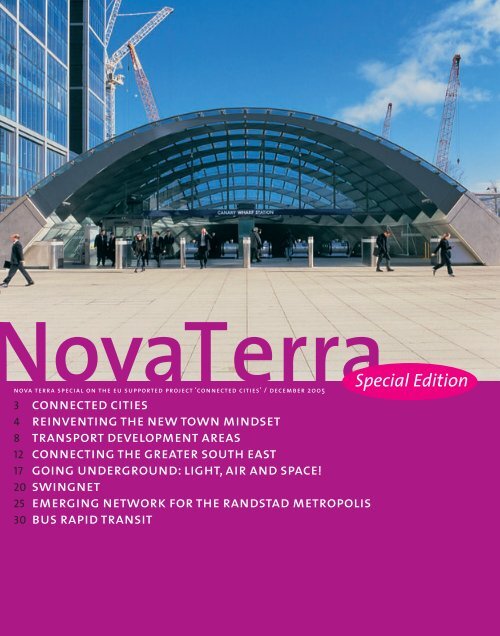
ovaTerra<br />
nova terra special on the eu supported project ‘connected cities’ / december 2005<br />
3 connected cities<br />
4 reinventing the new town mindset<br />
8 transport development areas<br />
12 connecting the greater south east<br />
17 going underground: light, air and space!<br />
20 swingnet<br />
25 emerging network for the randstad metropolis<br />
30 bus rapid transit<br />
Special Edition
Nova Terra Special on the EU<br />
supported project ‘<strong>Connected</strong><br />
<strong>Cities</strong>’, December 2005.<br />
http://connectedcities.net<br />
Publisher<br />
Nirov, The Hague, The<br />
Netherlands (www.nirov.nl)<br />
Editorial Board<br />
Jan Hein Boersma<br />
Evelien Brandes<br />
Yttje Feddes<br />
Huib Haccou<br />
Frank van der Hoeven (issue<br />
editor)<br />
Derek Middleton (English<br />
editing)<br />
Michiel Smit (editor in chief)<br />
Josja van der Veer<br />
Graphic design<br />
Studio Bau Winkel, Martijn<br />
van Overbruggen<br />
Print<br />
Grafisch Bedrijf Tuijtel,<br />
Hardinxveld-Giessendam<br />
Correspondence<br />
Nirov, Michiel Smit,<br />
Postbox 30833, 2500 GV<br />
The Hague, The Netherlands,<br />
smit@nirov.nl<br />
Office support:<br />
Helen Kokshoorn,<br />
kokshoorn@nirov.nl<br />
ISSN<br />
1570-0402<br />
Project part-financed<br />
by the European Union<br />
Content<br />
17<br />
Editorial<br />
3 connected cities<br />
Frank van der Hoeven<br />
4 reinventing the new<br />
town mindset<br />
Pascaline Gaborit<br />
8 transport development areas<br />
Peter Hine, Jeremy Edge, Kathy Gal and Michael Chambers<br />
Sustainable development and growing mobility in<br />
the South East of England<br />
12 connecting the greater<br />
south east<br />
Arno Schmickler<br />
Cover illustration: Netherlands Centre for the Underground Construction, Gouda<br />
4<br />
22<br />
8<br />
27<br />
17 going underground:<br />
light, air and space!<br />
Inge van Berkel<br />
22 swingnet<br />
Frank van der Hoeven<br />
27 emerging network for the<br />
randstad metropolis<br />
Daan Zandbelt<br />
40 bus rapid transit<br />
Stefan van der Spek and Jacques Splint<br />
12<br />
40
<strong>NovaTerra</strong> <strong>Connected</strong> <strong>Cities</strong> / december 2005 / 3<br />
<strong>Connected</strong> <strong>Cities</strong><br />
Frank van der Hoeven, Delft University of Technology, Lead Partner <strong>Connected</strong> <strong>Cities</strong><br />
Nova Terra is a not-for-profit magazine. It publishes<br />
mainly in Dutch and is distributed to two networks in the<br />
Netherlands: Habiforum and the Netherlands Institute<br />
for Housing and Planning (Nirov). Both work to raise and<br />
maintain the quality of spatial plans, urban design and<br />
development projects. This English language supplement<br />
to Nova Terra is dedicated to the activities of the<br />
<strong>Connected</strong> <strong>Cities</strong> project, an EU-sponsored Interreg IIIC<br />
network for sustainable mobility and spatial<br />
development, and dedicated to improving accessibility<br />
and quality of life in urban and rural areas.<br />
<strong>Connected</strong> <strong>Cities</strong> will ‘travel’ through Europe; every six<br />
months the focus and the location of activities will<br />
shift to another region. Starting off in the Belgium/<br />
Netherlands region, it will proceed to Bulgaria/Greece,<br />
Portugal/Spain and Italy/Greece, before concluding in<br />
the England/France region. The central issues during the<br />
first six months are changing urban relations, highquality<br />
public transport and Transport Development<br />
Areas. This supplement reflects that focus. New Towns,<br />
once a promising solution to deal with metropolitan<br />
growth in Europe, now seem to be struggling with the<br />
development of multi-centred urban areas. Originally<br />
built to serve a one-to-one relation with their mother<br />
city, the New Towns are being forced to reinvent their<br />
role, identity and transport provision.<br />
Fifty years have gone by since the first New Towns<br />
emerged. Metropolitan development in South East<br />
England is now guided by the Sustainable Communities<br />
programme, which revolves around four growth areas<br />
adjacent to London. It will be interesting to see during<br />
the course of <strong>Connected</strong> <strong>Cities</strong> how this new thinking<br />
engages older practices. Prominently located in the<br />
growth areas outlined by the Sustainable Communities<br />
programme are two New Towns: Basildon in the Thames<br />
Gateway and Milton Keynes in Milton Keynes-South<br />
Midlands. The idea of Transport Development Areas<br />
(TDAs) may play a key role in these new or reinvented<br />
ideas. TDAs are about concentrating urban growth in<br />
areas well-served by public transport, an approach that<br />
can readily be incorporated into the spatial or urban<br />
planning of many cities and regions in Europe. But it is<br />
the first time that such a practice has been explicitly<br />
labelled and presented as a coherent set of actions.<br />
This may help to focus attention on existing policies<br />
and plans that support the idea, as well as implant the<br />
concept where no such ‘tradition’ exists.<br />
The Dutch province of Zuid-Holland is struggling to<br />
become metropolitan and seems to be developing its<br />
own version of TDAs: Stedenbaan. This conversion of<br />
older transport systems into new ones goes hand in hand<br />
with a shift in spatial policies. But as the transit systems<br />
in Zuid-Holland goes through a period of rapid change,<br />
who is actually keeping an eye on the network as a<br />
whole? The fact that technical distinctions between light<br />
rail, metro, rapid transit, commuter train and regiotram<br />
have all but disappeared has not been reflected in<br />
practice. For underground construction it matters little<br />
what direction the development of such a network takes,<br />
and in dense urban areas it is clear that vast stretches<br />
will have be built underground. After decades of<br />
experience in the use of underground facilities, we have<br />
come to understand that underground facilities need<br />
different design and management strategies to deliver<br />
their full potential.<br />
With so much attention for rail-based transport one<br />
could easily overlook Bus Raid Transit. <strong>Cities</strong> that do not<br />
yet have a high-quality public transport system might<br />
want to look into the improved bus systems currently<br />
offer, which can meet high standards at a much lower<br />
price. The case of Phileas in Eindhoven shows that the<br />
planning of such a transport system can be integrated<br />
into the urban planning process. Which brings us back<br />
to the core of <strong>Connected</strong> <strong>Cities</strong> – the cutting edge of<br />
sustainable mobility and spatial planning.<br />
Z
<strong>NovaTerra</strong> <strong>Connected</strong> <strong>Cities</strong> / december 2005 / 4<br />
William Morris (1868)<br />
The idea of the New Town<br />
was based upon the Garden<br />
<strong>Cities</strong> concept by Ebenezer<br />
Howard in 1902.
<strong>NovaTerra</strong> <strong>Connected</strong> <strong>Cities</strong> / december 2005 / 5<br />
Reinventing<br />
the New Town mindset<br />
The New Towns were built in response to demographic growth, urban sprawl and uncontrolled<br />
metropolitan expansion. But they have only partly lived up to their promise and now experience<br />
similar problems to the suburbs: poor public transport, dependency on the private car and low<br />
urban densities. The New Town concept needs to be reinvented to promote sustainable transport<br />
and development.<br />
Pascaline Gaborit, The European New Towns Platform (ENTP), Brussels<br />
The idea of the New Town arose at the turn<br />
of the 20th century with the publication in<br />
1902 of Ebenezer Howard’s Garden <strong>Cities</strong><br />
of Tomorrow. After the Second World War,<br />
the UK Ministry of Town and Country<br />
Planning launched an extensive New Towns<br />
programme under the New Towns Act 1946.<br />
Since then 21 New Towns have been<br />
established in the UK and more than 40 in<br />
the whole of Europe. With hindsight, building<br />
New Towns from scratch cannot be considered<br />
a very environmentally friendly form of<br />
development. Although the New Towns did<br />
retain some green areas, they did not preserve<br />
the original landscape or its biodiversity.<br />
The New Towns were created alongside<br />
existing towns or around several villages.<br />
They attracted ‘neo-urban’ residents, who<br />
use different centres for shopping (malls<br />
or out-of-town centres), employment<br />
(‘technopoles’) and entertainment (cinemas,<br />
green parks, leisure centres and sports<br />
stadiums). These urban mutations are so<br />
deep and radical that they pervade all<br />
aspects of society, from mobility to the<br />
design of buildings. They affect lifestyles,<br />
families, consumers, employees and workers<br />
in the New Towns and in the periphery.<br />
For most New Towns the era of rapid growth<br />
is over and they now face similar problems:<br />
poor transport facilities apart from the links<br />
to the mother cities, poorly designed<br />
housing, simultaneous ageing of buildings,<br />
outdated infrastructure and a poor image.<br />
They generally lack a proper town centre,<br />
were built to low urban densities and have<br />
recently attracted low income households.<br />
The challenge facing New Towns face is to<br />
consolidate consolidating and restructure<br />
the urban fabric to accommodate changes<br />
in the population structure, household<br />
structure and lifestyles, and to redefine their<br />
sustainability objectives.<br />
household and demographic change<br />
In the New Towns, as in most European<br />
suburbs, housing was designed for nuclear<br />
families. As the quality of public transport<br />
serves was average at best, this group<br />
became largely dependent on the private<br />
car and this had a direct impact on family<br />
structures. Women were more or less<br />
prevented from taking paid employment and<br />
had to stay at home to care for their families.<br />
The New Towns generally did not provide<br />
leisure activities for children or kindergartens<br />
and crèches within walking distance, as in<br />
the old centres.<br />
The housing stock in the New Towns made<br />
a similar impact on public life. In Milton<br />
Keynes, for instance, ‘the single family<br />
housing was emphasised for nuclear<br />
families with two children, assuming a male<br />
breadwinner and a female homemaker.’ 1<br />
The problems of accessibility outlined above<br />
limit the opportunities open to women<br />
by reducing the possibility of combining<br />
domestic tasks with employment,<br />
disadvantaging women in the labour market.<br />
In the industrialised world this situation is<br />
now changing. Local authorities face two<br />
important demographic processes: the<br />
arrival of foreign migrants with large<br />
families and low incomes in need of decent<br />
housing, and the ageing of the population.<br />
In the Dutch New Town of Spijkenisse, for<br />
example, only ten per cent of the population<br />
Y
<strong>NovaTerra</strong> <strong>Connected</strong> <strong>Cities</strong> / december 2005 / 6<br />
The image and<br />
attractiveness<br />
of New Towns<br />
has declined<br />
The Dutch New Town of Spijkenisse, near Rotterdam. (photo: Mischa Keijser/ HH)<br />
was above 55 years old in 1983, but this will<br />
rise to twenty-five percent in 2009. 2 Such<br />
changes not only require policy strategies<br />
geared to providing the type of housing<br />
needed in the future, but also to deliver<br />
suitable transport, services, leisure and<br />
other facilities.<br />
image and economic development<br />
The image and attractiveness of New<br />
Towns has declined, and they are no longer<br />
considered to be the ‘best choice’ for those<br />
who want to live outside the congested<br />
urban areas. People initially moved to the<br />
New Towns because of the quality of the<br />
environment and the lower land prices.<br />
Policies designed to attract the middle<br />
classes through the provision of better<br />
housing and education services have been<br />
successful, but the context has now changed.<br />
The main problem facing New Towns today<br />
is their identity. Rather than becoming real<br />
communities they were simply places to<br />
live and are now generally thought of as<br />
dormitory towns, despite the fact that<br />
employment provision has grown.<br />
Jobs have been created in the New Towns<br />
mainly because of their location close to<br />
large cities. They have attracted businesses<br />
by offering good infrastructure, tax incentives<br />
and facilities. Business parks have been<br />
developed, often around new technology<br />
clusters and innovative industries. Some<br />
towns have attracted more services and hightech<br />
companies (for example Nokia in Espoo);<br />
others have attracted logistical companies.<br />
New Towns have succeeded in providing a<br />
wide range of cultural and leisure activities,<br />
and in most cases residents are encouraged<br />
to participate in the social life of the town to<br />
raise the sense of community. They now face<br />
the difficult task of further strengthening<br />
their economies in a sustainable way to<br />
avoid negative impacts on the quality of<br />
life of their inhabitants and the identity of<br />
the town.<br />
mobility<br />
The New Towns and suburbs have both<br />
experienced a period of rapid growth,<br />
signalling the end of the ‘city’ as a coherent,<br />
architectural and compact territory. They had<br />
to provide services, housing and transportation<br />
from scratch. Transport provision was a crucial<br />
issue because of the distances to the centre<br />
of the core city, but low densities of these<br />
new urban areas did not make it easy to build<br />
functional and efficient infrastructure.<br />
Both in the New Towns and in the periphery,<br />
the planning of infrastructure has not<br />
caught up with urban development. In the<br />
best cases, the demand for transport<br />
between the new urban areas and the<br />
original town centres has been met. While<br />
the master plans for most New Towns<br />
included provisions for lateral connections<br />
with other centres, the available budgets<br />
have generally not been sufficient to deliver<br />
the planned infrastructure. The public<br />
transport links that have been built link the<br />
centre of the metropolitan area to the<br />
periphery via rapid transit, metro and<br />
motorways. Internal rail and bus routes and<br />
links with other areas in the periphery were<br />
not provided; virtually all these journeys are<br />
therefore made by car.
<strong>NovaTerra</strong> <strong>Connected</strong> <strong>Cities</strong> / december 2005 / 7<br />
Milton Keynes is a good example. Its urban<br />
structure is based on a grid and the town<br />
is zoned into separate residential and<br />
industrial blocks, and employment is<br />
dispersed across the town in different<br />
locations. The population density is<br />
extremely low, which means that people<br />
have to travel long distances between<br />
activities. Milton Keynes was specially<br />
designed to cater for easy and fast travel by<br />
car, with plentiful parking and dispersed land<br />
uses, so it is no surprise that the use of public<br />
transport in Milton Keynes is about half the<br />
national average for towns of a similar size.<br />
Changing this situation will require a<br />
considerable increase in public transport<br />
provision and stringent measures to curb car<br />
use. Moreover, the structure of the town,<br />
which is ill suited to the operation of public<br />
transport, and the car culture are major<br />
obstacles that have to be overcome.<br />
Despite these obstacles, Milton Keynes<br />
Council has launched a programme to<br />
stimulate greater use of public transport.<br />
The long-term vision is to increase journeys<br />
by public transport to three to four times<br />
current levels. Given the growth in the<br />
population, this would equate to an increase<br />
in the number of public transport trips per<br />
year from about 7 million now to about 35<br />
to 40 million in 2031. The council is currently<br />
studying the structure of the city and its<br />
suitability for public transport, focusing on<br />
options for Bus Rapid Transit. The need<br />
to reduce dependency on the car is widely<br />
felt and Milton Keynes is just one many<br />
New Towns that aim to improve their<br />
transportation systems.<br />
Jobs have been created<br />
in the New Towns<br />
mainly because of their<br />
location close to the<br />
large cities<br />
The French New Town of Melun-Senart, near Paris.<br />
(photo: Pascaline Gaborit)<br />
towards sustainable new towns<br />
Most New Towns now have a public<br />
transport policy, and many of these propose<br />
better bus or light rail connections, highquality<br />
facilities and frequent services.<br />
In some towns, like Milton Keynes, improving<br />
public transport will require considerable<br />
investment to overcome the problems posed<br />
by the urban structure. In other cases, for<br />
example in France, local authorities are<br />
relying on regional or national decisions to<br />
improve the transport system. Transport<br />
policies for most of the towns are still quite<br />
limited: car use is sometimes still facilitated<br />
through the provision of parking places and<br />
many areas within the New Towns are not<br />
accessible by public transport.<br />
Raising urban densities may be an important<br />
condition for the introduction and use of<br />
more sustainable transport systems. This is<br />
a longer-term goal and will not be easy to<br />
achieve – it would mean developing real<br />
town centres and require further economic<br />
growth and higher local authority budgets.<br />
In the meantime, decision makers in New<br />
Towns have realised two things: increasing<br />
congestion is not an asset for their town; and<br />
they need an alternative public transport<br />
system directed principally at the elderly,<br />
lower-income families and students, but also<br />
to offer viable options for people who do not<br />
want to travel by car every day.<br />
Mobility and transport have implications for<br />
all the other aspects of the New Towns: their<br />
economies, urban planning and governance.<br />
These are global challenges which require<br />
what Stevenage calls the ‘reinvention of the<br />
New Town mindset’. This should seek to<br />
generate wider ownership of the New Town<br />
concept by external stakeholders and focus<br />
on developing the potential of the New<br />
Towns within the wider sub-regional and<br />
regional context.<br />
Notes<br />
1 Jane Hobson, New Towns, the modernist planning<br />
project and social justice: the case of Milton-Keynes<br />
UK, conference lecture about ‘urban development’,<br />
Cairo Egypt, 6th October 1999.<br />
2 Gemeente Spijkenisse, Statistisch jaaroverzicht 2004,<br />
the Netherlands.<br />
References<br />
– JP. Antoni, Urban sprawl modelling: A methodological<br />
approach, in Cybergeo 207, 1 March 2002.<br />
– Akio Doteuchi, The changing face of suburban<br />
New Towns – Seeking the ‘slow life’ for an ultra-aging<br />
society, NLI Social Development Research Group,<br />
October 2003.<br />
– ENTP, Contextual analysis of 6 New Towns, NEWTASC<br />
INTERREG IIIB project.<br />
– Pierre Merlin, New Towns in Perspective, INTA Press,<br />
April 1991.<br />
– Alan Parker, Transport and ecologically sustainable<br />
cities, Town and Country Planning Association<br />
of Victoria, Australia, 2004.<br />
– RTPI News, No sound planning basis for the<br />
development of Milton Keynes, Planning,<br />
June 4, 2004.<br />
– Revue Esprit, La ville à trois vitesses: gentrification,<br />
relegation, périurbanisation, Jacques Donzelot,<br />
March-April 2004 France.<br />
http://www.newtowns.net<br />
Z
<strong>NovaTerra</strong> <strong>Connected</strong> <strong>Cities</strong> / december 2005 / 8<br />
Founded on an understanding of the interrelationships between accessibility, location, design<br />
and intensity of land use, the Transport Development Area concept developed in the UK is a cross-<br />
sectoral mechanism for delivering higher density development around public transport nodes.<br />
The approach unites land use planning and the development industry with transport planning<br />
and transport operators. Urban design, community involvement and active urban management<br />
are key components for a workable package.<br />
Transport Development Areas<br />
Peter Hine, Symonds Group / Jeremy Edge, Knight Frank / Kathy Gal, gal.com / Michael Chambers, RICS<br />
The Royal Institution of Chartered Surveyors<br />
(RICS) has been developing the concept of<br />
the Transport Development Area (TDA) with<br />
key stakeholders for a number of years<br />
now. In 2002 RICS published a good practice<br />
guide that provides planning and transport<br />
practitioners with the tools needed to<br />
identify and implement TDAs. 1 The guidance<br />
was sponsored and supported by thirteen<br />
government authorities, professional<br />
institutes and transport organisations. 2<br />
This sponsorship lent significant backing<br />
for implementing the ideas developed in<br />
the guidance. TDAs can be developed in a<br />
wide range of circumstances, ranging from<br />
transport nodes in large conurbations to<br />
relatively small market towns.<br />
In essence, a TDA is a means of securing well<br />
designed, higher density, mixed-use<br />
development around good public transport<br />
nodes in towns and cities. It does not seek<br />
to lay down a rigid blueprint and can be<br />
applied in ways that suit the needs of a<br />
particular location.<br />
It does not require new legislation or<br />
changes in policy, but it does require the<br />
commitment of local authorities and other<br />
partners if the concept is to be carried<br />
forward successfully. TDA is an integrated<br />
land use planning approach to create a more<br />
specific relationship between development<br />
density around urban public transport<br />
interchanges and the level of public<br />
transport services provided. As an economic<br />
concept, TDAs are also a focus for more<br />
institutionalised arrangements whereby<br />
public transport operators receive additional<br />
funding based on the transfer, where<br />
appropriate, of part of the higher financial<br />
returns to development which might be<br />
achievable in such areas. TDAs, therefore, can<br />
deliver significant transport and development<br />
benefits by enabling financially more<br />
attractive (or at least less uncertain)<br />
development opportunities, and by offering<br />
the prospect of additional investment in<br />
public transport improvements. They also<br />
contribute to the sustainability objectives of<br />
the Transport White Papers by integrating land<br />
use and transport, reducing both the need to<br />
travel and reliance on private transport.<br />
the tda approach<br />
The basic concept of the ‘TDA Approach’ is<br />
already recognised within the existing policy<br />
framework. However, our research found<br />
Opportunity diagram<br />
that the approach to identifying and<br />
implementing TDA-style development of key<br />
sites or locations within urban areas has<br />
been both inadequate and inconsistent.<br />
While the planning system can and does<br />
deliver TDA-style development, benefits<br />
can be gained from greater clarity or more<br />
positive direction at the policy level, and<br />
from the provision of detailed guidance on<br />
TDA identification and delivery.<br />
Securing widespread application of the<br />
TDA Approach across a range of urban<br />
circumstances will require commitment by<br />
all stakeholders. The RICS guidance sets out<br />
the practical mechanisms for designating<br />
and delivering TDAs and the policy process<br />
that will be needed from the national to local<br />
planning level. The key messages in the<br />
guidance are that TDAs should be a key focus<br />
of locational policy, the TDA Approach is a
<strong>NovaTerra</strong> <strong>Connected</strong> <strong>Cities</strong> / december 2005 / 9<br />
mechanism for delivering suitable outcomes,<br />
and that long-term planning is essential.<br />
Although the concept of concentrating<br />
development around appropriate transport<br />
nodes is not new, it is difficult to realise<br />
successfully because many different<br />
elements need to be brought together to<br />
make it work. TDAs are not a quick fix,<br />
but early action can be taken.<br />
The TDA approach is not exclusively meant<br />
for the United Kingdom. It can work in many<br />
different situations throughout Europe.<br />
The following discussion of the UK situation<br />
serves only to illustrate the relation between<br />
TDA and national, regional and local policy<br />
frameworks. The underlying principles<br />
remain the same for other countries.<br />
regional guidance<br />
There is considerable scope for the new<br />
Regional Spatial Strategies being developed<br />
within the UK to take account of the TDA<br />
TDA Linkages<br />
approach and promote its inclusion within<br />
more local planning frameworks and local<br />
transport plans. TDAs should be actively<br />
promoted as a regional objective, to be<br />
applied across as wide a range of urban<br />
settlement types and rural centres as<br />
possible. It is vital to the approach that key<br />
stakeholder groups, such as the transport<br />
providers and the development industry,<br />
are engaged at an early stage.<br />
Where appropriate, Regional Spatial<br />
Strategies should encourage local authorities<br />
to ensure that within TDAs permissions for<br />
higher density development include<br />
developer contributions towards public<br />
transport and local transport objectives. The<br />
Regional Transport Strategy – prepared as an<br />
integral part of regional spatial planning –<br />
should include measures relevant to TDAs,<br />
such as accessibility criteria, increased public<br />
transport choice, car parking standards and<br />
demand management.<br />
The London Plan – the first spatial<br />
development strategy in the UK – indicates<br />
that designation of sites for TDA-style<br />
development should be undertaken by the<br />
various London boroughs, with the London<br />
Plan itself providing appropriate policy<br />
advice and characterising the key<br />
opportunities across Greater London.<br />
Local authorities should seek to make<br />
maximum use of the most accessible sites,<br />
such as those in town centres and others<br />
which are, or will be, close to major transport<br />
interchanges. They should develop a clear<br />
vision for development of these areas,<br />
prepare site briefs and, where appropriate,<br />
consider using compulsory powers to bring<br />
development forward. The TDA Approach<br />
supports Government policies designed to<br />
promote both urban and rural regeneration,<br />
with access to key services and facilities<br />
delivered through integrated local transport<br />
solutions.<br />
Y
<strong>NovaTerra</strong> <strong>Connected</strong> <strong>Cities</strong> / december 2005 / 10<br />
survey, analysis, plan<br />
At the pre-deposit consultation stage,<br />
structure plans and local development<br />
frameworks should incorporate as a specific<br />
objective the promotion of TDAs as a focus for<br />
locational policy to be applied across a range<br />
of urban settlement types and rural centres.<br />
Key sites and central locations will normally<br />
be the most appropriate for formal TDA<br />
designation. Other locations such as nodal<br />
points and interchanges on main public<br />
transport routes, however, will readily lend<br />
themselves to adoption of the underlying<br />
principles. Local authorities should apply the<br />
TDA approach in three key phases: survey,<br />
analysis and plan-making. Knowledge about<br />
the likely locations of TDAs is crucial. Local<br />
authorities should keep a number of factors<br />
under review. First, the principal physical and<br />
economic characteristics of the area,<br />
including supply and demand in the real<br />
estate market as well as the size,<br />
composition and distribution of population.<br />
The communications, transport system and<br />
traffic in the area should be considered, as<br />
well as the environmental characteristics.<br />
Finally, we should not overlook overall<br />
accessibility appraisal, including the transport<br />
network, service levels, network capacity and<br />
scope for expansion.<br />
The survey phase will identify likely locations<br />
with the potential to adequately serve more<br />
intensive land use developments and<br />
markets able to promote and support such<br />
development. The analysis stage should<br />
consider significant excess capacity in<br />
existing infrastructure, including public<br />
transport, utilities and social infrastructure.<br />
It should look at the potential for<br />
development in existing or new public<br />
transport corridors. And it has to identify<br />
opportunities for improving public transport<br />
accessibility.<br />
Early discussion and liaison between local<br />
authorities, developers, landowners,<br />
operators, the Regional Development<br />
Authorities (RDAs), Local Enterprise<br />
Companies (LECs), the Welsh Development<br />
Agency and all other stakeholders is essential<br />
to the successful application of the TDA<br />
Approach, with development frameworks<br />
TDA Management Company Model<br />
and local transport plans providing the initial<br />
basis for this. Local planning authorities<br />
should prepare appropriate TDA-related<br />
policies and proposals, taking particular<br />
account of boundaries, transport<br />
accessibility appraisals, urban design,<br />
density, parking standards and other key<br />
issues. Planning frameworks should identify<br />
key criteria relevant to the TDA Approach,<br />
particularly in relation to transport<br />
accessibility and urban design. Major TDA<br />
development opportunities should be<br />
supported by a detailed design or<br />
development brief including, where<br />
appropriate, boundaries and density ranges<br />
(particularly for residential development).<br />
Implementing the TDA Approach The key<br />
ingredients for successful implementation<br />
of the TDA Approach are the establishment<br />
of an overall partnership, funding, land<br />
assembly, a specific delivery mechanism and<br />
on-going monitoring and review.<br />
Partnerships<br />
The most complex schemes may benefit from<br />
forming TDA delivery companies to secure<br />
implementation, delivery and management.<br />
Government regeneration policy underlines<br />
the need to secure an Urban Renaissance<br />
through effective partnerships. These should<br />
allow ‘joined-up strategies’ to be developed<br />
with local people and other organisations<br />
and interests involved to tackle local<br />
problems and realise local opportunities.<br />
Partnerships formed to take the TDA<br />
Approach forward should include the local<br />
authority, normally in the lead or enabling<br />
role, landowners, investors, developers,<br />
designers, transport operators/providers and<br />
occupiers. TDA development may involve<br />
developer contributions to public transport<br />
infrastructure, but this will vary greatly<br />
according to local circumstances and the<br />
economic viability of individual schemes<br />
within the TDA.
<strong>NovaTerra</strong> <strong>Connected</strong> <strong>Cities</strong> / december 2005 / 11<br />
Prime Minister Tony Blair and Deputy Prime Minister John Prescott visit Greenhithe in Kent.<br />
(Source: Office of the Deputy Prime Minister)<br />
Land assembly<br />
Land assembly will often be an important<br />
issue for TDA-type development, particularly<br />
for large development sites. Many parties<br />
may hold land within a potential TDA and<br />
land ownership surveys need to be<br />
undertaken by the TDA promoter at an early<br />
stage. In some cases the use of, or threat of<br />
the use of, compulsory purchase will be<br />
necessary for planning authorities to secure<br />
the TDA development within appropriate<br />
boundaries. However, in most cases<br />
agreement between all landowning<br />
stakeholders should be the objective.<br />
Active urban management<br />
Much of the advantage to be gained through<br />
the TDA Approach will be squandered unless<br />
an appropriate regime of on-going active<br />
urban management is put in place. Town<br />
Improvement Schemes are a potential<br />
mechanism for allowing local authorities<br />
and other stakeholders to deal with area<br />
improvement and maintenance of<br />
environmental quality. The concept may<br />
prove to be of particular importance with<br />
regard to TDAs, along with appropriate joint<br />
ventures and/or partnership agreements.<br />
tdas in action<br />
Since RICS published its guidance report,<br />
the TDA project has continued to attract wide<br />
support from a range of diverse groups,<br />
including the Local Government Association,<br />
the Royal Institution of British Architects, the<br />
Greater London Authority, Scottish Enterprise<br />
and the Institution of Highways and<br />
Transportation. While these organisations<br />
recognise the benefits of TDAs, others have<br />
been implementing them in practice. The RICS<br />
guidance contains a wealth of case studies<br />
from locations throughout the country. These<br />
cover TDAs at town, city and even up to county<br />
level. Spatial strategies for regions such as<br />
London and South East England have focussed<br />
heavily on the need to produce ‘well-designed,<br />
higher density, mixed-use areas, situated<br />
around good public transport access points in<br />
urban areas’. Recognising the important<br />
leadership role that London can play, RICS<br />
published further research in 2003 that<br />
looked at how TDAs could be developed<br />
further in London. 3 The study found that TDAs<br />
have the capability of delivering many<br />
of the London Plan’s key objectives, from<br />
affordable housing to transport<br />
improvements and urban regeneration.<br />
Sustainable communities<br />
‘Sustainable communities’ has rapidly<br />
become the new buzz phrase in UK planning.<br />
Virtually every consultation paper or report<br />
issued by the Office of the Deputy Prime<br />
Minister now has the ‘sustainable<br />
communities’ strapline. This may be an<br />
excellent marketing strategy, but there is a<br />
danger that the constant repetition of the<br />
sustainable communities mantra and the<br />
multiple ways in which the term is<br />
interpreted will, in the end, leave it devoid of<br />
meaning. That would be a pity because the<br />
concept, however it is interpreted, is<br />
intrinsically sound. The UK Government<br />
launched its Sustainable Communities Plan<br />
in February 2003 with the avowed objective<br />
of creating ‘prosperous, inclusive and<br />
sustainable communities’. From an RICS<br />
perspective, some of the key priorities<br />
should be:<br />
– locating new housing and commercial<br />
development in the most sustainable<br />
places;<br />
– providing the infrastructure needed to<br />
support communities;<br />
– socially inclusive policies in housing that<br />
create balanced communities;<br />
– regeneration policies that are sensitive to<br />
local communities’ needs and reflect the<br />
‘soul’ of an area;<br />
– strategies for areas in decline as well as<br />
growth areas in the South East.<br />
Transport-oriented development Through<br />
its work on TDAs, RICS has argued that the<br />
successful integration of land use and<br />
transport can play a key role in reducing many<br />
of the difficulties posed by modern urban<br />
development. The orientation of integrated<br />
economic and residential activities around<br />
public transport nodes and the creation<br />
of relatively self-reliant sub-centres within<br />
wider metropolitan areas are important<br />
factors in reducing the need to travel and<br />
encouraging the use of more sustainable<br />
public transport modes. The TDA good<br />
practice guide has demonstrated the benefits<br />
that can be gained from providing highdensity,<br />
high-quality, mixed-use development<br />
around transport nodes. Testing this approach<br />
in London and the Thames Gateway3 will be<br />
the focus of the Greater South East activities<br />
within the <strong>Connected</strong> <strong>Cities</strong> project.<br />
Notes<br />
1 Royal Institution of Chartered Surveyors, Transport<br />
Development Areas – Guide to Good Practice, London,<br />
2002.<br />
2 The Greater London Authority; the Institution of<br />
Highways and Transportation; the Institute of<br />
Logistics and Transport; LT Property; the Local<br />
Government Association; Railtrack Property; the<br />
Royal Institute of British Architects; the Royal Town<br />
Planning Institute; Scottish Enterprise; the Strategic<br />
Rail Authority; Strathclyde Passenger Transport<br />
Executive; Transport for London; and the RICS London<br />
Regional Board.<br />
3 TDAs – the London dimension, april 2003, RICS<br />
London Region. See also www.rics.org<br />
Z
<strong>NovaTerra</strong> <strong>Connected</strong> <strong>Cities</strong> / december 2005 / 12<br />
The European Spatial Development<br />
Perspective proposes creating several<br />
dynamic zones of global economic<br />
integration and a network of<br />
internationally accessible metropolitan<br />
regions. Such a vision can only become<br />
reality by complementing international<br />
and national hubs with regional and<br />
local growth opportunities. How is this<br />
vision applied to the Thames Gateway<br />
Regeneration Corridor in the Greater<br />
South East region of England?<br />
Sustainable development and growing mobility in the South East of England<br />
Connecting<br />
the Greater South East<br />
Arno Schmickler, South East England Development Agency (SEEDA), Guildford, UK<br />
Illustrations: SEEDA (unless indicated otherwise)<br />
The region around London in the South East<br />
of England is home to about 21 million people<br />
living on only 16% of the total UK territory.<br />
This economic powerhouse creates 42% of<br />
the UK’s gross value added1 and many global<br />
headquarters are located in this area. Key<br />
international gateways, such as Heathrow<br />
Airport, Southampton and Felixstowe<br />
seaports and the Channel Tunnel provide<br />
access to London as one of three world<br />
cities. 2 Strictly speaking, London itself is only<br />
a small but very important part of Greater<br />
London; Greater London consists of the City<br />
of London, the City of Westminster and 31<br />
other London boroughs. In order to better<br />
understand and reflect the intrinsic relation<br />
between London and its surrounding region,<br />
three Regional Development Agencies have<br />
recently joined forces in the Greater South<br />
East super-region, including Greater London,<br />
the East of England and the South East<br />
England regions.<br />
accommodating growth in the greater<br />
south east<br />
Major population growth needs to be<br />
accommodated within the Greater South<br />
East. London itself is expected to grow from<br />
currently 7.4 million inhabitants to 8 million<br />
by 2016, and further growth will take place in<br />
the East and South East. To respond to this<br />
challenge the Office of the Deputy Prime<br />
Minister (ODPM) launched the Creating<br />
Sustainable Communities plan in 2003. This<br />
document sets out policies, resources and
<strong>NovaTerra</strong> <strong>Connected</strong> <strong>Cities</strong> / december 2005 / 13<br />
partnerships to achieve a step change in<br />
the Government’s approach to tackling ‘the<br />
challenges of a rapidly changing population,<br />
the needs of the economy, serious housing<br />
shortages in London and the South East and<br />
the impact of housing abandonment in<br />
places in the North and Midlands’. 3<br />
The Creating Sustainable Communities<br />
programme aims to take pressure off London<br />
through the provision of 250,000 new homes<br />
in the South East. These new homes will<br />
mainly be located in four growth areas:<br />
Thames Gateway, Ashford, Milton Keynes-<br />
South Midlands and London-Stansted-<br />
Cambridge. Alongside housing growth, an<br />
extra 120-180,000 jobs in the Thames<br />
Gateway and 120-150,000 in Milton Keynes-<br />
South Midlands are envisaged by 2016 as a<br />
key component of the programme.<br />
Delivery of the Sustainable Communities<br />
programme can only be achieved by<br />
interdisciplinary and cross-sectoral working.<br />
The UK Planning Policy Guidance on<br />
Transport 4 makes the case for a switch away<br />
from reliance on the private car and urban<br />
dispersal towards more sustainable modes of<br />
travel and urban growth. The key principles<br />
outlined in this guidance are important<br />
preconditions for urban renaissance and the<br />
delivery of the Sustainable Communities<br />
plan. They include promoting more<br />
sustainable transport choices and reducing<br />
the need to travel; promoting social inclusion,<br />
in part by revitalising towns and cities as<br />
places to live and work; focusing major<br />
generators of travel demand in urban areas<br />
near to public transport; giving more road<br />
space to pedestrians and cyclists, and giving<br />
priority to people over traffic in towns.<br />
a polycentric mega-city region<br />
The Greater London area is undergoing a<br />
process of decentralised concentration –<br />
concentration on a global scale (global cities)<br />
with simultaneous decentralisation and<br />
suburbanisation at the regional and local<br />
scales. The ever increasing mobility of people<br />
and goods in particular presents a challenge<br />
to urban cohesion. Not only transport<br />
technologies but also information and<br />
communication technologies have altered<br />
South East England: Areas of Outstanding Natural Beauty, Green Belt land and the Growth Areas.<br />
Source: Office of the Deputy Prime Minister, Creating sustainable<br />
communities: Making it happen, Thames Gateway and the Growth Areas,<br />
London 2003, p.7<br />
settlement structures. The combination of<br />
both – transport and communication<br />
technologies – is leading to a new correlation<br />
between space and time, and hence to<br />
fundamental changes in the relationship<br />
between the city and the region. 5<br />
In particular, transport technologies have<br />
enabled a transformation of resident<br />
communities into itinerant communities: an<br />
ever increasing number of people understand<br />
themselves to be global commuters in a digital<br />
market place. Castells introduced the concepts<br />
of the ‘network society’ and ‘informational<br />
capitalism’ to describe this process. 6<br />
Within a region like South East England the<br />
challenge is to better utilise the existing<br />
infrastructure and to encourage people to<br />
use public transport by improving the quality<br />
of the travel environment. The existing<br />
infrastructure, however, was mainly<br />
developed for the purpose of serving industry<br />
and followed the planning ideal of separating<br />
functions; for example, the rail network in the<br />
Greater South East is London-centric to<br />
accommodate historic commuting patterns<br />
from the urban fringe to the core city. This<br />
segregation of functions and socio-spatial<br />
fragmentation can be seen as the peak of the<br />
planning ideal of the industrial age (Fordism).<br />
But this ideal loses its strength when<br />
economic growth, as well as scientific and<br />
social progress, begins to demand a higher<br />
integration of functions and a more<br />
sustainable approach to dealing with scarce<br />
resources. Urban and regional planning,<br />
therefore, needs to adapt mechanisms as<br />
well as the built environment and its<br />
infrastructure to the needs and requirements<br />
of post-industrial regions.<br />
To achieve this change it is important to<br />
understand the economic and community<br />
relations within the region and beyond.<br />
A vital aspect of this is recognising the<br />
interdependency of London and the South<br />
East to keep the region on a successful track:<br />
the global city of London relies on the South<br />
East and vice versa. For London to be a global<br />
hub and to continue creating the economic<br />
power needed for the whole country – and for<br />
Europe – it is crucial to counterbalance the<br />
regional economies around those hubs<br />
(economic equilibrium). In this context the<br />
concept of a polycentric mega-city region<br />
needs to be looked at in more detail.<br />
spatial and functional polycentricity<br />
The European Spatial Development<br />
Perspective (ESDP) argues for polycentric<br />
spatial development and a new urban-rural<br />
relationship. 7 The ESDP also calls for the<br />
Y
<strong>NovaTerra</strong> <strong>Connected</strong> <strong>Cities</strong> / december 2005 / 14<br />
creation of several dynamic zones of global<br />
economic integration and a network of<br />
internationally accessible metropolitan<br />
regions with an integrated hinterland – areas<br />
like the Greater South East England. The<br />
question that arises is how these zones of<br />
global economic integration develop in terms<br />
of their spatial and functional organisation.<br />
Recent research carried out in the Interreg<br />
IIIB NWE POLYNET project led by the Young<br />
Foundation studied eight European megacity<br />
regions in North Western Europe: South<br />
East England, Rhine-Main, Rhine-Ruhr, Bassin<br />
Parisien, European Metropolitan Region<br />
Northern Switzerland, Central Belgium,<br />
Greater Dublin and the Randstad. POLYNET<br />
emphasised that polycentricity is not only<br />
scale-dependent, but also that there is a very<br />
clear distinction to be made between spatial<br />
and functional polycentricity. One activity of<br />
the project focused particularly on businessto-business<br />
communication (virtual as well<br />
as physical/f-2-f) in advanced producer<br />
services in order to map spatial and<br />
functional polycentricity in the study<br />
regions. 8<br />
Based on this extensive quantitative and<br />
qualitative research, POLYNET defined 51<br />
functional urban regions (FURs) in the<br />
Greater South East. FURs ‘comprise a core<br />
defined in terms of employment size and<br />
density, and a ring defined in terms of regular<br />
daily journeys (commuting) to the core’. 9<br />
Thirty FURs are located to the west of London<br />
and only eighteen to the east – this illustrates<br />
a greater dependency of the east on London<br />
and is an indicator of an increasing east-west<br />
imbalance. While the idea of strengthening<br />
regional economies should in principle lead<br />
to an economic equilibrium, there are still<br />
(and will always be) factors favouring certain<br />
locations above others. In the Greater South<br />
East the Western Corridor is economically<br />
very successful and buoyant (Thames Valley<br />
economy), whereas the Thames Gateway<br />
regeneration corridor in the East is struggling<br />
to realise some mixed-use development that<br />
would include higher-order businesses. This is<br />
why workers from the Thames Gateway still<br />
generally commute to business locations in<br />
Canary Wharf or the City of London.<br />
connecting higher density with<br />
higher quality<br />
Some key spatial policy questions can be<br />
derived from the polycentric development<br />
pattern in the Greater South East. How<br />
should policy respond to the increasing eastwest<br />
imbalance? Current public funding is<br />
very much aimed at the east and north of<br />
London to achieve a shift of gravity in the<br />
Greater South East region – will the market<br />
follow the funding? And how can a shift to<br />
more sustainable modes of transport be<br />
achieved? Advanced functional polycentricity<br />
creates orbital and tangential movement<br />
patterns that are no longer dependent on a<br />
core city. Very often these movements cannot<br />
be accommodated by public transport using<br />
existing infrastructure networks that are<br />
centred on a core city; as a result the private<br />
car becomes an even more predominant<br />
mode of transport.<br />
To respond to these challenges, changes in<br />
policy and subsequent implementation are<br />
needed. Decoupling gross domestic product<br />
from transport growth was formally<br />
introduced onto the European agenda at the<br />
Gothenburg Council in 2001, adding the<br />
environmental dimension to the Lisbon<br />
South East England: Functional Urban Regions.<br />
Source: POLYNET report, Action 1.1 SE England, p.3<br />
agenda. This policy is of particular<br />
importance for developing the Greater South<br />
East, where the existing transport networks<br />
are being put under extremely high<br />
pressures. Sustainable transport and a shift<br />
from the private car to other modes of<br />
transport are at the heart of the Gothenburg<br />
Council and subsequent national/regional<br />
policies to address climate change and reduce<br />
greenhouse gas emissions (Kyoto targets).<br />
Together with the ESDP’s goal of develop<br />
dynamic, attractive and competitive cities<br />
and urbanised regions, providing a parity of<br />
access to infrastructure and knowledge,<br />
these aims can only be achieved by concerted<br />
action. Such a vision can only become reality<br />
by complementing international and national<br />
hubs with regional and local growth<br />
opportunities, particularly in locations that<br />
can provide sustainable mobility – in other<br />
words, public transport hubs. In tackling the<br />
challenge of building sustainable urban<br />
spaces in growing metropolitan regions, we<br />
need to ensure that future growth is achieved<br />
with the maximum possible social cohesion<br />
and protection of the environment. More<br />
self-contained urban areas can help to reduce<br />
commuting and bring about mixed
<strong>NovaTerra</strong> <strong>Connected</strong> <strong>Cities</strong> / december 2005 / 15<br />
communities, but the integration of land use<br />
planning and transport is also essential to<br />
deliver that vision.<br />
The aim of achieving higher densities<br />
around public transport hubs needs to be<br />
accompanied by high quality urban and<br />
architectural design. Higher density should<br />
not only be financially more attractive for<br />
investors but also provide a higher quality of<br />
life and support more sustainable patterns of<br />
development. This comes close to the<br />
American practice of Transit Oriented<br />
Development (TOD) or the idea of Transport<br />
Development Areas (TDAs) that the Royal<br />
Institution of Chartered Surveyors (RICS) has<br />
been developing with key stakeholders for a<br />
number of years. 10<br />
Concentrating development and integrating<br />
land use and transport have also been<br />
identified as key actions to assist the Urban<br />
Renaissance agenda in England. ‘In England,<br />
urban areas provide for 91% of the total<br />
economic output and 89% of all the jobs.<br />
Maintaining and improving the economic<br />
strength of our towns and cities is therefore<br />
critical to the competitive performance of the<br />
country as a whole. 11 The potential for change<br />
is limited since ‘more than 90% of our urban<br />
fabric will still be with us in 30 years time.’ 12<br />
Therefore the quality of new developments is<br />
decisive to achieve the step change towards<br />
building a sustainable urban environment.<br />
‘Successful urban regeneration is designled.’<br />
13<br />
the thames gateway growth area<br />
Within the Greater South East substantial<br />
public funding is being channelled into the<br />
Thames Gateway, a major regeneration<br />
corridor. A great challenge for this area is to<br />
avoid becoming a cluster of dormitory towns<br />
for people commuting into London. Therefore<br />
it is important to strengthen locally<br />
distinctive patterns of culture and integrate<br />
mixed functions. In the context of large<br />
mega-city regions, it is vital for small and<br />
medium-sized towns to build upon their<br />
intrinsic local potential and develop an<br />
identity. A clear vision is needed which<br />
complements rather than duplicates existing<br />
or emerging urban patterns in polycentric<br />
city regions. The contribution small and<br />
medium-sized towns can make to a larger<br />
city region goes well beyond providing cheap<br />
housing within easy commuting distance to<br />
employment centres. Particularly in times<br />
when the pressures resulting from the core<br />
city are increasing – both in terms of demand<br />
for housing and employment land – it is<br />
important to carefully mature the concept of<br />
a network of complementary small and<br />
medium-sized towns. 14<br />
The Thames Gateway already has an<br />
established history, beginning with the<br />
development of the Docklands area. The<br />
benefits of Canary Wharf and the Isle of<br />
Dogs in London are becoming visible and<br />
accountable some 25 years after strategic<br />
decisions were made. With the shift in focus<br />
to the east, London is aiming to regenerate<br />
major areas of previously developed land and<br />
to provide space for further growth. The<br />
proposals for Olympia 2012, with the main<br />
facilities to be built in the east of London<br />
centred around the new high-speed train<br />
station to be opened in Stratford, underpins<br />
the new role of the Thames Gateway. But the<br />
Thames Gateway extends well beyond the<br />
boundaries of London.<br />
regeneration needs<br />
The Government has not defined this<br />
regeneration corridor along administrative<br />
boundaries but by regeneration needs,<br />
including large areas of derelict land and<br />
deprived communities. The Thames Gateway<br />
is an area of approximately 80,000 hectares<br />
in size, measuring 65 kilometres long and up<br />
to about 30 kilometres wide. It contains<br />
about 700,000 households and is home to<br />
around 1.6 million people and provides about<br />
500,00 jobs. 15<br />
The Thames Gateway offers the greatest<br />
development opportunities in the South East,<br />
together with the major concentration of<br />
previously developed land and deprivation in<br />
the country. It has the potential to deliver<br />
around 120,000 new homes and 200,000<br />
new jobs by 2016, subject to the appropriate<br />
physical and social infrastructure being in<br />
place. The Gateway will play a key part in<br />
delivering sustainable growth for South East<br />
England. As it has the largest collection of<br />
previously developed land (3000 hectares)<br />
near any European capital city it represents a<br />
major opportunity to address the housing<br />
shortage without large-scale release of green<br />
belt land. 16<br />
rail catalyst<br />
The high-speed Channel Tunnel Rail Link<br />
(CTRL), with its international passenger<br />
stations in Ashford, Ebbsfleet, Stratford and<br />
King’s Cross/St Pancras, can be seen as a<br />
prime regeneration catalyst in this corridor.<br />
Together with other major regional transport<br />
investments, such as Crossrail and Fastrack,<br />
CTRL will transform accessibility for the<br />
Thames Gateway area. An important<br />
precondition for delivering the sustainable<br />
communities in the Thames Gateway is the<br />
understanding that this large-scale<br />
development cannot be served purely by carbased<br />
transport system. New river crossings<br />
are being designed to accommodate multimodal<br />
traffic, making room for light rail and<br />
bicycle connections. Of strategic importance<br />
here are two new Thames crossings near the<br />
Royal Docks (Gallions Crossing) and near<br />
Thurrock (Lower Thames Crossing). The latter<br />
in particular will divert traffic from the<br />
Channel ports away from the congested<br />
South East region and the M25, leading it<br />
directly north, circumnavigating London<br />
completely.<br />
five strategic development locations<br />
Within the Thames Gateway development<br />
is focused on five strategic development<br />
locations: 17<br />
1 The East London Gateway, particularly<br />
around Stratford and the Lower Lea Valley,<br />
accommodating the development needed<br />
to make the London Olympics in 2012 a<br />
success and building on the good existing<br />
transport infrastructure.<br />
2 The area south of the Thames from<br />
Greenwich Peninsula to Woolwich, where<br />
there is potential for 20,000 new homes,<br />
developing the former Woolwich Arsenal<br />
site and including a new use for the Dome<br />
site with its successful Millennium<br />
Community. Y
<strong>NovaTerra</strong> <strong>Connected</strong> <strong>Cities</strong> / december 2005 / 16<br />
3 The area north of the Thames at Barking<br />
Reach – London’s largest area of previously<br />
developed land.<br />
4 Thurrock Riverside, with a substantial<br />
development potential for employment<br />
land, incorporating the Port of London and<br />
the proposal for a new container port at<br />
Shellhaven.<br />
5 North Kent Thamesside around Ebbsfleet<br />
International Passenger Station and the<br />
Medway Estuary.<br />
Further housing and employment will be<br />
allocated to key locations in the Gateway,<br />
such as Medway, Southend, Basildon and<br />
Sittingbourne-Sheerness.<br />
sustainable growth through partnership<br />
The key to delivering government targets<br />
in a sustainable way is the partnership<br />
approach. Neither political configurations nor<br />
individual budgets are equipped to deal with<br />
regeneration on such a large, strategic scale.<br />
The fact that the public sector input is<br />
achieved at all levels, from local authority<br />
to a specifically dedicated government<br />
department, ensures ‘joined-up’ policy<br />
changes and development implementation.<br />
This direct and coordinated public sector<br />
approach visibly encourages the private<br />
sector to begin to invest considerable<br />
resources in an area which otherwise fails to<br />
attract private sector interests. In all<br />
undertakings in the Thames Gateway, risks<br />
have to be taken and initial costs for<br />
remediation of previously used land are high.<br />
However, an extremely tight Green Belt policy<br />
and government direction on reusing<br />
previously developed land offers the private<br />
sector a real incentive to look at building on<br />
recycled land. A relaxation of that policy for<br />
the sake of achieving higher development<br />
profits would ultimately lead to the failure of<br />
the Urban Renaissance agenda. Tackling<br />
major contamination and pollution issues,<br />
addressing social problems, unemployment,<br />
crime and vandalism, and recharging former<br />
industrial sites with the value of aesthetics<br />
by using the rich history can change<br />
perceptions and enable the disjointed<br />
communities to reintegrate into the socioeconomic<br />
fabric of urban society. Integration<br />
The Thames Gate<br />
South East England: Functional Urban Regions.<br />
Source: POLYNET report, Action 1.1 SE England, p.3<br />
of commercial and residential use rather than<br />
segregation, provision of community services<br />
and parks, promotion of sustainability in<br />
terms of recycling and building efficiency, and<br />
encouraging high quality design will make a<br />
difference to the existing urban environment<br />
in the Thames Gateway.<br />
Notes<br />
1 National Statistics, 22 December 2004, www.<br />
statistics.gov.uk.<br />
2 Saskia Sassen, <strong>Cities</strong> in a world economy, Thousand<br />
Oaks Ca., 1994.<br />
3 Office of the Deputy Prime Minister, Sustainable<br />
communities: Building for the future, London,<br />
2003, p.2.<br />
4 Office of the Deputy Prime Minister, Planning Policy<br />
Guidance 13: Transport (PPG 13), London, 1994.<br />
5 See: Arno Schmickler, From commuterland to regional<br />
citizenship. South East England – A growing region in<br />
Europe, in: Christ, Wolfgang & Martin Fladt, Jahrbuch<br />
der Modellprojekte 2003 / 2004, Weimar, 2004.<br />
6 Manuel Castells, The rise of the network society,<br />
Cambridge, 1996.<br />
7 European Commission, ESDP – European Spatial<br />
Development Perspective. Towards balanced and<br />
sustainable development of the territory of the<br />
European Union, Luxembourg, 1999, p.11.<br />
8 POLYNET project reports edited by Sir Peter Hall and<br />
Dr Kathryn Pain, The Young Foundation, London<br />
2004/05, www.icstudies.ac.uk/html/whatdo_A.asp<br />
9 POLYNET Action 1.1, Summary report, p.2.<br />
10 Royal Institution of Chartered Surveyors, Transport<br />
Development Areas – Guide to Good Practice,<br />
London, 2002.<br />
11 Urban Task Force, Towards an urban renaissance: Final<br />
report of the Urban Task Force chaired by Lord Rogers<br />
of Riverside, London, 1999, p.32.<br />
12 Urban Task Force, Towards an urban renaissance: Final<br />
report of the Urban Task Force chaired by Lord Rogers<br />
of Riverside, London, 1999, p.113.<br />
13 Urban Task Force, Towards an urban renaissance: Final<br />
report of the Urban Task Force chaired by Lord Rogers<br />
of Riverside, London, 1999, p.49.<br />
14 See: Detlef H. Golletz & Arno Schmickler, From spaces<br />
to places. Enabling Sustainable urban growth in South<br />
East England with a practical focus on the<br />
Queenborough-Rushenden Zone of Change, in:<br />
Bundesamt für Bauwesen und Raumordnung, Kleinund<br />
Mittelstädte in Stadtregionen. Informationen zur<br />
Raumentwicklung, Heft 8, Bonn, 2005.<br />
15 Office of the Deputy Prime Minister, The Thames<br />
Gateway, London, 2004.<br />
16 Office of the Deputy Prime Minister, Creating<br />
sustainable communities: Making it happen: Thames<br />
Gateway and the Growth Areas, London, 2003.<br />
17 Office of the Deputy Prime Minister, Creating<br />
sustainable communities: Making it happen: Thames<br />
Gateway and the Growth Areas, London, 2003. Z
<strong>NovaTerra</strong> <strong>Connected</strong> <strong>Cities</strong> / december 2005 / 17<br />
Rotterdam Blaak station.<br />
Going underground:<br />
light, air and space!<br />
Building underground is becoming more common. For transport infrastructure and retail, commercial and<br />
leisure functions, underground spaces can offer surprising advantages – and save money. Design and<br />
safety are key components in making underground facilities successful. Inge van Berkel of the Netherlands<br />
Centre for Underground Construction reviews the case for going below ground.<br />
Inge van Berkel, Netherlands Centre for the Underground Construction (COB), Gouda<br />
Photos: Netherlands Centre for the Underground Construction (COB), Gouda<br />
During an unexpected diversion on the Rotterdam metro I passed<br />
Beurs, Oostplein, Voorschoterlaan, Gerdesiaweg and Capelsebrug<br />
stations. For me and my fellow stranded train passengers, the<br />
alternative metro routes were well signposted and clear, and the<br />
brightly lit stations soon cleared up my morning sleepiness. But at<br />
Kralingse Zoom it was suddenly much darker; here the station is<br />
above ground and the day was still dawning. The next day a lorry<br />
crashed into a metro train further up the same stretch of line. These<br />
two experiences in one week do not seem to fit our expectations<br />
about the underground. The benefits of going underground often<br />
go unnoticed.<br />
More and more developments are going underground. Not<br />
everywhere, but where land is in great demand. Economics and safety<br />
are the main reasons. Countless examples already exist: dwellings<br />
wholly or partly underground, offices, tunnels for all possible modes<br />
of transport, car parks, public records and archives, museums and<br />
water storage facilities. They all show that the restrictions on working<br />
underground can be exploited to raise quality. Many examples can be<br />
found in a book published in 2002 by the Netherlands Centre for<br />
Underground Construction (COB), 1 which showcases buildings that<br />
could never have been built above ground, such as the Guggenheim<br />
Museum in Salzburg, a museum without an exterior but with a<br />
uniquely sculptured interior – a work of art in itself.<br />
extra value for money<br />
The benefits of going underground can be counted in euros<br />
recovered per square metre. Making double use of the land returns<br />
a profit, once the initial investments costs have been written off.<br />
The underground functions free up space above ground for a range<br />
Y
<strong>NovaTerra</strong> <strong>Connected</strong> <strong>Cities</strong> / december 2005 / 18<br />
of other activities, from intensive uses, such as homes and offices<br />
(above underground car parks, for example) to more extensive<br />
activities, such as boulevards and wildlife sites/nature parks.<br />
The extra benefits in these cases comes from the above-ground uses<br />
or combination of uses. Value added can be measured in terms of<br />
improved quality, too. Under certain conditions the underground<br />
element creates a multiplier effect: a successful underground<br />
function can become an attraction in itself and generate increased<br />
flows of shoppers, for example, or museum-goers. Examples include<br />
the much talked about Koopgoot in Rotterdam, the Souterrain in<br />
The Hague and the Beelden aan Zee museum in Scheveningen.<br />
The central theme of <strong>Connected</strong> <strong>Cities</strong> – sustainable solutions for<br />
transport nodes – can be given added value by making innovative<br />
and inspired use of the underground space.<br />
The underground environment creates opportunities not possible<br />
above ground. As Lao Tse pointed out, ‘Architecture is what is left<br />
when you take away the walls.’ Designers of underground places are<br />
faced with a challenging task: in essence, to design the inner and<br />
underground ‘outer’ spaces together in a way that creates a safe,<br />
well-organised and attractive experience. These are the most widely<br />
used ways to raise quality:<br />
– Daylight access: the Artez Hogeschool voor de Kunsten (HKU<br />
University of Professional Education) in Arnhem, the underground<br />
office extension to a historic building on the Maliebaan in Utrecht,<br />
Rotterdam Blaak<br />
station.<br />
the Koopgoot in Rotterdam and the Louvre in Paris, to name just a<br />
few. ‘Light, sightlines and legibility are the three fundamental<br />
principles that underpin the layout of the underground space.’ 2<br />
– Use of materials: the Beelden aan Zee museum in Scheveningen,<br />
the Souterrain in The Hague, the Moscow Metro.<br />
– Noise control: prevention of noise reverberation, for example in<br />
the Second Heinenoord Tunnel under the Oude Maas river.<br />
– Orientation aids: sightlines, orientation features, for example the<br />
prize-winning underground car park at Arnhem Central Station.<br />
– Physical environmental quality: constant temperature and<br />
humidity, noise insulation, as in the Zeeland Record Office in<br />
Middelburg, the National Archives in Limburg and the<br />
underground houses at the ‘Kleine Aarde’ in Boxtel.<br />
Designs should pay particular attention to (social) safety,<br />
maintenance and management, and the transition between the<br />
surface and the underground environment.<br />
Transitional areas<br />
Design aspects that play an important role in the transition from<br />
surface to below ground are:<br />
– Envelope/interior<br />
– Views, sightlines, legibility<br />
– Daylight, lighting, colours<br />
– Integration in the surroundings, identity
<strong>NovaTerra</strong> <strong>Connected</strong> <strong>Cities</strong> / december 2005 / 19<br />
Some of the best designed transitional areas are underground<br />
stations. For example: Canary Wharf, where the curving signature<br />
glass canopies allow natural light to penetrate deep below ground,<br />
enhanced by functionally designed artificial lighting; the lighting<br />
built into the escalators accentuates sightlines and orientation.<br />
Or the Bilbao metro, where escalators rapidly transport travellers<br />
to street entrances covered by tree-shaped glass canopies. In the<br />
Netherlands, the ‘lid’ above Blaak station both signals the location<br />
of this transport node and forms a landmark that is recognisable a<br />
long way off.<br />
Designs can also be inspired by very different forms and uses. The<br />
roof of the oval Water Temple in Japan, for example, is at ground level<br />
and consists of a pond full of lotus plants. The entrance is a concrete<br />
stairway which cuts the pool into two as it descends, the stillness of<br />
the surrounding water preparing the visitor for the inner sanctuary.<br />
Or the long descent into the underground Volcano Centre at Saint-<br />
Ours les Roches in the Auvergne, where a funnel-shaped artificial<br />
crater forms the heart of the museum.<br />
Safety<br />
Our deep-seated fear of going below ground, apart from the need<br />
to seek shelter or protection (such as hiding in caves), has been<br />
reaffirmed with regularity in recent years by several accidents and<br />
even some attacks in tunnels. In the Netherlands, these events have<br />
partly been responsible for the drafting of the Addition Road Safety<br />
Regulations bill, which contains standards to be met by tunnel<br />
designs. A new Commission has also been established to advise<br />
on tunnel safety. But the need to improve the safety and image of<br />
underground buildings is not restricted to tunnels. In densely<br />
populated areas with high levels of mobility the motto is ‘cars<br />
underground’ and, luckily, we are seeing more and more welldesigned<br />
underground car parks. Well-known examples in the<br />
Netherlands are Laakhaven in The Hague, Ossenmarkt in Groningen,<br />
the Van Heekgarage in Enschede, Souterrain in The Hague and the<br />
Museumplein in Amsterdam. What makes all these successful is their<br />
spacious design and use of light. The ‘Safety concept for underground<br />
car parks’ 3 is a useful aid for integrating safety into the design right<br />
from the start. A similar safety concept was drawn up for<br />
underground retail areas at the end of 2005, and another is being<br />
contemplated for underground transport nodes, such as stations.<br />
Transport nodes<br />
Underground transport nodes can vary from the almost unnoticed,<br />
such as viaducts, to highly complex ‘human hubs’, such as Blaak and<br />
Schiphol stations. For a station to qualify as ‘underground’ at least<br />
part of the transfer or transport activities must have no visual<br />
relation with the surrounding area; they must be covered by other<br />
functions and/or located below ground. Sometimes the transfer<br />
function is combined with commercial or leisure activities, such as<br />
shopping and amusements. Most metro stations are underground.<br />
Significant differences between train and metro are that metro<br />
trains tend top be shorter than heavy rail and have shorter breaking<br />
distances, they stop at every station (in general there are no<br />
‘stopping-train station’) and the timetable is more frequent.<br />
That is why every world city has an easily accessible metro system.<br />
The decision to go underground is generally made for one or more<br />
of the following reasons:<br />
– Compact interchange between transport modes<br />
– Avoiding the barriers presented by the city<br />
– The only physical option<br />
– Economic potential<br />
The design of the entrances to the stations may be the decisive factor<br />
in their ease of use. Good examples are both diverse and numerous.<br />
Some are industrial in character, such as the Wilhelminastation in<br />
Rotterdam and the Jubilee Line in London, others are grand or<br />
monumental, as in Moscow, and a few are almost homely, like the<br />
Souterrain in The Hague. Important factors are a feel for scale and<br />
dimensions; visual calm; use of sustainable, high quality building<br />
materials and products; avoiding dead corners, reverberations or<br />
draughts; and – always – regular maintenance and good<br />
management.<br />
underground wins on quality<br />
Underground use of space can be the vital solution for connected<br />
cities where no realistic options are available above ground. The<br />
challenge of working underground inspires original design and<br />
sustainable solutions for urban nodes, which in turn benefits the city.<br />
One expression of this are the popular underground museums found<br />
the world over, such as the Museonder in the Hoge Veluwe National<br />
Park, the Water Museum in Arnhem, the volcano museum in<br />
Auvergne mentioned earlier, the Noashima Contemporary Art<br />
Museum in Kagawa and the underground extension of the Van Gogh<br />
Museum in Amsterdam. Another are the public transport nodes that<br />
are attractions in themselves, like the metros on Moscow, London and<br />
The Hague; and the pedestrian tunnel at the Wilheminastation in<br />
Rotterdam, which won a Dutch Design Award. Even the underground<br />
shopping centres that attract huge numbers of visitors. By making<br />
the necessary investments in quality, the benefits of underground<br />
development, below as well as above the ground, can be counted out<br />
in hard cash – and, above all, experienced.<br />
This article is based partly on a presentation by R.G.M. Stringa (Holland Railconsult) at the<br />
COB-Middag in 2002. Other material is drawn from Verborgen ruimte by Von Meijenfeldt<br />
et al., COB/V+K, 2002.<br />
Notes<br />
1 Von Meijenfeldt et al., Verborgen ruimte, COB, Gouda, 2002.<br />
2 Jaap Huisman, in Verborgen ruimte (p.106).<br />
3 Veiligheidsconcept voor ondergrondse parkeergarages, Nienke Maas, Richard<br />
Kleefman, TNO Bouw COB/BZK, 2004. Z
<strong>NovaTerra</strong> <strong>Connected</strong> <strong>Cities</strong> / december 2005 / 20<br />
SWINGnet<br />
Several new public transport systems are being introduced in the urban conurbation of Zuid-Holland:<br />
TramPlus, RandstadRail, Stedenbaan and the Rijn-Gouwe Light Rail line. These offer tremendous<br />
opportunities for sustainable urban development based on closer ties between transport and spatial<br />
development. But although the planning community is buzzing with talk of ‘urban networks’,<br />
little thought is given to the network itself. It is time to put that right.<br />
Frank van der Hoeven Delft University of Technology, Faculty of Architecture<br />
In the second half of the 20th century the<br />
number of people using public transport in<br />
the Netherlands fell far below the numbers<br />
travelling by car. The total length of the<br />
journeys people make each day has increased<br />
considerably. Motorway traffic in the<br />
Randstad has increased to five, ten and on<br />
some roads even twenty times the volumes<br />
fourty years ago. On some stretches, the<br />
number of vehicles already exceeds 200,000<br />
per day. At the same time, the cities have<br />
grown in size and are enveloping roads that<br />
originally lay beyond the urban edge. These<br />
new urban areas suffer from high levels of<br />
noise disturbance, air pollution and<br />
congestion. To stimulate the use of<br />
sustainable transport systems, Dutch<br />
planning policies promote new development<br />
near stations and transport hubs to shorten<br />
distances between public transport stops<br />
and places where people live and work.<br />
Concentrating homes, shops, educational<br />
institutions and offices near the stations and<br />
hubs served by bus rapid transit, light rail,<br />
metro and train services will make these<br />
services more competitive. The high-quality<br />
public transport lines would then have the<br />
potential to form the backbones of dispersed<br />
conurbations like the urban area of Zuid-<br />
Holland – the ‘South Wing of the Randstad’.<br />
Such a sustainable approach towards<br />
mobility and urban planning involves simple,<br />
straightforward principles and can be<br />
designed with ease: there is always a railway<br />
The South Wing network in 2010.<br />
line that can be extended or a station that<br />
can be added to open up new areas for<br />
development. Alternatively, existing urban<br />
areas surrounding stations and stops can be<br />
intensified. But in the Dutch province of<br />
Zuid-Holland things are not that easy.<br />
The cities of Rotterdam and The Hague are<br />
gradually merging to form into one larger<br />
regional urban network. New towns like<br />
Capelle aan den IJssel, Spijkenisse and<br />
Zoetermeer have grown as big as the smaller<br />
cities of Delft, Gouda, Vlaardingen and<br />
Schiedam, and the functional relationships<br />
between the new towns, cities and urban<br />
centres are becoming stronger. All this<br />
translates into an increase in traffic and a
<strong>NovaTerra</strong> <strong>Connected</strong> <strong>Cities</strong> / december 2005 / 21<br />
growth in the number of criss-cross<br />
relationships. The network serving private<br />
vehicles is relatively well equipped to deal<br />
with such structural changes, but the public<br />
transport network is still focused on the<br />
centres and central stations of its two largest<br />
cities: Rotterdam and The Hague.<br />
the existing public transport network<br />
In the 1990s the regional public transport<br />
network in the South Wing of the Randstad<br />
consisted of the Metro/light rail, the Sprinter<br />
(rapid transit) and local train services<br />
(commuter rail). This network is supported<br />
by city and rural bus services and a tram<br />
system in the Rotterdam/The Hague urban<br />
area.<br />
Metro/light rail The Rotterdam Metro/light<br />
rail system has two, largely underground<br />
trunk lines: the Erasmus line and the Caland<br />
line. In the eastern part of the city the Caland<br />
line branches off into three separate lines,<br />
two of which continue as light rail services.<br />
Sprinter The Sprinter (rapid transit) service<br />
runs on three local lines in the national rail<br />
network: the Hofplein, Hoekse and<br />
Zoetermeer lines, the last specially built for<br />
connecting Zoetermeer new town with its<br />
mother city, The Hague.<br />
Local train service The local train service<br />
(commuter rail) runs on the ‘Oude Lijn’<br />
(Leiden-The Hague-Delft-Rotterdam-<br />
Dordrecht), the two lines from Gouda<br />
(Gouda-The Hague and Gouda-Rotterdam)<br />
and the Rijn-Gouwe line (Gouda-Leiden).<br />
The commuter rail services share their<br />
infrastructure with interregional trains,<br />
intercity trains, high speed trains and even<br />
freight trains.<br />
the emerging public transport network<br />
In the period to 2010 several important<br />
additions and changes will be made within<br />
the overall network: TramPlus, the Metro,<br />
RandstadRail Rotterdam, RandstadRail<br />
The Hague, Light Rail and Stedenbaan.<br />
TramPlus Rotterdam is making a real effort to<br />
update a limited number of tramlines with<br />
its TramPlus initiative. This will improve<br />
connections with the southern part of<br />
Rotterdam, Barendrecht, Schiedam and the<br />
northern part of Vlaardingen.<br />
Metro In 2003 both of the Rotterdam Metro<br />
trunk lines were connected and now share<br />
a common route in the new town of<br />
Spijkenisse.<br />
RandstadRail The Hague Construction of the<br />
tram tunnel in the centre of The Hague was<br />
completed in 2004. This tunnel is an<br />
indispensable link in The Hague’s version of<br />
RandstadRail, a hybrid tram/train. In 2006<br />
RandstadRail will replace the Sprinter using<br />
the Zoetermeer line, providing direct<br />
connections between Zoetermeer and the<br />
western part of The Hague, including the<br />
city centre. RandstadRail uses former parts of<br />
the national rail network and parts of the<br />
existing tram network in The Hague.<br />
At the moment no one<br />
seems to care about the<br />
complete picture<br />
RandstadRail Rotterdam Two years after<br />
RandstadRail replaces the Sprinter on the<br />
Zoetermeer line, the Rotterdam version of<br />
RandstadRail will replace the Sprinter on the<br />
Hofplein line, which will be connected<br />
through a tunnel to the Rotterdam Metro at<br />
Rotterdam Central station. The Rotterdam<br />
variant of RandstadRail is not a hybrid tram/<br />
train as in The Hague, but is a metro that<br />
runs on a former railway line. Because of<br />
their different backgrounds, the versions of<br />
RandstadRail in The Hague and Rotterdam<br />
differ technically: the carriages in The Hague<br />
have a low floor and those in Rotterdam have<br />
a high floor. Between Zoetermeer and The<br />
Hague both systems will share the same<br />
infrastructure and stop at the same stations.<br />
Half of the platforms at these stations will be<br />
low and half will be high. The two systems<br />
will separate in The Hague and the<br />
Rotterdam version will end at The Hague<br />
Central Station because its high floor makes<br />
integration with the tram system in The<br />
Hague impossible.<br />
Light Rail Dutch Railways and the Province of<br />
Zuid-Holland are experimenting with a light<br />
rail vehicle on the railway line between<br />
Leiden and Gouda: the Rijn-Gouwe line. The<br />
idea is to extend this line into the city centres<br />
of both Leiden and Gouda at street level.<br />
Stedenbaan In the meantime, the local and<br />
regional authorities in the Zuid-Holland<br />
urban region (the ‘South Wing Platform’)<br />
are building up political pressure to replace<br />
the existing commuter rail services with a<br />
system called Stedenbaan, which they<br />
describe as being a metro-like system.<br />
Dutch Railways speak about renewing their<br />
Sprinter formula. The (phased) introduction<br />
of the Stedenbaan will be possible when the<br />
doubling of the rail infrastructure to four<br />
tracks, begun in the late 1980s, is complete.<br />
Doubling the infrastructure will make it<br />
possible to separate the different train<br />
systems. Although this widening is only<br />
partly completed, additional capacity is<br />
already available. In 2007 the new routes for<br />
the High Speed Train to Belgium (HSL Zuid)<br />
and the dedicated rail freight line to<br />
Germany (Betuweroute) will come into<br />
service and these high speed trains and<br />
freight trains will no longer use the existing<br />
infrastructure. It should be noted here that<br />
the Stedenbaan concept is not limited to<br />
introducing a new system; its main purpose<br />
is to act as a catalyst for building new homes,<br />
schools and offices around the stations on<br />
the network.<br />
redefining the south wing<br />
public transport network<br />
In the beginning of the 1990s the transit<br />
network in the South Wing consisted of three<br />
systems: the Metro, Sprinter and the local<br />
train services. In 2008 it will consist of six<br />
systems: TramPlus, the Metro, RandstadRail<br />
(two versions), the Rijn–Gouwe Light Rail and<br />
Stedenbaan. At the moment no one seems to<br />
care about the complete picture; each<br />
authority is working on its own pet project:<br />
The Hague city region (Haaglanden) on<br />
The Hague version of the RandstadRail, Y
<strong>NovaTerra</strong> <strong>Connected</strong> <strong>Cities</strong> / december 2005 / 22<br />
Light rail in the English city of Nottingham: a modern tram. (source: Bombardier) New vehicle Rotterdam RandstadRail. (source: Alstom)<br />
Rotterdam city region on the Rotterdam<br />
version, the Province of Zuid-Holland on<br />
the light rail between Leiden and Gouda, and<br />
the South Wing Platform is putting all its<br />
efforts into the Stedenbaan concept. A<br />
comprehensive vision on how the different<br />
systems could be integrated into a flexible<br />
network serving the needs of the regional<br />
population is lacking. Standardising the<br />
different systems would be a logical step,<br />
with a view to the need to privatise the<br />
public transport companies and the<br />
obligatory procurement of their services.<br />
But is standardisation actually possible?<br />
What are the main similarities and<br />
differences between the six systems?<br />
TramPlus/Light Rail TramPlus represents<br />
what the British or Americans would call<br />
Light Rail: the modern city tram, a tram with<br />
a higher than average speed (20-25 km/<br />
hour), a greater reach (< 10 km), high-quality<br />
stops and a rail vehicle with a low floor that<br />
matches its raised platform. The longest<br />
distance the TramPlus travels from the city<br />
centre is about 10 kilometres (Rotterdam<br />
Centre to Vlaardingen Holy). At 2.4 metres<br />
wide, the tram is relatively narrow compared<br />
with a metro or train carriage.<br />
Metro The metro is a classic and well known<br />
rail system. It is characterised by a highcapacity<br />
vehicle with a high floor using<br />
tracks separate from other infrastructure,<br />
elevated or underground. The Rotterdam<br />
Metro is a partially hybrid system running at<br />
street level in the eastern part of the city, and<br />
so part of its network is in fact similar to<br />
light rail. The lines serving partially as light<br />
rail cover a distance up to 10 kilometres<br />
(Rotterdam centre to Ommoord/Zevenkamp).<br />
The lines serving fully as a metro cover a<br />
distance of up to 15 kilometres (Rotterdam<br />
Centre to Spijkenisse).<br />
Rotterdam RandstadRail The Rotterdam<br />
RandstadRail is very similar to the Rotterdam<br />
Metro. It differs only in name and its use of a<br />
former railway track and the vehicles have<br />
a high floor – and that is the most striking<br />
difference with the The Hague version of<br />
RandstadRail. The technically minded reader<br />
will note the larger system reach of up to 25<br />
kilometres (The Hague Central to Rotterdam<br />
Zuidplein). Regiotram In Dutch practice, the<br />
term light rail is used for everything that is<br />
not heavy rail. It refers especially to light rail<br />
systems that use the national rail<br />
infrastructure, like those in Karlsruhe, Kassel<br />
and Saarbrücken. The Germans call such<br />
systems Regiotram. The version of<br />
RandstadRail in The Hague comes close to<br />
this concept and covers a distance of 15<br />
New vehicle The Hague RandstadRail. (source: Alstom)<br />
kilometres (The Hague Centre to Zoetermeer<br />
Oosterheem), similar to the Rotterdam<br />
Metro. Currently in the South Wing the term<br />
light rail is only used to describe the Rijn-<br />
Gouwe line. When this line operates in the<br />
centre of Leiden in 2010 it will become a true<br />
RegioTram, in this case covering distances up<br />
to 25 kilometres (Leiden Centraal to Gouda).<br />
Stedenbaan Although there is much hype<br />
surrounding the Stedenbaan, there is no<br />
clear picture of what system or lines will be<br />
involved. It might be a new version of the<br />
Sprinter formula. The main connections cover<br />
distances up to 30 kilometres (Rotterdam-<br />
Leiden or The Hague-Gouda), which is only<br />
marginally longer than the Rotterdam<br />
RandstadRail or the Rijn-Gouwe line.<br />
the benefit of hybrid systems<br />
The fact that all of these rail systems<br />
cover more or less the same distances<br />
suggests that TramPlus, the Metro,
<strong>NovaTerra</strong> <strong>Connected</strong> <strong>Cities</strong> / december 2005 / 23<br />
The South Wing requires a transport<br />
system with vehicles that can<br />
function like a metro or lightrail New vehicle Sprinter. (source: Bombardier)<br />
RandstadRail (2x), light rail and Stedenbaan<br />
are interchangeable. This might offer room<br />
for improvement. The key to such an<br />
optimisation may lie in the hybrid nature of<br />
RandstadRail, which provides what the urban<br />
structure of the South Wing of the Randstad<br />
needs. The South Wing requires a transport<br />
system with vehicles that can function in the<br />
city or conurbation like a metro or light rail,<br />
which do a better job in connecting housing<br />
areas and city centres. But the average speed<br />
of trains makes them a better choice for<br />
routes between the conurbations and cities.<br />
Combining the best of both these types of<br />
service in one system or one vehicle can be<br />
made to work.<br />
The projections for RandstadRail forecast a<br />
significant increase in the use of the<br />
Zoetermeer line and the Hofplein line after it<br />
replaces the Sprinter. The number of<br />
passengers on the Zoetermeer line will<br />
increase from 17,000 to 42,000; on the<br />
Hofplein line an increase from 7000 to<br />
28,000 passengers is expected.<br />
towards two integrated networks<br />
The hybrid nature of RandstadRail could<br />
form the basis of an optimised network for<br />
the South Wing of the Randstad. We will<br />
refer to this network as SWINGnet. With two<br />
RandstadRail versions there are several<br />
possible scenarios, explored in this article<br />
from the Rotterdam perspective. With four<br />
parallel systems (TramPlus, Metro,<br />
RandstadRail, Stedenbaan) it must be possible<br />
to devise a better operational system.<br />
To start with, we have to abandon the usual<br />
focus on ‘systems’. Instead we could examine<br />
the ‘network’; the fact that the Rotterdam<br />
transit network is used by three different<br />
systems (the Metro, light rail and<br />
RandstadRail) is not that important. The<br />
transit network makes it possible to run an<br />
integrated service avoiding unnecessary<br />
transfers, and that is what counts for the<br />
user. The next question is what<br />
characteristics this network should have.<br />
TramPlus, the Metro, RandstadRail and<br />
Stedenbaan could in principle use the same<br />
network. Hybrid vehicles like the Regiotram<br />
make this possible.<br />
But if we try to combine all these lines we<br />
run into a few practical problems. Things go<br />
wrong when the Rotterdam transit network<br />
has to be connected at Schiedam Central<br />
Station to the Spijkenisse Metro, the Holy<br />
and Kethel TramPlus, and to the Delft/The<br />
Hague Stedenbaan. This trunk line cannot<br />
cope with four high-frequency connections.<br />
We have to make choices.<br />
Y
<strong>NovaTerra</strong> <strong>Connected</strong> <strong>Cities</strong> / december 2005 / 24<br />
Network with RegioTram and Stedenbaan. Network with Stedenbaan and Light Rail. Network with RegioTram and Light Rail.<br />
RegioTram and Stedenbaan Better integration<br />
with RandstadRail in The Hague would be<br />
possible if the Rotterdam transit network is<br />
adapted to the Regiotram concept. It could<br />
then absorb the TramPlus lines with<br />
Beverwaard, Carnisselande, Schiedam-Noord<br />
and Vlaardingen-Noord. The Rotterdam<br />
transit and TramPlus networks could be<br />
interconnected at Schiedam Central Station<br />
and at Parkstad station to provide a better<br />
service for the north-western and southeastern<br />
part of the Rotterdam conurbation;<br />
the present network only serves the northeast<br />
and south-west. Translating such a<br />
model to the scale of the South Wing<br />
would result in three Regiotram networks:<br />
Rotterdam, The Hague and the Rijn-Gouwe<br />
line. Stedenbaan could link these networks<br />
together. Although this is a logical model, it<br />
would require adapting the rail<br />
infrastructure in Rotterdam to low-floor<br />
vehicles. Platforms would have to be lowered<br />
or the tracks raised, and rolling stock would<br />
have to be written off prematurely.<br />
Stedenbaan and Light Rail If the Rotterdam<br />
transit network is integrated with<br />
Stedenbaan it could link destinations up to<br />
25 to 30 kilometres apart: The Hague, Gouda<br />
and Dordrecht. In this model, light rail<br />
systems like TramPlus, The Hague<br />
RandstadRail and the Rijn-Gouwe line could<br />
cover distances from 10 to 15 kilometres. The<br />
problem of premature replacement of rolling<br />
stock can be avoided as long as Stedenbaan<br />
We need to refocus our efforts<br />
on things like ‘new stops’ and<br />
‘adding houses and offi ces’<br />
and RandstadRail in The Hague are operated<br />
separately, much like the current plans.<br />
Regiotram and Light Rail Separating the<br />
transit networks in The Hague and<br />
Rotterdam, as in the previous model, does<br />
not seem very logical at first sight. Things<br />
might work better when Regiotrams arriving<br />
from the Rotterdam conurbation (Hofplein<br />
line or the ‘Oude Lijn’) can use the city tunnel<br />
in The Hague. This will be possible when the<br />
Rotterdam transit network adapts (in time)<br />
to low-floor vehicles and when the<br />
Rotterdam and The Hague network link up<br />
with the Rijn-Gouwe line using the<br />
Stedenbaan infrastructure. The resulting<br />
integrated network would serve the whole<br />
South Wing. TramPlus (≤ 10 km) could then<br />
become a role model for upgrading the<br />
Rotterdam and The Hague tram systems.<br />
towards one integral swingnet<br />
Rail technology is so far advanced that the<br />
distinction between a commuter train, rapid<br />
transit, metro and light rail exists only in our<br />
heads. In a complex and dispersed urban area<br />
like the South Wing of the Randstad we<br />
should forget about them. We need to<br />
refocus our efforts on things like ‘new stops’<br />
and ‘adding houses and offices’. This is the<br />
link with urban planning and urban design.<br />
We can then concentrate on the spatial<br />
quality of the station areas and their day-today<br />
use by the travelling public. Having<br />
concluded that we need just one, possibly<br />
two systems to build a coherent SWINGnet, it<br />
is high time we turned our attention to these<br />
key planning issues.<br />
Information sources<br />
– Alstom Transport: www.transport.alstom.com<br />
– Bombardier: www.bombardier.com<br />
– RandstadRail: www.randstadrail.nl<br />
– Rijn-Gouwe Light Rail: www.rijngouwelijn.nl<br />
– Stedenbaan, Bestuurlijk Platform Zuidvleugel,<br />
The Hague, 2003.<br />
– Stedenbaan brengt stationslocaties tot leven,<br />
Bestuurlijk Platform Zuidvleugel, The Hague, 2005.<br />
– TramPlus: www.tramplus.nl<br />
– Zuidvleugelnet Zuid-Holland:<br />
www.humanhub.nl/zuidvleugelnet.html Z
<strong>NovaTerra</strong> <strong>Connected</strong> <strong>Cities</strong> / december 2005 / 25<br />
In a globalising world, metropolitan development<br />
is not an optional extra, but a necessity.<br />
Metropolitan areas are the engines and portals of<br />
the EU, simply because they contain the largest<br />
pool of labour – and talent. The Randstad is one of<br />
these European engines, but it has not made<br />
effective use of its metropolitan qualities. The<br />
Stedenbaan project resents an opportunity to<br />
close the gaps in the spatial structure and create<br />
a truly metropolitan condition.<br />
Emerging network for<br />
the Randstad metropolis<br />
Daan Zandbelt, Zandbelt&vandenBerg, Rotterdam/Delft University of Technology, Faculty of Architecture<br />
Illustrations: Zandbelt&vandenBerg (unless indicated otherwise)<br />
Most people’s idea of a metropolis is<br />
dominated by skyscrapers – and that scares<br />
them. This is hardly surprising, but illfounded.<br />
Skyscrapers dominate central<br />
business districts, but the rest of a<br />
metropolitan area consists mainly of green<br />
suburbs, business parks, universities,<br />
seaports and airports, landscape parks and,<br />
in the polynuclear Randstad, a dozen historic<br />
city centres and an awful lot of water.<br />
A metropolis is just an urban region that<br />
provides the widest choice of nearly<br />
everything: houses, jobs, schools, leisure<br />
activities and, essentially, transport.<br />
A good public transport system is a basic<br />
requirement for a metropolis, but is sadly<br />
lacking in the Randstad. Of course, the car<br />
will continue to dominate the modal split,<br />
but with the intensification of development<br />
around station areas and improved<br />
interconnectivity there is an opportunity to<br />
develop a proper alternative to the car in the<br />
10 to 30 kilometre range: a rapid transit<br />
network.<br />
blue-yellow caterpillars<br />
The Dutch trains crawl like blue-yellow<br />
caterpillars through virginal green meadows,<br />
ferrying commuters; day in, day out. The public<br />
transport system in the Randstad already<br />
works like a metropolitan transit system.<br />
But it performs even worse than the outdated<br />
transit system in London because it was not<br />
designed for the purpose. National railway<br />
systems are built to unite a country, both<br />
economically and socially: to make it possible<br />
to do business in another region, or to visit<br />
Reinvention of the Dutch rail system.<br />
your aunt at Christmas (and stay for a week).<br />
They are not meant for intensive use by<br />
hundreds of thousands of people each day. But<br />
this is exactly what we have been doing for<br />
decades in the Randstad. For short distances<br />
the trains are too heavy to accelerate rapidly,<br />
so they do not stop very often. The frequency<br />
of services is too low and the seats take up too<br />
much space, leaving no room for standing<br />
passengers. We urgently need to redefi ne the<br />
hierarchy in our transport system: besides the<br />
national system served by InterCity trains we<br />
need a metropolitan transit system daily<br />
commuting in the 10 to 30 kilometre range.<br />
french lessons<br />
How is this done elsewhere? Many<br />
metropolitan areas have dealt with this issue<br />
before. A classic example is Paris. Forty years Y
<strong>NovaTerra</strong> <strong>Connected</strong> <strong>Cities</strong> / december 2005 / 26<br />
after London it introduced the chemin de fer<br />
métropolitain, the current metro. This system<br />
runs underground most of the way and has a<br />
maximum reach of approximately 10<br />
kilometres. After World War II Paris suffered<br />
from severe congestion and its outer districts<br />
had become slums. To overcome these<br />
problems a fully-fledged masterplan for<br />
expansion was carried out as conceived. Five<br />
new towns were built and served by a new<br />
form of public transport, the RER, a rapid<br />
transit system built between 1965 and the<br />
1990s. Ten lines fan out from the city for<br />
some 35 kilometres in all directions, with a<br />
total journey time of under an hour.<br />
Two lessons can be learned from the Parisian<br />
experience. One is that Paris remains more or<br />
Paris Randstad<br />
less a monocentric metropolis. Like most<br />
French transport infrastructure, all the RER<br />
lines run to the heart of Paris. They are all<br />
intensively used, to such an extent that to<br />
prevent a total gridlock in the centre ville, a<br />
circle line (l’orbitale) has been introduced.<br />
This is a big difference from the Netherlands<br />
where journey patterns are much more ‘crisscross’.<br />
The Randstad is clearly polynuclear.<br />
The second lesson is that enormous energy<br />
and determination are needed to stick to the<br />
plan and carry it out as conceived. This may<br />
seem obvious, but the experiences with the<br />
Betuwe cargo line and the High Speed Line<br />
(HSL) clearly show that the Dutch political<br />
system makes it impossible to carry out such<br />
plans as originally intended. A multitude of<br />
stakeholders and other parties have the rand<br />
power to influence the planning process<br />
and endlessly force through amendments,<br />
hampering implementation.<br />
dutch disease<br />
This is a general obstacle in Dutch<br />
planning, which has two causes, it seems.<br />
Local authorities are more powerful than<br />
regional authorities and so local interests<br />
always prevail over regional ones. The second<br />
reason is a simple lack of vision and resolve.<br />
There are many parties involved, but no-one<br />
owns the problem. If something goes wrong,<br />
no-one can be held accountable. Neither<br />
does any party feel responsible for the<br />
bigger, long-term picture. This Dutch disease<br />
has already frustrated urban and suburban<br />
development in the ‘South Wing’, one of the<br />
most densely builtup areas in the Randstad<br />
that includes The Hague and Rotterdam. An<br />
enormous urban field is under construction<br />
right now in the area between these two<br />
centres. The ‘VINEX’ suburbs 1 in this area<br />
make up the largest component of this new<br />
development, next to business parks,<br />
regional parks and greenhouse complexes.<br />
Together they amount to a city of 100,000<br />
residents, equivalent to the size of Delft – but<br />
without the jobs and the city centre that<br />
normally go with it. They are supposed to<br />
have a bilateral relation with their mother<br />
city: live in the suburb; use the mother city<br />
for work and facilities. In reality, the VINEX<br />
residents use their new homes as a strategic<br />
location in the web of the Randstad’s<br />
(motorway) network. Their daily urban<br />
system covers a territory that extends on<br />
average about 20 kilometres from their<br />
house in several directions, whereas the<br />
mother cities of the VINEX districts are only<br />
five to ten kilometres away.<br />
An attempt was made to think of these<br />
housing schemes as a complete development<br />
package, but it failed. Now every city has its<br />
own suburb, with nothing in common except<br />
that they look the same. The legacy of the<br />
Master net vs. emerging network.<br />
attempt at some form of coherent<br />
development programme is the Randstadrail<br />
and the N470, a regional road. These two<br />
stepchildren are worthy in themselves, but<br />
by no means do they form a true network.<br />
They mainly connect the suburbs to their<br />
mother cities.<br />
The planning of new rail infrastructure took<br />
a slightly different course. There was not<br />
even an attempt to create a coherent<br />
network; the construction of a single line is<br />
considered difficult enough. The Randstad is<br />
now blessed with a whole series of separate<br />
plans for rapid transit lines. In the South
<strong>NovaTerra</strong> <strong>Connected</strong> <strong>Cities</strong> / december 2005 / 27<br />
Wing alone there are at least five. However,<br />
this accumulation of separate development<br />
may also have its advantages, although it is a<br />
pity that any benefits will be down to sheer<br />
luck rather than foresight.<br />
emerging network<br />
In the spring of 2007 the HSL between<br />
Amsterdam and Rotterdam will come into<br />
operation. The new HSL line will free up<br />
capacity on the ‘old’ line between Leiden,<br />
The Hague, Rotterdam and Dordrecht. The<br />
Stedenbaan project will make use of this<br />
capacity by introducing a commuter train<br />
service with ‘metro quality’ on this line and<br />
on the Rotterdam-Gouda and The Hague-<br />
Gouda lines by replacing, extending and<br />
upgrading the current local stopping train<br />
service. But there is more to come.<br />
The Stedenbaan project offers the<br />
opportunity to link together several concepts<br />
into a single rapid transit network, greatly<br />
increasing the number of destinations in the<br />
10 to 30 kilometre range that can be reached<br />
comfortably. The shrewd aspect of this<br />
emerging network is its bottom-up strategy.<br />
In the complicated Dutch political context, it<br />
is easier to create a transport network in<br />
incremental stages than by imposing a topheavy<br />
masterplan. Stedenbaan will connect<br />
no less than five different transit lines.<br />
Randstadrail, the most prominent, is a RER-<br />
like rail connection between Rotterdam and<br />
The Hague that links their Vinex suburbs and<br />
includes the Zoetermeer Stadslijn (city line).<br />
There are plans in an advanced stage of<br />
development for the RijnGouwe line<br />
between Gouda, Alphen aan den Rijn and<br />
Leiden, to be extended later to the coast.<br />
Last August the extension of the Rotterdam<br />
metro system to Nesselande was opened,<br />
and a forward connection to the<br />
Zuidplaspolder is a possibility. The Hoekse<br />
line will be upgraded and run from Schiedam<br />
to the coast. These developments will allow<br />
people to travel more easily from one place<br />
to another and expand the sphere of their<br />
daily activities. For example, someone living<br />
in a Schiedam suburb will be able to go to<br />
the cinema on a weekday night not just in<br />
Rotterdam, but also in The Hague or<br />
Zoetermeer, or for a student living with his<br />
parents in Alphen to study in Leiden, The<br />
Hague or Gouda.<br />
As well as offering residents in the region a<br />
wider choice, the greater connectivity of the<br />
new network will expand the catchments of<br />
a whole range of facilities and amenities<br />
(e.g. swimming pools), making it easier to<br />
generate sufficient income for their<br />
operation and maintenance. Stedenbaan<br />
taps into unsatisfied demand. Of course, as<br />
long as the total population does not grow,<br />
total demand will not increase dramatically,<br />
Freedom of choice<br />
but it will rise gradually as our needs and<br />
wishes continue to grow. On the other hand,<br />
the average household size is decreasing,<br />
which means more homes will have to be<br />
built to house the same number of people.<br />
Our recreational needs will grow, too, both<br />
for built facilities, such as retail and sports<br />
facilities, and for outdoor recreation – more<br />
beaches, urban parks and water-based<br />
recreational facilities at the lakes in the<br />
Green Heart, like the Kager Plassen. Possibly<br />
the most exciting opportunity is that<br />
connecting several transit lines will generate<br />
a larger critical mass to support programmes<br />
now considered wholly out of reach.<br />
upgrade<br />
Interestingly enough, most of these lines –<br />
the RijnGouwe line, Randstadrail, Stedenbaan<br />
and Hoekse line – run mostly on existing tracks.<br />
The really new element will be upgrading both<br />
their hardware and software. Improvements in<br />
the software will be twofold: more convenient<br />
and attractive vehicles, and more frequent<br />
services, which will be stepped up from once<br />
every 30 minutes to six trains per hour in each<br />
direction in 2014.The hardware upgrade will<br />
involve building new stations. Of the 48<br />
stations on the Stedenbaan, 16 are new, three<br />
of which have already been planned: Ypenburg,<br />
Schiedam Spaland and Sassenheim. On the<br />
strength of the network’s improved centrality<br />
and accessibility, new development will be Y
<strong>NovaTerra</strong> <strong>Connected</strong> <strong>Cities</strong> / december 2005 / 28<br />
clustered around the stations and provide part<br />
of the financing for the construction of the<br />
network. In the meantime, Stedenbaan will be<br />
restricted to the southern part of the Randstad,<br />
with extended branches to Schiphol Airport<br />
and Haarlem. In the long run opportunities<br />
exist to connect it to the range of regional<br />
transit systems in the north, including the<br />
Zuidtangent, the Amsterdam metro system<br />
and North-South line. We would then have a<br />
rapid transit network covering the whole<br />
Randstad.<br />
car connection<br />
The rapid transit network also provides an<br />
opportunity to combine car and train. These<br />
high-quality public transport systems always<br />
emphasise access to stations by foot, bicycle<br />
and local public transport. However, it is not a<br />
strange idea to consider cars as well. Good Park<br />
& Ride facilities will enlarge the catchment<br />
area of the stations and allow people to drive<br />
to their local station and get on the train in the<br />
morning without the problem of traffic jams or<br />
high parking charges. The stations would only<br />
have to be well positioned in the local road<br />
infrastructure, because the car serves as<br />
feeder only.<br />
Places that are very well connected to both the<br />
regional road and rail networks can rapidly<br />
develop into an edge city. European edge cities<br />
have a couple of features that set them apart<br />
them from North American ones. The European<br />
version is served by high quality public<br />
transport and parking is more efficiently solved<br />
by stacking the cars in buildings or on top of<br />
shops. The buildings do actually have an<br />
entrance for pedestrians, making them more<br />
attractive places to go to, even without a car.<br />
Rotterdam Alexandrium is a good example.<br />
Over the past two decades it has accumulated<br />
sufficient critical mass, with the construction<br />
of a ring of suburban areas, to support the<br />
Oosterhof local shopping centre. Once<br />
accessibility was improved with a metro stop,<br />
an intercity station and a motorway exit, the<br />
shopping centre evolved into a mega ‘home<br />
furnishings’ mall. (True regional shopping<br />
malls are not permitted in the Netherlands.)<br />
Alexandrium is also an important office park<br />
and is the home of NRC newspaper and Coca-<br />
Cola among others. Not every Stedenbaan<br />
station will grow into such an edge city, but<br />
some will.<br />
New developments around the stations,<br />
accessible to a large number of people, will<br />
give the network as a whole a metropolitan<br />
dimension. Stedenbaan is a tool to diversify,<br />
intensify, specialise and reorganise the set of<br />
local conditions. Diversification can be<br />
achieved by adding new functions to<br />
monofunctional areas; intensification by the<br />
construction of new buildings, thus avoiding<br />
greenfield development by making more<br />
efficient use of existing urban areas. Station<br />
areas can become more specialised by<br />
attracting activities within a specific field, such<br />
as knowledge intensive companies, and<br />
making connections between stations more<br />
attractive. Reorganisation can be achieved<br />
through regeneration; deprived<br />
neighbourhoods will be revitalised by their<br />
new centrality and accessibility. Stedenbaan<br />
can contribute to an urban renaissance.<br />
The ‘rapid transit network’ as a whole not only<br />
offers an excellent alternative means of<br />
transport to the car, but it also interconnects<br />
Three case studies. (source: Deltanet)<br />
all these different development programmes<br />
and environments to form a more coherent<br />
and richer whole.<br />
atelier zuidvleugel<br />
The Atelier Zuidvleugel, set up by the<br />
Province of Zuid-Holland to explore options for<br />
the ‘city plan’ for the South Wing, is analysing<br />
the spatial development opportunities of all<br />
the Stedenbaan station areas. The research<br />
team have already drawn up an inventory of<br />
the development potential in terms of land<br />
area, based on the ‘spheres of influence’ of each<br />
station defined by a radius of 1200 metres.<br />
The 48 spheres of influence investigated by<br />
the Atelier Zuidvleugel have an accumulated<br />
territory of 18,000 hectares. Of this enormous<br />
land area only 2800 hectares, a sixth of the<br />
total, is available to be transformed in the<br />
decade between 2010 and 2020. Almost twothirds<br />
of this development potential involves<br />
the regeneration of existing, predominantly<br />
residential urban areas.<br />
These maximum possible growth models<br />
have been juxtaposed with the regional<br />
development ambitions for these sites,<br />
which are based on housing needs. The South<br />
Wing housing needs assessment estimates
<strong>NovaTerra</strong> <strong>Connected</strong> <strong>Cities</strong> / december 2005 / 29<br />
that 175,000 new homes will be required<br />
between 2010 and 2020. Of these, 60,000 are<br />
needed to replace existing inadequate<br />
housing and the remaining 115,000 will be<br />
additional stock. Around 40-55,000 of these<br />
new homes are projected around stations,<br />
with the Stedenbaan stations accounting for<br />
25 – 40,000.<br />
The ambitions and space for intensification<br />
differ per region. The Haaglanden region<br />
has a healthy wish to raise the density of<br />
development. The Rotterdam region has a<br />
greater potential for growth than its current<br />
programmes suggest. The Midden Holland<br />
region (Gouda and surrounding area) seems to<br />
be overambitious, with a growth projection<br />
three times larger than it can reasonably be<br />
expected to accommodate in the space<br />
available. Moreover, the redevelopment<br />
potential is unequally divided between the<br />
various stations, with ninety per cent of the<br />
growth potential concentrated in about a third<br />
of the station areas. The stations in the<br />
Haaglanden region and the area around Leiden<br />
central station, in particular, have plenty of<br />
space.<br />
Another research team, at Delft University of<br />
Technology, has been established to determine<br />
the same potential along the other lines in the<br />
network (i.e. not the Stedenbaan).<br />
They have identified four categories of stations<br />
in the network:<br />
1 Stops that simply enjoy being hooked up<br />
to the network, as an entry point of the<br />
network. They give the network sufficient<br />
critical mass and enrich its overall value<br />
by adding additional destinations. These<br />
stations will be used more intensively<br />
and activities in the surrounding area will<br />
orientate more towards the station.<br />
Development potential is modest.<br />
2 Opportunity areas with plenty of space<br />
for new development, since their once<br />
peripheral location has now become more<br />
central. Car accessibility is good.<br />
Connection to the rapid transit network<br />
has considerably raised their development<br />
potential.<br />
3 Transport hubs, where several lines and<br />
modalities come together. Access by car<br />
may be poor. Typical examples are the<br />
Rotterdam airport: new centralities boost new developments.<br />
A project by Witteveen+Bos and Zandbelt&VandenBerg.<br />
major stations in the Randstad, such as<br />
Rotterdam Central and Leiden.<br />
4 ‘Empty’ stops, which do not generally<br />
supply a large number of passengers but<br />
enrich the overall network value. These<br />
include stations in regional parks, waterbased<br />
recreational areas and beach resorts.<br />
japanese style<br />
The Japanese keiretsu (business alliance)<br />
can serve as a role model for developing the<br />
system using a bottom-up strategy. The<br />
keiretsu is a set of affiliated companies in<br />
diverse fields, from a railway company to a<br />
construction firm and retail giants. The<br />
development would proceed as follows: private<br />
railway companies are developed in tandem<br />
with new stations, the station areas are<br />
initially developed as retail hubs, and then the<br />
wider area around the stations are prepared for<br />
residential development. In essence, the new<br />
territories are first made more accessible,<br />
giving them a more central position than<br />
before. Then consumers and employees are<br />
lured to these places to shop and work. And<br />
finally, the stops become centres offering<br />
attractive and convenient residential<br />
accommodation. The keirestu is responsible for<br />
the initiative, real estate development,<br />
construction and maintenance. Since it is also<br />
the owner of department stores and other<br />
property at the stations, it has to constantly<br />
innovate to keep consumers coming. Instead of<br />
‘hit and run development’, there will be a<br />
continuous cycle of design, construction,<br />
maintenance and improvement.<br />
A few lessons can be learned from these<br />
experiments:<br />
– Acknowledge that power to control<br />
development is limited.<br />
– Share a clear ambition by setting up a long<br />
term vision (what kind of city do we want<br />
to live in?).<br />
– Use this vision to build alliances.<br />
– Deliver in small portions, step by step,<br />
leaving enough freedom to other<br />
stakeholders, private or public.<br />
Stedenbaan itself offers an opportunity to<br />
make a start with a coherent spatial network<br />
for the Randstad through a public rapid transit<br />
system. The metropolitan condition this will<br />
create is good for people and business.<br />
Note<br />
1 VINEX is the Dutch house-building programme for<br />
one million new homes between 1995 and 2015, most<br />
of which are being built in major new urban<br />
extensions.<br />
References<br />
– Kiwa Matsushita, ‘Depato’, in Harvard Design School<br />
Guide to Shopping, 2001.<br />
– Atelier Zuidvleugel, Project Stedenbaan, 002, 2005<br />
– Frank van der Hoeven, ‘Zuidvleugelnet’, Rooilijn no. 3,<br />
2005.<br />
– Zandbelt&vandenBerg / Vereniging Deltametropool,<br />
Deltanet, 2003/04.<br />
– Zandbelt&vandenBerg / Stichting Vrienden van de<br />
Deltametropool, Deltawerk, 2004.<br />
– Zandbelt&vandenBerg / Provincie Zuid-Holland, Paris<br />
l’histoire se répète, 2004. Z
<strong>NovaTerra</strong> <strong>Connected</strong> <strong>Cities</strong> / december 2005 / 30<br />
Bus Rapid Transit<br />
Traffic congestion in the urbanised areas of the Netherlands is reaching critical levels. Rail-based mass<br />
transit systems have always been considered the solution, but the costs are often prohibitive. Modern Bus<br />
Rapid Transit systems are more affordable, flexible and clean, and can be readily integrated into the urban<br />
fabric of existing and planned developments. The Phileas in Eindhoven demonstrates their potential.<br />
Stefan van der Spek, Delft University of Technology, Faculty of Architecture<br />
Jacques Splint, Eindhoven City Council, Department of Urban Development and Management<br />
Photo’s: Stefan van der Spek<br />
Mobility and environmental quality are key<br />
issues in urban planning. In the Netherlands,<br />
traffic congestion is a daily occurrence<br />
and the problem is growing as population<br />
numbers and car ownership rise and the<br />
urban area expands. Per person we use more<br />
traffic space and floor space than ever.<br />
The most recent wave of large urban<br />
extensions (the ‘VINEX’ districts) are a major<br />
contributory factor because they were built<br />
without good quality public transport links,<br />
leaving them effectively isolated from other<br />
areas of the city and residents completely<br />
dependent on their cars. Although many of<br />
these districts are now served by tram and<br />
bus lines, and temporary train stations have<br />
been built, the relation between urban<br />
function, density and public transport<br />
remains limited.<br />
Although the motorway network is<br />
continually being improved, congestion is<br />
worsening, not only during the rush hour but<br />
also during the day, in the evening and at the<br />
weekend. A minor accident is enough to<br />
cause long tailbacks, but increasing the<br />
capacity of existing motorways and building<br />
more roads is not the solution. Satellite<br />
images reveal the shocking air quality in the<br />
Netherlands. 1 Although vehicle emissions of<br />
fine particulates and NOx are only partly to<br />
blame, there is a real problem in the most<br />
densely populated areas in the west of the<br />
country. 2 The problems of traffic congestion<br />
and unacceptably high levels of air pollution<br />
are not restricted to motorways and ring<br />
roads, but also affect the quality of life across<br />
wider urban areas and in the city centres.
<strong>NovaTerra</strong> <strong>Connected</strong> <strong>Cities</strong> / december 2005 / 31<br />
What is Bus<br />
Rapid Transit?<br />
Bus Rapid Transit is high-quality, customerorientated<br />
transit that delivers fast,<br />
comfortable and low-cost urban mobility.<br />
BRT systems have some or all of the following<br />
elements; many of these can also make a<br />
valuable contribution to improving regular<br />
bus services.<br />
– Dedicated bus corridors with strong<br />
physical separation from other traffi c lanes.<br />
– Modern bus stops that are more like bus<br />
‘stations’, with pre-board ticketing and<br />
comfortable waiting facilities.<br />
– Multi-door buses that ‘dock’ with the<br />
bus station to allow rapid boarding and<br />
alighting.<br />
– Large, high-capacity, comfortable buses,<br />
preferably low-emission.<br />
– Differentiated services such as local and<br />
express buses.<br />
– Bus prioritisation at intersections, either<br />
as signal priority or physical avoidance<br />
(e.g. underpasses).<br />
– Coordination with operators of smaller<br />
buses and paratransit vehicles to create<br />
new feeder services to the bus station.<br />
– Integrated ticketing that allows free<br />
transfers, if possible across transit<br />
companies and modes (bus, tram, metro).<br />
– Use of GPS or other locator technologies<br />
clean mass transit: rail or road?<br />
There are two main types of mass transit:<br />
road and rail systems. Road transit is<br />
generally thought of in terms of the bus, a<br />
slow, low-quality, polluting and inadequate<br />
carrier. Rail systems, such as tram, light rail,<br />
metro or train are higher in the hierarchy of<br />
public transport systems because of their<br />
faster operating speeds and greater<br />
capacities. Bus Rapid Transit (BRT) may change<br />
this. The International Energy Agency (IEA)<br />
claims that the quality of bus systems can be<br />
improved to a level normally associated with<br />
rail systems3 and BRT is far less expensive and<br />
more flexible than light rail.<br />
The IEA further states: ‘Compared to cities<br />
dominated by small private vehicles, those<br />
with a central control area that manages<br />
bus location at all times and facilitates<br />
rapid reaction to problems.<br />
– Real-time information displays on expected<br />
bus arrival times.<br />
– Good station access for taxis, pedestrians<br />
and cyclists, and adequate storage facilities<br />
for bikes.<br />
– New regimes for bus licensing, regulation<br />
and compensation of operators.<br />
– Land-use reform to encourage higher<br />
densities close to BRT stations.<br />
– Park and ride lots for stations outside the<br />
urban core.<br />
– Well-designed handicap access, including<br />
ability for wheelchair passengers to quickly<br />
board buses.<br />
– Excellence in customer services that<br />
includes clean, comfortable and safe<br />
facilities, good information and helpful staff.<br />
– A sophisticated marketing strategy that<br />
encompasses branding, positioning and<br />
advertising.<br />
Compared with regular bus services, BRT<br />
offers higher speed, higher frequencies,<br />
better information and more comfort. BRT is<br />
a concept which covers infrastructure,<br />
vehicles, urban design and management.<br />
Source: Wright, L., Bus Rapid Transit:<br />
Sustainable Transport: a Sourcebook for<br />
Policy-makers in Developing <strong>Cities</strong>, ITDP,<br />
New York, USA, 2002<br />
with well designed bus systems have much<br />
less traffic congestion, lower pollutant and<br />
CO2 emissions, and offer better mobility for<br />
all social and economic classes. Bus systems<br />
... are responsible for only a small part of<br />
traffic congestion, energy use and pollution.’<br />
And more importantly: ‘Even “dirty” buses<br />
emit far less pollution and CO2 emissions per<br />
passenger kilometre than most other types<br />
of vehicles.’ Of course, this figure depends<br />
on the level of occupancy of buses and the<br />
technological level of other types of vehicles,<br />
but we may conclude that offering high<br />
quality public transport – either BRT or Light<br />
Rail Transit (LRT) – alleviates traffic<br />
congestion, parking pressures and air<br />
pollution in the city.<br />
brt an attractive option<br />
Rail-based public transport has always<br />
been seen as a solution in the Netherlands,<br />
but not every city or region can afford such<br />
expensive transport systems. According to<br />
the IEA, BRT infrastructure at grade costs<br />
between $1 and $8 million/km, compared<br />
with $10 to $30 million/km for LRT or metro<br />
systems. The costs double for elevated<br />
infrastructure and are twice as high again for<br />
underground systems. The IEA and Wright4 state that the capacity of BRT is 50% higher<br />
than LRT, although this figure may vary<br />
according to vehicle capacity, operating<br />
speed and the frequency of the services.<br />
Dutch experts, on the other hand, state that<br />
BRT can never achieve a higher maximum<br />
capacity because of their lower operating<br />
speed and safety regulations for non-guided<br />
mass transit. A higher BRT network density<br />
and better integration into the urban fabric<br />
would compensate for a lower capacity,<br />
but this requires a different network<br />
configuration.<br />
The most significant difference between rail<br />
and road transit is the infrastructure. Railway<br />
infrastructure is more dangerous for cyclists<br />
and pedestrians and less flexible in the event<br />
of accidents. The overhead lines and traction<br />
poles are intrusive features in the urban<br />
environment and create obstructions. It<br />
should be noted, though, that innovative<br />
solutions have been developed to avoid this<br />
problem. For example, the new wireless light<br />
rail in Bordeaux, Innorail, obtains its power<br />
from a third, central rail, which is only<br />
energised in sections directly beneath the<br />
tram. But BRT can also free city centres from<br />
overhead lines.<br />
BRT and LRT compared<br />
Bus Rapid Light Rail<br />
Transit Transit<br />
Cost (million $/km) 1 – 8 10 – 30<br />
Flexibility + –<br />
Spatial implementation + –<br />
Identity – +<br />
The first wide scale and successful<br />
introduction of BRT was in 1974 in Curitiba<br />
(Brazil, 2.2 million inhabitants). Today, this<br />
Y
<strong>NovaTerra</strong> <strong>Connected</strong> <strong>Cities</strong> / december 2005 / 32<br />
famous system consists of several backbone<br />
corridors (over 50 kilometres of exclusive<br />
busways) and around 340 kilometres of<br />
feeder services. Although a number of cities<br />
have since introduced BRT, it was not until<br />
the late 1990s that the success of Curitiba<br />
was first replicated in Bogota (Colombia,<br />
7 million inhabitants) with the TransMilenio<br />
system. The largest BRT system in the world,<br />
with 250 kilometres of exclusive busways,<br />
can be found in Sao Paolo. Besides these<br />
Latin American cities there are also good<br />
examples of BRT in more developed nations:<br />
Brisbane (Australia), Ottowa (Canada) and<br />
Rouen (France). 4<br />
brt in the netherlands<br />
BRT has been introduced at three places in<br />
the Netherlands: Utrecht (HOV), Amsterdam-<br />
Schiphol-Haarlem (Zuidtangent) and<br />
Eindhoven (Phileas). The HOV (literally ‘High<br />
Quality Transit’) is based mainly on a still<br />
expanding network of dedicated busways.<br />
The Zuidtangent consists of a single main<br />
line designed as a LRT but operated as a BRT.<br />
The Phileas in Eindhoven is so far the only<br />
specially designed overall concept of vehicle<br />
type, infrastructure and urban<br />
transformation in the Netherlands.<br />
Following the publication in the early 1990s<br />
of various government policy documents,<br />
such as the National Transport Structure<br />
Plan, local authorities and regional transport<br />
authorities in the Netherlands sought to<br />
develop transport systems that offered an<br />
alternative to the private car. The city of<br />
Eindhoven drew up a set of requirements for<br />
a high-quality public transport system and<br />
examined a number of possible vehicle<br />
systems that would meet these<br />
requirements. Given the size of the city, a<br />
metro system was financially out of the<br />
question and even a tram was too expensive.<br />
Buses were considered to have a poor image<br />
and provide insufficient quality. The city,<br />
therefore, looked for an alternative that<br />
would combine the advantages of trams<br />
(image, capacity) and buses (flexible, cheap).<br />
They first examined the Guided Light Transit<br />
system (GLT) manufactured by BN/<br />
Bombardier, a mechanically guided bus<br />
comparable to Innorail, until a regional<br />
consortium led by the Noord-Brabant<br />
Development Agency (BOM) and Nedcar<br />
came up with a new proposal: the Phileas.<br />
The special feature of this vehicle is that it<br />
has an electrical guidance system rather<br />
than a mechanical one. After a feasibility<br />
study confirmed the viability of the system,<br />
the regional and local authorities and the<br />
business community lobbied the<br />
government to support the introduction of<br />
the system, holding discussions with officials<br />
at the transport, planning and economic<br />
affairs ministries. Representations were<br />
made to the Ministry of Economic Affairs<br />
because at the time Eindhoven was going<br />
through an economically difficult period<br />
(mass redundancies at DAF and Philips) and<br />
was keen to obtain an extra stimulus for<br />
regional industry.<br />
A financial package for the project was<br />
finally agreed in 1988, with a government<br />
subsidy covering 40% of the costs. The<br />
remainder was paid for by Eindhoven and<br />
Veldhoven municipal councils and the<br />
business community. European funding was<br />
also obtained for the development of the<br />
vehicle. The project was managed by the SRE<br />
(Eindhoven Regional Partnership). Having<br />
taken the original initiative, Eindhoven<br />
subsequently focused its efforts on building<br />
the required infrastructure.<br />
eindhoven west corridor:<br />
transport backbone<br />
Phileas runs from the centre of Eindhoven<br />
to Meerhoven, Eindhoven Airport and<br />
Veldhoven town centre, largely within the<br />
Eindhoven West Corridor. This corridor was a<br />
Key Project in the Fourth National Policy<br />
Document on Spatial Planning and is a high<br />
profile example of good coordination<br />
between mobility planning, urban planning<br />
and economic development. Much new<br />
development has been concentrated within<br />
this corridor and more is planned, such as the<br />
redevelopment of old Philips sites as new<br />
urban areas. The Meerhoven urban extension<br />
will provide in 6500 new houses and 200<br />
hectares of employment land for business<br />
development. Right from the start the<br />
Phileas line has been a structuring element<br />
in this extension, creating the opportunity<br />
to plan the new housing around the public<br />
transport stops, unlike many other major<br />
urban extensions. The project started in 2003<br />
as the backbone of an extremely modern,<br />
efficient and customer-friendly regional<br />
public transport network in a region well<br />
known for high-technology industries,<br />
innovation and creativity.<br />
Eindhoven Airport is located at the end of the<br />
West Corridor. This regional airport is rapidly<br />
expanding and passenger numbers are set to
<strong>NovaTerra</strong> <strong>Connected</strong> <strong>Cities</strong> / december 2005 / 33<br />
reach 2.2 million in a few years time; many<br />
of them are expected to use the Phileas to<br />
travel to or from the airport. The next<br />
corridor to be developed might be a northsouth<br />
corridor to Aalst/Valkenswaard,<br />
passing the High Tech Campus.<br />
An agreement has been reached with the<br />
government on supporting policy measures<br />
to increase the number of passengers using<br />
Phileas. Parking prices will be allowed to rise<br />
and paid parking will be introduced in more<br />
areas of the city. Public transport has been on<br />
offer in Meerhoven since the first residents<br />
moved in, and for a time public transport for<br />
these residents was free. A mobility shop in<br />
Phileas<br />
combines the<br />
fl exibility of<br />
transport by<br />
bus with the<br />
reliability<br />
of transport<br />
by rail or<br />
underground<br />
Meerhoven and the introduction of a<br />
Pioneers ticket providing a discount on travel<br />
by public transport in Meerhoven have raised<br />
public support for the project. In the years to<br />
come Phileas will demonstrate how a new<br />
and innovative form of public transport can<br />
be made to work in the Eindhoven region.<br />
phileas advanced public transport<br />
Advanced Public Transport (APT) has a<br />
number of characteristics – it is fast, flexible,<br />
comfortable, reliable, attractive, punctual,<br />
safe and environmentally friendly – and<br />
Phileas combines them all. The concept for<br />
Phileas is entirely new and combines the<br />
flexibility of transport by bus with the<br />
reliability of transport by rail or<br />
underground. This is of particular interest<br />
for medium-sized to large cities, where<br />
transport by bus is too small-scale and<br />
transport by rail is not economically viable.<br />
The concept was developed by a consortium<br />
of companies from the region under the<br />
leadership of APTS/Berkhof. The first<br />
prototype was tested in 2002 and scheduled<br />
services between Eindhoven and Veldhoven<br />
began in late 2004. Phileas is produced by<br />
APTS (Advanced Public Transport Systems) in<br />
Helmond, a subsidiary of VDL.<br />
Dedicated infrastructure<br />
To ensure optimum performance and<br />
benefits, Phileas runs on a dedicated route<br />
throughout virtually its entire length,<br />
unhindered by other traffic. The Phileas bus<br />
lane is made of 25 cm thick non-reinforced<br />
concrete and is 6.6 metres wide (for two<br />
directions). Concrete was chosen as the<br />
building material because it is rigid (nondeformable)<br />
– under constant use asphalt is<br />
subject to wheel track rutting – and because<br />
the difference in colour (grey instead of<br />
black) and structure makes it more readily<br />
identifiable. Moreover, concrete has a longer<br />
life than asphalt and is thus cheaper. At five<br />
places the Phileas line crosses other roads at<br />
grade-separated junctions and so loses no<br />
time. At the other crossings the Phileas has<br />
right of way or the sequence of traffic lights<br />
gives it priority, reducing journey times and<br />
ensuring a reliable service.<br />
The busway is well integrated into the<br />
surrounding area and particular attention<br />
has been paid to the green landscaping on<br />
either side. Local support and agreement for<br />
the required changes to the road infrastructure<br />
in existing residential areas was obtained<br />
through active local participation in the<br />
planning and design work.<br />
Comfort<br />
Two versions of the Phileas are in service:<br />
a double articulated, 18 metre long version<br />
with a maximum capacity of 120 passengers<br />
and a triple articulated version, 24 metres<br />
long, with a maximum capacity of 180<br />
passengers. Its special wheel suspension,<br />
entirely flat low floor, wide doors and well-<br />
spaced seating make the Phileas extremely<br />
comfortable and easily accessible. The<br />
platforms have been constructed on a higher<br />
grade, 30 cm above ground level and the<br />
same height as the floor of the Phileas<br />
vehicles, ensuring easy boarding and<br />
alighting without having to step up or down.<br />
The gap between the side of the vehicle and<br />
the edge of the platform is just 5 cm,<br />
presenting no insurmountable barrier for<br />
wheelchair access, prams and pushchairs. All<br />
the stops, which have a modern design, are<br />
fitted with a bus shelter and wooden bench,<br />
a line map and departure times, and a pillar<br />
with a dynamic passenger information<br />
display indicating the waiting times for the<br />
various services. The electronic passenger<br />
information system enables information to<br />
be obtained on timetables, departure times<br />
and any delays via the internet at home,<br />
in shops and theatres. In Phileas itself,<br />
information is given on the route, the<br />
following stop and the arrival time at the<br />
terminus.<br />
Electronic guidance<br />
Phileas is equipped with an electronic<br />
guidance system and follows a<br />
predetermined route via magnetic markers<br />
embedded in the road surface every four<br />
metres. This infrastructure is therefore much<br />
cheaper than rail and easy to maintain. The<br />
dedicated routes and guidance system<br />
greatly reduces strain on the drivers and<br />
ensures a high level of safety, particularly in<br />
busy city centres, while allowing the drivers<br />
to respond to any unforeseen situation as it<br />
occurs.<br />
Y
<strong>NovaTerra</strong> <strong>Connected</strong> <strong>Cities</strong> / december 2005 / 34<br />
Fast and reliable<br />
The use of dedicated lanes, grade-separated<br />
junctions and priority at grade junctions<br />
allows Phileas to travel at higher speeds,<br />
reducing journey times. The electronic<br />
guidance system enables Phileas to pull up<br />
and stop accurately at the platforms. Along<br />
with the large sliding doors and electronic<br />
payment system, this keeps stopping times<br />
down to the minimum. Journey times are<br />
therefore considerably shorter than with<br />
regular bus transport. The journey time from<br />
the centre of Eindhoven to Eindhoven Airport<br />
and the Veldhoven town centre is less than<br />
20 minutes.<br />
In addition to speed and comfort, reliability<br />
is another important characteristic of good<br />
public transport. The electronic guidance<br />
system allows the control room to accurately<br />
follow the progress of each vehicle and<br />
adjust their speed to fit the timetable<br />
accurately. This means that Phileas services<br />
are punctual and very frequent: Phileas<br />
operates in both directions every five<br />
minutes on both lines.<br />
low-emission hybrid drive<br />
Phileas has a hybrid drive in which all<br />
the wheels, apart from the front wheels,<br />
are driven by electric motors. The electrical<br />
energy is generated by an economical and<br />
environmentally friendly LPG motor that<br />
powers a generator with continuous<br />
rotational speed. A set of batteries provides<br />
a secondary power supply. The engine<br />
produces more power than necessary, and<br />
the excess energy and the energy released<br />
during braking is fed into to the batteries.<br />
Phileas is able to run purely on electric power<br />
supplied by these batteries, and thus<br />
emissions free, for three kilometres, making<br />
it ideal for use in the city centre. Because of<br />
the hybrid drive and its lightweight<br />
construction, Phileas consumes less energy<br />
than conventional vehicles and 25 per cent<br />
less energy than a conventional LPG motor. In<br />
addition, the materials used in Phileas are<br />
recyclable and environmentally friendly.<br />
a future for brt<br />
Tackling the problem of traffic<br />
congestions and air pollution is not only a<br />
matter of designing a transport system or<br />
introducing environmentally-friendly<br />
technology; it is also a matter of spatial<br />
planning and urban design. At the grass<br />
roots level, people should be encouraged to<br />
use other modes of transport, such as<br />
walking, cycling and public mass transit.<br />
Building at higher densities around public<br />
transport nodes and locating schools,<br />
supermarkets and other public facilities and<br />
amenities within walking distance should<br />
make the use of sustainable transport modes<br />
a more obvious choice. All three approaches<br />
must be used together to create sustainable<br />
and liveable cities.<br />
The choice between LRT and BRT is not just a<br />
matter of money and capacity. It also<br />
depends on the existing and future urban<br />
situation, existing transport modes and<br />
networks, and political preferences. In most<br />
German examples, BRT is not an issue: LRT<br />
connects with heavy rail and shares the same<br />
infrastructure.<br />
Nevertheless, as a concept BRT seems to have<br />
a future. Curitiba, Bogota, Sao Paolo and<br />
many other South American cities illustrate<br />
that BRT is a cost-effective, efficient and<br />
more environmentally beneficial alternative<br />
to LRT. The introduction of Phileas in<br />
Eindhoven is the first step towards<br />
integrated transport and development in the<br />
Netherlands. Further steps are necessary to<br />
expand the network into a fully operational<br />
backbone and feeder structure.<br />
Although BRT will contribute to upgrading<br />
bus services, in Europe it will probably never<br />
overtake LRT in the transport hierarchy. BRT<br />
is a good principle for upgrading feeder<br />
services for light and heavy rail, but its<br />
flexibility also makes it less permanent: if<br />
you take away the vehicles, all that remains<br />
is a simple piece of infrastructure.<br />
Notes<br />
1 See the tropospheric NO2 measurements on the<br />
KNMI website: http://www.knmi.nl/omi.<br />
2 Hout, D. van den, Problems with Air Quality, TNO,<br />
Kennisdag Duurzaam Mobiel, TU Delft, 29 November<br />
2005.<br />
3 IEA, Bus Systems for the Future: Achieving<br />
Sustainable Transport Worldwide, International<br />
Energy Agency, Paris, France, 2002.<br />
4 Wright, L., Bus Rapid Transit: Sustainable Transport: a<br />
Sourcebook for Policy-makers in Developing <strong>Cities</strong>,<br />
ITDP, New York, USA, 2002.<br />
Websites<br />
– http://www.itdp.org/<br />
– http://Humanhub.nl/<br />
– http://mobiel.bk.tudelft.nl Z
(Photo: European Community)<br />
Visit http://connectedcities.net
<strong>Connected</strong> <strong>Cities</strong><br />
<strong>Connected</strong> <strong>Cities</strong> is about sustainable mobility and<br />
spatial development. As EU-sponsored Interreg IIIC<br />
network it focuses on high quality public transport<br />
and transport development areas, aimed at improving<br />
mobility and quality of life in urban and rural areas.<br />
The network activities will continue until the end of 2007.<br />
European network<br />
<strong>Connected</strong> <strong>Cities</strong> brings together twenty-five partners<br />
throughout Europe. The partners in <strong>Connected</strong> <strong>Cities</strong><br />
will share their experiences and insights through<br />
management and coordination, interregional showcase<br />
workshops, dissemination and communication, including<br />
through a guide to good practice.<br />
http://connectedcities.net<br />
Belgium<br />
European New Town Platform (ENTP)<br />
Ghent University / Architecture and Urban Planning<br />
Bulgaria<br />
Municipality of Kardjali<br />
France<br />
City of Paris Engineering School (EIVP)<br />
Sénart Public Local Authority<br />
Germany<br />
Research Association for Underground Transportation<br />
Facilities (STUVA)<br />
Hamburg-Harburg University of Technology (TUHH)<br />
Greece<br />
Municipal Enterprise of Planning & Development<br />
of Patras (ADEP)<br />
Development Agency of Magnesia S.A. (ANEM)<br />
Municipality of Philippi<br />
Region of Thessaly<br />
University of Thessaly<br />
Italy<br />
Municipality of Ancona<br />
Municipality of Ferrara<br />
Netherlands<br />
Delft University of Technology (TU Delft)<br />
Eindhoven Regional Government Administrative<br />
structure (SRE)<br />
Netherlands Centre for Underground Construction(COB)<br />
TNO Environment and Geosciences<br />
Portugal<br />
City Hall of Covilhã<br />
Institute Pedro Nunes (IPN)<br />
Spain<br />
Federation of municipalities and provinces of<br />
Castilla-La Mancha (FEMPCLM)<br />
Municipality of Toledo<br />
United Kingdom<br />
Bristol City Council<br />
South East England Development Agency (SEEDA)<br />
Transport for London (TfL)