Vehicles
download
download

You also want an ePaper? Increase the reach of your titles
YUMPU automatically turns print PDFs into web optimized ePapers that Google loves.
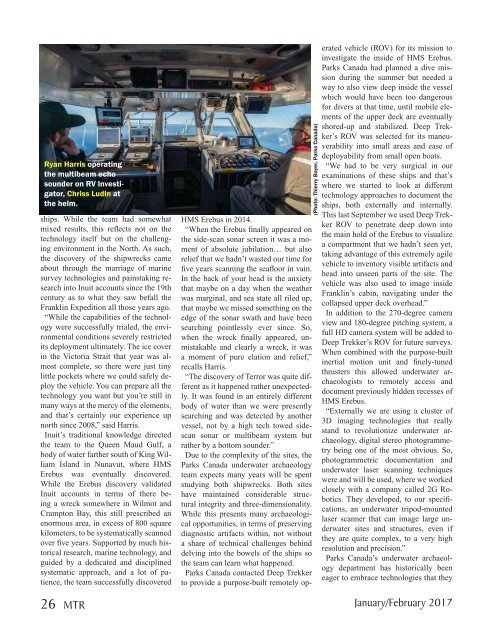
Ryan Harris operating<br />
the multibeam echo<br />
sounder on RV Investigator,<br />
Chriss Ludin at<br />
the helm.<br />
ships. While the team had somewhat<br />
mixed results, this reflects not on the<br />
technology itself but on the challenging<br />
environment in the North. As such,<br />
the discovery of the shipwrecks came<br />
about through the marriage of marine<br />
survey technologies and painstaking research<br />
into Inuit accounts since the 19th<br />
century as to what they saw befall the<br />
Franklin Expedition all those years ago.<br />
“While the capabilities of the technology<br />
were successfully trialed, the environmental<br />
conditions severely restricted<br />
its deployment ultimately. The ice cover<br />
in the Victoria Strait that year was almost<br />
complete, so there were just tiny<br />
little pockets where we could safely deploy<br />
the vehicle. You can prepare all the<br />
technology you want but you’re still in<br />
many ways at the mercy of the elements,<br />
and that’s certainly our experience up<br />
north since 2008,” said Harris.<br />
Inuit’s traditional knowledge directed<br />
the team to the Queen Maud Gulf, a<br />
body of water farther south of King William<br />
Island in Nunavut, where HMS<br />
Erebus was eventually discovered.<br />
While the Erebus discovery validated<br />
Inuit accounts in terms of there being<br />
a wreck somewhere in Wilmot and<br />
Crampton Bay, this still prescribed an<br />
enormous area, in excess of 800 square<br />
kilometers, to be systematically scanned<br />
over five years. Supported by much historical<br />
research, marine technology, and<br />
guided by a dedicated and disciplined<br />
systematic approach, and a lot of patience,<br />
the team successfully discovered<br />
(Photo: Thierry Boyer, Parks Canada)<br />
HMS Erebus in 2014.<br />
“When the Erebus finally appeared on<br />
the side-scan sonar screen it was a moment<br />
of absolute jubilation… but also<br />
relief that we hadn’t wasted our time for<br />
five years scanning the seafloor in vain.<br />
In the back of your head is the anxiety<br />
that maybe on a day when the weather<br />
was marginal, and sea state all riled up,<br />
that maybe we missed something on the<br />
edge of the sonar swath and have been<br />
searching pointlessly ever since. So,<br />
when the wreck finally appeared, unmistakable<br />
and clearly a wreck, it was<br />
a moment of pure elation and relief,”<br />
recalls Harris.<br />
“The discovery of Terror was quite different<br />
as it happened rather unexpectedly.<br />
It was found in an entirely different<br />
body of water than we were presently<br />
searching and was detected by another<br />
vessel, not by a high tech towed sidescan<br />
sonar or multibeam system but<br />
rather by a bottom sounder.”<br />
Due to the complexity of the sites, the<br />
Parks Canada underwater archaeology<br />
team expects many years will be spent<br />
studying both shipwrecks. Both sites<br />
have maintained considerable structural<br />
integrity and three-dimensionality.<br />
While this presents many archaeological<br />
opportunities, in terms of preserving<br />
diagnostic artifacts within, not without<br />
a share of technical challenges behind<br />
delving into the bowels of the ships so<br />
the team can learn what happened.<br />
Parks Canada contacted Deep Trekker<br />
to provide a purpose-built remotely operated<br />
vehicle (ROV) for its mission to<br />
investigate the inside of HMS Erebus.<br />
Parks Canada had planned a dive mission<br />
during the summer but needed a<br />
way to also view deep inside the vessel<br />
which would have been too dangerous<br />
for divers at that time, until mobile elements<br />
of the upper deck are eventually<br />
shored-up and stabilized. Deep Trekker’s<br />
ROV was selected for its maneuverability<br />
into small areas and ease of<br />
deployability from small open boats.<br />
“We had to be very surgical in our<br />
examinations of these ships and that’s<br />
where we started to look at different<br />
technology approaches to document the<br />
ships, both externally and internally.<br />
This last September we used Deep Trekker<br />
ROV to penetrate deep down into<br />
the main hold of the Erebus to visualize<br />
a compartment that we hadn’t seen yet,<br />
taking advantage of this extremely agile<br />
vehicle to inventory visible artifacts and<br />
head into unseen parts of the site. The<br />
vehicle was also used to image inside<br />
Franklin’s cabin, navigating under the<br />
collapsed upper deck overhead.”<br />
In addition to the 270-degree camera<br />
view and 180-degree pitching system, a<br />
full HD camera system will be added to<br />
Deep Trekker’s ROV for future surveys.<br />
When combined with the purpose-built<br />
inertial motion unit and finely-tuned<br />
thrusters this allowed underwater archaeologists<br />
to remotely access and<br />
document previously hidden recesses of<br />
HMS Erebus.<br />
“Externally we are using a cluster of<br />
3D imaging technologies that really<br />
stand to revolutionize underwater archaeology,<br />
digital stereo photogrammetry<br />
being one of the most obvious. So,<br />
photogrammetric documentation and<br />
underwater laser scanning techniques<br />
were and will be used, where we worked<br />
closely with a company called 2G Robotics.<br />
They developed, to our specifications,<br />
an underwater tripod-mounted<br />
laser scanner that can image large underwater<br />
sites and structures, even if<br />
they are quite complex, to a very high<br />
resolution and precision.”<br />
Parks Canada’s underwater archaeology<br />
department has historically been<br />
eager to embrace technologies that they<br />
26 MTR January/February 2017