
You also want an ePaper? Increase the reach of your titles
YUMPU automatically turns print PDFs into web optimized ePapers that Google loves.
SCOTTISH<br />
ISLANDS<br />
THE UK’S ONLY MAGAZINE DEVOTED TO EXPLORING THE ISLANDS OF SCOTLAND<br />
EXPLORER<br />
Lismore<br />
History<br />
Atlantic<br />
Grey Seals<br />
Welcome!<br />
JAN/FEB <strong>2017</strong> £3.95<br />
Rousay<br />
ORKNEY<br />
Mingulay<br />
GIVEAWAY<br />
Skye<br />
WILDERNESS<br />
Plus: Sound of Harris - Seabirds - Shortest Flight - and much more ...
ISLAND AND WILDLIFE CRUISES OFF SCOTLAND’S<br />
BEAUTIFUL HEBRIDEAN COAST<br />
NORTHERN LIGHT<br />
CRUISING COMPANY<br />
Exploring St Kilda, Mingulay, The Shiants, North Rona<br />
and many other Hebridean <strong>Islands</strong>.<br />
Small groups - maximun 12 guests • From long-weekends to 10 nights aboard.<br />
Great Food • Birds • Cetaceans • Walking • Photo Opportunities<br />
Call Michelle on 01599 555723<br />
info@northernlight-uk.com<br />
northernlight-uk.com
Gallery of Rust<br />
Page 36<br />
<strong>Scottish</strong> Seabirds New Marine Protected Area<br />
Page 8<br />
Page 20<br />
SCOTTISH ISLANDS EXPLORER JANUARY / FEBRUARY <strong>2017</strong> Volume 18 / Issue 1<br />
Editor<br />
John Humphries<br />
editor@scottishislandsexplorer.com<br />
01379 890270<br />
Publisher<br />
Tom Humphries<br />
publisher@scottishislandsexplorer.com<br />
Production Design<br />
Deborah Bryce<br />
production@scottishislandsexplorer.com<br />
Proof Reader<br />
Melanie Palmer<br />
Circulation and Enquiries<br />
Steve Tiernan<br />
www.magazineworkshop.co.uk<br />
01422 <strong>41</strong>0615<br />
Regular Contributors<br />
Tom Aston<br />
Roger Butler<br />
Marc Calhoun<br />
Richard Clubley<br />
James Hendrie<br />
Mavis Gulliver<br />
Jack Palfrey<br />
James Petre<br />
Stephen Roberts<br />
Andrew Wiseman<br />
Administration<br />
Ravenspoint Press Ltd<br />
Kershader Isle of Lewis HS2 9QA<br />
01851 830316<br />
info@scottishislandsexplorer.com<br />
www.scottishislandsexplorer.com<br />
Published bi-monthly<br />
Printed by Buxton Press Ltd<br />
Palace Road Buxton SK17 5AE<br />
01298 212000<br />
Next issue on sale: 18 <strong>Feb</strong>ruary <strong>2017</strong><br />
©Ravenspoint Press Ltd<br />
All rights reserved.<br />
ISSN: 1476-6469<br />
Distribution<br />
Warners Group Publications Plc<br />
The Maltings West Street<br />
Bourne Lincolnshire PE10 9PH<br />
01778 391000<br />
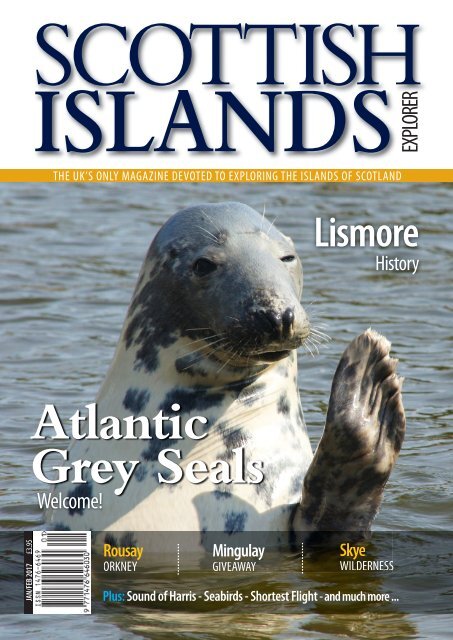
Front Cover<br />
Image of an Atlantic Grey Seal<br />
by Roger Butler<br />
CONTENTS<br />
4 Editor John Humphries and Guest Columnist Terry Marsh<br />
5 Vision for 2020 with A Town Walk, the Quiz and Collectors’ Copies<br />
6 Insights One Books on Mapping, Imaging and Reflecting on <strong>Islands</strong><br />
7 Insights Two about Shipping Movements on the Sound of Harris<br />
8 <strong>Scottish</strong> Seabird <strong>Islands</strong> - Part One<br />
Richard Clubley focuses on the wilderness<br />
13 House on the Point - Ullapool<br />
Jack Palfrey experienced pleasures in all directions<br />
15 <strong>Islands</strong> Beyond<br />
Tom Aston looks south towards Laurie Island<br />
16 ‘A Good Enough Day’<br />
Alayne Barton on Rousay, 45 years after George Mackay Brown<br />
20 New Marine Protected Area in Wester Ross<br />
Lizzie Williams celebrates initiatives, but is cautious on implementation<br />
24 Readers’ Opportunities One<br />
Whisky, Warmth, Winter and Signage<br />
25 Readers’ Opportunities Two<br />
Ben Buxton has been drawn to Mingulay … are you?<br />
26 Centrepiece<br />
Stewart Dawber is keen to develop his sense of wilderness<br />
28 The Atlantic Grey Seal<br />
Roger Butler is inquisitive about them<br />
32 A History of Lismore<br />
Gordon Eaglesham learnt more<br />
36 A Gallery of Rust<br />
Seth Cook takes delight in the decayed<br />
40 Apostle of Land Reform<br />
Andrew Wiseman assesses John Murdoch of Islay<br />
43 A Short Hop to Papa<br />
James Hendrie takes the trip<br />
46 Island Nurses<br />
Tom Aston learnt from Catherine Morrison about Hebridean Heroines<br />
48 Responses<br />
Declan O’Byrne has re-created journeys to the islands<br />
49 Crossword Sponsored by the <strong>Islands</strong> Book Trust<br />
Tom Johnson confronts crossword-puzzlers with his 26th challenge<br />
50 Island Incidents<br />
Mike Heslop wonders whether clockwise or anti-clockwise around Seil<br />
JANUARY / FEBRUARY <strong>2017</strong> SCOTTISH ISLANDS EXPLORER 3
Editor’s Welcome / Guest Columnist<br />
Editor<br />
John Humphries<br />
reacts to the word ‘No’<br />
Although I relentlessly promote <strong>Scottish</strong> island-holidaying<br />
and frequently go to them myself, albeit on business,<br />
there are times when my behaviour is covered by the old<br />
remark, ‘Don’t do as I do, do as I say.’ Back in the Summer, three<br />
generations of my family rented a cruiser for four nights on the<br />
Norfolk Broads. It was very different - in calmness of waters,<br />
levels of landscape and numbers of craft.<br />
Many positive aspects of journeying and the courtesies of<br />
fellow-sailors were revealed to us as cruising novices - but one<br />
feature filled me with disquiet, the plethora of warnings on<br />
notice boards. Some sections of the banks are festooned with<br />
signs indicating such prohibitions as - ‘No Entry’, ‘No Turning’,<br />
‘No Mooring’, ‘No Wash’, ‘No Fishing’.<br />
I suddenly realised that ‘notice’ and the very name of the<br />
county itself both begin with that restrictive ‘No’! I was not,<br />
however, filled with the rage of Harris, in Jerome K Jerome’s<br />
Three Men in a Boat, who wanted to kill those responsible for<br />
the ‘No Trespassing’ signs, slaughter their families, burn down<br />
their houses and sing comic songs on the ruins. Eventually he<br />
relented and promised not … to sing the songs.<br />
There has to be a balance between admittance with<br />
welcomes and preservation with warnings. The <strong>Scottish</strong> islands<br />
have coasts and hills where freedoms of access are enshrined<br />
in law, but where authorities need to continue vigilance<br />
especially as certain places become increasingly popular. The<br />
excesses of one generation can lead to diminished pleasures<br />
for the next.<br />
There is no formula for maintaining the appeal of an area - for<br />
changes in taste make, as they say, ‘ancient good uncouth’.<br />
However, places need to avoid anything comparable to that,<br />
undoubtedly untrue, story concerning a <strong>Scottish</strong> newspaper<br />
competition which announced: ‘First prize - a Week in Wick;<br />
Second Prize - Two Weeks in Wick’!<br />
John Humphries<br />
For the Editor’s daily item on <strong>Scottish</strong> islands, go to<br />
john-humphries.blogspot.com<br />
Guest Columnist<br />
Terry Marsh on<br />
contracting an<br />
island condition<br />
Late one warm Spring evening in 1967, I first<br />
ventured onto the Isle of Skye. Tired, following a<br />
long journey north, I drove onto the stony beach at<br />
Camas na Sgianadin and slept in the car. Such was my<br />
introduction to the <strong>Scottish</strong> islands.<br />
The next morning, chill dawn air probing the<br />
defences of the car, I watched the sky turn pink as the<br />
sun eased into the eastern sky behind me, while<br />
expectation, uncertainty and the aura of adventure<br />
combined to fuel a quiet excitement. I was about to<br />
encounter the briefest exposure to what Seton Gordon<br />
called ‘The Charm of Skye’.<br />
is induces a state of euphoria, longing and affection<br />
that has come to be termed ‘Skye fever’ and it is an<br />
affliction that not everyone will experience, but one for<br />
which there is no cure. I have visited Skye every year since<br />
… and I still have the feverish condition.<br />
But what I also have is the knowledge that it is not<br />
only Skye to blame. There are hundreds of islands<br />
around Scotland’s coast, and the more I discovered<br />
them, the greater I felt an obligation to seek out more,<br />
to try to understand what Jim Crumley describes as<br />
‘islandness’ … akin to a state of wanting, always, to be<br />
on and among islands.<br />
So it was with not one shred of doubt that in 1999 I<br />
signed a contract to write e Magic of the <strong>Scottish</strong><br />
<strong>Islands</strong>, a coffee-table book that would lead my wife and<br />
I, newly wed, to our honeymoon on Orkney. ereaer<br />
we endured 15 months of island-hopping, visiting all the<br />
island groups, getting on to as many as we could, some<br />
more easily than others. St Kilda was a wild Force 8 ride;<br />
Ulva by Mull a five-minute dash.<br />
In the years that followed, I probed Scotland’s island<br />
defences, and was rebuffed a time or two, but never to<br />
such an extent that I lost my desire to explore. e<br />
splendour of <strong>Scottish</strong> islands is there for all to see, but it<br />
is not to eyes alone that beauty is revealed. e charm of<br />
the islands is persuasive, and in that charm lies a magic<br />
that will remain long aer we are gone.<br />
Terry Marsh<br />
4 SCOTTISH ISLANDS EXPLORER JANUARY / FEBRUARY <strong>2017</strong>
VISION FOR 2020<br />
‘Challenge Ordinary’ is the directive in advertisements by the private bank, Investec, on the<br />
Waterloo & City Line, a section of the London Underground that is completely independent<br />
of the rest of the network. There’s my New Year resolution - endeavouring to lift more of the<br />
tasks that I do from the mundane to the special and hope that the end-products quietly<br />
achieve the extraordinary.<br />
A Town Walk<br />
Walking tends to be a rural<br />
pastime, undertaken by visitors<br />
rather than residents. Urban walks<br />
can form part of the daily commute,<br />
although an increasing number of<br />
enthusiasts like to take to the<br />
pavements in order to take in<br />
architectural features and social<br />
history. Where better to start than<br />
the largest town in the Western<br />
Isles, Stornoway?<br />
Stornoway from Lews Castle by James Hendrie<br />
There’s a presence of 8000 people<br />
in the vicinity and 5500 of them are<br />
Gaelic speakers. So there is the<br />
appeal of hearing the rhythms and<br />
cadences of the language without<br />
understanding the meaning of the<br />
words. Lews Castle and its woods<br />
and golf course, overlooking the bay,<br />
is a place to start for it is the highest<br />
point and the topography of the area<br />
soon becomes evident.<br />
Then move down to the harbour<br />
and the town-centre, including the<br />
main hall for events, An Lanntair,<br />
before continuing to the other side of<br />
the bay where trees are scarce and an<br />
industrial aspect becomes evident.<br />
Continue around to the broadcasting<br />
and publishing ‘zone’ before passing<br />
the Nicolson Institute with its 1000<br />
secondary school pupils.<br />
Behind the school are the older<br />
residential districts that are served by<br />
six Presbyterian denominations, a<br />
range of Nonconformist chapels, an<br />
Episcopalian and a Roman Catholic<br />
church. Eventually you will be at the<br />
fairly new Co-operative supermarket,<br />
ready to walk back down Bayhead to<br />
Cromwell Street, on to the Bus<br />
Station and Ferry Terminal, perhaps,<br />
to be transported away.<br />
Copies for Collectors<br />
The demand for back numbers<br />
continues. I have been offered a<br />
set of the editions of <strong>Scottish</strong><br />
<strong>Islands</strong> <strong>Explorer</strong> from September /<br />
October 2004 until November /<br />
December 2016. If you are<br />
interested in them or have a long<br />
run of consecutive numbers of the<br />
publication, please contact<br />
editor@scottishislandsexplorer.com<br />
01379 890270<br />
Quiz: Desert <strong>Islands</strong><br />
David Hoult writes: In the popular imagination, the phrase<br />
‘desert island’ conjures up a picture of a tropical paradise<br />
with idyllic white beaches lapped by an azure sea. The<br />
reality is quite different, because in this context, ‘desert’<br />
means ‘deserted’. So this category of island is one which<br />
was once inhabited, but whose population has left. Identify<br />
the following ‘desert’ islands around the shores of Scotland.<br />
1. The most southerly of the Bishop’s Isles<br />
2. A national nature reserve east of Bressay<br />
3. A supposedly haunted island south of Gigha<br />
4. An island in the Pentland Firth, north-west of<br />
John O’ Groats<br />
5. An island off Torridon, notorious as the former<br />
site of biological weapon tests.<br />
6. An island 44 miles north-east of the Butt of Lewis<br />
7. Separated from Jura by the Gulf of Corryvreckan.<br />
8. The largest island in the Firth of Forth<br />
9. An island off Harris, well-known as the site of a<br />
reality television series<br />
10. An island in the Firth of Clyde, colloquially<br />
known as Paddy’s Milestone.<br />
Answers on Page 50<br />
JANUARY / FEBRUARY <strong>2017</strong> SCOTTISH ISLANDS EXPLORER 5
Page<br />
INSIGHTS<br />
Index Header<br />
Mapping, Imagining and Reflecting on <strong>Islands</strong><br />
Scotland Mapping the <strong>Islands</strong><br />
by Christopher Fleet, Margaret<br />
Wilkes and Charles W J Withers<br />
£30 Birlinn 978-1-78027-351-8<br />
<strong>Islands</strong>, to visit, have their devotees; maps,<br />
to pore over, have their aficionados. e<br />
coastlines, alone, of the <strong>Scottish</strong> islands<br />
have an immense length and the interiors<br />
have long aroused interest. e authors<br />
consider the science of cartography while<br />
presenting examples of historical, colourful,<br />
digital, diagrammatical and pictorial maps<br />
and charts from Rockall to the oil-fields<br />
of Shetland and all points south.<br />
The Undiscovered <strong>Islands</strong><br />
by Malachy Tallack<br />
£12.99 Birlinn 978-1-84697-350-5<br />
‘Faced with the sky we imagine Gods; faced<br />
with the ocean we imagine islands.’ e<br />
author takes us on a journey to a range of<br />
settlements which were created by individuals<br />
or groups to impress others, to devise<br />
make-believe homes, to deceive in order to<br />
gain advantage or simply to be tricked by<br />
erroneous calculations. e phantoms,<br />
fakes and legends are here in a finelyprepared<br />
book.<br />
The Love of Country<br />
A Hebridean Journey<br />
by Madeleine Bunting<br />
£18.99 Granta 978-1-84708-517-7<br />
Over the course of six years, the author<br />
travelled extensively in the Hebrides<br />
and connected intensively with the<br />
landscape, history, people and attractions.<br />
is book is not the re-telling of<br />
well-known stories, but an exploration<br />
of a part of the country where traditions<br />
have grown, identification established<br />
and the creative flair of numerous<br />
writers and artists has been ignited.<br />
Poacher’s Pilgrimage<br />
An Island Journey<br />
by Alastair McIntosh<br />
£20 Birlinn 978-1-78027-361-7<br />
ere are three levels to stimulate here.<br />
One concerns a twelve-day pilgrimage<br />
through Lewis and Harris with the<br />
emphasis on the sacred aspects of<br />
landscape. Another concerns the working<br />
of the author’s mind on meanings of<br />
existence, healing and rigour. e third is<br />
about the place of Christian thought in<br />
the third millennium. ese topics are<br />
presented in lively and readable ways.<br />
The Skye Trail<br />
by Helen and Paul Webster<br />
£9.95 Cicerone<br />
978-1-85284-872-9<br />
When it comes to making a personal<br />
journey of one’s own, then the more<br />
arduous and challenging the more a good<br />
guide is required. e authors have<br />
devised a trail that runs (while you walk<br />
or climb) from Rubba Hunish in the<br />
north-east of the island to Broadford on<br />
the inhabited shores of the Cuillins. It is<br />
divided into seven stages, gives practical<br />
advice and comprehensive information.<br />
Take it to have at hand.<br />
Baby Boomers Memories<br />
of Post-War Shetland<br />
by Erik Young<br />
£12.99 e Shetland Times Ltd<br />
978-1-910997-09<br />
Erik Young, born at Hillhead, Lerwick, in<br />
June 1946, has experienced life in Shetland<br />
and Edinburgh. His recall of childhood and<br />
growing-up, sights and sounds, boats and<br />
businesses, holidays and schools are brought<br />
together in a fine journey down memory<br />
lane through prose, verse and illustrations.<br />
He has driven buses and so can assess people<br />
and places effectively. Let him take you on<br />
this trip to the past.<br />
6 SCOTTISH ISLANDS EXPLORER JANUARY / FEBRUARY <strong>2017</strong>
INSIGHTS<br />
Page Index Header<br />
Shipping Movements on the Sound of Harris<br />
MV Loch Bhrusda on the Sound of Harris route from 1996-2003.<br />
There is something about the Sound of Harris that is rather<br />
special. For the past 20 years CalMac’s sailings have brought<br />
it into the mainstream of car-ferry services in the Outer<br />
Hebrides. Before then, carrying supplies and foot-passengers,<br />
the Endeavour of Berneray plied from Newtonferry,<br />
North Uist, to Berneray and onto Leverburgh, South Harris,<br />
navigated by Neil and Domhnall Angie Macaskill.<br />
These boatmen were well aware of the ebbs and flows of<br />
this stretch of water where the confined sea of The Minch<br />
meets the immense dimensions of the Atlantic Ocean. In<br />
1858, Henry C Otter, Captain of HMS Porcupine, had written<br />
about the different movements of the ‘neap’ (with a small<br />
range between low and high water) and ‘spring’ (with a<br />
large range) tides.<br />
Propulsion<br />
The CalMac routes for vehicle-ferrying between North Uist<br />
and South Harris were on ‘triangular’ runs taking in<br />
Lochmaddy, Uig, on Skye, and Tarbert. Then in 1996 the<br />
MV Loch Bhrusda came into service, displayed manoeuvrability<br />
with its propulsion system and drew attention with<br />
its noisiness as it negotiated the shallows and rocky<br />
features of the journey directly through the Sound.<br />
The opening of the Causeway to Berneray in 1999 and the<br />
building of the ferry terminal on the island gave the service<br />
new impetus. In 2003, the MV Loch Portain, doubled the<br />
capacity from the 18 vehicles and a new era began. Three<br />
years later, there was a revolution in social history when<br />
sailings started on a seven-day-a-week basis. The Sabbath<br />
Observance culture was under threat.<br />
Circuitous<br />
Observance of the obstacles en route means that the ship<br />
sails at nine nautical miles an hour, taking a circuitous<br />
course. This has the effect of giving passengers the opportunity<br />
to see approaching and receding islands from different<br />
angles. Passengers also have to be aware that in addition to<br />
reading the regular schedules, they need to consult the<br />
smaller print for well-forecast variations in tide and time.<br />
So crossing the Sound of Harris demands a particular<br />
alertness by the captain and crew, with up to 20 changes<br />
of course per sailing, and a different sense of awareness<br />
by prospective travellers. It is well worth noting the<br />
departure times, for there is much to appreciate about the<br />
conditions and background of an historic passage that is<br />
the key ferry-link on the journey through the Western Isles.<br />
JANUARY / FEBRUARY <strong>2017</strong> SCOTTISH ISLANDS EXPLORER 7
<strong>Scottish</strong> Seabird <strong>Islands</strong> - Part One<br />
<strong>Scottish</strong> Seabird <strong>Islands</strong> -<br />
Part One<br />
Richard Clubley focuses on the wilderness<br />
Many I speak to have never been to Scotland, fewer<br />
have been to an island, fewer still have stood on<br />
Ailsa Craig, Bass Rock, St Kilda or any of the other,<br />
wonderful, teeming, raucous, smelly seabird-islands round<br />
the <strong>Scottish</strong> coast. Almost no one, save a few lighthouse<br />
men and mad adventurers have seen, let alone visited, Sule<br />
Stack or Sule Skerry.<br />
A ship’s captain once replied to my enquiry, “No, you<br />
won’t see either of those, they’re rocks, they’re dangerous,<br />
we steer well away them!” It is this danger to shipping,<br />
inaccessibility from land, lack of facilities and (oen) sheer,<br />
slippery sides that make sea bird islands just perfect - for<br />
seabirds. ey are wildernesses in the true sense of the word,<br />
a noun referring to an uncultivated and uninhabited area.<br />
Birds can court, nest, rest and raise their young in peace.<br />
ey are not hunted or squeezed out of their habitat by<br />
town planners or anyone else apart, perhaps, from some<br />
Outer Hebrideans who take 2000 gannet chicks, gugas,<br />
under licence ever year from Sula Sgeir for those who relish<br />
the delicacy.<br />
In Decline<br />
e islands are nurseries and sanctuaries for our seabirds.<br />
ere is little threat on the islands yet many species, in<br />
many places, are in decline. Ocean warming, ocean acidification,<br />
over-fishing and plastic pollution, leading to<br />
depleted or inaccessible or shied prey species are most<br />
likely to blame.<br />
ere are many voices calling for our act to be cleaned up.<br />
e banning of plastic microbeads, the establishment of<br />
marine special protection areas and fisheries regulation are<br />
proposed. May I add my own, small voice to the campaign<br />
for conservation of seabird islands?<br />
One bright, calm day in May 2015, I stepped off a rolling<br />
boat and clambered up some steep steps, cut into the side<br />
of the cliff face on Bass Rock in the Firth of Forth. I was<br />
very lucky to have been invited and luckier still the trip had<br />
not fallen foul of the weather, as all previous ones that<br />
season had.<br />
8 SCOTTISH ISLANDS EXPLORER JANUARY / FEBRUARY <strong>2017</strong>
<strong>Scottish</strong> Seabird <strong>Islands</strong> - Part One<br />
‘ere is little threat on the islands yet many<br />
species, in many places, are in decline.’<br />
JANUARY / FEBRUARY <strong>2017</strong> SCOTTISH ISLANDS EXPLORER 9
Old Prison<br />
Our guide, Maggie Sheddan, from the <strong>Scottish</strong> Seabird<br />
Centre in North Berwick escorted us through the rusting,<br />
iron gate into the old prison fortifications at the lower level.<br />
“Welcome to the Bass Rock,” she said, sounding like that<br />
grizzly, unsmiling warden at the start of every prison film -<br />
“Welcome to Shawshank”, “Welcome to Alcatraz.”<br />
At the start of the gannet slopes, Maggie issued plastic riot<br />
shields and instructed as to their use in fending off stabs from<br />
gannets nesting next to the path (on the path). I looked up,<br />
there was not a gannet-free inch of rock between me and the<br />
summit. at turned out to be not quite true. Having run the<br />
gannet gauntlet for a couple of hundred yards, we reached a<br />
clear patch, just big enough for 20 individuals to put down<br />
their rucksacks, eat lunch and take photos.<br />
Border Disputes<br />
This was the easiest bird photography I have done. Fishing<br />
in a barrel would be difficult by comparison. Gannets<br />
preening, billing, sky-pointing, taking off, landing, sleeping<br />
- whatever you want - fill your lens. The colony is dense. It<br />
follows the rules at all gannet colonies, each bird gets a nest<br />
patch that keeps it just out of stab range of its neighbours,<br />
but only just, for border disputes are common.<br />
Take-off and landing are difficult. Take off requires a run<br />
up, ideally down-slope and into the wind, but this may<br />
require running over the heads of neighbours, at the cost<br />
of more stabs. Landing is often just a controlled crash into<br />
the throng - more stabs. Seabirds in decline? Not gannets,<br />
not on Bass Rock. In recent years their numbers have risen<br />
from a few thousand to 150,000.<br />
When Sir David Attenborough visited a few years ago, he<br />
was filmed sitting by an isolated bird with a wellestablished<br />
nest close to the human area. The old bird and<br />
its mate are still there, but now surrounded by hundreds of<br />
others. Chris Packham said, and Sir David agreed: “This<br />
has to be one of the wonders of the natural world.”<br />
Monogamous and Loyal<br />
So, why the gloom if they’re all doing so well? e plain<br />
fact is that gannets are an exception. ey are powerful flyers,<br />
swimmers and divers. ey can exploit a range of fish prey<br />
species and can travel some distance from the colony to get<br />
food. ey are long-lived, monogamous and loyal to their<br />
nest sites. Eggs and chicks are not so vulnerable to predators,<br />
such as gulls and rats, since one adult remains on guard while<br />
the mate goes fishing. Gulls and rats are not equipped with<br />
riot shields.<br />
10 SCOTTISH ISLANDS EXPLORER JANUARY / FEBRUARY <strong>2017</strong>
<strong>Scottish</strong> Seabird <strong>Islands</strong> - Part One<br />
Manx shearwaters shear over the water in<br />
flight, inches above the waves. Best viewed<br />
from a ship they are dark on the back and<br />
light underneath (Spitfires were sometimes<br />
camouflaged this way during e Battle of<br />
Britain). ey bank, first one way then the<br />
other, and the observer will see these<br />
alternating colours. Shearwaters are<br />
fascinating to watch in a wavy sea as they skim<br />
the surface, up and down the troughs and<br />
over the peaks.<br />
I have included them in this article as the<br />
UK holds the bulk of the world breeding<br />
population. Manx shearwaters nest in<br />
colonies, in burrows, on grassy slopes above<br />
the sea. ey are brilliant swimmers and<br />
flyers, but very ungainly on land as their legs<br />
are set too far back for easy walking. is<br />
makes them vulnerable to predators at the<br />
colonies such as gulls.<br />
Wiped Out Colonies<br />
Their defence is to stay at sea during<br />
daylight and only land, to relieve their<br />
mates on duty in the burrows, in the<br />
darkest part of the night. They will fly past<br />
the nest, call to go off-watch, then crashland<br />
and shuffle below ground before any<br />
harm can come to them. Unlike the gannet,<br />
the Manx shearwater’s defence is its<br />
burrow. This is fine protection from gulls,<br />
but no use whatsoever against rats which<br />
have wiped out colonies in the past.<br />
In 1991, a team from Glasgow University,<br />
led by Bernard Zonfrillo, deployed large<br />
quantities of rat poison on the island of<br />
Ailsa Craig. The rats were eradicated and<br />
the shearwaters returned. During the<br />
winter of 2015/16, a similar project was<br />
conducted on the Shiants, aimed at<br />
getting rid of the colony of about 3,500<br />
black rats for the benefit of puffins,<br />
shearwaters and sundry other birds,<br />
invertebrates and plants.<br />
So far the results look promising, but we<br />
must wait at least a year for confirmation.<br />
It only takes one pregnant female to have<br />
been missed. Once confidence is restored,<br />
attempts will be made to entice shearwaters<br />
to re-colonise the islands. They do not like<br />
to land where none of their kin are living so<br />
recordings of their calls will be played to<br />
break the ice. No one wants to be first at a<br />
party after all.<br />
[In the next issue: great skuas in Shetland,<br />
kittiwakes in Fair Isle and fulmars on St Kilda.]<br />
Further Information<br />
The author would like to<br />
thank Maggie Sheddan<br />
and the <strong>Scottish</strong> Seabird<br />
Centre for the Bass Rock<br />
trip. The Centre - 01620<br />
890202 - undertakes<br />
excellent education and<br />
conservation work and is<br />
well worth a visit. Thanks<br />
also to Jess Barrett and<br />
Laura Bambini at RSPB<br />
for photographs and<br />
guidance (any and all<br />
errors in the articles are<br />
entirely mine, however).<br />
Page 8 - Bass Rock - Mo Thomson.<br />
Left: Gannet Morus bassan sitting on<br />
Bass Rock by Andy Hay RSPB images.<br />
Below: Manx shearwater taking<br />
flight - Chris Gomersall RSPB Images.<br />
JANUARY / FEBRUARY <strong>2017</strong> SCOTTISH ISLANDS EXPLORER 11
harrowwhiskyfestival.com<br />
Friday 13 / Saturday 14 <strong>Jan</strong>uary <strong>2017</strong><br />
Whiskies from <strong>Islands</strong> and Peninsulas with ferry connections.<br />
Carry 12 SCOTTISH a current ISLANDS EXPLORER or past edition of <strong>Scottish</strong> <strong>Islands</strong> <strong>Explorer</strong> for a discount.<br />
See page 24 for further details.
House on the Point - Ullapool<br />
House on the Point - Ullapool<br />
Jack Palfrey experienced pleasures in all directions<br />
This is bed-and-breakfast<br />
accommodation with several<br />
distinctive differences. It’s in a house with<br />
bedrooms with views in three directions.<br />
e North Room looks along Loch<br />
Broom to the Summer Isles and can<br />
command great sunsets. e West faces<br />
across the loch to the iconic white house<br />
at Altnaharrie - a residence that seems cut<br />
off from the rest of the world.<br />
I was in the South Room and<br />
thoroughly enjoyed the movements<br />
on the loch, whether tidal flows,<br />
passing clouds reflected, boats<br />
coasting, ships cruising or ferries<br />
plying. The house is the ultimate one<br />
of Ullapool Point, indeed a turning<br />
point, where the quayside road ends.<br />
One word can be used in its full and<br />
expressive sense - ‘idyllic’.<br />
e reality, however, is also attractive<br />
for within a hundred yards there is a<br />
fine inn, the ferry terminal, shops,<br />
restaurants, cafes, banks and tourist<br />
information. It is all so much part of a<br />
place that is a hub. To the west is<br />
Stornoway, served by CalMac’s most<br />
recent member of its fleet, MV Loch<br />
Seaforth. e Western Isles are now<br />
accessed quicker and some turbulence<br />
is off-set by modern ship technologies.<br />
e hinterland extends to the north,<br />
getting less and less populated as<br />
Assynt and Coigach merge into North<br />
West Sutherland and on to that<br />
ultimate point, Cape Wrath. e A835<br />
crosses open country to the east by<br />
Loch Glascarnoch, to Strathpeffer,<br />
Dingwall and Inverness. To the south<br />
is Wester Ross with Loch Ewe,<br />
Gairloch and Applecross among many<br />
places calling out to be visited.<br />
Not only do the rooms have views,<br />
they are spacious with stylish decors.<br />
Travellers’ needs are provided with<br />
features that make storage easy.<br />
Breakfasts, served in the rooms, are<br />
appetising, filling and healthy. I<br />
particularly liked the way in which the<br />
table served dining requirements and<br />
an office function. Wifi is there to<br />
bring the internet world to the side of<br />
Loch Broom.<br />
So here is a place for pleasure as well<br />
as for business. What matters above all<br />
is that Angus Bruce and his wife, Jill,<br />
are there to welcome you, provide<br />
directions for touring and / or walking<br />
and, if required, to give coaching and<br />
advice about photography - for his<br />
work is acclaimed and has appeared on<br />
the pages of this magazine.<br />
Opportunities abound at the Point and<br />
around Ullapool.<br />
JANUARY / FEBRUARY <strong>2017</strong> SCOTTISH ISLANDS EXPLORER 13
Small-group expeditions to Arctic Norway,<br />
the Solovetski <strong>Islands</strong> of Arctic Russia,<br />
Greenland and Kamchatka.<br />
• Arctic and Antarctic voyages by ship<br />
• Dog sledding, cross country skiing, boating, kayaking,<br />
hiking and wildlife trips<br />
• Tailor-made Iceland and the Faroes - flights from Scotland<br />
• Greenland - East and West coast:<br />
Wildlife and natural history<br />
• Wildlife of Russian Far East - by ship<br />
• Wild Scotland: Oban - Aberdeen 13 - 23 June <strong>2017</strong><br />
• Aberdeen, Fair Isle, <strong>Jan</strong> Mayen and Spitsbergen<br />
22 - 31 May <strong>2017</strong><br />
• Across the Artic Circle: Aberdeen to Longyearbyen<br />
23 June - 6 July <strong>2017</strong><br />
Please call for a full colour brochure<br />
ARCTURUS<br />
The polar arm of Far Frontiers Travel Ltd<br />
Ninestone<br />
South Zeal<br />
Devon EX20 2PZ<br />
Tel/Fax (44) 01837840640<br />
arcturusexpeditions.co.uk<br />
14 SCOTTISH ISLANDS EXPLORER JANUARY / FEBRUARY <strong>2017</strong>
ISLANDS BEYOND<br />
Island of and Iceberg off South Orkney. Fotosearch<br />
Tom Aston looks south towards Laurie Island<br />
The image of South Orkney, with an iceberg blocking<br />
some of it, is a reminder of how discovery, mapping,<br />
settling and disputing took place in a vast, inhospitable<br />
region within the past two hundred years. It was in 1821 that<br />
an English- and an American seal-hunter, Captain George<br />
Powell, and Nathaniel Palmer, discovered what was to<br />
become Laurie Island, the second largest in the South<br />
Orkney group.<br />
Powell’s observations were used by Richard Holmes Laurie<br />
to map the island and he was not backward in coming<br />
forward when naming it. James Weddell subsequently<br />
created another map, using an alternative name, Melville.<br />
In 1903, the <strong>Scottish</strong> National Antarctic Expedition, led by<br />
the formidable William Spiers Bruce (1867 - 1921),<br />
produced a third map with ‘Laurie’, as we would say today,<br />
as the username.<br />
Bruce was a Scotsman who aspired to be an acclaimed<br />
naturalist, polar scientist and oceanographer. In fact, he<br />
founded the <strong>Scottish</strong> Oceanographical Laboratory in<br />
Edinburgh. He was keen to set up a transcontinental<br />
Antarctic march via the South Pole, but was unable to arouse<br />
sufficient interest or funds. One of his problems was that he<br />
lacked diplomatic skills and had a habit of creating enemies.<br />
All-<strong>Scottish</strong><br />
His voyage to the south was in the Scotia a fully-equipped<br />
research vessel that had been converted from a Norwegian<br />
whaler, Hekla, which set off from Troon on 2 November<br />
1902 with an all-<strong>Scottish</strong> crew and scientific-team. Money<br />
for the venture came from then long-established textile<br />
company, Coats, that traces its roots back to Paisley weavers<br />
in the late 18th Century.<br />
It was on Laurie that he set up the first permanent weather<br />
station with the stone-built Omond House. is<br />
subsequently incorporated the first post office to be built on<br />
the continent. However, his initiatives were taken too far<br />
when he offered the meteorological facilities to Argentina<br />
who accepted, rebuilt it as the Orcades Base and then claimed<br />
sovereignty of the complete island.<br />
e dispute would still be on-going today, but the<br />
Antarctic Treaty has ensured, here with appropriate<br />
language, that all sovereignty claims are frozen. e achievements<br />
of William Bruce were quite remarkable, but aer a<br />
period of ill-health he died comparatively young and<br />
unrecognised for his work in the development of polar<br />
regions and knowledge about them.<br />
Their Original Presence<br />
In 2014, there were 28 people stationed at Orcades Base,<br />
probably aware that they were continuing the longest<br />
continental tradition of compiling information about<br />
weather. e Argentinian authorities are certain to know<br />
that their original presence there was thanks to Bruce and<br />
through his actions were given recognition as a nation with<br />
Antarctic claims.<br />
It is interesting to speculate how international histories and<br />
events can hinge on the endeavours and whims of individuals.<br />
When this Scotsman was actively setting up advanced<br />
scientific investigations in the Antarctic, Argentina was on<br />
its way to becoming the 5th largest economy in the world. A<br />
prospering nation saw opportunities; as did an explorer with<br />
entrepreneurial instincts.<br />
JANUARY / FEBRUARY <strong>2017</strong> SCOTTISH ISLANDS EXPLORER 15
‘A Good Enough Day’<br />
‘A Good Enough Day’<br />
Alayne Barton on Rousay, 45 years after George Mackay Brown<br />
One fine summer’s morning in 1971, the Orkney writer, George Mackay Brown, took<br />
a boat to Rousay in the company of a few friends. ey spent the day touring the<br />
island, stopping oen to admire the scenery. On his return he noted, with ‘an Orkney<br />
understatement’, that they had ’had a good enough day.’<br />
45 years later, on a day equally blue and cloudless, but far colder, since it was April, not<br />
July, my husband, youngest son and I made the same journey across the treacherous<br />
Eynhallow Sound. First though, we had to reverse the car onto the ferry; a prospect made<br />
more alarming by the large number of vehicles already in the queue.<br />
e ferrymen briskly worked their magic however and within minutes the boat, its deck<br />
a jumbled-jigsaw of cars, bikes, 4 x 4s and livestock trailers, was under way to Rousay which<br />
lies less than two miles to the north of Mainland Orkney. e name comes from the Old<br />
Norse Hrólfs-øy, meaning ‘Rolf ’s Island’ but has changed incrementally over the centuries,<br />
becoming Rousay by 1549.<br />
Surprisingly Self-sufficient<br />
At 19 square miles it is the fih largest island in Orkney’s impressive archipelago.<br />
Nowadays the island has a population of roughly 200 and is surprisingly self-sufficient,<br />
boasting a primary school, doctor’s surgery, shop, pub/restaurant and even a fitness-centre.<br />
e ferry service is frequent and cheap, allowing locals to work on the Mainland and<br />
teenagers to attend school in Kirkwall or Stromness daily.<br />
We drove off having elected not to travel widdershins, turning le onto the B9064 which<br />
encircles the island, and headed for the first in the series of magnificent archaeological sites<br />
which gives Rousay the nickname ‘the Egypt of the North’. Even in an island with more<br />
than its fair share of wonderfully eccentric names, Taversoe Tuick stands out.<br />
One of only two two-tier chambered cairns in Orkney, the 4,500-year-old tomb was<br />
discovered accidentally in 1898 by Lt General Sir Frederick Traill-Burroughs. It appears<br />
an unremarkable grassy mound from outside. However it is possible to enter the upper<br />
chamber through a grille door and from there descend by ladder into the lower - claustrophobia<br />
permitting.<br />
Notions Dispelled<br />
Just along the road is another tomb, the Blackhammer Cairn, dating from 3000 BC.<br />
A stalled-cairn with seven compartments, the tomb is accessed through a trap door in the<br />
hillside, prompting thoughts of peerie folk and magical fiddles. Once inside however, all<br />
such fanciful notions were dispelled by the prosaicness of the modern concrete roof.<br />
At the Knowe of Yarso, a stalled-tomb dating back to 3500 BC, the remains of 29 adults<br />
were discovered in 1934 with, strangely, those of 36 red deer. From the car park at Westside<br />
we admired the stunning view across to the mysterious island of Eynhallow, summer home<br />
to the treacherous Finfolk. It was the subject of speculation, in 1990, when two visitors<br />
‘vanished’ on a Orkney Heritage Society trip.<br />
16 SCOTTISH ISLANDS EXPLORER JANUARY / FEBRUARY <strong>2017</strong>
‘Archaeologists believe that the living<br />
would visit their dead in the tomb.’
Page 16 Top: View from Midhowe<br />
Broch.<br />
Below: The two-tiered tomb at<br />
Tavershoe Tuick.<br />
Above: St Mary’s Church.<br />
Opposite Top: View of the ‘Great<br />
Ship of Death’ - Midhowe<br />
chambered cairn.<br />
Below: Ian Hamilton Finlay’s<br />
Stone.<br />
Photographs supplied by the<br />
author, Alayne Barton.<br />
is is the start of the Westside Heritage<br />
Trail, described as the ‘most important<br />
archaeological mile in Scotland’; a figurative<br />
journey from the Stone Age to the 19th<br />
Century. Following the path downhill we a<br />
came first to Midhowe Broch, which is<br />
superbly preserved, featuring room partitions,<br />
a fireplace with sockets and even a water tank.<br />
An Imposing Sight<br />
Built on a small promontory above the sea<br />
more than 2000 years ago, the main tower<br />
stands 13’ high and is surrounded by the<br />
remains of smaller buildings which were<br />
probably used as workshops. It must have<br />
been an imposing sight indeed to early<br />
seafarers. A few hundred yards away is what<br />
resembles a huge agricultural shed, seeming<br />
horribly out of place.<br />
Inside however is a surprise; an enormous<br />
chambered tomb, 100’ long, 30’ wide and<br />
divided into twelve stalls. Above the tomb is<br />
a metal walkway, so you can look down and<br />
marvel at its sheer scale and ingenuity. When<br />
this tomb was opened in the 1930s, nine<br />
crouching bodies were found on shelves and<br />
15 on the floor. Archaeologists believe that<br />
the living would visit their dead in the tomb.<br />
Leaving ‘e Great Ship of Death’ behind<br />
we walked past the ruined medieval farm of<br />
Brough and headed towards the next stop on<br />
the path, the ruined St Mary’s church, which<br />
dates to the 17th Century. A stroll around<br />
the churchyard reveals the melancholy graves<br />
of James Sinclair and John Reid, who<br />
drowned when the mailboat foundered in<br />
Eynhallow Sound in the autumn of 1893.<br />
Close to the church are the remains of a<br />
square tower, the only surviving part of a<br />
grand medieval hall.<br />
Multi-period<br />
A stone’s throw away is the medieval<br />
farmstead of Skaill, which was in use until the<br />
mid-19th Century. It’s well-preserved with a<br />
fine example of a traditional Orkney corndrying<br />
kiln. Below the present buildings a<br />
Viking farmstead lies hidden. Further on<br />
there are excavations at the Knowe of<br />
Swandro, a huge multi-period site dating from<br />
the Early Iron Age to the Viking era, now in<br />
danger from the encroaching sea.<br />
18 SCOTTISH ISLANDS EXPLORER JANUARY / FEBRUARY <strong>2017</strong>
‘A Good Enough Day’<br />
e archaeological team hopes it will shed light on how<br />
people survived here over the centuries, adapting to environmental<br />
and climate changes. Westness Farm marks the end<br />
of the trail, and we climbed back up to the car, dazed and<br />
delighted by our millennial mile.<br />
To the west, Querndale has a series of Bronze Age burnt<br />
mounds, which, according to experts, were used for heating<br />
stones in order to produce hot water. Local lore however, tells<br />
tales of the ‘trowies’ who bide within. e area was the worst<br />
affected by the Orkney clearances, carried out in 1845-59 by<br />
landowner, George Traill. e haunting remains of cros and<br />
farmsteads are visible across the lonely landscape.<br />
High above the Bay of Saviskaill is a large, rectangular slab<br />
of white rock, engraved with the words ‘Gods of the Earth /<br />
Gods of the Sea’. is is the work of Rousay ex-resident, Ian<br />
Hamilton Finlay, writer, artist and gardener. We savoured for<br />
a moment the glorious views over to Westray, then followed<br />
the road which clings precipitously to the hillside, skirting<br />
the edge of Kierfea Hill.<br />
At the Heritage Centre, we learnt that 5000 years ago the<br />
climate and supplies were Mediterranean and so plentiful that<br />
people had to work just half the week. e MV Eynhallow<br />
rattled onto the slipway and we embarked. Soon the green<br />
hills of Rousay shrank in the distance, but not in our<br />
memories and, like George Mackay Brown in 1971, we had<br />
had ‘a good enough day.’<br />
He Comes to Life<br />
Turning le to Faraclett, we found the petrified giant,<br />
Yetnasteen. Legend has it that each Hogmanay, on the stroke<br />
of midnight, he comes to life, walks down to the Loch of<br />
Scockness, and takes a long refreshing drink, before resuming<br />
his eternal watch. We looked at the Victorian, B-listed<br />
Trumland House, famous for its magnificent gardens.
New Marine Protected Area in Wester Ross<br />
New Marine Protected Area<br />
in Wester Ross<br />
Lizzie Williams celebrates initiatives, but is cautious about implementation<br />
The kayak offers a perfect vantage point to view the<br />
water. As I glide off from the shore, all seems shades<br />
of brown: kelp, wrack and mud. Yet it is still above the<br />
perpetually yet unhurriedly moving water, and there’s a<br />
pearlescent periwinkle in the arms of a kelp forest, a bundle<br />
of sea hares in a hermaphroditic embrace, an iridescent comb<br />
jelly going nowhere.<br />
Our destination on this midsummer evening is the one<br />
Summer Isle I have never visited: Càrn nan Sgeir, about 4.5<br />
miles from the shore below our home in Achiltibuie and<br />
about a third of a square mile in area, rising to only 92’ above<br />
sea level. It looks so vulnerable out there, exposed to the wild<br />
south west, that I sometimes wonder why it hasn’t been<br />
washed away.<br />
As we paddle out from Acheninver we pass Horse Island - a<br />
regular otter spot. Today, instead of that splashy delight,<br />
there’s a coarse screech above me and I look up to a single<br />
Arctic tern - its nubile white body with sleek black cap and<br />
looping, nonchalant wing-beat. en come pairs, and as we<br />
near Càrn nan Sgeir the sky is a-frantic-chatter with them,<br />
hovering, swooping, plucking prey from just beneath the<br />
water’s surface.<br />
Quietly Circumnavigate<br />
I have been wondering for years if terns are breeding in the<br />
Summer Isles - and here they are, dozens of pairs on the<br />
shingle isthmus between the Island’s two rocky bulbs. Like<br />
the Manx shearwater and Storm petrel which breed on<br />
neighbouring islands, Arctic terns have an ‘amber’<br />
(‘unfavourable’) conservation status and are easily disturbed,<br />
so we decide not to land and instead quietly circumnavigate<br />
the tiny island.<br />
Pink Torridonian sandstone cliffs are topped with clouds of<br />
bird’s-foot-trefoil. en there is a cautious encounter with a<br />
common seal and a pair of porpoise passing shyly by -<br />
heavenly! And there’s good news, the seabed beneath us is<br />
safe at last from the worst ravages of modern fishing.<br />
e ‘Wester Ross Marine Protected Area’ (WRMPA) -<br />
encompassing the waters around the Summer Isles stretching<br />
south to Loch Ewe - was declared in July 2014, but only in<br />
March 2016 did the <strong>Scottish</strong> Government agree that<br />
‘Protection’ should mean significant restrictions on destructive<br />
bottom-towed fishing gear.<br />
Destroying Habitat<br />
‘Bottom-towed fishing gear’ here includes trawling for<br />
beautiful big pink prawns (‘langoustine’) and dredging for<br />
scallops. A dredger is a heavy rake towed along the sea bed<br />
pulling up scallops, ploughing up habitat in its wake. It<br />
produces cheap scallops, but at what wider environmental<br />
cost? It is, arguably, a preposterous way to take food from the<br />
sea and it provides no local jobs.<br />
Establishing Marine Protected Areas in Scotland has been<br />
a long process. A decade of campaigning by environmental<br />
groups led to the 2010 Marine (Scotland) Act, requiring<br />
<strong>Scottish</strong> Ministers to, among other things, designate a<br />
network of Nature Conservation MPAs providing protection<br />
for important marine habitats, wildlife and geology, while<br />
permitting ‘sustainable economic activity’.<br />
e basic premise of an MPA is that, if a patch of sea is given<br />
a rest from destructive fishing, it will start to recover and this<br />
rebounding life will spill over into the surrounding seas. As<br />
well as being crucial for nature’s sake, it is of course socioeconomically<br />
important - for instance, enabling sustainable<br />
jobs in wildlife tourism and low-impact fishing such as static<br />
gear (prawn creels), hand diving, and angling.<br />
20 SCOTTISH ISLANDS EXPLORER JANUARY / FEBRUARY <strong>2017</strong>
‘As well as being crucial for nature’s sake, it<br />
is of course socio-economically important ...’
New Marine Protected Area in Wester Ross<br />
The Glacial Past<br />
e WRMPA was designed specifically for the conservation<br />
and recovery of certain ‘Protected Features’ - species providing<br />
valuable habitats. Maerl (a slow-growing coralline red algae<br />
whose delicate skeleton locks up carbon and provides a nursery<br />
bed for many species including scallops); burrowed mud<br />
(habitat for economically valuable langoustine); kelp forests;<br />
flame shell beds and Northern feather star aggregations;<br />
together with ‘geodiversity’ features from the glacial past.<br />
Once a line has been drawn and agreed on a map, you might<br />
expect the seas within a Marine Protected Area to be ‘Protected’<br />
but - fascinatingly and infuriatingly - the original ‘Management<br />
Approach’ for the WRMPA prohibited dredgers and trawlers<br />
only from tiny patches surrounding these ‘Protected Features’.<br />
It is ‘Business as Usual’ permitted all around, an approach which<br />
seemed absurd. How could such restrictions be enforced or<br />
policed? ere are no fences on the sea.<br />
Furthermore, with such miniscule specifications, how could<br />
the wider seas recover? And crucially, how could we be sure<br />
that there are no more of these ‘Protected Features’ elsewhere<br />
in the area? ere has never been a comprehensive survey of<br />
the seabed. e plans were based on information cobbled<br />
together from various surveys conducted since the 1980s. To<br />
assume the rest of the area is safe to trawl and dredge is to<br />
defy the ‘Precautionary Principle’ - one of the key elements<br />
for policy decisions concerning environmental protection<br />
and management.<br />
Signed by Hundreds<br />
Fortunately for the sea, there are people with the dedication<br />
and know-how to challenge the traditionally powerful<br />
lobbies. Environmental NGOs continued to work together<br />
(the <strong>Scottish</strong> Environment LINK’s Marine taskforce), and<br />
launched a national campaign to ensure proper Protection -<br />
‘#DontTakeeP’. A local group was formed called ‘Sea<br />
Change’ and submitted a petition ‘For the Protection of the<br />
Sea Bed’, signed by hundreds of local people in the communities<br />
around the proposed MPA.<br />
is was a powerful message to take to MSPs and the then<br />
the chair of the Rural Affairs, Climate Change and<br />
Environment Committee, Rob Gibson, agreed with the logic<br />
of our argument. Eventually, aer a second round of consultation<br />
and devoted lobbying, the then environment secretary<br />
Richard Lochhead declared that the whole area should be free<br />
from dredgers, with trawlers restricted to certain less-sensitive<br />
areas. Creel fishing for prawns and hand-diving for scallops<br />
(employing more fishermen in this area) continue as before.<br />
Jubilation! Here was a triumph of sound science, common<br />
sense and long-term vision. However, now the MPA needs<br />
to be managed. Given that the State instigated the process,<br />
one might imagine that the State has a practical, affordable<br />
plan to ensure MPAs work. But in this era of financial<br />
constraint, there is no budget for such luxuries as a baseline<br />
survey, or management of the remaining fishing effort.<br />
22 SCOTTISH ISLANDS EXPLORER JANUARY / FEBRUARY <strong>2017</strong>
New Marine Protected Area in Wester Ross<br />
The Sea’s Recovery<br />
Coinciding with financial constraint is an<br />
era of ‘Community Empowerment’ and so<br />
it’s now down to ‘The Community’ to make<br />
this work. Again, luckily, there are<br />
dedicated, determined people such as the<br />
‘Sea Change’ group now working on a plan<br />
to monitor the seabed (in collaboration<br />
with experts from Glasgow University) and<br />
promote economic regeneration. This will<br />
involve many local people, including the<br />
static gear fishermen who will benefit most<br />
directly from the sea’s recovery.<br />
Meanwhile, the <strong>Scottish</strong> Wildlife Trust’s<br />
Living Seas programme is getting people<br />
beside, on and into the water, exploring<br />
shore-life, boarding the Hebridean Whale<br />
and Dolphin Trust’s research boat and even<br />
squeezing into neoprene for the newlylaunched<br />
North West Highlands Snorkel<br />
Trail. This is all helping the people on the<br />
fringe of the MPA to get to know more of<br />
our awesome nature, to respect it, and<br />
maybe even to love it. We take care of what<br />
we love.<br />
As I sit in my kayak swamped by this<br />
paradisiacal scenery, there’s a rumble in my<br />
sternum. At least I know it’s not the<br />
resonance of a dredger’s engine ... but it is<br />
the dispiriting knowledge that a multinational<br />
fish farm company has applied to site<br />
a huge new salmon farm in this wild place.<br />
The MPA status may not have any influence<br />
if the Environmental Impact Assessment<br />
shows that the farm will not directly impact<br />
on the five specified ‘Protected Features’.<br />
Unique Environment<br />
It’s difficult for such a farm would provide jobs<br />
in this economically struggling area. Yet this<br />
industry has multiple environmental impacts -<br />
from local pollution to the global issues of<br />
fishmeal sourcing. e <strong>Scottish</strong> Government<br />
has pledged to double aquaculture by 2030. Is<br />
this more industry-pleasing policy at the<br />
expense of our unique environment and the<br />
truly sustainable jobs it could provide?<br />
e Summer Isles are not alone in this<br />
conundrum; others in Skye and Arran are<br />
facing similar challenges. Fortunately, these<br />
island-based groups do not have a complete<br />
island-mentality for we recognise that by<br />
working together our voice can be heard<br />
above the waves.<br />
Page 21 Top: Underwater<br />
perspective (Lizzie Williams).<br />
Below: Dolphin calf (Noel<br />
Hawkins).<br />
Left: Paddling home<br />
(Lizzie Williams).<br />
Below: Comb jelly (Noel Hawkins).<br />
JANUARY / FEBRUARY <strong>2017</strong> SCOTTISH ISLANDS EXPLORER 23
Page<br />
READERS’<br />
Index Header<br />
OPPORTUNITIES<br />
Whisky, Warmth, Winter and Signage<br />
The advertisement on Page 12 shows<br />
opportunities to stay, dine and taste at a<br />
fine country house hotel, the Best<br />
Western Plus Grim’s Dyke Hotel, in<br />
Harrow. Its second Whisky Festival is<br />
being held there - with the Friday Night<br />
Dream ticket at £90 for readers (instead<br />
of £99) and the tasting sessions on<br />
Friday night and Saturday for £17.50<br />
(reduced from £19.50). The Editor will<br />
be there to meet and greet.<br />
Whisky was, and remains, a form of<br />
bodily central heating. An ultimate layer<br />
of insulation, however, is provided by the<br />
remarkable goose-down jacket from<br />
Sherpa Adventure Gear (sherpaadventuregear.co.uk)<br />
in its new<br />
Nangpala Hooded range. This<br />
garment for men and women<br />
features a snow-lion taffeta<br />
liner and the jacket has a<br />
soft, compressible feel.<br />
Winter will not be the<br />
same again for owners.<br />
It’s that time of giving, which is not<br />
difficult, although the choosing of gifts is<br />
never easy. Pickle Pie Gifts<br />
(picklepiegifts.co.uk) has a range to<br />
explore and for that traveller in the family<br />
a personalised leather luggage tag<br />
could be particularly appropriate. The<br />
items are handmade in England, come<br />
in seven colours with a choice of four<br />
metallic shades, plus a lift-up flap for the<br />
name and address details.<br />
Winter Safari is from the Royal Robbins (royalrobbins.co.uk) range of<br />
this American-based apparel clothing company set up by acclaimed<br />
climbers, Royal and Liz Robbins. Take a look online at their 100% two-ply<br />
nylon Field Guide Vest with 13 exterior and four interior pockets. They are<br />
so plentiful and well-placed that the garment could act as an additional<br />
suitcase that does not attract an extra fee!<br />
24 SCOTTISH ISLANDS EXPLORER JANUARY / FEBRUARY <strong>2017</strong>
READERS’ OPPORTUNITIES<br />
Page Index Header<br />
Ben Buxton has been drawn to<br />
Mingulay many times and now<br />
his 22-year-old book has been<br />
published in a new edition.<br />
Hunting basking sharks ... the<br />
only case of forced-labour<br />
known in Scotland ... fisticuffs<br />
between lighthouse keepers ... a<br />
Norse settlement ... these are just<br />
some remarkable recent discoveries.<br />
They are in the history of Mingulay<br />
and its two neighbours, Berneray and<br />
Pabbay, south of Barra at the southern<br />
end of the Outer Hebrides. The<br />
findings are detailed in the new edition<br />
of Mingulay an Island and its People<br />
by Ben Buxton.<br />
Mingulay was originally published by<br />
Birlinn in 1995. It was the first book on<br />
the island and was winner of the<br />
Michaelis-Jena Ratcliffe Prize for<br />
Folklife in 1997. Over the past 20<br />
years, archaeological fieldwork and<br />
research in newly-available documentary<br />
sources have transformed our<br />
knowledge of the histories of<br />
Mingulay and its neighbours.<br />
All three islands were inhabited from<br />
prehistoric times until the early years<br />
of the last century, when isolation in<br />
stormy seas drove the islanders to<br />
seek better lives by settling, illegally at<br />
first, on the less remote island of<br />
Vatersay. Documentary sources have<br />
revealed that the islanders were the<br />
victims of the only known case of<br />
forced-labour in Scotland.<br />
In the 1830s MacNeil of Barra, the<br />
clan chief, evicted the people and<br />
replaced them with more profitable<br />
sheep. This was common enough<br />
during the notorious Clearances, but<br />
MacNeil went a stage further and set<br />
some of the people to work in a<br />
factory he had built on Barra. The<br />
factory processed kelp - seaweed -<br />
but the venture bankrupted him, and<br />
the people returned to their islands.<br />
Archaeological surveys have shown<br />
that during the Iron Age, around 2,000<br />
years ago, Mingulay had several<br />
domestic dwellings, but no defensive<br />
building, unlike the other two islands<br />
which each had a defensive dun.<br />
Mingulay had a Norse settlement,<br />
Suinsibost, one of only two known<br />
Norse settlement names in the<br />
Barra Isles, also known as the<br />
Bishop’s Isles.<br />
The surveys also show that peat was<br />
dug on an almost industrial scale in<br />
the 19th Century - as indicated by the<br />
300-odd stone platforms for stacks of<br />
cut peat. It was at around this era<br />
when the population reached its alltime<br />
high of 160 permanent residents.<br />
In 2000, the National Trust for<br />
Scotland bought the islands in<br />
recognition of their outstanding<br />
cultural and natural heritage as well as<br />
coastal cliff scenery. A brief account of<br />
this period brings the story up-to-date.<br />
The new edition also has an extended<br />
plate section, including some<br />
photographs from 1909.<br />
Further Information<br />
Mingulay an Island and its People is<br />
published by Birlinn at<br />
£12.99 and three readers will receive<br />
free copies of the book. In<br />
50 or fewer words tell the Editor at;<br />
editor@scottishislandsexplorer.com<br />
what draws / has drawn you to<br />
Mingulay. Closing date 31 <strong>Jan</strong>uary <strong>2017</strong>.<br />
JANUARY / FEBRUARY <strong>2017</strong> SCOTTISH ISLANDS EXPLORER 25
Wilderness<br />
Stewart Dawber - keen to develop his sense of wilderness<br />
Isle of Canna from Skye at sunset.<br />
The first time the Isle of Skye caught my<br />
eye was from a Kyle of Lochalsh hotel<br />
window after a long journey from my Devon<br />
home. After researching where to find the wild<br />
and elusive Lutra lutra, the Eurasian otter, I<br />
had come to photograph it for my university<br />
wildlife photography degree course.<br />
It was obviously the place for a professional<br />
wildlife photographer and so my<br />
wife and I moved up. We are now in our<br />
seventh year of magical seasons surrounded<br />
by my subject-matter. Photography here is,<br />
essentially, about creating new angles with<br />
neither impact nor disturbance.<br />
We are fortunate to have many red deer on<br />
the high land, whooper swans, golden and<br />
sea eagles in the sky, otters on the shore,<br />
dolphins and trout in the water - in fact, nature<br />
all around. These are the all-year foundations<br />
of my business Skye High Wildlife.<br />
I now run bespoke trips for up to four<br />
people, give personal tuition in photography<br />
and use my field-skills to help clients<br />
achieve the picture they may have sought<br />
for years. This year I have teamed up with<br />
the only ‘keepered-estate on Skye -Fearann<br />
Eilean Iarmain - giving access to the hills<br />
with an all-terrain vehicle.<br />
We explore and seek out wildlife in<br />
unobtrusive and natural ways, then return<br />
to a private bothy in the glen to enjoy a<br />
dram of whisky while experiencing the heat<br />
of a wood-burner. If you want to learn more,<br />
then please access skyehighwildlife.com<br />
phone 01471 855643 / 07809 580253 or<br />
email stewdawber@hotmail.com<br />
White-tailed eagle.<br />
26 SCOTTISH ISLANDS EXPLORER JANUARY / FEBRUARY <strong>2017</strong>
Golden eagle in flight during winter.<br />
Common dolphins .<br />
Red deer stag.<br />
Otter.<br />
JANUARY / FEBRUARY <strong>2017</strong> SCOTTISH ISLANDS EXPLORER 27
The Atlantic Grey Seal<br />
The Atlantic<br />
Grey Seal<br />
The Atlantic grey seal is the largest carnivore in<br />
the British Isles and one of the world’s rarer<br />
seal species with total numbers fewer than 400,000.<br />
They only inhabit the north Atlantic, the Baltic Sea<br />
and the Barents Sea, but almost 40% of the world<br />
population - which translates into 95% of the<br />
European total - lives and breeds around the islands<br />
and coastlines of Scotland.<br />
eir scientific name, Halichoerus grypus, is derived<br />
from Greek and means ‘sea-pig with a hooked nose’.<br />
Anyone close to a beautifully mottled male might<br />
disagree with the reference to pigs, but will probably<br />
have spotted the proboscis-like snout. e old<br />
Shetland name is ‘haaf fish’, since these were the seals<br />
seen at the deep ‘haaf ’ fishing grounds though in the<br />
Northern Isles, seals are oen referred to as ‘selkies’.<br />
Other names include ‘ron mor’ in Gaelic and the<br />
more prosaic ‘horsehead’ in Canada. An old<br />
<strong>Scottish</strong> legend says they are the daughters, cast<br />
forever under a spell, of the king of Lochlinn from<br />
distant Scandinavia. Their attractive eyes supposedly<br />
originated from royal blood and they were<br />
known for the sad songs they sang on the far<br />
beaches of the Hebrides.<br />
Thought to Speak Gaelic<br />
e haunting melodies were so beautiful, it is said<br />
they could prompt humans to leave their land-locked<br />
life by diving to join the bobbing offshore colonies.<br />
Tales on Mull described how seals were from remnants<br />
of the Pharaoh’s army, overwhelmed when the Red<br />
Sea, parted for the Israelites, fell back upon their<br />
pursuers. ey became seals and, though highly<br />
unlikely were thought to speak Gaelic.<br />
Grey seals were known to love music and it was said<br />
they would listen to the sound of the bagpipes as it<br />
Roger Butler is inquisitive about them<br />
dried over the islands. One Hebridean story<br />
indicates the seals would always sing once the salmon<br />
had drunk three mouthfuls of spring water, deemed to<br />
be a sure sign that summer was on the way. And the<br />
seasons play a key role in the life of the grey seal.<br />
Most of their time is spent at sea, but they come<br />
ashore to breed in the autumn as well as for the annual<br />
moult in late winter. In July and early August the seals<br />
are fat and well fed and the mature bulls start to make<br />
their way towards long-established breeding grounds<br />
to create territories which are defended against any<br />
later entrants.<br />
Define a Territory<br />
e bulls generally arrive before the cows, which<br />
come to give birth - usually in less than 30 seconds!<br />
Cows can bear their first pup at five years of age and<br />
can continue to give birth up to the age of 35. Bulls<br />
are mature by the age of six, though it is oen another<br />
four years before they are bold enough to define a<br />
territory and they seem to have a shorter life span than<br />
cows.<br />
Grey seals use two different types of breeding islands<br />
in the Hebrides. In the Inner Isles sites are characterised<br />
by seaweed-covered erosion platforms, exposed<br />
as the tide falls, and small beaches which can be as<br />
much as a quarter of a mile from the open sea.<br />
Channels allow the cows to move to and from the<br />
water while the bulls remain on nearby rocks.<br />
In the Outer Hebrides, subject to the incessant<br />
pounding of the Atlantic, only east-facing beaches are<br />
used for breeding. Alternatively, grassland on top of a<br />
low island will be used, with access via gullies or<br />
shelves of rock. On remote North Rona, where gales<br />
could easily sweep away a new born pup, births take<br />
place on grassy patches as much as 250’ above sea level.<br />
28 SCOTTISH ISLANDS EXPLORER JANUARY / FEBRUARY <strong>2017</strong>
The Atlantic Grey Seal<br />
‘Grey seals were known to love music<br />
and it was said they would listen to<br />
the sound of the bagpipes as it dried<br />
over the islands.’<br />
JANUARY / FEBRUARY <strong>2017</strong> SCOTTISH ISLANDS EXPLORER 29
The Atlantic Grey Seal<br />
Aerial Photography<br />
In the more sheltered waters around Orkney many pups are<br />
found on the shores, though sheer numbers mean that some<br />
spend their first few weeks on the highest grass. More than<br />
40,000 pups are born in Scotland every year and their<br />
numbers at the main breeding sites - called rookeries - are<br />
now surveyed using aerial photography.<br />
Two colonies in Shetland each produce more than 1,000<br />
pups per year and, in summer, Sumburgh Head is always a<br />
good place to see large numbers at the base of the cliffs.<br />
Opportunists also gather around the fish processing factories<br />
at Lerwick. e seals are also found along the east coast as far<br />
south as the Firth of Forth and the Isle of May.<br />
Hebridean colonies which yield more than 1,000 pups each<br />
year include those on Oronsay, north Islay, Iona, the<br />
Treshnish Isles and South Uist. e sandy beaches of the lowlying<br />
Monach Isles, once inhabited by 100 people then<br />
abandoned in the 1940s, host the largest colony in Europe<br />
and in autumn grey seal numbers can total 35,000.<br />
Suitable Camouflage<br />
is means fights between bulls can be vicious but, when<br />
the fuss has died down, around 9,000 new pups are born here<br />
each year. ese have a white coat at birth and it is thought<br />
this is an evolutionary throw-back to the time when births<br />
took place on ice and suitable camouflage would have been<br />
essential.<br />
Growth is rapid and the pups, fed by fatty milk, can gain<br />
up to 3lbs per day while developing strong biting teeth within<br />
two weeks. e cows suckle their pups for up to three weeks<br />
before leaving them in order to mate with the bulls -<br />
pregnancy then lasts for a full eleven and a half months.<br />
is leaves the pups vulnerable to skuas, gulls and other<br />
predators and because their fur is not yet waterproof the<br />
young seals are unable to swim until it is shed. ey then<br />
depart in search of food, but the bulls will stay put for up two<br />
months before returning to the sea to feed during the last few<br />
weeks of the year. e usual diet consists of fish, crabs, squid<br />
and even sea birds.<br />
Roman Nose<br />
Grey seals vary in colour from dark brown to grey or<br />
black, with blotches, and females tend to be paler than<br />
males, which can weigh up to 650lbs and grow to well over<br />
six feet long. They have bulky shoulders, heavily creased<br />
necks and a distinctive Roman nose. Females are somewhat<br />
smaller and weigh up to 340lbs.<br />
They dive for short periods in shallow waters, usually for<br />
no more than ten minutes occasionally to 30. Fishing trips<br />
to deeper water can last for five days and may cover<br />
30 SCOTTISH ISLANDS EXPLORER JANUARY / FEBRUARY <strong>2017</strong>
distances of over 200 miles. Man has long<br />
hunted the grey seal for meat, blubber and<br />
skin and, until paraffin became a source of<br />
light and fuel, the oil was used in isolated<br />
island communities. The Grey Seal<br />
Protection Act of 1914 was the first<br />
legislation to fully safeguard a mammal in<br />
the UK.<br />
Entanglement with fishing equipment<br />
remains one of their biggest threats, while<br />
the impact of offshore windfarms may be<br />
another cause for concern. The debate<br />
about their impact on fish farms continues,<br />
although stronger net design has reduced<br />
problems. It seems St Columba had a soft<br />
spot for them and his monks on Iona<br />
claimed ownership of those which calved<br />
on nearby islands and skerries.<br />
It is possible to observe seals from cliffs<br />
and headlands, boats and kayaks and, of<br />
course, through binoculars. Care is required<br />
to avoid agitation or the risk of separation<br />
between mother and pup, particularly<br />
during the breeding season. Seals are more<br />
welcoming when in the water, but any<br />
approach by boat should be made slowly to<br />
assess their response. Usually they, too, can<br />
be quite inquisitive!<br />
The Common Seal<br />
Pages 28-29: Grey seal pup - one of<br />
40,000 born in Scotland each year.<br />
Opposite: A buoy in the Firth of<br />
Forth, west of the Isle of Inchcolm,<br />
makes an unusual hauling out point<br />
for four grey seals.<br />
Above: Grey seals basking on a<br />
sandbank. The large wedge-shaped<br />
head is always a key identification<br />
feature. By Hugh Venables -<br />
Creative Commons Licence ©<br />
Left: Common seal pup - note the<br />
more rounded head and the snout<br />
which is often described as<br />
resembling a labrador.<br />
The smaller common seal is also seen in Scotland. These are<br />
sometimes called harbour seals and prefer more sheltered stretches<br />
of coastline. High densities are located on the east coasts of Islay<br />
and Jura, the Ross of Mull, Coll, Tiree and parts of Skye. Further<br />
north, large clusters occur around both Orkney and Shetland. Current<br />
estimates put common seal numbers in Scotland at around 23,500,<br />
which is almost 90% of the total population in the British Isles. The<br />
common seal has a more rounded head and remains largely silent<br />
when ashore - in contrast to the haunting ‘song’ of the grey seal.<br />
JANUARY / FEBRUARY <strong>2017</strong> SCOTTISH ISLANDS EXPLORER 31
‘Clear signs of domestication<br />
occurred in the Iron Age.’
A History of Lismore<br />
A History of Lismore<br />
Gordon Eaglesham learnt more<br />
There are few <strong>Scottish</strong> islands which boast a<br />
heritage as rich as that of Lismore. It is truly<br />
steeped in history, with remnants of a 13th Century<br />
cathedral church, an Iron Age broch, Bronze Age<br />
cairns and a Stevenson lighthouse, to name a few.<br />
But when did Lismore’s story begin?<br />
Geologically speaking, that would be 470 million<br />
years ago, when ancient limestone was thrust up into<br />
the middle of what is now known as the Great Glen<br />
Fault. ese rocks were formed when life on Earth<br />
was primeval. Its unique geology shaped the<br />
landscape, still utilised by its residents.<br />
Unlike much of Argyll, the Inner Hebrides and the<br />
Western Highlands, the soil on Lismore is very<br />
fertile owing to its limestone-based composition.<br />
is nutrient-rich ground is a precious resource for<br />
farming. Its Gaelic name, Lios Mòr, translates as ‘e<br />
Great Garden’ for good reason. e soil’s inherent<br />
value had far-reaching implications on conflicting<br />
ownership claims.<br />
First Farming<br />
The first settlers are understood to be of<br />
Neolithic origin, with the earliest archaeological<br />
evidence being a polished stone axe-head from<br />
3500BC – discovered at Balnagowan in 1974.<br />
Evidence of the first farming activity from this<br />
period was found in peat core samples taken at<br />
Balnagowan and Fiart lochs.<br />
ese showed a sharp decrease in tree pollen and a<br />
substantial increase in grasses and cereal crops.<br />
During this time, much deforestation took place,<br />
transforming the landscape into what we see today.<br />
e fact this happened is by no means unusual, but<br />
the speed in which it evolved was extraordinary.<br />
e most notable traces of subsequent Bronze Age<br />
habitation come in the form of 14 burial cairns. All<br />
but one are to be found in the south-west of the<br />
island, with the exception of Cnoc Aingeal (Fire<br />
Hill), which lies around three miles from the<br />
northern end and is thought to be one of the largest<br />
in Argyll.<br />
Unearthed<br />
Other Bronze Age relics include two intact cists -<br />
burial chambers constructed of stone slabs - high up<br />
on Barr Môr and Aon Garbh and a bronze-socketed<br />
axe from the former. Little else from this age has<br />
survived, or yet been unearthed, which is surprising<br />
given the length of the period.<br />
Clear signs of domestication occurred in the Iron<br />
Age. en striking features appeared such as the<br />
broch at Tirfuir, denoting a Pictish presence on<br />
Lismore. It also happens to be one of the best<br />
preserved examples of a Pictish broch in the country.<br />
e most impressive Bronze Age find by far is a<br />
bronze armlet discovered serendipitously during a<br />
house renovation. Having been dated to around the<br />
1st Century AD, its rarity earned it permanent<br />
residence at the National Museum of Scotland, in<br />
Edinburgh. A replica can be viewed in the island’s<br />
Heritage Centre.<br />
JANUARY / FEBRUARY <strong>2017</strong> SCOTTISH ISLANDS EXPLORER 33
A History of Lismore<br />
Monastic Centre<br />
The ruins of Lismore’s six duns - fortified stone<br />
farmhouses - are further evidence of Iron Age Settlement.<br />
Lismore would soon enter arguably its most significant and<br />
transformative epoch between 350 and 850 as the early<br />
Christian era permeated along the west coast through the<br />
teachings of saints, including Moluag who established a<br />
monastic centre on the island.<br />
ose 500 years would also see Lismore’s inclusion into<br />
Dalriada, their language and culture shiing from the Proto-<br />
Celtic to Gaelic and a first involvement in international trade<br />
as well as sporadic conflicts among competing kingdoms.<br />
is led to the unification of the Scots and the Picts with the<br />
subsequent tumult arising from Viking raids.<br />
According to contemporary accounts, they immediately le<br />
their mark in the most devastating manner, by barricading<br />
monks in the chapel and setting it alight. Norse artefacts<br />
uncovered include a pin and boat rivets at Tirfuir –<br />
indicating they probably took over the broch. A piece of gold<br />
jewellery was discovered at Kilcheran.<br />
Two Imposing Castles<br />
Landmarks of medieval origin include the ruins of Coeffin<br />
Castle and Achinduin Castle, both built in the 13th Century.<br />
is coincided with Lismore becoming the Seat of the<br />
Bishopric of Argyll. But why the need for two imposing<br />
castles in close proximity to each other? One theory suggests<br />
they were needed to protect the only lime source on the<br />
western seaboard.<br />
is period also saw construction of the cathedral on<br />
Lismore, thought to be completed around 1350, but little<br />
documentation exists to verify this. e present-day parish<br />
church sits within the walls of the cathedral choir, yet traces<br />
of the original building are scarce. e modest legacy of the<br />
cathedral can be seen on at least 15 late-medieval, unique<br />
carved gravestones.<br />
e timeline around 1750 was in an age of upheaval. e<br />
decades following Culloden saw an incessant feud between<br />
the small tenants and the Campbell landowners, who now<br />
viewed the land as a commercial commodity. ey wanted a<br />
fast financial return made impossible when growing cereal<br />
crops in Lismore’s wet climate. A more polarised society was<br />
evident.<br />
Lime-burning<br />
Around this time, farming was not the only industry to see a<br />
marked intensification. Until 1800, lime-burning had been a<br />
cottage industry, but its value soon caught the attention of the<br />
estate owners who would go on to rent out numerous kilns at<br />
five sites on the island, with Sailean Quarry being the largest.<br />
is in turn caused a considerable increase in the population<br />
of the island from 500-600 to over 1750. An emerging flax<br />
trade was also a contributory factor. e first significant lime<br />
kilns were constructed to support the local economy and a<br />
34 SCOTTISH ISLANDS EXPLORER JANUARY / FEBRUARY <strong>2017</strong>
A History of Lismore<br />
Roman Catholic Highland Seminary based at<br />
Kilcheran between 1801 and 1829.<br />
Other temporary sources of income for the<br />
islanders from the late 18th to the early 19th<br />
Century came from the herring trade and the<br />
illicit production of whisky. e latter is<br />
thought to have saved many residents from<br />
absolute poverty. Despite this productivity, the<br />
ensuing land clearances would decimate the<br />
island’s population.<br />
Arable to Livestock<br />
This was when the farming sector was<br />
already struggling to recover from recession<br />
following the Napoleonic Wars. Those who<br />
remained endured much ill-health and<br />
hardship as the farming model shifted from<br />
arable to livestock, and this would have a<br />
profound effect on the island’s economy<br />
and landscape.<br />
Even with this adaptability, the complexities<br />
of land ownership and occupation<br />
contributed to further agricultural declines,<br />
compounded by a collapse of markets for<br />
native food in the 1920s and ‘30s plus a lack<br />
of investment and infrastructure. However,<br />
farmers on Lismore were to then enter a<br />
period of greater stability during the Second<br />
World War.<br />
Suddenly home-grown produce was a<br />
precious resource that required more investment.<br />
Later in the final quarter of the century,<br />
the population would once again rise - to<br />
around 180. e arrival of mains electricity in<br />
1970 played a pivotal role in this and caused<br />
a chain-reaction of improvements across the<br />
island to improve living conditions.<br />
EU membership boosted income through<br />
subsidies, and gradually, more interest was<br />
generated in turning cros into family<br />
homes. Lismore now finds itself entering a<br />
time of regeneration, embracing the latest<br />
technologies, yet staying true to its fertile<br />
agricultural roots.<br />
Page 32 Top: Abandoned village.<br />
Below: Island geology.<br />
Left: Castle Coeffin.<br />
Below: Loch Fiart.<br />
Bottom: Sailean limestone quarry.<br />
Photographs taken by the author,<br />
Gordon Eaglesham.<br />
JANUARY / FEBRUARY <strong>2017</strong> SCOTTISH ISLANDS EXPLORER 35
A Gallery of Rust<br />
A Gallery of Rust<br />
Seth Cook takes delight in the decayed<br />
Visitors to the islands gaze at stone ruins, but rarely give metal remains a glance.<br />
However, for some of us, what might otherwise seem to be only a road to Mud End<br />
has great promise. It may lead to a heap of agricultural machinery, something between a<br />
scrapyard and a museum, a gallery of rust. Even if not, there may be something in the bracken<br />
forest at the edge of a field, something visible only when the colour of the foliage is not also<br />
the colour of rust.<br />
Scattered across the islands are oat-grinders, turnip-slicers, corn-drills, grass-seeders, thistlereapers,<br />
rollers, disc-harrows, hay-rakes, retired tractors, trailers, balers and all the remnants<br />
of once enthusiastically-embraced progress in agriculture. en there are the unknowns,<br />
either so rusty or fragmentary or unfamiliar that they are enough to puzzle even experts. ‘I<br />
like photographing old machinery’ - may seem an eyebrow-raising response to the puzzled<br />
croer who wonders why you are peering into his field. Yet it is true.<br />
Anyone talking about potato-spinners is obviously harmless. It may be my favourite with<br />
its distinctive spidery rear - for identifying the front from the back of some machines is not<br />
so easy. Small, square, squat, clearly born in the horse days, the old film-clips show them to<br />
be rather delicate seeming in the way they nudge potatoes from earthed-up rows. Arms spin,<br />
spuds and clay are lied aside and all trail behind to pick out the crop. Generations of school<br />
kids followed a spinner in autumn.<br />
The Rise and Fall<br />
e great spin started in the mid-19th Century and developed when well enough designed<br />
not to turn potatoes into mash without the intermediate step of cooking. It was a good run<br />
that took in the shi from horse to tractor and only ended when the spinners were<br />
themselves pushed aside by machines that dig and collect. eir presence in numbers tells<br />
us how welcome they once were. ough picking up is backbreaking, it is better than<br />
forking. Forget the rise and fall of clans; remember the rise and fall of the spud-spinner.<br />
‘Dedicated spotters ask questions about<br />
what may be very rusty, in parts, and, like<br />
some fossils, far from complete.’<br />
36 SCOTTISH ISLANDS EXPLORER JANUARY / FEBRUARY <strong>2017</strong>
JANUARY / FEBRUARY <strong>2017</strong> SCOTTISH ISLANDS EXPLORER 37
Dedicated spotters ask questions about what may be very<br />
rusty, in parts, and, like some fossils, far from complete. It<br />
may be puzzling even when complete, although you may have<br />
a good chance of spotting a hay rake. On a trip to Inch<br />
Kenneth, while others looked at the grave of the lyricist of<br />
Over the Sea to Skye, a chapel containing memorials of chiefs<br />
or the modern house once owned by the Mitford family,<br />
I was more interested in a hay-rake pushed against a wall.<br />
Similar to portable bike-racks, with wheels at the sides and<br />
what look like smaller half-wheels in between, they gathered<br />
hay, spread it for drying then le it in small lines or pre-baled<br />
shapes. Hay-rakes look rickety, unlike the frequently far more<br />
puzzling balers that can have a military quality, like lost<br />
battleships in a sea of bracken. Oen only the shooting end<br />
sticks out. Ask people to identify what they are looking at<br />
and they may ask about military hardware, when, actually,<br />
only bales were fired.<br />
Hard to Read<br />
Sometimes plates have fallen off. Sometimes the name is hard<br />
to read. Sometimes there are only serial numbers. e pleasure<br />
is in finding names, which can feel like passing a test. If you are<br />
lucky there will be clear view of a name, such as Sheriff and Co<br />
on a grass-seeder; Wallace and Sons on a thistle-reaper. One of<br />
my favourites is an oat-grinder sprouting flowers that resides<br />
38 SCOTTISH ISLANDS EXPLORER JANUARY / FEBRUARY <strong>2017</strong>
A Gallery of Rust<br />
next to a redundant satellite-dish. People<br />
comment on it. One day they may comment<br />
on the ugly dish. Still clearly visible is E H<br />
Bentall e Mill.<br />
Why here? This is a question about why<br />
the machine was originally brought to the<br />
farm, another is why its kind declined in<br />
use and so could be expected to sink into<br />
the ground somewhere. Hay-rakes lost to<br />
devices that pick up as well as bale, spinners<br />
lost to that which digs and gathers.<br />
Another question focuses on the exact<br />
spot. General themes of history become<br />
specific. Not farmers, but specific farmers.<br />
Not disc harrows, but this disc harrow.<br />
Sometimes machines outlast sheds. Roofs<br />
blow away, outbuildings fill up and new<br />
machinery needs to be kept dry. So old<br />
machines are dragged outside, one by one,<br />
and left like lonely exiteers from the Ark.<br />
There is no point dragging them further<br />
away for where would the ‘further’ be?<br />
Possibly that rocky spot on part of the<br />
farm that was sterile for cultivation? There<br />
they are. Sometimes, more poignantly,<br />
they were left overnight on a spot by a<br />
farmer who died. They mark an<br />
interrupted job.<br />
An Abandoned Clachan<br />
Sometimes they find their way into cottage<br />
ruins. ere may be no roof, but if you stow<br />
the machine inside, the farm looks tidier.<br />
I once looked into a house in an abandoned<br />
clachan that has a spectacular view of Ben<br />
More. I saw the upturned undercarriage of a<br />
vehicle inside, taking up much of the space.<br />
e doors were small, so the move would have<br />
involved heavy liing machinery. Maybe the<br />
question, “You did take that old thing away<br />
didn’t you, to smarten things up?” was<br />
returned with an otherwise expressionless nod.<br />
Fortunately tidiness is not an overriding<br />
concern, so we have the pleasure of seeing the<br />
once horse-drawn at the roadside le behind<br />
by history, though in a picturesque spot.<br />
By the area where boats from Inch Kenneth<br />
landed on Mull, there is my favourite hay<br />
rake, which I suspect was once landed on the<br />
island and parked by the road in order to be<br />
picked up later. It is still waiting.<br />
One day someone will find a machine with<br />
no make, no serial number, no obvious<br />
function, no adjacent field, no farm - only a<br />
barely visible ‘...and sons’ on an arm<br />
sticking out. And we will gather around<br />
it like some old stone circle.<br />
The photographs were taken by the<br />
author, Seth Cook.
Apostle of Land Reform<br />
Apostle of Land Reform<br />
Andrew Wiseman assesses John Murdoch of Islay<br />
Like many an exile from the island of his<br />
upbringing, John Murdoch only periodically<br />
returned to Islay. Of those many men and women<br />
who appear in the annals of the Highlands and<br />
<strong>Islands</strong>, Murdoch deserves to be counted as one of<br />
the most revered and respected.<br />
Born in the farmhouse of Lynemore in the<br />
Nairnshire parish of Ardclach, on 15 <strong>Jan</strong>uary 1818,<br />
he was the second child and eldest son of the<br />
family of nine children to John Murdoch and Mary<br />
MacPherson. Three years later, the family moved<br />
to Atholl, Perthshire, and then on to Islay in 1827,<br />
where they settled. Having spent his formative<br />
years there, John Murdoch considered the island<br />
to be his home.<br />
Recollecting the journey between Perthshire and<br />
Islay, Murdoch notes: ‘And well do I remember the<br />
voyage on a small sloop to Port Askaig on the Sound<br />
of Islay. e steamer Maid of Islay was off the station;<br />
and, there being no wind, we were at the mercy of<br />
tides for I do not know how long. It was summer<br />
when we reached the ‘Queen of the Hebrides’ … No<br />
doubt the island was elevated to the status of ‘Queen’<br />
on account of its superior fertility - not on account<br />
of its beauty.’<br />
Beyond the Island<br />
In order to get on, as with so many other places, ‘it<br />
was accepted as a matter of course,’ as Murdoch<br />
himself was later to admit, ‘that any lad of intelligence<br />
and proper ambition should look beyond the<br />
island for his sphere.’ In 1838, at the age of 20,<br />
Murdoch moved to the mainland and, somewhat<br />
reluctantly, became a Civil Servant in the Excise<br />
Department of the Inland Revenue, a career where<br />
he served for 35 years.<br />
Posted to Armagh in 1839 and subsequently to<br />
Lancashire, Murdoch witnessed at first hand the<br />
plight of those Catholics in Ireland who, with their<br />
demand for Home Rule against the British, were<br />
forced into poverty and famine. In Lancashire he<br />
came under the pervasive influence of Chartism with<br />
its range of political, social and economic demands<br />
for parliamentary reform.<br />
Such injustice and suppression clearly pricked<br />
Murdoch’s conscience and so he took his campaign<br />
for social justice into newsprint and through the<br />
writing of pamphlets. Murdoch had a personal<br />
knowledge of tyranny for, in 1845, his father was<br />
tragically killed in a shooting accident. To make<br />
matters worse, a factor then took advantage of the<br />
situation in order to evict his grieving mother and<br />
her children from Claggan Farm.<br />
Like-minded<br />
Far from being embittered by these turn of events,<br />
it would seem that Murdoch became even more<br />
radicalised than before. A short time aerwards he<br />
returned to ‘a Ride’ in Islay, and was soon involved<br />
with a group of like-minded fellow-radicals in<br />
discussing such issues as science, history, poetry,<br />
theology and politics.<br />
Before long, however, he was destined for service<br />
in Kintyre, Dublin, Shetland and Inverness. While<br />
engaged in Dublin as an Excise Officer in 1856, he<br />
was active in an agitation for improvements in the<br />
pay and conditions of his fellow-officers. Such<br />
experiences were bound to inform his political<br />
philosophy. Murdoch observed the range of landlord<br />
oppressions and social, economic and agricultural<br />
crises along with the Clearances there.<br />
In Dublin, too, he contributed articles to such<br />
newspapers as e Nation on a wide variety of<br />
agricultural topics. ere he met and married Eliza<br />
<strong>Jan</strong>e Tickell, 14 years his junior, with whom he had<br />
six offspring. He was a practical land improver as well<br />
as a political agitator and knew well the effect of<br />
putting pen to paper as a powerful propaganda tool.<br />
40 SCOTTISH ISLANDS EXPLORER JANUARY / FEBRUARY <strong>2017</strong>
Apostle of Land Reform<br />
The Crofters’ Cause<br />
Retiring from his career in 1872, Murdoch<br />
moved to Inverness where the following year<br />
he founded e Highlander. It was a<br />
monthly publication and continued until<br />
eventually floundering owing to financial<br />
difficulties in 1881. As a progressive<br />
newspaper, it promoted the croers’ cause<br />
during the Land Agitation.<br />
Under Murdoch’s radical editorship he<br />
gave the Gaelic Language Revival<br />
Movement a distinctly political and<br />
inevitably nationalist flavour. In short, he<br />
provided an incisive voice for the oppressed<br />
Gaels and in his first editorial announced:<br />
‘We this day place in the hands of<br />
Highlanders a journal that they may call<br />
their own. is we do with the distinct view<br />
of stimulating them to develop their own<br />
industrial resources and of encouraging<br />
them to assert their nationality, and<br />
maintaining that position in the country to<br />
which their numbers, their traditions and<br />
their character entitle them.’<br />
Murdoch’s achievements were many.<br />
For instance, he was an early and active<br />
member of The Gaelic Society of<br />
Inverness, to which he contributed a few<br />
articles to its transactions, and which<br />
continues to this day. At one dinner, he was<br />
described by William Jolly as ‘a true<br />
Highlandman, with high, outspoken,<br />
honest purpose, working well to rouse his<br />
people to real self-help and independence.’<br />
Wrote Elegantly<br />
In essence, John Murdoch was an agitator.<br />
He combined the plight of the crofters<br />
with the struggles of the Irish and of the<br />
urban working class. He wrote eloquently<br />
about trade unionism in The Highlander,<br />
linking these issues as well as raising the<br />
visibility of crofters and their conditions to<br />
the wider world.<br />
Over and above this, Murdoch’s connections<br />
with the trades union movement<br />
were growing, and, as seen during his tour<br />
of America over the winter of 1879–80,<br />
his positions on Home Rule and Land<br />
Reform were part of wider, radicalised<br />
thinking. It was Murdoch who chaired<br />
the first meeting of the <strong>Scottish</strong> Labour<br />
Party in May 1888, at which Keir Hardie<br />
was present.<br />
JANUARY / FEBRUARY <strong>2017</strong> SCOTTISH ISLANDS EXPLORER <strong>41</strong>
Apostle of Land Reform<br />
By this stage of his life, Murdoch<br />
was residing in the Lowlands, but<br />
continued to engage in political<br />
activities at both local and national<br />
levels. But what motivated him? His<br />
primary concern was never for his<br />
own welfare as his campaigning made<br />
him a persona non grata to those in<br />
authority. That made sure his<br />
advancement in the service never<br />
went beyond that of supervisor.<br />
Guiding Principles<br />
Religious conviction was the reason<br />
why he set out on his course. ‘I had no<br />
right to hoard money,’ he wrote of one<br />
of his guiding principles in life, ‘no<br />
right to think of myself as anything<br />
better than an instrument of God to do<br />
whatever good came my way.’<br />
Murdoch died, aged 85, in Saltcoats,<br />
Ayrshire, on 29 <strong>Jan</strong>uary 1903 and was<br />
interred in Ardrossan Cemetery. He le<br />
a detailed, if unfinished, autobiography,<br />
penned between 1889 and 1898, and<br />
which has yet be published in full. A<br />
close friend commented, ‘He has le,<br />
we believe, a series of reminiscences of<br />
his varied and interesting story … to<br />
present, as far as is now possible, an<br />
adequate record of his lifelong, selfdenying<br />
and public-spirited career.’<br />
Never one to conform, Murdoch’s<br />
political evolution was most<br />
unusual. 20 years prior to his death,<br />
he moved left, and not to the right<br />
as would, perhaps, have been<br />
expected. Murdoch was many things<br />
to many people: an active temperance<br />
reformer, a land reformer, a<br />
journalist and editor, a champion of<br />
the Gaelic language, a collector of<br />
Highland folklore, a founding<br />
member of the <strong>Scottish</strong> Labour<br />
Party and, perhaps most telling of<br />
all, he was a humanitarian.<br />
Here was a man who possessed the<br />
vision to allow people’s potential to<br />
flourish if the right conditions could<br />
be set in place and the right type of<br />
practical philosophy applied.<br />
Murdoch was far ahead of his time as<br />
are so many other visionaries before<br />
and since.<br />
Further Information<br />
Page <strong>41</strong>: Photographic Portrait of John Murdoch c. 1890s<br />
and Claggan Farm, Islay.<br />
Above: The Highlander.<br />
James Hunter (ed.) For the People’s Cause: From<br />
the Writings of John Murdoch Edinburgh 1986.<br />
42 SCOTTISH ISLANDS EXPLORER JANUARY / FEBRUARY <strong>2017</strong>
A Short Hop to Papa<br />
A Short<br />
Hop to Papa<br />
James Hendrie takes the trip<br />
Ifinally managed, last summer, to tick off one of my ‘bucket list’, namely to be a passenger<br />
on the ‘world’s shortest scheduled flight’ - from Westray to Papa Westray. It is famous<br />
for this accolade and a mere two minutes is the scheduled time allotted to make the short<br />
1.7-mile hop between the two Orkney islands.<br />
This was the second occasion, having been thwarted two years earlier by a dense<br />
Orcadian sea mist which enveloped Kirkwall airport and most of the island when my<br />
wife, Gillian, and I were due to travel. If the mist had lifted the flight would have left<br />
immediately, but sadly it did not.<br />
There was no such problem this time and with no baggage, the check-in process<br />
was swift and much more relaxed than customary. Being a plane-spotter in my<br />
formative years, I had already spied the Britten-Norman Islander aircraft that was<br />
likely to be our plane. When ‘Delta Victor’ taxied towards the terminal, I was<br />
proved right.<br />
JANUARY / FEBRUARY <strong>2017</strong> SCOTTISH ISLANDS EXPLORER 43
A Short Hop to Papa<br />
Further Information<br />
loganair.co.uk<br />
Page 43: ‘Delta Victor’ being<br />
prepared for our flight at Kirkwall<br />
airport.<br />
Below l-r: A bird’s eye view of our<br />
landing at Westray; map in the<br />
terminal on Papa Westray, which<br />
shows quite strikingly the close<br />
proximity of the two islands; the<br />
Islander aircraft carries eight<br />
passengers and a pilot.<br />
Photographs by the author,<br />
James Hendrie.<br />
Right on Time<br />
e pilot, sporting a distinctive yellow high-viz<br />
vest entered the terminal buildings and went to the<br />
restaurant to grab a coffee! While this may have<br />
appeared an unusual thing to do, clearly, as we were<br />
to find out, flying in Orkney was different. Right<br />
on time he returned to the door with ‘Inter Island<br />
Air Service’ sign and called us all forward.<br />
Once through the door it was a short walk across<br />
the airport apron to our Islander G-BLDV. My<br />
desire to capture as many pictures of the plane and<br />
our walk to it, meant we were the last of the eight<br />
passengers to board … with the two seats immediately<br />
behind the pilot. We had a bird’s eye view of<br />
the take-off and aerial aspects of the islands.<br />
e flight to Westray itself is less than 15<br />
minutes and so even if it were possible to offer<br />
in-flight services on board our tight-for-space<br />
Islander, there would not have been the time.<br />
Our briefing from the pilot was short and to the<br />
point, before he checked we were all strapped in.<br />
Stalwart Service<br />
e Islander is a high fixed-wing twin-propeller<br />
plane flown by a single pilot and has proved<br />
most suitable for stalwart service to many island<br />
and remote communities throughout the world.<br />
It is highly robust, with a short take-off and<br />
landing capacity that makes it versatile on<br />
limited, occasionally rough-terrain, airstrips.<br />
Our plane, built in 1984, had been flying for over<br />
30 years. All too soon, we landed at Westray and<br />
there was activity as some passengers disembarked<br />
and some joined. Our pilot le for a short time,<br />
but was soon back onboard as we prepared to<br />
continue on the flight to Papa Westray.<br />
Just before we departed I checked with him<br />
so it would be in order to film on my phone<br />
our short flight, assuring him that I had turned<br />
it to ‘flight safe’ mode. Aer he agreed,<br />
I realised the plane was that old that it would<br />
not have had any of the newer technologies<br />
liable to interference.<br />
44 SCOTTISH ISLANDS EXPLORER JANUARY / FEBRUARY <strong>2017</strong>
A Short Hop to Papa<br />
Flying Time<br />
From the engines starting on Westray to their being<br />
shut down on Papa Westray, the time of my video was 4<br />
minutes and 14 seconds. The actual flying time was<br />
around two minutes as we barely lifted into the air and<br />
flew at a low level towards Papa before banking to the<br />
left to align with the runway and land.<br />
We taxied towards the small single story concrete<br />
terminal building. Gillian and I were getting off as we<br />
had planned our flights around spending some time<br />
there to explore. Two fire-fighters performed the roles<br />
of safety-staff as well as baggage-handlers and a female<br />
post-office worker doubled her day job by being airport<br />
hostess.<br />
We were to discover these same people there when we<br />
returned in the afternoon. For us the flight was a tourist<br />
trip encouraged, since 2011, by Loganair, the service<br />
provider. For the islanders, most of our fellow passengers,<br />
this flight is a vital link for people, food, mail and<br />
goods as well as an ambulance service in emergencies.<br />
At the Controls<br />
One pilot, the now-retired Stuart Linklater, made this<br />
journey more than 12,000 times. He was at the controls<br />
on the record-breaking flight of 53 seconds. While during<br />
his 24 years of service Stuart flew to the other destinations<br />
in the northern islands, it appears he became<br />
synonymous with the ‘worlds shortest scheduled flight’.<br />
He managed to chalk up 1.3 million air miles for the<br />
company. The cost of the tickets for this flight, like some<br />
others, is subsidised and there has been discussion<br />
recently about the linking of these and other islands by<br />
bridges, tunnels, or causeways. Feasibility studies and<br />
investigations have taken place, but decisions will be in<br />
the distant future.<br />
We found the whole experience unique, learned that, not<br />
surprisingly, a lot depends on wind direction to determine<br />
how fast the flight will be, and that certificates are available<br />
to record the fact that you have made this trip. Despite, for<br />
some reason, Gillian and I forgetting to collect ours,<br />
memories of the complete excursion are still very vivid.<br />
JANUARY / FEBRUARY <strong>2017</strong> SCOTTISH ISLANDS EXPLORER 45
Island Nurses<br />
Island Nurses<br />
Tom Aston learnt from Catherine Morrison about certain Hebridean Heroines<br />
The focus of this publication from e <strong>Islands</strong><br />
Book Trust is on the four decades from the<br />
1940s onwards, although aspects of a hundred years<br />
of social history are embodied within it. e<br />
Queen’s Nursing Institute Scotland was established<br />
in 1889 and the nurses it trained played a vital role<br />
in the Highlands & <strong>Islands</strong> Medical Service from<br />
1913. e era of the District Nurse had started.<br />
Catherine Morrison assesses the fundamental roles<br />
played by these nurses in providing sound medical<br />
care, improvising on many occasions, serving<br />
communities and winning both respect and<br />
affection. e background of the islands has<br />
something of the pioneering element of comparable<br />
conditions in Australia and Canada.<br />
Open-air Conditions<br />
e Outer Hebrides had been inhabited for<br />
thousands of years and its people were natural<br />
survivors. Conscription for war, improved<br />
transport facilities and awareness of the world<br />
beyond through popular newspapers and radio<br />
were factors in a population decline. Smoke from<br />
domestic and tobacco sources had a serious effect<br />
on health, however ‘natural’ some of the open-air<br />
conditions appeared.<br />
e introduction of the NHS in 1948 heralded the<br />
building of new health centres and multi-disciplined<br />
practices, but they were slow in coming to the<br />
Hebrides. e day-to-day work of the District<br />
Nurses involved walking across moors at night, the<br />
carrying of heavy bags, arduous journeys in small<br />
boats and contending with the wind and the rain.<br />
Fulfilment<br />
ere were linguistic barriers with, in the early<br />
days, monoglot Gaelic speakers; unconventional<br />
practices; oen somewhat primitive housing for<br />
nurses; no standard form of transport or conveying<br />
the seriously ill or injured. Nurses were supposed to<br />
retire when married. ey had to establish close<br />
working arrangements with GPs. Nothing was<br />
straightforward and yet there was a considerable<br />
sense of fulfilment.<br />
e author trained as a nurse in Glasgow, learnt<br />
midwifery skills in Renfrewshire, spent time<br />
working in Stirlingshire, saw new dimensions of the<br />
profession in Canada, returned to work as a ward<br />
sister in a neuro-surgical unit, became the district<br />
nurse on Bernera, Isle of Lewis, a community<br />
nursing manager before taking up a teaching fellowship<br />
on the Stirling University Campus.<br />
Analytical and Anecdotal<br />
In ‘retirement’ she took a PhD at the University of<br />
Manchester and her thesis is the backbone of this<br />
analytical and anecdotal account which is forged<br />
from her own experience as well as through<br />
interviews with many of the ‘Hebridean Heroines’<br />
themselves. It is a thoroughly readable book that<br />
brings to life those strands of human ingenuity in<br />
having to deal with life-and-death issues.<br />
Here is a ‘frontier’ and the training of those<br />
Queen’s Nurses included the very elements which<br />
help Mankind tame its perilous state - sanitary<br />
reforms, the promotion of personal health; ventilation,<br />
drainage, water-supply, diets, the feeding of<br />
infants and the care of the new-born. is book<br />
shows how personal resilience, improvisation,<br />
dedication and a sense of humour helped.<br />
Further Reading<br />
The <strong>Islands</strong> Book Trust has a new website and Island<br />
Nurses [978-1-907443-73-2] will be featured and on<br />
sale there for £12.99 plus postage.<br />
A miscellany of photographs from the <strong>Islands</strong> Book Trust<br />
46 SCOTTISH ISLANDS EXPLORER JANUARY / FEBRUARY <strong>2017</strong>
RESPONSES<br />
Responses<br />
The west coast of Scotland, from<br />
Shetland in the north to Arran in<br />
the south, presents sailors with some of<br />
the world’s best cruising grounds -<br />
notable for scenery, culture, weather and<br />
navigation. At sea, islands have looked<br />
too similar to seafarers for millennia. Not<br />
far offshore, the scene is 90% sea and sky<br />
with an outline of land defined by significant<br />
peaks and shapes that have been<br />
essential to navigation since earliest times.<br />
Early charts were based on memory,<br />
the compass and latitudes derived<br />
from angular sun-measurements with<br />
astrolabes, octants and more recently<br />
sextants. Longtitude was a mystery<br />
defined by estimated speed and distance.<br />
Tobermory: An aerial view of Tobermory by Iain Thornber.<br />
This is where Declan O’Byrne pulled in ‘for supplies’.<br />
Declan O’Byrne has re-created journeys to the islands<br />
In more recent times more accurate<br />
charts, thanks to such as Murdoch<br />
MacKenzie and his triangulations and<br />
to John Harrison and his accurate sea<br />
clock, were developed and saved lives.<br />
Minutes and Metres<br />
When I first sailed here in the 1970s, I<br />
remember scanning the Hebridean<br />
skyline for features to confirm our landfall<br />
aer lots of course and tide estimations.<br />
Recently we landed on St Kilda without<br />
a care, using satellites on our iPhones<br />
pinpointing arrival to within minutes and<br />
metres. ese technologies have increased<br />
safety, and I suppose, opened up these<br />
journeys to many more with less risk.<br />
However, the weather can change<br />
rapidly and knowledge of tides, currents<br />
and awareness of shipping is essential,<br />
albeit assisted by apps and the AIS<br />
system to provide detailed information<br />
about potential threats. Accessing<br />
islands from several anchorages, a<br />
privileged experience, gives a unique<br />
view of the geology and fauna. Coming<br />
ashore always feels like a new discovery<br />
and different perspective. What has<br />
changed and what is new?<br />
Last year we sailed the North Sea,<br />
feeling like the Vikings. We swept on to<br />
Stromness, Orkney, where, in the 19th<br />
Century, the Hudson Bay company<br />
ships took on supplies before adventures<br />
in Canada. We went through the<br />
Pentland Firth, imagining the early 20th<br />
Century whaling ships coming back<br />
from Greenland, and around Cape<br />
Wrath following the Norsemen on their<br />
9th Century raids down the Minch to<br />
the Irish Sea.<br />
Experienced by All<br />
From peaks of granite in Assynth to<br />
e Shiants, we then passed Skye to the<br />
Small Isles, and on to Mull and<br />
Tobermory for supplies of water, food<br />
and fuel. ese journeys may be experienced<br />
by all, if not on a yacht, on the<br />
CalMac ferries and smaller vessels willing<br />
to take visitors to interesting islands and<br />
sights. All can use some the sailing apps<br />
to understand the weather they may find<br />
and seas they may encounter.<br />
Avoid areas open to prolonged gales,<br />
watch for strong winds against tides<br />
and select journeys with settled<br />
conditions. Passage-planning can be<br />
fun and opens the mind to how the sea<br />
and weather affect these islands.<br />
e added benefit of a more<br />
pleasant journey is, indeed, a bonus.<br />
Alternatively, use technology by going<br />
to this article in the digital edition of<br />
this magazine and enjoy the author’s<br />
YouTube videos of his journeys.<br />
Further Reading<br />
For access to these YouTube videos go to<br />
the entries for Monday 17 and Monday<br />
24 October 2016 on<br />
john-humphries.blogspot.com<br />
48 SCOTTISH ISLANDS EXPLORER JANUARY / FEBRUARY <strong>2017</strong>
CROSSWORD<br />
Page Index<br />
26<br />
Header<br />
by Tom Johnson<br />
When you have solved the crossword, transfer the letters from some of the numbered squares<br />
into the small grid and so reveal a prosperous Shetland isle.<br />
ACROSS<br />
1. Hit with whip at largest village on Arran (7)<br />
5. Former administrative seat of Sutherland (7)<br />
9. Orkney terminus of the Pentland ferry from Gill’s Bay (2,9,4)<br />
10. On the hour (1,5)<br />
11. Nigerians or Kenyans, eg characters in a scarf, maybe (8)<br />
13. Otherwise expressed “tender name” (10)<br />
14. Sign of tiredness (4)<br />
16. Royal burgh and former county town of Caithness (4)<br />
18. Forced displacement of Highland tenants during the<br />
eighteenth and nineteenth centuries (10)<br />
22. Village in south-east Yell near where a Catalina<br />
aeroplane crashed on <strong>Jan</strong>uary 19th 1942 (8)<br />
23. Shout out about redhead in Caithness burgh (6)<br />
25. Dammed waters supplying Mossford power station (4,11)<br />
26. Love cruise arranged to Sutherland village, “the place of<br />
the wood” (7)<br />
27. Gave money to a charity (7)<br />
DOWN<br />
1. Island in Loch Linnhe where St Moluag founded a<br />
monastery c561 AD (7)<br />
2. Spoke indistinctly (7)<br />
3. Pointer cut cleaning lady at village at the head of Loch Long (8)<br />
4. Area used for deep-sea fishing, in Orkney and Shetland (4)<br />
5. Where Bonnie Prince Charlie’s standard was raised, thus<br />
indicating that the Jacobite Rebellion had started (10)<br />
6. <strong>Scottish</strong> girl from the (a)Isles! (6)<br />
7. Proportionally (3,4)<br />
8. Ralph Waldo …, US poet and essayist (7)<br />
12. Improve matters (10)<br />
15. Another learner crashed at village south of 16 Across (8)<br />
16. Shakes like a jelly (7)<br />
17. Liqueur flavoured with peel of bitter oranges (7)<br />
19. Village on Loch Harport near to the Talisker Distillery (7)<br />
20. Placated or assuaged (7)<br />
21. Firework or old car (6)<br />
24. Non-alkali (4)<br />
Solution to Crossword 25<br />
Send your answer from the small grid to:<br />
editor@scottishislandsexplorer.com or text to<br />
07510 127014 or by mailing it to SIE Elm Lodge IP22 1EA<br />
to enter the competition for a free year’s<br />
membership of The <strong>Islands</strong> Book Trust.<br />
Small grid answer to Crossword 25 was Elgol<br />
Winner of Crossword 25: Andrew Wragg<br />
JANUARY / FEBRUARY <strong>2017</strong> SCOTTISH ISLANDS EXPLORER 49
ISLAND INCIDENTS<br />
Mike Heslop wonders whether clockwise or anti-clockwise around Seil<br />
Looking out over Ardmaddy Bay the islands of Seil<br />
and Luing looked like one peninsula. How often<br />
Hebridean <strong>Islands</strong> can appear to fuse into one, hiding<br />
their individual form. But Seil is an island and an attractive<br />
circular day trip for a group of ten sea Kayakers from<br />
Bassenfell Christian Centre in Cumbria. Clockwise or<br />
anti-clockwise, does it matter?<br />
It is the tides that guide the decision. For our trip it had<br />
to be clockwise. We left Ardmaddy Bay on mirror flat<br />
water heading for the gap between Torsa and Seil, a gap<br />
clear on the map but looking like continuous land. Once<br />
between the islands we noticed changes in the water<br />
surface, not the ripples of a breeze, but upwellings of<br />
green glassy water showing something was changing<br />
underneath us.<br />
On Our Way<br />
As we turned into the Sound the sea began to feel like a<br />
river. Increasingly strong currents forced involuntary sideways<br />
movements on our kayaks. Speed continued to increase as the<br />
Sound narrowed. e flooding tide and south easterly breeze<br />
helped us on our way to Easdale Island. No crowd, but<br />
yesterday was different as it was the World Stone Skimming<br />
Championships.<br />
We settled for a private competition, but still using<br />
the rectangular slate block on the edge of the flooded quarry<br />
that is used for the World Championships. On leaving<br />
the slate-lined harbour we experienced the opportunistic<br />
spirit necessary for island life. e owner of a powerful rib<br />
encouraged us to book a one-way trip, kayaks as well, to any<br />
island of our choice.<br />
Good idea, but not for us as the tide was still moving along<br />
nicely. Across the Sound of Insk we noticed an interesting<br />
cave with a glazed window and water catchment system.<br />
What stories here? We headed for Eilian Duin where at high<br />
water the plan was to cook supper. Local goats watched our<br />
landing before quietly moving away. Were they really<br />
survivors from a wrecked Armada ship as locals told us?<br />
A Dark Line<br />
Out of the kayak hatches came stoves and food. In twos and<br />
threes we cooked our evening meal. During washing-up, eyes<br />
were drawn to developing colours over Mull. So yellows<br />
and oranges changed to blood reds followed by magenta with<br />
a final dark orange. e heavens were declaring the glory of<br />
God as light faded. And the tide? A dark line of wet rock by<br />
our kayaks showed the tide was ebbing.<br />
Our clockwise route would again be helped by its flow. is<br />
direction with the tides had been right, given a good day. Slate<br />
was certainly a thread through the day, from industrial history<br />
to quirky stone skimming. Ferries, wheelbarrows and<br />
powerful ribs had shown aspects of island transport. All this<br />
in the setting of island landscapes and the tides that wash<br />
their shores. Sea kayaking doesn’t get much better.<br />
In the Next Issue …<br />
Postal Services -<br />
Hebrides<br />
Penal Colonies - <strong>Islands</strong><br />
Frank Fraser Darling -<br />
Lunga<br />
Photograph supplied by the author, Mike Heslop.<br />
Ornithological<br />
Attraction - Puffins<br />
Clyde Island - Cumbrae<br />
Distilleries & Breweries<br />
- Cheers!<br />
On Sale 18 <strong>Feb</strong>ruary<br />
1. Berneray 2. Noss 3. Cara 4. Stroma 5. Gruinard 6. North Rona 7. Scarba 8. Isle of May 9. Taransay 10. Ailsa Craig<br />
50 SCOTTISH ISLANDS EXPLORER JANUARY / FEBRUARY <strong>2017</strong>
<strong>Scottish</strong> <strong>Islands</strong> <strong>Explorer</strong> Store<br />
Stocked with items for you,<br />
family and friends<br />
• One-year subscriptions from £24.97<br />
with discounts for longer terms<br />
• Back numbers for £4.00 each<br />
• Archive CD from 2000-2015<br />
• DVDs on islands , areas & topics<br />
• Binders at £12.45 (inc. p&p)<br />
scottishislandsexplorer.com<br />
01379 890270 or 07510 127014<br />
Cheques to ‘Ravenspoint Press Ltd’<br />
c/o Elm Lodge Garden House Lane<br />
Rickinghall Diss IP22 1EA
£60 <br />
<br />
<br />
Richard Kershaw<br />
<br />
<br />
<br />
www.nakedwines.com/explorer<br />
For UK residents aged 18 or over. Your voucher can be used against your first order of<br />
£99.99 or more. Cannot be used in conjunction with any other offer. Full terms and<br />
conditions are available at: www.nakedwines.com/terms