
Create successful ePaper yourself
Turn your PDF publications into a flip-book with our unique Google optimized e-Paper software.
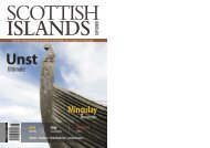
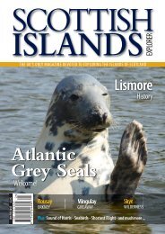
SCOTTISH<br />
ISLANDS<br />
THE UK’S ONLY MAGAZINE DEVOTED TO EXPLORING THE ISLANDS OF SCOTLAND<br />
EXPLORER<br />
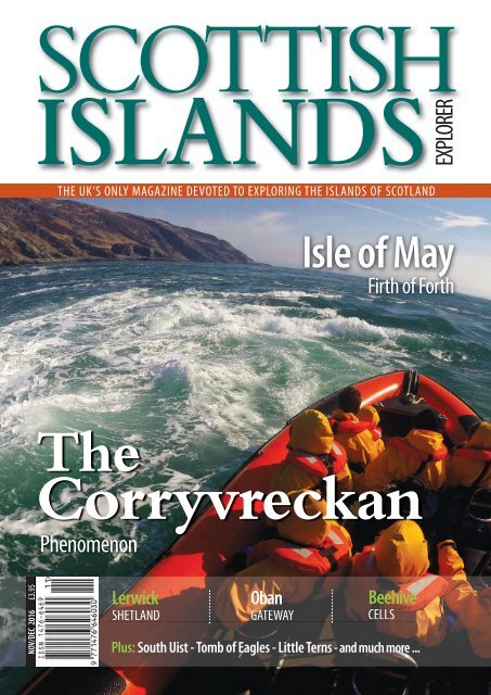
Isle of May<br />
Firth of Forth<br />
The<br />
Corryvreckan<br />
Phenomenon<br />
NOV/DEC <strong>2016</strong> £3.95<br />
Lerwick<br />
SHETLAND<br />
Oban<br />
GATEWAY<br />
Beehive<br />
CELLS<br />
Plus: South Uist - Tomb of Eagles - Little Terns - and much more ...
ISLAND AND WILDLIFE CRUISES OFF SCOTLAND’S<br />
BEAUTIFUL HEBRIDEAN COAST<br />
NORTHERN LIGHT<br />
CRUISING COMPANY<br />
Exploring St Kilda, Mingulay, The Shiants, North Rona<br />
and many other Hebridean <strong>Islands</strong>.<br />
Small groups - maximun 12 guests • From long-weekends to 10 nights aboard.<br />
Great Food • Birds • Cetaceans • Walking • Photo Opportunities<br />
Call Michelle on 01599 555723<br />
info@northernlight-uk.com<br />
northernlight-uk.com
Morvern - page 35<br />
Lerwick - page 8 Isle of May - page 28<br />
SCOTTISH ISLANDS EXPLORER NOVEMBER / DECEMBER <strong>2016</strong> Volume 17 / Issue 6<br />
Editor<br />
John Humphries<br />
editor@scottishislandsexplorer.com<br />
01379 890270<br />
Publisher<br />
Tom Humphries<br />
publisher@scottishislandsexplorer.com<br />
Production Design<br />
Deborah Bryce<br />
production@scottishislandsexplorer.com<br />
Proof Reader<br />
Melanie Palmer<br />
Circulation and Enquiries<br />
Steve Tiernan<br />
www.magazineworkshop.co.uk<br />
01422 410615<br />
Regular Contributors<br />
Tom Aston<br />
Roger Butler<br />
Marc Calhoun<br />
Richard Clubley<br />
James Hendrie<br />
Mavis Gulliver<br />
Jack Palfrey<br />
James Petre<br />
Stephen Roberts<br />
Andrew Wiseman<br />
Administration<br />
Ravenspoint Press Ltd<br />
Kershader Isle of Lewis HS2 9QA<br />
01851 830316<br />
info@scottishislandsexplorer.com<br />
www.scottishislandsexplorer.com<br />
Published bi-monthly<br />
Printed by Buxton Press Ltd<br />
Palace Road Buxton SK17 5AE<br />
01298 212000<br />
Next issue on sale: 18 <strong>Dec</strong>ember <strong>2016</strong><br />
©Ravenspoint Press Ltd<br />
All rights reserved.<br />
ISSN: 1476-6469<br />
Distribution<br />
Warners Group Publications Plc<br />
The Maltings West Street<br />
Bourne Lincolnshire PE10 9PH<br />
01778 391000<br />
Front Cover<br />
Image of the Corryvreckan Whirlpool<br />
from Seafari Adventures - Easdale<br />
CONTENTS<br />
4 Editor John Humphries and Guest Columnist Emily Richards<br />
5 Vision for 2020 with Christmas Offers as well as the Quiz challenge<br />
6 Insights One Books with Seasonal Interests - as Presents or for Pursuits<br />
7 Insights Two A Gift from a Writer’s Cabin<br />
8 Lerwick<br />
Stephen Roberts traces its development from Shetland backwater<br />
13 From the Static to the Dynamic<br />
Jack Palfrey took a Jerba campervan on a test-run<br />
15 <strong>Islands</strong> Beyond<br />
Hew Prendergast finds coincidences in Bronte, Sicily<br />
16 Oban<br />
Roger Butler focuses on ‘the Gateway to the Isles’<br />
20 The Cladh Hallan Mummies<br />
Sharon Brookshaw uncovers some of their mysteries<br />
24 Readers’ Opportunities One<br />
Get Out More … With Less!<br />
25 Readers’ Opportunities Two<br />
HMS Hampshire: A Century of Myths and Mysteries Unravelled<br />
26 Centrepiece<br />
Little Terns - Michael Steciuk shares his images from an assignment<br />
28 Isle of May - Beloved of Vikings, Smugglers and Seabirds<br />
Marieke McBean on the island in the Firth of Forth<br />
32 Ages of Man and Tomb of Eagles<br />
James Hendrie visits the archaeological finds of two people<br />
35 Morvern<br />
James Petre sees it more as an island<br />
38 The Corryvreckan<br />
Gordon Eaglesham explains the whirlpool phenomenon<br />
42 The Beehive Cells<br />
Marc Calhoun takes a walk to Ardveg<br />
45 Inchcolm<br />
Susan Hulme investigates the ‘Iona’ beside the city<br />
48 Responses<br />
Chris Banks revives special memories of visiting St Kilda<br />
49 Crossword Sponsored by the <strong>Islands</strong> Book Trust<br />
Tom Johnson presents puzzlers with his 25th challenge<br />
50 Island Incidents<br />
Barbara Sellars experienced the ancient and modern in Inchcailloch<br />
NOVEMBER / DECEMBER <strong>2016</strong> SCOTTISH ISLANDS EXPLORER 3
Editor’s Welcome / Guest Columnist<br />
Editor<br />
John Humphries<br />
on associates<br />
There is again something that feels new about this edition<br />
of the magazine. We are with Buxton Press which, of course,<br />
applies different production techniques. Alas, the family-firm of<br />
Hastings Printing, was taken over and closed. Sadness was felt<br />
because the company knew how to handle our commercial<br />
needs in both a friendly and professional manner.<br />
We felt an association with them for they owned two<br />
magazines, which like our title, encouraged those with a passion<br />
- in their case for ships and aircraft. One of the features of the<br />
British, and its males in particular, is a liking for an activity that<br />
creates a bond of common interest. Obviously on a large-scale<br />
this can involve soccer or, with its full title, Association Football.<br />
Fans (and sometimes fanatics) can be drawn to mass<br />
movements which are sporting, political, religious or social. Yet<br />
the appeal is to find those enthusiasts who focus on the often<br />
unnoticed and the unexpected. They derive pleasure from<br />
exploring, sometimes collecting, but always looking at structures<br />
or topics that demand a certain meticulousness.<br />
I had the privilege during the summer of spending time with<br />
members of the Relative Hills Society in the Isles of Scilly. Before<br />
you start contacting me about a group of Marilyn-baggers<br />
(dedicated climbers of certain hills of over 1500’ in Britain and<br />
Ireland) being on low-lying islands, you should know that here<br />
was a group interested also in SIBS - Significant <strong>Islands</strong> of Britain.<br />
I now urge you to google your way out of ignorance and then<br />
to listen to my account of how I was impressed by 20 individuals,<br />
male and female, who visited small islands, climbed to their<br />
highest and photographed, if there, the relevant trig points and<br />
then proceeded to search for and identify one or more of the<br />
Ordnance Survey bench-marks, of which there are some halfmillion<br />
nationwide.<br />
So let us rejoice that our heritage is being preserved for future<br />
generations, efforts are being made to enthuse others, individual<br />
passions are aroused and a ‘good time had by all.’ Those of us<br />
who are associates on this magazine - editor, contributors,<br />
publisher, designer, proof-reader, circulation-manager and<br />
printer - have a common cause that demands meticulous<br />
attention to creating a publication.<br />
John Humphries<br />
Guest Columnist<br />
Emily Richards on the<br />
Isle of Rum’s effect<br />
What do we mean by ‘the real world’, anyway?<br />
In 2013, I le London for an unknown wilderness,<br />
having abandoned job, income, friends and family<br />
to live with my wife in Kinloch Castle on the Isle of Rum,<br />
one of the wildest places in Britain. We shared an island<br />
with just 42 other people, plus eight eagles, 900 deer and<br />
100,000 Manx shearwater.<br />
During the two years that we lived there, my encounters<br />
with Rum's vast wilderness and its tiny community at<br />
first led to depression, even fear; but Rum was also<br />
beautiful, comical and, ultimately, life-changing. And<br />
when I wanted to run away, I was inspired to stay by the<br />
story of Lady Monica Bullough, the Edwardian beauty<br />
who once owned both castle and island.<br />
Here I was able to find my own voice and to write - at<br />
first a blog - then a whole book, Twelve Months with<br />
Lady Monica - A Beginner’s Life on the Isle of Rum. One<br />
reason for writing it was to tell the story of an island. But<br />
I also wanted to communicate that change is possible -<br />
but not easy. Living inescapably close to nature is not a<br />
romantic dream. It's more like a surgical intervention<br />
that changes you, body and soul.<br />
Even though we are now back in the ‘real world’ - which<br />
sometimes feels far less real than Rum - I am still stronger.<br />
My senses are sharper, I sleep more deeply and I know<br />
how to walk without footpaths; I used to feel cold all the<br />
time, now I feel warm. I am not passive in the way I used<br />
to be; I do not rely as much on other people;<br />
I have learnt what it means to feel free. is is what Rum<br />
gave me.<br />
So what happens now? <strong>Islands</strong> are not places where you<br />
can run away from life. Instead, if you take them<br />
seriously, they make you confront their realities.<br />
My challenge now is to put what I learned on Rum to<br />
use - to bring some of its freedom and wildness to my<br />
own life and, maybe, to other people’s too.<br />
Emily Richards<br />
4 SCOTTISH ISLANDS EXPLORER NOVEMBER / DECEMBER <strong>2016</strong>
VISION FOR 2020<br />
Here we are with the final issue of <strong>2016</strong> and 17 years of publishing complete. The magazine<br />
started on Fair Isle, moved to the south coast of England and has now settled down in …<br />
Suffolk, with a back office on Lewis. It’s that time of year when the need to keep-in-touch is<br />
paramount and what better for a present than a publication which keeps on coming (through<br />
the letter-box) for a whole year or beyond?<br />
Savings on Multiple<br />
Subscriptions<br />
This is the proposal for Christmas<br />
<strong>2016</strong>: one-year subscription gift<br />
offer to current readers wishing to<br />
purchase for family and friends<br />
with delivery in the UK.<br />
One gift may be bought for<br />
£22; two for £44; three for<br />
£55; four for £66.<br />
Cheques should be made payable<br />
to Ravenspoint Press Ltd and sent<br />
to<br />
<strong>Scottish</strong> <strong>Islands</strong> <strong>Explorer</strong><br />
Elm Lodge<br />
Garden House Lane<br />
Rickinghall<br />
Diss IP22 1EA<br />
Christmas <strong>2016</strong> Gift<br />
Subscription Offer!<br />
Please indicate the names and<br />
full addresses of the recipients<br />
together with your contact details<br />
(including phone and email, if<br />
applicable). For credit and debit<br />
card payments, phone 01379<br />
890270 or 07510 127014.<br />
Quiz: Insular Golf<br />
Courses<br />
David Hoult writes: The islands of<br />
Scotland boast some beautiful<br />
and distinctive golf courses. The<br />
latest is currently under construction<br />
at Ardfin, on Jura, and it is<br />
likely to be among the more<br />
impressive. Many existing ones<br />
are also in wonderfully scenic<br />
locations. On which islands are<br />
the following golf courses<br />
located?<br />
1. Machrie<br />
2. Askernish<br />
3. Dale<br />
4. Sconser<br />
5. Cleat<br />
6. Shiskine<br />
7. Scarista<br />
8. Vaul<br />
9. Skaw<br />
10. Balvicar<br />
Answers on Page 50<br />
Clarification<br />
The St Kilda gannet colony figure (quoted in the<br />
September / October <strong>2016</strong> edition) was, indeed,<br />
60,000 pairs of breeding birds, but in 2014 the<br />
Bass Rock became the world’s largest Northern<br />
Gannet colony with 75,000 pairs of birds.<br />
scottishislandsexplorer.com<br />
visit us<br />
online<br />
NOVEMBER / DECEMBER <strong>2016</strong> SCOTTISH ISLANDS EXPLORER 5
Page<br />
INSIGHTS<br />
Index Header<br />
Books with Seasonal Interests - as Presents or for Personal Pursuits<br />
Tobermory<br />
by Nic Davies, Sam Jones<br />
and Brian Swinbanks<br />
£9.99 Birlinn 978-1-78027-315-0<br />
e vibrant main street of the main town<br />
on Mull is photogenic - with its brightlycoloured<br />
frontages and iconic waterfront.<br />
Here is a collection of the work of three<br />
acclaimed, local photographers who have<br />
captured images of places, people,<br />
communities, events and wildlife encounters.<br />
e aerial views and stunning sunsets<br />
set the scene for a town to be recommended<br />
for holidaying and a book for giing.<br />
Island on the Edge -<br />
A Life on Soay<br />
by Anne Cholawo<br />
£12.99 Birlinn 978-1-78027-349-5<br />
e author saw Soay for the first time in<br />
1989, having found an advertisement for a<br />
property there. She was smitten, purchased<br />
and moved to be one of 17 residents. Now,<br />
including Anne and her husband, Robin,<br />
there are three. is is a first-person<br />
account of transition from urban life to selfsufficiency,<br />
of landscape and characters, of<br />
present-day activities and past endeavours,<br />
such as those of Gavin Maxwell.<br />
The Crinan Canal<br />
by Marian Pallister<br />
£9.99 Birlinn<br />
978-1-78027-346-4<br />
is is the first history of the canal that is<br />
a significant monument to British civil<br />
engineering. It has been called ‘Britain’s<br />
most beautiful shortcut’ and from 1801<br />
saved commercial shipping from<br />
journeying around the Mull of Kintyre to<br />
reach the West Coast and the Hebridean<br />
islands. Victoria and Albert made a return<br />
voyage in 1847 and encouraged tourists to<br />
follow the ‘Royal Route’.<br />
The Book of Iona -<br />
An Anthology<br />
Edited by Robert Crawford<br />
£14.99 Polygon 978-1-84697-351-2<br />
While Iona has come a long way since the<br />
early writings by and of Columba,<br />
Professor Crawford has brought together<br />
a wide range of stories, poems, assessments,<br />
analyses and reflections. e island<br />
annually attracts hundreds of thousands<br />
of visitors, for it is a place of pilgrimage<br />
and a tourist trail destination. is book<br />
deserves to attract the same length queues<br />
as those generated by the ferry.<br />
Religion in Secular Society<br />
by Bryan R Wilson<br />
Edited by Steve Bruce<br />
£27.50 Oxford University Press<br />
978-0-19-878837-9<br />
Visitors to the Outer Hebrides on a<br />
Sunday will be aware of the popularity of<br />
church-going among the Protestants in<br />
the north and the Catholics in the south.<br />
Secularisation has been relatively slow to<br />
develop, but in the religious culture of<br />
most of the UK and much of the USA it<br />
has been widespread. Bryan Wilson<br />
considers changes since the publication of<br />
his Religion in Secular Society 50 years ago.<br />
A Shetlander’s Fair Isle<br />
Graph Book<br />
with an Introduction by<br />
Dr Carol Christiansen<br />
£20.00 e Shetland Times Ltd<br />
978-1-910997-08-6<br />
is is for the adventurous knitter who<br />
wishes to be inspired by classic Shetland Fair<br />
Isle patterns and colourways as well as by<br />
Norwegian-created motifs. Income from<br />
this book will be used by the Shetland Guild<br />
of Spinners, Knitters, Weavers and Dyers to<br />
promote all aspects of their traditional<br />
textile skills that are also encouraged on the<br />
website www.ravelry.com<br />
6 SCOTTISH ISLANDS EXPLORER NOVEMBER / DECEMBER <strong>2016</strong>
INSIGHTS<br />
Page Index Header<br />
A Gift from a Writer’s Cabin<br />
Writer’s Cabin, Islay<br />
Mavis Gulliver, a lover of islands<br />
and contributor to this magazine, finds<br />
inspiration from her travels around the<br />
Hebrides. After a long teaching career,<br />
latterly on Colonsay, she has fulfilled<br />
her ambition to write for children.<br />
A Tiree fencepost in the rough shape<br />
of a horse’s head triggered her<br />
imagination and led her to write The<br />
Hagstone Chronicles.<br />
Swirled together with magic,<br />
mystery, island locations and folklore,<br />
the three books take the reader on<br />
an epic adventure as they join the<br />
Benevolent Wizards in their determination<br />
to defeat Malevolent Witchery.<br />
Accolades for the books have come,<br />
not only from 8 -12 year olds, but from<br />
teenagers, teachers, parents and a<br />
46-year-old man who said, “I love to<br />
immerse myself in a book meant for<br />
children. This is not just a story for the<br />
young, but for the young at heart.”<br />
Ideal for a holiday, for curling up on<br />
a winter’s evening, for reading alone<br />
or for sharing with the whole family,<br />
the three books make a perfect<br />
Christmas gift.<br />
On a limited offer - until Christmas<br />
Eve <strong>2016</strong> - signed copies of Cry at<br />
Midnight, Clickfinger and The Snake<br />
Wand are available from the author<br />
for the price of two, that’s £19.98<br />
post-free. Just email<br />
mavisgulliver@googlemail.com and<br />
she will reply, indicating the ways and<br />
means of securing her books.<br />
Mavis Gulliver converts her ideas<br />
into words from her writer’s cabin on<br />
Islay. Enjoy her gifts as a writer and do<br />
take advantage of her offer of a<br />
seasonal gift to you.<br />
An Acclaimed Triology<br />
for Under £20<br />
Signed - Post-free - A Gift!<br />
NOVEMBER / DECEMBER <strong>2016</strong> SCOTTISH ISLANDS EXPLORER 7
Lerwick<br />
Lerwick<br />
Stephen Roberts traces its development<br />
from Shetland backwater to commercial centre<br />
Ifancied I needed a haircut. I only had a few hours<br />
in Lerwick, the wind was ‘fresh’ and my mop was<br />
scattering indiscriminately. en I saw it; ‘Britain’s<br />
most northerly barber shop’. It seemed like an invitation<br />
I couldn’t pass up.<br />
Everything about Shetland’s capital is northerly, its<br />
being over 100 miles from the coast of mainland<br />
Scotland. For somewhere supposedly so remote, it is<br />
surprisingly busy, a bustling, cosmopolitan seaport.<br />
Here is Shetland’s industrial and commercial hub,<br />
with Lerwick Harbour its principal port.<br />
It is a key to the local economy and Britain’s<br />
northernmost commercial port, handling 5,000<br />
vessels annually, including cruise ships, with around<br />
50 behemoths berthing each year. We arrived in said<br />
fashion and paid homage at ‘Böd of Gremista’, the<br />
house one-mile north, where Arthur Anderson, cofounder<br />
of P&O was born.<br />
Today’s High School<br />
is building was once a fish-curing station and<br />
Anderson himself once worked on the beach,<br />
preparing fish. He endowed his eponymous<br />
educational institute in 1862, which became today’s<br />
High School, with some 900 pupils. As Shetland has<br />
15 inhabited islands, it would be impractical for some<br />
pupils to travel to school each day and so Anderson<br />
High has a student hostel.<br />
Down on the waterfront bob a myriad of cra;<br />
pleasure boats, yachts, historic cra and fishing boats,<br />
adding a touch of colour to what might, otherwise,<br />
be a grey scene. Lerwick’s building material is<br />
predominantly grey, so a sunny day should be ordered<br />
if possible. Bars and clubs abound.<br />
The fishing heritage is strong, of course. Hay’s<br />
Dock, once the centre of Shetland’s fishing<br />
industry and boatbuilding, is now home to the<br />
Shetland Museum and Archives, recalling 5,000<br />
years of human activity. The town’s population is<br />
7,500 and the islands have around 22,000<br />
residents, about half of whom live within ten miles<br />
of the burgh.<br />
Long, Chequered History<br />
e name literally means ‘muddy bay’ (‘Leir-vik’ in<br />
Norse). Founded originally as an unofficial market<br />
for 17th Century herring fleets, and developed on<br />
that trade, Lerwick had a long, chequered history.<br />
Every June, from 1602, saw the Dutch fishing fleet<br />
gather in Bressay Sound, the sheltered stretch<br />
between Shetland’s Mainland and the island of<br />
Bressay, for migrating herring.<br />
Native Shetlanders set up temporary huts along the<br />
shore to trade with the Netherlanders. e fact a<br />
harbour developed here is unsurprising, as Bressay<br />
Sound looks an eminently sensible place for a safehaven.<br />
e only surprise is it took so long to get<br />
established. Until 1625 there were just a few huts,<br />
but with the deep water harbour and fishing<br />
interests, its growth was inevitable.<br />
Lerwick was not always the ‘main-man’ though. In<br />
an interesting juxtaposition of old and new, the<br />
village of Scalloway, six miles west with 1,200<br />
residents today, was the ancient capital. is is why<br />
it has a fine castellated mansion, built in 1600 by<br />
Patrick Stewart, Earl of Orkney, who succeeded his<br />
father to the earldom and Lordship of Shetland<br />
eight years before.<br />
8 SCOTTISH ISLANDS EXPLORER NOVEMBER / DECEMBER <strong>2016</strong>
Lerwick<br />
‘Lerwick may have seen its fishing fleet<br />
dwindle, but its superb natural harbour<br />
has found ready compensation ...’<br />
NOVEMBER / DECEMBER <strong>2016</strong> SCOTTISH ISLANDS EXPLORER 9
Lerwick<br />
Business Had Shifted<br />
ere was then no castle on Shetland, hence his building in<br />
Scalloway which continued as the focus for local administration<br />
and justice, with courts held there in 1612 and 1613.<br />
By 1708, it ceased to be the archipelago’s capital, although,<br />
as late as 1733, public letters were still draed there, but, by<br />
then, government business had shied to Lerwick.<br />
Its travails included demolition by the Scalloway court in<br />
1615 and 1625, punishment for its ‘illegality’ and alleged<br />
immorality, referring to the infamously drunken and rowdy<br />
annual herring festival. ere appears to have been some<br />
resentment by pious citizens of what went on there, where<br />
‘country people and Hollanders caroused’.<br />
For many years the authorities insisted Lerwick’s shanty<br />
town was ‘fired’ aer the Dutch had le. By 1650, however,<br />
its settlement was looking more permanent, although the<br />
relationship with the Dutch was changing. e first Anglo-<br />
Dutch War broke out in 1652, fought to control trade routes<br />
and colonies.<br />
Another Fortified Site<br />
e response was to build a fort overlooking the harbour.<br />
To add to its woes the Dutch burned the fort in 1673 and the<br />
French set fire to the town in 1702. at bastion is Fort<br />
Charlotte, founded in the 17th Century, then re-built in<br />
1781. Defence has a long history here; another fortified site,<br />
‘Clickimin Broch’ was occupied from the 7th Century BC<br />
to the 6th Century AD.<br />
‘Up-Helly-Aa’ is world-famous as Britain’s biggest and most<br />
spectacular fire-festival. e last Tuesday of January sees a<br />
torch-lit procession of some 1,000 people, burning of a<br />
replica Viking longship and all-night dancing and partying.<br />
Sounds like my kind of shindig - for Scandinavian roots<br />
permeate here.<br />
Commercial Street, parallel to the shore, offers access to the<br />
sea though gaps between buildings. At its south-east end can<br />
be found the lodberries, private piers for unloading goods<br />
into enclosed courtyards and warehouses. Here are 18th<br />
Century warehouses, with their own piers, and foundations<br />
in the sea. Little has changed since the 1700s.<br />
The Edinburgh Sailing<br />
From 1736 it was possible to sail from Lerwick to Leith,<br />
with the service improving in the 1750s as Shetland ponies<br />
were exported to English coalmines. Right up to 1901,<br />
Shetlanders relied on the Edinburgh sailing, as anyone<br />
requiring medical treatment had to get to the city’s Royal<br />
Infirmary. Today ships sail to Kirkwall, Aberdeen,<br />
Scandinavia, Faroe and Iceland.<br />
Most sandstone-buildings on the waterfront date from the<br />
18th Century; a few are older. e narrow main-street and<br />
charming constricted lanes just evolved. e area up beyond<br />
the Hillhead was planned though by Victorian architects,<br />
spacious villas and parks dominated by the Town Hall of the<br />
1880s, financed by the herring trade.<br />
Lerwick may have seen its fishing fleet dwindle, but its<br />
superb natural harbour has found ready compensation,<br />
becoming central to the recent oil boom, with ‘aquiline’ (like<br />
an eagle’s beak) oil-boats competing for space with the<br />
remaining fishing boats. It was from the mid-70s that<br />
Shetland profited from the North Sea, with a massive<br />
terminal constructed at Sullom Voe.<br />
10 SCOTTISH ISLANDS EXPLORER NOVEMBER / DECEMBER <strong>2016</strong>
Lerwick<br />
The Inconvenience<br />
e Shetland Charitable Trust dates to<br />
1976, a way of recompensing local people for<br />
the ‘inconvenience’ of having the terminal<br />
based in Shetland, by investing its public oil<br />
money for the benefit of its community. Its<br />
genesis came four years earlier when the ‘oil<br />
giants’ were doubtless viewing Shetland as<br />
little islands to be exploited in the greater<br />
scheme of things.<br />
Ian Clark, then Clerk of Zetland Council,<br />
thought otherwise, and devised a scheme to<br />
acquire special powers from Parliament ‘to<br />
protect Shetland’s interests and exploit the<br />
financial opportunities about to arise’. It was<br />
very ‘Local Hero’ and led to the local<br />
authority (now Shetland <strong>Islands</strong> Council)<br />
holding the initiative on oil matters over<br />
Parliament and the industrial giants.<br />
Disturbance Agreement (DA) money is<br />
paid to the Trust, charitable status giving<br />
exemption from certain taxes and Clark’s<br />
initiative resulting in ‘special funds’ which the<br />
CT can spend as it likes. To highlight just one<br />
success; Shetland now has eight top-class<br />
leisure centres and sporting facilities in its<br />
more populated areas.<br />
Secondary Banking Crisis<br />
e Charitable Trust is not as buoyant as it<br />
was, a reflection of the global financial<br />
downturn. ‘Cost cutting’ and ‘value for<br />
money’ are now watchwords. at new mood<br />
also reflects at council level, Shetland <strong>Islands</strong><br />
Council lost heavily in the Secondary<br />
Banking crisis of 1973-75 when a slump in<br />
property prices caused smaller lenders,<br />
offering high interest rates, to face<br />
bankruptcy.<br />
en again there were difficulties in the more<br />
recent stock-market declines and banking<br />
crises, particularly those faced by the Icelandic<br />
financial authorities. All this goes to show that,<br />
while Shetland has done well from the North<br />
Sea’s oil industry, the words and concept of the<br />
poet John Donne need to be heeded in that ‘no<br />
man (nor business) is an island’.<br />
Page 9 Top: View towards Lerwick<br />
from the cruise ship berth.<br />
Below: Lerwick Harbour.<br />
Opposite: Fort Charlotte from the<br />
north.<br />
Left: Britain's most northerly<br />
barber shop.<br />
Below: Shetland Museum interior.<br />
Photographs taken by the author,<br />
James Hendrie.<br />
Further Information<br />
Shetland Pride of Place -<br />
shetland.org<br />
Lerwick Harbour -<br />
lerwick-harbour.co.uk<br />
Shetland Charitable Trust<br />
Shetland Times -<br />
shetlandtimes.co.uk<br />
NOVEMBER / DECEMBER <strong>2016</strong> SCOTTISH ISLANDS EXPLORER 11
The<br />
Pairc Trust<br />
Who are we?<br />
The Pairc Trust completed purchase of the Pairc Estate<br />
on behalf of the local community in <strong>Dec</strong>ember 2015.<br />
The Estate extends to an area of approximately<br />
10,8<strong>40</strong>ha in South Lochs, on the Isle of Lewis. It is a<br />
remote and rurally isolated area of the Western Isles,<br />
with a population of <strong>40</strong>0, and is 30 miles from<br />
Stornoway, the only large town in the Outer Hebrides.<br />
The Trust aims to regenerate the Pairc Estate, by<br />
providing affordable good quality accommodation,<br />
employment, community facilities and services.<br />
The Trust employs two full-time members of staff: a<br />
Development Manager and an Administrative Assistant<br />
who are both based in the Pairc Trust Office in the<br />
Kershader Resource Centre, South Lochs.<br />
There are seven directors who have a wide range of<br />
experience and skills. The minutes of their regular board<br />
meetings are published on the Pairc Trust website.<br />
What do we do?<br />
The five areas of prospective development have the<br />
potential to contribute towards the economic growth<br />
of the area and provide an income for the Trust.<br />
• Tourism: looking into how we can make the Estate<br />
more attractive to visitors by working in partnership<br />
with local groups and businesses.<br />
• Housing: providing additional and affordable<br />
housing to members of the community.<br />
• Renewable Energy: investigating potential opportunities<br />
for renewable energy development.<br />
• Resource Centre in Kershader: purchasing the<br />
building in order to provide a base for charities and<br />
community groups.<br />
• Crofting Administration: bringing the crofting files<br />
in-house and taking over the administration from<br />
the factors of the Estate.<br />
We are setting up working groups for each of the areas<br />
and welcome members of the community to join.<br />
In order to make the area more attractive to visitors,<br />
we are going to improve the walkway between<br />
Orinsay and the deserted village of Steimreway<br />
(pictured above). This is a very popular facility with<br />
locals and visitors alike.<br />
In order to make these improvements we have<br />
successfully applied for funding from Tesco Bags of<br />
Help, and local customers can vote for our project in<br />
Stornoway’s Tesco between 31 October to 13<br />
<strong>Nov</strong>ember <strong>2016</strong><br />
More information about the funding can be found<br />
at www.tesco.com/bagsofhelp<br />
Ways to get involved<br />
Email: info@pairctrust.co.uk<br />
Telephone: 01851 880 728<br />
Facebook: www.facebook.com/PaircTrust<br />
Website: www.pairctrust.co.uk<br />
If you live locally you can complete a Pairc<br />
Residents’ Survey online through the link on<br />
our website or contact us for a paper copy. We<br />
are always happy to meet with<br />
individuals or groups. If you<br />
would like to discuss anything,<br />
please feel free to get in touch.<br />
12 SCOTTISH ISLANDS EXPLORER
From the Static to the Dynamic<br />
Jack Palfrey took a Jerba Campervan on a test-run<br />
If you are able to put your hands on the May / June 2015<br />
edition of <strong>Scottish</strong> <strong>Islands</strong> <strong>Explorer</strong>, you will find an article<br />
on Jerba Campervans that advocates the vehicle as a fine<br />
prospective method of … <strong>Scottish</strong> islands exploring. Earlier<br />
this year I was invited to drive the converted Volkswagen T6<br />
from the company’s production unit near North Berwick.<br />
Simon Poole and his partner, Cath Brookes, own the<br />
going-concern that produces some 60 vehicles a year within<br />
a few hundred yards of Tantallon Castle. So customers drive<br />
away their new acquisitions and soon see the mid-14th<br />
Century semi-ruin as they begin an adventurous phase of<br />
their lives. The bonding of driver and vehicle will involve<br />
the same connections as between the builders and<br />
campervan, ‘teamwork’.<br />
Perfect Compactness<br />
e word ‘conversion’ implies an add-on element, but the<br />
standard of workmanship here elevates the interiors of the<br />
campervans to a perfect compactness, planned by those who<br />
have many years of experience in ‘tents-on-wheels’. ere is<br />
not an aer-thought in design, for all is part of a complete<br />
concept about creating carefree touring.<br />
For the most part, owners will be making their ways to<br />
scenic areas where roads are narrower and inclined to wind<br />
around hills and mountains, dales and vales. is campervan<br />
holds the road effectively and the higher position of the cab<br />
means that a wider sense of vision is there to enjoy.<br />
Cornering, manoeuvring, positioning and parking were soon<br />
mastered by me.<br />
My wish was to see how the relatively static element of<br />
driving safely became the dynamic concept of multiple uses<br />
for holidaying. I need not have worried, for access to<br />
equipment was either of finger-tip control or within-reach.<br />
Drivers and passengers see a daily evolution from refreshment<br />
bar to kitchen / diner and then on to a room for beds before<br />
that vital routine of PUMO - ‘Pack Up Move Off ’.<br />
Space on Board<br />
All the main <strong>Scottish</strong> islands have roll-on, roll-off ferries.<br />
Skye has two of them and then its main access point, the<br />
Bridge. It is a fine island to start a campervan odyssey with<br />
roads that attract enthusiasts, long coastal stretches,<br />
unrestricted parking with many fine places for overnight<br />
stays, and space on board for the kit needed to climb hills<br />
or relax on beaches.<br />
‘Jerba’ can be used as a variation for Djerba, the island off<br />
south-east Tunisia. It has been traditionally liked with<br />
Homer’s land of the lotus-eaters where the natural<br />
elements of the diet provide narcotic properties. This is a<br />
place associated with ‘peaceful apathy’. However, the drive<br />
to see places in the Jerba Campervan means that the<br />
appropriate word is, indeed, ‘carefree’. It’s yours to experience<br />
and enjoy!<br />
Further Information<br />
Jerba Campervans 01620 890374 jerbacampervans.co.uk<br />
NOVEMBER / DECEMBER <strong>2016</strong> SCOTTISH ISLANDS EXPLORER 13
harrowwhiskyfestival.com<br />
Friday / Saturday 13 / 14 January 2017<br />
Small-group expeditions to Arctic Norway,<br />
the Solovetski <strong>Islands</strong> of Arctic Russia,<br />
Greenland and Kamchatka.<br />
• Arctic and Antarctic voyages by ship<br />
• Dog sledding, cross country skiing, boating, kayaking,<br />
hiking and wildlife trips<br />
• Tailor-made Iceland and the Faroes - flights from Scotland<br />
• Greenland - East and West coast:<br />
Wildlife and natural history<br />
• Wildlife of Russian Far East - by ship<br />
• Wild Scotland: Oban - Aberdeen 13 - 23 June 2017<br />
• Aberdeen, Fair Isle, Jan Mayen and Spitsbergen<br />
22 - 31 May 2017<br />
• Across the Artic Circle: Aberdeen to Longyearbyen<br />
23 June - 6 July 2017<br />
Have a <strong>2016</strong> or 2017 edition of <strong>Scottish</strong><br />
<strong>Islands</strong> <strong>Explorer</strong> ready to show for a discount.<br />
Please call for a full colour brochure<br />
ARCTURUS<br />
The polar arm of Far Frontiers Travel Ltd<br />
Ninestone<br />
South Zeal<br />
Devon EX20 2PZ<br />
Tel/Fax (44) 018378<strong>40</strong>6<strong>40</strong><br />
arcturusexpeditions.co.uk<br />
Outstanding Self-Catering<br />
for Six in South Harris<br />
Corncrake and Otter Cottages<br />
Luxurious, five-star awarded accommodation -<br />
Almost on fabulous Scarista beach<br />
The distinctive Harris golf course close by - A pass for all six guests included<br />
Underfloor heating - Oil and electricity included - Large television with DVD - Broadband internet<br />
Linen and towels included - Two dogs welcomed<br />
www.LHHScotland.com 01381 01361 610496<br />
14 SCOTTISH ISLANDS EXPLORER NOVEMBER / DECEMBER <strong>2016</strong>
ISLANDS BEYOND<br />
Hew Prendergast finds coincidences in Bronte, Sicily<br />
In a small cypress-darkened Sicilian graveyard is a strange<br />
tomb. On its face are two names - one male, the other<br />
female. ey share a date of birth -12 September 1855 - as<br />
though they were twins. But they also share a very much later<br />
date of death - 12 <strong>Dec</strong>ember 1905 -by all appearances more<br />
then a remarkable coincidence.<br />
e two names are ‘William Sharp’ and ‘Fiona Macleod’<br />
and below them are inscribed, respectively, fitting lines of<br />
verse they each wrote:<br />
Farewell then to the known and exhausted<br />
Welcome to the unknown and unfathomed<br />
Love is more great than we conceive<br />
And death is the keeper of unknown redemptions<br />
William and Fiona were in fact one and the same, but not<br />
from the very beginning. Born in Paisley, and educated briefly<br />
at Glasgow University, William settled in London where he<br />
associated with many of the leading artists and literati of the<br />
time. He published volumes of poetry, wrote biographies of<br />
Shelley, Heine and Browning, and was commissioned for<br />
articles and essays for periodicals. He was also a keen traveller.<br />
The Key to Everything<br />
For anyone of sensibility from Europe’s north, a journey to<br />
Italy could have an enormous impact. Perhaps the most<br />
famously recorded of all was the Italienische Reise of Johann<br />
Wolfgang von Goethe. For six weeks in 1787 he visited<br />
Sicily. ‘Without Sicily,’ he wrote, ‘Italy creates no image in<br />
the soul: here is the key to everything.’<br />
Just over a century later, in 1893, came William Sharp’s own<br />
Sicily by Hew Prendergast. Pastel drawing by Charles Ross 1891.<br />
first visit to the island and it was later that year that (coincidentally?)<br />
he first mentioned to his publisher that ‘I wish to<br />
adhere rigidly to the Fiona Macleod authorship.’ What<br />
spurred him to adopt such a nom de plume must have been<br />
psychologically complicated, but this did appear to allow the<br />
expression of a feminine side to his character. Indeed he was<br />
supposed to have written to a friend that ‘in some things I am<br />
more a woman than a man.’<br />
e poetry ‘she’ wrote conferred on him a degree of<br />
anonymity and eventually attracted greater praise than ‘his’.<br />
A life of two halves and identities took hold. How did Sharp<br />
(and Macleod) end up 25 miles inland from Sicily’s east<br />
coast? A clue lies on a sign for the graveyard, the Cimitiro<br />
Inglese dei Nelson, although this in turn begs other questions.<br />
Never Visited<br />
In 1799, Horatio Nelson assisted the King of Naples in his<br />
resistance to the French and, in gratitude, was conferred a<br />
title and a fine Sicilian mansion opposite the graveyard. He<br />
never visited it, but his descendants retained possession of<br />
the Castello Nelson until the 1970s and they still,<br />
apparently, own the graveyard where Sharp/Macleod is its<br />
most famous internee.<br />
Whatever literary heights he/she managed to achieve, they<br />
are far outshone by the daughters of a Yorkshire vicar who,<br />
in awe and honour of Nelson, changed his surname, and<br />
theirs, to that of the town where the graveyard in Sicily is<br />
located - Brontë. Perhaps Sharp too had gone there to pay<br />
his respects?<br />
NOVEMBER / DECEMBER <strong>2016</strong> SCOTTISH ISLANDS EXPLORER 15
Oban<br />
Oban<br />
Roger Butler focuses on ‘the Gateway to the Isles’<br />
Ask a child to sketch out an imaginary coastal<br />
town, you might well receive something<br />
that looked like Oban. A sheltered harbour would<br />
be the centrepiece, with high mountains,<br />
shimmering sunsets and tiers of solid stone houses.<br />
A toy railway and a pier, tiny fishing boats bob in<br />
the bay and gigantic ferries squeeze their way out<br />
to sea. Seagulls fill the sky while tourists tuck into<br />
hearty portions of freshly-cooked crab.<br />
Everyone seems to like Oban. e name might<br />
be derived from the Gaelic equivalent of ‘little bay’<br />
but there’s nothing small about the present-day<br />
harbour. ‘Gateway to the Isles’ is a well-used<br />
strapline, though marketing teams can offer<br />
alternatives. Currently the town is ‘Seafood<br />
Capital of Scotland’, but in the years aer the<br />
Second World War it was oen known as the<br />
‘Charing Cross of the Highlands’.<br />
Today, Oban remains as busy as ever and the<br />
summertime traffic oen grinds to a halt along the<br />
shop-lined esplanade. e view across the bay<br />
looks west to the islands of Kerrera and Mull and<br />
many visitors are unable to resist the temptation<br />
to enjoy at least one boat trip. is might be a<br />
short visit to a seal colony, an aernoon cruise over<br />
to Lismore or a full-blown outing to Iona.<br />
Prehistoric Times<br />
For many decades, CalMac ferries have plied back<br />
and forth and there’s always a tingle of excitement<br />
when the tannoy announces departures to Barra,<br />
Coll, Tiree or Colonsay. However, the area around<br />
Oban is known to have been occupied in prehistoric<br />
times and in 1888 a lake dwelling was<br />
discovered by a marshy tract of ground at the south<br />
end of town.<br />
Six years later, a cave was discovered near the site<br />
of what is now St Columba’s Cathedral. is<br />
contained human skeletons and the remains of<br />
various animals such as deer, oxen, pigs and otters.<br />
Among the piles of fish bones and discarded shells<br />
were ancient stone hammers and crude<br />
implements fashioned from bone. Many centuries<br />
passed before houses were finally established here.<br />
By the 1790s thatched properties were appearing<br />
around the ‘tolerable inn’ which Boswell<br />
described in his tour of the Highlands in 1773. A<br />
post office and customs house were established,<br />
but Oban was still not much more than a simple<br />
clachan and 20 years later the population had<br />
reached just the 500 mark. By 1850 the growing<br />
town - now a parliamentary burgh - was home to<br />
around 1,500 people.<br />
Respectable-looking<br />
A reporter described ‘a village with a roadstead<br />
containing a small complement of shipping boats<br />
and a respectable-looking range of whitewashedhouses<br />
fronting the harbour’. The Duke of<br />
Argyll helped fund development, including a<br />
school, and the population was almost 2,000 in<br />
1861. Today, that figure has been multiplied by<br />
ten times.<br />
Oban became a good example of 18th Century<br />
<strong>Scottish</strong> town planning, where buildings and<br />
streets tended to be focused around a central<br />
square. The heart of the town is still around<br />
Argyll Square, near the railway station and main<br />
ferry terminal, but steeply rising slopes limited<br />
the grid-iron layouts which were conspicuously<br />
laid out in many other towns during that period.<br />
Prosperity arrived as trade and industry<br />
flourished and the opening of the Crinan Canal<br />
across the top of the Kintyre peninsula linked the<br />
booming markets of the Firth of Clyde to the<br />
Firth of Lorne. One report rather ambiguously<br />
described Oban’s main imports as ‘miscellaneous<br />
goods from Glasgow and Liverpool’, but could be<br />
more specific when it came to exports: ‘pig-iron,<br />
whisky, wool, fish, kelp and Easdale slates’.<br />
16 SCOTTISH ISLANDS EXPLORER NOVEMBER / DECEMBER <strong>2016</strong>
‘is huge granite structure oen<br />
puzzles first-time visitors ...’
Page 17 Top: A classic view across<br />
Oban as the ferry from Mull<br />
arrives at the South Pier. The<br />
prominent red roof marks the<br />
North Pier and the tall<br />
chimney rises from the distillery.<br />
Below: The entrance to the<br />
impressive McCaig’s Tower is<br />
through a tall arch. The gothic-inspired<br />
circumference of this unusual<br />
folly extends to around 650’.<br />
Above: An interesting range of<br />
boats is moored by Oban’s North<br />
Pier, with the unmistakeable<br />
McCaig’s Tower on the wooded<br />
skyline.<br />
Opposite Top: An early morning<br />
ferry from Mull emerges from the<br />
mist as it begins its approach<br />
towards Oban by passing St<br />
Columba’s Cathedral.<br />
Below: Oban is famous for its<br />
sunsets - an evening view<br />
towards Kerrera and the Sound of<br />
Mull with St Columba’s Cathedral<br />
on the right.<br />
Photographs taken by the author,<br />
Roger Butler.<br />
Still Welcoming<br />
e iron would have come from nearby<br />
Taynuilt, where whole forests were felled to<br />
feed the furnaces, and the whisky may have<br />
come from the town’s distillery, founded in<br />
1794 and still welcoming visitors today. e<br />
1845 Statistical Account listed just 13 fishing<br />
boats, but referred to good quality shellfish<br />
and large quantities of herring. Produce from<br />
the land was not so plentiful - 'supplies in the<br />
butcher and vegetable markets are neither<br />
regular nor prime'.<br />
e railway station opened on 1 July 1880<br />
and additional platforms were built in 1904<br />
to accommodate a new branch line running<br />
south from Ballachulish. Oban was now<br />
connected to the Central Belt and it soon<br />
gained a reputation as a popular resort for<br />
pioneering holiday-makers. ey would have<br />
stepped off their trains beneath the<br />
atmospheric cream-coloured timber canopies<br />
which eventually became listed buildings.<br />
Sadly, this was not enough to prevent their<br />
demolition in the 1980s and the revamped<br />
station is now something of a soulless place<br />
surrounded by functional retail units.<br />
However, McCaig’s Tower forms an unmistakeable<br />
feature on the hill behind the harbour.<br />
A Lasting Monument<br />
is huge granite structure oen puzzles<br />
first-time visitors and was commissioned in<br />
1897 by John Stuart McCaig, a philanthropic<br />
banker who wanted to create a lasting<br />
monument to his family while also providing<br />
welcome employment to local stonemasons.<br />
He planned an amphitheatre based on the<br />
Colosseum at Rome and intended to include<br />
a museum and viewing tower within the 650’<br />
circumference of the outer wall, which is<br />
pierced by almost 100 high gothic arches. His<br />
death in 1902 meant the structure remained<br />
unfinished, but a steep walk from the seafront<br />
to the folly is rewarded by exceptional<br />
panoramas over Mull and nearby islands.<br />
ere might have been another landmark on<br />
the skyline too. A huge Victorian hotel<br />
complex known as the Oban Hydro (its full<br />
name was the Hydropathic Establishment<br />
and Sanatorium) was planned on another hill.<br />
is would have hosted healthy seawater<br />
baths and a large concert hall, together with<br />
18 SCOTTISH ISLANDS EXPLORER NOVEMBER / DECEMBER <strong>2016</strong>
Oban<br />
a golf course, extensive gardens and even a hydraulic li to<br />
carry guests up from the town.<br />
Tourism Flourishes<br />
No doubt there were plans to get the seawater up there as<br />
well! Work commenced in the 1880s, but financial problems<br />
brought things to a halt and the crumbling ruins can now be<br />
found amid rambling woodland on the high ground to the<br />
east of the South Pier. e Hydro may have failed, where<br />
tourism flourishes and it is estimated that, at the height of the<br />
season, around 25,000 people stay in the local area each night.<br />
e distillery offers tours, the seafood stalls provide tasty<br />
snacks and the evening ceilidhs are as popular as ever. e<br />
boats remain a popular attraction with fishing vessels, seagoing<br />
yachts and, of course, the island ferries. e North and<br />
South Piers form ‘bookends’ to the harbour. Ferries ran from<br />
each, where CalMac operations are now based at the south<br />
end, leaving the North Pier free for moorings and restaurants.<br />
e prominent, ivy-clad ruin of Dunollie Castle guards the<br />
northern approach into Oban bay. Excavations in the 1970s<br />
suggest that this early fortification was abandoned during the<br />
10th Century, but it appears to have been rebuilt 300 years<br />
later. e area around Dunollie subsequently became part of<br />
the semi-independent Kingdom of the Isles. e existing<br />
castle ruins date largely from the 15th Century, but the<br />
owners, the MacDougalls, abandoned the site and built a<br />
large house in the nearby sheltered valley.<br />
Transatlantic<br />
Descendants and clan-members are encouraged to visit and<br />
the remains of an historic herb garden have recently been<br />
discovered in the castle grounds. By way of contrast, at<br />
Gallanach, just south of the ferry to Kerrera, the first transatlantic<br />
telephone cable, to Newfoundland, was installed in<br />
September 1956. More than 600 calls were made on its first<br />
day and, eventually, it carried the presidential hot-line during<br />
the Cold War.<br />
e associated flat-roofed buildings, complete with hidden<br />
subterranean caverns, are redundant, but still look west across<br />
the islands towards distant Tir-nan-Og, the fabled Land of<br />
the Ever-Young. I wonder how a child would draw that?
The Cladh Hallan Mummies<br />
‘So-called ‘bog bodies’ are known from<br />
the Iron Age across northern Europe ...’<br />
The Cladh<br />
Hallan Mummies<br />
Sharon Brookshaw uncovers some of their mysteries<br />
South Uist was always going to be an unlikely place for mummies to be found. However,<br />
excavations between 1995 - 2002 at the island’s Late Bronze Age site of Cladh Hallan<br />
revealed finds that the site director, Dr Mike Parker-Pearson, described as, ‘Likely to redefine<br />
key aspects of life and death in prehistoric society … we never expected to find evidence for<br />
mummification in Western Europe. e find is a complete revelation.’<br />
Positioned towards the south west of the island, the site was home to a group of six or<br />
seven roundhouses built in the Late Bronze Age (dated to the 11th Century BC). ere<br />
was also evidence of Middle and Early Bronze Age occupation at Cladh Hallan, indicating<br />
that the site had already been used for a considerable period of time by the point that these<br />
roundhouses were constructed.<br />
ey were built partially dug into the sandy ground, the sunken buildings presumably as<br />
an adaptation to the frequent windy weather. e excavations revealed that the houses were<br />
built on top of a dramatic series of human and animal burials. e skeletons of a man, a<br />
woman and a sheep were under one house; a 10-14 year-old (probably female) under a<br />
second and a three-year old beneath a third.<br />
The Full Significance<br />
e archaeologists thought that the two adult skeletons looked unusual as they were buried<br />
in a highly-flexed position, with the legs bent and brought in close to the chest. Later<br />
examination revealed the full significance of what they had found. Detailed testing on the<br />
two sets of adult remains showed that the skeletons had died up to 500 years before finally<br />
being buried in the ground in around 1000 BC.<br />
In the case of the male skeleton, there was evidence that the normal process of decay had<br />
begun aer death, but had then been abruptly halted, while in the female’s case it had never<br />
started at all. Bones in both bodies also displayed surface de-mineralisation, which suggested<br />
that they had been exposed to an acidic environment for a period of time.<br />
is is not what you would expect to find if the bodies had simply been interred in the<br />
local sandy ground, as was the case with the young child and the teenager. e archaeologists<br />
concluded that the two bodies had been placed in a peat bog for somewhere between six<br />
and 18 months, before being removed, dried and kept above ground.<br />
20 SCOTTISH ISLANDS EXPLORER NOVEMBER / DECEMBER <strong>2016</strong>
The Cladh Hallan Mummies<br />
NOVEMBER / DECEMBER <strong>2016</strong> SCOTTISH ISLANDS EXPLORER 21
The Cladh Hallan Mummies<br />
The First Evidence<br />
In other words, they had been deliberately mummified<br />
before burial. e mummification had not been immediately<br />
evident because the so tissue that would have been<br />
preserved in the process had decayed aer burial, leaving just<br />
the bones remaining. is was the first evidence for such a<br />
practice to be found anywhere in Britain.<br />
So-called ‘bog bodies’ are known from the Iron Age across<br />
northern Europe (such as Gunnister Man in Shetland and<br />
Lindow Man in Cheshire), but these were people le<br />
permanently in bogs and later found with surviving so<br />
tissue. e Cladh Hallan mummies represent something<br />
altogether different because they were later removed from the<br />
bog for an extended period before burial, suggesting that<br />
some people were aware of the preservative powers of peat<br />
bogs much earlier than the Iron Age.<br />
Stranger still, it was discovered that the male skeleton was a<br />
composite - that is, it was made up of the bones of at least<br />
three men who had died between 1500 - 1350 BC. Work<br />
published in 2012 examined the remains of the female<br />
skeleton and concluded that this one was also a composite,<br />
made up of at least three contributors who died at later dates<br />
than the males, somewhere between 1300 - 1130 BC.<br />
The Remains of Different People<br />
All of these dates are significantly earlier than the time the<br />
roundhouses were constructed and the burials took place.<br />
e first question that we might therefore ask is why these<br />
ancient islanders compiled skeletons from the remains of<br />
different people? Could it have been a case of simple carelessness<br />
on behalf of those tasked with caring for these remains?<br />
is perhaps seems unlikely given the elaborate care by<br />
which these people were placed in a bog, then removed and<br />
kept above ground for considerable periods of time before<br />
burial; if the bodies meant enough to the community to want<br />
to preserve them in this way, then surely they would have kept<br />
individual bodies intact if this was also important to them.<br />
We might then conclude that this mixing of bones was<br />
intentional. Some archaeologists have suggested this act<br />
might be a way of deliberately merging the identities of the<br />
individuals that made up the composite skeletons, perhaps as<br />
a way of joining together different ancestral lines into one<br />
powerful whole.<br />
Yet to be Discovered<br />
It also suggests that there was enough space and resources in<br />
this community to keep multiple sets of remains in a sufficiently<br />
warm, dry environment to inhibit so tissue decay for extensive<br />
periods of time, perhaps in yet to be discovered “mummy houses”.<br />
e second question raised by these strange finds is why<br />
these people were making mummies at all. Motives for the<br />
deliberate mummification of the deceased vary across the<br />
22 SCOTTISH ISLANDS EXPLORER NOVEMBER / DECEMBER <strong>2016</strong>
The Cladh Hallan Mummies<br />
different places where it is practised. In<br />
Ancient Egypt, for example, mummification<br />
was thought to aid the deceased to live well<br />
in the aerlife, while the South American<br />
Chinchorro culture seemed to have an<br />
ancestor cult that involved taking mummies<br />
with the living community to display at<br />
major rituals.<br />
ere is plenty of evidence for respect being<br />
paid to the ancestors in prehistoric Britain, so<br />
it is possible that such a practice formed part<br />
of this tradition for the South Uist islanders.<br />
It has been suggested that the male and female<br />
mummies could perhaps have represented key<br />
ancestors in the history of Cladh Hallan.<br />
ese could have been powerful religious<br />
figures or political leaders or that they may<br />
have acted as evidence of the ownership of the<br />
land by right of having lived there for so many<br />
generations. Perhaps they could protect the<br />
people still living, or intercede on their behalf<br />
with the gods?<br />
Apparently Venerated<br />
is of course just leaves the third and final<br />
big question: if these mummies had been<br />
preserved above ground and apparently<br />
venerated by the community for so long, why<br />
were they then buried with roundhouses built<br />
on top of the graves? ere is evidence of<br />
ritual activity conducted in and around the<br />
roundhouses for a considerable time aer<br />
they were built.<br />
Large amounts of smashed pottery and<br />
more deliberately interred animal remains<br />
suggest that some sort of spiritual practice<br />
continued on site long aer the mummies<br />
were buried. Does this, then, represent a<br />
change in the local religion? e Callanish<br />
stone circle on the nearby island of Lewis was<br />
brought back into use around this time aer<br />
centuries of apparent abandonment, which<br />
some archaeologists point to as evidence of<br />
such a change.<br />
Another possibility is that there was some<br />
sort of conquest or arrival of settlers - new<br />
people who removed the old symbols of<br />
power and erected buildings as a way of<br />
stamping their authority on the local<br />
landscape. Only time and more research will<br />
tell if there is more to the story of the Cladh<br />
Hallan mummies.<br />
Page 21 Top: View from the<br />
south-west of South Uist.<br />
Below: A sheep on a solitary<br />
South Uist rock.<br />
Opposite: A graveyard on the<br />
island.<br />
Images supplied by Fotosearch.<br />
<strong>Scottish</strong> <strong>Islands</strong> <strong>Explorer</strong><br />
Store<br />
Stocked with items for you,<br />
family and friends<br />
• One-year subscriptions from<br />
£24.97<br />
with discounts for longer terms<br />
• Back numbers for £4.00 each<br />
• Archive CD from 2000-2015<br />
• DVDs on islands , areas & topics<br />
• Binders at £12.45 (inc. p&p)<br />
scottishislandsexplorer.com<br />
01379 890270 or 07510 127014<br />
Cheques to ‘Ravenspoint Press Ltd’<br />
c/o Elm Lodge Garden House Lane<br />
Rickinghall Diss IP22 1EA<br />
NOVEMBER / DECEMBER <strong>2016</strong> SCOTTISH ISLANDS EXPLORER 23
Page<br />
READERS’<br />
Index Header<br />
OPPORTUNITIES<br />
Get Out More … With Less!<br />
What a difference, say, seven decades have meant to<br />
clothes, shoes and kit becoming lighter and more flexible.<br />
Just weigh (or weigh up) a pair of walking boots from the<br />
1950s and compare them with today’s products.<br />
Teva® has pioneered freedom in footwear since 1984 and<br />
its recently-launched Arrowood range of lightweight walking<br />
boots has created a modern look with the technology of<br />
Float-Lite TM in the sole. This gives water-resistance,<br />
durability and comfort - enabling the flexibility of extreme<br />
solo pursuits and casual trips in company. The boots are<br />
available in <strong>40</strong> countries and may be viewed at<br />
www.teva.com<br />
Getting up high, getting fit or getting on<br />
in years presents problems, and trekking<br />
poles could be the answer. Leading<br />
tech-leisure company, Black Diamond<br />
(blackdiamondequipment.com)<br />
produces a range that is versatile<br />
and durable, compact and ultralight.<br />
Distance, Alpine and Trail<br />
categories have 17 varying styles<br />
with emphasis on shock absorption,<br />
suitable tips and grips as well as<br />
adjustable lengths.<br />
Packing for holidays demands<br />
attention to detail and the Schelle<br />
Collection (www.schelle.co.uk) has<br />
applied this attribute to<br />
the design of its travel<br />
case - price £9.99 - for<br />
an electric toothbrush.<br />
It’s shatter-proof and<br />
robust, dishwasher-safe,<br />
anti-viral and anti-bacterial,<br />
prevents accidental turn-ons, fits<br />
most popular brands, available in a<br />
range of colours plus it’s compact<br />
and lightweight.<br />
Liberate yourself from soap, towels and<br />
running water with Wash Wizard<br />
(www.wash-wizard.co.uk). If you are at<br />
a festival, camping, bothying or trekking<br />
and want a complete body wash, here’s<br />
a sponge that requires a dash of water<br />
from a bottle, tap or stream. Its natural<br />
ingredients activate aloe vera foam and<br />
you can just air-dry. This is a green<br />
product, fragrance-free and priced at<br />
£7.99 for five sponges.<br />
Consider the Himalayan Heritage<br />
Collection from Sherpa Adventure Gear<br />
(www.sherpaadventuregear.co.uk) - fit<br />
for high-altitudes, challenging conditions<br />
and everyday wear. The hand-knitted<br />
and woven garments blend traditional<br />
designs with touches of modern<br />
technology. The Nepalese people<br />
benefit from sales and the mittens and<br />
hats, in particular, may help in some of<br />
your gift selecting.<br />
24 SCOTTISH ISLANDS EXPLORER NOVEMBER / DECEMBER <strong>2016</strong>
READERS’ OPPORTUNITIES<br />
Page Index Header<br />
HMS Hampshire:<br />
A Century of Myths and Mysteries Unravelled<br />
In June 1916 HMS Hampshire,<br />
carrying Lord Kitchener to Russia<br />
for talks with the Tsar, struck a mine<br />
west of Orkney and sank within a few<br />
minutes with the loss of all but twelve<br />
of the 749 on board. Two weeks later,<br />
a further nine men died when Laurel<br />
Crown hit a nearby mine. From that<br />
day to this, stories have been told in<br />
Orkney of the weather that night,<br />
sabotage, conspiracy, suffering and<br />
compassion.<br />
Some of the facts are known, some<br />
are firmly believed and some, no<br />
doubt, are apocryphal. The most often<br />
quoted is that soldiers prevented<br />
locals descending the cliff to attempt<br />
the rescue of those who did manage<br />
to make it ashore on rafts. Anger at<br />
this persists in Orkney, handed down<br />
as oral tradition through families.<br />
Horrors of War<br />
Twelve men were rescued or saved<br />
themselves, and the eyes of some<br />
old people still fill with tears as they<br />
recall the night their parents and<br />
grandparents took them in, close to<br />
death. It comes as no satisfaction to<br />
learn, as we did recently, that the<br />
commander of U75 that laid the mine<br />
was lost, off Orkney, in 1918 when his<br />
new command, U102, also hit a mine<br />
- just more horrors of war.<br />
James Irvine has assembled an<br />
excellent team of local writers with<br />
local knowledge to cover, between<br />
them, every conceivable aspect of<br />
this story of intrigue, mystery and<br />
adversity. The <strong>2016</strong> centenary<br />
commemorations are included. The<br />
writers, who are careful to distinguish<br />
between fact and supposition, offer<br />
possible explanations for why<br />
seemingly abhorrent actions were or<br />
were not taken.<br />
The Admiralty published a report in<br />
1926 to refute all the accusations<br />
made against it. Then, as now, if you<br />
believe all the excuses, you could<br />
find the authorities almost blameless.<br />
Using vivid, eye-witness accounts<br />
from survivors, would-be rescuers<br />
and cliff-top watchers, as well as later<br />
research, each contributor pieces<br />
together the best version of the story<br />
we have.<br />
Fanciful Theories<br />
Admiralty and German records as<br />
well as contemporary letters are<br />
quoted. Appropriate maps,<br />
photographs and facsimiles are<br />
presented. The most fanciful theories<br />
are analysed - that Kitchener was<br />
killed by a saboteur’s bomb placed on<br />
board, that German spies had discovered<br />
Hampshire’s route for the mines<br />
to be laid, that the ship was carrying<br />
gold to Russia or, maybe, being sent<br />
to bring gold back?<br />
It could also be that Lord Kitchener<br />
survived, made it to Russia, took<br />
over the Bolshevik Party, changed<br />
his name to Joseph Stalin and lived<br />
to the ripe old age of 102!<br />
Two things are certain: 746 lives<br />
were lost in the most awful circumstances<br />
and James Irvine and team<br />
have created a magnificent, written<br />
memorial to them. Proceeds will go to<br />
the final costs of the new memorial<br />
wall that bears all the names of the<br />
dead, on the clifftop overlooking<br />
Hampshire’s final resting place.<br />
Further Information<br />
Edited by James Irvine<br />
Available only from The Orcadian<br />
Bookshop 50 Albert Street Kirkwall<br />
KW15 1HQ 01856 878888<br />
www.orcadian.co.uk/shop/index.php<br />
£25.00<br />
NOVEMBER / DECEMBER <strong>2016</strong> SCOTTISH ISLANDS EXPLORER 25
little terns<br />
Michael Steciuk shares his images from a photographic assignment<br />
Little terns are one of the UK’s rarer<br />
seabirds and are listed on the ‘amber<br />
conservation’ category as well as being<br />
legally protected by the 1981 Wildlife and<br />
Countryside Act. Owing to these restrictions,<br />
a Schedule 1 licence was required in<br />
order to photograph the birds in the nest.<br />
They are summer visitors to the <strong>Scottish</strong><br />
islands, arriving in early May from their<br />
wintering sites off the west coast of Africa<br />
and leaving to return in late August / early<br />
September. They form the smallest species<br />
of tern breeding in the UK and nest<br />
exclusively on shingle beaches of the Outer<br />
and Inner Hebrides and Orkney.<br />
Their ground nests lead to vulnerability from<br />
predators and disturbances, although the<br />
close colonies on open beaches do offer<br />
good visibility and collective warning opportunities.<br />
However, foxes and badgers are a<br />
threat at low level and attacks from kestrels,<br />
crows, gulls and peregrine falcons feature<br />
from above.<br />
The Little tern tends to nest close to the<br />
high-tide line and is susceptible to onshore<br />
winds and Spring tides. I positioned myself<br />
unobtrusively in a small hide where I could<br />
enjoy their pleasant chattering calls that<br />
represent the heartbeat of many islands in<br />
evocative, atmospheric locations.<br />
26 SCOTTISH ISLANDS EXPLORER NOVEMBER / DECEMBER <strong>2016</strong>
NOVEMBER / DECEMBER <strong>2016</strong> SCOTTISH ISLANDS EXPLORER 27
Isle of May - Beloved of Vikings, Smugglers and Seabirds<br />
Isle of May -<br />
Beloved of Vikings,<br />
Smugglers and Seabirds<br />
Marieke McBean on the island in the Firth of Forth<br />
Nothing is more magical than seeing your first<br />
puffin flapping about and landing in the sea<br />
next to you. e Osprey of Anstruther, an inflatable<br />
but very solid boat, takes visitors to the Isle of May on<br />
most days during the summer season. Leaving<br />
Anstruther in Fife, it takes just over 20 minutes to<br />
make the crossing.<br />
ankfully the skipper takes it easy for even on the<br />
way out to this magnificent place there is plenty to see.<br />
Seabirds are all around and the occasional gannet dives<br />
into the water looking for fish. Gannets do not live on<br />
May itself, but puffins are abundant with about 46,000<br />
pairs. is is interesting as there were only a handful<br />
of these comical-looking birds recorded there in 1959.<br />
May is relatively small, measuring only about one<br />
mile long and 600 yards wide. It is uninhabited, apart<br />
from a handful of SNH staff and volunteers who look<br />
aer the wildlife. From a distance it looks fairly flat,<br />
with a building in the middle; the remains of<br />
Scotland’s very first lighthouse.<br />
Truly Spectacular<br />
Before landing, the Osprey takes a trip around to<br />
encounter thousands of seabirds nesting on the rugged<br />
cliffs. A constant noise of birds calling to one another<br />
other, and maybe shouting a warning about the<br />
approaching boat, is present. Of course we cannot get<br />
too close, but seeing them nest here is truly spectacular.<br />
At the height of the breeding season from May to<br />
July, this is home to around 200,000 seabirds<br />
including guillemots, razorbills, puffins, kittiwakes,<br />
shags and fulmars. ousands of these birds create<br />
nests on the cliffs; a breath-taking sight especially<br />
when observed from below.<br />
During the breeding season, walking around can be<br />
quite a challenge. Hundreds of terns have their nests<br />
adjacent to the paths. is is not a problem in itself,<br />
but these feisty birds do not like people getting close<br />
and they make this very clear by literally hitting<br />
passers-by on the head. is dive-bombing cannot be<br />
avoided, but a raised stick, hat and hood are useful.<br />
28 SCOTTISH ISLANDS EXPLORER NOVEMBER / DECEMBER <strong>2016</strong>
‘Wherever you go<br />
on the island, birds<br />
are never far away.’
Isle of May - Beloved of Vikings, Smugglers and Seabirds<br />
Can Collapse<br />
ings calm down once you reach the visitors’ centre, only<br />
a short stroll away from the jetty. ere are a number of paths<br />
to places of interest. A map supplied by the ferry company<br />
helps. Visitors are urged to stick to the paths, for their own<br />
safety. Many birds are ground-nesting and puffin burrows can<br />
collapse if someone unwittingly stands on them.<br />
Wherever you go on the island, birds are never far away.<br />
Puffins fly over with sand eels in their beaks and gulls can be<br />
seen near the rock edges, protecting their very wellcamouflaged<br />
chicks. ere is a resident population of rabbits<br />
on the island and sometimes visitors can spot a gull indulging<br />
in the treat of a dead rabbit.<br />
Although May is renowned for its birdlife, grey seals come<br />
to its shores in the autumn, to the second largest east coast<br />
breeding colony in Scotland. ey are the third rarest species<br />
of seal in the world. In addition, archaeological remains tell<br />
us something about the past with pottery, flint arrowheads<br />
and a piece of stone believed to date back to the Bronze Age<br />
of around 2,000 BC.<br />
Eventually Moved<br />
e remains of a priory first built here in the 12th Century<br />
are evident and medieval records indicate that a religious<br />
community was first established in the 7th Century. Vikings<br />
probably raided the island in the 9th Century and in the 12th<br />
Century King David I funded a monastery with 13 abbots<br />
in residence. ey eventually moved away to Pittenweem on<br />
the mainland.<br />
Gradually the priory fell into disuse, retaining a popular<br />
appeal for pilgrims during the early medieval times. To this<br />
day people can visit Pilgrim’s Haven on the south side of the<br />
island. Nearby is the Pilgrim’s Well with waters reputed to<br />
cure people miraculously. e ruined manor house, built on<br />
the remains of the original priory and church, is still visible.<br />
In the 17th and 18th Centuries people lived in a small<br />
village just south of the priory. e residents allegedly lived<br />
off smuggling, using caves to hide their spoils. ey discouraged<br />
excisemen to check out the caves by spreading rumours<br />
they were home to kelpies, <strong>Scottish</strong> water-spirits in the shape<br />
of horses. At this time the church was used as a defended<br />
manor house.<br />
Charging Ships<br />
Here is home to Scotland’s very first lighthouse. e initial<br />
design was simply a raised platform, <strong>40</strong>’ high, with a beacon<br />
on it. Alexander Cunningham had it built in 1635 with<br />
permission to start charging ships for providing the light. As<br />
a result he was able to improve the radiance, raising the tower<br />
by another 20’.<br />
30 SCOTTISH ISLANDS EXPLORER NOVEMBER / DECEMBER <strong>2016</strong>
e fire was fuelled by coal and worked well,<br />
until the light went out for two whole days in<br />
1791. It turns out the resident lighthouse<br />
keeper, his wife and five children had died of<br />
suffocation. A baby and two assistant<br />
lighthouse keepers survived. From then,<br />
families looking aer the lighthouse were<br />
required to stay in accommodation away<br />
from the building itself.<br />
e Northern Lighthouse Board acquired<br />
the island in 1815 and replaced the old<br />
lighthouse with a more modern one, designed<br />
by Robert Stevenson. e coal fire was<br />
discontinued and oil-powered lighting began.<br />
e tower is still in use, now with an electric<br />
light in place and the Northern Lighthouse<br />
Board, no longer the island owner, continues<br />
to maintain the facilities.<br />
A signal station was built during the First<br />
World War, warning allies of enemy vessels.<br />
e bird observatory was founded in 1934<br />
and is now the oldest continuously run<br />
establishment of its type in Britain. An<br />
official National Nature Reserve was set up in<br />
1956 and the NLB sold it to the Nature<br />
Conservancy Council (now <strong>Scottish</strong> Natural<br />
Heritage) in 1989. It continues to attract.<br />
Page 29 Top: Landing-place.<br />
Below: Left - Puffin and Right - the<br />
Stevenson-designed High Lighthouse.<br />
Opposite: A gull surveying the<br />
island from a rock.<br />
Above: Isle of May Cliff.<br />
Left: The Low Lighthouse, now a<br />
bird observatory.<br />
The photographs were taken by the<br />
author, Marieke McBean.<br />
Further Information<br />
nnr-scotland.org.uk/isleof-may<br />
NOVEMBER / DECEMBER <strong>2016</strong> SCOTTISH ISLANDS EXPLORER 31
‘Archaeologists exposed the building with its stone<br />
trough, water system and hearth.’
Ages of Man and Tomb of Eagles<br />
Ages of Man<br />
and Tomb of Eagles<br />
James Hendrie visits the archaeological finds of two people<br />
The leaflet, which showed the head of an eagle<br />
alongside a skull against a dark-sea<br />
background, grabbed my attention in the Kirkwall<br />
tourist office, as did the name on it - Tomb of the<br />
Eagles. e leaflet told me that this Orkney tourist<br />
attraction would offer a chance to see two ancient<br />
sites, as well as the ability to handle Neolithic<br />
artefacts. It quickly convinced me that I needed to<br />
visit it.<br />
A sea mist covered South Ronaldsay and added to<br />
the experience in a strange way. e Tomb of the<br />
Eagles is at Isbister where its Visitor Centre offers the<br />
opportunity to see a 5000-year-old Stone Age tomb<br />
and a 3000-year-old Bronze Age building discovered<br />
by Orcadian farmer, Ronnie Simison. anks to him<br />
and his wife, Morgan, this centre opened.<br />
Aer an introductory talk and handling of relics, we<br />
opted to go via the Liddle Burnt Mound and<br />
Chambered Cairn before returning to the centre. e<br />
leaflet had indicated allowing around two hours to<br />
enjoy the site fully, in fact for us it was probably nearly<br />
three hours. Ronnie’s search for stones to use on a<br />
farm track in the 1970s had led him and Morgan to<br />
develop a long-held passion for archaeology.<br />
Impressive … Majestic<br />
Archaeologists exposed the building with its stone<br />
trough, water system and hearth. e domestic setup<br />
was impressive as the Tomb of the Eagles was<br />
majestic, being perched on sea cliffs. e chambered<br />
cairn, within a retaining wall, looks no more than a<br />
mound of grassy earth with some surrounding stones<br />
and rocks. Closer inspection reveals much more.<br />
e entrance to it is in fact 10’ long, but only 34”<br />
high and 28” wide. Stone Age dwellers would have<br />
gained access by scrambling in; today a trolley linked<br />
to a pulley is the method. It’s definitely fun for the<br />
kids and, if truth be told, for adults alike! Once<br />
inside the chamber is actually 6.5’ high with central<br />
and side chambers as well as two end cells.<br />
Like many such sites, subsequent research of it has<br />
revealed much, particularly of the clear alignment to<br />
the rising sun. e purpose of this site was to be a<br />
tomb, but one constructed over many years. Experts<br />
suggest it was used for perhaps a period of 800 years<br />
before its roof was removed and central chamber<br />
filled in. e reason is not clear as the area alongside<br />
it continued to be used as a burial site.<br />
NOVEMBER / DECEMBER <strong>2016</strong> SCOTTISH ISLANDS EXPLORER 33
Ages of Man and Tomb of Eagles<br />
Page 32 Top: The 3000-year-old<br />
Liddle Mound Bronze Age site.<br />
Below: The original stones of the<br />
tomb creating the chambers within<br />
it (note the concrete roof).<br />
Above: The Visitor Centre. The Tomb<br />
of the Eagles is well-signposted<br />
and easy to locate.<br />
Photographs taken by the author,<br />
James Hendrie.<br />
Further Information<br />
tomboftheeagles.co.uk<br />
16,000 Human Bones<br />
Today a concrete cover helps to protect the<br />
cairn from the elements and skylights allow<br />
some natural light in. Ronnie Simison found<br />
much in the cairn, including human skulls and<br />
eagle remains. Perhaps to remind visitors,<br />
there are a number of skulls on the wall of one<br />
of the side chambers. Staggeringly 16,000<br />
human bones were found, yet there was not a<br />
single complete skeleton, adding to the<br />
mystery of its use.<br />
Animal bones were also found both inside<br />
and outside which experts believe suggests<br />
that while the cairn was used for burials, it<br />
would also have been used for ceremonies<br />
during the year. Over four stones of assorted<br />
pottery was also found coming from many<br />
different pots. Bones and talons of 14 Sea<br />
Eagles were found leading to both speculation<br />
and naming.<br />
Some suggest the eagle was a special animal<br />
to the original builders, but then others point<br />
to recent research suggesting that the feathers<br />
may have been added to the site a thousand<br />
years aer it ceased to be used. To complete<br />
our visit, the near pea-soup fog surrounded<br />
us. In a way it provided the opportunity for<br />
reflection on a unique site and gratitude to its<br />
discoverer.<br />
Shared the Secrets<br />
He clearly appreciated its significance and<br />
must have been frustrated by the apparent<br />
lack of interest by the authorities to excavate.<br />
Having endured 20 years of inaction by<br />
them, he set about the job and formed<br />
partnerships with experts. Ronnie and<br />
Morgan have shared the ‘secrets’ of the cairn<br />
with countless visitors initially from their<br />
farmhouse conservatory.<br />
Now family members continue their<br />
involvement from the Visitor Centre which<br />
opened in 2002. Ronnie received an MBE<br />
and poignantly as a memorial to both of<br />
them, there is a stone erected at the site of the<br />
Tomb of the Eagles.<br />
34 SCOTTISH ISLANDS EXPLORER NOVEMBER / DECEMBER <strong>2016</strong>
Morvern<br />
James Petre sees it more as an island<br />
W<br />
hat exactly constitutes an island? Must it be always sea-girt? Do we<br />
count ‘tidal islands’ that are and are sometimes not islands? Can we<br />
count tracts of land which are cut off and entirely, or almost entirely,<br />
surrounded by lochs and rivers? e question may be subjective and best<br />
answered by the views of those who live there.<br />
One such ‘marginal’ land is Morvern. Certainly some of its inhabitants sense<br />
that it is, to all intents and purposes, an island. Indeed it looks like one, for a<br />
study of the OS maps shows that, but for 250 yards or so, between the sources<br />
of the Carnoch river in Gen Tarbert in the west and the rivers Tarbert-<br />
Inversanda in the east, Morvern is an enormous, inverted triangle cut off from<br />
the Western Highlands.<br />
Inspection of the OS maps also readily shows that this land is even more<br />
sparsely-populated and bears even fewer marks of modern human settlement<br />
than other remote parts of the West Highlands and <strong>Islands</strong>. e huge stretch<br />
of coastline along Morvern’s eastern flank, from Loch a’ Choire down to Loch<br />
Aline, has no road or track. Few tourists make it here!<br />
‘Morvern is an<br />
enormous, inverted<br />
triangle cut off from the<br />
Western Highlands.’
Page 35: Kinlochline<br />
Above: The Wishing Stone.<br />
Opposite: The CalMac ferry at<br />
Lochaline.<br />
Photographs taken by the author,<br />
James Petre.<br />
Passed into Legend<br />
In the Middle Ages, it was a heartland of the<br />
Lordship of the Isles. From their castle at<br />
Ardtornish, on the east side of the mouth of<br />
Loch Aline, the MacDonalds mustered their<br />
clansmen in 1411 before the journey on to<br />
the famous battle of Harlaw in<br />
Aberdeenshire. In 1462, the Lord of the Isles,<br />
in his castle there, negotiated with the King<br />
of England and signed an indenture which<br />
passed into legend when given the title of the<br />
Treaty of Ardtornish-Westminster.<br />
It was elemental in inspiring Sir Walter<br />
Scott in 1815 to write his long poem e<br />
Lord of the Isles. e MacDonald township of<br />
Ardtornish is now long-gone and only the<br />
stump of his castle remains, like a broken<br />
tooth sticking out of the jaw of Morvern. e<br />
CalMac vessels that ply through the Sound<br />
of Mull pass quite close to this romantic ruin.<br />
Tourists who spot it focus their cameras.<br />
Few know of its dramatic history. ere are<br />
two other medieval coastal castle-towers,<br />
both of which were most likely built in the<br />
15th Century: Kinlochaline by the Duart<br />
Macleans at the head of Loch Aline and<br />
Glensanda by the Kingairloch Macleans<br />
perched atop a rocky eminence at the mouth<br />
of Glen Sanda.<br />
Enforced Removal<br />
Like other parts of the Highlands and<br />
<strong>Islands</strong>, Morvern once accommodated far<br />
more people. Census figures reveal that<br />
before the Clearances, there were as many as<br />
2,500 residents on this 250 square-mile,<br />
pseudo-island. e Clearances changed all<br />
this dramatically. Most enforced removal was<br />
completed as early as 1815; voluntary<br />
departure, especially from Western Morvern,<br />
continued for a good while aer.<br />
e Ardtornish estate, centred on Ardtornish<br />
House, was acquired in 1844 by that most<br />
notorious figure in Clearance history, Patrick<br />
Sellar, the one-time factor of the Duke and<br />
Duchess of Sutherland. He and his family<br />
returned to Ardtornish House for late Summer<br />
and Autumn enjoying a lifestyle that symbolised<br />
their vision of Victorian success, culture<br />
and respectability in a remote setting.<br />
A few miles to the north, on a hillside close<br />
to the A884 is a track beside which is ‘Sellar’s<br />
Stone’ where, no doubt, he sheltered behind<br />
with his shepherds when driving sheep down<br />
from Sutherland to stock his new estate.<br />
Aer his death, the house remained a popular<br />
resort for his family, including their friends<br />
such as Alfred Lord Tennyson, Sir Francis<br />
Palgrave and Herbert Spencer.<br />
36 SCOTTISH ISLANDS EXPLORER NOVEMBER / DECEMBER <strong>2016</strong>
Morvern<br />
Remoteness and Emptiness<br />
e depopulation brought about in the age of the<br />
Clearances all but emptied the land. By 1930, numbers<br />
occupying this vast tract had fallen to a little over 500. It was<br />
here that they settled on the state-owned Forestry<br />
Commission land where the evacuated St Kildans were<br />
offered employment. eir far-flung, lonely island out in the<br />
Atlantic was, ironically, tree-less.<br />
e St Kildans were given the choice and elected to come<br />
to Morvern and another way of life. Soon aer their arrival<br />
they wanted to go back, but the Labour Government saw to<br />
it that they were not permitted. eir occupancy has not<br />
quite passed into the history books for there are still many<br />
local residents who can recall them.<br />
eir transition to a new life in Morvern was not easy, as<br />
they were separated from one another and required to work<br />
regular hours for wages from which to buy the necessities of<br />
life. Virtually all was quite different to the manner in which<br />
they and the generations of their antecedents had lived. e<br />
last surviving inhabitant of St Kilda died earlier this year just<br />
short of her 94th birthday; with her demise the story of these<br />
evacuees passes from living memory to the history books.<br />
Today the population is even fewer, standing at some 320<br />
although, as with elsewhere, the increasing incidence of<br />
second, or holiday homes is a new, additional factor in the<br />
figures. ese are mainly dotted along the 12-mile-long little<br />
coastal road west from Lochaline up to Drimnin.<br />
Their Wish Granted<br />
is route has several interesting features including the<br />
shattered remnants of ancient forts at Dun Fhionnairidh and<br />
Caisteal nan Con where the latter remnants date to the 17th<br />
Century although they sit atop of Iron Age dun/fort. Just<br />
inland from Rubha Shalachain, is the Clach na Criche or<br />
Wishing Stone. e stone was on the old walking route for<br />
funerals and here, the bearers would put the coffin down for<br />
a rest. An implausible story goes that anyone who can dive<br />
through the hole in the middle of the stone without touching<br />
its sides, will have their wish granted.<br />
e public road ends just past Bonnavoulin, beyond which,<br />
in the holiday season, there is a passenger water-taxi service<br />
to Tobermory in Mull. It is also where you find the Drimnin<br />
Estate - a grand house and some 7,000 acres now providing<br />
the usual Highland and Island holiday complex of cottages.<br />
What goes on to the east of Lochaline is, however, a<br />
completely different matter for here, on the site of the<br />
mountain Meall na h-Easaiche, is the Glensanda superquarry.<br />
Admire or detest it, the scale and engineering of this<br />
operation is awe-inspiring, producing ten million tonnes of<br />
crushed granite a year. Once dislodged by blasting, the rock<br />
is transported by dump truck to the primary crusher, and<br />
thence to a vertical sha (the ‘glory hole’) which drops 1000'<br />
to a conveyor belt.<br />
A Variety of Uses<br />
is then takes the granite through a 1.1 mile-long,<br />
horizontal tunnel to the secondary crusher on the shore<br />
where it is loaded onto ships. e mountain is put to a variety<br />
of uses, such as roads, railway-gravel, tunnels, even power<br />
stations, both in Britain and all over Europe. It is said that<br />
quarrying and production will continue until 2100 by which<br />
time the cavity will be very considerable indeed.<br />
Aggregate Industries owns the quarry and its glossy<br />
Glensanda brochure is available on-line. Page 2 is haunting<br />
with the old Maclean castle-tower on its rocky prominence<br />
with the quarry bulking large behind, underneath a red sky.<br />
Tolkein fans would be excused if they thought that this vision<br />
inspired the great man in his depiction and designation of<br />
Mordor, but, of course, he had died before excavations started<br />
in 1982.<br />
ough the intention has been to minimise the visual<br />
impact from the coast, it is increasingly visible, particularly<br />
from the CalMac ferries that ply across the Firth of Lorne<br />
into and out of Oban. It is truly an industrial monster and,<br />
to some conservationists, a sad reflection of society’s ever<br />
increasing need to gobble up the very foundations of a wild<br />
and lonely place.<br />
NOVEMBER / DECEMBER <strong>2016</strong> SCOTTISH ISLANDS EXPLORER 37
The Corryvreckan<br />
The Corryvreckan<br />
Gordon Eaglesham explains the whirlpool phenomenon<br />
Between the islands of Jura and Scarba, lies a<br />
mysterious maelstrom of sea water known as the<br />
Corryvreckan. is natural phenomenon, the third<br />
largest whirlpool in the world, is the result of powerful<br />
Atlantic currents interacting with extraordinary<br />
underwater topography which was the product of a<br />
primeval catastrophe of enormous violence.<br />
With a prodigious ridge extending 48 yards out of the<br />
Camas nam Bairneach Bay by Scarba, it does not take<br />
much of a westerly wind to set its cyclonic action in<br />
motion - particularly during a spring tide. At this time,<br />
the intense overfalls can be heard up to ten miles away,<br />
with waves during storms approaching 30'.<br />
Local fishermen refer to the tempestuous waters as the<br />
Cailleach - a deity from Gaelic mythology that takes the<br />
form of a hag. According to legend, she controls the<br />
whirlpool, deciding which vessels will be claimed by its<br />
abnormally strong currents and which will survive. Its<br />
name derives from the Gaelic, Coire Bhreacian, meaning<br />
‘cauldron of the speckled seas’.<br />
Precise Timing<br />
Crossing the Corryvreckan is possible during brief<br />
periods of slack water, but requires precise timing. Boat<br />
trips to the area are available from local harbours, and if<br />
you are aer an aerial view, Oban Airport offers<br />
sightseeing flights. e small port of Ardfern on the<br />
banks of Loch Craignish as well as Easdale are the main<br />
departure points.<br />
During a spring tide, water is drawn up the Sound of<br />
Jura and is then forced through a narrowing of the gulf<br />
between Scarba and Jura, creating a bottleneck effect.<br />
When combined with underwater features, including a<br />
basalt pinnacle and an abyss descending 2<strong>40</strong> yards, along<br />
with myriad undulations in the rock and seabed, vortices<br />
of water develop.<br />
The catalyst for this is usually an inundation of water<br />
pouring into the cavernous hole and up to the base of<br />
the pinnacle, where it meets the east face. Its epicentre<br />
is directly above the pinnacle where the strongest<br />
vortices are formed. With 33 yards between the top of<br />
this geological oddity and the sea surface, it’s no wonder<br />
that many have been caught off guard.<br />
Most Challenging<br />
e overfall during an ebb tide creates waterfalls on the<br />
south side of the gulf as shallow waters meet greater<br />
depths and the sea attempts to flatten itself out. It is<br />
therefore unsurprising that the waters are regarded as<br />
some of the most challenging in the world for diving. An<br />
intricate tidal system exists between the islands and<br />
mainland of the Argyll coast.<br />
is creates anomalies which stretch the conventional<br />
laws of physics. For example, as the main flood flows<br />
north by the Mull of Kintyre, water is sucked out of the<br />
Clyde Estuary. is causes an incredible peculiarity to<br />
occur between Crinan and Lochgilphead, with a high<br />
tide at one and a low tide at the other - despite only being<br />
six miles apart.<br />
Meanwhile far below the surface, the water is<br />
vigorously stirred up by the unusual seabed. Countless<br />
holes and undulations create intense tidal flows, eddies<br />
and up-thrusts. The complex currents generated from<br />
all this aquatic commotion can be observed on the<br />
surface during calm conditions. It’s this unpredictability<br />
that makes the Corryvreckan so notorious.<br />
38 SCOTTISH ISLANDS EXPLORER NOVEMBER / DECEMBER <strong>2016</strong>
The Corryvreckan<br />
‘Local fishermen refer to the tempestuous<br />
waters as the Cailleach - a deity from Gaelic<br />
mythology that takes the form of a hag.’<br />
NOVEMBER / DECEMBER <strong>2016</strong> SCOTTISH ISLANDS EXPLORER 39
The Corryvreckan<br />
Confusion of Flows<br />
With so many opposing forces converging upon one<br />
another, there is a confusion of flows. Essentially, the tidal<br />
flow is disturbed, allowing a rising tide to evolve before the<br />
flow has ebbed. The established consensus attributes the<br />
cause of the Corryvreckan’s movement to strong currents<br />
hitting the pinnacle of rock, but marine research conducted<br />
in 2012 poses a new theory.<br />
Oceanographers from the <strong>Scottish</strong> Association for Marine<br />
Science (SAMS) mapped the seabed beneath the whirlpool<br />
using high-resolution multi-beam echo-sounder technology.<br />
Perplexingly, they found no evidence of a pinnacle. Having<br />
mapped the steep-sided buttress of rock sticking out from the<br />
Scarba shoreline, they concluded this to be the main driver<br />
of the turbulence.<br />
e research found that strong currents surging between<br />
Jura and Scarba had scoured the ocean floor clean, removing<br />
all sand and mud. Regardless of the cause, its hazardous<br />
nature has never been in question. e primary and investigative<br />
explorer, Martin Martin (c.1660-1719), once wrote of<br />
the phenomenon:<br />
‘It yields an impetuous current, not to be matched<br />
anywhere. e sea begins to boil and ferment with the tide<br />
of the flood, and resembles the boiling of a pot; and then<br />
increases gradually until it appears in many whirlpools, which<br />
form themselves in sort of pyramids, and immediately aer<br />
spout up as high as the mast of a little vessel, and at the same<br />
time make a loud report.’<br />
Topographical Studies<br />
is is from Martin’s seminal book of 1703, A Description<br />
of the Western Isles of Scotland, which was the first published<br />
account of life in the Hebrides as well as being an important<br />
contribution to topographical studies in Scotland at that<br />
time.<br />
e whirlpool phenomenon is rare, with only seven known<br />
in the world that rival or exceed the Corryvreckan in size or<br />
strength. Other noteworthy sites include the Moskstraumen<br />
on the Norwegian coast. It consists of multiple vortices which<br />
interact with one another between the Lofoten <strong>Islands</strong> and<br />
is globally second strongest - with currents reaching speeds<br />
of 17 knots.<br />
Unusually, it forms in the open sea owing to factors<br />
including strong semi-daily tides and the abnormal seabed<br />
<strong>40</strong> SCOTTISH ISLANDS EXPLORER NOVEMBER / DECEMBER <strong>2016</strong>
The Corryvreckan<br />
topography. e word Maelstrom came from<br />
Edgar Allen Poe’s short story A Descent into<br />
the Maelstrom of 1841. e Nordic word<br />
originates from the Dutch malen, meaning to<br />
grind and stroom (stream).<br />
Tunnel-shaped Eddy<br />
Its inherent danger comes from the potent<br />
and unpredictable current-wave interactions,<br />
with the largest vortices spanning between 48<br />
- 55 yards. During windy conditions, waves<br />
are generated which oppose the direction of<br />
the current, creating exceptionally steep and<br />
choppy waves. However the vast funnelshaped<br />
eddy described with such menace in<br />
Poe’s tale does not exist.<br />
Enormous tidal level difference in the open<br />
sea is the main cause of the treacherous<br />
currents. As high water flows westwards<br />
between coastal fjords and a network of<br />
small islands, its momentum is split into<br />
numerous varying currents - some of which<br />
develop into vortices.<br />
Norway is also home to the strongest<br />
whirlpool in the world, in the Saltstraumen<br />
Strait. It is also known to have some of the<br />
most powerful tidal currents. Up to 525<br />
million cubic yards of sea water is thrust<br />
through a two-mile long and 165 yards<br />
wide sound every six hours at speeds of up<br />
to 26 knots.<br />
Rate Increases<br />
e extreme conditions form when the tide<br />
fills or empties the Skjerstad fiord as the<br />
difference in sea height between the inside<br />
and outside of the sound can be as much as<br />
three feet. As it tries to level out, the flow rate<br />
increases and a whirlpool is formed. Other<br />
notable maelstroms include the Canadian<br />
Old Sow whirlpool in New Brunswick and<br />
the Naruto whirlpools in Japan.<br />
All leave their unique impressions on the sea<br />
with each one manifesting differing<br />
behaviours. Yet they all share an intrinsic<br />
mysteriousness that science is only just<br />
beginning to unravel. erein lies the source<br />
of our enduring fascination with them which<br />
brings visitors to the Corryvreckan to observe<br />
and experience.<br />
Further Information<br />
The photographs of the<br />
Corryvreckan are<br />
provided by the leading<br />
operator to, around and<br />
through the Whirlpool:<br />
Seafari Adventures -<br />
Easdale Oban PA34 4RF<br />
01852 300003<br />
oban@seafari,co.uk<br />
seafari.co.uk/oban<br />
NOVEMBER / DECEMBER <strong>2016</strong> SCOTTISH ISLANDS EXPLORER 41
The Beehive Cells<br />
‘In the years since the captain visited, the cell domes<br />
have collapsed, but their entrances are intact.’<br />
The Beehive Cells<br />
Marc Calhoun takes a walk to Ardveg<br />
Aquestion I’m asked oen is, ‘What are your favourite<br />
places in the islands?’ I don’t hesitate to answer. Two<br />
are in the southwest corner of Lewis: the Morsgail Deer<br />
Forest and the Ardveg. I think of this as the heart of the<br />
Hebrides; a vast, open mix of moorland and hills. It’s full of<br />
wildlife, historic sites and perfect for solitary wanderings.<br />
Over the years I have made several multi-day walks through<br />
this area. For me, hiking there means carrying a tent and<br />
sleeping bag, as the best parts are more than a day’s walk.<br />
Besides, sleeping under Hebridean stars on moorland,<br />
hilltops, or coastal cliffs, serenaded by barking deer and<br />
whirling snipe is a highlight of back-country exploration.<br />
Another highlight is seeing the old shielings where people<br />
migrated with their livestock in the summer to take<br />
advantage of common grazing land. ese sites are especially<br />
interesting if they have older beehive cells. Oen described<br />
as stone igloos, some of these cells predate their use as<br />
shielings by centuries.<br />
42 SCOTTISH ISLANDS EXPLORER NOVEMBER / DECEMBER <strong>2016</strong>
The Beehive Cells<br />
A Pastoral Site<br />
I set out for my most recent walk in this area last August.<br />
From the gate to Morsgail Lodge, a three-mile walk leads to<br />
the shieling known as Airighean Tighe Dhubhastail set in a<br />
pastoral site straddling a peaty stream. Here I find the ruins<br />
of four houses, their stone covered with yellow lichen, along<br />
with a double beehive cell.<br />
I wanted to see this beehive because of an evocative drawing<br />
of it in Proceedings of the Society of <strong>Scottish</strong> Antiquaries. e<br />
drawing was part of a report on a visit to the shieling made<br />
by Captain FWL omas in the 1850s. e following is a<br />
paraphrased version of the Captain’s report:<br />
‘Being Sunday, stayed at Kinlochresort, we thought to<br />
improve the occasion by visiting the shielings in the<br />
neighborhood. Along with the gamekeeper we were soon at<br />
Tighe Dhubhastail. Here was a bothan in which the family<br />
was at home. e bothan was double of the usual beehive<br />
shape, with the dwelling and dairy attached. A doorway,<br />
Entrances are Intact<br />
In the years since the captain visited, the cell domes have<br />
collapsed, but their entrances are intact. is allows me to crawl<br />
into the boudoir, the main dwelling chamber (unfortunately<br />
there are no young women in printed gowns to greet me). I also<br />
find the spot where the drawing of the beehives was made .<br />
I would like to camp in this beautiful spot, but there’s<br />
another place still to see; the beehive cells at Fidigidh. I head<br />
west across the moorland, zig-zagging to avoid evil-looking<br />
swamps, until I see several bumps on the terrain. I have<br />
reached Fidigidh, where two shielings sites lie along a stream<br />
- Fidigidh Uachdrach and Fidigidh Iochdrach (Upper and<br />
Lower Fidigidh).<br />
At the former are a half dozen cells, many still intact. To the<br />
south, at the latter, I find ten cells, most of them fairly<br />
ruinous. Standing between the two sites is something<br />
amazing; the most impressive beehive cell of them all, the<br />
massive Bothan Ruadh.<br />
easily closed with a mat, led to the boudoir within.’<br />
‘Close to the door was the fire, the smoke escaping through<br />
a hole in the dome. In the circular wall were three niches<br />
containing drying cheeses. e occupants were three young<br />
women, dressed in printed cotton gowns, and, being Sunday,<br />
they had finished their toilette at the burn to good purpose.<br />
Some eight of us packed into the hut while frothed milk was<br />
handed about.’<br />
Captain omas also visited these shielings when they were<br />
occupied. Accompanying him was Henry Sharbau, who<br />
made a drawing of Lower Fidigidh. (Sharbau would later<br />
become the chief draughtsman of the Royal Geographical<br />
Society.) What follows is a paraphrased version of omas’<br />
report from the 1850s:<br />
‘We strolled up the burn of Fidigidh till we came to 20<br />
dwellings scattered along the banks of the burn; groups of cows,<br />
NOVEMBER / DECEMBER <strong>2016</strong> SCOTTISH ISLANDS EXPLORER 43
The Beehive Cells<br />
Page 42: A shieling at Fidigidh<br />
Uachdrach.<br />
Page 43: The ruins of the old<br />
Ardveg house.<br />
Below: The ‘new’ house at Ardveg,<br />
built in 1934, beyond the ruins of<br />
the old.<br />
Photographs taken by the author,<br />
Marc Calhoun.<br />
with their attendants, spread about. We selected<br />
a good position for sketching, and very soon a<br />
boy was sent to us with the offer of milk. His<br />
stock of English was not good, and he could<br />
only speak of the group of huts as the city.<br />
Shortly a damsel brought us a bowl of milk.’<br />
When It Was Alive<br />
Most of the cells Sharbau sketched are in<br />
ruins, but I am able to find the spot where he<br />
made his drawing . Oh how I wish I could have<br />
seen this place when it was alive. anks to<br />
Sharbau, and Captain omas, we have some<br />
idea of how it used to look.<br />
My quest for shielings in the Morsgail Deer<br />
Forest is done for the day. I have covered<br />
eight miles, and it’s time to find a campsite. I<br />
have no doubt where that will be. e night<br />
will be spent in another favourite place, one<br />
full of shielings and only three miles away -<br />
the Ardveg.<br />
From Fidigidh, an hour of bog-hopping takes<br />
me to Hamanavay, where I cross the river to<br />
make the mile climb to the Ardveg. e Estate<br />
has just been sold and I have been told the new<br />
owners are in residence, so I decide to pay<br />
them a visit before setting up camp.<br />
Inspired Me<br />
With his tales of the MacDonalds and<br />
MacLennans, who once lived in the Ardveg,<br />
Alasdair Alpin MacGregor made this remote<br />
hamlet immortal in e Haunted Isles. at<br />
book inspired me to camp in the Ardveg back<br />
in 2001. I was fortunate to return in 2013 for<br />
the book launch of John MacDonald’s An<br />
Trusadh, Memories of Crofting in the Ardveg.<br />
Under the bright sun of a late summer<br />
afternoon, the wind keeping the midges<br />
away, I arrive to find three of the new owners<br />
in residence: Julie and two of her children.<br />
After pitching my tent near the old<br />
blackhouses, I am treated to supper in the<br />
‘new’ Ardveg house (built by John<br />
MacDonald’s father in 1934); a roaring coal<br />
fire warming cold toes.<br />
In the twilight, after enjoying true island<br />
hospitality, I return to the tent. The deer are<br />
barking as I settle in and there are no midges.<br />
I need to get some rest for tomorrow will be<br />
a long day. There are several shielings in the<br />
Ardveg with beehive cells I plan to visit<br />
before making the long walk up to Uig,<br />
where I hope to find another campsite<br />
under Hebridean stars.<br />
44 SCOTTISH ISLANDS EXPLORER NOVEMBER / DECEMBER <strong>2016</strong>
Inchcolm<br />
‘ ... a hermit who served St Columba<br />
lived here in the 12th Century ...’<br />
Inchcolm<br />
Susan Hulme investigates the ‘Iona’ beside the city<br />
Step off the boat, and know that below your feet may lie the bones of Norsemen,<br />
vanquished by Macbeth. Shakespeare says Norway’s King Sweno paid 10,000 dollars<br />
to allow his fallen warriors to be buried on Inchcolm Island in the Firth of Forth.<br />
An island burial was worth the money for it allowed the honoured corpses to rest safe<br />
from being devoured by the wolves that prowled the mainland. More than a thousand years<br />
on, this strange little island is still full of the reminders of its history as a place of both refuge<br />
and defence. Just over half-a-mile long and hourglass-shaped, Inchcolm lies opposite the<br />
City of Edinburgh, just off the coast of Fife.<br />
It is dominated by the remarkably well-preserved remains of an Augustinian abbey, built<br />
on raised ground towards the east end. Presumably, the abbey’s island location helped to<br />
save it from complete destruction by Protestant zealots or plunderers looking for goodquality<br />
stone aer the Dissolution of the Monasteries. e boat from South Queensferry<br />
sails through the centuries.<br />
NOVEMBER / DECEMBER <strong>2016</strong> SCOTTISH ISLANDS EXPLORER 45
Inchcolm<br />
Puffins Flying Shotgun<br />
It passes the naval dockyard at Rosyth, under the<br />
roar of traffic on the 1960s Forth Road Bridge,<br />
under the swooping red arches of the 19th Century<br />
rail bridge and on, as the estuary widens, towards<br />
Inchcolm, with puffins flying shotgun alongside<br />
the boat. Seals’ heads bob out of the water and stare<br />
for a few moments, before deciding we’re neither<br />
edible nor dangerous, and dive down below the<br />
water again.<br />
e boat drops visitors off at the small natural<br />
harbour where the land lies just a few feet above sea<br />
level, before rising up to the two higher ends of the<br />
island to the east and the west. e irresistible first<br />
move is to head for the path that leads along the<br />
narrow isthmus of so, short grass flanked by<br />
curving sandy beaches, and climbs gently up the<br />
slope towards the abbey ruins.<br />
Legend has it that a hermit who served St<br />
Columba lived here in the 12th Century, living off<br />
shellfish and the milk of one cow. In 1123, his<br />
solitude was broken when Scotland’s King<br />
Alexander I was driven onto the island by a great<br />
storm as he crossed the Forth. e King, stranded<br />
there for three days, must have been provided by the<br />
hermit with either a profound spiritual revelation or<br />
a terrific seafood chowder.<br />
The Flowing Sea<br />
Either way - the King in gratitude decided to found<br />
an Augustinian abbey there in honour of St<br />
Columba. Nearly 900 years on, an inscription above<br />
the entrance still reads: ‘Stet domus haec donec<br />
fluctus formica marinos ebibat et totum testudo<br />
perambulet orbem’ or ‘May this home stand until an<br />
ant drains the flowing sea, and a tortoise walks<br />
around the whole world’.<br />
So no surprise it’s still in good condition, though<br />
who knows what medieval <strong>Scottish</strong> monks thought<br />
about tortoises. e covered cloisters bordering the<br />
central green space are among the best-preserved in<br />
Scotland, with three remaining. Several rooms have<br />
survived intact, too, including the monks’ refectory<br />
and dormitory. Most impressive is the octagonal<br />
Chapter House, with its stone-ribbed domed<br />
ceiling, where the Abbot and his monks would meet<br />
for prayers and readings.<br />
Climb the narrow, spiral staircase of the tower and<br />
be startled by the view of how close Edinburgh<br />
seems, just across the water. Today - and maybe in<br />
the monks’ days too - the peace and isolation of<br />
Inchcolm contrast with the noise and rush of a<br />
major city, just a few miles away. Pick your way back<br />
down that staircase to ground level and go outside<br />
for another surprise.<br />
46 SCOTTISH ISLANDS EXPLORER NOVEMBER / DECEMBER <strong>2016</strong>
Inchcolm<br />
Page 44 Top: Inchcolm<br />
by Fotosearch.<br />
Page 44 Below and Opposite:<br />
Inchcolm Abbey, taken by the<br />
author, Susan Hulme.<br />
Another Rare Survival<br />
Squat down to see where a remarkable 13th<br />
Century fresco survives, in a tomb recess. e<br />
painting, of what’s believed to be the funeral<br />
procession of a long-dead Bishop of Dunkeld,<br />
is another rare survival in Scotland, where so<br />
much has been lost to harsh weather and rough<br />
politics. ere are reminders of those days<br />
everywhere too.<br />
However peaceful the monks might have<br />
been there - like the other islands in the Forth<br />
- it has long been buffeted by human aggression<br />
and passion. Fortifications - to resist pillaging<br />
Englishmen, Bonaparte’s invasion, the Kaiser’s<br />
and later, Hitler’s - such as Second World War<br />
pill boxes, are dotted about the hillsides. ese<br />
were built to defend the docks at Leith and the<br />
naval dockyard at Rosyth.<br />
Presumably, it’s too costly and too much<br />
trouble to dismantle the stumpy concrete boxes<br />
with their dank, malodorous interiors. More<br />
usefully, a tunnel built by the Royal Engineers<br />
still remains, housing the remains of the<br />
NAAFI now redeployed by Historic Scotland<br />
as a small gi shop. Alarmingly, the paths up to<br />
the fortifications are just as ferociously<br />
defended today.<br />
Sustained Attack<br />
Gulls are zealous parents, so dare to<br />
venture up there in the breeding season,<br />
and find yourself under sustained attack<br />
from beaks, talons, and stinking green<br />
guano. With no stoats or other ground<br />
predators on the island, the gulls nest<br />
carelessly beside or even on the path and<br />
then panic about their eggs and chicks as<br />
soon as the humans start tramping up<br />
towards them.<br />
It is much safer to stay down by the<br />
shore, with a good picnic in a warm and<br />
sunny spot, beneath the abbey walls,<br />
sheltered from any chill breeze off the<br />
water. Alternatively spend some time<br />
down on the beaches themselves,<br />
searching for tower shells and polished sea<br />
glass in greens and blues and opal. In<br />
summer, enjoy the peculiar sensation of a<br />
paddle in the sea with a view of<br />
Edinburgh Castle.<br />
Just make sure you catch that last boat<br />
home, and leave the gulls to rest<br />
peacefully on their nests, the seals to bask<br />
on the beaches again and, maybe, the<br />
ghosts of the monks to meet for Evensong.<br />
Further Reading<br />
Boats operate from April -<br />
October from South<br />
and North Queensferry<br />
Maid of the Forth<br />
0131 5000<br />
maidoftheforth.co.uk<br />
Forth Tours<br />
0870 118 1866<br />
forthtours.com<br />
Seafari Adventure Tours<br />
0131 331 4857<br />
seafari.co.uk<br />
Edinburgh Boat Charters<br />
0131 554 9<strong>40</strong>1<br />
edinburghboatcharters.com<br />
Historic Scotland makes<br />
an additional charge for<br />
landing of £5.50 adult /<br />
£3.50 children.<br />
NOVEMBER / DECEMBER <strong>2016</strong> SCOTTISH ISLANDS EXPLORER 47
RESPONSES<br />
Responses<br />
Chris Banks revives special memories of visiting St Kilda<br />
St Kilda Wren by the author, Chris Banks<br />
It was interesting to read the article about Dorothy Bruce<br />
who fulfilled her ambition of reaching St Kilda in her<br />
85th year, achieving a total of 48 islands. As a Wildlife<br />
Photographer with a love of the <strong>Scottish</strong> islands, I have so far<br />
visited only 31 of them, each being special and challenging<br />
in its own way.<br />
It was inevitable that one day St Kilda would be the destination<br />
for my wife and me. Having read the books and articles about<br />
the history and the survival of its people this year was the right<br />
time for us. We arranged a two-week holiday on the Isle of Harris<br />
incorporating the proposed trip to the distant archipelago.<br />
However, conditions out in the Atlantic Ocean and for<br />
getting ashore in Village Bay would have to be good. And it<br />
was into our second week and aer the fourth attempt that<br />
we eventually made it. e three-hour journey involved<br />
pounding waves, but steadily the familiar outlines of the<br />
islands grew ever closer on the horizon.<br />
Atmosphere of the Place<br />
As we arrived in the bay, we had our first distant view of the<br />
main street and the hairs on the back of my neck began rising.<br />
e atmosphere of the place hits immediately when walking<br />
between the old cottages. You could sense being among black<br />
and white ghosts, as if part of an old-movie reel.<br />
I was hoping to get a picture of the St Kilda Wren, a sub -<br />
species in its own right, and aer no more than ten minutes<br />
a familiar bird call was heard on the breeze. My target was<br />
based on top of a cleit, one of those numerous small buildings<br />
once used to store food, such as the seabirds.<br />
With no trees or shrubs, the old stone walls are home to<br />
these diminutive birds and aer a few minutes of stalking it<br />
was a case of mission accomplished. From behind the village<br />
we climbed steeply to e Gap. Eventually reaching the top<br />
of the highest sea-cliffs in Britain, we were not disappointed<br />
with the views out towards the Stacs.<br />
Ready for It<br />
On the way back towards the village I was closer to the<br />
wildlife than intended as an Arctic skua made a stealthy<br />
attack, just missing my head by inches. On the second attack<br />
I was ready for, it whirling my hat above my head. On<br />
departure and sailing passed Stacs Armin and Lee with their<br />
numerous seabirds, we knew that a decision would be needed.<br />
Should this trip be kept as a never-to-repeated, special<br />
memory or do we return? Living in Derbyshire is a long way<br />
from the <strong>Scottish</strong> islands and its wildlife. However, the love<br />
of these special places will be kept alive by regular talks and<br />
exhibitions, sharing our experiences with like-minded people.<br />
Plans for next year include a visit to Mingulay - our island<br />
number 32.<br />
48 SCOTTISH ISLANDS EXPLORER NOVEMBER / DECEMBER <strong>2016</strong>
CROSSWORD<br />
Page Index<br />
25<br />
Header<br />
by Tom Johnson<br />
When you have solved the crossword, transfer the letters from some of the numbered<br />
squares into the small grid and so reveal the Strathaird village where the Young Pretender<br />
found sanctuary in early July 1746.<br />
ACROSS<br />
1&3.Down. Song extract which is no longer relevant for<br />
travellers to Portree? (4,3,3,2,4)<br />
6. Skilled <strong>Scottish</strong> farm worker in the fish industry (4)<br />
10. Poor slave in Moray village (5)<br />
11. Missive to lamb’s mother on a Wester Ross estate (9)<br />
12. Inverie’s and Airor’s peninsula (8)<br />
14. Shetland settlement at the head of Vaila Sound (5)<br />
16. England cricket vice-captain, Joe … (4)<br />
17. Celebrates wildly at village on Lewis (10)<br />
20. Dance of the Sugar Plum Fairy ballet (10)<br />
21. Most northerly inhabited Shetland isle (4)<br />
23. Aberdeenshire river with scenery, thankfully! (5)<br />
25. Small migratory plover, Eudoromias morinellus (8)<br />
27. Annandale market town, noted for its August lamb fair (9)<br />
29. HQ of the former Sutherland Transport and Trading<br />
Company (5)<br />
30. Elephant’s long ivory tooth (4)<br />
31. Orkney location of Sheila Fleet’s jewellery workshop (10)<br />
DOWN<br />
1. Ferry port overlooked by MacCaig’s Folly (4)<br />
2. Clydesdale village where ton of veal is served (9)<br />
3. See 1 Across<br />
4. Lie back on loch west of Fort William (3)<br />
5. Neatest gate fixed by house-selling representative (6,5)<br />
7. My perfect way to distribute cards! (5)<br />
8. Edit theses about slimming plans (4,6)<br />
9. <strong>Islands</strong>’ capital and Norman Lamont’s baronetcy (7)<br />
13. Conjuror’s magic word (11)<br />
15. Nan’s annexe (6,4)<br />
18. Morecambe’s comedy partner (5,4)<br />
19. Duke of Norfolk’s castle (7)<br />
22. RA left in disarray for Shetland isle (6)<br />
24. Dull journalists making cuts (5)<br />
26. Urges at breakfast? (4)<br />
28. Rivers in Dalkeith, Angus and Dumfries and Galloway (3)<br />
Solution to Crossword 24<br />
Send your answer from the small grid to:<br />
editor@scottishislandsexplorer.com or text to<br />
07510 127014 or by mailing it to SIE Elm Lodge IP22 1EA<br />
to enter the competition for a free year’s<br />
membership of The <strong>Islands</strong> Book Trust.<br />
Small grid answer to Crossword 24 was Scalloway<br />
Winner of Crossword 24: David Purchase<br />
NOVEMBER / DECEMBER <strong>2016</strong> SCOTTISH ISLANDS EXPLORER 49
ISLAND INCIDENTS<br />
Barbara Sellars experienced the ancient and modern in Inchcailloch<br />
It was early March when my husband and I were the only<br />
passengers on the boat from Balmaha to the tiny island<br />
of Inchcailloch on Loch Lomond. Snow still covered the<br />
mountains to the north and despite the sunshine and blue<br />
skies, there was a chill in the air. As we slipped out across the<br />
glassy surface of the loch towards the densely wooded dome<br />
of the island, I felt excited.<br />
is was my first visit to Inchcailloch and the first of four<br />
planned seasonal sojourns. It is uninhabited, a National Nature<br />
Reserve, forms part of the Highland Boundary Fault - the<br />
geological junction between the <strong>Scottish</strong> Highlands and the<br />
Lowlands - and is a place of both natural and historical interest.<br />
Magical and Mysterious<br />
ese things I knew before arriving, but what I could not<br />
know, without previous experience, was the special<br />
atmosphere of this place. Ascending the worn stone steps<br />
from the north jetty, I was immediately struck by the palpable<br />
sense of peace - it was utterly quiet. I felt as if I was entering<br />
what I can only describe as a magical and mysterious place.<br />
e winter bare oak trees were clothed in lichen and from<br />
somewhere inside the woodland, the distinct tapping of a<br />
woodpecker was the only sound to break the silence. e<br />
name ‘Inchcailloch’ means ‘island of the old women’. It was<br />
in the early 8th Century that St. Kentigerna, daughter of an<br />
Irish prince and mother of St. Fillan came here to follow a<br />
hermit’s life of contemplation.<br />
It is not difficult to imagine why this place had been chosen<br />
for such a vocation. Not far from the jetty are the remains of<br />
a 13th Century chapel and burial ground, my first port of<br />
call. In the morning sunlight, it was a thing of gentle beauty.<br />
e old stone walls were covered in a thick carpet of bright<br />
green moss, snowdrops adorned one of the graves and the<br />
delicate shadow patterns of the surrounding trees were<br />
thrown across the turf.<br />
e peace of the island felt deeper still in here. is is the<br />
traditional burial ground of the Clan MacGregor. A fine table<br />
top gravestone dated 1623 belongs to Gregor Macgregor, clan<br />
chief and cousin of the famous Rob Roy. Little of the church<br />
remains aer disuse in the late 18th Century, although the<br />
burial ground continued to be used until 1947.<br />
The Privilege of an Island<br />
My remaining task for the day was to walk all the island’s<br />
pathways - not a difficult undertaking. e complete circuit<br />
takes less than an hour and a half. With a whole day to<br />
explore, we intended to take much longer. Besides, we had<br />
the privilege of an island to ourselves - or so we believed.<br />
Deep in the process of photographing a woodland scene<br />
shot through with silver light, a voice from another world<br />
appeared from behind with, “Do you know anything about<br />
mobile phones?” It’s a long story, but we discovered a lot from<br />
our meeting with Man Friday. ere are other ways to arrive<br />
on this island. Does anyone have a kayak for sale?<br />
In the Next Issue …<br />
Island - Nurses<br />
Flight - Shortest<br />
Lismore - Close<br />
Mingulay - Book<br />
Inchcailloch Burial Ground - Barbara Sellars<br />
Seabirds - Flocking<br />
Kayaking - Clockwise?<br />
On Sale 18 <strong>Dec</strong>ember<br />
1. Islay 2. South Uist 3. Shetland Mainland 4. Skye 5. Barra 6. Arran 7. Harris 8. Tiree 9. Whalsay 10. Seil<br />
50 SCOTTISH ISLANDS EXPLORER NOVEMBER / DECEMBER <strong>2016</strong>
<strong>Scottish</strong> <strong>Explorer</strong><br />
20% EXPLORER<br />
RHENIGIDALE E – Kenneth MacKay<br />
The village of Rhenigidale was cut off for many<br />
years from the rest of Harris, in the Western Isles<br />
s<br />
of Scotland. Facing a multitude of obstacles and<br />
powerful adversity, one man, Kenneth MacKay, led<br />
the fight for a road to be built, to secure the future<br />
of his village.<br />
£12.00<br />
www.acairbooks.com<br />
info@acairbooks.com<br />
irbooks.com<br />
TWO VIEWS<br />
OF<br />
HARRIS –<br />
Lesley & Alisdair Wiseman<br />
Two very different painting<br />
styles from husband and<br />
wife Lesley & Alisdair. These paintings capture the<br />
essence<br />
and<br />
drama of the incredible landscape<br />
of<br />
the Isle of Harris. £22.99<br />
LEWIS:<br />
THE<br />
STORY OF<br />
AN<br />
ISLAND<br />
–<br />
Christine MacDonald<br />
A comprehensive ensive history of the Isle of Lewis,<br />
from the prehistoric time of standing<br />
stones, to the<br />
modern industries of fishing<br />
and tweed. This book<br />
draws together er all the threads of the story of the<br />
island and its people.<br />
£12.99<br />
GO<br />
LISTEN<br />
TO THE<br />
CROFTERS<br />
– A.D. Cameron<br />
Crofting<br />
has long<br />
been a traditional way of life<br />
for those in the Highlands and <strong>Islands</strong>. This book<br />
details the<br />
changes and<br />
lasting<br />
impact<br />
of the<br />
Napier Commission over a century ago.<br />
£12.99<br />
A<br />
STORNOWAY LIFE<br />
–<br />
Pat MacFarlane<br />
arlane<br />
The life and times of Pat MacFarlane as told in a<br />
series of self penned essays and edited as a single<br />
volume by his niece Frances Murray. This personal<br />
history of Stornoway makes for compelling<br />
reading.<br />
£10.50<br />
THE<br />
CASTLES OF<br />
THE<br />
LEWS<br />
– Peter Cunningham<br />
The extraordinary history of the newly reopened<br />
Lews<br />
Castle<br />
is<br />
told<br />
in<br />
detail in<br />
this<br />
book.<br />
Featuring<br />
photographs and drawings, this<br />
book<br />
is worth reading before visiting!<br />
£12.00<br />
THE ISLANDERS AND<br />
THE<br />
ORB<br />
– Janet Hunter<br />
The definitive e book on the history of the world<br />
famous Harris Tweed. Renowned as a world-class lass<br />
product, and a favourite of top designers, this book<br />
explores what made the fabric what it is today.<br />
£8.00<br />
WILD<br />
LEWIS<br />
– Frank Stark<br />
A wonderful photographic safari ari of the largest island<br />
in the Highlands and <strong>Islands</strong> of Scotland – just a<br />
sample of the stunning<br />
combination of wildlife that<br />
can be viewed at few other locations on the planet.<br />
£25.00<br />
www.acairbooks.com