mill creek watershed - Pennsylvania Department of Environmental ...
mill creek watershed - Pennsylvania Department of Environmental ...
mill creek watershed - Pennsylvania Department of Environmental ...

Create successful ePaper yourself
Turn your PDF publications into a flip-book with our unique Google optimized e-Paper software.
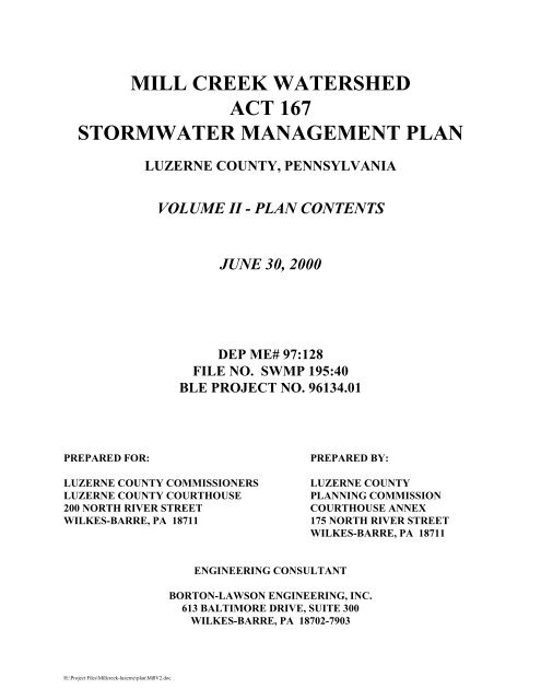
MILL CREEK WATERSHED<br />
ACT 167<br />
STORMWATER MANAGEMENT PLAN<br />
H:\Project Files\Mill<strong>creek</strong>-luzerne\plan\MillV2.doc<br />
LUZERNE COUNTY, PENNSYLVANIA<br />
VOLUME II - PLAN CONTENTS<br />
JUNE 30, 2000<br />
DEP ME# 97:128<br />
FILE NO. SWMP 195:40<br />
BLE PROJECT NO. 96134.01<br />
PREPARED FOR: PREPARED BY:<br />
LUZERNE COUNTY COMMISSIONERS LUZERNE COUNTY<br />
LUZERNE COUNTY COURTHOUSE PLANNING COMMISSION<br />
200 NORTH RIVER STREET COURTHOUSE ANNEX<br />
WILKES-BARRE, PA 18711 175 NORTH RIVER STREET<br />
WILKES-BARRE, PA 18711<br />
ENGINEERING CONSULTANT<br />
BORTON-LAWSON ENGINEERING, INC.<br />
613 BALTIMORE DRIVE, SUITE 300<br />
WILKES-BARRE, PA 18702-7903
H:\Project Files\Mill<strong>creek</strong>-luzerne\plan\MillV2.doc<br />
LUZERNE COUNTY COMMISSIONERS<br />
THOMAS A. MAKOWSKI, ESQ., CHAIRPERSON<br />
THOMAS P. PIZANO, COMMISSIONER<br />
STEPHEN A. URBAN, COMMISSIONER<br />
LUZERNE COUNTY PLANNING COMMISSION<br />
ADRIAN F. MEROLLI, EXECUTIVE DIRECTOR<br />
NANCY SNEE, PROJECT PLANNER<br />
LUZERNE COUNTY CONSERVATION DISTRICT<br />
ENGINEERING CONSULTANT<br />
BORTON-LAWSON ENGINEERING, INC.<br />
MILL CREEK WATERSHED PLAN ADVISORY COMMITTEE<br />
(WPAC MEMBERSHIP)<br />
Member Municipality<br />
Frank S. Westawski Bear Creek Township<br />
Joseph Noone Jenkins Township<br />
Frank Magdalinski Laflin Borough<br />
Donald Belles Laurel Run Borough<br />
Josephine DiGennari Pittston Township<br />
Charles Krommes Plains Township<br />
Jack Varaly Wilkes-Barre City<br />
Gerry Ryan Wilkes-Barre City<br />
Bill Turinski Wilkes-Barre Township<br />
Luzerne County Conservation District<br />
Luzerne County Planning Commission<br />
RESOLUTION
WHEREAS, the Stormwater Management Act 167 <strong>of</strong> 1978 provides for the regulation <strong>of</strong><br />
land and water use for flood control and stormwater management, requires the <strong>Pennsylvania</strong><br />
<strong>Department</strong> <strong>of</strong> <strong>Environmental</strong> Protection to designate <strong>watershed</strong>s, and provides for grants to be<br />
appropriated and administered by the <strong>Department</strong> for plan preparation and implementation costs, and<br />
provides that each county will prepare and adopt a <strong>watershed</strong> stormwater management plan for each<br />
designated <strong>watershed</strong>; and<br />
WHEREAS, the Luzerne County Commissioners entered into a grant contract with the<br />
<strong>Pennsylvania</strong> <strong>Department</strong> <strong>of</strong> <strong>Environmental</strong> Protection to develop the <strong>watershed</strong> stormwater<br />
management plan for the Mill Creek designated <strong>watershed</strong>; and<br />
WHEREAS, the purpose <strong>of</strong> the Mill Creek Watershed Stormwater Management Plan is to<br />
protect public health and safety and to prevent or mitigate the adverse impacts related to the<br />
conveyance <strong>of</strong> excessive rates and volumes <strong>of</strong> stormwater run<strong>of</strong>f by providing for the management <strong>of</strong><br />
stormwater run<strong>of</strong>f and control <strong>of</strong> erosion and sedimentation; and<br />
WHEREAS, design criteria and standards <strong>of</strong> stormwater management systems and facilities<br />
within the Mill Creek Watershed shall utilize the criteria and standards as found in the <strong>watershed</strong><br />
stormwater management plan;<br />
NOW, THEREFORE, BE IT RESOLVED that the Luzerne County Commissioners hereby<br />
adopt the Mill Creek Watershed Stormwater Management Plan, including all volumes, plates, and<br />
appendices, and forward the Plan to the Stormwater Management Section <strong>of</strong> the <strong>Pennsylvania</strong><br />
<strong>Department</strong> <strong>of</strong> <strong>Environmental</strong> Protection for approval.<br />
H:\Project Files\Mill<strong>creek</strong>-luzerne\plan\MillV2.doc<br />
ii<br />
LUZERNE COUNTY COMMISSIONERS<br />
Thomas A. Makowski, Esq., Chairman<br />
Thomas P. Pizano<br />
Stephen A. Urban
TABLE OF CONTENTS<br />
PAGE<br />
Section I. Introduction ................................................................................................... I-1<br />
A. Introduction ............................................................................................................... I-1<br />
B. Stormwater Management .......................................................................................... I-1<br />
Section II. Act 167 .........................................................................................................II-2<br />
A. Stormwater Management Act 167............................................................................II-2<br />
B. Purpose <strong>of</strong> the Study.................................................................................................II-2<br />
Section III. General Description <strong>of</strong> Watershed ....................................................................III-1<br />
A. Data Collection........................................................................................................III-2<br />
B. Drainage Area..........................................................................................................III-3<br />
C. Topography and Stream Pr<strong>of</strong>ile...............................................................................III-3<br />
D. Soils ........................................................................................................................III-5<br />
E. Geology ...................................................................................................................III-9<br />
F. Climate ..................................................................................................................III-10<br />
G. Land Use................................................................................................................III-10<br />
H. Land Development Patterns ..................................................................................III-13<br />
I. Present and Projected Development<br />
in the Flood Hazard Areas.....................................................................................III-17<br />
J. Obstructions ..........................................................................................................III-19<br />
K. Existing Drainage Problems<br />
and Proposed Solutions .........................................................................................III-22<br />
L. Existing and Proposed Stormwater Collection Systems .......................................III-24<br />
M. Existing and Proposed Flood<br />
Control Projects.....................................................................................................III-24 N.<br />
Existing and Proposed Stormwater Control Facilities ................................................III-25<br />
O. Wetlands................................................................................................................III-25<br />
Section IV. Watershed Technical Analysis ................................................................... IV-1<br />
A. Watershed Modeling .............................................................................................. IV-1<br />
B. Calibration.............................................................................................................. IV-3<br />
C. Verification............................................................................................................. IV-4<br />
D. Modeling Process ................................................................................................... IV-5<br />
Section V. Standards and Criteria for Stormwater Control............................................V-1<br />
A. Watershed Level Control Philosophy ......................................................................V-1<br />
B. Description <strong>of</strong> Mgmt. Districts.................................................................................V-1<br />
C. Standards and Criteria ..............................................................................................V-4<br />
D. Sub-Regional (Combined Site) Storage ...................................................................V-8<br />
E. "No Harm Option"....................................................................................................V-9<br />
F. Alternative Run<strong>of</strong>f Control Techniques...................................................................V-9<br />
G. Regional Detention Facilities .................................................................................V-15<br />
H. Best Management Practices....................................................................................V-15<br />
I. Impervious Area Exemptions.................................................................................V-16<br />
H:\Project Files\Mill<strong>creek</strong>-luzerne\plan\MillV2.doc<br />
iii
Section VI. Ordinance Provisions ................................................................................. VI-1<br />
Section VII. Model Ordinance....................................................................................... VII-1<br />
Section VIII. Priorities for Implementation ...................................................................VIII-1<br />
A. D.E.P. Approval <strong>of</strong> the Plan.................................................................................VIII-1<br />
B. Publishing the Final Plan......................................................................................VIII-1<br />
C. Municipal Adoption <strong>of</strong> Ordinance to Implement the Plan...................................VIII-1<br />
D. Level <strong>of</strong> Government Involvement in Stormwater Management.........................VIII-1<br />
E. County-Wide Coordination ..................................................................................VIII-2<br />
F. Correction <strong>of</strong> Existing Drainage Problems ..........................................................VIII-4<br />
G. Culvert Replacement............................................................................................VIII-4<br />
H. PennVEST Funding..............................................................................................VIII-5<br />
I. Landowner's/ Developers Responsibilities...........................................................VIII-5<br />
Section IX. Plan Review Adoption and Updating Procedures ...................................... IX-1<br />
A. County Adoption .................................................................................................... IX-1<br />
B. Provisions for Plan Revision.................................................................................. IX-1<br />
Section X. Advisory Committee Meetings ....................................................................X-1<br />
Figures<br />
III-1. Site Location ..............................................................................................III-1<br />
III-2. Digital Elevation Model ..............................................................................III-4<br />
III-3. Soil Associations.........................................................................................III-5<br />
III-4. Hydrologic Soil Groups...............................................................................III-7<br />
III-5. Soil Erodibility............................................................................................III-8<br />
III-6. Geology .......................................................................................................III-9<br />
III-7. Existing Land Use .....................................................................................III-12<br />
III-8. Future Land Use Conditions......................................................................III-15<br />
III-9. Development & Floodplains .....................................................................III-18<br />
III-10. Obstructions ..............................................................................................III-21<br />
III-11. Problem Areas, Flooding & Storm Water Control Facilities ....................III-23<br />
III-12. Wetlands....................................................................................................III-26<br />
IV-1. Subareas and Strip Mines........................................................................... IV-2<br />
IV-2. Calculation Methodologies Comparison.................................................... IV-6<br />
V-1. Relative Timing <strong>of</strong> Sub<strong>watershed</strong> Hydrographs ..........................................V-2<br />
H:\Project Files\Mill<strong>creek</strong>-luzerne\plan\MillV2.doc<br />
iv
Tables<br />
III-1. Mill Creek Watershed – Municipalities and Sub<strong>watershed</strong>s ......................III-2<br />
III-2. Land Use Status by Category ....................................................................III-11<br />
III-3. Development Potential by Municipality Based Upon<br />
Existing Patterns in the Mill Creek Watershed .........................................III-13<br />
III-4. Present Versus Future Combined Peak Flows - 100 year 24-hour Storm.III-16<br />
III-5. Present Residential and Commercial Areas Within 100-Year FloodplainIII-19<br />
III-6. Mill Creek Watershed Problem Areas ......................................................III-22<br />
III-7. 100-year Flow Attenuation........................................................................III-25<br />
IV-1. Comparison <strong>of</strong> Calibrated PSRM Model to Target<br />
Values Developed Through Regression Analyses...................................... IV-3<br />
IV-2. Comparison <strong>of</strong> Calibrated PSRM Model to Target<br />
Historical Storms at Mill Creek Stream Gauge.......................................... IV-4<br />
V-1. Required Criteria & Standards .....................................................................V-4<br />
V-2. Recommended Criteria & Standards............................................................V-6<br />
V-3. Process to Achieve the Standards & Criteria ...............................................V-7<br />
V-4. Various On-Site Stormwater Control Methods..........................................V-10<br />
V-5. Advantages and Disadvantages <strong>of</strong> Various On-Site<br />
Stormwater Control Methods.....................................................................V-11<br />
V-6. Suitability <strong>of</strong> Control Measures in the Mill<br />
Creek Watershed ........................................................................................V-14<br />
305.A.1 Acceptable Computational Methodologies for<br />
Stormwater Management Plans......................................................................14<br />
Appendices - Following Section X.<br />
1 Table <strong>of</strong> Contents for the Technical Appendix<br />
2 Public Comment & Responses<br />
3 Municipal Ordinance Matrix<br />
4 Peak Flow Summary Table<br />
5 Coal Storm Sewer Analysis<br />
6 WPAC Attendance Sheets<br />
H:\Project Files\Mill<strong>creek</strong>-luzerne\plan\MillV2.doc<br />
v
PLAN FORMAT<br />
The format <strong>of</strong> the Mill Creek Stormwater Management Plan consists <strong>of</strong> Volume I, The Executive<br />
Summary, Volume II, the Plan Report that includes GIS maps and the Model Ordinance, and<br />
Volume III the Technical Appendices.<br />
Volume I provides an overview <strong>of</strong> Act 167 and a summary <strong>of</strong> the standards and criteria developed<br />
for the Plan. The Plan Report provides an overview <strong>of</strong> stormwater management, purpose <strong>of</strong> the<br />
study, data collection, present conditions, projected land development patterns, calculation<br />
methodology, existing municipal ordinance matrix, and ordinance provisions and implementation<br />
discussion.<br />
Volume III, the Technical Appendices provide supporting data, <strong>watershed</strong> modeling parameters,<br />
peak flows, release rates, and obstructions inventory.<br />
H:\Project Files\Mill<strong>creek</strong>-luzerne\plan\MillV2.doc<br />
vi
A. Introduction<br />
H:\Project Files\Mill<strong>creek</strong>-luzerne\plan\MillV2.doc<br />
SECTION I<br />
INTRODUCTION<br />
This plan has been developed for the Mill Creek Watershed in Luzerne County, <strong>Pennsylvania</strong> under<br />
the requirements <strong>of</strong> the <strong>Pennsylvania</strong> Stormwater Management Act, Act 167, <strong>of</strong> 1978. The<br />
designated <strong>watershed</strong> encompasses approximately 36 square miles and all or portions <strong>of</strong> eight<br />
municipalities within Luzerne County. With little and inconsistent existing controls for stormwater<br />
management within this <strong>watershed</strong>, this plan has been developed to focus on a <strong>watershed</strong> wide<br />
consistent set <strong>of</strong> standards and criteria to control stormwater run<strong>of</strong>f.<br />
This plan is developed with the intent to present all information that may be required in order to<br />
implement the plan. The comprehensiveness <strong>of</strong> the plan covers legal, engineering, and municipal<br />
government topics, which combined, form the basis for implementation and enforcement <strong>of</strong> a final<br />
ordinance which will be developed and adopted by each affected municipality. A sample stormwater<br />
management ordinance for reference use has been developed as part <strong>of</strong> the plan and is a separate<br />
document.<br />
B. Stormwater Management<br />
Stormwater management entails bringing surface run<strong>of</strong>f caused by precipitation events under control.<br />
In past years, stormwater control was viewed only on a site-specific basis. Recently, local<br />
perspectives and policies have changed, with the realization that proper stormwater management can<br />
only be accomplished by evaluating the comprehensive picture (i.e., by analyzing what adverse<br />
impacts a development located in a <strong>watershed</strong>'s headwaters may have on flooding downstream).<br />
Proper stormwater management reduces flooding, soil and streambank erosion and sedimentation<br />
and improves the overall quality <strong>of</strong> the receiving streams.<br />
Stormwater management requires cooperation between the state and county and local <strong>of</strong>ficials and<br />
involves proper planning, engineering, construction, operation and maintenance. This entails<br />
educating the public and local <strong>of</strong>ficials and requires program development, financing, revising<br />
policy, development <strong>of</strong> workable criteria and adoption <strong>of</strong> ordinances. The Mill Creek Watershed<br />
Stormwater Management Plan, under the <strong>Pennsylvania</strong> Stormwater Management Act, will enable<br />
continued development to occur within the Mill Creek Watershed, utilizing both structural and nonstructural<br />
measures to properly manage stormwater run<strong>of</strong>f in the <strong>watershed</strong>.<br />
I - 1
A. Stormwater Management Act 167<br />
H:\Project Files\Mill<strong>creek</strong>-luzerne\plan\MillV2.doc<br />
SECTION II<br />
ACT 167<br />
The <strong>Pennsylvania</strong> General Assembly, recognizing the adverse effects <strong>of</strong> inadequate management <strong>of</strong><br />
excessive rates and volumes <strong>of</strong> stormwater run<strong>of</strong>f resulting from development, approved the<br />
Stormwater Management Act, P.L. 864, No. 167, October 4, 1978.Act 167 provides for the<br />
regulation <strong>of</strong> land and water use for flood control and stormwater management purposes. It imposes<br />
duties and confers powers to the <strong>Department</strong> <strong>of</strong> <strong>Environmental</strong> Resources, municipalities and<br />
counties, and provides for enforcement and making appropriations. The Act requires the <strong>Department</strong><br />
to designate <strong>watershed</strong>s and develop guidelines for stormwater management and model stormwater<br />
ordinances (the designated <strong>watershed</strong>s were approved by the <strong>Environmental</strong> Quality Board July 15,<br />
1980, and the guidelines and model ordinances were approved by the Legislature May 14, 1985). The<br />
Act provides for grants to be appropriated by the General Assembly and administered by the<br />
<strong>Department</strong> for 75% <strong>of</strong> the allowable costs for preparation <strong>of</strong> <strong>of</strong>ficial stormwater management plans<br />
and administrative, enforcement and implementation costs incurred by any municipality or county in<br />
accordance with Chapter 111 - Stormwater Management Grants and Reimbursement Regulations<br />
(adopted by the <strong>Environmental</strong> Quality Board August 27, 1985).<br />
Each county must prepare and adopt a <strong>watershed</strong> stormwater management plan for each <strong>of</strong> its<br />
designated <strong>watershed</strong>s in consultation with the municipalities, and will periodically review and<br />
revise such plans at least every five years when funding is available. Within six months following<br />
adoption and approval <strong>of</strong> a <strong>watershed</strong> stormwater plan, each municipality is required to adopt or<br />
amend, and implement ordinances and regulations as are necessary to regulate development within<br />
the municipality in a manner consistent with the applicable <strong>watershed</strong> stormwater plan and the<br />
provisions <strong>of</strong> the Act.<br />
Developers are required to manage the quantity, velocity, and direction <strong>of</strong> resulting stormwater<br />
run<strong>of</strong>f in a manner which adequately protects health and property from possible injury, and must<br />
implement control measures that are consistent with the provisions <strong>of</strong> the <strong>watershed</strong> plan and the<br />
Act. The Act also provides for civil remedies for those aggrieved by inadequate management <strong>of</strong><br />
accelerated stormwater run<strong>of</strong>f.<br />
B. Purpose <strong>of</strong> the Study<br />
Development in the Mill Creek Watershed causes an increase in stormwater run<strong>of</strong>f and a reduction in<br />
groundwater recharge. Uncontrolled stormwater run<strong>of</strong>f not only increases the risk <strong>of</strong> flooding<br />
downstream but also causes erosion and sedimentation problems, reduces stream quality, raises the<br />
temperature <strong>of</strong> the streams, impairs the aquatic food chain, and reduces the baseflow <strong>of</strong> streams<br />
which is imperative for aquatic life during the drier summer months. Erosion <strong>of</strong> the streambanks<br />
caused by accelerated stream velocities due to increased run<strong>of</strong>f is already evident in the middle<br />
reaches <strong>of</strong> Mill Creek, upstream <strong>of</strong> Route 315 along Bald Mountain Road in Plains Township.<br />
There is an increased statewide as well as local recognition that a sound and effective stormwater<br />
II - 1
management plan requires a diversified multiple purpose plan. The plan should address the full<br />
range <strong>of</strong> hydrologic consequences resulting from development instead <strong>of</strong> simply focusing on<br />
controlling site specific peak flow without consideration <strong>of</strong> tributary timing <strong>of</strong> flow volume<br />
reduction, base flow augmentation, water quality control and ecological protection.<br />
Managing stormwater run<strong>of</strong>f on a site-specific basis does not meet the requirements <strong>of</strong> <strong>watershed</strong><br />
based planning. The timing <strong>of</strong> flood peaks for each subbasin within a <strong>watershed</strong> contributes greatly<br />
to the flooding potential <strong>of</strong> a particular storm. Each stormwater control site within a subbasin should<br />
be managed by evaluating the comprehensive picture.<br />
The Mill Creek Watershed Stormwater Management Plan provides reasonable regulation <strong>of</strong><br />
development activities to control accelerated run<strong>of</strong>f and protect the health, safety and welfare <strong>of</strong> the<br />
public. The Plan includes recognition <strong>of</strong> the various rules, regulations and laws at the federal, state,<br />
county and municipal level. Once implemented, the Plan will aid in reducing costly flood damages<br />
by reducing the source and cause <strong>of</strong> local uncontrolled run<strong>of</strong>f. The Plan will make municipalities<br />
and developers more aware <strong>of</strong> comprehensive planning in stormwater control and will help maintain<br />
the quality <strong>of</strong> Mill Creek and its tributaries.<br />
H:\Project Files\Mill<strong>creek</strong>-luzerne\plan\MillV2.doc<br />
II - 2
H:\Project Files\Mill<strong>creek</strong>-luzerne\plan\MillV2.doc<br />
SECTION III<br />
GENERAL DESCRIPTION OF WATERSHED<br />
Mill Creek is approximately 20 miles long, originating near Mill Creek Reservoir in Jenkins<br />
Township and discharging into the North Branch <strong>of</strong> the Susquehanna River in Wilkes-Barre City.<br />
Mill Creek is located in the northeastern portion <strong>of</strong> Luzerne County and is contained within eight (8)<br />
municipalities as listed below and illustrated in Figure III-1. The Mill Creek Watershed is comprised<br />
<strong>of</strong> four (4) individual sub<strong>watershed</strong>s including Gardner Creek, Mill Creek, Laurel Run and Coal<br />
Brook Watersheds, as shown in the figure below. It is comprised <strong>of</strong> four major tributary <strong>watershed</strong>s,<br />
Mill Creek, Gardner Creek, Laurel Run and Coal Brook as shown in Figure III-1.<br />
Wilkes-Barre<br />
City<br />
Wilkes-Barre<br />
Towsnhip<br />
Coal Brook<br />
Laurel Run<br />
Borough<br />
Laurel Run<br />
Laflin<br />
Borough<br />
Plains<br />
Township<br />
Figure III-1 – Mill Creek Watershed Base Map<br />
III -1<br />
Gardner Creek<br />
Mill Creek<br />
Bear Creek<br />
Township<br />
Jenkins<br />
Township<br />
Pittston<br />
Township
H:\Project Files\Mill<strong>creek</strong>-luzerne\plan\MillV2.doc<br />
TABLE III-1<br />
Mill Creek Watershed - Municipalities<br />
1. Bear Creek Township 5. Pittston Township<br />
2. Jenkins Township 6. Plains Township<br />
3. Laflin Borough 7. Wilkes-Barre City<br />
4. Laurel Run Borough 8. Wilkes-Barre Township<br />
A. Data Collection<br />
In order to evaluate the hydrologic response <strong>of</strong> the <strong>watershed</strong>, data was collected on the physical<br />
features <strong>of</strong> the <strong>watershed</strong> as follows:<br />
1. Base Map: The base map for Geographical Information System (GIS) generated maps was<br />
developed from the PennDOT 1997 <strong>Pennsylvania</strong> Cartographic /GIS information CD-ROM.<br />
Roads, streams, lakes and municipal boundaries from this CD-ROM were utilized for base<br />
mapping purposes. The <strong>watershed</strong> boundary was digitized from 1:24,000 USGS<br />
topographic quadrangles.<br />
2. Topography: Sub<strong>watershed</strong>s or subareas used in the <strong>watershed</strong> modeling process were<br />
delineated utilizing U.S.G.S. topographic quadrangles at one inch equals 2,000 feet<br />
(1:24,000 scale). Subareas, drainage courses, land slopes and lengths, and drainage element<br />
lengths and slopes could all be determined from the base map. The subareas were then<br />
digitized into the GIS. A Digital Elevation Model (DEM) for the Mill Creek Watershed was<br />
also obtained.<br />
3. Soils: Soil mapping was obtained from the Luzerne County Soil Survey <strong>of</strong> the U.S.<br />
<strong>Department</strong> <strong>of</strong> Agriculture's Natural Resources Conservation Service (NRCS) formerly the<br />
Soil Conservation Service (SCS). The Hydrologic Soil Groups (HSG's) were digitized<br />
using the GIS s<strong>of</strong>tware and all HSG designations for the digitized areas were input into the<br />
GIS database. Attributes for Hydrologic Soil Groups (HSG's) and soil erodibility were<br />
assigned to the attribute table.<br />
4. Geology: The digital geology coverage for Luzerne County was obtained from the<br />
<strong>Pennsylvania</strong> Special Data Access (PASDA) web site and incorporated into the overall GIS.<br />
5. Land Use/Zoning: Existing land use was determined from two primary sources; the<br />
U.S.G.S. topographic map and the <strong>of</strong>ficial zoning maps from the various municipalities.<br />
Aerial photographs, soil surveys, field verification, and personal knowledge were also<br />
utilized in this determination. Zoning maps were available for all municipalities within the<br />
<strong>watershed</strong> and these were digitized into the computer database along with the corresponding<br />
zoning district designations to aid in development <strong>of</strong> the future land use maps.<br />
6. Wetlands: Wetlands were obtained from the National Wetlands Inventory Maps in digital<br />
format and incorporated into the overall GIS.<br />
III -2
The data collected on each <strong>of</strong> these features is summarized in items B through O to follow:<br />
B. Drainage Area<br />
Mill Creek drains a <strong>watershed</strong> area <strong>of</strong> approximately thirty-seven (37) square miles. The main<br />
source <strong>of</strong> Mill Creek is Mill Creek Reservoir in Jenkins Township. Mill Creek flows into the<br />
Susquehanna River in Wilkes-Barre City.<br />
The major tributaries to Mill Creek are Laurel Run, Gardner Creek, and Coal Brook. Smaller<br />
tributaries include Warden Creek, Lampblack Creek and several other unnamed tributaries.<br />
C. Topography and Streambed Pr<strong>of</strong>ile<br />
The topography <strong>of</strong> the <strong>watershed</strong> ranges from steep hilly terrain in the upper reaches to gently<br />
sloping areas in the valley floor. The highest point in the <strong>watershed</strong> is in Bear Creek Township on<br />
Bald Mountain with an elevation <strong>of</strong> 3070 feet above sea level U.S.G.S. datum. The lowest point<br />
occurs at the Susquehanna River confluence with an approximate elevation <strong>of</strong> 530 feet. Figure III-2<br />
is a Digital Elevation Map for Mill Creek Watershed.<br />
H:\Project Files\Mill<strong>creek</strong>-luzerne\plan\MillV2.doc<br />
III -3
H:\Project Files\Mill<strong>creek</strong>-luzerne\plan\MillV2.doc<br />
III -4
D. Soils<br />
Soils are also grouped into soil associations as shown in Figure III-3. Soil associations are groups <strong>of</strong><br />
soils that exhibit a regularly repeating pattern. There are four soil associations in the Mill Creek<br />
Watershed, which are described in more detail below. The Oquaga-Wellsboro-Lackawanna<br />
association is located in the upper portions <strong>of</strong> Mill Creek Watershed while the Strip mine-Mine<br />
dump association is in the lower portions. The Oquaga-Lordstown-Arnot and Chenango-Pope-<br />
Wyoming associations are in the middle portion <strong>of</strong> the <strong>watershed</strong>.<br />
Wilkes-Barre<br />
City<br />
Wilkes-Barre<br />
Towsnhip<br />
Laurel Run<br />
Borough<br />
H:\Project Files\Mill<strong>creek</strong>-luzerne\plan\MillV2.doc<br />
Laflin<br />
Borough<br />
Plains<br />
Township<br />
Figure III-3 – Mill Creek Watershed Soil Associations<br />
III -5<br />
Bear Creek<br />
Township<br />
Jenkins<br />
Township<br />
Pittston<br />
Township
1. Oquaga-Wellsboro-Lackawanna - The Oquaga-Wellsboro-Lackawanna soil association is<br />
found along parts <strong>of</strong> the eastern <strong>watershed</strong> boundary. This association consists <strong>of</strong> gently<br />
sloping to very steep, moderately deep and deep soils that are moderately well drained and<br />
well drained. These soils were formed in glacial till derived from red sandstone and shale.<br />
2. Strip mine-Mine dump - The Strip mine-Mine dump association comprises the<br />
northwestern half <strong>of</strong> the <strong>watershed</strong>. This association has nearly level to very steep,<br />
moderately deep and shallow soils that are well drained on mountain ridges and<br />
mountainsides. It consists <strong>of</strong> exposed bedrock and soils and rock material that were<br />
removed to gain access to coal.<br />
3. Oquaga-Lordstown-Arnot - The Oquaga-Lordstown-Arnot soil association is found<br />
around Wilkes-Barre Mountain and makes up one third <strong>of</strong> the <strong>watershed</strong>. This association<br />
is moderately steep and very steep, moderately deep and shallow soils that are well drained.<br />
These soils are on mountainsides and formed in glacial till derived from sandstone, shale or<br />
conglomerate.<br />
4. Chenango-Pope-Wyoming - The Chenango-Wyoming-Pope soil association consists <strong>of</strong><br />
gravelly sandy loam soils found along the PA Turnpike NE Extension. This association<br />
consists <strong>of</strong> nearly level to steep, deep soils that are somewhat excessively drained and well<br />
drained. These soils formed in loamy to coarse textured glacial outwash deposits derived<br />
from reddish and brown upland glacial till.<br />
Soil properties are known to influence the process <strong>of</strong> run<strong>of</strong>f generation. The USDA, Natural<br />
Resources Conservation Service has established criteria determining how soils will affect run<strong>of</strong>f by<br />
placing all soils into groups (Hydrologic Soil Groups (HSG's)) as shown in Figure III-4. Hydrologic<br />
Soil Groups are broken down into four sub-groups (A through D) based on infiltration rate and<br />
depth. The A soils, found along Mill Creek in terraces and floodplains, are the most pervious and<br />
have the lowest run<strong>of</strong>f potential and are typically sands and gravels. On the mountainsides and ridges<br />
along the <strong>watershed</strong> boundary are the D soils, which are tight, low permeable soils with high run<strong>of</strong>f<br />
potential and are typically clay soils. The majority <strong>of</strong> the soils in the <strong>watershed</strong> fall in the B and C<br />
Hydrologic Soil Groups and they comprise the inner portion <strong>of</strong> the <strong>watershed</strong>. Hydrologic Soil<br />
Group B is characterized as having moderate infiltration rates and consist primarily <strong>of</strong> moderately<br />
deep to deep, moderately well to well drained soils that exhibit a moderate rate <strong>of</strong> water<br />
transmission. Hydrologic Soil Group C has slow infiltration rates when thoroughly wetted and<br />
contain fragipans, a layer that impedes downward movement <strong>of</strong> water and produces a slow rate <strong>of</strong><br />
water transmission.<br />
This information was incorporated into the GIS and, from this, the <strong>watershed</strong> HSG map (Figure III-<br />
4) was developed.<br />
In addition, through field reconnaissance, several areas <strong>of</strong> accelerated stream bank erosion were<br />
found. The erodibility index was therefore added to the GIS attribute tables and a soil erodibility<br />
map was developed (Figure III-5). This map confirmed that erodible soils do exist in certain areas <strong>of</strong><br />
the <strong>watershed</strong> and proposed standards and criteria should be developed to minimize the impact <strong>of</strong><br />
run<strong>of</strong>f on stream bank erosion.<br />
H:\Project Files\Mill<strong>creek</strong>-luzerne\plan\MillV2.doc<br />
III -6
H:\Project Files\Mill<strong>creek</strong>-luzerne\plan\MillV2.doc<br />
III -7
H:\Project Files\Mill<strong>creek</strong>-luzerne\plan\MillV2.doc<br />
III -8
E. Geology<br />
Geology plays a direct role in surface run<strong>of</strong>f in Mill Creek because it affects soil types within the<br />
<strong>watershed</strong> through parent material breakdown. Strip mine areas also play an important role in the<br />
run<strong>of</strong>f <strong>of</strong> the Mill Creek <strong>watershed</strong> with mine hole/borings allowing some surface water to discharge<br />
directly to the underground system in many instances. An illustration <strong>of</strong> the strip mine areas in the<br />
Mill Creek Watershed can be found in Figure IV-1. There is no limestone surface geology in the<br />
Mill Creek Watershed and therefore is no presence <strong>of</strong> limestone sinkholes. The geologic map <strong>of</strong> the<br />
<strong>watershed</strong> can be found in Figure III-6 below.<br />
Data was collected from the DEP report entitled “Operations Scarlift – Project No. SL 181-4” for the<br />
Mill Creek Watershed, 1976, which looked at subsurface flow originating from run<strong>of</strong>f over stripped<br />
areas. These stripped areas were taken into account by increasing the abstraction parameters on the<br />
PSRM model.<br />
Wilkes-Barre<br />
City<br />
Wilkes-Barre<br />
Towsnhip<br />
Laurel Run<br />
Borough<br />
H:\Project Files\Mill<strong>creek</strong>-luzerne\plan\MillV2.doc<br />
Laflin<br />
Borough<br />
Plains<br />
Township<br />
Figure III-6 – Geology in Mill Creek Watershed<br />
III -9<br />
Bear Creek<br />
Township<br />
Jenkins<br />
Township<br />
Pittston<br />
Township
Duncannon Member <strong>of</strong> Catskill Family-Succession <strong>of</strong> greenish-gray and grayish-red, fine to<br />
course grained sandstone and grayish-red siltstone and shale; some gray sandstone and<br />
conglomerate also present.<br />
Llewellyn Family—Gray, fine to course grained sandstone, siltstone, shale, and some<br />
conglomerate and anthracite coal.<br />
Mauch Chunk Family—Brownish-gray to grayish-red, siltstone and claystone interbedded with<br />
brownish-gray to pale red, poorly cemented, fine-grained sandstone; medium-grained to finely<br />
conglomeratic sandstone occurs locally.<br />
Pocono Family—Light to medium-gray sandstone and conglomerate.<br />
Pottsville Group—Gray conglomerate, conglomeratic sandstone, sandstone, siltstone, and some<br />
anthracite coal.<br />
Spechty Kopf Family—Conglomeratic sandstone containing local pebbly mudstone.<br />
F. Climate<br />
Luzerne County is in the path <strong>of</strong> air masses that originate in western and central Canada. These air<br />
masses interact with the warm air from the Gulf <strong>of</strong> Mexico to produce generous precipitation<br />
throughout the year. The higher elevations receive additional precipitation because <strong>of</strong> upslope<br />
motion.<br />
Summers are generally warm, and maximum temperatures average in the low to mid 80s.<br />
Occasional higher temperatures occur when warm air moves into the area from the southwest. The<br />
annual precipitation is approximately thirty-seven (37) inches with an average <strong>of</strong> seven<br />
thunderstorms during each <strong>of</strong> the summer months. Heavy rainfall associated with tropical storms<br />
and hurricanes moving up the coast occasionally reach Luzerne County.<br />
Winter is characterized by cold temperatures and cloudy skies. Daytime temperatures average in the<br />
middle to upper 30s at the lower elevations. Higher elevations may have freezing temperatures on<br />
150 days <strong>of</strong> the year. On 50 <strong>of</strong> these days, the maximum temperature may be at or below freezing.<br />
Winter precipitation is light but frequent. The lower elevations receive most precipitation in the<br />
form <strong>of</strong> rain, whereas the higher elevations receive most in the form <strong>of</strong> snow. Annual snowfall<br />
ranges from about 15 inches at the lower elevation to more than 70 inches at the higher elevations.<br />
Spring and fall are characterized by rapidly changing weather patterns. Alternate periods <strong>of</strong> freezing<br />
and thawing are common during both seasons. The length <strong>of</strong> the growing season at the lower<br />
elevations can range from 120 to 200 days, whereas at the higher elevations it can range from 120 to<br />
180 days.<br />
G. Land Use<br />
The predominant land uses in the upper portion <strong>of</strong> the <strong>watershed</strong> are forest and rural while urban<br />
III -10<br />
H:\Project Files\Mill<strong>creek</strong>-luzerne\plan\MillV2.doc
land uses predominate the lower portion. Residential and commercial development is mostly<br />
concentrated at the mouth <strong>of</strong> Mill Creek and in the vicinities <strong>of</strong> Interstate 81, Routes 315 and 115,<br />
and the PA Turnpike NE Extension, and future development is expected to occur primarily along<br />
these major transportation arteries.<br />
Table III-2 shows the overall land use by category within the Mill Creek Watershed while Figure III-<br />
7 displays the existing land use <strong>of</strong> the <strong>watershed</strong>.<br />
H:\Project Files\Mill<strong>creek</strong>-luzerne\plan\MillV2.doc<br />
TABLE III-2<br />
Land Use Status by Category<br />
LANDUSE SQ. MI. PERCENT<br />
Commercial 1.15 3.20%<br />
Comm/Industrial 0.86 2.40%<br />
Industrial 0.11 0.32%<br />
Institutional 0.03 0.08%<br />
Paved 0.43 1.20%<br />
Mining 0.46 1.29%<br />
Forest/Mining 1.06 2.96%<br />
Forest 26.24 73.17%<br />
Forest/Meadow 0.50 1.39%<br />
Meadow 0.80 2.24%<br />
Open Space 0.52 1.46%<br />
R-1 (2 to 4 acres) 0.53 1.47%<br />
R-2 (1/2 to 1 acre) 0.63 1.74%<br />
R-3 (1/4 to 1/3 acre) 0.68 1.90%<br />
R-4 (1/8 acre or less) 1.60 4.47%<br />
Water 0.26 0.71%<br />
Total 35.87 100.00%<br />
III -11
H:\Project Files\Mill<strong>creek</strong>-luzerne\plan\MillV2.doc<br />
<br />
III -12
H. Land Development Patterns<br />
Residential and commercial growth is occurring rapidly throughout the middle portion <strong>of</strong> the Mill<br />
Creek <strong>watershed</strong>, which is situated between Route 315 and the <strong>Pennsylvania</strong> Turnpike. The lower<br />
Mill Creek <strong>watershed</strong>, which lies below Route 315, is urbanized and will not see any appreciable<br />
growth in the future. This urban area includes the city <strong>of</strong> Wilkes-Barre and the northern portions <strong>of</strong><br />
Wilkes-Barre and Plains Townships. The upper portion <strong>of</strong> the <strong>watershed</strong>, located southeast <strong>of</strong> the<br />
Turnpike, is relatively undeveloped and shows little signs <strong>of</strong> rapid growth. Commercial and<br />
industrial development will most likely continue at industrial parks or areas where public water and<br />
sewers are, or will soon be, available. These areas include the Interstate 81, Routes 315 and 115, and<br />
PA Turnpike NE Extension corridors. Single lot residential development will continue to occur<br />
sporadically throughout the <strong>watershed</strong>.<br />
The upper Mill Creek <strong>watershed</strong> is comprised <strong>of</strong> Pittston, Jenkins and the southern portions <strong>of</strong><br />
Wilkes-Barre and Plains Townships. All <strong>of</strong> these areas are experiencing commercial growth and to a<br />
lesser extent industrial growth along the highway corridors. There is minimal industrial growth<br />
although there are available industrial parks.<br />
Table III-3 provides an overview <strong>of</strong> the types <strong>of</strong> development that will occur when existing patterns<br />
are considered for each municipality within the <strong>watershed</strong>.<br />
H:\Project Files\Mill<strong>creek</strong>-luzerne\plan\MillV2.doc<br />
TABLE III-3<br />
Development Potential by Municipality<br />
Based Upon Existing Patterns in the Mill Creek Watershed<br />
Municipality R-4 R-3 R-2 R-1 I C C/I OS F M<br />
Bear Creek Township - - O X - - O - r -<br />
City <strong>of</strong> Wilkes-Barre - - - - - - O r - -<br />
Jenkins Township - - O - - - X - r -<br />
Laflin Borough - - O - - - - - r -<br />
Laurel Run Borough - O X O - O O - r -<br />
Pittston Township - - O O - - - - - r<br />
Plains Township - - O - - - O r r r<br />
Wilkes-Barre Township - - - - - - X - r -<br />
R-4 Residential Lots (1/8 acre or less) --- No Impact<br />
R-3 Residential Lots (1/4 ac. - 1/3 ac) O Minor Impact<br />
R-2 Residential Lots (1/2 ac. - 1 ac.) X Major Impact<br />
R-1 Residential Lots (greater than 1 acre) r Reduction in Land Use<br />
I Industrial<br />
C Commercial<br />
C/I Commercial / Industrial<br />
OS Open Space<br />
F Forest<br />
M Meadow<br />
III -13
A future land use scenario was developed using existing zoning maps and applying impervious<br />
percentage factors for each type <strong>of</strong> zoning district and assuming full development <strong>of</strong> these districts.<br />
The future land use map for the year 2010 projection is shown in Figure III-8. These increased<br />
impervious areas were then input into the Penn State Run<strong>of</strong>f Model to develop a future condition<br />
100-year hydrograph for the <strong>watershed</strong>. A comparison <strong>of</strong> peak flows for the 100-year storm for future<br />
and existing conditions can be found in Table III-4.<br />
The future hydrograph peak was found to be approximately 106% <strong>of</strong> the present hydrograph at the<br />
Mill Creek outlet. This scenario assumes a 2010 projected scenario based on existing zoning maps,<br />
this increase in peak flow is probably conservative due to the possibility <strong>of</strong> zoning changes to the<br />
extensive area <strong>of</strong> open space zoning districts still present in the upper Mill Creek <strong>watershed</strong>. Table<br />
III-4 summarizes the flows for each sub<strong>watershed</strong> for existing conditions and for the 2010 future<br />
land use projection, assuming proper storm water management facilities are not installed.<br />
Other storm frequencies can be found in the Technical Appendix. Increased development in a<br />
<strong>watershed</strong> increases run<strong>of</strong>f peaks, volumes and velocities that decrease the time to peak, all <strong>of</strong> which<br />
can contribute to the frequency <strong>of</strong> flooding.<br />
H:\Project Files\Mill<strong>creek</strong>-luzerne\plan\MillV2.doc<br />
III -14
H:\Project Files\Mill<strong>creek</strong>-luzerne\plan\MillV2.doc<br />
<br />
III -15
H:\Project Files\Mill<strong>creek</strong>-luzerne\plan\MillV2.doc<br />
TABLE III-4<br />
Present Versus Future Combined Peak Flows<br />
100-Year 24-Hour Storm<br />
NOTE: The computed flow values were derived for <strong>watershed</strong> planning purposes and should not<br />
be considered regulatory values for permitting purposes. While they may be used for comparison<br />
or checking purposes, additional hydrologic computations may be needed for the design <strong>of</strong><br />
bridges, culverts and dams.<br />
Subarea<br />
No.<br />
Existing<br />
Peak Q<br />
(cfs)<br />
Projected<br />
Future<br />
Peak Q<br />
(cfs)<br />
1 294.5 294.9<br />
2 517.0 526.6<br />
3 196.6 200.1<br />
4 691.7 704.4<br />
5 874.0 889.0<br />
6 297.8 297.8<br />
7 381.6 381.7<br />
8 1122.1 1135.1<br />
9 1293.8 1316.4<br />
10 1434.6 1457.1<br />
11 146.6 170.1<br />
12 1535.8 1573.8<br />
13 1654.7 1741.1<br />
14 210.1 210.0<br />
15 660.9 665.0<br />
16 545.2 593.3<br />
17 1110.6 1162.1<br />
18 1453.0 1485.3<br />
19 1556.1 1587.3<br />
20 450.4 458.2<br />
21 2043.9 2083.7<br />
22 43.7 67.9<br />
23 2061.5 2101.2<br />
24 2071.2 2110.3<br />
25 136.5 143.8<br />
26 132.4 150.1<br />
27 2110.6 2151.9<br />
28 2178.5 2226.8<br />
29 2207.2 2277.1<br />
30 2199.5 2269.5<br />
31 3572.9 3691.2<br />
32 3580.5 3702.2<br />
33 3629.5 3750.5<br />
III -16<br />
Subarea<br />
No.<br />
Existing<br />
Peak Q<br />
(cfs)<br />
Projected<br />
Future<br />
Peak Q<br />
(cfs)<br />
40 1549.9 1639.5<br />
41 306.6 329.2<br />
42 335.1 350.7<br />
43 476.9 496.9<br />
44 546.0 569.4<br />
45 1972.4 2065.3<br />
46 400.8 400.7<br />
47 699.1 703.0<br />
48 694.9 699.1<br />
49 2560.0 2684.9<br />
50 33.7 33.7<br />
51 74.7 74.7<br />
52 185.7 186.0<br />
53 0.0 0.0<br />
54 69.2 69.2<br />
55 149.3 149.3<br />
56 164.7 164.6<br />
57 185.5 185.6<br />
58 190.0 190.0<br />
59 345.6 383.2<br />
60 2788.7 2919.1<br />
61 2795.1 2924.6<br />
62 2808.5 2936.2<br />
63 2891.3 3037.7<br />
64 2938.2 3076.2<br />
65 2944.0 3074.3<br />
66 62.2 94.3<br />
67 36.7 65.8<br />
68 143.8 208.2<br />
69 39.9 42.7<br />
70 177.4 294.9<br />
71 191.7 326.9<br />
72 211.7 346.0
34 3745.0 3862.4<br />
35 128.0 177.2<br />
Subarea<br />
No.<br />
Existing<br />
Peak Q<br />
(cfs)<br />
H:\Project Files\Mill<strong>creek</strong>-luzerne\plan\MillV2.doc<br />
TABLE III-4 (cont.)<br />
Present Versus Future Combined Peak Flows<br />
100-Year 24-Hour Storm<br />
Projected<br />
Future<br />
Peak Q<br />
(cfs)<br />
36 524.0 597.9<br />
37 856.2 935.6<br />
38 365.8 383.9<br />
39 1437.5 1526.8<br />
79 538.1 899.0<br />
80 12.6 12.6<br />
81 247.1 272.9<br />
82 192.7 206.9<br />
83 26.9 26.9<br />
84 727.5 1056.6<br />
85 734.0 1038.5<br />
III -17<br />
73 62.5 62.5<br />
74 194.6 271.7<br />
Subarea<br />
No.<br />
I. Present and Projected Development in the Flood Hazard Areas<br />
Existing<br />
Peak Q<br />
(cfs)<br />
Projected<br />
Future<br />
Peak Q<br />
(cfs)<br />
75 57.1 57.1<br />
76 386.1 349.5<br />
77 494.3 787.7<br />
78 3.7 39.6<br />
86 27.1 27.1<br />
87 767.9 1071.1<br />
88 807.6 1132.7<br />
89 840.5 1172.1<br />
90 3362.3 3551.1<br />
91 5375.5 5696.3<br />
92 5384.5 5735.4<br />
The U.S. <strong>Department</strong> <strong>of</strong> Housing and Urban Development, Federal Insurance Administration, and<br />
Federal Emergency Management Agency (FEMA) have prepared Flood Insurance Studies (FIS's) and<br />
mapping for the following municipalities in the Mill Creek Watershed: Bear Creek Township,<br />
Jenkins Township, Laflin Borough, Laurel Run Borough, Pittston Township, Plains Township,<br />
Wilkes-Barre City, and Wilkes-Barre Township.<br />
There are two types <strong>of</strong> studies conducted in the FIS program: detailed and approximate. Detailed<br />
methods included hydrologic computations and detailed HEC-2 backwater computations. The areas<br />
studied by detailed methods were selected with priority given to all known flood hazard areas and<br />
areas <strong>of</strong> projected development and proposed construction. Those areas studied by the approximate<br />
methods were those having low development potential or minimal flood hazards.<br />
Due to the physiography <strong>of</strong> the <strong>watershed</strong> location, within the ridge and valley section <strong>of</strong><br />
<strong>Pennsylvania</strong>, the 100-year flood plains are generally quite narrow except in the , more urban areas<br />
along the original Susquehanna River Floodplain. The potential for any future development within<br />
any 100-year flood plain within the Mill Creek Watershed exists. At present, the 100-year floodplain<br />
within the Mill Creek Watershed is primarily residential and commercial areas along Mill Creek and<br />
its tributaries particularly in Wilkes-Barre City and Wilkes-Barre Township.<br />
Figure III-9 shows the 100-year floodplains, classified as detailed and approximate, as taken from the<br />
FEMA mapping for the Mill Creek Watershed. Infringements <strong>of</strong> residential and commercial areas<br />
are clearly shown by overlaying these areas on the floodplain in the GIS. Table III-5 outlines the<br />
type <strong>of</strong> development and land use that infringe upon the floodplain by municipality, general location,<br />
and <strong>creek</strong> or tributary. Municipalities and the <strong>Pennsylvania</strong> <strong>Department</strong> <strong>of</strong> Community and<br />
Economic Development (PACED) should be contacted as to the latest FIS studies before use.
H:\Project Files\Mill<strong>creek</strong>-luzerne\plan\MillV2.doc<br />
<br />
III -18
TABLE III-5<br />
Mill Creek Present Residential and Commercial Areas<br />
Within 100-Year Floodplain<br />
Land Use<br />
Infringing on<br />
Municipality Stream/Lake Flood Boundary General Location<br />
Bear Creek Twp. - - -<br />
JenkinsTwp. - - -<br />
Laflin Borough Gardner Creek R2<br />
At crossing with I-81N<br />
Gardner Creek R2, R3<br />
Near Union Street and<br />
Saylor Avenue intersection<br />
Laurel Run Boro. Laurel Run R1, R2 Along Laurel Run Road<br />
Pittston Twp. -<br />
-<br />
-<br />
Plains Twp. Mill Creek R4<br />
East <strong>of</strong> First Street<br />
Low-lying area R4<br />
North <strong>of</strong> Union Street<br />
Wilkes-Barre City Mill Creek R4<br />
Along stream between Scott<br />
Street and Mill Street<br />
Mill Creek R4<br />
0.15 miles east <strong>of</strong> River<br />
Street<br />
Wilkes-Barre Twp. Coal Brook R4, Commercial Along Highland Boulevard<br />
and Mundy Street<br />
Commercial 0.22 miles north <strong>of</strong> I-81S<br />
NOTE: "-" means no infringements or flood data in the Mill Creek Watershed for this municipality.<br />
The more credits a community can accumulate, the less its residents will have to pay for flood<br />
insurance. For further information, the publication "CRS Credit for Stormwater Management", July<br />
1996, published by FEMA, available at the County Planning Commission <strong>of</strong>fice, should be<br />
consulted.<br />
J. Obstructions<br />
Significant waterway obstructions (i.e., culverts, bridges, etc.) were obtained by inspection <strong>of</strong> and<br />
digitizing from the U.S.G.S. topographic base map. Data on these obstructions was then obtained<br />
from the <strong>Pennsylvania</strong> <strong>Department</strong> <strong>of</strong> Transportation (PaDOT), Luzerne County Road and Bridge<br />
<strong>Department</strong>, F.E.M.A. Flood Insurance Studies, and field surveys. From this data, obstruction flow<br />
capacities were computed for each significant obstruction. The obstruction capacities were then<br />
compared to the peak flow at that point derived through the modeling process for each design storm<br />
frequency. The obstructions were then classified into seven categories as follows:<br />
* Those obstructions which are able to pass the 100-year, 24-hour storm without obstructing<br />
the flow.<br />
* Those obstructions which are not able to pass the 100-year, 24-hour storm and greater<br />
without obstructing the flow.<br />
* Those obstructions which are not able to pass the 50-year, 24-hour storm and greater without<br />
H:\Project Files\Mill<strong>creek</strong>-luzerne\plan\MillV2.doc<br />
III -19
obstructing the flow.<br />
* Those obstructions which are not able to pass the 25-year, 24-hour storm and greater without<br />
obstructing the flow.<br />
* Those obstructions which are not able to pass the 10-year, 24-hour storm and greater without<br />
obstructing the flow.<br />
* Those obstructions which are not able to pass the 5-year, 24-hour storm and greater without<br />
obstructing the flow.<br />
* Those obstructions which are not able to pass the 2-year, 24-hour storm and greater without<br />
obstructing the flow.<br />
The locations <strong>of</strong> all obstructions, including those that fall into the seven categories above, can be<br />
found in Figure III-10. The obtained data and the obstruction flow capacities based upon inlet<br />
control conditions can be found in the Technical Appendix.<br />
H:\Project Files\Mill<strong>creek</strong>-luzerne\plan\MillV2.doc<br />
III -20
H:\Project Files\Mill<strong>creek</strong>-luzerne\plan\MillV2.doc<br />
<br />
III -21
K. Existing Drainage Problems and Proposed Solutions<br />
Information on drainage problems and proposed solutions was solicited from each municipality<br />
within the Mill Creek Watershed by providing forms to each Watershed Plan Advisory Committee<br />
(WPAC) member early in the Watershed Plan study.<br />
Problems were discussed at the WPAC meetings and were primarily minor, usually very local in<br />
nature, primarily clogged or undersized inlets and cross pipes.<br />
Table III-6 summarizes the problems discussed. These are shown pictorially in Figure III-11 (storm<br />
water problem areas). Solutions have been proposed both formally and informally as a result <strong>of</strong><br />
WPAC discussions.<br />
Seventeen (17) problem areas were identified in this study, including several types <strong>of</strong> problems. The<br />
type, cause, and occurrence <strong>of</strong> these problems are indicated on Table III-6. The categories selected in<br />
Table III-6 typically have similar causes and solutions that are discussed below.<br />
H:\Project Files\Mill<strong>creek</strong>-luzerne\plan\MillV2.doc<br />
TABLE III-6<br />
Mill Creek Watershed Problem Areas<br />
OCCURENCES<br />
TYPE OF CAUSES OF OF TYPES OF<br />
MUNICIPALITY PROBLEMS PROBLEMS PROBLEMS DAMAGE<br />
(A) (B) (C) (D)<br />
Bear Creek Township 2,3 3,5 2 3<br />
Jenkins Twp. none none none none<br />
Laflin Borough 1,2,3,4,5 1,2,4,6 - 3<br />
Laurel Run Borough 1,2,3 1,3 3 3<br />
Pittston Twp. none none none none<br />
Plains Township 1,2,3,4 1,2,3 1,2 2,3<br />
Wilkes-Barre City 1,2 1,2,3,4,5 3 3<br />
Wilkes-Barre Township 1,2 1,4 4 3<br />
Types <strong>of</strong> Problems: Causes <strong>of</strong> Problems:<br />
(A) 1. Stream Flooding (B) 1. Large increase in uncontrolled run<strong>of</strong>f<br />
2. Street Flooding 2. Run<strong>of</strong>f from municipality upstream<br />
3. Soil wash<strong>of</strong>f 3. Drainage system too small<br />
4. Stormwater pollution 4. Obstructions in system<br />
5. Other 5. Lack <strong>of</strong> maintenance in drainage way<br />
6. Other<br />
Occurrences <strong>of</strong> Problems: Types <strong>of</strong> Damage:<br />
(C) 1. Every rain (D) 1. Loss <strong>of</strong> life<br />
2. > 10 times per year 2. Loss <strong>of</strong> vital services<br />
3. > 1 time per year 3. Property damage<br />
4. Only major flood events<br />
III -22
H:\Project Files\Mill<strong>creek</strong>-luzerne\plan\MillV2.doc<br />
III -23
Erosion and Sedimentation (E & S)<br />
Erosion problems, particularly stream bank erosion, were encountered along Mill Creek adjacent to<br />
Bald Mountain Road that is verified in Figure III-11. The standards and criteria developed for<br />
upstream <strong>of</strong> this location took this into consideration. The Luzerne County Conservation District is<br />
responsible for administering Title 25, Chapter 102 (Erosion Control Regulations). These<br />
regulations address accelerated erosion and the resulting sedimentation from earthmoving activities.<br />
Permanent stabilization <strong>of</strong> exposed areas and proper stabilization <strong>of</strong> channels <strong>of</strong> conveyance will<br />
reduce erosion problems.<br />
Storm Sewers, Culverts, and Outlets<br />
Some <strong>of</strong> the problems identified in Table III-6 are the result <strong>of</strong> inadequately sized storm sewers,<br />
culverts and/or unstable outlets that traverse state, county, municipal, or private roads. The typical<br />
solution involves performing a hydrologic study to determine pipe size and replacing the pipe with a<br />
properly sized unit. Costs are typically borne by the owner <strong>of</strong> the road.<br />
Bridges<br />
Because <strong>of</strong> the high bedloads <strong>of</strong> streams within the <strong>watershed</strong>, gravel deposits threaten bridge<br />
capacity in addition to the inadequate waterway opening. Sixteen (16) bridges are unable to pass<br />
even the two-year storm event. The proposed solution typically involves performing a hydrologic<br />
study and increasing the hydraulic capacity underneath the roadway. Costs are typically borne by the<br />
owner <strong>of</strong> the bridge.<br />
Flooding<br />
Mill Creek and its tributaries have caused flooding conditions in the Mill Creek Watershed. The<br />
areas within the <strong>watershed</strong> immediately adjacent to Mill Creek and various wetland areas are<br />
generally low lying areas and are subject to minor flooding after rain or thaw conditions. Flooding in<br />
the <strong>watershed</strong> can be classified into two categories: 1) local flooding caused by inadequately sized<br />
storm sewers or culverts; and 2) location <strong>of</strong> structures within the floodplain <strong>of</strong> the major tributaries.<br />
Of the sites identified in Table III-6, most are caused by inadequate conveyance systems in<br />
developed areas.<br />
L. Existing and Proposed Storm Water Collection Systems<br />
Extensive sewer systems are located throughout Wilkes-Barre City and portions <strong>of</strong> Plains<br />
Townships. The sewer system in Wilkes-Barre City consists <strong>of</strong> 15-inch to 39-inch storm sewers and<br />
24-inch to 48-inch combination sewers. The system in Plains is comprised <strong>of</strong> 12-inch to 36-inch<br />
storm sewers. There are outfalls on Mill Creek above and below the Main Street bridge in Wilkes-<br />
Barre City. There are also outfalls along Laurel Run at Trethaway Street and the Mill Street and<br />
Scott Street bridges.<br />
No proposed collection systems are anticipated at this time.<br />
M. Existing and Proposed State, Federal and Local Flood Control Projects<br />
A flood control levee exists along Mill Creek in the Parsons section <strong>of</strong> Wilkes-Barre City between<br />
the Route 309 overpass and Main Street. This project was constructed to protect residential areas<br />
from flooding <strong>of</strong> Mill Creek and backwater during high river stages.<br />
H:\Project Files\Mill<strong>creek</strong>-luzerne\plan\MillV2.doc<br />
III -24
The City <strong>of</strong> Wilkes-Barre Flood Control project is proposed by the <strong>Pennsylvania</strong> <strong>Department</strong> <strong>of</strong><br />
<strong>Environmental</strong> Protection under the Dam Safety and Encroachment Act. The flood protection<br />
project will be constructed along Mill Creek in the Miner’s Mills Section <strong>of</strong> Wilkes-Barre City. The<br />
project consists <strong>of</strong> excavation <strong>of</strong> an elevated floodplain on the right bank <strong>of</strong> the stream and<br />
construction <strong>of</strong> a compacted earth levee on the left bank <strong>of</strong> the stream. The project affects a 1500<br />
foot reach <strong>of</strong> the stream with an upstream limit at Pelza Street and a downstream limit at the Main<br />
Street bridge over Mill Creek.<br />
N. Existing and Proposed Storm Water Control Facilities<br />
Due to the semi-rural nature <strong>of</strong> the <strong>watershed</strong> and the fact that the largest projects are constructed by<br />
the private sector, there are no municipal stormwater collection and control facilities proposed for the<br />
next ten years. The cost, design capacity, construction and operation <strong>of</strong> these private facilities cannot<br />
be projected at this time since they occur on a case by case basis as a developer buys land, submits<br />
plans, and develops the tract. Typically, the cost <strong>of</strong> such facilities is paid through the developer's<br />
financing with costs transferred to the buyer.<br />
The existing reservoirs/basins in the Mill Creek Watershed which impact the hydrology <strong>of</strong> the<br />
<strong>watershed</strong> are Mill Creek Reservoir, Deep Hollow Dam, Gardner Creek Reservoir, Laurel Run No. 2<br />
Dam, the Arena Hub, and the Wyoming Valley Mall Basin. The attenuation each provides for the<br />
100-year storm is provided in Table III-7.<br />
Lake/Basin<br />
H:\Project Files\Mill<strong>creek</strong>-luzerne\plan\MillV2.doc<br />
Table III-7<br />
100-Year Flow Attenuation<br />
Subarea<br />
100-year Flow (cfs)<br />
Into Dam Out-<strong>of</strong>-Dam<br />
III -25<br />
Maximum Storage<br />
Volume (ac-ft)<br />
Mill Creek Reservoir 2 631 517 102<br />
Deep Hollow Dam 53 440 0 741<br />
Gardner Creek Reservoir 18 1544 1453 54<br />
Laurel Run No. 2 Dam 61 2800 2795 26<br />
Arena Hub 72 109 20 7.9<br />
Wyoming Valley Mall Basin 80 357 13 49<br />
Allied Medical 83 50 27 1.1<br />
East End Center 86 110 27 4.4<br />
O. Wetlands<br />
Wetlands were obtained from the National Wetlands Inventory Maps in digital format and<br />
incorporated into the overall GIS. Figure III-12 shows the wetlands for the <strong>watershed</strong>.<br />
Wetlands play an important part in flood flow attenuation and pollutant removal or filtering.<br />
Although there are no major wetlands in the <strong>watershed</strong> that warranted individual modeling, they<br />
should be preserved through the joint permit application process.
H:\Project Files\Mill<strong>creek</strong>-luzerne\plan\MillV2.doc<br />
III -26
A. Watershed Modeling<br />
H:\Project Files\Mill<strong>creek</strong>-luzerne\plan\MillV2.doc<br />
SECTION IV<br />
WATERSHED TECHNICAL ANALYSIS<br />
An initial step in the preparation <strong>of</strong> this stormwater management plan was the selection <strong>of</strong> a<br />
stormwater simulation model to be utilized. It was necessary to select a model which:<br />
* Modeled design storms <strong>of</strong> various durations and frequencies to produce routed hydrographs<br />
which could be combined.<br />
* Was adaptable to the size <strong>of</strong> sub<strong>watershed</strong>s in this study.<br />
* Could evaluate specific physical characteristics <strong>of</strong> the rainfall-run<strong>of</strong>f process.<br />
* Did not require an excessive amount <strong>of</strong> input data yet yielded reliable results.<br />
The model decided upon was the Penn State Run<strong>of</strong>f Model (PSRM) for the following reasons:<br />
* It had been developed at the Penn State University specifically for the analysis <strong>of</strong> the timing<br />
<strong>of</strong> surface flow contributions to peak rates at various locations in a <strong>watershed</strong>.<br />
* Although originally developed as an urban run<strong>of</strong>f simulation model, data requirements make<br />
it easily adaptable to a rural situation.<br />
* Input parameters provide a flexible calibration process.<br />
* It has the ability to analyze reservoir or detention basin routing effects and location in the<br />
<strong>watershed</strong>.<br />
* It is accepted by the <strong>Pennsylvania</strong> <strong>Department</strong> <strong>of</strong> <strong>Environmental</strong> Protection.<br />
Although other models, such as TR-20, may provide essentially the same results as the Penn State<br />
Run<strong>of</strong>f Model, PSRM's ability to compare sub<strong>watershed</strong> contributions in a Peak Flow Presentation<br />
Table make it specifically attractive for this study. The Penn State Run<strong>of</strong>f Model generates run<strong>of</strong>f<br />
flow information for selected subareas along the drainage course and compares individual subarea<br />
contributions to the total run<strong>of</strong>f process. The model generates run<strong>of</strong>f quantities for a specified design<br />
storm based upon the physical characteristics <strong>of</strong> the subarea, and routes the run<strong>of</strong>f flow through the<br />
drainage system in relation to the hydraulic characteristics <strong>of</strong> the stream. The amount <strong>of</strong> run<strong>of</strong>f<br />
generated from each subarea is a function <strong>of</strong> its slope, soil type or permeability, percent <strong>of</strong> the<br />
sub<strong>watershed</strong> that is developed, and its vegetative cover. Composite run<strong>of</strong>f curve numbers were<br />
generated by overlaying the land use map with the subarea and hydrologic soil groups maps. The<br />
generated curve numbers were then used for input into the computer model. Figure IV-1 displays the<br />
subarea delineation for the Mill Creek Watershed on digital USGS Quadrangles.<br />
IV -1
H:\Project Files\Mill<strong>creek</strong>-luzerne\plan\MillV2.doc<br />
IV -2
B. Calibration<br />
All simulation models involve a significant degree <strong>of</strong> subjective input in their development. Values<br />
are chosen for various hydrologic parameters describing the run<strong>of</strong>f characteristics <strong>of</strong> a <strong>watershed</strong><br />
which represent average or expected behavior in <strong>watershed</strong>s <strong>of</strong> similar soils, slopes, etc. The specific<br />
hydrologic characteristics <strong>of</strong> an individual <strong>watershed</strong> are not necessarily reflected in such average<br />
values. Therefore, the model needs to be fine tuned, or calibrated, to provide a more accurate<br />
representation <strong>of</strong> the real run<strong>of</strong>f and timing conditions <strong>of</strong> a <strong>watershed</strong>. Calibration <strong>of</strong> a model<br />
involves the adjustment <strong>of</strong> input parameters, within acceptable value ranges, to reproduce the<br />
recorded response <strong>of</strong> an actual storm event. To simulate a specific event, antecedent moisture<br />
conditions and rainfall distribution must be duplicated in the model input. Adjustments to other<br />
parameters are then made to attempt to duplicate hydrograph shapes and peak flow rates at points in<br />
the <strong>watershed</strong> where flow recordings were made.<br />
In order to maximize the accuracy <strong>of</strong> the PSRM model, a calibration effort was undertaken. At<br />
several key points in the <strong>watershed</strong>, PSRM generated flows were compared to discharges developed<br />
from available regression models historically used in the estimation <strong>of</strong> peak design storm flows on<br />
large <strong>watershed</strong>s.<br />
FEMA Flood Insurance Studies (FIS's) were also referenced in areas where detailed floodplain<br />
information was available. FIS cross sections were referenced for Manning's "n" values, channel<br />
capacities, and channel and overbank velocities. Certain areas were field verified.<br />
There are several potential calibration parameters within PSRM. These include initial abstraction,<br />
surface roughness, overland flow widths, run<strong>of</strong>f curve numbers, and hydrograph routing travel times.<br />
After several efforts on sensitivity analyses <strong>of</strong> each <strong>of</strong> these parameters, it was determined that the<br />
surface roughness factors, specifically the overland flow pervious Manning's "n" value, the in stream<br />
to overbank flow velocity ratio, and initial rainfall abstraction, were the most sensitive parameters.<br />
These numbers could be revised with confidence, while remaining within an acceptable range <strong>of</strong><br />
values, for similar soil and sloped subareas, to arrive at flow values developed in the regression<br />
analyses. For calibration purposes, the 100-year design storm was focussed upon to compare PSRM<br />
generated flow to those developed by the regression models and in available FEMA Flood Insurance<br />
Studies. Table IV-1 lists several <strong>of</strong> the key subareas from Mill Creek chosen for comparison and<br />
summarizes the peak flow values developed by the calibrated PSRM model and target values<br />
determined in the regression analyses. It should be noted that regression methods <strong>of</strong>tentimes do not<br />
account localized variables such as soils and topography, therefore the results may vary on a<br />
sub<strong>watershed</strong> basis.<br />
Subarea<br />
H:\Project Files\Mill<strong>creek</strong>-luzerne\plan\MillV2.doc<br />
TABLE IV-1<br />
Comparison Of Calibrated PSRM Model To Target Values<br />
Developed Through Regression Analyses<br />
Contributing<br />
Drainage Area<br />
Calibrated<br />
100-Year Storm Peak<br />
IV -3<br />
Target Regression Model<br />
100-Year Storm Peak<br />
(SM)<br />
(CFS)<br />
(CFS)<br />
2 2.97 517 859<br />
5 5.48 874 1,322<br />
12 8.68 1,536 1,828<br />
13 10.35 1,655 2,096<br />
19 4.01 1,556 1,059
30 8.67 2,200 1,829<br />
TABLE IV-1 (cont.)<br />
Comparison Of Calibrated PSRM Model To Target Values<br />
Developed Through Regression Analyses<br />
Subarea<br />
H:\Project Files\Mill<strong>creek</strong>-luzerne\plan\MillV2.doc<br />
Contributing<br />
Drainage Area<br />
(SM)<br />
Calibrated<br />
100-Year Storm Peak<br />
(CFS)<br />
IV -4<br />
Target Regression Model<br />
100-Year Storm Peak<br />
(CFS)<br />
32 19.53 3,581 3,289<br />
34 21.52 3,745 3,484<br />
39 3.92 1,438 1,044<br />
45 5.82 1,972 1,378<br />
61 10.18 2,795 2,043<br />
64 11.47 2,938 2,228<br />
65 11.51 2,944 2,234<br />
89 2.43 841 791<br />
90 13.96 3,362 2,583<br />
91 35.49 5,376 4,958<br />
92 35.87 5,385 5,368<br />
C. Verification<br />
To verify that the calibrated model was accurately predicting flows throughout the <strong>watershed</strong>,<br />
additional model runs were performed. For the verification runs, the 2- year and 10- year storms were<br />
compared to target values for the above referenced key subareas. Results <strong>of</strong> the verification run<br />
provided favorable results as shown in Table IV-2.<br />
Subarea<br />
Contributing<br />
Drainage<br />
Area<br />
TABLE IV-2<br />
Comparison <strong>of</strong> Calibrated PSRM Model to<br />
2- & 10- Year Target Values<br />
Developed Through Regression Analyses<br />
Calibrated<br />
2-Year Storm<br />
Peak<br />
Target<br />
2-Year Storm<br />
Peak<br />
Calibrated<br />
10-Year<br />
Storm Peak<br />
Target<br />
10-Year<br />
Storm Peak<br />
(SM) (CFS) (CFS) (CFS) (CFS)<br />
2 2.97 32 155 137 369<br />
5 5.48 53 251 205 596<br />
12 8.68 145 359 484 854<br />
13 10.35 361 412 635 988<br />
19 4.01 74 196 493 466<br />
30 8.67 292 359 691 854<br />
32 19.53 665 676 1,048 1,622<br />
34 21.52 860 731 1,114 1,743<br />
39 3.92 108 193 449 458
45 5.82 144 263 597 624<br />
61 10.18 295 406 873 966<br />
TABLE IV-2 (cont.)<br />
Comparison <strong>of</strong> Calibrated PSRM Model to<br />
2- & 10- Year Target Values<br />
Developed Through Regression Analyses<br />
Subarea<br />
Contributing<br />
Drainage<br />
Area<br />
(SM)<br />
H:\Project Files\Mill<strong>creek</strong>-luzerne\plan\MillV2.doc<br />
Calibrated<br />
2-Year Storm<br />
Peak<br />
(CFS)<br />
IV -5<br />
Target<br />
2-Year Storm<br />
Peak<br />
(CFS)<br />
Calibrated<br />
10-Year<br />
Storm Peak<br />
(CFS)<br />
Target<br />
10-Year<br />
Storm Peak<br />
64 11.47 537 446 933 1,063<br />
65 11.51 530 448 936 1,066<br />
89 2.43 348 134 476 332<br />
90 13.96 793 521 1,211 1,241<br />
91 35.49 1,541 1,079 2,256 2,576<br />
92 35.87 1,569 1,088 2,288 2,586<br />
D. Modeling Process<br />
(CFS)<br />
After delineating the Mill Creek <strong>watershed</strong> on the U.S.G.S. topographic map, the <strong>watershed</strong> was<br />
subdivided into sub<strong>watershed</strong>s for modeling purposes. The main considerations in the subdivision<br />
process were location <strong>of</strong> obstructions and tributary confluences. This process resulted in a few<br />
exceedingly large subareas that were further subdivided. The most downstream point <strong>of</strong> each <strong>of</strong><br />
these areas is considered a "point <strong>of</strong> interest" in which increased run<strong>of</strong>f must be analyzed for its<br />
potential impact.<br />
The ultimate goal for selecting the key points <strong>of</strong> interest is to provide overall <strong>watershed</strong> stormwater<br />
run<strong>of</strong>f control through effective control <strong>of</strong> individual subarea storm run<strong>of</strong>f. Thus, comprehensive<br />
control <strong>of</strong> stormwater run<strong>of</strong>f in the entire <strong>watershed</strong> can be achieved through stormwater<br />
management in each subbasin.<br />
The <strong>watershed</strong> was then modeled to determine the hydrologic response for the 2, 5, 10, 15, 20, 25,<br />
50, and 100-year storm events for the 24-hour storm, the results <strong>of</strong> which can be found in the<br />
Technical Appendix.<br />
The modeling process addressed:<br />
* peak discharge values at various locations along the stream and its tributaries;<br />
* time to peak for the above discharges;<br />
* run<strong>of</strong>f contributions <strong>of</strong> individual subareas at selected downstream locations; and<br />
* overall <strong>watershed</strong> timing.<br />
The calibrated model was also run under different scenarios to compare results obtained by the model<br />
with results from various other calculation methodologies. This evaluation was conducted to<br />
determine other engineering methods applicability in generating stormwater flows within the
<strong>watershed</strong>. These other methods, which included the S.C.S. Tabular Method and Rational Method<br />
were analyzed for <strong>watershed</strong> areas from 0.5 to 2.0 square miles. For the Rational Method, various<br />
sources <strong>of</strong> Rational "C" coefficients were referenced. Results for these methods were then compared<br />
with results generated from runs on the calibrated PSRM model. Figure IV-2 summarized these<br />
comparisons.<br />
Results from this comparison show that utilizing the S.C.S. curve numbers and Rational "C" values<br />
specified by Rawls, et. al. (1981) as given in Ordinance Appendix B, either the curve number method<br />
or Rational Method could be used in determining pre- and post-development run<strong>of</strong>f peak rates.<br />
Flow (cfs)<br />
3000<br />
2500<br />
2000<br />
1500<br />
1000<br />
500<br />
0<br />
H:\Project Files\Mill<strong>creek</strong>-luzerne\plan\MillV2.doc<br />
Figure IV-2<br />
Hydrologic Method Comparison<br />
0.5 1.0 1.5 2.0<br />
PSRM<br />
Drainage Area (square miles)<br />
Rawls<br />
PADOT (Low) PADOT (High)<br />
NJ TR55<br />
IV -6
H:\Project Files\Mill<strong>creek</strong>-luzerne\plan\MillV2.doc<br />
SECTION V<br />
STANDARDS AND CRITERIA FOR STORMWATER CONTROL<br />
A. Watershed Level Control Philosophy<br />
An increase in development, and in turn an increase in impervious surfaces, not only increases run<strong>of</strong>f<br />
peaks but also increases run<strong>of</strong>f volume. The primary difference between on-site run<strong>of</strong>f control<br />
philosophy and the <strong>watershed</strong> level philosophy is the manner in which run<strong>of</strong>f volume is managed.<br />
Conventional on-site control philosophy has as its goal control <strong>of</strong> the run<strong>of</strong>f peak from the site.<br />
Although there are numerous volume controls which can be implemented on-site such as infiltration<br />
basins, porous pavement, etc. these controls are typically implemented to control the run<strong>of</strong>f peak.<br />
Any volume control provided by these measures would be an added benefit. The basic goal is<br />
therefore the same for both on-site and <strong>watershed</strong> level philosophies; however, the means by which<br />
this is achieved are different.<br />
B. Description <strong>of</strong> Management Districts<br />
The timing <strong>of</strong> run<strong>of</strong>f from a development site in a particular subarea in relation to the time and peak<br />
site <strong>of</strong> flows at the points <strong>of</strong> interest (POI) (subarea outlets) dictate how the run<strong>of</strong>f in a particular<br />
subarea should be managed.<br />
Figure V-1 shows a simplified version <strong>of</strong> how various subarea hydrographs would contribute to the<br />
peak flow at a particular point <strong>of</strong> interest. As can be seen from Figure V-1, hydrograph "A" peaks<br />
after the point <strong>of</strong> interest hydrograph. In this case, standard detention or reducing post development<br />
flows to predevelopment rates would attenuate the flows past A's peak, which would not influence<br />
the peak <strong>of</strong> the POI. A development site in subareas B and C would contribute flow at a time<br />
between the start and end <strong>of</strong> that subareas hydrograph, and standard detention would attenuate flow<br />
to a point where it is increasing flow at the POI; therefore, stormwater management controls would<br />
need to reduce the outflow to a higher frequency (smaller) storm. Flows in subarea B enter and exit<br />
the stream system before the peak flow occurred at the POI; therefore, it would be advantageous to<br />
not detain, if possible. Subareas A, B, C and D on the sample would fall into districts A, B, C and D<br />
as shown on Appendix D <strong>of</strong> the Model Ordinance. Development <strong>of</strong> the design storm criteria was<br />
based upon downstream obstruction capacities and problem areas identified in the study, as well as<br />
the overall goal <strong>of</strong> maintaining existing conditions flow at all points in the <strong>watershed</strong> in the future.<br />
V -1
H:\Project Files\Mill<strong>creek</strong>-luzerne\plan\MillV2.doc<br />
Figure V-1<br />
Relative Timing <strong>of</strong> Sub<strong>watershed</strong> Hydrographs<br />
Time (hours)<br />
In performing the tasks for the Mill Creek Watershed Plan under Act 167, a major goal was to<br />
determine where in the <strong>watershed</strong> storm water detention was appropriate for new development<br />
and, just as importantly, where detention was not appropriate. It was also important to determine<br />
to what extent storm water detention would be required in individual subareas as described<br />
above. In the table below, the peak rate <strong>of</strong> post-development run<strong>of</strong>f would have to be reduced to<br />
the peak rate <strong>of</strong> pre-development run<strong>of</strong>f for the design storms specified. Individual subareas<br />
would fall into one <strong>of</strong> four districts:<br />
District Subareas Post-Development (reduced to) Pre-Development<br />
A<br />
Flow (cfs)<br />
1,2,14-18,20,35-<br />
37,50-53<br />
B 38-47, 49<br />
C 3-13, 19, 21- 32,<br />
48, 54-63, 66-87<br />
D 33, 34, 64, 65, 88-<br />
92<br />
D<br />
2-year<br />
10-year<br />
25-year<br />
100-year<br />
2-year<br />
10-year<br />
25- year<br />
100-year<br />
5-year<br />
10-year<br />
25-year<br />
100-year<br />
V -2<br />
Time<br />
<strong>of</strong> Peak<br />
C<br />
ND*<br />
B<br />
A<br />
Point <strong>of</strong><br />
Interest<br />
Hydrographs<br />
from<br />
Sub<strong>watershed</strong>s:<br />
A<br />
B<br />
C<br />
D<br />
1- year<br />
10-year<br />
25-year<br />
100-year<br />
1-year<br />
5-year<br />
20- year<br />
100-year<br />
1-year<br />
5-year<br />
10-year<br />
100-year<br />
ND*
*ND Development sites which can discharge directly to a stream or watercourse main may do<br />
so without control <strong>of</strong> post-development peak rate <strong>of</strong> run<strong>of</strong>f. If the post-development<br />
run<strong>of</strong>f is intended to be conveyed to a stream or watercourse, assurance must be provided<br />
that such system has adequate capacity to convey the increased peak flows. When<br />
adequate capacity <strong>of</strong> a downstream system does not exist and will not be provided<br />
through improvements, the post-development peak rate <strong>of</strong> run<strong>of</strong>f must be controlled to<br />
the pre-development peak rate as required in District A provisions (post-development<br />
flows to pre-development flows for the 2, 25 and 100-year storms).<br />
For these subareas in District D, it was determined that it would be advantageous not to<br />
detain the run<strong>of</strong>f volume for the larger storms, but to allow it to exit the <strong>watershed</strong><br />
before the peak reaches that particular subarea. It has been found that these areas still<br />
require control <strong>of</strong> the water quality storms to maintain stream water quality. For water<br />
quality, the objective is to detain the 1-year flow, release it at the 1-year pre-development<br />
rate for residential development, and control the first 1/2-inch <strong>of</strong> run<strong>of</strong>f for commercial<br />
and industrial development. At the same time, the objective is not to attenuate the larger<br />
storms. This can be accomplished by configuration <strong>of</strong> the outlet structure not to control<br />
the larger storms, or by a bypass or channel to divert only the 1-year flood into the basin<br />
or divert flows in excess <strong>of</strong> the 1-year storm away from the basin.<br />
Development in those subareas designated on Plate I, as in District D must convey the<br />
generated storm water run<strong>of</strong>f to a stream or watercourse in a safe manner. The<br />
conveyance must manage the quantity, velocity and direction <strong>of</strong> resulting storm water<br />
run<strong>of</strong>f in a manner which otherwise adequately protects health and property from<br />
possible injury pursuant to Act 167, does not overtax existing drainage facilities and does<br />
not cause erosion or sedimentation. Anyone who proposes no detention must comply<br />
with Section 303.F, G, and H <strong>of</strong> the Model Ordinance. Acceptable velocities shall be<br />
based upon criteria contained in the DEP "Erosion and Sediment Pollution Control<br />
Program Manual". The post-development flow greater than pre-development flow can<br />
only be released if it does not aggravate a significant obstruction or existing problem area<br />
or would overload existing storm sewer networks. If it would, proper storm water<br />
management, obstruction replacement or standard detention would be required.<br />
Additionally, any flow from the 50-year storm not carried by downstream drainage<br />
facilities must be addressed and where necessary, additional controls installed to assure<br />
collection <strong>of</strong> this water by control facilities where required by the storm water design.<br />
Culverts, bridges, stream enclosures or any other facilities proposed within District D<br />
must meet the criteria outlined in DEP Chapter 105 Rules & Regulations. Such facilities<br />
shall allow an unimpeded flow to be conveyed.<br />
Proper analysis <strong>of</strong> channel capacity downstream <strong>of</strong> a development site for the purpose <strong>of</strong><br />
discharging greater than predevelopment peak flow rates is essential to insure that the<br />
goal <strong>of</strong> not creating any new problem areas or aggravating existing drainage problem<br />
areas is achieved. The analysis must include the assumption <strong>of</strong> complete build-out <strong>of</strong> the<br />
tributary areas to the channel being evaluated based upon the Future Land Use Map<br />
(Figure III-8) or the latest zoning revision after plan adoption assuming no detention in<br />
these tributary areas. This is required to evaluate the impacts <strong>of</strong> all proposed<br />
development to increase flows. In addition, storm water control measures consistent with<br />
the Plan must be assumed in analyzing projected development tributary to the point <strong>of</strong><br />
evaluation.<br />
H:\Project Files\Mill<strong>creek</strong>-luzerne\plan\MillV2.doc<br />
V -3
Stream channels, water courses or other conveyance facilities may be improved to meet<br />
the above requirements and alleviate existing capacity deficiencies as long as local, state,<br />
and federal requirements are met and permits obtained. Any facilities that are subject to<br />
Chapter 105 criteria must be designed to be consistent with Chapter 105.<br />
C. Standards and Criteria<br />
The required standards and criteria developed are summarized in Table V-1 while recommended<br />
standards and criteria can be found in Table V-2. Table V-3 provides a process to accomplish the<br />
required standards and criteria, on a priority basis, looking at means other than detention to reduce<br />
postdevelopment peak flows to the required predevelopment rate. The ultimate goal would be to<br />
match the predevelopment hydrograph, not just the predevelopment peak. Nonstructual stormwater<br />
management measures (or open space planning) should be evaluated to help achieve this goal.<br />
Section V <strong>of</strong> <strong>Pennsylvania</strong>'s BMP Manual should also be consulted to achieve these goals.<br />
H:\Project Files\Mill<strong>creek</strong>-luzerne\plan\MillV2.doc<br />
TABLE V-1<br />
Required Criteria & Standards<br />
REQUIRED STANDARD BENEFIT<br />
Storm Water Management<br />
A, B, C and D Detention Districts<br />
Calculations Methodology<br />
Parameters must be obtained from the<br />
Model Ordinance.<br />
Existing Storm Sewers or Culverts<br />
Discharge into existing sewer networks or<br />
culverts will be based on system capacity<br />
or design storm(s), whichever is more<br />
restrictive. Note: The design storm<br />
detention shall not necessarily be applied to<br />
the sewers and/or culverts.<br />
Discharge <strong>of</strong> Accelerated Run<strong>of</strong>f<br />
Accelerated storm water run<strong>of</strong>f shall be<br />
safely discharged into existing drainage<br />
patterns and storm sewers without<br />
adversely affecting properties or causing<br />
channel scouring and erosion.<br />
Inappropriate Outlets<br />
If outlet from storm water conveyance<br />
systems from a development site to a<br />
stream, tributary, stabilized channel, or<br />
storm sewer is not possible, run<strong>of</strong>f shall be<br />
collected in a detention/retention facility<br />
and discharged at a nonerosive rate.<br />
Outlets discharging onto adjacent property<br />
V -4<br />
No increase in run<strong>of</strong>f on a <strong>watershed</strong> wide<br />
basis, storm water detention and<br />
attenuation.<br />
Calculations for consistent storm water<br />
management.<br />
Preserve sewer/culvert capacity thereby<br />
reducing Operation and Maintenance and<br />
replacement costs.<br />
Safe conveyance, continued surface and<br />
groundwater quality, flow attenuation.<br />
Safe conveyance, continued surface and<br />
ground water quality, stormwater<br />
detention, flow attenuation.
owner(s) properties must have adjacent<br />
property owner(s) written permission.<br />
District D<br />
Those areas designated in Appendix D <strong>of</strong><br />
the Model Ordinance as being in District D<br />
shall safely discharge run<strong>of</strong>f directly into<br />
an existing conveyance system with no<br />
detention or attenuation.<br />
Wetlands<br />
Network regulatory agencies involvement<br />
within wetland areas.<br />
H:\Project Files\Mill<strong>creek</strong>-luzerne\plan\MillV2.doc<br />
V -5<br />
Allows run<strong>of</strong>f to exit <strong>watershed</strong> system<br />
prior to peak.<br />
Infiltration, surface and groundwater<br />
recharge, stream baseflow, water quality,<br />
flow attenuation, detention.
RECOMMENDED STANDARD<br />
Erosion and Sediment Pollution Control<br />
Network with Administrative and<br />
Regulatory agencies involvement with earth<br />
disturbance sites.<br />
Floodplains<br />
Those floodplains in which the floodplain<br />
stores water and acts as a detention basin<br />
shall not be filled so as to reduce the storage<br />
capacity.<br />
Hydrologic Soils Groups A & B<br />
All development proposed in hydrologic<br />
soils groups A and B should investigate the<br />
implementation <strong>of</strong> infiltration or retention<br />
measures as opposed to surface detention.<br />
This also pertains to the portions <strong>of</strong> the<br />
<strong>watershed</strong> that have storm sewers.<br />
Recharge structures installed prior to<br />
tapping into the storm sewers are<br />
recommended where soils and physical<br />
conditions permit.<br />
Ro<strong>of</strong> Drains, Residential/Commercial<br />
Prevent all ro<strong>of</strong> drains from discharging into<br />
storm sewers, roadside ditches or channels.<br />
Discharge to lawn, recharge basin or storage<br />
facilities.<br />
Pervious Surfaces<br />
The use <strong>of</strong> pervious materials will be<br />
encouraged for parking surfaces and<br />
sidewalks.<br />
Structures<br />
Concentrate on locating facilities within<br />
areas conducive to recharge and design,<br />
accommodate recharge to meet release rate<br />
requirements.<br />
H:\Project Files\Mill<strong>creek</strong>-luzerne\plan\MillV2.doc<br />
TABLE V-2<br />
Recommended Criteria & Standards<br />
V -6<br />
BENEFIT<br />
Infiltration, structure integrity, surface<br />
water quality, safe conveyance, stream,<br />
culvert, and channel capacity.<br />
Natural stormwater detention/flood control<br />
downstream.<br />
Groundwater/stream baseflow recharge,<br />
flow attenuation.<br />
Promotes infiltration, flow attenuation and<br />
increases run<strong>of</strong>f time <strong>of</strong> concentration,<br />
flow attenuation.<br />
Infiltration, groundwater recharge.<br />
Infiltration, groundwater recharge, stream<br />
baseflow.
Steep Slopes<br />
Regulate activities in critical slope areas<br />
where management <strong>of</strong> stormwater by<br />
structure is inappropriate.<br />
H:\Project Files\Mill<strong>creek</strong>-luzerne\plan\MillV2.doc<br />
V -7<br />
Stream base flow, flow attenuation,<br />
conveyance integrity, surface water quality.<br />
Note: See the Model Ordinance for more detailed standards and criteria.<br />
1.<br />
2.<br />
3.<br />
4.<br />
5.<br />
6.<br />
7.<br />
8.<br />
9.<br />
TABLE V-3<br />
Process to Achieve the Standards and Criteria<br />
in Order <strong>of</strong> Preference<br />
(Ultimate Goal - Match Predevelopment Hydrograph)<br />
Minimize disturbance <strong>of</strong> natural features (buffers, trees, vegetation, floodplains, etc.)<br />
Minimize grading.<br />
Minimize impervious surfaces, consider pervious surfaces.<br />
Disconnect large impervious surfaces.<br />
Apply BMP's near the source <strong>of</strong> the run<strong>of</strong>f.<br />
Evaluate needs for treating run<strong>of</strong>f.<br />
Satisfy the groundwater recharge objective.<br />
Satisfy the run<strong>of</strong>f peak attenuation objective considering all measures other than<br />
detention basins.<br />
Size detention basins after considering all other measures.<br />
Drainage Consideration <strong>of</strong> Coal Brook: Tributary <strong>of</strong> Mill Creek Watershed:<br />
The goal <strong>of</strong> the Mill Creek Stormwater Management Plan is to evaluate the entire <strong>watershed</strong> in terms<br />
<strong>of</strong> stormwater run<strong>of</strong>f, and to derive standards and criteria that will provide for the most effective<br />
control <strong>of</strong> stormwater run<strong>of</strong>f from all sub-areas throughout the <strong>watershed</strong>.<br />
These standards and criteria are based on the physical characteristics (e.g., slope, soils, etc.) <strong>of</strong> the<br />
sub-area, as well as the extent to which the sub-area is developed. Taking into consideration these<br />
factors, the entire <strong>watershed</strong> was divided into four districts. Each district has specific predevelopment<br />
versus post-development run<strong>of</strong>f rates that must be followed when new development<br />
occurs within that district.<br />
The Coal Brook <strong>watershed</strong>, a portion <strong>of</strong> which is contained within the larger Mill Creek <strong>watershed</strong>,<br />
has a history <strong>of</strong> flooding. One <strong>of</strong> the main reasons for the flooding is that the existing stormwater<br />
conveyance structures, culverts, and bridges are too small. Some <strong>of</strong> them cannot convey the run<strong>of</strong>f<br />
produced by a 2-year storm, let alone the run<strong>of</strong>f produced by the 5-year, 10-year, or 25-year storms.<br />
This area is also a location where intense development is expected to occur over the next few
years. Because <strong>of</strong> the physical characteristics <strong>of</strong> the <strong>watershed</strong>, including the timing <strong>of</strong> the various<br />
tributaries, the Coal Brook section <strong>of</strong> the Mill Creek <strong>watershed</strong> met the stormwater run<strong>of</strong>f standards<br />
applied in District “C”. This district is the most restrictive district in terms <strong>of</strong> the required predevelopment<br />
versus post-development run<strong>of</strong>f rates.<br />
There is a possibility that the areas within the Coal Brook <strong>watershed</strong>, as well as other sub-areas,<br />
could try to justify having the run<strong>of</strong>f standards <strong>of</strong> their district revised by undertaking alternative<br />
methods <strong>of</strong> run<strong>of</strong>f control. The following is a list <strong>of</strong> alternatives that may be evaluated specifically<br />
to ease the stormwater run<strong>of</strong>f problems in the Coal Brook sub-area:<br />
• Diversion <strong>of</strong> Coal Brook into the Highland Park Basin<br />
• Diversion <strong>of</strong> only the high flows from Coal Brook into the Highland Park Basin<br />
• Construct a pump station and outlet discharges from the Highland Park Basin<br />
• Improve the capacity <strong>of</strong> the existing obstructions<br />
• Improving the capacity <strong>of</strong> the current structures in the Coal Brook sub-area from the Arena to<br />
Mill Creek<br />
• Divert run<strong>of</strong>f down Coal Street via construction <strong>of</strong> storm sewers or other conveyances<br />
• Regional detention via construction <strong>of</strong> a regional basin upstream <strong>of</strong> the Wilkeswoods Apartments<br />
If one or more <strong>of</strong> these alternative methods were implemented before the Plan was adopted by the<br />
County and DEP, the County, in conjunction with the project consultant, would need to verify that<br />
the proposed method(s) would merit a change in the standards and criteria. If the proposed method(s)<br />
could not be implemented before adoption <strong>of</strong> the Plan, the Plan would need to be amended to reflect<br />
the change in the standards and criteria upon verification from the County and the project consultant.<br />
D. Sub-Regional (Combined Site) Storage<br />
Traditionally, the approach to stormwater management has been to control the run<strong>of</strong>f on an<br />
individual site basis. However, there is a growing commitment to finding cost-effective<br />
comprehensive control techniques, which both preserve and protect the natural drainage system. In<br />
other words, two developers developing sites adjacent to each other could pool their capital resources<br />
to provide for a community stormwater storage facility in the most hydrologic advantageous location.<br />
The goal should be the development and use <strong>of</strong> the most cost-effective and environmentally sensitive<br />
stormwater run<strong>of</strong>f controls. These controls will significantly improve the capability and flexibility <strong>of</strong><br />
land developers and communities to control run<strong>of</strong>f consistent with the Mill Creek Stormwater<br />
Management Plan.<br />
An advantage to combining efforts is to increase the opportunity to utilize stormwater control<br />
facilities to meet other community needs. For example, certain stormwater control facilities could be<br />
designed so that recreational facilities such as ball fields, open space, volleyball, etc. could be<br />
incorporated. Natural or artificial ponds and lakes could serve both recreational and stormwater<br />
management objectives.<br />
To take this concept a step further, there is also the possibility that the stormwater could be managed<br />
"<strong>of</strong>f-site"; that is, in a location <strong>of</strong>f the property(s) in question. Stormwater management facilities<br />
could be constructed in an <strong>of</strong>f-site location more hydrologically advantageous to the <strong>watershed</strong>.<br />
H:\Project Files\Mill<strong>creek</strong>-luzerne\plan\MillV2.doc<br />
V -8
These facilities could be publicly owned detention, retention, lake, pond, or other physical facilities<br />
to serve multiple developments. The design and release rate would need to be consistent with the<br />
Plan.<br />
E. "No Harm Option"<br />
A developer has the option to prove to the municipality that the increase in run<strong>of</strong>f generated from his<br />
site above the allowable release rate will cause "no harm" anywhere in the <strong>watershed</strong>. The No Harm<br />
Option is used when a developer can prove that the post-development hydrographs can match predevelopment<br />
hydrographs, or if it can be proved that the post-development conditions will not cause<br />
increases in peaks at all critical points downstream.<br />
Several developers within the same sub<strong>watershed</strong> identified on Plate 1 could independently show<br />
that they would cause no harm. However, the cumulative effect <strong>of</strong> these contributions could<br />
significantly increase the flow. Therefore, pro<strong>of</strong> <strong>of</strong> no harm would have to be shown assuming that<br />
the entire subarea(s) within which the proposed development is located would be developed and the<br />
cumulative effect would not create a problem anywhere in the <strong>watershed</strong>. The impact <strong>of</strong> the increase<br />
in flow would have to be followed downstream until the increase diminishes due to additional flow<br />
from tributaries and/or stream attenuation.<br />
F. Alternative Run<strong>of</strong>f Control Techniques<br />
Each developer must not allow the run<strong>of</strong>f from his site to exceed the applicable release rate applied<br />
to the sub<strong>watershed</strong> in which the site is located. This run<strong>of</strong>f control can be obtained in a number <strong>of</strong><br />
different ways. The following tables indicate an overview <strong>of</strong> general measures that can be applied to<br />
reduce or delay stormwater run<strong>of</strong>f as well as the advantages and disadvantages for several types <strong>of</strong><br />
run<strong>of</strong>f control measures. It will be up to the developer or the developer's engineer to select the<br />
technique that is the most appropriate to the type <strong>of</strong> project and physical characteristics <strong>of</strong> the site.<br />
In determining what measures or combination <strong>of</strong> measures to install, the following parameters should<br />
be considered:<br />
- Soil characteristics (hydrologic soil group, etc.)<br />
- Subsurface conditions (high water table, bedrock, etc.)<br />
- Topography (steepness <strong>of</strong> slope, etc.)<br />
- Existing drainage patterns<br />
- Economics<br />
- Advantages and disadvantages <strong>of</strong> each technique<br />
H:\Project Files\Mill<strong>creek</strong>-luzerne\plan\MillV2.doc<br />
V -9
AREA<br />
Large Flat Ro<strong>of</strong><br />
Parking Lots<br />
Residential<br />
General<br />
H:\Project Files\Mill<strong>creek</strong>-luzerne\plan\MillV2.doc<br />
TABLE V-4<br />
Various On-Site Stormwater Control Methods<br />
REDUCING RUNOFF<br />
1. Cistern storage<br />
2. Ro<strong>of</strong>top gardens<br />
3. Pool storage or fountain<br />
storage.<br />
1. Porous pavement:<br />
a. Gravel parking lots.<br />
b. Porous or punctured<br />
asphalt.<br />
2. Concrete vaults and<br />
cisterns beneath<br />
parking lots in high<br />
value areas.<br />
3. Vegetated ponding<br />
areas around parking<br />
lots.<br />
4. Gravel trenches.<br />
1. Cisterns for individual<br />
homes or groups <strong>of</strong><br />
homes.<br />
2. Gravel driveways<br />
(porous).<br />
3. Contoured landscape.<br />
4. Groundwater recharge:<br />
a. Perforated pipe.<br />
b. Gravel (sand).<br />
c. Trench.<br />
d. Porous pipe.<br />
e. Dry wells.<br />
5. Vegetated depressions.<br />
1. Gravel alleys.<br />
2. Porous sidewalks.<br />
3. Mulched planters.<br />
V -10<br />
DELAYING RUNOFF<br />
1. Ponding on ro<strong>of</strong> by<br />
constricted downspouts<br />
1. Grassy strips on<br />
parking lots.<br />
2. Grassed waterways<br />
draining parking lot.<br />
3. Ponding and detention<br />
measures for<br />
impervious areas.<br />
a. Rippled pavement.<br />
b. Depressions.<br />
c. Basins.<br />
1. Reservoir <strong>of</strong> detention<br />
basin.<br />
2. Planting a high<br />
delaying<br />
grass (high roughness).<br />
3. Gravel driveways.<br />
4. Grassy gutters or<br />
channels.<br />
5. Increased length <strong>of</strong><br />
travel <strong>of</strong> run<strong>of</strong>f by<br />
means <strong>of</strong> gutters,<br />
diversions, etc.<br />
1. Gravel alleys.<br />
Source: Urban Hydrology for Small Watershed. Technical Release No. 55.
MEASURE<br />
A. Cisterns and Covered<br />
Ponds.<br />
B. Ro<strong>of</strong>top Gardens.<br />
C. Surface Pond Storage<br />
(usually residential<br />
areas).<br />
H:\Project Files\Mill<strong>creek</strong>-luzerne\plan\MillV2.doc<br />
TABLE V-5 (PG. 1)<br />
Advantages and Disadvantages <strong>of</strong> Various<br />
On-Site Stormwater Control Methods<br />
ADVANTAGES<br />
1. Water may be used for:<br />
a. Fire Protection.<br />
b. Watering lawns.<br />
c. Industrial<br />
processes.<br />
2. Reduce run<strong>of</strong>f while<br />
only occupying small<br />
area.<br />
3. Land and space above<br />
cistern may be used for<br />
other purposes.<br />
1. Aesthetically pleasing.<br />
2. Run<strong>of</strong>f reduction.<br />
3. Reduce noise levels.<br />
4. Wildlife enhancement.<br />
1. Controls large drainage<br />
areas with low release.<br />
2. Aesthetically pleasing.<br />
3. Possible recreation<br />
benefits:<br />
a. Boating.<br />
b. Ice Skating.<br />
c. Fishing.<br />
d. Swimming.<br />
4. Aquatic life habitat.<br />
5. Increases land value <strong>of</strong><br />
adjoining property.<br />
V -11<br />
DISADVANTAGES<br />
1. Expensive to install.<br />
2. Cost required may be<br />
restrictive if the cistern<br />
must accept water from<br />
large drainage areas.<br />
3. Requires slight<br />
maintenance.<br />
4. Restricted access.<br />
5. Reduces available<br />
space in basements for<br />
other uses.<br />
1. Higher structural<br />
loadings on ro<strong>of</strong> and<br />
building.<br />
2. Expensive to install<br />
and maintain.<br />
1. Requires large areas.<br />
2. Possible pollution from<br />
stormwater and<br />
siltation.<br />
3. Possible mosquito<br />
breeding areas.<br />
4. May have adverse algal<br />
blooms as a result <strong>of</strong><br />
eutrophication.<br />
5. Possible drowning.<br />
6. Maintenance problems.
MEASURE<br />
D. Ponding on Ro<strong>of</strong> by<br />
Constricted<br />
Downspouts.<br />
E. Increased Ro<strong>of</strong><br />
Roughness:<br />
a. Rippled ro<strong>of</strong>.<br />
b. Gravel on ro<strong>of</strong>.<br />
F. Porous pavement<br />
(parking lots and<br />
alleys):<br />
a. Gravel parking lot.<br />
b. Holes in impervious<br />
pavements (1/4 in.<br />
diam.) filled with sand.<br />
G. Grassed channels and<br />
vegetated strips.<br />
H:\Project Files\Mill<strong>creek</strong>-luzerne\plan\MillV2.doc<br />
TABLE V-5 (cont.)<br />
ADVANTAGES<br />
1. Run<strong>of</strong>f delay.<br />
2. Cooling effect for<br />
building:<br />
a. Water on ro<strong>of</strong><br />
3. Ro<strong>of</strong> ponding provides<br />
fire protection for<br />
building (ro<strong>of</strong> water<br />
may be trapped in case<br />
<strong>of</strong> fire).<br />
1. Run<strong>of</strong>f delay and some<br />
reduction (detention in<br />
ripples or gravel).<br />
1. Run<strong>of</strong>f reduction (a<br />
and b).<br />
2. Potential groundwater<br />
3. Gravel pavements<br />
may be cheaper than<br />
asphalt or concrete<br />
(a).<br />
1. Run<strong>of</strong>f delay.<br />
2. Some run<strong>of</strong>f reduction<br />
(infiltration recharge).<br />
3. Aesthetically pleasing:<br />
a. Flowers.<br />
b. Trees.<br />
V -12<br />
DISADVANTAGES<br />
1. Higher structural<br />
loadings.<br />
2. Clogging <strong>of</strong> constricted<br />
inlet requiring<br />
maintenance.<br />
3. Freezing during winter<br />
(expansion).<br />
4. Waves and wave<br />
loading.<br />
5. Leakage <strong>of</strong> ro<strong>of</strong> water<br />
into building (water<br />
damage).<br />
1. Somewhat higher<br />
structural loadings.<br />
1. Clogging <strong>of</strong> holes or<br />
gravel (a and b).<br />
2. Compaction <strong>of</strong> earth<br />
below pavement or<br />
gravel decreases<br />
permeability <strong>of</strong> soil (a<br />
and b).<br />
3. Groundwater pollution<br />
from salt in winter (a<br />
and b).<br />
4. Frost heaving for<br />
pervious pavement with<br />
holes (b).<br />
5. Difficult to maintain.<br />
6. Grass or weeds could<br />
grow in porous<br />
pavement (a and b).<br />
1. Sacrifice some land area<br />
for vegetated strips.<br />
2. Grassed areas must be<br />
mowed or cut<br />
periodically<br />
(maintenance costs).
MEASURE<br />
H. Ponding and detention<br />
a. Rippled pavement<br />
b. Basins<br />
c. Constructed inlets<br />
I. Reservoir or detention<br />
J. Converted septic tank<br />
for storage and<br />
groundwater recharge.<br />
H:\Project Files\Mill<strong>creek</strong>-luzerne\plan\MillV2.doc<br />
TABLE V-5 (cont.)<br />
ADVANTAGES<br />
1. Run<strong>of</strong>f delay (a, b,<br />
and c).<br />
2. Run<strong>of</strong>f reduction (a<br />
and b).<br />
1. Run<strong>of</strong>f delay<br />
2. Recreation benefits:<br />
a. Ice skating.<br />
b. Baseball, football,<br />
etc. if land is<br />
provided.<br />
3. Aesthetically pleasing.<br />
4. Could control large<br />
drainage areas with low<br />
release.<br />
1. Low installation costs.<br />
2. Run<strong>of</strong>f reduction<br />
3. Water may be used<br />
for:<br />
a. Fire protection.<br />
b. Watering lawns and<br />
gardens.<br />
c. Groundwater<br />
recharge.<br />
V -13<br />
DISADVANTAGES<br />
1. Somewhat restricted<br />
movement <strong>of</strong> vehicle<br />
(a).<br />
2. Interferes with normal<br />
use (a and c).<br />
3. Damage to rippled<br />
pavement during snow<br />
removal (a).<br />
4. Depressions collect dirt<br />
and debris (a, b, and c).<br />
1. Considerable amount <strong>of</strong><br />
land is necessary.<br />
2. Maintenance costs:<br />
a. Mowing grass.<br />
b. Herbicides.<br />
c. Cleaning periodically<br />
(silt removal).<br />
3. Mosquito breeding area.<br />
4. Siltation in basin.<br />
1. Requires periodic<br />
maintenance (silt<br />
removal).<br />
2. Possible health hazard.<br />
3. Sometimes requires a<br />
pump.
H:\Project Files\Mill<strong>creek</strong>-luzerne\plan\MillV2.doc<br />
TABLE V-6<br />
Suitability Of Control Measures In<br />
The Mill Creek Watershed<br />
1. Cisterns and Covered Ponds:<br />
Recommended in industrial parks where water could be utilized for fire protection;<br />
expensive to install with limited benefit; low maintenance costs (usually requires<br />
periodic sediment removal).<br />
2. Ro<strong>of</strong>top Gardens:<br />
Not recommended in this <strong>watershed</strong> due to its rural nature. Established urban areas are<br />
generally located in "No Detention" areas (Wilkes-Barre City, Lower Wilkes-Barre<br />
Township, Lower Plains Township).<br />
3. Surface Pond Storage:<br />
Recommended where pond sites exist or on more porous soils (A and B) for<br />
groundwater recharge; relatively inexpensive to install and maintain; helps entrap<br />
sediment to improve water quality <strong>of</strong> receiving stream.<br />
4. Ponding on Ro<strong>of</strong>, Constricted Downspouts:<br />
Possible on large public buildings; required structure modifications usually expensive;<br />
low maintenance costs unless leaks occur.<br />
5. Increased Ro<strong>of</strong> Roughness:<br />
Possible for industrial, commercial, and public buildings; relative effectiveness<br />
minimal on a <strong>watershed</strong>wide basis; moderate installation costs; little maintenance<br />
costs.<br />
6. Porous Pavement:<br />
Highly recommended where possible, especially in A and B soils and large parking<br />
facilities; promotes groundwater recharge; moderate in expense compared to typical<br />
paving; low maintenance costs.<br />
7. Grassed Channels and Vegetated Strips:<br />
Recommended wherever possible throughout the <strong>watershed</strong> to slow velocity and reduce<br />
erosion; minimal slopes recommended; could entrap sediment to improve water<br />
quality; low installation and maintenance costs; promotes infiltration.<br />
8. Ponding and Detention on Pavement:<br />
Recommended in entire <strong>watershed</strong> except in "No Detention" areas; very inexpensive<br />
with low maintenance costs; freezing should be considered.<br />
9. Reservoir or Detention Basin:<br />
Recommended in entire <strong>watershed</strong> except in "No Detention" areas; moderate<br />
installation and maintenance costs.<br />
10. Groundwater Recharge:<br />
Recommended in HSG A and B soils.<br />
V -14
11. High Delay Grass and Routing Flow over Lawns:<br />
Recommended in entire <strong>watershed</strong>; delays run<strong>of</strong>f, entraps sediment, reduces velocities,<br />
reduces erosion potential; relatively inexpensive installation and maintenance costs.<br />
G. Regional Detention Facilities<br />
One option in <strong>watershed</strong>-wide storm management is to control run<strong>of</strong>f using regional facilities.<br />
Developers could pool their capital to build a regional detention basin at a strategic location in<br />
place <strong>of</strong> installing a basin on each individual site.<br />
The potential for locating regional facilities within the Mill Creek Watershed was evaluated. The<br />
six parameters used for locating such a facility were:<br />
- Site location's influence on the total <strong>watershed</strong> hydrology<br />
- Available undeveloped land<br />
- Ownership <strong>of</strong> the land<br />
- Topography<br />
- <strong>Environmental</strong> sensitivity <strong>of</strong> the locations<br />
- Total area and percent <strong>of</strong> the total contributing area to the basin location<br />
Three potentially viable regional basin locations were identified in the Mill Creek <strong>watershed</strong>. At two<br />
<strong>of</strong> these sites, a basin currently exists to which modification can be made to convert the basin to a<br />
regional detention facility. The fourth basin would be a new construction on land that is privately<br />
owned. The following locations have been sited for a potential regional detention facility:<br />
* - Existing dam / detention basin<br />
H:\Project Files\Mill<strong>creek</strong>-luzerne\plan\MillV2.doc<br />
Subarea Tributary<br />
2 Mill Creek *<br />
18 Gardner Creek *<br />
70 Coal Brook<br />
These regional facilities, if constructed, would have the following effect on the 100-year storm<br />
under future conditions.<br />
100-year Flow (cfs) Maximum<br />
Subarea Into-Dam Out-<strong>of</strong>-Dam Storage Volume (AC-FT)<br />
2 642 330 267<br />
18 1590 1327 94<br />
70 295 31 83<br />
H. Best Management Practices<br />
The use <strong>of</strong> traditional and innovative Best Management Practices (BMP's) is encouraged to meet<br />
the water quantity and quality criteria established in this Plan. The <strong>Pennsylvania</strong> Handbook <strong>of</strong><br />
Best Management Practices for Developing Areas prepared by the <strong>Pennsylvania</strong> Association <strong>of</strong><br />
Conservation Districts, Inc., Spring, 1998 should be referenced for design and maintenance <strong>of</strong><br />
these practices/facilities.<br />
V -15
I. Impervious Area Exemptions<br />
For <strong>Pennsylvania</strong> Act 167 Plans, it has been found that under certain circumstances proposed<br />
development may not affect the run<strong>of</strong>f potential on a given parcel <strong>of</strong> land. Typical ordinances have<br />
exemption criteria <strong>of</strong> 10,000 square feet <strong>of</strong> proposed impervious area, which serves as the cut <strong>of</strong>f for<br />
requiring a stormwater management plan. The reasoning is that this amount <strong>of</strong> impervious area on a<br />
parcel <strong>of</strong> land would equate to an approximate 1 cfs increase in run<strong>of</strong>f peaks from pre- to postdevelopment<br />
conditions. In practical application to a small parcel <strong>of</strong> land, say a 1/2 acre lot in which<br />
the owner wishes to create an impervious area, he is limited to paving 10,000 square feet,<br />
approximately 46 percent <strong>of</strong> his parcel, without requiring a stormwater management plan. However, if<br />
another parcel owner with 30 acres <strong>of</strong> land wishes to create an impervious area, he is still limited to the<br />
10,000 square feet while the change in impervious area for the parcel is only 0.7 percent. It was,<br />
therefore, realized that a sliding scale which took a more comprehensive look at the effect <strong>of</strong> adding<br />
impervious area to parcels would be more preferable than a flat cut <strong>of</strong>f point for exemption from<br />
requirement <strong>of</strong> a Stormwater Management Plan.<br />
A comprehensive analysis was performed to evaluate when exemptions could be applied. It took into<br />
account several factors that affect stormwater run<strong>of</strong>f. These factors included the slope <strong>of</strong> the land, the<br />
overall tract size, the contributing area draining towards the proposed development, soils, and the<br />
location <strong>of</strong> the proposed improvements on the tract with respect to downstream property lines. Several<br />
computations where made in which these factors were adjusted. These computations compared the<br />
pre-development with the post-development run<strong>of</strong>f rate for a sample tract. Areas <strong>of</strong> impervious cover<br />
were increased on the sample tract until a change in run<strong>of</strong>f rate <strong>of</strong> greater than 1.0 cfs was reached.<br />
This area <strong>of</strong> impervious was then accepted as the maximum impervious area that can be created<br />
without requiring a stormwater management plan. This analysis was run for several varying factors as<br />
described above. The maximum limit <strong>of</strong> each computation was then plotted on a scale and a trend<br />
analysis was performed to develop a best fit line through the results <strong>of</strong> the analysis. A table was then<br />
created which summarizes the percent proposed impervious area in relation to total site area and can be<br />
found in the Model Ordinance Section 402. Two examples utilizing this exemption table can be found<br />
below.<br />
Example 1.<br />
50 acre parcel -- 30,000 sq. ft. proposed impervious area.<br />
From Section 402 - exemption is 20,000 sq. ft.<br />
(30,000 sq. ft.) >20,000 sq. ft. therefore comply with the ordinance or reduce impervious<br />
area to 20,000 sq. ft.<br />
Example 2.<br />
1.5 acre lot -- 1 acre proposed to be impervious area.<br />
From Section 402 - exemption is 10,000 sq. ft.<br />
1 acre (43,560 sq. ft.) >10,000 sq. ft. therefore comply with the ordinance or reduce<br />
impervious area to 10,000 sq. ft.<br />
H:\Project Files\Mill<strong>creek</strong>-luzerne\plan\MillV2.doc<br />
V -16
H:\Project Files\Mill<strong>creek</strong>-luzerne\plan\MillV2.doc<br />
SECTION VI<br />
ORDINANCE PROVISIONS<br />
The Stormwater Management Act emphasizes locally administered stormwater programs with<br />
the <strong>watershed</strong> municipalities taking the lead role. Enforcement <strong>of</strong> the <strong>watershed</strong> plan standards<br />
and criteria will require the municipalities to incorporate them into their applicable ordinances<br />
that address land development. Provided as part <strong>of</strong> the Plan is a model stormwater ordinance.<br />
This model ordinance is a single purpose stormwater ordinance that could be adopted by each<br />
municipality with minor changes to fulfill the needs <strong>of</strong> a particular municipality.<br />
In addition to adopting the ordinance itself, the municipalities would also have to revise their<br />
existing subdivision, land development, and zoning ordinances to incorporate the necessary linking<br />
provisions. These linking provisions would refer to any applicable regulated activities within the<br />
<strong>watershed</strong> to the single purpose ordinance. Key provisions <strong>of</strong> the model stormwater ordinance<br />
include the drainage standards and criteria, performance standards for stormwater management, and<br />
maintenance provisions for stormwater facilities.<br />
Finally, the model stormwater ordinances should be understandable, applied fairly and uniformly<br />
throughout the <strong>watershed</strong>, and should not discourage creative solutions to stormwater management<br />
problems. It would be desirable for the municipalities to adopt a uniform regulatory approach for the<br />
Mill Creek Watershed.<br />
The implementation <strong>of</strong> the run<strong>of</strong>f control strategy for new development will be through municipal<br />
adoption <strong>of</strong> the appropriate ordinance provisions. As part <strong>of</strong> the preparation <strong>of</strong> the Mill Creek<br />
Watershed Stormwater Management Plan, a model municipal ordinance has been prepared which<br />
would implement the Plan provisions presented in the ordinance as a single purpose ordinance. This<br />
could be adopted essentially "as is (with some modifications) by the municipalities. Provisions<br />
would also be required in the Subdivision and Land Development Ordinance to ensure that activities<br />
regulated by the ordinance were appropriately referenced. The "Mill Creek Watershed Act 167<br />
Stormwater Management Ordinance" will not completely replace the existing storm drainage<br />
ordinance provisions currently in effect in the municipalities. The reasons for this are as follows:<br />
* Not all <strong>of</strong> the municipalities in Mill Creek Basin are completely within the <strong>watershed</strong>. For<br />
those portions <strong>of</strong> the municipality outside the Mill Creek <strong>watershed</strong>, the existing ordinance<br />
provisions would still apply.<br />
* Permanent and temporary stormwater control facilities are regulated by the Act 167<br />
Ordinance. Stormwater management and erosion and sedimentation control during<br />
construction would continue to be regulated under the existing stormwater ordinance and<br />
Chapter 102 Erosion and Sediment and Pollution Controls, Title 25 <strong>of</strong> D.E.P. Regulations.<br />
* The Act 167 Ordinance contains only those minimum stormwater run<strong>of</strong>f control criteria and<br />
standards which are necessary or desirable from a total <strong>watershed</strong> perspective. Additional<br />
stormwater management design criteria (i.e. inlet spacing, inlet type, collection system<br />
details, etc.) which should be based on sound engineering practice should be regulated under<br />
the current ordinance provisions or as part <strong>of</strong> the general responsibilities <strong>of</strong> the municipal<br />
engineer.<br />
VI - 1
The text <strong>of</strong> the ordinance is organized into eight articles as follows:<br />
I - General Provisions<br />
II - Definitions<br />
III - Stormwater Management<br />
IV - Drainage Plan Requirements<br />
V - Inspections<br />
VI - Fees and Expenses<br />
VII - Maintenance Responsibilities<br />
VIII - Enforcement and Penalties<br />
Within six months following adoption and approval <strong>of</strong> the <strong>watershed</strong> stormwater management plan,<br />
each municipality shall adopt or amend, and shall implement such ordinances and regulations,<br />
including zoning, subdivision and land development, building code, and erosion and sedimentation<br />
control ordinances, as are necessary to regulate development within the municipality in a manner<br />
consistent with the applicable <strong>watershed</strong> stormwater management plan and provisions <strong>of</strong> the Act.<br />
The following amendment is required for municipalities that issue an occupancy permit:<br />
* An Occupancy Permit shall not be secured or issued unless the provisions <strong>of</strong> the Mill Creek<br />
Watershed Stormwater Management Ordinance have been followed. The Occupancy Permit<br />
shall be required for each lot owner and/or developer <strong>of</strong> all major and minor subdivisions<br />
and land development in the municipality.<br />
For municipalities without an Occupancy Permit, they may want to adopt the above draft and also<br />
include other regulatory items in the occupancy permit requirement for their own purpose and use.<br />
H:\Project Files\Mill<strong>creek</strong>-luzerne\plan\MillV2.doc<br />
ORDINANCE REQUIREMENTS<br />
The following ordinance provisions must be retained when a municipality either elects to create a<br />
single-purpose stormwater ordinance or amends existing subdivision or zoning ordinances to<br />
implement the stormwater management plan.<br />
• Article I - General Provisions<br />
• Article II - Definitions<br />
• Article III - Design Criteria for Stormwater Management Facilities<br />
Sections 301, 302, 303 (except F), 304, 305, 306<br />
• Article IV - Section 402<br />
• Article VIII - Enforcement and Penalties (only when enacting a single-purpose<br />
ordinance)<br />
VI - 2
The following ordinance provisions are optional, but recommended to be retained:<br />
• Section 303F<br />
• Article V - Inspections<br />
• Article VI - Fees and Expenses<br />
The following ordinance provision is also optional, but municipalities are encouraged to retain:<br />
• Section 307 - Water Quality Requirements<br />
All other provisions are optional and may be modified to be consistent with other municipal<br />
ordinances related to land development.<br />
NOTE: If a municipality chooses to use the model ordinance to implement the stormwater<br />
management plan, it is recommended that the ordinance be submitted to the municipal solicitor,<br />
engineer, and DEP for review prior to enactment.<br />
H:\Project Files\Mill<strong>creek</strong>-luzerne\plan\MillV2.doc<br />
VI - 3
H:\Project Files\Mill<strong>creek</strong>-luzerne\plan\MillV2.doc<br />
SECTION VII<br />
MODEL ORDINANCE<br />
VII-1
H:\Project Files\Mill<strong>creek</strong>-luzerne\plan\MillV2.doc<br />
MILL CREEK WATERSHED<br />
MODEL ACT 167 STORMWATER MANAGEMENT<br />
ORDINANCE<br />
WITH OPTIONAL WATER QUALITY STANDARDS<br />
PLEASE HAVE YOUR SOLICITOR REVIEW THE ENCLOSED<br />
ORDINANCE AND CHECK THE APPLICABILITY OF ALL SECTIONS<br />
TO YOUR MUNICIPALITY<br />
If you have any questions, please call<br />
Durla Lathia or Lynn Manahan <strong>of</strong> the<br />
DEP Stormwater Planning and Management Section<br />
at (717) 772-4048<br />
VII-2
H:\Project Files\Mill<strong>creek</strong>-luzerne\plan\MillV2.doc<br />
MILL CREEK WATERSHED<br />
STORMWATER MANAGEMENT<br />
ORDINANCE<br />
ORDINANCE NO.<br />
____________________, __________________ COUNTY, PENNSYLVANIA<br />
Adopted at a Public Meeting Held on<br />
__________________, 20__<br />
VII-3
H:\Project Files\Mill<strong>creek</strong>-luzerne\plan\MillV2.doc<br />
TABLE OF CONTENTS<br />
PAGE<br />
ARTICLE I- GENERAL PROVISIONS......................................................................................... 1<br />
Section 101. Statement <strong>of</strong> Findings.......................................................................................... 1<br />
Section 102. Purpose................................................................................................................ 1<br />
Section 103. Statutory Authority.............................................................................................. 1<br />
Section 104. Applicability........................................................................................................ 2<br />
Section 105. Repealer............................................................................................................... 2<br />
Section 106. Severability.......................................................................................................... 2<br />
Section 107. Compatibility with Other Ordinance Requirements............................................ 2<br />
ARTICLE II-DEFINITIONS........................................................................................................... 3<br />
ARTICLE III-STORMWATER MANAGEMENT ........................................................................ 9<br />
Section 301. General Requirements ......................................................................................... 9<br />
Section 302. Stormwater Management Districts.................................................................... 10<br />
Section 303. Stormwater Management District Implementation Provisions<br />
(Performance Standards) ......................................................................................................... 10<br />
Section 304. Design Criteria for Stormwater Management Facilities.................................... 12<br />
Section 305. Calculation Methodology.................................................................................. 13<br />
Section 306. Erosion and Sedimentation Requirements ........................................................ 15<br />
Section 307. Ground Water Recharge.................................................................................... 15<br />
Section 308. Water Quality Requirements............................................................................. 16<br />
ARTICLE IV-DRAINAGE PLAN REQUIREMENTS................................................................ 17<br />
Section 401. General Requirements ....................................................................................... 17<br />
Section 402. Exemptions........................................................................................................ 17<br />
Section 403. Drainage Plan Contents..................................................................................... 17<br />
Section 404. Plan Submission................................................................................................ 19<br />
Section 405. Drainage Plan Review....................................................................................... 20<br />
Section 406. Modification <strong>of</strong> Plans........................................................................................ 21<br />
Section 407. Resubmission <strong>of</strong> Disapproved Drainage Plans ................................................. 21<br />
ARTICLE V-INSPECTIONS........................................................................................................ 22<br />
Section 501. Schedule <strong>of</strong> Inspections..................................................................................... 22<br />
ARTICLE VI-FEES AND EXPENSES........................................................................................ 22<br />
Section 601. General .............................................................................................................. 22<br />
Section 602. Municipality Drainage Plan Review Fee........................................................... 22<br />
Section 603. Expenses Covered by Fees ................................................................................ 22<br />
ARTICLE VII-MAINTENANCE RESPONSIBILITIES.............................................................. 22<br />
Section 701. Performance Guarantee ..................................................................................... 22<br />
Section 702. Maintenance Responsibilities............................................................................ 23<br />
Section 703. Maintenance Agreement for Privately Owned Stormwater Facilities............... 23<br />
Section 704. Municipal Stormwater Maintenance Fund........................................................ 23<br />
Section 705. Post-Construction Maintenance Inspections ..................................................... 24<br />
ARTICLE VIII-ENFORCEMENT AND PENALTIES................................................................ 24<br />
Section 801. Right-<strong>of</strong>-Entry ................................................................................................... 24<br />
Section 802. Notification........................................................................................................ 24<br />
Section 803. Enforcement ...................................................................................................... 24<br />
Section 804. Public Nuisance................................................................................................. 25<br />
Section 805. Penalties ............................................................................................................ 25<br />
VII-4
PAGE<br />
Section 806. Appeals.............................................................................................................. 26<br />
APPENDIX A - STANDARD STORMWATER FACILITIES MAINTENANCE &<br />
MONITORING AGREEMENT.......................................................................... 27<br />
APPENDIX B - STORMWATER MANAGEMENT DESIGN CRITERIA ............................... 31<br />
APPENDIX C - SAMPLE DRAINAGE PLAN APPLICATION AND FEE SCHEDULE......... 39<br />
APPENDIX D - STORMWATER MANAGEMENT DISTRICT WATERSHED MAP............ 44<br />
H:\Project Files\Mill<strong>creek</strong>-luzerne\plan\MillV2.doc<br />
VII-5
Section 101. Statement <strong>of</strong> Findings<br />
H:\Project Files\Mill<strong>creek</strong>-luzerne\plan\MillV2.doc<br />
ARTICLE I - GENERAL PROVISIONS<br />
The governing body <strong>of</strong> the Municipality finds that:<br />
A. Inadequate management <strong>of</strong> accelerated stormwater run<strong>of</strong>f resulting from development<br />
throughout a <strong>watershed</strong> increases flood flows and velocities, contributes to erosion and<br />
sedimentation, overtaxes the carrying capacity <strong>of</strong> existing streams and storm sewers, greatly<br />
increases the cost <strong>of</strong> public facilities to convey and manage stormwater, undermines floodplain<br />
management and flood reduction efforts in upstream and downstream communities, reduces<br />
groundwater recharge, and threatens public health and safety.<br />
B. A comprehensive program <strong>of</strong> stormwater management, including reasonable regulation <strong>of</strong><br />
development and activities causing accelerated erosion, is fundamental to the public health,<br />
safety, welfare, and the protection <strong>of</strong> the people <strong>of</strong> the Municipality and all the people <strong>of</strong> the<br />
Commonwealth, their resources, and the environment.<br />
Section 102. Purpose<br />
The purpose <strong>of</strong> this Ordinance is to promote health, safety, and welfare within The Mill Creek<br />
Watershed by minimizing the damages described in Section 101.A <strong>of</strong> this Ordinance through<br />
provisions designed to:<br />
A. Manage accelerated run<strong>of</strong>f and erosion and sedimentation problems at their source by regulating<br />
activities that cause these problems.<br />
B. Utilize and preserve the existing natural drainage systems.<br />
C. Encourage recharge <strong>of</strong> groundwater where appropriate and prevent degradation <strong>of</strong> groundwater<br />
quality.<br />
D. Maintain existing flows and quality <strong>of</strong> streams and watercourses in the municipality and the<br />
Commonwealth.<br />
E. Preserve and restore the flood-carrying capacity <strong>of</strong> streams.<br />
F. Provide proper maintenance <strong>of</strong> all permanent stormwater management facilities that are<br />
constructed in the Municipality.<br />
G. Provide performance standards and design criteria for <strong>watershed</strong>-wide stormwater management<br />
and planning.<br />
Section 103. Statutory Authority<br />
The Municipality is empowered to regulate land use activities that affect run<strong>of</strong>f by the authority <strong>of</strong><br />
the Act <strong>of</strong> October 4, 1978 32 P.S., P.L. 864 (Act 167) Section 680.1 et seq., as amended, the "Storm<br />
Water Management Act", [and the applicable Municipal Code].<br />
1
Section 104. Applicability<br />
This Ordinance shall apply to those areas <strong>of</strong> the Municipality that are located within The Mill Creek<br />
Watershed, as delineated in Appendix D which is hereby adopted as part <strong>of</strong> this ordinance.<br />
This Ordinance shall only apply to permanent stormwater management facilities constructed as part<br />
<strong>of</strong> any <strong>of</strong> the Regulated Activities listed in this Section. Stormwater management and erosion and<br />
sedimentation control during construction activities are specifically not regulated by this Ordinance,<br />
but shall continue to be regulated under existing laws and ordinances.<br />
This Ordinance contains only the stormwater management performance standards and design criteria<br />
that are necessary or desirable from a <strong>watershed</strong>-wide perspective. Local stormwater management<br />
design criteria (e.g. inlet spacing, inlet type, collection system design and details, outlet structure<br />
design, etc.) shall continue to be regulated by the applicable Municipal Ordinances or at the<br />
municipal engineer's discretion.<br />
The following activities are defined as "Regulated Activities" and shall be regulated by this<br />
Ordinance:<br />
A. Land development.<br />
B. Subdivision<br />
C. Construction <strong>of</strong> new or additional impervious or semi-pervious surfaces (driveways,<br />
parking lots, etc.).<br />
D. Construction <strong>of</strong> new buildings or additions to existing buildings.<br />
E. Diversion or piping <strong>of</strong> any natural or man-made stream channel.<br />
F. Installation <strong>of</strong> stormwater management facilities or appurtenances thereto.<br />
Section 105. Repealer<br />
Any ordinance or ordinance provision <strong>of</strong> the Municipality inconsistent with any <strong>of</strong> the provisions <strong>of</strong><br />
this Ordinance is hereby repealed to the extent <strong>of</strong> the inconsistency only.<br />
Section 106. Severability<br />
Should any section or provision <strong>of</strong> this Ordinance be declared invalid by a court <strong>of</strong> competent<br />
jurisdiction, such decision shall not affect the validity <strong>of</strong> any <strong>of</strong> the remaining provisions <strong>of</strong> this<br />
Ordinance.<br />
Section 107. Compatibility with Other Ordinance Requirements<br />
Approvals issued pursuant to this Ordinance do not relieve the Applicant <strong>of</strong> the responsibility to<br />
secure required permits or approvals for activities regulated by any other applicable code, rule, act, or<br />
ordinance.<br />
H:\Project Files\Mill<strong>creek</strong>-luzerne\plan\MillV2.doc<br />
2
H:\Project Files\Mill<strong>creek</strong>-luzerne\plan\MillV2.doc<br />
ARTICLE II-DEFINITIONS<br />
For the purposes <strong>of</strong> this chapter, certain terms and words used herein shall be interpreted as follows:<br />
A. Words used in the present tense include the future tense; the singular number includes the<br />
plural, and the plural number includes the singular; words <strong>of</strong> masculine gender include feminine<br />
gender; and words <strong>of</strong> feminine gender include masculine gender.<br />
B. The word "includes" or "including" shall not limit the term to the specific example but<br />
is intended to extend its meaning to all other instances <strong>of</strong> like kind and character.<br />
C. The word "person" includes an individual, firm, association, organization, partnership, trust,<br />
company, corporation, or any other similar entity.<br />
D. The words "shall" and "must" are mandatory; the words "may" and "should" are permissive.<br />
E. The words "used or occupied" include the words "intended, designed, maintained, or arranged to<br />
be used, occupied or maintained.<br />
Accelerated Erosion - The removal <strong>of</strong> the surface <strong>of</strong> the land through the combined action <strong>of</strong> man's<br />
activity and the natural processes <strong>of</strong> a rate greater than would occur because <strong>of</strong> the natural process<br />
alone.<br />
Agricultural Activities - The work <strong>of</strong> producing crops and raising livestock including tillage,<br />
plowing, disking, harrowing, pasturing and installation <strong>of</strong> conservation measures. Construction <strong>of</strong><br />
new buildings or impervious area is not considered an agricultural activity.<br />
Alteration - As applied to land, a change in topography as a result <strong>of</strong> the moving <strong>of</strong> soil and rock<br />
from one location or position to another; also the changing <strong>of</strong> surface conditions by causing the<br />
surface to be more or less impervious; land disturbance.<br />
Applicant - A landowner or developer who has filed an application for approval to engage in any<br />
Regulated Activities as defined in Section 104 <strong>of</strong> this Ordinance.<br />
BMP (Best Management Practice) - Stormwater structures, facilities and techniques to control<br />
maintain or improve the quantity and quality <strong>of</strong> surface run<strong>of</strong>f.<br />
Channel Erosion - The widening, deepening, and headward cutting <strong>of</strong> small channels and waterways,<br />
due to erosion caused by moderate to large floods.<br />
Cistern - An underground reservoir or tank for storing rainwater.<br />
Conservation District - The Luzerne County Conservation District.<br />
Culvert - A structure with appurtenant works which carries a stream under or through an<br />
embankment or fill.<br />
Dam - An artificial barrier, together with its appurtenant works, constructed for the purpose <strong>of</strong><br />
impounding or storing water or another fluid or semifluid, or a refuse bank, fill or structure for<br />
highway, railroad or other purposes which does or may impound water or another fluid or semifluid.<br />
3
Design Storm - The magnitude and temporal distribution <strong>of</strong> precipitation from a storm event<br />
measured in probability <strong>of</strong> occurrence (e.g., a 5-year storm) and duration (e.g., 24-hours), used in the<br />
design and evaluation <strong>of</strong> stormwater management systems.<br />
Designee - The agent <strong>of</strong> the _________________ Planning Commission and/or agent <strong>of</strong> the<br />
governing body involved with the administration, review or enforcement <strong>of</strong> any provisions <strong>of</strong> this<br />
ordinance by contract or memorandum <strong>of</strong> understanding.<br />
Detention Basin - An impoundment structure designed to manage stormwater run<strong>of</strong>f by temporarily<br />
storing the run<strong>of</strong>f and releasing it at a predetermined rate.<br />
Detention District - Those subareas in which some type <strong>of</strong> detention is required to meet the plan<br />
requirements and the goals <strong>of</strong> Act 167.<br />
Developer - A person, partnership, association, corporation, or other entity, or any responsible person<br />
therein or agent there<strong>of</strong>, that undertakes any Regulated Activity <strong>of</strong> this Ordinance.<br />
Development Site - The specific tract <strong>of</strong> land for which a Regulated Activity is proposed.<br />
Downslope Property Line - That portion <strong>of</strong> the property line <strong>of</strong> the lot, tract, or parcels <strong>of</strong> land being<br />
developed located such that all overland or pipe flow from the site would be directed towards it.<br />
Drainage Conveyance Facility - A Stormwater Management Facility designed to transmit stormwater<br />
run<strong>of</strong>f and shall include streams, channels, swales, pipes, conduits, culverts, storm sewers, etc.<br />
Drainage Easement - A right granted by a landowner to a grantee, allowing the use <strong>of</strong> private land for<br />
stormwater management purposes.<br />
Drainage Permit - A permit issued by the Municipal governing body after the drainage plan has been<br />
approved. Said permit is issued prior to or with the final Municipal approval.<br />
Drainage Plan - The documentation <strong>of</strong> the stormwater management system, if any, to be used for a<br />
given development site, the contents <strong>of</strong> which are established in Section 403.<br />
Earth Disturbance - Any activity including, but not limited to, construction, mining, timber<br />
harvesting and grubbing which alters, disturbs, and exposes the existing land surface.<br />
Erosion - The movement <strong>of</strong> soil particles by the action <strong>of</strong> water, wind, ice, or other natural forces.<br />
Erosion and Sediment Pollution Control Plan - A plan that is designed to minimize accelerated<br />
erosion and sedimentation.<br />
Existing Conditions - The initial condition <strong>of</strong> a project site prior to the proposed construction. If the<br />
initial condition <strong>of</strong> the site is undeveloped land, the land use shall be considered as "meadow" unless<br />
the natural land cover is proven to generate lower curve numbers or Rational "C" value, such as<br />
forested lands.<br />
H:\Project Files\Mill<strong>creek</strong>-luzerne\plan\MillV2.doc<br />
4
Flood - A general but temporary condition <strong>of</strong> partial or complete inundation <strong>of</strong> normally dry land<br />
areas from the overflow <strong>of</strong> streams, rivers, and other waters <strong>of</strong> this Commonwealth.<br />
Floodplain - Any land area susceptible to inundation by water from any natural source or delineated<br />
by applicable <strong>Department</strong> <strong>of</strong> Housing and Urban Development, Federal Insurance Administration<br />
Flood Hazard Boundary - Mapped as being a special flood hazard area. Also included are areas that<br />
comprise Group 13 Soils, as listed in Appendix A <strong>of</strong> the <strong>Pennsylvania</strong> <strong>Department</strong> <strong>of</strong> <strong>Environmental</strong><br />
Protection (PaDEP) Technical Manual for Sewage Enforcement Officers (as amended or replaced<br />
from time to time by PaDEP).<br />
Floodway - The channel <strong>of</strong> the watercourse and those portions <strong>of</strong> the adjoining floodplains that are<br />
reasonably required to carry and discharge the 100-year frequency flood. Unless otherwise specified,<br />
the boundary <strong>of</strong> the floodway is as indicated on maps and flood insurance studies provided by<br />
FEMA. In an area where no FEMA maps or studies have defined the boundary <strong>of</strong> the 100-year<br />
frequency floodway, it is assumed - absent evidence to the contrary - that the floodway extends from<br />
the stream to 50 feet from the top <strong>of</strong> the bank <strong>of</strong> the stream.<br />
Forest Management/Timber Operations - Planning and activities necessary for the management <strong>of</strong><br />
forest land. These include timber inventory and preparation <strong>of</strong> forest management plans,<br />
silvicultural treatment, cutting budgets, logging road design and construction, timber harvesting, site<br />
preparation and reforestation.<br />
Freeboard - A vertical distance between the elevation <strong>of</strong> the design high water and the top <strong>of</strong> a dam,<br />
levee, tank, basin, or diversion ridge. The space is required as a safety margin in a pond or basin.<br />
Grade - A slope, usually <strong>of</strong> a road, channel or natural ground specified in percent and shown on plans<br />
as specified herein. (To) Grade - to finish the surface <strong>of</strong> a roadbed, top <strong>of</strong> embankment or bottom <strong>of</strong><br />
excavation.<br />
Grassed Waterway - A natural or constructed waterway, usually broad and shallow, covered with<br />
erosion-resistant grasses, used to conduct surface water from cropland.<br />
Groundwater Recharge - Replenishment <strong>of</strong> existing natural underground water supplies.<br />
Impervious Surface - A surface that prevents the percolation <strong>of</strong> water into the ground.<br />
Impoundment - A retention or detention basin designed to retain stormwater run<strong>of</strong>f and release it at a<br />
controlled rate.<br />
Infiltration Structures - A structure designed to direct run<strong>of</strong>f into the ground (e.g., french drains,<br />
seepage pits, seepage trench).<br />
Inlet - A surface connection to a closed drain. A structure at the diversion end <strong>of</strong> a conduit. The<br />
upstream end <strong>of</strong> any structure through which water may flow.<br />
Land Development - (i) the improvement <strong>of</strong> one lot or two or more contiguous lots, tracts, or<br />
parcels <strong>of</strong> land for any purpose involving (a) a group <strong>of</strong> two or more buildings, or (b) the division<br />
or allocation <strong>of</strong> land or space between or among two or more existing or prospective occupants<br />
by means <strong>of</strong>, or for the purpose <strong>of</strong> streets, common areas, leaseholds, condominiums, building<br />
groups, or other features; (ii) any subdivision <strong>of</strong> land; (iii) development in accordance with<br />
Section 503(1.1) <strong>of</strong> the PA Municipalities Planning Code.<br />
Land Earth Disturbance - Any activity involving grading, tilling, digging, or filling <strong>of</strong> ground or<br />
H:\Project Files\Mill<strong>creek</strong>-luzerne\plan\MillV2.doc<br />
5
stripping <strong>of</strong> vegetation or any other activity that causes an alteration to the natural condition <strong>of</strong><br />
the land.<br />
Main Stem (Main Channel) - Any stream segment or other run<strong>of</strong>f conveyance facility used as a reach<br />
in The Mill Creek hydrologic model.<br />
Manning Equation in (Manning formula) - A method for calculation <strong>of</strong> velocity <strong>of</strong> flow (e.g., feet per<br />
second) and flow rate (e.g., cubic feet per second) in open channels based upon channel shape,<br />
roughness, depth <strong>of</strong> flow and slope. "Open channels" may include closed conduits so long as the<br />
flow is not under pressure.<br />
Municipality - [municipal name], Luzerne County, <strong>Pennsylvania</strong>.<br />
Nonpoint Source Pollution - Pollution that enters a watery body from diffuse origins in the <strong>watershed</strong><br />
and does not result from discernible, confined, or discrete conveyances.<br />
NRCS - Natural Resource Conservation Service (previously SCS).<br />
Open Channel - A drainage element in which stormwater flows with an open surface. Open channels<br />
include, but shall not be limited to, natural and man-made drainageways, swales, streams, ditches,<br />
canals, and pipes flowing partly full.<br />
Outfall - Point where water flows from a conduit, stream, or drain.<br />
Outlet - Points <strong>of</strong> water disposal from a stream, river, lake, tidewater or artificial drain.<br />
Parking Lot Storage - Involves the use <strong>of</strong> impervious parking areas as temporary impoundments with<br />
controlled release rates during rainstorms.<br />
Peak Discharge - The maximum rate <strong>of</strong> stormwater run<strong>of</strong>f from a specific storm event.<br />
Penn State Run<strong>of</strong>f Model (calibrated) - The computer-based hydrologic modeling technique adapted<br />
to The Mill Creek <strong>watershed</strong> for the Act 167 Plan. The model has been "calibrated" to reflect actual<br />
recorded flow values by adjoining key model input parameters.<br />
Pipe - A culvert, closed conduit, or similar structure (including appurtenances) that conveys<br />
stormwater.<br />
Planning Commission - The planning commission <strong>of</strong> [municipal name].<br />
PMF - Probable Maximum Flood - The flood that may be expected from the most severe<br />
combination <strong>of</strong> critical meteorologic and hydrologic conditions that are reasonably possible in any<br />
area. The PMF is derived from the probable maximum precipitation (PMP) as determined based on<br />
data obtained from the National Oceanographic and Atmospheric Administration (NOAA).<br />
Rational Formula - A rainfall-run<strong>of</strong>f relation used to estimate peak flow.<br />
Regulated Activities - Actions or proposed actions that have an impact on stormwater run<strong>of</strong>f and<br />
that are specified in Section 104 <strong>of</strong> this Ordinance Release Rate - The percentage <strong>of</strong><br />
predevelopment peak rate <strong>of</strong> run<strong>of</strong>f from a site or subarea to which the post development peak<br />
rate <strong>of</strong> run<strong>of</strong>f must be reduced to protect downstream areas.<br />
Retention Basin - An impoundment in which stormwater is stored and not released during the storm<br />
H:\Project Files\Mill<strong>creek</strong>-luzerne\plan\MillV2.doc<br />
6
event. Stored water may be released from the basin at some time after the end <strong>of</strong> the storm.<br />
Return Period - The average interval, in years, within which a storm event <strong>of</strong> a given magnitude can<br />
be expected to recur. For example, the 25-year return period rainfall would be expected to recur on<br />
the average once every twenty-five years.<br />
Riser - A vertical pipe extending from the bottom <strong>of</strong> a pond that is used to control the discharge rate<br />
from the pond for a specified design storm.<br />
Ro<strong>of</strong>top Detention - Temporary ponding and gradual release <strong>of</strong> stormwater falling directly onto flat<br />
ro<strong>of</strong> surfaces by incorporating controlled-flow ro<strong>of</strong> drains into building designs.<br />
Run<strong>of</strong>f - Any part <strong>of</strong> precipitation that flows over the land surface.<br />
Sediment Basin - A barrier, dam, retention or detention basin located and designed to retain rock,<br />
sand, gravel, silt, or other material transported by water.<br />
Sediment Pollution - The placement, discharge or any other introduction <strong>of</strong> sediment into the waters<br />
<strong>of</strong> the Commonwealth occurring from the failure to design, construct, implement or maintain control<br />
measures and control facilities in accordance with the requirements <strong>of</strong> this Ordinance.<br />
Sedimentation - The process by which mineral or organic matter is accumulated or deposited by the<br />
movement <strong>of</strong> water.<br />
Seepage Pit/Seepage Trench - An area <strong>of</strong> excavated earth filled with loose stone or similar coarse<br />
material, into which surface water is directed for infiltration into the ground.<br />
Sheet Flow - Run<strong>of</strong>f that flows over the ground surface as a thin, even layer, not concentrated in a<br />
channel.<br />
Soil-Cover Complex Method - A method <strong>of</strong> run<strong>of</strong>f computation developed by the NRCS that is<br />
based on relating soil type and land use/cover to a run<strong>of</strong>f parameter called Curve Number (CN).<br />
Soil Group, Hydrologic - A classification <strong>of</strong> soils by the Natural Resources Conservation Service,<br />
formerly the Soil Conservation Service, into four run<strong>of</strong>f potential groups. The groups range from A<br />
soils, which are very permeable and produce little run<strong>of</strong>f, to D soils, which are not very permeable<br />
and produce much more run<strong>of</strong>f.<br />
Spillway - A depression in the embankment <strong>of</strong> a pond or basin which is used to pass peak discharge<br />
greater than the maximum design storm controlled by the pond.<br />
Storage Indication Method - A reservoir routing procedure based on solution <strong>of</strong> the continuity<br />
equation (inflow minus outflow equals the change in storage) with outflow defined as a function <strong>of</strong><br />
storage volume and depth.<br />
Storm Frequency - The number <strong>of</strong> times that a given storm "event" occurs or is exceeded on the<br />
average in a stated period <strong>of</strong> years. See "Return Period".<br />
Storm Sewer - A system <strong>of</strong> pipes and/or open channels that convey intercepted run<strong>of</strong>f and<br />
stormwater from other sources, but excludes domestic sewage and industrial wastes.<br />
Stormwater - The total amount <strong>of</strong> precipitation reaching the ground surface.<br />
H:\Project Files\Mill<strong>creek</strong>-luzerne\plan\MillV2.doc<br />
7
Stormwater Management Facility - Any structure, natural or man-made, that, due to its condition,<br />
design, or construction, conveys, stores, or otherwise affects stormwater run<strong>of</strong>f. Typical stormwater<br />
management facilities include, but are not limited to, detention and retention basins, open channels,<br />
storm sewers, pipes, and infiltration structures.<br />
Stormwater Management Plan - The plan for managing stormwater run<strong>of</strong>f in The Mill Creek<br />
Watershed adopted by Luzerne County as required by the Act <strong>of</strong> October 4, 1978, P.L. 864, (Act<br />
167), and known as the "Mill Creek Watershed Act 167 Stormwater Management Plan.<br />
Stormwater Management Site Plan - The plan prepared by the Developer or his representative<br />
indicating how stormwater run<strong>of</strong>f will be managed at the particular site <strong>of</strong> interest according to this<br />
Ordinance.<br />
Stream Enclosure - A bridge, culvert or other structure in excess <strong>of</strong> 100 feet in length upstream to<br />
downstream which encloses a regulated water <strong>of</strong> this Commonwealth.<br />
Subarea - The smallest drainage unit <strong>of</strong> a <strong>watershed</strong> for which stormwater management criteria have<br />
been established in the Stormwater Management Plan.<br />
Subdivision - The division or re-division <strong>of</strong> a lot, tract, or parcel <strong>of</strong> land by any means into two or<br />
more lots, tracts, parcels or other divisions <strong>of</strong> land including changes in existing lot lines for the<br />
purpose, whether immediate or future, <strong>of</strong> lease, transfer <strong>of</strong> ownership, or building or lot<br />
development: Provided, however, that the subdivision by lease <strong>of</strong> land for agricultural purposes into<br />
parcels <strong>of</strong> more than ten acres, not involving any new street or easement <strong>of</strong> access or any residential<br />
dwellings, shall be exempt.<br />
Swale - A low-lying stretch <strong>of</strong> land which gathers or carries surface water run<strong>of</strong>f.<br />
Timber Operations - See Forest Management.<br />
Time-<strong>of</strong>-Concentration (Tc) - The time for surface run<strong>of</strong>f to travel from the hydraulically most<br />
distant point <strong>of</strong> the <strong>watershed</strong> to a point <strong>of</strong> interest within the <strong>watershed</strong>. This time is the combined<br />
total <strong>of</strong> overland flow time and flow time in pipes or channels, if any.<br />
Watercourse - A stream <strong>of</strong> water; river; brook; <strong>creek</strong>; or a channel or ditch for water, whether natural<br />
or manmade.<br />
Waters <strong>of</strong> the Commonwealth - Any and all rivers, streams, <strong>creek</strong>s, rivulets, ditches, watercourses,<br />
storm sewers, lakes, dammed water, wetlands, ponds, springs, and all other bodies or channels <strong>of</strong><br />
conveyance <strong>of</strong> surface and underground water, or parts there<strong>of</strong>, whether natural or artificial, within<br />
or on the boundaries <strong>of</strong> this Commonwealth.<br />
Wetland - Those areas that are inundated or saturated by surface or ground water at a frequency and<br />
duration sufficient to support, and that under normal circumstances do support, a prevalence <strong>of</strong><br />
vegetation typically adapted for life in saturated soil conditions, including swamps, marshes, bogs,<br />
ferns, and similar areas.<br />
H:\Project Files\Mill<strong>creek</strong>-luzerne\plan\MillV2.doc<br />
8
Section 301. General Requirements<br />
H:\Project Files\Mill<strong>creek</strong>-luzerne\plan\MillV2.doc<br />
ARTICLE III-STORMWATER MANAGEMENT<br />
A. All regulated activities in The Mill Creek Watershed which do not fall under the exemption<br />
criteria shown in Section 402 shall submit a drainage plan consistent with The Mill Creek<br />
Watershed Stormwater Management Plan to the municipality for review. This criteria shall<br />
apply to the total proposed development even if development is to take place in stages.<br />
Impervious cover shall include, but not be limited to, any ro<strong>of</strong>, parking or driveway areas and<br />
any new streets and sidewalks. Any areas designed to initially be gravel or crushed stone shall<br />
be assumed impervious for the purposes <strong>of</strong> comparison to the waiver criteria.<br />
B. Stormwater drainage systems shall be provided in order to permit unimpeded flow along natural<br />
watercourses, except as modified by stormwater management facilities or open channels<br />
consistent with this Ordinance.<br />
C. The existing points <strong>of</strong> concentrated drainage that discharge onto adjacent property shall not be<br />
altered without permission <strong>of</strong> the affected property owner(s) and shall be subject to any<br />
applicable discharge criteria specified in this Ordinance.<br />
D. Areas <strong>of</strong> existing diffused drainage discharge shall be subject to any applicable discharge<br />
criteria in the general direction <strong>of</strong> existing discharge, whether proposed to be concentrated or<br />
maintained as diffused drainage areas, except as otherwise provided by this ordinance. If<br />
diffused flow is proposed to be concentrated and discharged onto adjacent property, the<br />
Developer must document that adequate downstream conveyance facilities exist to safely<br />
transport the concentrated discharge, or otherwise prove that no erosion, sedimentation,<br />
flooding or other harm will result from the concentrated discharge.<br />
E. Where a development site is traversed by watercourses drainage easements shall be provided<br />
conforming to the line <strong>of</strong> such watercourses. The terms <strong>of</strong> the easement shall prohibit<br />
excavation, the placing <strong>of</strong> fill or structures, and any alterations that may adversely affect the<br />
flow <strong>of</strong> stormwater within any portion <strong>of</strong> the easement. Also, maintenance, including mowing<br />
<strong>of</strong> vegetation within the easement shall be required, except as approved by the appropriate<br />
governing authority.<br />
F. When it can be shown that, due to topographic conditions, natural drainageways on the site<br />
cannot adequately provide for drainage, open channels may be constructed conforming<br />
substantially to the line and grade <strong>of</strong> such natural drainageways. Work within natural<br />
drainageways shall be subject to approval by PaDEP through the Joint Permit Application<br />
process, or, where deemed appropriate by PaDEP, through the General Permit process.<br />
G. Any stormwater management facilities regulated by this Ordinance that would be located in or<br />
adjacent to waters <strong>of</strong> the Commonwealth or wetlands shall be subject to approval by PaDEP<br />
through the Joint Permit Application process, or, where deemed appropriate by PaDEP, the<br />
General Permit process. When there is a question whether wetlands may be involved, it is the<br />
responsibility <strong>of</strong> the Developer or his agent to show that the land in question cannot be<br />
classified as wetlands, otherwise approval to work in the area must be obtained from PaDEP.<br />
H. Any stormwater management facilities regulated by this Ordinance that would be located on<br />
State highway rights-<strong>of</strong>-way shall be subject to approval by the <strong>Pennsylvania</strong> <strong>Department</strong> <strong>of</strong><br />
Transportation (PaDOT).<br />
9
I. Minimization <strong>of</strong> impervious surfaces and infiltration <strong>of</strong> run<strong>of</strong>f through seepage beds, infiltration<br />
trenches, etc. are encouraged, where soil conditions permit, to reduce the size or eliminate the<br />
need for detention facilities.<br />
J. Ro<strong>of</strong> drains must not be connected to streets, sanitary or storm sewers or roadside ditches to<br />
promote overland flow and infiltration/ percolation <strong>of</strong> stormwater where advantageous to do so.<br />
When it is more advantageous to connect directly to streets or storm sewers, then it shall be<br />
permitted on a case by case basis by the municipality.<br />
Section 302. Stormwater Management Districts<br />
A. The Mill Creek Watershed has been divided into stormwater management districts as shown on<br />
the Watershed Map in Appendix D.<br />
Standards for managing run<strong>of</strong>f from each subarea in The Mill Watershed for the 2, 10, 25, and<br />
100-year design storms are shown below. Development sites located in each <strong>of</strong> the A, B, or C<br />
Districts must control post-development run<strong>of</strong>f rates to pre-development run<strong>of</strong>f rates for the<br />
design storms as follows:<br />
District Post-Development Pre-Development<br />
A 2-year<br />
10-year<br />
25-year<br />
100-year<br />
B 2-year<br />
10-year<br />
25-year<br />
100-year<br />
C 5-year<br />
10-year<br />
25-year<br />
100-year<br />
H:\Project Files\Mill<strong>creek</strong>-luzerne\plan\MillV2.doc<br />
10<br />
1-year<br />
10-year<br />
25-year<br />
100-year<br />
1-year<br />
5-year<br />
20-year<br />
100-year<br />
1-year<br />
5-year<br />
10-year<br />
100-year<br />
D ND* ND*<br />
EXPLANATION OF DISTRICT D: Development sites which can discharge directly to Mill Creek<br />
main channel or major tributaries or indirectly to the main channel through an existing stormwater<br />
drainage system (i.e., storm sewer or tributary) may do so without control <strong>of</strong> post-development peak<br />
rate <strong>of</strong> run<strong>of</strong>f. If the post-development run<strong>of</strong>f is intended to be conveyed by an existing stormwater<br />
drainage system to the main channel, assurance must be provided that such system has adequate<br />
capacity to convey the increased peak flows or will be provided with improvements to furnish the<br />
required capacity. When adequate capacity <strong>of</strong> downstream system does not exist and will not be<br />
provided through improvements, the post-development peak rate <strong>of</strong> run<strong>of</strong>f must be controlled to the<br />
predevelopment peak rate as required in District A provisions (i.e.25-year post-development flows to<br />
25 pre-development flows)for the specified design storms.<br />
Section 303. Stormwater Management District Implementation Provisions (Performance<br />
Standards)<br />
A. General - Post-development rates <strong>of</strong> run<strong>of</strong>f from any regulated activity shall meet the peak<br />
release rates <strong>of</strong> run<strong>of</strong>f prior to development for the design storms specified on the Stormwater
Management District Watershed Map (Ordinance Appendix D) and Section 302, <strong>of</strong> the<br />
Ordinance.<br />
B. District Boundaries - The boundaries <strong>of</strong> the Stormwater Management Districts are shown on an<br />
<strong>of</strong>ficial map, which is available for inspections at the municipal <strong>of</strong>fice. A copy <strong>of</strong> the <strong>of</strong>ficial<br />
map at a reduced scale in included in the Ordinance Appendix D. The exact location <strong>of</strong> the<br />
Stormwater Management District boundaries as they apply to a given development site shall be<br />
determined by mapping the boundaries using the two-foot topographic contours (or most<br />
accurate data required) provided as part <strong>of</strong> the Drainage Plan.<br />
C. Sites Located in More Than 1 District - For a proposed development site located within two or<br />
more stormwater management district category subareas, the peak discharge rate from any<br />
subarea shall be the pre-development peak discharge for that subarea as indicated in Section<br />
302. The calculated peak discharges shall apply regardless <strong>of</strong> whether the grading plan changes<br />
the drainage area by subarea. An exception to the above may be granted if discharges from<br />
multiple subareas recombine in proximity to the site. In this case, peak discharge in any<br />
direction may be a 100% release rate provided that the overall site discharge meets the weighted<br />
average release rate.<br />
D. Off-Site Areas - Off-site Areas, which drain through a proposed development site are not<br />
subject to release rate criteria when determining allowable peak run<strong>of</strong>f rates. However, on-site<br />
drainage facilities shall be designed to safely convey <strong>of</strong>f-site flows through the development<br />
site.<br />
E. Site Areas - Where the site area to be impacted by a proposed development activity differs<br />
significantly from the total site area, only the proposed impact area utilizing stormwater<br />
management measures shall be subject to the Management District Criteria. In other words,<br />
unimpacted areas bypassing the stormwater management facilities would not be subject to the<br />
Management District Criteria.<br />
F. "No Harm" Option - For any proposed development site not located in a provisional direct<br />
discharge district, the developer has the option <strong>of</strong> using a less restrictive run<strong>of</strong>f control<br />
(including no detention) if the developer can prove that "no harm" would be caused by<br />
discharging at a higher run<strong>of</strong>f rate than that specified by the Plan. The "no harm" Option is used<br />
when a developer can prove that the post-development hydrographs can match pre-development<br />
hydrographs, or if it can be proved that the post-development conditions will not cause increases<br />
in peaks at all points downstream. Pro<strong>of</strong> <strong>of</strong> "no harm" would have to be shown based upon the<br />
following "Downstream Impact Evaluation" which shall include a "downstream hydraulic<br />
capacity analysis" consistent with Section 303H to determine if adequate hydraulic capacity<br />
exists. The land developer shall submit to the municipality this evaluation <strong>of</strong> the impacts due to<br />
increased downstream stormwater flows in the <strong>watershed</strong>.<br />
1. The "Downstream Impact Evaluation" shall include hydrologic and hydraulic calculations<br />
necessary to determine the impact <strong>of</strong> hydrograph timing modifications due to the proposed<br />
development upon a dam, highway, structure, natural point <strong>of</strong> restricted streamflow or any<br />
stream channel section, established with the concurrence <strong>of</strong> the municipality.<br />
2. The evaluation shall continue downstream until the increase in flow diminishes due to<br />
additional flow from tributaries and/or stream attenuation.<br />
3. The peak flow values to be used for downstream areas for the design return period storms<br />
(2-, 5-, 10-, 25-, 50-, and 100-year) shall be the values from the calibrated model for The<br />
Mill Creek Watershed. These flow values can be obtained from the <strong>watershed</strong> plan.<br />
H:\Project Files\Mill<strong>creek</strong>-luzerne\plan\MillV2.doc<br />
11
4. Developer-proposed run<strong>of</strong>f controls which would generate increased peak flow rates at<br />
storm drainage problem areas would, by definition, be precluded from successful attempts to<br />
prove "no-harm", except in conjunction with proposed capacity improvements for the<br />
problem areas consistent with Section 303.H.<br />
5. A financial distress shall not constitute grounds for granting a no-harm exemption.<br />
6. Capacity improvements may be provided as necessary to implement the "no harm" option<br />
which proposes specific capacity improvements to provide that a less stringent discharge<br />
control would not create any harm downstream.<br />
7. Any "no harm" justifications shall be submitted by the developer as part <strong>of</strong> the Drainage<br />
Plan submission per Article IV.<br />
G. "Downstream Hydraulic Capacity Analysis" - Any downstream capacity hydraulic analysis<br />
conducted in accordance with this Ordinance shall use the following criteria for determining<br />
adequacy for accepting increased peak flow rates:<br />
1. Natural or man-made channels or swales must be able to convey the increased run<strong>of</strong>f<br />
associated with a 2-year return period event within their banks at velocities consistent with<br />
protection <strong>of</strong> the channels from erosion. Acceptable velocities shall be based upon criteria<br />
included in the DEP Erosion and Sediment Pollution Control Program Manual.<br />
2. Natural or man-made channels or swales must be able to convey increased 25-year return<br />
period run<strong>of</strong>f without creating any hazard to persons or property.<br />
3. Culverts, bridges, storm sewers or any other facilities which must pass or convey flows from<br />
the tributary area must be designed in accordance with DEP Chapter 105 regulations (if<br />
applicable) and, at minimum, pass the increased 25-year return period run<strong>of</strong>f.<br />
H. Regional Detention Alternatives - For certain areas within the study area, it may be more costeffective<br />
to provide one control facility for more than one development site than to provide an<br />
individual control facility for each development site. The initiative and funding for any regional<br />
run<strong>of</strong>f control alternatives are the responsibility <strong>of</strong> prospective developers. The design <strong>of</strong> any<br />
regional control basins must incorporate reasonable development <strong>of</strong> the entire upstream<br />
<strong>watershed</strong>. the peak outflow <strong>of</strong> a regional basin would be determined on a case-by-case basis<br />
using the hydrologic model <strong>of</strong> the <strong>watershed</strong> consistent with protection <strong>of</strong> the downstream<br />
<strong>watershed</strong> areas. "Hydrologic model" refers to the calibrated model as developed for the<br />
Stormwater Management Plan.<br />
Section 304. Design Criteria for Stormwater Management Facilities<br />
A. Any stormwater facility located on State highway rights-<strong>of</strong>-way shall be subject to approval by<br />
the <strong>Pennsylvania</strong> <strong>Department</strong> <strong>of</strong> Transportation (PaDOT).<br />
B. Any stormwater management facility (i.e. detention basin) designed to store run<strong>of</strong>f and<br />
requiring a berm or earthen embankment required or regulated by this ordinance shall be<br />
designed to provide an emergency spillway to handle flow up to and including the 100-year<br />
post-development conditions. The height <strong>of</strong> embankment must be set as to provide a minimum<br />
1.0 foot <strong>of</strong> freeboard above the maximum pool elevation computed when the facility functions<br />
for the 100-year post-development inflow. Should any storm-water management facility require<br />
a dam safety permit under PaDEP Chapter 105, the facility shall be designed in accordance with<br />
H:\Project Files\Mill<strong>creek</strong>-luzerne\plan\MillV2.doc<br />
12
Chapter 105 and meet the regulations <strong>of</strong> Chapter 105 concerning dam safety which may be<br />
required to pass storms larger than 100-year event.<br />
C. Any facilities that constitute water obstructions (e.g., culverts, bridges, outfalls, or stream<br />
enclosures), and any work involving wetlands as directed in PaDEP Chapter 105 regulations (as<br />
amended or replaced from time to time by PaDEP), shall be designed in accordance with<br />
Chapter 105 and will require a permit from PaDEP. Any other drainage conveyance facility that<br />
does not fall under Chapter 105 regulations must be able to convey, without damage to the<br />
drainage structure or roadway, run<strong>of</strong>f from the 25-year design storm with a minimum 1.0 foot <strong>of</strong><br />
freeboard measured below the lowest point along the top <strong>of</strong> the roadway. Roadway crossings<br />
located within designated floodplain areas must be able to convey run<strong>of</strong>f from a 100-year design<br />
storm with a minimum 1.0 foot <strong>of</strong> freeboard measured below the lowest point along the top <strong>of</strong><br />
roadway. Any facility that constitutes a dam as defined in PaDEP chapter 105 regulations may<br />
require a permit under dam safety regulations. Any facility located within a PaDOT right <strong>of</strong><br />
way must meet PaDOT minimum design standards and permit submission requirements.<br />
D. Any drainage conveyance facility and/or channel that does not fall under Chapter 105<br />
Regulations, must be able to convey, without damage to the drainage structure or roadway,<br />
run<strong>of</strong>f from the __-year design storm. Conveyance facilities to or exiting from stormwater<br />
management facilities (i.e. detention basins) shall be designed to convey the design flow to or<br />
from that structure. Roadway crossings located within designated floodplain areas must be able<br />
to convey run<strong>of</strong>f from a 100-year design storm. Any facility located within a PaDOT right-<strong>of</strong>way<br />
must meet PaDOT minimum design standards and permit submission requirements.<br />
E. Storm sewers must be able to convey post-development run<strong>of</strong>f from a __-year design storm<br />
without surcharging inlets, where appropriate.<br />
F. Adequate erosion protection shall be provided along all open channels, and at all points <strong>of</strong><br />
discharge.<br />
G. The design <strong>of</strong> all stormwater management facilities shall incorporate sound engineering<br />
principles and practices. The Municipality shall reserve the right to disapprove any design that<br />
would result in the occupancy or continuation <strong>of</strong> an adverse hydrologic or hydraulic condition<br />
within the <strong>watershed</strong>.<br />
Section 305. Calculation Methodology<br />
Stormwater run<strong>of</strong>f from all development sites shall be calculated using either the rational method or<br />
a soil-cover-complex methodology.<br />
A. Any stormwater run<strong>of</strong>f calculations shall use generally accepted calculation technique that is<br />
based on the NRCS soil cover complex method. Table 305.A.1. summarizes acceptable<br />
computation methods. It is assumed that all methods will be selected by the design pr<strong>of</strong>essional<br />
based on the individual limitations and suitability <strong>of</strong> each method for a particular site.<br />
The Municipality may allow the use <strong>of</strong> the Rational Method to estimate peak discharges from<br />
drainage areas that contain less than 200 acres.<br />
B. All calculations consistent with this Ordinance using the soil cover complex method shall use<br />
the appropriate design rainfall depths for the various return period storms presented in Table B-<br />
1 in Appendix B <strong>of</strong> this Ordinance. If a hydrologic computer model such as PSRM or HEC-1 is<br />
used for stormwater run<strong>of</strong>f calculations, then the duration <strong>of</strong> rainfall shall be 24 hours. The<br />
NRCS 'S' curve shown in Figure B-1, Appendix B <strong>of</strong> this Ordinance shall be used for the<br />
H:\Project Files\Mill<strong>creek</strong>-luzerne\plan\MillV2.doc<br />
13
ainfall distribution.<br />
C. For the purposes <strong>of</strong> predevelopment flow rate determination, undeveloped land shall be<br />
considered as "meadow" in good condition, unless the natural ground cover generates a lower<br />
curve number or Rational 'C' value (i.e. forest), as listed in Table B-3 or B-4 in Appendix B <strong>of</strong><br />
this document.<br />
D. All calculations using the Rational Method shall use rainfall intensities consistent with<br />
appropriate times-<strong>of</strong>-concentration for overland flow and return periods from the Design Storm<br />
Curves from PA <strong>Department</strong> <strong>of</strong> Transportation Design Rainfall Curves (1986) (Figure B-2).<br />
Times-<strong>of</strong>-concentration for overland flow shall be calculated using the methodology presented<br />
in Chapter 3 <strong>of</strong> Urban Hydrology for Small Watersheds, NRCS, TR-55 (as amended or replaced<br />
from time to time by NRCS). Time-<strong>of</strong>-concentration for channel and pipe flow shall be<br />
computed using Manning's equation.<br />
E. Run<strong>of</strong>f Curve Numbers (CN) for both existing and proposed conditions to be used in the soil<br />
cover complex method shall be obtained from Table B-3 in Appendix B <strong>of</strong> this Ordinance.<br />
F. Run<strong>of</strong>f coefficients (C) for both existing and proposed conditions for use in the Rational method<br />
shall be obtained from Table B-3 in Appendix B <strong>of</strong> this Ordinance.<br />
G. Where uniform flow is anticipated, the Manning equation shall be used for hydraulic<br />
computations, and to determine the capacity <strong>of</strong> open channels, pipes, and storm sewers. Values<br />
for Manning's roughness coefficient (n) shall be consistent with Table B-5 in Appendix B <strong>of</strong> the<br />
Ordinance.<br />
Outlet structures for stormwater management facilities shall be designed to meet the<br />
performance standards <strong>of</strong> this Ordinance using any generally accepted hydraulic analysis<br />
technique or method.<br />
H. The design <strong>of</strong> any stormwater detention facilities intended to meet the performance standards <strong>of</strong><br />
this Ordinance shall be verified by routing the design storm hydrograph through these facilities<br />
using the Storage-Indication Method. For drainage areas greater than 20 acres in size, the<br />
design storm hydrograph shall be computed using a calculation method that produces a full<br />
hydrograph. The municipality may approve the use <strong>of</strong> any generally accepted full hydrograph<br />
approximation technique, which shall use a total run<strong>of</strong>f volume that is consistent with the<br />
volume from a method that produces a full hydrograph.<br />
H:\Project Files\Mill<strong>creek</strong>-luzerne\plan\MillV2.doc<br />
TABLE 305.A.1.<br />
Acceptable Computation Methodologies For<br />
Stormwater Management Plans<br />
METHOD METHOD DEVELOPED APPLICABILITY<br />
BY<br />
TR-20 Applicable where use <strong>of</strong> full<br />
(or commercial computer USDA NRCS hydrology computer model is<br />
package based on TR-20) desirable or necessary.<br />
TR-55 Applicable for land<br />
(or commercial computer USDA NRCS development plans within<br />
package based on TR-55) limitations described in<br />
TR-55.<br />
14
Applicable where use <strong>of</strong><br />
HEC-1 US Army Corps <strong>of</strong> full hydrologic computer<br />
Engineers model is desirable or<br />
necessary.<br />
H:\Project Files\Mill<strong>creek</strong>-luzerne\plan\MillV2.doc<br />
TABLE 305.A.1. (Con’t)<br />
METHOD METHOD DEVELOPED APPLICABILITY<br />
BY<br />
Applicable where use <strong>of</strong> a<br />
PSRM Penn State hydrologic computer<br />
University model is desirable or<br />
necessary; simpler than<br />
TR-20 or HEC-1.<br />
Rational Method For sites less than 200<br />
(or commercial computer Emil Kuichling acres or as approved by<br />
package based on Rational (1889) the Municipality and<br />
Method) Municipal Engineer.<br />
Other computation<br />
Other Methods Varies methodologies approved<br />
by the Municipality and<br />
Municipal Engineer.<br />
Section 306. Erosion and Sedimentation Requirements<br />
A. Whenever the vegetation and topography are to be disturbed, such activity must be in<br />
conformance with Chapter 102, Title 25, Rules and Regulations, Part I, Commonwealth <strong>of</strong><br />
<strong>Pennsylvania</strong>, <strong>Department</strong> <strong>of</strong> <strong>Environmental</strong> Protection, Subpart C, protection <strong>of</strong> natural<br />
Resources, Article II, Water Resources, Chapter 102, "Erosion Control," and in accordance with<br />
the Luzerne or Wyoming County Conservation District.<br />
B. Additional erosion and sedimentation control design standards and criteria that must be or are<br />
recommended to be applied where infiltration BMPs are proposed shall include the following:<br />
1. Areas proposed for infiltration BMPs shall be protected from sedimentation and compaction<br />
during the construction phase, so as to maintain their maximum infiltration capacity.<br />
2. Infiltration BMPs shall not be constructed nor receive run<strong>of</strong>f until the entire contributory<br />
drainage area to the infiltration BMP has received final stabilization.<br />
Section 307. Ground Water Recharge<br />
A. The ability to retain and maximize the ground water recharge capacity <strong>of</strong> the area being<br />
developed is encouraged. Design <strong>of</strong> the stormwater management facilities shall give<br />
consideration to providing ground water recharge to compensate for the reduction in the<br />
percolation that occurs when the ground surface is paved and ro<strong>of</strong>ed over. A detailed geologic<br />
evaluation <strong>of</strong> the project site shall be performed to determine the suitability <strong>of</strong> recharge<br />
facilities. The evaluation shall be performed by a qualified person (i.e., geologist, geotechnical<br />
engineer, and/or soil scientist), and at a minimum, address soil permeability, depth to bedrock,<br />
15
susceptibility to sinkhole formation, and subgrade stability. Where pervious pavement is<br />
permitted for parking lots, recreational facilities, non-dedicated streets, or other areas, pavement<br />
construction specifications shall be noted on the plan.<br />
B. Whenever a basin will be located in an area underlain by limestone, a geological evaluation <strong>of</strong><br />
the proposed location shall be conducted to determine susceptibility to sinkhole formations.<br />
The design <strong>of</strong> all facilities over limestone formations shall include measures to prevent ground<br />
water contamination and, where necessary, sinkhole formation. Soils used for the construction<br />
<strong>of</strong> basins shall have low-erodibility factors ("K" factors). The municipality may require the<br />
installation <strong>of</strong> an impermeable liner in detention basins.<br />
It shall be the developers responsibility to verify if the site is underlain by limestone. The<br />
following note shall be attached to all drainage plans and signed and sealed by the developers<br />
engineer/surveyor/landscape architect/geologist:<br />
____________________________________, certify that the proposed detention basin (circle<br />
one) is/is not underlain by limestone.<br />
Section 308. Water Quality Requirements<br />
A. In addition to the performance standards and design criteria requirements <strong>of</strong> Article III <strong>of</strong> this<br />
Ordinance, the land developer SHALL comply with the following water quality requirements <strong>of</strong><br />
this Article unless otherwise exempted by provisions <strong>of</strong> this Ordinance.<br />
B. Detain the postdevelopment 1-year, 24-hour design storm to the predevelopment 1-year flow<br />
using the PA-IDF Type II distribution. Additionally, provisions shall be made such as adding a<br />
small orifice at the bottom <strong>of</strong> the outlet structure so that the post-development 1-year storm<br />
takes a minimum <strong>of</strong> 24 hours to drain from the facility from a point where the maximum<br />
volume <strong>of</strong> water from the 1-year storm is captured (i.e., the maximum water surface elevation is<br />
achieved in the facility). Release <strong>of</strong> water can begin at the start <strong>of</strong> the storm (i.e., the invert <strong>of</strong><br />
the water quality orifice is at the invert <strong>of</strong> the facility). The design <strong>of</strong> the facility shall consider<br />
and minimize the chances <strong>of</strong> clogging and sedimentation potential. Orifices smaller than 3<br />
inches diameter are not recommended.<br />
C. To accomplish A. and B. above, the land developer MAY submit original and innovative<br />
designs to the Municipal Engineer for review and approval. Such designs may achieve the<br />
water quality objectives through a combination <strong>of</strong> BMPs (Best Management Practices).<br />
D. In selecting the appropriate BMPs or combinations there<strong>of</strong>, the land developer SHALL consider<br />
the following:<br />
1. Total contributing area.<br />
2. Permeability and infiltration rate <strong>of</strong> the site soils.<br />
3. Slope and depth to bedrock.<br />
4. Seasonal high water table.<br />
5. Proximity to building foundations and well heads.<br />
6. Erodibility <strong>of</strong> soils.<br />
7. Land availability and configuration <strong>of</strong> the topography<br />
E. The following additional factors SHOULD be considered when evaluating the suitability <strong>of</strong><br />
BMPs used to control water quality at a given development site:<br />
1. Peak discharge and required volume control.<br />
2. Streambank erosion.<br />
H:\Project Files\Mill<strong>creek</strong>-luzerne\plan\MillV2.doc<br />
16
3. Efficiency <strong>of</strong> the BMPs to mitigate potential water quality problems.<br />
4. The volume <strong>of</strong> run<strong>of</strong>f that will be effectively treated.<br />
5. The nature <strong>of</strong> the pollutant being removed.<br />
6. Maintenance requirements.<br />
7. Creation/protection <strong>of</strong> aquatic and wildlife habitat.<br />
8. Recreational value.<br />
9. Enhancement <strong>of</strong> aesthetic and property value.<br />
Section 401. General Requirements<br />
H:\Project Files\Mill<strong>creek</strong>-luzerne\plan\MillV2.doc<br />
ARTICLE IV-DRAINAGE PLAN REQUIREMENTS<br />
For any <strong>of</strong> the activities regulated by this Ordinance, the final approval <strong>of</strong> subdivision and/or land<br />
development plans, the issuance <strong>of</strong> any building or occupancy permit, or the commencement <strong>of</strong> any<br />
land disturbance activity may not proceed until the Property Owner or Developer or his/her agent has<br />
received written approval <strong>of</strong> a Drainage Plan from the Municipality.<br />
Section 402. Exemptions<br />
Any Regulated Activity that meets the exemption criteria in the following table is exempt from the<br />
provisions <strong>of</strong> this Ordinance. This criteria shall apply to the total development even if development is<br />
to take place in phases. The date <strong>of</strong> the municipal Ordinance adoption shall be the starting point from<br />
which to consider tracts as “parent tracts” in which future subdivisions and respective impervious area<br />
computations shall be cumulatively considered. An exemption shall not relieve the applicant from<br />
providing adequate stormwater management to meet the purpose <strong>of</strong> this Ordinance, however, drainage<br />
plans will not have to be submitted to the municipality.<br />
Stormwater Management Exemption Criteria<br />
Impervious Area<br />
Total Parcel Size Exemption (sq.ft.)<br />
[ 1/4 acre 2,500 sq. ft.<br />
>1/4 acre to 1 acre 5,000 sq. ft.<br />
> 1 to 2 acres 10,000 sq. ft.<br />
> 2 to 5 acres 15,000 sq. ft<br />
> 5 acres 20,000 sq. ft.<br />
Exemptions shall be at discretion <strong>of</strong> Municipal Engineer upon review <strong>of</strong> site conditions, topography,<br />
soils and other factors as desired appropriate.<br />
Section 403. Drainage Plan Contents<br />
The Drainage Plan shall consist <strong>of</strong> all applicable calculations, maps, and plans. A note on the maps<br />
shall refer to the associated computations and erosion and sedimentation control plan by title and<br />
date. The cover sheet <strong>of</strong> the computations and erosion and sedimentation control plan shall refer to<br />
the associated maps by title and date. All Drainage Plan materials shall be submitted to the<br />
municipality in a format that is clear, concise, legible, neat, and well organized; otherwise, the<br />
Drainage Plan shall be disapproved and returned to the Applicant.<br />
17
The following items shall be included in the Drainage Plan:<br />
A. General<br />
1. General description <strong>of</strong> project.<br />
2. General description <strong>of</strong> permanent stormwater management techniques, including<br />
construction specifications <strong>of</strong> the materials to be used for stormwater management facilities.<br />
3. Complete hydrologic, hydraulic, and structural computations for all stormwater management<br />
facilities.<br />
B. Map(s) <strong>of</strong> the project area shall be submitted on 24-inch x 36-inch or 30-inch x 42-inch sheets<br />
and shall be prepared in a form that meets the requirements for recording the <strong>of</strong>fices <strong>of</strong> the<br />
Recorder <strong>of</strong> Deeds <strong>of</strong> Luzerne County. The contents <strong>of</strong> the maps(s) shall include, but not be<br />
limited to:<br />
1. The location <strong>of</strong> the project relative to highways, municipalities or other identifiable<br />
landmarks.<br />
2. Existing contours at intervals <strong>of</strong> two feet. In areas <strong>of</strong> steep slopes (greater than 15 percent),<br />
five-foot contour intervals may be used.<br />
3. Existing streams, lakes, ponds, or other bodies <strong>of</strong> water within the project area.<br />
4. Other physical features including flood hazard boundaries, sinkholes, streams, existing<br />
drainage courses, areas <strong>of</strong> natural vegetation to be preserved, and the total extent <strong>of</strong> the<br />
upstream area draining through the site.<br />
5. The locations <strong>of</strong> all existing and proposed utilities, sanitary sewers, and water lines within<br />
50 feet <strong>of</strong> property lines.<br />
6. An overlay showing soil names and boundaries.<br />
7. Proposed changes to the land surface and vegetative cover, including the type and amount <strong>of</strong><br />
impervious area that would be added.<br />
8. Proposed structures, roads, paved areas, and buildings.<br />
9. Final contours at intervals at two feet. In areas <strong>of</strong> steep slopes (greater than 15 percent),<br />
five-foot contour intervals may be used.<br />
10. The name <strong>of</strong> the development, the name and address <strong>of</strong> the owner <strong>of</strong> the property, and the<br />
name <strong>of</strong> the individual or firm preparing the plan.<br />
11. The date <strong>of</strong> submission.<br />
12. A graphic and written scale <strong>of</strong> one (1) inch equals no more than fifty (50) feet; for tracts <strong>of</strong><br />
twenty (20) acres or more, the scale shall be one (1) inch equals no more than one hundred<br />
(100) feet.<br />
13. A North arrow.<br />
H:\Project Files\Mill<strong>creek</strong>-luzerne\plan\MillV2.doc<br />
18
14. The total tract boundary and size with distances marked to the nearest foot and bearings to<br />
the nearest degree.<br />
15. Existing and proposed land use(s).<br />
16. A key map showing all existing man-made features beyond the property boundary that<br />
would be affected by the project.<br />
17. Horizontal and vertical pr<strong>of</strong>iles <strong>of</strong> all open channels, including hydraulic capacity.<br />
18. Overland drainage paths.<br />
19. A fifteen-foot wide access easement around all stormwater management facilities that would<br />
provide ingress to and egress from a public right-<strong>of</strong>-way.<br />
20. A note on the plan indicating the location and responsibility for maintenance <strong>of</strong> stormwater<br />
management facilities that would be located <strong>of</strong>f-site. All <strong>of</strong>f-site facilities shall meet the<br />
performance standards and design criteria specified in this Ordinance.<br />
21. A construction detail <strong>of</strong> any improvements made to sinkholes and the location <strong>of</strong> all notes to<br />
be posted, as specified in this Ordinance.<br />
22. A statement, signed by the landowner, acknowledging the stormwater management system<br />
to be a permanent fixture that can be altered or removed only after approval <strong>of</strong> a revised<br />
plan by the municipality.<br />
23. The following signature block for the Municipal Engineer:<br />
(Municipal Engineer), on this date (date <strong>of</strong> signature), have reviewed and hereby certify that<br />
the Drainage Plan meets all design standards and criteria <strong>of</strong> the Mill Creek Watershed Act<br />
167 Stormwater Management Ordinance."<br />
24. The location <strong>of</strong> all erosion and sedimentation control facilities.<br />
C. Supplemental Information<br />
1. A written description <strong>of</strong> the following information shall be submitted.<br />
a. The overall stormwater management concept for the project.<br />
b. Stormwater run<strong>of</strong>f computations as specified in this Ordinance.<br />
c. Stormwater management techniques to be applied both during and after development.<br />
d. Expected project time schedule.<br />
2. A soil erosion and sedimentation control plan, where applicable, including all reviews and<br />
approvals, as required by PaDEP.<br />
3. A geologic assessment <strong>of</strong> the effects <strong>of</strong> run<strong>of</strong>f on sinkholes as specified in this Ordinance.<br />
4. The effect <strong>of</strong> the project (in terms <strong>of</strong> run<strong>of</strong>f volumes and peak flows) on adjacent properties<br />
adjacent properties and on any existing municipal stormwater collection system that may<br />
receive run<strong>of</strong>f from the project site.<br />
H:\Project Files\Mill<strong>creek</strong>-luzerne\plan\MillV2.doc<br />
19
5. A Declaration <strong>of</strong> Adequacy and Highway Occupancy Permit from the PaDOT District Office<br />
when utilization <strong>of</strong> a PaDOT storm drainage system is proposed.<br />
D. Stormwater Management Facilities<br />
1. All stormwater management facilities must be located on a plan and described in detail.<br />
2. When groundwater recharge methods such as seepage pits, beds or trenches are used, the<br />
locations <strong>of</strong> existing and proposed septic tank infiltration areas and wells must be shown.<br />
3. All calculations, assumptions, and criteria used in the design <strong>of</strong> the stormwater management<br />
facilities must be shown.<br />
Section 404. Plan Submission<br />
For all activities regulated by this Ordinance, the steps below shall be followed for submission. For<br />
any activities that require a PaDEP Joint Permit Application and regulated under Chapter 105 (Dam<br />
Safety and Waterway Management) or Chapter 106 (Floodplain Management) <strong>of</strong> PaDEP's Rules and<br />
Regulations, require a PaDOT Highway Occupancy Permit, or require any other permit under<br />
applicable state or federal regulations, the permit(s) shall be part <strong>of</strong> the plan. The plan shall be<br />
coordinated with the state and federal permit process.<br />
A. The Drainage Plan shall be submitted by the Developer as part <strong>of</strong> the Preliminary Plan<br />
submission for the Regulated Activity.<br />
B. Four (4) copies <strong>of</strong> the Drainage Plan shall be submitted.<br />
C. Distribution <strong>of</strong> the Drainage Plan will be as follows:<br />
1. Two (2) copies to the Municipality accompanied by the requisite Municipal Review Fee, as<br />
specified in this Ordinance.<br />
2. One (1) copy to the Municipal Engineers.<br />
3. One (1) copy to the County Planning Commission/<strong>Department</strong><br />
Section 405. Drainage Plan Review<br />
A. The Municipal Engineer shall review the Drainage Plan for consistency with the adopted the<br />
Mill Creek Watershed Act 167 Stormwater Management Plan. The Municipality shall require<br />
receipt <strong>of</strong> a complete plan, as specified in this Ordinance.<br />
B. The Municipal Engineer shall review the Drainage Plan for any submission or land development<br />
against the municipal subdivision and land development ordinance provisions not superseded by<br />
this Ordinance.<br />
C. For activities regulated by this Ordinance, the Municipal Engineer shall notify the Municipality<br />
in writing, within ___ calendar days, whether the Drainage Plan is consistent with the<br />
Stormwater Management Plan. Should the Drainage Plan be determined to be consistent with<br />
the Stormwater Management Plan, the Municipal Engineer will forward an approval letter to the<br />
Municipal Secretary with a copy to the Developer.<br />
D. Should the Drainage Plan be determined to be inconsistent with the Stormwater Management<br />
H:\Project Files\Mill<strong>creek</strong>-luzerne\plan\MillV2.doc<br />
20
Plan, the Municipal Engineer will forward a disapproval letter to the Developer with a copy to<br />
the Municipal Secretary citing the reason(s) for the disapproval. Any disapproved Drainage<br />
Plans may be revised by the Developer and resubmitted consistent with this Ordinance.<br />
E. For Regulated Activities specified in Sections 104.C and 104.D <strong>of</strong> this Ordinance, the<br />
Municipal Engineer shall notify the Municipal Building Permit Officer in writing, within a time<br />
frame consistent with the Municipal Building Code and/or Municipal Subdivision Ordinance,<br />
whether the Drainage Plan is consistent with the Stormwater Management Plan and forward a<br />
copy <strong>of</strong> the approval/disapproval letter to the Developer. Any disapproved drainage plan may be<br />
revised by the Developer and resubmitted consistent with this Ordinance.<br />
F. For Regulated Activities requiring a PaDEP Joint Permit Application, the Municipal Engineer<br />
shall notify PaDEP whether the Drainage Plan is consistent with the Stormwater Management<br />
Plan and forward a copy <strong>of</strong> the review letter to the Municipality and the Developer. PaDEP may<br />
consider the Municipal Engineer's review comments in determining whether to issue a permit.<br />
G. The Municipality shall not approve any subdivision or land development for Regulated<br />
Activities specified in Sections 104 <strong>of</strong> this Ordinance if the Drainage Plan has been found to be<br />
inconsistent with the Stormwater Management Plan, as determined by the Municipal Engineer.<br />
All required permits from PaDEP must be obtained prior to approval <strong>of</strong> any subdivision or land<br />
development.<br />
H. The Municipal Building Permit Office shall not issue a building permit for any Regulated<br />
Activity specified in Section 104 <strong>of</strong> this Ordinance if the Drainage Plan has been found to be<br />
inconsistent with the Stormwater Management Plan, as determined by the Municipal Engineer,<br />
or without considering the comments <strong>of</strong> the Municipal Engineer. All required permits from<br />
PaDEP must be obtained prior to issuance <strong>of</strong> a building permit.<br />
I. The Developer shall be responsible for completing record drawings <strong>of</strong> all stormwater<br />
management facilities included in the approved Drainage Plan. The record drawings and an<br />
explanation <strong>of</strong> any discrepancies with the design plans shall be submitted to the Municipal<br />
Engineer for final approval. In no case shall the Municipality approve the record drawings until<br />
the Municipality receives a copy <strong>of</strong> an approved Declaration <strong>of</strong> Adequacy, Highway Occupancy<br />
Permit from the PaDOT District Office, and any applicable permits from PaDEP.<br />
J. The Municipality's approval <strong>of</strong> a Drainage Plan shall be valid for a period not to exceed ______<br />
( ) years. This ______-year time period shall commence on the date that the Municipality signs<br />
the approved Drainage Plan. If stormwater management facilities included in the approved<br />
Drainage plan have not been constructed, or if record drawings <strong>of</strong> these facilities has not been<br />
approved within this ______-year time period, then the Municipality may consider the Drainage<br />
plan disapproved and may revoke any and all permits. Drainage Plans that are considered<br />
disapproved by the Municipality shall be resubmitted in accordance with Section 407 <strong>of</strong> this<br />
Ordinance.<br />
Section 406. Modification <strong>of</strong> Plans<br />
A modification to a submitted Drainage Plan for a development site that involves a change in<br />
stormwater management facilities or techniques, or that involves the relocation or re-design <strong>of</strong><br />
stormwater management facilities, or that is necessary because soil or other conditions are not as<br />
stated on the Drainage Plan as determined by the Municipal Engineer, shall require a resubmission <strong>of</strong><br />
the modified Drainage Plan consistent with Section 404 <strong>of</strong> this Ordinance and be subject to review as<br />
specified in Section 405 <strong>of</strong> this Ordinance.<br />
H:\Project Files\Mill<strong>creek</strong>-luzerne\plan\MillV2.doc<br />
21
A modification to an already approved or disapproved Drainage Plan shall be submitted to the<br />
Municipality, accompanied by the applicable review. A modification to a Drainage Plan for which a<br />
formal action has not been taken by the Municipality shall be submitted to the Municipality,<br />
accompanied by the applicable Municipality Review Fee.<br />
Section 407. Resubmission <strong>of</strong> Disapproved Drainage Plans<br />
A disapproved Drainage Plan may be resubmitted, with the revisions addressing the Municipal<br />
Engineer's concerns documented in writing, to the Municipal Engineer in accordance with Section<br />
404 <strong>of</strong> this Ordinance and be subject to review as specified in Section 405 <strong>of</strong> this Ordinance. The<br />
applicable Municipality Review Fee must accompany a resubmission <strong>of</strong> a disapproved Drainage<br />
Plan.<br />
Section 501. Schedule <strong>of</strong> Inspections<br />
H:\Project Files\Mill<strong>creek</strong>-luzerne\plan\MillV2.doc<br />
ARTICLE V-INSPECTIONS<br />
A. The Municipal Engineer or his municipal assignee shall inspect phases <strong>of</strong> the installation <strong>of</strong> the<br />
permanent stormwater management facilities as deemed appropriate by the Municipal Engineer.<br />
B. During any stage <strong>of</strong> the work, if the Municipal Engineer determines that the permanent<br />
stormwater management facilities are not being installed in accordance with the approved<br />
Stormwater Management Plan, the Municipality shall revoke any existing permits until a revised<br />
Drainage Plan is submitted and approved, as specified in this Ordinance.<br />
Section 601. General<br />
ARTICLE VI-FEES AND EXPENSES<br />
The fee required by this Ordinance is the Municipal Review Fee. The Municipal Review fee shall be<br />
established by the Municipality to defray review costs incurred by the Municipality and the<br />
Municipal Engineer. All fees shall be paid by the Applicant.<br />
Section 602. Municipality Drainage Plan Review Fee<br />
The Municipality shall establish a Review Fee Schedule by resolution <strong>of</strong> the municipal governing<br />
body based on the size <strong>of</strong> the Regulated Activity and based on the Municipality's costs for reviewing<br />
Drainage Plans. The Municipality shall periodically update the Review Fee Schedule to ensure that<br />
review costs are adequately reimbursed.<br />
Section 603. Expenses Covered by Fees<br />
The fees required by this Ordinance shall at a minimum cover:<br />
A. Administrative Costs.<br />
B. The review <strong>of</strong> the Drainage Plan by the Municipality and the Municipal Engineer.<br />
C. The site inspections.<br />
D. The inspection <strong>of</strong> stormwater management facilities and drainage improvements during<br />
construction.<br />
22
E. The final inspection upon completion <strong>of</strong> the stormwater management facilities and drainage<br />
improvements presented in the Drainage Plan.<br />
F. Any additional work required to enforce any permit provisions regulated by this Ordinance,<br />
correct violations, and assure proper completion <strong>of</strong> stipulated remedial actions.<br />
H:\Project Files\Mill<strong>creek</strong>-luzerne\plan\MillV2.doc<br />
ARTICLE VII-MAINTENANCE RESPONSIBILITIES<br />
Section 701. Performance Guarantee<br />
The applicant should provide a financial guarantee to the Municipality for the timely installation and<br />
proper construction <strong>of</strong> all stormwater management controls as required by the approved stormwater<br />
plan and this ordinance equal to the full construction cost <strong>of</strong> the required controls.<br />
Section 702. Maintenance Responsibilities<br />
A. The Drainage Plan for the development site shall contain an operation and maintenance plan<br />
prepared by the developer and approved by the municipal engineer. The operation and<br />
maintenance plan shall outline required routine maintenance actions and schedules necessary to<br />
insure proper operation <strong>of</strong> the facility(ies).<br />
B. The Drainage Plan for the development site shall establish responsibilities for the continuing<br />
operating and maintenance <strong>of</strong> all proposed stormwater control facilities, consistent with the<br />
following principals:<br />
1. If a development consists <strong>of</strong> structures or lots which are to be separately owned and in<br />
which streets, sewers and other public improvements are to be dedicated to the municipality,<br />
stormwater control facilities may also be dedicated to and maintained by the municipality.<br />
2. If a development site is to be maintained in a single ownership or if sewers and other public<br />
improvements are to be privately owned and maintained, then the ownership and<br />
maintenance <strong>of</strong> stormwater control facilities shall be the responsibility <strong>of</strong> the owner or<br />
private management entity.<br />
E. The governing body, upon recommendation <strong>of</strong> the municipal engineer, shall make the final<br />
determination on the continuing maintenance responsibilities prior to final approval <strong>of</strong> the<br />
stormwater management plan. The governing body reserves the right to accept the ownership<br />
and operating responsibility for any or all <strong>of</strong> the stormwater management controls.<br />
Section 703. Maintenance Agreement for Privately Owned Stormwater Facilities<br />
A. Prior to final approval <strong>of</strong> the site's stormwater management plan, the property owner shall sign<br />
and record the maintenance agreement contained in Appendix A which is attached and made<br />
part here<strong>of</strong>, covering all stormwater control facilities that are to be privately owned.<br />
B. Other items may be included in the agreement where determined necessary to guarantee the<br />
satisfactory maintenance <strong>of</strong> all facilities. The maintenance agreement shall be subject to the<br />
review and approval <strong>of</strong> the municipal solicitor and governing body.<br />
Section 704. Municipal Stormwater Maintenance Fund<br />
A. Persons installing stormwater storage facilities shall be required to pay a specified amount to the<br />
23
Municipal Stormwater Maintenance Fund to help defray costs <strong>of</strong> periodic inspections and<br />
maintenance expenses. The amount <strong>of</strong> the deposit shall be determined as follows:<br />
1. If the storage facility is to be privately owned and maintained, the deposit shall cover the<br />
cost <strong>of</strong> periodic inspections performed by the municipality for a period <strong>of</strong> ten (10) years, as<br />
estimated by the municipal engineer. After that period <strong>of</strong> time, inspections will be<br />
performed at the expense <strong>of</strong> the municipality.<br />
2. If the storage facility is to be owned and maintained by the municipality, the deposit shall<br />
cover the estimated costs for maintenance and inspections for ten (10) years. The municipal<br />
engineer will establish the estimated costs utilizing information submitted by the applicant.<br />
3. The amount <strong>of</strong> the deposit to the fund shall be converted to present worth <strong>of</strong> the annual<br />
series values. The municipal engineer shall determine the present worth equivalents, which<br />
shall be subject to the approval <strong>of</strong> the governing body.<br />
B. If a storage facility is proposed that also serves as a recreation facility (e.g., ballfield, lake), the<br />
municipality may reduce or waive the amount <strong>of</strong> the maintenance fund deposit based upon the<br />
value <strong>of</strong> the land for public recreation purpose.<br />
B. If at some future time, a storage facility (whether publicly or privately owned) is eliminated due<br />
to the installation <strong>of</strong> storm sewers or other storage facility, the unused portion <strong>of</strong> the<br />
maintenance fund deposit will be applied to the cost <strong>of</strong> abandoning the facility and connecting<br />
to the storm sewer system or other facility. Any amount <strong>of</strong> the deposit remaining after the costs<br />
<strong>of</strong> abandonment are paid will be returned to the depositor.<br />
Section 801. Right-<strong>of</strong>-Entry<br />
H:\Project Files\Mill<strong>creek</strong>-luzerne\plan\MillV2.doc<br />
ARTICLE VIII-ENFORCEMENT AND PENALTIES<br />
Upon presentation <strong>of</strong> proper credentials, duly authorized representatives <strong>of</strong> the municipality may<br />
enter at reasonable times upon any property within the municipality to inspect the condition <strong>of</strong> the<br />
stormwater structures and facilities in regard to any aspect regulated by this Ordinance.<br />
Section 802. Notification<br />
In the event that a person fails to comply with the requirements <strong>of</strong> this Ordinance, or fails to conform<br />
to the requirements <strong>of</strong> any permit issued hereunder, the municipality shall provide written<br />
notification <strong>of</strong> the violation. Such notification shall set forth the nature <strong>of</strong> the violation(s) and<br />
establish a time limit for correction <strong>of</strong> these violation(s). Failure to comply within the time specified<br />
shall subject such person to the penalty provisions <strong>of</strong> this Ordinance. All such penalties shall be<br />
deemed cumulative and does not prevent the municipality from pursuing any and all remedies. It<br />
shall be the responsibility <strong>of</strong> the Owner <strong>of</strong> the real property on which any Regulated Activity is<br />
proposed to occur, is occurring, or has occurred, to comply with the terms and conditions <strong>of</strong> this<br />
Ordinance.<br />
Section 803. Enforcement<br />
The municipal governing body is hereby authorized and directed to enforce all <strong>of</strong> the provisions <strong>of</strong><br />
this ordinance. All inspections regarding compliance with the drainage plan shall be the<br />
responsibility <strong>of</strong> the municipal engineer or other qualified persons designated by the municipality.<br />
A. A set <strong>of</strong> design plans approved by the municipality shall be on file at the site throughout the<br />
24
duration <strong>of</strong> the construction activity. Periodic inspections may be made by the municipality or<br />
designee during construction.<br />
B. Adherence to Approved Plan<br />
It shall be unlawful for any person, firm or corporation to undertake any regulated activity under<br />
Section 104 on any property except as provided for in the approved drainage plan and pursuant<br />
to the requirements <strong>of</strong> this ordinance. It shall be unlawful to alter or remove any control<br />
structure required by the drainage plan pursuant to this ordinance or to allow the property to<br />
remain in a condition which does not conform to the approved drainage plan.<br />
C. At the completion <strong>of</strong> the project, and as a prerequisite for the release <strong>of</strong> the performance<br />
guarantee, the owner or his representatives shall:<br />
1. Provide a certification <strong>of</strong> completion from an engineer, architect, surveyor or other qualified<br />
person verifying that all permanent facilities have been constructed according to the plans<br />
and specifications and approved revisions thereto.<br />
2. Provide a set <strong>of</strong> as-built (record) drawings.<br />
D. After receipt <strong>of</strong> the certification by the municipality, a final inspection shall be conducted by the<br />
municipal engineer or designated representative to certify compliance with this ordinance.<br />
E. Prior to revocation or suspension <strong>of</strong> a permit, the governing body will schedule a hearing to<br />
discuss the non-compliance if there is no immediate danger to life, public health or property.<br />
F. Suspension and revocation <strong>of</strong> Permits<br />
1. Any permit issued under this ordinance may be suspended or revoked by the governing body<br />
for:<br />
a. Non-compliance with or failure to implement any provision <strong>of</strong> the permit.<br />
b. A violation <strong>of</strong> any provision <strong>of</strong> this ordinance or any other applicable law, ordinance, rule<br />
or regulation relating to the project.<br />
c. The creation <strong>of</strong> any condition or the commission <strong>of</strong> any act during construction or<br />
development which constitutes or creates a hazard or nuisance, pollution or which<br />
endangers the life or property <strong>of</strong> others, or as outlined in Article IX <strong>of</strong> this ordinance.<br />
2. A suspended permit shall be reinstated by the governing body when:<br />
a. The municipal engineer or his designee has inspected and approved the corrections to the<br />
stormwater management and erosion and sediment pollution control measure(s), or the<br />
elimination <strong>of</strong> the hazard or nuisance, and/or;<br />
b. The governing body is satisfied that the violation <strong>of</strong> the ordinance, law, or rule and<br />
regulation has been corrected.<br />
c. A permit, which has been revoked by the governing body, cannot be reinstated. The<br />
applicant may apply for a new permit under the procedures outlined in this Ordinance.<br />
G. Occupancy Permit<br />
H:\Project Files\Mill<strong>creek</strong>-luzerne\plan\MillV2.doc<br />
25
An occupancy permit shall not be issued unless the certification <strong>of</strong> compliance pursuant to<br />
Section 902.D has been secured. The occupancy permit shall be required for each lot owner<br />
and/or developer for all subdivisions and land development in the municipality.<br />
Section 804. Public Nuisance<br />
A. The violation <strong>of</strong> any provision <strong>of</strong> this ordinance is hereby deemed a Public Nuisance.<br />
B. Each day that a violation continues shall constitute a separate violation.<br />
Section 805. Penalties<br />
A. Anyone violating the provisions <strong>of</strong> this ordinance shall be guilty <strong>of</strong> a misdemeanor, and upon<br />
conviction shall be subject to a fine <strong>of</strong> not more than $ for each violation,<br />
recoverable with costs, or imprisonment <strong>of</strong> not more than days, or both. Each<br />
day that the violation continues shall be a separate <strong>of</strong>fense.<br />
B. In addition, the municipality, through its solicitor may institute injunctive, mandamus or any<br />
other appropriate action or proceeding at law or in equity for the enforcement <strong>of</strong> this Ordinance.<br />
Any court <strong>of</strong> competent jurisdiction shall have the right to issue restraining orders, temporary or<br />
permanent injunctions, mandamus or other appropriate forms <strong>of</strong> remedy or relief.<br />
Section 806. Appeals<br />
A. Any person aggrieved by any action <strong>of</strong> the [Municipality] or its designee may appeal to [the<br />
municipality's governing body or Zoning Hearing Board] within thirty (30) days <strong>of</strong> that action.<br />
B. Any person aggrieved by any decision <strong>of</strong> [the municipality's governing body] may appeal to the<br />
County Court <strong>of</strong> Common Pleas in the County where the activity has taken place within thirty<br />
(30) days <strong>of</strong> the municipal decision.<br />
H:\Project Files\Mill<strong>creek</strong>-luzerne\plan\MillV2.doc<br />
26
H:\Project Files\Mill<strong>creek</strong>-luzerne\plan\MillV2.doc<br />
Ordinance Appendix A<br />
STANDARD STORMWATER FACILITIES MAINTENANCE AND MONITORING<br />
AGREEMENT<br />
THIS AGREEMENT, made and entered into this day <strong>of</strong> _________, 19__, by and<br />
between ____________________________________, (hereinafter the “Landowner”), and<br />
________________________________, ___________________________ County; <strong>Pennsylvania</strong>,<br />
(hereinafter “Municipality”);<br />
WITNESSETH<br />
WHEREAS, the Landowner is the owner <strong>of</strong> certain real property as recorded by deed in the land<br />
records <strong>of</strong> ________________ County, <strong>Pennsylvania</strong>, Deed Book ___________ at Page ______,<br />
(hereinafter “Property”).<br />
WHEREAS, the Landowner is proceeding to build and develop the Property; and<br />
WHEREAS, the Subdivision/Land Management Plan (hereinafter “Plan”) for the ____________<br />
________________ Subdivision which is expressly made a part here<strong>of</strong>, as approved or to be approved by the<br />
Municipality, provides for detention or retention <strong>of</strong> stormwater within the confines <strong>of</strong> the Property; and<br />
WHEREAS, the Municipality and the Landowner, his successors and assigns agree that the health,<br />
safety, and welfare <strong>of</strong> the residents <strong>of</strong> the Municipality require that on-site stormwater management facilities be<br />
constructed and maintained on the Property: and<br />
WHEREAS, the Municipality requires, through the implementation <strong>of</strong> the_____________ _______<br />
______________ Watershed Stormwater Management Plan, that stormwater management facilities as shown<br />
on the Plan be constructed and adequately maintained by the Landowner, his successors and assigns.<br />
NOW, THEREFORE, in consideration <strong>of</strong> the foregoing premises, the mutual covenants contained<br />
herein, and the following terms and conditions, the parties hereto agree as follows:<br />
1. The on-site stormwater management facilities shall be constructed by the Landowner, his successors and<br />
assigns, in accordance with the terms, conditions and specifications identified in the Plan.<br />
27
2. The Landowner, his successors and assigns, shall maintain the stormwater management facilities in good<br />
working condition, acceptable to the Municipality so that they are performing their design functions<br />
3. The Landowner, his successors and assigns, hereby grants permission to the Municipality, his authorized<br />
agents and employees, upon presentation <strong>of</strong> proper identification, to enter upon the Property at reasonable<br />
times, and to inspect the stormwater management facilities whenever the Municipality deems necessary.<br />
The purpose <strong>of</strong> the inspection is to assure safe and proper functioning <strong>of</strong> the facilities. The inspection shall<br />
cover the entire facilities, berms, outlet structures, pond areas, access roads, etc. When inspections are<br />
conducted, the Municipality shall give the Landowner, his successors and assigns, copies <strong>of</strong> the inspection<br />
report with findings and evaluations. At a minimum, maintenance inspections shall be performed in<br />
accordance with the following schedule:<br />
• Annually for the first 5 years after the construction <strong>of</strong> the stormwater facilities,<br />
• Once every 2 years thereafter, or<br />
• During or immediately upon the cessation <strong>of</strong> a 100 year or greater precipitation event.<br />
4. All reasonable costs for said inspections shall be born by the Landowner and payable to the Municipality.<br />
5. The owner shall convey to the municipality easements and/or rights-<strong>of</strong>-way to assure access for periodic<br />
inspections by the municipality and maintenance, if required.<br />
6. In the event the Landowner, his successors and assigns, fails to maintain the stormwater management<br />
facilities in good working condition acceptable to the Municipality, the Municipality may enter upon the<br />
Property and take such necessary and prudent action to maintain said stormwater management facilities<br />
and to charge the costs <strong>of</strong> the maintenance and/or repairs to the Landowner, his successors and assigns.<br />
This provision shall not be construed as to allow the Municipality to erect any structure <strong>of</strong> a permanent<br />
nature on the land <strong>of</strong> the Landowner, outside <strong>of</strong> any easement belonging to the Municipality. It is expressly<br />
understood and agreed that the Municipality is under no obligation to maintain or repair said facilities, and<br />
in no event shall this Agreement be construed to impose any such obligation on the Municipality.<br />
7. The Landowner, his successors and assigns, will perform maintenance in accordance with the<br />
maintenance schedule for the stormwater management facilities including sediment removal as outlined on<br />
the approved schedule and/or Subdivision/Land Management Plan.<br />
8. In the event the Municipality, pursuant to this Agreement, performs work <strong>of</strong> any nature, or expends any<br />
funds in performance <strong>of</strong> said work for labor, use <strong>of</strong> equipment, supplies, materials, and the like on account<br />
<strong>of</strong> the Landowner’s or his successors’ and assigns’ failure to perform such work, the Landowner, his<br />
successors and assigns, shall reimburse the Municipality upon demand, within 30 days <strong>of</strong> receipt <strong>of</strong> invoice<br />
there<strong>of</strong>, for all costs incurred by the Municipality hereunder. If not paid within said 30-day period, the<br />
Municipality may enter a lien against the property in the amount <strong>of</strong> such costs, or may proceed to recover<br />
his costs through proceedings in equity or at law as authorized under the provisions <strong>of</strong> the<br />
_____________________________________ Code.<br />
9. The Landowner, his successors and assigns, shall indemnify the Municipality and his agents and<br />
employees against any and all damages, accidents, casualties, occurrences or claims which might arise or<br />
H:\Project Files\Mill<strong>creek</strong>-luzerne\plan\MillV2.doc<br />
28
e asserted against the Municipality for the construction, presence, existence or maintenance <strong>of</strong> the<br />
stormwater management facilities by the Landowner, his successors and assigns.<br />
10. In the event a claim is asserted against the Municipality, his agents or employees, the Municipality shall<br />
promptly notify the Landowner, his successors and assigns, and they shall defend, at their own expense,<br />
any suit based on such claim. If any judgment or claims against the Municipality, his agents or employees<br />
shall be allowed, the Landowner, his successors and assigns shall pay all costs and expenses in<br />
connection therewith.<br />
11. In the advent <strong>of</strong> an emergency or the occurrence <strong>of</strong> special or unusual circumstances or situations, the<br />
Municipality may enter the Property, if the Landowner is not immediately available, without notification or<br />
identification, to inspect and perform necessary maintenance and repairs, if needed, when the health,<br />
safety or welfare <strong>of</strong> the citizens is at jeopardy. However, the Municipality shall notify the landowner <strong>of</strong> any<br />
inspection, maintenance, or repair undertaken within 5 days <strong>of</strong> the activity. The Landowner shall reimburse<br />
the Municipality for his costs.<br />
This Agreement shall be recorded among the land records <strong>of</strong> __________________________ County,<br />
<strong>Pennsylvania</strong> and shall constitute a covenant running with the Property and/or equitable servitude, and shall be<br />
binding on the Landowner, his administrators, executors, assigns, heirs and any other successors in interests,<br />
in perpetuity.<br />
ATTEST:<br />
WITNESS the following signatures and seals:<br />
(SEAL) For the Municipality:<br />
(SEAL) For the Landowner:<br />
ATTEST:<br />
_____________________________ (City, Borough, Township)<br />
County <strong>of</strong> ___________________________, <strong>Pennsylvania</strong><br />
H:\Project Files\Mill<strong>creek</strong>-luzerne\plan\MillV2.doc<br />
29
I, _______________________________________, a Notary Public in and for the County and State<br />
aforesaid, whose commission expires on the __________ day <strong>of</strong> __________________, 20__, do hereby<br />
certify that ________________________________________ whose name(s) is/are signed to the foregoing<br />
Agreement bearing date <strong>of</strong> the ___________ day <strong>of</strong> ___________________, 20__, has acknowledged the<br />
same before me in my said County and State.<br />
(SEAL)<br />
GIVEN UNDER MY HAND THIS _______________ day <strong>of</strong> ___________________, 20___.<br />
H:\Project Files\Mill<strong>creek</strong>-luzerne\plan\MillV2.doc<br />
________________________________________<br />
30<br />
NOTARY PUBLIC
H:\Project Files\Mill<strong>creek</strong>-luzerne\plan\MillV2.doc<br />
ORDINANCE APPENDIX B -<br />
STORMWATER MANAGEMENT DESIGN CRITERIA<br />
TABLE B-1<br />
DESIGN STORM RAINFALL AMOUNT (INCHES)<br />
FIGURE B-1<br />
PA-IDF RAINFALL DISTRIBUTION - S CURVE<br />
TABLE B-2<br />
PA-IDF RAINFALL DISTRIBUTION - S CURVE - TABULAR FORMAT<br />
REGION 4<br />
Source: Α Field Manual <strong>of</strong> <strong>Pennsylvania</strong> <strong>Department</strong> <strong>of</strong> Transportation<br />
STORM INTENSITY-DURATION-FREQUENCY CHARTS<br />
P D T - I D F"<br />
May 1986.<br />
FIGURE B-2<br />
PENNDOT STORM INTENSITY-DURATION-FREQUENCY CURVE<br />
REGION 4<br />
Source: A Field Manual <strong>of</strong> <strong>Pennsylvania</strong> <strong>Department</strong> <strong>of</strong> Transportation<br />
STORM INTENSITY-DURATION-FREQUENCY CHARTS<br />
P D T - I D F"<br />
May 1986.<br />
TABLE B-3<br />
RUNOFF CURVE NUMBERS<br />
(FROM NRCS (SCS) TR-55)<br />
TABLE B-4<br />
RATIONAL RUNOFF COEFFICIENTS<br />
TABLE B-5<br />
MANNING ROUGHNESS COEFFICIENTS<br />
31
H:\Project Files\Mill<strong>creek</strong>-luzerne\plan\MillV2.doc<br />
TABLE B-1<br />
DESIGN STORM RAINFALL AMOUNT (INCHES)<br />
Design Storm<br />
Frequency<br />
(yrs)<br />
1<br />
2<br />
5<br />
10<br />
15<br />
20<br />
25<br />
50<br />
100<br />
24-Hours Rainfall Amount<br />
(inches)<br />
32<br />
2.40<br />
3.00<br />
3.60<br />
4.56<br />
4.95<br />
5.24<br />
5.52<br />
6.48<br />
7.44
H:\Project Files\Mill<strong>creek</strong>-luzerne\plan\MillV2.doc<br />
<br />
<br />
33
H:\Project Files\Mill<strong>creek</strong>-luzerne\plan\MillV2.doc<br />
<br />
34
<br />
H:\Project Files\Mill<strong>creek</strong>-luzerne\plan\MillV2.doc<br />
35
H:\Project Files\Mill<strong>creek</strong>-luzerne\plan\MillV2.doc<br />
TABLE B-3<br />
Run<strong>of</strong>f Curve Numbers<br />
(From NRCS (SCS) TR-55)<br />
36<br />
HYDROLOGIC SOIL GROUP<br />
LAND USE DESCRIPTION A B C D<br />
Open Space<br />
Meadow<br />
Agricultural<br />
Forest<br />
Forest / Meadow<br />
Mix<br />
Commercial<br />
Industrial<br />
Commercial /<br />
Industrial Mix<br />
Institutional<br />
Residential<br />
Average Lot Size<br />
1/8 acre or less<br />
1/8 - 1/3 acre<br />
1/3 - 1 acre<br />
1 - 4 acres<br />
Farmstead<br />
(85% Impervious)<br />
(72% Impervious)<br />
(79% Impervious)<br />
(50% Impervious)<br />
% Impervious<br />
65<br />
34<br />
23<br />
12<br />
Smooth Surfaces (Concrete, Asphalt,<br />
Gravel or Bare Compacted Soil)<br />
Water<br />
Mining / Newly Graded Areas<br />
(Pervious Areas Only)<br />
Forest / Mining Mix<br />
44<br />
30**<br />
59<br />
36**<br />
33**<br />
89<br />
81<br />
85<br />
71<br />
77<br />
59<br />
53<br />
46<br />
59<br />
98<br />
98<br />
84<br />
75<br />
* Includes Multi-Family Housing unless justified lower density can be provided.<br />
** Caution - CN values under 40 may produce erroneous modeling results.<br />
NOTE: Existing site conditions <strong>of</strong> bare earth or fallow shall be considered as meadow when<br />
65<br />
58<br />
71<br />
60<br />
59<br />
92<br />
88<br />
90<br />
82<br />
85<br />
74<br />
69<br />
66<br />
74<br />
98<br />
98<br />
84<br />
75<br />
77<br />
71<br />
79<br />
73<br />
72<br />
94<br />
91<br />
93<br />
88<br />
90<br />
82<br />
80<br />
78<br />
82<br />
98<br />
98<br />
84<br />
75<br />
82<br />
78<br />
83<br />
79<br />
79<br />
95<br />
93<br />
94<br />
90<br />
92<br />
87<br />
85<br />
82<br />
86<br />
98<br />
98<br />
84<br />
75
choosing a CN value.<br />
H:\Project Files\Mill<strong>creek</strong>-luzerne\plan\MillV2.doc<br />
37
H:\Project Files\Mill<strong>creek</strong>-luzerne\plan\MillV2.doc<br />
<br />
<br />
38
H:\Project Files\Mill<strong>creek</strong>-luzerne\plan\MillV2.doc<br />
TABLE B-5<br />
Roughness Coefficients (Manning's "n") For Overland Flow<br />
(U.S. Army Corps Of Engineers, HEC-1 Users Manual)<br />
Surface Description n<br />
-<br />
Dense Growth 0.4 - 0.5<br />
Pasture 0.3 - 0.4<br />
Lawns 0.2 - 0.3<br />
Bluegrass Sod 0.2 - 0.5<br />
Short Grass Prairie 0.1 - 0.2<br />
Sparse Vegetation 0.05 - 0.13<br />
Bare Clay-Loam Soil (eroded) 0.01 - 0.03<br />
Concrete/Asphalt - very shallow depths<br />
(less than 1/4 inch) 0.10 - 0.15<br />
- small depths<br />
(1/4 inch to several inches) 0.05 - 0.10<br />
Roughness Coefficients (Manning's "n") For Sheet Flow<br />
(U.S. Soil Conservation Service Technical Release 55)<br />
Surface Description n<br />
-<br />
Smooth Surfaces<br />
(concrete, asphalt, gravel, or bare soil) 0.011<br />
Fallow (no residue) 0.05<br />
Cultivated Soils:<br />
Residue Cover Less Than or = 20% 0.06<br />
Residue Cover Greater Than 20% 0.17<br />
Grass:<br />
Short Grass Prairie 0.15<br />
Dense Grasses 0.24<br />
Bermuda Grass 0.41<br />
Range (natural) 0.13<br />
Woods:<br />
Underbrush 0.40<br />
39
H:\Project Files\Mill<strong>creek</strong>-luzerne\plan\MillV2.doc<br />
ORDINANCE APPENDIX C-<br />
SAMPLE DRAINAGE PLAN APPLICATION AND FEE SCHEDULE<br />
(To be attached to the "land subdivision plan or development plan review application or "minor land<br />
subdivision plan review application")<br />
Application is hereby made for review <strong>of</strong> the Stormwater Management and Erosion and<br />
Sedimentation Control Plan and related data as submitted herewith in accordance with the<br />
Township Stormwater Management and Earth Disturbance Ordinance.<br />
Final Plan Preliminary Plan Sketch Plan<br />
Date <strong>of</strong> Submission Submission No.<br />
1. Name <strong>of</strong> subdivision or development<br />
2. Name <strong>of</strong> applicant Telephone No.<br />
(if corporation, list the corporation's name and the names <strong>of</strong> two <strong>of</strong>ficers <strong>of</strong> the corporation)<br />
Officer 1<br />
Officer 2<br />
Address<br />
40<br />
Zip<br />
Applicants interest in subdivision or development<br />
(if other than property owner, give owners name and address)<br />
3. Name <strong>of</strong> property Owner Telephone No.<br />
Address<br />
Zip<br />
4. Name <strong>of</strong> engineer or surveyor Telephone No.<br />
Address<br />
5. Type <strong>of</strong> subdivision or development proposed:<br />
Zip<br />
Single-Family Lots Townhouses Commercial (Multi-Lot)<br />
Two Family Lots Garden Apartments Commercial (One-Lot)<br />
Multi-Family Lots Mobile-Home Park Industrial (Multi-Lot)<br />
Cluster Type Lots Campground Industrial (One-Lot)<br />
Planned Residential Other ( )<br />
Development<br />
6. Lineal feet <strong>of</strong> new road proposed? L.F.<br />
7. Area <strong>of</strong> proposed and existing impervious area on entire tract.
a. Existing (to remain) S.F. % <strong>of</strong> property<br />
b. Proposed S.F. % <strong>of</strong> property<br />
8. Stormwater<br />
a. Does the peak rate <strong>of</strong> run<strong>of</strong>f from proposed conditions exceed that flow which occurred for<br />
pre-development conditions for the designated design storm?<br />
b. Design storm utilized (on-site conveyance systems) (24 hr.)<br />
No. <strong>of</strong> Subarea<br />
Watershed Name<br />
Explain:<br />
c. Does the submission meet the release rate and/or district criteria for the applicable subarea?<br />
d. Number <strong>of</strong> subarea(s) from Ordinance Appendix D <strong>of</strong> the Mill Creek Watershed Stormwater<br />
Management Plan.<br />
e. Type <strong>of</strong> proposed run<strong>of</strong>f control<br />
f. Does the proposed stormwater control criteria meet the requirement/guidelines <strong>of</strong> the<br />
Stormwater Ordinances?<br />
- If not, what variances/waivers are requested?<br />
- Reasons<br />
g. Does the plan meet the requirements <strong>of</strong> Article III <strong>of</strong> the Stormwater Ordinances?<br />
- If not, what variances/waivers are requested?<br />
- Reasons Why<br />
h. Was TR-55, June 1986 utilized in determining the time <strong>of</strong> concentration?<br />
i. What hydrologic method was used in the stormwater computations?<br />
j. Is a hydraulic routing through the stormwater control structure submitted?<br />
H:\Project Files\Mill<strong>creek</strong>-luzerne\plan\MillV2.doc<br />
41
k. Is a construction schedule or staging attached?<br />
l. Is a recommended maintenance program attached?<br />
9. Erosion and Sediment Pollution Control (E&S):<br />
a. Has the Stormwater Management and E&S Plan, supporting documentation and narrative<br />
been submitted to the County conservation District?<br />
b. Total area <strong>of</strong> earth disturbance S.F.<br />
10. Wetlands<br />
a. Have the wetlands been delineated by someone trained in wetland delineation?<br />
b. Have the wetland lines been verified by a state or federal permitting authority?<br />
c. Have the wetland lines been surveyed?<br />
d. Total acreage <strong>of</strong> wetland within the property<br />
e. Total acreage <strong>of</strong> wetland disturbed<br />
f. Supporting documentation<br />
11. Filing<br />
a. Has the required fee been submitted?<br />
Amount<br />
b. Has the proposed schedule <strong>of</strong> construction inspection to be performed by the applicant's<br />
engineer been submitted?<br />
c. Name <strong>of</strong> individual who will be making the inspections<br />
d. General comments about stormwater management at development<br />
CERTIFICATE OF OWNERSHIP AND ACKNOWLEDGMENT OF APPLICATION:<br />
COMMONWEALTH OF PENNSYLVANIA<br />
COUNTY OF SS<br />
On this the day <strong>of</strong> , 20 , before me, the undersigned <strong>of</strong>ficer, personally<br />
appeared who being duly sworn,<br />
according to law, deposes and says that owners <strong>of</strong> the property<br />
described in this application and that the application was made with knowledge<br />
and/or direction and does hereby agree with the said application and to the submission <strong>of</strong> the same.<br />
Property Owner<br />
My Commission Expires , 20<br />
H:\Project Files\Mill<strong>creek</strong>-luzerne\plan\MillV2.doc<br />
42<br />
Notary Public
THE UNDERSIGNED HEREBY CERTIFIES THAT TO THE BEST OF HIS KNOWLEDGE<br />
AND BELIEF THE INFORMATION AND STATEMENTS GIVEN ABOVE ARE TRUE AND<br />
CORRECT.<br />
SIGNATURE OF APPLICANT<br />
//////////////////////////////////////////////////////////////////////////////////////////////////////////////////////<br />
H:\Project Files\Mill<strong>creek</strong>-luzerne\plan\MillV2.doc<br />
(Information Below This Line To Be Completed By the Municipality)<br />
Township <strong>of</strong>ficial submission receipt:<br />
Date complete application received Plan Number<br />
Fees Date Fees Paid Received by<br />
Official submission receipt date<br />
Received by<br />
Township<br />
43
H:\Project Files\Mill<strong>creek</strong>-luzerne\plan\MillV2.doc<br />
Drainage Plan<br />
Proposed Schedule <strong>of</strong> Fees<br />
Subdivision Name Submittal No.<br />
Owner Date<br />
Engineer<br />
1. Filing fee $<br />
2. Land use<br />
2a. Subdivision, campgrounds, mobile home parks, and $<br />
multi-family dwelling where the units are located<br />
in the same local <strong>watershed</strong>.<br />
2b.Multi-family dwelling where the designated open $<br />
space is located in a different local <strong>watershed</strong> from<br />
the proposed units.<br />
2c. Commercial/industrial. $<br />
3. Relative amount <strong>of</strong> earth disturbance<br />
3a. Residential<br />
road 2,640 l.f. $<br />
3b. Commercial/industrial and other<br />
impervious area 43,560 s.f. $<br />
4. Relative size <strong>of</strong> project<br />
4a. Total tract area 200 ac $<br />
5. Stormwater control measures<br />
5a. Detention basins & other controls which $<br />
require a review <strong>of</strong> hydraulic routings<br />
($ per control).<br />
5b. Other control facilities which require $<br />
storage volume calculations but no hydraulic<br />
routings. ( $ per control)<br />
6. Site inspection ($ per inspection) $<br />
Total $<br />
All subsequent reviews shall be 1/4 the amount <strong>of</strong> the initial review fee unless a new application<br />
is required as per Section 406 <strong>of</strong> the stormwater ordinance. A new fee shall be submitted with<br />
each revision in accordance with this schedule.<br />
44
APPENDIX D -<br />
STORMWATER MANAGEMENT DISTRICT WATERSHED MAP<br />
<br />
H:\Project Files\Mill<strong>creek</strong>-luzerne\plan\MillV2.doc<br />
44
H:\Project Files\Mill<strong>creek</strong>-luzerne\plan\MillV2.doc<br />
SECTION VIII<br />
PRIORITIES FOR IMPLEMENTATION<br />
The Mill Creek Stormwater Management Plan preparation process is complete with Luzerne<br />
County's adoption <strong>of</strong> the draft Plan and submission <strong>of</strong> the final Plan to DEP for approval, which sets<br />
in motion the mandatory schedule <strong>of</strong> adoption <strong>of</strong> municipal ordinance provisions needed to<br />
implement stormwater management criteria. Mill Creek Watershed municipalities had six months<br />
from DEP approval to adopt the necessary ordinance provisions.<br />
A. DEP Approval <strong>of</strong> the Plan<br />
Upon adoption <strong>of</strong> the Watershed Plan by Luzerne County, the Plan was submitted to DEP for<br />
approval. A draft <strong>of</strong> the Stormwater Management Plan and draft Model Ordinance was to be sent to<br />
DEP prior to adoption <strong>of</strong> the Plan. The DEP review process involves determination that all <strong>of</strong> the<br />
activities specified in the Scope <strong>of</strong> Study have been completed. The DEP also reviewed the Plan for<br />
consistency with municipal floodplain management plans, State programs which regulate dams,<br />
encroachments and other water obstructions, and State and Federal flood control programs, that the<br />
Plan is compatible with other <strong>watershed</strong> stormwater plans in the basin in which the <strong>watershed</strong> is<br />
located, and that the Plan is consistent with the policies <strong>of</strong> Act 167.<br />
B. Publishing the Final Plan<br />
Upon DEP approval, the Luzerne County Planning Commission published and provided, at<br />
minimum, two copies <strong>of</strong> the Plan to each municipality. The Plan includes this report, appendices,<br />
figures, and Model Ordinance.<br />
C. Municipal Adoption <strong>of</strong> Ordinance to Implement the Plan<br />
The key ingredient for implementation <strong>of</strong> the Stormwater Management Plan is the adoption <strong>of</strong> the<br />
necessary ordinance provisions by the Mill Creek municipalities. Provided as part <strong>of</strong> the Plan is the<br />
Act 167 Stormwater Management Plan Model Ordinance which is a single purpose stormwater<br />
ordinance that could be adopted by each municipality essentially "as is" to implement the Plan. The<br />
single purpose ordinance was chosen for ease <strong>of</strong> incorporation into the existing structure <strong>of</strong><br />
municipal ordinances. All that is required <strong>of</strong> any municipality would be to adopt the ordinance itself<br />
and adopt the necessary provisions for tying into the existing subdivision and land development<br />
ordinance and zoning ordinance as outlined in the Municipal Ordinance Matrix in Appendix 3. The<br />
tying provisions would simply refer any applicable regulated activities within the Mill Creek<br />
Watershed from the other ordinances to the single purpose ordinance. It is recommended that the<br />
delineation <strong>of</strong> the <strong>watershed</strong> subareas and the stormwater management criteria assigned to each<br />
subarea be enacted as part <strong>of</strong> each municipality's zoning or subdivision ordinance so that the<br />
requirements for management <strong>of</strong> stormwater will be applicable to all changes in land use and not<br />
limited only to activities which are subject to subdivision and land development regulations.<br />
D. Level <strong>of</strong> Government Involvement in Stormwater Management<br />
The existing institutional arrangements for the management <strong>of</strong> stormwater include federal, state, and<br />
county governments, as well as every municipality within the <strong>watershed</strong>.<br />
In the absence <strong>of</strong> a single entity with responsibility for all aspects <strong>of</strong> stormwater management within<br />
a <strong>watershed</strong>, it is clear that the "management" which occurs is primarily a function <strong>of</strong> a multiple<br />
permitting process in which a developer attempts to satisfy the requirements <strong>of</strong> all <strong>of</strong> the permitting<br />
VIII - 1
agencies. Each public agency has established its own regulations based on its own objectives and<br />
legislative mandates as well as its own technical standards, applicable to its particular stormwater<br />
concerns.<br />
*****<br />
The minimum objectives <strong>of</strong> this Plan and the minimum mandates <strong>of</strong> Act 167 can be accomplished<br />
without significant modification <strong>of</strong> existing institutional arrangements - by actions taken at the<br />
municipal level, participation by the county in the technical review <strong>of</strong> stormwater management plans,<br />
maintenance and operation <strong>of</strong> the computer model (as necessary), and compilation <strong>of</strong> data required<br />
for periodically updating the Plan. In addition, upon adoption and approval <strong>of</strong> the Plan, all future<br />
public facilities, facilities for the provision <strong>of</strong> public utility services, and all facilities owned or<br />
financed by state funds will have to be consistent with the Plan, even though they might not<br />
otherwise be subject to municipal regulation.<br />
The primary municipal level activity will be the adoption or amendment <strong>of</strong> development regulations<br />
to incorporate <strong>watershed</strong> stormwater management standards. Act 167 requires that this be<br />
accomplished within six months <strong>of</strong> the Plan's adoption and approval. Model ordinance provisions<br />
will be distributed to all <strong>of</strong> the <strong>watershed</strong> municipalities. The Luzerne County Planning Commission<br />
will be available upon request to assist municipalities in the adoption <strong>of</strong> the model ordinance<br />
provisions to fit particular municipal ordinance structures.<br />
The primary county level activity will be the establishment <strong>of</strong> review procedures. The model<br />
ordinance calls for review <strong>of</strong> stormwater management plans for development sites by the Luzerne<br />
County Planning Commission, and Erosion and Sediment Pollution Control Plans by the Luzerne<br />
County Conservation District. Evidence that the appropriate state and federal agencies responsible<br />
for administering wetland regulatory programs have been contacted for land development sites<br />
containing regulated wetlands is also required. The purpose is to ensure that plan standards have<br />
been applied appropriately and that downstream impacts have been adequately addressed.<br />
Procedures and capabilities for performing the review function exist within the governmental<br />
agencies.<br />
The county will also be responsible for the maintenance <strong>of</strong> data for performance <strong>of</strong> review and <strong>of</strong><br />
"no-harm" evaluation. The materials initially prepared by consultants during the plan preparation<br />
process which are needed or which may be needed in the development <strong>of</strong> site specific stormwater<br />
management plans, including data needed to perform the "no-harm" evaluation, must be maintained<br />
in a place and form which is accessible to users.<br />
E. County-Wide Coordination<br />
There are possible situations <strong>of</strong> stormwater management functions and concerns which may not be<br />
adequately addressed within the structure <strong>of</strong> the existing institutional arrangements or by the<br />
adoption and enforcement <strong>of</strong> new regulations at the municipal level, as outlined above.<br />
For example, the construction <strong>of</strong> regional storage facilities may <strong>of</strong>fer a very economic and<br />
technically sound alternative to the construction <strong>of</strong> individual, on-site detention basins. There is,<br />
however, no organization at the present time, which is capable <strong>of</strong> implementing such a concept. To<br />
do so would require a multi-municipal entity capable <strong>of</strong> planning, financing, constructing, operating,<br />
and maintaining the shared storage facilities in a manner similar to the management required for the<br />
collection, treatment, and disposal <strong>of</strong> sanitary wastes.<br />
The Mill Creek <strong>watershed</strong> is a drainage system. All <strong>of</strong> its parts are interrelated. What happens<br />
upstream affects what happens downstream, and what happens downstream places limitations on<br />
what happens upstream. If run<strong>of</strong>f is not controlled in upstream communities, downstream<br />
H:\Project Files\Mill<strong>creek</strong>-luzerne\plan\MillV2.doc<br />
VIII - 2
communities will flood. However, if in a downstream community, the capacity <strong>of</strong> a drainage channel<br />
can be safely increased, more upstream run<strong>of</strong>f may be released, thus reducing to some degree the cost<br />
<strong>of</strong> required upstream control facilities.<br />
The reduced storm frequency standard proposed in this Plan is the primary standard for managing<br />
stormwater on a <strong>watershed</strong> basis and is a very simple concept which can be implemented on a<br />
property-by-property basis. It is equitable and can be used to achieve the law's "no-harm" mandate.<br />
But the same technical tool which allowed the modeling <strong>of</strong> rainfall routing throughout the <strong>watershed</strong><br />
and the development <strong>of</strong> a usable standard for property-level control is capable <strong>of</strong> testing numerous,<br />
technically feasible solutions which would work for combinations <strong>of</strong> properties and for combinations<br />
<strong>of</strong> subareas. Some <strong>of</strong> these potential solutions may be preferable to those which would result from<br />
the application <strong>of</strong> release rates to individual properties.<br />
There are, <strong>of</strong> course, ways to work out agreements on a case-by-case basis to permit the<br />
accomplishment <strong>of</strong> almost any objective, whether a public or a private undertaking. However, as the<br />
number <strong>of</strong> stormwater detention and control facilities increases during future years, continuing<br />
maintenance to ensure the integrity <strong>of</strong> structures and their performance will become very important.<br />
A proliferation <strong>of</strong> "special agreements" to handle special situations may make future accountability<br />
very difficult.<br />
An ideal structure for the management <strong>of</strong> stormwater on a <strong>watershed</strong> basis would be an entity, a<br />
regional stormwater management board, capable <strong>of</strong> dealing with all <strong>of</strong> the interrelated elements <strong>of</strong><br />
the system in order to achieve the following:<br />
* the best possible technical solutions in the most effective manner;<br />
* the efficient and competent review <strong>of</strong> stormwater management components <strong>of</strong> development<br />
plans;<br />
* the continued maintenance and proper functioning <strong>of</strong> all elements <strong>of</strong> the system;<br />
* the repair and replacement <strong>of</strong> system components as necessary;<br />
* continuing monitoring and evaluation <strong>of</strong> the performance <strong>of</strong> the drainage system;<br />
* updating and revision <strong>of</strong> system requirements and standards as necessary;<br />
* responsible financial management including an equitable apportionment <strong>of</strong> operating and<br />
capital costs among the system's users and beneficiaries.<br />
It is clear that not all <strong>of</strong> these objectives can be achieved on a <strong>watershed</strong> basis through municipal<br />
implementation <strong>of</strong> the stormwater plan, but that the existence <strong>of</strong> an intermunicipal entity capable <strong>of</strong><br />
continuous action at the system or <strong>watershed</strong> level is required.<br />
An optimum management system would be an entity capable <strong>of</strong> performing similar functions for<br />
multiple <strong>watershed</strong>s, a county-level stormwater management institution. There is a variety <strong>of</strong> models<br />
for such an entity, ranging from assigning new responsibilities to a coordinated team <strong>of</strong> existing<br />
county departments to the creation <strong>of</strong> a regional stormwater management board to include<br />
stormwater functions. Further, under any management system, some <strong>of</strong> the elements in the process<br />
could be contracted out to a private vendor.<br />
H:\Project Files\Mill<strong>creek</strong>-luzerne\plan\MillV2.doc<br />
VIII - 3
The essential concept is that stormwater can be managed like a public utility and that the costs for<br />
planning, construction, operation and maintenance, monitoring and evaluation can be equitably<br />
shared by all <strong>of</strong> the system's users.<br />
A basic assumption underlying the concept <strong>of</strong> user financing <strong>of</strong> stormwater management is that<br />
damage caused by existing and potential stormwater run<strong>of</strong>f without controls is intolerable.<br />
Therefore, it is in the public interest to undertake stormwater management immediately, and such<br />
management should not be delayed until federal and state funding is available.<br />
Based on stormwater management experience elsewhere, users (including beneficiaries) can finance<br />
the full cost <strong>of</strong> stormwater management inexpensively and equitably. The cost to each user is<br />
calculated based on user's property characteristics. Because this method is based on a formula, it has<br />
the advantage <strong>of</strong> being objective in its application.<br />
F. Correction <strong>of</strong> Existing Drainage Problems<br />
The development <strong>of</strong> the <strong>watershed</strong> plan has provided a framework for the correction <strong>of</strong> existing<br />
drainage problems, a logical first step in the process <strong>of</strong> implementation <strong>of</strong> a stormwater management<br />
ordinance. It will prevent the worsening <strong>of</strong> existing drainage problems and prevent the creation <strong>of</strong><br />
new drainage problems as well. The step-by-step outline below is by no means a mandatory action<br />
to be taken by the municipalities with <strong>watershed</strong> plan adoption options; it is just one method <strong>of</strong><br />
solving problems uniformly throughout the <strong>watershed</strong> in order to solve current run<strong>of</strong>f situations.<br />
1. Prioritize a list <strong>of</strong> storm drainage problems within the municipalities based on frequency <strong>of</strong><br />
occurrence, potential for injury, as well as damage history.<br />
2. Develop a detailed engineering evaluation to determine the exact nature <strong>of</strong> the top priority<br />
drainage problems within the municipalities in order to determine solutions, cost estimates<br />
and a recommended course <strong>of</strong> municipal action.<br />
3. Incorporate implementation <strong>of</strong> recommended solutions regarding stormwater run<strong>of</strong>f in the<br />
annual municipal capital or maintenance budget.<br />
G. Culvert Replacement<br />
The General Procedures for Municipalities to determine size <strong>of</strong> replacement culverts using Act 167<br />
data is as follows:<br />
1. Determine the location and municipality <strong>of</strong> obstruction on Obstruction Map and obtain the<br />
obstruction number.<br />
2. From Section 105.161 <strong>of</strong> DEP's Chapter 105, determine the design storm frequency.<br />
3. From "Municipal Stream Obstruction Data" tables, locate the Municipality and Obstruction<br />
number. Locate the flow value (cfs) for the design storm frequency determined in #2 above.<br />
4. Have the culvert sized for this design flow and obtain any necessary approvals/permits.<br />
Note: Any culverts/stream crossings not identified on the Obstruction Map would need to have<br />
storm flows computed for sizing purposes.<br />
H:\Project Files\Mill<strong>creek</strong>-luzerne\plan\MillV2.doc<br />
VIII - 4
H. PennVEST Funding<br />
One way in which the completion and implementation <strong>of</strong> this plan can be <strong>of</strong> assistance in addressing<br />
storm drainage problems is by opening the avenue <strong>of</strong> funding assistance through the PennVEST<br />
program. The PennVEST Act <strong>of</strong> 1988, as amended, provides low interest loans to governmental<br />
entities for the construction, improvement or rehabilitation <strong>of</strong> stormwater projects including the<br />
transports, storage and infiltration <strong>of</strong> stormwater and best management practices to address non-point<br />
source pollution associated with stormwater.<br />
In order to qualify for a loan under PennVEST, the municipality or county:<br />
1. Must be located in a <strong>watershed</strong> for which there is an existing county adopted and DEP<br />
approved stormwater plan with enacted stormwater ordinances consistent with the plan, or<br />
2. Must have enacted a stormwater control ordinance consistent with the Stormwater<br />
Management Act.<br />
I. Landowner's/Developers Responsibilities<br />
Any landowner and any person engaged in the alteration or development <strong>of</strong> land that may affect<br />
stormwater run<strong>of</strong>f characteristics shall implement such measures consistent with the provisions <strong>of</strong><br />
the applicable <strong>watershed</strong> stormwater plan as are reasonably necessary to prevent injury to health,<br />
safety or other property. Such measures shall include such actions as are required:<br />
1. To assure the maximum rate <strong>of</strong> stormwater run<strong>of</strong>f is no greater after development than prior<br />
to development activities; or<br />
2. To manage the quantity, velocity and direction <strong>of</strong> resulting stormwater run<strong>of</strong>f in a manner<br />
which otherwise adequately protects health and property from possible injury.<br />
Many developers throughout the state, after realizing the natural resource, public safety and potential<br />
economic advantages <strong>of</strong> proper stormwater management, are constructing new development<br />
consistent with natural resources protection.<br />
H:\Project Files\Mill<strong>creek</strong>-luzerne\plan\MillV2.doc<br />
VIII - 5
A. County Adoption<br />
H:\Project Files\Mill<strong>creek</strong>-luzerne\plan\MillV2.doc<br />
SECTION IX<br />
PLAN REVIEW ADOPTION AND UPDATING PROCEDURES<br />
Prior to plan completion, Luzerne County transmitted a sample <strong>of</strong> the proposed Stormwater<br />
Ordinance for review to affected municipal planning commissions, local governing bodies, the<br />
Watershed Plan Advisory Committee and other interested parties. Luzerne County then transmitted a<br />
draft plan which included the draft ordinance for review to the municipal planning commission and<br />
the governing body <strong>of</strong> each involved municipality, the County Planning Commission and the<br />
Watershed Plan Advisory Committee by <strong>of</strong>ficial correspondence. This review included an evaluation<br />
<strong>of</strong> the plan's consistency with other plans and programs affecting the <strong>watershed</strong>. The reviews and<br />
comments will be submitted to the county by <strong>of</strong>ficial correspondence. The county will receive,<br />
tabulate, and respond to the comments and will revise the Plan as appropriate.<br />
Luzerne County will hold a public meeting. A notice for the hearing will be published two weeks<br />
prior to the hearing date. The meeting notice will contain a summary <strong>of</strong> the principal provisions <strong>of</strong><br />
the Plan and will state where copies <strong>of</strong> the Plan could be examined or obtained within each<br />
municipality. The comments received at the public hearing will be reviewed by the county and<br />
appropriate modifications to the Plan will be made.<br />
The Plan will be passed as a resolution by the County Commissioners for the purpose <strong>of</strong> adoption.<br />
The resolution will include references to the text <strong>of</strong> the Plan, maps, plates, and model ordinance.<br />
The County resolution will be recorded in the minutes <strong>of</strong> a regular meeting <strong>of</strong> the Luzerne County<br />
Commissioners.<br />
Luzerne County then submitted to the <strong>Department</strong> <strong>of</strong> <strong>Environmental</strong> Protection a letter <strong>of</strong> transmittal<br />
and three copies <strong>of</strong> the adopted plan, the review by each affected municipal planning agency and<br />
local governing body and the County Planning Commission, public hearing notice and minutes, and<br />
the resolution <strong>of</strong> adoption <strong>of</strong> the Plan by the County. The letter <strong>of</strong> transmittal stated that Luzerne<br />
County has complied with all procedures outlined in Act 167 and requested that the <strong>Department</strong> <strong>of</strong><br />
<strong>Environmental</strong> Protection approve the adopted plan.<br />
B. Provisions for Plan Revision<br />
Section 5 <strong>of</strong> the Stormwater Management Act requires that the stormwater management plan be<br />
updated at least every five years. This requirement considers the changes in land use, obstructions,<br />
flood control projects, floodplain identification, and management objectives or policy that may take<br />
place within the <strong>watershed</strong>.<br />
It will be necessary to collect and manage the required data in a consistent manner and preferably<br />
store it in a central location not only to prepare an updated plan, but also, if required, to make interim<br />
runs on the run<strong>of</strong>f simulation model to analyze the impact <strong>of</strong> a proposed major development or a<br />
proposed major stormwater management facility.<br />
The following recommendations deal with the minimum requirements that will have to be<br />
undertaken to maintain an effective technical position for periodically reviewing, revising and<br />
updating the Plan.<br />
IX - 1
1. It is recommended that the Luzerne County Board <strong>of</strong> Commissioners authorize the County<br />
Planning Commission to undertake the task <strong>of</strong> collecting and organizing stormwater<br />
management plans and supporting documentation and data submitted for review and to<br />
assume responsibility for periodically reviewing, revising, and updating the stormwater<br />
management plan.<br />
2. It is recommended that the Luzerne County Planning Commission prepare a workable<br />
program for the identification, collection and management <strong>of</strong> the required data. The<br />
program should not be limited to the cooperative efforts <strong>of</strong> the constituent member<br />
municipalities within the Mill Creek <strong>watershed</strong>, but should also include both state and<br />
county agencies concerned with stormwater management.<br />
3. It is recommended that the Watershed Plan Advisory Committee convene biannually or as<br />
needed to review the Stormwater Management Plan and determine if the Plan is adequate<br />
for minimizing the run<strong>of</strong>f impacts <strong>of</strong> new development. At minimum, the information (to<br />
be reviewed by the Committee) will be as follows:<br />
a. Development activity data as monitored by the Luzerne County Planning Commission.<br />
b. Information regarding additional storm drainage problem areas as provided by the<br />
municipal representatives to the Advisory Committee.<br />
c. Zoning and Subdivision amendments within the <strong>watershed</strong>.<br />
d. Impacts associated with any regional or subregional detention alternatives implemented<br />
within the <strong>watershed</strong>.<br />
e. Adequacy <strong>of</strong> the administrative aspects <strong>of</strong> regulated activity review.<br />
f. Additional hydrologic data available through preparation <strong>of</strong> the Stormwater<br />
Management Plan for the Mill Creek Watershed.<br />
The Committee will review the above data and make recommendations to the County for revisions to<br />
the Mill Creek Stormwater Management Plan. Luzerne County will review the recommendations <strong>of</strong><br />
the Watershed Plan Advisory Committee and determine if revisions are to be made. A revised Plan<br />
would be subject to the same rules <strong>of</strong> adoption as the original Plan preparation. Should the County<br />
determine that no revisions to the Plan are required for a period <strong>of</strong> five consecutive years, the County<br />
will adopt a resolution stating that the Plan has been reviewed and been found satisfactory to meet<br />
the requirements <strong>of</strong> Act 167 and forward the resolution to the <strong>Department</strong> <strong>of</strong> <strong>Environmental</strong><br />
Protection.<br />
H:\Project Files\Mill<strong>creek</strong>-luzerne\plan\MillV2.doc<br />
IX - 2
H:\Project Files\Mill<strong>creek</strong>-luzerne\plan\MillV2.doc<br />
SECTION X<br />
ADVISORY COMMITTEE MEETINGS<br />
The following list shows the dates and purposes <strong>of</strong> the Advisory Committee meetings. All meetings<br />
were held at the Courthouse meeting room, Wilkes-Barre, <strong>Pennsylvania</strong>.<br />
Meeting No. 1: August 12, 1997<br />
Start-up meeting which introduced representatives from the Consultant, discussion <strong>of</strong> the <strong>watershed</strong><br />
study, functions <strong>of</strong> the Watershed Plan Advisory Committee (WPAC), handing out <strong>of</strong> various<br />
questionnaires to the municipal representatives, and discussion <strong>of</strong> final output <strong>of</strong> the study. A<br />
question and answer period followed.<br />
Meeting No. 2: March 27, 1998<br />
The status <strong>of</strong> the data collection efforts, GIS data and establishment <strong>of</strong> the computer model<br />
parameters were discussed. The next step, computer modeling <strong>of</strong> the <strong>watershed</strong>, was explained. Upto-date<br />
input on any new developments was requested.<br />
Meeting No. 3: October 1, 1998<br />
This meeting brought the involved municipalities up-to-date on the preliminary computer model runs<br />
and the resulting release rate findings. A sample ordinance was distributed for municipal review <strong>of</strong><br />
the administrative procedures for implementation. Various GIS maps were displayed showing the<br />
sub<strong>watershed</strong> boundaries, stream network, obstructions, problem areas, hydrologic soil groups,<br />
erodible soils, existing land use, and zoning. The release rate concept was discussed.<br />
Meeting No. 4: July 27, 1999<br />
The DRAFT PLAN including the draft model ordinance was distributed for municipal review. Mr.<br />
Jostenski addressed the audience on the municipal responsibilities for adopting the stormwater<br />
ordinance upon completion <strong>of</strong> the project. Preliminary stormwater management district and<br />
sub<strong>watershed</strong> boundary maps were handed out to all committee members in attendance. The<br />
stormwater management district concepts and control options were discussed. A question and<br />
answer period followed.<br />
Meeting No. 5 and Training Seminar: February 25, 2000<br />
This meeting was the last scheduled meeting <strong>of</strong> the WPAC. The main purpose <strong>of</strong> this meeting was to<br />
answer any questions or to discuss concerns <strong>of</strong> any <strong>of</strong> the WPAC members following their review <strong>of</strong><br />
the Preliminary Plan and Model Ordinance. Standards and Criteria, Ordinance Implementation, Best<br />
Management Practices (BMP's) and Innovative Stormwater Management Measures were reviewed.<br />
This meeting was conducted by representatives <strong>of</strong> the Luzerne County Planning Commission,<br />
<strong>Pennsylvania</strong> DEP, and Borton-Lawson Engineering. Municipal Engineers and Solicitors were<br />
invited.<br />
X - 1
H:\Project Files\Mill<strong>creek</strong>-luzerne\plan\MillV2.doc<br />
APPENDIX 1<br />
TABLE OF CONTENTS FOR THE<br />
TECHNICAL APPENDIX
H:\Project Files\Mill<strong>creek</strong>-luzerne\plan\MillV2.doc<br />
APPENDIX 2<br />
PUBLIC COMMENT<br />
&<br />
RESPONSES
H:\Project Files\Mill<strong>creek</strong>-luzerne\plan\MillV2.doc<br />
APPENDIX 3<br />
MUNICIPAL ORDINANCE MATRIX
H:\Project Files\Mill<strong>creek</strong>-luzerne\plan\MillV2.doc<br />
APPENDIX 4<br />
PEAK FLOW SUMMARY TABLE
H:\Project Files\Mill<strong>creek</strong>-luzerne\plan\MillV2.doc<br />
APPENDIX 6<br />
WPAC ATTENDANCE SHEETS