

SOUTH WEST APPROACHES
SW_Approached_digital
SW_Approached_digital

You also want an ePaper? Increase the reach of your titles
YUMPU automatically turns print PDFs into web optimized ePapers that Google loves.
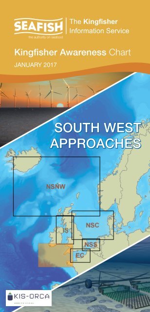
Kingfisher Awareness Chart<br />
JANUARY 2017<br />
<strong>SOUTH</strong> <strong>WEST</strong><br />
<strong>APPROACHES</strong>
"<br />
South West Approaches 2017<br />
30'<br />
13°W<br />
30'<br />
12°W<br />
30'<br />
11°W<br />
30'<br />
10°W<br />
30'<br />
9°W<br />
30'<br />
8°W<br />
30'<br />
7°W<br />
30'<br />
6°W<br />
30'<br />
5°W<br />
30'<br />
4°W<br />
30'<br />
3°W<br />
30'<br />
52°N<br />
IRELAND<br />
Cork<br />
!<br />
Saltees<br />
Ground<br />
St. David's<br />
Fishguard<br />
!<br />
!<br />
52°N<br />
Dursey Island<br />
!<br />
Kinsale<br />
!<br />
Ballycotton<br />
Ground<br />
Milford Haven<br />
Turbot Bank<br />
!<br />
30'<br />
12<br />
Fishing Lim<br />
Mile<br />
it<br />
Kinsale<br />
Head<br />
Grounds<br />
NYMPHE<br />
HIBERNIA EXPRESS00353 1 8673601<br />
GEMINI NORTH+44(0)207 138 7123<br />
12 Mile<br />
The Smalls<br />
Ground<br />
FishingLimit<br />
SOLAS+44(0)207 138 7123<br />
Oxwich<br />
!<br />
"<br />
"<br />
"<br />
"<br />
"<br />
"<br />
SWANSEA-BREAN+44(0)207<br />
138 7123<br />
30'<br />
"<br />
Lundy Island<br />
"<br />
50°N<br />
30'<br />
51°N<br />
PORCUPINE<br />
SEA BIGHT<br />
HIBERNIA ATLANTIC00353 1 8673601<br />
APOLLO NORTH+44(0)207 138 7117<br />
PTAT+44 (0) 207 315 4800<br />
YELLOW+44(0)208 5103119<br />
TAT 14 +44 2392 756227<br />
TATA ATLANTIC NORTH00800 89 266 298<br />
TATA W.EUROPE00800 89 266 298<br />
West Bank<br />
Labadie Bank<br />
TATA ATLANTIC <strong>SOUTH</strong>00800 89 266 298<br />
TATA W.EUROPE<br />
STUB00800<br />
89 266 298<br />
North<br />
West<br />
Bank<br />
Ireland - United Kingdom<br />
CELTIC +44 2392 756227<br />
ESAT 1+44 2392 756227<br />
Isles of<br />
Scilly<br />
UK-IRELAND CROSSING 1+44(0)208 5103119<br />
12 Mile Fishing Limit<br />
BT-IoS1+44(0)2392<br />
756227<br />
Bann Shoal<br />
Wolf Rock<br />
UK-IRELAND CROSSING 2+44(0)208 5103119<br />
""<br />
St. Ives<br />
Newlyn<br />
!<br />
!<br />
Newquay<br />
Falmouth<br />
"<br />
Mullion<br />
!<br />
Padstow<br />
!<br />
!<br />
Boscastle<br />
Mevagissey<br />
!<br />
!<br />
!<br />
Bude<br />
!<br />
Polperro<br />
!<br />
Plymouth<br />
"<br />
"<br />
!<br />
UNITED<br />
KINGDOM<br />
Dartmouth<br />
Exmouth<br />
Teignmouth<br />
Torquay<br />
Salcombe<br />
Ground<br />
!<br />
!<br />
!<br />
!<br />
Lyme Regis<br />
UK-CH.ISLANDS 7 + 4 2392 756227<br />
TAT 14+44 2392 756227<br />
!<br />
West<br />
Bay<br />
!<br />
Weymouth<br />
!<br />
Portland<br />
United Kingdom - Guernsey<br />
!<br />
50°N<br />
30'<br />
51°N<br />
LIBERTY +44 2392 756227<br />
49°N<br />
30'<br />
FLAG ATLANTIC NORTH+44(0)208 2821599<br />
South<br />
Hake<br />
Ground<br />
Great<br />
Sole<br />
Bank<br />
TAT 12+44 2392 756227<br />
Cockburn<br />
Bank<br />
ATLANTIC CROSSING 1+44(0)208 5103119<br />
EUROPE INDIA GATEWAY+44(0)207 138 7123<br />
Jones Bank<br />
GLO-1<br />
TAT 8 NORTH +44 2392 756227<br />
APOLLO <strong>SOUTH</strong>+44(0)207 138 7117<br />
SEA-ME-WE3+44 2392 756227<br />
United Kingdom - France<br />
RIOJA 2+44(0)8457 555999<br />
FLAG ATLANTIC INTERLINK+44(0)208 2821599<br />
HUGO+44(0)207 138 7123<br />
UK-CH.ISLANDS 8 +44 2392 756227<br />
France - Guernsey<br />
Plateau<br />
des Roches<br />
Douvres<br />
Plateau de<br />
Barnouic<br />
HURD DEEP<br />
!<br />
GUERNSEY!<br />
GUERNSEY-JERSEY<br />
4+44(0)1481<br />
757418<br />
Guernsey<br />
INGRID<br />
FO+44(0)1481<br />
242864<br />
- Jersey<br />
!<br />
49°N<br />
30'<br />
30'<br />
48°N<br />
Ireland - Atlantic Ocean<br />
Little Sole<br />
FLAG+44(0)208 2821599<br />
Shamrock<br />
Knoll<br />
TAT 11+44(0)207 138 7123<br />
RIOJA 1+44(0)8457 555999<br />
Parsons<br />
Bank<br />
FLAG ATLANTIC <strong>SOUTH</strong>+44(0)208 2821599<br />
TAT 9+44(0)8457 555999<br />
TAT12-13 +44 2392 756227<br />
UK-SPAIN 4 +44(0)8457 555999<br />
!<br />
Brest<br />
!<br />
!<br />
Goulven<br />
Douarnenez<br />
Lannion<br />
!<br />
FRANCE<br />
!<br />
Jersey - France<br />
Saint-Quay-Portrieux<br />
48°N<br />
30'<br />
Penmarch<br />
!<br />
!<br />
Concarneau<br />
United Kingdom - Atlantic Ocean<br />
!<br />
Lorient<br />
30'<br />
GEMINI <strong>SOUTH</strong>+44(0)207 138 7123<br />
TAT 8 +44 2392 756227<br />
La Chapelle<br />
30'<br />
NOT TO BE USED FOR NAVIGATION<br />
30'<br />
13°W<br />
30'<br />
12°W<br />
30'<br />
11°W<br />
30'<br />
10°W<br />
30'<br />
9°W<br />
30'<br />
8°W<br />
30'<br />
7°W<br />
30'<br />
6°W<br />
30'<br />
5°W<br />
30'<br />
4°W<br />
30'<br />
3°W<br />
PLEASE KEEP CLEAR OF AND DO NOT DAMAGE SUBSEA CABLES THESE CABLES CARRY HIGH VOLTAGES AND CAN BE DANGEROUS TO LIFE IT IS AN OFFENCE TO WILFULLY DAMAGE SUBSEA CABLES<br />
30'
Kingfisher Awareness Chart - Subsea Cables and Renewable Energy Structures<br />
The KIS-ORCA Project<br />
The Kingfisher Information Service - Offshore Renewable & Cable Awareness<br />
project (KIS-ORCA) is a joint initiative between European Subsea Cables<br />
Association (ESCA) and RenewableUK and is being managed by the Kingfisher<br />
Information Service of Seafish.<br />
Offshore wind farms, renewable energy structures<br />
and subsea cables are increasing in number<br />
around the shores of the UK. The potential<br />
risks these structures may cause to fishermen<br />
is significant and the KIS-ORCA project aims to<br />
ensure these are managed in a responsible way.<br />
It is against the law to wilfully damage a subsea<br />
cable. To enable fishermen to continue to work<br />
safely in the vicinity of subsea cables and renewable<br />
energy structures, KIS-ORCA provides fishermen<br />
with information and accurate positions of all these<br />
offshore structures.<br />
KIS-ORCA information is made available as fishing<br />
plotter files and awareness charts for use on vessels<br />
and on www.kis-orca.eu, where information may be<br />
viewed and downloaded.<br />
Dangers of Renewable Energy<br />
Structures & Cables to Fishing<br />
Renewable Energy Structures and Subsea Cables are a hazard and fishing over<br />
them should be avoided at all times. Heavily armoured cables used within the<br />
subsea cable and renewable energy industry are very strong and have high<br />
breaking strains, sometimes over 70 tonnes and can do extensive damage before<br />
they give way. Most modern subsea cables carry high voltages which could prove<br />
lethal if attempts are made to cut them.<br />
Fibre Optic cable consists of an inner optical<br />
core encased within a copper clad high tensile<br />
steel wire rope insulated with polythene. In water<br />
less than 1500 meters deep, protection is added<br />
against fishing and anchor damage in the form of<br />
external steel wire armour.<br />
Due to the severe environmental demands placed<br />
on submarine cables, a lead-alloy sheath is often<br />
specified because of its compressibility, flexibility<br />
and resistance to moisture and corrosion. The<br />
sheath is usually covered by a number of outer<br />
layers, comprising a PE or PVC jacket and metal<br />
wire armouring.<br />
Cable Burial<br />
Submarine cables have been laid on the seabed<br />
since the 1850’s. In most cases recently installed<br />
cables are buried beneath the seabed, unfortunately<br />
there remains a percentage of cables unburied.<br />
Cables can be scoured out by tides and currents or<br />
moved by anchors and fishing gear. Therefore cables<br />
that were considered safe from subsea activities at<br />
the time of installation may become partially or totally<br />
unburied and could present a serious risk to fishing<br />
activities. Please exercise extreme caution when<br />
fishing in the vicinity of submarine cables.<br />
Cables as Potential<br />
Gear Fasteners<br />
As a result of movements of the seabed the cables<br />
may occasionally be spanning hollows in the sea<br />
bed. Also where a cable repair has been carried out,<br />
although every effort is made to have it fall back flat<br />
on the bottom, it can sometimes finish with a bight<br />
of cable standing proud of the seabed which is easily<br />
picked up or fouled by a trawl door.<br />
Cable Repairs<br />
Further hazards to fishing gear are the repairs to the<br />
cables called FINAL SPLICE BIGHT. After a repair<br />
has been completed by splicing two ends together,<br />
the cable vessel has a large section or bight of wire<br />
leading from the seabed to the ship. This is held<br />
onboard by rope stoppers, then the procedure is<br />
simply to slip both stoppers and lower the bight of<br />
cable back onto the seabed.<br />
Burial of repairs are often more difficult, therefore the<br />
risk of contact is increased. The Final Splice Bight is<br />
laid on the seabed at right angles to the cable route.<br />
The crown of the bight may be up to 1 x water depth<br />
from the charted cable route.<br />
Wind Turbines and<br />
Foundations<br />
As wind turbines get larger and are deployed in<br />
deeper waters, a range of different foundation types<br />
may be encountered such as monopole, jacket,<br />
gravity base and suction bucket. In some cases<br />
multiple foundation types may be used within a single<br />
site. In all cases it is likely that scour holes will form<br />
around the foundation base, the depth and extent<br />
being dependent upon a range of factors including<br />
seabed type and current strength and direction.<br />
Scour protection in the form of rock dumping or<br />
cable mattresses is often used around the base of<br />
the foundations which may present a snagging risk.<br />
During the operational phase of a wind farm, an<br />
operator may request a 50m advisory safety zone<br />
around each structure.<br />
Inter Array Wind Farm<br />
Cabling<br />
The inter array cables interconnect the turbines<br />
typically in radial strings going to the offshore<br />
substation platform. The issues associated with<br />
these are largely the same as per cable burial. Each<br />
turbine will usually have up to two cables entering<br />
the foundation structure at the seabed through<br />
a protective tube. Typically the tube end has a<br />
bellmouth at the seabed to aid alignment and pulling<br />
in of the cables. Whilst the cables may have been<br />
jetted in or ploughed as close as practical to the<br />
foundation, cables may not be fully buried and may<br />
also become exposed by scour holes forming. In<br />
these circumstances scour protection in the form<br />
of rock dumping or cable mattresses may be used.<br />
Cables, albeit close to the foundation, may present a<br />
snagging risk to anchors and/or trawled gear.<br />
Reducing the Risks whilst Fishing<br />
To reduce the risks of fishing near offshore structures, it is essential to be up to<br />
date with KIS-ORCA information. KIS-ORCA information is easy to install on your<br />
vessel’s fishing plotter and ensures skippers are able to make informed decisions<br />
for their safety.<br />
The closer to the surface a subsea cable is lifted<br />
when fouled by fishing gear, the more danger<br />
there is to the fishing vessel.<br />
In the interests of fishing safety and to prevent<br />
damage to subsea structures, fishermen are<br />
advised to exercise caution when fishing in the<br />
vicinity of subsea cables and renewable energy<br />
structures. Loss of gear, fishing time and catch<br />
can result if a trawler snags a subsea structure<br />
and there is serious risk of loss of life.<br />
If it is thought prudent to slip, or cut your fishing gear<br />
in an attempt to clear a subsea structure, always<br />
Use of KIS-ORCA Data<br />
lower the gear to the seabed first. Never attempt to<br />
slip anything bearing excessive weight.<br />
Claims for loss of gear should be made to the<br />
appropriate authority within 24 hours of arrival in<br />
port. Full particulars of the incident should be given<br />
and full details recorded in the vessel’s official log,<br />
date and exact time, the vessel’s position (VMS if<br />
suitable), depth of water and a description of the<br />
cable if sighted.<br />
Claims for loss will only be considered if<br />
current KIS-ORCA data is installed on your<br />
vessel’s fishing plotter.<br />
KIS-ORCA data is available free of charge to skippers and includes Northern<br />
European cables and UK renewable energy structures. This includes the structure<br />
and cable positions and essential attribute information, such as the name and<br />
emergency contact number.<br />
The data is converted by Kingfisher into the<br />
most popular fishing plotter systems, including:<br />
Olex, Maxsea, Sodena, Transas Navifisher,<br />
TMPlanner/Quodfish, Penta+, SIS Microplot<br />
and Litton Fishmaster. KIS-ORCA data is easy to<br />
install on these systems and is displayed as an<br />
information layer.<br />
KIS-ORCA updates are provided annually in January<br />
and are distributed free of charge to the fishing<br />
industry by the Scottish Fishermen’s Federation<br />
(SFF), the National Federation of Fishermen’s<br />
Organisations (NFFO) and Kingfisher. From www.<br />
KIS-ORCA.eu you are able to view an interactive<br />
Google map and download fishing plotter files and<br />
awareness charts.<br />
KIS-ORCA data is easy to install and installation<br />
instructions are available at the following fishing<br />
exhibitions:<br />
• Skipper Expo Int. Aberdeen<br />
26th – 27th May 2017<br />
• Danfish International. Aalborg<br />
11th – 13th October 2017<br />
• Skipper Expo Int. Bristol<br />
7th - 8th September 2017<br />
You may also download instructions from<br />
www.kis-orca.eu, or contact Kingfisher.<br />
Always ensure you have the latest KIS-ORCA data installed on your fishing plotter system and<br />
are familiar with the awareness chart for your fishing area.<br />
Emergency<br />
Procedures<br />
1.<br />
If you suspect you have<br />
snagged a subsea cable<br />
or renewable energy structure,<br />
DO NOT endanger your vessel<br />
and crew by attempting to<br />
recover your gear.<br />
2.<br />
3.<br />
Carefully plot your vessel’s<br />
position as accurately as<br />
possible.<br />
Advise the Coastguard of<br />
your situation, and call the<br />
24 hour Emergency Number and<br />
state that an incident is occurring<br />
concerning an underwater<br />
structure, or subsea cable.<br />
Compensation for loss of<br />
fishing gear, will ONLY be<br />
considered, if you have up to<br />
date KIS-ORCA data displayed<br />
on your fishing plotter<br />
For more information contact:<br />
The Kingfisher Information Service<br />
Seafish Industry Authority<br />
Origin Way<br />
Europarc<br />
Grimsby<br />
DN37 9TZ<br />
t: +44 (0)1472 252 307<br />
e: Kingfisher@seafish.co.uk<br />
w: www.kingfishercharts.org<br />
w: www.KIS-ORCA.eu<br />
@KingfisherInfo
Emergency Procedures<br />
1.<br />
If you suspect you have snagged a<br />
subsea cable or renewable energy<br />
structure, DO NOT endanger your vessel and<br />
crew by attempting to recover your gear.<br />
2.<br />
3.<br />
Carefully plot your vessel’s position as<br />
accurately as possible.<br />
Advise the Coastguard of your<br />
situation, or call the 24 hour<br />
Emergency Number and state that an incident<br />
is occurring concerning an underwater<br />
structure, or subsea cable.<br />
Compensation for loss of fishing gear, will ONLY<br />
be considered, if you have up to date KIS-ORCA<br />
data displayed on your fishing plotter<br />
Kingfisher Awareness Chart<br />
South West Approches<br />
In Use Subsea Telecomms<br />
In Use Subsea Power<br />
Out of Service Subsea<br />
WF CABLES<br />
Oil & Gas Features<br />
Oil & Gas Pipeline<br />
International Maritime Boundary<br />
Windfarm (Proposed/Consented)<br />
Windfarm (Under Construction)<br />
Windfarm (Operational)<br />
Aggregate Active Areas (Licensed)<br />
Aggregate Application Areas<br />
TCE Tidal Lease Areas Dec 2016<br />
Wave Hub<br />
Repeater<br />
Final Splice<br />
Date: January 2017<br />
Projection: WGS_1984_World_Mercator<br />
Spheroid: GCS_WGS_1984<br />
Datum: D_WGS_1984<br />
Scale: 1:5,500,000<br />
This data is issued as a guide only. Seafish, Cable/Structure owners and distributors accept no responsibility<br />
for any inaccuracies however caused. Please be aware that other structures & cables may exist in addition to<br />
those shown on this chart. Coastlines are reproduced using GEBCO Digital Atlas, Centenary Edition 2003. The<br />
bathymetric metadata and Digital Terrain Model data products have been derived from the EMODnet Bathymetry<br />
portal - http://www.emodnet-bathymetry.eu and ETOPO2v2, U.S. Department of Commerce, National Oceanic<br />
and Atmospheric Administration, National Geophysical Data Center, 2006.