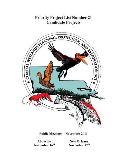
Priority Project List Number 21 Candidate Projects - US Army Corps ...
Priority Project List Number 21 Candidate Projects - US Army Corps ...
Priority Project List Number 21 Candidate Projects - US Army Corps ...

You also want an ePaper? Increase the reach of your titles
YUMPU automatically turns print PDFs into web optimized ePapers that Google loves.
<strong>Priority</strong> <strong>Project</strong> <strong>List</strong> <strong>Number</strong> <strong>21</strong><br />
<strong>Candidate</strong> <strong>Project</strong>s<br />
Public Meetings – November 2011<br />
Abbeville New Orleans<br />
November 16 th November 17 th
Table of Contents<br />
The <strong>21</strong>st <strong>Priority</strong> <strong>List</strong> Planning Process……………………..………………………………….1<br />
<strong>Candidate</strong> <strong>Project</strong>s located in Region One<br />
Fritchie Marsh Creation and Terracing………...………………………………………………7<br />
Labranche Central Marsh Creation..………………………………………………………..…9<br />
<strong>Candidate</strong> <strong>Project</strong>s located in Region Two<br />
Lake Lery Shoreline Marsh Creation…………………………………………………………12<br />
White Ditch Marsh Creation…….……………………………………………………………14<br />
Bayou Grand Cheniere Marsh Creation and Terracing….…………………………………...16<br />
Northwest Turtle Bay Marsh Creation……………...………………………………………..18<br />
Bayou L’Ours Terracing…….………………………………………………………………..20<br />
<strong>Candidate</strong> <strong>Project</strong>s located in Region Three<br />
Southeast Marsh Island Marsh Creation………..……………………………………………23<br />
Cole’s Bayou Marsh Restoration…………………………………………………………….25<br />
<strong>Candidate</strong> <strong>Project</strong>s located in Region Four<br />
Oyster Bayou Marsh Restoration…………………………………………………………….28<br />
<strong>Candidate</strong> Demonstration <strong>Project</strong>s<br />
Automated Marsh Planting (aka Alternative to Manual Planting)..…………………………..31<br />
Deltalok……………………………………………………………………………………….33<br />
Habitat Enhancement through Vegetative Plantings Using Gulf Saver Bags...………………34<br />
<strong>Candidate</strong> Evaluation Matrix………………………………………………………………….42<br />
Demonstration <strong>Project</strong> Evaluation Matrix……………………………………………………43
APPENDIX A<br />
PRIORITY LIST <strong>21</strong> SELECTION PROCESS<br />
Coastal Wetlands Planning, Protection and Restoration Act<br />
Guidelines for Development of the <strong>21</strong> st <strong>Priority</strong> <strong>Project</strong> <strong>List</strong><br />
Final<br />
I. Development of Supporting Information<br />
A. COE staff prepares spreadsheets indicating status of all restoration projects<br />
(CWPPRA <strong>Priority</strong> <strong>Project</strong> <strong>List</strong>s (PPL) 1-20; Louisiana Coastal Area (LCA)<br />
Feasibility Study, <strong>Corps</strong> of Engineers Continuing Authorities 1135, 204, 206; and<br />
State only projects). Also, indicate net acres at the end of 20 years for each<br />
CWPPRA project.<br />
B. OCPR/<strong>US</strong>GS staff prepare basin maps indicating:<br />
1) Boundaries of the following projects types (PPLs 1-20; LCA Feasibility Study,<br />
COE 1135, 204, 206; and State only).<br />
2) Locations of completed projects.<br />
3) <strong>Project</strong>ed land loss by 2050 including all CWPPRA projects approved for<br />
construction through January 2011.<br />
4) Regional boundary maps with basin boundaries and parish boundaries<br />
included.<br />
II. <strong>Project</strong> Nominations<br />
A. The four Regional Planning Teams (RPTs) will meet individually by region to<br />
examine basin maps, discuss areas of need and Coast 2050 strategies, and accept<br />
project nominations by hydrologic basin. <strong>Project</strong> nominations that provide<br />
benefits or construct features in more than one basin shall be presented in the<br />
basin receiving the majority of the project’s benefits. The RPT leaders, in<br />
coordination with the project proponents and the P&E Subcommittee, will<br />
determine which basin to place multi-basin projects. Alternatively, multi-basin<br />
projects can be broken into multiple projects to be considered individually in the<br />
basins which they occur. <strong>Project</strong> nominations that are legitimate coast-wide<br />
applications will be accepted separate from the nine basins at any of the four RPT<br />
meetings.<br />
Proposed project nominees shall support Coast 2050 strategies. Nominations for<br />
demonstration projects will also be accepted at any of the four RPT meetings.<br />
1
The RPTs will not vote to select nominee projects at the individual regional<br />
meetings. Rather, voting will be conducted during a separate coast-wide RPT<br />
meeting. All CWPPRA agencies and parishes will be required to provide the<br />
name and contact information during the RPT meetings for the official<br />
representative that will vote at the coast-wide RPT meeting.<br />
B. One coast-wide RPT meeting will be held after the individual RPT meetings to<br />
vote for nominees (including basin, coast-wide and demonstration project<br />
nominees). The RPTs will select three projects in the Terrebonne, Barataria, and<br />
Pontchartrain Basins based on the high loss rates (1985-2006) in those basins.<br />
Two projects will be selected in the Breton Sound, Teche/Vermilion, Mermentau,<br />
Calcasieu/Sabine, and Mississippi River Delta Basins. Because of the relatively<br />
low land loss rates, only one project will be selected in the Atchafalaya Basin. If<br />
only one project is presented at the Region II RPT Meeting for the Mississippi<br />
River Delta Basin, then an additional nominee would be selected for the Breton<br />
Sound Basin.<br />
A total of up to 20 basin projects could be selected as nominees. Each officially<br />
designated parish representative in the basin will have one vote and each federal<br />
CWPPRA agency and the State will have one vote. If coast-wide projects have<br />
been presented, the RPTs will select one coast-wide project nominee to compete<br />
with the 20 basin nominees for candidate project selection. Selection of a coastwide<br />
project nominee will be by consensus, if possible. If voting is required,<br />
officially designated representatives from all coastal parishes will have one vote<br />
and each federal CWPPRA agency and the State will have one vote. The RPTs<br />
will also select up to six demonstration project nominees at this coast-wide<br />
meeting. Selection of demonstration project nominees will be by consensus, if<br />
possible. If voting is required, officially designated representatives from all<br />
coastal parishes will have one vote and each federal CWPPRA agency and the<br />
State will have one vote.<br />
C. Prior to the coast-wide RPT voting meeting, the Environmental and<br />
Engineering Work Groups will screen each coast-wide project nominated at the<br />
RPT meetings to ensure that each qualifies as a legitimate coast-wide application.<br />
Should any of those projects not qualify as a coast-wide application, then the RPT<br />
leaders, in coordination with the project proponents and the P&E Subcommittee,<br />
will determine which basin the project should be placed in.<br />
Also, prior to the coast-wide RPT voting meeting, the Environmental and<br />
Engineering Work Groups will screen each demonstration project nominated at<br />
the RPT meetings. Demonstration projects will be screened to ensure that each<br />
meets the qualifications for demonstration projects as set forth in the CWPPRA<br />
Standard Operating Procedures (SOP), Appendix E.<br />
D. A lead Federal agency will be designated for the nominees and demonstration<br />
project nominees to prepare preliminary project support information (fact sheet,<br />
2
maps, and potential designs and benefits). The RPT Leaders will then transmit<br />
this information to the P&E Subcommittee, Technical Committee and other RPT<br />
members.<br />
III. Preliminary Assessment of Nominated <strong>Project</strong>s<br />
A. Agencies, parishes, landowners, and other individuals informally confer to<br />
further develop projects. Nominated projects shall be developed to support Coast<br />
2050 strategies and goals.<br />
B. The lead agency designated for each nominated project will prepare a brief<br />
<strong>Project</strong> Description that discusses possible features. Fact sheets will also be<br />
prepared for demonstration project nominees.<br />
C. Engineering and Environmental Work Groups meet to review project features,<br />
discuss potential benefits, and estimate preliminary fully funded cost ranges for<br />
each project. The Work Groups will also review the nominated demonstration<br />
projects and verify that they meet the demonstration project criteria.<br />
D. P&E Subcommittee prepares matrix of cost estimates and other pertinent<br />
information for nominees and demonstration project nominees and furnishes to<br />
Technical Committee and Coastal Protection and Restoration Authority (CPRA).<br />
IV. Selection of Phase 0 <strong>Candidate</strong> <strong>Project</strong>s<br />
A. Technical Committee meets to consider the project costs and potential wetland<br />
benefits of the nominees. Technical Committee will select ten candidate projects<br />
for detailed assessment by the Environmental, Engineering, and Economic Work<br />
Groups. At this time, the Technical Committee will also select up to three<br />
demonstration project candidates for detailed assessment by the Environmental,<br />
Engineering, and Economic Work Groups.<br />
B. Technical Committee assigns a Federal sponsor for each project to develop<br />
preliminary Wetland Value Assessment (WVA) data and engineering cost<br />
estimates for Phase 0 as described below.<br />
V. Phase 0 Analysis of <strong>Candidate</strong> <strong>Project</strong>s<br />
A. Sponsoring agency coordinates site visits for each project. A site visit is vital<br />
so each agency can see the conditions in the area and estimate the project area<br />
boundary. There will be no site visits conducted for demonstration projects.<br />
B. Environmental and Engineering Work Groups and the Academic Advisory<br />
Group meet to refine project features and develop boundaries based on site visits.<br />
3
C. Sponsoring agency develops a draft WVA and prepares Phase 1 engineering<br />
and design cost estimates and Phase 2 construction cost estimates. Sponsoring<br />
agency should use formats approved by the applicable work group.<br />
D. Environmental Work Group reviews and approves all draft WVAs.<br />
Demonstration project candidates will be evaluated as outlined in Appendix E of<br />
the CWPPRA SOP.<br />
E. Engineering Work Group reviews and approves Phase 1 and 2 cost estimates.<br />
F. Economics Work Group reviews cost estimates and develops annualized (fully<br />
funded) costs.<br />
G. <strong>Corps</strong> of Engineers staff prepares information package for Technical<br />
Committee and CPRA. Packages consist of:<br />
1) updated <strong>Project</strong> Fact Sheets;<br />
2) a matrix for each region that lists projects, fully funded cost, average<br />
annual cost, Wetland Value Assessment results in net acres and Average<br />
Annual Habitat Units (AAHUs), and cost effectiveness (average annual<br />
cost/AAHU); and<br />
3) a qualitative discussion of supporting partnerships and public support.<br />
H. Technical Committee will host two public hearings to present the results from<br />
the candidate project evaluations. Public comments from the public will be<br />
accepted during the meeting and in writing.<br />
VI. Selection of <strong>21</strong> st <strong>Priority</strong> <strong>Project</strong> <strong>List</strong><br />
A. The selection of the <strong>21</strong> st PPL will occur at the Winter Technical Committee and<br />
Task Force meetings.<br />
B. Technical Committee meets and considers matrix, <strong>Project</strong> Fact Sheets, and<br />
public comments. The Technical Committee will recommend up to four projects<br />
for selection to the <strong>21</strong> st PPL. The Technical Committee may also recommend<br />
demonstration projects for the <strong>21</strong> st PPL.<br />
C. The CWPPRA Task Force will review the Technical Committee<br />
recommendations and determine which projects will receive Phase 1 funding for<br />
the <strong>21</strong> st PPL.<br />
4
<strong>21</strong> st <strong>Priority</strong> <strong>List</strong> <strong>Project</strong> Development Schedule (dates subject to change)<br />
December 2010 Distribute public announcement of PPL <strong>21</strong> process and schedule<br />
December 8, 2010 Winter Technical Committee Meeting, approve Phases I and II<br />
(Baton Rouge)<br />
January 19, 2011 Winter Task Force Meeting (New Orleans)<br />
January 25, 2011 Region IV Planning Team Meeting (Abbeville)<br />
January 26, 2011 Region III Planning Team Meeting (Morgan City)<br />
January 27, 2011 Regions I and II Planning Team Meetings (New Orleans)<br />
February 22, 2011 Coast-wide RPT Voting Meeting (Baton Rouge)<br />
February 24 -<br />
March 11, 2011 Agencies prepare fact sheets for RPT-nominated projects<br />
March 22-23, 2011 Engineering/ Environmental Work Groups review project features,<br />
benefits & prepare preliminary cost estimates for nominated projects<br />
(Baton Rouge)<br />
March 24, 2011 P&E Subcommittee prepares matrix of nominated projects showing<br />
initial cost estimates and benefits<br />
April 8, 2011 Spring Technical Committee Meeting, select PPL <strong>21</strong> candidate project<br />
(Baton Rouge)<br />
May/June/July <strong>Candidate</strong> project site visits<br />
June 8, 2011 Spring Task Force Meeting (Lafayette)<br />
July/August/ Env/Eng/Econ Work Group project evaluations<br />
September<br />
September 20, 2011 Fall Technical Committee Meeting, O&M and Monitoring funding<br />
recommendations (Baton Rouge)<br />
October 12, 2011 Fall Task Force meeting, O&M and Monitoring approvals (New<br />
Orleans)<br />
October 26, 2011 Economic, Engineering, and Environmental analyses completed for<br />
PPL <strong>21</strong> candidates<br />
November 16, 2011 PPL <strong>21</strong> Public Meeting (Abbeville)<br />
November 17, 2011 PPL <strong>21</strong> Public Meeting (New Orleans)<br />
December 13, 2011 Winter Technical Committee Meeting, recommend PPL <strong>21</strong> and Phase I<br />
and II approvals (Baton Rouge)<br />
January 19, 2012 Winter Task Force Meeting, select PPL <strong>21</strong> and approve Phase II<br />
requests (New Orleans)<br />
5
<strong>Candidate</strong> <strong>Project</strong>s Located in Region 1<br />
6
PPL<strong>21</strong> Fritchie Marsh Creation and Terracing<br />
Coast 2050 Strategy:<br />
Coastwide: Dedicated dredging to create, restore, or protect wetlands<br />
<strong>Project</strong> Location:<br />
Region 1, Pontchartrain Basin, St. Tammany Parish, located approximately 3 miles southeast of<br />
Slidell, Louisiana. Portions of the project are located on Big Branch Marsh National Wildlife<br />
Refuge.<br />
Problem:<br />
A significant portion of the Fritchie Marsh was lost due to Hurricane Katrina. Post storm<br />
shallow open water areas dominate the landscape which reduces the effectiveness of the PO-06<br />
project. Wetlands in the project vicinity are being lost at the rate -0.92%/yr based on the<br />
extended boundary during 1984 to 2011. These marshes cannot recover without replacement of<br />
lost sediment, which is critical if the northshore marshes are to be sustained. Marshes near the<br />
intersection of Highways 433 and 90 are semi-impounded with substantially limited tidal<br />
exchange.<br />
Goals:<br />
<strong>Project</strong> goals include restoring and nourishing marsh, maintaining the structural integrity of Salt<br />
Bayou, creating edge and reducing wave erosion, and improving tidal exchange to created and<br />
existing marshes south of Prevost Island. Specific goals of the project are: 1) create 580 acres of<br />
marsh including 10,000 feet of tidal creeks and 10 acres of ponds; 2) nourish an additional 20<br />
acres or marsh, and 3) create 36 acres of emergent habitat by constructing 50,000 linear feet of<br />
earthen terraces.<br />
Proposed Solution:<br />
Approximately 4.5 million cubic yards of material would be placed into two marsh creation areas<br />
to restore 580 acres and nourish 20 acres of brackish marsh. Material would be dredged from a<br />
borrow site in Lake Pontchartrain. The borrow site would be designed to avoid and minimize<br />
impacts to sensitive aquatic habitat and existing banklines. Tidal creeks and ponds would be<br />
constructed prior to placement of dredged material and retention levees would be gapped to<br />
support estuarine fisheries access to achieve a functional marsh. Culverts would be installed to<br />
improve tidal exchange to marsh located south of Prevost Island. Approximately 50,000 linear<br />
feet of earthen terraces would be constructed and planted.<br />
<strong>Project</strong> Benefits:<br />
The project would result in approximately 575 net acres of marsh over the 20-year project life.<br />
<strong>Project</strong> Costs:<br />
The total fully-funded cost is $46,080,753.<br />
Preparers of Fact Sheet:<br />
Patrick Williams, NOAA’s National Marine Fisheries Service, (225) 389-0508, ext 208<br />
patrick.williams@noaa.gov<br />
7
PPL<strong>21</strong> LaBranche Central Marsh Creation<br />
Coast 2050 Strategy:<br />
Coastwide: Dedicated Dredging for Wetland Creation<br />
<strong>Project</strong> Location:<br />
Region 4, Pontchartrain Basin, St. Charles Parish, bounded to the North by the railroad running<br />
parallel to I-10, to the west by the marsh fringe just east of Bayou LaBranche, to the south by<br />
Bayou Traverse and to the east by marsh fringe west of a pipeline canal.<br />
Problem:<br />
Dredging of access/flotation canals for construction of I-10 resulted in increased salinity &<br />
altered hydrology that exacerbated conversion of wetland vegetation into shallow open water<br />
bodies. Land loss is estimated to be -0.543 percent/year based on <strong>US</strong>GS data from 1984 to 2011<br />
within the extended project boundary.<br />
Goals:<br />
The primary goal is to restore marsh that converted to shallow open water. <strong>Project</strong><br />
implementation would result in an increase of fisheries and wildlife habitat, acreage, and<br />
diversity along with improving water quality. The proposed project would provide a protective<br />
wetland buffer to the railroad and I-10, the region’s primary westward hurricane evacuation<br />
route, and complement hurricane protection measures in the area.<br />
Proposed Solution:<br />
The proposed solution consists of the creation of 762 acres of emergent wetlands and the<br />
nourishment of 140 acres of existing wetlands using dedicated dredging from Lake<br />
Pontchartrain. The marsh creation area would have a target elevation the same as average<br />
healthy marsh. It is proposed to place the dredge material in the target area with the use of<br />
retention dikes along the edge of the project area. If degradation of the containment dikes has<br />
not occurred naturally by TY3, gapping of the dikes will be mechanically performed. Successful<br />
wetland restoration in the immediate area (PO-17 constructed in 1994) clearly demonstrates the<br />
ability for these wetlands to be restored using material from a sustainable borrow area (outlet end<br />
of Bonnet Carre Spillway). Engineering monitoring surveys of the marsh creation area and<br />
borrow area are planned as well.<br />
<strong>Project</strong> Benefits:<br />
The project would result in approximately 731 net acres of marsh over the 20-year project life.<br />
<strong>Project</strong> Costs:<br />
The total fully-funded cost is $42,159,208.<br />
Preparer of Fact Sheet:<br />
Jason Kroll, <strong>US</strong>DA-NRCS, 225-389-0347 jason.kroll@la.usda.gov<br />
9
<strong>Candidate</strong> <strong>Project</strong>s Located in Region 2<br />
11
PPL<strong>21</strong> Lake Lery Shoreline Marsh Creation<br />
Coast 2050 Strategy:<br />
Coastwide: Dedicated Dredging to Create, Restore, or Protect Wetlands; and, Maintenance of<br />
Lake Shoreline Integrity.<br />
<strong>Project</strong> Location:<br />
Region 2, Breton Sound Basin, along the northern and eastern rim of Lake Lery in St. Bernard<br />
Parish<br />
Problem:<br />
The marshes forming the northern and eastern shoreline of Lake Lery were severely damaged by<br />
Hurricane Katrina. Wind-induced waves within Lake Lery could further damage the shoreline<br />
and cause accelerated interior marsh loss. Without directly rebuilding these marshes, the lake<br />
itself will likely continue to grow and will coalesce with Bayou Terre aux Boeufs and recently<br />
formed open water areas north of the lake. Based on <strong>US</strong>GS hyper temporal data analysis (1984<br />
to 2011), land loss for the area is -1.42% per year. The subsidence rate is estimated at 1.1 to 2.0<br />
ft per century (Coast 2050, Lake Lery mapping unit).<br />
Goals:<br />
The project area encompasses 589 acres. The primary goals of the project are to 1)<br />
create/nourish 557 acres of marsh through dedicated dredging: and, 2) restore/stabilize<br />
approximately 3 miles of Lake Lery shoreline.<br />
Proposed Solution:<br />
Create 432 acres and nourish 125 acres of intermediate marsh via dedicated dredging with<br />
borrow from nearby Lake Lery. Containment dikes will be constructed in situ and will be<br />
gapped within 3 years of construction to allow greater tidal exchange and estuarine fisheries<br />
access. Restore 15,911 feet of the lake rim by constructing a lakeshore berm feature, designed to<br />
reduce shoreline erosion. Approximately 17 acres will be constructed above water and will settle<br />
to intertidal elevation by year 5. The berm will be vegetated to stabilize the feature and reduce<br />
shoreline erosion.<br />
<strong>Project</strong> Benefits:<br />
The project would result in approximately 412 net acres of marsh over the 20-year project life.<br />
<strong>Project</strong> Costs:<br />
The total fully-funded cost is $31,278,012.<br />
Preparers of Fact Sheet:<br />
Kimberly Clements, NOAA’s National Marine Fisheries Service, (225) 389-0508, ext 204<br />
kimberly.clements@noaa.gov;<br />
Stuart Brown, Coastal Protection and Restoration Authority; (225) 342-4596<br />
stuart.brown@la.gov<br />
12
PPL<strong>21</strong> White Ditch Marsh Creation<br />
Coast 2050 Strategy:<br />
Coastwide: Dedicated Dredging to Create, Restore, or Protect Wetlands; Off-shore and Riverine<br />
Sand and Sediment Resources.<br />
Region 2 Regional Ecosystem Strategies: Restore and Sustain Marshes.<br />
<strong>Project</strong> Location:<br />
Region 2, Breton Sound Basin, Plaquemines Parish, South of the White Ditch Siphon canal<br />
Problem:<br />
The project area is an open water body immediately adjacent to the east bank of the Mississippi<br />
River levee. The area is a failed former agricultural impoundment that has also been cut off from<br />
the Mississippi River effectively eliminating any input of sediment or nutrients from the River.<br />
Surrounding marshes have changed from fresh marsh and possibly swamp, to intermediate marsh<br />
due to the elimination of freshwater inputs from the Mississippi River. High levels of subsidence<br />
(2.1 to 3.5 ft/century) have further exacerbated land loss and have increased water depths<br />
because of the lack of sediment input from the Mississippi River. The project area encompasses<br />
380 acres. Land loss rates in the area are estimated at -0.79% per year between 1984 and 2011.<br />
Goals:<br />
The primary goal of this project is to create/nourish emergent intermediate marsh habitat using<br />
dedicated renewable dredged sediment from the Mississippi River. Specific project goals<br />
include (1) creating 357 acres of marsh habitat, (2) nourishing 23 acres of existing marsh habitat,<br />
and (3) creating approximately 9,500 linear feet of tidal creeks.<br />
Proposed Solution:<br />
Hydraulically dredge and place approximately 2 million cubic yards of renewable sediments<br />
from the Mississippi River to create 357 acres of marsh habitat, nourish 23 acres of existing<br />
marsh habitat, create approximately 9,500 linear feet of tidal creeks, and plant 50% of the created<br />
marsh area using the appropriate intermediate species. The project would complement the White<br />
Ditch Resurrection and Outfall Management project (BS-12) intended to provide increased<br />
freshwater inputs through the existing siphon at White Ditch. Freshwater input would work<br />
synergistically to help sustain the marsh created via sediment delivery from the Mississippi<br />
River.<br />
<strong>Project</strong> Benefits:<br />
The project would result in approximately 331 net acres of marsh over the 20-year project life.<br />
<strong>Project</strong> Costs:<br />
The total fully-funded cost is $30,520,482.<br />
Preparers of Fact Sheet:<br />
Paul Kaspar, EPA (<strong>21</strong>4) 665-7459; kaspar.paul@epa.gov<br />
Adrian Chavarria, EPA (<strong>21</strong>4) 665-3103; chavarria.adrian@epa.gov<br />
Chris Llewellyn, EPA (<strong>21</strong>4) 665-7239, llewellyn.chris@epa.gov<br />
14
PPL<strong>21</strong> Bayou Grande Cheniere Marsh Creation and Terracing<br />
Coast 2050 Strategy:<br />
Coastwide: Dedicated Dredging for Wetland Creation<br />
<strong>Project</strong> Location:<br />
Region 2, Barataria Basin, Plaquemines Parish, near Lake Hermitage, along Bayou Grande<br />
Cheniere ridge<br />
Problem:<br />
Significant marsh loss has occurred south of Lake Hermitage with the construction of numerous<br />
oil and gas canals, subsidence, and sediment deprivation. Based on the hyper-temporal analysis<br />
conducted by <strong>US</strong>GS for the extended project boundary, loss rates in the area are estimated to be<br />
-0.66% per year for the period 1984 to 2011.<br />
Goals:<br />
The primary goal is to re-create marsh habitat in the open water areas and nourish marsh along<br />
the eastern side of the Bayou Grande Cheniere ridge. Terraces are proposed to reduce fetch in<br />
several large open water bodies and to capture suspended sediment delivered via the West Pointe<br />
a la Hache siphons. Specific goals of the project are: 1) Create approximately 509 acres (383<br />
acres of marsh creation and 126 acres of marsh nourishment) of marsh with dredged material<br />
from the Mississippi River; 2) create 85,600 linear feet (55 acres of marsh) of terraces.<br />
Proposed Solution:<br />
Riverine sediments will be hydraulically dredged and pumped via pipeline to create/nourish<br />
approximately 509 acres of marsh in the project area. Containment dikes will be constructed as<br />
necessary. The proposed design is to place the dredged material to a fill height of +2.0 ft<br />
NAVD88. Dewatering and compaction of dredged sediments should produce marsh elevations<br />
conducive to the establishment of emergent marsh and within the intertidal range.<br />
Approximately 85,600 linear feet of terraces (55 acres subaerial) will be constructed. The<br />
terraces will be 500 to 700 feet long, have a 20 ft crown width, an initial constructed height of<br />
+3.5 ft NAVD88 (settled height of +2.5ft), side slopes of 1(V):3(H), and 300 to 500-ft gaps<br />
between terraces. Terrace rows will be staggered and 250 feet apart. The terrace slopes will be<br />
planted with two staggered rows of smooth cordgrass, on 5-ft centers. The terrace crowns will<br />
be planted with two rows of seashore paspalum on 5-ft centers.<br />
<strong>Project</strong> Benefits:<br />
The project would result in approximately 419 net acres of marsh over the 20-year project life.<br />
<strong>Project</strong> Costs:<br />
The total fully-funded cost is $48,646,882.<br />
Preparer of Fact Sheet<br />
Kevin Roy, <strong>US</strong>FWS, (337) 291-3120, Kevin_Roy@fws.gov<br />
16
PPL<strong>21</strong> Northwest Turtle Bay Marsh Creation<br />
Coast 2050 Strategy:<br />
Coastwide: Dedicated Dredging for Wetland Creation<br />
<strong>Project</strong> Location:<br />
Region 2, Barataria Basin, Jefferson Parish, northwest of Turtle Bay<br />
Problem:<br />
Historic wetland loss in the area stems from shoreline erosion along Turtle Bay and interior<br />
marsh loss from subsidence, sediment deprivation, and construction of oil and gas canals. Based<br />
on the hyper-temporal analysis conducted by <strong>US</strong>GS for the extended project boundary, loss rates<br />
in the area are estimated to be -0.61% per year for the period 1984 to 2011.<br />
Goals:<br />
The primary goal is to re-create marsh habitat in the open water areas and nourish existing marsh<br />
within the project area. The specific goal of the project is to create approximately 760 acres (423<br />
acres of marsh creation and 337 acres of marsh nourishment) of marsh with dredged material<br />
from Turtle Bay or Little Lake.<br />
Proposed Solution:<br />
The proposed project would create approximately 423 acres (90% of the 470 open water acres)<br />
and nourish approximately 337 acres of marsh using sediment dredged from Turtle Bay or Little<br />
Lake. Existing canal spoil banks, emergent marsh, and limited segments of containment dikes<br />
will be used to guide the distribution of the dredged material. Containment dikes will be<br />
degraded as necessary to reestablish hydrologic connectivity with adjacent wetlands.<br />
<strong>Project</strong> Benefits:<br />
The project would result in approximately 407 net acres of marsh over the 20-year project life.<br />
<strong>Project</strong> Costs:<br />
The total fully-funded cost is $23,198,757.<br />
Preparers of Fact Sheet<br />
Kevin Roy, <strong>US</strong>FWS, (337) 291-3120, Kevin_Roy@fws.gov<br />
Jason Kroll, NRCS, (225) 389-0347, Jason.Kroll@la.usda.gov<br />
Quin Kinler, NRCS, (225) 342-2047, Quin.Kinler@la.usda.gov<br />
18
PPL<strong>21</strong> Bayou L’Ours Terracing<br />
Coast 2050 Strategy:<br />
Coastwide: Terracing, Vegetative Plantings, Maintain or Restore Ridge Functions<br />
Local and Common Strategies: Maintain function of Bayou L’Ours Ridge<br />
<strong>Project</strong> Location:<br />
Region 2, Barataria Basin, Lafourche Parish, east of Galliano and south of Little Lake<br />
Problem:<br />
Areas located north and south of Bayou L’Ours and adjacent to the East Golden Meadow<br />
Hurricane Protection Levee have experienced marsh loss in the range of 8,000 to 10,000 acres.<br />
Because this location is a great distance from preferred sediment sources such as the Mississippi<br />
River, Gulf of Mexico, and even large bays and lakes, the now-customary practice of marsh<br />
creation using hydraulically dredged and deposited material presently does not seem feasible.<br />
And the use of more local borrow sources has not gained significant support. Thus, this critical<br />
area has been neglected from a restoration standpoint.<br />
Goals:<br />
The proposed project would re-establish landmass in an area where land mass is scarce. This<br />
added landmass will help protect, extend the life expectancy, and help maintain the current<br />
function of the Bayou L’Ours ridge. The proposed project would also offer a small degree of<br />
protection to a portion of the Larose to Golden Meadow Hurricane Protection Levee.<br />
Proposed Solution:<br />
The proposed solution is to construct 93,250 linear feet of terraces. The terraces would have a<br />
target elevation of +2.0 NAVD88, 15-foot top width, and 5:1 side slopes. The terraces will be<br />
planted with a row of plants on the crest and a row of plants on each side; spacing between plants will be<br />
2.5 feet.<br />
<strong>Project</strong> Benefits:<br />
The project would result in approximately 58 net acres of marsh over the 20-year project life.<br />
<strong>Project</strong> Costs:<br />
The total fully-funded cost is $ $5,447,519.<br />
Preparer of Fact Sheet:<br />
Quin Kinler, <strong>US</strong>DA-NRCS, 225-382-2047, quin.kinler@la.usda.gov<br />
20
<strong>Candidate</strong> <strong>Project</strong>s Located in Region 3<br />
22
PPL<strong>21</strong> Southeast Marsh Island Marsh Creation<br />
Coast 2050 Strategy:<br />
Coastwide Common Strategies: Dedicated dredging to create, restore, or protect wetlands;<br />
Offshore and riverine sand and sediment resources.<br />
Region 2 Regional Ecosystem Strategies: Restore and Sustain Marshes.<br />
<strong>Project</strong> Location:<br />
Region 3, Teche-Vermillion Basin, Iberia Parish, Southeast end of Marsh Island Wildlife Refuge<br />
Problem:<br />
Areas of interior emergent marsh on Marsh Island have been converted to open water, primarily<br />
due to hurricane activity and subsidence. Marsh Island has been projected to lose 12.9% of its<br />
marsh habitat through 2050. Areas targeted by this project are those with the greatest historic<br />
land loss and are proximal to East Cote Blanche Bay. The project area encompasses 610 acres.<br />
Within the project area, 270 acres were marsh and the remaining 340 acres were open water as of<br />
2010. Land loss rates in the area are estimated at -0.46 percent/year based on <strong>US</strong>GS data from<br />
1985 – 2010.<br />
Goals:<br />
The primary goal of this project is to create/nourish brackish marsh habitat using dedicated<br />
dredging of offshore sediment. Borrow material will be targeted from the state offshore area to<br />
limit water quality impacts, avoid in situ deltaic sediments, and minimize impacts to potential<br />
oyster lease areas. Specific project goals include (1) creating 341 acres of marsh habitat, (2)<br />
nourishing 269 acres of marsh habitat, and (3) creating approximately 10,000 linear feet of tidal<br />
creeks.<br />
Proposed Solution:<br />
Hydraulically dredge and place approximately 1.3 million cubic yards of offshore sediments into<br />
two marsh creation areas to create 341 acres of marsh habitat, nourish 269 acres of marsh habitat,<br />
create approximately 10,000 linear feet of tidal creeks, and plant 50% of the created marsh area<br />
using the appropriate brackish species. The project would complement the constructed Marsh<br />
Island Hydrologic Restoration (TV-14) and the East Marsh Island Marsh Creation (TV-<strong>21</strong>)<br />
projects.<br />
<strong>Project</strong> Benefits:<br />
The project would result in approximately 338 net acres over the 20-year project life.<br />
<strong>Project</strong> Costs:<br />
The total fully-funded cost is $22,532,305.<br />
Preparers of Fact Sheet:<br />
Paul Kaspar, EPA, (<strong>21</strong>4) 665-7459; kaspar.paul@epa.gov<br />
Chris Llewellyn, EPA, (<strong>21</strong>4) 665-7239; llewellyn.chris@epa.gov<br />
Adrian Chavarria, EPA, (<strong>21</strong>4) 665-3103; Chavarria.adrian@epa.gov<br />
23
PPL<strong>21</strong> Cole’s Bayou Marsh Restoration<br />
Coast 2050 Strategy:<br />
Coastwide: Dedicated Dredging to Create, Restore, or Protect Wetlands<br />
Regional: Restore and Sustain Wetlands<br />
<strong>Project</strong> Location:<br />
Region 3, Teche/Vermilion Basin, Vermilion Parish, east of Freshwater Bayou Canal<br />
Problem:<br />
<strong>Project</strong> area wetlands are undergoing loss at -0.42 %/year based on 1983 to 2011 <strong>US</strong>GS data<br />
from the extended boundary. Wetland loss processes in this area include subsidence/sediment<br />
deficit, interior ponding and pond enlargement, and storm impacts resulting in rapid episodic<br />
losses. In addition, significant interior marsh loss has resulted from salt water intrusion and<br />
hydrologic changes associated with increasing tidal influence. As hydrology in this area has<br />
been modified, habitats have shifted to more of a floatant marsh type, resulting in increased<br />
susceptibility to tidal energy and storm damages. Habitat shifts and hydrologic stress reduce<br />
marsh productivity, a critical component of vertical accretion in wetlands.<br />
Goals:<br />
Specific goals of the project are: 1) create 365 acres of brackish marsh in recently formed<br />
shallow open water; 2) nourish 53 acres of existing brackish marsh; and, 3) increase freshwater<br />
and sediment inflow into interior wetlands by improving project area hydrology.<br />
Proposed Solution:<br />
Create 365 acres and nourish 53 acres of brackish marsh via dedicated dredging with borrow<br />
from nearby Vermilion Bay. Although this is not considered an “external” source of material,<br />
significant sediment inflows into this area may result in some borrow area infilling. Half of the<br />
marsh creation acres would be planted. Encourage additional freshwater nutrient and sediment<br />
inflow from Freshwater Bayou Canal by dredging a portion of Cole’s Bayou; and, installing a<br />
series of culverts throughout the project area. North structures are envisioned to allow the<br />
ingress of sediment, water, and fisheries organisms into the semi-impounded project area, but<br />
avoid backflow of water and potential loss of interior marsh sediment (i.e., north to south flow<br />
only). Southern structures are envisioned to allow water to drain out of the marsh.<br />
<strong>Project</strong> Benefits:<br />
The project would result in approximately 398 net acres of marsh over the 20-year project life.<br />
<strong>Project</strong> Costs:<br />
The total fully-funded cost is $26,631,224.<br />
Preparer of Fact Sheet:<br />
Kimberly Clements, NOAA’s National Marine Fisheries Service, (225) 389-0508, ext 204<br />
kimberly.clements@noaa.gov<br />
25
<strong>Candidate</strong> <strong>Project</strong>s Located in Region 4<br />
27
PPL<strong>21</strong> Oyster Bayou Marsh Restoration<br />
Coast 2050 Strategy:<br />
Coastwide: Dedicated Dredging to Create, Restore, or Protect Wetlands<br />
<strong>Project</strong> Location:<br />
Region 4, Calcasieu-Sabine Basin, located west of the Calcasieu Ship Channel and south of the<br />
west fork of the Calcasieu River<br />
Problem:<br />
Altered hydrology, drought stress, saltwater intrusion and hurricane induced wetland losses have<br />
caused the area to undergo interior marsh breakup. Recent impacts from Hurricane Rita in 2005<br />
and Hurricane Ike in 2008 have resulted in the coalescence of Oyster Lake with interior water<br />
bodies increasing wave/wake related erosion. Based on <strong>US</strong>GS hyper temporal data analysis<br />
(1984 to 2011), land loss for the area is -0.75% per year. The subsidence rate is estimated at 0.0<br />
to1.0 ft per century (Coast 2050, Mud Lake mapping unit).<br />
Goals:<br />
The project boundary encompasses 809 acres. Specific goals of the project are: 1) create 510<br />
acres of saline marsh in recently formed shallow open water; 2) nourish 90 acres of existing<br />
saline marsh; 3) create 14,140 linear feet of terraces; and, 4) reduce wave/wake erosion.<br />
Proposed Solution:<br />
Approximately 510 acres of marsh would be created and 90 acres would be nourished. Sediment<br />
needed for the fill would be mined approximately one and a half miles offshore in the Gulf of<br />
Mexico. Half of the created acres would be planted. Tidal creeks and ponds would be<br />
constructed prior to placement of dredged material and retention levees would be gapped to<br />
support estuarine fisheries access to achieve a functional marsh. Approximately 14,140 linear<br />
feet of earthen terraces would be constructed and planted.<br />
<strong>Project</strong> Benefits:<br />
The project would result in approximately 489 net acres of marsh over the 20-year project life.<br />
<strong>Project</strong> Costs:<br />
The total fully-funded cost is $29,781,355.<br />
Preparer of Fact Sheet:<br />
Kimberly Clements, NOAA’s National Marine Fisheries Service, (225) 389-0508, ext 204<br />
kimberly.clements@noaa.gov<br />
28
<strong>Candidate</strong> Demonstration <strong>Project</strong>s<br />
30
PPL<strong>21</strong> Automated Marsh Planting Demonstration <strong>Project</strong><br />
(formerly called “Alternative to Manual Planting”)<br />
Coast 2050 Strategy:<br />
Coastwide: Dedicated dredging for wetland creation; Wetlands Vegetation Plantings<br />
Regional: Dedicated delivery of sediment for marsh building by any means feasible; Habitat<br />
Diversification and Vegetation Planting<br />
Potential Demonstration <strong>Project</strong> Location:<br />
This demonstration project could be done at any dedicated or beneficial use of dredged material<br />
site creating a marsh platform.<br />
Problem:<br />
Though wetland restoration with grass plugs is being done in some areas, success of reestablishing<br />
vegetation is limited in many challenged sites. New technologies and applications<br />
are needed to achieve greater stabilization, higher survivability, and integration of diverse<br />
species back into these areas. Hand planting is costly and time consuming.<br />
Goals:<br />
The goal of this project is to demonstrate a possible alternative to manual plantings at dredged<br />
material placement sites. Specific goals: 1) To test if “plant parts” (not limited to rhizomes,<br />
seeds, stolons, stem cuttings, etc.) can survive passing through a dredge pipe; 2) To determine if<br />
this method gives an acceptable distribution of plants; and, 3) To determine the optimal time to<br />
input the “plant parts” for maximum growth and distribution.<br />
Proposed Solution:<br />
Install a hopper on the dredge pipe allowing “plant parts” to be carried to the dredged material<br />
placement site through the pipeline. The demo would consist of 3 replicates of 4 separate<br />
treatments: Concept 1 – three flagged-off areas of the dredged material placement site to be the<br />
“natural recruitment” area; Concept 2 – three flagged-off areas of the dredged material<br />
placement site to be the typical “hand planted” area; Concept 3 – three cells having dredged<br />
material pre-loaded thru the dredge pipe with “plant parts” at “time/dredged quantity interval 1”;<br />
and Concept 4 – three cells having dredged material pre-loaded thru the dredged pipe with<br />
“plant parts” at “time/dredged quantity interval 2”.<br />
<strong>Project</strong> Benefits:<br />
Potential project benefits include: 1) reduce the cost of planting and 2) increase habitat value.<br />
<strong>Project</strong> Costs:<br />
The total fully funded cost is $2,300,608.<br />
Preparers of Fact Sheet:<br />
Nathan Dayan, <strong>US</strong>ACE. 504-862-2530, nathan.s.dayan@usace.army.mil<br />
Susan Hennington, <strong>US</strong>ACE, 504-862-2504, susan.m.hennington@usace.army.mil<br />
John Petitbon, <strong>US</strong>ACE, 504-862-2732, john.b.petitbon@usace.army.mil<br />
Steve Roberts, <strong>US</strong>ACE, 504-862-2517, steve.w.roberts@usace.army.mil<br />
31
PPL<strong>21</strong> Deltalok® Coastline Stabilization Demonstration <strong>Project</strong><br />
Coast 2050 Strategy:<br />
Coastwide Strategy: Maintain, Protect or Restore Ridge Functions; Vegetation Planting;<br />
Regional Strategies: Protect Bay, Lake and Shorelines; Restore and Maintain Barrier Islands<br />
and Critical Land Forms<br />
Potential Demonstration <strong>Project</strong> Location:<br />
Coastwide<br />
Problem:<br />
Marsh and wetland loss occurs throughout coastal Louisiana due to shoreline erosion. The loss<br />
of vegetation has accelerated the rate of erosion, and reducing this loss is proving difficult and<br />
costly. Shore stabilization is crucially needed to prevent the eroding marsh footprint. Though<br />
wetland restoration with grass plugs is being done in some areas, it is limited in scope. Shoreline<br />
and ridge stabilization is still needed to prevent the eroding marsh footprint.<br />
Goals:<br />
The goal of this project is demonstrate the successful use of the Deltalok® Terra-Soft Block<br />
(TSB) System to both armor and repair shorelines, and serve as a viable planting ground for<br />
marsh vegetation.<br />
Proposed Solution:<br />
This project proposes shoreline protection and stabilization treatments with vegetative plantings<br />
utilizing the Deltalok® TSB System. Two different applications of the Deltalok® Terra-Soft<br />
Block (TSB) System will be constructed: 3-700ft Shoreline Protection treatments at 2 separate<br />
locations/environments; and 3 Shoreline Repair treatments due to washouts. The Shoreline<br />
Protection treatments will total 4,200 feet and be constructed to a height of 4 feet. The Shoreline<br />
Repair treatments have designed cross-sections of 30 foot wide double-wall washout closures,<br />
with a maximum depth of 4 feet in center, and an average depth of 3 feet, with the double wall to<br />
be approximately 12-18 inches above water at average tide. Assumptions of water depth,<br />
weather, and tide conditions will be subject to actual conditions once the project location is<br />
chosen.<br />
<strong>Project</strong> Benefits:<br />
1) Reduce the cost of shoreline stabilization (2/3 the cost of riprap)<br />
2) Rapid, efficient, and effective construction<br />
3) Durable structure which resists differential settlement and seismic activity<br />
4) Achieves 100% system strength on installation, does not rely on root strength/reinforcement<br />
<strong>Project</strong> Costs<br />
The total fully funded cost is $1,750,312.<br />
Preparer of Fact Sheet:<br />
Scott Wandell, <strong>US</strong>ACE, 504-862-1878, scott.f.wandell@usace.army.mil<br />
33
System Components<br />
• Deltalok ® Terra-Soft Block<br />
(TSB)<br />
- Soft, earthen building block, Terra-Soft Block<br />
- Made from geotextile material (5 micron mesh)<br />
- Material filters soil particles<br />
34<br />
- Water permeable and root friendly<br />
• Deltalok ® Interlocking Plate<br />
TSBs ready to install<br />
- 100% recycled plastic, made in <strong>US</strong>A<br />
- Interlocks Deltalok ® TSB’s<br />
- Provides mechanical connection to geogrid for<br />
backfill reinforcement<br />
Deltalok Interlocking Plate<br />
Empty TSB ready for fill material<br />
8
Construction<br />
Deltalok ® reinforced slope<br />
• Surface is leveled<br />
• A Deltalok ® Interlocking Plate secures first layer of<br />
Terra-Soft Blocks to the ground<br />
• Build wall like a block & mortar wall<br />
• Tamp TSB’s down to engage with interlocking plate<br />
35<br />
Near vertical Deltalok ® wall<br />
Building a Deltalok ® TSB Wall<br />
13
36<br />
Coastal Erosion Control -<br />
Newcastle Island, BC Canada<br />
25
37<br />
Riverbank protection - UK<br />
28
38<br />
Lakeside erosion control - Great Lakes<br />
29
PPL<strong>21</strong> Gulf Saver Bags Demonstration <strong>Project</strong><br />
Coast 2050 Strategy:<br />
Maintenance of Bay and Lake Shoreline Integrity; Vegetative Planting<br />
Potential Demonstration <strong>Project</strong> Location:<br />
Coastwide<br />
Problem:<br />
Shoreline erosion is one of the primary causes of loss in Louisiana's coastal marshes. Vegetative<br />
plantings are frequently used to combat shoreline erosion, especially in areas where funding or<br />
poor soils limit the use of hard structures (e.g., rock dikes). Though wetland restoration with<br />
grass plugs is being done, success is limited in many challenged sites. New technologies and<br />
applications are needed to achieve greater stabilization, higher survivability, and integration of<br />
diverse species back into to these areas, particularly where invasive species like roseau cane<br />
(Phragmites sp.) have become excessively dominant.<br />
Goals:<br />
The goal of this project is to demonstrate the applicability of Gulf Saver Bags for long term<br />
stabilization and reestablishment of coastal vegetation. Specifically, the project goal is to<br />
demonstrate the effectiveness of Gulf Saver Bags to provide a more efficient, reliable, and cost<br />
effective vegetative planting technique for shoreline stabilization.<br />
Proposed Solution:<br />
The Gulf Saver Bag is a biodegradable burlap bag filled with an all natural humus mix. The<br />
humus is a mixture of all natural organic nutrients that support maximum plant growth and<br />
survivability and custom mixed to be site specific. The plants "plugged" into the Gulf Saver Bag<br />
are native species such as smooth cordgrass.<br />
Three shoreline stabilization treatments will be evaluated. The treatments will consist of<br />
different alignments and spacing along the shoreline. Each treatment will be employed along<br />
750 feet of shoreline and will consist of three replicates for a total of 6,750 feet. Plant growth,<br />
survival, and shoreline position will be monitored.<br />
<strong>Project</strong> Benefits:<br />
Potential project benefits include; 1) establishment of vegetation in eroding areas, 2) reduction in<br />
shoreline erosion, 3) increased habitat value through increased species diversity.<br />
<strong>Project</strong> Costs:<br />
The total fully funded cost is $1,053,181.<br />
Preparers of Fact Sheet<br />
Kevin Roy, <strong>US</strong>FWS, Kevin_Roy@fws.gov<br />
Don Blancher, Sustainable Ecosystem Restoration, LLC, blancher@restoreecosystems.com<br />
P.J. Marshall, Restore the Earth Foundation Inc, pjm@gulfsaversolutions.com<br />
Leslie Carrere, Gulf Saver Solutions, lc@gulfsaversolutions.com<br />
39
40<br />
Gulf Saver Bags<br />
Demonstration <strong>Project</strong>
PPL<strong>21</strong> <strong>Candidate</strong> <strong>Project</strong> Evaluation Matrix<br />
Cost<br />
Effectiveness<br />
(Cost/Net Acre)<br />
Cost<br />
Effectiveness<br />
(AAC/AAHU)<br />
Average<br />
Annual Cost<br />
(AAC)<br />
Fully-Funded<br />
Phase II Cost<br />
Fully-Funded<br />
Phase I Cost<br />
Total Fully<br />
Funded Cost<br />
Net<br />
Acres<br />
Average<br />
Annual<br />
Habitat<br />
Units<br />
(AAHU)<br />
<strong>Project</strong><br />
Area<br />
(acres)<br />
<strong>Project</strong> Name Region Parish<br />
1 St. Tammany 2,0<strong>21</strong> 209 575 $46,080,753 $4,080,095 $42,000,658 $3,344,557 $16,003 $80,140<br />
Fritchie Marsh Creation and<br />
Terracing<br />
1 St. Charles 902 309 731 $42,159,208 $3,885,298 $38,273,910 $3,065,695 $9,9<strong>21</strong> $57,673<br />
Labranche Central Marsh<br />
Creation<br />
2 St. Bernard 589 172 412 $31,278,012 $3,277,356 $28,000,656 $2,271,516 $13,206 $75,918<br />
Lake Lery Shoreline Marsh<br />
Creation<br />
White Ditch Marsh Creation 2 Plaquemines 380 119 331 $30,520,482 $2,807,119 $27,713,363 $2,<strong>21</strong>1,330 $18,583 $92,207<br />
2 Plaquemines 1,729 190 419 $48,646,882 $3,669,775 $44,977,107 $3,532,709 $18,593 $116,102<br />
Bayou Grande Cheniere Marsh<br />
Creation and Terracing<br />
42<br />
2 Jefferson 807 187 407 $23,198,757 $2,354,788 $20,843,969 $1,683,220 $9,001 $56,999<br />
Northwest Turtle Bay Marsh<br />
Creation<br />
Bayou L'Ours Terracing 2 Lafourche 1,047 32 58 $5,447,519 $903,617 $4,543,902 $385,639 $12,051 $93,923<br />
3 Iberia 610 <strong>21</strong>6 338 $22,532,305 $2,273,834 $20,258,471 $1,632,615 $7,558 $66,664<br />
Southeast Marsh Island Marsh<br />
Creation<br />
Cole's Bayou Marsh Restoration 3 Vermilion 3,840 234 398 $26,631,224 $3,136,805 $23,494,419 $1,922,965 $8,<strong>21</strong>8 $66,913<br />
Oyster Bayou Marsh Restoration 4 Cameron 809 231 489 $29,781,355 $3,165,322 $26,616,033 $2,162,912 $9,363 $60,903
PPL <strong>21</strong> Demonstration <strong>Project</strong> Evaluation Matrix<br />
(Parameter grading as to effect: 1 = low; 2 = medium; 3 = high)<br />
Parameter (Pn) P6 Potential for<br />
Technological<br />
Advancement<br />
P5 Recognized Need<br />
for Info<br />
P4 Potential Env<br />
Benefits<br />
P3 Potential Cost<br />
Effectiveness<br />
P2 Applicability or<br />
Transferability<br />
P1 Innovativeness<br />
Averaging<br />
of Agency<br />
Scores<br />
Total<br />
Score<br />
Total Fully<br />
Funded Cost<br />
Lead<br />
Agency<br />
Demonstration <strong>Project</strong> Name<br />
COE $2,300,608 3 3 2 2 2 2 14 13.7<br />
Automated Marsh Planting<br />
(aka "Alternative to Manual<br />
Planting")<br />
COE $1,750,312 2 3 3 2 2 2 14 13.9<br />
Deltalok<br />
FWS $1,053,181 2 3 1 2 2 2 12 11.3<br />
Habitat Enhancement through<br />
Vegetative Plantings Using<br />
Gulf Saver Bags<br />
"Total Score" calculation: Individual parameter scores were determined from the score having the majority of the vote.<br />
Example - if 4 agencies cast a vote of "3" and 3 agencies cast a vote of "2", then a score of "3" was given.<br />
"Averaging of Agency<br />
Scores" calculation: Calculated by averaging the Total Scores from each Agency.<br />
43<br />
Demonstration <strong>Project</strong> Parameters<br />
(P1) Innovativeness - The demonstration project should contain technology that has not been fully developed for routine application in coastal Louisiana or in<br />
certain regions of the coastal zone. The technology demonstrated should be unique and not duplicative in nature to traditional methods or other previously tested<br />
techniques for which the results are known. Techniques which are similar to traditional methods or other previously tested techniques should receive lower scores<br />
than those which are truly unique and innovative.<br />
(P2) Applicability or Transferability - Demonstration projects should contain technology which can be transferred to other areas of the coastal zone. However,<br />
this does not imply that the technology must be applicable to all areas of the coastal zone. Techniques, which can only be applied in certain wetland types or in<br />
certain coastal regions, are acceptable but may receive lower scores than techniques with broad applicability.<br />
(P3) Potential Cost Effectiveness - The potential cost-effectiveness of the demonstration project’s method of achieving project objectives should be compared<br />
to the cost-effectiveness of traditional methods. In other words, techniques which provide substantial cost savings over traditional methods should receive higher<br />
scores than those with less substantial cost savings. Those techniques which would be more costly than traditional methods, to provide the same level of<br />
benefits, should receive the lowest scores. Information supporting any claims of potential cost savings should be provided.<br />
(P4) Potential Environmental Benefits - Does the demonstration project have the potential to provide environmental benefits equal to traditional methods?<br />
somewhat less than traditional methods? above and beyond traditional methods? Techniques with the potential to provide benefits above and beyond those<br />
provided by traditional techniques should receive the highest scores.<br />
(P 5) Recognized Need for the Information to be Acquired - Within the restoration community, is there a recognized need for information on the technique<br />
being investigated? Demonstration projects which provide information on techniques for which there is a great need should receive the highest scores.<br />
(P6) Potential for Technological Advancement - Would the demonstration project significantly advance the traditional technology currently being used to<br />
achieve project objectives? Those techniques which have a high potential for completely replacing an existing technique at a lower cost and without reducing<br />
wetland benefits should receive the highest scores.
Coastal Wetlands Planning, Protection and Restoration Act<br />
<strong>21</strong>st <strong>Priority</strong> <strong>Project</strong> <strong>List</strong> Meeting Announcement<br />
<strong>21</strong>st <strong>Priority</strong> <strong>Project</strong> <strong>List</strong> (PPL) Public Meetings<br />
Two public meetings will be held to present the results of candidate<br />
project evaluations under review and consideration for CWPPRA<br />
PPL <strong>21</strong>. The evaluation results will be presented for all the PPL <strong>21</strong><br />
candidate projects at each meeting. The public is invited to attend<br />
and provide comments on the candidate projects. The CWPPRA<br />
Technical Committee will meet on December 13, 2011 in Baton<br />
Rouge at the Louisiana Department of Wildlife and Fisheries to<br />
recommend projects for PPL <strong>21</strong> selection.<br />
Date: November 16, 2011 November 17, 2011<br />
Time: 7:00 p.m. 7:00 p.m.<br />
Location: Vermilion LSU U.S. <strong>Army</strong> <strong>Corps</strong> of Engineers<br />
Agriculture Center District Assembly Room<br />
1105 West Port Street 7400 Leake Avenue<br />
Abbeville, Louisiana New Orleans, Louisiana<br />
Written comments may be provided no later than November 28,<br />
2011 to the CWPPRA Task Force by mail, fax or email to:<br />
Colonel Edward R. Fleming<br />
District Engineer, New Orleans<br />
c/o: Brad Inman<br />
U.S. <strong>Army</strong> <strong>Corps</strong> of Engineers<br />
P.O. Box 60267<br />
New Orleans, Louisiana<br />
Fax: 504-862-2572<br />
Email: Brad.L.Inman@usace.army.mil