You also want an ePaper? Increase the reach of your titles
YUMPU automatically turns print PDFs into web optimized ePapers that Google loves.
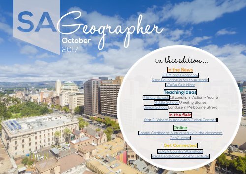
<strong>Oct</strong>ober<br />
<strong>2017</strong><br />
in this edition ...<br />
In the News<br />
STEM and Geography<br />
Risky <strong>Ed</strong>ucation in South Australia<br />
GTASA Quiz Night<br />
Teaching Ideas<br />
Primary School: Citizenship in Action - Year 5<br />
Middle School: Unveiling Stories<br />
Senior School: Landuse in Melbourne Street<br />
In the field<br />
Year 9 ‘Where is Adelaide’s Global Centre?’<br />
Online<br />
Google Cardboard: Virtual reality in the classroom<br />
GeoGuesser<br />
Get Connected<br />
GTASA Country Workshops<br />
Royal Geographic Society Lectures
From the editor<br />
In the news<br />
Teaching Ideas<br />
In the field<br />
Online<br />
Get Connected<br />
Your thoughts<br />
From the editor...<br />
Welcome to Term 4,<br />
It has been an action packed Semester 2.<br />
Last term GTASA and Adelaide University<br />
hosted a successful Year 12 Geography Night.<br />
Students and teachers were able to listen<br />
to exceptionally well presented and pitched<br />
lectures from Dr John Tibby on ‘Energy<br />
Alternatives for Adelaide’ and Dr Doug<br />
Bardsley on ‘Global Population Trends and<br />
Environmental Risks’. I was fortunate enough<br />
to take Stage 2 Geography students who<br />
found the presentations informative, engaging<br />
and relevant to their studies. The GTASA also<br />
hosted the Geography Quiz Night where teams<br />
battled it out over dinner and drinks. The quiz<br />
master Simon Miller did an exceptional job at<br />
creating competitive rounds that ranged from<br />
Geography DingBats to cutting and pasting<br />
locations guessing their latitude.<br />
This edition of the journal has some activities,<br />
resources and fieldwork that you might be<br />
able to squeeze into Term 4 or save for your<br />
programs next year. Wishing everyone a<br />
relaxing holiday break and all the best for<br />
your Stage 2 Geography students as they<br />
approach their exams.<br />
As always, we look forward to receiving your<br />
feedback and lesson ideas, so send us an<br />
email at sageographer@gtasa.asn.au with<br />
your suggestions, teaching and learning ideas<br />
or success stories.<br />
Elise<br />
housekeeping<br />
GTASA Website<br />
Join the GTASA<br />
Products and Resources<br />
AGM <strong>2017</strong> Minutes<br />
President’s Report <strong>2017</strong><br />
CEASA the Association<br />
for Associations!
From the editor<br />
In the news<br />
Teaching Ideas<br />
In the field<br />
Online<br />
Get Connected<br />
Your thoughts<br />
In the News<br />
STEM and Geography<br />
The world we live in is already a changed<br />
one. Since the Industrial Revolution<br />
global temperatures have warmed by<br />
approximately risen by 1 degree celsius.<br />
Spring now comes on average 2 weeks<br />
earlier in places such as the UK and in our<br />
oceans there are animals that have shifted<br />
their ranges 100 kilometers polewards. The<br />
Earth’s axis has even been altered as a<br />
result of melting ice in Greenland changing<br />
the planet’s water distribution. These along<br />
with increased heatwaves are just some<br />
of the realities we face living in a world of<br />
climate change.<br />
In 2015, 195 countries met and signed an<br />
agreement in Paris to limit global warming<br />
to 2 degrees celsius. This might seem<br />
small but poses some very serious threats<br />
including those discussed above. With<br />
current Government pledges temperatures<br />
are likely to exceed this and reach a<br />
warming of 3.6 degrees.<br />
There are many opportunities for<br />
Geography to integrate Science, Technology,<br />
Engineering and Mathematics (STEM) into<br />
the classroom. Students can be immersed<br />
in STEM in Geography when looking at<br />
Climate Change. Can we limit emissions<br />
to 2 degrees celsius by 2020? Have we<br />
reached peak emissions? Will we have to<br />
geoengineer? Can I make a difference?<br />
The New Scientist 24 June <strong>2017</strong> Magazine<br />
has an entire article discussing these<br />
questions with excellent graphs and<br />
diagrams. One of the most interesting of<br />
these discusses geoengineering and how it<br />
can be used to cool the plant. If we cannot<br />
meet temperature targets then possibly<br />
science and technology can be used to<br />
help cool the earth.
From the editor<br />
In the news<br />
Teaching Ideas<br />
In the field<br />
Online<br />
Get Connected<br />
Your thoughts<br />
Lesson Ideas<br />
• Students design their own<br />
geoengineered solution to global<br />
warming.<br />
• Students justify if it is possible to meet<br />
the maximum target of 2 degrees<br />
celcius warming<br />
• Calculate your ecological footprint. There<br />
are many online calculators to calculate<br />
one’s ecological footprint. One can be<br />
found here.<br />
• Get involved! Students could devise<br />
strategies and projects for their schools<br />
to reduce carbon emissions.<br />
• Debate! An informal class debate is a<br />
great way to engage student directed<br />
learning. A quick way to do this is to have<br />
a debate topic e.g. ‘Geoengineering is<br />
the best solution for global warming’<br />
and divide the class in half. After a<br />
designated time for research team is<br />
required to choose three speakers to<br />
present their argument.<br />
To find information on carbon offsets<br />
in Australia and other climate change<br />
information click here.<br />
References:<br />
NASA. (<strong>2017</strong>). NASA Releases Detailed<br />
Global Climate Change Projections. [online]<br />
Available at: https://www.nasa.gov/pressrelease/nasa-releases-detailed-globalclimate-change-projections<br />
[Accessed 19<br />
Sep. <strong>2017</strong>].
From the editor<br />
In the news<br />
Teaching Ideas<br />
In the field<br />
Online<br />
Get Connected<br />
Your thoughts<br />
News around the association<br />
Risky <strong>Ed</strong>ucation in South Australia<br />
By Douglas Bardsley, Geography, Environment<br />
and Population, The University of Adelaide.<br />
Email: douglas.bardsley@adelaide.edu.au<br />
During the recent GTASA Year 12<br />
Geography night at the University of<br />
Adelaide there was almost universal<br />
agreement amongst students that<br />
humanity was behaving like bacteria on an<br />
agar plate – spreading out and consuming<br />
the planet’s resources without recognising<br />
the limits of our habitat. That response<br />
from students was unexpected, but may be<br />
indicative of a generation that is growing up<br />
both with a sense of the enormous scale of<br />
the risks that they will face in their lifetimes<br />
and the lack of effective societal responses<br />
to anticipate or deal with them.<br />
The risks from climate change, resource<br />
depletion, energy systems, inequality,<br />
terrorism, and even a nuclear exchange<br />
have become more pronounced in <strong>2017</strong>. In<br />
relation to climate change alone, it seems<br />
that each week there is another scary<br />
prediction of extreme heat, sea-level rise<br />
or uncontrollable bushfires presented in<br />
the media. Young people are reading those<br />
reports – or at least scrolling past them on<br />
their way down to the entertainment pages!<br />
That raises a whole lot of questions about<br />
how we prepare young South Australians<br />
for an increasingly uncertain and risky<br />
future – questions that geography teachers<br />
are answering.<br />
Back in 2012, I surveyed geography<br />
teachers’ opinions of risk education at the<br />
GTASA conference. Teachers were asked<br />
to comment on the risks that they saw<br />
as most important for their students and<br />
then to outline how they were developing<br />
their curricula and lessons in response.<br />
My apologies for its tardiness, but the<br />
resulting article is now published: Bardsley,<br />
D.K., <strong>2017</strong>. Too much, too young? Teachers’<br />
opinions of risk education in secondary<br />
school geography. International Research in<br />
Geographical and Environmental <strong>Ed</strong>ucation<br />
26(1), pp.36-53.<br />
A number of key findings shone through the<br />
analysis that might be of interest. Firstly,<br />
you guys are great! Teachers’ insights into
From the editor<br />
In the news<br />
Teaching Ideas<br />
In the field<br />
Online<br />
Get Connected<br />
Your thoughts<br />
the complex question of how to develop<br />
pedagogical responses to risk were simply<br />
magnificent. Second, while ecological risks<br />
such as drought and climate change were<br />
mentioned, the most commonly discussed<br />
risks across all SES levels related instead<br />
to rising social inequality and living costs.<br />
A number of respondents suggested that<br />
such socio-economic risks do not form a<br />
large part of the curriculum and perhaps<br />
that could change in the future.<br />
Third, teachers generally welcomed the<br />
risk education elements in the curriculum<br />
because there is a “need to prepare<br />
students for increasingly ‘risky’ world<br />
without the old certainties,” and “better<br />
informed students = better future<br />
decisions.” Teaching about the risks that<br />
students are familiar with was recognised<br />
as the most engaging approach. One<br />
teacher stated, “Students need to be<br />
more aware of the risk/impacts of certain<br />
things. It makes them question that<br />
risk is associated with many aspects of<br />
geography. It makes subjects relevant and<br />
keeps them informed. The advantage is to<br />
be able to give students all the information,<br />
not just what they see in the media.”<br />
As students learn about risk they often<br />
develop deeper interests in environmental<br />
and social issues, and as those issues<br />
become real, they are translated into<br />
individual and community actions.<br />
Finally, teaching relentlessly on ‘doom and<br />
gloom’ scenarios is to no-one’s advantage,<br />
but if taught well, a knowledge of risk can<br />
help students to put the challenges ahead<br />
in the context of their own life paths. As<br />
one teacher stated the goal was to “Build<br />
the most<br />
commonly discussed<br />
risks across all SES<br />
levels related to rising<br />
social inequality and<br />
living costs...
From the editor<br />
In the news<br />
Teaching Ideas<br />
In the field<br />
Online<br />
Get Connected<br />
Your thoughts<br />
an interest, not a fear. Teaching risk can<br />
heighten awareness in kids and provide<br />
the ability to discuss risks to the<br />
environment etc. as well as things we can<br />
do to help, so they can feel empowered,<br />
buoyant and enthusiastic.” Another<br />
important suggestion was that for students<br />
risk “shouldn’t be the starting point. We<br />
need to foster a love/respect/appreciation<br />
of the planet before moving on to risk.”<br />
The broad conclusion of the paper is that<br />
according to geography teachers in SA,<br />
risk education is vital to prepare young<br />
people for greater uncertainty and change,<br />
but the emphasis needs to remain on the<br />
opportunities to respond to the challenges<br />
ahead to help them to imagine positive<br />
futures. Thanks again to those teachers<br />
who participated in the survey, as well as<br />
for teaching SA not to fill up its agar plate!<br />
Members through to recent graduates.<br />
It was great to be amongst so many<br />
enthusiastic geographers. A special thanks<br />
to quiz master, Simon, who made the event<br />
quite memorable with some challenging<br />
geography questions. Check out more<br />
photos on our Facebook page.<br />
Quiz Night<br />
GTASA members and friends had a great<br />
evening together on Friday 1st September<br />
for a Dinner and Quiz Night. Over 30<br />
people attended the event – from Life
From the editor<br />
In the news<br />
Teaching Ideas<br />
In the field<br />
Online<br />
Get Connected<br />
Your thoughts<br />
Teaching ideas<br />
In this section we bring you classroom ideas and resources that support the teaching<br />
of geography from F-12. Some of these will be linked to the GeogSpace resources and<br />
others will be written by members of the GTASA community. If you have one to share or<br />
any suggestions please email us (sageogeapher@gtasa.asn.au).<br />
GeogSpace<br />
Geogspace (pioneered and developed by<br />
AGTA, the peak national body representing<br />
all Geography Teachers State Associations)<br />
organises AC Geography support materials into<br />
year levels. There are detailed explanations<br />
of the key elements and some examples of<br />
possible activities that you might like to adapt<br />
or use in your classroom.
From the editor<br />
In the news<br />
Primary school classroom (F - 6)<br />
Citizenship in Action - Year 5<br />
Teaching Ideas<br />
In the field<br />
Online<br />
Get Connected<br />
Your thoughts<br />
This is an activity from GEOGSPACE. On<br />
the website there are links to supporting<br />
worksheets and outlines on how to introduce<br />
the activity. This activity aligns well with<br />
geographical inquiry skills in the Australian<br />
Curriculum.<br />
The stages of the inquiry process are:<br />
• Observing, questioning and planning<br />
• Collecting, recording, evaluating and<br />
representing<br />
• Analysing and concluding<br />
• Communicating<br />
• Reflecting and responding.<br />
In Illustration 1: Citizenship in action students<br />
are involved in using inquiry skills to explore<br />
human influences on place and space. It<br />
encourages students to work collaboratively<br />
to consider various points of view to form<br />
responses to the issue.<br />
The illustration outlines two hypothetical<br />
scenarios. The first involves exploring the<br />
impacts of a new shopping development in<br />
their local area. The activity has ideas for<br />
roleplays and debates. There is also the<br />
possibility of integrating fieldwork skills by<br />
visiting a proposed site near your school.<br />
Students could collect data such as traffic<br />
counts, pedestrian counts, litter surveys<br />
and even noise levels. The second scenario<br />
involves looks at the benefits hazardreduction<br />
burns to reduce bushfire risks.<br />
Evaluation:<br />
Both of these scenarios can be tailored to<br />
the interests of your class as well as places in<br />
your local area. The illustration is exceptionally<br />
detailed in outlining how to introduce the unit<br />
of work and offers numerous supporting<br />
worksheets and resources.
From the editor<br />
In the news<br />
Teaching Ideas<br />
In the field<br />
Middle school classroom (7- 10)<br />
• What is the story?<br />
• What is the human story?<br />
• What is the world story?<br />
• What is the new story?<br />
• What is the unntold story? (i.e. What is<br />
hidden and what are we not seeing?)<br />
Online<br />
Get Connected<br />
Your thoughts<br />
Unveiling Stories?<br />
This activity is a Visible thinking Routine that<br />
can be applied to any image and any Year<br />
level. The questions in this routine encourage<br />
students to develop empathy to big ideas<br />
or issues. For example the image of Cocoa<br />
Farmers would fit well into Year 9 teaching<br />
unit on Biomes and Food Security.<br />
Once students have been given or shown<br />
the image they need to answer the following<br />
questions:<br />
This activity works well when students have<br />
a chance to answer the questions on their<br />
own with enough thinking time before sharing<br />
in small groups.<br />
Visible thinking routines such as this work<br />
really well in Geography. Other routines can<br />
be found here.<br />
Image Reference:<br />
Fortune. (<strong>2017</strong>). Inside Big Chocolate’s Child<br />
Labor Problem. [online] Available at: http://<br />
fortune.com/big-chocolate-child-labor/<br />
[Accessed 25 Sep. <strong>2017</strong>].
From the editor<br />
Senior school classroom (<strong>11</strong>- 12)<br />
In the news<br />
Teaching Ideas<br />
In the field<br />
Online<br />
Get Connected<br />
Your thoughts<br />
Land use in Melbourne Street<br />
This task is based on a task from the SACE<br />
Boards Pre Approved Stage 1 Geography<br />
Learning and Assessment Plan (Number 2).<br />
This was run as a fieldwork buy could be<br />
tailored as a classroom activity based on<br />
your local area.<br />
Theme 1: Sustainable Places<br />
Topic 2: Urban Places<br />
Purpose:<br />
To assess students understanding of how<br />
land use in urban places is organised. To<br />
observe, identify and record fieldwork data<br />
along a transect.<br />
Description of assessment:<br />
The fieldwork is to be presented as a<br />
broadsheet or google map with land use<br />
map and transect of a section of Melbourne<br />
Street, North Adelaide.<br />
1. Use Naturemaps to obtain and print a<br />
blank landuse map of Melbourne Street.<br />
2. In groups you will be allocated a section<br />
of the landuse map to fill in and groups<br />
will work together to fill in land use map.<br />
3. Devise a suitable land use classification<br />
key, based on the type of landuse<br />
(residential, commercial etc) and<br />
sub-divided according to the age,<br />
function and building materials of<br />
individual buildings.<br />
4. In your groups you will be allocated a<br />
section of Melbourne Street to draw a<br />
transect (height and type of buildings<br />
and infrastructure).<br />
5. Redraw their transect either by hand or<br />
using a GIS package to show land use.<br />
6. Critically analyse their fieldwork data<br />
by describing and justifying landuse<br />
patterns observed
From the editor<br />
In the news<br />
Teaching Ideas<br />
In the field<br />
Online<br />
Get Connected<br />
Your thoughts<br />
Assessment conditions:<br />
The task is to be completed in 6 class lessons<br />
plus homework sessions. The total time<br />
available is 10 days. The task has a maximum<br />
of 800 words.<br />
Evaluation<br />
This fieldwork task was great to use as it<br />
could easily be adapted to our local area.<br />
Melbourne Street was chosen as it was within<br />
a 15 minute walk from school and no buses<br />
were needed. Before collecting the data<br />
students devised a land use key and were<br />
assigned a section to record the type of land<br />
use. When students returned to school the<br />
data was shared and each students created<br />
their own land use map. Some students<br />
chose to create a broadsheet, others chose<br />
to use Google Maps to create a GIS map as<br />
shown below.<br />
To accompany their maps students also<br />
prepared a geographical context to explain<br />
the site, situation and history of Melbourne<br />
Street. Students then used their maps to<br />
explain and justify patterned observed.<br />
Overall this excursion was great as it was<br />
fast to organise and the data collection itself<br />
did not take too long. It was a great way<br />
to introduce new Geography students to<br />
fieldwork techniques and consolidate skills in<br />
others.<br />
A copy of the task sheet can be found here.<br />
SACE Stage 1 Pre Approved Learning and<br />
Assessment Plans can be found here.
From the editor<br />
In the news<br />
Teaching Ideas<br />
In the field<br />
Online<br />
Get Connected<br />
Your thoughts<br />
In the field<br />
Year 9 Geography Fieldwork<br />
“Where is Adelaide’s global centre?”<br />
Whilst the Year 9 Australian Curriculum<br />
content, particularly in relation to<br />
Globalisation, is considered some of the<br />
most engaging and thought provoking to<br />
teach as a department we had always<br />
found producing meaningful fieldwork that<br />
addresses this topic quite difficult. This year<br />
we designed a new fieldwork activity based<br />
around finding Adelaide’s global centre.<br />
Pre-Fieldtrip learning<br />
The main concepts taught to students<br />
prior to the fieldtrip revolved around the<br />
processes of globalisation that have had<br />
the most influenced the area of the CBD of<br />
Adelaide. We focused on:<br />
• Cultural Diffusion and Migration (Could<br />
be taught with an emphasis how the<br />
British Empire and latterly large migrations<br />
from Asia have influenced place)<br />
• Trans-national Corporations with an<br />
emphasis on retail. Some retail Geography<br />
could also be taught at this stage.<br />
• Tourism (including extent of international<br />
tourists travelling to South Australia<br />
and where they are from, including<br />
Geography of connections such as<br />
direct airline routes to Adelaide<br />
Inquiry Question<br />
With the overarching Question “where is<br />
Adelaide’s global centre?” students were<br />
also encouraged to think about What would<br />
the global centre look like?<br />
After discussions as a class it was decided<br />
that we should look to record data on:<br />
• The density of global retail and global<br />
food outlooks<br />
• Evidence of global cultural influence<br />
• Nationality of people visiting different<br />
areas
From the editor<br />
In the news<br />
Teaching Ideas<br />
In the field<br />
Online<br />
Get Connected<br />
Your thoughts<br />
• Survey ranking of different areas as<br />
“global centres”<br />
The decision was taken to use Epicollect5 to<br />
collate all the data, including photographs<br />
This was run as a booklet-less fieldtrip<br />
which was very exciting and of course more<br />
sustainable.<br />
The classes were divided into 4 groups who<br />
would each map these different influences<br />
in each of the zones shown below (all groups<br />
visited all sites):<br />
Each site was also split into surveying zones<br />
with each group conducting surveys in one<br />
zone with all results collated together as<br />
shown below:<br />
Results:<br />
Once students had collected all their data in<br />
Epicollect5, spreadsheets were downloaded<br />
for use in GIS mapping locations.<br />
Students went through the steps of<br />
“cleaning” their data, by deleting any<br />
columns not needed. Some students used<br />
the “sort” facility to arrange their data into<br />
type of influence, and use this to add 3<br />
separate layers to a google my map.<br />
Survey results were split by location so this<br />
could be used to create graphs to compare<br />
rankings of the 3 different sites. This was<br />
done by working out the maximum latitude/<br />
longitude for each zone. Students could then<br />
use this data to create their own maps,<br />
including heat maps such as these created<br />
through Esri online:
From the editor<br />
In the news<br />
Teaching Ideas<br />
In the field<br />
Online<br />
Get Connected<br />
Your thoughts<br />
Other students created differing layers to<br />
compare the varying land uses and reasons<br />
for patterns<br />
The fieldtrip and subsequent responses<br />
provided an engaging, rich and fairly<br />
efficient way to collect a wide range of<br />
data and produce quick and effective visual<br />
and spatial representations. The technical<br />
aspects of the trip worked seamlessly and<br />
I would certainly recommend epicollect5<br />
as an efficient and accessible way to<br />
collect data.<br />
We are now refining our ability to clean<br />
the data collected and select appropriate<br />
information to “tell our story” which will<br />
become easier as student become more<br />
familiar with the processes involved.<br />
If anybody wishes to discuss anything in<br />
relation to this fieldtrip and the technology<br />
used, do not hesitate to get in touch.<br />
Simon Miller, Pembroke School
From the editor<br />
Online resources & apps<br />
In the news<br />
Teaching Ideas<br />
In the field<br />
Online<br />
Get Connected<br />
Google Cardboard: Virtual Reality<br />
in the Classroom<br />
This is an immersive experience that can<br />
bring virtual reality to your classroom. Google<br />
cardboard is a viewer that folds down from<br />
cardboard to hold a smartphone. The viewer<br />
and smartphone can then be used to visit<br />
places all around the world using an app.<br />
Information on the app and viewer can be<br />
found here.<br />
Evaluation<br />
Viewers can be purchased cheaper from<br />
sites such as eBay. It should be noted that<br />
some schools require a risk assessment<br />
for using virtual reality. This could be used<br />
as part of Geography assignments and<br />
activities that you run in your classroom.<br />
If you have used this activity and/or have<br />
developed resources, please send them to<br />
sageographer@gtasa.asn.au.<br />
Your thoughts
From the editor<br />
In the news<br />
Online resources & apps<br />
GeoGuessr<br />
Teaching Ideas<br />
In the field<br />
Online<br />
Get Connected<br />
Your thoughts<br />
This is a fun where<br />
in the world type<br />
activity that can<br />
be played individually or as a class. The<br />
website has an extensive range of themed<br />
maps from famous places to the location<br />
of McDonald’s stores around the world.<br />
Participants are presented with an image<br />
that can be explored and are then required<br />
to select a location on a world map guessing<br />
where it can be found. Points are awarded<br />
based on the guessed location compared to<br />
the real location.<br />
Evaluation<br />
This actually works well when played as a<br />
class. It encourages discussion and students<br />
use latitude and longitude to help explain<br />
where they think the location is. The website<br />
also offered the ability for teachers or even<br />
students to create their own maps.<br />
The link to GeoGuessr can be found here.<br />
Image Source:<br />
Geoguessr.com. (<strong>2017</strong>). GeoGuessr - Let’s<br />
explore the world!. [online] Available at:<br />
https://geoguessr.com/<br />
[Accessed 25 Sep. <strong>2017</strong>].
From the editor<br />
In the news<br />
Teaching Ideas<br />
In the field<br />
Online<br />
Get Connected<br />
Your thoughts<br />
Get connected<br />
Here’s an opportunity for you to engage<br />
with professional learning and geography<br />
events:<br />
Country Workshops in Term 4<br />
GTASA is pleased to announce that it will<br />
be bringing two full-day workshops to a<br />
country location near you.<br />
Friday 3rd Nov <strong>2017</strong>, 9.30 am—2.30 pm<br />
At Bordertown High School<br />
And<br />
Friday 10th Nov <strong>2017</strong>, 9.30 am—2.30 pm<br />
At Nuriootpa High School<br />
With a focus on curriculum pedagogy, and<br />
geographical skill development, the handson<br />
workshop will equip early career and<br />
out-of-field teachers of geography with<br />
the necessary tools to deliver engaging &<br />
targeted geography lessons.<br />
Cost per person:<br />
Members—$75<br />
Non-members—$100<br />
Register for these workshops through<br />
Eventbrite:<br />
http://gtasa-events.eventbrite.com
From the editor<br />
In the news<br />
Teaching Ideas<br />
In the field<br />
Online<br />
The Royal Geographical Society of South<br />
Australia Lectures<br />
The following take place at St Andrews<br />
Parish Centre 5:30pm<br />
• 16th November - Andrew Lothian<br />
‘Scenic Beauty-Can it be measured<br />
and Mapped<br />
Other upcoming GTASA professional<br />
development opportunities can be found<br />
on our website - http://www.gtasa.asn.au/<br />
Get Connected<br />
Your thoughts<br />
save th e<br />
date!<br />
Mark this date in your diaries and register<br />
your interest via sageographer@gtasa.asn.au
From the editor<br />
Your thoughts<br />
In the news<br />
Teaching Ideas<br />
In the field<br />
Online<br />
Get Connected<br />
Your thoughts<br />
‘This was the best GTASA conference I<br />
have been to. I found the Bushfires fieldtrip<br />
incredibly useful and it could certainly be<br />
used with a Year <strong>11</strong> class. The ‘Geography<br />
Skills Unlocked’ was a great bonus to the<br />
many resources I gained. Thank you.’<br />
‘I gained a lot from the spatial technologies<br />
workshop and enjoyed connecting with<br />
other teachers of Geography. Thank you for<br />
the exceptional food and coffee.’<br />
We want to hear from you!<br />
Share your thoughts with us on this<br />
(or another) topic and we’ll share<br />
them with the Geography community<br />
at large.<br />
All correspondence received by 1 December<br />
<strong>2017</strong> will be considered for publication in<br />
the next edition of SA Geographer.
From the editor<br />
In the news<br />
Teaching Ideas<br />
In the field<br />
Online<br />
We’re simply<br />
rewarding<br />
all your<br />
hard work<br />
Get Connected<br />
Your thoughts<br />
Introducing Credit Union SA <strong>Ed</strong>ucation Employee<br />
Banking Benefits. The culmination of over 50 years’<br />
helping South Australian employees, in the education<br />
sector with<br />
their finances.<br />
From home loans to car loans, savings accounts to credit<br />
cards, we have used<br />
our knowledge to provide the full range<br />
of banking products, services and advice.<br />
Take advantage of <strong>Ed</strong>ucation Employee Banking Benefits<br />
– exclusive to selected South Australian workplaces:<br />
VISA Credit Card discounted for<br />
first 6 months to 1.99% p.a., which<br />
Reverts to a competitive 10.49% p.a. variable rate<br />
after that<br />
No Home Loan Package fee for<br />
the first 12 months – saving $395<br />
Discounted Personal Loan<br />
application fee – saving $100<br />
No VISA Debit Card annual fee<br />
Minimum $10 transaction fee allowance<br />
Bonus rates on a Term Deposit Account<br />
Home and Car Insurance discounts, saving 10% in the<br />
first year*<br />
Make our knowledge yours. To take advantage of our<br />
<strong>Ed</strong>ucation Employee Banking Benefits, talk to one of our<br />
Mobile Managers.<br />
Call 8202 7777, visit your nearest<br />
branch or creditunionsa.com.au<br />
*Insurance is issued by Allianz Australia Insurance Limited ABN 15 000 122 850 AFS Licence No 234708. In arranging insurance Credit Union SA acts as an agent for Allianz and receives commission.<br />
Membership & Lending criteria, Fees & Charges and Terms & Conditions apply and are available upon request. The Terms & Conditions contain information that will assist you to compare products and help<br />
you to decide whether to acquire a product. This offer is limited and may be withdrawn at any time. The Customer Owned Banking Code of Practice applies. Credit Union SA Ltd ABN 36 087 651 232 | AFSL/<br />
Australian Credit Licence Number 241066.
From the editor<br />
In the news<br />
Teaching Ideas<br />
Promote your<br />
organisation.<br />
Contact us<br />
for more<br />
information.<br />
In the field<br />
Online<br />
Get Connected<br />
Your thoughts<br />
Measured for success<br />
> Bachelor of Environmental Science<br />
> Bachelor of Geospatial Science<br />
> Master of Surveying<br />
Environmental and geospatial sciences are pivotal to<br />
the understanding and management of our natural<br />
resources. Our bachelor programs are a blend of<br />
discipline fundamentals, environmental management<br />
and modelling, offering access to state-of-the-art<br />
satellite positioning equipment and industry experts.<br />
Geospatial Science graduates can progress to the Master<br />
of Surveying rated by recent McCrindle Research survey<br />
as Australia’s most underrated degree with 90 percent of<br />
surveying graduates finding full-time employment.<br />
For more information visit unisa.edu.au/enviroandgeo
From the editor<br />
In the news<br />
Teaching Ideas<br />
In the field<br />
Online<br />
Get Connected<br />
Your thoughts<br />
Promote your organisation.<br />
Contact us for more information.


