
Create successful ePaper yourself
Turn your PDF publications into a flip-book with our unique Google optimized e-Paper software.
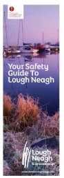
Safety Guide<br />
for Lough Neagh<br />
Planning for<br />
a Journey<br />
Navigation on<br />
Lough Neagh<br />
Good Conduct<br />
on the Lough<br />
Boat and Sail Safely<br />
The purpose of this guide is to help people to safely boat on Lough<br />
Neagh and enjoy what is one of Northern Ireland’s greatest inland<br />
waterway resources. The Lough provides great boating opportunities<br />
for both beginners and experienced boaters alike and an opportunity<br />
to experience one of our greatest waterway wildernesses. However,<br />
it is a very large expanse of water and caution should be exercised at<br />
all times but with care and attention and proper training, it can be<br />
enjoyed safely and provide a great day out.<br />
This guide is focussed towards new boaters and provides them with<br />
practical and useful advice on how to be safe on the Lough. It is not<br />
a detailed navigation aid but provides basic safety guidance and<br />
advice and points people in the direction of where to buy important<br />
safety and navigation equipment and get trained further in boating<br />
and navigation skills.<br />
Before setting off on a boat, here is a few<br />
simple tips for trouble free boating:<br />
Plan your boat journey<br />
Tell another party the details of your boat journey<br />
Check the weather for the day<br />
Check your boat’s in good condition<br />
Make sure you and your crew know how to handle the boat<br />
Get local waterway information if possible<br />
Make sure that you have more than enough fuel<br />
The surface of Lough Neagh covers some 390km² and in some ways<br />
could be described as an inland sea. With few exceptions, the Lough<br />
shelves gradually from the shoreline. Safe water is usually found by<br />
keeping 0.5km from shore, but an exception to this is the entrance<br />
to Toome Bay (known as Skady Tower) where safe water is not found<br />
until over 1km from the shore.<br />
Lough Neagh has no statutory navigation authority and it is vital that<br />
you exert caution at all times, as there are a number of hazards on<br />
the Lough and the horizon is surrounded by low-lying hinterland and<br />
good landmarks are few and far between. There is navigation signage<br />
around the Lough and the map overleaf details where all markers<br />
and hazards are located. Buildings and background landmarks can<br />
be used as a very basic way to judge your location. The map below<br />
identifies some of the main landmarks around the lough that can be<br />
used for basic location.<br />
The Lough is used for cruising, sailing, angling, canoeing, water<br />
skiing, commercial fishing, sand extraction, landing amphibious<br />
aircraft, jetskis and others. To ensure that everyone can enjoy the<br />
Lough, please observe the following code:<br />
General Code of Conduct<br />
Respect and be courteous to other users, visitors and locals<br />
Slow down when passing small craft and boat at jetties and slipways<br />
Keep wash and wake to a minimum<br />
Wear a Life Jacket appropriate to your activity<br />
The importance of getting trained to pilot or sail a boat on the Lough<br />
cannot be over emphasised and one of the best ways of starting to<br />
learn basic boating skills is by becoming a member of a local Sailing<br />
Club or the River Bann and Lough Neagh Association and learning<br />
from other boating colleagues. There are three main boating and<br />
sailing clubs around the shores of the Lough and all of them are very<br />
welcoming and wish to attract new members. So if you are keen to<br />
get on the waters of Lough Neagh, why not contact your local boating<br />
and sailing club. Details are provided below.<br />
Make sure you’ve got a tank of clean water<br />
Do not take alcohol when piloting a boat<br />
Check the Weather<br />
It is important to check the weather before a boating<br />
journey. Here is a list of weather forecast sources:<br />
Landmarks<br />
Slieve<br />
Gallion<br />
Weather Radar<br />
Prominent Building<br />
Sand Quays<br />
Cairn<br />
Use a kill cord/cut-out switch on sports boats and jet skis<br />
When skiing have an observer or use a wing mirror<br />
Ringoes and biscuits should be used only at<br />
max 20mph and with a rope no longer than 20m<br />
Give due respect to others engaged in sporting competitions<br />
Remember to Always<br />
Wear a Life Jacket<br />
VHF<br />
Belfast Coastguard broadcast weather forecasts and warnings<br />
every four hours on VHF with initial announcements on channel 16.<br />
Broadcasts are timed at 0305, 0705, 1105, 1505, <strong>19</strong>05, 2305 UTC.<br />
BBC RADIO<br />
BBC Radio 4 broadcasts the shipping forecast at 0048 and 0520<br />
on LW, MW, and FM. It also broadcasts it at 1201 and 1754 LW only.<br />
L.N.R<br />
Battery<br />
Langford<br />
Lodge<br />
Why not join a Lough Neagh Boating<br />
and Sailing Club?<br />
BBC WEBSITE<br />
The BBC has a day forecast with current observations<br />
for Belfast International Airport (beside Lough Neagh)<br />
on their website www.bbc.co.uk/weather/6296569.<br />
Brocagh<br />
Environmental Code of Conduct<br />
Lough Neagh Sailing Club<br />
Kinnego Marina<br />
Oxford Island<br />
Craigavon<br />
E: info@loughneaghsailingclub.org<br />
T: Kevin 077 1080 4169<br />
W: loughneaghsailingclub.org<br />
F: facebook.com/<br />
loughneaghsailingclub<br />
Equipment Checklist<br />
Check the equipment you need before a boat journey:<br />
Lifejackets, lifebuoy and lifeline<br />
Discovery<br />
Centre<br />
Castor<br />
Bay<br />
Lough Neagh’s natural environment is world renowned. It is<br />
designated as an international wetland Ramsar site and is an EU<br />
Special Protection Area because of its unique birdlife. The whole lough<br />
is also a Special Area Of Scientific Interest. Great care should therefore<br />
be taken by all boaters to avoid any damage to habitats and minimise<br />
any disturbance to wildlife. Please abide by the following code.<br />
Ballyronan Boat Club<br />
Ballyronan Marina<br />
Ballyronan<br />
Cookstown<br />
E: jim.barr@qradionetwork.com<br />
T: Jim 077 0234 3<strong>19</strong>1<br />
W: ballyronanboatclub.co.uk<br />
F: facebook.com/<br />
Ballyronan-Boat-Club<br />
Anchor, rope and chain and mooring ropes<br />
Fire extinguishers and fire blanket<br />
Compass, VHF Radio and practical knowledge for use<br />
Basic Rules of Navigation<br />
Keep to the right when meeting other craft.<br />
Operate within principles of “leave no trace”<br />
Respect wildlife and keep distance from them, especially in breeding<br />
season ( Mar – Jul)<br />
Keep wash and wake to a minimum at wildlife banks and shores<br />
Antrim Boat Club<br />
Shanes Castle Estate<br />
Antrim<br />
E: joeaa21@yahoo.co.uk<br />
T: Joe 078 6878 0341<br />
W: antrimboatclub.co.uk<br />
Flares and horn, emergency light and a first aid kit<br />
Emergency shut-offs for battery, gas and fuel<br />
Keep to the right of in any navigational channel.<br />
Recreational craft should not navigate after dark.<br />
Avoid damaging banks, reed beds and shoreline habitat<br />
Dispose of waste properly and do not pollute or litter the Lough<br />
Charts and maps and journey plan<br />
Use sewage pump-out facilities where possible<br />
Bilge pump, bucket and rope and fenders<br />
Boat pole or hook, gangplank and boarding ladder<br />
GPS and practical knowledge for use and a mobile phone<br />
In Case Of Emergency<br />
Dial 999 Or Call<br />
Channel 16 & Ask For<br />
The Coastguard.<br />
Respect all designated nature refuges and designated zones<br />
leavenotraceireland.org<br />
For more information visit:<br />
Enjoy the<br />
Big Lough<br />
Activities on Lough Neagh<br />
Lough Neagh is a wonderful place to boat on, with a rich natural,<br />
built and cultural heritage. The following is a list of some useful<br />
websites which provide information on places to visit, activities and<br />
events happening around the Lough.<br />
www.discoverloughneagh.com<br />
www.ramsisland.org<br />
www.loughneaghheritage.com<br />
www.antrim.gov.uk<br />
This document<br />
should NOT be used<br />
as a navigation aid.<br />
Markers, Buoys<br />
& Signs<br />
A modified IALA Cardinal and Lateral Buoyage system combined with<br />
the red and a white semi-circular marker sign is used on Lough Neagh.<br />
The Lough Neagh marks are numbered 1-47, starting at Toome Canal<br />
Entrance and finishing at Bamford Bank. They are numbered in a<br />
clockwise direction around the Lough and the map overleaf gives details<br />
of all marks.<br />
Typical Lough Neagh Combined Marks<br />
Training &<br />
Safety<br />
Equipment<br />
Training<br />
There are a number of centres around the shores of the<br />
Lough which provide Royal Yachting Association (RYA)<br />
certified courses, such as certified navigation, VHF, boating,<br />
dingy and sailing courses. It is really important for people to<br />
develop their training skills. The main training centres are:<br />
www.oxfordisland.com<br />
www.cookstown.gov.uk<br />
www.riverbannloughneagh.org www.dungannon.gov.uk<br />
www.discovernorthernireland.com www.magherfelt.gov.uk<br />
www.iwai.ie<br />
www.visitlisburn.com<br />
www.loughneaghrescue.co.uk<br />
www.ballymena.gov.uk<br />
www.outdoorni.com<br />
www.discovercraigavon.com<br />
www.doeni.gov.uk/niea<br />
www.canoeni.com<br />
Lough Neagh Canoe Trail<br />
Your Safety<br />
Guide To<br />
Lough Neagh<br />
Starboard<br />
Lateral Mark<br />
Cardinal Marks<br />
East<br />
Cardinal Mark<br />
Cardinal markers indicate the location of the safest or deepest water by<br />
reference to the cardinal points of the compass. They are identified by<br />
their top shapes and have four different names, North, South, East, and<br />
West. The marks are shaped as follows:<br />
Kinnego Marina<br />
Oxford Island<br />
Craigavon<br />
Ballyronan Boat Club<br />
Ballyronan Marina<br />
Ballyronan<br />
Cookstown<br />
Antrim Boat Club<br />
Shanes Castle Estate<br />
Antrim<br />
E: kinnego.marina@craigavon.gov.uk<br />
T: 028 3832 7573<br />
W: craigavonactivity.org/<br />
kinnego/marina<br />
F: facebook.com/kinnegomarina<br />
E: jim.barr@qradionetwork.com<br />
T: 077 0234 3<strong>19</strong>1<br />
W: ballyronanboatclub.co.uk<br />
F: facebook.com/<br />
Ballyronan-Boat-Club<br />
E: joeaa21@yahoo.co.uk<br />
T: Joe 078 6878 0341<br />
W: antrimboatclub.co.uk<br />
Lough Neagh also has its own canoe trail. Paddlers can explore the<br />
numerous bays and inlets of the Lough with the help of the Lough<br />
Neagh Canoe Trail Map. See www.canoeni.com for details of the trail.<br />
Safety Guide Assistance and Funding<br />
Stay<br />
North<br />
Other Marks<br />
Stay<br />
South<br />
Stay<br />
East<br />
Stay<br />
West<br />
Craigavon<br />
Watersports Centre<br />
1 Lake Rd<br />
Craigavon<br />
E: watersports.centre@craigavon.gov.uk<br />
T: 028 3834 2669<br />
W: craigavonactivity.com<br />
Funding for this safety guide was provided by the DARD Rural<br />
Development Programme through all of the Local Action Groups<br />
around the Lough. These include SWARD, SOAR, the Lagan Rural<br />
Partnership, and GROW South Antrim. The guide was produced by<br />
the Lough Neagh Partnership with help and assistance from the<br />
River Bann and Lough Neagh Association, Lough Neagh Rescue and<br />
all of the sailing and boating clubs around the Lough. Particular<br />
appreciation must also be given to the Lough Neagh Advisory Group<br />
who provided the original template for the guide.<br />
There are a number of other marks on Lough Neagh including lateral<br />
marks which indicate channels into or out of a port or harbour and<br />
isolated danger marks which indicate a danger area.<br />
Isolated<br />
Danger<br />
Starboard<br />
Lateral Mark<br />
Red and White Marker Sign<br />
Port<br />
Lateral Mark<br />
The red and white marker sign is one of the more simple markers on<br />
Lough Neagh. On Lough Neagh it is used in conjunction with the Cardinal<br />
and Lateral marks. Red indicates shallow or danger and white indicates<br />
safe water.<br />
Safety and Navigation Equipment<br />
It is important to have all of the necessary boating and<br />
personal safety equipment when taking a boat out on<br />
the Lough.<br />
Life Jackets<br />
Fire Extinguishers<br />
Safety Ladder<br />
Admiralty Charts of Lough Neagh<br />
Compasses and Plotters<br />
VHF radios/Mobile Phones<br />
Lifebuoys rings and throw lines<br />
Flares and Horn<br />
Safety Lights<br />
Pilot Book for Lough Neagh<br />
Depth Finders<br />
Personal Location Beacons<br />
Lough Neagh Partnership Limited<br />
Unit 3 The Marina Centre<br />
135a Shore Road<br />
Ballyronan Magherafelt<br />
BT45 6JA<br />
www.discoverloughneagh.com<br />
info@loughneaghpartnership.com<br />
T: +44 (0) 28 7941 7941<br />
/loughneaghanditswaterways<br />
@LoveLoughNeagh<br />
Download the Discover<br />
Lough Neagh App<br />
This guide is intended as a basic safety guide for new and inexperienced boaters on Lough Neagh. The information<br />
contained within should not be relied on for navigational use but used on conjunction with other maps, charts, pilot books<br />
and skills and knowledge gained from formal boating and sailing training; Whilst every care has been taken in compiling<br />
the information contained in this guide, the Lough Neagh Partnership, editors and their agents accept no responsibility<br />
for any errors, inaccuracies, or omissions or for any accidents or mishaps which may arise from its use.<br />
www.discoverloughneagh.com<br />
Safe Water<br />
(pass this side)<br />
Navigational Lights<br />
Danger<br />
The rules governing navigation lights are quite complex and if you are<br />
new to boating its best not to cruise in the dark and certainly not without<br />
proper training. Cruising at night can be dangerous, as the markers on<br />
the Lough Neagh system are unlit, except for the entrance to the Battery<br />
Harbour and Ballyronan. If you are new to boating, it’s simply best to<br />
give yourself plenty of time to return to your destination before nightfall.<br />
Lough Neagh Chart and Pilot Book<br />
For safe passage on the Lough, it is essential that a person<br />
buys a chart and pilot book of the Lough and learns how to<br />
use it. Both items can be bought at Sands Marine, Kinnego<br />
Marina, Craigavon.<br />
www.sandsmarineonline.com
Towing Area<br />
Brocagh<br />
Ballyronan<br />
Toome<br />
Antrim Loughshore Park<br />
Ram’s Island<br />
Ballyronan<br />
Village<br />
To<br />
Magherafelt<br />
Local<br />
Nature<br />
Reserve<br />
Caravan<br />
Park<br />
Jetty<br />
Community<br />
Building & Toilets<br />
Ballyronan<br />
Marina<br />
45<br />
Jetty<br />
White<br />
Cairn<br />
To<br />
Ballyronan<br />
Sand<br />
Quay<br />
Lough<br />
Beg<br />
Flood<br />
Gates<br />
White<br />
Calm<br />
Jetty<br />
Toome<br />
Canal<br />
Lock<br />
Lock<br />
Keepers<br />
Cottage<br />
Jetties<br />
Canal<br />
Walk<br />
Toome<br />
Village<br />
Lower<br />
River Bann<br />
To<br />
Belfast<br />
Antrim<br />
Boat Club<br />
Cafe<br />
Slipway<br />
Jetties<br />
Loughshore<br />
Park<br />
Toilets, water<br />
Caravan<br />
Park<br />
Maserene<br />
Golf Club<br />
Danger<br />
No Passage<br />
13<br />
Jetty<br />
A26<br />
Ram’s<br />
Island<br />
11<br />
Budgeon<br />
Bank<br />
Danger<br />
No Passage<br />
12<br />
Sand<br />
Quay<br />
Sandy<br />
Bay<br />
Marina<br />
Water<br />
Activities<br />
On Land<br />
Activities<br />
Sailors<br />
Beware<br />
Cardinal<br />
Mark<br />
Lateral<br />
Marks<br />
B160<br />
Red & White<br />
Mark<br />
Traad Point<br />
Disused jetty, walks,<br />
Local Nature Reserve.<br />
Moyola<br />
River<br />
Moyola River<br />
Flows into Lough,<br />
no boat access.<br />
Toome Floodgates<br />
Beware - rapidy<br />
changing water<br />
levels and flows.<br />
47<br />
1 2<br />
Toome<br />
Jetty, slipway, disabled<br />
access ramp, shop,<br />
fuel, public house,<br />
accommodation, cafe,<br />
telephone, parking,<br />
historic building, walks.<br />
Toome Canal<br />
Jetty, navigation lock<br />
Tel: 028 7965 0640<br />
Lower Bann<br />
Flows out of Lough.<br />
Randalstown Forest<br />
National Nature Reserve,<br />
nature reserve, toilets,<br />
bird hide, no direct<br />
access from Lough,<br />
boats stay 200m<br />
off shore.<br />
River Maine<br />
Flows into the Lough.<br />
Private access –<br />
emergencies only<br />
– bar to east of River<br />
mouth, approach<br />
from southwest<br />
River Maine<br />
< Derry – Rail Line – Belfast ><br />
Torpedo Platform<br />
Nature Reserve – all craft<br />
keep 200m clear from<br />
March to August –<br />
breeding birds<br />
Six Mile Water<br />
Flows into Lough<br />
extreme care needed<br />
when approaching in<br />
north west & west wind.<br />
Antrim Loughshore Park<br />
Public slipway, jetties,<br />
camping, caravanning,<br />
telephone, toilets, water,<br />
cafe, parking, nature<br />
walks and angling.<br />
45<br />
46<br />
3<br />
Doss Bay<br />
Wildfowl refuge<br />
Cranfield<br />
Jetty, toilets, historic<br />
buildings, parking,<br />
slipway.<br />
8<br />
9<br />
Six Mile Water<br />
4<br />
Caution<br />
Shallow water keep clear.<br />
Ballyronan Marina<br />
Public jetties, slipway,<br />
hoist, water electricity,<br />
shops, public house,<br />
Local Nature Reserve,<br />
walks, parking, camping<br />
and caravanning,<br />
restaurant, play<br />
area, toilets, fuel,<br />
telephone.<br />
Salter’s Castle<br />
5 6<br />
Churchtown Point<br />
7<br />
Kettlebottom Island<br />
Caution – stay clear.<br />
Water Intake Tower<br />
Craft keep clear.<br />
Ballinderry River<br />
Ballinderry River<br />
Flows into Lough,<br />
no boat access.<br />
B160<br />
44<br />
Campbell’s Rock<br />
Caution – stay clear.<br />
A26<br />
B520<br />
allyronan<br />
To<br />
Magherafelt<br />
ronan<br />
lage<br />
Water<br />
Activities<br />
B520<br />
Local<br />
Nature<br />
Reserve<br />
Caravan<br />
Park<br />
On Land<br />
Ativities<br />
Brocagh<br />
Informal camping, water,<br />
fuel on request, slipway,<br />
parking, jetty, Ballyronan restricted<br />
Marina<br />
Public jetties, slipway,<br />
depth, historic<br />
hoist, water<br />
castle<br />
electricity,<br />
2km. Extreme shops, public caution house,<br />
Local Nature Reserve,<br />
as entrance walks, to parking, harbour camping is<br />
and caravaning,<br />
silted up with sand.<br />
Washing Bay<br />
Livingwell Centre, Local<br />
Nature Reserve, no<br />
powered craft, restricted<br />
Ballinderry<br />
depth,<br />
River<br />
toilets, parking,<br />
informal camping,<br />
nature walks, shops and<br />
public house 3km.<br />
Blackwater Mouth<br />
Severe Hazard. Do not<br />
enter by mouth of river<br />
but by Maghery Canal<br />
instead but still with<br />
caution.<br />
Maghery<br />
Village and Country Park,<br />
toilets, informal<br />
camping, slipway, jetty,<br />
parking, nature<br />
reserve, nature walks.<br />
River Blackwater<br />
Brocagh Flows into Lough.<br />
Navigable to Blackwater<br />
town (11 miles), height<br />
restriction at M1 bridge.<br />
Informal camping, water,<br />
fuel on request, slipway,<br />
parking, jetty, restricted<br />
depth, historic castle<br />
2km. Extreme caution<br />
as entrance to harbour is<br />
silted up with sand.<br />
Jetty<br />
Toilets<br />
Sailors<br />
Beware<br />
River<br />
Blackwater<br />
Ballyronan<br />
Marina<br />
Cardinal<br />
Marker<br />
B160<br />
Jetty<br />
Lateral<br />
Mark<br />
restaurant, play<br />
area, toilets, fuel,<br />
telephone.<br />
White<br />
Calm<br />
Traad Point<br />
Disused jetty, walks,<br />
Local Nature Reserve.<br />
Ballinderry River<br />
Flows into Lough,<br />
no boat access.<br />
B160<br />
The Battery<br />
Public Marina, jetty,<br />
Maghery slipway, Canal<br />
Lough Neagh<br />
Rescue, parking, toilets,<br />
Access angling, to River restaurant,<br />
public house, informal<br />
Blackwater,<br />
camping,<br />
channel<br />
nature walks.<br />
unmarked, with<br />
restricted depth, enter<br />
Ardboe Cross<br />
with extreme Historic caution<br />
buildings.<br />
as entrance is silted up<br />
with sand .<br />
River<br />
Blackwater<br />
38<br />
Coney<br />
Island<br />
Moyola<br />
River<br />
Moyola River<br />
Flows into Lough,<br />
no boat access.<br />
Curran Quay<br />
Public jetty, slipway,<br />
boat hoist, toilets,<br />
nature walks, public<br />
house at Kinturk Cultural<br />
Centre – 400m.<br />
Kells Point<br />
45<br />
Toome<br />
To<br />
Ballyronan<br />
Salters Castle<br />
Battery<br />
Harbour<br />
Farsnagh Point<br />
Blackers Rock<br />
Toome Floodgates<br />
Beware - rapidy<br />
changing water<br />
levels and flows.<br />
Blackwater & Upper Bann<br />
Do not approach<br />
River Blackwater<br />
through mouth<br />
of river but by<br />
Maghery Canal.<br />
Verner’s Bridge and<br />
Motorway Bridge<br />
The motorway bridge<br />
has limited headroom<br />
(2.55m above 12.45<br />
O.D. -south side is<br />
50cm lower than<br />
the north side) slipway,<br />
jetty, parking,<br />
shop 1km.<br />
39<br />
Approaches to<br />
River Bann<br />
with caution.<br />
46<br />
44<br />
47<br />
Lough The Battery Jetties<br />
Flood Beg<br />
Gates Public Marina, jetty,<br />
slipway, Lough Neagh<br />
Canal<br />
Rescue, parking, Walk toilets,<br />
angling, Toome restaurant,<br />
Canal<br />
public house, informal<br />
White<br />
camping, nature walks.<br />
Anneeter Point<br />
40<br />
Coney<br />
Island<br />
Coney Island<br />
Informal camping, with<br />
good jetty facilities on<br />
the SE and SW of the<br />
island. Well worth a visit.<br />
Curran Quay<br />
Public jetty, slipway,<br />
boat hoist, toilets,<br />
nature walks, public<br />
house at Kinturk Cultural<br />
Centre – 400m.<br />
Lower<br />
Ardboe Cross River Bann<br />
Historic buildings.<br />
Stanierds Point<br />
Ardboe Point<br />
41<br />
Approach to<br />
River Blackwater<br />
through Maghery<br />
Canal with caution<br />
Upper Bann River<br />
Navigable beyond Point<br />
of Whitecoats, keep to<br />
Starboard side.<br />
Sand<br />
Quay<br />
38<br />
43<br />
Calm<br />
3<br />
4<br />
1 2<br />
Lock<br />
Keepers<br />
Cottage<br />
5 6<br />
River Bann<br />
Kell’s Point<br />
36<br />
Toome<br />
Village<br />
Toome<br />
Jetty, slipway, disabled<br />
access ramp, shop,<br />
fuel, public house,<br />
accommodation, cafe,<br />
telephone, parking,<br />
historic building, walks.<br />
Toome Canal<br />
Jetty, navigation lock<br />
Tel: 028 7965 0640<br />
Doss Bay<br />
Wildfowl refuge<br />
37<br />
To<br />
Belfast<br />
Upper Bann Mouth<br />
Channel unmarked,<br />
restricted depth, enter<br />
with extreme caution<br />
as entrance is silted up<br />
with sand, disused ferry<br />
jetties can be used<br />
for short stop.<br />
Upper Bann River<br />
Navigable to point of<br />
White Coats, keep to<br />
starboard side.<br />
Battery<br />
Harbour<br />
Farsnagh Point<br />
Lower Bann<br />
Flows out of Lough.<br />
Blacker’s Rock<br />
39<br />
Antrim<br />
Anneeter Loughshore<br />
Point<br />
Park<br />
Cranfield<br />
Jetty, toilets, historic<br />
buildings, parking,<br />
public house, slipway<br />
31<br />
40<br />
Lough Neagh<br />
Discovery<br />
Centre<br />
Stanierd’s Point<br />
Randalstown Forest<br />
National Nature Reserve,<br />
nature reserve, toilets,<br />
bird hide, no direct<br />
access from Lough,<br />
boats stay 200m<br />
off shore.<br />
Churchtown Point<br />
Antrim<br />
Boat Club<br />
Ardboe Point<br />
41<br />
43<br />
35<br />
Kinnego Marina<br />
7<br />
33<br />
Emerson’s Quay<br />
Public harbour,<br />
restricted depth.<br />
River Bann14<br />
18 15<br />
Hog Park Point<br />
17 16<br />
<strong>19</strong><br />
30 29<br />
22<br />
23<br />
24<br />
28<br />
27 25 26<br />
34<br />
Battery Harbour<br />
Public<br />
House<br />
Lifeboat<br />
Station<br />
Bartins<br />
Bay<br />
Tolans Point<br />
Cafe<br />
Slipway<br />
Jetties<br />
Kinnego<br />
Marina Slipway<br />
Jetty<br />
River Maine<br />
River Maine<br />
Flows into the Lough.<br />
Private access –<br />
emergencies only<br />
– bar to east of River<br />
mouth, approach<br />
from southwest<br />
Ardmore Point<br />
(Hunter’s Point)<br />
< Derry – Rail Line – Belfast ><br />
12<br />
Lough Neagh Discovery<br />
Ram’s<br />
Island<br />
Centre & Oxford Island<br />
National Nature Reserve<br />
13 Visitor short stop jetty,<br />
visitor centre, toilets,<br />
cafe, parking, telephone,<br />
slipway, nature walks,<br />
bird hides, sculpture trail.<br />
discovercraigavon.com<br />
Lady Bay<br />
Very shallow.<br />
Skane Flat<br />
Caution - Stay well clear.<br />
Radome<br />
(Large Golf ball)<br />
Toilets<br />
20<br />
21<br />
Loughshore<br />
Park<br />
Toilets, water<br />
Caravan<br />
Park<br />
Maserene<br />
Golf Club<br />
10<br />
Gartree Point<br />
11<br />
Morrows Point<br />
Private Marina, safe<br />
haven emergencies only.<br />
Kinnego Marina<br />
discovercraigavon.com<br />
Public jetties, slipway,<br />
camping, angling,<br />
caravanning, water,<br />
electric, showers, cafe,<br />
toilets, boat trips,<br />
parking, play park,<br />
telephone, Lough Neagh<br />
Rescue,chandlery,<br />
shop 1mile.<br />
Boat<br />
Hoist<br />
Jetty<br />
Jetty<br />
A26<br />
Torpedo Platform<br />
Nature Reserve – all craft<br />
keep 200m clear from<br />
March to August –<br />
breeding birds<br />
Gartree<br />
Stay well clear<br />
Gawley’s Gate<br />
Jetty, slipway, public<br />
house, water,toilets.<br />
Rams Island<br />
Round<br />
Tower<br />
Picnic<br />
Area<br />
Six Mile Water<br />
Flows into Lough<br />
extreme care needed<br />
when approaching in<br />
north west & west wind.<br />
Ardmore Point<br />
8<br />
Campbell’s Rock<br />
Caution – stay clear.<br />
Kettlebottom Island<br />
Caution – stay clear.<br />
Water Intake Tower<br />
Craft keep clear.<br />
Lennymore Bay<br />
Very shallow.<br />
Rams Island<br />
Nature Reserve March to<br />
July, jetty, camping by<br />
arrangement, historic<br />
buildings, nature walks<br />
www.ramsisland.org<br />
Airport<br />
Budgeon Bank<br />
Caution - Stay well clear.<br />
Sandy Bay<br />
Private marina, jetties,<br />
slipway Rams Island<br />
Ferry terminal.<br />
Jetty<br />
O’Neill<br />
Cottage<br />
(ruin)<br />
Ballinderry River<br />
A26<br />
Landmarks<br />
L.N.R<br />
Battery<br />
9<br />
32<br />
31<br />
Pond<br />
Cardwell’s<br />
Cottage (ruin)<br />
Note: shallow water<br />
all round Island<br />
Antrim Loughshore Park<br />
Public slipway, jetties,<br />
camping, caravanning,<br />
telephone, toilets, water,<br />
cafe, parking, nature<br />
walks, bank angling, pwc<br />
launching for NCPWC<br />
club members.<br />
Caution<br />
Shallow water keep clear.<br />
Lough Neagh<br />
Discovery<br />
Centre<br />
Six Mile Water<br />
A26<br />
< Dublin – Rail Line – Belfast ><br />
Oxford<br />
Island<br />
Nature<br />
Reserve<br />
30<br />
28<br />
Weather Radar<br />
Prominent Building<br />
Sand Quays<br />
Cairn<br />
27<br />
Jetties<br />
Rail Line – Belfa<br />
Wildlife Area<br />
(No Vessels)<br />
Bird<br />
Hide<br />
18<br />
23<br />
24 25<br />
27<br />
29<br />
Langford<br />
Lodge<br />
22<br />
26<br />
17<br />
<strong>19</strong><br />
15<br />
Kinnego<br />
Marina<br />
Kinnego Marina<br />
23<br />
28 24<br />
25<br />
A3<br />
16<br />
Towing Area<br />
(Waterskiing,<br />
towing rings)<br />
Bartin’s<br />
Bay<br />
Tolan’s Point<br />
26<br />
22<br />
Marina<br />
Centre<br />
Cycle Paths<br />
Craigavon<br />
Hog Park<br />
Point<br />
Ardmore Point<br />
(Hunter’s Point)<br />
14<br />
Ram’s<br />
Island<br />
Lady Bay<br />
Very shallow.<br />
Skane Flat<br />
Caution - Stay well clear.<br />
Radome<br />
(Large Golf ball)<br />
20<br />
21<br />
Kinnego<br />
Marina<br />
No Wake<br />
Lifeboat<br />
Station<br />
Caravan<br />
Park<br />
Gartree Point<br />
13<br />
Morrow’s Point<br />
Private Marina, safe<br />
haven emergencies only.<br />
Kinnego Marina<br />
discovercraigavon.com<br />
Public jetties, slipway,<br />
camping, angling,<br />
caravanning, water,<br />
electric, showers, cafe,<br />
toilets, boat trips,<br />
parking, play park,<br />
telephone, Lough Neagh<br />
Rescue,chandlery,<br />
shop 1mile.<br />
Jetties<br />
Chandlery<br />
Slipway<br />
10<br />
M2 to<br />
Belfast<br />
11<br />
6ft flat<br />
Group of red and<br />
white marks.<br />
Gartree<br />
Stay well clear<br />
– submerged rocks<br />
12<br />
Gawley’s Gate<br />
Jetty, slipway, public<br />
house, water,toilets.<br />
18<br />
Lennymore Bay<br />
Very shallow.<br />
Airport<br />
Budgeon Bank<br />
Caution - Stay well clear.<br />
Ram’s Island<br />
Ferry, jetty, historic<br />
buildings, picnics, nature<br />
walks and sculpture<br />
trail. Camping by<br />
arrangement.<br />
Tel warden:<br />
077 1536 8050<br />
www.ramsisland.org<br />
NB: No dogs policy.<br />
Sandy Bay<br />
Private marina, jetties,<br />
slipway Rams Island<br />
Ferry terminal.<br />
Ballinderry River<br />
A26<br />
Tolan’s Flat<br />
17<br />
15<br />
16<br />
<strong>19</strong><br />
Tolan’s<br />
Flat<br />
Skane<br />
Flat<br />
Tolan’s<br />
Point<br />
Danger<br />
No Passage<br />
< Dublin – Rail Line – Belfast ><br />
Derrymore<br />
Point<br />
Bartin’s<br />
Bay<br />
Hog Park<br />
Point<br />
Johnny’s<br />
Bay<br />
Gawley’s<br />
Gate<br />
Rail Line – Belfa<br />
A3<br />
Jetties