Offshore

You also want an ePaper? Increase the reach of your titles
YUMPU automatically turns print PDFs into web optimized ePapers that Google loves.
a<br />
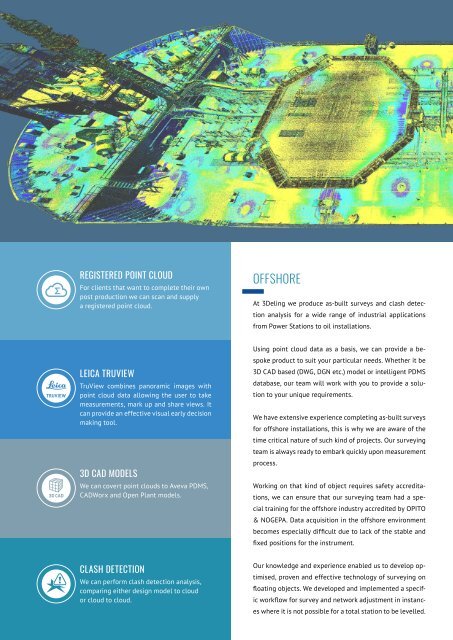
REGISTERED POINT CLOUD<br />
For clients that want to complete their own<br />
post production we can scan and supply<br />
registered point cloud.<br />
OFFSHORE<br />
At 3Deling we produce as-built surveys and clash detection<br />
analysis for a wide range of industrial applications<br />
from Power Stations to oil installations.<br />
<br />
<br />
LEICA TRUVIEW<br />
TruView combines panoramic images with<br />
point cloud data allowing the user to take<br />
measurements, mark up and share views. It<br />
can provide an effective visual early decision<br />
making tool.<br />
3D CAD MODELS<br />
We can covert point clouds to Aveva PDMS,<br />
CADWorx and Open Plant models.<br />
Using point cloud data as a basis, we can provide a bespoke<br />
product to suit your particular needs. Whether it be<br />
3D CAD based (DWG, DGN etc.) model or intelligent PDMS<br />
database, our team will work with you to provide a solution<br />
to your unique requirements.<br />
We have extensive experience completing as-built surveys<br />
for offshore installations, this is why we are aware of the<br />
time critical nature of such kind of projects. Our surveying<br />
team is always ready to embark quickly upon measurement<br />
process.<br />
Working on that kind of object requires safety accreditations,<br />
we can ensure that our surveying team had a special<br />
training for the offshore industry accredited by OPITO<br />
& NOGEPA. Data acquisition in the offshore environment<br />
becomes especially difficult due to lack of the stable and<br />
fixed positions for the instrument.<br />
<br />
or<br />
CLASH DETECTION<br />
We can perform clash detection analysis,<br />
comparing either design model to cloud<br />
cloud to cloud.<br />
Our knowledge and experience enabled us to develop optimised,<br />
proven and effective technology of surveying on<br />
floating objects. We developed and implemented a specific<br />
workflow for survey and network adjustment in instances<br />
where it is not possible for a total station to be levelled.