Kanniah

You also want an ePaper? Increase the reach of your titles
YUMPU automatically turns print PDFs into web optimized ePapers that Google loves.
QUANTIFYING GREEN COVER CHANGE<br />
FOR SUSTAINABLE URBAN PLANNING:<br />
A CASE OF KUALA LUMPUR,<br />
MALAYSIA<br />
Kasturi Devi <strong>Kanniah</strong><br />
increases demand for land. A vast amount of green space has already<br />
been replaced by grey infrastructure (Teh, 1989; Webb, 1998).<br />
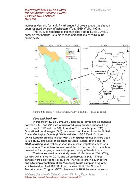
This study is restricted to the municipal area of Kuala Lumpur,<br />
because that permits us to make recommendations specific to the<br />
municipality.<br />
Figure 2. Location of Kuala Lumpur, Malaysia and its six strategic zones<br />
Data and Methods<br />
In this study, Kuala Lumpur’s urban green cover and its changes<br />
between 2001 and 2016 were monitored using satellite images. Four<br />
scenes (path 127 and row 58) of Landsat Thematic Mapper (TM) and<br />
Operational Land Imager (OLI) data were downloaded from the United<br />
States Geological Survey (USGS) website (USGS Earth Explorer,<br />
2016). Landsat satellite images with 30-m spatial resolution were used<br />
in this study. The Landsat program provides images dating back to<br />
1972, enabling observation of changes in urban vegetation over long<br />
time periods. These data are also available for free, which makes them<br />
preferable for mapping areas as large as the city of Kuala Lumpur.<br />
The images used in this study cover 12 September 2001 (TM),<br />
22 April 2013, 8 March 2014, and 25 January 2016 (OLI). These<br />
periods were selected to observe the changes in green cover before<br />
and after implementation of the “Greening Kuala Lumpur” program,<br />
which aimed to plant 100,000 trees by year 2020. The National<br />
Transformation Program (NTP), launched in 2010, focuses on twelve<br />
Malaysia Sustainable Cities Program, Working Paper Series 6<br />
© Kasturi Devi <strong>Kanniah</strong> & Massachusetts Institute of Technology 2017