


You also want an ePaper? Increase the reach of your titles
YUMPU automatically turns print PDFs into web optimized ePapers that Google loves.
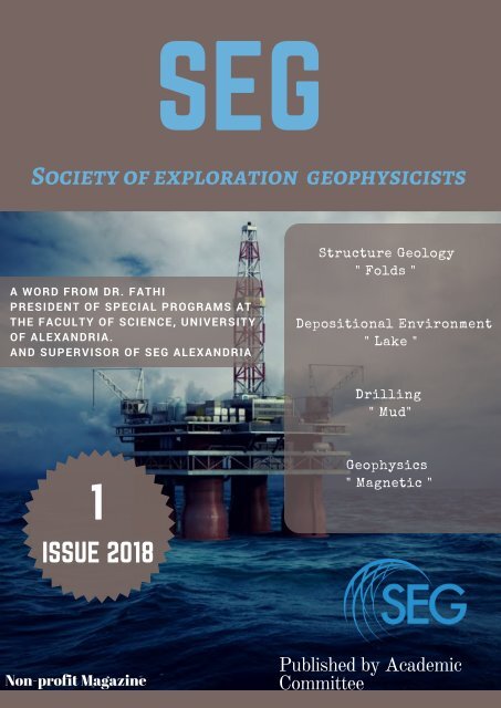
<strong>SEG</strong><br />
Society of exploration geophysicists<br />
Structure Geology<br />
" Folds "<br />
A WORD FROM DR. FATHI<br />
PRESIDENT OF SPECIAL PROGRAMS AT<br />
THE FACULTY OF SCIENCE, UNIVERSITY<br />
OF ALEXANDRIA.<br />
AND SUPERVISOR OF <strong>SEG</strong> ALEXANDRIA<br />
Depositional Environment<br />
" Lake "<br />
Drilling<br />
" Mud"<br />
1<br />
Geophysics<br />
" Magnetic "<br />
ISSUE 2018<br />
Non-profit Magazine<br />
Published by Academic<br />
Committee
Page 2<br />
Academic Articles<br />
I-STRUCTURE GEOLOGY<br />
Folds are probably the structure that comes to mind when we say the words<br />
(geological structure), so why is the fold such a distinctive term related to<br />
geological structures ...<br />
well folds are waves in stratified rocks, these rocks were once horizontal strata<br />
but they have been buckled...<br />
Folds are usually formed by compressional stress. like any architectural<br />
structure a fold has its terminology which describe it fold terminology :<br />
1- limbs : The generally planar region of a<br />
fold which lies between two adjacent hinge<br />
lines and is confined between the zones of<br />
maximum curvature.<br />
2- inflection point : the point where the<br />
sense of curvature is converted .<br />
3- hinge: place of maximum curvature on<br />
the fold .<br />
4- axes : it is the intersection of the axial<br />
plane with a bed in the fold<br />
5- axial plane : imaginary planar surface<br />
defined by the connection of the hinges and<br />
symmetrically divides the fold .<br />
6- wave length : distance between two<br />
peaks or two troughs<br />
7-median surface : an imaginary surface<br />
connecting adjacent infliction points<br />
8- amplitude : it is the distance form the<br />
median plane to the hinge<br />
Folds are classified according to the attitude of<br />
their fold axes which can be called a hinge line if<br />
the fold isn't cylindrical . the axes can be vertical<br />
or inclined and in some cases horizontal like the<br />
recumbent fold.<br />
Most famous types of folds<br />
1- anticline<br />
2- syncline<br />
3- dome<br />
4- basin<br />
1- Anticline is the fold where every limb<br />
dips away from the peak<br />
anticlines form one of the most<br />
important hydrocarbon trap formations<br />
about 80 % of the world's petroleum<br />
was found in anticlines.<br />
antiforms are folds that take the shape<br />
of an anticline but it's younging<br />
direction is inverted an anticline should<br />
have the oldest rock in the center .<br />
anticlinorium is a large scale anticline<br />
with smaller folds inside it<br />
2- Syncline is the fold<br />
where the limbs dip<br />
toward the trough<br />
a synclinorium is a large<br />
syncline which has minor<br />
folds in it<br />
Dome and basin aren't like the typical folds<br />
because they have more of a circular plane than<br />
a linear one .<br />
3- The dome is<br />
convex upward<br />
and the strata dip<br />
outward towards<br />
the center<br />
4- Basin is concave<br />
upward and the<br />
strata dip inward<br />
towards the center
Academic Articles<br />
Anticline<br />
Syncline<br />
Dome<br />
Basin<br />
Page 3
Academic Articles<br />
II- Depositional Environment<br />
- Lake -<br />
As one of many ecosystems lakes have sedimentological<br />
characteristics that distinguish it from other terrestrial sedimentary<br />
environments but first what is a lake exactly ??<br />
a lake is a large body of water that occupies an inland basin<br />
A related term would be pond but the difference between the two that<br />
lakes are great in size and have depth while ponds are shallow water<br />
bodies with small sizes<br />
How do lakes form ?<br />
lake can form from a variety of ways<br />
like<br />
1- ancient glaciers sliding and<br />
carving the land and then melting so<br />
the water fills the land carved by the<br />
glaciers , this is comment in the<br />
northern hemisphere<br />
2- basins created by tectonic<br />
movement buckling and breaking<br />
the earth , these basins are then<br />
filled with water from rainfall or<br />
streams<br />
3- volcanoes are also another mean<br />
of creating a basin for water to fill ,<br />
after the volcano has become<br />
inactive it leaves a crater that would<br />
be filled with water coming from<br />
rain or melted snow some times the<br />
volcano would erupt or the top<br />
would collapse and it would leave a<br />
depression called caldera that then<br />
would also be filled with water .<br />
4- rivers can make lakes when rivers<br />
are meandering and have a sudden<br />
change of flow (flood) it may make<br />
a short cut and leave a body of<br />
water Isolated from the river that<br />
kind of lake is then named oxbow<br />
lake because it takes the shape of<br />
the U frame that is put around ox's<br />
necks<br />
5- land slides could cause the<br />
creation of lakes due to barricading<br />
the flow of a stream or a river<br />
creating a dam tat would prevent<br />
the water from flowing<br />
6- artificially made lakes made by<br />
humans digging and letting the man<br />
made basin fill with water from<br />
streams or rivers and then using the<br />
lake to produce electricity and other<br />
uses for mankind<br />
The water in the lakes comes<br />
from rainfall or melted snow,<br />
stream and ground water<br />
seepage hence most of the<br />
lakes are fresh water lakes .<br />
there are two types of lakes<br />
open lakes and closed lakes<br />
open lakes have an outlet that<br />
lets it's water flow from it<br />
closed lakes have no outlet so<br />
they tend to be more saline<br />
because the still water<br />
evaporates and leaves behind<br />
salts .<br />
lakes sedimentation and<br />
sediments<br />
lakes sediments comprise of<br />
silts clays and sand sizes<br />
which are clastic elements , it<br />
is also has organic matter<br />
chemically precipitated<br />
material and the ratio between<br />
these elements depends on<br />
the drainage basin ,climate<br />
and the age of the lake<br />
Page 4
Academic Articles<br />
1- clastic sediments<br />
Large sediments roll due to the river moving it along<br />
it's bed ( bed load ) and when the river connects with<br />
the lake it's speed drops and it then drops the bigger<br />
sediments and then finer sediments which have been<br />
suspended till now settle to the bottom ( clays and<br />
silts ). the bottom of a lake will have mainly clays and<br />
silts when surveying away from the shore or the river<br />
mouth . big sediments will reveal their own origin<br />
from nearby source and will show current and wave<br />
directions that lead them where they have been<br />
deposited . volcanic ash may deposit and like the ash<br />
from the Pleistocene epoch it could be used as a<br />
stratigraphic marker . varve deposits are an annual<br />
deposit that indicates the change of seasonal change<br />
, it contains coarse grains and finer grains that alter<br />
between each other . varves are common especially<br />
when the water comes from ice sheets and glaciers<br />
.organic matter comes from plants, Bactria , small<br />
insects and algae which thrives of nitrogen and<br />
phosphorus and other neutrons .<br />
2- chemical deposits<br />
In the lake compose of mainly calcium, sodium, and<br />
magnesium carbonates and dolomite, gypsum, halite, and<br />
sulfate salts. calcium carbonate precipitates as calcite or<br />
aragonite while the lake is saturated with calcium and<br />
bicarbonate ions. algae can also generate the right<br />
conditions for calcium carbonate to precipitate like raise the<br />
ph of the water from 7 to 9 which makes it alkaline.<br />
dolomite is found in very alkaline water where calcium<br />
carbonate and magnesium carbonate combine. also in<br />
saline lakes gypsum occurs with the presence of sulfate,<br />
calcium, and hydrogen sulfide with certain concentrations.<br />
lakes with high concentration of sodium sulfate are called<br />
bitter lakes and lakes that contain high concentrations of<br />
sodium carbonate are called alkali lakes . magnesium salts<br />
can be found in the same sediment as the sodium salts.<br />
lakes could have other salts precipitating like borates,<br />
nitrates, and potash also a small portion of borax is found in<br />
various lakes through out the world<br />
Lakes characteristics according to<br />
geological sediments :<br />
Page 5<br />
The gradual thickening of sediments might<br />
put the lake under the danger of extinction.<br />
1- sediments become more fine toward the center of the lake<br />
2- lakes tend to have Low energy, poor oxygenation: bottom sediment generally poorly disturbed so lamina are<br />
present and commonly made of shale<br />
3- excellent preservation of fossils due to low energy and low disturbance<br />
4- edges of lakes have bigger sediments, bi-directional ripple marks and mud cracks<br />
5- lake shale may get disrupted by bigger sediments (storm deposits (tempestites ))
Academic Articles<br />
III- Dril<br />
Page 6
Academic Articles<br />
ling - Mud -<br />
Page 7