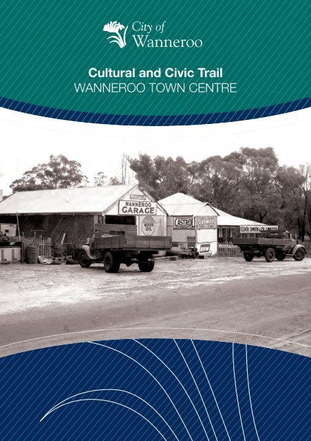
Wanneroo Town Centre - Cultural and Civic Trail

You also want an ePaper? Increase the reach of your titles
YUMPU automatically turns print PDFs into web optimized ePapers that Google loves.
<strong>Cultural</strong> <strong>and</strong> <strong>Civic</strong> <strong>Trail</strong><br />
WANNEROO TOWN CENTRE
CONTENTS<br />
Page<br />
Introduction 1<br />
<strong>Town</strong> Site Original Boundary (North) 2<br />
Schooling in <strong>Wanneroo</strong> 3<br />
Centenary Hall <strong>and</strong> Dennis Garage 4<br />
<strong>Wanneroo</strong> Road Board 1960 5<br />
15 Mile Well 5<br />
<strong>Town</strong> Site Original Boundary (South) 6<br />
<strong>Wanneroo</strong> Showground 6<br />
<strong>Wanneroo</strong> Sports <strong>and</strong> Social Club (Inc) 7<br />
<strong>Cultural</strong> <strong>and</strong> <strong>Civic</strong> <strong>Trail</strong> Map 8-9<br />
Original Road Board <strong>and</strong> Shire Hall 10<br />
Mains Water Supply 11<br />
Mains Electricity Supply 12<br />
Early <strong>Wanneroo</strong> Shops 13<br />
Plane Spotting Station 14<br />
Timber Forestry 15<br />
Old Post Office <strong>and</strong> Telephone Exchange 16<br />
St Anthony’s Church 17<br />
COVER PHOTOGRAPH <strong>Wanneroo</strong> Garage<br />
COURTESY BATTYE LIBRARY<br />
DESIGN ACKNOWLEDGEMENTS<br />
<strong>Trail</strong> Markers 1, 3-6 <strong>and</strong> 13 Judith Forrest<br />
<strong>Trail</strong> Markers 2, 8-12 <strong>and</strong> 14-16<br />
<strong>Trail</strong> Marker 7<br />
Bryce Kershaw<br />
Don Walters
INTRODUCTION<br />
<strong>Wanneroo</strong> has a remarkable history, unique from other Western<br />
Australian settlements. Built on agriculture <strong>and</strong> the market garden<br />
industry, <strong>Wanneroo</strong> has grown from a quiet, rural settlement, to the<br />
fastest growing local government area in WA.<br />
Each year, several thous<strong>and</strong> people move into the area as new residential<br />
developments are created. While our future is taking shape, it is important<br />
to remember our past <strong>and</strong> how <strong>Wanneroo</strong> came to be the wonderful place<br />
it is today.<br />
The City of <strong>Wanneroo</strong>’s <strong>Cultural</strong> <strong>and</strong> <strong>Civic</strong> <strong>Trail</strong> will take you to 16<br />
significant locations in the <strong>Wanneroo</strong> <strong>Town</strong> <strong>Centre</strong>, with all of the sites<br />
along the trail commemorating a place or event of cultural, heritage or<br />
social significance to the <strong>Wanneroo</strong> community.<br />
The trail is an interesting <strong>and</strong> informative way in which a community can<br />
help retain its historical memory, particularly where many of the buildings<br />
no longer exist or momentous events have faded into obscurity.<br />
Similarly, many of the artworks encountered on the trail find their<br />
inspiration in the cultural heritage of the district.<br />
The trail aims to encourage participants to further explore the threads<br />
of the story that has become modern <strong>Wanneroo</strong>, <strong>and</strong> to reflect on the<br />
City’s rich, yet sometimes hidden heritage.<br />
PAGE 1
TRAIL MARKER 1<br />
TOWN SITE ORIGINAL BOUNDARY<br />
NORTH<br />
Location: 981 <strong>Wanneroo</strong> Road<br />
(corner of Church Street)<br />
This point represents the original northern boundary<br />
of the <strong>Wanneroo</strong> townsite established in 1907 at the<br />
16-mile peg of <strong>Wanneroo</strong> Road.<br />
Until the late 1970s addresses along <strong>Wanneroo</strong> Road<br />
were given using the closest mile peg to the location.<br />
So a property’s address would be given, for example,<br />
as the ’13-mile’ or ’19-mile‘.<br />
Original townsite boundary sign. Forestry houses such as<br />
this one on Church Street were home to a number of forestry<br />
workers <strong>and</strong> their families. Once the pine plantations were<br />
established the houses were moved to another location.<br />
PHOTOGRAPH COURTESY MARGARET COCKMAN<br />
Now walk south on this side of <strong>Wanneroo</strong> Road.<br />
PAGE 2
TRAIL MARKER 2<br />
SCHOOLING IN WANNEROO<br />
Location: <strong>Wanneroo</strong> Road (western side, opposite Dundebar Road)<br />
The first <strong>Wanneroo</strong> school<br />
opened in what is now<br />
Greenwood in 1874, <strong>and</strong><br />
closed within a few years due to<br />
insufficient student numbers.<br />
In 1878, the <strong>Wanneroo</strong> Settlers’<br />
Association requested a new<br />
school but it took the donation<br />
of five acres of l<strong>and</strong> by John<br />
Buckingham as well as £5<br />
towards building costs, for the<br />
construction of a school to<br />
proceed. The <strong>Wanneroo</strong> School<br />
on the corner of Dundebar Road<br />
was opened on 30 January 1899<br />
with Charles Shaw as teacher<br />
<strong>and</strong> 14 students enrolled.<br />
An extra room was added to the<br />
school in 1924, <strong>and</strong> in 1928 the<br />
one room East <strong>Wanneroo</strong> School<br />
building (opened in 1904 as Lake<br />
J<strong>and</strong>abup School), was relocated<br />
to the <strong>Wanneroo</strong> School.<br />
In 1959 the school closed <strong>and</strong><br />
was later removed due to the<br />
widening of <strong>Wanneroo</strong> Road.<br />
The old schoolhouse is now in<br />
Neville Park next to Buckingham<br />
House. Here it has returned<br />
to its original function as an<br />
educational facility.<br />
<strong>Wanneroo</strong> School, 1933<br />
PAGE 3
TRAIL MARKER 3<br />
CENTENARY HALL AND DENNIS GARAGE<br />
Location: Peak garage, 951 <strong>Wanneroo</strong> Road<br />
(western side, marker set into footpath)<br />
PHOTOGRAPH COURTESY BATTYE LIBRARY<br />
The Dennis family’s<br />
connection with<br />
<strong>Wanneroo</strong> began in the<br />
1870s <strong>and</strong> in 1929 they<br />
built the <strong>Wanneroo</strong><br />
Centenary Hall in<br />
recognition of Western<br />
Australia’s first century of<br />
European settlement.<br />
They set up a picture show<br />
business in the hall, which was<br />
bought in 1931 by Antonio<br />
Crisafulli with the adjoining<br />
Dennis garage.<br />
From 1947, after army<br />
service, his son Ned reopened<br />
the garage in<br />
partnership with Tony<br />
Parin, another <strong>Wanneroo</strong><br />
war veteran. Ned<br />
operated the garage <strong>and</strong><br />
the hall, running weekly<br />
dances <strong>and</strong> Saturday night films<br />
up until 1966.<br />
The Centenary Hall was<br />
demolished in 1969 when the<br />
corner garage was sold.<br />
PAGE 4
TRAIL MARKER 4<br />
WANNEROO ROAD BOARD 1960<br />
Location: Enterprise House, 935 <strong>Wanneroo</strong> Road<br />
(western side, marker set into footpath)<br />
The 1960 <strong>Wanneroo</strong><br />
Road Board Building,<br />
now called Enterprise<br />
House, was the<br />
second Road Board<br />
Office but the first to<br />
be used for <strong>Wanneroo</strong>’s<br />
administration as a Shire.<br />
The building that we see today is<br />
the original one, although there<br />
have been some internal changes.<br />
Premier David Br<strong>and</strong><br />
opened the <strong>Wanneroo</strong><br />
Road, Health <strong>and</strong><br />
Vermin Board’s new<br />
office in July 1960.<br />
This was the first purpose built<br />
office for the Board <strong>and</strong> was<br />
designed by Oldham Boas Ednie-<br />
Brown. In 1961 the Road Board<br />
became the Shire of <strong>Wanneroo</strong>.<br />
TRAIL MARKER 5<br />
15 MILE WELL<br />
Location: <strong>Wanneroo</strong> Road - in <strong>Wanneroo</strong> Showground<br />
(western side of <strong>Wanneroo</strong> Road between Noonan Drive <strong>and</strong> Ariti<br />
Avenue, marker set into footpath)<br />
From its beginnings<br />
<strong>Wanneroo</strong> Road has<br />
been the major northsouth<br />
transport route<br />
through this region,<br />
providing access<br />
to Perth for farmers,<br />
market gardeners <strong>and</strong><br />
others living in the <strong>Wanneroo</strong><br />
area <strong>and</strong> further north.<br />
The Road Board had to<br />
maintain wells at locations<br />
along <strong>Wanneroo</strong> Road<br />
<strong>and</strong> provide a rope <strong>and</strong><br />
bucket for water. This<br />
allowed travellers <strong>and</strong><br />
their animals access to<br />
fresh water.<br />
There are no remnants of the<br />
well today.<br />
PAGE 5
TRAIL MARKER 6<br />
TOWN SITE ORIGINAL BOUNDARY SOUTH<br />
Location: <strong>Wanneroo</strong> Showground (western side<br />
of <strong>Wanneroo</strong> Road between Noonan Drive <strong>and</strong> Ariti<br />
Avenue, next to footpath)<br />
This point represents the original southern boundary<br />
of the <strong>Wanneroo</strong> townsite established in 1907. The<br />
boundary was at the corner of Lake Road but the<br />
road alignment has since been modified.<br />
TRAIL MARKER 7<br />
WANNEROO SHOWGROUND<br />
Location: Corner of <strong>Wanneroo</strong> Road <strong>and</strong> Ariti Avenue<br />
Crowd around the arena,<br />
<strong>Wanneroo</strong> Show c1931.<br />
The <strong>Wanneroo</strong> Showground<br />
was developed over several<br />
years at the 15 mile peg on<br />
<strong>Wanneroo</strong> Road, <strong>and</strong> the<br />
first <strong>Wanneroo</strong> Agricultural<br />
Society Show was held on<br />
Wednesday 21 April 1909.<br />
During the 1920s <strong>and</strong> 1930s,<br />
the <strong>Wanneroo</strong> Agricultural<br />
Show became very popular<br />
attracting locals <strong>and</strong> visitors<br />
alike. The <strong>Wanneroo</strong> Road Board took over<br />
the upkeep of the showground from the<br />
<strong>Wanneroo</strong> Agricultural Society in 1948.<br />
The <strong>Wanneroo</strong> Show continues to be an<br />
annual event <strong>and</strong> is still run by the <strong>Wanneroo</strong><br />
Agricultural Society.<br />
Now walk west on Ariti Avenue, turn<br />
right into Frederick Street <strong>and</strong> right<br />
again into Crisafulli Avenue.<br />
PAGE 6
TRAIL MARKER 8<br />
WANNEROO SPORTS AND SOCIAL CLUB (Inc)<br />
Location: Crisafulli Avenue (southern side, marker set into footpath)<br />
The <strong>Wanneroo</strong> Sports <strong>and</strong> Social<br />
Club (formerly the <strong>Wanneroo</strong><br />
Country Club) came into being<br />
in 1962.<br />
A group of residents<br />
TR<br />
keen to build a licensed ERITAGE<br />
club approached the<br />
licensing authorities <strong>and</strong><br />
20 members of the group<br />
SPO<br />
each donated £2 towards the<br />
cost of the licences.<br />
SOC<br />
In February 1963 the Shire<br />
Council granted the club<br />
seven acres (2.8 hectares)<br />
of l<strong>and</strong>.<br />
H<br />
From 1962 until 1966 various<br />
fundraising nights were held,<br />
usually in somebody’s shed.<br />
A<br />
I<br />
WANNEROO<br />
R S<br />
AND T<br />
IA<br />
CLUB<br />
L<br />
L N 8<br />
On 24 October 1966, the<br />
<strong>Wanneroo</strong> Country Club<br />
officially opened with the<br />
committee donating 36<br />
gallons of beer for the<br />
ceremony.<br />
Sports included darts, pool,<br />
snooker, tennis <strong>and</strong> bowls; as<br />
well as a junior<br />
football club.<br />
Return to <strong>Wanneroo</strong> Road <strong>and</strong> cross to the other side.<br />
PHOTOGRAPH COURTESY CITY OF STIRLING<br />
PAGE 7
neroo<br />
otion<br />
<strong>Cultural</strong> <strong>and</strong> <strong>Civic</strong> <strong>Trail</strong><br />
60<br />
City of<br />
<strong>Wanneroo</strong><br />
<strong>Civic</strong> <strong>Centre</strong><br />
DUNDEBAR RD<br />
WANNEROO<br />
1<br />
St Anthony’s<br />
Church<br />
WLCC <strong>and</strong><br />
Museum<br />
Bert Togno<br />
Park<br />
ROCCA WY<br />
2<br />
CIVIC<br />
CONLAN AV<br />
3<br />
15<br />
11<br />
CHURCH ST<br />
<strong>Wanneroo</strong><br />
Primary School<br />
SHAW RD<br />
2. Schooling in<br />
<strong>Wanneroo</strong><br />
13. Plane<br />
Spotting<br />
1. <strong>Town</strong>site<br />
Original<br />
Boundary<br />
16. Old St<br />
Anthonys<br />
Church<br />
14. Old Post Office<br />
Telephone Exchange<br />
‘Looking West’<br />
Roundabout<br />
15. Timber<br />
Forestry<br />
‘<strong>Wanneroo</strong> Sam’<br />
Entrance Gates Jacar<strong>and</strong>a<br />
Amphitheatre<br />
16<br />
14<br />
13<br />
12<br />
11. Electricity<br />
Walls of Honour<br />
Contains several<br />
public art pieces<br />
- LOTS to SEE!<br />
12. Early<br />
<strong>Wanneroo</strong><br />
Shops Togno<br />
Villanova
Wan<br />
Aquam<br />
DR<br />
SINAGRA ST<br />
ROAD<br />
AV<br />
<strong>Wanneroo</strong><br />
Showground<br />
FREDERICK ST<br />
ARITI<br />
1971<br />
Shire Office<br />
Memorial Park<br />
HASTINGS ST<br />
4<br />
7<br />
CRISAFULLI AV<br />
NOONAN DR<br />
3. Centenary Hall<br />
<strong>and</strong> Dennis Garage<br />
4. Road<br />
Board 1960<br />
8. <strong>Wanneroo</strong><br />
Sports <strong>and</strong><br />
Social Club<br />
9<br />
8<br />
6. <strong>Town</strong>site<br />
Original<br />
Boundary<br />
5<br />
6<br />
10<br />
Shelley<br />
Taylor-Smith<br />
‘Star’ plaque<br />
10. Water<br />
‘Synthesis’<br />
War Memorial<br />
9. Original Road<br />
Board, Shire Hall<br />
5.<br />
15 Mile Well<br />
7. <strong>Wanneroo</strong><br />
Showground<br />
N
TRAIL MARKER 9<br />
ORIGINAL ROAD BOARD AND SHIRE HALL<br />
Location: <strong>Wanneroo</strong> Road (eastern side opposite Enterprise House,<br />
marker set into footpath)<br />
Formed in 1903, the<br />
inaugural <strong>Wanneroo</strong><br />
Road Board had seven<br />
members, representing<br />
250 people.<br />
The improvement<br />
of roads within<br />
<strong>Wanneroo</strong> <strong>and</strong><br />
Perth was a major issue. So the<br />
Board carried out the expensive<br />
‘re‐blocking’ of parts of <strong>Wanneroo</strong><br />
Road with jarrah blocks cut<br />
<strong>and</strong> laid as part of the<br />
road’s foundation.<br />
This was the site of<br />
the 1907 Agricultural<br />
Hall, which was<br />
used for meetings<br />
of the Road Board.<br />
In 1920, the Board<br />
took over the hall from <strong>Wanneroo</strong><br />
Agricultural Society <strong>and</strong> later, an<br />
extension with façade <strong>and</strong> offices<br />
was built in front of the hall.<br />
Office <strong>and</strong> the Shire Works Depot, 1962.<br />
Seen here, with the war memorial across the road in an earlier location. The<br />
Agricultural Hall attached to the rear of the Shire offices was demolished in<br />
1965 <strong>and</strong> a new Shire Hall was built. This in turn was demolished for the<br />
construction of the new Shopping <strong>Centre</strong>.<br />
PAGE 10<br />
Walk up Sinagra Street <strong>and</strong> cross Memorial Park to the 1971 Shire Office.<br />
Memorial Park contains the <strong>Wanneroo</strong> War Memorial. Originally located outside the<br />
first <strong>Wanneroo</strong> Road Board Office, it was moved across <strong>Wanneroo</strong> Road after the<br />
construction of the 1960 Road Board building. It was subsequently moved again to<br />
Memorial Park behind the 1971 Shire Office.<br />
The 1971 Shire Office was the second building to house the growing Shire of<br />
<strong>Wanneroo</strong>. The building was used for administration, then became a library <strong>and</strong> is<br />
now a community centre.
TRAIL MARKER 10<br />
MAINS WATER SUPPLY<br />
Location: Next to pond at rear of 1971 Shire Office<br />
In 1974 the provision of water<br />
supply <strong>and</strong> sewerage<br />
in the <strong>Wanneroo</strong><br />
<strong>Town</strong> <strong>Centre</strong> was<br />
taken over by the<br />
Metropolitan Water<br />
Supply, Sewerage<br />
<strong>and</strong> Drainage Board.<br />
Before this, water had to<br />
be sourced from wells <strong>and</strong><br />
bores on individual properties.<br />
In 1970 when the homes<br />
near Buckingham<br />
House in <strong>Wanneroo</strong><br />
were developed, they<br />
had to use water from<br />
an artesian bore that<br />
was first pumped to a<br />
3.5 million litre tank.<br />
Behind the pool, look for the bronze sculpture<br />
Synthesis (left) by Bill Jeffrey. Produced<br />
in1996, it was the first public artwork in the<br />
<strong>Wanneroo</strong> <strong>Town</strong> <strong>Centre</strong>.<br />
Now walk north past the front of <strong>Wanneroo</strong><br />
Aquamotion on <strong>Civic</strong> Drive. On the wall on the<br />
north side of the entry is the Shelley Taylor-<br />
Smith Star, which celebrates Australian longdistance<br />
swimming champion <strong>and</strong> long-time<br />
Kingsley resident, Shelley Taylor-Smith.<br />
Continue along <strong>Civic</strong> Drive to Bert Togno<br />
Park. Here discover the Walls of Honour,<br />
designed by Judith Forrest. This artwork<br />
pays tribute to the early settler, pioneer<br />
<strong>and</strong> indigenous families that have shaped<br />
<strong>Wanneroo</strong> into the community it is today.<br />
Now walk west down Dundebar Road to<br />
the east end of the <strong>Wanneroo</strong> Library <strong>and</strong><br />
<strong>Cultural</strong> <strong>Centre</strong>.<br />
PAGE 11
TRAIL MARKER 11<br />
MAINS ELECTRICITY SUPPLY<br />
Location: Dundebar Road (southern side, marker set into paving at<br />
base of <strong>Wanneroo</strong> Library <strong>and</strong> <strong>Cultural</strong> <strong>Centre</strong> ramp)<br />
The date, 23 June 1954 was<br />
a l<strong>and</strong>mark day for <strong>Wanneroo</strong><br />
as residents were finally able to<br />
celebrate electricity reaching the<br />
district after years of lobbying.<br />
The extension of mains<br />
electricity to the 16 mile peg<br />
was celebrated by the<br />
<strong>Wanneroo</strong> Road Board<br />
with a buffet tea in the<br />
Shire Hall.<br />
However for many<br />
residents beyond the<br />
townsite, the long wait continued.<br />
Even when it did arrive, farmers<br />
paid thous<strong>and</strong>s of pounds for the<br />
privilege of ‘getting the power on’.<br />
Residents in new suburbs<br />
like Yanchep, Sorrento <strong>and</strong><br />
Marmion also had to wait until<br />
there was enough dem<strong>and</strong> for<br />
the electricity supply to be<br />
installed to these areas.<br />
Despite <strong>Wanneroo</strong>’s<br />
proximity to Perth, the<br />
Road Board had to lobby<br />
for more than 10 years<br />
to get power connected.<br />
In the 1950s power was<br />
connected to other rural<br />
areas of the South West <strong>and</strong><br />
the lack of ‘connection’ prior<br />
to 1954 reinforced <strong>Wanneroo</strong>’s<br />
perceived isolation.<br />
Walk west down Dundebar Road. At the roundabout on the intersection with<br />
Rocca Way see the sculpture Looking West by Jon Tarry created in 2000. The<br />
figure is a sower of seeds <strong>and</strong> a shallow water fisher <strong>and</strong> refers to the agricultural<br />
beginnings of <strong>Wanneroo</strong> <strong>and</strong> the lakes nearby.<br />
Opposite this sculpture, at the entry to the <strong>Wanneroo</strong> <strong>Civic</strong> <strong>Centre</strong>, you can view<br />
Entrance Gates designed by Tony Jones <strong>and</strong> Stuart Elliott (2000,) which reflects<br />
domestic, industrial, horticultural <strong>and</strong> workshop themes. Meet <strong>Wanneroo</strong> Sam by<br />
Tony Jones (2000), a statue of an early market gardener.<br />
Within the <strong>Wanneroo</strong> Library <strong>and</strong> <strong>Cultural</strong> <strong>Centre</strong> several public art works by Rick<br />
Vermey can be viewed.<br />
Go left at the roundabout <strong>and</strong> continue along Rocca Way <strong>and</strong> Conlan Avenue to<br />
<strong>Wanneroo</strong> Road. Turn right to head north along <strong>Wanneroo</strong> Road.<br />
PAGE 12
TRAIL MARKER 12<br />
EARLY WANNEROO SHOPS – Togno Delicatessen <strong>and</strong><br />
Villanova Shopping <strong>Centre</strong><br />
Location: <strong>Wanneroo</strong> Road (eastern side near Conlan Avenue<br />
intersection, marker set into footpath)<br />
Togno’s delicatessen was<br />
located on what is now<br />
the corner of Dundebar<br />
<strong>and</strong> <strong>Wanneroo</strong> roads.<br />
Villanova’s store was<br />
opposite the Peak<br />
service station.<br />
Bert Togno first came to<br />
<strong>Wanneroo</strong> in 1911 from<br />
northern Italy where he<br />
began dairying. In 1951 he<br />
sold his dairy, built a home on<br />
the corner of Dundebar <strong>and</strong><br />
<strong>Wanneroo</strong> roads <strong>and</strong> started a<br />
small delicatessen. The shop<br />
(where the Shell service station is<br />
now), was described as being a<br />
corner shop with living quarters<br />
at the back. They sold<br />
everything, even<br />
medicines for children.<br />
In 1929 Antonio<br />
Villanova <strong>and</strong> his family<br />
moved to <strong>Wanneroo</strong><br />
from Sicily, where he<br />
found work growing<br />
vegetables. In 1951 his<br />
son Tony built a shop in<br />
<strong>Wanneroo</strong> in partnership with<br />
Ben Muni.<br />
At this time, ‘Togno’s’ was the<br />
only other shop in the area.<br />
‘Villanova’s’ was initially run by<br />
Tony’s wife Lorna, while Tony<br />
continued working at his sawmill.<br />
Instead of exp<strong>and</strong>ing his shop,<br />
Tony built the Villanova Shopping<br />
<strong>Centre</strong>, which opened in 1969.<br />
Villanova Store<br />
c1960<br />
Marilyn Crisafulli <strong>and</strong> Carolyn<br />
Leach at Togno’s Shop 1959<br />
PAGE 13
TRAIL MARKER 13<br />
PLANE SPOTTING STATION<br />
Location: <strong>Wanneroo</strong> Road (south-eastern corner of Dundebar Road<br />
intersection, marker set into footpath)<br />
The aircraft spotting station<br />
was located at the corner of<br />
Dundebar <strong>and</strong> <strong>Wanneroo</strong><br />
roads opposite the<br />
post office.<br />
Residents<br />
remembered the<br />
station as a little wrought<br />
iron shed, like a garden shed,<br />
that had someone in attendance<br />
every day from 1942 until 1945.<br />
It was ‘manned’ by volunteers,<br />
mostly local young women who<br />
would spot planes flying<br />
over the area.<br />
Using the telephone<br />
switchboard in the<br />
shed, they would ring<br />
the Pearce Air Base with<br />
information about the plane<br />
types <strong>and</strong> their direction.<br />
During the war, Doris<br />
Steele was an aircraft<br />
spotter in <strong>Wanneroo</strong>.<br />
Doris recalled: “We<br />
had to be able to<br />
identify every plane<br />
that flew over … we<br />
held a mock air [raid]<br />
warning. When we<br />
sounded the air raid<br />
siren, all the kids at<br />
the <strong>Wanneroo</strong> School<br />
had to race outside<br />
their classrooms <strong>and</strong><br />
jump into trenches.”<br />
PHOTOGRAPH COURTESY<br />
DORIS STEELE<br />
PAGE 14
TRAIL MARKER 14<br />
TIMBER FORESTRY<br />
Location: 5 Dundebar Road (northern side, marker set into footpath)<br />
Department of Environment <strong>and</strong> Conservation – previously<br />
Forestry House, the offices of the former Forestry Department.<br />
The natural bushl<strong>and</strong><br />
<strong>and</strong> timber country of<br />
the <strong>Wanneroo</strong> area<br />
provided a ready<br />
product for the<br />
development of a<br />
timber industry. The<br />
Dennis family set up<br />
one of the first saw mills in<br />
<strong>Wanneroo</strong> near Lake Mariginiup<br />
in 1921.<br />
The family also produced the first<br />
power saw in Western Australia,<br />
using a car engine for the motor.<br />
In 1934, they established<br />
a second sawmill,<br />
known as the Pinjar<br />
Saw Mill, which was<br />
purchased by Tony<br />
Villanova in 1939.<br />
This mill became part<br />
of his Pinjar Case Milling<br />
Company, which made<br />
the vegetable packing cases<br />
that were so important for<br />
<strong>Wanneroo</strong>’s market gardens.<br />
Messrs Villanova, Sinagra <strong>and</strong> Serasugana pictured with<br />
a mobile Dennis saw as they cut timber in <strong>Wanneroo</strong>.<br />
PHOTOGRAPH COURTESY SINAGRA FAMILY<br />
PAGE 15
TRAIL MARKER 15<br />
OLD POST OFFICE AND TELEPHONE EXCHANGE<br />
Location: <strong>Wanneroo</strong> Road (north-eastern corner of Dundebar Road<br />
intersection, marker set into footpath)<br />
<strong>Wanneroo</strong> Post Office c1960<br />
The building housing the<br />
<strong>Wanneroo</strong> Post Office<br />
was constructed in 1903<br />
on the corner of<br />
<strong>Wanneroo</strong> <strong>and</strong> Dundebar<br />
Roads <strong>and</strong> began life as<br />
the <strong>Wanneroo</strong> School<br />
teacher’s quarters.<br />
Miss Dolly Tapping ran<br />
the post office from 1937 until<br />
her retirement in 1966, assisted<br />
by her sister Molly.<br />
The post office included<br />
a telephone exchange<br />
<strong>and</strong> a ‘tuck shop’ <strong>and</strong><br />
Dolly operated the<br />
exchange, wrote out<br />
telegrams <strong>and</strong> knew<br />
everything that was<br />
going on in the district.<br />
The building was<br />
demolished in 1978 to make<br />
way for a dual carriageway.<br />
Ada, Molly <strong>and</strong><br />
Dolly Tapping<br />
PAGE 16
TRAIL MARKER 16<br />
ST ANTHONY’S CHURCH<br />
Location: <strong>Wanneroo</strong> Road<br />
(eastern side opposite Church Street, marker set into footpath)<br />
Although Catholic services<br />
had been held in the<br />
district since 1887, no<br />
permanent church building<br />
had been erected until<br />
the construction of St<br />
Anthony’s Church.<br />
Local non-Catholic<br />
l<strong>and</strong>owner, John Brown,<br />
concerned for resident<br />
Italian <strong>and</strong> Slav migrants,<br />
donated two acres of l<strong>and</strong> to<br />
the Catholic authorities for the<br />
purpose of building the church.<br />
Funds were raised <strong>and</strong> Edgar Le<br />
Blond Henderson was appointed<br />
as architect.<br />
The name for the new church<br />
was suggested by parishioner,<br />
Antonio Crisafulli, one<br />
of the first Southern<br />
European migrants to<br />
settle in the area. He<br />
was from Sicily where<br />
Saint Anthony was a<br />
popular saint.<br />
Construction of St<br />
Anthony’s commenced<br />
in 1931, <strong>and</strong> Archbishop<br />
Clune officially opened the<br />
church on 17 July 1932 (below).<br />
In May 2001 when the new St<br />
Anthony’s Church on Dundebar<br />
Road was opened, it included<br />
pews from the old church.<br />
The old church was eventually<br />
demolished in 2009.<br />
PAGE 17
FURTHER INFORMATION<br />
If you would like to know more or see many of the brochure<br />
images on display, visit the <strong>Wanneroo</strong> Regional Museum<br />
<strong>and</strong> Community History <strong>Centre</strong> at the <strong>Wanneroo</strong> Library<br />
<strong>and</strong> <strong>Cultural</strong> <strong>Centre</strong>, 3 Rocca Way, <strong>Wanneroo</strong>.<br />
For further reference, the following books are available<br />
from any City of <strong>Wanneroo</strong> Library <strong>and</strong> the Community<br />
History <strong>Centre</strong>:<br />
Chambers, A. (1991). The Pioneers: a story of <strong>Wanneroo</strong>.<br />
Perth: City of <strong>Wanneroo</strong>.<br />
Marwick, B. (2002). Stories of Old <strong>Wanneroo</strong> as told<br />
to Bill Marwick. Perth: <strong>Wanneroo</strong> <strong>and</strong> Districts Historical<br />
Society Inc.<br />
Marwick, B. (2005). The Times of <strong>Wanneroo</strong> as told to<br />
Bill Marwick. Perth: <strong>Wanneroo</strong> <strong>and</strong> Districts Historical<br />
Society Inc.<br />
23 Dundebar Road, <strong>Wanneroo</strong>, WA 6065<br />
Locked Bag 1, <strong>Wanneroo</strong>, WA 6946<br />
T : (08) 9405 5000 F : (08) 9405 5499<br />
wanneroo.wa.gov.au