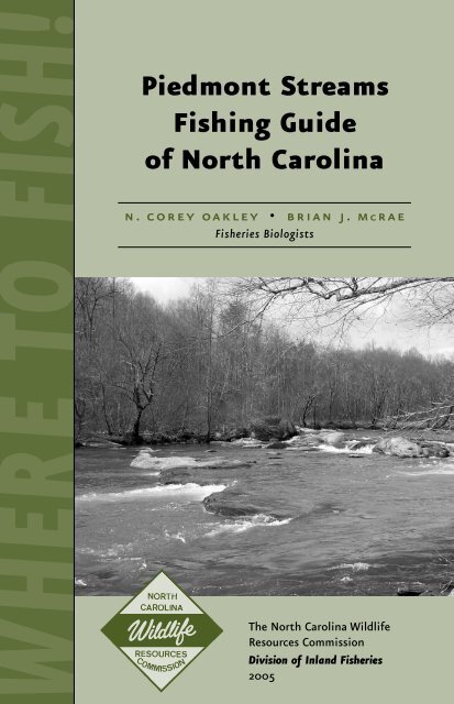
Piedmont Stream Fishing Guide of North Carolina
Piedmont Stream Fishing Guide of North Carolina
Piedmont Stream Fishing Guide of North Carolina

You also want an ePaper? Increase the reach of your titles
YUMPU automatically turns print PDFs into web optimized ePapers that Google loves.
WHERE TO FISH!<br />
<strong>Piedmont</strong> <strong>Stream</strong>s<br />
<strong>Fishing</strong> <strong>Guide</strong><br />
<strong>of</strong> <strong>North</strong> <strong>Carolina</strong><br />
n. corey oakley • brian j. mcrae<br />
Fisheries Biologists<br />
The <strong>North</strong> <strong>Carolina</strong> Wildlife<br />
Resources Commission<br />
Division <strong>of</strong> Inland Fisheries<br />
2005
Other<br />
Division <strong>of</strong><br />
Inland<br />
Fisheries<br />
Programs<br />
Public <strong>Fishing</strong> Areas and Community <strong>Fishing</strong> Program<br />
The N.C. Wildlife Resources Commission provides free public<br />
fishing opportunities at more than 100 Public <strong>Fishing</strong><br />
fishing program<br />
Areas (PFA) and Community <strong>Fishing</strong> Program (CFP) sites<br />
throughout the state. The Wildlife Commission has enhanced fishing opportunities<br />
at PFAs by clearing banks <strong>of</strong> underbrush and, in some cases,<br />
by constructing universally-accessible fishing piers, creating graveled or<br />
paved parking lots, installing fish attractors or baiting the areas with fish<br />
feed. CFP sites are located primarily at city- or county-owned parks and<br />
many have regular operation hours. The Wildlife Commission enhances<br />
fishing at many CFP sites by stocking fish, feeding the fish and installing<br />
artificial reefs or fish attractors. Most CFP sites are stocked from April to<br />
September with harvestable-sized channel catfish.<br />
Tackle Loaner Program<br />
The N.C. Wildlife Resources Commission’s Tackle Loaner Program<br />
(TLP) loans fishing tackle to the public similar to the<br />
way a library loans a book. Anglers <strong>of</strong> all ages register at participating<br />
city- or county-owned parks (<strong>of</strong>ten CFP sites) to receive<br />
a tackle loaner ID card, which allows them to check out a rod and reel<br />
for the day. The Wildlife Commission created the TLP to introduce people,<br />
especially children, to fishing and to encourage novice anglers to continue<br />
developing their angling skills.<br />
To find PFAs, CFP sites and TLP locations near you, visit the Wildlife<br />
Commission’s Web site, www.ncwildlife.org and click on “<strong>Fishing</strong>.” Call the<br />
Division <strong>of</strong> Inland Fisheries at (919) 707-0220 for more information on<br />
these programs.<br />
<strong>North</strong> <strong>Carolina</strong> Angler Recognition Program<br />
Effective July 1, 1997, any angler who catches a fish meeting<br />
specific size requirements can apply to have the catch recog-<br />
nc angler<br />
nized as a “trophy” fish through the <strong>North</strong> <strong>Carolina</strong> Angler<br />
Recognition Program, or NCARP. This program provides recognition to all<br />
anglers who catch trophy-sized fish that are not large enough to qualify as<br />
a state record fish.<br />
Other Information – N.C. Wildlife Resources Commission<br />
The N. C. Wildlife Resources Commission is dedicated to sound conservation<br />
<strong>of</strong> the state’s wildlife and other interrelated natural resources and to<br />
the environment we share with them.<br />
Regulation Information (919) 707-0030<br />
License Information (888) 248-6834<br />
To purchase a license by a credit card (888) 248-6834<br />
(Please see table on inside back cover for NCARP minimum measurements.)<br />
3<br />
1<br />
NC COMMUNITY<br />
NC TACKLE<br />
loaner program<br />
4<br />
5<br />
NCARP<br />
recognition program<br />
9<br />
10
<strong>Piedmont</strong> <strong>Stream</strong><br />
<strong>Fishing</strong> <strong>Guide</strong><br />
<strong>of</strong> <strong>North</strong> <strong>Carolina</strong><br />
n. corey oakley • brian j. mcrae<br />
Fisheries Biologists<br />
The <strong>North</strong> <strong>Carolina</strong> Wildlife Resources Commission<br />
Division <strong>of</strong> Inland Fisheries<br />
2005
The projects highlighted in this brochure were made possible because anglers and boaters<br />
pay special federal excise taxes and import duties on fishing equipment and motorboat<br />
fuels. The N.C. Wildlife Resources Commission receives a share <strong>of</strong> these federal monies,<br />
which are matched with 25 percent state or other non-federal money and invested in important<br />
fishing and boating projects across the state. Without your support for the Federal<br />
Aid in Sport Fish Restoration Program, our agency’s ability to provide fishing and<br />
boating opportunities in <strong>North</strong> <strong>Carolina</strong> could be severely curtailed.<br />
This program receives federal financial assistance from the U. S. Fish and Wildlife Service.<br />
Under Title VI <strong>of</strong> the Civil Rights Act <strong>of</strong> 1964, Section 504 <strong>of</strong> the Rehabilitation Act <strong>of</strong><br />
1973, Title II <strong>of</strong> the Americans with Disabilities Act <strong>of</strong> 1990, the Age Discrimination Act <strong>of</strong><br />
1975, Title IX <strong>of</strong> the Education Amendments <strong>of</strong> 1972, the U. S. Department <strong>of</strong> the Interior<br />
and its bureaus prohibit discrimination on the bases <strong>of</strong> race, color, national origin, age,<br />
disability, age or sex (in educational programs). If you believe that you have been discriminated<br />
against in any program, activity, or facility, or if you desire further information<br />
please write to: Equal Employment Officer, 1703 Mail Service Center, Raleigh, NC<br />
27699-1703, Tel. (919) 707-0101.<br />
Photographs by N.C. Wildlife Resources Commission.<br />
Your purchase <strong>of</strong> fishing equipment and<br />
motor boat fuels supports Sport Fish Restoration<br />
and boating access facilities.<br />
Printed on recycled paper.<br />
15,000 copies <strong>of</strong> this public document were printed<br />
at a cost <strong>of</strong> ???? or ??¢ per copy.<br />
Produced by the Division <strong>of</strong> Inland Fisheries<br />
N.C. Wildlife Resources Commission<br />
1721 Mail Service Center<br />
Raleigh, NC 27699-1721<br />
Telephone (919) 707-0220<br />
To view maps <strong>of</strong> Public <strong>Fishing</strong> Areas and Community <strong>Fishing</strong> Program<br />
sites, go to the N.C. Wildlife Resources Commission’s home page<br />
at www.ncwildlife.org and click on the “<strong>Fishing</strong>” button.<br />
The N. C. Wildlife Resources Commission is an equal opportunity employer.
Introduction<br />
The <strong>Piedmont</strong> region <strong>of</strong> <strong>North</strong> <strong>Carolina</strong> is noted <strong>of</strong>ten for its pond<br />
and city lake fisheries. However, stream fishing is a virtually untapped<br />
resource <strong>of</strong> angling opportunities that can provide anglers with many<br />
enjoyable hours <strong>of</strong> fishing. The <strong>Piedmont</strong> has hundreds <strong>of</strong> miles <strong>of</strong><br />
warm water streams supporting diverse populations <strong>of</strong> game and<br />
nongame fishes.<br />
This guide features streams with developed public access areas<br />
(see Map A, Map B on pp. 18 –19). These streams, which vary in size<br />
from small creeks to large rivers, provide harvestable-size largemouth<br />
bass, Roanoke bass, striped bass, white bass, sunfish, pickerel, crappie,<br />
catfish, carp and a variety <strong>of</strong> other game fishes. <strong>Fishing</strong> opportunities<br />
include bank, canoe and wading. Some streams provide access<br />
for all three. A number <strong>of</strong> hazards are associated with streams, so be<br />
sure that you know your skill level before leaving the bank.<br />
The streams described in this brochure are grouped into eastern<br />
and western <strong>Piedmont</strong> areas. The streams are then listed in alphabetical<br />
order. Access points for each stream are listed starting upstream<br />
and progressing downstream. Each access point, evaluated on six categories,<br />
is rated as follows:<br />
�����—Excellent<br />
����—Very Good<br />
���—Good<br />
��—Fair<br />
� —Poor<br />
N/A—Not Available<br />
3
4<br />
The categories are:<br />
Overall accessibility: ratings are based on the ability <strong>of</strong> all citizens<br />
to access the site with relative ease. A rating <strong>of</strong> ����� indicates<br />
easy access for all citizens including those with disabilities. A rating <strong>of</strong><br />
� indicates extremely difficult access with long hikes or steep banks<br />
that require some skill to access.<br />
Bank fishing opportunities: ratings are based on the length, height,<br />
steepness and overall quality <strong>of</strong> the bank areas. A rating <strong>of</strong> N/A means<br />
bank fishing is not allowed.<br />
Wading opportunities: ratings are based on the length, depth and<br />
overall ease <strong>of</strong> wading in the stream. A rating <strong>of</strong> N/A means wading<br />
is not advised or allowed due to hazardous conditions.<br />
Small boat /canoe launching access: ratings are based on the quality <strong>of</strong><br />
the ramp or ease <strong>of</strong> access to the site. A rating <strong>of</strong> ����� indicates<br />
a paved ramp that can be accessed with an automobile. A rating <strong>of</strong> �<br />
indicates no ramp and extreme conditions to carry a canoe to a given<br />
site. A rating <strong>of</strong> N/A means canoe launching is not advised or allowed.<br />
Parking: ratings are based on the size, quality and distance from actual<br />
site. A rating <strong>of</strong> N/A means no parking is available.<br />
Aesthetic quality: ratings are based on the natural beauty <strong>of</strong> each site.<br />
A rating <strong>of</strong> ����� indicates a site surrounded by nature with<br />
little noise pollution. A rating <strong>of</strong> � indicates the site is located within<br />
a city or near some form <strong>of</strong> industry that creates noise pollution.<br />
All locations described in this brochure are designated public access<br />
points. Some adjacent property upstream and downstream is private.<br />
Please respect the rights <strong>of</strong> property owners and do not trespass. So<br />
that these streams can provide fishing opportunities for future generations,<br />
please respect the environment.<br />
In addition to this booklet, several other information resources<br />
exist for the outdoor enthusiast:<br />
• For state park maps: park <strong>of</strong>fices or online at http://ils.unc.edu /<br />
parkproject /ncparks.html.<br />
• For streams and state parks in <strong>North</strong> <strong>Carolina</strong>: The <strong>North</strong> <strong>Carolina</strong><br />
Atlas and Gazetteer, 6th edition, published by DeLorme.<br />
• For descriptions <strong>of</strong> most streams described in this guide: Paddling<br />
Eastern <strong>North</strong> <strong>Carolina</strong> (2002) by Paul Ferguson.
Dan River<br />
Access<br />
Areas<br />
Western <strong>Piedmont</strong><br />
The Dan River flows south into <strong>North</strong> <strong>Carolina</strong>, providing beautiful<br />
scenery and exceptional fishing opportunities. The river snakes<br />
through the foothills <strong>of</strong> Stokes, Rockingham and Caswell counties<br />
before flowing back into Virginia. The upper reaches provide trout<br />
fishing opportunities, while lower sections have excellent striped bass<br />
fishing during the spring. The river is accessed mainly by canoe and<br />
has few small boat or bank fishing opportunities.<br />
Fishery Present: Sunfish, largemouth bass, smallmouth bass, catfish,<br />
trout (upper reaches) and striped bass (lower reaches).<br />
1. Hanging Rock State Park, Stokes County<br />
The access point is on the north boundary <strong>of</strong> the park with good<br />
bank and very good wading opportunities. The park provides an excellent<br />
canoe launch.<br />
Directions: From Danbury, follow N.C. 89/8 north. Turn left on<br />
Flinchum Road (S.R. 1487). Access is at the end <strong>of</strong> the road.<br />
Accessibility ����� Small Boat /Canoe �����<br />
Bank ��� Parking ���<br />
Wading ���� Aesthetic �����<br />
2. Lindsey Bridge, Rockingham County<br />
The access point is located directly below a low-head dam. The site<br />
is surrounded by a large industrial park so the area is noisy. The site<br />
provides good bank and wading opportunities with an excellent canoe<br />
launch facility.<br />
Directions: From Madison, follow U.S. 311 west. Turn left on Lindsey<br />
Bridge Road (S.R. 1138). Access is on the right after crossing the<br />
river.<br />
Accessibility ���� Small Boat /Canoe �����<br />
Bank ��� Parking ���<br />
Wading ��� Aesthetic ���<br />
3. N.C. 704, Rockingham County<br />
Undeveloped and difficult to locate, this access is under the N.C. 704<br />
bridge near E. Murphy and Water streets in Madison. A sand mining<br />
company is on the left at the put-in. Canoe launch area is available.<br />
Directions: Follow N.C. 704 west into Madison. Follow Dan River<br />
Trail Access signs back to the river.<br />
Accessibility ��� Small Boat /Canoe ���<br />
Bank �� Parking �<br />
Wading N/A Aesthetic ��<br />
5
6<br />
Fisher<br />
River<br />
Access<br />
Areas<br />
4. Settles Bridge, Rockingham County<br />
The access point is at the bottom <strong>of</strong> a steep hill. Stairs lead to a canoe<br />
launch area with very little bank opportunities.<br />
Directions: From Eden, follow N.C. 135 west. Turn left on Settles<br />
Bridge Road (S.R. 2145). Cross river and turn left on Dan River Road<br />
(S.R. 2149). Access is at the end <strong>of</strong> the road on the left.<br />
Accessibility ��� Small Boat /Canoe ���<br />
Bank �� Parking �<br />
Wading N/A Aesthetic ���<br />
5. Eden WRC Access, Rockingham County<br />
This access has a few bank fishing areas but is an excellent boat<br />
launching facility. Wading is not advised.<br />
Directions: From Eden, follow N.C. 14 east. Turn right on Bethlehem<br />
Church Road (S.R. 2039). Access is on the right.<br />
Accessibility ����� Small Boat /Canoe �����<br />
Bank ��� Parking ���<br />
Wading N/A Aesthetic ���<br />
6. Milton WRC Access, Caswell County<br />
This access has minimal bank fishing opportunities but provides an<br />
excellent boat launching facility. Wading is not advised.<br />
Directions: From Milton, follow N.C. 62 north. Access is on the<br />
left after crossing the river.<br />
Accessibility ���� Small Boat /Canoe �����<br />
Bank �� Parking ����<br />
Wading N/A Aesthetic ���<br />
The Fisher River is a small river that flows south through Surry County<br />
before draining into the Yadkin River. The river provides excellent fishing<br />
for trout in the northern sections <strong>of</strong> Surry County with smallmouth<br />
and largemouth bass fishing in the lower reaches. The only<br />
public access area located along the river is at Fisher River Park near<br />
Dobson in Surry County.<br />
Fishery present: Sunfish, largemouth bass, smallmouth bass, catfish,<br />
brown trout and rainbow trout.<br />
7. Fisher River Park, Surry County<br />
This park provides excellent wading and bank fishing opportunities.<br />
Operated by Surry County Parks and Recreation, the park also has<br />
several miles <strong>of</strong> trails with numerous access points along the river.
Fisher River<br />
Directions: Follow U.S. 601 Business north <strong>of</strong> Dobson. Turn left<br />
on Prison Camp Road (S.R. 1345). Turn left on County Home Road<br />
(S.R. 1346). Access is on the left.<br />
Accessibility ����� Small Boat /Canoe ����<br />
Bank ����� Parking �����<br />
Wading ����� Aesthetic �����<br />
7
8<br />
The Little<br />
River<br />
Access<br />
Areas<br />
Mayo River<br />
Access<br />
Areas<br />
The Little River, nestled deep within the Uwharrie National Forest,<br />
is a major tributary to the Pee Dee River. Public access is limited to<br />
a small Wildlife Resources Commission access area. The Little River<br />
provides excellent fishing for many species.<br />
Fishery Present: Sunfish, crappie, largemouth bass and catfish.<br />
8. Troy WRC Access, Montgomery County<br />
The access has an excellent boat launch facility. No wading is allowed.<br />
Few bank fishing areas are available.<br />
Directions: From Troy, follow S. Main Street / Pekin Road (S.R.<br />
1005) south. Access is on the right just before crossing the river.<br />
Accessibility ���� Small Boat /Canoe �����<br />
Bank ��� Parking ��<br />
Wading N/A Aesthetic ���<br />
The Mayo River originates in southern Virginia, flows south through<br />
Rockingham County and joins the Dan River near Madison, N.C. The<br />
picturesque Mayo River, which stretches 13 miles in <strong>North</strong> <strong>Carolina</strong>,<br />
flows over a very rocky substrate with many falls and pools. It is fairly<br />
inaccessible so fishing pressure is relatively light. This river is one <strong>of</strong><br />
the most pristine streams in the <strong>Piedmont</strong>.<br />
Fishery Present: Sunfish, largemouth bass, smallmouth bass and<br />
catfish.<br />
9. Anglin Mill Bridge, Rockingham County<br />
This access is directly below Anglin Mill Bridge. The access is just<br />
above a large rock garden and requires skilled boating in order to<br />
pass. Wading and canoe launching are available.<br />
Directions: From Madison, follow U.S. 220 north, turn left on<br />
N.C. 770. Turn right on C & N Smith Road (S.R. 1397). At “T” intersection,<br />
turn left on Smith Road (S.R. 1360). At the next “T” intersection,<br />
turn left on Anglin Mill Road (S.R. 1358). Turn left on Old<br />
Anglin Mill Road (S.R. 1385). Go down gravel road to “T” intersection,<br />
turn right on Mayo Beach Road (S.R. 1359).<br />
Accessibility ���� Small Boat /Canoe �����<br />
Bank ��� Parking ��<br />
Wading ���� Aesthetic �����<br />
10. South End <strong>of</strong> Mayo Beach Road, Rockingham County<br />
Surrounded by private property, this access is limited to a canoe launch<br />
area, located just below a large rock garden with many pools that may<br />
hold fish.
Mayo River<br />
Directions: From Madison, follow U.S. 220 north and turn left on<br />
N.C. 770. Turn right on C & N Smith Road (S.R. 1397). At “T” intersection,<br />
turn left on Smith Road (S.R. 1360). At the next “T” intersection,<br />
turn left on Anglin Mill Road (S.R. 1358). Turn left on Old<br />
Anglin Mill Road (S.R. 1385). Travel down gravel road to “T” intersection<br />
and turn right on Mayo Beach Road (S.R. 1359).<br />
Accessibility ���� Small Boat /Canoe ����<br />
Bank N/A Parking ��<br />
Wading N/A Aesthetic �����<br />
11. U.S. 220 Business Bridge, Rockingham County<br />
Located beside the U.S. 220 Business bridge north <strong>of</strong> Mayodan, this access<br />
provides limited bank and wading opportunities. Canoe launching<br />
is available.<br />
Directions: From Mayodan, take U.S. 220 Business north. Access<br />
is on left after crossing river.<br />
Accessibility ���� Small Boat /Canoe ����<br />
Bank �� Parking ��<br />
Wading ��� Aesthetic �����<br />
9
Mountain<br />
Creek<br />
10<br />
Access<br />
Areas<br />
Pee Dee<br />
River<br />
Access<br />
Areas<br />
Mountain Creek is a small tributary to the Pee Dee River that forms the<br />
southern boundary <strong>of</strong> Morrow Mountain State Park in Stanly County.<br />
The stream is accessed by strenuous hiking trails in the state park.<br />
Fishery Present: Sunfish, largemouth bass and catfish.<br />
12. Morrow Mountain State Park, Stanly County<br />
This access is difficult to reach. Long trails lead to the creek at the base<br />
<strong>of</strong> Morrow Mountain. Canoe access is limited to the lower reaches <strong>of</strong><br />
the creek near the confluence with the Pee Dee River.<br />
Directions: From Albemarle, follow N.C. 740 north. Turn right<br />
on Morrow Mountain Park Road and follow to the park.<br />
Accessibility � Small Boat /Canoe �<br />
Bank �� Parking �����<br />
Wading �� Aesthetic �����<br />
The Pee Dee River begins at the confluence <strong>of</strong> the Yadkin and Uwharrie<br />
rivers in Stanly and Montgomery counties. The river has an excellent<br />
catfish fishery as it flows into South <strong>Carolina</strong>. Access is limited<br />
primarily to boats with some bank fishing opportunities.<br />
Fishery Present: Sunfish, crappie, largemouth bass and catfish.<br />
Striped bass and American shad are below Blewett Falls Dam in the<br />
spring.<br />
13. Red Hill, Anson County<br />
Located along the Pee Dee River above Blewett Falls Lake, this Wildlife<br />
Resources Commission access has a boat launching facility along<br />
with good bank access.<br />
Directions: From Wadesboro, follow N.C. 109 north. The access<br />
is on the right before crossing the river.<br />
Accessibility ����� Small Boat /Canoe �����<br />
Bank ��� Parking ��<br />
Wading N/A Aesthetic ���<br />
14. Blewett’s Grave, Richmond County<br />
Located on the Pee Dee River at the base <strong>of</strong> Blewett Falls, this Wildlife<br />
Resources Commission access has a boat launching facility that<br />
is limited to high-flow periods regulated by output from Blewett Falls<br />
Dam. Limited bank access for fishing. A great public fishing area is<br />
directly across the river that can be accessed from Powerplant Road<br />
<strong>of</strong>f N.C. 74.<br />
Directions: From Rockingham, follow N.C. 74 west. Turn right on<br />
Old Charlotte Highway (S.R. 1140) just before crossing the river. Turn<br />
left on Blewett Falls Road. Follow road until it ends. Access road is on<br />
the left.
South<br />
Yadkin River<br />
Access<br />
Areas<br />
Accessibility ��� Small Boat /Canoe ��<br />
Bank �� Parking ��<br />
Wading � Aesthetic ���<br />
15. Rockingham, Richmond County<br />
Provided by the Wildlife Resources Commission, this is an easily accessible<br />
area for launching watercraft. It provides limited shoreline<br />
for good bank fishing opportunities.<br />
Directions: From Rockingham, take N.C. 74 west. Access area is<br />
on the left before crossing the river.<br />
Accessibility ����� Small Boat /Canoe �����<br />
Bank ��� Parking ���<br />
Wading N/A Aesthetic ���<br />
The South Yadkin River rises in the foothills before flowing through<br />
the western <strong>Piedmont</strong>. The river flows east from Alexander County<br />
through Iredell, Rowan and Davie counties before draining into the<br />
Yadkin River north <strong>of</strong> Salisbury. The South Yadkin River is a littleused<br />
resource that provides excellent fishing opportunities. The main<br />
access areas are in Davie County.<br />
Fishery Present: Sunfish, crappie, largemouth bass and catfish.<br />
16. Cooleemee Junction, WRC Access, Davie County<br />
This access provides very good bank fishing opportunities and an<br />
excellent boat launching facility. Wading is not advised.<br />
Directions: From Mocksville, travel south on U.S. 601. Turn right<br />
on N.C. 801 towards Cooleemee. Turn right on Marginal Road (S.R.<br />
1116). Turn right on Junction Road (S.R. 1116). After railroad tracks,<br />
turn left on gravel road. Access is at the end <strong>of</strong> the road.<br />
Accessibility ���� Small Boat /Canoe �����<br />
Bank ���� Parking ���<br />
Wading N/A Aesthetic ����<br />
17. U.S. 601, Davie County<br />
This access provides good bank fishing opportunities and a boat<br />
launching facility. Wading is not advised. This site is provided by<br />
ALCOA, Inc.<br />
Directions: From Mocksville, follow U.S. 601 south. Access is on<br />
the right before crossing the river.<br />
Accessibility ���� Small Boat /Canoe ����<br />
Bank ��� Parking ����<br />
Wading N/A Aesthetic ���<br />
11
12<br />
Uwharrie<br />
River<br />
Access<br />
Areas<br />
Uwharrie River<br />
The Uwharrie River begins in Randolph County and flows south into<br />
Montgomery County before entering the Pee Dee River. This scenic,<br />
cool water river cuts through the Uwharrie Mountains, the oldest<br />
mountain range in <strong>North</strong> America. Access is limited, but many opportunities<br />
are available for bank fishing, wading or canoeing within<br />
the Uwharrie National Forest.<br />
Fishery Present: Sunfish, largemouth bass, smallmouth bass, white<br />
bass and walleye.<br />
18. Uwharrie Hunt Camp, Montgomery County<br />
The river winds through the national forest providing many fishing opportunities.<br />
Cotton Place Road parallels the river for its entire length,<br />
with multiple access points. There are excellent bank fishing and<br />
wading opportunities within the Uwharrie National Forest.<br />
Directions: From Troy, travel north on N.C. 109. Turn left on Reservation<br />
Road (S.R. 1153). At Uwharrie Hunt Camp, turn right on Moccasin<br />
Road (F. S. 576). Turn left on Cotton Place Road (F. S. 555). Access<br />
is along the road with parking on the right.<br />
Accessibility ���� Small Boat /Canoe ���<br />
Bank ����� Parking �����<br />
Wading ����� Aesthetic �����
Yadkin River<br />
Access<br />
Areas<br />
The Yadkin River rises in the mountains <strong>of</strong> Watauga County before<br />
flowing south into South <strong>Carolina</strong>. The river is a major drainage <strong>of</strong><br />
<strong>North</strong> <strong>Carolina</strong> with excellent fishing. Most <strong>of</strong> the river is accessible<br />
only by canoe or other small boat.<br />
Fishery Present: Sunfish, largemouth bass and catfish. Smallmouth<br />
bass, brown trout and rainbow trout are in the upper reaches<br />
<strong>of</strong> the river.<br />
19. Tailwater Park, Wilkes County<br />
Located where the Yadkin River rushes out <strong>of</strong> W. Kerr Scott Reservoir,<br />
this access provides very good bank fishing opportunities. The park<br />
also provides an excellent canoe launching facility. Wading is not advised<br />
due to rapid increase in flow from W. Kerr Scott Reservoir.<br />
Directions: From Wilkesboro, follow N.C. 268 west. Turn right on<br />
Old N.C. 268. The park is at the end <strong>of</strong> the road.<br />
Accessibility ����� Small Boat /Canoe �����<br />
Bank ���� Parking �����<br />
Wading N/A Aesthetic ���<br />
20. Memorial Park, Wilkes County<br />
Flowing through the town <strong>of</strong> Wilkesboro, the river has small rapids<br />
and large pools. The park provides very little access to the river. High<br />
banks restrict the access area. There is a limited area for canoe access.<br />
Directions: The park is located on Wilkesboro Avenue in <strong>North</strong><br />
Wilkesboro.<br />
Accessibility �� Small Boat /Canoe ��<br />
Bank N/A Parking �����<br />
Wading N/A Aesthetic ���<br />
21. Smoot Park, Wilkes County<br />
River access is located at the rear <strong>of</strong> the park. The banks are high and<br />
steep and provide limited access to bank fishing. Stairs leading to the<br />
river provide access to a canoe launching facility.<br />
Directions: The park is located at the corner <strong>of</strong> Chestnut and<br />
Vance streets in <strong>North</strong> Wilkesboro.<br />
Accessibility ���� Small Boat /Canoe �����<br />
Bank �� Parking �����<br />
Wading �� Aesthetic ���<br />
22. Ronda Memorial Park, Wilkes County<br />
This access is primarily a canoe launching facility. The park provides<br />
very little bank fishing and no wading opportunities.<br />
13
14<br />
Directions: From <strong>North</strong> Wilkesboro, travel east along N.C. 268.<br />
Turn right on Clingman Road (S.R. 2303) in Ronda. Access is on right<br />
before crossing the river.<br />
Accessibility ���� Small Boat /Canoe ����<br />
Bank � Parking ���<br />
Wading N/A Aesthetic ���<br />
23. Elkin/Crater Park, Surry County<br />
This access is primarily a canoe launching facility. The park provides<br />
very little bank and wading opportunities. Access point is at the rear<br />
<strong>of</strong> the park along the river.<br />
Directions: Follow Bridges Street south from N.C. 268 through<br />
Elkin. The park is on the left before crossing the river.<br />
Accessibility ��� Small Boat /Canoe ����<br />
Bank � Parking ���<br />
Wading � Aesthetic ��<br />
24. Yadkin Shore, Yadkin County<br />
The access is primarily a canoe launch facility and should not be used<br />
for bank fishing or as a wading facility. As the river flows east toward<br />
Boonville, it widens and has large rock gardens and swift flowing water.<br />
Directions: From Boonville, follow U.S. 601 north. Access is on<br />
right before crossing the river.<br />
Accessibility ��� Small Boat /Canoe ���<br />
Bank N/A Parking ���<br />
Wading N/A Aesthetic ���<br />
25. Roy Burgess/Rockford, Surry County<br />
This very good canoe launch facility access provides few but quality<br />
bank fishing opportunities. Wading is advised only during low-flow<br />
periods.<br />
Directions: From Boonville, follow N.C. 67 east and turn north on<br />
Rockford Road (S.R. 1510). Access is on the left after crossing the river.<br />
Accessibility ���� Small Boat /Canoe ����<br />
Bank ��� Parking ��<br />
Wading ��� Aesthetic ���<br />
26. Shoals Access/Pilot Mountain State Park, Yadkin County<br />
This excellent canoe launch facility access provides minimal bank<br />
fishing opportunities. Wading is advised only during low-flow periods.<br />
The access is along the southern edge <strong>of</strong> the state park.
Directions: From Boonville, follow N.C. 67 east and turn north on<br />
Main Street in East Bend. Follow Yadkin River Trail signs to access<br />
area. Access is at the end <strong>of</strong> Shoals Road (S.R. 1546).<br />
Accessibility ���� Small Boat /Canoe �����<br />
Bank ��� Parking ���<br />
Wading �� Aesthetic �����<br />
27. Donnaha Park, Yadkin County<br />
This very good canoe launch facility provides minimal bank fishing<br />
opportunities. Wading is advised only during lower-flow periods. The<br />
access is at the back <strong>of</strong> the park, underneath the N.C. 67 bridge.<br />
Directions: From East Bend, follow N.C. 67 east. Park is on the left<br />
before crossing the river.<br />
Accessibility ���� Small Boat /Canoe ����<br />
Bank �� Parking ���<br />
Wading ���� Aesthetic ����<br />
28. Old U.S. 421 Park, Forsyth County<br />
This access does not provide bank or wading opportunities. The access<br />
should be used only for canoe launching.<br />
Directions: Follow Old U.S. 421 west <strong>of</strong> Lewisville. Park is on the<br />
right before crossing the river.<br />
Accessibility ���� Small Boat /Canoe ���<br />
Bank N/A Parking �����<br />
Wading N/A Aesthetic ���<br />
29. Pate Memorial, Yadkin County<br />
This access does not provide bank or wading opportunities. Undeveloped<br />
and difficult to use, the access is used primarily for canoe<br />
launching.<br />
Directions: Follow Courtney-Huntsville Road (S.R.1001) north <strong>of</strong><br />
Huntsville. A small county access is on the right before crossing the<br />
river.<br />
Accessibility �� Small Boat /Canoe ��<br />
Bank N/A Parking ��<br />
Wading N/A Aesthetic ��<br />
30. Tanglewood Park, Forsyth County<br />
This park is similar to many along the Yadkin River with little bank<br />
and wading opportunities. The access provides stairs leading to a canoe<br />
launching facility.<br />
15
16<br />
Directions: From Clemmons, follow U.S. 158 west. Park is on the<br />
left before crossing the river.<br />
Accessibility ���� Small Boat /Canoe ����<br />
Bank �� Parking ��<br />
Wading � Aesthetic ���<br />
31. U.S. 64, Davidson County<br />
Very limited access is available. The site is undeveloped and does not<br />
allow for bank or wading opportunities. Canoe launching is possible<br />
but difficult.<br />
Directions: From Lexington, follow U.S. 64 west. Access is on the<br />
left before crossing the river.<br />
Accessibility �� Small Boat /Canoe ��<br />
Bank N/A Parking ��<br />
Wading N/A Aesthetic ��<br />
32. Concord Church, WRC Access, Davie County<br />
This access is used primarily for small boat and canoe launching.<br />
The access also has some opportunity for bank fishing. Wading is<br />
not advised.<br />
Directions: From Lexington, follow U.S. 64 west. Turn left on N.C.<br />
801. Follow N.C. 801 south until reaching the Wildlife Resources<br />
Commission access sign. Turn left on access road and follow to river.<br />
Accessibility ���� Small Boat /Canoe ����<br />
Bank �� Parking ��<br />
Wading N/A Aesthetic ���<br />
33. Boone’s Cave State Park, Davidson County<br />
The high cliffs <strong>of</strong> Boone’s Cave overlook the winding Yadkin River.<br />
This access should not be used to launch a canoe because <strong>of</strong> steep<br />
trails. Bank fishing is available along the trails.<br />
Directions: From Lexington, follow U.S. 64 west. Turn left on N.C.<br />
150. Follow N.C. 150 south, turn right on Boone’s Cave Road (S.R.<br />
1167). Park is at the end <strong>of</strong> road.<br />
Accessibility ��� Small Boat /Canoe N/A<br />
Bank ��� Parking ����<br />
Wading � Aesthetic ����<br />
34. Salisbury Pump Station, Rowan County<br />
This access is located at the confluence <strong>of</strong> the Yadkin and South Yadkin<br />
rivers. The area provides a good boat launching facility. Bank fishing<br />
is available, but wading is not advised.
Campbell and<br />
Little Creeks<br />
Access<br />
Areas<br />
Cape Fear<br />
River<br />
Directions: From Mocksville, follow U.S. 601 south. Turn left on<br />
Old Mocksville Road (S.R. 1910). Turn left on Hannah Ferry Road<br />
(S.R. 1928). Access is at the end <strong>of</strong> the road.<br />
Accessibility ��� Small Boat /Canoe ���<br />
Bank ��� Parking ��<br />
Wading N/A Aesthetic ���<br />
35. York Hill, Davidson County<br />
This is the final access before the Yadkin flows into High Rock Reservoir.<br />
The access provides bank fishing opportunities and a very good<br />
boat launching access. Deep water prohibits any wading.<br />
Directions: From Salisbury, follow N.C. 150 north. Turn left on Old<br />
U.S. 29. Access is on the immediate left.<br />
Accessibility ���� Small Boat /Canoe ����<br />
Bank ���� Parking ���<br />
Wading N/A Aesthetic ����<br />
Eastern <strong>Piedmont</strong><br />
Campbell and Little creeks are located in Raven Rock State Park in<br />
Harnett County. Both streams, which flow east through the park before<br />
draining into the Cape Fear River, provide bank fishing and wading<br />
opportunities. Canoe access is restricted to the Cape Fear River.<br />
Fishery Present: Sunfish, largemouth bass, and catfish.<br />
36. Raven Rock State Park, Harnett County<br />
Directions: Follow U.S. 421 south <strong>of</strong> Sanford. Turn left on Raven Rock<br />
Road (S.R. 1314). Park is at the end <strong>of</strong> road.<br />
Accessibility ���� Small Boat /Canoe N/A<br />
Bank ��� Parking ����<br />
Wading ���� Aesthetic �����<br />
The Cape Fear River is the largest drainage in <strong>North</strong> <strong>Carolina</strong>. The<br />
confluence <strong>of</strong> the Haw and Deep rivers in Chatham County form the<br />
Cape Fear River as it flows east through the sandhills. The Cape Fear<br />
River provides an excellent catfish fishery along with various sunfish<br />
species. Access to the river is primarily by boat and canoe with very<br />
little bank fishing opportunities.<br />
Fishery Present: Sunfish, crappie, largemouth bass and catfish.<br />
17
Western <strong>Piedmont</strong><br />
Map A. Locations <strong>of</strong> stream access areas in the western <strong>Piedmont</strong> <strong>of</strong> <strong>North</strong> <strong>Carolina</strong>.
Eastern <strong>Piedmont</strong><br />
Map B. Locations <strong>of</strong> stream access areas in the eastern <strong>Piedmont</strong> <strong>of</strong> <strong>North</strong> <strong>Carolina</strong>.
20<br />
Access<br />
Areas<br />
Crabtree and<br />
Sycamore<br />
Creeks<br />
Access<br />
Areas<br />
Crabtree Creek<br />
37. Avent’s Ferry Bridge WRC Access, Chatham County<br />
This access point provides very good bank fishing along with ramp<br />
access for larger boats. Be careful around the dam, located two miles<br />
downstream from the access area.<br />
Directions: From Sanford, take N.C. 42 east. Cross river and access<br />
is on the left.<br />
Accessibility ����� Small Boat /Canoe �����<br />
Bank ���� Parking ����<br />
Wading N/A Aesthetic ���<br />
Crabtree and Sycamore creeks, located in William B. Umstead State<br />
Park in Wake County, provide bank fishing and wading opportunities.<br />
Canoes and small boats are not allowed on either stream. These<br />
streams support excellent sunfish fisheries, especially redbreast sunfish.<br />
The only access to these streams is by hiking trails ranging from<br />
0.2 to 6.5 miles.<br />
Fishery Present: Sunfish, crappie, largemouth bass and catfish.<br />
38. William B. Umstead Park, Wake County<br />
Directions: Follow I-40 west <strong>of</strong> Raleigh. Exit on Harrison Avenue<br />
(Exit #187). Turn right. Park is at the end <strong>of</strong> the road.
Deep River<br />
Access<br />
Areas<br />
Accessibility �� Small Boat /Canoe N/A<br />
Bank ��� Parking ����<br />
Wading ��� Aesthetic ����<br />
The picturesque Deep River rises near High Point in western Guilford<br />
County. As the river flows south through Randolph, Moore, Chatham<br />
and Lee counties, it provides a beautiful backdrop for an excellent<br />
fishing experience. The river joins the Haw River in Chatham County<br />
to form the Cape Fear River. The river provides an excellent fishery<br />
for many species.<br />
Fishery Present: Sunfish, crappie, largemouth bass and catfish.<br />
39. Riverside Park, Randolph County<br />
The park provides very good bank fishing opportunities. Wading is<br />
not advised due to deep water. This site should not be used as a canoe<br />
launch area.<br />
Directions: Follow N.C. 22 north from Ramseur to Franklinville.<br />
The park is on the left.<br />
Accessibility ���� Small Boat /Canoe N/A<br />
Bank ���� Parking ����<br />
Wading N/A Aesthetic ����<br />
40. Ramseur, Randolph County<br />
This access is limited as a boat launching facility and should be used<br />
only during high-flow periods. The area is inaccessible during lowflow<br />
periods.<br />
Directions: From Ramseur, take U.S. 64 west. Access area is on the<br />
left before crossing the river.<br />
Accessibility ��� Small Boat /Canoe ��<br />
Bank N/A Parking ��<br />
Wading N/A Aesthetic ��<br />
41. Carbonton Dam, Chatham County<br />
This access has a boat launching facility with very little bank access.<br />
Wading is not advised.<br />
Directions: From Sanford, take N.C. 42 west. After crossing the<br />
Deep River, take the next immediate left (gravel road). Access is at<br />
the end <strong>of</strong> the road.<br />
Accessibility ����� Small Boat /Canoe �����<br />
Bank �� Parking ���<br />
Wading N/A Aesthetic ���<br />
21
22<br />
Eno River<br />
Access<br />
Areas<br />
Few’s Ford<br />
The Eno River rises in Orange County and flows into Durham County<br />
where it joins the Flat River to form the Neuse River. The river winds<br />
for 42 miles with a channel width ranging from 10 to 30 feet. Access<br />
areas are in state and municipal parks.<br />
Fishery Present: Sunfish, largemouth bass, Roanoke bass and<br />
catfish.<br />
42. Few’s Ford, Orange County<br />
This access point, located in the Eno River State Park, provides excellent<br />
bank fishing and wading opportunities. Easy access to miles <strong>of</strong><br />
trails and an easy canoe launch make this a premiere stream fishing<br />
opportunity.<br />
Directions: From Durham, follow I-85 south to Cole Mill Road exit.<br />
Travel north on Cole Mill Road (S.R. 1569) to entrance <strong>of</strong> Eno River<br />
State Park on the left.<br />
Accessibility ����� Small Boat /Canoe �����<br />
Bank ����� Parking �����<br />
Wading ����� Aesthetic �����<br />
43. Pleasant Green, Orange County<br />
Nestled along the Eno River State Park, Pleasant Green contains both<br />
swift and slack water fishing opportunities because <strong>of</strong> a nearby dam.
Bank fishing opportunities are available with canoe access above and<br />
below the dam.<br />
Directions: From Durham, follow U.S. 70 west and turn right on<br />
Pleasant Green Road (S.R. 1567). Access is on left before the bridge.<br />
Accessibility ����� Small Boat /Canoe ���<br />
Bank ���� Parking �����<br />
Wading �� Aesthetic ����<br />
44. Cole Mill, Durham County<br />
Cole Mill is located within the Eno River State Park. Many trails leading<br />
to the river provide bank and wading access.<br />
Directions: From Durham, follow I-85 south to Cole Mill Road exit.<br />
Travel north on Cole Mill Road (S.R. 1569) and follow signs to access<br />
area on the left.<br />
Accessibility ���� Small Boat /Canoe �����<br />
Bank ���� Parking �����<br />
Wading ����� Aesthetic �����<br />
45. West Point on the Eno Park, Durham County<br />
Centered deep within Durham, this park provides an escape from the<br />
fast-paced urban life <strong>of</strong> the Triangle. The South River and Eagle trails<br />
provide excellent bank and wading opportunities.<br />
Directions: From I-85, travel north on Duke Street (U.S. 501 N Bypass).<br />
Access is on the left (follow signs).<br />
Accessibility ���� Small Boat /Canoe ���<br />
Bank ����� Parking �����<br />
Wading ���� Aesthetic �����<br />
46. Penny’s Bend Natural Area, Durham County<br />
Penny’s Bend is a natural area operated by the N.C. Botanical Garden.<br />
The sharp bend in the river has both deep and shallow water. Bank<br />
fishing is recommended where available.<br />
Directions: Travel north on Roxboro Road (U.S. 501 N Business)<br />
and turn right on Old Oxford Road (S.R. 1004). Turn left on Snow<br />
Hill Road (S.R. 1631). The access is at the intersection <strong>of</strong> Old Oxford<br />
Road and Snow Hill Road.<br />
Accessibility ��� Small Boat /Canoe N/A<br />
Bank ��� Parking ���<br />
Wading N/A Aesthetic ����<br />
23
Haw River<br />
24<br />
Access<br />
Areas<br />
The headwaters <strong>of</strong> the Haw River originate in Rockingham County<br />
and flow south through Guilford, Alamance and Chatham counties<br />
before entering B. Everett Jordan Reservoir. The Haw River combines<br />
with the Deep River to form the Cape Fear River as it flows toward<br />
the southeast. Use extreme caution when wading or boating due to<br />
the rocky riverbed and rapid fluctuation in water levels. Most access<br />
points are along the Haw River Canoe Trail (www.hawrivertrail.org).<br />
Fishery Present: Sunfish, crappie, largemouth bass and catfish.<br />
47. Glen Raven, Alamance County<br />
This site is primarily a canoe launch site with limited bank and wading<br />
opportunities. The site is directly beneath the N.C. 87 bridge, and<br />
noise from the traffic above can be disturbing.<br />
Directions: From Burlington, follow N.C. 87 north. Access is on<br />
north end <strong>of</strong> the bridge near Altamahaw. Follow steps down to access<br />
area. Parking is at the intersection <strong>of</strong> Union Road and N.C. 87.<br />
Accessibility �� Small Boat /Canoe ���<br />
Bank �� Parking ��<br />
Wading �� Aesthetic ��<br />
48. Glencoe Mill, Alamance County<br />
This site is primarily a canoe launch site with limited bank access. This<br />
section <strong>of</strong> river has numerous shallow rapids that provide good wading<br />
opportunities. It is located near the historic Glencoe Mill Village.<br />
Directions: From Burlington, follow N.C. 62 north. After crossing<br />
Haw River, turn left on Glencoe Street (S.R. 1600). Park at the mill.<br />
Accessibility ���� Small Boat /Canoe ����<br />
Bank �� Parking ��<br />
Wading ��� Aesthetic ����<br />
49. Burlington Town & Country, Alamance County<br />
This site has poor access for canoe and bank fishing. Parking is currently<br />
not available at this site.<br />
Directions: Follow U.S. 70 west to Burlington. Turn right on Sellars<br />
Mill Road. Turn right on Morningside Drive. Turn right on Riverside<br />
Road. Access is on the left at the end <strong>of</strong> the road.<br />
Accessibility �� Small Boat /Canoe �<br />
Bank � Parking N/A<br />
Wading � Aesthetic ���<br />
50. Graham, Alamance County<br />
This site, just outside Graham, provides an easy boat access and good<br />
bank fishing opportunities along the Haw River.
Little <strong>Fishing</strong><br />
Creek<br />
Access<br />
Areas<br />
Little <strong>Fishing</strong> Creek<br />
Directions: From Graham, follow N.C. 54 east. Turn right on<br />
Cooper Road (S.R. 2100). Access is to the immediate left.<br />
Accessibility ����� Small Boat /Canoe �����<br />
Bank ��� Parking ����<br />
Wading � Aesthetic ��<br />
Little <strong>Fishing</strong> Creek is a small tributary <strong>of</strong> <strong>Fishing</strong> Creek, which flows<br />
through Halifax County. The stream winds through rolling hills as it<br />
runs through the heart <strong>of</strong> Medoc Mountain State Park. Little <strong>Fishing</strong><br />
Creek is accessed primarily via the state park.<br />
Fishery Present: Sunfish, largemouth bass, Roanoke bass and<br />
catfish.<br />
51. Medoc Mountain State Park, Halifax County<br />
Medoc Mountain State Park provides excellent access to one <strong>of</strong> the<br />
<strong>Piedmont</strong>’s more pristine streams. Canoe access is located at several<br />
points along the stream. Excellent bank fishing opportunities are<br />
available along the many trails that border the stream. The park provides<br />
limited wading opportunities.<br />
Directions: From Louisburg, follow N.C. 561 north. Turn right<br />
on Medoc Mountain State Park Road / Wood Road (S.R. 1322). The<br />
25
Neuse River<br />
26<br />
Access<br />
Areas<br />
park <strong>of</strong>fice and trailheads are located along Medoc Mountain State<br />
Park Road.<br />
Accessibility ���� Small Boat /Canoe ����<br />
Bank ����� Parking �����<br />
Wading �� Aesthetic �����<br />
The Neuse River begins at the confluence <strong>of</strong> the Eno and Flat rivers<br />
in the <strong>Piedmont</strong>. The Neuse then flows southeasterly for 270 miles<br />
through eastern <strong>North</strong> <strong>Carolina</strong> where it eventually discharges into<br />
the Pamlico Sound. The Neuse begins in the <strong>Piedmont</strong> with relatively<br />
high gradients and rocky substrates but widens and slows with substrates<br />
<strong>of</strong> sand and silt throughout the Coastal Plain. Access areas vary<br />
among municipal and state parks along the river basin.<br />
Fishery Present: Sunfish, crappie, largemouth bass, catfish, striped<br />
bass (spring), American shad (spring) and hickory shad (spring).<br />
52. Neuse River East Canoe Launch, Wake County<br />
The access area, located just below Milburnie Dam, has bank fishing<br />
and wading opportunities and an excellent canoe launch area.<br />
Directions: From Raleigh, follow U.S. 64 east and turn left on Old<br />
Milburnie Road (S.R. 2217). Take the next immediate left on Loch<br />
Raven Parkway into an apartment complex and follow signs to access<br />
area.<br />
Accessibility ����� Small Boat /Canoe �����<br />
Bank ���� Parking ���<br />
Wading ���� Aesthetic ����<br />
53. Rogers Lane, Wake County<br />
This access, located just downstream <strong>of</strong> the Neuse River East Canoe<br />
Launch, is used primarily as a canoe launch with little bank fishing<br />
and wading opportunities.<br />
Directions: From Raleigh, take U.S. 64 east and turn right on<br />
Rogers Lane (S.R. 2517). Follow Rogers Lane to a Raleigh municipal<br />
park just before the U.S. 64 bypass.<br />
Accessibility ���� Small Boat /Canoe ����<br />
Bank �� Parking ����<br />
Wading �� Aesthetic ���<br />
54. Cliffs <strong>of</strong> the Neuse State Park, Wayne County<br />
The park is famous for its steep cliffs that overlook the Neuse River.<br />
The 350 Yard Trail and the Spanish Moss Trail provide bank fish-
Tar River<br />
Access<br />
Areas<br />
ing opportunities. Wading and canoe launching are not allowed in<br />
the park.<br />
Directions: From Goldsboro, take U.S. 70 east and turn right on<br />
N.C. 111 South. Turn left on Cliffs Park Road (S.R. 1743). Park is at the<br />
end <strong>of</strong> the road.<br />
Accessibility ���� Small Boat /Canoe N/A<br />
Bank ���� Parking �����<br />
Wading N/A Aesthetic �����<br />
The Tar River rises in the eastern <strong>Piedmont</strong> in Granville County and<br />
flows east into the Coastal Plain. The river begins with an excellent<br />
Roanoke bass fishery, but as it flows east, the river is known for its<br />
striped bass and shad fishing in the spring. The river flows through<br />
Granville, Vance, Franklin, Nash and Edgecombe counties and is accessed<br />
primarily by small boat or canoe.<br />
Fishery Present: Sunfish, crappie, largemouth bass, Roanoke bass<br />
and catfish. Striped bass, American shad and hickory shad are below<br />
Rocky Mount Mill Dam during the spring.<br />
55. Sunset Park, Nash County<br />
This Rocky Mount city park is located along the river’s edge. River<br />
access is limited in the park, but very good access is available along<br />
the Tar River Trail that runs through the southern edge <strong>of</strong> the park.<br />
Directions: Follow U.S. 301 north into Rocky Mount. Turn right on<br />
Sunset Avenue (U.S. 64 Business). Turn left on River Road. Park is on<br />
the left.<br />
Accessibility ����� Small Boat /Canoe ��<br />
Bank ���� Parking �����<br />
Wading N/A Aesthetic ���<br />
56. Battle Park, Nash County<br />
Battle Park, located on U.S. 64 in Rocky Mount, has a pier and is a<br />
very good boat launch facility. The bank fishing is good. This is the<br />
first access along the river where spring spawning runs <strong>of</strong> striped<br />
bass, American shad and hickory shad occur.<br />
Directions: From Rocky Mount, follow U.S. 64 east, exit on Peachtree<br />
Street. Battle Park is across the exit.<br />
Accessibility ����� Small Boat /Canoe ����<br />
Bank ��� Parking �����<br />
Wading N/A Aesthetic ����<br />
27
28<br />
57. Stith Park, Edgecombe County<br />
This access area is in a small city park on the eastern edge <strong>of</strong> Rocky<br />
Mount. The park allows limited fishing from a small pier.<br />
Directions: Follow U.S. 64 east to Rocky Mount, exit on Atlantic<br />
Avenue. Turn right. From Atlantic Avenue, turn right on Spruce Street.<br />
Turn right on Riverside Drive.<br />
Accessibility ���� Small Boat /Canoe N/A<br />
Bank �� Parking ��<br />
Wading N/A Aesthetic ��<br />
58. Riverfront Park East, Edgecombe County<br />
This park, located in Tarboro, provides excellent access for bank and<br />
boat fishing opportunities.<br />
Directions: From Tarboro, take U.S. 64 east. Turn left on N.C. 33.<br />
Turn right on Granville Street. Turn right on St. Andrews Street. Turn<br />
right on River Road. Park is on the right.<br />
Accessibility ����� Small Boat /Canoe �����<br />
Bank ����� Parking ���<br />
Wading N/A Aesthetic ����
NCARP Minimum Trophy Fish Weight or Length Requirements<br />
Species Weight (pounds) Length (inches)<br />
Largemouth Bass 8 24<br />
Smallmouth Bass 3 19<br />
Spotted Bass 2 15<br />
Striped Bass 10 27<br />
Bodie Bass 8 24<br />
White Bass 2 17<br />
Bowfin 10 22<br />
Carp 20 34<br />
Catfish<br />
Blue 30 41<br />
Channel 10 30<br />
Flathead 30 41<br />
White 4 21<br />
Crappie (Black or White) 2 16<br />
Longnose Gar 10 48<br />
Muskellunge 20 41<br />
White Perch 1 12<br />
Yellow Perch 1 14<br />
Chain Pickerel 4 26<br />
American Shad 3 16<br />
Hickory Shad 2 13<br />
Sunfish<br />
Redbreast (Robin) 1 11<br />
Redear (Shellcracker) 1 11<br />
Green 1 9<br />
Flier 0.4 8<br />
Bluegill 1 11<br />
Warmouth 1 11<br />
Rock Bass 1 11<br />
Roanoke Bass 1 11<br />
Mountain Trout<br />
Hatchery Trout<br />
Brook (speckled) 2 16<br />
Brown 2.5 18<br />
Rainbow 2.5 18<br />
Wild Trout<br />
Brook (speckled) 0.5 10<br />
Brown 2 15<br />
Rainbow 0.75 12<br />
Walleye 6 23
“Take Me <strong>Fishing</strong>”<br />
www.ncwildlife.org