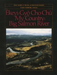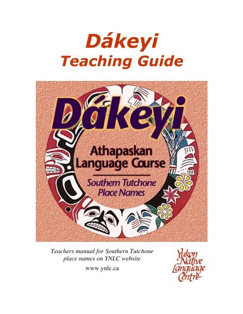
Dákeyi-Teaching-Guide-April-2017
Athapaskan Language Course - Southern Tutchone Place Names
Athapaskan Language Course - Southern Tutchone Place Names

Create successful ePaper yourself
Turn your PDF publications into a flip-book with our unique Google optimized e-Paper software.
Dákeyi<br />
<strong>Teaching</strong> <strong>Guide</strong><br />
Teachers manual for Southern Tutchone<br />
place names on YNLC website<br />
www.ynlc.ca
Dákeyi<br />
<strong>Teaching</strong> <strong>Guide</strong><br />
Teachers manual for Southern Tutchone<br />
place names on YNLC website<br />
www.ynlc.ca
Dákeyi <strong>Teaching</strong> <strong>Guide</strong><br />
First published 1997<br />
Reprint 2012<br />
Yukon Native Language Centre<br />
Yukon College<br />
Box 2799<br />
Whitehorse, Yukon<br />
Canada Y1A 5K4<br />
Tel: (867) 668-8820<br />
Fax: (867) 668-8825<br />
ISBN 978-1-55242-356-1
Table of Contents<br />
Foreword ........................................................................................................................ v<br />
Dedication ..................................................................................................................... vi<br />
Acknowledgments ........................................................................................................ vii<br />
Main Map of the Southern Tutchone Area ......................................................... 1<br />
Map 1> Whitehorse Area ...................................................................................... 2<br />
1.1 Thay T&a/w (Eagle&s Nest) Haeckel Hill ................................................................. 3<br />
1.2 Ta;ga' Sha/w (Great River) Yukon River ................................................................ 3<br />
1.3 Kwa/nlin (Flowing Through) Whitehorse ............................................................... 4<br />
1.4 Òu Ze'çla MaÜn (Skimming Fish Lake) Fish Lake .................................................... 5<br />
1.5 Chasa'n Chu'a (Copper Creek) McIntyre Creek .................................................... 5<br />
1.6 The May (Grey Rock Mountain) Grey Mountain .................................................. 6<br />
1.7 Sima (also Simba) Golden Horn ............................................................................ 6<br />
1.8 Jekudìtl&eda (Water Cutting New Channel) Alligator Lake ................................... 7<br />
1.9 N"tsaÜw Chu' (Wild Rhubarb Creek) Porter Creek .................................................. 7<br />
Worksheet for Map 1- Kwa/nlin (Whitehorse) ................................................................ 8<br />
Map 2> Lake Laberge Area ................................................................................ 11<br />
2.1 Kwa/ta/n&aya (Something Branching Off (out of sight)) Fox Lake ........................ 12<br />
2.2 Ta'a&an MaÜn Lake Laberge ................................................................................ 12<br />
2.3 Nakhu\ç Chu' (Rafting Across River) Takhini River .............................................. 13<br />
2.4 ÒuÖr Deye'l (Whirling Dust) Thirty-One Mile ......................................................... 13<br />
2.5 Naalen (Flowing Around) Lone Mountain .......................................................... 14<br />
Worksheet for Map 2 - Ta'a&an MaÜn (Lake Laberge) ................................................... 15<br />
Dákeyi <strong>Teaching</strong> <strong>Guide</strong> - <strong>April</strong> <strong>2017</strong><br />
i
Map 3> Hutshi Area ............................................................................................ 17<br />
3.1 Ma/na/n Ts&etsay DhaÜl (––– Crying Mountain) Mount Vowles ............................. 18<br />
3.2 Chu Ya/na MaÜn (A-Type-of-Whitefish Lake) Hutshi (Hutchi) Lake ..................... 18<br />
3.3 Òu Sha/wa MaÜn (Big Fish Lake) 52-Mile Lake .................................................... 19<br />
3.4 Chemìa (Netting Place) ..................................................................................... 20<br />
3.5 DuÉ Chu' (Driftwood River) Mendenhall River ...................................................... 20<br />
3.6 Cha/nk&uÖa Taye Lake ......................................................................................... 21<br />
3.7 NambuÜr (– knife$) Sifton Range ........................................................................ 21<br />
Worksheet for Map 3 - Chu Ya/na MaÜn (HutshiHutchi Lakes) .................................... 22<br />
Map 4> Kusawa Area .......................................................................................... 24<br />
4.1 Shadha/la (Small Sunny Mountain) Champagne ................................................ 25<br />
4.2 Nakhu\ç MaÜn (Rafting Across Lake) Kusawa Lake .............................................. 26<br />
Worksheet for Map 4 - Shadha/la (Champagne) ......................................................... 27<br />
Map 5> Alsek Area .............................................................................................. 29<br />
5.1 Sha/wshe Chu' (Dalton Post River) Tatshenshini ................................................ 30<br />
5.2 A¬se[xh (Tlingit name) Alsek River ...................................................................... 31<br />
Worksheet for Map 5 - A"¬se[xh (Alsek) ........................................................................ 32<br />
Map 6> Klukshu Area ......................................................................................... 34<br />
6.1 Ma/t&a'ta/na MaÜn (Something Frozen Inside Lake) Kathleen Lake ....................... 35<br />
6.2 Titl&a't MaÜn (Head of the Lake) Dezadeash Lake ............................................... 35<br />
6.3 Sâ MaÜn (Ochre Lake) Bates Lake ...................................................................... 36<br />
6.3 Tasha/l MaÜn (Deep Lake) Mush Lake ................................................................. 36<br />
6.4 Òu Ghaç (Fishing Place) Klukshu ........................................................................ 37<br />
6.5 The T&a't Chu'a (Water Inside the Rocks) Neskatahin ........................................ 38<br />
6.6 Sha/wshe Dalton Post ....................................................................................... 40<br />
Worksheet for Map 6 - Òu Ghaç (Klukshu) ................................................................... 42<br />
Dákeyi <strong>Teaching</strong> <strong>Guide</strong> - <strong>April</strong> <strong>2017</strong><br />
ii
Map 7> Haines Junction Area ............................................................................ 44<br />
7.1 Nade'lin (Water Flowing Over) Otter Falls .......................................................... 45<br />
7.2 Tthe Ya/nlin (Water Flowing Through the Rocks) Canyon Creek ....................... 45<br />
7.3 DakwaÖkaÖda (High Cache Place) Haines Junction ............................................. 46<br />
7.4 Tsâ MaÜn (Red Ochre Lake) Pine Lake ............................................................... 47<br />
7.5 K&uÖa MaÜn (Fishtrap Lake) Kloo Lake ................................................................. 47<br />
7.6 Na'day Ga/n (Dried Lynx Mountain) Mount Decoeli ............................................ 48<br />
Worksheet for Map 7 - DakwaÖkaÖda (Haines Junction) ............................................... 49<br />
Map 8> Aishihik Area ......................................................................................... 51<br />
8.1 Nìèièlin Chu' (Swift Flowing River) Nisling River .................................................... 52<br />
8.2 Tatay MaÜn (Portage Between Two Lakes) Stevens Lake .................................. 53<br />
8.3 A?she'yi Aishihik .................................................................................................. 53<br />
8.4 TthechaÖl MaÜn (Stone Scraper Lake) Sekulmun Lake ........................................ 55<br />
8.5 Sakay Chu' (Round Whitefish Creek) Albert Creek ............................................ 55<br />
8.6 Tthe Yì Chu' (Running Through the Rocks) Isaac Creek ................................... 56<br />
8.7 Tl&el Ta\na (Above the Flint) Hopkins Lake ......................................................... 56<br />
8.8 Shutth&a/n MaÜn Long Lake ................................................................................ 57<br />
Worksheet for Map 8 - A?she'yi (Aishihik)..................................................................... 58<br />
Map 9> South Kluane Area ................................................................................ 61<br />
9.1 Tthe Yì Chu' (Running Through the Rocks) Gladstone Creek ........................... 61<br />
9.2 Tl&a't Kwa/sha/w (Big Deep Bay) Cultus Bay ........................................................ 62<br />
9.3 Ma/n Shìè&aya (Where the Lake Branches Off) Silver Creek ............................... 62<br />
9.4 Tacha/l DhaÜl (Flat Face Mountain) Sheep Mountain .......................................... 63<br />
9.5 Òu'&a'n MaÜn (Big Whitefish Lake) Kluane Lake .................................................... 64<br />
9.6 Ta/n Chu' (Glacier Water) Slims River ................................................................ 64<br />
9.7 ShaÉr Lu\ (Bear Fish) Bear Lake .......................................................................... 65<br />
Worksheet for Map 9 - Òu'&a'n MaÜn (Kluane Lake) South ............................................. 66<br />
Dákeyi <strong>Teaching</strong> <strong>Guide</strong> - <strong>April</strong> <strong>2017</strong><br />
iii
Map 10> North Kluane Area ............................................................................... 68<br />
10.1 Da/n ZhuÖr Chu' (Silverberry River) Donjek River .............................................. 69<br />
10.2 CheghaÜr MaÜn (Broad Whitefish Lake) Tincup Lake ......................................... 69<br />
10.3 The Kala Dagu/r (Between the Flat, Rocky Hills) Brooks Arm (Little Arm) ....... 70<br />
10.4 Uùa K&e'nji (Fishtrap Place) Talbot Arm (Big Arm) ............................................. 70<br />
10.5 ShaÉr Ndu/ Chu' (Long Bear River) Duke River .................................................. 71<br />
10.6 Òu'&a'n MaÜn (Big Whitefish Lake) Kluane Lake .................................................. 71<br />
Worksheet for Map 10 - Òu'&a'n maÜn (Kluane Lake) North ........................................... 72<br />
Bibliography ....................................................................................................... 74<br />
Dákeyi <strong>Teaching</strong> <strong>Guide</strong> - <strong>April</strong> <strong>2017</strong><br />
iv
Foreword<br />
Dákeyi is a production of the Yukon Native Language Centre, a research and teachertraining<br />
facility based at Yukon College, Whitehorse, Yukon, Canada.<br />
The Dákeyi project began in the spring of 1995 with the goal of drawing together various<br />
types of information on Southern Tutchone place-names and land use. These topics had<br />
been taught since 1989 in high-school Athapaskan language and culture courses<br />
instructed by Mrs. Margaret Workman, a fluent native speaker and writer who grew up at<br />
Aishihik Lake. In addition to visits by Elders who spoke about their own traditional<br />
territories, the classes featured readings from various sources, videos, slide presentations,<br />
and oral language learning. The CD-ROM format provided an ideal way of linking the<br />
various types of information for use by the students.<br />
Research and writing began in the autumn of 1995 and continued into the spring of 1996,<br />
when the first version of Dákeyi was tested with the high school students. Further<br />
refinements were made in the fall of 1996, when plans were also made for an<br />
accompanying Teacher’s <strong>Guide</strong>. The CD-ROM was released for distribution in the spring<br />
of 1997.<br />
In 2007 Dákeyi was reformatted and posted on the Yukon Native Language Centre<br />
website www.ynlc.ca.<br />
This guide was updated in 2012, with additions and corrections included. It contains the<br />
complete Southern Tutchone and English text for each place name. The organization<br />
parallels that of the website with a map at the beginning of each area.<br />
Dákeyi owes its existence to the efforts of many individuals and organizations, and we<br />
acknowledge their support and encouragement throughout the project. We welcome your<br />
comments on both substance and format.<br />
KwaÖnaÖchis !<br />
Yukon Native Language Centre<br />
Whitehorse, Yukon<br />
Dákeyi <strong>Teaching</strong> <strong>Guide</strong> - <strong>April</strong> <strong>2017</strong><br />
v
Dedication<br />
Dákeyi is Dedicated to the Memory of<br />
Mr. Sam Williams, Andatà,<br />
1908-1996<br />
Mr. Sam Williams was a regular guest in the Southen Tutchone language Classes at F.H.<br />
Collins Senior Secondary School in Whitehorse. In fact, he was the founding Elder of the<br />
Athapaskan language classes offered there for students in Grades 11 and 12 beginning in<br />
1989. He drove in from Haines Junction on many occasions to share his knowledge with<br />
the students, both native and non-native, who appreciated his hands-on approach to<br />
demonstrating various aspects of traditional culture.<br />
Mr. Williams was of the Crow clan and was born and raised in the old village of<br />
Aishihik. He was named after his mother’s brother, the late Mr. Sam Isaac. He credited<br />
his father and grandfather as the source of most of his traditional knowledge. His wife<br />
died when his children were young, so he raised them with the help of his sister. His<br />
interest in young people, his patience, and his creative use of models in teaching made<br />
him a favorite Elder with all the students.<br />
Sam Williams also assisted the Yukon Native Language Centre staff in documenting<br />
traditional place-names and land use in the Aishihik and Nisling River regions. His<br />
wisdom and his kindness will be long remembered.<br />
Dákeyi <strong>Teaching</strong> <strong>Guide</strong> - <strong>April</strong> <strong>2017</strong><br />
vi
Acknowledgments<br />
Production Team<br />
Produced by: Yukon Native Language Centre<br />
Director: John Ritter, YNLC<br />
Design: Felix Vogt, Total North Communications<br />
Graphic Art: Paul Mantle, Keyline Graphics Design<br />
Research and Writing:<br />
Doug Hitch, YNLC<br />
John Ritter, YNLC<br />
Margaret Workman, YNLC<br />
Sound: Margaret Workman, YNLC<br />
Classroom Testing: Margaret Workman, Lorraine Allen, and Pat Moore.<br />
Elder Consultants<br />
Mr. Sam Williams (1908-1996)<br />
Mr. and Mrs. John Adamson<br />
Ms. Stella Boss<br />
Ms. Bessie Crow<br />
Ms. Marge Jackson<br />
Mr. and Mrs. Paddy Jim<br />
Ms. Jessie Joe<br />
Other Support<br />
Grand Chief Shirley Adamson<br />
Chief and Mrs. Paul Birckel<br />
Mrs. Anne Cullen, YNLC<br />
Mr. Pete Etherton, Canadian Department of Fisheries and Oceans<br />
Ms. Sarah Gaunt, Champagne-Aishihik Heritage Department<br />
Ms. Ruth Gotthardt, Yukon Archaeologist, Department of Tourism<br />
Mrs. Gertie Tom, Founding Elder, YNLC<br />
Ms. Sheila Maissan, YNLC<br />
Institutional<br />
Champagne and Aishihik First Nations<br />
Council of Yukon First Nations<br />
Yukon Department of Education<br />
Yukon Executive Council Office<br />
Yukon Archives<br />
Dákeyi <strong>Teaching</strong> <strong>Guide</strong> - <strong>April</strong> <strong>2017</strong><br />
vii
Main Map of the Southern Tutchone Area<br />
The Southern Tutchone places included in Dákeyi are shown on ten area maps:<br />
10<br />
North<br />
Kluane<br />
8<br />
Aishihik<br />
9<br />
South<br />
Kluane<br />
7<br />
Haines<br />
Junction<br />
3<br />
Hutshi<br />
2<br />
Lake<br />
Laberge<br />
6<br />
Klukshu<br />
4<br />
Kusawa<br />
1<br />
Whitehorse<br />
5<br />
Alsek<br />
Dákeyi <strong>Teaching</strong> <strong>Guide</strong> - October 2012 1
Map 1> Whitehorse Area<br />
1.1 Thay T&a/w .................(Eagle&s Nest) .................................................. Haeckel Hill<br />
1.2 Ta;ga' Sha/w ................(Great River) .................................................... Yukon River<br />
1.3 Kwa/nlin ....................(Flowing Through) ............................................ Whitehorse<br />
1.4 Òu Ze'çla MaÜn .............(Skimming Fish Lake) .......................................... Fish Lake<br />
1.5 Chasa'n Chu'a .............(Copper Creek) .......................................... McIntyre Creek<br />
1.6 The May ...................(Grey Rock Mountain) ................................ Grey Mountain<br />
1.7 Sima .......................... .......................................................................... Golden Horn<br />
1.8 Jekudìtl&eda ..............(Water Cutting New Channel) ..................... Alligator Lake<br />
1.9 N"tsaÜw Chu' ................(Wild Rhubarb Creek) ..................................... Porter Creek<br />
Dákeyi <strong>Teaching</strong> <strong>Guide</strong> - October 2012 2
1.1 Thay T&a/w (Eagle&s Nest) Haeckel Hill<br />
Dha/l ts&esha/w, N"tsa/w Chu' ya;de' a/&aç kay kwa/da\çy ch&a/w a/de\la/t k&e thay<br />
¬a\na/je'l k&e ukay gha'zha/r kwaÖch&e na'. Ukay ts&a/n shuç kwa/ntha't<br />
shats&eja/na/ta ts&e;tsi. Utl&ay yu\ tl&a/wkay sa'kwa/tha/n yu\ da/n, tth&eme'n ye'<br />
tsa/l ka'je'l ch&e na'.<br />
This mountain, just to the west of Porter Creek, is called Thay T&a/w ^Eagles& Nest&<br />
because eagles used to meet there in the spring. They nested on this hill which served<br />
as a lookout over the meadows below. Thay T&a/w was also a very good place to snare<br />
gophers.<br />
The English name Haeckel Hill was given in 1883 by Fredrick Schwatka, the<br />
U.S. army lieutenant who made a military trip down the Yukon River. Ernst<br />
Haeckel was a science professor in Germany.<br />
Sources: Margaret Workman. Coutts 1980:119.<br />
1.2 Ta;ga' Sha/w (Great River) Yukon River<br />
Kwa/da\çy ch&a/w da/n Ta;ga' Sha/w kay k&aÖnadaÖl ch&e'. A?tl&a taÜn ga' gha'keyìè&iè.<br />
Aúde' Alaska ts&aÖn shuç kega' naÖnadaÖl ch&e na'. Kega' shuç ts&etla/w ts&a/n mbaÖt<br />
ka ¬a/na'je'l k&e sambay a/tlaç gha'ke;ga/n nu\ç yu;k&e du.<br />
The Yukon River has been the main travel route connecting Southern Tutchone with the<br />
First Nations to the north, such as the Northern Tutchone, Ha/n and Gwich&in. Many<br />
subsistence activities—hunting, fishing, trapping—are governed by the freeze-up and<br />
break-up of the river. The Yukon River has always provided food for the native people,<br />
and its salmon and other fish continue to form an important part of the diet of First<br />
Nations peoples.<br />
The Yukon River runs 1979 miles from Marsh Lake to the Bering Sea. Large<br />
riverboats used to sail from the mouth, up river to Whitehorse. The last riverboat<br />
to carry freight and passengers stopped in 1956. A major feature of Yukon life<br />
up until the 1950s was the riverboat traffic between Whitehorse and Dawson.<br />
The name ‘Youcon’ was applied by John Bell, an HBC trader who came south<br />
on the Porcupine from the Mackenzie Delta. Bell claimed it represented the local<br />
Indian (Gwich’in) name for the river. For many years the section of the Yukon<br />
above the Pelly River was called the Lewes River. The name Lewes was given<br />
in 1843 by Robert Campbell of the Hudson Bay Company after the company’s<br />
Chief Factor, John Lee Lewes.<br />
Sources: Champagne-Aishihik Band 1988:15. Coutts 1980:158, 291<br />
Dákeyi <strong>Teaching</strong> <strong>Guide</strong> - October 2012 3
1.3 Kwa/nlin (Flowing Through) Whitehorse<br />
Kwa/da\çy ch&a/w da/n keyi aÉda\y Kwa/nlin yata\n kwaÖ&aç kwaÖch&e na'. A?yu\<br />
kwa/ni a/k&a\n gu;ch&a/n k&e' ^^Miles Canyon&& ku'ye. A?yu\ kaÖna'ch&iè nu\ da/n<br />
cheme'n gyu/ sha/w ka cha/na'tl&u'ç. Gu;ch&a/n atlaç gwa/n ka na'na/ta ¬aÖa/daÖl k&e<br />
da/n a/tthe' chu kwa/ta/nliè (rapids) ya;tthe' na'nijel. A?yu\ shuç gu;ch&a/n da/n ye'<br />
kedìèjel k&e aÉna'n ta;ga' na/nu\ ts&aÖn na/a/jel, da/n keyi a/yu\ç nakwa/ke'tsiè.<br />
A?yet ts&a/n cheshuç aÉtthe' da/kwa/de'&aç shipyard yu\ na'nijel.<br />
A?yet ts&a/n shu\ç aÉda\y Mount McIntyre yu\ na'nijel. A?yu\ kwaÖch&e a/k&a\n<br />
Kwa/nlin Dun keyi ku'liè.<br />
The Southern Tutchone name Kwa/nlin originally referred to the place upstream from<br />
the modern town where the river flows through a narrow canyon with steep rock walls.<br />
This narrowing is now called Miles Canyon in English. Kwa/nlin was important for two<br />
reasons. It was a natural stopping place for travellers. The rapids below were extremely<br />
dangerous, the most dangerous obstacle on the whole Yukon River, so there was a<br />
portage around them. Also, fishing was especially good around Kwa/nlin. People caught<br />
king salmon and other fish.<br />
The fishcamp Kwa/nlin moved downriver several times under pressure from nonnatives.<br />
At the original site, Canyon City was built during the Gold Rush. Kwa/nlin<br />
people moved downriver to the area near present-day Riverdale, then across to where<br />
the Rotary Peace Park is now located, and finally down to to the flats below the<br />
shipyards in what is now the industrial area. In the 1980s most residents of this now<br />
permanent settlement moved to the Mount McIntyre subdivision which is locally called<br />
the Kwanlin Dun village.<br />
The name ‘Whitehorse’ seems to come from early miners who thought the<br />
rapids below Miles Canyon, Kwänlin, resembled the manes of horses. It was in<br />
common use by 1871. The White Horse rapids can no longer be seen. In 1957<br />
construction began on a hydroelectric dam which flooded the rapids with<br />
Schwatka Lake. [The movie, taken by Thomas A. Edison, probably in 1901,<br />
shows a scow descending the rapids.]<br />
During the Gold Rush, there was a short lived settlement at Canyon City above<br />
Miles Canyon, as tramlines were constructed around the rapids. With the<br />
completion of the White Pass and Yukon Railway in 1900, the main settlement<br />
moved to the trans-shipment point between steamboats and railway on the west<br />
side of the Yukon River, where downtown Whitehorse is today.<br />
Sources: Margaret Workman. Coutts 1980:284. Champagne-Aishik Band:15. Kwanlin Dün First Nation<br />
1994:6. Northern Canada Power Commission (undated).<br />
Dákeyi <strong>Teaching</strong> <strong>Guide</strong> - October 2012 4
1.4 Òu Ze'çla MaÜn (Skimming Fish Lake) Fish Lake<br />
Kwa/da\çy ch&a/w shakat lan na'kwaÖtth&et k&e da/n Òu Ze'çla MaÜn ghaç ¬aada/je'l<br />
k&e cheme'n cha/na'tl&u'ç. A?yu\ naÖna'nje k&e ¬u gha'akek&a'. Òu ghu'ç¬a\n k&e<br />
gha'keye;kaÖr ¬u ye\ gha'ke;tsi, uye' ts&e;ch&uÖ du. Ts&e'na yu'u&ìè du shuç. Yu;k&e<br />
shuç ¬u ka &uÖ cha/na'le' kwaÖch&e tth&ay. Tsa/l, kanday, mbay ye' udzi shu\ç ka<br />
¬a/na'je'l a/yu\. Yu;k&e du mbaÖt a/tlaç gha'daÖtsi.<br />
People would go to Òu Ze'çla MaÜn in late summer and fall. The main camp was at the<br />
north end of the lake. At first they would catch trout with nets made of sinew. In<br />
October and November when the whitefish were spawning they would also use fish<br />
traps made of spruce and willow poles in the shallow water. Fall was a good time to<br />
snare gophers and hunt moose, caribou and sheep.<br />
People would collect fish in August and put them in a trough to ferment for a while.<br />
Then they would skim the fat from the mixture to use for cooking or making candles for<br />
light. The name Òu Ze'çla refers to the action of skimming fat from the surface of boiling<br />
or fermenting fish. Fat was hard to come by in the old days and was valuable.<br />
Old trails used to run all around Fish Lake to hunting areas at Bonneville Lake,<br />
the Ibex Valley, and Primrose and Mud Lakes. A good trail existed between the<br />
lake and Whitehorse long before the road was constructed.<br />
Archaeological investigations have revealed that the Fish Lake site was first<br />
used as long as 10,000 years ago.<br />
Sources> Irene Adamson. Irene Smith. Kwanlin Du/n First Nation 1994.<br />
1.5 Chasa'n Chu'a (Copper Creek) McIntyre Creek<br />
Kwa/da\çy da/n da/zha/n Chasa'n Chu'a ga' da\y ts&a/n chasa'n ka kaÖna/daÖl<br />
kwaÖch&e na'. A?yu\ mbu/r shu\ç k&a' lan uye' gha'ke;tsi.<br />
The Southern Tutchone people used to find raw copper nuggets along the upper part of<br />
this creek. They would use these to make arrowheads and knives.<br />
The English name of the creek comes from John McIntyre, from California, who<br />
staked the 'Copper King' claim in 1898. Several copper mines have operated in<br />
the Whitehorse area including one along McIntyre Creek.<br />
sources> Coutts 1980> 171. Margaret Workman.<br />
Dákeyi <strong>Teaching</strong> <strong>Guide</strong> - October 2012 5
1.6 The May (Grey Rock Mountain) Grey Mountain<br />
Dazha/n dha/l kay tthe da/gay gha'kwa/naÖch&in ka'kwa/ni ^^The May&& u'ye.<br />
The Southern Tutchone name for this mountain, The May, refers to the grey-white<br />
colour of its rocks.<br />
Grey Mountain, on the east side of Riverdale, is designated on official maps as<br />
Canyon Mountain. It was given this name by the early miners in the 1800s. The<br />
mountain was a landmark warning of the approach to the dangerous White<br />
Horse rapids.<br />
Sources> Irene Adamson. Irene Smith. Coutts 1980>46.<br />
1.7 Sima (also Simba) Golden Horn<br />
Kwa/da\çy kwa/daÜn dazha/n dha/l keyu'zhê k&e Sima keni. A?k&a\n k&e a/sha/w a/ju<br />
uyaÖna'njì daÖkwa/nê kwa/nu\. Si ye' k&a'y thaya laÖkwa/naÖch&iè nu\ç kwa/ni.<br />
Utthe't&ay shuç tthe sha/w da/gay a/&aç ka\kwa/nuç. Dazha/n dha/l, Kwa/nlin ts&a/n<br />
so'otha/n uya'kwa/da/ch&iè ch&e.<br />
The Southern Tutchone name for this prominent landmark is very old, and it is<br />
interpreted in more than one way by local speakers. Some Elders suggest that Sima<br />
refers to ‘ochre& or ‘red willow&, noting that ^si& is the Southern Tutchone word for ‘red<br />
ochre&. Others say it may be understood to refer to a grey or off-white color rock, as in<br />
the name for Grey Mountain, The may and The ma.<br />
The original meaning of this name has become obscured with the passage of time. This<br />
often happens with place-names in all cultures, where successive generations of use<br />
may lead to alternations in meaning and designation.<br />
The designation 'Golden Horn' may have been used as early as the 1880s,<br />
possibly first applied by miners boating down the Yukon River. Sima (Golden<br />
Horn) is a conspicuous feature in the Whitehorse area.<br />
sources> Irene Adamson. Irene Smith. Margaret Workman. Coutts 1980>115.<br />
Dákeyi <strong>Teaching</strong> <strong>Guide</strong> - October 2012 6
1.8 Jekudìtl&eda (Water Cutting New Channel) Alligator Lake<br />
A?daÜla/t kwa/tsi k&e ta/n ntaa'&e'l k&e. Chu je'kwa/de'liè kwa/tsi dagu/r nje' t&aÖwa<br />
ta'de&e'l k&e da/n t&aÖwa ka naÖnadaÖl na'.<br />
In the spring a channel would appear in the ice on this lake and the grayling would move<br />
up through it. The Southern Tutchone used to come to catch grayling at that time.<br />
source> Mrs. Kitty Smith.<br />
1.9 N"tsaÜw Chu' (Wild Rhubarb Creek) Porter Creek<br />
Da/zhan ta;ga'ya ga' ts&a/n da/n n'tsa/w kaÖnadaÖl kwaÖch&e na'.<br />
A?k&a\n k&e gu;ch&a/n keyi sha/w naÖkwaÖnntth&a/t ayu\.<br />
People used to pick wild rhubarb along this creek.<br />
In 1889, H. E. Porter, a prospector, staked a claim to a deposit of copper on the<br />
creek which was given his name. The city of Whitehorse named a subdivision<br />
which runs along this creek 'Porter Creek'.<br />
sources> Margaret Workman. Coutts 1980>213.<br />
Dákeyi <strong>Teaching</strong> <strong>Guide</strong> - October 2012 7
Worksheet for Map 1- Kwa/nlin (Whitehorse)<br />
1. What are the Southern Tutchone place names and what do they mean$<br />
Southern Tutchone Translations<br />
a) Yukon River<br />
b) Grey Mountain<br />
c) Whitehorse<br />
d) Porter Creek<br />
e) Haeckel Hill<br />
f) McIntyre Creek<br />
g) Fish Lake<br />
h) Golden Horn<br />
i) Alligator Lake<br />
2. Where was the original Indian Village of Kwa/nlin$<br />
3. The local natives moved their village several times. Where was the second<br />
site (a), the third (b), and the fourth (c)$ Where is the current site (d)$<br />
a)<br />
b)<br />
c)<br />
d)<br />
4. Why was the original native camp upriver from what is now called ^Miles<br />
Canyon&$ What did the Southern Tutchone people do there$<br />
5. How did Òu Ze'çla MaÜn get its name$<br />
Dákeyi <strong>Teaching</strong> <strong>Guide</strong> - October 2012 8
6. What type of fishnets did the First Nations people have before the white people<br />
came$<br />
7. From which creek did the First Nations collect copper nuggets and what did they<br />
make with the copper$<br />
8. What do the following Southern Tutchone words mean from the Kwa/nlin<br />
(Whitehorse) Athapaskan text$<br />
a) kwa/da\çy<br />
b) da/n keyi<br />
c) kwa/ni<br />
d) gu;ch&a/n k&e'<br />
e) ku'ye<br />
f) cheme'n<br />
g) gyu/ sha/w<br />
h) ka<br />
i) gwa/n<br />
j) ta;ga' na/nu\<br />
9. What food source is found on Thay T&a/w (Haeckel Hill) by both eagles and<br />
humans$<br />
10. From the Sima (Golden Horn) Athapaskan text, what are the meanings for the<br />
Southern Tutchone words below$<br />
a) dha/l<br />
b) a/k&a\n<br />
c) a/ju<br />
Dákeyi <strong>Teaching</strong> <strong>Guide</strong> - October 2012 9
d) si<br />
e) k&a'y<br />
f) shuç<br />
g) da/gay<br />
h) so'otha/n<br />
Dákeyi <strong>Teaching</strong> <strong>Guide</strong> - October 2012 10
Map 2> Lake Laberge Area<br />
2.1 Kwa/ta/n&aya ...............(Something Branching Off (out of sight)) ............ Fox Lake<br />
2.2 Ta'a&an MaÜn ............... ........................................................................ Lake Laberge<br />
2.3 Nakhu\ç Chu' ................(Rafting Across River) .................................. Takhini River<br />
2.4 ÒuÖr Deye'l .................(Whirling Dust) ......................................... Thirty-One Mile<br />
2.5 Naalen .......................(Flowing Around) ........................................ Lone Mountain<br />
Dákeyi <strong>Teaching</strong> <strong>Guide</strong> - October 2012 11
2.1 Kwa/ta/n&aya (Something Branching Off (out of sight)) Fox Lake<br />
Kwa/da\çy ch&a/w da/n dazha/n ma/n yanda naÖna'nje' kwa/ch&e na'. A?k&a\n k&e<br />
Ta'a&an MaÜn kwa/daÜn she'k&a\ keyanda ¬a/na'je'l. Òu shuç ka chaaketl&u'ç. A?k&a\n<br />
k&e ku'ç a/tlaç na'kwaÖntl&et ha\ç ta/n ts&ets&a/n.<br />
This lake has been used for many years by native people living in the area. Some of the<br />
present-day residents of Lake Laberge continue to use the lake and surrounding area for<br />
fishing, hunting, and trapping.<br />
In recent years a number of houses and cabins have been constructed on the<br />
highway side of Fox Lake. There is also a Territorial Campground at Fox Lake<br />
used by many visitors to the Yukon in summer.<br />
[John Adamson told us something about the name. It is not named after Major<br />
Fox who landed here, as Coutts would have it.]<br />
source: Mrs. Irene Adamson.<br />
2.2 Ta'a&an MaÜn Lake Laberge<br />
Kwa/da\çy ch&a/w da/n ts&etla/w ts&a/n Ta'a&an MaÜn yu\ n;¬a'ashedaÖl kwaÖch&e na'.<br />
Da\ç kwa/¬e' k&e Ma/n Tl&at yu\ (Shallow Bay) chu dade'taÖr k&e da/n k&a'y uÖ<br />
cha/na'le'. A?yu\ ¬u' ye' sakaya shuç t&aÖwa ka uÖ cha/na'le'.<br />
Kwa/da\çy ch&a/w Ta'a&an MaÜn kwa/daÜn, A?luÜr da/n ye' n;¬egha'y na'daÖl kwa/ch&e<br />
na'. Uka na'ch&e a/k&a\n Ta'a&an kwa/daÜn, A?luÜr ye' n;¬eta/na'ch&e. A?k&a\n<br />
kwa/ts&aÖn ch&a/w dazha/n ma/n yanda she'k&a\ da/n naÖna'nje'.<br />
This lake has long been an important gathering place for Southern Tutchone people. The<br />
name itself, Ta'a&an MaÜn, has been given various interpretations by local Elders, a<br />
situation which often arises with place-names which are very old. One suggestion is that<br />
Ta'a&an MaÜn means ^Head of the Lake&.<br />
According to Mrs. Irene Adamson, Ta'a&an MaÜn, has for centuries been a ^food bank& for<br />
people from the surrounding areas. They knew that the fish resources could always be<br />
depended upon in times of scarcity, especially in the early spring (called da\ç in Southern<br />
Tutchone) when very little fat was available to the people. She notes that MaÜn Tl&at<br />
^Shallow Bay& on the southwest end of the lake was a favoured fishing spot where<br />
willow bales were used in early days to block off the stream channel so that people<br />
could take large quantities of whitefish, pike, grayling and sakaya ^round whitefish&.<br />
There was much contact between Ta'a&an people and the neighbouring Tlingit to the<br />
south. Intermarriage took place, and many of the contemporary Ta'a&an families have<br />
both Southern Tutchone and Tlingit roots.<br />
Dákeyi <strong>Teaching</strong> <strong>Guide</strong> - October 2012 12
Chief Jim Boss was a well-known leader of the Ta'a&an people. He petitioned the Crown<br />
for a land claim settlement in the period immediately following the Gold Rush, when<br />
thousands of non-native people passed through his traditional territory. One result of this<br />
effort was the eventual establishment of a reserve at Ta'a&an MaÜn, which still exists.<br />
There have been native houses and settlements at several locations around the lake, and<br />
many native people continue to live on or near the lake.<br />
The English name, Lake Laberge, was apparently given by W.H. Dall to<br />
commemorate a French Canadian, Michael Laberge, from Chateauguay,<br />
Quebec. Laberge traveled from Fort Yukon to Fort Selkirk in 1867 as part of<br />
the Western Union Telegraph Expedition, but it is not known whether he<br />
actually traveled upriver as far as Ta'a&an MaÜn. The lake and its location may<br />
have been described to him by the local native people.<br />
[John Adamson gave us the Tlingit name. We have not known what it was since<br />
the spellings of Schwatka and Dawson more than 100 years ago. Though not<br />
specifically Southern Tutchone it may be included in future.]<br />
sources: Mrs. Irene Adamson. Coutts 1980:151. Dawson 1888:156<br />
2.3 Nakhu\ç Chu' (Rafting Across River) Takhini River<br />
Dazha/n ta;ga', da/n k&e' Nakhu\ç Chu' ku'ye. Ma/n sha/w ts&a/n kedìèlin, eyet ma/n<br />
Nakhu\ç MaÜn ku'ye. Ma/n tatay yu\ da/n kwa/da\çy ch&a/w khu\ç ye' na/na'ke'<br />
kwaÖch&e na'. A?luÜr k&e' dazha/n ta;ga', T&ahôni ku'ye. A?luÜr k&e' gyuÉ chu' ke'ni.<br />
The river is called Nakhu\ç Chu' ^Rafting Across River& because it runs out of Nakhu\ç MaÜn<br />
^Rafting Across Lake& (Kusawa Lake).<br />
A sketch of the Tahk-heena River appears on a map from the U.S. Coast Survey<br />
Report for 1867 (Dawson 161). Dawson notes that the name would be better<br />
spelled Ta-hê-nê (fn, p. 160). The Tlingit name for the river is in fact T&ahôni<br />
(king salmon river).<br />
Coutts 259 attributes it to Krause 1882 and Tagish tahk ^mosquito& and heena<br />
^river&.<br />
sources> Bessie Crow. Stella Boss. Dawson 1888>160 fn, 161.<br />
2.4 ÒuÖr Deye'l (Whirling Dust) Thirty-One Mile<br />
Kwa/da\çy ch&a/w ÒuÖr Deye'l yu\ da/n a/tlaç naÖna'nje' kwaÖch&e na'. A?tl&a Ta;ga'ya,<br />
Nakhu\ç Chu' ta/nliè yu\. Sambay ta;ga'ya ga' da\y taÖde&e'l k&e a/yu\ cheme'n<br />
chaaketl&u'ç. A?yu\ kwaÖga/n ka tsa/l ghaç sa'kwaÖtha/n kwaÖch&e.<br />
Dákeyi <strong>Teaching</strong> <strong>Guide</strong> - October 2012 13
An important fishcamp of the Southern Tutchone was located on the Takhini River at<br />
the mouth of the Little River, just west of present-day Whitehorse. Here they caught the<br />
salmon running up the Little River. The site is called ÒuÖr Deye'l ^Whirling Dust&<br />
because the soil is very dry there. It is good for camping and snaring gophers. This was<br />
also a good place to net trout and whitefish.<br />
Stella and Paddy Jim remember hearing about a potlatch put on here by the Crow<br />
people who invited the Tlingit from Teslin. Many also came from Hutshi, Champagne<br />
and other areas. There is a graveyard on the bluff. There are some remains of old houses<br />
there which once belonged to Johnny Jackson, Johnny Ned (Stella Jim&s father),<br />
MaÖndaÖsa' (Jim Boss&s father), George Ned, Jimmy Smith, and Jimmy Kudawat. Very<br />
little is left, however, because a big forest fire went through the area in 1958.<br />
The old Dawson Trail went by here. There is no longer a bridge across the Little<br />
River but there is a power line. Thirty-One Mile is 31 miles from Whitehorse via<br />
the Takhini crossing and an extension of what is now known as the Takhini<br />
River road.<br />
sources: Stella Jim. Paddy Jim.<br />
2.5 Naalen (Flowing Around) Lone Mountain<br />
Dazha/n dha/l sha/w, ¬a\n ch&a/w a/&aç Nakhu\ç Chu' yekha\n. Kwa/da\çy ch&a/w<br />
dazha/n dha/l Kaje't gha'ts&en&a lay ch&e na kyal dâèkhay. Kaje't Naalen<br />
k&e'adedaÖl k&e ukay k&a\kwa/nedhaÖt uye'kunjì du. Dha/l da/n k&e' Naalen u'ye.<br />
A?luÜr k&e' shuç Xâch& Ku'ç u'ye ^^ts&al ku'ç&& kwa/ni A?luÜr k&e'.<br />
This mountain sits by itself close to Nakhu\ç Chu' (Takhini River), and is a prominent<br />
feature of the local landscape. It is visible far to the west and has long been a landmark<br />
to the native people.<br />
The name Naalen refers to the flow of the river at the base of the mountain.<br />
The mountain has been claimed by the Crow people, who received ^ownership& of it in<br />
repayment for a debt of some kind. It is said that there are, or were, marks of clan<br />
ownership on the mountain.<br />
The mountain also has a hybrid Tlingit-Southern Tutchone name, Xâxch& Ku'ç,<br />
which means ^frog house&. Xâxch& is Tlingit for ^frog& and ku'ç is Southern<br />
Tutchone for ^house&. The frog crest is used by one of the Tlingit Raven clans,<br />
and the name refers to the Crow ownership of the mountain.<br />
sources: Bessie Crow. Stella Boss. Paddy Jim. Stella Jim.<br />
Dákeyi <strong>Teaching</strong> <strong>Guide</strong> - October 2012 14
Worksheet for Map 2 - Ta'a&an MaÜn (Lake Laberge)<br />
1. What are the Southern Tutchone names around Lake Laberge$<br />
Southern Tutchone<br />
Translation<br />
a) Lake Laberge<br />
b) Fox Lake<br />
c) Thirty-One Mile<br />
d) Lone Mountain<br />
e) Takhini<br />
2. What do the following words mean from the Ta'a&an MaÜn Athapaskan text$<br />
a) yu\<br />
b) maÜn<br />
c) chu<br />
d) sakaya<br />
e) t&aÖwa<br />
f) kwa/daÜn<br />
g) ye'<br />
h) ¬u'<br />
i) Ta'a&an kwa/daÜn<br />
j) NaÖna'nje'<br />
3. Why was Ta'a&an MaÜn a significant gathering place for Southern Tutchone<br />
peoples$<br />
4. What person provided much of the information about the Lake Laberge area$<br />
Dákeyi <strong>Teaching</strong> <strong>Guide</strong> - October 2012 15
5. What is the meaning of the Southern Tutchone word da\ç $<br />
6. What is the Southern Tutchone name for Shallow Bay$ Who was Jim Boss and<br />
what did he achieve for his people$<br />
7. What kinds of fish were caught at Shallow Bay$<br />
a) c)<br />
b) d)<br />
8. Why do you think the Ta'a&an people had much contact with the Tlingit<br />
people$<br />
9. Where was the Southern Tutchone fish camp called ÒuÖr Deye'l$<br />
10. How did the Crow people get Naalen$ Which river is it near$ What is the<br />
Southern Tutchone name for this river, and why is it called that$<br />
Dákeyi <strong>Teaching</strong> <strong>Guide</strong> - October 2012 16
Map 3> Hutshi Area<br />
3.1 Ma/na/n Ts&etsay DhaÜl ( Crying Mountain) ................................. Mount Vowles<br />
3.2 Chu Ya/na MaÜn ...........(A-Type-of-Whitefish Lake) .............. Hutshi (Hutchi) Lake<br />
3.3 Òu Sha/wa MaÜn ...........(Big Fish Lake) ................................................ 52-Mile Lake<br />
3.4 Chemìa ......................(Netting Place)<br />
3.5 DuÉ Chu'....................... (Driftwood River) .................................... Mendenhall River<br />
3.6 Cha/nk&uÖa .................... ............................................................................. Taye Lake<br />
3.7 NambuÜr ......................(knife) ............................................................... Sifton Range<br />
Dákeyi <strong>Teaching</strong> <strong>Guide</strong> - October 2012 17
3.1 Ma/na/n Ts&etsay DhaÜl ( Crying Mountain) Mount Vowles<br />
Kwa/da\çy ch&a/w da/k&a'n dazha/n dha/l kay ¬a/na'ya ch&a/w dekeja/nìya tth&ay.<br />
A?yu\ ka'zha' a/chiè lay.<br />
U"ka kwa/ni dazha/n dha/l ^^Ma/na/n Ts&etsay DhaÜl&& u'ye. Dazha/n dha/l yanda<br />
ta/n shakwaÖdaç aÉda\y Sâ MaÜn kwa/ts&aÖn. Jede'&o'la shuç a/yet dha/l tl&ay da/daÖtaç.<br />
A?yu\ ka/na'ch&iè da/n nena ka ¬a/na'jaÖl.<br />
The Southern Tutchone name for this mountain, Ma/na/n Ts&etsay DhaÜl, can be partially<br />
translated as ^^Crying Mountain&&. It is sometimes referred to in English as ^^Cry<br />
Mountain.&& In one version of the story associated with this mountain, a man died while<br />
hunting there. He had become stranded on the mountain and was unable to get down.<br />
This is a prominent mountain in the Nordenskiold Valley. A trail leads around it to Sâ<br />
MaÜn (Ochre Lake), and the lake called Jede'&o'la is located at its base. It has long been a<br />
favoured hunting area.<br />
The English name was given by D. D. Cairnes of the Geological Survey of<br />
Canada. He named the mountain after Stanley Tom Vowles of the Northwest<br />
Mounted Police, who spent most of his career, 1904-8, in this area.<br />
sources: Bessie Crow. Stella Boss. Margaret Workman. Coutts 1980:276.<br />
3.2 Chu Ya/na MaÜn (A-Type-of-Whitefish Lake) Hutshi (Hutchi) Lake<br />
Kwa/da\çy ch&a/w da/n a/tlaç Chu Ya/na yu\ naÖna'nje' kwa/ch&e na'. A?yu\ kwa/ts&aÖn<br />
kaÖna'ch&iè. AluÜr a/da;ta ta'akele.<br />
A?yet Chu Ya/na kwa/daÜn nena dhuÖ kedânkhay k&a'dele.<br />
A?k&a\n k&e a/ju da/n naÖna'nje' ayu\ Chu Ya/na yu\. Da/n aÉde' n-da/n Sha/dha/la ye'<br />
A?she'yê yu\ naÖnijel ha'ç.<br />
Chu Ya/na yu\ she'k&a ku'ç kwa/zha/t ye' tth&a/nk&e kwaÖla.<br />
The lake shown on the map is one of a series of lakes which all have individual names<br />
in Southern Tutchone. Collectively they are called Hutshi Lakes in English. Many<br />
Southern Tutchone prefer the spelling Hutchi but Hutshi appears on maps. The Southern<br />
Tutchone name for this particular lake is pronounced and translated in more than one<br />
way. Mrs. Bessie Crow suggests that the name refers to a type of whitefish (chu ya/na)<br />
found in this lake.<br />
The name Hutshi is from the Tlingit language. Until recently it was thought to be from<br />
Hu[ch&i A{yi, meaning ^the last lake&, but John Adamson gives the name as Hu[ch&i-a'yâ<br />
^the last one& referring to packs. Hutshi was an important trade centre on the old Chilkat<br />
trail to the interior.<br />
Dákeyi <strong>Teaching</strong> <strong>Guide</strong> - October 2012 18
No one lives at Hutshi today, but some of the old cabins are still standing, and<br />
there is a prominent graveyard with many headstones and fences. People<br />
continue to use the old trails to get to this area to hunt, trap, and fish, as there is<br />
no road into Hutshi. This was the original homeland of the Champagne people,<br />
who began to move south with the establishment of the trading post in 1902.<br />
Some of the other residents of Hutshi moved to Aishihik as well.<br />
sources: Bessie Crow. Stella Boss. John Adamson. Gotthardt 1989:32. Champagne-Aishihik Band<br />
1988:21-22.<br />
3.3 Òu Sha/wa MaÜn (Big Fish Lake) 52-Mile Lake<br />
Da/n ts&e'tla/w ts&a/n Òu Sha/wa yu\ naÖnadaÖl kwa/ch&e na'. ÒuÖr Deye'l ts&a/n ye'<br />
Shadha/la ts&a/n, Chu Ya/na shuç kwa/ts&a/n kaÖna'ch&iè. Yu;k&e na\y shuç cheme'n<br />
¬u sha/w ka chena'tl&u'ç.<br />
She'k&a a/yu\ ku'ç kwa/zha/t a/la kwa/ni.<br />
This is a large and important lake which has been utilized by the Southern Tutchone<br />
people for generations. There are two large arms on the lake and many bays where<br />
fishnets are set for trout, whitefish, and other fish species. People fished successfully<br />
there all winter.<br />
The name ^52-Mile& reflects the fact that the trail to Òu Sha/wa is located at a turn-off<br />
fifty-two miles down the old Dawson Road.<br />
There are still many old cabins, caches, and other structures at Òu Sha/wa. In<br />
earlier years a number of families traveled between Òu Sha/wa and LuÖr Deye'l<br />
(31-Mile). These included Mr. and Mrs. George Ned, Mr. and Mrs. Johnny<br />
Jackson, and others.<br />
From Òu Sha/wa the people traveled west to Hutshi, south to Champagne, and<br />
north to Braeburn and Carmacks.<br />
sources: Bessie Crow. Stella Boss. Kathy Birckel. Champagne-Aishihik 1988.<br />
Dákeyi <strong>Teaching</strong> <strong>Guide</strong> - October 2012 19
3.4 Chemìa (Netting Place)<br />
Da/n a/da/la/t k&e Chemìa naÖnadaÖl kwa/ch&e na'. A?yu\ kaÖna'ch&iè dza/na ka'je'l.<br />
Da/n ta;ga' da'kwa/daÉtsi tth&ay, chu dadu'taÖr du. A?tl&a dza/na ukay ghu'uzha/r<br />
du. Da/n a/tlaç naÖna'nje' kwa/ch&e tth&ay Chemìa yu\. Harry Joe uku'ç she'k&a a/&aç<br />
a/yu\.<br />
Dazha/n kwa/daÜn she'k&a a/yu\ kwa/ts&aÖn naÖnadaÖl tth&ay.<br />
The name Chemìa refers both to a particular lake in the Nordenskiold Valley, as well as<br />
to the immediate area which includes several other lakes and a meadow.<br />
Chemìa has long been used as a spring muskrat-hunting area. Chief Paul Birckel notes<br />
that the people used to dam up the river to increase the volume of water in some of the<br />
lakes. This would create a larger breeding habitat for the muskrats, which then<br />
multiplied in greater numbers.<br />
A number of people used to live at Chemìa, including Chief Hutshi Joe and<br />
family, Drury Crow and family, and Charlie and Lilly Bill. Harry Joe and his<br />
family had a cabin there, and it is still standing. Chemìa is still utilized by the<br />
descendants of these people.<br />
sources> Stella Boss. Bessie Crow. Kathy and Paul Birckel.<br />
3.5 DuÉ Chu' (Driftwood River) Mendenhall River<br />
DuÉ Chu' a/duç Cha/nk&uÖa ts&a/n ninliè k&e NakhuÜç Chu ta/ninliè ch&e.<br />
Ka'tthe k&e Jo-Jo ku'ye kwa/ch&e na' a/yu\. Gu'dan gha\l ta/n ku'çliè k&e da/n a/yu\<br />
naÖna'ç nje' na'.<br />
Gu;ch&a/n ta/n kwaÖtsiè k&e gas station ye' mbaÖt ku'ç a/yu\ naÖnitth&a/t. Ka'k&e k&etl&a'ç<br />
ka'sha' da/n Shadha/la ts&aÖn n;-daÖnijel.<br />
DuÉ Chu' (Mendenhall River) flows from Cha/nk&uÖa (Taye Lake) to NakhuÜç Chu' (Takhini<br />
River). The name describes the large amount of drift and brush in the creek. At the<br />
place where DuÉ Chu' crosses the Alaska Highway, there was once a highway lodge<br />
which became a focal point for people in the surrounding area. This was also once the<br />
first gas station west of Whitehorse, and some elders recall seeing cars for the first time<br />
at DuÉ Chu'.<br />
The English name honors Prof. T.C. Mendenhall (1841-1924), Superintendent of<br />
the US Coast and Geodetic Survey. The name was given by E.H. Wells, the<br />
leader of the Frank Leslie Illustrated Newspaper Expedition which explored the<br />
southwest Yukon in the summer of 1890.<br />
sources> Champagne-Aishihik 1988>19-20. Wells 1891>355.<br />
Dákeyi <strong>Teaching</strong> <strong>Guide</strong> - October 2012 20
3.6 Cha/nk&uÖa Taye Lake<br />
Cha/nk&uÖa, a/tl&a ta/n Shadha/la ts&a/n, Chu Ya/na kwa/ts&aÖn ni&a ga' dadaÖtaç.<br />
A?yu\ kaÖna'ch&i da/n a/daÜla/t k&e ta'¬e ka naÖnadaÖl.<br />
Cha/nk&uÖa (Taye Lake) is on the old trail from Shadha/la (Champagne) to Hutshi. The<br />
Lake drains to DuÉ Chu' (Mendenhall River), and it is the first of a series of lakes in the<br />
Hutshi valley. From Cha/nk&uÖa the trail leads to Ma/n Da/tha/wa (Yellow Lake), Ma/n<br />
Ts&a/ndu/ (Long Lake), Mu/rk&a\y T&a/wa (Gull Nest), and eventually to Chu Ya/na MaÜn<br />
(Hutshi).<br />
Native people used to spear pike fish at Cha/nk&uÖa in spring. From this lake the hunting<br />
trails led to NambuÜr and other mountains in the area.<br />
Archaeologists have discovered that the ancestors of Southern Tutchone people<br />
established a village here over 4,500 years ago.<br />
sources> Bessie Crow. Stella Boss. Sam Williams. Champagne-Aishihik 1988>19.<br />
3.7 NambuÜr (– knife$) Sifton Range<br />
Kwa/da\çy ch&a/w da/n a/&u'ç Òu Sha/wa ts&a/n ye' Chu Ya/na ts&a/n shuç NambuÜr<br />
kay ¬a/na'je'l kwa/ch&e na'. Kanday ye' mbay ka ¬a/na'je'l. Tsa/l ka shuç ¬a/na'je'l.<br />
NambuÜr is a very prominent mountain range located immediately south of Òu Sha/wa<br />
(52-Mile Lake) and east of the Hutshi valley. It has long been a favored hunting area for<br />
the Southern Tutchone people. Sheep and moose are found there as well as smaller<br />
game such as gophers.<br />
The name is not easily translated, although the stem ^^-mbuÜr&& suggests the Southern<br />
Tutchone word for knife, mbu/r.<br />
In English, the entire mountain range bears the name of Clifford Sifton,<br />
Canadian Minister of the Interior (1896-1906), who set up the government<br />
apparatus of the Yukon Territory in 1897-98.<br />
sources> Stella Boss. Bessie Crow. Coutts 1980>241.<br />
Dákeyi <strong>Teaching</strong> <strong>Guide</strong> - October 2012 21
Worksheet for Map 3 - Chu Ya/na MaÜn (HutshiHutchi Lakes)<br />
1. List the Southern Tutchone place names in the Chu Ya/na (Hutchi) area.<br />
Southern Tutchone<br />
Translation<br />
a) Mt. Vowles<br />
b) Hutchi Lake<br />
c) 52-Mile Lake<br />
d) Mendenhall River<br />
e) Taye Lake<br />
f) Sifton River<br />
2. What two main activities did the Southern Tutchone people carry out at Chemìa$<br />
3. From the Southern Tutchone text of Ma/na/n Ts&etsay DhaÜl (Crying Mountain)<br />
translate the following words into English.<br />
a) da/k&a'n<br />
b) a/yu\<br />
c) kwa/ni<br />
d) u'ye<br />
e) nena<br />
4. Explain why the mountain is called Ma/na/n Ts&etsay DhaÜl.<br />
5. Give the Southern Tutchone names for the two lakes located near Ma/na/n<br />
Ts&etsay DhaÜl.<br />
a) b)<br />
6. What remains can be found around Chu Ya/na MaÜn$<br />
Dákeyi <strong>Teaching</strong> <strong>Guide</strong> - October 2012 22
7. What does Hu[ch&i-a'yâ mean in English Why do some of the place names<br />
in the interior derive from the Tlingit language$<br />
8. For what reason was Hutchi (Hutshi) an important centre to the Coastal Tlingits$<br />
9. What Southern Tutchone word is suggested by the stem ^^mbuÜr&& in the name<br />
NambuÜr$ Why is NambuÜr a favored hunting area for Southern Tutchone people$<br />
10. Why did the Southern Tutchone people travel to Cha/nk&uÖa (Taye Lake)<br />
in the spring time$<br />
Dákeyi <strong>Teaching</strong> <strong>Guide</strong> - October 2012 23
Map 4> Kusawa Area<br />
4.1 Shadha/la ................... (Small Sunny Mountain) .................................... Champagne<br />
4.2 Nakhu\ç MaÜn ................ (Rafting Across Lake) ..................................... Kusawa Lake<br />
4.3 Nakhu\ç Chu' ................ (Rafting across River) .................................... Takhini River<br />
(see 2.3)<br />
Dákeyi <strong>Teaching</strong> <strong>Guide</strong> - October 2012 24
4.1 Shadha/la (Small Sunny Mountain) Champagne<br />
Kwa/da\çy ch&a/w da/n ts&etla/w ts&a/n Shadha/la yu\ n-¬a'ashedaÖl kwa/ch&e tth&ay.<br />
Da/n ¬u'ç kwaÖnntha't ts&a/n kaÖna'ch&iè. A?du'ç Chu Ya/na ye' Selkirk ye' A?she'yi<br />
Kwa/ts&a/n KaÖna'ch&iè.<br />
Shadha/la yu\ A?luÜr da;ta, nena dhuÖ udinkhay k&a'kedele nu\ç. A?yu\ shuç da/n ye'<br />
kwa/ts&esha/w na'akwa/t&a' na' kwa/ni. A?k&a\n k&e a/ju ka'kwaÖch&iè. Da/n a/che\ k&e<br />
ghaçch&i na'kwa/t&a'. 1950&s ye' 1960&s a/yu da/n a/tlaç naÖna'nje' Shadha/la yu\.<br />
Da/kwaÖkaÖda ye' kwa/nlin yu\ n-daÖnijel. A?k&a\n k&e cheshu\ç Shadha/la yu\ da/n<br />
da/keyi nakwaÉtsi.<br />
Sha Dha/la ^little sunny mountain& is located at the intersection of important north-south<br />
and east-west trails used by the Southern Tutchone. Klukshu people from the south and<br />
Hutshi people from the north would meet together at Sha Dha/la to trade and share<br />
stories of the year&s activities. The north-south trail was also followed by the Tlingit<br />
traders traveling between Fort Selkirk and the coast. Later this became known as the<br />
^Dalton Trail&. The east-west trail later became the Kluane wagon road and then the<br />
Alaska Highway.<br />
A trading post was established here in 1902. Shortly afterwards many Southern<br />
Tutchone families moved from Neskatahin or the nearby Dalton Post on the<br />
Tatshenshini River as the White Pass railroad quickly made the Dalton Trail much less<br />
important. They also moved north because they were no longer allowed to hunt in their<br />
former range to the south in what was now British Columbia. More of their hunting<br />
territory was lost in 1943 with the establishment of the game sanctuary west of the<br />
Haines road. The Southern Tutchone lived near the Sha Dha/la post during the winter<br />
months, returning to outlying camps during other seasons of the year.<br />
Sha Dha/la was the centre of activity in the region until the Alaska Highway opened.<br />
Elder Elijah Smith recalled, ^^Champagne—that&s where all the good furs came from.<br />
Lots of money changed hands there.&&<br />
By the 1960s many people had moved to Whitehorse or Haines Junction but band<br />
members still gathered here for funerals and potlatches and returned to the area to hunt<br />
and fish. Today Champagne is home to a growing number of people.<br />
On the north side of the road there is a graveyard with spirithouses which belong to the<br />
Champagne and Aishihik people.<br />
There is still Tlingit influence in Champagne, and a few older people can speak or<br />
understand some of the language.<br />
Jack Dalton established the original trading post here in 1902 and shortly after it<br />
was run by ‘Shorty’ Chambers. The Chambers family still lives there.<br />
Dákeyi <strong>Teaching</strong> <strong>Guide</strong> - October 2012 25
For administrative reasons, Indian and Northern Affairs grouped the Champagne<br />
people together with the Aishihik. The headquarters of the Champagne and<br />
Aishihik First Nation is now at Haines Junction.<br />
sources: Champagne-Aishihik Band 1988:20-21. McClellan 1975:25-29. Margaret Workman.<br />
4.2 Nakhu\ç MaÜn (Rafting Across Lake) Kusawa Lake<br />
Kwa/da\çy kwa/daÜn Na'khu\ç MaÜn yu\ ¬u ka naÖnadaÖl kwa/ch&e na'. Ma/n<br />
ts&eda/tth&a/na yu\ khu\ç ye' na/na'ke tth&ay. U"ka ku'ye dazha/n ma/n Na'khu\ç MaÜn<br />
ku'ye. A?yu\ shuç kaÖna'ch&iè da/n udzi du tthel ke;tsiè. Me'n ye' udzi ka'je'l kwa/ch&e<br />
kwa/da\y ch&a/w, gwa/nk&a' natthe. ShaÖk&a\ ugha' kwa/dach&iè kwa/ni a/yet udzâ<br />
tthe\l.<br />
There is a narrows in the lower (northern) section of the lake where people used to<br />
cross by raft, hence the name Nakhu\ç MaÜn.<br />
There was a fish camp at the northern end of the lake. It is reported that remnants of<br />
caribou fences can still be found along the lake&s rugged shoreline. Mrs. Annie Ned<br />
recounted that><br />
Before Coast Indians, before guns, they had ranch for moose at Lake<br />
Arkell (Kusawa). They got corral there, set snares. Then everybody<br />
came there—lots of meat, lots of fish. They helped together.<br />
Southern Tutchone tradition says that there was a great flood sometime after the<br />
creation of the world. The people tried to escape on rafts. Southern Tutchone Elders say<br />
that the remains of one of these rafts can be found on top of Dha/l Sha/w, a mountain near<br />
the head of this lake.<br />
The name Kusawa comes from Tlingit Ku'sawu.a[ ^narrow lake&.<br />
Kusawa Lake had provided a natural pathway for the Tlingit in their trade with<br />
the interior people for centuries. The first published record of it seems to be<br />
from the early 1880’s in a report on the travels of Arthur Krause of the Bremen<br />
Geographical Society who visited the lake in June, 1882. Earlier, in 1869, the<br />
Tlingit Chief Kohklux drew a ‘long skinny lake’ he called Koo=see=wagh that<br />
emptied into the Tahk-heena River on a map he and his wives sketched for<br />
George Davidson from California.<br />
In the 1890s, Jack Dalton used the existing trails to establish his pack trail from<br />
Dezadeash Lake, up Kusawa Lake to the Takhini river.<br />
Kusawa Lake is now one of the most favoured recreational spots in the<br />
Southwest Yukon.<br />
sources: Champagne-Aishihik 1988:19. Coutts 1980:151. Krause 1885:6. Jeff Leer.<br />
Dákeyi <strong>Teaching</strong> <strong>Guide</strong> - October 2012 26
Worksheet for Map 4 - Shadha/la (Champagne)<br />
1. List the Southern Tutchone place names in the Shadha/la (Champagne) area.<br />
Southern Tutchone Translation<br />
a) Champagne<br />
b) Kusawa Lake<br />
c) Takhini River<br />
2. From the Nakhu\ç Chu' (Takhini River) Southern Tutchone text, what do the<br />
following Southern Tutchone words mean$<br />
a) dazha/n f) khu\ç<br />
b) ta;ga' g) ye'<br />
c) ku'ye h) na/na'ke'<br />
d) ma/n sha/w i) kwaÖch&e na'<br />
e) eyet j) k&e'<br />
3. The Coast Tlingit (A?luÜr) call Takhini (T&ahôni), which means<br />
4. What was the most used transportation device on the lakes and rivers long ago$<br />
5. What kind of activity took place at Nakhu\ç MaÜn$<br />
6. What was the old English name for Kusawa Lake$<br />
7. What system was used to catch caribou near the Kusawa shoreline$ What<br />
other ways were caribou hunted$<br />
Dákeyi <strong>Teaching</strong> <strong>Guide</strong> - October 2012 27
8. Which part of a large lake do you think may be the safest to cross with a raft$<br />
9. Draw a diagram of what a caribou fence may have looked like long ago.<br />
10. How do you think the Southern Tutchone people caught the caribou after<br />
the caribou were herded into the fence$<br />
Dákeyi <strong>Teaching</strong> <strong>Guide</strong> - October 2012 28
Map Key><br />
Southern Tutchone<br />
Tlingit<br />
English<br />
Map 5> Alsek Area<br />
5.1 Sha/wshe Chu' ............. (Dalton Post River) ........................................... Tatshenshini<br />
5.2 A"¬se[xh ........................ (Tlingit name) .................................................... Alsek River<br />
Dákeyi <strong>Teaching</strong> <strong>Guide</strong> - October 2012 29
5.1 Sha/wshe Chu' (Dalton Post River) Tatshenshini<br />
Ta;ga' a/tl&a Dalton Post yu\ kwa/k&ede'liè Sha/wshe Chu' u'ye ch&e.<br />
A?yet ta;ga' keye'ni gu;ch&a/n map kay A?luÜr k&e' Tatshenshini keni.<br />
Tlaçch&a/w k&e A?luÜr k&e A¬se[xh u'ye ch&e. Òu'çtla\ç k&e Blanchard River u'ye,<br />
Tatshenshini. Gu;ch&a/n keyìèla' tth&ay, map kay n-du\ç na'keyenìèdhaÖt.<br />
Sambay a/tthu'ç &el ts&a/n ta'da/&el k&e, da/n da/zhu\ç sambay ka naÖnadaÖl<br />
kwa/ch&e na'. Da/zhu\ç na\y ka'kwaÖch&e A?luÜr ta/n kwaÖn&a tth&ay.<br />
The large river that flows by Sha/wshe (Dalton PostNeskatahin) is called Sha/wshe Chu'<br />
in Southern Tutchone. On maps this is labelled the Tatshenshini. The Tlingit name<br />
Ta'cha.a'n-shahôni originally referred to the Blanchard River, a few kilometers upstream<br />
from Sha/wshe. The original Tlingit name for the Sha/wshe Chu' was A"¬se[xh and this is<br />
the source of the name ^Alsek& found on modern maps.<br />
Sha/wshe Chu' was a traditional hunting and fishing area of the Southern Tutchone<br />
Sha/wshe people. In spring time the people would gather at Sha/wshe from their winter<br />
hunting and trapping areas, from as far away as Hutshi and Aishihik, and then go down<br />
the Sha/wshe Chu' to meet the salmon. There were several salmon camps along the river<br />
going as far down as its confluence with the Titl&a't Ta;ga'Shadha/la Chu' (Alsek River).<br />
Chilkat traders would sometimes meet the Southern Tutchone on the river on their way<br />
inland. Both Southern Tutchone and Chilkat Tlingit would go downriver to the coast to<br />
trade with the Tlingit at Dry Bay. The trip from Sha/wshe was difficult and took at least<br />
two months. The travelers returned not only with trade goods, but also with new dances,<br />
songs and stories to share with their people.<br />
Over a century ago there seem to have been permanent settlements on the lower<br />
Sha/wshe Chu' with mixed Southern Tutchone-Tlingit populations. The coast people<br />
came looking for flint, met the Southern Tutchone, and began trading seal oil for furs<br />
and hides. These settlements were abandoned in the mid to late 1800s, perhaps as a<br />
result of disease epidemics. Some survivors moved upriver to join the Southern<br />
Tutchone of Sha/wshe, others joined the Tlingit in Chilkat or downriver in Dry Bay.<br />
For a while after the British Columbia border was established the Southern<br />
Tutchone lost hunting rights along most of Sha/wshe Chu'. This loss, the loss of<br />
the southern villages, and the move of most people to Shadha/la after Dalton&s<br />
trading post closed, all contributed to a decline in activity in the area. Today<br />
only a few elders know much about the traditional use of the region.<br />
Most people who now travel the river are the tourists who make the whitewater<br />
raft trips in summer from Sha/wshe to Dry Bay.<br />
sources> White-Fraser 1901>73-74. McLellan 1975>33, 509, 581 fn.20. Champagne-Aishihik 1988>34-37.<br />
Champagne and Aishihik 1995>5, 20.<br />
Dákeyi <strong>Teaching</strong> <strong>Guide</strong> - October 2012 30
5.2 A"¬se[xh (Tlingit name) Alsek River<br />
Dazha/n ta;ga' A?luÜr k&e' A"¬se[xh u'ye ch&e. ^^Da/n gha'nada/ghwe' yu\&& kwa/ni<br />
a/luÜr k&e'. Dazhu\ç kwa/daÜn k&e Sha/wshe Chu' u'ye. A?tl&a map kay ja/naÖtl&aÖt k&e<br />
ta;ga' Titl&a't MaÜn kay ts&a/n kìèièliè keye'ni haç Alsek keye'ni. A?ju uk&e' ch&a/w keni<br />
gu;ch&a/n.<br />
Kwa/da\çy ch&a/w A?luÜr ye' da/n dazha/n ta;ga' da\y ts&etla/w ts&a/n naÖnadaÖl<br />
kwaÖch&e tth&ay. N:-¬a/ye' shu\ç naÖnadaÖl nuç.<br />
The Tlingit name A"¬se[xh may mean ^place where people rest&. Originally A¬se[kh<br />
referred to the river running past Sha/wshe (Dalton Post) to the Pacific. The upper part of<br />
the original A"¬se[kh is called Sha/wshe Chu' in Southern Tutchone and Tatshenshini in<br />
English. On maps the Alsek River now runs from a little south of Dakwa/kaÖda (Haines<br />
Junction), to the Pacific.<br />
People lived and traveled along the Alsek until the mid 1800s. At that time, Na¬udi<br />
(Lowell Glacier) blocked the river for several years, creating a huge lake that even<br />
covered the area where Dakwa/kaÖda (Haines Junction) is now located.<br />
sources> White-Fraser 1901>73-74. Champagne-Aishihik 1988>34-37. Cruikshank 1980>31-34.<br />
Dákeyi <strong>Teaching</strong> <strong>Guide</strong> - October 2012 31
Worksheet for Map 5 - A"¬se[xh (Alsek)<br />
1. The Coastal Tlingit word for Alsek, A"¬se[xh may mean<br />
2. What is the Southern Tutchone name for Dalton Post$<br />
3. Where is Dakwa/kaÖda$ What does this word mean in Southern Tutchone$<br />
4. What is the English name for Na¬udi$<br />
5. What glacial event affected Dakwa/kaÖda in the mid 1800s$<br />
6. What was the Sha/wshe Chu' well known for$<br />
7. What did the Coastal Tlingit trade with the Southern Tutchone people at<br />
Sha/wshe$<br />
8. What year, and why, were the settlements abandoned at Sha/wshe$<br />
Dákeyi <strong>Teaching</strong> <strong>Guide</strong> - October 2012 32
9. Why did the Southern Tutchone people loose hunting rights for a while along<br />
most of the Sha/wshe Chu'$<br />
10. What factors contributed to a decline in activity in the Sha/wshe Chu' area$<br />
Dákeyi <strong>Teaching</strong> <strong>Guide</strong> - October 2012 33
Map 6> Klukshu Area<br />
6.1 Ma/t&a'ta/na MaÜn ...........(Something Frozen Inside Lake) .................. Kathleen Lake<br />
6.2 Titl&a't MaÜn .................(Head of the Lake) ..................................... Dezadeash Lake<br />
6.3 Sâ MaÜn ......................(Ochre Lake) ....................................................... Bates Lake<br />
Tasha/l MaÜn ...............(Deep Lake) ........................................................ Mush Lake<br />
6.4 Òu Ghaç ......................(Fishing Place) ......................................................... Klukshu<br />
6.5 The T&a't Chu'a ............(Water Inside the Rocks) .................................... Neskatahin<br />
6.6 Sha/wshe ..................... ............................................................................ Dalton Post<br />
Dákeyi <strong>Teaching</strong> <strong>Guide</strong> - October 2012 34
6.1 Ma/t&a'ta/na MaÜn (Something Frozen Inside Lake) Kathleen Lake<br />
Kwa/da\çy ch&a/w da/n Ma/t&a'ta/na MaÜn kay ts&a/Ön ¬u ye' sambay ka naÖnadaÖl<br />
kwa/ch&e tth&ay. A?tl&a Òughaç na;tthe ka'kwa/ni. Dazha/n ma/n kay shuç n;-ch&ìè<br />
ye' kru;da a/tlaç ku'çliè na' kwa/ni. A?yet ts&a/n ta/n aÉ&a'n A?zuch&a/n DakwaÖ&yuÖ dha/l<br />
datu/ kwaÖdaç kwa/ch&e, Sâ MaÜn ye' Tasha/l MaÜn kwa/ts&aÖn. A?yu\ shuç nena ka<br />
¬a/naje'l nu.<br />
Ma/t&a'ta/na MaÜn (Kathleen Lake) is in a steep sided valley which makes the winds very<br />
dangerous for boating. There were once many mink and otter in this area because their<br />
main source of food, fish, is abundant. Old trails lead south over the mountains to Bates<br />
and Mush Lakes, and on to Sha/wshe (Neskatahin–Dalton Post).<br />
The lake has a variety of fish including two special ones, the pygmy whitefish and a<br />
kind of land-locked salmon, or kokanee, which evolved as the Na¬udi (Lowell) Glacier<br />
periodically cut off the route to the ocean on the Titl&a't Ta;ga' Shadha/la Chu' (Alsek).<br />
The last major cutoff occurred about 145 years ago but there are still no ocean running<br />
salmon in the upper Titl&a't Ta;ga' Shadha/la Chu' (Alsek-Dezadeash system).<br />
sources: Marge Jackson. Kathy Birckel. Champagne-Aishihik:1988. Heritage North 1990:13, 14, 45.<br />
Linsey 1981:5.<br />
6.2 Titl&a't MaÜn (Head of the Lake) Dezadeash Lake<br />
Dazha/n ma/n da/n k&e' Titl&a't MaÜn u'ye ch&e. Ta;ga' dazha/n ma/n ts&a/n kìèièliè k&e<br />
a/de' Shadha/la k&ede' liè yu\ Shadha/la chu' u'ye ch&e. DakwaÖkaÖda k&ede' liè yu\<br />
shuç Titl&a't chu' ku'ye ch&e. A?yet ts&a/n k&e aÉnda\y el kwa/ts&i niliè yu\ k&e A¬se[xh<br />
u'ye ch&e. A?luÜr k&e' kwa/ni Dezadeash ku'ye. Dazhuç ka/na'ch&iè kwa/daçy<br />
kwa/da/n ¬u ka ¬aada/daÖl tth&ay. Aúna\n ma/n na/nu\ç she'k&a\ ku'ç kwa/zha/t<br />
gha'kwa/dach&iè. A?tl&a kwa/da\çy da/n naÖna'nje lay.<br />
People often call this lake ‘Head o&Lake Lake& which is a literal translation of the<br />
Southern Tutchone name. The Titl&a't MaÜn people had a number of fishing camps along<br />
this lake before the turn of the century. Lake trout, round whitefish, northern pike,<br />
Arctic grayling, and burbot (freshwater cod) are plentiful><br />
All the people used to come up here from Dalton Post to the other end of<br />
Dezadeash. That’s where the fish always started. They come out past<br />
here in the springtime—whitefish, jackfish. That’s why they used to<br />
move here from Dalton Post spring of the year. (Jessie Joe)<br />
Dákeyi <strong>Teaching</strong> <strong>Guide</strong> - October 2012 35
In early spring men would work in pairs to spear the fish through holes cut in the ice.<br />
The pair covered themselves with a blanket in order to see better into the water. While<br />
one dangled bait in the water, the other speared the fish. Later people would learn to set<br />
nets under the ice from non-natives. Fishtraps were set for whitefish in the outlet stream<br />
between Titl&a't MaÜn and Six Mile Lakes. The traps were different from the ones seen<br />
today at Òu Ghaç (Klukshu). They were probably cone-shaped baskets, about 1.2 meter<br />
long, with a funnel in the mouth.<br />
Today some families have cabins on the east shore of the lake, just south of the outlet<br />
and along the summer trail to Shadha/la (Champagne). There is also a large gravesite.<br />
From here they trap along the Titl&a't Ta;ga' (Dezadeash River) and in the area of<br />
Frederick Lake, to the east. On a hill overlooking Frederick Lake there is also a small<br />
gravesite.<br />
At the southern end of the lake, at the start of the trail to Klukshu, there is an old camp<br />
called TaÖkwaÖzha/n. In June and July the Southern Tutchone would dry and cut fish at Òu<br />
Ghaç (Klukshu), then pack them in several trips to caches at TaÖkwaÖzha/n. From there,<br />
around August 1, the cached fish would be taken north by boat.<br />
sources: Marge Jackson. Champagne-Aishihik 1988:29-30. Kathy Birckel. McClellan 1975:109.<br />
6.3 Sâ MaÜn (Ochre Lake) Bates Lake<br />
6.3 Tasha/l MaÜn (Deep Lake) Mush Lake<br />
Kwa/da\çy ch&a/w da/n Titl&a't MaÜn kwa/ts&a/n, Sâ MaÜn ye' Tasha/l MaÜn yanda<br />
¬a/na'je'l kwa/ch&e tth&ay. A?yet Sâ DhaÜl kay ts&a/n kaÖna'ch&iè tsi kaÖnadaÖl. A?tl&a<br />
uye' a gha'jenu'ma/n du. Da/n a/che\ k&e shu\ç, da/n uye' da/ts&ataçy n;k&a'tu/<br />
da/dhe't. A?yet ts&a/n shuç tthechaÖl kaÖnadaÖl tth&ay. Tasha/l MaÜn ma'y yu\ Harry<br />
Joe ku'ç kwaÖ&aç. A?yu\ ka'ch&iè nena ka na'khe'l ya kwa/ni kwa/da\çy ch&a/w. A?k&a\n<br />
k&e udune'na she'k&a\ yu;k&e ¬u ka gha'adaÉch&aÖçr ye' naÖnadaÖl.<br />
Kitty Smith who was originally from Sha/wshe (Dalton Post–Neskatahin) told stories<br />
about these lakes. At Sâ MaÜn ‘Ochre Lake’ (Mush Lake) her grandfather watched six<br />
caribou try to swim across the lake. They were pulled down by a whirlpool and never<br />
came up. And at Tasha/l MaÜn ‘Deep Lake’ (Bates Lake) a giant snake came ashore at a<br />
camp, chasing a small barking dog. It knocked trees down with its head. The lake barely<br />
freezes over because of the snake.<br />
On the north side of Sâ MaÜn stands Sâ Dha/l ‘Ochre Mountain&. The red ochre was found<br />
right on top of this mountain. People would use the fine powder to mark a cross on their<br />
forehead when someone died, or on the forehead of a patient when they were ill. The<br />
ochre also was used to place marks on snowshoes in certain places for protection.<br />
Dákeyi <strong>Teaching</strong> <strong>Guide</strong> - October 2012 36
There is a cabin on the north of Mush Lake where the Jessie and Harry Joe family<br />
stayed one winter and trapped marten, fox, mink, lynx and wolverine. At one time<br />
Johnny Brown and family panned for gold around here in the summer and earned<br />
enough to buy food for the winter.<br />
sources: Marge Jackson. Smith 1982: 98-100. Kathy Birckel.<br />
6.4 Òu Ghaç (Fishing Place) Klukshu<br />
Òu'ç ka'tthe k&e dazhuç Ò&ukshu ku'ye kwaÖch&e na' a/luÜr k&e'. Nìèìèle ta'a&e'l lan<br />
keni kwa/ni.<br />
Dazhuç da/n k&e' k&e Òu Ghaç ku'ye. Kwa/daçy kwa/ts&aÜn ch&a/w da/n a/du'ç A?she'yi<br />
ye' Òu'&an MaÜn, ye' Shadha/la kwa/daÜn. A?yu\ n-¬a'shedaÖl kwa/ch&e na. A?tl&a<br />
yu;k&e du, ¬u gha'ga/n. Shakat lan ts&aÖn kwa/tth&a/l k&e, sambay ghaÖsha/naÖtl&uç<br />
DakwaÖkaÖda ts&a/n gha'na/da/ge\ nu\ç. A?tl&a yu;k&e tliè gha\l ye' kekaÖnuje'l du.<br />
A?k&an nday ch&a/w da/n she'k&a\ sambay ka Òu Ghaç naÖnadaÖl kwa/ch&e.<br />
There used to be many houses at Òu Ghaç. It was one of the most important headquarters<br />
of the Southern Tutchone. There are old and new buildings along the shallow Òu Ghaç<br />
Chu' (Klukshu River) and there are fish traps which are still in use.<br />
The village was founded by the hero Akhjiyis (a Tlingit name). He was hunting in the<br />
mountains and came down to find the narrow shallow stream rich with nììle (coho or<br />
silver) salmon. According to some versions of the story, he was shortly afterwards<br />
introduced to the box fish trap by Chilkat Tlingit and became the first Southern<br />
Tutchone to use it. Before that they were using the cone shaped traps.<br />
Gyu/ (king), sambay (sockeye), and nììle (coho) salmon run up the Sha/wshe Chu' (Alsek<br />
and Tatshenshini) and Klukshu Rivers to Klukshu Lake and on into Little Klukshu<br />
where they spawn. Later, into November, the thì (dog) salmon run here. It was mostly<br />
dried for dog food.<br />
There seem to have been two fishing calendars at Klukshu. Before the abandonment of<br />
the Sha/wshe (Neskatahin–Dalton Post) settlements, people would fish on the lower<br />
Sha/wshe Chu' (Tatshenshini) from May to July, not moving onto Òu Ghaç (Klukshu) until<br />
around August first, and then staying until September. After the move to Shadha/la<br />
(Champagne), perhaps because of the school year, people began coming around the 20th<br />
of June and leaving a little after August first as they had to get moose and prepare dry<br />
meat.<br />
The salmon were caught in traps, dried and then stored in caches. Out of respect for the<br />
fish, they were killed quickly with a special club. The first salmon caught each fall<br />
would be cooked and served to everyone in celebration. Some families carried their fish<br />
with them when they returned north. Sometimes caches were left behind and brought in<br />
Dákeyi <strong>Teaching</strong> <strong>Guide</strong> - October 2012 37
winter by sled back to Shadha/la (Champagne). And in the old days some people would<br />
stay in the area and trap through the winter, living off the fish cache.<br />
Many people are buried in the Klukshu gravesite. There was an Anglican church in a<br />
quonset hut. In the 1930s, children went to school here in the summer while the families<br />
dried fish. After the highway was built, the children were taken by truck to boarding<br />
school in Whitehorse.<br />
Today Òu Ghaç is reached by a short side road from the Haines highway. The<br />
Champagne and Aishihik First Nation has built a new footbridge here, replacing the log<br />
bridge seen in old photographs.<br />
The map name Klukshu derives from Tlingit Ò&ukshu; ‘end of the coho-salmon<br />
[run]’. It was recorded by Glave, the English reporter-adventurer in 1890. The<br />
lake drains south via the Klukshu River which joins the Tatshenshini near<br />
Dalton Post. On older maps the Klukshu River is called the Unahini which is its<br />
Tlingit name Ghuna'-hôni ^Athapaskan River&.<br />
The kind of fishtrap used at Òu Ghaç is highly sophisticated. A V-shaped fence<br />
is placed in the creek, pointing upstream. Inside the V is a long box. The fish<br />
are funneled into the point of the V where they turn back, and jump into the<br />
box over a row of pointed sticks which angle into the box. The water in the box<br />
is too shallow for the fish to jump out of. The fish are taken from the trap with a<br />
gaff, clubbed, then cleaned and cut for drying.<br />
sources: Marge Jackson. Kathy Birckel. Champagne-Aishihik 1988:32-34. Gotthardt 1989:33-34.<br />
McClellan 1975:26-27. McClellan 1975:186-187. Jeff Leer.<br />
6.5 The T&a't Chu'a (Water Inside the Rocks) Neskatahin<br />
Dazhuç (Village Creek) ku'ye Neskataheen A?luÜr k&e. Da/n k&e' The T&a't<br />
Chu'a ku'ye. A?tl&a k&a' maÜn ts&a/n Tatshenshini ta/nnliè ch&e. A?yu\ ts&aÖn<br />
kaÖna'ch&i da/n sambay kaÖnadaÖl tth&ay. Da/n aÉduç kwaÖnnthat ts&aÉn ch&a/w<br />
Sha/wshe dashe n;-¬aasheda/l na'. A?yu\ kaÖnach&iè yu;k&e du ¬uga/n ye' zhuÖr<br />
gha'tsi. Na/kwa/ja/daÖk&o' k&e da/keyi ts&a/n na/da/jaÖl nu\. Yu;k&e nay nena ka<br />
na'khe'lje'l nu\. A?tl&a nena dhuÖ a/luÜr da;ta dinkhay k&a'akedule du. A?k&a\n k&e<br />
ku' kwa/zha/t ye' tth&a/nk&e shek&a\ ye'kwadach&iè.<br />
The Southern Tutchone of the Sha/wshe (Neskatahin–Dalton Post) area had a traditional<br />
headquarters on The T&a't Chu'a (Village Creek) near its juncture with Sha/wshe Chu'<br />
(Tatshenshini River). This may have been the southern Yukon&s oldest and most<br />
permanent village. The Southern Tutchone usually refer to it by its Tlingit name<br />
Ne'sghadi Hôn ‘water (goes) under rocks’ which may mean the same thing as the<br />
Southern Tutchone name. The creek was bigger then and teeming with sockeye salmon.<br />
The small lake at the end of the creek where the fish spawn is called K&a\ MaÜn ‘Old<br />
Dákeyi <strong>Teaching</strong> <strong>Guide</strong> - October 2012 38
Male Sockeye Lake& (Neskatahin Lake) after the k&a\ or old male sockeye which have<br />
humps on their backs when they spawn. Southern Tutchone also came here from Hutshi<br />
and Aishihik to fish salmon.<br />
The Sha/wshe people moved to lower Sha/wshe Chu' (Tatshenshini) fishcamps in <strong>April</strong> to<br />
harvest salmon from May to the end of July when they returned to The T&a't Chu'a to dry<br />
and cache fish and berries for the winter. Then they moved to Òu Ghaç (Klukshu) to fish<br />
until freeze-up when some went back to The T&a't Chu'a, others to Titl&a't MaÜn<br />
(Dezadeash), Aishihik and Hutshi. In the winter the Southern Tutchone would disperse<br />
in small groups to hunt and trap on the land but return with their fur harvest to trade with<br />
the Chilkats for blankets, guns, powder, and tobacco.<br />
The Sha/wshe people traded with the Chilkat Tlingit from the coast who came up the<br />
Klehini river. Large parties of Tlingit would come in February and in early summer to<br />
trade for a few days before going further inland, sometimes as far as Selkirk on the<br />
Yukon River. The trade visits involved much feasting, celebration and story-telling.<br />
Each Southern Tutchone would have one Tlingit trading partner. Both traders were from<br />
the same clan and the partnership was often reinforced by marriage. In this way, the clan<br />
system spread from the Tlingit to the Southern Tutchone.<br />
The Southern Tutchone of Sha/wshe themselves served as middlemen with the interior.<br />
Before the war with the Upper Tanana people in the mid 1800s, the Southern Tutchone<br />
snowshoed to the Donjek River to get furs and copper from the Upper Tanana to trade<br />
with the Tlingit. By the 1890s some Sha/wshe people were going north on the well-used<br />
trails to the Yukon River to trade with the non-natives there, rather than trading with the<br />
Tlingit.<br />
The first white men to come here in the 1890s found Southern Tutchone living in<br />
houses made from planks with shingle roofs and wearing European clothing. Originally<br />
people lived in brush camp houses but began using imported axes and saws to build<br />
coastal style houses after the mid 1800s. By the 1890s there were about a dozen multifamily<br />
dwellings. Most Sha/wshe people moved to Champagne in 1902.<br />
In the 1910s, new clan houses with formal names were built here. Big potlatches were<br />
held to help with the construction and people came from as far away as Selkirk and<br />
Little Salmon. The Wolf K&etlimbet clan built the Butterfly House (Paddy Duncan<br />
House) and the Crow Gha'naxhte'dâ built the Drum Sound House (Big Jim Fred House).<br />
A few years later, the Duncan and Fred families moved to Òu Ghaç (Klukshu). The<br />
Butterfly house is the only old structure still standing in The T&a't Chua' today.<br />
About half the village has been bulldozed by mining activity. Around 15 structures<br />
remain, as does the graveyard on the west side of the creek with about 30 graves.<br />
Trade with the Tlingit was carried on long before the early 1800s when the fur<br />
trade began. The Southern Tutchone offered goat wool, yellow lichen for dying<br />
blankets, tanned hides, ground squirrel robes, spruce gum and raw copper. In<br />
Dákeyi <strong>Teaching</strong> <strong>Guide</strong> - October 2012 39
eturn the Tlingit traded seaweed, grease from eulachon (a kind of fish), spruce<br />
root baskets, cedar boxes, dried clams, obsidian, crushed clamshells, and, from<br />
tribes farther south, abalone and dentalia shell for jewelry.<br />
sources: Champagne-Aishihik 1988:35-36. Gotthardt 1989:35. McClellan 1975:24-26. Cruickshank<br />
1974:V-9 to V-17. Kathy Birckel. Champagne and Aishihik 1993a:3, 10, 15, 19<br />
6.6 Sha/wshe Dalton Post<br />
Sha/wshe yu\ kwa/daçy ch&a/w da/n a/tl&aç naÖna'nje' kwa/ni. A?tl&a ju\ç Òu Ghaç chu'a<br />
ye' The T&a't chu'a Sha/wshe Chu' ta/nliè yu\. Dazhuç kaÖna'ch&i da/n aÉdu'ç A?she'yi<br />
ye' chu Ya/na kwa/ts&a/n sambay ka naÖnada/l na' kwa/ni. A?yu\ shuç kaÖna'ch&iè<br />
A?lu/r ye' n-¬a/ts&iè gha'akeke't.<br />
A?yu\ ka'zha' gu;ch&a/n Jack Dalton uye' trading post kwaÖtsiè. Uka' ku'ye a/k&a\n<br />
Dalton Post keni. Òu Ghaç chu'a dashe yu\ shuç ka'zha tsa/njê ku'ç kwaÖtsiè. A?yet<br />
k&e'tl&a'ç ka'zha' da/n Òu Ghaç ye' Shadha/la ts&aÖn n-daÖnijel kwa/ni.<br />
The name Sha/wshe originally referred to the region on the Sha/wshe Chu' (Tatshenshini)<br />
around the mouths of Òu Ghaç Chu' and The T&a't Chu'a (Klukshu and Village Creeks).<br />
Both creeks were important for salmon. 300-400 people would gather in spring and<br />
summer from as far away as Hutshi and Aishihik to gaff and trap sockeye. The wolf<br />
owned the fish traps at The T&a't Chu'a (Village Creek) while the crow owned those at Òu<br />
Ghaç (Klukshu). The original village in the area was on The T&a't Chu'a. Around the turn<br />
of the century a non-native trading post, Dalton Post, was built on Sha/wshe Chu' at Òu<br />
Ghaç Chu' (Klukshu River) and many Southern Tutchone built homes nearby. Now<br />
Sha/wshe usually refers to Dalton Post.<br />
The families of Jimmy Kane, John Kha-Sha, Parton Kane, David Hume and Jack Pringle<br />
were based here until the 1950s when they moved to Òu Ghaç (Klukshu) or Dakwa/kaÖda<br />
(Haines Junction). Some Dalton Post cabins are still standing and those built by Chuck<br />
Hume and old Jack Pringle are used as fishing cabins by Champagne families.<br />
The trading post carried guns, calico and gingham fabric, shoes, hats, pans, plates, cups,<br />
kettles, pails, steel traps, flour, bacon, rice and sugar. Elders such as Jimmy Kane and<br />
Kitty Smith remembered tasting their first sugar and cow&s milk at the post.<br />
Jack Dalton built the trading post in 1894. He took advantage of the network of<br />
Indian trails used in the fur trade. But the post soon became far more important<br />
as Dalton was able to use the trails to profit from gold rush transportation. By<br />
1898 he was charging a toll to travelers using his route to the interior. He drove<br />
herds of livestock north to provide fresh meat to Dawson residents. In 1897<br />
Dawson had 30,000 people and was the largest city in Canada west of Winnipeg.<br />
Around this time the US government hired Laplanders to drive a herd of<br />
reindeer along this trail because they thought US prospectors were starving.<br />
Dákeyi <strong>Teaching</strong> <strong>Guide</strong> - October 2012 40
Dalton also profited from the Dalton Pony Express Company which ran between<br />
the coast and Five Finger Rapids, on the Yukon.<br />
But the boom declined, steamboats began plying the Yukon from Whitehorse to<br />
Dawson in 1898, and in 1900 the White Pass railroad reached Whitehorse. In<br />
1902 Dalton sold the business and left the Yukon.<br />
There was a Northwest Mounted Police post here from 1898 to 1905 when the<br />
settlement and the Dalton Trail were abandoned. The only standing structures in<br />
Dalton Post are the remains of mining operations from later years.<br />
sources: Kathy Birckel. Champagne-Aishihik 1988:34-35. Gotthardt 1989:30. McClellan 1975:25-26,186.<br />
Champagne and Aishihik 1993a:1-2, 6, 8, 19.<br />
Dákeyi <strong>Teaching</strong> <strong>Guide</strong> - October 2012 41
Worksheet for Map 6 - Òu Ghaç (Klukshu)<br />
1. What are the English names for these places$<br />
a) Sâ MaÜn<br />
b) TashaÜl MaÜn<br />
c) Titl&a't MaÜn<br />
d) Òu Ghaç<br />
e) Ma/t&a'ta/na MaÜn<br />
f) The T&a't Chu'a<br />
g) Sha/wshe<br />
2. What do these words mean in English from the description of Kathleen Lake$<br />
a) da/n<br />
b) ¬u<br />
c) sambay<br />
d) dazha/n<br />
e) maÜn<br />
f) ku'çliè<br />
g) ta/n<br />
h) dha/l<br />
i) nena<br />
3. Why were mink and otter attracted to Kathleen Lake$<br />
4. What special kinds of fish are in Ma/t&a'ta/na MaÜn (Kathleen Lake)$<br />
5. What legends were told about Sâ MaÜn and Tasha/l MaÜn$<br />
Dákeyi <strong>Teaching</strong> <strong>Guide</strong> - October 2012 42
6. Who was the first person to find Òu Ghaç$ How did he come across this creek$<br />
7. What kinds of salmon come to Klukshu$<br />
8. What changes occurred at Sha/wshe (Dalton Post) between the photo of l899 and<br />
that from the 1990s$<br />
9. Who owned the fish traps at Dalton Post and who owned those at Òu Ghaç$<br />
10. Where did the families of Jimmy Kane, John Kha-sha, Parton Kane, David<br />
Hume and Jack Pringle move when they left Sha/wshe in the 1950s$<br />
Dákeyi <strong>Teaching</strong> <strong>Guide</strong> - October 2012 43
Map 7> Haines Junction Area<br />
7.1 Nade'lin .....................(Water Flowing Over) ......................................... Otter Falls<br />
7.2 Tthe Ya/nlin ................ (Water Flowing Through the Rocks) .......... Canyon Creek<br />
7.3 DakwaÖkaÖda ................(High Cache Place) .................................... Haines Junction<br />
7.4 Tsâ MaÜn ......................(Red Ochre Lake) ................................................ Pine Lake<br />
7.5 K&uÖa MaÜn ...................(Fishtrap Lake) .................................................... Kloo Lake<br />
7.6 Na'day Ga/n .................(Dried Lynx Mountain) ............................... Mount Decoeli<br />
Dákeyi <strong>Teaching</strong> <strong>Guide</strong> - October 2012 44
7.1 Nade'lin (Water Flowing Over) Otter Falls<br />
Nade'lin yu\ chu a/tlaç nade'lin kwaÖch&e na'. A?tl&a gu;ch&a/n kedaÖdìn;tsiè na;tthe.<br />
A?k&a\n k&e a/ju chu kwa/ts&a/shaÜw nade'lin.<br />
Ku'ç kwa/zha/t ¬aÖki she'k&a\ a/la a/yu\. ÒaÖch&i ku'ç k&e Bill Jamieson ku'ç kwaÖch&e<br />
na'.<br />
Nade'lin yata\n yu\ kaÖna'ch&iè da/n kwa/da\çy ch&a/w ¬u ka che;me'n cha/na'tl&u'ç.<br />
Yu;k&e du ¬u gha'ake;ga/n.<br />
Nade'lin (Otter Falls) was once known for its scenic beauty and was featured on the<br />
reverse of the old five dollar bill. Water flows out of Aishihik Lake, through A?da/ts&u/r<br />
MaÜn (Canyon Lake), over Nade'lin (Otter Falls) and along the Aishihik River before<br />
joining the Titl&a't MaÜn Ta;ga' (Dezadeash River). When the hydroelectric dam was<br />
installed at the south end of Aishihik Lake, water was diverted away from the falls to<br />
flow through the turbine and into the West Aishihik River. Little water now flows over<br />
Nade'lin.<br />
The old Southern Tutchone name for Canyon Lake is A?da/ts&u/r MaÜn, which means ^lake<br />
where the strong wind chaps one&s face&. The earliest English name for the lake was<br />
Otter Lake, and some younger Southern Tutchone call it Kru;da MaÜn ^^Otter Lake&& after<br />
this English name.<br />
There is an old village at the north end of A?da/ts&u/r MaÜn (Canyon Lake) where five or<br />
six houses once stood. There are two old cabins still at Nade'lin (Otter Falls). One<br />
belonged to Bill Jamieson. The Southern Tutchone people would stay at fish camps<br />
above Nade'lin (Otter Falls) in July and August, catching and drying whitefish and trout<br />
for their families, as well as pike for the dogs.<br />
source: Margaret Workman.<br />
7.2 Tthe Ya/nlin (Water Flowing Through the Rocks) Canyon Creek<br />
A?she'yi ta;ga' da/zhu\ç tthe yì niliè ka kwa/ni Tthe Ya/nlin ku'ye. Da/n a/tlaç<br />
naÖna'nje' kwaÖch&e na' kwa/da\çy ch&a/w. A?tl&a aÉdu'ç A?da/ts&u/r MaÜn ye' n;-da/n<br />
ts&a/n shuç da/zhu\ç ¬a/a/daÖl kwaÖch&e tth&ay. A?tl&a gu'dan gha\l ta/n kwaÖtsiè k&e.<br />
A?yet k&e'tl&a'ç k&e Alaska Highway kwaÖtsiè k&e da/n DakwaÖkaÖda kwa/ts&aÖn n;-<br />
daÖnijel. A?k&a\n k&e A?she'yi kwa/daÜn a/tlaç Tthe Ya/nlin yu\ naÖna'nje'.<br />
This site was a traditional Southern Tutchone meeting and fishing place above the<br />
mouth of the Aishihik River. In 1903 during the Kluane goldrush a wagon road was built<br />
from Champagne to Burwash. In 1904 a roadhouse was built at Tthe Ya/nlin (Canyon),<br />
where the road crosses the river, and Annie Chambers established a trading post here.<br />
Dákeyi <strong>Teaching</strong> <strong>Guide</strong> - October 2012 45
A?da/ts&u/r MaÜn (Canyon Lake) people moved to Tthe Ya/nlin to be near the road and the<br />
trading post. The settlement must have been large because there are many people<br />
buried in the graveyard which is on a hill overlooking the village. Many graves are<br />
likely of people who died in the 1919 influenza epidemic. Several gravehouses from the<br />
early 1900s are still visible. The Jacquot brothers built a log bridge for the wagon road<br />
around 1920. It was rebuilt during the 1940s by the US army and is still standing.<br />
When Haines Junction was established in the 1940s there was work on the pipeline and<br />
the experimental farm. Part of the old Tthe Ya/nlin site was leveled by the US army to<br />
make way for the new highway, but some cabin remains can still be seen. The Canyon<br />
people moved to Haines Junction and worked for wages. Having entered the cash<br />
economy they no longer hunted and trapped full-time for subsistence.<br />
In the late 1960s when the Aishihik airport closed, Indian Affairs convinced the Aishihik<br />
people to move to Tthe Ya/nlin (Canyon). Indian Affairs said the road to Aishihik would<br />
no longer be maintained and there would be no rations or child support for people who<br />
stayed in Aishihik. Indian Affairs also built housing at Canyon to encourage the move.<br />
Today about 20 families live here.<br />
Archaeologists have found the remains of stone spearheads, some small fine<br />
tools, and a few large bison bones. The artifacts belong to the Little Arm culture<br />
(8000-2500 BC) which used very precise and finely chipped tools or<br />
microblades.<br />
sources: Margaret Workman. Champagne-Aishihik 1988:24. Coutts 1980:45. Gotthardt 1989:28.<br />
7.3 DakwaÖkaÖda (High Cache Place) Haines Junction<br />
Titl&a't MaÜn Ta;ga' kwa/k&ede'lin yu\ kwa/ni DakwaÖkaÖda ku'ye. A?tl&a kwa/da\çy<br />
da/n Òughaç naÖnadaÖl k&e a/yu\ da;ka't gha'tsi nu', kekay mbaÖt gha'anunju'. A?yu\<br />
da\y kwaÖch&e a/k&a\n da/n ku'ç a/tlaç kwaÖla.<br />
A?k&a\n k&e a/yu\ keyi ts&e;sha/w kwaÖ&aç. Da/n A?she'yi ye' Shadha/la ye' Chu<br />
Ya/na shuç K&uÖa MaÜn kwa/ts&a/n kaÖna'zha', DakwaÖkaÖda yu\ naÖninjel.<br />
DakwaÖkaÖda is situated on the Titl&a't MaÜn Ta;ga' (Dezadeash River). It is at an<br />
intersection of traditional travel routes. It was a convenient place to cache meat hunted<br />
in the nearby mountains. The caches were at the site of the new village of the<br />
Champagne and Aishihik First Nation.<br />
In the 1940s, during World War II, the US army built a highway from Haines Alaska on<br />
the coast to join the Alaska Highway. A pipeline was also constructed. Where the two<br />
highways meet was called Haines Junction. This was a major supply and accommodation<br />
centre during the construction period.<br />
Dákeyi <strong>Teaching</strong> <strong>Guide</strong> - October 2012 46
Southern Tutchone people relocated here from Champagne, Canyon and Aishihik,<br />
beginning in the 1940s. In the early 1970s Kluane National Park was established with<br />
headquarters in DakwaÖkaÖda. The town now has a population of more than 500 and is<br />
headquarters of the Champagne and Aishihik First Nations.<br />
sources: Champagne-Aishihik Band 1988:26. Coutts 1980:120. Margaret Workman.<br />
7.4 Tsâ MaÜn (Red Ochre Lake) Pine Lake<br />
Dazha/n ma/n Tsâ DhaÜl t&ay da/daÖtaç ka ku'ye Tsâ MaÜn u'ye. Kwa/da\çy ch&a/w<br />
da/n, da/zhan dhaÉl kay ts&aÖn tsi kaÖnadaÖl kwaÖch&e tth&ay. A?tl&a keye'<br />
gha'ja/numa/n du. N:-¬a/ta\ k&e da;ta dâèkhay k&a'keda/le tth&ay. Tsâ MaÜn kay da/n<br />
cheme'n chegha/r ka chena'tl&u'ç na'.<br />
Tsâ MaÜn ^red ochre lake& is on the south side of Tsâ DhaÜl ^red ochre mountain&. Red<br />
ochre is the soft, crumbly rock that can be seen as red patches on the mountainside. The<br />
Southern Tutchone collected the mineral to make dye and paint and to use as a trade<br />
item.<br />
This is a good fishing lake, with many species represented. Southern Tutchone people<br />
go to this lake to get chegha/r (broad whitefish). There is a Territorial Campground at<br />
Pine Lake.<br />
sources: Champagne-Aishihik 1988:26. Yukon Native Languages Project 1984:53.<br />
7.5 K&uÖa MaÜn (Fishtrap Lake) Kloo Lake<br />
Kwa/da\çy ch&a/w da/n a/tlaç naÖna'nje' kwa/niè K&uÖa MaÜn yu\. Ma/n ma'y de' ts&aÖn<br />
ku'ç kwa/zha/t ye' tth&a/nk&e she'k&a\ gha'kwa/dach&iè. A?k&a\n k&e K&uÖa MaÜn da;&u'ç yu\<br />
ku'ç a/k&a\n da/n ghaç gha'ats&e;tsin yu\ naÖnije'l. A?tl&a ma/n de' ts&aÖn ja/de'lin yu\<br />
kaÖna'ch&iè da/n ¬u ka uÖ chenale'. A?k&a\n k&e cheme'n ye' ghaÖna'ch&iè.<br />
This was a traditional camp of the K&u/Öa MaÜn people. Old houses and a graveyard can<br />
still be seen in the old village at the west side of the the lake. A trading post operated<br />
here, probably between 1904 and 1930. A small sawmill was started in 1905 to supply<br />
lumber for mining along the Alsek River and was abandoned a few years later. The new<br />
village is at the south end of the lake, close to the highway. It was started in the late<br />
1970s and is home to about four families descended from the traditional K&u/Öa MaÜn<br />
people.<br />
The traditional site for fishing is at the north end of the lake. People still go there in fall<br />
to set nets for spawning whitefish and trout.<br />
sources: Gotthardt 1989:33. Coutts 1980:149. Margaret Workman.<br />
Dákeyi <strong>Teaching</strong> <strong>Guide</strong> - October 2012 47
7.6 Na'day Ga/n (Dried Lynx Mountain) Mount Decoeli<br />
A?ju uye'kwa/njì daÖkwa/ni kwaÖnu\ Na'day Ga/n.<br />
Dazha/n dha/l, DakwaÖkaÖda ts&a/n so'otha/n ugha' kwa/dach&iè ch&e. Kwa/da\çy<br />
ch&a/w da/n aÉ&a'n Òu'&a'n MaÜn ts&a/n a/daÖl k&e Na'day Ga/n k&a\kena/ta. A?tl&a<br />
châèch&a daÖkwa/da'ach&aÖl ka. A?tl&a ke'ghay Òu'&a'n MaÜn ts&aÖn na/duje'l du.<br />
This mountain is clearly visible from DakwaÖkaÖda (Haines Junction). The old people say<br />
that if you are going to Kluane Lake, check Na'day Ga/n. It serves as a weather<br />
forecaster, which is important because storms can come up quickly on Kluane and create<br />
dangerous boating conditions. Sam Williams explained that if the clouds point north<br />
there will be a south wind, while if they point south there will be a north wind. The<br />
Jacquot Brothers who ran a freight service on the wagon road from Champagne to<br />
Burwash used the mountain as a weather guide while hauling freight in the area and<br />
especially before boating on Kluane Lake.<br />
sources: Yukon Native Languages Project 1984:54. Margaret Workman.<br />
Dákeyi <strong>Teaching</strong> <strong>Guide</strong> - October 2012 48
Worksheet for Map 7 - DakwaÖkaÖda (Haines Junction)<br />
1. List the Southern Tutchone place names in the DakwaÖkaÖda area.<br />
Southern Tutchone Name Translation<br />
a) Otter Falls<br />
b) Canyon Creek<br />
c) Pine Lake<br />
d) Haines Jct.<br />
e) Kloo Lake<br />
f) Mt. Decoeli<br />
2. Why was the former scenic beauty of Nade'lin once well known throughout<br />
Canada$<br />
3. Looking at Nade'lin today, explain what has happened to these beautiful falls.<br />
4. What role did Annie Chambers play in the move of A?da/tsu/r MaÜn people to<br />
Tthe Ya/nlin$<br />
5. What happened to the Tthe Ya/nlin people in the 1940s$<br />
6. Who built the log bridge at Canyon Creek in the 1920s$<br />
Dákeyi <strong>Teaching</strong> <strong>Guide</strong> - October 2012 49
7. From the Southern Tutchone text Tsâ Ma/n (Pine Lake) translate the following<br />
words.<br />
a) dazha/n ma/n<br />
b) t&ay<br />
c) dazha/n dha/l<br />
d) kay<br />
e) ts&aÖn<br />
f) tsi<br />
g) tth&ay<br />
h) cheme\n<br />
i) chegha/r<br />
j) chena'tl&u'ç<br />
8. Why is Haines Junction called DakwaÖkaÖda$<br />
9. From what settlements did First Nations people move to DakwaÖkaÖda$<br />
a) b)<br />
c)<br />
10. What did the Southern Tutchone use Na'day Ga/n mountain for$ List at least two<br />
forecasts.<br />
a)<br />
b)<br />
Dákeyi <strong>Teaching</strong> <strong>Guide</strong> - October 2012 50
Map 8> Aishihik Area<br />
8.1 Nìèièlin Chu' ..................(Swift Flowing River) ..................................... Nisling River<br />
8.2 Tatay MaÜn ..................(Portage Between Two Lakes) ...................... Stevens Lake<br />
8.3 A?she'yi ....................... ................................................................................. Aishihik<br />
8.4 TthechaÖl MaÜn .............(Stone Scraper Lake) ................................. Sekulmun Lake<br />
8.5 Sakay Chu'.................. (Round Whitefish Creek) ............................... Albert Creek<br />
8.6 Tthe Yì Chu'............... (Running Through the Rocks) ........................... Isaac Creek<br />
8.7 Tl&el Ta\na ..................(Above the Flint) ............................................ Hopkins Lake<br />
8.8 Shutth&a/n MaÜn ........... ............................................................................. Long Lake<br />
Dákeyi <strong>Teaching</strong> <strong>Guide</strong> - October 2012 51
8.1 Nìèièlin Chu' (Swift Flowing River) Nisling River<br />
A?she'yi kwa/daÜn aÉde' Nìèièlin Chu' ts&aÖn shaka\t naÖnadaÖl kwaÖch&e na'. Ju\ç<br />
kanday ts&edaÉkhe yu\ ts&enaÉtuÖr k&e a/tthaÖn gha'ats&e;ga/n. A?yet k&e'tl&a'ç k&e a/yu\<br />
ch&ê da;ka't kay gha'ts&ena/nju'. Nìèièlin Chu' ga' de' Ta/na;dliè ku'ye yu\ da/n<br />
sambay ka uÖ cha/na'ale' na'.<br />
N:¬a/ta\ k&e da/n Carmacks ts&a/n shuç White River ts&a/n a/yu\ ¬aa'da/je'l na'. A?yet<br />
k&e'tl&a'ç k&e, da/n T&aÖw Zhièaç yu\ a/thuç ka naÖnadaÖl. A?yet shuç yu;k&e du<br />
gha'ats&e;ga/n.<br />
The Nisling River and valley have always been used by native people for hunting,<br />
fishing, trapping and berry-picking. There are many specific sites which have been used<br />
for generations by Aishihik, Carmacks, and White River people.<br />
In July Aishihik people would go north on foot along a trail which leads past Stevens<br />
Lake to the Nisling River. Along the way they would hunt moose and gopher, then dry<br />
and cache the meat. The crossing at Nìèièlin is called K&a'y NaÖts&aÉ/ghuÖr ^breaking willows&.<br />
It was considered bad luck to cross the trail of an otter. When necessary to do that, you<br />
had to break off a willow branch and thrash your legs otherwise they would get weak.<br />
Every time the family approached K&a'y NaÖts&aÉ/ghuÖr, Margaret Workman&s grandmother<br />
would tell the story of a man taken by the otter because he did not believe what the old<br />
people told him. Still today piles of old dry willow branches can be seen along the banks<br />
of the river at this point.<br />
The Aishihik people would proceed down the Nisling river to Ta'na;dlin ^where the river<br />
makes a turn back&, so called because the river is slow here and makes big meandering<br />
turns back upon itself. By now it would be August. Old-fashioned cone-shaped fishtraps<br />
made from willow were set in the river to get king salmon. The fish was cleaned and<br />
dried. Some boys from Aishihik village came with horses to pack the fish out.<br />
Sometimes the White River people would come down to help catch fish and share in the<br />
harvest.<br />
There is a huge field of wild leeks or ^onions& a short way up T&aÖw Zhièaç (Tyrell Creek),<br />
a tributary to Nìèièlin. You can smell the onions on the bluff overlooking the field. In the<br />
1940s and 50s, the Smith family, the Charlie Stevens family and the Albert Isaac family<br />
would camp here for a few days. With sharpened sticks, the children would dig out the<br />
onions and wash them. Their mothers hung them up to dry and packed them in a gunny<br />
sack. They would be used in soup and stew all winter.<br />
The Aishihik people began the return trip around the end of August. The Smith family<br />
made a side trip upriver to their winter cabin near Lonely Creek to cache dry fish and<br />
meat for the winter when they would return to trap and hunt. They then headed back to<br />
Aishihik along the Nansen Creek Trail.<br />
sources: Margaret Workman.<br />
Dákeyi <strong>Teaching</strong> <strong>Guide</strong> - October 2012 52
8.2 Tatay MaÜn (Portage Between Two Lakes) Stevens Lake<br />
Ma/n sha/w A?she'yi ya;de' da/de'taç Tatay MaÜn u'ye ch&e. Dazha/n ma/n kay<br />
ts&aÖn kaÖna'ch&iè A?she'yi kwa/daÜn a/tl&a ¬u' sha/w cha/ghu/r u'ye ka cha/na'atl&u'ç<br />
na'kwa/daÖk&o' k&e. Dazha/n ¬u' sha/w chê ne'ttha/n ka a/ju so'otha/n a/ga/n ch&e.<br />
Ga;tthì Ta' (Charlie Stevens) da/dune'na ye' a/kwa/de' na'khe'lje'l kwaÖch&e na'.<br />
Tatay MaÜn is a large lake north of Aishihik which is used as a favoured fishing place.<br />
The name Tatay refers to the point of land between the two bays on the north side of the<br />
lake.<br />
Between Tatay MaÜn and Polecat Lake there is a narrow channel. Here, in November, ¬u'<br />
sha/w or cha/ghu/r (broad whitefish), come to spawn. The fish are so rich they cannot dry<br />
in the summer. So A?she'yi people come in November to catch, clean and freeze them.<br />
The eggs are a special delicacy and are frozen to be later boiled or fried. The Smith<br />
family and others set nets in the bay on the Tatay MaÜn side of the channel, but at an<br />
earlier time fish traps were put in the channel. Òu' sha/w and pike are caught in the lake,<br />
but not trout, grayling, or ling cod. In earlier days, people would fish until the lake froze<br />
then return to A?she'yi.<br />
Charlie Stevens had a trapping cabin at the north end of Pole Cat Lake. In November he<br />
and his wife would go there to hunt and trap all winter around Tatay MaÜn and Tatay<br />
DhaÜl, the mountain to the northwest.<br />
In midwinter A?she'yi people still set fishnets through the ice on Tatay MaÜn.<br />
source: Margaret Workman.<br />
8.3 A?she'yi Aishihik<br />
Da/n k&e' Aishihik, A?she'yi ku'ye ch&e. A?tl&a dha/l lan kwaÖ&aç ka\ kwa/ni. A?she'yi<br />
MaÜn kay ¬u a/tlaç kwaÖch&e. Nena shuç a/tlaç ku'liè. A?she'yi MaÜn ts&uçts&a/n ta/n<br />
kwa/zha/t kwaÖnn&a&, a/tl&a Klukwan ts&a/n aÉde' Selkirk kwa/ts&aÖn kwaÖdaç. A?tl&a<br />
A?luÜr da/da;ta ye' taÖnadaÖl k&e n;-¬a/ye' naÖnadaÖl nu\ç.<br />
A?she'yi kwa/daÜn, Tthe Ya/nlin ye' DakwaÖkaÖda ts&aÖn n;-daÖnije\l na', a/tl&a<br />
gu;ch&a/n A?she'yi airport ka'da'dinn;kyuÜ k&e. A?k&a\n k&e A?she'yi kwa/daÜn da/keyi<br />
¬a/nadaÖl k&e ku'ç gha'nakwaÖtsi.<br />
The old Southern Tutchone name for Aishihik is A?she'yi. One interpretation of the name<br />
is ^^at the end (or tail) of the mountain range&&, referring to the village site at the north<br />
end of the lake. Another Southern Tutchone name for the lake is Ma/n Sha/w, or ^^Big<br />
Lake&&. Some traditional Aishihik people had names such as ^^Big Lake Joe&&, ^^Big<br />
Lake Albert&&, etc.<br />
Dákeyi <strong>Teaching</strong> <strong>Guide</strong> - October 2012 53
The old and new Aishihik villages are at the north end of the lake on a shallow bay. The<br />
location is good because it is out of the wind and fish come to spawn in the shallow<br />
water. There is good hunting in the surrounding area. At one time the caribou hunting<br />
was especially good. People would travel in all directions hunting and fishing on their<br />
seasonal rounds, always returning to the village headquarters. There are two cemeteries<br />
overlooking the present village, and two lying to the north and west.<br />
At the old village site artifacts have been found which show trade contact with Tlingit,<br />
White River Upper Tanana, and Europeans. Glass beads, engraved Tlingit mother-ofpearl<br />
buttons, cartridges, dentalium shells and a copper arrow point have come to light.<br />
The road to Aishihik village runs north along the east side of Ma/n Sha/w, but the main<br />
traditional trail from the south ran along the west side of the lake to A?she'yi then north to<br />
Fort Selkirk on the Yukon River. There was a trail on the east of the lake but it ran to<br />
Long Lake and Hutshi. Besides trails north to the Yukon River, south to Klukwan, and<br />
east to Hutshi, there were trails west to Kluane Lake and northwest to the Nisling River.<br />
When the Tlingit began coming far inland to trade, local people acted as guides and<br />
middle men between the Chilkat from the south and the Northern Tutchone to the north.<br />
A typical situtation was that of Go'¬an, a coastal Tlingit who came north trading as a<br />
young man. At Selkirk he met MaÖdaÖka and wanted to marry her and take her home. The<br />
Selkirk people would not let her go, so he returned to Klukwan. The next year he came<br />
to Selkirk with presents for her parents, but they still would not let her move to the<br />
coast. Instead, as a compromise, they let her move to Aishihik where she had relatives<br />
and would be closer to Go'¬an. Then Go'¬an also decided to stay at Aishihik. They had<br />
one child, Isaac Chief, who survived to adulthood. His son was Chief Isaac of Aishihik.<br />
Memories of Go'¬an and MaÖdaÖka remain strong in both A?she'yi and Klukwan traditions.<br />
As late as the 1940&s and 1950&s, Aishihik and Klukwan families were spending time<br />
together.<br />
The US army constructed an airport at Aishihik during the building of the Alaska<br />
highway. The Department of Transport maintained the airport until the 1960s. At that<br />
time the Federal Department of Indian Affairs told the Aishihik people that the road<br />
would no longer be maintained and they would no longer receive rations or schooling<br />
for the children. To encourage them to move, Indian Affairs built housing at Canyon.<br />
Most people moved there or to Haines Junction.<br />
The road is still open today. Two families live year-round in the village and about<br />
twenty houses are in seasonal or weekend use. Many A?she'yi people who work in<br />
Whitehorse or Haines Junction return to the village almost every weekend.<br />
sources: Margaret Workman. Champagne and Aishihik Band 1988:23-24. Gates and Roback 1973.<br />
Dákeyi <strong>Teaching</strong> <strong>Guide</strong> - October 2012 54
8.4 TthechaÖl MaÜn (Stone Scraper Lake) Sekulmun Lake<br />
A?she'yi kwa/daÜn TthechaÖl MaÜn ts&aÖn tthe da/t&a'çya kaÖnadaÖl kwaÖch&e na'<br />
kwa/da\çy ch&a/w. TthechaÖl ye' taagwaÖt keyìgha'tsi. A?yet ma/n sha/w kay ¬u<br />
a/tlaç ku'liè ch&e. Ukay mbet shuç kwa/tsuç gha'ts&esha/w ch&e.<br />
A?she'yi kwa/daÜn shaka\t ¬aada/je'l k&e aÉda\y Sakay Chu' ga' ta'ada/je'l. Aú&a'n<br />
Ttheyì ghaç shaada/je'l k&e TthechaÖl MaÜn ma'y ka'da/je'l nu\. A?yet ts&a/n A?she'yi<br />
ts&aÖn nada/je'l.<br />
A?she'yi people would come here to collect shale to make stone scrapers, knives and<br />
other tools. The source of this rock is a bluff on the the northwest shore.<br />
Some A?she'yi people would also pass along TthechaÖl MaÜn on their seasonal round which<br />
took them on a loop through Sakay Chu' and Tthe Yì Chu', Albert and Isaac Creeks. Their<br />
activity was mostly concentrated in the area north of Tthe Yì Chu'. TthechaÖl MaÜn is a<br />
deep cold lake. Huge kwa/tsuç (ling cod), 25-30 pounds in size have been taken here.<br />
A?she'yi people still set nets and get mbet (trout), ¬u (whitefish), and kwa/tsuç (ling cod).<br />
The blueberries are especially good here. Sheep and caribou are found in the hills. The<br />
area is used for trapping in the winter.<br />
source: Margaret Workman.<br />
8.5 Sakay Chu' (Round Whitefish Creek) Albert Creek<br />
Nt&açy na/daÖjaÖl k&e da/n A?she'yi ts&a/n Sakay Chu' ts&aÖn da/jaÖl na'. A?tl&a sakay<br />
a/je\l k&e, keka che;me'n chena'tl&u'ç. Sakay k&e ketaa'daÉch&ì k&e gha'keye'ga/n<br />
yu;k&e du. Òu ye\ shuç keye;tlu/r na'. Dazha/n ta;ga'ya t&a't shuç t&aÖwa ts&e;sha/w<br />
ku'liè ch&e.<br />
A?she'yi people used to set up camp on Sakay Chu' (Albert Creek) in the fall time when<br />
the sakay (round whitefish) came downstream to spawn along the shores of TthechaÖl<br />
MaÜn. They used homemade nets with small mesh to catch the round whitefish which,<br />
because of its small size and cylindrical shape would just pass through regular nets.<br />
After the guts and eggs were removed, the fish were smoked a little to make them tasty<br />
and then strung up to dry in a lean-to before a fire. The heat would encourage the oil to<br />
drip out so it could be collected. The dry fish was packed in a gunny sack and cached in<br />
A?she'yi village. Huge grayling have also been caught in Sakay Chu' around the same<br />
time of the year.<br />
Albert Creek, is named after Albert Isaac, Khìa, a son of Chief Isaac. Khìa guided<br />
prospectors and surveyors for many years and did some staking himself. He died in the<br />
early 1970s.<br />
source: Margaret Workman.<br />
Dákeyi <strong>Teaching</strong> <strong>Guide</strong> - October 2012 55
8.6 Tthe Yì Chu' (Running Through the Rocks) Isaac Creek<br />
A?she'yi kwa/daÜn aÉ&a'n Ttheyì Chu' shaka\t naÖna/daÖl kwaÖch&e na'. Mbay ye'<br />
udzi da/nji ka shuç.<br />
N:¬a/ta\ shuç aÉ&a'n Òu'&a'n MaÜn ts&aÖn gu;ch&a/n njê ka naÖnadaÖl. Òu'&a'n MaÜn ma'y<br />
kaÖdaÖjaÖl k&e kwaÖn ts&a/shaw ts&e;tsi. Da/n aÉnu'njê kwaÖn ka/naÉ&iè k&e na'la't<br />
naada/kyuÖ da/n ka. Gu;ch&a/n njê gha'ke't k&e'tl&a'ç da/n naakwa/ts&a/le'. A?yet<br />
k&e'tl&a'ç A?she'yi kwa/ts&aÖn na/da/jaÖl nu\.<br />
The creek is called Tthe Yì Chu' ^running through rocks& because it goes through a steep<br />
sided, rocky mountain pass. At the head of the creek there is a string of small, very deep<br />
and blue lakes. One drains to the east into Tthe Yì Chu' (Isaac Creek), the others to the<br />
west into what is also called Tthe Yì Chu' in Southern Tutchone, but Gladstone Creek in<br />
English.<br />
This creek is most important as a trail from Aishihik to Gladstone Creek and then to<br />
Kluane Lake. While travelling through, A?she'yi people would hunt and dry sheep,<br />
caribou and groundhog.<br />
On Kluane Lake the young boys gathered wood and lit a big fire. The traders at<br />
Burwash Landing would see the fire and boat across the lake to pick up the people.<br />
They bought the basic goods at the post> flour, sugar, tea and baking powder. The<br />
women and children remained on the shore near the mouth of Tthe Yì Chu', waiting and<br />
playing games.<br />
Isaac Creek is named after Chief Isaac, A?zha/nta', who died around 1920. He had twelve<br />
children. A?zha/nta' guided prospectors and surveyors, and staked some claims.<br />
source: Margaret Workman.<br />
8.7 Tl&el Ta\na (Above the Flint) Hopkins Lake<br />
A?she'yi kwa/daÜn da/zhaÜçw kwa/ts&a/n tl&el ka naÖnadaÖl kwaÖch&e na'. A?tl&a dha/l<br />
Tl&el Ta\na MaÜn ya;da\y a/&aç ts&a/n kaÖna'ch&iè tl&el ka'na'agwa/t. A?yet ma/n kay<br />
shuç mbeda ka che;me'n cha/na'tl&u'ç na'.<br />
Tl&el Ta\na means ^the lake that sits below the flint hill& and refers to the mountain to the<br />
west which was the only source of tool flint for the A?she'yi people. The lake has small<br />
mbeda (rainbow trout), which people catch with nets and hooks.<br />
To the south of Tl&el Ta\na modern maps show Giltana Lake which reflects an effort to<br />
use the Southern Tutchone name, Tl&el Ta\na, albeit for the wrong lake.<br />
sources: Margaret Workman. Sam Williams.<br />
Dákeyi <strong>Teaching</strong> <strong>Guide</strong> - October 2012 56
8.8 Shutth&a/n MaÜn Long Lake<br />
A?she'yi kwa/daÜn, Chu Ya/na ts&aÖn a/daÖl k&e Shutth&a/n MaÜn ma'y ¬aÖwa ch&a/w<br />
gha'anaÉtuÖr na'. Òu' sha/w ka che;me'n cha/na'tl&u'ç nu\. Kanday ye' mbay ka<br />
¬a/na'jaÖl shuç.<br />
N:¬a/ta\ k&e Chu Ya/na kwa/daÜn shuç a/yu\ ¬a/da/jaÖl k&e n;¬a/ts&aÖn naÖna'nji ¬u<br />
gha'ke;ga/n ye'. A?tthaÖn ga/n shuç gha'ke;tsi. A?k&a\n k&e gu;ch&a/n gha'ch&iè<br />
a/kwa/da\y ¬a/naÖjaÖl.<br />
The lake is a good place for ¬u' sha/w (broad whitefish). It is on the trail between A?she'yi<br />
and Chu Ya/na MaÜn (Hutshi). Southern Tutchone from both places would come here to<br />
fish. Sometimes they would meet and visit.<br />
This is a good moose, caribou and sheep hunting area. In the summer, a non-native big<br />
game hunting outfitter is based here. The company has a long-term lease from the<br />
Territory dating back to before the lands claim process.<br />
sources: Margaret Workman. Sam Williams.<br />
Dákeyi <strong>Teaching</strong> <strong>Guide</strong> - October 2012 57
Worksheet for Map 8 - A?she'yi (Aishihik)<br />
1. List the place names in the A?she'yi area.<br />
Southern Tutchone<br />
a) Nisling River<br />
b) Stevens Lake<br />
c) Aishihik<br />
d) Albert Creek<br />
e) Hopkins Lake<br />
f) Aishihik Lake<br />
g) Sekulmun Lake<br />
h) Isaac Creek<br />
Translation<br />
2. What do the Aishihik people call the crossing at the Nisling and why$<br />
3. Draw a cone shaped fish trap and describe how it was used.<br />
4. What kind of vegetable was harvested at T&aÖw Zhièaç (Tyrell Creek)$ How did<br />
the Southern Tutchone people preserve it for the winter$<br />
5. From a topographic map of the Aishihik Lake, draw a diagram of Polecat Lake<br />
and Tatay MaÜn (Stevens Lake).<br />
Dákeyi <strong>Teaching</strong> <strong>Guide</strong> - October 2012 58
6. From the Tatay MaÜn text, what do the following words mean$<br />
a) ma/n sha/w<br />
b) ¬u sha/w<br />
c) cha/na'atl&u'ç<br />
d) na'kwa/daÖk&o'<br />
e) chê ne'ttha/n<br />
f) a/ju<br />
g) so'otha/n<br />
h) a/ga/n<br />
i) da/dune'na<br />
j) na'khe'lje'l<br />
7. Sakay Chu' is named in English after which person$ What was his father&s<br />
name$<br />
8. What are two Southern Tutchone names for Aishihik Lake$<br />
a)<br />
b)<br />
9. At the A?she'yi old village site, what artifacts have been found$<br />
10. What role did the First Nations people of A?she'yi play between the Chilkat and<br />
Northern Tutchone$<br />
Dákeyi <strong>Teaching</strong> <strong>Guide</strong> - October 2012 59
11. Name the Coastal Tlingit man who married a young woman named MaÖdaÖka.<br />
What rules did her family impose on this marriage$<br />
12. What does Tl&el Ta\na (Hopkins Lake) mean in Southern Tutchone. Why<br />
did A?she'yi people go there$<br />
13. What kind of tools did the Southern Tutchone people make from the shale<br />
they collected at TthechaÖl MaÜn$<br />
14. What are the east and west parts of Tthe Yì Chu' called in English$<br />
Dákeyi <strong>Teaching</strong> <strong>Guide</strong> - October 2012 60
Map 9> South Kluane Area<br />
9.1 Tthe Yì Chu'............... (Running Through the Rocks) ................... Gladstone Creek<br />
9.2 Tl&a't Kwa/sha/w ...........(Big Deep Bay) ................................................... Cultus Bay<br />
9.3 Ma/n Shìè&aya ...............(Where the Lake Branches Off) ...................... Silver Creek<br />
9.4 Tacha/l DhaÜl ...............(Flat Face Mountain) .................................. Sheep Mountain<br />
9.5 Òu'&a'n MaÜn .................(Big Whitefish Lake) ....................................... Kluane Lake<br />
9.6 Ta/n Chu' .....................(Glacier Water) .................................................. Slims River<br />
9.7 ShaÉr Lu\ ......................(Bear Fish) ............................................................ Bear Lake<br />
9.1 Tthe Yì Chu' (Running Through the Rocks) Gladstone Creek<br />
A?tl&a ta/n Tthe Yì Chu' ga' kwaÖnn&a ga' kaÖna'ch&iè da/n A?she'yi ts&a/n nena ka<br />
¬a/na'jaÖl. Shakat shuç mbay, udzi ye' da/nji ka ¬a/na'jaÖl na'.<br />
Dákeyi <strong>Teaching</strong> <strong>Guide</strong> - October 2012 61
A?tthaÖn ga/n a/tlaç gha'kaÉtsi k&e da;ka't kay gha'ka/ya/na/nju', yu;k&e tliè gha\l ye'<br />
ka/ka'nujaÖl du.<br />
N:-¬a/ta\ shuç Òu'&a'n MaÜn gu;ch&a/n njê ka naÖnadaÖl na'.<br />
Tthe Yì Chu' ^running through rocks& refers to the steep, rocky canyon which the<br />
Southern Tutchone used to pass through when travelling between the Aishihik and<br />
Burwash areas. Two creeks, Gladstone and Isaac, run out of the canyon. Gladstone flows<br />
westward into Kluane Lake, and Isaac eastward into Sekulmun Lake. The trail was used<br />
in summer and winter. Along the way people would hunt the abundant sheep, goats,<br />
moose, groundhog and other animals.<br />
Hunting sheep in the traditional way involved much skill and organization. Snares were<br />
set along the sheep trails or near the sheep licks. A noose would be hung in a crevice or<br />
other path narrowing. Then people would quietly, gently drive the sheep toward the<br />
snares. The snares were made of babiche, stripped caribou hide cut into strands. From<br />
18 to 24 strands were assembled into a babiche cable which was also strong enough to<br />
get caribou. While drying, the cable was stretched between two trees and people would<br />
tend to it by bouncing on it to keep it from shrinking and becoming brittle.<br />
sources: Sam Williams. Margaret Workman.<br />
9.2 Tl&a't Kwa/sha/w (Big Deep Bay) Cultus Bay<br />
Shakat na'akwa/tth&et k&e da/n K&uÖa MaÜn yanda kwa/ts&a/n da/zhu\ç che;me'n<br />
cha/na'tl&u'ç kwaÖch&e na'. Mbet ye' ¬u' ka. Thì shuç gha'ka/lu'ç na'kwa/k&o k&e.<br />
A?k&a\n k&e Champagne Aishihik kwa/da/n a/yu\ ku'ç gha'kwìntsiè. A?tl&a a/yu\<br />
dune'na kwa/da\çy kwa/daÜn k&e' kenu'da/n du.<br />
This is a major traditional fishing place for native people. They set nets here for trout<br />
and whitefish. In the fall, thì, chum or dog salmon, which have come up all the way from<br />
the Yukon River are sometimes caught. Many people from Kloo Lake and other areas<br />
used to travel to this bay in the summer. Nowadays the area is used by the Champagne-<br />
Aishihik people. There is a culture camp there for children and young adults.<br />
sources: Sam Williams. Lena Johnson.<br />
9.3 Ma/n Shìè&aya (Where the Lake Branches Off) Silver Creek<br />
Kwa/da\çy ch&a/w da/zhu\ç da/n a/tlaç naÖna'nje' kwa/ch&e tth&ay. A?tl&a DakwaÖkaÖda<br />
ts&aÖn n-daÖnija/l na;tthe. Da/zhu\ç kwa/ts&aÖn ka'ch&e gu'dan gha\l ta/n kwaÖnndaç.<br />
A?yuç shu\ç n;-tthe ye' n;-ch&ìè gha'ts&a/na/khe na' kwa/ni.<br />
Dákeyi <strong>Teaching</strong> <strong>Guide</strong> - October 2012 62
A?k&a\n k&e da/n shaÖk&a a/yu\ naÖna'nje'. Gu;ch&a/n shuç sha/k&a\ a/yu n-dasa/da/ye<br />
ye' ku'ç kwaÖla.<br />
Long ago the people of Kluane Lake used to live much of the year at Ma/n Shìè&aya<br />
^where the lake branches off&. This is located where Silver Creek runs into Kluane<br />
Lake, and includes the area where Silver City and the abandoned settlement of Kluane<br />
are found. There was much fishing activity at Ma/n Shìè&aya, and the Chilkat Tlingit used<br />
to come here to trade. The horse freight trail went as far as Silver City from where it<br />
was barged. During the 1903-1904 Kluane gold rush, the area became crowded and the<br />
Southern Tutchone people moved either across the lake to what is now Burwash<br />
Landing, or to the east to Kloo Lake and Bear Creek, and later eventually to Haines<br />
Junction.<br />
Jack Allen, his brothers and their families used to hunt and trap in this area many years<br />
ago. This was before people moved to Haines Junction. A fox and mink farm was once<br />
operating here. Native people still live today at Silver Creek. The Kluane base camp of<br />
the Arctic Institute of North America is also located at Silver Creek.<br />
Near the mouth of Silver Creek a small settlement called Kluane was established<br />
during the 1903-1904 Kluane gold rush. Sometime later it was renamed Silver<br />
City. When the lake was open, steamboats from here carried the supplies<br />
brought from Whitehorse to Burwash Landing. The site also served the Chisana<br />
gold rush of 1913. When the wagon road was extended around Kluane Lake and<br />
the Burwash gold discoveries were made in the 1920’s, Silver City declined. The<br />
town was largely abandoned by 1924, when mining activity in the area ceased.<br />
In 1942, during the Alaska highway construction, a construction camp was<br />
located at Silver City. Approximately 23 structures remain at Silver City,<br />
including the military complex, the N.W.M.P. post, and fox farming pens and<br />
buildings.<br />
sources: Sam Williams. Bessie Allen. Jessie Joe. Lena Johnson. Gotthardt 1989:33,35-36.<br />
9.4 Tacha/l DhaÜl (Flat Face Mountain) Sheep Mountain<br />
Kwa/da\çy ch&a/w da/n dazha/n dha/l kay ts&aÖn mbay ka ¬a/na'jaÖl kwa/ch&e na'.<br />
A?k&a\n k&e gu;ch&a/n Kluane Park keye'tsiè k&e'tl&a'ç a/ju da/n a/yu\ ¬a/na'jaÖl.<br />
Gu;ch&a/n aÉnu'ç kwaÖnntha't ts&a/n ¬aa'da/daÖl ghaçch&i, picture gha'tsi ye' Tacha/l<br />
DhaÜl kay k&a'na/daÖl.<br />
This mountain is home to a large herd of Dall sheep and was once a favoured sheep<br />
hunting area for the Southern Tutchone people. They no longer hunt here because the<br />
mountain is located within the boundaries of Kluane Park. Many visitors to the Yukon<br />
stop here in summer in order to see the sheep. They can walk up the hill to take<br />
pictures.<br />
Dákeyi <strong>Teaching</strong> <strong>Guide</strong> - October 2012 63
The summer trail that goes along the side of Tacha/l DhaÜl is steep and narrow. Once a<br />
man fell off the trail and into the Slims river with his pack. His companions could not<br />
save him.<br />
sources: Jessie Joe. Lena Johnson.<br />
9.5 Òu'&a'n MaÜn (Big Whitefish Lake) Kluane Lake<br />
Kwa/da\çy ch&a/w da/n aÉde' Thekala Dagu/r yu\ naÖna'nje' kwaÖch&e na'. A?tl&a A?luÜr<br />
da/da;ta ye' taÖnadaÖl k&e kaÖna'zha' da/n Òu'&a'n MaÜn ma'y ts&aÖn n-daÖnija/l. A?luÜr<br />
k&e' ku'ye Òu'&a'n MaÜn kwa/niè. Òu' Sha/w MaÜn keniè kaÖna'ni.<br />
Dazha/n ma/n tlaçyaç ch&a/w a/k&uÖ ye' taa'tlaç ch&e. Ukay shu;ç n;-¬a/ta\ n;-ts&i a/k&a/l<br />
ka'ts&i k&e ta;ya\n ts&esha/w kwaÖ¬e' ch&e. Ma/n kay ¬u a/tlaç ku'çliè ch&e Thì Shu\ç.<br />
The Southern Tutchone name means ^big whitefish lake&. The Tlingit name Òu'xh-a'nâ<br />
^whitefish country& is the source of the English name Kluane, and the Southern<br />
Tutchone Òu'&a'n is probably adapted from it as well. This is a good fishing lake for<br />
whitefish, trout and thì (dog salmon). The lake is the largest in the Yukon. It is deep and<br />
has dangerous boating conditions at certain times of the year. The first non-natives to try<br />
boating on Kluane, E.J. Glave and Jack Dalton, almost died in the attempt. The Alaska<br />
Highway goes along the south side of the lake and carries many travelers year-round.<br />
The 1903-1904 Kluane gold rush probably brought the first non-native settlers to<br />
the area. Louis and Gene Jacquot from the Alsace region of France established<br />
the trading post at Burwash Landing about 1904. Shortly after, they began<br />
building cabins for the families from the upper White and Donjek River area<br />
who would stop to trade during their seasonal rounds. Eventually these families<br />
settled here. Jimmy Joe's father, Copper Joe, who died in 1943, was the one<br />
person most responsible for the move to Burwash Landing. The Aishihik people<br />
also traded at Burwash Landing. They came through Isaac and Gladstone Creeks<br />
and built huge signal fires on the shore of Kluane Lake. The traders would send<br />
a boat over to pick up the people who wished to trade. The Jacquots had forty or<br />
fifty horses which packed supplies from Whitehorse to Christmas Creek and<br />
later to Kluane from where the supplies were boated to Burwash Landing. The<br />
wagon trail, the road and finally the Alaska highway followed much of this<br />
route. The brothers also ran a sport hunting business.<br />
sources: John Adamson. Johnson and Raup 1964:161-4.<br />
9.6 Ta/n Chu' (Glacier Water) Slims River<br />
Dazha/n ta;ga' chu' dza/n la'ch&e, aÉduç ta/nshêè ts&a/n ninlêè ka. Ta/n Chu' ga' du\ç n;-<br />
ts&i nints&i k&e tha ya;k&e' a/ju ka'kwa/da'ch&iè ch&e. Òu'&a'n MaÜn kwa/daÜn Ta/n Chu'<br />
Dákeyi <strong>Teaching</strong> <strong>Guide</strong> - October 2012 64
ga' da\y aÉ&a'n Kaskawulsh yanda ye' Tsigra du\ç shada/daÖl kwaÖch&e tth&ay.<br />
A?tl&a nena ka ¬a/na'jaÖl kaÖna'ch&iè.<br />
The water in Ta/n Chu' is very silty because it flows from the glacier to the south. The<br />
river is very wide. The valley is like a wind tunnel because the prevailing winds come<br />
over the coast range and are funnelled through it. There is much sand in the valley.<br />
From Kluane Lake people used to travel up the Slims River to the Kaskawulsh River<br />
and Jarvis Creek on a seasonal round.<br />
sources: Jessie Joe. Lena Johnson.<br />
9.7 ShaÉr Lu\ (Bear Fish) Bear Lake<br />
Da/n A?she'yi kwa/ts&a/n mbaÖt ka tliè gha\l ye' K&uÖa MaÜn naÖna/daÖl kwaÖch&e<br />
kwa/da\çy ch&a/w. Tliè gha\l ta/n TthechaÖl Ma/n a;&a'n ShaÉr Lu\ MaÜn da;tu/ kwa/nn&a<br />
na'.<br />
ShaÉr Lu\ yanda kwaÖch&e Sam Williams yu;k&e na'khe'lya. Dza/na shuç ukay<br />
a/tlaç kwaÖch&e kwa/ni.<br />
For a time, A?she'yi people would travel in winter by dogteam via TthechaÖl MaÜn and ShaÉr<br />
Lu\ to Frank Skit&s trading post on K&uÖa MaÜn (Kloo Lake).<br />
Sam Williams of A?she'yi had a winter trapping cabin here and used the area a lot.<br />
source: Margaret Workman.<br />
Dákeyi <strong>Teaching</strong> <strong>Guide</strong> - October 2012 65
Worksheet for Map 9 - Òu'&a'n MaÜn (Kluane Lake) South<br />
1. Name the places names in the Òu'&a'n MaÜn area.<br />
Southern Tutchone<br />
Translation<br />
a) Gladstone Creek<br />
b) Kluane Lake<br />
c) Bear Lake<br />
d) Cultus Bay<br />
e) Sheep Mountain<br />
f) Silver Creek<br />
g) Slims River<br />
2. Tthe Yì Chu' (Gladstone) is well known to Southern Tutchone people for<br />
hunting<br />
. Snares were set along<br />
or near the .<br />
3. Describe how the snares were made long ago.<br />
4. Read the following sentences. Write T (True) or F (False) in the blanks.<br />
a) The Tlingit name for Kluane Lake is Òu'xh-a'nâ.<br />
b) In the Yukon, Òu'&a'n MaÜn is a medium sized lake.<br />
c) Òu'&a'n MaÜn is well known as a dangerous and deep lake.<br />
d) The First Nations people of Burwash are Southern Tutchone.<br />
5. Where was Frank Skit&s trading post$ What large lake is ShaÉr Lu\<br />
(Bear Lake) just south of$<br />
Dákeyi <strong>Teaching</strong> <strong>Guide</strong> - October 2012 66
6. From the Tl&a't Kwa/sha/w (Cultus Bay) Athapaskan text give the meaning of the<br />
following words.<br />
a) shakat e) a/k&a\n<br />
b) kwa/ts&a/n f) a/tl&a<br />
c) mbet g) dune'na<br />
d) thì h) kenu'da/n<br />
7. What kind of farm was operated at Silver Creek$<br />
8. Why do people no longer hunt at Sheep Mountain$<br />
9. What lake does Ta/n Chu' (Glacier Water) flow into$<br />
10. From Kluane Lake what route did people take to the Kaskawulsh River and<br />
Jarvis Creek$<br />
Dákeyi <strong>Teaching</strong> <strong>Guide</strong> - October 2012 67
Map 10> North Kluane Area<br />
10.1 Da/n ZhuÖr Chu' ............(Silverberry River) .......................................... Donjek River<br />
10.2 CheghaÜr MaÜn .............(Broad Whitefish) ............................................. Tincup Lake<br />
10.3 The Kala Dagu/r .........(Between the Flat, Rocky Hills) .. Brooks Arm (Little Arm)<br />
10.4 Uùa K&e'nji ...................(Fishtrap Place) ................................ Talbot Arm (Big Arm)<br />
10.5 ShaÉr Ndu/ Chu' ............(Long Bear River) .............................................. Duke River<br />
10.6 Òu'&a'n MaÜn .................(Big Whitefish Lake) ....................................... Kluane Lake<br />
Dákeyi <strong>Teaching</strong> <strong>Guide</strong> - October 2012 68
10.1 Da/n ZhuÖr Chu' (Silverberry River) Donjek River<br />
Dazha/n ta;ga' sha/w aÉduç ta/nshiè sha/w ts&a/n kìèìèliè ch&e.<br />
Uga' da\y zhuÖr da/k&a/l da/n zhuÖr u'ye ghaÖna/ye ka keni Da/n ZhuÖr Chu' u'ye.<br />
Northern Tutchone k&e' dazha/n zhuÖr da/n jaÉk u'ye. A?yet k&e' ka'nê guch&a/n<br />
Donjek a/ni.<br />
Kwa/da\çy ts&a/n da/n ts&aÖ/tla/w a/yaa'day nena ka ¬a/na'jaÖl kwa/ch&e tth&ay.<br />
Kwa/da\çy ch&a/w ta;ga' lan da\y gyuç sha/w na'nje lay ghaç she'k&a keghaç<br />
gha'akwa/ndu/r.<br />
This major river has its headwaters in the glaciers to the south and eventually flows into<br />
the White River. The name refers to the white berries or ^silverberries& which grow<br />
along the river. These are edible and their large seeds were used as beads for<br />
decoration. In Northern Tutchone the berry is called da/n jaÉk, and this probably is the<br />
source of the English name. Native people have always hunted and trapped in this<br />
region. Nowadays the area is used by Burwash people but formerly Southern Tutchone<br />
from Aishihik used it as well. There are stories about the giant worms that used to live at<br />
the headwaters.<br />
About eight kilometres west of the Donjek, on Lake Creek just south of mile<br />
1146 on the Alaska Highway, are the ruins of some log houses examined by<br />
archaeologists in the 1940's. At that time no one at Burwash Landing knew who<br />
lived there. The cabin floors were made by removing the earth to the layer of<br />
volcanic ash and then spreading down spruce boughs. Stones which were heated<br />
and then dropped into moose stomachs to cook food were found on the floors.<br />
One cabin had small red pictographs of stylized animals. Among artifacts found<br />
were stone tools, a two-sided bone comb with engraved decoration, unusual iron<br />
skin scrapers, an empty rifle cartridge, a string of glass beads, and the end of a<br />
metal spoon.<br />
sources: Margaret Workman. Lena Johnson. Johnson and Raup 1964:165-169<br />
10.2 CheghaÜr MaÜn (Broad Whitefish Lake) Tincup Lake<br />
Dazha/n ma/n sha/w Òu'&a'n MaÜn ya;de' da/daÖtaç CheghaÜr MaÜn u'ye ch&e. A?yu\<br />
kaÖna'ch&iè da/n Òu'&a'n MaÜn ts&a/n cheghaÜr ka cheme'n cha/na'tl&u'ç tth&ay.<br />
Nena ka shuç ts&aÖtla/w ts&a/n ¬a/na'jaÖl tth&ay. A?k&a\n k&e gu;ch&a/n a/yu\ ma/n ma'y<br />
ku'ç sha/w kwaÖtsiè.<br />
A?tl&a ta;ga'ya CheghaÜr MaÜn ta/niliè k&e GyuÉ Chu' u'ye ch&e.<br />
Uga' gyu/, Da/n ZhuÖr Chu' ts&a/n taÖna&wa/l ka ku'ye.<br />
Dákeyi <strong>Teaching</strong> <strong>Guide</strong> - October 2012 69
The creek which flows into Tincup Lake is called GyuÉ Chu' because of the king salmon<br />
which come up from the Donjek River. Used today mostly by Burwash people, formerly<br />
Southern Tutchone from Aishihik also came here. The area is mostly important for the<br />
dog salmon run. It is one of the few places in the region where the salmon come in any<br />
numbers. They were caught in cone-shaped fish traps from six to eight feet long made<br />
of small poles laced with spruce root.<br />
sources: Jessie Joe. McClellan 1975:30,188. Johnson and Raup 1964:195<br />
10.3 The Kala Dagu/r (Between the Flat, Rocky Hills) Brooks Arm (Little Arm)<br />
Dazha/n ma/n Òu'&a'n MaÜn ts&a/n chìè&a aÉde' dha/l dagu/r The Kala Dagu/r u'ye.<br />
Òu'&a'n MaÜn kwa/daÜn dazhu\ç de' na'nadaÖl kwa/ch&e na'. CheghaÜr MaÜn ye' ushe'<br />
Da/t&a/la ts&aÖn. Che;me'n cha/na'tl&u'ç k&e nena ka shuç ¬a/na'jaÖl tth&ay.<br />
A?tl&a da/n uch&a' na/daÖjaÜl k&e ka'zha' Jimmy Johnson khen aÉtsiè ^^Little Arm<br />
Tatay&&. Ayet ye'ni Jessie Joe a/k&a\n uye' a/zha/n.<br />
This ^little arm& of Kluane Lake lies in a mountainous valley which is called The Kala<br />
Dagu/r. Long ago many people lived along the arm but they moved south towards<br />
Burwash Landing when the Tlingit traders started coming. The Kluane Lake people<br />
went along this arm to its upper end from where they would travel to ChegaÜr MaÜn<br />
(Tincup Lake) and Ushe' Da/t&a/la (Redtail Lake) for fishing and hunting. Little Arm is the<br />
place mentioned in the old song sung by Jessie Joe which is played at the opening of<br />
Da;keyi. Jimmy Johnson made this song about someone travelling away by boat down<br />
Little Arm.<br />
There was a fishing site on Brooks Creek near the confluence of Bridge Creek. In the<br />
1940s archaeologists found the remains of a fish trap here. The wings or fence were still<br />
in the creek and the remains of the cone were on the banks. They learned that salmon<br />
were sometimes caught but that other species were more plentiful.<br />
sources: Jessie Joe. Johnson and Raup 1964:195. Margaret Workman<br />
10.4 Uùa K&e'nji (Fishtrap Place) Talbot Arm (Big Arm)<br />
Òu'&a'n MaÜn kwa/da/n da/zhuç kaÖna'ch&iè ¬u ka &uÖ Cha/na'le' tth&ay.<br />
Kwa/daçy ch&a/w mbay ye' kanday shuç udzi ka ¬a/na'jaÖl k&e yu;k&e du mbaÖt<br />
ghaÖda/tsê nu\.<br />
N:-¬a/ta\shuç A?she'yi kwa/daÜn shaka\t sha/nadaÖl ts&u'ç ch&a/w da/zhu\ç Òu'&a'n daÜn<br />
ye' n;-¬a/ghaç na'jaÖl na'.<br />
Dákeyi <strong>Teaching</strong> <strong>Guide</strong> - October 2012 70
Uùa K&enji ^Fishtrap Place& refers to the area along Talbot Creek where it runs into<br />
Talbot Arm or the ^big arm& of Kluane Lake. The Kluane Lake people used to set<br />
fishtraps in the creek for whitefish. In the mountains around the creek and the arm, the<br />
Kluane Lake people hunted for sheep, moose, caribou and other animals. Moose<br />
Johnson had a cabin at the head of the arm. The ruins of hundreds of brush camps can be<br />
seen in the area. Along the banks of the creek there are the remains of three houses<br />
whose roughly pyramid-shaped frames would have been covered with moose hides.<br />
These structures are over a century in age.<br />
In late August of 1948 McClellan met several Aishihik families in a meat camp on the<br />
Big Arm of Kluane Lake where they were drying good numbers of sheep. The people<br />
had come via Tthe Yì Chu' (Gladstone and Isaac Creeks) with horses about a month<br />
earlier. They reported that Aishihik men formerly hunted as far west as Duke river<br />
meadows and north around Tincup Lake.<br />
In the fall, before freeze-up, people would build large brush fires on the shores of the<br />
big arm to attract whitefish which they would then spear.<br />
sources: Jessie Joe. Margaret Workman. McClellan 1975:30,120. Johnson and Raup 1964:180,184. W.<br />
Workman 1978:88<br />
10.5 ShaÉr Ndu/ Chu' (Long Bear River) Duke River<br />
Kwa/da\çy ch&a/w da/n Òu'&a'n MaÜn ts&a/n ShaÉr Ndu/ Chu' ga' da\y nena ka<br />
¬a/na'jaÖl ch&e. Aú&a'n Da/n ZhuÖr Chu' ts&aÖn shuç shada/daÖl na'. Yu;k&e du mbaÖt<br />
gha'da/tsi k&e. Tsa/l shuç a/tla\ç tth&ay ShaÜr Ndu/ tl&a/wkay yu\.<br />
This river is used to travel to meat camps in the south and to the Donjek River in the<br />
west. About eight kilometres from Burwash is a flood plain called ^Duke Meadows&.<br />
There are many gophers here.<br />
In the 1940s archaeologists found the remains of many houses in Duke Meadows. There<br />
was one group of four houses and another group of six houses, and there were ruins of<br />
houses stretching along an old channel. Tree ring evidence shows that this large<br />
community was inhabited in the middle of the last century. It is not known when it was<br />
established or when it was abandoned. No one knows who lived there. A single glass<br />
bead and a piece of glass bottle show trade with Europeans or Russians. Some floors had<br />
ten inches of silt deposit which is evidence for flooding.<br />
sources: Jessie Joe. Johnson and Raup 1964:169,178.<br />
10.6 Òu'&a'n MaÜn (Big Whitefish Lake) Kluane Lake<br />
(See 9.5 Kluane Lake)<br />
Dákeyi <strong>Teaching</strong> <strong>Guide</strong> - October 2012 71
Worksheet for Map 10 - Òu'&a'n maÜn (Kluane Lake) North<br />
1. List the place names in the Òu'&a'n MaÜn (Kluane Lake) North area.<br />
a) Tincup Lake<br />
b) Brooks Arm<br />
c) Donjek River<br />
d) Talbot Arm<br />
e) Duke River<br />
f) Kluane Lake<br />
Southern Tutchone<br />
Translation<br />
2. What kinds of fish were harvested at CheghaÜr MaÜn by the Burwash and<br />
Aishihik peoples$<br />
3. Describe the fish traps used at CheghaÜr MaÜn.<br />
4. Explain the Southern Tutchone name for the Donjek River. How was the<br />
plant used$<br />
5. How did the Southern Tutchone people cook their food long ago$<br />
6. In the l940&s, archaeologists found a cabin on Da/n ZhuÖr Chu' (Donjek River).<br />
List the artifacts found in and around that cabin.<br />
a) e)<br />
b) f)<br />
Dákeyi <strong>Teaching</strong> <strong>Guide</strong> - October 2012 72
c) g)<br />
d) h)<br />
7. From the The Kala Dagu/r (Little ArmBrooks Arm) text, what do the following<br />
Southern Tutchone words mean$<br />
a) dha/l f) che;me'n<br />
b) dagu/r g) nena<br />
c) kwa/daÜn h) shuç<br />
d) maÜn i) a/k&a\n<br />
e) ts&aÖn j) a/zha/n<br />
8. Who composed the song ^^Little Arm Tatay&& and what is it about$<br />
9. Read the following sentences about Uùa K&e'nji. Write T (True) or F (False) in<br />
the blanks.<br />
a) Uùa in Southern Tutchone means fish trap.<br />
b) Kluane Lake people caught dolly varden in their fish traps.<br />
c) The Southern Tutchone people built pyramid-shaped skin tent frames.<br />
d) Large brush fires were built on the lake shores to keep away<br />
mosquitoes and black flies.<br />
10. Why do you think the Southern Tutchone people travelled to Duke Meadows$<br />
Dákeyi <strong>Teaching</strong> <strong>Guide</strong> - October 2012 73
Bibliography<br />
Hans-Bastedo, Brenda<br />
1986 Aishihik Lake Resource Survey, Cultural Aspects. [= Yukon<br />
Environmentally Significant Area Series, No. 4.] President's<br />
Committee on Northern Studies, University of Waterloo. Waterloo,<br />
Ontario.<br />
Champagne-Aishihik Band<br />
1988 From Trail to Highway. Kwa/da\çy kwa/taÜn ts&a/n ek&a'n taÜn kwa/Ötsin. A<br />
<strong>Guide</strong> to the places and the people along the Whitehorse, Yukon to<br />
Haines, Alaska corridor.<br />
Champagne and Aishihik First Nations<br />
1993a Shäwshe - Neskatahin Background History Study. Unpublished.<br />
Prepared for National Historic Parks and Sites Directorate, Canadian<br />
Parks Service. Sarah Gaunt and Sheila Greer for Champagne and<br />
Aishihik First Nations. Whitehorse.<br />
1993b<br />
Tatshenshini River (Sha?wshe Chu'), Yukon Territory. Canadian<br />
Heritage Rivers System. Background Study. Unpublished. For: Parks<br />
and Outdoor Recreation Branch, Yukon Renewable Resources;<br />
Champagne and Aishihik First Nations; Canadian Parks Service;<br />
Water Resources, Department of Indian and Northern Affairs.<br />
Prepared by J.S. Peepre and Associates. With human heritage<br />
assessed by Sarah Gaunt and Sheila Greer (for Champagne and<br />
Aishihik First Nations). With traditional land use and story research<br />
by Chuck Hume, Champagne and Aishihik First Nations.<br />
Whitehorse.<br />
1995 Sha/wshe Chu' - A"¬se[xh. Tatshenshini River Ethnohistory. Champagne<br />
and Aishihik First Nations, Sarah Gaunt and Sheila Greer.<br />
Whitehorse.<br />
Coutts, R.C.<br />
1980 Yukon: Places & Names. Gray’s Publishing Limited, Sidney, B.C.<br />
Cruikshank, Julie<br />
1974 Through the Eyes of Strangers: A Preliminary Survey of Land Use<br />
History in the Yukon during the Late Nineteenth Century. Report to<br />
the Yukon Territorial Government and the Yukon Archives.<br />
1981 Legend and Landscape: Convergence of Oral and Scientific<br />
Tradition with Special Reference to the Yukon Territory, Canada.<br />
Unpublished thesis for the Diploma in Polar Studies. Scott Polar<br />
Research Institute, Cambridge.<br />
Dawson, George M.<br />
1888 Report on an Exploration in the Yukon District, N.W.T. and Adjacent<br />
Northern Portion of British Columbia 1887. Montreal, Dawson<br />
Dákeyi <strong>Teaching</strong> <strong>Guide</strong> - October 2012 74
Brothers. [=Annual Report, Geological Survey of Canada. (N.S.)<br />
Vol. iii, 8vo. pp. 1B-277B.]<br />
de Laguna, Frederica<br />
1991 Additions in Emmons 1991.<br />
Emmons, George Thornton<br />
1991 The Tlingit Indians. Edited with additions by Frederica de Laguna<br />
and a biography by Jean Low. [=Number 70, Anthropological<br />
Papers of the American Museum of Natural History.] American<br />
Museum of Natural History, New York.<br />
Gates, M. and F. Roback<br />
1972 An Archaeological survey and Ethnohistoric study of the<br />
Tatshenshini River Basin, Southwest Yukon. Yukon Archives mss<br />
170.<br />
Gaunt, Sarah<br />
see:<br />
1973 Patterns of trade in two Southern Tutchone settlements, southeast<br />
Yukon: an ethnohistoric approach. 67 p. Yukon Archives PAM<br />
1973-324.<br />
Champagne and Aishihik First Nations.<br />
Glave, E.J<br />
1890-91 Our Alaska Expedition: Exploration of the Unknown Alseck River<br />
Region. Frank Leslie’s Illustrated Newspaper. 1890: 86-87 (Sept. 6),<br />
262 (Nov. 15), 286-287 (Nov. 22), 310 (Nov. 29), 332 (Dec. 6), 352<br />
(Dec. 13), 376 (Dec. 20), 396-97 (Dec. 27). 1891: 414 (Jan. 3), 438<br />
(Jan. 10).<br />
1892 Pioneer Packhorses in Alaska. Century Illustrated Magazine. n.s.,<br />
vol. 22, no. 5, 671-682; No. 6, 869-881.<br />
Gotthardt, Ruth M.<br />
1989 Summary of Historic and Prehistoric Resources in the Kluane<br />
Planning Region. Report prepared for Yukon Land Use Planning.<br />
Photocopy.<br />
Greer, Sheila<br />
see:<br />
Champagne and Aishihik First Nations.<br />
Heritage North<br />
1990? A Visitor’s guide to Kluane National Park. “High Mountain<br />
Wilderness”. Heritage North. Whitehorse.<br />
Johnson, Frederick and Hugh M. Raup<br />
1964 Notes on the Ethnology of the Kluane Lake Region. Appendix III,<br />
p.159-198 in: Investigations in Southwest Yukon. Geobotanical and<br />
Archaeological Reconnaissance. [= Papers of the Robert S. Peabody<br />
Foundation for Archaeology. Volume six, number one.] Robert S.<br />
Peabody Foundation for Archaeology. Andover, Massachusetts.<br />
Dákeyi <strong>Teaching</strong> <strong>Guide</strong> - October 2012 75
Krause, Aurel<br />
1885 The Tlingit Indians. Results of a Trip to the Northwest Coast of<br />
America and the Bering Straits. [Die Tlingit-Indianer, Jena, 1885.<br />
Translation by Erma Gunther, American Ethnological Society<br />
Monograph 26, University of Washington Press, 1956. Canadian<br />
paperback 1979.] Douglas & McIntyre, Vancouver.<br />
Kwanlin Dün First Nation<br />
1994 Fish Lake. Uncovering the Past.<br />
Leer, Jeff<br />
1986 Some Recognizable Place Names from the Koklux Map. Alaska<br />
Native Language Center. One page typescript.<br />
Lindsey, CC., K. Patalas, R.A. Bodaly and C.P. Archibald<br />
1981 Glaciation and the Physical, Chemical and Biological Limnology of<br />
Yukon Lakes. Canadian Technical Report of Fisheries and Aquatic<br />
Sciences 966. Western Region, Department of Fisheries and Oceans,<br />
Winnipeg.<br />
McArthur, J.J.<br />
1898 Annual Report of the Department of the Interior for the year 1897.<br />
[=No.13—1898.] Part II.—Dominion Lands Surveys. Report of J.J.<br />
McArthur, D.L.S., Exploration of overland route to the Yukon by<br />
way of Chilkat Pass. p.128-140.<br />
McClellan, C.<br />
1975 My Old People Say. An Ethnographic Survey of Southern Yukon<br />
Territory. 2 parts. [=National Museum of Man Publications in<br />
Ethnology, Nos. 6(1) and 6(2).] National Museums of Canada,<br />
Ottawa.<br />
Northern Canada Power Commission<br />
undated The Infamous White Horse Rapids. pamphlet.<br />
O’Leary, Beth Laura<br />
1992 Salmon and Storage: Southern Tutchone Use of an “Abundant”<br />
Resource. [= Occasional Papers in Archaeology No. 3, Heritage<br />
Branch, Government of the Yukon, Hude\ç HudaÜn Series.] Heritage<br />
Branch, Government of the Yukon, Whitehorse.<br />
Schwatka, Frederick<br />
1885 Report of a Military Reconnaissance in Alaska, Made in 1883.<br />
Washington: Government Printing Office. [=48th Congress, 2nd<br />
Session, Senate, Ex. Doc. No.2.]<br />
Smith, Kitty<br />
1982 Nindal Kwädindür: “I’m Going to Tell You a Story”. Recorded by<br />
Julie Cruikshank. Council for Yukon First Nations and Government<br />
of Yukon, Whitehorse.<br />
Dákeyi <strong>Teaching</strong> <strong>Guide</strong> - October 2012 76
Wells, E.H.<br />
1891 Our Alaska Expedition. Frank Leslie’s Illustrated Newspaper. June<br />
27. 354-5.<br />
White-Fraser, George<br />
1901 Annual Report of the Department of the Interior for the year 1900-<br />
1901. [= Sessional paper No. 25—1902.] Part III—Dominion Lands<br />
Surveys. Report of George White-Fraser, D.T.S. p.68-75. Ottawa.<br />
Workman, William B.<br />
1978 Prehistory of the Aishihik-Kluane Area, Southwest Yukon Territory.<br />
[= National Museum of Man Mercury Series, Archaeological Survey<br />
of Canada Paper No. 74, A Diamond Jenness Memorial Volume.]<br />
National Museums of Canada, Ottawa.<br />
Yukon Historical & Museums Associations<br />
1995 The Kohklux Map. Yukon Historical & Museums Association,<br />
Whitehorse.<br />
Yukon Native Languages Project<br />
1984 Southern Tutchone Literacy Workshop, May 9-11, 1984. Council for<br />
Yukon Indians, Whitehorse.<br />
Dákeyi <strong>Teaching</strong> <strong>Guide</strong> - October 2012 77