FINAL SUBMISSION - intro to urban planning assignment 3

Create successful ePaper yourself
Turn your PDF publications into a flip-book with our unique Google optimized e-Paper software.
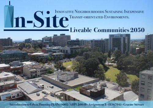
n-Site<br />
Innovative Neighbourhoods Sustaining Inexpensive<br />
Transit-orientated Environments.<br />
Liveable Communities 2050<br />
Introduction <strong>to</strong> Urban Planning PLAN10002/ABPL20049 - Assignment 3 - (836704) - Graeme Stewart
Contents<br />
Site Context……………………………………………………………………..1-4<br />
Site Context Title Page………………………………….……………..….1<br />
Geographical Context Map & Description…………………………….2<br />
Land Use Map………………………………………………………………..3<br />
Area of Investigation Profile……………………………………………..4<br />
Vision…………………………………………………………………………….5-6<br />
Vision Title Page……………………………………….….…………….…5<br />
Vision Statement……………………………….…………………………..6<br />
Objective 1……………………………………………………………………..7-11<br />
Objective 1 Title Page…………………………………….……………….7<br />
Objective 1 Discussion………………………..…………….…………….8<br />
Site Context & Observations……………………………………………..9<br />
Actions and Implementation Plans ……………………………………10<br />
Objective 1 - Action 1.3&4 - Implementation Sites…………………11<br />
Objective 2……………………………………………………………………12-17<br />
Objective 2 Title Page…………………………………….………………12<br />
Objective 2 Discussion………………………..………………………….13<br />
Site Context & Observations………………………………………..…..14<br />
Actions and Implementation Plans ……………………………….……15<br />
Objective 2 - Action 2.3&4 - Implementation Sites……………..….16<br />
Objective 2 - Action 2.3&4 - Implementation Sites………..……….17<br />
Objective 3……………………………………………………………………18-22<br />
Objective 3 Title Page…………………………………….……….………18<br />
Objective 3 Discussion………………………..……………………….….19<br />
Site Context & Observations……………………………………………..20<br />
Actions and Implementation Plans ……………………..……..………21<br />
Objective 3 - Action 3.3&4 - Implementation Sites………….…..….22<br />
Objective 4……………………………………………………………………23-27<br />
Objective 4 Title Page…………………………………….……………..…23<br />
Objective 4 Discussion………………………..…………………………...24<br />
Site Context & Observations………………………………………….…..25<br />
Actions and Implementation Plans ………………………..……………26<br />
Objective 4 - Action 4.3&4.4 - Implementation Sites……..…………27<br />
Objectives Time line………………………………………………………….…28<br />
Conclusions……………………………………………………………….…29-31<br />
Conclusions Title Page………………………..………………………..….29<br />
Objective Interactions Map…………………….…..……………………..30<br />
Conclusion…………….………………………..……………………………31<br />
References………………………………………………………………….…32<br />
References …………………………………………..……………..……..…32
Site Context<br />
1
Map 1: Geographical Context Map<br />
2<br />
Site Description<br />
The area of investigation is situated<br />
approximately 1.3km North of Melbourne’s<br />
Central Business District, 0.4km East of the<br />
Royal Melbourne Hospital, 0.8km West of the<br />
Carl<strong>to</strong>n Gardens and lies adjacent <strong>to</strong> the<br />
Southern Edge of the Melbourne University<br />
Campus.It is situated within the South-West<br />
parts of Carl<strong>to</strong>n, an inner-city suburb.<br />
As seen in Map 2 below , the area of<br />
investigation is dominated by the Residential<br />
(33%), Tertiary Education (25%) and<br />
Commercial Land use functions (18% &<br />
14%). In stark contrast, the area significantly<br />
lacks in land uses such as Industry (1%),<br />
Religious Services(1%) & Entertainment<br />
(>1%). Concurrently, the area is home <strong>to</strong> two<br />
large green spaces, Lincoln Square and<br />
University Square. The area of Investigation<br />
is approximately 18 hectares.
0%0%<br />
Map 2: Land Use Context Map<br />
3<br />
Figure 1:<br />
Built-up Distribution<br />
4%<br />
2%<br />
1% 1%1%<br />
14%<br />
33%<br />
18% 25%
Area of Investigation<br />
Figure 2: Population Increase<br />
2016 2026 2036<br />
4<br />
Profile<br />
70000<br />
52500<br />
The site observations and research convey that the area of<br />
investigation is dominated by a large student population. Hence,<br />
the area is best characterised as a knowledge hub with high<br />
multiculturalism and low income youth. Figures 1-4 support this<br />
as Carl<strong>to</strong>n, the suburb in which the area is situated, has the<br />
youngest median age from 2016 <strong>to</strong> 2036 and the lowest current<br />
income. With a moderate population increase expectancy, the<br />
area has high multiculturalism when compared <strong>to</strong> Vic<strong>to</strong>ria and<br />
Australia as a whole. Despite this, it is crucial <strong>to</strong> plan for the<br />
whole demographic, whether or not their lifestyles match the<br />
majority of the population.<br />
35000<br />
17500<br />
0<br />
Melbourne CBD Southbank N.Melbourne Carl<strong>to</strong>n Docklands Parkville E.Melbourne<br />
Figure 3: Median Age Increase<br />
2016 2026 2036<br />
60<br />
45<br />
30<br />
15<br />
0<br />
Carl<strong>to</strong>n N.Melbourne Parkville Melbourne CBD Southbank Docklands E.Melbourne<br />
SWOT Analysis<br />
Figure 4: Multiculturalism<br />
Carl<strong>to</strong>n<br />
Strengths<br />
• Student hubs defined by innovation and<br />
sustainable/future thinking<br />
• High open space percentage in the specific area<br />
• High amount of transport types and transport<br />
nodes<br />
• High multiculturalism<br />
• High proximity <strong>to</strong> the CBD<br />
• High proximity <strong>to</strong> Medical services<br />
Opportunities<br />
• Short-stay residents allows for change and less conflicts of<br />
interest<br />
• High walkability opportunity if alleyways/laneways are utilised<br />
• Space <strong>to</strong> build upwards, predominantly low <strong>to</strong> medium rise at<br />
present.<br />
• Large amount of au<strong>to</strong>mobile dedicated spaces offer potential<br />
renewal areas as technology looks at alternate transport<br />
options<br />
• Influence the leaders of future generations in<strong>to</strong> sustainable<br />
thinking<br />
• High accessibility means infilling is maximised<br />
Weaknesses<br />
• One dominant population & orientation (Students)<br />
• Awkward mixture of housing styles i.e. 1860’s<br />
cottage next <strong>to</strong> high rise apartment complex<br />
• Lack of housing affordability<br />
• High priority for car parking space<br />
• Minimal community connection between Students<br />
& Non-Students<br />
• Housing is dominated by rented apartments<br />
Threats<br />
• High future population increase<br />
• Moderate undulation of <strong>to</strong>pography<br />
• Low income community<br />
• University Melbourne's stranglehold of the<br />
built up area<br />
• Stubbornness of the heritage building<br />
register<br />
• High activity area impedes on major change<br />
Vic<strong>to</strong>ria<br />
Australia<br />
0 25 50 75 100<br />
Australian Chinese Malaysian Indonesia India Singapore Assorted Others<br />
Figure 5: Weekly Income & Rents<br />
2400<br />
600<br />
1800<br />
450<br />
1200<br />
300<br />
600<br />
150<br />
0<br />
Carl<strong>to</strong>n Melbourne CBD N.Melbourne Parkville Southbank Docklands E.Melbourne<br />
0<br />
Median Weekly Income<br />
Median Weekly Rent
Vision<br />
5
Vision Statement<br />
6<br />
In-Site’s Liveable Communities2050 vision is ‘‘<strong>to</strong> enhance the liveability of the local<br />
community by delivering healthy and safe environments that promote a greater sense<br />
of community through streetscape connectivity and social engagement opportunities.<br />
Liveable communities must foster the cohesion and inclusion of all social groups <strong>to</strong><br />
ensure the long term viability of the area’’.<br />
Objective 1:<br />
To enable a greater sense of connectivity through the<br />
development of green space links.<br />
Connectivity<br />
Objective 2:<br />
To promote healthier lifestyles through effective <strong>urban</strong><br />
designs that encourage healthier diets and physical<br />
activity.<br />
Healthy<br />
lifestyles<br />
Liveability<br />
Social<br />
Interaction<br />
Objective 3:<br />
To foster social interaction through the development of<br />
inclusive community engagement centres.<br />
Objective 4:<br />
To encourage a safer environment by enabling more<br />
‘passive surveillance’ and ‘eyes on the street’.<br />
Safer<br />
Environment
Objective 1<br />
7
Objective 1 Discussion<br />
In-site’s Liveable Communities2050 Planning Scheme maintains that for<br />
a community <strong>to</strong> be deemed as highly liveable, there must be a<br />
significant consideration for the connectivity of the area. Subsequently,<br />
the <strong>planning</strong> scheme aims <strong>to</strong> achieve it’s vision by reviewing and<br />
revitalising the laneway street connections within the area of<br />
investigation by proposing innovative ‘Green Laneways’ which will<br />
encourage the usage of Melbourne’s iconic laneways and connect<br />
major green spaces by enhancing walkability within the region.<br />
8<br />
Hence, the Liveable Communities2050 Planning Scheme will facilitate<br />
the delivery of the following actions and implementations:<br />
Act 1.1: Re-define Laneway priorities <strong>to</strong> pedestrians and open them up<br />
for usage whilst removing the allowance of laneways as parking space.<br />
Act 1.2: Redevelop all laneways within the area of investigation with<br />
permeable pavements for s<strong>to</strong>rmwater drainage and better conditions.<br />
Act 1.3: Implementation of ‘Green Laneways’ in<strong>to</strong> two advantageous<br />
locations, Little Pelham Street and Canada Lane.<br />
Act 1.4: Develop both locations through the growth of native vegetation,<br />
street art and community gardens.<br />
However, it is important <strong>to</strong> consider the benefits for local Stakeholders:<br />
Local Residents: More physical activity, sense of Melbourne pride,<br />
greater access <strong>to</strong> green spaces, higher land values, promotes social<br />
interaction, gives pedestrians ownership of laneways, better air quality.<br />
Local Businesses: More exposure due <strong>to</strong> foot traffic/<strong>to</strong>urism, provides<br />
employment for street artists/gardeners, higher land values.<br />
Local Government: Promotes <strong>to</strong>urism, Connects the local area <strong>to</strong><br />
Melbourne’s Laneway Culture, encourages use of major green spaces,<br />
reduces flood risk damages through improved drainage.
Site Context & Observations<br />
9<br />
Site observations recognised that the area of investigation had an abundance of laneways and side-streets that linked major parts of the region (Map 3),<br />
however it was concluded that the majority of these locations had poor conditions and in some cases did not allow pedestrian access (Pho<strong>to</strong>s 1-7).<br />
Additionally, the site analysis determined these laneways as crucial <strong>to</strong> the connectivity of the area of investigation as they provided a direct link through the<br />
centre of the area, specifically between the three major green spaces (Map 3). Furthermore, for these laneways <strong>to</strong> be renewed in<strong>to</strong> areas of green space, the<br />
area of investigation has the opportunity <strong>to</strong> see a significant increase in the use of the three major green spaces and a greater physical connection of the area<br />
as a whole by allowing greater aesthetic travel routes.<br />
C<br />
D<br />
Lincoln Street North<br />
E<br />
Map 3: Major Laneway<br />
Sites Map<br />
A<br />
Pelham Street<br />
Leicester Street<br />
Bouverie Street<br />
Swans<strong>to</strong>n Street<br />
Pelham Street<br />
Berkeley Street<br />
Barry Street<br />
B<br />
Lincoln Street South<br />
G<br />
F<br />
A<br />
A<br />
B C D E F G<br />
Image 1: Looking South down<br />
Barry Street Laneway<br />
Image 2: Looking South down<br />
Leicester Place Laneway<br />
Image 3: Looking East down<br />
Pelham Street Laneway<br />
Image 4: Looking West down<br />
Scotts Place Laneway<br />
Image 5: Looking East down<br />
Church Street Laneway<br />
Image 6: Looking West down<br />
Carl<strong>to</strong>n Place Laneway<br />
Image 7: Looking East down<br />
Canada Lane Laneway
Actions and Implementation Plans<br />
Under Action 1.1, the plan aims <strong>to</strong> re-define laneway priorities <strong>to</strong> pedestrians in each laneway discussed<br />
(Map 3) as in some cases, there is no pedestrian access and parking is prioritised (Image 8-9). Furthermore,<br />
laneways are important <strong>to</strong> the connectivity of an environment as they offer human-scale experiences (City<br />
of Perth 2007, p.1) and assist the pedestrian network of a specific area by fostering movement and social<br />
engagement (Carmichael, 2011, pp. 2).<br />
The further revitalisation of these laneways, under Action 1.2, involves the redevelopment of the laneway<br />
conditions <strong>to</strong> higher standards through techniques such as permeable pavements for s<strong>to</strong>rmwater drainage.<br />
This concept derives from the ‘Chicago Green Alley Plan’ (Case Study 1) whereby local alleyways are<br />
reconstructed with high-albedo, permeable pavements which drains 80% of rainwater and reflects sunlight<br />
<strong>to</strong> reduce the heat-island effect (Daley, 2008, pp.4). This would support the Elizabeth Street Water<br />
Catchment Management Plan that occurs within the area through extra drainage (City of Melbourne, 2017).<br />
Action 1.3 aims <strong>to</strong> determine the most beneficial laneways <strong>to</strong> revitalise in<strong>to</strong> fully-formed ‘Green Laneways’<br />
within the area of investigation, which Site Observations determined as Little Pelham Street and Canada<br />
Lane. These laneways are the most effective locations as they offer appropriate <strong>to</strong>pography (Images 8-11)<br />
and are successful in providing ‘‘through-block pedestrian linkages’’(Carmichael, 2011, pp. 2) that connect<br />
the major green spaces within the area of investigation.<br />
The final action, Action 1.4, is <strong>to</strong> entirely revitalise these two laneway locations in<strong>to</strong> ‘Green Laneways’<br />
which replicates the Guildford place and Coromandel Place plans in Melbourne (Case Study 2). Both these<br />
laneways are being redeveloped with the planting of green vegetation such as Bos<strong>to</strong>n Ivy and Creeping Fig,<br />
with the painting of local street art and with the construction of community gardens (Doyle, 2017).<br />
Case Studies<br />
Case Study 1: Global<br />
Case Study - Chicago Green Alleys<br />
Pho<strong>to</strong>graph - City Of Chicago<br />
10<br />
Figure 6:<br />
Objective 2<br />
Action Timeline<br />
1<br />
yr<br />
Short Medium Long<br />
2<br />
yr<br />
3<br />
yr<br />
4<br />
yr<br />
5<br />
yr<br />
6<br />
yr<br />
7<br />
yr<br />
8<br />
yr<br />
9<br />
yr<br />
10<br />
yr<br />
11<br />
yr<br />
12<br />
yr<br />
13<br />
yr<br />
14<br />
yr<br />
15<br />
yr<br />
16<br />
yr<br />
17<br />
yr<br />
18<br />
yr<br />
19<br />
yr<br />
20<br />
yr<br />
21<br />
yr<br />
22<br />
yr<br />
23<br />
yr<br />
24<br />
yr<br />
25<br />
yr<br />
26<br />
yr<br />
27<br />
yr<br />
28<br />
yr<br />
29<br />
yr<br />
30<br />
yr<br />
31<br />
yr<br />
32<br />
yr<br />
33<br />
yr<br />
Objective 1 Action 1.1<br />
Action 1.2<br />
Action 1.3<br />
Action 1.4<br />
Constant<br />
Case Study 2: Local<br />
Case Study - Guildford Place Melbourne Green Laneway<br />
Pho<strong>to</strong>graph - City Of Melbourne
Objective 1 - Action 1.3&4 - Implementation Sites<br />
The chosen sites for the implementation of New Green Laneways for greater connectivity (Map 4) are proposed for the following reasons:<br />
11<br />
Social<br />
• Enhances social interaction<br />
• Increase physical activity & promotes green space use<br />
• Encourages the usage of green spaces<br />
Economic<br />
• Employment opportunities in street art/gardening<br />
• Increases Tourism within the area<br />
• More foot traffic allows local business exposure<br />
Environmental<br />
• Allows the growth of native species<br />
• Appropriate Topography Areas<br />
• Improves the local air quality<br />
Map 4: Pelham Street<br />
Laneway Site Map<br />
Map 5: Canada Lane Site<br />
Map<br />
A<br />
B<br />
Bouverie Street<br />
Leicester Street<br />
C<br />
Pelham Street<br />
D<br />
Bouverie Street<br />
Leicester Street<br />
Pelham Street<br />
A<br />
B<br />
C<br />
D<br />
Image 8: Looking East down Pelham Street Laneway Image 9: Looking West down Pelham Street Laneway Image 10: Looking East down Canada Lane Laneway Image 11: Looking West down Canada Lane Laneway
Objective 2<br />
12
Objective 2 Discussion<br />
13<br />
In-site’s Liveable Communities2050 Planning Scheme maintains that for<br />
a community <strong>to</strong> be deemed as highly liveable, there must be a<br />
significant consideration for healthy lifestyles within the community.<br />
Subsequently, the <strong>planning</strong> scheme aims <strong>to</strong> achieve it’s vision by<br />
<strong>planning</strong> and implementing ‘healthy corridors’ within the area of<br />
investigation which include both innovative ‘Green Traffic Islands’ and<br />
‘Community Allotment Gardens’ which will encourage higher physical<br />
activity and healthy eating.<br />
Hence, the Liveable Communities2050 Planning Scheme will facilitate<br />
the delivery of the following actions and implementations:<br />
Act 2.1: Identify and allocate the most advantageous locations of the<br />
proposed ‘Healthy Corridors’.<br />
Act 2.2: Development of New ‘Green Traffic Islands’ along Healthy<br />
Corridors in place of Middle-of-the-Road Parking Spaces.<br />
Act 2.3: Implementation of Allotment Gardens on residency roof<strong>to</strong>ps<br />
along Healthy Corridors.<br />
However, it is important <strong>to</strong> consider the benefits for local Stakeholders:<br />
Local Residents: More physical activity, healthier diets, greater<br />
aesthetic appeal, community pride, higher land values, less emission<br />
in<strong>to</strong>xication, home grown food.<br />
Local Businesses: More exposure due <strong>to</strong> foot traffic, higher land<br />
values, more appealing workplace, Less commuter transport costs.<br />
Local Government: Supports public transports, promotes <strong>to</strong>urism,<br />
reduces LGA’s environmental footprint.
Site Context & Observations<br />
14<br />
Site Observations identified that the area of investigation holds a high prioritisation for the use of au<strong>to</strong>mobiles and parking spaces (Map 6). Concurrently, site<br />
observations noticed that the main streets included both middle-of-the-road parking and on-street parking on each side of the road. However, the area of<br />
investigation exhibited a population who lacked the income (Figure 5) and age (Figure 3) <strong>to</strong> have high car ownership and lived in an environment where<br />
foot traffic was most effective. Additionally, the Site Observations found a sheer lack in the availability of healthy food sources, with a high allocation for<br />
commercial zones with only fast food and café options. Although, this has presented the opportunity for the development of ‘healthy corridors’ that can<br />
improve the physical activity and healthy diets of a community.<br />
Bouverie Street<br />
Map 6: Parking Space<br />
Locations Map<br />
Lincoln Square North<br />
Pelham Street<br />
Berkeley Street<br />
Barry Street<br />
Leicester Street<br />
A<br />
B<br />
C<br />
Lincoln Square South<br />
D<br />
Swans<strong>to</strong>n Street<br />
Pelham Street<br />
A B C D<br />
Image 12: Looking West down Pelham Street Image 13: Looking South down Bouverie Street Image 14: Looking West down Lincoln Square South Image 15: Looking East up Lincoln Square North
Actions and Implementation Plans<br />
The first step of the implementation plan, under Action 2.1, is <strong>to</strong> identify and allocate the most<br />
advantageous locations for the proposed healthy corridors. Site observations have confirmed that these sites<br />
should be located along the East <strong>to</strong> West corridors of Pelham Street & Lincoln Square N & S and the North<br />
<strong>to</strong> South Corridors of Barry, Leicester and Bouverie Street. This implementation aims <strong>to</strong> replicate the Urban<br />
Land Institute’s Building Healthy Corridors plan (Case Study 3), which is developing across the USA. This<br />
plan maintains that healthy corridors should be placed in areas which will connect land uses such<br />
education, residential and commercial (Urban Land Institute, 2016, pp. 8). Hence, the corridors chosen<br />
within the area of investigation are effective as they link the Central Business District and University of<br />
Melbourne, North <strong>to</strong> South and they link the three major green spaces, East <strong>to</strong> West.<br />
Furthermore, the Action 2.2 program aims <strong>to</strong> renew the middle-of-the-road car parking spaces along these<br />
new healthy corridors in<strong>to</strong> ‘New Green Traffic Islands’. The ‘Greening Sydney Plan’ (Case Study 4) supports<br />
this, as it claims <strong>urban</strong> forests can encourage physical activity through more aesthetic walking appeal and<br />
mental well-being by providing social opportunities and a sense of place (City of Sydney, 2012, pp. 14).<br />
Additionally, the implementation plan will improve the air quality of the area and further it will discourage<br />
the use of au<strong>to</strong>mobiles which can reduce reduce greenhouse gases and fume in<strong>to</strong>xication.<br />
Concurrently, the Action 2.3 program intends implement roof<strong>to</strong>p allotment gardens on appropriate<br />
residential buildings that are situated along or near the healthy corridor routes. Allotment gardens can<br />
promote healthy diets through encouraging the growth of green vegetation for eating and also provide<br />
sustainable food production and community building (City of Sydney, 2012, pp. 6). This <strong>planning</strong> scheme<br />
believes roof<strong>to</strong>p allotment gardens are most effective as they can receive greater natural light, greater<br />
residential access and can bring people <strong>to</strong>gether who live in the same residential building.<br />
Case Studies<br />
Case Study 3: Global<br />
Case Study - US Healthy Corridors<br />
Pho<strong>to</strong>graph - Urban Land Institute<br />
15<br />
Figure 7:<br />
Objective 2<br />
Action Timeline<br />
1<br />
yr<br />
Short Medium Long<br />
2<br />
yr<br />
3<br />
yr<br />
4<br />
yr<br />
5<br />
yr<br />
6<br />
yr<br />
7<br />
yr<br />
8<br />
yr<br />
9<br />
yr<br />
10<br />
yr<br />
11<br />
yr<br />
12<br />
yr<br />
13<br />
yr<br />
14<br />
yr<br />
15<br />
yr<br />
16<br />
yr<br />
17<br />
yr<br />
18<br />
yr<br />
19<br />
yr<br />
20<br />
yr<br />
21<br />
yr<br />
22<br />
yr<br />
23<br />
yr<br />
24<br />
yr<br />
25<br />
yr<br />
26<br />
yr<br />
27<br />
yr<br />
28<br />
yr<br />
29<br />
yr<br />
30<br />
yr<br />
31<br />
yr<br />
32<br />
yr<br />
33<br />
yr<br />
Objective<br />
2<br />
Action<br />
2.1<br />
Action<br />
2.2<br />
Action<br />
2.3<br />
Constant<br />
Case Study 4: Local<br />
Case Study - Bourke Street Community Garden, Sydney<br />
Pho<strong>to</strong>graph - City of Sydney
Objective 2 - Action 2.2 - Implementation Site<br />
The chosen sites for the implementation of New Green Traffic Islands for Healthy Corridors (Map 4) are proposed for the following reasons:<br />
16<br />
Social<br />
• Enhances social interaction<br />
• Links the green spaces, UniMelb & CBD<br />
• Increases active lifestyles<br />
Economic<br />
• Exposure for High local business numbers<br />
• Increases local residential land values<br />
• Encourages the use of local transport options<br />
Environmental<br />
• Reduces Greenhouse gas pollution<br />
• Appropriate <strong>to</strong>pography area’s<br />
• Improves the local air quality<br />
Bouverie Street<br />
Map 7: Proposed New<br />
Green Traffic Islands<br />
Map<br />
Leicester Street<br />
Lincoln Square North<br />
Pelham Street<br />
Swans<strong>to</strong>n Street<br />
Pelham Street<br />
Barry Street<br />
Lincoln Square South
Objective 2 - Action 2.3 - Implementation Site<br />
The chosen sites for the implementation of Roof<strong>to</strong>p Allotment Gardens for Healthy Corridors (Map 4) are proposed for the following reasons:<br />
17<br />
Social<br />
• Facilitates healthier diets<br />
• Enhances social interaction in the community<br />
• Develops ownership and education skills<br />
Economic<br />
• Cheaper costs for residents<br />
• Supports local food production<br />
• Provides employment opportunities<br />
Environmental<br />
• Improves air quality<br />
• Improves the filtering of rainwater<br />
• Promotes future environmentalism<br />
Map 8: Proposed<br />
Allotment Gardens Map<br />
Leicester Street<br />
Lincoln Square North<br />
C<br />
Barry Street<br />
Pelham Street<br />
A<br />
B<br />
Bouverie Street<br />
Swans<strong>to</strong>n Street<br />
Pelham Street<br />
D<br />
Lincoln Square South<br />
A<br />
B<br />
C<br />
D<br />
Image 16: 13 Leicester Place Image 17: 24 Barkly Place Image 18: 650 Swans<strong>to</strong>n Street<br />
Image 19: 159-167 Pelham Street
Objective<br />
318
Objective 3 Discussion<br />
19<br />
In-site’s Liveable Communities2050 Planning Scheme maintains that for<br />
a community <strong>to</strong> be deemed as highly liveable, there must be a<br />
significant consideration for social interaction between members of the<br />
community. Subsequently, the <strong>planning</strong> scheme aims <strong>to</strong> achieve it’s<br />
vision by <strong>planning</strong> and implementing a new ‘community centre’ within<br />
the area of investigation which will spark a new sense of community and<br />
encourage the amalgamation of all social groups by acting as the heart<br />
of the local area and the lifeblood of community events.<br />
Hence, the Liveable Communities2050 Planning Scheme will facilitate<br />
the delivery of the following actions and implementations:<br />
Act 3.1: Identify and allocate the most advantageous location for the<br />
community centre through site observations/check <strong>planning</strong> controls.<br />
Act 3.2: Organise the popular participation of the entire community in<br />
the <strong>planning</strong> of the community centre layout and <strong>urban</strong> design.<br />
Act 3.3: Implementation of the community centre on the <strong>to</strong>p of Lincoln<br />
Square and the relocation of the war memorial <strong>to</strong> the <strong>to</strong>p of University<br />
Square.<br />
However, it is important <strong>to</strong> consider the benefits for local Stakeholders:<br />
Local Residents: More social interaction, more social inclusion, greater<br />
understanding of differing social groups, better representation of the<br />
community in <strong>planning</strong>, offers facilities and support, volunteering<br />
opportunities.<br />
Local Businesses: Allows greater involvement in <strong>planning</strong> and events,<br />
provides employment, greater exposure of local business’s at events.<br />
Local Government: Sparks the cohesion of the entire community,<br />
allows the people <strong>to</strong> be indirectly part of <strong>planning</strong> and decision-making.
Site Context & Observations<br />
20<br />
Site Observations concluded that the area of investigation has a significant divide between the dominant student population and the non-student populations<br />
(Map 9) as there is a significant prioritisation of educational buildings and student accommodation in the area. Concurrently, site analysis found that the<br />
region is further divided by high multiculturalism (Figure 2) and thus the area is home <strong>to</strong> a whole variety of different social and cultural groups. Therefore, the<br />
need for a <strong>planning</strong> scheme that aims <strong>to</strong> bring these social groups <strong>to</strong>gether <strong>to</strong> form one community is crucial <strong>to</strong> the liveability of the area and the social<br />
interaction it can provide. Furthermore, this has provided the opportunity for the development of a community centre on Lincoln square, where all groups<br />
can be represented in community events and <strong>planning</strong> whilst becoming more knowledgable about the other cultures existing in the area.<br />
Map 9: Student vs Non-<br />
Student Population Map<br />
Pelham Street<br />
Leicester Street<br />
Bouverie Street<br />
Lincoln Square North<br />
Pelham Street<br />
Barry Street<br />
Berkeley Street<br />
Swans<strong>to</strong>n Street<br />
Lincoln Square South
Actions and Implementation Plans<br />
Case Studies<br />
21<br />
Action 3.1 aims <strong>to</strong> find the most advantageous location for the development of a new community centre<br />
within the area of investigation. Site observations concluded that the best location for the development of a<br />
community centre would be on the Eastern Edge of Lincoln Square, as ‘Community Centres SA’ suggested<br />
that area’s of high accessibility <strong>to</strong> locals, with nearby public transport and an area of open space are most<br />
ideal (Reynolds, 1998, pp.33). Concurrently, site research confirmed that the <strong>planning</strong> controls for this area<br />
claim that this site is under the a Design and Development Overlay (DDO) overlay, providing that<br />
construction is possible and only means ‘‘A permit is required <strong>to</strong> construct a building or construct or carry<br />
out works’’(Vic<strong>to</strong>ria State Government, 2017).<br />
Additionally, Action 3.2 aims <strong>to</strong> include the local community in the design and implementation of the<br />
community centre on Lincoln Square. Community Centres SA further concludes that an ideal community<br />
centre principle is <strong>to</strong> allow the community services <strong>to</strong> be regulated and governed by the local community,<br />
whilst other research confirms that involving the people in <strong>planning</strong> can increase expectation, reduce<br />
conflict and emulate good governance (Reynolds, 1998, pp.33).<br />
As a result, Action 3.3, the implementation of the community centre on Lincoln square can successfully<br />
occur. Site research of the area of investigation proved that there is a significant divide between the student<br />
and non-student population and a division of cultural groups due <strong>to</strong> high multiculturalism (Figure 4).<br />
However, the Brøndby Community Centre, Denmark (Case Study 5) shows that community centres can be<br />
a place where everybody is included and different cultural groups can socially interact at events and<br />
activities (Brøndby Community Centre, 2017). Furthermore, the Thebar<strong>to</strong>n Community Centre, South<br />
Australia (Case Study 6) suggested that a community centre can also act as a place for local businesses <strong>to</strong><br />
socially interact and for the delegation of local governance, allowing greater community engagement in<br />
decision making (City of West Torrens, 2017).<br />
Case Study 5: Global<br />
Case Study - Brøndby Community Centre, Denmark<br />
Pho<strong>to</strong>graph - Brøndby Community Centre<br />
Figure 8:<br />
Objective 3<br />
Action Timeline<br />
1<br />
yr<br />
Short Medium Long<br />
2<br />
yr<br />
3<br />
yr<br />
4<br />
yr<br />
5<br />
yr<br />
6<br />
yr<br />
7<br />
yr<br />
8<br />
yr<br />
9<br />
yr<br />
10<br />
yr<br />
11<br />
yr<br />
12<br />
yr<br />
13<br />
yr<br />
14<br />
yr<br />
15<br />
yr<br />
16<br />
yr<br />
17<br />
yr<br />
18<br />
yr<br />
19<br />
yr<br />
20<br />
yr<br />
21<br />
yr<br />
22<br />
yr<br />
23<br />
yr<br />
24<br />
yr<br />
25<br />
yr<br />
26<br />
yr<br />
27<br />
yr<br />
28<br />
yr<br />
29<br />
yr<br />
30<br />
yr<br />
31<br />
yr<br />
32<br />
yr<br />
33<br />
yr<br />
Objective<br />
3<br />
Action<br />
3.1<br />
Action<br />
3.2<br />
Case Study 6: Local<br />
Case Study - Thebar<strong>to</strong>n Community Centre, S.Australia<br />
Pho<strong>to</strong>graph - City of West Torrens<br />
Action<br />
3.3<br />
Constant
Objective 3 - Action 3.3 - Implementation Site<br />
The chosen site for the implementation of a Community Centre on Lincoln Square (Map 4) is proposed for the following reasons:<br />
22<br />
Social<br />
• Enhances social interaction<br />
• Brings all social groups <strong>to</strong>gether<br />
• Increases social inclusion<br />
Economic<br />
• Provides new employment opportunities<br />
• Encourages the use of public transport<br />
• Allows local business exposure at events<br />
Environmental<br />
• Appropriate <strong>to</strong>pography area<br />
• Provides greater upkeep of Lincoln Square Green Space<br />
• A place for environmentalism awareness<br />
Map 10: Community<br />
Centre Proposal Map<br />
Lincoln Square North<br />
Image 20: Looking North at Lincoln Square<br />
Pelham Street<br />
Bouverie Street<br />
Swans<strong>to</strong>n Street<br />
Lincoln Square South<br />
Image 21: Looking South at Lincoln Square
Objective 4<br />
23
Objective 4 Discussion<br />
24<br />
In-site’s Liveable Communities2050 Planning Scheme maintains that for<br />
a community <strong>to</strong> be deemed as highly liveable, there must be a<br />
significant consideration for the safety of the members within the<br />
community. Subsequently, the <strong>planning</strong> scheme aims <strong>to</strong> achieve it’s<br />
vision by <strong>planning</strong> and implementing new mixed use developments<br />
within the area of investigation which will allow for more active street<br />
frontages. Therefore increasing passive surveillance and the ‘eyes on<br />
the street’ whilst also renewing areas such as vacant lots which spark<br />
unsociable behaviours like crime.<br />
Hence, the Liveable Communities2050 Planning Scheme will facilitate<br />
the delivery of the following actions and implementations:<br />
Act 4.1: Identify and isolate areas of vacant land and poorly lit zones <strong>to</strong><br />
prevent unsocial behaviours.<br />
Act 4.2: Subdivide current residential buildings and renew them with<br />
more land uses <strong>to</strong> foster mixed use.<br />
Act 4.3: Facilitate the implementation of new land use developments in<br />
the most advantageous areas within the are of investigation<br />
However, it is important <strong>to</strong> consider the benefits for local Stakeholders:<br />
Local Residents: More homes, greater social safety, more social<br />
interaction, more affordable homes, more land use exposure, closer<br />
jobs, closer services, less unsocial behaviours, less anxiety.<br />
Local Businesses: Later commercial zone hours, more employment,<br />
more business exposure, less commuter hours, higher land values,<br />
greater competition.<br />
Local Government: Combats population rise, more <strong>to</strong>urism, less crime<br />
rates, less security measures.
Site Context & Observations<br />
Site research established that Carl<strong>to</strong>n, the suburb in which the area of investigation is situated, has had a significant increase in crime rates since 2011, where theft,<br />
burglary and property damage had increased by 70%, 84% and 67% respectively (Australian Bureau of Statistics, 2016). Furthermore, site observations identified that<br />
there is an abundance of poorly lit vacant lots and car parks which are sited within the area that could potentially spark unsociable behaviours such as crime. However,<br />
these site conditions offer an opportunity for the development of mixed use buildings that can improve the safety of the area by increasing passive surveillance and the<br />
amount of ‘eyes on the street’. Additionally, site observations noticed that the area of investigation has some mixed use developments already (Map 11), the concept in<br />
which this <strong>planning</strong> scheme wishes <strong>to</strong> replicate in other appropriate areas <strong>to</strong> ensure the safety of the entire community.<br />
25<br />
C<br />
Map 11: Current Mixed<br />
Use Site Map<br />
D<br />
Lincoln Square North<br />
Berkeley Street<br />
Pelham Street<br />
Barry Street<br />
Leicester Street<br />
Bouverie Street<br />
Swans<strong>to</strong>n Street<br />
Pelham Street<br />
A<br />
Lincoln Square South<br />
B<br />
A<br />
Image 22: 109 Leicester Street Image 23: 609 Swans<strong>to</strong>n Street Image 24: 743 Swans<strong>to</strong>n Street<br />
D<br />
Image 25: 672-74 Swans<strong>to</strong>n Street<br />
A<br />
B<br />
C<br />
D
Actions and Implementation Plans<br />
The implementation plan, Under Action 4.1, aims <strong>to</strong> isolate areas that breed unsociable<br />
behaviours such as crime. Site observations identified a variety of poorly lit and undermaintained<br />
land plots which need <strong>to</strong> be isolated and blocked off until they are regenerated in<strong>to</strong><br />
new developments.<br />
Furthermore, Action 4.2 aims <strong>to</strong> subdivide existing residential developments <strong>to</strong> involve mixed<br />
use in order <strong>to</strong> make more active street frontages and thus allowing for more ‘passive<br />
surveillance’ and ‘eyes on the street’ (Kanigel, 2016). The Brunswick structure Plan (Case Study<br />
8) supports this as the <strong>planning</strong> scheme claims that ‘adding interests’ <strong>to</strong> make residency<br />
frontages active can generate a ‘sense of safety’ (Moreland City Council, 2010, pp. 16).<br />
Additionally, the use of mixed-use developments can also reduce the cost of living and thus<br />
improve economic safety for the local community.<br />
Case Studies<br />
26<br />
The final implementation plan, under Action 4.3, is <strong>to</strong> construct new mixed use residential<br />
buildings in the areas discussed in Action 4.1 and Map 7. Jane Jacobs ‘eyes on the street’ theory<br />
(Case Study 7) suggests that by replacing buildings of poor lighting and ‘blind’ street sight with<br />
developments of active frontages, the safety of the community is enhanced through passive<br />
surveillance (Kanigel, 2016). Furthermore, by increasing the amount of mixed-use residential<br />
developments, there will be more people walking on the streets due <strong>to</strong> less travel distances and<br />
further supporting Jane Jacobs concept that ‘the more people in the streets, the safer they<br />
become’(Kanigel, 2016).<br />
Case Study 7: Global<br />
Case Study - Eyes on the Street theory: The life of Jane Jacobs<br />
Pho<strong>to</strong>graph - Robert Kanigel<br />
Figure 9:<br />
Objective 3<br />
Action Timeline<br />
1<br />
yr<br />
Short Medium Long<br />
2<br />
yr<br />
3<br />
yr<br />
4<br />
yr<br />
5<br />
yr<br />
6<br />
yr<br />
7<br />
yr<br />
8<br />
yr<br />
9<br />
yr<br />
10<br />
yr<br />
11<br />
yr<br />
12<br />
yr<br />
13<br />
yr<br />
14<br />
yr<br />
15<br />
yr<br />
16<br />
yr<br />
17<br />
yr<br />
18<br />
yr<br />
19<br />
yr<br />
20<br />
yr<br />
21<br />
yr<br />
22<br />
yr<br />
23<br />
yr<br />
24<br />
yr<br />
25<br />
yr<br />
26<br />
yr<br />
27<br />
yr<br />
28<br />
yr<br />
29<br />
yr<br />
30<br />
yr<br />
31<br />
yr<br />
32<br />
yr<br />
33<br />
yr<br />
Objective<br />
4<br />
Action<br />
4.1<br />
Action<br />
4.2<br />
Action<br />
4.3<br />
Constant<br />
Case Study 8: Local<br />
Case Study - Brunswick Structure Plan, Melbourne<br />
Pho<strong>to</strong>graph - Moreland City Council
Objective 4<br />
Action 4.3<br />
Implementation Site<br />
Map 12: Proposed<br />
New Mixed-Use<br />
Site Map<br />
D<br />
E<br />
B<br />
27<br />
The chosen sites for the implementation of<br />
New Mixed Use buildings (Map 4) is<br />
proposed for the following reasons:<br />
Social<br />
• Improves passive surveillance<br />
• More physical activity in walkability<br />
• Removes vacant lots/areas that spark<br />
unsocial behaviour<br />
F<br />
Lincoln Square North<br />
Image 27: 157-163 Pelham Street<br />
C<br />
Image 28: 155 Bouverie Street<br />
Economic<br />
• Increases affordable housing<br />
• Allows more local commercial space<br />
• Reduces commuter travel costs<br />
A<br />
Pelham Street<br />
B<br />
Bouverie Street<br />
D<br />
Environmental<br />
• New developments allow for more<br />
environmentally friendly buildings<br />
• Reduces au<strong>to</strong>mobile greenhouse gases<br />
• Allows for the development of roof<strong>to</strong>p<br />
allotment gardens<br />
Lincoln Square South<br />
Image 29: 239 Bouverie Street<br />
E<br />
A<br />
C<br />
Image 30: 166-170 Church Street<br />
F<br />
Image 26: 160 Pelham Street<br />
Image 31: 25 Church Street
Objectives & Implementation Timeline<br />
28<br />
Figure 10: All Four<br />
Short Medium Long<br />
Objectives Timeline<br />
Years<br />
Objective 1 Action 1.1<br />
1yr 2yr 3yr 4yr 5yr 6yr 7yr 8yr 9yr 10yr 11yr 12yr 13yr 14yr 15yr 16yr 17yr 18yr 19yr 20yr 21yr 22yr 23yr 24yr 25yr 26yr 27yr 28yr 29yr 30yr 31yr 32yr 33yr<br />
Action 1.2<br />
Action 1.3<br />
Action 1.4<br />
Constant<br />
Objective 2 Action 2.1<br />
Action 2.2<br />
Constant<br />
Action 2.3<br />
Objective 3 Action 3.1<br />
Action 3.2<br />
Action 3.3<br />
Constant<br />
Objective 4 Action 4.1<br />
Action 4.2<br />
Action 4.3<br />
Constant
Conclusions<br />
29
30<br />
Map 13: Implementation Plans<br />
Spatial Relationship Map
Conclusions<br />
31<br />
Above all, Insite’s Liveable Communities2050 <strong>planning</strong> scheme aims <strong>to</strong> enhance the liveability of the<br />
area of investigation through the implementation of high level framework and strategic <strong>planning</strong> that<br />
will deliver a safe, connected and healthy environment for a community of high cohesion and<br />
inclusion. Taken <strong>to</strong>gether, the four main objectives of the Liveable Communities2050 are coaddressed<br />
(Map 13) <strong>to</strong> enhance the liveability by enabling connectivity, promoting healthy lifestyles,<br />
fostering social interaction and encouraging a safer environment for all social groups.<br />
Site observations and research can conclude that this vision and these objectives are suitable for<br />
this area <strong>to</strong> a significant extent. This is because any given area of one dominant population and high<br />
multiculturalism can lead <strong>to</strong> disunity within a community and an unsafe environment for particular<br />
social groups. Furthermore, the area of investigation includes two major green spaces that have the<br />
capacity <strong>to</strong> provide social opportunities and physical activity for a young and growing population<br />
and these implementation plans successfully maximise their usage. Additionally, the fact that this<br />
area of investigation is home <strong>to</strong> a young, student population is of great benefit, as the objectives and<br />
implementations proposed by this <strong>planning</strong> scheme will influence young, innovative minds in<strong>to</strong> future<br />
<strong>planning</strong> and will <strong>to</strong> carry on this vision <strong>to</strong> ensure the long term viability of liveability within the area<br />
and beyond.<br />
For these reasons and with the provided evidence, Insite’s Liveable Communities2050 vision will<br />
inarguably enhance the liveability of the area of investigation for all of the social groups within it.
References<br />
Resources<br />
Australian Bureau of Statistics. (2016). Carl<strong>to</strong>n Regional Data Summary. Retrieved from http://stat.abs.gov.au/itt/r.jsp?<br />
RegionSummary®ion=206041117&dataset=ABS_REGIONAL_ASGS&geoconcept=REGION&datasetASGS=ABS_R<br />
EGIONAL_ASGS&datasetLGA=ABS_REGIONAL_LGA®ionLGA=REGION®ionASGS=REGION<br />
Brøndby Community Centre. (2017). Retrieved from https://linkarkitektur.com/en/Projects/Broendby-Community-<br />
Center?sp=17580,18158,18765,17782<br />
Carmichael, J. (2011). Revitalising laneways in inner city Brisbane. Brisbane, Australia: PIA QLD State Planning.<br />
City of Melbourne. (2014). Reimagining University Square. Retrieved from https://participate.melbourne.vic.gov.au/<br />
application/files/4514/2130/2092/Reimagining_University_Square_Community_Engagement_Summary_-<br />
_November_2014.pdf<br />
City of Melbourne. (2017). Elizabeth Street Catchment IWCM Plan. Retrieved from http://<br />
<strong>urban</strong>water.melbourne.vic.gov.au/industry/our-strategies/elizabeth-street-catchment-iwcm-plan/<br />
City of Melbourne. (2017). Lincoln Square Concept Plan Phase One Community Engagement Summary. Retrieved<br />
from https://participate.melbourne.vic.gov.au/application/files/9214/9801/6164/Lincoln_Square_-<br />
_Phase_1_Engagement_Summary.pdf<br />
City of Melbourne. (2017). Participate Melbourne - Green your Laneway. Retrieved from https://<br />
participate.melbourne.vic.gov.au/greenlaneways<br />
City of Perth.(2007). Forgotten spaces - Revitalising Perth’s Laneways Episode. Retrieved from https://<br />
www.perth.wa.gov.au/sites/default/files/documents/Forgotten%20Spaces%20Revitalising%20Perths%20Laneways.pdf<br />
City of Sydney. (2012). Greening Sydney Plan. Retrieved from http://www.cityofsydney.nsw.gov.au/__data/assets/<br />
pdf_file/0009/135882/GreeningSydneyPlan.pdf<br />
City of West Torrens. (2017). Thebar<strong>to</strong>n Community Centre. Retrieved from http://www.west<strong>to</strong>rrens.sa.gov.au/Services/<br />
Recreation_arts_lifestyle/Thebar<strong>to</strong>n_Community_Centre<br />
Daley, R. M., & Heramb, C. (2008). Green Alley - An Action Guide <strong>to</strong> Create a Greener, Environmentally Sustainable<br />
Chicago The Chicago Handbook. Chicago, Illinois: City of Chicago.<br />
Kanigel, R. (2016). Eyes on the Street: The Life of Jane Jacobs. New York, USA: Alfred A. Knopf.<br />
Moreland City Council. (2010). Brunswick structure plan local area two - lygon street. Retrieved from http://<br />
www.moreland.vic.gov.au/globalassets/areas/strategic-<strong>planning</strong>/bsp-lygon-st-vol-3-part-1.pdf<br />
Reynolds, K. (1998). How <strong>to</strong> establish a neighbourhood house or community centre resource manual. Adelaide,<br />
South Australia: Community Centres SA Inc.<br />
Urban Lane Institute. (2016). Building thriving places transforming <strong>urban</strong> and sub<strong>urban</strong> arterials in<strong>to</strong> Health<br />
Corridors. Retrieved from http://uli.org/wp-content/uploads/ULI-Documents/Building-Healthy-Corridors-ULI.pdf<br />
Vic<strong>to</strong>ria State Government. (2017). Planning Maps Online. Retrieved from http://services.land.vic.gov.au/maps/<br />
pmo.jsp<br />
Case Studies<br />
Case Study 1: Daley, R. M., & Heramb, C. (2008). Green Alley - An Action Guide <strong>to</strong> Create a Greener, Environmentally<br />
Sustainable Chicago The Chicago Handbook. Chicago, Illinois: City of Chicago.<br />
Case Study 2: City of Melbourne. Participate Melbourne - Green your Laneway. (2017). Retrieved from https://<br />
participate.melbourne.vic.gov.au/greenlaneways<br />
Case Study 3: Urban Lane Institute. (2016). Building thriving places transforming <strong>urban</strong> and sub<strong>urban</strong> arterials in<strong>to</strong> Health<br />
Corridors. Retrieved from http://uli.org/wp-content/uploads/ULI-Documents/Building-Healthy-Corridors-ULI.pdf<br />
Case Study 4: City of Sydney. Greening Sydney Plan. (2012). Retrieved from http://www.cityofsydney.nsw.gov.au/__data/assets/<br />
pdf_file/0009/135882/GreeningSydneyPlan.pdf<br />
Case Study 5: Brøndby Community Centre. (2017). Retrieved from https://linkarkitektur.com/en/Projects/Broendby-Community-<br />
Center?sp=17580,18158,18765,17782<br />
Case Study 6: City of West Torrens. (2017). Thebar<strong>to</strong>n Community Centre. Retrieved from http://www.west<strong>to</strong>rrens.sa.gov.au/<br />
Services/Recreation_arts_lifestyle/Thebar<strong>to</strong>n_Community_Centre<br />
Case Study 7: Kanigel, R. (2016). Eyes on the Street: The Life of Jane Jacobs. New York, USA: Alfred A. Knopf.<br />
Case Study 8: Moreland City Council. (2010). Brunswick structure plan local area two - lygon street. Retrieved from http://<br />
www.moreland.vic.gov.au/globalassets/areas/strategic-<strong>planning</strong>/bsp-lygon-st-vol-3-part-1.pdf<br />
Figure Data<br />
Figure 2: Australian Bureau of Statistics. (2016). Carl<strong>to</strong>n Regional Data Summary. Retrieved from http://stat.abs.gov.au/itt/r.jsp?<br />
RegionSummary®ion=206041117&dataset=ABS_REGIONAL_ASGS&geoconcept=REGION&datasetASGS=ABS_REGIONAL<br />
_ASGS&datasetLGA=ABS_REGIONAL_LGA®ionLGA=REGION®ionASGS=REGION<br />
Figure 3: Australian Bureau of Statistics. (2016). Carl<strong>to</strong>n Regional Data Summary. Retrieved from http://stat.abs.gov.au/itt/r.jsp?<br />
RegionSummary®ion=206041117&dataset=ABS_REGIONAL_ASGS&geoconcept=REGION&datasetASGS=ABS_REGIONAL<br />
_ASGS&datasetLGA=ABS_REGIONAL_LGA®ionLGA=REGION®ionASGS=REGION<br />
Figure 4: Australian Bureau of Statistics. (2016). Carl<strong>to</strong>n Regional Data Summary. Retrieved from http://stat.abs.gov.au/itt/r.jsp?<br />
RegionSummary®ion=206041117&dataset=ABS_REGIONAL_ASGS&geoconcept=REGION&datasetASGS=ABS_REGIONAL<br />
_ASGS&datasetLGA=ABS_REGIONAL_LGA®ionLGA=REGION®ionASGS=REGION<br />
Figure 5: Australian Bureau of Statistics. (2016). Carl<strong>to</strong>n Regional Data Summary. Retrieved from http://stat.abs.gov.au/itt/r.jsp?<br />
RegionSummary®ion=206041117&dataset=ABS_REGIONAL_ASGS&geoconcept=REGION&datasetASGS=ABS_REGIONAL<br />
_ASGS&datasetLGA=ABS_REGIONAL_LGA®ionLGA=REGION®ionASGS=REGION<br />
Images<br />
Image 1: Author’s Own Image<br />
Image 2: Author’s Own Image<br />
Image 3: Author’s Own Image<br />
Image 4: Author’s Own Image<br />
Image 5: Author’s Own Image<br />
Image 6: Author’s Own Image<br />
Image 7: Author’s Own Image<br />
Image 8: Author’s Own Image<br />
Image 9: Author’s Own Image<br />
Image 10: Author’s Own Image<br />
Image 11: Author’s Own Image<br />
Image 12: Author’s Own Image<br />
Image 13: Author’s Own Image<br />
Image 14: Author’s Own Image<br />
Image 15: Author’s Own Image<br />
Image 16: Author’s Own Image<br />
Image 17: Author’s Own Image<br />
Image 18: Author’s Own Image<br />
Image 19: Author’s Own Image<br />
Image 20: Author’s Own Image<br />
Image 21: Author’s Own Image<br />
Image 22: Author’s Own Image<br />
Image 22: Author’s Own Image<br />
Image 23: Author’s Own Image<br />
Image 24: Author’s Own Image<br />
Image 25: Author’s Own Image<br />
Image 26: Author’s Own Image<br />
Image 27: Author’s Own Image<br />
Image 28: Author’s Own Image<br />
Image 29: Author’s Own Image<br />
Image 30: Author’s Own Image<br />
Image 31: Author’s Own Image<br />
32