
You also want an ePaper? Increase the reach of your titles
YUMPU automatically turns print PDFs into web optimized ePapers that Google loves.
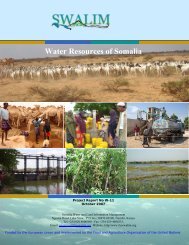
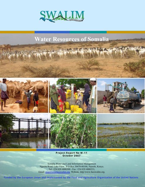
<strong>Water</strong> <strong>Resources</strong> <strong>of</strong> <strong>Somalia</strong><br />
Project Report No W-11<br />
October 2007<br />
<strong>Somalia</strong> <strong>Water</strong> and Land Information Management<br />
Ngecha Road, Lake View. P.O Box 30470-00100, Nairobi, Kenya.<br />
Tel +254 020 4000300 - Fax +254 020 4000333,<br />
Email: enquiries@fao<strong>swalim</strong>.org Website: http//www.fao<strong>swalim</strong>.org.<br />
Funded by the European Union and implemented by the Food and Agriculture Organization <strong>of</strong> the United Nations
Disclaimer<br />
The designations employed and the presentation <strong>of</strong> material in this information product do not imply the<br />
expression <strong>of</strong> any opinion whatsoever on the part <strong>of</strong> the Food and Agriculture Organization <strong>of</strong> the United<br />
Nations and the SWALIM Project concerning the legal status <strong>of</strong> any country, territory, city or area <strong>of</strong> its<br />
authorities, or concerning the delimitation <strong>of</strong> its frontiers or boundaries.<br />
This document is prepared by SWALIM consultant with contributions from the SWALIM team below:<br />
Alex Koton, Data Management Officer<br />
Peris Muchiri, Hydro-informatics Officer<br />
Flavian Muthusi, <strong>Water</strong> <strong>Resources</strong> Officer<br />
Hussein Gadain, <strong>Water</strong> Coordinator<br />
The document should be cited as follows:<br />
Basnyat, D. B. (2007), <strong>Water</strong> <strong>Resources</strong> <strong>of</strong> <strong>Somalia</strong>. Technical Report No W-11, FAO-SWALIM, Nairobi, Kenya<br />
ii
Acknowledgement<br />
iii<br />
Executive Summary<br />
I would like to acknowledge with gratitude the close support and guidance during the<br />
preparation <strong>of</strong> this report provided by Dr. Zoltan Balint, SWALIM Chief Technical Advisor<br />
and Dr. Hussein Gadain, SWALIM <strong>Water</strong> Coordinator.<br />
I would also like to thank and put on record the support provided by the entire SWALIM<br />
team for the completion <strong>of</strong> this report.<br />
The excellent information management system, including documentary, time series and<br />
spatial (GIS) data available at SWALIM, was useful in accessing all past work and data at<br />
one location and in a short period <strong>of</strong> time. This report has used extensively the data and<br />
analyses carried out by SWALIM and partner agencies over the past years. The various<br />
technical reports on water and land resources are referred to specifically and used in this<br />
report.<br />
Last but not the least; I would like to thank FAO, Rome and FAO-SWALIM for giving me<br />
this opportunity to undertake this water resources assessment study for <strong>Somalia</strong>.<br />
Executive Summary<br />
Introduction<br />
<strong>Water</strong> and land development need reliable data and information on available resources.<br />
<strong>Somalia</strong> <strong>Water</strong> and Land Information Management (SWALIM) are trying to recover lost<br />
information from all available sources and re-establish data collection networks. The purpose<br />
<strong>of</strong> this report is to prepare a comprehensive water resource assessment <strong>of</strong> <strong>Somalia</strong> based on<br />
data collected by SWALIM and partner agencies over the past years. The report is intended to<br />
assist decision makers, donors and investors.<br />
The specific objectives <strong>of</strong> the report are:<br />
• To assess the surface water and groundwater resources and the potential for meeting<br />
domestic, livestock and irrigation water supply demands in the whole <strong>of</strong> <strong>Somalia</strong>;<br />
• To assess the water resources <strong>of</strong> the Juba and Shabelle river basins with special focus on<br />
water resources development constraints and potential;<br />
• To identify major problems and priority areas within which more detailed investigations<br />
may be carried out.<br />
As water and land resources <strong>of</strong> a river basin are inter-related and form a unit, a river basin is<br />
widely recognized as a natural unit for water resources planning and management. In this<br />
context, the water resources assessment <strong>of</strong> <strong>Somalia</strong> was carried out on the basis <strong>of</strong> a major<br />
river (drainage) basin. Although the surface water divide (catchment boundaries) may not<br />
follow strictly the groundwater aquifer boundaries, they are, however, seen to coincide<br />
generally with the major drainage basins. The general approach followed was to assess the<br />
water, land and related resources in each river basin. The assessment is based on the<br />
following major drainage basins:
1. Gulf <strong>of</strong> Aden basin<br />
2. Darror basin<br />
3. Tug Der/ Nugal basin<br />
4. Ogaden basin<br />
5. Shabelle basin<br />
6. Juba basin<br />
7. Lag Dera basin<br />
8. Lag Badana basin<br />
9. Central Coastal basin<br />
Climate and Rainfall<br />
iv<br />
Executive Summary<br />
Based on the agro-ecological zones <strong>of</strong> <strong>Somalia</strong>, the climate varies from desert in the northeastern<br />
parts <strong>of</strong> the coastal areas <strong>of</strong> the Gulf <strong>of</strong> Aden basin and some areas in the Darror basin<br />
in the north-east; to arid and semi arid in much <strong>of</strong> the Gulf <strong>of</strong> Aden, Nugal and Ogaden<br />
basins in the central and northern regions; and to moist semi-arid in most <strong>of</strong> the Juba-<br />
Shabelle river basins in the south and in the mountainous areas <strong>of</strong> the Gulf <strong>of</strong> Aden in the<br />
north-west.<br />
The long-term mean annual rainfall varies from 93 mm in the Darror basin to 549 mm in the<br />
Lag Badana basins. While the maximum annual rainfall in the Ethiopian and Kenyan parts <strong>of</strong><br />
the Juba and Shabelle catchment reaches 1100 to 1350 mm, the maximum annual rainfall<br />
within <strong>Somalia</strong> is a high <strong>of</strong> about 700 mm in areas around Mareere in the lower parts <strong>of</strong> the<br />
Juba and Lag Badana basins. The minimum annual rainfall is around 20 mm in parts <strong>of</strong> the<br />
northern coastal locations in Gulf <strong>of</strong> Aden. In some parts <strong>of</strong> the Darror and Nugal basins it is<br />
as low as 66 and 80 mm, respectively.<br />
Annual Potential Evapo-transpiration (PET) is between 1500 to 2000 mm in the southern<br />
river basins but exceeds 2000 mm in the northern basins (and is as high as 3000 mm in the<br />
northern coastal regions <strong>of</strong> the Gulf <strong>of</strong> Aden basin). In most locations, PET exceeds rainfall<br />
in all months <strong>of</strong> the year. In the southern basin areas, the monthly rainfall exceeds 0.5 PET in<br />
the Gu and Deyr seasons giving “growing periods” which allow some rainfed agriculture.<br />
However, in the case <strong>of</strong> the northern basins, except for few locations in the extreme northwest<br />
<strong>Somalia</strong>, even 0.5 PET exceeds rainfall in all months giving zero values for the longest<br />
growing period (LGP) in most <strong>of</strong> the areas. This is why most areas in the northern basins are<br />
not suitable for agriculture.<br />
Hydrological Analysis <strong>of</strong> the Juba and Shabelle Rivers<br />
The Juba and Shabelle are the only perennial rivers in <strong>Somalia</strong>. They are also the only rivers<br />
where long-term hydrological data are available. Based on streamflow data from 1963 to<br />
1990, the long-term mean annual flow volumes in the Juba river at Luuq (catchment area-<br />
166,000 km 2 ) and at Jamama (268,800 km 2 ) are 5.9 billion cubic meter (bcm) and 5.4,<br />
respectively. The annual flows in the Shabelle river at Belet Weyne (207,000 km 2 ) and at<br />
Awdgegle (sp?) (280,000 km 2 ) are 2.4 bcm and 1.4 bcm respectively. The annual run<strong>of</strong>frainfall<br />
ratios (run<strong>of</strong>f-coefficient) are about 6.5% in Juba at Luuq and 2.1% in Shabelle at<br />
Belet Weyne. Annual flows decrease as the river flows downstream. This is mainly due to<br />
various factors such as: not much contribution to flows from the Somali catchment areas;<br />
frequent occurrence <strong>of</strong> bank full condition and spilling <strong>of</strong> flood into the flood plains and<br />
natural flood relief channels;river diversions for irrigation both during low and high flow
v<br />
Executive Summary<br />
periods; and losses due to evaporation and infiltration/recharge <strong>of</strong> the groundwater along the<br />
river. It is also evident that the flow in Juba is more than the flow in Shabelle although the<br />
catchment area <strong>of</strong> the latter is larger than the former.<br />
There are considerable flow variations within a year as well as from one year to another. As<br />
the reliability <strong>of</strong> flow available is important for the design and planning <strong>of</strong> water resources,<br />
flow duration curves for the locations where long-term data are available have been prepared<br />
for all locations with long-term data. For example, the flows exceeding 50% and 90% <strong>of</strong> the<br />
time in Juba at Luuq are 152 m 3 /s and 12 m 3 /s, respectively. In the most downstream gauged<br />
location in Juba at Jamame, the 50% and 90% flows are 144 m 3 /s and 10.3 m 3 /s. In Shabelle<br />
river at Belet Weyne, the 50% and 90% flows are 61 m 3 /s and 7.4 m 3 /s, respectively. And in<br />
the most downstream gauged location in Shabelle at Awdhgle (sp?), the 50% and 90% flows<br />
are 45.7 m 3 /s and only 0.26 m 3 /s. This shows that the water in Shabelle river is diverted most<br />
extensively in the dry seasons.<br />
High floods in the Juba and Shabelle are known to cause frequent problems. Flood frequency<br />
analyses <strong>of</strong> annual daily maximum streamflow values were carried out using different<br />
probability distribution functions. The 5-year, 10-year, 50-year, 100-year and 1000-year flood<br />
estimates based on the Gumbel distribution for Juba at Luuq are 1,117 m 3 /s, 1,338 m 3 /s,<br />
1,825 m 3 /s, 2,031 m 3 /s and 2,710 m 3 /s, respectively. These estimates for Shabelle at Belet<br />
Weyne are 337 m 3 /s, 395 m 3 /s, 522 m 3 /s, 576 m 3 /s and 754 m 3 /s, respectively. Flood values<br />
in Juba are more than that in Shabelle although the catchment area <strong>of</strong> the latter is larger than<br />
the former. This is due to higher rainfall intensities as well as denser drainage networks in the<br />
upper catchments <strong>of</strong> Juba.<br />
The flood volume is not very large compared to the catchment areas <strong>of</strong> the two rivers.<br />
However, various natural and man-made causes have aggravated the flood problems in the<br />
two river basins. These may be summarized as:<br />
• River bed levels rising higher than adjacent land, due to sediment deposition;<br />
• People breaching levees to irrigate land in dry seasons;<br />
• Encroachment <strong>of</strong> natural flood plains;<br />
• Unplanned closures <strong>of</strong> natural flood relief channels;<br />
• Total break down <strong>of</strong> the existing irrigation infrastructure;<br />
• A total lack <strong>of</strong> central or local governance managing the river basin.<br />
The problem <strong>of</strong> drought is also a recurrent problem in the two river basin areas. The low flow<br />
analyses <strong>of</strong> streamflows were carried out to plan for the worst condition <strong>of</strong> flow availability.<br />
Annual one-day, seven-day, 10-day, 15-day and monthly low flows were calculated, using<br />
the daily flow data in the two rivers. The lowest flows in the two rivers reach very low values<br />
close to even zero in some years. And as the river flows downstream, the low flows are<br />
extensively diverted for irrigation and other uses and the minimum flows in the lower reaches<br />
dropped to zero in many years. Due to the very high variability and zero or near zero flow<br />
values in some years, low flow frequency analysis was reasonable in the two upstream<br />
locations <strong>of</strong> the two rivers only. Even in the two locations, the low flows beyond a 10-year<br />
return period were mostly zeros, using the standard probability distribution functions.<br />
<strong>Water</strong> quality <strong>of</strong> the two rivers is a matter <strong>of</strong> concern since both the human and livestock<br />
populations use the river water for direct consumption. There was very little water quality<br />
data available for the two rivers. The only available long-term data was for Juba at Mareera<br />
where electrical conductivity (EC) values were available for the period, 1977 to 1990. It is
vi<br />
Executive Summary<br />
observed that the salinity in the river rises during the Jilaal season and peaks during Gu flood<br />
season. There is also a slight rise during the Deyr flood season, but it never reaches the peaks<br />
<strong>of</strong> Jilaal and Gu seasons.<br />
Very little sediment observation has been made in the two rivers. Based on 53 samples <strong>of</strong><br />
suspended sediment observations data from November 1989 to November 1990 in Shabelle at<br />
Afgoi, the total suspended sediment load is calculated to be about 6.9 million tons per year<br />
during the one year period. This is a preliminary estimate and it should be used with caution<br />
as there are various other factors that affect soil erosion and sediment transport.<br />
Surface <strong>Water</strong> in other Major Basins<br />
Surface water is limited in all the other drainage basins. There is no river with perennial<br />
flows. In the case <strong>of</strong> the northern basins especially that <strong>of</strong> the Gulf <strong>of</strong> Aden, there are a<br />
number <strong>of</strong> small streams (toggas) which are mostly ephemeral that originate from the<br />
mountainous areas in the north-west (above 2000 m elevation) and flow to the coastal areas<br />
<strong>of</strong> the Gulf <strong>of</strong> Aden. Other toggas draining the Nugal, Bokh and Darrror Valleys and other<br />
minor valleys move towards the Indian Ocean. However, there is practically no surface water<br />
that reaches the ocean as the rainfall falling in these catchments is lost through evaporation<br />
and infiltration.<br />
No long-term surface water monitoring is done in these streams. Some limited monitoring<br />
was done in the late fifties and in 1980 and 1981 in some catchments in the Gulf <strong>of</strong> Aden<br />
basin. The catchment areas <strong>of</strong> these toggas were in the range <strong>of</strong> 3000 km 2 to 4800 km 2 .<br />
Perennial springs are located along these toggas where the groundwater tables are intersected<br />
by the rocky outcrops. These toggas carry very high flood flows and debris after intense<br />
rainfall. Such surface run<strong>of</strong>f lasts for a few hours to a few days. Flash floods as high as 2500<br />
m 3 /s have been observed in toggas with a catchment area <strong>of</strong> 3,660 km 2 . There were 12 flood<br />
events observed in one year in the same togga, out <strong>of</strong> which four were between 900 m 3 /s and<br />
2200 m 3 /s. In such toggas, the annual run<strong>of</strong>f-rainfall ratio (run<strong>of</strong>f coefficient) are estimated to<br />
be between 3% and 6%.<br />
Surface <strong>Water</strong> Storage<br />
Wars (also called bailey, water pan, ponds or dams) and berkads are commonly used to<br />
collect surface (storm) water from small catchments <strong>of</strong> 2 to 3 km 2 . Wars are more common<br />
than berkads in southern drainage basins mainly because <strong>of</strong> the favourable soil type (clayey)<br />
for the construction <strong>of</strong> wars. From the distribution <strong>of</strong> water points in the old 1:100,000<br />
topograhical maps, we can see that percentage <strong>of</strong> rainwater ponds/reservoirs (87% in<br />
Shabelle, 91% in Juba, 79% in Lag Dera and 98% in Lag Badana) is larger compared to<br />
groundwater sources in the southern river basins than in the central and northern drainage<br />
basins (25% in Gulf <strong>of</strong> Aden, 28% in Darror, 39% in Nugal, 77% in Ogaden and 39% in<br />
central coastal basins).<br />
Rainfall and climate regime is important for designing the wars and berkads and in<br />
estimating the amount <strong>of</strong> rainfall that can be harvested. Some studies in the past (Kammer<br />
and Win, 1989) show that in catchments <strong>of</strong> 2.5 to 4 km 2 , storms <strong>of</strong> less than 15 mm rainfall<br />
did not produce run<strong>of</strong>f unless the antecedent moisture content was high. This would mean a<br />
threshold daily rainfall value <strong>of</strong> 20 to 30 mm, and there were only 9 to 16% <strong>of</strong> the rainfall<br />
days which exceeded this threshold values. Daily rainfall data have been analysed as part <strong>of</strong>
vii<br />
Executive Summary<br />
this study in some locations to calculate the number <strong>of</strong> days and amount <strong>of</strong> rainfall with daily<br />
rainfall exceeding different threshold values. The results show that there are few days with<br />
rainfall exceeding threshold values <strong>of</strong> 20 mm and that 24-hour maximum rainfall is<br />
sometimes close or even higher than the long-term annual rainfall.<br />
Groundwater <strong>Resources</strong><br />
Southern <strong>Somalia</strong>, which is traversed by the two perennial rivers, has the best hydrogeological<br />
conditions for finding groundwater such as along the major toggas in the alluvial<br />
deposits and weathered basement. In the areas covered by the Gulf <strong>of</strong> Aden, the Darror and<br />
the Nugal Drainage basins, groundwater movements start in the mountainous areas and move<br />
in two directions. The first is from the south to the north from the mountainous regions to the<br />
coastal areas <strong>of</strong> the Gulf <strong>of</strong> Aden. The second is from the north to the south towards the Haud<br />
and Sool plateaus. The hydro-geological divide also mostly coincides with the surface<br />
drainage divide.<br />
The areas <strong>of</strong> good groundwater potential are as follows:<br />
• Baydhaba Plateau, Buur, Waajid, Damassa areas in the Juba and Shabelle basins;<br />
• Alluvial plains along the Juba, Shabelle and Lag Dera rivers;<br />
• Shallow aquifers in the sand dunes in the central coastal belt and the northern coastal<br />
regions (freshwater lenses), in the Galkayo and Dhuusamarreb Ancestral drainage<br />
systems in the Mudug-Galgaduud Plateau, along the toggas in the mountainous areas<br />
and sloping plains <strong>of</strong> Northern <strong>Somalia</strong>;<br />
• Deep aquifers in the Mudug-Galgaduud Plateau with wells <strong>of</strong> 100m to 250 m depths;<br />
• Shallow aquifers in the Galcayo and Dhuusaarreb ancestral drainage and Coastal belt<br />
along the Gulf <strong>of</strong> Aden;<br />
• Upper catchment area <strong>of</strong> the mountainous zone in the Gulf <strong>of</strong> Aden and Darror basins<br />
where many springs and underground/surface dams and infiltration galleries could be<br />
constructed;<br />
• Plateaus and valleys in northern <strong>Somalia</strong> (Sanaag region, Haud Plateau and Darror<br />
Valley).<br />
Groundwater Use<br />
While surface water sources are limited to the riverine areas in the Juba and Shabelle basins<br />
and in toggas in the northern basins, groundwater sources such as dug wells, boreholes,<br />
springs, sub-surface dams and infiltration galleries are predominantly used to meet the human<br />
and livestock needs.<br />
Dug wells are extensively used along the toggas, sloping plains and the coastal areas<br />
(freshwater lenses) with depth ranging from 2 or 3 m to 10 m. <strong>Water</strong> quality is a problem in<br />
these wells due to poor construction and since they provide common outlets for both<br />
livestock and humans. Boreholes are a permanent source <strong>of</strong> water for most <strong>of</strong> the people. In<br />
the southern river basins, average depth varied from 90m to 220 m in Bakool region, 60 to 70<br />
m in Bay region, 60 to 25 (? check figure - Ed) m in the Hiraan region and 50 to 100 m in<br />
Gedo region. The average yield was around 10 to12 m 3 /hr. Borehole depths ranged from 90<br />
to 220 m (with static water levels from 80 to 130 m) in the north-western regions <strong>of</strong> <strong>Somalia</strong><br />
(Somaliland). The estimated yield was from 3 to 30 m 3 /hr. <strong>Water</strong> levels in Bari, Nugal,<br />
Eastern Sanaag and Mudug regions in central and north-eastern <strong>Somalia</strong> were estimated to be
viii<br />
Executive Summary<br />
around 30 m, 160 m, 120 m and 230 m, respectively. Many boreholes have been abandoned<br />
due to the unsustainable draw down <strong>of</strong> static water levels.<br />
Many natural springs exist in the Juba, Shabelle and Lag Dera basins (about 1 to 3% <strong>of</strong> the<br />
identified water points in the topographical maps) and in the mountainous areas <strong>of</strong> the Gulf <strong>of</strong><br />
Aden basin, Darror basin and Nugal (about 10% <strong>of</strong> the water points). Perennial spring<br />
sources are found across the mountainous areas and a number <strong>of</strong> thermal springs are found<br />
along the coast in the Gulf <strong>of</strong> Aden basin.<br />
<strong>Water</strong> for Human and Livestock<br />
Sufficient quantity and quality <strong>of</strong> water for human needs is considered a basic human right.<br />
Access to safe water is said to be limited to only about 20.5% <strong>of</strong> the population, <strong>of</strong> which<br />
53.1% live in urban areas and 4.1% in rural areas (World Bank, 2006, cited by IUCN, 2006).<br />
The present per capita consumption is said to be lower than the basic need standard <strong>of</strong> 20<br />
lpcd.<br />
Data on water used across regions and socio-economic pr<strong>of</strong>ile is not available. However,<br />
given the scarcity <strong>of</strong> water, 20 lpcd and 50 lpcd are considered the average water<br />
consumption (basic requirement) in most regions Based on these figures and the current<br />
population estimate <strong>of</strong> 7.5 million, the total basic water requirement for the whole country is<br />
estimated to be 240,000 m 3 /d.<br />
<strong>Water</strong> for livestock is crucial as the livelihood <strong>of</strong> the majority <strong>of</strong> the population depends on<br />
livestock. Considering the 25-litre (is it ‘2.5’-not ‘25’? check – Ed), 1.6-litre and litre per<br />
head per day (lphd) requirements <strong>of</strong> cattle, sheep/goats and camels, respectively, water<br />
demand for livestock in the country is about 230,000 m 3 /day (based on the livestock<br />
population <strong>of</strong> 4.7 million in 1988).<br />
Recent population estimates show that there is a general trend towards urbanization in the<br />
country as the internally displaced population returns to the towns. Urban water supply will<br />
therefore be an important issue. Most such towns are rehabilitating the old piped water<br />
system. Various management models based on public-private-participation (PPP) are now in<br />
place in these towns. Boreholes are the predominant source <strong>of</strong> water for such systems.<br />
<strong>Water</strong> for Agriculture<br />
The crisis <strong>of</strong> food security linked to flood and drought is a striking feature <strong>of</strong> life in <strong>Somalia</strong>.<br />
Crop production is largely limited to the alluvial plains <strong>of</strong> the Juba and Shabelle rivers and<br />
inter-riverine area <strong>of</strong> Bay region where 90% <strong>of</strong> production is undertaken. In northern regions,<br />
where pastoralism is predominant, crop cultivation is mostly confined to the alluvial plains<br />
and slopes along the toggas in the northern basins and in natural oases where groundwater is<br />
available. Production is mostly smallholder and subsistence based.<br />
Given the climatic regime <strong>of</strong> the country with its erratic and irregular rainfall pattern and the<br />
high potential evaporation losses, the water requirements <strong>of</strong> the crops are generally high. The<br />
cropping patterns for the irrigated agriculture in the Juba and Shabelle river basins consist <strong>of</strong><br />
fruit trees, maize and groundnuts in the Gu and Deyr periods and tomatoes, sesame, cow peas<br />
and vegetables in the Deyr and Jilaal seasons. Based on a standard cropping pattern covering<br />
the above crops and representative cropping areas, irrigation water requirements were
ix<br />
Executive Summary<br />
estimated, using climatic conditions <strong>of</strong> Jilib (in Juba basin) and Jowhar (in Shabelle basin).<br />
The irrigation water requirements (considering 65% field application efficiency only) for the<br />
representative copping patterns were an average <strong>of</strong> 0.36 l/s/ha or 11,400 m 3 /ha and 0.37 l/s/ha<br />
or 11,800 m 3 /ha, respectively.<br />
Considering the 80% dependable flow (flows exceeding 80% <strong>of</strong> the time) available in Juba at<br />
Bardheera and in Shabelle at Mahadey Weyne, it is estimated that 50,000 ha <strong>of</strong> land could be<br />
irrigated year-round in Juba basin, while seasonal irrigation for a second crop <strong>of</strong> maize and<br />
sesame could be provided in much more land (up to 170,000 ha). In the case <strong>of</strong> Shabelle<br />
river, irrigation could be provided for up to 25,000 ha in the Gu season and it can be<br />
increased to 80,000 ha for the Deyr crops. These figures are preliminary estimates and are<br />
based on unregulated flow in the two rivers.<br />
In the case <strong>of</strong> the mountainous regions in north-west <strong>Somalia</strong>, small pockets <strong>of</strong> land which<br />
are less than 1 to 2 ha are irrigated and cultivated along the toggas. Due to the high PET<br />
values and low rainfall, water required to meet the net irrigation requirement (effective<br />
rainfall minus crop requirement) for one crop <strong>of</strong> maize and sorghum during about four<br />
months growing period each is in the range <strong>of</strong> about 6000 m 3 and 5500 m 3 per ha (for the<br />
agro-climatic condition <strong>of</strong> Hargeisa). If 65% irrigation efficiency is considered, about 9230<br />
m 3 and 8460 m 3 <strong>of</strong> water would be required per ha.<br />
Recommendations for Future Activities<br />
The following are some <strong>of</strong> the recommendations for future activities that would help improve<br />
water resources management in <strong>Somalia</strong>.<br />
Meteorological Network<br />
• The rainfall stations in the Juba, Shabelle, Gulf <strong>of</strong> Aden and Nugal Drainage Basins in<br />
<strong>Somalia</strong> are within the recommended network density <strong>of</strong> World Meteorological<br />
Organization (WMO). However, the network densities in other basins are sparse. It is<br />
recommended that network density be installed in the following basins: an additional<br />
three in Lag Dera, two in Lag Badana, one in Darror, five in Ogaden and five in the<br />
Central Coastal basins. This would bring the total rainfall stations in the country to 86<br />
from the currently operational 70 stations.<br />
• None <strong>of</strong> the above rainfall stations is the automatic recording type nor does any one <strong>of</strong><br />
them measure other agro-climatological parameters. It is recommended that the ‘tipping<br />
bucket’ type automatic rain gauges be installed in 15 stations, covering at least one in<br />
each major basin, and some additional ones installed in the northern mountainous regions<br />
and in the central coastal basin areas.<br />
• Pan evaporation, wind, relative humidity, water and air temperature and sunshine hours<br />
are other agro-climatological parameters that are required for water and agricultural<br />
development and management. WMO recommends one evaporation station in 50,000 km 2<br />
in hilly and coastal areas and one in 100,000 km 2 in arid regions. It is recommended that<br />
19 evaporation stations be installed covering all the major drainage basins.<br />
• Apart from the meteorological stations within <strong>Somalia</strong>, it is important that rainfall data<br />
are available from the upper catchment areas <strong>of</strong> the Ethiopian and Kenyan highlands and
x<br />
Executive Summary<br />
other areas in the catchment both for flood forecasting as well as run<strong>of</strong>f estimation using<br />
rainfall-run<strong>of</strong>f models.<br />
Hydrometric Network<br />
• Daily staff gauge readings are observed in each <strong>of</strong> three hydrometric stations in the Juba<br />
(Luuq, Bardhere and Bualle) and Shabelle rivers (Belet Weyne, Bulo Burti and Jowhar).<br />
There are eight other stations, four in each riverine area, mostly in the downstream stretch<br />
<strong>of</strong> the two rivers that were operational before 1990 but have not been re-established yet.<br />
The currently operational stations in the upper stretches <strong>of</strong> the rivers are appropriate for<br />
the estimation <strong>of</strong> the flows available in the river. The stations in the lower reaches should<br />
be rehabilitated in the future, especially after the irrigation infrastructure in the<br />
downstream areas are rehabilitated and start functioning again.<br />
• The other small streams in the northern basins do not have perennial flows but are known<br />
to generate flash floods during the rainy season. It is recommended that discharge<br />
measurement and river gauging be carried out in at least five such toggas in the north.<br />
These may be T. Durdur (north-eastern Gulf <strong>of</strong> Aden), T. Hodomo (north-central Gulf <strong>of</strong><br />
Aden), T. Dhut (Darror basin), T. Nugal (Nugal basin) and the togga contributing flows<br />
to the Xingalool internal drainage basin. These can be useful for designing early flood<br />
warning systems.<br />
• The presently operational hydrometric stations observe daily gauge readings. Since no<br />
discharge measurements have been made after their rehabilitation, rating curves have not<br />
been developed. It is recommended that direct discharge measurements be started as soon<br />
as possible so that the rating curves can be developed.<br />
• SWALIM is installing automatic water level recorders in four locations, Luuq and Bualle<br />
in Juba river and Belet Weyne and Jowhar in Shabelle river. Although the water level<br />
variations within a day are not expected to be much, these water level recorders would<br />
help derive the flood hydrographs and they would also be useful to observe any variations<br />
in the irrigation and other diversions within a day.<br />
Surface water quality and sediment measurements<br />
• The Juba and Shabelle rivers are extensively used by the people and livestock to meet<br />
their water needs in the riverine areas. While water salinity is a major concern, other<br />
parameters related to human and aquatic health (microbiological analysis, dissolved<br />
oxygen (DO) and minerals) are also important. It is recommended that water quality<br />
observations be carried out in at least two locations each in the two rivers, Luuq and<br />
Bualle in Juba and Belet Weyne and Jowhar in Shabelle. As urbanization and agricultural<br />
development increase along the river course, the water quality observations should be<br />
carried out in key locations in the downstream areas <strong>of</strong> the river, especially after the<br />
gauging stations in the lower reaches are rehabilitated.<br />
• It is recommended that sediment sampling be undertaken in at least two locations in each<br />
river, Luuq and Bualle in Juba and Belet Weyne and Jowhar in Shabelle. As the soil<br />
erosion is found to be high during the first rainfall period sediment sampling should be<br />
done as frequently as once every week during March to June and once in two weeks<br />
during other months.<br />
• The other rivers and toggas are also central in meeting the water needs <strong>of</strong> the people and<br />
livestock <strong>of</strong> the areas. <strong>Water</strong> quality monitoring in such rivers should also be carried out,<br />
taking into consideration agricultural and human interventions in these toggas.<br />
Groundwater monitoring
xi<br />
Executive Summary<br />
• It is recommended that hydro-geological investigations be carried out in the future to<br />
update past studies and to estimate the renewable groundwater available including the<br />
potential recharge areas. This will require a detailed assessment <strong>of</strong> the topography,<br />
geology and hydrology <strong>of</strong> the areas, including some sub-surface investigations. While this<br />
activity needs to be carried out in the long term, it is recommended that the groundwater<br />
monitoring <strong>of</strong> some key bore holes be done in the short term.<br />
• Based on the data collected in SWIMS by SWALIM, a selected number <strong>of</strong> bore holes<br />
covering different river basins and aquifer systems should be monitored. The monitoring<br />
should include: yield tests, observations <strong>of</strong> seasonal variations <strong>of</strong> the water level, water<br />
quality tests (especially the salinity and its seasonal variation but including other physical<br />
(temperature, colour, turbidity, odour and taste), chemical and bacteriological analyses<br />
(coliform etc).<br />
• The shallow wells (dug wells) and springs should also be monitored to test its suitability<br />
for human and livestock consumption.<br />
Run<strong>of</strong>f characteristics <strong>of</strong> small catchments<br />
• Selected catchments like those <strong>of</strong> toggas in the north and small catchments that are used<br />
to collect storm water in the wars and berkads spread across the country should be<br />
monitored for one to two years. A meteorological station should be installed as required,<br />
equipped with automatic rain gauges and taking observations <strong>of</strong> other parameters like pan<br />
evaporation, wind, air temperature, relative humidity, sunshine hours and automatic<br />
surface water recording facility (gauges in a river or a war, berkad or pond) . A simple<br />
water balance -- taking into consideration rainfall, evaporation¸ infiltration and other<br />
losses, soil moisture content and run<strong>of</strong>f -- can then be used to develop the rainfall-run<strong>of</strong>f<br />
relationships in different catchment and physiographic conditions.<br />
Survey <strong>of</strong> water demand for humans and livestock<br />
• There is little data available on the water consumption pattern <strong>of</strong> households and<br />
livestock. Factors such as the socio-economic pr<strong>of</strong>ile, quantity and quality <strong>of</strong> water<br />
sources available, cost <strong>of</strong> water, climatic conditions are essential for designing<br />
interventions to improve access to safe water. Hence, it is recommended that users’<br />
surveys <strong>of</strong> water sources covering different regions/basins, rural and urban, be carried out<br />
to better understand the water consumption characteristics and the water needs <strong>of</strong><br />
different regions. This should also include nomadic communities who move with their<br />
livestock from one place to another. Such a survey should be done on a water source basis<br />
(consumers using one source) and community basis (community and livestock using<br />
different sources).<br />
Optimising <strong>Water</strong> Input to agriculture<br />
• <strong>Water</strong> use for agriculture consumes the maximum amount <strong>of</strong> water. The crop yield <strong>of</strong> the<br />
major crops grown such as maize and sorghum are seen to be low and, as expected, the<br />
yield is higher in irrigated areas than in rain-fed areas. While crop yield depends on many<br />
types <strong>of</strong> inputs such as climatic conditions, soil, seeds, and fertilizers, it is also a matter <strong>of</strong><br />
interest to optimise the water input to agriculture. Better water management through the<br />
forecast <strong>of</strong> climatic conditions (forecast <strong>of</strong> on-set and expected amount <strong>of</strong> rainfall) and<br />
water availability may assist the farmers to improve the agricultural productivity. A study<br />
linking water availability, rainfall forecasting and selection <strong>of</strong> cropping patterns and types<br />
may be carried out. This will require an integrated water, land and agricultural resources<br />
approach.
xii<br />
Executive Summary<br />
<strong>Water</strong> resources development<br />
• <strong>Water</strong> resources development potential exists especially in the Juba and Shabelle basins<br />
and in some <strong>of</strong> the watersheds in the mountainous areas <strong>of</strong> the northern basins. Such<br />
development should assist in better management <strong>of</strong> the water resources in the basins to<br />
address the problems <strong>of</strong> “too much”, “too little” and “too dirty” water. The planned water<br />
resources development in the Juba and Shabelle rivers includes rehabilitation <strong>of</strong> the old<br />
irrigation infrastructure such as barrages and canals. Some inter-basin diversion, <strong>of</strong>fstream<br />
storage and reservoir projects (e.g. Berdheere in Juba) were planned in the past.<br />
These should be reassessed, based on the data collected and the assessment and studies<br />
carried out on the water and land resources by SWALIM, including this one.<br />
• In the case <strong>of</strong> the flooding problem in the Juba and Shabelle rivers, it is seen that<br />
integrated flood management would help alleviate many <strong>of</strong> the problems presently<br />
attributed to floods in the areas. Even a small flood event that occurs once in every five<br />
years is known to create major problems. Various strategies <strong>of</strong> integrated flood<br />
management can be undertaken, such as reduction <strong>of</strong> flooding, reduction <strong>of</strong> susceptibility<br />
to damage, mitigating the impacts and preserving the natural resources <strong>of</strong> flood plains<br />
(WMO and GWP, 2004). It is recommended that an integrated flood management plan be<br />
developed for the two river basins, based on a river basin approach.<br />
Data Gaps<br />
• There were major data gaps in some regions (southern regions in Lad Dera and Lag<br />
Badana basins) due to security concerns and data gaps in some sectors such as water for<br />
other uses like industry, environment and wetlands (swamps).<br />
• It is recommended that efforts are made to collect data on the above so that water<br />
resources management can be carried out in a holistic manner.
Glossary <strong>of</strong> Somali Terms<br />
___________________________________________________________________________<br />
Glossary <strong>of</strong> Somali Terms<br />
Balli Small surface water harvesting ponds<br />
Berkad Underground reservoir, lined or un-lined, excavated to store surface<br />
run<strong>of</strong>f<br />
Deyr October to November, minor wet season<br />
Elmi Jama Sorghum variety grown in Northern <strong>Somalia</strong><br />
Gu April to June, major wet season<br />
Hagaa July to September dry and cool season<br />
Jilaal Dry season from December to March<br />
Mugciid Underground reservoir storage well with an average depth <strong>of</strong> 15 meters<br />
Togga A non-perennial (seasonal) stream which is deep and narrow<br />
Wadi A non-perennial (seasonal) stream which is wide and shallow<br />
War Unlined dug-out (dam), usually 2 to3 m deep<br />
xiii
List <strong>of</strong> Abbreviations<br />
___________________________________________________________________________<br />
List <strong>of</strong> Abbreviations<br />
AEZ Agro-ecological zones<br />
AMC Antecedent moisture content<br />
CV Coefficient <strong>of</strong> variation<br />
DD Drainage density<br />
DEM Digital Elevation Model<br />
EC Electrical Conductivity<br />
EC European Commission<br />
EV1 Extreme value type 1 distribution<br />
FAO Food and Agriculture Organisation <strong>of</strong> United Nations<br />
FSAU Food Security Analysis Unit<br />
FSAU Food Security Analysis Unit- <strong>Somalia</strong><br />
GEV General Extreme value distribution<br />
GWP Global <strong>Water</strong> Partnership<br />
Ha Hectare<br />
IDPs/IDP Internally Displaced People /Internally Displaced Person<br />
IDWA Inverse Distance Weighted Average<br />
ITCZ Inter tropical Convergence Zone<br />
IWRM Integrated <strong>Water</strong> <strong>Resources</strong> Management<br />
KS Kolmogorav-Smirn<strong>of</strong>f goodness-<strong>of</strong>-fits tests<br />
l/s/ha Litre per second per ha<br />
LGP Length <strong>of</strong> Growing Period<br />
LN2 Log-normal distribution<br />
LN3 3-parameter Log-normal distribution<br />
LP3 Log-pearson type 3 distribution<br />
Lpcd Litre per capita per day<br />
Lphd Litre per head per day (livestock)<br />
LUT Land utilization type<br />
MDGs Millennium Development Goals<br />
PET Potential Evapotranspiration<br />
PPP Public-private participation<br />
PSAWEN Puntland State Agency for <strong>Water</strong>, Energy and Natural <strong>Resources</strong><br />
RC Run<strong>of</strong>f coefficient<br />
RFE Rainfall Estimates<br />
RH Relative Humidity<br />
SWALIM <strong>Somalia</strong> <strong>Water</strong> and Land Information Management<br />
SWIMS <strong>Somalia</strong> <strong>Water</strong> Source Information Management System<br />
UNCEF United Nations Children’s Fund<br />
UNDP United Nations Development Programme<br />
UNESCO United Nations Education, Science and Cultural Organization<br />
WHO World Health Organization<br />
WMO World Meteorological Organization<br />
xiv
Table <strong>of</strong> Contents<br />
___________________________________________________________________________<br />
Table <strong>of</strong> Contents<br />
Acknowledgement<br />
Executive Summary<br />
Glossary <strong>of</strong> Somali Terms<br />
List <strong>of</strong> Abbreviations<br />
1 Introduction....................................................................................................................2<br />
1.1 Purpose and scope <strong>of</strong> report...........................................................................................2<br />
1.2 General approach and methodology ..............................................................................3<br />
1.3 Assumptions and limitations..........................................................................................4<br />
1.4 Literature Review...........................................................................................................5<br />
1.5 Structure and contents <strong>of</strong> the report...............................................................................7<br />
2 Country Context.............................................................................................................8<br />
2.1 Geography......................................................................................................................8<br />
2.2 Socio-economic feature .................................................................................................8<br />
2.3 Land resources .............................................................................................................12<br />
2.4 Climatological data ......................................................................................................14<br />
2.5 Surface water resources ...............................................................................................17<br />
2.6 Hydro-meteorological database ...................................................................................17<br />
2.7 Groundwater resources ................................................................................................18<br />
2.8 <strong>Water</strong> use .....................................................................................................................20<br />
2.8.1 <strong>Water</strong> for human and livestock....................................................................................20<br />
2.8.2 <strong>Water</strong> for agriculture....................................................................................................21<br />
2.8.3 Other water uses...........................................................................................................22<br />
2.9 Enabling environment..................................................................................................23<br />
3 Major River Basins in South-Central <strong>Somalia</strong>.............................................................24<br />
3.1 General characteristics.................................................................................................24<br />
3.1.1 Location .......................................................................................................................24<br />
3.1.2 Topography and drainage network ..............................................................................27<br />
3.1.3 Land resources .............................................................................................................30<br />
3.1.4 Socio-economics ..........................................................................................................36<br />
3.1.5 Trans-boundary issues .................................................................................................38<br />
3.2 Climate.........................................................................................................................41<br />
3.2.1 Network analysis..........................................................................................................41<br />
3.2.2 Rainfall characteristics.................................................................................................43<br />
3.2.3 Potential Evapotranspiration........................................................................................52<br />
3.2.4 Air Temperature...........................................................................................................54<br />
3.2.5 Relative Humidity........................................................................................................55<br />
3.2.6 Wind Speed..................................................................................................................56<br />
3.3 Surface water resources ...............................................................................................57<br />
3.3.1 Hydrological networks.................................................................................................58<br />
3.3.2 Streamflow...................................................................................................................58<br />
3.3.3 Rating curves ...............................................................................................................59<br />
3.3.4 Monthly and annual flows ...........................................................................................61<br />
3.3.5 Flow duration curves....................................................................................................66<br />
3.3.6 High flow analysis .......................................................................................................71<br />
3.3.7 Low flow analysis........................................................................................................77<br />
3.3.8 <strong>Water</strong> quality and sedimentation .................................................................................85<br />
3.3.9 Surface water storage - Wars and Berkads ..................................................................88<br />
xv
Table <strong>of</strong> Contents<br />
___________________________________________________________________________<br />
3.4 Groundwater ................................................................................................................91<br />
3.4.1 Grounwater Aquifers ...................................................................................................91<br />
3.4.2 Potential groundwater development areas ...................................................................93<br />
3.4.3 Groundwater use ..........................................................................................................97<br />
3.5 <strong>Water</strong> demand ............................................................................................................100<br />
3.5.1 Domestic demand.......................................................................................................101<br />
3.5.2 Livestock demand ......................................................................................................103<br />
3.5.3 Irrigation water use ....................................................................................................103<br />
4 Major River Basins in Central-North <strong>Somalia</strong>...........................................................110<br />
4.1 General characteristics...............................................................................................110<br />
4.1.1 Location .....................................................................................................................110<br />
4.1.2 Topography and physiography....................................................................................115<br />
4.1.3 Land resources ...........................................................................................................119<br />
4.1.4 Socio-economics ........................................................................................................121<br />
4.2 Climate.......................................................................................................................124<br />
4.2.1 Network analysis........................................................................................................124<br />
4.2.2 Rainfall characteristics...............................................................................................126<br />
4.2.3 Potential Evapotranspiration......................................................................................139<br />
4.2.4 Air Temperature.........................................................................................................141<br />
4.2.5 Relative Humidity......................................................................................................143<br />
4.2.6 Wind Speed................................................................................................................144<br />
4.3 Surface water .............................................................................................................146<br />
4.4 Surface <strong>Water</strong> Storage - Wars and Berkads ..............................................................150<br />
4.5 Groundwater ..............................................................................................................152<br />
4.5.1 Groundwater Aquifers ...............................................................................................153<br />
4.5.2 Potential groundwater development areas .................................................................155<br />
4.5.3 Groundwater use ........................................................................................................161<br />
4.6 <strong>Water</strong> demand ............................................................................................................164<br />
4.6.1 Domestic demand.......................................................................................................164<br />
4.6.2 Livestock demand ......................................................................................................169<br />
4.6.3 Irrigation demand.......................................................................................................169<br />
5 Summary, Conclusions and Recommendations.........................................................172<br />
5.1 Summary and conclusions .........................................................................................172<br />
5.2 Recommendations......................................................................................................181<br />
5.2.1 Network density and hydro-meteorological data collection ......................................181<br />
5.2.2 Surface water quality and sediment measurements ...................................................183<br />
5.2.3 Groundwater monitoring............................................................................................184<br />
5.2.4 Run<strong>of</strong>f characteristics <strong>of</strong> small catchments ...............................................................185<br />
5.2.5 <strong>Water</strong> for humans and livestock ................................................................................185<br />
5.2.6 <strong>Water</strong> for agriculture..................................................................................................186<br />
5.2.7 <strong>Water</strong> resources development....................................................................................186<br />
6 References..................................................................................................................188<br />
Annexes<br />
Annex A: Socio-economic Data<br />
Annex B: Selected Climatological Data and Sample Results<br />
Annex C: Selected Hydrometric Data and Sample Results<br />
xvi
Table <strong>of</strong> Contents<br />
___________________________________________________________________________<br />
List <strong>of</strong> Figures<br />
Figure 2-1 : Population Distribution within different Regions <strong>of</strong> <strong>Somalia</strong> .............................10<br />
Figure 2-2 : Percentage <strong>of</strong> Urban, Rural and Nomadic Population (1988) .............................10<br />
Figure 2-3 : Percentage <strong>of</strong> Urban and Non-urban Population (2005 estimate) .......................10<br />
Figure 2-4 : Livestock Percentage in different Regions <strong>of</strong> <strong>Somalia</strong> (1988) ............................11<br />
Figure 3-1 : Hypsometric Curves <strong>of</strong> full Basin areas ..............................................................30<br />
Figure 3-2 : Hypsometric Curves <strong>of</strong> Catchment areas within <strong>Somalia</strong> ...................................30<br />
Figure 3-3 : Urbanization Trends in Southern <strong>Somalia</strong>...........................................................37<br />
Figure 3-4 : Maize cultivated area and yield in selected Districts <strong>of</strong> <strong>Somalia</strong> ........................39<br />
Figure 3-5 : Sorghum cultivated area and yield in selected Districts <strong>of</strong> <strong>Somalia</strong>....................40<br />
Figure 3-6 : Rainfall variation with elevation in Hagaa and Deyr and Gu Seasons ...............44<br />
Figure 3-7: Monthly Rainfall and PET variations <strong>of</strong> selected Stations ...................................46<br />
Figure 3-8 : Coefficient <strong>of</strong> variation <strong>of</strong> Annual Rainfall for representative Stations ..............49<br />
Figure 3-9 : Daily Rainfall in Baidoa (1983, low rainfall year) ..............................................51<br />
Figure 3-10 : Daily Rainfall in Baidoa (1923, high rainfall year) ...........................................51<br />
Figure 3-11 : 24-hour maximum Rainfall Frequency Analysis Results (Baidoa) ...................52<br />
Figure 3-12 : Annual PET in selected Stations in Juba and Shabelle Basins ..........................53<br />
Figure 3-13 : PET in selected Stations within Shabelle Basin.................................................53<br />
Figure 3-14 : PET in selected Stations within Juba Basin.......................................................54<br />
Figure 3-15 : Mean Monthly Temperature in selected Stations within Shabelle Basin ..........55<br />
Figure 3-16 : Mean Monthly Temperature in selected Stations within Juba Basin.................55<br />
Figure 3-17 : Relative Humidity in selected Stations within Shabelle Basin..........................56<br />
Figure 3-18 : Relative Humidity in selected Stations within Juba Basin ................................56<br />
Figure 3-19: Wind Speed in selected Stations within Shabelle Basin.....................................57<br />
Figure 3-20 : Wind Speed in selected Stations within Juba Basin ..........................................57<br />
Figure 3-21 : Monthly Flow Variation along the Juba River...................................................62<br />
Figure 3-22 : Monthly Flow Variation along the Shabelle River ............................................62<br />
Figure 3-23 : Long-term Average Flows in the Juba River.....................................................63<br />
Figure 3-24 : Long-term Average Flows in the Shabelle River...............................................63<br />
Figure 3-25 : Flow Duration Curve <strong>of</strong> Juba at Luuq ...............................................................67<br />
Figure 3-26 : Flow Duration Curve <strong>of</strong> Shabelle at Belet Weyne.............................................68<br />
Figure 3-27 : Annual Hydrograph <strong>of</strong> the Juba River (1981) ..................................................73<br />
Figure 3-28 : Annual Hydrograph <strong>of</strong> the Shabelle River (1981).............................................73<br />
Figure 3-29 : Flood Frequency Analysis for Juba River at Luuq ............................................75<br />
Figure 3-30 : Flood Estimates for Juba River at Luuq (Gumbel Distribution)........................75<br />
Figure 3-31 : Flood Frequency Analysis for Shabelle River at Belet Weyne .........................76<br />
Figure 3-32 : Flood Estimates for Shabelle River at Belet Weyne..........................................77<br />
Figure 3-33 : Seven-day Low Flow Frequency for Juba at Luuq............................................84<br />
Figure 3-34 : Monthly Low Flow Frequency for Juba at Luuq ...............................................84<br />
Figure 3-35 : Seven-day Low Flow Frequency for Shabelle at Belet Weyne .........................85<br />
Figure 3-36 : Monthly Low Flow Frequency for Shabelle at Belet Weyne ............................85<br />
Figure 3-37 : Long-term Salinity (mean and median) for the Juba River at Mereere .............86<br />
Figure 3-38 : Annual Variation <strong>of</strong> Salinity for the Juba River at Mereere..............................86<br />
Figure 3-39 : Suspended Sediment and Discharge Data for the Shabelle at Afgoi .................87<br />
Figure 3-40 : Relationship between Discharge and Sediment Concentration .........................87<br />
Figure 3-41 : Variation <strong>of</strong> Salinity in the Shabelle River at Afgoi..........................................88<br />
Figure 3-42 : <strong>Water</strong> Balance for different Irrigation Scenarios (Juba River)........................108<br />
Figure 3-43 : <strong>Water</strong> Balance for different Irrigation Scenarios (Shabelle River)..................109<br />
xvii
Table <strong>of</strong> Contents<br />
___________________________________________________________________________<br />
Figure 4-1 : Hypsometric Curves for Major Basins in Central-Northern <strong>Somalia</strong> (based on<br />
90m SRTM DEM data)..........................................................................................................117<br />
Figure 4-2 : Crop Calendar for some Rain-fed Agriculture in Durdur Catchment................121<br />
Figure 4-3 : Urbanization trends in Northern <strong>Somalia</strong> ..........................................................123<br />
Figure 4-4 : Monthly Rainfall and PET Variations ...............................................................128<br />
Figure 4-5 : Seasonal Rainfall Variation with Elevation in Central-Northern <strong>Somalia</strong> ........129<br />
Figure 4-6 : Annual Rainfall Variation with Elevation (North <strong>of</strong> 8 o N <strong>of</strong> Equator)..............130<br />
Figure 4-7 : Coefficient <strong>of</strong> Variation <strong>of</strong> Annual Rainfall for representative Stations ...........133<br />
Figure 4-8 : 24-hour Maximum Rainfall Frequency Analysis Results (Hargeisa)................138<br />
Figure 4-9 : 24-hour Maximum Rainfall Frequency Analysis Results (Galcayo).................138<br />
Figure 4-10 : Annual PET in selected Stations across <strong>Somalia</strong>.............................................139<br />
Figure 4-11 : PET in selected Stations within Gulf <strong>of</strong> Aden Basin.......................................140<br />
Figure 4-12 : PET in selected Stations within Darror, Tug Der/ Nugal and Ogaden Basins.140<br />
Figure 4-13 : PET in selected Stations in the Eastern Coastal Areas ....................................141<br />
Figure 4-14 : Mean Monthly Temperature in selected Stations within Gulf <strong>of</strong> Aden Basin.142<br />
Figure 4-15 : Mean Monthly Temperature in selected Stations within Darror, Tug Der/ Nugal<br />
and Ogaden Basins.................................................................................................................142<br />
Figure 4-16 : Mean Monthly Temperature in selected Stations in the Central Coastal Basin<br />
................................................................................................................................................142<br />
Figure 4-17 : Relative Humidity in selected Stations in the Gulf <strong>of</strong> Aden Basin..................143<br />
Figure 4-18 : Relative Humidity in selected Stations in the Darror, Tug Der/ Nugal and<br />
Ogaden Basins .......................................................................................................................143<br />
Figure 4-19 : Relative Humidity in selected Stations in the Central Coastal Basin ..............144<br />
Figure 4-20 : Wind Speed in selected Stations in the Gulf <strong>of</strong> Aden Basin............................145<br />
Figure 4-21 : Wind Speed in selected Stations in the Darror, Tug Der/Nugal and Ogaden<br />
Basins.....................................................................................................................................145<br />
Figure 4-22 : Wind Speed in selected Stations in the Central Coastal Basin ........................145<br />
Figure 4-23 : <strong>Water</strong> Points from 1:100,000 Topographical Maps.........................................151<br />
Figure 5-1 : Hypsometric Curves <strong>of</strong> Major River Basins across <strong>Somalia</strong>.............................172<br />
Figure 5-2 : Hypsometric Curves (catchment area within <strong>Somalia</strong>) <strong>of</strong> Major River Basins.173<br />
Figure 5-3 : Annual Run<strong>of</strong>f along the Juba River..................................................................175<br />
Figure 5-4 : Annual Run<strong>of</strong>f along the Shabelle River ...........................................................176<br />
xviii
Table <strong>of</strong> Contents<br />
___________________________________________________________________________<br />
List <strong>of</strong> Tables<br />
Table 2-1 : Livestock Population in different Regions <strong>of</strong> <strong>Somalia</strong> in 1988 ............................11<br />
Table 2-2 : Recommended EC values for <strong>Water</strong> for Human and Animal Consumption ........20<br />
Table 3-1: Topographic and Drainage Characteristics <strong>of</strong> the Major River Basins in South-<br />
Central <strong>Somalia</strong>........................................................................................................................31<br />
Table 3-2: Major Land Use Types in South-Central <strong>Somalia</strong> .................................................33<br />
Table 3-3 : Crop Calendar for Main Rainfed Crops in South-Central <strong>Somalia</strong>.......................34<br />
Table 3-4: Land Suitability for Irrigated Agriculture in Riverine areas ..................................35<br />
Table 3-5 : Crop Calendar for some Irrigated Agriculture along the Juba and Shabelle River<br />
Basins.......................................................................................................................................36<br />
Table 3-6: Population Dynamics in Southern <strong>Somalia</strong> for 1988 and 2005 .............................37<br />
Table 3-7 : Rainfall Station Network in South-Central <strong>Somalia</strong> .............................................42<br />
Table 3-8 : Stations with Long-term Mean Agro-climatological Estimates............................43<br />
Table 3-9 : Seasonal Rainfall Variation in the Major Basins <strong>of</strong> South-Central <strong>Somalia</strong> ........43<br />
Table 3-10 : Annual Areal Rainfall (mm) for River Basins in South-Central <strong>Somalia</strong>...........45<br />
Table 3-11 : 80% Dependable Monthly Rainfall in selected Stations (mm) in South-Central<br />
<strong>Somalia</strong> ....................................................................................................................................50<br />
Table 3-12 : Number <strong>of</strong> days with Daily Rainfall > 20 mm for selected Stations ..................51<br />
Table 3-13 : Annual PET <strong>of</strong> selected Stations in Juba and Shabelle Basins ...........................53<br />
Table 3-14 : Long-term Mean Monthly Discharge in Juba River (m 3 /s).................................64<br />
Table 3-15 : Long-term Mean Monthly Discharge in Shabelle River (m 3 /s) ..........................65<br />
Table 3-16 : Flow Duration Curve for Juba River at Luuq (m 3 /s)...........................................66<br />
Table 3-17 : Flow Duration Curve for Shabelle River at Belet Weyne (m 3 /s)........................66<br />
Table 3-18 : Summary <strong>of</strong> Flow Duration Curve in Juba River (m 3 /s).....................................69<br />
Table 3-19 : Summary <strong>of</strong> Flow Duration Curve in Shabelle River (m 3 /s) ..............................70<br />
Table 3-20 : Annual Maximum Discharge (m 3 /s) for the Juba and Shabelle Gauging Stations<br />
..................................................................................................................................................72<br />
Table 3-21: Flood Frequency Analysis for Juba at Luuq (m 3 /s)..............................................74<br />
Table 3-22: Flood Frequency Analysis for Shabelle at Belet Weyne (m 3 /s)...........................76<br />
Table 3-23 : Annual Low Flows in Juba River at Luuq (m 3 /s)................................................79<br />
Table 3-24 : Annual Low Flows in Juba River at Jamame (m 3 /s)...........................................80<br />
Table 3-25 : Annual Low Flows in Shabelle River at Belet Wyene (m 3 /s).............................81<br />
Table 3-26 : Annual Low Flows in Shabelle River at Awdhegle (m 3 /s) .................................82<br />
Table 3-27 : Low Flow Frequency Analysis for Juba at Luuq (m 3 /s) .....................................83<br />
Table 3-28 : Low Flow Frequency Analysis for Shabelle at Belet Weyne (m 3 /s)...................83<br />
Table 3-29 : <strong>Water</strong> Points Digitised from the Topographical Maps <strong>of</strong> <strong>Somalia</strong> .....................89<br />
Table 3-30 : Areas with good Groundwater Potential in the Southern River Basins ..............95<br />
Table 3-31 : <strong>Water</strong> Sources from SWIMS Database...............................................................97<br />
Table 3-32 : Boreholes in Bakool Region................................................................................99<br />
Table 3-33 : Boreholes in Bay Region.....................................................................................99<br />
Table 3-34 : Boreholes in Hiran Region................................................................................100<br />
Table 3-35 : <strong>Water</strong> demand for Domestic Use in the Rural and Urban areas <strong>of</strong> South-Central<br />
<strong>Somalia</strong> ..................................................................................................................................101<br />
Table 3-36 : <strong>Water</strong> demand for Livestock in South-Central <strong>Somalia</strong> in 1988 ......................103<br />
Table 3-37 : Representative Cropping Pattern and % areas within Juba and Shabelle Basins<br />
................................................................................................................................................105<br />
Table 3-38 : Irrigation <strong>Water</strong> Demand for selected Cropping Pattern (Jilib) ........................106<br />
Table 3-39 : Irrigation <strong>Water</strong> Demand for selected Cropping Pattern (Jowhar) ...................106<br />
Table 3-40 : Scenarios <strong>of</strong> <strong>Water</strong> Balance in Juba River ........................................................108<br />
xix
Table <strong>of</strong> Contents<br />
___________________________________________________________________________<br />
Table 3-41 : Scenarios <strong>of</strong> <strong>Water</strong> Balance in Shabelle River at Mahadey Weyne..................109<br />
Table 4-1 : Physiographic Characteristics <strong>of</strong> the River Basins in Central-Nothern <strong>Somalia</strong> 118<br />
Table 4-2 : Population Dynamics for the Regions in Central-Northern <strong>Somalia</strong> (1988 and<br />
2005) ......................................................................................................................................122<br />
Table 4-3 : Number <strong>of</strong> Livestock Exported in 2005 (heads) .................................................123<br />
Table 4-4 : Area and Production <strong>of</strong> Maize in Northern Regions...........................................124<br />
Table 4-5 : Area and Production <strong>of</strong> Sorghum in Northern Regions ......................................124<br />
Table 4-6 : Rainfall Station Network in Major Basins in Northern Central-Northern <strong>Somalia</strong><br />
................................................................................................................................................125<br />
Table 4-7 : Stations with Mean Agro-climatological Estimates in Central-Northern <strong>Somalia</strong><br />
................................................................................................................................................125<br />
Table 4-8 : Seasonal Rainfall Variation for the Major Basins in Central-Northern <strong>Somalia</strong> 127<br />
Table 4-9 : Annual Basin Areal Rainfall (mm) for the Major Basins in Central-Northern<br />
<strong>Somalia</strong> ..................................................................................................................................130<br />
Table 4-10 : 80% dependable Monthly Rainfall (mm) in selected Stations in <strong>Somalia</strong>........134<br />
Table 4-11: Maximum 24-hour Rainfall <strong>of</strong> selected Stations in Central-Northern <strong>Somalia</strong>.137<br />
Table 4-12 : A 24-hour Maximum Rainfall Frequency Analysis (Gumbel Distribution) for<br />
Hargeisa and Galcayo ............................................................................................................138<br />
Table 4-13 : Annual PET <strong>of</strong> selected Stations across <strong>Somalia</strong>..............................................139<br />
Table 4-14 : Main Toggas in the Drainage Basins <strong>of</strong> Northen <strong>Somalia</strong>................................146<br />
Table 4-15 : Hydrological Parameters <strong>of</strong> Four Catchments in Gulf <strong>of</strong> Aden Basin..............147<br />
Table 4-16 : <strong>Water</strong> Points from Topographical Maps <strong>of</strong> Major Drainage Basins in Central-<br />
Northern <strong>Somalia</strong>...................................................................................................................150<br />
Table 4-17 : Number <strong>of</strong> Berkads in Regions <strong>of</strong> Northern <strong>Somalia</strong> .......................................152<br />
Table 4-18 : Areas with good Groundwater Potential in the Five Drainage Basins <strong>of</strong> Central-<br />
Northern <strong>Somalia</strong>...................................................................................................................157<br />
Table 4-19 : <strong>Water</strong> Sources in Central-Northern <strong>Somalia</strong> from SWIMS Database ..............161<br />
Table 4-20 : Shallow Wells in Regions <strong>of</strong> Northern <strong>Somalia</strong> ...............................................162<br />
Table 4-21 : Data <strong>of</strong> selected Boreholes in Somaliland.........................................................163<br />
Table 4-22 : Rural and Urban <strong>Water</strong> Demand Estimate in Central-Northern <strong>Somalia</strong> .........165<br />
Table 4-23 : Estimate <strong>of</strong> Livestock <strong>Water</strong> Demand in Central-Northern <strong>Somalia</strong> (1988<br />
livestock numbers).................................................................................................................169<br />
Table 4-24 : Crop <strong>Water</strong> Requirement for Hargeisa Calculated using CropWat ..................170<br />
Table 5-1 : Catchment Areas <strong>of</strong> Major River Basins in <strong>Somalia</strong> ..........................................172<br />
Table 5-2 : Areal Annual Rainfall (mm) <strong>of</strong> Major River Basins in <strong>Somalia</strong>.........................174<br />
Table 5-3 : Annual Run<strong>of</strong>f Volume along the Juba and Shabelle Rivers..............................175<br />
Table 5-4 : Flood Frequency Analysis (m 3 /s) for selected Stations in Juba and Shabelle.....176<br />
Table 5-5 : WMO Recommended Minimum Meteorological Network Densities ................181<br />
xx
Table <strong>of</strong> Contents<br />
___________________________________________________________________________<br />
List <strong>of</strong> Maps<br />
Map 1-1 : Major Drainage Basins <strong>of</strong> <strong>Somalia</strong> ...........................................................................1<br />
Map 2-1 : Administrative Map <strong>of</strong> <strong>Somalia</strong>................................................................................9<br />
Map 2-2 : Agro-ecological Zones <strong>of</strong> <strong>Somalia</strong>..........................................................................13<br />
Map 2-3 : Pre-war Rainfall Network in <strong>Somalia</strong>.....................................................................15<br />
Map 2-4 : Present Rainfall Network in <strong>Somalia</strong> (April, 2007)................................................16<br />
Map 2-5 : Potential Groundwater Development areas in <strong>Somalia</strong> ..........................................19<br />
Map 3-1 : Drainage Basins <strong>of</strong> Southern <strong>Somalia</strong>.....................................................................25<br />
Map 3-2 : Regions and Districts in Juba, Shabelle, Lag Dera and Lag Badana Basins ..........26<br />
Map 3-3 : Annual Rainfall Map for South-Central <strong>Somalia</strong>....................................................47<br />
Map 3-4 : Thiesen Polygons for Juba, Shabelle, Lag Dera and Lag Badana Basins...............48<br />
Map 3-5 : Location <strong>of</strong> the Hydrometric Gauging Stations along Juba and Shabelle Rivers...60<br />
Map 3-6 : Potential Groundwater areas in Southern <strong>Somalia</strong>..................................................94<br />
Map 4-1 : Major Basin Location Map for Nothern <strong>Somalia</strong> .................................................112<br />
Map 4-2 : Classification <strong>of</strong> Catchments <strong>of</strong> Northern Drainage Basins .................................113<br />
Map 4-3 : Regions and Districts covered by the Central-Northern Drainage Basins............114<br />
Map 4-4 : Annual Rain in Five Central and Northern <strong>Somalia</strong> Drainage Basins..................131<br />
Map 4-5 : Thiesen Polygons in Five Central and Northern <strong>Somalia</strong> Drainage Basins..........132<br />
Map 4-6 : Potential Groundwater area in Northern <strong>Somalia</strong> .................................................156<br />
xxi
Map 1-1 : Major Drainage Basins <strong>of</strong> <strong>Somalia</strong><br />
1
Introduction<br />
__________________________________________________________________________________________<br />
1 Introduction<br />
1.1 Purpose and scope <strong>of</strong> this report<br />
<strong>Water</strong> and land development need reliable data and information on the available resources.<br />
For planning purposes, raw data has to be turned into information to enable informed<br />
decision making. <strong>Somalia</strong> <strong>Water</strong> and Land Information Management (SWALIM) is in the<br />
process <strong>of</strong> attempting to recover lost information from all over the world and at the same<br />
time re-establish data collection networks in collaboration with partner agencies. Hence, the<br />
preparation <strong>of</strong> this report on water resources <strong>of</strong> <strong>Somalia</strong> is based on the assessment <strong>of</strong> the<br />
data collected by SWALIM over the past years.<br />
The purpose <strong>of</strong> this report is to prepare an overall water resource assessment <strong>of</strong> <strong>Somalia</strong>. It is<br />
intended to assist decision makers, donors and investors. <strong>Water</strong> resource is defined as the<br />
“water available or capable <strong>of</strong> being made available, for use in sufficient quantity and quality<br />
at a location and over a period <strong>of</strong> time appropriate for an identifiable demand” (WMO and<br />
UNESCO, 1997). <strong>Water</strong> resources assessment is further defined as “determination <strong>of</strong> the<br />
sources, extent, dependability and quality <strong>of</strong> water resources for their utilization and control”.<br />
The specific objectives <strong>of</strong> the report are:<br />
• to assess the surface water and groundwater resources and the potential for meeting<br />
domestic, livestock and irrigation water supply demands in the whole <strong>of</strong> <strong>Somalia</strong>;<br />
• to assess the water resources <strong>of</strong> the Juba and Shabelle river basins with special focus<br />
on water resources development constraints and potential;<br />
• to identify major problems and priority areas within which more detailed<br />
investigations may be carried out.<br />
The scope <strong>of</strong> the report covers the following:<br />
• Review <strong>of</strong> existing materials, literature, data and knowledge related to the surface<br />
water and groundwater resources <strong>of</strong> <strong>Somalia</strong>, covering both quantity and associated<br />
water quality.<br />
• Evaluation <strong>of</strong> the hydro-meteorological monitoring networks and available water<br />
resources information and databases (time series, rating curves, etc.) and<br />
recommendations for future development for integrated water resources management<br />
purposes.<br />
• Assessment <strong>of</strong> the spatial and temporal variability <strong>of</strong> surface water and groundwater<br />
in terms <strong>of</strong> quantity and quality, including periods <strong>of</strong> groundwater stresses, as well as<br />
identification <strong>of</strong> zones with high groundwater salinity and poor water quality.<br />
• Analysis <strong>of</strong> available water quality and sedimentation data and preparation <strong>of</strong> a<br />
preliminary system for future measurements.<br />
• Assessment <strong>of</strong> the hydrological characteristics <strong>of</strong> the main catchments and rivers,<br />
including extreme events and long-term trends, and estimation <strong>of</strong> the water resources<br />
potential <strong>of</strong> meeting irrigation and other water demands.<br />
• General assessment <strong>of</strong> the balance between available water resources versus the<br />
demand for suitable land for irrigation, considering topographical and available socioeconomic<br />
characteristics<br />
• General assessment <strong>of</strong> the water sources used for human and livestock needs as well<br />
as other needs.<br />
2
Introduction<br />
__________________________________________________________________________________________<br />
1.2 General approach and methodology<br />
As water and land resources <strong>of</strong> a river basin are inter-related and form a unit, a river basin is<br />
widely recognized as a natural unit for water resources planning and management. It is also<br />
widely accepted that the water resources available in a river basin should be managed on the<br />
basis <strong>of</strong> integrated water resources management (IWRM). The Global <strong>Water</strong> Partnership<br />
(GWP) defines IWRM as a process which promotes the coordinated development and<br />
management <strong>of</strong> water, land and related resources in order to maximize the resultant economic<br />
and social welfare in an equitable manner, without compromising the sustainability <strong>of</strong> vital<br />
ecosystems.<br />
In this context, the water resources assessment <strong>of</strong> <strong>Somalia</strong> was carried out on the basis <strong>of</strong> a<br />
major river (drainage) basin. Although the surface water divide (catchment boundaries) may<br />
not strictly follow the groundwater aquifer boundaries, they are, however, seen to generally<br />
coincide with the major drainage basins in <strong>Somalia</strong>. <strong>Somalia</strong> can be divided into the<br />
following major drainage basins (Map 1-1(NB.-names <strong>of</strong> basins on Map are barely legible –<br />
Ed)<br />
1. Gulf <strong>of</strong> Aden basin<br />
2. Darror basin<br />
3. Tug Der/ Nugal basin<br />
4. Ogaden basin<br />
5. Shabelle basin<br />
6. Juba basin<br />
7. Lag Dera basin<br />
8. Lag Badana basin<br />
9. Central Coastal basin<br />
This assessment is based on secondary data available from past studies (mainly before 1990)<br />
and recent studies carried out by SWALIM. The general approach followed was to assess the<br />
water, land and related resources in each drainage basin. All available data on the surface<br />
water and groundwater resources was analysed to assess their temporal and spatial variations.<br />
As the availability and use <strong>of</strong> the surface water and groundwater is dependent on various<br />
topographic and physiographic factors such as geology, geomorphology, soil, land use and<br />
land cover, a brief assessment (description) <strong>of</strong> these land characteristics for each basin was<br />
carried out, based on relevant literature. In particular, SWALIM undertook the land<br />
suitability assessment for various land use such as rainfed agriculture, irrigated agriculture,<br />
pastoralism (extensive grazing) and forestry. As agricultural water use, both rain-fed and<br />
irrigated, is a major consumptive use <strong>of</strong> surface water and groundwater, general cropping<br />
patterns for different basins were adopted based on relevant data and studies that were<br />
available. Historical data on areas <strong>of</strong> major crops cultivated in different regions and their<br />
yield were also collected and assessed in terms <strong>of</strong> their variations in the different regions<br />
(basins).<br />
As the water needs for human and livestock are vital in an arid country like <strong>Somalia</strong>, data on<br />
population (rural, nomadic and urban) was collected from the best available source. There has<br />
been no population census since 1988 in the country so the population estimates that are<br />
available have to be used with caution. Similarly, recent data on livestock population was not<br />
available and the water needs for livestock was estimated using data <strong>of</strong> 1988 only. No reliable<br />
3
Introduction<br />
__________________________________________________________________________________________<br />
data on water consumption patterns for domestic and livestock are available and general<br />
standards were used to estimate the demand. Data on water demand for other uses such as<br />
industry, in-stream water demands <strong>of</strong> the aquatic ecosystems and wetlands, and wildlife were<br />
not available.<br />
The assessment was based on the following specific types <strong>of</strong> analyses:<br />
• Analysis <strong>of</strong> the climatological data to define the general climatic regime (rainfall,<br />
potential evaporation, temperature, relative humidity, wind speed) in each basin;<br />
• Hydrological analysis (especially <strong>of</strong> the Juba and Shabelle rivers) including long-term<br />
monthly and annual flows, flow duration curves, flood frequency analysis, low flow<br />
analysis, water quality and sediment;<br />
• Assessment <strong>of</strong> the hydrological regime <strong>of</strong> small ephemeral stream (toggas) in the<br />
northern drainage basins;<br />
• Assessment <strong>of</strong> the surface water storages (wars, berkads) and the description <strong>of</strong> the<br />
important climatic and hydrological regime for catchment storm water harvesting;<br />
• Assessment <strong>of</strong> the groundwater aquifers and potential groundwater development areas for<br />
future development, based on past studies;<br />
• Assessment <strong>of</strong> technologies used for groundwater use – dug wells, boreholes, springs;<br />
• Assessment <strong>of</strong> the main water demand -- domestic (rural and urban), livestock and<br />
irrigation;<br />
• Assessment <strong>of</strong> interventions that may be required to improve the utilization <strong>of</strong> the<br />
available water resources in the different basins.<br />
1.3 Assumptions and limitations<br />
The civil war that erupted in 1990 has destroyed totally the hydro-meteorological data<br />
collection network as well as all major water resources infrastructures including barrages and<br />
canals to other water sources such as boreholes. Governance at the central and local levels is<br />
yet to be re-established. In this context, data on the water resources <strong>of</strong> the country is scattered<br />
and missing over a period <strong>of</strong> many years. As little climatological and hydrological data are<br />
available after 1990, most <strong>of</strong> the analysis was carried out using the pre-war data (before<br />
1990). It is assumed that the hydro-meteorological regime is still valid.<br />
Some <strong>of</strong> the limitations <strong>of</strong> this study are:<br />
• Limited data is available on all sectors after 1990. SWALIM is rescuing the historical<br />
data and re-establishing the hydro-meteorological network in cooperation with partner<br />
agencies. However, due to security reasons as well as differing priorities <strong>of</strong> partner<br />
agencies, data gaps still exist in some regions <strong>of</strong> the country.<br />
• Daily rainfall data is only available for some stations, so some analyses requiring short<br />
duration rainfall intensities could not be carried out. Similarly, only long-term average<br />
monthly values <strong>of</strong> other climatological parameters are available and time series data are<br />
available for only a few stations.<br />
• Current socio-economic and population (human and livestock) data are not available.<br />
Demand estimation had to be based on old data and/or the best estimates made by<br />
different agencies.<br />
• Hydrological flow data are available for the two main rivers only, the Juba and Shabelle.<br />
No long-term hydrological data is available for other rivers. The small streams (toggas) in<br />
the northern basins have high flows during high intensity rainfall. There are, however,<br />
4
Introduction<br />
__________________________________________________________________________________________<br />
very limited data available (one or two years <strong>of</strong> data in the 1950s and 1980s) for a few <strong>of</strong><br />
such toggas.<br />
• The six stations established for the Juba and Shabelle rivers after 2002 are observing<br />
gauge height readings on a daily basis. However, as no discharge measurements have<br />
been made, new rating curves have not been developed and the validity <strong>of</strong> the old rating<br />
curves can not be confirmed.<br />
• Groundwater is an important source <strong>of</strong> water for most <strong>of</strong> the country. Limited data is<br />
available on the aquifer system and their characteristics. Data on the yield and water level<br />
variations in the boreholes are also limited.<br />
• SWALIM has started a collecting data on the water sources (berkads, wars, dams, dug<br />
wells, bore holes, springs etc) but this database is incomplete due to time and other<br />
resource constraints. Hence, a full assessment <strong>of</strong> the water use from these various water<br />
sources was not feasible.<br />
• Lack <strong>of</strong> governance has led to the collapse <strong>of</strong> the water resources infrastructure and<br />
institutions. Any data collection is therefore based on the activities <strong>of</strong> international<br />
agencies or NGOs. Despite the best efforts by SWALIM to collect them together, there is<br />
still much to be done to rescue old data and manage new data to make it accessible to all.<br />
1.4 Literature Review<br />
There are certain past studies and work that can be considered crucial to assess the water<br />
resources <strong>of</strong> <strong>Somalia</strong>. Among them, the key literatures are briefly discussed below.<br />
A little outdated but comprehensive study <strong>of</strong> the agriculture and water resources <strong>of</strong> <strong>Somalia</strong> is<br />
presented in a six-volume series report by UNDP/FAO (1968). The six volumes <strong>of</strong> the report<br />
were titled: General, <strong>Water</strong> <strong>Resources</strong>, Landforms and Soils, Livestock and Crop Production,<br />
Engineering Aspects <strong>of</strong> Development, and Social and Economic Aspects <strong>of</strong> Development.<br />
Although the report is old, it provides the setting for water resources and agriculture<br />
development in <strong>Somalia</strong>.<br />
A comprehensive agro-climatological assessment and description <strong>of</strong> the whole <strong>of</strong> <strong>Somalia</strong><br />
has been undertaken by Hutchinson and Polishchouk (1988). The report elaborately describes<br />
the climate <strong>of</strong> <strong>Somalia</strong>, including the general atmospheric circulation system affecting<br />
<strong>Somalia</strong>’s climate. The report gives a thorough analysis <strong>of</strong> the variation <strong>of</strong> climatological<br />
parameters especially dealing with agriculture and also provides climatic classifications,<br />
growing season computation and crop potential and actual yield <strong>of</strong> major crops. Although<br />
there are other studies and reports prepared on the climate <strong>of</strong> specific locations <strong>of</strong> the country<br />
after that date, a complete description <strong>of</strong> the climate <strong>of</strong> <strong>Somalia</strong> has recently been prepared by<br />
SWALIM (SWALIM Technical Report No. W-01, 2007). The SWALIM study also uses the<br />
data collected from various sources (mainly from FAO database). Apart from the temporal<br />
variations <strong>of</strong> the various climatic parameters, spatial variations <strong>of</strong> the parameters over the<br />
whole <strong>of</strong> <strong>Somalia</strong> have been derived using the Inverse Distance Weighted Averaging<br />
(IDWA) Interpolation Method and presented in maps. The updated climate classification,<br />
agro-climatic zoning and Longest Growing Period (LGP) analysis have also been carried out.<br />
The report by Kammer (1989) provides a general description <strong>of</strong> the nine major basins <strong>of</strong><br />
<strong>Somalia</strong> and also describes each river basin’s topography and physiography, climatic<br />
variations and surface water availability. As this report was focused on surface water<br />
resources only, it did not present any data or information on groundwater resources. Since<br />
the catchment areas and other physiographic characteristics must have been derived using<br />
5
Introduction<br />
__________________________________________________________________________________________<br />
maps and data available in the late 1980s, they need to be updated using new higher<br />
resolution (DEM) data than those that have been done in this report. Kammer (1989) has<br />
named the eastern coastal drainage systems -- consisting <strong>of</strong> small drainage flowing into the<br />
Indian Ocean -- as the Indian Ocean Basin. The present report has renamed it the Central<br />
Coastal Basin.<br />
The Hydrometry Project-<strong>Somalia</strong> Report (MacDonald and Institute <strong>of</strong> Hydrology, 1990) is a<br />
comprehensive report on the pre-war hydrological data and analysis <strong>of</strong> the Juba and Shabelle<br />
rivers. The report provides the hydrometric data collected for all stations up to 1990.<br />
Analysis on hydrographs and flow forecasting is also carried out. Data on river water quality<br />
and suspended sediments are included in the report.<br />
A description <strong>of</strong> the hydro-geological basins is provided by Johnson (1978). While the report<br />
presents a general description <strong>of</strong> the groundwater system, quantitative figures on the recharge<br />
and the yields <strong>of</strong> these aquifers are not available. It should be noted that the hydrogeological<br />
basins broadly follow the surface water drainage basins. A more detailed description <strong>of</strong> the<br />
aquifer systems and the potential groundwater development areas across <strong>Somalia</strong> is presented<br />
by Faillace and Faillace (1987). This report is divided into three sections covering the<br />
Northern, Central and Southern regions. The water quality (mainly electrical conductivity)<br />
and the water depths for shallow and deep bore holes are also provided. Again, however, the<br />
description on water movement, safe yield and recharge areas are not included.<br />
Irrigation facilities in the Juba and Shabelle rivers are important for <strong>Somalia</strong>. The details <strong>of</strong><br />
the irrigation infrastructure and the gross irrigated areas and cropping patterns are described<br />
in specific project reports (mainly feasibility studies). Henry (1979) provides a broad<br />
framework for irrigated agriculture in the Juba and Shabelle river basins. An estimation <strong>of</strong> the<br />
irrigation potential in the two river basins is also provided in his report. For details on the<br />
irrigation infrastructure, there are a number <strong>of</strong> project feasibility studies that deal with the<br />
irrigation potential and the related infrastructure development e.g. Mogambo Irrigation<br />
Project (MacDonald, 1979); Genale-Bulo Marerta Project (MacDonald, 1978); and Juba<br />
Master Plan Juba Master Plan (Agrar-Und Hydrotechnik GMBH, 1990).<br />
An important source <strong>of</strong> water for the majority <strong>of</strong> the population is the groundwater wells (dug<br />
wells and boreholes). UNICEF has undertaken a number <strong>of</strong> inventories in 1999 on the water<br />
sources in Bay Bakool, Hiraan, Sool and Sanaag, Puntland and Somaliland. SWALIM, with<br />
the help <strong>of</strong> partner agencies, is also collecting data on the water sources and the database is<br />
called the <strong>Somalia</strong> <strong>Water</strong> Source Information Management System (SWIMS). Data on the<br />
monitoring <strong>of</strong> these sources, such as the water level variations in different seasons and the<br />
draw downs, if any, would be useful for planning purposes.<br />
Another important source <strong>of</strong> water in <strong>Somalia</strong> is the catchment water (storm water)<br />
harvesting in berkads and wars (dams/reservoirs). As the climate is arid with erratic rainfall<br />
patterns and very high potential evaporation, most streams or drainages remain dry and there<br />
is adequate flow in them only at times <strong>of</strong> heavy rainfall. The hydrological regime <strong>of</strong> such<br />
small catchments from where the water is collected in these wars or berkads is important.<br />
Kammer and Win (1989) have carried out a case study <strong>of</strong> four small catchment areas from<br />
where the storm water is collected. The study presents the catchment and rainfall conditions<br />
for run<strong>of</strong>f generation. The research study reflected in this report is useful for the design <strong>of</strong><br />
rainwater harvesting systems based on catchment run<strong>of</strong>f.<br />
6
Introduction<br />
__________________________________________________________________________________________<br />
The above-mentioned consist <strong>of</strong> the main literature that set the background information for<br />
further assessment <strong>of</strong> water resources in <strong>Somalia</strong>. The most up-to-date data and information<br />
available on these individual topics are the more recent series <strong>of</strong> studies and reports prepared<br />
by SWALIM on the water and land resources <strong>of</strong> <strong>Somalia</strong>. The SWALIM <strong>Water</strong> Technical<br />
Reports that have been quite extensively used and/or referred to in this report are:<br />
W01: The Climate <strong>of</strong> <strong>Somalia</strong><br />
W02: <strong>Somalia</strong> Rainfall Observers’ Manual<br />
W03: Inventory <strong>of</strong> Hydrometeorological Data for <strong>Somalia</strong><br />
W04: Development <strong>of</strong> River Gauge Network<br />
W05: Status <strong>of</strong> Medium to Large Irrigation Schemes in Southern <strong>Somalia</strong><br />
W06: SWIMS Manuals; Volumes I and II<br />
W07: Urban <strong>Water</strong> Supply Assessment - Monitoring Progress <strong>of</strong> Urban <strong>Somalia</strong><br />
towards Millennium Development Goals<br />
W08: Rural <strong>Water</strong> Supply Assessment<br />
W09: Potential <strong>of</strong> Rainwater Harvesting in <strong>Somalia</strong> – A Planning, Design,<br />
Implementation and Monitoring Framework<br />
W10: Improving Flood Forecasting and Early Warning in <strong>Somalia</strong><br />
In addition, the land resources reports prepared by SWALIM provide the most up-to-date<br />
data and status in <strong>Somalia</strong>. These are the following SWALIM Land Technical Reports:-<br />
L-06: Land Suitability Assessment <strong>of</strong> selected study area in Somaliland<br />
L-09: Land Suitability Assessment <strong>of</strong> the Juba and Shabelle riverine areas in Southern<br />
<strong>Somalia</strong><br />
L-12 Land <strong>Resources</strong> Assessment <strong>of</strong> <strong>Somalia</strong><br />
1.5 Structure and contents <strong>of</strong> the report<br />
An Executive Summary is prepared for the benefit <strong>of</strong> readers, giving a brief summary <strong>of</strong> the<br />
water resources <strong>of</strong> <strong>Somalia</strong> and an outline <strong>of</strong> the report. The main report is divided into five<br />
chapters. An introductory chapter (this one) describes the purpose and content <strong>of</strong> the study,<br />
assumptions and limitations and the key literature available on the water resources <strong>of</strong><br />
<strong>Somalia</strong>. Chapter 2 provides the country context and describes the socio-economic setting on<br />
which the water resources management and utilization will be based. This chapter also deals<br />
with an account <strong>of</strong> the issues and topics relevant to water resources management on a<br />
country-wide basis.. Chapter 3 deals with the water resources assessment <strong>of</strong> the two main<br />
river basins in <strong>Somalia</strong>, the Juba and Shabelle. In addition, the chapter covers two other<br />
southern basins, the Lag Dera and Lag Badana, and also describes the general surface water<br />
and groundwater availability as well as their current and potential uses. As the Juba and<br />
Shabelle are the only two rivers with perennial flows in the country, detailed hydrological<br />
analyses <strong>of</strong> the two rivers are presented. This chapter also presents an estimate <strong>of</strong> water<br />
supply demand and the irrigation demand under various scenarios. Chapter 4 covers the water<br />
assessment <strong>of</strong> the other major basins including Gulf <strong>of</strong> Aden, Darror, Tug Der/Nugal, Ogaden<br />
and Central Coastal basins. As surface water is limited and occurs only after high rainfall, the<br />
hydrological regime <strong>of</strong> these basins is different. Groundwater is an important source <strong>of</strong> water<br />
in these basins. Finally, the conclusions and recommendations are presented in Chapter 5.<br />
References <strong>of</strong> the literature reviewed and cited are provided in Chapter 6.<br />
A number <strong>of</strong> annexes are attached at the end <strong>of</strong> the report containing selected data and sample<br />
figures and tables.<br />
7
Country Context<br />
__________________________________________________________________________________________<br />
2 Country Context<br />
2.1 Geography<br />
<strong>Somalia</strong> is situated in the Horn <strong>of</strong> Africa and covers an area <strong>of</strong> 637,660 km 2 . It has the<br />
longest coastline in Africa, being bordered by the Gulf <strong>of</strong> Aden to the north and the Indian<br />
Ocean to the east. The country is bordered by Kenya in the south, Ethiopia in the west and by<br />
Djibouti in the north-west. The country can be divided in five distinct physio-geographic<br />
zones differentiated by topography (FAO, 2005):<br />
• the northern coastal plains;<br />
• the Golis mountain range in the north;<br />
• the central coastal plains;<br />
• the broad limestone-sandstone plateau covering all <strong>of</strong> central and southern <strong>Somalia</strong>;<br />
• the flood plains <strong>of</strong> the Juba and Shabelle rivers in the south, which provide the highest<br />
agricultural potential.<br />
<strong>Somalia</strong> is <strong>of</strong>ten broadly divided into three states, politically as well as administratively. They<br />
are Somaliland, Puntland and South-Central <strong>Somalia</strong>. The country is further divided into 18<br />
regions with 74 districts within them (Map 2-1).<br />
2.2 Socio-economic features<br />
Population Estimates<br />
<strong>Water</strong> for human needs is considered a basic right <strong>of</strong> each individual. Population estimates<br />
for <strong>Somalia</strong> vary from 6.8 million, according to <strong>Somalia</strong> Watching Brief (UNDP and World<br />
Bank, 2003), to 7.5 million according to the UNDP (Draft estimate, 2005). The population<br />
estimation figures according to district are presented in Annex A. About 65% <strong>of</strong> the<br />
population is rural. Majority <strong>of</strong> the people are nomadic, either pastoralist or agro-pastoralist.<br />
Agriculture is the second most common occupation <strong>of</strong> the people. <strong>Somalia</strong>’s agro-pastoralists<br />
and settled farmers live in villages or small settlements where water resources are reliable,<br />
while the nomadic pastoralists are constantly on the move with their livestock, the year round<br />
in search <strong>of</strong> pastures and water.<br />
The last population census carried out in <strong>Somalia</strong> was in 1988 (Ministry <strong>of</strong> National<br />
Planning, cited by Musse, 1997). Figure 2-1 presents the population distribution in different<br />
regions <strong>of</strong> <strong>Somalia</strong> in 1988 and 2005. The diagrams show that there has been an increase in<br />
the percentage <strong>of</strong> population in the north-west regions and Banadir from 1988 to 2005. This<br />
is perhaps an effect <strong>of</strong> a relatively peaceful situation in the north-west, mainly Somaliland.<br />
However, as the southern region is the bread basket <strong>of</strong> <strong>Somalia</strong>, a higher percentage <strong>of</strong> people<br />
live in the South (mainly Juba and Shabelle riverine areas) than in other regions, with more<br />
than 40% in 1988 and an estimated 35% at present. Banadir region, where Mogadishu is<br />
located, is considered fully urban although some rural areas exist within it.<br />
8
Country Context<br />
__________________________________________________________________________________________<br />
Map 2-1 : Administrative Map <strong>of</strong> <strong>Somalia</strong><br />
9
Country Context<br />
__________________________________________________________________________________________<br />
45%<br />
40%<br />
35%<br />
30%<br />
25%<br />
20%<br />
15%<br />
10%<br />
5%<br />
0%<br />
100%<br />
80%<br />
60%<br />
40%<br />
20%<br />
0%<br />
100%<br />
80%<br />
60%<br />
40%<br />
20%<br />
0%<br />
1988 (Muese, 1997)<br />
2005 (UNDP)<br />
North-west North-east Central South Benadir<br />
Figure 2-1 : Population Distribution within different Regions <strong>of</strong> <strong>Somalia</strong><br />
North-west North-east Central South Benadir<br />
10<br />
Urban<br />
Rural<br />
Nomadic<br />
Figure 2-2 : Percentage <strong>of</strong> Urban, Rural and Nomadic Population (1988)<br />
Urban<br />
Rural/Nomadic<br />
North-west North-east Central South Benadir<br />
Figure 2-3 : Percentage <strong>of</strong> Urban and Non-urban Population (2005 estimate)
Country Context<br />
__________________________________________________________________________________________<br />
In terms <strong>of</strong> water requirements for domestic use, the water use pattern varies among the rural,<br />
nomadic and urban populations. Hence, the population dynamics in terms <strong>of</strong> rural and urban<br />
areas are important. Figure 2-2 and Figure 2-3 give the percentage <strong>of</strong> rural and urban<br />
population in different regions <strong>of</strong> <strong>Somalia</strong> in 1988 and in 2005. In the case <strong>of</strong> 2005, the<br />
population estimates have been categorised as urban and non-urban. From the available<br />
estimates, it is seen that, in general, population in urban areas is increasing, mainly due to<br />
migration <strong>of</strong> people from rural to urban areas and because the internally displaced people<br />
(IDPs) opt to return and settle in urban areas.<br />
Livestock Population<br />
Of the estimated population <strong>of</strong> 7.5 million people, about 65% live in rural areas where<br />
livelihoods are largely dependent upon livestock and agriculture. Livestock production is the<br />
predominant occupation in <strong>Somalia</strong>, with an estimated three-quarters <strong>of</strong> the population<br />
obtaining their subsistence needs from camels, cattle, sheep, and goats. Seasonal migration<br />
patterns <strong>of</strong> the nomadic herders are determined by the availability <strong>of</strong> grazing and water, based<br />
on a complex system <strong>of</strong> traditional land and water rights.<br />
No recent estimate <strong>of</strong> the livestock population is available for <strong>Somalia</strong>. In order to present an<br />
overview <strong>of</strong> the livestock population <strong>of</strong> the country, data <strong>of</strong> the census in <strong>Somalia</strong> (1988) is<br />
presented in Table 2-1 and Figure 2-2<br />
Table 2-1 : Livestock Population in Different Regions <strong>of</strong> <strong>Somalia</strong> in 1988<br />
Region Cattle Camel Sheep Goats Total %<br />
Northern Region 336,650 1,751,400 7,862,110 8,307,280 18,257,440 44%<br />
Central 882,440 1,878,850 2,504,250 7,270,970 12,536,510 30%<br />
Southern 924,970 1,207,810 706,320 1,828,470 4,667,570 11%<br />
Trans Juba 2,037,210 1,406,210 740,920 2,045,850 6,230,190 15%<br />
Total 4,181,270 6,244,270 11,813,600 19,452,570 41,691,710 100%<br />
Source:Ministry <strong>of</strong> Livestock, Forestry and Rangeland, Department <strong>of</strong> Planning and Statistics, Mogadishu (cited<br />
by Musse, 1997)<br />
70%<br />
60%<br />
50%<br />
40%<br />
30%<br />
20%<br />
10%<br />
0%<br />
Northern Region Central Southern Trans Juba<br />
11<br />
Cattle<br />
Camel<br />
Sheep<br />
Goats<br />
Figure 2-4 : Livestock Percentage in Different Regions <strong>of</strong> <strong>Somalia</strong> (1988)
Country Context<br />
__________________________________________________________________________________________<br />
2.3 Land resources<br />
Data on geology, geomorphology, soil, land use and land cover are critical for water<br />
resources assessment and development. These are needed to assess the hydrological and<br />
climatological regime. In addition, these data combined with climate and hydrological<br />
information can be used to assess the land suitability <strong>of</strong> various purposes, including rain-fed<br />
and irrigated agriculture. SWALIM has undertaken a land suitability assessment <strong>of</strong> a selected<br />
study area in Somaliland (Technical Report L-06, 2007) and the riverine areas <strong>of</strong> Juba and<br />
Shabelle rivers (Technical Report L-09, 2007). Both reports were based on various land<br />
resources surveys carried out by SWALIM in the catchment areas <strong>of</strong> the Dur Dur <strong>Water</strong>shed<br />
in North-west Somaila and the Juba and Shabelle rivers. The results <strong>of</strong> these surveys are<br />
documented in SWALIM Technical Reports nos L-02 (Landform), L-03 (Land cover), L-07<br />
(Land use), and L-08 (Soils), respectively.<br />
Agro-ecological zones (AEZ) are land resource mapping units, defined in terms <strong>of</strong> climate,<br />
landform and soils, and/or land cover, having a specific range <strong>of</strong> potentials and constraints<br />
(FAO, 1996). Agro-ecological zones for <strong>Somalia</strong> have been defined and mapped through a<br />
combination <strong>of</strong> “Length <strong>of</strong> Growing Period (LGP)” Zones and “Aggregated Soil Groups”.<br />
The Length <strong>of</strong> Growing Period (LGP) is a period (in days) that moisture supply exceeds half<br />
potential evapotranspiration 1 (P > 0.5PET). The LGP is calculated over a whole year and may<br />
consist <strong>of</strong> one or more “normal” or “intermediate” Growing Periods (GP), whereby a normal<br />
GP is a period in which P exceeds full PET (P>PET) and an intermediate GP a period in<br />
which P exceeds half PET, but is less than PET (0.5PET
Country Context<br />
_________________________________________________________________________________________________________________________________________________________________________________________________________________<br />
Source: SWALIM Technical Report L-12, 2007<br />
Map 2-2 : Agro-ecological Zones <strong>of</strong> <strong>Somalia</strong><br />
13
Country Context<br />
__________________________________________________________________________________________<br />
2.4 Climatological data<br />
The requirements for the meteorological station network depend on the specific purpose the<br />
climatological data is used for. For water resources assessment purpose, its application is<br />
mainly to define the agro-climatic conditions for agriculture (both rainfed and irrigated),<br />
estimation <strong>of</strong> streamflows using rainfall-run<strong>of</strong>f relationships and models, for flood and low<br />
flow estimates (both prediction and forecasting) and for estimating erosion and sediment<br />
load. Streamflow in the rivers is the “catchment response” to the climate (rainfall,<br />
evaporation) in the catchment. The main climatological data <strong>of</strong> interest for water resources<br />
assessment are precipitation (hourly, daily, maximum rainfall for different durations),<br />
temperature, relative humidity, evaporation, wind speed, sunshine hours. Potential evapotranspiration<br />
(PET) is an important parameter for estimating the water balance and for the<br />
estimation <strong>of</strong> crop water requirements.<br />
SWALIM Technical Report No. W-01 provides an overview <strong>of</strong> the climate <strong>of</strong> <strong>Somalia</strong>. It<br />
also provides a description <strong>of</strong> the data available and general characteristics <strong>of</strong> the<br />
climatological parameters in <strong>Somalia</strong>. In addition, inventory <strong>of</strong> hydro-meteorological data for<br />
<strong>Somalia</strong> (SWALIM Technical Report No. W-03) provides an overview <strong>of</strong> data availability.<br />
The internal civil strife in <strong>Somalia</strong> has led to the collapse <strong>of</strong> the hydro-meterological station<br />
network after 1990. There has been some effort to re-establish this vital information network<br />
recently, since 2002, by SWALIM in cooperation with other partner agencies active in<br />
<strong>Somalia</strong>. Hence, the meteorological stations and their data have been categorized as pre-war<br />
(before 1990, Map 2-3) and post-war periods (after 2002, Map 2-4). SWALIM has taken a<br />
lead to re-collect all datasets that are now scattered and those available in different conditions<br />
from various agencies.<br />
Times series data are only available for rainfall and temperature in a few stations. Time series<br />
data <strong>of</strong> other climatology variable such as relative humidity, wind speed, sunshine hours, and<br />
evaporation are not existent. Database <strong>of</strong> FAO such as FAO Clim2, New LocClim and<br />
AgroMet Shell have been used to estimate other climatic parameters such as relative<br />
humidity, sunshine hours, temperature and potential evapotranspiration.<br />
Apart from the rainfall data available from ground stations, remote sensing methods have also<br />
been used to estimate rainfall using satellite images <strong>of</strong> cloud cover, temperature and other<br />
atmospheric parameters over regions <strong>of</strong> interest. SWALIM has also acquired daily rainfall<br />
estimates (RFE) from 1995 onwards from NOAA’s (NB.-insert full title <strong>of</strong> acronym – Ed)<br />
Climate Prediction Center. These are derived using RFE 2.0 model which uses satellite data<br />
and WMO GTS data for about 1000 stations (for calibration and validation purpose). The<br />
grids are 8.0 km grid and are in albers (?) (‘albers’ - meaning unclear – Ed) equal area (conic)<br />
projection. Validation <strong>of</strong> these estimates with data from the ground stations within SWALIM<br />
was not encouraging. The reason for this is perhaps because NOAA does not include any<br />
rainfall data from stations within <strong>Somalia</strong> to calibrate and validate their model for RFEs.<br />
14
Country Context<br />
__________________________________________________________________________________________<br />
Map 2-3 : Pre-war Rainfall Network in <strong>Somalia</strong><br />
15
Country Context<br />
__________________________________________________________________________________________<br />
Map 2-4 : Present Rainfall Network in <strong>Somalia</strong> (April, 2007)<br />
16
Country Context<br />
__________________________________________________________________________________________<br />
2.5 Surface water resources<br />
For the purposes <strong>of</strong> surface water resources assessment, <strong>Somalia</strong> can be divided into the<br />
following major river basins:<br />
1. Gulf <strong>of</strong> Aden basin<br />
2. Daroor basin<br />
3. Tug Der/ Nugal basin<br />
4. Ogaden/Central basin<br />
5. Shabelle basin<br />
6. Juba basin<br />
7. Lag Dera basin<br />
8. Lag Badana basin<br />
9. Indian Ocean basin<br />
A significant portion <strong>of</strong> water resources <strong>of</strong> <strong>Somalia</strong> comes from the river basin areas outside<br />
<strong>Somalia</strong>. The entire areas covering all the river basins contributing surface water in <strong>Somalia</strong><br />
is shown in Map 1-1. It is bordered to the west by the East African Rift Valley and to the<br />
south by the Tana river basin, while to the north and east are the Gulf <strong>of</strong> Aden and the Indian<br />
Ocean, respectively. The areas include the Ethiopian part <strong>of</strong> the Juba and Shabelle river<br />
basins and parts <strong>of</strong> the Ogaden desert in Ethiopia and <strong>Somalia</strong> and northeast Kenya.<br />
The Juba and Shabbele are the only two perennial rivers where there is a flow throughout the<br />
year. Other rivers and drainages have surface water only after periods <strong>of</strong> heavy rainfall. There<br />
are, however, some small streams called toggas originating from the plateaus and mountains<br />
in northern <strong>Somalia</strong> that have perennial flows in some stretches and at other stretches have a<br />
complex surface-water groundwater interaction where there is groundwater recharge as well<br />
as the existence <strong>of</strong> springs in the mountainous areas.<br />
Most attention <strong>of</strong> surface water resources is given to the Juba and Shabelle rivers as there is a<br />
potential <strong>of</strong> irrigating the vast riverine areas <strong>of</strong> the two rivers. Juba and Shabelle rivers are<br />
also affected by intermittent floods. Even a small flood event <strong>of</strong> one in a 5-year period is<br />
known to cause flooding problems. The small toggas in the northern mountain areas also are<br />
known for the flash floods that have very high flows. The areas along the toggas are<br />
cultivated and irrigation is provided to small plots <strong>of</strong> 2 to 3 ha each through surface water and<br />
groundwater<br />
Chapters 3 and 4 <strong>of</strong> this report contain a detailed analysis <strong>of</strong> the surface water resources <strong>of</strong><br />
the major basins.<br />
2.6 Hydro-meteorological database<br />
The hydro-meteorological data available and collected for <strong>Somalia</strong> has been stored and<br />
managed, using the HYDATA systems originally developed by the Institute <strong>of</strong> Hydrology<br />
(IH), Wallingform (now the Center <strong>of</strong> Ecology and Hydrology). SWALIM is updating all<br />
historical and current data on this system.<br />
As time series data on the climatological parameters such as temperature, relative humidity,<br />
sunshine hours, wind speed, potential evaporation etc. are not available for <strong>Somalia</strong>,<br />
estimates for these parameters have been made by using FAO’s world wide database. These<br />
include New LocClim 1.10 – Local Climate Estimator (Grieser, J, 2006), FAOCLIM- Worldwide<br />
agroclimate database (Version 2.02) and AgroMetShell (FAO, 2006).<br />
17
Country Context<br />
__________________________________________________________________________________________<br />
2.7 Groundwater resources<br />
Groundwater is the main source <strong>of</strong> water for the majority <strong>of</strong> the people in <strong>Somalia</strong>. Except for<br />
the population residing along the Juba and Shabelle rivers, which also use surface water to<br />
meet their water needs, groundwater from dug wells, bore holes and springs are the primary<br />
sources <strong>of</strong> water for the population in the most <strong>of</strong> the country. Groundwater is harnessed by<br />
the rural and urban population to meet domestic and livestock water needs as well as for<br />
small scale irrigation.<br />
Data on the aquifers and groundwater systems in <strong>Somalia</strong> are scattered and scarce.<br />
Investigations and groundwater explorations have been carried out for specific locations by<br />
different agencies (e.g. by TAMS (1986) for Bay and central rangeland, by Petrucci (2006)<br />
for some areas <strong>of</strong> NW Galbeed and Awdal regions <strong>of</strong> the Haud Plateau, Somaliland, by<br />
Sogreah (1982) and Groundwater Survey (2006) for Dur Dur watershed in Awdal region).<br />
But country-wide data are lacking. The best source <strong>of</strong> information on groundwater aquifers<br />
and potential areas for further development is the data collected and analysed by Faillace and<br />
Faillace (1987). The areas with good groundwater potential are presented in Map 2-5<br />
(adapted from Faillace and Faillace, 1987).<br />
Major water sources using groundwater are as follows:<br />
• Shallow wells (hand-dug wells) – these are usually unlined, open with logs and stone<br />
arranged around the mouth. Their depth range is from a few meters to appr. 20 m;<br />
• Boreholes – these are usually machined drilled and lined with steel casings. They are<br />
located mainly in major trading centres and towns. Depth <strong>of</strong> boreholes vary from 40 to<br />
175 m or as high as 400 m and they yield in the range <strong>of</strong> 5 -10 m 3 /hr . They are found to<br />
be either drilled by the government or donor agencies.<br />
• Springs – these may be perennial as well as seasonal and are mostly located in<br />
mountainous regions. They are used both for livestock and domestic purposes.<br />
• Sub-surface dam – these intercept and store the underflow in permeable togga beds. They<br />
are normally <strong>of</strong> two types. The first type uses a clay or masonry wall made in a trench,<br />
using the existing materials. The other type uses a masonry wall above an impermeable<br />
valley bottom, which are raised in several steps after every flood. <strong>Water</strong> is then collected<br />
from wells in the river beds or by using an infiltration galley connected to a pipe,<br />
conveying water to the community or a water point.<br />
• Infiltration galleries – these are permeable collectors for interflow/sub-surface flow. They<br />
are normally laid horizontally across the river bed and conveyed to a central collector or<br />
well. In some instances, a downstream impermeable layer is constructed to raise the subssurface<br />
flow.<br />
18
Source: Adapted from Faillace and Faillace (1987)<br />
Map 2-5 : Potential Groundwater Development Areas in <strong>Somalia</strong><br />
19<br />
Country Context
20<br />
Country Context<br />
As groundwater sources are important in meeting the water needs <strong>of</strong> the population and<br />
livestock across the country, the following water quality acceptance (electrical conductivity<br />
based) are proposed by different sources (Table 2-2).<br />
Use<br />
Table 2-2 : Recommended EC values for <strong>Water</strong> for Human and Animal Consumption<br />
EC (µS/cm)<br />
WHO TAMS (1986)<br />
Domestic use ≤ 5,000 ≤ 3,500<br />
Cattle, goats and sheep ≤ 8,000 ≤ 7,500<br />
Camels ≤ 12,000 ≤ 10,000<br />
2.8 <strong>Water</strong> Use<br />
2.8.1 <strong>Water</strong> for human and livestock<br />
Domestic water demand is the most basic and fundamental need <strong>of</strong> humans for survival.<br />
Domestic water demand depends on various factors such as the climate, socio-economic<br />
conditions, and availability <strong>of</strong> fresh water. The demand is for both quantity and quality <strong>of</strong><br />
water. In the case <strong>of</strong> the various types <strong>of</strong> users/groups their needs also varies. Pastoralists, for<br />
example, are concerned more about the quantity <strong>of</strong> water available for their animals, while in<br />
the urban and peri-urban areas water quality is a major consideration. The pastoralists obtain<br />
water mainly from shallow wells and berkads where sanitary services are limited, while the<br />
urban areas are supplied with water from boreholes and shallow wells. <strong>Water</strong> chlorination is<br />
practised in many <strong>of</strong> the urban water supplies.<br />
Domestic water demand varies for rural, peri-urban and urban consumers. While the rural<br />
population, including pastoralists, agropastoralists and sedentary farmers, rely on common<br />
water points and public facilities, the urban population are normally supplied by various<br />
means: ranging from piped water supply, <strong>of</strong>ten metered and paid by volume <strong>of</strong> consumption,<br />
to public standposts and wells. The per capita demand for these different categories varies. In<br />
the case <strong>of</strong> most settlements in <strong>Somalia</strong>, actual water consumption is very small, mainly due<br />
to the water availability constraints that are normal in an arid climate. Although the minimum<br />
basic human consumption as recommended by WHO is 20 litres per capita per day (lpcd),<br />
most consumers survive with much less (between 2-16 lpcd). The Millennium Development<br />
Goal (MDG) defines access to water as water being available from an improved water source<br />
within 200 m <strong>of</strong> one’s place <strong>of</strong> residence. In the case <strong>of</strong> <strong>Somalia</strong>, people undertake a return<br />
journey <strong>of</strong> up to 20 km or more in dry seasons in search <strong>of</strong> water. <strong>Water</strong> fetched from<br />
elsewhere can only last a couple <strong>of</strong> days, meaning several trips are made every week. An<br />
estimate <strong>of</strong> the minimum water requirements for humans and livestock is given in Table 2-3.<br />
These rates are the bare minimum and do not represent the demand in the case <strong>of</strong><br />
unconstrained availability.
Table 2-3: Daily <strong>Water</strong> Consumption for Humans and Animals<br />
Consumption per head/person (litres per day)<br />
Cattle 20-25<br />
Sheep, goats 1.3-1.6<br />
Camels * 9-12<br />
Human (domestic use)<br />
* <strong>Water</strong> taken weekly, meaning around 80 litres per week.<br />
Source: UNDOS Study in Nugal Region (cited in MWH and Parsons Brinckerh<strong>of</strong>f, 2004)<br />
5-20<br />
21<br />
Country Context<br />
The demand for the urban population will be higher as the socio-economic conditions <strong>of</strong> the<br />
consumers are different and demand in terms <strong>of</strong> household connection ranges from 50 to 100<br />
lpcd for domestic use.<br />
2.8.2 <strong>Water</strong> for agriculture<br />
Food security crisis linked to flood and drought is a striking feature <strong>of</strong> life in <strong>Somalia</strong>. Crop<br />
production is largely limited to South <strong>Somalia</strong>'s alluvial plains and inter-riverine area <strong>of</strong> the<br />
Bay region where 90% <strong>of</strong> production is obtained. In northern regions, where pastoralism is<br />
predominant, crop cultivation is mostly confined to natural oases where groundwater is<br />
available. Production is mainly smallholder and subsistence based.<br />
The exploitation <strong>of</strong> natural resources for agricultural production is limited due to insecurity;<br />
displacement <strong>of</strong> communities; degraded irrigation infrastructure; and lack <strong>of</strong> technical<br />
support, inputs, marketing and market access. Food Security Analysis Unit (FSAU) estimates<br />
that after the civil war that lasted through most <strong>of</strong> the 1990’s, the annual cereal production<br />
was about 300,000 tonnes covering 50% <strong>of</strong> the annual requirements (590,000 tonnes) and<br />
before the break <strong>of</strong> the civil war in 1990 it was 62% <strong>of</strong> the average production (480,000<br />
tonnes).<br />
Both rain-fed and irrigated agriculture is practised, depending on the agro-climatic conditions<br />
and the water availability <strong>of</strong> the area. As most <strong>of</strong> the country lies in an arid climatic belt,<br />
agriculture is limited to small areas in the north-west along the alluvial plains <strong>of</strong> the small<br />
toggas and in the Juba and Shabelle riverine areas where surface water is available for<br />
irrigation. Other areas with favourable climatic conditions such as the Buur escarpment<br />
between Juba and Shabelle have rain-fed agriculture with some irrigation, supplemented by<br />
groundwater.<br />
As the potential evapotranspiration (PET) is higher than the rainfall in all months in most<br />
parts <strong>of</strong> the country, the irrigation requirement to meet the crop water requirement is quite<br />
high. This is more so in the north where PET levels are higher than the south. Hence, the<br />
yield <strong>of</strong> crops grown in these regions remain very low as the rainfall and irrigation water, if<br />
any, does not meet the crop water requirement.
22<br />
Country Context<br />
There is conflicting data available on the actual areas presently being irrigated in <strong>Somalia</strong>.<br />
Table 2-4 and Table 2-5 present the land under cultivation and irrigated land in 1988.<br />
Table 2-4 : Land Under Cultivation in <strong>Somalia</strong> in 1988<br />
Region Land Under<br />
Cultivation<br />
Potential<br />
Cultivable Land 2<br />
% <strong>of</strong> Potential<br />
Cultivable<br />
Land<br />
Ha % Ha %<br />
North 132,000 13.2 139,500 94.6<br />
Central 121,150 12.1 432,800 28.0<br />
South 748,300 74.7 1,243,000 60.2<br />
<strong>Somalia</strong> 1,001,450 100 1,815,000 55.2<br />
Source: <strong>Somalia</strong> Agricultural Sector Survey,1988<br />
Table 2-5 : Actual Irrigated Areas in <strong>Somalia</strong> in 1988<br />
Region Flood Recession Controlled Irrigation Total<br />
Cropping (Ha) (Ha)<br />
(Ha)<br />
Juba 24,200 22,600 46,800<br />
Shabelle 21,600 40,150 61,750<br />
Bay 0 800 800<br />
Center 0 1,600 1,600<br />
North 0 2,000 2,000<br />
Total 45,800 67,150 112,950<br />
Source: <strong>Somalia</strong> Agricultural Sector Survey, 1988<br />
2.8.3 Other water uses<br />
Apart from the domestic, livestock and agricultural water use, other important uses <strong>of</strong> water<br />
include industry and the environment. There is no data available on these uses.<br />
One vital consideration for the use <strong>of</strong> the river flows in Juba and Shabelle is the<br />
environmental water requirements that need to be maintained in the river for aquatic as well<br />
as other environmental uses. The swamps that the Shabelle river feeds would have an<br />
important ecological value in terms <strong>of</strong> sustaining the ecosystem as well as recharging the<br />
groundwater aquifers <strong>of</strong> the area. The many small fresh water lenses and shallow wells along<br />
the dunes and eastern coastal areas are likely to be affected if there any changes in the flows<br />
to the swamps.<br />
The present study did not include these water needs mainly due to unavailability <strong>of</strong> data.<br />
However, any future study or investigation should consider these water requirements.<br />
2 Total land suitable for cultivation, which includes land currently under cultivation and land that is yet to be<br />
opened up for cultivation.
2.9 Enabling environment<br />
23<br />
Country Context<br />
<strong>Somalia</strong> is in a transitional phase with a Transitional Federal Government (TFG) recognized<br />
by the international community. There are two autonomous regions in the north, Puntland and<br />
Somaliland, which have been managing their resources, including water resources,<br />
independently. The presence <strong>of</strong> the national government is limited to certain areas and there<br />
is very little central government presence in the central and southern regions <strong>of</strong> the country.<br />
Management <strong>of</strong> natural resources like water resources is not possible without a strong<br />
enabling environment. It includes an institutional framework that focuses on the integration<br />
<strong>of</strong> various sectors while practising decentralization and decision making at the local level.<br />
What is urgently needed are water resources policies and acts that support integrated water<br />
resources management (IWRM) based on the principles <strong>of</strong> economic efficiency, equity and<br />
environmental sustainability.<br />
The Ministry <strong>of</strong> <strong>Water</strong> and Mineral <strong>Resources</strong> <strong>of</strong> Somaliland has prepared a Somaliland<br />
National <strong>Water</strong> Policy 2004. <strong>Water</strong> <strong>Resources</strong> Strategy and Acts based on the policy have<br />
also been formulated. Similarly, the Puntland State Agency for <strong>Water</strong>, Energy and Natural<br />
<strong>Resources</strong> (PSAWEN, 2001) has prepared a “<strong>Water</strong> Supply Policy Green Paper”. These<br />
policies are based on the IWRM principles and river basins are considered fundamental<br />
planning units.<br />
There is however a lack <strong>of</strong> relevant policy and regulatory framework in the southern regions.<br />
It would be difficult to undertake any irrigation infrastructure rehabilitation and flood<br />
management interventions in the Juba and Shabelle river basins without the necessary<br />
enabling environment.
3 Major River Basins in South-Central <strong>Somalia</strong><br />
3.1 General characteristics<br />
24<br />
Major River Basins in South-Central <strong>Somalia</strong><br />
The alluvial plains <strong>of</strong> the two perennial rivers <strong>of</strong> <strong>Somalia</strong>, Juba and Shabelle, are the food<br />
basket <strong>of</strong> the country. Shabelle joins Juba before Juba flows to the Indian Ocean, but it is<br />
only during major flood seasons that flows from Shabelle reach Juba. Similarly, flows from<br />
the seasonal rivers <strong>of</strong> north-east Kenya to Lag Dera, itself a seasonal river, only occur during<br />
extreme rains, and it is very rarely that flows reach Juba. Hence, technically both Shabelle<br />
and Lag Dera rivers are tributaries <strong>of</strong> Juba.<br />
In addition to the three rivers, Juba, Shabelle and Lag Dera, another group <strong>of</strong> small ephemeral<br />
streams in the southern-most region <strong>of</strong> <strong>Somalia</strong> drains into the Indian Ocean. This river<br />
system has been collectively called the Lag Badana Basin. The Lag Badana Basin has a<br />
sparse network <strong>of</strong> poorly defined seasonal water courses but the catchment receives one <strong>of</strong><br />
the highest rainfalls in <strong>Somalia</strong>. The water resources <strong>of</strong> Southern <strong>Somalia</strong> and the southern<br />
part <strong>of</strong> Central <strong>Somalia</strong> (parts <strong>of</strong> the Hiraan and Middle Shabelle) are based on these four<br />
river basins.<br />
This chapter covers the water assessment <strong>of</strong> the above four drainage basins in South-Central<br />
Region <strong>of</strong> <strong>Somalia</strong> (Map 3-1).<br />
3.1.1 Location<br />
About two-thirds <strong>of</strong> the catchments <strong>of</strong> both the Juba and the Shabelle basins lie outside<br />
<strong>Somalia</strong>, mostly in Ethiopia, with a part <strong>of</strong> the Juba catchment in Kenya. Similarly, about<br />
three-quarters <strong>of</strong> the catchment <strong>of</strong> the Lag Dera Basin lie in Kenya. The catchment <strong>of</strong> the Lag<br />
Badana Basin lies within <strong>Somalia</strong> in the extreme south <strong>of</strong> the country.<br />
Juba Basin<br />
The Juba Basin within <strong>Somalia</strong> is spread over five regions and 20 districts within them (Map<br />
3-2). The regions and districts (in brackets) that are covered by the Juba Basin are Bakool<br />
(Ceel Barde, Xudur, Rab Dhuure, Waajid), Bay (Baydhaba, Qansax Dheere, Dinsoor), Gedo<br />
(Luuq, Doolow, Belet Xaawo, Garbohaarey, Baardheere, Ceel Waaq), Middle Juba (Saakow,<br />
Jilib, Bu’aale), Lower Juba (Afmadow, Jamaame, Kismayo) (Map 3-2). As administrative<br />
boundaries <strong>of</strong> regions and districts do not necessarily match the basin boundaries, the river<br />
basin covers only parts <strong>of</strong> some <strong>of</strong> these regions and districts. The whole basin lies roughly<br />
between 38 o 1’ and 46 o 0’ east <strong>of</strong> the Prime Meridian and between 0 o 15’ and 7 o 28’ north <strong>of</strong><br />
the Equator. The most important towns lying within the Juba basin are Luuq, Garbohaarrey,<br />
Baardheere, Bu’aale, Jilib, Jamaame and Kismayo.
Map 3-1 : Drainage Basins <strong>of</strong> Southern <strong>Somalia</strong><br />
25<br />
Major River Basins in South-Central <strong>Somalia</strong>
26<br />
Major River Basins in South-Central <strong>Somalia</strong><br />
Map 3-2 : Regions and Districts in Juba, Shabelle, Lag Dera and Lag Badana Basins
Shabelle Basin<br />
27<br />
Major River Basins in South-Central <strong>Somalia</strong><br />
The Shabelle basin, within <strong>Somalia</strong>, is spread over six regions and 22 districts within them.<br />
The regions and districts (in brackets) covered by the Shabelle basin in <strong>Somalia</strong> are Hiraan<br />
(Belet Weyne, Bulo Burto, Jalalaqsi), Middle Shabelle (Shabelle Cadale, Balcad, Jowhar),<br />
Lower Shabelle (Afgooye, Qoryooley, Marka, Kurtuwaarey, Sablaale, Baraawe, Wanla<br />
Weyne), Middle Juba (Jilib, Bu’aale), Bay (Diinsoor, Buur Hakaba, Baydhaba) and Bakool<br />
(Ceel Barde, Xudur, Tayeeglow) (Map 3-2). The whole basin lies roughly between 38 o 40’<br />
and 46 o 9’ east <strong>of</strong> the Prime Meridian and between 0 o 15’ and 9 o 38’ north <strong>of</strong> the Equator.<br />
The most important towns lying within the Shabelle Basin in <strong>Somalia</strong> are Ferfer, Belet<br />
Weyne, Buulobarde, Mahadday Weyne, Jowhar, Balcad, Afgooye, Marka, Baraawe and<br />
Haaway.<br />
Lag Dera Basin<br />
The Lag Dera Basin, within <strong>Somalia</strong> covers two regions and five districts. The regions and<br />
districts (in brackets) are Gedo (Ceel Waaq, Baardheere, Saakow) and Lower Juba<br />
(Afmadow, Kismayo). The basin lies roughly between 36 o 12’ and 42 o 35’ east <strong>of</strong> the Prime<br />
Meridian and between 0 o 20’ south and 4 o 35’ north <strong>of</strong> the Equator. There is no major town<br />
located in this basin.<br />
Lag Badana Basin<br />
The Lag Badana Basin lies entirely within two districts, Kismayo and Afmadow, in the<br />
Lower Juba region (Map 3-2). The basin lies roughly between 41 o 0’ and 42 o 15’ east <strong>of</strong> the<br />
Prime Meridian and between 1 o 38’ and 4 o 30’ north <strong>of</strong> the Equator, with no major town<br />
located in it.<br />
3.1.2 Topography and drainage network<br />
Juba Basin<br />
The Juba river has three main tributaries (Webi Gestro, Genale and Dawa) in its upper<br />
catchment which all flow south-eastwards. The three main tributaries have catchments <strong>of</strong><br />
approximately 27,000 km 2 , 57,000 km 2 and 60,000 km 2 , respectively. Gestro and the Genale<br />
unite to form the Juba river just north <strong>of</strong> Dolo in Ethiopia, and the Dawa joins the Juba river<br />
at Dolo, having formed the Kenya-Ethiopia border and the <strong>Somalia</strong>-Ethiopia border in the<br />
area west <strong>of</strong> Dolo. The total catchment area <strong>of</strong> the Juba basin at the mouth <strong>of</strong> the river near<br />
Kismayo is about 221,000 km 2 (based on catchment delineation in SRTM 30m from USGS).<br />
65% <strong>of</strong> which is in Ethiopia, 30% in <strong>Somalia</strong> and 5% in Kenya. The catchment areas <strong>of</strong><br />
Shabelle and Lag Dera are not included, although both <strong>of</strong> them are technically tributaries <strong>of</strong><br />
Juba, as explained earlier.<br />
The basin extends from sea level at its mouth where it flows into the Indian Ocean in <strong>Somalia</strong><br />
to well above 3000m in the northwest in Ethiopia. About 42% <strong>of</strong> the catchment area is below<br />
500 m, 43% between 500 and 1500 m, 14% between 1,500 and 3,000 m and 1% above 3,000<br />
m (Figure 3-1 and Table 3-1). The catchment area within <strong>Somalia</strong> is below 700m (Figure<br />
3-2). Slopes in the upper part <strong>of</strong> the catchment in Ethiopia and Kenya are generally steep with<br />
a well developed drainage network. In the middle and lower part <strong>of</strong> the basin below 500m,<br />
the slopes are gentle and the drainage network is less dense. There is little flow contributed in
28<br />
Major River Basins in South-Central <strong>Somalia</strong><br />
the basin area within <strong>Somalia</strong> as the network is not well developed and there is no major<br />
tributary.<br />
The total length <strong>of</strong> the Juba river is about 1808 km (measured on the longest tributary), <strong>of</strong><br />
which 804 km lies in Ethiopia and 1004 km lies in <strong>Somalia</strong> (based on SRTM 30m derived<br />
streams from USGS). The total length <strong>of</strong> the longest tributary (the Genale) from its source to<br />
the confluence with the Gentro and Dawa is about 550 km. After entering <strong>Somalia</strong>, the river<br />
continues to flow south-easterly until it reaches the town <strong>of</strong> Luuq (also called Lugh Genale),<br />
from which point it flows towards south and into the Indian Ocean. The gradient <strong>of</strong> the river<br />
is steep in the upper reaches but slopes gently in the lower reaches, especially within<br />
<strong>Somalia</strong>.<br />
Shabelle Basin<br />
The Shabelle river rises on the eastern flanks <strong>of</strong> the eastern Ethiopian highlands (the highest<br />
point being 4230 m). The total catchment area <strong>of</strong> the Shabelle river at its confluence with the<br />
Juba river is about 297,000 km 2 (based on catchment delineation using SRTM 30m from<br />
USGS), two-thirds (188,700 km 2 ) <strong>of</strong> which lies in Ethiopia and the rest (108,300 km 2 ) is in<br />
<strong>Somalia</strong>. The elevation <strong>of</strong> the basin varies from about 20m above sea level in the south to<br />
more than 3000 m on the eastern Ethiopian Plateau. About 47% <strong>of</strong> the basin is below 500 m,<br />
another 41% is between 500 and 1,500 m, 12% is between 1,500 and 3,000 m and less than<br />
1% is above 3000 m (Figure 3-1 and Table 3-1). Within <strong>Somalia</strong>, the catchment area is below<br />
700 m (Figure 3-2).<br />
The river and its tributaries in the eastern Ethiopian highlands are deeply incised and the<br />
slopes are steep. The total length <strong>of</strong> the main course <strong>of</strong> the river from the source to the<br />
<strong>Somalia</strong> border is about 1290 km and it traverses to additional distance <strong>of</strong> 1236 km within<br />
<strong>Somalia</strong> before it meets the Juba river. Its main tributaries in Ethiopia are the Fanfan<br />
(northern part <strong>of</strong> the basin) and the Far Depression. The flows in the former are intermittent<br />
and flows from it reach the Shabelle river only during heavy rainfall periods. The drainage<br />
network in the Ethiopian part <strong>of</strong> the catchment (especially in the western part) is dense to<br />
very dense except in the bordering region with <strong>Somalia</strong> and east <strong>of</strong> longitude 44 o E.<br />
The Shabelle river flows south-eastwards to the <strong>Somalia</strong> border at the border town <strong>of</strong> Ferfer.<br />
There, it turns south to Balcad near Mogadishu, where it turns southwest and continues<br />
roughly parallel to the coast from which it is separated by a range <strong>of</strong> sand dunes. Half way<br />
along the coastal stretch, it runs into a series <strong>of</strong> swamps. Downstream <strong>of</strong> the swamps the<br />
river resumes a defined channel, but the flows are very much reduced and the Shabelle<br />
discharges into the Juba only in times <strong>of</strong> exceptional floods. The swamp areas (wetland)<br />
which are fed by Shabelle could have high ecological value in terms <strong>of</strong> habitat for flora and<br />
fauna as well as recharge areas <strong>of</strong> the groundwater aquifers lying in the area. Unfortunately,<br />
no data is available on these swamps. However, it could be safely said that the swamps<br />
sustain the freshwater available in the aquifers which meets the water needs <strong>of</strong> the coastal<br />
towns and settlements in the south. Further study, however, would be required to assess the<br />
hydro-geological conditions <strong>of</strong> the area.<br />
The drainage network in the <strong>Somalia</strong> part <strong>of</strong> the basin is thin and virtually non-existent. The<br />
small streams with small catchment are <strong>of</strong> ephemeral type, where there is a flow only during<br />
heavy rainfall. A number <strong>of</strong> streams are found in Buur escarpment which is fed by springs.
Lag Dera Basin<br />
29<br />
Major River Basins in South-Central <strong>Somalia</strong><br />
The total catchment area <strong>of</strong> the Lag Dera river at its confluence with Juba is about 231,000<br />
km 2 (based on SRTM 30m derived catchment delineation from USGS), out <strong>of</strong> which 80% is<br />
in Kenya. Its elevation ranges from sea level to over 2000 m in the northwest and to well over<br />
3000 m in the southwest. The highest point in Kenya is Mount Kenya (5195m). About 73%<br />
<strong>of</strong> the basin area is below 500 m, 33% is between 500 and 1000m and the remaining areas are<br />
mostly below 3000 m, with a small percentage above 3000 m (Figure 3-1 and Table 3-1).<br />
Within <strong>Somalia</strong>, the catchment area is all below 700 m (Figure 3-2). Slopes are steep to very<br />
steep in the mountains in the southwest and along the western boundary.<br />
Much <strong>of</strong> the drainage network is ill defined and thin. It consists <strong>of</strong> seasonal water courses <strong>of</strong><br />
different lengths and carries run<strong>of</strong>f only after heavy rainfall. The larger <strong>of</strong> the seasonal<br />
streams are Lag Kutula in the northeast, and Lag Bor and Lag Bogal in the centre <strong>of</strong> the<br />
basin. Much <strong>of</strong> the rainfall evaporates or infiltrates in the flat lands and the broad shallow<br />
valleys. The flows from Lag Dera rarely reaches Juba as virtually all water disappears in<br />
Deshek Wamo, a large natural depression in the south <strong>of</strong> the basin. This natural depression<br />
could be <strong>of</strong> high ecological significance. However, no data is available on the hydrology <strong>of</strong><br />
the basin or on the depression area and the wetlands within it.<br />
Lag Badana Basin<br />
The Lag Badana basin in the extreme south <strong>of</strong> the country is relatively flat and has a thin<br />
network <strong>of</strong> poorly defined seasonal water courses. The entire area <strong>of</strong> 16,600 km 2 within<br />
<strong>Somalia</strong> is below 200m above sea level (Figure 3-2 and Table 3-1). Surface water resources<br />
in the area are scarce and localized run<strong>of</strong>f occurs only during periods <strong>of</strong> heavy rainfall. Little<br />
water reaches the ocean although the seasonal streams receive seawater from the tidal<br />
estuaries. This area is assessed to receive a fair amount <strong>of</strong> rainfall based on data <strong>of</strong> rainfall<br />
stations in the neighbouring areas in Lag Dera basin (one station) and in the Kenyan side. No<br />
rainfall and surface water gauging is done in the basin.
Elevation (m)<br />
Elevation (m)<br />
900<br />
800<br />
700<br />
600<br />
500<br />
400<br />
300<br />
200<br />
100<br />
4000<br />
3000<br />
2000<br />
1000<br />
0<br />
30<br />
Major River Basins in South-Central <strong>Somalia</strong><br />
0% 10% 20% 30% 40% 50% 60% 70% 80% 90% 100%<br />
% <strong>of</strong> Catchment Area<br />
Figure 3-1 : Hypsometric Curves <strong>of</strong> Full Basin Areas<br />
(based on 90m SRTM DEM data)<br />
Juba<br />
Shabelle<br />
Lag Dera<br />
0<br />
0% 10% 20% 30% 40% 50% 60% 70% 80% 90% 100%<br />
3.1.3 Land resources<br />
% <strong>of</strong> Catchment Area<br />
Juba within <strong>Somalia</strong><br />
Shabelle within <strong>Somalia</strong><br />
Lag Dera within <strong>Somalia</strong><br />
Lag Badana<br />
Figure 3-2 : Hypsometric Curves <strong>of</strong> Catchment Areas within <strong>Somalia</strong><br />
(based on 90m SRTM DEM)<br />
SWALIM has undertaken a land suitability assessment <strong>of</strong> the riverine areas <strong>of</strong> Juba and<br />
Shabelle rivers (Technical Report L-09, 2007). These were based on various land resource<br />
surveys carried out by SWALIM in the catchment areas <strong>of</strong> the Juba and Shabelle rivers. The<br />
results <strong>of</strong> these surveys are documented in SWALIM Technical Reports nos. L-02<br />
(Landform), L-03 (Land cover), L-07 (Land use), and L-08 (Soils), respectively.<br />
The main lithologies drained by the two rivers in the Somali part <strong>of</strong> their drainage are<br />
limestones, gypsum formations, sandstones and then silty clays, gravels and sandy deposits<br />
along the Shabelle river, with mainly limestones, gypsum formations, sandstones, and clays<br />
and sands in more than half <strong>of</strong> the Juba river. Between the two rivers lies a huge outcrop <strong>of</strong><br />
crystalline rocks belonging to the African basement which is formed by granite, marbles,<br />
quartzite, gneiss and paragneiss (so called Buur region).
Table 3-1: Topographic and Drainage Characteristics <strong>of</strong> the Major River Basins in South-Central <strong>Somalia</strong><br />
Catchment Area (km 2 ) % <strong>of</strong> Catchment Area under different elevation levels (m)<br />
From 30m<br />
DEM<br />
From 90m<br />
DEM<br />
31<br />
Major River Basins in South-Central <strong>Somalia</strong><br />
Basin<br />
3000<br />
Juba 220,872 210,010 4% 5% 33% 22% 21% 8% 4% 2.1% 0.9%<br />
Shabelle 296,972 283,054 11% 10% 26% 24% 17% 7% 3% 1.6% 0.6%<br />
Lag Dera 231,639 218,645 26% 13% 34% 24% 9% 5% 2% 0.4% 0.2%<br />
Catchment Area within <strong>Somalia</strong> 700<br />
Juba 64,744 61,395 10% 5% 15% 22% 20% 16% 8% 2.8% 0.3%<br />
Shabelle 108,295 102,806 9% 21% 27% 17% 10% 8% 5% 2.5% 0.1%<br />
Lag Dera 46,335 43,789 34% 26% 18% 9% 8% 4% 2% 0.1% 0.01%<br />
Lag Badana 16,575 15,619 73% 27%<br />
Based on SRTM 30m and 90m DEM; for catchment areas within <strong>Somalia</strong>, the catchments derived by 30m SRTM are clipped by national<br />
boundary
32<br />
Major River Basins in South-Central <strong>Somalia</strong><br />
The main soil types present on the hillslopes and plains <strong>of</strong> the Somali portion <strong>of</strong> the Juba and<br />
Shabelle river basins are Eutric Vertisols, (deep clayey soils with >30% <strong>of</strong> clay that expand<br />
when wet and shrink upon drying), Haplic Calcisols (typical soils with accumulation <strong>of</strong><br />
secondary carbonates in a calcic horizon), Haplic Solonetz (typical soils with "much" sodium<br />
absorbed at its exchange complex), Lithic Leptosols (very shallow soils limited at maximum<br />
<strong>of</strong> 25 cm deep by hard rock), Petric Gypsisols (soils with substantial secondary accumulation<br />
<strong>of</strong> gypsum (CaS04,2H2O), and in this case the gypsum is strongly cemented or indurated).<br />
The landcover <strong>of</strong> the flood plains and alluvial plain <strong>of</strong> the two rivers in <strong>Somalia</strong> consists <strong>of</strong><br />
66% wooded vegetation (mainly open shrubs), 18% rangeland (mainly closed to open<br />
savannah), 15% agriculture (mainly rainfed agriculture) and 1% <strong>of</strong> other types <strong>of</strong> cover.<br />
A major type <strong>of</strong> land use is the subdivision <strong>of</strong> rural land use such as rainfed agriculture,<br />
irrigated agriculture, forestry etc. A land utilization type (LUT) is land use defined in more<br />
detail, according to a set <strong>of</strong> technical specifications in a given socio-economic setting. Major<br />
kinds <strong>of</strong> land use and land utilization types (LUTs) included in the land suitability assessment<br />
<strong>of</strong> the study area (SWALIM Technical Report No. L-09) are given in Table 3-2. The<br />
evaluation was done on a wide variety <strong>of</strong> tree species, including suitable species not currently<br />
under cultivation in the study area such as cotton, Acacia nilotica (maraa), etc.
Major Kind <strong>of</strong> Land<br />
Use<br />
R Rainfed Agriculture<br />
(crops)<br />
I Irrigated Agriculture<br />
(crops)<br />
P Pastoralism<br />
(extensive grazing)<br />
F Forestry<br />
(tree plantation)<br />
33<br />
Major River Basins in South-Central <strong>Somalia</strong><br />
Table 3-2: Major Land Use Types in South-Central <strong>Somalia</strong><br />
Land Use Type (LUT)<br />
Rc Rainfed cowpea; short GP (80 days); low-medium<br />
input<br />
Rk Rainfed cotton; GP 160-180 days; medium input<br />
Rm1 Rainfed maize; short GP (80-90 days); medium input<br />
Rs1 Rainfed sorghum; short GP (90-100 days); medium<br />
input<br />
Ir Flood irrigation <strong>of</strong> paddy ice; medium input<br />
Ic Gravity irrigation <strong>of</strong> citrus and other fruits, medium<br />
input<br />
Is Gravity irrigation <strong>of</strong> sugarcane, medium to high input<br />
Pc Extensive grazing <strong>of</strong> cattle; low input<br />
Pd Extensive grazing <strong>of</strong> camels; low input<br />
Pg Extensive grazing <strong>of</strong> goats; low input<br />
Ps Extensive grazing <strong>of</strong> sheep; low input<br />
Fai Azadirachta indica (neem)<br />
Fan Acacia nilotica (maraa)<br />
Fat Acacia tortilis (qurac)<br />
Fce Casuariana equisetifolia (shawri)<br />
Fcl Conocarpus lancifolius (damas, ghalab)<br />
Fdg Dobera glabra (garas)<br />
Fti* Tamarindus inidica (raqai)<br />
The land suitability was further classified into the following four classes:<br />
S1 = highly suitable * (Ed: indicate meaning <strong>of</strong> symbols in this column?)<br />
S2 = moderately suitable<br />
S3 = marginally suitable<br />
N = not suitable
Land Suitability for Rainfed Agriculture<br />
34<br />
Major River Basins in South-Central <strong>Somalia</strong><br />
The main rain-fed crops grown in the Southern <strong>Somalia</strong> are maize, sorghum, sesame and cow<br />
peas. Other crops such as cotton are also suitable for the region (Table 3-2), but not<br />
commonly cultivated. As rain occurs mainly in the Gu (April-June) and Deyr (October-<br />
November) seasons, the crop calendar also follows the two seasons as seen in Table 3-3.<br />
There are three crops grown under rainfed agriculture in this region: the first crop is grown in<br />
the long rains <strong>of</strong> Gu, the second crop planted immediately after to take advantage <strong>of</strong> the short<br />
rains <strong>of</strong> Hagaa (July-September), while the third crop is planted at the beginning <strong>of</strong> the short<br />
rains <strong>of</strong> Deyr.<br />
Table 3-3 : Crop Calendar for Main Rainfed Crops in South-Central <strong>Somalia</strong><br />
Source: SWALIM Technical Report No. L-09 (2007)<br />
The study area has no land which is suitable (class S1) for the four rainfed crops which have<br />
been analysed. This is largely due to the fact that even in areas with relatively high mean<br />
annual rainfall (lower Shabelle and coastal zone), long-term average crop yields will remain<br />
below their biological potential, mainly because <strong>of</strong> rainfall variability (both seasonal and<br />
annual), flooding hazard, low soil fertility (alkaline soils) and/or high soil sodicity. Although<br />
some <strong>of</strong> these limitations can be overcome by improved management and increased inputs,<br />
this would mean increased costs that are unlikely to be <strong>of</strong>f-set by increased production.<br />
Roughly 10 to 25 % <strong>of</strong> the study area is moderately suitable (class S2) for one or all <strong>of</strong> the<br />
four crops analysed. Most <strong>of</strong> the moderately suitable land is made up <strong>of</strong> the floodplains <strong>of</strong> the<br />
middle Shabelle south <strong>of</strong> Jowhar. Another area moderately suitable for rainfed cropping is<br />
that <strong>of</strong> the upland plateaus in the Juba catchment around Baydhaba, Qansax Dheere and<br />
Xudur. One <strong>of</strong> the main limitations for cowpea and maize in the alluvial plains <strong>of</strong> both the<br />
Juba and Shabelle is the alkalinity (high pH) <strong>of</strong> the soil. Locally high sodicity and salinity<br />
also act as a limitation. Where such conditions exist, tolerant crops such as cotton, and to a<br />
lesser extent sorghum, are expected to do better. It is for this reason that some <strong>of</strong> the alluvial<br />
plains <strong>of</strong> the lower Juba and Shabelle are classified as moderately suitable for cotton, and<br />
marginally suitable or unsuitable for cowpea, maize and sorghum.<br />
Around 35% <strong>of</strong> the study area is unsuitable (class N) for all four LUTs, and almost 55% is<br />
unsuitable for maize (Rm1), which is the most demanding crop. Severe limitations to rainfed<br />
cropping exist in the coastal dunes and plains because <strong>of</strong> the low moisture holding capacity <strong>of</strong><br />
the soil. Short and unreliable growing periods, <strong>of</strong>ten in combination with shallow stony soils,<br />
pose a severe limitation in the hills and pediments in the northern parts <strong>of</strong> both the Juba and
35<br />
Major River Basins in South-Central <strong>Somalia</strong><br />
Shabelle catchments. High salinity makes some <strong>of</strong> the alluvial plains unsuitable for cowpea<br />
and maize.<br />
Land Suitability for Irrigated Agriculture<br />
<strong>Somalia</strong> has a long history <strong>of</strong> irrigated agriculture on the alluvial plains <strong>of</strong> the Juba and<br />
Shabelle rivers. In 1988 about 67,150 ha was under controlled irrigation and 45,800 ha under<br />
flood irrigation (SWALIM Project Report No W-05, 2006). Large commercial schemes <strong>of</strong><br />
irrigated sugarcane, rice, banana, citrus and other fruit crops used to operate in the Shabelle<br />
below Jowhar and in the Juba near Jilib. Since the early 1990s much <strong>of</strong> the irrigation<br />
infrastructure has deteriorated. Opportunities exist to revive old schemes or to grow the same<br />
crops in smaller schemes. Hence, three LUTs were defined and selected for the suitability<br />
assessment:<br />
Ir: Rice. Flood irrigation <strong>of</strong> paddy rice, small-scale, low-medium input (NPK fertilizer,<br />
irrigation management and infrastructure);<br />
Ic: Citrus. (Also other fruits). Controlled irrigation, medium-high input (seedlings,<br />
fertilizer, pesticides, irrigation management and infrastructure);:<br />
Is: Sugarcane. Controlled irrigation, medium-high input (fertilizer, pesticides,<br />
irrigation management and infrastructure).<br />
The land suitability evaluation carried out by SWALIM mainly concentrated on the<br />
suitability <strong>of</strong> the land (notable soils and topography), so that irrigation in these areas will be<br />
possible only if irrigation water can be provided from the Juba and Shabelle rivers. Table 3-4<br />
gives the areas found suitable for irrigated agriculture, based on land resource information in<br />
Juba and Shabelle riverine areas.<br />
Table 3-4: Land Suitability for Irrigated Agriculture in Riverine Areas<br />
<strong>of</strong> Juba and Shabelle<br />
Ic (citrus) Is (sugarcane) Ir (rice)<br />
area (ha) % area (ha) % area (ha) %<br />
S1 0 0 85,813 1 0 0<br />
S2 177,689 2 667,016 8 91,876 1<br />
S3 3,239,716 37 2,6645,76 30 2,948,051 34<br />
N 5,374,900 61 5,374,900 61 5,752,378 65<br />
Total 8,792,305 100 8,792,305 100 8,792,305 100<br />
The major crops grown where irrigation is available are fruit trees, tomatoes, maize, sesame,<br />
groundnuts, rice, cowpea and other vegetables. Flooding and water logging can hamper crop<br />
production in the Gu season in some years.
36<br />
Major River Basins in South-Central <strong>Somalia</strong><br />
Table 3-5 : Crop Calendar for Some Irrigated Agriculture along the Juba and Shabelle River<br />
Basins<br />
Source: SWALIM Technical Report L-09 (2007)<br />
3.1.4 Socio-economics<br />
Human Population<br />
The more recent draft population estimates for the regions lying in the four basins are<br />
presented in Table A.1, Annex A. The most important towns found in the areas covered by<br />
the four basins, and their estimated populations are: Baardheere (25544), Jilib (29951),<br />
Jamaame (22415) and Kismayo (89333), in the Juba valley and Belet Weyne (30869), Jowhar<br />
(36844), Balcad (28106) and Afgooye (21602), in the Shabelle valley. Mogadishu (pop.<br />
unknown) and Marka (63900) are located along the coast, slightly <strong>of</strong>f the Shabelle basin. The<br />
two (which two? -Ed) towns do not get water directly from the river. The Lag Dera and Lag<br />
Badana basins do not have major towns lying within their area.<br />
Population estimation in <strong>Somalia</strong> is a very sensitive issue for various reasons. As the majority<br />
<strong>of</strong> people are pastoralists and agro-pastoralists, they lead a nomadic life and are always on the<br />
move in search <strong>of</strong> water and pasture for their livestock. About 48% <strong>of</strong> the population in the<br />
central and southern regions lying in the four basins are nomadic (pre-war period, year 1988)<br />
with 24% urban and 28% rural (Table 3-6). Hence, many areas have a moving population.<br />
These figures are based on the last <strong>of</strong>ficial census in <strong>Somalia</strong> as there has been no census<br />
carried out since the outbreak <strong>of</strong> conflict in <strong>Somalia</strong>. However, according to the best available<br />
recent population estimate, 38% <strong>of</strong> the population in the regions is urban. Comparing the<br />
urban population in 1988 and the recent estimates (2005), there is a growing trend for more<br />
people to live in urban centres (see Table 3-6 and Figure 3-3).
37<br />
Major River Basins in South-Central <strong>Somalia</strong><br />
Table 3-6: Population Dynamics in Southern <strong>Somalia</strong> for 1988 and 2005<br />
1988 Census 1 2005 Estimate 2<br />
Region % Urban % Rural % Nomadic % Urban % Non-urban<br />
Hiraan 15 17 68 21 79<br />
Shabelle Dhexe 15 44 40 19 81<br />
Benadir 100 100 0<br />
Shabelle Hoose 17 60 23 20 80<br />
Juba Hoose 22 27 51 32 68<br />
Juba Dhexe 13 43 44 23 77<br />
Gedo 12 20 68 25 75<br />
Bay 16 30 54 20 80<br />
Bakool<br />
Note:<br />
9 11 80 20 80<br />
1<br />
Based on Ministry <strong>of</strong> National Planning, Central Statistics Department, Mogadishu (cited<br />
by Musse, 1997)<br />
2<br />
Based on UNDP estimate (the estimates have been categorized as urban and non-urban<br />
only, non-urban included both rural and nomadic)<br />
Urban Population %<br />
100<br />
90<br />
80<br />
70<br />
60<br />
50<br />
40<br />
30<br />
20<br />
10<br />
0<br />
Hiraan Shabelle<br />
Dhexe<br />
Benadir Shabelle<br />
Hoose<br />
Agriculture and Crop Production<br />
Juba<br />
Hoose<br />
Juba<br />
Dhexe<br />
Figure 3-3 : Urbanization Trend in Southern <strong>Somalia</strong><br />
1988<br />
2005 Estimate<br />
Gedo Bay Bakool<br />
The riverine areas <strong>of</strong> the Juba and Shabelle rivers are mostly suitable for irrigated agriculture<br />
in <strong>Somalia</strong>. According to pre-war statistics, crop production accounted for just over 20% <strong>of</strong><br />
the foreign exchange. About 110,000 ha <strong>of</strong> land were under recession cropping and 112,950<br />
ha under full control irrigation schemes in the Juba-Shabelle basin (SWALIM Project Report<br />
No W-05, 2006). Civil war, aided by the El Nino floods in 1997-98, has led to the collapse <strong>of</strong><br />
all large irrigation schemes and agricultural exports are now almost zero. However, even in<br />
the present context, 70% <strong>of</strong> the country’s cereal production is from Juba-Shabelle basin.<br />
Some 60% <strong>of</strong> the country’s maize is produced in the Lower Shabelle primarily by small<br />
holders’ farmers.<br />
Maize and sorghum are the two main crops grown in most <strong>of</strong> <strong>Somalia</strong>, which are cultivated<br />
both in rain-fed and irrigated areas. The annual area, production and yield <strong>of</strong> maize and<br />
sorghum for <strong>Somalia</strong> (based on FSAU data) are available in the Dynamic Atlas (2007).
38<br />
Major River Basins in South-Central <strong>Somalia</strong><br />
Annual cultivated areas, their production and yield for selected districts are presented in<br />
Figure 3-4 and Figure 3-5. The districts lying in the riverine areas (Jilib, Jowhar, Afgooye)<br />
have more areas cultivated with maize and the yields are higher than those in the districts<br />
(Huddur, Ceel Berde, Afmadow and Buur Hakaaba) that are mostly based on rain-fed<br />
cultivation. In the case <strong>of</strong> sorghum, as expected, districts away from the riverine areas (e.g.<br />
Buur Hakaaba) have more areas under sorghum cultivation.<br />
Farmers in the Juba and Shabelle river basins are sedentary, practising animal husbandry in<br />
conjunction with crop production. Lactating cattle, a few sheep and goats are kept near the<br />
homes, while non-lactating animals are herded further away. Most people in the riverine<br />
areas practise rural crop production and animal husbandry. Livestock population in 1988<br />
numbered around 13.5 million in the regions <strong>of</strong> the four basins (see Table A.2 <strong>of</strong> Annex A).<br />
Again, although these figures are outdated, it gives an indication <strong>of</strong> the livestock population<br />
that used to be present in these regions.<br />
3.1.5 Trans-boundary issues<br />
The Juba and Shabelle rivers both originate from the Ethiopian highlands and their main<br />
contributing catchments lie close together. Lag Dera originates from the highlands in Kenya.<br />
While much <strong>of</strong> the run<strong>of</strong>f <strong>of</strong> the Juba and Shabelle rivers (estimated to be more than 90%) is<br />
generated from the catchments in Ethiopia and Kenya, very little flows from catchments <strong>of</strong><br />
north-east Kenya ever reach the Somali parts <strong>of</strong> the Lag Dera river except during the high<br />
flood periods. The discharge along the river starts decreasing from well within the river<br />
reaches in Ethiopia and Kenya, due to – among other reasons -- river diversions, losses due to<br />
evaporation and seepage and over bank spillages,. However, little data is available on the<br />
stream flow gauging and water use in the Ethiopian and Kenyan catchments. Some limited<br />
climatological data are available for the stations in the two countries through the FAO<br />
Database, as well as information on other water use, especially in Ethiopia.<br />
The Melka Wakana Dam for hydropower generation was built in the upper reach <strong>of</strong> the<br />
Shabelle river in Ethiopia in 1988. Since this is used for a non-consumptive purpose and the<br />
water storage provides regulation to increase the dry season flows, this project should not<br />
have any negative impacts on <strong>Somalia</strong>. There are some indications that another large dam has<br />
been constructed for irrigation in the Shabelle river. Any water diverted for consumptive uses<br />
like irrigation in the upstream reaches will reduce the flows in the river stretches in <strong>Somalia</strong>.<br />
This can have adverse impacts on the utilization <strong>of</strong> the river water, especially in the low flow<br />
periods. In Juba river, Baardheere Dam was planned to irrigate 175,000 ha <strong>of</strong> land and<br />
generate hydropower. Later, the project was downsized to irrigate 50,000 ha (Gomes, 2003),<br />
but it did not materialize due to <strong>Somalia</strong>’s internal problems.<br />
Recent reports (e.g. Min. <strong>of</strong> <strong>Water</strong> <strong>Resources</strong>, Ethiopia et al, 2004) mention that a <strong>Water</strong><br />
<strong>Resources</strong> Master Plan <strong>of</strong> the Webi Shabelle Basin (referring to the Shabelle river basin<br />
within Ethiopia) has been prepared. A similar master plan was under preparation for the<br />
Genale Dawa basin (Juba river basin within Ethiopia) in 2004, as reported in the referred<br />
document. Both <strong>of</strong> these plans were not available for this study. These master plans should be<br />
consulted while planning and managing the water resources <strong>of</strong> the Juba and Shabelle basins<br />
in <strong>Somalia</strong>.
Area (ha)<br />
Yield (t/ha)<br />
Area (ha)<br />
Yield (t/ha)<br />
20000<br />
15000<br />
10000<br />
5000<br />
2.000<br />
1.500<br />
1.000<br />
0.500<br />
0.000<br />
0<br />
50000<br />
40000<br />
30000<br />
20000<br />
10000<br />
1.200<br />
1.000<br />
0.800<br />
0.600<br />
0.400<br />
0.200<br />
0.000<br />
0<br />
39<br />
Major River Basins in South-Central <strong>Somalia</strong><br />
1995 1996 1997 1998 1999 2000 2001 2002 2003 2004 2005 2006<br />
Jilib<br />
Huddur<br />
Ceel Berde<br />
Afmadow<br />
1995 1996 1997 1998 1999 2000 2001 2002 2003 2004 2005 2006<br />
Jilib<br />
Huddur<br />
Ceel Berde<br />
Afmadow<br />
Jowhar<br />
Afgooye<br />
Buur Hakaba<br />
1995 1996 1997 1998 1999 2000 2001 2002 2003 2004 2005 2006<br />
Jowhar<br />
Afgooye<br />
Buur Hakaba<br />
1995 1996 1997 1998 1999 2000 2001 2002 2003 2004 2005 2006<br />
Data source: FSAU (Dynamic Atlas, 2007)<br />
Figure 3-4 : Maize Cultivated Area and Yield in Selected Districts <strong>of</strong> <strong>Somalia</strong>
Area (ha)<br />
Yield (t/ha)<br />
Area (ha)<br />
Yield (t/ha)<br />
10000<br />
8000<br />
6000<br />
4000<br />
2000<br />
1.200<br />
1.000<br />
0.800<br />
0.600<br />
0.400<br />
0.200<br />
0.000<br />
0<br />
80000<br />
70000<br />
60000<br />
50000<br />
40000<br />
30000<br />
20000<br />
10000<br />
0<br />
0.800<br />
0.700<br />
0.600<br />
0.500<br />
0.400<br />
0.300<br />
0.200<br />
0.100<br />
0.000<br />
40<br />
Major River Basins in South-Central <strong>Somalia</strong><br />
1995 1996 1997 1998 1999 2000 2001 2002 2003 2004 2005 2006<br />
Jilib<br />
Huddur<br />
Ceel Berde<br />
Afmadow<br />
1995 1996 1997 1998 1999 2000 2001 2002 2003 2004 2005 2006<br />
Jowhar<br />
Afgooye<br />
Buur Hakaaba<br />
Jilib<br />
Huddur<br />
Ceel Berde<br />
Afmadow<br />
1995 1996 1997 1998 1999 2000 2001 2002 2003 2004 2005 2006<br />
Jowhar<br />
Afgooye<br />
Buur Hakaba<br />
1995 1996 1997 1998 1999 2000 2001 2002 2003 2004 2005 2006<br />
Data source: FSAU (Dynamic Atlas, 2007)<br />
Figure 3-5 : Sorghum Cultivated Area and Yield in Selected Districts <strong>of</strong> <strong>Somalia</strong>
41<br />
Major River Basins in South-Central <strong>Somalia</strong><br />
No international agreement on the sharing or utilization <strong>of</strong> the Shabelle and Juba rivers<br />
among the co-riparian countries <strong>of</strong> Ethiopia, Kenya and <strong>Somalia</strong> is known to have been<br />
signed to date. Ethiopia, being an upper riparian country, does not share information or data<br />
on the existing and proposed water projects in the Juba and Shabelle rivers.<br />
3.2 Climate<br />
3.2.1 Network analysis<br />
SWALIM’s Technical Reports Nos. W-01 and W-03 contain the data and inventory related to<br />
climate in <strong>Somalia</strong>. In the case <strong>of</strong> the Juba, Shabelle and Lag Dera basins, a substantial part<br />
<strong>of</strong> the upper catchment areas lie in Ethiopia and Kenya. The Ethiopian and Kenyan parts <strong>of</strong><br />
the catchment also receive more rain than the areas within <strong>Somalia</strong>, but the potential<br />
evaporation in the <strong>Somalia</strong> catchment is greater than that <strong>of</strong> the catchment areas in Ethiopia<br />
and Kenya. Hence, in terms <strong>of</strong> generation <strong>of</strong> streamflows in rivers, the contribution <strong>of</strong> rainfall<br />
within Ethiopian and Kenyan catchment is much more significant. Hence, the climatological<br />
data <strong>of</strong> stations in the upper catchment areas outside <strong>Somalia</strong> is more critical in estimating<br />
stream flows in the rivers. However, in terms <strong>of</strong> the agro-climatological parameters<br />
influencing both rainfed and irrigated agriculture, the climatological data <strong>of</strong> stations within<br />
<strong>Somalia</strong> is <strong>of</strong> considerable importance.<br />
Mean monthly time series data is mostly available only for rainfall whereas long-term mean<br />
monthly data are available for other climatogical variables. There were 28 stations within the<br />
four river basins within <strong>Somalia</strong> for the pre-war periods. Of these, limited daily rainfall data<br />
is available for only four stations (before 1986 with many missing values). Rainfall<br />
observations in 31 stations (19 new and 12 old) are presently being made by SWALIM and<br />
partner agencies in the areas <strong>of</strong> the four basins. An inventory <strong>of</strong> the station network (in<br />
<strong>Somalia</strong>, Ethiopia and Kenyan parts <strong>of</strong> the catchments) is given in SWALIM Technical<br />
Report No. W-03. The rainfall stations in different river basins are given in Table 3-7. It<br />
should be noted that there is only one rainfall station at Afmadow within Lag Dera basin in<br />
<strong>Somalia</strong> and none in Lad Badana basin.
42<br />
Major River Basins in South-Central <strong>Somalia</strong><br />
Table 3-7 : Rainfall Station Network in South-Central <strong>Somalia</strong><br />
Basin Basin Area Pre-war Stations Present Network<br />
(km 2 ) No. <strong>of</strong> Density Range <strong>of</strong> Areas<br />
Rainfall (km2/ (Thiesen<br />
Stations station) Polygon) (km 2 No. <strong>of</strong> Density<br />
Rainfall (km<br />
) Stations<br />
2 /<br />
station)<br />
Shabelle<br />
within <strong>Somalia</strong><br />
108,295 17* 6,350 34 – 12,700 23** 4,700<br />
Shabelle<br />
within Ethiopia<br />
188,677 14 14,200 100 – 33,700 - -<br />
Juba<br />
<strong>Somalia</strong><br />
within 64,744 14* 5,000 130 – 14,300 13*** 5,400<br />
Juba within 156,128 7 21,600 20 – 29,000 - -<br />
Ethiopia/Kenya<br />
Lag Dera within<br />
<strong>Somalia</strong><br />
46,335 1 46,335 230 – 24,600 1 46,335<br />
Lag Badana 16,575 0 NA 10 – 7,500 0 NA<br />
* Including 4 stations in the basin border <strong>of</strong> Juba and Shabelle<br />
** Including 12 new and 11 old stations<br />
*** These include 6 in old locations, 3 <strong>of</strong> which are in the border region <strong>of</strong> Juba and Shabelle basin<br />
WMO (1994) recommends a minimum network density <strong>of</strong> one rainfall station in 10,000 km 2<br />
in arid areas. Based on this criterion, the rainfall station network density is within the<br />
recommended density in Juba and Shabelle river basins within <strong>Somalia</strong>. However, it is<br />
advisable to add about three stations within the Lag Dera basin and two stations in Lag<br />
Badana basin.<br />
At present, there is neither an automatic rain gauge nor a climate station (observing rainfall,<br />
evaporation, maximum and minimum water and air temperature, wind movement and relative<br />
humidity, sunshine hours) in operation in the areas <strong>of</strong> the four basins. WMO (1994)<br />
recommends a minimum <strong>of</strong> one recording rain gauge and one evaporation station per 100,000<br />
km 2 for arid regions. Rainfall intensity <strong>of</strong> shorter durations is important to estimate the storm<br />
run<strong>of</strong>f characteristics that are so essential for catchment water harvesting through wars and<br />
ponds in Southern <strong>Somalia</strong>. Other climate data such as evaporation, air temperature, wind<br />
movement, relative humidity and sunshine hours are important for water management.<br />
SWALIM is in the process <strong>of</strong> installing two automatic weather stations each in the Juba river<br />
basin (Luuq and Bualle) and in the Shabelle river basin (Belet Weyne and Jowhar). These<br />
stations will observe all the above climate parameters. In addition to these, it is recommended<br />
that at least one each <strong>of</strong> the automatic rain gauges and evaporation stations be installed in the<br />
Lag Dera and Lag Badana river basins.<br />
Time series data for other climatological variables, apart from rainfall, are not available.<br />
There are only two stations with some monthly temperature time series data, namely<br />
Mogadishu (1928-1987) and Kismayo (1933-1960) in the vicinity <strong>of</strong> the areas <strong>of</strong> the four<br />
basins. Mean monthly estimation <strong>of</strong> other climatological data are available for a limited<br />
number <strong>of</strong> stations (Table 3-8). These are derived from FAO Global Climate Datasets<br />
(FAOCLIM and LOCCLIM).
43<br />
Major River Basins in South-Central <strong>Somalia</strong><br />
Table 3-8 : Stations with Long-term Mean Agro-climatological Estimates<br />
(within <strong>Somalia</strong>)<br />
Basin Basin Area<br />
(km 2 )<br />
Stations with Estimates <strong>of</strong> Mean<br />
Monthly Agro-climatological data<br />
No. <strong>of</strong> Stations Density<br />
(km 2 / station)<br />
Shabelle within <strong>Somalia</strong> 108,000 9* 12,000<br />
Juba within <strong>Somalia</strong> 70,000 7* 10,000<br />
Lag Dera within <strong>Somalia</strong> 46,335 1 46,335<br />
Lag Badana 16,575 0 NA<br />
* Including two stations lying in the boundary area <strong>of</strong> Juba and Shabelle basins (Huddur and<br />
Baidoa)<br />
3.2.2 Rainfall characteristics<br />
Rainfall in the four basins is low and erratic with a bimodal annual pattern. The Kenya-<br />
Ethiopia highland in the upper catchment area receives more rain. The middle catchment<br />
areas around <strong>Somalia</strong> and Ethiopian border, being in the leeward side <strong>of</strong> the highlands,<br />
receive less rain. There is an increase in annual rainfall as one moves towards the coast.<br />
Based on the annual average rainfall pattern, the southern parts <strong>of</strong> <strong>Somalia</strong>, including the four<br />
river basins, has an arid to semi-arid climate. Orographic and coastal influences also lead to a<br />
high variation in rainfall in the region.<br />
3.2.2.1 Temporal variation <strong>of</strong> rainfall<br />
The temporal rainfall variation in the four distinct seasons in different catchment areas within<br />
<strong>Somalia</strong> (based on Thiesen Polygon Analysis) are summarized in Table 3-9 and variations <strong>of</strong><br />
some representative stations are presented in Figure 3-7.<br />
Table 3-9 : Seasonal Rainfall Variation in the Major Basins <strong>of</strong> South-Central <strong>Somalia</strong><br />
% <strong>of</strong> Annual Rainfall<br />
Basin Jilal Gu<br />
Hagaa Deyr<br />
(Dec-Mar) (Apr-Jun) (Jul-Sep) (Oct-Nov)<br />
Shabelle<br />
<strong>Somalia</strong><br />
Basin within<br />
6% 53% 12% 29%<br />
Juba Basin within <strong>Somalia</strong><br />
9% 51% 7% 33%<br />
Lag Dera within <strong>Somalia</strong><br />
11% 43% 13% 33%<br />
Lag Badana 6% 56% 24% 15%<br />
Gu season is the primary cropping season as it is the major rainy season (more than 50% <strong>of</strong><br />
the annual rain, except for Lag Badana). It also is to be noted that although 25 to 30% <strong>of</strong> the<br />
rain falls in the Deyr season in inland areas <strong>of</strong> the basins, the southern areas near the coast<br />
(e.g. Kismayo, see Figure 3-7) do not receive much rain in this season. The amount <strong>of</strong> rainfall<br />
in the four different seasons is also seen to be correlated with elevation in the areas <strong>of</strong> interest
44<br />
Major River Basins in South-Central <strong>Somalia</strong><br />
in Southern <strong>Somalia</strong> (Figure 3-6). As the elevation decreases, the trend is for a higher<br />
percentage <strong>of</strong> rain in Gu and a lower percentage <strong>of</strong> rain in Deyr. Similarly, there is more rain<br />
(30% <strong>of</strong> annual) in Hagaa for lower elevations (less than 75 m). This can be beneficial for<br />
rain-fed crops extended even after the Gu season.<br />
There is a trend for higher Hagaa rainfall in lower elevation, particularly below 100m, and a<br />
decrease in Deyr rainfall as elevation decreases (see Figure 3-6). The trend in Gu season is<br />
not very well defined, though as the figure shows it is similar to that <strong>of</strong> Hagaa.<br />
Elevation (m)<br />
600<br />
500<br />
400<br />
300<br />
200<br />
100<br />
0<br />
Hagaa<br />
0 50 100 150<br />
Rainfall (mm)<br />
Elevation (m)<br />
600<br />
500<br />
400<br />
300<br />
200<br />
100<br />
0<br />
Gu<br />
Elevation (m)<br />
600<br />
500<br />
400<br />
300<br />
200<br />
100<br />
0 100 200 300 400 500<br />
0<br />
Rainfall (mm)<br />
Deyr<br />
0 50 100 150 200 250<br />
Rainfall (mm)<br />
Figure 3-6 : Rainfall Variation with Elevation in Hagaa, Deyr and Gu Seasons<br />
3.2.2.2 Spatial rainfall variation<br />
There is a significant spatial variation in the rainfall in the catchment areas <strong>of</strong> the four basins.<br />
Upper catchment areas <strong>of</strong> Juba and Shabelle rivers in the Kenyan-Ethiopian highlands receive<br />
annual rainfall as high as 1270 mm whereas it decreases to as low as 280-300 mm in the<br />
central part <strong>of</strong> the basin in the Ethiopian-Kenyan border areas. The middle and lower Juba<br />
and along the coastal areas <strong>of</strong> mid-Shabelle river receive about 700-800 mm annually. The<br />
areas around the Shabelle and Juba basin boundaries (in the Baydhabo plateau and Buur<br />
areas) receive about 500-700 mm annually.<br />
Map 3-3 presents the annual rainfall map prepared using the Inverse Distance Weighted<br />
Averaging (IDWA) method for the full catchment areas <strong>of</strong> the four basins lying in <strong>Somalia</strong>,<br />
Ethiopia and Kenya. A Thiesen polygon method was also used to estimate the areal rainfall in<br />
each basin. The polygons showing the influence <strong>of</strong> different stations are shown in Map 3-4.
45<br />
Major River Basins in South-Central <strong>Somalia</strong><br />
The areal rainfall in the different river basins is given in Table 3-10. There is some difference<br />
in the areal rainfall estimated using the IDWA and Thiesen Polygons. This is also due to the<br />
scarce network <strong>of</strong> rainfall stations.<br />
Table 3-10 : Annual Areal Rainfall (mm) for River Basins in South-Central <strong>Somalia</strong><br />
Areal Annual<br />
Rainfall (mm)<br />
Based on IDWA<br />
Method<br />
(Annual Rainfall-mm)<br />
Basin IDWA Thiesen Maximum Minimum<br />
Shabelle Basin (full catchment) 543 520 1129 266<br />
Shabelle- North-West (Ethiopia) 644 - 1129 266<br />
Shabelle- North- East (Ethiopia) 439 - 730 319<br />
Shabelle- South (<strong>Somalia</strong>) 460 452 651 279<br />
Juba Basin (full catchment) 595 566 1275 239<br />
Juba within Ethiopia/Kenya 669 - 1275 239<br />
Juba within <strong>Somalia</strong> 427 - 704 279<br />
Lag Dera (full catchment) 534 501 1355 279<br />
Lag Dera within <strong>Somalia</strong> 478 499 571 332<br />
Lag Badana 549 496 704 452
Figure 3-7: Monthly Rainfall and PET Variations <strong>of</strong> Selected Stations<br />
46<br />
Major River Basins in South-Central <strong>Somalia</strong>
47<br />
Major River Basins in South-Central <strong>Somalia</strong><br />
Map 3-3 : Annual Rainfall Map for South-Central <strong>Somalia</strong>
48<br />
Major River Basins in South-Central <strong>Somalia</strong><br />
Map 3-4 : Thiesen Polygons for Juba, Shabelle, Lag Dera and Lag Badana Basins
3.2.2.3 Rainfall variability<br />
49<br />
Major River Basins in South-Central <strong>Somalia</strong><br />
The variability <strong>of</strong> rainfall from one year to the other is a matter <strong>of</strong> prime concern for water<br />
utilization. The reliability <strong>of</strong> available water influences agricultural productivity as well as<br />
the design <strong>of</strong> water resources systems. Rainfall variation is quite high in the case <strong>of</strong> <strong>Somalia</strong>,<br />
including the areas <strong>of</strong> the four basins in Southern <strong>Somalia</strong>. The coefficient <strong>of</strong> variation (CV)<br />
<strong>of</strong> annual rainfall is found to vary more for locations with lower rainfall (Figure 3-8). The<br />
CVs <strong>of</strong> monthly rainfall is also greater during dry seasons compared to the two rainy seasons<br />
as seen from box plots presented in Annex B.<br />
CV (%)<br />
60%<br />
50%<br />
40%<br />
30%<br />
20%<br />
10%<br />
0%<br />
Belet_Weyne<br />
Kismayo<br />
Luuq<br />
Annual Rainfall (mm)<br />
CV <strong>of</strong> Annnual Rainfall (%)<br />
Jowhar<br />
Afgoi<br />
Marere<br />
Figure 3-8 : Coefficient <strong>of</strong> Variation <strong>of</strong> Annual Rainfall for Representative Stations<br />
3.2.2.4 Long-term Monthly and Annual Rainfall<br />
The long-term mean monthly and annual rainfall for stations within <strong>Somalia</strong> in the catchment<br />
areas and vicinity <strong>of</strong> the four basins are given in SWALIM Technical Report No. W-01.<br />
Table 3-11 presents the 80% dependable monthly rainfall in stations with more than ten years<br />
<strong>of</strong> monthly time series data. It should be noted that the 80% dependable rainfall is mostly<br />
zero in the dry months <strong>of</strong> Hagaa and Jilaal for most locations.<br />
It is to be noted also that for locations (Jowhar, Balad, Afgoi, Mareera, Jilib and Jamame) in<br />
the riverine areas <strong>of</strong> lower Juba and lower Shabelle, the 80% dependable rainfall is higher<br />
than other areas even in the months <strong>of</strong> July and Aug (begining <strong>of</strong> Hagaa). This is beneficial<br />
for crops extending beyond the Gu season. These values are important for estimating the<br />
irrigation water requirements.<br />
800<br />
700<br />
600<br />
500<br />
400<br />
300<br />
200<br />
100<br />
0<br />
Annual Rainfall (mm
Table 3-11 : 80% Dependable Monthly Rainfall in Selected Stations (mm) in South-Central <strong>Somalia</strong><br />
50<br />
Major River Basins in South-Central <strong>Somalia</strong><br />
Stationa Data Period<br />
Years<br />
<strong>of</strong><br />
Annual<br />
Data Jan Feb Mar Apr May Jun Jul Aug Sep Oct Nov Dec Ann<br />
Belet_Weyne 1922-1990 59 0.0 0.0 0.0 17.0 20.1 0.0 0.0 0.0 0.0 25.6 1.0 0.0 155.4<br />
Huddur 1922-1990 28 0.0 0.0 0.0 65.6 13.8 0.0 0.0 0.0 0.0 56.4 4.0 0.0 233.0<br />
Baidoa 1922-1990 54 0.0 0.0 0.0 86.0 24.9 0.0 3.0 0.0 0.0 63.7 12.9 0.0 380.5<br />
Bur-Acaba 1922-1986 13 0.0 0.0 0.0 12.0 6.8 0.0 0.0 0.0 0.0 29.9 0.0 0.0 347.4<br />
Jowhar 1922-1990 33 0.0 0.0 0.0 56.4 23.0 13.2 7.2 2.4 0.0 34.1 30.7 3.6 358.3<br />
Balad 1922-1990 20 0.0 0.0 0.0 28.2 26.3 15.6 7.4 0.0 0.0 7.0 28.5 14.0 338.9<br />
Genale 1929-1990 31 0.0 0.0 0.0 32.3 29.8 33.9 32.5 10.4 0.6 2.5 22.3 2.9 331.6<br />
Jilib 1930-1986 19 0.0 0.0 0.0 63.0 73.7 31.1 26.3 6.2 0.3 7.5 28.1 13.6 478.6<br />
Dinsor 1953-1990 10 0.0 0.0 0.6 39.6 18.7 6.2 0.8 0.0 0.0 19.0 48.0 0.0 307.2<br />
Afgoi 1922-1990 40 0.0 0.0 0.0 25.1 36.5 17.2 20.1 5.0 0.0 11.2 25.2 0.0 414.6<br />
Khismaio 1930-1986 33 0.0 0.0 0.0 2.7 19.2 41.6 23.3 3.8 0.4 0.0 0.0 0.0 226.2<br />
Mareere 1977-1990 11 0.0 0.0 0.0 70.1 91.0 26.8 18.8 5.9 5.1 13.9 64.1 13.0 623.4<br />
Allessandra 1930-1990 23 0.0 0.0 0.0 62.9 70.7 29.0 21.3 6.5 0.0 5.2 31.7 6.0 465.9<br />
Luuq/Genale 1929-1990 31 0.0 0.0 0.0 32.3 29.8 33.9 32.5 10.4 0.6 2.5 22.3 2.9 331.6<br />
Note: the 80% dependable rainfall has been calculated using data <strong>of</strong> different periods and duration. The years <strong>of</strong> annual data used are the years <strong>of</strong><br />
data for all months in a year. There are many missing values and these were not filled (estimated) as the network density was sparse.
3.2.2.5 Daily Rainfall Analysis<br />
51<br />
Major River Basins in South-Central <strong>Somalia</strong><br />
Rainfall intensity data <strong>of</strong> periods less than 24 hours are not available. There are some stations<br />
with long-term daily data such as in Luuq, Jilib, Baidoa, Jowhar, and Belet Weyne. These<br />
data were analysed to see the variations in the daily rainfall patterns. As 20 mm is estimated<br />
by some past studies as the threshold daily rainfall for surface run<strong>of</strong>f generation in small<br />
catchments, an analysis <strong>of</strong> the number <strong>of</strong> days <strong>of</strong> rainfall exceeding 20 mm was calculated for<br />
selected stations (Table 3-12). There are not many days in a year where rainfall exceeds 20<br />
mm so there is very little surface run<strong>of</strong>f generated. Figure 3-9 and Figure 3-10 present the<br />
daily rainfall in Baidoa for 1983 and 1923, the lowest and highest annual rainfall years.<br />
Table 3-12 : Number <strong>of</strong> Days with Daily Rainfall > 20 mm for Selected Stations<br />
Jan Feb Mar Apr May Jun Jul Aug Sep Oct Nov Dev Annual<br />
Jilib Mean 0.0 0.0 0.0 2.5 2.3 0.8 0.5 0.0 0.3 0.9 0.9 0.3 7.8<br />
Max 0.0 1.0 1.0 5.0 5.0 3.0 1.0 1.0 2.0 3.0 3.0 2.0 14.0<br />
Jowhar mean 0.1 0.0 0.1 1.1 1.2 0.5 0.1 0.0 0.1 0.3 1.0 0.2 4.2<br />
max 2.0 1.0 1.0 4.0 4.0 3.0 2.0 0.0 2.0 4.0 5.0 2.0 15.0<br />
Baidoa Mean 0.0 0.0 0.2 1.8 1.4 0.1 0.0 0.0 0.1 1.7 1.0 0.1 6.6<br />
Max 1.0 1.0 6.0 6.0 6.0 1.0 1.0 1.0 2.0 7.0 9.0 1.0 20.0<br />
Luuq Mean 0.0 0.0 0.2 1.1 0.5 0.0 0.0 0.0 0.0 0.4 0.6 0.1 2.8<br />
Max 0.0 0.0 2.0 6.0 3.0 0.0 0.0 0.0 0.0 4.0 7.0 2.0 10.0<br />
Note: the mean values are in fraction because it is the average <strong>of</strong> days over different years<br />
Rainfall (mm<br />
Rainfall (mm<br />
60<br />
50<br />
40<br />
30<br />
20<br />
10<br />
0<br />
120<br />
100<br />
80<br />
60<br />
40<br />
20<br />
0<br />
1983<br />
J F M A M J J A S O N D J<br />
Figure 3-9 : Daily Rainfall in Baidoa (1983, low rainfall year)<br />
1923<br />
J F M A M J J A S O N D<br />
Figure 3-10 : Daily Rainfall in Baidoa (1923, high rainfall year)
3.2.2.6 24-Hour Maximum Rainfall<br />
52<br />
Major River Basins in South-Central <strong>Somalia</strong><br />
A frequency analysis <strong>of</strong> 24-hour maximum rainfall for Baidoa, using 44 years <strong>of</strong> intermittent<br />
data (from 1922 to 1986) was analysed to estimate the maximum 24-hour rainfall. The<br />
maximum 24-hour rainfall for 2-year, 5-year, 10-year, 20-year, 50-year and 100-year return<br />
periods based on Gumbel Distribution were 74 mm, 101 mm, 118 mm, 135 mm, 157 mm and<br />
173 mm, respectively (Figure 3-11).<br />
Max 24- Hour Rainfal<br />
260<br />
210<br />
160<br />
110<br />
60<br />
10<br />
Observed Upper Limit<br />
Lower Limit Gumbel<br />
1 10 100<br />
Return Period (Years)<br />
Figure 3-11 : 24-Hour Maximum Rainfall Frequency Analysis Results (Baidoa)<br />
3.2.3 Potential Evapotranspiration<br />
No time series data are available for evaporation for <strong>Somalia</strong>. Potential Evapotranspiration<br />
(PET) data were obtained from the FAO Global Database. Long-term monthly PET values<br />
are available for 49 stations within <strong>Somalia</strong>. SWALIM Technical Report No. W-01 gives the<br />
PET data for 49 stations. PET in the Juba-Shabelle basin area is lower than in the northern<br />
region. It ranges from about 1500 to 2000 mm per annum in the region (Figure 3-12 and<br />
Table 3-13). PET in selected stations within Shabelle and Juba basins are presented in Figure<br />
3-13 and Figure 3-14, respectively. It can be seen that the PET increases as one moves inland<br />
to upstream areas <strong>of</strong> the basins (e.g. from Sablaale to Belet Weyne and Kismayo to Luuq,<br />
respectively). Highest monthly PET values are in March and September.
Annual PET (mm)<br />
2500<br />
2000<br />
1500<br />
1000<br />
500<br />
0<br />
Belet<br />
Weyne<br />
53<br />
Major River Basins in South-Central <strong>Somalia</strong><br />
Jow har Afgoi Luuq Jilib Sablaale Kismayo Afmadow Bardera Baidoa<br />
Figure 3-12 : Annual PET in selected stations in Juba and Shabelle Basins<br />
Table 3-13 : Annual PET <strong>of</strong> Selected Stations in Juba and Shabelle Basins<br />
River Basin<br />
Station<br />
Name<br />
Longitude<br />
( o E)<br />
Lattitude<br />
( o N)<br />
Elevation<br />
(m)<br />
Annual PET<br />
(mm)<br />
Belet Weyne 45.2 4.7 173 1778<br />
Shabelle<br />
Jowhar 45.5 2.8 108 1631<br />
Afgoi 45.1 2.1 83 1796<br />
Luuq 42.5 3.6 165 2113<br />
Jilb 42.8 0.43 23 1611<br />
Sablaale 43.8 1.3 50 1459<br />
Juba<br />
Kismayo 42.4 -0.4 8 1657<br />
Afmadow 42.1 0.5 29 1669<br />
Bardera 42.3 2.35 116 2094<br />
Baidoa 43.7 3.13 487 2094<br />
PET (mm)<br />
200<br />
180<br />
160<br />
140<br />
120<br />
100<br />
80<br />
Belet Weyne<br />
Johwar<br />
Afgoi<br />
Sablaale<br />
Jan Feb Mar Apr May Jun Jul Aug Sep Oct Nov Dec<br />
Figure 3-13 : PET in Selected Stations within Shabelle Basin
PET (mm)<br />
220<br />
200<br />
180<br />
160<br />
140<br />
120<br />
100<br />
80<br />
54<br />
Major River Basins in South-Central <strong>Somalia</strong><br />
Luuq Bardera<br />
Afmadow Jilib<br />
Kismayo<br />
Jan Feb Mar Apr May Jun Jul Aug Sep Oct Nov Dec<br />
Figure 3-14 : PET in Selected Stations within Juba Basin<br />
It should be noted that annual PET is more than monthly rainfall all over <strong>Somalia</strong> (Figure<br />
3-7). There is therefore a water balance deficit. On a monthly basis some areas (stations)<br />
within Juba and Shabelle basins and in the vicinity have surplus water balance e.g Jilib,<br />
Mareere and Bur Acaba in the months <strong>of</strong> April and May.<br />
SWALIM has calculated the “Length <strong>of</strong> Growing Period” (LGP) for all the stations with<br />
rainfall and PET data. LGP, as defined by FAO, is the period (in days) during a year when<br />
precipitation exceeds half the potential evapotranspiration, plus a period required to<br />
evapotranspire an assumed 100mm <strong>of</strong> water from excess precipitation stored in the soil<br />
pr<strong>of</strong>ile. According to this assessment, the Juba and Shabelle basin areas and in the vicinity<br />
have the longest LGP values and are more suitable for cultivation.<br />
3.2.4 Air Temperature<br />
The mean air temperatures are generally high in the Juba-Shabelle river basin region.<br />
Average monthly temperatures reach as high as 31-33 o C in March in Bardheera, Luuq and<br />
Afmadow, in the Juba basin area <strong>of</strong> South <strong>Somalia</strong>. It is the hottest in the months <strong>of</strong><br />
December to March. It is the highest in the Kenya-<strong>Somalia</strong> and Ethiopia-<strong>Somalia</strong> border<br />
areas (>30 o C) and it decreases toward the coastal areas. July and August are the coolest<br />
months. It can be seen from Figure 3-15 and Figure 3-16 that the stations in the inland areas<br />
(e.g. Belet Weyne amd Luuq) near the border with Ethiopia and Kenya are hotter than the<br />
stations nearer the coast (e.g. Kismayo and Afgoi). The long-term monthly temperature<br />
(mean, maximum and minimum) values are given in SWALIM Technical Report No. W-01.<br />
Greaterr differences occur in daily minimum and maximum temperature inland compared<br />
with temperatures near the coast.
Mean Temp. ( o C)<br />
Mean Temp. ( o C)<br />
32<br />
31<br />
30<br />
29<br />
28<br />
27<br />
26<br />
25<br />
55<br />
Major River Basins in South-Central <strong>Somalia</strong><br />
Belet Weyne<br />
Johwar<br />
Afgoi<br />
Bur Acaba<br />
Jan Feb Mar Apr May Jun Jul Aug Sep Oct Nov Dec<br />
Figure 3-15 : Mean Monthly Temperature in Selected Stations within Shabelle Basin<br />
34<br />
33<br />
32<br />
31<br />
30<br />
29<br />
28<br />
27<br />
26<br />
25<br />
Luuq Bardera<br />
Afmadow Kismayo<br />
Jan Feb Mar Apr May Jun Jul Aug Sep Oct Nov Dec<br />
Figure 3-16 : Mean Monthly Temperature in Selected Stations within Juba Basin<br />
3.2.5 Relative Humidity<br />
Data on relative humidity is scarce in <strong>Somalia</strong> with only a few stations recording some<br />
observations. The monthly relative humidity data for stations in <strong>Somalia</strong> are given in<br />
SWALIM Technical Report No. W-01. These have been compiled by SWALIM from various<br />
sources. The relative humidity (RH) in the reaches <strong>of</strong> Juba and Shabelle rivers are higher than<br />
in other places and ranges from 70% to 80%. It is also higher near the coastal areas and<br />
downstream areas <strong>of</strong> Juba and Shabelle rivers. For example, RHs in Belet Weyne and Bur<br />
Acaba, inland areas, are lower than Balad and Afgoi, which are near the downstream areas <strong>of</strong><br />
Shabelle river (Figure 3-17). Similarly, Luuq has lower RH than Kismayo for the same<br />
reason (Figure 3-18).
Relative Humidity (%)<br />
Relative Humidity ( %)<br />
90<br />
85<br />
80<br />
75<br />
70<br />
65<br />
60<br />
55<br />
50<br />
45<br />
40<br />
80<br />
75<br />
70<br />
65<br />
60<br />
55<br />
50<br />
Belet Weyne Bur Acaba<br />
Balad Afgoi<br />
56<br />
Major River Basins in South-Central <strong>Somalia</strong><br />
Jan Feb Mar Apr May Jun Jul Aug Sep Oct Nov Dec<br />
Figure 3-17 : Relative Humidity in Selected Stations within Shabelle Basin<br />
Luuq Bardera<br />
Afmadow Kismayo<br />
Jan Feb Mar Apr May Jun Jul Aug Sep Oct Nov Dec<br />
Figure 3-18 : Relative Humidity in Selected Stations within Juba Basin<br />
3.2.6 Wind Speed<br />
Wind speeds are generally from 0.2m/s to 8.5m/s on average in <strong>Somalia</strong>. The values<br />
however do vary greatly within the year from season to season. Low values <strong>of</strong> wind speed<br />
(0.2m/s to 4m/s) are observed in most parts <strong>of</strong> southern <strong>Somalia</strong> excluding areas around the<br />
south <strong>of</strong> lower Juba (5 m/s to 7 m/s) e.g. Kismayo. Figure 3-19 and Figure 3-20 present the<br />
monthly variation <strong>of</strong> wind speed in different stations in Shabelle and Juba basins. SWALIM<br />
Technical Report No. W-01 gives the monthly values <strong>of</strong> wind speed data derived from the<br />
FAOClim database. These are based on data taken from a limited number <strong>of</strong> years and hence<br />
it should be used with caution.
Wind Speed (m/s)<br />
Wind Speed (m/s)<br />
8<br />
7<br />
6<br />
5<br />
4<br />
3<br />
2<br />
1<br />
5<br />
4.5<br />
4<br />
3.5<br />
3<br />
2.5<br />
2<br />
1.5<br />
1<br />
57<br />
Major River Basins in South-Central <strong>Somalia</strong><br />
Belet Weyne Johwar<br />
Afgoi Huddur<br />
Jan Feb Mar Apr May Jun Jul Aug Sep Oct Nov Dec<br />
Figure 3-19: Wind Speed in Selected Stations within Shabelle Basin<br />
Luuq Bardera<br />
Afmadow Kismayo<br />
Jan Feb Mar Apr May Jun Jul Aug Sep Oct Nov Dec<br />
Figure 3-20 : Wind Speed in Selected Stations within Juba Basin<br />
On an average the lowest values <strong>of</strong> wind speed occur in the months <strong>of</strong> April and November in<br />
the country, coinciding with the peaks <strong>of</strong> the two rainy seasons, Gu and Deyr, respectively.<br />
3.3 Surface water resources<br />
In the headwaters <strong>of</strong> the Juba and Shabelle river basins, where rainfall is generally high and<br />
losses are relatively low, surface water resources are abundant. In the middle sections, as<br />
rainfall decreases and becomes less frequent, losses increase and run<strong>of</strong>f is highly localised<br />
and seasonal, the rivers themselves still carry considerable volumes <strong>of</strong> water during most <strong>of</strong><br />
the year. Downstream <strong>of</strong> the border, discharges reduce progressively, the flow being reduced<br />
by evaporation, infiltration, consumptive use, and by over-bank spillage when the stage is<br />
high.
58<br />
Major River Basins in South-Central <strong>Somalia</strong><br />
Although Shabelle has a substantially larger catchment area than the Juba, the flow in the<br />
Juba is about three times larger, partly due to higher average annual rainfall, but also due to a<br />
much better developed drainage network in the upper part <strong>of</strong> its basin, with three major<br />
tributaries. River flows are highly variable from year to year, reflecting the great spatial and<br />
temporal variability in climate.<br />
The general pattern <strong>of</strong> river flow is similar on the two rivers. Both rivers have two flood<br />
seasons, the Gu and the Deyr, reflecting the rainfall patterns. During the flood seasons, it is<br />
normal for downstream stations on both rivers to reach a sustained peak and display flattopped<br />
hydrographs because <strong>of</strong> over-bank spillages upstream. The rivers also have slow<br />
response times, with significant changes in flow occurring over days, rather than hours.<br />
3.3.1 Hydrological networks<br />
There are gauging stations only in the Juba and Shabelle rivers. At present, three gauging<br />
stations with staff gauges are operational in each basin, although historical daily water levels<br />
and daily flows are available for six locations in each <strong>of</strong> the two rivers (Map 3-5). From the<br />
standpoint <strong>of</strong> water resources assessment and future development <strong>of</strong> water resources in the<br />
river basins, the following are recommended.<br />
• In addition to the six operational gauging stations, additional gauging stations should be<br />
installed considering major water diversion locations.<br />
• SWALIM is undertaking activities to make regular discharge measurements in order to<br />
develop up-to-date rating curves for the gauging stations in operation.<br />
• Sediment load in the two rivers are an important factor for future water resources<br />
development in the two river basins. Regular sediment concentration observations should<br />
be undertaken in these gauging stations so that the sediment load <strong>of</strong> the rivers can be<br />
monitored. Sediment-discharge rating curves <strong>of</strong> these rivers can then be developed.<br />
• Automatic gauge recording equipment should be installed in at least two stations in each<br />
river (one at an upstream location near the Ethiopian-<strong>Somalia</strong>n border and one at a<br />
downstream location within <strong>Somalia</strong>). This would help develop flood hydrographs that<br />
would be needed for the design <strong>of</strong> water resources projects including flood management<br />
in the two river basins.<br />
• Although the Lag Dera and Lag Badana rivers are ephemeral in nature, gauging <strong>of</strong> these<br />
rivers during the wet seasons at appropriate locations would assist water resources<br />
assessment and development in these two basins as well.<br />
3.3.2 Streamflow<br />
The Juba and Shabelle rivers are the only gauged rivers in <strong>Somalia</strong>. Before the out-break <strong>of</strong><br />
the civil war, there were six gauging stations each in operation in Juba and Shabelle rivers<br />
within <strong>Somalia</strong>. River gauges (staff gauge readings) and discharge measurement records are<br />
available for these stations up to 1990 (Map 3-5). From the end <strong>of</strong> 1990 to 2000, these river<br />
gauging stations were not monitored and no data is available for this period. SWALIM in<br />
cooperation with other partner agencies are now collecting data from three gauging sites each<br />
in the Juba and Shabelle rivers. A complete inventory <strong>of</strong> the stream flow data availability is<br />
presented in SWALIM Technical Report No. 01.
3.3.3 Rating curves<br />
59<br />
Major River Basins in South-Central <strong>Somalia</strong><br />
Rating curves have been developed for the gauging stations based on direct discharge<br />
measurements in the rivers. Since no discharge measurements were made after 1990, there is<br />
no rating curve developed for these stations for the period after that year. There are one or<br />
two rating curves per station for more than 20 years. This signifies that the hydraulic control<br />
in the stations did not change frequently during the period. However, the sediment load in the<br />
rivers is considered to be quite high and the river cross section and hydraulic control <strong>of</strong> the<br />
stations could have changed between 1990 and now. So even though, staff gauge reading<br />
observations have been restarted in several stations, these have not been <strong>of</strong> much use as no<br />
discharge measurement data are available to develop the rating curves. SWALIM Technical<br />
Report No. W-03 gives the details <strong>of</strong> the rating curves. Standard power equations <strong>of</strong> the<br />
following form have been used to define the rating curves. The maximum heights (hmax) up to<br />
which the ratings are valid are also given.<br />
( ) b<br />
H c<br />
Q = a + valid up to Hmax<br />
Where,<br />
Q = discharge in m 3 /s<br />
a, b and c = constants,<br />
H = staff gauge height (m)<br />
Hmax is the highest river level for which the relationship is valid.<br />
The Juba and Shabelle rivers both have a very gentle gradient and the stage-discharge<br />
relationship may not be a single-valued function (hysteresis). This will lead to what is<br />
commonly also known as the “loop rating curve”, where the relationship differs during the<br />
rising and falling flow conditions. Data for developing such a rating curve was not available<br />
but this could be further explored so that the flow estimations are more accurate. SWALIM<br />
Technical Report No. W-10 on improving flood forecasting and early warning in <strong>Somalia</strong><br />
provides a brief methodology for developing such a rating curve.
60<br />
Major River Basins in South-Central <strong>Somalia</strong><br />
Map 3-5 : Location <strong>of</strong> the Hydrometric Gauging Stations along Juba and Shabelle Rivers
3.3.4 Monthly and annual flows<br />
61<br />
Major River Basins in South-Central <strong>Somalia</strong><br />
Daily flow data for each <strong>of</strong> the stations are available, that have been derived by applying the<br />
above rating curves to the daily observed gauge readings. These daily discharge data are<br />
given in SWALIM Technical Report no. W-01 and can be accessed through the SWALIM’s<br />
website (www.fao<strong>swalim</strong>.org). The long-term flow data are available from 1951 for Belet<br />
Weyne and Luuq in the Shabelle and Juba river basins, respectively. These two stations are<br />
the most important ones and both are in the most upstream stretch <strong>of</strong> the two rivers within<br />
<strong>Somalia</strong>. They are also found to be less influenced by human and other interventions in<br />
<strong>Somalia</strong>. The flow data <strong>of</strong> other stations are available from 1963 or later until October 1990.<br />
Long-term flow statistics are derived using data from 1963-1989 (or available data during<br />
this period <strong>of</strong> stations with less data) as the gauge readings, discharge measurements and<br />
rating curves were found to be more reliable during this period. Rainfall and other<br />
climatological data are also available from this period. A summary <strong>of</strong> the lon- term monthly<br />
discharge along the Juba and Shabelle rivers is given in Table 3-14 and Table 3-15. It can be<br />
seen that the average river flows along the river decreases from upstream to the downstream<br />
parts, although the catchment areas increase. These could be due to various factors, which<br />
include the following:<br />
• There is little contribution from the catchment areas in <strong>Somalia</strong>, due to both arid climatic<br />
conditions and undefined drainage network and density. Only during high rainfall periods<br />
do the tributaries contribute flows to the main river.<br />
• The bank full condition occurs frequently when flood waters spill over the river banks<br />
and flood the vast flood plains laterally as one moves downstream. The peak flows in the<br />
downstream areas thus reduces and hence the total annual volume. The river channel<br />
becomes wider as it flows downstream.<br />
• During the low flow periods, there is significant water diversion to irrigate the lands in<br />
the riverine areas along the Juba and Shabelle rivers. And very little water returns to the<br />
river as return flow.<br />
• As the river traverses through arid climate conditions, the potential evapotranspiration is<br />
very high compared to rainfall. The evaporation from water in the flood plains is high too.<br />
Since the river slope is also very gentle, there is a lag <strong>of</strong> 2 to 3 days for the water to travel<br />
from the upstream to downstream points, where evaporation is quite high.<br />
• The river water is recharging the aquifers along the course <strong>of</strong> the river which reduces the<br />
flow downstream. And due to the topography and hydro-geological conditions, it can be<br />
safely said that there is very little base flow contribution from groundwater aquifers in the<br />
Somali catchments.
Discharge (m 3 /s)<br />
Discharge (m 3 /s)<br />
450<br />
400<br />
350<br />
300<br />
250<br />
200<br />
150<br />
100<br />
50<br />
0<br />
160<br />
140<br />
120<br />
100<br />
80<br />
60<br />
40<br />
20<br />
0<br />
Long-term Flows (1963-1989)<br />
62<br />
Major River Basins in South-Central <strong>Somalia</strong><br />
Jan Feb Mar Apr May Jun Jul Aug Sep Oct Nov Dec<br />
Luuq Bardheere Marere Kaitoi Jamama CV- Luuq CV- Jamame<br />
Figure 3-21 : Monthly Flow Variation along the Juba River<br />
Long-term Flows (1963-1989)<br />
Jan Feb Mar Apr May Jun Jul Aug Sep Oct Nov Dec<br />
Belet Weyne Bulo Burti M. Weyne Afgoi<br />
Awdhegle CV - Belet Weyne CV- Awdhegle<br />
Figure 3-22 : Monthly Flow Variation along the Shabelle River<br />
In terms <strong>of</strong> flows in the two rivers, there are more flows in Juba than in Shabelle although the<br />
catchment area <strong>of</strong> the former is smaller than that <strong>of</strong> the latter. The catchment area <strong>of</strong> Juba at<br />
Luuq is only 80% <strong>of</strong> the catchment area <strong>of</strong> Shabelle at Belet Weyne. The annual volume <strong>of</strong><br />
discharge at Luuq is 4.13 billion m 3 (bcm) compared to the annual volume <strong>of</strong> only 1.63 bcm<br />
in Shabelle at Belet Weyne. These run<strong>of</strong>f values are only 4.2% and 1.3%. respectively, <strong>of</strong> the<br />
long-term average rainfall volume that falls in the two catchment areas. The Shabelle river<br />
has peak flows in May (middle <strong>of</strong> Gu season) and September (a month before the Deyr<br />
season), whereas in the Juba river the peak flows in Gu season are much less than those<br />
during October/November (Deyr season. The coefficient <strong>of</strong> variation (CV) in the low flow<br />
period is higher (80%-140%) than in high flow season (20%-50%).<br />
It can also be seen from Figure 3-23 and Figure 3-24 that there is more reduction in flows in<br />
the Shabelle river than the Juba river from the most upstream to the most downstream<br />
gauging stations. The reduction in the Shabelle river occurs both in the wet months as well as<br />
the dry months. This implies that the high water reaches the bank full condition and spill to<br />
the flood plains and there is significant water diversion for irrigation to supplement the little<br />
rainfall that occurs. In the dry season, the reduction is more due to diversion and water use.<br />
The reduction in the Juba river is less, signifying that bank full condition occurs less as well<br />
as there is less diversion from the rivers.<br />
160%<br />
140%<br />
120%<br />
100%<br />
80%<br />
60%<br />
40%<br />
20%<br />
0%<br />
80%<br />
60%<br />
40%<br />
20%<br />
0%<br />
CV<br />
140%<br />
120%<br />
100%<br />
CV
Discharge (m 3 /s)<br />
Discharge (m 3 /s)<br />
450<br />
400<br />
350<br />
300<br />
250<br />
200<br />
150<br />
100<br />
50<br />
0<br />
160<br />
140<br />
120<br />
100<br />
80<br />
60<br />
40<br />
20<br />
0<br />
Luuq Jamame<br />
63<br />
Major River Basins in South-Central <strong>Somalia</strong><br />
Jan Feb Mar Apr May Jun Jul Aug Sep Oct Nov Dec<br />
Time in Days<br />
Figure 3-23 : Long-term Average Flows in the Juba River<br />
(Most Upstream and Downstream Stations within <strong>Somalia</strong>)<br />
Belet Weyne Awdhegle<br />
Jan Feb Mar Apr May Jun Jul Aug Sep Oct Nov Dec<br />
Time in Days<br />
Figure 3-24 : Long-term Average Flows in the Shabelle River<br />
(Most Upstream and Downstream Stations within <strong>Somalia</strong>)
Table 3-14 : Long-term Mean Monthly Discharge in Juba River (m 3 /s)<br />
64<br />
Major River Basins in South-Central <strong>Somalia</strong><br />
Year Area (km2) Jan Feb Mar Apr May Jun Jul Aug Sep Oct Nov Dec Annual<br />
Luuq 166,000<br />
Bardheere 216,730<br />
Marere 240,000<br />
Kaitoi 278,000<br />
Jamama 268,800<br />
Mean: 41.6 24.2 31.4 150.4 275.1 198.3 189.5 242.6 270.7 391.6 302.1 110.9 186.4<br />
Std. Dv. 30.3 22.0 45.5 158.6 154.3 112.1 62.8 78.7 89.1 161.0 202.0 72.1 57.8<br />
C.V. 73% 91% 145% 105% 56% 57% 33% 32% 33% 41% 67% 65% 31%<br />
Mean: 47.3 30.0 36.0 148.6 294.2 212.4 188.3 239.3 270.5 394.2 330.0 123.5 195.2<br />
Std. Dv. 29.5 20.8 46.1 158.0 180.0 132.2 63.5 77.1 88.6 161.4 200.9 77.9 59.4<br />
C.V. 62% 69% 128% 106% 61% 62% 34% 32% 33% 41% 61% 63% 30%<br />
Mean: 45.3 25.9 30.4 137.3 290.2 253.0 188.7 212.3 236.4 339.9 325.7 146.3 186.0<br />
Std. Dv. 32.0 23.0 40.5 139.9 175.4 159.0 72.2 81.9 91.6 121.9 165.6 124.4 64.0<br />
C.V. 71% 89% 133% 102% 60% 63% 38% 39% 39% 36% 51% 85% 34%<br />
Mean: 54.3 31.6 28.4 117.3 254.9 227.1 183.8 224.9 248.0 319.8 313.5 146.5 178.1<br />
Std. Dv. 37.3 28.1 39.2 112.9 146.2 115.8 65.5 65.4 73.8 105.8 141.7 103.8 53.5<br />
C.V. 69% 89% 138% 96% 57% 51% 36% 29% 30% 33% 45% 71% 30%<br />
Mean: 50.5 23.4 21.7 96.7 233.2 205.2 167.4 211.3 247.1 308.8 311.0 142.8 169.5<br />
Std. Dv. 38.5 18.7 31.0 103.5 128.8 115.5 65.9 72.7 82.5 96.4 114.9 99.2 48.<br />
C.V. 76% 80% 143% 107% 55% 56% 39% 34% 33% 31% 37% 70% 29%
Table 3-15 : Long-term Mean Monthly Discharge in Shabelle River (m 3 /s)<br />
65<br />
Major River Basins in South-Central <strong>Somalia</strong><br />
Year Area (km 2 ) Jan Feb Mar Apr May Jun Jul Aug Sep Oct Nov Dec Annual<br />
Belet Weyne 207,000<br />
Bulu Burti 231,000<br />
M. Weyne 255,300<br />
Balcad 272,700<br />
Afgoi 278,000<br />
Awdhegle 280,000<br />
Mean: 13.5 13.8 30.0 79.8 151.2 82.7 57.0 110.0 151.8 129.6 77.5 36.9 75.0<br />
Std. Dv. 11.1 13.3 35.0 68.2 88.2 65.6 22.5 32.3 57.3 60.2 62.9 39.8 22.6<br />
C.V. 82% 96% 117% 85% 58% 79% 40% 29% 38% 46% 81% 108% 30%<br />
Mean: 14.3 9.8 14.5 31.9 65.6 56.1 40.8 67.3 74.8 71.9 57.2 31.7 44.7<br />
Std. Dv. 15.0 12.8 18.1 24.7 19.7 22.4 19.7 19.3 10.3 9.5 20.1 25.5 10.7<br />
C.V. 105% 130% 125% 78% 30% 40% 48% 29% 14% 13% 35% 81% 24%<br />
Mean: 17.2 13.1 21.1 53.6 104.5 74.8 52.0 98.3 122.8 111.4 74.6 37.5 65.1<br />
Std. Dv. 12.9 12.0 25.4 38.1 39.0 40.7 25.5 27.9 26.9 27.8 37.4 33.7 15.3<br />
C.V. 75% 92% 121% 71% 37% 54% 49% 28% 22% 25% 50% 90% 23%<br />
Mean: 15.8 9.0 22.8 37.2 74.6 50.5 43.9 78.3 91.7 84.6 65.3 34.0 50.6<br />
Std. Dv. 13.0 6.5 23.9 24.4 20.9 21.7 19.0 22.4 9.4 9.1 18.9 22.1 10.0<br />
C.V. 82% 72% 105% 66% 28% 43% 43% 29% 10% 11% 29% 65% 20%<br />
Mean: 14.2 9.6 14.7 34.7 70.9 57.4 40.0 72.8 84.8 79.2 60.4 32.4 47.6<br />
Std. Dv. 13.9 11.7 19.6 27.1 22.9 25.8 20.0 22.3 15.7 14.6 24.6 27.1 12.1<br />
C.V. 98% 122% 133% 78% 32% 45% 50% 31% 18% 18% 41% 84% 26%<br />
Mean: 14.3 9.8 14.5 31.9 65.6 56.1 40.8 67.3 74.8 71.9 57.2 31.7 44.7<br />
Std. Dv. 15.0 12.8 18.1 24.7 19.7 22.4 19.7 19.3 10.3 9.5 20.1 25.5 10.7<br />
C.V. 105% 130% 125% 78% 30% 40% 48% 29% 14% 13% 35% 81% 24%
3.3.5 Flow duration curves<br />
66<br />
Major River Basins in South-Central <strong>Somalia</strong><br />
Flow duration curves were prepared using daily flow data for the period between 1963<br />
and 1989. The curves present discharge as a function <strong>of</strong> the percentage <strong>of</strong> time that<br />
discharge is exceeded. It provides a compact graphical summary <strong>of</strong> streamflow<br />
variability. The curves illustrate the dependability <strong>of</strong> flows and that the low flow<br />
dependability is important for the purpose <strong>of</strong> water resources planning. The flow duration<br />
curves for the Juba river at Luuq and the Shabelle river at Belet Weyne are given in Table<br />
3-16 and Figure 3-25, and Table 3-17 and Figure 3-26, respectively. The monthly and<br />
annual flow duration curves and data for the other locations along the two rivers are<br />
presented in Annex C. A summary <strong>of</strong> the same is given in Table 3-18 and Table 3-19.<br />
Table 3-16 : Flow Duration Curve for Juba River at Luuq (m 3 /s)<br />
% Jan Feb Mar Apr May Jun Jul Aug Sep Oct Nov Dec Annual<br />
5 102.2 76.2 170.2 494.8 651.8 472.8 355.2 418.9 448.6 847.8 674.6 288.6 508.4<br />
10 79.8 58.3 67.0 390.5 550.4 357.3 282.6 379.6 409.1 734.7 506.9 239.8 404.0<br />
20 60.6 36.2 36.4 216.7 418.7 271.7 248.9 326.6 368.7 560.0 412.6 174.0 297.5<br />
30 49.5 27.5 19.2 166.6 335.0 223.9 222.7 282.1 330.4 483.7 339.1 120.8 237.4<br />
40 35.3 20.4 13.8 126.8 265.9 197.9 197.3 249.7 291.5 397.3 287.3 98.3 192.9<br />
50 30.0 16.0 10.3 91.1 222.3 169.9 182.8 227.9 263.7 327.9 244.2 81.6 151.8<br />
60 25.5 12.3 8.4 52.6 182.2 142.7 166.8 205.8 239.2 287.9 208.3 66.7 106.2<br />
70 21.6 9.9 7.1 34.4 146.4 119.0 151.3 186.9 213.3 253.4 164.4 54.8 62.1<br />
80 17.3 6.4 5.5 15.3 102.1 96.0 122.0 161.1 170.8 217.4 135.1 46.0 30.9<br />
90 12.0 5.3 3.2 6.0 61.5 78.3 91.9 128.9 127.1 167.2 102.8 36.7 12.1<br />
95 9.0 2.2 1.3 4.6 34.5 58.5 69.4 107.9 112.0 147.0 85.0 30.0 6.4<br />
Note: the % in the first column is the probability <strong>of</strong> flow exceedance<br />
Table 3-17 : Flow Duration Curve for Shabelle River at Belet Weyne (m 3 /s)<br />
% Jan Feb Mar Apr May Jun Jul Aug Sep Oct Nov Dec Annual<br />
5 34.4 43.2 130.9 209.6 341.7 295.5 109.2 175.8 243.4 261.1 235.3 118.9 228.3<br />
10 27.6 25.4 97.0 169.2 324.5 192.7 100.3 159.9 219.6 217.3 203.7 84.3 187.7<br />
20 21.3 17.9 56.8 129.6 242.4 124.7 82.5 138.3 198.1 184.9 121.9 57.3 137.0<br />
30 18.0 15.2 21.6 102.6 197.3 85.4 70.2 132.2 177.3 156.9 86.7 35.8 109.5<br />
40 12.5 12.9 13.9 81.6 146.3 66.3 61.9 125.4 164.2 136.0 64.4 23.8 81.7<br />
50 10.5 8.6 11.3 64.2 130.4 52.6 54.6 116.4 153.2 118.7 46.7 17.9 60.7<br />
60 8.6 6.5 7.3 44.3 109.8 42.4 48.0 105.6 141.7 101.3 39.0 14.0 41.6<br />
70 7.1 5.4 5.0 28.3 84.3 33.9 39.4 92.7 122.7 85.2 30.7 12.2 24.3<br />
80 5.8 4.7 3.8 14.6 63.8 28.0 30.9 77.7 99.1 69.1 22.6 10.0 14.3<br />
90 3.3 3.3 2.6 8.3 40.4 18.1 17.3 52.1 69.4 51.9 17.8 7.0 7.4<br />
95 2.4 2.7 2.0 3.0 26.0 14.0 13.8 37.2 60.2 44.3 14.2 5.7 4.6<br />
Note: the % in the first column is the probability <strong>of</strong> flow exceedance
Discharge (m 3 /s)<br />
m 3 /s<br />
m 3 /s<br />
120<br />
100<br />
800<br />
700<br />
600<br />
500<br />
400<br />
300<br />
200<br />
100<br />
80<br />
60<br />
40<br />
20<br />
0<br />
600<br />
500<br />
400<br />
300<br />
200<br />
100<br />
0<br />
0<br />
Annual Flow Duration Curve- Luuq<br />
67<br />
Major River Basins in South-Central <strong>Somalia</strong><br />
0 20 40 60 80 100<br />
February<br />
0 20 40 60 80 100<br />
Exceedance Probability (%)<br />
July<br />
0 20 40 60 80 100<br />
Exceedance Probability (%)<br />
Exceedance Probability (%)<br />
m 3 /s<br />
1400<br />
1200<br />
1000<br />
800<br />
600<br />
400<br />
200<br />
0<br />
1400<br />
1200<br />
1000<br />
800<br />
600<br />
400<br />
200<br />
0<br />
May<br />
0 20 40 60 80 100<br />
Exceedance Probability (%)<br />
October<br />
Figure 3-25 : Flow Duration Curve <strong>of</strong> Juba at Luuq<br />
m 3 /s<br />
0 20 40 60 80 100<br />
Exceedance Probability (%)
.<br />
Discharge (m 3 /s)<br />
m 3 /s<br />
m 3 /s<br />
120<br />
100<br />
80<br />
60<br />
40<br />
20<br />
500<br />
450<br />
400<br />
350<br />
300<br />
250<br />
200<br />
150<br />
100<br />
0<br />
160<br />
140<br />
120<br />
100<br />
80<br />
60<br />
40<br />
20<br />
0<br />
50<br />
0<br />
Annual Flow Duration Curve- Belet Weyne<br />
68<br />
Major River Basins in South-Central <strong>Somalia</strong><br />
0 20 40 60 80 100<br />
February<br />
0 20 40 60 80 100<br />
Exceedance Probability (%)<br />
July<br />
0 20 40 60 80 100<br />
Exceedance Probability (%)<br />
Exceedance Probability (%)<br />
m 3 /s<br />
m 3 /s<br />
500<br />
400<br />
300<br />
200<br />
100<br />
0<br />
400<br />
350<br />
300<br />
250<br />
200<br />
150<br />
100<br />
50<br />
0<br />
May<br />
0 20 40 60 80 100<br />
Exceedance Probability (%)<br />
September<br />
c<br />
0 20 40 60 80 100<br />
Exceedance Probability (%)<br />
Figure 3-26 : Flow Duration Curve <strong>of</strong> Shabelle at Belet Weyne
Table 3-18 : Summary <strong>of</strong> Flow Duration Curve in Juba River (m 3 /s)<br />
69<br />
Major River Basins in South-Central <strong>Somalia</strong><br />
Jan Feb Mar Apr May Jun Jul Aug Sep Oct Nov Dec Annual<br />
Luuq Mean 41.3 24.2 31.4 150.4 275.1 198.3 189.5 242.6 270.7 396.8 302.1 110.9 186.1<br />
20% 60.6 36.2 36.4 216.7 418.7 271.7 248.9 326.6 368.7 560.0 412.6 174.0 298.2<br />
50% 30.0 16.0 10.3 91.1 222.3 169.9 182.8 227.9 263.7 327.9 244.2 81.6 151.9<br />
80% 17.3 6.4 5.5 15.3 102.1 96.0 122.0 161.1 170.8 217.4 135.1 46.0 31.0<br />
Bardheere Mean 47.0 30.0 36.0 148.6 294.2 212.4 188.3 239.3 270.5 398.1 330.0 123.5 193.2<br />
20% 66.6 44.4 36.7 216.8 436.2 297.8 245.4 319.2 365.2 555.6 447.2 192.7 305.6<br />
50% 36.4 20.9 16.4 83.9 220.8 172.6 175.5 223.8 259.6 334.0 264.7 89.1 155.3<br />
80% 23.3 14.6 9.5 21.0 112.3 101.7 125.7 159.7 175.2 210.4 156.4 53.7 35.9<br />
Marera Mean 45.3 25.9 30.4 137.3 290.2 253.0 188.7 212.3 236.4 339.9 325.7 146.3 186.0<br />
20% 65.7 47.3 38.4 220.1 533.9 403.9 266.9 292.2 348.1 508.3 540.6 245.4 318.1<br />
50% 33.7 16.3 11.8 70.5 224.7 216.9 178.0 200.8 222.8 334.6 296.8 86.5 147.5<br />
80% 20.4 7.6 3.8 10.7 122.6 101.0 111.0 137.8 135.6 185.3 148.1 51.1 32.1<br />
Kaitoi Mean 55.2 32.2 29.1 119.3 252.4 209.1 181.7 235.6 253.7 334.2 310.8 145.1 179.9<br />
20% 77.9 52.4 37.6 215.2 477.0 314.8 238.7 313.4 335.3 472.0 455.0 238.2 301.0<br />
50% 44.2 24.5 14.2 42.4 191.8 178.7 168.9 216.4 250.4 303.7 280.6 100.0 154.7<br />
80% 27.2 8.7 3.3 9.0 100.5 99.8 115.1 163.9 174.4 203.7 158.8 59.0 36.1<br />
Jamame Mean 50.4 23.3 21.7 96.7 233.2 205.2 167.4 211.3 247.1 307.4 311.0 142.8 168.1<br />
20% 73.0 36.5 29.3 169.6 415.7 310.4 229.1 276.6 342.1 452.6 460.3 228.4 293.7<br />
50% 36.4 18.2 9.9 31.6 199.1 174.7 157.6 203.4 245.3 286.4 312.2 101.9 143.6<br />
80% 20.6 6.9 0.9 5.0 81.0 93.4 100.8 144.5 161.3 183.7 173.7 56.8 27.5
Table 3-19 : Summary <strong>of</strong> Flow Duration Curve in Shabelle River (m 3 /s)<br />
70<br />
Major River Basins in South-Central <strong>Somalia</strong><br />
Jan Feb Mar Apr May Jun Jul Aug Sep Oct Nov Dec Annual<br />
Belet Mean 14.3 13.8 30.3 80.5 152.8 82.8 57.0 110.7 152.0 130.2 77.7 37.2 78.3<br />
Weyne 20% 21.3 17.9 56.8 129.6 242.4 124.7 82.5 138.3 198.1 184.9 121.9 57.3 137.1<br />
50% 10.5 8.6 11.3 64.2 130.4 52.6 54.6 116.4 153.2 118.7 46.7 17.9 60.8<br />
80% 5.8 4.7 3.8 14.6 63.8 28.0 30.9 77.7 99.1 69.1 22.6 10.0 14.4<br />
Bulo Burti Mean 13.3 10.5 20.8 61.3 132.8 78.8 49.9 99.5 136.4 122.9 76.1 34.3 69.7<br />
20% 21.2 16.0 21.8 110.1 209.1 115.9 75.5 127.2 173.5 173.3 118.4 46.9 121.6<br />
50% 8.8 6.4 7.2 42.0 111.5 50.7 47.6 104.2 138.5 108.7 51.0 16.0 49.7<br />
80% 3.9 2.0 1.1 5.5 53.9 21.8 22.8 68.7 97.1 70.6 24.1 8.3 10.0<br />
M. Weyne Mean 17.2 13.1 21.1 53.6 104.5 74.8 52.0 98.3 122.8 111.4 74.6 37.5 65.1<br />
20% 25.9 20.3 23.9 107.0 145.1 129.9 79.1 129.7 140.0 140.8 125.6 63.3 125.2<br />
50% 12.9 9.2 8.8 37.2 114.2 63.0 47.2 104.2 134.5 116.0 63.0 22.2 52.9<br />
80% 6.6 4.0 2.4 4.9 54.8 29.8 24.1 67.7 101.5 78.9 30.2 12.1 13.3<br />
Afgoi Mean 13.3 10.5 20.8 61.3 132.8 78.8 49.9 99.5 136.4 122.9 76.1 34.3 69.7<br />
20% 21.2 16.0 21.8 110.1 209.1 115.9 75.5 127.2 173.5 173.3 118.4 46.9 121.6<br />
50% 8.8 6.4 7.2 42.0 111.5 50.7 47.6 104.2 138.5 108.7 51.0 16.0 49.7<br />
80% 3.9 2.0 1.1 5.5 53.9 21.8 22.8 68.7 97.1 70.6 24.1 8.3 10.0<br />
Awdhegle Mean 14.3 9.8 14.5 31.9 65.6 56.1 40.8 67.3 74.8 71.9 57.2 31.7 44.7<br />
20% 26.4 17.1 26.9 72.8 85.2 83.0 64.5 84.6 83.3 81.9 81.4 62.1 77.7<br />
50% 8.1 4.1 3.0 19.8 74.0 63.5 39.1 74.0 77.4 74.0 62.7 22.0 45.7<br />
80% 1.7 0.0 0.0 0.0 42.7 28.4 17.9 49.2 70.0 63.8 32.7 7.3 8.7
3.3.6 High flow analysis<br />
71<br />
Major River Basins in South-Central <strong>Somalia</strong><br />
The high floods in the Juba and Shabelle rivers regularly inundate scarce cultivated land<br />
along the river course. From the date presented in Table 3-20, we can see that major<br />
floods occurred in 1977, 1981 and 1987 in Juba while, in the case <strong>of</strong> Shabelle, the peak<br />
flood in 1977 was not prominent. In 1997 and 2006 also there were high floods in the two<br />
rivers. The continuing deterioration <strong>of</strong> the flood control and river regulation<br />
infrastructure, coupled with unregulated settlement in flood plains and the recent practice<br />
<strong>of</strong> breaching river embankments to access water for wild flood irrigation, have increased<br />
the vulnerability <strong>of</strong> these communities to progressively smaller peak flows. The<br />
deposition <strong>of</strong> high sediment yield <strong>of</strong> the river course due to the mild slope and velocity <strong>of</strong><br />
the rivers in <strong>Somalia</strong> has raised the bed level over the years. Hence, the river banks are<br />
regularly breached and the areas surrounding the river courses, both in the Juba and<br />
Shabelle rivers, are flooded every other year. The flood plains as well as some settlements<br />
located in them are also now relatively at a lower level than the river bed level. Any<br />
breach <strong>of</strong> the river banks therefore leads to the flooding <strong>of</strong> these settlements and precious<br />
agricultural areas. There is a loss <strong>of</strong> property and life, both livestock and human.<br />
Floods are also a risk to a number <strong>of</strong> barrages and bridges along the course <strong>of</strong> the two<br />
rivers. Hence, a proper assessment <strong>of</strong> the floods and their likelihood <strong>of</strong> occurrence will<br />
benefit the design and management <strong>of</strong> these existing hydraulic structures and any planned<br />
in the future.<br />
As far as the high flood data are concerned, there is no record <strong>of</strong> instantaneous maximum<br />
staff gauge readings or <strong>of</strong> the instantaneous discharge corresponding to them. But since<br />
the river pr<strong>of</strong>ile is relatively mild sloped and the flood events are normally an outcome <strong>of</strong><br />
high rainfall intensity in the upper catchment areas in Kenyan and Ethiopian highlands,<br />
there is likely to be little variation in the water level within a day, even for the high flows.<br />
There is also a considerable lag between the rainfall events in the upstream catchment<br />
areas and the flood events reaching the Somali territory. The flood hydrographs are thus<br />
estimated to be rather flat.<br />
In the case <strong>of</strong> the Juba and Shabelle rivers, it is important to note that the floods in the<br />
lower reaches have been attenuated (peaks flattened) due to breaching <strong>of</strong> river banks and<br />
over-topping <strong>of</strong> them to flood the areas in the surrounding flood plains and beyond.<br />
Figure 3-27 and Figure 3-28 show the peak flow attenuation in the two rivers from the<br />
upstream to the downstream location in one <strong>of</strong> the high flood years. In the given year<br />
1981, the high flood peaked in a single Gu season for Juba at Luuq while a smaller peak<br />
was also observed in the Deyr season in Shabelle at Belet Weyne. The upstream stations,<br />
Luuq and Belet Weyne, in the Juba and Shabelle rivers, respectively, are two locations<br />
which represent the flood estimates <strong>of</strong> the two rivers in <strong>Somalia</strong>. The flood estimates in<br />
the downstream reaches would then have to be estimated using flood routing methods,<br />
taking into consideration the hydraulic conditions such as over bank spillage into the<br />
flood plains. The annual peak floods from the observed gauge levels are given in Table<br />
3-20. It can be seen that the flood peaks in Juba river at Luuq, although with a smaller<br />
catchment area, has larger flood values than that in Shabelle river at Belet Weyne.
72<br />
Major River Basins in South-Central <strong>Somalia</strong><br />
Table 3-20 : Annual Maximum Discharge (m 3 /s) for the Juba and Shabelle Gauging<br />
Stations<br />
Belet<br />
Year Weyne B Burti M Weyne Afgoi Awdegle Luuq Bardheera Jamame Mareera<br />
1951 343.2 1080.5<br />
1952 NA 857.0<br />
1953 NA 770.3<br />
1954 258.5 916.3<br />
1955 174.5 619.3<br />
1956 377.8 NA<br />
1957 303.9 650.0<br />
1958 NA NA<br />
1959 208.4 1113.5<br />
1960 138.5 NA<br />
1961 395.9 1181.0<br />
1962 NA NA<br />
1963 351.4 306.2 135.4 96.8 74.7 689.0 642.4 459.2<br />
1964 226.5 195.0 136.7 92.0 75.3 839.8 790.4 473.2<br />
1965 226.1 197.3 134.9 88.8 77.1 1069.0 1035.9 477.2<br />
1966 190.9 160.8 143.2 87.4 72.2 484.8 547.6 477.0<br />
1967 284.6 231.7 140.6 98.2 74.0 NA 968.3 477.0<br />
1968 350.2 302.2 145.5 98.5 74.6 NA NA NA<br />
1969 199.7 175.9 147.1 97.9 74.0 NA NA NA<br />
1970 229.7 210.1 145.4 99.7 74.0 1119.1 1049.8 471.8<br />
1971 168.2 154.4 140.0 99.7 83.3 900.8 854.1 477.0<br />
1972 227.6 217.7 140.0 104.7 82.0 611.9 558.2 475.6<br />
1973 156.1 145.7 140.0 96.9 82.0 622.4 609.7 480.2<br />
1974 161.2 144.5 130.2 94.3 81.1 556.1 500.0 413.7<br />
1975 231.3 203.5 140.0 98.8 82.0 543.8 531.1 439.9<br />
1976 373.1 292.7 147.5 100.0 85.9 866.9 814.1 477.0<br />
1977 345.0 333.8 151.3 105.5 93.3 1822.8 1761.8 553.4 650.0<br />
1978 255.3 218.4 140.0 108.6 93.6 828.8 809.1 477.0 595.0<br />
1979 151.1 153.1 140.0 112.7 86.0 354.3 365.1 392.8 408.1<br />
1980 164.5 168.7 148.4 89.5 80.4 249.7 439.7 240.8 201.4<br />
1981 473.6 489.3 163.2 89.5 86.2 1431.1 1568.4 500.8 803.8<br />
1982 245.4 228.9 156.8 95.5 90.3 851.4 1164.6 477.0 634.0<br />
1983 361.8 317.8 155.5 96.6 90.3 677.7 680.9 510.5 634.7<br />
1984 179.3 179.6 144.7 89.7 80.1 503.3 548.4 433.4 482.4<br />
1985 352.9 307.5 166.3 81.1 82.0 641.4 1064.6 477.0 590.3<br />
1986 165.8 179.2 156.1 89.0 89.1 543.9 562.9 477.0 513.5<br />
1987 419.6 322.0 164.4 93.1 89.3 1475.2 1415.4 477.0 667.0<br />
1988 226.9 199.4 172.3 85.5 89.7 855.8 962.9 477.0 536.5<br />
1989 298.6 240.2 169.8 97.1 93.7 957.9 1296.4 477.0 593.2<br />
1990 242.7 175.5 176.0 99.2 95.6 747.0 493.2 625.0<br />
Note the high flows in 1977 and 1981.
Flow (m 3 /s)<br />
Flow (m 3 /s)<br />
1600<br />
1400<br />
1200<br />
1000<br />
800<br />
600<br />
400<br />
200<br />
500<br />
450<br />
400<br />
350<br />
300<br />
250<br />
200<br />
150<br />
100<br />
50<br />
73<br />
Major River Basins in South-Central <strong>Somalia</strong><br />
Luuq (1981) Jamame (1981)<br />
0<br />
Jan Feb Mar Apr May Jun Jul Aug Sep Oct Nov Dec<br />
Figure 3-27 : Annual Hydrograph <strong>of</strong> the Juba River (1981)<br />
Belet Weyne (1981) Afgoi (1981)<br />
0<br />
Jan Feb Mar Apr May Jun Jul Aug Sep Oct Nov Dec<br />
Figure 3-28 : Annual Hydrograph <strong>of</strong> the Shabelle River (1981)<br />
Flood frequency analysis was therefore carried out using the maximum daily flow every<br />
year for the stations in the two rivers. Various probability distribution functions, namely<br />
Log-normal (LN), 3-parameter Log-normal (LN3), Log-pearson Type 3, Gumbel,<br />
Extreme Value (EV1) and General Extreme Value (GEV) were used and the best fit<br />
distribution was tested, using different goodness-<strong>of</strong>-fit tests. These included standard<br />
error, coefficient <strong>of</strong> correlation, chi-square and K-S tests. Outlier tests were applied to test<br />
for any high or low outliers. Data from 1951 to 1990 were utilized where available. One<br />
low outlier that was detected in Juba river at Luuq was removed and flood frequency<br />
analysis carried out. In both cases, Gumbel was found to be the best fit distributions from<br />
the view point <strong>of</strong> majority <strong>of</strong> goodness-<strong>of</strong>-fit tests. The flood estimates for the Juba river<br />
at Luuq are presented in Table 3-21, Figure 3-29 and Figure 3-30; for the Shabelle river at<br />
Belet Weyne estimates are presented in Table 3-22, Figure 3-31 and Figure 3-32.
74<br />
Major River Basins in South-Central <strong>Somalia</strong><br />
The flood frequency analysis shows that the all the five frequency distribution are within<br />
the goodness-<strong>of</strong>-fit critical values. In the case <strong>of</strong> Juba at Luuq, the best fit distributions<br />
from the point <strong>of</strong> view <strong>of</strong> different tests were: GEV (standard error), EV1 and GEV<br />
(correlation coefficient), LN3 (chi-square) and LP3 ( KS tests). In the case <strong>of</strong> Shabelle at<br />
Belet Weyne, while LN2 distribution was light better fit in terms <strong>of</strong> standard error and<br />
correlation coefficient, Gunbel distribution fitted the best in terms <strong>of</strong> the chi-square and<br />
KS tests. As the goodness-<strong>of</strong>-fit <strong>of</strong> all distributions are within the critical values and the<br />
variations <strong>of</strong> the flood predictions are also within each other, flood values determined by<br />
Gumbel distribution has been selected and recommended for planning purpose.<br />
Table 3-21: Flood Frequency Analysis for Juba at Luuq (m 3 /s)<br />
Return Period Distribution<br />
(Year) LN2 LN3 LP3 Gumbel EVI GEV<br />
2 771 799 794 783 777 775<br />
5 1,084 1,090 1,090 1,117 1,082 1,079<br />
10 1,296 1,266 1,267 1,338 1,284 1,283<br />
20 1,501 1,425 1,424 1,550 1,477 1,481<br />
50 1,771 1,620 1,610 1,825 1,727 1,740<br />
100 1,978 1,761 1,740 2,031 1,915 1,935<br />
500 2,473 2,073 2,014 2,506 2,349 2,395<br />
1000 2,694 2,203 2,122 2,710 2,535 2,595<br />
10000<br />
Goodness <strong>of</strong> Fit<br />
3,475 2,630 2,450 3,389 3,154 3,273<br />
Standard Error 44.599 54.271 54.255 49.322 40.533 39.505<br />
Corr. Coeff., r 0.990 0.984 0.984 0.989 0.993 0.993<br />
Chi-Square, χ 2 5.625 2.125 2.563 5.188 5.625 5.188<br />
KS 0.086 0.066 0.059 0.067 0.075 0.079<br />
Critical Value <strong>of</strong> KS for N= 36 and 95% confidence level 0.251<br />
Critical Value <strong>of</strong> χ 2 for K= 7 (class) and 95% confidence level for 2<br />
parameter distributions = χ 2 0.95,4 9.4877<br />
Critical Value <strong>of</strong> χ 2 for K= 7 (class) and 95% confidence level for 3<br />
parameter distributions = χ 2 0.95,3 7.8147
Discharge (m 3 /s)<br />
Discharge (m 3 /s)<br />
2550<br />
2050<br />
1550<br />
1050<br />
550<br />
50<br />
3050<br />
2550<br />
2050<br />
1550<br />
1050<br />
550<br />
50<br />
75<br />
Major River Basins in South-Central <strong>Somalia</strong><br />
Observed LN2 LN3<br />
LP3 Gumbel EVI<br />
GEV<br />
1 10 100<br />
Return Period (Years)<br />
Figure 3-29 : Flood Frequency Analysis for Juba River at Luuq<br />
Observed Upper Limit<br />
Lower Limit Gumbel<br />
1 10 100<br />
Return Period (Years)<br />
Figure 3-30 : Flood Estimates for Juba River at Luuq (Gumbel Distribution)
Discharge (m 3 /s)<br />
76<br />
Major River Basins in South-Central <strong>Somalia</strong><br />
Table 3-22: Flood Frequency Analysis for Shabelle at Belet Weyne (m 3 /s)<br />
Return Period Distribution<br />
(Year) LN2 LN3 LP3 Gumbel EVI GEV<br />
2 249 243 248 249 247 249<br />
5 329 329 328 337 331 333<br />
10 381 390 381 395 387 387<br />
20 429 450 432 450 440 437<br />
50 492 532 498 522 509 501<br />
100 538 596 548 576 561 547<br />
500 646 753 666 701 681 649<br />
1000 693 826 718 754 732 692<br />
10000 854 1,088 900 932 903 825<br />
Goodness <strong>of</strong> Fit<br />
Standard Error 13.896 17.700 14.424 15.866 18.090 16.935<br />
Corr. Coeff., r 0.985 0.978 0.984 0.984 0.980 0.982<br />
Chi-Square, χ 2 5.611 5.222 5.611 2.889 4.056 4.056<br />
KS 0.131 0.127 0.132 0.112 0.115 0.111<br />
Critical Value <strong>of</strong> KS for N= 36 and 95% confidence level 0.230<br />
Critical Value <strong>of</strong> χ 2 for K= 7 (class) and 95% confidence level for 2<br />
parameter distributions = χ 2 0.95,4 9.4877<br />
Critical Value <strong>of</strong> χ 2 for K= 7 (class) and 95% confidence level for 3<br />
parameter distributions = χ 2 0.95,3 7.8147<br />
650<br />
550<br />
450<br />
350<br />
250<br />
150<br />
50<br />
Observed LN2<br />
LN3 LP3<br />
Gumbel EVI<br />
1 10 100<br />
Return Period (Years)<br />
Figure 3-31 : Flood Frequency Analysis for Shabelle River at Belet Weyne<br />
GEV
Discharge (m 3 /s)<br />
750<br />
650<br />
550<br />
450<br />
350<br />
250<br />
150<br />
50<br />
Observed Upper Limit<br />
Lower Limit Gumbel<br />
77<br />
Major River Basins in South-Central <strong>Somalia</strong><br />
1 10 100<br />
Return Period (Years)<br />
Figure 3-32 : Flood Estimates for Shabelle River at Belet Weyne<br />
(Gumbel Distribution)<br />
3.3.7 Low flow analysis<br />
Low flow analysis <strong>of</strong> streamflow is important to plan for the worst situation <strong>of</strong> surface<br />
water availability. The capacity requirements <strong>of</strong> water storage facilities are <strong>of</strong>ten fixed,<br />
based on the low flow parameters to ensure the reliability <strong>of</strong> supply. The available daily<br />
streamflow data (1963-1989) <strong>of</strong> all gauging stations in the Juba and Shabelle rivers were<br />
used to derive one-day, 7-day, 10-day, 15-day and 30-day annual low flows by the<br />
moving average method. When most data for the low flow months were not available e.g.<br />
during January-March, such years were excluded from analysis (denoted by “NA” in the<br />
tables). The tables <strong>of</strong> annual low flows for Luuq (upstream) and Jamame (downstream) in<br />
Juba and Belet Weyne (upstream) and Awdhegle (downstream) in Shabelle are presented<br />
in Table 3-23, Table 3-24, Table 3-25, Table 3-26, respectively. The low flows at both<br />
Belet Weyne and Luuq (even zero for a 15-day average) are quite low in some years and<br />
it reduces to very low values in some years. As the river flows downstream, there is<br />
considerable reduction in low flows, as explained earlier, and the flows reach a low flow<br />
monthly average <strong>of</strong> even zeros (Table 3-24 and Table 3-26).
Box 3-1 : Floods in Juba and Shabelle<br />
78<br />
Major River Basins in South-Central <strong>Somalia</strong><br />
• Both the Juba and Shabelle rivers have extensive lengths <strong>of</strong> “levees” or flood<br />
embankments on both sides <strong>of</strong> the river banks.<br />
• Six severe flood events occurred – Deyr <strong>of</strong> 1961, Deyr <strong>of</strong> 1977, Gu <strong>of</strong> 1981,<br />
Deyr <strong>of</strong> 1997, Gu <strong>of</strong> 2005 and Deyr <strong>of</strong> 2006. Although data are not available,<br />
the El Nino floods <strong>of</strong> 1977/78 are considered the worst in living memory.<br />
• The flood peaks are <strong>of</strong> relatively low values (considering catchment area) e.g.<br />
floods <strong>of</strong> 100-year return period in Juba at Luuq (166,000 km 2 ) is about 2000<br />
m 3 /s and in Shabelle at Belet Weyne (207,000 km 2 ) is about 575 m 3 /s.<br />
• There is considerable lag time (more than 2-3 days) and the flood hydrographs<br />
(peaks) are substantially attenuated along the river due to, among other<br />
reasons, over-bank spillages onto flood plains, abstractions in flood relief<br />
canals (not operational at present), evaporation and infiltration.<br />
• Various actions have aggravated the flood problems even in periods <strong>of</strong> low<br />
floods:<br />
o river bed levels rising higher than adjacent land due to sediment<br />
deposition;<br />
o people breaching levees to irrigate land in dry seasons;<br />
o natural flood plains have also been encroached;<br />
o unplanned closures <strong>of</strong> natural flood relief channels;<br />
o total break down <strong>of</strong> the existing irrigation infrastructure;<br />
o a total lack <strong>of</strong> central or local governance managing the river basin.<br />
• SWALIM issues weekly flood warning bulletins during the flood season based<br />
on the water levels observed in the rivers. As bank full levels are reached<br />
almost 1 in 5 years, the two warning levels are adopted – orange (moderate<br />
flooding for 5-year flood events) and red (severe flooding for 10-year flood<br />
events and higher).<br />
• An integrated flood management is recommended taking into consideration the<br />
various strategies and options, apart from haphazard control by levees.<br />
Strategies and Options for Flood Management
Year Daily<br />
Flow<br />
79<br />
Major River Basins in South-Central <strong>Somalia</strong><br />
Table 3-23 : Annual Low Flows in Juba River at Luuq (m 3 /s)<br />
3-day 7-day 10-day 15-day 30-day Month<br />
1963 9.6 9.8 9.8 10.0 10.8 12.7 14.1<br />
1964 7.9 8.2 9.8 9.8 10.8 12.7 13.9<br />
1965 4.6 4.7 4.9 5.1 5.4 6.4 9.1<br />
1966 22.8 23.7 24.2 24.4 25.1 27.8 31.6<br />
1967 5.4 5.4 5.4 5.5 5.5 5.6 5.6<br />
1968 NA NA NA NA NA NA NA<br />
1969 NA NA NA NA NA NA NA<br />
1970 0.0 0.0 0.0 0.0 0.0 0.1 5.7<br />
1971 3.1 3.2 3.4 3.6 3.8 4.9 5.3<br />
1972 23.2 23.4 24.8 28.9 32.5 35.6 36.8<br />
1973 4.2 4.2 4.3 4.4 4.5 4.8 9.6<br />
1974 7.6 7.7 7.9 8.0 8.2 8.2 12.8<br />
1975 0.8 0.8 0.8 0.9 1.1 1.7 3.1<br />
1976 3.9 3.9 4.0 4.2 4.4 6.1 7.5<br />
1977 11.9 12.5 14.6 14.8 16.6 21.2 23.7<br />
1978 26.3 27.0 28.4 29.5 31.4 39.7 38.6<br />
1979 32.9 34.9 38.7 40.8 42.3 51.6 52.4<br />
1980 4.9 4.9 5.0 5.1 5.2 5.6 6.7<br />
1981 1.5 1.5 1.5 1.5 1.7 2.2 2.7<br />
1982 15.1 15.2 15.3 15.5 15.8 16.6 17.3<br />
1983 24.2 26.9 29.3 30.3 31.4 32.4 40.0<br />
1984 4.1 4.3 5.5 6.4 6.8 7.1 8.7<br />
1985 0.7 0.8 0.9 0.9 1.1 1.2 1.6<br />
1986 3.4 3.8 4.2 4.6 4.8 5.3 5.9<br />
1987 2.9 3.2 4.1 4.7 5.1 6.3 7.7<br />
1988 5.4 5.7 5.8 6.1 7.1 9.9 11.4<br />
1989 6.2 6.2 6.6 6.8 7.2 9.1 10.7
80<br />
Major River Basins in South-Central <strong>Somalia</strong><br />
Table 3-24 : Annual Low Flows in Juba River at Jamame (m 3 /s)<br />
Year Daily<br />
Flow<br />
3-day 7-day 10-day 15-day 30-day Month<br />
1963 9.7 9.9 10.0 10.2 11.0 12.9 14.7<br />
1964 6.4 6.6 7.3 7.7 7.9 9.3 12.1<br />
1965 2.6 2.9 3.3 3.3 3.5 4.6 7.6<br />
1966 15.1 15.5 16.4 17.1 18.1 22.5 21.8<br />
1967 12.3 12.3 12.3 12.3 12.4 12.4 12.5<br />
1968 NA NA NA NA NA NA NA<br />
1969 NA NA NA NA NA NA NA<br />
1970 0.0 0.0 0.9 0.9 1.0 2.9 10.4<br />
1971 0.0 0.0 0.0 0.0 0.0 0.3 1.6<br />
1972 16.5 16.8 18.0 19.1 22.3 25.4 29.9<br />
1973 2.0 2.2 2.5 2.8 3.2 4.1 4.5<br />
1974 2.2 2.4 2.9 3.2 3.2 4.1 4.4<br />
1975 0.0 0.0 0.0 0.0 0.0 0.0 0.2<br />
1976 0.0 0.0 0.0 0.0 0.0 0.0 0.0<br />
1977 19.6 19.7 20.1 20.8 23.3 25.8 33.4<br />
1978 33.1 33.4 33.8 33.8 34.0 38.6 45.2<br />
1979 32.1 32.1 32.4 33.1 36.0 50.1 51.5<br />
1980 0.0 0.0 0.1 0.1 0.1 0.2 1.0<br />
1981 0.0 0.0 0.0 0.0 0.0 0.0 0.0<br />
1982 5.7 5.8 6.4 6.9 7.8 8.4 9.4<br />
1983 7.7 13.7 16.7 17.8 19.1 20.0 27.7<br />
1984 2.6 3.2 4.6 4.9 5.3 7.2 9.4<br />
1985 0.1 0.1 0.2 0.4 0.8 2.1 2.2<br />
1986 2.7 2.8 2.8 2.8 2.8 3.0 3.5<br />
1987 1.8 1.8 2.2 2.5 2.8 4.4 5.6<br />
1988 11.3 11.8 12.6 13.2 13.5 14.1 14.2<br />
1989 0.0 0.0 0.0 0.0 0.0 0.2 1.3
81<br />
Major River Basins in South-Central <strong>Somalia</strong><br />
Table 3-25 : Annual Low Flows in Shabelle River at Belet Wyene (m 3 /s)<br />
Year Daily<br />
Flow<br />
3-day 7-day 10-day 15-day 30-day Month<br />
1963 NA NA NA NA NA NA NA<br />
1964 NA NA NA NA NA NA NA<br />
1965 NA NA NA NA NA NA NA<br />
1966 2.7 2.8 2.9 3.0 3.1 6.8 6.1<br />
1967 0.4 0.4 0.4 0.4 0.5 0.7 0.8<br />
1968 12.5 12.5 12.8 13.2 13.8 15.3 15.7<br />
1969 9.8 10.5 11.0 11.5 12.3 14.7 14.8<br />
1970 7.1 7.3 7.5 7.8 8.1 8.8 9.0<br />
1971 5.4 5.5 5.6 5.6 5.7 6.0 6.1<br />
1972 6.8 6.8 6.9 7.0 7.4 8.6 11.5<br />
1973 2.9 2.9 2.9 2.9 2.9 3.1 4.2<br />
1974 NA NA NA NA NA NA NA<br />
1975 NA NA NA NA NA NA NA<br />
1976 NA NA NA NA NA NA NA<br />
1977 NA NA NA NA NA NA NA<br />
1978 10.6 10.6 10.6 10.7 10.9 12.2 12.6<br />
1979 8.0 8.5 9.1 9.5 10.3 13.0 13.2<br />
1980 2.2 2.3 2.4 2.5 2.8 4.7 5.3<br />
1981 2.0 2.0 2.1 2.1 2.2 2.5 2.6<br />
1982 7.0 7.0 7.1 7.1 7.5 8.7 9.2<br />
1983 9.2 9.4 9.9 10.2 10.5 12.0 17.1<br />
1984 8.0 8.1 8.4 8.7 9.5 9.8 11.0<br />
1985 2.4 2.5 2.5 2.6 2.8 3.4 3.5<br />
1986 4.0 4.1 4.2 4.3 4.5 4.7 5.0<br />
1987 3.6 3.6 3.6 3.6 3.8 4.2 4.7<br />
1988 2.3 2.3 2.3 2.3 2.4 2.5 2.6<br />
1989 11.2 11.3 11.4 11.5 11.7 12.6 15.2
82<br />
Major River Basins in South-Central <strong>Somalia</strong><br />
Table 3-26 : Annual Low Flows in Shabelle River at Awdhegle (m 3 /s)<br />
Year Daily<br />
Flow<br />
3-day 7-day 10-day 15-day 30-day Month<br />
1963 0.0 0.0 0.0 0.0 0.0 0.0 0.1<br />
1964 0.4 0.5 0.6 0.7 1.0 1.9 4.6<br />
1965 0.0 0.0 0.0 0.0 0.1 0.8 1.7<br />
1966 0.0 0.0 0.0 0.0 0.0 1.0 1.5<br />
1967 0.0 0.0 0.0 0.0 0.0 0.0 0.0<br />
1968 8.5 8.7 9.4 9.6 10.1 12.0 12.3<br />
1969 8.2 9.1 10.5 11.0 12.3 15.4 15.8<br />
1970 1.0 1.1 1.5 1.9 2.5 3.9 5.4<br />
1971 0.9 0.9 0.9 0.9 0.9 0.9 1.1<br />
1972 0.9 0.9 0.9 0.9 1.0 2.6 3.8<br />
1973 0.0 0.0 0.0 0.0 0.0 0.0 0.0<br />
1974 0.0 0.0 0.0 0.0 0.0 0.0 0.0<br />
1975 0.0 0.0 0.0 0.0 0.0 0.0 0.0<br />
1976 0.0 0.0 0.0 0.0 0.0 0.0 0.0<br />
1977 4.8 4.9 5.3 5.9 6.2 7.6 10.1<br />
1978 10.8 11.0 11.8 12.4 13.2 18.2 21.3<br />
1979 2.5 2.8 3.6 4.1 5.0 8.5 8.9<br />
1980 0.0 0.0 0.0 0.0 0.0 0.0 0.0<br />
1981 0.0 0.0 0.0 0.0 0.0 0.0 0.0<br />
1982 10.2 11.3 12.2 12.8 13.4 14.7 16.4<br />
1983 19.1 19.3 20.9 21.2 21.5 23.2 29.4<br />
1984 4.4 5.0 5.2 5.3 5.6 10.1 10.5<br />
1985 0.0 0.0 0.0 0.0 0.0 0.2 0.2<br />
1986 0.0 0.0 0.0 0.0 0.0 0.0 0.1<br />
1987 0.0 0.0 0.0 0.0 0.0 0.1 0.1<br />
1988 0.0 0.0 0.0 0.0 0.0 0.0 1.5<br />
1989 3.8 5.3 9.2 9.2 10.1 10.8 11.3<br />
A low flow frequency <strong>of</strong> these annual low flows were analysed by fitting them into<br />
standard probability distribution functions, namely Log-normal (LN2), 3-parameter Lognormal,<br />
Log Pearson Type 3 and Weibul distributions. Standard goodness-<strong>of</strong>-fit tests<br />
were also analysed. The 7-day and monthly low flows for different return periods for Juba<br />
at Luuq and Shabelle at Belet Weyne are given in Table 3-27 and Table 3-28. Figure<br />
3-33 and Figure 3-34 give the details <strong>of</strong> 7-day and monthly low flow analysis for Juba at<br />
Luuq. Figure 3-35 and Figure 3-36 show the figures <strong>of</strong> 7-day and monthly low flows for<br />
Shabelle at Belet Weyne. The low flow distribution that best fits the low flow distribution<br />
is Weibul (from the point <strong>of</strong> most tests). However, in the case <strong>of</strong> some low flow values<br />
being equal to zero, LN2 and LP3 distributions could not be fitted due to their<br />
mathematical properties. As there is wide variation (high coefficient <strong>of</strong> variations) <strong>of</strong> low<br />
flows over the years (from maximum to minimum), the low flow frequency analysis<br />
results should be used with caution. The low flow prediction for return periods <strong>of</strong> more<br />
than 10 years gave very low or zero values. It is sometimes more advisable to use the<br />
flow duration values (% <strong>of</strong> time certain flow is exceeded in such cases).
83<br />
Major River Basins in South-Central <strong>Somalia</strong><br />
Table 3-27 : Low Flow Frequency Analysis for Juba at Luuq (m 3 /s)<br />
Return Distributions<br />
Period LN2 LN3 LP3 Weibul<br />
7-day Low Flow<br />
2 6.70 7.81 6.70 7.81<br />
5 2.50 1.51 2.50 1.51<br />
10 1.31 0.00 1.31 0.00<br />
20 0.63 0.00 0.63 0.00<br />
50 0.09 0.00 0.09 0.00<br />
100 0.00 0.00 0.00 0.00<br />
Standard Error 2.010 2.299 2.010 2.299<br />
Corr. Coeff., r 0.977 0.970 0.977 0.970<br />
Monthly Low Flow<br />
2 10.74 11.93 10.74 11.93<br />
5 5.08 3.69 5.08 3.69<br />
10 3.39 1.15 3.39 1.15<br />
20 2.41 0.00 2.41 0.00<br />
50 1.62 0.00 1.62 0.00<br />
100 1.23 0.00 1.23 0.00<br />
Standard Error 2.445 2.962 2.445 2.962<br />
Corr. Coeff., r 0.979 0.971 0.979 0.971<br />
Table 3-28 : Low Flow Frequency Analysis for Shabelle at Belet Weyne (m 3 /s)<br />
Return Distributions<br />
Period LN2 LN3 LP3 Weibul<br />
7-day Low Flow<br />
2 4.80 6.04 4.08 6.04<br />
5 2.37 2.99 2.37 2.84<br />
10 1.64 1.48 1.93 1.33<br />
20 1.21 0.27 1.69 0.21<br />
50 0.86 0.00 1.50 0.00<br />
100 0.68 0.00 1.41 0.00<br />
Standard Error 1.865 0.701 3.153 0.684<br />
Corr. Coeff., r 0.923 0.979 0.834 0.981<br />
Monthly Low Flow<br />
2 6.73 8.01 5.85 8.31<br />
5 3.45 4.17 3.44 4.02<br />
10 2.43 2.41 2.79 2.00<br />
20 1.82 1.07 2.42 0.51<br />
50 1.32 0.00 2.13 0.00<br />
100 1.06 0.00 1.99 0.00<br />
Standard Error 2.321 0.902 3.808 0.864<br />
Corr. Coeff., r 0.929 0.981 0.850 0.983<br />
Note: The Chi-square and KS test results for all the distribution were similar mainly due<br />
to the problem <strong>of</strong> a high variation between high and low values. Hence, these are not<br />
present in the two tables above.
Discharge (m 3 /s)<br />
Discharge (m 3 /s)<br />
45<br />
40<br />
35<br />
30<br />
25<br />
20<br />
15<br />
10<br />
5<br />
0<br />
60.0<br />
50.0<br />
40.0<br />
30.0<br />
20.0<br />
10.0<br />
0.0<br />
84<br />
Major River Basins in South-Central <strong>Somalia</strong><br />
LN3 Weibul Observed Data<br />
1 10 100<br />
Return Period (Year)<br />
Figure 3-33 : 7-day Low Flow Frequency for Juba at Luuq<br />
LN2 LN3<br />
LP3 Weibul<br />
Observed Data<br />
1 10 100<br />
Return Period (Year)<br />
Figure 3-34 : Monthly Low Flow Frequency for Juba at Luuq
Discharge (m 3 /s)<br />
Discharge (m 3 /s)<br />
30<br />
25<br />
20<br />
15<br />
10<br />
5<br />
0<br />
30.0<br />
25.0<br />
20.0<br />
15.0<br />
10.0<br />
5.0<br />
0.0<br />
85<br />
Major River Basins in South-Central <strong>Somalia</strong><br />
LN2 LN3<br />
LP3 Weibul<br />
Observed Data<br />
1 10 100<br />
Return Period (Year)<br />
Figure 3-35 : 7-day Low Flow Frequency for Shabelle at Belet Weyne<br />
LN2 LN3<br />
LP3 Weibul<br />
Observed Data<br />
1 10 100<br />
Return Period (Year)<br />
Figure 3-36 : Monthly Low Flow Frequency for Shabelle at Belet Weyne<br />
3.3.8 <strong>Water</strong> quality and sedimentation<br />
There has been very little work done regarding the quality <strong>of</strong> water in the rivers <strong>of</strong><br />
<strong>Somalia</strong>. River water quality data (salinity) on a daily basis was collected for the Juba<br />
river at Mareera by the Juba Sugar Project (JSP) from 1977 to the end <strong>of</strong> November 1990.<br />
The data is presented in the Hydrometry Project Report (MacDonald and IH, 1990).<br />
Figure 3-37 and Figure 3-38 show the variation <strong>of</strong> the salinity during the year. The former
86<br />
Major River Basins in South-Central <strong>Somalia</strong><br />
figure presents the long-term monthly mean and medium salinity for the period from<br />
1977 to 1990 and the latter presents the variation in some typical years (plotted, using<br />
daily salinity values). The figures demonstrate that the salinity in the river rises during the<br />
Jilaal season and the peak occurs during the Gu flood season. The figures also show that<br />
although there is a slight rise in the Deyr season, it never reaches the peaks <strong>of</strong> the Jilaal<br />
and Gu seasons.<br />
Electrical Conductivit ( 3 /s)<br />
Electrical Conductivity (mS/cm<br />
1400<br />
1200<br />
1000<br />
800<br />
600<br />
400<br />
200<br />
0<br />
Juba at Mareere (1977-1990)<br />
Jan Feb Mar Apr May Jun Jul Aug Sep Oct Nov Dec<br />
Figure 3-37 : Long-term Salinity (mean and median) for the Juba River at Mereere<br />
5000<br />
4500<br />
4000<br />
3500<br />
3000<br />
2500<br />
2000<br />
1500<br />
1000<br />
500<br />
0<br />
1980 1983 1989<br />
Jan Feb Mar Apr May Jun Jul Aug Sep Oct Nov Dec<br />
Figure 3-38 : Annual Variation <strong>of</strong> Salinity for the Juba River at Mereere<br />
There is also very little data on the sediment load <strong>of</strong> the rivers. The Hydrometry Project<br />
(Phase 3) carried out by MacDonald and Institute <strong>of</strong> Hydrology (IH) (1991) presented<br />
some data collected by the project in the Shabelle river at Afgoi. Suspended sediment<br />
sampling using depth integrated method as well as salinity measurements were done by<br />
the project for one year from November 1989 to November 1990. There were 53 samples<br />
collected during this period and sampling was done at regular intervals throughout the<br />
year. The data are derived from the Hydrometry Project Report (MacDonald and IH,<br />
1990). Although it would not be appropriate to draw strong conclusions from one year’s<br />
data, a scatter plot <strong>of</strong> the suspended sediment concentrations and corresponding discharge<br />
at the time <strong>of</strong> observation over the one year period is presented in Figure 3-39. Higher<br />
Mean<br />
Median
87<br />
Major River Basins in South-Central <strong>Somalia</strong><br />
values <strong>of</strong> sediment were observed during Gu period than in the Deyr. This supports the<br />
understanding that the Gu floods carry a higher sediment load than those in the Deyr.<br />
Sed. Conc. (g/l)<br />
Sed. Conc. (g/l)<br />
12<br />
10<br />
8<br />
6<br />
4<br />
2<br />
0<br />
Nov-89<br />
Dec-89<br />
Jan-90<br />
Feb-90<br />
Mar-90<br />
Apr-90<br />
Sed. Conc. Discharge<br />
May-90<br />
Figure 3-39 : Suspended Sediment and Discharge Data for the Shabelle at Afgoi<br />
100<br />
10<br />
1<br />
Jun-90<br />
Jul-90<br />
Aug-90<br />
Sep-90<br />
Oct-90<br />
Nov-90<br />
Dec-90<br />
y = 0.0035x 1.6837<br />
R 2 = 0.6583<br />
0.1<br />
10 100<br />
Discharge (m 3 /s)<br />
Figure 3-40 : Relationship between Discharge and Sediment Concentration<br />
One sees a close correlation between sediment concentration and discharge (Figure 3-40).<br />
A power equation fits the data with a coefficient <strong>of</strong> determination (r 2 ) equal to 0.65.<br />
Again, developing a discharge-sediment concentration relationship using one year data<br />
may not be very reliable. However, the figure is presented here to demonstrate the<br />
possibility <strong>of</strong> developing sediment load and discharge rating curves. Such rating curves<br />
are useful in estimating the long-term sediment load using discharge data which are<br />
available for longer periods.<br />
The total sediment load normally consists <strong>of</strong> suspended sediment load and bed loads.<br />
Given the topography and the very mild pr<strong>of</strong>ile <strong>of</strong> the rivers, it is unlikely that there<br />
would be much bed load (sediments with large sizes) being carried by the Juba and<br />
120<br />
100<br />
80<br />
60<br />
40<br />
20<br />
0<br />
Discharge (m 3 /s)
88<br />
Major River Basins in South-Central <strong>Somalia</strong><br />
Shabelle rivers. Applying the sediment concentration –- discharge rating curve derived in<br />
Figure 3-40 to the daily flow data for one year from 1 Dec, 1989 to 30 Nov, 1990<br />
(discharge data for December 1990 was not complete, hence the December 1989 flows<br />
were used) -- the total suspended sediment load for a one-year period is estimated to be<br />
6.9 million tonnes, This is just a one-year load calculated using sediment observation for<br />
one year period. Hence, it should not be taken in any way as a long-term estimate. It was<br />
carried out so as to get an idea <strong>of</strong> the likely magnitude <strong>of</strong> sediment load only. However, it<br />
does call for a concerted effort to undertake sediment data collection in the rivers in<br />
<strong>Somalia</strong>.<br />
Salinity tests (electrical conductivity) were also carried out from the river samples<br />
collected during the sediment data collection in Afgoi. The variation <strong>of</strong> salinity in<br />
Shabelle at Afgoi (Figure 3-41) was also similar to that for the Juba river at Mareera<br />
(Figure 3-37). The higher salinity is observed during the Jilaal and Gu periods compared<br />
to the Deyr. In the case <strong>of</strong> Afgoi (check if correct- Ed) in 1990, salinity has decreased in<br />
a particular period in April, There could be various reasons for this, including that fact the<br />
water quality data at this location is also influenced by the discharge from the Jowhar <strong>of</strong>fpeak<br />
reservoir.<br />
Electrical Conductivity μS/cm) (<br />
1600<br />
1400<br />
1200<br />
1000<br />
800<br />
600<br />
400<br />
200<br />
0<br />
Nov-89<br />
Dec-89<br />
Jan-90<br />
Feb-90<br />
Mar-90<br />
Apr-90<br />
Elec. Cond.. Discharge<br />
May-90<br />
Figure 3-41 : Variation <strong>of</strong> Salinity in the Shabelle River at Afgoi<br />
(Data Samples- 1989-1990)<br />
Other water quality parameters are not observed in the rivers. As these rivers are used not<br />
only for irrigating the crops but also to meet the water needs <strong>of</strong> human and livestock<br />
populations in the area, the quality <strong>of</strong> water should be closely monitored.<br />
3.3.9 Surface water storage - Wars and Berkads<br />
Wars for rain water harvesting are more common than berkads in Southern <strong>Somalia</strong>.<br />
Wars are large ground natural or mechanically scooped water catchments for surface<br />
water collection and storage, mostly unlined, also called bailey or water pan, ponds,<br />
dams. The main reason for this is the favourable soil type (clayey) for the construction <strong>of</strong><br />
wars.<br />
Jun-90<br />
Jul-90<br />
Aug-90<br />
Sep-90<br />
Oct-90<br />
Nov-90<br />
Dec-90<br />
120<br />
100<br />
80<br />
60<br />
40<br />
20<br />
0<br />
Discharge (m 3 /s)
89<br />
Major River Basins in South-Central <strong>Somalia</strong><br />
The 1:100,000 topographical maps <strong>of</strong> <strong>Somalia</strong>, although prepared some decades ago,<br />
locate the water points in the country. There are many such water points located in the<br />
areas <strong>of</strong> the four river basins. As expected, due to higher rainfall in the region compared<br />
to other areas in the central and northern regions <strong>of</strong> <strong>Somalia</strong>, a majority <strong>of</strong> such points are<br />
categorized as rainwater ponds and reservoirs (91% in Juba basin, 87% <strong>of</strong> total water<br />
points in the Shabelle basin, 79% in Lag Dera basin and 98% in Lag Badana basin (Table<br />
3-29). Similarly, there is a small percentage <strong>of</strong> water tanks located in these basins which<br />
could be filled also utilizing the surface water sources. The SWALIM water sources<br />
database (SWIMS) being compiled through cooperation with partner agencies, however,<br />
does not include any water sources using surface water. As this is just a start <strong>of</strong> the<br />
process <strong>of</strong> collection, the data available is not complete. Berkads are known to be used<br />
mainly in Hiran and Gedo regions for domestic storage.<br />
Table 3-29 : <strong>Water</strong> Points Digitised from the Topographical Maps <strong>of</strong> <strong>Somalia</strong><br />
Wells (WPW) 502 10.8%<br />
Wind Driven Wells<br />
(WPWW) 2 0.0%<br />
Motor Driven Wells<br />
(WPMW)<br />
Rainwater ponds/reservoirs<br />
1 0.0%<br />
(WPRP_R)<br />
4,051 86.8%<br />
Natural Springs (WPNS)<br />
Man-made Springs (WPMS)<br />
<strong>Water</strong> Tanks (WPT)<br />
Shabelle Juba Lag Dera Lag Badana<br />
No. % No. % No. % No. %<br />
10 0.2%<br />
28 0.6%<br />
75 1.6%<br />
190 7.2%<br />
3 0.1%<br />
1 0.0%<br />
2,406 90.7%<br />
36 1.4%<br />
11 0.4%<br />
6 0.2%<br />
3,043 17.3%<br />
9 0.1%<br />
15 0.1%<br />
13,907 78.9%<br />
428 2.4%<br />
45 0.3%<br />
170 1.0%<br />
Total<br />
4,669 100% 2,653 100% 17,617 100%<br />
Source: Digitised Data from 1:100,000 Topographical Maps<br />
29 1.6%<br />
0 0.0%<br />
0 0.0%<br />
1,746 98.4%<br />
0 0.0%<br />
0 0.0%<br />
0 0.0%<br />
1,775 100%<br />
Berkads, classified under rainwater ponds/reservoirs in Table 3-29, have a capacity<br />
ranging between 10 and 100 m 3 (ICRC 2002). They are constructed mainly in areas where<br />
there are no dug wells. <strong>Water</strong> from the berkads is either used for domestic consumption<br />
or sold to outsiders. Where the water is sold, the berkads are better maintained with<br />
fencing to keep <strong>of</strong>f animals, and in some cases covered with shrubs or iron sheets to<br />
reduce evaporation.
90<br />
Major River Basins in South-Central <strong>Somalia</strong><br />
Box 3-2 : Wars - Rainwater Harvesting in Southern <strong>Somalia</strong><br />
(Source: Kammer and Win, 1989)<br />
Box 3-3<br />
The former National <strong>Water</strong> Centre (NWC) <strong>of</strong> <strong>Somalia</strong> monitored four rural<br />
rain/catchment/storage facilities (wars) during 1989 in Southern <strong>Somalia</strong>. Although<br />
these data is quite old, it does, however, present representative characteristics including<br />
rainfall-run<strong>of</strong>f processes in small catchments which contribute to the harvesting <strong>of</strong><br />
surface/storm run<strong>of</strong>f generated by rainfall in such catchments.<br />
These storages (balli, wars and berkads) basically collect storm run<strong>of</strong>f that occurs when<br />
rainfall has sufficient intensity, duration and areal extent. Run<strong>of</strong>f-rainfall relationship<br />
(run<strong>of</strong>f coefficient), rainfall threshold (for run<strong>of</strong>f to occur) and effective rainfall (rainfall<br />
exceeding infiltration) depends on various physiographical factors <strong>of</strong> the catchments<br />
such as:<br />
• Topography, slope and vegetation cover<br />
• Soil characteristics and infiltration capacity<br />
• Drainage density (DD) and drainage pattern<br />
Physical details <strong>of</strong> catchments and reservoirs monitored<br />
Name Xabaal Filley Madax Maroodi Fuud Dooro Ribo<br />
Elevation (m asl) 85 110 183 358<br />
Catchment Area (km 2 ) 2.5 2.8 2.7 3.0<br />
Average slope (%) 0.20 0.24 0.75 0.86<br />
Drainage density<br />
(m/km 2 )<br />
2200 3000 2100 2200<br />
Vegetation crops, shrubs shrub, bush crops, shrubs bush, shrubs<br />
Soils dark brown,<br />
grayishbrown<br />
clay<br />
(medium density)<br />
reddish-brown,<br />
medium to fine<br />
textured sandy<br />
loams<br />
dark red to red<br />
coarse sands and<br />
sandy loams with<br />
quarts gravels<br />
(dense)<br />
dark red to<br />
red coarse<br />
and sandy<br />
loams<br />
Infiltration rate (cm/hr) 0.1-0.5 2.0-6.0 12.5-25.0 12.5-25.0<br />
Reservoirs<br />
Max depth (m) 5.22 6.88 4.56 4.25<br />
Max. volume (m 3 ) 25,300 29,300 18,200 19,200<br />
Some <strong>of</strong> the key findings were:<br />
• Most <strong>of</strong> the daily rainfall occurred in one storm event.<br />
• Storms <strong>of</strong> less than 15 mm did not produce run<strong>of</strong>f unless the antecedent moisture<br />
content (AMC) was high (soil is very wet). Threshold rainfall value was between 20<br />
to 30 mm depending on rainfall intensity and AMC. Only 9 to 16% <strong>of</strong> the rainy days<br />
had rainfall over this threshold values.<br />
• Run<strong>of</strong>f coefficients (RC) varied considerably dependent on storm duration and/or<br />
intensity and AMC. They varied from 0.005 to 0.1 depending on the catchment<br />
physiographic (slope, DD and soil) as well storm characteristics, discussed above.<br />
• Evaporation varied from 5 to 10 mm/day and seepage losses from 1 to 4 mm/day.
91<br />
Major River Basins in South-Central <strong>Somalia</strong><br />
Clayey soils favour the construction <strong>of</strong> wars. However, sometimes they have to be lined up<br />
with plastic sheets to prevent water loss through seepage. The sizes <strong>of</strong> wars vary depending<br />
on the manpower available in the village for the construction. <strong>Water</strong> lasts for up to six<br />
months depending on the lining material used and consumption rate.<br />
Wars are common in the Bakool, Bay and Hiraan regions. Their capacities vary from 1,500 to<br />
50,000 m 3 . Silting and seepage are the main problems with wars. The water lasts for two to<br />
three months after rain, but with proper lining using plastic sheets and clay material, the<br />
water can last for up to six months. On an average the settlements in the regions have two or<br />
three wars each.<br />
Mugciids, which are underground reservoir storage wells with an average depth <strong>of</strong> 15 meters,<br />
exist mainly in the Bakool region. There are more than 1,700 mugciids in the region, mainly<br />
in Hoddur, Teyeglow and Wajid districts. Many <strong>of</strong> the mugciids are constructed in clusters,<br />
with each family owning two to three units. The depth <strong>of</strong> the mugciid varies from 7 to 17m<br />
with a diameter <strong>of</strong> 1 to1.5m. <strong>Water</strong> lasts for two to three months.<br />
3.4 Groundwater<br />
As the groundwater aquifers are recharged through infiltration from direct rainfall as well as<br />
from surface water from rivers and small toggas, the storage and movement <strong>of</strong> groundwater<br />
resources are likely to follow the rough boundaries <strong>of</strong> the major river basins. Hence, areas in<br />
Southern <strong>Somalia</strong> which are traversed by the two perennial rivers, Juba and Shabelle, have<br />
the best hydro-geological conditions for finding groundwater such as along the major toggas<br />
in alluvial deposits and weathered basements. In other areas, including the central rangelands<br />
where groundwater recharge is through direct rainfall, the amount <strong>of</strong> infiltration is estimated<br />
to be not more than 5% <strong>of</strong> the rainfall due to low and erratic rainfall which ranges from 100-<br />
250mm/year (Faillace and Faillace, 1987). Surface water from toggas and wadis can be<br />
trapped through infiltration galleries and check dams (gabion structures) to recharge the<br />
groundwater<br />
3.4.1 Grounwater Aquifers 3<br />
The main hydro-geological basins/aquifers in Southern <strong>Somalia</strong> extend towards the north into<br />
Ethiopia and west into Kenya. These are:<br />
• Basement Complex (also known as the “Buur Area”) in the centre;<br />
• Xuddur-Bardheere Aquifer to the north;<br />
• Coastal Aquifer to the south in Southern <strong>Somalia</strong>;<br />
• Upper and Middle Shabelle Valley.<br />
Basement Complex Aquifer<br />
The Basement Complex in the Buur Area is a well defined hydrogeological province, which<br />
due to its position and characteristics has an influence on the groundwater movement in<br />
Xuddur-Bardheere Aquifer. The rocks found in the basement complex are mainly granites,<br />
quartzite, micashists and marble. Mantle <strong>of</strong> red lateritic sand resulting from deep weathering<br />
3 The description <strong>of</strong> the aquifer systems is adapted from Faillace and Faillace (1987)
92<br />
Major River Basins in South-Central <strong>Somalia</strong><br />
<strong>of</strong> underlying rocks and alluvial formations deposited by numerous streams are also common.<br />
Recharge occurs mainly with rainfall and from run<strong>of</strong>f water along toggas. Little recharge<br />
occurs in large areas covered by black alluvial clay, and water found in such clays is usually<br />
salty. Much <strong>of</strong> the groundwater is found along the toggas in alluvial deposits and weathered<br />
basement where recharge conditions are good. Groundwater flows mainly along the major<br />
surface drainage pattern. The groundwater bodies are small and discontinuous, most <strong>of</strong> which<br />
are locally recharged. Small amounts <strong>of</strong> water can also be found in the rock fractures, though<br />
salinity <strong>of</strong> the water is generally high. The settlement density in this area, like those along the<br />
Shabelle and Juba rivers, is a testimony to the good groundwater resources available in the<br />
region ( see Map 3-6).<br />
Xuddur-Bardheere Aquifer<br />
Recharge in this basin occurs along the Baydhabo escarpment through the joints <strong>of</strong><br />
stratification and the Karstic areas through the dolines and sinkholes where rainfall and<br />
run<strong>of</strong>f water infiltrates rapidly (Faillace and Faillace, 1987). Recharge is good at the areas<br />
covered by the Baydhabo Jurrasic limestone, and almost zero at the areas covered by residual<br />
clay which is impermeable. Underground flow starts from the Baydhabo plateau and<br />
continues in the northeast and northwest direction. In the upper parts <strong>of</strong> the Juba valley,<br />
groundwater flow is from east to west, and from north to south.<br />
There are numerous springs along the Baydhabo escarpment due to the draining <strong>of</strong> a narrow<br />
belt <strong>of</strong> the limestone formation cut by several small faults. Underground flow is locally<br />
inverted towards the escarpment by the small faults.<br />
Two discharge zones are found in the Gedo region: one located in the western side <strong>of</strong> the<br />
Juba valley where groundwater seeps out through several small springs along the river bed <strong>of</strong><br />
major toggas, and the other found in the north west <strong>of</strong> Garbaahaarrey draining the Cambar<br />
and Garbahaarrey formations.<br />
Baydhabo Formation which surrounds the Basement Complex to the west, east and north has<br />
a high potential for groundwater. The depth <strong>of</strong> water increases from the edge <strong>of</strong> the<br />
escarpment towards the north. At Baydhabo, water level is 5m, whereas at the contact point<br />
with Canoole Formation the level is 50m. The levels are 70m and 120m for Ufurow and War<br />
Caasha respectively. <strong>Water</strong> quality in the Baydhabo is generally <strong>of</strong> good quality, with EC<br />
values ranging between 650 and 1500 µohms/cm. The other formations with water potential<br />
are Garbahaarrey, Cambar and the Main Gypsum Formations. The good groundwater<br />
potential in the area is also evident from the dense settlement in the area.<br />
Coastal Aquifer<br />
This groundwater aquifer system extends from the lower reaches <strong>of</strong> the Juba, Shabelle, Lag<br />
Dera and Lag Badhana river basins to the coastal areas in the South. Recharge <strong>of</strong><br />
groundwater at the coastal basin occurs as a result <strong>of</strong> direct rainfall, Juba and Shabelle rivers,<br />
underground flow from Kenya, run<strong>of</strong>f and underground flow from the basement complex.<br />
Although little has been documented concerning the large swamps (wetlands) which the<br />
Shabelle and the Lag Dera rivers feed, it would be a potential source <strong>of</strong> recharge <strong>of</strong> the<br />
coastal aquifers which supply vital fresh water resources to the important towns located in the<br />
coastal areas in the south. Major recharge occurs only in certain areas where there are sand or<br />
sandy clay deposits. Flow in the Shabelle Valley area is influenced by the Bandar-Jalalaqsi<br />
fault. In Juba recharge mainly occurs in the areas <strong>of</strong> Liboy, Bilis Qooqani, Hosingo and south<br />
Hosingo. The recharge is good and groundwater is <strong>of</strong> fairly good quality. Sand deposits exist
93<br />
Major River Basins in South-Central <strong>Somalia</strong><br />
to a depth <strong>of</strong> 200m. Groundwater flow in the Shabelle is north to south, while in Juba valley<br />
it is north to south in the northern part and northwest to southeast in the southern area.<br />
Upper and Middle Shabelle valley<br />
Upper Shabelle is characterised by a broad valley delimited by geological formations<br />
composed <strong>of</strong> mainly limestone, gypsum, marls and sandstone. The Middle Shabelle valley<br />
consists mainly <strong>of</strong> clay and sandy clay overlaying gravel and clay layers. The groundwater<br />
movement in the riparian areas <strong>of</strong> the Shabelle river is along the river. The main formations<br />
are the Cretaceous Formations which supply water <strong>of</strong> marginal to salty quality, and the<br />
Alluvial Deposits which yield good to marginal quality water.<br />
3.4.2 Potential groundwater development areas<br />
Faillace and Faillace (1987) recommended certain areas that had good potential for<br />
groundwater development across the country. These are based on the hydrogeological and<br />
water quality suitability, using data <strong>of</strong> wells available at the time. Other factors important for<br />
groundwater development such as the potential for grazing, agriculture and population<br />
distribution were not included in the assessment <strong>of</strong> these areas.<br />
These areas with good groundwater potential in the areas <strong>of</strong> the four basins are given in Table<br />
3-30 and presented in Map 3-6. It should be noted that data on the nature, thickness and<br />
extension <strong>of</strong> aquifers are missing and only water quality information and descriptive<br />
information <strong>of</strong> the geological characteristics are available. The groundwater potential areas<br />
show that the well depths are in the range <strong>of</strong> 100-180 m. In addition to these deep wells that<br />
harness the deep aquifers in the region, water is also used from sub-surface layers at shallow<br />
depths along the various toggas and small streams.
94<br />
Major River Basins in South-Central <strong>Somalia</strong><br />
Map 3-6 : Potential Groundwater Areas in Southern <strong>Somalia</strong><br />
(Source: Faillace and Faillace, 1987)
Table 3-30 : Areas with good Groundwater Potential in the Southern River Basins<br />
No Name River Basin Region District Electric<br />
Conductivit<br />
y Range<br />
1 Baydhabo Plateau-<br />
Area north <strong>of</strong><br />
Baydhabo<br />
2 Baydhabo Plateau-<br />
Area north-east <strong>of</strong><br />
Baydhabo<br />
3 Baydhabo Plateau-<br />
Area south-west <strong>of</strong><br />
Baydhabo<br />
95<br />
(µS/cm)<br />
Well<br />
Depth (m)<br />
Major River Basins in South-Central <strong>Somalia</strong><br />
Remarks<br />
Juba Bay Baydhaba 650-250 100–150 Based on records <strong>of</strong> 15 drilled wells,<br />
good potential and can even be used<br />
for supplementary irrigation<br />
Juba Bay Baydhaba < 1,700 100-150 Based on well data along the<br />
perimeter <strong>of</strong> the area, additional<br />
wells required for further assessment<br />
Juba Bay Baydhaba 900-6,500 100-150 Less favourable than areas 1.1 and<br />
1.2 above<br />
4 Waajid Area Juba Bakool Waajid 252-4,200 60-80 Several faults, folds, karst holes and<br />
depressions provide fast recharge<br />
conditions<br />
5 Damassa Area Juba Gedo Goolow,<br />
Belet<br />
Xaawa<br />
6 Tabda- Hosingo<br />
Area<br />
7 Laaq Dheere – Laaq<br />
Bissic Alluvial Area<br />
900 120-200 Pump test <strong>of</strong> one well = 28m 3 /h for<br />
54cm drawdown, additional 3-4<br />
exploratory wells needed to assess, 2<br />
wells in the area- best quality water<br />
Juba L. Juba Afmadow 1,700-5,520 120-180 Additionals wells recommended<br />
Lag Dera L. Juba Afmadow NA ~ 10 Favourable for infiltration galleries,<br />
dug wells and shallow drilled wells
No Name River Basin Region District Electric<br />
Conductivit<br />
y Range<br />
8 The Juba River –<br />
Alluvial Area<br />
9 Shabelle River –<br />
Alluvial area<br />
between Buulo<br />
Mareeta and<br />
Homboy<br />
Juba M. Juba Jilib,<br />
Bu’aale<br />
Shabelle L. Shabelle<br />
and M.<br />
Shabelle<br />
10 Buur Area Juba/Shabelle Bay Buur<br />
Hakaba<br />
11 Afgooye-Balcad-<br />
Mogadishu<br />
12 Jowhar and its<br />
surroundings<br />
13 Shabelle Riparian<br />
belt between Jowhar<br />
and Beled Weyne<br />
Shabelle Shabelle<br />
Dhexe<br />
Shabelle Shabelle<br />
Dhexe<br />
Afgooye,<br />
Balcad and<br />
Mogadishu<br />
Jowhar,<br />
Afgooye<br />
Shabelle Hiraan Jowhar,<br />
Beled<br />
Weyne,<br />
96<br />
(µS/cm)<br />
Source: Adapted from Faillace and Faillace (1987)<br />
Well<br />
Depth (m)<br />
Major River Basins in South-Central <strong>Somalia</strong><br />
Remarks<br />
NA NA Alluvial belt, from Dujuuma to<br />
Yoontay, has shallow groundwater<br />
table, good quality water<br />
NA NA Generally good water quality for dug<br />
wells and shallow drilled wells,<br />
water salinity increases towards the<br />
coast<br />
NA NA Good shallow aquifers along major<br />
toggas and drainage network good<br />
for recharge; surface water and<br />
groundwater dams can also be made<br />
to store water in stream beds, water<br />
quality varying from place to place<br />
NA NA Used for irrigation and water<br />
supplies <strong>of</strong> Balcad, Afgoye and<br />
Mogadishu, water <strong>of</strong> good quality<br />
NA NA <strong>Water</strong> table – 30-40 m deep, good to<br />
marginal quality<br />
NA 50-60 Shallow water table- dug wells and<br />
shallow drilled wells, <strong>Water</strong> table in<br />
5-6 m
3.4.3 Groundwater use<br />
97<br />
Major River Basins in South-Central <strong>Somalia</strong><br />
Groundwater is harnessed by the rural and urban population to meet domestic and livestock<br />
water needs as well as for small scale irrigation. Major water sources using groundwater are<br />
shallow wells (hand-dug), boreholes, springs, sub-surface dams, and infiltration galleries.<br />
An inventory <strong>of</strong> the water points is being collected and updated by SWALIM through<br />
coordination with agencies working in <strong>Somalia</strong>. The major groundwater sources that are used<br />
in the areas <strong>of</strong> the four basins are dug wells, drilled wells and others (springs). FAO-<br />
SWALIM database (SWIMS) contain 193 water sources listed in the three river basins (Table<br />
3-31). No data has been received from Lag Badana river basin, mainly due to the security<br />
situation in the region. It is to be noted that the majority <strong>of</strong> these groundwater sources are dug<br />
wells although data on drilled wells were available in the Juba basin.<br />
Table 3-31 : <strong>Water</strong> Sources from SWIMS Database<br />
Juba Basin Shabelle Basin Lag Dera Basin<br />
Borehole 31 4 2<br />
Urban 13 1 1<br />
Nomad 3 0 1<br />
Rural 4 0 1<br />
Community owned 0 0 0<br />
Dug Well 24 97 4<br />
Urban 2 3 1<br />
Nomad 8 0 2<br />
Rural 9 81 1<br />
Community owned 0 57 0<br />
Other (springs) 16 3 2<br />
Urban 1 0 0<br />
Nomad 6 0 1<br />
Rural 2 0 1<br />
Community owned 0 0 0<br />
Total Sources 71 104 8<br />
Another database <strong>of</strong> water points, albeit a little outdated, digitised from the 1:100,000<br />
topographical maps <strong>of</strong> <strong>Somalia</strong>, is also available for the whole country (Table 3-29).<br />
Interestingly, the majority <strong>of</strong> the water points are derived from the rainwater ponds and<br />
reservoirs. This is understandable given the fact that both rainfall and surface water is more<br />
available in this region than other parts <strong>of</strong> the country.<br />
3.4.3.1 Dug Wells<br />
Shallow dug wells are the most common sub-surface water sources in the area. Many <strong>of</strong><br />
them, however, run dry during prolonged droughts. They are also known to have high organic<br />
contamination due to poor construction and common outlets for both livestock and humans.<br />
Data <strong>of</strong> this important source <strong>of</strong> groundwater has been collected by various sources.<br />
However, these are incomplete and data on the water consumption pattern, amount and
98<br />
Major River Basins in South-Central <strong>Somalia</strong><br />
purpose <strong>of</strong> use, are unavailable. FAO-SWALIM and partner agencies are collecting primary<br />
data on these water sources from the field for inclusion in the SWIMS Database.<br />
In the Bakool region, a survey by UNICEF (1999) identified a total <strong>of</strong> 770 shallow wells,<br />
both permanent and seasonal. Only a small percentage <strong>of</strong> these water sources are functioning,<br />
as most <strong>of</strong> them have broken down. The average depth <strong>of</strong> the shallow wells in the district is<br />
12m. Some are lined with concrete, but the majority have traditional timber logs for lining. In<br />
El Berde district only ten shallow wells were identified. The number is low because <strong>of</strong> the<br />
subsurface formation <strong>of</strong> fragile limestone intercalated with siltstones that tend to cave in with<br />
depth, making it difficult to construct dug wells.<br />
The number <strong>of</strong> shallow dug wells in the Bay region is estimated to be 610, which includes<br />
250 in Baidoa; 50 in Kansadere; 60 in Bardale; 90 in Burhakaba and 160 in Dinsor districts.<br />
The depth <strong>of</strong> the shallow wells vary across the districts, but is generally in the range <strong>of</strong> 8-10<br />
m. Almost every household has a shallow well in the rural communities, whereas in the urban<br />
centres they are commonly constructed in clusters with the wells less than 300 m apart. The<br />
wells generally have stagnant water, cracked platforms and lacking proper drainage.<br />
There are more than 200 shallow wells in the Hiran region, both communal and privately<br />
owned. Most <strong>of</strong> the wells are constructed either in limestone depressions in areas covered by<br />
gypsum, or along the river belt. Several shallow wells are also constructed along the main<br />
drainage system in Karstic limestone formation, though they tend to dry up during the dry<br />
period. However, most <strong>of</strong> the dug wells in the region have low recharge as a result <strong>of</strong><br />
inadequate water column and caving in at the bottom due to upwelling <strong>of</strong> sands mainly along<br />
the tug beds and alluvial and sandy formations.<br />
Gedo region has around 40 shallow wells (ICRC, 2002). The population served by these<br />
shallow wells is in excess <strong>of</strong> 140,000 families, both permanent and nomadic. Most <strong>of</strong> the<br />
wells are in a poor state, and need rehabilitation.<br />
Construction technique used for the dug wells is poor, leading to cracked platforms that allow<br />
run<strong>of</strong>f water to seep back into the well. Many lack the well head, while those that have been<br />
rehabilitated have concrete lining only to a maximum depth <strong>of</strong> 10 m with the rest <strong>of</strong> the lining<br />
being either timber or natural stone.<br />
3.4.3.2 Boreholes<br />
Boreholes provide water throughout the year, and for communities living away from the<br />
major rivers they are the only source <strong>of</strong> water during prolonged drought periods.<br />
A survey by UNICEF (1999) identified boreholes, along side shallow wells and Mugciid, as<br />
the main water sources in the Bakool region. There are a total <strong>of</strong> 31 boreholes in the Bakool<br />
region. However only three, representing 10% <strong>of</strong> the total boreholes, are functioning (Table<br />
3-32)
District Functioning<br />
Boreholes<br />
Table 3-32 : Boreholes in Bakool Region<br />
Non-Functioning<br />
Boreholes<br />
99<br />
Major River Basins in South-Central <strong>Somalia</strong><br />
Boreholes<br />
Abandoned<br />
Total No. <strong>of</strong><br />
Boreholes<br />
Hoddur 0 0 11 11<br />
Teyeglow 2 4 3 9<br />
Rabdhure 0 2 2 4<br />
El-Berde 0 0 1 1<br />
Wajid 1 2 3 6<br />
Total 3 8 20 31<br />
Source: SWALIM Technical Report No. W-07<br />
The average borehole depth varied from 90 m at Teyeglow district to 220 m at Hoddur. As a<br />
result <strong>of</strong> the civil strife in <strong>Somalia</strong>, many <strong>of</strong> the boreholes have been filled with stones and<br />
the power and pumping units have been looted. Both Rubdurre and El Berde districts have<br />
limited boreholes due to low yielding aquifers at great depths, leading to acute shortages <strong>of</strong><br />
reliable water supply. Most structures accompanying boreholes -- water tanks, animal troughs<br />
and stand pipes -- were destroyed.<br />
A total <strong>of</strong> 144 boreholes existed in the Bay region by the year 1999. The distribution <strong>of</strong> the<br />
boreholes per district is shown in Table 3-33.<br />
District Functioning<br />
Boreholes<br />
Table 3-33 : Boreholes in Bay Region<br />
Non-Functioning<br />
Boreholes<br />
Boreholes<br />
Abandoned<br />
Total No. <strong>of</strong><br />
Boreholes<br />
Baidoa 8 25 52 85<br />
K/dhere 10 2 8 20<br />
Bardale 9 6 5 19<br />
B/khaba 0 2 5 7<br />
Dinsor 1 3 9 13<br />
Total 27 36 81 144<br />
Source: SWALIM Technical Report No. W-07<br />
The water table is fairly deep across the region. The average borehole depth is about 120 m.<br />
However, the static water level (SWL) varies from place to place. In Baidoa district, SWL is<br />
estimated at 63 m, while in Dinsor it is 73 m. In both cases the water yield is approximately<br />
12m 3 /hr.<br />
In the Hiran region, borehole drilling started as early as 1915. A summary <strong>of</strong> the number <strong>of</strong><br />
boreholes in each district is presented in Table 3-34.
District Functioning<br />
Boreholes<br />
Table 3-34 : Boreholes in Hiran Region<br />
Non-Functioning<br />
Boreholes<br />
100<br />
Major River Basins in South-Central <strong>Somalia</strong><br />
Total No. <strong>of</strong><br />
Boreholes<br />
Belet Weyne 2 6 8<br />
Bulo Burti 6 3 9<br />
Jalalaqsi 4 2 6<br />
Mahas 5 1 6<br />
Mataban 1 4 5<br />
Total 18 16 34<br />
Source: SWALIM Technical Report No. W07 (2007)<br />
The average depth <strong>of</strong> boreholes in the Hiran region is about 96 m, with the actual range<br />
identified as between 60 and 250 m. The average yield is estimated at 10m 3 /hr.<br />
According to ICRC (2002), there are six operational boreholes in the Gedo region. These<br />
boreholes serve a population <strong>of</strong> over 3,800 permanent families and 42,000 nomadic families.<br />
The average depth <strong>of</strong> boreholes in the region varies between 50 and 100 m. The depth<br />
increases with height above sea level. However, water quality according to ICRC is a major<br />
constraint, as large areas have water which cannot sustain people and livestock.<br />
3.4.3.3 Springs<br />
Both natural and man-made springs are also used for human and livestock water<br />
consumption. According to the data <strong>of</strong> water points derived from the 1:100,000 scale<br />
topographical maps (Table 3-29) there were 428 natural springs in Lag Dera basin, 38 in Juba<br />
basin and 10 springs in Shabelle basin. A number <strong>of</strong> man-made springs also exist in the<br />
region. Lag Badana basin did not include any identified springs.<br />
3.5 <strong>Water</strong> demand<br />
<strong>Water</strong> demand for human and livestock consumption is an important demand in any region in<br />
<strong>Somalia</strong>. A look at the topographical map with settlements show that settlements are mostly<br />
concentrated along the rivers and/or where there is good groundwater resource available. In<br />
the case <strong>of</strong> the areas covered by the four basins also, the riverine areas and the Buur area,<br />
where good groundwater resources are available, the areas are densely populated. As the<br />
Juba-Shabelle river basin is the food basket <strong>of</strong> the whole country, a good proportion <strong>of</strong><br />
agricultural land is irrigated in this area. Hence, irrigation water is another major demand.<br />
Although these direct demands are important, one should not forget the water required to<br />
maintain the ecological balance. The aquatic life in the rivers as well as the flora and fauna in<br />
the swamps also requires water for their maintenance. The swamps which are fed by the<br />
Shabelle and Lag Dera rivers, as mentioned earlier, play a crucial role for the ecosystem as<br />
well as for recharging the aquifers in the region which are tapped by the many villages and<br />
towns. Hence, the environmental flow requirements cannot be ignored. As a good percentage<br />
<strong>of</strong> the population are nomadic, pastoralists and agro-pastoralists, there is a seasonal water<br />
demand pattern for most water sources, both surface water and groundwater.
3.5.1 Domestic demand<br />
101<br />
Major River Basins in South-Central <strong>Somalia</strong><br />
There is no household-level study on the water consumption pattern or water demand<br />
available for the region. Consequently, a rough estimate is made <strong>of</strong> domestic water demand,<br />
based on the UNDP draft population (2005). A per capita demand <strong>of</strong> 20 lpcd and 50 lpcd for<br />
rural and urban population is used. A total <strong>of</strong> 140,250 m 3 per day is required to meet the basic<br />
domestic water demand (Table 3-35).<br />
Table 3-35 : <strong>Water</strong> Demand for Domestic Use in the Rural and Urban Areas <strong>of</strong> South-Central<br />
<strong>Somalia</strong><br />
Zone<br />
Region<br />
Population Estimates <strong>Water</strong> Demand Estimates (m 3 /d)<br />
Urban Non-urban Urban Non-urban Total<br />
Central Hiraan 69,113 260,698 3,456 5,214 8,670<br />
Shabelle Dhexe 95,831 419,070 4,792 8,381 13,173<br />
Benadir Benadir 901,183 45,059 - 45,059<br />
Shabelle Hoose 172,714 677,937 8,636 13,559 22,194<br />
South Bay 126,813 493,749 6,341 9,875 16,216<br />
Bakool 61,438 249,189 3,072 4,984 8,056<br />
Gedo 81,302 247,076 4,065 4,942 9,007<br />
Juba Dhexe 54,739 184,138 2,737 3,683 6,420<br />
Juba Hoose 124,682 261,108 6,234 5,222 11,456<br />
Total 1,687,815 2,792,965 84,391 55,859 140,250<br />
Note: 1 Only two regions (Hiraan and Shabelle Dhexe) are included from the Central region<br />
in this table.<br />
Some urban towns in the region have piped water supply, utilities run by private, public or<br />
public-private partnership. However, they do not cover the total population <strong>of</strong> these towns.<br />
The water supply systems that were running before the civil war have been destroyed mostly<br />
and these are being slowly revived, but there is much still to be done. For example, the<br />
Jowhar water supply system that used to have 7000 household connections before the war is<br />
now connected to only 700 households through private connections (see Box 3-4)
102<br />
Major River Basins in South-Central <strong>Somalia</strong><br />
Box 3-4 : Jowhar <strong>Water</strong> Supply System<br />
Background<br />
• Jowhar Town WS Sytem built in 1981-82 – vanadalized during the civil war.<br />
• More than 30,000 people then relied on the low quality Shabelle river water.<br />
• System rehabilitated in 1997 with support from EU and UNICEF.<br />
• ‘Farjano’ (“Spring Heavan”) owned by 14 prominent business men representing a<br />
cross section <strong>of</strong> clans started operating and managing the system.<br />
Salient Feautures <strong>of</strong> <strong>Water</strong> Supply System operated by Farjano<br />
• Population <strong>of</strong> 13,000 served (23,256 users).<br />
• Daily production – 300 m 3 from two new boreholes (yield > 70 m 3 /hr) distributed<br />
without treatment.<br />
• Hanti Wadaag Borehole ~ 60 m 3 /hr supply to two 225 m 3 storage tanks in Horsed and<br />
Hanti Wadaag villages.<br />
• Distribution system<br />
o Horsed Village Line – 7 public points (kiosks) and 99 private connections (~<br />
516 households (HHs));<br />
o Buulo Shiek Village Line – 5 kiosks and 27 private connections (~195 HHs);<br />
o Hanti Wadaag Village Line- 24 kiosks and 40 private connections (~2,483<br />
HHs);<br />
o Kulmis Village Line – 6 kiosks and 29 private connections (~ 245 HHs);<br />
o Plus 5 international agencies;<br />
o 24-hour supply since 1997.<br />
• Historical Tariff per m 3<br />
o 5000 SSh to water distribution operators and household consumers;<br />
o 6000 SSh to agencies.<br />
Year <strong>Water</strong><br />
Tariff<br />
Production (m 3 Total Revenue<br />
) So Sh US$<br />
(US$)<br />
1997 14,671 5,000 0.66 9,683<br />
1998 49,615 5,000 0.69 48,034<br />
1999 37,103 5,000 0.63 23,375<br />
Total 81,092<br />
• Current tariff and consumption (based on information provided in September 2007)<br />
o 1 US$ per m 3 in private connection (average consumption ~ 7 m 3 per<br />
household per month);<br />
o 0.5 US$ per m 3 to kiosks (currently 44 standpipes) privately operated and<br />
operators sell to consumers;<br />
o 1 kiosk supplies about 50 households (per household consumption about 60<br />
litres per day);<br />
o Piped water supply mainly for drinking and cooking and secondary sources<br />
like shallow wells used for other purposes.<br />
• Revenue enough to cover the Operation and Maintainance Cost and Farjano Company<br />
also runs school from its income.<br />
• The present coverage includes 700 private connections (all metered with volumetric<br />
tariff) compared to 7000 before 1990.<br />
• Clan members select the Board members <strong>of</strong> Farjano and there are four departments-<br />
Financial, Technical, Security and Personnel under a Chairmana and Vice-Chairman.<br />
Source: UNICEF (1999) and Field Visit (2007)
3.5.2 Livestock demand<br />
103<br />
Major River Basins in Central-North <strong>Somalia</strong><br />
As livestock rearing is an important source <strong>of</strong> income for the people <strong>of</strong> the region, the<br />
demand for water for the livestock is considered vital. The people <strong>of</strong> the region practise a<br />
sedentary lifestyle. As they are involved both in agriculture and livestock rearing, the<br />
percentage <strong>of</strong> cattle is higher in this region compared to that <strong>of</strong> camels and sheep/goats than<br />
in the northern region <strong>of</strong> <strong>Somalia</strong>. The livestock are taken <strong>of</strong>ten to the rivers for watering. In<br />
fact, during the dry season, there occasions <strong>of</strong> conflicts between the nomadic populations<br />
who bring their livestock to the rivers and the local people living in the riverine areas,<br />
because the livestock destroy or eat the crops that are grown in the riverine areas.<br />
<strong>Water</strong> demand for livestock has been based on 1988 data (Ministry <strong>of</strong> Agriculure, cited by<br />
Musse, 1997). The water demand for cattle, sheep/goats and camels have been taken as 25,<br />
1.6 and 12 litres per head per day (l/h/d). A total <strong>of</strong> 114,000 m 3 per day <strong>of</strong> water is required<br />
for the livestock in the region (Table 3-36).<br />
Table 3-36 : <strong>Water</strong> Demand for Livestock in South-Central <strong>Somalia</strong> in 1988<br />
Cattle Camel Sheep/Goats<br />
Region Head m 3 /day Head m 3 /day Head m 3 Total<br />
Demand<br />
/day (m 3 /day)<br />
Shabelle Dhexe 443,420 11,086 235,140 2,822 1,348,380 2,157 16,065<br />
Shabelle Hoose 43,940 1,099 336,070 4,033 374,210 599 5,730<br />
Benadir 25,530 638 1,140 14 32,430 52 704<br />
Bakool 116,080 2,902 220,230 2,643 458,750 734 6,279<br />
Bay 296,000 7,400 415,230 4,983 321,020 514 12,896<br />
Gedo 612,900 15,323 899,270 10,791 1,566,160 2,506 28,620<br />
Mid Juba 424,860 10,622 252,300 3,028 968,160 1,549 15,198<br />
Low Juba 999,450 24,986 254,640 3,056 252,450 404 28,446<br />
Total 2,962,180 74,055 2,614,020 31,368 5,321,560 8,514 113,937<br />
3.5.3 Irrigation water use<br />
The Juba and Shabelle river basins are considered the breadbasket <strong>of</strong> <strong>Somalia</strong>. They have<br />
considerable potential for irrigation development. It is estimated that up to 265,000 ha <strong>of</strong> land<br />
could be irrigated in these two basins if the pre-war irrigation infrastructure were brought<br />
back in operation. Based on the conclusions and recommendations <strong>of</strong> the "Banana Sector<br />
Study" (EC, 2003), efforts are being made by various donor agencies, including the European<br />
Community (EC), to restore the irrigation facilities and revive the agricultural sector for<br />
about 19,000 to 31,500 hectares, most <strong>of</strong> them on the Middle and Lower Shabelle. Private<br />
entrepreneurs are also investing to rehabilitate and maintain formerly irrigated plantations.<br />
There are two major distinctions <strong>of</strong> river water use for agricultural production in the Juba and<br />
Shabelle river basins. Irrigation water is diverted to the irrigated areas either by pumps or by<br />
gravity flow through canals. In addition, cultivation is also carried out in flooded areas<br />
utilizing the moisture in the soil after flood recession; such areas are called “deshek”.
104<br />
Major River Basins in Central-North <strong>Somalia</strong><br />
The pre-war irrigation schemes are now in a state <strong>of</strong> disrepair, with most <strong>of</strong> the barrages and<br />
canals silted up and the gates and intakes inoperable due to lack <strong>of</strong> maintenance as well as<br />
due to intentional destruction <strong>of</strong> the structures during the conflict. In the 1920s, the Italian<br />
colonizers introduced controlled irrigation to grow a wide range <strong>of</strong> commercial crops such as<br />
cotton and bananas. Since then, a number <strong>of</strong> irrigation schemes were developed in the Juba<br />
and Shabelle rivers. There were altogether ten barrages (one in Juba and nine in Shabelle)<br />
that were constructed to regulate flows to the canals supply irrigation water to these irrigation<br />
schemes (SWALIM Technical Report No. W-05).<br />
In addition, there were around 125 pumps in 1990 with an average pumping capacity <strong>of</strong> 150<br />
l/s in operation supplying irrigation water to banana plantations in Lower Juba Valley<br />
(between Jamame and Kismayo).<br />
Based on the available schemes, about 23,000 ha could be irrigated in the Juba basin with a<br />
future potential <strong>of</strong> about 50,000 ha. Irrigation schemes in the Shabelle basin itself could<br />
irrigate up to about 135,000 ha with a future potential <strong>of</strong> 215,000 ha if extensions were to be<br />
made. The ground reality now is that only a fraction <strong>of</strong> this area is presently being irrigated<br />
mainly because <strong>of</strong> the destruction <strong>of</strong> the infrastructure during the war and lack <strong>of</strong> operation<br />
and maintenance <strong>of</strong> the structures (barrages, intakes and canals).<br />
3.5.3.1 Cropping patterns<br />
The cropping patterns for irrigated agriculture were proposed by the SWALIM Land<br />
Suitability Assessment and were presented in Table 3-5 earlier. Basically, it consisted <strong>of</strong> fruit<br />
trees, maize and ground nuts in Gu and Der periods, tomatoes, sesame, cowpea and vegetable<br />
in Deyr and Jilaal seasons. It should be noted that irrigation can be considered for both<br />
seasonal (during wet seasons) and year-round (irrigating in dry season too) cultivation. As the<br />
Juba and Shabelle are important perennial rivers, year-round irrigation <strong>of</strong> some areas should<br />
be planned.<br />
Cropping patterns have also been proposed and discussed by various other studies especially<br />
dealing with feasibility studies <strong>of</strong> individual projects. Henry (insert full name –Ed) (1979) has<br />
summarized the cropping patterns for irrigation areas in various stretches <strong>of</strong> Juba and<br />
Shabelle rivers.<br />
In terms <strong>of</strong> irrigation planning, deciding on the cropping patterns and cropped areas for each<br />
crop is an iterative process which is based on the water availability and other resource<br />
constraints. As the scope <strong>of</strong> the present assessment does not include these aspects, a simple<br />
cropping pattern is used, based on the main crops, to assess the water balance in the two<br />
major rivers using some sort <strong>of</strong> scenario analysis. A simple cropping pattern (CP1) is<br />
presented in Table 3-37 based on the Land Suitability Study undertaken by SWALIM to<br />
estimate the crop water and irrigation requirements to get the water balance for various<br />
scenarios.
105<br />
Major River Basins in Central-North <strong>Somalia</strong><br />
Table 3-37 : Representative Cropping Pattern and % Areas within Juba and Shabelle Basins<br />
Crop<br />
% <strong>of</strong> Total Area<br />
Gu Deyr Perennial<br />
% Area Start % Area Start % Area<br />
Maize 60 Mid Apr 26 Mid Sep<br />
Groundnuts 2 Beg. Apr<br />
Sesame 35 Mid Sep<br />
Vegetable 5 Mid Apr<br />
Bananas 10<br />
Citrus 7<br />
Sugarcane 16<br />
3.5.3.2 Crop water and irrigation requirement<br />
CROPWAT Version 4.3 for Windows developed by FAO has been used to derive the crop<br />
water requirements using climatological data for two locations, one each in the Juba and<br />
Shabelle basins. CROPWAT uses the Penman Montieth Method to derive the Reference Crop<br />
Evaporation (ETo). The crop coefficients for the crops have also been taken from the<br />
CROPWAT database. Effective rainfall is also calculated using the long-term average rainfall<br />
data.<br />
Irrigation water requirement is a function <strong>of</strong> efficiency <strong>of</strong> delivering the crop water<br />
requirements for the crops. The following irrigation efficiencies are used to estimate the<br />
irrigation water demand.<br />
Field application 0.65<br />
Distribution 0.60<br />
Overall 0.39<br />
The overall efficiency is 39% which is quite reasonable for the conditions in <strong>Somalia</strong>.<br />
Based on the cropping pattern given in Table 3-37, the field crop water requirements and<br />
irrigation demand calculated are given in Table 3-38 and Table 3-39, using the above<br />
efficiency figures and climate conditions <strong>of</strong> Jilib (Juba basin) and Jowhar (Shabelle basin).
106<br />
Major River Basins in Central-North <strong>Somalia</strong><br />
Table 3-38 : Irrigation <strong>Water</strong> Demand for Selected Cropping Pattern (Jilib)<br />
Effective Net Field <strong>Water</strong> Irrigation<br />
ETo ETm Rainfall Irrigation Supply Demand<br />
Month (mm) (mm) (mm) (mm) (l/s/ha) (l/s/ha) m 3 /ha<br />
Jan 52.1 16.8 0.2 16.6 0.30 0.49 1324<br />
Feb 53.3 10.6 0.0 10.6 0.00 0.00 0<br />
Mar 51.4 13.7 0.4 13.2 0.00 0.00 0<br />
Apr 47.3 20.2 23.4 2.6 0.05 0.08 208<br />
May 42.4 28.3 39.6 0.0 0.00 0.00 0<br />
Jun 38.3 40.8 29.2 11.6 0.20 0.34 908<br />
Jul 36.1 40.9 16.3 24.6 0.44 0.73 1964<br />
Aug 36.3 30.7 7.9 22.8 0.41 0.68 1815<br />
Sep 38.5 14.1 4.3 9.8 0.17 0.29 774<br />
Oct 41.9 18.3 8.6 9.8 0.17 0.29 774<br />
Nov 45.4 31.8 14.5 17.4 0.31 0.52 1384<br />
Dec 42.0 34.0 9.2 24.8 0.51 0.85 2277<br />
Annual 525.0 300.2 153.6 163.8 0.21 0.36 11428<br />
Table 3-39 : Irrigation <strong>Water</strong> Demand for Selected Cropping Pattern (Jowhar)<br />
Effective Net Field <strong>Water</strong> Irrigation<br />
ETo ETm Rainfall Irrigation Supply Demand<br />
Month (mm) (mm) (mm) (mm) (l/s/ha) (l/s/ha) m 3 /ha<br />
Jan 41.6 13.4 0.2 13.3 0.24 0.39 1,056<br />
Feb 42.9 8.5 0.0 8.5 0.00 0.00 -<br />
Mar 42.1 11.2 0.6 10.6 0.00 0.00 -<br />
Apr 39.7 17.0 19.5 1.9 0.03 0.06 149<br />
May 36.8 24.5 25.8 2.4 0.04 0.07 193<br />
Jun 34.5 36.7 13.3 23.4 0.42 0.69 1,860<br />
Jul 33.4 37.8 6.1 31.8 0.57 0.94 2,530<br />
Aug 34.0 28.7 0.9 27.8 0.50 0.83 2,217<br />
Sep 35.7 13.1 0.2 12.9 0.23 0.38 1,027<br />
Oct 37.8 16.5 15.5 2.4 0.04 0.07 193<br />
Nov 39.5 27.6 19.5 8.1 0.14 0.24 640<br />
Dec 34.8 28.2 6.7 21.5 0.44 0.73 1,964<br />
Total 452.7 263.4 108.4 164.5 0.22 0.37 11,830<br />
3.5.3.3 <strong>Water</strong> balance<br />
In order to make an estimate <strong>of</strong> the water balance in the Juba and Shabelle rivers, 80%<br />
dependable monthly flows are considered at Berdheera in Juba river and Mahadey Weyne in<br />
Shabelle river.. As no seasonal regulation storage is available, the following irrigation<br />
scenarios are considered to assess the irrigation water potential <strong>of</strong> the two rivers.
Juba Basin<br />
107<br />
Major River Basins in Central-North <strong>Somalia</strong><br />
Scenario 1 – Irrigating 25,000 ha (based on the assumption that the pre-war irrigation<br />
infrastructure is rehabilitated to full operation);<br />
Scenario 2 - Irrigating 50,000 ha (based on the assumption that some extension is made using<br />
the pre-war irrigation infrastructure).<br />
Shabelle Basin<br />
Scenario 3 – Irrigating 50,000 ha (approximately the present irrigated areas);<br />
Scenario 4 – Irrigating 135,000 ha (based on the assumption that the pre-war irrigation<br />
infrastructure is rehabilitated to full operation);<br />
Scenario 5 - Irrigating 215,000 ha (based on the assumption that some extension is made<br />
using the pre-war irrigation infrastructure).<br />
The water balance for the above five scenarios and the estimate <strong>of</strong> the maximum land that<br />
could be irrigated based on the available flows in Juba at Bardheere and Shabelle at Mahadey<br />
Weyne are presented in Table 3-40 and Figure 3-42, and Table 3-41 and Figure 3-43<br />
respectively.<br />
It can be seen that the up to 50,000 ha could be irrigated year round with the available flow in<br />
Juba (Figure 3-42) whereas the crops (second crop <strong>of</strong> maize and sesame) would be cultivated<br />
in more than 170,000 ha <strong>of</strong> land.<br />
In the case <strong>of</strong> Shabelle where the flow is lower, it is not possible to irrigate such a large area<br />
(as considered to be possible by the available infrastructure) year round. Irrigation could be<br />
provided to up to 25,000 ha in Gu season whereas it could be increased to about 80,000 ha for<br />
the Deyr crops. As the maximum limitation for irrigation in January and December is only<br />
about 17,000 ha, the % <strong>of</strong> areas with perennial crops has to be limited to that area (Table 3-41<br />
and Figure 3-43).<br />
The calculation presented here is for the purpose <strong>of</strong> an estimation <strong>of</strong> the available surface<br />
water for irrigation without regulation. However, if regulation is possible, a larger area could<br />
be irrigated. The change in cropping pattern could also lead to more areas being irrigated. It<br />
should be noted that the flows available in the rivers during February and March are quite<br />
low, so irrigated agriculture is not planned for this period. The requirement for minimum<br />
flow release for environmental and other purposes also need to be considered while planning<br />
the irrigation from the rivers.
Month m 3 /ha<br />
Table 3-40 : Scenarios <strong>of</strong> <strong>Water</strong> Balance in Juba River<br />
Irr. <strong>Water</strong> Demand<br />
25,000 ha 50,000 ha<br />
108<br />
Major River Basins in Central-North <strong>Somalia</strong><br />
80% Dependable<br />
Flow at Berdheere<br />
Max. Irrigation<br />
Possible<br />
mcm mcm ha<br />
Jan 1,324 33 66 62 47,124<br />
Feb 0 0 0 39 -<br />
Mar 0 0 0 25 -<br />
Apr 208 5 10 56 270,000<br />
May 0 0 0 301 -<br />
Jun 908 23 45 272 300,098<br />
Jul 1,964 49 98 337 171,409<br />
Aug 1,815 45 91 428 235,623<br />
Sep 774 19 39 469 606,462<br />
Oct 774 19 39 564 728,308<br />
Nov 1,384 35 69 419 302,710<br />
Dec 2,277 57 114 144 63,176<br />
mcm<br />
200<br />
150<br />
100<br />
50<br />
0<br />
80% Flow<br />
25,000 ha<br />
50,000 ha<br />
Jan Feb Mar Apr May Jun Jul Aug Sep Oct Nov Dec<br />
Figure 3-42 : <strong>Water</strong> Balance for different Irrigation Scenarios (Juba River)
Month<br />
109<br />
Major River Basins in Central-North <strong>Somalia</strong><br />
Table 3-41 : Scenarios <strong>of</strong> <strong>Water</strong> Balance in Shabelle River at Mahadey Weyne<br />
m 3 /ha<br />
Irr. <strong>Water</strong> Demand<br />
50,000 ha<br />
135,000<br />
ha<br />
215,000<br />
ha<br />
80%<br />
Dependable<br />
Flow at<br />
Mahadey<br />
Weyne<br />
Max.<br />
Irrigation<br />
Possible<br />
mcm mcm ha<br />
Jan 1,056 53 143 227 18 16,641<br />
Feb 0 0 0 0 11 -<br />
Mar 0 0 0 0 6 -<br />
Apr 149 7 20 32 13 87,660<br />
May 193 10 26 42 147 759,115<br />
Jun 1,860 93 251 400 80 42,869<br />
Jul 2,530 127 341 544 65 25,504<br />
Aug 2,217 111 299 477 181 81,728<br />
Sep 1,027 51 139 221 272 264,819<br />
Oct 193 10 26 42 211 1,092,711<br />
Nov 640 32 86 138 81 126,431<br />
Dec 1,964 98 265 422 32 16,480<br />
mcm<br />
300<br />
250<br />
200<br />
150<br />
100<br />
50<br />
0<br />
80% Flow<br />
50,000 ha<br />
135,000 ha<br />
Jan Feb Mar Apr May Jun Jul Aug Sep Oct Nov Dec<br />
Figure 3-43 : <strong>Water</strong> Balance for different Irrigation Scenarios (Shabelle River).
4 Major River Basins in Central-North <strong>Somalia</strong><br />
4.1 General characteristics<br />
110<br />
Major River Basins in Central-North <strong>Somalia</strong><br />
The major drainage basins in the central and northern regions <strong>of</strong> <strong>Somalia</strong> are: the Gulf <strong>of</strong><br />
Aden Basin, Darror Basin, Tug Der/Nugal Basin and Ogaden/Central Basin (see Map 4-1).<br />
Further sub-classifications <strong>of</strong> the northern drainage basins is presented in Map 4-2. In<br />
addition to these, the narrow strip <strong>of</strong> land along the Indian Ocean has short drainage networks<br />
and there is not much flow in these drainage channels that reaches the Indian Ocean. Unlike<br />
the Juba and Shabelle river basins which originate in the Ethiopian and Kenyan highland<br />
areas, these basins have little surface run<strong>of</strong>f and rainfall in the basins which are mostly lost<br />
through infiltration and evaporation. There are, however, some short streams (toggas)<br />
especially in the mountainous regions in the north that have flow through out the year in<br />
some stretches. There is a complex surface water-groundwater interaction along the toggas,<br />
whereby in some stretches there is surface run<strong>of</strong>f and in others there are mostly sub-surface<br />
interflows and recharging <strong>of</strong> groundwater aquifers. Natural springs are also common in the<br />
mountainous regions <strong>of</strong> the north where the rocky outcrops intersect the groundwater tables.<br />
Sub-surface flows along the toggas and groundwater available in springs (mountainous areas)<br />
and in shallow and deep aquifers are an important source <strong>of</strong> water for people and livestock in<br />
these drainage basins. Catchment rainwater harvesting through wars and berkads is also<br />
prevalent.<br />
This chapter covers the water assessment <strong>of</strong> the above six drainage basins in Central and<br />
Northern regions <strong>of</strong> Somali.<br />
4.1.1 Location<br />
Gulf <strong>of</strong> Aden Basin<br />
The Gulf <strong>of</strong> Aden basin, situated in the northern parts <strong>of</strong> <strong>Somalia</strong>, covers the areas drained by<br />
the small wadis and toggas that originate from the gently sloping plateau and passes through<br />
the mountain range extending in an east-west direction before reaching the coastal region to<br />
flow into the Gulf <strong>of</strong> Aden. The drainage area covered by these small seasonal streams,<br />
collectively known as the Gulf <strong>of</strong> Aden basin, is about 74,500 km 2 (based on the 90m SRTM<br />
DEM data). The drainage area is spread over five regions- Awdal, W. Galbeed, Togdheer,<br />
Sanaag and Bari and 15 districts within the regions (see Map 4-3). As administrative<br />
boundaries <strong>of</strong> regions and districts do not necessarily match the basin boundaries, the<br />
drainage basin covers only parts <strong>of</strong> some <strong>of</strong> these regions and districts. The drainage area lies<br />
roughly between 42 o 42’ and 51 o 22’ east <strong>of</strong> the Prime Meridian and between 9 o 28’ and 12 o<br />
1’ north <strong>of</strong> the Equator. The most important towns lying within the drainage basin are<br />
Borama, Gebiley, Hargeisa, Berbera, Ceerigabo and Bossaso.<br />
Darror Basin<br />
The Darror basin mainly drains the Darror Valley and flows into the Indian Ocean. It covers<br />
an area <strong>of</strong> approximately 34,200 km 2 (based on the 90m SRTM DEM data) and is spread<br />
over the Sanaag and Bari regions and six districts within them (see Map 4-3). To its north lies<br />
the eastern part <strong>of</strong> the Gulf <strong>of</strong> Aden basin and to its south is the Tug Der/Nugal basin. The<br />
drainage area lies roughly between 47 o 52’ and 51 o 15’ east <strong>of</strong> the Prime Meridian and
111<br />
Major River Basins in Central-North <strong>Somalia</strong><br />
between 9 o 47’ and 11 o 35’ north <strong>of</strong> the Equator. The most important towns lying within the<br />
drainage basin are Gardho, Ishkushiban.<br />
Tug Der/Nugal Basin<br />
The Tug Der/Nugal basin lies to the south <strong>of</strong> the Darror Valley and the mountain range in the<br />
central part <strong>of</strong> north <strong>Somalia</strong>. It covers an area <strong>of</strong> approximately 112,200 km 2 (based on the<br />
90m SRTM DEM data) and is spread over five regions- Togdheer, Sool, Sanaag, Nugaal and<br />
Bari and 16 districts within them (see Map 4-3). The drainage area lies roughly between 44 o<br />
57’ and 50 o 59’ east <strong>of</strong> the Prime Meridian and between 7 o 55’ and 10 o 57’ north <strong>of</strong> the<br />
Equator. The most important towns lying within the drainage basin are Burco, Los Anod,<br />
Garoowe, Eyl.<br />
Ogaden Basin<br />
A major part <strong>of</strong> the central region <strong>of</strong> <strong>Somalia</strong> is drained by the extension <strong>of</strong> the Ogaden desert<br />
that can be considered to extend from the Ethiopian region northeast <strong>of</strong> the Shabelle river<br />
catchment area. As the area is mostly arid, with the least developed drainage network,<br />
localized run<strong>of</strong>f occurs during high rainfall but quickly dissipates through evaporation and<br />
infiltration. Virtually no water flows from one area to another, let alone any water reaching<br />
the sea. The total drainage area <strong>of</strong> the Ogaden basin extending from Ethiopia to coastal areas<br />
in <strong>Somalia</strong> is about 235,000 km 2 (based on 90m SRTM DEM data). Within <strong>Somalia</strong>, the area<br />
extends over seven regions and 20 districts within them (see Map 4-3). The drainage area lies<br />
roughly between 42 o 45’ and 49 o 55’ east <strong>of</strong> the Prime Meridian and between 3 o 32’ and 9 o<br />
50’ north <strong>of</strong> the Equator. The only major urban centre (town) within the drainage basin is<br />
Galkayo.<br />
Central Coastal Basin<br />
The numerous small drainages, within the narrow strip <strong>of</strong> land along the Indian Ocean coast<br />
which flow towards the Indian Ocean, are collectively referred to as the Central Coastal<br />
basin. It stretches from just below the Equator to about 6 o north <strong>of</strong> the Equator. The inland<br />
boundary south <strong>of</strong> Mogadishu is formed by a range <strong>of</strong> sand hills <strong>of</strong> less than 150m in height.<br />
The drainage area stretches over the coastal areas <strong>of</strong> the five regions and ten districts within<br />
them (see Map 4-3). The drainage area lies roughly between 42 o 40’ and 49 o 7’ east <strong>of</strong> the<br />
Prime Meridian and between 0 o 15’ and 6 o 25’ north <strong>of</strong> the Equator. There are a number <strong>of</strong><br />
coastal towns lying within the drainage basin including the capital <strong>of</strong> <strong>Somalia</strong>, Mogadishu.
112<br />
Major River Basins in Central-North <strong>Somalia</strong><br />
Map 4-1 : Major Basin Location Map for Nothern <strong>Somalia</strong>
Map 4-2 : Classification <strong>of</strong> Catchments <strong>of</strong> Northern Drainage Basins<br />
113<br />
Major River Basins in Central-North <strong>Somalia</strong>
114<br />
Major River Basins in Central-North <strong>Somalia</strong><br />
Map 4-3 : Regions and Districts Covered by the Central-Northern Drainage Basins
4.1.2 Topography and physiography 4<br />
115<br />
Major River Basins in Central-North <strong>Somalia</strong><br />
Gulf <strong>of</strong> Aden Basin<br />
The Gulf <strong>of</strong> Aden basin (drainage area 74,422 km 2 ) includes a variety <strong>of</strong> morphological<br />
features, such as accentuated reliefs, escarpment, steep slopes, coastal plains, internal<br />
plateaus and valleys. The high mountain range runs parallel to the shore <strong>of</strong> the Gulf <strong>of</strong> Aden.<br />
The highest peak is Mt. Surud, with an elevation <strong>of</strong> 2,408 m. The mountain range is<br />
constituted by crystalline rocks which are deeply incised by numerous toggas that flow<br />
towards the Gulf <strong>of</strong> Aden.<br />
Many seasonal streams (wadis and toggas) originate from the gently sloping plateau<br />
(elevation ranging 1000 m and 1600 m) in the southern part <strong>of</strong> the western region <strong>of</strong> the<br />
basin. These streams then cut through the mountain range that extends in the east-west<br />
direction and flows to the coastal region <strong>of</strong> the Gulf <strong>of</strong> Aden. The area north <strong>of</strong> the mountain<br />
range is constituted by the sloping plain and the coastal range with elevation ranging from<br />
about sea level to 600 m. The drainage basin can be further classified into two sections, the<br />
coastal plane section and the mountain section (Map 4-2).<br />
A number <strong>of</strong> large but seasonal streams, the toggas, flow in the western part <strong>of</strong> the Gulf <strong>of</strong><br />
Aden basin. They include from east to west Tug Waheen (3000 km 2 ), Tug Durdur (3850<br />
km 2 ), Tug Biji (3560 km 2 ) and Tug Silil (1930 km 2 ). Surface run<strong>of</strong>f occurs in these toggas<br />
only after heavy rainfall in the upstream (plateau) areas <strong>of</strong> the catchments which may last for<br />
few hours to a few days. The flow, however, may be perennial in the mountain range where<br />
bedrocks are exposed. However, in sandy wide channels <strong>of</strong> the streams, in valley bottoms and<br />
in the coastal plains, the surface run<strong>of</strong>f disappears through infiltration, evaporation and bank<br />
overflows to flood plains and little water, if any, is known to reach the sea.<br />
The central region <strong>of</strong> the Gulf <strong>of</strong> Aden basin is marked by a high mountain range running<br />
west to east parallel to the coast and south to north along the 47 o E meridian (highest peak <strong>of</strong><br />
2410 m), The area is deeply incised with numerous toggas, the major ones being the Tug<br />
Jangarra (3700 km 2 ), Tug Hodmo (3800 km 2 ) and Tug Belgeabbili (4,800 km 2 ). The water<br />
from the toggas barely reaches the seas and infiltrates in the coastal plains.<br />
The eastern part <strong>of</strong> the basin consists <strong>of</strong> a relatively narrow strip <strong>of</strong> land, bordered to the<br />
south by a mountain range varying in elevation from 500 m to well over 2000 m. The<br />
drainage network in this area is dense. Numerous short toggas dissect the escarpment facing<br />
the Gulf <strong>of</strong> Aden. Although short duration storms <strong>of</strong>ten generate brief spate flows, total<br />
run<strong>of</strong>f volumes are relatively small due to small catchments as well as limited rainfall in the<br />
area.<br />
In terms <strong>of</strong> the elevation variation in the basin, the elevation varies from sea level in the<br />
coastal areas to over 2000 m in the mountain ranges that extend from the east to the west <strong>of</strong><br />
the basin. The area slopes from the south to the north with the drainage flowing towards the<br />
Gulf <strong>of</strong> Aden, albeit very little, if an,y reaching the sea, as explained above. From Table 4-1,<br />
it can be seen that 42% <strong>of</strong> the area is below 500 m, 94% below 1500 m and 5% <strong>of</strong> the area<br />
lies between 1500 m to 2000 m. The hypsometric curves are presented in Figure 4-1.<br />
4 The physiographic features have been adapted from Kammer (1989) and Faillace and Faillace (1989) but have<br />
been updated with new information, where available.
116<br />
Major River Basins in Central-North <strong>Somalia</strong><br />
The Darror Basin<br />
The Darror basin covers an area <strong>of</strong> 34,195 km 2 more than half <strong>of</strong> which is above 500 m<br />
(Table 4-1). To its north is the eastern part <strong>of</strong> the Gulf <strong>of</strong> Aden basin and to its south are the<br />
featureless plateaus separating it from the Tug Der/Nugal basin. This drainage basin is<br />
drained by a fairly dense network <strong>of</strong> seasonal streams. There are three main toggas that reach<br />
the Indian Ocean. The northernmost one is the Wadi Jeceyl which has a catchment area <strong>of</strong><br />
over 3,800 km 2 . Tug Dhut, also called Tug Jaceyl, downstream <strong>of</strong> Iskushuban, drains the<br />
Darror Valley and its western extension as far as Hadaaftimo. The Darror Valley is located<br />
south <strong>of</strong> the northernmost mountainous area and extends from west to east over a length <strong>of</strong><br />
about 350 km with an area <strong>of</strong> over 25,000 km 2 with elevations varying from about sea level to<br />
1,500 m. There are a number <strong>of</strong> small drainages north <strong>of</strong> the Darror Valley that flow from<br />
west to east towards the Indian Ocean, whose catchment does not contribute to flows in the<br />
main water course <strong>of</strong> the Darror Valley (see Map 4-2). For convenience <strong>of</strong> proximity <strong>of</strong><br />
geography and climate, it has been grouped together while classifying the major drainage<br />
basin as the Darror basin.<br />
The Tug Der/Nugal Basin<br />
The Tug Der/Nugal basin lies to the south <strong>of</strong> the Darror Valley and the mountain range in the<br />
central part <strong>of</strong> north <strong>Somalia</strong>. The Tug Nugal drains the Nugal region and parts <strong>of</strong> the<br />
Togdheer and Sool regions. The Nugal valley extends over 600 km in length with elevations<br />
varying from about sea level in the east to 1,200 m a.s.l in the west. The Sool Plateau, a<br />
nearly featureless plain covered by limestone and marls, lies between the Darror and Nugal<br />
valleys. The elevations <strong>of</strong> the basin area vary from sea level in the west to over 2000 m in<br />
the mountain area <strong>of</strong> the north-east <strong>of</strong> the basin. The highest point is 2,233 m. About 24% lies<br />
below 500 m, 58% between 500-1000 m, 15% between 1000-1500 m, 3% between 1500-<br />
2000 m and a small part <strong>of</strong> the basin (
117<br />
Major River Basins in Central-North <strong>Somalia</strong><br />
but this generally disappears quickly through evaporation and infiltration. No water reaches<br />
the Indian Ocean.<br />
The drainage basin can be further classified into a number <strong>of</strong> sub-catchments. These include<br />
the Dulcad/Bokh catchment and Buuhoodle catchment that extends into both <strong>Somalia</strong> and<br />
Ethiopia (parts <strong>of</strong> which are shown in Map 4-2). Again, catchments <strong>of</strong> small drainages that<br />
flow directly into the Indian Ocean are included in the Ogaden drainage basin.<br />
The Central Coastal Basin<br />
The central coastal region drainage basin is defined as the narrow strip <strong>of</strong> land in the coastal<br />
areas <strong>of</strong> the Indian Ocean separated from the inland areas by a range <strong>of</strong> sand dunes (hills)<br />
which as generally less than 150 m high. North <strong>of</strong> Mogadishu the strip widens and the<br />
elevations along the inland boundaries increase to 452 m.<br />
Elevation (m<br />
2500<br />
2000<br />
1500<br />
1000<br />
500<br />
0<br />
0% 10% 20% 30% 40% 50% 60% 70% 80% 90% 100%<br />
Cumulative % <strong>of</strong> Catchment Area<br />
Gulf <strong>of</strong> Aden<br />
Darror<br />
Tug Der/Nugal<br />
Ogaden<br />
Central Coastal<br />
Figure 4-1 : Hypsometric Curves for Major Basins in Central-Northern <strong>Somalia</strong> (based on<br />
90m SRTM DEM data)
Table 4-1 : Physiographic Characteristics <strong>of</strong> the River Basins in Central-Nothern <strong>Somalia</strong><br />
Basin<br />
Catchment<br />
Area<br />
(km 2 )<br />
Max<br />
Elevation<br />
Catchment Area under different elevation levels (m)<br />
(m)
4.1.3 Land resources<br />
119<br />
Major River Basins in Central-North <strong>Somalia</strong><br />
The northern part <strong>of</strong> the country (northern Somaliland and Puntland), covering the Gulf <strong>of</strong><br />
Aden, the Darror and the Tug Der/ Nugal basins, is characterized by an association <strong>of</strong><br />
shallow and/or stony soils and somewhat deeper calcareous soils. A small area with deep,<br />
clayey soils is found south <strong>of</strong> Gebiley in the Gulf <strong>of</strong> Aden (south-western Somaliland). The<br />
central part <strong>of</strong> the country covering the Central Coastal and Ogaden drainage basins is<br />
dominated by sandy soils along the coast (Central Coastal basin) and moderately deep loamy<br />
soils with a high content <strong>of</strong> calcium carbonate and/or gypsum further inland (Ogaden basin)<br />
(SWALIM Technical Report No. L-12, 2007).<br />
Based on the agro-ecological zones for <strong>Somalia</strong> that have been defined and mapped by<br />
SWALIM, all land areas lying in the five drainage basins <strong>of</strong> the central and northern regions<br />
are categorized as not suitable for irrigated agriculture. It should be noted, however, that<br />
some patches <strong>of</strong> areas along the toggas in the mountainous regions in North <strong>Somalia</strong> are<br />
suited for irrigated agriculture (e.g. Durdur and Gebiley watersheds described below). Some<br />
areas in the plateau areas in the northwest part <strong>of</strong> the country (around Hargeisa) are<br />
marginally suitable (S3) for rain-fed cultivation. However, these areas are mostly moderately<br />
(S2) or marginally (S3) suitable for extensive grazing and forestry plantation. SWALIM<br />
Technical Report No. L-12 (2007) presents the map and other details <strong>of</strong> the agro-ecological<br />
zones for <strong>Somalia</strong>.<br />
SWALIM has undertaken a land suitability assessment in two main areas <strong>of</strong> interest, one in<br />
the north in the Dur Dur and Gebiley watersheds in the Gulf <strong>of</strong> Aden drainage basin in<br />
Somaliland (Technical Report L-09, 2007) and another in the riverine areas <strong>of</strong> the Juba and<br />
Shabelle rivers (Technical Report L-09, 2007). The latter was covered in Chapter 3. These<br />
were based on various land resources surveys carried out by SWALIM. The results <strong>of</strong> these<br />
surveys are documented in SWALIM Technical Reports Nos. L-02 (Landform), L-03 (Land<br />
cover), L-07 (Land use), and L-08 (Soils), respectively.<br />
As land suitability assessment has been specifically carried out in the Durdur and Gebiley<br />
areas <strong>of</strong> the Gulf <strong>of</strong> Aden basin, the suitability <strong>of</strong> the land in these areas is presented in detail<br />
below.<br />
Land Suitability for Rainfed Agriculture<br />
Because <strong>of</strong> the arid and semi-arid conditions in the area, most <strong>of</strong> the attention has been paid<br />
to crops with a short Growing Period (GP). Four land utilization types (LUTs) were analysed,<br />
characterized by the production <strong>of</strong> individual crop varieties. They are: cowpeas (with short<br />
Growing Period(GP)), maize (with short GP), sorghum ( with short GP) and sorghum (with<br />
long GP).<br />
The study area has no land that is suitable (class S1) for the four rainfed crops which have<br />
been analysed. This is largely due to the fact that even in areas with relatively high mean<br />
annual rainfall (north-western plateau), long-term average crop yields will remain below their<br />
potential because <strong>of</strong> rainfall variability (both seasonal and annual), erosion hazard and low<br />
soil fertility. Although both erosion hazard and low soil fertility could be overcome by<br />
improved management and increased inputs, this would mean increased costs which are<br />
unlikely to be <strong>of</strong>f-set by increased production.
120<br />
Major River Basins in Central-North <strong>Somalia</strong><br />
About 14 % <strong>of</strong> the study area (185,000 ha) was found to be moderately suitable (class S2) for<br />
all four crop varieties analysed. Most <strong>of</strong> the moderately suitable land is found on the plateau,<br />
around Gebiley. In this area, relatively high rainfall (around 500mm) and moderate LGP (90 -<br />
120 days) combine with deep soils (Vertisols) and gentle slopes to create favourable<br />
conditions for the cultivation <strong>of</strong> drought-resistant crops. Moderate limitations are posed by<br />
the variability in rainfall and LGP and by erosion hazard, preventing the realization <strong>of</strong><br />
sustained high yields.<br />
One-third <strong>of</strong> the study area is marginally suitable (class S3) for three <strong>of</strong> the four crop varieties<br />
analysed (cowpea, and the two sorghum varieties). For maize, which has somewhat higher<br />
moisture requirements, only 15% has been classified as marginally suitable. The main<br />
limitation is low moisture availability because <strong>of</strong> arid climatic conditions and/or shallow<br />
soils. Many <strong>of</strong> the main alluvial plains and floodplains have also been classified as<br />
marginally suitable because <strong>of</strong> the hazard <strong>of</strong> flooding.<br />
More than 50% <strong>of</strong> the study area is unsuitable (class N) for the rainfed production <strong>of</strong> cowpea<br />
and sorghum, and more than 70% is unsuitable for maize. Most <strong>of</strong> the study area poses severe<br />
limitations for these types <strong>of</strong> land uses because <strong>of</strong> arid or desert climatic conditions and/or<br />
shallow and stony soils with poor rooting conditions and very low water holding capacity.<br />
From the above, we can see that only the plateau area with relatively high rainfall is<br />
(moderately) suitable for rainfed crops. This area has two short growing periods (Gu and<br />
Deyr, respectively), separated by a short dry period (Hagaa). Farmers can follow two<br />
strategies: either grow a crop with a very short growing period in the Gu and/or Deyr period,<br />
or plant a drought resistant crop with a long growth cycle which can make use <strong>of</strong> both Gu and<br />
Deyr. Presently farmers in the area follow the latter strategy and grow a sorghum variety<br />
(Elmi Jama) with a growing period <strong>of</strong> 180 days. However, an improved early maturing<br />
variety is likely to give a better yield then the traditional late maturing variety. Also, any<br />
early maturing crop gives the farmer the opportunity to plant a second sequential or relay<br />
crop on the same land within a year (SWALIM Technical Report No. L-06, 2007).<br />
The cropping calendar for some rain-fed crops is presented in Figure 4-2.<br />
Land Suitability for Irrigated Agriculture (Orchards)<br />
No systematic land evaluation has been carried out for irrigated agriculture. There is no water<br />
available for irrigation in most <strong>of</strong> the study area. Even the construction <strong>of</strong> storage dams or the<br />
application <strong>of</strong> water harvesting techniques would not solve the problem <strong>of</strong> general water<br />
deficit in the area. Potential evapotranspiration (PET) greatly exceeds precipitation<br />
throughout the year. Also there are no rivers bringing water from outside the study area and<br />
no known significant underground water reservoirs.<br />
However, small surface water and underground water supplies exist locally along the major<br />
seasonal rivers (toggas), draining the mountains and the plateau. Small-scale irrigation is<br />
possible in these floodplains where water supplies occur close to pockets <strong>of</strong> deep soil. In fact,<br />
most <strong>of</strong> these areas are already used for irrigated gardens (orchards). Such scattered areas <strong>of</strong><br />
irrigable land are usually not larger than half a hectare or less and used for the production <strong>of</strong><br />
fruits (citrus, mango, papaya, guava) and vegetables.<br />
Only a rough estimate was made <strong>of</strong> irrigable land due to the scale <strong>of</strong> the study, based on the<br />
estimation that roughly 30% <strong>of</strong> the braided river plains <strong>of</strong> the plateau, mountains and<br />
piedmont have suitable land. In this case, suitable land means gently sloping, slightly<br />
elevated land with deep soils along the main sandy and/or stony river beds.
121<br />
Major River Basins in Central-North <strong>Somalia</strong><br />
About 10,500 ha <strong>of</strong> land (only about 0.8% <strong>of</strong> the total study area) consisting <strong>of</strong> braided river<br />
plains in the mountains and on the plateau was estimated to be suitable for irrigated<br />
agriculture. This figure should only been seen as an upper limit. The availability <strong>of</strong> water will<br />
be an important factor for irrigating this land. Also, because <strong>of</strong> land fragmentation, irrigation<br />
may be impractical or not cost-effective on some <strong>of</strong> the “suitable” land.<br />
The 10,500 ha <strong>of</strong> estimated irrigable land refers to the total area <strong>of</strong> land near a water source<br />
and comprises a great number <strong>of</strong> the small patches <strong>of</strong> irrigable land in the narrow valleys in<br />
the mountain and plateau area. Although more detailed study is needed, it is likely that most<br />
suitable land is already used for irrigation and that future development <strong>of</strong> irrigated agriculture<br />
should focus on improved management <strong>of</strong> orchards, rather than expansion.<br />
Source: SWALIM Project Report No. L-06 (2007)<br />
Figure 4-2 : Crop Calendar for Some Rain-fed Agriculture in Durdur Catchment<br />
4.1.4 Socio-economics<br />
The four drainage basins in the central and northern regions <strong>of</strong> the country lie in the two<br />
autonomous regions <strong>of</strong> <strong>Somalia</strong>, namely Somaliland and Puntland. Although they have not<br />
been <strong>of</strong>ficially recognized by the international community, their existence and the water (?<br />
meaning not clear – Ed) governance related to them can not be ignored. Somaliland basically<br />
covers the north-western regions covering the Awdal, W. Galbeed and Togdheer regions and<br />
parts <strong>of</strong> the Sanaag and Sool regions. There are some territorial demarcation conflicts<br />
between Somaliland and Puntland in Sanaag and Sool regions. Puntland, on the other hand,<br />
covers the north-eastern regions including Bari and Nugaal and parts <strong>of</strong> Sool, Sanaag and<br />
Mudag. As mentioned earlier, the administrative boundaries do not necessarily match the<br />
drainage basin divides. Hence, the Gulf <strong>of</strong> Aden drainage, Darror, Tug Der/Nugal and<br />
Ogaden basins are spread over both the Puntland and Somaliland. The lower parts <strong>of</strong> the<br />
Ogaden basin are mostly in Central <strong>Somalia</strong>.<br />
The majority <strong>of</strong> the population in the central and northern regions are engaged in nomadic<br />
livestock rearing. Table 3-6 presents the demographic change between the pre-war period in<br />
1988 and that <strong>of</strong> 2005 estimates for the regions lying in the four basin areas in northern and<br />
central regions <strong>of</strong> <strong>Somalia</strong>. Figure 3-3 shows that more people are now living in urban towns.<br />
According to the last <strong>of</strong>ficial census in <strong>Somalia</strong>, the majority <strong>of</strong> the population in these
122<br />
Major River Basins in Central-North <strong>Somalia</strong><br />
regions are nomadic, on an average around 72% <strong>of</strong> the population, with around 80% in the<br />
central-northern regions lying in Nugal and Ogaden Drainage basins. This is also due to the<br />
arid and semi-arid climatic conditions <strong>of</strong> the region where land suitable for cultivation is<br />
limited.<br />
Based on the more recent estimates, the north-west zone <strong>of</strong> the country (Awdal, W. Galbeed,<br />
Togdheer, Sool and Sanaag regions) are estimated to have a population <strong>of</strong> 1.8 million (24%<br />
<strong>of</strong> the national population), 45% <strong>of</strong> which is urban and 55% rural. The north-east zone (Bari,<br />
Nugal and Mudug regions) has a population estimate <strong>of</strong> about 863,000 (12% <strong>of</strong> the national<br />
population), 38% <strong>of</strong> which is urban and 62% rural. Galgaduud region <strong>of</strong> the central zone<br />
which lies in the Ogaden drainage basin area has a mostly rural population (82%). The<br />
population estimates for 2005 are presented in Table A.1 <strong>of</strong> Annex A.<br />
Population estimation in <strong>Somalia</strong> is a very sensitive issue for a number <strong>of</strong> reasons. As the<br />
majority <strong>of</strong> people are pastoralists and agro-pastoralists, they lead a nomadic life and are<br />
always on the move in search <strong>of</strong> water and pasture for their livestock. Hence, many areas<br />
have a moving population. No distinction has been made to identify the nomadic population<br />
in these estimates but it is assumed that most <strong>of</strong> the rural population in the regions are<br />
nomadic. These figures have to be used with caution.<br />
Livestock is the biggest contributer to the national GDP from this region. Livestock exports<br />
from Berbera and Bosasso ports in 2005 were 1.6 million and 1.2 million, respectively (Table<br />
4-3)<br />
Table 4-2 : Population Dynamics for the Regions in Central-Northern <strong>Somalia</strong> (1988 and<br />
2005)<br />
1988 Census 1 2005 Estimate 2<br />
Region % Urban % Rural % Nomadic % Urban % Non-urban<br />
Awdal 8 27 64 36 64<br />
W. Galbeed 27 21 52 70 30<br />
Togdheer 18 21 61 31 69<br />
Sanaag 6 13 82 21 79<br />
Bari 11 9 80 49 51<br />
Nugaal 9 11 80 38 62<br />
Sool 7 24 69 26 74<br />
Mudug 8 13 80 27 73<br />
Galgaduud 7 14 79 18 82<br />
Note:<br />
1<br />
Based on Ministry <strong>of</strong> National Planning, Central Statistics Department, Mogadishu (cited<br />
by Musse, 1997)<br />
2<br />
Based on UNDP estimate (the estimates have been categorized as urban and non-urban<br />
only, non-urban included both rural and nomadic)
Urban Population %<br />
80<br />
70<br />
60<br />
50<br />
40<br />
30<br />
20<br />
10<br />
0<br />
Awdal W.<br />
Galbeed<br />
123<br />
Major River Basins in Central-North <strong>Somalia</strong><br />
1988<br />
2005 Estimate<br />
Togdheer Sanaag Bari Nugaal Sool Mudug Galgaduud<br />
Figure 4-3 : Urbanization trend in Northern <strong>Somalia</strong><br />
Table 4-3 : Number <strong>of</strong> Livestock Exported in 2005 (heads)<br />
Year Sheep/Goat Cattle Camel Total<br />
Bosasso 1,487,101 90,544 7,833 1,585,478<br />
Berbera 1,023,795 148,151 5,069 1,177,015<br />
Source: Respective Port Authorities<br />
Sorghum and maize are the two crops grown in some districts and regions in northern<br />
<strong>Somalia</strong>. Sorghum is normally planted at the end <strong>of</strong> April to coincide with the Gu rainfall,<br />
and harvested by the middle <strong>of</strong> October. Two crops <strong>of</strong> maize are planted, one from the end <strong>of</strong><br />
April to the end <strong>of</strong> middle <strong>of</strong> (‘end’ or ‘middle’? – Ed) June and again from the beginning <strong>of</strong><br />
August to the middle <strong>of</strong> October (FSAU data from Dynamic Atlas, 2007). Table 4-4 and<br />
Table 4-5 present the average production <strong>of</strong> maize and sorghum over the years. While the<br />
maize yield is seen have a reasonable yield <strong>of</strong> about 800 kg/ ha in 1999, it has decreased over<br />
the last few years, and was especially low during 2001-2005 during the drought. In the case<br />
<strong>of</strong> sorghum too, the yield in 1999 was 800 kg/ha while the yield decreased during 2001-2005<br />
to about 400-600 kg/ha.<br />
Degradation <strong>of</strong> the northern rangelands as a result <strong>of</strong> overgrazing is an issue that has been <strong>of</strong><br />
concern. There have been various estimates <strong>of</strong> the regional carrying capacities based on<br />
estimates <strong>of</strong> annual rainfall, mean live weight <strong>of</strong> livestock and primary forage production.<br />
Such an assessment is beyond the scope <strong>of</strong> the present report. However, a land degradation<br />
study carried out by SWALIM indicated that development <strong>of</strong> water points in some areas have<br />
led to land degradation as a result <strong>of</strong> the nomadic population and pastoralists bringing their<br />
livestock for watering at the water points (SWALIM Technical Report L-10). This calls for a<br />
coordinated management <strong>of</strong> water and land (rangeland).<br />
The most important towns in the areas covered by the four basins, and their estimated<br />
populations are: Boramo (82,921), Hargeisa (422,515), Burco (96,463), Laas Caanood<br />
(24,830), Ceerogaabo (31,098), Bossaso (107,181), Garoowe (33,395) and Gaalkacyo<br />
(54,800).
124<br />
Major River Basins in Central-North <strong>Somalia</strong><br />
Table 4-4 : Area and Production <strong>of</strong> Maize in Northern Regions<br />
Region Awdal W. Galbeed W. Galbeed Togdheer Togdheer Togdheer<br />
District Borama Hargeisa Gebiley Burco Owdweyne Sheikh<br />
Production (t) 797 743 1645 34 20 23<br />
Area (ha) 1,891 1,799 3,630 85 52 58<br />
Yield (t/ha)<br />
Average 0.421 0.413 0.453 0.400 0.385 0.397<br />
1999 0.800 0.800 0.800 0.800<br />
2000 0.500 0.300 0.400 0.300<br />
2001 0.500 0.301 0.400 0.294<br />
2002 0.203 0.200 0.200<br />
2003 0.300 0.200 0.300 0.200<br />
2004 0.400 0.400 0.400 0.400 0.400 0.400<br />
2005 0.450 0.450 0.450 0.400 0.400 0.400<br />
2006 0.600 0.500 0.600 0.381 0.400 0.500<br />
Source: FSAU Data (Dynamic Atlas, 2007)<br />
Table 4-5 : Area and Production <strong>of</strong> Sorghum in Northern Regions<br />
Region Awdal W. Galbeed W. Galbeed Togdheer Togdheer Togdheer<br />
District Borama Hargeisa Gebiley Burco Owdweyne Sheikh<br />
Production (t) 2315 1876 9168 125 444 126<br />
Area (ha) 3809 3010 14815 218 816 240<br />
Yield (t/ha)<br />
Average 0.608 0.623 0.619 0.573 0.544 0.525<br />
1999 0.700 0.800 0.800 0.600<br />
2000 0.600 0.600 0.700 0.600<br />
2001 0.600 0.600 0.595 0.606<br />
2002 0.400 0.500 0.400 0.230<br />
2003 0.700 0.644 0.752 0.600<br />
2004 0.500 0.500 0.400 0.602 0.600 0.500<br />
2005 0.700 0.600 0.650 0.552 0.600 0.600<br />
2006 0.750 0.600 0.750 0.600 0.600 0.600<br />
Source: FSAU Data (Dynamic Atlas, 2007)<br />
4.2 Climate<br />
4.2.1 Network analysis<br />
The drainage basins dealt in this chapter are basins with relatively little, if any, surface water<br />
available. The climate is mostly arid and semi-arid in these basins. Rainwater harvesting<br />
through various means is common in these catchment areas. High short duration rainfalls are<br />
found to generate “spates” <strong>of</strong> run<strong>of</strong>f <strong>of</strong>ten lasting for a few hours to a few days. However,<br />
these may cause localized flooding and soil erosion in the steeper mountainous areas in the<br />
north-west parts <strong>of</strong> the Gulf <strong>of</strong> Aden basin and some parts <strong>of</strong> the Darror and the Tug<br />
Der/Nugal basins. Hence, the meteorological network requirements for these areas are for<br />
rainfall (intensity and amount) and other climatological data for flash flood forecasting and<br />
management, rainwater harvesting, irrigation water requirement in small patches <strong>of</strong> some<br />
mountainous areas, rain-fed agriculture in limited areas and supply or recharge <strong>of</strong> the<br />
groundwater and other water sources.
125<br />
Major River Basins in Central-North <strong>Somalia</strong><br />
Mean monthly time series data are mostly available only for rainfall whereas long-term mean<br />
monthly values are only available for other climatogical variables. A detailed description <strong>of</strong><br />
the meteorological network in <strong>Somalia</strong> is presented in SWALIM Technical Reports No. W-<br />
01 and No. W-03. There were 16 stations within or in the vicinity <strong>of</strong> the five drainage basins<br />
within <strong>Somalia</strong> for the pre-war periods. Three stations within Ethiopia can also be used to<br />
assess the areal rainfall in the Ogaden basin. Out <strong>of</strong> these, limited daily rainfall data is<br />
available only for four stations (before 1986 with many missing values). Rainfall<br />
observations in 41 stations (19 new and 22 old) are presently being made by SWALIM and<br />
partner agencies in the areas <strong>of</strong> the five drainage basins. An inventory <strong>of</strong> the station network<br />
(in <strong>Somalia</strong> and Ethiopian parts <strong>of</strong> the catchments) is provided in SWALIM Technical Report<br />
No. W-03. The rainfall stations in different drainage basins are given in Table 3-7.<br />
Table 4-6 : Rainfall Station Network in Major Basins in Northern Central-Northern <strong>Somalia</strong><br />
Basin Basin<br />
Area<br />
(km 2 )<br />
No. <strong>of</strong><br />
Rainfall<br />
Stations<br />
Pre-war Stations Present Network<br />
Density<br />
(km 2 /<br />
station)<br />
Range <strong>of</strong> Areas<br />
(Thiesen<br />
Polygon)<br />
(km 2 )<br />
No. <strong>of</strong><br />
Rainfall<br />
Stations 1<br />
Density<br />
(km 2 /<br />
station)<br />
Gulf<br />
Aden<br />
<strong>of</strong> 74,400 11 6,764 950 – 15,500 17 4,376<br />
Darror 34,200 6 5,700 102 – 17,800 2 17,100<br />
Nugal 112,200 7 16,000 1,700 – 30,900 11 10,200<br />
Tug Der/ 150,000 11 13,600 970 – 38,000 5 30,000<br />
Ogaden 2<br />
Central<br />
Coastal<br />
Note:<br />
27,600 18 1,500 30 – 9,300 2 13,800<br />
1<br />
Considering stations strictly within basins boundaries<br />
2<br />
Drainage includes the area within <strong>Somalia</strong> only<br />
Time series data for other climatological variables apart from rainfall are not available.<br />
There are only two stations with some monthly temperature time series data, namely<br />
Mogadishu (1928-1987) and Kismayo (1933-1960) in the vicinity <strong>of</strong> the areas <strong>of</strong> the four<br />
basins. Mean monthly estimation <strong>of</strong> other climatological data are available for a limited<br />
number <strong>of</strong> stations (Table 3-8). These are derived from FAO Global Climate Datasets<br />
(FAOCLIM and LOCCLIM).<br />
Table 4-7 : Stations with Mean Agro-climatological Estimates in Central-Northern <strong>Somalia</strong><br />
Basin Basin Area Stations with Estimates <strong>of</strong> Mean Monthly<br />
(km Agro-climatological data<br />
2 )<br />
No. <strong>of</strong> Stations Density<br />
(km 2 / station)<br />
Gulf <strong>of</strong> Aden 74,400 3 24,800<br />
Darror 34,200 2 17,100<br />
Nugal 112,200 0 -<br />
Tug Der/ Ogaden 150,000 3 50,000<br />
Central Coastal 27,600 1 27,600
4.2.2 Rainfall characteristics<br />
126<br />
Major River Basins in Central-North <strong>Somalia</strong><br />
Rainfall in the five drainage basins is low and erratic. There is wide spatial and temporal<br />
variations in the rainfall patterns over most <strong>of</strong> the areas covered by the five drainage basins<br />
covered in this chapter. There is both a seasonal as well inter-annual variations in the amount<br />
<strong>of</strong> rainfall in the areas covered by these five basins. In order to assess the spatial variation <strong>of</strong><br />
the rainfall over the catchment areas <strong>of</strong> the respective drainage basins, two methods were<br />
used: mainly the Inverse Distance Weighted Averaging (IDWA) and the Thiesen Polygon<br />
methods. The following subsections describe the spatial and temporal variations <strong>of</strong> the<br />
rainfall.<br />
4.2.2.1 Temporal variation <strong>of</strong> rainfall<br />
The temporal rainfall variation in the four distinct seasons in different catchment areas, based<br />
on the Thiesen Polygon weights, are summarized in Table 3-9 and a variation <strong>of</strong> some<br />
representative stations are presented in Figure 4-4.<br />
From Table 3-9, it can be seen that the areal percentage <strong>of</strong> rainfall in Deyr is quite low in the<br />
Gulf <strong>of</strong> Aden drainage basin. The mountainous western region <strong>of</strong> the Gulf <strong>of</strong> Aden basin e.g<br />
Borama (Figure 4-4) receives a good amount <strong>of</strong> rainfall in Hagaa compared to Deyr and<br />
other seasons. Rainfall in Gu and Hagaa seasons is good for rain-fed agriculture in the area<br />
(as the length <strong>of</strong> growing period (LGP) is longer). The locations in the coastal regions<br />
(stations - Alula, Bossaso and Berbera, see Figure 4-4) receive very little rain.<br />
In the case <strong>of</strong> other basins, about 50% and 30% <strong>of</strong> the annual rainfall occur in the Gu and<br />
Deyr seasons, respectively. In terms <strong>of</strong> the seasonal variations <strong>of</strong> the rainfall, it is interesting<br />
to note that there is an exponential correlation between elevations and Hagaa rainfall and<br />
inverse- exponential correlation between elevation and Deyr rainfall. In higher elevations<br />
especially in the north-western region <strong>of</strong> <strong>Somalia</strong>, there is more Hagaa rainfall than in other<br />
reqions and less <strong>of</strong> Deyr rainfall. However, no correlation was seen in the % <strong>of</strong> rainfall falling<br />
in Jilaal and Gu seasons (see Figure 4-5). This would be beneficial for rain-fed agriculture as<br />
seen from the length <strong>of</strong> growing period (LGP) analysis carried out by SWALIM (SWALIM<br />
Technical Report Nos. W-01 and L-12, 2007).
127<br />
Major River Basins in Central-North <strong>Somalia</strong><br />
Table 4-8 : Seasonal Rainfall Variation for the Major Basins in Central-Northern <strong>Somalia</strong><br />
Basin Jilal<br />
(Dec-Mar)<br />
% <strong>of</strong> Annual Rainfall<br />
Gu Hagaa<br />
(Apr-Jun) (Jul-Sep)<br />
Deyr<br />
(Oct-Nov)<br />
Areal* Annual<br />
Rainfall (mm)<br />
Gulf <strong>of</strong> Aden<br />
13% 39% 40% 8% 272<br />
Darror<br />
Tug Der/Nugal<br />
9% 53% 20% 18% 78<br />
9% 51% 20% 20% 168<br />
Ogaden (total catchment) 8% 51% 12% 29% 247<br />
Tug Der/ Ogaden<br />
(catchment within <strong>Somalia</strong><br />
only)<br />
9% 50% 11% 30% 212<br />
Central Coastal 8% 52% 12% 28% 301<br />
* Note: Areal rainfall estimated using Thiesen Polygon method gives slightly different<br />
estimates than the one estimated using the Inverse Distance Weighted Averaging (IDWA)<br />
method
Figure 4-4 : Monthly Rainfall and PET Variations<br />
128<br />
Major River Basins in Central-North <strong>Somalia</strong>
% <strong>of</strong> Annual Rainfall<br />
% <strong>of</strong> Annual Rainfall<br />
80%<br />
60%<br />
40%<br />
20%<br />
80%<br />
60%<br />
40%<br />
20%<br />
Jilaal<br />
0%<br />
0 500 1000 1500 2000<br />
0%<br />
Elevation (m)<br />
Hagaa<br />
y = 0.0238e 0.0019x<br />
R 2 = 0.5298<br />
0 500 1000 1500 2000<br />
Elevation (m)<br />
129<br />
% <strong>of</strong> Annual Rainfall<br />
% <strong>of</strong> Annual Rainfall<br />
80%<br />
60%<br />
40%<br />
20%<br />
0%<br />
60%<br />
40%<br />
20%<br />
0%<br />
Major River Basins in Central-North <strong>Somalia</strong><br />
Gu<br />
0 500 1000 1500 2000<br />
Elevation (m)<br />
Deyr<br />
y = 0.4025e -0.0011x<br />
R 2 = 0.5203<br />
0 500 1000 1500 2000<br />
Elevation (m)<br />
Figure 4-5 : Seasonal Rainfall Variation with Elevation in Central-Northern <strong>Somalia</strong><br />
4.2.2.2 Spatial rainfall variation<br />
There is a significant spatial variation in the rainfall in the catchment areas <strong>of</strong> the five basins<br />
in the central and northern regions <strong>of</strong> <strong>Somalia</strong>. The mountain region in the western part <strong>of</strong> the<br />
Gulf <strong>of</strong> Aden basin receives more than 500 mm <strong>of</strong> annual rainfall e.g. Borama (543 mm) and<br />
in Sheikh (515 mm). However, the coastal areas in the northern part <strong>of</strong> the Gulf <strong>of</strong> Aden<br />
receive very little annual rainfall (less than 20 mm in Berbera, Alula and Bossaso as<br />
presented in Figure 4-4). The catchment areas in the Darror basin also receive little water<br />
e.g.,, Scusciuban (72 mm) The western part <strong>of</strong> the Nugal basin near the mountains receive<br />
about 240 mm (e.g. Burao) and further east it decreases to about 110 mm (e.g. Qardo). The<br />
Ogaden basin areas in <strong>Somalia</strong> receive from 205 mm (El Bur) to 170 mm (Galcayo). The<br />
rainfall in the central coastal area increases as you go south e.g. Obbia (206 mm) to Modun<br />
(486 mm).
130<br />
Major River Basins in Central-North <strong>Somalia</strong><br />
There is no rainfall station located in the Ethiopian region <strong>of</strong> the Ogaden catchment, but some<br />
stations in the Shabbele river catchment in the vicinity receive 266 mm (Gode) to 467 mm<br />
(Kebri Dehar). These stations, however, may not really represent the rainfall in the Ogaden<br />
catchment, although the Thiesen Polygon method considers these locations to estimate the<br />
rainfall in the Ogaden catchment due to their vicinity. The areal rainfall in the different<br />
drainage basins based on the Inverse Distance Weighted Averaging (IDWA) (see Map 4-4)<br />
and the Thiesen Polygon (see Map 4-5) methods are given in Table 3-10. There is some<br />
difference in the areal rainfall estimated using the IDWA and Thiesen Polygon methods.<br />
Although both methods do not take into consideration the topographical variations, these<br />
differences arise due to the scarce rainfall network (Table 3-7).<br />
Table 4-9 : Annual Basin Areal Rainfall (mm) for the Major Basins in Central-Northern<br />
<strong>Somalia</strong><br />
Areal Annual Rainfall<br />
(mm)<br />
Based on IDWA Method<br />
(Annual Rainfall-mm)<br />
Basin IDWA Thiesen Polygon Minimum Maximum<br />
Gulf <strong>of</strong> Aden 228 272 27 531<br />
Darror 93 78 66 159<br />
Tug Der/ Nugal 164 168 80 465<br />
Ogaden (Total) 280 247 133 651<br />
Ogaden (<strong>Somalia</strong>) - 212 - -<br />
Central Coastal 358 301 186 545<br />
There is some correlation seen between elevation and annual rainfall (Figure 4-6) especially<br />
for location north <strong>of</strong> 8 o N. Latitude.<br />
Annual Rainfall (mm)<br />
600<br />
500<br />
400<br />
300<br />
200<br />
100<br />
0<br />
y = 22.256e 0.0021x<br />
R 2 = 0.8719<br />
North <strong>of</strong> 8 o N Latitude<br />
0 200 400 600 800 1000 1200 1400 1600 1800 2000<br />
Elevation (m)<br />
Figure 4-6 : Annual Rainfall Variation with Elevation (North <strong>of</strong> 8 o N <strong>of</strong> Equator)
131<br />
Major River Basins in Central-North <strong>Somalia</strong><br />
Map 4-4 : Annual Rain in Five Central and Northern <strong>Somalia</strong> Drainage Basins
132<br />
Major River Basins in Central-North <strong>Somalia</strong><br />
Map 4-5 : Thiesen Polygons in Five Central and Northern <strong>Somalia</strong> Drainage Basins<br />
4.2.2.3 Inter-annual rainfall variability<br />
The variability <strong>of</strong> rainfall from one year to the next is a matter <strong>of</strong> prime concern for water<br />
utilization. The reliability <strong>of</strong> water availability influences agricultural productivity as well<br />
as the design <strong>of</strong> water resources systems. Similarly, as rainwater harvesting is quite<br />
common in meeting the domestic and livestock needs <strong>of</strong> the majority <strong>of</strong> the population in
133<br />
Major River Basins in Central-North <strong>Somalia</strong><br />
these basins, high variation (seasonal as well as inter-annual) is a matter <strong>of</strong> concern. The<br />
rainfall variation is quite high in the case <strong>of</strong> <strong>Somalia</strong>, including the areas <strong>of</strong> the five<br />
basins in Central and Northern <strong>Somalia</strong>. The coefficient <strong>of</strong> variation (CV) <strong>of</strong> annual<br />
rainfall is found to vary more for locations with lower rainfall (Figure 4-7). The CVs <strong>of</strong><br />
monthly rainfall is also greater during dry seasons compared to the two rainy seasons.<br />
CV (%)<br />
160%<br />
140%<br />
120%<br />
100%<br />
80%<br />
60%<br />
40%<br />
20%<br />
0%<br />
Bosaso<br />
Barbera<br />
Qardo<br />
Eil<br />
Galcayo<br />
Annual Rainfall (mm)<br />
CV <strong>of</strong> Annnual Rainfall (%)<br />
Obbia<br />
Mogadishu<br />
Hergeisa<br />
Boramo<br />
Figure 4-7 : Coefficient <strong>of</strong> Variation <strong>of</strong> Annual Rainfall for Representative Stations<br />
Box plots <strong>of</strong> selected stations located in the five drainage basins <strong>of</strong> Central and Northern<br />
<strong>Somalia</strong> are presented in Annex B. The inter-annual variations <strong>of</strong> the monthly rainfall are<br />
quite high as seen from the box plots, which show the maximum, minimum, median and<br />
the quantile values <strong>of</strong> the monthly rainfall.<br />
4.2.2.4 Long-term Monthly and Annual Rainfall<br />
The long-term mean monthly and annual rainfall for stations within <strong>Somalia</strong> in the<br />
catchment areas and vicinity <strong>of</strong> the five basins are given in SWALIM Technical Report<br />
No.W-01. The data is also accessible through SWALIM’s web site (www.fao<strong>swalim</strong>.org).<br />
Table 3-11 gives the 80% dependable monthly rainfall in stations with more than 10 years<br />
<strong>of</strong> monthly time series data. It can be seen that the 80% dependable rainfall is mostly zero<br />
in the dry months <strong>of</strong> Hagaa and Jilaal for most locations with low annual rainfall.<br />
However, it is useful to note that locations such as Borama, Brava, Gebiley and Hargeisa<br />
receive more rainfall in August-September than in October-November. Continuity <strong>of</strong><br />
rainfall after the Gu season is good for rain-fed agriculture as such locations have longer<br />
growing period. It is also seen that the coastal regions <strong>of</strong> the Gulf <strong>of</strong> Aden receive<br />
practically no rainfall (less than 20 mm in Alula, Berbera and Bossaso) whereas the<br />
mountainous regions <strong>of</strong> the northwest <strong>Somalia</strong> receive more than 500 mm <strong>of</strong> annual<br />
rainfall (Borama and Sheikh).<br />
600<br />
500<br />
400<br />
300<br />
200<br />
100<br />
0<br />
Annual Rainfall (mm
Table 4-10 : 80% Dependable Monthly Rainfall (mm) in Selected Stations in <strong>Somalia</strong><br />
134<br />
Major River Basins in Central-North <strong>Somalia</strong><br />
Station Long. ( o E) Latt. ( o N) Alt. (m) Jan Feb Mar Apr May Jun Jul Aug Sep Oct Nov Dec Annual<br />
Berbera 45 10.4 89 0.0 0.0 0.0 0.0 0.0 0.0 0.0 0.0 0.0 0.0 0.0 0.0 14.1<br />
Borama 43.2 9.9 1454 0.0 0.0 0.0 31.4 21.4 12.6 45.5 85.3 45.4 0.0 0.0 0.0 418.0<br />
Bosaso 49.2 11.3 6 0.0 0.0 0.0 0.0 0.0 0.0 0.0 0.0 0.0 0.0 0.0 0.0 0.0<br />
Brava 44 1.1 6 0.0 0.0 0.0 6.2 11.8 32.5 10.1 4.1 0.0 0.0 0.0 0.0 235.5<br />
Bulo-burti 45.6 3.3 158 0.0 0.0 0.0 76.0 10.0 0.0 0.0 0.0 0.0 53.5 13.6 0.0 328.4<br />
Burao 45.6 9.5 1032 0.0 0.0 0.0 1.8 13.0 2.0 0.0 0.0 5.0 0.0 0.0 0.0 137.4<br />
Eil 49.8 8 36 0.0 0.0 0.0 0.0 19.0 0.0 0.0 0.0 0.0 4.5 0.4 0.0 80.0<br />
Erigavo 47.4 10.6 1744 0.0 0.0 0.0 7.6 13.0 9.0 0.0 9.4 46.0 0.0 0.0 0.0 236.0<br />
Galcayo 47.4 6.9 302 0.0 0.0 0.0 0.0 11.0 0.0 0.0 0.0 0.0 5.1 0.0 0.0 104.8<br />
Gebiley 43.3 9.6 1563 0.0 0.0 0.0 11.4 27.2 27.8 46.4 37.0 27.2 0.0 0.0 0.0 372.2<br />
Hargeisa 44.1 9.5 1326 0.0 0.0 0.0 13.0 26.2 16.4 22.9 36.9 34.6 1.0 0.0 0.0 319.8<br />
Las-anod 47.4 8.5 705 0.0 0.0 0.0 0.0 6.2 0.0 0.0 0.0 0.0 3.0 0.0 0.0 82.0<br />
Mogadishu 45.4 2 9 0.0 0.0 0.0 7.6 15.0 25.8 27.2 9.3 2.2 1.1 3.7 0.0 271.3<br />
Obbia 48.6 5.3 10 0.0 0.0 0.0 0.0 4.8 0.0 0.0 0.0 0.0 0.0 5.2 0.0 85.9<br />
Qardo 49.1 9.5 810 0.0 0.0 0.0 0.0 0.0 0.0 0.0 0.0 0.0 0.0 0.0 0.0 33.4<br />
Scusciub 50.2 10.3 344 0.0 0.0 0.0 0.2 0.0 0.0 0.0 0.0 0.0 0.0 0.0 0.0 26.3<br />
Note: the 80% dependable rainfall has been calculated using data <strong>of</strong> different periods and duration. The years <strong>of</strong> annual data used<br />
are the years <strong>of</strong> data for all months in a year. There are many missing values and these were not filled (estimated) as the network<br />
density was sparse.
4.2.2.5 Daily Rainfall Analysis<br />
135<br />
Major River Basins in Central-North <strong>Somalia</strong><br />
As the rainfall pattern in northern <strong>Somalia</strong> is quite erratic and irregular, the rainfall<br />
analysis <strong>of</strong> shorter periods than a month is necessary. Unfortunately, daily rainfall data is<br />
available for only a few stations. These include Berbera, Borama, Hargeisa and Galkayo<br />
in the northern regions <strong>of</strong> <strong>Somalia</strong>. However, no data <strong>of</strong> short duration storms are<br />
available. Daily data <strong>of</strong> the post-war stations are availabl,e but for a few years only. High<br />
intensity rainfalls <strong>of</strong> short durations are known to occur, resulting in flash floods and<br />
heavy erosion in the mountainous areas in Northern <strong>Somalia</strong>. Most <strong>of</strong> the toggas as<br />
discussed in the later sections, are known to carry intermittent surface water (spates), e.g.<br />
in the Durdur catchment. Assessment and forecasting <strong>of</strong> such events require rainfall data<br />
<strong>of</strong> shorter duration which are not available. SWALIM is preparing to install automatic<br />
weather stations across the country to collect rainfall and other climatological data on a<br />
continuous basis.<br />
Rainwater harvesting from ro<strong>of</strong> catchments as well as from catchment harvesting <strong>of</strong> storm<br />
water (wars and ponds) is an important source <strong>of</strong> water in the northern drainage basins<br />
(SWALIM Technical Report No. W-09). It is noted that the minimum daily rainfall <strong>of</strong> 5<br />
mm is required for rainwater harvesting and about 20 mm is required for the generation <strong>of</strong><br />
surface run<strong>of</strong>f in small catchments. A daily rainfall analysis to estimate the number <strong>of</strong><br />
rainy days, number <strong>of</strong> days with a threshold rainfall <strong>of</strong> 5 mm and 20 mm, and the rainfall<br />
volume with rainfall exceeding the 5 mm and 20 mm threshold rainfall was carried out.<br />
Sample results <strong>of</strong> Galcayo are presented in Annex A.<br />
Box 4-1 presents salient features <strong>of</strong> the daily rainfall variations in Galcayo in the Ogaden<br />
drainage basin.<br />
4.2.2.6 24-hour Maximum Rainfall<br />
Analysis <strong>of</strong> some intermittent years <strong>of</strong> data in Berbera, Hargeisa, Borame and Galkayo<br />
show that the maximum 24-hour rainfall figures reach a high <strong>of</strong> 61 mm, 100 mm, 123 mm<br />
and 167 mm in these locations, respectively (see Table 4-11). These maximum rainfall<br />
figures are <strong>of</strong> interest in various water resources assessment, including soil erosion and<br />
flooding. In order to give an idea <strong>of</strong> the frequency <strong>of</strong> occurrence <strong>of</strong> the 24-hour maximum<br />
rainfall, a frequency analysis using the Gumbel distribution was carried out using 30<br />
years <strong>of</strong> data available for Hargeisa and 25 years <strong>of</strong> data for Galcayo. Based on the<br />
Gumbel distribution, the 24-hour maximum rainfall figures in Hargeisa is estimated to be<br />
70 mm, 80 mm, 94 mm and 104 mm for 10, 20, 50 and 100 year return periods,<br />
respectively (Table 4-12 and Figure 4-8). Similarly, the 24-hour maximum rainfall<br />
figures in Galcayo is estimated to be 122 mm, 149 mm, 184 mm and 210 mm for 10, 20,<br />
50 and 100 year return periods, respectively (Table 4-12 and Figure 4-9).
Box 4-1 : Daily Rainfall Analysis – Galcayo<br />
136<br />
Major River Basins in Central-North <strong>Somalia</strong><br />
The rainfall pattern in Galgayo, located in the Ogaden drainage basin, is presented to<br />
illustrate the highly erratic and intermittent rainfall pattern in the region.<br />
Some <strong>of</strong> the salient features <strong>of</strong> the daily rainfall pattern based on 25 years <strong>of</strong> daily data<br />
between 1944 and 1985 in Galcayo are:<br />
• The long-term average annual rainfall is 159<br />
mm but the annual variation is from a<br />
minimum 34 mm to a maximum <strong>of</strong> 406 mm<br />
per annum.<br />
• The long-term annual rainfall, considering<br />
daily rainfall over the 5 mm threshold value,<br />
•<br />
is 147 mm.<br />
The long-term annual rainfall, considering<br />
daily rainfall over the 20 mm threshold value,<br />
is 98 mm.<br />
Galcayo<br />
• The long-term average number <strong>of</strong> days with daily rainfall <strong>of</strong> more than 5 mm is<br />
only 7 days, varying from 2 to 13 days over the 25-year data period.<br />
• The long-term average number <strong>of</strong> days with daily rainfall <strong>of</strong> more than 20 mm is<br />
only 2 days, varying from 0 to 5 days over the 25-year data period.<br />
• The highest 24-hour maximum rainfall occurred in 1965 which was equal to 167<br />
mm, more than the long-term annual average rainfall <strong>of</strong> the station.<br />
• In four out <strong>of</strong> 25 years <strong>of</strong> data available, 24-hour maximum rainfall exceeded<br />
100mm. The 5-year and 10-year return period 24-hour maximum rainfall is equal to<br />
94 mm and 122mm, respectively.<br />
• The rainfall variation in 1965 which received the highest 24-hour rainfall <strong>of</strong> 167<br />
mm is presented in the figure below.<br />
mm<br />
200<br />
150<br />
100<br />
50<br />
0<br />
J F M A M J J A S O N D
137<br />
Major River Basins in Central-North <strong>Somalia</strong><br />
Table 4-11: Maximum 24-hour Rainfall <strong>of</strong> Selected Stations in Central-Northern <strong>Somalia</strong><br />
Year Berbera Hargeisa Borama Galkayo<br />
1944 56 - - 19<br />
1945 22 - - 51<br />
1946 13 36 - 52<br />
1947 1 57 - 51<br />
1948 61 47 - 42<br />
1949 - 37 - 10<br />
1950 - - - -<br />
1951 - 70 - -<br />
1952 - 38 - -<br />
1953 - - - -<br />
1954 - 32 - -<br />
1955 - 36 - -<br />
1956 - 43 - -<br />
1957 - - - -<br />
1958 - 53 - -<br />
1959 - 38 - -<br />
1960 - - - -<br />
1961 - - - 113<br />
1962 - - - 36<br />
1963 - 100 - -<br />
1964 - 50 - 33<br />
1965 - 27 - 167<br />
1966 - 30 - 48<br />
1967 - 44 33 36<br />
1968 - 39 42 38<br />
1969 - 38 - 44<br />
1970 - 22 - 31<br />
1971 - 34 36 38<br />
1972 - 33 46 40<br />
1973 - 32 - 166<br />
1974 - 41 38 60<br />
1975 - 60 56 27<br />
1976 - 67 43 110<br />
1977 - 65 34 -<br />
1978 - 57 45 40<br />
1979 - - 46 -<br />
1980 - 42 30 -<br />
1981 - - 34 94<br />
1982 - 37 62 59<br />
1983 - - 78 -<br />
1984 - - 52 43<br />
1985 - - 123 -<br />
1986 - 62 - -
138<br />
Major River Basins in Central-North <strong>Somalia</strong><br />
Table 4-12 : 24-hour Maximum Rainfall Frequency Analysis (Gumbel Distribution) for<br />
Hargeisa and Galcayo<br />
Max 24- Hour Rainfall (mm<br />
Max 24- Hour Rainfal<br />
150<br />
130<br />
110<br />
90<br />
70<br />
50<br />
30<br />
10<br />
Return Period<br />
(year) Hargeisa Galcayo<br />
2 43 52<br />
5 59 94<br />
10 70 122<br />
20 80 149<br />
50 94 184<br />
100 104 210<br />
Observed Upper Limit<br />
Lower Limit Gumbel<br />
1 10 100<br />
Return Period (Years)<br />
Figure 4-8 : 24-hour Maximum Rainfall Frequency Analysis Results (Hargeisa)<br />
310<br />
260<br />
210<br />
160<br />
110<br />
60<br />
10<br />
Observed Upper Limit<br />
Lower Limit Gumbel<br />
1 10 100<br />
Return Period (Years)<br />
Figure 4-9 : 24-hour Maximum Rainfall Frequency Analysis Results (Galcayo)
4.2.3 Potential Evapotranspiration<br />
139<br />
Major River Basins in Central-North <strong>Somalia</strong><br />
No time series data are available for evaporation for <strong>Somalia</strong>. Potential Evapotranspiration<br />
(PET) data were obtained from the FAO Global Database. SWALIM<br />
Technical Report No. W-01 presents the PET data for 49 stations. PET in the northern<br />
areas, including the north-west mountainous regions, are higher than in the southern<br />
regions and in the eastern coastal regions. It ranges from about 2100 to 3000 mm in the<br />
north-east coastal regions (Alula and Berbera) whereas it is only 1460 to 1630 mm per<br />
annum in the central coastal region (Figure 4-10 and Table 4-13). In the inland areas <strong>of</strong><br />
the Darror, Tug Der/ Nugal and Ogaden basins, annual PET is between 2000 to 2400 mm.<br />
Annual PET (mm)<br />
3000<br />
2500<br />
2000<br />
1500<br />
1000<br />
500<br />
0<br />
ALULA<br />
Northern Coastal Areas<br />
BERBERA<br />
BOSASO<br />
Mountainous Areas-<br />
North-west<br />
SHIEKH<br />
SCUSCIUBAN<br />
QARDO<br />
Inland Areas-<br />
Darror, Nugal<br />
and Ogaden<br />
GALCAYO<br />
OBBIA<br />
Eastern Coastal Areas-<br />
Central Coastal Areas<br />
MOGADISCIO<br />
Figure 4-10 : Annual PET in Selected Stations across <strong>Somalia</strong><br />
Table 4-13 : Annual PET <strong>of</strong> Selected Stations across <strong>Somalia</strong><br />
Name<br />
Longitude<br />
( o E)<br />
Lattitude<br />
( o N)<br />
Elevation<br />
(m)<br />
Annual PET<br />
(mm)<br />
ALULA 50.8 12.0 6 2094<br />
BERBERA 45.0 10.4 89 2977<br />
BOSASSO 49.2 11.3 6 2094<br />
SHIEKH 45.2 9.9 1441 2977<br />
SCUSCIUBAN 50.2 10.3 344 2440<br />
QARDO 49.1 9.5 810 2094<br />
GALCAYO 47.4 6.9 302 2014<br />
OBBIA 48.6 5.3 10 1554<br />
MOGADISCIO 45.4 2.0 9 1631<br />
MODUN 44.0 1.2 50 1459<br />
Monthly PET variation <strong>of</strong> selected stations in these basins are presented in Figure 4-11,<br />
Figure 4-12 and Figure 4-13. Highest monthly PET values are in May and September in<br />
the northern coastal areas whereas PET is more or less constant over the months in the<br />
eastern coastal areas (Central Coastal Basin) with a small peak in March.<br />
MODUN
140<br />
Major River Basins in Central-North <strong>Somalia</strong><br />
It should be noted that monthly PET is more than the monthly rainfall all over <strong>Somalia</strong><br />
(as was also presented in Map 4-4). While annual rainfall in central and northern <strong>Somalia</strong><br />
ranges from almost zero to a maximum <strong>of</strong> 700 mm, annual PET is in the range <strong>of</strong> 1500<br />
mm to more than 3000 mm. There is therefore a water balance deficit through out the<br />
year (see Map 4-4).<br />
According to “Length <strong>of</strong> Growing Period” LGP assessment carried out by SWALIM, the<br />
catchment areas under the Gulf <strong>of</strong> Aden, Darror, Tug Der/ Nugal and Ogaden basins have<br />
the shortest LGP values and are not suitable for cultivation. Some areas in the mountainous<br />
regions in the north-western parts <strong>of</strong> the Gulf <strong>of</strong> Aden are marginally suitable for<br />
cultivation provided that the flows in the small Tugs can supplement the rainfall.<br />
PET (mm)<br />
PET (mm)<br />
480<br />
430<br />
380<br />
330<br />
280<br />
230<br />
180<br />
130<br />
80<br />
330<br />
280<br />
230<br />
180<br />
130<br />
80<br />
ALULA<br />
BERBERA<br />
BORAMA<br />
SHIEKH<br />
Jan Feb Mar Apr May Jun Jul Aug Sep Oct Nov Dec<br />
Figure 4-11 : PET in Selected Stations within Gulf <strong>of</strong> Aden Basin<br />
SCUSCIUBAN<br />
QARDO<br />
GALCAYO<br />
Jan Feb Mar Apr May Jun Jul Aug Sep Oct Nov Dec<br />
Figure 4-12 : PET in Selected Stations within Darror, Tug Der/ Nugal and Ogaden Basins
PET (mm)<br />
170<br />
160<br />
150<br />
140<br />
130<br />
120<br />
110<br />
100<br />
90<br />
80<br />
141<br />
Major River Basins in Central-North <strong>Somalia</strong><br />
OBBIA<br />
MOGADISCIO<br />
MODUN<br />
Jan Feb Mar Apr May Jun Jul Aug Sep Oct Nov Dec<br />
Figure 4-13 : PET in Selected Stations in the Eastern Coastal Areas<br />
4.2.4 Air Temperature<br />
The mean air temperatures are generally high in the drainage basins in central and<br />
northern regions <strong>of</strong> <strong>Somalia</strong>. Mean temperature is high in the range <strong>of</strong> about 25 o C to<br />
more than 35 o C in the northern coastal regions (e.g. Berbera and Bossaso) while it is<br />
cooler in the north-western mountain region (e.g. Shiekh) where it varies from about 15 o<br />
C to about 23 o C (Figure 4-14). In the inland areas <strong>of</strong> the Darror, Tug Der/Nugal and<br />
Ogaden basins, it varies between 22 o C to about 33 o C (Figure 4-15). The mean<br />
temperature is highest from June to August in the Gulf <strong>of</strong> Aden basin areas whereas the<br />
peak temperature occurs from May to September in the inland areas <strong>of</strong> the Darror, Tug<br />
Der/Nugal and Ogaden basins. In the eastern coastal areas <strong>of</strong> the Central Coastal basin,<br />
the mean temperature is cooler than the inland and northern coastal regions and is more or<br />
less constant between 25 o C to about 28 o C throughout the year (Figure 4-16).<br />
The long-term monthly temperature (mean, maximum and minimum) values are given in<br />
SWALIM Technical Report No. W-01. Higher differences in daily minimum and<br />
maximum temperature occur inland compared to nearer the coast.
Mean Temp. ( o C)<br />
40<br />
35<br />
30<br />
25<br />
20<br />
15<br />
10<br />
Berbera Bosaso<br />
Shiekh<br />
142<br />
Major River Basins in Central-North <strong>Somalia</strong><br />
Jan Feb Mar Apr May Jun Jul Aug Sep Oct Nov Dec<br />
Figure 4-14 : Mean Monthly Temperature in Selected Stations within Gulf <strong>of</strong> Aden Basin<br />
Mean Temp. ( o C)<br />
40<br />
35<br />
30<br />
25<br />
20<br />
15<br />
10<br />
Scusciuban Qardo<br />
Galcayo<br />
Jan Feb Mar Apr May Jun Jul Aug Sep Oct Nov Dec<br />
Figure 4-15 : Mean Monthly Temperature in Selected Stations within Darror, Tug Der/<br />
Nugal and Ogaden Basins<br />
Mean Temp. ( o C)<br />
40<br />
35<br />
30<br />
25<br />
20<br />
15<br />
10<br />
Obbia Mogadiscio<br />
Genale<br />
Jan Feb Mar Apr May Jun Jul Aug Sep Oct Nov Dec<br />
Figure 4-16 : Mean Monthly Temperature in Selected Stations in the Central Coastal<br />
Basin
143<br />
Major River Basins in Central-North <strong>Somalia</strong><br />
4.2.5 Relative Humidity<br />
Data on relative humidity is scarce in <strong>Somalia</strong> with only a few stations recording some<br />
observations. The monthly relative humidity data for stations in <strong>Somalia</strong> are given in<br />
SWALIM Technical Report No. W-01. The relative humidity (RH) is higher in the<br />
coastal regions than in the inland areas. In the case <strong>of</strong> the Gulf <strong>of</strong> Aden basin which has<br />
wide topographical variations, RH in the northern coastal region (e.g. Alula and Berbera)<br />
is higher (70-75%) than in the inland-mountainous regions (e.g. Borama and Sheikh)<br />
where it varies around 50-65% over the year (Figure 4-17). In the case <strong>of</strong> the inland areas<br />
in the Darror, Tug Der/Nugal and Ogaden basins, it is more or less constant throughout<br />
the year and varies from a low <strong>of</strong> 40% (in Susciuban) to around 70% (in Las Anod)<br />
(Figure 4-18). In the case <strong>of</strong> the coastal regions <strong>of</strong> the Central Coastal basin, it is constant<br />
through the year at around 75% to 80% (Figure 4-19).<br />
.<br />
Relative Humidity (%<br />
Relative Humidity (%<br />
90<br />
85<br />
80<br />
75<br />
70<br />
65<br />
60<br />
55<br />
50<br />
45<br />
40<br />
Alulla Berbera<br />
Borama Sheikh<br />
Jan Feb Mar Apr May Jun Jul Aug Sep Oct Nov Dec<br />
Figure 4-17 : Relative Humidity in Selected Stations in the Gulf <strong>of</strong> Aden Basin<br />
90<br />
85<br />
80<br />
75<br />
70<br />
65<br />
60<br />
55<br />
50<br />
45<br />
40<br />
Scusciuban Las Anod<br />
Galcayo<br />
Jan Feb Mar Apr May Jun Jul Aug Sep Oct Nov Dec<br />
Figure 4-18 : Relative Humidity in Selected Stations in the Darror, Tug Der/ Nugal and<br />
Ogaden Basins
Relative Humidity (%<br />
90<br />
85<br />
80<br />
75<br />
70<br />
65<br />
60<br />
55<br />
50<br />
45<br />
40<br />
144<br />
Major River Basins in Central-North <strong>Somalia</strong><br />
Obbia Mogadisho Genale<br />
Jan Feb Mar Apr May Jun Jul Aug Sep Oct Nov Dec<br />
Figure 4-19 : Relative Humidity in Selected Stations in the Central Coastal Basin<br />
4.2.6 Wind Speed<br />
In the case <strong>of</strong> the Gulf <strong>of</strong> Aden basin, in the mountainous areas (e.g. Hargeisa) the wind<br />
speed is quite high, ranging from around 7 m/s to a peak wind speed <strong>of</strong> about 11 m/s<br />
during July and August. The northern coastal areas (e.g. Berbera and Bossaso) have wind<br />
speeds varying from around 4 m/s to a high <strong>of</strong> around 8 m/s during July and August<br />
(Figure 4-20) In the case <strong>of</strong> the inland areas <strong>of</strong> the Darror and Tug Der/Nugal basins,<br />
wind speeds vary from a low <strong>of</strong> about 3 m/s to a high <strong>of</strong> about 7.5 m/s. Wind speeds are<br />
higher during June to August (Figure 4-21). The inland areas <strong>of</strong> the Ogaden basin have<br />
lower wind speeds which vary from a low <strong>of</strong> about 2 m/s to a high <strong>of</strong> about 5 m/s (e.g.<br />
Galcayo, Figure 4-21). In the case <strong>of</strong> the Central Coastal basin, it is interesting to note<br />
that the wind speed increases as one moves from the south (Genale) to the north (Obbia)<br />
(Figure 4-22). At Genale, a coastal location in the southern part <strong>of</strong> <strong>Somalia</strong>, the wind<br />
speed is quite low and varies from 1 m/s to 2 m/s throughout the year. At Mogadishu, the<br />
wind speed varies from 3 m/s to less than 5 m/s over the year. At Obbia, further north in<br />
the eastern coastal region, the wind speed varies from about 6 m/s to 8 m/s.<br />
SWALIM Technical Report No. W-01 gives the monthly values <strong>of</strong> wind speed data<br />
derived from the FAOClim database. These are based on data <strong>of</strong> a limited number <strong>of</strong><br />
years and hence it should be used with caution. On an average the lowest values <strong>of</strong> wind<br />
speed occur in the months <strong>of</strong> April and November in the country coinciding with the<br />
peaks <strong>of</strong> the two rainy seasons, Gu and Deyr, respectively.
Wind Speed (m/s)<br />
Wind Speed (m/s)<br />
12<br />
11<br />
10<br />
9<br />
8<br />
7<br />
6<br />
5<br />
4<br />
3<br />
2<br />
1<br />
12<br />
11<br />
10<br />
9<br />
8<br />
7<br />
6<br />
5<br />
4<br />
3<br />
2<br />
1<br />
BERBERA BOSASO<br />
HARGEISA<br />
145<br />
Major River Basins in Central-North <strong>Somalia</strong><br />
Jan Feb Mar Apr May Jun Jul Aug Sep Oct Nov Dec<br />
Figure 4-20 : Wind Speed in Selected Stations in the Gulf <strong>of</strong> Aden Basin<br />
SCUSCIUBAN<br />
QARDO<br />
GALCAYO<br />
Jan Feb Mar Apr May Jun Jul Aug Sep Oct Nov Dec<br />
Figure 4-21 : Wind Speed in Selected Stations in the Darror, Tug Der/Nugal and Ogaden<br />
Basins<br />
Wind Speed (m/s)<br />
12<br />
11<br />
10<br />
9<br />
8<br />
7<br />
6<br />
5<br />
4<br />
3<br />
2<br />
1<br />
OBBIA<br />
MOGADISCIO<br />
GENALE<br />
Jan Feb Mar Apr May Jun Jul Aug Sep Oct Nov Dec<br />
Figure 4-22 : Wind Speed in Selected Stations in the Central Coastal Basin
4.3 Surface water<br />
146<br />
Major River Basins in Central-North <strong>Somalia</strong><br />
The surface drainage <strong>of</strong> the northern regions <strong>of</strong> <strong>Somalia</strong>, in particular the Gulf <strong>of</strong> Aden,<br />
Darror and Nugal Drainage basins, can be further classified according to their surface<br />
drainage and catchments (Faillace and Faillace, 1986) (see Map 4-2). This area has a<br />
variety <strong>of</strong> geomorphological aspects: mountainous areas, valleys, plateaus, sloping plains,<br />
coastal hills and dunes. Many small toggas cross the escarpment facing the Gulf <strong>of</strong> Aden.<br />
Large toggas drain the mountain areas <strong>of</strong> Borama and Hargeisa as well as the areas from<br />
Sheikh and Ceerigabo and they flow to the coastal areas <strong>of</strong> the Gulf <strong>of</strong> Aden. All other<br />
toggas draining the Nugal Valley, the Bokh Valley, the Darror Valley and other minor<br />
valleys discharge into the Indian Ocean or into endoric basins. The Xingalool internal<br />
drainage basin and the Qardho Plateau catchment are two such endoric basins which do<br />
not flow out <strong>of</strong> the catchment to the ocean or to another river system. The northern-most<br />
part <strong>of</strong> the Horn <strong>of</strong> Africa is a mountainous area, the highest point being Mt. Bahaja at<br />
2,135 m.<br />
No perennial river <strong>of</strong> any importance exists in the five drainage basins covered in this<br />
chapter. The wadis and toggas, the seasonal streams, where drainage networks are<br />
developed, such as in the Gulf <strong>of</strong> Aden, Darror and Tug Der/Nugal basins, have surface<br />
run<strong>of</strong>f only after heavy rainfall. After intense rainfall, these small streams can carry high<br />
floods and debris. The surface run<strong>of</strong>f lasts from a few hours to a few days. In the Ogaden<br />
basin, the drainage networks are very thinly developed and most <strong>of</strong> the little rainfall that<br />
falls is lost through evaporation and infiltration. The main toggas in the drainage basins<br />
<strong>of</strong> Northern <strong>Somalia</strong> are given in Table 4-14.<br />
No long term surface water monitoring has been done in any <strong>of</strong> these wadis and toggas.<br />
Some surface water observations were made in the small streams originating from the<br />
plateau in the western region <strong>of</strong> the Gulf <strong>of</strong> Aden basin by Sogreah in 1980 and 1981.<br />
Sogreah monitored 12 hydrometric stations, four with water level recorders and eight<br />
with staff gauge only in four main catchments in the Gulf <strong>of</strong> Aden drainage basin (northwestern<br />
<strong>Somalia</strong>). In addition, nine stations were also installed in small catchments with<br />
drainage areas between 6 and 172 km 2 . Based on the one-year programme carried out in<br />
1980 and 1981, the surface water estimates made in the four wadis are presented in Table<br />
4-15.<br />
Table 4-14 : Main Toggas in the Drainage Basins <strong>of</strong> Northen <strong>Somalia</strong><br />
Major Basin Name <strong>of</strong> Togga Catchment Area (km 2 ) Remarks<br />
Gulf <strong>of</strong> Aden T. Waheen 3,000 Western mountainous<br />
T. Durdur 3,560 Western mountainous<br />
T. Biji 4,185 Western mountainous<br />
T. Silil 3,930 Western mountainous<br />
T. Jangarra 3,700 Central part<br />
T. Hodomo 3,800 Central part<br />
T. Belgeabili 4,800 Central part<br />
Darror Basin Wadi Jecyl 3,800 Tributary <strong>of</strong> T. Dhut<br />
T. Dhut main togga<br />
Nugal Basin T. Nugal main togga
147<br />
Major River Basins in Central-North <strong>Somalia</strong><br />
Sogreah (1981) also concluded that, on average, for unit drainage areas <strong>of</strong> 100 km 2 on the<br />
plateau, the run<strong>of</strong>f threshold is 24 mm and the corresponding run<strong>of</strong>f coefficient is 0.65. In<br />
the case <strong>of</strong> small catchment areas (2-3 km 2 ) used for rainwater harvesting, the threshold<br />
rainfall value for run<strong>of</strong>f generation was estimated as 15-20 mm.<br />
In the Darror drainage basin, surface run<strong>of</strong>f in most <strong>of</strong> the drainage area is negligible as<br />
whatever rainfall that occurs in the basin area, which is low and irregular, is lost through<br />
evaporation and infiltration. Some toggas in the northern mountainous region do produce<br />
some surface rainfall after heavy rainfall. No data or observations exist in these small<br />
toggas.<br />
In the Tug Der/Nugal drainage basin, some surface water records are available for Tug<br />
Der at Burai for six years during 1945 to 1950. During this period, an average <strong>of</strong> about 33<br />
spates was recorded per year. About 85% <strong>of</strong> these occurred during the five months from<br />
May to September. It is estimated that an average run<strong>of</strong>f <strong>of</strong> 33 million m 3 (mcm) per year,<br />
equivalent to about 22 mm in the 1500 km 2 catchment, occurs in the area (run<strong>of</strong>f<br />
coefficient <strong>of</strong> 0.06) (Kammer, 1989). Although some mountainous areas in the basin<br />
contain some surface water, in other plain and plateau areas most rainfall is lost and little<br />
surface water ever reaches the Indian Ocean.<br />
Table 4-15 : Hydrological Parameters <strong>of</strong> Four Catchments in Gulf <strong>of</strong> Aden Basin<br />
Waheen Biji Dur Dur Silil-Jidhi<br />
Catchment Area (km 2 ) 3,000 3,560 4,185 3,930<br />
Potential Upstream Run<strong>of</strong>f<br />
(mcm)<br />
130 100 160 89<br />
<strong>Water</strong> lost by infiltration<br />
upstream <strong>of</strong> gorges (mcm)<br />
90 56 120 85<br />
<strong>Water</strong><br />
(mcm)<br />
passing gorges 40 44 40 4<br />
Infiltration<br />
plains (mcm)<br />
in coastal 40 44 40 4<br />
Source: Sogreah (1981), cited by Groundwater Survey Ltd. (2006)
Box 4-2 : Typical Hydrological Regime <strong>of</strong> Toggas<br />
(Example: Tug Durdur)<br />
148<br />
Major River Basins in Central-North <strong>Somalia</strong><br />
Tug Durdur is a typical small stream (catchment area <strong>of</strong> 4,185 km 2 ) draining the northwestern<br />
part <strong>of</strong> <strong>Somalia</strong> (Somaliland) which originates in the plateau and flows through<br />
the mountains to the Gulf <strong>of</strong> Aden. Even in this region with its semi-arid climate,<br />
surface water and groundwater resources available in catchments drained by toggas like<br />
Durdur can be and has been used for agriculture and for the domestic water needs <strong>of</strong><br />
humans and livestock. Based on the study by Sogreah (1981) and by Groundwater<br />
Survey Ltd (2006), the water resources situation in the catchment is summarized below:<br />
<strong>Water</strong> Availability<br />
• Mean annual rainfall in the catchment is about 340 mm, with the upper catchment<br />
areas receiving around 500 mm per annum. Although the flows in most reaches <strong>of</strong><br />
the stream are intermittent, there are certain stretches where there are perennial<br />
flows.<br />
• Perennial springs are found in areas where groundwater recharges by the toggas are<br />
intersected by rocky outcrops. Discharge <strong>of</strong> such springs located in the upper<br />
catchment areas (e.g. region <strong>of</strong> Ruqi) were observed to be around 190 m 3 /hr by<br />
Groundwater Survey Ltd (2006) while Sogreah (1981) has measured it as being 43<br />
m 3 /hr in 1981.<br />
• Irrigation is carried out in such areas by pumping and water conveyance system.<br />
Irrigated orchards are found in the alluvium 2 to 3 m above the riverbeds.<br />
• There are considerable groundwater-surface water interactions as the water tables<br />
and the rock outcrops intersect each other. Infiltration <strong>of</strong> run<strong>of</strong>f is high because <strong>of</strong><br />
the gentle slopes <strong>of</strong> the river course, wide riverbeds and flood zones with large<br />
grained permeable soils. The toggas are <strong>of</strong>ten dammed up by rock barriers which<br />
stores large volume <strong>of</strong> water under the bed <strong>of</strong> the toggas. Vast green, fertile alluvial<br />
plains (e.g. at Qabri Baxar) are prevalent in such areas.<br />
• Groundwater Survey Ltd. (2006) estimates an infiltration rate <strong>of</strong> about 36, 000 to<br />
40,000 m 3 per km 2 in the valley areas <strong>of</strong> the toggas such as Durdur.<br />
Flash Floods<br />
The flash floods that originate from high intensity rainfall in the mountain areas are<br />
mostly infiltrated in sands and sandy clay deposits to contribute towards the<br />
groundwater recharge in the lower catchment. Hydrological observations were made for<br />
about a year during 1980 and 1981 in two locations in the Tug Durdur: one upstream at<br />
Ruqi on the Dibrawein (catchment area- 770 km 2 , mean annual rainfall- 400 mm) and<br />
one downstream at Qabri Baxar on the Durdur (catchment area- 3660 km 2 , mean annual<br />
rainfall- 350 mm) by Sogreah (1981).<br />
• At Ruqi, 20 floods <strong>of</strong> 10m 3 /s or above were recorded in 1980, with three about 60<br />
m 3 /s and one attaining 125 m 3 /s. The latter was caused by heavy rains on the 20 th<br />
and 21 st October, 1980.
Togga Durdur (cont’d)<br />
149<br />
Major River Basins in Central-North <strong>Somalia</strong><br />
• At Qabri, ten flood events were observed in 1980, the heaviest being 2500 m 3 /s<br />
and lasting for about 20 hours and another about 400 m 3 /s lasting for eight<br />
hours. Total run<strong>of</strong>f was estimated to be about 27 mcm (million m 3 ).<br />
• Again at Qabri, in 1981, 12 flood events occurred in March, <strong>of</strong> which four were<br />
between 900 m 3 /s and 2200 m 3 /s, total run<strong>of</strong>f volume being equal to 88 mcm.<br />
These floods were due to exceptional cyclonic rainfall.<br />
• Based on data from 1954 and 1960, Mac Donald (1976) estimated the average<br />
annual run<strong>of</strong>f at Qabri Baxar as 34 mcm, 2.7 % <strong>of</strong> the mean annual rainfall <strong>of</strong><br />
350 mm. However the annual variation, as seen from the figure below, is very<br />
high.<br />
Annual Run<strong>of</strong>f (mcm<br />
100<br />
80<br />
60<br />
40<br />
20<br />
0<br />
<strong>Water</strong> Sources<br />
13<br />
66<br />
80<br />
18<br />
21<br />
Average<br />
40<br />
3.8<br />
1954 1955 1956 1957 1958 1959 1960<br />
• Data on the assessment <strong>of</strong> 12 boreholes (depth between 60 -125m ) in Durdur<br />
show that: the downstream parts have higher yields (20 – 100 m 3 /hr) compared<br />
to those in the upstream parts <strong>of</strong> (7 – 14 m 3 /hr). Safe yield is much less.<br />
• Shallow wells and springs located in the Durdur catchments are given below:<br />
District Baki Ruqi Heego Adaad Hamarta Horey Total<br />
Shallow Wells 78 37 11 25 0 0 151<br />
Av. water level (m) 5.9 9.4 4.5 3.3 0 0 5.8<br />
Av. depth (m) 8 11.3 6.5 4.3 0 0 7.5<br />
Av. discharge (m 3 /d) 67 204 19.2 11 0 0 75.3<br />
Springs 1 1 - 2 2 3 9<br />
. Source: Groundwater Survey Ltd. (2006)
4.4 Surface <strong>Water</strong> Storage - Wars and Berkads<br />
150<br />
Major River Basins in Central-North <strong>Somalia</strong><br />
Wars and berkads (also called bailey or water pan, ponds, dams) used for rain water<br />
(catchment) harvesting are common in Northern <strong>Somalia</strong>. The 1:100,000 topographical maps<br />
<strong>of</strong> <strong>Somalia</strong>, although prepared some decades ago, locate the water points in the country.<br />
There are many such water points located in the areas <strong>of</strong> the five drainage basins (Table 3-29<br />
and Figure 4-23). The Ogaden drainage basin has a high percentage <strong>of</strong> rainwater<br />
ponds/reservoir (77% <strong>of</strong> water points) which is understandable because the groundwater<br />
potential in the areas is not much. In the other four drainage basins, there are between 25% to<br />
40% rainwater ponds/reservoirs. Except for the Central Coastal areas (5% <strong>of</strong> total water<br />
points), there are not many water tanks (“Berkads”) located in the topographical maps. The<br />
SWALIM water sources database (SWIMS) being compiled through cooperation with partner<br />
agencies, however, does include Berkads and Dams which harness surface water in all the<br />
drainage basins except for the Central Coastal region (Table 4-17).<br />
Table 4-16 : <strong>Water</strong> Points from Topographical Maps <strong>of</strong> Major Drainage Basins in Central-<br />
Northern <strong>Somalia</strong><br />
Aden Darror Nugal Ogaden Central Coastal<br />
Type <strong>of</strong> <strong>Water</strong> Point No % No % No % No % No %<br />
Wells (WPW) 393 42.9 97 62.6 408 49.5 861 23.2 459 55.8<br />
Wind Driven Wells (WPWW) 0 0.0 0 0.0 0 0.0 0 0.0 2 0.2<br />
Motor Driven Wells (WPMW) 7 0.8 0 0.0 6 0.7 0 0.0 0 0.0<br />
Rainwater ponds/reservoirs<br />
(WPRP_R) 231 25.2 44 28.4 323 39.2 2838 76.6 319 38.8<br />
Natural Springs (WPNS) 283 30.9 14 9.0 83 10.1 0 0.0 0 0.0<br />
Man-made Springs (WPMS) 1 0.1 0 0.0 0 0.0 1 0.0 0 0.0<br />
<strong>Water</strong> Tanks (WPT) 1 0.1 0 0.0 5 0.6 5 0.1 42 5.1<br />
Total 916 100 155 100 825 100 3705 100 822 100<br />
Source: Digitised Data from 1:100,000 Topographical Maps<br />
Dams, ponds and dug outs (Wars) are commonly used in the Nugal and Darror valleys to<br />
collect storm water from small catchments. The Wars are unlined with surface areas <strong>of</strong><br />
hundreds to thousands <strong>of</strong> m 2 and a depth <strong>of</strong> 2 to 3 m.<br />
Berkads are major water sources in Haud Pleatau. There are many <strong>of</strong> them in Galbeed, Sool<br />
and Togdheer regions. Recently, they have been introduced in the Sanaag and Awdal regions<br />
too. They vary in their capacity, the ones in Togdheer, Sool and Sanaag are normally less<br />
than 300 m 3 while the ones in Awdal and Galbeed are more than 300 m 3 capacity. The main<br />
problems with Berkads are related to sanitary and hygienic conditions. More than 50% <strong>of</strong> the<br />
Berkads are non-operational due to cracks developed mainly as a result <strong>of</strong> faulty design and<br />
construction.
Gulf <strong>of</strong> Aden<br />
Nugal<br />
Central Coastal Wells<br />
151<br />
Major River Basins in Central-North <strong>Somalia</strong><br />
Darror<br />
Ogaden<br />
Wind Driven Wells<br />
Motor Driven Wells<br />
Rainwater ponds/reservoirs<br />
Natural Springs<br />
Man-made Springs<br />
<strong>Water</strong> Tanks<br />
Figure 4-23 : <strong>Water</strong> Points from 1:100,000 Topographical Maps
152<br />
Major River Basins in Central-North <strong>Somalia</strong><br />
Table 4-17 : Number <strong>of</strong> Berkads in Regions <strong>of</strong> Northern <strong>Somalia</strong><br />
Region No. <strong>of</strong> Berkads<br />
Togdheer 5000<br />
Sool 2400<br />
Awdal 100<br />
Sanag 100<br />
Woqooyi Galbeed 40 5<br />
Source: SWALIM Project Report No. W-08 (2007)<br />
Mink (2007) estimated that the cost <strong>of</strong> Berkad construction was between US$1500 and 3000,<br />
depending on the size and construction materials. Major problems encountered with Berkads<br />
were: leakages due to seepage through cracks appearing as a result <strong>of</strong> bad construction<br />
technology used, high evaporation losses, and contamination due to poor sanitary conditions<br />
in rural areas.<br />
Surface water dams from small surface water harvesting ballis (sp? –Ed) to wars <strong>of</strong> larger<br />
sizes (up to 150,000 m3 capacity) are common in Northern <strong>Somalia</strong>. The major problems<br />
identified with such dams are: high construction costs (US$ 80,000 – 100,000 for one), high<br />
losses through seepage due to adverse site conditions, the need for regular dredging to<br />
remove silts, over exploitation <strong>of</strong> the wars and the locating (meaning not clear – Ed) leading<br />
to land degradation and erosion due to over grazing by livestock <strong>of</strong> pastoralists and nomadic<br />
population. There were six high capacity dams constructed by the World Bank in rural<br />
<strong>Somalia</strong> in the 1980s. The cost <strong>of</strong> each <strong>of</strong> these dams ranged from US$ 80,000 to 100,000<br />
each. Siltation was identified as one <strong>of</strong> the main problems in the wars and dams.<br />
4.5 Groundwater<br />
As there is little surface water available in the five drainage basins described in this chapter,<br />
groundwater is an important source <strong>of</strong> water to meet the needs <strong>of</strong> the human and livestock<br />
population. Data on the aquifers and groundwater systems are scattered and scarce. The<br />
following are some past studies/reports available for the areas discussed in this chapter: TA<br />
MS (1986) in the central rangeland, by Petrucci (2006) for some areas <strong>of</strong> NW Galbeed and<br />
Awdal regions <strong>of</strong> the Haud Plateau; Somaliland, by Sogreah (1982); and Groundwater<br />
Survey (2006) for Dur Dur watershed in Awdal region. The best source <strong>of</strong> information on<br />
groundwater aquifers and potential areas <strong>of</strong> further development is still the data collected and<br />
analysed by Faillace and Faillace (1987).<br />
Groundwater movements in Northern <strong>Somalia</strong>, in the areas covered by the Gulf <strong>of</strong> Aden, the<br />
Darror and the Nugal drainage basins, start in the mountainous areas and move in two<br />
directions. The first is from the south to the north from the mountainous regions to the coastal<br />
areas <strong>of</strong> the Gulf <strong>of</strong> Aden. The second is from the north to the south towards the Haud and<br />
5 Indicated data is only from current SWIMS database, no numbers were obtained from the ground; the actual<br />
number could be much more.
153<br />
Major River Basins in Central-North <strong>Somalia</strong><br />
Sool plateaus. Thus the hydrogeological divide mostly coincides with the surface drainage<br />
divide.<br />
In most <strong>of</strong> the areas covered by the five drainage basins, groundwater recharge is through<br />
direct rainfall, amount <strong>of</strong> infiltration is estimated to be not more than 5% <strong>of</strong> the rainfall due to<br />
low and erratic rainfall (Faillace and Faillace, 1987). Surface water from toggas and wadis<br />
can be trapped in the mountainous areas <strong>of</strong> the Gulf <strong>of</strong> Aden basin through infiltration<br />
galleries and check dams (gabion structures) to recharge the groundwater .<br />
In the mountainous areas <strong>of</strong> the Gulf <strong>of</strong> Aden, Darror and Nugal basins and in the northern<br />
and eastern coastal areas, water tables are found with 5 – 20 m along the toggas. Whereas in<br />
the plateau areas, the water depth is quite deep and boreholes are drilled to a depth <strong>of</strong> 150 m<br />
to up to 400 m.<br />
4.5.1 Groundwater Aquifers 6<br />
The main hydrogeological basins in the areas (Faillace and Faillace, 1987) covered by the<br />
five drainage basins are as follows:<br />
• Coastal Belt and Sloping Plain, Mountainous Zone incised by numerous toggas in the<br />
Gulf <strong>of</strong> Aden basin<br />
• Plateaus and Valleys which include the large undulated Haud and Sool plateaus and the<br />
Darror and Nugal valleys in the Darror and Tug Der/Nugal drainage basins<br />
• Mudug-Galgadud Plateau in the Ogaden drainage basin<br />
• Coastal belt in the Central Coastal basin<br />
Northern Coastal Belt, Sloping Plain and Mountainous Zone<br />
The coastal belt and sloping plains <strong>of</strong> the Gulf <strong>of</strong> Aden basin receive little rainfall (less than<br />
50 mm/year) and has very high temperatures and evaporation. The alluvial deposits <strong>of</strong> the<br />
sloping plains and the coastal belt are recharged by run-<strong>of</strong>f water from toggas flowing from<br />
the mountain range. The mountainous zone extends along the continuous belt from Borama to<br />
Hargeisa, Sheikh, Ceerigabo and Bosaso Districts. The northern side towards the Gulf <strong>of</strong><br />
Aden consists <strong>of</strong> deep valleys, steep slopes, hills and mountain ranges. The southern side<br />
forms the edge <strong>of</strong> a large plateau which slopes gently towards south and southwest.<br />
Plateaus and Valleys<br />
The Haud Plateau, the Taleex Plateau and the Nugal Valley, the Sool Haud and Sool plateaus,<br />
and the Darror Valley are known to have interrelated factors. Geological and morphological<br />
aspects are similar and the groundwater conditions are interrelated.<br />
In the Haud Plateau, groundwater is tapped by hand-dug wells along major depressions and<br />
by a few drilled wells. The water table in general is known to be deep, more than 300m in<br />
some regions. Economic exploitation <strong>of</strong> groundwater aquifers in the central and eastern parts<br />
<strong>of</strong> the Haud Plateau is doubtful.<br />
6 Mainly adapted from Faillace and Faillace (1987)
154<br />
Major River Basins in Central-North <strong>Somalia</strong><br />
The Nugal Valley is a large, flat-bottomed valley flanked by the Teleex, Sool Haud and Sool<br />
Plateaus. The Teleex Plateau rises gently towards the edge <strong>of</strong> the escarpment which<br />
constitutes the upper-most part <strong>of</strong> the T. Nugal catchment. Groundwater recharge by direct<br />
infiltration occurs mainly in the upper most part <strong>of</strong> the T. Nugal catchment. There are a<br />
number <strong>of</strong> hand-dug wells tapping water from the Teleex Formation and from gypsiferous<br />
alluvial deposits in the depressions along togga beds and in the flood plains.<br />
The Sool Plateau is a sparsely populated area with very little water resources. The water table<br />
in the Sool Haud Plateau is at depths <strong>of</strong> more than 100m. In the flood plains <strong>of</strong> the Xingalool,<br />
the water table is at depths <strong>of</strong> 60m. Data from eight boreholes drilled by the Chinese in the<br />
1980s in the Haud and Sool Plateaus are at depths from 113 m to 230 m, with yields ranging<br />
from 1.35 to 8.33 m 3 /hour and specific capacity between 0.038 and 9.560 m 3 /hr/m (Faillace<br />
and Faillace, 1989). Groundwater resources in the Sool Haud and Sool Plateaus seem to be<br />
scarce and high cost required for drilling deep bore holes makes it uneconomical.<br />
The main water sources in the Darror Valley are located along the toggas, especially along T.<br />
Jaceyl, where water is found at shallow depths in different locations. In addition, springs are<br />
also found in small valleys in the mountain range. The central part <strong>of</strong> the valley does not<br />
show a good potential <strong>of</strong> freshwater at economical depths. However, possibilities <strong>of</strong><br />
exploiting groundwater at reasonable depths are there in the terminal sections <strong>of</strong> the alluvial<br />
fans which extend along the mountain bordering the northern side <strong>of</strong> the Valley. Groundwater<br />
exploration should be further carried out in this region.<br />
Mudug-Galgadud Plateau<br />
The main aquifers in the Mudug-Galgaduud Plateau are the Yasooman Formation, Karkar<br />
Formation, Oligocene-miocene Suites and Plio-Pleistocene Gypsiferous Deposits. The<br />
Yasooman Formation marks the eastern edge <strong>of</strong> the Upper Shabelle Valley and forms as<br />
escarpment which corresponds to the southwestern limit <strong>of</strong> the Central Rangelands Plateau.<br />
Groundwater from this formation is known to be <strong>of</strong> good quality. There are limited well data<br />
but one artesian well drilled in 1985 had a water level 2.7 m above ground. The Karkar<br />
formation covers the northern part <strong>of</strong> the Mudug-Galgaduud Plateau. The boreholes drilled in<br />
this formation had to be abandoned due to cavities. The ones that were completed as<br />
production wells struck water <strong>of</strong> good to fair quality at depths over 100 m. The lower section<br />
<strong>of</strong> the Oligocene-miocene Suites is represented by dense karstified limestone (basal<br />
limestone) transgressive over the Yasooman Formation. <strong>Water</strong> quality in the limestones is<br />
known to be from fair to good. The upper section <strong>of</strong> the Oligocene-miocene suites consists <strong>of</strong><br />
gypsiferous clay, sand, gypsiferous sand, gypsum, sandstone, and intercalation <strong>of</strong> thin layers<br />
<strong>of</strong> limestone (Mudug beds). Several wells drilled in the Mudug beds struck highly saline<br />
water. A shallow gypsiferous aquifers constituted by gypsum, calcrete, and gypsiferous clay<br />
is widespread in the central part <strong>of</strong> the Mudug-Galgaduud Plateau (Plio-Pleistocene<br />
Gypsiferous Deposits) and is related to the two major ancestral drainage systems: the<br />
Galkayo and Dhuusamarreeb systems. There is some underground flow along these ancestral<br />
drainage systems. The water level in hand dug wells and sinkholes are 20-25 m deep<br />
northeast <strong>of</strong> Gaalkacyo and it decreases to 2-3 m or less in the terminal flood plains.<br />
Indian Ocean Coastal Belts in Central Coastal Basin<br />
The coastal best is constituted by a variety <strong>of</strong> rocks including limestone, sandstone, marls and<br />
clay, sand, coral limestone, and arenaceous sandstones dating from Oligocene to recent. The
155<br />
Major River Basins in Central-North <strong>Somalia</strong><br />
main water sources are the hand-dug wells used by the nomads and the few scattered villages.<br />
Pits and hand-dug wells along the coast tap water from beach sand and coral limestone. The<br />
freshwater lenses are very thin and deteriorate rapidly when withdrawn intensely. most <strong>of</strong> the<br />
hand-dug wells yield water with an E. C. between 2000 – 3000 S/cm, with exception <strong>of</strong> a few<br />
cases in the dunal belt at a certain distance from the coast which is <strong>of</strong> the bicarbonate type.<br />
4.5.2 Potential groundwater development areas<br />
Faillace and Faillace (1987) recommended certain areas that had good potential for<br />
groundwater development across the country. As also discussed in Chapter III, these are<br />
based on the hydro-geological and water quality suitability using data <strong>of</strong> wells available at the<br />
time. Other factors important for groundwater development such as the potential for grazing<br />
and agriculture, and population distribution were not included the assessment <strong>of</strong> these areas.<br />
These areas with good groundwater potential in the areas <strong>of</strong> the five drainage basins are given<br />
in Map 4-6 and Table 4-18. It should be noted that data on nature, thickness and extension <strong>of</strong><br />
aquifers is missing and water quality information and descriptive information <strong>of</strong> the<br />
geological characteristics are only available. The groundwater potential areas show that the<br />
well depths are in the range <strong>of</strong> 100 - 250 m. In addition to these deep wells that harness the<br />
deep aquifers in the region, water is also used from sub-surface layers at shallow depths along<br />
the various toggas and small streams.
Map 4-6 : Potential Groundwater Area in Northern <strong>Somalia</strong><br />
156<br />
Other Major Drainage Basins
157<br />
Other Major Drainage Basins<br />
Table 4-18 : Areas with good Groundwater Potential in the Five Drainage Basins <strong>of</strong> Central-Northern <strong>Somalia</strong><br />
No Name River Region District EC Range Well Remarks<br />
Basin<br />
(µS/cm) Depth<br />
(m)<br />
1. Sand dune Coastal Belt Central L. Shabelle Mogadishu,<br />
NA NA <strong>Water</strong> quality good depending on the<br />
coastal<br />
Marka<br />
thickness and shape <strong>of</strong> the freshwater lens,<br />
additional investigation recommended<br />
Deep Aquifer Development in Mudug-Galgadud Plateau<br />
2 Southwestern Side <strong>of</strong> the Ogaden Galgaduud Cabudwaaq, NA 100- Yasoomman Formation, constituted by red<br />
Mudug-Galgadud<br />
Galkacyo,<br />
220 sand and stand stone covering a large belt <strong>of</strong><br />
Plateau<br />
Galdogob<br />
30-60 km along the western side <strong>of</strong> the<br />
Mudug-Galgaduud basin<br />
3 Border Belt between Ogaden Galgaduud Ceel Buur 1,750–3,000 120- Unconfined aquifers with water level<br />
Belanbaal<br />
Yaqab<br />
and Buur<br />
250 between 75-150 m<br />
4 Dhuusamarreeb – Ogaden Galgaduud Dhussa - NA 150-<br />
Gaalkacyo-Balli Busle<br />
arreeb,<br />
Cadado,<br />
Galkacyo<br />
200<br />
5 Dhuusamarreeb-Ceel Ogaden Galgaduud Dhussa<br />
NA NA Deep confined aquifers overlain by basalt<br />
Buur Artesian Sub-basin<br />
marreeb,,<br />
has high artesian pressure and well<br />
Ceel Buur<br />
production is good, Wells in Ceel Buur can<br />
be used for small scale irrigation
No Name River<br />
Basin<br />
Region District EC Range<br />
(µS/cm)<br />
Central <strong>Somalia</strong>- Mudug-Galgadud Plateau – Shallow Aquifer Development<br />
6 Gaalkacyo and Dhuusaarreeb<br />
Ancestral<br />
Drainage Systems<br />
7 Coastal belt Central<br />
coastal<br />
Ogaden Galgaduud,<br />
Mudug<br />
Galgaduud,<br />
Mudug<br />
Northern <strong>Somalia</strong> - Coastal belt and sloping plain<br />
8 Shallow aquifer<br />
development along the<br />
coastal belt<br />
9 Sand- River and Alluvial<br />
Cone Aquifers<br />
Bordering the Sloping<br />
Plain<br />
Gulf <strong>of</strong><br />
Aden<br />
Gulf <strong>of</strong><br />
Aden<br />
Awdal, W.<br />
Galbeed,<br />
Sanaag,<br />
Bari<br />
Awdal, W.<br />
Galbeed,<br />
Dhussa<br />
marreeb,<br />
Galkacyo<br />
Ceel Dheer,<br />
Xarardheere,<br />
Hobyo<br />
Coastal<br />
Districts in<br />
the north<br />
Borama,<br />
Baki,<br />
Lughayen<br />
Hargeisa<br />
158<br />
3,000-6,000<br />
(Waheen<br />
area)<br />
Well<br />
Depth<br />
(m)<br />
Remarks<br />
Other Major Drainage Basins<br />
NA NA Numerous shallow wells in existence - 70-<br />
80% <strong>of</strong> water for Mudug-Galgadud plateau,<br />
mostly used by nomads and hence grazing<br />
potential<br />
NA NA Freshwater lens limited to a few short<br />
sections along the coast, careful management<br />
required, dug well and shallow drilled wells<br />
with good to marginal quality water<br />
NA 5–10 Continuous shallow aquifer recharged by<br />
numerous toggas from the mountains, subsurface<br />
water flowing in alluvial deposits,<br />
water table is 2-3 m near the shore, date<br />
palms are cultivated along the coast<br />
NA Areas covered by T. Waheen, Biji, Durdur,<br />
Silil Toggas have high yield, suitable for dug<br />
wells and shallow drilled wells
No Name River<br />
Basin<br />
Mountainous Zone- Northern <strong>Somalia</strong><br />
10 Boorama Shiekh-Hulul<br />
Area<br />
Gulf <strong>of</strong><br />
Aden<br />
Region District EC Range<br />
(µS/cm)<br />
Awdal, W.<br />
Galbeed,<br />
159<br />
Well<br />
Depth<br />
(m)<br />
Remarks<br />
Other Major Drainage Basins<br />
Borama NA NA Good rainfall and recharge conditions, many<br />
springs and underground/surface dams and<br />
infiltration galleries could be constructed<br />
NA NA 30-40 springs yielding less than 1 l/s, small<br />
11 Ceerigabo-Ahlmado Gulf <strong>of</strong> Sanaag, Ceerigaavo,<br />
Escarpment<br />
Aden<br />
Ceel Afweyn<br />
scale irrigation feasible<br />
12 Bari Region Darror Bari Qardho NA NA “Laas” dug in the sandy beds <strong>of</strong> Dugahan,<br />
Mountainous area<br />
Plateaus and Valleys- Northern <strong>Somalia</strong><br />
Balade and Merera Toggas, many springs<br />
occur and are used for small scale irrigation,<br />
Numerous wells around the town <strong>of</strong> Boosaso<br />
13 Haud Plateau7 Ogaden, W. Hargeisa,<br />
NA NA Best grazing potential, but limited water<br />
Nugaal Galbeed, Owdweyne,<br />
resources, <strong>Water</strong> table below 282 m at<br />
Togdheer Burco<br />
Salaleh, investigation for shallow aquifers<br />
required in T. Togdheer and other toggas<br />
7 In 2005/2006, geophysical survey was carried out in some small areas NW Galbeed and Awdal regions <strong>of</strong> the Haud Plateau (Petrucci, 2006). A number <strong>of</strong> Vertical Eletrical<br />
Sounding (VES) were carried out in 6 villages. Groundwater potential were categorized as poor (less than 50 m 3 /day/well), medium (50-100 m 3 /day/well) and high (more<br />
than 100 m 3 /day/well). Two <strong>of</strong> them had poor and four had medium to high potential.
No Name River<br />
Basin<br />
14 Margin <strong>of</strong> Sedimentary<br />
Basin in Ceerigabo,<br />
Hadaaftimo, and<br />
Hunerra in the Sanaag<br />
Region<br />
Gulf <strong>of</strong><br />
Aden and<br />
Darror<br />
Region District EC Range<br />
(µS/cm)<br />
Sanaag Ceerigaavo,<br />
Ceed<br />
Afweyn<br />
160<br />
Well<br />
Depth<br />
(m)<br />
Remarks<br />
Other Major Drainage Basins<br />
NA NA Well drilled in Ceerigabo – 195m deep, with<br />
yield <strong>of</strong> 180m 3 /hr with only 2.43 m<br />
drawdown<br />
15 Darror Valley Darror Bari Iskushuban NA NA Shallow aquifers along T. Jaceyl, good<br />
potential springs, Iskushuban springs are<br />
used for irrigation, groundwater investigation<br />
along the base <strong>of</strong> the -ountains delimiting the<br />
northern side <strong>of</strong> the valley neededd<br />
Source: Adapted from Faillace and Faillace (1987)
4.5.3 Groundwater use<br />
161<br />
Other Major Drainage Basins<br />
Groundwater is harnessed by rural and urban population to meet domestic and livestock<br />
water needs as well as for small scale irrigation. A rural water supply assessment study<br />
carried out by SWALIM (Technical Report No. W-08) shows that the major groundwater<br />
sources such as dug well, bore holes and springs are extensively used in the region.<br />
SWALIM’s database (SWIMS) contains a total <strong>of</strong> 538 water sources listed in the five<br />
drainage basins (Table 3-31). Out <strong>of</strong> which, 266 are groundwater sources, namely Bore holes,<br />
Dug Wells, Springs and Others.<br />
Table 4-19 : <strong>Water</strong> Sources in Central-Northern <strong>Somalia</strong> from SWIMS Database<br />
Gulf <strong>of</strong><br />
Aden<br />
Darror<br />
Tug<br />
Der/<br />
Nugal<br />
Ogaden<br />
Central<br />
Coastal<br />
Total<br />
Berkad 31 5 43 179 - 258<br />
Urban 6 1 6 7 - 20<br />
Nomad 20 3 15 39 - 77<br />
Rural 24 5 30 148 - 207<br />
Community owned 4 - 2 16 - 22<br />
Dam 11 - - 3 - 14<br />
Urban - - - - - 0<br />
Nomad - - - - - 0<br />
Rural - - - - - 0<br />
Community owned 1 - - - - 1<br />
Bore holes 10 5 33 21 - 69<br />
Urban 6 1 20 5 - 32<br />
Nomad - 2 6 0 - 8<br />
Rural 9 5 16 13 - 43<br />
Community owned - - - 1 - 1<br />
Dug Well 94 7 18 13 31 163<br />
Urban 24 - 4 1 3 32<br />
Nomad 22 3 3 9 1 38<br />
Rural 77 7 10 11 13 118<br />
Community owned 5 - 3 1 15 24<br />
Springs 10 8 10 3 - 31<br />
Urban - 2 3 - - 5<br />
Nomad 1 1 3 2 - 7<br />
Rural 7 6 5 3 - 21<br />
Community owned 2 - 1 - - 3<br />
Other - - 3 - - 3<br />
Urban - - 1 - - 1<br />
Nomad - - 1 - - 1<br />
Rural - - 2 - - 2<br />
Community owned - - - - - 0<br />
Total Sources 156 25 107 219 31 538
162<br />
Other Major Drainage Basins<br />
From the database <strong>of</strong> water points digitised from the 1:100,000 topographical maps <strong>of</strong> Somali<br />
(Table 3-29), we can see that except for Ogaden Basin, other drainage basins have a good<br />
percentage <strong>of</strong> groundwater wells. In the case <strong>of</strong> Gulf <strong>of</strong> Aden, 31% <strong>of</strong> the water points in the<br />
topographical maps are springs, which is quite understandable in the mountainous terrain in<br />
the western regions with small toggas interspersed in them recharging the spring water<br />
sources. The Darror and Nugal Basins also have about 10% <strong>of</strong> spring water points. Again,<br />
these are predominant in the higher elevation regions. Ogaden and the Central Coastal areas<br />
do not have springs identified, which is also quite obvious given their relative low elevation<br />
and flatter terrain. In the Ogaden Drainage Basin, 77% <strong>of</strong> the water points listed is rainwater<br />
ponds/reservoirs. This is understandable given the low groundwater potential in the areas and<br />
rainwater harvesting is one main source <strong>of</strong> water. The topographical maps did not have many<br />
water tanks (“Berkads”) listed except for some 5% in the Central Coastal drainage basin.<br />
4.5.3.1 Dug Well<br />
Shallow dug wells are common sub-surface water sources in the area. many <strong>of</strong> them however<br />
run dry during prolonged droughts. They are also known to have high organic contamination<br />
due to poor construction and common outlets for both livestock and humans. As discussed in<br />
Chapter III, data <strong>of</strong> this important source <strong>of</strong> groundwater has been collected by various<br />
sources. However, these are incomplete and data on the water consumption pattern, amount<br />
and purpose <strong>of</strong> use, are unavailable.<br />
Shallow wells are dug along the various toggas <strong>of</strong> the mountainous regions <strong>of</strong> the drainage<br />
basins in Northern <strong>Somalia</strong>. Shallow wells are also common in the northern coastal areas but<br />
the quality <strong>of</strong> water is a problem. In the plateau areas, the water tables are found to be lower<br />
and hence there are less <strong>of</strong> shallow dug wells found in these areas.<br />
Information on shallow wells collected by SWALIM through field visits and interviews in the<br />
regions <strong>of</strong> Northern <strong>Somalia</strong> are given in Table 4-20. most <strong>of</strong> these were found to be unlined<br />
which was attributed to high costs <strong>of</strong> lining such wells.<br />
Table 4-20 : Shallow Wells in Regions <strong>of</strong> Northern <strong>Somalia</strong><br />
Region Number Locations Average Depth<br />
(m)<br />
Uses<br />
Awdal 300 Along dry beds <strong>of</strong><br />
Toggas<br />
W.<br />
Galbeed<br />
465 Along dry river<br />
beds and backs<br />
Sanaag 250 Coastal areas,<br />
along river beds<br />
Togdheer 980 Dry beds <strong>of</strong> T.<br />
Dheer<br />
Source: SWALIM Technical Report No. W-08.<br />
5 - 6 Domestic, livestock<br />
and irrigation<br />
8 Domestic, livestock<br />
and irrigation<br />
4 Domestic, livestock<br />
and irrigation<br />
3 – 8 Domestic, livestock<br />
and irrigation ( 10%)
163<br />
Other Major Drainage Basins<br />
Construction technique used for the dug wells is poor, which leads to cracked platforms<br />
which allow run<strong>of</strong>f water to seep back into the well. Many lack the well head, while those<br />
rehabilitated have concrete lining only to a maximum depth <strong>of</strong> 10 m with the rest <strong>of</strong> lining<br />
being either timber or natural stone. Average cost <strong>of</strong> shallow dug wells with concrete linings<br />
to about 6 m depth ranged from 1,800 – 2,200 US$.<br />
4.5.3.2 Boreholes<br />
Boreholes provide water through out the year and for communities living away from the<br />
major rivers they are the only source <strong>of</strong> water during prolonged drought periods. It is<br />
estimated that there were a total <strong>of</strong> 205 boreholes in the five regions <strong>of</strong> Somaliland before<br />
1988. However recent estimates suggest that only about 25% <strong>of</strong> them are operational. Private<br />
boreholes are also drilled to irrigate private farms or for selling water through tankers to other<br />
users. As boreholes are the only permanent sources <strong>of</strong> water in most <strong>of</strong> the arid regions <strong>of</strong><br />
Northern <strong>Somalia</strong>, they are quite useful to meet the water needs during the dry seasons.<br />
Private wells are known to charge an equivalent <strong>of</strong> between 0.05 to 0.1 US$ for a 20 litre<br />
jerrican and it is also supplied through tankers as far away as 50-60 km. The transportation<br />
costs add up to the cost <strong>of</strong> water and it can be as high 0.4 US$ for 20 litre <strong>of</strong> water. The cost<br />
<strong>of</strong> drilling boreholes in the region was about 120-200 US$ per m <strong>of</strong> drilling. For a 150 m<br />
deep borehole, it will cost 35,000 – 40,000 US$ including the casing and pumping tests.<br />
Private boreholes are also now in operation. Fifteen private boreholes (with a depth <strong>of</strong> 145 m<br />
– 180 m; static water level – 95 m – 120 m) are in operation in Togdheer Region. These are<br />
mainly used for irrigating orchards, with one near Burao used for water bottle industry.<br />
Details <strong>of</strong> some <strong>of</strong> the bore holes in operation in Somaliland are given in Table 4-21.<br />
Table 4-21 : Data <strong>of</strong> Selected Boreholes in Somaliland<br />
Name/Location Depth Static Yield<br />
(m) Head (m) Estimate<br />
(m 3 Remarks<br />
/h)<br />
Yuba Borehol 160 - - -<br />
Darar Weyne 220 105 3 Operates 22 hours/day in Hagaa<br />
and Jilaal (0.15$ for 20 liter)<br />
Lanqucuje 124 94 12 For Erigavo Town (0,08$ for 20<br />
liter<br />
Xingalool 114 60 6.5 0.3 $ for 200 liter barrel<br />
Berahaga 200 130 - -<br />
Dhakar 170 - 30 -<br />
El Bur 164 137 39 -<br />
Kabadheere 186 90 10 5 km south <strong>of</strong> Burao<br />
Jiifto 86 82 - 25 km from Berbera Town<br />
Source: SWALIM Technical Report No. W-08.<br />
From Table 4-21, we can see that the depth <strong>of</strong> bore holes in Somaliland (north-western<br />
regions <strong>of</strong> <strong>Somalia</strong>) ranged from about 90 m to 220m and the static water level was from 80<br />
to 130 m below the surface. Survey by various sources estimate that the average water level<br />
in Bari, Nugal, Eastern Sanaag and Mudug regions are 30 m, 160 m, 120 m and 230 m<br />
respectively.
4.5.3.3 Springs<br />
164<br />
Other Major Drainage Basins<br />
In the mountainous areas <strong>of</strong> the Gulf <strong>of</strong> Aden Drainage Basin and the Darror and the Nugal<br />
Valleys, groundwater moves quickly towards the lowland in fissures and faults and is<br />
discharged through a number <strong>of</strong> springs. Spring water generally flows in stream channels and<br />
infiltrates rapidly in boulders and gravel after short durations. This water is <strong>of</strong> relatively good<br />
quality. There are a number <strong>of</strong> thermal springs that flows from the base <strong>of</strong> the mountain areas<br />
and faulted rock outcrops along the coast.<br />
Natural springs are found In the mountainous areas <strong>of</strong> Awdal, W. Galbeed and Togdheer<br />
regions. There are more 28 perennial springs in the Galbeed regions. UNICEF in 1999<br />
located six springs in the Baki and Lughaya districts <strong>of</strong> Awdal region.<br />
Both natural and man-made springs are also used for human and livestock water<br />
consumption. According to the data <strong>of</strong> water points derived from the 1:100,000 scale<br />
topographical maps (Table 3-29) there were 283 natural springs in the Gulf <strong>of</strong> Aden Basin, 14<br />
in Darror Basin and 83 in the Nugal Basin. Ogaden and Central Coastal basins, as expected,<br />
did not have any springs due to their geological conditions.<br />
4.6 <strong>Water</strong> demand<br />
<strong>Water</strong> demand for human and livestock consumption is an important demand in any region in<br />
<strong>Somalia</strong>. UNICEF survey results for Puntland showed that 30% <strong>of</strong> people used Berkads, 35%<br />
used Boreholes, 10% used dug wells and 5% used springs as the main source <strong>of</strong> water supply<br />
for human and livestock needs.<br />
4.6.1 Domestic demand<br />
Although per capita water demand is based on various factors including water availability,<br />
price, socio-economic pr<strong>of</strong>ile, climate etc, a rough estimate <strong>of</strong> the rural and urban water<br />
demand for regions lying in the four northern drainage basins is presented in Table 3-35. It is<br />
based on the UNDP draft population data and a per capita demand <strong>of</strong> 20 lpcd and 50 lpcd<br />
have been used for rural and urban water demand. These demand rates are considered average<br />
rates in the region considering the water availability and other factors. A total <strong>of</strong> about 96,670<br />
m 3 <strong>of</strong> water per day is required for the regions under consideration. The water demand <strong>of</strong> the<br />
central coastal regions is not included here as population estimates are unavailable.
Zone<br />
165<br />
Other Major Drainage Basins<br />
Table 4-22 : Rural and Urban <strong>Water</strong> Demand Estimate in Central-Northern <strong>Somalia</strong><br />
Region<br />
Population Estimates <strong>Water</strong> Demand Estimates (m 3 /d)<br />
Urban Non-urban Urban Non-urban Total<br />
North-west Awdal 110,942 194,513 5,547 3,890 9,437<br />
W. Galbeed 490,432 209,913 24,522 4,198 28,720<br />
Togdheer 123,402 278,893 6,170 5,578 11,748<br />
Sool 39,134 111,143 1,957 2,223 4,180<br />
Sanaag 56,079 214,288 2,804 4,286 7,090<br />
Bari 179,633 188,005 8,982 3,760 12,742<br />
North-east Nugaal 54,749 90,592 2,737 1,812 4,549<br />
Mudug 94,405 255,694 4,720 5,114 9,834<br />
Central 1 Galgaduud 58,977 271,080 2,949 5,422 8,370<br />
Total 1,207,753 1,814,121 60,388 36,282 96,670<br />
Note:<br />
1<br />
Only one regions (Galgaduud) is included from the Central region in this table.<br />
<strong>Water</strong> consumption in five villages in north-east <strong>Somalia</strong>, in Togdheer and Galbeed regions<br />
<strong>of</strong> the autonomous region <strong>of</strong> Somaliland, is presented in Box 4-3. It is based on a house-hold<br />
level survey carried out by Caritas, Switzerland and Caritas, Luxembourg (Swiss Group)<br />
(Caritas, 2007). The survey was carried out in a sample size <strong>of</strong> 150 households (about 7% <strong>of</strong><br />
2235 households in the 5 villages) to survey on “Knowledge, Attitude and Practices (KAP) in<br />
<strong>Water</strong>, Sanitation and Hygiene” in the five villages. The discussion presented in the box is<br />
focused mainly on the water supply and sanitation (WATSAN) coverages, water sources,<br />
water consumption pattern, some coping cost and sanitation aspects although the survey<br />
carried out by Caritas had covered other aspects <strong>of</strong> hygiene. It would certainly be<br />
inappropriate to consider the case <strong>of</strong> these five villages as representative <strong>of</strong> the whole<br />
northern region. The regions also received more rainfall than other arid regions in the western<br />
and central-north regions <strong>of</strong> <strong>Somalia</strong>. However, it does give a snapshot <strong>of</strong> WATSAN<br />
situation in the rural villages <strong>of</strong> northern <strong>Somalia</strong>. Other similar studies and/or performance<br />
evaluations on WATSAN interventions by different agencies spread over different climatic<br />
and socio-economic regions <strong>of</strong> the drainage basins would be useful to plan and design future<br />
interventions in the WATSAN sector.<br />
The urban water supply system in central and northern regions <strong>of</strong> <strong>Somalia</strong>, like in southern<br />
<strong>Somalia</strong>, is managed and operated by various public and private operators. As water is a<br />
scarce commodity in the arid and semi-arid regions <strong>of</strong> most <strong>of</strong> <strong>Somalia</strong>, consumers in the<br />
urban areas are willing to pay a substantial amount <strong>of</strong> money for access to water supply. must<br />
urban towns rely in a variety <strong>of</strong> water sources including water utility (privately owned or<br />
public-private), private tankers, private wells and hand-pumps. Tanker distribution is now<br />
common in many towns in Northern <strong>Somalia</strong>. Privately owned water distribution tankers are<br />
used to supply water to towns such as Galcio, Garowe, Bossaso and Gardo. SWALIM<br />
Technical Report No. W-07 presents the status and description <strong>of</strong> three urban water supply<br />
systems in Bosaso, Borama and Erigabo, all located in the northern region <strong>of</strong> <strong>Somalia</strong>.<br />
A study by Hydroconseil (2002) for EC and UNICEF in the five urban towns in <strong>Somalia</strong><br />
(including Berbera, Borama, Burao and Bosaso in Northern <strong>Somalia</strong>) show that the private
166<br />
Other Major Drainage Basins<br />
sector plays an important role in meeting the water needs <strong>of</strong> these urban towns. However, the<br />
coverage <strong>of</strong> urban households by the water utility is quite low. Connection per 1000<br />
inhabitants are about 30 for Berbera, 20 for Hargeisa, 10 for Bosaso and is less than 5 for<br />
Burao and Boroma. The scope <strong>of</strong> public-private partnership (PPP) to increase the coverage in<br />
these and other towns is considered good as people in <strong>Somalia</strong> are willing to pay for the<br />
water services they receive. Given the huge investment required for the water sector, it would<br />
be beneficial to attract private investment at least in the urban sector. Management <strong>of</strong> private<br />
utilities is also considered to be better than this <strong>of</strong> the public sector. Various models <strong>of</strong> PPP<br />
are in operation from concession (informal) in Baidoa, public autonomous in Berbera, Burao,<br />
Hargeisa and Borama, and lease contract in Bosaso.
167<br />
Other Major Drainage Basins<br />
Box 4-3 : WATSAN Situation in North West <strong>Somalia</strong> (Somaliland)-<br />
Togdheer and Galbeed Regions<br />
(Source: Caritas, 2007)<br />
Status<br />
• About 69% <strong>of</strong> population lack access to safe drinking water in Somaliland<br />
• 79% <strong>of</strong> rural and nomadic population have no access, total an unserved rural and<br />
nomadic population <strong>of</strong> about 723,000<br />
• Latrine coverage (Sanitation) is 25.1% (urban) and 14.4% (rural)<br />
• Caritas WASH project has rehabilitated more than 500 berkads and built 17 new<br />
berkads, over 100 wells and several sand storage dams<br />
• Caritas has also provided latrine slabs and rubbish pits to enhance proper hygience<br />
• Current population <strong>of</strong> Somaliland estimated as 3 million with 50% in Togdheer and<br />
Galbeed regions (including IDPs returning from Ethiopia and Djibouti)<br />
Results <strong>of</strong> Caritas Assessment in 5 Villages<br />
• 150 households in Wajaale, Udaan, Qoryaale, Haahi and Qaloocan Villages surveyed<br />
using structured questionnaires (out <strong>of</strong> total 2235 households with total population<br />
11,865, with average house hold size <strong>of</strong> 7)<br />
Main Sources <strong>of</strong> <strong>Water</strong><br />
Village Source <strong>of</strong> Drinking <strong>Water</strong><br />
Spring Berkad Shallow Well Protected Well Balley or Dam<br />
Haahi 25 3 2<br />
Qaloocan 29 1<br />
Qoryaale 7 23<br />
Udaan 1 29<br />
Wajaale 2 2 1 25<br />
Total 1 56 42 24 27<br />
42%<br />
40%<br />
30%<br />
20%<br />
10%<br />
0%<br />
1%<br />
<strong>Water</strong> Consumption<br />
per Family<br />
37%<br />
28%<br />
Main <strong>Water</strong> Source<br />
16%<br />
18%<br />
Spring Berkad Well Protected Well Balley/ Dam<br />
58%<br />
20 - 40 L > 40 L<br />
No<br />
72%<br />
Latrine Use<br />
Yes<br />
28%<br />
No<br />
80%<br />
Cases <strong>of</strong> Diarrhoea -<br />
past 2 weeks<br />
Yes<br />
20%
40%<br />
30%<br />
20%<br />
10%<br />
168<br />
Other Major Drainage Basins<br />
Box : WATSAN Situation in North West <strong>Somalia</strong> (Somaliland)- (oont’d)<br />
50%<br />
40%<br />
30%<br />
20%<br />
10%<br />
0%<br />
0%<br />
70%<br />
60%<br />
50%<br />
40%<br />
30%<br />
20%<br />
10%<br />
0%<br />
Key Findings<br />
41%<br />
43%<br />
37%<br />
37%<br />
Round-trip to fetch water<br />
21%<br />
19%<br />
2 hours<br />
22%<br />
Daily Frequency <strong>of</strong> <strong>Water</strong> Collection<br />
32%<br />
36%<br />
1%<br />
Dry Season<br />
Rainy Season<br />
2%<br />
10%<br />
Once Twice Thrice More than thrice<br />
63%<br />
29%<br />
<strong>Water</strong> Treatment Methods<br />
2%<br />
No treatment Boiling Chlorine Decantation Filtration Other<br />
• Majority lack access to improved water source<br />
• <strong>Water</strong> consumption is very low (48% using less than 40 liter per household (HH) and<br />
58% between 20 – 40 liter per HH.<br />
• 72% do not have latrines, 20 % has diarrhoea in the last 2 weeks prior to survey<br />
• About 60% spend more than 15 minutes to fetch water, with more than 20% spending<br />
more than 1 hours each time<br />
• 63% do not use any water treatment at home<br />
3%<br />
2%<br />
1%
4.6.2 Livestock demand<br />
169<br />
References<br />
As livestock rearing is the most important occupation and biggest export from <strong>Somalia</strong>,<br />
water demand for livestock is important. <strong>Water</strong> demand for cattle, sheep/goats and camels<br />
are 25, 1.3-1.6 and 9-12 litres per head per day (l/h/d). Camels have the unique ability to<br />
go for days without water and although its daily requirements can be 12 l/h/d, the water<br />
consumption can be 80 litres once every week. Hence, nomadic population travel long<br />
distances to feed and fetch water using camels to meet their domestic water requirements.<br />
Using a water demand <strong>of</strong> 25 l/h/d, 1.6 l/h/d and 12 l/h/d water demand for cattle,<br />
sheep/goats and camels, an estimate <strong>of</strong> the livestock water demand based on the 1988<br />
livestock population is calculated in Table 4-23. Total <strong>of</strong> 115,000 m 3 <strong>of</strong> water is required<br />
per day to meet the livestock water demand <strong>of</strong> the regions lying in the northern drainage<br />
basins.<br />
Table 4-23 : Estimate <strong>of</strong> Livestock <strong>Water</strong> Demand in Central-Northern <strong>Somalia</strong> (1988<br />
livestock numbers)<br />
Cattle Camel Sheep/Goats<br />
Region Head m 3 /day Head m 3 /day Head m 3 Total<br />
Demand<br />
/day (m 3 /day)<br />
W. Galbeed 168,310 4,208 695,100 8,341 5,608,030 8,973 21,522<br />
Togdheer 51,070 1,277 367,410 4,409 2,250,690 3,601 9,287<br />
Sanaag 85,930 2,148 235,370 2,824 2,758,180 4,413 9,386<br />
Nugaal 13,930 348 177,960 2,136 3,004,190 4,807 7,290<br />
Bari 17,410 435 275,560 3,307 2,548,300 4,077 7,819<br />
Mudug 399,380 9,985 883,480 10,602 4,985,760 7,977 28,563<br />
Galgaduud 282,310 7,058 464,410 5,573 2,923,720 4,678 17,309<br />
Hiraan 200,750 5,019 530,960 6,372 1,865,740 2,985 14,375<br />
Total 1,219,090 30,477 3,630,250 43,563 25,944,610 41,511 115,552<br />
4.6.3 Irrigation demand<br />
Although the areas covered by the five drainage basins in central and northern <strong>Somalia</strong><br />
has very little surface water available, pockets <strong>of</strong> land along the toggas and other areas<br />
with good groundwater are irrigated. The main crops grown are vegetables and other cash<br />
crops. Some <strong>of</strong> the irrigated areas in the drainage basins dealt in this chapter are as<br />
follows.<br />
Coastal Areas <strong>of</strong> the Gulf <strong>of</strong> Aden<br />
Date palm cultivation is the major agricultural activity along the coast. <strong>Water</strong> for<br />
irrigation is obtained from hand-dug wells. The Sogreah (1981) study estimated an area <strong>of</strong><br />
about 700 ha that could be irrigated in the coastal plains <strong>of</strong> the Durdur Catchment areas,<br />
in the western region. The shallow wells that are recharged by the Tug Durdur are used<br />
for irrigation. The best conditions for shallow wells exist within a 2 km width <strong>of</strong> the
170<br />
References<br />
coastal belt, where water table is within a depth <strong>of</strong> 1-5 m. Another area along the sloping<br />
plains at the outlet <strong>of</strong> the major toggas is also suitable for date palm cultivation.<br />
4.6.3.1 Cropping patterns and water requirements<br />
The major crops grown in the northern regions <strong>of</strong> <strong>Somalia</strong> are maize and sorghum.<br />
According to Figure 4-2 (Dur Dur catchment in north-west <strong>Somalia</strong>) there are two crops<br />
<strong>of</strong> maize grown (first from April to July and second from August to November) and a<br />
single crop <strong>of</strong> sorghum from May to October. Other crops like sesame, cow peas, Qat<br />
(Miraa - an illegal crop still widely grown in the region.) vegetables and water melon are<br />
also grown but they are done so in limited areas. In order to estimate the crop water and<br />
irrigation requirements for the two major crops (two crops <strong>of</strong> maize) and sorghum, crop<br />
water requirements, Cropwat s<strong>of</strong>tware was used with rainfall and climate data from<br />
Hargeisa. The net irrigation requirement and field water supply requirement (70%<br />
efficiency) is presented in Table 4-24.<br />
Table 4-24 : Crop <strong>Water</strong> Requirement for Hargeisa Calculated using CropWat<br />
Climate data used Hargeisa<br />
Calculation time step used 10 days<br />
Irrigation efficiency 70%<br />
Net<br />
Irrigation<br />
Req.<br />
Field<br />
<strong>Water</strong><br />
Supply<br />
ETo Crop ETm Total Rain<br />
Effect.<br />
Rain<br />
Date mm/perio Kc mm/perio mm/perio mm/perio<br />
d<br />
d<br />
d<br />
d mm/period (l/s/ha)<br />
Maize 1<br />
April 224.62 0.34 75.81 74.72 65.34 10.48 0.06<br />
May 238.34 0.89 213.59 67.04 59.29 154.31 0.85<br />
June 245.47 1.20 294.56 37.51 35.17 259.38 1.43<br />
July 253.17 0.80 224.07 33.24 31.96 192.10 0.90<br />
Total<br />
Maize 2<br />
961.60 0.81 808.03 212.51 191.76 616.27 0.81<br />
Aug 236.57 0.34 79.42 56.17 50.87 28.55 0.16<br />
Sep 222.19 0.89 197.52 64.19 57.50 140.02 0.77<br />
Oct 203.83 1.20 244.59 27.88 26.36 218.24 1.20<br />
Nov 190.27 0.80 169.47 1.75 1.75 167.72 0.80<br />
Total<br />
Sorghum<br />
852.86 0.81 691.00 149.99 136.48 554.53 0.73<br />
May 238.34 0.34 80.38 67.04 59.29 21.09 0.11<br />
Jun 245.47 0.80 196.54 37.51 35.17 161.36 0.89<br />
Jul 245.10 1.00 245.10 31.86 30.68 214.41 1.18<br />
Aug 275.65 0.77 221.39 65.69 59.51 161.88 0.72<br />
Total 1004.56 0.73 743.41 202.10 184.65 558.74 0.73<br />
From the water requirements based on difference between the crop evaporation (ETm)<br />
and the effective rainfall, the net irrigation requirement is calculated. The field water<br />
requirement is then calculated using a field application efficiency (70% used here). If the<br />
irrigation water is conveyed through canals, water conveyance and distribution efficiency<br />
should also be applied while calculating the irrigation water requirement. It is seen that<br />
the ETm is always higher than effective rainfall, so cultivation without irrigation<br />
requirement would result in yield reduction.
171<br />
References<br />
In rainfed areas, the yield would be reduces according to any moisture shortage which the<br />
crop experiences. methods are available for estimating yield <strong>of</strong> crops based on rainfall<br />
and other meteorological variables. One method, which includes response to inadequate<br />
water supply is that <strong>of</strong> Doorenbos and Kassam (1979). The basic equation is:<br />
Where:<br />
⎛ Y<br />
⎜<br />
⎜1<br />
−<br />
⎝ Y<br />
a<br />
m<br />
⎞ ⎛ ETa<br />
⎞<br />
⎟ = k<br />
⎜ − ⎟<br />
y 1<br />
⎠ ⎝ Etm<br />
⎠<br />
Ya = actual yield<br />
Ym = theoretical maximum yield<br />
Ky = yield reduction factor<br />
Eta = actual evapotransipiration<br />
ETm = crop required evapotranspiration<br />
Hutchnison and Polishchouk (1988) has calculated the yield reduction for different crops<br />
due to water shortage for different locations in <strong>Somalia</strong> using agro-climatological data<br />
available then. According to their calculation, yield reduction due to water shortage in<br />
Hargeisa for both sorghum and maize is 26% <strong>of</strong> the ideal yield assuming optimal water<br />
supply.<br />
If irrigation water is available, the irrigation requirement as per Table 4-24 would be<br />
needed. As an estimate <strong>of</strong> water requirement, the total volume <strong>of</strong> water required to meet<br />
the irrigation requirement (with 70% efficiency) in each cropping season for each crop is<br />
equivalent to about 8551 m 3 , 7727 m 3 and 7708 m 3 per ha <strong>of</strong> crop cultivated for maize<br />
(Gu), maize (Der) and sorghum, respectively, as per the cropping calendar used in Table<br />
4-24. In case, non-conventional methods like drip or sprinkler irrigation were to be used<br />
(with higher field application efficiency), the net irrigation water requirement would be<br />
6163 m 3 , 5545 m 3 and 5587 m 3 per ha <strong>of</strong> crop cultivated for maize (Gu), maize (Der) and<br />
sorghum, respectively.<br />
The irrigation water requirement estimates made here can be used for general planning<br />
purpose.
5 Summary, Conclusions and Recommendations<br />
5.1 Summary and conclusions<br />
172<br />
References<br />
Based on the assessment <strong>of</strong> the water resources <strong>of</strong> the major river basins <strong>of</strong> <strong>Somalia</strong>, the<br />
following summary and conclusions can be drawn.<br />
Physiography and Socio-economics<br />
• As the water and land resources <strong>of</strong> a river basin are interrelated, a river basin or<br />
watershed should be taken as the unit for planning and management <strong>of</strong> water and land<br />
resources. It is also seen that the groundwater aquifers generally follow the surface<br />
water divide. The catchment areas <strong>of</strong> the major river basins are summarized in Table<br />
5-1. The hypsometric curves are presented in Figure 5-1 and Figure 5-2 for the full<br />
catchments and catchments within <strong>Somalia</strong>, respectively. It can be seen that while the<br />
elevations <strong>of</strong> the Juba, Shabelle and Lag Dera River basins reach higher than 3000 m<br />
in the upper catchment areas in Ethiopia and Kenya, the elevations within <strong>Somalia</strong> for<br />
these basins are within 700 m. The highest elevations <strong>of</strong> the northern basins are above<br />
2000 m.<br />
Elevation (m)<br />
Table 5-1 : Catchment Areas <strong>of</strong> Major River Basins in <strong>Somalia</strong><br />
Major Drainage Catchment Area<br />
Basin<br />
Total Within <strong>Somalia</strong><br />
km 2 km 2 % <strong>of</strong> total<br />
Juba 220,872 64,744 29%<br />
Shabelle 296,972 108,295 36%<br />
Lag Dera 231,639 46,335 20%<br />
Lag Badana 16,575 16,575 100%<br />
Ogaden 234,943 159,500 63%<br />
Tug Der/Nugal 112,231 112,231 100%<br />
Darror 34,195 34,195 100%<br />
Gulf <strong>of</strong> Aden 74,422 74,422 100%<br />
Central Coastal 27,638 27,638 100%<br />
4000<br />
3000<br />
2000<br />
1000<br />
0<br />
Lag Badana Gulf <strong>of</strong> Aden<br />
Darror Tug Der/Nugal<br />
Ogaden Central Coastal<br />
Juba Shabelle<br />
Lag Dera<br />
0% 10% 20% 30% 40% 50% 60% 70% 80% 90% 100%<br />
% <strong>of</strong> Catchment Area<br />
Figure 5-1 : Hypsometric Curves Major River Basins across <strong>Somalia</strong>
Elevation (m<br />
2500<br />
2000<br />
1500<br />
1000<br />
500<br />
173<br />
References<br />
Juba within <strong>Somalia</strong> Shabelle within <strong>Somalia</strong><br />
Lag Dera within <strong>Somalia</strong> Lag Badana<br />
Gulf <strong>of</strong> Aden Darror<br />
Tug Der/Nugal Ogaden<br />
Central Coastal<br />
0<br />
0% 10% 20% 30% 40% 50% 60% 70% 80% 90% 100%<br />
% <strong>of</strong> Catchment Area<br />
Figure 5-2 : Hypsometric Curves (catchment area within <strong>Somalia</strong>) <strong>of</strong> Major River Basins<br />
• Based on the agro-climatic conditions and water availability, irrigated agriculture is<br />
practiced in areas within the riverine areas <strong>of</strong> the Juba and Shabelle Rivers and some<br />
patches <strong>of</strong> land along the toggas in the mountainous areas <strong>of</strong> north-western <strong>Somalia</strong><br />
(e.g. Durdur watershed) and northern coastal areas. The areas in the Juba, Shabelle,<br />
Lag Dera and Lag Badana basins are either moderately or marginally suited for rainfed<br />
agriculture. In the case <strong>of</strong> the northern basins (Gulf <strong>of</strong> Aden, Darror, Nugal and<br />
Ogaden), most <strong>of</strong> the land areas are not suitable for rainfed or irrigated agriculture.<br />
There are however some areas in north-west <strong>Somalia</strong> in Borama, Hargeisa, Gebiley,<br />
Burco, Owdweyne and Sheikh districts where rain-fed cultivation is done. Most <strong>of</strong> the<br />
areas in these basins are marginally and moderately suitable for extensive grazing and<br />
forestry plantation.<br />
• The present population estimate is about 7.5 million. The population density, as<br />
expected, is higher in the areas where water availability is better. Such areas include<br />
the riverine areas <strong>of</strong> Juba and Shabelle, Buur area and the north-western mountainous<br />
regions in the Gulf <strong>of</strong> Aden Basin. Although 61% <strong>of</strong> the population live in rural areas<br />
where livelihoods are largely dependent upon livestock and agriculture, there have<br />
been a recent trend <strong>of</strong> increase in urban population mainly due to security situations<br />
and the internally displaced population returning to urban areas.<br />
• There is no recent data available on livestock population. Livestock population in<br />
1988 was about 42 million livestock, out <strong>of</strong> which 44% were in the northern region,<br />
30% in the central region, 11% in the southern region and 15% in the trans Juba<br />
region. It is also seen that percentage <strong>of</strong> sheep/goats were higher in the northern and<br />
central regions compared to the southern and trans-Juba region. Cattle are more<br />
common in the southern basins while camels are more common in the northern basins.<br />
• As the majority <strong>of</strong> the population are nomadic who are pastoralists rearing livestock<br />
as their main occupation, these people rely in rangelands for grazing their livestock.<br />
<strong>Water</strong> availability in these grazing lands is also an important need for the livestock.<br />
Hence, water sources management in coordination <strong>of</strong> rangeland management is an<br />
important consideration.
Climate and Rainfall<br />
174<br />
References<br />
• Based on the agro-ecological zones <strong>of</strong> <strong>Somalia</strong>, the climate varies from desert in the<br />
northern coastal areas <strong>of</strong> the Gulf <strong>of</strong> Aden Basin and some areas in the Darror in the<br />
north-east; arid and semi arid in most <strong>of</strong> the areas within Gulf <strong>of</strong> Aden, Nugal and<br />
Ogaden Basin in the central and northern regions; and moist semi-arid in most <strong>of</strong> the<br />
Juba-Shabelle River Basins in the south and in the mountainous areas <strong>of</strong> the Gulf <strong>of</strong><br />
Aden in the north-west.<br />
• The areal annual rainfalls in the major basins based on the Inverse Distance Weighted<br />
Averaging (IDWA) Method are presented in Table 5-2. It varies from 93 mm in the<br />
Darror Basin to 549 mm in the Lag Badana Basins. While the maximum annual<br />
rainfall in the Ethiopian and Kenyan parts <strong>of</strong> the catchment reaches 1100 – 1350 mm,<br />
the maximum annual rainfall within <strong>Somalia</strong> reaches a high <strong>of</strong> 704 mm in some areas<br />
<strong>of</strong> Juba and Lag Badana Basins. The minimum annual rainfall is around 20 mm in<br />
some parts <strong>of</strong> the northern coastal locations in Gulf <strong>of</strong> Aden and the minimum in<br />
some parts <strong>of</strong> Darror and Nugal is as low as 66 and 80 mm, respectively.<br />
• Annual Potential Evapo-transpiration (PET) is between 1500 to 2000 mm in the<br />
southern river basins but exceeds 2000 mm in the northern basins (and is as high as<br />
3000 mm in Berbera and Sheikh). In most locations PET exceeds rainfall in all<br />
months <strong>of</strong> the year. In the southern basin areas, the monthly rainfall exceeds 0.5PET<br />
in the Gu and Deyr seasons giving some growing periods which allows some rainfed<br />
agriculture. However in the case <strong>of</strong> the northern basins, except <strong>of</strong> few locations in the<br />
extreme north-west <strong>Somalia</strong> (e.g. Borama and Gebiley), even 0.5PET exceeds rainfall<br />
in all months giving zero values for the longest growing period (LGP) in most <strong>of</strong> the<br />
areas. This is one <strong>of</strong> the main reasons why most areas are not suitable for agriculture.<br />
.<br />
Table 5-2 : Areal Annual Rainfall (mm) <strong>of</strong> Major River Basins in <strong>Somalia</strong><br />
Basin Annual Maximum Minimum<br />
Shabelle Basin (full catchment) 543 1129 266<br />
Shabelle Basin within <strong>Somalia</strong> 460 651 279<br />
Juba Basin (full catchment) 595 1275 239<br />
Juba Basin within <strong>Somalia</strong> 427 704 279<br />
Lag Dera (full catchment) 534 1355 279<br />
Lag Dera within <strong>Somalia</strong> 478 571 332<br />
Lag Badana 549 704 452<br />
Gulf <strong>of</strong> Aden 228 531 27<br />
Darror 93 159 66<br />
Tug Der/ Nugal 164 465 80<br />
Ogaden (full catchment) 280 651 133<br />
Ogaden within <strong>Somalia</strong> 257 558 133<br />
Central Coastal 358 545 186<br />
National (<strong>Somalia</strong>) 307 704 27
175<br />
References<br />
Hydrological Analysis <strong>of</strong> the Juba and Shabelle Rivers<br />
• The water resources available in the Juba and Shabelle rivers provide the only<br />
opportunities for irrigated agriculture in the country. The wide variations in the river<br />
flows, in particular “too much” water in the rainy season and “too little” water in the<br />
dry season requires sound management <strong>of</strong> the available water resources. Hence, a<br />
detailed hydrological analysis was carried out for the streamflow in these two rivers<br />
that would assist in the water resources planning and management. The findings <strong>of</strong><br />
these analyses are summarized below.<br />
• The annual flow volumes along the two rivers are presented in Table 5-3, Figure 5-3<br />
and Figure 5-4. It can be seen that the annual flows decrease as the river flows<br />
downstream. This is mainly due to various factors such as: not much contribution to<br />
flows from the Somali catchment areas, frequent occurrence <strong>of</strong> bank full condition<br />
and spilling <strong>of</strong> flood into the flood plains and natural flood relief channels, river<br />
diversions for irrigation both during low and high flow periods, and losses due to<br />
evaporation and infiltration/recharge <strong>of</strong> the groundwater along the river. It is also seen<br />
that the flow in Juba is more than the flow in Shabelle although the catchment area <strong>of</strong><br />
the latter is larger than the former.<br />
bcm<br />
12<br />
10<br />
8<br />
6<br />
4<br />
2<br />
0<br />
Table 5-3 : Annual Run<strong>of</strong>f Volume along the Juba and Shabelle Rivers<br />
Location Area (km 2 ) Mean (mcm) Std. Dv. (mcm) C.V.<br />
Juba River<br />
Luuq 166,000 5,878 1,823 31%<br />
Bardheere 216,730 6,156 1,873 30%<br />
Marere 240,000 5,866 2,018 34%<br />
Kaitoi 278,000 5,617 1,687 30%<br />
Jamama 268,800 5,345 1,514 29%<br />
Shabelle River<br />
Belet Weyne 207,000 2,365 713 30%<br />
Bulu Burti 231,000 1,410 337 24%<br />
M. Weyne 255,300 2,053 483 23%<br />
Balcad 272,700 1,596 315 20%<br />
Afgoi 278,000 1,501 382 26%<br />
Awdhegle 280,000 1,410 337 24%<br />
Luuq Bardheere Jamame Kaitoi Mareere<br />
Figure 5-3 : Annual Run<strong>of</strong>f along the Juba River
cm<br />
5<br />
4<br />
3<br />
2<br />
1<br />
0<br />
176<br />
References<br />
B_Wevne B_Burti M_Weyne Balcad Afgoi Audegle<br />
Figure 5-4 : Annual Run<strong>of</strong>f along the Shabelle River<br />
• There are considerable flow variations within a year as well as from one year to<br />
another. As the reliability <strong>of</strong> flow available is important for water resources design<br />
and planning, flow duration curves for the locations where long-term data are<br />
available have been prepared. For example, the flow exceeding 50% and 90% <strong>of</strong> the<br />
time in Juba at Luuq are 152 m 3 /s and 12 m 3 /s, respectively. Similarly, it is 61 m 3 /s<br />
and 7.4 m 3 /s, respectively in Shabelle at Belet Weyne.<br />
• High floods in the Juba and Shabelle are known to cause problems in the two river<br />
basins. Flood frequency analyses <strong>of</strong> annual daily maximum streamflow values were<br />
carried out using different probability distribution functions. As bank full conditions<br />
occurred during high flow periods as the two rivers flowed downstream, the<br />
maximum flood values observed in the lower reaches <strong>of</strong> the rivers were limited to the<br />
bank full values only. Hence, flood frequency analyses were more appropriate for the<br />
locations in the upstream reaches only. For estimation <strong>of</strong> the flood values in the lower<br />
reaches, it would be more appropriate to use flood routing methods. Various<br />
goodness-<strong>of</strong>-fit tests showed that the standard probability distribution functions used<br />
for flood analysis were all within the accepted critical values and the flood<br />
estimations by the different methods did not vary much. Hence, the Gumbel Method,<br />
which is a simple and widely used method, was selected as the best fit distribution.<br />
The flood estimates based on the Gumbel distribution for the two rivers are<br />
summarized in Table 5-4. It can be seen that the flood values in Juba are more than<br />
that in Shabelle although the catchment area <strong>of</strong> the latter is larger than the former.<br />
This is due to higher rainfall in the upper catchments <strong>of</strong> Juba.<br />
Table 5-4 : Flood Frequency Analysis (m 3 /s) for Selected Stations in Juba and Shabelle<br />
Area Return Periods (years)<br />
Location<br />
(km 2 ) 2 5 10 20 50 100 500 1000<br />
Juba at Luuq 166,000 783 1,117 1,338 1,550 1,825 2,031 2,506 2,710<br />
Shabelle at Belet<br />
Weyne<br />
207,000 249 337 395 450 522 576 701 754
177<br />
References<br />
• The flood volume is not very big compared to the catchment areas <strong>of</strong> the two rivers.<br />
However, various natural and man-made causes have aggravated the flood problems<br />
in the two river basins. These may be summarized as:<br />
o River bed levels rising higher than adjacent land due to sediment deposition<br />
o People breaching levees for irrigating land in dry seasons<br />
o Encroachment <strong>of</strong> natural flood plains<br />
o Unplanned closures <strong>of</strong> natural flood relief channels<br />
o Total break down <strong>of</strong> the existing irrigation infrastructure<br />
o Total lack <strong>of</strong> central or local governance managing the river basin<br />
• The problem <strong>of</strong> drought is also a recurrent problem in the two river basin areas. The<br />
low flow analysis <strong>of</strong> streamflow was carried out to plan for the worst condition <strong>of</strong><br />
flow availability. Annual 1-day, 7-day, 10-day, 15-day and monthly low flows were<br />
calculated using the daily flow data in the two rivers. It is seen that the lowest flow<br />
years in the Juba River at Luuq were 1970, 1975 and 1985 where even the 30-day low<br />
flow values were close to zero. In the case <strong>of</strong> Shabelle at Belet Weyne, the low flows<br />
in 1967 were seen to be the worst with less than 1 m 3 /s <strong>of</strong> 30-day average low flows.<br />
And as the river flows downstream, the low flows are fully diverted and the minimum<br />
flows in the lower reaches reached zero in many years. Due to the very high<br />
variability and the flows being equal to or near zero in some years, low flow<br />
frequency analysis was reasonable in the two upstream locations <strong>of</strong> the two rivers<br />
only. Even in the two locations, the low flows beyond a 10-year return periods were<br />
mostly zeros using the standard probability distribution functions.<br />
• <strong>Water</strong> quality <strong>of</strong> the two rivers is a matter <strong>of</strong> concern as the human and livestock<br />
population use the river water for direct consumption. There was very little data<br />
available for the two rivers. The only available long-term data was for Juba at<br />
Mareera where electrical conductivity (EC) values were available for a period <strong>of</strong> 1977<br />
to 1990. It is observed that the salinity in the river rises during the Jilaal season and<br />
peaks during Gu flood season. There is also a slight rise during the Deyr flood season<br />
but it never reaches the peaks <strong>of</strong> Jilaal and Gu seasons.<br />
• Very little sediment observation has been made in the two rivers. Based on 53<br />
samples <strong>of</strong> suspended sediment observations made from November 1989 to<br />
November 1990 in Shabelle at Afgoi, the total suspended sediment load is calculated<br />
to be about 6.9 million tons per year during the one year period. Again, this is a very<br />
preliminary estimate and it should be used with caution as there are various other<br />
factors that affect soil erosion and sediment transport.<br />
Surface water in other Major Basins<br />
• Surface water is very limited in all the other drainage basins. There is no river with<br />
perennial flows. Data on Lag Dera and Lag Badana are very scarce. These two basins<br />
receive the maximum rainfall in <strong>Somalia</strong> (478 mm and 549 mm annual areal rainfall<br />
respectively in Lag Dera and Lag Badana). However, there is no surface water<br />
observation made in these river basins. It is generally believed that surface run<strong>of</strong>f only<br />
occurs after high intensity rainfall.<br />
• In the case <strong>of</strong> the northern basins especially the Gulf <strong>of</strong> Aden Basin, there are a<br />
number <strong>of</strong> small streams (toggas) which are mostly ephemeral that originates from<br />
the mountainous areas in the north-west (above 2000 m elevation) and flows to the<br />
coastal areas <strong>of</strong> the Gulf <strong>of</strong> Aden. Other toggas draining the Nugal Valley, Bokh<br />
Valley, Darrror Valley and other minor valleys drain towards the Indian Ocean.
178<br />
References<br />
However, there is practically no surface water that reaches the ocean as the rainfall<br />
falling in these catchments is lost through evaporation and infiltration. There are only<br />
small stretches in toggas that have flow throughout the year.<br />
• No long-term surface water monitoring is done in these streams. Some limited<br />
monitoring in the late fifties was done in 1980 and 1981 in some catchments in the<br />
Gulf <strong>of</strong> Aden Basin. The catchment areas <strong>of</strong> these toggas were in the range <strong>of</strong> 3000 to<br />
4800 km 2 . The main findings <strong>of</strong> these studies were:<br />
o Perennial springs are located along these toggas where the groundwater tables are<br />
intersected by the impermeable rock layers<br />
o Infiltration rate is estimated to be about 40,000 m 3 /km 2 along these toggas.<br />
o These toggas carry very high flood flows and debris after intense rainfall. Such<br />
surface run<strong>of</strong>f lasts for few hours to few days. Flash floods as high as 2500 m 3 /s<br />
was recorded in 1980 for T. Durdur at Qabri (catchment area – 3660 km 2 ). In<br />
1981, there were 12 flood events observed, out <strong>of</strong> which four were between 900<br />
m 3 /s and 2200 m 3 /s.<br />
o Mac Donald (1976) estimated an average annual run<strong>of</strong>f <strong>of</strong> 34 mcm in T. Durdur at<br />
Qabri, which was equivalent t<strong>of</strong> 3.2% <strong>of</strong> the mean annual rainfall <strong>of</strong> 350 mm in<br />
the catchment area.<br />
• Based on limited data <strong>of</strong> six years in late 1940s, an average <strong>of</strong> 33 spates <strong>of</strong> surface<br />
run<strong>of</strong>f was recorded per year in Tug Der at Burai in Tug Der/Nugal Basin. Kammer<br />
(1989) estimated an average run<strong>of</strong>f <strong>of</strong> 33 mcm per year which was equivalent to<br />
22mm <strong>of</strong> run<strong>of</strong>f depth in the 1500 km 2 catchment area and a run<strong>of</strong>f coefficient <strong>of</strong><br />
0.06.<br />
Surface <strong>Water</strong> Storage<br />
• Wars, balleys, water pan, ponds, dams and berkads are commonly used to collect<br />
surface (storm) water from small catchments <strong>of</strong> 2-3 km 2 . Wars are more common than<br />
berkads in southern drainage basins mainly because <strong>of</strong> the favorable soil type (clayey)<br />
for the construction <strong>of</strong> wars. From the distribution <strong>of</strong> water points in the old 1:100,000<br />
topograhical maps, we can see that percentage (out <strong>of</strong> the total water points) <strong>of</strong><br />
rainwater ponds/reservoirs (87% in Shabelle, 91% in Juba, 79% in Lag Dera and 98%<br />
in Lag Badana) is larger compared to groundwater sources in the southern river basins<br />
than in the central and northern drainage basins (25% in Gulf <strong>of</strong> Aden, 28% in Darror,<br />
39% in Nugal, 77% in Ogaden and 39% in central coastal basins).<br />
• It is important to note that the rainfall and climate regime is important for designing<br />
the wars and berkads and in estimating the amount <strong>of</strong> rainfall that can be harvested.<br />
Some studies in the past (Kammer and Win, 1989) show that in catchments <strong>of</strong> 2.5 to 4<br />
km 2 , storms <strong>of</strong> less than 15 mm rainfall did not produce run<strong>of</strong>f unless the antecedent<br />
moisture content was high. This would mean a threshold daily rainfall value <strong>of</strong> 20-30<br />
mm and there were only 9-16% <strong>of</strong> the rainfall days which exceeded this threshold<br />
values. Daily rainfall data have been analysed as part <strong>of</strong> this study in some locations<br />
to calculate the number <strong>of</strong> days and amount <strong>of</strong> rainfall with daily rainfall exceeding<br />
different threshold values.<br />
• Average costs <strong>of</strong> Berkads was 1500 – 3000 US$ depending on their size and average<br />
cost <strong>of</strong> wars was 80,000 - 100,000 US$. Faulty design and bad construction has made<br />
more than 50% <strong>of</strong> the Berkads non-functional in the north-western regions. Siltation<br />
was a major problem for wars.
Groundwater resource<br />
179<br />
References<br />
• Very little data is available on the groundwater potential and hydro-geological<br />
condition <strong>of</strong> the aquifer system. The best available data and study on a country wide<br />
basis is the one by Faillace and Faillace (1987) although other investigations have<br />
been carried out for specific locations. Southern <strong>Somalia</strong> which are traversed by the<br />
two perennial rivers have the best hydro-geological conditions for finding<br />
groundwater such as along the major toggas in the alluvial deposits and weathered<br />
basement.<br />
• In the areas covered by the Gulf <strong>of</strong> Aden, the Darror and the Nugal Drainage Basins,<br />
groundwater movements start in the mountainous areas and moves in two directions.<br />
The first is from the south to the north from the mountainous regions to the coastal<br />
areas <strong>of</strong> the Gulf <strong>of</strong> Aden. The second is from the north to the south towards the Haud<br />
and Sool plateaus. The hydro-geological divide also mostly coincides with the surface<br />
drainage divide.<br />
• The areas <strong>of</strong> good groundwater potential are as follows:<br />
o Baydhaba Plateau, Buur, Waajid, Damassa Areas in the Juba and Shabelle basins<br />
o Alluvial plains along the Juba, Shabelle and Lag Dera Rivers<br />
o Shallow aquifers in the sand dunes in the central coastal belt and the northern<br />
coastal regions (freshwater lenses), in the Galkayo and Dhuusamarreb ancestral<br />
drainage systems in the Mudug-Galgaduud Plateau, along the toggas in the<br />
mountainous areas and sloping plains <strong>of</strong> Northern <strong>Somalia</strong>,<br />
o Deep aquifers in the Mudug-Galgaduud Plateau with 100 – 250 m well depths<br />
o Shallow aquifers in the Galcayo and Dhuusaarreb Ancestral Drainage and Coastal<br />
belt along the Gulf <strong>of</strong> Aden<br />
o Upper catchment area <strong>of</strong> the mountainous zone in the Gulf <strong>of</strong> Aden and Darror<br />
Basins where many springs and underground/surface dams and infiltration<br />
galleries could be constructed<br />
o Plateaus and Valleys in northern <strong>Somalia</strong> (Sanaag region, Haud Plateau and<br />
Darror Valley)<br />
Groundwater use<br />
• Shallow wells (dug wells), boreholes, springs, sub-surface dams and infiltration<br />
galleries are used as groundwater sources.<br />
• Dugwells are extensively used along the toggas, sloping plains and the coastal areas<br />
(freshwater lenses) with depth ranging from 2-3 m to 10 m. <strong>Water</strong> quality is a<br />
problem in these wells due to bad construction and common outlets for both livestock<br />
and humans. Average cost <strong>of</strong> dug wells with concrete linings to about 6m depth<br />
ranged from 1800 – 2200 US$.<br />
• Boreholes are the permanent source <strong>of</strong> water for most <strong>of</strong> the people. In the southern<br />
river basins, average depth varied from 90-220 m in Bakool region, 60-70 m in Bay<br />
region, 60-25 m in the Hiraan region and 50-100 m in Gedo region. The average yield<br />
was around 10-12 m 3 /hr. Borehole depths ranged from 90- 220 m (with static water<br />
level from 80-130 m) in north-western regions <strong>of</strong> <strong>Somalia</strong> (Somaliland). The<br />
estimated yield was from 3-30 m 3 /hr. <strong>Water</strong> levels in Bari, Nugal, Eastern Sanaag and<br />
Mudug regions in central and north-eastern <strong>Somalia</strong> was estimated to be around 30 m,<br />
160 m, 120 m and 230 m, respectively. There have been cases <strong>of</strong> many boreholes<br />
being abandoned due to unsustainable draw down <strong>of</strong> static water levels.
180<br />
References<br />
• The cost <strong>of</strong> drilling was about 12-200 US$ per m <strong>of</strong> drilling. For a 150 m deep<br />
borehole it would cost 35,000 – 40,000 US$ including casing and pumping tests.<br />
• Many natural springs exist in the Juba, Shabelle and Lag Dera basins (about 1-3% <strong>of</strong><br />
the identified water points in the topographical maps) and in the mountainous areas <strong>of</strong><br />
the Gulf <strong>of</strong> Aden Basin, Darror Basin and Nugal (about 10% <strong>of</strong> the water points).<br />
Perennial spring sources are found across the mountain areas and a number <strong>of</strong> thermal<br />
springs are found along the coast in the Gulf <strong>of</strong> Aden Basin. They are however not<br />
found in Ogaden and the Central Coastal areas.<br />
<strong>Water</strong> for Human and Livestock<br />
• Sufficient quantity and quality <strong>of</strong> water for human needs is considered a basic human<br />
right. Recent data on access to water are not available. Access to safe water is said to<br />
be limited to only about 20.5% <strong>of</strong> the population, with the coverage <strong>of</strong> 53.1% in urban<br />
areas and 4.1% in rural areas (World Bank, 2006 cited by IUCN, 2006). The present<br />
per capita consumption is said to be lower than the basic need standard <strong>of</strong> 20 lpcd.<br />
• Of the estimated population <strong>of</strong> 7.5 million people, about 61% <strong>of</strong> the population lives<br />
in rural areas where livelihoods are largely dependent upon livestock and agriculture.<br />
Livestock production is the pre-dominant livelihood, with an estimated three quarters<br />
<strong>of</strong> the population obtaining their subsistence needs from camels, cattle, sheep, and<br />
goats. <strong>Water</strong> for livestock is therefore an important need and nomadic population is<br />
known to travel long distances in search for forage and water sources. While surface<br />
water sources are limited to the riverine areas in the Juba and Shabelle basins and in<br />
the toggas in the northern basins, groundwater sources such as dug wells, boreholes<br />
and springs are predominantly used to meet the human and livestock needs.<br />
Catchment water harvesting in wars and berkads is also used where it is feasible and<br />
other sources are not available.<br />
• The per capita water consumption is very low in the region. One study by a SWISS<br />
agency in five villages in Awdal and Galbeed regions showed that 58% <strong>of</strong> the<br />
households used 20-40 litre <strong>of</strong> water per family per day (about 3-6 lpcd) and 42%<br />
used more than 40 litre per family per day (more than 6 lpcd).<br />
• Data on water used across regions and socio-economic pr<strong>of</strong>ile is not available.<br />
However, given the scarcity <strong>of</strong> water, 20 lpcd and 50 lpcd are considered the average<br />
water consumption (basic requirement) in most region. Based on these figures the<br />
total basic water requirement for the whole country is estimated to be 240,000 m 3 /d.<br />
• Considering 25, 1.6 and 12 litre per head per day (lphd) demands <strong>of</strong> cattle,<br />
sheep/goats and camels, respectively, water demand for livestock in the country is<br />
about 230,000 m 3 /day (based on the livestock population data <strong>of</strong> 1988).<br />
• Recent population estimates show that there is a general trend <strong>of</strong> urbanization in the<br />
country as internally displaced population is returning to towns. Urban water supply<br />
will therefore be an important issue. Most such towns are rehabilitating the old piped<br />
water system. Various management models based on public-private-participation<br />
(PPP) are now in place in these towns. Bore holes are the predominant source <strong>of</strong><br />
water for such systems.<br />
<strong>Water</strong> for Agriculture<br />
• Given the climatic regime <strong>of</strong> the country with very erratic and irregular rainfall<br />
pattern and the high potential evaporation losses, the water requirements <strong>of</strong> the crops<br />
are generally high.
181<br />
References<br />
• The cropping patterns for the irrigated agriculture in the Juba and Shabelle River<br />
Basins consist <strong>of</strong> fruit trees, maize and groundnuts in Gu and Deyr periods and<br />
tomatoes, sesame, cow pea and vegetables in Deyr and Jilaal seasons. Based on a<br />
standard cropping pattern covering the above crops and representative cropping areas,<br />
irrigation water requirements were estimated using climatic conditions <strong>of</strong> Jilib and<br />
Jowhar. The irrigation water requirement (considering 65% field application<br />
efficiency but without considering water distribution losses) for the representative<br />
copping patterns was an average <strong>of</strong> 0.36 l/s/ha or 11,400 m 3 /ha and 0.37 l/s/ha or<br />
11,800 m 3 /ha. Considering the 80% dependable flow available in Bardheera and<br />
Mahadey Weyne in Juba and Shabelle Rivers, it is estimated that 50,000 ha <strong>of</strong> land<br />
could be irrigated year-round in Juba basin but seasonal irrigation for second crop <strong>of</strong><br />
maize and sesame could be provided in much more land (up to 170,000 ha). In the<br />
case <strong>of</strong> Shabelle River, irrigation could be provided to up to 25,000 ha in the Gu<br />
season and it can be increased to 80,000 ha for the Deyr crops. These figures are<br />
preliminary estimates and are based on unregulated flow available in the two rivers.<br />
• In the case <strong>of</strong> the mountainous regions in north-west <strong>Somalia</strong>, small pockets <strong>of</strong> land<br />
which are less than 1-2 ha are irrigated and cultivated along the toggas. Due to the<br />
high PET values and low rainfall, water required to meet the net irrigation<br />
requirement (effective rainfall minus crop requirement) for one crop <strong>of</strong> maize and<br />
sorghum during about four months each <strong>of</strong> the growing period is in the range <strong>of</strong><br />
about 6000 m 3 and 5500 m 3 per ha (for the agro-climatic condition <strong>of</strong> Hargeisa). If<br />
70% irrigation efficiency is considered about 8500 m 3 and 7700 m 3 <strong>of</strong> water would be<br />
required per ha.<br />
5.2 Recommendations<br />
5.2.1 Network density and hydro-meteorological data collection<br />
World Meteorological Organization (WMO) recommended density <strong>of</strong> stations for<br />
minimum network (WMO, 1994) in the physiographic regions relevant to <strong>Somalia</strong> is<br />
presented in Table 5-5.<br />
Table 5-5 : WMO Recommended Minimum Meteorological Network Densities<br />
Physiographic Unit<br />
Minimum density per station<br />
(area in km 2 per station)<br />
Rainfall Station Evaporation<br />
Non-recording Recording<br />
stations 1<br />
Streamflow<br />
Station<br />
Coastal 900 9,000 50,000 2,750<br />
Hilly 575 5,757 50,000 1,875<br />
Arid 10,000 100,000 100,000 20,000<br />
Note: 1 An evaporation station consists <strong>of</strong> a pan <strong>of</strong> standard national designs where daily observations <strong>of</strong><br />
evaporation are made, together with daily observations <strong>of</strong> rainfall, maximum and minimum water and air<br />
temperatures, wind movement, and relative humidity.<br />
The above network density is used as a guide only and various other factors such as<br />
accessibility and resources availability should also be considered. The following<br />
recommendations are made as regards to the hydro-meteorological network and data<br />
collection.
182<br />
References<br />
Meteorological Network<br />
• The rainfall stations in the Juba, Shabelle, Gulf <strong>of</strong> Aden and Nugal Drainage Basins<br />
within <strong>Somalia</strong> are within the recommended network density by WMO. The network<br />
densities in other basins are however sparse. It is recommended that additional three<br />
in Lag Dera, two in Lag Badana, one in Darror, five in Ogaden and five in the Central<br />
Coastal basins be installed. This would bring the total rainfall stations in the country<br />
to 86 from the currently operational 70 stations.<br />
• None <strong>of</strong> the above rainfall stations are <strong>of</strong> automatic recording type nor does any one<br />
<strong>of</strong> them measure other agro-climatological parameters. SWALIM is planning to<br />
install four automatic weather stations (observing all key climatological parameters)<br />
in two locations in Juba River Basin (Luuq and Bualle) and in two locations in<br />
Shabelle River Basin (Belet Weyne and Jowhar) soon. Three more in Baidoa (in the<br />
South, Juba/Shabelle Basin), Garowe (Tug Der/Nugal Basin) and Hargeisa (Gulf <strong>of</strong><br />
Aden Basin) will also be installed in the near future. WMO recommends that about<br />
10% <strong>of</strong> rainfall stations should be automatic recorders. It is recommended that<br />
‘tipping bucket’ type automatic rain gauges be installed in 15 stations covering at<br />
least one in each major basin and some additional ones in the mountainous regions <strong>of</strong><br />
north and in the central coastal basin areas.<br />
• Pan evaporation, wind, relative humidity, water and air temperature and sun shine<br />
hours are other agro-climatological parameters that are required for water and<br />
agricultural development and management. WMO recommends one evaporation<br />
station in 50,000 km 2 in hilly and coastal areas and one in 100,000 km 2 in arid<br />
regions. It is recommended that 19 evaporation stations be installed in the following<br />
major drainage basins: Gulf <strong>of</strong> Aden (Borama, Berbera and Bosaso), Darror (Qardo),<br />
Nugal (Burao, Garowe), Nugal (Galcayo and El-bur), Shabelle (Belet Weyne, Jowhar,<br />
Sablaale, Baidoa and Buur Acaba), Juba (Luuq and Jilib), Lag Dera (Afmadow), Lag<br />
Badana (Badhadeedhe) and Central Coastal Basin (Mogadishu and Obbia).<br />
• Apart from the meteorological stations within <strong>Somalia</strong>, it is important that rainfall<br />
data are available from the upper catchment areas in Ethiopian and Kenyan highlands<br />
and other areas in the catchment both for flood forecasting as well as run<strong>of</strong>f<br />
estimation using rainfall-run<strong>of</strong>f models.<br />
Hydrometric Network<br />
• Three hydrometric stations each are observing daily staff gauge readings in the Juba<br />
(Luuq, Bardhere and Bualle) and Shabelle Rivers (Belet Weyne, Bulo Burti and<br />
Jowhar). There are eight other stations, four in each river, mostly in the downstream<br />
stretch <strong>of</strong> the two rivers that were operational before 1990 but have not been reestablished<br />
yet. As the flows contributions to the rivers is mostly from catchment<br />
outside <strong>Somalia</strong>, both in terms <strong>of</strong> low flows as well as high flows and there is no<br />
major tributary contributing flows to the two rivers, the pre-war station network can<br />
be considered adequate. The currently operational stations in the upper stretches <strong>of</strong><br />
the rivers are appropriate for the estimation <strong>of</strong> the flows available in the river. The<br />
stations in the lower reaches should be rehabilitated in the future especially after the<br />
irrigation infrastructure in the downstream areas are rehabilitated and start functioning<br />
again.<br />
• The other small streams in the northern basins do not have perennial flows but are<br />
known to generate flash floods during the rainy season. It is recommended that<br />
discharge measurement and river gauging be carried out in at least five toggas in the<br />
north. These may be T. Durdur (north-eastern Gulf <strong>of</strong> Aden), T. Hodomo (northcentral<br />
Gulf <strong>of</strong> Aden), T. Dhut (Darror Basin), T. Nugal (Nugal Basin) and the togga
183<br />
References<br />
contributing flows to the Xingalool internal drainage basin. These can be useful for<br />
designing early flood warning systems.<br />
• The present operational hydrometric stations observe daily gauge readings. Since no<br />
discharge measurements have been made after their rehabilitation, rating curves have<br />
not been developed. It is recommended that direct discharge measurements be started<br />
as soon as possible so that the rating curves can be developed. The discharge<br />
measurements should be made to cover the different flow conditions- low, medium<br />
and high flows. As the river pr<strong>of</strong>ile is very mild and the possibility <strong>of</strong> a ‘loop rating<br />
curve’ being more appropriate as the water surface slope is likely to be different in the<br />
rising and falling flow conditions, discharge measurements should be made for both<br />
rising and falling water level conditions.<br />
• SWALIM is installing automatic water level recorders in four locations, Luuq and<br />
Bualle in Juba River and Belet Weyne and Jowhar in Shabelle River. Although the<br />
water level variations within a day are not expected to be much, it is recommended<br />
that these water level recorders be installed so that the flood hydrographs can be<br />
generated. It would also be useful to observe any variations in the irrigation and other<br />
diversions within a day.<br />
5.2.2 Surface water quality and sediment measurements<br />
• The Juba and Shabelle Rivers are extensively used by the people and livestock to<br />
meet their water needs in the riverine areas. During dry seasons, ’nomadic’<br />
pastoralists also bring their livestock for watering to the rivers. The chances <strong>of</strong> the<br />
river water being polluted by geological, agricultural and human interventions are<br />
high. While water salinity is a major concern, other parameters related to human and<br />
aquatic health (bacterial content, dissolved oxygen (DO) and mineral (especially<br />
heavy metals)) are also important). Very few water quality observations mainly<br />
electrical conductivity (EC) for salinity have been made in the past. It is<br />
recommended that water quality observations be carried out in at least two locations<br />
each in the two rivers, Luuq and Bualle in Juba and Belet Weyne and Jowhar in<br />
Shabelle. As the urbanization as well as agricultural development along the river<br />
course increases, the water quality observations should be carried out in key locations<br />
in the downstream areas <strong>of</strong> the river, especially after the gauging stations in the lower<br />
reaches are rehabilitated.<br />
• As the water quality is believed to be more critical in the dry (Jilaal) and beginning <strong>of</strong><br />
first rainfall (Gu), the frequency <strong>of</strong> water quality observations should be about once a<br />
week from February to May and once a month in the other months. As the detailed<br />
planning <strong>of</strong> water quality observations is being undertaken by SWALIM under the<br />
river basin management project, it was not further assessed in the study leading to this<br />
report.<br />
• Sediment load <strong>of</strong> the Juba and Shabelle rivers seem to be high as seen from the<br />
aggradation and siltation <strong>of</strong> the existing irrigation canals and the Jowhar <strong>of</strong>ftake<br />
reservoir. Given the physiographic and river morphological characteristics, there is<br />
practically no bed load in the rivers and the sediment load is mostly <strong>of</strong> suspended<br />
type. It is recommended that sediment sampling be undertaken in at least two<br />
locations in each river, Luuq and Bualle in Juba and Belet Weyne and Jowhar in<br />
Shabelle. As the soil erosion is found to be high during the first rainfall period, the<br />
frequency <strong>of</strong> sediment sampling should be once every week during March to June and<br />
once in two weeks in other months. As sediments concentration can vary along the
184<br />
References<br />
vertical as well as horizontal direction within the cross-sectional area <strong>of</strong> the river, it is<br />
recommended three samples be taken in each cross section, i.e. at 25%, centre and<br />
75% <strong>of</strong> the width <strong>of</strong> the river cross-section. Depth integrated samplers should be used<br />
with a sounding weight that is capable <strong>of</strong> reaching the bottom <strong>of</strong> the river. As the<br />
gauging sites are located in the bridges in the river, appropriate equipment capable <strong>of</strong><br />
sediment sampling from the bridges should be used. SWALIM is preparing and<br />
undertaking a detailed work plan for sediment measurement under the river basin<br />
management project and it was therefore not assessed further in the study leading to<br />
this report.<br />
• Although the Juba and Shabelle Rivers are extensively used, the other rivers and<br />
toggas are not less important to meet the water needs <strong>of</strong> the people and livestock <strong>of</strong><br />
the areas. <strong>Water</strong> quality monitoring in such rivers should also be carried out taking<br />
into consideration agricultural and human interventions in these rivers and toggas.<br />
5.2.3 Groundwater monitoring<br />
While there are some preliminary information available on the hydrogeology and the<br />
description <strong>of</strong> different aquifers in the country (e.g. Faillace and Faillace, 1987), aquifer<br />
characteristics (storage coefficients, groundwater movements etc), recharge areas,<br />
thickness and its extension are not known. Data on the groundwater sources (dug wells,<br />
bore holes, springs) that are in use is being collected by SWALIM. While boreholes are<br />
the permanent sources <strong>of</strong> water both for rural and urban areas, majority <strong>of</strong> them are<br />
known to be non-functional or abandoned. There have been some evidence (e.g. Petrucci<br />
(2006), Groundwater Survey (2005)) that the discharge from some <strong>of</strong> these boreholes<br />
have been more than their safe yield and hence the water levels have gone down<br />
(unsustainable draw down). <strong>Water</strong> quality <strong>of</strong> some <strong>of</strong> the boreholes is also found to be not<br />
suitable for human and livestock consumption. Monitoring <strong>of</strong> these bore holes across the<br />
country, covering different agro-climatic regions as well as in different known hydrogeological<br />
basins (aquifers) would help understand the groundwater characteristics and<br />
estimate the annual recharge amount.<br />
It is recommended that groundwater basin (aquifer system) investigations be carried out<br />
in the future to update the data from past studies and estimate the renewable groundwater<br />
available including the potential recharge areas. This will require a detailed assessment <strong>of</strong><br />
the topographic, geologic and hydrologic including some sub-surface investigations.<br />
While this activity should be carried out in the long term, it is recommended that the<br />
groundwater monitoring through monitoring <strong>of</strong> some key bore holes be carried out in the<br />
short term.<br />
The following is recommended for monitoring the groundwater sources:<br />
• Assessment <strong>of</strong> the recharge areas fracturation and infiltration by a combination <strong>of</strong><br />
satellite imagery analysis and field and laboratory analysis <strong>of</strong> rock samples (especially<br />
in the north-mountainous areas)<br />
• Based on the data collected in SWIMS by SWALIM, selected number <strong>of</strong> bore holes in<br />
the following regions should be monitored:<br />
o Basement complex aquifer in the Buur Area (Bay region)<br />
o Xudder-Bardheere Aquifer in the Gedo region<br />
o Coastal aquifers in the south <strong>of</strong> the Juba and Shabelle river basins
185<br />
References<br />
o Upper and Middle Shabelle valley (water quality is also a concern in the area as<br />
the geological formations are mainly limestone, gypsum, marls and sandstones in<br />
the Cretaceous Formations)<br />
o Mudug-Galgaduud Plateau area<br />
o Haud Plateau, Nugal Valley, Sool Plateau, Flood plains <strong>of</strong> Xangalool and Darror<br />
Valley<br />
o Northern coastal belt and sloping plains <strong>of</strong> the Gulf <strong>of</strong> Aden<br />
o Some urban towns where boreholes are used for town water supply (e.g Bossaso,<br />
Borama, Ergabo, Jowhar where SWALIM had already collected some baseline<br />
data, SWALIM Technical Report No. W-07)<br />
• The monitoring should include the following:<br />
o Yield test (using a pumping test by observing the static water level and the<br />
draw down, and then estimating the discharge-draw down ratio)<br />
o Observations <strong>of</strong> seasonal variations <strong>of</strong> the water level<br />
o <strong>Water</strong> quality tests (especially the salinity and its seasonal variation but<br />
including other physical (temperature, colour, turbidity, odour and taste),<br />
chemical and bacteriological analyses (coliform etc)<br />
• The shallow wells (dug wells) and springs should also be monitored to test its<br />
suitability for human and livestock consumption.<br />
5.2.4 Run<strong>of</strong>f characteristics <strong>of</strong> small catchments<br />
While the ongoing projects deal more with the management <strong>of</strong> the Juba and Shabelle<br />
River Basins which is understandable, some investigations on the rainfall-run<strong>of</strong>f<br />
characteristics <strong>of</strong> the smaller catchments generating run<strong>of</strong>f only after high intensity<br />
rainfall would be useful. This would particularly be useful for watershed management (<strong>of</strong><br />
small toggas in the north) and for planning and designing catchment water harvesting<br />
systems such as the wars and berkads.<br />
Selected catchments like the catchments <strong>of</strong> toggas in the north and small catchments that<br />
are used to collect storm water in the wars and berkads spread across the countries should<br />
be monitored for one to two years. The field monitoring methodology can be similar to<br />
the one used by Kammer and Win (1989). A meteorological station equipped with<br />
automatic rain gauges and taking observations <strong>of</strong> other parameters like pan evaporation,<br />
wind, air temperature, relative humidity, sun shine hours and automatic surface water<br />
recording (gauges in a river or a war, berkad or pond) facility should be installed as<br />
required. A simple water balance taking into consideration rainfall, evaporation¸<br />
infiltration and other losses, soil moisture content and run<strong>of</strong>f into consideration can then<br />
be used to develop the rainfall-run<strong>of</strong>f relationships in different catchment and<br />
physiographic conditions.<br />
5.2.5 <strong>Water</strong> for human and livestock<br />
There is however very little data available on the water consumption pattern <strong>of</strong> the<br />
households and livestock. Factors such as the socio-economic pr<strong>of</strong>ile, quantity and<br />
quality <strong>of</strong> water sources available, cost <strong>of</strong> water, climatic conditions etc are important for<br />
designing interventions to improve access to safe water. Hence, it is recommended that<br />
some users’ surveys covering different regions/basins, rural and urban, water sources be<br />
carried out to better understand the water consumption characteristics and the water needs
186<br />
References<br />
<strong>of</strong> different regions. This should also include nomadic communities who move with their<br />
livestock from one place to another.<br />
Some past studies including the ones carried out by SWALIM (SWALIM Technical<br />
Report No. L-10) suggest that land-degradation has accelerated due to inappropriate<br />
construction <strong>of</strong> new water sources in the rangeland areas. It is recommended that an<br />
environmental impact assessment be made <strong>of</strong> the location <strong>of</strong> new development <strong>of</strong> water<br />
sources based on land and other characteristics <strong>of</strong> the areas.<br />
The above may not directly fall under the mandate and objective <strong>of</strong> SWALIM but, as<br />
SWALIM has collected the baseline data on the water sources, concerned agencies such<br />
as UNICEF, UN-HABITAT and other NGOs working in the sector could partner with<br />
SWALIM to undertake such a study. Interventions based on such a study would be more<br />
successful.<br />
5.2.6 <strong>Water</strong> for agriculture<br />
<strong>Water</strong> use for agriculture consumes the maximum amount <strong>of</strong> water. The crop yield <strong>of</strong> the<br />
major crops grown such as maize and sorghum are seen to be low and it is, as expected,<br />
more in irrigated areas than in rain-fed areas. While crop yield depends on many types <strong>of</strong><br />
inputs such as the climatic conditions, soil, seeds, fertilizers etc, it is also matter <strong>of</strong><br />
interest to optimise the water input to agriculture. Better water management through the<br />
forecast <strong>of</strong> climatic conditions (forecast <strong>of</strong> on-set and expected amount <strong>of</strong> rainfall) and<br />
water availability may assist the farmers to improve the agricultural productivity. A study<br />
linking water availability, rainfall and water forecasting and selection <strong>of</strong> cropping patterns<br />
and types may be carried out. This will require an integrated water, land and agricultural<br />
resources approach.<br />
Irrigation planning in the riverine areas <strong>of</strong> Juba and Shabelle needs to be based on the<br />
water availability. This study has assessed the water availability in different period<br />
including their reliability. <strong>Water</strong> use conflicts may develop between different uses<br />
(irrigation, water supply and environment) and between upstream and downstream users<br />
if integrated water resources management (IWRM) principles are not followed. A river<br />
basin approach should thus be taken while developing the irrigated areas in the two river<br />
basins.<br />
5.2.7 <strong>Water</strong> resources development<br />
<strong>Water</strong> resources development potential exists especially in the Juba and Shabelle basins<br />
and in some <strong>of</strong> the potential watershed in the mountainous areas <strong>of</strong> the northern basins.<br />
Such development should assist in better management <strong>of</strong> the water resources in the basins<br />
to address the problems <strong>of</strong> “too much”, “too little” and “too dirty” water.<br />
In the case <strong>of</strong> the flooding problem in the Juba and Shabelle Rivers, it is seen that an<br />
integrated flood management would help alleviate many <strong>of</strong> the problems presently<br />
attributed to floods in the areas. Even a small flood event that occurs once in every five<br />
years is known to create major problems. Various strategies <strong>of</strong> integrated flood<br />
management such as reduction <strong>of</strong> flooding, reduction <strong>of</strong> susceptibility to damage,<br />
mitigating the impacts and preserving the natural resources <strong>of</strong> flood plains (WMO and<br />
GWP, 2004) can be taken. It is recommended that an integrated flood management plan
187<br />
References<br />
be developed for the two river basins based on the river basin approach. SWALIM is<br />
undertaking a river basin management project that is geared towards this goal.<br />
The planned water resources development in the Juba and Shabelle Rivers includes<br />
rehabilitation <strong>of</strong> the old irrigation infrastructure such as barrages and canals. Some interbasin<br />
diversion, <strong>of</strong>fstream storage and reservoir project may also be planned in the future.<br />
The data collected on the water and land resources and the assessment and studies carried<br />
out by SWALIM including this one should help the water resources development in the<br />
two basins.
6 References<br />
188<br />
References<br />
Agrar-Und Hydrotechnik GMBH. 1990. Master Plan for Juba Valley Development. Main<br />
Report. Ministry <strong>of</strong> Juba Valley Development, Somali Democratic Republic.<br />
Alim, M. S. 1997. Inventory Report <strong>Somalia</strong>. Internal Report No. 1. GCP/RAF/287/ITA.<br />
Food and Agriculture Organization <strong>of</strong> the United Nations.<br />
Caritas. 2007. A Survey on Knowledge, Attitude and Practices (KAP) in <strong>Water</strong>,<br />
Sanitation and Hygiene in 5 Villages <strong>of</strong> NW-<strong>Somalia</strong> (Somaliland).<br />
Hegeisa/Nairobi. Caritas Switzerland and Caritas Luxembourg (Swiss Group).<br />
Clarke, D. 1998. Crop<strong>Water</strong> for Windows: User Guide. CropWat 4 Windows Version 4.2.<br />
FAO, IIDS and Khaled El-Askari.<br />
Dosiadis Ionides Associates Ltd. 1960. Preliminary Study on the <strong>Water</strong> <strong>of</strong> <strong>Somalia</strong>.<br />
Document R-GL Prepared for Hunting Syrvey Corporation <strong>of</strong> Canada. FAO<br />
Library Fische AN: 66258.<br />
EU. 2001. <strong>Water</strong> Management in Developing Countries – Policy and Priorities for EU<br />
Development Cooperation. Doc trav 21/05/2001.<br />
Hack, H. and McKilligan, H. 2003. Preliminary Assessment and Strategic Options<br />
Report. Banana Sector Study for <strong>Somalia</strong>. Eurata.<br />
Faillace, C. 1964. Surface <strong>Water</strong> and Underground <strong>Water</strong> <strong>Resources</strong> <strong>of</strong> the Shebeli<br />
Valley. Ministry <strong>of</strong> Public Works & Communication. Mogadishu.<br />
Faillace, C and Faillace, E. R. 1987. <strong>Water</strong> Quality Data Book <strong>of</strong> <strong>Somalia</strong>. General<br />
Report. GTZ Project No. 80.2193.3-09.112. GTZ and <strong>Water</strong> Development<br />
Agency (WDA), <strong>Somalia</strong>.<br />
Faillace, C. 1993. Results <strong>of</strong> a Country-wide Groundwater Quality Study in <strong>Somalia</strong>. In.<br />
Geology and Mineral <strong>Resources</strong> <strong>of</strong> <strong>Somalia</strong> and Surrounding Regions. Eds.<br />
Abbate, E., Sagri. M. and Sassi, F. P. Instituto Agronomico Per L’oltremare,<br />
Firenze. Pages: 615-632.<br />
Faillace, C. 1993. The Need to use Simple and Appropriate Technology to Develop the<br />
<strong>Water</strong> <strong>Resources</strong> in <strong>Somalia</strong>. In. Geology and Mineral <strong>Resources</strong> <strong>of</strong> <strong>Somalia</strong> and<br />
Surrounding Regions. Eds. Abbate, E., Sagri. M. and Sassi, F. P. Instituto<br />
Agronomico Per L’oltremare, Firenze. Pages: 633-648..<br />
FAO. 2005. Irrigation in Africa in figures - Aquastat Survey- <strong>Somalia</strong>, Rome.<br />
Gomes, N. 2003. <strong>Water</strong> and Land Management in the Riverine Region <strong>of</strong> Southern<br />
<strong>Somalia</strong>, Preliminary Study, Draft, Project No. OSRO/SOM/303/EC, EC and<br />
FAO.<br />
Groundwater Survey (Ltd.). 2006. <strong>Water</strong> <strong>Resources</strong> Assessment Report. Community<br />
Based Natural Resource Management in the Dur-Dur <strong>Water</strong>shed, Somaliland.
189<br />
References<br />
Final Report. German Agro Action Somaliland. EC: 424-NGO-AB02-03 GAA:<br />
SOM 1003.<br />
Groundwater Survey Ltd. 2006. <strong>Water</strong> <strong>Resources</strong> Assessment Report. Final Report.<br />
Community Based Natural Resource Management in the Dur-Dur <strong>Water</strong>shed.<br />
Somaliland. EC: 424-NGO-AG02-03, GAA: SOM 1003. German Agro Action<br />
Somaliland.<br />
Guleid A.8, Gadain H.M., Muthusi F.M. and Muchiri P.W. (2007),<br />
Improving Flood Forecasting and Early Warning in <strong>Somalia</strong>, Feasibility Study,<br />
Technical Report No W-10, FAO-SWALIM, Nairobi, Kenya.<br />
Henry, J. C. 1979. Present and Future Irrigated Agriculture in the Shabelle and Juba River<br />
Basins, FAO, Rome.<br />
Henry, J. C. 1979. Present and Future Irrigated Agriculture in the Shabelle and Juba River<br />
Basins. Democratic Republic <strong>of</strong> <strong>Somalia</strong>. FAO. Rome.<br />
Hodgson, S. 2003. Land and <strong>Water</strong> – the Rights Interface. FAO.<br />
Hutchinson, P. and Polishchouk, O. The Agroclimatology <strong>of</strong> <strong>Somalia</strong>. Food Early<br />
Warning Department. Ministry <strong>of</strong> Agriculture. Somali Democratic Republic.<br />
Technical Report No. 12. F.E.W.S. Project.<br />
Hydroconseil. 2002. Study on the Commercialization <strong>of</strong> Urban <strong>Water</strong> Distribution and<br />
Collection and Disposal <strong>of</strong> Solid and Liquid Waste <strong>Somalia</strong>. Final Report. EC and<br />
UNICEF. <strong>Somalia</strong> Unit. EU Delegation <strong>of</strong> the EC to the Republic <strong>of</strong> Kenya.<br />
Instrupa Consulting GMBH, Sir M. MacDonald & Partners, HVA International BV.<br />
1984. Jowhar Sugar Estate. Feasibility Study for Rehabilitation. Final Report.<br />
Ministry <strong>of</strong> National Planning. Somali Democratic Republic.<br />
Johnson, J. H. 1978. A Conceptual Review <strong>of</strong> <strong>Somalia</strong>’s Groundwater <strong>Resources</strong>.<br />
Democratic Republic <strong>of</strong> <strong>Somalia</strong>. Food and Agriculture Organization <strong>of</strong> the<br />
United Nations. Rome.<br />
Kammer, D. 1989. A Brief Description <strong>of</strong> Major Drainage Basins affecting <strong>Somalia</strong> with<br />
special reference to Surface <strong>Water</strong> <strong>Resources</strong>. National <strong>Water</strong> Center, Mogadishu,<br />
Field Document No. 14. FAO/SOM/85/008, Rome.<br />
Kammer, D. and Win, U. T. 1989. Rainwater Harvesting in <strong>Somalia</strong>- Preliminary Results<br />
<strong>of</strong> Observations at Four Rural Reservoirs. National <strong>Water</strong> Center, Ministry <strong>of</strong><br />
Mineral and <strong>Water</strong> <strong>Resources</strong>, <strong>Somalia</strong> Democratic Republic. SOM/85/008. Field<br />
Document 13. UNDP, FAO. Mogadishu.<br />
8 SAIC, contractor to U.S. Geological Survey, Centre for Earth <strong>Resources</strong> Observation and Science<br />
(EROS), Sioux Falls, SD 57198 USA (work performed by SAIC under USGS contract 03CRCN0001)
190<br />
References<br />
McKilligan, H. 2003. Agricultural Development and Diversification Strategy in Lower<br />
Shabelle. Banana Sector Study for <strong>Somalia</strong>. Eurata.<br />
Mbara C.J., Gadain H.M and Muthusi F.M. (2007), Status <strong>of</strong> Medium to Large Irrigation<br />
Schemes in Southern <strong>Somalia</strong>, Technical Report No W-05, FAO-SWALIM,<br />
Nairobi, Kenya.<br />
Mink, A. 2007. Rural <strong>Water</strong>, Sanitation and Hygiene in Northwest <strong>Somalia</strong>. Technical<br />
Backstopping Mission to the EC funded Project. Caritas Luxembourg and<br />
Switzerland and EU.<br />
Muchiri P.W. (2007), Climate <strong>of</strong> <strong>Somalia</strong>. Technical Report No W-01, FAO-SWALIM,<br />
Nairobi, Kenya.<br />
Muchiri, P. W. (2007), Inventory <strong>of</strong> Hydro-Meteorological Data <strong>of</strong> <strong>Somalia</strong>. Technical<br />
Report No W-03. FAO-SWALIM, Nairobi, Kenya.<br />
Musgrave, H. 2002. Drought and Hydrological Variability in Southern <strong>Somalia</strong>. A<br />
dissertation submitted in partial fulfillment <strong>of</strong> the requirements for the degree <strong>of</strong><br />
Master <strong>of</strong> Science in the University <strong>of</strong> London. London.<br />
Muthusi F.M., Mahamud G., Abdalle A., Gadain H.M. (2007), Rural <strong>Water</strong> Supply<br />
Assessment, Technical Report No-08, FAO-SWALIM, Nairobi, Kenya.<br />
MWH and Parsons Brinckerh<strong>of</strong>f. 2004. Project Development: Rural <strong>Water</strong> and Sanitation<br />
Interventions in Northeast and Southern <strong>Somalia</strong>. Volume 11 Preliminary<br />
Assessment and Strategic Approaches Report. Final Version. European<br />
Commission <strong>Somalia</strong> Unit. Nairobi.<br />
Oduor A.R. Gadain, H. M. 2007: Potential <strong>of</strong> Rainwater Harvesting in <strong>Somalia</strong>, A<br />
Planning, Design, Implementation and Monitoring Framework, Technical Report<br />
NoW-09, 2007, FAO-SWALIM, Nairobi, Kenya<br />
Oduori, S.M., Vargas, R.R. and Alim, M.S. (2007) Land <strong>Resources</strong> Assessment <strong>of</strong><br />
<strong>Somalia</strong>, Technical Report No L-12, FAO-SWALIM<br />
Petrucci, B. 2006. Geophysical Survey for Groundwater Research in NWICDP Areas.<br />
Final Report. <strong>Water</strong> and Land Geological Consultancy. IFAD-UNOPS-BSF,<br />
Northwestern Integrated Community Development Programme, <strong>Somalia</strong>.<br />
Print, C. 2000. Development <strong>of</strong> a <strong>Water</strong> Information System for <strong>Somalia</strong>. Final Report to<br />
the SACB WSIS Committee. UNICEF <strong>Somalia</strong>.<br />
PSAWEN. 2001. <strong>Water</strong> Supply Policy Green Paper. A discussion paper for review.<br />
Puntland State for <strong>Water</strong>, Energy and Natural <strong>Resources</strong> Cooperation. 1 st <strong>of</strong><br />
February 2001.<br />
Quest Consult. 2003. Study to Prepare an Urban <strong>Water</strong> Programme in <strong>Somalia</strong>. Final<br />
Report. <strong>Somalia</strong> Unit. Delegation <strong>of</strong> the EC to the Republic <strong>of</strong> Kenya.
191<br />
References<br />
Sir M MacDonald & Partners and Institute <strong>of</strong> Hydrology, 1990. Flow Forecasting<br />
Models, Juba and Shebelli Rivers 1951 -1989. Overseas Development<br />
Administration, Ministry <strong>of</strong> Agriculture, Government <strong>of</strong> <strong>Somalia</strong>.<br />
Sir M MacDonald & Partners and Institute <strong>of</strong> Hydrology, 1990. Hydrometric Data Book,<br />
Juba and Shebelli Rivers 1951 -1989. Overseas Development Administration,<br />
Ministry <strong>of</strong> Agriculture, Government <strong>of</strong> <strong>Somalia</strong>.<br />
Sir MacDonald & Partners. 1978. Genale-Bulo Marerta Project. Main Report. <strong>Somalia</strong><br />
Democratic Republic, Min. <strong>of</strong> Agriculture.<br />
Sir MacDonald & Partners. 1979. Mogambo Irrigation Project. Supplementary Feasibility<br />
Study. Main Report. <strong>Somalia</strong> Democratic Republic, State Planning Commission.<br />
Stoskopf, N. C. 1985. Cereal Grain Crops. Reston Publishing Company, Inc. A Prentice-<br />
Hall Company, Reston, Virginia.<br />
SWALIM. 2002. A Briefing Paper in the Cross Border Surface <strong>Water</strong> <strong>Resources</strong> <strong>of</strong> the<br />
Juba-Shabelle River Basins. Working Paper. OSRO/SOM/103/ITA. FAO<br />
SWALIM. 2007. <strong>Somalia</strong> Dynamic Atlas. FAO, Nairobi.<br />
TAMS. 1986. Comprehensive Groundwater Development Project, 1979 – 1986. <strong>Water</strong><br />
Development Agency, Government <strong>of</strong> the Somali Democratic Republic.<br />
USAID/<strong>Somalia</strong>. PIO/T No. 649-0104-3-20076. (Final Report and 5 Volumes)<br />
UNDP and FAO, 1968. Agricultural and <strong>Water</strong> Surveys, <strong>Somalia</strong>, Final Report, Six<br />
Volumes (Series), <strong>Water</strong> <strong>Resources</strong> (Volume II). DP/FAO/Sf:36/SOM. FAO<br />
Library Fische AN: 04002-004.<br />
UNDP and FAO. 1973. Surface <strong>Water</strong> <strong>Resources</strong>. Report to the Government <strong>of</strong> <strong>Somalia</strong>.<br />
No. TA 3190. FAO Library Fische AN: 23906.<br />
UNDP and World Bank. 2003. Socio-Economic Survey 2002 <strong>Somalia</strong>. Report No. 1<br />
<strong>Somalia</strong> Watching Brief.<br />
UNICEF. 1999. Assessment Review <strong>of</strong> the Jowhar <strong>Water</strong> Supply System. United Nations<br />
Children’s Fund <strong>Somalia</strong> Program.<br />
UNICEF. 1999. Inventory <strong>of</strong> <strong>Water</strong> Sources (Series) – Different Regions. <strong>Somalia</strong>.<br />
Unruh, J. D. 1995. The Relationship between Indegenous Pastoralist Resource Tenure<br />
and State Tenure in <strong>Somalia</strong>. Geo-Journal 36.1: 19-26.<br />
Venema, J.H. and Vargas, R.R. (2007), Land Suitability Assessment <strong>of</strong> Selected Area in<br />
Somaliland, Technical Report No L-06, FAO-SWALIM<br />
Venema, J.H. and Vargas, R.R. (2007), Land Suitability Assessment <strong>of</strong> the Juba and<br />
Shabelle Riverine Areas in Southern <strong>Somalia</strong>, Technical Report N o . L-07, FAO-<br />
SWALIM
192<br />
References<br />
WMO and GWP. 2004. Integrated Flood Management- Concept Paper. The Advanced<br />
Program on Flood Management.<br />
WMO and UNESCO. 1997. <strong>Water</strong> <strong>Resources</strong> Assessment- Handbook for Review <strong>of</strong><br />
National Capabilities.<br />
WMO. 1994. Guide to Hydrological Practices. Fifth Edition. WMO-No. 168. World<br />
Meteorological Organization.<br />
WMO. 2006, Guide to Meteorological Instruments and Methods <strong>of</strong> Observation.<br />
Preliminary seventh edition. WMO-No. 8. World Meteorological Organization.<br />
Geneva. Switzerland.<br />
WWAP/UNESCO. 2004. National <strong>Water</strong> Development Report <strong>of</strong> Ethiopia (Final). UN-<br />
WATER/WWAP/2006/07. Addis Ababa.
Annexes<br />
193<br />
Annexes
Table A. 1 : Population Estimates for <strong>Somalia</strong><br />
194<br />
Annex A: Socio-economic Data<br />
Estimated population<br />
Region District 2005 (mid-year)<br />
Total Urban Non-urban<br />
North-west Zone 1,828,739 819,989 1,008,750<br />
Awdal 305,455 110,942 194,513<br />
Borama 215,616 82,921 132,695<br />
Baki 25,500 8,577 16,923<br />
Lughaya 36,104 14,010 22,094<br />
Zeylac 28,235 5,434 22,801<br />
W. Galbeed 700,345 490,432 209,913<br />
Hargeisa 560,028 422,515 137,513<br />
Berbera 60,753 42,070 18,683<br />
Gebiley 79,564 25,847 53,717<br />
Togdheer 402,295 123,402 278,893<br />
Burco 288,211 96,463 191,748<br />
Buuhoodle 38,428 9,607 28,821<br />
Owdweyne 42,031 11,107 30,924<br />
Sheikh 33,625 6,225 27,400<br />
Sool 150,277 39,134 111,143<br />
Laas Caanood 75,436 24,830 50,606<br />
Caynabo 30,702 6,676 24,026<br />
Taleex 25,354 4,371 20,983<br />
Xudun 18,785 3,257 15,528<br />
Sanaag 270,367 56,079 214,288<br />
Ceerigaabo 114,846 31,098 83,748<br />
Ceel Afweyn 65,797 12,159 53,638<br />
Laasqoray 34,724 5,500 29,224<br />
Badhan 55,000 7,322 47,678<br />
North-east Zone 863,078 328,787 534,291<br />
Bari 367,638 179,633 188,005<br />
Bossaso 164,906 107,181 57,725<br />
Bandarbayla 14,376 5,400 8,976<br />
Caluula 40,002 13,000 27,002<br />
Iskushuban 45,027 8,508 36,519<br />
Qandala 42,502 15,600 26,902<br />
Qardho 60,825 29,944 30,881<br />
Nugaal 145,341 54,749 90,592<br />
Garoowe 57,991 33,395 24,596<br />
Burtinle 34,674 8,669 26,005
195<br />
Annex A: Socio-economic Data<br />
Estimated population<br />
Region District 2005 (mid-year)<br />
Total Urban Non-urban<br />
Eyl 32,345 7,086 25,259<br />
Dan Gorayo 20,331 5,599 14,732<br />
Mudug 350,099 94,405 255,694<br />
Gaalkacyo 137,667 54,800 82,867<br />
Galdogob 40,433 7,067 33,366<br />
Hobyo 67,249 12,811 54,438<br />
Jariiban 39,207 6,341 32,866<br />
Xarardheere 65,543 13,386 52,157<br />
Central Zone 1,174,769 223,921 950,848<br />
Galgaduud 330,057 58,977 271,080<br />
Dhuusamarreeb 91,260 16,819 74,441<br />
Cabudwaaq 41,067 8,413 32,654<br />
Cadaado 45,630 9,326 36,304<br />
Ceel Buur 79,092 12,818 66,274<br />
Ceel Dheer 73,008 11,601 61,407<br />
Hiraan 329,811 69,113 260,698<br />
Belet Weyne 144,345 30,869 113,476<br />
89,120 17,824 71,296<br />
46,724 10,279 36,445<br />
21,918 4,541 17,377<br />
27,704 5,600 22,104<br />
Shabelle Dhexe 514,901 95,831 419,070<br />
Jowhar 218,027 36,844 181,183<br />
Adan Yabbal 62,917 7,200 55,717<br />
Balcad 120,434 28,106 92,328<br />
Cadale 46,720 10,800 35,920<br />
Warsheikh 15,573 2,635 12,938<br />
Mahaday 51,230 10,246 40,984<br />
Banadir Zone/Region 901,183 901,183<br />
Xamar Weyne 43,309 43,309<br />
Hodan 71,590 71,590<br />
Warddhiigleey 53,619 53,619<br />
Boondheere 61,143 61,143<br />
Xamar Jabjab 36,331 36,331<br />
Waaberi 50,864 50,864<br />
Wadajir 50,110 50,110<br />
Kaaraan 123,171 123,171
196<br />
Annex A: Socio-economic Data<br />
Estimated population<br />
Region District 2005 (mid-year)<br />
Total Urban Non-urban<br />
Yaaqshid 128,488 128,488<br />
Shibis 79,751 79,751<br />
Cabdulcasiis 22,153 22,153<br />
Hawl Wadaag 39,114 39,114<br />
Shangaani 24,368 24,368<br />
Heliwaa 43,420 43,420<br />
Dharkenley 40,983 40,983<br />
Dayniile 32,769 32,769<br />
South Zone 2,734,885 621,688 2,113,197<br />
Shabelle Hoose 850,651 172,714 677,937<br />
Marka 192,939 63,900 129,039<br />
Afgooye 135,012 21,602 113,410<br />
Baraawa 57,652 15,413 42,239<br />
Kurtunwaarey 55,445 7,426 48,019<br />
Qoryooley 134,205 22,841 111,364<br />
Sablaale 43,055 8,011 35,044<br />
Wanla Weyn 155,643 22,016 133,627<br />
Aw Dheegle 76,700 11,505 65,195<br />
Bay 620,562 126,813 493,749<br />
Baydhaba 227,761 59,107 168,654<br />
Buur Hakaba 125,616 25,123 100,493<br />
Dinsoor 75,769 12,154 63,615<br />
Qansax Dheere 98,714 16,743 81,971<br />
Bardaale 92,702 13,686 79,016<br />
Bakool 310,627 61,438 249,189<br />
Xudur 93,049 19,110 73,939<br />
Ceel Barde 29,179 5,335 23,844<br />
Tayeeglow 81,053 16,221 64,832<br />
Waajid 69,694 14,439 55,255<br />
Rab Dhuure 37,652 6,333 31,319<br />
Gedo 328,378 81,302 247,076<br />
Garbahaarey 38,017 11,650 26,367<br />
Baardheere 106,172 25,544 80,628<br />
Belet Xaawo 55,989 13,597 42,392<br />
Ceel Waaq 19,996 4,559 15,437<br />
Doolow 26,495 5,674 20,821<br />
Luuq 62,703 14,676 48,027<br />
Buur Dhuubo 19,006 5,602 13,404
197<br />
Annex A: Socio-economic Data<br />
Estimated population<br />
Region District 2005 (mid-year)<br />
Total Urban Non-urban<br />
Juba Dhexe 238,877 54,739 184,138<br />
Bu’aale 59,489 13,588 45,901<br />
Jilib 113,415 29,951 83,464<br />
Saakow 65,973 11,200 54,773<br />
Juba Hoose 385,790 124,682 261,108<br />
Source: UNDP (Draft, 2005)<br />
Kismaayo 166,667 89,333 77,334<br />
Afmadow 51,334 7,122 44,212<br />
Badhaadhe 38,640 5,812 32,828<br />
Jamaame 129,149 22,415 106,734<br />
7,502,654 2,895,568 4,607,086
Table A. 2 : Livestock Distribution in <strong>Somalia</strong> (1988)<br />
198<br />
Annex A: Socio-economic Data<br />
Region Cattle Camel Sheep Goats Total<br />
Northern Region<br />
W. Galbeed 168,310 695,100 2,795,590 2,812,440 6,471,440<br />
Togdheer 51,070 367,410 1,141,870 1,108,820 2,669,170<br />
Sanaag 85,930 235,370 1,894,030 864,150 3,079,480<br />
Nugaal 13,930 177,960 277,690 2,726,500 3,196,080<br />
Bari 17,410 275,560 1,752,930 795,370 2,841,270<br />
Sub-total 336,650 1,751,400 7,862,110 8,307,280 18,257,440<br />
Central Region<br />
Mudug 399,380 883,480 1,414,670 3,571,090 6,268,620<br />
Galgaduud 282,310 464,410 732,200 2,191,520 3,670,440<br />
Hiraan 200,750 530,960 357,380 1,508,360 2,597,450<br />
Sub-total 882,440 1,878,850 2,504,250 7,270,970 12,536,510<br />
Southern Region<br />
Shabelle Dhexe 443,420 235,140 411,360 937,020 2,026,940<br />
Shabelle Hoose 43,940 336,070 113,930 260,280 754,220<br />
Banadir 25,530 1,140 7,720 24,710 59,100<br />
Bakool 116,080 220,230 102,160 356,590 795,060<br />
Bay 296,000 415,230 71,150 249,870 1,032,250<br />
Sub-total 924,970 1,207,810 706,320 1,828,470 4,667,570<br />
Transjuba Region<br />
Gedo 612,900 899,270 622,620 943,540 3,078,330<br />
Mid Juba 424,860 252,300 31,130 937,030 1,645,320<br />
Low Juba 999,450 254,640 87,170 165,280 1,506,540<br />
Sub-total 2,037,210 1,406,210 740,920 2,045,850 6,230,190<br />
Total 4,181,270 6,244,270 11,813,600 19,452,570 41,691,710<br />
Source: Ministry <strong>of</strong> Livestock, Forestry and Rangeland, Department <strong>of</strong> Planning and<br />
Statistics, Mogadishu (cited by Musse, 1997)
199<br />
Annex B: Selected Climatological Data and Sample Results<br />
Table B. 1 : Long-term Mean Monthly and Annual Rainfall (mm) for Weather Stations in <strong>Somalia</strong><br />
Longitude<br />
Station<br />
( o Latitude<br />
E) ( o Elevation<br />
N) (m) Jan Feb Mar Apr May Jun Jul Aug Sep Oct Nov Dec Annual<br />
1 Afgoi 45.13 2.13 83 2.0 2.0 10.0 91.0 94.0 64.0 58.0 26.0 15.0 62.0 121.0 39.0 584.0<br />
2 Afmadow 42.06 0.51 29 5.0 12.0 32.0 102.0 81.0 23.0 30.0 13.0 18.0 84.0 97.0 53.0 550.0<br />
3 Alessandra 42.70 0.50 25 1.0 3.0 4.0 131.0 136.0 74.0 50.0 24.0 20.0 51.0 69.0 37.0 600.0<br />
4 Alula 50.75 11.96 6 1.0 0.0 0.0 3.0 1.0 0.0 0.0 0.0 0.0 1.0 6.0 2.0 14.0<br />
5 Balad 45.38 2.36 95 0.0 1.0 10.0 92.0 114.0 71.0 17.0 21.0 13.0 65.0 111.0 30.0 545.0<br />
6 Bardera 42.30 2.35 116 3.0 6.0 27.0 117.0 71.0 10.0 11.0 5.0 8.0 82.0 116.0 17.0 473.0<br />
7 Barro-Weyne 45.50 2.86 104 0.0 0.0 14.0 120.0 77.0 26.0 25.0 12.0 12.0 92.0 65.0 10.0 453.0<br />
8 Belet-Weyne 45.21 4.70 173 0.0 0.0 9.0 72.0 86.0 15.0 0.0 1.0 13.0 86.0 41.0 7.0 330.0<br />
9 Berbera 45.03 10.43 89 6.0 0.0 0.0 0.0 0.0 0.0 1.0 3.0 3.0 0.0 1.0 6.0 20.0<br />
10 Borama 43.18 9.93 1454 4.0 21.0 44.0 104.0 57.0 27.0 67.0 107.0 80.0 19.0 9.0 4.0 543.0<br />
11 Bosaso 49.18 11.28 6 0.0 0.0 0.0 4.0 1.0 0.0 0.0 0.0 1.0 2.0 3.0 0.0 11.0<br />
12 Brava 44.03 1.10 6 0.0 0.0 3.0 46.0 81.0 96.0 66.0 23.0 17.0 14.0 20.0 10.0 376.0<br />
13 Bulo-burti 45.56 3.25 158 3.0 3.0 11.0 70.0 64.0 5.0 3.0 3.0 8.0 90.0 61.0 7.0 328.0<br />
14 Bur-acaba 44.06 2.78 194 0.0 4.0 9.0 202.0 130.0 13.0 12.0 6.0 18.0 112.0 57.0 4.0 567.0<br />
15 Burao 45.56 9.51 1032 2.0 4.0 5.0 47.0 68.0 23.0 10.0 8.0 27.0 34.0 8.0 0.0 236.0<br />
16 Burdhuxul 43.30 4.10 400 0.0 0.0 26.0 215.0 67.0 0.0 0.0 0.0 1.0 102.0 24.0 3.0 438.0<br />
17 Capo-Guadaffi 51.25 11.81 244 8.0 1.0 7.0 3.0 0.0 0.0 0.0 1.0 0.0 2.0 32.0 10.0 64.0<br />
18 Dinsor 42.98 2.41 280 3.0 0.0 30.0 138.0 70.0 15.0 11.0 11.0 11.0 64.0 98.0 19.0 470.0<br />
19 Eil 49.78 7.95 36 5.0 5.0 5.0 27.0 57.0 0.0 0.0 0.0 2.0 41.0 15.0 5.0 162.0<br />
20 El-bur 46.61 4.68 175 5.0 1.0 13.0 54.0 47.0 1.0 3.0 1.0 6.0 49.0 19.0 6.0 205.0<br />
21 El-mugne 44.76 1.71 12 0.0 0.0 0.0 57.0 28.0 70.0 18.0 26.0 20.0 13.0 19.0 0.0 251.0<br />
22 Erigavo 47.36 10.61 1744 10.0 8.0 22.0 39.0 59.0 38.0 8.0 31.0 80.0 4.0 5.0 1.0 305.0<br />
23 Galcayo 47.43 6.85 302 0.0 0.0 4.0 37.0 50.0 6.0 1.0 1.0 4.0 48.0 15.0 2.0 168.0<br />
24 Gebiley 43.28 9.61 1563 1.0 4.0 28.0 52.0 60.0 51.0 71.0 82.0 59.0 17.0 9.0 2.0 436.0<br />
25 Genale 44.75 1.83 69 2.0 0.0 3.0 87.0 87.0 72.0 69.0 52.0 16.0 24.0 60.0 15.0 487.0<br />
26 Jowhar 45.50 2.76 108 0.0 1.0 14.0 100.0 97.0 41.0 19.0 12.0 6.0 99.0 75.0 28.0 492.0<br />
27 Giumbo 42.60 -0.21 30 0.0 0.0 1.0 41.0 113.0 105.0 71.0 44.0 12.0 29.0 23.0 3.0 442.0<br />
28 Hargeisa 44.08 9.50 1326 2.0 11.0 25.0 85.0 65.0 33.0 39.0 55.0 65.0 29.0 8.0 1.0 418.0<br />
29 Huddur 43.90 4.16 500 0.0 0.0 5.0 107.0 75.0 0.0 0.0 0.0 46.0 108.0 12.0 2.0 355.0<br />
30 Baidoa 43.66 3.13 487 3.0 3.0 23.0 165.0 95.0 20.0 15.0 8.0 13.0 135.0 89.0 8.0 577.0
200<br />
Annex B: Selected Climatological Data and Sample Results<br />
Longitude<br />
Station<br />
( o Latitude<br />
E) ( o Elevation<br />
N) (m) Jan Feb Mar Apr May Jun Jul Aug Sep Oct Nov Dec Annual<br />
31 J-Mubarak 44.66 3.68 135 0.0 0.0 1.0 113.0 80.0 13.0 58.0 29.0 3.0 55.0 35.0 3.0 390.0<br />
32 Jilib 42.80 0.43 23 1.0 5.0 4.0 122.0 170.0 106.0 47.0 41.0 26.0 25.0 87.0 29.0 663.0<br />
33 Jonte 42.46 -0.33 8 0.0 0.0 0.0 42.0 124.0 82.0 52.0 15.0 9.0 3.0 28.0 28.0 383.0<br />
34 Mareere 42.71 0.43 12 2.0 4.0 33.0 148.0 167.0 89.0 47.0 41.0 27.0 49.0 114.0 45.0 766.0<br />
35 Kismaio 42.43 -0.36 8 0.0 1.0 6.0 45.0 80.0 117.0 70.0 34.0 28.0 11.0 24.0 3.0 419.0<br />
36 Lafoole 45.15 2.10 100 2.0 0.0 3.0 108.0 81.0 100.0 42.0 25.0 15.0 30.0 88.0 32.0 526.0<br />
37 Las-anod 47.36 8.46 705 1.0 1.0 4.0 14.0 52.0 1.0 0.0 0.0 15.0 30.0 10.0 2.0 130.0<br />
38 Luuq 42.45 3.58 165 1.0 1.0 18.0 82.0 52.0 2.0 1.0 1.0 3.0 48.0 48.0 14.0 271.0<br />
39 Mahaddei 45.51 2.95 125 3.0 8.0 37.0 75.0 82.0 18.0 31.0 1.0 11.0 74.0 60.0 24.0 424.0<br />
40 Jamame 42.73 0.05 10 2.0 3.0 5.0 60.0 99.0 78.0 68.0 24.0 32.0 27.0 19.0 18.0 435.0<br />
41 Modun 44.00 1.15 50 0.0 0.0 0.0 115.0 103.0 93.0 30.0 69.0 16.0 22.0 33.0 5.0 486.0<br />
42 Mogadishu 45.35 2.03 9 0.0 2.0 4.0 60.0 75.0 86.0 77.0 39.0 17.0 34.0 72.0 8.0 474.0<br />
43 Mogambo 42.75 0.06 10 0.0 0.0 10.0 119.0 130.0 130.0 38.0 28.0 34.0 12.0 75.0 15.0 591.0<br />
44 Obbia 48.56 5.33 10 11.0 1.0 4.0 47.0 41.0 9.0 0.0 0.0 5.0 34.0 39.0 15.0 206.0<br />
45 Qardo 49.08 9.50 810 0.0 1.0 7.0 26.0 31.0 4.0 0.0 4.0 8.0 26.0 5.0 0.0 112.0<br />
46 Sablaale 43.80 1.30 50 0.0 0.0 0.0 124.0 124.0 97.0 49.0 15.0 24.0 65.0 59.0 11.0 568.0<br />
47 Scusciub 50.23 10.30 344 0.0 0.0 3.0 22.0 21.0 2.0 0.0 5.0 7.0 6.0 5.0 1.0 72.0<br />
48 Shiekh 45.18 9.91 1441 5.0 13.0 33.0 79.0 76.0 38.0 33.0 53.0 74.0 71.0 25.0 15.0 515.0<br />
49 Villabruzi 45.48 2.75 108 6.0 1.0 22.0 94.0 87.0 25.0 26.0 16.0 12.0 104.0 84.0 21.0 498.0<br />
Source: FAO Climate Database (based on pre-war data)
201<br />
Annex B: Selected Climatological Data and Sample Results<br />
Table B. 2 : Long-term Mean Monthly and Annual Rainfall (mm) for Stations in Ethiopia and Kenya Relevant to Juba and Shabelle Basins<br />
Longitude<br />
Station Country ( o Latitude<br />
E) ( o Elevation<br />
N) (m) Jan Feb Mar Apr May Jun Jul Aug Sep Oct Nov Dec Annual<br />
1 Abela Ethiopia 38.90 6.85 2600 28 30 67 93 86 83 169 106 164 82 22 53 983<br />
2 Adaba Ethiopia 39.40 7.02 2485 27 39 56 75 64 72 169 190 82 26 5 6 811<br />
3 Alemaya Ethiopia 42.05 9.43 2125 9 38 71 92 100 84 111 190 104 45 29 7 880<br />
4 Awash Ethiopia 40.17 8.98 1052 21 52 59 70 57 31 118 135 63 22 15 11 654<br />
5 Bokoji Ethiopia 39.25 7.53 2850 30 43 75 81 100 114 198 174 91 55 19 10 990<br />
6 Degehabur Ethiopia 43.55 8.15 1000 6 1 34 79 68 28 5 12 43 61 12 1 350<br />
7 Dire-dawa Ethiopia 41.87 9.60 1146 15 33 67 103 55 20 80 117 60 19 17 8 594<br />
8 Dixis Ethiopia 39.58 8.13 2600 57 63 72 89 45 98 156 175 134 82 22 21 1014<br />
9 Dodola Ethiopia 39.18 6.97 2540 35 35 47 82 47 79 153 158 111 59 28 18 852<br />
10 Funyan-bira Ethiopia 42.38 9.35 2050 19 15 37 98 78 54 107 122 106 49 28 0 713<br />
11 Galamso Ethiopia 40.48 8.90 1829 28 29 79 199 105 129 237 165 184 69 51 19 1294<br />
12 Goba Ethiopia 40.00 7.02 2700 22 40 61 139 108 59 91 119 121 108 64 18 950<br />
13 Gode Ethiopia 44.58 5.10 320 0 3 16 89 63 1 0 0 8 48 35 3 266<br />
14 Grawa Ethiopia 41.83 9.13 2250 16 26 52 111 158 85 115 189 85 46 39 9 931<br />
15 Hamaro Ethiopia 42.22 7.37 750 6 9 23 80 102 12 1 2 26 37 10 2 310<br />
16 Harer Ethiopia 42.12 9.20 1856 13 30 55 97 126 99 145 121 94 42 28 9 859<br />
17 Jiggiga Ethiopia 42.72 9.33 1644 9 31 50 114 103 58 78 139 111 50 19 9 771<br />
18 Kebri-dehar Ethiopia 44.30 6.67 450 2 12 4 149 100 5 0 0 15 114 58 8 467<br />
19 K<strong>of</strong>ele Ethiopia 38.78 7.07 2680 28 60 114 148 90 110 145 149 143 98 61 24 1170<br />
20 Metehara Ethiopia 39.78 8.83 1062 15 45 44 63 34 21 120 122 46 9 3 2 524<br />
21 Midagaloloa Ethiopia 42.12 8.78 1428 14 23 49 72 92 87 80 66 101 64 13 4 665<br />
22 Robe Ethiopia 40.00 7.10 2450 22 41 67 129 72 59 88 109 119 67 36 14 823<br />
23 Ticho Ethiopia 39.53 7.82 2800 46 87 135 155 101 95 157 165 144 103 54 23 1265<br />
24 Adola-(kibrem Ethiopia 39.08 5.92 2170 20 21 84 214 135 42 31 50 60 160 78 25 920<br />
25 Burji Ethiopia 37.93 5.40 1960 41 36 100 176 137 52 43 37 69 155 84 31 961<br />
26 Colaris Ethiopia 38.48 6.97 1850 27 61 109 130 156 121 197 182 153 81 46 14 1277<br />
27 Dila Ethiopia 38.30 6.42 1670 35 48 99 174 150 105 129 102 167 158 65 21 1253<br />
28 Gode Ethiopia 44.58 5.10 320 0 3 16 89 63 1 0 0 8 48 35 3 266<br />
29 Hagere-mariam Ethiopia 38.25 5.63 2000 15 30 79 149 193 63 45 19 57 133 51 15 849<br />
30 Hagere-selam Ethiopia 38.52 6.47 2840 55 98 88 134 131 109 124 119 113 148 88 21 1228
202<br />
Annex B: Selected Climatological Data and Sample Results<br />
Longitude<br />
Station Country ( o Latitude<br />
E) ( o Elevation<br />
N) (m) Jan Feb Mar Apr May Jun Jul Aug Sep Oct Nov Dec Annual<br />
31 Mega Ethiopia 38.33 4.08 2215 34 52 70 149 103 16 22 10 11 120 74 11 672<br />
32 Neghelli Ethiopia 39.75 5.28 1455 13 32 58 225 168 9 7 6 44 180 60 10 812<br />
33 Wendo-(aleta) Ethiopia 38.42 6.58 1860 54 59 114 192 227 119 130 153 239 175 65 39 1566<br />
34 Yabelo Ethiopia 38.10 4.88 1740 44 33 71 162 71 14 16 3 58 76 20 11 579<br />
35 Yirga-chefe Ethiopia 38.25 6.23 1925 29 42 123 293 296 136 101 124 243 301 103 13 1804<br />
36 Yirgalem Ethiopia 38.38 6.75 1835 43 57 104 153 143 94 114 136 153 126 57 36 1216<br />
37 El-roba Kenya 40.02 3.92 1006 3 4 38 122 43 1 1 5 1 59 49 8 334<br />
38 El-wak Kenya 40.93 2.77 366 4 1 37 100 22 1 4 3 3 43 90 28 336<br />
39 Mandera Kenya 41.87 3.93 231 1 7 18 83 35 2 1 1 2 44 48 5 247<br />
40 Murri Kenya 40.70 4.18 1006 0 1 28 95 48 0 0 0 0 54 79 29 334<br />
Note:<br />
1. The long-term mean has been calculated with data <strong>of</strong> different periods<br />
2. The relevant stations are based on the Thiesen Polygon analysis.<br />
Source: FAO Climate Database
Rainfall (mm)<br />
Rainfall (mm)<br />
Rainfall (mm)<br />
300<br />
250<br />
200<br />
150<br />
100<br />
50<br />
0<br />
400<br />
350<br />
300<br />
250<br />
200<br />
150<br />
100<br />
50<br />
80<br />
70<br />
60<br />
50<br />
40<br />
30<br />
20<br />
10<br />
0<br />
0<br />
Annex B: Selected Climatological Data and Sample Results<br />
Obbia<br />
Jan Feb Mar Apr May Jun Jul Aug Sep Oct Nov Dec<br />
Mogadishu<br />
Jan Feb Mar Apr May Jun Jul Aug Sep Oct Nov Dec<br />
Bossaso<br />
Jan Feb Mar Apr May Jun Jul Aug Sep Oct Nov Dec<br />
Figure B. 1 : Box Plots <strong>of</strong> Rainfall for Selected Stations in <strong>Somalia</strong><br />
203
Rainfall (mm)<br />
Rainfall (mm)<br />
Rainfall (mm)<br />
400<br />
350<br />
300<br />
250<br />
200<br />
150<br />
100<br />
50<br />
0<br />
300<br />
250<br />
200<br />
150<br />
100<br />
50<br />
0<br />
300<br />
250<br />
200<br />
150<br />
100<br />
50<br />
0<br />
Annex B: Selected Climatological Data and Sample Results<br />
Hargeisa<br />
Jan Feb Mar Apr May Jun Jul Aug Sep Oct Nov Dec<br />
Borama<br />
Jan Feb Mar Apr May Jun Jul Aug Sep Oct Nov Dec<br />
Glackyao<br />
Jan Feb Mar Apr May Jun Jul Aug Sep Oct Nov Dec<br />
Figure B. 2 : Box Plots <strong>of</strong> Rainfall for Selected Stations in <strong>Somalia</strong> (cont’d)<br />
204
Rainfall (mm)<br />
Rainfall (mm)<br />
Rainfall (mm)<br />
450<br />
400<br />
350<br />
300<br />
250<br />
200<br />
150<br />
100<br />
50<br />
0<br />
600<br />
500<br />
400<br />
300<br />
200<br />
100<br />
0<br />
450<br />
400<br />
350<br />
300<br />
250<br />
200<br />
150<br />
100<br />
50<br />
0<br />
Annex B: Selected Climatological Data and Sample Results<br />
Jowhar<br />
Jan Feb Mar Apr May Jun Jul Aug Sep Oct Nov Dec<br />
Baidoa<br />
Jan Feb Mar Apr May Jun Jul Aug Sep Oct Nov Dec<br />
Jilib<br />
Jan Feb Mar Apr May Jun Jul Aug Sep Oct Nov Dec<br />
Figure B. 3 : Box Plots <strong>of</strong> Rainfall for Selected Stations in <strong>Somalia</strong> (cont’d)<br />
205
Annex B: Selected Climatological Data and Sample Results<br />
Table B. 3 : Number <strong>of</strong> Days with Rainfall > 20mm (Galkayo)<br />
Year Jan Feb Mar Apr May Jun Jul Aug Sep Oct Nov Dec Ann-ual<br />
1944 0 0 0 0 0 0 0 0 0 0 0 0 0<br />
1945 0 0 0 0 1 0 0 0 0 0 0 0 1<br />
1946 0 0 0 2 0 0 0 0 0 0 0 0 2<br />
1947 0 0 0 0 1 0 0 0 0 1 0 0 2<br />
1948 0 0 0 0 2 0 0 0 0 1 0 0 3<br />
1949 0 0 0 0 0 0 0 0 0 0 0 0 0<br />
1961 0 0 0 0 1 0 0 0 0 0 1 0 2<br />
1962 0 0 0 0 1 0 0 0 0 2 0 0 3<br />
1963 0 0 0 3 m 0 0 0 0 0 1 0 M<br />
1964 0 0 0 0 0 0 0 0 0 1 0 0 1<br />
1965 0 0 0 0 3 0 0 0 0 2 0 0 5<br />
1966 0 0 0 0 0 0 0 0 0 3 0 0 3<br />
1967 0 0 0 0 2 0 0 0 0 1 0 0 3<br />
1968 0 0 0 2 0 0 0 0 0 0 0 0 2<br />
1969 0 0 0 0 3 0 0 0 0 0 0 0 3<br />
1970 0 0 0 1 1 1 0 0 0 0 0 0 3<br />
1971 0 0 0 0 0 0 0 0 0 1 0 0 1<br />
1972 0 0 0 0 1 0 0 0 0 1 0 0 2<br />
1973 0 0 0 0 2 0 0 0 0 1 0 0 3<br />
1974 0 0 0 0 1 0 0 0 0 0 0 0 1<br />
1975 0 0 0 0 1 0 0 0 0 0 0 0 1<br />
1976 0 0 0 2 1 0 0 0 0 1 0 0 4<br />
1977 0 0 0 m m 0 0 0 0 6 1 0 M<br />
1978 0 0 0 0 2 0 0 0 0 0 0 0 2<br />
1979 0 0 0 1 2 1 0 0 1 0 0 m M<br />
1980 m m m m m m m m m m m m M<br />
1981 0 0 1 2 0 0 0 0 0 0 0 0 3<br />
1982 0 0 0 1 0 0 0 0 0 1 1 0 3<br />
1983 m m m m m m m m m m m m M<br />
1984 0 0 0 0 1 0 0 0 0 0 0 0 1<br />
1985 0 0 0 0 1 0 0 0 0 m 0 m M<br />
Mean 0.0 0.0 0.0 0.5 1.0 0.1 0.0 0.0 0.0 0.8 0.1 0.0 2.2<br />
Max 0 0 1 3 3 1 0 0 1 6 1 0 5<br />
206
Annex B: Selected Climatological Data and Sample Results<br />
Table B. 4 : Daily Rainfall > 20mm in Galkayo<br />
Year Jan Feb Mar Apr May Jun Jul Aug Sep Oct Nov Dec Annual<br />
1944 0 0 0 0 51 0 0 0 0 0 0 0 51<br />
1945 0 0 0 0 51 0 0 0 0 0 0 0 51<br />
1946 0 0 0 94 0 0 0 0 0 0 0 0 94<br />
1947 0 0 0 0 51 0 0 0 0 20 0 0 71<br />
1948 0 0 0 0 55 0 0 0 0 42 0 0 97<br />
1961 0 0 0 0 29 0 0 0 0 0 113 0 142<br />
1962 0 0 0 0 21 0 0 0 0 61 0 0 82<br />
1963 0 0 0 117 m 0 0 0 0 0 35 0 M<br />
1964 0 0 0 0 0 0 0 0 0 33 0 0 33<br />
1965 0 0 0 0 98 0 0 0 0 231 0 0 329<br />
1966 0 0 0 0 0 0 0 0 0 90 0 0 90<br />
1967 0 0 0 0 70 0 0 0 0 21 0 0 91<br />
1968 0 0 0 68 0 0 0 0 0 0 0 0 68<br />
1969 0 0 0 0 103 0 0 0 0 0 0 0 103<br />
1970 0 0 0 29 30 31 0 0 0 0 0 0 90<br />
1971 0 0 0 0 0 0 0 0 0 38 0 0 38<br />
1972 0 0 0 0 35 0 0 0 0 40 0 0 74<br />
1973 0 0 0 0 188 0 0 0 0 23 0 0 211<br />
1974 0 0 0 0 60 0 0 0 0 0 0 0 60<br />
1975 0 0 0 0 27 0 0 0 0 0 0 0 27<br />
1976 0 0 0 147 20 0 0 0 0 27 0 0 195<br />
1977 0 0 0 m m 0 0 0 0 186 27 0 M<br />
1978 0 0 0 0 68 0 0 0 0 0 0 0 68<br />
1979 0 0 0 48 81 45 0 0 32 0 0 m M<br />
1981 0 0 94 69 0 0 0 0 0 0 0 0 164<br />
1982 0 0 0 54 0 0 0 0 0 54 59 0 167<br />
1983 m m m m m m m m m m m m M<br />
1984 0 0 0 0 43 0 0 0 0 0 0 0 43<br />
1985 0 0 0 0 26 0 0 0 0 m 0 m M<br />
Mean 0 0 3 22 41 3 0 0 1 31 8 0 102<br />
Max 0 0 94 147 188 45 0 0 32 231 113 0 329<br />
Min 0 0 0 0 0 0 0 0 0 0 0 0 27<br />
207
Site<br />
ID Station Name Time Series<br />
Jubba River<br />
Table C. 1 : Hydrometric Station Inventory in <strong>Somalia</strong><br />
Area<br />
(km 2 ) Lat. Lon.<br />
208<br />
Elevation<br />
(m)<br />
Annex C: Selected Hydrometric Data and Sample Results<br />
Start<br />
Date<br />
End<br />
Date<br />
Missing<br />
data Data Source<br />
1 Luuq Stage and Daily flow 166,000 3:47:29 42:32:30 141 1951 To date 1968,1991-2000 IH, Care <strong>Somalia</strong><br />
2<br />
3<br />
4<br />
5<br />
6<br />
7<br />
Bardheere<br />
Jamame<br />
Kaitoi<br />
Mareere<br />
Kamsuma<br />
Mogambo<br />
Stage and Daily flow<br />
Stage and Daily flow<br />
Stage and Daily flow<br />
Stage and Daily flow<br />
Stage and Daily flow<br />
Stage and Daily flow<br />
216,730<br />
268,800<br />
240,000<br />
240,000<br />
255,000<br />
260,000<br />
2:20:30<br />
0:01:10<br />
00:47;30<br />
0:27:00<br />
0:14:40<br />
0:09:00<br />
42:17:00<br />
42:41:00<br />
42:40:00<br />
42:42:00<br />
42:46:30<br />
42:44:00<br />
89<br />
25<br />
10<br />
14<br />
1963<br />
1963<br />
1963<br />
1977<br />
1972<br />
1983<br />
To date<br />
1990<br />
1990<br />
1990<br />
1989<br />
1989<br />
1968,1990-2000<br />
1968<br />
1965 - 1971<br />
1977-1987<br />
IH, Care <strong>Somalia</strong><br />
IH<br />
IH<br />
IH<br />
IH<br />
Shabelle River<br />
10 Belet Weyne<br />
11 Bulo Burti<br />
12 Mahadey Weyne<br />
13 Balcad<br />
14 Afgoi<br />
15 Audegle<br />
16 Kurtunwaarey<br />
Stage and Daily flow 207,000 4:44 45:12:20 176 1951 To date 1953, 1991-2001 IH, ScUk-<strong>Somalia</strong><br />
Stage and Daily flow 231,000 3:51:20 45;34:20 133 1963 To date 1991-2001 IH,CINS<br />
Stage and Daily flow 255,300 2:58:20 45:31:50 105 1963 1990 IH<br />
Stage and Daily flow 272,700 2:21:00 45:23:30 95 1963 1979 IH<br />
Stage and Daily flow 278,000 2:08:40 45:07:30 77 1963 1990 IH<br />
Stage and Daily flow 280,000 1:59:10 44:50:00 70 1963 1990 IH<br />
Stage and Daily flow 1:39:00 44:18:00 IH<br />
26 Jowhar Stage only 1999 2003 CEFA
Annex C: Selected Hydrometric Data and Sample Results<br />
Table C. 2 : Flow Duration Curve for Juba at Luuq<br />
% Jan Feb Mar Apr May Jun Jul Aug Sep Oct Nov Dec Annual<br />
5 102.2 76.2 171.1 494.8 660.2 472.8 357.2 420.4 448.6 847.8 674.6 293.7 509.9<br />
10 79.8 58.9 67.0 390.5 550.4 357.3 282.6 379.6 409.1 739.9 506.9 239.8 404.5<br />
20 60.9 36.2 36.4 216.7 418.7 271.7 248.9 326.6 368.7 560.0 412.6 174.0 298.2<br />
30 49.5 27.6 19.2 166.6 335.0 223.9 222.7 282.1 330.4 483.7 339.1 120.8 237.7<br />
40 35.3 20.4 13.8 126.8 265.9 197.9 197.3 249.7 291.5 397.5 287.3 98.3 193.0<br />
50 30.0 16.0 10.3 91.1 222.3 169.9 182.8 227.9 263.7 327.9 244.2 81.6 151.9<br />
60 25.5 12.3 8.4 52.6 182.2 142.7 166.8 205.8 239.2 287.9 208.3 66.7 106.6<br />
70 21.7 9.9 7.1 34.4 146.4 119.0 151.3 186.9 213.3 253.8 164.4 54.8 62.2<br />
80 17.3 6.4 5.5 15.3 102.1 96.0 122.0 161.1 170.8 217.6 135.1 46.0 31.0<br />
90 12.0 5.3 3.2 6.0 61.5 78.3 91.9 128.9 127.1 167.2 102.8 36.7 12.1<br />
95 9.0 2.4 1.3 4.6 34.5 58.5 69.4 107.9 112.0 147.9 85.0 30.0 6.4<br />
Note: % is the first column is the percentage <strong>of</strong> exceedance<br />
Table C. 3 : Flow Duration Curve for Juba at Bardheere<br />
% Jan Feb Mar Apr May Jun Jul Aug Sep Oct Nov Dec Annual<br />
5 106.3 76.3 157.8 505.8 740.7 501.9 363.6 410.9 457.1 881.0 762.7 317.3 532.8<br />
10 85.6 64.1 66.5 386.5 600.1 382.1 304.3 375.5 419.1 747.3 579.1 261.7 413.6<br />
20 66.6 44.4 36.7 216.8 436.2 297.8 245.4 319.2 365.2 555.6 447.2 192.7 305.6<br />
30 53.8 32.5 23.6 162.6 339.9 228.9 214.0 280.3 322.2 487.4 383.5 132.9 241.5<br />
40 43.3 26.9 19.8 125.4 270.2 198.8 192.6 253.2 284.1 401.7 320.5 110.5 192.6<br />
50 36.4 20.9 16.4 83.9 220.8 172.6 175.5 223.8 259.6 334.0 264.7 89.1 155.3<br />
60 31.5 18.6 14.7 49.5 181.8 155.4 159.6 197.0 236.3 287.5 226.1 73.5 112.5<br />
70 26.7 16.2 12.1 30.6 152.7 126.2 142.3 182.0 208.4 252.1 183.1 65.8 69.0<br />
80 23.4 14.6 9.5 21.0 112.3 101.7 125.7 159.7 175.2 210.6 156.4 53.7 35.9<br />
90 18.5 12.2 7.0 11.7 71.2 77.7 96.8 132.8 129.0 165.7 125.3 43.2 18.4<br />
95 15.1 10.5 4.2 6.4 45.3 61.3 80.5 108.7 113.0 148.7 99.5 36.9 12.8<br />
Table C. 4 : Flow Duration Curve for Juba at Mareere<br />
% Jan Feb Mar Apr May Jun Jul Aug Sep Oct Nov Dec Annual<br />
5 133.1 71.0 169.0 530.4 667.4 623.4 364.7 383.7 425.0 584.5 627.0 432.1 544.5<br />
10 92.3 59.5 58.1 448.8 575.6 512.7 312.9 357.8 380.4 538.0 591.7 318.5 452.1<br />
20 65.7 47.3 38.4 220.1 533.9 403.9 266.9 292.2 348.1 508.3 540.6 245.4 318.1<br />
30 51.8 34.8 24.9 170.6 385.4 316.3 224.3 249.3 306.4 458.9 449.9 178.2 240.3<br />
40 38.7 20.9 15.1 133.6 302.7 251.4 199.8 216.4 258.3 401.2 366.2 115.5 187.8<br />
50 33.7 16.3 11.8 70.5 224.7 216.9 178.0 200.8 222.8 334.6 296.8 86.5 147.5<br />
60 28.8 11.8 7.7 28.4 179.9 171.6 154.9 171.7 192.9 278.6 223.6 72.8 107.5<br />
70 24.6 8.7 5.1 20.1 153.6 140.0 124.6 157.4 166.9 233.2 171.9 58.2 61.8<br />
80 20.4 7.6 3.8 10.7 122.6 101.0 111.0 137.8 135.6 185.3 148.1 51.1 32.1<br />
90 14.9 4.3 2.2 5.3 72.9 65.6 90.8 113.5 88.0 127.8 113.0 37.3 12.2<br />
95 10.3 2.5 0.7 2.6 25.8 58.7 65.0 88.4 72.6 117.8 98.3 32.1 6.2<br />
Table C. 5 : Flow Duration Curve for Juba at Kaitoi<br />
209
Annex C: Selected Hydrometric Data and Sample Results<br />
% Jan Feb Mar Apr May Jun Jul Aug Sep Oct Nov Dec Annual<br />
5 139.8 94.4 101.5 483.4 556.9 456.0 349.2 403.9 402.1 590.7 613.0 369.8 477.0<br />
10 109.9 77.2 63.7 325.7 486.3 406.1 296.2 361.9 373.5 518.0 503.2 309.2 406.7<br />
20 77.9 52.4 37.6 215.2 477.0 314.8 238.7 313.4 335.3 472.0 455.0 238.2 301.0<br />
30 60.1 34.6 23.8 162.3 340.8 254.5 206.5 271.1 306.8 421.2 407.6 160.3 235.5<br />
40 50.3 27.9 19.9 108.9 247.7 215.2 186.4 236.8 278.7 354.0 353.4 121.6 191.9<br />
50 44.2 24.5 14.2 42.4 191.8 178.7 168.9 216.4 250.4 303.7 280.6 100.0 154.7<br />
60 39.1 20.1 11.5 22.8 170.3 151.1 150.0 202.8 225.8 269.2 222.2 79.6 111.3<br />
70 32.7 16.2 7.7 18.0 146.7 122.9 132.7 183.2 202.9 233.1 184.7 67.4 70.0<br />
80 27.2 8.7 3.3 9.0 100.5 99.8 115.1 163.9 174.4 203.7 158.8 59.0 36.1<br />
90 18.7 5.3 1.2 5.8 50.9 78.0 89.6 139.6 126.7 169.7 130.9 50.4 16.2<br />
95 11.1 1.4 0.0 3.7 29.2 70.8 74.7 115.6 105.1 135.5 112.6 43.9 6.5<br />
210
Annex C: Selected Hydrometric Data and Sample Results<br />
Table C. 6 : Flow Duration Curve for Juba at Jamame<br />
% Jan Feb Mar Apr May Jun Jul Aug Sep Oct Nov Dec Annual<br />
5 144.9 62.3 70.8 457.1 477.0 477.0 320.4 379.3 399.0 477.0 477.0 383.0 469.8<br />
10 104.4 52.4 46.4 267.3 477.0 436.1 278.1 348.7 377.6 477.0 477.0 311.6 401.8<br />
20 73.0 36.5 29.3 169.6 415.7 310.4 229.1 276.6 342.1 452.6 460.3 228.4 293.7<br />
30 56.6 27.9 16.1 131.0 325.6 243.3 199.5 239.4 311.5 411.5 427.8 163.8 226.9<br />
40 43.7 22.4 12.6 62.1 247.7 205.3 176.2 217.1 272.2 344.9 377.1 123.8 183.6<br />
50 36.4 18.2 9.9 31.6 199.1 174.7 157.6 203.4 245.3 286.4 312.2 101.9 143.6<br />
60 30.6 13.5 6.1 19.1 160.4 153.5 135.7 180.9 215.0 252.8 248.5 85.2 99.2<br />
70 25.6 10.0 3.1 10.0 127.7 123.3 120.4 160.9 192.8 222.4 211.6 68.4 58.1<br />
80 20.6 7.0 0.9 5.0 81.0 93.4 100.8 144.5 161.3 183.7 173.7 56.8 27.5<br />
90 14.2 5.3 0.0 1.3 44.8 62.7 76.5 112.6 109.8 146.4 128.2 43.1 10.5<br />
95 5.7 1.4 0.0 0.0 23.1 51.4 53.6 78.0 87.0 127.6 112.9 34.5 3.6<br />
Table C. 7 : Flow Duration Curve for Shabelle at Belet Weyne<br />
% Jan Feb Mar Apr May Jun Jul Aug Sep Oct Nov Dec Annual<br />
5 34.4 43.2 130.9 212.0 341.8 298.3 109.2 175.8 246.4 262.0 235.3 118.9 229.2<br />
10 27.6 26.1 99.0 169.2 324.5 196.8 100.7 159.9 219.6 217.3 203.7 84.3 188.2<br />
20 21.3 17.9 57.5 129.7 242.4 124.7 82.5 138.4 198.1 186.2 121.9 57.3 137.1<br />
30 18.0 15.2 21.7 103.5 197.7 85.4 70.4 132.2 177.3 156.9 86.7 35.8 109.7<br />
40 12.5 12.9 13.9 82.1 146.3 66.6 61.9 125.4 164.3 136.0 64.4 23.8 81.9<br />
50 10.5 8.6 11.3 64.2 130.4 52.6 54.6 116.4 153.2 118.7 46.7 17.9 60.8<br />
60 8.6 6.5 7.3 44.3 110.2 42.4 48.0 105.8 141.7 101.3 39.0 14.0 41.6<br />
70 7.1 5.4 5.0 28.3 84.3 34.0 39.4 92.7 122.7 85.3 30.7 12.2 24.5<br />
80 5.8 4.7 3.8 14.6 64.1 28.2 31.0 77.7 99.2 69.1 22.6 10.1 14.4<br />
90 3.3 3.3 2.6 8.3 40.4 18.1 17.3 52.2 69.4 52.0 17.8 7.0 7.5<br />
95 2.4 2.7 2.0 3.0 26.0 14.0 13.8 37.3 60.2 44.3 14.5 5.8 4.6<br />
Table C. 8 : Flow Duration Curve for Shabelle at Bulo Burti<br />
% Jan Feb Mar Apr May Jun Jul Aug Sep Oct Nov Dec Annual<br />
5 35.8 32.1 101.9 180.8 291.0 288.7 102.6 153.4 209.3 260.2 222.5 119.3 202.2<br />
10 30.1 20.5 76.2 136.5 265.3 193.5 91.4 140.3 190.0 196.1 191.5 77.3 165.8<br />
20 21.2 16.1 21.8 110.1 209.1 115.9 75.5 127.2 173.5 173.3 118.4 46.9 121.6<br />
30 16.5 13.2 14.6 83.1 169.1 85.6 63.7 119.3 159.1 146.1 87.3 27.6 95.0<br />
40 11.6 10.1 9.7 63.0 134.2 66.2 55.6 113.1 149.6 122.8 69.1 21.1 72.2<br />
50 8.9 6.4 7.2 42.0 111.6 50.7 47.7 104.3 138.5 108.8 51.0 16.0 49.7<br />
60 7.4 4.9 4.6 27.5 91.5 38.8 38.6 95.3 127.8 96.2 40.2 12.9 30.1<br />
70 5.8 3.6 2.9 13.2 75.8 30.1 30.6 85.5 112.6 83.2 31.6 10.3 17.0<br />
80 3.9 2.0 1.1 5.5 54.3 21.8 22.9 69.0 97.1 70.9 24.1 8.4 10.0<br />
90 2.1 0.0 0.0 2.6 29.9 14.7 14.1 46.9 72.2 57.7 17.5 6.5 4.5<br />
95 0.7 0.0 0.0 0.1 20.3 12.1 9.4 35.4 60.8 47.2 13.1 5.5 1.9<br />
211
Annex C: Selected Hydrometric Data and Sample Results<br />
Table C. 9 : Flow Duration Curve for Shabelle at Mahadey Weyne<br />
% Jan Feb Mar Apr May Jun Jul Aug Sep Oct Nov Dec Annual<br />
5 42.7 35.0 98.6 158.1 164.3 159.7 107.9 141.7 154.9 156.2 152.3 132.7 149.5<br />
10 34.2 23.2 72.2 134.5 159.4 148.0 93.7 138.5 145.6 149.4 144.6 91.6 140.0<br />
20 25.9 20.3 23.9 107.0 145.1 129.9 79.1 129.7 140.0 140.8 125.6 63.3 125.2<br />
30 22.1 16.8 18.0 80.0 140.0 102.1 65.9 120.8 140.0 137.5 100.2 37.4 100.7<br />
40 15.6 13.2 13.4 58.0 129.2 79.8 55.9 113.6 138.0 127.6 83.8 27.1 77.3<br />
50 12.9 9.2 8.9 37.2 114.3 63.0 47.3 104.2 134.5 116.0 63.0 22.3 52.9<br />
60 10.5 7.6 6.2 19.0 99.2 48.7 40.6 94.3 129.9 106.4 48.4 19.0 34.5<br />
70 8.6 5.2 4.6 12.5 80.8 39.2 33.6 82.7 119.1 90.9 39.1 15.7 21.2<br />
80 6.6 4.0 2.4 4.9 55.3 29.8 24.2 67.7 101.5 78.9 30.2 12.1 13.3<br />
90 5.0 2.2 1.1 2.2 32.1 18.2 16.0 50.3 70.3 62.2 23.3 9.4 6.3<br />
95 2.7 0.1 0.0 0.7 22.5 14.9 10.5 35.7 61.5 50.8 19.5 8.0 3.6<br />
Table C. 10 : Flow Duration Curve for Shabelle at Afgoi<br />
% Jan Feb Mar Apr May Jun Jul Aug Sep Oct Nov Dec Annual<br />
5 35.8 32.1 101.9 180.8 291.0 288.7 102.6 153.4 209.3 260.2 222.5 119.3 202.2<br />
10 30.1 20.5 76.2 136.5 265.3 193.5 91.4 140.3 190.0 196.1 191.5 77.3 165.8<br />
20 21.2 16.1 21.8 110.1 209.1 115.9 75.5 127.2 173.5 173.3 118.4 46.9 121.6<br />
30 16.5 13.2 14.6 83.1 169.1 85.6 63.7 119.3 159.1 146.1 87.3 27.6 95.0<br />
40 11.6 10.1 9.7 63.0 134.2 66.2 55.6 113.1 149.6 122.8 69.1 21.1 72.2<br />
50 8.9 6.4 7.2 42.0 111.6 50.7 47.7 104.3 138.5 108.8 51.0 16.0 49.7<br />
60 7.4 4.9 4.6 27.5 91.5 38.8 38.6 95.3 127.8 96.2 40.2 12.9 30.1<br />
70 5.8 3.6 2.9 13.2 75.8 30.1 30.6 85.5 112.6 83.2 31.6 10.3 17.0<br />
80 3.9 2.0 1.1 5.5 54.3 21.8 22.9 69.0 97.1 70.9 24.1 8.4 10.0<br />
90 2.1 0.0 0.0 2.6 29.9 14.7 14.1 46.9 72.2 57.7 17.5 6.5 4.5<br />
95 0.7 0.0 0.0 0.1 20.3 12.1 9.4 35.4 60.8 47.2 13.1 5.5 1.9<br />
Table C. 11 : Flow Duration Curve for Shabelle at Awdhegle<br />
% Jan Feb Mar Apr May Jun Jul Aug Sep Oct Nov Dec Annual<br />
5 46.5 36.4 71.5 83.8 90.1 88.6 81.1 89.0 88.1 84.4 88.1 82.7 87.1<br />
10 35.4 25.8 48.2 75.6 88.2 86.2 73.5 88.0 85.7 82.4 85.7 74.0 83.3<br />
20 26.4 17.1 26.9 72.8 85.2 83.0 64.5 84.6 83.3 81.9 81.4 62.1 77.7<br />
30 18.6 13.9 16.8 54.4 81.7 74.0 53.3 82.0 82.0 79.8 74.0 42.5 74.0<br />
40 12.0 8.5 9.9 37.5 74.5 69.9 44.2 79.5 81.1 74.5 72.9 29.5 64.1<br />
50 8.1 4.1 3.1 19.8 74.0 63.5 39.2 74.0 77.4 74.0 62.7 22.0 45.7<br />
60 5.8 1.5 0.1 13.8 71.9 51.3 34.0 73.6 74.0 73.3 49.6 17.7 31.2<br />
70 3.4 0.4 0.0 1.1 61.9 39.8 26.4 61.7 74.0 69.6 40.1 12.1 18.3<br />
80 1.7 0.0 0.0 0.0 42.8 28.4 18.0 49.2 70.0 64.1 32.7 7.6 8.7<br />
90 0.0 0.0 0.0 0.0 24.7 16.5 12.1 33.8 57.9 53.7 22.4 3.7 0.3<br />
95 0.0 0.0 0.0 0.0 18.0 11.3 5.4 24.7 45.6 46.8 16.6 0.0 0.0<br />
212