

OHI+ Tanzania_Brief_2018

Create successful ePaper yourself
Turn your PDF publications into a flip-book with our unique Google optimized e-Paper software.
© Flickr/David Stanley<br />
TANZANIA OCEAN HEALTH INDEX<br />
The Ocean Health Index (OHI) scientifically combines key biological, physical, economic, cultural, and social<br />
data to understand the health of a country’s ocean resources. It reflects how well countries optimize potential<br />
ocean benefits in a sustainable way relative to a target, on a scale of 0 to 100.<br />
Preliminary <strong>Tanzania</strong> OHI<br />
The <strong>Tanzania</strong> OHI assessment was conducted as a participatory process involving government institutions and<br />
stakeholders, hosted nationally by the <strong>Tanzania</strong> Fisheries Research Institute (TAFIRI) and Fisheries Education<br />
and Training Agency (FETA) with technical coordination by CORDIO East Africa, Conservation International,<br />
and the National Center for Ecological Analysis and Synthesis (NCEAS, USA). The project was funded by the<br />
Indian Ocean Commission through the Biodiversity Project funded by the EU, and the Dalio Foundation.<br />
Other institutional contributors include Vice president’s office, The Nature Conservancy (TNC), Ministry of<br />
Livestock and Fisheries, WWF <strong>Tanzania</strong> Country Office, Ministry of Agriculture, Natural Resources, Livestock<br />
and Fisheries, Zanzibar Department of Environment, Zanzibar, Zanzibar Environmental Management Authority<br />
(ZEMA), National Environment Management Council (NEMC), IOC/Biodiversity focal Point, <strong>Tanzania</strong>, University<br />
of Dar es Salaam (UDSM), Youth Vision Kigamboni, Sea sense, Department of Fisheries, Department of Fisheries<br />
Development, State University of Zanzibar (SUZA), Institute of Marine Sciences (IMS), and Mwambao Coastal<br />
Community Network.<br />
Why Now?<br />
The ocean plays a significant role in socioeconomic development of the United Republic of <strong>Tanzania</strong> by<br />
supporting key economic sectors such as fisheries, tourism, and shipping as well as its rich cultural heritage.<br />
However, the growing interest and inevitable investment in the ‘Blue Economy’ within a changing climate and<br />
growing population, poses considerable risks. An OHI analysis can help to align actors from diverse sectors<br />
and across scales, to ensure sustainable use of the ocean for future prosperity.<br />
Tailoring OHI to <strong>Tanzania</strong>’s Needs and Priorities<br />
36 37 38 39 40<br />
The preliminary OHI assessment in <strong>Tanzania</strong> was a stakeholder led<br />
process, where through a series of focused meetings with experts<br />
from key government institutions and NGOs, the issues around<br />
ocean conservation were discussed using the OHI framework as a<br />
guiding mechanism.<br />
The aim of this assessment was to build on and improve the OHI<br />
global assessment through the use of local datasets and more<br />
applicable targets, and identify the most relevant models for<br />
<strong>Tanzania</strong>. Results from this assessment are preliminary and can be<br />
used as a baseline to develop and improve in the future using more<br />
suitable and accurate metrics and data.<br />
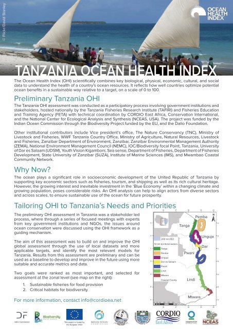
Two goals were ranked as most important, and selected for<br />
assessment at the zonal level (see map on the right):<br />
1. Sustainable fisheries for food provision<br />
2. Critical habitats for biodiversity<br />
For more information, contact info@cordioea.net<br />
-9 -8 -7 -6 -5<br />
-10<br />
-11<br />
200 nm EEZ<br />
12 nm territorial waters<br />
Tanga<br />
Pemba<br />
Unguja<br />
Dar es Salaam<br />
Pwani<br />
Lindi<br />
Mtwara<br />
Coastal County<br />
Tanga<br />
0 20 40 80 120 160<br />
Kilometers<br />
Pwani<br />
Lindi<br />
Mtwara<br />
Pemba<br />
Unguja<br />
Dar<br />
36 37 38 39 40<br />
-9 -8 -7 -6 -5<br />
-10<br />
-11
KEY FINDINGS<br />
Food Provision: Fisheries<br />
Measures the amount of wild-caught seafood harvested and its sustainability for human consumption<br />
Resilience<br />
Pemba: 73<br />
Tanga: 66<br />
Unguja: 76<br />
Dar es Salaam: 73<br />
Pwani: 69<br />
Lindi: 69<br />
Mtwara: 67<br />
<<br />
Pressures<br />
Pemba: 47<br />
Tanga: 50<br />
Unguja: 35<br />
Dar es Salaam: 52<br />
Pwani: 47<br />
Lindi: 43<br />
Mtwara: 41<br />
Resilience: condition of species located within 3nm offshore of<br />
each region, percentage of territorial waters under protection<br />
compared to 30% target, protected area management<br />
effectiveness, artisanal fisheries management effectiveness,<br />
social progress, strength of governance, water quality<br />
Pressures: intertidal habitat destruction, weakness of social<br />
progress, weakness of governance, subtidal hardbottom habitat<br />
destruction, by-catch due to artisanal fishing, coastal chemical<br />
pollution, coastal nutrient pollution, blast and poison fishing<br />
For this preliminary assessment, only artisanal fisheries within the <strong>Tanzania</strong>’s territorial waters were discussed,<br />
and only pressure and resilience scores were calculated due to data constraints (i.e. availability, quality, timely<br />
access). For all zones, pressure scores are lower than resilience scores, with all resilience scores above 65.<br />
Technical discussions held during this project will help guide any subsequent analysis of this goal.<br />
Biodiversity: Habitats<br />
Measures the average condition of critical marine habitats for a broad range of species<br />
Coral reefs, mangroves, and<br />
seagrasses assessed<br />
74<br />
Pemba: 66<br />
Tanga: 69<br />
Unguja: 87<br />
Dar es Salaam: 77<br />
Pwani: 62<br />
Lindi: 85<br />
Mtwara: 73<br />
National average score for<br />
habitats was 74<br />
Habitat health projected to<br />
decline for all but Unguja<br />
Habitat level results indicate the country lost around 16% of its mangrove cover between 2000 and 2014, with<br />
Mtwara and Lindi retaining around 90% of their mangrove cover but Tanga and Pwani losing over a quarter of<br />
their area, and Dar over 30% of mangroves.<br />
Five of the seven zones showed declines in coral cover, with Pwani as the most impacted after losing about<br />
half its original living coral, whilst Mtwara and Pemba have lost around 40% and Unguja and Tanga about 30%.<br />
There was no variation in seagrass status score as OHI global score for <strong>Tanzania</strong> was applied in all zones due<br />
to lack of data.<br />
Recommendations<br />
This preliminary analysis of two sub-goals of the OHI reveal its potential for future application to support<br />
national objectives. The following recommendations focus on next steps for OHI goal assessments to produce<br />
tangible results in ocean and coastal management:<br />
1. Each competent authority should be a goal ‘custodian’ to embed the evaluation in their official processes<br />
2. A relevant cross-sectoral entity should coordinate assessments to centralize the technical evaluation<br />
and integrate across levels of government e.g. ICZM strategy (Zanzibar) and NICES (mainland)<br />
3. Invest in comprehensive monitoring and data collection programmes to improve the quality of<br />
assessments<br />
4. Ensure adequate resourcing, capacity, and influence to undertake the assessments and implement<br />
recommendations<br />
5. Use sub-products such as status, pressure, and resilience data layers and information to inform planning<br />
processes at regional and national level


