Pantops Master Plan DRAFT 4/18/19

You also want an ePaper? Increase the reach of your titles
YUMPU automatically turns print PDFs into web optimized ePapers that Google loves.
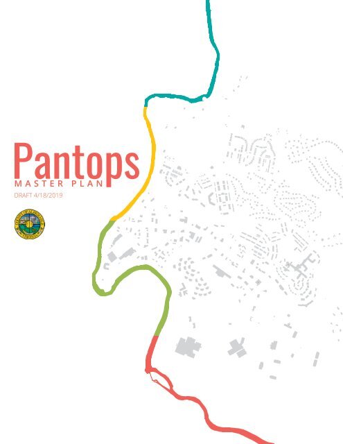
<strong>Pantops</strong><br />
MASTER PLAN<br />
<strong>DRAFT</strong> 4/<strong>18</strong>/20<strong>19</strong>
<strong>Pantops</strong> <strong>Master</strong> <strong>Plan</strong><br />
ALBEMARLE COUNTY, VIRGINIA<br />
<strong>DRAFT</strong> April <strong>18</strong>, 20<strong>19</strong><br />
BOARD OF SUPERVISORS<br />
Ned Gallaway, Chair | Rio<br />
Rick Randolph, Vice Chair | Scottsville<br />
Norman Dill | Rivanna<br />
Ann Mallek | White Hall<br />
Diantha McKeel | Jack Jouett<br />
Liz Palmer | Samuel Miller<br />
PANTOPS COMMUNITY<br />
ADVISORY COMMITTEE<br />
Olivia Branch<br />
Larry Brown<br />
Richard Hiss<br />
Catherine Hughes<br />
Jason Inofuentes<br />
Rita Krenz<br />
LJ Lopez<br />
Stephanie Lowenhaupt<br />
Calvin Morris<br />
Rob Neil<br />
Laurel Olson<br />
Sara Robinson<br />
Nicole Sullivan<br />
Lauri Wilson<br />
PLANNING COMMISSION<br />
Tim Keller, Chair | At-Large<br />
Julian Bivins, Vice Chair | Jack Jouett<br />
Bruce Dotson | Rio<br />
Karen Firehock | Samuel Miller<br />
Jennie More | White Hall<br />
Pam Riley | Scottsville<br />
Daphne Spain | Rivanna<br />
Luis Carrazana | Ex-Officio (UVA)<br />
COUNTY STAFF<br />
Michaela Accardi<br />
Daniel Butch<br />
Elaine Echols<br />
Rachel Falkenstein<br />
David Fox<br />
Tarin Jones<br />
Andrew Knuppel<br />
Cameron Langille<br />
Dan Mahon<br />
Kevin McDermott<br />
Melissa Symmes<br />
Table of Contents<br />
Introduction<br />
Historic Context 3<br />
<strong>Pantops</strong> Today 5<br />
Key Challenges & Opportunities 7<br />
<strong>Plan</strong> Overview 9<br />
Connectivity<br />
Connectivity Overview 13<br />
Future Bike & Pedestrian Network 15<br />
Future Street Network 17<br />
Street Typologies <strong>19</strong><br />
Connectivity Recommendations 23<br />
Character & Land Use<br />
Character & Land Use Overview 27<br />
Future Land Use <strong>Plan</strong> 29<br />
Future Land Use Typologies 31<br />
Urban Design Guidance 33<br />
Centers35<br />
Districts37<br />
Other Areas 39<br />
Recommendations41<br />
Conservation<br />
Conservation Overview 45<br />
Future Parks & Green Systems <strong>Plan</strong> 47<br />
Recreational Opportunities 49<br />
Environmental Protection 51<br />
Cultural & Scenic Resources 53<br />
Recommendations55<br />
Implementation<br />
Implementation Overview 59<br />
Policy & Coordination Projects 61<br />
Capital Projects 63<br />
Parks, Trails, & Greenways Projects 73<br />
Appendix<br />
Glossary75<br />
Community Engagement & Feedback 77<br />
Citations & References 79
Introduction<br />
The <strong>Pantops</strong><br />
<strong>Master</strong> <strong>Plan</strong> is<br />
the culmination<br />
of countless<br />
hours of work<br />
by citizens,<br />
public officials,<br />
and staff who<br />
attended<br />
meetings and<br />
workshops,<br />
took surveys,<br />
presented ideas,<br />
and participated<br />
in framing<br />
the future of<br />
the <strong>Pantops</strong><br />
community.<br />
FLOW: The Rivanna River Arts<br />
Festival celebrated the river’s history,<br />
ecology, and spiritual traditions<br />
through visual and performing arts.<br />
This <strong>Master</strong> <strong>Plan</strong> document provides long range policy direction for land<br />
use, transportation, parks and greenspace for <strong>Pantops</strong>. It also includes<br />
recommendations relating to economic development, housing, public services,<br />
and historic and cultural resource protection. This <strong>Plan</strong> serves as a guide for<br />
elected and public officials by establishing policies and priorities and providing<br />
the framework for evaluating development proposals. It expresses the<br />
community’s vision and priorities, and describes where development should<br />
occur, while also identifying resources that are worthy of protection that<br />
should be preserved for public use by current and future generations.<br />
The <strong>Pantops</strong> community is distinctively situated between several of the<br />
County’s most important natural, scenic, and historic assets. The Rivanna River<br />
forms the western and southern boundary of <strong>Pantops</strong> and provides over three<br />
miles of riverfront through <strong>Pantops</strong>. Immediately south of <strong>Pantops</strong> is Thomas<br />
Jefferson’s Monticello, which is listed as a UNESCO World Heritage site, and<br />
directly east is the Southwest Mountains Rural Historic District, a 31,000-<br />
acre district that includes some of the Piedmont’s most pristine and scenic<br />
countryside. Additionally, the topography of <strong>Pantops</strong> provides for some of the<br />
region’s best views to the Blue Ridge and the City of Charlottesville.<br />
<strong>Pantops</strong>’ unique location adjacent to the City of Charlottesville with<br />
accessibility to abundant natural and cultural resources is part of what makes<br />
it such a desirable place to live, work, and recreate. This <strong>Master</strong> <strong>Plan</strong> provides<br />
a vision and recommendations for the future growth of the community that<br />
acknowledges the importance of protecting the relationships to the natural<br />
and cultural resources. The <strong>Plan</strong> provides a guide for how the community can<br />
grow in a responsible manner; one that improves access and connectivity to<br />
these treasured resources, while also providing for their protection.<br />
Vision<br />
IMPLEMENTATIONCONSERVATION CHARACTERCONNECTIVITY<br />
Improve multimodal transportation options for<br />
all residents, regardless of age, race, income and<br />
ability. Enhance connectivity to, from, and within<br />
<strong>Pantops</strong>.<br />
Encourage high quality, walkable urban<br />
places and support development that protects<br />
viewsheds and existing neighborhoods.<br />
With the Rivanna River as the backbone, create<br />
an integrated system of parks and greenways<br />
throughout <strong>Pantops</strong> that provides accessible,<br />
usable amenity spaces and conserves and<br />
restores natural systems.<br />
Support this <strong>Plan</strong> with proactive implementation<br />
initiatives such as updates to policy, zoning<br />
changes, and regional partnerships.<br />
1 | PANTOPS MASTER PLAN | <strong>DRAFT</strong> 04/<strong>18</strong>/<strong>19</strong> INTRODUCTION | 2
Historic Context<br />
For much of its<br />
history, <strong>Pantops</strong><br />
and its built<br />
environment<br />
have been<br />
oriented towards<br />
two defining<br />
features: the<br />
Rivanna River<br />
and the historic<br />
route of the<br />
Three Notch’d<br />
Road.<br />
The Rivanna River<br />
The plantation economy of the antebellum Virginia Piedmont relied heavily<br />
on waterways to power mills and transport goods for export in the Tidewater<br />
region. The Rivanna River has served as a vital link to the James River from<br />
the northern half of Albemarle County. Large land holdings and mill villages<br />
bordering the river were defining qualities of the landscape near <strong>Pantops</strong>.<br />
Many of these features still exist today with varying degrees of integrity, as<br />
preservation tracts or place names: moving upriver from the mill village of<br />
Milton (near present-day Stone-Robinson Elementary and the Milton Boat<br />
Launch), they included Thomas Jefferson’s Shadwell, Tufton, Lego, Monticello,<br />
and <strong>Pantops</strong>; the port of Pireus near present-day Woolen Mills; Pen Park; and<br />
the birthplace of George Rogers Clark at Buena Vista.<br />
During the early <strong>19</strong>th century, the Rivanna Navigation Company was chartered<br />
to improve the river’s navigability for batteaux, constructing locks, dams,<br />
canals, and towpaths. Remnants of these improvements exist today along the<br />
Old Mills Trail.<br />
The Three Notch’d Road<br />
The Three Notch’d Road, which is now the path of Route 250 (Richmond<br />
Road), was historically one of the primary east-west road connections linking<br />
the Shenandoah Valley to the Tidewater. Although records dating to 1741<br />
indicate that a former road trace crossed the Rivanna River at Secretary’s<br />
Ford (near the current Interstate 64 bridge), the most consequential crossing<br />
of the Rivanna came at Moore’s Ford with the Free Bridge (left), which was<br />
constructed in the early <strong>18</strong>00s at the site of the current bridge.<br />
Suburbanization<br />
While <strong>Pantops</strong> remained primarily agricultural and undeveloped into the<br />
<strong>19</strong>30s, the post-war boom of suburban development within the City of<br />
Charlottesville and the construction of the limited-access Route 250 Bypass<br />
began to push growth east towards the Rivanna River and <strong>Pantops</strong>. During<br />
the <strong>19</strong>50s, transient, highway-oriented uses such as the Stanislaw Makielskidesigned<br />
Town & Country Motor Lodge and White House Motel (both now<br />
demolished) began to cluster in the area referred to today as “Dealership<br />
Row”. However, the rest of the area remained fairly undeveloped, aside from<br />
the construction of Interstate 64.<br />
The growth of modern suburban <strong>Pantops</strong> began in the late <strong>19</strong>70s with the<br />
Ashcroft subdivision to the north of Route 250 and the larger State Farm &<br />
South <strong>Pantops</strong> development to the south. With the <strong>19</strong>80 Zoning Ordinance,<br />
<strong>Pantops</strong> was designated for mixed commercial uses and dense residential<br />
development south of Route 250, highway commercial development along<br />
Route 250, and primarily low-density residential uses north of Route 250.<br />
Almost 40 years later, the zoning map for <strong>Pantops</strong> looks mostly the same.<br />
Since <strong>19</strong>80, large planned commercial developments have dominated the<br />
area south of Route 250, including the <strong>Pantops</strong> Shopping Center (<strong>19</strong>80s),<br />
Rivanna Ridge Shopping Center (late <strong>19</strong>90s/early 2000s), and Peter Jefferson<br />
Place/Martha Jefferson Hospital (2000s). North of Route 250, more intensive<br />
residential development began in the <strong>19</strong>90s and early 2000s with the Wilton<br />
Farm, Fontana, and Avemore developments and has continued through today.<br />
Postcards of <strong>Pantops</strong>’ Early Motels<br />
The Free Bridge crossing also facilitated improved access to the growing town<br />
of Charlottesville from the north, with the original path of Route 20 following<br />
Free Bridge Lane, Elk Drive, and Stony Point Road (Route 20) north towards<br />
Orange and Fredericksburg until the <strong>19</strong>50s.<br />
Adopted <strong>19</strong>80 Zoning Map<br />
Free Bridge<br />
<strong>Pantops</strong> in <strong>19</strong>37 <strong>Pantops</strong> in <strong>19</strong>74<br />
<strong>Pantops</strong> in <strong>19</strong>90 <strong>Pantops</strong> in 20<strong>18</strong><br />
3 | PANTOPS MASTER PLAN | <strong>DRAFT</strong> 04/<strong>18</strong>/<strong>19</strong> INTRODUCTION | 4
<strong>Pantops</strong> Today<br />
Population<br />
Estimate<br />
<strong>Pantops</strong> CDP<br />
Albemarle County<br />
4,810 116,439<br />
Median Age 39.4 38.6<br />
% under <strong>18</strong> 17.5% 20.7%<br />
% over 65 28.7% 16.7%<br />
Sex<br />
Race<br />
Average<br />
household/<br />
family size<br />
45.5% male<br />
54.5% female<br />
76.7% White, 17.3%<br />
Black or African-<br />
American, 0.5%<br />
American Indian and<br />
Alaska Native, 3.2%<br />
Asian, 2.3% two or<br />
more races<br />
1.90 household<br />
2.61 family<br />
Current Land Uses<br />
523 acres residential<br />
159 acres office<br />
121 acres commercial/retail<br />
87 acres institutional<br />
Current Housing Stock<br />
409 single-family detached units<br />
546 attached/townhouse units<br />
1,329 multifamily/condo units<br />
214 group quarters units<br />
47.8% male<br />
52.2% female<br />
81.5% White, 9.6%<br />
Black or African-<br />
American, 0.2%<br />
American Indian and<br />
Alaska Native, 5.0%<br />
Asian, 2.4% two or<br />
more races<br />
Land<br />
Use<br />
2.44 household<br />
3.02 family<br />
Housing<br />
Units<br />
Demographics<br />
Selected statistics from internal population estimates<br />
and the 2013-2017 American Community Survey 5-year<br />
estimates are shown at left for the <strong>Pantops</strong> censusdesignated<br />
place, which approximates the boundaries<br />
of the Development Area, as well as Albemarle County.<br />
Relative to the rest of Albemarle County, <strong>Pantops</strong> has<br />
an older population and smaller average household<br />
sizes, potentially due to its large multifamily and senior<br />
housing stock.<br />
Land Use Patterns<br />
The legacy of suburban highway development is visible<br />
in <strong>Pantops</strong>’ current land use patterns. The majority of<br />
acreage along Route 250 is devoted to commercial uses,<br />
including “Dealership Row” and the large strip-style<br />
<strong>Pantops</strong> Shopping Center and Rivanna Ridge Shopping<br />
Center. While commercial uses are the most visible, the<br />
largest non-residential land use type are offices, which<br />
are mainly clustered near Riverbend Drive and Martha<br />
Jefferson Hospital/State Farm at Peter Jefferson Place.<br />
Residential developments consume about 523<br />
acres, more land than all other uses combined, with<br />
residential subdivisions and condominiums (including<br />
common areas controlled by owners’ associations)<br />
occupying about 400 acres. Despite this large acreage,<br />
the bulk of <strong>Pantops</strong>’ housing stock is contained in about<br />
123 acres of dense rental housing, which includes<br />
group quarters and senior living.<br />
Housing<br />
<strong>Pantops</strong>’ housing mix leans heavily towards dense<br />
multifamily or attached unit types. While single-family<br />
home construction has increased in recent years,<br />
detached units still comprise less than a quarter of all<br />
dwellings within <strong>Pantops</strong>.<br />
Employment & Commuting<br />
Patterns<br />
There are approximately 7900 employees who work in<br />
<strong>Pantops</strong> and approximately 660 total businesses. The<br />
top five employment sectors are shown in the adjacent<br />
table. Sentara Martha Jefferson Hospital, Westminster-<br />
Canterbury of the Blue Ridge, and State Farm Insurance<br />
are currently the largest employers in <strong>Pantops</strong>.<br />
As a major employment center within Albemarle<br />
County, <strong>Pantops</strong> has a large commute shed. 2015 data<br />
from the Census Bureau’s Longitudinal Employer-<br />
Household Dynamics (LEHD) program shows this shed<br />
reaching east into Fluvanna and Louisa counties, as well<br />
as west towards Crozet and the Shenandoah Valley.<br />
However, residents of <strong>Pantops</strong> primarily work in other<br />
employment centers within the City of Charlottesville<br />
and Albemarle’s urban ring such as Downtown<br />
Charlottesville, the University of Virginia, and the<br />
Route 29 corridor. Similarly, the Route 250 corridor<br />
within <strong>Pantops</strong> serves as a major commuting route for<br />
residents of areas east of the urban areas to access<br />
Downtown Charlottesville and the University of Virginia.<br />
Environment<br />
<strong>Pantops</strong>’ location on <strong>Pantops</strong> Mountain and the lower<br />
portions of the Southwest Mountains creates an<br />
environment that is unique in Albemarle County due to<br />
its significant urbanization and topography. Substantial<br />
portions of the Development Area include steep slopes,<br />
some of which have been disturbed or graded by prior<br />
development projects while others remain forested or<br />
undisturbed.<br />
The most significant water resource is the Rivanna<br />
River, which forms the western border of the <strong>Pantops</strong><br />
Development Area. A number of smaller perennial and<br />
intermittent streams drain from <strong>Pantops</strong> Mountain<br />
into the river and are associated with hillside systems.<br />
However, the Rivanna is currently identified as<br />
“impaired” in certain water quality categories by the<br />
Virginia Department of Environmental Quality.<br />
Sector # Employees # Businesses<br />
Health Care & Social<br />
Assistance<br />
4000 378<br />
Retail & Wholesale Trade 1047 39<br />
Hospitality & Food Service 640 26<br />
Finance & Insurance 532 75<br />
Educational Services 470 8<br />
Red dots show the general employment locations of<br />
commuters from <strong>Pantops</strong>. Blue dots show general residence<br />
locations of commuters to <strong>Pantops</strong>.<br />
Pink areas are<br />
predominantly<br />
<strong>Pantops</strong> has a number of senior living, assisted<br />
owner-occupied<br />
living, and nursing & memory care facilities. An 20<strong>19</strong><br />
housing in<br />
estimate shows that in addition to the 214 units/beds in<br />
residential<br />
assisted living and nursing care facilities, 517 dwelling<br />
subdivisions or<br />
The Rivanna River Corridor is noted as a Focus Area<br />
condominiums.<br />
units are located within age-restricted or senior living<br />
in the County’s Biodiversity Action <strong>Plan</strong> (BAP) and the<br />
Blue areas are<br />
communities.<br />
<strong>Pantops</strong> section of the corridor includes two river bluffs<br />
rental housing or<br />
identified as “Important Sites” in the BAP.<br />
group quarters.<br />
Each dot represents<br />
More information about existing environmental<br />
one dwelling unit.<br />
conditions can be found in the Conservation chapter.<br />
5 | PANTOPS MASTER PLAN | <strong>DRAFT</strong> 04/<strong>18</strong>/<strong>19</strong> INTRODUCTION | 6
Key Challenges & Opportunities<br />
Connecting Neighborhoods<br />
Renewing the Riverfront<br />
U.S. Route 250 is a national highway that runs from<br />
Richmond, Virginia to Ohio. It is the largest east-west<br />
thoroughfare that runs through <strong>Pantops</strong>. Route 250<br />
was designed to transport a large volume of through<br />
traffic at high speeds, with little consideration given<br />
to alternative modes of travel. The segment of U.S.<br />
250 located within <strong>Pantops</strong> varies in width between 4<br />
and 6 vehicular travel lanes, with some intersections<br />
widening up to 8 lanes. Currently, Route 250 is difficult<br />
and unsafe to cross by foot or bicycle, and there is<br />
only one dedicated crosswalk located at the State<br />
Farm Boulevard and Luxor Road intersection. The road<br />
creates a de facto barrier to connectivity between the<br />
northern and southern portions of <strong>Pantops</strong>. Residential<br />
neighborhoods to the north cannot easily access<br />
the commercial and office uses to the south unless<br />
traveling by vehicle.<br />
The Rivanna River is highly valued by citizens of <strong>Pantops</strong><br />
and the larger region. It has become a signature<br />
recreational feature along the western boundary of<br />
<strong>Pantops</strong> and includes the Old Mills Trail greenway<br />
system along its eastern bank. In addition to its<br />
recreational value, the River also provides a natural<br />
ecosystem that is vital to the health of the environment<br />
and <strong>Pantops</strong> citizens. Although not yet fully realized, the<br />
Rivanna River offers abundant economic opportunities<br />
for the community. However, most buildings have<br />
physically “turned their backs” to the River corridor<br />
which has created a lack of interaction between private<br />
developments and the Riverbank. Furthermore, the<br />
portion of the Rivanna River between Meadow Creek<br />
and Moore’s Creek has been designated as an impaired<br />
waterway by the Virginia Department of Environmental<br />
Quality (DEQ) for over a decade.<br />
How can we better connect neighborhoods north<br />
and south and provide safe and convenient routes<br />
for pedestrians and bicyclists? How can we bridge the<br />
divide created by Route 250?<br />
Protecting Scenic and<br />
Cultural Landscapes<br />
Thomas Jefferson gave <strong>Pantops</strong> its name, meaning “all<br />
seeing,” when he inherited land in this area from his<br />
father. <strong>Pantops</strong> offers unparalleled scenic views of the<br />
Blue Ridge Mountains and the City of Charlottesville and<br />
its location near Monticello, the Southwest Mountains<br />
and the Rivanna River. These natural features,<br />
combined with the remnants of early American and<br />
Colonial settlements, offer a rich cultural landscape<br />
within and around <strong>Pantops</strong> that is worth celebrating<br />
and protecting.<br />
How can development and redevelopment within<br />
<strong>Pantops</strong> expand access to, while also protecting, these<br />
important scenic and cultural resources?<br />
How can new development and redevelopment within<br />
<strong>Pantops</strong> reconnect and reorient to the river in a way<br />
that embraces this valuable community asset? How<br />
can future development and conservation initiatives<br />
be coordinated to renew the riverfront, enhance river<br />
health, and protect the local ecosystem?<br />
Expanding Transportation<br />
Choice<br />
One of the highest priorities identified by community<br />
members during the planning process is finding<br />
solutions to decrease traffic congestion on major<br />
roadways in <strong>Pantops</strong>. Routes 250 and 20 routinely<br />
experience traffic congestion during peak travel times.<br />
Development has the potential to compound this<br />
problem unless alternative transportation modes<br />
become more readily available in <strong>Pantops</strong>. Commuting<br />
data from the 2013-2017 American Community Survey<br />
5-year estimates indicate that over 95% of <strong>Pantops</strong><br />
residents who work outside of the home commute by<br />
car. More surprisingly, the survey estimates that none<br />
of the existing residents are regularly walking to work.<br />
How can we improve facilities for bicycle, pedestrian<br />
and transit to help ease traffic congestion along major<br />
roadways? How can we improve mobility and increase<br />
access to alternative modes of transportation for all,<br />
especially <strong>Pantops</strong>’ large senior population?<br />
Providing Livability For All<br />
<strong>Pantops</strong> has a diverse mix of housing types. Multifamily<br />
dwellings account for approximately half of<br />
the total available units, about a quarter are attached<br />
dwellings or townhouses, and a mix of single-family<br />
detached, nursing homes, and assisted living comprise<br />
the final quarter of the overall housing stock. As<br />
growth continues and land prices increase, there is<br />
potential for working class and low income families to<br />
be priced out of the <strong>Pantops</strong> community. Furthermore,<br />
as development continues and undeveloped land<br />
becomes more scare, it becomes increasingly important<br />
to provide access to quality amenity spaces for the<br />
residents, employees, and visitors of <strong>Pantops</strong>.<br />
How can we ensure that future growth maintains a<br />
mix of housing types and affordability for all ages and<br />
incomes? How can we grow in a manner that increases<br />
access to jobs, community services, and facilities, while<br />
also providing access to <strong>Pantops</strong>’ natural and cultural<br />
assets and resources?<br />
Collaborating with Regional<br />
Partners<br />
<strong>Pantops</strong> shares its western border with the City of<br />
Charlottesville, and the Rivanna River creates a physical<br />
boundary between the localities. Currently, Free<br />
Bridge is the only crossing that connects <strong>Pantops</strong> to<br />
Charlottesville. As a result, those traveling between<br />
the two localities are funneled onto a single roadway,<br />
creating congestion and making it difficult to walk and<br />
bike between localities. Identifying opportunities for<br />
increased connectivity between Charlottesville and<br />
<strong>Pantops</strong> will require collaboration between the City and<br />
County. Similarly, efforts to improve water quality in the<br />
Rivanna River will require regional collaboration.<br />
How can the County lead the way to forge a productive<br />
dialogue with the City of Charlottesville to find solutions<br />
to increased regional connectivity and improved<br />
stewardship of the Rivanna River? How can the County<br />
and City work together to develop a platform for<br />
coordinated planning for our collective future?<br />
7 | PANTOPS MASTER PLAN | <strong>DRAFT</strong> 04/<strong>18</strong>/<strong>19</strong> INTRODUCTION | 8
Overview<br />
The <strong>Pantops</strong> <strong>Master</strong> <strong>Plan</strong> establishes a long-range vision and supporting recommendations for the<br />
transformation of the <strong>Pantops</strong> area. Citizens, stakeholders, public officials, and staff worked together to<br />
develop the vision and recommendations on the following pages. This <strong>Plan</strong> provides a guide to future decision<br />
making related to development and redevelopment, public investment, and capital projects for the area. The<br />
following chapters focus on the three topic areas from the vision: Connectivity, Character, and Conservation.<br />
The last chapter, Implementation, provides a road-map for achieving the vision.<br />
CONNECTIVITY<br />
Improve multimodal transportation options for all residents, regardless<br />
of age, race, income and ability. Enhance connectivity to, from, and within<br />
<strong>Pantops</strong>.<br />
1. Establish a connected network of complete streets that provide safe, convenient, and viable<br />
transportation choices for all users.<br />
2. Design and construct new pedestrian and cyclist crossings along the Rivanna River Corridor and<br />
across Route 250 to facilitate better access to the City of Charlottesville and connectivity within the<br />
<strong>Pantops</strong> Development Area.<br />
3. Establish sidewalks, shared use paths, bicycle lanes and trails, where needed, to support a<br />
comprehensive and complete active transportation network.<br />
4. Provide physically separated or buffered bicycle facilities on streets with steep grades or high traffic<br />
volumes to accommodate cyclists of all skill levels.<br />
5. Collaborate with regional planning efforts, such as the Rivanna River Corridor Study and the Jefferson<br />
Area Bicycle and Pedestrian <strong>Plan</strong> to plan, design, and construct a network of bicycle and pedestrian<br />
infrastructure that is well aligned with the communities and infrastructure adjacent to <strong>Pantops</strong>.<br />
6. Improve transit service and infrastructure quality at bus stops in <strong>Pantops</strong> with the goal of reducing<br />
single-occupancy vehicle trips, promoting transit choice, and increasing mobility and multi-modal transit<br />
across the Development Area.<br />
CONSERVATION<br />
With the Rivanna River as the backbone, create an integrated system of<br />
parks and greenways throughout <strong>Pantops</strong> that provides accessible, usable<br />
amenity spaces and conserves and restores natural systems.<br />
1. Provide pedestrian and trail connections to major natural systems and public amenities, such as the<br />
Rivanna River greenway corridor and Darden Towe Park.<br />
2. Create a variety of public spaces to support active, passive, and social recreation and link existing<br />
neighborhoods to cultural assets.<br />
3. Strategically preserve open space and tree canopy to create an internal green infrastructure network<br />
and amenity areas within the centers, districts, and neighborhoods.<br />
4. Encourage design that minimizes impacts to critical natural resources including preserved slopes,<br />
streams & stream buffers, and floodplain areas.<br />
5. Encourage low-impact development and onsite stormwater management strategies to improve surface<br />
water quality and protect the health of the Rivanna River.<br />
6. Promote and protect locally significant vistas & view corridors by establishing public access points and<br />
building and landscape design guidelines.<br />
7. Encourage compliance with the Monticello Viewshed Guidelines identified in the Comprehensive <strong>Plan</strong>.<br />
CHARACTER<br />
Encourage high quality, walkable urban places and support development<br />
that protects viewsheds and existing neighborhoods.<br />
1. Encourage infill development that provides walkable, transit-oriented environments and respects natural<br />
systems.<br />
2. Develop incentives to attract mixed-use, infill development, especially in the Urban Centers (Riverbend<br />
Urban Center and Rivanna Ridge Urban Center).<br />
3. Encourage new development and redevelopment to contribute space to public parks and green systems<br />
in an effort to create an interconnected network of green and public amenity spaces in <strong>Pantops</strong>.<br />
4. Reorient development to the Rivanna River in coordination with the future Rivanna River Corridor <strong>Plan</strong>,<br />
the Connectivity Chapter’s recommendations to ensure access to the Rivanna River, and the Conservation<br />
Chapter’s recommendations for protecting River health.<br />
IMPLEMENTATION<br />
Support this <strong>Plan</strong> with proactive implementation initiatives such as<br />
updates to policy, zoning changes, and regional partnerships.<br />
1. Direct County investment and policy changes to support the identified Priority Areas.<br />
2. Complete the Rivanna River Corridor <strong>Plan</strong> in conjunction with the City of Charlottesville and the<br />
Thomas Jefferson <strong>Plan</strong>ning District Commission.<br />
3. Create a performance management framework and evaluate development projects for their<br />
consistency with the Key Outcomes.<br />
4. Complete the Policy and Coordination Projects identified in this Chapter.<br />
5. Complete the Capital Projects identified in this Chapter.<br />
5. Collaborate with the Albemarle County Office of Housing to provide a variety of housing options in cost,<br />
unit type, and character to promote choice and equitable access in <strong>Pantops</strong>.<br />
6. Pursue zoning changes, such as form-based code, to support desired building, street form, and uses as<br />
described in the Future Land Use <strong>Plan</strong>.<br />
9 | PANTOPS MASTER PLAN | <strong>DRAFT</strong> 04/<strong>18</strong>/<strong>19</strong> INTRODUCTION | 10
CONNECTIVITY<br />
Improve multimodal transportation options for all<br />
residents, regardless of age, race, income and ability.<br />
Enhance connectivity to, from, and within <strong>Pantops</strong>.<br />
CHAPTER TWO
5<br />
Connectivity Overview<br />
This <strong>Plan</strong> works<br />
to expand choice<br />
in transportation<br />
options to address<br />
the auto-oriented<br />
challenges in<br />
<strong>Pantops</strong>.<br />
Vision<br />
This <strong>Master</strong> <strong>Plan</strong> envisions <strong>Pantops</strong> as a connected community that offers<br />
multimodal transportation options for all residents regardless of age, race,<br />
income and ability. Citizens should be able to safely access areas within and<br />
adjacent to <strong>Pantops</strong>.<br />
To achieve this vision, the <strong>Plan</strong> calls for improving the overall transportation<br />
network, with an emphasis on expanding the availability of bicycle, pedestrian<br />
and public transit systems. Providing a wide range of transportation modes is<br />
a vital component of community development initiatives in Albemarle County.<br />
These efforts enable designated Development Areas like <strong>Pantops</strong> to become<br />
cohesive communities where residents can live, work, play, and shop.<br />
Existing Conditions<br />
Consistent with the 2008 <strong>Master</strong> <strong>Plan</strong>, transportation remains one of the<br />
highest priority issues in <strong>Pantops</strong>. Through collaborative work with the<br />
<strong>Pantops</strong> Community Advisory Committee, residents and stakeholders have<br />
identified traffic congestion along Route 250 and Route 20 as a significant,<br />
ongoing challenge. Simultaneously, as an Entrance Corridor to the City of<br />
Charlottesville, preservation of the Monticello Viewshed and the rural and<br />
scenic nature of Route 20 as it enters the <strong>Pantops</strong> Development Area remain<br />
important.<br />
While traffic congestion along Route 250 and Route 20 is a regional challenge,<br />
the lack of bicycle, pedestrian and public transit infrastructure currently<br />
inhibits a safe commute for many residents. Manmade and natural landscape<br />
features physically restrict connection points between <strong>Pantops</strong> and the City<br />
of Charlottesville. The Rivanna River is a valuable recreational, transit and<br />
environmental asset to the community, yet there is a need for additional<br />
crossings to facilitate access between the City and County. Additionally,<br />
<strong>Pantops</strong> residents have stated that crossing Route 250 as a pedestrian or<br />
bicyclist can be unsafe and intimidating since the road caters predominantly<br />
to car-centric travel. The high volume of vehicular traffic along the Route 250<br />
corridor is another barrier that inhibits cohesion and connectivity between the<br />
northern residential neighborhoods and commercial businesses and offices in<br />
the southern half of <strong>Pantops</strong>.<br />
In response, the <strong>Master</strong> <strong>Plan</strong> calls for additional pedestrian crossings, an<br />
expanded internal street grid, and increased bicycle, pedestrian, and transit<br />
infrastructure. These recommendations aim to reduce vehicular traffic and<br />
congestion, increase transit service ridership, and foster a sense of place and<br />
community amongst <strong>Pantops</strong> residents.<br />
There are several ongoing, regional planning efforts that address<br />
transportation issues affecting <strong>Pantops</strong>. These initiatives include the Thomas<br />
Jefferson <strong>Plan</strong>ning District Commission (TJPDC) and Piedmont Environmental<br />
Council’s (PEC) Jefferson Area Bike and Pedestrian <strong>Plan</strong>, as well as the Rivanna<br />
River Corridor Study, which is a joint City-County collaborative project<br />
facilitated by TJPDC staff. The <strong>Master</strong> <strong>Plan</strong> illustrates the community’s vision<br />
for <strong>Pantops</strong> specifically and sets an expectation for alignment with these other<br />
ongoing planning projects.<br />
M<br />
L O N G<br />
B R O A D W A Y S T<br />
I D G E<br />
F R E E B R<br />
L N<br />
E L K D R<br />
O L Y M P<br />
I A<br />
Hot spot analysis of 2011-2017<br />
accident data reveals clusters near<br />
the intersections of Route 250 with<br />
Route 20/Riverbend Drive, State<br />
Farm Boulevard, and Rolkin Road; as<br />
well as a section of South <strong>Pantops</strong><br />
Drive near Riverbend Drive.<br />
42000<br />
20000<br />
E A DOW<br />
S T<br />
R<br />
CREE K<br />
I VAN NA<br />
52000<br />
RI VE R<br />
S TO N Y P O I N<br />
R<br />
S T O N Y<br />
PE T E<br />
R<br />
P O<br />
I N T<br />
R D<br />
This map of traffic counts highlights<br />
the influence of vehicles moving<br />
east-west along Route 250 between<br />
areas east of <strong>Pantops</strong> and the City of<br />
Charlottesville. Free Bridge carries an<br />
estimated 52,000 vehicles per day.<br />
D R<br />
F O N T A NA<br />
R I C H M O ND R D<br />
J E<br />
ICH M O N D R D<br />
100<br />
T<br />
9200<br />
R D<br />
F FER S<br />
6300<br />
44000<br />
O N<br />
5600<br />
D R<br />
PK W<br />
Y<br />
40000<br />
7700<br />
L E GO<br />
D R<br />
43000<br />
Dan Mahon, Albemarle County Outdoor Recreation Supervisor discusses construction of an access trail from Free Bridge to the<br />
Rivanna River Trail along the Rivanna River - a Neighborhood Improvement Funding Initiative (NIFI) project.<br />
13 | PANTOPS MASTER PLAN | <strong>DRAFT</strong> 04/<strong>18</strong>/<strong>19</strong> CONNECTIVITY | 14
Future Bike & Pedestrian Network<br />
Expanding Bicycle, Pedestrian, and Transit Infrastructure<br />
Prepared by Albemarle County.<br />
Map Produced 4/5/20<strong>19</strong>.<br />
File: BikePed_Center_v2.mxd<br />
0 0.125 0.25<br />
Miles<br />
ST<br />
P A RK<br />
2 5 0<br />
2 50 BY P<br />
E H I G H S T<br />
BY P<br />
Charlottesville<br />
ME AD E AV E<br />
ME A D E A V E<br />
C I T Y O F<br />
C H A R L O T T E S V I L L E<br />
Pen Park<br />
L O N G S T<br />
S T O N Y P OI NT RD<br />
RI CHMO ND<br />
RD<br />
FR E E<br />
B R I D GE L N<br />
D R<br />
R I V E RBE N D<br />
S TO N Y P O I N T R D<br />
S O U T H P A N T O P S<br />
RIV ANNA RI VE R<br />
1 / 2 M I L E R A D I U S WA L K S H E D<br />
FO NT A N A<br />
O L Y M P I A D R<br />
R I C H M O N D R D<br />
DR<br />
1 / 2 M I L E R A D I U S WA L K SH E D<br />
D R<br />
R O<br />
L K I N<br />
RD<br />
S T A T E F AR M B L V D<br />
P E<br />
T E R JE FFERS O N<br />
P K W Y<br />
I- 6 4 W<br />
I - 6 4 E<br />
<strong>Pantops</strong> residents who were engaged during the public<br />
feedback process envision <strong>Pantops</strong> as a “connected<br />
community”. Streets are often the most vital yet<br />
underutilized public spaces in communities. Streets<br />
provide the physical space necessary for travel, play a<br />
significant role in the public life of communities, and<br />
should be designed as public spaces and channels for<br />
movement.<br />
With the goal of creating Complete Streets, bicycle and<br />
pedestrian infrastructure are essential features that<br />
create truly connected neighborhoods. These healthy<br />
and active modes of transit allow neighbors to engage<br />
with one another on a daily basis, which fosters a sense<br />
of identity within a community.<br />
H<br />
I C KM A N S BR A NCH<br />
Map Legend<br />
Transit Routes<br />
(from 20<strong>18</strong> CAT Transit<br />
Development <strong>Plan</strong>)<br />
Enhanced On-Street<br />
Bicycle Facilities<br />
Shared-Use Path<br />
Urban Center<br />
Core Area<br />
With the goal<br />
of creating<br />
Complete<br />
Streets, bicycle<br />
and pedestrian<br />
infrastructure<br />
are essential<br />
in facilitating<br />
connected<br />
neighborhoods<br />
in <strong>Pantops</strong>.<br />
Future Pedestrian Trails & Paths<br />
Sidewalks, paths, and trails play a vital role in urban life. As conduits for<br />
pedestrian movement and access, they enhance connectivity and promote<br />
physical activity. As public spaces, sidewalks serve as the front steps to the<br />
<strong>Pantops</strong> community, activating streets socially and economically. Maintaining<br />
a safe, contiguous, and accessible sidewalk network is a fundamental and<br />
necessary investment for Albemarle County.<br />
This <strong>Plan</strong> proposes a network of trails and shared use paths (SUPs) that<br />
connect neighborhoods adjacent to <strong>Pantops</strong> including: North Downtown<br />
Charlottesville, the Rivanna River Corridor, and the Woolen Mills<br />
neighborhood. In addition, this <strong>Plan</strong> envisions a complete pedestrian network<br />
within the <strong>Pantops</strong> Development Area, with greater connectivity between<br />
residential neighborhoods and commercial businesses, especially around<br />
Martha Jefferson Hospital and South <strong>Pantops</strong> Drive.<br />
Stakeholders identified two key pedestrian infrastructure projects that are<br />
essential in supporting a more connected community throughout <strong>Pantops</strong>.<br />
First, identifying a location for, designing, and constructing an additional<br />
pedestrian crossing along the Rivanna River Corridor that would facilitate<br />
commuter and recreational access to the City of Charlottesville. To address<br />
the northern/southern division created by Route 250, stakeholders identified<br />
the need for an additional above-grade pedestrian crossing across the road.<br />
This crossing could potentially be located either near the <strong>Pantops</strong> Shopping<br />
Center or near the Rivanna Ridge Shopping Center, both designated by this<br />
<strong>Plan</strong> as Urban Centers. The crossing should be designed in compliance with<br />
the American Disabilities Act (ADA) to ensure safe, convenient, and accessible<br />
travel for all users, regardless of age or physical ability.<br />
Future Bike Lanes<br />
This <strong>Plan</strong> envisions bicycling as a safe and convenient transportation option<br />
for all <strong>Pantops</strong> residents, regardless of race, income, or geography. High<br />
quality and connected bike facilities have several benefits, including reduced<br />
traffic congestion, improved health outcomes for commuters, and increased<br />
viability and sales for commercial businesses.<br />
Currently, the only bicycle lanes in <strong>Pantops</strong> are located on Rolkin Road. The<br />
Connectivity Map proposes bike lanes from Stony Point Road (Route 20) to<br />
South <strong>Pantops</strong> Drive and Peter Jefferson Parkway. It also calls for bike lanes<br />
throughout the interior street network in the southern half of <strong>Pantops</strong>. This<br />
proposed network aims to create an alternate commuter path for cyclists,<br />
which is safely removed from high traffic roadways (such as Route 250). An<br />
equally important benefit is providing connections between neighborhoods<br />
and businesses in <strong>Pantops</strong> and the City of Charlottesville.<br />
In addition to connectivity within <strong>Pantops</strong>, this <strong>Plan</strong> calls<br />
The exact locations of bike lanes may differ depending on future development<br />
Rivanna Greenway for additional connections to neighboring communities<br />
patterns. Final locations will be partially determined by the form and character<br />
(to Milton, Village of Rivanna, and amenities, including potential crossings of the Rivanna<br />
of redevelopment and new development proposals. The recommended bike<br />
Woolen Mills<br />
and Fluvanna County)<br />
River to Pen Park, the City of Charlottesville, and the Woolen<br />
lane design standards are shown in the street typologies section and should<br />
Mills area, as well as continuation of the Rivanna Greenway<br />
be built in compliance with VDOT and County regulations.<br />
towards the Village of Rivanna and Fluvanna County.<br />
15 | PANTOPS MASTER PLAN | <strong>DRAFT</strong> 04/<strong>18</strong>/<strong>19</strong> CONNECTIVITY | 16
Future Street Network<br />
Improving Connectivity & Network Performance<br />
M E A DOW<br />
C REEK<br />
RIV A NNA RI VE R<br />
Map Legend<br />
Arterial<br />
Future Street Network<br />
Streetscapes should reflect a unified, complete design that balances a wide<br />
variety of functions including: stormwater management, safe pedestrian,<br />
bicycle and vehicular travel, use as public space, parking and loading<br />
requirements, ease of maintenance, and emergency access.<br />
Boulevard<br />
Avenue<br />
The Future Street Network and supporting recommendations in this chapter<br />
envision a well-connected street network that can better enable movement<br />
within and between <strong>Pantops</strong> neighborhoods and the proposed Centers and<br />
Districts. Proposed streets should be Complete Streets, designed for all users<br />
– motorists, pedestrians, bicyclists, and transit riders.<br />
L O N G S T<br />
S T<br />
E H I G H<br />
R<br />
IVE R B E N D D R<br />
B R I D GE<br />
F RE E<br />
L N<br />
S O U T H P A N T O P S<br />
E L K D R<br />
S TON Y P OIN T RD<br />
D R<br />
F O N TAN A<br />
D R<br />
O L YM P<br />
R I C H M O N D R D<br />
I A D R<br />
R O<br />
L K I N<br />
R D<br />
Local Street<br />
Rural Transition<br />
Future Street<br />
Alignment<br />
Signalized<br />
Intersection<br />
Roundabout<br />
Intersection<br />
Urban Center<br />
Core Area<br />
The Future Street Network proposes a hierarchy of streets based on capacity<br />
(how many people, cars, bikes, and buses it can accommodate) and function.<br />
The scale and design of streets should be both a reflection of a street’s<br />
capacity and its role in the overall network. Additionally, a street that can be<br />
designed to hold a high amount of traffic may change its capacity and serve<br />
different functions along its length.<br />
As shown on the Future Street Network, proposed streets fit within categories<br />
of principal arterial (Route 250), Boulevards, Avenues, local roads, and rural<br />
transition streets. The Network also shows key intersection improvements.<br />
The Future Street Network shows a conceptual plan that achieves the<br />
community’s vision for connectivity. Dotted lines convey the approximate<br />
locations of new streets. Exact locations will be determined as redevelopment<br />
occurs.<br />
The proposed Urban Center Core Areas are intended to have the highest<br />
development intensity. Streets in the Centers should have wider pedestrian<br />
sections and bike lanes in order to accommodate heavier flows of pedestrian<br />
and bike traffic.<br />
L E GO D R<br />
C I T Y O F<br />
C H A R L O T T E S V I L L E<br />
S TATE F AR M<br />
B LVD<br />
B R O A D W A Y S T<br />
M O O RE S CRE<br />
Prepared by Albemarle County.<br />
Map Produced 4/5/20<strong>19</strong>.<br />
File: FutureStreetNetwork.mxd<br />
K<br />
E<br />
P E T E R JEFFERSON P K W Y<br />
I - 6 4 W<br />
I - 6 4 E<br />
CUL PE P E R BRA N C H<br />
H I C K M A N S BRA NCH<br />
0 0.125 0.25<br />
Miles<br />
17 | PANTOPS MASTER PLAN | <strong>DRAFT</strong> 04/<strong>18</strong>/<strong>19</strong> CONNECTIVITY | <strong>18</strong>
Street Typologies<br />
Boulevards<br />
Avenues<br />
*Median trees and landscaping<br />
should be consistent with viewshed<br />
protection guidelines.<br />
*Bus shelters, street furniture, utility<br />
poles and other bicycle & pedestrianoriented<br />
amenities should be located<br />
in the 6’ separation zone.<br />
The Boulevard is the second highest capacity street that facilitates movement<br />
away from the principal arterials (Route 250) to other areas in <strong>Pantops</strong>.<br />
Boulevards typically have a center median as a function of the high capacity<br />
and provision of safety of bicyclists and pedestrians, with roundabouts and/<br />
or signalized intersections. When designed appropriately, the Boulevard<br />
can maintain its high capacity through the Urban Center Core Areas without<br />
altering the character of the surrounding centers, neighborhoods, and<br />
employment districts. The street design and function can also impact what<br />
uses are appropriate along a street.<br />
Peter Jefferson Parkway, State Farm Boulevard, and Stony Point Road (Route<br />
20) are the existing Boulevards in <strong>Pantops</strong>. While Peter Jefferson Parkway is<br />
currently classified as a Boulevard due to its capacity (4 travel lanes with a<br />
median), additional upgrades to bicycle and pedestrian facilities are needed.<br />
Given the steep terrain of this road, alternative bicycle and pedestrian routes<br />
may be identified to facilitate connectivity throughout the employment district.<br />
Avenues (2 lanes across) are intermediate-sized and medium capacity streets<br />
with low to moderate speeds. Examples of Avenues in <strong>Pantops</strong> are South<br />
<strong>Pantops</strong> Drive, Rolkin Road, and Olympia Drive. Avenues only have two travel<br />
lanes, but are designed to carry a significant volume of both automobile and<br />
bicycle/pedestrian traffic.<br />
The Future Street Network proposes Avenue road connections between<br />
Olympia Drive and Stony Point Road (Route 20), Olympia Drive and Route 250,<br />
and Route 250, Rolkin Road, and <strong>Pantops</strong> Shopping Center. These proposed<br />
Avenues seek to connect existing commercial businesses to one another and<br />
provide alternate travel routes for local commuters.<br />
<strong>19</strong> | PANTOPS MASTER PLAN | <strong>DRAFT</strong> 04/<strong>18</strong>/<strong>19</strong> CONNECTIVITY | 20
Street Typologies<br />
Local Streets<br />
Rural Transition Streets<br />
*Variable separation zone with<br />
vegetated buffer.<br />
Rural Transition Streets are medium-to-high capacity roads with moderate<br />
speeds that reflect edge conditions of the Development Area. These streets are<br />
designed with respect for the rural character of the area, but still contribute to<br />
bicycle and pedestrian connectivity in <strong>Pantops</strong>.<br />
This street typology is only called for on one segment of Stony Point Road<br />
(Route 20) north of Elk Drive, and portions of Hansen Mountain Road and the<br />
Ashcroft Subdivision. The cross-section features drive lanes, as well as a buffer/<br />
separation zone in alignment with Route 20’s Scenic Byway designation and<br />
pedestrian connectivity for new development.<br />
*These streets are not intended to<br />
have curb/gutter.<br />
*May have sidewalk or shared-use<br />
path on one or both sides of road,<br />
but should provide transition from<br />
rural byway character to urban<br />
street standards.<br />
*Existing Local Streets are not<br />
expected to meet all standards<br />
shown in the section (at right),<br />
however, infill of missing pedestrian<br />
and bicycle links should be<br />
prioritized.<br />
Local Streets are low-capacity, low-speed streets that form the majority of<br />
<strong>Pantops</strong>’ northern residential street network. Several proposed future local<br />
street locations are identifies on the Future Street Network, which build<br />
greater connectivity between residential neighborhoods and commercial<br />
areas.<br />
Local street locations on the Future Street Network are conceptual and final<br />
locations will be determined by future development and redevelopment.<br />
Route 20 was designated a National Scenic Byway in 2009, as part of the<br />
“Journey Though Hallowed Ground”. The Living Legacy Tree Project: <strong>Master</strong><br />
<strong>Plan</strong> Report designates this portion of Route 20 as Rural Residential (Area<br />
E), calling for trees to be placed 20-40 feet apart with a variety of species. In<br />
viewshed areas, trees should be placed 100-300 feet apart to preserve views<br />
and openness of the landscape (where appropriate).<br />
21 | PANTOPS MASTER PLAN | <strong>DRAFT</strong> 04/<strong>18</strong>/<strong>19</strong> CONNECTIVITY | 22
Connectivity Recommendations<br />
The below recommendations work to collectively address<br />
traffic congestion and expanding transportation choice,<br />
the key priorities outlined by the community during this<br />
planning process.<br />
Policy and coordination projects that address these<br />
recommendations are indicated with , while capital<br />
projects are indicated with . Implementation of these<br />
recommendations is not limited to the specific projects<br />
referenced in the Implementation Chapter.<br />
1. Establish a connected network of complete<br />
streets that provide safe, convenient, and viable<br />
transportation choices for all users.<br />
1<br />
2. Design and construct new pedestrian and cyclist<br />
crossings along the Rivanna River Corridor and across<br />
Route 250 to facilitate better access to the City of<br />
Charlottesville and connectivity within the <strong>Pantops</strong><br />
Development Area.<br />
1 2<br />
3. Establish sidewalks, shared use paths, bicycle lanes<br />
and trails, where needed, to support a comprehensive<br />
and complete active transportation network.<br />
3<br />
4. Provide physically separated or buffered bicycle<br />
facilities on streets with steep grades or high traffic<br />
volumes to accommodate cyclists of all skill levels.<br />
G<br />
C D E H K L N O P Q R<br />
A B I<br />
G J M<br />
5. Collaborate with regional planning efforts,<br />
such as the Rivanna River Corridor Study and the<br />
Jefferson Area Bicycle and Pedestrian <strong>Plan</strong> to plan,<br />
design, and construct a network of bicycle and<br />
pedestrian infrastructure that is well aligned with the<br />
communities and infrastructure adjacent to <strong>Pantops</strong>.<br />
2<br />
6. Improve transit service and infrastructure quality<br />
at bus stops in <strong>Pantops</strong> with the goal of reducing<br />
single-occupancy vehicle trips, promoting transit<br />
choice, and increasing mobility and multi-modal<br />
transit across the Development Area.<br />
F<br />
A<br />
KEY OUTCOMES<br />
How We Will Measure Progress<br />
Buildout of a Complete Street Network.<br />
Improving existing streets and building future streets<br />
to meet this Chapter’s recommended typologies will<br />
create a network of Complete Streets that can safely<br />
and comfortably accommodate vehicular, bicycle, and<br />
pedestrian traffic.<br />
Strengthened Regional Connectivity.<br />
Completion of regional connectivity projects for<br />
bicycle & pedestrian users and improved transit<br />
service to <strong>Pantops</strong> will alleviate pressures on existing<br />
regional links such as Route 250.<br />
23 | PANTOPS MASTER PLAN | <strong>DRAFT</strong> 04/<strong>18</strong>/<strong>19</strong> CONNECTIVITY | 24
CHARACTER<br />
& LAND USE<br />
Encourage high quality, walkable urban places and support<br />
development that protects viewsheds and existing neighborhoods.<br />
CHAPTER THREE
Character & Land Use Overview<br />
The <strong>Pantops</strong><br />
community<br />
values its<br />
neighborhoods<br />
and surrounding<br />
rural areas.<br />
The thoughtful<br />
redevelopment<br />
and infill of its<br />
suburban spaces<br />
can contribute to<br />
the preservation<br />
of valued places.<br />
Vision<br />
The Character and Land Use chapter establishes the future vision for<br />
development patterns and activities across all properties within <strong>Pantops</strong>.<br />
Through the master planning process, <strong>Pantops</strong> residents, business owners,<br />
and other stakeholders have shared their vision for the future of the<br />
community to support this updated document.<br />
The <strong>Master</strong> <strong>Plan</strong> envisions the development of high quality urban places<br />
within <strong>Pantops</strong> and encourages development that protects viewsheds and<br />
existing neighborhoods. Supporting recommendations call for mixed use<br />
development, public places, and affordable housing.<br />
Protecting existing residential neighborhoods is a key component of the<br />
<strong>Plan</strong>’s vision, as recommended by citizens and stakeholders. This can be<br />
accomplished by balancing the size, scale and location of new developments<br />
with the character of surrounding neighborhoods. The land use designations<br />
throughout <strong>Pantops</strong> have been refined to strategically preserve open space,<br />
natural areas, and recreational amenities.<br />
The <strong>Plan</strong> also encourages infill of commercialized suburban land use patterns<br />
that currently exist along the major transportation corridors. In order to<br />
accomplish the <strong>Plan</strong>’s vision, planning and design of redevelopment projects<br />
should be consistent with the use, form, and building recommendations called<br />
for in this chapter. This is especially important for properties located within<br />
the centers identified on the Future Land Use <strong>Plan</strong>. Centers are intended<br />
to become dense, walkable nodes of activity which feature a mixture of<br />
residential and non-residential land uses. Centers will become focal points for<br />
the community that can be accessed through enhanced pedestrian, bicycle,<br />
and transit opportunities.<br />
Existing Conditions<br />
As mentioned in previous chapters, much of the<br />
residential development with in <strong>Pantops</strong> is north<br />
of Route 250 and commercial and office uses are<br />
concentrated along and south of Route 250. This<br />
pattern is not expected to change significantly in the<br />
next 20 years, however, opportunities for infill and<br />
redevelopment are identified in this chapter.<br />
Since redevelopment of existing residential<br />
neighborhoods is not expected, changes to future<br />
land use designations are not proposed in these<br />
areas. Future land use designations are based on the<br />
current residential density in existing neighborhoods.<br />
Open space parcels and other areas under common<br />
ownership by homeowners associations (HOAs) or<br />
other unit owners associations in each neighborhood<br />
have been classified as Parks & Green Systems.<br />
Rural Character<br />
<strong>Pantops</strong> makes up the eastern edge of Albemarle’s<br />
“urban ring” surrounding the City of Charlottesville and<br />
is surrounded by historic landscapes in the Southwest<br />
Mountains and Southern Albemarle Rural Historic<br />
Districts.<br />
Maintaining the rural character of properties located<br />
outside of <strong>Pantops</strong> was identified as a priority<br />
during the planning process. Therefore, the <strong>Pantops</strong><br />
Development Area boundary is not altered or expanded<br />
in this updated <strong>Master</strong> <strong>Plan</strong>. The Development Area<br />
boundary will be reevaluated during the next update<br />
process, with particular attention to properties within<br />
the Shadwell Interchange area south of I-64.<br />
Riverside<br />
Village<br />
Riverbend<br />
Wilton<br />
Farm<br />
Cascadia<br />
Hyland<br />
Ridge<br />
Avemore Fontana<br />
Carriage<br />
Hill<br />
Overlook<br />
Pavilions<br />
Glenorchy<br />
Westminster<br />
Canterbury<br />
Ashcroft<br />
Land Use & Existing Zoning<br />
<strong>Pantops</strong> and Darden Towe Park<br />
as viewed from Monticello’s North<br />
Terrace.<br />
The need to bring consistency between the Future<br />
Land Use <strong>Plan</strong> recommendations and existing zoning<br />
districts was identified early in the planning process.<br />
The Future Land Use <strong>Plan</strong> has been updated to<br />
minimize inconsistencies between the long-range<br />
vision and by-right development scenarios that are<br />
not subject to review by the <strong>Plan</strong>ning Commission and<br />
Board of Supervisors. This works to build trust with the<br />
community and maintain expectations about future<br />
development.<br />
27 | PANTOPS MASTER PLAN | <strong>DRAFT</strong> 04/<strong>18</strong>/<strong>19</strong> CHARACTER & LAND USE | 28
Future Land Use <strong>Plan</strong><br />
Guiding <strong>Pantops</strong>’ Future Form & Feel<br />
1 / 2 MI L E R A D IU S WA L KS H E D<br />
L O N G S T<br />
S T<br />
E H I G H<br />
R<br />
C I T Y O F<br />
C H A R L O T T E S V I L L E<br />
B R O A D W A Y S T<br />
M O O RE S CRE<br />
M E A DOW<br />
IVE R B E N D D R<br />
Prepared by Albemarle County.<br />
Map Produced 4/17/20<strong>19</strong>.<br />
File: LandUse.mxd<br />
0 0.125 0.25<br />
Miles<br />
K<br />
E<br />
C REEK<br />
B R I D GE<br />
F RE E<br />
L N<br />
RIV A NNA RI VE R<br />
S T ON Y P OIN T R D<br />
S O U T H P A N T O P S<br />
E L K D R<br />
D R<br />
1/4 M ILE<br />
R ADI U S WALK SHED<br />
F O N TAN A<br />
D R<br />
O L YM P<br />
I A D R<br />
R O<br />
S T A T E F A R M B L V D<br />
L K I N<br />
R I C H M O N D R D<br />
1 / 2<br />
R D<br />
P E T E R J E FFERS O N<br />
I - 6 4 W<br />
I - 6 4 E<br />
M I L E R A D I U S WA L K S H E D<br />
P K W Y<br />
H I C K M A N S BRA NCH<br />
CUL PE P E R BRA N C H<br />
L E GO D R<br />
Map Legend<br />
Neighborhood Density<br />
Residential<br />
Urban Density<br />
Residential<br />
Community<br />
Mixed Use<br />
Commercial<br />
Mixed Use<br />
Office / R&D / Flex /<br />
Light Industrial<br />
Parks &<br />
Green Systems<br />
Potential<br />
Public Park<br />
Public<br />
Parks<br />
Institutional<br />
U Urban<br />
Center<br />
N Neighborhood<br />
Service Center<br />
ED Employment<br />
District<br />
RD Recreational<br />
District<br />
Urban Center<br />
Core Area<br />
Walkshed<br />
Future Street Network<br />
Future Land Use Typologies<br />
Future land use typologies are identified by the different colors on the<br />
Future Land Use <strong>Plan</strong>, at left. A table on the next page describes the intent<br />
of each land use typology, guidance for use, building types, and form<br />
recommendations. The use recommendations, in particular are meant to<br />
provide guidance on appropriate uses, though future uses not listed could be<br />
considered if consistent with the intent of the district and form guidance.<br />
Urban Design Guidance<br />
Each future land use typology includes suggested guidelines for building<br />
types, urban design and form (e.g. block sizes and scale) and prioritized<br />
design principles. All future developments are expected to comply with the<br />
Neighborhood Model principles identified in the County’s Comprehensive <strong>Plan</strong><br />
(A.8.3 Neighborhood Model Design Guidance). Additionally, certain areas and<br />
viewsheds have been identified for future study and consideration for sitespecific<br />
design principles.<br />
Centers & Districts<br />
The Future Land Use <strong>Plan</strong> identifies two center types within <strong>Pantops</strong>: Urban<br />
Centers and Neighborhood Service Centers. Centers are intended to be<br />
nodes of activity that feature a dense mixture of uses that foster a sense of<br />
community for residents, employees, and visitors of <strong>Pantops</strong>. Each center<br />
is located along a major transportation corridor and land uses have been<br />
coordinated to support improved transit options with a walkshed scaled to the<br />
intensity of the Center.<br />
Two districts are identified: 1) an Employment District centered around major<br />
employers at Martha Jefferson Hospital and Peter Jefferson Place, and 2) a<br />
Recreational District at Darden Towe Park. Districts lack a core area and the<br />
urban form of a Center but their regional importance indicates that they<br />
should have multimodal connectivity to other Centers and amenities.<br />
Infill & Redevelopment<br />
Redevelopment proposals should proactively set aside the physical space<br />
needed to complete the capital projects called for in the Implementation<br />
Chapter of the <strong>Master</strong> <strong>Plan</strong>. Where necessary, utility infrastructure and other<br />
hardscape improvements that will enable completion of the projects should<br />
also be installed by private developers carrying out projects.<br />
Infill development within Centers is strongly encouraged as greenfield<br />
sites become less available within <strong>Pantops</strong>. Redevelopment is expected to<br />
conform to the guidance described on the following pages and should also<br />
be respectful of the character of adjoining properties, especially existing<br />
residential neighborhoods. Areas outside of Centers where redevelopment<br />
and development is expected to occur in the near term are described in more<br />
detail in “Other Areas.”<br />
29 | PANTOPS MASTER PLAN | <strong>DRAFT</strong> 04/<strong>18</strong>/<strong>19</strong> CHARACTER & LAND USE | 30
Future Land Use Typologies<br />
Intent, Use, & Building Type<br />
The Land Use Table below and Urban Design Guidance on the following page illustrate the expectations for<br />
development in <strong>Pantops</strong>. The Future Land Use Typoligies Table describes the intent for each land use as well as<br />
recommendations for primary and secondary uses. The use recommendations are meant to provide guidance on<br />
appropriate uses, though future uses not listed could be considered, if consistent with the intent of the district<br />
and form guidance. Recommendations for building type, form, height, and massing are also provided in the table.<br />
Additional urban design guidance and example development patterns are provided on pages 33-34. For those<br />
areas within centers and the Employment District, additional intensity of development is encouraged, with the<br />
apporpriate form and scale. Guidance for these areas can be found on pages 35-38.<br />
Intent<br />
Primary<br />
Use<br />
Secondary<br />
Use<br />
Building Type &<br />
Form Guidance<br />
Height & Massing<br />
Neighborhood<br />
Density Residential<br />
Low-density residential<br />
development supported<br />
by small-scale<br />
neighborhood serving<br />
commercial, retail, and<br />
institutional uses.<br />
• Residential at a density<br />
of 3-6 units/acre<br />
• Religious assembly<br />
uses<br />
• Schools and child care<br />
• Institutional<br />
• Commercial/retail<br />
Residential: Single-family<br />
detached, single-family<br />
attached, townhomes.<br />
Commercial/Retail/<br />
Office/Institutional: uses<br />
should be located in<br />
small buildings or as part<br />
of mixed-use buildings<br />
with small shop-fronts<br />
along streets.<br />
• Up to 3 stories<br />
• Suggested maximum<br />
building footprints:<br />
• Commercial/retail:<br />
5,000 sq. ft<br />
• Office/Institutional:<br />
20,000 sq. ft.<br />
Urban Density<br />
Residential*<br />
Medium to highdensity<br />
residential<br />
development<br />
supported by small<br />
to medium scale<br />
commercial, retail, and<br />
institutional uses.<br />
• Residential at a<br />
density of 6-34 units/<br />
acre<br />
• Religious assembly<br />
uses<br />
• Schools and child<br />
care<br />
• Institutional<br />
• Commercial/retail<br />
Residential: Singlefamily<br />
detached,<br />
single-family<br />
attached, townhomes,<br />
multifamily.<br />
Commercial/retail:<br />
uses should be located<br />
in small buildings or<br />
as part of mixed-use<br />
buildings, with small<br />
shop fronts along<br />
streets.<br />
• Up to 4 stories<br />
• Suggested maximum<br />
building footprints:<br />
• Commercial/retail:<br />
8,000 sq. ft<br />
• Office/Institutional:<br />
25,000 sq. ft.<br />
Community<br />
Mixed Use*<br />
Mixed use development with a mix of<br />
medium to high-density residential,<br />
commercial, retail, office, and other<br />
uses that serve the community, with<br />
a high intensity of uses expected in a<br />
walkable development pattern.<br />
• Commercial/retail<br />
• Offices<br />
• Residential at a density of 6-34 units/<br />
acre<br />
• Religious assembly uses<br />
• Schools and child care<br />
• Institutional<br />
• Hotels/conference facilities<br />
• Office/R&D/Flex/Light Industrial<br />
• Existing auto-commercial sales &<br />
services<br />
Mixed use buildings with active<br />
ground-story uses along street fronts<br />
encouraged.<br />
Commercial/retail: large scale uses<br />
should locate in multi-story buildings<br />
with small shop-fronts along streets.<br />
Single use buildings should be<br />
constructed to allow future conversion<br />
to active ground-story uses along main<br />
streets.<br />
Residential: multi-family encouraged;<br />
townhouses and single-family attached<br />
should be secondary.<br />
Light Industrial: activities and uses<br />
should be located inside of buildings.<br />
• 2-4 stories (up to 5 by exception).<br />
• Blocks should be 300-400 feet in<br />
length.<br />
• Stepback/facade breaks should<br />
be incorporated to protect areas<br />
identified for viewshed protection.<br />
Commercial<br />
Mixed Use<br />
Commercial<br />
retail, service,<br />
and automobileoriented<br />
uses, with<br />
infill residential<br />
or employmentgenerating<br />
uses<br />
encouraged.<br />
• Commercial/retail<br />
• Wholesale<br />
businesses<br />
• Hotels/conference<br />
facilities<br />
• Auto-commercial<br />
sales & services<br />
• Religious assembly<br />
uses<br />
• Schools and child<br />
care<br />
• Office/R&D/Flex/<br />
Light Industrial<br />
• Residential at a<br />
density of 6-34 units/<br />
acre<br />
• Institutional<br />
Mixed-use buildings<br />
and developments<br />
encouraged.<br />
Single-use commercial<br />
buildings acceptable,<br />
with future conversion<br />
to ground story active<br />
uses along main<br />
streets encouraged.<br />
Light Industrial:<br />
activities and uses<br />
should be located<br />
inside of buildings.<br />
• Up to 4 stories (5 by<br />
exception).<br />
• Blocks should be<br />
300-400 feet in<br />
length.<br />
Office/R&D/Flex/<br />
Light Industrial*<br />
Employment-generating<br />
uses and basic industries<br />
meant to bolster economic<br />
development goals,<br />
supported by secondary<br />
commercial/retail, and<br />
residential uses to serve<br />
employees.<br />
• Offices, research and<br />
development, flex spaces,<br />
light industrial.<br />
• Commercial/retail<br />
• Residential at a density of<br />
6-34 units/acre<br />
• Institutional<br />
Mixed-use buildings and<br />
developments encouraged<br />
with active ground-story uses<br />
along main streets.<br />
Single-use office/R&D/Flex<br />
buildings acceptable.<br />
Light Industrial: uses and<br />
activities should be located<br />
inside of buildings.<br />
• Up to 4 stories (5 by<br />
exception).<br />
• Blocks should be 300-400<br />
feet in length.<br />
• Stepback/facade breaks<br />
should be incorporated to<br />
protect areas identified for<br />
viewshed protection.<br />
Parks & Green Systems Public Parks Institutional*<br />
Areas providing ecosystem<br />
and cultural services<br />
(including recreation), critical<br />
environmental resources,<br />
and areas held in common<br />
ownership in existing<br />
developments.<br />
• Sensitive environmental<br />
features including stream<br />
buffers, flood plain, and<br />
steep slopes.<br />
• Privately owned open space<br />
with passive and/or active<br />
recreation amenities, parks,<br />
playgrounds, outdoor sitting<br />
areas, plazas, etc.<br />
• Natural areas.<br />
Few buildings expected,<br />
although exceptions can be<br />
made for community-serving<br />
uses such as neighborhood<br />
recreational amenities.<br />
• 1-2 stories<br />
• Buildings and amenity<br />
areas should avoid critical<br />
environmental resources.<br />
Existing and proposed<br />
publicly owned parks and<br />
greenway systems for active,<br />
passive, or social recreational<br />
use.<br />
• Existing publicly owned<br />
parks and greenway<br />
systems.<br />
Few buildings expected,<br />
although exceptions can<br />
be made for communityserving<br />
uses such as public<br />
recreational amenities.<br />
• Building design guidance<br />
should be vetted through<br />
a park master planning<br />
process.<br />
• Buildings and amenity<br />
areas should avoid critical<br />
environmental resources.<br />
Government buildings,<br />
schools, public safety<br />
facilities, public utilities, and<br />
major health care facilities;<br />
unprogrammed government<br />
property.<br />
• Schools, colleges,<br />
universities, and ancillary<br />
facilities<br />
• Fire stations, hospitals,<br />
libraries<br />
• Public facilities and major<br />
utilities<br />
• Offices supporting primary<br />
uses<br />
• Nursing homes, assisted<br />
living facilities, convalescent<br />
homes<br />
Building types dependent on<br />
use, mixed use encouraged<br />
in public facilities where<br />
appropriate.<br />
• Up to 4 stories (5 by<br />
exception).<br />
• Building height and massing<br />
should be respectful of<br />
adjacent neighborhoods and<br />
areas identified for viewshed<br />
protection.<br />
*See Centers table for additional guidance.<br />
31 | PANTOPS MASTER PLAN | <strong>DRAFT</strong> 04/<strong>18</strong>/<strong>19</strong> CHARACTER & LAND USE | 32
Urban Design Guidance<br />
Form & Prioritized Design Principles<br />
This guidance illustrates the appropriate form and scale of development within each category and highlights<br />
prioritized design principles that will be necessary for achieving the desired form. All future developments are also<br />
expected to comply with the applicable Neighborhood Model principles identified in the Comprehensive <strong>Plan</strong>.<br />
Neighborhood Density Residential<br />
Urban Density Residential<br />
Office/R&D/Flex/Light Industrial<br />
Institutional<br />
• Pedestrian & bicycle connectivity.<br />
• Access to parks, amenities, and green systems.<br />
• Maintain clear boundaries with the Rural Areas.<br />
• Provide a mixture of housing types and affordability.<br />
• Promote density of uses and compact development,<br />
including infill and redevelopment.<br />
• Access to parks, amenities, and green systems.<br />
• Promote density of uses and compact development,<br />
including infill and redevelopment.<br />
• Access to parks, amenities, and green systems.<br />
• Site design accommodates multi-modal transportation<br />
infrastructure.<br />
• Connections to open space, parks, greenways, and<br />
recreational amenities<br />
• Site design accommodates multi-modal transportation<br />
infrastructure<br />
• Promote density of uses and infill redevelopment<br />
Community Mixed Use<br />
Commercial Mixed Use<br />
Public Parks<br />
Parks & Green Systems<br />
• Block-scale development within centers and<br />
interconnected streets.<br />
• Promote density of uses and compact development,<br />
including infill and redevelopment.<br />
• Human-scaled development.<br />
• Relegate parking to the side and rear of buildings.<br />
• Promote appropriate scale, massing and enclosure.<br />
• Block-scale development and interconnected streets.<br />
• Interconnectivity to other areas of open space, parks,<br />
greenways, and recreational amenities.<br />
• Respecting existing terrain and careful grading/regrading<br />
of terrain.<br />
• Preserve natural systems where shown in the <strong>Master</strong><br />
<strong>Plan</strong>.<br />
• Interconnectivity to other areas of open space, parks,<br />
greenways, and recreational amenities<br />
• Respecting existing terrain and careful grading/regrading<br />
of terrain.<br />
• Preserve natural systems where shown in the <strong>Master</strong><br />
<strong>Plan</strong>.<br />
33 | PANTOPS MASTER PLAN | <strong>DRAFT</strong> 04/<strong>18</strong>/<strong>19</strong> CHARACTER & LAND USE | 34
Centers<br />
Centers &<br />
Districts should<br />
be <strong>Pantops</strong>’<br />
most active<br />
places, with<br />
community<br />
amenities and<br />
multimodal<br />
access.<br />
Riverbend Urban Center<br />
Urban Centers<br />
Urban Centers are intended to create community focal points, or nodes,<br />
that feature high-density, compact, mixed-use development patterns. Urban<br />
Centers create connectivity between regional transit networks and are<br />
intended to be walkable, bikeable places that offer a mix of people’s daily<br />
needs, such as places to work, live, and shop, within a walkable area.<br />
The most intense activities are concentrated in the Core of the Urban Centers,<br />
which is generally defined as land within a quarter-mile radius of a central<br />
feature such as a prominent intersection or regional amenity. Supporting<br />
amenities and development patterns may extend up to a half-mile within an<br />
Urban Center, though the intensity of development is expected to decrease<br />
around the edges of the Center, especially in areas adjacent to existing<br />
residential neighborhoods.<br />
Two Urban Centers are identified in <strong>Pantops</strong>: Riverbend (currently the area<br />
of <strong>Pantops</strong> Shopping Center), and Rivanna Ridge (currently the area of the<br />
Rivanna Ridge Shopping Center).<br />
Riverbend Urban Center<br />
Development within the Riverbend Urban Center should focus on re-orienting<br />
the built environment toward the Rivanna River. Infill development and<br />
intensification of uses is expected in this Center, especially within the current<br />
<strong>Pantops</strong> Shopping Center, where much of the land is dedicated to surface<br />
parking and single story strip commercial development.<br />
Development projects in this Center should establish a more diverse mix<br />
of uses, an interconnected street network, and human-scaled, walkable<br />
development patterns. Care should also be taken to preserve natural systems<br />
adjacent to the River, such as 100-year floodplains and land within Water<br />
Protection Ordinance stream buffers. Future study is needed to determine if<br />
a street or bicycle and pedestrian connection from this Center to the City of<br />
Charlottesville is feasible. This should be evaluated during the Rivanna River<br />
Corridor <strong>Plan</strong>ning Process in collaboration with stakeholders from the City.<br />
Neighborhood Service<br />
Center<br />
Neighborhood Service Centers are intended to provide<br />
areas of activity that support surrounding residential<br />
neighborhoods. Neighborhood Service Centers should<br />
be served by transit, and contain small-scale, mixeduse<br />
development patterns that are compatible with<br />
surrounding uses. Development is expected to be<br />
concentrated around and oriented toward a community<br />
focal point, such as a public amenity space, park, or<br />
plaza.<br />
Neighborhood Service Centers are smaller in size and<br />
intensity than Urban Centers, and can be concentrated<br />
in an area of one-eighth to one-quarter of a mile<br />
radius from a central feature. Development should<br />
be pedestrian-scale and walkable from adjacent<br />
neighborhoods.<br />
There is one Neighborhood Service Center identified<br />
in <strong>Pantops</strong>, located at the intersection of Elk Drive and<br />
Stony Point Road (Route 20), directly south of Darden<br />
Towe Park. Development in this Center directly adjacent<br />
to Darden Towe should be oriented toward the Park<br />
and additional connections between the Park, Center,<br />
and adjacent neighborhoods should be incorporated<br />
into the design of this Center.<br />
Neighborhood Service Center and the intersection of Elk Drive<br />
and Stony Point Road, facing southwest. Darden Towe Park<br />
can be seen in the upper right corner.<br />
Rivanna Ridge Urban Center<br />
Rivanna Ridge Urban Center<br />
Development within the Rivanna Ridge Urban Center should focus on<br />
reestablishing development patterns that promote walkability and transform<br />
the existing auto-oriented development patterns into buildings and spaces of<br />
human scale. The existing retail strip development pattern makes it difficult to<br />
navigate the area on foot or by bicycle, with large stretches of surface parking<br />
separating stores. Establishing an internal street network of complete streets<br />
will help transform this Center into a walkable node, with Rolkin Road and<br />
Abbey Road serving as Center’s main streets.<br />
The Rivanna Ridge Urban Center should provide connectivity to the future<br />
Rivanna Ridge Park, which will provide a green space adjacent to the Center<br />
with connections to the Rivanna River Greenway. New development is highly<br />
encouraged to be oriented to this public outdoor amenity space.<br />
The <strong>Pantops</strong> Shopping Center comprises a significant portion<br />
of the land area within the Riverbend Urban Center. While<br />
home to a variety of local commercial services and CAT transit<br />
stops, the strip design of the center underutilizes this land<br />
with excess parking and single-story development.<br />
The Rivanna Ridge Shopping Center and surrounding<br />
commercial uses near Hansen Road and Abbey Road are<br />
part of a large planned commercial development within the<br />
Rivanna Ridge Urban Center. Although vehicle travelways and<br />
circulation form a rough street grid, there is a lack of human<br />
scale and pedestrian infrastructure.<br />
35 | PANTOPS MASTER PLAN | <strong>DRAFT</strong> 04/<strong>18</strong>/<strong>19</strong> CHARACTER & LAND USE | 36
Districts<br />
Employment District<br />
Employment Districts are intended to support the<br />
County’s economic development initiatives and create<br />
investment opportunities in the Development Areas.<br />
A central goal of the Employment District is to expand<br />
employment opportunities for area residents in highpaying<br />
“good jobs.” Specific primary sector industries<br />
should be targeted for locating their facilities within the<br />
Employment District. Optimal target industries include:<br />
biosciences, medical device technology and research,<br />
information technology, business and financial<br />
services, communications, defense and security, multimedia,<br />
engineering, and light manufacturing in the<br />
agribusiness and food processing sectors. However,<br />
this list should not be interpreted to exclude related<br />
sectors that support the cultivation and nurture growth<br />
of existing businesses.<br />
The Employment District encompasses properties<br />
located south of Route 250 and adjacent to Peter<br />
Jefferson Parkway and State Farm Boulevard. While<br />
the District is not intended to have a hard boundary, it<br />
is meant to include those properties shown for Office/<br />
R&D/Flex/LI. 1<br />
The two primary employment anchors in the<br />
Employment District are Sentara Martha Jefferson<br />
Hospital and the State Farm Insurance Operations<br />
Center. There are also extensive professional and<br />
medical office spaces located along Peter Jefferson<br />
Parkway and Martha Jefferson Drive.<br />
While the Employment District is suburban in<br />
character and existing buildings are unlikely to be<br />
demolished during this <strong>Master</strong> <strong>Plan</strong> life cycle, there<br />
are opportunities for infill development to occur<br />
throughout the District, particularly on properties<br />
near Worrell Drive. Multiple users may occupy<br />
individual buildings, but preference should be given<br />
to professional fields that complement and enable<br />
expansion of existing primary sector employers in the<br />
area. Building designs and form should comply with the<br />
recommendations specified in the Land Use and Center<br />
and District tables.<br />
To enable walkability and reduce traffic congestion at<br />
peak travel hours on surrounding streets, secondary<br />
commercial service and retail uses should be<br />
incorporated into redevelopment proposals when<br />
possible. Vertical mixed-use buildings are preferred<br />
throughout the District, but are most appropriate on<br />
properties closest to the core of the Rivanna Ridge<br />
Urban Center. Ground floors may feature a mix of<br />
office/R&D/flex/light industrial and commercial space,<br />
with upper floors occupied by other uses consistent<br />
with the Office/R&D/Flex/Light Industrial land use<br />
classification.<br />
Single-use buildings occupied by primary uses<br />
consistent with the Office/Flex/R&D/Light Industrial land<br />
use classification and horizontal mixed-use buildings<br />
may be permitted on properties close to the walkshed<br />
boundary of the Rivanna Ridge Urban Center. However,<br />
any projects proposing single-use buildings should<br />
comply with the Neighborhood Model principles and<br />
form guidance recommendations specified in the Land<br />
Use and Center/District tables.<br />
Residential uses could be allowable in the Employment<br />
District, especially as a way to provide live/work<br />
opportunities for workers employed by businesses in<br />
the District. However, residential uses should be clearly<br />
secondary to businesses that generate employment.<br />
Further, the presence of residential should not preclude<br />
future light industrial uses in the District.<br />
Recreational District<br />
The Recreational District is anchored by Darden Towe<br />
Park, which is jointly owned by Albemarle County and<br />
the City of Charlottesville. This Recreational District also<br />
includes adjacent areas designated as Public Parks.<br />
Darden Towe Park is an amenity of regional importance<br />
and will soon undergo a master planning process to<br />
address visibility, access to the Park, and updates to<br />
Park facilities.<br />
Projects supporting this expectation, including the<br />
Old Mills Trail, the Riverside Village Park, and the Free<br />
Bridge Lane green street are further detailed in the<br />
Conservation and Implementation chapters.<br />
Intent<br />
Walkshed /<br />
Multimodal<br />
Service Area<br />
Core Area<br />
Building<br />
Type<br />
Use<br />
Form &<br />
Site Design<br />
Guidance<br />
Urban Center Neighborhood Service Center Employment District<br />
Development with urban character,<br />
a high level of activity density, and<br />
multimodal connectivity. Compact,<br />
walkable development patters with a<br />
connected street network expected<br />
with access to improved transit<br />
located near the built Core.<br />
A neighborhood-serving activity<br />
center oriented around an improved<br />
transit stop or a public amenity,<br />
with residential and small-scale<br />
commercial uses near the amenity.<br />
An area with employmentgenerating<br />
uses supporting<br />
basic industries and<br />
economic development goals<br />
with secondary residential<br />
uses; commercial and retail<br />
uses that support employees<br />
and residents.<br />
1/2 mile radius from center 1/4 mile radius from center Martha Jefferson Hospital,<br />
areas with Office/R&D/Flex/<br />
Light Industrial land use<br />
designations and adjacent<br />
parcels.<br />
Generally 1/4 mile radius from Center<br />
and adjacent areas/parcels<br />
Vertical mixed-use should be<br />
predominant building type in the<br />
Core. Buildings should be constructed<br />
to allow ground-story commercial/<br />
retail along street frontages.<br />
• Use should be consistent with<br />
underlying land use.<br />
• Active ground-story uses strongly<br />
encouraged along streets and public<br />
spaces in the Core. Where active<br />
uses are not feasible (due to market<br />
conditions or other circumstances),<br />
other uses may be permitted if<br />
form allows for future conversion to<br />
ground-story active uses.<br />
• 2-5 stories within core areas (up to 6<br />
by exception).<br />
• Massing, height, and stepbacks<br />
should be consistent with any future<br />
viewshed studies/recommendations.<br />
• Blocks in the Core should be 200-300<br />
feet in length.<br />
• All parking should be relegated;<br />
structured parking strongly<br />
encouraged in Core.<br />
None<br />
Vertical mixed-use encouraged.<br />
Buildings should be constructed to<br />
allow ground-story commercial/retail<br />
along Boulevard street frontages,<br />
adjacent to transit, and public<br />
amenities.<br />
• Use should be consistent with<br />
underlying land use.<br />
• Secondary uses such as retail,<br />
commercial service, office<br />
encouraged to locate in Center.<br />
• Active ground-story uses strongly<br />
encouraged adjacent to transit and<br />
public amenities.<br />
• 2-4 stories.<br />
• Massing, height, and stepbacks<br />
should be consistent with<br />
any future viewshed studies/<br />
recommendations.<br />
• Bike/ped connections between<br />
the Recreational District, existing<br />
neighborhoods, and proposed<br />
developments are required.<br />
• Parking should be relegated to the<br />
side and rear of buildings<br />
None<br />
All light industrial activities<br />
should be located inside of<br />
buildings. Vertical mixed-use<br />
buildings encouraged for<br />
infill and redevelopment.<br />
Horizontal mixed-use<br />
buildings permitted if<br />
no residential units are<br />
proposed.<br />
• Use should be consistent<br />
with underlying land use.<br />
• Uses supportive of the<br />
County’s Economic<br />
Development goals are<br />
strongly encouraged.<br />
• 2-4 stories (up to 6 by<br />
exception). Massing, height,<br />
and building stepbakcs<br />
should promote visibility of<br />
significant views and view<br />
corridors.<br />
• Relegated and structured<br />
parking encouraged.<br />
1 It should be noted that heavy industrial and heavy<br />
manufacturing uses are not permitted under the Office/R&D/<br />
Portions of the Recreational District are within the<br />
Larger blocks may be allowed by exception if internal circulation is designed to promote walkability, frequent<br />
Flex/Light Industrial future land use classification. Light<br />
walkshed of the Neighborhood Service Center near<br />
façade breaks are incorporated to allow bicycle/pedestrian circulation throughout the site, and the minimum<br />
manufacturing, warehousing, and distribution activities are<br />
vehicular connectivity as shown in the Future Street Network is established.<br />
acceptable uses provided they are combined with office,<br />
Elk Drive and Stony Point Road (Route 20). Future<br />
research and development, or flex space. Light industrial development adjacent to Darden Towe Park should<br />
uses must demonstrate that noise, light, and other impacts to provide pedestrian connections to the Park.<br />
surrounding properties will be minimized.<br />
37 | PANTOPS MASTER PLAN | <strong>DRAFT</strong> 04/<strong>18</strong>/<strong>19</strong> CHARACTER & LAND USE | 38
Other Areas<br />
State Farm Boulevard<br />
Properties on the west side of State Farm Boulevard<br />
have the potential to redevelop with a diverse mix of<br />
employment-generating uses, commercial businesses<br />
and secondarily, residential uses. The southern<br />
terminus of State Farm Boulevard, near the intersection<br />
of South <strong>Pantops</strong> Drive, offers some of the best views in<br />
<strong>Pantops</strong>. Care should be taken with future development<br />
along this stretch of roadway to preserve this viewshed.<br />
Development on the west side of State Farm Boulevard<br />
should maintain clear views of the Blue Ridge<br />
Mountains to the west from a pedestrian standpoint<br />
along the street. Multi-story buildings are encouraged<br />
on these sites, but development should be designed in<br />
a way to preserve terminated vistas to the Blue Ridge<br />
Mountains to the west. Site design features such as<br />
pedestrian building and facade breaks, pedestrian<br />
plazas, or providing top story stepbacks along<br />
prominent view sight lines can help achieve this goal.<br />
Monolithic facades that entirely block these valued<br />
viewsheds are discouraged.<br />
Additionally, the Future Land Use <strong>Plan</strong> and Future Parks<br />
& Green Systems <strong>Plan</strong> show a public park, identified<br />
as the Rivanna Ridge Park, to the west of this area.<br />
Public access from State Farm Boulevard to Park should<br />
be provided through development along State Farm<br />
Boulevard, via trails, pedestrian promenades, new<br />
streets, or sidewalks. More than one point of access<br />
should be provided to this future Park, and care should<br />
be taken to connect new pedestrian trails to areas of<br />
existing trails on the Martha Jefferson Hospital campus.<br />
250 Corridor “Dealership<br />
Row”<br />
The prevailing development pattern along Route<br />
250 is auto-oriented retail and commercial service<br />
uses and retail development. Car dealerships are the<br />
predominant use in the stretch of Route 250 between<br />
<strong>Pantops</strong> Shopping center and Rivanna Ridge Shopping<br />
Center, earning this area the nickname “Dealership<br />
Row”.<br />
The Commercial Mixed Use land use encourages a<br />
mix of land uses. Redevelopment in this area should<br />
focus on how to use land more efficiently to create<br />
infill development opportunities on underutilized land.<br />
For instance, re-imagining the form of the traditional<br />
highway oriented car dealership can allow for a more<br />
appropriate scale of development. Relegating parking<br />
and dedicating less land to display of inventory could<br />
help transform this stretch of the Route 250 Entrance<br />
Corridor into a community gateway, in an area that<br />
offers prominent views to the Blue Ridge Mountains<br />
and City of Charlottesville. As opportunities arise for<br />
redevelopment, the focus should be on a mixed-use<br />
form that emphasizes bringing buildings closer to the<br />
street, creating appropriate scale and enclosure, and<br />
relegated parking.<br />
Olympia Drive<br />
North of Dealership Row and behind the current<br />
Malloy Ford properties is an area of underdeveloped<br />
and undeveloped land that is a mix of parking and<br />
wooded managed and preserved slopes. The Future<br />
Road Network calls for the extension of Olympia Drive<br />
through this area to provide connectivity to Stony Point<br />
Road (Route 20). It is anticipated that the construction<br />
of this roadway may necessitate the disturbance of<br />
preserved slopes in areas designated on the Future<br />
Land Use <strong>Plan</strong> as Parks and Green Systems. Due to the<br />
anticipated disturbance from the construction of the<br />
street, it could be appropriate allow development along<br />
the north side of the Olympia Drive extension in areas<br />
currently shown for Parks and Green Systems.<br />
More analysis of the site and a final road design<br />
is needed to determine the appropriate level of<br />
development here. Development activity that is<br />
consistent with the adjacent Urban Density Residential<br />
land uses and the form and design principles discussed<br />
in this chapter could help create a sense of enclosure<br />
along the future Avenue street section. Any disturbance<br />
that is proposed in land dedicated to Parks and<br />
Green System should be further analyzed for impacts<br />
and appropriateness, and should identify mitigation<br />
measures to offset the disturbances to environmental<br />
features.<br />
Martha Jefferson Hospital<br />
Martha Jefferson Hospital’s campus is currently<br />
governed by an application plan approved with a 2003<br />
rezoning. The hospital has a separate master plan that<br />
anticipates additional future medical office buildings<br />
and structured parking decks. Future expansion<br />
and redevelopment should comply with the design<br />
principles articulated in this chapter.<br />
State Farm Boulevard<br />
“Dealership Row”<br />
Olympia Drive<br />
Martha Jefferson Hospital Complex<br />
39 | PANTOPS MASTER PLAN | <strong>DRAFT</strong> 04/<strong>18</strong>/<strong>19</strong> CHARACTER & LAND USE | 40
Recommendations<br />
As one of the most central elements of this <strong>Master</strong><br />
<strong>Plan</strong>, the Future Land Use <strong>Plan</strong> will be used to inform<br />
decisions regarding use and form throughout <strong>Pantops</strong>.<br />
Policy and coordination projects that address these<br />
recommendations are indicated with , while capital<br />
projects are indicated with . Implementation of these<br />
recommendations is not limited to the specific projects<br />
referenced in the Implementation Chapter.<br />
1. Encourage infill development that provides<br />
walkable, transit-oriented environments and<br />
respects natural systems.<br />
2 3 5 7 A B F G<br />
2. Develop incentives to attract mixed-use, infill<br />
development, especially in the Urban Centers<br />
(Riverbend Urban Center and Rivanna Ridge Urban<br />
Center).<br />
2 3 5 A B F G M N GC RR<br />
3. Encourage new development and redevelopment<br />
to contribute space to public parks and green<br />
systems in an effort to create an interconnected<br />
network of green and public amenity spaces in<br />
<strong>Pantops</strong>.<br />
2 3 5 7 8 I J GC RR ET<br />
• Utilize recommendations specified in the Character & Land<br />
Use, and Conservation Chapters when evaluating private<br />
development proposals.<br />
4. Reorient development to the Rivanna River in<br />
coordination with the future Rivanna River Corridor<br />
<strong>Plan</strong>, the Connectivity Chapter’s recommendations<br />
to ensure access to the Rivanna River, and the<br />
Conservation Chapter’s recommendations for<br />
protecting River health.<br />
2 7 8 I J<br />
5. Collaborate with the Albemarle County Office of<br />
Housing to provide a variety of housing options in<br />
cost, unit type, and character to promote choice<br />
and equitable access in <strong>Pantops</strong>.<br />
3<br />
• Where feasible, require a mix of affordable, workforce and<br />
market-rate housing.<br />
• Encourage affordable housing through incentives such<br />
as height or density bonuses and parking reductions for<br />
inclusion of affordable housing.<br />
6. Pursue zoning changes, such as form-based code,<br />
to support desired building, street form, and uses as<br />
described in the Future Land Use <strong>Plan</strong>.<br />
2 7<br />
KEY OUTCOMES<br />
How We Will Measure Progress<br />
Redevelopment & Infill within Centers.<br />
Reutilizing excess surface parking and encouraging<br />
more density within these areas will reinforce<br />
a human-scaled urban environment, promote<br />
walkability, and provide opportunities for housing and<br />
employment.<br />
Vibrant & Connected Neighborhoods.<br />
Encouraging quality design, public amenities, and<br />
a variety of housing types in new development and<br />
creating links between existing neighborhoods will<br />
promote equitable access and greater choice for all<br />
<strong>Pantops</strong> residents.<br />
41 | PANTOPS MASTER PLAN | <strong>DRAFT</strong> 04/<strong>18</strong>/<strong>19</strong> CHARACTER & LAND USE | 42
CONSERVATION<br />
With the Rivanna River as the backbone, create an integrated<br />
system of parks and greenways throughout <strong>Pantops</strong> that<br />
provides accessible, usable amenity spaces and conserves and<br />
restores natural systems.<br />
CHAPTER FOUR
T<br />
Conservation Overview<br />
Existing Conditions<br />
Map Legend<br />
Vision<br />
100-Year<br />
Floodplain<br />
Water Protection<br />
Ordinance Buffer<br />
Preserved<br />
Steep Slopes<br />
Managed<br />
Steep Slopes<br />
Critical Slopes<br />
(in Rural Area)<br />
Perennial<br />
Stream<br />
Intermittent<br />
Stream<br />
L O N G S T<br />
S T<br />
E H I G H<br />
R<br />
C I T Y O F<br />
C H A R L O T T E S V I L L E<br />
B R O A D W AY S T<br />
M O O RE S CRE<br />
M E A DOW<br />
IVE R B E N D D R<br />
Prepared by Albemarle County.<br />
Map Produced 4/4/20<strong>19</strong>.<br />
File: EnvFeat.mxd<br />
E K<br />
0 0.125 0.25<br />
Miles<br />
C REEK<br />
B R I D GE<br />
F RE E<br />
¹<br />
L N<br />
RIVA NNA RI VE R<br />
S O U T H P A N T O P S<br />
E L K D R<br />
D R<br />
P O<br />
S T O N Y<br />
I N T R D<br />
F O N TAN A<br />
D R<br />
O L YM P<br />
I A D R<br />
R O<br />
S T A T E F A R M B L V D<br />
L K I N<br />
R D<br />
P E T E R J E FFERS O N<br />
I - 6 4 W<br />
I - 6 4 E<br />
P K W Y<br />
R I C H M O N D R D<br />
The <strong>Pantops</strong> Development Area is known for its prominent landscape features including the Rivanna River and<br />
extensive views of the Blue Ridge Mountains. Building off of these key features, the vision for <strong>Pantops</strong> is to create<br />
an integrated system of parks and greenways that provides accessible, usable amenity spaces and conserves and<br />
restores natural systems.<br />
H I C K M A N S BRA NCH<br />
CUL PE P E R BRA N C H<br />
L E GO D R<br />
Existing Conditions<br />
The Rivanna River, slopes and hillsides, and native tree<br />
canopy provide essential ecosystem services in addition<br />
to their aesthetic and recreational value.<br />
However, the most recent 2016 Virginia Department<br />
of Environmental Quality (DEQ) assessment identified<br />
that the segment of the Rivanna River bordering the<br />
<strong>Pantops</strong> Development Area boundary as “impaired”<br />
for the following uses: aquatic life (based on benthic<br />
macroinvertebrate data) and recreation (based<br />
on coliform bacteria levels). Impaired aquatic life<br />
assessments indicate low biodiversity levels for<br />
beneficial aquatic species in the River. Impaired<br />
recreation assessments indicate high bacteria levels<br />
that make popular activities such as swimming and<br />
wading unhealthy for humans. 1<br />
As development continues, both greenways and<br />
natural areas need to be strategically preserved and<br />
recreational amenities need to be further developed - in<br />
quantity and quality - to support a healthy environment<br />
for both human and ecological wellbeing.<br />
The only public park with in <strong>Pantops</strong> is the regional<br />
110-acre Darden Towe Park, jointly-owned by the<br />
County and City of Charlottesville. While there are<br />
privately-owned green spaces and networks in <strong>Pantops</strong><br />
neighborhoods, smaller pocket and neighborhood<br />
parks are needed to ensure frequent and recreational<br />
varied options for local residents and visitors.<br />
Additionally, while the Rivanna Greenway Trail is a<br />
valuable recreational asset that connects to regional<br />
amenities, there is a need for additional connections<br />
to the City of Charlottesville (for more information<br />
on existing conditions and recommendations, see<br />
Connectivity chapter).<br />
Tree Canopy<br />
Urban forests provide an important natural resource<br />
to Albemarle County’s Development Areas as they have<br />
a significant role in mitigating the effects of climate<br />
change and urban heat islands. In addition to their<br />
role in providing valuable ecosystem services, trees<br />
create an inviting, livable, and healthy atmosphere for<br />
residents, businesses, and visitors.<br />
The below tree cover map approximates the location<br />
and extent of forested areas within <strong>Pantops</strong> in green.<br />
While much of the River Corridor is forested, significant<br />
portions of the urbanized area along Route 250 lack<br />
tree cover and include a large amount of impervious<br />
surface.<br />
There are several benefits to planting trees for urban<br />
development including reduction of stormwater<br />
runoff from impervious surfaces, reduction of heat<br />
island effect by providing shade, and improvements<br />
to air quality. Roots from large trees also stabilize<br />
soils, reduce sediment runoff, and further enhance<br />
the quality of surrounding water systems such as the<br />
Rivanna River.<br />
The Rivanna River forms the western boundary of the <strong>Pantops</strong> and has a long history of culturally significant use<br />
and land development. While many historic, cultural, and recreational resources exist along the Rivanna River<br />
Corridor, it is also a critical community resource that provides drinking water to residents downstream and receives<br />
1 The Virginia Department of Environmental Quality (DEQ)<br />
treated wastewater and stormwater runoff.<br />
assesses the quality of all surface waters within the state<br />
every two years in order to comply with requirements of the<br />
This <strong>Plan</strong> acknowledges that <strong>Pantops</strong> is nested within several larger natural systems, including the Rivanna<br />
U.S. Clean Water Act and Virginia Water Quality Monitoring,<br />
River Corridor, one of three Conservation Focus Areas identified in Albemarle County’s Biodiversity Action <strong>Plan</strong>.<br />
Information and Restoration Act. Each DEQ assessment evaluates<br />
the quality of six “uses,” or attributes, of surface waters.<br />
Conservation Focus Areas are key locations/corridors in Albemarle County that have significant conservation value<br />
and should be a focus of conservation efforts in the future. <strong>Pantops</strong> also contains portions of Hickmans Branch<br />
Waters that do not meet DEQ water quality standards are<br />
and Culpeper Branch - perennial streams that are valuable natural and scenic resources that support stormwater<br />
designated as “impaired.” The DEQ assessments are based<br />
management in the area.<br />
on samples taken at numerous places along water systems<br />
which makes it difficult to identify specific causes for impaired<br />
waters, such as a point pollution source.<br />
45 | PANTOPS MASTER PLAN | <strong>DRAFT</strong> 04/<strong>18</strong>/<strong>19</strong> CONSERVATION | 46<br />
R<br />
B R O AD W A Y S T<br />
MO O R E S<br />
I V A NNA<br />
I D G E<br />
FR E E B R<br />
LN<br />
E L K D R<br />
S O U TH P ANT O P<br />
R IVE R<br />
C R EEK<br />
S T O N Y<br />
S D R<br />
P O<br />
O L Y M P<br />
PE<br />
E<br />
T RD<br />
I N<br />
R<br />
J E<br />
I A<br />
F<br />
DR<br />
R I C HM O N D<br />
F FER S<br />
NA<br />
O N T A<br />
O N<br />
R D<br />
DR<br />
PK W<br />
Y<br />
L E GO<br />
D R
Future Parks & Green Systems <strong>Plan</strong><br />
L O N G S T<br />
S T<br />
E H I G H<br />
M E A DOW<br />
C REEK<br />
B R I D GE<br />
F RE E<br />
L N<br />
RIV A NNA RI VE R<br />
RIVERSIDE<br />
VILLAGE<br />
PARK<br />
DARDEN<br />
TOWE PARK<br />
E L K D R<br />
S T O N Y<br />
I N T R D<br />
P O<br />
F O N TAN A<br />
D R<br />
O L YM P<br />
I A D R<br />
R O<br />
L K I N<br />
R D<br />
Map Legend<br />
Public<br />
Parks<br />
Potential<br />
Public Park<br />
Parks &<br />
Green Systems<br />
Existing<br />
Public Trail<br />
Proposed<br />
Public Trail<br />
Proposed<br />
Shared Use Path<br />
Proposed Neighborhood<br />
Trail Connection<br />
Old Mills Trail Features<br />
The Future Parks & Green Systems <strong>Plan</strong> mirrors the Future Land Use <strong>Plan</strong> by<br />
identifying areas with existing public parkland, opportunities for new public<br />
parks, and other green systems to be protected. It also identifies potential new<br />
trail alignments and other public amenities to be pursued in the future.<br />
Creating Recreational Opportunities<br />
In addition to existing or already planned amenities such as Darden Towe<br />
Park and the Old Mills Trail, new public park areas, trails, and Rivanna River<br />
access points are proposed to provide improved access to amenities and the<br />
River, especially within the southern portion of <strong>Pantops</strong>. These amenities are<br />
intended to provide a range of recreational opportunities and ensure that all<br />
areas of <strong>Pantops</strong> have access to parks and trails.<br />
Activating the Rivanna River<br />
The spine of <strong>Pantops</strong>’ parks & green systems is the Rivanna River, where a<br />
substantial amount of land is publically owned or accessible by the Old Mills<br />
Trail, which is part of the larger Rivanna Greenway system. Besides protecting<br />
the Rivanna’s environmental resources, the <strong>Plan</strong> identifies opportunities to<br />
improve access to the River and amenities along the Old Mills Trail. The County<br />
is also participating in the Rivanna River Corridor <strong>Plan</strong> process with the City<br />
of Charlottesville and the Thomas Jefferson <strong>Plan</strong>ning District Commission,<br />
which will determine a shared vision for the River and more detailed<br />
recommendations for how it should develop in the future.<br />
R<br />
C I T Y O F<br />
C H A R L O T T E S V I L L E<br />
B R O A D W A Y S T<br />
M O O RE S CRE<br />
IVE R B E N D D R<br />
Prepared by Albemarle County.<br />
Map Produced 4/17/20<strong>19</strong>.<br />
File: PGS.mxd<br />
K<br />
E<br />
S O U T H P A N T O P S<br />
D R<br />
RIVANNA<br />
RIDGE<br />
PARK<br />
EASTERN<br />
TRAILHEAD<br />
S T A T E F A R M B L V D<br />
P E T E R J E FFERS O N<br />
I - 6 4 W<br />
I - 6 4 E<br />
P K W Y<br />
R I C H M O N D R D<br />
H I C K M A N S BRA NCH<br />
CUL PE P E R BRA N C H<br />
L E GO D R<br />
Protecting Sensitive Environmental<br />
Features<br />
In addition to the features included within public park areas, additional areas<br />
with identified sensitive environmental resources were included in the “Parks<br />
& Green Systems” land use designation. This designation includes critical<br />
environmental resources such as preserved steep slopes 2 , water protection<br />
ordinance buffers, and floodplain; additional areas that provide ecosystem<br />
and cultural services (including recreation) and create linkages between<br />
other green systems, and areas held in common ownership in existing<br />
developments.<br />
Managing Cultural & Scenic Resources<br />
Balancing development with the protection of resources that contribute<br />
to <strong>Pantops</strong>’ cultural history and scenic beauty is a priority identified in this<br />
chapter, as well as mitigating impacts on surrounding resources. Three<br />
strategies identified include encouraging development that is sensitive to the<br />
Monticello Viewshed guidelines, promoting cultural & heritage tourism, and<br />
managing expectations for viewshed preservation.<br />
2 Preserved Steep Slopes on existing lots of record containing single-family dwellings<br />
were not included in this designation, as the primary and accessory structures are<br />
exempt from steep slopes regulations per Section 30.7.3.b of the Zoning Ordinance.<br />
47 | PANTOPS MASTER PLAN | <strong>DRAFT</strong> 04/<strong>18</strong>/<strong>19</strong> CONSERVATION | 48<br />
0 0.125 0.25<br />
Miles<br />
Old Mills Trail<br />
Access Point<br />
Trail Parking<br />
Vista<br />
Historical Site<br />
Pedestrian Bridge<br />
Informational<br />
Kiosk
Recreational Opportunities<br />
Trails<br />
<strong>Pantops</strong> has some of the most extensive public trail<br />
networks within Albemarle County, with the Old Mills<br />
Trail running along the Rivanna River through the length<br />
of <strong>Pantops</strong>. The Old Mills Trail is part of the larger<br />
Rivanna Greenway Network, which when completed,<br />
will run along the River Corridor from <strong>Pantops</strong> to the<br />
Village of Rivanna and east to the Fluvanna County line.<br />
Though the Old Mills Trail is currently completed,<br />
upgrading the trail surface, improving trail access,<br />
visibility, and connectivity to adjacent areas are needed.<br />
Additional trail improvements such as wayfinding<br />
signage, artwork, historical markers and opportunities<br />
for passive recreation such as benches and picnic areas<br />
could further enhance the Greenway and transform this<br />
area into a linear park along the River’s length through<br />
<strong>Pantops</strong>.<br />
There are several other existing trails within <strong>Pantops</strong>,<br />
many of which were built through private development,<br />
such as the trail network within Peter Jefferson Place<br />
and throughout the Martha Jefferson hospital campus.<br />
The Parks and Green Systems <strong>Plan</strong> identifies areas<br />
for future trails and critical links between existing<br />
trails, with a focus on providing greater connectivity<br />
throughout <strong>Pantops</strong> and increasing access to parks and<br />
the Rivanna River.<br />
determined at time of park master planning). Of these<br />
three parks, only the Riverside Village Park is currently<br />
owned by the County. Land for the other parks<br />
should be acquired through adjacent development or<br />
purchased by the County when funds become available.<br />
Park master plans should be developed for all of these<br />
future parks, in conjunction with the community,<br />
to identify appropriate active, passive, and social<br />
recreation opportunities for each park.<br />
Urban Parks and Plazas<br />
In addition to the community and neighborhood scale<br />
parks identified in the Parks and Greenways <strong>Plan</strong>,<br />
future development, especially in areas identified as<br />
centers, should plan for smaller more urban public<br />
spaces such as plazas or greens. These can be small<br />
public spaces that can offer seating areas, art work,<br />
water features, or other amenities where people can<br />
gather and socialize amongst a developed area.<br />
Plazas and greens should be designed into future<br />
developments or redevelopment of areas such as<br />
<strong>Pantops</strong> Shopping Center, Rivanna Ridge Shopping<br />
Center, and Gazebo Plaza. These amenity spaces can be<br />
small in size, but should be prominent features of the<br />
design and easily accessible on foot for residents and<br />
visitors of the area.<br />
Activating the Rivanna River<br />
There has been a renewed interest in the Rivanna<br />
River recently. <strong>Pantops</strong> has seen newly established<br />
festivals and events celebrating the River and the area’s<br />
first paddling outfitter and guide service also recently<br />
opened. Further work is needed to improve access to<br />
the River, to improve its visibility and to reconnect the<br />
<strong>Pantops</strong> community to this Rivanna River.<br />
North of Route 250, the River runs along Darden Towe<br />
Park and the future Riverside Village Park for much of<br />
its length, providing an opportunity to highlight the<br />
River as a recreational asset. The Park provides a canoe<br />
launch with parking, which also serves as trailhead<br />
parking for the Old Mills Trail. Further Park planning<br />
and development should focus on how to enhance the<br />
recreational opportunities along the River, while also<br />
protecting its diverse natural ecosystem.<br />
Just South of the two parks, the River runs parallel<br />
to Free Bridge Lane, a low volume local street that<br />
connects Darden Towe Park to Route 250. Free Bridge<br />
Lane provides a unique opportunity to further enhance<br />
the River corridor while improving upon the bicycle/<br />
pedestrian connectivity in the area. Free Bridge Lane<br />
should be reimagined as a “green street” that integrates<br />
elements of stormwater management into the street<br />
design to reduce runoff, while also enhancing facilities<br />
for bicycle and pedestrian travel along its length.<br />
Future street design should take care to prioritize these<br />
elements and further enhance this stretch of River<br />
corridor.<br />
South of Route 250, the River passes behind areas<br />
of commercial and residential development. This<br />
reach of the Rivanna has the most potential to<br />
serve as an economic asset for <strong>Pantops</strong>. Future<br />
development and redevelopment of areas such as<br />
<strong>Pantops</strong> Shopping Center and the State Farm site<br />
should consider reorienting development towards<br />
the River and providing outdoor plazas or seating<br />
areas on the developable land adjacent to the River.<br />
Future development along the River should be done<br />
in a way to increase access and visibility of the River<br />
to take advantage of its natural beauty and this<br />
unique landscape; however, care should be taken to<br />
preserve and enhance the River ecosystem and to<br />
keep development out of sensitive features such as<br />
preserved slopes, water protection ordinance buffers,<br />
and floodplain.<br />
Additional work to further define a vision for the<br />
Rivanna River Corridor and to identify ways to<br />
reactivate and reorient to the River should be identified<br />
through future phases of the Rivanna River Corridor<br />
<strong>Plan</strong>, to be completed in collaboration with the City of<br />
Charlottesville.<br />
Future development and redevelopment within<br />
<strong>Pantops</strong> should seek to enhance the trail network and<br />
provide greater connectivity to recreational resources,<br />
especially in areas identified for future trails on the<br />
Parks and Green Systems Map.<br />
Parks<br />
Currently, the only public park within <strong>Pantops</strong> is the<br />
110-acre Darden Towe Park, which is classified as a<br />
Regional Park, serving residents of <strong>Pantops</strong> and the<br />
larger community. The Park provides play fields, a<br />
fenced dog park, running trails, a canoe launch and is<br />
home to the Lewis & Clark Exploratory Center. Future<br />
<strong>Master</strong> <strong>Plan</strong>ning efforts for Darden Towe Park should<br />
be completed to further identify park needs and<br />
opportunities.<br />
THE RIVANNA RIVER<br />
In addition to Darden Towe Park, the Parks & Green<br />
Systems <strong>Plan</strong> identifies three future public parks:<br />
Riverside Village Park, the Eastern Trailhead, and<br />
Rivanna Ridge Park (final names for these parks will be<br />
49 | PANTOPS MASTER PLAN | <strong>DRAFT</strong> 04/<strong>18</strong>/<strong>19</strong> Rivanna Greenway Sign Along the Old Mills Trail<br />
CONSERVATION | 50
Environmental Protection<br />
Parks and green systems provide invaluable<br />
recreational assets that contribute to a high quality<br />
of life and sense of place for <strong>Pantops</strong> residents. Their<br />
presence and health requires development that is<br />
respectful of the natural environment, systems and<br />
topography.<br />
Several specific elements of <strong>Pantops</strong>’ natural<br />
environment need special consideration and protection,<br />
which are detailed below.<br />
Water Quality<br />
The <strong>Pantops</strong> Development Area contains portions of<br />
the Rivanna River, Hickmans Branch, and Culpeper<br />
Branch, which are all perennial streams, or streams that<br />
have continuous flow throughout the year. Protecting<br />
the integrity of stream channels and stream buffers in<br />
<strong>Pantops</strong> that feed into these perennial water bodies can<br />
help to rectify the impairments classified by the Virginia<br />
DEQ and maintain water quality in the future.<br />
Albemarle County’s Water Protection Ordinance<br />
(WPO) requires preservation of a 100-foot wide<br />
vegetative buffer on both sides of USGS-identified<br />
perennial streams. While a significant portion of<br />
existing development in <strong>Pantops</strong> was built prior to the<br />
WPO, properties undergoing redevelopment will be<br />
required to meet the current stormwater management<br />
regulations to reduce potential impacts on downstream<br />
flooding, erosion, and pollution. It is important to note<br />
that all natural water bodies - including intermittent<br />
streams - have value for water quality, biodiversity and<br />
other ecosystem services. Leaving a buffer around<br />
streams undeveloped, where possible, is encouraged.<br />
Additionally, the Future Land Use <strong>Plan</strong> (see Character<br />
& Land Use Chapter) has identified locations of other<br />
water flow channels that feed into the Rivanna River,<br />
which are classified as “Parks and Green Systems”.<br />
Development on properties classified as Parks and<br />
Green Systems should carefully evaluate and preserve<br />
potential stream channels and adjacent buffers as they<br />
serve stormwater management functions and maintain<br />
water quality of the Rivanna River.<br />
Stream Buffers & Hillside<br />
Systems<br />
The preservation of <strong>Pantops</strong>’ natural landscape,<br />
hillsides and slopes are vital to improving and<br />
maintaining a healthy Rivanna River. Albemarle<br />
County’s Steep Slopes Overlay District establishes<br />
areas where land disturbance is subject to additional<br />
design considerations and attention to protect slopes,<br />
downstream lands, and waterways. The intention of<br />
this regulation is to prevent movement of soil and<br />
rock, excessive stormwater runoff, and degradation<br />
of surface water. It classifies slopes and hillsides<br />
into preserved slopes, or slopes that “warrant their<br />
preservation by the prohibition of disturbance” and<br />
managed slopes, or “slopes where development may<br />
occur, provided that design standards are satisfied to<br />
mitigate the impacts caused by the disturbance of the<br />
slopes” (Albemarle County Code).<br />
In addition to these regulations, topography and<br />
natural landscapes should be respected on sites<br />
throughout <strong>Pantops</strong>. On-site stormwater management<br />
is encouraged (see below for more information).<br />
Many local organizations focus their work on<br />
the Rivanna River and its watershed and will be<br />
instrumental partners in repairing and maintaining<br />
a healthy Rivanna River, including: the Rivanna<br />
Conservation Alliance, Rivanna Water and Sewer<br />
Authority, Rivanna River Basin Commission, Thomas<br />
Jefferson Soil and Water Conservation District, Thomas<br />
Jefferson <strong>Plan</strong>ning District Commission (TJPDC), and<br />
Piedmont Environmental Council (PEC).<br />
Biodiversity<br />
The Biodiversity Action <strong>Plan</strong> (BAP) has identified that the presence of nonnative<br />
invasive plant species is a major threat to biodiversity, environmental<br />
health, and human health across Albemarle County. These plants are most<br />
often introduced into non-native environments by humans, both intentionally<br />
and unintentionally. Other forms of non-native invasive wildlife that may affect<br />
<strong>Pantops</strong> include insects, fungi, and other small vertebrates that cause harm to<br />
the ecosystem. The recommendations developed through the BAP and future<br />
Comprehensive <strong>Plan</strong> updates should be implemented within <strong>Pantops</strong> once<br />
adopted by the County.<br />
In the interim, landscape plans for new development projects should install<br />
native, non-invasive species wherever possible, especially where landscaping<br />
is used as a stormwater management tool and/or green infrastructure.<br />
This will enhance soil and water quality throughout <strong>Pantops</strong>, facilitate<br />
interconnected habitats and networks, and help prevent against the spread<br />
of invasive species. Landowners and developers should contact staff with the<br />
Albemarle County Department of Community Development to obtain lists of<br />
locally native vegetation when pursuing site development activities or other<br />
landscaping projects.<br />
Stormwater Management<br />
Given the precious natural resources in the <strong>Pantops</strong> Development Area<br />
that provide a variety of environmental services to County and City of<br />
Charlottesville residents, stormwater management is encouraged to be<br />
addressed on-site, especially through low-impact development (LID) strategies.<br />
As <strong>Pantops</strong> continues to develop, practices that mimic or preserve natural<br />
drainage process to manage stormwater will be increasingly necessary.<br />
Adding on-site LID strategies, such as bioswales, depressions, and vegetated<br />
areas, can help the Rivanna River watershed act more like an undeveloped<br />
watershed.<br />
Tree Canopy<br />
To promote tree coverage in <strong>Pantops</strong>, development proposals should evaluate<br />
the existing canopy coverage within the project boundaries and how it relates<br />
to adjacent forested areas and networks. When existing trees are removed<br />
through construction, developers should replant native, non-invasive tree<br />
species that can eventually mature into urban forests and help replace lost<br />
canopies (see Biodiversity section above).<br />
In addition to maintaining existing tree canopy, future redevelopment<br />
should design sites that provide more tree coverage than existed prior to<br />
redevelopment. As mentioned previously, tree canopy provides a number of<br />
environmental services including stormwater management and mitigation<br />
of urban heat island effects. The importance of maintaining these ecosystem<br />
functions will only grow in the future as impervious surface area and intensity<br />
of uses grows.<br />
Animal tracks along the banks of the<br />
Rivanna River in <strong>Pantops</strong>.<br />
An existing stormwater outfall from<br />
Interstate 64 near the Old Mills Trail.<br />
This type of facility is discouraged.<br />
Hillside Adjacent to the Rivanna River on Riverbend Drive<br />
51 | PANTOPS MASTER PLAN | <strong>DRAFT</strong> 04/<strong>18</strong>/<strong>19</strong> CONSERVATION | 52
Cultural & Scenic Resources<br />
Westminster-Canterbury (above) and <strong>Pantops</strong> (bottom) as<br />
viewed from Monticello’s East Walk. The areas shown in green<br />
on the below map are within Monticello’s Viewshed.<br />
E L L<br />
S<br />
C I T Y O F<br />
C H A R L O T T E S V I L L E<br />
I O T T A V E<br />
C O TT S<br />
A V O N S T<br />
2 5 0 BY P<br />
V I L L E R D<br />
P A R K<br />
S T<br />
2 5 0<br />
R IO<br />
R D<br />
B Y P<br />
T H O M AS<br />
E<br />
JE FF E R S O N<br />
PK W<br />
Y<br />
Y<br />
S T O N<br />
P OI N T<br />
Monticello<br />
R D<br />
R I C H M O N D<br />
R D<br />
<strong>Pantops</strong>’ contexts of the Rivanna River and surrounding<br />
mountain landscapes includes a legacy of culturally<br />
significant uses and land development. Managing<br />
<strong>Pantops</strong>’ unique relationship to these resources<br />
contributes to the continued economic viability of<br />
heritage tourism and residents’ quality of life.<br />
Monticello Viewshed<br />
Because of its significant historical value and its<br />
economic contribution to the community, Monticello<br />
stands out as resource that deserves special<br />
recognition. Monticello is a National Historic Landmark<br />
and is the only house in the United States designated<br />
a UNESCO World Heritage Site. It is also an important<br />
economic asset, as it draws approximately half a million<br />
visitors each year.<br />
Monticello’s elevated location south of <strong>Pantops</strong> means<br />
that the view from the mountaintop is subject to<br />
significant change based on development patterns in<br />
<strong>Pantops</strong>. Therefore, it is important to consider impacts<br />
to Monticello’s viewshed when development occurs<br />
in <strong>Pantops</strong>. Development within <strong>Pantops</strong> should<br />
continue to follow the steps outlined in Chapter 5 of the<br />
County’s Comprehensive <strong>Plan</strong>, which includes sharing<br />
TJF’s Voluntary Guidelines with applicants of proposed<br />
development that falls within the Monticello viewshed.<br />
Additionally, during the review of legislative applications<br />
(special use permits and rezonings) in <strong>Pantops</strong>, care<br />
should be taken to consider impacts on Monticello’s<br />
viewshed. Where viewshed impacts are anticipated,<br />
staff and applicants should work with TJF to identify and<br />
encourage mitigation measures that are consistent with<br />
the County’s Comprehensive <strong>Plan</strong> and this <strong>Master</strong> <strong>Plan</strong>.<br />
Heritage & Cultural Tourism<br />
The surrounding historic landscapes (including the<br />
Journey Through Hallowed Ground National Heritage<br />
Area) and cultural institutions such as the Lewis & Clark<br />
Exploratory Center and the Kluge-Ruhe Aboriginal Art<br />
Collection present opportunities for <strong>Pantops</strong> to become<br />
a hub for heritage & cultural tourism. Implementation<br />
of connectivity improvements and wayfinding and<br />
historical marker programs will enhance the visibility<br />
and accessibility of these resources.<br />
View Corridors & Vistas<br />
<strong>Pantops</strong>’ significant visual qualities are captured in<br />
its “all-seeing” name, and its residents, workers, and<br />
visitors delight in views of the Southwest Mountains<br />
to the east, and the City of Charlottesville and the Blue<br />
Ridge Mountains to the west. However, balancing the<br />
preservation of views with the height and massing<br />
of urban development presents a challenge for<br />
implementation due to the difficulty in defining and<br />
administering viewshed protections.<br />
The Future Parks & Green Systems <strong>Plan</strong> identifies<br />
multiple vistas due to their visual quality and<br />
opportunities for public access. Securing public access<br />
to vista sites should be prioritized and can serve<br />
as waysides on trails or gathering spaces in urban<br />
developments.<br />
The View Corridors Map (at right) identifies view<br />
corridors which parallel existing roadways. Care should<br />
be taken with these corridors to coordinate building<br />
and landscape design to frame their terminated vistas:<br />
specifically, the City of Charlottesville from Route 250,<br />
and Montalto and the Ragged Mountains from State<br />
Farm Boulevard.<br />
The Woolen Mills water tower as viewed from <strong>Pantops</strong> and<br />
the Rivanna River.<br />
ST<br />
P A R K<br />
2 5 0<br />
BY P<br />
ME A D E A V E<br />
S T O N Y P OI N T R D<br />
RI C H MO N D<br />
The View Corridors Map (above) identifies view corridors<br />
along Route 250 west of Town & Country Lane and along State<br />
Farm Boulevard southwest of Martha Jefferson Drive.<br />
The vista (below left) from State Farm Boulevard and the<br />
view corridor along Route 250 (below right) are examples of<br />
significant views in <strong>Pantops</strong>.<br />
R D<br />
53 | PANTOPS MASTER PLAN | <strong>DRAFT</strong> 04/<strong>18</strong>/<strong>19</strong> CONSERVATION | 54
Recommendations<br />
Environmental preservation and expanding outdoor<br />
recreational opportunities are two of the most<br />
important objectives that can help realize the <strong>Master</strong><br />
<strong>Plan</strong>’s vision for <strong>Pantops</strong>.<br />
Policy and coordination projects that address these<br />
recommendations are indicated with , while capital<br />
projects are indicated with . Implementation of these<br />
recommendations is not limited to the specific projects<br />
referenced in the Implementation Chapter.<br />
1. Provide pedestrian and trail connections to major<br />
natural systems and public amenities, such as the<br />
Rivanna River greenway corridor and Darden Towe<br />
Park.<br />
1 2 6 7 8 I J ET RR GC NT<br />
2. Create a variety of public spaces to support<br />
active, passive, and social recreation and link<br />
existing neighborhoods to cultural assets.<br />
5. Encourage low-impact development and onsite<br />
stormwater management strategies to improve<br />
surface water quality and protect the health of the<br />
Rivanna River.<br />
2 3<br />
6. Promote and protect locally significant vistas &<br />
view corridors by establishing public access points<br />
and building and landscape design guidelines.<br />
4 7 8 ET<br />
7. Encourage compliance with the Monticello<br />
Viewshed Guidelines identified in the<br />
Comprehensive <strong>Plan</strong>.<br />
2 7 8<br />
2 7 ET RR RV<br />
3. Strategically preserve open space and tree<br />
canopy to create an internal green infrastructure<br />
network and amenity areas within the centers,<br />
districts, and neighborhoods.<br />
2 3 5 7 I J<br />
• Utilize recommendations specified in the Character &<br />
Land Use Chapter when evaluating private development<br />
proposals.<br />
4. Encourage design that minimizes impacts to<br />
critical natural resources including preserved<br />
slopes, streams & stream buffers, and floodplain<br />
areas.<br />
2 3<br />
• Utilize recommendations specified in the Character &<br />
Land Use Chapter when evaluating private development<br />
proposals.<br />
KEY OUTCOMES<br />
How We Will Measure Progress<br />
A Completed Rivanna River Corridor.<br />
Creating new parks, trailheads, and connections<br />
will expand public access to the Old Mills Trail, the<br />
Rivanna River, and Darden Towe Park.<br />
Protected Natural & Scenic Resources.<br />
Continued enforcement and quality design that<br />
accommodates these resources will improve the<br />
health of natural systems and ensure that they are<br />
available for future generations to enjoy.<br />
55 | PANTOPS MASTER PLAN | <strong>DRAFT</strong> 04/<strong>18</strong>/<strong>19</strong> CONSERVATION | 56
IMPLEMENTATION<br />
Support this <strong>Plan</strong> with proactive implementation initiatives<br />
such as updates to policy, zoning changes, and regional<br />
partnerships.<br />
CHAPTER FIVE
Implementation Overview<br />
Achieving this<br />
<strong>Plan</strong>’s vision<br />
will require<br />
concerted effort<br />
by the County,<br />
its residents, and<br />
stakeholders.<br />
L O NG<br />
FR E E<br />
B R I D GE L N<br />
E L K D R<br />
S T O N Y P O I N T R D<br />
Priority Areas<br />
Central to creating the desired <strong>Pantops</strong> community will be the continued<br />
revitalization and investment in <strong>Pantops</strong>’ centers and infrastructure. <strong>Pantops</strong>’<br />
ability to accommodate future growth in a manner that fulfills this <strong>Plan</strong>’s<br />
aims for connectivity, character, and conservation will largely depend on infill<br />
and redevelopment opportunities in these identified Priority Areas. Although<br />
redevelopment will be driven by the private sector, County partnerships,<br />
investment, and support are most appropriate in these areas for projects that<br />
support this <strong>Plan</strong>’s vision.<br />
Three areas have been identified as Priority Areas for County policy and<br />
investment:<br />
• <strong>Pantops</strong> Urban Development Area<br />
• Rivanna River Corridor<br />
• Rivanna Ridge Urban Center<br />
The <strong>Pantops</strong> Urban Development Area (UDA) includes the areas in the<br />
Riverbend Urban Center & Riverside Village Neighborhood Center. Its prime<br />
location bordering the Rivanna River and the City of Charlottesville presents<br />
opportunities for mixed-use infill and redevelopment that will provide housing<br />
choice, regional connectivity, and access to recreational amenities with the<br />
Rivanna River Corridor. A number of connectivity improvements focused on<br />
improving roadway performance and enhancing multimodal access have been<br />
identified for this area.<br />
Performance Management<br />
Each chapter contains identified Key Outcomes and a<br />
brief explanation. These Key Outcomes are listed below:<br />
• Buildout of a Complete Street Network<br />
• Strengthened Regional Connectivity<br />
• Redevelopment & Infill within Centers<br />
• Vibrant & Connected Neighborhoods<br />
• A Completed Rivanna River Corridor<br />
• Protected Natural & Scenic Resources<br />
Continued organizational capacity-building in<br />
performance management and community<br />
engagement will be necessary to ensure that the<br />
community’s needs and expectations are being met.<br />
Projects can be evaluated for their consistency with the<br />
<strong>Master</strong> <strong>Plan</strong> using the Key Outcomes.<br />
These Key Outcomes may lend themselves well to<br />
metrics similar to the Indicators of Progress identified<br />
in the County’s Comprehensive <strong>Plan</strong>. A performance<br />
management framework should be created and<br />
endorsed by the Board of Supervisors and <strong>Plan</strong>ning<br />
Commission.<br />
<strong>Plan</strong>ning, Policy, & Zoning<br />
A future Small Area <strong>Plan</strong> may be appropriate at the<br />
<strong>Pantops</strong> or Rivanna Ridge Urban Center locations to<br />
permit detailed coordination and planning of land<br />
use and transportation, including improved bicycle/<br />
pedestrian crossings. The need for this effort should<br />
be identified in conjunction with the findings of<br />
the Rivanna River Corridor <strong>Plan</strong> and other studies<br />
identifying the location and type of such crossing(s).<br />
A recommendation of the Character & Land Use<br />
chapter is to pursue zoning changes, to support desired<br />
building, street form, and uses in the <strong>Plan</strong>. The last<br />
comprehensive rezoning of <strong>Pantops</strong> was in <strong>19</strong>80 with<br />
the adoption of the current Zoning Ordinance, and with<br />
the exception of applicant-initiated rezonings since<br />
that time, the current zoning map largely reflects that<br />
adopted in <strong>19</strong>80, with designations that are inconsistent<br />
with this <strong>Plan</strong>’s land use recommendations. However,<br />
no specific zoning changes are recommended at this<br />
time. The scope of any <strong>Pantops</strong>-specific zoning changes<br />
should be determined in conjunction with future<br />
planning efforts.<br />
S T<br />
RI VA NNA<br />
R I C H M O ND<br />
S O U T H P A N T O P S<br />
R IVE R<br />
Urban Development<br />
Area Boundary<br />
D R<br />
RD<br />
The ongoing Rivanna River Corridor <strong>Plan</strong> is a joint planning effort between<br />
the County, the City of Charlottesville, and the Thomas Jefferson <strong>Plan</strong>ning<br />
District Commission. This plan will identify a vision for the portion of the<br />
urban riverfront shared by both localities, including the potential for new or<br />
improved connections across the Rivanna River. Phase 2 is expected to begin<br />
in 20<strong>19</strong>. Future County investments and plans for areas adjacent to the River<br />
should be aligned with the Rivanna River Corridor <strong>Plan</strong>’s recommendations.<br />
The Rivanna Ridge Urban Center is identified as another location for a<br />
potential pedestrian crossing of Route 250 and future roadway improvements.<br />
Any County efforts in this area should focus on improving multimodal<br />
infrastructure, buildout of a network of Complete Streets, and public<br />
recreational amenities such as a future Rivanna Ridge Park.<br />
Other Areas<br />
For other existing neighborhoods and areas not within a Priority Area, County<br />
investment should be limited to facility and service improvements necessary<br />
to provide the adequate level of service for the existing populations and<br />
developed areas. These types of projects may include infill sidewalk projects<br />
and public trail connections. The County should not be expected to contribute<br />
to infrastructure improvements that would normally be expected with new<br />
private development and which will be necessary to mitigate the impacts from<br />
these projects.<br />
Comprehensive<br />
<strong>Plan</strong><br />
<strong>Pantops</strong><br />
<strong>Master</strong> <strong>Plan</strong><br />
Possible<br />
Small Area<br />
<strong>Plan</strong><br />
Implementation<br />
The <strong>Pantops</strong> <strong>Master</strong> <strong>Plan</strong> provides for the localized implementation of the principles articulated in the County’s Comprehensive<br />
<strong>Plan</strong> by applying site-specific land use designations and identifying infrastructure needs. Future small area and corridor<br />
planning efforts can provide more detailed study and recommendations to supplement this <strong>Master</strong> <strong>Plan</strong> and aid the County in<br />
implementing the vision for <strong>Pantops</strong>.<br />
59 | PANTOPS MASTER PLAN | <strong>DRAFT</strong> 04/<strong>18</strong>/<strong>19</strong> IMPLEMENTATION | 60
Policy & Coordination Projects<br />
The following projects have been identified as<br />
important steps in future planning, policy development,<br />
and implementation. They involve operating support<br />
and coordination between stakeholders and the County<br />
rather than capital investment:<br />
1<br />
Location for Rt. 250<br />
Pedestrian Bridge<br />
Complete a future planning effort to identify a location<br />
for a pedestrian bridge across 250, which could<br />
include a full Small Area <strong>Plan</strong> effort to incorporate<br />
transportation, form and design recommendations for<br />
the areas identified as Urban Centers.<br />
2<br />
Rivanna River Corridor <strong>Plan</strong><br />
(RRCP)<br />
Complete the Rivanna River Corridor <strong>Plan</strong> (RRCP) in<br />
cooperation with the City of Charlottesville to identify a<br />
preferred bicycle/pedestrian crossing location or a full<br />
vehicular, transit, and bike/ped crossing.<br />
3<br />
Zoning Ordinance Update<br />
Update the zoning ordinance and/or maps to more<br />
closely reflect the recommended land uses, prioritizing<br />
updates to areas identified as Centers to foster mixeduse<br />
development and redevelopment.<br />
4<br />
Entrance Corridor Guidelines<br />
Update<br />
Update Architectural Review Board (ARB) Design<br />
Guidelines specific to <strong>Pantops</strong>’ Entrance Corridor<br />
to ensure that the guidelines support development<br />
consistent with the vision described in this <strong>Plan</strong>.<br />
5<br />
Economic Development<br />
Incentives<br />
Collaborate with the Economic Development Office to<br />
support and incentivize development consistent with<br />
the <strong>Plan</strong>, specifically within areas identified as Centers<br />
and Employment Districts.<br />
6<br />
<strong>Pantops</strong> Trails Crew<br />
Establish a <strong>Pantops</strong> Trails Crew to support and<br />
assist with maintenance and programming along the<br />
<strong>Pantops</strong> greenways network.<br />
7<br />
Community Engaged Design<br />
Facilitate an engaging and inclusive community design<br />
process in support of the recommendations throughout<br />
the <strong>Plan</strong>’s chapters.<br />
8<br />
Historic & Cultural<br />
Programming<br />
Expand Historic/Cultural programming along the<br />
Old Mills Trail and other locations identified by the<br />
community as important resources.<br />
9<br />
Library Services Study<br />
Study the possibility of establishing a library branch<br />
or other expanded library services within the <strong>Pantops</strong><br />
community.<br />
61 | PANTOPS MASTER PLAN | <strong>DRAFT</strong> 04/<strong>18</strong>/<strong>19</strong> IMPLEMENTATION | 62
Capital Projects<br />
M E A DOW<br />
C REEK<br />
RV<br />
H<br />
L N<br />
RIVERSIDE<br />
VILLAGE<br />
PARK<br />
F R E E B RI D G E<br />
E L K D R<br />
E<br />
A<br />
DARDEN<br />
TOWE PARK<br />
J<br />
F O N TAN A<br />
S T O N Y P O I N T R D<br />
D R<br />
Map Legend<br />
Arterial<br />
Improvement<br />
Boulevard<br />
Improvement<br />
Avenue<br />
Improvement<br />
Local Street<br />
Improvement<br />
Signalized<br />
Intersection<br />
Roundabout<br />
Intersection<br />
Pedestrian Crossing<br />
Study Area<br />
Trail / Shared Use Path<br />
Improvement<br />
Public<br />
Parks<br />
Potential<br />
Public Park<br />
Urban Center<br />
Core Area<br />
Achieving the vision for a connected <strong>Pantops</strong><br />
community will require investment in its infrastructure<br />
by public and private actors. Projects are listed in<br />
a suggested order of implementation based on<br />
anticipated availability of funding and need. The order<br />
of projects should not be construed as a prioritized list.<br />
Where possible, implementation of these projects<br />
should be timed to be concurrent with redevelopment<br />
or where economies of scale can be achieved. Catalyst<br />
projects are intended to be completed within the first 8<br />
years of this <strong>Master</strong> <strong>Plan</strong>. Key Outcomes achieved by a<br />
project are identified by chapter icons.<br />
Project Timing Outcomes<br />
A Rivanna River Crossing Alternatives Catalyst<br />
B Route 250 Pedestrian Crossing Alternatives Catalyst<br />
C<br />
Route 250 / Stony Point Road (Route 20) Intersection<br />
Improvements<br />
Catalyst<br />
D Route 250 Medians & Turn Lanes (Western Phase) Catalyst<br />
E Route 20 Improvements Catalyst<br />
F CAT Service & Infrastructure Improvements Catalyst<br />
L O N G S T<br />
E H I G H S T<br />
A<br />
GC<br />
GC<br />
B<br />
RI V ANNA<br />
C<br />
M<br />
N<br />
RIVER<br />
D<br />
Q<br />
P<br />
S O U T H P A N T O P S<br />
Q<br />
R<br />
I<br />
O L YM P<br />
I A D R<br />
R O<br />
B<br />
O<br />
L K I N<br />
R D<br />
G South <strong>Pantops</strong> Drive Bike/Ped Improvements Catalyst<br />
H Route 250 Medians & Turn Lanes (Eastern Phase) Catalyst<br />
I Free Bridge Lane Green Street Conversion Catalyst<br />
J Darden Towe Park Shared-Use Path Long-term<br />
K State Farm Blvd./ Hickman Rd./ Isham Ave. Roundabout Long-term<br />
L Hansens Mtn. Rd./ Glenorchy Connector South Long-term/Redevelopment<br />
L E GO D R<br />
C I T Y O F<br />
C H A R L O T T E S V I L L E<br />
DR<br />
G<br />
RIVANNA<br />
RIDGE<br />
PARK<br />
RR<br />
S T A T E F A R M<br />
B L V D<br />
K<br />
R I C H M O N D R D<br />
L<br />
M Riverbend Dr. Improvement Long-term/Redevelopment<br />
N Riverbend Dr. / South <strong>Pantops</strong> Dr. Roundabout Long-term/Redevelopment<br />
O Rolkin Rd./ Abbey Rd. Roundabout Long-term/Redevelopment<br />
P Olympia Drive Extension to Route 20 Long-term/Redevelopment<br />
Q Spotnap Rd. Extension to US 250/Town & Country Ln Long-term/Redevelopment<br />
B R O A D W A Y S T<br />
M O O RE S CRE<br />
Prepared by Albemarle County.<br />
Map Produced 4/8/20<strong>19</strong>.<br />
File: Implementation.mxd<br />
E K<br />
A<br />
EASTERN TRAILHEAD<br />
ET<br />
P E T E R J E FFERS O N<br />
I - 6 4 W<br />
I - 6 4 E<br />
P K W Y<br />
CUL PE P E R BRA N C H<br />
R Rolkin Road Extension to Spotnap Rd. Long-term/Redevelopment<br />
RV Riverside Village Park<br />
Catalyst<br />
ET Eastern Trailhead Park Catalyst<br />
RR Rivanna Ridge Park<br />
Catalyst<br />
NT Neighborhood Trails<br />
Long-term<br />
H I C K M A N S BRA NCH<br />
0 0.125 0.25<br />
Miles<br />
GC Riverbend Urban Center Greenway Connections<br />
Long-term<br />
63 | PANTOPS MASTER PLAN | <strong>DRAFT</strong> 04/<strong>18</strong>/<strong>19</strong> IMPLEMENTATION | 64
Capital Projects<br />
Timing<br />
Catalyst projects are intended<br />
to be completed within the first<br />
8 years of this <strong>Master</strong> <strong>Plan</strong>.<br />
Long-term projects can also be<br />
coordinated with redevelopment<br />
projects.<br />
A<br />
A<br />
PLACEHOLDER IMAGE<br />
Smith Creek Pedestrian Bridge Clifton Forge, VA<br />
PLACEHOLDER IMAGE<br />
Cost Index<br />
$: 12,000,000<br />
PRECEDENT<br />
RENDERING<br />
Smith Creek Pedestrian Bridge Clifton Forge, VA<br />
A<br />
Rivanna River Crossing<br />
Alternatives<br />
Phase 1: Determine location/alignment for bike and<br />
pedestrian and/or vehicular crossing<br />
Phase 2: Design/Construction<br />
The ongoing Rivanna River Corridor <strong>Plan</strong> (RRCP) is a<br />
joint planning effort between the County, the City of<br />
Charlottesville, and the Thomas Jefferson <strong>Plan</strong>ning<br />
District Commission. This plan will identify a vision for<br />
the portion of the urban Riverfront shared by both<br />
localities, including the potential for new or improved<br />
connections across the Rivanna River.<br />
Phase 1 will study and determine the location(s) and<br />
appropriate crossing type(s) for bicycle, pedestrian,<br />
and/or vehicular crossings.<br />
Phase 2 will design and construct the crossing type<br />
and locations along the Rivanna River. Future County<br />
investments and plans for areas adjacent to the River<br />
should be aligned with the Rivanna River Corridor <strong>Plan</strong>’s<br />
recommendations.<br />
Possible Alternatives Include:<br />
• New vehicular bridge between <strong>Pantops</strong> Shopping<br />
Center and the City<br />
• New pedestrian/bicycle bridge over the Rivanna near<br />
Free Bridge<br />
• Free Bridge widening to remove sidewalks from free<br />
Bridge and add an additional lane in each direction<br />
• Pedestrian/Bicycle bridges between Pen Park &<br />
Darden Towe Park; Riverview Park & State Farm area<br />
Cost: Phase 1 - $<br />
Phase 2 - $$$<br />
Key Outcomes<br />
Connectivity Chapter<br />
Character Chapter<br />
Conservation Chapter<br />
B<br />
Route 250 Pedestrian Bridge<br />
Phase 1: Pedestrian Bridge Study<br />
Phase 2: Bridge Design/Construction<br />
Throughout the master planning process, <strong>Pantops</strong><br />
community members identified the need for additional<br />
cyclist and pedestrian crossings across Route 250.<br />
Additional crossing(s) aim to support a more connected<br />
and pedestrian-oriented environment in <strong>Pantops</strong>.<br />
Phase 1 will study and determine appropriate locations<br />
for pedestrian/bicycle bridge crossing(s) of Route<br />
250. If more than one location is identified, bridge<br />
crossings will be prioritized. Locations studied should<br />
include at or near Rivanna Ridge Shopping Center<br />
and <strong>Pantops</strong> Shopping Center, given their designation<br />
as Urban Centers in the Future Land Use <strong>Plan</strong>.<br />
Phase 2 will design and construct priority location(s)<br />
for pedestrian and cyclist crossings. Design and<br />
construction in this phase will be based on community<br />
preferences and needs identified in Phase 1.<br />
Cost: Phase 1 - $<br />
Phase 2 - $$<br />
C<br />
Route 250/Stony Point Road<br />
Intersection Improvements<br />
Route 250 is a auto-centric corridor that bisects the<br />
<strong>Pantops</strong> Development Area. This project identifies the<br />
need for additional turn lanes, pedestrian facilities and<br />
improved signals to enhance operations and safety at<br />
the Route 250/Stony Point Road (Route 20) intersection.<br />
Funding sources for these improvements have not<br />
yet been identified, but should be prioritized in future<br />
transportation planning work in Albemarle County.<br />
Cost: $$$<br />
PRECEDENT<br />
College Avenue Bridge Columbia, MO<br />
PRECEDENT<br />
College Avenue Bridge Columbia, MO<br />
D<br />
Route 250 Medians and Turn<br />
Lanes (Western Phase)<br />
Alongside Route 250/Stony Point Road intersection<br />
improvements (C), medians, and a continuous right<br />
turn lanes are needed westbound on Route 250 from<br />
Stony Point Road (Route 20) to Town & Country Lane.<br />
The goals of adding new medians and a continuous<br />
right turn lane are to improve visibility and traffic<br />
management and maintain an adequate Level of<br />
Service along Route 250.<br />
Cost: $$<br />
PLACEHOLDER IMAGE<br />
PLACEHOLDER IMAGE<br />
65 | PANTOPS MASTER PLAN | <strong>DRAFT</strong> 04/<strong>18</strong>/<strong>19</strong> IMPLEMENTATION | 66
Capital Projects<br />
E<br />
G<br />
PLACEHOLDER IMAGE<br />
Rendering of possible improvements to Route 20.<br />
CAT stop at <strong>Pantops</strong> Shopping Center.<br />
Rendering of possible improvements to South <strong>Pantops</strong> Drive.<br />
E<br />
Route 20 Infrastructure<br />
Improvements<br />
F<br />
CAT Service and<br />
Infrastructure Improvements<br />
G<br />
South <strong>Pantops</strong> Drive Bicycle<br />
Improvements<br />
H<br />
Route 250 Medians and Turn<br />
Lanes (Eastern Phase)<br />
Addressing safety of all users and creating Complete<br />
Streets were consistent themes throughout the<br />
master planning process. Improvements to Route 20<br />
from Winding River Lane to Elks Drive/Fontana Drive<br />
are recommended to enhance both the pedestrian<br />
experience through landscaping and buffering, while<br />
also extending the 4-lane section to improve vehicle<br />
operations and capacity.<br />
Examples of these infrastructure improvements are<br />
shown in the rendering above.<br />
Cost: $$<br />
The 20<strong>18</strong> Charlottesville Area Transit (CAT) Transit<br />
Development <strong>Plan</strong> recommends improving transit serve<br />
and improving quality of infrastructure at bus stops.<br />
In consistency, this <strong>Plan</strong> recommends that<br />
improvements be made to transit service and stops<br />
throughout <strong>Pantops</strong>, prioritizing the stops/routes<br />
with the highest use and need. This will expand travel<br />
choices and increase mobility for <strong>Pantops</strong> residents and<br />
commuters working/living in the City of Charlottesville.<br />
As traffic remains a major concern among residents,<br />
this project seeks to reduce single-occupancy vehicle<br />
use and mitigate vehicular traffic.<br />
CAT service and infrastructure improvements will be<br />
funded as part of a broad transit funding agreement<br />
currently under development by the Regional Transit<br />
Partnership.<br />
Additional bicycle infrastructure is needed along South<br />
<strong>Pantops</strong> Drive in order to meet the Avenue design<br />
standards outlined in the Connectivity Chapter. A “road<br />
diet” is recommended to reallocate portions of the<br />
existing wide vehicle travel lanes for bicycle facilities,<br />
creating these needed facilities and slowing traffic<br />
speeds.<br />
The road diet can be accomplished in the interim by<br />
restriping the existing pavement at a relatively low cost,<br />
but long-term designs should accommodate physically<br />
separated bike lanes.<br />
Cost: $<br />
Install medians and a continuous right turn lane for<br />
both east and westbound vehicular traffic on Route 250<br />
from Town & Country Lane to Rolkin Road.<br />
This project seeks to improve visibility, traffic<br />
management and maintain an adequate Level of<br />
Service along Route 250, from Town & Country Lane to<br />
Rolkin Road.<br />
Cost: $$<br />
Cost: $<br />
67 | PANTOPS MASTER PLAN | <strong>DRAFT</strong> 04/<strong>18</strong>/<strong>19</strong> IMPLEMENTATION | 68
Capital Projects<br />
I<br />
I<br />
Free Bridge Lane<br />
Green Street Conversion<br />
Consistent with both the Connectivity and Parks and<br />
Green Systems chapters in this <strong>Master</strong> <strong>Plan</strong>, this project<br />
proposes converting Free Bridge Lane into a “green<br />
street” to improve connectivity to and from the Rivanna<br />
Greenway, Darden Towe Park, and the Riverbend Urban<br />
Center. It contributes a key linkage and green space to<br />
the broader green systems network in <strong>Pantops</strong>.<br />
This project will convert Free Bridge Lane into a oneway,<br />
southbound street that is pedestrian, cyclist and<br />
car-friendly with landscaping and design to manage<br />
stormwater. The road condition will be upgraded to<br />
meet VDOT standards and should be coordinated with<br />
the proposed Riverside Village Park and Darden Towe<br />
<strong>Master</strong> <strong>Plan</strong>.<br />
Cost: $$<br />
J<br />
Darden Towe Shared Use Path<br />
Currently, there are no sidewalks or bicycle<br />
paths along the Route 20 corridor north of Elk<br />
Drive or along Elk Drive, preventing connectivity to the<br />
northern edge of the Development Area and to the Old<br />
Mills Trail from areas east of Route 20. Constructing<br />
a shared use path along Elk Drive and Route 20 will<br />
improve bicycle and pedestrian connectivity and safety.<br />
This project seeks to provide expanded accessibility to<br />
Darden Towe Park and should be coordinated with the<br />
Darden Towe Park master planning process.<br />
Cost: $<br />
K<br />
State Farm Blvd/Hickman Rd/<br />
Isham Avenue Roundabout<br />
This project proposes to convert the intersection at<br />
State Farm Boulevard, Hickman Road, and Isham<br />
Avenue to a roundabout. This project will improve<br />
traffic operations and safety for all users.<br />
Cost: $$$<br />
Current conditions looking west on Elk Drive.<br />
L<br />
Hansens Mountain Road/<br />
Glenorchy Connector South<br />
Improved access between Hansens Mountain Road<br />
and the future Gazebo Plaza development is expected.<br />
Timing of this should be coordinated with development.<br />
Cost: $$$<br />
M<br />
Riverbend Drive<br />
Improvements<br />
Improvements to Riverbend Drive from Route 250 to<br />
South <strong>Pantops</strong> Drive are needed to meet Boulevard<br />
design standards outlined in the Connectivity chapter.<br />
The goal of these road improvements are to expand<br />
pedestrian infrastructure and to support and facilitate<br />
redevelopment of this area as an Urban Center (see<br />
Future Land Use <strong>Plan</strong>) in <strong>Pantops</strong>.<br />
Cost: $$<br />
Current conditions looking southwest on Free Bridge Lane.<br />
69 | PANTOPS MASTER PLAN | <strong>DRAFT</strong> 04/<strong>18</strong>/<strong>19</strong> IMPLEMENTATION | 70
Capital Projects<br />
Riverbend Drive/South<br />
<strong>Pantops</strong> Drive Roundabout<br />
Alongside improvements to Riverbend Drive (Project M),<br />
the existing signalized intersection of Riverbend Drive<br />
and South <strong>Pantops</strong> Drive should be converted into a<br />
roundabout, with the goal of improving operations and<br />
safety for all users.<br />
Cost: $$$<br />
Rolkin Road/Abbey Road<br />
Intersection Roundabout<br />
This project proposes converting the existing 4-way<br />
stop intersection of Rolkin Road and Abbey Road into a<br />
roundabout, with the goal of improving operations and<br />
safety for all users.<br />
Cost: $$<br />
Olympia Drive Extension to<br />
Route 20<br />
N O P Q<br />
The Future Street Network identifies extending Olympia<br />
Drive west from its terminus at Town & Country Lane<br />
to complete a parallel street network north of US 250.<br />
A portion of this network near Route 250 and Route<br />
20 intersection is proposed to be completed with<br />
the <strong>Pantops</strong> Corner development, leaving a missing<br />
section near the Malloy Ford properties.<br />
This project should be undertaken concurrent with<br />
redevelopment of the Malloy Ford property, which<br />
includes areas of preserved and managed steep slopes<br />
that will likely need to be disturbed to complete this<br />
connection.<br />
Cost: $$$<br />
Spotnap Road Extension<br />
to US 250/Town & Country<br />
Intersection<br />
A connection between Spotnap Road, Route 250,<br />
and Town & Country Drive intersection will enhance<br />
connectivity between two major east west corridors in<br />
<strong>Pantops</strong> (Route 250 and South <strong>Pantops</strong> Drive).<br />
Cost: $$$<br />
R<br />
Rolkin Road Extension to<br />
Spotnap Road<br />
Alongside the extension of Spotnap Road (Project Q),<br />
extending Rolkin Road to Spotnap Road will improve<br />
east west connectivity between two Urban Centers.<br />
Cost: $$$$<br />
Current conditions at Riverbend Drive and South <strong>Pantops</strong> Drive, facing south.<br />
This oblique aerial photo (facing east) shows portions of the<br />
proposed <strong>Pantops</strong> Corner development and Malloy Ford sites.<br />
The conceptual road connections shown in red are proposed<br />
with the <strong>Pantops</strong> Corner development, and the connection<br />
shown in blue is the Olympia Drive extension in project “P”.<br />
The Malloy Ford site includes areas of preserved and<br />
managed steep slopes that will likely need to be disturbed to<br />
complete this connection.<br />
This oblique aerial photo (facing north) shows portions of<br />
the area between South <strong>Pantops</strong> Drive and Route 250. The<br />
Spotnap Road Extension (Project Q) is shown in blue, while the<br />
Rolkin Road Extension (Project R) is shown in red. The exact<br />
alignments of these projects should avoid disturbing steep<br />
slopes wherever possible to minimize environmental impacts<br />
and costs related to earthwork & grading.<br />
71 | PANTOPS MASTER PLAN | <strong>DRAFT</strong> 04/<strong>18</strong>/<strong>19</strong> IMPLEMENTATION | 72
Parks, Trails, & Greenways Projects<br />
RV<br />
Riverside Village Park<br />
This park space is intended to provide an additional<br />
public park and open space near the Rivanna River,<br />
adjacent to the Riverside Village neighborhood. The<br />
design for this park space should be coordinated with<br />
the future design of the Free Bridge Lane green street<br />
and should provide connectivity to the Old Mills Trail.<br />
The County received a $30,000 cash proffer with the<br />
Riverside Village development for a park master plan,<br />
which should be used to engage the community and<br />
identify appropriate uses and facilities for the space.<br />
Cost: $$<br />
Riverside Village Park photo?<br />
ET<br />
Eastern Trailhead Park<br />
The Eastern Trailhead Park should provide an eastern<br />
access point to the Old Mills Trail near the proposed<br />
Martha Jefferson Hospital apartments. Future design<br />
and engagement is needed to identify final park<br />
elements, but trailhead parking, river access and<br />
historic and cultural programming should be provided.<br />
Cost: $<br />
The Rivanna River as viewed from the edge of the <strong>Pantops</strong><br />
development area near the Eastern Trailhead park site.<br />
RR<br />
Rivanna Ridge Park<br />
Phase 1: Land acquisition and design<br />
Phase 2: Construction<br />
Rivanna Ridge Park (final park name should be<br />
determined at time of park design) is intended to<br />
provide a public park space in southern <strong>Pantops</strong>,<br />
located behind Rivanna Ridge Shopping Center and<br />
north of South <strong>Pantops</strong> Blvd. The park space should<br />
provide opportunities for active and passive recreation<br />
and should provide a greenway connection to the<br />
River, State Farm Blvd, and adjacent developments.<br />
A park master plan should be completed to identify<br />
appropriate park facilities.<br />
Cost: $$<br />
This aerial photo (facing northeast) shows the general area of the proposed Rivanna Ridge Park.<br />
NT<br />
Neighborhood Trails<br />
Ongoing work is needed to enable interested<br />
neighborhoods and new developments to connect<br />
to the parks and green systems within <strong>Pantops</strong>.<br />
Connections identified on the Parks and Green Systems<br />
Map and connections to the River, Old Mills Trail, and<br />
Darden Towe Park should be prioritized.<br />
Cost: $<br />
GC<br />
Riverbend Urban Center<br />
Greenway Connection<br />
Currently the only public access point from the<br />
Riverbend Urban Center to the Old Mills Trail and<br />
River is at Free Bridge Lane. This project is intended<br />
to provide an additional access point or points to<br />
the River from the Core Area of this Center. Timing<br />
should be concurrent with redevelopment in this<br />
area, or alternatively, as a capital project completed in<br />
partnership with the current property owner.<br />
Cost: $<br />
73 | PANTOPS MASTER PLAN | <strong>DRAFT</strong> 04/<strong>18</strong>/<strong>19</strong> IMPLEMENTATION | 74
Glossary<br />
Affordable Housing: Albemarle County defines<br />
affordable housing as “housing affordable to<br />
households with income not exceeding 80% of the area<br />
median income established by the U.S. Department of<br />
Housing and Urban Development adjusted by family<br />
size”. For rental units, expenses include monthly rent<br />
and utilities, while for for-sale units, expenses include<br />
the mortgage, taxes, and interest paid. The County does<br />
not have a local housing authority, however it does<br />
contribute funds toward vouchers and the creation<br />
of affordable rental units. Affordable housing is also<br />
created through state and federal funding, as well as<br />
incentive programs such as Low-Income Housing Tax<br />
Credit (LIHTC).<br />
Basic Industry: An industry or firm that produces<br />
goods primarily for consumption by external<br />
customers, bringing new revenue into the local<br />
economy.<br />
Building Footprint: The amount of land area (square<br />
footage) a building takes up with its first floor. Largescale<br />
commercial uses, such as single-story big-box<br />
stores and malls, have large building footprints.<br />
By-right: Development and land uses that can occur<br />
by administrative review, rather than legislative review<br />
(involving the Board of Supervisors). If the application<br />
or proposal meets the requirements of the County’s<br />
Zoning Ordinance and other relevant codes, the<br />
application must be approved.<br />
Complete Streets: Streets designed to safely<br />
accommodate all modes of transportation, including<br />
bicyclists, pedestrians, motorists, and transit users.<br />
Comprehensive <strong>Plan</strong>: A documents that lays out the<br />
community’s developmental aspirations and long-term<br />
vision for the community. The Comprehensive <strong>Plan</strong> is<br />
a policy document intended to act as a guide future<br />
decisions and development. The Comprehensive <strong>Plan</strong> is<br />
does not carry the force of law, but can inform County<br />
Ordinances, budgets, and other policy decisions.<br />
Density (dwelling units/acre): When used in planning,<br />
refers to the concentration of people, buildings, or<br />
streets in an area. Density is typically expressed in<br />
terms of dwelling units per acre. A higher number of<br />
units per acre has a greater density than a smaller<br />
number.<br />
Dwelling Unit: A single unit providing complete,<br />
independent living facilities for one or more persons.<br />
Type of dwelling units include: Single-Family Detached<br />
(units that do not share any walls with other units,<br />
or standalone houses), Single-Family Attached (units<br />
that do share walls, such as a townhouse or duplex),<br />
and Multi-family (multiple dwelling units within one<br />
building or complex, usually in the form of apartments<br />
or condos).<br />
Economic Development: The process through which a<br />
community works to make its transaction of goods and<br />
services, resources, or market responsiveness more<br />
sustainable and resilient.<br />
Ecosystem Services: The processes that nature<br />
inherently carries out that provide benefits to humans,<br />
such as water and air filtration and flood control.<br />
Façade: The front of a building.<br />
Flex Space: Space designed for a variety of<br />
employment uses, which may include: administrative<br />
or other office space, Research & Development<br />
(R&D), laboratories, and even small assembly or<br />
manufacturing areas.<br />
Grading: Ensuring a level base or re-shaping the land to<br />
have a specified slope.<br />
Green Infrastructure: Consists of the interconnected<br />
network of biologically active land such as forest,<br />
streams, marsh, and grassland that support native<br />
species, maintain natural ecological processes, sustain<br />
air and water resources and contribute to health and<br />
quality of life.<br />
Greenfield: Undeveloped or vacant land.<br />
Heat Island Effect: Describes the phenomenon of<br />
built and paved surfaces retaining heat and making<br />
predominantly urban areas up to 5.4° F hotter than<br />
rural areas during the day and up to 22° F hotter during<br />
calm nights.<br />
Human Scale: Human scale refers to urban design for<br />
pedestrians, or how a space looks and feels to a person<br />
walking through and using it. A buildings’ location on<br />
the lot in relation to the street, the height and massing,<br />
and architecture all contribute to human scale.<br />
Infill Development: Building in the under-used parcels<br />
of already-developed areas. This increases building<br />
density and land conservation.<br />
Intermittent Stream: A stream that carries water a<br />
considerable portion of the time, but that ceases to flow<br />
occasionally or seasonally.<br />
Land Use: The purpose that a lot or group of lots is<br />
being used for, such as commercial, institutions (e.g.<br />
schools), residential, or office.<br />
Mixed-Use: A variety of land use types in the same area<br />
or within the same building. For example, a mixed use<br />
building could be one that has stores and restaurants<br />
on the ground story and apartments in the upper<br />
stories.<br />
Multimodal: accommodating or consisting of several<br />
different transportation types or modes (e.g. bicycle,<br />
transit, etc.).<br />
Node: A center where much of a development’s activity<br />
occurs, whether economic, social, or transportation.<br />
Perennial Stream: A stream that has continuous flow<br />
in parts of its stream bed all year round during years of<br />
normal rainfall.<br />
Preserved Slopes: Slopes of twenty-five (25) percent<br />
or greater within the County’s Development areas that<br />
are designated for preservation and as depicted on the<br />
County’s Zoning Map.<br />
Public Amenity Spaces: Indoor or outdoor communal<br />
spaces that can be used for social or recreational<br />
activities. These include plazas, trails, and civic centers.<br />
Relegated Parking: Parking that is located behind or<br />
to the side of buildings relative to the street. Relegated<br />
parking to the side should be set back further than the<br />
building and screened from the street.<br />
Research & Development: Uses including design,<br />
experimentation, development of prototypes,<br />
engineering, scientific applications, and administration.<br />
Includes fields such as medical technology,<br />
communication systems, transportation, multimedia,<br />
and development of electronic technology,<br />
communication systems, or information systems.<br />
Development, construction, and testing of prototypes<br />
may be associated with this use.<br />
Right-of-Way (ROW): A general term denoting land or<br />
property, usually in a strip, acquired for or devoted to<br />
a street, which can include the travel lanes, bike lanes,<br />
planting strips, medians, and sidewalks.<br />
Setbacks: The minimum or maximum distance a<br />
building must be from the street, sidewalk, edge of a<br />
parcel, or another boundary. Setbacks can be for the<br />
front, rear, and sides of a building.<br />
Small Area <strong>Plan</strong> (SAP): A specific plan for a portion of<br />
the locality’s jurisdiction. It is often tailored considering<br />
the challenges and goals unique to the SAP’s boundary.<br />
Stepbacks: A break in the face of a building made by<br />
recessing the upper part back from the lower part.<br />
Stepbacks may be required over a certain height or a<br />
certain number of stories. They allow more sunlight<br />
onto the street below and create a more open overall<br />
feeling for pedestrians.<br />
Stormwater Management: Facilities and activities that<br />
handle and treat the volume and pollution from water<br />
that runs off of impervious surfaces. This can be done<br />
through gray (pipes and water treatment plants) and<br />
green (plants and pervious methods) infrastructure.<br />
Stream Buffer: A vegetated area near a stream. This<br />
shades and protects the stream for adjacent land uses<br />
and stormwater runoff. See Chapter 17 of the County<br />
Code for a detailed description of County stream buffer<br />
regulations.<br />
Traditional Neighborhood Development (TND):<br />
A type of development that is classified by walkable<br />
neighborhood centers, diverse and easily accessible<br />
land uses, and interconnected streets (i.e. similar to<br />
the structure of neighborhoods prior to auto-oriented<br />
suburbs).<br />
Transit-Oriented Development (TOD): The creation of<br />
compact, walkable, mixed-use communities centered<br />
around access to train or transit systems.<br />
Urban Development Area (UDA): Places designated<br />
for higher density in a locality’s comprehensive<br />
plan that incorporate the principles of Traditional<br />
Neighborhood Development. Further criteria are<br />
described in §15.2-2223.1 of the Code of Virginia. UDAs<br />
may be eligible for assistance funded by the Office of<br />
Intermodal <strong>Plan</strong>ning and Investment.<br />
Wayfinding: A form of real-time “spatial problem<br />
solving” through landmarks, architectural clues, lighting,<br />
and signage.<br />
Zoning District: An area that is designated for certain<br />
uses as permitted by the Zoning Ordinance.<br />
Zoning Code/Ordinance: A law that determines<br />
whether certain uses and designs are allowed under<br />
the district in question. May also regulate lot size,<br />
placement, bulk, density, and the height of structures.<br />
75 | PANTOPS MASTER PLAN | <strong>DRAFT</strong> 04/<strong>18</strong>/<strong>19</strong> APPENDIX | 76
Community Engagement & Feedback<br />
<strong>Master</strong> <strong>Plan</strong> Update Process<br />
1/22/20<strong>18</strong> Kickoff - Open House for <strong>Pantops</strong> community – Albemarle Co.<br />
Office Building McIntire<br />
2/26/20<strong>18</strong> Public Meeting Topic 1 – Land Use and <strong>Pantops</strong> Development<br />
Area Boundary north of I-64<br />
3/26/20<strong>18</strong> Public Meeting Topic 2 – Traffic and Transportation<br />
4/23/20<strong>18</strong> Public Meeting Topic 3 – Parks, Recreation & Greenway Trails<br />
5/21/20<strong>18</strong> Public Meeting Topic 4 – Economic Development (including<br />
Shadwell Interchange) and Redevelopment<br />
6/25/20<strong>18</strong> Public Meeting Topic 5 – Implementation and Prioritization<br />
7/20<strong>18</strong> Staff Work - synthesize feedback and prepare draft of major<br />
concepts for the public<br />
7/23/20<strong>18</strong> PCAC Meeting – staff presents overview of concepts to PCAC<br />
for feedback and updates on progress of Rivanna River Corridor <strong>Plan</strong><br />
8/20<strong>18</strong> Staff Work - synthesize feedback and prepare draft of major<br />
concepts for the public<br />
8/27/20<strong>18</strong> PCAC Open House with PCAC and <strong>Pantops</strong> community for<br />
comment(s) on proposed plan<br />
8-9/20<strong>18</strong> Staff work – continue to refine major concepts for <strong>Master</strong> <strong>Plan</strong><br />
update<br />
9/24/20<strong>18</strong> PCAC worksession – PCAC endorsement of parks and<br />
greenways and economic development<br />
10/22/20<strong>18</strong> PCAC worksession – endorsement of land use and guiding<br />
principles<br />
11/<strong>19</strong>/20<strong>18</strong> PCAC worksession – endorsement of transportation and<br />
implementation<br />
12/11/20<strong>18</strong> <strong>Plan</strong>ning Commission (PC) worksession – land use,<br />
transportation, parks & green systems<br />
2/5/20<strong>19</strong> <strong>Plan</strong>ning Commission (PC) worksession – implementation<br />
3/6/20<strong>19</strong> Board of Supervisors (BOS) worksession – all topics<br />
3-4/20<strong>19</strong> Staff Work to refine concepts, write text, prepare final draft,<br />
advertise plan<br />
5/15/20<strong>19</strong> Tentative PC Public Hearing and recommendation to Board of<br />
Supervisors (BOS)<br />
5-6/20<strong>19</strong> Staff Work to refine plan for BOS (if applicable)<br />
Relationship to 2008 <strong>Master</strong><br />
<strong>Plan</strong> Land Use<br />
Through engagement with the <strong>Pantops</strong> Community<br />
Advisory Committee and input from the public, the<br />
future land use types have been reclassified since the<br />
2008 <strong>Master</strong> <strong>Plan</strong> update to better reflect and align<br />
with other Development Area master plans and the<br />
Comprehensive <strong>Plan</strong>.<br />
The Future Land Use <strong>Plan</strong> replaces the “<strong>Pantops</strong> <strong>Master</strong><br />
<strong>Plan</strong> Framework <strong>Plan</strong>” map that was created with the<br />
2008 <strong>Master</strong> <strong>Plan</strong>. The future land use classifications<br />
recommended on some properties have been updated<br />
to reflect the type, character, and density of uses<br />
that currently occupy developed parcels throughout<br />
<strong>Pantops</strong>. The future land use classifications called for<br />
on properties which remain undeveloped have been<br />
refined in order to allow development patterns that<br />
follow the community’s vision and goals for <strong>Pantops</strong>.<br />
Another key theme of the land use chapter is to bring<br />
consistency between the future land use classifications<br />
and the existing primary zoning district on some<br />
properties. The intent is to minimize inconsistencies<br />
between by-right development scenarios that are<br />
not subject to review under the <strong>Master</strong> <strong>Plan</strong> land<br />
use recommendations, and the expectations of the<br />
community.<br />
<strong>Pantops</strong> Development Area<br />
Boundary Discussion<br />
As part of the public input process, changes to<br />
the <strong>Pantops</strong> Development Area boundaries were<br />
considered. Discussion on this topic centered on<br />
whether properties south of I-64 in the Shadwell<br />
Interchange should be brought into the Development<br />
Area. Several properties south of the interchange are<br />
currently within the Comprehensive <strong>Plan</strong> Rural Area<br />
boundary, but feature primary zoning districts other<br />
than RA. Final consensus between the public and<br />
County staff was that the <strong>Pantops</strong> Development Area<br />
boundary should not be altered or expanded with this<br />
update. The topic will be reevaluated during the next<br />
update process and particular attention will be paid to<br />
properties within the Shadwell Interchange area south<br />
of I-64.<br />
<strong>Pantops</strong> Community<br />
Advisory Committee<br />
The <strong>Pantops</strong> Community Advisory Committee (CAC) will<br />
provide assistance, feedback and input to County staff<br />
and the Board of Supervisors on community and county<br />
efforts related to implementation and support of the<br />
adopted <strong>Master</strong> <strong>Plan</strong>, in accordance with established<br />
county procedures. CAC members will communicate<br />
with their constituencies to increase understanding<br />
of and support for successful implementation of the<br />
<strong>Master</strong> <strong>Plan</strong>.<br />
The membership is broad-based to incorporate a<br />
variety of perspectives and ideas and to provide<br />
citizens, business people, and representatives of<br />
community groups a chance to be engaged and to be<br />
heard in a constructive and meaningful way.<br />
6/<strong>19</strong>/20<strong>19</strong> Tentative BOS Public Hearing – adoption of plan<br />
77 | PANTOPS MASTER PLAN | <strong>DRAFT</strong> 04/<strong>18</strong>/<strong>19</strong> APPENDIX | 78
Citations & References<br />
Image Citations<br />
Free Bridge, Charlottesville, Virginia. Charlottesville, VA: University of Virginia Library, undated.<br />
Gillick Printing, Inc. Town and Country Motor Lodge. Cardcow.com. Accessed March 20<strong>19</strong>. https://www.cardcow.<br />
com/296069/town-country-motor-lodge-charlottesville-virginia/<br />
LeRoy, Inc. White House Motel Court & Restaurant. Cardcow.com. Accessed March 20<strong>19</strong>. https://www.cardcow.<br />
com/492842/white-house-motel-court-restaurant-charlottesville-virginia/<br />
Historic Information<br />
Nolting, Lindsay, and J. Stephen Pence. “Rivanna River History.” Rivanna Conservation Alliance. February <strong>19</strong>96.<br />
Accessed April 20<strong>19</strong>. http://www.rivannariver.org/wp-content/uploads/2015/02/RCS-Rivanna-River-History.pdf<br />
Schwartz, Kenneth. “A Brief History of the Rivanna River.” Charlottesville Urban Design and Affordable Housing.<br />
Institute for Advanced Technology in the Humanities. Last modified July 28, 2005. Accessed April 20<strong>19</strong>. http://www2.<br />
iath.virginia.edu/schwartz/vhill/rivanna.html<br />
Referenced <strong>Plan</strong>s<br />
Thomas Jefferson <strong>Plan</strong>ning District Commission & Piedmont Environmental Council. Jefferson Area Bicycle and<br />
Pedestrian <strong>Plan</strong>. 20<strong>19</strong>. http://tjpdc.org/transportation/jefferson-area-bike-and-pedestrian-plan/<br />
The Journey Through Hallowed Ground Partnership & Rhodeside & Harwell. Journey Through Hallowed Ground/The<br />
Living Legacy Project <strong>Master</strong> <strong>Plan</strong>. 2014. http://llp.hallowedground.org/LLTPP_<strong>Master</strong>_<strong>Plan</strong>.pdf<br />
Albemarle County Community Development. Biodiversity Action <strong>Plan</strong>. June 20<strong>18</strong>. https://www.albemarle.org/<br />
department.asp?department=cdd&relpage=22534<br />
Albemarle County Community Development. Comprehensive <strong>Plan</strong>. June 10, 2015. https://www.albemarle.org/<br />
department.asp?department=cdd&relpage=3969<br />
Demographics & Mapping Data<br />
All maps, graphics, and geospatial data layers produced by Albemarle County Community Development unless<br />
otherwise stated.<br />
Crash & Traffic Data (2011-2017) from Virginia Department of Transportation.<br />
Historic Aerial Imagery for <strong>19</strong>37, <strong>19</strong>74, <strong>19</strong>90, <strong>19</strong>96 obtained from the University of Virginia Library Geoportal.<br />
https://geoportal.lib.virginia.edu/UVAImageDiscovery/<br />
Impaired stream information from Virginia Department of Environmental Quality Final 2016 305(b)/303(d) Water<br />
Quality Assessment Integrated Report.<br />
Oblique aerial imagery from Pictometry © Copyright 20<strong>18</strong> EagleView.<br />
Population estimate by Albemarle County Community Development, March 1, 20<strong>19</strong> for Certificates of Occupancy<br />
Issued Through 1/22/20<strong>19</strong>.<br />
Street section on p.68 from Google Maps StreetView.<br />
Tree canopy analysis produced using 2016 LIDAR data from the Virginia Geographic Information Network (VGIN)<br />
and 20<strong>18</strong> aerial imagery from the United States Department of Agriculture (USDA) Farm Service Agency’s National<br />
Agriculture Imagery Program (NAIP).<br />
U.S. Census Bureau. American Community Survey: 2013-2017 American Community Survey 5-Year Estimates, Table<br />
S0101 Age & Sex, S0801 Commuting Characteristics By Sex. DP02 Selected Social Characteristics in the United<br />
States. Accessed February 28, 20<strong>19</strong> using American FactFinder. http://factfinder.census.gov<br />
U.S. Census Bureau, OnTheMap Application and LEHD Origin-Destination Employment Statistics (Beginning of<br />
Quarter Employment, 2nd Quarter of 2002-2015). Accessed March 6, 20<strong>19</strong> using OnTheMap 6.6. https://onthemap.<br />
ces.census.gov/<br />
79 | PANTOPS MASTER PLAN | <strong>DRAFT</strong> 04/<strong>18</strong>/<strong>19</strong> APPENDIX | 80
Funding Sources & Implementation<br />
[funding sources removed from Implementation<br />
chapter - bring in table from Rio29 here]<br />
The County’s Capital Improvements Program (CIP),<br />
based on a two-year financial cycle, is the final authority<br />
for funding policy, including funding level, timing and<br />
sources associated with specific improvements. The<br />
actual programming of projects in the CIP will be based<br />
on priority needs and availability of funding from the<br />
sources anticipated in this section. The County will take<br />
the lead in initiating projects and coordinating with<br />
other entities such as the City of Charlottesville and<br />
the Virginia Department of Transportation (VDOT). In<br />
some instances, initiatives will be joint projects and the<br />
project manager would not necessarily be the County.<br />
Rio29 summary below<br />
Smart Scale<br />
Smart Scale grants are funded through State and<br />
Federal Transportation appropriations and are<br />
awarded to Virginia’s most critical transportation<br />
needs. Albemarle County can apply for projects that<br />
address VTRANS needs identified for Corridors of<br />
Statewide Significance (CoSS), regional networks,<br />
Urban Development Areas, or Safety with a resolution<br />
of support from the Charlottesville-Albemarle<br />
Metropolitan <strong>Plan</strong>ning District Commission (C-A<br />
MPO). The C-A MPO may also submit applications on<br />
the County’s behalf for needs identified on CoSS or<br />
Regional Networks (with a resolution of support from<br />
the County). Albemarle County is in Tier 1 population<br />
threshold and can submit a maximum of 4 applications<br />
for each two-year application cycle.<br />
management, and environmental mitigation related<br />
to stormwater and habitat connectivity. It is funded<br />
through the U.S. Department Of Transportation.<br />
Virginia Department of Rail<br />
and Public Transportation<br />
(DRPT) Grants<br />
DRPT provides grants for public transportation and<br />
commuter services that include funding for planning,<br />
operating, and/or capital expenses. Numerous grants<br />
are awarded each year to public entities and local<br />
governments and typically require a small project<br />
match.<br />
Albemarle County Capital<br />
Improvement <strong>Plan</strong> (CIP)<br />
A portion of Albemarle’s budget is dedicated to the<br />
Capital Improvement <strong>Plan</strong> (CIP). All public facilities,<br />
infrastructure projects and capital equipment must be<br />
in the CIP to become reality. The CIP is based on the<br />
County’s physical needs and development and looks<br />
forward 5 – 10 years.<br />
Private Development<br />
Developers may fund projects that are particularly<br />
attractive to them. They can also contribute to County<br />
funds to yield higher grant matches.<br />
Revenue Sharing<br />
A VDOT grant for federal and state transportation<br />
funding in which the locality and VDOT share the cost<br />
of the transportation project. 50% of funding comes<br />
from state/federal sources, and 50% from local county/<br />
private funds, where multiple parties can contribute.<br />
Transportation Alternatives<br />
This grant is used to fund a wide range of projects that<br />
support alternative modes of transportation, including<br />
pedestrian and bicycle facilities, recreational trails, safe<br />
routes to school projects, community improvements<br />
such as historic preservation and vegetation<br />
81 | PANTOPS MASTER PLAN | <strong>DRAFT</strong> 04/<strong>18</strong>/<strong>19</strong> APPENDIX | 82