Stiles of Ruan Lanihorne
In 1997 the St Gerrans & Porthscatho Old Cornwall Society carried out and published a survey report on the Stiles of Gerrans Parish, including St Anthony. In 1999/2000 the Society completed a survey and published a report of the stiles in the parishes of Philleigh and St Just in Roseland. This report extends the survey to cover the neighbouring parish of Ruan Lanihorne. Ruan Lanihorne is a rural parish in the Hundred of Powder. It is bounded by the Fal River and St Michael Penkivel Parish to the north, and then clockwise by St Cuby (Tregony), Veryan, and Philleigh. This survey is intended to be an historical record of Cornish stiles in the Parish. It was mainly conducted in 2014, but with some additional material in 2019. For the sake of completeness, the location of stiles of all types existing at the time of the survey have been included and some information on the original use of the footpath has been given where possible. It is not a commentary on the condition of the footpaths, obstructions or diversions of rights of way.
In 1997 the St Gerrans & Porthscatho Old Cornwall Society carried out and published a survey report on the Stiles of Gerrans Parish, including St Anthony. In 1999/2000 the Society completed a survey and published a report of the stiles in the parishes of Philleigh and St Just in Roseland.
This report extends the survey to cover the neighbouring parish of Ruan Lanihorne. Ruan Lanihorne is a rural parish in the Hundred of Powder. It is bounded by the Fal River and St Michael Penkivel Parish to the north, and then clockwise by St Cuby (Tregony), Veryan, and Philleigh.
This survey is intended to be an historical record of Cornish stiles in the Parish. It was mainly conducted in 2014, but with some additional material in 2019. For the sake of completeness, the location of stiles of all types existing at the time of the survey have been included and some information on the original use of the footpath has been given where possible. It is not a commentary on the condition of the footpaths, obstructions or diversions of rights of way.

Create successful ePaper yourself
Turn your PDF publications into a flip-book with our unique Google optimized e-Paper software.
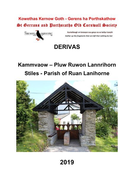
Kowethas Kernow Goth - Gerens ha Porthskathow<br />
DERIVAS<br />
Kammvaow – Pluw Ruwon Lannrihorn<br />
<strong>Stiles</strong> - Parish <strong>of</strong> <strong>Ruan</strong> <strong>Lanihorne</strong><br />
2019
<strong>Stiles</strong> <strong>of</strong> <strong>Ruan</strong> <strong>Lanihorne</strong><br />
Contents<br />
Acknowledgements<br />
Thanks are due to Carol and David Hughes who carried out virtually all <strong>of</strong> the fieldwork which forms<br />
the basis for this study.<br />
Any errors are the responsibility <strong>of</strong> the Recorder/Editor.<br />
Introduction<br />
Topic<br />
Page<br />
Acknowledgements 2<br />
Introduction 2<br />
Footpaths & <strong>Stiles</strong> 3<br />
Miscellaneous <strong>Stiles</strong> 36<br />
St Gerrans & Porthscatho Old Cornwall Society 41<br />
In 1997 the St Gerrans & Porthscatho Old Cornwall Society carried out and published a survey report<br />
on the <strong>Stiles</strong> <strong>of</strong> Gerrans Parish, including St Anthony. In 1999/2000 the Society completed a survey and<br />
published a report <strong>of</strong> the stiles in the parishes <strong>of</strong> Philleigh and St Just in Roseland.<br />
This report extends the survey to cover the neighbouring parish <strong>of</strong> <strong>Ruan</strong> <strong>Lanihorne</strong>. <strong>Ruan</strong> <strong>Lanihorne</strong> is<br />
a rural parish in the Hundred <strong>of</strong> Powder. It is bounded by the Fal River and St Michael Penkivel Parish<br />
to the north, and then clockwise by St Cuby (Tregony), Veryan, and Philleigh.<br />
This survey is intended to be an historical record <strong>of</strong> Cornish stiles in the Parish. It was mainly conducted<br />
in 2014, but with some additional material in 2019. For the sake <strong>of</strong> completeness, the location <strong>of</strong> stiles<br />
<strong>of</strong> all types existing at the time <strong>of</strong> the survey have been included and some information on the original<br />
use <strong>of</strong> the footpath has been given where possible. It is not a commentary on the condition <strong>of</strong> the<br />
footpaths, obstructions or diversions <strong>of</strong> rights <strong>of</strong> way.<br />
The footpaths <strong>of</strong> the Parish <strong>of</strong>ten provide direct routes between settlements, and sometimes these paths<br />
form longer cross-county routes. For example, one such path leads from the Tregony Road, above Barn<br />
via <strong>Ruan</strong> <strong>Lanihorne</strong>, Little Treviles, Treworga, Quoit Stile, and Lower Mill (Veryan) right through to<br />
Pendower.<br />
A stile is a set or series <strong>of</strong> steps for crossing a hedge, fence or wall, usually constructed so as to allow<br />
humans but not livestock to pass. The word stile derives from the Saxon stigel, a "device for climbing,<br />
ladder" it is related to stigen "to climb," from Proto-Germanic *stig- "to climb"<br />
The traditional stiles in the Roseland and surrounding districts tend to be built <strong>of</strong> native killas stone, and<br />
are <strong>of</strong> 3 main types (or modifications there<strong>of</strong>), Cattle <strong>Stiles</strong>, Sheep <strong>Stiles</strong> and C<strong>of</strong>fen <strong>Stiles</strong>.<br />
The most numerous are Cattle <strong>Stiles</strong>. These consist <strong>of</strong> a gap through the hedge with steps either side<br />
and a central bar.<br />
Sheep <strong>Stiles</strong> consist <strong>of</strong> cantilevered steps leading diagonally up on side <strong>of</strong> the hedge and down the<br />
other.<br />
The C<strong>of</strong>fen Stile can best be described as a stone “cattle grid”. There is a gap in the hedge, with<br />
horizontal slabs <strong>of</strong> stone over a pit.<br />
The style <strong>of</strong> both hedges and stiles is largely dictated by the underlying geology and the type <strong>of</strong> stone<br />
available combined with the local customs and hedging skills. These traditional stone stiles are thus an<br />
integral part <strong>of</strong> the local cultural and physical landscape. It is to be regretted that in recent years some<br />
organisations have turned their back on the local culture and littered the Roseland landscape with nonnative<br />
wooden stiles and kissing gates.<br />
Nev Meek – Recorder: St Gerrans & Porthscatho Old Cornwall Society – mis Gortheren 2019<br />
Page 2
<strong>Stiles</strong> <strong>of</strong> <strong>Ruan</strong> <strong>Lanihorne</strong><br />
Footpaths & <strong>Stiles</strong><br />
Footpath 317/1/1 - Veryan Turn to Lambourne<br />
Boundary 1 - SW 90100 39461<br />
Wooden step stile and gate leading from the A3078 near<br />
Veryan Turn (The junction with the road to Crugsillick).<br />
Figure 1 Photo - Carol Hughes 2014<br />
Boundary 2 - SW 89991 39516<br />
Figure 2 - Carol Hughes 2014<br />
The Field Boundary, at this point is accessed by a 5-bar wooden gate hung on granite gatepost.<br />
Page 3
<strong>Stiles</strong> <strong>of</strong> <strong>Ruan</strong> <strong>Lanihorne</strong><br />
Boundary 3 - SW 89850 39672<br />
Figure 3 - Carol Hughes 2014<br />
The boundary is accessed by means <strong>of</strong> a pedestrian wooden gate. Note that this is a modern boundary,<br />
until recent years the track from Lambourne to Trestain crossed an open field at this point.<br />
Boundary 4 - SW 89707 40000<br />
Between Boundary 3 and 4 this path follows the route <strong>of</strong><br />
the farm track to Lambourne and Trestain. At this point<br />
it meets with the road from <strong>Ruan</strong> High Lanes to Philleigh.<br />
There is no stile or gate at the end <strong>of</strong> the lane.<br />
Figure 4 - Carol Hughes 2014<br />
Page 4
<strong>Stiles</strong> <strong>of</strong> <strong>Ruan</strong> <strong>Lanihorne</strong><br />
Footpath 317/2/1 – <strong>Ruan</strong> High Lanes to Lambourne<br />
This is a short path across a field which forms a short cut to the route taken by the road.<br />
Boundary 1 – SW 89873 39965<br />
The boundary is crossed at this point by means <strong>of</strong> a Cattle<br />
Stile the top tread <strong>of</strong> which is a large native stone.<br />
Figure 5 - Carol Hughes 2019<br />
Figure 7 - Carol Hughes 2019 Figure 6 - Carol Hughes 2019<br />
Page 5
<strong>Stiles</strong> <strong>of</strong> <strong>Ruan</strong> <strong>Lanihorne</strong><br />
Boundary 2 – SW 89713 40003<br />
Figure 8 - Carol Hughes 2019 Figure 9 - Carol Hughes 2019<br />
The boundary here is crossed by means <strong>of</strong> a Cattle Stile and emerged adjacent to the lane to<br />
Lambourne, as detailed above.<br />
Page 6
<strong>Stiles</strong> <strong>of</strong> <strong>Ruan</strong> <strong>Lanihorne</strong><br />
Footpath 317/3/1 – Trethella to Treviles<br />
Boundary 1 – SW 89737 41561<br />
The footpath leads <strong>of</strong>f the road between <strong>Ruan</strong> <strong>Lanihorne</strong><br />
and Trethella. It is accessed by means <strong>of</strong> a wooden Step<br />
Stile and leads along a farm track.<br />
Figure 10 - Carol Hughes 2014<br />
The stile leading from the road onto a farm track is a<br />
two-tread step stile, next to a modern galvanised tubular<br />
steel field gate.<br />
Figure 11 - Carol Hughes 2014<br />
Page 7
<strong>Stiles</strong> <strong>of</strong> <strong>Ruan</strong> <strong>Lanihorne</strong><br />
Boundary 2 - SW 89750 41547<br />
The stile at this point is a two-tread wooden step stile<br />
alongside a modern galvanised steel field gate.<br />
Figure 12 - Carol Hughes 2014<br />
Boundary 3 – SW 89883 41250<br />
Figure 13 - Carol Hughes 2014<br />
Page 8
<strong>Stiles</strong> <strong>of</strong> <strong>Ruan</strong> <strong>Lanihorne</strong><br />
The boundary at this point is crossed by means <strong>of</strong> a galvanised tubular steel field gate, with<br />
waymarks on the latch-post.<br />
Figure 14 - Carol Hughes 2014<br />
Boundary 4 – SW 89890 41133<br />
The boundary at this point is accessed by means <strong>of</strong> a<br />
two-tread wooden step stile.<br />
Figure 15 - Carol Hughes 2014<br />
Page 9
<strong>Stiles</strong> <strong>of</strong> <strong>Ruan</strong> <strong>Lanihorne</strong><br />
Boundary 5 – SW 89922 40905<br />
Figure 16 - Carol Hughes 2014 Figure 17 - Carol Hughes 2014<br />
Figure 18 - Carol Hughes 2014<br />
The boundary is crossed at this point by a traditional stone Cattle Stile, the top tread <strong>of</strong> which is a<br />
substantial granite stone. There is a wooden fence on the southern side the top rung <strong>of</strong> which is<br />
hinged.<br />
Page 10
<strong>Stiles</strong> <strong>of</strong> <strong>Ruan</strong> <strong>Lanihorne</strong><br />
Boundary 6 – SW 89961 40748<br />
Figure 20 - Carol Hughes 2014 Figure 19 - Carol Hughes 2014<br />
There is wire mesh on the north side <strong>of</strong> the boundary. The stile itself is a modified Cattle Stile, with a<br />
large step-over stone on edge on the top <strong>of</strong> the hedge and stone treads on the southern side.<br />
Boundary 7 – SW 89961 40748<br />
Figure 21 - Carol Hughes 2014<br />
This galvanised tubular steel gate is immediately adjacent to the last boundary.<br />
Page 11
<strong>Stiles</strong> <strong>of</strong> <strong>Ruan</strong> <strong>Lanihorne</strong><br />
Boundary 8 – SW 89960 40738<br />
The path fords a small stream at this point. The stream<br />
itself joins other tributaries before flowing into the <strong>Ruan</strong><br />
River.<br />
Figure 22 - Carol Hughes 2014<br />
Boundary 9 – SW 89950 40667<br />
Figure 23 - Carol Hughes 2014<br />
Figure 24 - Carol Hughes 2014<br />
The boundary here is accessed by a stone-built Cattle Stile, the top tread <strong>of</strong> which is a very hefty rock.<br />
The path here emerges on to the road between Treviles and Treworga.<br />
Page 12
<strong>Stiles</strong> <strong>of</strong> <strong>Ruan</strong> <strong>Lanihorne</strong><br />
Footpath 317/4/1 – Forge to Trethella<br />
Boundary 1 – SW 89761 41761<br />
Figure 25 - Nev Meek 2019<br />
The footpath leaves the road at <strong>Ruan</strong> immediately next<br />
to a post-medieval blacksmith’s shop, which has now<br />
been converted into a dwelling. A modified stone Cattle<br />
Stile accesses the field behind where there is a modern<br />
wooden kissing gate.<br />
Figure 27 - Carol Hughes 2014<br />
Figure 26 - Carol Hughes 2014<br />
Page 13
<strong>Stiles</strong> <strong>of</strong> <strong>Ruan</strong> <strong>Lanihorne</strong><br />
Boundary 2 – SW 89700 41703<br />
Figure 28 - Carol Hughes 2014<br />
The hedgerow at this point is a new creation, as is the wooden kissing gate which provides the route<br />
through it.<br />
Boundary 3 – SW 89631 41637<br />
Figure 29 - Carol Hughes 2014<br />
The hedgerow at this point is a new creation, as are the double wooden pedestrian gates which provides<br />
the route through it.<br />
Page 14
<strong>Stiles</strong> <strong>of</strong> <strong>Ruan</strong> <strong>Lanihorne</strong><br />
Boundary 4 – SW 89585 41591<br />
The boundary here is accessed by means <strong>of</strong> a wooden<br />
pedestrian gate.<br />
Figure 30 - Carol Hughes 2014<br />
Boundary 5 – SW 89574 41573<br />
The path down to the road at Trethella is accessed by a<br />
flight <strong>of</strong> modern steps.<br />
Figure 31 - Carol Hughes 2014<br />
Page 15
<strong>Stiles</strong> <strong>of</strong> <strong>Ruan</strong> <strong>Lanihorne</strong><br />
Footpath 317/5/1 – <strong>Ruan</strong>/Tregony Road, via Barn to <strong>Ruan</strong> Mill<br />
Boundary 1 – SW 90027 42424<br />
The path here is accessed by climbing a hedge from<br />
the roadside. There are wooden steps on the field side,<br />
but these are <strong>of</strong>ten obscured by undergrowth.<br />
Figure 32 - Carol Hughes - 2019<br />
This “Ladder Stile” is unusual in Roseland, and is the<br />
only example in the parish.<br />
Figure 33 - Carol Hughes 2019<br />
Page 16
<strong>Stiles</strong> <strong>of</strong> <strong>Ruan</strong> <strong>Lanihorne</strong><br />
Boundary 2 – SW 89902 42158<br />
The path here leads through a<br />
modern galvanised tubular metal field<br />
gate. This gives access to the<br />
farmstead at Barn.<br />
Figure 34 - Carol Hughes 2019<br />
The Heritage Environment Record<br />
records that the historian, Charles<br />
Henderson, identified a granite stone<br />
on a wall at Barn, which he thought<br />
could be a medieval cross.<br />
Figure 35 - Old Building at Barn, Nev Meek 2019<br />
Page 17
<strong>Stiles</strong> <strong>of</strong> <strong>Ruan</strong> <strong>Lanihorne</strong><br />
Figure 36 - Green Lane from Barn to <strong>Ruan</strong>, Nev Meek 2019<br />
The path from Barn follows a green lane which<br />
emerges on the eastern side <strong>Ruan</strong> <strong>Lanihorne</strong>, next to<br />
a house named Fairview, and behind the former corn<br />
mill.<br />
Figure 37 - Carol Hughes - 2019<br />
Page 18
<strong>Stiles</strong> <strong>of</strong> <strong>Ruan</strong> <strong>Lanihorne</strong><br />
Figure 38 - Former Mill at <strong>Ruan</strong> <strong>Lanihorne</strong>, Nev Meek 2019<br />
Page 19
<strong>Stiles</strong> <strong>of</strong> <strong>Ruan</strong> <strong>Lanihorne</strong><br />
Footpath 317/6/1 – <strong>Ruan</strong>/Tregony Road, via Trethewey & Cregoe to A3078<br />
The footpath leads from the <strong>Ruan</strong> / Tregony Road to the A3078 via Trethewey and Cregoe.<br />
Boundary 1 – SW 91025 43283<br />
Figure 39 - Track to Trethewey - Nev Meek 2019<br />
The footpath leaves the <strong>Ruan</strong>/Tregony road via the track to Trethewey. The first part <strong>of</strong> the footpath<br />
follows this track until it crosses the fields near to Trethewey itself.<br />
Boundary 2 – SW 91649 43117<br />
Figure 40 - Nev Meek 2019<br />
At this point the footpath crosses the field boundary by means <strong>of</strong> a modern wooden two-tread step stile.<br />
Page 20
<strong>Stiles</strong> <strong>of</strong> <strong>Ruan</strong> <strong>Lanihorne</strong><br />
Figure 41 - Looking back toward Trethewey - Nev Meek 2019<br />
Boundary 3 – SW 91855 43053<br />
From the fields the path enters a green lane with no stile or gate.<br />
Figure 42 - Green lane to Cregoe - Nev Meek 2019<br />
Page 21
<strong>Stiles</strong> <strong>of</strong> <strong>Ruan</strong> <strong>Lanihorne</strong><br />
Boundary 4 – SW 91924 42972<br />
There is a modern wooden gate across the green lane near what is now named Cregoe Court.<br />
Figure 43 - Gate at Cregoe Court - Nev Meek 2019<br />
Boundary 5 – SW 92147 43052<br />
The footpath continues from Cregoe Court along the main track to Cregoe to the A3078.<br />
Figure 44 - Track to Cregoe from A3078 - Nev Meek 2019<br />
Page 22
<strong>Stiles</strong> <strong>of</strong> <strong>Ruan</strong> <strong>Lanihorne</strong><br />
Footpath 317/7/1 – <strong>Ruan</strong> High Lanes/<strong>Ruan</strong> <strong>Lanihorne</strong> Road to Beruppa<br />
Boundary 1 – SW 90388 40489<br />
Figure 46 - Carol Hughes 2019<br />
Figure 45 - Nev Meek 2019<br />
The path is accessed by means <strong>of</strong> a widened field gateway from the <strong>Ruan</strong> High Lanes to <strong>Ruan</strong><br />
<strong>Lanihorne</strong> Road. There is a traditional granite gatepost on one side <strong>of</strong> the gateway. The latch-post is<br />
missing.<br />
Figure 47 - Nev Meek 2019<br />
For part <strong>of</strong> its route the path follows a green lane down to Beruppa.<br />
Page 23
<strong>Stiles</strong> <strong>of</strong> <strong>Ruan</strong> <strong>Lanihorne</strong><br />
Figure 49 - Nev Meek 2019<br />
Boundary 2 – SW 90725 40401<br />
The path follows the farm track from Beruppa and<br />
emerges onto the A3078.<br />
The gateway has a traditional granite gatepost.<br />
Figure 48 - Nev Meek 2019<br />
Page 24
<strong>Stiles</strong> <strong>of</strong> <strong>Ruan</strong> <strong>Lanihorne</strong><br />
Footpath 317/8/1 - Tregisswin to New Gonitor<br />
Boundary 1 – SW 90610 41169<br />
The path is accessed from the road adjacent to<br />
Tregisswin by means <strong>of</strong> a traditional stone-built Cattle<br />
Stile.<br />
Figure 50 - Carol Hughes 2018<br />
Figure 52 - Carol Hughes 2014 Figure 51 - Carol Hughes 2014<br />
Page 25
<strong>Stiles</strong> <strong>of</strong> <strong>Ruan</strong> <strong>Lanihorne</strong><br />
Boundary 2 – SW 90420 41284<br />
Figure 54 - Carol Hughes 2014<br />
Figure 53 - Carol Hughes 2014<br />
The hedge at this point is crossed by a stone Sheep Stile (aka Step Stile).<br />
Page 26
<strong>Stiles</strong> <strong>of</strong> <strong>Ruan</strong> <strong>Lanihorne</strong><br />
Boundary 3 – SW 90037 41298<br />
Figure 56 - Carol Hughes 2014 Figure 55 - Carol Hughes 2014<br />
The path at this point emerges onto the <strong>Ruan</strong> High Lanes to <strong>Ruan</strong> <strong>Lanihorne</strong> road. The boundary is<br />
accessed by means <strong>of</strong> a wooden two-tread step stile.<br />
Page 27
<strong>Stiles</strong> <strong>of</strong> <strong>Ruan</strong> <strong>Lanihorne</strong><br />
Footpaths 317/9/1 & 317/9/2 - Treworga to Praze Hill<br />
Boundary 1 – SW 89654 40109<br />
Figure 58 - Carol Hughes 2014<br />
Figure 57- Carol Hughes 2014<br />
The path is accessed by climbing the hedge on the outskirts <strong>of</strong> Treworga.<br />
Boundary 2 – SW 89219 39910<br />
The path is accessed from the road by walking over a<br />
low hedge. There is no actual stile.<br />
Figure 59 - Carol Hughes 2014<br />
Page 28
<strong>Stiles</strong> <strong>of</strong> <strong>Ruan</strong> <strong>Lanihorne</strong><br />
Footpath 317/10/1 - Trethella to Trelonk<br />
This footpath is a shortcut across a loop in the road it crosses a stream in the bottom <strong>of</strong> the valley.<br />
Footbridge – SW 89470 41479<br />
There is a footbridge across the stream and stone steps<br />
at the other side.<br />
Figure 60 - Carol Hughes 2014<br />
Page 29
<strong>Stiles</strong> <strong>of</strong> <strong>Ruan</strong> <strong>Lanihorne</strong><br />
Footpath 317/11/1 - <strong>Ruan</strong> High Lanes to Veryan Footpath 327/22/1<br />
The hamlet <strong>of</strong> High Lanes is in the Parish <strong>of</strong> <strong>Ruan</strong> <strong>Lanihorne</strong>, but only just! The parish boundary with<br />
Veryan runs along the back gardens <strong>of</strong> the cottages on the south western side <strong>of</strong> the hamlet. This<br />
footpath is a very short section from the main A3078 in High Lanes to the Veryan Parish boundary.<br />
Boundary 1 – SW 90277 39901<br />
Figure 61 - Nev Meek 2019<br />
The path is accessed via a narrow path and some stone steps.<br />
Figure 62 - Nev Meek 2019<br />
Page 30
<strong>Stiles</strong> <strong>of</strong> <strong>Ruan</strong> <strong>Lanihorne</strong><br />
Boundary 2 – SW 90286 39894<br />
Figure 63 - Wooden Stile at High Lanes - Nev Meek 2019<br />
The path across the field is accessed by a modern two-tread wooden step stile.<br />
Figure 64 - Nev Meek 2019<br />
Page 31
<strong>Stiles</strong> <strong>of</strong> <strong>Ruan</strong> <strong>Lanihorne</strong><br />
Footpath 317/12/1 - <strong>Ruan</strong> village<br />
This is a short section <strong>of</strong> footpath which winds its way through the old village <strong>of</strong> <strong>Ruan</strong>. There are no<br />
stiles.<br />
Figure 65 Entrance to the footpath from the lower road in <strong>Ruan</strong> - Nev Meek 2019<br />
Figure 66 - Rout <strong>of</strong> path in <strong>Ruan</strong> - Nev Meek 2019<br />
Page 32
<strong>Stiles</strong> <strong>of</strong> <strong>Ruan</strong> <strong>Lanihorne</strong><br />
Figure 67 - Nev Meek 2019<br />
The footpath passes the well at Hillside, before climbing some steps and a short path, emerging on to<br />
the road near the Kings Head.<br />
Figure 68 - Steps leading up from Hillside - Nev Meek 2019<br />
Figure 69 - Point where path emerges on to road near Kings<br />
Head - Nev Meek 2019<br />
Page 33
<strong>Stiles</strong> <strong>of</strong> <strong>Ruan</strong> <strong>Lanihorne</strong><br />
Footpath 325/6/1 – Hay Corner to Porters<br />
This bridleway is numbered as a St Cuby (Tregony) Parish bridleway; however, this lane forms the<br />
boundary between <strong>Ruan</strong> and Tregony so is actually in both parishes. It is a green lane which runs from<br />
Hay Corner on the A3078 to Porters on the <strong>Ruan</strong>/Tregony road.<br />
Boundary 1 – SW 92138 43385<br />
Figure 70 - Entrance to green lane from Hay Corner - Nev Meek 2019<br />
Figure 71 - Traditional 'Jin pon Jan' (Jack & Jill, herringbone) hedging in lane between Hay Barton and Porters - Nev<br />
Meek 2019<br />
Page 34
<strong>Stiles</strong> <strong>of</strong> <strong>Ruan</strong> <strong>Lanihorne</strong><br />
Boundary 2 – SW 91458 44036<br />
Figure 72 - Lane at Porters - Nev Meek 2019<br />
Figure 73 - Bridleway Sign at Porters - Nev Meek 2019<br />
Page 35
<strong>Stiles</strong> <strong>of</strong> <strong>Ruan</strong> <strong>Lanihorne</strong><br />
Miscellaneous <strong>Stiles</strong> and Other Features<br />
Lychgate – SW 89465 42005<br />
The largest stile in the Parish is the lychgate which gives access to the church and churchyard. The<br />
word lych is from the Saxon lic ‘corpse’, since the ro<strong>of</strong>ed lychgate gives shelter to c<strong>of</strong>fins on the way to<br />
burial. The lychgate is also the only example <strong>of</strong> a C<strong>of</strong>fen Stile in the Parish.<br />
Figure 74 - Lychgate - Nev Meek 2015<br />
The horizonal stone slabs can still be seen on the floor <strong>of</strong> the lychgate although the gaps and the pit<br />
underneath have unfortunately been filled with concrete.<br />
Figure 75 - Lychgate interior - Nev Meek 2019<br />
Page 36
<strong>Stiles</strong> <strong>of</strong> <strong>Ruan</strong> <strong>Lanihorne</strong><br />
Quoit Stile – SW 89885 39110<br />
Figure 76 - Carol Hughes 2019<br />
Quoit Stile is the only named stile in the parish; it is so named because it is on the hedge <strong>of</strong> a field<br />
named Quoit Field. It is situated on the hedge bordering the A3078 opposite the entrance <strong>of</strong> the<br />
driveway to Trenance. It is in a significant location on a path which extends from <strong>Ruan</strong> <strong>Lanihorne</strong> to<br />
Pendower, via Lambourne and Lower Mill. It is also at the point where three parish boundaries meet –<br />
<strong>Ruan</strong>, Veryan, and Philleigh.<br />
Unfortunately, this section <strong>of</strong> the path was omitted from the Definitive Map in the 1950s. Recently Carol<br />
Hughes had to fight her way through the undergrowth to confirm that the stile still exists, and to obtain<br />
the above photograph.<br />
In his ‘History <strong>of</strong> the Parish <strong>of</strong> <strong>Ruan</strong>lanihorne’, the Rector, Rev. John Whitaker (1735-1808) wrote:<br />
“On this hill and along the High Lane was a wood which has lent a name to the site <strong>of</strong> it. Coit field, and<br />
to the access into it from the High Lane, Coit Stile. But the word Coit not being understood as<br />
significative <strong>of</strong> a wood, and being still retained in popular use for a Quoit, vulgar fancies have laid hold<br />
<strong>of</strong> the circumstances very naturally, to wrest the name from what they did not know, to something <strong>of</strong><br />
which they did. Two stones also being laid near the stile, the populace imagined one <strong>of</strong> them to be the<br />
dominating object, because it has something <strong>of</strong> the Quiot in its appearance. They were both <strong>of</strong> a blue<br />
aspect and appeared from that to have been cut from the cliffs at Pendour. But one <strong>of</strong> them was in the<br />
ditch <strong>of</strong> the lane near the style set up as a pillar, fastened deep in the ground, surrounded with a little<br />
mound <strong>of</strong> earth and rising about two feet above it; while the other was round and flat, evidently the<br />
cover <strong>of</strong> that pillar, lying where it had fallen with its edge in the ditch and not above two or three inches<br />
uncovered with it. The former was shaped by imagination into the jack, and the latter into the quoit<br />
pitched near it. This indeed was rather too large for a quoit. But then what will not suit an ordinary hand<br />
may be adapted to a gigantic one. The vulgar have therefore been obliged to conjure up a Giant for the<br />
Quoit, who lived they not in which castle, and who threw it from they know not which point, the<br />
churchyard <strong>of</strong> Gerrans, the top <strong>of</strong> its spire, or from somewhere else. Thus, a wood, by the copulation <strong>of</strong><br />
ignorance with accident became a Quoit in the first generation and a father <strong>of</strong> a most miraculous Giant<br />
in the second! And. All the while, the Quoit and its Jack were only the cap and post set up by authority<br />
to mark the place at which the three parishes <strong>of</strong> <strong>Ruan</strong>, Philleigh and Veryan converge to a point.”<br />
There was another stile on this section <strong>of</strong> path, possibly over a hedge at SW 898 394, near Trestain.<br />
According to former land, Steve Paull, the stile was a Cattle Stile. This survey has been unable to<br />
locate it.<br />
Page 37
<strong>Stiles</strong> <strong>of</strong> <strong>Ruan</strong> <strong>Lanihorne</strong><br />
Polsue Cottage Stile – SW 88787 39662<br />
There is a stile over the hedge adjacent to Polsue<br />
Cottage on the <strong>Ruan</strong> High Lanes to Philleigh road. It<br />
probably provided a shortcut to Trenestrall.<br />
The stile is a traditional stone Cattle Stile.<br />
Figure 77 - Carol Hughes 2014<br />
Sett Bridge – SW 88743 42178<br />
Sett Bridge is the 19 th Century bridge over the River Fal to the north west <strong>of</strong> <strong>Ruan</strong> <strong>Lanihorne</strong>. There is<br />
a stile from the bridge down on to the west bank <strong>of</strong> the river. It is technically just in the parish <strong>of</strong> St<br />
Michael Penkivel, but is included here for interest.<br />
Figure 78 - Carol Hughes 2019<br />
Page 38
<strong>Stiles</strong> <strong>of</strong> <strong>Ruan</strong> <strong>Lanihorne</strong><br />
Figure 79 - Carol Hughes 2019<br />
Tuckingmill Footbridge – SW 89163 40403<br />
Figure 80 - Carol Hughes 2014<br />
Page 39
<strong>Stiles</strong> <strong>of</strong> <strong>Ruan</strong> <strong>Lanihorne</strong><br />
Churchyard Stile - SW 89456 42061<br />
Figure 81 - Carol Hughes 2019<br />
A “stile” in the form <strong>of</strong> steps, from the road gives access over the lann into the north-west corner <strong>of</strong><br />
the churchyard.<br />
Page 40
<strong>Stiles</strong> <strong>of</strong> <strong>Ruan</strong> <strong>Lanihorne</strong><br />
St. Gerrans & Porthscatho Old Cornwall Society<br />
The objectives <strong>of</strong> the Society are: -<br />
1. To collect, record and share information about Cornish history, place-names, folk-lore,<br />
traditions, dialect, music, industries etc.<br />
2. To protect the natural beauty <strong>of</strong> Cornwall<br />
3. To encourage the study and use <strong>of</strong> the Cornish Language<br />
4. To preserve Cornish Antiquities and relics <strong>of</strong> the past<br />
Members <strong>of</strong> the Society work tirelessly to collect, record and promote all aspects <strong>of</strong> our rich<br />
Cornish history and culture.<br />
In order to promote Cornish culture, the Society: -<br />
1. Manages projects to survey and preserve sites <strong>of</strong> historic interest.<br />
2. Publishes pamphlets, booklets and other material.<br />
3. Holds cultural events, e.g. St Peran’s Celebration, Crying the Neck, Feast Day<br />
Celebrations.<br />
4. Holds a series <strong>of</strong> monthly talks between October and May.<br />
5. Runs visits to sites <strong>of</strong> historic interest each Summer.<br />
If you have additional relevant information, documents, photos, illustrations or objects please<br />
contact our Recorder: Nev Meek<br />
Email: nev.meek@sky.com Tel: 01872 581817<br />
If you would enjoy the challenge <strong>of</strong> contributing to a dynamic, Roseland based, cultural<br />
organisation please contact our Membership Secretary for more information:<br />
Jean Rigley<br />
Email: jeanrigley@btinternet.com Tel: 01872 501838<br />
Page 41
<strong>Stiles</strong> <strong>of</strong> <strong>Ruan</strong> <strong>Lanihorne</strong><br />
This Report collates details <strong>of</strong> all <strong>of</strong> the known stiles in the Parish <strong>of</strong> <strong>Ruan</strong> <strong>Lanihorne</strong>.<br />
St Gerrans & Porthscatho Old Cornwall Society is affiliated to the Federation <strong>of</strong> Old Cornwall<br />
Societies.<br />
Registered Charity No.247283<br />
Page 42