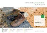
Broschuere Hiking – Actively enjoying nature

You also want an ePaper? Increase the reach of your titles
YUMPU automatically turns print PDFs into web optimized ePapers that Google loves.
<strong>Hiking</strong><br />
<strong>Actively</strong> <strong>enjoying</strong> <strong>nature</strong><br />
Outdoor Activities<br />
in the natural paradise<br />
at the Rothaarsteig<br />
Region & Culture<br />
in the princely<br />
Bad Berleburg<br />
Nature<br />
in the land<br />
of the wisents<br />
Health & Well-Being<br />
in the heart of<br />
South Westphalia<br />
www.blb-tourismus.de
Dear Nature- and <strong>Hiking</strong> Fans!<br />
Welcome to Wittgenstein <strong>–</strong> the largest connected<br />
forest area in Germany. Especially for hikers, the<br />
Rothaargebirge (a low mountain range in North<br />
Rhine-Westphalia and Hessen) is the most beautiful<br />
destination in South Westphalia, here you find the<br />
city Bad Berleburg with its 22 villages. You will see:<br />
In our natural paradise you come close to heaven.<br />
In Wittgenstein you can find wonderful treasures!<br />
The adventurous and various premium hiking<br />
paths, e. g. the Wittgensteiner Schieferpfad (Wittgensteiner<br />
slate path), the Via Adrina, the Wisent<br />
path and of course the Rothaarsteig (hiking path<br />
on the Rothaargebirge), are great to experience.<br />
Even when you leave the normal paths you will<br />
come across beautiful villages that show you the<br />
traditional charm of the region. Unique in<br />
Germany and therefore outstanding is the Wald-<br />
SkulpturenWeg (ForestSculptureWay) with its eleven<br />
artworks created by international artists. The trail<br />
connects the regions Wittgenstein and Sauerland.<br />
Around the Rothaarsteig you can experience the<br />
world of hiking with all of your senses: See the pure<br />
beauty of <strong>nature</strong>, the careful keeping of costums<br />
and history, as well as a spectacular cultural program<br />
and great hospitality.<br />
The wild side of Wittgenstein is even more impressive:<br />
During a trip to the Wisent-wilderness at the<br />
Rothaarsteig the visitors gain an insight into a<br />
unique wildlife conservation program.<br />
Come and visit us!<br />
Your Tourism Team of Bad Berleburg<br />
Photo: Klaus Hurtienne<br />
2<br />
3
Bad Berleburg<br />
Wittgensteiner Schieferpfad<br />
Facts around the track<br />
Raumland<br />
Eder<br />
Length<br />
Duration<br />
Altitude<br />
difference<br />
Loop road<br />
Start / Finish<br />
Dotzlar<br />
15 km<br />
ca. 5 h<br />
434 m<br />
Raumland<br />
For hiking on the Wittgensteiner Schieferpfad<br />
(Wittgensteiner slate path), the bat signs show you<br />
the way. One thing that makes this trail very special:<br />
It was the first certified premium hiking path<br />
in our region. Here you will meet imposing cliffs,<br />
majestic old trees, clear waters and historical traces<br />
of the former slate mining. A great adventure!<br />
In 2005 the Wittgensteiner Schieferpfad received<br />
the German hiking seal as the first premium<br />
hiking path in our region, since then many visitors<br />
were thrilled by the path!<br />
exciting<br />
adventures<br />
The slate path passes four <strong>nature</strong> reserves and<br />
numerous habitats. Experience wilderness at its<br />
best. Here <strong>nature</strong> shows all its liberty and unfolds<br />
its full beauty. On the more than 14 kilometre long<br />
loop trail you will meet fascinating forest surroundings,<br />
stunning rock formations, enchanted paths,<br />
huge slate mounds as well as great views through<br />
the Edertal, to the old city centre of Bad Berleburg<br />
and the slate village Raumland. The landscape is<br />
set in a unique scenery. Some passages of the path<br />
are adventurous!<br />
Hikers should plan around five hours for this tour.<br />
The tour starts at the parking lot Reisegarten in<br />
Raumland next to the river Eder, 200 metres from<br />
the Schieferschaubergwerk (slate mine museum).<br />
Good physical condition is required, as well as<br />
sturdy shoes and a backpack with food and<br />
drinks. Trekking poles are recommended.<br />
Slate village Raumland: The oldest maintained concession<br />
certificat for slate mining is dated back to 1717. The last mine<br />
Hörre 2 was retired in 1973. The Schieferschaubergwerk Raumland<br />
(visited mine) was opened in 1983.<br />
www.schieferschaubergwerk.de<br />
Church village Raumland: In the 9th century it was the original<br />
parish of the Edertal. Around 1250 the Bonifatius church was<br />
built on a cliff high above the confluence of the rivers Eder and<br />
Odeborn. The church with three naves is worth a visit especially<br />
because of its mural paintings from the 15th century.<br />
www.kg-raumland.de<br />
On the slate path you can reach the most beautiful cliffs in<br />
Wittgenstein. Extraordinary cliffs can be found in the habitats<br />
Fredlar and Honert.<br />
Parts of the tour use the old “Hessenweg”, an old trade route,<br />
that ends in Marburg. On the forest road to Fredlar you can<br />
see traces of heavily burdened ox-carts in the rocks.<br />
The slate path was elaborated by pupils of a school in Bad Berleburg.<br />
Mining path: You find a theme path about slate mining history<br />
in and around Raumland. The tour starts at the ”Grube Delle“ and<br />
the first stage is about 3,5 km. www.schieferschaubergwerk.de<br />
4<br />
<strong>Hiking</strong> in Bad Berleburg, the natural paradise in South Westphalia<br />
5
Eder<br />
Dotzlar<br />
Arfeld<br />
Length<br />
Duration<br />
Altitude<br />
difference<br />
Loop road<br />
Start / Finish<br />
Schwarzenau<br />
20,2 km<br />
ca. 6 h<br />
650 m<br />
Arfeld<br />
Via Adrina<br />
The Via Adrina is a way with spectacular sights.<br />
The trail, formed like a lying eight, leads over 20.2<br />
kilometres through the hilly and fascinating landscape<br />
around Arfeld and Schwarzenau and explores<br />
the Eder-loops.<br />
The approximately six-hour tour is demanding.<br />
Hikers should be relatively fit and wear hiking<br />
shoes. En route you will be rewarded with wonderful<br />
panoramic views of the surrounding hills<br />
and adventurous <strong>nature</strong> trails in the valleys.<br />
Way of<br />
spectacular sights<br />
The premium hiking trail has the German hiking<br />
seal and is one of the highlights near the Rothaarsteig.<br />
Starting point is at the Eder bridge in Arfeld.<br />
The signs with waves run along the Via Adrina<br />
in both directions. This signpost concept has also<br />
contributed to achieve the premium hiking trail<br />
certificat for this route at the end of 2014.<br />
Through a well-marked shortcut, it is also possible<br />
to divide the tour into two 12 kilometres stages.<br />
However, those who want to extend their walk,<br />
after 19 kilometres, you can change to the<br />
Wittgensteiner Schieferpfad which is 15 kilometres<br />
long.<br />
From the two viewing platforms it is possible<br />
to see the way you have already passed and the<br />
part you will walk during the next hours.<br />
Facts around the track<br />
In the Mühlbach (a millstream) near the village Arfeld lives the<br />
“Rote Wittgensteiner Höhenvieh”. The old cow race had nearly<br />
disappeared from the meadows, until they were saved from<br />
extinction by breeding.<br />
The manor house with its well-tended garden, built in 1788,<br />
is worth seeing. The princely family zu Sayn-Wittgenstein-<br />
Hohenstein used it as a residence for the widowed, a summer<br />
domicile and a hunting lodge.<br />
When Alexander Mack baptized eight persons in the river Eder<br />
in 1788, he founded the pietistic movement of the Schwarzenau<br />
Brethren that still exist today and was spread in the<br />
USA after their emigration to North America.<br />
The Alexander-Mack-Museum reminds us about the Church<br />
Brethren and the time of the radical Pietism in Wittgenstein.<br />
www.heimatverein-schwarzenau.de<br />
Since 1250 you find the Church of Arfeld below the<br />
church montain. The architectural style goes back to the<br />
time between the Romantic period and the Gothic period.<br />
Since 2011 the church is an open church for cyclists.<br />
Hikers from the Via Adrina are very welcome as well.<br />
www.kirche-arfeld.de<br />
The Arfelder Schmiede (forge museum) is also worth a<br />
visit. Until 1970 the Arfelder Schmiede was used. Today<br />
the builing it under preservation order.<br />
www.heimatverein-arfeld.de<br />
Next gastronomies: Gasthof Zum Bahnhof (Arfelder<br />
Hauptstraße 1, Arfeld, 0 27 55 - 2 03), Café Hainbach<br />
(Arfeld, www.fewo-cafe-hainbach.de) Gasthof Kassel<br />
(Schwarzenau, www.gasthof-kassel.de) Schwarzenauer<br />
Mühle (Schwarzenau, www.schwarzenauer-muehle.com).<br />
6<br />
<strong>Hiking</strong> in Bad Berleburg, the natural paradise in South Westphalia<br />
7
Jagdhaus<br />
Wisent-Path<br />
animal hiking pleasure<br />
Facts around the track<br />
8<br />
Length<br />
Duration<br />
Altitude<br />
difference<br />
Wingeshausen<br />
13,5 km<br />
ca. 4,5 h<br />
357 m<br />
Loop road<br />
Start / Finish Wingeshausen<br />
Rothaarsteig-Spur<br />
<strong>Hiking</strong> in Bad Berleburg, the natural paradise in South Westphalia<br />
Photo: Heidi Bücker<br />
In Wittgenstein you can see the wisents in free<br />
<strong>nature</strong>. They gave the name for the hiking path in<br />
Wingeshausen, which is 13,5 kilometres long. The<br />
Wisent-Path invites you to adventure over narrow<br />
forest paths. A great natural spectacle with the<br />
European bisons.<br />
Because of the unique <strong>nature</strong> conservation project<br />
in west Europe the wisents live in the Rothaargebirge<br />
since 2013. One herd is living in the woods of<br />
the princely family zu Sayn-Wittgenstein-Berle-<br />
burg.<br />
To see the shy giants in the wilderness, a tour on<br />
the Wisent-Path is a great opportunity. Little wooden<br />
information signs with wisents lead through<br />
mystic forests and idyllic meadow valleys as well<br />
as to picturesque views use of the Rothaar ridge on<br />
the way.<br />
Who doesn’t get the chance to see the wisents can<br />
go to the “wisent-wilderness” where you can walk<br />
a three kilometre path around a preserve of another<br />
herd of wisents. Also kids can discover a <strong>nature</strong><br />
playground.<br />
The Wisent-Path leads from Wingeshausen, trough<br />
the Rohrbach-Valley, over the Rothaar ridge, to<br />
Schmallenberg-Jagdhaus, through the picturesque<br />
valley of the Ihrige and paths in the Bockeshorn-<br />
Valley back to Wingeshausen. The duration of the<br />
tour is 4,5 hours. There are several possibilities to<br />
start the tour in Wingeshausen, the parking lot of<br />
the wisent-wilderness and at Jagdhaus.<br />
Photo: Manuela Weller<br />
On the track the wisents are not alone, because the village association<br />
Aue-Wingeshausen has printed different animal motives<br />
and put them up along the way. So you can see rabbits, foxes,<br />
deers and wild boars in life-size.<br />
In the middle of the tour you reach the wisent-wilderness. The<br />
concept of the “wilderness” includes a smart heightcontrol to<br />
find out which price each person has to pay. The park invites<br />
the visitors to climb over rocks and trees, walk through a tunnel<br />
and over streams. www.wisent-welt.de<br />
The theme “All Nature” characterises the <strong>nature</strong>- and adventure<br />
playground right above the wisent-wilderness. Here you find a<br />
water-, wood-, and music place as well as a small wilderness<br />
for children.<br />
Right next to these highlights you can relax for a moment. The<br />
Wisent-Hütte gives you the opportunity to drink and eat something<br />
before you start your tour. www.wisent-huette.de<br />
There is more gastronomy next to the path:<br />
Café-Restaurant Sonnenhof: www.sonnenhof-cafe.de<br />
Hotel-Restaurant Forellenhof: www.forellenhof-wingeshausen.de<br />
9
Schmallenberg<br />
Bad Berleburg<br />
Length<br />
Duration<br />
Altitude<br />
difference<br />
23 km<br />
ca. 6 h<br />
630 m<br />
Start / Finish<br />
City hall Bad Berleburg,<br />
Poststraße 42 or<br />
Schloss Bad Berleburg or<br />
Rathaus Schmallenberg,<br />
Unterm Werth 1<br />
Art in the<br />
WaldSkulpturenWeg Wittgenstein-Sauerland<br />
<strong>nature</strong><br />
On your journey through the Rothaar ridge you will<br />
encounter art in the green frame. The WaldSkulpturenWeg<br />
(ForestSculptureWay) Wittgenstein <strong>–</strong><br />
Sauerland connects the towns Bad Berleburg and<br />
Schmallenberg over a distance of 23 kilometres and<br />
offers a large scale of art in <strong>nature</strong>.<br />
In a wonderful forestal idyllic scene eleven<br />
renowned artists have created a unique art trail.<br />
The artworks impress by their diversity.<br />
At the beginning of the around six hours long trail<br />
the first piece of art, “The challenge” (Der Wettbewerb)<br />
by Jochen Gerz, is located right next to the<br />
town hall in Bad Berleburg. After his Invitation the<br />
people from Berleburg and Schmallenberg sent letters<br />
to each others to build a bridge between the<br />
identities and traditions on both sites of the Rothaarsteig.<br />
Das “goldene Ei” (The golden egg) greets<br />
you high above Bad Berleburg and invites you to<br />
find the answer to the question who was there first,<br />
the chicken or the egg? “Die Grünstation” (The<br />
Green Station) are deeply rooted trees, which grow<br />
through the roof of a house into the sky. A bit further<br />
“Der Falke" (The Falcon) spread its wings (made<br />
of mud and planted with local flowers). Followed<br />
by the “Stein-Zeit-Mensch" (Stone-Age-Human)<br />
which forms a mighty unity of the lonelyness in the<br />
forest around Kühhude. “Kein leichtes Spiel" (No<br />
easy game) illustrates the “border experience" which<br />
seperates and connects the two regions: prostantic<br />
influenced Wittgenstein and the catholic Sauerland.<br />
In between those two worlds of Wittgenstein and<br />
Sauerland, “Der Krummstab” (The crook) illustrates<br />
a highly visible accent, just before the trail<br />
directs the hikers to the small village of Schanze.<br />
A charming magical place is the “Hexenplatz”<br />
(witches circle) which takes you back in time. A<br />
staged natural phenomenon awaits you at the<br />
giant sculpture “Blinker II”. With the sculpture<br />
“Über den Teichen” (Above the ponds) mystical<br />
sounds from Grafschaft greet you as you arrive in<br />
the lovely town of Schmallenberg.<br />
Facts around the track<br />
A few hundred metres next to the sculpture “Stein-Zeit-<br />
Mensch” you find the adventure station “Forest ecosystem”.<br />
A path informs you about the forest as a habitat. Right next to<br />
it a rope bridge leads you above a canyon.<br />
The WaldSkulpturenWeg directly leads you to the Rothaarsteig.<br />
The traffic association in Schmallenberg transports their guests<br />
to the starting point of the WaldSkulpturenWeg in Bad Berleburg.<br />
For the guests from Bad Berleburg there is the option to<br />
start in Schmallenberg as well. Departure in Schmallenberg<br />
(Holz-& Touristikzentrum, Poststraße 7) is every Saturday<br />
(1. April <strong>–</strong> 31. Oktober) at 10 am. Departure in Bad Berleburg<br />
(Castle’s gate, Goetheplatz 8) is at 10.30 am. Please book your<br />
ticket until Friday 5 pm at this number +49 29 72 - 97 40 18.<br />
Otherwise you can get tickets at the Tourist Information in Bad<br />
Berleburg (Goetheplatz 3).<br />
Gastronomy next to the path:<br />
Café-Restaurant “Hof Mühlbach” (www.hof-muehlbach.de).<br />
In Schanze, Grafschaft and Schmallenberg are more restaurants.<br />
More information:<br />
www.waldskulpturenweg.de<br />
10<br />
<strong>Hiking</strong> in Bad Berleburg, the natural paradise in South Westphalia<br />
11
Bei de Hullerkeppe<br />
Bei de Hullerkeppe<br />
Eisensteintour<br />
Eder<br />
Burgtour<br />
Length<br />
Duration<br />
Altitude<br />
difference<br />
Dotzlar<br />
Kellertour<br />
Arfeld<br />
19 km<br />
ca. 6 h<br />
779 m<br />
Loop road<br />
Start / Finish<br />
<strong>Hiking</strong> car park on<br />
Laubrother Straße,<br />
Eichenstraße intersection<br />
(Wittgenstein Culture Hall<br />
in Dotzlar)<br />
Photo: Sigrid Müller<br />
Bei de Hullerkeppe<br />
The themed hiking path doesn’t only pay attention<br />
to the wild <strong>nature</strong> and the interesting history of<br />
the village Dotzlar, but also to the dialect <strong>–</strong> “The<br />
juniper heads welcome you!". Nomen est omen:<br />
Firstly, because the people from Dotzlar love to<br />
drink gin and second because the hiking path<br />
leads you through juniper heathland.<br />
The path invites you to have a varied hike. It is<br />
possible to devide the path into three stages: Burgtour,<br />
Eisensteintour and the Kellertour. Burgtour<br />
which is 7,2 kilometres long, Eisensteintour which<br />
is 11,6 kilometres long and the Kellertour with its<br />
6,7 kilometres.<br />
“Bei de Hullerkeppe” leads past many interesting<br />
sights. From a chapel that was built in the 13th<br />
century, it leads you through a narrow pass to<br />
the costums-duty-tree. The oak tree markes the<br />
old border of the princely properties. In the<br />
past the Wallburg (circular hillfort) stood on the<br />
Burgberg; nowadays stone walls show where is<br />
Experience<br />
history<br />
was located. Along the beautiful river Eder you<br />
meet stunning quartzite-cliffs.<br />
In former times there were slate mines and split<br />
houses along the way. A huge slate tip shows this<br />
past. Wide sights open up towards ravines of the<br />
quarry, the church in Raumland, the Castle Berleburg<br />
and beautiful juniper heathlands.<br />
Because of the hilly paths you should be fit.<br />
Sturdy footwear and sure-footedness are a must.<br />
Besides that we recommend a backpack with food<br />
and drinks.<br />
Photo: Sigrid Müller<br />
Facts around the track<br />
The themed hiking path was developed in connection with<br />
the 600-year anniversary of the village Dotzlar. The name<br />
Hullerkeppe describes the once widespread juniper willow<br />
around Dotzlar.<br />
The sign “Bei de Hullerkeppe” is a juniper branch <strong>–</strong> the main<br />
path on white background and the access routes on yellow<br />
background.<br />
Dotzlar is one of the oldest villages in the Wittgensteiner<br />
province. The ending “-lar” is of Celtic origin; like the names of<br />
the villages Hemschlar and Schüllar. Dotzlar is documented for<br />
the first time in 1418. It’s however said that the village was<br />
founded 500-600 years earlier. Since 1975, Dotzlar is a district<br />
of Bad Berleburg.<br />
The hiking path allows to see some of the most beautiful<br />
juniper heath in the entire Wittgensteiner area. The juniper<br />
heath is listed as endangered fauna on Germany to<br />
ensure its protection.<br />
The juniper heath was nominated “tree of the year” in<br />
2002. It is a true master of metamorphosis: sometimes it<br />
appears as tree and sometimes as bush. It can grow tall,<br />
slim, wide, and in some extreme situations even flat.<br />
Throughout the middle ages, juniper heath, was an important<br />
plant for medical purposes.<br />
On the path, visitors will get to see a variety of water places.<br />
Among seeing the river Eder, there are many other<br />
river streets and wells.<br />
Photo: Sigrid Müller<br />
12<br />
<strong>Hiking</strong> in Bad Berleburg, the natural paradise in South Westphalia<br />
13
Via Celtica<br />
Dotzlar<br />
14<br />
Arfeld<br />
Length 14,5 km<br />
Duration ca. 6 h<br />
Loop road<br />
Start / Destination<br />
<strong>Hiking</strong> carpark at the<br />
Laubrother Street,<br />
crossing Eichenstraße<br />
(Kulturhalle Wittgenstein<br />
in Dotzlar)<br />
To experience <strong>nature</strong> and landscape in a different<br />
way <strong>–</strong> this seminal conjunction achieves the<br />
Via Celtica. The path is subject to the traces of a<br />
prehistoric people and its formative culture: the<br />
central theme is the world of the Celts, who lived<br />
in deep connection with <strong>nature</strong> and the landscape.<br />
Outstanding locations are showing their witchery.<br />
More and more Europeans are discovering supposedly<br />
Celtic roots as part of their own heritage.<br />
Thus, the traces of the Celts last millennia to the<br />
present day. Regardless of whether the Celts actually<br />
lived in Wittgenstein, in Siegerland, in northern<br />
Hesse, or whether the regions were merely<br />
contact zones, here they should represent the early<br />
cultures and their cultural-historical human<strong>nature</strong><br />
relationship.<br />
The Celts saw the landscape as a personal living<br />
being with whom it is possible to interact. Even<br />
for many humans of today this people is an ideal<br />
<strong>Hiking</strong> in Bad Berleburg, the natural paradise in South Westphalia<br />
of the distant past, that attracts us with its aspirations,<br />
desires and imaginations.<br />
The 14,5 km path of the Via Celtia permits us the<br />
possibility of information, interpretation and<br />
inspiration. Because of several steep parts and<br />
many paths, the trail is quite challenging. Basic<br />
requirements are a good condition, sturdy shoes<br />
and surefootedness. A backpack with food and<br />
drinks is recommended<br />
tick like<br />
the celts<br />
Facts around the track<br />
The Via Celtica was developed on the basis of the “Heritage<br />
Interpretation” method. Which was developed for American<br />
National Parks and established in Germany through the University<br />
of Freiburg.<br />
For those who would like to deal more intensively with the<br />
world of the Celts <strong>–</strong> we offer another extended flyer with further<br />
information and inspiration. You can get the flyer at the Tourist-Information<br />
of Bad Berleburg and at www.blb-tourismus.de<br />
The Via Celtica hiking mark / sign is a black hexagon on white<br />
ground.<br />
If you are looking for a place to rest <strong>–</strong> please visit the Café Hainbach<br />
(www.fewo-cafe-hainbach.de, phone +49 27 55 409) <strong>–</strong><br />
you will find it right next to the trail<br />
While hiking you can discover outstanding montains: The Hohe<br />
Stift (610 m) at Richstein, the Homberg (590 m) at Schwarzenau<br />
and the Burgberg (490 m) at Dotzlar. They stand in a territorial<br />
connetion: Looking from the hilfort of Dotzlar <strong>–</strong> the sun<br />
rises spectacularly exactly over the Hohen Stift on the 21st<br />
December <strong>–</strong> day of midwinter. The Homberg is the montain of<br />
equinox on 21st March and 21st September. Both montains<br />
resemble pyramids <strong>–</strong> (look like pyramids). 15
STAGE 3<br />
Winterberg<br />
Kühhude<br />
Bad Berleburg<br />
STAGE 3<br />
B Length 18 km<br />
S Kühhude / Winterberg<br />
Schmallenberg<br />
STAGE 4<br />
Rhein-Weser-Turm<br />
Bad Berleburg<br />
Kühhude<br />
STAGE 4<br />
Length 20 km<br />
Kühhude / Rhein-Weser-Turm<br />
Rothaarsteig total distance<br />
Length 154 km<br />
Several daily stages<br />
Altitude<br />
difference 3.931 m<br />
Brilon / Dillenburg<br />
Rothaarsteig<br />
sights<br />
scents<br />
senses<br />
The Rothaarsteig offers a special experience of<br />
<strong>nature</strong>. Sounds, smells and fabulous landscapes<br />
invite you to the path of sences. A modern long<br />
distance hiking path for <strong>nature</strong> lovers.<br />
With a total of 154 kilometres the Rothaarsteig<br />
connects Brilon in the Sauerland region with<br />
Dillenburg on the edge of the Westerwald via the<br />
Wittgensteiner Land and Siegerland. Devided into<br />
eight classic day stages the entrance and the<br />
direction of travel can be chosen individually.<br />
The forestal mountain range of the Rothaarsteig<br />
reaches up to 843 metres in altitude. Right in<br />
the middle you find Bad Berleburg, as an ideal<br />
starting point for your trip. Kühhude is the<br />
best connection for two of the eight stages. From<br />
here you can start your hike to Winterberg (18 km)<br />
or the Rhein-Weser-Turm (20 km). Along the<br />
way you will find a variety of historical, cultural<br />
or natural historical places. Specially designed<br />
Photo: www.rothaarsteig.de<br />
Rothaarsteig wooden loungers let you experience<br />
the landscape in a particularly relaxing way. A<br />
variety of small watersources and impressive<br />
views accompany you on your journey. Make<br />
sure to stop at the adventure station “Forest<br />
ecosystem" (Ökosystem Wald) in Kühhude with<br />
its fantastic 40 metres long rope reminding you<br />
of the Amazonas.<br />
The Rothaarsteig has its own trademark. A white<br />
R on red background always directs you to the the<br />
right way. The official access routes are marked<br />
with an lying R on yellow background.<br />
Photo: www.rothaarsteig.de Photo: www.rothaarsteig.de<br />
Facts around the track<br />
Next to Kühhude hikers can experience forest on another level.<br />
A walk over the rope bridge gives an informative sight into the<br />
egological system.<br />
You can experience the Rothaarsteig in a relaxing way as well.<br />
The forest furniture that was custom-built for the Rothaarsteig<br />
invites you. There is a forest couch, a forest swing etc.<br />
With modern designed shelters even wild-weather-hikings with<br />
fog, snow or rain become fun.<br />
In the winter <strong>–</strong> the Rothaarsteig is a good hikingtip as well.<br />
The Rothaarsteig-Ranger know everything about the Rothaarsteig<br />
and they offer adventurous hiking trips. The Ranger-Hotline<br />
in available at (+49 29 72) 97 02 55 or (+49 151) 11 15 88 22<br />
www.wald-und-holz.nrw.de<br />
From the 1st April until the 31st October a shuttle service brings<br />
you directly to the Rothaarsteig. To book the shuttle service,<br />
please contact Peter's Taxis services at (+49 27 55) 7 67 or<br />
the Tourist Information at (+49 27 51) 9 36 33 one day prior,<br />
latest by 4 pm. The shuttle service is available on Saturdays<br />
and Sundays.<br />
More information:<br />
www.rothaarsteig.de<br />
16<br />
<strong>Hiking</strong> in Bad Berleburg, the natural paradise in South Westphalia<br />
17
Diedenshausen<br />
Neuludwigsdorf<br />
Fascinating<br />
Rotmilan-Höhenweg<br />
far - sightedness<br />
Look at Elsoff<br />
Christianseck<br />
Elsoff<br />
Alertshausen<br />
Length<br />
Duration<br />
Altitude<br />
difference<br />
45 km<br />
min. 13 h<br />
357 m<br />
Loop road<br />
Start / Finish<br />
Elsoff oder Christianseck<br />
The Rotmilan-Höhenweg (hiking trail red kite<br />
falcon) is an approximately 45 kilometre long,<br />
cross country circular trail through the Elsofftal.<br />
The pentagonal signs mark the way for hikers and<br />
cyclists through the Wittgensteiner villages of<br />
Elsoff, Christianseck, Diedenshausen, Alertshausen<br />
and Neuludwigsdorf in county Hessen (Hessenland).<br />
An interesting “border experience” with<br />
fascinating panoramic views.<br />
The Rotmilan (red kite falcon) flys over the way<br />
that connects the two federal states North Rhine-<br />
Westphalia and Hessen.<br />
The Rotmilan-Höhenweg offers diversity and<br />
serves different requirements. Due to a few paved<br />
trails, cyclists as ambitious hikers will thouroughly<br />
enjoy this trip. Subsections are particularly well<br />
suited for those who are traveling with prams,<br />
wheelchair or a walking frame. Also ten feeder<br />
paths are marked as a connection to the villages<br />
Alertshausen, Christianseck and Diedenshausen,<br />
which can be used as loops with different lengths.<br />
They are marked with a red pentagon on yellow<br />
ground.<br />
Hikers are advised to wear hiking boots and take<br />
food and enough water with them. One of the starting<br />
points is the village square of Elsoff, an alternative<br />
is the car park Struthbach in Christianseck.<br />
Look at Dachsloch<br />
Photo: Hartmut Dienst<br />
Photo: Hartmut Dienst<br />
Facts around the track<br />
Am Heiligenholz<br />
The village Elsoff with its 18 bridges is the Small-Venice of<br />
Wittgenstein. With its picturesque scenery of the historical<br />
centre, the romanesque church and the colourful gardens,<br />
Elsoff is one of the most interesting villages for built heritage<br />
conservation in Westphalia. The village has one of the oldest<br />
jewish graveyards (1721).<br />
Pure country life can be seen on the farms in Christianseck.<br />
The quiet situated houses with its 100 habitants are called the<br />
Switzerland of Wittgenstein.<br />
Diedenshausen is an award-winning village. The centre of the<br />
village shows beautiful half-timbered houses and a stunning<br />
little museum (www.heimatverein.diedenshausen.de).<br />
Johannes Althusius (1563 <strong>–</strong> 1638) an important federalismtheoretician<br />
was born in this village<br />
When you visit Alertshausen you can expect a rural idylle. We<br />
recommend to visit the romantic forest-café Dachsloch<br />
(www.wandertreff-dachsloch.de).<br />
Gastronomy next to the path: Restaurant Landgasthof Laibach<br />
(www.landgasthof-laibach.de), Landgasthof “Wittgensteiner<br />
Schweiz” (www.wittgensteiner-schweiz.de), in Elsoff: Gasthof<br />
Hannelore Spies (Brückenstraße 6, phone: +49 27 55 7 69),<br />
Gaststätte Georg Spies (Vogteistraße 11, phone +49 27 55 3<br />
84).<br />
More information:<br />
www.rotmilan-hoehenweg.de<br />
Photo: Martin Gücker<br />
18<br />
<strong>Hiking</strong> in Bad Berleburg, the natural paradise in South Westphalia 19
Impressive<br />
encounters<br />
Wittgensteiner Panorama Path<br />
The 154 kilometres long panorama path guides you over<br />
the tops of the hilly country of Wittgenstein. On this path you<br />
will get to know the country and the people in the south<br />
of Westphalia. Awesome encounters are guaranteed.<br />
The panorama path runs along the old district border, that<br />
clasped Bad Berleburg, Bad Laasphe and Erndtebrück. It<br />
guides you over mountain ridge and through meadow valleys.<br />
Characteristics of the path are endless forests, burbeling rivers<br />
and picturesque farms. It is possible to devide the long path<br />
into eight day’s stages. The long distance hiking trail “panorama<br />
path" is marked with a white “W” on black ground.<br />
Stages of the Panoramapath<br />
Bad Laasphe-Hesselbach-Fischelbach-<br />
Lahnhof-Großenbach<br />
Entrance: Haus des Gastes, Bad Laasphe<br />
Length: 26,3 km<br />
Großenbach-Altenteich-Erndtebrück<br />
Entrance: Village centre Großenbach<br />
Length: 16,6 km<br />
Erndtebrück-Zinse-Röspe-Wingeshausen<br />
Entrance: Village centre Erndtebrück<br />
Length: 22,4 km<br />
Wingeshausen-Bad Berleburg<br />
Entrance: Church Wingeshausen<br />
Length: 11 km<br />
Bad Berleburg-Kühhude-Girkhausen<br />
Entrance: Castle Bad Berleburg<br />
Length: 19,5 km<br />
Photos on this double page: Konstantin Bikar<br />
Girkhausen-Wunderthausen-<br />
Dachsloch-Hatzfeld<br />
Entrance: Village centre Girkhausen<br />
Length: 33,5 km<br />
Hatzfeld-Beddelhausen-Richstein<br />
Entrance: Sports centre Hatzfeld<br />
Length: 13,5 km<br />
20<br />
Richstein-Bad Laasphe<br />
Entrance: Village centre Richstein<br />
Length: 11,2 km<br />
<strong>Hiking</strong> in Bad Berleburg, the natural paradise in South Westphalia 21
Europäischer Fernwanderweg E1<br />
(European Long distance trail)<br />
The European long distance hiking trail E1 leads you from the<br />
North Cape to Salerno in South Italy. On the way which is<br />
7000 kilometres long you also pass Bad Berleburg. Welcome to<br />
the heart of Europe.<br />
E1 <strong>–</strong> day’s stage 1: The European long distance trail leads you from Schanze<br />
south through Wittgenstein. On this 16,2 kilometres long trail you experience<br />
several special locations. You will pass the Kyrillpath near Schanze, the Wald-<br />
SkulpturenWeg and the old city centre of Bad Berleburg where you can see<br />
the castle of the princely family Sayn-Wittgenstein-Berleburg.<br />
The trail is marked with a white diagonal cross on a black ground.<br />
in the heart<br />
of Europe<br />
E1 <strong>–</strong> day’s stage 2: The second day’s stage on the European long distance hiking<br />
trail leads you from the Eder valley to the Lahn valley. You start in Raumland,<br />
then pass Dotzlar, Sassenhausen and Stünzel. Through dence forests you reach<br />
the castle Wittgenstein in the south. After a descent to the valley of the rivers<br />
Eder / Lahn with the Kneipp therapeutic bath and health resort Bad Laasphe this<br />
day’s stage ends at the Friedrichshütte.<br />
22<br />
23
<strong>Hiking</strong> guides<br />
Our guides can tell you facts about the region<br />
Wittgenstein and the city Bad Berleburg in detail.<br />
Also they have many inside tips for you. Their<br />
offers are diverse and promise exciting experiences<br />
in the <strong>nature</strong> at any season. Full moon<br />
hiking, snow shoe hiking, the trail of the night<br />
guard, GPS hiking, modern or historical hiking,<br />
castle tours <strong>–</strong> fun for everyone is guaranteed. You<br />
can ask for specials and our hiking guides try to<br />
fulfill your personal requirements for the tour.<br />
More Information and contact:<br />
Rothaar-Touren Frank Rother<br />
<strong>Hiking</strong> guide<br />
Healthy hiking guide<br />
Wild-herbal-expert<br />
Bike tour manager<br />
Phone (+49 27 51) 4 34 03 34<br />
Mobile +49 152 - 01 75 22 74<br />
info@rothaar-touren.de<br />
www.rothaar-touren.de<br />
<strong>Hiking</strong> guide Wolfgang Lückert<br />
Phone (+49 27 51) 5 31 28<br />
Mobile +49 151 - 18 68 40 14<br />
Wandern & Mehr Jörg Sonneborn<br />
<strong>Hiking</strong> guide<br />
Phone (+49 27 59) 13 85<br />
Mobile +49 171 - 7 34 51 76<br />
joerg_sonneborn@t-online.de<br />
www.joerg-sonneborn.de<br />
Sauerländischer Gebirgsverein (SGV)<br />
Department Bad Berleburg<br />
sgv-berleburg@online.de<br />
Current hiking map:<br />
www.sgv-bad-berleburg.de<br />
24<br />
<strong>Hiking</strong> in Bad Berleburg, the natural paradise in South Westphalia<br />
25
Bad Berleburg moves<br />
Bad Berleburg is a small city with big ideas. In our<br />
natural paradise you will find time for the important<br />
things in life. Take a deep breath <strong>–</strong> we provide<br />
you with best air. In the shadow of the trees you<br />
keep cool even if it is summer. Bad Berleburgs<br />
keeps their guests active through all seasons. The<br />
different offers for hikers follow the growing<br />
trend. But there are also possibilities for bikers.<br />
For those who love to bike <strong>–</strong> enjoy a tour on two<br />
wheels on the Eder-Bike-Path or find you way<br />
through the forests. Who likes to climb can<br />
explore the climbing area Kapplerstein. High<br />
ambitions are also served at the Golf Club Wittgensteiner<br />
Land with its panoramic view on 585 m<br />
altitude. Therefore our offer in wintersports is also<br />
more than a schuss <strong>–</strong> be active on slopes, crosscountry<br />
skiing tracks or book a snow shoe hike.<br />
Another great place is the Rothaarbad. You can be<br />
sportive and swim some lanes or relax in the sauna.<br />
If there is great weather, you can even swim outside.<br />
For futher information about tracks, places, accomodations<br />
or hiking maps please visit<br />
us in the Tourist-Information. We are<br />
happy to help you.<br />
Office BLB-Tourismus GmbH<br />
Marktplatz 1a | 57319 Bad Berleburg<br />
Phone: (+49 27 51) 93 63 3<br />
26<br />
27
Here you will find more<br />
information about the<br />
hiking trails:<br />
Stand: 1 / 2019 | Conception, Editorial department, Layout: embe consult GmbH, www.embe-consult.de<br />
Touristikverband Siegerland-Wittgenstein e.V.<br />
www.siegerland-wittgenstein-tourismus.de<br />
BLB-Tourismus<br />
Marktplatz 1a | 57319 Bad Berleburg<br />
Phone: (+49 27 51) 93 63 3<br />
info@blb-tourismus.de | www.blb-tourismus.de<br />
@blbtourismus |<br />
@blbtourismus<br />
28