MasterSeries Wind Site Analysis Sample Output
Sample wind site analysis output from MasterSeries MasterKey: Wind Analysis
Sample wind site analysis output from MasterSeries MasterKey: Wind Analysis

You also want an ePaper? Increase the reach of your titles
YUMPU automatically turns print PDFs into web optimized ePapers that Google loves.
© <strong>MasterSeries</strong> PowerPad - Project Title <strong>MasterSeries</strong><strong>Wind</strong><strong>Site</strong>Data<strong>Output</strong><br />
<strong>MasterSeries</strong> Sales Team<br />
3 Castle Street<br />
Carrickfergus<br />
Co. Antrim BT38 7BE<br />
Tel : 028 9036 5950<br />
Job ref : Job Ref<br />
Sheet : Sheet Ref / 1 -<br />
Made By :<br />
Date : 21 June 2015/ Version 2015.04<br />
Checked :<br />
Approved :<br />
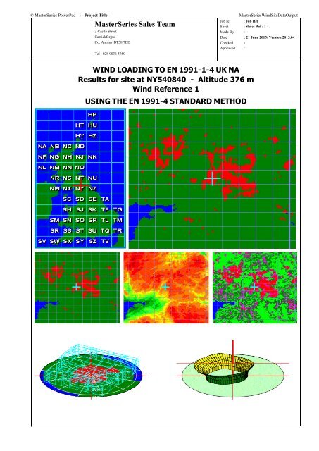
WIND LOADING TO EN 1991-1-4 UK NA<br />
Results for site at NY540840 - Altitude 376 m<br />
<strong>Wind</strong> Reference 1<br />
USING THE EN 1991-4 STANDARD METHOD
© <strong>MasterSeries</strong> PowerPad - Project Title <strong>MasterSeries</strong><strong>Wind</strong><strong>Site</strong>Data<strong>Output</strong><br />
<strong>MasterSeries</strong> Sales Team<br />
3 Castle Street<br />
Carrickfergus<br />
Co. Antrim BT38 7BE<br />
Tel : 028 9036 5950<br />
Job ref : Job Ref<br />
Sheet : Sheet Ref / 2 -<br />
Made By :<br />
Date : 21 June 2015/ Version 2015.04<br />
Checked :<br />
Approved :<br />
<strong>Site</strong> Basic Data<br />
Location and Base wind speed BREVe site data for NY540840 - Base wind speed, Vb 24.16 m/s<br />
<strong>Site</strong> Range<br />
500 m<br />
Altitude and Obstructions<br />
<strong>Site</strong> altitude 376 m - Shelter effect from obstructions is included<br />
Seasonal factor, Ss Season length is All year - Seasonal factor, Ss 1.000<br />
Annual risk and probability factor Design annual risk 0.02 - Probability factor, Sp 1.000<br />
Topographic Increments<br />
Topographic increment from internal parameters<br />
Heights (m) Heights above ground 3; 6.29; 8.15 and 9.85<br />
Building height, h (m) For 0.6 h limit on hdis 9.85 m<br />
Direction Factors - Using UK direction Factors<br />
Direction (°N) 0 30 60 90 120 150 180 210 240 270 300 330<br />
Direction factor, Cdir 0.780 0.730 0.730 0.740 0.730 0.800 0.850 0.930 1.000 0.990 0.910 0.820<br />
Topography<br />
Crest Height (m) 36.2 26.0 38.0 80.7 101.0 27.0 18.0 89.0 101.0 134.0 102.0 42.0<br />
<strong>Site</strong> Location (m) 300.0 999.0 0.0 0.0 129.0 0.0 0.0 0.0 0.0 0.0 0.0 0.0<br />
Upwind Length (m) 621.0 176.0 724.0 733.0 451.0 338.0 225.0 603.0 563.0 793.0 671.0 247.0<br />
Downwind Length (m) 453.0 176.0 177.0 475.0 666.0 200.0 10000 10000 10000 1225.0 602.0 467.0<br />
Base Altitude (m) 312.0 346.0 346.0 294.0 263.0 319.0 330.0 283.0 280.0 240.0 247.0 295.0<br />
Upwind Slope 0.058 0.148 0.052 0.110 0.224 0.080 0.080 0.148 0.179 0.169 0.152 0.170<br />
EN 1991-1-4 STANDARD METHOD<br />
Direction (°N) 0 30 60 90 120 150 180 210 240 270 300 330<br />
Direction factor, Cdir 0.780 0.730 0.730 0.740 0.730 0.800 0.850 0.930 1.000 0.990 0.910 0.820<br />
Distance to Sea (km) 200.0 77.9 73.9 73.9 200.0 200.0 200.0 106.0 90.0 135.6 200.0 200.0<br />
Distance in Town (km) 7.5 6.5 16.5 2.5 3.5 3.5 4.5 4.5 7.5 3.5 4.5 5.5<br />
Altitude factor, Sa 1.312 1.346 1.346 1.294 1.263 1.319 1.330 1.283 1.280 1.240 1.247 1.295<br />
Obstructions Height, Have (m) 10.0 10.0 10.0 10.0 10.0 10.0 10.0 10.0 10.0 10.0 10.0 10.0<br />
Obstructions Spacing, Xo (m) 20.0 20.0 20.0 20.0 20.0 20.0 20.0 20.0 20.0 20.0 20.0 20.0<br />
Displacement Height, Hdis (m) 5.9 5.9 5.9 5.9 5.9 5.9 5.9 5.9 5.9 5.9 5.9 5.9<br />
Height Above Ground = 3.0 m<br />
Direction (°N) 0 30 60 90 120 150 180 210 240 270 300 330<br />
Effective height, Ze (m) 2.00 2.00 2.00 2.00 2.00 2.00 2.00 2.00 2.00 2.00 2.00 2.00<br />
Orography factor, Co 0.037 0.000 0.106 0.222 0.320 0.160 0.159 0.297 0.361 0.341 0.306 0.339<br />
Exposure factor, Ce 1.408 1.417 1.419 1.419 1.408 1.408 1.408 1.408 1.412 1.408 1.408 1.408<br />
Roughness factor, Cr 0.724 0.726 0.727 0.727 0.724 0.724 0.724 0.724 0.725 0.724 0.724 0.724<br />
Rough. Correction, CrT 0.563 0.565 0.552 0.582 0.576 0.576 0.571 0.571 0.563 0.576 0.571 0.568<br />
Effective wind speed, Ve (m/s) 23.5 22.2 23.2 25.4 25.4 26.7 28.3 32.3 35.3 34.2 30.8 29.2<br />
Dynamic Pressure, q (N/m²) 339.6 303.4 329.6 395.9 396.1 436.0 492.6 638.1 764.7 717.4 582.6 522.1<br />
Height Above Ground = 6.29 m<br />
Direction (°N) 0 30 60 90 120 150 180 210 240 270 300 330<br />
Effective height, Ze (m) 2.52 2.52 2.52 2.52 2.52 2.52 2.52 2.52 2.52 2.52 2.52 2.52<br />
Orography factor, Co 0.037 0.000 0.106 0.221 0.319 0.159 0.159 0.297 0.360 0.340 0.306 0.338<br />
Exposure factor, Ce 1.526 1.536 1.538 1.538 1.526 1.526 1.526 1.526 1.530 1.526 1.526 1.526<br />
Roughness factor, Cr 0.764 0.766 0.767 0.767 0.764 0.764 0.764 0.764 0.765 0.764 0.764 0.764<br />
Rough. Correction, CrT 0.599 0.601 0.587 0.618 0.612 0.612 0.607 0.607 0.599 0.612 0.607 0.604<br />
Effective wind speed, Ve (m/s) 25.1 23.7 24.8 27.1 27.1 28.5 30.2 34.4 37.7 36.5 32.9 31.1<br />
Dynamic Pressure, q (N/m²) 386.9 345.7 375.5 450.9 451.0 496.5 560.8 726.6 870.7 817.0 663.5 594.0<br />
Height Above Ground = 8.15 m<br />
Direction (°N) 0 30 60 90 120 150 180 210 240 270 300 330<br />
Effective height, Ze (m) 3.26 3.26 3.26 3.26 3.26 3.26 3.26 3.26 3.26 3.26 3.26 3.26<br />
Orography factor, Co 0.036 0.000 0.105 0.221 0.318 0.159 0.158 0.296 0.359 0.340 0.305 0.336<br />
Exposure factor, Ce 1.665 1.675 1.677 1.677 1.665 1.665 1.665 1.665 1.669 1.665 1.665 1.665<br />
Roughness factor, Cr 0.809 0.811 0.812 0.812 0.809 0.809 0.809 0.809 0.810 0.809 0.809 0.809<br />
Rough. Correction, CrT 0.634 0.637 0.622 0.655 0.648 0.648 0.643 0.643 0.634 0.648 0.643 0.640<br />
Effective wind speed, Ve (m/s) 26.9 25.4 26.5 29.1 29.0 30.5 32.4 36.9 40.4 39.1 35.2 33.3<br />
Dynamic Pressure, q (N/m²) 444.0 396.8 430.9 517.4 517.2 569.4 643.0 833.4 998.4 937.2 761.1 680.4<br />
Height Above Ground = 9.85 m<br />
Direction (°N) 0 30 60 90 120 150 180 210 240 270 300 330<br />
Effective height, Ze (m) 3.94 3.94 3.94 3.94 3.94 3.94 3.94 3.94 3.94 3.94 3.94 3.94<br />
Orography factor, Co 0.036 0.000 0.105 0.221 0.318 0.158 0.157 0.295 0.358 0.339 0.304 0.334<br />
Exposure factor, Ce 1.770 1.781 1.783 1.783 1.770 1.770 1.770 1.770 1.774 1.770 1.770 1.770<br />
Roughness factor, Cr 0.842 0.844 0.845 0.845 0.842 0.842 0.842 0.842 0.843 0.842 0.842 0.842<br />
Rough. Correction, CrT 0.658 0.661 0.645 0.680 0.673 0.673 0.667 0.667 0.658 0.673 0.667 0.664<br />
Effective wind speed, Ve (m/s) 28.2 26.7 27.8 30.5 30.4 32.0 33.9 38.7 42.3 41.0 36.9 34.9
© <strong>MasterSeries</strong> PowerPad - Project Title <strong>MasterSeries</strong><strong>Wind</strong><strong>Site</strong>Data<strong>Output</strong><br />
<strong>MasterSeries</strong> Sales Team<br />
3 Castle Street<br />
Carrickfergus<br />
Co. Antrim BT38 7BE<br />
Tel : 028 9036 5950<br />
Job ref : Job Ref<br />
Sheet : Sheet Ref / 3 -<br />
Made By :<br />
Date : 21 June 2015/ Version 2015.04<br />
Checked :<br />
Approved :<br />
Dynamic Pressure, q (N/m²) 488.4 436.4 473.8 568.8 568.3 625.9 706.5 916.0 1097.3 1030.2 836.6 747.0<br />
MASTERFRAME WIND PRESSURE VALUES<br />
Dynamic Pressure Values, q (N/m²)<br />
<strong>Wind</strong> Direction to X Axis 0 90 180 270 0 90 180 270<br />
q (N/m²) for H = 3 717.4 764.7 436.0 339.6 717.4 764.7 436.0 339.6<br />
q (N/m²) for H = 6.29 817.0 870.7 496.5 386.9 817.0 870.7 496.5 386.9<br />
q (N/m²) for H = 8.15 937.2 998.4 569.4 444.0 937.2 998.4 569.4 444.0<br />
q (N/m²) for H = 9.85 1030.2 1097.3 625.9 488.4 1030.2 1097.3 625.9 488.4<br />
Ground level<br />
Ground Level is at the user defined model Y coordinate of 0.45m<br />
0.9m of the structure is below ground level.<br />
CAUTION - <strong>Wind</strong> loading will NOT be applied to the members of the structure fully below ground level.