Create successful ePaper yourself
Turn your PDF publications into a flip-book with our unique Google optimized e-Paper software.
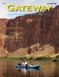
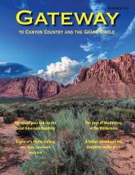
GATEWAY TO CANYON COUNTRY 1
Winter Hours:
November 1-
February 28
8:45 am - 2:45 pm
7 Days a Week
Summer Hours:
March 1 -
October 31
7:45 am - 4:15 pm
7 Days a Week
Hiking Tours Depart
Every 30 Minutes
$48 00* Adults
Per Person. Includes
Navajo Nation Permit Fee.
$28 00* Children
8-12 Years Old. Per Person.
Includes Navajo Nation
Permit Fee.
0-7 Years FREE
All Tours Are Guided
THINGS TO BRING:
HIKERS:
• Bottled Water
• Closed-Toe Hiking Shoes
• Sun Screen & Hat
Hiking Tours Depart Every 30 minutes
TO BOOK CALL:
928.640.1761
www.antelopelowercanyon.com
book@lowercanyontours.com
*Prices subject to change.
2 GATEWAY TO CANYON COUNTRY
Set against the dazzling Glen
Canyon Overlook off Highway
89, the Sleep Inn & Suites® hotel
and Baymont Inn & Suites® hotel
in Page puts guests close to
gorgeous Arizona landmarks like
Horseshoe Bend and Rainbow
Bridge.
SLEEP INN & SUITES
673 Scenic View Rd, Page,
AZ, 86040, US Phone: (928)
645-2020 Fax: (928) 645-4950
These non-smoking affordable
Page hotels are also near attractions
like:
• Antelope Canyon
• Horseshoe Bend
• Lake Powell
• Wahweap Overlook
• John Wesley Powell Museum
• Water Holes Canyon
We want you to feel refreshed when you stay with us, that’s why our indoor heated
pools and whirlpool is a great place to relax. Our exercise rooms are the perfect
place to keep your endorphins going.
Other amenities include:
• Free full breakfast • Free WiFi • Free parking • Guest laundry
All guest rooms offer a 40-inch HDTV and desk. Some rooms feature a balcony,
coffee maker, whirlpool, microwave, refrigerator, sofa sleeper
and in-room tea and coffee.
Dream better at the Sleep Inn & Suites
and Baymont Inn & Suites® hotel.
Hotels in Page, AZ offer cozy,
modern rooms at a great value.
Book now!
Baymont Inn & Suites
677 Scenic View Rd, Page AZ
Ph: 928-645-5050 • Fax: 928-645-0028
GATEWAY TO CANYON COUNTRY 3
E D I T O R ’ S N O T E
Model: Andrea Tso-Holt
/andrea.tso.1
tso_strong
Photographer: Lyonel Tso
Three Diné women now hold the top three positions
on the Navajo Nation Supreme Court in the Alą́ą́jį́ Hashkééjí
Nahat’á. Those three women are Chief Justice JoAnn Jayne,
Associate Justice Eleanor Shirley, and Associate Justice Tina
Tsinigine. As I write this editorial (Jan. 30, 2020), I learned that
local businesswoman Baya Meehan, co-owner of Shash Diné
Eco-Retreat, was also named to the Change Labs Board of
Directors.
The Navajo Nation, the Diné Bikéyah, is home to strong,
powerful Diné women, some of whom have gone on to become
professors at a university, lawyers and attorneys, physicians,
state senators and representatives. The list goes on. But
Diné women’s accomplishments in politics, medicine, media,
sports, business, and other pursuits are worth celebrating every
day.
It was either a landscape photo or an action shot of Andrea
Tso-Holt, a Diné college student at Chandler-Gilbert Community
College in Chandler, Arizona. We at the Lake Powell
Chronicle and at the Gateway magazine chose Andrea soaring
over Lake Powell – Dá’deestł’in Hótsaa – for the cover of the
winter edition. Chances are, something like this has never been
done in Gateway.
Andrea, a personal trainer, is wearing her high-topped
moccasins, kénitsaa, with her gym wear adorned with her turquoise
and silver – dootł’izhii and béésh łigaii, representing the
blend of Diné culture, traditions, and modernization.
When I look at this photo, I see Andrea ascending with
her sis łichí’í (red woven sash) and ádístsíín – stirring sticks,
carrying with her the prayers and songs of all the Diné
grandmothers and mothers. She is a sophomore and will be
transferring to Arizona State University soon. I see her leading
the charge to change for the Diné. So, this is in honor of all
the strong Diné women who are able to stand up for themselves
and who don’t need to hide because their fierce hearts
don’t settle between walls and their instinct is strong as their
upbringing.
Krista Allen, Editor-in-chief
4 GATEWAY TO CANYON COUNTRY
Pow Wow Trading Post
Specializing in
Native
American Arts
& Crafts
635 Elm Street, Page, Arizona
powwowtradiingpost.com • 928.645-2140
GATEWAY TO CANYON COUNTRY 5
Celebrating
GATEWAY
Gateway to Canyon Country is a travel-outdoor
magazine published four times a year.
Publisher
Mike Caywood
mcaywood@lakepowellchronicle.com
Editor
Krista Allen
kallen@lakepowellchronicle.com
Photojournalist
Bob Hembree
bhembree@lakepowellchronicle.com
rjhembree.com
Contributing writer
Shanna Lewis
Graphic Design
Marty Sisk
msisk@lakepowellchronicle.com
Advertising
Norma Tsinnijinnie
ntsinnijinnie@lakepowellchronicle.com
Norma L Y Max
Norma L.Y. Tsinnijinnie
Ed Pease
epease@lakepowellchronicle.com
Circulation
Jim Blittersdorf
John Baker
C O N T E N T S
ON THE COVER
Andrea Tso-Holt photograph by Lyonel Tso.
10 11
Page, America
The Chains
Photography tips from a The Hanging Gardens near
local photographer. Page are interesting to
BY BOB HEMBREE
look at, but the best photo
opportunities are at The
Chains.
29
Patterns in nature
Adventurous Antelope
Canyon Photo Tour
6 GATEWAY TO CANYON COUNTRY
BY KRISTA ALLEN
14-17& 28 21
Maps
The centerfold features
Page-Lake Powell area
maps, including the Rimview
Trail.
26-27
A pair of cowboys herd cows across U.S. Route 89
on Babbitt Ranches Jan. 31 near Cameron, Arizona.
Wahweap Overlook
It’s a three-act show. And
the clouds create a light
shadow.
PHOTOGRAPH BY KRISTA ALLEN
Glen Canyon Dam
Night photography
tips.
Stepping into silence
A WALK IN THE DESERT
Story by Shanna Lewis | Photographs by Krista Allen and Bob Hembree
Go to the desert, my heart tells me.
Where dark canyons etch deep into the
earth. Where massive pink and orange
sandstone walls loom high above dry
sandy washes. Where towering rock
spires create an exquisite, yet alien landscape
set against the smooth blue sky.
Pick a less travelled area, like Bears Ears or Grand Staircase-Escalante.
Rattle the car over a washboard dirt road.
Park at an unmarked turnout.
This is a gateway, a portal to serenity not found in modern
life expanded, yet limited, by technology.
Once the clatter of arrival fades, I feel the silence, the
utter lack of man-made sound. Motionless, I let the desert
stillness wash over me, envelope me, soak in, reach into my
body and mind. It courses through my veins and settles into
my bones.
Somehow this silence is louder than the anxieties, the chatter,
the worries, the fears, the plans, the daydreams.
I walk out across the rock with no particular destination,
only the goal of disconnecting from stress. Untethered
from technology, ears unfettered by anything other than the
desert around me, my footsteps and breath harmonize into a
rhythmic beat that carries me on my path. I get to the rim of
a canyon and walk along the edge, until a way down and in
opens to me. I descend.
Sliding my hand along the gritty red slick rock, I feel the cool
of the previous night, even as the sun begins to warm the air.
The cascading notes of a canyon wren’s song slide sweetly
down the canyon walls, caressing my ears. This is not noise;
this is nature painting on the canvas of silence.
Finally, I reach the bottom and follow the meandering
wash. Then something quietly draws my gaze. The stacked
stone masonry walls of ancient Puebloan people nestle high
up, hidden under a rock overhang. Easy to miss, the small,
strong structures are sited so they’re protected from the
scorching summer heat yet warmed by the rays of low angle
winter sun. Precarious, seemingly impossible to get to and so,
although risky for daily life, they are safe from adversaries.
These buildings have survived the passage of centuries.
The afternoon breezes roll in. A raven soars far above me.
Wings spread, its shining black feathers are beautiful and
Bears Ears (Shash Jaa’ in Diné bizaad – Navajo
language) meadows in southeastern Utah.
GATEWAY TO CANYON COUNTRY 7
Bears Ears National Monument (Shash Jaa’ in Diné
bizaad – Navajo language) in southeastern Utah,
has an elevation of 9,058 feet. Shash Jaa’ is located
in San Juan County.
maybe a little frightening. It caws, circles twice and then
flies on. I’m uninteresting to this huge bird, which apparently
has other more important matters to attend to.
I stop further down canyon. Petroglyphs are carved
into the rust colored wall. Mysterious figures and images,
but a connection to the past, to the ancient people who
walked these canyons and built their homes of stone
perched up high.
People who likely had their own fears, anxieties, worries,
plans and daydreams, like me.
Time doesn’t exist here - until it does. The sun moves
west, and shadows grow, reaching eastward. I return to
the car the way I came.
The night sky fills with stars. The Milky Way cuts a
misty swath across the heavens. It is cool, the heat of day
gone. Silence seeps into my flesh, my blood, my being. It
collects in my soul, nourishing the heart that called me
to come here.
Paria Canyon and the Vermilion Cliffs Wilderness
area offers hikes to spectacular formations – hoodoos,
slender, ghostly rocks that can reach several
stories high.
8 GATEWAY TO CANYON COUNTRY
White Mesa Arch in Tonalea-Red Lake, Arizona, in
Western Navajo Nation. Wildcat Peak (Náshdóíts’ǫǫį)
and the San Francisco Peaks (Dook’o’oosłííd) are
seen in the distance.
iPHONE X PHOTOGRAPHS BY KRISTA ALLEN
WHITE MESA ARCH
Tsé Łigai Ńt’i’
Join us for excellent food and service.
Visit our website
www.eltapatio-restaurants.com
25 Lake Powell Blvd., Page, AZ
928.645.4055
Open 7 days a week 11 am - 11 pm
LIQUOR STORE
Fine Wines and Champagnes
Domestic, Imported and Microbrew
Fresh Draft Beer To-Go from the GROWLER STATION
www.fredsliquorstore.com • 928-645-3575
902 North Navajo Dr., Page, AZ 86040
We Book Tours for Most Local Companies
See Page & Lake Powell Today!
• Individual/Families/Tour Groups
• Same Rates as Local Guides
• Tips & Ideas to Tour Area
• Hike/Boat/Kayak/Whitewater Rafting
Helicopter Rides/Swim/Fishing/Dining/Hotels
Need ice? Get it straight from the source, Reddy Ice!
www.ReddyIce.com 928.645.8886 ext. 35480
2018 E. Frontage Rd., Page, AZ 86040
www.PageChamber.com
928.645.2741
5 Lake Powell Blvd., Unit 3
M-F 9-5
GATEWAY TO CANYON COUNTRY 9
PAGE, AMERICA
Tips from a local photographer
Story and Photographs by Bob Hembree
I’ve
I used a Nikon D810 camera
with a Tamron 24-70 f2.8
lens for this photo. Settings:
1/1250 seconds, f/8, ISO 400
at 24mm. I usually darken
the exposure by a 1/3 stop
of what the camera’s meters
recommend. This helps prevent
blown-out whites.
spent a lot of time taking photos in the
Page area before making it my home. I’ve
spent time in the U.S. and in Canada, seen
a lot of amazing sights, and visited many
national, state and regional parks. Even
two- to three-month road trips weren’t
enough.
There were always places I wish I could
have stayed longer, always more to see.
When I reached retirement age, I’d planned
on moving to a new area every year: a year
in Idaho, another in Oregon, maybe Montana
or in New Mexico.
I felt it was the only way to learn the
area and the photography potential. While
wildlife photography is about patience,
landscape photography is about persistence
and readiness when the weather conditions
are right. Page, Arizona, changed my plans.
I quickly discovered there’s a lifetime
worth of exploration and photographic opportunities
– much of it is walking distance
from my home. That’s the thing about
Page. It’s like a remote island, yet smack
dab in the middle of everything beautiful.
While a wide variety of scenic locations
are important, and Page has plenty, I look
at other factors. Weather conditions are at
the top of the list. The beauty of the high
desert changes daily. The colors, lighting,
and the clouds constantly change the textures
and backdrops. I learned to appreciate
storms, before, during and after.
In Canyon Country, you can photograph
from a distance, safe and dry. Page
itself gets very little rain.
10 GATEWAY TO CANYON COUNTRY
Page is on Manson Mesa, though it reaches beyond the
mesa to Horseshoe Bend, Lake Powell, the Colorado River
and the Navajo Nation.
Last November, at the Balloon Regatta, I had the chance
to see Page and the surrounding area from a hot-air balloon.
The image on page 10 shows a bird’s eye view of many of the
locations in the following pages. A map of Rimview Trail is
also included.
In this photo story, I’ll share locations, tips and camera
settings. I shoot with Nikon DSLRs and variety of lenses, but
much of the information applies to any camera, including
smartphones.
The Chains
Settings: Aperture Priority, 1/320 seconds, f/11,
ISO 320 at 35mm. I always use a tripod because
I use graduated filters, but it’s not needed if the
light is good; or with cameras and lenses with
good vibration reduction.
FOR THIS PHOTO, I USED A NIKON D600 CAMERA WITH A NIKON NIKKOR 17-35 F2.8 LENS WITH
A 3-STOP GRADUATED NEUTRAL DENSITY FILTER.
The Hanging Gardens near Page are
interesting to look at, but the best photo
opportunities are at the Chains at the end
of the road. This isn’t on most maps, but it’s easy
to find. There’s a large parking lot at the end of the
graded road. From there you can walk down the
hill to Lake Powell or explore the rock formations
to the east or south.
This is an easy daytime trip, and usually great
for water reflections on the Colorado River. The
water was clean and clear every time I’ve gone. To
the west, there’s a good view of the Glen Canyon
Dam. Walk a short distance to the east, Wahweap
Marina, Navajo Mountain (Naatsis’áán in the Navajo
language) and Tower Butte come into view.
I recommend treaded hiking boots, though I’ve
seen many take the hike in sandals and in running
shoes. My personal favorites are Timberlands for
traction and comfort. In some areas, the loose
sandstone is fragile and slippery. There are trails,
but they’re difficult to see and not necessary. It’s
easy to look ahead and make your own path.
Landmarks are always visible, so it’s easy to find
the parking lot on the return hike. There’s a lot to
explore, and you might decide to stay longer once
you see views. I always bring a bottle of water.
The sandstone formation in the above photo is
below the parking lot at the end of the road. It’s
easy to spot. I walked down the hill, then tried a
few vantage points. I settled on this one because of
the sharp contrasts. Luck brought a storm to the
north. This added some depth to the composition.
Luck also brought two speedboats crossing paths.
They added splashes of light to the darker waters.
It works as a counterbalance to the sunbathed
water on the other side of the rock formation.
GATEWAY TO CANYON COUNTRY 11
For the Chains area, I
prefer wide-angle lenses. It’s
easy to get close to photo-worthy
subjects.
I always use a tripod and
graduated filters, but it’s not
needed if the light is good or
with cameras and lenses with
good vibration reduction.
Right photo
Gear: Nikon D810 camera with
a Tamron 24-70 f2.8 lens and
2-stop graduated neutral density
filter. Settings: 1/125 seconds,
f/13, ISO 100 at 200 mm.
Bottom photo
Gear: Nikon D750 camera with a
Nikon NIKKOR 50 mm f/1.4 lens.
Settings: 1/100 seconds, f/136,
ISO 100.
12 GATEWAY TO CANYON COUNTRY
Cowboy Cookin’ at
Juicy Steaks & more!
Freshly made
Sandwiches!
Authentic
Navajo Tacos!
Great Food &
Great Prices -
come on down
and see for
yourself!
Fresh Salad Bar!
Open 11 am to 2 pm; 5 pm to close
718 Vista Ave., Page, AZ • 928-645-0908
GATEWAY TO CANYON COUNTRY 13
14 GATEWAY TO CANYON COUNTRY
GATEWAY TO CANYON COUNTRY 15
89
Morgan Rd.
Hawk Ct.
Falcon Ct.
Elk Rd.
Cameron St.
Bonita Rd. W
Bonita St. Bonita Rd. W
Piute Piute Ct.
Castle Rock St.
Driftwood
Del Barrco Ave.
1
2
Page Hospital
Urgent Care
Police Station
Fire Station
Park
ATM
KEY
Must See
Visitors’ Centers
Scenic Overlooks
Marinas
Lake Access
Church
School
Golf Course
United States Post Office
A B C D
To Glen Canyon Dam
Wahweap Marina
& Kanab, UT
Glen Canyon
Dam Overlook
89
View Rd.
Scenic
N. Navajo Dr.
89
Lake Powell
National Golf
Blvd.
Powell Lake N
Date St.
Clubhouse Dr.
Dr.
Eagle
Dr.
Navajo N.
St.
Gum
Fir St.
Ave.
Vista
Ave.
4th
19th Ave.
Pueblo Dr.
Dr.
Rim View
N. Navajo Dr.
18th Ave.
Dr.
Rimview
17th Ave.
Ave.
16th
15th Ave.
14th Ave.
6th Ave.
13th Ave.
St.
Bureau
20th Ave.
Ave.
Vista
A
8
Ave.
7th S.
Elm St.
4
Mesa Dr.
B
Ave.
12th
Grandview St.
13th Ct.
Ave.
Knoll
N. 10th Ave.
Hemlock St.
Pine St.
Poplar St.
S. Lake Powell Blvd.
Coconino St.
View Dr.
W.
14th Ave.
Ct.
Butte
Ct.
Valley
Padre Escalante Dr.
Ave.
11th
Cathedral Ave.
Kachina Kachina
20th Ave.
Westview Dr.
10th N. Ave.
Aero Ave.
Plateau Ct.
Ave.
Turquoise
7th Ave.
Grandview St.
Ave.
Mesa Red
8th Ave.
Gunsight St.
S. 9th Ave.
Grandview St.
Glen Canyon Dr.
Gunsight St.
Golliard
Park
Glen Canyon Dr.
Thunderbird Ave.
Gramdview St.
Spruce
Tower Butte Ave.
Page Municipal Airport
Redrock St.
Mirage St.
El
St.
10th
Cll Hermosa
Pondersoa St.
Juniper Ave.
Cypress Ave.
Tamarisk St.
Crestview
2
Colorado St.
Willow St.
Vermilion Ave.
Tower Butte Ave.
Sage Ave.
S. Navajo Dr.
3
S. Navajo Dr.
1st Ave.
Ave.
2nd
Ave.
3rd
Cedar St.
St.
Birch
Aspen St.
Date St.
S. Navajo Dr.
3
5
5th Ave.
John C.
Page Park
9
1*
F
E 6
L
K
S. Lake Powell Blvd.
Aqua Ave.
Ave.
S. 9th
Oak St.
Village Dr.
Veronica Ct.
Antelope Ave.
Cheryl Ave.
Diane Ct.
Sunrise St.
Hopi Ave.
Lakeside Ct.
Sage Ave.
Elm St.
89
Haul Rd.
S. Lake Powell Blvd.
Kaibab Rd.
Haul Rd.
Golden Eagle Ct.
I
Cache Rd.
Bran Rd.
K
S. Lake Powell Blvd.
Cemetery Rd.
San Francisco Rd.
Azure Rd.
C
Cameron St.
7
Page
Public Library
Cascade St.
Manson Rd.
Marble Rd.
Granada
Via Valdez
Jerome St.t
Newburn Rd.
Maverick Loop
Rd.
Newburn
Coppermine Rd.
Coppermine Rd.
Sandpiper Dr.
Osprey Dr.
Buckeye Dr.
4
Appaloosa Rd.
e Powell S. Lake Blvd. Powell Blvd.
Cameron St.
Haul Rd.
Palomino Rd.
Clydesdale Rd.
Cliff Ct.
Manson Rd.
Packer Ct.
Bass Ct.
Rd.
Coppermine
Sunset Rd. W Sunset St.
5
89
To Horseshoe Bend
lake powell
printing
98
Rd.
Pinto
Shetland
Mustang Rd.
San Francisco Rd.
98
Azure Rd.
Loop
O’Neil
C
Sunset St.
Aztec St.
Amand Cir.
Scott’s Lake Powell Printing ©2015 All Rights Reserved
315 S. 12th Street :: Montrose, CO 81401 :: 928-645-3663 :: scottb@scottsprinting.com |Reproduction of the whole or any part of this publication, by any method for any purpose whatever, without written permission from the publisher is strictly prohibited.
Amado Rd. W
Amado St.
Bonita Loop
Cameron St.
To Antelope Point Marina
Navajo Generating Station
& Kayenta, AZ
98
To Flagstaff, AZ
Aero Ave. C, D-2
Amado St. C-4
Amado Rd. W. C-4
Armand Cir. C-4
Antelope Ave. D-3
Appaloosa Rd. B-5
Aqua Ave. D-3
Aspen St. C-3
Aztec St. C-4
Azure Rd. B-4
Bran Rd. B-4
Bass Ct. C-3
Birch St. B,C-3
Bonita Lp. C-4
Bonita Rd. W. C-4
Bonita St. C-4
Buckeye Dr. D-4
Bureau St. C-2
Butte Ct. C-1
Cll. Hermosa D-2
Cache Rd. B-4
Cameron St. B-3, D-3,4
Cascade St. C-4
Castle Rock St. C-2
Cathedral Ave. C-2
Cedar St. B,C-3
Cemetery Rd. B-3,4
Cheryl Ave. D-3
Cliff Ct. B-3
Clubhouse Dr. B-1,2
Clydesale Rd. B-4
Coconino St. C-2
Colorado St. D-2
Coppermine Rd. (89T)
C-3,D-3,4,5
Crestview Ave. D-2
Cypress Ave. D-2
Date St. B-2,3,C-3
Del Barrco Ave. D-2
Diane Ct. D-3
Driftwood Ave. D-2
Eagle Dr. B,C-2
Elk Rd. B-3,4
Elm St. B,C-2
El Mirage St. D-2
Falcon Ct. B-4
Fir St. C-2
Glen Canyon Dr. D-1,2
Granada Rd. C-4
Grandview St. C-1,2
,D-2
Golden Eagle Ct. B-3,4
Gum St. B,C-2
Gunsight St. C-1, D-1,2
Haul Rd. A,B,C,D-4
Hawk Ct. B-4
Hemlock St. C-2
Hopi Ave. D-3
Jerome St. C-4
16 GATEWAY TO CANYON COUNTRY
street index
Juniper Ave. D-2
Kachina St. C-2
Kaibab Rd. B-3,4
Knoll Ave. C-1
Lake Powell Blvd.
A-3,B-1,3,C-1,2,3, D-3
Lakeside Ct. D-3
Manson Rd. B,C-3
Marble Rd. C-3
Maverick Lp. C-4
Mesa Dr. C-1
Morgan Rd. B-4,5
Mustang Rd. B-5
Navajo Dr. B,C-1,2,3,
D-2
Newburn Rd. C-3,4
Oak St. D-3
O’Neil Lp. B-4
Osprey Dr. D-3
Packer Ct. C-3
Padre Escalante Dr.
C-1,2
Palomino Rd. B-4
Pine St. C-2
Pinto Rd. B-5
Piute Ct. C-3
Plateau Ct. C,D-1
Ponderosa St. D-2
Poplar St. C-2
Pueblo Dr. C-1
Red Mesa Ave. C-2
Redrock St. D-2
Rim View Dr. C-1
Rimview Dr. C-2
Sage Ave.
Sandpiper Dr.
D-2,3
D-3,4
San Francisco Rd. B,C-4
Scenic View Rd. B-1,2
Shetland B-5
Spruce D-2
Sunrise St. D-3
Sunset St. B-4
Sunset Rd. W. B-3,4
Tamerisk St. D-2
Thunderbird Ave. C,D-2
Tower Butte Ave. D-2
Turquoise Ave. C-2
Valley Ct. C-1
Vermilion Ave. D-2
Veronica Ct. D-3
Via Valdez C-4
W. View Dr. C-1
Village Dr. D-3
Vista Ave. C-1,2
Westview Dr. C-1
Willow St. D-2
1st Ave. B-2,3
2nd Ave. B-3
3rd Ave. B,C-3
4th Ave. C-2,3
5th Ave. C-2,3
6th Ave. C-2,3
7th Ave. C-2
8th Ave. C,D-2
9th Ave. C,D-2,3
N. 10th Ave. C-1,2
10th St. D-1,2
11th Ave. C,D-1
12th Ave. C-1
13th Ave. C-1
13th Ct. C-1
14th Ave. C-1
15th Ave. C-1
16th Ave. C-1
17th Ave. C-1
18th Ave. C-1
19th Ave. C-1
20th Ave. C,D-1
Wahweap
Bay Warm Creek
Bay
Hole-
In-The-
Rock
Antelope
Point Marina
State Line Launch
Ramp
Dangling
Rope
Marina
Rock
Creek
Escalante
River
San Jaun
River
Halls
Creek Bay
Bullfrog Bay
Bullfrog
Marina
Halls
Crossing
Marina
Colorado
River
Hite Marina
Lake Powell
Lone Rock Beach/
Fee Camping
Last Chance Bay
Padre Bay
Wahweap
Marina & Launch
Ramp
Glen Canyon Dam
West Canyon
Navajo Canyon
Antelope
Point
Marina &
Launch
Ramp
City
of
Page,
AZ
Colorado
River
Rainbow Bridge
National
Monument
Wahweap Marina
GATEWAY TO CANYON COUNTRY 17
ZION NATIONAL PARK
Zion National Park is distinguished by Zion
Canyon’s steep red cliffs. Zion Canyon Scenic Drive
cuts through its main section, leading to forest trails
along the Virgin River.
PHOTOGRAPHS BY BOB HEMBREE
At the End of Your Day...
• Deluxe guest rooms with fridges, microwaves,
Coffee pots, irons & ironing boards
• Boat parking/AC power • Convenient location
• Free wireless Internet • Breakfast
• Guest laundry
American Bighorn Sheep (Tsétah
Dibé in Navajo) in Zion National
Park.
LAKE POWELL
Lake Powell Days Inn & Suites
961 Hwy 89, Box 3910,
Page, AZ 86040
(928) 645-2800
www.daysinn.net
Nationwide Reservations
1 (800) DAYSINN
18 GATEWAY TO CANYON COUNTRY
Gear: Nikon D750 camera with a
Nikon NIKKOR 85 mm f/1.8 lens.
Settings: 1/100 seconds, f/11, ISO
100, -0.67 EV at 85 mm.
PHOTOGRAPHS BY BOB HEMBREE
Gear: Nikon D750 camera with a
Nikon NIKKOR 17-35 mm f/2.8
lens and 2-stop graduated neutral
density filter (GND). Settings:
1/125 seconds, f/11, ISO 100,
-0.67 EV at 35 mm.
For this photo of Lake Powell, the GND filter helped balance the sky and
water brightness. I use square filters on the lens. Sliding them up and
down in the filter holder controls what areas are darkened. GND filters
are especially useful on bright days. They preserve the sky’s color and
prevent it from blowing out (losing detail and turning white).
GATEWAY TO CANYON COUNTRY 19
A
DOUBLE RAINBOW IS QUITE A CATCH. IN HINDSIGHT, I WISH I CARRIED A WIDER ANGLE LENS TO
CATCH MORE OF IT. I WAS ON MY WAY HOME FROM A GROUP PHOTOSHOOT AT THE MARINA, AND
ALL I HAD WAS THE 35 MM LENS. IT DOES A GREAT JOB, AND I’M HAPPY WITH THE PHOTO, BUT I
KNOW TO ALWAYS CARRY A 15-30 MM LENS FOR OCCASIONS LIKE THIS.
20 GATEWAY TO CANYON COUNTRY
Wahweap
Overlook
It’s a three-act show.
Act I: For the first hour and
half, especially when it’s breezy, the
clouds create a lightshow by letting
the sun spotlight different features of the
landscape. I watch the shadows move and
wait for the light to shine in the most interesting
places. This is also the best time to
catch rainbows during and after rains.
Act II: As the sun descends behind the
mountains to the west, colors begin to
change. They vary from reds, to oranges
to purples. I follow the colors as they shift
west to south from across the sky.
Act III: After the sun sets, the blue hour
begins. It’s often surprising, and sometimes
there’s a small window of time – usually
less than five minutes, when the light takes
amazing twists and turns.
I’ve seen it cast a metallic tint on
everything, and sometimes, it will coat the
landscape with surreal pastel colors. Most
people leave once the sun sets, but I like
to stick around for another 30 minutes in
case anything interesting develops.
Gear: Nikon D750 camera with
a Tamron 35 mm f/1.8 lens and
2-stop graduated neutral density
filter (GND). Settings: 1/320
seconds, f/9, ISO 400.
WHEN THE CLOUDS ARE RIGHT,
WAHWEAP OVERLOOK IS UNBEATABLE
FOR DRAMATIC PHOTOS.
I USUALLY GO TWO HOURS BEFORE SUNSET.
GATEWAY TO CANYON COUNTRY 21
Gear: Nikon D750 camera with a
Tamron 35 mm f/1.8 lens and 2-stop
graduated neutral density filter
(GND). Settings: 1/15 seconds, f/11,
ISO 400.
Gear: Nikon D750 camera with a Tamron 35 mm
f/1.8 lens and 2-stop graduated neutral density
filter (GND). Settings: 2/5 seconds, f/11, ISO 100.
Gear: Nikon D750 camera with a Nikon NIKKOR
85 mm f/1.8 lens and 2-stop graduated neutral
density filter (GND). Settings: 1/500 seconds,
f/11, ISO 100.
Gear: Nikon D750 camera with a Nikon
NIKKOR 85 mm f/1.8 lens and 2-stop
graduated neutral density filter (GND).
Settings: 1/500 seconds, f/16, ISO 100.
Gear: Nikon D750 camera with a Tamron 35 mm
f/1.8 lens and 2-stop graduated neutral density filter
(GND). Settings: 1/500 seconds, f/11, ISO 100.
22 GATEWAY TO CANYON COUNTRY
Rimview Trail
Gear: Nikon D810 camera with
a Tamron 24-70 f/2.8 lens and
2-stop graduated neutral density
filter (GND). Settings: 8 seconds,
f/8, ISO 100 at 70mm.
I’ve spent more time on Rim View Trail
than any other location in the area. It’s a
10-mile trail circling the perimeter of Manson
Mesa, which Page is built on. It’s walking distance
from any place in town.
In the mornings and late afternoons, I follow the
clouds. They keep things interesting. My favorite part
of the trail is on the east side, near the airport.
Navajo Mountain, LeChee Rock (aka Sleeping
Indian), and my favorite subject, Tower Butte are all
visible.
As I’ve mentioned, in the high desert, everything is
constantly changing. The changes are not only seasonal,
they’re weekly, daily, even within minutes.
The best times for photos are 30 minutes before
and after sunrise, and 90 minutes before sunset and 30
minutes after.
For the Rimview Trail area, I prefer the 70-200-millimeter
range. The landmarks are in the distance, so
a wide-angle lens, or anything below 70 mm is too
limiting for me. For a while, I used a Nikon NIKKOR
85 mm lens, which is a practical walk around size for
the trail.
Blue hour is shortly before sunrise and shortly after
sunset. Above is a blue, misty, winter morning shot of
Tower Butte from Rim view Trail. It was dark, so I setup
for a long, eight-second exposure, just long enough
to soften the moving clouds a bit.
“This is a blue, misty, winter morning shot of
Tower Butte from Rimview Trail.”
GATEWAY TO CANYON COUNTRY 23
Tower Butte
For Tower Butte, I set
up the tripod and
frame according to
the clouds. I wait
until they move into the
best positions relative to the
subject.
The lighting can change
quickly, so I use aperture
priority and let the camera
figure out the shutter speed.
What’s important to me is
using the lowest ISO (measures
the sensitivity of the
light sensor), like 100, and
having the aperture set to get
the depth of field needed,
that is, to get both near and
far in focus.
I usually start with F/11
then then go from there.
There are mathematical
formulas to figure this out,
but out in the field it’s easier
to snap, preview and adjust
the aperture as needed.
There’s a trade-off when
using different size apertures.
A wider aperture gives less
depth of field, but less noise.
A smaller aperture gives
more depth of field, but
more noise.
24 GATEWAY TO CANYON COUNTRY
Gear: Nikon D750 camera with
a Tamron 70-200 mm f/2.8 lens
and 2-stop graduated neutral
density filter (GND). Settings:
1/4 seconds, f/11, ISO 100, 135
mm.
Grandview
Overlook
It’s not unusual to find Page residents along the eastern side of the
trail and watching the sunrise. It’s different every morning. Photographers
can easily find the perfect vantage point to align the rising
sun with a landmark. Sometimes, I use a phone app called “The
Photographer's Ephemeris” to find the best location to shoot for sunrises
and sunsets.
Occasionally, races are held in the Rimview Trail area, like the Lake
Powell Obstacle Race and the Lake Powell Half Marathon.
This photo was taken from Grandview Overlook, which is scheduled
to open in 2020. It’s up the hill, at about mile 3.2 on the Rimview Trail
(see Rimview Trail map at the end of this story).
The Canyon Club and local businesses donated time, materials and
money to build the project. They will present it to the City of Page when
completed in early spring. The above photo was taken from the construction
site with a telephoto lens (200 mm).
Top photo
Gear: Nikon D810 camera with a
Tamron 70-200 mm f/2.8 lens and
2-stop graduated neutral density
filter (GND). Settings: 1/125 seconds,
f/13, ISO 100, 200 mm.
Left photo
Gear: Nikon D7200 camera with a
Nikon NIKKOR 18-200 mm f/3.5-
5.6 lens. Settings: 1/1600 seconds,
f/8, ISO 400, 75 mm.
GATEWAY TO CANYON COUNTRY 25
Glen Canyon Dam
This a long exposure night
shot from about mile 9.4
on Rimview Trail on July 4,
2019. I went there to photograph
the fireworks but stayed to photograph
Glen Canyon Dam.
The traffic was busy with people returning
home from the event, and the 20-second
exposure captured the consistent trails
of car lights.
26 GATEWAY TO CANYON COUNTRY
Nikon D7200 camera with a Nikon NIKKOR 18-
200 mm f/3.5-5.6 lens. Settings: 20 seconds, f/8,
ISO 200, 50 mm (full frame equivalent is 75 mm).
Top photo
Gear: Nikon D7200 camera
with a Nikon NIKKOR
18-200 mm f/3.5-5.6 lens.
Settings: 6 seconds, f/10,
ISO 125, 18 mm.
Bottom photo
Gear: Nikon D7200 camera
with a Nikon NIKKOR 18-
200 mm f/3.5-5.6 lens. Settings:
13 seconds, exposure
compensation -1.67 EV, f/8,
ISO 400, 35 mm.
GATEWAY TO CANYON COUNTRY 27
28 GATEWAY TO CANYON COUNTRY
ADVENTUROUS
ANTELOPE
CANYON
PHOTO TOUR
PATTERNS
IN NATURE
Story by Krista Allen
and Photographs by Lionel Bigthumb
Carol Bigthumb’s family
dumped around 5,000 gallons
of water into a section
of Antelope Canyon in August
2001 just so Britney Spears could
walk through it for her music video.
“My whole family was down there
that day,” said Carol’s son, Lionel
Bigthumb, the chief operating officer
for Adventurous Antelope Canyon
Photo Tour, which is owned by his
mother, “and it was kind of embarrassing.”
Then-20-year-old pop star Britney
Spears’s music video “I’m not a girl,
not yet a woman,” which was released
in 2002, was shot in Antelope Canyon
and in Glen Canyon National Recreation
Area.
Carol Bigthumb’s family has also
done work with popular celebrities such
as Howie Long, John Travolta, and
Seal. And they have given private tours
to big names such as Tyler Perry and
fine-art photographers Peter Lik and
Jeff Mitchum.
Lionel says Adventurous Antelope
Canyon Photo Tour is more about
quality rather than quantity and
focuses exclusively on journeys to the
labyrinthine underworld where he and
a cousin grew up and were raised by
their grandmother, Pearl Young Begay,
95.
Since leading her first tour in 1985,
Begay has passed the business to her
children.
“We used to live in a hogan … that
my grandfather, Dan Begay, built,”
Lionel recalls. “One summer day my
grandparents started getting ready as if
they were going somewhere. I wondered
what they were getting ready for.
But they didn’t get us ready.”
“Next thing we knew, a Bilagáana
(non-Native) lady pulls up in a riggedout
jeep,” he continued. “I guess she
had made a deal with my grandmother,
a certain amount of money or something.
That’s when the story of tourism
for my family started.”
Thereafter the non-Native woman
visited regularly. Eventually, photographers
also started visiting, to photograph
Begay and her family. Lionel
says there is a portrait of his aunt that
GATEWAY TO CANYON COUNTRY 29
hangs on a wall of a Native American
museum in Washington, D.C.
Before long, Lionel’s grandparents
– experts with deep knowledge on the
area – started guiding the non-Native
woman down Antelope Canyon, or
Tsébighánílíní or Tsébii’ Hazdeestas in
Diné bizaad (Navajo language).
“They took the jeep (into the
canyon) and we would stop and (my
grandmother) would talk about the cacti,”
Lionel explained. “We’d drive down
and that’s when tourism started for us.”
Today, people from all over the
world stop by to see Antelope Canyon
with this tour operator situated at
milepost 302 on State Route 98. And
it has some of the best guides, the best
itineraries, and the best value.
In fact, this tour operator has an
agreement with Amangiri, the ultra-luxury
resort in nearby Canyon
Point, Utah, to provide tours to their
high-end clients.
Carol’s business though is still fairly
new. She started the legwork in 2009
when she ventured outside her brother’s
tour operator business, where she
worked after she retired as an educator.
Concurrently, Lionel was an engineering
student at the University of Arizona
where he thoroughly took in a particular
engineering management course
and used it take the family business to
the next level.
“I understood the dynamics of operating
a business,” Lionel said. “So, we
turned four products into 14 products.
We have the three extra canyons that
we go to (as well), so it’s four canyons.”
Adventurous Antelope Canyon
Photo Tour operates 14 trips, spanning
four slot canyons – Mountain Sheep,
Owl, Rattlesnake, and Upper Antelope.
Each trip is designed to reflect travelers’
broad spectrum of interests.
“So, a lot of hiking, photography,
and a lot of colors to see,” said Lionel,
a professional, fine art photographer
who owns a galleria in Page as well.
“That’s who we are as adventurists.”
This tour operator provides more
than 60 jobs during its peak season and
around 25 jobs during the off season.
The business sees up to 400 people a
day.
“We’re busy 10 months out of the
year,” Lionel said. “So, for us as a family,
we’ve been doing this for three decades.
We have a connection to Mother
Earth to be able to do this because we
have songs, prayers, and offerings. We
give offerings to the canyons, so for us
that connection is there.”
“That’s how we’re able to have a
livelihood,” he added, “how we’re able
to have jobs and how we’re able to feed
families.”
Carol also makes an effort to help
the nearby community of LeChee by
supporting the senior center, the veterans’
organization, and other programs.
There are five tour operators in
Upper Antelope Canyon and two tour
operators in Lower Antelope Canyon,
according to Navajo Parks and Recreation.
At least two operators – Dixie
Ellis’ Lower Antelope Canyon Tours
owned by Dixie L. Ellis and Ken’s
Tours owned by Kenny N. Young – are
related to the Bigthumb family. Ellis
and Young are siblings.
Information: navajoantelopecanyon.
com
30 GATEWAY TO CANYON COUNTRY
GATEWAY TO CANYON COUNTRY 31
928-645-4082
Experience the authentic atmosphere
of Mexico and enjoy the
best Margarita’s in town.
32 GATEWAY TO CANYON COUNTRY