
You also want an ePaper? Increase the reach of your titles
YUMPU automatically turns print PDFs into web optimized ePapers that Google loves.
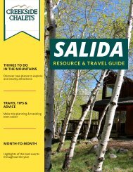
Turquoise Lake<br />
A day trip to Turquoise Lake is sure to be a<br />
wonderful addition to your <strong>Salida</strong> vacation. Located<br />
about an hour and 20 minutes away, you can get to<br />
the lake by heading east on Highway 50. Turn left<br />
on 285 and after about 21 miles you’ll continue<br />
straight on Highway 24. After about 32.5 miles, turn<br />
left on Colorado Highway 300 and then right on<br />
Road 5A. Continue to County Road 4 where you’ll<br />
take a left. This is also known as Turquoise Lake<br />
Road and it encircles the entire lake.<br />
The lake is a prime spot for fishing, hiking, boating,<br />
and mountain biking. One of our favorite trails,<br />
aptly named the Turquoise Lake Trail, starts from<br />
the Sugar Loaf Dam, which you’ll approach shortly<br />
after turning onto Country Road 4. It’s 6.4 miles<br />
long and will take you to the May Queen<br />
Campground. There are plenty of areas around the<br />
lake where you can pull off and take in the lovely<br />
sights. You’ll notice that beautiful scenery is not<br />
hard to come by in this area especially as two of<br />
the state’s highest mountains, Mount Elbert and<br />
Mount Massive, provide the backdrop for<br />
Turquoise Lake.<br />
16<br />
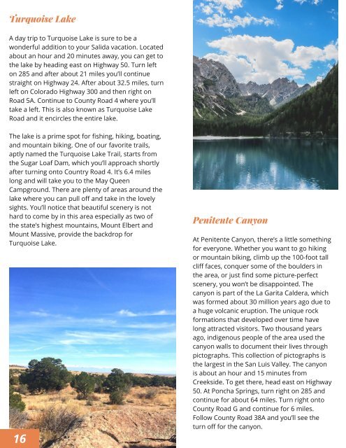
Penitente Canyon<br />
At Penitente Canyon, there’s a little something<br />
for everyone. Whether you want to go hiking<br />
or mountain biking, climb up the 100-foot tall<br />
cliff faces, conquer some of the boulders in<br />
the area, or just find some picture-perfect<br />
scenery, you won’t be disappointed. The<br />
canyon is part of the La Garita Caldera, which<br />
was formed about 30 million years ago due to<br />
a huge volcanic eruption. The unique rock<br />
formations that developed over time have<br />
long attracted visitors. Two thousand years<br />
ago, indigenous people of the area used the<br />
canyon walls to document their lives through<br />
pictographs. This collection of pictographs is<br />
the largest in the San Luis Valley. The canyon<br />
is about an hour and 15 minutes from<br />
Creekside. To get there, head east on Highway<br />
50. At Poncha Springs, turn right on 285 and<br />
continue for about 64 miles. Turn right onto<br />
County Road G and continue for 6 miles.<br />
Follow County Road 38A and you’ll see the<br />
turn off for the canyon.