A boat cannot go forward if each rows his own way
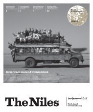
Be it to improve irrigation, manage floods and droughts or generate energy; dams have played a significant role in humanity’s progress. But the dam-building development model also has its flaws. The Niles journalists tackle the sensitive dam topic and self-aware that they all are in the same boat, they agree that it is time to start rowing the same way.
Be it to improve irrigation, manage floods and droughts or generate energy; dams have played a significant role in humanity’s progress. But the dam-building development model also has its flaws. The Niles journalists tackle the sensitive dam topic and self-aware that they all are in the same boat, they agree that it is time to start rowing the same way.

You also want an ePaper? Increase the reach of your titles
YUMPU automatically turns print PDFs into web optimized ePapers that Google loves.
“A boat
cannot
go forward
if each
rows his
own way.”
Be it to improve irrigation,
manage floods
and droughts or generate
energy, dams have
played a significant
role in humanity’s
progress. But the dam
building development
model also has its flaws.
And with the impacts
of climate change
starting to threaten
livelihoods, many argue
it’s time to protect and
even restore our freeflowing
rivers the world
over. The developmentconservation-dilemma
is hard to address,
particularly for transboundary
rivers such
as the Nile. Saving the
shared resource
while providing for
the Nile Basin’s growing
populations requires
transboundary cooperation.
The Niles
journalists, who hail
from across the Nile
Basin, have tackled
the highly sensitive
dam topic and have
no easy answers. But
self-aware that they
all are in the same boat,
they agree that it is
time to start rowing the
same way.
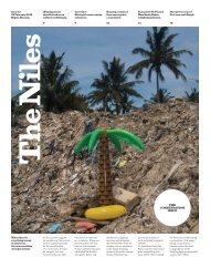
The Dam
Issue
Issue #15
Entebbe, Uganda
February 2021
Editorial: The dam
conundrum: To build
or not to build?
p. 3
Opinion: How to report
on dams without having
seen one
p. 6
South Sudan: The roadmap
towards a dam in
South Sudan
p. 12
Sudan: The White Dam:
a tale of big ambitions
and big problems
p. 16
Ethiopia: Choke
Mountain sediments
stifle downstream
reservoirs
p. 23
Egypt: ‘The Dams
of Welfare’
p. 24
TN15_20210310.indd 1 2021/03/10 18:28
The Niles is a publication of Media in Cooperation
and Transition gGmbH.
Editor-in-Chief: Dominik Lehnert
Editors: Jess Smee, Leila Bendra-Lehnert
Art Direction & Design: Gunnar Bauer
Finance Manager: Dirk Spilker
Contributors:
Waakhe Simon Wudu, Rehab Abdalmohsen, Francis Wani,
Nema Juma, Alaa Eliass, Essameldin Mohamed, Elzahraa
Jadallah, Elfatih Mohammed, Mohamed Hilali, Dagim
Terefe, Asmaa Gamal
Pictures:
The LIFE Picture Collection via Getty Images / Eliot
Elisofon (p. 1), OFID / F. Albassam (p. 2), David Haberlah
(p. 2), The Niles / Dominik Lehnert (p. 4, 7, 22), The Niles /
Bullen Chol (p. 12, 13), Getty Images / SSPL (p. 14),
mapio.net (p.14), Getty Images / Bashar Shglila (p. 15),
Gamma-Keystone via Getty Images / Keystone-France
(p.15), Wikimedia / Sudani (p. 15), SaWaM / KIT (p.15),
Marthad Salah El-Din (p. 16, 17), The Niles / Elzahraa
Jadallah (p. 18, 19), The Niles / Mohamed Hilali (p. 21),
The Niles / Dagim Terefe (p. 23), The Niles / Asmaa Gamal
(p. 24, 25), Copernicus Programme (p. 27), SSPL / Getty
Images (p. 28)
This issue of The Niles is produced by Media in Cooperation
and Transition (MiCT) in collaboration with the
Nile Basin Initiative (NBI) Eastern Nile Technical Regional
Office (ENTRO), and with support from the Deutsche
Gesellschaft für Internationale Zusammenarbeit (GIZ)
GmbH, commissioned by the German Federal Foreign
Office (AA). The views expressed in this publication
do not reflect the opinions of NBI, AA, GIZ or MiCT.
Contact:
Media in Cooperation and Transition
Dirk Spilker
dirk@mict-international.org
Brunnenstraße 9
10119 Berlin, Germany
Phone +49 (0)30 4849 3020
www.mict-international.org
www.theniles.org
© 2021, all rights reserved.
Cover:
The Aswan Dam on the River
Nile (circa 1950).
Photo: Three Lions / Getty
Images
TN15_20210310.indd 2 2021/03/10 18:28
The dam
TN 3
conundrum:
To build
or not to build?
MiCT The Niles
Berlin, Germany
The ancient technology of dams has fuelled human progress. Yet countries building
and managing dams, especially in transboundary river systems like the Nile, face complex
and difficult challenges.
Construction activity
at Sudan’s Merowe Dam.
Photo: David Haberlah
Sudan’s Roseires Dam.
Photo: OFID / F. Albassam
T
he Nile Basin’s population is rising, as is the demand for clean water, food and energy. Over the
past 50 years, six Nile Basin countries have built 25 hydroelectric dams.
Despite their drawbacks, dams are seen as a necessary step to provide for growing populations
by the Nile Basin countries and their leaders.
By definition, dams are an obstruction to the flow of water. Some of the risks associated with
them, in addition to negative impacts on biodiversity, include conflicts, the danger of them failing,
and sometimes the displacement of local populations.
As rivers, such as the Nile, often cross multiple countries, building a dam in one country can
also create problems in nations further along the river.
This is clear when we take a closer look at the dams, existing, planned and under construction,
in the Nile Basin.
Dams are impressive structures that require vast investment and can be part of a government’s
legacy. On the negative side, as well as carrying debris and silt, they can also generate local conflict.
The potential for disputes between upstream and downstream countries is only one example
of how dams can have major consequences for political, social, economic and ecological dynamics
in the basin.
And there is much to learn from the past: Investigating dam failures, not only structurally,
but also in their impact on humans and nature can pave the way towards a more open discussion
on how cooperation can really take place.
But first and foremost, we need to understand how dams work.
Despite having a decisive effect on the Nile’s ecosystem, some science and environmental
journalists, including Rehab Abdalmohsen, had never visited a dam until she investigated Sennar
for this publication.
In this issue of The Niles, journalists from the Eastern Nile Basin shed light on the key themes
of the region’s dams, probing them from a range of perspectives.
Our correspondents zero in on Sudan’s long history of constructing dams as well as South
Sudan’s plans and what they mean for the country’s future.
The reports reveal how it is all interconnected: for example, Dagim Terefe investigates how
the changing climate of the Ethiopian Choke watersheds increases silting and other impacts
in downstream countries like Egypt, where Asmaa Gamal homes in on the history and popularity
of the Al-Qanater al-Khairiya dams.
Guided by this The Niles issue’s proverb “A boat cannot go forward if each rows his own way”,
we end on a question and with a spark of hope: Cooperation is primordial in the Nile Basin – and
it is a key ingredient in a dams’ success. So how can we ensure it happens?
TN
TN15_20210310.indd 3 2021/03/10 18:28
4 TN
Why dams matter
Waakhe Simon Wudu
Juba, South Sudan
Nile Basin countries are in a race for time as growing populations
require significant amounts of electric power. Dams are a solution
but also pose new challenges.
M
ichael Abebe is the Regional Coordinator for Water Resources and
Dam Safety at the Eastern Nile Technical Regional Office (ENTRO)
and currently the Vice President of the International Commission
on Large Dams (ICOLD). During the Nile Day celebrations in Sudan’s
capital Khartoum on February 23, 2020, he spoke with Waakhe Simon
Wudu about dams, why they matter and some pressing issues.
The Niles: What would you tell a South Sudanese person in Juba who
does not know about dams in the region?
Michael Abebe: A dam is to regulate variability of flow in the river
systems. If there is any variability in the Eastern Nile countries, there
is a need to develop dams, because they regulate the flow during the
rainy season.
Usually, in the Eastern Nile, the flow is mostly dominated by three
or four months of rain starting from June or September, but the other
months are very dry. There is a need for irrigation, energy, water supply
and navigation. To ensure this water is available throughout the year,
you need to develop a dam.
TN: Why do some countries in the Eastern Nile Basin region (South Sudan,
Ethiopia, Sudan and Egypt) establish dams and others do not?
“We have more than 30 large
dams in the Eastern Nile Basin
region.”
MA: To have a dam you have to have the water resources, the topography
and also demand for water. If there is a scarcity of water or the wrong
topography in the area, you cannot build a dam. If the water is scarce and
variable, you have to develop a dam to secure water supply or to sustain
irrigation or energy.
If you have a continuous flow of water in the river system, you don’t
need to develop a dam. But when there are scarcity and variability of flow
in the rivers, you need to provide a regulating mechanism, and that is
often a dam.
TN: Do we have dams in the Eastern Nile Basin region, and if yes, where?
TN: What considerations need to be taken into account while constructing
a dam?
MA: Proper planning and investigations have to take place before you
begin construction. Luckily, we have a lot of experience around the world,
and we can learn from that.
First, you have to conduct proper studies, planning and even consultations.
Unless you do this properly, you may repeat mistakes made
by other countries. I suggest that South Sudan has to properly assess
the possibility of constructing a dam in its river because there are other
options rather than developing dams.
For instance, many dams are constructed in the region to provide
energy. If there is the possibility of power trading with neighbouring
countries, you don’t need to develop a power plant or a dam.
Or, if you have sufficient vegetation or rainfall in the region – for
example, six months or nine months of rainfall per year – you may not
need to develop your irrigation system. You have to make efficient use
of the rain-fed system for agriculture.
TN: Are there basic other things to take into account while planning to
construct a dam besides environmental studies?
MA: Yes, when I say planning, it means the planning process in the
study phase. This includes environmental and technical aspects, including
whether the material is available to construct the dam itself and
whether the foundation is strong enough for a dam.
Similarly, you have to explore the environmental and social aspects
in that area. For example, you have to be careful if there is a high amount
of displacement or resettlement.
TN: What advantages and disadvantages come with a dam?
MA: A dam has multiple benefits. It can be used for flood control,
irrigation, recreation or navigation. However, it needs proper operation
and maintenance. You need to monitor the safety or the health of the
dam properly. If the structure is not maintained, you lose the benefits
of energy or irrigation as well as maybe affecting the downstream
communities.
So from the structural point of view and also in terms of environmental
and social aspects, you have to be very careful. However, dams also
offer a wide range of benefits.
TN
Michael Abebe briefs
journalists at Sudan’s Sennar
Dam, February 21, 2020.
Photo: The Niles / Dominik
Lehnert
MA: We have more than 30 large dams in the Eastern Nile Basin region.
Mostly these are located in Egypt, Sudan and Ethiopia. At the moment,
South Sudan does not have a dam. But I know that there are dams in the
pipeline for hydropower purposes in the future.
TN15_20210310.indd 4 2021/03/10 18:28
The cascade effect:
TN 5
sharing information,
knowledge and experience
MiCT The Niles |
Based on a presentation
by Michael Abebe
Berlin, Germany
The interdependency of dams in a river system demands coordinated operation, so all
dams have an optimal configuration that, in the interplay with all others, minimises risks
and maximises mutual benefits for all riparian states.
T
he flow of the Nile differs depending on the
seasons. Any particular area along the banks
of the Nile might therefore get too much
water, leading to floods, or too little, causing
droughts. This fluctuation between excess
and deficit is typical, with irregular periods
of balance in between.
The term ‘cascade dams’ refers to two or
more water storage dams situated along the
same river or in the same river basin. These
dams are coupled such that the operation of
one reservoir affects the function of the others.
Depending on how harmonised these operations
are, the overall impact can be either
positive or negative.
If the operators of each dam are aware
of the needs of the others, and if all operators
agree to work cooperatively, the overall
negative impact would decrease.
For a coordinated operation of cascade
dams to succeed, all dams must follow
some fundamental principles. These include
the need to access and share accurate data,
particularly relating to weather and hydrology
forecasting. Each dam must operate with
a view on maximising overall benefits for
the entire river basin. Sharing these increased
benefits between, and within countries, as
equitably as possible, is a must.
Additionally, it is vital to set up operating
procedures and the necessary legal and
institutional frameworks. Both the procedures
and the frameworks must also include a
degree of reasonable flexibility to allow future
operators to deal with unexpected and unforeseen
situations.
Finally, all stakeholders representing various
sectors affected by the operation of cascade
dams must be consulted regularly, and their
views and concerns must be addressed.
The case of the Blue Nile
Along the Blue Nile river, there are five
particular dams of interest to look at: The High
Aswan Dam in Egypt, the Merowe, Sennar
and Roseires dams in Sudan and the Grand
Ethiopian Renaissance Dam in Ethiopia.
Dams are used for diverse reasons such
as to produce hydropower, to supply water for
consumption and irrigation, to mitigate floods,
but also for navigation, fisheries and
recreation.
Conflict may arise when the operation
of one dam adversely impacts the purposes
of another. For example, to generate hydropower,
one dam might keep most of the water
coming in, therefore filling its reservoir. Less
water will then be available for subsequent
dams on the river.
It is important to note that the Nile’s water
is not evenly distributed amongst Nile Basin
countries, which leads to an unevenly distributed
potential to develop water resources.
According to the Nile Basin Initiative (NBI),
the projected water demand in the 20 years
from 2014 to 2034 will increase by 60 percent
in the Nile Basin.
Balancing needs and interests means that
the needs of each party must be acknowledged
as legitimate, and served in a sustainable,
equitable and efficient manner.
So what is stopping the Nile Basin countries
from enacting such cooperation agreements
based on balancing needs?
Cooperative operation of dams could
bring many opportunities, such as helping
to adapt to climate change by bridging
droughts and preventing flood damage,
in addition to providing hydropower for
the whole of the Eastern Nile region.
It is critical to capitalise on the hydrological
knowledge already existing and to
take advantage of the enabling environment
created through the continuous cooperation
between the Nile Basin Initiative and its
Eastern Nile Technical Regional Office (ENTRO).
This could help encourage countries to
jointly set up data exchange and consultation
mechanisms and common standard guidelines
and rules for dam operation. Bringing
together all the actors of the Eastern Nile
region in a concerted effort to bridge weaknesses
and fortify strengths would help build
a future of increased prosperity and harmony.
Levels of cooperation
To support countries in building this
future, NBI/ENTRO is involved in several
projects related to improving forecasting and
improving dam safety, for example. Maybe
most urgent of all, NBI/ENTRO is currently
developing a roadmap containing different
options for coordinated operation of the
existing and planned dams.
Concretely, there are different levels of
cooperation possible concerning a coordinated
dam cascade management in the Eastern Nile.
The first level is data exchange amongst
different stakeholders. Cooperation is based
on a local perspective, which translates into
minimal changes to already established
operations. Still, it leaves the door open for
the possibility to adjust operation, depending
on the data received from other dams.
The second level of cooperation includes
the local perspective and a system perspective.
The local operation rules are in place but are
subject to adjustments, making it possible to
share benefits if agreements on joint objectives
are developed.
Full cooperation comes at the third and last
level. It is based on a system perspective where
the assessment of operation rules follows joint
objectives across borders. Different organisational
structures for regulation, management
and operation can also be set up.
To exemplify these levels of cooperation
in real life, ENTRO ran several models on the
Atbara-Tekeze sub-system, which consists of
three dams: the Tekeze Dam, located upstream
in Ethiopia, operated to meet hydropower
requirements; the Upper Atbara Dam, located
downstream of Tekeze at the confluence of
Setit and Atbara River; and Khashm el-Girba
Dam, downstream of Upper Atbara, operated
to supply the New Halfa irrigation scheme.
Whichever level of cooperation the model
relied on, the total benefits for both Sudan
and Ethiopia were higher than the baseline.
Following the current mode of non-cooperation
operation of dams deprives both countries
of a multitude of benefits – just in monetary
terms worth millions of dollars.
This modelling was a successful way to
describe and demonstrate the different levels
of cooperation and coordination of cascade
dam management. Looking at the whole
Eastern Nile as an interconnected system,
therefore, is an essential step on the road
towards full cooperation.
TN
TN15_20210310.indd 5 2021/03/10 18:28
6 TN
How to report on dams
without having seen one
Rehab Abdalmohsen
Cairo, Egypt
Reporting on dams in the Nile Basin is a tricky endeavour –
even more so if you’ve never seen one.
D
uring a Media Training Workshop on dams in Khartoum, Sudan,
the trainer asked the group journalists if they had ever visited a dam.
Surprisingly enough just a few hands went up, prompting me to wonder
if a journalist can write about dams without having seen one.
Of course, it is always better to visit a dam site, but the answer that
jumped to my brain was: yes you can write about something you haven’t
seen. As long as journalists who cover dams take the time to inform
themselves about how dams work, what they look like, and the different
types of dams. This desktop research becomes easier thanks to Google,
Youtube and and other online resources.
This is how I personally became the journalist responsible for
covering dams and cascade dams, starting by studying the issues
relating to dams in Africa and the Middle East.
I found that dams amount to more than just blocks of concrete
or other materials: they are structures that have a complex impact
on the surrounding ecosystem. They may help regulate water flow,
preventing floods and saving crops, but they also decrease the flow
of sediments. However, the removal of natural vegetation and leakage
from new reservoirs or dams can mean that the water table rises,
carrying stored salts to the surface and harming crops.
I learnt that dams have pros and cons. While some big dams are
built to store water for emergency needs, water lost via evaporation might
be more than expected. Similarly, producing hydroelectric power means
providing electricity for houses, but it also means destroying others
as citizens are forced to give up their homes because of a dam project.
“Dams amount to more than
just blocks of concrete or other
materials.”
Attending events related to this topic and being surrounded
by a community of water management and dam experts is vital
for a journalist like me. I am able to listen to researchers and experts
discussing the topic, I can pose questions to them on the sidelines
of the event, and this helps me hone a story idea to send to my editor.
But what if this golden moment comes, and the journalist was
not prepared? Let me tell you a story: In 2018, while I was attending
World Water Week in Stockholm, I was in the press room, and I heard
that the Iraqi Minister of Water was attending. I alerted my editor and
we agreed that I would interview him.
And all of a sudden, I looked up and saw the minister passing me.
I went over and asked him for an interview, and he agreed. Because
of my preparation, I managed to touch on the real, local problems like
the huge hydroelectric dam built by Turkey on the Tigris river, and
the risks of creating water shortages downstream in Iraq, not to mention
the effect of this on soil salinity which is one of the most significant
problems facing the country, putting food security at risk.
So carefully reading the event agenda before attending and then
targeting some specific sessions and speakers top my “must do” list
before attending a conference. I google the names of speakers and
organisations to know more about their work and getting familiar
with some dam-related glossaries like dead storage, aquifers, evapotranspiration
and others.
I try to keep myself up to date on the topic of dams: the Grand
Ethiopian Renaissance Dam in particular and Nile issues in general.
This means taking some other steps, such as setting a Google Alert
with keywords and following all the players in this topic on social media.
Such steps reliably help me find story ideas to pitch to my editor.
Over years of working as a journalist specialising in dams, I learnt
to hunt for the human-related angle. While interviewing a source or
pitching a story, I keep my mind fixed on the question: What impact does
this have on humans?
After all, to convince the editor, I need to show him/her that this story
will engage the reader, that it relates to them.
As a journalist living beside the Nile, it is hard to resist the temptation
of writing about conflict. The minute you talk about “war” “blood” or
“the death of the Nile” the clicks climb, but it is important to recall that,
so far in the history of humankind there was never a war over water
between countries.
In my stories, I try to address questions like: What are the solutions
to this problem? Am I missing or ignoring any perspective? And if the
story is about cascade dams in an international river, I try to bring in the
voices from the different riparian countries, with their diverse opinions.
In 2013, I wrote my first story on dams – a long feature focused on
the establishment of the Grand Ethiopian Renaissance Dam and its
effects on both Egypt and Sudan. I interviewed two experts from Egypt,
each with a different scientific point of view, and though I didn’t have
any contacts with Ethiopian journalists or experts at this time; I managed
to find two via social media, each with their specific viewpoint.
My personal take-aways from that story: teamwork is crucial when
covering transboundary stories, and prioritise the voice of science all
the time.
Finally, before sending the story, I check everything, from scientific
accuracy to the names of the organisations, sources, and the numbers
mentioned in the story. I also check that the various voices and perspectives
have been given the same space and attention. I re-read my story to see
if there is any jargon that needs explanation, or any questions which
need answering.
Covering water can be either be shallow, just stating the obvious
and copy and pasting press-releases, but, with journalistic attention
to detail, it can also go much deeper, boosting awareness and even
exposing corruption.
TN
TN15_20210310.indd 6 2021/03/10 18:28
TN 7
A photojournalist from
Egypt at Sudan’s Sennar Dam,
February 21, 2020.
Photo: The Niles / Dominik
Lehnert
TN15_20210310.indd 7 2021/03/10 18:29
8 TN
Dam safety:
Coordinated operation
of transboundary
cascade dams
Infographic: Nile Basin
Initiative (NBI) / Gunnar
Bauer
RISKS
Climate
extremes
Dam
failures
Uncoordinated
operation
+ Extreme floods
+ Prolonged droughts
+ Loss of lives, properties
& services
+ Regional insecurity
+ Environmental damage
+ Energy underproduction
+ High & low releases
+ Inefficiency of irrigation water use
+ Evaporation loss
ACTION BENEFITS
Adaption
strategies
+ Strengthen forecasting system
+ Drought & flood management
plans
Flood & drought
control
+ Reliable water supply
+ Resilient economies
Dam safety
standards
+ Institutional & legal framework
+ Setting construction, operation
& safety standards
Functional
safety
+ Safety of downstream lives,
property & environment
+ Regional security
+ Sustained economic services
Regional
cooperation
+ Regional optimised planning
+ Setting up basin organisation
+ Standardise tools
Maximised
returns
+ Energy uplift
+ Irrigation expansion
+ Improved navigation
+ Sustained environmental flow
TN15_20210310.indd 8 2021/03/10 18:29
Do dams
MiCT The Niles
Berlin, Germany
TN 9
cause
more
problems
than
they
solve?
All across the Nile Basin, dams
generate power, store drinking
and irrigation water, as well as
prevent flooding and create spaces
to relax. On the downside, dams,
especially poorly maintained structures,
can endanger local people,
especially in the context of a rapidly
changing climate.
A
dam is a barrier or structure which blocks a
stream, river, water-way to confine and control
the flow of water.
Dams are classified according to
the materials from which they are built.
Embankment dams, for example, can
either be earth-filled or rock-filled. The dam
contains more than 50 percent of either soil
and gravel-sized or smaller rocks (earth-filled)
or cobble-sized or larger rocks (rock-filled).
This type of dams represents about
75 percent of all of the dams in the world.
Concrete dams, on the other hand, are mainly
constructed from cast-in-place or roller-compacted
concrete. Composite dams are composed
of both, with concrete gravity or buttress
section in combination with earth-filled or
rock-filled embankment sections.
Earth filled dams were constructed as
far back as 2000 BC. Built from 276 to 303
AD, and restored in 1901, the Minneriya
dam in Sri Lanka is the oldest still in use.
Today there are over 60,000 large
dams in operation. A large dam, according
to the International Commission on Large
Dams (ICOLD), has a height of over 15 metres
or is both between 10 and 15 metres high and
has a storage capacity of over 3 million cubic
metres (MCM).
A typical swimming pool (25 m x 10 m
with an average depth of 1.5 m) would have
a volume of 375 cubic metres. For context,
3 MCM is equivalent to 8,000 of such swimming
pools.
In comparison, the Grand Ethiopian
Renaissance Dam (GERD) is planned to have
a reservoir with a volume of more than 74
billion cubic metres, or more than 197 million
typical swimming pools.
The Eastern Nile dams
The Eastern Nile Sub-basin is home
to several large and complex dams, with
other dams under construction and in the
planning phase.
At present, the Eastern Nile countries
host more than 30 large dams with a combined
total storage capacity of more than 200
billion cubic metres (BCM) (>25 percent of
existing African dams’ storage capacity). It is
also estimated that more than 300 small dams
exist in the Eastern Nile countries.
These dams hold several risks, but, if
these are overcome, the structures can benefit
all eastern Nile Basin countries.
Climate variability
“More than 90 percent of the world’s
rivers will be fragmented by at least one dam
within the next 15 years” according to a study
by researchers at the University of Waterloo
and the Université libre de Bruxelles.
The same study investigates the impacts
of dams and reservoirs on the earth’s climate,
as they “trap nearly one-fifth of the organic
carbon moving from land to ocean via the
world’s rivers”.
“In similar recent studies, the group
of researchers also found that ongoing dam
construction impedes the transport of nutrients
such as phosphorus, nitrogen and
silicon through river networks. The changes
in nutrient flow have global impacts on
the quality of water delivered to wetlands,
lakes, floodplains and coastal marine areas
downstream.”
The impact of dams on climate has
also been documented, but it is essential
to remember that humans can also decide
how much they want to influence the environment
through building dams. Dams are
built to be used for irrigation, water supply,
energy, or flood control.
Dams can also be multipurpose and be
used for two or more of the above purposes.
They can also mitigate the effect of floods
“90 percent
of the world’s
rivers will
be fragmented
by at least
one dam.”
or droughts, thus contributing towards local
communities becoming more resilient.
Within the Nile Basin, the High Aswan
Dam is an excellent example that demonstrates
both positive and negative impacts.
On the one hand, its consequences include
“an explosion of water hyacinth, outbreaks
of bilharzia [an infection caused by a parasitic
worm that lives in fresh water], polluted
irrigation channels and a build-up of sediment
inland that would otherwise compensate
for coastal erosion from Egypt to Lebanon,”
TN15_20210310.indd 9 2021/03/10 18:29
10 TN
according to Tim Harford’s article on
the BBC.
On the other hand, it “shielded Egypt
from what would have been a disastrous
drought throughout the 1980s, followed
by potentially catastrophic floods in 1988”,
the article continues.
And although they are hailed as a poster
child for green economy initiatives and a
worthy investment by agencies supporting
developing countries, it is essential to recall
Up to 2018,
there have
been 30 dam
failures in
Africa alone.
that dams worldwide are also being removed
to limit their disastrous environmental effects.
According to a study by several institutions
including the World Wildlife Fund and
the European River Network, up to 30,000
dams are obsolete in France, Poland, Spain
and the UK alone. These dams “no longer
have a beneficial function for society yet
continue to suppress the healthy functioning
of our rivers”.
This casts a new light over the Nile Basin
area, sparking questions like: Are projects
double-checked to ensure that they are all
really beneficial? Are the dams fulfilling their
promises? Do the risks they pose outweigh
their benefits?
Dam failures
Dam safety has two main aspects: the
safety of the dam and appurtenant structures;
and the safety of the population, property and
the environment in the vicinity or downstream
of the dam.
A dam failure is a catastrophic incident
when water is uncontrolledly released from
the structure, often when it is no longer
structurally sound.
Up to 2018, there have been 30 dam
failures in Africa alone, and over 300 failures
worldwide, according to ICOLD.
Erosion, defects during the building
process or overtopping (water spilling over
the top of a dam) can all cause a dam to
break down.
Generally, these risks can be alleviated
by closely monitoring the building process
and performing multiple quality checks.
It is also essential to regularly maintain the
structure and to be alert to the risks of any
pending environmental challenges.
It is crucial to raise the awareness of
people living near dams, educating them
about emergency plans in the event of dam
failure. After all, the toll for local populations
can be high: In 2018, the Patel dam in Kenya,
a small earth dam used for agriculture, failed
after heavy rains and flooding. It killed 40
people and displaced 500 families.
This tragedy is only a snapshot of the
risks posed. With more dams planned in
the Nile Basin, it is all the more important
to make sure that these legacy structures
are built for local people and are not to
their detriment.
In the Nile Basin, several issues must
be addressed. With the growing number
of large and complex dams located along
a transboundary river, it is crucial to reassess
ageing dams, to check they are up to date
with current standards to protect people and
their environment.
Additionally, institutions and individuals,
for example, those responsible for repairing
the structures, should also be trained to deal
with potential risks posed by dams.
This also entails updating or creating
institutional structures responsible for dam
management and repairs, both at national
and regional levels.
With over 150 million people living in
major urban centres along the Nile corridor,
the lack of a coordinated system of transboundary
dam safety management imminently
threatens the survival and wellbeing of
Nile Basin citizens.
Uncoordinated operation
Any single dam failure in a transboundary
river would entail more than
economic damage. It would exacerbate
social and political instability and complicate
regional security.
There are significant challenges and
conflicts of interest when it comes to the
rights of use and access the Nile, a vital
resource for local populations.
It comes as no surprise that all parties
consider its use and access as key for security,
survival and progress. Compromising on
such issues can sometimes be interpreted
as a failure, and yet, it has become clear
that failure to cooperate can trigger violence
and abuse, thus extending cycles of mistrust
and fear.
Several points are vital for cooperation
in managing dams to become a reality. First,
weather, hydrology data and forecasting are
essential in order to operate dams properly.
Second, future planning is a priority.
Legal and institutional mechanisms must
be set up on national and regional levels
to agree on cooperative management.
Third, any agreements reached must
be flexible enough to allow future operators
to deal with unforeseen issues. On this point,
it is essential to deal with all stakeholders
with clarity, fairness and dialogue.
As of the time of writing, there are neither
regional nor national guidelines for dam
operations in Nile Basin countries. Similarly,
a cooperative dam safely regulatory framework
is yet to be developed.
Nile Basin countries operate according
to different guidelines and standards for
building, running and managing dams.
Other gaps are yet to be bridged, especially
raising awareness on the benefits of coordinated
dam operation, improving technical
and institutional capacities and encouraging
upstream-downstream data exchange to
ensure successful coordinated dam operation.
The Nile Basin Initiative (NBI) Eastern
Nile Technical Regional Office ran a cooperative
model between the Atbara dam in Sudan
and the Tekeze dam in Ethiopia.
With increased levels of data exchange
and mutual support, benefits were seen in
both countries, running into millions of dollars.
Extending this scenario of cooperation to more
dams and more countries promises a range
of advantages, economic and otherwise.
Maybe most importantly, cooperation
would reduce water loss, maintain the
environment and create a brighter economic
future for all involved.
TN
TN15_20210310.indd 10 2021/03/10 18:29
EL-QANATER EL-KHAYREYA DAM, Egypt
Existing and planned
Eastern Nile Basin
dams featured in this
The Niles issue
TN 11
EGYPT
HIGH ASWAN DAM, Egypt
MAIN NILE
MEROWE DAM, Sudan
SUDAN
JEBEL AULIA DAM, Sudan
KHASHM EL-GIRBA DAM, Sudan
BLUE NILE
SENNAR DAM, Sudan
UPPER ATBARA AND SETIT DAM, Sudan
TEKEZE DAM, Ethiopia
WHITE NILE
ROSARIES DAM, Sudan
LAKE TANA
GRAND ETHIOPIAN RENAISSANCE DAM, Ethiopia
ETHIOPIA
SOUTH
SUDAN
BEDDEN DAM (planned), South Sudan
LAKKI DAM (planned), South Sudan
FULA DAM (planned), South Sudan
SHUKOLI DAM (planned), South Sudan
LAKE
VICTORIA
Map: The Niles /
Gunnar Bauer
TN15_20210310.indd 11 2021/03/10 18:29
12 TN
The roadmap
towards
a dam in
South Sudan
Comment by Francis Wani
Juba, South Sudan
Many people are thinking about introducing dams to South Sudan
– but a systematic approach is needed before they become a reality
in the country.
“Many
people
believe
that dams
are only
for
electricity.”
Electricity remains an urgent
need across South Sudan.
Photo: The Niles / Bullen Chol
“
The pressing need for electricity is the main argument of those pushing for the construction of dams in
South Sudan – mostly people who returned to the country after the end of the civil war which divided Sudan
into two independent countries.
After all, electricity remains an urgent need across South Sudan. When the Ministry of Electricity, Dams,
Irrigation and Water Resources was established, and electricity was not forthcoming, the people of Juba even
nicknamed the new ministry as the “Ministry of Darkness”.
Hydroelectric dams could help provide electricity but usher in many new issues and complexities
to the region. To consider this option, the government and the general public should focus on five important
mechanisms.
The first mechanism is that the country should define why dams should be built and how they should
be managed and operated. We know that dams have different purposes, such as electricity production, flood
control or both.
Once the purpose of building the dams is widely known and understood by the public, it will be easier
for the government to push the project forward. After all, many people believe that dams are only for electricity,
but the fact is that they have other benefits which should be clearly communicated.
Meanwhile, the ministry should explain the disadvantages and the price of building and operating dams.
This is important to avoid public expectations being impossibly high, sparking complaints and condemnation
further down the line.
The second mechanism is for the ministry to develop a policy, legal and institutional framework for dams
and cascade dam management in the country. Policies and laws are fundamental to manage dams. These
documents enable an understanding of the purpose and goals of dams and give stakeholders, in particular
donors or development partners, a clear view of how the project is progressing.
The third mechanism is that the country’s responsible ministry should ensure solid management and
operation of dams or cascade dams. In the past, many dams in the Eastern Nile Basin region have been constructed,
but their management has proven incompetent. Institutions are needed to oversee this management.
The fourth mechanism involves the country securing funding, either from the government budget or
from development partners and donors communities for this important project. Without sufficient funding,
it will be impossible to build and maintain the new dam. Similar programmes elsewhere have stumbled
because of a lack of funding.
The fifth mechanism is that the country should consider entering into both bilateral and multilateral
agreements for cooperation and collaboration to manage and operate single or multipurpose dams. The
issues of dams are critical, especially in a transboundary river, like the Nile, where tensions are running
very high. Partnerships and cooperation are vital to secure the future of cascade dams in the country.
In conclusion, these five considerations are vital to manage and operate dams in any country. They should
be taken on board by South Sudan if it is to succeed in managing and operating dams in the country.
This path is important, not only for South Sudan but for the entire basin. After all, the failure of one country
means the failure of all the countries within the same river system.
TN
TN15_20210310.indd 12 2021/03/10 18:29
Can South Sudan relaunch
TN 13
its Fula Dam project?
Nema Juma
Juba, South Sudan
South Sudan’s plans for the Fula Dam have long been in place, but a multitude of obstacles
have halted the project.
S
outh Sudan’s government says it is working
towards reviving construction plans for the
Fula Dam, a hydropower project which stalled
due to outbreak of conflict in late 2013.
The Fula Dam project idea dates from
2009 when Sudan and South Sudan were
still one country. Back then, Juba and Khartoum
set up an Implementation Committee,
but the project was put on ice due to lack
of funding and expertise when South Sudan
became independent.
Tom Remis Pitia, Director General /
Engineering & Grid Operations, Ministry
of Electricity, Dams, Irrigation and Water Resources,
South Sudan, says construction will
cost SSP 493 billion (USD 1.47 billion).
South Sudan has vast potential to generate
electricity from hydropower, especially along
the Nile. South Sudan was undertaking
feasibility studies for various hydropower
projects with a combined capacity of 2,000
megawatts.
The planned projects include Fula (890
megawatts), Shukoli (235 megawatts), Lakki
(410 megawatts) and Bedden (570 megawatts).
Small hydropower plants with capacities
ranging between three and 11 megawatts
are also in the planning stages.
“We have to involve financial investors,”
Pitia says, hinting that the country is keen
to undertake the construction of all hydropower
plant projects.
South Sudan has one of the lowest rates
of electricity access, with over 90 percent
“Constructing
Fula Dam
is very
important
for economic
progress
of South
Sudan.”
of its over 12 million population without
a connection. Most businesses in the country
depend on diesel-powered generators
to operate.
The Fula Dam was envisaged to generate
hydroelectric power, a move that would boost
economic growth in the world’s poorest
country, Remis said.
James David Kolok, civil rights activist
and Director of the Foundation for Democratic
and Accountable Governance applauded
the government’s plan to restart the project,
saying it will diversify the country’s weak
economy.
“Constructing Fula Dam is very important
for economic progress of South Sudan,”
Kolok said. “The dam will help citizens along
the Nile to produce food, and it will help
with irrigation.”
The Fula Dam project was an initiative
launched with support from the Norwegian
government, Remis said.
From 2011 to 2014 the project “involved
environmental assessment and resettlement
planning for the proposed Fula Rapids
hydropower plant and transmission line
in South Sudan,” according to Multiconsult,
a Norwegian company dealing in planning
and development of hydropower stations,
dams, underground facilities, onshore wind
farms and solar plants.
“Fula Rapids is planned as a run-of-river
project on the Nile River, near the Ugandan
border. It includes an intake structure
(overflow weir), 950 metres headrace canal
and a power station with an installed capacity
of 40 megawatts,” Multiconsult explained on
its website, adding “the power will be evacuated
via a 132 kilovolts overhead transmission
line to the capital city Juba. In addition,
electricity will be distributed to the nearest
town and village.”
According to Pitia, work on the plan
would resume if South Sudan secures finances.
Such efforts would mean that South Sudan’s
project would join other dams across the
Eastern Nile Basin region, especially the Great
Ethiopian Renaissance Dam (GERD).
Looking at the dam’s likely regional impact,
it is unclear how other countries on the Nile
would react to any dam construction by South
Sudan, the only country along the Nile River
without any major water-driven projects.
Currently, the population of the Nile Basin
Initiative (NBI) member states is estimated
to be around 505 million and increases by 2.5
percent annually. The basin’s total population
is on track to double by 2050. This will mean
increasing usage of the Nile waters as the
population increases.
This trend in population growth and
its increasing demand on the waters is likely
to increase competition on the usage of
the Nile waters among the countries in the
Nile Basin. The situation may worsen when
underdeveloped countries like South Sudan
start to industrialise their economies, sparking
tensions in the region.
TN
South Sudan has vast
potential to generate
electricity from hydropower.
Photo: The Niles / Bullen Chol
TN15_20210310.indd 13 2021/03/10 18:29
14 TN
Sudan’s dams
Alaa Eliass &
Essameldin Mohamed
Khartoum, Sudan
There are six major dams along the Nile in Sudan, all built at different times
for different purposes.
D
THE SENNAR DAM
THE JEBEL AULIA DAM
ams are ancient human constructions
that have evolved with scientific progress
and technological developments. Dams
have shifted from solely enabling water
conservation to generating electricity
and cultivating large areas of land through
flow irrigation, which has contributed
to economic and social development
in many countries.
Wherever a dam is built, a diligent
weighing of the advantages and the disadvantages
of dams, as well as the cost
for local ecosystems is required. The
overriding question is whether the
advantages outweigh the disadvantages.
Sudan is part of this global discussion,
especially when we look at the destruction
of local environments and communities
as a consequence of building some dams
in the past. Most of Sudan’s dams were
built to obtain electrical power and decrease
the danger of catastrophic floods that
hit Sudan every autumn.
But, the fact is, we still witness floods
in fall, and the electricity sector in Sudan
is still weak, with power shutdowns in
Sudan sometimes lasting for several days.
This makes us question whether they are
effective, especially given the impact on
the environment.
In an African context, Sudan is one
of the nations with the most potential
for hydropower. It is covered by 10 percent
of wetlands and has about one million
hectares of surface water. The river Nile
and its streams form its most important
source of water.
Sudan started building dams in
the 1920s utilising the country’s diverse
water resources, the most important
of which are the Blue and White Niles,
in addition to seasonal rivers such as
the Setit and the Atbara.
There are six major dams along the
Nile in Sudan (Jebel Aulia Dam, Khashm
el-Girba Dam, Merowe Dam, Roseires
Dam, Upper Atbara, Setit Dam Complex
and Sennar Dam) which were all built
at different times for different purposes
– supplying electrical power, irrigation,
protecting land and people from floods
and using dams in various projects such
as fish farms on the dams lakes.
A closer look at these dams and their
history shows a multitude of beneficial
outcomes for the people and the country:
Sennar Dam was constructed on the
Blue Nile, approximately 320 kilometres southeast
from Khartoum and 270 kilometres
downstream of the Roseires Dam.
The construction started in 1922 and
was completed in May 1925, while Sudan
was colonised by the British Empire. It
was built to irrigate the lands of the Gezira
scheme through flow irrigation and the
provision of electricity to Khartoum. This
is the oldest water dam in Sudan, and it
has a production capacity of 15 megawatts.
The dam is 3,025 metres long, with a
maximum height of 40 metres. The dam’s
80 low-level sluice gates regulate the
dam’s reservoir.
“The initial reservoir storage capacity
was 930 million cubic metres at a maximum
water surface elevation of 421.7
metres,” according to an International
Hydropower Association case study.
Today the reservoir has a storage
capacity of 390 million cubic metres
of water, and its reservoir lake extends
to more than five kilometres South of
the dam.
Sennar Reservoir contributed to
the irrigation of the Gezira and Managil
project, which boosted the productivity
of cash crops such as cotton, beans, and
wheat, transforming the Gezira region
into a meeting place for all the tribes
of Sudan.
The project contributed to raising
production and productivity rates for
Sudan and exporting cash crops, mostly
cotton, to European factories.
The Prime Minister of Egypt addressed
a letter to the British High Commissioner
in 1929, explaining that Egypt will build
the Jebel Aulia Dam to stand opposite
to the Gezira project.
The dam was inaugurated in 1938
under Egyptian administration. It was
handed over to Sudan after the Egyptian
government decided to dispense with
storage there, following the creation
of Egypt’s Aswan High Dam in 1963.
The Jebel Aulia Dam was designed
on the White Nile, 44 kilometres south
of the capital Khartoum, with a height
of 22 metres and a lake capacity of 3,5
million cubic metres. In 2003 the Sudanese
government implemented a project to
generate electricity from the dam with
30 megawatts.
The Jebel Aulia raised the water level
in the areas in front of and behind the
dam, so that the White Nile agricultural
projects in Abu Qouta, Al Fatisa, Al
Hashaba, Umm Jarr, and Al Duwaim
areas could be irrigated by pumps.
The Jebel Aulia dam and reservoir
have helped provide water for sugar and
agricultural projects, and also underpinned
the economic and social life in
the Jebel Aulia region, south of Khartoum.
The Jebel Aulia dam formed a barrier
against weeds, preventing them from
passing behind the reservoir and affecting
the main Nile.
Besides, the reservoir region is a
tourist area regularly visited by residents
of Khartoum.
TN15_20210310.indd 14 2021/03/10 18:29
TN 15
THE KHASHM EL-GIRBA DAM
THE ROSEIRES DAM
THE MEROWE DAM
THE UPPER ATBARA AND
SETIT DAM COMPLEX
Khashm el-Girba Dam is a concrete
dam located on the Atbara River, west
of the city of Khashm el-Girba, 560
kilometres east of the city of Khartoum,
about 80 kilometres west of the town
of Kassala and at 438 kilometres from
the city of Atbara.
It is the fourth-smallest of five dams
erected on the Nile and its tributaries
in Sudan. It was built from 1961 to 1964,
within the framework of a project to
resettle the residents of Wadi Halfa affected
by the construction of the High Dam
in Egypt after the waters of Lake Nuba
(Lake Nasser in Egypt) flooded their
villages and towns.
The French company, Sogreah,
prepared its engineering design, while
the Italian company Torno built it,
completing it by 1964, with a design
capacity of 1.3 billion cubic metres of
water. This capacity has now decreased
to one third as a result of the siltation.
However, the Upper Atbara and Setit Dams
Complex had a positive impact on the
storage capacity by reducing siltation.
The Khashm el-Girba reservoir targeted
the irrigation of 450,000 acres in the new
Halfa agricultural project in addition to
cultivating large areas outside the areas
of displaced people from Wadi Halfa,
which contributed to the stability of the
people in the eastern states.
The new Halfa Sugar Project also
increased the development of the area,
as did the manufacturing plants in the
new Halfa region.
The Roseires Dam is a concrete hydroelectric
dam named after the town
of Roseires in Sudan which is located
nearby on the Blue Nile in Blue Nile
State, and it is 550 kilometres from the
capital Khartoum. It was built in 1952
to store water from the Blue Nile River
to use for agricultural irrigation.
The Roseires Dam project was executed
in two stages. The first stage was
completed in 1966, and a hydroelectric
plant was attached to it and the second
phase was completed in 2013, by Sudan’s
Dams Implementation Unit (DIU).
The storage capacity of the reservoir
increased from 3 to 7.3 billion cubic
metres after the dam raised from 68
to 78 metres. The purpose of the Roseires
Dam was to increase the capacity of the
Sennar reservoir, and therefore, expand
the cultivation of winter crops, which have
a high economic yield.
This second stage of the project
required the resettlement of people
affected by the project, who received
compensation for their lost properties,
and the resettlement. “We have resettled
20,000 families in 12 modern cities
equipped with all the necessary services,”
said Dr Ahmed al Karori, social affairs
commissioner of the Dams Implementation
Unit (DIU) in an interview in
November 2012.
The Merowe Dam project is considered
one of the most important and largest
economic projects implemented in
Sudan during its recent history, and
it has had a significant impact on the
lives of citizens.
The proposal for the Merowe Dam
project began with the preliminary study
carried out by the Egyptian government
in 1946, followed by the study by the
Swedish company Sweco in the period
1983-1986 and then studies by the
Canadian company Monaco-Agra
in 1989-1993.
Then the complete project design work
followed by the Hydro-Project Institute.
The project was designed with a production
capacity of 1,250 megawatts.
The project is located on the main
Nile River on Meroe Island, 346 kilometres
north of Khartoum and 330 kilometres
from the northern border of Sudan.
The Dams Implementation Unit has
implemented several projects accompanying
the Merowe Dam project, constructing
roads, bridges, houses, a, college, a
hospital, a railway station and an airport.
The Implementation Unit established
four agricultural projects for those affected
by the construction of the Merowe Dam,
with a total area of 207,000 feddans
(86,940 hectares), namely: 1. Al-Hamdab
el-Gedida: 35,000 feddans (14,700 hectares)
2. Amri el-Gedida: 67,000 feddans
(28,140 hectares) 3. Al- Manasir el-Gedida:
60,000 feddans (25,200 hectares) and
4. Kahila East: 45,000 feddans (18,900
hectares).
These are two hydroelectric dams with
a mud nucleus and a shared storage lake
located on the Atbara River with a storage
capacity of 3.688 billion cubic metres
and a height of 52 metres. One is located
on the Atbara River and the other on
the Setit River in the locations of Bardana
and Rumila.
The establishment of the Upper Atbara
and Setit dams aims to add new agricultural
projects in the region and provide
a radical solution to el-Gadarif’s water
shortage problem.
The project also helps revive the
Khashm el-Girba Dam reservoir, protect
it from floods, and revive the new Halfa
agricultural project, whose agricultural
areas have decreased due to the silting
on the Khashm el-Girba reservoir.
The Dams Implementation Unit has
established residential cities for those
affected by the project, including houses
with electricity and water services, as well
as hospitals, sports clubs, places of worship
and schools, as well as agricultural
projects that were distributed to those
affected, which created development and
stability in the region.
TN
Sennar dam during
construction, Sudan, 1924.
Photo: Getty Images / SSPL
The Jebel Aulia Dam.
Photo: mapio.net
An aerial view of Khashm
el-Girba Dam on the Atbara
River about 4 km south of
Khashm el-Girba in Eastern
Sudan. Photo: Getty Images /
Bashar Shglila
View of the Roseires
Dam under construction
in February 1965.
Photo: Gamma-Keystone
via Getty Images /
Keystone-France
View of the Merowe Dam
around 350 km north of
Khartoum.
Photo: Wikimedia / Sudani
The Upper Atbara Dam.
Photo: SaWaM, KIT
TN15_20210310.indd 15 2021/03/10 18:29
The White
Dam: a tale of
big ambitions
and big
problems
In 2017, Sudan completed the Upper Atbara and Setit hydroelectric project,
bringing the country closer toward its goal to increase hydroelectric power
generation from 1,500 to 2,000 megawatts by 2020. The years of planning
and construction tell a tale of big ambitions and big problems.
A
Elzahraa Jadallah
Khartoum, Sudan
imed at boosting development and securing water supply, the Upper Atbara
and Setit Dam Complex is a twin dam with a shared reservoir. It was inaugurated
by the then President Omar al-Bashir in February 2017, wrapping
up many decades of surveying, planning and construction. However, its
completion ushered in a new set of challenges for the local area.
Located in the East of the country, about 460 kilometres from Sudan’s
capital Khartoum, in the eastern part of Sudan the dam is upstream of
where the Atbara and Tekeze rivers meet.
Spanning two states, Kassala and el-Gadarif, the idea for the complex
dates back to 1946, a few years after the creation of Khashm el-Girba Dam
(about 80 kilometres downstream), designed to irrigate the New Halfa
Agricultural Scheme. The project hung in limbo for decades until feasibility
studies began in the seventies and updated studies followed in 2007-2009.
Building work started in 2011, intending to reduce the sediment
affecting Khashem el-Girba, solve el-Gadarif’s historical water issues
and advance development in areas including fish production, agriculture
and power generation.But when al-Bashir finally officially opened the
project in 2017, the majority of residents didn’t celebrate as the dam’s
side effects had dented initial enthusiasm.
Environmental impact
A study into the dam by Sudan University of Science and Technology
(SUST) graduate, Abazar Ali states: “A dam built across a river will
The Burdana Dam, part of the
Upper Atbara and Setit Dam
Complex in Sudan.
Photo: SaWaM, KIT / Frank
Zöllner
TN15_20210310.indd 16 2021/03/10 18:29
TN 17
obviously have a major effect on the river valley upstream of the dam
which will be flooded as the new storage reservoir fills.”
“Less obvious is that the river downstream of the dam will also be
significantly affected,” he surmised, adding that large dam projects have
varying impacts according to their specific design, geological setting
and construction materials. “They are also individual in their impact
on their environment.”
The study mentions several potential effects of dams to the riparian
area, whether it is downstream or upstream. While the upstream
might be flooded, the downstream ecosystem might be impacted by
the alteration in water properties depending on the dam’s design and
discharge methods. However, it says since the 1980s there had been
efforts to address those issues.
In the case of the Upper Atbara Dam Complex, the French
company Sogreah did the impact study for Sudan’s Dam Implementation
Unit (DIU) before construction. The document provides
a “Preliminary Resettlement Action Plan that will have to be actualised
and detailed in a further stage after completion of an official census
of people and goods that will be affected, and a Public Information
and Consultation Campaign”.
The study states that regarding the Sudanese legal framework,
“The Environmental Health Act, 1975 contains detailed provisions
for the protection of water and air from pollution and assigns defined
administrative responsibilities to District Councils with respect to
“A dam
built
across
a river
will
obviously
have a
major
effect.”
preservation of environmental health in general”. However, it doesn’t
contain a chapter about the environmental impact.
Mohamed Abdelkarim, a resident of the area and an activist on
the local consequences of the dam spoke to The Niles about the environmental
impact of the construction.
“The dam has impacted the area in several ways, even safety
standards and measurements while building the dam were not followed,”
he said.
Abdelkarim noted changes such as flooding, variations in the length
and amount of rain falling during the rainy season and the increase
in insects that threaten crops, and therefore impacts farming.
Prof Hussien Suliman, an environmental expert who participated
in the environmental assessment study by Sogreah told The Niles that
the downstream area naturally contained diverse vegetation that hadn’t
been erased by agriculture like other places in el-Gadarif State.
“The area didn’t witness agricultural activity, and the grazing was
limited which meant most of its diversity was intact - some now extinct
plants species existed there. All that is now underwater is lost. It would
have been beneficial to save some samples at least. I suggested that
the authorities make an artificial garden and keep samples from the
area to save them, but I don’t think they did,” Suliman said.
Regarding the aquatic environment, he said a significant change must
have happened: “We can’t determine for sure, but shallow water fishes
can’t exist. The dam also changed the conditions for some wild animals,
TN15_20210310.indd 17 2021/03/10 18:29
18 TN
“They
call
Atbara
Dam
Complex
‘The
White
Dam’.”
and they fled the area. It also impacted fruit trees, gardens and seasonal
farming, all that drowned, and it impacted people in many ways. Grazing
was also impacted as natural grazing lands were lost”.
“I don’t think that the government had followed the recommendations
of the studies done by Sogreah upon constructing the dam,” Suliman said.
“The former Minister of Health had stated that the bathrooms weren’t
fit as the pits were only 160 centimetres deep. But the Dams Implementation
Unit ignored that, leading to disastrous problems.
People usually dispose the waste from their bathrooms every three
months in the farms – they were told by local leaders that it helps
to fertilise the soil – and that led to even more contamination issues,”
Manahil Edris from The Supreme Council for Environment of el-Gadarif
State told The Niles.
“We formed a committee to address those issues and filed a complaint
to the Governor of el-Gadarif State about five years ago. That caused
a row and newspapers wrote about it, but shortly afterwards the National
Security stopped the process and told us not to pursue it any further.
Samia Mohamed, the General Secretary of the Council in el-Gadarif,
is determined to pursue the fight,” Edris added.
The resettlement
After the study and design phase in 2010, the Dam Implementation
Unit started to resettle people living close to the dam site. They had
Sogreah’s Preliminary Resettlement Action Plan from 2009, which
recommended that, as far as possible, World Bank policies must be
followed regarding involuntary resettlement, indigenous people and
cultural property.
These policies cover issues like eligibility for benefits and planning
instruments for involuntary resettlement.
The Preliminary Resettlement Action Plan acknowledges the dam’s
multiple impacts on the area, for example, loss of residential land, village
areas, buildings, socio-economic infrastructure, services (health units,
schools, markets), not to mention the loss of both agricultural and
non-agricultural income.
Besides, the building site and camps also affect the area, for example
through increased traffic, social disruption, loss to agricultural production
as farmers and their families are moved, loss in fish production, changes
to public transportation.
“Efforts have been made at this stage of the Preliminary Resettlement
Action Plan to minimise the displacement of villages and population,
to resettle in the vicinity of the present villages and to minimise also land
acquisition needed in actual rain-fed agricultural land, giving priority
to village reinstallation in not affected karab land or shrub savannah
in the neighbourhood of the rain-fed agricultural lands of the villages,”
the study states.
A member of the former administration of the Dam Implementation
Unit was asked for comment and detail on the relocation process and
compensation but declined to comment.
The dam also covered several historical sites that would be saved,
according to an arrangement between the Dam Implementation Unit
and the National Museum of Sudan from 2013.
The White Dam
Well-established houses,
infrastructure and basic
services fall behind what
was promised in towns
created for people who had
to make way for the Upper
Atbara Dam Complex.
Photos: The Niles / Elzahraa
Jadallah
“They call Atbara Dam Complex ‘The White Dam’ as it witnessed
no conflicts or protests from the locals upon construction, unlike other
dams in the country,” Abdulrahman Awadelsied, a resident of a town
of resettled people, told The Niles.
Some 13 new towns were created; eight complexes within el-Gadarif
State and three in Kassala. When the officials came, locals welcomed
the overall benefits of the dam. The population had been settled in the
area for hundreds of years and had houses, farms, livestock and services.
Awadelsied, like many citizens, has complaints about the
TN15_20210310.indd 18 2021/03/10 18:29
TN 19
resettlement, saying that that the authorities cheated them into moving
without offering alternatives. “The construction of the dam moved
people from their homes and lives, and the whole geography of the
area changed,” he says.
“People were moved to those new complexes and expected the
services and the well-established houses and facilities they were promised;
they expected proper water-pipeline networks, electricity, decent
infrastructure and other basics; instead they were shocked by the poor
quality of buildings and the lack of almost everything.”
Awadelsied explained that the standard home was meant to cost more
than SDG 200,000 (approx. EUR 3,000) according to the budget: “But
when we moved here in 2012, the actual houses couldn’t have cost more
than SDG 20,000-30,000 each. The quality was so poor. Relocation
companies were highly corrupt.”
Also, as part of their relocation, every family was promised a small
project to help them make a living, Awadelsied said: “The plans included
agricultural machines and equipment, but no one received anything.”
Many citizens from the 11 newly created villages voiced complaints.
They lacked staff and facilities like schools and health centres. Some
of the buildings also needed repairs.
Town ten, which is home to about 4,500 families, for example, has
only one health centre. It has three elementary schools and two high
schools but no staff to teach the scientific track. Classes are overcrowded,
and they are short of books and other vitals, according to locals.
Marwan Abdulla, a doctor at the town ten health centre, says it lacks
beds and medical devices. “We most severely lack staff, and the biggest
struggle is water, and that’s a general issue in the area. We have just two
general doctors, four nurses, one gynaecologist,” he said.
“As a general doctor, I see all patients. Those who need specialists
have to be transferred to more equipped hospitals, but there is no
ambulance or a car. We have x-ray and dentist equipment, but we don’t
use them as there are no specialists. The lab has only basic equipment.
There’s a pharmacy with an assistant, but the supplies usually don’t
last more than a week.”
Some people in the towns also lack electricity, and there is no
clean water access in most of them. The pipeline is flawed and in
need of repairs. “Every autumn people drink directly from the lake
or other shallow water sources and face disastrous health complications
and water-borne diseases,” an engineer told The Niles.
Some people are yet to be relocated, and they also struggle. Those
living in the eastern neighbourhood say that water floods their houses
every autumn.
“We suffer from flooding, the bad environmental situation, and
many of our children drowned during the rainy season, the insects
caused diseases. We need to be moved like anyone else. The dam
made the lives of women and mothers very difficult,” says Aisha
Awad who lives there.
Ali Adam, a resident of the eastern neighbourhood living with
disability, said water reaches his door during the rainy season. “My
children are at constant risk of drowning. As a person with disability,
things are tough for me. When people were getting relocated, I went
to the authorities to discuss my compensation for lost land. Every
time I go, they tell me to wait.”
Adam is not alone. In fact, all of the lands where the 11 new towns
have been built belong to people that are seeking replacements, compensation
or justice.
The World Bank Policy on resettlement advises that displaced persons
should be told about their possible options and rights. They should be
offered choices and provided with technically and economically feasible
resettlement alternatives.
However, Abdelkarim said citizens were largely excluded from
the decision-making process: “The authorities used citizens to accomplish
their agenda, taking advantage of the lack of awareness among
the people in the area. They also took advantage of the local leaders
“What
happened
wasn’t
humane,
and
there was
great
injustice.”
who were mostly loyal to the Islamic Movement and the National
Congress Party (NCP).”
Surveys were conducted to count citizens and their assets before
resettlement. However, this process was reputedly flawed: “Local leaders
– who are from the NCP - chose the people. They were extremely biased:
they controlled the lists and the compensation,” Abdelkarim said.
The DIU did most of their work in the dark. Even bidding for infrastructure
permits wasn’t transparent.
“What happened wasn’t humane, and there was great injustice.
We’re demanding investigations and accountability from the government
and the companies involved – a group of about 11 - which executed
the project in the absence of competition or public consultation –
and with the government’s blessing.”
In the absence of any response from the authorities, citizens formed
the association of Atbara and Setit displaced people. In 2015, they
together with Marawi dam displaced people and in cooperation with
the youth committee against the Kajbar dam formed a union and
an initiative called “this land belongs to us”. They sought to join forces
and write a draft of rights to open investigations.
The union launched awareness-raising campaigns, conducted
studies, and wrote papers about the areas impacted by the dams. After
the revolution, they decided to expand the alliance, and now it contains
more than 48 advocacy bodies.
There are different secretariats within the alliance dealing with issues
beyond dams’ problems, including land grabbing, environmental issues
related to mining and border-line-conflict issues.
“We believe that the answer to all the issues in Sudan is a just civil
government that achieves sustainable development and invest in the
human resources in the country,” says Abdelkarim.
Economic impact
According to Sogereah’s study, the World Bank’s policies advise
against involuntary resettlement unless necessary, and argue that
resettlement should take the form of sustainable development programmes
with sufficient investment resources. The project definitely
received funds, but activists and locals ask where they ended up.
“Where did they go?” questions Awadelsied.
“Displaced persons should be assisted in their efforts to improve
their livelihoods and standards of living or at least to restore them,”
states the Preliminary Resettlement Action Plan.
But Awadelsied said that local people are relying on their relatives
in cities for support after losing their financial stability.
Murtada Ahmed, a local teacher, says that a ferry was part of the
transportation plans after the construction of the dams. However,
it was taken over by NCP officials, and they charged people unreasonable
amounts of money to use it and cross the river with their crops.
That led many people to stop cultivating crops and abandon their
lands. “Before moving the villages, we had markets. We still don’t have
an official market, but people made a local market on their own, yet
the authorities still take taxes and fees from them”.
Abdurrahman Faki, a teacher from the area, told The Niles that
resettlement authorities asked people about their income sources, jobs
and houses, which should have subsequently been replaced. “They
cheated people,” he added, pointing out that authorities only compensated
people with marriage certificates, regardless of what they had
owned before their relocation.
“The property in which housing schemes are built belong to
other people. I have the legal papers to two lands, we went to court
and got orders to retain our properties which have been occupied
by corrupt individuals loyal to the previous regime. It’s four years
now, and we couldn’t implement those orders. In total, 700 families
in the eastern neighbourhood lost their rights. They face an
uncertain future”.
TN15_20210310.indd 19 2021/03/10 18:29
20 TN
Musatim Musa, who also lives in the eastern neighbourhood says
that authorities even oppressed those who tried to speak out: “When the
displacement happened, they came with security forces, and any of us
who complained were arrested. When we went to our farmlands, we were
met with force and thrown out. We blame our local committee; they are
the ones who cheated us. I am married and wasn’t compensated, while
their children as young as six have houses. We demand that the committee
be held accountable, and we can prove our cases,” he said, adding that
favouritism by local leaders is the reason why they lost out.
New administration
After the revolution, a change of administration occurred in
the DIU, Eng. Ahmed Sidig spoke to The Niles on April this year,
shortly after being appointed as the DIU’s new manager of Dams
and Reservoirs.
He stated that most of the information on the resettlement belongs
to the committee of resettlement, adding that as he’s new to his position,
he can’t comment on past projects.
Regarding the environmental problems and health hazards people
suffer from, the location of the housing scheme and the agricultural
nature of land people had been resettled to that caused them issues,
Sidig says that every reservoir has prior studies that determine the
area where people should be relocated to.
“When DCUAP was constructed, people didn’t follow the instructions
and weren’t committed,” he said.
Lessons learnt
Adam Babicker, a professor in el-Gadarif University who participated
in the study of social impact told The Niles that the dam’s issues would
have been avoided if they had adhered to the recommendations of the
studies done by Sogreah.
“It seems that the unit only did the studies to be able to access funds,”
he said, adding that the community that lost their farms and livelihoods
should have been more adequately compensated.
“The health problems due to restrooms in the rainy season could’ve
also been avoided by building houses to good standards. Authorities
knew that people of the area are simple-minded and peaceful, so they
mistreated them. This is a political issue,” he told The Niles.
Along with the loss and injustice people experienced, some of their
current issues are pressing: “Residents in all the 11 towns currently suffer
from water shortages as the water stations rely on electricity and gasoline.
Why didn’t they use the electricity produced by the dam to solve the
water issues,” Adam asked.
He added that authorities need to act to prevent possible clashes
between residents from different backgrounds and who are struggling
to survive with limited resources.
Although many continue to seek justice, they have still not received
a clear response from the new government.
[This in-depth report was realised with an additional grant from
IHE Delft & InfoNile]
TN
Sennar:
A dam, a
scheme –
but water
sufficiency
remains
a pipe
dream
Just 300 kilometres upstream of Sudan’s
capital Khartoum, the Sennar dam is
situated on the Blue Nile. Its reservoir stores
water for irrigation, and it also provides
hydropower.
Alaa Eliass, Elfatih Mohammed
& Mohamed Hilali
Khartoum, Sudan
For some farmers in the Gezira Scheme, one
of the largest irrigation projects in the world,
the last winter season was a failure, as they
faced severe water shortages.
Mohamed Abd Elrahim, one of the affected
farmers, told The Niles how the wheat crop
was damaged: “The wheat was irrigated only
twice with streamlined irrigation, the rest
with pumps – until the water was cut off.
The result was that more than 100,000 acres
were lost.”
Elrahim and other affected farmers
reported that they did not receive any assistance
from the authorities.
Sudan’s Minister of Irrigation and Water
Resources, Prof Yasir Abbas Mohamed Ali,
said that the biggest problem is the rising
amount of cultivated land. While 400,000
acres of wheat was planned for cultivation,
he said that “the actual areas cultivated
amounted to more than 500,000 acres”,
consequently leading to water shortages.
He announced measures to halt agricultural
activities requiring irrigation beyond
what is planned for. He said police and a
special office for irrigation would monitor
for any violations exceeding the plan.
Agricultural production in the Gezira
Scheme depends mainly on industrial
irrigation, as well as rain between July-
October, which helps to water some
summer crops.
The scheme
The Gezira Scheme started in 1911 as an
experimental farm for cotton cultivation covering
an area of 250 acres. After the success of
the experiment, the area was increased year
by year until it reached 22,000 acres in 1924.
A year later, the Sennar Dam was opened,
and the irrigated area was expanded to about
one million acres in 1943. Then, between
1958 and 1962, agricultural land with an area
of another million acres was added, known
as the extension of Managil, bringing today’s
total area to 2.2 million acres.
It is located in central Sudan between
the Blue and White Niles, in the muddy
plain between Sennar and the capital Khartoum.
The project was created to supply
the British cotton factories, which continued
to form the backbone of Sudan’s economy
after independence.
Gezira is Africa’s largest irrigation project
and the largest farm in the world with one
single administration. It houses more than
three and a half million people, and individual
farmers have plots measuring between 15
and 40 acres.
“The project is irrigated by what is known
as flow irrigation,” said irrigation engineer,
Muawia Mohamad Eltayeb. “Water is distributed
through a network of canals covering 375.14
TN15_20210310.indd 20 2021/03/10 18:29
TN 21
kilometres in length, with a storage capacity
of 31 million cubic metres”.
The dam
Built in 1925, the Sennar Dam is Sudan’s
oldest dam, constructed during British
colonial rule. It is located in Sennar on the
Blue Nile in the Gezira region. It is 3,025
metres long and 40 metres high. It took
ten years to complete.
The Sennar Dam was created to store and
divert water for the Gezira Scheme irrigation,
in addition to generating hydropower, flood
control and water supply.
There is no mention in the Ministry
of Environment records of any environmental
study before the dam was built, reflecting
a lack of ecological awareness at that time.
Obtaining hydroelectric power was
one of the reasons for building Sennar Dam.
Although it is considered renewable energy,
it still impacts the environment. For example,
the lake formed by the dam destroyed the
natural habitat for animals in the area.
Impeding the flow of rivers can also prevent
fish from moving freely from one area to
another. In addition, there is the risk of lethal
floods in the event of the dam collapsing,
which could kill thousands of people.
Talal Mohamed, an ecologist living in Sennar,
noted other disadvantages, including the
prevalence of diseases like Malaria, Bilharzia
and Guardia. “Those diseases are all caused
by insects living in the dam’s lake,” he said.
However, he noted the dam offers advantages.
”It is a source of income for many
people around the dam’s lake, enabling fishing
and gathering of firewood caught in the dam’s
lake. Also, many farmers irrigate their crops
from the dam’s water supply, and Sennar’s
electricity is more stable than that of many
other cities in Sudan.”
Originally designed with a capacity of
930 million cubic metres, today, it can store
only 390 million cubic metres of water, around
60 percent less, due to accumulated sedimentation
and silt in its reservoir.
As reservoir capacity was lost, channel
design became disordered, with silt blocking
major canals, minor canals and field canals.
“Modern
techniques
would
avoid [...]
the large
quantities
of wasted
water.”
During the rainy season in the Ethiopian
highlands, the vast amounts of water in
the Blue Nile lead to embankment erosion.
Besides the silt, the water carries drowned
animals, trees, and rubbish into the reservoir,
and finally to the cultivated fields, often
devastating crops.
On the way to Sennar Dam, mountains
of silt can be seen along the Gezira’s main
canal east embankment, indicating a significant
amount of silt coming from upstream
highlands.
Wubalem Fekade, the Head of Social
Development and Communication at the
Eastern Nile Technical Regional Office (ENTRO)
observed that without the Sennar Dam and
the adjacent Gezira Scheme, where upstream
sediments are caught, “there would definitely
be much more sedimentation downstream”.
The silt
Dr Younis Abdallah Gisamallah, from
the Directorate of River Engineering and
Dams of the Hydraulic Research Centre (HRC)
said that while the Blue Nile has an average
sediment load of 146 million tonnes per year,
sediments inside the Gezira Scheme accumulate
to approximately 7.5 to 8.5 million tonnes
per year.
“Efficient workers and engineers at the
Excavation Corporation and the Irrigation
Authority used 40 percent of that silt at the
beginning of irrigation, which contributed
to fertilising the soil, and then they removed
the rest professionally and without damaging
the space and volume of channels,” said
Hassabu Ibrahim, the 70-years-old Chairman
of Gezira and Managil farmers Alliance, who
lived all his life at the scheme.
In 2005, things took a different turn,
as private businesses got involved in the silt
excavation. Elsadig Ali, a farmer living in
the area, said that “companies working in
the silt removal caused a water shortage due
to over digging”, reducing the water level.
“They worked without technical guidance
and changed canal design – the depth and
width,” Elsadig explained, adding that “the
water of the canal couldn’t even reach field
channels” anymore.
Managing the silt is a delicate procedure,
as too much or too little of it causes water
shortages in the irrigation scheme. This comes
at a high cost. Officials in Sudan say that 50
percent of the operation and maintenance cost
from the ministry budget is used for managing
the sediments.
Is there a long-term solution?
Given the resources spent on managing
the sediments, and the recurrent water
shortages associated with too much or too
little sediments in the Sennar reservoir and
the Gezira irrigation canals, the search for
a long-term solution is on.
“We must change the planting times
gradually until the canals and the irrigation
network return to what they once were,”
said Ibrahim.
The agricultural engineer, Abeer Ali,
meanwhile, agreed that planting times should
be changed. She also spoke out in favour
of stopping the cultivation of crops that
consume large quantities of water, like
animal feed, for example.
Ali also recommended using modern
techniques: “Modern irrigation techniques
such as pivot and drip irrigation should be
used instead of flow irrigation,” which would
increase water application efficiency and
minimise fertiliser and nutrient loss due to
a localised application and reduced leaching.
Ali, who specialised in the field of plant
protection, pointed out that “modern techniques
would avoid the risk of harmful weeds
growing, plant disease, and would reduce the
large quantities of wasted water”.
The HRC Directorate of River Engineering
and Dams see the Grand Ethiopian Renaissance
Dam (GERD) as part of the long-term
solution. They say, once operational, the GERD
reduces the amount of sediments in the Blue
Nile and maximises the Gezira Scheme’s
irrigation efficiency.
TN
One of the two main Gezira
Canals near the city of
Al-Hasahisa.
Photo: The Niles / Mohamed
Hilali
TN15_20210310.indd 21 2021/03/10 18:29
22 TN
“I don’t think the dam
has a big effect”
Alaa Eliass
Khartoum, Sudan
Hatim Abdelhadi, a 30-year-old lawyer in Sennar, talks about how
the Sennar Dam changes the lives of those living alongside it.
“Electricity
is
more
stable
here.”
The Niles: In your opinion, what are the good
and the bad aspects of the Sennar Dam?
Hatim Abdelhadi: I can’t say that there are
many adverse effects from the dam, except
the many mosquitos living and reproducing
in the dam’s reservoir. The dam was built
for its positive impact of providing irrigation
for the farms of Gezira, Managil and other
agricultural projects near the city, as well as
generating electricity.
TN: Are there any diseases in Sennar that are
linked to the dam?
HA: Malaria is the disease that I believe
is connected with the dam. After all, mosquitos
live and breed in the lake. That has
made malaria one of the endemic diseases
in Sennar.
TN: Do you think air humidity is higher in
Sennar than elsewhere in Sudan because of
the dam’s lake?
HA: The air humidity is normal to me –
it’s not very high or low. I don’t believe that
the dam has affected air humidity.
TN: Are there big populations of mosquitos,
scorpions or house flies in the area?
HA: We have big numbers of mosquitos in
the city linked to the dam, but I think we don’t
have an excessive number of other insects,
although there are scorpions and snakes in
the grass near the dam’s lake.
TN: Is electricity stable in Sennar?
HA: Electricity is more stable here than in
other cities: the electricity is cut off once or
twice a week, except in the autumn.
TN: From your information, were people forced
to move due to the Sennar Dam? Was compensation
paid to these people?
HA: Yes, there was forced transfer of some
families near the dam area because they were
at risk of drowning and their agricultural lands
were sinking in the dam’s lake. From what
I heard they were compensated.
TN: Have you been personally negatively affected
by the dam?
HA: Yes, I have had Malaria many times, but
other than that, I don’t see any evident impact.
TN: Do you personally benefit from Sennar dam?
How?
HA: Yes. We can get a lot of fresh fruits and
vegetables from different farms around the
dam which are directly irrigated by it.
TN
A fisherman at work
in Sennar.
Photo: The Niles / Dominik
Lehnert
TN15_20210310.indd 22 2021/03/10 18:29
Dagim Terefe
Addis Ababa, Ethiopia
Choke Mountain sediments
stifle downstream reservoirs
TN 23
Growing populations and their needs put pressure on the Choke Mountain
ecosystem — and the consequences reach as far downstream as Egypt.
“We are
suffering
as
flooding
washes
away
the soil
with our
seeds.”
A
t an elevation of over 4,000 metres, Choke
Mountain in the tropical alpine environments
in Ethiopia’s Amhara region is experiencing
rapid population growth, deforestation, land
degradation and seasonal flooding.
The Choke watershed is the water source
for the Upper Abay (Blue Nile) river system, which
includes more than 59 rivers and 273 springs.
Belachew Miherete, a 52-year-old farmer,
has five children and works on his father’s farm.
“I have been farming with my father and getting
crops and produce from his land,” he said.
Belachew, like other farmers in the area,
underlined that the Choke’s regional ecosystems
are deteriorating as the climate warms.
“We are suffering as flooding washes away
the soil with our seeds during ‘Kiremet’
(Winter),” he said.
Choke means “very cold” in Amharic.
Until about 20 years ago it was covered with
a glacier, but these days it is rare to see snow
and frost, not to mention vegetation like the
giant lobelia gibberoa tree which was traditionally
found in the region.
The Choke Mountain ecosystems are
also under pressure as agriculture reduces
biodiversity and the alpine zone retreats.
Land use pressures of a growing population
are affecting the agro-ecological systems.
Land degradation associated with overcultivation
impacts watershed-wide erosion
rates and affects the quality of water for
downstream users, including the Great
Ethiopian Renaissance Dam.
Siltation, the increasing amount of sand and
other particles in the water, increasingly affects
the downstream countries Sudan and Egypt.
According to a United Nations Office for
the Coordination of Humanitarian Affairs
(OCHA) report of 2019, higher than average
rainfall during the first weeks of August triggered
flooding in South Gondar Zone in the
Amhara region of Ethiopia and killed two
people and inundated many households.
The flooding occurred in the Fogera and
Libo Kemekem districrs on August 11 and 12,
and is attributable to the overflow of the rivers
that are tributaries of Lake Tana and the Blue
Nile. Reportedly 25,000 people were affected,
6,653 houses were flooded, 18 schools were
damaged, and 3,428 hectares of crop-areas
were covered by water.
This year the pattern was repeated, and
the damage was even worse. On the same dates
in August, a large number of communities
were affected, but the extent of the damage has
not yet been officially announced.
overgrazing, deforestation, and unsustainable
agricultural practices.
The Choke agro-ecological problems have
been noted by environmentalists, government
and non-governmental organisations, sparking
a series of initiatives and projects.
Debre Markos University and Addis Ababa
University have conducted several surveys,
identifying socio-economic aspects of the Choke
Mountain communities.
“We have conducted a research on what
kind of livelihood options are recommended
to avert the existing severe ecological problems,”
said Abiyot Molla, Director of Choke Watershed
Research Project Development Department
at Debre Markos University.
The university is working with East Gojjam
Zone Rural Land Administration Authority
and the Federal Environment Commission’s
project office of Mainstreaming Incentives
for Biodiversity Conservation funded by the
Global Environment Facility.
Extreme rainfall has been a significant
problem in the Choke watersheds, causing
floods that can significantly damage agriculture,
ecology, infrastructure, disruption to human
activities and the loss of property, especially
downstream of the watersheds.
The high cost of sedimentation
Sudan and Egypt have been building many
dams along the Nile for various purposes,
valid experiences upstream riparian countries,
including Ethiopia, should take into account.
According to Dr Eng Manaye Ewenetu,
Associate Engineer at Me Consulting Engineers,
siltation of these reservoirs has been a major
issue for storage and the structural integrity
of the dams.
The sedimentation, within their reservoirs,
reduces their storage capacity and their
effective life span, he said.
He also mentioned that the Sennar Dam
built on the Blue Nile in Sudan for irrigation
purposes has lost more than 60 percent of
its original water storage capacity due to the
sediment deposition over 61 years, according
to publicly available studies.
The Roseires Dam, which was constructed
on the Blue Nile (Sudan) to store water for
irrigation lost 36 percent of its original water
storage capacity over 28 years.
The High Aswan Dam Reservoir (Lake
Nasser) has a total length of about 500 kilometres
(350 kilometres inside Egypt and
150 kilometres inside Sudan). More than 124
million tons of sediment per year is deposited
in the Lake Nasir reservoir, which has reduced
the reservoir volume tremendously.
Sedimentation is seen as a critical problem
for Ethiopia, and it could cost millions of
dollars to avoid the silts from the Grand
Ethiopian Renaissance Dam’s reservoir.
However, according to experts, the Grand
Ethiopian Renaissance Dam will substantially
reduce the sedimentation problem to reservoirs
in Sudan and Egypt.
“This will directly benefit the downstream
countries with additional agricultural production,
energy generation, river navigation and
water supply”, Dr Manaye said.
As the Nile is a shared river, both the
Ethiopian government and several academics
call on basin countries to share responsibility
for conserving the environment.
More ambitiously, the Ethiopian government
also wants countries downstream of the
Nile, including Sudan and Egypt, to contribute
financially towards maintaining Choke’s
ecosystem services.
Some 85 percent of the Nile River emerges
from the Ethiopian highlands. “Choke Mountain
by itself contributes more than 10 percent
of the Nile water. So the ecosystem is not just
invaluable for Ethiopia – the downstream
countries Sudan and Egypt should also take
a share in the problems facing this landscape
and act accordingly,” said Abiyot.
Adding legal support to this argument,
Article 2 of the Convention on the Protection
and Use of Transboundary Watercourses and
International Lakes (Water Convention) also
states that “the Parties shall take all appropriate
measures to prevent, control and reduce
any transboundary impact”.
TN
Local livelihoods on the line
Studies by Debere Markos University
reveal that the Choke Mountain watersheds
have been facing flooding and erosion resulting
from population growth, settlement,
Farmers are ploughing their
field on the slopes of Choke
Mountain.
Photo: The Niles / Dagim
Terefe
TN15_20210310.indd 23 2021/03/10 18:29
24 TN
‘The Dams
of Welfare’
Author | Photographer:
Asmaa Gamal
Cairo, Egypt
The city of El Qanater El Khayreya emerged after a dam was built
and has since become a magnet for local and foreign tourists alike.
The Mohamed Ali Bridge on the Damietta
section of the El Qanater El Khayreya dam was
named after Mohamed Ali Pasha, the Albanian
Ottoman governor and the de-facto ruler
of Egypt from 1805 to 1848. Many tourists
consider the bridge as one of the most beautiful
places in El Qanater El Khayreya.
E
l Qanater El Khayreya is a city in the El Qalyubiya Governorate, North
of Cairo, where the Nile splits into the Damietta and Rosetta branches
- right at the beginning of the Nile Delta. Its unique location led to
the construction of the El Qanater El Khayreya Dam, which in Arabic
means “The Dams of Welfare”, and soon a city grew around it.
It is believed that the foundation of a modern irrigation system in
Egypt started when Mohamed Ali Pasha laid the cornerstone for the twosection
dam in 1840. Its main purpose was to protect the Nile Delta from
getting flooded whenever the water rose above dangerous levels. The
dam was also accompanied by water management schemes to distribute
water to the West, East and centre of the Nile Delta region.
The dam sections – the 465-metre long Rosetta section and the 545-
metre long Damietta section – were completed in 1862. Since then,
the city which lies just 22 kilometres from Cairo has flourished, attracting
millions of local and foreign tourists every year with its many parks,
gardens and stunning views across the Nile.
For today’s residents of El Qanater El Khayreya, ‘The Dams of Welfare’
have lived up to their name, providing income, food and an economic
boost for the region.
TN
El Qanater El Khayreya is a top tourist destination,
especially among Egyptian families living
in Cairo. The short drive from Cairo makes the
city an ideal spot for longer holidays or short
weekend trips, offering an escape into nature
with an abundance of plants and birds.
TN15_20210310.indd 24 2021/03/10 18:29
Farming is not the only source of income.
Seyed Ahmed, a 20-year-old living in El Qanater
El Khayreya, makes a living by driving foreigners
and locals around the city’s historical sites.
He says every morning they wash the horses
and carts on the shores of the Nile.
TN 25
Fishing is common in El Qanater El Khayreya.
These two men fishing near one of the dam
sections say they have an excellent spot to catch
a variety of fish.
The 465-metre long Rosetta section has 61
arches of 4.8 metres in length, each containing
an adjustable floodgate. The floodgates are
operated with a crane on rails, controlling the
flow of the Nile into the Nile Delta.
The dam sections serve as bridges to cross the
Damietta and Rosetta branches of the Nile. This
comes in handy for the local farmers and herders
who benefit from fertile lands surrounding the
city of El Qanater El Khayreya.
El Qanater El Khayreya offers a variety of foods
cooked in traditional styles, as well as museums
and chalets, all of which are affordable for all
classes of people. It shouldn’t come as a surprise
that Egyptian leaders, such as King Farouk and
President Anwar Al-Sadat, had holiday homes
near ‘The Dams of Welfare’.
TN15_20210310.indd 25 2021/03/10 18:29
26 TN
Do we need a framework
for dams?
Waakhe Simon Wudu
Juba, South Sudan
The Eastern Nile Technical Regional Office (ENTRO) is drawing up a coordination framework
for dams in the region, aiming to ease conflicts about dams and water supply in the future.
T
he planned framework seeks to organise and coordinate the operation
of dams in the Eastern Nile Basin, according to Michael Abebe, the
Regional Coordinator for Water Resources and Dam Safety at the Eastern
Nile Technical Regional Office (ENTRO) in Addis Ababa.
“In the last ten years many more dams were constructed in the Nile
Basin, so the issue is getting more attention,” said Abebe, of the planned
coordination mechanism, which comes against a backdrop of rising
tensions between countries about dams and water usage.
It aims to maximise dams’ benefits, helping to make the most of the
water resources in the basin for the riparian states who share the waters
of the Nile. It also reduces risks of inefficient or unsafe operation of
dams along the Blue Nile.
Work began on the framework back in 2018, and it will detail how
countries can cooperate on dams’ operation.
Once the ENTRO technical team, in close coordination with the
countries of the Eastern Nile region, has finished the framework,
likely in two- or three-years time, it will need to be adopted by ENTRO
member states.
Rising conflicts
Tensions have emerged between the Nile Basin Initiative (NBI)
member states as dams are constructed. For example, a long-running
dispute between Ethiopia, Egypt, and Sudan over the waters of the
Nile flared in 2020, as Ethiopia moves toward completion of Africa’s
largest hydroelectric power project, the Grand Ethiopian Renaissance
Dam (GERD).
“Effective management must
be approached from a basin-wide
perspective.”
“The dispute over the GERD is part of a feud the downstream states
on the one hand, and Ethiopia and the upstream riparians on the other
over access to the Nile’s waters, which are considered a lifeline for
millions of people living in Egypt and Sudan,” writes John Mukum
Mbaku, Nonresident Senior Fellow - Global Economy and Development,
Africa Growth Initiative in an article published on Brookings.
“Despite the intense disagreements, though, Ethiopia continues to
move forward with the dam, arguing that the hydroelectric project will
significantly improve livelihoods in the region more broadly,” he adds.
Observers say that more dams are likely amid rising demand for water
and other services. Currently, the population of the NBI member states
is estimated to be around 505 million.
Dr Mohsen Alarabawy, Regional Technical Specialist at the NBI, says
the region’s population increases by 2.5 percent annually. The basin’s
total population is on track to double by 2050. This will mean increasing
usage of the Nile waters as the population increases, putting intense
pressure on water supply.
Although organisations such as the NBI have worked for decades
to ensure the best use of the Nile’s waters in the region, there is still
no overarching coordination mechanism for dams.
“Unless you manage them properly or you coordinate your operation,
there might be a scarcity of water in the region again because of security
issues,” Abebe said.
Averting water wars
Nhial Tiitmamer, an environmental expert from South Sudan, said
a framework on dam management “will reduce conflicts between member
states and build cooperation instead of antagonism”.
“Most of the focus on dams has been on safety and environmental
and social impacts of the dams, but there has been less focus on the
rights and obligations of member states sharing an international river
such as the Nile River,” he added.
The World Commission on Dams has underscored the need
for moves to eliminate conflict relating to dams. It outlines bestpractice
models and bleakly states: “when rivers cross borders within
or between nations, water scarcity leads to water stress which leads
to water wars.”
“Decisions on dams must respond to a wide range of needs,
expectations, objectives and constraints. As matters of public choice
and policy, they will always reflect competing interests and require
negotiation.”
“The Nile riparians must understand that the river is a common
resource whose effective management must be approached from
a basin-wide perspective. Thus, it is only through cooperation that
Egypt, Ethiopia, Sudan, and the other riparians can peacefully resolve
conflicts over the Nile and achieve the type of water use that will
contribute significantly to regional economic and human development,”
recommends John Mukum Mbaku.
Coordinating the operation of dams in the Eastern Nile Basin is
a crucial pillar of managing the Nile waters. If adopted by the ENTRO
member states, the suggested coordination framework for operating
dams would significantly contribute to ensure equitable water supply
for all Nile Basin citizens in the future. And with every new dam being
constructed, the need for such a framework increases.
TN
TN15_20210310.indd 26 2021/03/10 18:29
The Grand Ethiopian
Renaissance Dam (GERD)
captured by the Sentinel-2
satellite on April 4, 2020.
Photo: Copernicus Programme
TN15_20210310.indd 27 2021/03/10 18:29
The Aswan Dam across the Nile, Egypt, 1926:
Two longitudinal sections, one of the Aswan Reservoir, showing
the partial submersion of various ancient temples by the formation
of the reservoir and the water levels before and after heightening
the dam. The other section is of the dam itself. Built between 1898
and 1902, the Aswan Dam was designed to better control the massive
annual Nile floods for irrigation as well as providing hydroelectric
power. After the dam was completed, it became clear that its height
and the size of the reservoir behind it were insufficient. As a result, the
dam’s height was further raised in 1907-1912 and again in 1929-1934.
Even after this the dam ultimately proved inadequate for its purpose,
leading to the building of the much larger Aswan High Dam between
1960 and 1970.
Photo: SSPL / Getty Images
TN15_20210310.indd 28 2021/03/10 18:29