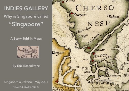
Why is Singapore Called "Singapore" - Indies Gallery Catalogue 2021
Why is Singapore called “Singapore” - A Story Told in Maps by Eric Rosenkranz. The map collection of Sake Rudmer Santema.
Why is Singapore called “Singapore” - A Story Told in Maps by Eric Rosenkranz. The map collection of Sake Rudmer Santema.

Create successful ePaper yourself
Turn your PDF publications into a flip-book with our unique Google optimized e-Paper software.
INDIES GALLERY<br />
<strong>Why</strong> <strong>is</strong> <strong>Singapore</strong> called<br />
“<strong>Singapore</strong>”<br />
A Story Told in Maps<br />
By Eric Rosenkranz<br />
<strong>Singapore</strong> & Jakarta - May <strong>2021</strong><br />
www.<strong>Indies</strong><strong>Gallery</strong>.com
INDIES GALLERY<br />
<strong>Why</strong> <strong>is</strong> <strong>Singapore</strong> called “<strong>Singapore</strong>” - A story Told in Maps<br />
The map collection of Sake Rudmer Santema<br />
By Eric Rosenkranz<br />
<strong>Singapore</strong> & Jakarta ~ May <strong>2021</strong>
<strong>Singapore</strong> <strong>is</strong> often called the “Lion City’, a name supposedly deriving from the<br />
Sanskrit words Singha, Lion, and Pura, City. Further evidence purportedly comes from<br />
the Malay Chronicles, a h<strong>is</strong>torical compilation written in the 15th century, which tells<br />
the story of a 13th century Palembang Prince named Sang Nila Utama who came to<br />
the <strong>is</strong>land, saw an animal he was told was a lion, and named the city after it.<br />
However, the earliest known copy of the Chronicles dates from 1612, more than 300<br />
years after these events were said to occur. The animal the Prince was said to have<br />
seen had a red body, black head and a white breast (unlike most lions) and we know<br />
today that no lion ever graced the <strong>is</strong>land, nor was there a city at the time the Prince<br />
arrived.<br />
So, if we might doubt the Lion City origin of the name <strong>Singapore</strong>, how do we search<br />
for another explanation?
It turns out that maps of the last few<br />
hundred years tell a different story. From<br />
them, we can see that the <strong>is</strong>land had a<br />
different name before it was named<br />
“<strong>Singapore</strong>” and that it was the waterways<br />
around the <strong>is</strong>land that first carried th<strong>is</strong><br />
d<strong>is</strong>tinctive name.<br />
Our journey begins in the early 1500s when<br />
European explorers first started sailing to<br />
Asia from the west. Th<strong>is</strong> 1522 map by<br />
Laurent Fries has written at the foot of<br />
South East Asia the word “Bar mingapara”.<br />
An earlier version by another cartographer<br />
writes the name “Bar Xingapara”. Other<br />
maps of the same era write at th<strong>is</strong> area<br />
“Gimgaparaa” and “Samgapura”.
Folio 34 of O Livro de Franc<strong>is</strong>co Rodrigues<br />
1513 showing “Samgapura”<br />
(The Book of Franc<strong>is</strong>co Rodrigues)<br />
The placement of the word on all of these maps indicates<br />
that the name <strong>is</strong> referring to a body of water, especially as<br />
what we now call <strong>Singapore</strong> <strong>is</strong>land <strong>is</strong> not shown at all.
Giacomo Gastaldi’s map India Tercera Nova Tabula from 1548<br />
changes things slightly. Now we can see, in the water east of<br />
the Malaccan peninsula, a cape called “Cape Cincapula “
TEXT by Erik NEEDED<br />
C. Cingatola 2x named on<br />
th<strong>is</strong> map
Maps for the next 50 years referred<br />
to th<strong>is</strong> “<strong>Singapore</strong> Cape” as can be<br />
seen in th<strong>is</strong> beautiful 1598 map by<br />
Willem Lodewycksz where you can<br />
read “C. de Singapour” running<br />
down the side. While th<strong>is</strong> large land<br />
mass appears to be an <strong>is</strong>land, it <strong>is</strong> in<br />
fact the southern part of the Malay<br />
Peininsua, separated from the<br />
mainland by an imaginary “river”.<br />
Th<strong>is</strong> non ex<strong>is</strong>tant river ex<strong>is</strong>ted on<br />
many maps of the time.
The little known Dutch engraver<br />
Barent Langenes in 1609 publ<strong>is</strong>hed<br />
th<strong>is</strong> map of Sumatra and the Malay<br />
peninsula (with East at the top)<br />
showing “Sincapura”, once again<br />
as a cape at the bottom of the<br />
eastern side of the Malaccan<br />
peninsula. As in previous maps,<br />
<strong>Singapore</strong> <strong>is</strong>land <strong>is</strong> not shown.<br />
DIFFERENT MAP
Sometime in the late 1600s, another<br />
evolution of the word “<strong>Singapore</strong>” becomes<br />
apparent on maps. From the generalized<br />
“Bar Xingapura” to “Cape Cincapula”, maps<br />
now start identifying <strong>Singapore</strong> as a strait<br />
connecting the Straits of Malacca on the<br />
west to the Karimata Strait on the east (which<br />
leads to the South China Sea).<br />
Let’s look at some maps that illustrate th<strong>is</strong>.
The first, and possibly most important, <strong>is</strong> th<strong>is</strong> hand-drawn<br />
map from a collection at the University of Leiden dating<br />
sometime from 1675-1700. To the right side of the map, we<br />
see a black mountain which on the previous series of maps<br />
was named Cape <strong>Singapore</strong>. Slightly southwest of the cape<br />
we see, written in red, the Dutch words “Straat Sincapura” or<br />
“<strong>Singapore</strong> Strait”. If your eye travels to the left you will see<br />
many very small <strong>is</strong>lands. Above these <strong>is</strong> a green line, above<br />
which are the words “T Lang Eyl.t” which translate to “Long<br />
Island”. Th<strong>is</strong> area has been identified by cartographers as<br />
<strong>Singapore</strong> <strong>is</strong>land, perhaps the first clear depiction of the<br />
<strong>is</strong>land on a map. Clearly, while the straits are called the<br />
“<strong>Singapore</strong> Straits”, the <strong>is</strong>land <strong>is</strong> called “Long Island.”
The <strong>Singapore</strong> Straits now begin appearing on more maps.<br />
Th<strong>is</strong> beautiful map by Pieter van der Aa from 1706 names the<br />
“Naarw van Cincapura” but does not show <strong>Singapore</strong> <strong>is</strong>land.<br />
(While Van der AA <strong>is</strong> best known for h<strong>is</strong> maps and atlases, he<br />
began h<strong>is</strong> career by pirating and printing foreign and<br />
illustrated books.)
Jacques Nicolas Bellin was a French hydrographer and<br />
geographer and h<strong>is</strong> maps are some of the most detailed and<br />
accurately rendered of the time. Th<strong>is</strong> map of the area dates<br />
to 1755. We can now see <strong>Singapore</strong> <strong>is</strong>land very clearly<br />
identified with the modern named <strong>is</strong>lands of Ubin and<br />
Tekong appearing to the north. Between <strong>Singapore</strong> <strong>is</strong>land<br />
and Ubin (called on th<strong>is</strong> map “Salat Buro”) we see written<br />
“Vieux Detroits de Sincapour” (Old Strait of <strong>Singapore</strong>) and<br />
just below <strong>Singapore</strong> <strong>is</strong>land we see “Nouveau Detroit de<br />
Sincapour” (New Strait of <strong>Singapore</strong>).<br />
<strong>Singapore</strong> <strong>is</strong>land itself <strong>is</strong> named “Pulo ou Isle<br />
Panjang” (“Long Island”).
So, clearly, as late as 1755, <strong>Singapore</strong> <strong>is</strong>land was still being called Long Island while the<br />
waterways around it were called the <strong>Singapore</strong> Straits.<br />
Sometime by 1794 had <strong>Singapore</strong> Island had finally adopted the name of its neighbouring<br />
waterway? In th<strong>is</strong> map, named “The Straits Of Sincapore With Those Of Durion, Sabon,<br />
and Mandol” by Thomas Jeffers, Geographer to the King, we read the words “The Old<br />
Straits” and then the word “Sincapore” on the <strong>is</strong>land.<br />
But <strong>is</strong> th<strong>is</strong> word referring now to the name of the <strong>is</strong>land, or <strong>is</strong> it merely the continuation of<br />
the phrase “The Old Straits…”?<br />
In fact, as late as 1803 Brit<strong>is</strong>h maps were still naming <strong>Singapore</strong> Island “Pulo<br />
Panjang” (Long Island). The <strong>is</strong>land appears to have been clearly named “Sincapour” for<br />
possibly the first time in 1823 and spelled “<strong>Singapore</strong>” three years later.
By 1828, the date of th<strong>is</strong> “Plan<br />
Of The Brit<strong>is</strong>h Settlement Of<br />
<strong>Singapore</strong> and Town plan of<br />
<strong>Singapore</strong>”, the Island had<br />
finally won its final name.<br />
In the 300 hundred plus years from 1502 to 1826,<br />
maps and charts of the region variously referred to<br />
Barmingapara, Barxingapara, Samgapura, Cape<br />
Cincapula, Long Island, Pulo Panjang and finally<br />
Sincapour/<strong>Singapore</strong>. Maps were not the only<br />
source of confusion. Zedler’s Universal Lexicon, first<br />
publ<strong>is</strong>hed in 1731 and purporting to be the<br />
Wikipedia of its time, has five d<strong>is</strong>tinct entries for<br />
<strong>Singapore</strong>, identifying it as a strait, a cape, an <strong>is</strong>land<br />
and a city, with the city being located in numerous<br />
places throughout the region.
Which leads one to finally ask, if not named after Lion City, what was<br />
<strong>Singapore</strong> named after? Alas, we will never know. But here’s another<br />
hypothes<strong>is</strong>. Instead of thinking of “Singha Pura” (Lion City), think of “Sin<br />
Gapura”. Sin (or Xin or Cin) <strong>is</strong> the prefix for China (today we have the<br />
words Sinophile and Sinolog<strong>is</strong>t, for example). Gapura <strong>is</strong> the Javanese word<br />
for “Gateway”.<br />
So “Singapura” can be seen to mean “The Gateway to China”. Th<strong>is</strong> makes<br />
sense when one imagines a sea captain travelling down the Malaccan<br />
Straits, being in the same body of water until he reaches <strong>Singapore</strong> and<br />
enters into the beginnings of the South China Sea, where everything, the<br />
tides and the currents, are different. Thence, our Captain would sail onto<br />
China, having navigated the Straits and the Gateway to China, Singapura.