Prince George Dangerous Goods Routes - Greater Vancouver Section
Prince George Dangerous Goods Routes - Greater Vancouver Section
Prince George Dangerous Goods Routes - Greater Vancouver Section

Create successful ePaper yourself
Turn your PDF publications into a flip-book with our unique Google optimized e-Paper software.
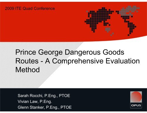
2009 ITE Quad Conference<br />
<strong>Prince</strong> <strong>George</strong> <strong>Dangerous</strong> <strong>Goods</strong><br />
<strong>Routes</strong> - A Comprehensive Evaluation<br />
Method<br />
Sarah Rocchi, P.Eng., PTOE<br />
Vivian Law, P.Eng.<br />
Glenn Stanker, P.Eng., PTOE
The City of <strong>Prince</strong> <strong>George</strong> commissioned<br />
Opus to:<br />
• Establish designated routes for<br />
dangerous goods in the City<br />
(for through and internal truck<br />
traffic, as well as short- and longterm)<br />
• Identify related network<br />
improvement and<br />
upgrade requirements<br />
• Prepare policies and<br />
bylaws to regulate dangerous<br />
goods movement
SR1<br />
Project Tasks<br />
• Literature review<br />
• Current practices review<br />
• Establish current and future conditions<br />
• Extensive public and stakeholder consultation<br />
• Develop an evaluation methodology<br />
• Conduct risk evaluation of proposed network<br />
• Recommend short and long term networks<br />
• Identify locations requiring infrastructure<br />
improvements<br />
• Prepare a draft dangerous goods route bylaw<br />
and project report
Slide 3<br />
SR1 Vivian and I are going to focus the presentation on points 1, 4 and 5. Could you make those three di<br />
Sarah Rocchi, 4/15/2009
Literature Review<br />
Legislation<br />
• Federal: Transportation of <strong>Dangerous</strong> <strong>Goods</strong> Act (1992)<br />
• Provincial: Transport of <strong>Dangerous</strong> <strong>Goods</strong> Act (1996)<br />
• Trucks transporting dangerous goods are permitted on highways under<br />
the Ministry jurisdiction unless restrictions exist<br />
Other DGR bylaws<br />
• Kamloops and District of North <strong>Vancouver</strong>, BC<br />
• Edmonton and Calgary, Alberta<br />
• Saskatoon, Saskatchewan
Public Consultation<br />
• Web surveys and open<br />
house<br />
• Provide local<br />
knowledge: issues,<br />
concerns, potential<br />
solutions<br />
• Input used to confirm if<br />
recommendations are<br />
supportable
<strong>Prince</strong> <strong>George</strong> Public Consultation<br />
Materials Used<br />
CLASS<br />
1<br />
2<br />
3<br />
4<br />
5<br />
6<br />
7<br />
8<br />
9<br />
SUBSTANCE<br />
Explosives<br />
Gases<br />
Flammable liquids<br />
Flammable solids<br />
Oxidizing substances<br />
Poisonous substances<br />
Radioactive materials<br />
Corrosives<br />
Miscellaneous products
Stakeholder Consultation<br />
• Trucking, transportation, industry, business and<br />
government representatives<br />
• Identify issues and concerns with proposed network<br />
• Identify potential risk reduction mitigation measures<br />
(infrastructure, legislative, enforcement, emergency<br />
response)
Evaluation Methodology<br />
Framework<br />
• Reviewed methods used in Calgary (Alberta) and Kamloops<br />
(British Columbia)<br />
• Needs of <strong>Prince</strong> <strong>George</strong><br />
• Relative comparison of routes considered<br />
• Transparent and repeatable process<br />
• Focus on overall route conditions
Evaluation Methodology<br />
Objectives<br />
• Minimize the likelihood and<br />
consequences of dangerous<br />
goods spill<br />
• Recognize various risks that<br />
are involved � evaluation<br />
criteria<br />
• Recognize various levels of<br />
difficulty in mitigating risks �<br />
weighting factors<br />
EVALUATION<br />
CRITERIA<br />
Access Control<br />
Population Exposure<br />
Public Evacuation Potential<br />
Surrounding Environment<br />
Road Geometry<br />
Traffic Efficiency<br />
Public Emergency<br />
Response<br />
Accommodation of<br />
Pedestrians and Cyclists<br />
Collision History<br />
WEIGHT<br />
FACTOR<br />
3<br />
3<br />
3<br />
3<br />
2<br />
2<br />
2<br />
1<br />
1<br />
Consequences<br />
Likelihood
Ideal Characteristics for a <strong>Dangerous</strong> <strong>Goods</strong><br />
Route<br />
Access control<br />
Population exposure<br />
Public evacuation potential<br />
Surrounding environment<br />
Road geometry<br />
Traffic efficiency<br />
Public emergency response<br />
Accommodation of pedestrians and<br />
cyclists<br />
Collision history<br />
All intersections have signals/few<br />
private access<br />
Primarily undeveloped / heavy industrial<br />
Affected people can evacuate quickly<br />
and efficiently<br />
No sensitive natural areas along route<br />
Wide, flat, straight route<br />
Infrequent delays<br />
Fire hall less than 2 kilometres away<br />
Sidewalks and bike lanes provided<br />
Low collision rate
Evaluation Methodology<br />
Evaluation procedure<br />
• Divide a route in homogeneous segments (land use, roadway<br />
characteristics)<br />
• For each segment and evaluation criteria, assign a risk score and multiple<br />
risk score with weighting factor<br />
• Determine a total score for a route by adding up the segment scores<br />
weighted by their respective lengths
Criteria<br />
Access control<br />
Population exposure<br />
Public Evacuation<br />
Potential<br />
Surrounding environment<br />
Route Risk Rating<br />
Low Moderate High Extreme<br />
25 50 75 100<br />
All intersections along route are<br />
signalized / few issues with sight<br />
distances / few private access points<br />
Primarily undeveloped / heavy<br />
industrial<br />
Affected people can evacuate quickly<br />
and efficiently / limited number of<br />
access points but there is no public<br />
evacuation requirement<br />
No sensitive natural areas* along<br />
route<br />
Road geometry Desirable alignment elements<br />
Traffic efficiency<br />
Public Emergency<br />
response<br />
Collision history<br />
Accommodation of<br />
pedestrians and cyclists<br />
Low traffic volumes / infrequent delays<br />
or congestion<br />
Fire hall less than 2 kilometres away /<br />
fire hall 2 kilometres or greater away<br />
but there is no public emergency<br />
response requirement<br />
Collision rate is lower than average for<br />
the road class / very few or no<br />
collisions involving heavy trucks<br />
Raised sidewalks available / bikes<br />
share road space with traffic (marked<br />
bike lanes) / low pedestrian crossing<br />
demands<br />
Few unsignalized intersections along<br />
route / some issues with sight<br />
distances that are correctable / some<br />
private access points<br />
Light industrial<br />
Evacuation may be difficult for<br />
affected people due to few number of<br />
access points<br />
Few sensitive natural areas* along<br />
route / low aquifer vulnerability<br />
Medium standard / generally meets<br />
expectations<br />
Medium traffic volumes / occasional<br />
delays or congestion<br />
Some unsignalized intersections along<br />
route / some issues with sight<br />
distances that are difficult to correct /<br />
many private access points (low<br />
volume)<br />
Primarily commercial / up to 3<br />
assembly or large scale institutional<br />
facilities within 500 metres from route<br />
Evacuation difficult for affected people<br />
due to very few number of access<br />
points<br />
Some sensitive natural areas* along<br />
route / moderate aquifer vulnerability<br />
Low standard / may not meet all<br />
expectations<br />
High traffic volumes / frequent delays<br />
or congestion<br />
Many unsignalized intersections along<br />
route / many sight distance issues and<br />
most are difficult to correct / many<br />
private access points (high volume)<br />
Primary residential / more than 3<br />
assembly or large scale institutional<br />
facilities within 500 metres from route<br />
Evacuation very difficult for affected<br />
people due to restricted access<br />
Route crosses a floodplain / high<br />
aquifer vulnerability<br />
Significantly below current standards<br />
and expectations<br />
Very high traffic volumes / very<br />
frequent delays or congestion<br />
Fire hall 2 to 4 kilometres away Fire hall 4 to 7 kilometres away Fire hall more than 7 kilometres away 2<br />
Collision rate is about average for the<br />
road class / few collisions involving<br />
heavy trucks<br />
Raised sidewalks available / bikes<br />
share road space with traffic (wide<br />
curb lanes) / moderate pedestrian<br />
crossing demands<br />
Collision rate is higher than average<br />
for the road class / some collisions<br />
involving heavy trucks<br />
No raised sidewalks, road shoulders<br />
are available for pedestrians / bikes<br />
share road space with traffic<br />
(unmarked facility) / high pedestrian<br />
crossing demands<br />
Collision rate is among the highest in<br />
the City for the road class / notable<br />
collisions involving heavy trucks<br />
No raised sidewalks or shoulders for<br />
pedestrians / no road space allocated<br />
to bikes / very high pedestrian<br />
crossing demands<br />
* Sensitive natural areas include: floodplain, wetland, large area of swamp, significant slopes, agricultural land reserve, current parks and reserves, and wildlife habitats. When a route crosses a floodplain it is considered extreme risk<br />
Weighting<br />
Factor<br />
3<br />
3<br />
3<br />
3<br />
2<br />
2<br />
1<br />
1
Selection of Risk According to:<br />
• Opus’ objective assessment<br />
• Input from stakeholders and<br />
the public (preliminary<br />
results presented in<br />
consultation process)<br />
Criteria<br />
Access control<br />
Route Risk Rating<br />
Low Moderate High Extreme<br />
25 50 75 100<br />
All intersections along route are<br />
signalized / few issues with sight<br />
distances / few private access points<br />
Few unsignalized intersections along<br />
route / some issues with sight<br />
distances that are correctable / some<br />
private access points<br />
Some unsignalized intersections along<br />
route / some issues with sight<br />
distances that are difficult to correct /<br />
many private access points (low<br />
volume)<br />
Many unsignalized intersections along<br />
route / many sight distance issues and<br />
most are difficult to correct / many<br />
private access points (high volume)<br />
Weighting<br />
Factor<br />
3
Results<br />
The higher the total risk score, the lower the desirability<br />
Min Score 500<br />
Max Score 2000
Results – Example of Trade-offs<br />
Route<br />
Population<br />
Exposure<br />
Risk Score<br />
Public<br />
Evacuation<br />
Potential<br />
Northwood Pulpmill Rd 85 85 821<br />
PG Pulpmill Rd 75 75 925<br />
Noranda Rd 75 150 950<br />
Hwy 16 (outside of Victoria St / 20th Ave) 163 138 1019<br />
Hwy 97 (outside of the Bowl) 117 126 1035<br />
Old Cariboo Hwy 150 150 1050<br />
1st Avenue west of Victoria St. 150 75 1075<br />
Foothills Blvd / 15th Avenue 243 93 1205<br />
River Rd 150 212 1241<br />
Hwy 97 (through the Bowl) 225 75 1275<br />
Hwy 16 (on Victoria St / 20th Ave) 225 75 1334<br />
Queensway 288 75 1350<br />
Ferry Ave 300 75 1375<br />
POTENTIAL FUTURE ROUTES<br />
Future Airport Connector 150 150 858<br />
Future East Connector 75 75 875<br />
Future Boundary Rd 139 107 892<br />
Foothills Extension 186 75 1066<br />
Lower Patricia 300 75 1180<br />
Lowest score: 75 75<br />
Highest score: 300 212<br />
Route Risk<br />
Score
Recommended DGR Network – Short Term
Recommended Network – Long Term
Risk Reduction Measures - Legislative<br />
• Adoption of a DGR bylaw (details currently being<br />
finalized)<br />
• Definitions<br />
• Reference to other applicable bylaws, acts and regulations<br />
• Exemptions<br />
• Conditions upon which vehicles may travel outside of the<br />
network and<br />
• Conditions upon which vehicles transporting dangerous goods<br />
may stop within the municipality<br />
• DG vehicle restrictions<br />
• Conditions for temporary dangerous goods routes<br />
• Fines and other penalties<br />
• Map of the dangerous goods route network
Risk Reduction Measures - Others<br />
• Develop enforcement strategy<br />
• Present bylaw to Council for adoption, and MoTI for<br />
approval<br />
• Provide education to public and industry during bylaw<br />
implementation phase<br />
• Address identified network concerns
Conclusions<br />
• DG routes generally follow<br />
Ministry Highways and<br />
existing industrial roads<br />
• There will always be tradeoffs<br />
• Stakeholder consultation is<br />
valuable<br />
• Focus on improvements and<br />
carry out enforcement<br />
• Long term routes identified in<br />
the process
Questions?<br />
Sarah Rocchi, P.Eng., PTOE<br />
Vivian Law, P.Eng.<br />
Glenn Stanker, P.Eng., PTOE