Introduction to Human Geography (2nd Edition), 2019a
Introduction to Human Geography (2nd Edition), 2019a
Introduction to Human Geography (2nd Edition), 2019a

Create successful ePaper yourself
Turn your PDF publications into a flip-book with our unique Google optimized e-Paper software.
INTRODUCTION TO HUMAN GEOGRAPHY<br />
INTRODUCTION TO GEOGRAPHY<br />
Digital imagery like the one in Figure 1.9 is in a format that can be entered in<strong>to</strong><br />
Geographic Information Systems (GIS), the second important <strong>to</strong>ol employed<br />
by geographers. GIS combines computer hardware and software in a system that<br />
s<strong>to</strong>res, analyzes and displays geographic data with a “computer mapping” capability.<br />
Geographic data is s<strong>to</strong>red in layers, and these layers of data can be queried in a<br />
Figure 1.11 Each<br />
data point in a GIS is georeferenced <strong>to</strong><br />
a precise location on the Earth’s surface<br />
<br />
<br />
attributes corresponding <strong>to</strong> the data<br />
layer they are associated with. Data<br />
layers can represent a myriad of characteristics<br />
about that data point, such<br />
as elevation, soils, the presence of<br />
water, per-capita income, ethnicity,<br />
etc. Overlaying the data layers can<br />
provide incredible insights in<strong>to</strong> the<br />
connections between characteristics/<br />
fac<strong>to</strong>rs in places, such as the connection<br />
between per-capita income and<br />
Figure 1.11 | Data Layers<br />
Data layers in a Geographic Information System (GIS).<br />
ethnicity or the links between soil types<br />
Author |<br />
and vegetative cover. GIS also has a Source | National Geographic<br />
License | Public Domain<br />
vast suite of other capabilities such as<br />
least-cost path for transportation, lineof-sight<br />
perspectives from a particular<br />
location, or 3-D models of urban areas.<br />
Because of their multi-faceted capacity<br />
<strong>to</strong> present geographic information,<br />
businesses and government agencies<br />
around the world use GIS <strong>to</strong> answer<br />
questions, plan development, chart<br />
delivery routes, and even moni<strong>to</strong>r<br />
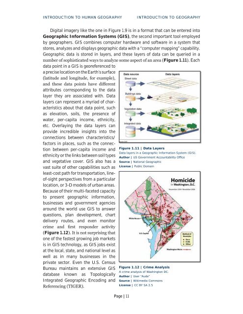
<br />
Figure 1.12<br />
one of the fastest growing job markets<br />
is in GIS technology, as GIS jobs exist<br />
at the local, state, and national level as<br />
well as in many businesses in the<br />
private sec<strong>to</strong>r. Even the U.S. Census<br />
Bureau maintains an extensive GIS<br />
Figure 1.12 | Crime Analysis<br />
A crime analysis of Washing<strong>to</strong>n DC.<br />
database known as Topologically<br />
Author | User “Aude”<br />
Integrated Geographic Encoding and Source | Wikimedia Commons<br />
License | CC BY SA 2.5<br />
<br />
Page | 11