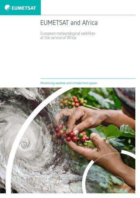
EUMETSAT and Africa
European meteorological satellites at the service of Africa
European meteorological satellites at the service of Africa
- No tags were found...

You also want an ePaper? Increase the reach of your titles
YUMPU automatically turns print PDFs into web optimized ePapers that Google loves.
<strong>EUMETSAT</strong> <strong>and</strong> <strong>Africa</strong><br />
European meteorological satellites<br />
at the service of <strong>Africa</strong><br />
Monitoring weather <strong>and</strong> climate from space
It’s a fact<br />
<strong>EUMETSAT</strong> provides 16 megabits of data<br />
per second via its EUMETCast system to<br />
<strong>Africa</strong>n meteorological services, climate<br />
researchers <strong>and</strong> others. <strong>EUMETSAT</strong>’s<br />
Meteosat satellites in geostationary<br />
orbit have had a continuous view of the<br />
continent for 40 years.<br />
Right: Image of Tropical Cyclone<br />
Vardah crossing the Gulf of<br />
Bengal, as captured by<br />
<strong>EUMETSAT</strong>'s Meteosat-8<br />
satellite on 19 December 2016<br />
at 06:00 UTC
Changing rainfall patterns in <strong>Africa</strong> are predicted to have a negative impact on agriculture<br />
<strong>and</strong> food <strong>and</strong> water security. Extreme weather events, such as severe storms, droughts <strong>and</strong><br />
floods, are expected to increase in frequency <strong>and</strong> intensity. Rising sea levels, combined<br />
with storm surges <strong>and</strong> breaking waves, are predicted to threaten coastal areas, potentially<br />
causing major population shifts. Accurate weather forecasts <strong>and</strong> warnings of severe<br />
weather are essential to enable <strong>Africa</strong>n countries to deal with the impacts of the changing<br />
climate. Meteorological satellites have a key role to play.<br />
01
The value of <strong>EUMETSAT</strong><br />
satellites for <strong>Africa</strong><br />
Climate change is a major threat to sustainable growth <strong>and</strong> development in <strong>Africa</strong><br />
Ensuring safety requires the ability to forecast rapidly developing severe weather events<br />
accurately. These very-short-range weather forecasts require fast access to high-quality<br />
data such as those from Europe’s Meteosat satellites. The Meteosat Second Generation<br />
(MSG) operational system, which comprises satellites over continental <strong>Africa</strong> <strong>and</strong> the<br />
Indian Ocean, ensures a regular flow of imagery every 15 minutes from geostationary orbit,<br />
36,000km above the equator.<br />
Left: Accumulated rainfall estimate<br />
anomaly in <strong>Africa</strong> for March 2021 derived<br />
from Meteosat thermal infrared imagery<br />
(Source: TAMSAT, University of Reading, UK)<br />
02
<strong>Africa</strong> is continuously in the field of view of <strong>EUMETSAT</strong>’s Meteosat<br />
satellites. Therefore, the data <strong>and</strong> imagery the satellites provide are<br />
crucial for weather forecasting across the <strong>Africa</strong>n continent <strong>and</strong><br />
for supporting climate <strong>and</strong> environmental monitoring. Additional<br />
information about the weather, atmosphere <strong>and</strong> oceans is provided<br />
by the Metop polar-orbiting <strong>and</strong> Jason ocean altimetry satellites<br />
which feed digital weather forecasting <strong>and</strong> seasonal prediction<br />
models. Satellite data contribute to seasonal forecasting prepared<br />
with the support of regional climate centres in <strong>Africa</strong> to prepare<br />
for agricultural seasons, <strong>and</strong> to warn of potential severe weather<br />
events, such as droughts. This output also is vital for <strong>Africa</strong>.<br />
They have undertaken projects <strong>and</strong> initiatives to help the<br />
<strong>Africa</strong>n meteorological community meet national <strong>and</strong> regional<br />
requirements in terms of severe weather warnings, water <strong>and</strong><br />
agriculture management, <strong>and</strong> mitigation of the effects of natural<br />
hazards <strong>and</strong> climate change.<br />
The next generations of <strong>EUMETSAT</strong>’s Meteosat <strong>and</strong> Metop<br />
satellites will begin to be deployed from 2022, making more, <strong>and</strong><br />
even higher quality, data available to users, including the <strong>Africa</strong>n<br />
meteorological community.<br />
<strong>EUMETSAT</strong>’s Member States have made support for <strong>Africa</strong> a<br />
strategic objective. The organisation’s efforts are combined with<br />
those of the European Union, the <strong>Africa</strong>n Union <strong>and</strong> the World<br />
Meteorological Organization (WMO).<br />
Top: A fisherman prepares his<br />
nets, Maputo, Mozambique<br />
(source: V. Gabaglio)<br />
03
Support for <strong>Africa</strong> is an integral<br />
<strong>EUMETSAT</strong> objective<br />
“The cooperation between the Directorate-General for<br />
International Partnerships <strong>and</strong> <strong>EUMETSAT</strong> plays a major<br />
role in EU-<strong>Africa</strong> partnerships, especially in support<br />
of sustainable growth, green transition <strong>and</strong> digital<br />
transformation on the <strong>Africa</strong>n continent. Our joint efforts<br />
<strong>and</strong> <strong>EUMETSAT</strong>’s involvement in Copernicus, GMES <strong>and</strong><br />
<strong>Africa</strong>, <strong>and</strong> ClimSA, just to mention a few, are already<br />
enabling our <strong>Africa</strong>n partners to better tap into the<br />
unexploited potential offered by satellite data <strong>and</strong> digital<br />
technologies <strong>and</strong> to bring benefits to their societies<br />
<strong>and</strong> economies.”<br />
Koen Doens<br />
Director General for International Partnership (DG INTPA)<br />
European Commission<br />
<strong>EUMETSAT</strong>'s cooperation with <strong>Africa</strong> is grounded in the<br />
organisation’s strategic objective to “exp<strong>and</strong> the user base for<br />
<strong>EUMETSAT</strong> data, products <strong>and</strong> services in <strong>EUMETSAT</strong> Member<br />
States <strong>and</strong> among WMO Members”. This objective is in line with<br />
the Joint <strong>Africa</strong>-EU Strategy <strong>and</strong> the Integrated <strong>Africa</strong>n Strategy<br />
on Meteorology.<br />
Helping user communities to easily access <strong>and</strong> make best use<br />
of <strong>EUMETSAT</strong> data, products <strong>and</strong> services is the main aim of<br />
the strategic objective. <strong>EUMETSAT</strong> will continue to fulfil its very<br />
specific <strong>and</strong> challenging mission to deliver time-critical data <strong>and</strong><br />
products to user communities across several continents, with<br />
dedicated end-to-end service, <strong>and</strong> to offer users in Member<br />
States <strong>and</strong> WMO Regional Associations RA-VI (Europe) <strong>and</strong> RA-I<br />
(<strong>Africa</strong>) the easiest <strong>and</strong> cheapest access to data.<br />
Contributing to the Joint <strong>Africa</strong>-EU Strategy<br />
Since 2007, successive action plans adopted by European<br />
Union-<strong>Africa</strong>n Union summits have identified Earth observation<br />
as a joint cooperation area. Earth observation is recognised as<br />
a tool that supports environmental monitoring <strong>and</strong> increasing<br />
resilience. At the 5th EU-AU Summit held in Abidjan in 2017,<br />
the Heads of States <strong>and</strong> Governments committed to fostering<br />
the use of space-based technologies <strong>and</strong> information for<br />
those purposes.<br />
04
Tropical Cyclone Idai<br />
Satellite:<br />
Location:<br />
Metosat-11<br />
Mozambique<br />
Date: 15 March 2019<br />
Tropical Cyclone Idai was one of the worst<br />
tropical cyclones on record to affect <strong>Africa</strong><br />
<strong>and</strong> the Southern Hemisphere, causing<br />
severe flooding throughout Madagascar,<br />
Malawi, Mozambique <strong>and</strong> Zimbabwe<br />
resulting in at least 1,297 deaths <strong>and</strong><br />
widespread destruction.<br />
Top: Aid workers load medical supplies on to a<br />
South <strong>Africa</strong>n National Defence Force helicopter<br />
in the aftermath of Cyclone Idai in Beira,<br />
Mozambique, 25 March 2019 (Source: Reuters)<br />
05
06
Extract from the Abidjan Summit Declaration<br />
“We agree to undertake efforts to halt <strong>and</strong> reverse<br />
environmental degradation, which has potentially significant<br />
implications for sustainable development, including related to<br />
security <strong>and</strong> migration, <strong>and</strong> for enhancing adaptive capacity<br />
to the adverse impacts of climate change <strong>and</strong> related shocks,<br />
<strong>and</strong> increase resilience to environmental degradation,<br />
desertification, health threats <strong>and</strong> humanitarian crises, <strong>and</strong><br />
increase resilience by addressing drivers of vulnerability.”<br />
The EU’s Copernicus Earth observation programme <strong>and</strong> the<br />
Global Monitoring for Environment <strong>and</strong> Security in <strong>Africa</strong><br />
(GMES <strong>and</strong> <strong>Africa</strong>) initiative will be central to achieving<br />
those aims.<br />
Contributing to the Integrated <strong>Africa</strong>n Strategy<br />
on Meteorology<br />
Other aims include:<br />
• To facilitate access to <strong>and</strong> use of globally available<br />
operational oceanography data from ocean-monitoring<br />
satellites (for example, Jason or Sentinel-3) <strong>and</strong> global ocean<br />
analysis <strong>and</strong> forecast centres (for example, the Copernicus<br />
Marine Service), as well as the production of <strong>Africa</strong>n-tailored<br />
marine forecast products based on these global data.<br />
• To facilitate access to, use <strong>and</strong> development of satellitebased<br />
meteorological products for aviation (for example,<br />
lightning detection, tropopause folding turbulences, fog<br />
detection <strong>and</strong> volcanic ash).<br />
• To increase <strong>Africa</strong>n capacities to develop tailored products<br />
based on satellite data through an <strong>Africa</strong>n Meteorological<br />
Satellite Application Facility as proposed in the Abidjan<br />
Declaration, <strong>and</strong> engage with international partners to combine<br />
or assimilate in situ observations, model outputs <strong>and</strong> satellitederived<br />
products to better address <strong>Africa</strong>n requirements.<br />
The Integrated <strong>Africa</strong>n Strategy on Meteorology (Weather<br />
<strong>and</strong> Climate Services) was first adopted during the <strong>Africa</strong>n<br />
Ministerial Conference on Meteorology (AMCOMET) in 2012.<br />
The revised strategy was presented <strong>and</strong> adopted at the<br />
March 2021 conference.<br />
The revised strategy highlights the importance of access to<br />
global sources of weather <strong>and</strong> climate data. It states that<br />
satellite data, global weather models <strong>and</strong> climate data are<br />
essential for national weather <strong>and</strong> climate services <strong>and</strong> will be<br />
secured for national meteorological <strong>and</strong> hydrological services<br />
to underpin economic growth <strong>and</strong> sustainable development.<br />
The strategy also makes explicit references to the importance of<br />
satellites operated by <strong>EUMETSAT</strong>. It aims to ensure sustainable<br />
access to <strong>and</strong> use of data from existing <strong>and</strong> future geostationary<br />
<strong>and</strong> polar-orbiting satellites, in particular, MTG.<br />
Left: Aerial view of<br />
Johannesburg, South <strong>Africa</strong><br />
(source: Adobe Stock)<br />
07
Preparing <strong>Africa</strong> for the next generation<br />
of meteorological satellites<br />
Meteosat Third Generation (MTG) satellites will begin replacing the current secondgeneration<br />
satellites from 2022. The MTG system will provide continuity of the data <strong>and</strong><br />
information from MSG spacecraft but with more frequent, accurate <strong>and</strong> higher-quality<br />
observations of the weather <strong>and</strong> climate over the <strong>Africa</strong>n continent.<br />
MTG geostationary satellites located above the Gulf of Guinea<br />
will deliver imagery of the <strong>Africa</strong>n continent every 10 minutes,<br />
in 16 spectral b<strong>and</strong>s, at a resolution of 1km, plus a continuous<br />
lightning detection capability. This will provide unique<br />
information on fast developing high-impact weather, incoming<br />
solar energy, wild fires, sea surface temperature, turbidity of<br />
coastal waters, <strong>and</strong> more.<br />
The Lightning Imager (LI) on MTG spacecraft will be an<br />
important source of information for <strong>Africa</strong>n forecasters, given<br />
the relative lack of radar availability. It will be particularly<br />
important for aviation safety, <strong>and</strong> the protection of life<br />
<strong>and</strong> property.<br />
The MTG system will significantly improve monitoring of the<br />
weather <strong>and</strong> climate over <strong>Africa</strong> until the 2040s. The improved<br />
capabilities of the MTG system call for a strengthening of<br />
existing capacities in <strong>Africa</strong>, at regional <strong>and</strong> national levels, to<br />
access, process <strong>and</strong> make best use of the data.<br />
This wealth of information will allow for substantial<br />
improvements in safety <strong>and</strong> health-critical early warnings <strong>and</strong><br />
disaster risk reduction in <strong>Africa</strong>, as well as public <strong>and</strong> private<br />
decision making in vital weather-sensitive sectors of the<br />
economy, such as air traffic management, renewable energy<br />
<strong>and</strong> sustainable use of water, marine <strong>and</strong> agricultural resources.<br />
In planning for future initiatives in <strong>Africa</strong>, <strong>EUMETSAT</strong> will consider<br />
the impact of large volumes of data generated by new <strong>EUMETSAT</strong><br />
missions <strong>and</strong> those of the EU’s Copernicus programme.<br />
Since 2016, <strong>EUMETSAT</strong> has been regularly discussing with<br />
users of its data the opportunities <strong>and</strong> challenges arising<br />
from the transition from the current MSG system to the MTG<br />
system, in close cooperation with the WMO RA-I Data Expert<br />
Group (RAIDEG). <strong>EUMETSAT</strong> has developed a roadmap for the<br />
transition, taking into account <strong>Africa</strong>n priorities.<br />
In addition, more <strong>and</strong> higher quality data will become available<br />
from <strong>EUMETSAT</strong>’s second generation of the polar-orbiting<br />
Metop satellites, which will begin to be deployed from 2023,<br />
<strong>and</strong> from the Sentinel missions of the EU’s Copernicus Earth<br />
observation programme.<br />
08
Below: Signature of the<br />
Abidjan Declaration<br />
in September 2018<br />
In September 2018, the <strong>Africa</strong>n Union Commission, Côte<br />
d’Ivoire’s Transport Minister, the President of the AMCOMET<br />
(Cape Verde’s minister in charge of meteorology) <strong>and</strong><br />
representatives of the Regional Economic Communities for<br />
western, eastern, central <strong>and</strong> southern <strong>Africa</strong> signed the<br />
“Abidjan Declaration on next generation of satellites products<br />
for weather <strong>and</strong> climate services in <strong>Africa</strong>”.<br />
in support of the objectives of the Integrated <strong>Africa</strong>n Strategy on<br />
Meteorology (Weather <strong>and</strong> Climate Services), <strong>and</strong> in line with the<br />
<strong>Africa</strong>n Space Policy <strong>and</strong> strategy”.<br />
It also encourages the creation of an <strong>Africa</strong>n Meteorological<br />
Satellite Applications Facility (AMSAF) to generate tailored<br />
products that meet specific regional needs.<br />
The Abidjan Declaration details the strengthening of capacities<br />
in <strong>Africa</strong> in preparation for access to <strong>and</strong> the exploitation of<br />
data from the MTG satellites. It encourages <strong>and</strong> supports “the<br />
strengthening of <strong>Africa</strong>n capabilities at regional <strong>and</strong> national<br />
levels, in particular the national meteorological <strong>and</strong> hydrological<br />
services, to ensure a smooth transition to MTG, <strong>and</strong> secure<br />
access to, <strong>and</strong> exploitation of, MTG satellite data <strong>and</strong> products<br />
Conscious of the role of satellites in monitoring weather <strong>and</strong><br />
climate, the AMCOMET Cairo Ministerial Declaration, signed in<br />
February 2019, endorsed the Abidjan Declaration <strong>and</strong> supported<br />
the creation of the AMSAF. The transition from MSG to MTG<br />
<strong>and</strong> the establishment of an <strong>Africa</strong>n Meteorological Satellite<br />
Applications Facility are explicitly mentioned in the Integrated<br />
<strong>Africa</strong>n Strategy on Meteorology.<br />
The launch of the first of the next-generation Meteosat satellites in 2022 will feature a celebration of the strong<br />
links between <strong>EUMETSAT</strong> <strong>and</strong> <strong>Africa</strong>. <strong>EUMETSAT</strong>, Arianespace <strong>and</strong> <strong>Africa</strong>n Artists for Development have joined<br />
forces to make it a launch to remember through the <strong>Africa</strong>n Space Art Project!<br />
The Arianespace rocket launching MTG-I1 into orbit will be decorated with a unique artwork by an<br />
<strong>Africa</strong>n artist on its fairing.<br />
09
Supporting joint EU-<strong>Africa</strong> initiatives<br />
To maximise the benefits of its involvement in projects in <strong>Africa</strong>, <strong>EUMETSAT</strong> is linking<br />
its activities to existing initiatives related to weather, the climate <strong>and</strong> environmental<br />
monitoring. Through the Joint <strong>Africa</strong>-EU Strategy, <strong>EUMETSAT</strong> is involved in several major<br />
initiatives: “GMES <strong>and</strong> <strong>Africa</strong>”, which aims to strengthen cooperation on Earth observation<br />
between Europe <strong>and</strong> <strong>Africa</strong>; ClimSA, which supports the implementation of climate services<br />
in the <strong>Africa</strong>n, Caribbean <strong>and</strong> Pacific regions; <strong>and</strong> SAWIDRA, which supports early warnings<br />
for disaster resilience on the continent.<br />
Below: Normalised Difference Vegetation Index image of the <strong>Africa</strong>n<br />
continent, which is used to monitor changes in, for example, vegetation<br />
cover, droughts <strong>and</strong> desertification. (Source: VGT-VITO)<br />
10
The GMES <strong>and</strong> <strong>Africa</strong> initiative: cooperation<br />
between Europe <strong>and</strong> <strong>Africa</strong> on Earth observation<br />
Climate services in the <strong>Africa</strong>n, Caribbean <strong>and</strong><br />
Pacific regions<br />
The aim of the Global Monitoring for Environment <strong>and</strong> Security<br />
in <strong>Africa</strong> (GMES <strong>and</strong> <strong>Africa</strong>) initiative is to strengthen <strong>and</strong> further<br />
develop infrastructure for exploitation of Earth observation data<br />
(from space <strong>and</strong> in-situ), technologies <strong>and</strong> services in support of<br />
environmental policies for sustainable development in <strong>Africa</strong>.<br />
The initiative is the flagship of the EU-AU partnership on space,<br />
<strong>and</strong> was launched by the Maputo Declaration in October 2006.<br />
In December 2007, during the EU-<strong>Africa</strong> Summit in Portugal,<br />
“The Lisbon Process on GMES <strong>and</strong> <strong>Africa</strong>” was approved. The<br />
European Commission adopted the “Action Document for the<br />
GMES <strong>and</strong> <strong>Africa</strong> Support Programme” in November 2015,<br />
committing a budget of €26.5 million for its first phase <strong>and</strong><br />
€25 million in 2020 for its second phase.<br />
The GMES <strong>and</strong> <strong>Africa</strong> Support Programme focuses<br />
on two main services:<br />
• the monitoring <strong>and</strong> management of marine <strong>and</strong> coastal<br />
environments (“marine service”);<br />
• the management of water resources <strong>and</strong> natural resources<br />
(“l<strong>and</strong> service”).<br />
The use of space-based technologies in GMES <strong>and</strong> <strong>Africa</strong> makes<br />
<strong>EUMETSAT</strong> satellite data, expertise <strong>and</strong> infrastructure great<br />
assets. The action plan provides continuity <strong>and</strong> builds on the<br />
achievements of previous projects undertaken since 2001,<br />
while exp<strong>and</strong>ing the geographical scope to northern <strong>Africa</strong>.<br />
The ClimSA programme contributes to progress on UN<br />
sustainable development goal 13, “take urgent action to combat<br />
climate change <strong>and</strong> its impacts”. The specific objective is “to<br />
support the climate information services value chain with<br />
technical assistance, financial assistance, infrastructure <strong>and</strong><br />
capacity building to improve access to <strong>and</strong> use of climate<br />
information, <strong>and</strong> to enable <strong>and</strong> encourage the generation <strong>and</strong><br />
use of climate services <strong>and</strong> applications for decision making<br />
processes at all levels”. Under this programme, regional climate<br />
centres that have not already done so will reach the necessary<br />
operational capacities to become WMO-certified, <strong>and</strong> operational<br />
climate services will be delivered in support of policy sectors<br />
across the regions.<br />
Under the UN Global Framework for Climate Services (GFCS),<br />
climate services include the timely production, translation,<br />
provision <strong>and</strong> use of climate data, information <strong>and</strong> knowledge<br />
for informed societal decision making regarding climate risks.<br />
In 2012, the Organisation of <strong>Africa</strong>n, Caribbean <strong>and</strong> Pacific<br />
States Secretariat, the <strong>Africa</strong>n Union Commission <strong>and</strong> regional<br />
economic communities convened in Addis Ababa <strong>and</strong> agreed to<br />
join forces for the implementation of the GFCS in <strong>Africa</strong>. In 2016,<br />
the “Intra-ACP Cooperation Strategy” included an explicit priority<br />
action to support the development of climate services <strong>and</strong><br />
related applications in the <strong>Africa</strong>n, Caribbean <strong>and</strong> Pacific regions,<br />
while strengthening the capacities of regional climate centres”.<br />
A budget of €85 million was allocated to this priority.<br />
The programme is implemented through regional climate centres<br />
under the overall coordination of the Organisation of the ACP States.<br />
The <strong>Africa</strong>n Union Commission coordinates activities at continental<br />
level in <strong>Africa</strong>, including the deployment of key infrastructure to<br />
access, process <strong>and</strong> exploit climate data made available by<br />
international partners, such as <strong>EUMETSAT</strong> <strong>and</strong> the Copernicus<br />
Climate Change Service. <strong>EUMETSAT</strong> will contribute through the<br />
provision of climate data <strong>and</strong> products, training, <strong>and</strong> supporting the<br />
related infrastructure.<br />
11
The Satellite <strong>and</strong> Weather Information for Disaster<br />
Resilience in <strong>Africa</strong> programme<br />
The <strong>Africa</strong>n Centre for Meteorological Applications for<br />
Development (ACMAD) implemented the Satellite <strong>and</strong> Weather<br />
Information for Disaster Resilience in <strong>Africa</strong> (SAWIDRA) project<br />
to strengthen resilience in sub-Saharan <strong>Africa</strong> to the impacts<br />
of climate change <strong>and</strong> natural disasters.<br />
“Through various programmes, our member states<br />
obtain critical data <strong>and</strong> information from <strong>EUMETSAT</strong>.<br />
The added-value services developed from these<br />
data allow policy <strong>and</strong> decision makers to improve<br />
the performance of climate <strong>and</strong> weather sensitive<br />
sectors such as agriculture, environment, fisheries,<br />
transportation, among others. We cherish the fruitful<br />
<strong>and</strong> long-term partnership that the <strong>Africa</strong>n Union<br />
has with the European Union <strong>and</strong> <strong>EUMETSAT</strong>.”<br />
H.E. Ambassador Josefa Leonel Correia Sacko<br />
Commissioner for Agriculture, Rural Development,<br />
Blue Economy <strong>and</strong> Sustainable Environment<br />
<strong>Africa</strong>n Union Commission<br />
The aim is to “improve core capacities of specialised national<br />
<strong>and</strong> regional climate centres, to meet the needs of disaster risk<br />
management agencies <strong>and</strong> socio-economic sectors for effective<br />
use of weather <strong>and</strong> climate services <strong>and</strong> community-focused<br />
<strong>and</strong> real-time early warning systems”, in line with the ACP-EU<br />
Programme on Disaster Risk Reduction.<br />
Five SAWIDRA projects are implemented under the <strong>Africa</strong>n<br />
Development Bank’s ClimDev-<strong>Africa</strong> Special Fund. The specific<br />
aim of these SAWIDRA projects is to improve the capacity<br />
of regional climate centres <strong>and</strong> national meteorological <strong>and</strong><br />
hydrological services to produce tailored climate <strong>and</strong> weather<br />
information services to disaster risk management agencies<br />
for use in early warnings.<br />
As a major achievement, the SAWIDRA-continental project,<br />
implemented by ACMAD, installed the Regional Advanced<br />
Retransmission Service network (RARS-<strong>Africa</strong>) composed of<br />
four ground stations. This ensures operational access to data<br />
from polar-orbiting meteorological satellites, <strong>and</strong> allows <strong>Africa</strong>n<br />
centres to ingest the data into regional numerical weather<br />
prediction models, <strong>and</strong> potentially for other applications<br />
(agriculture, water management, etc).<br />
Another achievement was the establishment of a first team in<br />
the Central <strong>Africa</strong> Regional Climate Centre, <strong>and</strong> procurement<br />
of their basic meteorological <strong>and</strong> climate infrastructure.<br />
<strong>EUMETSAT</strong> mainly contributed to SAWIDRA through the<br />
provision of technical specifications <strong>and</strong> expertise for the<br />
establishment of the RARS-<strong>Africa</strong>. It also made data<br />
freely available.<br />
12
Top: This Regional Advanced Retransmission Service (RARS) satellite<br />
on the premises of the South <strong>Africa</strong>n National Space Agency is one of<br />
four on the continent enabling the <strong>Africa</strong>n meteorological community to<br />
access data from <strong>EUMETSAT</strong>’s polar-orbiting Metop satellites.<br />
13
Earth observation in <strong>Africa</strong><br />
– achievements over the past 20 years<br />
Through close cooperation between the European Commission, <strong>Africa</strong>n regional economic<br />
communities, the Organisation of <strong>Africa</strong>n, Caribbean <strong>and</strong> Pacific States Secretariat, the<br />
<strong>Africa</strong>n Union Commission <strong>and</strong> <strong>EUMETSAT</strong>, successive projects have improved <strong>Africa</strong>n<br />
countries’ access to Earth observation data. The focus of the initial project was to provide<br />
access to satellite data for weather forecasting. The subsequent projects addressed<br />
provision of data for climate <strong>and</strong> environmental monitoring.<br />
PUMA: paving the way (2001-2006)<br />
The Preparation for the Use of MSG in <strong>Africa</strong> initiative (PUMA)<br />
was the first pan-<strong>Africa</strong>n technology project focusing on Earth<br />
observation. It was funded by the European Union <strong>and</strong> has<br />
significantly enhanced weather forecasting capabilities across<br />
the continent.<br />
“Thanks to the PUMA stations, <strong>Africa</strong>n NMHS can<br />
access <strong>EUMETSAT</strong> data <strong>and</strong> key meteorological<br />
information such as forecast model outputs.<br />
This allows the production of improved weather<br />
forecasts for our population.”<br />
Key achievements:<br />
• 51 EUMETCast stations (PUMA stations) <strong>and</strong> four regional<br />
centres were deployed in 47 sub-Saharan countries to<br />
ensure operational <strong>and</strong> real-time access to meteorological<br />
observations <strong>and</strong> products;<br />
• five PUMA stations were deployed for the national<br />
meteorological <strong>and</strong> hydrological services in northern <strong>Africa</strong>n<br />
countries <strong>and</strong> South <strong>Africa</strong>;<br />
• more than 350 staff from <strong>Africa</strong>n national meteorological <strong>and</strong><br />
hydrological services received training;<br />
• training sessions were conducted Nairobi, Niamey<br />
<strong>and</strong> Pretoria;<br />
• six pilot projects were launched to foster the use of Meteosat-8<br />
data <strong>and</strong> products for non-meteorological purposes.<br />
Daouda Konate<br />
President of WMO Regional Association I (<strong>Africa</strong>)<br />
14
Dust Storm <strong>Africa</strong><br />
Satellite:<br />
Location:<br />
Metosat-11<br />
0° Longitude<br />
Date: 15 February 2021<br />
A major dust outbreak over west <strong>Africa</strong>,<br />
which affected the weather in the Canary<br />
Isl<strong>and</strong>s can be seen in the Dust RGB product.<br />
The image shows the outbreak of dust (pink)<br />
from a large number of dust sources located<br />
in Algeria <strong>and</strong> Mauritania (so-called dust hot<br />
spots), with the biggest source in Algeria,<br />
northwest of the Hoggar mountains.<br />
Top: A man covers his face<br />
during a s<strong>and</strong>storm near the<br />
River Nile in Cairo, Egypt<br />
16 January 2019<br />
(source: Reuters)<br />
15
AMESD: supporting sustainable development<br />
(2006-2013)<br />
MESA: monitoring environment in <strong>Africa</strong><br />
(2012-2018)<br />
The <strong>Africa</strong>n Monitoring of Environment for Sustainable<br />
Development (AMESD) programme, financed by the 9th<br />
European Development Fund, took PUMA a stage further by<br />
significantly extending the use of remote sensing data for<br />
environmental <strong>and</strong> climate monitoring applications.<br />
By extending the operational use of Earth observation<br />
technologies <strong>and</strong> data from meteorological to environmental<br />
<strong>and</strong> climate applications, AMESD enabled <strong>Africa</strong>n national<br />
<strong>and</strong> regional institutions, as well as the continent’s national<br />
meteorological <strong>and</strong> hydrological services, to provide decision<br />
makers with the information needed to manage the environment<br />
more effectively <strong>and</strong> ensure long-term sustainable development.<br />
Key achievements:<br />
• installation of 107 EUMETCast stations (57 AMESD stations <strong>and</strong><br />
50 PUMA 2010 stations) in 47 sub-Saharan <strong>Africa</strong>n countries to<br />
ensure operational access to Earth observation data;<br />
• equipment of four training centres, enabling the AMESD<br />
continental training sessions <strong>and</strong> continuous training on<br />
Earth observation, including satellite meteorology;<br />
• training of more than 1,000 <strong>Africa</strong>n experts through more<br />
than 80 training sessions, which has created a critical<br />
mass of technicians with skills in station maintenance <strong>and</strong><br />
operation, Earth observation data <strong>and</strong> data processing,<br />
satellite meteorology, e-Station software suite, <strong>and</strong><br />
production of an environmental monitoring bulletin;<br />
• training of 60 <strong>Africa</strong>n experts as trainers to carry out training<br />
sessions at national level;<br />
• production of 12 regional environmental services by the five<br />
regional implementation centres, as well as three AMESD<br />
continental bulletins;<br />
• the organisation of two AMESD forums <strong>and</strong> a policy<br />
workshop that contributed to creating frameworks for the<br />
use of satellite data in support of policy <strong>and</strong> decision making.<br />
The Monitoring of Environment <strong>and</strong> Security in <strong>Africa</strong><br />
programme (MESA) built on the results of the PUMA <strong>and</strong><br />
AMESD projects <strong>and</strong> was a first contribution to the GMES <strong>and</strong><br />
<strong>Africa</strong> <strong>and</strong> ClimDev-<strong>Africa</strong> initiatives of the Joint <strong>Africa</strong>-EU<br />
Strategy. MESA aimed to consolidate <strong>and</strong> widen the operational<br />
environmental services developed in AMESD, <strong>and</strong> to add new<br />
services, such as <strong>Africa</strong>n climate services.<br />
The purpose of the MESA project was “to increase the<br />
information management, decision-making <strong>and</strong> planning<br />
capacity of <strong>Africa</strong>n continental, regional <strong>and</strong> national institutions<br />
m<strong>and</strong>ated for environment, climate, food security <strong>and</strong> related<br />
responsibilities by enhancing access to <strong>and</strong> exploitation of<br />
relevant Earth observation applications in <strong>Africa</strong>”.<br />
The MESA programme comprised three main elements:<br />
• support for meteorological services (with the upgrade of<br />
PUMA stations <strong>and</strong> associated training);<br />
• support for environmental services (implemented through<br />
regional centres);<br />
• support for climate services (a €2.5 million grant to ACMAD<br />
was fully dedicated to these services).<br />
MESA key achievements:<br />
• 2,250 <strong>Africa</strong>n experts trained;<br />
• 195 EUMETCast stations deployed or upgraded<br />
in 49 countries;<br />
• 130 <strong>Africa</strong>n trainers trained;<br />
• 50 classroom training courses (including six train-thetrainers<br />
sessions);<br />
• 43 distance education courses conducted;<br />
• 18 environmental <strong>and</strong> climate services operational at<br />
regional level;<br />
• 12 south-south transfer of know-how <strong>and</strong> services between<br />
regional centres;<br />
• eight technical expert meetings <strong>and</strong> seven steering<br />
committee meetings;<br />
• five continental bulletins on the state of the environment in<br />
<strong>Africa</strong> for decision makers;<br />
• four training centres fully equipped;<br />
• two MESA Forums <strong>and</strong> two policy dialogue workshops.<br />
16
Overview - <strong>EUMETSAT</strong>’s role in supporting PUMA,<br />
AMESD <strong>and</strong> MESA<br />
<strong>EUMETSAT</strong>’s contribution was fundamental to the success<br />
of the MESA, PUMA <strong>and</strong> AMESD projects. It encompassed<br />
the following:<br />
• the continuous supply of its satellite data <strong>and</strong> products via<br />
the EUMETCast dissemination service;<br />
• the dissemination via EUMETCast of additional<br />
meteorological <strong>and</strong> environmental information;<br />
• support for the maintenance <strong>and</strong> upgrading of receiving<br />
stations <strong>and</strong> equipment;<br />
• coordination with its training programmes for <strong>Africa</strong>n<br />
national meteorological <strong>and</strong> hydrological services personnel;<br />
• participation in <strong>and</strong> contribution to the committee in charge<br />
of supervising the project; <strong>and</strong><br />
• an opportunity, through its biennial <strong>Africa</strong>n User Forum <strong>and</strong><br />
other workshops, for the <strong>Africa</strong>n user community to meet,<br />
discuss <strong>and</strong> exchange information about the activities of<br />
the project.<br />
The Satellite Application Facility on Operational Hydrology <strong>and</strong> Water<br />
Management product showing accumulated precipitation over <strong>Africa</strong><br />
for a 24-hour period 11-12 March 2021<br />
(Source: H SAF)<br />
Top: Meteosat data are made available to users through hundreds of<br />
EUMETCast stations deployed across the <strong>Africa</strong>n continent under projects<br />
(PUMA, AMESD, <strong>and</strong> MESA) established in cooperation with the <strong>Africa</strong>n<br />
Union Commission <strong>and</strong> the European Development Fund.<br />
17
<strong>EUMETSAT</strong>’s own<br />
activities in <strong>Africa</strong><br />
<strong>EUMETSAT</strong>’s activities in <strong>Africa</strong> focus on providing real-time satellite data <strong>and</strong> other<br />
meteorological <strong>and</strong> environmental information via EUMETCast, providing training on how to<br />
get the most out of the data, <strong>and</strong> working closely with users through the <strong>EUMETSAT</strong> Help<br />
Desk <strong>and</strong> biennial user forums. These activities benefit from information produced across<br />
the European meteorological infrastructure <strong>and</strong> by other operators in Europe <strong>and</strong> <strong>Africa</strong>.<br />
For more than two decades, <strong>EUMETSAT</strong> has undertaken<br />
activities supporting the organisation’s strategic objectives<br />
relating to <strong>Africa</strong>. These activities continue to make a key<br />
contribution within the framework of the WMO <strong>and</strong><br />
Joint <strong>Africa</strong>-EU strategies.<br />
The activities implemented by <strong>EUMETSAT</strong> directly or through<br />
various projects <strong>and</strong> initiatives include:<br />
• satellite data coverage of <strong>Africa</strong> ensured with<br />
an appropriate data policy;<br />
• real-time data access for <strong>Africa</strong>n users via<br />
EUMETCast/GEONETCast;<br />
• provision of training to strengthen capacity to exploit<br />
satellite data;<br />
• maintaining close links with <strong>Africa</strong>n users (biennial<br />
user forum in <strong>Africa</strong>, <strong>EUMETSAT</strong> Help Desk).<br />
Meteosat-11 red-green-blue images showing a dust storm off the coast<br />
of western <strong>Africa</strong>, 18-21 June 2020<br />
18
The impact of EUMETCast<br />
EUMETCast Terrestrial<br />
<strong>EUMETSAT</strong>’s data dissemination system, EUMETCast, delivers<br />
data <strong>and</strong> products to users through inexpensive reception<br />
stations. It is the organisation’s contribution to GEONETCast,<br />
a global network of satellite data dissemination systems,<br />
<strong>and</strong> to the Integrated Global Data Dissemination Service,<br />
a component of the World Meteorological Organization<br />
Information Service.<br />
Through EUMETCast-<strong>Africa</strong>, the <strong>Africa</strong>n component of<br />
GEONETCast, all <strong>Africa</strong>n users have real-time access to<br />
a wide variety of satellite data, including WMO basic data,<br />
forecast data from the European Centre for Medium-Range<br />
Weather Forecasts <strong>and</strong> the national meteorological services<br />
of <strong>EUMETSAT</strong> Member States, <strong>and</strong> environmental data from<br />
the Group for Earth Observation, distributed by various data<br />
providers such as VITO, South <strong>Africa</strong>, for example.<br />
One of the strengths of the EUMETCast system is its simple user<br />
infrastructure <strong>and</strong> the resulting low cost of obtaining high-quality<br />
data. It requires a single receiving station using off-the-shelf<br />
components. Currently, about 400 EUMETCast stations are in<br />
operation throughout <strong>Africa</strong>.<br />
EUMETCast Terrestrial delivers satellite data <strong>and</strong> products in<br />
near-real time by using a terrestrial network rather than a<br />
satellite one. The network used is the National Research <strong>and</strong><br />
Education Network (NREN), in combination with Europe’s<br />
GEANT e-infrastructure. NREN organisations are committed<br />
to furthering the development of research <strong>and</strong> educational<br />
communities within their countries by providing high-quality,<br />
specialised network connectivity.<br />
The <strong>Africa</strong>Connect programme, which is funded by the EU,<br />
links GEANT <strong>and</strong> NREN in <strong>Africa</strong>. The primary objective of the<br />
<strong>Africa</strong>Connect project is to support the creation, continued<br />
development <strong>and</strong> use of advanced <strong>and</strong> consistent internet<br />
connectivity within <strong>Africa</strong>’s teaching, learning <strong>and</strong> research<br />
communities. The <strong>Africa</strong>Connect-GEANT link enables<br />
users in <strong>Africa</strong> to access weather, climate <strong>and</strong><br />
environmental data through EUMETCast Terrestrial.<br />
Alternative mechanisms to access <strong>EUMETSAT</strong> data include<br />
EUMETCast Terrestrial <strong>and</strong> cloud computing services.<br />
19
Cloud computing<br />
WEkEO<br />
<strong>EUMETSAT</strong> established could computing services to allow users<br />
not only to access data, but also to process them remotely.<br />
These services include the European Weather Cloud (EWC),<br />
focusing on the meteorological <strong>and</strong> climate community, <strong>and</strong> the<br />
Copernicus Data <strong>and</strong> Information Access Service, WEkEO.<br />
Cloud computing technology is becoming increasingly accessible<br />
in <strong>Africa</strong> in various domains. These services will be an important<br />
alternative for <strong>Africa</strong>n users who cannot download <strong>and</strong> store<br />
large volumes of satellite data, but want to create their own<br />
products, running their own algorithms, based on these data.<br />
A growing number of <strong>Africa</strong>n data users are participating in<br />
training related to the use of cloud computing services to access<br />
<strong>and</strong> process Earth observation data.<br />
WEkEO is the European Union's Copernicus Data <strong>and</strong><br />
Information Access Service (DIAS) reference service for<br />
environmental data, virtual environments for data processing<br />
<strong>and</strong> skilled user support. WEkEO is a joint <strong>EUMETSAT</strong>, ECMWF,<br />
Mercator Ocean International <strong>and</strong> European Environment<br />
Agency initiative.<br />
WEkEO’s strength is its distributed infrastructure. Infrastructure<br />
<strong>and</strong> data from the partners are not duplicated but linked<br />
together, reducing costs for the European taxpayer <strong>and</strong> avoiding<br />
the need for new energy-consuming equipment. This approach<br />
gives users direct access to the most up-to-date Copernicus<br />
data. The federative approach can be extended to other external<br />
partners, providing potential for future growth <strong>and</strong> expansion.<br />
European Weather Cloud<br />
The European Centre for Medium-Range Weather Forecasts<br />
<strong>and</strong> <strong>EUMETSAT</strong> have joined forces to set up a distributed cloud<br />
computing infrastructure, the European Weather Cloud, to serve<br />
its community of users. It delivers data access <strong>and</strong> cloud-based<br />
processing capabilities for the ECMWF, <strong>EUMETSAT</strong>, <strong>and</strong> the<br />
National Meteorological Services of their member states <strong>and</strong><br />
data users.<br />
Example of an ECMWF model output disseminated through EUMETCast<br />
(five-day temperature forecast)<br />
20
DMN Maroc Meteo<br />
Casablanca, Morocco<br />
EAMAC / ASECNA<br />
Niamey, Niger<br />
IMTR<br />
Nairobi, Kenya<br />
SAWS<br />
Pretoria, South <strong>Africa</strong><br />
21
Training<br />
Regular training in satellite meteorology is provided through<br />
cooperation with training centres in Niger, Morocco, Kenya <strong>and</strong><br />
South <strong>Africa</strong>, which are all recognised as centres of excellence<br />
by the WMO. Hundreds of <strong>Africa</strong>n meteorologists <strong>and</strong><br />
environmental scientists are trained each year in these centres<br />
on the use of Earth observation data for meteorological <strong>and</strong><br />
climate applications.<br />
<strong>EUMETSAT</strong> also contributes to training organised by other<br />
institutions by providing materials, trainers, data <strong>and</strong> expertise.<br />
Advancing the application of satellite products<br />
through research<br />
Research <strong>and</strong> development projects aiming to explore the<br />
potential use of Earth observation data in <strong>Africa</strong> <strong>and</strong> facilitating<br />
access to data <strong>and</strong> products for scientists <strong>and</strong> researchers<br />
are underway.<br />
These projects, funded by the European Commission<br />
Framework Programme for Research (H2020), provide a<br />
platform for technical exchange between <strong>EUMETSAT</strong> <strong>and</strong><br />
its potential <strong>and</strong> enlarged user community in <strong>Africa</strong>.<br />
Meteosat-10 red-green-blue image over Sudan shows an example of<br />
a clash of two air masses: dry, dusty Saharan air against warm, very<br />
moist, tropical air<br />
Training session at the South <strong>Africa</strong>n Weather Service,<br />
Pretoria, South <strong>Africa</strong><br />
Right: Fruit packers fill boxes<br />
with peaches at Epping Market<br />
near Cape Town, South <strong>Africa</strong><br />
20 January 2020<br />
(source: Reuters)<br />
22
Engagement with users<br />
<strong>Africa</strong>n national meteorological <strong>and</strong> hydrological services<br />
(NMHS) are the direct beneficiaries of <strong>EUMETSAT</strong> activities<br />
in <strong>Africa</strong>. <strong>EUMETSAT</strong> maintains frequent contact with this<br />
community, either directly or through the WMO. <strong>Africa</strong>n NMHS<br />
are also involved in specific activities such as training, the<br />
biennial user forum <strong>and</strong> the Expert Group for EUMETCast Data<br />
Dissemination.<br />
Ensuring close links with <strong>Africa</strong>n users:<br />
user forum, RAIDEG <strong>and</strong> help desk<br />
Maintaining close links with users all over the world is a high<br />
priority for <strong>EUMETSAT</strong>. In the case of <strong>Africa</strong>, this means not<br />
only day-to-day support provided by the <strong>EUMETSAT</strong> Help Desk,<br />
but also the organisation of a biennial user forum in <strong>Africa</strong>.<br />
Typically, about 150 participants, from all <strong>Africa</strong>n countries <strong>and</strong><br />
Europe, attend this forum. The RA-I Dissemination Expert Group<br />
(RAIDEG) was established by the WMO in cooperation with<br />
<strong>EUMETSAT</strong>, <strong>and</strong> is part of the strategy to improve access<br />
to satellite data <strong>and</strong> user awareness in developing countries.<br />
23
Cooperation with regional technical centres<br />
Cooperative training activities<br />
In support of policies relating to issues such as agriculture,<br />
desertification, food security <strong>and</strong> water management,<br />
<strong>EUMETSAT</strong> has established close cooperation with <strong>Africa</strong>n<br />
regional technical centres with the m<strong>and</strong>ate to undertake<br />
weather, climate <strong>and</strong> environmental monitoring.<br />
These include:<br />
• the <strong>Africa</strong>n Centre for Meteorological Applications for<br />
Development (ACMAD) which contributes to the sustainable<br />
development of <strong>Africa</strong>n socio-economic sectors through<br />
the use of information related to weather, climate <strong>and</strong> the<br />
environment as resources for development;<br />
• the Centre Régional de Formation et d’Application en<br />
Agrométéorologie et Hydrologie Opérationnelle (AGRHYMET),<br />
a specialised institution of the Permanent Inter-State<br />
Committee for Drought Control in the Sahel with the mission<br />
of promoting information <strong>and</strong> training related to food<br />
security, desertification control <strong>and</strong> the management of<br />
natural <strong>and</strong> water resources;<br />
• the Intergovernmental Authority on Development Climate<br />
Prediction <strong>and</strong> Applications Centre, the Southern <strong>Africa</strong>n<br />
Development Community Climate Service Centre, <strong>and</strong> the<br />
Climate Application <strong>and</strong> Prediction Centre for Central <strong>Africa</strong>.<br />
These institutions are m<strong>and</strong>ated to provide climate <strong>and</strong><br />
seasonal forecasting services in their respective regions.<br />
<strong>EUMETSAT</strong> cooperates with four <strong>Africa</strong>n WMO Centres of<br />
Excellence on training in satellite meteorology<br />
• the Direction de la Météorologie Nationale, in Casablanca,<br />
Morocco;<br />
• the Ecole <strong>Africa</strong>ine de la Météorologie et de l’Aviation Civile<br />
of the Agence pour la Sécurité de la Navigation Aérienne en<br />
Afrique et à Madagascar, in Niamey, Niger;<br />
• the Institute for Meteorological Training <strong>and</strong> Research in<br />
Nairobi, Kenya; <strong>and</strong><br />
• the South <strong>Africa</strong>n Weather Service training centre in Pretoria,<br />
South <strong>Africa</strong>.<br />
Cooperation with policy institutions<br />
<strong>EUMETSAT</strong> works with <strong>Africa</strong>n policy institutions providing<br />
input for projects <strong>and</strong> initiatives <strong>and</strong> ensuring they are properly<br />
aligned with national, regional <strong>and</strong> continental policies:<br />
• the <strong>Africa</strong>n Union Commission, which is the executive <strong>and</strong><br />
administrative branch of the <strong>Africa</strong>n Union;<br />
• the <strong>Africa</strong>n regional economic communities <strong>and</strong> the<br />
Secretariat of the Organisation of <strong>Africa</strong>n, Caribbean <strong>and</strong><br />
Pacific States; <strong>and</strong><br />
• the <strong>Africa</strong>n Development Bank.<br />
24
Eumetsat-Allee 1<br />
64295 Darmstadt<br />
Germany<br />
Tel: +49 6151 807 3660/3770<br />
Email: press@eumetsat.int<br />
www.eumetsat.int<br />
© <strong>EUMETSAT</strong>, October 2021<br />
Brochure: COP.03, V2