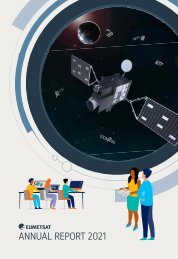
EUMETSAT Annual Report 2022

Create successful ePaper yourself
Turn your PDF publications into a flip-book with our unique Google optimized e-Paper software.
Back cover photo: Meteosat Third Generation<br />
(MTG) teams from <strong>EUMETSAT</strong>, the European Space<br />
Agency, the French Space Agency (CNES), Thales<br />
Alenia Space, Arianespace and OHB pose in front<br />
of MTG-I1 before it is loaded into the launcher at<br />
Kourou, French Guiana (Credit: ESA/CNES)
<strong>EUMETSAT</strong> ANNUAL REPORT <strong>2022</strong><br />
Table of<br />
contents<br />
Director-General’s foreword. ............................. 2<br />
Council Chairman’s foreword. ............................ 4<br />
Highlights of <strong>2022</strong> ....................................... 6<br />
Responding to disasters. ............................... 10<br />
<strong>EUMETSAT</strong> climate statement. ......................... 11<br />
Looking ahead............................. 12<br />
Potential future <strong>EUMETSAT</strong> missions. .................. 12<br />
Artificial intelligence and machine learning ............. 14<br />
Space weather. . . . . . . . . . . . . . . . . . . . . . . . . . . . . . . . . . . . . . . . . 14<br />
Making best use of scientific data ....................... 15<br />
Case study: Meteosat Third Generation: cutting-edge<br />
weather data. ...................................... 16<br />
Satellite operations. ........................ 18<br />
Meteosat. .............................................. 18<br />
Metop. ................................................. 20<br />
Copernicus Sentinels. .................................. 20<br />
Jason-3. ............................................... 21<br />
Case study: The eyes on a storm. . . . . . . . . . . . . . . . . . . . . . 22<br />
Services to data users ...................... 24<br />
<strong>EUMETSAT</strong>’s online data access services. ............... 24<br />
WEkEO. ................................................ 25<br />
European Weather Cloud. .............................. 25<br />
Commercial radio occultation data. ..................... 26<br />
Training ................................................ 26<br />
Data policy. . . . . . . . . . . . . . . . . . . . . . . . . . . . . . . . . . . . . . . . . . . . . 27<br />
Destination Earth. ...................................... 27<br />
<strong>EUMETSAT</strong> satellite application facilities. ................ 28<br />
Case study: Marine heatwave intensification threatens<br />
coral reef health. ................................... 30<br />
Climate services. .......................... 32<br />
Case study: Climate change in the European context. .. 34<br />
Programme development ................... 36<br />
Meteosat Third Generation. ............................. 36<br />
<strong>EUMETSAT</strong> Polar System – Second Generation ......... 38<br />
Copernicus missions ................................... 39<br />
European and international cooperation ....... 40<br />
Relationships with partners in Europe................... 40<br />
Bilateral partnerships................................... 42<br />
Multilateral partnerships................................ 43<br />
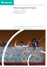
African Space Art Project ............................... 44<br />
Copernicus. ............................... 46<br />
Management and administration ............. 48<br />
Reorganisation of the Technical and Scientific<br />
Support Department.................................... 48<br />
Response to the Covid-19 pandemic.................... 49<br />
New policies, tools and work practices.................. 50<br />
Evolution of the <strong>EUMETSAT</strong> campus.................... 51<br />
Staff survey follow-up activities......................... 51<br />
Reducing <strong>EUMETSAT</strong>’s carbon footprint................. 52<br />
Communication and outreach........................... 53<br />
Ethics Officer............................................ 53<br />
Case study: In the heat of the moment. ............... 54<br />
Key figures. ............................... 56<br />
<strong>EUMETSAT</strong> mission planning........................... 56<br />
Operational performance indicators..................... 58<br />
<strong>EUMETSAT</strong> data centre and user base................... 60<br />
Financial information................................... 61<br />
Human resources...................................... 62<br />
Appendix ................................. 64<br />
Organisation chart...................................... 64<br />
<strong>EUMETSAT</strong> delegate body chairs <strong>2022</strong>. . . . . . . . . . . . . . . . . . 65<br />
<strong>EUMETSAT</strong> Council delegates and advisors <strong>2022</strong>........ 66<br />
Participation in major events in <strong>2022</strong>.................... 68<br />
Data records released in <strong>2022</strong>........................... 69<br />
New products released in <strong>2022</strong>. . . . . . . . . . . . . . . . . . . . . . . . . 70<br />
Scientific and technical publications in <strong>2022</strong>. . . . . . . . . . . . . 71
<strong>EUMETSAT</strong> ANNUAL REPORT <strong>2022</strong><br />
Director-General's<br />
foreword<br />
“The mid-December <strong>2022</strong> launch of the<br />
first imaging satellite in the Meteosat Third<br />
Generation system, MTG-I1, capped a pivotal<br />
year for <strong>EUMETSAT</strong>.”<br />
It was a year in which, despite significant external<br />
challenges, the organisation made concrete progress<br />
and continued to deliver on its mission.<br />
<strong>EUMETSAT</strong> took control of MTG-I1 on 28 December,<br />
after its 13 December launch from Kourou, French<br />
Guiana, on an Ariane 5 rocket. The launch and early<br />
operations phase (LEOP), led by Telespazio, brought<br />
the spacecraft to its correct orbit. The satellite’s<br />
commissioning phase has begun and it is expected<br />
to become operational at the end of 2023. This is<br />
an achievement to which the whole organisation<br />
contributed and of which everyone can be proud.<br />
The launch of MTG-I1 marks the start of the<br />
deployment of the organisation’s next-generation<br />
systems, MTG and <strong>EUMETSAT</strong> Polar System –<br />
Second Generation (EPS-SG). These systems will<br />
be the catalysts for major advances in weather<br />
forecasting and climate monitoring in our member<br />
states and beyond. The launch and end of the LEOP<br />
also represents the start of the next phase of work,<br />
following almost two decades’ worth of planning and<br />
development, in which the investment of expertise<br />
and resources that has gone in to our new systems<br />
will bring tangible benefits to communities across<br />
Europe and Africa.<br />
While much of our attention and effort was geared<br />
toward the launch of MTG-I1 in <strong>2022</strong>, work continued<br />
on preparations for launching MTG-S1, the first<br />
sounder, and Metop Second Generation A1 and B1, a<br />
consecutive pair of satellites carrying complementary<br />
instruments. The first pair of satellites, is expected<br />
to be launched in 2025-2026. With several satellite<br />
launches planned for 2025 and 2026, this will be an<br />
exciting and challenging time for the organisation.<br />
In addition to core programmes, <strong>EUMETSAT</strong> continues<br />
to work on the most efficient ways to provide<br />
innovative data and products to meteorological and<br />
climate services, through satellite programmes and<br />
ground segment developments.<br />
Throughout <strong>2022</strong>, <strong>EUMETSAT</strong> held many bilateral<br />
discussions with member states on preparation of<br />
our new programmes. As a result, in December, the<br />
<strong>EUMETSAT</strong> Council approved a €26.8 million allocation<br />
for the preparatory phase of the EPS-Aeolus and<br />
EPS-Sterna missions, which are primarily designed<br />
to measure winds and atmospheric temperature<br />
and humidity respectively. Formal EPS-Aeolus<br />
and EPS-Sterna programme proposals will be<br />
presented to member states in mid-2024. Our teams<br />
also continued to collaborate with the European<br />
Space Agency and the European Commission on<br />
development of the Copernicus CO2M carbonmonitoring<br />
programme, the Copernicus Polar Ice<br />
and Snow Topography Altimeter (CRISTAL) mission<br />
and the Copernicus Imaging Microwave Radiometer<br />
(CIMR) mission in <strong>2022</strong>.<br />
In the meantime, expert and efficient satellite<br />
operations ensured a high level of data availability<br />
throughout <strong>2022</strong>. The very reliable delivery of<br />
<strong>EUMETSAT</strong> services and data, 24 hours a day,<br />
every day, is central to what we do and of critical<br />
importance to our member states.<br />
All of these developments occurred in the context<br />
of post-pandemic strictures, the negative economic<br />
impact of the war in Ukraine and constraints on the<br />
availability of European launchers around the time of the<br />
planned launches of the MTG-Sounder and Metop-SG<br />
satellites. Those impacts will continue to be felt in<br />
2023 and adaptations will need to be made across all<br />
areas of <strong>EUMETSAT</strong> to meet those challenges.<br />
The difficult inflationary climate and pressures on the<br />
construction industry caused delays to the start of<br />
work on the <strong>EUMETSAT</strong> childcare centre. However,<br />
the organisation was delighted construction could<br />
proceed in <strong>2022</strong> and that the centre will open in late<br />
2023. Contracts were also signed for the construction<br />
of the extension to the East Building at <strong>EUMETSAT</strong><br />
headquarters and work will commence in early 2023.<br />
2
<strong>EUMETSAT</strong> ANNUAL REPORT <strong>2022</strong><br />
To modernise, improve efficiency and empower<br />
staff, the council agreed to a proposal to reform<br />
the financial control regime at <strong>EUMETSAT</strong> and to<br />
strengthen the internal audit function. This is a<br />
fundamental change to the organisation’s processes<br />
and culture.<br />
I thank the staff of <strong>EUMETSAT</strong> for rising to the<br />
challenges of <strong>2022</strong> and know the difficulties that lie<br />
ahead will be met with the same commitment and<br />
determination. I also thank the <strong>EUMETSAT</strong> Council<br />
for its guidance and support throughout the year.<br />
In particular, I thank former Council Chairman<br />
Gerard van der Steenhoven, whose term ended in<br />
<strong>2022</strong>, for his outstanding contribution to <strong>EUMETSAT</strong>.<br />
I welcome Eoin Moran to the role and look forward<br />
to working with him in the years ahead.<br />
Phil Evans<br />
Director-General<br />
3
<strong>EUMETSAT</strong> ANNUAL REPORT <strong>2022</strong><br />
Council Chairman's<br />
foreword<br />
The central importance of <strong>EUMETSAT</strong>’s work – and<br />
the need to continue to innovate and improve – was<br />
again brought home in <strong>2022</strong>, another year of extreme<br />
weather events. The World Economic Forum’s Global<br />
Risks <strong>Report</strong> <strong>2022</strong> reinforces this need. The report<br />
identified the top three most severe risks on a global<br />
scale over the next 10 years as climate action failure,<br />
extreme weather and biodiversity loss. The Gallagher<br />
Re Natural Catastrophes <strong>Report</strong> of <strong>2022</strong> identified<br />
11 natural disasters that resulted in multi-billion US<br />
dollar insured losses. These catastrophes caused<br />
about 50,000 fatalities and total economic losses<br />
of US$360 billion. All but one of the disasters were<br />
weather or climate related.<br />
Communities experiencing the record heat, drought,<br />
fires and floods of <strong>2022</strong> required accurate forecasts<br />
and climate analyses from their meteorological<br />
and hydrological services. Data from <strong>EUMETSAT</strong>’s<br />
satellites are essential for ensuring forecast accuracy.<br />
Over the past year, <strong>EUMETSAT</strong> has continued to<br />
deliver new and better products and services to<br />
member states, and to examine how to make best<br />
use of new technologies and approaches for the<br />
future. The organisation continues to respond to<br />
changes affecting the meteorological community,<br />
including the growth of artificial intelligence and<br />
machine learning, the development of cloud<br />
technologies and the growth of “new space”.<br />
<strong>EUMETSAT</strong>’s approach remains to deliver on its first<br />
priority, that is, to fulfil the essential requirements of<br />
its member states for operational weather and Earth<br />
system monitoring in the most effective manner.<br />
With Europe poised for a new era of satellite<br />
meteorology, through the deployment of <strong>EUMETSAT</strong>’s<br />
next-generation satellite systems and additional<br />
missions, the council in <strong>2022</strong> approved plans for<br />
making the best scientific use of the data produced.<br />
Three new or updated roadmaps for marine and<br />
meteorological pathfinders, of wind products and of<br />
aerosol products were adopted. A roadmap for the<br />
use of artificial intelligence and machine learning to<br />
improve the use of satellite observations for weather<br />
prediction also was approved. These roadmaps are<br />
an investment in the science behind the translation of<br />
data from satellite instruments into tangible benefits<br />
felt by member states’ communities.<br />
At the same time, <strong>EUMETSAT</strong> continues to innovate<br />
in the area of how data are provided to member<br />
states and other data users.<br />
The <strong>EUMETSAT</strong> Council approved changes to<br />
the organisation’s data policy to reflect the vastly<br />
increased amount of observations that will be<br />
available from its new satellite systems. <strong>EUMETSAT</strong><br />
is committed to making its data as widely available<br />
as possible. The World Meteorological Organization<br />
Unified Data Policy is the reference for <strong>EUMETSAT</strong>’s<br />
data policy. The aim is to continue to offer full<br />
and non-discriminatory access to as much of<br />
<strong>EUMETSAT</strong>’s data as possible under documented<br />
licensing conditions, while protecting the value of<br />
<strong>EUMETSAT</strong> membership.<br />
In addition, a new training framework was approved<br />
by the council, focusing on supporting weather<br />
forecasters in member states to transition to the use<br />
of data from the new satellite missions.<br />
On a personal note, I was delighted to attend the<br />
launch of the first satellite in <strong>EUMETSAT</strong>’s next<br />
generation systems – Meteosat Third Generation-<br />
Imager 1 – in Kourou, French Guiana on 13 December.<br />
This was a huge achievement for the organisation<br />
and represents an exciting milestone in a project that<br />
began almost two decades ago and now enters an<br />
important new phase.<br />
I take this opportunity, on behalf of <strong>EUMETSAT</strong>’s<br />
member states, to congratulate staff and<br />
management for delivering on the organisation’s<br />
mission and making important progress on our<br />
strategic objectives in <strong>2022</strong>.<br />
Finally, I am honoured to have been elected<br />
Chairman of the <strong>EUMETSAT</strong> Council and to take<br />
up that post from September <strong>2022</strong>. I pay tribute to<br />
my predecessor, Gerard van der Steenhoven, for<br />
his expert stewardship of the organisation over<br />
the previous four years and look forward to the<br />
opportunities that lie ahead.<br />
Eoin Moran<br />
Council Chairman<br />
4
<strong>EUMETSAT</strong> ANNUAL REPORT <strong>2022</strong><br />
“<strong>EUMETSAT</strong> continues to innovate in<br />
the area of how data are provided to<br />
member states and other data users.”<br />
5
<strong>EUMETSAT</strong> ANNUAL REPORT <strong>2022</strong><br />
<strong>2022</strong><br />
highlights<br />
First MTG Imager<br />
successfully launches<br />
At 21:30 (CET), on 13 December, Meteosat<br />
Third Generation – Imager 1 was successfully<br />
launched from Kourou, French Guiana, on an<br />
Ariane 5 rocket. <strong>EUMETSAT</strong> took control of the<br />
satellite on 28 December, after a 15-day launch<br />
and early operations phase, led by Telespazio.<br />
The satellite will undergo a 12-month<br />
commissioning phase, before becoming<br />
operational at the end of 2023.<br />
Data users prepare for<br />
next-generation systems<br />
About 200 users of <strong>EUMETSAT</strong> data –<br />
meteorologists, climate experts and researchers<br />
– met in Darmstadt on 31 May – 2 June, to prepare<br />
for the use of data from MTG and <strong>EUMETSAT</strong><br />
Polar System – Second Generation. The event<br />
was designed to encourage research into, and<br />
development of, innovative uses of the systems’<br />
data. The event was part of <strong>EUMETSAT</strong>’s ongoing<br />
work with national meteorological and hydrological<br />
services to prepare to make best use of the data<br />
once available. The full report from the event is<br />
available here - www.eumetsat.int/media/50569<br />
6
<strong>EUMETSAT</strong> ANNUAL REPORT <strong>2022</strong><br />
Meteosat-9 moves<br />
to Indian Ocean<br />
After moving to longitude 45.5°E in April,<br />
Meteosat-9 became <strong>EUMETSAT</strong>’s reference<br />
satellite for the Indian Ocean region on 1 June,<br />
taking over from Meteosat-8. <strong>EUMETSAT</strong><br />
provides the service on a best-effort basis, as<br />
its contribution to an international initiative to<br />
provide meteorological satellite coverage from<br />
the geostationary orbit over the region. The<br />
service particularly benefits Indian Ocean island<br />
nations, eastern Africa, Central and Eastern<br />
Europe and Central Asia.<br />
Meteosat-8 moves<br />
to the “graveyard orbit”<br />
After 20 years of life-saving service, more than<br />
any other meteorological satellite in geostationary<br />
orbit, Meteosat-8 was moved to the “graveyard<br />
orbit” in October. The first of the second generation<br />
of Meteosat satellites, Meteosat-8 was designed<br />
to last 7.5 years. Although guidelines for satellite<br />
disposal did not exist when the spacecraft was built,<br />
<strong>EUMETSAT</strong> was committed to moving Meteosat-8, in<br />
line with space debris mitigation standards.<br />
Altimetry becomes a mandatory<br />
<strong>EUMETSAT</strong> programme<br />
In December, the <strong>EUMETSAT</strong> Council agreed to<br />
recategorise the organisation’s satellite altimetry<br />
programme from “optional” to “mandatory”,<br />
consolidating involvement in ocean monitoring. The<br />
decision emphasises the importance of operational<br />
oceanography and satellite altimetry to weather<br />
forecasting and climate monitoring for all member<br />
states. The move also adds surety to <strong>EUMETSAT</strong>’s<br />
involvement in the European Union Copernicus<br />
programme’s ocean-monitoring missions,<br />
Copernicus Sentinel-3 and Sentinel-6.<br />
European Commission<br />
launches Destination Earth<br />
The European Commission held a public online<br />
event on 30 March for the launch of the Destination<br />
Earth initiative. As one of the implementing entities,<br />
<strong>EUMETSAT</strong> took part in the launch, along with<br />
the European Centre for Medium-Range Weather<br />
Forecasts and the European Space Agency.<br />
<strong>EUMETSAT</strong> has responsibility for a key part of<br />
the initiative which will create digital twins of the<br />
entire Earth system. <strong>EUMETSAT</strong> will have endto-end<br />
responsibility for the multi-cloud data lake<br />
underpinning the initiative and for an online inventory.<br />
7
<strong>EUMETSAT</strong> ANNUAL REPORT <strong>2022</strong><br />
<strong>2022</strong> highlights<br />
Member states<br />
invest in innovation<br />
The <strong>EUMETSAT</strong> Council in December authorised<br />
a three-year, €26.8 million investment in the<br />
preparatory phase of new satellite systems<br />
designed to significantly improve weather<br />
forecasting accuracy. The funding will allow<br />
engineering activities to continue on the<br />
<strong>EUMETSAT</strong> Polar System (EPS) – Aeolus and<br />
EPS-Sterna missions, which would measure<br />
winds and atmospheric temperature and humidity<br />
respectively. The work will pave the way for the<br />
council’s decision, by mid-2025, whether to proceed<br />
with the two programmes.<br />
AI MOOC passes<br />
10,000 registrations<br />
In late 2021, <strong>EUMETSAT</strong>, the European Centre for<br />
Medium-Range Weather Forecasts, Mercator Ocean<br />
International and the European Environment Agency<br />
developed a massive open online course (MOOC)<br />
covering artificial intelligence and Earth monitoring. The<br />
course remains available online and, by the end of <strong>2022</strong>,<br />
had attracted more than 10,700 registrations. The MOOC<br />
provides an introduction to the use of machine learning<br />
techniques with Copernicus data, through a mix of<br />
video content and new Jupyter notebooks.<br />
<strong>Annual</strong> conference<br />
draws large turnout<br />
About 460 people attended the annual <strong>EUMETSAT</strong><br />
Meteorological Satellite Conference in Brussels,<br />
Belgium, on 19-23 September. The conference was<br />
held in person, after last year’s online event and the<br />
cancellation of the 2020 edition due to pandemic<br />
restrictions. The theme of the <strong>2022</strong> conference was<br />
“a digital ecosystem for Earth observation”. A wellattended<br />
press conference was held in conjunction<br />
with the conference to promote awareness of the<br />
upcoming launch of MTG-I1.<br />
Africa forum focuses<br />
on transition to MTG<br />
Preparing Africa’s meteorologists and scientists<br />
for use of data from MTG was a feature of the<br />
15th <strong>EUMETSAT</strong> User Forum in Africa, held in<br />
Dar es Salaam, Tanzania, on 13-16 September.<br />
About 150 meteorologists and scientists from<br />
50 African nations attended, to help ensure their<br />
communities get maximum benefit from the new<br />
capabilities of the MTG system.<br />
Coordination group marks<br />
50th anniversary<br />
The Coordination Group for Meteorological<br />
Satellites, consisting of satellite agencies from<br />
around the world, marked its 50th anniversary<br />
at a meeting at the World Meteorological<br />
Organization’s headquarters in Switzerland<br />
on 17 June. The event showcased the benefits<br />
of coordinated space-based observations and<br />
looked at future challenges, including threats<br />
of disruption to services from “space weather”<br />
and growing pressure on radio frequencies.<br />
8
<strong>EUMETSAT</strong> ANNUAL REPORT <strong>2022</strong><br />
Agreement strengthens<br />
commitment to Africa<br />
The African Union Commission and <strong>EUMETSAT</strong><br />
signed an agreement in May to formalise<br />
cooperation under the Intra-ACP Climate Services<br />
and Related Applications (ClimSA) programme.<br />
The agreement aims to significantly boost African<br />
nations’ capacity to mitigate the impacts of climate<br />
change by sharing the benefits of Europe’s nextgeneration<br />
meteorological satellites. It commits<br />
<strong>EUMETSAT</strong> to providing data, technical support<br />
and training in Africa.<br />
<strong>EUMETSAT</strong> publishes<br />
climate action statement<br />
At the Global Climate Observing System’s Climate<br />
Observation Conference in Darmstadt, Germany, in<br />
October, <strong>EUMETSAT</strong> published its first statement on<br />
climate action. The statement commits <strong>EUMETSAT</strong><br />
to contributing to the maintenance of essential<br />
climate variables records, implementation of the<br />
Paris agreement, provision of climate change<br />
information to the United Nations and provision<br />
of continuous, long-term climate data records.<br />
Election of new <strong>EUMETSAT</strong><br />
Council Chairman<br />
Eoin Moran, Director of Ireland’s national<br />
meteorological service, Met Éireann, was<br />
elected <strong>EUMETSAT</strong> Chairman for a twoyear<br />
term at the council’s 101st meeting in<br />
Amsterdam on 30 June – 1 July. At the same<br />
meeting, Marianne Thyrring, Director-General of<br />
the Danish Meteorological Institute, was elected<br />
vice-chair, also for a two-year term. Moran<br />
formally took over the position in September<br />
from Gerard van der Steenhoven, of the Royal<br />
Netherlands Meteorological Institute, who held<br />
the post for four years.<br />
Working groups tackle<br />
staff survey issues<br />
Three corporate working groups, with representatives<br />
of staff, the management board and the Staff<br />
Association Committee, were established in<br />
March to tackle organisation-wide issues identified<br />
by the 2021 staff survey. The groups presented<br />
recommendations to the management board in<br />
October on workload, diversity and inclusion, people<br />
development and bureaucracy. Work is progressing<br />
on refining the groups’ proposals.<br />
Work begins on childcare centre<br />
Work began on <strong>EUMETSAT</strong>’s 44-place “LittleOrbiters”<br />
childcare centre in <strong>2022</strong> and was celebrated with a<br />
special cornerstone-laying ceremony on 4 October. The<br />
cornerstone was laid by Director-General Phil Evans,<br />
Referatsleiter DK22 for the Federal Ministry for Digital<br />
and Transport Prof Dr-Ing Hans Moser, and Stadtrat of<br />
the City of Darmstadt Wolfram von Rotberg. The centre<br />
is expected to open in late 2023.<br />
9
<strong>EUMETSAT</strong> ANNUAL REPORT <strong>2022</strong><br />
Responding<br />
to disasters<br />
<strong>EUMETSAT</strong> is one of 17<br />
agencies from around the<br />
world that have committed to<br />
the International Charter on<br />
Space and Major Disasters.<br />
Meteosat-8 IR10.8 image of Cyclone Batsirai<br />
over Madagascar, 5 February <strong>2022</strong>. Cloud top<br />
temperatures are coloured, from -36°C (blue)<br />
to -80°C (dark red).<br />
The charter is a system for providing satellite data<br />
quickly and reliably to authorised users, for example,<br />
aid agencies, to respond to natural and human-induced<br />
disasters. The data is made available free of charge<br />
and the aim is to help mitigate impacts on lives and<br />
property by providing information that is not available<br />
to disaster management agencies on the ground.<br />
<strong>EUMETSAT</strong> responded to activations of the charter<br />
in <strong>2022</strong> related to tropical storms and associated<br />
disasters in Africa and Asia. <strong>EUMETSAT</strong> supports<br />
the secretariat and management activities of the<br />
charter. It also provides access to its satellite imagery<br />
via its EUMETView data service and redistributes<br />
products from other charter members, in particular,<br />
post-disaster maps, via the EUMETCast data<br />
dissemination system.<br />
Leadership of the charter rotates between members<br />
every six months. <strong>EUMETSAT</strong> and the Canadian<br />
Space Agency will take on the role of co-chairs in<br />
October 2023.<br />
10
<strong>EUMETSAT</strong> ANNUAL REPORT <strong>2022</strong><br />
<strong>EUMETSAT</strong><br />
climate<br />
statement<br />
On 19 October <strong>2022</strong>, the final day<br />
of the Global Climate Observing<br />
System conference in Darmstadt,<br />
Germany, <strong>EUMETSAT</strong> issued a<br />
statement on its commitment<br />
to climate monitoring. The<br />
statement highlighted four key<br />
ways <strong>EUMETSAT</strong> works with<br />
global partners to monitor<br />
climate change and its impacts.<br />
Read the rest of the<br />
statement on how the<br />
organisation contributes<br />
to climate action on the<br />
<strong>EUMETSAT</strong> website.<br />
www.eumetsat.int/statement-climate-action<br />
The Earth is facing a threat.<br />
The concentration of greenhouse gases in the<br />
atmosphere is rising, fuelled by increased emissions.<br />
This is causing a substantial rise in temperature<br />
across the globe.<br />
Take the Arctic, currently warming more than two<br />
times faster than the global average. Or consider<br />
Greenland where, since 2000, temperatures in<br />
certain regions have surged to more than 8°C above<br />
the monthly average, according to the Copernicus<br />
Climate Change Service. And looking back still<br />
further reveals that, over the past 40 years, marine<br />
heatwaves in the eastern Mediterranean Sea have<br />
become considerably more frequent.<br />
The steps we take today matter.<br />
As Europe’s operational satellite agency, <strong>EUMETSAT</strong><br />
is committed to taking the necessary steps to<br />
address climate change and its consequences<br />
through cooperative action. In fact, this commitment<br />
is built into <strong>EUMETSAT</strong>’s core. Both its founding<br />
convention and mission statement put forth the<br />
operational monitoring of the climate and the<br />
detection of global climatic changes as one of the<br />
agency’s fundamental objectives. The climate data<br />
<strong>EUMETSAT</strong> collects and processes enable experts to<br />
better understand climate change and policymakers<br />
to mitigate further damage to the planet.<br />
credit: Adobe Stock<br />
11
<strong>EUMETSAT</strong> ANNUAL REPORT <strong>2022</strong><br />
Looking<br />
ahead<br />
The full exploitation of <strong>EUMETSAT</strong>’s new satellite<br />
fleets will require dedicated research activities and the<br />
strengthening of collaborative efforts between member<br />
states and with international initiatives, such as the<br />
European Union’s (EU) Horizon Europe programme<br />
and World Meteorological Organization activities.<br />
<strong>EUMETSAT</strong> aims to remain at the forefront of a changing<br />
environment, anticipating and capitalising on technological<br />
advances and developments in the space industry.<br />
Potential future<br />
<strong>EUMETSAT</strong> missions<br />
<strong>EUMETSAT</strong> continuously plans to meet the future<br />
needs of its member states to fulfil their obligations<br />
to their communities. At the same time, <strong>EUMETSAT</strong><br />
aims to ensure it provides a tangible return on<br />
member states’ investments and that those<br />
investments are affordable.<br />
<strong>EUMETSAT</strong> is examining the expansion of its<br />
low-Earth-orbiting fleet with the addition of new,<br />
complementary satellite systems. In December<br />
<strong>2022</strong>, the <strong>EUMETSAT</strong> Council authorised a<br />
€26.8 million investment over three years in<br />
the preparatory phase of new satellite systems<br />
designed to significantly improve weather<br />
forecasting accuracy.<br />
The funding will allow the continuation of<br />
engineering activities aimed at establishing a<br />
preliminary design for these missions, which would<br />
eventually enable the expansion of the <strong>EUMETSAT</strong><br />
Polar System (EPS) with two new missions:<br />
EPS-Aeolus and EPS-Sterna. The work will pave<br />
the way for the council’s decision, by mid-2025,<br />
whether to proceed with the two programmes.<br />
The EPS-Sterna mission would enable the provision<br />
of atmospheric temperature and humidity profiles.<br />
The mission would significantly benefit medium and<br />
short-range weather forecasting globally, as well as<br />
enhancing very-short-range forecasting regionally at<br />
high latitudes.<br />
The EPS-Sterna mission would be a constellation<br />
of small satellites, based on the Arctic Weather<br />
Satellite (AWS) developed by the European Space<br />
Agency (ESA) and which is planned to be launched<br />
in 2024. This mission is developed following the<br />
so called “new space” approach, which has the<br />
objective of developing space systems in a more<br />
flexible, standardised and industrialised way at<br />
relatively lower cost. The EPS-Sterna constellation<br />
will be developed by <strong>EUMETSAT</strong> in cooperation<br />
with ESA, capitalising on the AWS experience, and<br />
it will be the first small satellite constellation to be<br />
operated by <strong>EUMETSAT</strong>.<br />
EPS-Sterna system activities progressed well in<br />
<strong>2022</strong>. System feasibility studies have concluded<br />
and the requirement consolidation and preliminary<br />
architecture definition is ongoing with the System<br />
Requirement Review (SRR) to be completed by the<br />
end of 2023. A study on the scientific and socio-<br />
12
<strong>EUMETSAT</strong> ANNUAL REPORT <strong>2022</strong><br />
Credit: Adobe Stock<br />
economic benefits of EPS-Sterna has started and<br />
results are expected in the second half of 2023. In<br />
parallel, the AWS, the precursor of the EPS-Sterna<br />
constellation, completed its Preliminary Design<br />
Review in February <strong>2022</strong>. AWS is expected<br />
to be launched in 2024, providing one year of<br />
demonstration before the EPS-Sterna programme<br />
approval decision in mid-2025. If approved, the<br />
launch of the EPS-Sterna constellation is planned for<br />
2029 and the mission lifetime would be 13 years.<br />
The EPS-Aeolus mission would be the successor<br />
to ESA’s Aeolus Earth Explorer. <strong>EUMETSAT</strong> would<br />
operate the Aeolus-2 satellite, whose development<br />
was approved by ESA’s ministerial council in<br />
November, and plans to procure a recurrent satellite<br />
to ensure more than 10 years of observations.<br />
A draft cooperation agreement with ESA includes<br />
a clear division of roles for the implementation<br />
of EPS-Aeolus. It was validated by the ESA and<br />
<strong>EUMETSAT</strong> councils and is planned to be signed in<br />
2025, when the <strong>EUMETSAT</strong> Council considers the<br />
programme proposal.<br />
EPS-Aeolus would allow wind vectors from the<br />
ground to 30km altitude to be determined by<br />
measuring the Doppler shift of signal backscattered<br />
by the pulses from an ultraviolet laser.<br />
13
<strong>EUMETSAT</strong> ANNUAL REPORT <strong>2022</strong><br />
Looking ahead<br />
3,500<br />
number of new publications added<br />
3,000<br />
2,500<br />
2,000<br />
1,500<br />
1,000<br />
500<br />
Computing power<br />
increased with parallel<br />
processing in GPU<br />
True power of deep<br />
learning introduced<br />
ImageNet ‘see’ better,<br />
deep learning boom<br />
AlphaGo,<br />
Google’s TPU<br />
Temperature<br />
Wind<br />
Solar<br />
Cloud<br />
Precipitation<br />
0<br />
2011 2012 2013 2014 2015 2016 2017 2018 2019 2020 2021<br />
Number of scientific publications released per year<br />
investigating the short-range forecasting of five key<br />
environmental variables with the use of artificial<br />
intelligence (AI) and/or machine learning (ML)<br />
techniques. Several key milestone events in AI/ML<br />
research and development are marked along the<br />
x-axis. Credit: Chris Chung (TU Delft/<strong>EUMETSAT</strong>)<br />
Artificial intelligence<br />
and machine learning<br />
As the graph above shows, there is a growing<br />
interest in artificial intelligence (AI) and machine<br />
learning (ML) methods applied to nowcasting<br />
and short-range forecasting. Recent scientific<br />
publications have demonstrated the readiness of<br />
ML methods to be used in operational weather<br />
prediction. <strong>EUMETSAT</strong> needs to be ready to support<br />
member states in this new area. After council<br />
approval for <strong>EUMETSAT</strong>’s AI and ML roadmap in<br />
2021, work began to facilitate the uptake of AI and<br />
ML techniques in <strong>2022</strong>. Four pathfinder domains<br />
have been agreed. They are: a joint nowcasting<br />
effort, preparing for future extremes, an incubator<br />
of processors and exploring new requirements<br />
and applications. These pathfinder domains will be<br />
explored in the first phase of the roadmap (2023-<br />
2025) through project proposals from member<br />
states and contributions from <strong>EUMETSAT</strong>’s satellite<br />
application facility network.<br />
A call for proposals for two joint fellowships was issued<br />
in August <strong>2022</strong>. Two projects will start in 2023-24.<br />
Space weather<br />
Space weather refers to conditions on the Sun and<br />
in the solar wind - a flow of ionised solar plasma<br />
(charged particles) released from the upper<br />
atmosphere of the Sun - and the outer edge of the<br />
Earth’s atmosphere. Space weather can influence<br />
the performance and reliability of space-borne<br />
and ground-based technological systems and can<br />
endanger human health.<br />
<strong>EUMETSAT</strong> has instruments on its Metop fleet and<br />
on Copernicus Sentinel-6 measuring energetic<br />
particles and ionosphere properties through radio<br />
occultation. These measurements are used for<br />
operational purposes and they are shared with other<br />
satellite agencies through the Coordination Group for<br />
Meteorological Satellites.<br />
In addition, <strong>EUMETSAT</strong> is exploring with member<br />
states an increased role in operational space<br />
weather activities as a provider of operational data in<br />
this challenging sector. Member states have strategic<br />
assets in space and see a need for information on<br />
space weather.<br />
A workshop on space weather was held with<br />
member states in March <strong>2022</strong>. As a follow-on, a<br />
survey was carried out to assess member states’<br />
interest and level of expertise in the field. The results<br />
were presented to the <strong>EUMETSAT</strong> Policy Advisory<br />
Committee in Autumn <strong>2022</strong>.<br />
14
<strong>EUMETSAT</strong> ANNUAL REPORT <strong>2022</strong><br />
The survey showed overall positive responses on<br />
the importance of data access and a potential role<br />
for <strong>EUMETSAT</strong> in operational space weather data<br />
and product provision. Additionally, the member<br />
states would further explore a potential role for<br />
<strong>EUMETSAT</strong> in operational space weather data<br />
and product provision. A final roadmap will be<br />
developed in 2023 in close cooperation with ESA<br />
to manage respective responsibilities.<br />
Making best use<br />
of scientific data<br />
With Europe poised for a new era of satellite<br />
meteorology, through the deployment of nextgeneration<br />
satellite systems and new missions,<br />
<strong>EUMETSAT</strong> has mapped out its plans for making the<br />
best scientific use of the data produced. In July, the<br />
<strong>EUMETSAT</strong> Council approved three new, or updated,<br />
roadmaps for scientific development of marine and<br />
meteorological pathfinders, of wind products and of<br />
aerosol products derived by satellite instruments.<br />
Investing in the science behind the translation of<br />
data into tangible benefits for member states is<br />
critical. The scientific roadmaps for marine and<br />
meteorological pathfinders, and the wind and<br />
aerosol products, will foster the development of<br />
new advanced satellite data products using data<br />
from <strong>EUMETSAT</strong>’s existing and up-coming satellite<br />
systems, as well as existing and new satellite<br />
missions that are part of the European Union’s<br />
Copernicus programme.<br />
<strong>EUMETSAT</strong> has also been working with the EU<br />
Directorate-General for Research and Innovation in<br />
Brussels to ensure the full exploitation of Meteosat<br />
Third Generation (MTG) and Metop – Second<br />
Generation (Metop-SG) satellite data. A call was issued<br />
in December <strong>2022</strong> under the Horizon Europe Work<br />
Programme 2023-2024. This call would enhance the<br />
development of new environmental information based<br />
on MTG and Metop-SG observations.<br />
Specifically, the research activities under this call<br />
are expected to contribute to:<br />
• uptake of the newly available environmental<br />
information and data at global and regional scale<br />
from Copernicus Sentinels and the <strong>EUMETSAT</strong><br />
next-generation fleet<br />
• preparation and implementation of high-quality,<br />
novel, satellite data products and applications<br />
using the next-generation <strong>EUMETSAT</strong> and<br />
Copernicus instruments to improve the<br />
implementation and operationalisation of new<br />
and advanced services and applications<br />
• demonstrated use of these applications for Earth<br />
system predictions, long-term climate monitoring<br />
and disaster risk prediction and reduction<br />
• exploitation of European cloud systems and a<br />
contribution to the Destination Earth initiative<br />
• demonstrated use of satellite-derived<br />
environmental information to advance and<br />
improve seamless climate, weather and<br />
environmental services in Europe, and<br />
potentially beyond.<br />
Space weather<br />
can influence the<br />
performance of<br />
space-borne and<br />
ground-based<br />
technological<br />
systems and can<br />
endanger human<br />
health. Elements<br />
of this image were<br />
furnished by NASA.<br />
Credit: Adobe Stock<br />
15
<strong>EUMETSAT</strong> ANNUAL REPORT <strong>2022</strong><br />
Case study<br />
Meteosat<br />
Third Generation:<br />
cutting-edge weather data<br />
As devastating storms, floods, and other<br />
extreme weather events become more<br />
frequent, it is essential to monitor the<br />
Earth’s complex systems.<br />
Thousands of researchers and data users attended<br />
the European Space Agency’s Living Planet<br />
Symposium in Bonn, Germany, in May, to tackle<br />
that formidable challenge. One of the world’s largest<br />
Earth observation conferences, the symposium<br />
provided experts with an opportunity to exchange<br />
ideas on how satellites can best be used to collect<br />
information about the planet – from monitoring<br />
wetlands, forests, and biodiversity, to tracking<br />
the health of the oceans and keeping tabs on<br />
diminishing Arctic sea ice, to measuring greenhouse<br />
gases in the atmosphere.<br />
A highlight of the event was presentations about<br />
<strong>EUMETSAT</strong>’s Meteosat Third Generation (MTG)<br />
system. MTG-Imager 1, the first satellite in the<br />
system, was launched on 13 December.<br />
“We are really excited about the new MTG satellites,”<br />
Dr Tony McNally, Head of Earth System Assimilation<br />
at the European Centre for Medium-Range Weather<br />
Forecasts (ECMWF), said.<br />
“The observations that we’ll receive from these<br />
satellites will be critical for many applications,<br />
including accurate forecasts of severe weather. The<br />
MTG satellite could capture the genesis or rapid<br />
intensification of a tropical cyclone in the Atlantic –<br />
that’s literally a life or death situation for the people<br />
of the Caribbean.”<br />
Game changers<br />
McNally is looking forward to a few instruments<br />
in particular that will further improve weather<br />
forecasts by providing even better pictures of fastevolving<br />
meteorological systems. These include<br />
the Flexible Combined Imager on MTG-I1 and the<br />
Infrared Sounder on the second satellite, the sounder,<br />
expected to launch in 2024.<br />
“The Flexible Combined Imager will be a really big<br />
step up,” McNally said. “We will get 16 channels,<br />
which enable us to tune in to different features of the<br />
atmosphere, similar to how different radio stations<br />
play different types of music. More channels mean<br />
more information, and from each individual channel<br />
we will get better spatial detail. Importantly, we’ll also<br />
receive more rapid updates.<br />
“Then, the Infrared Sounder on the following<br />
MTG satellite is going to be an absolutely gamechanging<br />
instrument. With more than a thousand<br />
channels, as is the case with this instrument,<br />
we can build up a three-dimensional, timeevolving<br />
picture of the atmospheric state with<br />
unprecedented vertical detail.”<br />
McNally is also eagerly anticipating the data that will<br />
come from a brand new instrument on MTG imaging<br />
satellites, the Lightning Imager. The four cameras<br />
on board will collect continuous, near-real-time<br />
data about intracloud, cloud-to-cloud, and cloud-toground<br />
lightning flashes. This information can be<br />
used to identify highly unstable and dynamic regions<br />
of the atmosphere – again critical for accurate<br />
weather forecasts.<br />
16
<strong>EUMETSAT</strong> ANNUAL REPORT <strong>2022</strong><br />
ECMWF Atos high-performance computing facility,<br />
Bologna, Italy (credit: S. Marzoli/ECMWF)<br />
Unique collaboration<br />
Although crucial, the instruments alone are only one<br />
piece of the puzzle. Another essential piece is how<br />
useful the data they generate are for the people who<br />
work with them.<br />
“In order to make the best of a satellite, you have<br />
to invest in infrastructure and collaborate with<br />
users and I think <strong>EUMETSAT</strong> does that really well,”<br />
McNally said.<br />
“The close relationship between <strong>EUMETSAT</strong> and the<br />
ECMWF is really quite unique and highly productive<br />
– it ensures that these new satellite systems actually<br />
benefit the people who pay for them.”<br />
“The close relationship<br />
between <strong>EUMETSAT</strong> and<br />
the ECMWF is really quite<br />
unique and highly productive<br />
– it ensures that these new<br />
satellite systems actually<br />
benefit the people who pay<br />
for them.”<br />
Dr Tony McNally<br />
Head of Earth System Assimilation<br />
European Centre for Medium-Range<br />
Weather Forecasts (ECMWF)<br />
For more information,<br />
read the case study on the<br />
<strong>EUMETSAT</strong> website<br />
www.eumetsat.int/features/meteosat-thirdgeneration-cutting-edge-weather-data<br />
17
<strong>EUMETSAT</strong> ANNUAL REPORT <strong>2022</strong><br />
Satellite<br />
operations<br />
The uninterrupted provision of data from <strong>EUMETSAT</strong>’s satellites,<br />
24 hours a day, every day, is essential for member states’<br />
meteorological and hydrological services to provide timely,<br />
accurate weather forecasting. Central to this objective is the<br />
efficient and expert operation of the organisation’s satellite fleets.<br />
Geostationary satellites<br />
36,000km altitude<br />
<strong>EUMETSAT</strong> was able to meet that objective with<br />
a very high level of data availability in <strong>2022</strong>, a<br />
transformative year for the fleet.<br />
Three collision avoidance manoeuvres were<br />
carried out in <strong>2022</strong>. Two involved Sentinel-3A,<br />
on 10 January and 16 March, and one involved<br />
Metop-C, on 22 November.<br />
Meteosat<br />
Throughout <strong>2022</strong>, operations preparation activities<br />
continued to ensure important milestones were<br />
met before the launch of Meteosat Third Generation<br />
– Imager 1. The last system verification test was<br />
successfully conducted in July, and the operational<br />
scenario validation concluded in September ahead<br />
of the launch and operational readiness review. In<br />
October and November, training and rehearsals<br />
were conducted to ensure the team and systems at<br />
<strong>EUMETSAT</strong> were ready to operate the new satellite.<br />
The satellite was successfully launched on an Ariane<br />
5 launcher from Kourou on 13 December. The launch<br />
and early operations phase, performed by Telespazio,<br />
prepared the satellite for its handover to <strong>EUMETSAT</strong>,<br />
and was successfully completed on 28 December.<br />
The satellite is now undergoing commissioning.<br />
18
<strong>EUMETSAT</strong> ANNUAL REPORT <strong>2022</strong><br />
Meteosat-9<br />
45.5°E<br />
Indian Ocean data coverage (IODC)<br />
Delivers the <strong>EUMETSAT</strong> best-effort<br />
contribution to the multi-partner<br />
IODC services.<br />
Meteosat-8<br />
Graveyard orbit<br />
Decommissioned<br />
Moved to graveyard orbit from 41.5°E in<br />
October <strong>2022</strong> and decommissioned.<br />
Meteosat-10<br />
9.5°E<br />
Rapid Scan Service (RSS)<br />
Delivers the Meteosat secondary RSS<br />
service over Europe and adjacent seas.<br />
Meteosat-11<br />
0° longitude<br />
Full Earth Scan imagery<br />
Provides the Meteosat primary full-disc<br />
imagery service over the European<br />
continent, Africa and parts of the Atlantic<br />
and Indian oceans.<br />
MTG-I1<br />
3.4°W<br />
Commissioning phase<br />
MTG-I1 was successfully launched on<br />
13 December <strong>2022</strong>.<br />
The Meteosat lifetime review, held in November,<br />
assessed the performance of the Meteosat Second<br />
Generation satellites and preparations for the launch<br />
of the first third-generation satellite.<br />
After more than 20 years in orbit, having supported<br />
the Full Earth Scan and Rapid Scan Services over<br />
Europe, and providing Indian Ocean data coverage<br />
(IODC) at 41.5°E for its last six years, Meteosat-8<br />
was successfully re-orbited and decommissioned<br />
in October <strong>2022</strong>. In its final phases of operation,<br />
from April to June <strong>2022</strong>, Meteosat-8 supported a<br />
smooth transition of IODC services to Meteosat-9.<br />
A technology test campaign was then performed<br />
to obtain valuable information on satellite and<br />
instrument operations prior to decommissioning.<br />
Having ended its role as the Rapid Scan Service<br />
backup satellite at 3.5°E, Meteosat-9 was moved<br />
to 45.5°E between February and April <strong>2022</strong>. It then<br />
completed a two-month period of parallel operations<br />
with Meteosat-8 before taking over responsibility for<br />
IODC operational services in June.<br />
Meteosat-10 and -11 continued operating reliably<br />
to provide the Rapid Scan Service and Full Earth<br />
Scan service, respectively, with excellent image<br />
quality performance and availability. In <strong>2022</strong>, the<br />
two satellites achieved an overall availability of<br />
more than 99.7% for Meteosat-11 and 99.9% for<br />
Meteosat-10, surpassing service requirements<br />
and operational targets.<br />
19
<strong>EUMETSAT</strong> ANNUAL REPORT <strong>2022</strong><br />
Satellite operations<br />
Metop-C<br />
SSO 98.7° inclination<br />
EPS secondary mission<br />
Delivers additional EPS services from<br />
817km altitude.<br />
Metop-B<br />
SSO 98.7° inclination<br />
EPS primary mission<br />
Delivers the primary operational EPS<br />
services from 817km altitude.<br />
Low-Earth orbit satellites<br />
817-1,336km altitude<br />
Metop<br />
Following the successful decommissioning of<br />
Metop-A at the end of 2021, the focus of the Metop<br />
Mission Lifetime Review, held in June, shifted to the<br />
remaining Metop satellites in orbit, Metop-B and -C.<br />
Metop-B remains the prime satellite and this is likely<br />
to continue, despite predictions its orbit drift will bring<br />
it to exceed specification limits by the end of 2023.<br />
Metop-B performed well in <strong>2022</strong>, with most of the<br />
remaining fuel being reserved to lower its orbit when<br />
it reaches the end of its operational life. In August<br />
<strong>2022</strong>, rocking commands successfully spun the filter<br />
wheel on the High Resolution Infrared Radiation<br />
Sounder, which had been stalled for two years. At<br />
the end of <strong>2022</strong>, the instrument was once again<br />
producing useful data.<br />
Metop-C’s mission performance remained<br />
good throughout <strong>2022</strong>, although there is some<br />
continuing degradation in the Microwave Sounder’s<br />
performance. The platform’s performance is of<br />
greater interest, for both the attitude and orbital<br />
control system and the power subsystems. One of<br />
the satellite’s gyroscopes was marked faulty at the<br />
end of the <strong>2022</strong>, leaving one spare gyroscope. On the<br />
power sub-system, one of the satellite’s five batteries<br />
has exhibited symptoms of cell leakage. Some<br />
heater power-saving options were implemented as<br />
a mitigation of any impact from disconnecting the<br />
battery, anticipated to be necessary before the end<br />
of 2023.<br />
Copernicus Sentinels<br />
The Sentinel-3A and -3B satellites continued to<br />
perform smoothly in orbit throughout <strong>2022</strong> with<br />
satellite and instrument availability generally above<br />
target. Both delivered mission data in line with<br />
performance requirements and completed a longterm<br />
lunar calibration campaign for the Ocean and<br />
Land Colour Instruments’ cameras. The average<br />
yearly availability to data users of Sentinel-3<br />
marine and near-real-time atmospheric products<br />
exceeded targets.<br />
20
<strong>EUMETSAT</strong> ANNUAL REPORT <strong>2022</strong><br />
Jason-3<br />
NSO 66° inclination<br />
Interleaved orbit<br />
Providings measurements of ocean surface topography and sea state from<br />
a non-synchronous, 10-day repeat orbit at 1,336km altitude (mission shared<br />
with CNES, NOAA, NASA and the European Commission).<br />
Copernicus Sentinel-3A<br />
SSO 98.7° inclination<br />
Copernicus Sentinel-3 mission<br />
Delivers Copernicus marine and nearreal-time<br />
atmospheric data services<br />
from 814km altitude.<br />
Copernicus Sentinel-3B<br />
SSO 98.7° inclination<br />
Copernicus Sentinel-3 mission<br />
Delivers Copernicus marine and nearreal-time<br />
atmospheric data services<br />
from 814km altitude.<br />
Copernicus Sentinel-6<br />
Michael Freilich<br />
NSO 66° inclination<br />
Reference altimetry mission<br />
Delivers measurements of ocean<br />
surface topography and sea state from a<br />
non-synchronous, 10-day repeat orbit at<br />
1,336km altitude (mission partners are<br />
<strong>EUMETSAT</strong>, the European Commission,<br />
ESA, NASA/JPL and NOAA, with support<br />
from CNES).<br />
The next Sentinel-3 lifetime review, in January 2023,<br />
is expected to confirm both satellites have sufficient<br />
fuel to continue operating into the 2030s and do not<br />
currently have any lifetime-limiting issues. Satellite<br />
reliability calculations indicate any consideration of<br />
a deorbiting decision would not be necessary until<br />
2032, when the 90% probability of a successful<br />
re-orbiting would be reached for both satellites.<br />
Sentinel-6 Michael Freilich entered routine operations<br />
at the end of 2021 and mission performance in <strong>2022</strong><br />
was good. The satellite flew in close tandem formation<br />
with Jason-3 for several months to complete crosscalibration<br />
of the Poseidon-4 instrument. In April,<br />
Sentinel-6 Michael Freilich became the reference<br />
mission for ocean altimetry and Jason-3 moved to<br />
adopt an interleaved orbit.<br />
Steps were taken in <strong>2022</strong> to improve the availability<br />
of Sentinel-6 mission data, including modifications<br />
to the software for the onboard mass memory unit,<br />
in conjunction with updates to the Swedish Space<br />
Corporation Kiruna ground station service and the<br />
ground data processing systems at <strong>EUMETSAT</strong>.<br />
The first annual Sentinel-6 mission performance<br />
review, in November <strong>2022</strong>, concluded that the<br />
Sentinel-6 system – comprising the satellite<br />
and ground systems – is meeting or exceeding<br />
performance targets. The satellite is expected to<br />
continue to deliver data within specification for its<br />
nominal lifetime until the transition to Sentinel-6B,<br />
which is planned for launch in 2025.<br />
Jason-3<br />
After Sentinel-6 Michael Freilich became the<br />
reference ocean altimetry mission on 7 April,<br />
Jason-3 began a series of manoeuvres to move<br />
it to an interleaved orbit. Jason-3 began its new<br />
mission on 25 April <strong>2022</strong>.<br />
The overall satellite status is nominal. The annual<br />
Jason-3 operations review identified nothing to<br />
prevent the mission from achieving a similar lifetime<br />
to that of Jason-1 or Jason-2, which completed more<br />
than 11 years of operations.<br />
21
<strong>EUMETSAT</strong> ANNUAL REPORT <strong>2022</strong><br />
Case study<br />
The eyes<br />
on a storm<br />
On 24 December 1963,<br />
Météo-France’s Satellite<br />
Meteorology Research<br />
Centre received a Christmas<br />
present forecasters had<br />
been dreaming of: the first<br />
weather satellite image<br />
ever processed by<br />
a European centre.<br />
Fast-forward nearly six decades and meteorologists<br />
are eagerly awaiting the next big moment in<br />
European weather forecasting history, the first image<br />
from Meteosat Third Generation’s inaugural imaging<br />
satellite, which was launched on 13 December <strong>2022</strong>.<br />
New ways of forecasting<br />
extreme events<br />
“It’s been a long time in the making, and it will<br />
be really exciting to see the first images beamed<br />
back to Earth,” Sylvain Le Moal, Head of Satellite<br />
Applications, Imagery, and Innovation at Météo-<br />
France’s Satellite Meteorology Centre (CMS), said.<br />
“Meteosat Third Generation satellites will<br />
provide invaluable observations for users such<br />
as meteorologists, national weather centres,<br />
scientific researchers, and the media. Services and<br />
products making use of the data will provide new<br />
ways of tracking lightning and more effective means<br />
of pinpointing fire hotspots. It will also help scientists<br />
build long-term records that can guide responses<br />
to the global climate crisis.”<br />
Applications that will benefit in particular include<br />
nowcasting – very short-range forecasting that can<br />
project how fast developing and highly dangerous<br />
weather events such as storms will evolve in the<br />
coming minutes and hours.<br />
The satellite constellation will also provide a major<br />
boost to numerical weather prediction, helping to<br />
extend the accuracy of weather forecasts into the future.<br />
“The first priority for numerical weather prediction<br />
models is to know what the state of the atmosphere<br />
is right now,” Le Moal said.<br />
“Meteosat Third Generation’s sounder satellite,<br />
for instance, will provide regular measurements –<br />
up to every 30 minutes – on aspects such as<br />
humidity and temperature from the ground to<br />
the top of the atmosphere.<br />
“These data will be invaluable for weather<br />
forecasting tools such as France’s small-scale<br />
numerical prediction model, AROME. The AROME<br />
model has been designed to improve forecasts of<br />
severe events such as violent and localised storms,<br />
fog, and extreme urban heat. Meteosat Third<br />
Generation will greatly improve the data we feed<br />
into the model.”<br />
22
<strong>EUMETSAT</strong> ANNUAL REPORT <strong>2022</strong><br />
Météo-France’s Satellite Meteorology Centre (CMS)<br />
(credit: Météo-France)<br />
Preparing for the future<br />
Preparing for Meteosat Third Generation began<br />
some 20 years ago.<br />
“When I arrived at CMS two decades ago, Meteosat<br />
Second Generation’s first satellite had just become<br />
operational, but planning for the third-generation<br />
satellites had already begun in earnest,” Le Moal said.<br />
“Since then, member states have taken part in a<br />
wide range of initiatives and workshops that have<br />
allowed us to account for the needs of end users.<br />
Meteorologists, forecasters, researchers, and<br />
other professionals who will benefit from these<br />
satellite data have been informing the design and<br />
development of Meteosat Third Generation every<br />
step of the way.”<br />
Meteosat Third Generation satellites will carry<br />
next-generation instrumentation, as well as new<br />
instruments, such as the Lightning Imager.<br />
“To make sure we’re ready, we’ve needed to enhance<br />
our telecommunications lines, build antennas, and<br />
process algorithms to account for new information<br />
types such as lightning data,” Le Moal said .<br />
“Meteosat Third Generation<br />
satellites will provide<br />
invaluable observations for<br />
users such as meteorologists,<br />
national weather centres,<br />
scientific researchers, and<br />
the media.”<br />
Sylvain Le Moal<br />
Head of Satellite Applications,<br />
Imagery, and Innovation<br />
Météo-France<br />
“We’ve also been developing specialised training<br />
courses so that end users are ready to hit the<br />
ground running as soon as Meteosat Third<br />
Generation goes live. All of this has been done in<br />
collaboration with <strong>EUMETSAT</strong> and its member<br />
states – it’s a truly international endeavour.”<br />
For more information,<br />
read the case study on the<br />
<strong>EUMETSAT</strong> website<br />
www.eumetsat.int/features/eyes-storm<br />
23
<strong>EUMETSAT</strong> ANNUAL REPORT <strong>2022</strong><br />
Services to<br />
data users<br />
<strong>EUMETSAT</strong> makes considerable effort to ensure its data<br />
are provided to those who require it in a way that meets<br />
their needs, that is, quickly, reliably and efficiently. The aim<br />
is to ensure member states and other data users reap<br />
maximum benefit from <strong>EUMETSAT</strong>’s satellite fleets.<br />
Significant achievements in enhancing data access<br />
were realised in <strong>2022</strong>.<br />
<strong>EUMETSAT</strong>’s online data<br />
access services<br />
After becoming operational in 2021, the new<br />
online access services that enable people to<br />
search and download <strong>EUMETSAT</strong> data (<strong>EUMETSAT</strong><br />
Data Store), customise the data (<strong>EUMETSAT</strong> Data<br />
Tailor) and view data (EUMETView), have gained<br />
in popularity. These services have gone through<br />
several releases, providing improved operational<br />
stability and implementing enhanced features<br />
based on user feedback.<br />
One key enhancement was the introduction of the<br />
<strong>EUMETSAT</strong> data access application programming<br />
interface client (EUMDAC), which provides easy<br />
programmatic interfaces to the Data Store and the<br />
Data Tailor. EUMDAC simplifies the way data users<br />
can discover, search, download, and customise<br />
data contained in the Data Store. Instead of writing<br />
lengthy code to download a particular product type<br />
for a specific time range, the data user can do this<br />
with one, or a few, simple commands. Respondents<br />
to a <strong>2022</strong> survey of the online data access services<br />
rated the client “very helpful”.<br />
New releases of the Data Store included the<br />
addition of Copernicus Sentinel-3 data and other<br />
content enhancements. A fair use policy was<br />
introduced to ensure fair usage of the Data Store<br />
bandwidth and to protect the service in cases of<br />
unusual high-traffic peaks.<br />
On EUMETView, the need for a user login to visualise<br />
all available layers was removed and a new “view<br />
description” feature was added to allow people<br />
to add their own text to a map. An “auto-update”<br />
feature now allows for the most recent images to<br />
be displayed and animated continuously. A selection<br />
of new layers was introduced, including new<br />
precipitation estimate products from <strong>EUMETSAT</strong>’s<br />
Support to Operational Hydrology and Water<br />
Management Satellite Application Facility.<br />
Access to the Data Store more than doubled in<br />
<strong>2022</strong> to an average of 600 unique users per month<br />
in the last quarter. For EUMETView, the number of<br />
unique IP addresses – linked to one or more users<br />
visualising imagery – rose to 3,000 per day on a<br />
regular basis.<br />
24
<strong>EUMETSAT</strong> ANNUAL REPORT <strong>2022</strong><br />
WEkEO<br />
The European Union’s (EU) Copernicus programme<br />
aims to provide integrated access to its data<br />
and information. To achieve this, <strong>EUMETSAT</strong>,<br />
together with the European Centre for Medium-<br />
Range Weather Forecasts (ECMWF), the<br />
European Environment Agency and Mercator<br />
Ocean International, the entities entrusted with<br />
implementing the Copernicus Atmosphere, Climate,<br />
Land, and Marine Monitoring Services, have<br />
established the WEkEO Data and Information Access<br />
Service. WEkEO provides easy and transparent<br />
access to data from the Copernicus Sentinel<br />
satellites operated by <strong>EUMETSAT</strong> and the European<br />
Space Agency (ESA), and data from the Copernicus<br />
services, and offers hosted processing capabilities<br />
close to the data sources.<br />
In <strong>2022</strong>, <strong>EUMETSAT</strong> transitioned from its Copernicus<br />
Online Data Access tool to its new Data Store service.<br />
On 29 September, WEkEO access to <strong>EUMETSAT</strong>provided<br />
Copernicus data was successfully moved<br />
to the Data Store. This also allowed for the easy<br />
addition of reprocessed Sentinel-6 data to WEkEO.<br />
A use cases section and a Jupyter catalogue<br />
have been added to the WEkEO portal, providing<br />
a user-friendly overview and access to example<br />
applications. All Jupyter notebooks are available<br />
to WEkEO data users for self-learning.<br />
European Weather Cloud<br />
The European Weather Cloud (EWC) is a joint<br />
initiative of <strong>EUMETSAT</strong> and the ECMWF. The EWC<br />
is set to become the cloud-based collaboration<br />
platform for the development of meteorological<br />
applications and operations in Europe and, as such,<br />
is supporting the digital transformation of Europe’s<br />
meteorological infrastructure. The platform is<br />
dedicated to supporting the national meteorological<br />
and hydrological services in <strong>EUMETSAT</strong>’s and<br />
the ECMWF’s member states to fulfil their official<br />
duty to protect life and property from impending<br />
meteorological hazards. The EWC made strong<br />
progress in <strong>2022</strong> and agreement was reached<br />
with <strong>EUMETSAT</strong>’s and the ECMWF’s councils to<br />
commence the operational phase of the initiative<br />
after a joint readiness check in 2023.<br />
In December <strong>2022</strong>, the <strong>EUMETSAT</strong> Council approved<br />
a medium-term resource plan for the EWC for 2023-<br />
2026, including a features development roadmap.<br />
At the end of August <strong>2022</strong>, <strong>EUMETSAT</strong> launched<br />
its first research and development call for the EWC.<br />
After evaluation of the submissions and approval<br />
by <strong>EUMETSAT</strong>’s Science and Technology Group,<br />
the selected projects will begin in 2023.<br />
Credit: Met Office<br />
25
<strong>EUMETSAT</strong> ANNUAL REPORT <strong>2022</strong><br />
Services to data users<br />
Commercial radio<br />
occultation data<br />
In 2021, <strong>EUMETSAT</strong> began a three-year pilot<br />
programme to purchase radio occultation data,<br />
process it and disseminate it for use in weather<br />
forecast modelling. A contract was signed with<br />
Spire Global Luxembourg Sarl. <strong>EUMETSAT</strong> already<br />
receives radio occultation data from its own fleet<br />
of low-Earth-orbiting Metop satellites but research<br />
showed that the use of more radio occultation<br />
data increased the accuracy of weather forecasting<br />
models. Member states reported that the additional<br />
data received had been useful and beneficial.<br />
In December <strong>2022</strong>, the <strong>EUMETSAT</strong> Council agreed<br />
to a proposal to develop a plan for a commercial<br />
data service, should it decide at the end of the<br />
pilot programme in 2024 to continue buying data.<br />
The council specified that planning for a recurrent<br />
commercial data service must be undertaken on the<br />
basis that the data are acquired with a global license,<br />
meaning they can be shared globally, in near-real<br />
time, in line with the trial programme.<br />
The US National Oceanic and Atmospheric<br />
Administration has recently adopted a similar<br />
approach to <strong>EUMETSAT</strong>’s when buying commercial<br />
radio occultation data. The two agencies share<br />
the data, making even more available for weather<br />
forecasting models.<br />
Training<br />
Last year, <strong>EUMETSAT</strong> delivered training to more<br />
than 2,750 participants at more than 80 events. At<br />
least half of the participants were from <strong>EUMETSAT</strong><br />
member states.<br />
The training covered marine, atmosphere, land,<br />
climate and severe weather applications of<br />
satellite data. The biggest innovation in <strong>EUMETSAT</strong><br />
training was the use of Jupyter notebooks, so that<br />
participants could work with data from a range of<br />
sources in an integrated manner. The advantage<br />
of this approach is that participants could return to<br />
their workplace with working processing chains.<br />
This is particularly beneficial for fire, dust and marine<br />
training courses.<br />
The Nordic Meteorological Competency Training<br />
(NOMEK) course brings together forecasters from<br />
Denmark, Finland, Iceland, Norway and Sweden to<br />
learn about better forecasting of severe weather and<br />
represents great cooperation between <strong>EUMETSAT</strong><br />
and its member states. The <strong>2022</strong> NOMEK course was<br />
held in Oslo, Norway in April.<br />
26
<strong>EUMETSAT</strong> ANNUAL REPORT <strong>2022</strong><br />
Who’s next?<br />
Jason-CS (Copernicus Sentinel-6),<br />
MTG, EPS-SG<br />
10 million<br />
Number of items<br />
in our catalogue<br />
400tb<br />
Average data volume<br />
delivered per month<br />
200,000<br />
Last peak of daily ingestions<br />
(with reprocessing campaigns)<br />
2 million<br />
Average number of requests<br />
from users served per day<br />
99.8%<br />
Average monthly availability<br />
of the Data Store<br />
4 million<br />
Total number of products<br />
downloaded per month<br />
2.9pb<br />
Total volume of data<br />
available from the catalogue<br />
<strong>EUMETSAT</strong> Data Lake and Data Store facts and figures<br />
Data policy<br />
<strong>EUMETSAT</strong> is committed to making as much of its<br />
data available, as widely as possible, while protecting<br />
the value of <strong>EUMETSAT</strong> membership. The aim is to<br />
ensure the data disseminated can help to protect<br />
communities and boost economies. <strong>EUMETSAT</strong><br />
uses the World Meteorological Organization’s (WMO)<br />
Unified Data Policy as the reference for its own policy,<br />
which offers full and non-discriminatory access<br />
to as much <strong>EUMETSAT</strong> data as possible under<br />
documented licensing conditions.<br />
In December <strong>2022</strong>, the <strong>EUMETSAT</strong> Council approved<br />
changes to the data policy, to reflect the vastly<br />
increased amount of data that will be available from<br />
<strong>EUMETSAT</strong>’s new satellite systems. All <strong>EUMETSAT</strong><br />
“essential” and “non-essential” data and products,<br />
including from MTG and EPS-SG instruments, will be<br />
offered as the organisation’s contribution to the WMO<br />
as “core data” and “recommended data”, respectively.<br />
A proposal outlining the detailed implementation<br />
of the data policy will be submitted to the council in<br />
2023 for approval.<br />
Destination Earth<br />
The EU’s Destination Earth initiative (DestinE) will<br />
create digital twins of the planet, modelling the entire<br />
Earth system. <strong>EUMETSAT</strong> has responsibility for the<br />
multi-cloud data lake underpinning DestinE, including<br />
its design, establishment and testing, as well as its<br />
operations, and the provision of an online inventory.<br />
The ECMWF and ESA are the other two agencies<br />
selected by the European Commission for the first<br />
phase of DestinE. ESA is responsible for DestinE’s<br />
core service platform and the ECMWF for the digital<br />
twins driving the weather and climate modelling.<br />
A workshop attended by more than 140 participants<br />
was held at <strong>EUMETSAT</strong> headquarters in November<br />
<strong>2022</strong>, as the first step in the organisation’s contribution<br />
to joint activities in partnership. The workshop aimed to:<br />
• foster understanding of Destination Earth and<br />
particularly the DestinE data lake services<br />
• collect and explore a list of potential use cases<br />
• collect and explore a list of potential partnerships.<br />
In February <strong>2022</strong>, <strong>EUMETSAT</strong> organised an event<br />
to brief industry about Destination Earth and, in<br />
particular, about the DestinE data lake and related<br />
upcoming procurements.<br />
After an invitation to tender and evaluation process,<br />
<strong>EUMETSAT</strong> awarded a contract to a consortium of<br />
CloudFerro Sp Z.o.o. from Poland, CS Group – France<br />
and EODC Austria for the data lake service.<br />
27
<strong>EUMETSAT</strong> ANNUAL REPORT <strong>2022</strong><br />
Services to data users<br />
<strong>EUMETSAT</strong> satellite<br />
application facilities<br />
<strong>EUMETSAT</strong>’s satellite application facilities (SAFs)<br />
transitioned to a new five-year continuous<br />
development and operations phase (CDOP) in<br />
<strong>2022</strong>. The new phase, CDOP4, covering <strong>2022</strong>-2027,<br />
contains a commitment to the development and<br />
operations of hundreds of new and improved<br />
products based on satellite data and the continuation<br />
of existing data and software services. A particular<br />
emphasis of CDOP4 is the release of operational<br />
products based on <strong>EUMETSAT</strong>’s next-generation<br />
systems, Meteosat Third Generation (MTG) and<br />
<strong>EUMETSAT</strong> Polar System – Second Generation<br />
(EPS-SG). All eight SAFs kicked off their CDOP4<br />
phase between March and July <strong>2022</strong>.<br />
The SAF network marked its 25th anniversary in<br />
<strong>2022</strong>. The first SAF, the Nowcasting and Very Short<br />
Range Forecasting SAF, came into being at the<br />
Spanish National Weather Service, Madrid, on<br />
14 February 1997.<br />
The SAF network’s products featured in international<br />
climate reports again in <strong>2022</strong>. The European State<br />
of Climate 2021 report, by the Copernicus Climate<br />
Change Service, included data records from the<br />
Climate Monitoring (CM) and Ocean and Sea Ice<br />
SAFs and the World Meteorological Organization’s<br />
State of Climate Services – Energy report included<br />
CM SAF data records.<br />
Data users were provided with a large number of<br />
new and enhanced SAF products in <strong>2022</strong>. They<br />
included releases of long-term data records and<br />
extensions, near-real-time products, products with<br />
lower latency and software packages, including<br />
packages able to process MTG and EPS-SG data.<br />
The full list of new SAF products for <strong>2022</strong> can be<br />
found on page 70.<br />
The Operational Hydrology and Water Management<br />
SAF released a multisensor precipitation rate<br />
(H68) product which provides better temporal and<br />
spatial coverage through a combination of several<br />
microwave missions (credit: H SAF)<br />
The Ocean and Sea Ice SAF’s data records on sea ice<br />
concentration were improved and extended and the<br />
first on sea ice drift was released (credit: OSI SAF)<br />
28
<strong>EUMETSAT</strong> ANNUAL REPORT <strong>2022</strong><br />
Pixel based cloud top pressure [hPa]<br />
Cloud top pressure uncertainty [hPa]<br />
Cloud top pressure uncertainty [hPa]<br />
100 200 300 400 500 600 700 800 900 0 25 50 75 100 125 150 175 200<br />
0 5 10 15 20 25<br />
CLAAS-3 L2 instantaneous CTP<br />
1 June 2010, 12:00 UTC<br />
CLAAS-3 L2 instantaneous CTP<br />
1 June 2010, 12:00 UTC<br />
CLAAS-3 L3 monthly mean CTP<br />
June 2010<br />
The Climate Monitoring SAF released the CLAAS-3:<br />
climate relevant cloud properties (cloud cover,<br />
height, liquid water content) product from 18 years<br />
of Meteosat Second Generation SEVIRI observations<br />
(credit: CM SAF)<br />
Radio Occultation<br />
Meteorology (ROM SAF)<br />
led by the Meteorologiske<br />
Institut, Denmark<br />
Atmospheric Composition<br />
Monitoring (AC SAF)<br />
led by the Ilmatieteen laitos,<br />
Finland<br />
Numerical Weather<br />
Prediction (NWP SAF)<br />
led by the Met Office,<br />
United Kingdom<br />
Ocean and Sea Ice (OSI SAF)<br />
led by Météo-France, France<br />
Climate Monitoring (CM SAF)<br />
led by Deutscher<br />
Wetterdienst, Germany<br />
Nowcasting and Very Short-<br />
Range Forecasting (NWC SAF)<br />
led by Agencia Estatal de<br />
Meteorología, Spain<br />
Operational Hydrology and<br />
Water Management (H SAF)<br />
led by Servizio Meteorologico<br />
Aeronautica Militare, Italy<br />
Land Surface Analysis<br />
(LSA SAF)<br />
led by Instituto Portugues do<br />
Mar e da Atmosfera, Portugal<br />
29
<strong>EUMETSAT</strong> ANNUAL REPORT <strong>2022</strong><br />
Case study<br />
Marine<br />
heatwave<br />
intensification<br />
threatens<br />
coral reef<br />
health<br />
A dramatic increase in<br />
number and intensity of<br />
marine heatwave episodes<br />
has occurred over the past<br />
four decades.<br />
Above: Composite of two night-time images from<br />
the Sea and Land Surface Temperature Radiometer<br />
sensors on board Sentinel-3A and -3B, captured<br />
an hour apart on 22 December 2021, over the Great<br />
Barrier Reef<br />
Below: Sea surface temperature anomaly in the<br />
Mediterranean over the first 20 days of August <strong>2022</strong><br />
as measured by the AVHRR instrument on board<br />
<strong>EUMETSAT</strong>’s Metop-B satellite. These anomalies are<br />
calculated by subtracting the climatological mean of<br />
August over the period 1985-2007 from the mean<br />
over the first 20 days of August <strong>2022</strong>. Credit: OSI SAF<br />
30
<strong>EUMETSAT</strong> ANNUAL REPORT <strong>2022</strong><br />
Credit: Adobe Stock<br />
These episodes of persistent, anomalously warm<br />
ocean temperatures pose a serious threat to the<br />
health of marine ecosystems around the globe.<br />
One particular ecosystem impacted by marine<br />
heatwaves is coral reefs. Heatwaves can cause coral<br />
bleaching, disease outbreaks, and algal blooms.<br />
In its 6th Assessment <strong>Report</strong>, the United Nations’<br />
Intergovernmental Panel on Climate Change (IPCC)<br />
found that ocean surface temperatures increased<br />
on average by almost 1°C globally since the start<br />
of the industrial era. Similarly, the frequency of<br />
marine heatwaves (high confidence) as well as their<br />
intensity and lifetime (medium confidence) have<br />
increased since the 1980s. The Sentinel-3 satellites,<br />
operated by <strong>EUMETSAT</strong>, are the Copernicus<br />
programme’s contribution to monitoring of sea<br />
surface temperatures, with the Sea and Land<br />
Surface Temperature Radiometer (SLSTR) on<br />
Sentinel-3A and -3B. The SLSTR provides frequent,<br />
high-quality, and high-resolution sea surface<br />
temperature data, allowing for observations at<br />
event scale. Climate data records of satellite sea<br />
Healthy coral<br />
Coral and algae<br />
live in symbiosis<br />
Stressed coral<br />
Symbiosis is disturbed,<br />
algae leave the coral<br />
Increased sea surface temperature ⇢<br />
Above: Schematic representation of coral bleaching<br />
occurring with increasing sea surface temperatures<br />
surface temperatures can provide a good basis for<br />
verifying the IPCC’s conclusions that global oceans<br />
have warmed strongly and marine heatwaves<br />
have increased significantly since the 1980s. Data<br />
on marine heatwaves can help characterise the<br />
stressors facing marine ecosystems and contribute<br />
to decision making to protect, manage and restore<br />
those affected.<br />
For more information,<br />
read the case study on the<br />
<strong>EUMETSAT</strong> website<br />
Bleached coral<br />
www.eumetsat.int/marine-heatwaveintensification-threatens-coral-reef-health<br />
31
<strong>EUMETSAT</strong> ANNUAL REPORT <strong>2022</strong><br />
Climate<br />
services<br />
The use of <strong>EUMETSAT</strong> data in climate services and science<br />
is expanding from year to year. <strong>EUMETSAT</strong> has enhanced its<br />
systematic approach to delivering high-quality climate data<br />
records utilising satellite observations that now span more than<br />
40 years. New climate data records were created at <strong>EUMETSAT</strong><br />
headquarters and by the satellite application facilities (SAF)<br />
network in <strong>2022</strong>.<br />
4% <strong>EUMETSAT</strong> SAF network<br />
32% <strong>EUMETSAT</strong> satellite data<br />
IPCC data usage<br />
45%<br />
of total number<br />
of data sets labelled<br />
as remote sensing<br />
and reanalysis or<br />
combinations<br />
64% Other agencies’ satellite and analysis<br />
Illustration of the use of <strong>EUMETSAT</strong> data in the<br />
first part of the IPCC report (credit: : IPCC Climate<br />
Change 2021)<br />
Determining the impact<br />
of <strong>EUMETSAT</strong> climate data<br />
Early in <strong>2022</strong>, <strong>EUMETSAT</strong> assessed the impact of<br />
its mission data and products on the first part of the<br />
United Nations’ Intergovernmental Panel on Climate<br />
Change (IPCC) 2021 assessment and the Copernicus<br />
Climate Change Service’s (C3S) report on the<br />
European State of Climate 2021. Both reports made<br />
heavy use of <strong>EUMETSAT</strong> data and products, including<br />
those of the SAFs. This use of <strong>EUMETSAT</strong> data will<br />
further increase for the next global European Centre<br />
for Medium-Range Weather Forecasts (ECMWF)<br />
reanalysis, called ERA6.<br />
Strengthened engagement<br />
with climate data users<br />
Recognising the need for more support to users<br />
of climate data, the <strong>EUMETSAT</strong> climate team<br />
established a user engagement team in <strong>2022</strong>.<br />
Serving member states with high-quality and<br />
easy-to-access climate products tailored to their<br />
applications requires close collaboration and regular<br />
communication. <strong>EUMETSAT</strong>’s workshop, Shaping<br />
the Future – <strong>EUMETSAT</strong> support to Climate Services,<br />
in spring <strong>2022</strong>, helped to enhance collaboration<br />
with climate data and service providers within<br />
member states and to assess their needs for climate<br />
products, data access, and data visualisation. The<br />
workshop significantly improved understanding<br />
of the needs for existing products and provided<br />
ideas for new products and joint activities. A salient<br />
outcome of the workshop was the recommendation<br />
32
<strong>EUMETSAT</strong> ANNUAL REPORT <strong>2022</strong><br />
Brightness temperature [K]<br />
155 181 207 233 258 284 310<br />
FCDR MWI // SSMIS F18 // 22GHz // 2020-01-01, ascending orbits<br />
to develop a “climate normals and climate anomalies”<br />
service for <strong>EUMETSAT</strong>’s climate data records that will<br />
start in 2023.<br />
A new agreement to support the Copernicus<br />
Climate Change Service (C3S) entered into force on<br />
1 January <strong>2022</strong>. The agreement covers and funds<br />
provision of satellite data used as inputs to ERA6<br />
until the end of 2025.<br />
Data record release and<br />
development in <strong>2022</strong><br />
In <strong>2022</strong>, <strong>EUMETSAT</strong> released several new, extended,<br />
or improved data records, of (re)calibrated and<br />
quality-controlled sensor data as well as of validated<br />
and quality-controlled geophysical variables. Besides<br />
releasing new versions of existing data records, there<br />
were several first-time releases.<br />
A list of the climate data records released in <strong>2022</strong><br />
can be found on page 69.<br />
The update of the rolling, five-year Climate Services<br />
Development Plan for <strong>2022</strong>-2026 was approved in<br />
June and contains new commitments that support<br />
the SAF network and the C3S. A quality-controlled,<br />
recalibrated and remapped radiation data record<br />
from satellites in geostationary orbit will be created<br />
in the next five years in cooperation with the US<br />
National Oceanic and Atmospheric Administration<br />
and the Japan Meteorological Agency, starting from<br />
the mid-1970s and continuing into the future.<br />
The Microwave Image Radiances: Climate Monitoring<br />
SAF fundamental climate data record 4th release<br />
is an extended and improved edition now covering<br />
1978-2020 and is based on SSMR, SSM/I and SSMIS<br />
observations. It is the basis for the Ocean and Sea<br />
Ice SAF Sea Ice Concentration data record and was<br />
released 4 August <strong>2022</strong>. Credit: CM SAF<br />
Systematic activities to reprocess data from<br />
Copernicus missions to enhance their quality and<br />
temporal consistency as a step towards climate data<br />
records were further enhanced throughout <strong>2022</strong>.<br />
A first altimeter and microwave radiometer data<br />
record from the first year of data from the Sentinel-6<br />
Michael Freilich satellite was generated and jointly<br />
released to the public with NASA Jet Propulsion<br />
Laboratory in July. An ocean colour data record from<br />
the Ocean and Land Colour Instruments on Sentinel-3A<br />
and -3B was completed and delivered to the<br />
Copernicus Marine Environment Monitoring Service.<br />
All activities are captured in the new, five-year<br />
rolling Copernicus Reprocessing Plan, published in<br />
November, which details <strong>EUMETSAT</strong>’s activities for<br />
the programme.<br />
33
<strong>EUMETSAT</strong> ANNUAL REPORT <strong>2022</strong><br />
Case study<br />
Climate<br />
change in the<br />
European<br />
context<br />
The annual European State<br />
of the Climate <strong>Report</strong> was<br />
published on 22 April <strong>2022</strong>.<br />
<strong>EUMETSAT</strong> data, products, and<br />
services made a significant<br />
contribution to the report.<br />
Compiled by the Copernicus Climate Change Service,<br />
implemented by the European Centre for Medium-<br />
Range Weather Forecasts on behalf of the European<br />
Commission, the report detailed a year of contrasts.<br />
Spring was cooler than average but the summer<br />
was the hottest on record, with temperatures close<br />
to 1°C above the 1991-2020 average.<br />
The report also detailed extreme events such as<br />
devastating floods in western Europe in July, which<br />
killed more than 200 people and caused about €15<br />
billion damage, and summer wildfires that burned<br />
more than 800,000 hectares across southern Europe.<br />
The report stated that extreme weather events<br />
experienced in Europe in 2021 are made more likely by<br />
climate change, and stressed the urgent need to act.<br />
Sea ice extent<br />
In the Arctic Ocean, the extent and thickness of<br />
sea ice has fallen dramatically over the past four<br />
decades. The melting ice is strongly connected to<br />
heating in the region over the same time. Average<br />
summer sea ice concentration decreased by 11.8%<br />
each decade relative to the 1981-2010 average.<br />
A smaller, yet equally pronounced, decline also<br />
occurred during winter. Arctic ice thickness is also<br />
reported to be plummeting by an average of around<br />
13% per decade.<br />
<strong>EUMETSAT</strong>’s Ocean and Sea Ice Satellite<br />
Application Facility (OSI SAF) uses satellite imagery<br />
to track changes and movement of global sea ice<br />
on a daily basis.<br />
The data analysed by the OSI SAF can be used to<br />
provide some of the most direct visualisations of<br />
climate change, with graphs mapping year-onyear<br />
variations.<br />
“Satellite observations are the foundation for most<br />
of our knowledge about the evolution of the global<br />
sea ice cover,” Dr Jörg Schulz, <strong>EUMETSAT</strong>’s leading<br />
climate scientist, said. “OSI SAF products provide<br />
essential evidence for understanding how climate<br />
change is playing out in polar regions.<br />
Sunshine duration<br />
As solar radiation passes through the atmosphere,<br />
it is scattered, reflected, and absorbed by air<br />
molecules, small airborne particles, water droplets,<br />
and ice crystals.<br />
Longer-term variations in surface solar radiation<br />
are likely a result of human activities, with aerosol<br />
pollutants very probably major drivers. In Europe,<br />
annual sunshine duration shows a clear upward<br />
trend over the past four decades.<br />
34
<strong>EUMETSAT</strong> ANNUAL REPORT <strong>2022</strong><br />
Credit: Adobe Stock<br />
Geostationary and polar-orbiting satellites provide<br />
essential data on aspects such as aerosols,<br />
cloudiness, precipitation, water vapour, and longterm<br />
changes in average radiation on the Earth’s<br />
surface and at the top of the atmosphere. Meteosat<br />
measurements are used by <strong>EUMETSAT</strong>’s Satellite<br />
Application Facility on Climate Monitoring to create<br />
products and maps that can be used to characterise<br />
cloud cover and estimate surface solar radiation<br />
and sunshine duration at specific locations in<br />
Europe and beyond.<br />
“Climate services use these products to help to build<br />
up our understanding of climate change,” Schulz said.<br />
Climate data reanalysis<br />
<strong>EUMETSAT</strong>’s Meteosat geostationary satellites and<br />
Metop polar-orbiting satellites provide continuous,<br />
decades-long archives of space-based observations<br />
of the Earth’s atmosphere, ocean, land, and<br />
cryosphere. Researchers can also make substantial<br />
enhancements to the global climate record by<br />
turning to past satellite observations.<br />
“More than six decades after the launch of the first<br />
weather satellites, the datasets collected by past<br />
missions are again proving crucial,” Schulz said.<br />
“Satellite observations are<br />
the foundation for most of<br />
our knowledge about the<br />
evolution of the global sea<br />
ice cover.”<br />
Dr Jörg Schulz<br />
Climate Service and Product Manager<br />
<strong>EUMETSAT</strong><br />
“Historical satellite data can help us to fill in the<br />
details of the past, with comprehensive records of<br />
surface temperatures, to polar ice, to essential trace<br />
gases in the atmosphere.”<br />
The outputs from climate data reanalyses contribute<br />
to almost all high-level climate documents,<br />
including the Copernicus and World Meteorological<br />
Organisation state of the climate reports.<br />
For more information,<br />
read the case study on the<br />
<strong>EUMETSAT</strong> website<br />
www.eumetsat.int/features/climate-changeeuropean-context<br />
35
<strong>EUMETSAT</strong> ANNUAL REPORT <strong>2022</strong><br />
Programme<br />
development<br />
The first strategic objective<br />
in <strong>EUMETSAT</strong>’s strategy<br />
document, Destination 2030,<br />
is the deployment of the<br />
Meteosat Third Generation<br />
(MTG) and <strong>EUMETSAT</strong> Polar<br />
System – Second Generation<br />
(EPS-SG) systems.<br />
The systems will bring about a new era of<br />
monitoring the weather and climate from space and<br />
offer huge potential for developing new products<br />
and applications. The development of these new<br />
systems benefits from <strong>EUMETSAT</strong>’s effective<br />
cooperation with the European Space Agency<br />
(ESA). After <strong>EUMETSAT</strong> defines its member states’<br />
requirements from its satellite systems, ESA<br />
procures the spacecraft on <strong>EUMETSAT</strong>’s behalf. This<br />
cooperation is central to the success of <strong>EUMETSAT</strong>’s<br />
meteorological satellite systems.<br />
A significant milestone was achieved in December<br />
<strong>2022</strong>, with the launch of the first satellite in<br />
<strong>EUMETSAT</strong>’s Meteosat Third Generation system.<br />
MTG-Imager 1 (MTG-I1) was successfully launched<br />
and brought to its correct orbit and is now<br />
undergoing a 12-month commissioning phase.<br />
Work continues toward the launch of the first MTG<br />
sounding satellite in 2024.<br />
Progress was made toward the launch of the<br />
first satellites in EPS-SG in 2025. This system will<br />
enable more accurate weather forecasts up to 10<br />
days in advance.<br />
<strong>EUMETSAT</strong> also reached important milestones in<br />
the development of future Copernicus missions.<br />
Altogether, <strong>EUMETSAT</strong> made significant steps<br />
towards the deployment of major new satellite<br />
observation systems for member states and the<br />
users of <strong>EUMETSAT</strong> data worldwide.<br />
36
<strong>EUMETSAT</strong> ANNUAL REPORT <strong>2022</strong><br />
Integration of the MTG-I1 satellite with the Ariane 5<br />
launcher, in preparation for launch from Kourou,<br />
French Guiana (credit: ESA, CNES, Arianespace)<br />
Meteosat Third Generation<br />
The recurrent MTG satellite platforms have been<br />
finished and have been placed in storage. MTG-I2 has<br />
been delivered to Thales Alenia Space in Cannes for<br />
storage, ready to start the final integration with its<br />
instruments in 2024, for a launch in 2026.<br />
MTG-I<br />
<strong>EUMETSAT</strong> took over control of the newest addition<br />
to its fleet of geostationary meteorological satellites<br />
– MTG-I1 – on 28 December <strong>2022</strong>. MTG-I1 was<br />
successfully launched on an Ariane 5 rocket from<br />
Kourou on 13 December. The launch and early<br />
operations phase (LEOP) lasted 15 days and was<br />
performed by Telespazio from the Fucino Space<br />
Centre in Italy.<br />
During the LEOP, a series of critical operations<br />
successfully deployed the satellite’s solar arrays,<br />
manoeuvred it into geostationary orbit and deployed<br />
its communications antennas from their stowed<br />
launch positions. MTG-I1 is currently undergoing<br />
a 12-month commissioning phase, during which<br />
its instruments will be calibrated and the data they<br />
produce validated. Operational service is expected<br />
to begin at the end of 2023.<br />
MTG-I1 was built by Thales Alenia Space under<br />
contract by ESA. ESA is responsible for procuring the<br />
satellites from industry and fulfilling <strong>EUMETSAT</strong>’s<br />
requirements. Thales Alenia Space Cannes is the<br />
prime industrial partner for the development of the<br />
MTG-I satellites and also integrated the Flexible<br />
Combined Imager instrument.<br />
Other partners included:<br />
• OHB-Bremen, which assembled, integrated<br />
and tested the platform<br />
• LEONARDO in Italy, which provided the Lightning<br />
Imager instrument<br />
• Thales Alenia Space Italy, which delivered the<br />
Data Collection and GEOSAR instruments.<br />
MTG-S<br />
The MTG-S1 spacecraft platform is fully ready<br />
and waiting for integration of the instruments.<br />
The Infrared Sounder (IRS) instrument underwent<br />
repairs in <strong>2022</strong> after an incident with ground support<br />
facilities. The IRS will enter its calibration campaign<br />
in spring 2023.<br />
37
<strong>EUMETSAT</strong> ANNUAL REPORT <strong>2022</strong><br />
Programme development<br />
<strong>EUMETSAT</strong> Polar System –<br />
Second Generation<br />
The launches of the first satellites in the <strong>EUMETSAT</strong><br />
Polar System – Second Generation, Metop-SGA1<br />
and –SGB1, are planned for the first and fourth<br />
quarters of 2025 respectively, after the council<br />
approved the third schedule rebaselining of the<br />
Metop-SG satellites’ development in December<br />
<strong>2022</strong>. Ariane 6 has been selected as the de facto<br />
launcher for both satellites.<br />
Satellite mechanical tests began on Metop-SGA1 in<br />
December, after the delivery of the final instrument,<br />
IASI-Next Generation proto flight model. Integration,<br />
verification and validation of the system progressed,<br />
with mission control and operations (MCO) and<br />
payload data acquisition and processing (PDAP)<br />
milestones reached. The launch version of the<br />
MCO was accepted in December <strong>2022</strong> and a new<br />
PDAP procurement approach was endorsed by<br />
the council, also in December, to secure ground<br />
segment readiness for Metop-SGA1’s launch.<br />
Satellite system validation test milestones were<br />
achieved in July and November.<br />
The IASI-NG instrument is installed on Metop-SG-A<br />
- Toulouse, 25 October <strong>2022</strong> (credit: Airbus)<br />
38
<strong>EUMETSAT</strong> ANNUAL REPORT <strong>2022</strong><br />
Copernicus missions<br />
Preparations for the launch of Copernicus Sentinel-3C,<br />
which has a launch window of December 2024<br />
to November 2025, continued throughout <strong>2022</strong>.<br />
The main focus remained on progressing the<br />
re-engineering of the Sentinel-3 ground segment<br />
to remove hardware and software obsolescence<br />
and to expand its capacity to process data from a<br />
third satellite. The test systems are already able to<br />
process in real time simulated Sentinel-3C data<br />
created by tuning Sentinel-3A data.<br />
The first operations validation tests started in August<br />
for the new flight operations segment and in October<br />
for the new payload data processing system. The<br />
fully re-engineered ground segment for Sentinel-3A<br />
and -3B is expected to enter operations in summer<br />
2023. The Sentinel-3C ground segment acceptance<br />
review will take place shortly afterwards.<br />
The main activity relating to the spacecraft was<br />
the successful completion of the last pre-storage<br />
satellite verification test in January. Sentinel-3C and<br />
-3D have been placed in storage with de-storage<br />
activities planned to start in 2024 at the earliest.<br />
Sentinel-3D is expected to be launched no earlier<br />
than 2027.<br />
Copernicus Sentinel-4 is an instrument to be<br />
carried on <strong>EUMETSAT</strong>’s MTG-Sounder satellites.<br />
In December <strong>2022</strong>, the Copernicus Sentinel-4<br />
instrument finished its calibration campaign in the<br />
RAL Space facilities in the United Kingdom and was<br />
delivered to OHB in Bremen for integration into the<br />
MTG-S1 satellite.<br />
The Copernicus Sentinel-5 instrument will be<br />
part of the Metop-SGA1 payload. Implementation<br />
of the temporary ground processing system<br />
at <strong>EUMETSAT</strong> was agreed with ESA to secure<br />
availability of level 1 products to calibration/<br />
validation users and for commissioning.<br />
The Copernicus Sentinel-6B satellite successfully<br />
passed its pre-storage and acceptance review in<br />
July <strong>2022</strong> and was placed into storage at Airbus<br />
Defence and Space premises in Friedrichshafen,<br />
Germany, in October. The decision by NASA to<br />
award SpaceX the launch of the satellite was<br />
announced in December <strong>2022</strong>. The launch is<br />
planned for November 2025, on a Falcon 9 rocket,<br />
from Vandenberg Air Force Base in California, the<br />
United States.<br />
<strong>EUMETSAT</strong> will develop the ground segment for,<br />
operate, and process and disseminate the data<br />
from, the future Copernicus anthropogenic carbon<br />
dioxide emissions-monitoring mission, CO2M.<br />
Important milestones for this mission achieved in<br />
<strong>2022</strong> include:<br />
• the project implementation plan was defined<br />
and signed with ESA<br />
• the <strong>EUMETSAT</strong> management arrangements<br />
review was completed<br />
• the system preliminary design review, cochaired<br />
by ESA and <strong>EUMETSAT</strong>, was completed<br />
and the ground segment preliminary design<br />
review was kicked off<br />
• the space segment preliminary design reviews<br />
were completed.<br />
<strong>EUMETSAT</strong> will contribute to the Copernicus Polar<br />
Ice and Snow Topography Altimeter (CRISTAL)<br />
mission with the deployment and operations of<br />
global ocean altimetry product processing and data<br />
access services.<br />
<strong>EUMETSAT</strong> will also contribute to Copernicus<br />
Imaging Microwave Radiometer mission with the<br />
deployment and operations of the data processing<br />
chains for the generation and the dissemination of<br />
global secondary level two products. It will do this<br />
to support weather applications in synergy with<br />
other relevant missions operated by <strong>EUMETSAT</strong>.<br />
In <strong>2022</strong>, the space segment preliminary design<br />
reviews were completed for both missions<br />
and the principles for the ESA and <strong>EUMETSAT</strong><br />
implementing arrangements were defined.<br />
<strong>EUMETSAT</strong> operates<br />
Copernicus Sentinel<br />
satellites from its<br />
Low-Earth Orbit<br />
Control Centre in<br />
Darmstadt, Germany<br />
39
<strong>EUMETSAT</strong> ANNUAL REPORT <strong>2022</strong><br />
European and<br />
international<br />
cooperation<br />
The need for accurate weather forecasts, early warnings of<br />
severe weather events, and understanding of Earth’s changing<br />
climate are global challenges that require global cooperation<br />
to address. Through a framework established by the World<br />
Meteorological Organization (WMO), <strong>EUMETSAT</strong> maintains<br />
global, multilateral, and bilateral cooperation agreements<br />
focusing on data and scientific exchange.<br />
Relationships with<br />
partners in Europe<br />
The Director-General took part in a series of<br />
meetings at ministerial level throughout <strong>2022</strong> in<br />
the lead-up to the European Space Agency (ESA)<br />
Ministerial Council in November, where decisions<br />
of central importance to <strong>EUMETSAT</strong> were made.<br />
Areas of particular significance for <strong>EUMETSAT</strong><br />
were the continuation of the European Union’s<br />
(EU) Copernicus programme, including funding for<br />
the preparation of future missions to be operated<br />
by <strong>EUMETSAT</strong>. This included the AEOLUS windmonitoring<br />
mission, cooperation on space weather<br />
and development of a way forward, studies for future<br />
meteorological missions, the Destination Earth<br />
digital twins initiative and climate monitoring.<br />
“Family portrait” at the European Space Summit,<br />
Toulouse, France, 16 February <strong>2022</strong><br />
(credit: Hamilton de Oliveira/MEFR)<br />
40
<strong>EUMETSAT</strong> ANNUAL REPORT <strong>2022</strong><br />
Starting with the European Space Summit in<br />
Toulouse in February and continuing with 16<br />
bilateral meetings with ministers in member<br />
states, the Director-General stressed the benefit<br />
from member states’ continued investment and<br />
support. The meetings were an opportunity for the<br />
Director-General to highlight how <strong>EUMETSAT</strong> can<br />
and does contribute to these fields and the overlap<br />
with EU priorities, for example, <strong>EUMETSAT</strong>’s role<br />
in the Copernicus programme, meteorology, and<br />
space weather. As a result of <strong>EUMETSAT</strong> inputs,<br />
the EU’s Horizon Europe programme for the first<br />
time included funding for research into the use of<br />
Meteosat Third Generation (MTG) and <strong>EUMETSAT</strong><br />
Polar System – Second Generation (EPS-SG) data.<br />
The Director-General also spoke at the EU’s Space<br />
Working Group council meeting and identified<br />
<strong>EUMETSAT</strong> support for the Space Strategy for<br />
Europe. The European Commission consulted<br />
<strong>EUMETSAT</strong> from the beginning of the process of<br />
developing a European space and defence strategy.<br />
The EU’s plan was to be presented in March 2023.<br />
Copernicus<br />
<strong>EUMETSAT</strong> maintained continuous dialogue with<br />
the European Commission and ESA to prepare for<br />
the future of the Copernicus programme. All three<br />
entities are preparing for a decision on the future<br />
of the programme in 2024. <strong>EUMETSAT</strong> operates<br />
the Copernicus Sentinel-3, Jason-3 and Sentinel-6<br />
satellites on behalf of the European Union<br />
and processes and disseminates their data. In<br />
addition, the Copernicus Sentinel-4 and Sentinel-5<br />
instruments will be flown on board <strong>EUMETSAT</strong>’s<br />
MTG and EPS-SG satellites. <strong>EUMETSAT</strong> will operate<br />
the carbon-monitoring CO2M mission on behalf<br />
of the EU. The decisions to be made on the future<br />
of the Copernicus programme in 2024 will be<br />
significant for <strong>EUMETSAT</strong>.<br />
Destination Earth<br />
The EU’s Destination Earth (DestinE) initiative<br />
involves building virtual replicas of Earth systems,<br />
ultimately allowing greater insight into weather and<br />
climate phenomena and their impacts on society.<br />
<strong>EUMETSAT</strong> is one of the three agencies, along<br />
with ESA and the European Centre for Medium-<br />
Range Weather Forecasts, that the European<br />
Commission selected for the first stage of the<br />
initiative, and has end-to-end responsibility for<br />
creating and maintaining the data lake underpinning<br />
the project. <strong>EUMETSAT</strong> has begun dialogue with<br />
the commission about phase two of the initiative to<br />
ensure a long-term approach to planning.<br />
41
<strong>EUMETSAT</strong> ANNUAL REPORT <strong>2022</strong><br />
European and international cooperation<br />
A world of<br />
weather, based<br />
on data from the<br />
meteorological<br />
satellites of<br />
<strong>EUMETSAT</strong>,<br />
NOAA, CMA<br />
and JMA. Cloud<br />
imagery provided<br />
by Météo-France.<br />
Bilateral partnerships<br />
US National Oceanic and<br />
Atmospheric Administration<br />
<strong>EUMETSAT</strong> maintains a strong relationship<br />
with the US National Oceanic and Atmospheric<br />
Administration (NOAA). The Director General and<br />
NOAA’s Administrator Dr Rick Spinrad had their first<br />
in-person meeting in <strong>2022</strong>, one of several high-level<br />
meetings during the year.<br />
During the <strong>EUMETSAT</strong>-NOAA high level working<br />
group meeting in March, both organisations agreed<br />
to set up a group to examine top priorities for the<br />
next 10 years. Both organisations face similar issues<br />
and challenges including the evolution of ground<br />
segments, new technology, artificial intelligence,<br />
machine learning and cloud technology, the<br />
future architecture of their low-Earth-orbiting and<br />
geostationary systems, miniaturisation and the role<br />
of the commercial space sector.<br />
<strong>EUMETSAT</strong> has communicated regularly with NOAA<br />
on preparation of data users for next-generation<br />
satellite systems. <strong>EUMETSAT</strong> was able to learn<br />
from NOAA’s experience preparing for its new<br />
geostationary and polar-orbiting satellites.<br />
China<br />
A series of technical and scientific workshops with<br />
representatives from the China Meteorological<br />
Administration (CMA) was held in <strong>2022</strong>, including<br />
some involving <strong>EUMETSAT</strong>’s satellite application<br />
facilities. An online high-level bilateral meeting was<br />
held in December. The CMA is shifting its focus to<br />
improving the capability of meteorological satellite<br />
applications for data users and plans to establish a<br />
centre for remote sensing applications and services<br />
to fully apply FengYun satellite data. The CMA<br />
announced it intends to establish a global, regional<br />
and operational satellite application centre, similar to<br />
<strong>EUMETSAT</strong>’s satellite application facilities, within the<br />
framework of the WMO integrated processing and<br />
prediction system. Discussions also covered the use of<br />
polar ground stations for downlinking of global data.<br />
<strong>EUMETSAT</strong> participated in the first international<br />
forum on high-quality meteorological development<br />
hosted by the CMA on 15 September. The workshop<br />
was important for the CMA to show it coordinates<br />
with international partners when preparing<br />
long-term plans. <strong>EUMETSAT</strong> was the only space<br />
agency providing a presentation, together with the<br />
ECMWF and WMO. The CMA again demonstrated<br />
its impressive roadmap, and commitment to the<br />
fulfilment of the WIGOS Vision 2040.<br />
Japan<br />
<strong>EUMETSAT</strong> renewed its cooperation agreement with<br />
the Japan Meteorological Agency (JMA) on technical<br />
and scientific cooperation and exchange of data and<br />
products in support of Earth observation in July <strong>2022</strong>.<br />
The JMA plans to begin the manufacturing of its<br />
next-generation geostationary satellites in 2023 and<br />
to include a hyperspectral sounder. <strong>EUMETSAT</strong> has<br />
previously expressed its willingness to support the<br />
agency on the use of the data as far as possible in<br />
that regard.<br />
The visiting scientist programme has restarted,<br />
after being impacted by Covid-19 pandemic travel<br />
restrictions. A scientist from the JMA is expected to<br />
arrive at <strong>EUMETSAT</strong> in March 2023 for a one-year stay.<br />
The purpose of the visit is to work on activities related<br />
to processing and calibrating data from <strong>EUMETSAT</strong>’s<br />
Hyperspectral Infrared Sounder instruments.<br />
42
<strong>EUMETSAT</strong> ANNUAL REPORT <strong>2022</strong><br />
Multilateral partnerships<br />
Coordination Group for<br />
Meteorological Satellites<br />
The Coordination Group for Meteorological Satellites<br />
celebrated its 50th anniversary in <strong>2022</strong>. The 50th<br />
plenary agreed to look at refocusing the group’s<br />
activities to suit the changing environment. A task<br />
team was established to identify priorities, which<br />
will be decided by the 51st plenary in 2023.<br />
World Meteorological Organization<br />
The WMO approved its new data policy, The WMO<br />
Unified Policy for the International Exchange of<br />
Earth System Data (the “WMO Unified Data Policy”,<br />
or “Resolution 1”), in <strong>2022</strong>. The WMO data policy is<br />
the reference for <strong>EUMETSAT</strong>’s, as agreed by the<br />
<strong>EUMETSAT</strong> Council in December <strong>2022</strong>.<br />
Relationships with Africa<br />
Africa produces the lowest proportion of<br />
greenhouse gases of all continents but is deeply<br />
impacted by climate change. <strong>EUMETSAT</strong>, in<br />
cooperation with the European Commission’s<br />
Directorate-General for International Partnerships,<br />
has been working with African agencies for more<br />
than 20 years, providing meteorological and climate<br />
data, training, and technical assistance to enhance<br />
access to, and use of, satellite data for weather and<br />
climate forecasting. <strong>EUMETSAT</strong>’s Meteosat Third<br />
Generation (MTG) system, with its satellites having<br />
a constant view of Africa and Europe, will provide<br />
imagery and data of unprecedented precision and<br />
resolution to meteorologists and climate experts<br />
on the African continent.<br />
The first imaging satellite in the new system,<br />
MTG-I1, was launched in December <strong>2022</strong>. The<br />
satellite will provide significantly more and better<br />
weather and climate information for Africa.<br />
<strong>EUMETSAT</strong> is committed to making the data<br />
from the MTG system readily available to African<br />
weather and climate services, providing training for<br />
forecasters, and participating in capacity-building<br />
projects on the continent.<br />
In September, the 15th <strong>EUMETSAT</strong> User Forum in<br />
Africa, held in Dar es Salaam, Tanzania, attracted<br />
150 participants from 50 African countries, regional<br />
organisations and from <strong>EUMETSAT</strong> and its member<br />
states. The focus of the forum was on MTG and the<br />
use of satellite data in support of the blue economy,<br />
disaster resilience and climate services.<br />
On the eve of the forum, the African Union<br />
Commission (AUC), the African Ministerial<br />
Conference on Meteorology and the Tanzanian<br />
Government’s minister for meteorology signed a<br />
joint statement on the transition to MTG data.<br />
The statement calls on the European Union<br />
and <strong>EUMETSAT</strong> to support the strengthening of<br />
capacities for MTG, continue to provide Meteosat data<br />
free of charge, to provide regular training on the use<br />
of MTG data, and to establish a satellite application<br />
facility in Africa.<br />
African nations’ capacity to mitigate the impacts of<br />
climate change received a significant boost in May<br />
through an agreement designed to share the benefits<br />
of Europe’s next-generation meteorological satellites,<br />
including MTG. The AUC and <strong>EUMETSAT</strong> signed an<br />
agreement to formalise their cooperation under the<br />
EU-funded Intra-ACP Climate Services and Related<br />
Applications (ClimSA) programme. The Organisation<br />
of African, Caribbean and Pacific States and the EU<br />
initiated ClimSA to improve climate services. The AUC<br />
coordinates its implementation in Africa.<br />
ClimSA enables African meteorological and<br />
hydrological services to renew their EUMETCast<br />
stations – receiving stations for <strong>EUMETSAT</strong> data<br />
– to ensure that they are capable of receiving and<br />
processing MTG data.<br />
In addition to these milestones, <strong>EUMETSAT</strong><br />
contributed to EU-Africa events in <strong>2022</strong>. A<br />
presentation on MTG was given at the Africa-Europe<br />
Week <strong>2022</strong>, in the margin of the EU-African Union<br />
summit. <strong>EUMETSAT</strong> also contributed to the EU<br />
Global Action on Space event, Current and future<br />
opportunities for EU-African cooperation in the space<br />
domain, in September, and the Copernicus data<br />
access and use in Africa event in October.<br />
43
<strong>EUMETSAT</strong> ANNUAL REPORT <strong>2022</strong><br />
African<br />
Space Art<br />
Project<br />
The launch of Meteosat<br />
Third Generation – Imager 1<br />
(MTG-I1) made history not<br />
just for European satellite<br />
meteorology but also for the<br />
world of contemporary art.<br />
In recognition of the enormous contribution to African<br />
meteorology and climate services MTG will make, and<br />
of <strong>EUMETSAT</strong>’s long-standing relationship with Africa,<br />
a unique project came into being.<br />
The African Space Art Project was an initiative of<br />
<strong>EUMETSAT</strong>, Arianespace and the French nongovernmental<br />
organisation African Artists for<br />
Development. The aim was to adorn the Ariane 5<br />
rocket launching MTG-I1 into space with a replica<br />
of a specially commissioned contemporary<br />
African artwork.<br />
After a careful selection process, three artists<br />
– Géraldine Tobé and Michel Ekeba from the<br />
Democratic Republic of Congo and Jean David Nkot<br />
from Cameroon – were asked to create the art<br />
piece together.<br />
Here, they explain their inspiration and approach.<br />
“The artwork is not just a series of elements placed<br />
side by side: they are mixed in order to create a<br />
unified message about sustainability, but also about<br />
the importance of collaboration and harmony.<br />
“The central character is a woman depicted three<br />
times in different positions by Géraldine Tobé.<br />
Her work represents the rural part of the African<br />
population that is extensive, continues to suffer,<br />
and will experience increasing hardships because<br />
of climate change. As Africa has many challenges<br />
to overcome, sending satellites into space might<br />
not be seen as a priority. However, the information<br />
brought back by the MTG satellites will be crucial<br />
to support their development. There is a very<br />
important need for more outreach and education<br />
towards these rural populations.<br />
“Surrounding these three women, Jean-David Nkot<br />
painted a dotted cartography representing Africa<br />
using six colours to depict the six climatic regions<br />
in the continent.<br />
“Lastly, Michel Ekeba created astronauts made of<br />
electronic waste, a reference to the 1960s Zambian<br />
Space Programme, in order to bring attention to<br />
the vast amount of non-recyclable electronic waste<br />
that pervades the environment in his country, the<br />
Democratic Republic of Congo.<br />
“Our artistic universes are very different, partly<br />
because we come from different cultures but also<br />
because of the tools and techniques we are using.<br />
“Michel Ekeba is a photographer and sculptor, while<br />
Jean-David Nkot and Géraldine Tobé are painters.<br />
Géraldine uses smoke to create stunning images<br />
in greyscale, while Jean-David uses mostly bright<br />
colours. It was crucial for us to first confront our<br />
differing ideas in order to find a common concept in<br />
order to create a cohesive, meaningful piece of art.<br />
44
<strong>EUMETSAT</strong> ANNUAL REPORT <strong>2022</strong><br />
Jean David Nkot (Cameroon), Michel Ekeba<br />
(DRC) and Géraldine Tobé (DRC) in residency in<br />
Ouidah, Benin, as they work together to create<br />
the unique work of art, a fusion of their three<br />
creative universes, a copy of which was transferred<br />
on to the fairing of the rocket launching MTG-I1<br />
into space (far left) (credits: Frédérique Toulet<br />
Photographe, ESA/CNES/Arianespace)<br />
“We built on the very ancient astronomical<br />
knowledge stemming from African people. For<br />
example, several thousand years BC, the Dogon,<br />
an ancient West African people, developed a very<br />
complex cosmogony based on the distant stars<br />
Sirius A and B that were “discovered” by Western<br />
astronomers only in the 19th Century. More generally,<br />
the tight interconnections between Earth and space<br />
are very present throughout many African cultures.<br />
“In the 1970s, several projects aimed at giving<br />
Africans a more prominent role in the conquest of<br />
space were set up, but they did not succeed, which<br />
just adds to how meaningful it is for us to have the<br />
privilege of participating in this project.”<br />
“The artwork is not just a<br />
series of elements placed<br />
side by side: they are<br />
mixed in order to create<br />
a unified message about<br />
sustainability, but also<br />
about the importance of<br />
collaboration and harmony.”<br />
Géraldine Tobé<br />
Artist<br />
Democratic Republic of Congo<br />
45
<strong>EUMETSAT</strong> ANNUAL REPORT <strong>2022</strong><br />
Copernicus<br />
The Copernicus component of the European Union’s (EU) space<br />
programme makes its data available free of charge to everyone.<br />
In line with this principle, <strong>EUMETSAT</strong> has developed a suite of tools<br />
and tutorials in open source programming languages to support<br />
uptake of the data.<br />
In <strong>2022</strong>, <strong>EUMETSAT</strong> migrated the online data<br />
access to Copernicus data (previously delivered by<br />
CODA) to the <strong>EUMETSAT</strong> Data Store. For users of<br />
Copernicus data, the Data Store offers operational<br />
and reprocessed collections from the Copernicus<br />
Sentinel-3 and Sentinel-6 missions, which will<br />
progressively enable users to access a consistent,<br />
full mission archive online. A <strong>EUMETSAT</strong> data<br />
access client, EUMDAC, has also been developed,<br />
and allows data users simple programmatic access<br />
to the advanced features offered by the Data Store<br />
application programming interfaces. Supporting<br />
explanatory resources, including a knowledge base,<br />
videos, and Jupyter notebooks, as well as helpdesk<br />
support and training events, have facilitated data<br />
users’ transition to the new service.<br />
98.95% 106,606.5tb<br />
3,278.84tb<br />
Average timeliness<br />
Data delivered<br />
Total data<br />
for data delivery<br />
by EUMETCast<br />
downloaded<br />
in <strong>2022</strong><br />
600<br />
500<br />
400<br />
300<br />
200<br />
100<br />
0TB<br />
Jan<br />
Feb Mar Apr May Jun Jul Aug Sep Oct Nov Dec<br />
Data downloaded [TB] per month, <strong>2022</strong><br />
CODA Data store Data centre<br />
46
<strong>EUMETSAT</strong> ANNUAL REPORT <strong>2022</strong><br />
<strong>EUMETSAT</strong> also collaborates with other agencies<br />
to provide training on the use of Copernicus data.<br />
In <strong>2022</strong>, <strong>EUMETSAT</strong> developed a new version of<br />
its annual introductory marine applications online<br />
training course. The Supporting Marine Applications<br />
course is designed to support potential users who<br />
wish to work with satellite data for a diverse range<br />
of marine applications. The <strong>2022</strong> iteration of the<br />
course brought marine products from Copernicus<br />
Sentinel-3 and Sentinel-6 missions together with<br />
the products available from the Ocean and Sea Ice<br />
Satellite Application Facility (OSI SAF), providing<br />
data users with a holistic view of the wide variety<br />
of products available through <strong>EUMETSAT</strong>. The <strong>2022</strong><br />
external collaboration was with the University of<br />
Athens, which provided guest tutorials on monitoring<br />
marine ecosystems.<br />
Towards the development of a marine applications<br />
curriculum of training, <strong>EUMETSAT</strong> is designing<br />
advanced courses suited to supporting data users<br />
in different marine user groups. The Supporting<br />
Marine Earth Observation Educators course offers an<br />
opportunity for those already familiar with satellite<br />
data and with teaching or training responsibilities,<br />
to co-develop resources for their own activities.<br />
The participants act as multipliers, delivering and<br />
further developing learning material about marine<br />
products distributed by <strong>EUMETSAT</strong>, including those<br />
from Copernicus missions and the OSI SAF, and the<br />
Copernicus marine service.<br />
About 1,400 participants took part in 15 training<br />
events on Copernicus atmosphere applications in<br />
<strong>2022</strong>. A workshop dedicated to wildfires attracted<br />
about 200 participants in October, including about<br />
100 from European organisations and services.<br />
The training included sessions on the use of data<br />
from MTG, EPS-SG, Modis, Copernicus Sentinel-2<br />
and -5, GOES-R, and JPSS satellite instruments<br />
during fire events.<br />
User engagement related to wildfire and dust<br />
monitoring also continued in <strong>2022</strong>, with development<br />
of demonstrational tools, training material, courses<br />
and workshops. Higher-resolution imagery and a<br />
dedicated fire channel on MTG’s Flexible Combined<br />
Imager, will allow for a much-improved capacity to<br />
detect and monitor fires even at smaller scales. The<br />
user preparation involves civil protection agencies,<br />
meteorological services, researchers, modellers and<br />
data providers from <strong>EUMETSAT</strong>, the European Centre<br />
for Medium-Range Weather Forecasts (ECMWF) and<br />
Copernicus Services.<br />
A training session on dust monitoring was held,<br />
together with the World Meteorological Organization,<br />
the ECMWF and the Aerosol, Clouds and Trace Gases<br />
Research Infrastructure European infrastructure.<br />
More than 250 attendees took part, discovering 20<br />
products from models, satellite data and in-situ data.<br />
<strong>EUMETSAT</strong> ran a Jupyter Notebook competition in<br />
<strong>2022</strong> as an outreach initiative to build up learning<br />
resources for people wanting to work with<br />
Copernicus data. The aim was to start a communitydriven<br />
collection of notebooks on the Copernicus<br />
WEkEO online platform, which could help others to<br />
start their own journeys with Earth observation data.<br />
First prize, from 36 notebooks submitted, went to a<br />
team that developed a notebook with the title Portrait<br />
of a Lake’s Death. The notebook shows people how<br />
to use Copernicus Sentinel-2 data to document the<br />
disappearance of the Aculeo Lagoon in Chile, due to<br />
drought conditions and changes in land use.<br />
47
<strong>EUMETSAT</strong> ANNUAL REPORT <strong>2022</strong><br />
Management<br />
and administration<br />
<strong>EUMETSAT</strong>’s strategic<br />
objectives include continuously<br />
improving management and<br />
risk management process<br />
and remaining an attractive<br />
employer for diverse, skilled,<br />
talented and engaged people.<br />
In <strong>2022</strong>, <strong>EUMETSAT</strong> reached important milestones<br />
towards these objectives. A reorganisation of the<br />
Technical and Scientific Support Department was<br />
undertaken, a new approach to financial control<br />
was adopted and digitalisation of administrative<br />
processes continued. Working groups developed<br />
proposals to address issues highlighted in the<br />
2021 staff survey and a study into ways to reduce<br />
<strong>EUMETSAT</strong>’s carbon footprint was undertaken.<br />
Reorganisation of the Technical<br />
and Scientific Support<br />
Department<br />
As <strong>EUMETSAT</strong> evolves, the Technical and Scientific<br />
Support Department (TSS) needs to enhance its<br />
capacity to support other departments to achieve the<br />
organisation’s objectives, relying on <strong>EUMETSAT</strong> core<br />
values. The department was reorganised in <strong>2022</strong> to<br />
48
<strong>EUMETSAT</strong> ANNUAL REPORT <strong>2022</strong><br />
achieve the aims listed below. TSS’s people are its<br />
greatest asset and the new structure will improve<br />
the way they work together.<br />
• Improving the management of increasing<br />
complexity for the benefit of the organisation.<br />
• Supporting, within <strong>EUMETSAT</strong>, the development<br />
of downstream applications, day two data and big<br />
data services.<br />
• Developing further the TSS project management<br />
culture, contributing to <strong>EUMETSAT</strong>’s capability<br />
to deliver programmes according to our<br />
commitments to member states, including end<br />
user requirements, budget and deadlines.<br />
• Offering clearer career development opportunities<br />
and paths, through technical expertise, team<br />
management and project management. This also<br />
addresses some of the outcomes from the TSS<br />
staff survey.<br />
• Enhancing the capability to support programmes<br />
in development, developing a multi-mission<br />
ground segment approach, developing synergies<br />
between satellite application facilities and digital<br />
solutions, such as Destination Earth, WEkEO,<br />
the user portal, the European Weather Cloud,<br />
and relying on an IT Infrastructure based on a<br />
platform as a service model.<br />
The department will retain the matrix logic regarding<br />
interfaces within the organisation and the existing<br />
“competence area” structure as much as possible.<br />
In order to facilitate this departmental change, a<br />
change management cross-organisational team<br />
was established and has been holding open door<br />
sessions in TSS so that everybody in <strong>EUMETSAT</strong><br />
is aware of their future role or the new way of<br />
interfacing with the department.<br />
Response to the<br />
Covid-19 pandemic<br />
Throughout <strong>2022</strong>, <strong>EUMETSAT</strong> continued to<br />
carefully monitor the evolution of the Covid-19<br />
pandemic and regulations adopted by member<br />
states, particularly Germany as the host state.<br />
Measures for increased hygiene at <strong>EUMETSAT</strong><br />
headquarters were maintained, as were restrictions<br />
on visits to headquarters. <strong>EUMETSAT</strong> senior<br />
management continued to meet weekly within the<br />
Covid Coordination Group in order to review the<br />
situation and the implications for <strong>EUMETSAT</strong> and<br />
its employees.<br />
From April, and in sync with German legislative<br />
developments, it was agreed to generalise onsite<br />
presence while maintaining a requirement<br />
for testing and mask wearing. The return to<br />
headquarters coincided with the start of a<br />
pilot teleworking policy and the publication<br />
of corresponding rules. The teleworking pilot<br />
arrangements required presence in the office at least<br />
three days per week and a maximum of two days of<br />
teleworking per week, business needs permitting.<br />
49
<strong>EUMETSAT</strong> ANNUAL REPORT <strong>2022</strong><br />
Management and administration<br />
New policies, tools<br />
and work practices<br />
For more than 20 years, document management<br />
tools have been the cornerstone of <strong>EUMETSAT</strong>’s<br />
most critical processes, a trusted repository for<br />
decisions, technical documents, and other vital<br />
records ensuring business continuity. For this<br />
reason, <strong>EUMETSAT</strong> must ensure its information<br />
repositories are up to date. The current tool, based on<br />
Oracle WebCentre Content, served <strong>EUMETSAT</strong> well<br />
for some 10 years but will not be supported in the<br />
future, and needed to be replaced. Replacing the tool<br />
with a new, modern one is key to how <strong>EUMETSAT</strong><br />
staff will continue to work together and evolve the<br />
organisation’s institutional memory.<br />
Following council approval of a procurement<br />
proposal in July, an efficient tender evaluation board<br />
process managed to issue an invitation to tender and<br />
to evaluate all proposals received in time to submit a<br />
contract proposal to the December council meeting.<br />
The council agreed to the proposed selection<br />
of M-files as the future <strong>EUMETSAT</strong> information<br />
management tool.<br />
A proposal to establish a procurement review<br />
procedure for all open competitive procurements<br />
valued at or above €100,000 also was approved at<br />
the July council meeting. The procurement review<br />
procedure offers a formal avenue of redress to<br />
unsuccessful tenderers who claim a procedural<br />
breach in the implementation of a procurement<br />
action. It reinforces the principle of fair treatment by<br />
making available objective legal recourse, allowing<br />
tenderers to challenge the outcome of an open<br />
competitive procurement action on the grounds<br />
of procedural breach.<br />
The practical implementation of the procedure involves<br />
the appointment of a <strong>EUMETSAT</strong> Ombudsperson and<br />
his or her alternate by the council in spring 2023. The<br />
new procedure will become operational as soon as the<br />
Ombudsperson has been nominated.<br />
The December council meeting approved a<br />
proposal to discontinue the function of financial<br />
control. The proposal implements external auditors’<br />
recommendations regarding the <strong>EUMETSAT</strong> internal<br />
control framework made more than 10 years ago.<br />
The new system will end a priori financial control,<br />
replacing it with an audit only model.<br />
50
<strong>EUMETSAT</strong> ANNUAL REPORT <strong>2022</strong><br />
Evolution of the<br />
<strong>EUMETSAT</strong> campus<br />
<strong>EUMETSAT</strong>’s 44-place childcare centre, LittleOrbiters,<br />
began to take shape in <strong>2022</strong>. After a report to the<br />
council in July, site preparations and excavation<br />
work began. The initial works and installation of the<br />
wooden shell of the building progressed quickly. A<br />
cornerstone-laying ceremony was held on 4 October.<br />
The outside shell of the building was completed by<br />
the end of the year, ready for the interior finishing in<br />
2023. LittleOrbiters will start admitting children of<br />
<strong>EUMETSAT</strong> staff in October 2023.<br />
In July, the council approved the contract proposal<br />
for the construction of an extension of the East<br />
Building. The extension will provide an additional<br />
120 workspaces, a series of meeting rooms and an<br />
extension of the canteen area, which has become<br />
tight since the canteen was established in the East<br />
Building in 2014. The contract with Leonhard Weiss<br />
was signed in July <strong>2022</strong> and all preparations for<br />
the start of works in January 2023 took place in<br />
December <strong>2022</strong>. The extension of the East Building<br />
is expected to be completed by June 2024.<br />
Childcare centre cornerstone laying ceremony, 4<br />
October <strong>2022</strong>. Left to right: Prof. Dr.-Ing. Hans Moser,<br />
Referatsleiter DK22, Bundesministerium für Digitales<br />
und Verkehr, Phil Evans and Wolfram von Rotberg,<br />
Stadtrat der Stadt Darmstadt<br />
Staff survey follow-up activities<br />
<strong>EUMETSAT</strong> conducted a staff engagement survey in<br />
2021 using Willis Towers Watson, which conducted<br />
the last survey in 2018. The primary objective of the<br />
staff survey initiative was to measure sustainable<br />
staff engagement, a broader indicator than employee<br />
satisfaction and motivation.<br />
Survey results were presented to staff through<br />
presentations at organisational, divisional and<br />
departmental level.<br />
To address the most pronounced corporate level<br />
issues, cross-organisational working groups were<br />
formed with members from the management board,<br />
Human Resources, the Staff Association Committee<br />
and staff members to analyse and propose tangible<br />
actions to improve 1) efficiency and bureaucracy, 2)<br />
people and career development, and 3) diversity and<br />
inclusion and workload issues.<br />
In addition to actions raised at a corporate level, survey<br />
results are being analysed and actions established at<br />
departmental, divisional and team levels.<br />
A report on the organisational actions identified<br />
and their implementation will be presented to<br />
<strong>EUMETSAT</strong>’s delegate bodies in autumn 2023.<br />
51
<strong>EUMETSAT</strong> ANNUAL REPORT <strong>2022</strong><br />
Management and administration<br />
Reducing <strong>EUMETSAT</strong>’s<br />
carbon footprint<br />
In <strong>2022</strong>, <strong>EUMETSAT</strong> contracted a study into its<br />
corporate carbon footprint. The study analysed the<br />
evolution of <strong>EUMETSAT</strong>’s corporate carbon footprint<br />
using the year 2019 as base year, that is, the year<br />
prior to the Covid-19 pandemic.<br />
The study calculated <strong>EUMETSAT</strong>’s total carbon<br />
footprint within the project scope and the relative<br />
greenhouse gas emissions in 2019 and 2021. The<br />
study showed that <strong>EUMETSAT</strong>’s emissions had<br />
reduced by 50% between 2019 and 2021. The main<br />
contributor to this reduction was lower “scope three”<br />
emissions, relating to purchased goods and services,<br />
generated waste, business travel and employee<br />
commuting. These emissions had radically reduced<br />
due to forced teleworking during the pandemic,<br />
which also prevented business travel.<br />
Above: <strong>EUMETSAT</strong>’s energy-efficient Technical<br />
Infrastructure Building<br />
Further analysis of the organisation’s carbon footprint<br />
is required and, when this is completed, <strong>EUMETSAT</strong><br />
will establish a roadmap for further improvements<br />
to its carbon footprint. In order to keep scope<br />
three emissions as low as possible, <strong>EUMETSAT</strong><br />
will continue applying significant reductions to<br />
mission travel and offering subsidised “job tickets”<br />
to encourage staff to commute to work using public<br />
transport, in combination with teleworking.<br />
This builds on previous decisions aimed at<br />
reducing the organisation’s carbon footprint and<br />
providing value for member states. <strong>EUMETSAT</strong><br />
already receives 100% of its electricity supply from<br />
renewable sources. The Technical Infrastructure<br />
Building, the largest consumer of energy at<br />
<strong>EUMETSAT</strong>, has received official certification for<br />
its energy efficiency.<br />
52
<strong>EUMETSAT</strong> ANNUAL REPORT <strong>2022</strong><br />
Communication and outreach<br />
The launch of Meteosat Third Generation (MTG) –<br />
Imager 1 was the focus of much of <strong>EUMETSAT</strong>’s<br />
external communication activity in <strong>2022</strong>. The impact<br />
and benefits of the MTG system, for member<br />
states and Africa, in particular, were highlighted via<br />
the media and social media throughout the year,<br />
reaching a crescendo during the launch campaign<br />
itself from September to December.<br />
The communication team’s approach was to<br />
ensure all activities were as inclusive, dynamic<br />
and sustainable as possible.<br />
Close collaboration with media offices in member<br />
states’ national meteorological and hydrological<br />
services (NHMS) resulted in national media<br />
coverage in 25 of those countries. Half of the NMHS<br />
also published news about the MTG-I1 launch<br />
online. This successfully enabled member states<br />
to explain their involvement in the programme and<br />
the benefits it would bring their citizens. In addition,<br />
media briefings the week before launch were held<br />
in English, Italian, French and German and achieved<br />
widespread coverage of the expected benefits of<br />
MTG. The briefings included spokespeople from<br />
<strong>EUMETSAT</strong>, the European Space Agency, industry<br />
and NMHS.<br />
A more structured approach to internal<br />
communication began at <strong>EUMETSAT</strong> in <strong>2022</strong>. In<br />
order to connect a growing workforce, <strong>EUMETSAT</strong><br />
launched an internal newsletter, a blog written by<br />
senior managers, and a quarterly newsletter focusing<br />
on innovation, held more internal briefing events and<br />
continued to publish articles on the intranet.<br />
Other communication activities undertaken by<br />
<strong>EUMETSAT</strong> also promoted important achievements<br />
and projects. For example, the deorbiting of<br />
Meteosat-8 in October was covered by the media<br />
and showcased the expertise of <strong>EUMETSAT</strong>’s<br />
operations teams and the organisation’s<br />
commitment to preventing space debris. A<br />
competition was organised by <strong>EUMETSAT</strong>, the<br />
European Centre for Medium-Range Weather<br />
Forecasts, Mercator Ocean International and the<br />
European Environment Agency to promote the<br />
use of Copernicus data. The competition involved<br />
the development of Jupyter notebooks to help<br />
people work with the vast amount of data available,<br />
creating a community-driven resource. The<br />
competition attracted more than 450 registrations<br />
and resulted in 31 notebooks being submitted.<br />
In September, <strong>EUMETSAT</strong> provided all staff members<br />
with a booklet outlining the organisation’s core<br />
values. The core values are guidance on how staff<br />
do their daily work, and promote behaviours that<br />
foster a positive and productive work environment<br />
in alignment with <strong>EUMETSAT</strong>’s mission and vision.<br />
The booklet also is provided to all new recruits.<br />
Ethics Officer<br />
The Ethics Officer’s mandate was broadened in<br />
<strong>2022</strong> so that everybody working at <strong>EUMETSAT</strong>,<br />
staff member or contractor, may consult with her<br />
or share concerns or allegations of retaliation.<br />
The Ethics Officer also made significant progress<br />
in establishing a shared understanding of the<br />
definition of ethics in the organisational context<br />
and her role. She held multiple briefings, including<br />
with the Chairman of <strong>EUMETSAT</strong>’s Administrative<br />
and Finance Group (AFG), the Director-General, the<br />
management board and heads of divisions.<br />
Newcomers met with the Ethics Officer as part<br />
of their induction process to be briefed on the<br />
organisation’s ethics framework and reporting of<br />
wrongdoing policy, how to raise issues and points<br />
of contact. The Ethics Officer also attended divisional<br />
and departmental assemblies to explain her role<br />
and activities.<br />
Work began on an invitation to tender for a code of<br />
ethics, ethics training, and an awareness campaign<br />
and tools for a “speak-up” programme. The proposal<br />
will be completed in 2023.<br />
Other milestones in <strong>2022</strong> included:<br />
• A pilot training programme for senior staff on<br />
bullying and harassment and investigations was<br />
held and a new course is being developed with an<br />
option to include training on increasing general<br />
awareness of ethics.<br />
• As part of the framework allowing <strong>EUMETSAT</strong><br />
employees to report wrongdoing in a secure and<br />
streamlined manner, and to receive protection<br />
against retaliation, the policy and framework were<br />
extended to include employees of contracted<br />
service companies, as well as temporary<br />
workers, interns and visiting scientists. This<br />
included improvements to the mechanism for<br />
reporting wrongdoing, allowing contractors to<br />
escalate reports to the AFG Chairperson and<br />
allowing for allegations of retaliation from people<br />
who are not <strong>EUMETSAT</strong> employees on a case-bycase<br />
basis.<br />
53
<strong>EUMETSAT</strong> ANNUAL REPORT <strong>2022</strong><br />
Case study<br />
In the heat of<br />
the moment<br />
Summer <strong>2022</strong> was the<br />
hottest ever recorded in<br />
Europe. An intense series<br />
of heatwaves coincided with<br />
unusually dry conditions that<br />
led to record temperatures,<br />
droughts and fire activity in<br />
many parts of Europe.<br />
Credit: Adobe Stock<br />
Record low precipitation leads<br />
to serious drought conditions<br />
Depleted soil moisture and vegetation stress<br />
contributed to widespread strain on the water cycle,<br />
with <strong>EUMETSAT</strong> satellite data revealing that severe<br />
soil wetness deficits impacted nearly half of Europe<br />
in August.<br />
“Already in the first half of <strong>2022</strong>, data showed that<br />
rainfall over most parts of Europe was well below<br />
average,” Dr David Fairbairn of the European Centre<br />
for Medium-Range Weather Forecasts (ECMWF)<br />
said. Fairbairn contributes to <strong>EUMETSAT</strong>’s Support<br />
to Operational Hydrology and Water Management<br />
Satellite Application Facility (H SAF).<br />
“With low levels of precipitation continuing into the<br />
summer and hot temperatures causing increased<br />
evapotranspiration, soil moisture became severely<br />
depleted in many parts of Europe.”<br />
Europe’s rivers felt the heat as the Po, Danube,<br />
Rhine, Rhône, and many other waterways suffered<br />
alarmingly low water levels.<br />
Dr Luca Brocca, of the Italian National Research<br />
Council, said conditions underlying the drought in<br />
the Po Valley – reported to be the region’s worst in<br />
70 years – were building long before summer.<br />
“Winter 2021-<strong>2022</strong> saw the driest conditions in a<br />
decade, and by February <strong>2022</strong>, the Po’s water levels<br />
resembled those typical of August,” said Brocca, who<br />
also contributes to <strong>EUMETSAT</strong>’s H SAF.<br />
“When the heatwaves hit, it was a recipe for disaster.<br />
The Po Valley, like many European regions, is<br />
experiencing a multi-year drought. To recover, we<br />
need a substantial amount of precipitation spread<br />
over several years.<br />
“As drought impacts worsen, satellite data plays<br />
a crucial role in understanding and predicting<br />
such conditions.”<br />
A brutal wildfire season<br />
The European Forest Fire Information System<br />
reported the highest burnt area ever recorded in<br />
<strong>2022</strong>, exceeding 785,000 hectares in the European<br />
Union. This included areas in Portugal, Germany,<br />
Slovenia, Spain, and France, where the Gironde region<br />
experienced two major phases of fire activity in July<br />
and August, leading to widespread destruction and the<br />
evacuation of more than 40,000 people.<br />
“During the summer, satellite data showed many<br />
countries in Europe had significantly elevated values of<br />
fire radiative power, which is a measure of the intensity<br />
of ongoing fires,” Carla Barroso, Weather Applications<br />
and User Training Expert at <strong>EUMETSAT</strong>, said.<br />
54
<strong>EUMETSAT</strong> ANNUAL REPORT <strong>2022</strong><br />
[-]<br />
-0.3<br />
-0.2<br />
-0.1<br />
0<br />
0.1<br />
0.2<br />
0.3<br />
H SAF Soil Wetness Index (L3) Anomaly<br />
June <strong>2022</strong><br />
H SAF Soil Wetness Index (L3) Anomaly<br />
July <strong>2022</strong><br />
H SAF Soil Wetness Index (L3) Anomaly<br />
August <strong>2022</strong><br />
[-]<br />
-0.15<br />
-0.10<br />
-0.05<br />
0<br />
0.05<br />
0.10<br />
0.15<br />
fAPAR Anomaly<br />
June <strong>2022</strong><br />
fAPAR Anomaly<br />
July <strong>2022</strong><br />
fAPAR Anomaly<br />
August <strong>2022</strong><br />
Above top row: Anomaly of Monthly Soil Wetness<br />
Index (28-100cm below the surface), compared the<br />
period 2006-20. Product: Root Zone Soil Wetness<br />
Index provided by H SAF.<br />
Bottom row: Anomaly of Fraction of Absorbed<br />
Photosynthetic Active Radiation (fAPAR) – the change<br />
or deviation in the amount of sunlight that plants use<br />
for photosynthesis – compared to the period 2006-<br />
2020. Product: fAPAR, provided by LSA SAF.<br />
“Because of global heating,<br />
the reality is that situations<br />
like extreme heat, drought,<br />
and wildfires we saw in<br />
<strong>2022</strong> will happen more<br />
frequently and potentially<br />
more intensely in future.”<br />
Dr Christine Träger-Chatterjee<br />
Climate Data Applications Expert<br />
<strong>EUMETSAT</strong><br />
“The past decade has seen the likelihood of major<br />
fire and drought events increasing across Europe and<br />
other parts of the world. But even by recent standards,<br />
<strong>2022</strong> was a particularly shocking year for the number<br />
and intensity of wildfires and related emissions.”<br />
Preparing for the future<br />
European temperatures have risen at over twice<br />
the global average in the past 30 years, Dr Christine<br />
Träger-Chatterjee, Climate Data Applications Expert<br />
at <strong>EUMETSAT</strong>, said.<br />
“The quality and continuity of satellite data<br />
records over long time series provide significant<br />
opportunities, for instance for climate services to<br />
design ways to both help monitor situations in real<br />
time and to support studies of long-term trends<br />
that could help predict what might happen<br />
in future,” she said.<br />
“Because of global heating, the reality is that situations<br />
like extreme heat, drought, and wildfires we saw in<br />
<strong>2022</strong> will happen more frequently and potentially more<br />
intensely in future. The climate is changing rapidly, and<br />
we need to do everything we can to address that.”<br />
For more information,<br />
read the case study on the<br />
<strong>EUMETSAT</strong> website<br />
www.eumetsat.int/features/heat-moment<br />
55
<strong>EUMETSAT</strong> ANNUAL REPORT <strong>2022</strong><br />
Key figures<br />
Mission<br />
planning<br />
Manadatory programme<br />
Meteosat Second<br />
Generation (MSG)<br />
Satellite<br />
Meteosat-8<br />
Meteosat-9<br />
Meteosat-10<br />
Meteosat-11<br />
2020 2025 2030<br />
Meteosat Third<br />
Generation (MTG)<br />
MTG-I1<br />
MTG-S1<br />
MTG-I2<br />
MTG-I3<br />
MTG-S2<br />
MTG-I4<br />
<strong>EUMETSAT</strong> Polar<br />
System (EPS)<br />
Metop-A<br />
Metop-B<br />
Metop-C<br />
<strong>EUMETSAT</strong> Polar<br />
System - Second<br />
Generation<br />
(EPS-SG)<br />
Metop-SGA1<br />
Metop-SGB1<br />
Metop-SGA2<br />
Metop-SGB2<br />
Metop-SGA3<br />
Metop-SGB3<br />
Optional and Copernicus programme<br />
Jason<br />
Jason-3<br />
Copernicus<br />
Sentinel-3A<br />
Sentinel-3B<br />
Sentinel-3C<br />
Sentinel-3D<br />
Sentinel-6 Michael Freilich<br />
Sentinel-6B<br />
Sentinel-6C<br />
Sentinel-6 NG<br />
CRISTAL<br />
(CO2M)<br />
56
<strong>EUMETSAT</strong> ANNUAL REPORT <strong>2022</strong><br />
2035 2040 2045 2050<br />
57
<strong>EUMETSAT</strong> ANNUAL REPORT <strong>2022</strong><br />
Key figures<br />
Operational<br />
performance<br />
Satellite series Service 1 2 3 4 5 6 7 8 9 10 11 12 1 2 3 4 5 6 7 8 9 10 11 12 1 2 3 4 5 6 7 8 9 10 11 12<br />
Meteosat<br />
Full Earth Scan (0°)<br />
Rapid Scan (9.5°E)<br />
IODC Image (41.5°E)<br />
2017 2018 2019<br />
Metop<br />
Jason-3<br />
Sentinel-6<br />
AMSU Level 1B - Metop-A<br />
AMSU Level 1B - Metop-B<br />
AMSU Level 1B - Metop-C<br />
ASCAT Level 1B - Metop-A<br />
ASCAT Level 1B - Metop-B<br />
ASCAT Level 1B - Metop-C<br />
AVHRR Level 1B - Metop-A<br />
AVHRR Level 1B - Metop-B<br />
AVHRR Level 1B - Metop-C<br />
GOME Level 1B - Metop-A<br />
GOME Level 1B - Metop-B<br />
GOME Level 1B - Metop-C<br />
IASI Level 1C - Metop-A<br />
IASI Level 1C - Metop-B<br />
IASI Level 1C - Metop-C<br />
MHS Level 1B - Metop-A<br />
MHS Level 1B - Metop-B<br />
MHS Level 1B - Metop-C<br />
Altimetry (NRT)<br />
POSEIDON 4 Level 2 HR<br />
POSEIDON 4 Level 2 LR<br />
Sentinel-3<br />
SRAL Level 1 - Sentinel-3A<br />
SRAL Level 1 - Sentinel-3B<br />
SRAL Level 2 - Sentinel-3A<br />
SRAL Level 2 - Sentinel-3B<br />
OLCI Level 1 - Sentinel-3A & -3B<br />
SLSTR Level 2 - Sentinel-3A & -3B<br />
EUMETCast<br />
Europe<br />
Africa<br />
58
<strong>EUMETSAT</strong> ANNUAL REPORT <strong>2022</strong><br />
Service availability to users<br />
Above target<br />
Below target<br />
100% availability<br />
Within 1% of reaching target<br />
Exceeded target<br />
More than 1% below target<br />
2020 2021 <strong>2022</strong><br />
1 2 3 4 5 6 7 8 9 10 11 12 1 2 3 4 5 6 7 8 9 10 11 12 1 2 3 4 5 6 7 8 9 10 11 12 Why were some services below target?<br />
May <strong>2022</strong>, Full Earth Scan, due to thermal regulation tests<br />
Nov-Dec <strong>2022</strong>, Rapid Scan, due to planned routine<br />
instrument maintenance<br />
Jan <strong>2022</strong>, AMSU level 1B, Metop-C<br />
Jan <strong>2022</strong>, AVHRR level 1B, Metop-C<br />
March <strong>2022</strong>, IASI level 1C, Metop-B, September, Metop-C<br />
Apr <strong>2022</strong>, POSEIDON instrument commanded to wait<br />
mode 7-25 April<br />
Sep <strong>2022</strong>, ground segment issues<br />
Nov and Dec <strong>2022</strong>, ground segment issues<br />
Jun, Aug, and Nov <strong>2022</strong>, ground segment issues<br />
59
<strong>EUMETSAT</strong> ANNUAL REPORT <strong>2022</strong><br />
Key figures<br />
<strong>EUMETSAT</strong><br />
user base<br />
Number of user enquiries<br />
in <strong>2022</strong><br />
3,206 user enquiries were processed in <strong>2022</strong>, with<br />
66% from <strong>EUMETSAT</strong> member states.<br />
Number of EUMETCast stations<br />
and users on 31 December <strong>2022</strong><br />
At the end of December <strong>2022</strong>, there were 4,913<br />
registered EUMETCast stations exploited by 3,378<br />
registered users.<br />
3,206 enquiries 4,913 stations<br />
66% from member states<br />
3,378 users<br />
Data Centre and Data Store<br />
users and orders in <strong>2022</strong><br />
Unique active users in <strong>2022</strong> Total delivery volume in terabytes (tb) in <strong>2022</strong><br />
Data Centre Data Store<br />
Data Centre Data Store<br />
700 400 200 0 0 200 400 700 700 400 200 0 0tb 200 400<br />
Jan<br />
Feb<br />
Mar<br />
Apr<br />
May<br />
Jun<br />
Jul<br />
Aug<br />
Sep<br />
Oct<br />
Nov<br />
Dec<br />
Jan<br />
Feb<br />
Mar<br />
Apr<br />
May<br />
Jun<br />
Jul<br />
Aug<br />
Sep<br />
Oct<br />
Nov<br />
Dec<br />
60
<strong>EUMETSAT</strong> ANNUAL REPORT <strong>2022</strong><br />
Financial<br />
information<br />
The <strong>2022</strong> <strong>EUMETSAT</strong> Financial Statement has been audited by the Tribunal De Contas. The following tables,<br />
in K€, are a summary of the information for <strong>2022</strong> included in those accounts.<br />
Summary revenue<br />
and expenses <strong>2022</strong><br />
REVENUE<br />
KEUR<br />
Member state contributions 486,257<br />
Other contributions 63,255<br />
Sales revenue 1,345<br />
Other revenue 555,231<br />
Asset impairments<br />
TOTAL REVENUE 1,106,088<br />
EXPENSES<br />
Costs for human resources 182,227<br />
Services and works contracts 88,843<br />
Other operating expenses 15,683<br />
Satellite related costs 68,495<br />
SAF, prospective activities, research fellows 14,043<br />
Depreciation 162,166<br />
Change of provisions 0<br />
TOTAL EXPENDITURES 531,457<br />
Expenses from financial operations 288<br />
NET SURPLUS FOR THE PERIOD 574,343<br />
Surplus to be distributed to member states 33,746<br />
Result allocated to reserves 540,597<br />
Expenditure budgets <strong>2022</strong><br />
General budget (GB) M€ 76.3<br />
Meteosat Second Generation (MSG) M€ 26.6<br />
Meteosat Third Generation (MTG) M€ 192.8<br />
<strong>EUMETSAT</strong> Polar System (EPS) M€ 40.2<br />
EPS - Second Generation (EPS-SG) M€ 251<br />
Jason-CS M€ 1.3<br />
Copernicus M€ 6.9<br />
Copernicus 2.0 M€ 89.9<br />
Destination Earth (DestinE) M€ 16.6<br />
TOTAL M€ 701.6<br />
Summary balance<br />
sheet <strong>2022</strong><br />
ASSETS<br />
M€ 701.6<br />
Total expenditure <strong>2022</strong><br />
KEUR<br />
Current assets 1,077,453<br />
Non-current assets 3,907,662<br />
TOTAL ASSETS 4,985,115<br />
LIABILITIES<br />
Current liabilities 764,975<br />
Non-current liabilities 584,119<br />
TOTAL LIABILITIES 1,349,094<br />
TOTAL NET ASSETS/EQUITY 3,636,021<br />
TOTAL LIABILITIES & 4,985,115<br />
NET ASSETS/EQUITY<br />
Member state<br />
contributions <strong>2022</strong><br />
REVENUE<br />
KEUR<br />
Austria 10,492<br />
Belgium 12,737<br />
Bulgaria 1,449<br />
Croatia 1,378<br />
Czechia 5,172<br />
Denmark 8,494<br />
Estonia 661<br />
Finland 6,426<br />
France 66,612<br />
Germany 94,426<br />
Greece 5,108<br />
Hungary 3,413<br />
Iceland 524<br />
Italy 49,498<br />
Ireland 6,730<br />
Latvia 759<br />
Lithuania 1,152<br />
Luxembourg 1,040<br />
Netherlands 21,052<br />
Norway 10,438<br />
Poland 12,592<br />
Portugal 5,418<br />
Romania 5,197<br />
Slovakia 2,361<br />
Slovenia 1,196<br />
Spain 32,923<br />
Sweden 13,593<br />
Switzerland 17,032<br />
Türkiye 21,212<br />
United Kingdom 67,172<br />
TOTAL MEMBER 486,257<br />
STATE CONTRIBUTIONS<br />
61
<strong>EUMETSAT</strong> ANNUAL REPORT <strong>2022</strong><br />
Key figures<br />
Human<br />
resources<br />
Staff in post<br />
Staff nationalities<br />
At the end of December <strong>2022</strong>, there were 593 staff<br />
in post. There were 43 starters and 17 leavers.<br />
593<br />
staff in post<br />
Administration 151<br />
Engineering 346<br />
Science 91<br />
Senior management 5<br />
Germany 22.09%<br />
Italy 17.03%<br />
United Kingdom 14.00%<br />
Spain 13.83%<br />
France 12.14%<br />
Portugal 2.70%<br />
Türkiye 2.36%<br />
Romania 1.85%<br />
Belgium 1.69%<br />
Other 12.31%<br />
(Netherlands 1.52%, Ireland 1.52%, Poland 1.18%,<br />
Finland 1.01%, Greece 0.84%, Hungary 0.84%,<br />
Bulgaria 0.67%, Sweden 0.67%, Switzerland 0.67%,<br />
Austria 0.51%, Croatia 0.51%, Denmark 0.51%,<br />
Lithuania 0.51%, Norway 0.34%, Slovakia 0.34%,<br />
Czechia 0.17%, Estonia 0.17%, Slovenia 0.17%,<br />
United States 0.17%)<br />
62
<strong>EUMETSAT</strong> ANNUAL REPORT <strong>2022</strong><br />
Recruitment and<br />
gender balance<br />
6,000 applications were received for vacancies<br />
posted in <strong>2022</strong>, of which 26.6% were from women.<br />
71 applications were from <strong>EUMETSAT</strong> staff,<br />
with 11 successful internal appointments.<br />
30.7%<br />
of staff in post<br />
are female<br />
Recruitment <strong>2022</strong><br />
% of female candidates <strong>2022</strong><br />
Gender balance<br />
% of females in post at year end<br />
B grade posts<br />
100%<br />
Applications<br />
50 0<br />
0<br />
50<br />
100%<br />
2006<br />
+9.6%<br />
increase<br />
of female staff in A4-A5<br />
posts (2006-<strong>2022</strong>)<br />
Female candidates<br />
A1 grade posts<br />
Shortlisted<br />
Suitable<br />
Appointed<br />
Applications<br />
2007<br />
2008<br />
2009<br />
2010<br />
2011<br />
Female candidates<br />
Shortlisted<br />
2012<br />
Suitable<br />
2013<br />
Appointed<br />
2014<br />
2015<br />
A2-A4 grade posts<br />
Applications<br />
2016<br />
Female candidates<br />
Shortlisted<br />
2017<br />
Suitable<br />
2018<br />
Appointed<br />
2019<br />
2020<br />
A4-A5 grade posts<br />
Applications<br />
2021<br />
Female candidates<br />
Shortlisted<br />
<strong>2022</strong><br />
Suitable<br />
Appointed<br />
Eurospace average <strong>2022</strong><br />
22% female<br />
Benchmark based on<br />
weighted market data<br />
63
<strong>EUMETSAT</strong> ANNUAL REPORT <strong>2022</strong><br />
Appendix<br />
Organisation<br />
chart<br />
1 January 2023<br />
Chief Scientist<br />
Paolo Ruti<br />
Director-General<br />
Phil Evans<br />
<strong>EUMETSAT</strong><br />
Council<br />
Quality Management<br />
Carmelo Aveni Cirino<br />
Financial Control<br />
and Internal Audit<br />
Jose Travesi Garcia<br />
Policy Advisory<br />
Committee (PAC)<br />
Scientific and Technical<br />
Group (STG)<br />
STG Operations Working<br />
Group (STG-OWG)<br />
STG Science Working<br />
Group (STG-SWG)<br />
Strategy, Communication<br />
and International Relations<br />
Paul Counet<br />
Administration and<br />
Finance Group (AFG)<br />
Data Policy Group (DPG)<br />
Programme<br />
Preparation and<br />
Development<br />
Operations and<br />
Services to Users<br />
Administration<br />
Technical and<br />
Scientific Support<br />
Cristian Bank Sean Burns<br />
Silvia Castañer Frédéric Pradeilles<br />
Mandatory LEO<br />
Programmes<br />
Fran Martinez Fadrique<br />
Flight Operations<br />
Gareth Williams<br />
Contracts<br />
Eleni Katsampani<br />
Process Assurance and<br />
Management Support<br />
Andrea Duflaut<br />
Mandatory GEO<br />
Programmes<br />
Alexander Schmid<br />
Real Time Services<br />
and System Operations<br />
Jenny Rourke<br />
Finance<br />
Per Collin<br />
Information and<br />
Communication Technology<br />
Okan Gumrah<br />
Copernicus Missions<br />
Development<br />
Vincenzo Santacesaria<br />
User Support and<br />
Climate Services<br />
Joachim Saalmueller<br />
General Services<br />
Bernd Kaufmann<br />
Satellite System Ground<br />
Segments (designate)<br />
Arnaud Carlier<br />
(starting 1 June 2023)<br />
Copernicus Programme and<br />
Service Management Office<br />
Lieven Bydekerke<br />
Human Resources<br />
Raffael Clerici<br />
Infrastructure for IT<br />
and Data (designate)<br />
Andy Phelps<br />
(starting 1 June 2023)<br />
Legal Affairs<br />
Mechtild Lauth<br />
Digital Solutions<br />
and SAF<br />
Lothar Wolf<br />
Remote Sensing<br />
and Products<br />
Bojan Bojkov<br />
64
<strong>EUMETSAT</strong> ANNUAL REPORT <strong>2022</strong><br />
<strong>EUMETSAT</strong><br />
delegate body<br />
chairs <strong>2022</strong><br />
<strong>EUMETSAT</strong><br />
Council<br />
Chair<br />
until 31 August <strong>2022</strong><br />
Prof G. Van der Steenhoven<br />
Vice-Chair<br />
Mr E. Moran<br />
until 31 August <strong>2022</strong><br />
Koninklijk Nederlands Meteorologisch Instituut<br />
Met Éireann<br />
Mr E. Moran<br />
Met Éireann<br />
from 1 September <strong>2022</strong> from 1 September <strong>2022</strong><br />
Ms M. Thyrring<br />
Danish Meteorological Institute<br />
Policy Advisory Committee (PAC)<br />
Scientific and Technical Group (STG)<br />
Chair<br />
Vice-Chair<br />
Chair<br />
Vice-Chair<br />
Mr F. Fontana<br />
Mr P. Rottiers<br />
Mr M. Manso Rejón<br />
Dr I. Trigo<br />
MeteoSwiss<br />
Belgian Science Policy<br />
Office (BELSPO)<br />
Agencia Estatal de<br />
Meteorología (AEMet)<br />
Instituto Português do Mar<br />
e da Atmosfera<br />
Administration and Finance Group (AFG)<br />
STG Operations Working Group (STG-OWG)<br />
Chair<br />
Vice-Chair<br />
Chair<br />
Vice-Chair<br />
until 31 August <strong>2022</strong><br />
until 31 August <strong>2022</strong><br />
Dr S. Keogh<br />
until 28 February <strong>2022</strong><br />
Mr S. Rasmussen<br />
Mr S. Green<br />
Met Office<br />
Mr A. Dybbroe<br />
Norwegian Meteorological<br />
Institute<br />
Met Office<br />
Swedish Meteorological<br />
and Hydrological Institute<br />
from 1 September <strong>2022</strong><br />
from 1 September <strong>2022</strong><br />
from 1 March <strong>2022</strong><br />
Mr S. Green<br />
Ms J. Prendergast<br />
Mr A. Dybbroe<br />
Met Office<br />
Met Éireann<br />
Swedish Meteorological<br />
and Hydrological Institute<br />
Data Policy Group<br />
Chair<br />
Mr. V. Rak<br />
MeteoSwiss<br />
Vice-Chair<br />
Mr S. Ulatowski<br />
Instytut Meteorologii<br />
i Gospodarki Wodnej<br />
Państwowy Instytut<br />
Badawczy<br />
STG Science Working Group (STG-SWG)<br />
Chair<br />
Dr D. Biron<br />
COMet, Italian Air Force<br />
65
<strong>EUMETSAT</strong> ANNUAL REPORT <strong>2022</strong><br />
Appendix<br />
<strong>EUMETSAT</strong> Council<br />
delegates and advisors<br />
Austria<br />
France<br />
Mr A. Schaffhauser<br />
Zentralanstalt für Meteorologie und Geodynamik<br />
Ms V. Schwarz<br />
Météo France<br />
Mr L. Berset<br />
Österreichische Forschungsförderungsgesellschaft<br />
Mr A. Soulan<br />
Météo France<br />
Belgium<br />
Dr D. Gellens<br />
Koninklijk Meteorologisch Instituut<br />
Ms A. Debar<br />
Ms L. Frachon<br />
Ms A. Magnoulous<br />
Météo France<br />
Météo France<br />
Météo France<br />
Mr P. Rottiers<br />
Belgian Science Policy Office (BELSPO)<br />
Germany<br />
Bulgaria<br />
Prof G. Adrian<br />
Deutscher Wetterdienst<br />
Prof Dr I. Gospodinov<br />
Prof Dr H. Branzov<br />
Ms T. Doncheva<br />
Prof Dr P. Ninov<br />
National Institute of Meteorology and Hydrology<br />
National Institute of Meteorology and Hydrology<br />
National Institute of Meteorology and Hydrology<br />
National Institute of Meteorology and Hydrology<br />
Mr M. Rohn<br />
Dr M. Uphoff<br />
Dr G. Seuffert<br />
Mr T. Ruwwe<br />
Deutscher Wetterdienst<br />
Bundesministerium für Verkehr und digitale Infrastruktur<br />
Bundesministerium für Verkehr und digitale Infrastruktur<br />
Deutsches Zentrum für Luft-und Raumfahrt<br />
Croatia<br />
Greece<br />
Dr B. Ivancan-Picek<br />
Mr I. Guettler<br />
Državni hidrometeorološki zavod<br />
Državni hidrometeorološki zavod<br />
Maj. Gen. D. Sideridis<br />
Brg. Gen. A. Gatopoulos<br />
Lt. Col I. Matsangouras<br />
Hellenic National Meteorological Service<br />
Hellenic National Meteorological Service<br />
Hellenic National Meteorological Service<br />
Czechia<br />
Mag. M. Rieder<br />
Mr M. Setvák<br />
Dr J. Stastka<br />
Český hydrometeorologický ústav<br />
Český hydrometeorologický ústav<br />
Český hydrometeorologický ústav<br />
Hungary<br />
Mr L. Hanyecz<br />
Dr K. Radics<br />
Országos Meteorológiai Szolgálat<br />
Országos Meteorológiai Szolgálat<br />
Ms D. Bachmanová<br />
Ministerstvo životního prostředí<br />
Iceland<br />
Denmark<br />
Dr A. Snorrason<br />
Veðurstofa Íslands<br />
Ms M. Thyrring<br />
Danmarks Meteorologiske Institut<br />
Mr T. Kjellberg Christensen Danmarks Meteorologiske Institut<br />
Mr A. H. Müller<br />
Danmarks Meteorologiske Institut<br />
Estonia<br />
Ireland<br />
Mr E. Moran<br />
Ms J. Prendergast<br />
Ms S. O’Reilly<br />
Met Éireann<br />
Met Éireann<br />
Met Éireann<br />
Mr T. Ala<br />
Ms K. Rosin<br />
Estonian Environment Agency<br />
Estonian Environment Agency<br />
Italy<br />
Finland<br />
Prof Jussi Kaurola<br />
Mr J. Pulliainen<br />
Finnisches Meteorologisches Institut<br />
Finnisches Meteorologisches Institut<br />
Brig. Gen. L. Baione<br />
Mr A. Raspanti<br />
Mr A. Bartolini<br />
Dr F. Battazza<br />
Ms P. Sacco<br />
Aeronautica Militare<br />
Aeronautica Militare<br />
Ministero dell’Economia e delle Finanze<br />
Agenzia Spaziale Italiana<br />
Agenzia Spaziale Italiana<br />
Latvia<br />
Mr E. Zarins<br />
Latvijas Vides ģeoloģijas un meteoroloģijas centrs<br />
Mr A. Viksna<br />
Latvijas Vides ģeoloģijas un meteoroloģijas centrs<br />
66
<strong>EUMETSAT</strong> ANNUAL REPORT <strong>2022</strong><br />
Lithuania<br />
Mr K. Šetkus<br />
Lietuvos hidrometeorologijos tarnyba<br />
Ms O. Snieskaite<br />
Lietuvos hidrometeorologijos tarnyba<br />
Luxembourg<br />
Ms M. Reckwerth<br />
MeteoLux, Administration de la navigation aérienne<br />
Netherlands<br />
Prof. G. Van der Steenhoven Koninklijk Nederlands Meteorologisch Instituut<br />
Mr H. Roozekrans<br />
Koninklijk Nederlands Meteorologisch Instituut<br />
Mr G. Verver<br />
Koninklijk Nederlands Meteorologisch Instituut<br />
Norway<br />
Mr R. Skålin<br />
Meteorologisk institutt<br />
Mr L. A. Breivik<br />
Meteorologisk institutt<br />
Mr S. Rasmussen<br />
Meteorologisk institutt<br />
Poland<br />
Dr J. Karp<br />
Instytut Meteorologii i Gospodarki Wodnej Państwowy<br />
Instytut Badawczy (IMGW)<br />
Mr P. Ligenza<br />
IMGW<br />
Dr A. Rutkowski<br />
IMGW<br />
Mr J. Trzosowski<br />
IMGW<br />
Portugal<br />
Mr J. M. A. de Miranda Insituto Portugues do Mar e da Atmosfera<br />
Ms I. M. Martins<br />
Insituto Portugues do Mar e da Atmosfera<br />
Mr N. Lopes<br />
Insituto Portugues do Mar e da Atmosfera<br />
Ms I. Trigo<br />
Insituto Portugues do Mar e da Atmosfera<br />
Romania<br />
Ms E. Mateescu<br />
Administraţia Naţională de Meteorologie<br />
Dr G. Stancalie<br />
Administraţia Naţională de Meteorologie<br />
Slovakia<br />
Spain<br />
Mr M.-Á. López González Agencia Estatal de Meteorologia<br />
Mr M. Manso Rejon Agencia Estatal de Meteorologia<br />
Ms A. Grande Royo-Villanova Agencia Estatal de Meteorologia<br />
Mr J. P. Ortiz-de-Galisteo Marin Agencia Estatal de Meteorologia<br />
Ms M. Lopez<br />
Centro para el Desarrollo Tecnologico Industrial<br />
Sweden<br />
Mr H. Wirtén<br />
Sveriges meteorologiska och hydrologiska institut<br />
Ms B. Aarhus Andrae Sveriges meteorologiska och hydrologiska institut<br />
Mr S. Nilsson<br />
Sveriges meteorologiska och hydrologiska institut<br />
Ms E. Strandberg<br />
Sveriges meteorologiska och hydrologiska institut<br />
Switzerland<br />
Mr P. Binder<br />
Federal Office of Meteorology and Climatology MeteoSwiss<br />
Mr B. Calpini<br />
Meteo Swiss<br />
Mr F. Fontana<br />
Meteo Swiss<br />
Türkiye<br />
Mr V. Mutlu Coskun Devlet Meteoroloji İşleri Genel Müdürlüğü<br />
Mr Y. Yagan<br />
Devlet Meteoroloji İşleri Genel Müdürlüğü<br />
Mr C. Akin<br />
Devlet Meteoroloji İşleri Genel Müdürlüğü<br />
Mr M. Çelik<br />
Devlet Meteoroloji İşleri Genel Müdürlüğü<br />
Mr M. Altinyollar (Interpreter) Devlet Meteoroloji İşleri Genel Müdürlüğü<br />
Mr S. Karayususufoglu Uysal Devlet Meteoroloji İşleri Genel Müdürlüğü<br />
Dr K. Öztürk<br />
Devlet Meteoroloji İşleri Genel Müdürlüğü<br />
United Kingdom<br />
Mr S. Brown<br />
Met Office<br />
Mr S. Green<br />
Met Office<br />
Ms I. Harrison-Roberts Met Office<br />
Ms S. Hewitt<br />
Met Office<br />
Ms S. Jackson<br />
Met Office<br />
Mr S. Turner<br />
Met Office<br />
Observers<br />
Dr M. Benko<br />
Mr V. Rak<br />
Slovenia<br />
Mr J. Knez<br />
Mr J. Jerman<br />
Mr G. Sluga<br />
Slovenský hydrometeorologický ústav<br />
Slovenský hydrometeorologický ústav<br />
Agencija Republika Slovenija za okolje<br />
Agencija Republika Slovenija za okolje<br />
Agencija Republika Slovenija za okolje<br />
European Centre for Medium-Range Weather Forecasts<br />
European Space Agency<br />
EUMETNET<br />
European Commission<br />
National Oceanic and Atmospheric Administration<br />
World Meteorological Organization<br />
67
<strong>EUMETSAT</strong> ANNUAL REPORT <strong>2022</strong><br />
Appendix<br />
<strong>EUMETSAT</strong> participation<br />
in major events in <strong>2022</strong><br />
14th Space Policy Conference Brussels 25-26 January<br />
102ⁿd AMS <strong>Annual</strong> Meeting hybrid 23-27 January<br />
NOAA High Level Working Group virtual 11 and 14 March<br />
<strong>EUMETSAT</strong> Space Weather Workshop virtual 29 March<br />
Committee on Earth Observation Satellites virtual 29-31 March<br />
Strategic Implementation Team meeting<br />
32ⁿd ESA - <strong>EUMETSAT</strong> bilateral meeting virtual 5 April<br />
Inauguration of the MTG ground segment Leuk 6 May<br />
CGMS-50, WGIII and WGII meetings virtual 17-21 May<br />
Living Planet Symposium Bonn 23-27 May<br />
MTG and EPS-SG User Days Darmstadt 30 May - 2 June<br />
Coordination Group for Meteorological Satellites-50 (CGMS) plenary session, Geneva and hybrid<br />
and CGMS-World Meteorological Organization Space Day<br />
15-17 June<br />
European Union Council Space Working Group Brussels 21 June<br />
Meteo et Climat Paris 21 June<br />
15th <strong>EUMETSAT</strong> User Forum in Africa Dar-es-Salam 13-16 September<br />
Committee on Earth Observation Satellites Frascati 13-16 September<br />
Strategic Implementation Team meeting<br />
<strong>EUMETSAT</strong> Meteorological Satellite Conference Brussels 19-23 September<br />
Meteorological Technology World Expo Paris 11-13 October<br />
Global Climate Observing System Climate Observation Conference Darmstadt 17-19 October<br />
Switch to Space 3 Brussels 19 October<br />
Ocean Surface Topography Science Team Conference Venice 30 October - 3 November<br />
Group on Earth Observations Week <strong>2022</strong> Accra 31 October - 4 November<br />
Hessian Space Event Frankfurt 4 November<br />
Committee on Earth Observation Satellites plenary Biarritz 29 November - 1 December<br />
68
<strong>EUMETSAT</strong> ANNUAL REPORT <strong>2022</strong><br />
Data records<br />
released in <strong>2022</strong><br />
In <strong>2022</strong>, <strong>EUMETSAT</strong> released several new, extended,<br />
or improved data records, of (re)calibrated and<br />
quality-controlled sensor data as well as of validated<br />
and quality-controlled geophysical variables. Besides<br />
releasing new versions of existing data records, there<br />
were several first-time releases.<br />
(<strong>2022</strong>) First-time release of SEVIRI on MSG Optimal Cloud Analysis (doi: 10.15770/EUM_SEC_CLM_0049)<br />
(OCA) data record released<br />
(<strong>2022</strong>) First-time release of Metop Multi-sensor aerosol data (doi: 10.15770/EUM_SEC_CLM_0053)<br />
record released<br />
(<strong>2022</strong>) First-time release of GOME-2 on Metop ozone profiles (doi: 10.15770/EUM_SAF_AC_0037)<br />
of the AC SAF<br />
(<strong>2022</strong>) First-time release of IASI on Metop atmospheric temperature (doi 10.15770/EUM_SEC_CLM_0063)<br />
and humidity profiles data records<br />
(<strong>2022</strong>) First-time releases of third party radio occultation (doi: 10.15770/EUM_SEC_CLM_0030,<br />
(Cosmic/Champ/Grace) bending angle data records<br />
10.15770/EUM_SEC_CLM_0031,<br />
10.15770/EUM_SEC_CLM_0032)<br />
(<strong>2022</strong>) Release of new version of GRAS on Metop bending angle (doi: 10.15770/EUM_SEC_CLM_0051)<br />
data record<br />
(<strong>2022</strong>) Release of new version of sensor data record of HIRS (doi: 10.15770/EUM_SEC_CLM_0026)<br />
atmospheric temperatures<br />
(<strong>2022</strong>) Release of new version of global ocean and sea ice (doi: 10.15770/EUM_SAF_OSI_0013,<br />
data records of the OSI SAF<br />
10.15770/EUM_SAF_OSI_0015)<br />
(<strong>2022</strong>) Release of new version of sensor data record (doi: 10.5676/EUM_SAF_CM/FCDR_MWI/V004)<br />
microwave imager radiances of the CM SAF<br />
(<strong>2022</strong>) First-time release of tropospheric bromine (doi: 10.15770/EUM_SAF_O3M_0012)<br />
monoxide data record from Metop GOME-2 released<br />
(<strong>2022</strong>) Updated/extended release of soil moisture data (doi: 10.15770/EUM_SAF_H_0009)<br />
record v.7 12.5km sampling<br />
(<strong>2022</strong>) Updated/extended Meteosat cloud data record (doi: 10.5676/EUM_SAF_CM/CLAAS/V003)<br />
CLAAS-3 released<br />
69
<strong>EUMETSAT</strong> ANNUAL REPORT <strong>2022</strong><br />
Appendix<br />
New products<br />
released in <strong>2022</strong><br />
ROM SAF: Radio Occultation Processing Package version 11 Released 26 January <strong>2022</strong><br />
AC SAF: SO2 and CO from IASI Metop-C Released 27 January <strong>2022</strong><br />
NWP SAF: AAP v.8.9 and IASI L1 processor 8.4 Released 22 February <strong>2022</strong><br />
NWP SAF: Pre-processor for MTG IRS (IRSPP version 1.0) Released 9 March <strong>2022</strong><br />
ROM SAF: Gridded Radio Occultation Sentinel-6 Products Released 14 March <strong>2022</strong><br />
NWP SAF: Microwave Imager Pre-processor (MWIPP 1.1) Released 16 March <strong>2022</strong><br />
NWC SAF: GEO Software Package GEO version 2021 Released 12 April <strong>2022</strong><br />
AC SAF: Ozone Profile Data Record from GOME-2 Released 14 April <strong>2022</strong><br />
AC SAF: Ultra-violet Radiation products from Metop-C Released 20 April <strong>2022</strong><br />
AC SAF: Tropospheric Bromine monoxide (BrO) data record from Metop GOME-2 Released 2 May <strong>2022</strong><br />
AC SAF: Ozone and Nitric acid (HNO3) from IASI Released 18 May <strong>2022</strong><br />
H SAF: Accumulated rain from passive microwave and scatterometer observation Released 9 June <strong>2022</strong><br />
H SAF: Multi-sensor Microwave Precipitation Rate Released 9 June <strong>2022</strong><br />
H SAF: SEVIRI Accumulated rain: Indian Ocean Coverage Released 9 June <strong>2022</strong><br />
CM SAF: Microwave Imager Radiance: Fundamental Data Record release 4 Released 4 August <strong>2022</strong><br />
NWP SAF: AAPP version 8.10 Released 9 August <strong>2022</strong><br />
H SAF: ASCAT Soil Moisture Data Record version 7 Released 15 September <strong>2022</strong><br />
NWP SAF: Pre-processor for MTG IRS Released 12 October <strong>2022</strong><br />
OSI SAF: Pencil beam scatterometer Wind Processor Released 14 October <strong>2022</strong><br />
NWC SAF: GEO software package GEO version 2021.1 Released 27 October <strong>2022</strong><br />
ROM SAF: Demonstrational NRT RO products from Spire Released 27 October <strong>2022</strong><br />
OSI SAF: Sea Ice Concentration Data Record version 3 Released 18 November <strong>2022</strong><br />
OSI SAF: Sea Ice Drift Data Record version 1 Released 18 November <strong>2022</strong><br />
NWP SAF: Radiative Transfer Model RTTOV version 13.2 Released 1 December <strong>2022</strong><br />
CM SAF: Meteosat Cloud Data Record CLAAS-3 Released 6 December <strong>2022</strong><br />
70
<strong>EUMETSAT</strong> ANNUAL REPORT <strong>2022</strong><br />
Scientific and technical<br />
publications <strong>2022</strong><br />
Aguilar Taboada, D. ‘Use of All Perturbing Forces<br />
in Repeat-Ground-Track Computation’. 28th Int.<br />
Symposium on Space Flight Dynamics. Beihang,<br />
China, <strong>2022</strong>.<br />
Allan, R., K. Willett, V. John and T. Trent. ‘Global<br />
Changes in Water Vapor 1979–2020’. JGR<br />
Atmospheres 127, no. 12 (27 June <strong>2022</strong>).<br />
Anguelova, M., […], C. Accadia et al. ‘FOAM Emissivity<br />
Modelling with Foam Properties Tuned by Frequency<br />
and Polarization’. IGARSS <strong>2022</strong> - <strong>2022</strong> IEEE Int.<br />
Geoscience and Remote Sensing Symposium. Kuala<br />
Lumpur, Malaysia, <strong>2022</strong>.<br />
Arranz J. and J. De Juana Gamo. ‘Tandem Orbit<br />
Acquisition for the Sentinel-6A Earth Observation<br />
Satellite’. 28th Int. Symposium on Space Flight<br />
Dynamics. Beihang, China, <strong>2022</strong>.<br />
Bouillon, M., […], M. Doutriaux-Boucher et al.<br />
‘Time Evolution of Temperature Profiles Retrieved<br />
from 13 Years of Infrared Atmospheric Sounding<br />
Interferometer (IASI) Data Using an Artificial Neural<br />
Network’. Atmos. Meas. Tech. 15, no. 6 (<strong>2022</strong>): 1779–93.<br />
Bowler, N., C. Marquardt and K. Lonitz. ‘Initial<br />
Experiments with Vertical Smoothing of GNSS-RO<br />
Bending Angles’. Joint OPAC-7 & IROWG 9. Castle<br />
Seggau, Austria, <strong>2022</strong>.<br />
Bozzo, A., J. Chimot, B. Fougnie, H. Guermazi,<br />
J. Jackson, S. Jafariserajehlou, H. Lutz,<br />
T. Marbach, E. Martins, S. Sasi, L. Spezzi,<br />
M. Vazquez Navarro and P. Watts. ‘<strong>EUMETSAT</strong><br />
Plans for Cloud and Aerosol Products from the<br />
next Generation Geostationary and Polar Orbiting<br />
Satellites’. <strong>2022</strong> EMS <strong>Annual</strong> Meeting. Bonn,<br />
Germany, <strong>2022</strong>.<br />
Bugliaro, L., […], S. Kox, […], M. Vázquez Navarro<br />
et al. ‘VADUGS: A Neural Network for the Remote<br />
Sensing of Volcanic Ash with MSG/SEVIRI Trained<br />
with Synthetic Thermal Satellite Observations<br />
Simulated with a Radiative Transfer Model’. Nat.<br />
Hazards Earth Syst. Sci. 22, no. 3 (<strong>2022</strong>): 1029–54.<br />
Burgdorf, M., S. Buehler, V. John and T. Müller. ‘The<br />
In-Orbit Performance of SEVIRI From Observations<br />
of Mercury and Venus’. IEEE J. Sel. Top. Appl. Earth<br />
Observations Remote Sensing 15 (<strong>2022</strong>): 3215–23.<br />
Casella, D., G. Panegrossi, P. Sano, B. Rydberg,<br />
V. Mattioli, C. Accadia, M. Papa, F. Marzano and<br />
M. Montopoli. ‘Can We Use Atmospheric Targets<br />
for Geolocating Spaceborne Millimeter-Wave Ice<br />
Cloud Imager (ICI) Acquisitions?’ IEEE Trans. Geosci.<br />
Remote Sensing 60 (<strong>2022</strong>): 1–22.<br />
Chen, C., […] J. Chimot, B. Fougnie, T. Marbach and<br />
B. Bojkov. ‘Properties of Aerosol and Surface Derived<br />
from OLCI/Sentinel-3A Using GRASP Approach:<br />
Retrieval Development and Preliminary Validation’.<br />
Remote Sens. Environ. 280 (October <strong>2022</strong>): 113142.<br />
Cheng, R., P. Köhler and C. Frankenberg. ‘Impact<br />
of Radiation Variations on Temporal Upscaling of<br />
Instantaneous Solar-Induced Chlorophyll Fluorescence’.<br />
Agric. For. Meteorol. 327 (December <strong>2022</strong>): 109197.<br />
Cheng, R., […], P. Köhler et al. ‘Evaluating Photosynthetic<br />
Activity across Arctic-Boreal Land Cover Types Using<br />
Solar-Induced Fluorescence’. Environ. Res. Lett. 17, no.<br />
11 (1 November <strong>2022</strong>): 115009.<br />
D’Amore, M. and S. Padovan. ‘Automated Surface<br />
Mapping via Unsupervised Learning and Classification<br />
of Mercury Visible–Near-Infrared Reflectance Spectra’.<br />
In Machine Learning for Planetary Science, ed. by J.<br />
Helbert et al. 131–49. Elsevier, <strong>2022</strong>.<br />
Doutriaux-Boucher, M., R. Huckle, A. Lattanzio,<br />
O. Sus, J. Onderwaater, M. Grant, R. Borde and<br />
J. Schulz. ‘Climate Data Record of Atmospheric<br />
Motion Vectors at <strong>EUMETSAT</strong>: Sustainable<br />
Production, Improvement and Usage’ 2ⁿd GCOS<br />
Climate Observation Conference. <strong>2022</strong>.<br />
Dussarrat, P. and C. Burrows. ‘Preparing for the<br />
Exploitation of MTG-S IRS in NWP Using FY4-A GIIRS<br />
Observations’. ECMWF Tech. Memorandum 899.<br />
(June <strong>2022</strong>).<br />
Evans, P. and P. Counet. ‘How <strong>EUMETSAT</strong> Connects<br />
Communities to Deliver Products and Services<br />
Seamlessly’. <strong>2022</strong> EMS <strong>Annual</strong> Meeting <strong>2022</strong>. Bonn,<br />
Germany, <strong>2022</strong>.<br />
Fernandez Sanchez, J., H. Peter, M. Fernandez,<br />
P. Femenias and Y. Andres. ‘Sentinel-6 Orbit<br />
Determination at the Copernicus POD Service’. EGU<br />
General Assembly <strong>2022</strong>. Vienna, Austria & online, <strong>2022</strong>.<br />
Names in bold indicate <strong>EUMETSAT</strong> authors<br />
71
<strong>EUMETSAT</strong> ANNUAL REPORT <strong>2022</strong><br />
Appendix<br />
Scientific and technical<br />
publications <strong>2022</strong><br />
Fiolleau, T, R. Roca, J. Schulz, J. Viju and M. Grant.<br />
‘A 39-year Convective Systems database using the<br />
TOOCAN cloud tracking algorithm and METEOSAT<br />
thermal infrared archive’. EGU General Assembly<br />
<strong>2022</strong>. Vienna, Austria & online, <strong>2022</strong>.<br />
Fuchs, J., H. Andersen, J. Cermak, E. Pauli and<br />
R. Roebeling. ‘High-Resolution Satellite-Based<br />
Cloud Detection for the Analysis of Land Surface<br />
Effects on Boundary Layer Clouds’. Atmos. Meas.<br />
Tech. 15, no. 14 (27 July <strong>2022</strong>): 4257–70.<br />
Garrigues, S., […], J. Chimot, […], S. Jafariserajehlou,<br />
B. Fougnie, […], M. Vazquez Navarro et al.<br />
‘Monitoring Multiple Satellite Aerosol Optical Depth<br />
(AOD) Products within the Copernicus Atmosphere<br />
Monitoring Service (CAMS) Data Assimilation<br />
System’. Atmos. Chem. Phys. 22, no. 22 (18<br />
November <strong>2022</strong>): 14657-92.<br />
Grzegorski, M., G. Poli, A. Cacciari,<br />
S. Jafariserajehlou, A. Holdak, R. Lang, M. Vazquez<br />
Navarro, R. Munro and B. Fougnie. ‘Multi-Sensor<br />
Retrieval of Aerosol Optical Properties for near-Real-<br />
Time Applications Using the Metop Series of Satellites:<br />
Concept, Detailed Description, and First Validation’.<br />
Remote Sens. 14, no. 1 (<strong>2022</strong>): article No. 85.<br />
Hernandez-Pajares, M., […], R. Notarpietro et al.<br />
‘Ionospheric Tomography Phase Leveling Based on<br />
LEO POD GNSS Data Only and Applications: Proof<br />
of Concept with Metop Constellation Data’. <strong>2022</strong> 3rd<br />
URSI Atlantic and Asia Pacific Radio Science Meeting<br />
(AT-AP-RASC). Gran Canaria, Spain, <strong>2022</strong>.<br />
Innerkofler, J., G. Kirchengast, M. Schwärz,<br />
C. Marquardt, Y. Andres and C. Liu. ‘GNSS Radio<br />
Occultation Excess Phase Processing for Climate<br />
Applications Including Uncertainty Estimation’. Joint<br />
OPAC-7 & IROWG 9. Castle Seggau, Austria, <strong>2022</strong>.<br />
Innerkofler, J., C. Pock, G. Kirchengast, M. Schwärz,<br />
A. Jäggi, Y. Andres and C. Marquardt. ‘Precise<br />
Orbit Determination of Low Earth Orbiting Satellites<br />
for Climate Applications Including Uncertainty<br />
Estimation’. Joint OPAC-7 & IROWG 9. Castle Seggau,<br />
Austria, <strong>2022</strong>.<br />
John, V., L. Shi, E. Chung, R. Allan, S. Buehler and<br />
B. Soden. ‘Upper Tropospheric Humidity’. Bull. Amer.<br />
Meteor. Soc. 103, no. 8 (<strong>2022</strong>): S54–55.<br />
Kawamura, Taichi, […] S. Padovan et al. ‘An<br />
Autonomous Lunar Geophysical Experiment<br />
Package (ALGEP) for Future Space Missions: In<br />
Response to Call for White Papers for the Voyage<br />
2050 Long-Term Plan in the ESA Science Program’.<br />
Exp. Astron. 54 (12 May <strong>2022</strong>): 617-40.<br />
Kocaman, S., V. Debaecker, S. Bas, S. Saunier,<br />
K. Garcia and D. Just. ‘A Comprehensive Geometric<br />
Quality Assessment Approach for MSG SEVIRI<br />
Imagery’. Adv. Space Res. 69, no. 3 (<strong>2022</strong>): 1462–80.<br />
Kottayil, A., […], V. John et al. ‘Assessing the Quality<br />
of Aeolus Wind over a Tropical Location (10.04 N, 76.9<br />
E) Using 205 MHz Wind Profiler Radar’. Int. J. Remote<br />
Sens. 43, no. 9 (3 May <strong>2022</strong>): 3320–35.<br />
Lavigne, H., […], J. Gossn et al. ‘The HYPERMAQ<br />
Dataset: Bio-Optical Properties of Moderately to<br />
Extremely Turbid Waters’. Earth Syst. Sci. Data 14, no.<br />
11 (8 November <strong>2022</strong>): 4935–47.<br />
Lin, Junfang, […], H. Evers-King et al. ‘Derivation of<br />
Uncertainty Budgets for Continuous Above-Water<br />
Radiometric Measurements along an Atlantic<br />
Meridional Transect’. Opt. Express 30, no. 25 (5<br />
December <strong>2022</strong>): 45648.<br />
Lonitz, K., S. Healy and C. Marquardt. ‘Impact on<br />
ECMWF Forecast by Assimilating Spire Bending<br />
Angles’. Joint OPAC-7 & IROWG 9. Castle Seggau,<br />
Austria, <strong>2022</strong>.<br />
Losco, P., A. De Vincenzis, J. Pergoli, and<br />
R. Dyer. ‘From Theory to Practice: Operational<br />
Implementation of Telemetry Outlier Detection at<br />
<strong>EUMETSAT</strong>’. In Space Operations, edited by C. Cruzen<br />
et al, 235–59. Springer International Publishing, <strong>2022</strong>.<br />
Loveday, B., C. Träger-Chatterjee, S. Wannop, H.<br />
Evers-King, V. Brando, V. Rosmorduc, A. Ruescas<br />
and C. Troupin. ‘Expanding the use of Copernicus<br />
marine satellite data: <strong>EUMETSAT</strong>’s user support<br />
and training activities.’ EGU General Assembly <strong>2022</strong>.<br />
Vienna, Austria & online, <strong>2022</strong>.<br />
72<br />
Names in bold indicate <strong>EUMETSAT</strong> authors
<strong>EUMETSAT</strong> ANNUAL REPORT <strong>2022</strong><br />
Mainul Hoque, M., F. Prol, M. Hernandez-Pajares,<br />
R. Notarpietro, L. Yuan, A. von Engeln and<br />
C. Marquardt. ‘GRAS Ionospheric Measurements<br />
from MetOp-A End-of-Life Testing Campaign’.<br />
International Workshop on GNSS Ionosphere.<br />
Neustrelitz, Germany, <strong>2022</strong>.<br />
Mainul Hoque, M., L. Yuan, F. Prol, M. Hernandez-<br />
Pajares and R. Notarpietro. ‘A New Technique of RO<br />
Electron Density Retrieval from MetOp-A Truncated<br />
Measurements’. Beacon Satellite Symposium.<br />
Boston, United States, <strong>2022</strong>.<br />
Mainul Hoque, M., L. Yuan, F. Prol, M. Hernandez-<br />
Pajares and R. Notarpietro. ‘Electron Density<br />
Retrieval from MetOp-A Radio Occultation Truncated<br />
Measurements’. <strong>2022</strong> 3rd URSI Atlantic and Asia<br />
Pacific Radio Science Meeting (AT-AP-RASC). Gran<br />
Canaria, Spain, <strong>2022</strong>.<br />
Mainul Hoque, M., L. Yuan, F. Prol, M. Hernandez-<br />
Pajares, R. Notarpietro, A. von Engeln and<br />
C. Marquardt. ‘Assessment of GRAS Ionospheric<br />
Measurements from Metop-A End-of-Life Testing<br />
Campaign’. Joint OPAC-7 & IROWG 9. Castle Seggau,<br />
Austria, <strong>2022</strong>.<br />
Malečić, B., […], N. Strelec Mahović et al.<br />
‘Performance of HAILCAST and the Lightning<br />
Potential Index in Simulating Hailstorms in Croatia<br />
in a Mesoscale Model – Sensitivity to the PBL and<br />
Microphysics Parameterization Schemes’. Atmos.<br />
Res. 272 (<strong>2022</strong>): 106143.<br />
Manninen, T., […], O. Hautecoeur et al. ‘Airborne<br />
Measurements of Surface Albedo and Leaf Area<br />
Index of Snow‐Covered Boreal Forest’. JGR:<br />
Atmospheres 127, no. 1 (16 January <strong>2022</strong>).<br />
Marquardt, C., Y. Andres, L. Butenko, A. von<br />
Engeln, F. Martin-Alemany, R. Notarpietro,<br />
S. Padovan, S. Paolella, F. Sancho, V. Nguyen and<br />
V. Irisov. ‘Quality Control Measures in Eumetsat’s<br />
RO Reprocessing’. Joint OPAC-7 & IROWG 9. Castle<br />
Seggau, Austria, <strong>2022</strong>.<br />
Marquardt, C., Y. Andres, L. Butenko, A. von<br />
Engeln, F. Martin-Alemany, R. Notarpietro,<br />
S. Padovan, S. Paolella, and F. Sancho. ‘On<br />
the Impact of Signal Cutoff and Smoothing on<br />
Systematic and Random Uncertainty in RO<br />
Retrievals’. Joint OPAC-7 & IROWG 9. Castle Seggau,<br />
Austria, <strong>2022</strong>.<br />
Marquardt, C., Y. Andres, L. Butenko, A. von<br />
Engeln, F. Martin-Alemany, R. Notarpietro,<br />
S. Padovan, S. Paolella and F. Sancho.. ‘Recent RO<br />
Activities at <strong>EUMETSAT</strong>’. Joint OPAC-7 & IROWG 9.<br />
Castle Seggau, Austria, <strong>2022</strong>.<br />
Martin-Alemany, F., C. Marquardt, A. von Engeln,<br />
S. Padovan, S. Paolella, R. Notarpietro, F. Sancho,<br />
Y. Andres and L. Butenko. ‘<strong>EUMETSAT</strong> GRAS<br />
Reprocessing Activities’. Joint OPAC-7 & IROWG 9.<br />
Castle Seggau, Austria, <strong>2022</strong>.<br />
Mastro, P., […] T. Hultberg, T. August et al.<br />
‘Combined IASI-NG and MWS Observations for the<br />
Retrieval of Cloud Liquid and Ice Water Path: A Deep<br />
Learning Artificial Intelligence Approach’. IEEE J. Sel.<br />
Top. Appl. Earth Observations Remote Sensing 15<br />
(<strong>2022</strong>): 3313–22.<br />
McGregor, D., M. Grant and R. Care. ‘Data Proximate<br />
Computation on a Dask Cluster Distributed Between<br />
Data Centres’. Dask Working Notes, <strong>2022</strong>.<br />
Mikelsons, K., M. Wang, E. Kwiatkowska, L. Jiang,<br />
D. Dessailly and J. Gossn. ‘Statistical Evaluation of<br />
Sentinel-3 OLCI Ocean Color Data Retrievals’. IEEE<br />
Trans. Geosc. Remote Sens., <strong>2022</strong>.<br />
Monge-Sanz, B., A. Bozzo et al. ‘A Stratospheric<br />
Prognostic Ozone for Seamless Earth System<br />
Models: Performance, Impacts and Future’. Atmos.<br />
Chem. Phys. 22, no. 7 (<strong>2022</strong>): 4277–4302.<br />
Narayanan, S, A. von Engeln, O. Osechas and M.<br />
de Haag. ‘Real-Time Capable Compensation of<br />
Tropospheric Ducting for Terrestrial Navigation<br />
Integrity’, 1190–1201. <strong>2022</strong> International Technical<br />
Meeting of The Institute of Navigation. Long Beach,<br />
United States, <strong>2022</strong>.<br />
Names in bold indicate <strong>EUMETSAT</strong> authors<br />
73
<strong>EUMETSAT</strong> ANNUAL REPORT <strong>2022</strong><br />
Appendix<br />
Scientific and technical<br />
publications <strong>2022</strong><br />
Notarpietro, R., C. Marquardt, S. Paolella,<br />
S. Padovan, Y. Andres, A. von Engeln, L. Butenko,<br />
F. Martin-Alemany, F. Sancho, M. Mainul Hoque<br />
and M. Hernandez-Pajares. ‘Radio Occultation<br />
Ionospheric Products from GRAS on Board Metop<br />
EPS Satellites: Overview and Validation’. Joint OPAC-7<br />
& IROWG 9. Castle Seggau, Austria, <strong>2022</strong>.<br />
Notarpietro, R., S. Paolella, S. Padovan, Y. Andres,<br />
L. Butenko, F. Martin-Alemany, A. von Engeln,<br />
C. Marquardt, M. Mainul Hoque and M. Hernandez-<br />
Pajares. ‘Radio Occultation Ionospheric Products<br />
from <strong>EUMETSAT</strong> Satellites: Overview and Validation’.<br />
<strong>2022</strong> 3rd URSI Atlantic and Asia Pacific Radio Science<br />
Meeting (AT-AP-RASC). Gran Canaria, Spain, <strong>2022</strong>.<br />
Padovan, S., Y. Andres, S. Paolella, A. von Engeln,<br />
R. Notarpietro, L. Butenko, F. Martin-Alemany,<br />
F. Sancho and C. Marquardt. ‘Impact of the GNSS<br />
Clock Rate on Radio Occultation Bending Angles’. Joint<br />
OPAC-7 & IROWG 9. Castle Seggau, Austria, <strong>2022</strong>.<br />
Paolella, S., A. von Engeln, S. Padovan,<br />
R. Notarpietro, Y. Andres, F. Martin-Alemany,<br />
L. Butenko, C. Marquardt and F. Sancho. ‘L1-<br />
L2 Bending Angle Fitting and L2 Extrapolation in<br />
the Troposphere’. Joint OPAC-7 & IROWG 9. Castle<br />
Seggau, Austria, <strong>2022</strong>.<br />
Parker, D. […], P. Ruti et al. ‘The African SWIFT<br />
Project: Growing Science Capability to Bring about a<br />
Revolution in Weather Prediction’. Bull. Amer. Meteor.<br />
Soc. 103, no. 2 (February <strong>2022</strong>): E349–69.<br />
Poli, P., J. Schulz, V. John, T. Hanschmann,<br />
J. Onderwaater, O. Sus, M. Doutriaux-Boucher,<br />
A. Lattanzio, K. Petraityte, M. Grant, R. Huckle<br />
and R. Roebeling. ‘Minding the Gaps between<br />
Fundamental Climate Data Records and Model<br />
Gridded Datasets’. ESA Living Planet Symposium<br />
<strong>2022</strong>. Bonn, Germany, <strong>2022</strong>.<br />
Quaas, Johannes, […], M. Doutriaux-Boucher et al.<br />
‘Robust Evidence for Reversal of the Trend in Aerosol<br />
Effective Climate Forcing’. Atmos. Chem. Phys. 22, no.<br />
18 (21 September <strong>2022</strong>): 12221–39.<br />
Righetti, P. ‘Conjunction Analysis Process and<br />
Lessons Learned in <strong>EUMETSAT</strong>’. 28th Int. Symposium<br />
on Space Flight Dynamics. Beihang, China, <strong>2022</strong>.<br />
Sancho, F., D. Lazaro and P. Righetti. ‘Metop-A<br />
Deorbiting: Planning, Execution and Lessons<br />
Learned’. 28th Int. Symposium on Space Flight<br />
Dynamics. Beihang, China, <strong>2022</strong>.<br />
Schulz, J., M. Doutriaux-Boucher, M. Grant,<br />
V. John, P. Poli and L. Schüller. ‘Climate at<br />
<strong>EUMETSAT</strong>: Systematic Support to Climate Science<br />
and Services’. 2ⁿd GCOS Climate Observation<br />
Conference. <strong>2022</strong>.<br />
Schulz, J., M. Doutriaux-Boucher, M. Grant,<br />
V. John, P. Poli and L. Schüller. ‘<strong>EUMETSAT</strong>’s<br />
Support to Climate Services and Its Possible<br />
Evolution’. ESA Living Planet Symposium <strong>2022</strong>. Bonn,<br />
Germany, <strong>2022</strong>.<br />
Schulz, J., M. Doutriaux-Boucher, M. Grant,<br />
V. John, P. Poli, R. Roebeling, L. Schüller and<br />
C. Traeger Chatterjee. ‘Sustainable Provision of<br />
Climate Data for Research and Climate Services by<br />
<strong>EUMETSAT</strong>’. ESA Living Planet Symposium <strong>2022</strong>.<br />
Bonn, Germany, <strong>2022</strong>.<br />
Shi, L., […], V. John et al. ‘Assessing the Consistency<br />
of Satellite-Derived Upper Tropospheric Humidity<br />
Measurements’. Atmos. Meas. Tech. 15, no. 23 (2<br />
December <strong>2022</strong>): 6949–63.<br />
Silveira, B., […], T. August, T. Hultberg et al.<br />
‘Preliminary Assessment of MetOp-Based<br />
Temperature and Humidity Statistical Retrievals within<br />
the 3D-Var AROME-France Prediction System’. Mon.<br />
Weather Rev. 150, no. 4 (April <strong>2022</strong>): 733–52.<br />
Tervo, R. and M. Grant. ‘Providing AI- and ML-<br />
Ready Data’. <strong>2022</strong> EMS <strong>Annual</strong> Meeting <strong>2022</strong>. Bonn,<br />
Germany, <strong>2022</strong>.<br />
Tilstone, G., […], D. Dessailly, E. Kwiatkowska et<br />
al. ‘Consistency between Satellite Ocean Colour<br />
Products under High Coloured Dissolved Organic<br />
Matter Absorption in the Baltic Sea’. Remote Sensing<br />
14, no. 1 (25 December 2021): 89.<br />
von Engeln, A., R. Munro, V. Mattioli and<br />
F. De Angelis. ‘Options for Radiosonde Launches<br />
with <strong>EUMETSAT</strong> Metop and Metop-SG Overpasses’.<br />
14th Implementation and Coordination Meeting (ICM).<br />
La Réunion, France, <strong>2022</strong>.<br />
74<br />
Names in bold indicate <strong>EUMETSAT</strong> authors
<strong>EUMETSAT</strong> ANNUAL REPORT <strong>2022</strong><br />
von Engeln, A., S. Paolella, S. Padovan,<br />
R. Notarpietro, Y. Andres, F. Martin-Alemany,<br />
L. Butenko, C. Marquardt and F. Sancho.<br />
‘Sentinel-6A Non-Real-Time-Critical Radio<br />
Occultation Products by <strong>EUMETSAT</strong>’. Joint OPAC-7<br />
& IROWG 9. Castle Seggau, Austria, <strong>2022</strong>.<br />
von Engeln, A. and RO Team at <strong>EUMETSAT</strong>.<br />
‘Direct Validation of Radiosonde Data against Radio<br />
Occultation Bending Angles’. 14th Implementation and<br />
Coordination Meeting (ICM). La Réunion, France, <strong>2022</strong>.<br />
Wagemann, J., F. Fierli, S. Mantovani, S. Siemen,<br />
B. Seeger and J. Bendix. ‘Five Guiding Principles to<br />
Make Jupyter Notebooks Fit for Earth Observation<br />
Data Education’. Remote Sensing 14, no. 14 (12 July<br />
<strong>2022</strong>): 3359.<br />
Whitburn, S., L. Clarisse, M. Crapeau, T. August,<br />
T. Hultberg, P. Coheur and C. Clerbaux. ‘A CO2-<br />
Independent Cloud Mask from Infrared Atmospheric<br />
Sounding Interferometer (IASI) Radiances for<br />
Climate Applications’. Atmos. Meas. Tech. 15, no. 23<br />
(21 November <strong>2022</strong>): 6653–68.<br />
Windle, A., H. Evers-King, B. Loveday, M. Ondrusek<br />
and G. Silsbe. ‘Evaluating Atmospheric Correction<br />
Algorithms Applied to OLCI Sentinel-3 Data of<br />
Chesapeake Bay Waters’. Remote Sensing 14, no. 8<br />
(14 April <strong>2022</strong>): 1881.<br />
Yang, C., […], F. Fierli et al. ‘Independent Quality<br />
Assessment of Essential Climate Variables: Lessons<br />
Learnt from the Copernicus Climate Change Service’.<br />
Bull. Amer. Meteor. Soc. 103, no. 9 (4 July <strong>2022</strong>): E2032-49.<br />
Yang, J., […], T. Hewison et al. ‘An Adaptive<br />
Calibration Window for Noise Reduction of Satellite<br />
Microwave Radiometers’. IEEE Trans. Geosc. Remote<br />
Sens. 60 (<strong>2022</strong>): 1–16.<br />
Zhao, Feng, […], P. Köhler et al. ‘Retrieval of Red<br />
Solar-Induced Chlorophyll Fluorescence With<br />
TROPOMI on the Sentinel-5 Precursor Mission’. IEEE<br />
Trans. Geosc. Remote Sens. 60 (<strong>2022</strong>): 5526014.<br />
Zibordi, G., E. Kwiatkowska, F. Mélin, M. Talone,<br />
I. Cazzaniga, D. Dessailly and J. Gossn.<br />
‘Assessment of OLCI-A and OLCI-B Radiometric<br />
Data Products across European Seas’. Remote Sens.<br />
Environ. 272 (April <strong>2022</strong>): 112911.<br />
Names in bold indicate <strong>EUMETSAT</strong> authors<br />
75
Published by <strong>EUMETSAT</strong> - Europe’s meteorological<br />
satellite organisation.<br />
Produced by the Strategy, Communication and<br />
International Relations Division.<br />
For further information about <strong>EUMETSAT</strong>, its programmes<br />
and activities, please contact:<br />
<strong>EUMETSAT</strong><br />
Eumetsat Allee 1<br />
64295 Darmstadt<br />
Germany<br />
Tel: +49 6151 807 3660/3770<br />
Email: press@eumetsat.int<br />
Web: www.eumetsat.int<br />
© <strong>EUMETSAT</strong>, June 2023 EUM.AR.35 ISSN 1013-3410 ISBN 978-92-9110-112-2
Eumetsat Allee 1<br />
64295 Darmstadt<br />
Germany<br />
T: +49 6151 807 3660/3770<br />
E: press@eumetsat.int<br />
W: www.eumetsat.int<br />
EUM AR.35, © <strong>EUMETSAT</strong>, 2023<br />
ISSN: 1013-3410<br />
ISBN: 978-92-9110-112-2<br />
Member states