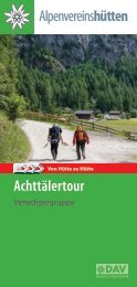
Virgentaler Hüttenbuch & Stempelbuch
Ausführliche Informationen über die Wanderwege, Hütten und Almen finden Sie in unserem Virgentaler Hüttenbuch. Des weiteren beinhaltet unser Wanderführer auch eine Wanderkarte, wichtige und interessante Infos sowie Beschreibungen von Gipfel, Seen ect.
Ausführliche Informationen über die Wanderwege, Hütten und Almen finden Sie in unserem Virgentaler Hüttenbuch. Des weiteren beinhaltet unser Wanderführer auch eine Wanderkarte, wichtige und interessante Infos sowie Beschreibungen von Gipfel, Seen ect.
- No tags were found...

Create successful ePaper yourself
Turn your PDF publications into a flip-book with our unique Google optimized e-Paper software.
Virgental Valley –
Hiking Valley
Hut book
Go for Gold - the Virgentaler Wander-Thaler
VIRGENTALER
WANDER-THALER
Impressive panoramas, freshening
mountain-lakes, quaint
huts, local delicacies and
many more impressions to get
in the walking paradise
Virgental-valley and in the
nature of the Nationalpark
Hohe Tauern with its numerous
peaks more than 3.000
m in altitude. Take the new
„Virgentaler Wander-thaler“
in bronze, silver or gold home
with you. As an incentive for
your next walking-holiday in
the Virgental-valley. Because
once you‘ve been there you
will want to come again.
How to get your free Virgentaler
Wander-thaler:
The following stamps are required for the bronze Wander-thaler:
Virger Bauernladen (from a purchase of € 10,-), Stabanthütte, Wodenalm,
Zunigalm, Würfelehütte, Lasnitzenhütte, Islitzeralm und Niljochhütte.
_____________________________
The following stamps are required for the silver Wander-thaler:
All stamps required for the Bronze Wander-thaler plus Essener- und Rostockerhütte,
Johannishütte, Defreggerhaus, Neue Sajathütte, Bonn-Matreier
Hütte, Badenerhütte, Zupalseehütte, Neue Reichenbergerhütte, Lasörlinghütte,
Clarahütte and Eisseehütte.
_____________________________
The following stamps are required for the gold Wander-thaler:
All stamps required for the Bronze and Silver Wander-Thaler plus
a nationalpark-ranger tour.
_____________________________
Where to get your Wander-thaler?
If all the required stamps are available in the Virgentaler hut book, report to
the tourist-offices Matrei, Virgen or Prägraten a. Gr.
All stamps for the Virgentaler-Wander-thaler can be acquired
within the duration of several hiking holidays!
2
HUTS
Alpine farming
Eat & Drink
Overnight
accomodation
for ski tours
suitable (open)
Herausgeber: Verein Virgentaler Hütten. Gestaltung: Studio Superfast,
Lienz. Fotos: Titelseite: Nationalpark Hohe Tauern/Mathäus Gartner;
Weisskopf, Virgentaler Hütten, Nationalpark Hohe Tauern/Martin Lugger.
Druck: Oberdruck, Dölsach. Druck- und Satzfehler vorbehalten.
VIRGENTAL VALLEY
Freedom, Peace, Happiness, Silence -
from hut to hut through the Hohe Tauern National Park
Already 30 years ago the alpine pasture and hut keepers of the valley united
to form the „Virgentaler Hütten“ association. This association made it
possible to expand the Lasörling- and Venedigerhöenweg, in order to enable
the hike from hut to hut. The aim of the association is to make the guests
aware of our beautiful hiking valley through the cooperation and association
of the hut owners.
Chairwoman Sara Rainer
Page 9
Page 10
Page 11
Page 12
Page 13
Page 14
Page 15
Page 16
Page 17
Page 18
Page 26
Page 27
Page 28
Page 29
Page 30
Page 31
Page 32
Page 33
ESSENER- u. ROSTOCKERHÜTTE 2.208 m
DAV Sektion Essen
STABANT HÜTTE 1.777 m
Private Hut, Obkircher Gabi and Erich
JOHANNISHÜTTE 2.121 m
DAV Sektion Oberland, Family Unterwurzacher
DEFREGGERHAUS 2.964 m
ÖTK, Tenant Vroni Terzer and Tom Ploner
NEUE SAJAT HÜTTE 2.600 m
Private Hut, Kratzer Stefan
EISSEEHÜTTE 2.521 m
Private Hut, Markus Islitzer
NILLJOCHHÜTTE 1.990 m
Private Hut, Tenant Milan Hudec
BONN-MATREIER HÜTTE 2.750 m
ÖAV / DAV, Tenant Andreas Rainer
BADENER HÜTTE 2.608 m
ÖAV-Sektion Baden, Steiner Marco
WODEN ALM 1.825 m
Private Hut, Family Niederegger
ZUNIG ALM 1.846 m
Private Hut, Family Rainer
WÜRFELEHÜTTE 1.380 m
Private Hut, Mariacher Ludwig
ZUPALSEE HÜTTE 2.350 m
Private Hut, Family Tschoner
LASÖRLINGHÜTTE 2.293 m
Private Hut, Tenantin Heidi Bender
LASNITZEN HÜTTE 1.900 m
Private Hut, Berger Alois
NEUE REICHENBERGER HÜTTE 2.586 m
ÖAV Sektion Reichenberg, Johann Feldner
CLARAHÜTTE 2.038 m
DAV Sektion Essen, Karin Mikusová and Juraj Malek
ISLITZER ALM 1.513 m
Jausenstation, Berger Johannes
4 5
The Virgen Valley circled
by Walter Mair
Two great mountain groups frame the well-known Virgental with populated
areas sheltered in summer green. The Virgental is bordered to the south by the
Lasörlingkamm and to the north by the vanguard of the Venediger group. The
forests rise steeply to the alpine pastures and refuges, which connect the adventurous
high-altitude trails like a string of pearls. We are already on the way
in the raised floors of the mountains, from where we look into the valley floor
as if with eagle eyes. In the area of the Hohe Tauern National Park, the present
hiking stages lead into natural and unique mountain areas.
Let‘s start at the Nikolauskirche in the Matrei district of Ganz and on the Zunigalm
in the upper edge of the forest. The next destination on the Bärensteig is
the Arnitzalm (not serviced) and, in a further stage, the Wetterkreuzhütte (not
serviced). The Wetterkreuztaxi supports the high-altitude hikers there. The Zupalseehütte
is easy to reach on a family-friendly route and the Lasörlinghütte
is a worthwhile destination for the day with more distance. The further course
to the Bergerseehütte should be snow-free, while on the Muhs-Panoramaweg
to the Lasnitzenalm the white-clad alpine panorama shows itself from the
most beautiful side. The Lasörling-Höhenweg to the Reichenberger Hütte on
the Bödensee reminds you of stamina and surefootedness, before the Venediger-Höhenweg
takes the lead with the descent to the Pebell and Islitzeralm to
the nature power path and the Umbal Falls water viewing path.
The promising Türmljoch connects to the Johannishütte in the Dorfer Valley,
where we climb to the Defreggerhaus on historic routes and in close contact
with the ice-shining Großvenediger. Via the Zopetscharte we reach the Eisseehütte
in the Timmeltal, where the Prägrater Höhenweg also includes the Sajathütte
in the range of important bases on the Venediger Höhenweg. With an
impressive view of both the valley and the Lasörlingkamm opposite, we arrive
at the Bonn-Matreier-Hütte. There the route swings northwards to the Badener
Hütte in the Frosnitz Valley and over the Löbbentörl into the picture-book landscape
of the Gschlösser Almen.
One floor below and closer to the Virger valley, the Stabanthütte and Nilljochhütte
all the way to the Gottschaunalm invite you to take a leisurely hike. The
Wodenalm completes the recommended mountain and hiking experience with
lasting impressions in the Hohe Tauern National Park.
Foto: Nationalpark Hohe Tauern/ Martin Lugger
6 7
Huts along the
Venediger
hiking trail
Foto: Karin Frei
Stamp
ESSENER u. ROSTOCKER HÜTTE 2.208 m
DAV hut (alpine association - Sektion Essen)
Tenant „Wiggerl“ Thomas LUDWIG
Maurertal 1 - 9974 Prägraten
Phone +43 (0)4877 5101 (March – September)
zugast@essener-rostocker-huette.de
https://dav-essen.de/huetten/
Stamp
A beautiful view to the glacier
© Gerald Weißkopf
The Essener and Rostocker Hütte is a beautiful and important
starting point along the Venedigerhöhenweg and along the
Route Hoch Tirol. The place offers a breathtaking panorama to the
three thousand meter high mountain peaks. Take part in an alpine
course in the area of the Dreiherrn-, Simony- and Malhamsummits
to get more experience in mountaineering an climbing. The hut is
also open for ski tourer.
Ascent: Parking area Ströden 2 ½ h, after about 20 minutes
possibilty for your luggage transport
Huts nearby: Johannishütte 3 ½ h, Clarahütte über Ströden 4 h, Clarahütte über Hochkarscharte
6 h (schwarzer Weg), Warnsdorferhütte 4 ½ h, Kürsingerhütte 6h
Tours: Dreiherrnspitze 5 ½ h, Simonyspitzen 3 ½ h, Malhamspitzen 4 ½ h, Quirl 4 h, Maurerkeesköpfe
3 ½ h, Großer Geiger 4 h, Großer Happ 3 ½ h, Rostocker Eck 2 ½ h, Hinterer Gubachspitz
3 ½ h, Vorderer Gubachspitz 3 ½ h
Via ferrata Türmljoch: Information and registration: Venediger-Bergführer
(mountain guides)
8 9
© E. Obkircher
© L. Unterwurzacher, © VAUDE - Toniolo
STABANTHÜTTE 1.777 m
Private hut
Gabi and Erich Obkircher
Phone hut +43 (0)664 220 75 77
stabanthuette@virgental.at
www.virgental.at/stabanthuette
The castle in Prägraten
Stamp
Situated at the Virgental SonnPagenweg on one of the most beautiful places in Prägraten with
a great view to Lasörling- and Schobergroup and to Matreier Goldried. Walk along a magic
larch wood to the hut, enjoy the alpine flora and pick up its wonderful smell.
Suitable for all ages, by mountain bike and in bad weather. Playground, seminar- and conference
room and deckchairs complete the offer. 1. place in 2012, 2015 and 2016 by „Mei liabste
Hütt’n“ and rewarded with the „Austrian walking quality seal“.
Open: Von Mitte Juni bis Ende Oktober (im Juni und Oktober mittwochs Ruhetag)
Specialities: Tyrolean home cooking and delicacies cooked with love - freshly prepared by
the landlady Gabi.
Overnight accommodation is available.
We kindly ask you to register in advance!
Ascent: Parking area Bichl 1 h, from Hinterbichl 1 ½ h, via Katin/
Maurach 1 ½ h. Fine walkable even in bad weather. Accessible by
mountain bike on a publicly approved route.
Huts nearby: Sajathütte 2 h, Eisseehütte 4 ½ h,
Nilljochhütte, Schmiedleralm
JOHANNISHÜTTE 2.121 m
DAV-Sektion Oberland (alpine association)
Tenant: Unterwurzacher Leonhard
Hinterbichl 19b, 9974 Prägraten a. Gr.
Phone +43 (0)4877 5150 (hut)
office@johannis-huette.at
LIVE WEBCAM: Südansicht Großvenedigermassiv:
www.johannis-huette.at oder www.grossvenediger.at
At the bottom of the Großvenediger!
Open: For skiingtours from the beginnig of March till beginning of May
Summer: Middle of June till beginning of October
Stamp
Ascent: Hinterbichl/parking area Wiesenkreuz (chargeable) along the road in about 2 h, suitable
for all ages; or hiking path till Gumpachkreuz. In summer transfer with the Venediger Taxi,
Phone +43 (0)4877 5369
Huts nearby: via Türmljoch to the Essener and Rostockerhütte 3 ½ hours, via Zopatscharte to
the Eisseehütte 4 hours, via Kreuzspitze to the Sajathütte 4 hours (black path)
Ausstattung: It offers 50 „Lager“ beds, comfy restaurant with a tiled stove, shower, lavatory with
warm water, drying room, shoe dryer, a big terrace, teriffic view to the Großvenediger, playground,
boulder-mats-rental; registration requested!
Spezialitäten aus der Küche: Tyrolean home-made dishes and sweets.
Schöne Tourenziele: Großvenediger 3674 m, Weißspitze 3300 m,
Kreuzspitze 3164 m, Zopetspitze 3198m, Großer Geiger 3360 m,
Großer Happ 3352 m, Kristallwand 3329 m; • Via Ferrata Türmljoch •
Popular mountain bike route from Hinterbichl 8.5 km • Varied bouldering
area near the hut (bouldering mat rental for a fee) • Starting point for
wonderful ski tours • Base of the Hoch-Tirol ski route
10 11
© Kratzer - Sajathütte
DEFREGGERHAUS 2.964 m
NEUE SAJATHÜTTE 2.600 m
Hütte des Österreichischen Touristenklubs (ÖTK)
(alpine association)
Tenant: Vroni Terzer and Tom Ploner
Phone: +43 (0)4877 20088
defreggerhaus@oetk.at
www.virgentaler-huetten.at
Stamp
Private Hut
directly on the Venediger-Höhenweg
Stefan Kratzer
Phone hut +43 (0)664 54 54 460
kratzer@sajathuette.at
www.sajathuette.at
Stamp
The gate to the Großvenediger
The hut of the Austrian Tourist Club is one of the oldest and highest located in the Eastern Alps.
The refuge was built in 1887 and named after the famous painter Franz von Defregger. From
the hut you can enjoy a breathtaking panoramic view of over 30 three-thousandmeter peaks.
Open: End of June till middle/end of September (depending on the weather)
Winter: On request for ski tourer. Please make a reservation for your
overnight stay and your tour to the Großvenediger!
Ascent: From Hinterbichl to Johannishütte about 2 h, transfer with Venediger Taxi possible
Phone 04877 5369. Johannishütte further on to Defreggerhaus about 2 ½ h.
Huts nearby: Johannishütte 1 ½ h, Eisseehütte via Wallhornertörl* 4 h, Neue Pragerhütte via
Rainertörl* 4 ½ h, Badenerhütte via Froßnitztörl* 4 h, Kürsingerhütte via Venedigerscharte* 4 ½
h. * only with a mountain guide
Tours: Shortest ascent to the Großvenediger 3.666 m in about 2
½ h. Große Venedigertour „Venedigerkrone“ incl. Großvenediger,
Schwarze Wand 3506 m, Hohe Aderl 3506 m, Hoher Zaun
3451 m and Rainer Horn 3559 m in about 4 bis 5 h;
A castle in the mountains
The old Sajathütte was distroyed in 2001 by an avalanche, the new hut was reopened after
only one year. It offers comfy rooms and „Lager“-beds, 2 patios to enjoy the surrounding mauntains
and an 10 m high indoor climbing tower. Possibility of luggage-delivery and to rent the
climbing-equipment.
Open: Beginning of May till end of October
Ascent: From parking area „Bodenalm“ along the Timmeltal about 2 ½ h, along Bichl Blumenweg
or Stabanthütte 3 h, along Bichl Timmeltal 4 h, from Johannishütte via Kreuzspitze 4 h (difficulty:
hard), Driveway with the Venediger taxi Kratzer.
Hint: Sajatscharte closed!
Huts nearby: Eisseehütte 2 ½ h, Bonn-Matreier-Hütte 4h
Tours: Rote Säule 2822 m along the via ferrata or along the
normal ascent in 1 h, Scherneskopf 3048 m 1 ½ h, Kreuzspitze
3164 m 2 h, Hinterer Sajatkopf 3098 m 3 h, Tulpspitze 3054 m,
Zopetspitze 3198 m.
12 13
© M. Islitzer
DIE EISSEEHÜTTE 2.521 m
NILLJOCHHÜTTE 1.990 m
Private hut
Private hut
Family Islitzer
Phone hut +43 (0)680 2041698
admin@eisseehuette.at
www.eisseehuette.at
Stamp
Milan Hudec
Phone +43 (0)676 46 123 88
niljochhuette@gmail.com
www.nilljochhuette.com
Stamp
In the heart of the Timmeltal-valley
Located at the end of the Timmeltal and just below the beautiful Eissee, the hut is the starting
point for numerous three-thousander peaks and a popular accommodation on the Venice High
Trail. On the new sun terrace you can enjoy delicious home cooking with a wonderful view. In
winter you can go on wonderful ski tours. Since 2021 there has been a new summit cross on the
Hinterer Seekopf 3234 m and the Kleinen Hexenkopf 3194 m.
Open: Middle of June till end of September (depends on the
weather) In Winter: from middle march, to end of april
Ascent: From parking area Boden Alm 2 ½ h, from Bichl 3 h
Huts nearby: Stabanthütte 2 h, Defreggerhaus via Wallhorner
Törl 4 h (Only with a mountain guide!), Sajathütte via
Timmeltal Höhenweg 2 ½ h, Nilljochhütte 2 ½ h, Bonn-Matreier
Hütte 3 ½ h, Badenerhütte 6 h
Ski Tours: Weißspitze, Seeköpfe, Kl. Hexenkopf, Kreuzspitze,
Venedigerrundtour, Eicham
Unique 360° mountain panorama!
Especially popular hut for children and seniors. The big and sunny patio offers a fantastic view
to the surrounding peaks and the Virgental-valley. The comfy restaurant with an open fire
place is perfectly suitable for family-, private- or company-parties. Highly suitable to start the
Venediger Höhenweg!
Open: Beginning of June – end of September daily
Übernachtungsmöglichkeiten: It offers 17 beds (1 room for 10, 2 rooms for 4 and 1 room for 3).
All rooms are with shower/WC.
Specialities: Home-made Tyrolean main courses, cakes, sweets and ice-cream.
Ascent: from Prägraten parking area along the parking area Bodenalm 1h, from Virgen/ Obermauern
to parking area Budam 1 1/4 h,from Virgen to parking
area Marin 2h
Huts nearby: Bonn-Matreier Hütte (2745 m) 2 ½ h, Eisseehütte
(2521 m) 3 ½ h, Neue Sajathütte (2575 m) 3 ½ h, Gottschaunalm
(1946 m) 1 h, Schmiedleralm (2082 m) ½ h, Stuhleralm (2300 m) 1 h
Tours: Weißspitze 3.300 m – 2 ½-3 h, Seewandspitze 3.024
Summits: Wunspitze (3219 m) 4 ½ h, Schaufel (2633 m) 1 ¾ h, Esel
m – 2 h, Zopetspitze 3.198 m – 2 h, Tulpspitze 3.054 m – 1,5h,
(2401 m) 1 ½ h; beautiful tours: Hocheicham (3371 m) 5 h, Sailkopf
Kreuzspitze 3.164 m – 2 h, Hinterer Seekopf 3.234 m – 2 h, Vorderer
Seekopf 3.280 m – 2 h, Gr. + kl. Hexenkopf 3.313 m – ca.
(3209 m) 3 ½ h
3,5h /3.194 m - ca. 3,0 h
14 15
© W. Heinz, © G. Weißkopf
© ÖAV Sektion Baden, © M. Steiner
BONN-MATREIER HÜTTE 2.750 m
BADENER HÜTTE 2.608 m
Hut of the Alpenverein der OeAV-Sektion Matrei und der
DAV-Sektion Bonn (alpine associations)
Tenant Andreas Rainer
Phone hut +43 (0)664 3481006
office@bonnmatreier-huette.at
www.bonn-matreier-huette.at, www.oeav-matrei.at
Stamp
Hut of the Alpenverein der OeAV-Sektion Baden
(alpine association)
Tenant: Marco Steiner
Phone +43 (0)664 91 55 666
badenerhuette@gmx.at
www.facebook.com/Badenerhuette
Stamp
Fabulous panorama till Triglav/Slovenia.
Build in 1932 on a individuated mountain ridge in the Eichamgroup. Wonderful panorama to
Triglav, the Dolomites and the Lasörlinggroup. Very nice hut to stop or stay overnight along the
Venediger Höhenweg. Top place to start unforgetable tours to summits.
Open: 1. June – till end of October (depends on the weather)
Ascent: From parking area „Bodenalm“ 4 h, from Obermauern/Budam 3 ½ h,
from Obermauern/Marin 4 h
Huts nearby: Badenerhütte via Galtenscharte 5 ½ h, Eisseehütte 4 h, Sajathütte 4 h, Schmiedleralm
1 ½ h, Nilljochhütte 2 h
Tours: Rauhkopf 3070 m 1 h, Sailkopf 3209 m 1 ½ h, Hoher
Eicham 3371 m 3 h, via Kälberscharte and Galtenscharte to
Badener Hütte, along Kleines Nilltal to Gottschaunalm
In the midst of mountain crystals
Located above the wild-romantic Froßnitztal valley and in the near of the Froßnitzkees (glacier)
Pass very old alp villages and historical miners‘ houses along the Froßnitztal valley. Also
an unforgetable route is via Innergschlöß and Löbbentörl to Badener Hütte. Enjoy terrivic
views and wine from Baden by Vienna! It is known as the highest „Heuriger“ in Austria as well.
Open: End of June till middle of September (depends on the weather)
Ascent: From Gruben via Froßnitztal valley along Katal-Alm, Mitteldorfer Alm and Gosser Alm
4 - 5 h, from Katal Alm along the miners‘ houses 5 - 6 h, via Innergschlöß and Löbbentörl 5 - 6 h,
along Matreier Tauernhaus and Wildenkogel 7 h
Huts nearby: Bonn-Matreier Hütte along Galtenscharte 5 ½ h, Neue Prager Hütte via Löbbentörl
4 ½ h, Venedigerhaus Innergschlöß via Löbbentörl 3 h, Matreier Tauernhaus 4 h, Defreggerhaus
via Froßnitztörl 5 h (only with a mountain-guide!)
Tours: Kristallwand 3329 m 3 h, Weißspitze 3300 m 3 ½ h, Hohe Achsel
3161 m 4 h, Innerer Knorrkogel 2884 m 2 h, Wildenkogel 3022 m 3 ½ h,
Dabernitzkogel 2972 m 3 ½ h; Großvenediger 3674 m 5 ½ h
16 17
© Grafik Zlöbl, © A. Niederegger
WODENALM 1.825 m
Private hut
Family Niederegger
Zedlach 12, 9971 Matrei in Osttirol
Phone hut +43 (0)664 154 9790 or valley +43 (0)699 1216 5858
wodenalm.zedlach@gmail.com
www.virgental.at/wodenalm
Along old paths and the Zedlacher Paradies
Stamp
Even the paths to the Wodenalm are a unique experience. Old cart tracks and a comfortable
forest road lead through the Zedlacher Paradise and along the educational forest trail past
larch trees that are more than 500 years old. Arriving at the Wodenalm, you can enjoy the
delicious specialties and regional farm products and have a breathtaking view of the Granatspitz,
Schober, Glockner and Lasörling groups, the Dolomites and the Malhamkees from
the sun terrace.
Open: Beginning of June till end of October
Ascent: From the car park at the entrance to the village
of Zedlach, comfortably follow the road or sportily
via Hohlweg (Jösenhof) 2 hours, from the Dirnburg/
Hinteregg car park comfortably via a forest road or
forest above Zedlach 1 ½ hours or sportily via a direct,
steeper ascent 1 hour.
NATURE ENERGY PATH
UMBALFÄLLE
Water Vista Trail Prägraten a.G.
More than in any other valley of the Hohe
Tauern, the landscape-shaping effect and
the essence of a glacier brook are shown
in such an impressive way as in the Umballtal
with the imposing cascades of the Isel.
The smoothly ground green rock of the river
bed with the washed-out hollow forms
gives an idea of the power of the flowing
water masses. The nature trail of the same
name invites you on a journey of discovery
and offers spectacular insights into the Isel
cataracts.
Further Informations: www.hohetauern.at
18
19
Peaks, ridges and
Via ferratas –
on the way to yourself
The mountain calls - not loudly, but very quietly, often only with a whisper.
In the mountain massifs of the Virgental there are a thousand opportunities
to experience the feeling of happiness in the walls and on the peaks in
the area of the Hohe Tauern National Park. Over 60 three-thousand-meter
peaks, numerous easy-to-climb mountains, climbing walls and via ferrata,
bouldering boulders - in a relatively small space, guests can find everything
they need in traditional and modern alpinism.
The mountain huts of the Virgen Valley are the ideal bases on the mountain
and hiking tour. Not only does the landlord provide information here, you
often come across local mountain guides and mountaineering groups from
all over the world who are out and about in the rock and ice region of the
Virgen Valley in order to gain experience, learn alpine skills or simply feel
the proverbial happiness on the summit . On the many via ferratas you can
use fixed steel ropes and ladders to penetrate walls that were previously
only reserved for experienced alpinists.
The local mountain and ski guide knows every stone, every corner and
knows where danger lurks. Traveling with him not only provides security
- the mountain guide also has a lot to tell about the people here, about
mountain adventures and summit experiences, and he gives tips for the
next tour in the wonderful world of the Virgental rock and ice region.
20 21
Kürsinger Hütte
Neue Prager Hütte
2782
2926
res Umbaltörl
3496
itze
ze
rspitze
33
Kartenmaterial: Arbeitsgemeinschaft Kartographie
H
T
i
Postbus-Haltestelle
Hüttentaxi-Haltestelle
Parkplatz
Nationalparkinfo
Tourismusinformation
Dreiherrenspitze
3499
Hohes Kreuz
3156
Östliche Simonyspitze
3448
3373
Nördl. Malhamspitze
Quirl
3251
Wiesbauerspitze
Alpenkönigroute (nur mit Bergführer!)
Rosenspitze
3060
Keeseck
3173
Reggentörl
3056
Clara Hütte
Simonysee
Rostocker Eck
2749
Umbalfälle
3360
Großer Geiger
Hochkarscharte
Gösleswand
2912
Türmljoch
2790
Essener-
Rostocker Hütte
Neue Reichenberger Hütte
Islitzer Alm
Kriselachspitze
Rote Lenke
2794
Toinig
2666
T
Johannis Hütte
Stabant
Hütte
2848
Micheltalscharte
2652
Sajatscharte
2750
Rote Säule
2879
Ströden
T H
H
Hinterbichl
Finsterkarspitze
3028
Muhs-Panorama Weg
Lasnitzen Hütte
Rainerhorn
3560
Defregger Haus
Zopatscharte
2958
Kreuzspitze
3164
Sajat Hütte
Lasörling
3098
Wallhorntörl
3045
Hint. u. Vord.
Sajatkopf
i
Bergersee Hütte
Eissee Hütte
Berger Kogel
Säul
2850
Kristallwand
3329
Hoher Eichham
Steingrubenhöhe
2776
Oberstkogel
This map 22is purely an overview map and does not replace a real hiking map!
2900
Virgen Törl
Speikboden
Arnitzsee
23
Zupalkogel 2574
2616
2653 2720
2729
2656
Weißspitze
3300
Eissee
2770
Löbbentörl
3371 Rauhkopf
3070
Sailkopf
3209
Wallhorn
Bobojach Nilljoch Hütte
H T H
Bichl
H Obermauern
Lasörlingütte
Welzelach
Badener Hütte
Bonn-Matreier Hütte
Taxi
Gries
Würfelehütte
Merschenhöhe
2499
H
Zupalsee Hütte
3021
Wildenkogel
T
Dabernitzkogel
T
H
2969
2925
Raneburgkogel
3008
Ochsenbug
Mitteldorf
2160
Wetterkreuz
H
Wetterkreuz Hütte
Woden Alm
Zedlach
Ganz
T
Guggenberg
Nationalparkhaus
Information
Service
Ausstellungen
Großer Zunig
H
.
Matrei i.O.
Bichl
Zunig Alm
Glanz
Klaunz
Sebla
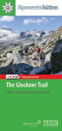
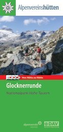
Hohe Tauern Nationalpark –
The idea throughout the world
Started with Yellowstone National Park sparked the idea of a protected natural space to experience
and feel a passion in the hearts of people around the world. At 18 km, the Hohe Tauern
National Park is the largest national park in Central Europe and has shares in three federal
states: Tyrol, Salzburg and Carinthia. With glaciers, high mountain valleys, forests, moors, rivers,
lakes, colorful flower meadows and much more, the Hohe Tauern brought a particularly impressive
biodiversity, which on the one hand through the enormous height levels - from the
valley to the highest mountain in Austria, the Grossglockner at 3798 m - and on the other the
rich water resources are made possible.
Huts along the
Lasörling
hiking trail
In the Hohe Tauern National Park, the focus is on the impressive nature and the opportunity
to experience it. With species protection projects and scientific surveys, we try to maintain
and protect the special world of the Hohe Tauern and do not neglect the cultural landscape,
in which old traditions and customs are not forgotten and are still passed on from generation
to generation.
Nationalparktips in the Virgental-valley:
• Nature Energy Path Umbalfälle • Exhibition „Tauernblicke - Momente des Staunens“ -
Nationalparkhaus Matrei • guided Rangertours • Adlerweg Osttirol • Iseltrail
Experience nature with a ranger
Guided hiking tours according to the summer program:
Costs: Adults from € 20,00 / Children up to 14 years € 13,00
Rent a Ranger
The individual national park experience tailored entirely to personal wishes.
Cost: € 250 / Ranger and Tour
Information and Booking
Nationalparkhaus, 9971 Matrei i. O., Kirchplatz 2
Phone: +43 4875 5161 10, nationalparkservice.tirol@hohetauern.at
www.hohetauern.at/erlebnis, nationalpark.osttirol.com
GUIDED
RANGERTOUR
SIGNATURE:
24 25
TVB Osttirol - Peter Maier
© Fam. Rainer
ZUNIGALM 1.846 m
WÜRFELEHÜTTE 1.380 m
Family Rainer
Waier 2, 9971 Matrei
Phone +43 (0)4875 62 40
Phone hut +43 (0)664 9059063
zunigalm@gmx.at
www.virgental.at/zunigalm
Stamp
Private Hut
Mariacher Ludwig
Phone +43 (0)664 5328139
wuerfelehuette@gmail.com
Würfelehütte auf Facebook
Stamp
Fascinating glances to Tauern- and Virgental valley
The Zunig Alm towers high above the valley basin of Matrei. From the sun terrace you can enjoy
a breathtaking panoramic view of the realm of the Hohe Tauern National Park: the Tauern
and Virgental, the Glockner, Granatspitz, Venediger and Schober groups as well as the Malhamkees.
In addition, you can be pampered by the hostess Moidl with agricultural products
from their own farm and enjoy the well-known desserts - above all the legendary blackberry
omelette.
Open: 10. June till middle of October
Ascent: Via the Matrei districts of Bichl or Ganz to St. Nikolauskirche and the Guggenberg car
park. From there 2 to 2 ½ hours on a wide hiking trail to the Zunig Alm, easily accessible for
children and seniors.
Tours: Großer Zunig 2771 m, Kleiner Zunig 2443 m, Zunigsee 2112
m, Malereck with a view over the Dolomites, begin of the Lasörling
Höhenweges
Huts nearby: Arnitzalm (not cultivated) along the Bärensteig
1h,along Zunigsee and Ganitzle 11/2h, Zupalseehütte 7 - 8 h
Specialities: Apfelstrudel, Heidelbeeromlette, Bratwürstl with
Kraut, Brettljause, Kaiserschmarren and products of the own
farm.
The hiking destination for young and old
A cosy, rustic parlor and sunny terraces invite you to linger and offer a wonderful view of the
Virg mountains with their many three-thousanders. Our focus is on the little guests, for whom
we have built a small play and fun paradise.
The kitchen team cooks with a lot of love and spoils you with freshly prepared delicacies,
homemade pastries, ice cream variations, etc. Of course, you
can also have a healthy and rich brunch at the Würfelehütte.
Among other things, a delicious “cube breakfast” is served from
9:00 a.m. to 11:00 a.m. if ordered in advance.
Open: Summer: Mai till middle of October from wednesday to
Sunday. Winter: from 25.12. till middle of March
Ascent: from the Virgen/Tratte car park, approx. 45 minutes
on foot. In summer by car on your own road (toboggan run).
Driveway illuminated at night. taxi service.
Special features: Toboggan rental, taxi service,
playground, brunch
26 27
© T. Tschoner
ZUPALSEEHÜTTE 2.350 m
LASÖRLINGHÜTTE 2.293 m
Private Hut
Family Tschoner
Phone +43 (0)650 5457402
tschoner@aon.at
www.alm-ferienhaus.com
Stamp
Private Hut
Tenant: Heidi Bender
Virgentalstraße 85, 9972 Virgen
Phone hut +49 172 8663267 or
+43 664 1015440
benderheidi@aol.com
www.Lasoerlinghuette.com
Stamp
The heart of the Virgentaler huts
The Zupalsee hut is one of the most beautiful shelters in the Virgental. From the Zupalsee Hut a
little further into the valley, you can enjoy a breathtaking view of the peaks in the Hohe Tauern
National Park. The cozy Zirbenstube, the Almdiele and the sun terrace invite you to linger, quiet
and pause. Overnight accommodation for 35 people. Also highly recommended for longer hut
holidays. 25 beds in rooms with cold and warm water, 10 storage
spaces, 2 washrooms / showers, central heating, electricity.
Open: Middle of June till beginning October
Ascent: From Virgen in about 3 ½ - 4 h to Wetterkreuz Hütte and
then in about 1 ½ h further on to Zupalsee Hütte. Along the Steinkaastal
in about 3 ½ - 4 h, by taxi in about 30 minutes to Wetterkreuz
Hütte - registration necessary, please phone: +43 (0)650
5457402)
Huts nearby: Speikbodenhütte 4 h, along the panorma path to
Lasörlinghütte 3 h
Tours: Zupalkogel 2720 m, Oberstkogel 2574 m, Legerle 2527 m,
Speikboden 2653 m, Donnerstein 2725 m
The little village in the mountains
The shelter built in 1982 in the so-called „Glaurat“ in the rear Mullitztal is a popular base on the
Lasörling Höhenweg and on the way to the Lasörling summit at 3098 m above sea level. With
the additions and outbuildings, a unique alpine ensemble emerged over time, a small village
in the mountains. From the sun terrace you can enjoy a wonderful view of Austria‘s highest
mountain, the Großglockner, and the Virger Nordkette.
Open: Beginning/middle of June till the end of September
(depends on the weather)
Ascent: From the Virg district of Welzelach on the Almfahrweg
via Mullitztal and Stadler Alm 3 hours, from the Wetterkreuz
Hütte 3 ½ to 4 hours, also easily accessible for children
and seniors.
Huts nearby: via Bergertörl to Bergerseehütte 3 ½ h, via Prägratner
Törl to Neuen Reichenbergerhütte 6 ½ h, along the
Niedere Höhe to Lasnitzenhütte 3 ½ h.
Tours: Lasörling (summit), 3098 m 3 h (one of the best photo
mountains in the Hohe Tauern National Park)
28 29
© A. Berger
© J. Feldner
LASNITZENHÜTTE 1.900 m
Private hut, Alois Berger
St. Andrä 56, 9974 Prägraten am Großvenediger
Phone hut +43 (0)4877 5267
Phone valley +43 (0)4877 5252
lasnitzenhuette@gmx.at
www.virgental.at/lasnitzen-huette
Wonderful view to the Großvenediger
Stamp
The Lasnitzenhütte in the wild and romantic Lasnitzental can be easily reached from Prägraten via
the forest road, also for families with children and seniors. The mighty massif of the Großvenediger
group accompanies us throughout the hike, the view of the Großvenediger from the hut terrace
is particularly impressive. With this wonderful sight, we spoil you with homemade delicacies for
big and small appetites. Roast veal, roast pork, Tyrolean dumplings, Tyrolean Gröstl and Kaiserschmarren
are freshly prepared for you. You will remember the well-known and extremely popular
Almkrapfen with a cup of coffee! Our comfortable single, double and multi-bed rooms as well as
the cozy hut camp (shower facilities available!) invite you to spend the night in order to explore the
wonderful mountain world of the Lasnitz Valley the next day after a hearty breakfast.
Ascent: From Prägraten, parking area „Sägewerk“ via the forest road in about 2 h. Suitable for
all ages! Easily accessible even in bad weather.
Huts nearby: Via Muhs-Panoramaweg to Bergerseehütte 2 ½
h, Lasörlinghütte via Niedere Höhe 4 h, Neue Reichenbergerhütte
4 h, Umbalfälle 3 ½ h
Tours: Toinig 2666 m, Criselachspitz 2750m, Weisl 2730 m,
Stampfles Spitzen 3024 m, Blindis Spitze 3000 m, Pitzles Horn
2947 m, Lasörling 3098 m.
NEUE REICHENBERGER HÜTTE 2.586 m
Hut of the OeAV-Sektion Reichenberg
(alpine association)
Tenant Johann Feldner
Phone hut +43 (0)4873 5580
Phone Sat. 0720 88 42 13
neue.reichenbergerhuette@utanet.at
www.alpenverein.at/reichenberg
Divinely at the Bödensee-lake
Stamp
The new Reichenberger Hütte is located on a beautiful spot on the Bödensee in the Lasörling
group. From the Bachlenke a little above the hut you have an impressive view of the Großvenediger.
The Alpine Club - Schutzhaus is the ideal accommodation halfway when you cross
the Lasörlingkamm between the Defereggental and the Virgental. Mountain hikers also like to
take a break or take a break Get a good night‘s sleep at the Neue Reichenberger Hütte when
you are on the Lasörling Höhenweg or when you climb the peaks in the Virgen and Defereggental
valleys, all of which are located in the Hohe Tauern National Park.
Open: From middle of June till end of September (depends on the weather)
Ascent: From Prägraten via Pebell- and Stürmitzalm along the Großbachtal-valley in about 4
h, via Kleinbachtal-valley in about 4 ½ h, from St. Jakob in the Defereggental-valley along the
Hintere Troyeralm 4 h. Hut taxi to the Trojeralm.
Huts nearby: Via Dabertal-valley to Clara Hütte 3 h,
along Rote Lenke and Micheltalscharte to Lasnitzen
Hütte 3 ½ h and to Bergerseehütte 5 h, via Prägrater Törl
to Lasörling Hütte 6 h
Tours: Göselswand 2912 m 1 h, Bachlenkenkopf 2759 m ½
h, Finsterkarspitze 3028 m, Keeseck 3173 m, Rosenspitze
3060 m
30 31
© Pawlus-Biel, Bodzek
© G. Posch, © O. Ranacher
CLARAHÜTTE 2.038 m
ISLITZERALM 1.513 m
Hut of the DAV Sektion (alpine association)
Tenant: Karin Mikusová und Juraj Malek
9974 Prägraten a. G.
Phone +43 (0)664 97 588 93
Phone valley: +42 (0)190 2287273
clarahuette@virgental.at
https://dav-essen.de/clarahuette
Stamp
Almgasthaus
Johannes Berger
Phone hut +43 (0)664 97 59 790
Phone valley +43 (0)4877 5285
office@islitzeralm.at
www.islitzeralm.at
Stamp
The romantic hut in the Umbaltal-valley!
The Clarahütte, the oldest hut in East Tyrol, is located in the heart of the Umbal Valley. It is the
ideal hiking destination for all age groups. The way to the Clarahütte leads through the picturesque
high mountain valley along the famous Umbal Falls: You can never get enough of this
imposing natural spectacle! Renovated between 2013 and 2015, the Clarahütte has double,
triple and four-bed rooms for a total of 22 people as well as a mattress dormitory with 8 beds.
Enjoy local specialties on our sunny terrace with a view of the Rötspitze or in our cozy dining
room. We are looking forward to your visit!
Open: middle of June till beginning of October
Ascent: From parking area Ströden along the Umbal-waterfalls in about 3 h, suitable for all
ages!
Huts nearby: Via Dabertal-valley to Neuen Reichenberger Hütte
4,5 h, along Wiesbauerweg and Hochkarscharte to Essenerund
Rostocker Hütte 6 h, Philipp-Reuter-Hütte (bivouac) 2 ½ h,
Lenkjöchlhütte 4 ½ h
Tours: Rötspitze 5 h, Dreiherrnspitze 5 h, Gletschersteig Umbalkees
1 h, Wiesbauerspitze 2 ½ h, Umbaltaltalrundpfad (Philipp-Reuter-
Hütte, Umbalkees) 3 h, Daberspitze (Hohe Saile) 6 h, Simonyspitzen
5 h, Malhamspitzen 4 ½ h, Hohes Kreuz 4 h
Only inches away from the Umbal-water-falls!
You sit on the sun terrace of the Islitzer Alm, hear the roaring and rustling of the Umbal Falls
and look forward to hiking the Nature - Power - Path. But before you immerse yourself in the
wonderful world of wild water, you can relax on the sun terrace of the rustic Almgasthaus with
a hearty meal or enjoy coffee and cake. The children let off steam in the children‘s playground,
and wildlife observation is also offered.
Open: Beginning of May till end of October
Ascent: Easy walk from the Ströden car park, past the portal of
the Hohe Tauern National Park via the Almweg in ½ hour, easily
accessible for children, seniors and with prams. Narrow waterfall
path along the Isel.
Huts nearby: along the Umbal Falls to the Clara Hütte 2 ½ hours,
via Groß- or Kleinbachtal to the Neue Reichenberger Hütte 3
½ hours
Tours: Nature energy path Umbalfälle (water falls), via Lasnitzen
Hütte to Toinig 2666 m
32 33
Quiet waters -
they invite us to relax
From crystal blue to emerald green - in the most varied The many mountain
lakes in Virgental present themselves in colors. Take a break on its banks,
wade barefoot through the shallow water or even take a dip in the cool
water, hikers and mountaineers will find refreshment, cooling off and relaxation
in the mountain lakes in the Hohe Tauern National Park.
On the way from the Zunigalm to the Big and Small Zunig lies the quiet, idyllic
Zunigsee, where the highest mountain in Austria - the Großglockner - is reflected
when the weather permits. The legendary Arnitzsee at 2507 meters
between the Arnitzalm and the Großer Zunig is also worth a trip. Sheep
graze on the bank overgrown with Speik and Gentian - a wonderful place
to find yourself. A highlight on the Lasörling-Höhenweg is the Lackensee,
which can be reached on foot in around an hour from the Wetterkreuzhütte.
The rustic Zupalseehütte and the peaks of the Virger Nordkette or the
Venediger Group are reflected in the Zupalsee at 2350 meters. Getting up
and moving on is quite difficult in this breathtaking place. It doesn‘t take
long, however, and we can take a rest and relax while hiking into the valley
at the azzur blue Steinkassee. The Gumpenlacke and the Gritzer Lakes not
far from the Lasörlinghütte are definitely worth a detour. A highlight on the
Lasörling-Höhenweg is the Bergersee with the hut of the same name at 2181
meters above sea level. Via the Rote Lenke and the Micheltalscharte you
reach the Neue Reichenberger Hütte, located on the idyllic Bödensee.
DEIN URLAUBSINFOPORTAL IN OSTTIROL
From the Eisseehütte, located in Timmeltal at 2521, you can walk to the Eissee
in just under an hour, which is beautifully embedded in the mountain
landscape on the Venediger-Höhenweg. And the Simonysee at 2,360 meters
not far from the Essener and Rostocker Hütte is what many call a special
place of power.
34 35
HÜTTENTAXI
VENEDIGERTAXI KRATZER-
Hut-Taxi
Do you want to climb the Großvenediger in one day?
Yes? No Problem!
Please call us and make an appointment for the driveway to the Johannishütte. We start
for you, if you want, at 3 a.m.!
If you want to go high fast –
on the way with the Virgental hut taxi
Even holidaymakers who do not want to start their tours from the very bottom
of the valley can take a taxi to the middle heights of the fascinating natural
and mountain world of the Virgen Valley. By saving time and energy, you have
the whole day to relax on the alpine pasture or in the area of the refuge, to
recharge your batteries or to relax. The taxi also takes mountaineers to the
highest starting point that can be reached by vehicle on the Lasör-ling
Höhenweg. So you have a lot more time to climb the summit or reach the
refuges. And on your hike from hut to hut or on your long-distance hike, the
taxi will bring you comfortably back to the next starting point or to your
vehicle or your accommodation.
© Tschoner
Your advantage: The Johannishütte (2121m) on the Venediger-Höhenweg is the ideal
starting point for the shortest ascent to the "worldly majesty" the Großvenediger (3666
m) -> 5 hours.
Further tours: - till Sajathütte above Kreuzspitze-Tulpscharte 3,5 h.
- till Eisseehütte above Zopetscharte 3,5 h.
- till Essener-Rostockerhütte above Türmljoch 3,0 h.
And if you have special requests:
Ask us! We do what's in our bikes!
30 people can be chauffeured to the Johannishütte at the same time
general taxi service
Mountain bike transport
Train station transfer
Overnight accommodation
Transfer to the approaches:
for the Venediger Höhenweg from Ströden to the Matreier Tauernhaus
for the Lasörling Höhenweg from Ströden to the Guggenberg car park
We are always there for you!
Ascent Decent Ascent Decent
07:45 08:25 12:45 14:45
09:00 09:40 15:20 16:00
10:15 10:55 16:35 17:15
11:30 12:10 17:50 18:30
Virgentaler Taxi and Hut-Taxi to the Wetterkreuz
Family Tschoner ◆ Mellitz 19 ◆ A-9972 Virgen
Phone +43 (0) 650 5457402
Our taxi stand is in Virgen between the
bakery and the fire station or on the
"Tratte" at the Isel car park. (Immediately
after the fire station turn left and follow
the street over the Isel). Reservations
necessary by calling in advance!
www.alm-ferienhaus.com
© Kratzer
Fam. Siegfried Kratzer
Bichl 8, A-9974 Prägraten a. G.
Phone 0043 4877 5369
Fax 53694
info@huettentaxi.at
Seite 45
36
Farmers shop Virgen
Virgental Straße 61, 9972 Virgen
Tel. +43 (0)664 3041177
bauernladen@vereine-virgen.at
bauernladen-vereine.virgen.at
For more than 20 years regional products
have been produced by ancient
recipes and tradtitional crafts and have
been sold in the course of direct marketing
to our customers.
office@virgentaler-huetten.at
www.virgentaler-huetten.at
More information to all requests:
Touristinformation Prägraten
Phone +43 (0)50 212 530, praegraten@osttirol.com
Touristinformation Virgen
Phone+43 (0)50 212 520, virgen@osttirol.com
Touristinformation Matrei
Phone +43 (0)50 212 500, matrei@osttirol.com
Touristinformation Osttirol
Phone +43 (0)50 212 212, info@osttirol.com
All products exclusively come
from the nationalpark region.
We are offering several sorts of
Schnaps, bread, doughnuts, cakes,
Speck, sausages, butter, cheese,
marmelade, juices, honey, herbal
teas, herbal salt, Schlipfkrapfen, handiworks
and many more. All products
can be packed as gifts or souvenirs in
request.
Open:
Friday 15:00 – 18:00 h
Saturday 9:00 – 12:00 h
Additional in July, Aug. and Sept.
Wednesday 15:00 – 18:00 h
Thursday 15:00 – 18:00 h
Find us on
Stamp:
Prägraten
Virgen
Matrei
Alpine emergency number: 140
Euro emergency number: 112
From a purchase of 10,00 Euro.
39
Round trip
Großglockner - Felbertauern
40
The most beautiful passes in the country lead through the heart of the
Hohe Tauern National Park. The reduced FELBERTAUERN ROUND
TRIP TICKET takes you around Austria‘s highest mountain through
the most beautiful national park regions of the Hohe Tauern.
Travel time: approx. 4 hours.
Car: € 44,50 E-Car: € 37,00
Motorcycle: € 34,50 E-Motorcycle: € 30,00