Upper Gila Watershed, Taylor Creek - New Mexico Environment ...
Upper Gila Watershed, Taylor Creek - New Mexico Environment ...
Upper Gila Watershed, Taylor Creek - New Mexico Environment ...

You also want an ePaper? Increase the reach of your titles
YUMPU automatically turns print PDFs into web optimized ePapers that Google loves.
<strong>Upper</strong> <strong>Gila</strong> <strong>Watershed</strong>, <strong>Taylor</strong> <strong>Creek</strong><br />
<strong>Watershed</strong> Restoration Action Strategy<br />
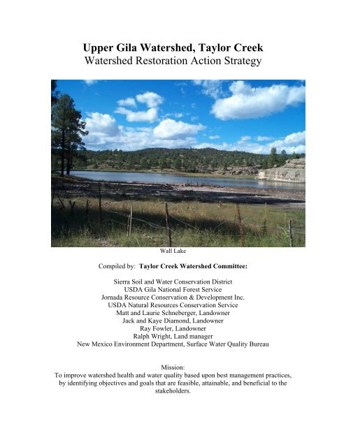
Wall Lake<br />
Compiled by: <strong>Taylor</strong> <strong>Creek</strong> <strong>Watershed</strong> Committee:<br />
Sierra Soil and Water Conservation District<br />
USDA <strong>Gila</strong> National Forest Service<br />
Jornada Resource Conservation & Development Inc.<br />
USDA Natural Resources Conservation Service<br />
Matt and Laurie Schneberger, Landowner<br />
Jack and Kaye Diamond, Landowner<br />
Ray Fowler, Landowner<br />
Ralph Wright, Land manager<br />
<strong>New</strong> <strong>Mexico</strong> <strong>Environment</strong> Department, Surface Water Quality Bureau<br />
Mission:<br />
To improve watershed health and water quality based upon best management practices,<br />
by identifying objectives and goals that are feasible, attainable, and beneficial to the<br />
stakeholders.
Table of Contents<br />
Introduction 3<br />
Area Information 4<br />
Identification of Causes and Sources of Impairments 6<br />
<strong>Watershed</strong> Issues and Some Specific Recommendations 9<br />
Education and Outreach 11<br />
Description of Best Management Practices 12<br />
Schedule for Implementation and Estimate of Needed Resources 14<br />
Description of Measurable Milestones 15<br />
Criteria to Determine Load Reductions 15<br />
<strong>Watershed</strong> Assessment and Monitoring 16<br />
Estimated Load Reductions 19<br />
Contact and Reference Information 21<br />
Appendices<br />
1. Complete Beaverhead Terrestrial Ecosystem Survey<br />
2. Complete PSIAC Survey<br />
3. Fire Regime Condition Class Maps<br />
<strong>Upper</strong> <strong>Gila</strong>, <strong>Taylor</strong> <strong>Creek</strong><br />
<strong>Watershed</strong> Restoration Action Strategy<br />
July 2005<br />
4. Riparian Vegetation Response to Different Intensities and Seasons of Grazing<br />
5. Ecological Restoration Institute, Project Report<br />
6. Wall Lake As-Built Drawings<br />
2 of 22
Introduction<br />
<strong>Upper</strong> <strong>Gila</strong>, <strong>Taylor</strong> <strong>Creek</strong><br />
<strong>Watershed</strong> Restoration Action Strategy<br />
July 2005<br />
This <strong>Watershed</strong> Restoration Action Strategy (WRAS) identifies stakeholder driven<br />
solutions to address water quality issues in <strong>Taylor</strong> <strong>Creek</strong>. The principle stakeholders<br />
include private property owners living within the watershed, the <strong>Gila</strong> National Forest<br />
which administers public lands within the watershed, and the <strong>New</strong> <strong>Mexico</strong> <strong>Environment</strong><br />
Department Surface Water Quality Bureau (SWQB) which is responsible for protecting<br />
designated uses of surface waters of the state. Additional stakeholders that have indirect<br />
ownership or management interests include the Wahoo <strong>Watershed</strong> Workgroup WWW),<br />
the Sierra Soil and Water Conservation District (SSWCD), Jornada Resource<br />
Conservation and Development (RC&D) and the Natural Resource Conservation Service<br />
(NRCS) which offers technical and financial support for soil and water conservation<br />
practices within the watershed. Other interests include hunters, fishing enthusiasts, and<br />
hikers. Water quality issues as identified by the SWQB resulted in the inclusion of<br />
<strong>Taylor</strong> <strong>Creek</strong> on the Clean Water Act (CWA) 303d list of impaired watersheds. The 303d<br />
listing of <strong>Taylor</strong> <strong>Creek</strong> and the subsequent development of Total Maximum Daily Loads<br />
(TMDLs) resulted in the failure of <strong>Taylor</strong> <strong>Creek</strong> to meet high quality coldwater fisheries<br />
standards for chronic aluminum and temperature. As part of the SWQB CWA 319 effort<br />
to address water quality issues, the SWQB partially funded the formation of the <strong>Taylor</strong><br />
<strong>Creek</strong> watershed group to develop this WRAS. In addition to the water quality issues<br />
identified by the SWQB, this WRAS will identify and offer solutions to other watershed<br />
issues as recognized by the local stakeholders. The importance of respecting stakeholder<br />
interests is critical and will ensure effective cooperation to insure a successful and<br />
effective plan.<br />
The SSWCD and NRCS Truth or Consequences field office possess the necessary<br />
experience in addressing resource concerns through collaboratively working with local<br />
landowners/managers for proper identification and implementation of best management<br />
practices (BMPs). The SSWCD has been active in natural resource concerns since 1943,<br />
assisting local landowners with technical and financial assistance to address and improve<br />
their natural resources. The SSWCD currently has programs to assist with resource<br />
improvements for local landowners, and is involved in projects such as the Poverty <strong>Creek</strong><br />
Research and Demonstration Forest Restoration site, the Lower Rio Grande Salt Cedar<br />
Management Project Area, Sierra County Wildland-Urban Interface Thinning project, the<br />
Sierra County Community Wildfire Protection Plan, and the Geronimo Springs Nature<br />
Walk/Hot Water Falls.<br />
A list of the stakeholder generated BMPs are presented later in this WRAS and provides<br />
purposes and descriptions of the individual practices. The principle goal of the<br />
implementation of the BMPs is the reduction of the pollutant loads identified in the<br />
SWQB TMDLs for <strong>Taylor</strong> <strong>Creek</strong>. Additional goals associated with watershed health and<br />
use is the concern of other stakeholders. The BMPs have been chosen by the <strong>Taylor</strong><br />
<strong>Creek</strong> watershed group as qualified practices to improve watershed health recognizing<br />
that non point pollution sources are difficult to identify and subsequent treatments may<br />
not achieve immediate reduction of the pollutant loads.<br />
3 of 22
<strong>Upper</strong> <strong>Gila</strong>, <strong>Taylor</strong> <strong>Creek</strong><br />
<strong>Watershed</strong> Restoration Action Strategy<br />
July 2005<br />
<strong>Taylor</strong> <strong>Creek</strong> <strong>Watershed</strong> consists of large areas of National Forest with several inholdings<br />
of private lands located along perennial sections of stream reaches. The two<br />
main stakeholders within the watershed are the private landowners/permittees and the<br />
<strong>Gila</strong> National Forest (GNF). Private in-holdings consist of approximately 640 acres with<br />
approximately 65,280 acres of public lands under GNF management.<br />
<strong>Watershed</strong> Map<br />
Area Information<br />
<strong>Taylor</strong> <strong>Creek</strong> is a sub-watershed of the <strong>Gila</strong> River, a major tributary to the Colorado<br />
River. The <strong>Taylor</strong> <strong>Creek</strong> watershed covers 102 square miles in Sierra and Catron<br />
Counties, <strong>New</strong> <strong>Mexico</strong>. The upper watershed begins along the Continental Divide on the<br />
western side of the Black Range. The highest elevation is 9177 feet at the head of Turkey<br />
Run while the lowest elevation is 6252 feet where <strong>Taylor</strong> <strong>Creek</strong> enters the East Fork of<br />
the <strong>Gila</strong> River giving the watershed a relief of 2925 feet. The topography consists of<br />
incised canyons separated by relatively flat uplands. Several small mountain peaks are<br />
located within the northern portion of the watershed. Upland slopes are steep to very<br />
steep with grades above 30% in many areas. Precipitation is approximately 15 inches per<br />
4 of 22
<strong>Upper</strong> <strong>Gila</strong>, <strong>Taylor</strong> <strong>Creek</strong><br />
<strong>Watershed</strong> Restoration Action Strategy<br />
July 2005<br />
year with about 40% of the yearly total falling during intense, short duration<br />
thunderstorms generally starting in July and ending in mid-September.<br />
The two main watercourses in the watershed are <strong>Taylor</strong> <strong>Creek</strong> and Hoyt <strong>Creek</strong>. <strong>Taylor</strong><br />
<strong>Creek</strong> enters Wall Lake from the northern portion of the watershed and is fed by Stiver<br />
and Scales canyon drainages along the Continental Divide and from Cox and Whitetail<br />
canyons at the lower end of the watershed. Hoyt <strong>Creek</strong> is fed by Seventyfour Draw and<br />
Turkey Run canyons. These canyons also head along the Continental Divide before<br />
joining to form Hoyt <strong>Creek</strong>. Hoyt <strong>Creek</strong> begins in steep rocky country before opening up<br />
into a wider, lower gradient valley before its confluence with <strong>Taylor</strong> <strong>Creek</strong> at Wall Lake.<br />
Downstream of Wall Lake, <strong>Taylor</strong> <strong>Creek</strong> flows for approximately another mile before<br />
joining Beaver <strong>Creek</strong> to form the East Fork of the <strong>Gila</strong> River. The stream channels have<br />
grades of less than 1% to more than 7%. The streambeds are dominated by gravel to<br />
boulder substrates.<br />
Teritary and Quaternary volcanic and<br />
sedimentary rocks characterize the<br />
<strong>Taylor</strong> <strong>Creek</strong> watershed. The<br />
watershed contains rhyolite flows,<br />
tuffs, breccias, basalt flows, andesites<br />
and conglomerates. The watershed has<br />
large amounts of exposed bedrock.<br />
The steepness and amount of exposed<br />
rock leads to rapid shedding of rainfall<br />
within the watershed. Flash floods<br />
from summer thunderstorms and<br />
winter rain-on-snow events are capable<br />
of generating large volumes of water.<br />
Moderate to heavy flood events are<br />
capable of producing large amounts of sediment. Most sediment originates from the<br />
upland slopes and is carried into the stream channels. Additional sediment is produced<br />
during flood events when high stream velocities lead to stream bank erosion.<br />
<strong>Taylor</strong> <strong>Creek</strong> watershed is forested with some areas of open meadows. The over-story<br />
vegetation species consist of a variety of tree and shrub components. Ponderosa pine<br />
dominates the north-facing slopes and the cooler, wetter portions of the forest. One-seed<br />
juniper, rocky mountain juniper, and pinyon pine are found on the dry rocky slopes<br />
sometimes intermixed with alligator juniper, gambel oak and ponderosa stands. Small<br />
areas of mixed conifers can be found along the highest elevations of the Black Range.<br />
Stream corridors in the watershed support narrow leaf cottonwood, willow trees, and<br />
other riparian species. Grass and forb species form the groundcover within the<br />
watershed. The warm-season grasses appear to dominate most sites. Vegetative cover<br />
ranges from 5-45% across the watershed. Rock and litter cover often are as abundant as<br />
vegetative cover.<br />
5 of 22
Identification of Causes and Sources of Impairments<br />
<strong>Upper</strong> <strong>Gila</strong>, <strong>Taylor</strong> <strong>Creek</strong><br />
<strong>Watershed</strong> Restoration Action Strategy<br />
July 2005<br />
Fire suppression, logging, mining,<br />
grazing, recreation, upstream<br />
impoundment, and road construction<br />
are potential pollution sources that<br />
have or may have contributed to the<br />
current condition of the watershed. In<br />
some cases the significance of impacts<br />
from potential sources is still<br />
undetermined. There is scientific<br />
documentation and anecdotal<br />
information related to historic<br />
watershed impacts and there is value in<br />
recognizing cumulative impact to the<br />
current state of the watershed. Many stakeholders including the GNF believe the policy<br />
of “total fire suppression” practiced over the last 90 years has had a significant impact to<br />
watershed health and surface water quality, the GNF has and is making strides towards<br />
using fire as a management tool. Peer reviewed scientific studies regarding fire ecology<br />
indicate that fire suppression policy has led to an eruption of upland woody species and<br />
decline of both the amount and diversity of herbaceous plants. Although not all<br />
stakeholders agree, some stakeholders believe that current public lands policy limiting<br />
multiple use and accessibility to harvest material such as firewood and timber products<br />
have also contributed to increased tree density in the uplands.<br />
According to the GNF, much of the<br />
forested acreage in this watershed<br />
has tree densities exceeding<br />
recommendations for this area.<br />
The <strong>New</strong> <strong>Mexico</strong> State Forestry<br />
average recommendation is 60 sq.<br />
ft. per acre of basal area but most<br />
areas that were assessed averaged<br />
from 80 to 200 sq. ft. per acre of<br />
basal area. The Northern Arizona<br />
University Ecological Restoration<br />
Institute studies of fire history and<br />
current conditions have shown an<br />
average of 35-50 trees per acre but current densities range from 100-400 trees per acre.<br />
Thus inventory and analysis of vegetation in this watershed indicate an excess of<br />
recommended tree density. A project report prepared by Northern Arizona University on<br />
a thinning demonstration adjacent to the <strong>Taylor</strong> <strong>Creek</strong> watershed is included in the<br />
Appendix. In the watershed, upland woody species are encroaching into the riparian<br />
corridor to the detriment of narrow leaf cottonwood, willow, and other riparian woody<br />
and herbaceous species.<br />
6 of 22
<strong>Upper</strong> <strong>Gila</strong>, <strong>Taylor</strong> <strong>Creek</strong><br />
<strong>Watershed</strong> Restoration Action Strategy<br />
July 2005<br />
Natural processes within the watershed do<br />
affect water quality and watershed health.<br />
The watershed is capable of generating large<br />
amounts of sediment due to the steepness of<br />
the canyon walls and the ease of erodibility<br />
of some of the soils and rock. Erosion of the<br />
volcanic materials and soils leads to the<br />
mobilization of aluminum found dissolved<br />
in the waters of <strong>Taylor</strong> <strong>Creek</strong>. Healthy<br />
uplands can provide vegetative protection<br />
from erosion to minimize sediment moving<br />
towards the stream channels. Healthy<br />
riparian areas and stable vegetated stream banks can also reduce erosion, act as a<br />
pollutant filter, and minimize sediment delivery to <strong>Taylor</strong> <strong>Creek</strong>.<br />
Livestock grazing is the principle<br />
economic activity within the <strong>Taylor</strong><br />
<strong>Creek</strong> watershed both on private land<br />
and on some Forest Service allotments.<br />
Stakeholders engaged in the cattle<br />
business are committed to conservation<br />
and watershed health because continuing<br />
operation depends on healthy productive<br />
rangeland. The private<br />
landowners/permittees in the <strong>Taylor</strong><br />
<strong>Creek</strong> watershed are consistently<br />
working to manage and enhance the<br />
natural resources on a daily basis. Some<br />
of the livestock operators have been working cooperatively with <strong>New</strong> <strong>Mexico</strong> State<br />
University (NMSU) and Cooperative Extension Service on a long term, intensive study to<br />
determine the effects of livestock grazing on riparian vegetation within the <strong>Taylor</strong> <strong>Creek</strong><br />
<strong>Watershed</strong>. Published results of this study are included in the appendix. Annual<br />
Operating Instructions for allotment management are compiled by the GNF in<br />
cooperation with the permittees regarding their grazing systems. Recent drought<br />
conditions have contributed to low stocking numbers on the allotments. Some<br />
stakeholders believe grazing by elk is an impact because grazing from domestic livestock<br />
is significantly decreasing, while grazing from elk is increasing.<br />
7 of 22
SWQB Total Maximum Daily Load Summary<br />
<strong>Upper</strong> <strong>Gila</strong>, <strong>Taylor</strong> <strong>Creek</strong><br />
<strong>Watershed</strong> Restoration Action Strategy<br />
July 2005<br />
<strong>New</strong> <strong>Mexico</strong> Standards<br />
Segment<br />
<strong>Gila</strong> River, 20.6.4.503 NMAC (formerly 2503)<br />
Water body Identifier <strong>Taylor</strong> <strong>Creek</strong> from the confluence with Beaver <strong>Creek</strong> to Wall<br />
Lake, 2.9 miles<br />
Parameter of Concern Temperature<br />
Parameter of Concern Metals (Chronic Aluminum)<br />
Use Affected High Quality Coldwater Fishery<br />
Geographic Location <strong>Gila</strong> River Basin (GRB1-20300)<br />
Scope/Size of <strong>Watershed</strong> *102 Square Miles (<strong>Taylor</strong> <strong>Creek</strong> <strong>Watershed</strong>)<br />
Identified Sources Natural, Rangeland, Recreation, Upstream Impoundment<br />
<strong>Watershed</strong> Ownership U.S. Forest Service (99%) and Private (1%)<br />
Priority Ranking 3<br />
Threatened/Endangered<br />
Species<br />
Yes<br />
Total Maximum Daily<br />
Load (TMDL)<br />
TMDL for Temperature<br />
Total Maximum Daily<br />
Load (TMDL)<br />
TMDL for Chronic<br />
Aluminum<br />
WLA is Waste Load Allocation<br />
LA is Load Allocation<br />
MOS is Margin of Safety<br />
WLA + LA + MOS = TMDL<br />
0 + 57.6 (joules/meter 2/second/day) + 6.4 (joules/meter2<br />
/second/day)<br />
= 64 (joules/meter2 /second/day)<br />
WLA is Waste Load Allocation<br />
LA is Load Allocation<br />
MOS is Margin of Safety<br />
WLA + LA + MOS = TMDL<br />
0 + 39.4 lbs/day + 7.0 lbs/day = 46.4 lbs/day<br />
8 of 22
<strong>Watershed</strong> Issues and Some Specific Recommendations<br />
<strong>Upper</strong> <strong>Gila</strong>, <strong>Taylor</strong> <strong>Creek</strong><br />
<strong>Watershed</strong> Restoration Action Strategy<br />
July 2005<br />
Wall Lake is a man made structure at the confluence of Hoyt Canyon and <strong>Taylor</strong> <strong>Creek</strong>.<br />
As-Built Drawings provided by the State Engineers Office are included in the Appendix,<br />
as they will be used to determine sediment capacity. The impoundment is over 50 years<br />
old and almost completely filled with sediment. Disturbances to the surface of the lake<br />
such as wave action or high flows from upstream tributaries causes the stored sediment to<br />
become suspended in the water and transported downstream. The shallow unprotected<br />
nature of the lake leads to an increase in water temperature.<br />
• The <strong>Taylor</strong> <strong>Creek</strong> <strong>Watershed</strong> Group recommends that preliminary information<br />
related to current sediment storage capacity, dredging methods, and cost of a<br />
project to regain storage capacity and depth at Wall Lake be developed. This<br />
would reduce some of the pollutant load for the TMDL stream segment “<strong>Taylor</strong><br />
<strong>Creek</strong> below Wall Lake”.<br />
Upland woody species encroachment - Stiver Canyon<br />
Upland woody species densities have greatly exceeded thresholds for a healthy<br />
ecosystem. This has occurred primarily due to the elimination of natural fire regimes and<br />
other causes discussed in the preceding section. The increased tree densities in this<br />
watershed have resulted in a corresponding decrease in herbaceous groundcover; leading<br />
to increased peak discharges, sediment transport, and associated decreased infiltration.<br />
Overall net transpiration within the watershed has increased due to the increased tree<br />
density contributes to a significant reduction in base flow in perennial streams. Areas<br />
with high tree density are also subject to hot intense crown fires that leave impacted<br />
landscapes subject to severe erosion during summer thunderstorms.<br />
9 of 22
<strong>Upper</strong> <strong>Gila</strong>, <strong>Taylor</strong> <strong>Creek</strong><br />
<strong>Watershed</strong> Restoration Action Strategy<br />
July 2005<br />
• The <strong>Taylor</strong> <strong>Creek</strong> <strong>Watershed</strong> Group recommends that continued support and<br />
development for thinning projects and prescribed burns conducted by private<br />
landowners and private land management agencies is vital management practice<br />
and an important step towards increased infiltration and reduced runoff, thus<br />
reducing pollutant loading in perennial waters. In addition, development of<br />
biomass projects improve watershed health and afford local opportunity for<br />
employment as well as reductions in fuel related operating cost for businesses,<br />
schools, and government agencies. For instance, the current efforts by the Wahoo<br />
<strong>Watershed</strong> group to assist in obtaining expertise, fuel wood, and startup costs for<br />
the Saint Cloud Mining operation converting from propane to biomass for mineral<br />
processing, the WWW is also encouraging the development of local industry to<br />
utilize small diameter wood.<br />
Scouring floods caused by intense thunderstorms in areas affected by crown fires, along<br />
with elk and cattle grazing, have impacted riparian vegetation in areas of the watershed.<br />
The loss of riparian species can also lead to upland woody species invasion of the<br />
riparian corridor. This contributes to the deterioration of the qualities that make a healthy<br />
functioning riparian area that is capable of filtering pollutant-laden runoff, storing<br />
sediment, and mitigating high water temperature.<br />
• The <strong>Taylor</strong> <strong>Creek</strong> <strong>Watershed</strong> Group recommends suitable riparian areas need to<br />
be identified and evaluated for restoration projects to reduce temperature and<br />
sediment impacts to water quality. This could include bank stabilization, woody<br />
riparian and/or herbaceous planting projects, pasture fencing, and removal of<br />
upland woody species.<br />
Bank Stabilization with Stream Barbs<br />
10 of 22
Current and Ongoing Efforts<br />
Education and Outreach<br />
<strong>Upper</strong> <strong>Gila</strong>, <strong>Taylor</strong> <strong>Creek</strong><br />
<strong>Watershed</strong> Restoration Action Strategy<br />
July 2005<br />
Collaboration with the landowners/managers/interested parties, is a key component of<br />
this project, appreciating they are interested in implementing projects that will contribute<br />
to water quality and watershed health.<br />
A Power Point presentation was developed on the project purpose and plan. This<br />
presentation is and will be made available to local government entities and various<br />
interest groups (Sierra, Grant, and Catron Counties, Sierra Club, Rotary Club, Las Cruces<br />
Chapter of Wild Turkey Federation, Rocky Mountain Elk Foundation, Mesilla Valley Fly<br />
Fishers Association, <strong>Gila</strong> Sportsmen’s Council).<br />
Presentations to groups informing them on the benefits of watershed planning and the<br />
possible on-the-ground watershed projects.<br />
Support and participate in Wahoo <strong>Watershed</strong> Workgroup which was formed to address<br />
broad resource concerns by a diverse group of government entities and stakeholders from<br />
<strong>Taylor</strong> <strong>Creek</strong> to the Rio Grande within the northeastern corner of <strong>Gila</strong> National.<br />
Future Outreach and Education Efforts<br />
• Outreach to individual stakeholders and groups interested in implementation of<br />
project BMPs and/or forming volunteer project monitoring groups.<br />
• Technical assistance and facilitation provided for installation and maintenance of<br />
project BMPs by stakeholders or youth through a student cooperative program.<br />
• Reporting, documentation, and publication to the interested parties of the results<br />
and outcomes of the proposed, ongoing, and completed watershed projects.<br />
11 of 22
Description of Best Management Practices<br />
<strong>Upper</strong> <strong>Gila</strong>, <strong>Taylor</strong> <strong>Creek</strong><br />
<strong>Watershed</strong> Restoration Action Strategy<br />
July 2005<br />
These watershed health management measures will be strategically selected per problem<br />
area by accessing current ecological conditions, identifying landowner/manager<br />
objectives, reviewing opportunities and alternatives, and determining best management<br />
practice with a draft schedule of implementation.<br />
Forest Canopy Management<br />
Purpose: To decrease canopy cover allowing for<br />
increased herbaceous cover, and in turn an<br />
increase in rainfall infiltration, as well as<br />
increased soil moisture and stability.<br />
Description: Handcutting and/or mechanical<br />
thinning to a prescribed density that encourages<br />
an increase in the herbaceous plant component.<br />
Contour Felling<br />
Purpose: Used in conjunction with thinning this procedure helps reduce surface flows,<br />
trap sediment transported down slopes and can promote the germination of herbaceous<br />
plant species.<br />
Description: Directional felling of trees by hand or mechanically to align down trees<br />
perpendicularly to the direction of slope.<br />
Bank Stabilization/Protection/Bio-Engineering<br />
Purpose: To stabilize stream banks by directing<br />
stream flows away from banks, this can reduce bank<br />
erosion, channel slope, and stream velocity.<br />
Description: Planting projects and structures placed<br />
in and on stream bends, banks, and bed, or in areas<br />
that are in need of stabilization.<br />
Prescribed Fire<br />
Purpose: To decrease surface and canopy fuel<br />
loads to reduce the threat of crown fire.<br />
Prescribed fire can also improve forage<br />
production, quality, and palatability for livestock<br />
and wildlife, and reduce encroaching woody<br />
species.<br />
Description: Utilize surface fire in target areas<br />
determined by the GNF or the fire manager.<br />
12 of 22
<strong>Upper</strong> <strong>Gila</strong>, <strong>Taylor</strong> <strong>Creek</strong><br />
<strong>Watershed</strong> Restoration Action Strategy<br />
July 2005<br />
Seeding<br />
Purpose: Herbaceous reclamation of disturbed areas.<br />
Description: Native seeds will be selected according to location, key areas of intense<br />
burns and fallow fields will be identified for future projects.<br />
Pole Planting<br />
Purpose: Establish woody plants for stream bank<br />
stabilization, wildlife habitat, long-term erosion<br />
control, improvement of water quality, and stream<br />
temperature reduction.<br />
Description: Establishing woody plants by<br />
planting or transplanting seedlings, saplings or<br />
cuttings, direct seeding, or natural regeneration.<br />
Dredging<br />
Purpose: Wall Lake is a TMDL-identified contributor to the temperature load in <strong>Taylor</strong><br />
<strong>Creek</strong> below the lake and is near capacity for sediment storage. The lake also acts as a<br />
sediment trap reducing sediment in downstream reaches. Description: Removal of<br />
stored sediment by mechanical means (options are currently being investigated).<br />
Grazing Management<br />
Purpose: To distribute and control livestock in<br />
order to maintain acceptable utilization rates.<br />
Description: Control grazing by season of use<br />
(deferment) and livestock numbers to achieve<br />
desired utilization levels and promote plant<br />
vigor and improved plant composition.<br />
Facilitating practices such as fencing,<br />
salt/mineral placement, and herding may be<br />
needed.<br />
Watering Facilities for Livestock and Wildlife<br />
Purpose: Improve livestock distribution and<br />
wildlife habitat, providing relief in low lands, and<br />
riparian areas.<br />
Description: Spring developments, water<br />
pipelines, catchment basins, rock headers, and<br />
tanks.<br />
13 of 22
<strong>Upper</strong> <strong>Gila</strong>, <strong>Taylor</strong> <strong>Creek</strong><br />
<strong>Watershed</strong> Restoration Action Strategy<br />
July 2005<br />
Schedule of Implementation and Estimate of Needed Resources<br />
The planned practice schedule is based upon the stakeholders’ consensus of prioritization.<br />
Actual implementation of practices may vary from the planned schedule due to<br />
availability of funding and future stakeholder participation.<br />
The Federal lands are subject to Decision Memos and Categorical Exclusions under the<br />
National <strong>Environment</strong>al Protection Act (NEPA) process in order for work to be done on<br />
these lands, depending upon the size of the project, this would affect the schedule of<br />
implementation.<br />
Some of the referenced practices will need to be implemented based on season, therefore<br />
if funding is approved, the implementation time will vary depending upon when approval<br />
is given. The below chart gives an estimated time frame, amount, and cost on potential<br />
projects:<br />
Practice Schedule Amount Required Average Cost<br />
Riparian Thinning Early - Fall of 2005 250 acres $1,000.00 per acre<br />
Upland Thinning Mid 2,500 acres $1,000.00 per acre<br />
Contour felling GNF 8/06-7/15 500 acres $1,200.00 per acre<br />
Prescribed fire *GNF 8/06-7/15 30,000 acres $15.00 per acre<br />
Bank<br />
stabilization/protection<br />
*Early - Mid 2000 feet $20.00<br />
Seeding Early 1,000 acres $50.00<br />
Dredging **Mid ** **<br />
Fencing Mid GNF $1.50 per linear ft.<br />
Watering facilities Mid GNF **<br />
* Ongoing<br />
** Requires further investigation, in depth studies, and development of alternatives<br />
Early 1 to 3 years<br />
Mid 3 to 7 years<br />
Late 7 – 10 years<br />
14 of 22
Description of Measurable Milestones<br />
<strong>Upper</strong> <strong>Gila</strong>, <strong>Taylor</strong> <strong>Creek</strong><br />
<strong>Watershed</strong> Restoration Action Strategy<br />
July 2005<br />
Measurable milestones focus on goals and responsibilities to control, abate, and prevent<br />
Non Point Source pollution within the <strong>Taylor</strong> <strong>Creek</strong> <strong>Watershed</strong>. A table of BMPs<br />
believed to achieve reduction of pollutant loads and an estimated schedule of<br />
implementation are provided in this WRAS under Section VII entitled “Schedule of BMP<br />
Implementation”. The table on page 19 entitled “Estimate of Load Reductions” divides<br />
the watershed into smaller areas, identifies the type of BMPs that are applicable to the<br />
individual areas, and identifies the principal stakeholders in specific areas. The SSWCD,<br />
NRCS, and Jornada RC&D will provide additional technical support and funding (when<br />
possible) to assist the private landowners with project development funding, and<br />
implementation of BMPs. An important short-term goal of the <strong>Taylor</strong> <strong>Creek</strong> <strong>Watershed</strong><br />
group is developing, securing funding, and implementing an on-the-ground project prior<br />
to the next round of intensive water quality survey work by the SWQB (estimated to<br />
occur in 2007 or 2008).<br />
Criteria to Determine Load Reductions<br />
The SWQB Parameters of Concern are Chronic Aluminum, and Temperature. Criteria<br />
for determining load reductions will include both direct and indirect methods.<br />
Temperature load - The direct method would require the deployment of temperature data<br />
loggers for measuring water temperatures in <strong>Taylor</strong> <strong>Creek</strong> below Wall Lake. Data<br />
collected would consist of hourly measurements from May through September. Direct<br />
methods are the best criteria for determining load reductions. This method of data<br />
collection is preferred by the SWQB for intensive water quality surveys and can be used<br />
for regulatory assessment and development of TMDLs. The <strong>Taylor</strong> <strong>Creek</strong> <strong>Watershed</strong><br />
group may include this direct method to determine load reductions in conjunction with an<br />
on-the-ground BMP implementation project. Indirect methods of determining<br />
temperature load reduction would require estimating temperature reduction based on the<br />
effect of increased riparian canopy cover or increased depth of water in Wall Lake.<br />
Chronic aluminum - The direct method for determining load reduction would require<br />
intensive water quality sampling and chemical analysis as performed by the SWQB and<br />
State Laboratory Division (SLD). This type of direct method would be best conducted by<br />
the SWQB and SLD as part of their regular monitoring schedule for <strong>New</strong> <strong>Mexico</strong> surface<br />
waters. The indirect method of determining chronic aluminum load reductions is to<br />
estimate the reduction based on reduction in erosion and stream sediment load. Any onthe-ground<br />
project proposal using an indirect method to determine load reductions<br />
resulting from BMP implementation would need to outline the method and the rational<br />
for using the method.<br />
15 of 22
Past and Ongoing Monitoring Efforts<br />
<strong>Watershed</strong> Assessment and Monitoring<br />
<strong>Upper</strong> <strong>Gila</strong>, <strong>Taylor</strong> <strong>Creek</strong><br />
<strong>Watershed</strong> Restoration Action Strategy<br />
July 2005<br />
GNF Terrestrial Ecosystem Survey 1985<br />
The Beaverhead Terrestrial Ecosystem Survey included soil classification and<br />
mapping of soil types for the entire <strong>Taylor</strong> <strong>Creek</strong> watershed. Terrestrial<br />
ecosystems are recognized by the interaction of three major components – soil,<br />
climate, and vegetation. Nineteen individual mapping units are present in the<br />
survey based on the three major components. The survey indicates the typical<br />
variability of sediment yield in western upland landscapes like <strong>Taylor</strong> <strong>Creek</strong><br />
watershed. (The complete Beaverhead TES should be included as Appendix 1)<br />
NRCS PSIAC Evaluation 2005<br />
The watershed was broken into 14 areas based on sub-drainages and geomorphic<br />
zones. Pacific Southwest Inter Agency Committee (PSIAC) sediment yield<br />
evaluations were taken at representative sites within these areas. A map of these<br />
described areas is found on page 20, and a chart exhibiting the acreage, identified<br />
planned practices, estimated load reductions from implementation of proposed<br />
best management practices, and stakeholders within the area on page 19. Report<br />
with details attached in appendix 2)<br />
Fire Regime Condition Class Landscape Assessment<br />
The GNF Fire Regime Condition Class (FRCC) landscape scale assessment maps<br />
can be used for assessment of vegetation conditions within a watershed. The<br />
FRCC is not a direct indicator of fire hazard but does indicate where vegetation<br />
conditions have departed from expected natural ecological conditions. Graphic<br />
examples of Fire Regime Condition classes are shown in the three side-by-side<br />
images below. For the maps attached in Appendix 4, Condition Class 1<br />
corresponds to 0-33%, Condition Class 2 corresponds to 33-66% and Condition<br />
Class 3 corresponds to 66-99%. FRCC and associated maps can be used for<br />
prioritizing thinning projects and prescribed burns thereby directing project<br />
planners to areas most in need of treatment.<br />
16 of 22
<strong>Upper</strong> <strong>Gila</strong>, <strong>Taylor</strong> <strong>Creek</strong><br />
<strong>Watershed</strong> Restoration Action Strategy<br />
July 2005<br />
17 of 22
Additional Monitoring<br />
<strong>Upper</strong> <strong>Gila</strong>, <strong>Taylor</strong> <strong>Creek</strong><br />
<strong>Watershed</strong> Restoration Action Strategy<br />
July 2005<br />
Dr. Red Baker, Riparian Specialist with the <strong>New</strong> <strong>Mexico</strong> Extension Service has been<br />
conducting riparian grazing trials on Turkey Run and 74 Draw in the <strong>Taylor</strong> <strong>Creek</strong><br />
<strong>Watershed</strong> for 4 years. Though most of his study is targeted to determine ungulate<br />
grazing affects on riparian areas, there has been detailed data gathered that will be useful<br />
for setting up monitoring locations and protocols, as well as assisting with educational<br />
and outreach efforts. The latest publication entitled ‘Riparian vegetation response to<br />
different intensities and seasons of grazing’ is attached in the Appendix as it has and will<br />
be used for reference.<br />
The SWQB has conducted intensive water quality surveys in the <strong>Taylor</strong> <strong>Creek</strong> watershed<br />
in the past and these surveys form the basis for assessment and development of TMDLs.<br />
The SWQB will continue to conduct these surveys collecting water quality data related to<br />
the physical, chemical, and biological standards designed to protect designated uses of<br />
surface waters of <strong>New</strong> <strong>Mexico</strong>.<br />
The GNF has planned and ongoing watershed assessment responsibilities and projects<br />
such as Fire Regime Condition Class landscape assessment, updating the 1985<br />
Beaverhead Terrestrial Ecosystem Survey, and development of hill slope modeling for<br />
project assessment related to sediment yield.<br />
The GNF also conducts range analysis and assessments, that have been valuable for<br />
reference during this process, they have provided copies of the <strong>Environment</strong>al<br />
Assessment for the Turkey Run Allotment 7/2000, 1998 Turkey Run Allotment Range<br />
Analysis, as well as reports for the Turkey Run and Corduroy allotments. These<br />
documents will be available for reference particularly regarding applications of BMPs.<br />
Proposed Stakeholder and Volunteer Monitoring<br />
Photo points will be established to document benchmark conditions prior to<br />
implementation of BMPs, as well conditions after implementation of BMPs. Temperature<br />
thermographs are being considered for temperature monitoring by the<br />
stakeholders/volunteers.<br />
A follow up PSIAC sediment yield evaluation is also being considered within 5 years of<br />
implementation of Best Management Practice.<br />
18 of 22
Sub-<br />
drainages<br />
Lower<br />
<strong>Taylor</strong><br />
<strong>Creek</strong><br />
<strong>Upper</strong><br />
<strong>Taylor</strong><br />
<strong>Creek</strong><br />
<strong>Taylor</strong> Peak<br />
Alexander<br />
Peak<br />
Scales<br />
Canyon<br />
Stiver<br />
Heights<br />
Stiver<br />
Canyon<br />
Whitetail<br />
Canyon<br />
Lower Hoyt<br />
<strong>Creek</strong><br />
<strong>Upper</strong> Hoyt<br />
<strong>Creek</strong><br />
<strong>Taylor</strong><br />
Heights<br />
Seventyfour<br />
Draw<br />
Turkey Run<br />
Turkey Run<br />
Heights<br />
Areas Identified for<br />
Implementation of Best<br />
Management Practices<br />
(B.M.P.s)<br />
Wall Lake – Dredging /<br />
Sediment Removal<br />
Areas with greater than 100<br />
trees per acre - Forest Canopy<br />
Management, Prescribed Fire<br />
Prescribed Fire, Forest Canopy<br />
Management<br />
Prescribed Fire, Forest Canopy<br />
Management<br />
Riparian areas – Thinning of<br />
upland woody species, Kline<br />
Mountain – seeding and<br />
contour felling on high<br />
intensity burn areas<br />
None identified in planning<br />
stage<br />
Riparian areas – Thinning of<br />
upland woody species, Inman<br />
homestead – seeding of<br />
abandoned cropland<br />
None identified in planning<br />
stage<br />
Stream bank Protection, Pole<br />
Planting, Seeding<br />
None identified in planning<br />
stage<br />
Thinning of upland woody<br />
species<br />
Stream bank Protection, Pole<br />
Planting, Seeding<br />
Stream bank Protection,<br />
Seeding, Pole Planting(Aspen<br />
regeneration), Riparian areas -<br />
Thinning of upland woody<br />
species,<br />
Thinning of upland woody<br />
species<br />
Estimated Load Reductions<br />
Expected Load Reductions<br />
from Implementation of<br />
B.M.P.’s<br />
Short Term – None<br />
Long Term - Moderate<br />
decrease in downstream<br />
turbidity and slight decrease<br />
in temperature<br />
Short Term – None<br />
Long Term – Slight decrease<br />
in sediment yield<br />
Short Term – None<br />
Long Term – Slight decrease<br />
in sediment yield<br />
Short Term – None<br />
Long Term – Slight decrease<br />
in sediment yield<br />
Short Term – None<br />
Long Term – Slight decrease<br />
in sediment yield<br />
-<br />
Short Term – None<br />
Long Term – Slight decrease<br />
in sediment yield<br />
-<br />
Short Term – Slight<br />
Long Term – Slight decrease<br />
in sediment yield<br />
-<br />
Short Term – None<br />
Long Term – Slight decrease<br />
in sediment yield<br />
Short Term – Slight<br />
Long Term – Slight decrease<br />
in sediment yield<br />
Short Term – None<br />
Long Term – Slight decrease<br />
in sediment yield<br />
Short Term – None<br />
Long Term – Slight decrease<br />
in sediment yield<br />
Total<br />
Area<br />
1,920<br />
acres<br />
11,520<br />
acres<br />
1,280<br />
acres<br />
1,920<br />
acres<br />
2,560<br />
acres<br />
1,280<br />
acres<br />
3,840<br />
acres<br />
5,120<br />
acres<br />
6,400<br />
acres<br />
5,760<br />
acres<br />
10,880<br />
acres<br />
5,760<br />
acres<br />
5,760<br />
acres<br />
1,280<br />
acres<br />
None 0% Short Term<br />
Very Slight 0 – 1% Long Term<br />
Slight 1 – 3%<br />
Moderate 3 - 5%<br />
High 5 – 10%<br />
Very High Greater than 10%<br />
<strong>Upper</strong> <strong>Gila</strong>, <strong>Taylor</strong> <strong>Creek</strong><br />
<strong>Watershed</strong> Restoration Action Strategy<br />
July 2005<br />
Stakeholders<br />
Ray Fowler, GNF<br />
Jack Diamond, GNF<br />
Jack Diamond, GNF<br />
Jack Diamond, GNF<br />
Jack Diamond, GNF<br />
Matt & Laura<br />
Schneberger, GNF<br />
Matt & Laura<br />
Schneberger,<br />
Jack Diamond, GNF<br />
GNF<br />
Ray Fowler, GNF<br />
Matt & Laura<br />
Schneberger, GNF<br />
Matt & Laura<br />
Schneberger, Jack<br />
Diamond, GNF<br />
Matt & Laura<br />
Schneberger,<br />
Jack Diamond, GNF<br />
Matt & Laura<br />
Schneberger, GNF<br />
Matt & Laura<br />
Schneberger, GNF<br />
19 of 22
<strong>Upper</strong> <strong>Gila</strong>, <strong>Taylor</strong> <strong>Creek</strong><br />
<strong>Watershed</strong> Restoration Action Strategy<br />
July 2005<br />
This map was developed by USDA Natural Resources Conservation Service,<br />
Albuquerque State Office for identification of areas to conduct PSIAC surveys. It shows<br />
a breakdown of drainages to better plan for best management practices according to area<br />
geology/drainage patterns, and estimated sediment yields. The table on the preceding<br />
page has these areas identified with the acreage, identified planned practices, estimated<br />
load reductions from implementation of proposed best management practices, and<br />
stakeholders within the area.<br />
20 of 22
Sierra Soil and Water Conservation District Staff:<br />
Merry Jo Fahl, District Manager<br />
Stephanie Bason, Resource Management<br />
Specialist<br />
Aaron Parker, WUI/NFP Planner<br />
Brent Bason, <strong>Watershed</strong> Coordinator<br />
2101 S. Broadway<br />
Truth or Consequences, NM 87901<br />
(505) 894-2232<br />
Gene Adkins<br />
NRCS Coordinator<br />
Jornada Resource Conservation & Development<br />
Inc.<br />
2101 S. Broadway<br />
Truth or Consequences, NM 87901<br />
(505) 894-6354<br />
Steve Lacy, Geomorphologist<br />
Natural Resource Conservation Service<br />
6200 Jefferson NE<br />
Albuquerque, NM 87109<br />
Matt and Laurie Schneberger, Landowner<br />
P.O. Box 111<br />
Winston, NM 87943<br />
(505) 772-5753<br />
Jack and Kaye Diamond, Landowner<br />
HC 30 Box 446<br />
Winston, NM 87943<br />
(505) 772-5677<br />
Ray Fowler, Landowner<br />
HC 30 Box 469<br />
Winston, NM 87943<br />
(505) 772-5534<br />
Ralph Wright, Land manager<br />
P.O. Box 134<br />
Silver City, NM 88062<br />
(505) 772-5534<br />
Contact and Reference Information<br />
<strong>Upper</strong> <strong>Gila</strong>, <strong>Taylor</strong> <strong>Creek</strong><br />
<strong>Watershed</strong> Restoration Action Strategy<br />
July 2005<br />
<strong>Gila</strong> National Forest<br />
Supervisors Office<br />
Carolyn Coury, Forest Hydrologist<br />
Silver City, NM 88061<br />
Black Range Ranger District Staff:<br />
Tammy Randall Parker, Ranger<br />
Ron Mortensen, Range Staff<br />
Toby Richards, Fire Management Officer<br />
Jeremy Kiesling, Fuel Specialist<br />
1804 N. Date St.<br />
Truth or Consequences, NM 87901<br />
(505) 894-6677<br />
<strong>New</strong> <strong>Mexico</strong> <strong>Environment</strong> Department<br />
Surface Water Quality Bureau Staff:<br />
Mike Matush, Line Manager<br />
David Menzie, Geologist<br />
910 E. 32 nd St.<br />
Silver City, NM 88061<br />
(505) 388-0599<br />
Chris Canavan, Enviromental Scientist<br />
Las Cruces District III Office<br />
1001 N. Solano Drive<br />
Las Cruces, NM 88001<br />
(505) 647-7926<br />
Dr. Terrell T. ‘Red’ Baker<br />
Associate Professor & Ext. Riparian Specialist<br />
<strong>New</strong> <strong>Mexico</strong> Cooperative Extension Service<br />
and Range Improvement Task Force<br />
P.O. Box 30003, MSC 3AE Knox Hall<br />
Las Cruces, NM 88003-8003<br />
(505) 646-2218<br />
H.B. ‘Doc’ Smith<br />
Northern Arizona University, Ecological<br />
Restoration Institute<br />
P.O. Box 15017<br />
Flagstaff, AZ 86011-5017<br />
(928) 523-7502<br />
<strong>New</strong> <strong>Mexico</strong> State Engineers Office<br />
Elaine Pacheco, Chief, Dam Safety Bureau<br />
495 Old Santa Fe Trail<br />
Santa Fe, NM 87505-5102<br />
(505) 827-6175<br />
21 of 22
Appendices<br />
1. Complete Beaverhead Terrestrial Ecosystem Survey<br />
2. Complete PSIAC Survey<br />
3. Fire Regime Condition Class Maps<br />
<strong>Upper</strong> <strong>Gila</strong>, <strong>Taylor</strong> <strong>Creek</strong><br />
<strong>Watershed</strong> Restoration Action Strategy<br />
July 2005<br />
4. Riparian vegetation response to different intensities and seasons of grazing<br />
5. Ecological Restoration Institute, Project Report<br />
6. Wall Lake as-built drawings<br />
22 of 22