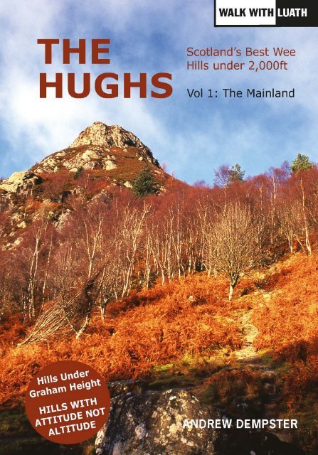
The Hughs Volume 1 by Andrew Dempster sampler
Andrew Dempster has 40 years’ experience of hillwalking the length and breadth of Scotland. Author of several climbing books, including the first guidebook to the Grahams, in this volume he identifies the best wee hills on the Scottish mainland.
Andrew Dempster has 40 years’ experience of hillwalking the length and breadth of Scotland. Author of several climbing books, including the first guidebook to the Grahams, in this volume he identifies the best wee hills on the Scottish mainland.
- No tags were found...
Create successful ePaper yourself
Turn your PDF publications into a flip-book with our unique Google optimized e-Paper software.
andrew dempster has almost 40 years’ experience of scrambling and backpacking<br />
in the Scottish Highlands and Islands. He has climbed all the Munros twice,<br />
and all the Corbetts, and wrote the first guidebook to the Grahams (mountains<br />
between 2,000 and 2,500ft in height). He has also walked, trekked and climbed<br />
extensively in such varied locations as the Alps, the Pyrenees, the Himalayas, Africa,<br />
Iceland and Greenland. <strong>The</strong> Highlands of Scotland are his first love, however.<br />
He is a retired mathematics teacher, currently living in rural Perthshire with his<br />
wife, Heather, and son, Ruaraidh.<br />
1
2<br />
By the same author:<br />
Classic Mountain Scrambles in Scotland (Mainstream, 1992)<br />
<strong>The</strong> Munro Phenomenon (Mainstream, 1995)<br />
<strong>The</strong> Grahams (Mainstream, 1997)<br />
Skye 360 (Luath, 2003)<br />
100 Classic Coastal Walks in Scotland (Mainstream, 2011)
3<br />
<strong>The</strong> <strong>Hughs</strong><br />
Scotland’s Best Wee Hills Under 2,000ft<br />
ANDREW DEMPSTER
4<br />
First published 2015<br />
isbn: 978-1-910745-03-8<br />
<strong>The</strong> author’s right to be identified as author of this book<br />
under the Copyright, Designs and Patents Act 1988 has been asserted.<br />
<strong>The</strong> paper used in this book is recyclable. It is made<br />
from low chlorine pulps produced in a low energy, low emission manner<br />
from renewable forests.<br />
Printed and bound <strong>by</strong> Bell & Bain Ltd., Glasgow.<br />
Typeset in 8.5 point Sabon<br />
© <strong>Andrew</strong> <strong>Dempster</strong> 2015
Contents<br />
5<br />
Introduction 11<br />
Key to Using this Guide 15<br />
part 1: south and east scotland (50 hughs)<br />
central belt and southern uplands – hughs map 19<br />
Edinburgh, the Pentlands and Lothian<br />
1 Arthur’s Seat 21<br />
2, 3 Caerketton Hill and Allermuir Hill 24<br />
4, 5 Scald Law and West Kip 26<br />
6 North Berwick Law 28<br />
7 Traprain Law 30<br />
Lanarkshire and Ayrshire<br />
8 Cairn Table 32<br />
9 Loudoun Hill 34<br />
10 Knockdolian 36<br />
<strong>The</strong> Campsie Fells and Ochils<br />
11 Dumgoyne 38<br />
12 Meikle Bin 41<br />
13 Lewis Hill 43<br />
14 Dumyat 46<br />
Loch Lomond and the Trossachs<br />
15 Conic Hill 49<br />
16 Ben A’n 52<br />
Fife<br />
17 West Lomond 55<br />
18 East Lomond 58<br />
19 Bishop Hill 62<br />
20 Benarty Hill 65<br />
21 Largo Law 68<br />
22 Norman’s Law 70
6<br />
contents<br />
Perthshire<br />
23 Moncreiffe Hill 72<br />
24 Kinnoull Hill 75<br />
25 Birnam Hill 78<br />
26 Deuchary Hill 81<br />
<strong>The</strong> Lammermuirs<br />
27 Lammer Law 84<br />
28 Dirrington Great Law 88<br />
Biggar to the Borders<br />
29 Broughton Heights 90<br />
30, 31 Eildon North Hill and Eildon Mid Hill 92<br />
32 Rubers Law 96<br />
33 Maiden Paps 98<br />
34 Skelfhill Pen 101<br />
Dumfries and Galloway<br />
35 Criffel 103<br />
36 Screel Hill 106<br />
37 Cairnsmore of Dee 109<br />
38 Craiglee (above Loch Dee) 111<br />
39 Craiglee (above Loch Doon) 114<br />
east of the great glen – hughs map 117<br />
Braemar to Aberdeen<br />
40 Creag Choinnich 119<br />
41 <strong>The</strong> Coyles of Muick 121<br />
42 Craigendarroch 123<br />
43 Clachnaben 125<br />
44 Bennachie: Mither Tap 128<br />
Tomintoul to Keith<br />
45 Tap o’Noth 131<br />
46 Knock Hill 133<br />
47, 48 Meikle Conval and Little Conval 135
contents<br />
Kingussie to Loch Ness<br />
49 Creag Bheag 137<br />
50 Stac Gorm 139<br />
part 2: west and north scotland (50 hughs)<br />
firth of clyde to fort william – hughs map 143<br />
Argyll<br />
51 Sgorach Mor 145<br />
52 Clach Bheinn 147<br />
53 Cruach nam Miseag 150<br />
54 Deadh Choimhead 152<br />
55 Beinn Lora 154<br />
56 Beinn Duirinnis 156<br />
57 Beinn Churalain 159<br />
Morvern, Ardnamurchan and Ardgour<br />
58 An Sleaghach 162<br />
59, 60 Beinn Iadain and Beinn na h-Uamha 165<br />
61 Ben Hiant 168<br />
62 Ben Laga 171<br />
63 Meall an t-Slamain 173<br />
fort william to ullapool hughs map 175<br />
Morar and Knoydart<br />
64 Sidhean Mor 177<br />
65 Sgurr an Eilein Ghiubhais 180<br />
66 Druim na Cluain-airighe 183<br />
Loch Alsh<br />
67 Beinn a’Mheadhoin 185<br />
68 Auchtertyre Hill 187<br />
Applecross to Gairloch<br />
69 Croic-bheinn 189<br />
70 Ben Shieldaig 191<br />
7
8<br />
contents<br />
71, 72 Meall a Ghlas Leothaid and Meall Lochan a’Chleirich 194<br />
73 Meall Aundrary 197<br />
74, 75 An Groban and Sidhean Mor 199<br />
76 Sidhean Mor (Fairy Lochs) 203<br />
Loch Broom and Ullapool<br />
77 Beinn nam Ban 206<br />
78 Meall Liath Choire 208<br />
the far north – hughs map 211<br />
Coigach and Assynt<br />
79 Sgorr Tuath 213<br />
80 Stack of Glencoul 215<br />
Cape Wrath<br />
81 Farmheall 218<br />
82, 83 An Grianan and Creag Riabhach 219<br />
84 Fashven 222<br />
Durness to Tongue<br />
85, 86 Meall Meadhonach and Beinn Ceannabeinne 224<br />
87 An Lean-charn 226<br />
88 Ben Hutig 229<br />
89 Meallan Liath 231<br />
90 Cnoc an Fhreiceadain 234<br />
91 Ben Hiel 235<br />
92 Cnoc nan Cuilean 236<br />
93 Beinn Stumanadh 238<br />
Tongue to Golspie<br />
94, 95 Ben Griam Mor and Ben Griam Beg 240<br />
96 Maiden Pap 243<br />
97 Creag Scalabsdale 245<br />
98 Ben Horn 247<br />
99 Beinn a’Bhragaidh 249<br />
100 Creag an Amalaidh 251<br />
Index of Hill Names 252
9<br />
Introduction<br />
Meall Lochan a' Chleirich
10
Introducing the <strong>Hughs</strong><br />
11<br />
the hughs are a new category of Scottish hills. All under 2,000ft, they are hills<br />
with attitude, not altitude. So what exactly is ‘attitude’? <strong>The</strong> three key words are:<br />
prominence · position · panorama<br />
I love the Scottish hills and in 40 years of hillwalking (and writing about<br />
hillwalking) I have identified a whole host of smaller hills which are rewarding<br />
– and often stunning – climbs. <strong>The</strong> <strong>Hughs</strong> have been chosen on the basis of this<br />
personal experience, rather than on strict quantitative criteria. <strong>The</strong>ir outstanding<br />
qualities have inspired me to create this list of the 100 mainland <strong>Hughs</strong> (a second<br />
volume will cover the 100 island <strong>Hughs</strong>). Some are already popular, many are<br />
less well-known. However, I can attest to the fact that there is something very<br />
special about each and every one of the <strong>Hughs</strong>.<br />
This is what the <strong>Hughs</strong> are about – they are diverse but never dull, small in<br />
stature but big in character, charisma and clout – hills small in altitude but big<br />
in attitude. I agree with the great fell-walker AW Wainwright when he observed:<br />
‘Some misinformed sources have defined a mountain as a hill which exceeds<br />
2,000 feet in height. Of course they are wrong. <strong>The</strong> status of a mountain is not<br />
determined <strong>by</strong> any arbitrary level of altitude but <strong>by</strong> appearance. Rocks and<br />
ruggedness, roughness of terrain and a commanding presence are the essential<br />
qualifications’.<br />
Essential Qualities<br />
Prominence, Position and Panorama are qualities that are not independent of each<br />
other: one will influence the other. Let’s take two examples. A hill may not be prominent<br />
on account of steepness and cragginess, but because it is the highest point for<br />
miles around. Similarly, the quality of a hill’s summit view is dependent on position.<br />
Many <strong>Hughs</strong> offering marvellous panoramic views, especially in the west and north,<br />
are coastal or island hills which benefit from their maritime position.<br />
Arthur’s Seat, the most climbed hill in Scotland, possesses all the key attributes<br />
of a Hugh. Its prominence ensures that it is the iconic landmark of Edinburgh and<br />
its unique position in the centre of Scotland’s capital city guarantees an unrivalled<br />
panorama, not only of the city, but of the Pentland Hills and the Firth of Forth.<br />
Arthur’s Seat has attitude.<br />
Another iconic Hugh is the Trossach’s little gem, Ben A’n. <strong>The</strong> character of<br />
this hill lies not only in its rocky profile, but also in its position at the centre of<br />
the Trossachs, one of Scotland’s most scenic areas. <strong>The</strong>re are outstanding views
12 introduction<br />
from its craggy, airy summit. Among <strong>Hughs</strong> blessed with both a fantastic position<br />
and wide-ranging summit views (but rarely climbed) is Ben Hutig in the far north<br />
(Route 88).<br />
Accessibility<br />
Someone once commented that hills under 2,000 feet are for people over 60.<br />
This is unwarranted, given that older folk, some into their 80s, are still capable<br />
of climbing Munros. It is true to say that a good number of <strong>Hughs</strong> are entry-level<br />
hills, but some require as much effort and commitment as a Munro or Corbett,<br />
especially hills such as Creag Riabhach or the Stack of Glencoul which are situated<br />
in remote, wild areas.<br />
Many mainland <strong>Hughs</strong> are situated in areas mostly devoid of Munros, Corbetts<br />
and Grahams – a quarter in the Southern Uplands and the East of Scotland,<br />
another quarter straddling the Highland Edge or in the Central Belt. <strong>Hughs</strong> in<br />
settings not characterised <strong>by</strong> high mountains, such as Meikle Bin in the Campsies<br />
and West Lomond in Fife, therefore tend to stand out significantly.<br />
Views<br />
Climbing wee hills and enjoying the view is better than climbing big hills in mist.<br />
Big isn’t always beautiful. <strong>The</strong> view from a smaller hill often has impact and<br />
three-dimensionality, as it is not looking down on other hills and is less dominated<br />
<strong>by</strong> the horizon.<br />
Probably the best view of the Cuillin ridge on Skye is from a wee hill called<br />
Sgurr na Stri. From this island Hugh, there is an unparalleled vista of the entire<br />
ridge, of Blaven and of the islands of Soay, Rum and Eigg. I have climbed this<br />
rocky eminence on countless occasions, <strong>by</strong> a variety of routes and never tire of<br />
its magic and charm.<br />
<strong>Hughs</strong> vs Marilyns and Humps<br />
As the best hills under 2,000ft, the <strong>Hughs</strong> do not constitute a comprehensive and<br />
all-inclusive list. For that, you must turn to the Marilyns (see Note on Classifications),<br />
or extend the Marilyn 150m drop criterion down to 100m and climb<br />
what are known as the ‘Humps’ – a loose acronym of ‘Hills with 100m of prominence’.<br />
(<strong>The</strong>re are over 1,200 Humps under 2,000ft in Scotland – a list too far in<br />
my opinion. In Great Britain the total number of Humps, regardless of absolute<br />
height, is almost 3,000!)
introduction<br />
13<br />
An Groban<br />
Approximately two-thirds of the 100 mainland <strong>Hughs</strong> are Marilyns. This is not<br />
surprising, since <strong>by</strong> their nature Marilyns have greater prominence due to their<br />
150m drop. Of the remainder, around half are Humps. <strong>The</strong>re remain roughly a<br />
dozen <strong>Hughs</strong> which stubbornly refuse to be categorised into the sterile logic of<br />
relative height. <strong>The</strong>se include such notable summits as West Kip, Dumgoyne,<br />
Ben A’n, Screel Hill, Clachnaben and An Groban. <strong>The</strong> 150m drop rule is just too<br />
restrictive and prescriptive for the <strong>Hughs</strong> list.<br />
A Note on Classifications<br />
It is perhaps fitting that the acronym hughs – Hills Under Graham Height in<br />
Scotland – is also the first name of the man whose surname has become a household<br />
term for the 3,000ft mountains in Scotland – the Munros.<br />
Sir Hugh Munro could never have imagined how his innocent list of hills would<br />
come to dominate the mindset of so many hillwalkers, and lead on to the creation<br />
of other lists of hills such as Corbetts, Donalds and Grahams.<br />
During the century since his death, a complete circle has been turned. From<br />
Munros (mountains over 3,000ft) to Corbetts (mountains over 2,500ft) to<br />
Donalds and Grahams (hills over 2,000ft) – and now, to the <strong>Hughs</strong>: the best hills<br />
under 2,000ft.<br />
As mentioned above, other than the fact that a Hugh is below 2,000 feet, there
14 introduction<br />
are no fixed criteria for inclusion. In this sense, <strong>Hughs</strong> have more in common<br />
with Munros, which have no rules for inclusion based on relative height, whereas<br />
Corbetts, Grahams and Donalds have strict rules of inclusion based on relative<br />
height (re-ascent) and/or other factors.<br />
A Marilyn is any hill in Great Britain (regardless of absolute height) having<br />
at least 150m of drop. <strong>The</strong> list of over 1,500 Marilyns was introduced in Alan<br />
Dawson’s <strong>The</strong> Relative Hills of Britain (Cicerone, 1992). <strong>The</strong> Marilyns include<br />
the Corbetts and Grahams as subsets, since they require 500ft and 150m of reascent<br />
respectively. Only slightly over 200 of the 282 Munros are also Marilyns,<br />
the rest having re-ascents of less than 150m.<br />
Adding the 200 <strong>Hughs</strong> to the already existing total of Munros, Corbetts,<br />
Grahams and Donalds produces a grand total of 985 listed summits in Scotland.<br />
This is a figure which almost begs to be increased to a crisp, round 1,000. Oddly<br />
enough, the 100m drop rule applied to mountains over 3,000ft can help out here.<br />
As already mentioned, the Munros have no rules for inclusion based on relative<br />
height. It turns out that exactly 15 non-Munros over 3,000ft have more than<br />
100m of re-ascent. Many of these have been serious contenders for promotion<br />
from ‘Top’ status to full Munro status and are therefore prominent summits,<br />
worthy of inclusion in this ‘Scottish Thousand’ list.<br />
It is debatable whether this mega-list of 1,000 Scottish hills will ever become<br />
a popular objective, except possibly for hardened hill connoisseurs. I hope,<br />
however, that the smaller, more manageable list of 200 <strong>Hughs</strong> will eventually<br />
become a popular challenge.<br />
<strong>The</strong> Right to Roam in Scotland<br />
Responsible right to roam in Scotland has always been at the core of access to<br />
wild land and this became law in 2003, when the Land Reform (Scotland) Act<br />
enshrined the principle as a statutory right.<br />
For most of the hills described in this book, there are unlikely to be any<br />
problems with restricted access, especially south and west of the Great Glen.<br />
For some of the more remote hills in the north and west, there may be issues<br />
regarding deer stalking, particularly during the main season from 1 July to 20<br />
October. I have never found this a major problem. Details are usually posted at<br />
the main access points to the hills, but if in doubt, phone the local Estate office.<br />
Note that deer stalking does not take place on Sundays.<br />
Another potential issue is forestry. Some hill routes may be temporarily diverted<br />
(but not usually closed) during forestry operations.
Key to Using this Guide<br />
15<br />
information boxes<br />
Each route description is headed with<br />
an Information Box. This concisely<br />
itemises the following essential<br />
information:<br />
• hill height in metres and in feet<br />
• associated 1:50000 os map(s)<br />
• 6-figure grid reference of the<br />
summit(s)<br />
• total distance (including return<br />
• height gain)<br />
• estimated completion time(s)<br />
• access point with grid reference<br />
• difficulty<br />
• summary<br />
All of the <strong>Hughs</strong> are accessible,<br />
but the ‘Difficulty’ and ‘Summary’<br />
sections in the Information Box<br />
provide a quick guide to the<br />
characteristics and challenges of<br />
individual hills.<br />
sketch maps<br />
Five location maps show the <strong>Hughs</strong><br />
<strong>by</strong> region and each individual route<br />
is accompanied <strong>by</strong> a sketch map<br />
designed <strong>by</strong> the author to be as clear<br />
and uncluttered as possible. <strong>The</strong>se<br />
maps could in principle be used ‘in the<br />
field’, but when walking it is advisable<br />
to have the appropriate os map.<br />
route quality<br />
<strong>The</strong> quality of a hill route is, to a large<br />
extent, subjective and may be affected<br />
<strong>by</strong> weather conditions, season, etc.<br />
<strong>The</strong> following criteria, satisfied in<br />
ratios varying from hill to hill, have<br />
been used to select the <strong>Hughs</strong>:<br />
• prominence<br />
• position<br />
• panorama<br />
Circular routes are generally more<br />
satisfying than ‘there and back’ walks<br />
and for each outing every effort has<br />
been made to avoid returning exactly<br />
the same way, wherever practicable.<br />
Possible alternative routes are also<br />
sometimes mentioned or described<br />
briefly.<br />
names of hills<br />
Where it appears, the derivation of<br />
a hill’s name is given either in the<br />
Information Box or in the narrative<br />
describing the route. <strong>The</strong>re is an index<br />
of hill names at the end of the book.
16
17<br />
part 1<br />
south and east scotland – 50 hughs<br />
central belt – 26 hughs<br />
southern uplands – 13 hughs<br />
east of the great glen – 11 hughs<br />
West Lomond
18
central belt – 26 hughs<br />
southern uplands – 13 hughs<br />
19
20
arthur’s seat<br />
21<br />
1. arthur’s seat (251m/822ft)<br />
map os sheet 66 (gr 275729)<br />
distance 4km<br />
ascent 210m<br />
time 1.5–2.5 hrs<br />
access palace of holyroodhouse car park (gr 271737)<br />
difficulty easy going on excellent paths<br />
summary Arthur’s Seat is the highest, most prominent and most popular<br />
of Edinburgh’s seven hills and easily the most climbed hill<br />
in Scotland. Its unique position, craggy profile and stunning<br />
panoramic views epitomise the very essence of hill ‘attitude’ –<br />
a Capital Hill in every sense.<br />
A half sovereign is smaller than a five<br />
shilling piece, and many a Highland Ben<br />
of ten times its bulk has less of a real<br />
mountain about it than Arthur’s Seat.<br />
—Harold Raeburn<br />
(pioneer of Scottish mountaineering)<br />
the volcanic plug of Arthur’s Seat<br />
is the focus of the extensive Royal<br />
Park known as Holyrood Park, and<br />
is a striking landmark from all parts<br />
of the city and beyond. <strong>The</strong> name,<br />
Arthur’s Seat, does not refer to any<br />
local of that name, but likely derives<br />
from the 12th century, when the<br />
Arthur’s Seat<br />
powerful legend of King Arthur and<br />
his knights caught the imagination of<br />
the public, resulting in many places<br />
(and hills) being named in his honour.<br />
A road completely surrounds<br />
Arthur’s Seat within the Park and<br />
ascends almost half way up the<br />
hill on its eastern side at Dunsapie<br />
Loch, where there is ample parking.<br />
This is the start of the easiest and<br />
quickest ascent, but the described
22<br />
View from Arthur’s Seat<br />
route begins to the north of the hill<br />
at the large car park near the Palace<br />
of Holyroodhouse and the Scottish<br />
Parliament Building. A fee is charged<br />
for using this car park.<br />
Leave the car park and cross the<br />
road to reach the start of two main<br />
walking trails. <strong>The</strong> one on the right<br />
winds its way round the base of an<br />
impressive rock formation known as<br />
Salisbury Crags and is your return<br />
route. Take the left-hand route which<br />
ascends gradually and is, oddly enough,<br />
not signposted to Arthur’s Seat.<br />
After several hundred metres,<br />
take a left fork path which heads<br />
up through crags to the obvious<br />
stone ruin of St Anthony’s Chapel,<br />
standing on a grassy promenade<br />
overlooking St Margaret’s Loch.<br />
<strong>The</strong>re is an information plaque about<br />
the near<strong>by</strong> chapel. From here, there<br />
is an excellent view of the second<br />
most prominent of Edinburgh’s seven<br />
hills, Calton Hill, with its distinctive<br />
Parthenon-type structure.<br />
Leave the Chapel and take a left fork<br />
leading downhill at first then rising<br />
gradually upwards on the west side of<br />
edinburgh, the pentlands and lothian<br />
Whinny Hill, the craggy, flat-shaped<br />
eminence on your left. <strong>The</strong> summit<br />
cone of Arthur’s seat is visible high<br />
above to the right. <strong>The</strong> path continues<br />
upwards into a wide depression<br />
curving left at the head over some<br />
steeper crags to arrive at a flat grassy<br />
platform just below the summit.<br />
Turn right here and follow a path<br />
<strong>by</strong> a chain fence up a series of stone<br />
steps. A variety of paths lead to the<br />
summit at this point, over polished<br />
rock which can be very slippery when<br />
wet. Unless you are climbing at night,<br />
you are unlikely to have the summit to<br />
yourself, but take time to savour the<br />
glorious panorama from this rocky<br />
perch. Just below the trig point is a<br />
view indicator, pointing out scores of<br />
surrounding hills such as Bass Rock,<br />
North Berwick Law, Traprain Law,<br />
the Pentlands and even Ben Lawers<br />
in Perthshire. <strong>The</strong> ‘crag and tail’<br />
formation of Castle Rock and the<br />
Royal Mile is just one of many city<br />
landmarks which can be picked out<br />
from this phenomenal vantage point.<br />
Immediately south of the summit<br />
is the flat, grassy mound known as<br />
Nether Hill, which is another good<br />
viewpoint. Return to the grassy<br />
platform east of the summit and then<br />
descend an easy, grassy path on gentle<br />
slopes to Dunsapie Loch just beyond<br />
the perimeter road. Here you may spot<br />
swans and several species of duck.<br />
Turn right and follow the road round<br />
the base of Nether Hill, its steep crags<br />
on the right clothed in juniper and
arthur’s seat<br />
23<br />
View from Salisbury Crags<br />
gorse. Here, you gain a fine bird’s eye<br />
view of Duddingston Loch, nestled in<br />
greenery in the heart of the city. After<br />
about 1km, cross the road and follow<br />
another footpath, taking you uphill to<br />
the start of Salisbury Crags.<br />
<strong>The</strong> name ‘Salisbury’ seems strange<br />
for a Scottish location, but the crags<br />
may have been named after the Earl<br />
of Salisbury who visited here with<br />
Edward iii in 1335. Others argue<br />
that it means ‘willows hill’ from the<br />
Cumbric ‘salis bre’.<br />
<strong>The</strong> path winds round the foot<br />
of these crags and is known as<br />
the Radical Road, constructed<br />
<strong>by</strong> unemployed weavers in the<br />
19th century. It was here that the<br />
geologist James Hutton made the<br />
groundbreaking discovery that the<br />
crags were formed <strong>by</strong> the intrusion<br />
and cooling of molten rock during<br />
volcanic activity.<br />
<strong>The</strong> final kilometre’s stroll round<br />
the base of Salisbury Crags is a<br />
delight, with ever-changing vistas of<br />
Edinburgh’s magical skyline backed<br />
<strong>by</strong> the soaring buttresses of basalt<br />
to your right. It is also possible to<br />
follow a rough path along the top of<br />
the crags. For reasons of public safety,<br />
climbing on the crags is restricted<br />
to a designated area (putting out of<br />
bounds some of the best routes in<br />
south Scotland).<br />
<strong>The</strong> Radical Road descends quite<br />
steeply in the latter stages down to the<br />
road and your starting point.
24<br />
edinburgh, the pentlands and lothian<br />
2. caerketton hill (478m/1,568ft)<br />
3. allermuir hill (493m/1,618ft)<br />
map os sheet 66 (gr 237663, 227662)<br />
distance 5km<br />
ascent 370m<br />
time 1.5–2 hrs<br />
access swanston (gr 241673)<br />
difficulty grassy paths on reasonable terrain<br />
summary Both these hills stand proud at the northern end of the<br />
Pentland range and give an unrivalled vista of Edinburgh’s<br />
sprawling skyline. <strong>The</strong> traverse of the two is an ideal<br />
introduction to the range.<br />
like arthur’s seat,<br />
the Pentland Hills are<br />
held in great affection<br />
<strong>by</strong> Edinburgh folk and<br />
have long been a quiet<br />
haven of escape from<br />
the hustle and bustle<br />
of the city far below.<br />
<strong>The</strong> name Pentland is<br />
likely derived from the<br />
Cumbric (pre-Welsh)<br />
‘pen llan’, meaning<br />
height above the<br />
enclosed land or church. Caerketton<br />
is also of Cumbric origin, ‘caer’<br />
being fort – the eastern<br />
shoulder of the hill has<br />
remains of a prehistoric<br />
fort. Allermuir derives<br />
from the Old Scots<br />
‘muir’, meaning moor.<br />
<strong>The</strong> old village of<br />
Swanston, lying to<br />
the south of the a720<br />
Edinburgh <strong>by</strong>pass, has<br />
a peaceful, tranquil air.<br />
Robert Louis Stevenson<br />
spent many summers<br />
here. It makes an ideal base from<br />
which to explore the northern end<br />
Allermuir Hill from Caerketton Hill
caerketton hill and allermuir hill<br />
of the range and there is a walkers’<br />
car park at the end of the public road<br />
near the golf course.<br />
Follow the path from the left-hand<br />
extremity of the car park which soon<br />
emerges from trees to the environs of<br />
Swanston, a picturesque collection<br />
of thatched cottages and colourful<br />
gardens. <strong>The</strong> path continues upwards<br />
through a gate and passes to the right<br />
of the so-called ‘T’ Wood.<br />
By now the craggy north face of<br />
Caerketton Hill is very prominent. It<br />
is the only part of the Pentland Range<br />
having a substantial amount of bare<br />
rock. At a T-junction, turn left and<br />
then fork right soon after on a good<br />
path which traverses round to the<br />
top of the Hillend Ski Centre. Before<br />
this, take a minor path which goes off<br />
to the right, climbing steadily to the<br />
summit of Caerketton Hill.<br />
Alternatively, continue on round to<br />
Hillend and take another ascent path<br />
which traverses the eastern shoulder<br />
first before ascending to Caerketton<br />
Hill. <strong>The</strong> view of Edinburgh and the<br />
Firth of Forth is absolutely stunning<br />
on a clear day. Stevenson wrote with<br />
great fondness: ‘you look over a great<br />
expanse of champaign sloping to the<br />
sea… So you sit, like Jupiter up on<br />
Olympus, and look down from afar<br />
on men’s life’.<br />
<strong>The</strong> grassy cone of Allermuir Hill<br />
lies 1km to the east and is easily<br />
reached from Caerketton <strong>by</strong> following<br />
the twisting ridge <strong>by</strong> a fence down<br />
to a grassy col and a further ascent.<br />
25<br />
This hill is another fine viewpoint<br />
and contains a trig point and a view<br />
indicator of dozens of other hills both<br />
near and far.<br />
<strong>The</strong> quickest return route to<br />
Swanston is <strong>by</strong> a path which descends<br />
the north-eastern flank of the hill to<br />
reach the T-junction just above the<br />
‘T’ Wood met on the ascent. <strong>The</strong> time<br />
shown above is based on this route.<br />
Alternatively, for a more prolonged<br />
outing, descend west <strong>by</strong> a path to<br />
join a well-made vehicle and bicycle<br />
track, where you turn right to steeply<br />
descend the wooded defile formed<br />
<strong>by</strong> the Howden Burn. Turn right at<br />
an old Water Feeder building and<br />
follow a grassy track which meanders<br />
pleasantly through stands of new<br />
trees and passes some established<br />
plantations. Note that this is an mod<br />
area and access may be restricted at<br />
certain times. Go through a gate and<br />
follow a vehicle track past the golf<br />
course to reach Swanston Steading.<br />
Go left here and right at the road to<br />
reach the car park. This alternative<br />
route will add around an hour to the<br />
total time.<br />
Edinburgh from Caerketton Hill


