PANDIT GOVIND BALLABH PANT MEMORIAL LECTURE: VII ...
PANDIT GOVIND BALLABH PANT MEMORIAL LECTURE: VII ...
PANDIT GOVIND BALLABH PANT MEMORIAL LECTURE: VII ...
Create successful ePaper yourself
Turn your PDF publications into a flip-book with our unique Google optimized e-Paper software.
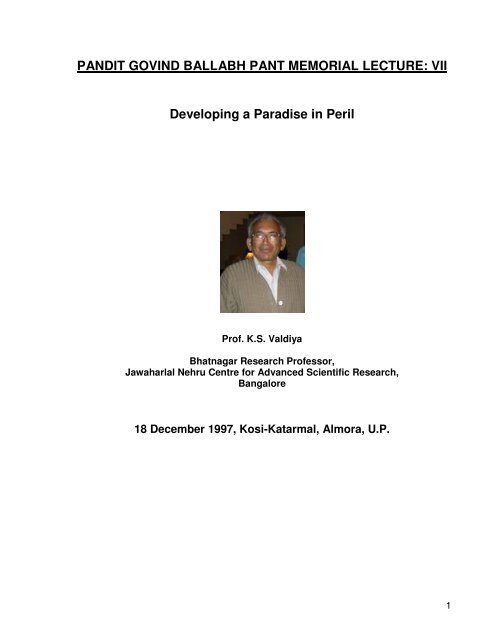
<strong>PANDIT</strong> <strong>GOVIND</strong> <strong>BALLABH</strong> <strong>PANT</strong> <strong>MEMORIAL</strong> <strong>LECTURE</strong>: <strong>VII</strong><br />
Developing a Paradise in Peril<br />
Prof. K.S. Valdiya<br />
Bhatnagar Research Professor,<br />
Jawaharlal Nehru Centre for Advanced Scientific Research,<br />
Bangalore<br />
18 December 1997, Kosi-Katarmal, Almora, U.P.<br />
1
About Prof. K.S. Valdiya<br />
Prof K.S. Valdiya<br />
Bhatnagar Research Professor at JNCASR, Bangalore<br />
(Born 20 March, 1937 at Kalaw, Burma)<br />
Fellowships<br />
Third World Academy (Trieste)<br />
Indian National Science Academy (Delhi)<br />
Indian Academy of Sciences (Bangalore)<br />
National Science Academy (Allahabad)<br />
Written two monographs, 4 books (one in Hindi), over 85 research papers and 40<br />
popular articles in English and Hindi inn national magazines of wide circulation and<br />
repute.<br />
Social Service and Societal Involvement<br />
Deeply and intimately involved in Ecodevelopment through peoples’ participation<br />
such as development of spring sanctuaries, afforestation in village Panchayat lands,<br />
linkages of animal husbandry, horticulture and agriculture, etc. in villages in Kumaun<br />
under the aegis of an NGO since 1982. Involved in organizing and promoting<br />
Uttarakhand-wide periodic scientific meets of school and college students.<br />
Research Contributions<br />
(i) Pioneering study of cyanobacteria-built stromatolites, initiating a new line of<br />
investigation in India, leading ot fixing of age of key horizons and establishment<br />
and refinement of stratigraphic order of the sedimentary succession in the<br />
Lesser Himalaya.<br />
(ii) Studies related to genesis and chareacterizationof deposits of magnesite and<br />
associated soapstone, culminating in their large-scale mining and attendant<br />
economic development of eastern Kumaun.<br />
(iii) Comprehensive investigation of palaecurrents and basin analysis demonstrating.<br />
for the first time, that it was the north-flowing rivers draining the Aravali terrane in<br />
the Peninsular India that deposited sediments in the Himalayan basin-a finding<br />
of tremendous importance in reconstructing the palaeogeography of the Indian<br />
subcontinent during the Proterozoic Era 9 200 0 to 570 m.y. ago).<br />
(iv) Regional tectonic studies of the intracrustal boundary thrusts and India-Asia<br />
junction providing insight into the evolution and development of the Himalaya<br />
mountain, particularly with regard to the origin, characteristics, location and<br />
neotectnics of the fractured framework of the Lesser Himalayan province,<br />
buckling up of the northern edge of the Indian crust, detachment of the cover<br />
2
fgorm tits basement in the Tettys/Great Himalayan domains, splitting up of the<br />
upper crust into duplex structures in zones of bundary thrusts, and the<br />
geomorphic, rejuvenation and landscape reshaping due to continuing crustal<br />
movements.<br />
(v) Pioneering investigation of the hydrology of mountain speings, their declining<br />
discharges and reduced stream flows in relation to environmental degradation<br />
and developmental activities.<br />
(vi) Hazard-zone mapping in context of hillside instability ad occurrences of<br />
landslides and earthquakes, leading to identification of belts vulnerable to<br />
mountain hazards in Uttarakhand.<br />
Awards<br />
Chancellor’s medal (1954) at Lucknow University.<br />
S.S. Bhatnagar Prize (1976) of the Council of Scientific and Industrial Research.<br />
L. Rama Rao Gold medal of the Geological Society of India.<br />
National Lectureship (1977-1978) of the University Grants Commission,<br />
P. Pant national environment Fellowship of the Department of Environment (1982-84),<br />
S. K. Mitra Award of the Indian National Sciences Academy (1991),<br />
National Mineral Award of the Ministry of Mines, Government of India (1993) and D.N.<br />
Wadia Medal of the Indian National Science Academy (1995)<br />
Membership of Learned Bodies & Expert Committee<br />
Has been/is a member of more than two dozen national committees,<br />
expert/councils, governing bodies, including a member of the Science Advisory<br />
Committee of the Cabinet of the Prime Minister (1983-85), the sub-committees of the<br />
Planning Commission, the Executive Councils of universities, Board of Management of<br />
the Geological Survey of India, Councils of two Science Academies, Research Councils<br />
of two CSIR National Institutes, etc.<br />
Professional Career<br />
Lecturer at Lucknow University (1957-1969), Reader at Rajasthan University,<br />
Udaipur (1969-1970), Senior Scientific Officer (1970-1973), Deputy Director (1973-<br />
1976) and Additional Director in the Director’s grade (1980) in Wadia Institute of<br />
Himalayan Geology; Professor (1976-1995), Dean of Science Faculty (1977-1980) and<br />
Vice-Chancellor (1981), Acting Vice-Chancellor (1984, 1992), Kumaun University,<br />
Nainital. Professor of Geodynamics at Jawaharlal Nehru Centre for Advanced<br />
Research (1995-1997).<br />
3
Pandit Govind Ballabh Pant Memorial Lecture<br />
K.S. Valdiya<br />
Geodynamics Unit<br />
Jawaharlal Nehru Centre for Advanced Scientific Research, Bangalore-560064<br />
Redefining Development<br />
We set out to make the future of Himalaya safe and secure; what actually we did<br />
and /are doing is to make ourselves rich and our posterity deprived and insecure.<br />
Undoubtedly, there is growth all-round, but no development. For, the people of the<br />
mountain are living in the shadow of fears of ecodisasters and natural hazards. There<br />
are very few who discern virtue in conserving the gifts of nature and preserving the<br />
integrity of ecosystems. There are some who see beauty In the landscape, but do not<br />
care. There are many who look at the mountain assets but with greed in their eyes.<br />
And the powerful look away; even as there is utter lack of political will for saving this<br />
mountain of tremendous splendor and majesty.<br />
Having no voice in the affairs of planning for development, the mountain people<br />
not only feel marginalized but also are quite disillusioned. Time has come for the<br />
highlanders to set out their own agenda for environmental security and socio-economic<br />
development. Holding the pivotal position in the socio-economic things and closer as<br />
they are to both life and nature, the women in the mountains (Figure 1) will have to take<br />
up this challenge and assume the responsibility of managing the resources.<br />
A condition has to be attained in which even a common marginal man is able to<br />
make more than the subsistence living in his own habitat in the midst of the environment<br />
of wholesome ecological health. For a development to become sustainable there has to<br />
be, as Pearce (1988) stressed, “the whole process of economic progress in which<br />
economies must contribute to the improvement in human welfare”. And this process of<br />
development should safeguard, among other things, the ecosystems of the land. There<br />
will be no safeguard if the benefits of the development is not shared by all sections of<br />
the society, including those living on the edge-the development oustees, the victims of<br />
ecodisasters, and the socially deprived.<br />
The material world development cannot be separated from the maintenance of<br />
health of natural environment and restoration of degraded or damaged ecosystems.<br />
The initiatives for regeneration or restoration of environment cannot but be cross<br />
sectoral, entailing involvement of scientists from varied disciplines. Their programmes<br />
need to be flexible in approach and compatible with the local tradition and culture.<br />
In my perception there are seven aspects of the development which deserve<br />
paramount consideration by the planners, the agencies of development, and by the<br />
people whose lives the processes of development will touch and affect (figure 1)<br />
4
Figure. 1. Marginalized woman in the Himalaya, whose life has been affected by<br />
mountain hazards and the deplorable state of the natural environment. Yet she occupies a<br />
pivotal position in the socioeconomic scheme of things.<br />
Figure 2. Crustal plate that makes the Indian subcontinent is sliding under the<br />
Himalaya at the rate of 18 7 mm per year, along what is known as the Main Boundary<br />
Thrust (MBT). The fast-rising Great Himalaya domain is moving up the Main Central<br />
Htrust (MCT) that separates the populated Lesser Himalaya terrane from the snowy<br />
Great Himalaya domain. The Siwalik in the southern front is separated from the Indo-<br />
Gangetic Plains by the Himalayan Frontal Fault (HFF). All these faults are quite active,<br />
that is, the mountain blocks are still moving up and down and sideways on them. As the<br />
blocks move suddenly, the ground shakes perceptibly. Black circles indicate the<br />
epicentres of such seismic events.<br />
(Block diagram after Jackson and Bilham (1994) and the epicentral map from Valdiya,<br />
1997)<br />
1. Quickened Earth Processes and Safety from Natural Hazards<br />
Geodynamically Active Domain<br />
Riven with multiplicity of faults that are quite active and shaken by earthquakes,<br />
which are far too frequent in several pockets, the geodynamically, sensitive, youthful<br />
Himalaya is going through unrelenting tectonic ferment. The crustal plate that makes<br />
the Indian subcontinent is sliding under the Himalayan mass (Figure2) at the rate of<br />
18±7 mm per year (Molnar, 1990). It is the titanic force of compression resulting from<br />
collision of India with mainland Asia (Figure 2) that is responsible for this tectonic turmoil<br />
of the mountain (Valdiya, 1988). Consequently, the mountain front is rising and<br />
frequently shaking.<br />
There are four 200 to 450 km long segments of the mountain arc which were<br />
ruptured in the last about one hundred years by earthquakes of magnitude more than 8<br />
– the northern Meghalaya (1897), the Kangra sector in western Himachal (1905), the<br />
south-central belt of Nepal (1934), and the northeastern Arunachal (1950). The three<br />
unruptured and presently seismically less active parts called “seismic gaps” (Figure 3)<br />
seem to be the sites of major earthquakes in the future (Gaur, 1993). For, it is in these<br />
segments of the mountain front where the strain is building up progressively, as the<br />
Indian plate pushes inexorably northward at the rate of 55 mm/yr. In the central<br />
segment that embraces western Nepal, Uttarakhand and western Himachal, no great<br />
earthquake has occurred since the 1255 A.D. event near Katmandu. The 1833 A.D.<br />
earthquake of magnitude 7.5 to 7.9 happened close to the rupture of 1934 earthquake<br />
of magnitude 8.1(Bilham, 1995). Practically the same seismotectonic situation obtains<br />
in the Garhwal sector (Chander and Gahalaut, 1995). Thus the seismic gaps remain<br />
5
locked or stuck. It is in these locked parts where the progressively building up strain<br />
awaits relaxation. So sizeable is the amount of strain that only an earthquake of<br />
magnitude 8 or above is capable of releasing the accumulated energy with attendant<br />
major earthquakes.<br />
Environmental Security<br />
Figure 3. Four great slips and attendant great earthquakes of magnitude more than 8<br />
have ruptured the Himalayan front along the plate boundary (Main Boundary Thrust)<br />
in the past 100 years, leaving three seismic gaps – locked segments – between them<br />
that may be already close to rupturing (From Gaur, 1993)<br />
The severely stressed Himalaya thus deserves extraordinary care when it comes<br />
to modifying topography by excavations, putting on loads of water and sediments,<br />
changing its groundwater circulation, removing protective cover of forests, etc.<br />
obviously, only those programmes of development can be launched which are less<br />
extractive and which cause but minimum adverse impact on the ecological balance,<br />
which is very delicate.<br />
Earthquakes cannot be prevented from occurring but their impacts can be reduced<br />
through timely measures. It is therefore imperative that the environmental security<br />
planning be undertaken simultaneous with implementation of development projects.<br />
The agenda for the environment management requires. Among other things,<br />
identification of zones of areas or hazard. This is done by making hazard-zoning maps<br />
(figure 4), which are based on geological, geomorphological, land use, and<br />
demographic data and past records of occurrence and through monitoring by<br />
geophysical changes taking place. The hazard-zoning maps provide crucial information<br />
related to estimation of actual danger (risk) to settlements, systems of communications<br />
and lines of essential supplies (Valdiya, 1987).<br />
Figure 4. An exercise in seismic hazard zoning. Bhatia et al. (1992) identify the<br />
intersections of faults and fractures characterized by great elevation and steep slopes of<br />
the faulted blocks that exhibit conspicuous gravity anomaly as potential sites of<br />
earthquakes. In the upper map 21 such spots are the area likely to be hit by seismic events<br />
of magnitude (M) equal to or more than 6.5 and in the lower map are shown 36 sites that<br />
would be shaken by events of M greater than or equal to 7.0<br />
Once the hazard-zoning maps are available the governments and the threatened<br />
communities can prepare hazard-preparedness plans accordingly.<br />
Accelerated Erosion and Landslides<br />
A consequence of tectonic compression of the mountain is the slow and persistent rise<br />
of uplift of the terrains. The rate of uplift varies from region to region----- it is 2 to 12<br />
6
mm/yr in the extreme northwestern Himalaya (Burbank et al., 1996), 5mm/yr in<br />
southwestern Garhwal (Rajal etal.,1986), and 2 to 3 mm/yr in southecentral Nepal<br />
(Jackson and Bilham, 1984), the uplift of terrain has prompted quickening of erosion<br />
rate it is 0.13 mm/yr in dry season to 0/91 to 3.38 mm/yr during rains in central<br />
Kumaun (Rawat and Rawat, 1994), 1.73 mm/yr in southcentral Kumaun (Bartarya and<br />
Valdiya, 1989), and 1.38 mm/yr in eastern Nepal (Carson, 1985). The present rate of<br />
erosion is many times higher than what is was in the immediate geological past.<br />
One of the consequences of accelerated pace of erosion is the voluminous production<br />
of sediment, which fills valleys reservoirs. Every one hundred square kilometer area of<br />
the catchment of the Bhagirathi upstream of the Tehri dam, for example, is producing<br />
22.72 ha-m of sediments annually (Bhumbla et al., 1990). If the bed load-which is<br />
normally taken at 15% of the suspended load-is also taken into account, the amount of<br />
accumulated sediments would be quite large. Interestingly, in some rivers in westerncentral<br />
Nepal the bed-load can be 500% to 1000% of the suspended load (Carson,<br />
1985). One can judge the magnitude of erosion and the volume of debris accumulating<br />
in reservoirs and floodplains. Along with sediments goes down the nutrient-rich soil,<br />
the building block of life. Even slight tampering such as modification of topography for<br />
road construction or mining can aggravate soil loss and attendant hazards or land<br />
degradation.<br />
Coping With Hazards of Mass-movement<br />
People suffer from the natural hazard not because it happens, but because they come<br />
in the way of the natural events occurring swiftly or suddenly (Valdiya, 1987). Of<br />
course, man’s own activities hasten the natural processes. The programme of coping<br />
with the landslide hazard requires identification of areas/belts prone to rock falls,<br />
landslides and debris flows (Figure 5) on the basis of geological and geomorphological<br />
features, rainfall data, history of past occurrence, and present sings of slope instability.<br />
It should be abundantly clear that for the environmental security of an area. The<br />
preparation of landslide hazard zoning map is an item of high priority. This requires<br />
combined efforts of geologists and geomorphologists.<br />
Figure 5. Identifying zones or areas of slope instability and proness to landslides is an<br />
essential prerequisite in the exercise of hazard management.Mehrotra (1994)<br />
attempts at hazard-zoning in the Bhagirathi valley in which the Tehri Dam is<br />
located.<br />
2. Water Conservation and Spring Sanctuaries<br />
Too Little-Too Much-Water Syndrome<br />
More than a billion people living in Tibet, Pakistan, India and Bangaldesh depend<br />
on the water of the Himalayan rivers. Despite abundance of flow (12,00.000 million<br />
m 3 /year) ------ 4,60,000 million m 3 of the Ganga alone (Table 1) ----- there is scarcity of<br />
7
water practically everywhere in the inhabited Lesser Himalayan domain, Locally the<br />
problem has assumed an alarming proportion. More then 40% of the springs in<br />
southcentral Kumaun for example, have greatly reduced discharges--- they have either<br />
gone dry or become seasonal (Valdiya and Bartarya, 1991).<br />
The situation is as had elsewhere in the Lesser Himalaya. In the snow-fed Seti<br />
River (A tributary of the Karnali River) in western Nepal, the difference of volume of<br />
water flowing during dry and rainy seasons is 1000 times (Kollmannsperger, 1977). In<br />
streams fed by the springs arising in the lesser Himalaya, this difference may be of the<br />
order of 3,000 to 60,000 (Kattleman, 1977). The reason is quite obvious. For, less<br />
than. 15% of the rainwater is able to percolate down through the ground of trees-less<br />
slopes to recharge the springs, more than 85% flowing down as surface runoff to make<br />
floods. This too-little-too-much-water syndrome is characteristic of a desert country<br />
(Valdiya, 1987). This is further borne out eloquently by the appearance of xerophytes<br />
on naked slopes.<br />
Developing Spring Sanctuaries<br />
The need is for augmenting spring discharges. For this purpose sanctuaries for<br />
springs in catchments of streams, rivulets and ravines can be developed, by allowing<br />
trees, shrubs and grasses to grow freely without interference and tampering (figure 6).<br />
This can be ensured by enclosing the catchments with fences or stonewalls in order to<br />
prevent access of grazing animals, fodder gatherers and timber seekers. The<br />
vegetation in the sanctuaries would grow effortlessly without external input. The genetic<br />
resource could also be enhanced. Where the trees have fallen, seedlings. Of<br />
appropriate vegetation may be planted and nurtured. The sanctuaries’ are located in<br />
the areas of ground-water recharge and must be cut with trenches and pits to promote<br />
infiltration of rainwater. This will result in augmentation of spring discharges.<br />
This is an area of crucial importance, and environmental institutions should be<br />
capable of identifying areas suitable for the development of spring sanctuaries within<br />
clusters of villages on the basis of geomorphological layout, geological setting<br />
(especially structures). Nature of soil cover, hydrology of streams, etc.<br />
Figure 6. Development of a spring sanctuary entails fencing or stonewalling a part of the<br />
catchment of a stream for ensuring unhampered growth of grasses, shrubs and<br />
trees, Trenches and pits are dug to induce or promote infiltration of rainwater to<br />
recharge springs. The area of recharge is identified on the basis of geological<br />
setup.<br />
Water harvesting.<br />
In addition to the development of spring sanctuaries, there should be concerted<br />
efforts in every village-or every community of villages-for harvesting rainwater and the<br />
storage of water of springs and seepages (Figure 7b). Streams and rivulets can be<br />
8
epeatedly impounded by constructing small and medium,- sized dams (Figure 7a). the<br />
aggregate storage would be sufficient to meet the round- the year needs of villages and<br />
towns. The distribution of stored water can be left to the Pani/Panchayat constituted of<br />
village elders and women.<br />
Figure 7(a) Repeated ponding of streams and rivulets by constructing small dams can<br />
accomplish storage of sizeable quantity of water for the use of villages and<br />
towns in the vicinity. Conceptual diagram as a suggestion for developing the<br />
Thuligad (stream) in Pithoragrah, eastern Kumaun.<br />
(b) Rainwater or streamwater can be safely stored in underground reservoirs and<br />
dugout. There will be little evaporation loss, and no pollution by animals and<br />
people.<br />
Every household should make provision for storing rainwater failing form roofs.<br />
As the people of Marwar in Rajasthan have been doing for centuries. Reading the signs<br />
of onset of desertic conditions in the Lesser Himalaya. It would be prudent at this early<br />
stage to take all measures to cape with the hazards of water deficiency which is bound<br />
opt strike sooner than later.<br />
Melt-Water Storage<br />
The bounty of the Himalaya is also locked in the 1400 km 2 of snow and ice<br />
spread over nearly 33,200-km2 area in higher altitudes (Figure 8). There are 15,000 –<br />
odd glaciers. The melting of this frozen asset contributes, on the average, about 58% of<br />
the water flowing down the Himalaya rivers – 50 to 80% in the northwestern sector and<br />
less than 30% in the eastern (Bahadur, 1985). Nearly 49% of the water flowing in the<br />
Chenab River, for example, is made up of melt water (Singh et al., 1997). One can<br />
have an idea of the importance of the ice pack if one realized that the Gangotri Glacier<br />
spread over 200 km 2 is capable of yielding three times the volume of water held in the<br />
Govind Sagar behind the Bhakra Dam. Unfortunately, the melting takes place<br />
maximally in late summer during rainy seasons when there is already a surfeit of water<br />
from the sky. The precious melt water thus goes waste.<br />
This enormous reserve of pure water is now threatened by untimely melting<br />
induced by global climate warming, as borne out by receding glaciers and rising snow<br />
line. Water-resource development programmes will have to take care of conserving the<br />
frozen asset and storing melt water for use when water is needed most, that is during<br />
drier seasons. Dams –which can be quite high – in glacier –fed rivers and streams in<br />
the snowy Great Himalayan and Tethyan domains will help a great deal in preventing<br />
the melt water form going waste. The stored melt-water can be released whenever<br />
needed and for the generation of electricity. Located as these dams would be in the<br />
wilderness of the ruggedly barren Great Himalayan and Tethys zone where settlements<br />
9
are very sparse o non – existent, the impoundment would not engender the problems<br />
that high dams generate in the populated and vegetation-rich Lesser Himalayan terrene.<br />
Figure 8. Vast pack of snow and ice represents the frozen asset. Nearly 58% of discharge<br />
in the snow-fed Himalayan rivers in meltwater. A satellite view of the<br />
northwestern Himalaya.<br />
(Photo; Courtesy Anshu K. Sinha)<br />
Glaciological and hydrological investigations are thus essential in any<br />
programme for the conservation and utilization of water, identification of suitable sites of<br />
dams in the glacial valleys need to be taken up as an essential item of the<br />
environmental agenda.<br />
Promotion of Biodiversity<br />
3. Conservation Forestry and Tree Cropping<br />
The Himalayan flora are not only diverse in composition with high level (-30%)of<br />
endemism, but also have high primary productivity manifest in abundant biomass<br />
production value for broad leaf evergreen forests (Sing, 1996). The integrity of the<br />
ecosystems of such a forest has to be preserved and protected at all costs.<br />
Not only the weather and altitude but also the slopes of the mountain are key<br />
factors in the healthy growth and sustenance of the mountain forest. This implies that<br />
gravity has a strong control on their security. The gravity causes slope failures.<br />
Therefore any act of man that modifies the slope and causes slope instability resulting<br />
in landslides, needs to be moderated. In other words the custodians of forests must see<br />
that there are no slope failures and no denudation of the soil mantle providing anchors<br />
to trees.<br />
The Forest Department would do well to develop and strengthen a division to<br />
take care exclusively of the promotion of biodiversity and protection of the forest<br />
ecosystem.<br />
Meeting Growing Demand for Woodstock<br />
Taking into consideration the phenomenally growing demand for Woodstock, and<br />
also the fact that the productivity of the dwindling forests is declining (0.7m 3 wood/ha/yr<br />
– Khoshoo, 1995) it is imperative to seek alternative sources of fuel and industrial wood.<br />
One way in which this can be achieved is to grow plantations of quick=growing trees of<br />
requisite species in specifically identified or designated areas. This has to be done in a<br />
big way, not by replacing natural forest, but of three-cropping in marginal or degraded<br />
lands and in fields found unsuited for agriculture. The aim of optimizing productivity in<br />
the long range rather than maximizing productivity in short term is vital and this confers<br />
viability and sustainability to traditional system” (Palni, 1996). Significantly, the<br />
10
productivity of tree plantations is greater than that of the natural forests (10 to 20 m 3 /yr<br />
per tree in plantations compared to 1 to 4 m 3 /yr per tree in natural forests according to<br />
N. D. Bachkheti in Valdiya, 1987). This is due to absence of inter specific competition in<br />
monocultural ecosystem. The environmental scientists are required to delineate<br />
onmaps the areas where crops of suitable trees can be raised. Another division of the<br />
forestry department – the Division of Tree Farming – would develop and nourish tree<br />
plantations and sell the products to the needy, including the industries.<br />
Fighting Forest Fires<br />
What has happened recently in lush rain forests of Indonesia and Brazil should<br />
be a lesson for the Indian foresters. Special precaution needs to be taken against fires,<br />
which are two, frequent. The pine forests are particularly vulnerable to forest fires, 95%<br />
of which are deliberate or due to carelessness. Not only 9000 km 2 area of Uttarakhand<br />
is covered with pine forest (Mehta, 1996), the resilient hardy pine is also rapidly<br />
encroaching on the realm of oaks, saal and other biologically mature trees. Thus, the<br />
pine has become a dominant tree species in the forests of the Lesser Himalaya. The<br />
abundance of pine needles in the litter is diminishing the nutrients in the soil as there is<br />
leach-out of its caction during decomposition (Schreier et at., 1995). The fires cause<br />
incomprehensible damage and loss both to the forests and to the soil, which is deprived<br />
of its ability of infiltration of rainwater that recharges springs (Mehta, 1996). It is<br />
therefore incumbent on the Forest Department to develop and effective system for<br />
coping with fire hazards, including monitoring and remedial measures Formation of an<br />
autonomous Division of Forest Fire Fighters may possibly provide security to the forests<br />
from conflagrations.<br />
Pasture Development<br />
Realizing that the grazing pressure in the Uttarakhand is 2½ to 4½ times the<br />
carrying capacity of forests and appreciating the paramount need for having larger<br />
number of cattle as producers of organic manure for the nutrient-starved montane<br />
agricultural fields, it is advisable to develop securely fenced pastures for controlled<br />
grazing of the community cattle. Undeniably, there is ample scope for genetic<br />
improvement of the local breeds (rather than import exotic breeds. The need for the<br />
producers of ecologically wholesome animal manure cannot be stressed too much.<br />
The adequately fenced pastures should have fodder trees interspersed with grasses.<br />
The society expects the environmental scientists to tell how to go about this venture,<br />
including increase in the productivity and nutrition value of the fodder plants.<br />
Ending Drudgery<br />
4. Women: The Natural managers of Resources<br />
So small is the per capita land-holding (0.1 ha) in the central Himalaya (Dhar and<br />
Gupta, 1992) and so limited the availability of essential resource that menfolk are<br />
compelled to migrate out phenomenally for livelihood and sustenance of their tottering<br />
11
economy. There are no opportunities for meaningful/appropriate employment or jobs,<br />
and the doors of recruitment to security services are nearly barred to nutrition- deficient<br />
men as they have become lately. There is therefore no option for men but to leave their<br />
hearths and homes to the care of their women. The women have thus become the<br />
principal producers in their subsistence economy. With deplorable decline of forest<br />
health the women are now spending nearly 66% more time- approximately 2 to 5 hours<br />
per day- for fetching fodder alone (Gurung, 1995). Cash economy – such as production<br />
of milk through buffaloes bought with loan money –has only added to the burden of daily<br />
chores, without commensurate personal gain or empowerment relating to planning and<br />
earning. A woman in the rural world in the mountain has thus become a drudge in her<br />
own home.<br />
Unless the various development programmes are geared to be supportive of<br />
women’s agenda of work, and aim at lessening their drudgery. There will be no<br />
development, no progress.<br />
Custodian of Biological diversity<br />
The survival and sustenance of the whole mountain systems depends on the<br />
perception, capabilities and enthusiasm of the women. They are not only the keepers of<br />
cultural heritage, but also the custodians of biological diversity. Since they are innately<br />
inclined towards living in harmony with the nature, and are contented with whatever the<br />
nature offers, including forests and water. They therefore have access to these<br />
resources and the power to make decisions on resource management.<br />
Target of Training and Women in Forestry<br />
The women should be made the targets of all training - training in management<br />
of biomass and water, in animal husbandry, in ecotechnologies of horticulture and<br />
agriculture, in planning and budgeting production –related projects, in monitoring and<br />
evaluating development programmes, etc. They need to be apprised of the advantages<br />
of judicious blend of ecological prudence with traditional technology.<br />
Let women be inducted in the fields of forestry –as range officers, forester, forest<br />
guards – and empowered to nurture and protect community forests, tree farms and<br />
pastures. Their compassion and benign inputs would convert these plantations into<br />
smiling nurseries.<br />
5. Taming Rivers without Bad Impacts<br />
The 12,00,000 million m 3 volume annually flowing down the Himalayan rivers has the<br />
potential ( Table 1) of generating 28 million kilowatts of electricity; and approximately<br />
2,46,000 million m 3 of water can be utilized of irrigation (Murthy, 1981),. This boundless<br />
resource should be tapped wherever possible. However, small decisions taken to meet<br />
political expediencies or for realization of immediate objectives without taking into<br />
12
consideration the wider impact of impacts on the environment, society and people’s<br />
psyche be avoided.<br />
Smaller Dams are Desirable<br />
Bigger dams are known to engender environmental imbalances and enormous<br />
societal problems, including the trauma of large-scale uprooting of people (Valdiya,<br />
1992, 1997). Since there is no built-in provision for mitigation or elimination of negative<br />
environmental and socioeconomic effects such as restoration of forests, stabilization of<br />
slopes and appropriate and adequate relocation of displaced population, and of sharing<br />
of benefits by communities living in the command areas and upstream of the dams, it<br />
would be better to go in for smaller dams (Figure 7a) which cost less, start giving<br />
benefits quite early, bring greater profits, and cause less damage to or impairment of<br />
environment, croplands and human habitats (Table 2). This is quite evident form the<br />
date (Table 3) collected by the Planning Commission (Singh, 1993).<br />
TABLE 2:<br />
Comparison of a Big Dam with a series of Smaller Dams in a River in the USA<br />
(Odum, 1959)<br />
Mainstream Multiple-head<br />
reservoirs behind water reservoirs<br />
a big dam behind smaller<br />
dams<br />
Number of reservoirs 1 34<br />
Drainage are (sq. miles) 195 190<br />
Flood storage (acre-fee) 52,000 59,100<br />
Surface water for<br />
Recreation (acres) 1950 2100<br />
Flood, pool (acres0 3650 5100<br />
Bottom inundated and<br />
Lost (acres) 1850 1600<br />
Bottom protected (acres) 3371 8080<br />
Total cost $6,000,000 $1,985,000<br />
TABLE 3:<br />
Expenditure on the Benefits from Major and Minor Irrigation Projects, Planning<br />
Commission Statistics<br />
(S.Singh, 1993)<br />
Quality/Expenditure Comulative Potential<br />
(million rupees) (million hactares)<br />
________________________________________________<br />
13
Major/Medium Minor Major/Medium Minor<br />
Pre-Plan benefits - - 9.70 12.90<br />
First Plan 3,800 760 12.20 14.06<br />
Second Plan 3,800 1,420 14.30 14.79<br />
Third Plan 5,810 3,280 16.60 17.01<br />
Annual Plan 1996-1969 4,340 3,260 18.10 19.00<br />
Fourth Plan 1969-1974 12,370 5,130 20.70 23.50<br />
Fifth Plan 1974-1978 24,420 6,310 24.82 27.30<br />
1978-1979 9,770 2,370 25.86 28.60<br />
Annual Plan1979-1980 10,790 2,600 26.60 30.00<br />
75,100 12,930 168.88 187.16<br />
Admittedly, the cost of production of electricity is high for small hydel projects –<br />
Rs. 15,000 to 8,000 per kilowatt, compared to Rs. 7,000 to 3,000 per KW by large hydel<br />
projects (Singh, 1993). However, if one were to think of the real (total) cost of the water<br />
resource development which also includes the values of the losses of environment and<br />
resources (mineral, forest, agriculture, etc), the cost of damaged land and the enormous<br />
expenditure on relocation of uprooted communities, this high cost of electricity<br />
generated by small hydel project is more than compensated (Valdiya, 1992, 1997).<br />
As already stated, in the Himadri (Great Himalayan) and Tethyan domains where<br />
rivers flow through narrow gorges, higher dams would not only be feasible nut also quite<br />
less damaging to the environment and settlements, the latter being very sparse or nonexistent.<br />
Cascade Development Hydropower<br />
Chinese provide an inspiring example of tapping stream water in an<br />
environmentally very sound and economically rewarding manner. By 1985 they had<br />
built about 80,600 small hydropower stations that produced and aggregate amount of<br />
8000 m.W. f electricity of the total of 20,000 kW, hydroelectricity (Zheng Naibo, 1986).<br />
These small hydropower projects (Figure 9) entailing cascade development and<br />
multipurpose utilization of water of streams and small rivers were planned and<br />
developed locally, involving local people. They required less investment, had shorter<br />
period of construction and the benefits came quite early. The cascade development tof<br />
small rivers fully utilize the river drop, create upper reservoirs for increasing the firm<br />
capacity of downstream stations and to operate the cascade stations jointly in order to<br />
maintain appropriate water balance between stations (Zheng naibo, 1986). Each<br />
project with dam height of 30 to 50 m generates 6 to 12 mW power. The design of<br />
small hydropower projects incorporates storage, retention, diversion and<br />
interconnection measure, the lower reaches of reservoir serving as the storage basin.<br />
There are today thousands of such multipurpose microhydel projects in China.<br />
14
Figure 9. Tapping a small river in the high mountain for generation of electricity and for<br />
storage of water for irrigation and flood moderation under the cascade scheme<br />
adopted by the Chinese (Zheng Naibo, 1986)<br />
Environmental Scientists would be required to locate the sites where dams can<br />
be constructed with minimum backlashes or adverse effects. Needless to state,<br />
geologists, hydrologists, botanists, economists, and social scientists would join hands to<br />
carry out exploration and impact- assessment exercises. As a matter of fact,<br />
environment impact assessment of major and minor development projects should be<br />
the most important preoccupation of the environmental institutions.<br />
Planning new Settlements<br />
Related to the development of microhydel projects is the problem of resettlement<br />
of people. In order to stem the alarming tide of exodus of able-bodied, capable and<br />
hardworking men, and to accommodate the growing number of people, it is necessary<br />
that new settlements be planned and developed. The new township – having clearly<br />
spelled out master plans –can be developed in the proximity of hydel projects and<br />
around ecofriendly factories and plants (such as milk processing, vegetable-and fruit –<br />
preservation medicinal plant extraction), slate and pavingstone quarries, tea gardens,<br />
and new academic institutions. The new settlements would not only open up avenues<br />
of employment but also provide opportunities for skilled craftsmen and also help ramify<br />
trade and commercial ventures.<br />
The locations of new settlements have to be identified on the basis of land<br />
capability, freedom form natural hazards, availability of resources ( like water,<br />
construction material, fuelwood, etc.) and on the likely impact on the society.<br />
Mineral Deposits<br />
6. Utilization of Wealth Stored in Rocks<br />
Reserves of magnesite, dolomite, cement-grade limestone, roofing slate,<br />
pavingstone and gypsum are very large and economically very promising. Other<br />
minerals like steatite-talc, phosporite, lignite, rock salt, base-metals, uranium-minerals,<br />
etc, are substantial, although their mining at present is not always economically<br />
profitable or viable (Table 4). Then there are notable deposits of high-cost but low –<br />
volume minerals occurring in various parts of the Himalaya. These deposits can be<br />
mined in t times of acute need and emergency. Since minerals form the base of al<br />
industrial, economic and commercial activities, and are used for the generation of<br />
energy that touches all spheres of life of the common man, workable deposits of<br />
minerals must be mined. Establishment of slate and pavingstone industry would prove<br />
very beneficial and greatly rewarding. However, this is to be done with minimum waste<br />
in extraction and rigorous adoption of scientific and systematic methods of mining<br />
15
(figure 10) so that integrity of the environments not violated and its ecological balance is<br />
maintained.<br />
TABLE 4<br />
Mineral Wealth of the Himalaya within the Indian Territory<br />
(V.C. Thakur, 1976)<br />
Mineral Proven Reserves in 1980<br />
Limestone 458 m.t<br />
Dolomite 94 m.t<br />
Magnesite 82.2 m.t<br />
Gypum 66.7 m.t<br />
Graphite 26.7 m.t<br />
Lignite 21.7 m.t<br />
Phosphorite 18.1 m.t<br />
Bauxite 13.6 m.t<br />
Coal 11.6 m.t<br />
Rock Salt 8.0 m.t<br />
Copper-Lead-Zinc 2.2 m.t<br />
Steatite-Talc 1.9 m.t<br />
Flourite 86,000 t<br />
Bentonite 40,000 t<br />
Sulphur 20,000 t<br />
Barytes 13,200 t<br />
Antimony 10,588 t<br />
Borax 5,423 t<br />
Uranium minerals Appreciable<br />
Mining of quite a few mineral deposits has created environmental problem in a number<br />
of areas. This is because of the lack of safeguards against scarification of landscape<br />
and triggering of mass-,movement, Consequently, many mining areas have become<br />
open wounds and scarred wasteland of barren slopes and eroding soil, Down slope,<br />
stream beds have been clogged with debris, and springs and vegetation, buried and<br />
smothered by sedimentary wastes.<br />
There was to be a running programme of overall assessment of reserves<br />
embracing not only the benefits to be derived from the mining of deposits, but also the<br />
magnitude and cost of adverse impacts on water, soil, forest, agriculture, grazing land,<br />
etc. There should also be a legislative provision for placing full responsibility of<br />
treatment and environmental rehabilitation or restoration of mined areas squarely on<br />
mining agencies (Valdiya, 1987). In other words, there should be legal binding on mineowners<br />
to restore the land they damage by resorting to systematic and appropriate<br />
methods of disposal of wastes and debris, and regeneration of vegetal cover (figure<br />
10). Stacking and preserving of nutrient-rich topsoil in order to cover back the<br />
16
excavated parts with debris and then put a mantle of this soil over it for growing<br />
grasses, shrubs and trees must be made compulsory. Serious attempts should be<br />
made to stabilize the slopes, not only during the excavation, but also afterwards, to<br />
ensure that the stability is maintained in future also.<br />
Figure 10. It would be quite prudent to extract mineral deposits for meeting the needs of<br />
industries, and for building material. However, care has to be taken to stabilize<br />
the excavated slopes and also the dumps of debris and wasters during and after<br />
mining. The dumps should be covered with nutrient-impregnated soil, so that<br />
there is quick regeneration of protective vegetation.<br />
(From Valdiya, 1987)<br />
Tapping Geothermal Energy<br />
There are a large number of springs emitting heated water and steam in fault zones,<br />
particularly the Indus-Tsangpo suture in Ladakh, the Main Central Thrust and Main<br />
Central Thrust and Main Boundary Thrust (Figure 11). There are 34 hot springs in<br />
Ladakh, 34 in Himachal Pradesh. 37 in Kumaun, 7 in Sikkim, and 11 in Arunachal<br />
Pradesh. These hot springs have the potential of generating power at the rate varying<br />
from 130 milli W/m 2 to 468 milli W/m 2 _ the high value of 300 milli W/m 2 being in the<br />
Ladakh belt (Shanker 1989).<br />
The energy from hot springs can be profitable utilized for local development , as<br />
is being done in Ladakh. There are two ways in which the geothermal energy can be<br />
utilized. The hot waters and superheated steam can be directly conveyed to power<br />
plants to operate generating turbines. The hot water and steam can be used to heat<br />
buildings and glass housed. The latter fort growing vegetables.<br />
Figure 11. Located in the zones of deep faults that define the tectonic boundaries of the<br />
Himalayan terrane, the hotsprings can be profitable tapped for electricity and for<br />
heating homes and glass-houses.<br />
(From Valdiya, 1997 based on Shanker (1989)<br />
7. Road Network : Unavoidable Wrecker<br />
Roads are essential for the development of the mountain, despite the serious<br />
environmental havocs they create and bring social tribulations and cause economic<br />
distresses. The compelling demand for more roads cannot be avoided. Excavations<br />
cause interception of groundwater and behead the water table, leading to drastic<br />
disruption of groundwater regime. Therefore, special cares have e to be taken in the<br />
construction of roads and canals. Where roads are essential, their construction should<br />
be undertaken with concurrent measures of slope stabilization (even if these measures<br />
escalate the costs manifold). Ecologically vulnerable and geologically unstable zones<br />
and areas must be avoided at all cost or bypassed altogether. Only those places need<br />
17
to be brought in the ambit of road networks which are strategically or touristically<br />
important and which produce commodities for marketing.<br />
The road construction should be preceded by geotechnical investigations for<br />
examining the bearing capacity and shear strength or the roadbed substrate, the<br />
stability of the slopes and the conditions of groundwater. On the basis of investigations,<br />
alignments are to be suggested and areas of potential instability indicated. Te safe<br />
disposal of the debris generated by cutting of slopes is the most important aspect of the<br />
road development (Valdiya, 1987). A Road has to be in harmony with the environment<br />
and appear as “ an integral part of the total landscape rather than an offensive intruder”.<br />
Summing up<br />
This is an insider’s perspective of the Himalaya --- who regards it as a paradise. I am<br />
awed by the majesty of the mountain, and overwhelmed by the tragedy of its people.<br />
Forty years of wandering in the mountain fastness and two decades of environmental<br />
pursuits have convinced me that intervention of exotic technology and input of external<br />
money are not going to make impact on the health of Himalaya’s environment and on<br />
the trend and pace of socio-economic development of its people. It would be for better<br />
to develop and offer working models of ecological and socio-economic development ---<br />
of hazard-zoning and risk preparedness exercises, of spring sanctuaries and waterharvesting<br />
devices, of tree-cropping farms and ecologically sound pastures, of<br />
microhydel projects, of geothermal energy plants, of small scientific pavingstone of slate<br />
quarries, and so on. Looking at these pragmatic models the people may feel inspired<br />
and be impelled to replicate them in their own ways, using their earthy genius and their<br />
limited resources as input.<br />
Since development activities would be aimed for the benefits and well being of<br />
the highlanders, they themselves must flex their sinews and strive for getting their goals.<br />
There should be no suggestion of bequeathing their Himalaya to only the privileged and<br />
the powerful. Let it also belong to those who live on the edge.<br />
What I have stated may appear a uptopain vision. Perhaps it is but then I feel<br />
strongly like Mirza Ghalib “If the youths do not try to reach out to the stars, they will end<br />
up becoming what we have become”. I don’t want our children to be like us, stoically,<br />
callously unconcerned about the world around us, or plundering the resources, dirtying<br />
the waters, fouling the air and defiling the landscape.<br />
I share the sentiments of Tom Knudson who said some years ago on the Sierra<br />
Navada mountain. “When my grandchildren come before whoever is in charge at that<br />
time and ask where it (the mountain) went, they are going to say there was no one<br />
responsible. It disappeared because nobody was responsible”. I do not want this to<br />
happen to the Himalaya.<br />
The practitioners of research and Ecodevelopment have to see that Himalaya is<br />
not put for sale.<br />
18
Acknowledgement<br />
I am grateful to the chairman Governing Body and the Director of the G.B. Pant Institute<br />
of Himalayan Environment and Development for bestowing me this honour and giving<br />
me an opportunity for ventilating my feelings.<br />
The talented and great son of India Govind Ballabh pant would have had he been<br />
alive, exhorted scientists and scholars of all disciplines to strive together in unision -<br />
rather than in compartments – to make the Himalaya a paradise once again.<br />
References<br />
Bahadur, Jagdish, 1985. Role of snow and glacier – melt contribution for environmental<br />
regeneration in the Himalaya. In: J. S. Singh (Ed). Environmental Regeneration in<br />
Himalaya. Gyanodaya Prakashan. Nainital,268-375.<br />
Bartarya, S.K. And Valdiya, K.S., 1989. landslides and erosion in the catchment of the<br />
Gaula River, Kumaun Lesser Himalaya, mountain Research & Development, 9, 405-<br />
419.<br />
Bhatia, S.S. and 5 others, 1992. identification of potential areas for occurrences of<br />
strong earthquakes in Himalayan arc. Proc. Indian Academy of Sciences (Earth Planet.<br />
Sci). 101, 369-385.<br />
Bhumbla, D.R. and 11 others, 1990. Environmental Appraisal of multipurpose Tehri<br />
dam Project. Unpub. Report. Department of Environment &Forests New Delhi, 77p.<br />
Bilham, R. 1995. Location and magnitude of the 1833 Nepal earthquake and aits<br />
relation to the rupture zones of contiguous great Himalayan earthquakes, Current<br />
Science, 69, 101-128.<br />
Burbank, D.W. and 6 other 1996. bedrock inicision, rock uplift and threshsold hill slopes<br />
in the northwestern Himalaya. Nature 379,565-570.<br />
Carson, B., 1985. Erosion and Sedimentation Processes I the hepalese Himalaya.<br />
ICIMOD. Kathmandu. 39p.<br />
Chander, R. And Gahalaut, V.K., 1995. Implications of recent leveling observations for<br />
Tehri and other high dams in the Himalaya. Current Science, 69,223-226.<br />
Dhar, T.N. and Gupta. S.P., 1992. the Himalayan States of India : Development<br />
Profiles. SHERPA, Lucknow, 408p<br />
19
Gaur, V.K., 1993. Earthquake hazards in the Himalaya, In : V.K. Gaur (Ed). Earthquake<br />
Hazard and Large Dams in the Himalaya. INTACH, New Delhi, 63-74.<br />
Gurung, Jeannete, 1995. Invisible farmers: Hill and mountain women of Himalaya, In :<br />
H. Schreier et al. (Eds) Challenges in Mountain Resource Management In Nepal.<br />
ICIMOD, Kathmandu, 96-05.<br />
Jackson, M. and Bilham, R., 1994. Constraints on Himalayan deformation inferred from<br />
vertical velocity fields in Nepal and Tibet, Jaur. Geophys. Res. 99B, 13697-13912.<br />
Kattlemann, R., 1987. Uncertainty in assessing Himalayan water resources. Mountain<br />
Research & Development, 7, 279-286.<br />
Kollmannsperger. F., 1977. Change in microclimate and biotopes leading to erosion, In ;<br />
H.C. Rieger (Ed). Dialogue : Himalayan Mountain Ecosystem, Maxmuller Bhavan, New<br />
Delhi, 76-80.<br />
Khoshoo, T.N., 1996. Making forestry in India sustainable, Current Science, 70,205-<br />
214.<br />
Mehrotra, G.S. 1994, Environmental Development of Garhwal Himalaya with Particular<br />
Reference to landslide Hazard Zonation and Efficiency of Innovative control measures,<br />
Unpub. Report Central Building Research Institute. Roorkee. 184p.<br />
Mehta, J.S. 1996. Forest fires and land degradation in Uttarakhand, In: Kireet Kumar et<br />
al. (Eds). Land Utilization in the Central Himalaya, Indus Publishing Co. New Delhi, 125-<br />
134.<br />
Molnar, P., 1990. A review of the seismicity and the rates of active underthrusting and<br />
deformation in the Himalaya, jour, Himalayan Geology. 1. 131-154.<br />
Murthy, Y.K., 1981. Water-resource potential of the Himalayas, In: J.S. Lall and A.D.<br />
Moddie (Eds_. The Himalaya, Oxford University Press. New Delhi, 152-174.<br />
Odum, E.P., 1959. Fundamentals of Ecology (2 nd Ed), W.B. Saunders. Philadelphia,<br />
546p.<br />
Palni, L.M.s., 1996. Welcome Address. In : kireet Kumar et al. (Eds). Land Utilization in<br />
the Central Himalaya, Indus publishing Co. New Delhi, 24-31.<br />
Pearce, D.W., 1988. Economics, equity and sustainable development, Futures, 20,598-<br />
605.<br />
Rajal, B.S., Virdi, N.S. and hasja, N.L, 1986. Recent crustal uplift in the Doon valley.<br />
Proc. Intern. Symp. Neotectonics inSouth Asia, survey of India Dehradun, 146-159.<br />
20
Rawat, J.S. and Rawat, M. S., 1994. Accelerated erosion and denudationin the Nana<br />
Kosi watershed, Central Himalaya, India : Sediment load, mountain Research &<br />
Development, 14, 25-38.<br />
Schreier, H., brown, S. and Shah P.B. 1995. Identification of key resource issues :<br />
Discussion and Recommendations. In : H. Schreier et al (Eds). Challenges in mountain<br />
Resource management in Nepal. ICIMOD. Kathmandu, 247-252.<br />
Shanker, Ravi, 1989. Heat flow in the Himalaya, Special Publication of Geological<br />
Survey of India. No. 26, Calcutta, 191-192.<br />
Singh, Satyajit, 1993 Political economy of large dams : some tentative assertions. In: m<br />
Balakrishnan (Ed). Environmental Problems and Prospects in India. Oxford & IBH.<br />
New Delhi. 195-231.<br />
Singh, S.P. 1996. Forest wealth of Uttarakhand In: K.S. Valdiya 9Ed). Uttarakhand<br />
Today. Shree Almora Book Depot, Almora, 93-101.<br />
Singh, P., Jain, S.K., Kumar, N., 1997. Estimation of snow and glacier melt contribution<br />
to the Chenab river, western Himalaya, Mountain Research &Development. 17(1), 49-<br />
56.<br />
Thakur, V.C. 1976, Himalayan region: promising prospects for mineral development,<br />
Commerce, Annual number. 71-77.<br />
Valdiya, K.S., 1987. Environmental Geology: Indian context, Tata-McGraw-Hill, New<br />
Delhi, 583p.<br />
Valdiya K.S. 1992. must we have high dams in the geodynamically active Himalayan<br />
domain?. Current Science, 63, 289-296.<br />
Valdiya, k.S., 1997. High dams in Central Himalayan in context of active faults,<br />
seismicity and societal problems, Jour Geol. Soc. India, 49, 479-494.<br />
Valdiya, K.S. 1998. Dynamic Himalaya, Universities Press, Hyderabad, 186p.<br />
Valdiya K.S. and Bartarya, S.K., 1991. Hydrological studies of springs in the catchment<br />
of the Gaula River, Kumaun Himalaya, mountain Research & Developmet, 11, 239-258.<br />
Zheng Naibo. 1996. Cascade development and multipurpose utilization of small rivers,<br />
Urja, 19(3), 179-184.<br />
21


