Walk Northern Ireland - Mountaineering Ireland
Walk Northern Ireland - Mountaineering Ireland
Walk Northern Ireland - Mountaineering Ireland

Create successful ePaper yourself
Turn your PDF publications into a flip-book with our unique Google optimized e-Paper software.
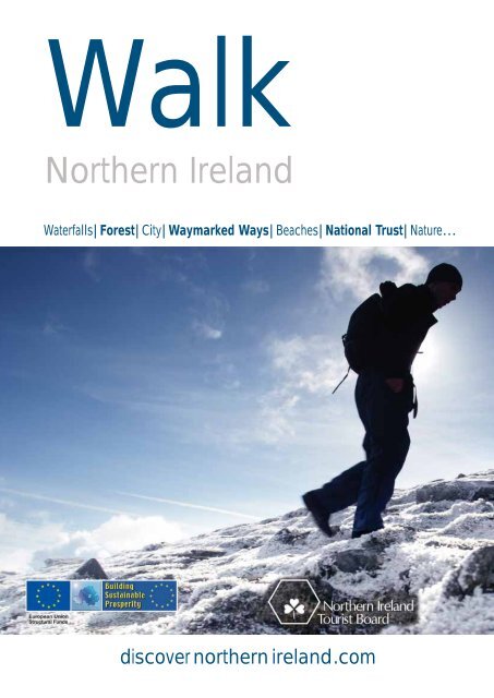
<strong>Walk</strong><br />
<strong>Northern</strong> <strong>Ireland</strong><br />
Waterfalls|Forest|City|Waymarked Ways|Beaches|National Trust|Nature…<br />
discover northern ireland.com
discovernorthernireland.com<br />
2<br />
walk… northern ireland<br />
Introduction<br />
The beauty and variety of our landscape, the compact distances and ever-changing vistas, and<br />
our mild climate, make <strong>Northern</strong> <strong>Ireland</strong> brilliant to explore on foot. And the good news for<br />
those who like to travel this way is that the region offers a huge variety of walks, all packed<br />
into a relatively small area. One day you could be looking out on the restless Atlantic crashing on the<br />
rocks of the Giant’s Causeway, then taking a stroll in peaceful woodland, then standing on a summit<br />
in the Mourne Mountains with the patchwork fields of County Down far below. <strong>Northern</strong> <strong>Ireland</strong><br />
has it all, forests, boglands, clifftop walks, mountain trails, country parks and beachfront dunes. So<br />
if you’re a serious rambler or just like to stretch the legs and enjoy the view, you’re in the right place.
ACKNOWLEDGEMENTS:<br />
walk… Introduction<br />
Text:<br />
Helen Fairburn<br />
Photography:<br />
<strong>Northern</strong> <strong>Ireland</strong> Tourist Board Photographic Library<br />
The National Trust Photographic Library<br />
<strong>Northern</strong> <strong>Ireland</strong> Young <strong>Walk</strong>ers’ Group<br />
Environment and Heritage Service<br />
Chris Hill Photography<br />
Production and Design:<br />
NITB Publications Dept.<br />
Printed:<br />
GPS Colour Graphics, Belfast<br />
Front Cover & Inside: The Mournes, County Down<br />
discovernorthernireland.com<br />
3
discovernorthernireland.com<br />
4<br />
walk… northern ireland<br />
Contents<br />
Mountains 6<br />
Slieve Donard » Slieve Bearnagh » Slieve Binnian » Slieve Gullion<br />
Hills 10<br />
Glenullin » Slemish Mountain<br />
Belfast 12<br />
Cave Hill » Lagan Towpath » Sir Thomas and Lady Dixon Park » Colin Glen<br />
The National Trust 16<br />
The Argory » Castle Ward » Mount Stewart » Florence Court » Crom Demesne<br />
Beaches 21<br />
Benone Strand » Portstewart » Murlough National Nature Reserve<br />
Nature 24<br />
Rathlin Island » Castle Archdale » Oxford Island » Peatlands Park<br />
Country Parks 27<br />
Roe Valley » Delamont » Crawfordsburn<br />
Waterfall <strong>Walk</strong>s 30<br />
Glenariff Forest Park » Cranny Falls » Cladagh Glen » Sloughan Glen<br />
Forest 34<br />
Castlewellan Forest Park » Tollymore Forest Park » Gosford Forest Park<br />
Waymarked Ways 38<br />
Moyle Way » Lecale Way » Newry Canal Way » Causeway Coast Way<br />
Practical Information 48<br />
Getting to <strong>Northern</strong> <strong>Ireland</strong> » Useful Websites » Tourist Information Centres<br />
Welcome to <strong>Walk</strong> <strong>Northern</strong> <strong>Ireland</strong>, we hope you enjoy this<br />
publication and the walks it contains.<br />
In the interests of health and safety we recommend that you familiarise<br />
yourself with the <strong>Northern</strong> <strong>Ireland</strong> Countryside Code,<br />
www.discovernorthernireland/walk and be prepared for sudden weather<br />
changes. For all walks we recommend you acquire the appropriate Ordnance<br />
Survey <strong>Northern</strong> <strong>Ireland</strong> (OSNI), 1:50,000 Discover Series Maps. The<br />
appropriate sheet number, for each walk is referenced in the accompanying<br />
fact box. OSNI maps can be purchased on-line at www.osni.gov.uk<br />
Map<br />
reference »<br />
For detailed information on each of the walks visit<br />
www.landwaterair.co.uk<br />
Cladagh<br />
Glen
Sloughan<br />
Glen<br />
Crom<br />
Slieve Donard F5<br />
Slieve Bearnagh F5<br />
Slieve Binnian F5<br />
Slieve Gullion E5<br />
Glenullin E2<br />
Slemish Mountain F3<br />
Cave Hill F3<br />
Lagan Towpath F4<br />
Sir Thomas and Lady Dixon Park F4<br />
Glenullin<br />
Colin Glen Forest Park F3<br />
The Argory E4<br />
Castle Ward G4<br />
Mount Stewart G4<br />
Florence Court C5<br />
Crom Demesne C5<br />
Benone Strand D2<br />
Portstewart E2<br />
Murlough National Nature Reserve F5<br />
Cranny<br />
Falls<br />
Rathlin Island E1<br />
Castle Archdale C4<br />
Oxford Island E4<br />
Peatlands Park E4<br />
Roe Valley Country Park D2<br />
Delamont Country Park G4<br />
Crawfordsburn Country Park F3<br />
Glenariff Forest Park F2<br />
Cranny Falls F2<br />
walk… Contents & Map<br />
Crawfordsburn<br />
Murlough<br />
Delamount<br />
Cladagh Glen B5<br />
Sloughan Glen C3<br />
Castlewellan Forest Park F5<br />
Tollymore Forest Park F5<br />
Gosford Forest Park E4<br />
The Moyle Way E2–F2<br />
The Lecale Way G4–F5<br />
The Newry Canal Way E4–E5<br />
Causeway Coast Way E2–E1<br />
discovernorthernireland.com<br />
5
discovernorthernireland.com<br />
6<br />
walk… northern ireland<br />
Mountains<br />
<strong>Northern</strong> <strong>Ireland</strong>’s mountains are perfect for walking. Most slopes<br />
begin around sea level and it’s quite possible to climb to a<br />
significant summit, appreciate the views, and be back down again<br />
within five or six hours. Perfect for one-day excursions that leave<br />
you fulfilled and revitalised.<br />
Slieve Donard<br />
No visit to <strong>Northern</strong> <strong>Ireland</strong> is complete without a<br />
trip to Slieve Donard, the highest mountain in the<br />
province. The ascent of the<br />
853m-high peak is the<br />
classic hill walk in the<br />
region, and those who<br />
accept the challenge are<br />
richly rewarded for their<br />
efforts. The mountain’s<br />
eastern slopes sweep<br />
famously to the sea, while<br />
the bustling town of<br />
Newcastle – with its wide<br />
range of visitor amenities -<br />
lies at the foot of the peak<br />
to the north. With such a<br />
combination of scenery and<br />
accessibility, its little wonder<br />
the mountain is a magnet<br />
for local and visiting walkers<br />
alike. Slieve Donard owes its<br />
name to St Domangard, a<br />
fifth century chieftan who<br />
was converted to<br />
Christianity by St Patrick.<br />
Domangard was so inspired<br />
by the mountain that he built a<br />
prayer cell at the summit. A stone<br />
tower still marks the high point,<br />
though the modern version was<br />
constructed in the early 1900s as<br />
part of the Mourne Wall. The large<br />
summit cairn and a smaller one<br />
about 100m north have been<br />
around rather longer however, and<br />
have graced the top for over 3000<br />
years.<br />
There are many possible routes<br />
up the mountain, however the<br />
most popular trails begins from<br />
Donard Park in Newcastle, and<br />
approaches the peak via the Glen<br />
River Track. The routes begin with<br />
wonderful sections along the banks<br />
of tumbling streams, which stand<br />
in complete contrast to the bare<br />
summit slopes above.<br />
The paths combine at the<br />
Mourne Wall to make routefinding<br />
a relatively simple matter.<br />
But wherever you begin your walk,<br />
there’s no avoiding the amount of<br />
ascent you’ll have to contend with.<br />
All routes start at sea level and the<br />
upper slopes are steep and<br />
sustained, gaining around three<br />
hundred vertical metres in less than<br />
a kilometre during the final push to<br />
the top.<br />
As you’d imagine the summit<br />
itself offers a supreme viewpoint,<br />
and a perfect place to survey the<br />
Mourne range. The wider<br />
panorama encompasses most of<br />
<strong>Northern</strong> <strong>Ireland</strong> while across the<br />
Irish Sea you should be able to<br />
identify the Isle of Man and even<br />
parts of the Scottish coast. If you’re<br />
in the area on a clear day, grab the<br />
chance and go for it – you won’t be<br />
disappointed!<br />
Slieve Donard F5<br />
Starting Point: Donard Car Park,<br />
Newcastle<br />
Distance: 9km, Height 853m<br />
Maps & Books: ‘25 <strong>Walk</strong>s in Down<br />
District’ Leonard Lawson. ‘Your Guide to<br />
<strong>Walk</strong>s: <strong>Walk</strong>ing in the Kingdoms of Down’,<br />
MHT <strong>Walk</strong> Cards. OSNI sheet: 29<br />
Facilities: Parking/Toilets: Donard<br />
Car Park, Newcastle<br />
p THE NATIONAL TRUST
Right: Crossing the stile at Hare‘s Gap<br />
Below: Approaching Mourne Wall on<br />
the way to Donard<br />
Below right: A break on the final<br />
ascent to Donard’s summit<br />
Slieve Bearnagh<br />
Though not as high as Slieve<br />
Donard, Slieve Bearnagh (739m) is<br />
often cited as a favourite peak by<br />
many walkers. The attraction is<br />
obvious: a steep-sided mountain<br />
topped by distinctive granite tors,<br />
Bearnagh crowns the head of the<br />
Silent Valley.<br />
Standing astride the massive rock<br />
boulders at its summit, walkers<br />
tower over the dark waters of the<br />
Ben Crom and Silent Valley<br />
reservoirs some 600m below. These<br />
reservoirs lie at the very heart of the<br />
Mourne range, flooding the deep<br />
basin of the Silent Valley.<br />
A tough mountain circuit begins<br />
in the Silent Valley and climbs<br />
around the surrounding peaks,<br />
visiting Slieve Bearnagh at the apex<br />
of the route. Another, shorter<br />
option uses the Trassey Track to<br />
gain direct access from the north.<br />
Once at the top it becomes clear<br />
that the mountain is defined by not<br />
one but by two summits, each<br />
resplendent with its own massive<br />
tor. In fact the name Slieve<br />
Bearnagh translates as ‘gapped<br />
mountain’ in reference to these<br />
twin peaks.<br />
Whichever way you approach the<br />
mountain, you’ll be guided up the<br />
final, steep slopes by the presence<br />
of the Mourne Wall. This famous<br />
wall stretches for 35km and crosses<br />
15 of the highest summits in the<br />
range. Built between 1910 and<br />
1922 to mark the watershed of the<br />
Silent and Annalong Valleys, it’s a<br />
miniature Great Wall of China that<br />
helps imbue these mountains with<br />
such distinctive character.<br />
Most routes to Slieve Bearnagh<br />
also take in the col that lies just to<br />
the northeast. Known as Hare’s<br />
Gap, this pass has long provided a<br />
major access route through the<br />
range. During the eighteenth and<br />
nineteenth centuries it was<br />
favoured by smugglers transporting<br />
illicit goods inland from the coast.<br />
Tobacco, silk and spices all passed<br />
this way, but alcohol was always a<br />
The wider<br />
panorama<br />
encompasses<br />
most of<br />
<strong>Northern</strong><br />
<strong>Ireland</strong> while<br />
across the Irish<br />
Sea you<br />
should be able<br />
to identify the<br />
Isle of Man<br />
and even parts<br />
of the Scottish<br />
coast<br />
walk… Mountains<br />
mainstay of the cargo. Indeed so<br />
much wine and liqueur was carried<br />
along this trail that it became<br />
known as the Brandy Pad, a name<br />
that is still in use today.<br />
Slieve Bearnagh F5<br />
Starting Point: Trassey Car Park,<br />
2.5m SW of Bryansford<br />
Distance: 10km, Height 600m<br />
Maps & Books: ‘The Mournes <strong>Walk</strong>s’<br />
by Paddy Dillon<br />
‘Bernard Davey’s Mourne: – 10 <strong>Walk</strong>s<br />
with the Weatherman’<br />
OSNI sheet: 29<br />
Facilities: Parking: Trassey Car Park<br />
Toilets: Meelmore Lodge<br />
discovernorthernireland.com<br />
7
discovernorthernireland.com<br />
8<br />
walk… northern ireland<br />
…almost 2<br />
kilometres of<br />
walking above<br />
600m…<br />
making this<br />
one of the<br />
most<br />
interesting<br />
summits in<br />
<strong>Ireland</strong><br />
Slieve Binnian<br />
Slieve Binnian and its little brother,<br />
Wee Binnian, lie side by side at the<br />
south eastern corner of the<br />
Mournes. Their location between<br />
mountain and sea provides a<br />
wonderful vantage point, and a<br />
great place to appreciate both the<br />
rugged heartland of the Mournes<br />
and the pastoral coastline to the<br />
south. The third highest peak in<br />
<strong>Northern</strong> <strong>Ireland</strong> at 747m, Slieve<br />
Binnian is another of the must-do<br />
mountain walks in the area.<br />
The name Slieve Binnian<br />
translates as ‘mountain of the little<br />
horns’, and its most distinctive<br />
features are the granite tors that<br />
crown its summit ridge. The long,<br />
narrow plateau offers almost two<br />
kilometres of walking above 600m.<br />
Scattered along the length of the<br />
ridge are clustered rock outcrops<br />
known locally as ‘castles’, making<br />
this one of the most interesting<br />
summits in <strong>Ireland</strong>.<br />
The tors themselves are a feature<br />
of the glacial past, and a number of<br />
Below: Views from the summit of Binnian<br />
similar formations can be found<br />
around the Mournes.<br />
For walkers there’s a choice of<br />
routes over Slieve Binnian. The<br />
most straightforward option is a<br />
circuit that starts and finishes along<br />
the Carrick Little Track, a major<br />
access route into the mountains for<br />
modern walkers and climbers. The<br />
Mourne Wall then leads up steep<br />
slopes to the South Tor, before a<br />
descent north towards Blue Lough.<br />
Other possibilities include a circuit<br />
that includes Wee Binnian to the<br />
south, or a challenging trip around<br />
the entire Annalong Valley. If you<br />
choose the latter option you may<br />
need to remind yourself that views<br />
and memories last longer than<br />
aching muscles, but satisfaction<br />
remains a guarantee.<br />
Slieve Binnian F5<br />
Starting Point: Carrick Little Car Park<br />
Distance: 11km, Ascent 747m<br />
Maps & Books: ‘<strong>Walk</strong>ing in Newry and<br />
Mourne’, MHT <strong>Walk</strong> cards. OSNI sheet: 29<br />
Facilities: Parking: Carrick Little Car park<br />
(the car park is at the junction of the Head<br />
Road and Oldtown Road, near Annalong)<br />
Slieve Gullion<br />
Despite its status as the highest<br />
point in County Armagh, Slieve<br />
Gullion is better known amongst<br />
the world’s geologists than its<br />
walkers. The 573m summit is the<br />
centre point of a former volcano<br />
that was torn apart by a massive<br />
explosion some 60 million years<br />
ago. The eruption left a distinct<br />
circle of hills around the main<br />
peak. The formation is known by<br />
geologists as a ring dyke, and Slieve<br />
Gullion provides the finest example<br />
of its type in Britain or <strong>Ireland</strong>.<br />
For walkers Slieve Gullion is the<br />
focal point the 57km Ring of<br />
Gullion Waymarked Way, which<br />
takes two or three days to<br />
complete. The mountain also offers<br />
plenty of scope for those looking<br />
for a shorter outing.<br />
From a hillwalking perspective,<br />
the undisputed highlight of the<br />
area is a visit to the summit<br />
plateau. The Neolithic burial<br />
chamber at the southern summit is<br />
the highest remaining passage tomb
Right: Neolithic burial chamber at the<br />
summit of Slieve Gullion<br />
Below: View to Slieve Gullion<br />
The Neolithic<br />
burial chamber<br />
at the southern<br />
summit is the<br />
highest<br />
remaining<br />
passage tomb<br />
in all of<br />
<strong>Ireland</strong>. It’s<br />
still possible<br />
to enter the<br />
tomb’s inner<br />
chamber<br />
in all of <strong>Ireland</strong>. It’s still possible to<br />
enter the tomb’s inner chamber,<br />
which lies directly beneath the<br />
modern trig point. With 360°<br />
views of the Mourne Mountains<br />
and Carlingford Lough, it’s not<br />
hard to understand why it was<br />
considered an honour to be buried<br />
in such an evocative place.<br />
The next focal point along the<br />
plateau is Calliagh Berra’s Lough.<br />
The pool is named in honour of a<br />
woman famed in local folklore for<br />
bewitching the giant Finn McCool.<br />
She tricked him into diving in to<br />
the lough, and when he surfaced<br />
his blonde hair had turned<br />
completely white. Legend has it<br />
that the same fate will befall any<br />
person who swims in the waters<br />
today. For walkers who make it<br />
past the lough intact, the reward is<br />
the mountain’s northern summit,<br />
which also holds an ancient cairn<br />
dating back to 1800 BC.<br />
It is possible to extend the route to<br />
make a longer circuit following a<br />
mixture of forest driveway and<br />
narrow country roads. This<br />
provides the opportunity to visit<br />
the picturesque Killevy Old<br />
Church, built on the site of a 5th<br />
century convent. St Bline’s holy<br />
well, at the top of a small boreen<br />
beside the church, is also well<br />
worth a visit.<br />
Slieve Gullion Forest Park,<br />
located on the mountain’s lower<br />
slopes, offers shorter walking<br />
options in the form of marked<br />
walk… Mountains<br />
trails through forestry and native<br />
woodland. The park’s Courtyard<br />
Centre provides a convenient start<br />
and finish point for most routes in<br />
the area.<br />
Slieve Gullion E5<br />
Starting Point: Slieve Gullion Courtyard,<br />
Killevy<br />
Distance: 12.5km, Ascent 500m<br />
Maps & Books: ‘Ring of Gullion Way: An<br />
Illustrated Guide to <strong>Walk</strong>ing the Ring of<br />
Gullion Way’. OSNI sheet: 29<br />
Facilities: Parking/toilets: Slieve Gullion<br />
Courtyard<br />
Safety<br />
Remember that if attempting a mountain<br />
or hill walk, you should be able to use a<br />
map and compass, and be suitably<br />
dressed and equipped for cold and wet,<br />
even in the summer. Check the weather<br />
forecast.<br />
discovernorthernireland.com<br />
9
discovernorthernireland.com<br />
10<br />
walk… northern ireland<br />
Glenullin<br />
Officially designated an Area of<br />
Outstanding Natural Beauty, the<br />
Sperrin Mountains are the<br />
largest but least explored<br />
mountain range in <strong>Northern</strong><br />
<strong>Ireland</strong>. Straddling the<br />
border between counties<br />
Londonderry and Tyrone,<br />
this is the perfect destination<br />
for walkers who want to get<br />
off the beaten track and<br />
discover the reality of rural<br />
life in the province.<br />
Glenullin is a picturesque<br />
valley that cuts down the<br />
northeastern edge of the<br />
Sperrins. Its position at the<br />
very corner of the range<br />
makes it a good vantage<br />
point from which to<br />
appreciate both the higher<br />
mountains to the southwest,<br />
and the intricate coastline to<br />
the north. Several<br />
waymarked walking trails<br />
Below: Sperrins Hillwalking Festival<br />
Hills<br />
If a single feature could define the landscape of <strong>Northern</strong> <strong>Ireland</strong>, it<br />
would be its rolling hills. Outliers of larger mountain ranges, midheight<br />
summits and smaller drumlins; all combine to give the<br />
impression that the province is an endlessly undulating tapestry of<br />
hills and glens.<br />
have been provided to guide you<br />
past the most striking features of<br />
the area.<br />
Lying low at the base of the<br />
valley, the Errigal Glen Trail is a<br />
beautiful 4km walk. Beginning<br />
along the steep-sided, wooded<br />
banks of the Agivey River, the route<br />
continues along a series of quiet<br />
country roads and forest tracks. An<br />
ancient inauguration stone and the<br />
remains of Errigal Old Church<br />
provide historic interest along the<br />
way.<br />
Just south of Errigal Glen you’ll<br />
find Drumbane Hill (250m).<br />
Though relatively modest in height,<br />
the summit provides fine views<br />
across the Bann Valley and Antrim<br />
Hills. The 10km-long Drumbane<br />
Trail approaches the hill via narrow<br />
country lanes and farm tracks.<br />
The head of Glenullin is guarded<br />
by Benbradagh, the highest peak in<br />
the vicinity at 465m. The walk to<br />
the top crosses a mixture of<br />
moorland track and open<br />
mountainside, and offers a more<br />
challenging route around 8km<br />
long. You’ll pass an old lime kiln<br />
before arriving at the summit itself.<br />
The western slopes of the<br />
mountain fall away steeply,<br />
allowing clear views across to Sawel<br />
and Dart, the highest peaks of the<br />
Sperrins.<br />
If you enjoy these walks, why not<br />
delve further into the range. This is<br />
an area rich in archaeological<br />
heritage and there are countless<br />
other routes awaiting discovery.<br />
Happy exploring!<br />
Glenullin E2<br />
Drumbane Trail<br />
Starting Point: Glenullin Chapel Car Park<br />
(Glen Road)<br />
Distance: 10–13km height 125m<br />
Errigal Glen Trail<br />
Starting point: Layby car park on<br />
Temple Road (beside Errigal Bridge)<br />
Maps & Books: ‘Glenullin – The<br />
Legends and the History’. OSNI sheet: 8<br />
Facilities: Parking/ toilets: Garvagh,<br />
Glenullin Chapel Car Park
Right: Shamrock<br />
Below: Slemish Mountain<br />
Slemish Mountain<br />
An isolated cone that can be seen<br />
for miles around, Slemish<br />
mountain (437m) is a landmark of<br />
County Antrim. The steep-sided<br />
hill rises from relatively flat<br />
surrounds and is a real icon of the<br />
area. Getting to the top is easier<br />
than you might imagine, however,<br />
it’s an experience that shouldn’t be<br />
missed.<br />
Much of the rock in this area is<br />
volcanic in nature, and Slemish is<br />
no exception. The mountain was<br />
created during a period of major<br />
volcanic activity that began around<br />
55 million years ago. The original<br />
volcano would have been much<br />
larger than the hill we see today –<br />
Slemish is merely the solidified<br />
plug of lava that once filled the<br />
underground vent. When<br />
subsequent ice ages eroded the<br />
landscape, the hard volcanic plug<br />
was all that was left behind. With a<br />
vent the size that we see today, the<br />
eruption itself must have been truly<br />
massive in scale.<br />
Slemish is also famous for its<br />
links with St Patrick, patron saint<br />
of <strong>Ireland</strong>. Towards the end of the<br />
Roman occupation of Britain, Irish<br />
raiders plundered thousands of<br />
slaves and transported them across<br />
the Irish Sea. The boy who was to<br />
become Saint Patrick arrived this<br />
way, and spent several childhood<br />
years herding swine around Slemish<br />
for a local slavemaster named<br />
Miluic.<br />
By the mid 400s, St Patrick and<br />
his missionaries had begun the<br />
work of establishing<br />
Christianity in the<br />
country. Slemish has since<br />
become a place of<br />
pilgrimage on 17th<br />
March, St Patrick’s Day.<br />
Modern visitors wishing<br />
to make their own<br />
pilgrimage up the<br />
mountain have got a 2km<br />
trek to the top. The trail is<br />
steep, however, gaining<br />
some 180m in altitude in<br />
its short distance.<br />
Fortunately the views<br />
from the summit are well<br />
worth the effort,<br />
encompassing most of<br />
County Antrim and<br />
beyond.<br />
Slemish is just one of<br />
many distinctive<br />
mountains worth<br />
walk… Hills<br />
Slemish is also famous for its<br />
links with St Patrick, patron<br />
saint of <strong>Ireland</strong><br />
exploring in the region; the famous<br />
Antrim Glens and Antrim Hills lie<br />
just to the north. Numerous high<br />
quality walking routes cross the<br />
area, offering everything from short<br />
strolls to eight-hour upland<br />
challenges. If you’ve been inspired<br />
by the experience of standing on<br />
top of Slemish, don’t stop there - as<br />
there is still a world to discover<br />
nearby.<br />
Slemish F3<br />
Starting Point: Carnstroan Lane<br />
Distance: 2km, Height 180m<br />
Maps & Books: OSNI sheet: 9<br />
Facilities: Parking/toilets: Available<br />
Safety<br />
Remember that if attempting a mountain<br />
or hill walk, you should be able to use a<br />
map and compass, and be suitably<br />
dressed and equipped for cold and wet,<br />
even in the summer. Check the weather<br />
forecast.<br />
discovernorthernireland.com<br />
11
discovernorthernireland.com<br />
12<br />
walk… northern ireland<br />
Belfast<br />
Most cities contain more walking opportunities than you’d<br />
imagine. Within Belfast’s city boundaries there are numerous<br />
green enclaves containing nature reserves and parkland.<br />
Below: View from McArt’s Fort<br />
at the summit of Cave Hill<br />
Cave Hill<br />
Cave Hill should be considered a<br />
mandatory excursion for all walkers<br />
passing through the capital. The<br />
climb to the top takes a couple of<br />
hours but the reward is fantastic;<br />
no other vantage point can<br />
compete in terms of views across<br />
the city and beyond.<br />
The hill’s eastern slopes are<br />
severed by a series of sheer escarpments<br />
that can be seen towering<br />
over most parts of Belfast. The<br />
cliffs culminate at a prow known<br />
locally as Napoleon’s Nose, in<br />
reference to its face-like profile<br />
when viewed from the south. In<br />
fact the promontory holds the<br />
remains of McArt’s Fort, a<br />
ceremonial promontory fort dating<br />
back to early Christian times. Little<br />
remains above the ground today,<br />
but it’s easy to appreciate why the<br />
cliff-top location was singled out<br />
for ceremonial use.<br />
McArt’s Fort lies at the heart of<br />
Cave Hill Country Park, a 750-acre<br />
site in Belfast’s northwest corner.<br />
The park is also home to Belfast<br />
Castle and Belfast Zoo. The late<br />
nineteenth century castle makes a<br />
good starting point for most of the<br />
walks in the area.<br />
There are three main walking<br />
trails in the park. The shorter<br />
routes concentrate on the<br />
deciduous woodland at the base of<br />
the hill, passing though a mixture<br />
of mature oak, sycamore and pine.<br />
The longest route is a 7km circuit<br />
that takes you to the very top of<br />
the cliffs.<br />
If you accept the challenge of the<br />
long route, you’ll follow a mixture<br />
of gravel trails and rough,<br />
unsurfaced footpaths past the<br />
natural depression known as The<br />
Devil’s Punchbowl. As you<br />
approach the cliffs themselves you’ll<br />
realise why the hill got its name: no
Right: Harland and<br />
Wolff Shipyard<br />
Below: The Lagan<br />
Towpath<br />
less than five caves have been cut<br />
into the face of the cliffs. All of<br />
these have been chiselled from the<br />
basalt rock by humans, and used as<br />
both iron mines and temporary<br />
shelters in times gone by.<br />
A steep climb brings you to the<br />
top of the escarpment near the<br />
368m-high summit of Cave Hill.<br />
Care is now needed as you follow<br />
the path along the very edge of the<br />
cliffs. The lofty location combines<br />
with stunning views to make this a<br />
truly memorable moment. The city<br />
lies spread out beneath your feet,<br />
and on a clear day the panorama<br />
extends from the Antrim Hills in<br />
the north, the Scottish coast and<br />
the Mournes in the south. For a<br />
bird’s eye view over the city, it’s<br />
difficult to imagine anything better.<br />
Cave Hill F3<br />
Starting Point: Belfast Castle<br />
Distance: 7.2km<br />
Maps & Books: ‘A <strong>Walk</strong> in the<br />
Park’ booklet, ‘Cave Hill Country Park’<br />
leaflet. OSNI sheet: 15<br />
Facilities: Parking, refreshments & toilets<br />
at Belfast Castle<br />
Lagan Towpath<br />
The River Lagan runs through the<br />
heart of Belfast and has played a<br />
key role in the industrialisation of<br />
the city. In the days of the canals it<br />
was a major thoroughfare used for<br />
transporting goods to port.<br />
Despite the city’s subsequent<br />
growth, much of the infrastructure<br />
of the canal days remains intact.<br />
Many of the natural habitats that<br />
border the river have also been<br />
granted protection, and an 18km<br />
stretch of river between Belfast and<br />
Lisburn has been designated as the<br />
Lagan Valley Regional Park. The<br />
old towpath that was once the<br />
preserve of barge horses has been<br />
retained and upgraded, and now<br />
serves as a popular walking and<br />
cycling route between the two<br />
urban centres.<br />
Many people choose to walk the<br />
towpath from Stranmillis<br />
Embankment to Lisburn in around<br />
four hours. It’s then a simple<br />
matter to catch one of the frequent<br />
bus and train services to return to<br />
Belfast. The path can also be joined<br />
It’s a<br />
significant<br />
corridor of<br />
greenery, and<br />
a precious<br />
commodity…<br />
so close to the<br />
city centre<br />
walk… Belfast<br />
at numerous points along its length<br />
and other walkers choose to dip in<br />
to shorter sections rather than<br />
completing the route in one go.<br />
Wherever you join the path, you<br />
can see the old dual-waterway<br />
system at work. This system was<br />
devised in the 1700s and involved<br />
bypassing the steepest parts of river<br />
with sections of canal. Barges<br />
would navigate the river wherever<br />
possible, but would divert onto the<br />
canals where the flow was too<br />
steep. A series of locks allowed<br />
boats to negotiate the different<br />
water levels in safety.<br />
Various locks can still be seen<br />
along the towpath, with traditional<br />
lock-keepers’ cottages. The most<br />
impressive set of locks lie at the<br />
very end of the route in Lisburn.<br />
Here you’ll find the Union Locks,<br />
where 4 locks and a passing<br />
chamber were used to raise the<br />
barges 8m in less than 100m.<br />
The banks of both the river and<br />
canal have been largely preserved in<br />
their natural state, and it’s worth<br />
keeping an eye open for wildlife.<br />
Otters, kingfishers and waterfowl<br />
discovernorthernireland.com<br />
13
discovernorthernireland.com<br />
14<br />
walk… northern ireland<br />
are all river residents, while the<br />
adjacent woodlands and forest<br />
parks contain their own creatures.<br />
Belvoir Forest Park, Clement<br />
Wilson Park, the Barnett Demesne,<br />
the Lagan Meadows and Sir<br />
Thomas and Lady Dixon Park all<br />
abut the river are worthy of<br />
exploration. The Lagan Valley is a<br />
significant green corridor and a<br />
precious commodity indeed, so<br />
close to two city centres.<br />
Lagan Towpath F4<br />
Starting Point: Union Locks, Blaris Road,<br />
Lisburn<br />
Distance: 17km<br />
Maps & Books: ‘Your Guide To<br />
<strong>Walk</strong>s: <strong>Walk</strong>ing in the Kingdoms of Down’<br />
OSNI sheet: 20<br />
Facilities: Parking available<br />
Sir Thomas and<br />
Lady Dixon Park<br />
One of several parks and<br />
conservation areas in the south of<br />
the city, Sir Thomas and Lady<br />
Dixon Park offers short walks<br />
through a wide variety of formal<br />
and informal grounds.<br />
The centrepoint of the estate is<br />
Wilmont House, a beautiful redbrick<br />
mansion built in 1860.<br />
Around the building lies a diverse<br />
range of habitats ranging from<br />
world famous flower gardens to<br />
rolling hay meadows. For walkers,<br />
the best option is to follow the<br />
4km-trail that undulates around<br />
the perimeter of the park. Though<br />
some sections of the path are<br />
surfaced, you’ll cross grass and<br />
woodland trails in other places.<br />
The formal grounds lie closest to<br />
the house, and include an azealea<br />
walk, a fountain and a walled<br />
vegetable garden. There’s also a<br />
Japanese garden, designed in<br />
oriental style and filled with plants<br />
from the Far East. Tranquillity and<br />
quiet contemplation are the themes<br />
here. Yet the most impressive area<br />
is the rose garden, packed with<br />
more than 40,000 roses.<br />
International rose trials are held<br />
here every year to showcase the<br />
best blooms from around the<br />
world. If you want to catch the<br />
display at its most spectacular, try<br />
to visit in late July or early August<br />
when the flowers are at their best.<br />
Beyond the formal gardens the<br />
estate develops into a wilder<br />
Right: Views from<br />
Divis Mountain<br />
toward Cave Hill and<br />
Belfast Lough<br />
Below: Sir Thomas<br />
and Lady Dixon Park<br />
Tranquillity<br />
and quiet<br />
contemplation<br />
are the themes<br />
here<br />
habitat. A grassy path leads around<br />
a large wildflower meadow<br />
containing numerous species such<br />
as orchids, speedwells and hay<br />
rattle. This brings you to the banks<br />
of the River Lagan and an expanse<br />
of deciduous woodland. Both red<br />
and grey squirrels live in these<br />
woods, so keep an eye on the<br />
branches overhead and see if you<br />
can spot either species.<br />
The park also offers a children’s<br />
play area and orienteering trail.<br />
If you’re still feeling energetic after<br />
your visit, why not stroll along a<br />
section of the Lagan Towpath or<br />
call in to the neighbouring Barnett<br />
Demesne.<br />
Sir Thomas and Lady Dixon Park F4<br />
Starting Point: Lower Car Park<br />
Distance: 4km<br />
Maps & Books: ‘<strong>Walk</strong> in the Park’ booklet,<br />
‘Sir Thomas and Lady Dixon Park’ leaflet<br />
OSNI sheet: 15<br />
Facilities: Parking: Upper Malone<br />
Road. Toilets: Near Wilmont House
Colin Glen Forest<br />
Park<br />
The Colin Glen area of southwest<br />
Belfast was a wasteland for many<br />
years before being rescued in 1989<br />
and developed into an awardwinning<br />
park and amenity area.<br />
Today it contains beautiful<br />
broadleaf woodland, two wildlife<br />
ponds and four walking trails, all<br />
centred around the tumbling waters<br />
of the Colin River.<br />
The interpretative centre at the<br />
base of the glen makes a good place<br />
to start your walk. You must then<br />
decide which trail you want to take<br />
around the 200-acre site. Most of<br />
the paths are well surfaced, and all<br />
begin by following the river away<br />
from the visitor centre. The mixed<br />
woodland is rich in ferns and in<br />
early summer bluebells and wood<br />
anenomae grow in profusion.<br />
There are no less than five<br />
bridges in the park, allowing<br />
circuits of different lengths. The<br />
Gamekeeper’s Bridge has its<br />
Colin Glen can<br />
also be used<br />
as a starting<br />
point for Divis<br />
and Black<br />
Mountain, now<br />
in the<br />
ownership of<br />
the National<br />
Trust<br />
Right: The Big Fish sculpture by John Kindness,<br />
celebrating the return of salmon to the River<br />
Lagan, Lagan Lookout, Belfast<br />
foundations in volcanic rock to<br />
help combat erosion. In days gone<br />
by you would have had to pay a<br />
toll to cross the river at this point.<br />
Weir Bridge marks the spot where<br />
the river was once dammed to<br />
power an adjacent linen mill. And<br />
at Cantilever Bridge, on the park’s<br />
upper boundary, the path runs<br />
beneath the arch suspended on a<br />
metal walkway.<br />
The glen is situated on the lower<br />
slopes of the Belfast Hills, and the<br />
views improve as you progress up<br />
the valley. The very upper end of<br />
the park makes a fine vantage point<br />
for Belfast city, Stormont and the<br />
Mourne Mountains. But keen<br />
walkers don’t have to turn round<br />
here. The trail continues out of<br />
Colin Glen Forest Park and heads<br />
into mature woodland owned by<br />
the National Trust. It’s now<br />
possible to continue right up Colin<br />
Glen as far as the Hannahstown<br />
Road.<br />
Since the National Trust secured<br />
ownership of Divis and Black<br />
Mountain in 2005, Colin Glen can<br />
walk… Belfast<br />
also be used as a starting point to<br />
access these. From the top of Colin<br />
Glen, follow the paths through<br />
Glenside Woodland. Cross the<br />
Upper Springfield Road and walk<br />
up the Divis Road until you reach<br />
the entrance to the National Trust<br />
property. Follow the tarmac path<br />
in through its open heathland, bog<br />
pools and upland pastures. From<br />
here you can reach the northern<br />
summit of Black Mountain (390m)<br />
and up to the high point of the<br />
walk at Divis (478m). The reward<br />
is magnificent views west to Lough<br />
Neagh and the Sperrin Mountains<br />
and east across the entire city of<br />
Belfast, Belfast Lough and the Irish<br />
Sea. If the weather is clear, you will<br />
see Scotland, the Lake District and<br />
the Isle of Man.<br />
Colin Glen F3<br />
Starting Point: Car Park at Colin Glen<br />
Trust Centre<br />
Distance: 4.8km<br />
Maps & Books: ‘A <strong>Walk</strong> in the Park’<br />
OSNI sheet: 15<br />
Facilities: Parking/toilets: Colin Glen<br />
Forest Park Centre, Woodland Café<br />
discovernorthernireland.com<br />
15
discovernorthernireland.com<br />
16<br />
walk… northern ireland<br />
The National<br />
Trust<br />
Most of the National Trust sites are now furnished<br />
with specially designed walking trails, allowing the<br />
visitor to explore the best of <strong>Northern</strong> <strong>Ireland</strong>’s<br />
heritage at their leisure.
Left: Kingfishers by the river Blackwater<br />
Right: Castle Ward<br />
Below left: The Argory Lime <strong>Walk</strong><br />
The Argory<br />
Situated southwest of Lough<br />
Neagh in County Armagh, the<br />
Argory is an atmospheric timecapsule.<br />
Built in 1824, the<br />
handsome building was designed<br />
in the neoclassical style favoured<br />
by the Irish gentry at the time.<br />
It was the grandson of the<br />
original owner who donated the<br />
property to the National Trust in<br />
1979. Though the building itself<br />
was in reasonable shape, nothing<br />
had changed inside since 1900.<br />
The Trust decided to preserve the<br />
house exactly as it was, providing a<br />
living museum of life at the turn<br />
of the twentieth century. Nothing<br />
has been altered except the former<br />
bullock house, which has been<br />
converted to provide an awardwinning<br />
tea room.<br />
The house sits on a rise<br />
overlooking the Blackwater River,<br />
in the middle of a 315-acre estate.<br />
The formal grounds around the<br />
house include a sundial garden<br />
and rose beds. The gardens are<br />
contained within arbours clipped<br />
from yew trees, another practice<br />
typical of the Victorian era.<br />
Outdoor visitor attractions<br />
include an adventure playground<br />
and an environmental sculpture<br />
trail. Further away from the house,<br />
the grounds meld into deciduous<br />
woodland. This is where walkers<br />
can get into their stride, and several<br />
marked trails offer a variety of<br />
routes through the trees and along<br />
the river. All the paths are<br />
interlinked so it’s easy to devise a<br />
route to suit your own tastes and<br />
interests.<br />
The Lime Tree <strong>Walk</strong> is one of the<br />
most popular paths. This trail<br />
explores a beautiful swathe of<br />
deciduous woodland that’s carpeted<br />
with snowdrops in the spring. It<br />
also passes the Argory Oaks<br />
Plantation, which was re-planted to<br />
celebrate the Trust’s centenary using<br />
acorns from the estate.<br />
The Blackwater River <strong>Walk</strong> is<br />
another recommended excursion.<br />
Though the river is relatively<br />
peaceful here, a series of weirs and<br />
rapids aerate the water a short<br />
distance upstream. This ensures<br />
good conditions for fish and other<br />
water creatures, and makes this a<br />
popular stretch of river amongst<br />
fishermen. As you walk along the<br />
banks keep an eye open for<br />
kingfishers. The vibrant turquoise<br />
feathers of these distinctive birds<br />
are often spotted in this area,<br />
another welcome sign of a healthy<br />
river ecosystem.<br />
The Argory E4<br />
Starting Point: Main Car Park<br />
Distance: 5km<br />
Maps & Books: Available at property.<br />
OSNI sheet: 19<br />
Facilities: Parking/toilets at property<br />
p THE NATIONAL TRUST<br />
Castle Ward<br />
The National Trust estate of Castle<br />
Ward lies on the shore of<br />
Strangford Lough in County<br />
Down. The 25km-long sea inlet is<br />
a haven for all sorts of wildlife, and<br />
one of <strong>Northern</strong> <strong>Ireland</strong>’s most<br />
treasured natural assets. The trails<br />
at Castle Ward provide an ideal<br />
opportunity to explore the<br />
shoreline and estate.<br />
The property at the centre of the<br />
850-acre estate is an imposing<br />
The Lime Tree<br />
<strong>Walk</strong> …<br />
explores a<br />
beautiful<br />
swathe of<br />
deciduous<br />
woodland<br />
that’s carpeted<br />
with<br />
snowdrops in<br />
the spring<br />
walk… National Trust<br />
eighteenth century mansion. The<br />
building’s most remarkable feature<br />
is its double façade. It’s an amusing<br />
exercise to walk around the house<br />
to see how the two quite different<br />
architectural styles meld together.<br />
But for walkers the grounds are<br />
likely to provide as much interest as<br />
the house. An immensely varied<br />
estate boasting a diverse selection of<br />
natural and historic sites, Castle<br />
Ward is one of the most popular<br />
destinations in the region. The<br />
grounds of the estate contain six<br />
walking trails ranging from 2km to<br />
5km in length. In addition to these<br />
trails, the Lecale Way, one of<br />
<strong>Northern</strong> <strong>Ireland</strong>’s waymarked<br />
walking routes, also passes through<br />
the area.<br />
Whichever circuit you choose,<br />
don’t miss the path along the lough<br />
shore. Here you’ll be treated to<br />
wonderful views across the lough to<br />
the towns of Strangford and<br />
Portaferry. The channel between<br />
these two towns is known as ‘The<br />
Narrows’ and is renowned for its<br />
surging currents. Some 400,000<br />
tonnes of sea water pour through<br />
the gap each time the tide changes.<br />
No wonder the Vikings named the<br />
inlet Strangfjiord, or strong fiord.<br />
Castle Ward’s trails have all been<br />
designed around different features<br />
of the estate. You’ll visit a working<br />
farm, a tranquil lake and several<br />
different types of woodland. You’ll<br />
also pass two old tower houses,<br />
Castle Ward and Audley’s Castle.<br />
The region is dotted with similar<br />
keeps, all built to defend the<br />
coastline during the fifteenth or<br />
sixteenth centuries.<br />
At the Strangford Lough Wildlife<br />
Centre, you’ll find an interpretative<br />
centre with audiovisual displays,<br />
tea-room and children’s<br />
playground.<br />
Castle Ward G4<br />
Starting Point: Main Car Park<br />
Distance: Up to 14km<br />
Maps & Books: Available at property.<br />
OSNI sheet: 21<br />
Facilities: Parking/toilets at property<br />
p THE NATIONAL TRUST<br />
discovernorthernireland.com<br />
17
discovernorthernireland.com<br />
18<br />
walk… northern ireland<br />
Mount Stewart<br />
Mount Stewart, on the<br />
northeastern shore of Strangford<br />
Lough, is one of the National<br />
Trust’s most popular properties in<br />
<strong>Northern</strong> <strong>Ireland</strong>. With numerous<br />
short walking trails and a varied<br />
programme of guided tours around<br />
the grounds, this is an ideal<br />
destination for those who want to<br />
combine a stroll in the park with a<br />
trip to a beautiful and historic<br />
estate.<br />
Mount Stewart House is a fine<br />
example of neoclassical<br />
architecture. Built in the eighteenth<br />
century for the Marquess of<br />
Londonderry, the house contains<br />
lavish plasterwork and an<br />
impressive collection of art.<br />
The grounds outside the house<br />
are as impressive as the great<br />
building itself. The 86-acre gardens<br />
were planted in the 1920s by Lady<br />
Edith Londonderry, wife of the<br />
seventh marquess. Today they are<br />
considered one of the finest gardens<br />
in Britain or <strong>Ireland</strong>. The mild<br />
climate of the Ards Peninsula<br />
allows a wide diversity of species to<br />
thrive, and there are many rare<br />
specimens amongst the beds and<br />
borders. The most intriguing<br />
feature is a series of themed<br />
‘outdoor rooms’. Dinosaurs,<br />
Dinosaurs,<br />
griffins,<br />
mermaids and<br />
duck-billed<br />
platypuses all<br />
jostle side by<br />
side on the<br />
Dodo Terrace<br />
Left: Summer picnic<br />
at Mount Stewart<br />
Below: Aerial view<br />
of Mount Stewart,<br />
Strangford Lough<br />
griffins, mermaids and duck-billed<br />
platypuses all jostle side by side on<br />
the Dodo Terrace for example.<br />
Beyond the formal gardens you’ll<br />
discover gentle hills covered by<br />
woodland and lakes. The<br />
eighteenth century folly known as<br />
the Temple of the Winds sits on<br />
top of a rise at the southern end of<br />
the estate, providing wonderful<br />
views over the adjacent Strangford<br />
Lough.<br />
<strong>Walk</strong>s can also be extended to<br />
take in the shore of Strangford<br />
Lough. Much of the foreshore of<br />
this lough is also under the<br />
protection of the National Trust.<br />
When you’ve finished exploring,
the estate café offers an ideal place<br />
to relax after your day’s activity.<br />
What better way to end your visit<br />
to such a special place!<br />
Mount Stewart G4<br />
Starting Point: Main Car Park<br />
Distance: 4km<br />
Maps & Books: Available at property.<br />
OSNI sheet: 21<br />
Facilities: Parking/toilets at property<br />
p THE NATIONAL TRUST<br />
Florence Court<br />
Florence Court Estate and Forest<br />
Park lie side by side in southwest<br />
County Fermanagh.<br />
The centrepiece of the National<br />
Trust property is a large Palladian<br />
mansion that dates back to the<br />
eighteenth century.<br />
Despite a fire in 1955, much of<br />
the building’s original rococo<br />
plasterwork remains intact. The<br />
formal grounds around the house<br />
have also been maintained, and<br />
contain a walled garden, expansive<br />
lawns and flower beds. Yet the<br />
estate’s biggest horticultural success<br />
stems from one particular tree. It’s<br />
believed that all yew trees in <strong>Ireland</strong><br />
are descended from one specimen<br />
in this garden. The 3km Yew Tree<br />
Trail explores the gardens and takes<br />
you beneath the boughs of the<br />
famous plant.<br />
Longer walking trails leave the<br />
gardens to explore the adjacent<br />
forest park. One recommended<br />
circuit is the 8km Glen Trail, which<br />
follows the banks of the Finglass<br />
River to the magnificent oaks and<br />
beeches of the Glen Wood Forest<br />
Nature Reserve.<br />
Left: Extinct creatures in<br />
the grounds of Mount<br />
Stewart<br />
Below: Florence Court<br />
For more adventurous types,<br />
Florence Court can also be used as<br />
a starting point for several hill<br />
walks. The most strenuous route<br />
involves the ascent of Cuilcagh<br />
Mountain, the highest point in<br />
County Fermanagh at 665m. This<br />
14km outing uses the waymarked<br />
Hiker’s Trail to reach the summit of<br />
Cuilcagh, a long, flat-topped peak<br />
that lies just southwest of the<br />
estate. It’s a challenging walk that<br />
crosses a sea of bog to reach the<br />
base of the mountain, before a<br />
short, steep climb brings you to the<br />
summit. On a clear day the views<br />
span the breadth of the country,<br />
with both the Atlantic Ocean and<br />
the Irish Sea visible in the distance.<br />
Any of these options will allow<br />
you to appreciate the curious<br />
It’s believed<br />
that all yew<br />
trees in <strong>Ireland</strong><br />
are descended<br />
from one<br />
specimen in<br />
this garden<br />
walk… National Trust<br />
geology that underpins the<br />
Florence Court area. The numerous<br />
sink holes, springs and<br />
underground streams are a sure<br />
indication of limestone<br />
foundations. Different species of<br />
plant also thrive on different rock<br />
types, and it’s an interesting exercise<br />
to walk around the estate and try to<br />
divine which sort of rock lies<br />
below. A tea-room offers end-ofthe-day<br />
refreshments for walkers<br />
and amateur geologists alike.<br />
Florence Court C5<br />
Starting Point: Main Car Park<br />
Distance: 4km<br />
Maps & Books: ‘25 <strong>Walk</strong>s in Fermanagh’.<br />
Available at property. OSNI sheet: 26<br />
Facilities: Parking/toilets at property<br />
p THE NATIONAL TRUST<br />
discovernorthernireland.com<br />
19
discovernorthernireland.com<br />
20<br />
walk… northern ireland<br />
…the trees<br />
and rich<br />
diversity of<br />
fauna suggest<br />
these woods<br />
are remnants<br />
of the ancient<br />
woodland that<br />
covered much<br />
of neolithic<br />
<strong>Ireland</strong><br />
Crom Demesne<br />
Encompassing several peninsulas<br />
and islands of Upper Lough Erne,<br />
the Crom Demesne blurs the<br />
boundary between water and land.<br />
With more than 2000 acres of<br />
woodland, marsh and parkland,<br />
this is one of the National Trust’s<br />
most important sites for nature<br />
conservation in <strong>Northern</strong> <strong>Ireland</strong>.<br />
Numerous trails explore the<br />
grounds of the estate, taking<br />
visitors on a tour of the natural<br />
habitats and historic buildings. The<br />
oak woodland is one of the most<br />
treasured environments. Some of<br />
the individual trees are believed to<br />
be over 400 years old. The age of<br />
the trees and the rich diversity of<br />
flora and fauna suggest these woods<br />
may descend directly from the<br />
Neolithic forests that once covered<br />
much of <strong>Ireland</strong>.<br />
The lough shore is another<br />
important habitat, home to a<br />
variety of endangered plants and<br />
birds. The dense reed beds are<br />
particularly precious, and a haven<br />
for several species of grebe and<br />
bunting. Waterside paths lead past<br />
all the best habitats and let you see<br />
the wildlife first hand. If you’re a<br />
keen naturalist you might also want<br />
to go one step further and spend a<br />
night in the estate’s private wildlife<br />
hide. Access to the hide is by boat<br />
and the dawn chorus is nothing<br />
short of exceptional.<br />
The Demesne trails also lead past<br />
the ruins of Crom Old Castle,<br />
situated in a clearing beside the<br />
lake. The castle was the first<br />
building on the estate, constructed<br />
in 1610 as part of the Plantation of<br />
Ulster. Nearby there’s an ornate<br />
Victorian boathouse and the white<br />
bridge that leads across the water to<br />
Left and Below:<br />
Bracket fungi in the<br />
ancient woodlands<br />
of Crom Demesne<br />
the island of Inisherk. This island is<br />
also well worth exploring, and is<br />
endowed with its own network of<br />
woodland paths.<br />
A short distance inland lies the<br />
Dragonfly pond, where no less<br />
than twelve types of dragonfly and<br />
damselfly can be found. The most<br />
unusual species is the rare hairy<br />
dragonfly. Try to visit during April<br />
or May if you want to catch a<br />
glimpse of this curious creature.<br />
Extensive visitor facilities include a<br />
visitor centre, tea room, boat hire,<br />
campsite and self-catering cottages.<br />
With so much to see and do, why<br />
not take your time and stay for a<br />
few days. You won’t regret it!<br />
Crom Demesne C5<br />
Starting Point: Main Car Park<br />
Distance: 17km<br />
Maps & Books: ‘25 <strong>Walk</strong>s in Fermanagh’<br />
& other leaflets from Visitor Centre<br />
OSNI sheet: 27<br />
Facilities: Parking/toilets: At Visitor Centre<br />
p THE NATIONAL TRUST
Right: Pebbles on Murlough beach<br />
Below: White Rocks, County Antrim<br />
Beaches<br />
Beach walking<br />
in <strong>Northern</strong><br />
<strong>Ireland</strong> is an<br />
activity for any<br />
weather and<br />
any time of the<br />
year<br />
Benone Strand<br />
Benone Strand is one of <strong>Ireland</strong>’s<br />
longest beaches, stretching for<br />
more than 9km from the tiny<br />
village of Downhill to Magilligan<br />
Point at the mouth of Lough Foyle.<br />
It’s a marvellously atmospheric<br />
place for a walk whatever the<br />
weather. Endless lines of ocean<br />
swell come rolling in from the<br />
Atlantic to thunder onto the beach,<br />
which stretches off west as if to<br />
infinity. To the northwest you can<br />
see the proud line of hills marking<br />
Donegal’s Inishowen Peninsula,<br />
while in clear conditions you<br />
should also be able to identify the<br />
Scottish islands of Jura and Islay to<br />
the northeast. All of this is<br />
overlooked by the majestic cliffs of<br />
Binevenagh, which provide a half<br />
day of fine walking in themselves,<br />
offering aerial views of Magilligan,<br />
Lough Foyle and the Sperrin<br />
Mountains.<br />
In practice most walkers simply<br />
walk west from Downhill as far as<br />
their time and energy permit. The<br />
Umbra Stream comes after about<br />
two kilometres; this is the only<br />
obstacle you’ll encounter and it can<br />
be easily crossed near the water’s<br />
edge. The beach and duneland<br />
from Magillian Point to Downhill<br />
falls within the Magilligan Special<br />
Area of Conservation. At<br />
Magilligan Point itself you’ll find<br />
an old Martello Tower and great<br />
views across the mouth of Lough<br />
Foyle to the village of Greencastle<br />
on the other side.<br />
walk… Beaches<br />
There is a certain meditative simplicity in beach<br />
walking. The open space and sense of freedom are<br />
exhilarating, and even on a wild day there is nowhere<br />
to feel closer to nature. <strong>Northern</strong> <strong>Ireland</strong>’s long,<br />
sweeping beaches are one of its most prized habitats.<br />
Above lies Mussenden Temple,<br />
perched precariously on the edge of<br />
the crumbling cliff high above the<br />
beach. If you want to visit the<br />
discovernorthernireland.com<br />
21
discovernorthernireland.com<br />
22<br />
walk… northern ireland<br />
temple, one of <strong>Northern</strong> <strong>Ireland</strong>’s<br />
most iconic landmarks, a short<br />
walk from Downhill village will<br />
bring you to the entrance of the<br />
Downhill estate, now managed by<br />
the National Trust. From here you<br />
can wander around the grounds<br />
and visit the temple at your leisure.<br />
Benone Strand D2<br />
Starting Point: Either Benone or Downhill<br />
Strand<br />
Distance: 11.3km<br />
Maps & Books: Sections of the<br />
route features in ‘Route 4 Downhill – <strong>Walk</strong><br />
the Bann and Roe Valleys’ – Landscapes<br />
from Stone Series. OSNI sheet: 4<br />
Facilities: Parking at Benone and/or<br />
Downhill and/or on beach: Toilets at<br />
Benone and Downhill beach<br />
Portstewart<br />
For decades the pretty seaside town<br />
of Portstewart has been one of<br />
<strong>Northern</strong> <strong>Ireland</strong>’s favourite<br />
holiday destinations. The cafés,<br />
pubs and galleries along the<br />
promenade look out on a quaint<br />
harbour and rocky shoreline.<br />
A coastal path begins at the<br />
promenade and takes you south to<br />
the edge of Portstewart Strand, a<br />
three-kilometre sweep of sand that<br />
extends all the way to the<br />
breakwater at the mouth of the<br />
River Bann. The beach is backed<br />
by tall dunes, which can also be<br />
explored via a maze of sandy paths.<br />
If the walk along the beach isn’t<br />
enough for you, you can also take<br />
the 4km cliff path, known as the<br />
Port Path, from Portstewart to<br />
Portrush. From there it’s possible to<br />
continue all the way across Curran<br />
Strand to White Rocks and the<br />
crumbling remains of Dunluce
Left: Gulls on the North Coast<br />
Right: Above Benone Strand looking<br />
toward Mussenden Temple<br />
Castle. See the description of the<br />
Causeway Coast Way for more<br />
information on this stretch of<br />
coastline, page 46.<br />
Portstewart E2<br />
Starting Point: Beach entrance<br />
Portstewart<br />
Distance: 3.2km + 4km cliff path<br />
Maps & Books: OSNI sheet: 4<br />
Facilities: Parking: Seasonal car parking<br />
fee £3.50, 4.50 (July/August).<br />
Toilets: Portstewart, Portrush,White Rocks<br />
p THE NATIONAL TRUST<br />
Murlough National<br />
Nature Reserve<br />
Murlough National Nature Reserve<br />
lies in County Down in the shadow<br />
of the Mourne Mountains. The<br />
reserve protects a 5,000-year-old<br />
sand dune system, which has been<br />
colonised by heath, grassland and<br />
small pockets of woodland. This<br />
fascinating ecosystem is home to<br />
delicate wildflowers and rare<br />
butterflies. There’s also a wide<br />
variety of birdlife, ranging from<br />
little willow warblers and<br />
whitethroats to several species of<br />
geese and wading birds, which can<br />
be observed in the estuary on the<br />
northern edge of the reserve. There<br />
is cover too for badgers and stoats,<br />
while just offshore, common and<br />
Belfast<br />
Murlough<br />
Nature<br />
Reserve<br />
grey seals can often be seen.<br />
The reserve is about four<br />
kilometres long and a kilometre<br />
wide, and several paths and tracks<br />
provide access through the dunes to<br />
the beach and headland sheltering<br />
Dundrum Inner Bay. If you explore<br />
all of the reserve you’ll enjoy two to<br />
three hours of highly scenic coastal<br />
walking, all with the stunning<br />
backdrop of Slieve Donard,<br />
<strong>Northern</strong> <strong>Ireland</strong>’s highest<br />
mountain. Alternatively you can<br />
choose from a variety of shorter<br />
itineraries. It’s also possible to walk<br />
to the reserve from the nearby<br />
resort of Newcastle, just two<br />
kilometres away along the shore.<br />
Murlough National Nature Reserve F5<br />
Starting Point: Main Car Park<br />
Distance: 6.4km<br />
Maps & Books: Available at property.<br />
OSNI sheet: 29<br />
Facilities: Parking/toilets: Available at<br />
property<br />
p THE NATIONAL TRUST<br />
walk… Beaches<br />
Belfast<br />
Murlough National<br />
Nature Reserve,<br />
looking toward<br />
Newcastle and the<br />
Mournes<br />
The reserve is<br />
about four<br />
kilometres<br />
long and a<br />
kilometre<br />
wide, and<br />
several paths<br />
and tracks<br />
provide access<br />
through the<br />
dunes to the<br />
beach<br />
discovernorthernireland.com<br />
23
discovernorthernireland.com<br />
24<br />
walk… northern ireland<br />
Nature<br />
There are 47 nature reserves in <strong>Northern</strong> <strong>Ireland</strong>. These reserves<br />
have been established around a vast array of different landscapes.<br />
From native woodland to inland lakes, from coastline to blanket<br />
bog, a multitude of natural habitats have been singled out for<br />
protection. If you’re looking for a walk on the wild side, <strong>Northern</strong><br />
<strong>Ireland</strong>’s nature reserves are the perfect place for you.<br />
Rathlin Island<br />
Rathlin Island is a place of<br />
superlatives. Situated 10km across<br />
the sea from Ballycastle, this is the<br />
largest island off the coast of<br />
<strong>Northern</strong> <strong>Ireland</strong>. And at the<br />
western tip of the island you’ll find<br />
Kebble National Nature<br />
Reserve, home to the<br />
biggest seabird colony in<br />
the province. The island<br />
setting and accessible<br />
wildlife are a powerful<br />
combination, and make<br />
Rathlin a wonderfully<br />
evocative place for a walk.<br />
Almost all of Rathlin is<br />
worth exploring, and one<br />
of the best ways to do it is<br />
on foot. The island<br />
measures just 12km long<br />
by 1.5km wide, making<br />
all points accessible to walkers. The<br />
wild coastline is home to no less<br />
than three lighthouses, as well as<br />
the cave in which Robert the Bruce<br />
decided to persevere in his claim to<br />
the Scottish throne. The island’s<br />
proximity to Scotland means links<br />
between the two places have always<br />
been strong, and the Mull of<br />
Kintyre seems just a stone’s throw<br />
away across the sea.<br />
Yet the undisputed highlight of<br />
the island is Kebble Reserve,<br />
situated at the top of a series of<br />
dramatic seacliffs some 130m high.<br />
Four kilometres of pleasant laneway<br />
separate the reserve from the ferry<br />
pier, offering a beautiful walk on a<br />
fine day. The road rises high above<br />
the sea and provides fantastic views<br />
across the sea to Fair Head on the<br />
mainland. In the summer the<br />
island is awash with colourful<br />
flowers, and if you look closely<br />
you’ll notice seals basking on the<br />
boulders at the shore.<br />
The reserve itself is busiest from<br />
early May to mid July, when the<br />
cliffs are alive with hundreds of<br />
thousands of breeding seabirds.<br />
Guillemots, kittiwakes, razorbills,<br />
fulmars and puffins can all be seen<br />
in their multitudes. The sensory<br />
overload that comes from being<br />
close to so many birds will stay<br />
etched in your memory forever.<br />
The site is so important the<br />
Royal Society for the Protection of<br />
Birds maintains a viewing platform<br />
here, located part-way down the<br />
cliffs near West Lighthouse. Free<br />
binoculars are available to visitors,<br />
and friendly staff are on hand to<br />
answer your bird-related questions.<br />
Throw in the excitement of a 45minute<br />
ferry trip to and from
Ballycastle, and you’ve got a perfect<br />
day out.<br />
Rathlin Island E1<br />
Starting Point: Ballyconagan Waymark<br />
Trail<br />
Distance: 5km<br />
Maps & Books: OSNI sheet: 5<br />
Facilities: Toilets available at Manor<br />
House<br />
Castle Archdale<br />
Lower Lough Erne lies at the heart<br />
of the lakeland region of County<br />
Fermanagh. A huge lough with a<br />
total area of more than a hundred<br />
square kilometres, the area teems<br />
with watersports enthusiasts in the<br />
summer. For walkers however, one<br />
of the best places to head for is<br />
Castle Archdale Country Park.<br />
Top Left: Bog Cotton,<br />
Peatlands Park<br />
Top Middle: Puffin<br />
on Rathlin<br />
Top Right: Oxford<br />
Island<br />
Left: Rathlin Island<br />
Lighthouse and Bird<br />
Sanctuary<br />
The wild<br />
coastline is<br />
home to no<br />
less than three<br />
lighthouses, as<br />
well as the<br />
cave in which<br />
Robert the<br />
Bruce decided<br />
to persevere in<br />
his claim to<br />
the Scottish<br />
throne<br />
Here an extensive network of<br />
walking trails allow you to explore<br />
the wooded lough shore at your<br />
leisure.<br />
Though the park itself is not<br />
designated as a nature reserve,<br />
many of the small islands that lie<br />
just offshore are. These islets are<br />
actually the tops of glacial hills, or<br />
drumlins, that were partially<br />
submerged when Lough Erne was<br />
formed. Their relative isolation in<br />
the lake has allowed their<br />
ecosystems to survive untouched,<br />
and most are covered by pristine<br />
native woodland.<br />
Some of the islands can be visited<br />
by boat, and a variety of watercraft<br />
is available for hire at the park’s<br />
marina. There are also regular ferry<br />
crossings to White Island, which<br />
once held one of several monastic<br />
sites established on Lower Lough<br />
Erne. Today visitors can view the<br />
ruins of a twelfth century church<br />
and seven stone figures dating from<br />
the ninth or tenth century, and a<br />
trip is well recommended.<br />
For those preferring to keep their<br />
feet on dry land, many of the<br />
species that colonise the islands can<br />
also be seen along the wooded trails<br />
of the park. By following the signed<br />
paths you’ll visit the formal<br />
gardens, the wildfowl ponds, the<br />
butterfly garden and the deer<br />
enclosure.<br />
The ruin of old Castle Archdale<br />
itself is located beside one of the<br />
trails in the adjacent forest park.<br />
Built in the early 1600s, the castle<br />
was the first building constructed<br />
on the estate when the Archdale<br />
family arrived during the plantation<br />
of Ulster. Other landmarks date<br />
back to World War<br />
Two, when the<br />
estate became the<br />
most westerly flying<br />
boat station in<br />
Britain. The war<br />
years and other<br />
aspects of the park’s<br />
colourful past are<br />
explained in<br />
fascinating detail at<br />
the visitor centre.<br />
Whether you<br />
head to the islands<br />
or keep to the<br />
mainland, Castle<br />
walk… Nature<br />
Archdale is the perfect place to<br />
explore Lough Erne, its history and<br />
wildlife.<br />
Castle Archdale C4<br />
Starting Point: Castle Archdale Country<br />
Park Car Park<br />
Distance: 5.6km<br />
Maps & Books: ‘25 <strong>Walk</strong>s in<br />
Fermanagh’. OSNI sheet: 17<br />
Facilities: Parking/toilets: Castle Archdale<br />
Oxford Island<br />
Oxford Island National Nature<br />
Reserve is one of the most<br />
important conservation sites on the<br />
shores of Lough Neagh. This<br />
massive body of freshwater lies at<br />
the very centre of <strong>Northern</strong> <strong>Ireland</strong><br />
and is the<br />
largest inland<br />
lake in Britain<br />
and <strong>Ireland</strong>.<br />
Its sheer bulk<br />
enables it to<br />
support a vast<br />
array of birds,<br />
fish and other<br />
water<br />
creatures,<br />
some of which<br />
are found<br />
nowhere else<br />
on the planet.<br />
Though<br />
Oxford Island<br />
was surrounded by water until the<br />
1850s, recent drainage schemes<br />
have lowered the levels of the<br />
lough. The former island is now a<br />
peninsular, and can be readily<br />
accessed from County Armagh.<br />
With its focus on allowing visitors<br />
to get close to nature, the 270-acre<br />
reserve offers a wide range of<br />
facilities that help you appreciate<br />
the biodiversity of the area first<br />
hand.<br />
Five birdwatching hides are<br />
located around the perimeter of the<br />
headland, each offering a window<br />
into the secret lives of different bird<br />
species. You’ll be entertained by the<br />
antics of bobbing grebes, diving<br />
terns and grey herons, some of<br />
which are solitary birds, while<br />
others gather in great flocks along<br />
the shoreline. In peak season it can<br />
be difficult to know where to look,<br />
discovernorthernireland.com<br />
25
discovernorthernireland.com<br />
26<br />
walk… northern ireland<br />
there are so many birds competing<br />
for your attention.<br />
The centre of the peninsula holds<br />
woodlands, ponds and wildflower<br />
meadows, all of which teem with<br />
their own natural inhabitants.<br />
Whatever the season and whatever<br />
the weather, there are always plenty<br />
of creatures to observe.<br />
6.5 km of walking trail explore<br />
the reserve, and a series of path-side<br />
panels provide information on the<br />
different habitats you pass.<br />
Alternatively you could join one of<br />
the guided nature walks and let the<br />
resident expert explain the various<br />
ecosystems as you walk through<br />
them.<br />
Whether you decide to explore<br />
the area alone or as part of a group,<br />
don’t miss Lough Neagh Discovery<br />
Centre, a focal point of any visit to<br />
Oxford Island. This award-winning<br />
facility is filled with fascinating<br />
exhibits, café, and friendly staff are<br />
on hand to answer any questions<br />
you might have.<br />
Oxford Island E4<br />
Starting Point: Lough Neagh Discovery<br />
Centre<br />
Distance: 6.5km<br />
Maps & Books: ‘<strong>Walk</strong>ing and Cycling in<br />
Craigavon’. OSNI sheet: 19/20<br />
Facilities: Toilets/refreshments at Lough<br />
Neagh Discovery Centre, Kinnego Marina<br />
White Island in<br />
County Fermanagh<br />
has seven stone<br />
figures lined upon<br />
the far wall of a<br />
twelfth century<br />
church, and they are<br />
first glimpsed<br />
through a<br />
Romanesque<br />
doorway as you walk<br />
through the trees<br />
from the jetty<br />
Right: Wild raspberry, Peatlands Park<br />
Below left–right: Turf cutting in Peatlands<br />
Park, early Christian Statue at White Island<br />
near Castle Archdale, woodchip paths<br />
Peatlands Park<br />
Peatlands Park<br />
Peatlands Country Park is a 650acre<br />
site near the southwestern<br />
shore of Lough Neagh. Ten<br />
thousand years of poor drainage has<br />
resulted in thick blanket bog<br />
developing across the entire region.<br />
It’s now<br />
relatively<br />
rare to<br />
find areas<br />
of<br />
pristine<br />
bog in<br />
<strong>Ireland</strong>,<br />
and<br />
extremely<br />
rare in<br />
the world<br />
as a<br />
whole.<br />
The park<br />
has five<br />
waymarked walking trails ranging<br />
from 2km to 9km in length. The<br />
longest path is also the most varied.<br />
Known as the Peatlands <strong>Walk</strong>, this<br />
route visits both of the park’s two<br />
nature reserves and also includes a<br />
trip around Derryadd Lake in the<br />
southeastern corner of the reserve.<br />
Mullenakill Nature Reserve has<br />
been established to protect the<br />
largest area of uncut bog in the<br />
vicinity. Experts believe the bog has<br />
been building naturally for more<br />
than 8,000 years untouched by<br />
humans. Fortunately the fauna and<br />
flora of Mullenakill remains intact<br />
despite the drainage of adjoining<br />
land, and the nutrient-rich soil still<br />
supports all the specialist plants<br />
that have learnt to thrive on this<br />
type of soil. Sphagnum moss, red<br />
sundew, cotton grass and bog<br />
asphodel are just some of the<br />
species you’ll spot as you make<br />
your way along the trail.<br />
The second protected area you<br />
come across is Annagarriff National<br />
Nature Reserve. This site contains a<br />
swathe of native woodland, with<br />
oak and birch dominant amongst<br />
the trees. Yet the wildlife here is as<br />
special and the landscape.<br />
Annagarriff is the only place in<br />
<strong>Ireland</strong> you’ll find the wood ant,<br />
which builds its nests to the size of<br />
a double bed.<br />
Besides offering some great<br />
walking, the overall impression<br />
provided by a visit to Peatlands is<br />
just how fragile our ancient<br />
landscape can be. Be sure to<br />
include a trip to the visitor centre<br />
to learn more about the history and<br />
natural history of the bog.<br />
Peatlands Park E4<br />
Starting Point: Countryside Centre<br />
Distance: 16km<br />
Maps & Books: Leaflets available at<br />
centre. OSNI sheet: 19<br />
Facilities: Toilets/refreshments at<br />
Countryside Centre<br />
Oxford Island
Below: The Roe Valley<br />
Country<br />
Parks<br />
<strong>Northern</strong> <strong>Ireland</strong>’s country parks are made for walkers.<br />
Each one is different in character. Most of the parks<br />
encompass a range of habitats including woodlands,<br />
wildlife areas, lakes, grassland and coastline and contain<br />
sites of archaeological and historic importance.<br />
Roe Valley Country Park<br />
This delightful country park extends for 5km on<br />
either side of the River Roe in County Londonderry.<br />
The river is the indisputable centrepiece of the park,<br />
with its fast flowing rapids, sheer-walled gorges and<br />
wooded banks. Easy<br />
riverside paths stretch up<br />
either side of the<br />
watercourse, and numerous<br />
foot bridges mean you can<br />
devise a walk of two to ten<br />
kilometres long depending<br />
on personal taste. The<br />
visitor centre makes a good<br />
starting point for all routes.<br />
The turbulent waters of<br />
the river have long played a<br />
significant role in the<br />
fortunes of the area.<br />
Between the seventeenth<br />
and nineteenth centuries the<br />
river was used to power a<br />
thriving linen industry. Several<br />
buildings associated with this era<br />
can be seen along the park trails,<br />
including the old Scutch Mill,<br />
where linen flax was pounded to<br />
expose the tough interior fibres.<br />
Later an enterprising local named<br />
John Edward Ritter began to<br />
experiment with other ways to<br />
harness the water’s energy, and in<br />
1896 the nearby town of Limavady<br />
became the first place in <strong>Ireland</strong> to<br />
be powered by hydroelectricity.<br />
The most impressive rapid in the<br />
park is known as the Dogleap.<br />
Here the whole river is channelled<br />
through a rocky gap around 2m<br />
wide. The valley was controlled by<br />
the O’Cahan clan until the<br />
seventeenth century and the rapid<br />
is named in honour of one of their<br />
hounds, who leapt over the channel<br />
to warn of approaching attack.<br />
walk… Country Parks<br />
Other sites associated with this<br />
period include O’Cahan’s Castle<br />
and O’Cahan’s Rock, a precipice<br />
that towers over the river and was<br />
once used as a defensive lookout.<br />
The dramatic cliffs combined with<br />
thick deciduous woodland make<br />
this a particularly scenic part of the<br />
park. Try to visit in spring time if<br />
you want to see the bluebells that<br />
carpet the forest floor.<br />
Roe Valley Country Park D2<br />
Starting Point: Dogleap Countryside<br />
Centre<br />
Distance: 10km<br />
Maps & Books: ‘Roe Valley Country<br />
Park Leaflet’. OSNI sheet: 7<br />
Facilities: Parking: Countryside Centre<br />
Toilets: At Dogleap Countryside Centre<br />
discovernorthernireland.com<br />
27
discovernorthernireland.com<br />
28<br />
walk… northern ireland<br />
…the<br />
Strangford<br />
Millennium<br />
Stone…<br />
weighing 47<br />
tonnes and<br />
reaching 10m<br />
high…is now<br />
the tallest<br />
standing stone<br />
in <strong>Ireland</strong><br />
Delamont Country Park<br />
Situated on the western shore of Strangford Lough,<br />
Delamont Country Park offers the perfect<br />
environment for recreational walkers. No less than<br />
five waymarked trails provide circuits of varying<br />
lengths, with the longest path stretching to 5.5km.<br />
The park harbours a wide<br />
range of habitats within its<br />
borders, including open<br />
parkland, meadows,<br />
woodland and the shoreline<br />
of Strangford Lough. One<br />
of its many attractions is the<br />
heronry, a pond near the<br />
lough shore where herons<br />
come to breed. The birds<br />
arrive each year in February,<br />
rear their young, and leave<br />
in June or July. The nesting<br />
grounds occupy one side of<br />
a large pool, and a series of boarded<br />
walkways allow visitors to see<br />
what’s going on.<br />
Herons are not the only birds<br />
native to the park, and a bird hide<br />
allows observation of other local<br />
species. Nearby there’s the remains<br />
of an early Christian homestead,<br />
and an observation tower that<br />
provides fine views along the length<br />
of Strangford Lough and south to<br />
the Mourne Mountains. You’ll also<br />
notice the Strangford Millennium<br />
Stone, which was erected in 1999<br />
by young people from right across<br />
<strong>Northern</strong> <strong>Ireland</strong>. Weighing 47<br />
tonnes and reaching 10m high, this<br />
is now the tallest standing stone in<br />
<strong>Ireland</strong>.<br />
Left: Wildlife on the<br />
shores of strangford<br />
Lough<br />
Below: Delamont<br />
Country Park<br />
Other attractions include a<br />
miniature railway, an adventure<br />
playground and a visitor centre.<br />
Cruise boats also leave from<br />
Mullagh Quay (seasonal) and allow<br />
you to view the birds, seals and<br />
other marine life of the lough first<br />
hand.<br />
Delamont Country Park G4<br />
Starting Point: Delamont Country<br />
Park Car Park<br />
Distance:5.5km<br />
Maps & Books: ‘25 <strong>Walk</strong>s in Down<br />
District’ Leonard Lawson<br />
OSNI sheet: 21<br />
Facilities: Parking/toilets: Available
Right: Field of Bluebells<br />
Below: Crawfordsburn<br />
Country Park<br />
Crawfordsburn<br />
Country Park<br />
Crawfordsburn Country Park lies<br />
on the southern shore of Belfast<br />
Lough. Situated just<br />
15km from the heart<br />
of Belfast city, the<br />
park could be a<br />
million miles away<br />
in terms the habitat<br />
within its borders.<br />
There are ponds,<br />
woodlands,<br />
wildflower meadows,<br />
a beautiful waterfall<br />
and a 3.5km stretch<br />
of rugged coastline<br />
that includes two of<br />
the best beaches in<br />
North Down.<br />
Three walking<br />
trails explore<br />
different areas of the park, though<br />
the 5.5km coastal path is a<br />
favourite with most visitors. This<br />
circuit joins part of the North<br />
Down Coastal Path, a longer route<br />
that traces the coastline between<br />
Hollywood and Groomsport. A<br />
variety of marine life can be seen<br />
along the shore, with seals and<br />
seabirds most prominent.<br />
The rocky headland of Grey<br />
Point provides a wonderful lookout<br />
from which to appreciate the<br />
coastal scenery. It’s no surprise that<br />
such a prime vantage point was<br />
chosen as the site for the lough’s<br />
war defences. Grey Point Fort was<br />
operational throughout both world<br />
wars, with two six-inch guns<br />
trained over the water to prevent<br />
unwanted vessels from reaching<br />
Belfast. The fort lies alongside the<br />
coastal path and is well worth a<br />
visit.<br />
Near the fort you’ll also find<br />
Horse Rock, an intriguing<br />
formation of pillow lava that<br />
erupted from underwater volcanoes<br />
around 450 million years ago. An<br />
enclave of broadleaf woodland then<br />
brings you to the beautiful sandy<br />
beach at Helen’s Bay, a popular<br />
bathing spot in summer months.<br />
Post-walk refreshments are available<br />
at the Countryside Centre.<br />
…just 15km<br />
from the heart<br />
of Belfast city,<br />
the park could<br />
be a million<br />
miles away…<br />
Crawfordsburn Country Park F3<br />
Starting Point: Crawfordsburn<br />
Countryside Centre<br />
Distance: Up to 5km<br />
Maps & Books: Available at<br />
centre. OSNI sheet: 15<br />
Facilities: Parking/café:<br />
Countryside Centre<br />
walk… Country Parks<br />
discovernorthernireland.com<br />
29
30<br />
walk… northern ireland<br />
<strong>Walk</strong>s<br />
As any meteorologist will tell you, <strong>Northern</strong> <strong>Ireland</strong><br />
receives its fair share of rainfall. Not only does this<br />
endow the countryside with its many famous hues of<br />
green, it also provides a natural heritage of fast<br />
flowing rivers and streams.<br />
discovernorthernireland.com Waterfall<br />
Below: Glenariff Waterfall
Glenariff Forest<br />
Park<br />
Amongst the Glens of<br />
Antrim, Glenariff is<br />
considered the queen.<br />
The writer Thackeray<br />
called the valley<br />
“Switzerland in<br />
Miniature” alluring to<br />
its towering cliffs,<br />
thundering waterfalls<br />
and whispering pines.<br />
At the heart of the<br />
valley lies Glenariff<br />
Forest Park, with a<br />
network of waymarked<br />
trails that is extensive<br />
enough to allow<br />
several hours of walking. Those<br />
who opt for the higher paths are<br />
rewarded with fine views down the<br />
valley to the coast, but there’s no<br />
doubt that the riverside trails are<br />
the park’s main attraction.<br />
Two rivers, the Glenariff and the<br />
Inver, converge in the park, and as<br />
they meet each passes through a<br />
series of spectacular cascades. The<br />
most dramatic falls lie at the<br />
northern edge of the park near<br />
Manor Lodge. From here a path<br />
follows the turbulent water<br />
upstream past numerous small<br />
rapids. Before long the rock walls<br />
surrounding the river draw closer,<br />
forcing the path onto a thrilling<br />
wooden walkway built into the<br />
cliff.<br />
This dark, moist gorge is a haven<br />
for many species of fern, moss and<br />
liverwort, and has been designated<br />
a National Nature Reserve. At the<br />
head of the ravine you’ll find<br />
perhaps the most famous waterfall<br />
in the Glens of Antrim, the<br />
powerful, double drop of Ess-na-<br />
Larach, meaning ‘the Mare’s Fall’.<br />
The billowing spray is refreshing.<br />
Glenariff Forest Park F2<br />
Starting Point: Main Car Park Glenariff<br />
Forest Park<br />
Distance: Up to 9km<br />
Maps & Books: Glenariff Forest<br />
Park leaflet, www.forestserviceni.gov.uk<br />
OSNI sheet: 9<br />
Facilities: Parking, toilets, refreshments at<br />
Forest Park<br />
…the Glenariff<br />
and the Inver,<br />
converge in<br />
the park, and<br />
as they meet<br />
each passes<br />
through a<br />
series of<br />
spectacular<br />
cascades<br />
Below: Cranny Falls<br />
Cranny Falls<br />
The picturesque harbour at<br />
Carnlough is one of the highlights<br />
of a visit to the Glens of Antrim.<br />
But there’s more to this village than<br />
fishing boats and sea breezes. Just a<br />
few kilometres inland lies the<br />
beautiful and secluded Cranny<br />
Falls, a Local Nature Reserve. The<br />
walk from Carnlough begins at the<br />
harbour and climbs gently along a<br />
quiet path surrounded by<br />
blackberry and hawthorn. This is<br />
actually the route of an old railway<br />
line, which once transported<br />
quarried limestone to the harbour.<br />
Before you reach the falls<br />
walk… Waterfalls<br />
themselves,<br />
consider<br />
making a<br />
short detour<br />
into Gortin<br />
Quarry to<br />
view the<br />
regeneration<br />
taking place<br />
since<br />
excavations<br />
ceased.<br />
Limestoneloving<br />
flowers<br />
such as ox-eye<br />
daisy and<br />
yellow vetch are now thriving in a<br />
place once dominated by industrial<br />
discovernorthernireland.com<br />
31
discovernorthernireland.com<br />
32<br />
walk… northern ireland<br />
Left: Marble Arch<br />
Caves<br />
Below: Cladagh<br />
River and Glen
mining. After passing through the<br />
old quarry, the route comes to<br />
Cranny Falls Nature Reserve which<br />
includes a hazel wood.<br />
Conditions become damper as<br />
you get closer to the waterfall,<br />
creating ideal conditions for<br />
dragonflies, irises and ferns. At the<br />
head of the dark ravine you are<br />
rewarded for your effort by the falls<br />
themselves, which cascade<br />
spectacularly over the dark rock<br />
above.<br />
Cranny Falls F2<br />
Starting Point: The Harbour in Carnlough<br />
village<br />
Distance: 4.8km<br />
Maps & Books: ‘Larne Country <strong>Walk</strong>’<br />
pack of 10 walks. OSNI sheet: 9<br />
Facilities: Parking: 2 car parks in<br />
Carnlough: Havelock Place and Croft<br />
Road. Toilets: Havelock Place Car Park<br />
Cladagh Glen Most visitors<br />
to <strong>Northern</strong><br />
<strong>Ireland</strong> feel<br />
their trip is<br />
not complete<br />
without a<br />
visit to the<br />
Marble Arch<br />
Caves in<br />
County<br />
Fermanagh.<br />
Yet many<br />
miss out of<br />
one of the<br />
best parts of<br />
the<br />
experience. The connoisseur’s way<br />
to visit these spectacular caves is to<br />
start at the bottom of Cladagh<br />
Glen and walk up the Cladagh<br />
River to Marble Arch Visitor<br />
Centre at the top. You can then<br />
take a tour of the caves before<br />
returning back down the glen; a<br />
perfect way to experience the<br />
ecology of this karst landscape from<br />
both above and below the ground.<br />
Cladagh Glen is a National<br />
Nature Reserve that protects a<br />
long-established ash woodland and<br />
its natural inhabitants, which<br />
include feral goats, red squirrels<br />
and pine martens. About 500m<br />
along the path you’ll see a waterfall<br />
The<br />
connoisseur’s<br />
way to visit<br />
these<br />
spectacular<br />
showcaves is<br />
to start at the<br />
bottom of<br />
Cladagh Glen<br />
and walk up<br />
the Cladagh<br />
River<br />
Below right: Sloughan Glen<br />
emerging from the ground. This<br />
water has travelled on an<br />
underground journey from a<br />
swallow hole called the Rattling<br />
Hole higher up the hillside. The<br />
trail continues past the numerous<br />
small rapids of the Cladagh River<br />
to reach Marble Arch itself, an arc<br />
of limestone that the river has<br />
sculpted as it emerges from the<br />
caves below.<br />
Cladagh Glen B5<br />
Starting Point: Cladagh Glen Car Park,<br />
near Belcoo<br />
Distance: 2km<br />
Maps: OSNI sheet: 26<br />
Facilities: Marble Arch Visitor Centre<br />
Sloughan Glen<br />
This secluded and peaceful glen lies<br />
just west of the village of<br />
Drumquin in County Tyrone. A<br />
steep-sided valley cut by the<br />
Blackwater River, the glen stretches<br />
for over a kilometre. Within the<br />
protective walls of the valley a<br />
broadleaf woodland thrives, with<br />
sessile oak, ash, hazel and birch<br />
dominant amongst the native<br />
species. The woods themselves<br />
provide shelter for rare plants such<br />
as wood fescue and Dutch rush,<br />
but the main attraction of<br />
Sloughan Glen is the waterfall. A<br />
pleasant woodland path takes you<br />
along the banks of the river,<br />
climbing steadily towards the<br />
unmistakable thunder of plunging<br />
water. The falls are at their most<br />
impressive after heavy rain, as the<br />
entire Blackwater hurls itself over<br />
an abrupt rock ledge into the<br />
plunge pool ten metres below. In<br />
such<br />
conditions<br />
the water is<br />
stained<br />
deep red<br />
by the<br />
tannins of<br />
the blanket<br />
bog above<br />
the glen,<br />
and the<br />
whole<br />
valley is<br />
filled with<br />
a fine mist<br />
walk… Waterfalls<br />
of water droplets thrown up by the<br />
falls.<br />
Even in low water levels the falls<br />
have their charm, with the water<br />
seeping over the cliff in a thin veil.<br />
For walkers with plenty of energy, a<br />
steeper path leads from here to a<br />
viewing point at the top of the<br />
falls, allowing you to peer over the<br />
ledge and even continue upstream.<br />
Sloughan Glen C3<br />
Starting Point: Drumquin<br />
Distance: 1.6km<br />
Maps: OSNI sheet: 12<br />
Facilities: Parking & picnic facilities<br />
available on site<br />
discovernorthernireland.com<br />
33
discovernorthernireland.com<br />
34<br />
walk… northern ireland<br />
Forest<br />
Cladagh<br />
Glen<br />
Rolling drumlins, open parkland, splendid<br />
vistas of woodland and rivers teaming with<br />
wildlife are just some of the things you will<br />
see in many of <strong>Northern</strong> <strong>Ireland</strong>’s forest parks.<br />
Marble<br />
Arch<br />
Caves<br />
Enniskillen<br />
Belfast
Top, left & right:<br />
Castlewellan<br />
Forest<br />
Park<br />
Castlewellan<br />
Forest Park<br />
The land now covered by<br />
Castlewellan Forest Park was once a<br />
stronghold of the powerful<br />
Magennis family. The estate was<br />
sold to the Forest Service in 1967,<br />
and opened as a Forest Park two<br />
years later.<br />
Three waymarked walking trails<br />
explore the 1,100-acre park. The<br />
hilly landscape means some routes<br />
involve significant ascent, so take<br />
care when deciding which path to<br />
follow. The least demanding route<br />
is the 3.8km Lake Path and<br />
Sculpture Trail, which circles the<br />
watery expanse of Castlewellan<br />
Lake. The trailside<br />
sculptures<br />
have been<br />
fabricated from<br />
natural materials<br />
gathered locally.<br />
If you don’t<br />
mind a little<br />
ascent, try the<br />
Slievenaslat Trail,<br />
which climbs<br />
through the<br />
wood to the<br />
273m summit of<br />
Slievenaslat.<br />
There are fine<br />
walk… Forest<br />
views from the top over the<br />
Mourne Mountains and the Irish<br />
Sea. The most challenging route is<br />
the 8km Boundary Trail, which<br />
involves several ascents and<br />
descents and takes you near the<br />
Moorish Tower in the remote<br />
northwestern corner of the park.<br />
Also within the park you’ll see a<br />
granite castle built in a Scottish<br />
baronial style, a distinctive walled<br />
garden and an arboretum. The<br />
Grange Yard, a former farmstead<br />
built in the 1720s, is now home to<br />
the cafe and exhibition centre.<br />
Yet the most recent feature is also<br />
one of the most distinctive. In<br />
2001 the Peace Maze was opened<br />
in the forest park, an ambitious<br />
project that involved planting the<br />
largest, and longest permanent<br />
hedge maze in the world. As the<br />
maze matures it becomes more<br />
difficult to navigate, so you might<br />
want to visit sooner rather than<br />
later to ensure your escape.<br />
Castlewellan Forest Park F5<br />
Starting Point: Main Car Park at<br />
Castlewellan Forest Park<br />
Distance: Up to 7km<br />
Maps & Books: Castlewellan<br />
Arboretum leaflet. OSNI sheet: 29<br />
Facilities: Parking/toilets: Castlewellan<br />
Forest Park<br />
discovernorthernireland.com<br />
35
discovernorthernireland.com<br />
36<br />
walk… northern ireland<br />
Tollymore Forest<br />
Park<br />
Opened in 1955, Tollymore is the<br />
oldest Forest Park in <strong>Ireland</strong> and<br />
Britain, and its location at the foot<br />
of the Mourne Mountains makes it<br />
a popular destination for day<br />
visitors. Four way-marked trails<br />
cater for serious ramblers and<br />
casual walkers alike.<br />
Features found in the Forest Park<br />
include; the formal garden and<br />
arboretum dating from the days<br />
when this was a private estate, the<br />
turbulent waters of the Shimna<br />
River and a wide variety of<br />
deciduous and coniferous<br />
woodland. Those interested in<br />
horticulture will enjoy the trails<br />
around the arboretum and gardens,<br />
which includes the Azalea <strong>Walk</strong>.<br />
Another option takes you past a<br />
series of small lakes and pools, and<br />
is a popular place with families<br />
who want to feed the ducks.<br />
Beyond the tended areas the river<br />
is the main attraction, and<br />
waterside trails explore both banks.<br />
Several historical landmarks lie<br />
alongside the rapids and falls of the<br />
Shimna River and it is here that<br />
you’ll find the Hermitage, a<br />
beehive-shaped sanctuary built in<br />
1770. Further on there are several<br />
stone bridges and several sets of<br />
stepping stones that date back over<br />
200 years.<br />
The Long Haul Trail is the<br />
longest waymarked path in the<br />
park at 13km. This track climbs<br />
through the trees to Tollymore’s<br />
southern boundary, where there are<br />
fine views south to the Mourne<br />
Mountains. Of course it is also<br />
possible to mix and match the<br />
official paths with forest roads, to<br />
make a route of your own design.<br />
No matter what sort of walking<br />
you prefer, there’s something for<br />
you in Tollymore.<br />
Tollymore Forest Park F5<br />
Starting Point: Main Car Park Tollymore<br />
Forest Park<br />
Distance: Up to 13km<br />
Maps & Books: Tollymore Forest<br />
park leaflet. OSNI sheet: 29<br />
Facilities: Parking/toilets: At Tollymore<br />
Forest Park<br />
Left: Aerial view of<br />
Tollymore Forest<br />
Park<br />
Below: Stepping<br />
stones in Tollymore
Below: Drumleck river,<br />
Gosford Forest Park<br />
Gosford Forest<br />
Park<br />
Gosford Forest Park occupies the<br />
grounds of what was once Gosford<br />
Demesne, a 600-acre estate in<br />
County Armagh. The Forest Park is<br />
set in rolling drumlin countryside<br />
covered by open parkland and<br />
mixed woodland. Trails are laid out<br />
for horse riding and family cycling<br />
as well as walking, and a tea-room<br />
offers refreshments. The longest of<br />
the three way-marked walking<br />
routes, the 6km Greer’s and<br />
Crunaght Trail, takes you past most<br />
of the major sites in the Forest<br />
Park, including two ancient stone<br />
built forts hidden beneath the cover<br />
of trees. Once back in open<br />
parkland you pass the Rare Breeds<br />
Enclosure, an area of open paddock<br />
containing a large collection of<br />
traditional Irish poultry, Irish<br />
draught horses, long-horned cattle<br />
and rare breeds of sheep. You will<br />
also see a herd of red deer enclosed<br />
within the adjacent Deer Park. For<br />
those who don’t want to complete<br />
the whole trail, a number of<br />
shorter, smoother surfaced paths<br />
allow you easier access around the<br />
core areas.<br />
Gosford Forest Park E4<br />
Starting Point: Main Car Park at Gosford<br />
Forest Park<br />
Distance: Up to 6km<br />
Maps & Books: Gosford Forest<br />
Park leaflet. OSNI sheet: 19<br />
Facilities: Parking/Toilets: At Gosford<br />
Forest Park<br />
walk… Forest<br />
discovernorthernireland.com<br />
37
discovernorthernireland.com<br />
38<br />
walk… northern ireland
Left: Aerial view of Causeway Coast Way and Carrick-a-Rede rope bridge<br />
walk… Waymarked Ways<br />
Waymarked<br />
Ways<br />
Besides the one-day walks that can be found across<br />
the province, <strong>Northern</strong> <strong>Ireland</strong> also offers a variety<br />
of longer, multi-day walking routes. Known as<br />
‘waymarked ways’, these are fully signposted trails<br />
that explore some of the best scenery in the region.<br />
The routes vary in character; some spend their time on<br />
quiet country lanes, while others cross open<br />
mountainsides and remote moorland. What all the routes<br />
have in common is their format. Ranging from 32km to 65km<br />
long, each is designed to take two or three days to complete.<br />
The trail is signed throughout by frequent waymarking posts:<br />
metre-high wooden stakes painted with a walking symbol. Stiles,<br />
footbridges and other walking infrastructure are in place to help<br />
you cross any obstacles, and intermittent information boards<br />
provide details about the most interesting natural and historical<br />
features along the route.<br />
discovernorthernireland.com<br />
39
discovernorthernireland.com<br />
40<br />
walk… northern ireland<br />
Moyle Way<br />
The Moyle Way is a 32km long waymarked way that runs through<br />
eastern County Antrim. The nine Glens of Antrim are justly famed<br />
for their beauty, and have been honoured in many traditional songs<br />
and works of literature over the centuries.<br />
This route takes you on a<br />
journey across five of the<br />
nine glens, visiting<br />
Glentaisie (‘Glen of princess<br />
Taisie’), Glenshesk (‘Sedgy Glen’),<br />
Glendun (‘Glen of the Brown<br />
River’), Glenballyemon (‘Edward’s<br />
Glen and Town’) and Glenariff<br />
(‘The Arable Glen’).<br />
The entire route lies within the<br />
Antrim Coast and Glens Area of<br />
Outstanding Natural Beauty. The<br />
mountains of the region are<br />
predominately basalt, laid down<br />
during an extended period of<br />
volcanic activity that began around<br />
55 million years ago. This basalt<br />
underlayer ensures fertile soils and<br />
is largely responsible for the rich<br />
vegetation that can be found along<br />
the valley floors. The glens<br />
themselves were created during the<br />
ice ages and the steep U-shaped<br />
valley of Glenariff is a classic<br />
example of glacial erosion.<br />
The walk begins in the seaside<br />
town of Ballycastle and finishes at<br />
the entrance to Glenariff Forest<br />
Park. The route is furnished with<br />
frequent waymarking posts, stiles<br />
Right: <strong>Walk</strong>ing group above Glenariff<br />
and occasional information boards<br />
to keep you on the right track. The<br />
ground underfoot is a mixture of<br />
forest tracks, quiet country lanes<br />
and rough upland moor. The latter<br />
part of the route in particular<br />
crosses significant areas of open<br />
mountainside, and you’ll need to<br />
carry a map and compass as extra<br />
security across these stretches. The<br />
mountain sections are also prone to
eing rather boggy underfoot. If<br />
possible, try to wait for dry<br />
conditions before attempting the<br />
walk.<br />
Most people allow two days for<br />
the route, though it’s not unknown<br />
for very fit walkers to complete the<br />
distance in a single outing. This is<br />
not recommended however unless<br />
you’re very sure of your stamina<br />
levels. If you split the walk in two<br />
you’ll probably want to stop for the<br />
night in one of the more remote<br />
valleys mid-way along the path.<br />
The picturesque harbour town of<br />
Ballycastle provides a fitting start<br />
for the route. The castle from<br />
which the town got its name lies<br />
beside the church on the Diamond,<br />
Above: The Antrim Coast and Glens<br />
the town’s central square. It was<br />
built in 1612 by Sir Randal<br />
MacDonnell, a member of the<br />
powerful MacDonell clan which<br />
arrived by sea from Scotland in the<br />
early sixteenth century. Ballycastle<br />
marks the spot where the Atlantic<br />
Ocean officially meets the Irish Sea<br />
and is the place to catch the ferry if<br />
you want to visit Rathlin Island.<br />
The gap between island and<br />
mainland became world famous in<br />
1898 when the Italian inventor<br />
Guiglielmo Marconi successfully<br />
sent the first ever commercial radio<br />
transmission between Ballycastle<br />
and Rathlin.<br />
The Moyle Way leaves Ballycastle<br />
along the route of the old narrow<br />
gauge railway. This line finally<br />
closed in 1950. The path then<br />
diverts into Ballycastle Forest and<br />
climbs along a series of forest tracks<br />
to Ballyveely.<br />
The steep cone of Knocklayd is<br />
the second highest mountain in<br />
Antrim at 514m. This peak enjoyed<br />
a brief moment of fame in 1788<br />
when a Dublin newspaper reported<br />
that the top had blown off,<br />
discharging molten rock over the<br />
surrounding landscape.<br />
The route continues south from<br />
Knocklayd and enters the Breen<br />
Oakwood Nature Reserve and up<br />
the slopes of Bohilbreaga. A steep<br />
descent then brings you down to<br />
the Glenshesk River, and a very<br />
pretty section of trail follows the<br />
river upstream. Look out for a<br />
small waterfall and pool, and an<br />
old gravestone on the opposite<br />
bank. This stone marks the place<br />
where a MacQuillan chief died<br />
after being defeated at the bloody<br />
Battle of Orra in 1559.<br />
After a brief trip up Altahillion<br />
Gorge you leave the forest behind.<br />
The slopes of Slieveanorra can now<br />
be seen rising ahead, where the<br />
Battle of Orra took place during<br />
the sixteenth century. During this<br />
particular skirmish, the<br />
MacDonnell clan covered the<br />
boggy mountain slope with rushes<br />
to make the ground appear solid.<br />
They then goaded their enemies<br />
into crossing the area. The<br />
MacQuillans and O’Neills<br />
floundered into the chest-deep bog,<br />
only to be slaughtered as they tried<br />
walk… Moyle Way<br />
to struggle free.<br />
Fortunately today a gravel track<br />
allows modern walkers to traverse<br />
the bog without difficulty. Fine<br />
views reward your effort as you<br />
arrive at the 508m summit of<br />
Slieveanorra. The outline of<br />
Scotland’s highlands and island<br />
should also be visible on the<br />
horizon.<br />
The route descends south from<br />
the summit, passing through<br />
Slieveanorra Forest at the base of<br />
Glendun. A wooden footbridge<br />
then brings you safely across the<br />
Glendun River. You must now<br />
gather yourself for the final climb<br />
of the route. A rough, moorland<br />
path climbs over the shoulder of<br />
Trostan, the highest peak in<br />
County Antrim at 550m. The cairn<br />
at the summit was built by the<br />
victorious members of the<br />
MacDonnell clan after the Battle of<br />
Orra. It was intended as a<br />
memorial to their leader, Sorely<br />
Boy MacDonnell.<br />
The descent from Trostan takes<br />
you back into a coniferous forest,<br />
where you pick up the line of the<br />
Essathohan Burn. A final stroll<br />
through the trees brings you to the<br />
end of the route opposite the<br />
entrance to Glenariff Forest Park.<br />
If you still have energy to spare,<br />
it’s well worth continuing into this<br />
forest park. The Glenariff River<br />
passes through the trees, creating<br />
countless spectacular waterfalls.<br />
If not, then relax, you deserve it.<br />
You have just spent two days<br />
traversing Antrim’s highest and<br />
wildest peaks. The least you can do<br />
is treat yourself to a cup of tea!<br />
The Moyle Way E2–F2<br />
Starting Point: Ballycastle<br />
Distance: 32km<br />
Maps & Books: ‘Moyle Way: An illustrated<br />
guide to walking the Moyle Way’<br />
OSNI sheet 5/9<br />
www.waymarkedways.com<br />
Facilities: Parking available. Toilets:<br />
Available at Ballycastle and Glenariff<br />
discovernorthernireland.com<br />
41
discovernorthernireland.com<br />
42<br />
walk… northern ireland<br />
Lecale Way<br />
Tucked away on the coast of County Down is Lecale, a beautiful region of<br />
sandy beaches and quiet rocky shoreline, which is another of <strong>Northern</strong> <strong>Ireland</strong>’s<br />
Areas of Outstanding Natural Beauty. The 65km Lecale Way explores the best<br />
of the region, starting in the hamlet of Raholp and finishing in the seaside resort<br />
of Newcastle.<br />
Along the way the route takes<br />
you through old estates,<br />
fishing villages, nature<br />
reserves, and past lighthouses and<br />
ancient castles.<br />
In prehistoric times Lecale was<br />
an island, and only a few centuries<br />
ago it could only be reached at<br />
high tide via a thin neck of dry<br />
land. These days the Quoile and<br />
Blackstaff Rivers are no longer wide<br />
tidal estuaries, though their<br />
marshes still create a physical<br />
boundary dividing Lecale from the<br />
rest of County Down. The older<br />
generations in the area still refer to<br />
it as ‘Isle-Lecale’ in reference to its<br />
former status. The name Lecale<br />
itself is derived from the Irish Leath<br />
Chathail, meaning ‘Cathal’s<br />
territory’ in memory of one of the<br />
Celtic Ulidians or Princess of<br />
Ulster. Its isolated past has given it<br />
a distinctive history.<br />
The walk can be broken up into<br />
six stages, although several of these<br />
can be combined, allowing most<br />
walkers to complete the route in<br />
three or four days. If the winds are<br />
blowing from the southwest as they<br />
often are, if would be more<br />
Right: View from Ringhaddy<br />
advantageous to start in Newcastle.<br />
There are plenty of fine<br />
accommodations, places to eat, and<br />
good public transport along the<br />
way, so whenever you plan to do<br />
the walk you can be flexible with<br />
your itinerary.<br />
If you want to walk further, why<br />
not consider extending the route to<br />
the south and including a crossing<br />
of <strong>Northern</strong> <strong>Ireland</strong>’s highest<br />
mountain range, the Mourne
Mountains. By joining the Mourne<br />
Trail in Newcastle you can<br />
continue along all the way to<br />
Rostrevor.<br />
The village of Raholp at the start<br />
of the route has strong associations<br />
with St Patrick, <strong>Ireland</strong>’s patron<br />
saint. It’s believed he landed on the<br />
shores of nearby Strangford Lough,<br />
and in 432AD, established <strong>Ireland</strong>’s<br />
first church near Raholp. This is<br />
also one of the highest spots in<br />
Lecale, and on a clear day it makes<br />
a fine vantage point from which to<br />
preview the route ahead.<br />
From Raholp your way lies to the<br />
east, and it’s not long before you<br />
enter the grounds of Castle Ward<br />
Estate. A short detour from the<br />
Above: View of the Mournes<br />
route allows you to take in<br />
Audleystown Cairn, one of the<br />
most important Neolithic sites in<br />
<strong>Northern</strong> <strong>Ireland</strong>. Paths and riding<br />
tracks are then followed past<br />
Audley’s Castle, a fifteenth century<br />
towerhouse, to the grounds of<br />
Castle Ward itself. The grounds of<br />
the estate provide ample walking<br />
opportunity.<br />
The Lecale Way leaves the estate<br />
and winds through pleasant<br />
woodland on the shores of<br />
Castleward Bay towards the village<br />
of Strangford, situated right at the<br />
mouth of Strangford Lough. The<br />
name is derived from the Norse<br />
Strangfjiord, meaning ‘strong fiord’.<br />
Huge swirls, eddies and whirlpools<br />
form as millions of tons of water<br />
are forced through this constricted<br />
passage with every passing tide.<br />
From Strangford the route turns<br />
south and follows the coast towards<br />
Ardglass. The initial section along<br />
the main road is scenic, but you<br />
can take the bus for a few miles if<br />
you want to avoid the traffic.<br />
Quieter lanes then lead past Mill<br />
Quarter Bay and Killard Nature<br />
Reserve before reaching the beach<br />
and village of Ballyhornan. It’s<br />
worth keeping an eye out for<br />
common and grey seals, which are<br />
commonly seen basking on the<br />
rocks. You’re almost certain to spot<br />
cormorants and shags perched on<br />
isolated outcrops with wings<br />
stretched out to dry. And in<br />
summer the coastal meadows are<br />
alive with birds and wild flowers,<br />
including orchids.<br />
Just south of Ballyhornan<br />
Harbour, the Ballyhornan Coastal<br />
Path begins. For much of the way<br />
this is little more than an informal,<br />
grassy path leading along the tops<br />
of the low cliffs and around<br />
secluded coves. There are great<br />
views over Gun Island, which can<br />
be reached on foot at spring low<br />
tides. The island was apparently<br />
named after a cannon from a<br />
shipwreck was washed up on its<br />
shores. This is one of the wildest<br />
stretches of coastline in County<br />
Down and a real pleasure to walk<br />
at any time of year. There is a<br />
palpable sense of isolation, even<br />
though you’re only a few kilometres<br />
walk… Lecale Way<br />
from the nearest village.<br />
The coastal path ends near St<br />
Patrick’s Well, which is marked by a<br />
wooden cross and enclosure. Quiet<br />
roads then lead into Ardglass, a<br />
lovely fishing village founded by<br />
the Normans and still centred<br />
around a deep natural harbour.<br />
Ardglass, or the village of Killough<br />
a short distance further along the<br />
coast, make a perfect place to stop<br />
for the night.<br />
From Killough the Lecale Way<br />
heads south along the Killough<br />
Coastal Path to reach St John’s<br />
Point, resplendent with its striking<br />
black-and-yellow-striped<br />
lighthouse. The route then turns<br />
west past Ringhaddy, Ringboy and<br />
Minerstown, to the beautiful sands<br />
of Tyrella Beach. This is also where<br />
the Mourne Mountains dominate<br />
the views ahead ‘sweeping down to<br />
the sea’, as it says in the famous<br />
Percy French song.<br />
The roads are now left behind<br />
again as you round Dundrum<br />
Inner Bay and head south along the<br />
Dundrum Coastal Path. It’s not far<br />
now to the village of Dundrum,<br />
dominated by de Courcy’s Castle.<br />
The final stage takes you into<br />
Murlough National Nature<br />
Reserve, a 5,000-year-old dune<br />
system of international importance.<br />
There’s a choice of routes through<br />
the reserve; you can either follow<br />
the paths through the extensive<br />
heath and grassland, or stay on the<br />
beach. The reserve is a great place<br />
to visit in its own right for a couple<br />
of hours of walking – see page 23.<br />
The Lecale Way finishes by taking<br />
you along Newcastle Beach, with<br />
the magnificent dome of Slieve<br />
Donard and the promenade of<br />
Newcastle town beckoning you on<br />
to the finish.<br />
The Lecale Way G4–F5<br />
Starting Point: Newcastle<br />
Distance: 43.4km<br />
Maps & Books: ‘Lecale Way: An<br />
Illustrated Guide To <strong>Walk</strong>ing the Lecale<br />
Way’. OSNI sheet: 21/29<br />
www.waymarkedways.com<br />
Facilities: Parking: at Cloghy,<br />
Tyrella, Murlough, Newcastle. Toilets:<br />
Available<br />
discovernorthernireland.com<br />
43
discovernorthernireland.com<br />
44<br />
walk… northern ireland<br />
The path is part of the<br />
National Cycle Network.<br />
This relatively easy terrain<br />
means families, strollers, cyclists<br />
and serious walkers alike can all<br />
enjoy the route together.<br />
Fit walkers often complete the<br />
distance in a single day, though<br />
others prefer to proceed at a more<br />
leisurely pace. There are several<br />
towns and villages along the way,<br />
though the best place to break your<br />
journey is probably the busy<br />
market town of Poyntzpass.<br />
The idea of a canal between<br />
Lough Neagh and Carlingford<br />
Lough was first conceived in the<br />
1640s. However Colonel George<br />
Newry<br />
Canal<br />
A 30km waymarked way that runs along the border of counties Down and<br />
Armagh, the Newry Canal Way traces the course of the now disused Newry<br />
Canal. The entire walk is steeped in history and reminders of the past combined<br />
with constantly changing scenery make the trip rather like turning the pages of<br />
a book.<br />
Monck, the officer of Oliver<br />
Cromwell’s army who first<br />
forwarded the proposal, failed to<br />
garner any support for his plan and<br />
it failed. Work began in 1703,<br />
when coal deposits were discovered<br />
in East Tyrone around Coalisland.<br />
The Government soon recognised<br />
the benefits of a transport system<br />
that would link Lough Neagh to<br />
the sea.<br />
The construction of the canal<br />
took ten years to complete and<br />
men flocked from all over <strong>Ireland</strong><br />
to work on the project. They<br />
simply presented themselves with<br />
their own tools – pick, spades and<br />
shovels – and worked long hours<br />
for the equivalent of three pence a<br />
day. The construction process was<br />
fraught with problems, a project on<br />
such a scale was a first.<br />
The proposed canal had to climb<br />
a ridge just south of the village of<br />
Scarva, which acts as a natural<br />
watershed, rivers to the south<br />
flowing to Carlingford Lough and<br />
those to the north flowing towards<br />
Lough Neagh. This ridge lies some<br />
24m above sea level. An intricate<br />
system of 14 locks was eventually<br />
installed, and a lough near the<br />
watershed maintained the water<br />
level in the canal. It was a feat of<br />
groundbreaking engineering, and<br />
the canal is the first summit level
Above left: Moneypenny’s Lock, Portadown<br />
Above right: Mouth of Newry Canal, looking toward<br />
Warrenpoint and the Mournes<br />
canal in the British Isles.<br />
The canal was officially opened<br />
in 1742, and it thrived for over 150<br />
years. Wooden horse-drawn barges<br />
made up the bulk of the traffic.<br />
Alongside the barges were dredgers<br />
engaged in both the commercial<br />
extraction of sand from Lough<br />
Neagh, and helping to keep the<br />
waterway free of silt.<br />
Almost every town and village<br />
along the route was shaped by the<br />
canal trade. Portadown, the start of<br />
the trail thrived during the canal<br />
era, and linen mills, a brewery and<br />
distillery sprang up thanks to the<br />
volume of passing coal, timber and<br />
grain.<br />
A short distance outside<br />
Portadown the path brings you to<br />
the Point of Whitecoat, where the<br />
Rivers Bann and Cusher merge.<br />
Cross the canal here and continue<br />
along the gravel towpath to<br />
Monneypenny Lock. The adjacent<br />
lock-keeper’s house dates from the<br />
early 1800s and now contains a<br />
small museum.<br />
The placid waters of the canal<br />
offer a perfect habitat for waterloving<br />
fauna and flora. Since the<br />
closure of the navigation channel in<br />
1947, the waterway has been<br />
preserved as a haven for wildlife.<br />
Floating plants include water lilies,<br />
Canadian pondweed and<br />
walk… Newry Canal<br />
amphibious bistort. You’ll also see<br />
yellow flag iris and purple<br />
loosestrife in the early summer.<br />
Water birds are regular companions<br />
too, with ducks, swans and herons<br />
all feeding off the plethora of small<br />
insects and fish that abound in the<br />
area.<br />
John Wesley, founder of<br />
Methodism, stayed at the<br />
Terryhoogan Lock House in the<br />
mid eighteenth century and was so<br />
impressed he remained a vocal<br />
advocate of the canal. In the<br />
village of Scarva, you might be<br />
tempted to take a break in the<br />
visitor centre café. Scarva owes its<br />
very existence to the canal. A<br />
Bridge was constructed here in<br />
1744, and the settlement soon<br />
sprang up. Acton Lake, also known<br />
as Lough Shark was enlarged<br />
during the construction period, and<br />
a sluice was added to ensure<br />
consistent water levels in the canal.<br />
This marks the halfway point of<br />
the walk.<br />
Poyntzpass boomed at the time<br />
of the canal, but was not as hard<br />
hit by the canal’s subsequent<br />
closure. The development of the<br />
railway which saw the demise of<br />
the canal was ironically built<br />
adjacent to the course of the old<br />
canal. Today the train station lies<br />
just a short distance from an old<br />
canal lock, which still stands some<br />
250 years after it was constructed.<br />
As you get closer to Newry the<br />
landscape changes as you draw near<br />
to the Mournes. Beside the trail<br />
you’ll notice Canal Wood, part of<br />
the Millennium Woodland Scheme,<br />
which aims to restore <strong>Ireland</strong>’s<br />
native forests. Just a few more locks<br />
now separate you from Newry and<br />
the Canal Quay Bridge, at the<br />
official end of the route.<br />
The Newry Canal E4–E5<br />
Starting Point: Portadown<br />
Distance: 32km<br />
Maps & Books: ‘Newry Canal Way:<br />
An illustrated guide to walking the Newry<br />
Canal Way’<br />
OSNI sheet: 20/29<br />
www.waymarkedways.com<br />
Facilities: Toilets: Public houses en route<br />
discovernorthernireland.com<br />
45
discovernorthernireland.com<br />
46<br />
walk… northern ireland<br />
Causeway<br />
Coast Way<br />
The Causeway Coast Way is an exhilarating linear route along the<br />
most celebrated stretch of coastline in <strong>Northern</strong> <strong>Ireland</strong>. At the heart<br />
of the route is the geological wonder of the Giant’s Causeway, and<br />
the equally iconic Carrick-a-Rede rope bridge.<br />
The section of cliff path<br />
linking these two<br />
attractions is often referred<br />
to as the North Antrim Cliff Path,<br />
and is one of the finest one-day<br />
coastal walks in Britain or <strong>Ireland</strong>.<br />
If you don’t have the time or<br />
energy to tackle the entire<br />
Causeway Coast Way, you should<br />
seriously consider walking this<br />
central section.<br />
The Causeway Coast Way runs<br />
from Portstewart in County<br />
Londonderry to Ballycastle in<br />
County Antrim. Though the route<br />
can be followed in either direction,<br />
it’s advisable to walk from west to<br />
east so that the prevailing winds are<br />
at your back. The total distance is<br />
52km, which is best spread over at<br />
least three days. Particularly fit<br />
walkers could probably manage the<br />
distance in two days, but hurrying<br />
would do a disservice to the<br />
attractions along the way. To fully<br />
appreciate the scenery you’ll want<br />
to take your time, pop in to one of<br />
the numerous cafés for tea and<br />
scones, or rest in a sheltered nook<br />
with your back against a warm rock<br />
and the sun on your face. It’s worth<br />
Right: The Giant’s Causweway<br />
savouring the essence of this coast,<br />
with its friendly people, quiet<br />
harbours, crumbling castles,<br />
sweeping beaches and towering<br />
cliffs.<br />
For decades the pretty seaside<br />
town of Portstewart has been one<br />
of <strong>Northern</strong> <strong>Ireland</strong>’s favourite<br />
holiday destinations. Quieter and<br />
more relaxed than its bustling<br />
neighbour Portrush, the cafés, pubs<br />
and galleries along the promenade
look out on a quaint harbour and<br />
rocky shore. From here the Port<br />
Path follows a convoluted coastline<br />
for about four kilometres to<br />
Portrush. Along the way you’ll pass<br />
Stoney Port, Devil’s Port and<br />
Holywell Port, a succession of<br />
jutting headlands and cliff-bound<br />
coves littered with jumbles of black<br />
rock.<br />
From Portrush the route heads<br />
east along Curran Strand, or East<br />
Strand as it’s known locally. The<br />
sand here has a soft, floury<br />
consistency, which contrasts with<br />
the pan-hard sands of the beaches<br />
further east. As you round Curran<br />
Point the magnificent limestone<br />
cliffs of White Rocks come into<br />
Above: The Causeway Coast Way<br />
view ahead, topped by the beetling<br />
remains of Dunluce Castle.<br />
It’s believed the site was first<br />
fortified by the Normans in the<br />
fourteenth century, but by the<br />
sixteenth century the castle had<br />
fallen into the hands of the<br />
powerful local McQuillan clan and<br />
to the MacDonnells. By the end of<br />
the seventeenth century the castle<br />
had been abandoned and fell into<br />
ruin. While appreciating the<br />
building’s precarious cliff top<br />
position it’s worth bearing in mind<br />
the story of a stormy night in<br />
1639, when the cliff under the<br />
kitchen collapsed into the sea,<br />
taking with it nine servants and a<br />
cook.<br />
Beyond Dunluce lies the village<br />
of Bushmills, famous for its<br />
whiskey distillery. The brown,<br />
peaty water of the river is used in<br />
the distillery process and imparts its<br />
own unique flavour to the spirit.<br />
The path continues through the<br />
dunes behind Bushfoot Strand,<br />
taking you to the Giant’s Causeway.<br />
This UNESCO World Heritage<br />
Site never fails to impress. The<br />
perfection of the 40,000 hexagonal<br />
basalt columns is complimented by<br />
the manner in which they point<br />
into the ocean like a giant finger.<br />
From the Causeway the Shepherd’s<br />
Steps lead you up a hundred metres<br />
to the grassy cliff tops above.<br />
There are superb views across to<br />
Scotland’s Mull of Kintyre and the<br />
Hebridean islands of Islay and Jura.<br />
On such a day it’s easy to<br />
appreciate the strong cultural and<br />
geological links between Scotland<br />
and this corner of <strong>Northern</strong><br />
<strong>Ireland</strong>.<br />
The cliff path continues around<br />
Benbane Head as far as<br />
Dunseverick Castle, with the ocean<br />
and wild, precipitous cliffs on one<br />
side, and the quiet, pastoral<br />
landscape of fields and farms on<br />
the other. Dunseverick is another<br />
of the MacDonnell clan’s former<br />
strongholds.<br />
A few kilometres east of<br />
Dunseverick the path brings you to<br />
the tiny hamlet of Portbraddan,<br />
which shelters beneath the cliffs at<br />
the western end of White Park Bay.<br />
Don’t miss St Gobban’s Church,<br />
walk… Causeway Coast Way<br />
which is said to be the smallest<br />
church in <strong>Ireland</strong>. Unless the tide is<br />
high you can scramble across the<br />
boulders to reach the sands of<br />
White Park Bay. The long, sandy<br />
beach comes as a real contrast to<br />
the dramatic cliffs of Benbane<br />
Head.<br />
East of White Park Bay the trail<br />
winds past seastacks and curious<br />
jumbles of boulders as it rounds the<br />
headland to Port Ballintoy. This<br />
picturesque harbour is protected by<br />
a natural outer breakwater of basalt<br />
rock.<br />
The route now turns inland for a<br />
short distance and passes through<br />
the village of Ballintoy. It then<br />
detours around Larrybane Bay to<br />
reach Carrick-a-Rede rope bridge,<br />
now also under the protection of<br />
the National Trust. This bridge<br />
spans a narrow channel between<br />
the mainland and a small, rocky<br />
island lying just offshore. A<br />
footbridge has been raised here<br />
every summer for over 250 years to<br />
allow local fishermen to access their<br />
nets. The island itself juts into a<br />
salmon migration route, giving rise<br />
to the name Carrick-a-Rede, or ‘the<br />
rock in the road’. The thrill of<br />
walking across the bridge, strung<br />
between cliffs over 30m above sea<br />
level, is unforgettable.<br />
Many walkers will choose to<br />
omit the final section from Carricka-Rede<br />
to Ballycastle, a distance of<br />
10km, most of which is along the<br />
main road. However this section<br />
does have fine views, and offers the<br />
reward of completing the route in<br />
Ballycastle, with its lovely beach<br />
and wide selection of pubs,<br />
restaurants and accommodation.<br />
Just what you need after several<br />
days of top quality walking.<br />
Causeway Coast Way E2–E1<br />
Starting Point: Portstewart Strand<br />
Distance: 52km<br />
Maps & Books: ‘Causeway Coast Way:<br />
An illustrated guide to walking the<br />
Causeway Coast Way’<br />
OSNI sheet: 4/5<br />
www.waymarkedways.com<br />
Facilities: Parking: Portstewart Strand<br />
discovernorthernireland.com<br />
47
discovernorthernireland.com practical<br />
48<br />
walk… northern ireland<br />
information<br />
Superb Value and Variety in Accommodation<br />
Fancy a weekend in a charming 16th Century Inn with a resident ghost for company? Or a new international hotel with its own<br />
golf course and trout river? Or a B&B with a swimming pool? What about the guesthouse where Thomas Andrews, the designer of<br />
RMS Titanic once lived? Perhaps a few days break with family and friends in a loughside chalet? Or is your preference a quick<br />
stopover in a well equipped and modern hostel... That’s just a sample - Whatever you are planning to do, there will be a choice of<br />
several comfortable places to stay. Expect to pay a minimum of £20 B&B per person to £33 or more in a top guesthouse. Hotels<br />
are more expensive unless you get a special offer. To book your accommodation online visit discover northern ireland.com<br />
Getting to <strong>Northern</strong> <strong>Ireland</strong><br />
<strong>Northern</strong> <strong>Ireland</strong> is easy to get to, easy to get around.<br />
Excellent fast ferry links from England and Scotland to Belfast<br />
and Larne, 3 airports with frequent, low-cost flights from the<br />
UK and beyond, plus good roads, buses and trains to take you<br />
where you want to go.<br />
Fly direct to <strong>Northern</strong> <strong>Ireland</strong> from:<br />
Aberdeen » Alicante » Amsterdam » Barcelona » Berlin »<br />
Birmingham » Blackpool » Bristol » Cardiff » Cork »<br />
Edinburgh » Exeter » Faro » Geneva » Glasgow » Guernsey »<br />
Inverness » Isle of Man Jersey » Leeds-Bradford » Liverpool »<br />
London Gatwick » London Heathrow » London Luton »<br />
London Stansted » Malaga » Manchester » Murcia »<br />
Newcastle » New York » Nice » Nottingham East Midlands »<br />
Palma » Paris CDG » Pisa » Prague » Rome » Southampton »<br />
Toronto » Vancouver.<br />
Check with the airports listed below for airline information.<br />
Belfast International Airport<br />
Tel: +44 (0) 28 9448 4848, www.belfastairport.com<br />
Bus 300 into the city centre. It runs 5 past (on the hour) every<br />
20 mins. Bus service phone Translink +44 (0) 28 9066 6630.<br />
Taxi fare to city is about £24.<br />
George Best Belfast City Airport<br />
Tel: +44 (0) 28 9093 9093, www.belfastcityairport.com<br />
Bus 600 into city centre, runs on the hour every 20 mins.<br />
Taxi fare to city is about £7. Trains run from Sydenham to<br />
Belfast City Centre and other parts of <strong>Northern</strong> <strong>Ireland</strong>.<br />
City of Derry Airport<br />
Tel: +44 (0) 28 7181 0784, www.cityofderryairport.com<br />
Bus 143 or the 234 into the city centre, Limavady and<br />
Coleraine: fare £4.70 return. Taxi fare to city is about £10.<br />
Trains run from Derry to Coleraine and Belfast.<br />
Sail direct to <strong>Northern</strong> <strong>Ireland</strong> from:<br />
Cairnryan » Birkenhead (Liverpool) » Fleetwood »<br />
Douglas (Isle of Man) » Stranraer » Troon.<br />
Check with the harbours listed below for ferry operator<br />
information.<br />
Belfast Harbour<br />
Tel: +44 (0) 28 9055 4422, www.belfast-harbour.co.uk<br />
Taxi fare is about £5 to city centre.<br />
Larne Harbour<br />
Tel: +44 (0) 28 2887 2100, www.portoflarne.co.uk<br />
Trains to Belfast: fare £4.70 single. Main bus station is a short<br />
walk from the harbour. Bus single £4.10.<br />
Taxi is about £30 into city centre. Car rental available.
Below: Enjoy a night out after a days walking!<br />
Francis McPeake International Summer School,<br />
The John Hewitt, Belfast<br />
Public Transport<br />
Practical Information<br />
Translink Bus and Train Services<br />
Tel: +44 (0) 28 9066 6630, www.translink.co.uk<br />
Look out for good value Day Returns, Freedom of <strong>Northern</strong> <strong>Ireland</strong> ticket (unlimited bus and rail travel in NI)<br />
and Emerald Card (covers both <strong>Northern</strong> <strong>Ireland</strong> and the Republic). Within Belfast the Metro bus service offers unlimited travel<br />
for £2.50/£3.50 per day. Dublin to Belfast by car takes around 2 hours, or use Goldline 200 express coach (2hrs 30mins). £5.50<br />
single, £11.70 return. Train (2hrs 05 mins) £24 single £35 return.<br />
Driving and Car Rentals<br />
Roads are well kept and the volume of traffic is lower than in Britain. Bring your licence and tell your insurance company in<br />
advance if you plan to drive here. www.highwaycode.gov.uk for the Highway Code online. Prices for car rentals vary, shop around<br />
for deals and make sure you ask if there are other associated charges. www.alamo.co.uk » www.europcar.ie » www.avis.co.uk »<br />
www.hertz.com » wwww.belfastselfdrive.co.uk » www.holidayautos.co.uk www.budgetbelfast.co.uk » www.nationalcar.co.uk »<br />
www.easycar.com. You must be aged 23–70 and have held a valid driving licence for more than one year.<br />
Speed Limits and Car Parking<br />
Towns and cities 30mph. Regional/country roads 60 mph. Motorway 70 mph.<br />
Car parking is permitted where there is a blue P sign which indicates a car park in towns or a lay-by at the roadside outside towns.<br />
Drivers can park elsewhere on the street except when there are double yellow lines which prohibits all parking. Pay heed to<br />
restriction notices drawing attention to morning and evening rush hour clearways and bus lanes when in operation.<br />
Bringing a pet?<br />
UK Pet Travel Scheme helpline: Tel: +44 (0) 28 9052 4622, www.defra.gov.uk<br />
Telephone<br />
To call <strong>Northern</strong> <strong>Ireland</strong> from abroad, dial 00 44 + area code (without 0) + local number. To call <strong>Northern</strong> <strong>Ireland</strong> from the<br />
Republic of <strong>Ireland</strong>, dial 048 + area code (without 0) + local number. To call <strong>Northern</strong> <strong>Ireland</strong> from elsewhere in UK or to<br />
make an internal call, dial area code (with 0) + local number. To call the Republic from <strong>Northern</strong> <strong>Ireland</strong>, dial 00 353 + the area<br />
code (without 0) + local number. made.<br />
Pubs & Entertainment<br />
Opening hours are 1100-2300 (Mon-Sat), and 1230-2200 (Sun): www.ulsterpubs.com. No alcohol to be served to under 18’s.<br />
Club opening times vary depending on which club.<br />
All <strong>Ireland</strong> Information:<br />
For details on the rest of <strong>Ireland</strong> visit: www.tourismireland.com<br />
discovernorthernireland.com<br />
49
discovernorthernireland.com<br />
50<br />
walk… northern ireland<br />
Useful Websites<br />
The National Trust . . . . . . . . . . . . . . . . . . . . . . . . . www.ntni.org.uk<br />
Environment & Heritage Service NI . . . . . . . . . . www.ehsni.gov.uk<br />
The Forest Service NI . . . . . . . . . . . . . . . . . . . . www.forestserviceni.gov.uk<br />
The Countryside Access and Activities Network . . www.landwaterair.co.uk<br />
BBC Weather . . . . . . . . . . . . . . . . . . . . . . . . . . www.bbc.co.uk/weather<br />
<strong>Northern</strong> <strong>Ireland</strong> Young <strong>Walk</strong>ers . . . . . . . . . . . . . . groups.msn.com/<strong>Northern</strong><strong>Ireland</strong>Young<strong>Walk</strong>ers<br />
Beach Safety . . . . . . . . . . . . . . . . . . . . . . . . . . . . . . www.mcga.gov.uk/seasmart<br />
Ulster Federation of Rambling Clubs . . . . . . . . . . . www.ufrc-online.co.uk<br />
Useful Publications<br />
B&B Guide<br />
Self-Catering Holiday Homes<br />
Budget Accommodation<br />
Hotel & Guesthouse<br />
Caravanning & Camping<br />
To order any of these publications,<br />
contact Belfast & <strong>Northern</strong> <strong>Ireland</strong><br />
Welcome Centre<br />
Tel: +44 (0) 28 9024 6609<br />
email: info@belfastvisitor.com<br />
or order/download online from<br />
www.discovernorthernireland.com<br />
<strong>Northern</strong> <strong>Ireland</strong> Short Breaks<br />
Don’t waste another weekend... if you value your time, book a<br />
short break in <strong>Northern</strong> <strong>Ireland</strong>. Freephone: 0800 032 5588 or<br />
visit www.discovernorthernireland.com for your FREE copy of<br />
the <strong>Northern</strong> <strong>Ireland</strong> Short Breaks Brochure.<br />
Above: From action and adventure to relaxing cycle rides, <strong>Northern</strong> <strong>Ireland</strong> has<br />
something for everyone!
BELFAST CITY<br />
Belfast Welcome Centre<br />
Tourist Information<br />
Belfast & <strong>Northern</strong> <strong>Ireland</strong><br />
47 Donegall Place<br />
T: (028) 9024 6609<br />
E: info@belfastvisitor.com<br />
COUNTY ANTRIM<br />
Antrim<br />
16 High Street<br />
T: (028) 9442 8331<br />
E: info@antrim.gov.uk<br />
Ballycastle<br />
Sheskburn House, 7 Mary St.<br />
T: (028) 2076 2024<br />
E: tourism@moyle-council.org<br />
Ballymena<br />
76 Church Street<br />
T: (028) 2563 8494<br />
E: tourist.information@ballymena.gov.uk<br />
Carrickfergus<br />
Museum & Civic Centre<br />
11 Antrim Street<br />
T: (028) 9335 8049<br />
E: touristinfo@carrickfergus.org<br />
Crumlin<br />
Belfast International Airport<br />
T: (028) 9448 4677<br />
E: info@belfastvisitor.com<br />
Giant’s Causeway<br />
44 Causeway Road, Bushmills<br />
T: (028) 2073 1855<br />
E: info@giantscausewaycentre.com<br />
Larne<br />
Narrow Gauge Road<br />
T: (028) 2826 0088<br />
E: larnetourism@btconnect.com<br />
Lisburn<br />
15 Lisburn Square<br />
T: (028) 9266 0038<br />
E: tic.lisburn@lisburn.gov.uk<br />
Portrush (seasonal)<br />
Dunluce Centre, Sandhill Drive<br />
T: (028) 7082 3333<br />
E: portrushtic@btconnect.com<br />
COUNTY ARMAGH<br />
Armagh<br />
40 English Street<br />
T: (028) 3752 1800<br />
E: tic@armagh.gov.uk<br />
COUNTY DOWN<br />
Banbridge<br />
Gateway Tourist Information<br />
Centre<br />
200 Newry Road<br />
T: (028) 4062 3322<br />
E: tic@banbridge.gov.uk<br />
discovernorthernireland.com<br />
Bangor<br />
34 Quay Street<br />
T: (028) 9127 0069<br />
E: tic@northdown.gov.uk<br />
Downpatrick<br />
The St. Patrick Centre<br />
53a Market Street<br />
T: (028) 4461 2233<br />
E: downpatrick.tic@downdc.gov.uk<br />
Hillsborough<br />
The Courthouse, The Square<br />
T: (028) 9268 9717<br />
E: tic.hillsborough@lisburn.gov.uk<br />
Kilkeel<br />
28 Bridge Street<br />
T: (028) 4176 2525<br />
E: kdakilkeel@hotmail.com<br />
Newcastle<br />
10-14 Central Promenade<br />
T: (028) 4372 2222<br />
E: newcastle.tic@downdc.gov.uk<br />
Newtownards<br />
31 Regent Street<br />
T: (028) 9182 6846<br />
E: tourism@ards-council.gov.uk<br />
Tourist Information Centres<br />
THE NORTHERN IRELAND TOURIST INFORMATION CENTRE NETWORK IS A COMPREHENSIVE, FRIENDLY SOURCE OF EXPERT ADVICE. WHETHER YOU ARE A<br />
LOCAL RESIDENT OR A VISITOR, YOU’LL FIND A QUICK CALL TO ANY OF THE CENTRES BELOW WILL HELP TO MAKE YOUR HOLIDAY SPECIAL.<br />
NETWORKED TOURIST INFORMATION CENTRES<br />
TOURIST<br />
INFORMATION<br />
Newry City<br />
Town Hall<br />
Bank Parade<br />
T: (028) 3026 8877<br />
E: newrytic@newryandmourne.gov.uk<br />
Portaferry (seasonal)<br />
The Stables, Castle Street,<br />
T: (028) 4272 9882<br />
E: tourism.portaferry@ards-council.gov.uk<br />
COUNTY FERMANAGH<br />
Enniskillen<br />
Fermanagh Tourist Information<br />
Centre, Wellington Road<br />
T: (028) 6632 3110<br />
E: tic@fermanagh.gov.uk<br />
COUNTY LONDONDERRY<br />
Coleraine<br />
Railway Road<br />
T: (028) 7034 4723<br />
E: colerainetic@btconnect.com<br />
Limavady<br />
Council Offices, 7 Connell Street<br />
T: (028) 7776 0307<br />
E: tourism@limavady.gov.uk<br />
Londonderry<br />
44 Foyle Street<br />
T: (028) 7126 7284<br />
E: info@derryvisitor.com<br />
Magherafelt<br />
The Bridewell, 6 Church Street<br />
T: (028) 7963 1510<br />
E: thebridewell@magherafelt.gov.uk<br />
COUNTY TYRONE<br />
Cookstown<br />
The Burnavon, Burn Road<br />
T: (028) 8676 6727<br />
E: tic@cookstown.gov.uk<br />
Killymaddy<br />
Killymaddy Tourist Information<br />
Centre, 190 Ballygawley Road,<br />
Dungannon (off A4)<br />
T: (028) 8776 7259<br />
E: killymaddy@dstbc.org<br />
Omagh<br />
1 Market Street<br />
T: (028) 8224 7831<br />
E: omaghtic@btconnect.com<br />
Strabane (seasonal)<br />
The Pagoda Abercorn Square<br />
T: (028) 7188 3735<br />
E: tic@strabanedc.com<br />
discovernorthernireland.com<br />
51
For more information contact:<br />
Belfast and <strong>Northern</strong> <strong>Ireland</strong> Welcome Centre<br />
47 Donegall Place, Belfast, BT1 5AD<br />
Tel: +44 (0) 28 9024 6609<br />
Fax: +44 (0) 28 9031 2424<br />
E: info@belfastvisitor.com<br />
© NITB. Published by the<br />
<strong>Northern</strong> <strong>Ireland</strong> Tourist Board,<br />
59 North St, Belfast BT1 1NB.<br />
Tel: +44 (0) 28 9023 1221.<br />
Fax: +44 (0) 28 9024 0960.<br />
Textphone: +44 (0) 28 9044 1522.<br />
E: info@nitb.com<br />
www.discovernorthernireland.com<br />
Below: St Patrick’s Day <strong>Walk</strong>ing Festival, County Down<br />
This document may be made available in alternative formats on<br />
request, contact the E.Tourism department (NITB)<br />
for further details.<br />
Every care has been taken to ensure accuracy in the compilation of this<br />
brochure. The <strong>Northern</strong> <strong>Ireland</strong> Tourist Board cannot, however, accept<br />
responsibility for errors or omissions but where such are brought to<br />
our attention, future publications will be amended accordingly.<br />
Special Thanks<br />
NITB are grateful to the following for assistance in the selection of<br />
walks listed in this guide: The Countryside Officers within each Local<br />
Council, Environment and Heritage Service, Forest Service and The<br />
National Trust.<br />
ISBN NO: 1 86193 134 4 30Mrp/7/06