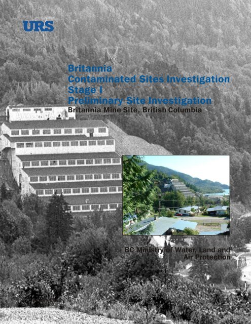
Britannia Contaminated Sites Investigation Stage I Preliminary Site ...
Britannia Contaminated Sites Investigation Stage I Preliminary Site ...
Britannia Contaminated Sites Investigation Stage I Preliminary Site ...

Create successful ePaper yourself
Turn your PDF publications into a flip-book with our unique Google optimized e-Paper software.
January 2002<br />
File 50319-001<br />
<strong>Britannia</strong><br />
<strong>Contaminated</strong> <strong><strong>Site</strong>s</strong> <strong>Investigation</strong><br />
<strong>Stage</strong> I<br />
<strong>Preliminary</strong> <strong>Site</strong> <strong>Investigation</strong><br />
<strong>Britannia</strong> Mine <strong>Site</strong>, British Columbia<br />
for BC Ministry of Water, Land and<br />
Air Protection
BRITANNIA CONTAMINATED SITE INVESTIGATION<br />
STAGE I PRELIMINARY SITE INVESTIGATION<br />
BRITANNIA MINE SITE, BRITISH COLUMBIA<br />
Prepared for:<br />
BC Ministry of Water, Land and Air Protection<br />
c/o Golder Associates Ltd.<br />
500 – 4260 Still Creek Drive<br />
Burnaby, BC V5C 6C6<br />
Prepared by:<br />
URS Norecol Dames & Moore Inc.<br />
Suite 1900, 650 West Georgia Street<br />
Vancouver, BC V6B 4N7<br />
Project No. 50319-001-310<br />
January 29, 2002
EXECUTIVE SUMMARY<br />
This report presents the findings of the <strong>Stage</strong> I <strong>Preliminary</strong> <strong>Site</strong> <strong>Investigation</strong> (PSI) completed by<br />
URS Norecol Dames & Moore (URS) of the <strong>Britannia</strong> Mine <strong>Site</strong> (<strong>Britannia</strong> Mine) on Howe<br />
Sound in British Columbia. The purpose of this work is to identify the known and potential<br />
sources of contamination associated with surface activities at <strong>Britannia</strong> Mine. This work was<br />
commissioned by the British Columbia Ministry of Water, Land and Air Protection<br />
(BCMWLAP) and meets BCMWLAP’s requirements for submission for review.<br />
The <strong>Stage</strong> I PSI included the following tasks:<br />
• interviews with people having personal knowledge about the history of activities at the<br />
<strong>Britannia</strong> Mine;<br />
• a review of historical information from a variety of sources, including historical aerial<br />
photographs, historical maps, plans and historical photographs from the <strong>Britannia</strong> Museum of<br />
Mining archives and historical photographs, Insurance Advisory Organization (IAO) fire<br />
insurance maps, British Columbia Ministry of Energy and Mines (BCMEM) annual reports,<br />
reports of previous environmental investigations at <strong>Britannia</strong> Mine, books on the history of<br />
<strong>Britannia</strong> Mine;<br />
• online searches of the BCMWLAP <strong>Site</strong> Registry and Groundwater Well databases;<br />
• a visual reconnaissance along with photographic documentation; and<br />
• preparation of this written report.<br />
The <strong>Britannia</strong> Mine covers a large area divided between the <strong>Britannia</strong> Creek and Furry Creek<br />
watersheds that encompasses numerous distinct and separate sites where mining and related<br />
activities have occurred (shown on Figure 1). For purposes of the <strong>Britannia</strong> <strong>Contaminated</strong> <strong><strong>Site</strong>s</strong><br />
<strong>Investigation</strong>, a distinction has been made between <strong>Britannia</strong> Beach (Fan Area), located adjacent<br />
to Howe Sound, and the rest of the <strong>Britannia</strong> Mine area (Additional Areas). The Fan Area was<br />
the site of milling, processing, and support activities related to the mine operation. Activities at<br />
the various Additional Areas locations consisted primarily of open pit and underground mining<br />
and operations with limited mineral processing. The following sites comprise the Additional<br />
Areas:<br />
• 2200 Portal (Tunnel Mine);<br />
• Mt. Sheer Townsite;<br />
• Victoria Camp;<br />
• Beta Camp;<br />
• Empress Camp;<br />
<strong>Britannia</strong> <strong>Contaminated</strong> <strong>Site</strong> <strong>Investigation</strong><br />
<strong>Stage</strong> I <strong>Preliminary</strong> <strong>Site</strong> <strong>Investigation</strong><br />
Project No. 50319-001-310 i
• Barbara Camp;<br />
• Head of Incline and 2700 Portal Area (including sawmill and landfill 1.5 km to the<br />
northwest); and<br />
• Halfway Town.<br />
Evaluation of the Jane Basin (open pit complex), where potential contaminants flow into the<br />
underground mine workings, is not within the scope of work for URS.<br />
The elevations and mine level designations assigned by the <strong>Britannia</strong> Mine for the Fan Area and<br />
the specific sites within the Additional Area are presented in Table 1.<br />
Based on the review of historical information, the general chronological history of <strong>Britannia</strong><br />
Mine and the specific histories for each site are summarized and presented in Section 3.1.<br />
Summaries of historical information of buildings, structures, equipment and features associated<br />
with potential environmental concerns are presented in Tables 2 to 8, and the historical locations<br />
are presented on Figures 2 to 7. A site reconnaissance was conducted to note any visual evidence<br />
of soil contamination, surface water contamination, and contaminant sources. The results of the<br />
site reconnaissances are summarized in Tables 9 to 13.<br />
Based on information compiled from the historical sources and the site reconnaissance,<br />
Contaminants of Concern (COCs), Potential Contaminants of Concern (PCOCs) and Areas of<br />
Environmental Concern (AECs) have been determined for the Fan Area; and PCOCs and Areas<br />
of Potential Environmental Concerns (APECs) have been determined for the Additional Areas.<br />
The AECs, APECs, COCs, and PCOCs are summarized in Tables 14 to 21 and the locations are<br />
shown on Figures 8 to 14.<br />
<strong>Britannia</strong> <strong>Contaminated</strong> <strong>Site</strong> <strong>Investigation</strong><br />
<strong>Stage</strong> I <strong>Preliminary</strong> <strong>Site</strong> <strong>Investigation</strong><br />
Project No. 50319-001-310 ii
TABLE OF CONTENTS<br />
<strong>Britannia</strong> <strong>Contaminated</strong> <strong>Site</strong> <strong>Investigation</strong><br />
<strong>Stage</strong> I <strong>Preliminary</strong> <strong>Site</strong> <strong>Investigation</strong><br />
Project No. 50319-001-310 iii<br />
Page<br />
EXECUTIVE SUMMARY............................................................................................................................ i<br />
TABLE OF CONTENTS.............................................................................................................................iii<br />
LIST OF TABLES ........................................................................................................................................ v<br />
LIST OF FIGURES...................................................................................................................................... vi<br />
LIST OF APPENDICES.............................................................................................................................. vi<br />
1.0 INTRODUCTION ........................................................................................................................... 1<br />
2.0 SITE DESCRIPTION ...................................................................................................................... 1<br />
2.1 SITE LOCATION............................................................................................................... 1<br />
2.2 LEGAL DESCRIPTION AND OWNERSHIP................................................................... 3<br />
2.3 GEOLOGICAL AND HYDROGEOLOGICAL REVIEW ................................................ 3<br />
3.0 HISTORICAL REVIEW.................................................................................................................. 4<br />
3.1 SUMMARY OF HISTORY................................................................................................ 5<br />
3.1.1 Chronological History of the <strong>Britannia</strong> Mine, B.C................................................. 6<br />
3.1.2 History of Specific Buildings and Activities at <strong>Britannia</strong> Mine, B.C................... 12<br />
3.1.2.1 Fan Area ........................................................................................... 12<br />
3.1.2.2 2200 Portal (Tunnel Mine) ............................................................... 15<br />
3.1.2.3 Mt. Sheer Townsite .......................................................................... 16<br />
3.1.2.4 Victoria Camp .................................................................................. 17<br />
3.1.2.5 Beta Camp ........................................................................................ 18<br />
3.1.2.6 Empress Camp.................................................................................. 19<br />
3.1.2.7 Barbara Camp................................................................................... 19<br />
3.1.2.8 Head of Incline and 2700 Portal Area (Including Sawmill &<br />
Landfill 1.5 km to the Northwest) .................................................... 20<br />
3.1.2.9 Halfway Town .................................................................................. 21<br />
3.1.2.10 Other <strong><strong>Site</strong>s</strong> of Operations/Camps/Portals ......................................... 22<br />
3.1.2.11 Lands Adjacent to <strong>Britannia</strong> Mine.................................................... 22<br />
3.2 BC MINISTRY OF WATER, LAND AND AIR PROTECTION (BCMWLAP)............ 23<br />
3.2.1 <strong>Site</strong> Registry......................................................................................................... 23<br />
3.2.2 Groundwater Database Search ............................................................................. 23<br />
4.0 SITE RECONNAISSANCE ..........................................................................................................24<br />
4.1 FAN AREA....................................................................................................................... 24<br />
4.2 ADDITIONAL AREAS.................................................................................................... 27<br />
4.2.1 2200 Portal (Tunnel Mine)................................................................................... 27<br />
4.2.2 Mt. Sheer Townsite.............................................................................................. 28<br />
4.2.3 Victoria Camp...................................................................................................... 29<br />
4.2.4 Head of Incline and 2700 Portal Area (Including Sawmill & Landfill 1.5<br />
km Northwest)...................................................................................................... 30<br />
4.2.5 Halfway Town...................................................................................................... 31<br />
4.3 LAND USE AT ADJACENT LANDS............................................................................. 31
TABLE OF CONTENTS (concluded)<br />
<strong>Britannia</strong> <strong>Contaminated</strong> <strong>Site</strong> <strong>Investigation</strong><br />
<strong>Stage</strong> I <strong>Preliminary</strong> <strong>Site</strong> <strong>Investigation</strong><br />
Project No. 50319-001-310 iv<br />
Page<br />
5.0 PROTOCOL 5 ............................................................................................................................... 31<br />
6.0 REGULATORY CONTEXT......................................................................................................... 32<br />
7.0 CONCLUSIONS............................................................................................................................ 32<br />
7.1 FAN AREA....................................................................................................................... 33<br />
7.2 ADDITIONAL AREAS.................................................................................................... 37<br />
7.2.1 2200 Portal (Tunnel Mine)................................................................................... 38<br />
7.2.2 2200 Mt. Sheer Townsite..................................................................................... 39<br />
7.2.3 Victoria Camp...................................................................................................... 39<br />
7.2.4 Beta Camp............................................................................................................ 40<br />
7.2.5 Empress Camp ..................................................................................................... 41<br />
7.2.6 Head of Incline and 2700 Portal Area (Including Sawmill and Landfill 1.5<br />
km Northwest)...................................................................................................... 41<br />
7.2.7 Halfway Town...................................................................................................... 42<br />
8.0 REPORT USE AND LIMITATIONS............................................................................................ 42<br />
9.0 DISCLAIMER ............................................................................................................................... 44<br />
10.0 PROFESSIONAL STATEMENT.................................................................................................. 44<br />
11.0 REFERENCES .............................................................................................................................. 45<br />
FIGURES<br />
APPENDICES<br />
PROTOCOL 5
LIST OF TABLES<br />
Table 1 Elevations and Corresponding Mine Levels for <strong>Britannia</strong> Mine <strong><strong>Site</strong>s</strong>.......................... 2<br />
Historical Summaries of Buildings, Structures, Equipment & Features<br />
Associated with Potential Environmental Concerns:<br />
Table 2 Fan Area ..................................................................................................................... 13<br />
Table 3 2200 Portal (Tunnel Mine) ......................................................................................... 15<br />
Table 4 Mt. Sheer Townsite..................................................................................................... 17<br />
Table 5 Victoria Camp............................................................................................................. 18<br />
Table 6 Beta Camp .................................................................................................................. 19<br />
Table 7 Head of Incline & 2700 Portal Area (Including Sawmill & Landfill 1.5 km<br />
Northwest) .................................................................................................................. 21<br />
Table 8 Halfway Town ............................................................................................................ 22<br />
<strong>Site</strong> Reconnaissance Findings:<br />
Table 9 Fan Area ..................................................................................................................... 24<br />
Table 10 2200 Portal (Tunnel Mine) ......................................................................................... 27<br />
Table 11 Mt. Sheer Townsite..................................................................................................... 28<br />
Table 12 Victoria Camp............................................................................................................. 29<br />
Table 13 Head of Incline & 2700 Portal Area ........................................................................... 30<br />
AECs/APECs & PCOCs:<br />
Table 14 Fan Area & Immediately Adjacent Additional Area................................................... 33<br />
Table 15 2200 Portal (Tunnel Mine) ......................................................................................... 38<br />
Table 16 Mt. Sheer Townsite..................................................................................................... 39<br />
Table 17 Victoria Camp............................................................................................................. 39<br />
Table 18 Beta Camp .................................................................................................................. 40<br />
Table 19 Empress Camp............................................................................................................41<br />
Table 20 Head of Incline & 2700 Portal Area (Including Sawmill & Landfill 1.5 km<br />
Northwest) .................................................................................................................. 41<br />
Table 21 Halfway Town ............................................................................................................42<br />
<strong>Britannia</strong> <strong>Contaminated</strong> <strong>Site</strong> <strong>Investigation</strong><br />
<strong>Stage</strong> I <strong>Preliminary</strong> <strong>Site</strong> <strong>Investigation</strong><br />
Project No. 50319-001-310 v
LIST OF FIGURES<br />
Figure 1 Study Areas<br />
Figure 2 Fan Area <strong>Site</strong> Plan with Current and Historical Features<br />
Figure 3 Mt. Sheer Townsite and 2200 Portal (Tunnel Mine) <strong>Site</strong> Plan with Current<br />
and Historical Structures and Features<br />
Figure 4 Victoria and Beta Camps <strong>Site</strong> Plan of Historical Structures and Features<br />
Figure 5 Barbara and Empress Camps <strong>Site</strong> Plan of Historical Structures and Features<br />
Figure 6 Head of Incline and 2700 Portal Area (Including Sawmill 1.5 km NW)<br />
Figure 7 Halfway Town <strong>Site</strong> Plan of Historical Structures and Features<br />
Figure 8 Fan Area AECs and PCOCs Related to Metals Contamination<br />
Figure 9 Fan Area AECs and PCOCs Related to Petroleum Hydrocarbons and Other<br />
Contaminants<br />
Figure 10 2200 Portal (Tunnel Mine) / Mt. Sheer Townsite APECs and PCOCs<br />
Figure 11 Victoria and Beta Camps APECs and PCOCs<br />
Figure 12 Empress Camp APEC and PCOC<br />
Figure 13 Head of Incline and 2700 Portal Area (Including Sawmill and Landfill 1.5 km<br />
NW) APECs and PCOCs<br />
Figure 14 Halfway Town APECs and PCOCs<br />
LIST OF APPENDICES<br />
Appendix A Legal Description and Limited Historical Title Search Documentation<br />
Appendix B Aerial Photograph Review<br />
Appendix C Historical Maps, Plans and Photos<br />
Appendix D BCMWLAP Data<br />
Appendix E Photographic Documentation<br />
<strong>Britannia</strong> <strong>Contaminated</strong> <strong>Site</strong> <strong>Investigation</strong><br />
<strong>Stage</strong> I <strong>Preliminary</strong> <strong>Site</strong> <strong>Investigation</strong><br />
Project No. 50319-001-310 vi
BRITANNIA CONTAMINATED SITE INVESTIGATION<br />
STAGE I PRELIMINARY SITE INVESTIGATION<br />
BRITANNIA MINE SITE, BRITISH COLUMBIA<br />
1.0 INTRODUCTION<br />
This report presents the findings of the <strong>Stage</strong> I <strong>Preliminary</strong> <strong>Site</strong> <strong>Investigation</strong> (PSI) completed by<br />
URS Norecol Dames & Moore (URS) of the <strong>Britannia</strong> Mine <strong>Site</strong> (<strong>Britannia</strong> Mine) on Howe<br />
Sound in British Columbia. The purpose of this work is to identify the known and potential<br />
sources of contamination associated with surface activities at <strong>Britannia</strong> Mine. This work was<br />
commissioned by the British Columbia Ministry of Water, Land and Air Protection<br />
(BCMWLAP).<br />
The report meets BCMWLAP requirements for submission for review. The scope of work for<br />
this study was limited to the following tasks:<br />
• interviews with persons knowledgeable about the history of activities and operations at the<br />
<strong>Britannia</strong> Mine;<br />
• review of available information from various sources with respect to historical activities and<br />
locations of buildings, structures and equipment;<br />
• a visual reconnaissance along with photographic documentation; and<br />
• preparation of this written report.<br />
The scope of work did not include sampling of site soils, groundwater, or building materials.<br />
2.0 SITE DESCRIPTION<br />
This section of the report provides a description of the site location and a brief summary of the<br />
geologic and hydrogeologic setting of the site.<br />
2.1 SITE LOCATION<br />
The <strong>Britannia</strong> Mine covers a large area divided between the <strong>Britannia</strong> Creek and Furry Creek<br />
watersheds. Within this area, there are numerous distinct and separate sites where mining and<br />
related activities have occurred. The Jane Basin (open pit complex), where any potential<br />
contaminants flow into the underground mine workings is not within the scope of work for URS.<br />
<strong>Britannia</strong> <strong>Contaminated</strong> <strong>Site</strong> <strong>Investigation</strong><br />
<strong>Stage</strong> I <strong>Preliminary</strong> <strong>Site</strong> <strong>Investigation</strong><br />
Project No. 50319-001-310 1
A brief summary of the Jane Basin operations is provided in Section 3.1.2.10. Figure 1 shows<br />
the <strong>Britannia</strong> Mine and the individual sites within.<br />
For purposes of the <strong>Britannia</strong> <strong>Contaminated</strong> <strong><strong>Site</strong>s</strong> <strong>Investigation</strong>, a distinction has been made<br />
between <strong>Britannia</strong> Beach (Fan Area), located adjacent to Howe Sound, and the rest of the<br />
<strong>Britannia</strong> Mine area (Additional Areas). The Fan Area was the site of milling, processing, and<br />
support activities related to the mine operation. Activities at the various Additional Areas<br />
locations consisted primarily of open pit and underground mining and operations with limited<br />
mineral processing. The Additional Areas comprise the following sites:<br />
• 2200 Portal (Tunnel Mine);<br />
• Mt. Sheer Townsite;<br />
• Victoria Camp;<br />
• Beta Camp;<br />
• Empress Camp;<br />
• Barbara Camp;<br />
• Head of Incline and 2700 Portal Area (including sawmill and landfill 1.5 km to the<br />
northwest); and<br />
• Halfway Town.<br />
The Fan Area and Additional Areas sites are shown in detail on Figures 2 to 12.<br />
There are several minor sites immediately adjacent to the <strong>Britannia</strong> Creek fan that were<br />
associated with activities in the Fan Area. For ease of discussion, these are addressed within the<br />
Fan Area sections of this report.<br />
The various sites at the <strong>Britannia</strong> Mine were assigned designations, based on elevation, known as<br />
“mine levels”. This convention followed a system of reverse elevation levels, with the mine<br />
level at the highest elevation assigned “0” and the descending mine levels assigned numbers in<br />
ascending order down to sea level. Since the elevation of the highest mine level at the <strong>Britannia</strong><br />
Mine (the original workings at the open pit complex) was initially 4300’, the 4300 mine level<br />
refers to the Fan Area. Table 1 lists the corresponding mine levels and actual elevations above<br />
sea level for the <strong>Britannia</strong> Mine sites noted above. Mine levels were not assigned to the sawmill,<br />
landfill and Halfway Town, as these were not actual mine sites.<br />
Table 1<br />
Elevations and Corresponding Mine Levels for <strong>Britannia</strong> Mine <strong><strong>Site</strong>s</strong><br />
Location Mine Level Elevation (feet) Elevation<br />
(metric)<br />
Fan Area 4300 0 0<br />
Head of Incline and 2700<br />
Portal Area<br />
2700 1600 487<br />
2200 Portal (Tunnel Mine)/ 2200 2100 640<br />
Mt. Sheer Townsite<br />
Victoria Camp 1800 2500 762<br />
Beta Camp 1600 2625 800<br />
Empress Camp 1050 3250 990<br />
<strong>Britannia</strong> <strong>Contaminated</strong> <strong>Site</strong> <strong>Investigation</strong><br />
<strong>Stage</strong> I <strong>Preliminary</strong> <strong>Site</strong> <strong>Investigation</strong><br />
Project No. 50319-001-310 2
Table 1<br />
Elevations and Corresponding Mine Levels for <strong>Britannia</strong> Mine <strong><strong>Site</strong>s</strong><br />
Barbara Camp 500 3800 1158<br />
2.2 LEGAL DESCRIPTION AND OWNERSHIP<br />
According to information provided by BCMWLAP, ownership of the <strong>Britannia</strong> Mine is divided<br />
between the Crown, the <strong>Britannia</strong> Beach Historical Society (BBHS), Copper Beach Estates Ltd.<br />
(CBEL), and <strong>Britannia</strong> Beach Holdings Ltd. A current list obtained from the BC Land Title<br />
internet system showing the titles held by each owner, is presented in Appendix A.<br />
BCMWLAP has provided the following legal descriptions for the Fan Area, the ownership of<br />
which is divided between the BBHS and CBEL:<br />
PID: 015-913-961<br />
DL 891, Group 1, NWD Except, Firstly: Part in Reference Plan 4390, Secondly: Part in<br />
Plan 19960, Thirdly: Part on Highway Plan 145<br />
PID: 015-913-970<br />
DL 892, Group 1, NWD Except (A) Part in Reference Plan 7313 and (B) Part in Plan<br />
19960.<br />
The legal plan for <strong>Britannia</strong> Beach is presented in Appendix A.<br />
An historical title-search was ordered from West Coast Title Search Ltd. (West Coast Title) for<br />
one of the lots within District Lot 892. Title and transfer documents dating back to 1900 were<br />
reviewed and summarized by West Coast Title for information about the history of ownership of<br />
the subject property and are presented in Appendix A.<br />
Ownership of the Additional Areas is divided between the Crown and Copper Beach Estates.<br />
BCMWLAP has provided a map showing the boundaries of the former <strong>Britannia</strong> Mine that<br />
delineates the portion owned by CBEL. The map and additional information provided by<br />
BCMWLAP are presented in Appendix A. The mining claims, with lot numbers for the portions<br />
outside of the Fan Area, are shown on the Energy, Mines and Resources topographic map,<br />
92G/11, Squamish, British Columbia (Figure 1).<br />
2.3 GEOLOGICAL AND HYDROGEOLOGICAL REVIEW<br />
The <strong>Britannia</strong> area is underlain by intrusive rocks of the Coast Plutonic Complex capped by<br />
sedimentary and volcanic rocks of the Gambier Group. There is a lower volcanic sequence<br />
comprised of dacitic tuff breccia grading upwards into a well-bedded sequence of interbedded<br />
black argillite and tuff. Andesitic tuffs, tuffaceous sediments and cherty tuffs comprise the upper<br />
volcanic sequence. The overlying sedimentary rocks are a mix of poorly bedded shale, siltstone<br />
and greywacke (Environment Canada 1973).<br />
The Fan Area is situated on the <strong>Britannia</strong> Creek fan, a debris fan formed since the end of the last<br />
glacial period, approximately 10,000 years ago. The fan comprises a heterogeneous assemblage<br />
<strong>Britannia</strong> <strong>Contaminated</strong> <strong>Site</strong> <strong>Investigation</strong><br />
<strong>Stage</strong> I <strong>Preliminary</strong> <strong>Site</strong> <strong>Investigation</strong><br />
Project No. 50319-001-310 3
of sediments, landslide deposits and detritus originating from the <strong>Britannia</strong> Creek drainage. The<br />
fan extends into Howe Sound.<br />
The Additional Areas are located in uplands. Glacial till and colluviated sediments mantle and<br />
blanket the surrounding mountains with bedrock exposed at higher elevations and on steep<br />
slopes. Creek valleys are often layered with thick units of glacial sediment and more recent<br />
fluvial and landslide deposits. Soils in the area are primarily podzolic, highly leached, acidic and<br />
reddish brown in colour (Environment Canada 1973).<br />
The Fan Area is adjacent to Howe Sound and is bounded by <strong>Britannia</strong> Creek runs through the<br />
north edge of the fan. Groundwater at the Fan Area flows west towards Howe Sound. Near the<br />
foreshore, groundwater is tidally influenced, resulting in periodic changes to the direction of<br />
flow. At periods of low tide, the groundwater gradient will result in groundwater discharge to<br />
Howe Sound. At periods of high tide, the groundwater gradient may be altered in direction or<br />
even reversed, decreasing rate of groundwater discharge.<br />
The topography of the <strong>Britannia</strong> Mine, depicted by the Energy, Mines and Resources topographic<br />
map, 92G/11, Squamish, British Columbia, is shown on Figure 1.<br />
3.0 HISTORICAL REVIEW<br />
The history of land use at the <strong>Britannia</strong> Mine has been compiled from the review of information<br />
obtained from the following sources:<br />
• Historical aerial photographs dated 1947, 1951, 1957, 1969, 1972, 1976, 1982, 1990 and<br />
1994 from the University of British Columbia’s Geographic Information Centre. Aerial<br />
photos do not cover the <strong>Britannia</strong> Mine consistently. The 1947 and 1951 aerial photographs<br />
cover only the Fan Area, the 2200 Portal, and the Mt. Sheer Townsite, and in 1976, aerial<br />
photography provides coverage only of the Fan. An in-depth summary of the review of<br />
historical aerial photographs is provided as Appendix B;<br />
• Historical maps and plans, listed below, from the <strong>Britannia</strong> Museum of Mining archives and<br />
historical photographs. It should be noted that the museum’s archives contains hundreds of<br />
maps. The maps were searched as methodically as was possible given the archives’ as-yet<br />
uncurated status of their map collection. Copies of the maps and plans are presented in<br />
Appendix C;<br />
� Claim Map of <strong>Britannia</strong> Mountain (June 1912),<br />
� <strong>Britannia</strong> Mine and Tunnel Workings Map (November 30, 1916),<br />
� Jane Basin Area, The Anaconda Company (Canada) Ltd., undated,<br />
� 2200 Copper Precipitation Plan General Arrangement, (December 23, 1969), The<br />
Anaconda Company (Canada) Ltd.,<br />
<strong>Britannia</strong> <strong>Contaminated</strong> <strong>Site</strong> <strong>Investigation</strong><br />
<strong>Stage</strong> I <strong>Preliminary</strong> <strong>Site</strong> <strong>Investigation</strong><br />
Project No. 50319-001-310 4
� Untitled map showing mine claims, <strong>Britannia</strong> Beach No. 1 Mill and a portion of No. 2<br />
Mill (1915),<br />
� Plan of <strong>Britannia</strong> Beach Howe Sound Showing Domestic Water Supply (May 31, 1926),<br />
� <strong>Britannia</strong> Beach, Anaconda <strong>Britannia</strong> Mines, (1971, revised 1986), and<br />
� Untitled map showing <strong>Britannia</strong> Beach and No. 3 Mill (undated);<br />
• Insurance Advisory Organization (IAO) fire insurance maps:<br />
� <strong>Britannia</strong> Beach, Mt. Sheer Townsite, Tunnel Mine (2200 portal), Victoria Camp, Beta<br />
Camp, Barbara Camp, Empress Camp, and Head of Incline, dated 1923 (revised 1937),<br />
and<br />
� <strong>Britannia</strong> Beach, Mt. Sheer Townshite, Tunnel Mine (2200 portal) and Halfway Town,<br />
1945;<br />
� British Columbia Ministry of Energy and Mines (BCMEM) annual reports from 1900<br />
through 1971-73. (BCMEM was originally the BC Ministry of Mines, then the BC Ministry<br />
of Energy, Mines and Petroleum Resources; followed by the BC Ministry of Employment and<br />
Investment. For purposes of this report, the term, BCMEM, refers to the Ministry throughout<br />
its existence.);<br />
• Reports of previous environmental investigations at <strong>Britannia</strong> Mine. A number of reports<br />
document previous investigations, however, most do not contain useful information with<br />
respect to the history of activities and structures at the various <strong>Britannia</strong> Mine sites. Of<br />
particular usefulness were reports documenting a reconnaissance study of acid mine drainage,<br />
prepared for the Ministry of Energy, Mines and Petroleum Resources by Price, Schwab and<br />
Hutt in 1995, and a site hazard assessment prepared by Dillon Consulting Ltd, for the B.C.<br />
Museum of Mining;<br />
• Books on the history of <strong>Britannia</strong> Mine; and<br />
• Interviews with persons having knowledge of the history of <strong>Britannia</strong> Mine.<br />
A list of references is included in Section 11.0 of this report.<br />
3.1 SUMMARY OF HISTORY<br />
Based on the review of historical information, a general chronological history of the <strong>Britannia</strong><br />
Mine, and specific historical summaries for the areas described in Section 2.1 are presented<br />
below.<br />
<strong>Britannia</strong> <strong>Contaminated</strong> <strong>Site</strong> <strong>Investigation</strong><br />
<strong>Stage</strong> I <strong>Preliminary</strong> <strong>Site</strong> <strong>Investigation</strong><br />
Project No. 50319-001-310 5
3.1.1 Chronological History of the <strong>Britannia</strong> Mine, B.C.<br />
The chronological history of the <strong>Britannia</strong> Mine, as determined primarily from a review of<br />
BCMEM annual reports, is summarized below.<br />
1888: The original mineral discovery was made by Dr. A.A. Forbes. He acquired 100%<br />
interest in the discovery in exchange for a boat, and continued to prospect in the<br />
following summers.<br />
1897: Forbes described his <strong>Britannia</strong> prospect to F. Turner, while Turner was visiting a<br />
showing belonging to Forbes on Texada Island.<br />
1898: F. Turner and O. Furry staked five claims which were to produce the bulk of the<br />
<strong>Britannia</strong> ore. Turner sold a half interest to Bascovitz & Sons for $10,000.<br />
1899: The claims were surveyed and two fractions were added to become the <strong>Britannia</strong><br />
Group: Fairview, Jane, Clifton, William, Mineral Creek, Edith fraction, and<br />
Heather fraction. A pack trail was constructed from the Fan Area to the first camp<br />
at Jane Flats. A 375 foot cross-cut tunnel was driven on the Jane showing and<br />
general prospecting was done. Turner sold 7/10 th of his interest in the property to<br />
Walters (of Libby, Montana) for $35,000 and 3/10 th to G. Robinson (of Butte,<br />
Montana) for $53,000. Staking took place in the area. The first mention of the<br />
<strong>Britannia</strong> Group occurred in the Ministry of Mines Annual Report, New<br />
Westminster Mining Division.<br />
1900: January 1900, the <strong>Britannia</strong> Copper Syndicate of Vancouver was organized to<br />
develop the property. Robinson bought out Walters and became the controlling<br />
stake holder.<br />
1901-1902: No work recorded.<br />
1903: Clearing of the tramline from the Beach to the Jane tunnel began – a total distance<br />
of three miles. 150 acres were partially cleared for a townsite at Jane Basin. The<br />
Howe Sound Company became the holding company of the <strong>Britannia</strong> Copper<br />
Syndicate.<br />
1904: Construction of a concentrator mill (Mill No. 1) began at the Beach. Elevated<br />
trestles to connect the Jane Tunnel and Big Bluff workings to a central receiving<br />
bin located at the upper terminal of the tramway were constructed. Underground<br />
workings on the Jane claims penetrated the Clifton claim workings. Tunnelling<br />
and cross-cuts were developed on the Mammoth Bluff showing and<br />
mineralization was discovered on the Empress Group to the east.<br />
1905: The tramway and concentrator mill were completed. Raw ore and concentrate<br />
were shipped to a smelter in Crofton on Vancouver Island. The <strong>Britannia</strong><br />
Smelting Company was formed to purchase the Crofton smelter. Cyanide was<br />
<strong>Britannia</strong> <strong>Contaminated</strong> <strong>Site</strong> <strong>Investigation</strong><br />
<strong>Stage</strong> I <strong>Preliminary</strong> <strong>Site</strong> <strong>Investigation</strong><br />
Project No. 50319-001-310 6
under consideration for use in the concentrating plant and tests were conducted to<br />
determine the viability.<br />
1906: 10,000 tons of ore were mined and 55,000 tons were processed in the<br />
concentrator. The mine was slow to develop and was producing low-grade ore.<br />
1907: There was further mine camp construction, including bunkhouses and individual<br />
dwellings on the original Jane Flats site. A sawmill was constructed to supply<br />
timber to the camp. At the Beach, a compressor plant was built to aerate the<br />
mine. The old mill was remodelled and milling was changed from fine-crush to<br />
coarse-crush.<br />
1908: The <strong>Britannia</strong> Copper Syndicate and the <strong>Britannia</strong> Smelting Company merged to<br />
become the <strong>Britannia</strong> Mining and Smelting Company Ltd.<br />
1909: No data was available.<br />
1910: High-grade ore was intersected in the Fairview vein in an explanatory tunnel off<br />
the Mammoth Bluff. Rapid mine development took place. There were six<br />
working levels and much new machinery installed. Compressors and generators<br />
were run by water wheels while other equipment operated on compressed air and<br />
electric motors.<br />
1911: Ore was hand-sorted and sent by tram to the mill on the Beach. Concentrate was<br />
shipped to Tacoma, Washington. A group of log cabins on Mineral Creek at the<br />
1600 level, known as the Daisy or Goldsmith Camp, was occupied by men<br />
trenching and tunnelling at that level.<br />
1912: The New Westminster Mining Division was subdivided and <strong>Britannia</strong> became<br />
part of the Vancouver Mining Division. An auxiliary steam plant was installed at<br />
the Beach. Cottages, a store and a hospital were also constructed at the Beach.<br />
An adit was driven at 1200’ below the lowest workings (the 2200 level) in order<br />
to increase the amount of ore that could be handled. A new mining engineer,<br />
James Dunbar Moodie, was hired, who began to revamp the mining/milling<br />
operations and make them profitable.<br />
1913: Further underground work was conducted.<br />
1914: The Jane Creek Flats townsite now consisted of five bunkhouses, numerous single<br />
family dwellings, a cookhouse, warehouse, stable, tram terminal, crusher house,<br />
office, compressor and powder house, blacksmith shop, candle house, powder<br />
magazine, small school and tennis court. Construction of bunkhouses and single<br />
dwellings continued at the Beach and concrete tanks for handling sludges and<br />
slimes were constructed. Water from <strong>Britannia</strong> Creek was generating 1800 horsepower<br />
to operate the mill, compressors and other areas of the plant. New wharf<br />
bunkers were constructed. World War I was declared and production slumped.<br />
<strong>Britannia</strong> <strong>Contaminated</strong> <strong>Site</strong> <strong>Investigation</strong><br />
<strong>Stage</strong> I <strong>Preliminary</strong> <strong>Site</strong> <strong>Investigation</strong><br />
Project No. 50319-001-310 7
1915: A catastrophic landslide destroyed much of the Jane Creek Flats townsite at the<br />
foot of Mammoth Bluff on the 1000 level. Fifty-six people were killed. The site<br />
was abandoned in favour of a new site in the valley along <strong>Britannia</strong> Creek at the<br />
2200 level. This became known variously as the Mt. Sheer Townsite, Tunnel<br />
Mine or Camp, or Mount Sheer Camp. Production from the mine halted for three<br />
months, during which a new tram terminal was completed. The raise from the<br />
2200 level to the 1050 level was completed and a cookhouse, bunkhouses, and<br />
powder house were erected next to the tunnel. At the Beach, the first half of the<br />
new flotation mill (Mill No. 2) was commissioned. The last stage in the<br />
concentration of ore was oil flotation. Power generated from <strong>Britannia</strong> Creek was<br />
now augmented by steam turbines.<br />
1916: The drift connecting the Fairview workings with the Empress mine on the 1000<br />
level was completed. A tunnel was driven at the 1200 level from Jane Creek to<br />
the Bluff mine. A 3-storey store was constructed at the Beach. Several concrete<br />
dams were constructed on <strong>Britannia</strong> Creek and one on Mineral Creek. High<br />
voltage lines with transformers were laid from the tunnel powerhouse through the<br />
2200 level to the crusher room. At the Beach, the first (west) half of the No. 2<br />
Mill was completed, along with slime and concentrator tanks, and a copper<br />
launder that discharged to the ocean. The mill, which used an oil flotation<br />
process, started production while the No. 1 Mill also continued to operate.<br />
1917: A concrete dam was built on Furry Creek. Empress and Beta Camps and housing<br />
at the Head of Incline were started. Heavy rains damaged the incline railway. At<br />
the Beach, a customs house was built.<br />
1918: Underground development of the mines occurred, however, there were no<br />
significant new buildings.<br />
1919: Gypsum ore was shipped from the Fairview mine. A large recreation hall was<br />
constructed on the Beach. Ore-grade material was discovered on the Victoria<br />
claim. The Seaview camp was established for men working the 3100 and 3250<br />
levels and the 4100 raise. This camp was occupied form 1919-24.<br />
1920: The mill was closed, but development work continued, including the Victoria<br />
claim and the 2700 level where the Armour adit was driven.<br />
1921: The <strong>Britannia</strong> Mine was now subdivided into five sections: Bluff, Fairview, Jane,<br />
Empress and Victoria. In March, the No. 2 Mill was destroyed by a large fire and<br />
in October a flood destroyed half of the Beach community, killing 37 people and<br />
destroying 50 houses. New houses were constructed on higher ground.<br />
1922: Construction of the No. 3 Mill began. At the Tunnel Mine (2200 level)<br />
approximately 20 buildings were abandoned as part of a “safety-first” policy.<br />
<strong>Britannia</strong> <strong>Contaminated</strong> <strong>Site</strong> <strong>Investigation</strong><br />
<strong>Stage</strong> I <strong>Preliminary</strong> <strong>Site</strong> <strong>Investigation</strong><br />
Project No. 50319-001-310 8
1923: The new mill began processing ore. A 30-mile power line from West Vancouver<br />
to <strong>Britannia</strong> Beach was completed, making the Beach steam plant obsolete as it<br />
was no longer required when periods of low water levels in <strong>Britannia</strong> Creek<br />
necessitated supplemental power. There were now two powerhouses (at the<br />
Beach and at the 2200 portal) and five storage dams.<br />
1924: The Victoria workings were connected to the other mine workings through the<br />
2200 level, and the tram was no longer needed, leaving only the lower tram<br />
section from the Head of Incline to the Beach still in use as needed. The<br />
transportation system now consisted of electric trams over a narrow-gauge<br />
switchback railway between the 2200 level and the adit at the 2700 level. Ore<br />
was delivered at the top of the ore-raise at the 2700 level adit and dropped 1500’<br />
to the main haulage-adit on the 4100 level. From there it was transported 4000’<br />
through the adit by electric cars to the concentrator. The railway, used only for<br />
transport of people and goods, was located underneath the tramway from the 2700<br />
level to the Beach.<br />
The first copper precipitation plant was constructed in 1924 at Jane Flats (Price,<br />
Schwab, Hutt 1995).<br />
1925: Ore that had been stockpiled in 1920-1922 was processed. The comments in the<br />
Annual Report indicate they had trouble milling the ore as it was heavily oxidized.<br />
1926: A pyrite concentrate, with 47% sulphur, was produced and shipped.<br />
1927: The haulage tunnel 11,200’ long from the 2700 level to the Fairview mine was<br />
completed and further construction occurred at the 2200 level and the Beach. The<br />
company devised a method to manufacture 5” mill balls on-site.<br />
1928: The Jane Flats copper precipitation plant was replaced by a new plant at the 2200<br />
Portal (Tunnel Mine) (Price, Schwab, Hutt 1995). A new haulage tunnel was<br />
inaugurated.<br />
1929: There is little data, except that a foundry was added.<br />
1930: This was a peak year of production, with more than 44,000,000 lbs of copper<br />
produced. Larger shops were constructed which could produce anything the mine<br />
site needed.<br />
1931-1937: During the Depression, copper dropped to 5 cents/lb., production slowed and the<br />
work force declined from 1000 to 400. In 1933, the Beach hotel burned down and<br />
was replaced by several hotels and dining houses, including the Ritz and the<br />
Savoy. A new passenger rail car started operating from the Head of the Incline to<br />
the Mt. Sheer Townsite.<br />
1938: Production was up and 1324 people were employed.<br />
<strong>Britannia</strong> <strong>Contaminated</strong> <strong>Site</strong> <strong>Investigation</strong><br />
<strong>Stage</strong> I <strong>Preliminary</strong> <strong>Site</strong> <strong>Investigation</strong><br />
Project No. 50319-001-310 9
1939-1945: Mining continued through the Second World War, but employees were hard to<br />
find. Ventilation and dust control for the benefit of the workers’ health started to<br />
receive much attention.<br />
1946: The workers went on strike from July 1 to October 21.<br />
1949: The road from Squamish was completed. Roads were built around the Beach and<br />
workers began using trucks. A road was built to backfill No. 8 Mine and the first<br />
mile of road to the Tunnel Mine (2200 level) was completed.<br />
1950-1952: Additional residential and community construction continued at the Beach and the<br />
4100 yard area was built. The road to the Tunnel Mine (2200 level) and Mt.<br />
Sheer Townsite was completed, eliminating the use of the railways. A full-time<br />
ventilation engineer was employed by 1950.<br />
1954: The P.G.E. Railway was built through the Beach, resulting in demolition of some<br />
housing and construction of new housing.<br />
1955-1957: The company struggled with lower metal prices. Those mines still yielding ore<br />
were the Bluff, Fairview, Victoria, No. 8, Jane, and Empress. The No. 5 mine<br />
was now inactive. All mining operations were moved to the Beach site and the<br />
Mount Sheer Townsite was virtually abandoned.<br />
1958: The company ceased production and went into voluntary liquidation. Only<br />
maintenance operations continued. All assets went to Howe Sound Company, the<br />
holding company. Metal prices then began to rise and a two-year contract was<br />
signed with the Union. The Sea to Sky Highway was completed, allowing the<br />
scaling back of operations at <strong>Britannia</strong> Beach.<br />
1959: The Mine reopened, however, much rehabilitation was required before milling<br />
recommenced. Milling methods changed from wet to dry flotation. Copper<br />
concentrates were stockpiled while the Tacoma smelter was closed by a strike.<br />
Part of the mill tailings were sold to LaFarge Cement and Construction<br />
Aggregates Ltd.<br />
1962: Exploration was still taking place in the Victoria, Bluff and No. 8 mines.<br />
1963: By this time, 10,000,000 pounds of copper had been recovered in precipitation<br />
plants (Price, Schwab, Hutt 1995). All the property and assets of Howe Sound<br />
Company were sold to Anaconda Mining Company and the Victoria, Bluff and<br />
No. 9 mines continued to be mined.<br />
1964: A labor strike shut down the mine for seven months, but new ore zones were<br />
discovered, the mill was remodelled and production resumed. Silica from the<br />
tailings was recovered and sold to cement companies. The company continued to<br />
produce 60,000 tons of ore annually.<br />
<strong>Britannia</strong> <strong>Contaminated</strong> <strong>Site</strong> <strong>Investigation</strong><br />
<strong>Stage</strong> I <strong>Preliminary</strong> <strong>Site</strong> <strong>Investigation</strong><br />
Project No. 50319-001-310 10
1965: A road was constructed to Jane Basin and Fairview glory holes to aid in<br />
evaluating the remaining mineral reserves in the Bluff and Fairview mines.<br />
1966: Victoria, Bluff, and No. 8 mines were still being mined and the access roads to the<br />
Jane Basin were completed. Some rehabilitation of old underground workings<br />
was carried on using the 1050 portal. Other raises and workings were<br />
reconditioned to control the flow of underground waters and increase leaching of<br />
copper.<br />
1967: Open-pit mining was started at the Jane Basin.<br />
1968: The Victoria, Bluff and No. 8 ore bodies were still being run.<br />
1969: Mining and ore extraction at Victoria ceased and the shaft was decommissioned.<br />
1971-1973: Development work continued and copper precipitation plants were operating at<br />
both the Fan Area and the Mt. Sheer Townsite (Price, Schwab, Hutt 1995).<br />
1974: Due to limited reserves and increased costs, the <strong>Britannia</strong> Mine was shut down for<br />
the last time. Reserves at the time of mine closure were 1.4 million tonnes at<br />
1.9% copper.<br />
1975: The British Columbia Mining Museum opened.<br />
1977: Anaconda sold the property to Atlantic Richfield Company (ARCO), and<br />
maintained it as a subsidiary until 1981 when the two companies merged into<br />
ARCO.<br />
1978: ARCO/Anaconda sold the property to 85818 Canada Ltd. which became<br />
Anaconda Canada Exploration Ltd. (ACEL).<br />
1979: ACEL sold the <strong>Britannia</strong> Block to CBEL, and the Museum Block to the BBHS<br />
which commenced development of the mining museum. The Museum Block<br />
consisted of 26 hectares of land, including the mill, mine buildings and a small<br />
underground section of the mine.<br />
Historical owners of the <strong>Britannia</strong> Mine up to the present division of ownership, are listed below:<br />
• <strong>Britannia</strong> Copper Syndicate;<br />
• Howe Sound Holding Company;<br />
• <strong>Britannia</strong> Mining and Smelting Co. Ltd.;<br />
• Anaconda Canada Ltd.;<br />
• Atlantic Richfield Co.;<br />
• 85818 Canada Ltd. (Anaconda Exploration Ltd.);<br />
• Copper Beach Estates Ltd.; and<br />
• 400091 B.C. Ltd.<br />
<strong>Britannia</strong> <strong>Contaminated</strong> <strong>Site</strong> <strong>Investigation</strong><br />
<strong>Stage</strong> I <strong>Preliminary</strong> <strong>Site</strong> <strong>Investigation</strong><br />
Project No. 50319-001-310 11
The BC Museum of Mining provides the following data on the quantities of ores extracted and<br />
processed during the mine’s operation from 1904 until 1974:<br />
• Copper: 650,000 tons;<br />
• Zinc: 137,000 tons;<br />
• Lead: 17,000 tons;<br />
• Gold: 500,000 ounces;<br />
• Silver: 6 million ounces; and<br />
• Cadmium: 1.55 million lbs.<br />
According to the BC Museum of Mining, there are 210 km of tunnels and five open pits.<br />
Approximately 100 fatalities have occurred over the years, however, there is no record of burial<br />
grounds at the <strong>Britannia</strong> Mine.<br />
3.1.2 History of Specific Buildings and Activities at <strong>Britannia</strong><br />
Mine, B.C.<br />
Numerous buildings and structures have existed at the Fan Area and the Additional Areas during<br />
the history of the <strong>Britannia</strong> Mine. Some have been demolished, burned down and even relocated.<br />
Activities carried out at some buildings and areas have changed over time. By assembling<br />
information from the various sources reviewed, either definitive or approximate dates of<br />
existence have been determined. Based on this information, the history of buildings, structures,<br />
equipment and associated activities is summarized in the following sections.<br />
The specific sites range from small remote areas of activity to large sites of intense industrial<br />
activity. For clarity, the history of buildings, structures, and equipment associated with potential<br />
environmental concerns at the larger sites has been summarized in tables.<br />
3.1.2.1 Fan Area<br />
The Fan Area has been the site of the most intense surface activities at <strong>Britannia</strong> Mine. It was the<br />
base of all milling operations and in the latter years was also a base for mining operations.<br />
Numerous buildings and structures have been constructed during the course of operations at the<br />
Fan Area.<br />
Development began in approximately 1900, with establishment of a base camp from which a<br />
pack trail lead to the first camp at Jane Flats. Clearing of the tramline started from the Beach in<br />
1903. Three concentrator mills existed at the Beach over the course of operations. The first mill<br />
was constructed in 1904-1905. Construction of the second mill began in 1915. After a fire<br />
destroyed the second mill in 1921, the third mill was constructed and still stands today.<br />
By 1924, the mill flotation process was utilizing primarily hydrated lime, as poor results had<br />
been received with other reagents, notably sodium cyanide (Ministry of Mines, 1924). (It should<br />
be noted, however, that former employees reported that during their employment in the 1960s<br />
and early 1970s, cyanide was utilized in the zinc flotation circuit at the mill.) Oils utilized for<br />
flotation in the mill were primarily coal-tar and hardened creosote with steam-distilled pine-oil as<br />
<strong>Britannia</strong> <strong>Contaminated</strong> <strong>Site</strong> <strong>Investigation</strong><br />
<strong>Stage</strong> I <strong>Preliminary</strong> <strong>Site</strong> <strong>Investigation</strong><br />
Project No. 50319-001-310 12
a frother (Ministry of Mines 1924). It was anticipated that the heavier oils were soon to be<br />
phased out in favour of potassium xanthate in conjunction with the lighter pine-oil (Ministry of<br />
Mines 1924). Subsequent follow-up documentation of the phasing out of the heavier oils has not<br />
been found.<br />
The history of those buildings, structures and equipment associated with potential environmental<br />
concerns is summarized in Table 2 (Untitled map 1915; Plan of <strong>Britannia</strong> Beach 1916; Fire<br />
Insurance Maps 1923 – rev. 1937, 1945; Domestic Water Supply Map 1926; <strong>Britannia</strong> Beach<br />
1971 – rev. 1986, untitled undated map). The long history of operations at the Fan Area has also<br />
resulted in the widespread deposition of mine tailings over the area. The locations of historic<br />
buildings, based on the information reviewed, is illustrated on Figure 2. It should be noted that<br />
high concentrations of metals in soil and groundwater have been previously identified in the Fan<br />
Area (Golder 2001).<br />
Table 2<br />
Historical Summary of Buildings, Structures & Equipment Associated with<br />
Potential Environmental Concerns in the Fan Area<br />
Buildings / Structures /<br />
Dates of Operation/Existence<br />
Storage Areas<br />
No. 1 Mill 1905-1915<br />
No. 2 Mill 1915-1921<br />
No. 3 Mill 1923-present (final cessation of operations in mid-1970s)<br />
Powerhouse Operated throughout the life of mill operations. Burned down<br />
in the early 1990s.<br />
Storage Bunkers on the Wharf Utilized for concentrate storage from 1914 until 1922, when<br />
the conveyor was constructed. Continued to exist for many<br />
years thereafter.<br />
Reagent Plant / Precipitation Storage Exact dates unknown, however, was known to be associated<br />
Various Storage Tanks Associated with<br />
Milling Operations (Dorr Tanks,<br />
Settling, Dewatering, Lime Storage)<br />
<strong>Britannia</strong> <strong>Contaminated</strong> <strong>Site</strong> <strong>Investigation</strong><br />
<strong>Stage</strong> I <strong>Preliminary</strong> <strong>Site</strong> <strong>Investigation</strong><br />
Project No. 50319-001-310 13<br />
with the operation of the No. 3 Mill.<br />
The tanks are presumed to have been associated with both<br />
No. 2 and No. 3 Mills. While locations are documented, exact<br />
dates are unknown.<br />
Transformers / Substations Existed at various locations throughout the life of mill<br />
operations.<br />
Ore Bins From 1916 onward throughout the duration of mill activities.<br />
Compressor Plants Associated with No. 1 Mill (a 25 drill compressor plant) and a<br />
later plant associated with No. 2 Mill.<br />
Foundry Constructed in 1929 and operated until 1958. It was<br />
demolished between 1972 and 1976.<br />
Slug Plant Was associated with the foundry and produced ball mills<br />
briefly prior to their fabrication by the foundry. It was<br />
demolished between 1972 and 1976.<br />
Copper Sulfate Plants Existed throughout the duration of mill operations. An<br />
historical plant, existing until approximately 1937, preceded<br />
the existing second plant.<br />
Lead Plant Associated with No. 3 mill and presumed to operate<br />
throughout the duration of mill activities.<br />
Regrinding Mill Associated with the No. 3 Mill through approximately 1937.<br />
Settling Pond Constructed in 1966 for clarifier overflows and other mill<br />
solutions that were discharged into Howe Sound.<br />
Pozzolon Shed (Formerly a Garage) Originally utilized as a garage, it appears to have been<br />
constructed around 1949 when vehicle use began at <strong>Britannia</strong>
Table 2<br />
Historical Summary of Buildings, Structures & Equipment Associated with<br />
Potential Environmental Concerns in the Fan Area<br />
Buildings / Structures /<br />
Storage Areas<br />
Dates of Operation/Existence<br />
Beach. It was later used as a storage shed.<br />
Pyrite Storage (outdoors, notably at the Occurred during the early years of No. 3 Mill and continued at<br />
site of the ballfield and near the wharf) least up to 1950.<br />
Boilers, Steam Compressors,<br />
Provided supplementary power prior to construction of the<br />
Generators<br />
powerline from North Vancouver in 1924.<br />
Precipitate Storage (outdoors) Associated with No. 3 Mill throughout operations.<br />
Gasoline Warehouse Existed around 1945.<br />
Machine Shop Constructed in 1916, it operated during the life of mill<br />
activities.<br />
Blacksmith Shop Constructed in 1919, it operated during the life of mill<br />
activities.<br />
Motor Shed Constructed in 1916, it operated during the life of mill<br />
activities.<br />
Welding Shop and Cutting Shed Constructed by 1945.<br />
Friction Saw Shed Associated with No. 2 Mill and the early years of No. 3 Mill.<br />
Roll Shell Shop Associated with No. 2 Mill and the early years of No. 3 Mill.<br />
Acetylene Generator Constructed by 1945. Associated with No. 3 Mill operations.<br />
Warehouse Associated with mill operations since at least 1915. Recently<br />
burned down.<br />
Coal Storage Associated with No. 3 Mill around 1945.<br />
Forrester Machines Associated with early years of No. 3 Mill.<br />
Lower Sedimentation Pond and Existed along with the copper launder since approximately the<br />
Adjacent Storage Area<br />
mid-1950s.<br />
Copper Launder Constructed in 1955 (Price, Schwab, Hutt 1995).<br />
Upper Sediment Pond Constructed between 1951 and 1957.<br />
Oil Storage Tunnel Associated with No. 2 Mill.<br />
Carpenter Shed (Also Pattern Shop) Associated with the early years of No. 3 Mill.<br />
Steam Plant Associated with the early years of No. 3 Mill.<br />
Roots Blower Shed Associated with the later years of No. 3 Mill.<br />
Pumphouse Associated with the later years of No. 3 Mill.<br />
Generators Present in a building in the Beach village during the early<br />
years of No. 3 Mill operations.<br />
Garage In existence by 1951, it has continued to be utilized for<br />
automotive maintenance and refuelling.<br />
Incinerator Associated with the early years of No. 3 Mill operations.<br />
Electrical Shop/Warehouse Associated with the early years of operations at No. 3 Mill, it<br />
was demolished between 1957 and 1969.<br />
Oil Storage Has occurred at different locations throughout the life of mill<br />
operations.<br />
Ball Mill Associated with the early years of operations at No. 3 Mill, it<br />
was demolished between 1957 and 1969.<br />
Concentrate Storage Has occurred at different locations throughout the life of mill<br />
operations.<br />
Mine Tailings/Waste Rock Widespread deposits have occurred throughout the Fan Area<br />
at various locations throughout the life of mill operations.<br />
Car (rail) Shop (immediately adjacent<br />
to the Fan Area)<br />
Associated with the latter years of operations at No. 3 Mill.<br />
Ore Stock Pile (immediately adjacent<br />
to the Fan Area)<br />
Prior to No. 3 Mill construction.<br />
<strong>Britannia</strong> <strong>Contaminated</strong> <strong>Site</strong> <strong>Investigation</strong><br />
<strong>Stage</strong> I <strong>Preliminary</strong> <strong>Site</strong> <strong>Investigation</strong><br />
Project No. 50319-001-310 14
Table 2<br />
Historical Summary of Buildings, Structures & Equipment Associated with<br />
Potential Environmental Concerns in the Fan Area<br />
Buildings / Structures /<br />
Dates of Operation/Existence<br />
Storage Areas<br />
Steel Shop (immediately adjacent to At some time during No. 3 Mill operations.<br />
the Fan Area)<br />
4100 Car Barn (immediately adjacent Approximately 1945.<br />
to the Fan Area)<br />
Framing Shed (immediately adjacent to<br />
the Fan Area)<br />
<strong>Britannia</strong> <strong>Contaminated</strong> <strong>Site</strong> <strong>Investigation</strong><br />
<strong>Stage</strong> I <strong>Preliminary</strong> <strong>Site</strong> <strong>Investigation</strong><br />
Project No. 50319-001-310 15<br />
Associated with the later years of No. 3 Mill operations.<br />
A blanket gold recovery system, installed in 1927, did not utilize mercury and is considered to<br />
pose a low potential for soil and groundwater contamination, as do employee housing, and other<br />
buildings associated with residential and community activities.<br />
3.1.2.2 2200 Portal (Tunnel Mine)<br />
Construction at the 2200 level appears to have started around 1910. Over time, mine waste rock<br />
deposited at the Tunnel Mine site expanded the buildable area northwards and was also used for<br />
railbed construction.<br />
Until the road from <strong>Britannia</strong> Beach to the Tunnel Mine was constructed in 1952, a complex of<br />
buildings clustered around the mine portal provided the necessary infrastructure to support<br />
mining and related activities for the Tunnel Mine. In addition, mine water was processed at a<br />
copper precipitation plant at the Tunnel Mine site, which was expanded by 1927 to hundreds of<br />
feet of flume lined with scrap tin and iron (BCMEM 1927). By the mid-1950s, operations at the<br />
complex were abandoned for economic reasons and all operations were consolidated at the<br />
Beach. The majority of the buildings were demolished during the 1960s; by 1982, the<br />
powerhouse appeared to be the only significant structure remaining (Aerial photograph 1982).<br />
In addition to mine waste rock, numerous activities associated with the historical buildings and<br />
structures pose a potential for environmental concerns. The history of buildings, structures and<br />
equipment associated with potential environmental concerns is summarized in Table 3 (Fire<br />
Insurance Maps 1923 – rev. 1937, 1945; Copper Launder Engineers Drawing 1969). The<br />
historical site layout, based on the information reviewed, is shown on Figure 3.<br />
Table 3<br />
Historical Summary of Buildings, Structures & Equipment<br />
Associated with Potential Environmental Concerns at the<br />
2200 Portal (Tunnel Mine)<br />
Buildings /<br />
Dates of Operation/Existence<br />
Structures<br />
Powerhouse Operated from approximately 1916 until the mid-<br />
1950s. The building was not demolished.<br />
Warehouse Utilized from approximately 1916 until the mid-<br />
Motor Shed /<br />
Blacksmith / Machine<br />
Shops<br />
1950s, it appeared to be gone by 1969.<br />
Housed within the same building at different times,<br />
the motor shed operated in the very early days and<br />
was replaced by the blacksmith and machine shops<br />
by 1923, which operated until the mid-1950s.
Table 3<br />
Historical Summary of Buildings, Structures & Equipment<br />
Associated with Potential Environmental Concerns at the<br />
2200 Portal (Tunnel Mine)<br />
Buildings /<br />
Dates of Operation/Existence<br />
Structures<br />
Electrical Shop Appears to have existed prior to 1945.<br />
Steel Shop (“Sharping”) Existed from approximately 1923 to the mid-1950s.<br />
Blower House Existed from approximately 1923 to the mid-1950s.<br />
Carpenter Shop Existed from approximately 1923 to the mid-1950s.<br />
Copper Plant / Settling In existence by 1923, continuing through the mid-<br />
Tanks<br />
1950s.<br />
Electric Shop Existed from approximately 1923 to the mid-1950s.<br />
Electrical Transformers Existed from approximately 1923 to the mid-1950s.<br />
Heating Plant Existed from approximately 1923 to the mid-1950s.<br />
Freight/oil storage Existed from approximately 1923 to the mid-1950s.<br />
Steel Rack Existed from approximately 1923 to the mid-1950s.<br />
Bunkhouses, a cookhouse, and a meat plant which existed at the site are considered to pose a low<br />
potential for environmental contamination.<br />
3.1.2.3 Mt. Sheer Townsite<br />
The Mt. Sheer Townsite was constructed in 1915 when the previous Jane Flats townsite was<br />
abandoned after the catastrophic landslide. Waste rock from the Tunnel Mine was utilized to<br />
build the railway bed through the townsite and a very large volume was deposited at the west end<br />
of the townsite (BCMM historical photograph). Waste rock may also have been deposited in<br />
other areas of the townsite. By 1916, there were houses, a new school, hospital, car shop, and a<br />
central heating plant which furnished heat and hot water to the bunkhouses. According to former<br />
townsite residents interviewed, the houses were heated by furnaces initially fuelled by coal, then<br />
by diesel fuel, and eventually by furnace oil. The fuel was delivered by rail and the diesel and<br />
furnace oil were reported to have been stored in drums or aboveground storage tanks (ASTs)<br />
inside the basements of the houses.<br />
The railway for transport of ore from the Tunnel Mine ran through the townsite to a terminal on<br />
the west edge of the townsite. Also in 1916, a powder house was constructed west of the Mt.<br />
Sheer Townsite, described as being located along the railroad line 914 metres (3000 ft) from the<br />
Head of the Incline. Amenities were constructed at various times at the townsite, including a<br />
movie house, a gymnasium, tennis courts and a swimming pool.<br />
In the mid-1950s, the townsite was virtually abandoned along with the Tunnel Mine site. The<br />
railway leading southwest from the townsite to Halfway Town, still present in 1951, appears to<br />
have been de-activated by 1957. By 1965, the houses had been removed and a copper<br />
precipitation plant (launder) to process mine water from the 2200 Portal was constructed at<br />
former house sites on the northeast edge of the townsite. By 1969, the copper launder, a steel<br />
warehouse at the west edge of the townsite, and the swimming pool were the only structures still<br />
apparent on aerial photographs. The railbeds running through the townsite still existed but the<br />
rails appeared to have been removed. Also by 1969, the powder house west of the townsite<br />
appeared to be gone. By 1990, there were no buildings left and vegetation had regrown over<br />
<strong>Britannia</strong> <strong>Contaminated</strong> <strong>Site</strong> <strong>Investigation</strong><br />
<strong>Stage</strong> I <strong>Preliminary</strong> <strong>Site</strong> <strong>Investigation</strong><br />
Project No. 50319-001-310 16
much of the townsite; the in-ground swimming pool and concrete remnants of the copper launder<br />
were the only remaining structures.<br />
In addition to the mine waste rock comprising the railway bed and deposited elsewhere in the<br />
townsite, there were other potential historical sources of contamination at the townsite. The<br />
history of buildings and structures associated with potential environmental concerns is<br />
summarized in Table 4 (Fire Insurance Maps 1923 – rev. 1937, 1945; Copper Launder Engineers<br />
Drawing 1969). The historical site layout, based on the historical sources reviewed, is shown on<br />
Figure 3.<br />
Table 4<br />
Historical Summary of Buildings, Structures & Equipment<br />
Associated with Potential Environmental Concerns at the Mt.<br />
Sheer Townsite<br />
Buildings /<br />
Dates of Operation/Existence<br />
Structures<br />
Copper Launder (including<br />
precipitation storage shed<br />
and outdoor storage area)<br />
Machine Shop and<br />
Bunkers / Steel<br />
Warehouse<br />
Furnace Oil Storage in<br />
Underground Storage<br />
Tanks (USTs)<br />
Powder House (west of the<br />
townsite)<br />
3.1.2.4 Victoria Camp<br />
<strong>Britannia</strong> <strong>Contaminated</strong> <strong>Site</strong> <strong>Investigation</strong><br />
<strong>Stage</strong> I <strong>Preliminary</strong> <strong>Site</strong> <strong>Investigation</strong><br />
Project No. 50319-001-310 17<br />
Constructed in 1964, it operated until 1974 and all but<br />
the concrete troughs were demolished.<br />
A machine shop and bunkers, in existence by 1923,<br />
were replaced by a steel warehouse by 1945. The<br />
warehouse was demolished sometime between 1969<br />
and 1982.<br />
Presumed to have existed since construction of the<br />
townsite and demolished along with housing and other<br />
buildings by 1969.<br />
Presumed to have existed since the townsite was<br />
developed, it was demolished by 1969.<br />
The Victoria ore body was discovered and a tunnel advanced by 1919. The Victoria Camp was<br />
constructed between 1921 and 1922 at approximately 700 metres (2300 ft.) elevation (Ministry of<br />
Mines 1919, 1922). The main entrance to the Victoria Mine was via the Victoria Shaft. A mine<br />
portal also existed. In 1923, the first ore was sent to the mill via a tramway on the 1600 level and<br />
the aerial tram. At its peak, 300 people lived at the Victoria Camp. In 1941, the 4100 tunnel<br />
near the mill was connected to the bottom of the Victoria Shaft, allowing copper water to flow<br />
from the Victoria mine to the Beach copper plant (Ministry of Mines 1941). By 1943, the<br />
Victoria Camp was closed, although the mine continued to be worked long after (Ministry of<br />
Mines 1941). When the <strong>Britannia</strong> Mine reopened after a brief closure in 1958, ore was taken<br />
from the remnant pillars in the Victoria mine and there was some exploration on the 4100 level;<br />
however, there is no reference to reopening of the Victoria Camp. The Victoria mine continued<br />
to be worked until 1964 (Ministry of Mines 1964).<br />
There is reference to a sawmill constructed at the Victoria portal in 1921 (Ministry of Mines<br />
1922). The fate of this sawmill has not been determined; however, by 1924, a sawmill with a<br />
capacity of 20,000 ft had been constructed on Furry Creek (Ministry of Mines 1924). Dipping or<br />
treating of lumber was reported during interviews not to have occurred, and no written records<br />
indicating this operation occurred have been found.
In addition to mine waste rock, activities associated with some of the historical buildings and<br />
structures posed a potential for environmental concerns. The history of buildings, structures and<br />
equipment associated with potential environmental concerns is summarized in Table 5 (<strong>Britannia</strong><br />
Mine & Tunnel Workings 1916; Fire Insurance Maps (1923 – rev. 1937, 1939; undated Jane<br />
Basin Area map). The historical locations of buildings and structures is shown on Figure 4.<br />
Table 5<br />
Historical Summary of Buildings, Structures & Equipment<br />
Associated with Potential Environmental Concerns at the<br />
Victoria Camp<br />
Buildings /<br />
Dates of Operation/Existence<br />
Structures<br />
Blacksmith Shop Believed to operate for the duration of camp operations.<br />
Warehouse Utilized only during the early stages of the Victoria Camp,<br />
based on a 1939 map indicating it was still present but<br />
no longer used.<br />
Oil Storage Utilized only during the early stages of the Victoria Camp,<br />
based on a 1939 map indicating it was still present but<br />
no longer used.<br />
Tram Terminal Utilized only during the early stages of the Victoria Camp,<br />
based on a 1939 map indicating it was still present but<br />
no longer used.<br />
Carpenter Shop Operated during the early stages of the Victoria Camp<br />
and utilized as a candle house and tool shed by 1939.<br />
Framing Mill Apparently utilized during the early stages of the Victoria<br />
Camp.<br />
Sawmill and Burner Apparently utilized during the early stages of the Victoria<br />
Camp.<br />
Hoist Houses Believed to operate for the duration of camp operations.<br />
Ore Bins Believed to exist for the duration of camp operations.<br />
Electrical Transformers Believed to exist for the duration of camp operations.<br />
Compressor House Apparently utilized during the early stages of the Victoria<br />
Camp.<br />
In addition, the existence of the following buildings and structures is also documented:<br />
bunkhouses, clubhouse/library, dry house and snowshed.<br />
Many buildings and structures remained standing until at least 1957 (Aerial photographs 1957).<br />
By 1969, only the hoist house, the No. 2 shaft headframe and a small structure near the Victoria<br />
tunnel entrance appeared to remain (Aerial photograph 1969).<br />
3.1.2.5 Beta Camp<br />
The Beta Camp was developed in 1917 (BCMEM 1917). Located at a slightly higher elevation<br />
than the Victoria Camp and approximately 280 metres to the northwest, the Beta Camp was a<br />
small operation; however, hot water, heat and electricity existed at the camp. In existence by<br />
1923 were a locomotive shed, blacksmith shop, ore bins, several cabins, small buildings and a<br />
bunkhouse (Fire Insurance Map 1923). A few small buildings still remained in the mid-1950s;<br />
by 1990, the only remaining structure appeared to be the bunkhouse (Aerial Photographs 1957,<br />
1969, 1972, 1982, 1990). The Beta Camp burned to the ground in 1926 (BCMEM 1926). In<br />
1995, a large amount of woody debris, steel cable, a section or rail track with some mine cars still<br />
<strong>Britannia</strong> <strong>Contaminated</strong> <strong>Site</strong> <strong>Investigation</strong><br />
<strong>Stage</strong> I <strong>Preliminary</strong> <strong>Site</strong> <strong>Investigation</strong><br />
Project No. 50319-001-310 18
on it, and a 2-storey shack were all that remained (Price, Schwab, Hutt 1995). A prominent band<br />
of blue-green coloured staining running down the stream bed of a seepage emerging from the<br />
portal was identified as copper-rich and slightly acidic(Price, Schwab, Hutt 1995).<br />
Potential environmental concerns are associated with the portal discharge, mine waste rock and<br />
the structures summarized in Table 6 (<strong>Britannia</strong> Mine & Tunnel Workings 1916; Fire Insurance<br />
Maps (1923 – rev. 1937, 1939; undated Jane Basin Area map). The historical site layout of Beta<br />
Camp in 1923 is shown on Figure 4.<br />
Table 6<br />
Historical Summary of Buildings, Structures & Equipment<br />
Associated with Potential Environmental Concerns at the<br />
Beta Camp<br />
Buildings /<br />
Dates of Operation/Existence<br />
Structures<br />
Locomotive Shed The duration of Beta Camp operations.<br />
Blacksmith Shop The duration of Beta Camp operations.<br />
Ore Bins The duration of Beta Camp operations.<br />
3.1.2.6 Empress Camp<br />
The Empress Camp, located at approximately 998 metre (3275 ft.) elevation, was developed in<br />
1917 (BCMEM 1917). Access to the underground workings was via the 1050 Level Portal. At<br />
the camp, there was a bunkhouse, blacksmith shop and cookhouse (BCMEM 1917). Hot water,<br />
heat and electricity were installed at the camp. By 1923, a bunkhouse appears to have been the<br />
only remaining building (Fire Insurance Map 1923). The bunkhouse still existed in 1982 (Aerial<br />
Photograph 1982). The camp was closed during the Depression, in 1933, and reopened for a few<br />
years in 1939 (BCMEM 1939). By 1995, the mouth of the portal had collapsed and all that<br />
remained were a concrete foundation, woody debris and some sections of rail (Price, Schwab,<br />
Hutt 1995).<br />
The historical existence of the blacksmith shop and the existence of mine waste rock appear to be<br />
the only potential sources of environmental concerns. The waste rock appeared to be highly<br />
oxidized and seepage was emerging from the debris at the mouth of the Empress Camp in 1995<br />
(Price, Schwab, Hutt 1995).<br />
The historical site layout, based on the information reviewed, is shown on Figure 5.<br />
3.1.2.7 Barbara Camp<br />
Houses were first built at the Barbara Camp, located at approximately 1188 metre (3900 ft)<br />
elevation, in 1915 (BCMEM 1915). The houses were heated by a hot water system. In 1916,<br />
bunkhouses were added. Three bunkhouses, a loghouse and a cabin, existing in 1916, appeared<br />
to have been reduced to two bunkhouses by 1923 (Ministry of Mines 1916, Fire Insurance Map<br />
1923). A stable existed at the Barbara Portal, approximately 300 metres (984 ft) to the west and<br />
a wagon road ran between the stable and the camp The camp was closed during the Depression,<br />
between 1931 and 1937 (Ministry of Mines 1937). Partially collapsed shacks still existed in<br />
1995 (Price, Schwab, Hutt 1995).<br />
<strong>Britannia</strong> <strong>Contaminated</strong> <strong>Site</strong> <strong>Investigation</strong><br />
<strong>Stage</strong> I <strong>Preliminary</strong> <strong>Site</strong> <strong>Investigation</strong><br />
Project No. 50319-001-310 19
The historical review has not determined historical sources of environmental concern besides<br />
mine waste rock. Waste rock was end dumped from the portal and extended downslope (Price,<br />
Schwab, Hutt 1995).<br />
The historical site layout, based on the information reviewed, is shown on Figure 5.<br />
3.1.2.8 Head of Incline and 2700 Portal Area (Including Sawmill &<br />
Landfill 1.5 km to the Northwest)<br />
Construction of a new tram terminal, a blacksmith, and repair shop were constructed at the head<br />
of the incline in 1916 (BCMEM 1916). In 1917, a camp was established for construction crews<br />
working on the incline railway and crews working at the 2700 level (BCMEM 1917). Initially<br />
there were several houses and bunkhouses. The camp was closed early in the Depression and<br />
reopened in 1938 (BCMEM 1938). Upon reopening, a large bunkhouse, dry house and hotel<br />
were built.<br />
Maps or plans of the sawmill were not discovered during the historical research. The sawmill<br />
was constructed after completion of the road from <strong>Britannia</strong> Beach to the Mt. Sheer townsite.<br />
The sawmill site was cleared by 1957 and two buildings were in existence by 1969, continuing<br />
through at least 1972 (Aerial photographs 1957, 1969, 1972). It was reported that no creosoting<br />
or chemical treatment of lumber occurred at the facility (Trythall, 2001); no written records<br />
indicating this activity was conducted have been found. The lumber may have been transported<br />
from outside of the <strong>Britannia</strong> Mine. The facility was gone by 1982 and substantial vegetation<br />
regrowth had occurred; by 1994, vegetation had reclaimed the entire sawmill site (Aerial<br />
photographs 1982, 1990, 1994).<br />
A landfill for deposit of <strong>Britannia</strong> Beach municipal refuse was located across the road to the<br />
northwest of the sawmill. The exact start date of the landfill has not been determined, however,<br />
it was in existence by 1957 and the area covered by the landfill had grown considerably by 1969<br />
(Aerial photographs 1951, 1957, 1969). Permit, PR-06025, was issued by the British Columbia<br />
Ministry of Environment, Lands & Parks (BCMELP) April 10, 1981 and amended March 28,<br />
1995. It is reported that dumping at the landfill ceased in 1976 and in 1995 it was covered over<br />
with topsoil by CBEL (Knudsen 2002). The method of landfill closure did not meet BCMELP<br />
requirements for landfill closures (Squamish-Lillooet Regional District November 1999). A copy<br />
of the permit and an excerpt from the Squamish-Lillooet Regional District Solid Waste<br />
Management Plan, 1999, are presented in Appendix D.<br />
In addition to mine waste rock, activities associated with some of the historical buildings;<br />
structures, and the landfill pose a potential for environmental concerns. Their history is<br />
summarized in Table 7 (Fire Insurance Maps 1923, 1937). The historical site layout, based on the<br />
information reviewed, is shown on Figure 6.<br />
<strong>Britannia</strong> <strong>Contaminated</strong> <strong>Site</strong> <strong>Investigation</strong><br />
<strong>Stage</strong> I <strong>Preliminary</strong> <strong>Site</strong> <strong>Investigation</strong><br />
Project No. 50319-001-310 20
Table 7<br />
Historical Summary of Buildings, Structures, Equipment &<br />
Features Associated with Potential Environmental Concerns at<br />
the Head of Incline & 2700 Portal Area (Including Sawmill &<br />
Landfill 1.5 km Northwest)<br />
Buildings / Structures Dates of Operation/Existence<br />
Tram Terminal (incline hoist For the duration of incline hoist operation<br />
house)<br />
(1916 – early 1970s).<br />
Ore Bins For the duration of incline hoist operation<br />
(1916 – early 1970s).<br />
Rail Car Repair Shop For the duration of incline hoist operation<br />
(1916 – early 1970s).<br />
Oil House For the duration of incline hoist operation<br />
(1916 – early 1970s).<br />
Battery Charging Indicated to exist during the early years of operation.<br />
Train Shack For the duration of incline hoist operation<br />
(1916 – early 1970s).<br />
Sawmill Established by 1969, gone by 1982.<br />
Landfill Created in the early 1950s and decommissioned after<br />
1982.<br />
Carbide Shed For the duration of operation at the 2700 portal<br />
(1916 – early 1970s).<br />
Smithers Shed For the duration of operation at the 2700 portal<br />
(1916 – early 1970s).<br />
Electrical Shop For the duration of operation at the 2700 portal<br />
(1916 – early 1970s).<br />
Employee housing, the dry house and hotel are considered to pose a low potential for<br />
environmental concerns.<br />
3.1.2.9 Halfway Town<br />
Halfway Town, at approximately the 472 metre elevation (1500 ft), was located along the south<br />
side of <strong>Britannia</strong> Creek near the junction of the lower tramway to <strong>Britannia</strong> Beach and the upper<br />
tramway to the Jane Basin (Fire Insurance Map 1945; Claim Map of <strong>Britannia</strong> Mountain). A<br />
sawmill with a wood-fired boiler house existed on a flat next to <strong>Britannia</strong> Creek by 1912 (Claim<br />
Map of <strong>Britannia</strong> Mountain 1912). The sawmill appears to have been gone by 1945, although a<br />
few houses and the old tram station were still present near the tramway junction (Fire Insurance<br />
Map 1945). No structures or buildings can be located on the aerial photographs with the possible<br />
exception of the 1957 aerial photograph, which shows the sawmill site was still cleared and<br />
possibly occupied by a building; the aerial photo is of poor quality, however, and the presence of<br />
the building is inconclusive.<br />
The Mt. Sheer townsite dump was on the south side of <strong>Britannia</strong> Creek at Halfway Town<br />
(Trythall 2001). Located between the road and the creek to the west of the old tram station, it<br />
was regularly burned.<br />
By 1994, Halfway Town and the area around it had been logged over.<br />
The history of buildings and activities associated with potential environmental concerns is<br />
summarized in Table 8 (Fire Insurance Map 1945; Claim Map of <strong>Britannia</strong> Mountain 1912;<br />
<strong>Britannia</strong> <strong>Contaminated</strong> <strong>Site</strong> <strong>Investigation</strong><br />
<strong>Stage</strong> I <strong>Preliminary</strong> <strong>Site</strong> <strong>Investigation</strong><br />
Project No. 50319-001-310 21
(Trythall, 2001). The historical site layout, based on the information reviewed, is shown on<br />
Figure 7.<br />
Table 8<br />
Historical Summary of Buildings, Structures, Equipment &<br />
Features Associated with Potential Environmental Concerns at<br />
Halfway Town<br />
Buildings /<br />
Dates of Operation/Existence<br />
Structures<br />
Old Tram Station Existed from at least 1912 through 1945.<br />
Sawmill Existed in 1912. The duration of operations is<br />
undetermined. The sawmill may have remained at<br />
least until 1957.<br />
Town Dump Presumed to have existed throughout the life of the<br />
Mt. Sheer townsite.<br />
3.1.2.10 Other <strong><strong>Site</strong>s</strong> of Operations/Camps/Portals<br />
The open pit complex comprised a number of smaller pits and ranged from elevations of<br />
approximately 914 m. (3000 ft.) to 1371 m. (4500 ft). In 1995, roads, several portals, nearsurface<br />
underground workings, a number of glory holes and waste rock were evident (Price,<br />
Schwab, Hutt 1995). The historic Jane Camp (1050 level), destroyed by the avalanche in 1915,<br />
had existed near the bottom of the open pit complex. Five seeps disappearing into loose rock<br />
have been identified and most of the open pit complex drains into glory hole depressions leading<br />
to underground workings (Price, Schwab, Hutt 1995).<br />
There were smaller and more remote operations at other locations. The other locations included<br />
the 1200 and 1000 Level Portals in the Furry Creek watershed, and the Goldsmith (or Daisy<br />
Camp) and the Seaview Camp along Mineral Creek in the <strong>Britannia</strong> Creek watershed. These<br />
locations were reported to consist of apron-like pads of waste rock with flat bench tops<br />
surrounded by steep slopes (Price, Schwab, Hutt 1995).<br />
In 1995, seepage was observed coming from the 1200 Level Portal; the only equipment still<br />
present was a section of track (Price, Schwab, Hutt 1995). The Goldsmith and Seaview camps<br />
consisted of log cabins.<br />
Approximately 1.6 km up Furry Creek from the Victoria Mine, the Fairwest Mine was<br />
established on the south side of Furry Creek in 1925. It was abandoned a year later and utilized<br />
by the Vancouver Water Board guard house until 1940. Another mining camp, known as<br />
Saulter’s Cabins, existed on the Seymour Creek watershed south of Furry Creek. The Queen<br />
tunnel existed northeast of the Victoria Mine.<br />
3.1.2.11 Lands Adjacent to <strong>Britannia</strong> Mine<br />
Adjacent lands to the north, east and south have remained largely undeveloped, with the notable<br />
exception of residential land use adjacent to the Fan Area on the north side of <strong>Britannia</strong> Creek<br />
and commercial activities and a gravel pit to the south. The powerline corridor coming up from<br />
North Vancouver to <strong>Britannia</strong> was completed by 1924.<br />
<strong>Britannia</strong> <strong>Contaminated</strong> <strong>Site</strong> <strong>Investigation</strong><br />
<strong>Stage</strong> I <strong>Preliminary</strong> <strong>Site</strong> <strong>Investigation</strong><br />
Project No. 50319-001-310 22
3.2 BC MINISTRY OF WATER, LAND AND AIR PROTECTION (BCMWLAP)<br />
3.2.1 <strong>Site</strong> Registry<br />
The <strong>Site</strong> Registry Detail Report for the subject property (January 6, 2002) obtained through BC<br />
Online, is presented in Appendix D. The <strong>Britannia</strong> Mine is BCMWLAP <strong>Site</strong> 436. Four<br />
pollutions abatement orders have been issued against the mine since 1971. Copper Beach<br />
Estates, which purchased the property in 1979, has remained out of compliance with respect to<br />
each of the orders. The Ministry Orders issued for the <strong>Britannia</strong> Mine are briefly outlined below.<br />
A Remediation Order to collect and treat acid mine drainage was issued to Anaconda Canada<br />
Ltd. in October 1974. In 1981, the Order was revised to include the new owner, Copper Beach<br />
Estates Ltd. (CBEL).<br />
A Ministry Order (File AE-2194) was issued in 1981 which required that all mine drainage be<br />
collected and directed to the 4100 level portal and treated by a copper recovery plant.<br />
Remediation Order (File OE-12635) was issued to CBEL in November 1993, requiring the<br />
submission of a plan to treat all mine acid drainage by July 31, 1994; submission of a scope,<br />
terms of reference and schedule for the plan by January 1994; application for effluent discharge<br />
permit and fee payment by February 1994; and submission of audited financial records before<br />
January 31, 1994.<br />
Remediation Order (OE-16097) was issued to CBEL in August 1999 to reflect new contaminant<br />
criteria and the 1997 amendments to the Waste Management Act that relate to contaminated sites<br />
and responsible parties for the Remediation Order.<br />
Remediation Order OE-16097 was issued in September 1999 to include only CBEL as a<br />
responsible party. When CBEL failed to comply and defaulted, the Regional Waste Manager<br />
enacted Provision 27.1(3) (c), allowing the Manager to add additional parties to the Remediation<br />
Order.<br />
3.2.2 Groundwater Database Search<br />
The BC Ministry of Water, Land and Air Protection (BCMWLAP) Groundwater Section Water<br />
Management Division’s online groundwater database was consulted for information regarding<br />
registered groundwater wells in the vicinity of the subject property. The groundwater database<br />
searches were conducted based on BC Geographic System (BCGS) maps 092G054, 092G055<br />
and 092G064. The results of the searches are presented in Appendix D.<br />
According to the database, nine groundwater wells are registered within the area covered by<br />
BCGS 092G054. The search results for BCGS 092G055 and BCGS 092G064 were nil.<br />
<strong>Britannia</strong> <strong>Contaminated</strong> <strong>Site</strong> <strong>Investigation</strong><br />
<strong>Stage</strong> I <strong>Preliminary</strong> <strong>Site</strong> <strong>Investigation</strong><br />
Project No. 50319-001-310 23
4.0 SITE RECONNAISSANCE<br />
A site reconnaissance of the Additional Areas at the <strong>Britannia</strong> Mine was conducted on<br />
October 31, and of the Fan on November 6, 2001, by Vicki Skye-May, Environmental<br />
Geographer and Steve Sibbick, Senior Geochemist with URS. Mr. Terry Johnson, P.Eng.,<br />
General Manager of the BC Museum of Mining and a former employee of the <strong>Britannia</strong> Mine<br />
accompanied Ms. Skye-May and Mr. Sibbick on the November 6, site reconnaissance. The<br />
purpose of the site visits was to:<br />
• interview persons knowledgeable about the subject property's history;<br />
• note any visual evidence of soil contamination, surface water contamination, and possible<br />
contaminant sources;<br />
• note existing land uses adjacent to the subject property and assess the potential for migration<br />
of possible contaminants to the subject site; and<br />
• obtain photographic documentation of the subject site.<br />
The findings of the site reconnaissance are summarized in the following tables. Photographic<br />
documentation is presented in Appendix E.<br />
4.1 FAN AREA<br />
Table 9<br />
Fan Area <strong>Site</strong> Reconnaissance Findings<br />
Potential Issues Findings<br />
The Fan Area is occupied by the BC Museum of Mining, small commercial<br />
establishments, Copper Beach Estates offices, a school, a postal centre, a<br />
firehall, and a few residences (Photograph 1, Appendix E).<br />
A number of museum buildings and others owned by the museum are<br />
periodically utilized by the movie industry during filming. There are also<br />
newer buildings that the film industry has constructed as movie sets. The<br />
museum rents space in some of the other buildings on their property to<br />
individuals who operate small businesses.<br />
<strong>Site</strong> Occupants and<br />
Activities<br />
<strong>Britannia</strong> <strong>Contaminated</strong> <strong>Site</strong> <strong>Investigation</strong><br />
<strong>Stage</strong> I <strong>Preliminary</strong> <strong>Site</strong> <strong>Investigation</strong><br />
Project No. 50319-001-310 24<br />
The following buildings and structures identified by the historical review as<br />
potential sources of environmental concerns are still present:<br />
• No. 3 Mill (Photograph 1, Appendix E);<br />
• Substation south of the No. 3 Mill;<br />
• Lime storage tank (Photograph 2, Appendix E);<br />
• Copper sulfate plant (Photograph 3, Appendix E);<br />
• Lead plant (Photograph 3, Appendix E);<br />
• Roots blower shed (Photograph 3, Appendix E)<br />
• Settling pond near the highway (Photograph 4, Appendix E);<br />
• Machine shop;<br />
• Blacksmith shop;<br />
• Motor shed (Photograph 5, Appendix E);<br />
• Welding shop and cutting shed (Photograph 6, Appendix E);
Table 9<br />
Fan Area <strong>Site</strong> Reconnaissance Findings<br />
Potential Issues Findings<br />
• Friction saw shed;<br />
• Roll shell shop;<br />
• Acetylene generator (Photograph 7, Appendix E);<br />
• Copper launder;<br />
• Upper sedimentation pond;<br />
• Framing shed;<br />
• Garage;<br />
• Oil house east of the historical warehouse (Photograph 8, Appendix<br />
E);<br />
• Pozzolon shed (formerly a garage) (Photograph 9, Appendix E);<br />
• Conveyor shed (Photograph 9, Appendix E); and<br />
• Pumphouse (Photograph 9, Appendix E).<br />
In addition, the locations of some historical structures (No. 2 Mill, the<br />
powerhouse, foundry, and warehouse) are still evident by concrete<br />
foundations and footings (Photographs 10 and 11, Appendix E).<br />
The BC Museum of Mining occupies the south portion of the Fan Area.<br />
Small business and a few vacant buildings occupy the remainder. The rest<br />
of the Fan Area is laid out along a small network of streets, occupied by a<br />
few small businesses and vacant houses. The Sea to Sky Highway passes<br />
<strong>Site</strong> Lay-Out and Access along the west edge of the Fan Area with vehicle access from the highway<br />
at two points. Vehicles also access the Fan Area from a residential street to<br />
the northeast.<br />
Pedestrian access to the BC Museum of Mining is restricted.<br />
Surface water runs on-site from upland areas on the east and south.<br />
Surface water infiltrates into the ground as well as draining directly into<br />
Surface Water Drainage <strong>Britannia</strong> Creek and Howe Sound at three outfalls which historically<br />
discharged mine tailings wastewater from the mill (Photograph 12,<br />
Appendix E).<br />
Wood siding and metal cladding comprise the dominant exterior building<br />
Building Construction,<br />
sheathing. A number of buildings are not heated. Heating for the rest was<br />
Heating and Cooling<br />
provided by oil-fired furnaces or electric heat.<br />
Evidence of vegetation which appeared stressed, stained or dying was not<br />
observed; however, contaminant impact to soils was evident by a complete<br />
absence of vegetation in many areas of historic mill operations, notably near<br />
Stressed, Stained or<br />
the mill and in the vicinity of the historic settling pond just west of the copper<br />
Dead Vegetation<br />
launder (Photographs 9 and 13, Appendix E). Staining of the ground,<br />
resulting from acid rock drainage, was also apparent (Photograph 14,<br />
Appendix E).<br />
The former sedimentation pond above the copper launder still exists.<br />
Evidence of the historical settling pond on the mining museum just east of<br />
the highway was visible in the form of low concrete walls now flush with the<br />
Ponds/Lagoons<br />
ground surface (Photograph 4, Appendix E). The location of the historical<br />
settling pond just west of the copper launder was also evident (Photograph<br />
13, Appendix E).<br />
<strong>Britannia</strong> <strong>Contaminated</strong> <strong>Site</strong> <strong>Investigation</strong><br />
<strong>Stage</strong> I <strong>Preliminary</strong> <strong>Site</strong> <strong>Investigation</strong><br />
Project No. 50319-001-310 25
Table 9<br />
Fan Area <strong>Site</strong> Reconnaissance Findings<br />
Potential Issues Findings<br />
Drains with the audible sound of running water were observed on the<br />
grounds of the mining museum (Photograph 15, Appendix E). According to<br />
Mr. Johnson, numerous pipelines, including drainlines have been<br />
encountered during excavation in the Fan Area.<br />
Drains/Sumps/Pits/Oil-<br />
Water Separators/Catch<br />
Basins<br />
Solid Waste, Hazardous<br />
Materials and Hazardous<br />
Waste<br />
Underground Storage<br />
Tanks and Aboveground<br />
Storage Tanks<br />
(USTs/ASTs)<br />
<strong>Britannia</strong> <strong>Contaminated</strong> <strong>Site</strong> <strong>Investigation</strong><br />
<strong>Stage</strong> I <strong>Preliminary</strong> <strong>Site</strong> <strong>Investigation</strong><br />
Project No. 50319-001-310 26<br />
In particular, trench drains were observed in front of the garage (Photograph<br />
16, Appendix E) on the museum grounds and closer to the mill.<br />
An oil change pit was observed inside the museum-owned garage<br />
(Photograph 17, Appendix E).<br />
The floor of the former lead plant slopes to an open trench drain running<br />
into a catchment under the east end of the building.<br />
Mr. Johnson advised URS that large piles of pyrite were stored historically in<br />
the ballfield (once referred to as “pyrite plaza”).<br />
Evidence of the historical storage of various bulk quantities of chemicals in<br />
the pozzolon shed/garage was observed. Labels still present above former<br />
storage bins identified the following chemicals: copper sulfate, soda ash,<br />
zinc sulfate, pine oil, and CX51. (CX51 has not been identified.)<br />
Waste rock and mine tailings are widespread throughout the Fan Area.<br />
Tailings underlie the paved area west of the highway (Photograph 14,<br />
Appendix E) and are evident close to the mill (Photographs 2, 3, 9, 10 & 11,<br />
Appendix E). The roots blower shed had been constructed on a bed of<br />
tailings. Large deposits of waste rock are present along the east bluffs<br />
above the Fan Area.<br />
As the mill is no longer operating, waste generated by occupants at the Fan<br />
Area can be characterized as primarily non-hazardous. Vehicle<br />
maintenance activities by tenants at the museum-owned garage would be<br />
expected to generate waste oil and solvents. At the time of the site<br />
reconnaissance, the tenants were not available to determine the manner in<br />
which these are stored and handled; however, no evidence of improper<br />
storage was observed.<br />
There is the potential for oil still to be present in old industrial equipment.<br />
Notable areas of old equipment storage observed during the site<br />
reconnaissance were at the boneyard on the museum grounds (Photograph<br />
8, Appendix E) and inside the former copper sulfate plant. A strong<br />
petroleum odour was detected near the old transformers stored inside the<br />
former copper sulfate plant.<br />
Evidence of unregulated dumping was observed along the side of the road<br />
near the church on the terrace east of the fan. Domestic refuse, including<br />
abandoned household appliances, was present at the dump site.<br />
An aboveground storage tank, reported to have been utilized for diesel fuel,<br />
is still present at the garage (Photograph 18, Appendix E). The AST was<br />
mounted on the roof of a shed on the west end of the garage, with the<br />
dispensing nozzle hanging over the trench drain (Photograph 16, Appendix<br />
E). The AST has not been used for several years by may still contain<br />
sludge, according to Mr. Johnson.<br />
A UST was reportedly located at an historic pump island immediately south<br />
of the garage (Dillon 1997).
Table 9<br />
Fan Area <strong>Site</strong> Reconnaissance Findings<br />
Potential Issues Findings<br />
Given the ages of the buildings, the presence of hazardous building<br />
materials would be expected.<br />
Hazardous Building<br />
Materials (PCBs,<br />
asbestos, lead paint,<br />
ozone-depleting<br />
substances)<br />
4.2 ADDITIONAL AREAS<br />
<strong>Britannia</strong> <strong>Contaminated</strong> <strong>Site</strong> <strong>Investigation</strong><br />
<strong>Stage</strong> I <strong>Preliminary</strong> <strong>Site</strong> <strong>Investigation</strong><br />
Project No. 50319-001-310 27<br />
PCBs may be present in electrical equipment such as fluorescent lamp<br />
ballasts, in old electrical transformers and capacitors stored in the former<br />
copper sulfate plant and those still remaining at the site of the powerhouse.<br />
A strong petroleum odour was evident near the transformers and capacitors<br />
at both locations.<br />
Asbestos-containing insulation has been identified around the boilers and<br />
pipes at the dry house and the school (Dillon 1997). Asbestos-containing<br />
insulation was also identified in the warehouse which has subsequently<br />
burned down (Dillon 1997). In addition, there is potential for asbestos to be<br />
present in old vinyl floor tiles, gyproc joint compound, and acoustical ceiling<br />
tiles.<br />
The presence of lead-based paint is likely.<br />
The potential exists for ozone-depleting substances to be contained within<br />
the cooling systems of refrigerators, coolers, and freezers.<br />
The Additional Areas are accessed via two roads. <strong><strong>Site</strong>s</strong> within the <strong>Britannia</strong> Creek watershed<br />
(the 2200 Portal [Tunnel Mine], Mt. Sheer Townsite, Head of Incline and 2700 Portal Area<br />
[Including Sawmill and Landfill 1.5 km Northwest], and Halfway Town) are accessed by the<br />
original road constructed in 1952. A locked gate just east of the Fan Area restricts access to<br />
authorized vehicles only. With the exception of the Head of Incline and 2700 Portal Area, each<br />
site can be accessed directly from the road; a separate road branching off west of the 2200 Portal<br />
(Tunnel Mine) leads to the Head of Incline and 2700 Portal Area.<br />
Primary access to sites within the Furry Creek watershed is provided by the road, on the north<br />
side of Furry Creek, leading to Victoria Camp. The roads are now utilized as active logging haul<br />
roads. Unauthorized access is restricted by locked gates.<br />
4.2.1 2200 Portal (Tunnel Mine)<br />
Table 10<br />
2200 Portal (Tunnel Mine) <strong>Site</strong> Reconnaissance<br />
Potential Issues Findings<br />
<strong>Site</strong> Occupants and<br />
Activities<br />
The former Tunnel Mine site at the 2200 level has been abandoned.<br />
Remediation activities were being carried out by Millenium Plug<br />
Construction at the time of the site reconnaissance. In support of these<br />
activities, a diesel generator was in operation.<br />
The former powerhouse is the only significant structure still standing<br />
(Photograph 19, Appendix E). The roof is collapsed and the building is<br />
hazardous for entry.
Table 10<br />
2200 Portal (Tunnel Mine) <strong>Site</strong> Reconnaissance<br />
Potential Issues Findings<br />
Vehicle access to the site is via the road coming from <strong>Britannia</strong> Beach.<br />
<strong>Site</strong> Lay-Out and Access Access to the portal is restricted, however, the rest of the site is accessible<br />
Surface Water Drainage<br />
Building Construction,<br />
Heating and Cooling<br />
Stressed, Stained or<br />
Dead Vegetation<br />
Ponds/Lagoons<br />
Drains/Sumps/Pits/Oil-<br />
Water Separators/Catch<br />
Basins<br />
Solid Waste, Hazardous<br />
Materials and Hazardous<br />
Waste<br />
Underground Storage<br />
Tanks and Aboveground<br />
Storage<br />
Tanks(USTs/ASTs)<br />
Hazardous Building<br />
Materials (PCBs,<br />
asbestos, ozone-depleting<br />
substances)<br />
4.2.2 Mt. Sheer Townsite<br />
by foot.<br />
Mine water flows from the mine portal. Surface water flows from the south<br />
slopes adjacent to the site (Photograph 20, Appendix E). Surface water<br />
infiltrates into the ground as well as running to Jane and <strong>Britannia</strong> Creeks.<br />
The former powerhouse was constructed of timbers with metal cladding on<br />
the sides and roof. Piles of rubble are all that remain of other buildings.<br />
There is no heating or cooling.<br />
Evidence of vegetation that appeared stressed, stained or dying was not<br />
observed; however, contaminant impact to soils was evident by a complete<br />
absence of vegetation in many areas, notably near the site of the historic<br />
copper plant and in the vicinity of the portal. Impact from metal<br />
contamination was indicated by staining on the ground (Photograph 21,<br />
Appendix E); the orange colouration of the mine drainage flowing from the<br />
tunnel portal suggested the presence of acid rock drainage (Photograph 20,<br />
Appendix E).<br />
As part of the current remediation activity at the 2200 level, a settling pond<br />
has been constructed to which the mine water is diverted prior to discharge<br />
into Jane Creek.<br />
No evidence was observed.<br />
<strong>Britannia</strong> <strong>Contaminated</strong> <strong>Site</strong> <strong>Investigation</strong><br />
<strong>Stage</strong> I <strong>Preliminary</strong> <strong>Site</strong> <strong>Investigation</strong><br />
Project No. 50319-001-310 28<br />
As mine operations have ceased, there are no solid or hazardous wastes<br />
generated or hazardous materials utilized. There is evidence of the historic<br />
deposition of mine waste rock throughout the site (Photograph 22,<br />
Appendix E).<br />
A strong odour of petroleum hydrocarbons was detected around machinery<br />
remaining inside the powerhouse, indicating the potential for petroleum<br />
hydrocarbon contamination.<br />
There was no evidence of USTS or ASTs.<br />
There was no evidence observed of hazardous building materials.<br />
Table 11<br />
Mt. Sheer Townsite <strong>Site</strong> Reconnaissance Findings<br />
Potential Issues Findings<br />
<strong>Site</strong> Occupants and<br />
Activities<br />
The townsite is abandoned and with the exception of logging trucks passing<br />
through the townsite, there was no evidence of ongoing activities.<br />
No buildings were observed, however, the in-ground swimming pool is still<br />
visible and the concrete remnants of the historical copper launder remain<br />
(Photograph 23, Appendix E).<br />
<strong>Site</strong> Lay-Out and Access There did not appear to be any significant deviations from the site layout
Table 11<br />
Mt. Sheer Townsite <strong>Site</strong> Reconnaissance Findings<br />
Potential Issues Findings<br />
depicted on historical maps. The former railway beds are now utilized as<br />
roads.<br />
There is a gentle to moderate slope to the south. Surface water drains into<br />
Surface Water Drainage<br />
<strong>Britannia</strong> Creek as well as infiltrates into the ground.<br />
Building Construction, N/A<br />
Heating and Cooling<br />
Stressed, Stained or Evidence of stressed, stained or dead vegetation was not observed.<br />
Dead Vegetation<br />
Ponds/Lagoons No ponds or lagoons were observed.<br />
Drains/Sumps/Pits/Oil- None observed.<br />
Water Separators/Catch<br />
Basins<br />
Solid Waste, Hazardous Waste materials, consisting primarily of scrap metal, were observed around<br />
Materials and Hazardous the historical copper launder (Photograph 24, Appendix E).<br />
Waste<br />
Underground Storage No evidence of current or historical USTs or ASTs was observed.<br />
Tanks and Aboveground<br />
Storage<br />
Tanks(USTs/ASTs)<br />
Hazardous Building N/A<br />
Materials (PCBs,<br />
asbestos, ozone-depleting<br />
substances)<br />
4.2.3 Victoria Camp<br />
Table 12<br />
Victoria Camp <strong>Site</strong> Reconnaissance Findings<br />
Potential Issues Findings<br />
<strong>Site</strong> Occupants and The camp is abandoned and, with the exception of logging trucks passing<br />
Activities<br />
through, there was no evidence of ongoing activities.<br />
The absence of buildings makes it difficult to determine the locations of<br />
<strong>Site</strong> Lay-Out and Access historical structures. The locations can be determined by orienting with the<br />
remaining portals and shafts.<br />
Surface Water Drainage<br />
The site slopes to the south towards Furry Creek. Surface water runs<br />
towards the creek as well as infiltrating into the ground.<br />
Building Construction,<br />
Heating and Cooling<br />
N/A<br />
Stressed, Stained or Evidence of vegetation that appeared stressed, stained or dying was not<br />
Dead Vegetation<br />
observed.<br />
Ponds/Lagoons There were no ponds or lagoons observed.<br />
Drains/Sumps/Pits/Oil-<br />
Water Separators/Catch<br />
Basins<br />
None were observed.<br />
Solid Waste, Hazardous<br />
Materials and Hazardous<br />
Waste<br />
Waste material consists of large piles of mine waste rock generated during<br />
mine operations (Photograph 25, Appendix E). A large mound of sawdust<br />
at the historical sawmill site reported by former mine employees was not<br />
discovered.<br />
<strong>Britannia</strong> <strong>Contaminated</strong> <strong>Site</strong> <strong>Investigation</strong><br />
<strong>Stage</strong> I <strong>Preliminary</strong> <strong>Site</strong> <strong>Investigation</strong><br />
Project No. 50319-001-310 29
Table 12<br />
Victoria Camp <strong>Site</strong> Reconnaissance Findings<br />
Potential Issues Findings<br />
Underground Storage No evidence of USTs or ASTs was observed.<br />
Tanks and Aboveground<br />
Storage<br />
Tanks(USTs/ASTs)<br />
Hazardous Building N/A<br />
Materials (PCBs,<br />
asbestos, ozone-depleting<br />
substances)<br />
4.2.4 Head of Incline and 2700 Portal Area (Including Sawmill &<br />
Landfill 1.5 km Northwest)<br />
Observations for the Head of Incline and 2700 Portal Area are summarized in the table below.<br />
The historic sawmill site was overgrown with vegetation with no evidence of the historic<br />
activities observed from the road. The landfill was no longer operating, however, a clearing<br />
alongside the road appeared to be used for parking and staging of equipment associated with<br />
logging activities.<br />
Table 13<br />
Head of Incline & 2700 Portal Area<br />
Potential Issues Findings<br />
<strong>Site</strong> Occupants and<br />
Activities<br />
<strong>Site</strong> Lay-Out and Access<br />
<strong>Britannia</strong> <strong>Contaminated</strong> <strong>Site</strong> <strong>Investigation</strong><br />
<strong>Stage</strong> I <strong>Preliminary</strong> <strong>Site</strong> <strong>Investigation</strong><br />
Project No. 50319-001-310 30<br />
The site is abandoned and, with the exception of logging trucks passing<br />
through, there was no evidence of ongoing activities.<br />
Several small shacks remain near the mine portals and the foundation of<br />
the former hoist house is evident (Photographs 26, Appendix E).<br />
While most buildings and the rail tracks are gone, the railbeds remain. The<br />
site is accessed via the road running through it, now an active logging road.<br />
The former railway beds are still present and now utilized as roads.<br />
Water seeps from the 2700 Portal and enters Mineral Creek, the most<br />
significant surface water drainage in the area. While the site is large with<br />
Surface Water Drainage<br />
variations in site topography, the general slope is to the northwest. Surface<br />
water infiltrates into the ground as well as flowing into Mineral Creek.<br />
Building Construction, N/A<br />
Heating and Cooling<br />
Stressed, Stained or No evidence of stressed, stained or dead vegetation was observed.<br />
Dead Vegetation<br />
Ponds/Lagoons No ponds or lagoons were observed.<br />
Drains/Sumps/Pits/Oil- None were observed.<br />
Water Separators/Catch<br />
Basins<br />
Mine waste rock generated during historical mining operations is<br />
widespread throughout the site (Photograph 27, Appendix E). A few old<br />
Solid Waste, Hazardous<br />
drums had been dumped in Mineral Creek below the mine portals<br />
Materials and Hazardous<br />
(Photograph 28, Appendix E). A strong odour of petroleum hydrocarbons<br />
Waste<br />
was detected in the hoist house, suggesting the potential for petroleum<br />
hydrocarbon contamination.
Table 13<br />
Head of Incline & 2700 Portal Area<br />
Potential Issues Findings<br />
Underground Storage No evidence of USTs or ASTs was observed.<br />
Tanks and Aboveground<br />
Storage<br />
Tanks(USTs/ASTs)<br />
Hazardous Building N/A<br />
Materials (PCBs,<br />
asbestos, ozone-depleting<br />
substances)<br />
4.2.5 Halfway Town<br />
No evidence of the existence of Halfway Town was observed during the site reconnaissance.<br />
4.3 LAND USE AT ADJACENT LANDS<br />
Logging is underway in the surrounding mountains to the north, east and south of the <strong>Britannia</strong><br />
Mine. Residential land use exists on the north side of <strong>Britannia</strong> Creek. There is a small area of<br />
commercial development to the south of the Fan Area, with a gravel pit located just beyond.<br />
Residential, recreational and resort development at Furry Creek are several kilometres southwest<br />
of the Victoria Camp.<br />
5.0 PROTOCOL 5<br />
Section 60 of the <strong>Contaminated</strong> <strong><strong>Site</strong>s</strong> Regulation requires that each preliminary site investigation<br />
or PSI report submitted to the Ministry for review include a summary of the report or plan for the<br />
purpose of entry on the site registry. Protocol 5, Establishing a Format for Summaries of <strong>Site</strong><br />
<strong>Investigation</strong> Reports and Remediation Plans, has been in effect since December 1, 1998. It<br />
formalizes the requirements for consultants when submitting preliminary site investigation and<br />
detailed site investigation reports and/or remediation plans to BCMWLAP. It consists of a<br />
checklist, signature/credential page, and statistical interpretation of summarized information.<br />
Protocol 5 Appendix B, Summary of Report Participants, and Appendix C, Report Summary –<br />
<strong>Site</strong> Information Summary, required with submission to BCMWLAP of <strong>Stage</strong> I PSI reports, have<br />
been completed by URS and are located at the back of this report. Protocol 5 has also been<br />
provided in a digital format as required by BCMWLAP.<br />
<strong>Britannia</strong> <strong>Contaminated</strong> <strong>Site</strong> <strong>Investigation</strong><br />
<strong>Stage</strong> I <strong>Preliminary</strong> <strong>Site</strong> <strong>Investigation</strong><br />
Project No. 50319-001-310 31
6.0 REGULATORY CONTEXT<br />
The following documents comprise the regulatory context for the subject site:<br />
• <strong>Contaminated</strong> <strong><strong>Site</strong>s</strong> Regulation (CSR) effective April, 1997 and subsequent amendments,<br />
November, 1999;<br />
• B.C. Special Waste Regulation; and<br />
• Federal Fisheries Act.<br />
As the subject property is utilized for industrial and commercial use and is located adjacent to<br />
Howe Sound and fish-bearing streams, the CSR residential land use (IL) generic numerical soil<br />
standards and the CSR aquatic life (AW) standards for groundwater flow to a surface water body<br />
supporting aquatic life apply.<br />
The B.C. Special Waste Regulation (SWR; 1989) classifies substances as Special Wastes if they<br />
contain leachable contaminants at concentrations in excess of a specified maximum. The Special<br />
Waste Extraction Procedure (SWEP) test outlined in the Regulation is employed to assess<br />
contaminant leachability. Special Wastes may also be defined by their total content of certain<br />
substances. Soil or groundwater contaminated in excess of the Special Waste standard must be<br />
handled and disposed of as Special Wastes in accordance with the Regulation.<br />
The Canada Fisheries Act administered by the Federal Department of Fisheries and Oceans<br />
(DFO) prohibits the discharge of a deleterious substance to an aquatic environment and is<br />
enforced by Environment Canada, Fisheries and Oceans Canada, and BCMWLAP. Deleterious<br />
substances include contaminants regulated by the CSR.<br />
7.0 CONCLUSIONS<br />
Contaminants of Concern (COCs), Potential Contaminants of Concern (PCOCs) and Areas of<br />
Environmental Concern (AECs) have been determined for the Fan Area, and PCOCs and Areas<br />
of Potential Environmental Concerns (APECs) have been determined for the Additional Areas.<br />
The existence of mine waste rock and tailings is pervasive throughout the Fan Area; mine waste<br />
rock dumps and fill sites are common in the Additional Areas. Acidic drainage discharges from<br />
a number of mine portals.<br />
The AECs, APECs, COCs, and PCOCs are summarized in the following tables. Their locations<br />
are shown on Figures 8 to 14.<br />
<strong>Britannia</strong> <strong>Contaminated</strong> <strong>Site</strong> <strong>Investigation</strong><br />
<strong>Stage</strong> I <strong>Preliminary</strong> <strong>Site</strong> <strong>Investigation</strong><br />
Project No. 50319-001-310 32
7.1 FAN AREA<br />
The Fan Area has been subdivided into four Areas of Environmental Concern (AECs), as<br />
described below:<br />
• AEC 1, the Milling/Processing Area at the eastern-southern portion of the Fan Area where<br />
there has been the highest concentration of milling and processing activities directly related<br />
to the production of concentrates and disposal of wastes;<br />
• AEC 2, the Residential/Commercial Area/Storage north of AEC 1 activities were primarily<br />
residential, commercial, and storage, including historical port facilities along the shoreline<br />
and historical disposal of mine waste and tailings;<br />
• AEC 3, the Intertidal Zone of the Fan Area where there has been widespread deposition of<br />
tailings and that continues to receive potentially contaminated stormwater and groundwater;<br />
and<br />
• AEC 4, Lower <strong>Britannia</strong> Creek (adjacent to the Fan Area) which has received discharges<br />
from milling/processing activities in the Fan Area and possibly from upstream mine sources.<br />
Within the AECs, stormwater and 54 specific buildings or structures have been identified with<br />
COCs and PCOCs. Most of these are within AEC 1.<br />
Within the Fan Area AECs, the contaminants have been grouped into two categories: metals and<br />
petroleum hydrocarbons. Based on recent data sources indicating elevated concentrations of<br />
metals in soils, metals have been classed as COCs (Golder 2001). Petroleum hydrocarbons have<br />
not previously been detected on-site; however, their presence is suspected and they are classed as<br />
PCOCs.<br />
Location Number<br />
AEC 1<br />
LOCATIONS OF<br />
ENVIRONMENTAL<br />
CONCERNS<br />
(multiple names/uses,<br />
which occurred at some<br />
sites, are indicated)<br />
Table 14<br />
Fan Area AECs & PCOCs (Figures 8 and 9)<br />
CONTAMINANTS OF<br />
CONCERN (COCs) AND<br />
POTENTIAL<br />
CONTAMINANTS OF<br />
CONCERN (PCOCs)<br />
<strong>Britannia</strong> <strong>Contaminated</strong> <strong>Site</strong> <strong>Investigation</strong><br />
<strong>Stage</strong> I <strong>Preliminary</strong> <strong>Site</strong> <strong>Investigation</strong><br />
Project No. 50319-001-310 33<br />
RATIONALE FOR CONCERN<br />
1 No. 1 Mill Metals Contaminants commonly associated with mineral processing<br />
2 No. 2 Mill Metals Contaminants commonly associated with mineral processing<br />
3 No. 3 Mill Metals Contaminants commonly associated with mineral processing<br />
4 Powerhouse<br />
Metals, petroleum<br />
hydrocarbons, PCBs<br />
Contaminants commonly associated with powerhouse operations.
Location Number<br />
LOCATIONS OF<br />
ENVIRONMENTAL<br />
CONCERNS<br />
(multiple names/uses,<br />
which occurred at some<br />
sites, are indicated)<br />
Table 14<br />
Fan Area AECs & PCOCs (Figures 8 and 9)<br />
CONTAMINANTS OF<br />
CONCERN (COCs) AND<br />
POTENTIAL<br />
CONTAMINANTS OF<br />
CONCERN (PCOCs)<br />
<strong>Britannia</strong> <strong>Contaminated</strong> <strong>Site</strong> <strong>Investigation</strong><br />
<strong>Stage</strong> I <strong>Preliminary</strong> <strong>Site</strong> <strong>Investigation</strong><br />
Project No. 50319-001-310 34<br />
RATIONALE FOR CONCERN<br />
5 Concentrate Storage Metals Resulting from spillage in storage area.<br />
6<br />
Reagent Plant /<br />
Precipitate Storage<br />
Metals Resulting from spillage in storage area.<br />
7 Dorr Tanks Metals Contaminants commonly associated with mineral processing<br />
8<br />
Transformers /<br />
substations (multiple<br />
sites)<br />
Petroleum hydrocarbons,<br />
metals, PCBs.<br />
Contaminants commonly associated with leakage from electrical<br />
equipment.<br />
9 Ore Bins Metals Contaminants commonly associated with <strong>Britannia</strong> mine ore.<br />
10 Compressor Plant<br />
Petroleum hydrocarbons,<br />
metals<br />
Contaminants commonly associated with leakage from<br />
compressors and compressor blowdown.<br />
11 Foundry Metals, phenols Contaminants commonly associated with foundry operations.<br />
12 Lime Storage Tank pH From spillage/leakage of lime.<br />
49 Slug Plant Metals Contaminants commonly associated with production of ball mills.<br />
13<br />
Settling Tank<br />
(Dorr Tank #4)<br />
Metals Contaminants commonly associated with mineral processing<br />
14 No. 4 Dewatering Tank Metals Contaminants commonly associated with mineral processing<br />
15 Unknown Tank Metals, pH<br />
16<br />
Copper Sulfate Plants<br />
(2 locations)<br />
Due to potential historical use as a settling/dewatering tank or a<br />
lime storage tank.<br />
Metals Contaminants commonly associated with mineral processing<br />
17 Lead Plant Metals Contaminants commonly associated with mineral processing<br />
18 Regrinding Mill<br />
Metals, petroleum<br />
hydrocarbons<br />
Contaminants commonly associated with mineral processing<br />
19 Settling Pond Metals Common contaminants associated with mill effluent.<br />
21<br />
Pozzolon Shed (Formerly<br />
a Garage)<br />
Petroleum hydrocarbons,<br />
VOCs, metals.<br />
Common contaminants associated with vehicle maintenance,<br />
storage and dispensing of vehicle fuel, storage of new and waste<br />
oils/solvents.
Location Number<br />
LOCATIONS OF<br />
ENVIRONMENTAL<br />
CONCERNS<br />
(multiple names/uses,<br />
which occurred at some<br />
sites, are indicated)<br />
Table 14<br />
Fan Area AECs & PCOCs (Figures 8 and 9)<br />
CONTAMINANTS OF<br />
CONCERN (COCs) AND<br />
POTENTIAL<br />
CONTAMINANTS OF<br />
CONCERN (PCOCs)<br />
<strong>Britannia</strong> <strong>Contaminated</strong> <strong>Site</strong> <strong>Investigation</strong><br />
<strong>Stage</strong> I <strong>Preliminary</strong> <strong>Site</strong> <strong>Investigation</strong><br />
Project No. 50319-001-310 35<br />
RATIONALE FOR CONCERN<br />
22 Pyrite Storage Metals Possible spillage in storage area.<br />
23<br />
Boilers / Steam<br />
Compressors /<br />
Generators<br />
Petroleum hydrocarbons,<br />
metals<br />
Contaminants commonly associated with fuel oil utilized to power<br />
the boilers, with leakage from machinery, and compressor<br />
blowdown.<br />
24 Precipitate Storage Metals Possible spillage in storage area.<br />
25 Gasoline Warehouse<br />
26 Machine Shop<br />
Petroleum hydrocarbons,<br />
metals.<br />
Metals, petroleum<br />
hydrocarbons, VOCs<br />
Resulting from spillage and leakage from gasoline storage<br />
containers.<br />
Contaminants commonly associated with machine shop<br />
operations.<br />
27 Blacksmith Shop Metals Contaminants commonly associated with blacksmith shops.<br />
28 Motor Shed<br />
29<br />
Welding Shop and Cutting<br />
Shed<br />
30 Friction Saw Shed<br />
31 Roll Shell Shop<br />
Petroleum hydrocarbons,<br />
metals<br />
Metals, petroleum<br />
hydrocarbons<br />
Metals, petroleum<br />
hydrocarbons<br />
Metals, petroleum<br />
hydrocarbons<br />
Contaminants commonly associated with locomotive<br />
maintenance.<br />
Contaminants commonly associated with welding operations.<br />
Contaminants commonly associated with friction saw operations<br />
and maintenance.<br />
Contaminants commonly associated with roll shell shop<br />
operations.<br />
32 Acetylene Generator Petroleum Hydrocarbons Contaminants commonly associated with acetylene generation<br />
33 Warehouse<br />
34 Coal Storage<br />
39 Forrester Machines<br />
40<br />
Lower Sedimentation<br />
Pond and Adjacent<br />
Storage Area<br />
Metals, petroleum<br />
hydrocarbons, PCBs<br />
Metals, petroleum<br />
hydrocarbons<br />
Metals, petroleum<br />
hydrocarbons<br />
Various contaminants are assumed to have been stored over the<br />
long history of the warehouse.<br />
Contaminants commonly associated with coal storage.<br />
Contaminants commonly associated with industrial operations.<br />
Metals, pH Contaminants commonly associated with copper launder effluent.
Location Number<br />
LOCATIONS OF<br />
ENVIRONMENTAL<br />
CONCERNS<br />
(multiple names/uses,<br />
which occurred at some<br />
sites, are indicated)<br />
Table 14<br />
Fan Area AECs & PCOCs (Figures 8 and 9)<br />
CONTAMINANTS OF<br />
CONCERN (COCs) AND<br />
POTENTIAL<br />
CONTAMINANTS OF<br />
CONCERN (PCOCs)<br />
41 Copper Launder Metals<br />
42 Upper Sediment Pond Metals<br />
47 Oil Storage Tunnel Petroleum hydrocarbons<br />
48<br />
Carpenter Shed (Also<br />
Pattern Shop)<br />
Metals, petroleum<br />
hydrocarbons<br />
<strong>Britannia</strong> <strong>Contaminated</strong> <strong>Site</strong> <strong>Investigation</strong><br />
<strong>Stage</strong> I <strong>Preliminary</strong> <strong>Site</strong> <strong>Investigation</strong><br />
Project No. 50319-001-310 36<br />
RATIONALE FOR CONCERN<br />
Common contaminants associated with copper launder<br />
operations.<br />
Common contaminants associated with copper launder<br />
operations.<br />
Contaminants commonly associated with handling and storage of<br />
petroleum products.<br />
Contaminants commonly associated with carpenter shop<br />
operations.<br />
49 Steam Plant Petroleum hydrocarbons Contaminants commonly associated with oil utilized as boiler fuel.<br />
50 Roots Blower Shed Petroleum hydrocarbons Contaminants commonly associated with blower compressors.<br />
51 Pumphouse Petroleum hydrocarbons Contaminants commonly associated with pumps.<br />
52 Generators Petroleum hydrocarbons<br />
53<br />
54<br />
Framing Shed (in<br />
Additional Areas)<br />
Unauthorized dump site<br />
(in Additional Areas)<br />
Petroleum hydrocarbons<br />
Petroleum hydrocarbons,<br />
metals, PCBs<br />
Contaminants commonly associated with leakage and spillage of<br />
diesel fuel to power generators.<br />
Contaminants commonly associated with historical activities<br />
conducted at the framing shed.<br />
Contaminants commonly associated with unauthorized dumping.<br />
55 Storm water Metals Contaminants associated with mining/milling activities.<br />
AEC 2<br />
20 Garage<br />
35 Incinerator<br />
36<br />
Electrical Shop /<br />
Warehouse<br />
Petroleum hydrocarbons,<br />
VOCs, metals.<br />
Metals, petroleum<br />
hydrocarbons<br />
Petroleum hydrocarbons,<br />
PCBs<br />
Common contaminants associated with vehicle maintenance,<br />
storage and dispensing of vehicle fuel, storage of new and waste<br />
oils/solvents.<br />
Contaminants commonly associated with incinerators.<br />
Contaminants commonly associated with the historical storage of<br />
electrical transformer oil.
Location Number<br />
LOCATIONS OF<br />
ENVIRONMENTAL<br />
CONCERNS<br />
(multiple names/uses,<br />
which occurred at some<br />
sites, are indicated)<br />
Table 14<br />
Fan Area AECs & PCOCs (Figures 8 and 9)<br />
CONTAMINANTS OF<br />
CONCERN (COCs) AND<br />
POTENTIAL<br />
CONTAMINANTS OF<br />
CONCERN (PCOCs)<br />
37 Oil Storage Petroleum hydrocarbons<br />
38 Ball Mill<br />
AEC 3<br />
Metals, petroleum<br />
hydrocarbons<br />
<strong>Britannia</strong> <strong>Contaminated</strong> <strong>Site</strong> <strong>Investigation</strong><br />
<strong>Stage</strong> I <strong>Preliminary</strong> <strong>Site</strong> <strong>Investigation</strong><br />
Project No. 50319-001-310 37<br />
RATIONALE FOR CONCERN<br />
Resulting from spillage and leakage from oil storage tanks and<br />
containers.<br />
Contaminants commonly associated with ball mill operations.<br />
5 Concentrate Storage Metals Resulting from spillage in storage area.<br />
AEC 1, AEC 2, AEC 3, AEC 4<br />
Entire<br />
Fan Area<br />
Mine tailings/waste rock Metals<br />
Additional Areas Adjacent to the Fan Area<br />
8<br />
43<br />
Transformers /<br />
substations (multiple<br />
sites)<br />
Car (rail) Shop (in<br />
Additional Areas)<br />
Petroleum hydrocarbons,<br />
metals, PCBs.<br />
Petroleum hydrocarbons,<br />
metals<br />
Contaminants commonly associated with mine tailings and waste<br />
rock.<br />
Contaminants commonly associated with leakage from electrical<br />
equipment.<br />
Contaminants commonly associated with locomotive<br />
maintenance.<br />
44 Ore Stock Pile Metals Contaminants commonly associated with mill stock piles.<br />
45 Steel Shop<br />
46<br />
4100 Car Barn (In<br />
Additional Areas)<br />
7.2 ADDITIONAL AREAS<br />
Metals, petroleum<br />
hydrocarbons<br />
Metals, petroleum<br />
hydrocarbons<br />
Contaminants commonly associated with steel shop operations.<br />
Contaminants commonly associated with rail car maintenance.<br />
Within the Additional Areas, the contaminants have been grouped into two categories: metals<br />
and petroleum hydrocarbons; both categories are classed as PCOCs.
7.2.1 2200 Portal (Tunnel Mine)<br />
APEC #<br />
Table 15<br />
2200 Portal (Tunnel Mine) APECs & PCOCs (Figure 10)<br />
AREAS OF POTENTIAL<br />
ENVIRONMENTAL<br />
CONCERNS (APECs)<br />
(multiple names/uses,<br />
which occurred at some<br />
sites, are indicated)<br />
POTENTIAL<br />
CONTAMINANTS OF<br />
CONCERN (PCOCs)<br />
1 Powerhouse Petroleum hydrocarbons<br />
2 Warehouse<br />
3<br />
Motor Shed / Blacksmith /<br />
Machine Shops<br />
4 Electrical Shop<br />
5 Steel Shop ("Sharping")<br />
Petroleum hydrocarbons,<br />
metals, PCBs<br />
Petroleum hydrocarbons,<br />
metals<br />
Petroleum hydrocarbons,<br />
metals, PCBs<br />
Petroleum hydrocarbons,<br />
metals, PCBs<br />
6 Blower House Petroleum hydrocarbons<br />
7 Carpenter Shop Petroleum hydrocarbons<br />
8<br />
Copper Plant / With<br />
Settling Tanks<br />
9 Electric Shop<br />
10 Electrical Transformers<br />
<strong>Britannia</strong> <strong>Contaminated</strong> <strong>Site</strong> <strong>Investigation</strong><br />
<strong>Stage</strong> I <strong>Preliminary</strong> <strong>Site</strong> <strong>Investigation</strong><br />
Project No. 50319-001-310 38<br />
RATIONALE FOR CONCERN<br />
Contaminants commonly associated with powerhouse equipment<br />
and operation. (Olfactory and visual evidence noted.)<br />
Contaminants associated with the potential storage of a variety of<br />
materials utilized at the camp.<br />
Contaminants commonly associated with the various operations.<br />
Contaminants commonly associated with storage and repair of<br />
electrical equipment.<br />
Contaminants commonly associated with steel shop activities.<br />
Contaminants commonly associated with compressors utilized to<br />
provide air to the mine.<br />
Contaminants commonly associated with industrial carpenter shop<br />
activities.<br />
Metals Contaminants commonly associated with copper plant operations.<br />
Petroleum hydrocarbons,<br />
VOC, metals<br />
Petroleum hydrocarbons,<br />
metals, PCBs<br />
Contaminants commonly associated with electrical shop activities.<br />
Contaminants commonly associated with leakage from electrical<br />
transformers.<br />
11 Heating Plant Petroleum hydrocarbons Contaminants commonly associated with furnace oil.<br />
12 Freight/Oil Storage<br />
Petroleum hydrocarbons,<br />
metals, PCBs<br />
Contaminants commonly associated with oil.<br />
13 Steel Rack Metals Contaminant commonly associated with storage of steel.<br />
14 Waste Rock Metals Common contaminants associated with mine waste rock.
7.2.2 2200 Mt. Sheer Townsite<br />
APEC #<br />
1<br />
2<br />
AREAS OF POTENTIAL<br />
ENVIRONMENTAL<br />
CONCERNS (APECs)<br />
(multiple names/uses,<br />
which occurred at some<br />
sites, are indicated)<br />
Copper Launder (includes<br />
precipitates storage shed<br />
and outdoor storage area)<br />
Machine Shop and<br />
Bunkers / Steel<br />
Warehouse<br />
Table 16<br />
Mt. Sheer Townsite APECs & PCOCs (Figure 10)<br />
POTENTIAL<br />
CONTAMINANTS OF<br />
CONCERN (PCOCs)<br />
Metals<br />
Metals, Petroleum<br />
hydrocarbons, VOCs<br />
<strong>Britannia</strong> <strong>Contaminated</strong> <strong>Site</strong> <strong>Investigation</strong><br />
<strong>Stage</strong> I <strong>Preliminary</strong> <strong>Site</strong> <strong>Investigation</strong><br />
Project No. 50319-001-310 39<br />
RATIONALE FOR CONCERN<br />
Common contaminants associated with copper launder<br />
operations.<br />
Common contaminants associated with machine shop activities<br />
and with storage of steel.<br />
3 Furnace Oil Storage Petroleum hydrocarbons Common contaminants associated with furnace oil.<br />
4 Powder House Metals Contaminants commonly associated with storage of explosives.<br />
5<br />
Rail Beds (constructed on<br />
waste rock and mine<br />
muck)<br />
Metals, petroleum<br />
hydrocarbons<br />
Common contaminants associated with <strong>Britannia</strong> Mine waste<br />
materials and with railway activities.<br />
6 Waste Rock Metals Common contaminants associated with mine waste rock.<br />
7.2.3 Victoria Camp<br />
APEC #<br />
AREAS OF POTENTIAL<br />
ENVIRONMENTAL<br />
CONCERNS (APECs)<br />
1 Blacksmith Shop<br />
2 Warehouse<br />
Table 17<br />
Victoria Camp APECs & PCOCs (Figure 11)<br />
POTENTIAL<br />
CONTAMINANTS OF<br />
CONCERN (PCOCs)<br />
Metals, petroleum<br />
hydrocarbons<br />
Metals, petroleum<br />
hydrocarbons, PCBs<br />
RATIONALE FOR CONCERN<br />
Metal contamination commonly associated with blacksmith shops.<br />
Potential for petroleum hydrocarbon contamination due to<br />
presence of a furnace.<br />
Contaminants associated with the potential storage of a variety of<br />
materials utilized at the camp.<br />
3 Oil Storage Petroleum hydrocarbons Contaminants commonly associated with oil storage.
APEC #<br />
AREAS OF POTENTIAL<br />
ENVIRONMENTAL<br />
CONCERNS (APECs)<br />
4 Tram Terminal<br />
Table 17<br />
Victoria Camp APECs & PCOCs (Figure 11)<br />
POTENTIAL<br />
CONTAMINANTS OF<br />
CONCERN (PCOCs)<br />
Metal, petroleum<br />
hydrocarbons<br />
5 Carpenter Shop Petroleum hydrocarbons<br />
<strong>Britannia</strong> <strong>Contaminated</strong> <strong>Site</strong> <strong>Investigation</strong><br />
<strong>Stage</strong> I <strong>Preliminary</strong> <strong>Site</strong> <strong>Investigation</strong><br />
Project No. 50319-001-310 40<br />
RATIONALE FOR CONCERN<br />
Contaminants likely associated with operation of a mine tram<br />
terminal.<br />
Contaminants commonly associated with carpenter shop<br />
activities.<br />
6 Framing Mill Petroleum hydrocarbons Contaminants commonly associated with framing mill operations.<br />
7 Sawmill Petroleum hydrocarbons<br />
Lumber was reported not to have been dipped by ex-employees.<br />
While sawmill boilers at Halfway Town were wood-fired in 1923, it<br />
is unknown if they were at Victoria Camp.<br />
8 Burner Metals Contaminants commonly associated with wood ash.<br />
9 Hoist House Petroleum hydrocarbons Contaminants commonly associated with hoist operations.<br />
10 Ore Bins Metals Contaminants commonly associated with copper mining ore.<br />
11 Electrical Transformers<br />
12 Compressor House<br />
Petroleum hydrocarbons,<br />
metals, PCBs<br />
Petroleum hydrocarbons,<br />
metals<br />
Contaminants commonly associated with leakage from electrical<br />
transformers.<br />
Contaminants commonly associated with leakage from<br />
compressors and compressor blowdown.<br />
13 Waste Rock Metals Contaminants commonly associated with mine waste rock.<br />
7.2.4 Beta Camp<br />
APEC #<br />
AREAS OF POTENTIAL<br />
ENVIRONMENTAL<br />
CONCERNS (APECs)<br />
Table 18<br />
Beta Camp APECs & PCOCs (Figure 11)<br />
POTENTIAL<br />
CONTAMINANTS OF<br />
CONCERN (PCOCs)<br />
RATIONALE FOR CONCERN<br />
1 Ore Bins Metals Contaminants commonly associated with copper mining ore.<br />
2 Locomotive Shed<br />
3 Blacksmith Shop (BSM)<br />
Petroleum hydrocarbons,<br />
metals<br />
Metals, petroleum<br />
hydrocarbons<br />
Contaminants commonly associated with locomotive<br />
maintenance.<br />
Metal contamination commonly associated with blacksmith shops.<br />
Potential for petroleum hydrocarbon contamination due to<br />
presence of a furnace.
APEC #<br />
AREAS OF POTENTIAL<br />
ENVIRONMENTAL<br />
CONCERNS (APECs)<br />
Table 18<br />
Beta Camp APECs & PCOCs (Figure 11)<br />
POTENTIAL<br />
CONTAMINANTS OF<br />
CONCERN (PCOCs)<br />
<strong>Britannia</strong> <strong>Contaminated</strong> <strong>Site</strong> <strong>Investigation</strong><br />
<strong>Stage</strong> I <strong>Preliminary</strong> <strong>Site</strong> <strong>Investigation</strong><br />
Project No. 50319-001-310 41<br />
RATIONALE FOR CONCERN<br />
4 ARD From Portal Metals Contaminants commonly associated with ARD.<br />
5 Waste Rock Metals Contaminants commonly associated with mine waste rock.<br />
7.2.5 Empress Camp<br />
APEC #<br />
AREA OF POTENTIAL<br />
ENVIRONMENTAL<br />
CONCERN (APEC)<br />
Table 19<br />
Empress Camp APECs & PCOCs (Figure 12)<br />
POTENTIAL<br />
CONTAMINANT OF<br />
CONCERN (PCOC)<br />
1 Blacksmith Shop Metals<br />
RATIONALE FOR CONCERN<br />
Contaminants commonly associated with blacksmith shop<br />
operations.<br />
7.2.6 Head of Incline and 2700 Portal Area (Including Sawmill and<br />
Landfill 1.5 km Northwest)<br />
Table 20<br />
Head of Incline & 2700 Portal Area<br />
(Including Sawmill & Landfill 1.5 km Northwest APECs & PCOCs (Figure 13)<br />
APEC #<br />
AREAS OF POTENTIAL<br />
ENVIRONMENTAL<br />
CONCERNS (APECs)<br />
POTENTIAL<br />
CONTAMINANTS OF<br />
CONCERN (PCOCs)<br />
1 Incline Hoist House Petroleum hydrocarbons Petroleum hydrocarbons<br />
RATIONALE FOR CONCERN<br />
2 Ore Bins Metals Contaminants commonly associated with copper mining ore.<br />
3 Rail Car Repair Shop<br />
Petroleum hydrocarbons,<br />
metals<br />
Contaminants commonly associated with locomotive<br />
maintenance.<br />
4 Oil House Petroleum hydrocarbons Contaminants commonly associated with oil storage.<br />
5 Battery Charging Metals. Contaminant commonly associated with leakage from batteries.<br />
6 Train Shack<br />
7<br />
Creek Bed Below Armour<br />
Portal<br />
Petroleum hydrocarbons,<br />
metals<br />
Petroleum hydrocarbons Petroleum hydrocarbons<br />
Contaminants commonly associated with locomotive<br />
maintenance.
Table 20<br />
Head of Incline & 2700 Portal Area<br />
(Including Sawmill & Landfill 1.5 km Northwest APECs & PCOCs (Figure 13)<br />
APEC #<br />
AREAS OF POTENTIAL<br />
ENVIRONMENTAL<br />
CONCERNS (APECs)<br />
POTENTIAL<br />
CONTAMINANTS OF<br />
CONCERN (PCOCs)<br />
<strong>Britannia</strong> <strong>Contaminated</strong> <strong>Site</strong> <strong>Investigation</strong><br />
<strong>Stage</strong> I <strong>Preliminary</strong> <strong>Site</strong> <strong>Investigation</strong><br />
Project No. 50319-001-310 42<br />
RATIONALE FOR CONCERN<br />
8 Waste Rock Metals Contaminants commonly associated with mine waste rock.<br />
9 Sawmill Petroleum hydrocarbons<br />
Contaminants commonly associated with operation of sawmill<br />
machinery. Lumber was reported by ex-employees not to have<br />
been dipped.<br />
10 Carbide Shed Metals Contaminants commonly associated with carbide.<br />
11 Smithers Shed Metals Contaminants commonly associated with smithing.<br />
12 Electrical Shop<br />
13 Landfill<br />
7.2.7 Halfway Town<br />
APEC #<br />
AREAS OF POTENTIAL<br />
ENVIRONMENTAL<br />
CONCERNS (APECs)<br />
1 Old Tram Station<br />
2 Town Dump<br />
Petroleum hydrocarbons,<br />
VOC, metals<br />
Metals, petroleum<br />
hydrocarbons<br />
Contaminants commonly associated with electrical shop activities.<br />
Contaminants commonly associated with landfills.<br />
Table 21<br />
Halfway Town APECs & PCOCs (Figure 14)<br />
POTENTIAL<br />
CONTAMINANTS OF<br />
CONCERN (PCOCs)<br />
Metals, petroleum<br />
hydrocarbons<br />
Metals, petroleum<br />
hydrocarbons<br />
RATIONALE FOR CONCERN<br />
Common contaminants associated with tram operations.<br />
Common contaminants associated with unregulated dumping of<br />
refuse.<br />
8.0 REPORT USE AND LIMITATIONS<br />
This <strong>Stage</strong> I <strong>Preliminary</strong> <strong>Site</strong> <strong>Investigation</strong> report has been prepared for the exclusive use of<br />
BCMWLAP and the <strong>Britannia</strong> Mine investigation team, and it is intended to provide<br />
BCMWLAP and the <strong>Britannia</strong> Mine investigation team with an understanding of the potential for<br />
environmental contamination by hazardous materials at the property assessed. The scope of<br />
services performed in execution of this investigation may not be appropriate to satisfy the needs<br />
of other users, and any use or re-use of this document or the findings, conclusions, or
ecommendations presented herein is at the sole risk of said user. Sampling of building<br />
materials, soil, groundwater and surface water and laboratory analyses of samples were not<br />
within the scope of work. The findings and recommendations in this report are based upon data<br />
and information obtained during a site visit by URS personnel to property identified herein and<br />
the condition of the property on the date of such visit, supplemented by information and data<br />
obtained by URS and described herein.<br />
The findings and recommendations contained in this report are based on the expertise and<br />
experience of URS in conducting similar site assessments. In assessing the subject site, URS has<br />
also relied upon representations and information furnished by individuals noted in the report with<br />
respect to existing operations and property conditions and the historic uses of the properties to<br />
the extent that the information obtained has not been contradicted by data obtained from other<br />
sources. Accordingly, URS accepts no responsibility for any deficiency, misstatements or<br />
inaccuracy contained in this report as a result of misstatements, omissions, misrepresentations or<br />
fraudulent information provided by others.<br />
It should be recognized that this study was not intended to be a definitive investigation of<br />
contamination at the site. Given that the scope of services for this assessment did not include<br />
soil or groundwater sampling and analytical testing, it is possible that currently unrecognized<br />
contamination may exist at the site and, if present, that the levels of contamination may vary<br />
across the site. Opinions and recommendations presented herein apply to site conditions existing<br />
at the time of our assessment and those reasonably foreseeable. Should environmentally<br />
significant changes to the site or additional information become available, URS should be<br />
provided the opportunity to review this information/data and amend our opinions, as appropriate.<br />
Definitive evidence against potential site contamination would require surface and subsurface<br />
exploration and chemical analytical testing. Fungi, mycotoxins, bioaerosols and other indoor air<br />
quality issues were not included in the scope of work.<br />
URS’s objective is to perform our work with care, exercising the customary thoroughness and<br />
competence of earth science, environmental, and engineering consulting professionals, in<br />
accordance with the standard for professional services at the time and location those services are<br />
rendered. It is important to recognize that even the most comprehensive scope of services may<br />
fail to detect environmental liability on a particular site. Therefore, URS cannot act as insurers<br />
and cannot “certify” or “underwrite” that a site is free of environmental contamination, and no<br />
expressed or implied representation or warranty is included or intended in our reports, except that<br />
our work was performed, within the limits prescribed by our client, with the customary<br />
thoroughness and competence of our profession.<br />
<strong>Britannia</strong> <strong>Contaminated</strong> <strong>Site</strong> <strong>Investigation</strong><br />
<strong>Stage</strong> I <strong>Preliminary</strong> <strong>Site</strong> <strong>Investigation</strong><br />
Project No. 50319-001-310 43
9.0 DISCLAIMER<br />
In the event that this report is provided in electronic format, URS is not responsible for uses of<br />
the data outside of or beyond the scope of our original agreement with our client. Our paper<br />
report represents our official work product. Also, because data stored on electronic media or<br />
transmitted by electronic means can deteriorate undetected or be modified without URS's<br />
knowledge, URS is not liable for the compatibility, completeness or correctness of the data.<br />
10.0 PROFESSIONAL STATEMENT<br />
The information compiled for this document has been prepared in accordance with the<br />
requirements of the Waste Management Act and its Regulations.<br />
URS certifies that the persons signing this document have demonstrable experience in the<br />
assessment of commercial sites. The work has been performed by URS staff under the guidance<br />
and supervision of the signatories below.<br />
Thank you for selecting URS for this project. Please call either of the undersigned at<br />
(604) 681-1672 if you require any clarification.<br />
URS NORECOL DAMES & MOORE INC.<br />
per:<br />
Vicki Skye-May, M.Sc.<br />
Environmental Geographer<br />
Douglas M. Whiticar, M.Eng., P.Eng., CEA<br />
Manager, BC Operations<br />
Senior Review<br />
H:\Ndm\50319\001\Historical Review.rpt\<strong>Britannia</strong> <strong>Stage</strong> I PSI.rpt.doc January 29, 2002<br />
<strong>Britannia</strong> <strong>Contaminated</strong> <strong>Site</strong> <strong>Investigation</strong><br />
<strong>Stage</strong> I <strong>Preliminary</strong> <strong>Site</strong> <strong>Investigation</strong><br />
Project No. 50319-001-310 44
11.0 REFERENCES<br />
Aerial photographs: 1947 (X637-739); 1951 (P. 13250:152-154); 1957 (BC2349:4-10,<br />
BC2350:17-23, 62-67); 1969 (BC7202:137-143 and 154-157, BC7204:3-9); 1972<br />
(RSA30518:54,55); 1976 (BC5715:66-68); 1982 (30BC82058:61-64, 30BC82060:18-<br />
21, 93-96, 130-134); 1990 (30BCB90019:199-204, 30BCB90020:16-26, 40-46); 1994<br />
(30BCC94122: 190-197; 30BCC94123: 3-10; 30BCC94144: 148-155; 30BCC94156:<br />
74-81).<br />
BC Archives MS1221, Box 120, File 38, 1966. A history of <strong>Britannia</strong> Beach and surrounding<br />
area. 8 pages.<br />
British Columbia Historical Society (BCHS). 2001. Internet site.<br />
BC Ministry of Energy and Mines (BCMEM)* Annual Reports:<br />
1900: pp. 930, 934, 994.<br />
1901: p. 1120.<br />
1902: p. 255.<br />
1903: p. 212.<br />
1904: p. 261-264.<br />
1905: p. 26, G268.<br />
1906: p. 215.<br />
1907: p. 158.<br />
1908: L158.<br />
1910: pp. 162, 166.<br />
1911: pp. 202-204, 213.<br />
1912: pp. 200-201, 238.<br />
1913: pp. 303-306.<br />
1914: pp. 390-391, K306.<br />
1915: pp. 293-295, K390-391.<br />
1916: pp. 431-432. K294.<br />
1917: pp. 271-275, 297-299, K371.<br />
1918: pp.291-292, F298.<br />
1919: pp. 225-229, K292, K310.<br />
1920: pp. 217-218, 227-228, N226.<br />
1921: pp. 225-229, N217.<br />
1922: pp. 245-249, G200, G227, G228.<br />
1923: pp. 263-267, N246, N247, N249.<br />
*BCMEM was originally the BC Ministry of Mines, then the BC Ministry of Energy, Mines and Petroleum<br />
Resources; followed by the BC Ministry of Employment and Investment. For purposes of this report, the term,<br />
BCMEM, refers to the Ministry throughout its existence.<br />
<strong>Britannia</strong> <strong>Contaminated</strong> <strong>Site</strong> <strong>Investigation</strong><br />
<strong>Stage</strong> I <strong>Preliminary</strong> <strong>Site</strong> <strong>Investigation</strong><br />
Project No. 50319-001-310 45
1924: pp. 229-240, A267.1925:<br />
1925: pp. 294-297, B230, A296.<br />
1926: pp. 327-330, A328.<br />
1927: pp. 362-364, C362.<br />
1928: pp. 427-428.<br />
1937: pp. F35-36, F36.<br />
1941: p. A78.<br />
1944: p. A66.<br />
1946: pp. A175-176.<br />
1950: p. A169.<br />
1956: p. 116.<br />
1958: p. 56, A56.<br />
1959: p. 127.<br />
1962: pp. 92-93.<br />
1963: p. 92.<br />
1964: p. 144.<br />
1966: p. 57.<br />
1967: pp. 61-62.<br />
1968: pp. 75-76.<br />
1969: p. 193.<br />
British Columbia Museum of Mining (BCMM). 2001. Photographs<br />
BCMELP. 1995. Permit PR-06025 and correspondence.<br />
BCMWLAP. 1999. <strong>Contaminated</strong> <strong><strong>Site</strong>s</strong> Regulation, Section 20.11 of Bill 26, Waste<br />
Management Amendment Act, 1993, effective April 1, 1997, amended July 9, 1999.<br />
BCMWLAP. January 6, 2002, BC Online <strong>Site</strong> Registry Search.<br />
BCMWLAP. January 14, 2002. Groundwater Section Water Well Database Search.<br />
BCMWLAP. January 16, 2002. Legal description.<br />
Cumming, Dan. D’arcy, British Columbia. November 6, 2001. Interview. URS.<br />
DeLancey, P. R., 1978. Assessment Report 7021 – Geological and Geochemical report on the<br />
McVicar Group.<br />
Dillon Consulting Limited. 1997. <strong>Site</strong> Hazard Assessment: B.C. Museum of Mining, National<br />
Historic <strong>Site</strong>, <strong>Britannia</strong> Beach, B.C., 97-4289-02, December 3, 1997. Prepared for B.C<br />
Museum of Mining.<br />
Energy, Mines and Resources. 1981. Topographic map, 92G/11, Squamish, British Columbia.<br />
<strong>Britannia</strong> <strong>Contaminated</strong> <strong>Site</strong> <strong>Investigation</strong><br />
<strong>Stage</strong> I <strong>Preliminary</strong> <strong>Site</strong> <strong>Investigation</strong><br />
Project No. 50319-001-310 46
Environment Canada. 1973. The Burrard Inlet – Howe Sound Area: <strong>Preliminary</strong> Description of<br />
Existing Environmental Conditions. Department of Environment Report.<br />
Golder Associates. 2001. <strong>Britannia</strong> Creek Fan <strong>Preliminary</strong> <strong>Site</strong> <strong>Investigation</strong>, <strong>Britannia</strong> Beach,<br />
B.C., 012-1710, April 9, 2001. Prepared for BC Environment.<br />
Insurance Underwriters Association (IAO) Fire Insurance Maps. 1923. 1939 and 1945.<br />
Johnson, Terry, P.Eng., General Manager, B.C. Museum of Mining, <strong>Britannia</strong> Beach, B.C. 2001,<br />
2002. Interviews. URS.<br />
Knudsen, Ray, Copper Beach Estates. 2002. As told to Terry Johnson.<br />
Laird, James, Prospector, Laird Exploration Ltd., Lions Bay, B.C., BC Museum of Mining<br />
employee. 2001. Interview. URS.<br />
Lisle, T.E., 1980. Assessment Report 8207 – Geochemical report on the Bob Mineral claim.<br />
Mackenzie, K.R., 1981. Assessment Report 9714 – Geochemical Report on the Diddi (574),<br />
Kathryn (666) and Sarah (710) claims of the Alpen South property.<br />
Mackenzie, K.R., 1982. Assessment Report 10,549 – Geochemical Report on the Nadine (696)<br />
and Michael (697) claims, Raffuse Creek area, Vancouver M.D.<br />
McTaggart, G., and Gibbins, S., 1987. Assessment Report 16494 – 1987 Final Report on the<br />
Baldwin-McVicar claims.<br />
Millard, George A.,. Consultant, British Columbia Assets & Land Corporation, Development and<br />
Marketing Division, Lower Mainland Region. January, 2002. Correspondence. URS.<br />
Mitchel, Marvin A., P.Eng., Mitchell Geological Services Inc., Vancouver, B.C., former<br />
<strong>Britannia</strong> Mine employee. November 6, 2001. Interview. URS.<br />
Mullan, M., 1988. <strong>Britannia</strong> Mines (1888-1988) – Mill now a National Historic <strong>Site</strong>. in CIM<br />
Vol. 81, No. 912, p. 74-78.<br />
Mullan, M., 1991. <strong>Britannia</strong> – The story of a British Columbia mine. B.C.G.S.B. Open File<br />
1992-19, pages 41-52.<br />
National Topographic System Map 92 G/11, Squamish, B.C.<br />
Parliament, H., 1962. Assessment Report 494 – Geological and Geochemical report on mapping<br />
and soil sampling, Claims Bob 1 to 12 inclusive and Phil 4.<br />
Price, W.A., Schwab, T., Hutt, N. 1995. A Reconnaissance Study of Acid Mine Drainage at the<br />
<strong>Britannia</strong> Mine, March 1995. Produced for the British Columbia Ministry of Energy,<br />
Mines & Petroleum Resources.<br />
<strong>Britannia</strong> <strong>Contaminated</strong> <strong>Site</strong> <strong>Investigation</strong><br />
<strong>Stage</strong> I <strong>Preliminary</strong> <strong>Site</strong> <strong>Investigation</strong><br />
Project No. 50319-001-310 47
Ramsey, Bruce. 1967. <strong>Britannia</strong> – The Story of a Mine. <strong>Britannia</strong> Beach Community Club.<br />
Sharp, W.M., 1970. Assessment Report 2373 - Geological and Geochemical report Dal-Lily-<br />
Agape Group.<br />
Solid Waste Management Plan Section 2.0. November 1999. Squamish-Lillooet Regional<br />
District.<br />
Stephen, Robertson and Kirsten (B.C.) Inc. in association with Gormley Process Engineering.<br />
1991. Evaluation of ARD from <strong>Britannia</strong> Mine and the Options for Long Term<br />
Remediation of the Impact on Howe Sound, November 1991. Prepared for Ministry of<br />
Energy, Mines and Petroleum Resources.<br />
Trythall, Will, Former <strong>Britannia</strong> Mine employee. November 6, 2001. Interview. URS.<br />
West Coast Title. 2002. Legal Plan and title information.<br />
W.G. Timmins Exploration & Development Ltd., and Sivertz, G.W.G., 1983. Assessment Report<br />
11121 – Geological, Geochemical and Ground geophysical exploration program.<br />
W.G. Timmins Exploration and Development Ltd., 1984. Assessment Report 12165 – Report on<br />
the Jim Kim claim.<br />
W.G. Timmins Exploration and Development Ltd., 1984. Assessment Report 13028 – Report on<br />
the Gin, Scotch, Ring 7, 8 and 9, Lard, Moose, Lisa Dawn, Elk, Bear, Raven and Beans<br />
claims.<br />
<strong>Britannia</strong> <strong>Contaminated</strong> <strong>Site</strong> <strong>Investigation</strong><br />
<strong>Stage</strong> I <strong>Preliminary</strong> <strong>Site</strong> <strong>Investigation</strong><br />
Project No. 50319-001-310 48