Vol. 4 No. 1 - International Varanid Interest Group
Vol. 4 No. 1 - International Varanid Interest Group
Vol. 4 No. 1 - International Varanid Interest Group

You also want an ePaper? Increase the reach of your titles
YUMPU automatically turns print PDFs into web optimized ePapers that Google loves.
9<br />
WEIJOLA - MONITOR LIZARDS OF THE NORTHERN MOLuccAS<br />
dense vegetation provides ample cover and places to<br />
hide. Recurrent periods of rain and clouds often decrease<br />
activity levels of the animals, making observations<br />
difficult for days or weeks on end. For each observation,<br />
a set of data (most importantly: habitat use, location and<br />
activity etc.) were recorded. In a few cases, dead animals<br />
were encountered and stomach content and reproductive<br />
condition was analyzed.<br />
Abbreviations for museum collections mentioned in<br />
this article are: BYu: Brigham Young university, utah;<br />
RMNH: Naturalis, National Museum of Natural History,<br />
Leiden; MZB: Museum Zoologicum Bogoriense, Java<br />
Halmahera<br />
Halmahera is the largest and most geologically<br />
complex island in the Moluccas (Hall, 1998). It is of<br />
composite origin and consists of a younger, volcanic<br />
western part and an older eastern part. These collided<br />
somewhere between one and three million years ago<br />
(Hall, 1999), after having moved westwards for 15-20<br />
million years. Their composite nature and historical<br />
proximity to New guinea probably contributes to the<br />
high species diversity of this island. Four species have<br />
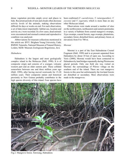
Fig.2. Mangrove forest, Tetewang, Halmahera<br />
been confirmed (V. caerulivirens, V. rainerguentheri, V.<br />
yuwonoi and V. zugorum), which is more than on any<br />
other Moluccan island.<br />
Observations were made around a number of sites<br />
on the northwestern, northeastern and eastern peninsulas<br />
in a variety of habitats from coastal mangrove swamps,<br />
Nypa swamps, coastal forests, sago swamps, plantations,<br />
secondary forest, disturbed forest, and primary forest, at<br />
elevations from 0 to 700 m.<br />
Morotai<br />
Morotai is a part of the East Halmaheran crustal<br />
Fragment (Hall, 1999) and is at present separated from<br />
Halmahera by about 10 km of open sea. According to<br />
Voris (2000), Morotai would have been connected to<br />
Halmahera by land bridges repeatedly during pleistocene<br />
glacial periods. Only one field site was visited on<br />
Morotai: the surroundings of pilowo village on the<br />
southern end of the island. There are vast mangrove<br />
forests in this area but unfortunately the lowland forests<br />
are disturbed or secondary. Most observations were<br />
made in the mangroves.