ABSTRACT VOLUME - International Association of Geomorphologists
ABSTRACT VOLUME - International Association of Geomorphologists
ABSTRACT VOLUME - International Association of Geomorphologists

Create successful ePaper yourself
Turn your PDF publications into a flip-book with our unique Google optimized e-Paper software.
<strong>International</strong> <strong>Association</strong> <strong>of</strong> <strong>Geomorphologists</strong><br />
<strong>Association</strong> <strong>International</strong>e de Géomorphologues<br />
IAG/AIG REGIONAL CONFERENCE 2011<br />
GEOMORPHOLOGY FOR HUMAN ADAPTATION TO<br />
CHANGING TROPICAL ENVIRONMENTS<br />
GHION HOTEL<br />
ADDIS ABABA, ETHIOPIA<br />
FEBRUARY 18‐22, 2011<br />
<strong>ABSTRACT</strong> <strong>VOLUME</strong><br />
Editors:<br />
Asfawossen Asrat, Francesco Dramis, Jan Nyssen, Mohammed Umer<br />
I A G ‐ 2 0 1 1 , A D D I S A B A B A , E T H I O P I A , 1 8 ‐ 2 2 F E B R U A R Y 2 0 1 1
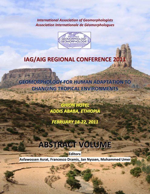
Cover Photo: Amba Seneyti, Tigray, Northern Ethiopia. Triassic sandstone tor overlying<br />
Plaeozoic tillites, which in turn lie over upper Proterozoic metavolcanics-metasediments.<br />
[Photo © Asfawossen Asrat, 2010]<br />
I A G ‐ 2 0 1 1 , A D D I S A B A B A , E T H I O P I A , 1 8 ‐ 2 2 F E B R U A R Y 2 0 1 1
<strong>International</strong> <strong>Association</strong> <strong>of</strong> <strong>Geomorphologists</strong><br />
<strong>Association</strong> <strong>International</strong>e de Géomorphologues<br />
IAG/AIG REGIONAL CONFERENCE 2011<br />
GEOMORPHOLOGY FOR HUMAN ADAPTATION TO<br />
CHANGING TROPICAL ENVIRONMENTS<br />
GHION HOTEL<br />
ADDIS ABABA, ETHIOPIA<br />
FEBRUARY 18‐22, 2011<br />
<strong>ABSTRACT</strong> <strong>VOLUME</strong><br />
Editors:<br />
Asfawossen Asrat, Francesco Dramis, Jan Nyssen, Mohammed Umer<br />
1 | I A G ‐ 2 0 1 1 , A D D I S A B A B A , E T H I O P I A , 1 8 ‐ 2 2 F E B R U A R Y 2 0 1 1
CONFERENCE ORGANIZATION<br />
ORGANIZED BY<br />
EAG ‐ ETHIOPIAN ASSOCIATION OF GEOMORPHOLOGISTS<br />
WITH THE SUPPORT OF<br />
Department <strong>of</strong> Earth Sciences, Addis Ababa University, Ethiopia,<br />
Paleoanthropology & Paleoenvironment Program, Addis Ababa University, Ethiopia<br />
Mekelle University, Ethiopia<br />
Department <strong>of</strong> Geological Sciences, “Roma Tre” University, Rome, Italy<br />
AIGEO ‐ Italian <strong>Association</strong> <strong>of</strong> Physical Geography and Geomorphology, Italy<br />
BAG ‐ Belgian <strong>Association</strong> <strong>of</strong> <strong>Geomorphologists</strong>, Belgium<br />
ORGANIZING COMMITTEE<br />
Asfawossen Asrat ‐ Department <strong>of</strong> Earth Sciences, Addis Ababa University, Ethiopia<br />
Mohammed Umer ‐ Department <strong>of</strong> Earth Sciences, Addis Ababa University, Ethiopia<br />
Francesco Dramis ‐ Department <strong>of</strong> Geological Sciences, “Roma Tre” University, Rome, Italy<br />
Jan Nyssen ‐ Department <strong>of</strong> Geography, University <strong>of</strong> Ghent, Belgium<br />
CONFERENCE SECRETARIAT<br />
Asfawossen Asrat ‐ Department <strong>of</strong> Earth Sciences, Addis Ababa University, Ethiopia<br />
Mohammed Umer ‐ Department <strong>of</strong> Earth Sciences, Addis Ababa University, Ethiopia<br />
SCIENTIFIC COMMITTEE<br />
Bekele Abebe ‐ Department <strong>of</strong> Earth Sciences, Addis Ababa University, Ethiopia<br />
Valerio Acocella ‐ Department <strong>of</strong> Geological Sciences, “Roma Tre” University, Rome, Italy<br />
Kassa Amare ‐ Department <strong>of</strong> Earth Sciences, Mekelle University, Ethiopia<br />
Asfawossen Asrat ‐ Department <strong>of</strong> Earth Sciences, Addis Ababa University, Ethiopia<br />
Paolo Billi ‐ Department <strong>of</strong> Earth Sciences, Università di Ferrara, Italy<br />
Mauro Coltorti ‐ Department <strong>of</strong> Earth Sciences, University <strong>of</strong> Siena, Italy<br />
Francesco Dramis ‐ Department <strong>of</strong> Geological Sciences, “Roma Tre” University, Rome, Italy<br />
Giandomenico Fubelli ‐ Dept. <strong>of</strong> Geological Sciences, “Roma Tre” University, Rome, Italy<br />
Tsige Gebru, University <strong>of</strong> Cologne, Germany<br />
Mitiku Haile ‐ Department <strong>of</strong> Land Resource Management and Environmental Protection<br />
(LARMEP), Mekelle University, Ethiopia<br />
Nigussie Haregeweyn ‐ Department <strong>of</strong> LARMEP, Mekelle University, Ethiopia<br />
Jan Moeyersons ‐ Royal Museum for Central Africa, Tervuren, Belgium<br />
Paola Molin ‐ Department <strong>of</strong> Geological Sciences, “Roma Tre” University, Rome, Italy<br />
Jan Nyssen ‐ Department <strong>of</strong> Geography, University <strong>of</strong> Ghent, Belgium<br />
Alberto Pizzi ‐ Department <strong>of</strong> Earth Sciences, University <strong>of</strong> Chieti, Italy<br />
Jean Poesen ‐ Department <strong>of</strong> Earth and Environmental Sciences, K.U.Leuven, Belgium<br />
Valery J. Terwilliger, Geography Department, University <strong>of</strong> Kansas, Lawrence, Kansas, USA<br />
Mohammed Umer ‐ Department <strong>of</strong> Earth Sciences, Addis Ababa University, Ethiopia<br />
Kifle Woldearegay – Department <strong>of</strong> Applied Geology, Mekelle University, Ethiopia<br />
Gezahegn Yirgu ‐ Department <strong>of</strong> Earth Sciences, Addis Ababa University, Ethiopia<br />
WE GREATLY APPRECIATE FINANCIAL SUPPORT FROM<br />
IAG (<strong>International</strong> <strong>Association</strong> <strong>of</strong> <strong>Geomorphologists</strong>)<br />
2 | I A G ‐ 2 0 1 1 , A D D I S A B A B A , E T H I O P I A , 1 8 ‐ 2 2 F E B R U A R Y 2 0 1 1
February 18, 2011<br />
14.00 ‐ 17.00 Registration Desk<br />
19.00 ‐ Welcome Party<br />
CONFERENCE PROGRAM<br />
February 19, 2011<br />
8.00 ‐ 18.00 Registration<br />
9.00 – 9.50 Opening Ceremony (welcome addresses by IAG, EAG and the Guest <strong>of</strong> Honour)<br />
9.50 – 10.30 Invited talk by Ilaria Lener from IAG<br />
10.40 – 11.00 Break<br />
11.00 – 13.00 Parallel Sessions ECHI/LDR<br />
13.00 – 14.00 Lunch<br />
14.00 – 16.40 Parallel Sessions ECHI+GGA/LDR<br />
16.40 – 17.00 Break<br />
17.00 – 17.40 Poster Session<br />
17.40 – 18.10 Keynote Lecture by Martin Williams<br />
18.10 ‐ 18.40 Keynote Lecture by Jean Poesen<br />
February 20, 2011<br />
Mid‐Conference Excursions<br />
February 21, 2011<br />
8.00 – 10.00 Parallel Sessions LHAZ/MATVG<br />
10.00 – 10.20 Break<br />
10.20 – 12.20 Parallel Sessions LHAZ+GGT/MATVG<br />
12.20 – 13.20 Lunch<br />
13.20 – 15.40 Parallel Sessions FGFH/PG<br />
15.40 – 16.00 Break<br />
16.00 – 16.40 Poster Session<br />
16.40 – 17.10 Keynote Lecture by Olav Slaymaker<br />
17.10 ‐17.40 Keynote Lecture by Andrew Goudie<br />
17.40 ‐18.10 Keynote Lecture by Antonio Cendrero<br />
February 22, 2011<br />
8.00 – 10.20 Parallel Sessions QSP/DGD<br />
10.20 – 10.40 Break<br />
10.20 – 12.20 Parallel Sessions GM/GEEG<br />
12.20 – 13.20 Lunch<br />
13.20 – 14.20 Parallel Sessions GM/GEEG<br />
14.20 – 15.20 Poster Session<br />
15.20 – 15.40 Break<br />
15.40 – 16.10 Second invited talk by Ilaria Lener<br />
16.10 – 16.40 Keynote Lecture by Cliff Ollier<br />
16.40 – 17.10 Keynote Lecture by Mike Crozier<br />
17.10 – 17.40 Closing Ceremony<br />
19.00 – Farewell Banquet<br />
3 | I A G ‐ 2 0 1 1 , A D D I S A B A B A , E T H I O P I A , 1 8 ‐ 2 2 F E B R U A R Y 2 0 1 1
PROGRAM LAYOUT<br />
Date: February 18, 2011<br />
Venue: Saba Hall<br />
Time Activity<br />
14.00 – 17.00 Registration at the Ghion Hotel<br />
19.00 ‐ Welcome (Ice Breaker) Party at the Lucy Restaurant<br />
Date: February 19, 2011<br />
Venue: Saba Hall<br />
8.00 ‐ 18.00 Registration<br />
9.00 – 9.50 Opening Ceremony (welcome addresses by IAG, EAG and the Guest <strong>of</strong> Honour)<br />
9.50 – 10.30 Invited talk by Ilaria Lener: <strong>International</strong> Cooperation and African countries: enhancing<br />
scientific excellence through mobility and training<br />
10.30 – 11.00 C<strong>of</strong>fee/tea Break<br />
Session 1: ENVIRONMENTAL CHANGE AND HUMAN IMPACT (ECHI)<br />
Conveners/Chairs: A. Pérez Gonzales, A. Goudie<br />
Venue: Saba Hall<br />
11.00 – 11.20 Viel V., Le Gouée P. & Delahaye D. ‐ Impacts <strong>of</strong> climate change on the sensitivity <strong>of</strong><br />
agricultural land to erosion hazard<br />
11.20 – 11.40 Nyssen J., Frankl A., Mitiku Haile, Hurni H., Descheemaeker K., Ritler A., Crummey D.,<br />
Nievergelt B., Moeyersons J., Munro R.N., Portner B., Deckers J., Billi P. & Poesen J. ‐<br />
Are changes in north Ethiopian mountain landscapes over the last 140 years caused by<br />
changing climate, or by human‐induced degradation and rehabilitation?<br />
11.40 – 12.00 Moeyersons J., Vandecasteele I. & Trefois P. ‐ Applications <strong>of</strong> the topographic<br />
thresholds slope and runon area in the study <strong>of</strong> hillslope incisions along the Albertine<br />
Rift in Kivu (DR <strong>of</strong> the Congo), Rwanda and Burundi<br />
12.00 – 12.20 Getachew Eshetu ‐ An upland farming system under transformation: Proximate causes<br />
<strong>of</strong> land use change in Bela‐Welleh catchment (Wag, Northern Ethiopian Highlands)<br />
12.20 – 12.40 Yu Ge, Shen Huadong & Ke Xiankun ‐ Geomorphologic system changes in river‐lake <strong>of</strong><br />
Yangtze River and the lacustrine sediments and pollen disposition responses<br />
12.40 – 13.00 Prokop P. & Bhattacharyya A. ‐ Environmental response to human impact on the<br />
Meghalaya Plateau (NE India) during the last 2500 yrs BP<br />
Session 2: LAND DEGRADATION AND RESILIENCE (LDR)<br />
Conveners/Chairs: Mitiku Haile, J. Nyssen, O. Slaymaker<br />
Venue: Hall 1<br />
11.00 – 11.20 Rosell S. ‐ Soil productivity and food security in the central highlands <strong>of</strong> Ethiopia<br />
11.20 – 11.40 Frankl A., Poesen J., de Dapper M., Deckers J., Mitiku Haile & Nyssen J. ‐ Assessing gully<br />
headcut retreat rates in the semi‐arid highlands <strong>of</strong> North Ethiopia<br />
11.40 – 12.00 Claessens L., Schoorl J.M., Verburg P.H., Geraedts L. & Veldkamp A. ‐ Modelling<br />
interactions and feedback mechanisms between land use change and landscape<br />
processes<br />
12.00 – 12.20 Afana A., Solé‐Benet A. & Pérez J.L. ‐ Determination <strong>of</strong> soil erosion using laser scanners<br />
12.20 – 12.40 Tesfay Araya, Cornelis W.M., Nyssen J., Govaerts B, Fekadu Getnet, Bauer H., Raes D.,<br />
Kindeya Gebrehiwot, Teklit Yohannes & Deckers J. ‐ Effects <strong>of</strong> resource‐conserving<br />
tillage in the Ethiopian highlands, a sustainable option for soil and water management<br />
and crop productivity. A case study from Dogua Tembien<br />
4 | I A G ‐ 2 0 1 1 , A D D I S A B A B A , E T H I O P I A , 1 8 ‐ 2 2 F E B R U A R Y 2 0 1 1
12.40 – 13.00 Ciampalini R., Billi P., Follain S., Le Bissonnais Y., Ferrari G. & Borselli L. ‐ Long‐term soil<br />
erosion analysis on the terrace systems <strong>of</strong> the archaeological area <strong>of</strong> Aksum (Ethiopia)<br />
13.00 – 14.00 Lunch Break<br />
Session 1: ENVIRONMENTAL CHANGE AND HUMAN IMPACT (ECHI)<br />
Conveners/Chairs: A. Pérez Gonzales, A. Goudie<br />
Venue: Saba Hall<br />
14.00 – 14.20 Embleton‐Hamann C. ‐ The importance <strong>of</strong> landuse and landcover changes in the<br />
Austrian Alps<br />
14.20 – 14.40 Lajczak A. ‐ Geomorphological development <strong>of</strong> post‐peat areas in the Polish Carpathian<br />
Mts. over the last ca. 200 years<br />
14.40 – 15.00 Móga J., Szabó M., Borsodi A.K., Kiss K., Kéri A., Darabos G., Mari L. & Knáb M. ‐<br />
Investigations <strong>of</strong> the changes (degradation) <strong>of</strong> karst landscapes and epikarst due to<br />
human impact in two Hungarian karst areas<br />
15.00 – 15.20 Rączkowska Z. ‐ Recent transformation <strong>of</strong> alpine debris slopes in the Tatra mts. (Poland)<br />
Session 1: GEOHERITAGES AND GEOARCHAEOLOGY (GGA)<br />
Conveners/Chairs: Asfawossen Asrat, Z. Zwolinski<br />
Venue: Saba Hall<br />
15.20 – 15.40 Fouache E., Cosandey C., Chahryar Adle & Coussot C. ‐ The fault <strong>of</strong> Bam (South Eastern<br />
Iran), regional water resources and human settlements from the Chalcolithic period to<br />
present times<br />
15.40 – 16.00 Chabrol A., Fouache E., Lecoeur C., Apostolopoulos G. & Pavlopoulos K. ‐<br />
Reconstructing the early/mid Holocene landscape evolution <strong>of</strong> the Thyamis delta<br />
(Greece): implications for human populations<br />
16.00 – 16.20 Ackermann O. ‐ Reading the field: geoarchaeological codes in the Israeli landscape<br />
16.20 – 16.40 Ecochard E., Fouache E., Kuzucuoğlu C., Carcaud N., Ekmekçi M., Ulusoy I., Çiner A.,<br />
Cavalier L. & des Courtils J. ‐ Promoting the geomorphological heritage <strong>of</strong> the plain <strong>of</strong><br />
Xanthos and Letoon (Turkey): Issues, practices and problems<br />
Session 2: LAND DEGRADATION AND RESILIENCE (LDR)<br />
Conveners/Chairs: Mitiku Haile, J. Nyssen, O. Slaymaker<br />
Venue: Hall 1<br />
14.00 – 14.20 Teka D., van Wesemael B., Poesen J., Hallet V., Vanacker V., Deckers S., Taye G. &<br />
Haregeweyn N. ‐ A trade‐<strong>of</strong>f between fighting land degradation and water harvesting<br />
in northern Ethiopia<br />
14.20 – 14.40 Amanuel Zenebe, Atkilt Girma, Vanmaercke M., Nyssen J., Verstraeten G., Mitiku Haile,<br />
Kassa Amare, Deckers J. & Poesen J. ‐ Intra‐seasonal sediment yield variability in<br />
response to catchment greenness as detected by hyper‐temporal SPOT NDVI image<br />
analysis in Geba catchment, Northern Ethiopia<br />
14.40 – 15.00 Thomaz E.L. ‐ Microcatchment hydrological response and sediment transport under<br />
simulated rainfall, Guarapuava – Brazil<br />
15.00 – 15.20<br />
15.20 – 15.40<br />
15.40 – 16.00<br />
16.00 – 16.20<br />
16.20 – 16.40<br />
16.40 – 17.00 C<strong>of</strong>fee/tea Break<br />
17.00 – 17.40 Poster Sessions (see separate list for posters)<br />
5 | I A G ‐ 2 0 1 1 , A D D I S A B A B A , E T H I O P I A , 1 8 ‐ 2 2 F E B R U A R Y 2 0 1 1
‐ENVIRONMENTAL CHANGE AND HUMAN IMPACT (ECHI)<br />
‐LAND DEGRADATION AND RESILIENCE (LDR)<br />
‐GEOHERITAGES AND GEOARCHAEOLOGY (GGA)<br />
‐LANDSLIDE HAZARD ASSESSMENT AND ZONING (LHAZ)<br />
‐GEODIVERSITY AND GEOTOURISM (GGT)<br />
Keynote Lectures; Venue: Saba Hall<br />
17.40 – 18.10 Martin Williams ‐ Geomorphic evolution <strong>of</strong> the Ethiopian tributaries <strong>of</strong> the Nile:<br />
volcanism, tectonism, climatic change, and human impact<br />
18.10 – 18.40 Jean Poesen ‐ Research challenges for soil erosion, soil and water conservation in<br />
tropical environments<br />
Date: February 20, 2011<br />
Mid‐Conference excursions<br />
Date: February 21, 2011<br />
Session 1: LANDSLIDE HAZARD ASSESSMENT AND ZONING (LHAZ)<br />
Conveners/Chairs: Bekele Abebe, J. Moeyersons<br />
Venue: Saba Hall<br />
8.00 – 8.20 Williamson S.J. & Dias A. ‐ Geomorphological mapping for natural terrain hazard<br />
assessment, Hong Kong<br />
8.20 – 8.40 Solomon Hishe, Adalberto A. & Alfred T. ‐ Landslide susceptibility assessment in<br />
Kilte_Awulaelo Woreda, Tigray Region, Ethiopia<br />
8.40 – 9.00 Kifle Woldearegay, Schubert W., Klima K. & Aberra Mogessie ‐ Application <strong>of</strong> analytical<br />
hierarchy process (AHP) for GIS‐based landslide susceptibility mapping; the case <strong>of</strong><br />
northern highlands <strong>of</strong> Ethiopia<br />
9.00 – 9.20 Kalita K. ‐ Landslide hazards <strong>of</strong> Gangtok, Sikkim (India)<br />
9.20 – 9.40 Soldati M., Bruschi V.M., Devoto S., González Díez A., Mantovani M., Pasuto A. &<br />
Piacentini D. ‐ A multi‐technical integrated approach to investigate lateral spreading<br />
phenomena in the north‐west coast <strong>of</strong> Malta<br />
9.40 – 10.00 Migoń P. & Kasprzak M. ‐ Using LiDAR to detect landslide remnants under forest. A<br />
study from SW Poland<br />
Session 2: MORPHOTECTONICS, ACTIVE TECTONICS & VOLCANIC GEOMORPHOLOGY (MATVG)<br />
Conveners/Chairs: M. Coltorti, Gezahegn Yirgu, C.D. Ollier<br />
Venue: Hall 1<br />
8.00 – 8.20 Vandenberghe J. ‐ Differential tectonic Impact on fluvial evolution (Huang Shui, China)<br />
8.20 – 8.40 Coltorti M., Pizzi A., Bekele Abebe, Disperati L., Firuzabadì D., Pomposo G., Sacchi G. &<br />
Salvini R. ‐ Geomorphology <strong>of</strong> the southern border <strong>of</strong> Afar in the Dire Dawa district<br />
(Ethiopia)<br />
8.40 – 9.00 Ufimtsev G. & Shchetnikov A. ‐ Morpotectonics and lakes <strong>of</strong> the inner and eastern Asia<br />
Rift systems<br />
9.00 – 9.20 Papanastassiou D., Gaki‐Papanastassiou K. & Karymbalis E. ‐ Geomorphological<br />
observations in the Mani Peninsula, (South Peloponnesus, Greece) and their<br />
seismotectonic implications<br />
9.20 – 9.40 Molin P., Sperini S., Nocentini M., Fubelli G., Scotti V.N., Dramis F. & Grecu F. ‐ The<br />
interplay <strong>of</strong> mantle dynamics, tectonics, and surface processes: the Romanian<br />
Carpathians topography<br />
9.40 – 10.00 Scotti V., Molin P. & Dramis F. ‐ The Influence <strong>of</strong> surface and tectonic processes in the<br />
Late Miocene to Quaternary landscape evolution <strong>of</strong> Western Alps: a quantitative<br />
6 | I A G ‐ 2 0 1 1 , A D D I S A B A B A , E T H I O P I A , 1 8 ‐ 2 2 F E B R U A R Y 2 0 1 1
geomorphological analysis<br />
10.00 – 10.20 C<strong>of</strong>fee/tea Break<br />
Session 1: LANDSLIDE HAZARD ASSESSMENT AND ZONING (LHAZ)<br />
Conveners/Chairs: Bekele Abebe, J. Moeyersons<br />
Venue: Saba Hall<br />
10.20 – 10.40 Fubelli G. & Ferrari M. ‐ Rainstorm‐triggered shallow landslides in a urban context: the<br />
case <strong>of</strong> S. Vito Romano (Rome, Italy)<br />
10.40 – 11.00 Gutiérrez F., Guerrero J, Galve J.P., Lucha P., García‐Ruiz J.M., Bonachea J. & Carbonell<br />
D. ‐ Detailed mapping <strong>of</strong> landslides in the Gállego glacial valley (Spanish Pyrenees) as a<br />
basis for hazard analysis and risk mitigation<br />
Session 1: GEODIVERSITY AND GEOTOURISM (GGT)<br />
Conveners/Chairs: Metasebia Demissie, Frances Williams<br />
Venue: Saba Hall<br />
11.00 – 11.20 Thomas M. ‐ Geodiversity and landscape sensitivity – engaging geomorphology in a<br />
new dialogue about geoconservation<br />
11.20 – 11.40 Asfawossen Asrat, Metasebia Demissie & Aberra Mogessie ‐ Geo‐scenery based on geo‐<br />
diversity in Ethiopia<br />
11.40 – 12.00 Williams F. ‐ Ethiopia: a geotourist’s perspective<br />
12.00 – 12.20 Zbigniew Zwolinski ‐ Geodiversity <strong>of</strong> Tatra Mts., Poland<br />
Session 2: MORPHOTECTONICS, ACTIVE TECTONICS & VOLCANIC GEOMORPHOLOGY (MATVG)<br />
Conveners/Chairs: M. Coltorti, Gezahegn Yirgu, C.D. Ollier<br />
Venue: Hall 1<br />
10.20 – 10.40 Stamatopoulos L., Pavlides S. & Kamberis S. ‐ Evolution <strong>of</strong> a fault‐line scarp after the 8<br />
June, 2008 earthquake, in the western Peloponnese<br />
10.40 – 11.00 Panin A. & Selezneva E. ‐ Active tectonic and seismicity in permafrost environment: the<br />
Terekhol Basin, Southern Siberia<br />
11.00 – 11.20 Sheth H.C. ‐ Volcanic geomorphology <strong>of</strong> flood basalt provinces: an overview <strong>of</strong> the<br />
Deccan Traps and similarities with the Ethiopian Traps<br />
11.20 – 11.40 Purcell P., Mege D. & Jourdan F. ‐ Volcanic geomorphology <strong>of</strong> Southeast Ethiopia<br />
11.40 – 12.00 Zangmo Tefogoum G., Kagou Dongmo A., Nkouathio D. G. & Wandji P. ‐ Hazards<br />
zonation and assessment <strong>of</strong> the associated risks in the Mount Manengouba Caldera<br />
(Cameroon volcanic line)<br />
12.00 – 12.20 Gountié Dedzo M., Nono A., Kamgang P., Njonfang E., Zangmo Tefogoum G. & Nédélec<br />
A. ‐ Evaluation and mapping <strong>of</strong> the volcanic hazard related to the ignimbritic eruption<br />
by AMS in Mount Bambouto, West Cameroon<br />
12.20 – 13.20 Lunch Break<br />
Session 1: FLUVIAL GEOMORPHOLOGY AND FLOODING HAZARD (FGFH)<br />
Conveners/Chairs: P. Billi, M.J. Machado<br />
Venue: Saba Hall<br />
13.20 – 13.40 Billi P. & Aklilu Amsalu ‐ Sediment transport <strong>of</strong> a flash flood stream in Tigray, Ethiopia<br />
13.40 – 14.00 Douvinet J., Delahaye D. & Langlois P. ‐ Linking surface flow concentration and<br />
geomorphic forms in dry valleys: what kind <strong>of</strong> information the CA model RuiCells<br />
supports?<br />
14.00 – 14.20 Oliveira F.A. ‐ Analysis <strong>of</strong> suspended sediment variation in a subtropical watershed,<br />
Southern Brazil<br />
14.20 – 14.40 Rowntree K.M. & Van der Waal B.W. ‐ A geomorphological response model for<br />
7 | I A G ‐ 2 0 1 1 , A D D I S A B A B A , E T H I O P I A , 1 8 ‐ 2 2 F E B R U A R Y 2 0 1 1
predicting habitat change in non‐perennial river systems: lessons from the Mokolo<br />
River, Limpopo Province, South Africa<br />
14.40 – 15.00 Lajczak A. ‐ Deltas development in dam‐retained lakes in the Carpathian part <strong>of</strong> the<br />
Vistula River drainage basin, Southern Poland<br />
15.00 – 15.20 Pandey P.K. & Das S.S. – A new hypothesis in stream ordering methodology<br />
15.20 – 15.40 Mazurek M., Dobrowolski R., Osadowski Z. ‐ Role <strong>of</strong> geological and hydrological factors<br />
in the development <strong>of</strong> spring mires in the Parsęta River catchment (Northern Poland)<br />
Session 2: PLANETARY GEOMORPHOLOGY (PG)<br />
Conveners/Chairs: R.M.C. Lopes, J. Radebaugh<br />
Venue: Hall 1<br />
13.20 – 13.40 McEwen A.S. & the HiRISE Team ‐ Meter‐scale geomorphology <strong>of</strong> Mars<br />
13.40 – 14.00 Mège D., Le Deit L., Lucas A. & Bourgeois O. – Gravitational spreading <strong>of</strong> high<br />
wallslopes on Mars: evidence <strong>of</strong> past tropical glaciations on Mars<br />
14.00 – 14.20 Radebaugh J., Barth B, Schleiffarth K., Lopes R.M.C. & Christiansen E.H. ‐ Global<br />
volcanism and tectonism on Jupiter’s moon Io as manifested in surface features<br />
14.20 – 14.40 Lorenz R. ‐ Titan’s lakes, dunes and wadis: an arid landscape shaped by methane<br />
weather<br />
14.40 – 15.00 Pappalardo R.T. ‐ Ridge and trough terrains on outer planet satellites<br />
15.00 – 15.20 Lopes R.M.C., Peckyno R., St<strong>of</strong>an E.R., Radebaugh J. & the Cassini RADAR Team ‐<br />
Geomorphological mapping <strong>of</strong> Saturn’s moon Titan<br />
15.20 – 15.40 Diniega S., Bridges N.T., Byrne S., Dundas C.M., Hansen C.J. & McEwen A.S. ‐ Seasonal<br />
activity within Martian dune gullies<br />
15.40 – 16.00 C<strong>of</strong>fee/tea Break<br />
16.00 – 16.40 Poster Sessions (see separate list for posters)<br />
‐MORPHOTECTONICS, ACTIVE TECTONICS & VOLCANIC GEOMORPHOLOGY (MATVG)<br />
‐FLUVIAL GEOMORPHOLOGY AND FLOODING HAZARD – FGFH<br />
‐DRYLANDS GEOMORPHOLOGY AND DESERTIFICATION (DGD)<br />
‐QUATERNARY STRATIGRAPHY AND PALAEOCLIMATES (QSP)<br />
Keynote Lectures; Venue: Saba Hall<br />
16.40 – 17.10 Slaymaker O. ‐ Drivers <strong>of</strong> landscape change during the present century<br />
17.10 – 17.40 Goudie A. ‐ Environmental changes in Africa – Past, present and future<br />
17.40 – 18.10 Cendrero A. ‐ Evidences <strong>of</strong> major changes in Earth’s surface processes. Should the<br />
Anthropocene be considered as a new period in geologic history?<br />
Date: February 22, 2011<br />
Session 1: QUATERNARY STRATIGRAPHY AND PALAEOCLIMATE (QSP)<br />
Conveners/Chairs: Mohammed Umer, M. Williams<br />
Venue: Saba Hall<br />
8.00 – 8.20 Mohammed Umer ‐ Glaciation, deglaciation and postglacial history <strong>of</strong> the Ethiopian<br />
mountains<br />
8.20 – 8.40 Pietsch D. & Kühn P. ‐ Palaeosols as proxies for Holocene climate change along the ITCZ<br />
(Yemen, Ethiopia)<br />
8.40 – 9.00 Accioly Teixeira de Oliveira M., Porsani J.L., Leite de Lima G., Jeske‐Pieruschka V. &<br />
Behling H. ‐ Highland peatland evolution in Southern Brazil, since the Late Pleistocene,<br />
as depicted by radar stratigraphy, sedimentology and palynology<br />
9.00 – 9.20 Machado M.J. & Pérez‐González A. ‐ Land cover resilience and environmental changes<br />
during the last 3000 yrs in Northern Ethiopia: phytolithic and palaeosols evidences<br />
8 | I A G ‐ 2 0 1 1 , A D D I S A B A B A , E T H I O P I A , 1 8 ‐ 2 2 F E B R U A R Y 2 0 1 1
9.20 – 9.40 Chunchang Huang, Xiaochun Zha & Yali Zhou ‐ Extraordinary floods recorded by<br />
slackwater deposit during the 4200 a BP climatic event in the middle reaches <strong>of</strong> the<br />
Yellow River, China<br />
9.40 – 10.00 Karasiewicz M.T. & Hulisz P. ‐ Reconstruction <strong>of</strong> the environmental changes during the<br />
Late Vistulian and Holocene (north‐central Poland) using kettle‐hole sediment analysis<br />
10.00 ‐10.20 Dramis F., Fubelli G. & Mazzini I. ‐ Aggradation/erosion <strong>of</strong> tufa and paleoclimatic<br />
implications: the Nera River dam at Triponzo (Central Italy)<br />
Session 2: DRYLANDS GEOMORPHOLOGY AND DESERTIFICATION (DGD)<br />
Conveners/Chairs: J. Poesen, M. Thomas<br />
Venue: Hall 1<br />
8.00 – 8.20 Smolska E., Dłużewski M. & Biejat K. ‐ Present‐day development <strong>of</strong> gullies in semi‐dry<br />
areas: examples from the Gabes region (N Tunisia)<br />
8.20 – 8.40 Penven M.J., Bouhahad Smail & Cotonnec A. ‐ Control <strong>of</strong> geomorphic patterns on the<br />
development <strong>of</strong> aeolian processes during the last dry period in a Sahelian region (1970‐<br />
1999)<br />
8.40 – 9.00 Dunkerley D.L. ‐ Hillslope and river responses to climate change – analyses from inland<br />
Australia<br />
9.00 – 9.20 Xinbao Zhang ‐ Mechanisms for the formation <strong>of</strong> dry planation surfaces<br />
9.20 – 9.40 Abd Elbasit M.A.M., Yasuda H., Kimura R. & Fan J. – Spatiotemporal variability <strong>of</strong><br />
rainfall erosivity in Loess Plateau, China<br />
9.40 – 10.00 Cantón Y., Chamizo S., Rodriguez‐Caballero E., Miralles‐Mellado I., Lázaro R., Domingo<br />
F., Calvo‐Cases A. & Sole‐Benet A. ‐ Key variables <strong>of</strong> soil crusting involved in their<br />
hydrological and erosive response<br />
10.00 – 10.20<br />
10.20 – 10.40 C<strong>of</strong>fee/tea Break<br />
Session 1: GEOMORPHOLOGICAL MAPPING (GM)<br />
Conveners/Chairs: F. Dramis, P. Paron<br />
Venue: Saba Hall<br />
10.40 – 11.00 Coltrinari L. & Reis J.P.P. ‐ Geomorphologic Information Systems, why not?<br />
11.00 – 11.20 Junqueira Villela F.N. & Sanches Ross J.L. ‐ Rock‐soil‐relief relationships in the transition<br />
<strong>of</strong> the Atlantic Plateau to the Peripheral Depression <strong>of</strong> Sao Paulo<br />
11.20 – 11.40 Coltorti M., Firuzabadì D. & Pieruccini P. ‐ The 1:200,000 scale geomorphological map<br />
<strong>of</strong> the Siena Province (Southern Tuscany, Italy)<br />
11.40 – 12.00 Mulas M., Fubelli G., Sandric I., Balteanu D., Micu M. & Ignat P. ‐ Morphodynamic<br />
mapping <strong>of</strong> landslide affected slopes: the case <strong>of</strong> the Groapa Vantului (Romania)<br />
12.00 – 12.20 Szefler K., Tęgowski J. & Nowak J. ‐ Mapping <strong>of</strong> Southern Baltic submarine landscapes<br />
and habitats<br />
Session 2: GEOMORPHOLOGICAL ENVIRONMENTS AND ENVIRONMENTAL GEOMORPHOLOGY (GEEG)<br />
Conveners/Chairs: A. Mottana, H. Regnauld<br />
Venue: Hall 1<br />
10.40 – 11.00 Asfawossen Asrat, Baker A., Agazi Negash ‐ Geomorphology <strong>of</strong> limestone terrain <strong>of</strong><br />
Tigray, Northern Ethiopia: implication for cave formation and speleothem growth<br />
11.00 – 11.20 Regnauld H., Pian S., Musereau J., Haya M. & Menier D. ‐ Present forcings on coastal<br />
evolution: the coastlines <strong>of</strong> western France<br />
11.20 – 11.40 Haubold F. & Faust D. ‐ The bolsa phenomenon: a conceptual model <strong>of</strong> its origin<br />
11.40 – 12.00 Joubert R. & Ellery W.N. ‐ Controls on wetland formation and geomorphic dynamics:<br />
9 | I A G ‐ 2 0 1 1 , A D D I S A B A B A , E T H I O P I A , 1 8 ‐ 2 2 F E B R U A R Y 2 0 1 1
the case <strong>of</strong> Wakkerstroom Vlei, Mpumalanga Province, South Africa<br />
12.00 – 12.20 Lebedeva E. ‐ Planation surfaces <strong>of</strong> South Africa and topographic levels <strong>of</strong> the<br />
Drakensberg<br />
12.20 – 13.20 Lunch Break<br />
Session 1: GEOMORPHOLOGICAL MAPPING (GM)<br />
Conveners/Chairs: F. Dramis, P. Paron<br />
Venue: Saba Hall<br />
13.20 – 13.40 Andrzejewski L. ‐ Geomorphological map <strong>of</strong> the forefield <strong>of</strong> Tungnaárjökull (Iceland)<br />
13.40 – 14.00 Kit‐Ying Ng, Millis S.W. & Wallace M.I. ‐ Characterising natural terrain landslide<br />
distribution at Catchment Scale, West Lantau, Hong Kong<br />
14.00 – 14.20 Sadiki Ndyanabo, Ine Vandecasteele, Jan Moeyersons, Philippe Trefois, André Ozer,<br />
Pierre Ozer, Kalegamire Dunia, Bahati Cishugi ‐ Vulnerability mapping for sustainable<br />
hazard mitigation in the city <strong>of</strong> Bukavu, South Kivu, DRCongo<br />
Session 2: GEOMORPHOLOGICAL ENVIRONMENTS AND ENVIRONMENTAL GEOMORPHOLOGY (GEEG)<br />
Conveners/Chairs: A. Mottana, H. Regnauld<br />
Venue: Hall 1<br />
13.20 – 13.40 Goracci G., Bonavia F. & Mottana A. ‐ The non‐diamondiferous rocks occurring in the<br />
vicinity <strong>of</strong> the Mega diatreme (Sidamo, Ethiopia)<br />
13.40 – 14.00 Bruschi V.M., Otero C., Manchado C., Arias R. & Cendrero A. ‐ Development and<br />
application <strong>of</strong> a methodological tool for landscape impact assessment in mining areas.<br />
Application as a decision‐support tool for impact mitigation<br />
14.00 – 14.20 Bondesan A., Francese R., Coren F. & Fabbrucci L. ‐ Geomorphological study <strong>of</strong> the El<br />
Alamein battlefield (Egypt): a military geology approach<br />
14.20 – 15.20 Poster Sessions (see separate list for posters)<br />
‐GEOMORPHOLOGICAL MAPPING (GM)<br />
‐GEOMORPHOLOGICAL ENVIRONMENTS AND ENVIRONMENTAL GEOMORPHOLOGY<br />
(GEEG)<br />
15.20 – 15.40 C<strong>of</strong>fee/tea break<br />
Keynote Lectures; Venue: Saba Hall<br />
15.40 – 16.10 Illaria Lener – Second talk<br />
16.10 – 16.40 Ollier C.D. ‐ Variety in rift valleys and in passive margins<br />
16.40 – 17.10 Crozier M.J. ‐ Locational controls <strong>of</strong> landslides: where will the next one occurs?<br />
17.10 – 17.40 Closing Ceremony<br />
19.00 – Farewell Banquet<br />
10 | I A G ‐ 2 0 1 1 , A D D I S A B A B A , E T H I O P I A , 1 8 ‐ 2 2 F E B R U A R Y 2 0 1 1
SCHEDULE OF POSTER PRESENTATION<br />
February 19/2011<br />
Venue: Hall 1; Time: 17.00 – 17.40<br />
ENVIRONMENTAL CHANGE AND HUMAN IMPACT (ECHI)<br />
1. Florek W., Kaczmarzyk J. & Majewski M. ‐ Evolution <strong>of</strong> a South Baltic Sea cliff near Ustka<br />
(Poland):natural and human impact<br />
2. Paron P. & Munro R.N. ‐ Analysis <strong>of</strong> environmental change in Somalia using historical aerial<br />
photography archives<br />
3. Zaporozhchenko E.V. ‐ The influence <strong>of</strong> the changing climate on conditions <strong>of</strong> initiation,<br />
movement and discharge <strong>of</strong> debris flows on mountainous rivers in the Northern Caucasus<br />
(Russia)<br />
LAND DEGRADATION AND RESILIENCE (LDR)<br />
1. Afana A., Del Barrio G. & Solé‐Benet A. ‐ Landform delineation using semivariograms in real<br />
dataset structures<br />
2. Barreiros A.M. & De Oliveira D. ‐ Study <strong>of</strong> the genesis <strong>of</strong> a Red Ferric Latosolic Nitisol in an area<br />
<strong>of</strong> lithological interface, in the Municipality <strong>of</strong> Floraí, State <strong>of</strong> Paraná, Brazil<br />
3. Munro R.N., Mitiku Maile, Nyssen J., Virgo K.J., Wilson R.T., Poesen J., Deckers J., Frankl A. &<br />
Lewis J.G. ‐ Landscape recovery and resilience in a badly degraded region – Tigray (Ethiopia)<br />
1974 ‐ 2006<br />
4. Prokop P. ‐ Soil degradation along rainfall gradient on the Meghalaya Plateau (NE India)<br />
GEOHERITAGES AND GEOARCHAEOLOGY (GGA)<br />
1. Migoń P., Billi P., Ciampalini R. & Ferrari G. ‐ Geomorphology <strong>of</strong> nephelinite syenite stocks<br />
around Aksum, northern Ethiopia ‐ adding earth science value to the Aksum world heritage site<br />
2. Skovitina T. & Angelelli F. ‐ Geoheritage <strong>of</strong> Baikal Lake coast zone<br />
LANDSLIDE HAZARD ASSESSMENT AND ZONING (LHAZ)<br />
1. Kassa Amare, Kurkura Kebato & Assay Gebremichael ‐ Landslide hazard and risk assessment: a<br />
case study from Keyhi‐Tekeli village Adi‐Shu area, southern Tigray<br />
2. Aringoli D., Bisci C., Dramis F., Farabollini P., Gentili B., Materazzi M. & Pambianchi G. ‐<br />
Disturbances to buildings as indicators <strong>of</strong> slope gravitational processes: study cases from Central<br />
Italy<br />
3. Carvalho Vieira B. & Dias Nery T. ‐ Prediction <strong>of</strong> shallow landslides using SINMAP model in Serra<br />
do Mar, Brazil<br />
4. Fort M & Cossart E. ‐ Landslide hazards, settlements sites and development in the Nepal<br />
Himalayas<br />
5. Fubelli G., Leoni G., Dramis F. & Puglisi C. ‐ GIS methodology to assess landslide susceptibility:<br />
application to the piedmont <strong>of</strong> the Sila Greca (Calabria, Italy)<br />
6. Lajczak A. ‐ Neogene‐Quaternary relief development <strong>of</strong> a highly elevated monoclinal flysch<br />
range modelled by huge landslides: case study from the Babia Gora Massif, Western Carpathian<br />
Mts.<br />
7. Falconi L., Lentini A., Leoni G., Puglisi C. & Ramirez C. ‐ Geomorphological approach to assess<br />
debris flow risk in the catchment <strong>of</strong> Alcamayo creek (Aguas Calientes, Cusco, Perù)<br />
GEODIVERSITY AND GEOTOURISM (GGT)<br />
1. Junqueira Villela F.N. ‐ Geological, geomorphological and climatic aspects <strong>of</strong> the Serra Geral do<br />
Tocantins ecologic station, Brazil<br />
2. Strat D. ‐ Geodiversity and geoconservation in the lagoonal littoral <strong>of</strong> Romanian Black Sea coast<br />
11 | I A G ‐ 2 0 1 1 , A D D I S A B A B A , E T H I O P I A , 1 8 ‐ 2 2 F E B R U A R Y 2 0 1 1
3. Piotr Migoń, Paolo Billi, Rossano Ciampalini, Giovanni Ferrari ‐ Geomorphology <strong>of</strong> nephelinite<br />
syenite stocks around Aksum, northern Ethiopia ‐ adding Earth Science value to the Aksum<br />
World Heritage site<br />
4. Tatiana Skovitina, Francesco Angelelli ‐ Geoheritage <strong>of</strong> Baikal Lake coast zone<br />
February 21/2011<br />
Venue: Hall 1; Time: 16.00 – 16.40<br />
MORPHOTECTONICS, ACTIVE TECTONICS & VOLCANIC GEOMORPHOLOGY (MATVG)<br />
1. Coltorti M., Pizzi A., Bekele Abebe, Disperati L., Firuzabadì D., Pomposo G., Pontarelli L., Sacchi G.<br />
& Salvini R. ‐ Geology and tectonic setting <strong>of</strong> Dire Dawa (southern Afar, Ethiopia)<br />
2. Gaki‐Papanastassiou K., Karymbalis E. & Papanastassiou D. ‐ Uplifted marine terraces in Greece,<br />
their spatial distribution and morphotectonic implications, a synthesis<br />
3. Mège D., Le Deit L., Rango T., Jourdan F., Tesfaye Korme, Lopez‐Gonzalez T. & Purcell P. ‐ Large‐<br />
scale gravitational spreading in Southeast Ethiopia<br />
4. de Pavia Reis J.P. & Ramos Tomazzoli E. ‐ Geomorphological and geophysical procedures in<br />
neotectonics research at Vargem Do Braço River, Southern Brazil<br />
5. Shchetnikov A. & Filinov I. ‐ Tectogenic lakes <strong>of</strong> the Baikal rift zone<br />
FLUVIAL GEOMORPHOLOGY AND FLOODING HAZARD (FGFH)<br />
1. Yonas Tadesse Alemu ‐ Socio‐economic impacts <strong>of</strong> flooding in Dire Dawa, Ethiopia<br />
2. Yonas Tadesse Alemu & Girma Moges Meshesha ‐ Flood triggering factors and the efforts to<br />
mitigate flood disaster in Dire Dawa<br />
3. Bezerra dos Santos A.H. & de Oliveira D. ‐ Drainage derangement by a probable meteoritic<br />
impact in southwestern Brazil: the crater <strong>of</strong> Colônia and the Capivari River<br />
4. Douvinet J. & Delahaye D. ‐ Flash flooding in northern France, Europe<br />
5. Gogoi B. ‐ Fluvial geomorphology and flood problems in the Brahmaputra Valley<br />
6. Karymbalis E., Gaki‐Papanastassiou K. & Ferentinou M. ‐ Geomorphic analysis <strong>of</strong> fan deltas and<br />
their contributing drainage basins along the Southern coast <strong>of</strong> the Gulf <strong>of</strong> Corinth, Central<br />
Greece<br />
7. Lajczak A. ‐ River training vs. flood exposure. Case study <strong>of</strong> the Nida River, Poland<br />
8. Lamour M.R., Domit C. & de Paula E.V. ‐ Geomorphologic estuarine characteristics regarding<br />
biodiversity conservation on south Brazilian coast<br />
9. Lóczy D. ‐ Flood hazard and floodplain management<br />
10. Mahato R.K. & Shukla J. ‐ Geohydrodynamics and sedimentation in the Kosi River basin<br />
11. Pasa V. & de Oliveira D. ‐ Review on the possible stream piracy drainages between the Middle<br />
Paraiba do Sul and High Tietê: the case <strong>of</strong> Guararema’s elbow – Brazil<br />
12. Pandey Pramod K. , S. S. Das ‐ Drainage pattern and linear morphometry <strong>of</strong> Barakar ‐Usri<br />
confluence region, Giridih, Jharkhand using G.I.S. technique<br />
DRYLANDS GEOMORPHOLOGY AND DESERTIFICATION (DGD)<br />
1. Munro R.N., Abuzeid H.M., Abdel Mahmoud M., el Hassan B. & El Siddig E. ‐ Aeolian<br />
geomorphological, soil and ecological applications for sand dune stabilization in Arabia and<br />
North‐East Africa – 1970s to present<br />
QUATERNARY STRATIGRAPHY AND PALAEOCLIMATES (QSP)<br />
1. Pelle T., Scarciglia F., La Russa M.F., Natali E. & Tinè V. ‐ Multidisciplinary study <strong>of</strong> Holocene soils<br />
in the archaeological site “Piani della Corona” (SW Calabria, southern Italy): paleoenvironmental<br />
reconstruction<br />
2. Wachecka‐Kotkowska L. & Górska‐Zabielska M. ‐ Extent <strong>of</strong> the Middle Polish Glaciations (Warta<br />
Stadial, Late Saalian, MIS 6) in Central Poland in the light <strong>of</strong> a petrographic analysis<br />
12 | I A G ‐ 2 0 1 1 , A D D I S A B A B A , E T H I O P I A , 1 8 ‐ 2 2 F E B R U A R Y 2 0 1 1
3. Osadczuk K., Borówka R.K., Osadczuk A., Witkowski A. & Duda T. ‐ Stages <strong>of</strong> post‐glacial<br />
evolution <strong>of</strong> the Odra River mouth area, Poland‐Germany<br />
February 22/2011<br />
Venue: Hall 1; Time: 14.20 – 15.20<br />
GEOMORPHOLOGICAL MAPPING (GM)<br />
1. Tigist Araya, Nyssen J., Nurhussen Taha, Mitiku Haile, Atkilt Girma, Amanuel Zenebe, Poesen J.,<br />
Mintesinot Behailu, Deckers J. & Baert G. ‐ Conceptual modeling <strong>of</strong> soil‐landscape relationships<br />
for soil classification and mapping on the Atsbi horst, Tigray, Ethiopia<br />
2. Bondesan A., Francese R., Coren F., Busoni S. & Wardell N. ‐ The average shear wave velocity<br />
map <strong>of</strong> the Province <strong>of</strong> Treviso: a geomorphological‐geophysical integrated project<br />
3. Borgatti L., Coratza P., Corsini A., Ghinoi A., Keim L., Marchetti M., Panizza M., Pasuto A.,<br />
Piacentini D., Silvano S. & Soldati M. ‐ Geomorphological map <strong>of</strong> the Alta Badia Valley<br />
(Dolomites, Italy)<br />
4. Abd Elbasit M.A.M. & Yasuda H. ‐ Close‐range photogrammetry for soil microtopography<br />
evaluation<br />
5. Grecu F., Zaharia L., Carcimaru E., Comanescu L., Dobre R., Ghită C. & Ioana‐Toroimac G. ‐ Hydro‐<br />
geomorphological vulnerability mapping (central sector <strong>of</strong> the Romanian Plain)<br />
6. Guida D., Dramis F. & Cestari A. ‐ From geomorphological mapping to geomorphological map<br />
modeling: a new GIS based, object‐oriented, multi‐scale mapping system<br />
7. Miura Thiesen G. & de Oliveira D. ‐ A geomorphologic description <strong>of</strong> the High Juqueri drainage<br />
basin (Southeast Brazil) as a contribution to comprehend the occupied areas inside <strong>of</strong> it<br />
8. Paron P., Vargas Rojas R. & Omuto C.T. ‐ Integrated landform mapping: methodology and<br />
application for digital soil mapping in Somalia<br />
9. Perotti L., Giardino M. & Alberto W. ‐ Geomatics applications for reliable geomorphological field<br />
mapping: examples from the Western Alps<br />
10. Zwoliński Z. ‐ Geodiversity maps for the western coast <strong>of</strong> Admiralty Bay, King George Island,<br />
Maritime Antarctica<br />
GEOMORPHOLOGICAL ENVIRONMENTS AND ENVIRONMENTAL GEOMORPHOLOGY (GEEG)<br />
1. Bruschi V., Coratza P., Devoto S., Piacentini D., Soldati M. & Giovanni Tosatti ‐ Multidisciplinary<br />
investigations for the environmental rehabilitation <strong>of</strong> mining areas in the Rio della Rocca valley<br />
(Reggio Emilia Province, northern Italy)<br />
2. de Bélizal É. & Lavigne F. ‐ The part <strong>of</strong> human activity on volcanic valley dynamics and<br />
morphology: case study from block and sand mining, Gendol Valley (Merapi Volcano, Indonesia)<br />
3. Efremov Yu.V. ‐ Lacustrine morpholithogenesis on plains and foothills <strong>of</strong> the northern Caucasus<br />
4. Gaki‐Papanastassiou K., Karymbalis E., Maroukian H. & Tsanakas K ‐ Geomorphological study <strong>of</strong><br />
Cephalonia Island, Ionian Sea, western Greece<br />
5. Florek W., Łęczyński L. & Majewski M. ‐ Morphology <strong>of</strong> the beaches <strong>of</strong> Cape Verde Archipelago<br />
6. Raczkowska Z. ‐ Some remarks on granitic relief <strong>of</strong> the Meghalaya Plateau<br />
7. Sánchez‐Cañete E.P., Serrano‐Ortiz P., Kowalski A.S., Oyonarte C. & Domingo, F. ‐ CO2 ventilation<br />
in karst systems<br />
8. Solé‐Benet A., Contreras S., Miralles I. & Lázaro R. ‐ Soil reconstruction in limestone quarries in<br />
semiarid SE Spain<br />
9. Alemayehu Regassa Tolossa ‐ Formation and characteristics <strong>of</strong> nitisols in South ‐ West Ethiopia<br />
10. Vespremeanu E. ‐ Geomorphology <strong>of</strong> the western continental margin <strong>of</strong> the Black Sea<br />
11. de Souto M. M. F., Ross J. L. S. ‐ Geomorphology <strong>of</strong> the coastal plain <strong>of</strong> São Paulo, Brazil: a dynamic<br />
equilibrium study<br />
13 | I A G ‐ 2 0 1 1 , A D D I S A B A B A , E T H I O P I A , 1 8 ‐ 2 2 F E B R U A R Y 2 0 1 1
Close-range photogrammetry for soil microtopography evaluation<br />
Abd Elbasit M. A. M. 1,2 , Yasuda H. 1<br />
1 Arid Land Research Center, Tottori University, Tottori 680-0001, Japan<br />
(mbasit@alrc.tottori-u.ac.jp, m_abdelbasit@hotmail.com)<br />
2 National Center for Research, Desertification Research Institute, Khartoum, Sudan<br />
Soil microtopography is a dynamic soil property, which has great effects on all processes involving the<br />
soil-surface and water. It has been used as an indicator to characterize the impact <strong>of</strong> rain/flow kinetic<br />
energy on soil structure. Also, sediment transport can, theoretically, be derived from the soil<br />
morphological changes alone. Other soil surface features, such as rills, have been used to characterize soil<br />
erosion status and sediment transport. Although the importance <strong>of</strong> soil microtopography has been<br />
recognized for long time, yet limited available literature can be found. In this study, the potential <strong>of</strong> using<br />
consumer-grade camera and close range photogrammetry procedures to quantify soil microtopography<br />
were assessed. Five fabricated gypsum surfaces with different roughness were used simulating the soil<br />
surface conditions with different aggregates. The surfaces digital elevation model (DEM) was generated<br />
using the photogrammetry system (PHM) involving consumer- grade camera, and pin-microrelief meter<br />
(PM). The DEM generated using the photogrammetry system was assessed for accuracy, roughness<br />
indices (RI), percentage depression area (DA%), depression storage capacity (DSC), and micro-rills<br />
delineation in comparison with the direct measurement method using the pin-microrelief meter. The<br />
accuracy was evaluated visually using the 3D vision <strong>of</strong> the DEM generated by the two methods, and<br />
numerically using the root mean square error (RMSE) in the x-, y-, and z-directions. The visual<br />
comparison between the 3D-visions <strong>of</strong> the DEM showed high agreements between the DEM generated by<br />
the PHM and the PM on one hand, and between the PHM and the 2D images for the different gypsum<br />
surfaces on the other. On the other hand, the average RMSE in the x-. y-, and z-direction were 2.08, 1.52,<br />
and 0.82 mm for the rough surfaces, and 4.42, 1.65, and 3.22 mm for the smooth surface. The RIs<br />
calculated from the two methods were highly correlated. However, the little discrepancy between the two<br />
methods was due to the high sampling resolution <strong>of</strong> the photogrammetry system compared with the pinmicrorelief<br />
meter. The DA% and DSC (mm) calculated from the DEM generated by the two methods<br />
were poorly correlated. The micro-rills delineation was also similar for the two methods regarding the<br />
network density with some differences, which can be attributed to the sampling resolution. The grid size<br />
was not effective in the RI calculation, and has a high influence on the DA%, DSC, and the delineated<br />
micro-rills orders. Accordingly, the consumer-grade camera and the close range photogrammetry have<br />
good potential to quantify the soil microtopography and it can be used effectively for field survey and<br />
instantaneous monitoring <strong>of</strong> the soil microtopography changes due to tillage practices and rainfall impact.<br />
14 | I A G ‐ 2 0 1 1 , A D D I S A B A B A , E T H I O P I A , 1 8 ‐ 2 2 F E B R U A R Y 2 0 1 1
Spatiotemporal variability <strong>of</strong> rainfall erosivity in Loess Plateau, China<br />
Abd Elbasit M. A. M. 1,2 , Yasuda H. 1 , Kimura R. 1 , Fan J. 3<br />
1<br />
Arid Land Research Center, Tottori University, Tottori 680-0001, Japan<br />
(mbasit@alrc.tottori-u.ac.jp, m_abdelbasit@hotmail.com)<br />
2<br />
National Center for Research, Desertification Research Institute, Khartoum, Sudan<br />
3<br />
Institute <strong>of</strong> Soil and Water Conservation, Chinese Academy <strong>of</strong> Sciences and Ministry <strong>of</strong> Water Resources, Yangling,<br />
712100 Shaanxi, China<br />
Rainfall and run<strong>of</strong>f represent the main driver <strong>of</strong> land degradation by soil erosion in large areas <strong>of</strong> the<br />
Loess plateau, China. Rainfall and run<strong>of</strong>f erosivity are assessed using the “R” factor in the universal soil<br />
loss equation (USLE). Several indices have been developed to assess the R factor particularly under<br />
conditions where meteorological data are scarce. The aim <strong>of</strong> this study is to assess the spatiotemporal<br />
patterns resulting from using various estimation methods under arid and semi-arid condition. First, the<br />
rainfall erosivity was evaluated using monthly Fournier Index (FI) and the annual Modified Fournier<br />
index (MFI) as a macro-structural rainfall erosivity indicators. Second, the R factor has been calculated<br />
using historical rainfall data and dominant rainfall intensity observed at representative meteorological<br />
stations. Several rainfall intensity and kinetic energy relationships have been used to analyze the impact<br />
<strong>of</strong> these relationships on rainfall erosivity time and space patterns.<br />
15 | I A G ‐ 2 0 1 1 , A D D I S A B A B A , E T H I O P I A , 1 8 ‐ 2 2 F E B R U A R Y 2 0 1 1
Reading the field: geoarchaeological codes in the Israeli landscape<br />
Ackermann O.<br />
The Institute <strong>of</strong> Archaeology, The Martin (Szusz) Department <strong>of</strong> Land <strong>of</strong> Israel Studies and Archaeology, Bar Ilan<br />
University, Ramat Gan, 52900 Israel, and Kinneret College on the Sea <strong>of</strong> Galilee, Emek-Hayarden, Zemach, 15132,<br />
Israel (orenack@gmail.com; orenack@kinneret.ac.il)<br />
The land <strong>of</strong> Israel has been subject to human activity for thousands <strong>of</strong> years. This activity was influenced<br />
by the landscape, and left its mark on the landscape. Over the years, landscape recovery processes such as<br />
natural vegetation regeneration have occurred. Sometimes, these processes have covered evidence <strong>of</strong><br />
ancient human activity. This lecture will present select case studies in which ‘geoarchaeological codes’<br />
have been deciphered. Understanding these ‘codes’ can be critical for identifying phenomena that are<br />
invisible at first glance. This can add insight and enrich future field surveys and archaeological<br />
excavations. The influence <strong>of</strong> ancient human activity on the current vegetation pattern will be presented in<br />
two case studies: (i) Oak tree distribution in the Golan Heights, which was determined by the distribution<br />
<strong>of</strong> tombs (dolmans) constructed 5000 years ago; and (ii) Sarcopoterium spinosum L. (thorny burnet)<br />
distribution in Tell es Safi/Gath, influenced by an artificial earth embankment. The<br />
lithological/pedological structure has a significant effect on the location <strong>of</strong> ancient agricultural activities.<br />
In many cases, lithological boundaries between hard and s<strong>of</strong>t rock determined land use. Studies <strong>of</strong> ancient<br />
land use show that dwellings, oil presses, wine presses, and olive trees were located on rocky surfaces;<br />
vineyards and agricultural fields were located on soil and sediment surfaces. The location and spatial<br />
distribution <strong>of</strong> agricultural terraces changes with the transition from the sub-humid to the semi arid / arid<br />
zone. Widespread terrace distribution in sub-humid areas becomes a concentrated terrace pattern attached<br />
to rock outcrop in the semi arid / arid zone.<br />
16 | I A G ‐ 2 0 1 1 , A D D I S A B A B A , E T H I O P I A , 1 8 ‐ 2 2 F E B R U A R Y 2 0 1 1
Landform delineation using semivariograms in real dataset structures<br />
Afana A., Del Barrio G., Solé-Benet A.<br />
Dept. <strong>of</strong> Desertification & Geo-Ecology, EEZA-CSIC, Almeria, Spain (albert@eeza.csic.es)<br />
Mapping and detection <strong>of</strong> discrete surface features (i.e. landforms) is an essential task in earth science<br />
applications, e.g. hydrological modeling, hillslope forming processes, soil erosion and denudation, etc. In<br />
these disciplines, a landform type comprises a geomorphological unit that may be defined by its surface<br />
form (i.e. shape), dimension (i.e. scale), location in the landscape (i.e. contextual position relative to<br />
adjacent features), statistical frequency <strong>of</strong> its geomorphic attributes and the physical processes that were<br />
involved in their formation. In this work, we propose a geostatistical framework for landform definition,<br />
mainly stream channels and hillslope structures, which allows for geomorphic concepts to be incorporated<br />
into the terrain modelling process. The proposed approach has three key objectives. The first is to fully<br />
take advantage <strong>of</strong> the geometric information contained in the multispatial Terrestrial Laser Scanner (TLS)<br />
dataset acquired over a given area in order to maximise measurement sensitivity to semivariograms. The<br />
second is to verify the capacity <strong>of</strong> spatial analysis procedure in detecting landform structure. The third is<br />
to look for changes in structure relief forms that allow for channel-initiation detection. In order to achieve<br />
these aims a geostatistical analysis <strong>of</strong> semivariograms was performed to define the exact spatial patterns<br />
that control landform types and to verify scale effect (i.e. scaling-up and -down) over the topographic<br />
structures and limits between them. Thus, a comprehensive set <strong>of</strong> sample data analysis was performed to<br />
verify spatial-domain effect in landform structures using the captured data <strong>of</strong> the TLS. First, within the<br />
domain structure itself, several samples <strong>of</strong> varying dimensions have been selected to check for the<br />
directional effect, i.e. anisotropy. In each sample data, several semivariogram parameters were defined<br />
and compared. In addition, another group <strong>of</strong> sample datasets that contain more than one structural<br />
formation were analysed. Such sample data allows for a comprehensive understanding <strong>of</strong> semivariogram<br />
behaviour under multiple landform conditions. Finally, a sample dataset <strong>of</strong> stream-hillslope transect was<br />
used to identify convergent and divergent topography (i.e. channels and hillslopes), as well as the<br />
transition zone between them (i.e. channel initiation area). Results <strong>of</strong> the semivariogram analysis<br />
highlighted two important points. The first one is the presence <strong>of</strong> a clear domain pattern in each structure<br />
formation that could be used to identify similar landform structures and limits between adjacent ones.<br />
Secondly, such prevailing patterns are highly sensitive to the scale <strong>of</strong> the sample data set; that is the<br />
dimension <strong>of</strong> the landform structure. Results reveal that semivariograms were capable <strong>of</strong> accurately<br />
identifying a dominant pattern in each structure formation and the corresponding scale for such pattern.<br />
The semivariogram parameters <strong>of</strong> anisotropic ratio and sill variance consistently reflect the presence <strong>of</strong><br />
pattern- and scale-dependent structures that should be taken into account in spatial variation analysis for<br />
landform structures. Direct applications <strong>of</strong> these results include a reliable validation approach for channel<br />
network extent in the landscape.<br />
17 | I A G ‐ 2 0 1 1 , A D D I S A B A B A , E T H I O P I A , 1 8 ‐ 2 2 F E B R U A R Y 2 0 1 1
Determination <strong>of</strong> soil erosion using Laser scanners<br />
Afana A. 1 , Solé-Benet A. 1 , Pérez J.L. 2<br />
1 Estación Experimental de Zonas Aridas, CSIC, Almeria, Spain (albert@eeza.csic.es)<br />
2 Universidad de Jaén, Campus Las Lagunillas, Edificio A3, 23071, Jaén, Spain<br />
Recent advances in laser scanning techniques have allowed for a wide variety <strong>of</strong> applications and<br />
therefore the adaption <strong>of</strong> laser scanners (LS), both airborne laser scanners (ALS) and terrestrial laser<br />
scanners (TLS), is increasing in many scientific disciplines. Geomorphology and specifically soil erosion<br />
are not an exception, where advances in soil erosion detection and measurement techniques are crucial<br />
steps in the reduction <strong>of</strong> errors and uncertainties in soil erosion models. In this presentation, topographic<br />
datasets captured by different laser scanning devices (ScanStation2 by Leica, Ilris by Optech and LS-800<br />
by Faro) were tested in order to quantify soil erosion by water using different s<strong>of</strong>tware-types (Polyworks,<br />
I-Site Studio, Cyclone, Faro-Scene and JRC-3D-Reconstructor). An experimental protocol based on<br />
iterative processes <strong>of</strong> data capturing and processing on field plots are the essential points <strong>of</strong> the<br />
methodology. In the selected experimental site, a 20° hillslope in the Tabernas Desert badlands in SE<br />
Spain, five micro-plots were defined and scanned before (surface a) and after (surface b) removing<br />
manually some soil volume, about 1 L, as would occur during any soil erosion process. The removed<br />
(eroded) materials were weighted at the laboratory and their volume calculated considering known<br />
maximum and minimum bulk densities. The scanned datasets (i.e. point clouds) were also adjusted and<br />
calibrated at the maximum possible resolution in relation to instrument capacities (i.e. accuracy and spot<br />
size divergence). Soil erosion in each plot was calculated as the difference between the two surfaces (a<br />
and b) assuming that this volume provides a good estimate <strong>of</strong> the manually extracted volumes (i.e. eroded<br />
plots). The generation <strong>of</strong> soil surfaces and their subtractions to provide the eroded volumes were done<br />
with the five s<strong>of</strong>tware-types mentioned and both laser-calculated and manual-weighted results were<br />
compared from each scan using the different s<strong>of</strong>tware-types. Results revealed that TLS <strong>of</strong>fer a highly<br />
effective method for collecting massive volumes <strong>of</strong> precise, high-resolution 3D information for<br />
microtopographic detection, and hence surface variations. The datasets obtained from a given instrument<br />
(TLS) but modelled by different s<strong>of</strong>tware-types are slightly variable, which highlights the importance <strong>of</strong><br />
the algorithm used in the surface construction process (i.e. triangulation process), a crucial step in the<br />
volumetric calculation <strong>of</strong> the eroded surfaces.<br />
18 | I A G ‐ 2 0 1 1 , A D D I S A B A B A , E T H I O P I A , 1 8 ‐ 2 2 F E B R U A R Y 2 0 1 1
Socio-economic impacts <strong>of</strong> flooding in Dire Dawa, Ethiopia<br />
Yonas Tadesse Alemu<br />
Department <strong>of</strong> Geography and Environmental Studies, Dire Dawa University, Ethiopia (tadesse.yonas@gmail.com)<br />
Dire Dawa, the second largest city <strong>of</strong> Ethiopia, has been suffering from disastrous floods in it history. The<br />
flooding <strong>of</strong> 6 August, 2006 was unprecedented and caused severe impacts in the city. This study focused<br />
on finding out flood causative factors and the impacts <strong>of</strong> flooding on the socio-economic sectors <strong>of</strong> Dire<br />
Dawa. To achieve the objectives the study employed trend analysis; soil conservation service curve<br />
number method (SCS-CN); inundation analysis and ECLAC methodology. Results <strong>of</strong> the analysis showed<br />
that high intensity <strong>of</strong> rainfall accompanied by severe forest degradation has caused increased flood<br />
damage in the impact area. Moreover, the inundation result showed residential areas and business centers<br />
experienced the worst socio-economic damages among the different sectors in the city. It has also an<br />
enormous impact on the economic foundation <strong>of</strong> the city due to expenditure for rehabilitation and<br />
reconstruction. Absence <strong>of</strong> early warning system and land-use policy has contributed to the increased<br />
impact <strong>of</strong> the disaster.<br />
19 | I A G ‐ 2 0 1 1 , A D D I S A B A B A , E T H I O P I A , 1 8 ‐ 2 2 F E B R U A R Y 2 0 1 1
Flood triggering factors and the efforts to mitigate flood disaster in<br />
Dire Dawa, Ethiopia<br />
Yonas Tadesse Alemu, Girma Moges Meshesha<br />
Department <strong>of</strong> Geography, Dire Dawa University, Ethiopia (Girma_mo2005@yahoo.com)<br />
The city <strong>of</strong> Dire Dawa was established in 1902 at the foot hills <strong>of</strong> eastern Harerge highlands, It has been<br />
repeatedly hit by powerful flash floods <strong>of</strong> Dechatu River that caused several casualties and destroyed<br />
properties, infrastructures and livestock. The unprecedented August 6, 2006 flood was worst <strong>of</strong> all cases;<br />
it surpassed all the flood <strong>of</strong> past in loss <strong>of</strong> human life, and property damages. Yet, on April 22, 2010,<br />
flooding had moderate effects on human life but damage on property was again high. While also for the<br />
Dechatu R. the primary cause <strong>of</strong> flooding is unusually high rainfall, other man-induced causes, such as<br />
land degradation, deforestation, increased population density along riverbanks, poor land-use planning<br />
and zoning and a progressive vanishing <strong>of</strong> flood risk consciousness due to the sporadic occurrence <strong>of</strong><br />
flash floods, play a relevant role as well. Droughts and floods are very common occurrences in Ethiopia<br />
and this situation <strong>of</strong> contrasting extremes is being exacerbated by the global climate change. Analysis <strong>of</strong><br />
the rainfall data for the Dechatu catchment indicates an uneven distribution <strong>of</strong> precipitation and though<br />
the area is undergoing a general decreasing trend for both rainfall amount and rainy days exceeding 24<br />
mm, peaks <strong>of</strong> rainfall extraordinarily higher than usual may still occur and generate destructive flash<br />
floods. On August 2006, the rainfall on the Dechatu catchment was about 93 mm, i.e. equivalent to 2/3-<br />
3/4 <strong>of</strong> the long term average amount for August. In the recent decades, the upland catchment <strong>of</strong> Eastern<br />
Harerge has experienced great pressure <strong>of</strong> population settlement and land-use change. A comparison<br />
between the 1985 and 2006 land use maps (Daniel, 2006) show that a remarkable change as occurred in<br />
the area, namely urbanized area + 44%, bare land +3%, cultivated land +16 %, shrub land -78% and open<br />
woodland -38%. Expansion <strong>of</strong> agricultural land at the expense <strong>of</strong> shrub land and open wood land has a<br />
direct correlation with surface run<strong>of</strong>f generation potential. Before 1985, when the status <strong>of</strong> land cover was<br />
in a good condition, large floods had a return interval <strong>of</strong> 15-30 years. As the area experienced serious<br />
land-use/land cover change, the flood frequency in Dire Dawa and the damages associated to it increased<br />
as four destructive floods hit the town since 1994. People concentration along flood plain affected river<br />
morphology by narrowing the channel and increasing vulnerability. The rapid population growth is due to<br />
the large number <strong>of</strong> migrants from poor rural areas, mainly attracted by the booming business and<br />
establishment <strong>of</strong> some industries. As the flood plain is wrongly perceived as “vacant space” greater<br />
proportions <strong>of</strong> these migrants settled in flood prone areas, increasing the vulnerability to flash floods.<br />
River rehabilitation practices, flood mitigation structures and recommendations were properly designed<br />
and partly implemented. In this presentation they are illustrated and their effectiveness is discussed.<br />
20 | I A G ‐ 2 0 1 1 , A D D I S A B A B A , E T H I O P I A , 1 8 ‐ 2 2 F E B R U A R Y 2 0 1 1
Landslide hazard and risk assessment: a case study from Keyhi-Tekeli village<br />
in southern Tigray, Ethiopia<br />
Kassa Amare, Kurkura Kabeto, Assay Gebremichael<br />
Department <strong>of</strong> Earth Sciences, Mekelle University, Mekelle, Ethiopia<br />
Landslides and rock falls have resulted in numbers <strong>of</strong> causalities and huge economic loss in the hills and<br />
mountainous areas in the Keyhi-Tekeli village and its surrounding, southern part <strong>of</strong> Tigray. The aim <strong>of</strong><br />
this paper is to assess the active landslide sites and hazard zoning in this affected area and describing the<br />
type and cause <strong>of</strong> landslide and to generate basic database for future and remedial measures. The<br />
methodology employed in assessing the hazard areas is mainly field investigation which includes<br />
geological, geophysical, hydrogeological, geotechnical techniques, GIS and laboratory tests. The hazard<br />
area is covered by the Mesozoic sequences and overlain by trap volcanic series. The area is highly<br />
deformed and affected by two major sets <strong>of</strong> faults, the EW and NS and are responsible for the present<br />
topographic features. Factors that are critical in the active hazard area are identified and are considered,<br />
mainly (1) tectonic, such as major and minor faults, joints and fractures (2) topography and slope (3)<br />
lithology and drainage pattern (4) river incision and (5) huge rock fall on top <strong>of</strong> the slope which increase<br />
the stress pressure down slope. The slope failures in the area occurred when the strength <strong>of</strong> the loose<br />
material forming the slope, exceeds the pressure. Water pressure in the pore spaces <strong>of</strong> the loose material<br />
increases to the point that the internal strength <strong>of</strong> the lose material is drastically weakened. The loose<br />
material reduced its resistance easily and overcome by gravity, changing the lose material into a flow <strong>of</strong><br />
mud down slope <strong>of</strong> the area. After assessing the vulnerabilities <strong>of</strong> the hazard through the risk assessment<br />
processes, we recommend as mitigation measures, rotational land use planning, water management<br />
mainly during irrigation, afforestion, terracing and soil drainage, taking retaining structure where the<br />
villagers are living and use check dams in the streams by using geo-textiles.<br />
21 | I A G ‐ 2 0 1 1 , A D D I S A B A B A , E T H I O P I A , 1 8 ‐ 2 2 F E B R U A R Y 2 0 1 1
Geomorphological map <strong>of</strong> the Forefield <strong>of</strong> Tungnaárjökull (Iceland)<br />
Institute <strong>of</strong> Geography, NCU, TORUN, Poland<br />
Andrzejewski L.<br />
The geomorphological research carried out at the forefield <strong>of</strong> the Tungnaárjökull, Iceland (including<br />
Andrzejewski, Molewski, 1999, 2000; Andrzejewski, 2002) enabled the scientists to study its relief in<br />
details. The results include a geomorphological map. The studies undertaken in 2004 and 2005, financed<br />
by the Polish Committee for Scientific Research aimed at reconstructing the course <strong>of</strong> the glacial,<br />
glaci<strong>of</strong>luvial and glaciolacustrine processes in the key areas <strong>of</strong> the above forefield zone. The<br />
reconstruction referred to the period between the end <strong>of</strong> the Little Ice Age and modern times. Detailed<br />
geomorphological, sedimentological and palaeogeographical analyses were used to reconstruct the range<br />
and the dynamics <strong>of</strong> the glacier’s snout, directions <strong>of</strong> the melt-water outflow, as well as glacial and<br />
fluvioglacial erosion/accumulation processes in the marginal zone <strong>of</strong> the Tungnaárjökull. The<br />
reconstruction <strong>of</strong> the changes in the glacier snout’s range also considered the analysis <strong>of</strong> both historical<br />
and modern cartographic materials, aerial and satellite photographs and field research. Reconstruction <strong>of</strong><br />
the character <strong>of</strong> individual advances <strong>of</strong> Tungnaárjökull, from the end <strong>of</strong> the 19 th century using<br />
geomorphological and sedimentological evidence within the ice marginal zone, suggest that they are<br />
consistent with surge-type advances (Andrzejewski, 2002). The forefield <strong>of</strong> the Tungnaárjökull (western<br />
part <strong>of</strong> the Vatnajökull) is located at the altitude <strong>of</strong> 700-900 m a.s.l. It spreads from north to south for over<br />
28 km, while its width ranges from about 1 km in the northern part to over 2.5 km in the middle and<br />
southern parts. The snout <strong>of</strong> the glacier shows a lob character. The orography <strong>of</strong> the volcanic basement <strong>of</strong><br />
the glacier’s forefield, especially the NE-SW course <strong>of</strong> the Upper Pleistocene volcanic ridges, determines<br />
significantly both spreading and dynamics <strong>of</strong> the glacier’s snout. The analysis <strong>of</strong> the development and<br />
correlations <strong>of</strong> glacial and fluvioglacial forms/deposits as well as their relation to the volcanic relief<br />
became the basis for distinguishing six diverse morphogenetic zones at the Tungnaárjökull forefield. The<br />
research carried so far enables the authors to reconstruct partially the above processes in the three key<br />
areas located within the distinguished zones. They include the following: (i) in the 1 st zone, which is an<br />
extra-marginal zone from the Little Ice Age located in the northern section <strong>of</strong> the glacier’s forefield. From<br />
the north-west this area is bordered by a volcanic range <strong>of</strong> the Jökulgrindur. This area includes a lake with<br />
distinct traces <strong>of</strong> a higher water level (abrasion shelves) and fossil lacustrine deltas, outwash levels <strong>of</strong><br />
varied elevation as well as numerous forms <strong>of</strong> dead and stagnating ice forms; (ii) in the 2 nd zone, which is<br />
bordered by the volcanic range <strong>of</strong> the Jökulgrindur from the west, the range limit was crossed by the<br />
glacier in some places during the Little Ice Age. This area contains numerous forms and deposits <strong>of</strong> the<br />
ice-contact, including kame terraces, which are found where the area nears to the eastern slope <strong>of</strong> the<br />
volcanic ridge. Currently, numerous blocks <strong>of</strong> buried glacier ice are recorded there; (iii) in the 3 rd zone,<br />
which shows the increasing width towards the south-west, and is limited on the west by the volcanic ridge<br />
<strong>of</strong> the Jökulgrindur. A significant number <strong>of</strong> the old outwash levels, partially on the dead ice, are found<br />
from the glacier’s side where the zone meets the ridge. They are separated by patches <strong>of</strong> ground moraine<br />
with the isolated kame hummocks and hills. This zone concentrates modern subglacial outflow <strong>of</strong> the<br />
melt-water from the north.<br />
22 | I A G ‐ 2 0 1 1 , A D D I S A B A B A , E T H I O P I A , 1 8 ‐ 2 2 F E B R U A R Y 2 0 1 1
Effects <strong>of</strong> resource-conserving tillage in the Ethiopian highlands, a sustainable<br />
option for soil and water management and crop productivity. A case study<br />
from Dogua Tembien<br />
Tesfay Araya 1,2 , Cornelis W. M. 2 , Nyssen J. 3 , Govaerts B. 4 , Fekadu Getnet 5,7 , Bauer H. 6 , Raes D. 6 ,<br />
Kindeya Gebrehiwot 7 , Teklit Yohannes 8 , Deckers J. 6<br />
1<br />
Mekelle University, Department <strong>of</strong> Crop and Horticultural Science, POBox 231, Mekelle, Ethiopia<br />
2<br />
Ghent University, Department <strong>of</strong> Soil Management, Coupure Links 653, B-9000 Gent, Belgium<br />
3<br />
Ghent University, Department <strong>of</strong> Geography, Krijgslaan 281 (S8), B-9000 Gent, Belgium<br />
4<br />
<strong>International</strong> Maize and Wheat Improvement Centre (CIMMYT), A.P. 6-641, Mexico D.F. 06600, México<br />
5<br />
Ethiopian Institute <strong>of</strong> Agricultural Research, Pawe research center, Ethiopia<br />
6<br />
K.U.Leuven, Department <strong>of</strong> Earth and Environmental Sciences, Celestijnenlaan 200E, B-3001 Heverlee, Belgium<br />
7<br />
Mekelle University, Department <strong>of</strong> Land Resources Management and Environmental Protection, POBox 231,<br />
Mekelle, Ethiopia<br />
8<br />
Haramaya University, Department <strong>of</strong> Natural Resource and Environmental Science, Haramaya, Ethiopia<br />
In the Ethiopian highlands, croplands yield extremely high volumes <strong>of</strong> storm run<strong>of</strong>f and are the major<br />
contributor to sediment load in the rivers. Resource-conserving tillage is one <strong>of</strong> the options to curb these<br />
problems <strong>of</strong> high run<strong>of</strong>f response and sediment transport. Hence, a long-term tillage experiment has been<br />
carried out (2005 to 2009) on a Vertisol to quantify changes in run<strong>of</strong>f, soil loss and crop yield due to<br />
Conservation Agriculture (CA) in the sub-humid Dogua Tembien district <strong>of</strong> the Northern highlands <strong>of</strong><br />
Ethiopia. The experimental layout was implemented in a randomized complete block design with 3<br />
replications on permanent plots <strong>of</strong> 5 m by 19 m. The tillage treatments were (i) permanent raised bed (PB)<br />
in a furrow and bed system with 30% standing crop residue retention and no-tillage on top <strong>of</strong> the bed, (ii)<br />
reduced tillage, locally called terwah (TER), with ploughing once at sowing with 30% standing crop<br />
residue retention and contour furrows made at 1.5m distance interval, and (iii) conventional tillage (CT)<br />
with a minimum <strong>of</strong> 3 tillage operations and removal <strong>of</strong> crop residues. All ploughing, as well as refreshing<br />
<strong>of</strong> the furrows <strong>of</strong> the permanent raised beds when sowing, was done using the local ard plough mahresha.<br />
Crops planted during the five years were wheat, grass pea, wheat, hanfets (wheat and barley sown<br />
together) and grass pea. Glyphosate was sprayed starting from the third year (2007) at 2 L/ha before<br />
planting to control pre-emergent weed in PB and TER. Run<strong>of</strong>f and soil loss were measured in plastic<br />
sheet lined collector trenches, which were located at the lower end <strong>of</strong> each plot. Crop stands were<br />
evaluated with local farmers and NDVI was measured on the spot at several phenological stages, using<br />
green seeker. Significantly different (p
Conceptual modeling <strong>of</strong> soil-landscape relationships for soil classification and<br />
mapping on the Atsbi horst, Tigray, Ethiopia<br />
Tigist Araya 1 , Nyssen J. 2 , Nurhussen Taha 1 , Mitiku Haile 1 , Atkilt Girma 1 , Amanuel Zenebe 1 ,<br />
Poesen J. 3 , Mintesinot Behailu 1 , Deckers S. 2 , Baert G. 4<br />
1 Department <strong>of</strong> Land Resources Management and Environmental Protection, Mekelle University, Ethiopia<br />
2 Department <strong>of</strong> Geography, Ghent University, Belgium<br />
3 Physical and Regional Geography Research Group, K.U.Leuven, Belgium<br />
4 Hogeschool Gent, Belgium<br />
Soil survey interpretation and soil information systems help to predict potentials, limitations, problems<br />
and management needs for soils. However, high expert input, difficulty <strong>of</strong> producing a large-scale soil<br />
map and financial constraints, especially in developing countries like Ethiopia, are major problems to<br />
undertake detailed surveys and have available data for different applications. As a result, developing a<br />
soil-landscape relationship model for an area helps surveyors to extrapolate results to other areas with<br />
similar soil forming factors. The study area, Ruba Feleg catchment in Tigray, Ethiopia at 2747 - 3065 m<br />
a.s.l. comprises Precambrian meta-sediments with small patches <strong>of</strong> Meta volcanic Precambrian rock, and<br />
Ordovician Enticho Sandstone, overlaying the Precambrian rock. A geopedologic map was produced with<br />
the help <strong>of</strong> topographic maps, aerial photograph interpretation and field data. The soil data were obtained<br />
from a grid auger survey and standard pr<strong>of</strong>ile pits. A conceptual discrete model <strong>of</strong> spatial variation was<br />
developed, which was then validated in the nearby Kuret catchment, which has similar soil forming<br />
conditions. The study showed that the different soil types within the landscape result not only from the<br />
difference in position along the catena but also from differences in lithology and land cover. In areas<br />
having Precambrian rock or Enticho Sandstone, the occurrence <strong>of</strong> different soils such as Lithic Leptosols,<br />
Leptic Cambisols and Leptic Regosols is mainly due to topographic conditions (steepness and curvature).<br />
In the area where thin colluvium <strong>of</strong> Enticho Sandstone covers the soils developed from Precambrian,<br />
complexes <strong>of</strong> Haplic Cambisols, Haplic Regosols and Skeletic Regosols are observed. In addition to this,<br />
the land cover also contributed to the formation <strong>of</strong> different soils. The verified results furthermore<br />
indicated that the soil landscape relationship modelling should strongly consider the slight variations in<br />
lithology (facies) and degree <strong>of</strong> land degradation to extrapolate the model successfully to other areas.<br />
24 | I A G ‐ 2 0 1 1 , A D D I S A B A B A , E T H I O P I A , 1 8 ‐ 2 2 F E B R U A R Y 2 0 1 1
Disturbances to buildings as indicators <strong>of</strong> slope gravitational processes: study<br />
cases from central Italy<br />
Aringoli D. 1 , Bisci C. 1 , Dramis F. 2 , Farabollini P. 1 , Gentili B. 3 , Materazzi M. 1 , Pambianchi G. 1<br />
1 School <strong>of</strong> Environmental Sciences, University <strong>of</strong> Camerino, Italy (marco.materazzi@unicam.it)<br />
2 Department <strong>of</strong> Geological Sciences, “Roma Tre” University, Rome, Italy<br />
3 School <strong>of</strong> Architecture and Design “Eduardo Vittoria”, University <strong>of</strong> Camerino, Italy<br />
The disturbances suffered during time by buildings and other man-made works (such as, walls, roads,<br />
bridges, tunnels, monuments, etc.) may provide valuable contributions to the study <strong>of</strong> large-scale<br />
landslides and landslide complexes affecting built-up slopes. In particular, the analysis <strong>of</strong> historical<br />
documents (such as maps, photographs, technical reports, restoration plans, remedial works, etc),<br />
providing information <strong>of</strong> landslide-induced damages to buildings, may allow outlining the spatialtemporal<br />
evolution and the future tendency <strong>of</strong> the investigated unstable slopes. This approach was applied<br />
to the study <strong>of</strong> some landslide-affected built-up areas <strong>of</strong> the Adriatic hilly belt <strong>of</strong> Central Italy. In this<br />
context, geological/geomorphological field survey, supported by hydrological/geotechnical/geophysical<br />
investigation and stratigraphic logging from exploration boreholes, was performed, including the detailed<br />
mapping <strong>of</strong> landslide-induced ground features (scarps, fractures, trenches, counterslopes, bulging, etc.). In<br />
addition, systematic field observations on damaged buildings, coupled with in-depth analysis <strong>of</strong><br />
documents preserved in public and private archives was carried out. The GIS intersection <strong>of</strong> field and<br />
archive data made it possible to define the surface kinematics <strong>of</strong> the slope movements. These data were<br />
reported on large-scale geomorphological maps, with legend symbols describing the different types <strong>of</strong><br />
disturbances (“faulting”, fracturing, tilting, translation, sinking, disruption, etc.). These documents may be<br />
definitely helpful to decision makers and land managers allowing them to better understand the landslide<br />
evolutionary trend and plan the possible remedial interventions.<br />
25 | I A G ‐ 2 0 1 1 , A D D I S A B A B A , E T H I O P I A , 1 8 ‐ 2 2 F E B R U A R Y 2 0 1 1
Geomorphology <strong>of</strong> limestone terrain <strong>of</strong> Tigrai, northern Ethiopia: implication<br />
for cave formation and speleothem growth<br />
Asfawossen Asrat 1 , Baker A. 2 , Agazi Negash 3<br />
1<br />
Department <strong>of</strong> Earth Sciences, Addis Ababa University, P. O. Box 1176, Addis Ababa, Ethiopia<br />
(asrata@geol.aau.edu.et)<br />
2<br />
The University <strong>of</strong> New South Wales, Australia<br />
3<br />
Department <strong>of</strong> History and Heritage Management, Addis Ababa University, P. O. Box 1176, Addis Ababa, Ethiopia<br />
Extensive limestone beds with great potential for caving are exposed in three regions in Ethiopia: the<br />
Mekelle Outlier in the North (Tigrai), the Blue Nile Basin in central Ethiopia, and the Ogaden Basin in<br />
southeastern Ethiopia (Mechara karst). Our studies <strong>of</strong> speleothems recovered from the Mechara karst<br />
system gave high-resolution, multi-proxy palaeohydrological and palaeoclimatic records <strong>of</strong> the late<br />
Quaternary. The results <strong>of</strong> our investigations in the Mechara karst have been encouraging to extend our<br />
studies to other limestone terrians in Ethiopia. A thick succession <strong>of</strong> limestone beds forms part <strong>of</strong> the<br />
“Mekele Outlier”, a near circular 8000 km 2 area Mesozoic Sedimentary Basin. The Antalo Limestone<br />
conformably underlying the Agula Shale (both Oxfordian-Kimmerdgian), and overlying the Adigrat<br />
Sandstone (Triassic) consists <strong>of</strong> white (and rarely black) limestone, finely crystalline to lithographic,<br />
thinly-bedded, fossiliferrous, typically well-indurated, and interbedded with yellow marl and sandy<br />
limestone. It has a maximum thickness <strong>of</strong> 700 m and forms steep cliffs and gradual terraced slopes. Our<br />
investigation in this limestone terrain revealed (i) numerous entrances into short caves on thinly bedded<br />
limestone cliffs, most <strong>of</strong> which are dry and relict; (ii) that irrespective <strong>of</strong> similar climatic conditions with<br />
those <strong>of</strong> the Mechara karst system, this limestone terrain is less karstified; and (iii) some longer caves<br />
formed into relatively massive crystalline limestone beds, the longest explored being 330m, which<br />
contain numerous relict and active speleothems. Though the thinly- (2-3 m on average) bedded limestone<br />
hinder the formation <strong>of</strong> extensive karst systems, the speleothems collected from these caves show<br />
continuous and regular laminae sequences with no periods <strong>of</strong> indistinct or discontinuous laminae,<br />
indicative <strong>of</strong> annual growth. These stalagmites are suitable for high-resolution palaeoclimate studies and<br />
have the potential to expand our understanding <strong>of</strong> the climate variation in northern Ethiopia, one <strong>of</strong> the<br />
most drought prone regions in the country.<br />
26 | I A G ‐ 2 0 1 1 , A D D I S A B A B A , E T H I O P I A , 1 8 ‐ 2 2 F E B R U A R Y 2 0 1 1
Geo-Scenery based on geo-diversity in Ethiopia<br />
Asfawossen Asrat 1 , Metasebia Demissie 2 , Aberra Mogessie 3<br />
1<br />
Department <strong>of</strong> Earth Sciences, Addis Ababa University, P. O. Box 1176, Addis Ababa, Ethiopia<br />
(asrata@geol.aau.edu.et)<br />
2<br />
Geo-Information and Landscape Gardening, Addis Ababa, Ethiopia<br />
3<br />
Institute <strong>of</strong> Earth Sciences, University <strong>of</strong> Graz, Universitaetsplatz 2, A-8010 Graz, Austria<br />
Geology is <strong>of</strong>ten the most important factor controlling natural scenery and landforms and hence diverse<br />
geomorphologic features characterize the Ethiopian landform. The Cenozoic volcanic and tectonic<br />
episodes by uplifting and subsequent outpouring <strong>of</strong> huge quantities <strong>of</strong> lava cover on a peneplained<br />
Precambrian surface or over the Palaeozoic-Mesozoic sedimentary successions determined the current<br />
landscape <strong>of</strong> Ethiopia. The current landform <strong>of</strong> the country is one way or anther, a direct manifestation <strong>of</strong><br />
long and continuous physical, geological and tectonic processes that have been occurring since the<br />
Precambrian era and still continuing to the present day. The active Ethiopian Rift System trending NNE-<br />
SSW is part <strong>of</strong> the East African Rift System extending from the Middle East to Mozambique. The Rift<br />
cuts through the highlands <strong>of</strong> the country into north-west and south-east plateaus endowing the country<br />
with some spectacular features that range from hot, dry, and barren places to a string <strong>of</strong> beautiful lakes<br />
and hot springs. The active tectonics and multiple faults are precursors for the formation <strong>of</strong> escarpments,<br />
horsts, and grabens adding up to another kind <strong>of</strong> morphological scenery. The Ethiopian rivers, sometimes<br />
referred to as “water tower <strong>of</strong> Africa” mostly aligned along faults start their journey from the highlands<br />
winding down the slopes and travel to the lowlands feeding the neighboring countries and on their way<br />
forming spectacular water falls, gorges, ravines and caves. Continuous volcanic activities and an ongoing<br />
continental rifting and faulting coupled with river courses gave rise to a diversified geological, complex<br />
geomorphologic set up, and fascinating and diversified geo-sceneries. These sceneries vary from<br />
mountain ranges and peaks (e.g. Ras Dashen and The Bale mountains at more than 4000 m a.s.l.) which<br />
are suitable for hiking and trekking, to some <strong>of</strong> the lowest, hottest and most inhospitable places on Earth,<br />
like Dallol depression and the Ert’Ale volcano, which are suitable for the most adventurous. Some <strong>of</strong><br />
these geo-sceneries <strong>of</strong> Ethiopia are ideal for geo-parks in addition to the traditional national parks, and<br />
sanctuaries. The Ethiopian geo-scenery is also home for diversified ethnic groups and interesting culture,<br />
language and religious beliefs. It is also a land <strong>of</strong> legends, whose culture and traditions date back over<br />
3,000 years, but human habitation began here much, much earlier, as evidenced from the numerous<br />
hominid fossil kinds in the Afar and Omo rifts. This paper deals with the results <strong>of</strong> the second phase <strong>of</strong><br />
the project “Geotourism in Ethiopia: Natural Sceneries” we have been undertaking since 2004. During<br />
this phase three field seasons <strong>of</strong> geo-traverse were conducted to the NW and SE Highlands and the Rift<br />
Valley. The third and fourth phases <strong>of</strong> the project will cover Geotourism on Archeological,<br />
Anthropological and Historical places and Modern Cities.<br />
27 | I A G ‐ 2 0 1 1 , A D D I S A B A B A , E T H I O P I A , 1 8 ‐ 2 2 F E B R U A R Y 2 0 1 1
Study <strong>of</strong> the genesis <strong>of</strong> a red ferric Latosolic Nitisol in an area <strong>of</strong> lithological<br />
interface, in the municipality <strong>of</strong> Floraí, state <strong>of</strong> Paraná, Brazil<br />
Barreiros A.M., de Oliveira D.<br />
Department <strong>of</strong> Geography, University <strong>of</strong> São Paulo (USP), Brazil (barrerinho@usp.br, debolive@usp.br)<br />
Soils are dynamic, complex and organized systems, and have been used by mankind since ancient times<br />
as a vital resource, especially in terms <strong>of</strong> food production. Despite <strong>of</strong> that, it´s easily noticed that<br />
humanity very <strong>of</strong>ten uses this natural resource without a clear knowledge about its characteristics, which<br />
is a premise to consider the soil as a renewable resource. In order to accomplish a better understanding <strong>of</strong><br />
the soils, it´s important to comprehend under which circumstances its pedogenetic horizons were formed<br />
and its present stage <strong>of</strong> evolution. The present work intends, by its completion, to provide theoretical and<br />
methodological subsides to understand the pedogenetic processes that are responsible for the genesis <strong>of</strong> a<br />
Red Ferric Latosolic Nitisol in an area <strong>of</strong> lithological interface between basic rocks from the Serra Geral<br />
Formation and the sandstones <strong>of</strong> the Caiuá Formation, both in the Paraná River sedimentary basin, in the<br />
municipality <strong>of</strong> Floraí, state <strong>of</strong> Paraná, Brazil. The observation <strong>of</strong> the morphological aspects <strong>of</strong> the soils<br />
should precede any human intervention, since the fertility and usage conditions strictly depend on such<br />
characteristics. With the expansion <strong>of</strong> the agricultural borders in Brazil, such as the current processes<br />
taking place in the North and Central-West regions <strong>of</strong> the country, and also due to the modification <strong>of</strong> the<br />
property structure <strong>of</strong> traditional rural areas, it´s imperative to know the pedological covertures <strong>of</strong> such<br />
areas in detail. In a revision <strong>of</strong> the contribution <strong>of</strong> the pedology studies in tropical areas, Ruellan teaches<br />
that in the present days we should take more that the "soil-individual" (pedon) in consideration for the<br />
studies on genesis, classification and fertility, among other themes. From the moment the soil is<br />
understood as an organized and structured body, all <strong>of</strong> the pedological coverture should be studied in its<br />
four dimensions (three spatial and one temporal), thus analyzing the historic evolution <strong>of</strong> the studied<br />
coverture, allowing the researcher to achieve a prognostic that will allow an interpretation <strong>of</strong> the soils<br />
within the landscape in which it´s inserted - also considering the human actions, which are, according to<br />
the author, "[...] a powerful agent in the transformation <strong>of</strong> the soil." From the data raised in field trips to<br />
this area, it was possible to identify a pedological system which can also be found in all <strong>of</strong> the extension<br />
<strong>of</strong> the referred lithological contact, being: Red Latosol (on the top <strong>of</strong> the hills), Red-yellow Argisol<br />
(beneath the Latosols), Red Ferric Latosolic Nitisol (in the first segments within the basaltic coverture),<br />
Red ferric Nitisol and Gleysols, these last two in the final section <strong>of</strong> the slopes, near the water courses.<br />
Based on the previous knowledge <strong>of</strong> the area and bibliographic references on the theme (pedogenesis,<br />
morphogenesis and geology), it´s possible to raise some hypothesis on the genesis <strong>of</strong> the Latosolic<br />
Nitisols: (i) a possible increase <strong>of</strong> the clay fraction, mechanically transported by leaching from the top<br />
segments <strong>of</strong> the hills, covered by a sandstone formation, in altitudes above 450 meters to the inferior third<br />
section (basalt), transforming the micro-aggregated structures <strong>of</strong> a typical Latosol into angular structures,<br />
with signs <strong>of</strong> cerosity. Such process is possible due to the differential erosion between the sedimentary<br />
and basaltic structures; the last one being more resistant than the first to the weathering processes. This<br />
characterizes this pedological system as a pedobioclimatic unbalanced one, with a front <strong>of</strong> transformation<br />
that advances from the bottom to the top <strong>of</strong> the hill (eluvial-iluvial system), a similar process to the ones<br />
studied by Boulet in Burkina Faso by Boulet; and (ii) the second hypothesis would be the mobilization <strong>of</strong><br />
the iron by a physical-chemical process related to the dissection, releasing part <strong>of</strong> the clay fraction which<br />
was initially trapped in the crystalline structures, similar process to those described by Chauvel in<br />
Casamansa, Senegal, which would indicate a transformation system without lateral internal transfers.<br />
Further studies that are being developed about the pedological systems within the Gurupá river basin,<br />
using the Pedological Coverture Structural Analysis should reveal which are the processes that acted or<br />
still act on the pedological differentiation on the two lithological provinces.<br />
28 | I A G ‐ 2 0 1 1 , A D D I S A B A B A , E T H I O P I A , 1 8 ‐ 2 2 F E B R U A R Y 2 0 1 1
Drainage derangement by a probable meteoritic impact in southwestern<br />
Brazil: the crater <strong>of</strong> Colônia and the Capivari River<br />
Bezerra dos Santos A. H., de Oliveira D.<br />
Department <strong>of</strong> Geography, University <strong>of</strong> São Paulo (USP), Brazil (andresantos@usp.br, debolive@usp.br)<br />
The crater <strong>of</strong> Colônia is a probable impact crater located in south-eastern Brazil, near São Paulo. With 3.6<br />
km in diameter, it is estimated that the crater has been formed between the Oligocene and the Pliocene.<br />
Since, to the moment, minerals as coesite and stishovite, considered diagnostic <strong>of</strong> meteoritic impacts, has<br />
not been identified in the area, the feature does not appear on lists <strong>of</strong> recognized impact craters. The<br />
impact structure (geological counterpart <strong>of</strong> the geomorphological “impact crater”) is developed on<br />
Precambrian metasedimentary rocks whose faults, fractures and folds line up in the ENE direction. These<br />
are partially covered by sediments <strong>of</strong> the Basin <strong>of</strong> São Paulo which, after reaching a maximum extension<br />
in the Tertiary, has been degraded by denudation. To the south <strong>of</strong> the structure, 12 km away, lays the<br />
Serra do Mar, 800 m in average height, a probable fault line scarp generated in response to distension <strong>of</strong><br />
the crust in the context <strong>of</strong> separation America-Africa. Recent tectonic movements, responsible for<br />
reactivation <strong>of</strong> dip-slip faults and strike-slip faults, influenced the development <strong>of</strong> relief and drainage in<br />
the region. We investigated the relationship between the formation <strong>of</strong> the impact structure and the<br />
development <strong>of</strong> the drainage <strong>of</strong> its surroundings, specifically the possibility <strong>of</strong> faults and fractures radial<br />
and concentric to the impact crater have been superimposed on the influence <strong>of</strong> regional structures for the<br />
development <strong>of</strong> the drainage pattern, based on the framework provided by studies that investigated the<br />
formation <strong>of</strong> impact structures. We also examine the origin <strong>of</strong> a conspicuous shift in the course <strong>of</strong><br />
Capivari. This river, which rises on the back <strong>of</strong> the Serra do Mar, deviates sharply as it approached the<br />
crater, being led back to the escarpment, which runs through finding large altitudinal gradients. Such a<br />
shift would have been produced by impact or by stream piracy. In the first case, the river would<br />
necessarily be older than the impact, whereas in the latter case later ages are possible. Moreover, if the<br />
typical evidences <strong>of</strong> fluvial captures as: capture elbow, misfit river, dry valley with gravel deposits,<br />
knickpoint in the longitudinal pr<strong>of</strong>ile and resemblance <strong>of</strong> gravel between the drainages involved are<br />
identified, it supports the hypothesis <strong>of</strong> capture at the expense <strong>of</strong> the hypothesis <strong>of</strong> fluvial disturbance. For<br />
the investigation, we applied GIS techniques to the analysis <strong>of</strong> digital elevation models (DEMs), and<br />
remote sensing, field work and laboratory analysis. A detailed description <strong>of</strong> landforms <strong>of</strong> the area has<br />
been made, together with descriptions <strong>of</strong> fluvial deposits and soil materials on selected portions <strong>of</strong> the<br />
watersheds surrounding the crater. From DEM data, we generate hypsometric, slope and lineaments<br />
maps, and topographic pr<strong>of</strong>iles combined with geological information. From the photo interpretation and<br />
data obtained from analysis <strong>of</strong> digital models, were planned and executed field work, in which were held<br />
drillings and description <strong>of</strong> soil pr<strong>of</strong>iles. In laboratory, were characterized particle size, morphology and<br />
mineralogy <strong>of</strong> the sandy fraction <strong>of</strong> materials belonging to the floodplain <strong>of</strong> the upper course <strong>of</strong> the river<br />
Capivari and the so-called dry valley, for purposes <strong>of</strong> comparison. The data obtained indicates the<br />
occurrence <strong>of</strong> a rough annular drainage surrounding the crater, which would indicate possible structural<br />
control, although the structures themselves have not yet been identified in the field. For the case <strong>of</strong><br />
Capivari river, the lack <strong>of</strong> terraces and the small width <strong>of</strong> the valley indicated as pre-impact former exit,<br />
north <strong>of</strong> the crater, suggests their relatively recent formation (or at least newer than the impact <strong>of</strong> Pliocene<br />
age or earlier). We identified: the elbow <strong>of</strong> capture, the misfit <strong>of</strong> the river over the valley, the rupture in<br />
the longitudinal pr<strong>of</strong>ile and the similarity <strong>of</strong> sands (gravels were not identified) between stretches <strong>of</strong><br />
drainage involved. However, we did not identify gravel deposits in the dry valley, which by no means<br />
refutes the possibility <strong>of</strong> capture. With more evidence favorable to capture than to the disruption <strong>of</strong><br />
Capivari directly by the impact, it is proposed that the impact was not directly responsible for the<br />
inflection <strong>of</strong> the river.<br />
29 | I A G ‐ 2 0 1 1 , A D D I S A B A B A , E T H I O P I A , 1 8 ‐ 2 2 F E B R U A R Y 2 0 1 1
Sediment transport <strong>of</strong> a flash flood stream in Tigray, Ethiopia<br />
Billi P. 1 , Aklilu Amsalu 2<br />
1 Department <strong>of</strong> Earth Sciences, University <strong>of</strong> Ferrara, Italy<br />
2 Department <strong>of</strong> Geography & Environmental Studies, Addis Ababa University, Ethiopia<br />
Arid and semi-arid landscapes are incised by river systems in which water flows for no more than 20% <strong>of</strong><br />
the time. Dryland rivers have an intermittent and impulsive flow, as it is generated by sporadic, short and<br />
high intensity rainstorms. Ephemeral streams floods deploy a large quantity <strong>of</strong> energy that is dissipated<br />
through the entrainment <strong>of</strong> large amounts <strong>of</strong> sediment, channel scouring, avulsions and downstream water<br />
loss for infiltration. Both suspended and bed sediment transports <strong>of</strong> ephemeral streams are reported to be<br />
very high. Though sediment transport processes such as erosion and deposition can increase the frequency<br />
<strong>of</strong> overbank flooding, causing many casualties and infrastructure damages, field measurements <strong>of</strong><br />
sediment transport <strong>of</strong> ephemeral streams are very scant. This paper illustrates the flow and sediment<br />
transport data measured during a field work undertaken during the rainy season (July-August) <strong>of</strong> 2008 on<br />
Gereb Oda river, a steep, sand-bed ephemeral stream, draining the western margin <strong>of</strong> the Kobo structural<br />
basin in northern Ethiopia. Information about hydraulic and sediment transport processes in steep sandbed<br />
ephemeral streams is very poor and, though only two flash floods occurred during the field survey,<br />
the data gathered may contribute to improve our knowledge on these rivers processes. Froude numbers<br />
were calculated in order to verify the occurrence <strong>of</strong> supercritical flow conditions as postulated by a few<br />
authors from the analysis <strong>of</strong> sediment structure characteristics. Flow data are also compared to simple<br />
models to predict flow velocity and discharge since flow recording systems are seldom installed on<br />
ephemeral streams in remote areas and developing countries. Dryland Rivers are known for their very<br />
high suspended sediment transport, but very little bedload data exist for sand-bed ephemeral streams. The<br />
variation <strong>of</strong> suspended sediment concentration with discharge is analysed and simple rating curves for<br />
both suspended and bed load transport are derived. A few equations to predict bedload are tested against<br />
Gereb Oda data and the relationship between en masse bedload transport processes as thin sand sheets and<br />
the development <strong>of</strong> horizontal lamination through the migration <strong>of</strong> leaf-shaped, sheet-like bedforms is<br />
investigated. Individual, large boulders were observed to move at flow depths <strong>of</strong> the same order <strong>of</strong><br />
magnitude <strong>of</strong> their size. A few functions to predict the threshold conditions for large particles entrainment<br />
are used to verify if and to what extent they match Gereb Oda field conditions. The increased density <strong>of</strong><br />
the water-sediment mixture, for the very high suspended sediment concentrations ranging from 100,000<br />
to 200,000 ppm, is considered as well.<br />
30 | I A G ‐ 2 0 1 1 , A D D I S A B A B A , E T H I O P I A , 1 8 ‐ 2 2 F E B R U A R Y 2 0 1 1
Geomorphological study <strong>of</strong> the El Alamein battlefield (Egypt): a military<br />
geology approach<br />
Bondesan A. 1 , Francese R. 2 , Coren F. 2 , Fabbrucci L. 3<br />
1 Dipartimento di Geografia, Università degli Studi di Padova (Italy) (aldino.bondesan@unipd.it)<br />
2 Istituto Nazionale di Oceanografia e di Ge<strong>of</strong>isica Sperimentale – OGS, Trieste (Italy)<br />
3 Italian Society <strong>of</strong> Military Geography and Geology, Italy<br />
In 1942, between the end <strong>of</strong> June and the beginning <strong>of</strong> November, a series <strong>of</strong> battles and war actions took<br />
place in the Egyptian Desert (namely, Western Desert), near the location known as El Alamein. The third,<br />
and final, El Alamein battle began at 20.40 on October 23rd when the awaited British <strong>of</strong>fensive started.<br />
After 12 days <strong>of</strong> hard fighting Montgomery’s VIII Army broke into Rommel’s defenses, and the Axis<br />
troops began a long and difficult retreat which finally ended-up in Tunisia, in May 1943. During the<br />
battle, which lasted until November 4th, and the next few days, about 30,000 Italian and German<br />
prisoners were captured, while, as a whole, the Axis had 9,000 men killed or missed and 15,000 wounded.<br />
On the British side, Montgomery’s VIII Army losses accounted for 13,560 killed, missed, or wounded<br />
men. The study is devoted to the geological-historical analysis <strong>of</strong> the reciprocal relationships between the<br />
terrain and the development <strong>of</strong> military operations. The interested area encompasses the sites <strong>of</strong> the<br />
Egyptian sector <strong>of</strong> El Alamein (Western Desert), were three battles took place in 1942. Investigations<br />
were performed according to a multidisciplinary approach, in tight collaboration with researchers having<br />
different expertise from military history to archaeology, from geophysics to topography, from geopolitics<br />
to sociology, etc. A Geographical Information System was implemented in order to document and<br />
reconstruct the battlefield by mean <strong>of</strong> remote sensing and geological-geomorphological field survey and<br />
mapping. The study was integrated by an historical analysis <strong>of</strong> the battle and <strong>of</strong> the North African<br />
Campaign. By a comprehensive study <strong>of</strong> the battlefield it has been possible to analyze the geological and<br />
geomorphological factors that influenced the military operations and the environmental consequences on<br />
the actions <strong>of</strong> war.<br />
31 | I A G ‐ 2 0 1 1 , A D D I S A B A B A , E T H I O P I A , 1 8 ‐ 2 2 F E B R U A R Y 2 0 1 1
The average shear wave velocity map <strong>of</strong> the province <strong>of</strong> Treviso: a<br />
geomorphological-geophysical integrated project<br />
Bondesan A. 1 , Francese R. 2 , Coren F. 2 , Busoni S. 3 , Wardell N. 2<br />
1 Dipartimento di Geografia, Università degli Studi di Padova (Italy) (aldino.bondesan@unipd.it)<br />
2 Istituto Nazionale di Oceanografia e di Ge<strong>of</strong>isica Sperimentale – OGS, Trieste (Italy)<br />
3 Provincia di Treviso, Italy<br />
An experimental geomorphological-seismic survey was undertaken to target the shear wave velocity in<br />
the near surface layers <strong>of</strong> a large area <strong>of</strong> the Veneto region. The main objective <strong>of</strong> the survey was to<br />
define and to map the average velocity in the uppermost 30 m as required by the EN1998 Eurocode 8:<br />
“Design <strong>of</strong> structures for earthquake resistance”. This parameter, generally indicated as VS30, provides<br />
important information for the structural engineers to adequately design or refurbish buildings. Low local<br />
values <strong>of</strong> theVS30 parameter require the application <strong>of</strong> specific safety coefficients. In the seismic<br />
experiment the VS30 parameter was mapped in an area <strong>of</strong> approximately 2000 km² in the plain <strong>of</strong> the<br />
Province <strong>of</strong> Treviso. The experiment attempted to address two major issues: the definition <strong>of</strong> a reference<br />
velocity map to guide the geotechnical studies and the assessment <strong>of</strong> a low cost technique to investigate<br />
the elastic properties <strong>of</strong> large areas that could also be used for seismic hazard assessment. The survey was<br />
carried out using the Refraction Microtremor (ReMi) technique capable <strong>of</strong> estimating the 1-D shear<br />
velocity model by means <strong>of</strong> analysis <strong>of</strong> the dispersion <strong>of</strong> the surface waves. The major advantage <strong>of</strong> this<br />
method is the recording <strong>of</strong> the surface waves in passive mode without the need <strong>of</strong> an active seismic<br />
source. In order to optimise and minimise the number <strong>of</strong> field stations used, the existing<br />
geomorphological data were reprocessed to construct an accurate map <strong>of</strong> the surface depositional units.<br />
The VS30 seismic network was then designed based on the geometry <strong>of</strong> the different depositional units<br />
obtained by a detailed geomorphological survey, thus assuring an adequate number <strong>of</strong> stations in key<br />
locations. The investigated area is part <strong>of</strong> the Venetian-Friulian Plain, which corresponds to the eastern<br />
portion <strong>of</strong> the Southern Alps foreland basin, consisting <strong>of</strong> several, coalescent alluvial megafans. The<br />
existence <strong>of</strong> these large-size sedimentary systems is allowed by the tectonic setting, while their evolution<br />
during the Upper Pleistocene and Holocene has been controlled mainly by climatic change and eustasy.<br />
From a stratigraphic point <strong>of</strong> view fluvioglacial and alluvial deposits are several hundreds <strong>of</strong> meters deep<br />
showing a change in texture from the massive gravel and sand belonging to the high plain to the stratified<br />
silty-clayey low plain. The surface sediments are mostly continental; they are organised along fluvial<br />
ridges connected with the main river directions, both abandoned and still active. The VS30 map showed a<br />
close correspondence between velocity and the geomorphological textures <strong>of</strong> the surface deposits. In the<br />
upper plain region, where the subsurface is homogeneous down to a depth <strong>of</strong> several hundreds <strong>of</strong> meters,<br />
the 500 m/s VS-contour clearly marks the boundary <strong>of</strong> the gravel domain. High VS bodies are clearly<br />
visible also along the fluvial axes <strong>of</strong> the major rivers cutting the middle and lower plane indicating coarse<br />
textures due to high depositional energy. The final data synthesis provided a comprehensive insight into<br />
the understanding <strong>of</strong> the relationship between the near surface textures <strong>of</strong> the alluvial deposits and the<br />
associated shear wave velocity field.<br />
32 | I A G ‐ 2 0 1 1 , A D D I S A B A B A , E T H I O P I A , 1 8 ‐ 2 2 F E B R U A R Y 2 0 1 1
Geomorphological map <strong>of</strong> the Alta Badia valley (Dolomites, Italy)<br />
Borgatti L. 1 , Coratza P. 2 , Corsini A. 2 , Ghinoi A. 2 , Keim L. 3 , Marchetti M. 2 , Panizza M. 2 , Pasuto A. 4 ,<br />
Piacentini D. 2 , Silvano S. 4 , Soldati M. 2<br />
1<br />
Dipartimento di Ingegneria Civile, Ambientale e dei Materiali DICAM, Alma Mater Studiorum Università di<br />
Bologna, Viale Risorgimento 2, 41036 Bologna, Italy (lisa.borgatti@unibo.it)<br />
2<br />
Dipartimento di Scienze della Terra, Università di Modena e Reggio Emilia, Largo S. Eufemia 19, 41121, Modena,<br />
Italy (paola.coratza@unimore.it, alessandro.corsini@unimore.it, ghinoialessandro@gmail.com,<br />
mauro.marchetti@unimore.it, mario.panizza@unimore.it, daniela.piacentini@unimore.it,<br />
mauro.soldati@unimore.it)<br />
3<br />
Ufficio Geologia e prove materiali, Provincia Autonoma di Bolzano, Via Val d’Ega 48, 39053 Cardano (BZ), Italy<br />
( lorenz.keim@provincia.bz.it)<br />
4<br />
Istituto di Ricerca per la Protezione Idrogeologica, CNR, Corso Stati Uniti 4, 35127, Padova, Italy<br />
(alessandro.pasuto@irpi.cnr.it; sandro.silvano@irpi.cnr.it)<br />
The geomorphological investigations carried out in the Alta Badia Valley (Dolomites, northern Italy)<br />
have lead to the elaboration <strong>of</strong> a geomorphological map at 1:20,000 scale. The method used for the survey<br />
and mapping follows the guidelines issued by the Italian National Geological Service for the 1:50,000<br />
Geomorphological map <strong>of</strong> Italy. The research has also enabled to reconstruct the geomorphological<br />
evolution <strong>of</strong> the area and to outline the spatial and temporal occurrence <strong>of</strong> landslides, which are the most<br />
spread geomorphological features in the area. The geomorphological mapping process took advantage <strong>of</strong><br />
the output <strong>of</strong> a series <strong>of</strong> investigations carried out during more than ten years in the Alta Badia Valley<br />
within national and international projects, such as multitemporal analyses <strong>of</strong> aerial and terrestrial photos<br />
and maps, field survey and mapping, as well as instrumental sampling and monitoring <strong>of</strong> several<br />
landslides. Particularly significant to reconstruct the geomorphological evolution <strong>of</strong> the area were about<br />
50 radiocarbon organic samples – generally collected from either landslide accumulations or lacustrine<br />
deposits – which gave significant radiocarbon ages related also to pollen analysis. The Alta Badia Valley<br />
is located in the eastern Dolomites and surrounded by high plateaus such as Sella Group (Piz Boè, 3110 m<br />
a.s.l.), Gardenaccia Group (Col Dala Sone, 2633 m), Contourines (Piz Dles Contourines, 3064 m),<br />
Settsass and Lagazuoi Groups (Piz Lagazuoi, 2762 m). The area is linked to surrounding alpine valleys by<br />
famous alpine passes: Gardena Pass towards west (2150 m), Campolongo Pass towards south (1875 m),<br />
Valparola and Falzarego Passes towards southeast (2109 m). Water courses flow towards north and the<br />
main stream is Rio Gadera. The geological structure <strong>of</strong> the area, characterised by an alternation <strong>of</strong><br />
dolomite rocks and successions <strong>of</strong> prevalently pelitic components, has markedly conditioned the<br />
morphological evolution <strong>of</strong> the slopes after the retreat <strong>of</strong> the Last Glacial Maximum (LGM) glaciers. The<br />
stratigraphic sequence outcropping in the Alta Badia valley covers a period <strong>of</strong> time ranging from Middle<br />
and Upper Triassic to Lias. The Triassic rocks outcrop especially in the peripheral parts where the highest<br />
mountain groups are located. As a result, the slope morphology is s<strong>of</strong>tly degrading in the medium and<br />
lower parts where pelitic formations outcrop, while at higher altitudes subvertical dolomitic cliffs rise up,<br />
eventually interrupted by typical ledges, thick scree slopes, located in correspondence with more erodible<br />
formations. During the LGM, the whole area was covered by a thick ice cap, till about 2300 m, flowing<br />
from north and partially linked to contiguous ice tongues through the main Alpine passes. During the Late<br />
Glacial, ice masses in the area were confined among the main dolomite groups and flux changed from<br />
Falzarego, Campolongo and Gardena Passes towards the north. Most <strong>of</strong> the Quaternary deposits consist<br />
<strong>of</strong> landslide accumulations, which have widely involved and deleted glacial deposits. Actually, the whole<br />
area has <strong>of</strong>ten been affected by landslide phenomena <strong>of</strong> various types and <strong>of</strong> sometimes notable<br />
dimensions, some <strong>of</strong> which are still active today. The favourable morphological conditions <strong>of</strong> the valley<br />
have lead to progressive urbanisation, strictly connected to intensive tourist development.<br />
33 | I A G ‐ 2 0 1 1 , A D D I S A B A B A , E T H I O P I A , 1 8 ‐ 2 2 F E B R U A R Y 2 0 1 1
Development and application <strong>of</strong> a methodological tool for landscape impact<br />
assessment in mining areas: application as a decision-support tool for impact<br />
mitigation<br />
Bruschi V.M. 1 , Otero C. 2 , Manchado C. 2 , Arias R. 2 , Cendrero A. 1<br />
1<br />
DCITIMAC, Faculty <strong>of</strong> Sciences, University <strong>of</strong> Cantabria, Spain (viola.bruschi@unican.es)<br />
2<br />
Department <strong>of</strong> Geographical and Graphical Engineering, EGI-CAD Group, Civil Engineering Faculty, University<br />
<strong>of</strong> Cantabria, Spain<br />
One <strong>of</strong> the effects <strong>of</strong> mining activities, particularly open cast, is the pr<strong>of</strong>ound alteration <strong>of</strong> landforms,<br />
through excavation and accumulation. This, together with land-cover changes, produces a variety <strong>of</strong><br />
impacts, among which visual landscape impact is perhaps the most widely objected to by the general<br />
public. Visual landscape is increasingly valuated by the public as a cultural, aesthetic and recreation asset.<br />
Prevention or mitigation <strong>of</strong> impacts on landscape are therefore more and more necessary. The “quality” or<br />
“value” <strong>of</strong> a landscape is determined to a great extent by three characteristics: geomorphology/relief,<br />
vegetation, human structures. Visual effects <strong>of</strong> new human actions on landscape are therefore related to<br />
the degree <strong>of</strong> modification on the above, as well as by the perception <strong>of</strong> those changes by people. The<br />
latter, in turn, can be analysed from a quantitative and a qualitative perspective. A methodological tool<br />
has been developed for measuring (quantitative perspective) visual impacts due to existing or projected<br />
mining exploitations and for simulating potential new landscapes (qualitative perspective), on the basis <strong>of</strong><br />
the projected landform and land cover changes The same tool can be used to simulate and assess the<br />
efficiency <strong>of</strong> different mitigation measures. Examples <strong>of</strong> the tool’s application and results obtained in<br />
several mining/quarrying areas will be presented. The same basic principles underlying the design <strong>of</strong> this<br />
tool can be applied to the analysis and assessment <strong>of</strong> any other landscape modification. Building on the<br />
experience obtained through the former work, a technological decision support tool has been developed to<br />
measure, simulate and assess visual landscape impacts at much large scales, and to use it as a social<br />
participation tool. Examples <strong>of</strong> its application to the assessment <strong>of</strong> wind energy parks, at local level and<br />
for a 5,200 km 2 province will be shown and discussed.<br />
34 | I A G ‐ 2 0 1 1 , A D D I S A B A B A , E T H I O P I A , 1 8 ‐ 2 2 F E B R U A R Y 2 0 1 1
Multidisciplinary investigations for the environmental rehabilitation <strong>of</strong><br />
mining areas in the Rio della Rocca valley (Reggio Emilia province, northern<br />
Italy)<br />
Bruschi V.M. 1 , Coratza P. 2 , Devoto S. 2 , Piacentini D. 2 , Soldati M. 2 , G.Tosatti 2<br />
1 Departamento de Ciencias de la Tierra y Física de la Materia Condensada, Universidad de Cantabria – Avda. De<br />
Los Castros s/n, 39005 Santander, Spain (viola.bruschi@unican.es)<br />
2 Dipartimento Scienze della Terra, Università di Modena e Reggio Emilia – Largo S. Eufemia 19, 41121 Modena,<br />
Italy (paola.coratza@unimore.it, stefano.devoto@unimore.it, daniela.piacentini@unimore.it,<br />
mauro.soldati@unimore.it, giovanni.tosatti@unimore.it)<br />
The landscape modifications induced by human activity in the past 50 years, due to quarrying in the small<br />
catchment <strong>of</strong> Rio della Rocca (Province <strong>of</strong> Reggio Emilia, northern Italy) and its environmental<br />
rehabilitation are illustrated. The study area is located in the northern Apennines margin, specifically in<br />
the municipality <strong>of</strong> Castellarano, and is characterised by a great variety <strong>of</strong> abiotic environments and high<br />
biodiversity. As regards the geological aspects <strong>of</strong> the area, the main lithological outcrops consists <strong>of</strong><br />
yellow sandstones belonging to the Epi-Ligurian Sequence (Upper Eocene - Lower Oligocene) and grey<br />
clays (Lower Pliocene - Lower Pleistocene) <strong>of</strong> the marine units <strong>of</strong> the Apennine margin. From a<br />
geomorphological viewpoint, the landscape <strong>of</strong> this valley has been deeply influenced by the presence <strong>of</strong><br />
rocks with different mechanical behaviour, gravitational processes and, more recently, human activities.<br />
The latter have played a fundamental role in modelling the physical landscape <strong>of</strong> the area in recent times.<br />
In the Sassuolo area (Province <strong>of</strong> Modena), very close to the study area, there is the largest tile making<br />
district in the world, which was developed during the ’60s and ’70s <strong>of</strong> the 20 th century, partly thanks to<br />
the wide availability <strong>of</strong> clayey raw materials with suitable technological properties. Since the mid-1950s<br />
the study area has been affected by intense quarrying activities which have largely modified its<br />
environmental and, in particular, geomorphological features. In the 1970s, three clay pits and four<br />
sandstone quarries were active in the area. The clay pits were used for tile production whereas the<br />
sandstone materials were utilised in large part for the building industry. This production scenario has<br />
radically changed during the past twenty years, with the abandonment <strong>of</strong> four quarries for the progressive<br />
introduction <strong>of</strong> ever-more restrictive environmental policies, imposing rigorous planning on mining<br />
activities. At present only one quarry is active in the catchment <strong>of</strong> Rio della Rocca. Considering the high<br />
scenic and environmental value <strong>of</strong> the study area, multidisciplinary investigations concerning the main<br />
geological, botanical and faunistic aspects were carried out in order to plan the environmental<br />
rehabilitation <strong>of</strong> the whole valley. Specific attention was given to assessing slope instability and<br />
identifying the geosites <strong>of</strong> the area. On the basis <strong>of</strong> the results attained, proposals <strong>of</strong> territorial upgrading<br />
have been developed by taking into account also appraisal measures for geotourism and recreational<br />
purposes. A series <strong>of</strong> specific proposals have been presented for the protection and use <strong>of</strong> sites <strong>of</strong><br />
geological interest in the valley. These proposals include the design <strong>of</strong> physical protection measurements,<br />
the formulation <strong>of</strong> traditional itineraries, aiming at integrating geological-geomorphological elements and<br />
information on flora and fauna, and the appraisal <strong>of</strong> geosites as basis for fostering tourism and recreation<br />
and contributing to economic activities. The aim is to show the link between Man and the geological<br />
environment with respect to exploitation <strong>of</strong> raw materials which are particularly abundant in the area<br />
studied.<br />
35 | I A G ‐ 2 0 1 1 , A D D I S A B A B A , E T H I O P I A , 1 8 ‐ 2 2 F E B R U A R Y 2 0 1 1
Key variables <strong>of</strong> soil crusting involved in their hydrological and erosive<br />
response<br />
Cantón Y. 1 , Chamizo S. 2 , Rodriguez-Caballero E. 1 , Miralles-Mellado I. 2 , Lázaro R. 2 , Domingo F. 2 ,<br />
Calvo-Cases A. 3 , Sole-Benet A. 2<br />
1 Department <strong>of</strong> Soil Science, University <strong>of</strong> Almería, Spain (ycanton@ual.es; rce959@ual.es);<br />
2 Experimental Station <strong>of</strong> Arid Zones, CSIC, Almería, Spain (schamizo@eeza.csic.es; isa@eeza.csic.es;<br />
lazaro@eeza.csic.es; poveda@eeza.csic.es; albert@eeza.csic.es)<br />
3 Geography Department, University <strong>of</strong> Valencia, Spain (adolfo.Calvo@uv.es)<br />
Soil surface characteristics (microtopography and soil crusting, stone and vegetation cover) have a very<br />
strong influence on local hydrologic regimes, controlling infiltration rates, run<strong>of</strong>f generation and also<br />
affect erosion. In dryland ecosystems, where plant cover is scarce, other surface components such as soil<br />
crusts or stones acquire a very relevant role affecting run<strong>of</strong>f generation and water redistribution, flow<br />
velocity and soil erosion. In these ecosystems, soils in open areas among sparse shrubs are very <strong>of</strong>ten<br />
crusted with both biological soil crusts (BSC) and physical soil crusts (PSC). BSCs are a combination <strong>of</strong><br />
cyanobacteria, algae, fungi, lichens and mosses that occur on every continent and account for up to 70%<br />
<strong>of</strong> the life cover in arid lands. BSCs have been demonstrated to be very vulnerable to disturbance which<br />
in turn can lead to accelerated soil erosion and other forms <strong>of</strong> land degradation. Incorporation <strong>of</strong> the<br />
response <strong>of</strong> different type <strong>of</strong> soil crusts and the effects <strong>of</strong> their disturbance is highly likely to improve the<br />
prediction <strong>of</strong> run<strong>of</strong>f and water erosion models in dryland catchments. The main purposes <strong>of</strong> this work are<br />
(i) to examine how crust characteristics influence infiltration and erosion, (ii) to identify the most<br />
influential crust characteristics on run<strong>of</strong>f and erosion processes and (iii) to analyse the effects <strong>of</strong> crust<br />
disturbance on the hydrological and erosional response <strong>of</strong> PSCs and BSCs. Two semiarid areas, where<br />
soil crusts are well represented, were chosen and the most representative PSCs and BSCs were identified<br />
at both sites. For each crust type, four repetitions were considered and physical and chemical<br />
characteristics <strong>of</strong> the soil underneath the crust were analysed. Other crust properties such as cover,<br />
roughness, soil storage capacity, hydrophobicity and resistance to penetration were considered. Moreover,<br />
their run<strong>of</strong>f and erosion responses <strong>of</strong> intact and disturbed crusts were examined by means <strong>of</strong> rainfall<br />
simulation in both areas and in one <strong>of</strong> the areas open plots <strong>of</strong> about 1 m 2 on cyanobacteria, lichen crusts<br />
and PSC were set to examine the hydrological response to natural rainfall. Millimetric resolution DEMs<br />
were built on those plots from laser scan height records, and soil storage capacity (SSC) was obtained.<br />
Results show that some properties <strong>of</strong> the soil material below crusts, like organic carbon and texture, partly<br />
control the open porous system and are the most discriminating variables explaining the differences<br />
between sites. The cover (species composition) <strong>of</strong> the crust is a key factor controlling run<strong>of</strong>f and erosion.<br />
Infiltration rates are lower in the PSCs than in BSCs and increase with crust development, with the<br />
exception <strong>of</strong> the lichen crust where different factors (cover, hydrophobicity, pore clogging or roughness)<br />
interact together resulting in lower infiltration rates. Hydrophobicity also appears as useful characteristics<br />
to discriminate the hydrological response <strong>of</strong> crusts. The resistance to penetration <strong>of</strong> BSCs decreases as<br />
crust development increases due to the influence <strong>of</strong> the underneath material, highlighting the limitations<br />
<strong>of</strong> some penetrometers to provide adequate BSCs resistance values. Crust roughness influences the<br />
hydrological response <strong>of</strong> the plot by its effect on SSC. The SSC appears as a potent predictive variable <strong>of</strong><br />
annual run<strong>of</strong>f coefficient. At event scale, SSC is also related with the run<strong>of</strong>f coefficient but the variance is<br />
higher depending on the rainfall intensity. The SSC is also related with the timing <strong>of</strong> run<strong>of</strong>f for small<br />
intensity rainfalls. The disturbance <strong>of</strong> crust characteristics by scraping and trampling promoted significant<br />
higher erosion rates than undisturbed crust, but no significant differences were found between both<br />
treatments, except for the lichen-dominated crust. Trampling the crust causes not only the crust disruption<br />
but also soil compaction, inducing the lowest infiltration rates. The effect <strong>of</strong> crust disturbance is less<br />
remarkable in areas subjected to frequent grazing or livestock trampling.<br />
36 | I A G ‐ 2 0 1 1 , A D D I S A B A B A , E T H I O P I A , 1 8 ‐ 2 2 F E B R U A R Y 2 0 1 1
Evidences <strong>of</strong> major changes in Earth’s surface processes. Should the<br />
Anthropocene be considered as a new period in geologic history?<br />
Cendrero A. & CAMGEO Group*<br />
DCITIMAC, Faculty <strong>of</strong> Science, University <strong>of</strong> Cantabria, Spain (antonio.cendrero@unican.es)<br />
A few years ago Crutzen (2002) proposed to define a new period <strong>of</strong> Earth’s history, the “Anthropocene”,<br />
characterised by the strong human influence on natural processes. The beginning <strong>of</strong> that period should be<br />
the end <strong>of</strong> the 18 th century, when ice core records show evidences <strong>of</strong> increasing CO2 concentration, as a<br />
result <strong>of</strong> human activities. In our opinion the proposal is clearly justified, but as we are dealing with<br />
geologic history we feel that it would be better to define the new period on the basis <strong>of</strong> differences in<br />
geologic processes. Evidences will be presented, from different parts <strong>of</strong> the world and at different scales,<br />
showing that important changes in surface geologic processes seem indeed to have occurred after the start<br />
<strong>of</strong> the Industrial Revolution. Those changes affect landslide and flood frequency or<br />
denudation/sedimentation rates and could have global extent. The magnitude <strong>of</strong> the changes observed –<br />
one order <strong>of</strong> magnitude or more in less than a century- is much greater than could be expected from<br />
changes experienced by climate during the same period. A plausible explanation <strong>of</strong> the cause <strong>of</strong> those<br />
changes is the very considerable modification <strong>of</strong> land surface which has taken and is taking place, very<br />
especially after mid-twentieth century. The importance <strong>of</strong> that ‘global geomorphic change (GGC)’ is<br />
shown by the growing ‘human geomorphic footprint (HGF)’ we produce or by the increasing frequency<br />
and severity <strong>of</strong> hydrogeomorphic hazards. The main driver <strong>of</strong> such changes appears to be growing human<br />
pressure on land surface and geomorphic systems, which could be named ‘human geomorphic pressure<br />
(HGP)’ and expressed as GDP/km 2 . Data will be presented that suggest human influence on geomorphic<br />
processes surpassed that <strong>of</strong> natural agents around the end <strong>of</strong> World War Two. If this were so, from a<br />
geomorphic point <strong>of</strong> view perhaps it would be better to consider that date as the beginning <strong>of</strong> the<br />
Anthropocene. The implications <strong>of</strong> the changes described for natural hazards and, therefore, human<br />
wellbeing, are considerable. This makes the issue <strong>of</strong> much more than academic interest. It is probably<br />
worth to test the ideas presented, through analyses and gathering <strong>of</strong> new evidences in other areas and by<br />
other research groups.<br />
*The CAMGEO Group is formed by the following persons:<br />
V.M. Bruschi, J. Bonachea, J. Remondo, V. Rivas, A. Cendrero (Universidad de Cantabria, Spain); G.<br />
Méndez (Universidad de Vigo, Spain); J.M. Naredo (U. Politécnica de Madrid, Spain); M. Dantas-<br />
Ferreira, O. J. Pejon, L. V. Zuquette (Universidade de Sao Paulo, Sao Carlos, Brasil); M. A. Hurtado, L.<br />
M. Forte, J. L. Cavallotto (Universidad Nacional de La Plata, Argentina).<br />
37 | I A G ‐ 2 0 1 1 , A D D I S A B A B A , E T H I O P I A , 1 8 ‐ 2 2 F E B R U A R Y 2 0 1 1
Reconstructing the early/mid Holocene landscape evolution <strong>of</strong> the Thyamis<br />
delta (Greece): implications for human populations<br />
Chabrol A. 1 , Fouache E. 1, 2 , Lecoeur C. 1 , Apostolopoulos G. 3 , Pavlopoulos K. 4<br />
1<br />
UMR CNRS 8591, Laboratoire de Géographie Physique, Université Paris 1 Panthéon-Sorbonne, Paris, France<br />
(Antoine.chabrol@cnrs-bellevue.fr)<br />
2<br />
Université Paris-Ouest Nanterre, IUF, EA 375 GECKO, UMR CNRS 8591, France<br />
3<br />
National Technical University <strong>of</strong> Athens, Section <strong>of</strong> Mining Engineering, Zographou Campus, GR-15780 Athens,<br />
Greece<br />
4<br />
Harokopio University, Department <strong>of</strong> Geography, Athens, Greece<br />
Across the Mediterranean Basin, the glacial-interglacial transition (15000-6000 cal. BP) is the transition<br />
from hunter-gatherer societies <strong>of</strong> the Upper Paleolithic and Mesolithic Final companies to Neolithic<br />
farmers. In Epirus (northwestern Greece), the lack <strong>of</strong> archaeological sites is obvious for this period: only<br />
two cave sites have yielded Upper Paleolithic occupations and one open air site was dated to the<br />
Mesolithic. During the Lateglacial and the Holocene, climate fluctuations have caused major<br />
palaeogeographic changes on the coastline evolution and the river dynamics. The prehistoric remains in a<br />
continental environment cannot be easily found: they were either destroyed by marine erosion during the<br />
post-glacial rebound/fast sea level rise, or they were buried by sediment accumulation. The study we are<br />
conducting as part <strong>of</strong> a PhD in geoarchaeology tries to better understand the response <strong>of</strong> the deltaic areas<br />
in northwestern Greece. Our study focuses on two specific areas: the delta formed by the Thyamis River<br />
(also called Kalamas R.), and the inlet between the island <strong>of</strong> Corfu and the mainland. The first was not yet<br />
investigated for palaeoenvironmental reconstructions. Likewise, archaeological research in the watershed<br />
is lacking. The second study area is <strong>of</strong> paramount importance to understand the impact <strong>of</strong> the post-glacial<br />
rebound on the prehistoric and archaeological maps: initial investigation indicates that this space was<br />
occupied by a lake that ceased to function around 10 000 BP. The paper presents preliminary results on<br />
the paleogeographic evolution <strong>of</strong> the delta Thyamis. In June 2009, combined measures <strong>of</strong> Electrical<br />
Resistivity Tomography (E.R.T.), seismic refraction and Ground Penetrating Radar (G.P.R.) pr<strong>of</strong>iles have<br />
established the thickness <strong>of</strong> the Holocene sedimentation: around/circa 15 meters at the upstream <strong>of</strong> the<br />
delta. To better understand the prehistoric and historical evolution <strong>of</strong> this space, a series <strong>of</strong> 15 cores was<br />
conducted in conjunction with the geophysical investigations. Preliminary results <strong>of</strong> sediment analyses<br />
and micr<strong>of</strong>auna identifications allow us a first reconstruction <strong>of</strong> the delta that still needs to be dated. The<br />
results will be compared with against the existing data from Greece and Italy. We will also present the<br />
advantages <strong>of</strong> expanding this type <strong>of</strong> study across the lower valley <strong>of</strong> Thyamis.<br />
38 | I A G ‐ 2 0 1 1 , A D D I S A B A B A , E T H I O P I A , 1 8 ‐ 2 2 F E B R U A R Y 2 0 1 1
Long-term soil erosion analysis on the terrace systems <strong>of</strong> the archaeological<br />
area <strong>of</strong> Axum (Ethiopia)<br />
Ciampalini R. 1 , Billi P. 2 , Follain S. 1 , Le Bissonnais Y. 1 , Ferrari G. 3 , Borselli L. 4<br />
1 UMR – LISAH, Laboratoire d’Étude des Interactions Sol-Agrosystème-Hydrosystème, INRA–IRD, SupAgro<br />
Montpellier, Bat. 24-2 place Viala-34060 Montpellier, France (ciampali@supagro.inra.fr)<br />
2 Dipartimento di Scienze della Terra, Università di Ferrara, Italy<br />
3 Dipartimento di Scienza del Suolo e Nutrizione della Pianta, Università di Firenze, Italy<br />
4 CNR-IRPI, Sesto Fiorentino, Italy<br />
Landscape evolution in agricultural contexts is primarily the result <strong>of</strong> soil redistribution processes. The<br />
analysis <strong>of</strong> such soil dynamics in archaeological areas is useful to account for the pattern and evolution in<br />
space and time <strong>of</strong> landscape structures. This study is focused on the area <strong>of</strong> Aksum (Tigray, northern<br />
Ethiopia), one <strong>of</strong> the most relevant archaeological site in East Africa, where the flourishing and decay <strong>of</strong><br />
the Aksumite Kingdom (400y AC, 800y BC), took place. It provided favorable conditions for long term<br />
approach to the study <strong>of</strong> soil conservation techniques since they have been maintained from ancient times<br />
to present. The area surrounding the city <strong>of</strong> Aksum has been used since the antiquity for agricultural<br />
purposes and stone bounds terrace systems have been put into effect for soil conservation and water<br />
harvesting. Archaeological data allowed tracing the evolution pattern <strong>of</strong> such conservation practices since<br />
4th century BC (Butzer, 1981; Fattovich, 1997). Terraces were and are ploughed by the “maresha”, an<br />
ard plough pulled by animals that is present in the Ethiopian culture since before the development <strong>of</strong> the<br />
Aksumite kingdom. The ard plough carves deep scratches on the upper face or on the sides <strong>of</strong> shallow<br />
buried and protruding field stones, respectively. By measuring the elevation <strong>of</strong> these plough marks above<br />
the present ground, Ciampalini et al. (2008) found that for the Aksum area the rates <strong>of</strong> soil loss are<br />
surprisingly low (2-4 Mg ha-1 y-1) in terraced crops, whereas their abandonment and/or land use changes<br />
causes a rapid increase <strong>of</strong> erosion, leading to severe land degradation up to 90 Mg ha 1 y -1 . In the present<br />
study, three terrace systems have been surveyed and analysed in terms <strong>of</strong> soil loss across the last two<br />
millennia by physical and archaeological evidences. Tillage and water erosion has been evaluated by a<br />
long term expert-system model (Landsoil) (Ciampalini et al., 2010) based on a raster distributed-approach<br />
taking into account the principal components in soil erosion-deposition processes. The results <strong>of</strong> model<br />
analysis, integrating tillage erosion, diffusive and concentrated erosion have been compared and<br />
calibrated with the plough marks technique (Ciampalini et al., 2008), soil loss computing procedures such<br />
as the recalibrated PSIAC model for Ethiopian Highlands (Negussie et al., 2005) and a reparameterisation<br />
<strong>of</strong> P factor (USLE) for stone-bounds (Desta et al., 2005) and experimental tillage<br />
transport coefficients for Ethiopian Highlands traditional cropping (Nyssen et al., 2000). This analysis<br />
provides new values for tillage soil displacement and water erosion complying with data reported in the<br />
literature accounting for the relative influence <strong>of</strong> both mechanical (tillage) and hydrological processes,<br />
and confirms the high efficiency <strong>of</strong> these traditional soil conservation practices.<br />
39 | I A G ‐ 2 0 1 1 , A D D I S A B A B A , E T H I O P I A , 1 8 ‐ 2 2 F E B R U A R Y 2 0 1 1
Modelling interactions and feedback mechanisms between land use change<br />
and landscape processes<br />
Claessens L. 1,2 , Schoorl J.M. 1 , Verburg P.H. 1 , Geraedts L. 1 , Veldkamp A. 1<br />
1 Wageningen University, the Netherlands<br />
2 <strong>International</strong> Potato Center, Kenya<br />
Land use changes and landscape processes are interrelated and influenced by multiple bio-physical and<br />
socio-economic driving factors, resulting in a complex, multi-scale system. Consequently in landscapes<br />
with active surface processes such as erosion, land use changes should not be analyzed in isolation<br />
without accounting for both on-site and <strong>of</strong>f-site effects on landscape processes. To investigate the<br />
interactions between land use, land use change and landscape processes, a case study for the Álora region<br />
in southern Spain is carried out, coupling a land use change model (CLUE) and a landscape process<br />
model simulating water and tillage erosion and sedimentation (LAPSUS). First, both models are run<br />
independently for a baseline scenario <strong>of</strong> land use change. Secondly, different feedbacks are added to the<br />
coupled model framework as ‘interaction scenarios’. Firstly effects <strong>of</strong> land use change on landscape<br />
processes are introduced by means <strong>of</strong> a ‘changed erodibility feedback’. Secondly effects <strong>of</strong> landscape<br />
processes on land use are introduced stepwise: (i) an ‘observed erosion feedback’ where reallocation <strong>of</strong><br />
land use results from farmers’ perception <strong>of</strong> erosion features, and (ii) a ‘reduced productivity feedback’<br />
whereby changes in soil depth result in a land use relocation. Quantities and spatial patterns <strong>of</strong> both land<br />
use change and soil redistribution are compared with the baseline scenario to assess the cumulative effect<br />
<strong>of</strong> including each <strong>of</strong> the interaction mechanisms in the modelling framework. The results <strong>of</strong> this study<br />
provide insight into the interactions between different processes occurring within landscapes and the<br />
influence <strong>of</strong> feedbacks on the development <strong>of</strong> the landscape. The interaction between processes goes<br />
across various spatial and temporal scales, leading to difficulties in linked model representation and<br />
calibration and validation <strong>of</strong> the coupled modelling system.<br />
40 | I A G ‐ 2 0 1 1 , A D D I S A B A B A , E T H I O P I A , 1 8 ‐ 2 2 F E B R U A R Y 2 0 1 1
Geology and tectonic setting <strong>of</strong> Dire Dawa (southern Afar, Ethiopia)<br />
Coltorti M. 1 , Pizzi A. 2 , Bekele Abebe 3 , Disperati L. 4-1 , Firuzabadì D. 1 , Pomposo G. 2 ,<br />
Pontarelli L. 2 , Sacchi G. 1 , Salvini R. 4<br />
1 University <strong>of</strong> Siena, Earth Sciences Department, Siena, Italy (coltorti@unisi.it)<br />
2 University <strong>of</strong> Chieti, Earth Sciences Department, Campus Universitario, Italy (pizzi@unich.it)<br />
3 University <strong>of</strong> Addis Ababa, Earth Sciences Department, Ethiopia (babebe@geol.aau.edu.et)<br />
4 University <strong>of</strong> Siena, Centre <strong>of</strong> GeoTechnologies, San Giovanni Valdarno (AR), Italy (disperati@unisi.it)<br />
During two field seasons in 2006 and 2007 we realized a geological map at the scale <strong>of</strong> 1: 50,000 scale <strong>of</strong><br />
the Dire Dawa area (Ethiopia). The area is located at the border <strong>of</strong> the main escarpment separating the<br />
Somalian Plateau from the southern margin <strong>of</strong> the Afar. In order to map not easily accessible areas: 1) we<br />
integrated field data with aerial photos and satellite data; and 2) we distinguished only the main<br />
sedimentary/volcanic units bounded by major unconformities, as well as the pre-Cambrian metamorphic<br />
basement. A first sedimentary unit is made up by the Late Triassic sandstones (Adigrat Formation) whose<br />
thickness greatly changes locally. This formation is buried under the Upper Jurassic carbonate sequence<br />
(Antalo Group). This formation includes the Antalo Limestones, the Dire Dawa Limestones and Marls,<br />
the Daghani Shales and the Gildessa Limestones. The third unit is made up by the Early Cretaceous<br />
continental and transitional sandstones and conglomerates <strong>of</strong> the Amba Aradom Formation. Finally, a<br />
further unconformity preceded the emplacement <strong>of</strong> a thick sequence <strong>of</strong> flood basalt (Trap series) during<br />
the Oligocene associated with the intrusion <strong>of</strong> many doleritic dikes, sills, necks and laccolites. Subhorizontal,<br />
200-300 m thick layers <strong>of</strong> flood basalts are exposed only at the top <strong>of</strong> the plateau at an<br />
elevation <strong>of</strong> 3500 m asl, while they have been eroded in the rest <strong>of</strong> the area. The whole sedimentary<br />
sequence resting on the metamorphic basement is exposed in many location along the Rift escarpment,<br />
displaced by a series <strong>of</strong> closely spaced extensional faults mostly oriented ca. E-W. Faulted blocks are<br />
commonly tilted in counter slope up to 60° suggesting a domino-style rotation extension above a shallow<br />
crustal detachment. The occurrence <strong>of</strong> footwall anticline-hanging-wall syncline pairs, adjacent to many <strong>of</strong><br />
the block-bounding and intra-block faults testifies to fault-propagation folding in an extensional regime.<br />
Kinematic indicators measured along the fault planes usually show a slight left-lateral component<br />
providing a ca. NNW-SSE direction <strong>of</strong> extension, most probably as a consequence <strong>of</strong> the propagation <strong>of</strong><br />
the Aden rift toward the Afar. During a period <strong>of</strong> quiescence in the activity <strong>of</strong> the faults, most probably<br />
during a long lasting arid period <strong>of</strong> the Early-Middle Pleistocene, a pediplain was generated over 25-30<br />
km in width. It connected the main escarpment to the Afar depression. It bevelled all the existing fault<br />
escarpments and its distal part was buried under the Afar Stratoid Basalts. The intermediate part <strong>of</strong> the<br />
pediplain, deprived <strong>of</strong> any younger deposit is now preserved on top <strong>of</strong> the faulted blocks. In a successive<br />
time some faults were reactivated cutting and tilting the remnants <strong>of</strong> the pediplain and allowing a<br />
distinction between pre and post-Afar Stratoid Basalts tectonics. Therefore, despite the common idea that<br />
this border is actually a passive margin, fault activity continued into the Mid-Pleistocene. The pediment<br />
was later deeply dissected by stream erosion that mostly run along pre-existing lines <strong>of</strong> weakness<br />
represented by the major faults. Inside the valleys the sedimentation is mostly represented by Late<br />
Pleistocene and Holocene alluvial sediments and Holocene calcareous tufa.<br />
41 | I A G ‐ 2 0 1 1 , A D D I S A B A B A , E T H I O P I A , 1 8 ‐ 2 2 F E B R U A R Y 2 0 1 1
Geomorphology <strong>of</strong> the southern border <strong>of</strong> Afar in the Dire Dawa district<br />
(Ethiopia)<br />
Coltorti M. 1 , Pizzi A. 2 , Bekele Abebe 3 , Disperati L. 4-1 , Firuzabadì D. 1 , Pomposo G. 2 , Sacchi G. 1 , R.<br />
Salvini 4-1<br />
1 University <strong>of</strong> Siena, Earth Sciences Department, Siena, Italy (coltorti@unisi.it)<br />
2 University <strong>of</strong> Chieti, Earth Sciences Department, Campus Universitario, Italy (pizzi@unich.it)<br />
3 University <strong>of</strong> Addis Ababa, Earth Sciences Department, Ethiopia (babebe@geol.aau.edu.et)<br />
4 University <strong>of</strong> Siena, Centre <strong>of</strong> GeoTechnologies, San Giovanni Valdarno (AR), Italy (disperati@unisi.it)<br />
The geomorphology <strong>of</strong> the Dire Dawa area is representative <strong>of</strong> the processes that occurred after the<br />
continental break-up along the southern border <strong>of</strong> the Afar. We investigated the area during two field<br />
seasons in 2006 and 2007. The bedrock has been subdivided according to the main rock units that are<br />
separated by major unconformities. From the bottom upward we distinguished: (i) pre-Cambrian<br />
metamorphic basement; (ii) Late Triassic sandstones (Adigrat Formation); (iii) Upper Jurassic carbonate<br />
sequence (Antalo Group made by Limestones, Dire Dawa Limestones and Marls, Daghani Shales,<br />
Gildessa Limestones, Bosellini et al. 2001); (iv) Early Cretaceous continental and transitional sandstones<br />
and conglomerates (Amba Aradom Formation); (v) Oligocene Flood Basalts (Trap Series) with associated<br />
doleritic dikes, sills, necks and laccolites; and (vi) Early-Middle Pleistocene Afar flood basalts. The<br />
different subunits <strong>of</strong> the Late Jurassic Limestones are laterally discontinuous do not create major<br />
erosional contrasts. On the other hand, selective erosion is usually very effective on the Cretaceous shales,<br />
generating saddles and locally also large valleys. The geomorphology is conditioned by the occurrence <strong>of</strong><br />
a closely spaced (2-3 km apart) staircase <strong>of</strong> faults mainly oriented in a E-W direction. However, many<br />
fault segments rotate and progressively turns to NE or NW subdividing obliquely the EW blocks. There<br />
are also some faults oriented approximately NNW-SSE but the occurrence <strong>of</strong> doleritic dikes along these<br />
lineaments indicate their pre-Oligocene age. The morphology <strong>of</strong> the plateau that occurs at the southwestern<br />
border <strong>of</strong> the area is very flat. The later deepening <strong>of</strong> the valley network generated large mesas<br />
that testify to the previous continuation <strong>of</strong> the Trap series and the importance <strong>of</strong> erosion. A large pediplain<br />
developed during the Early-Middle Pleistocene before the emplacement <strong>of</strong> the Afar Flood Basalts. It<br />
bevelled the existing faults and allowed us to distinguish between pre and post-pediplanation fault<br />
activity. The older faults can be recognised mostly based on geological field evidence whilst the latter are<br />
associated with faults escarpments, usually with a reduced geomorphological downthrown in comparison<br />
with the geological displacement. Moving along the various faulted blocks, tilting up to 60° affected the<br />
sub horizontal sedimentary rocks <strong>of</strong> the plateau. Tilting up to 10° also affected the remnants <strong>of</strong> the<br />
pediplain confirming the continuation <strong>of</strong> the fault activity in the Middle Pleistocene. After pediplanation<br />
a general deepening <strong>of</strong> the valleys occurred. They are nowadays mostly parallel and normal to the<br />
orientation <strong>of</strong> the faults. The incision favoured selective erosion and the modelling <strong>of</strong> stepped slopes. A<br />
series <strong>of</strong> river captures is also documented during this recent downcutting. However, a greater process <strong>of</strong><br />
river inversion occurred after the emplacement <strong>of</strong> the Oligocene flood basalts and the later onset <strong>of</strong> the<br />
fault activity. Initially the rivers drained to the south but when erosion was no more able to keep the rate<br />
<strong>of</strong> fault activity they were diverted to the north inside the rift. During the Late Pleistocene, after a period<br />
<strong>of</strong> pedimentation, coarse fluvial sediment were deposited inside the valley but they were largely removed<br />
during the river downcutting at the end <strong>of</strong> the Last Glaciation. During the Early Holocene the area was<br />
covered by a thick forest cover and almost every valley was affected by the deposition <strong>of</strong> calcareous tufa.<br />
This process ended diachronically and by the 6 th millennia BP it was replaced firstly by deposition <strong>of</strong><br />
sandy and gravelly sediments and later by a general incision.<br />
42 | I A G ‐ 2 0 1 1 , A D D I S A B A B A , E T H I O P I A , 1 8 ‐ 2 2 F E B R U A R Y 2 0 1 1
The 1:200,000 scale geomorphological map <strong>of</strong> the Siena province (southern<br />
Tuscany, Italy)<br />
Coltorti M., Firuzabadì D., Pieruccini P.<br />
Department <strong>of</strong> Earth Sciences, University <strong>of</strong> Siena, Italy (coltorti@unisi.it, firuzabadi@unisi.it, pieruccini@unisi.it)<br />
In the last few decades many detailed geomorphological mapping projects have been performed in<br />
different regions <strong>of</strong> Italy. However, the synthesis <strong>of</strong> the data might be somehow puzzling due to the<br />
complexity <strong>of</strong> the Italian geomorphological setting and therefore few 1:200,000 scale geomorphological<br />
maps have been published. The geomorphological map <strong>of</strong> Siena Province (exceeding 3500 km 2 ) has been<br />
obtained starting from a 1:25,000 scale geomorphological field and aerophotographical survey. The<br />
survey has been carried out following the legend proposed by the Italian National Geological Survey for<br />
the 1:50,000 scale geomorphological maps <strong>of</strong> Italy. The legend classify punctual, linear and polygonal<br />
landforms and related deposits according to the prevalent geomorphic process (in this case selective<br />
erosion, volcanic, superficial running water, gravity, karst, anthropic, polygenic) The original manuscripts<br />
have been digitalized in ESRI ArcGis© environment creating a database structured following the legend.<br />
In order to build up the Geomorphological map <strong>of</strong> the entire province we analysed the distribution and<br />
frequency <strong>of</strong> the landforms and their relations with the factors responsible for landscape modelling such<br />
as geology, morphology and land use. These data have been based on the Tuscany Region 1:10,000 scale<br />
geological map, a slope classification from a 20m DTM and the Corine Land Use Cover (1995). By the<br />
overlapping <strong>of</strong> these themes have been obtained the relationships between the various landscape elements.<br />
After the generalisation due to the scale t 7 main landscape units, some <strong>of</strong> them subdivided into landscape<br />
elements have been recognised. They are: (i) MOR - landscapes <strong>of</strong> the mountain ridges, steep mostly<br />
forested slopes, local deep seated gravitational movements: a) Chianti Ridge type area, sandstone<br />
bedrock, steep and locally stepped slopes, relatively dense drainage network, deep valleys and gorges; b)<br />
Cetona - Rapolano Ridge type area, calcareous bedrock, steep usually short slopes and summit planation<br />
surfaces, small catchments and low drainage network density; c) Montagnola Senese Ridge type area,<br />
metamorphic bedrock, steep slopes and summit planation surfaces, low drainage network density, deep<br />
valleys and gorges; (ii) PLB - landscapes <strong>of</strong> the Pliocene marine and transitional basins, gentle slopes,<br />
land use mostly arable and permanent crops: a) landscape <strong>of</strong> the sandy dominated bedrock, selective<br />
erosion dominant, stepped slopes, common rotational slides; b) landscape <strong>of</strong> the clay dominated bedrock,<br />
gentle sloping, severely denudated hills with badlands, strong soil erosion processes and widespread<br />
earth- and mudflows; (iii) KAL – karstic dominated landscapes, land use mostly arable and permanent<br />
crops: a) landscape <strong>of</strong> the travertines successions, almost flat surfaces bounded by stepped slopes or steep<br />
escarpments; b) landscape <strong>of</strong> the flat karstic depressions filled with reddish polygenic sediments; (iv)<br />
VOL – landscapes <strong>of</strong> the Monte Amiata volcanic relief, steep forested slopes <strong>of</strong> the past volcanic conduct,<br />
flat and gently dipping surfaces bounded by few steep escarpments in the front <strong>of</strong> the lava flows, local<br />
deep seated gravitational movements; (v) LIL – landscapes <strong>of</strong> Ligurian Units bedrock, steep to gentle<br />
slopes, mostly undulated and affected by a large number <strong>of</strong> gravitational movements, local deep seated<br />
gravitational movements; strong soil erosion processes, land use arable and permanent crops; (vi) VAL –<br />
landscapes <strong>of</strong> the arable valley bottoms: a) landscapes <strong>of</strong> the inner valleys, flat alluvial plains with<br />
entrenched active channel and hanging alluvial terraces b) landscape <strong>of</strong> the reclaimed Valdichiana, flat<br />
plain with artificial hanging channels network; and (vii) MIB – landscapes <strong>of</strong> the Miocene continental and<br />
marine basins (gravelly, sandy and clayey sediments), steep and stepped slopes, frequent landslides and<br />
strong soil erosion processes, land use mostly arable and permanent crops.<br />
43 | I A G ‐ 2 0 1 1 , A D D I S A B A B A , E T H I O P I A , 1 8 ‐ 2 2 F E B R U A R Y 2 0 1 1
Geomorphologic Information Systems, why not?<br />
Coltrinari L. 1 , Reis J. P. P. 2<br />
1<br />
Departamento de Geografia, Faculdade de Filos<strong>of</strong>ia, Letras e Ciências Humanas - Universidade de São Paulo,<br />
São Paulo, Brazil (lylian@usp.br)<br />
2<br />
Programa de Pós-Graduação em Geografia, Departamento de Geociências, Centro de Filos<strong>of</strong>ia e Ciências<br />
Humanas – Universidade Federal de Santa Catarina, Florianópolis, Brazil (jppaiva.reis@gmail.com)<br />
Advances in computer systems, occurred in the last decades, have been increasing the amount and quality<br />
<strong>of</strong> geospatial information available to scientific research and, especially, to private/public management as<br />
this kind <strong>of</strong> information becomes more strategic for decision makers. Nowadays the knowledge about<br />
geographic information systems (GIS) is essential to many geoscientists and technicians like engineers,<br />
urban planners, etc. Geomorphologic mapping tools or modules have been incorporated in most GIS as<br />
the understanding <strong>of</strong> landscape dynamic is essential to regional and urban planning, environmental<br />
assessment, and agriculture and infra-structure projects. The main purpose <strong>of</strong> these geomorphologic<br />
mapping tools is the generation <strong>of</strong> cartographic information based on supposedly consolidated concepts<br />
derived from scientific research. In addition to other thematic maps (geologic, pedologic, land use, etc.)<br />
provided by GIS, geomorphologic maps are viewed as a part <strong>of</strong> the big picture <strong>of</strong> the area where it is<br />
working on. As other thematic mapping tools, geomorphologic mapping in GIS are built mainly by the<br />
integration <strong>of</strong> relational database over remote sensing imagery, involving complex statistical analysis and<br />
testing provided by geomathics. The most common features <strong>of</strong> geomorphologic mapping tools provided<br />
by GIS can be summarized as: i) wide range <strong>of</strong> work scale, from medium (1:250,000) to large (1:10,000<br />
or more); ii) wide range and detailed morphometric information based on quantitative data related to<br />
geometric and/or measurable attributes <strong>of</strong> landforms and drainage network (slope inclination, channel<br />
length, etc.) calibrated by field survey, if possible; iii) qualitative data related to structure/geology,<br />
climatic conditions, soils, vegetation and land use, ordered in hierarchical series defined by the “weight”<br />
<strong>of</strong> each <strong>of</strong> these factors on erosive and/or depositional processes, adjusted by field conditions by<br />
surveying ; iv) surface modeling tools for 3D simulation (digital elevation models or digital terrain<br />
models) to allow different visualization <strong>of</strong> landforms, gaining additional information about geomorphic<br />
processes; v) cartographic tool for surface features representation and the correspondent legend for quick<br />
perception and understanding <strong>of</strong> the geomorphologic phenomena in the area expressed by the map, as<br />
final product or output. Usually, geomorphologic mapping provided by GIS emphasizes two aspects <strong>of</strong><br />
geomorphologic research: morphometry, defined as the geometrical or measurable linear and areal<br />
attributes <strong>of</strong> landforms and morphodynamics defined as present-day geomorphic processes occurring in<br />
landscape and changes as a result <strong>of</strong> the interaction between different factors intervening in these<br />
processes (rock types, precipitation, soil sequences, vegetal cover, etc.). Compared with the first<br />
proposals presented mostly by European geomorphologists between the ‘50s and ‘70s, contemporary<br />
geomorphologic maps seem to be easier to read but poorer in information. Is it a symptom <strong>of</strong> evolution <strong>of</strong><br />
geomorphology as knowledge field towards a more scientific standard or is it an excess <strong>of</strong> simplification<br />
which overrides the complexity <strong>of</strong> natural processes for practical purposes and fast answers to nongeomorphologists?<br />
In this paper the authors review concepts related to cartographic representation <strong>of</strong><br />
geomorphic features and processes since the middle ‘50s until the late ‘70s in Europe -especially in humid<br />
tropical environments not considered by European geomorphologists, and suggest new approaches to<br />
issues concerning the development <strong>of</strong> geomorphologic information systems inside GIS.<br />
44 | I A G ‐ 2 0 1 1 , A D D I S A B A B A , E T H I O P I A , 1 8 ‐ 2 2 F E B R U A R Y 2 0 1 1
Locational controls <strong>of</strong> landslides: where will the next one occur?<br />
Crozier M. J.<br />
Victoria University, Wellington, New Zealand (Michael.crozier@vuw.ac.nz)<br />
This question <strong>of</strong> defining the effective locational controls <strong>of</strong> landslides is explored with reference to preconditions,<br />
preparatory factors, and triggering factors. These factors are defined and illustrated. It is<br />
argued that the validity <strong>of</strong> any answer depends on the scale <strong>of</strong> the area under consideration; whether <strong>of</strong><br />
regional, catchment, or site dimensions. Observations suggest that at the regional scale, the spatial<br />
distribution <strong>of</strong> intensity <strong>of</strong> the triggering factor manifest during an event, whether climatic <strong>of</strong> seismic, is<br />
<strong>of</strong> primary importance in controlling landslide occurrence. At the catchment and site scale, pre-conditions<br />
and preparatory factors emerge as primary controls <strong>of</strong> location. However, at these scales, precedence<br />
becomes less reliable as a factor in determining future landslide susceptibility owing to time dependent<br />
changes brought about by the history <strong>of</strong> previous landsliding in an area. Time variable locational controls<br />
are particularly evident in the case <strong>of</strong> rainfall-triggered regolith failures. At the site scale, the location <strong>of</strong><br />
deep-seated bedrock failures, on the other hand, is primarily controlled by rock structure and topography,<br />
with certain stratigraphic sequences, especially competent over incompetent rock, being particular<br />
susceptible to failure.<br />
45 | I A G ‐ 2 0 1 1 , A D D I S A B A B A , E T H I O P I A , 1 8 ‐ 2 2 F E B R U A R Y 2 0 1 1
The part <strong>of</strong> human activity on volcanic valley dynamics and morphology: case<br />
study from block and sand mining, Gendol valley (Merapi volcano, Indonesia)<br />
de Bélizal E., Lavigne F.<br />
Université Paris 1, Panthéon-Sorbonne, UMR 8591 Laboratoire de Géographie Physique, CNRS<br />
(edouard.dbelizal@gmail.com)<br />
Thousands <strong>of</strong> workers and hundreds <strong>of</strong> trucks come every day to Gendol valley to take block and sand<br />
from the thick volcanic deposits. Thus the valley is characterised by a high erosion rate, both natural, due<br />
to heavy rainfall generating volcanic debris flows (lahars), and also artificial. The aim <strong>of</strong> this poster is to<br />
show (1) different methods used to understand the part <strong>of</strong> the extractions in the morphology and dynamics<br />
<strong>of</strong> the valleys, and (2) the related assumptions which can be made. First, the valley bottom has been<br />
modelled at a very fine scale with a DEM and characterised with aerial photos, in order to characterise<br />
precisely the different micro-reliefs shaped by block and sand mining (artificial holes and levees).<br />
Second, volumes <strong>of</strong> taken materials have been estimated from field observations and with photo<br />
interpretation, and can be confronted with the total volume <strong>of</strong> the volcanic deposits, to estimate the<br />
artificial erosion rate. Third, these different measures allow to pose some hypotheses concerning the<br />
influence on the valley’s dynamics: rainwater run<strong>of</strong>f and infiltration, lahars triggering, or rockfall increase<br />
on the valley slopes.<br />
46 | I A G ‐ 2 0 1 1 , A D D I S A B A B A , E T H I O P I A , 1 8 ‐ 2 2 F E B R U A R Y 2 0 1 1
Highland peatland evolution in southern Brazil, since the late Pleistocene, as<br />
depicted by Radar Stratigraphy, Sedimentology and Palynology<br />
de Oliveira M. A. T. 1 , Porsani J. L. 2 , de Lima G. L. 3 , Jeske-Pieruschka V. 4 , Behling H. 4<br />
1<br />
Departamento de Geociências, Universidade Federal de Santa Catarina (UFSC), Brazil (maroliv@cfh.ufsc.br)<br />
2<br />
Universidade Federal da Fronteira Sul (UFFS), Brazil (giselelima99@gmail.com)<br />
3<br />
Departamento de Ge<strong>of</strong>ísica, Instituto de Astronomia, Ge<strong>of</strong>ísica e Ciências Atmosféricas, Universidade de São<br />
Paulo (USP) (porsani@iag.usp.br)<br />
4<br />
Department <strong>of</strong> Palynology and Climate Dynamics, Albrecht-von-Haller Institute for Plant Sciences, Georg-August-<br />
University <strong>of</strong> Göttingen, Germany (vjeske@uni-goettingen.de; Hermann.Behling@bio-uni-goettingen.de)<br />
Despite their common use in Quaternary studies as sources <strong>of</strong> proxy data, peatlands evolve as<br />
stratigraphic units which deserve comprehension and classification on its own. Application <strong>of</strong> ground<br />
penetration radar (GPR) to peatlands had been made for several years in northern hemisphere, revealing<br />
varied stratigraphic settings and well established reflective patterns. We present results <strong>of</strong> surveys carried<br />
out on a highland peatland (860 m a.s.l.), at the Serra do Tabuleiro range, in the Santa Catarina state,<br />
Southern Brazil. Geophysical, sedimentological, palynological and geochronological data had been<br />
analyzed in order to test the potential <strong>of</strong> radar stratigraphy as a basis for the interpretation <strong>of</strong> peatland<br />
evolution and classification. GPR data were acquired by 400 MHz and 200 MHZ antennae (GSSI, Inc.).<br />
Data processing was performed by RADAN-6.5 and ReflexW-5.0.8 s<strong>of</strong>twares, which enabled a<br />
processing sequence including migration and topographic correction. Relative permittivity ε r was<br />
calculated as 61.43, while EM waves propagate at 0.038 m/ns in the study peatland. Radar stratigraphic<br />
analysis was performed by observation <strong>of</strong> reflection configuration and description <strong>of</strong> radar surfaces,<br />
packages and facies. Routine sedimentological analysis was performed to define proportions <strong>of</strong><br />
sand/gravel and mud. A 165 cm long core <strong>of</strong> peat was sampled at 4 cm intervals, and material was<br />
processed by standard pollen analytical methods, using HF (78%) and acetolysis. Geochronological data<br />
was obtained by AMS radiocarbon analysis and by optically stimulated luminescence (OSL). Radar<br />
stratigraphy enables division <strong>of</strong> the mire deposits in four major stratigraphic zones, revealing a relatively<br />
complex local history <strong>of</strong> erosion and deposition since about OSL 64.5 ka BP and 14C 53.5 ka BP.<br />
Independent stratigraphic interpretation fits well with paleoenvironmental interpretation based upon<br />
palynology. For instance, the existence <strong>of</strong> shallow water ponds is advocated to explain radar reflections<br />
and sediments found at the base <strong>of</strong> the depositional set. Coincidently, the pollen record also indicates the<br />
presence <strong>of</strong> fern taxa commonly found in seasonally wet to aquatic habitats, since at least 39.4 ka BP, at<br />
the base <strong>of</strong> the sampled peat core. Instead <strong>of</strong> the random distribution <strong>of</strong> radar reflections commonly<br />
reported in applications <strong>of</strong> GPR analysis to peatlands, the study <strong>of</strong> mire enables subdivision <strong>of</strong> each<br />
stratigraphic zone in a number <strong>of</strong> radar facies, suggesting that materials had been reworked during the<br />
entire evolution <strong>of</strong> the mire, since the Late Pleistocene until historical times. This complex local history <strong>of</strong><br />
erosion and deposition may be considered as a problem to account for in palynologic studies, as<br />
supposition <strong>of</strong> lentic environments is crucial for palynologic achievement. Based on the gathered<br />
evidence, classification <strong>of</strong> the study <strong>of</strong> mire points to a particular case <strong>of</strong> minerotrophic soligenous<br />
peatland, in what concerns its hydromorphologic evolution, as some areas <strong>of</strong> the peatland would better<br />
match to the raised bog type.<br />
47 | I A G ‐ 2 0 1 1 , A D D I S A B A B A , E T H I O P I A , 1 8 ‐ 2 2 F E B R U A R Y 2 0 1 1
Geomorphological and geophysical procedures in neotectonics research at<br />
Vargem Do Braço River, southern Brazil<br />
de Paiva Reis J. P., Ramos Tomazzoli E.<br />
Programa de Pós-Graduação em Geografia – Departamento de Geociências – Centro de Filos<strong>of</strong>ia e Ciências<br />
Humanas – Universidade Federal de Santa Catarina, Florianópolis, Brasil (jppaiva.reis@gmail.com)<br />
High elevations bordering coastal plains in Southern Brazil are remnants <strong>of</strong> rifts developed by Gondwana<br />
break-up and the opening <strong>of</strong> South Atlantic Ocean during Cretaceous period. Nowadays it is a passive<br />
margin likewise eastern and south-eastern Brazilian coast. Despite many earthquake records in adjacent<br />
continental shelf, the onshore margin is thought as stable area that has been modelled by geomorphic<br />
processes related to climatic and sea-level changes along Cainozoic Era, especially in Pleistocene, as<br />
indicated by marine terraces near the coast and alluvial fans at the base <strong>of</strong> elevations. No previous report<br />
about neotectonic activity exists, but the strong relationship between topography, drainage and structure<br />
in geological-geomorphological surveying and mapping carried out in surrounding area (Santa Catarina<br />
Island) provided the first evidences <strong>of</strong> recent tectonic activity. The authors have been studying the<br />
Vargem do Braço river basin, east <strong>of</strong> Santa Catarina State, Southern Region in Brazil, which is located in<br />
the Florianopolis batholith, the inner domain <strong>of</strong> the Dom Feliciano Belt, a strike-slip shear zone<br />
developed during West-Gondwana continental collage. In this basin, the Florianópolis batholith is<br />
composed <strong>of</strong> Archean/Paleo-Proterozoic granite-gneiss (Aguas Mornas Complex), Middle Proterozoic<br />
phyllite and quartzite (Queçaba Formation/Brusque Metamorphic Complex), Neo-Proterozoic/Cambrian<br />
granites (Serra do Tabuleiro Granite) and Ordovician volcanics (Plutono-vulcanic Cambirela Suite); there<br />
are narrow and discontinuous floodplains with shallow sandy/gravel deposits <strong>of</strong> supposedly Holocene<br />
age. Faults and fractures control drainage network, even in floodplains. The authors have been using<br />
fluvial geomorphology and morphometric indices in search <strong>of</strong> recent reactivated faults. Drainage analysis<br />
based in satellite images and aerial photos besides morphometric indices calculated over data extracted<br />
from topographic map (scale 1:10,000) has revealed the existence <strong>of</strong> anomalies that could be ascribed to<br />
neotectonic movements in the area. Field survey along exposed floodplain deposits provided additional<br />
evidences. The most important evidences <strong>of</strong> recent tectonic movement in Vargem do Braço Basin are:<br />
river deflexions and captures, channel pattern changing, while abrupt discontinuities in sedimentary<br />
sequences at floodplains indicate that base level had been rapidly changed along Holocene. As no direct<br />
observation <strong>of</strong> faults in recent deposits was possible due to intense weathering in sedimentary sequences<br />
and dense vegetal cover at the river banks, the authors carried out geophysical surveys using ground<br />
penetrating radar (GPR) along pr<strong>of</strong>iles located according to structural and geomorphologic analysis. The<br />
results are shown in a poster.<br />
48 | I A G ‐ 2 0 1 1 , A D D I S A B A B A , E T H I O P I A , 1 8 ‐ 2 2 F E B R U A R Y 2 0 1 1
Geomorphology <strong>of</strong> the coastal plain <strong>of</strong> São Paulo, Brazil: a dynamic<br />
equilibrium study<br />
de Souto M. M. F., Ross J. L. S.<br />
Geography Department <strong>of</strong> São Paulo´s University, Brazil (msmattos@usp.br; juraross@usp.br)<br />
The principal aim <strong>of</strong> this research is to evaluate, using the Systems and Dynamic Equilibrium approaches,<br />
the geological and geomorphologic configurations and environmental fragility <strong>of</strong> the several topographic<br />
features in the coastal plains <strong>of</strong> Peruíbe-Itanhaém area, in central southern coast <strong>of</strong> the São Paulo State.<br />
These differences in the morphological configurations are results <strong>of</strong> the past geologic processes and the<br />
active geologic structures that controlled the resulting landscape forms. These behave as modeling agents<br />
and for maintenance <strong>of</strong> the dynamic equilibrium <strong>of</strong> these forms. The dynamic equilibrium by<br />
ecogeography principles <strong>of</strong> Tricart (1977) is maintained by the vegetal cover that prolong constantly the<br />
process <strong>of</strong> morphogenesis and pedogenesis for all the coastal plain that is mainly formed by thin to very<br />
thin sand particles, giving the region characteristic intensive fragility. The dynamic equilibrium on the<br />
geomorphologic models <strong>of</strong> Hack (1960, 1965) is maintained by the materials’ resistance variation that<br />
composes the relief’s forms. Both these examples help in the determination <strong>of</strong> the environmental fragility<br />
that is identified and represented, mainly by the variations <strong>of</strong> the resistance among the various<br />
geomorphologic compartments or subsystems mapped throughout the coastal plain. In some parts <strong>of</strong> the<br />
coastal plain, mainly in the south shore, where the kind <strong>of</strong> soil is Espodossoil presents level B espodic,<br />
which is hardened by the composition <strong>of</strong> the humic and fulvic acids, retained there by the podzolization<br />
process. In these places the resistance tests resulted in few or null impact penetration. The hardened level<br />
B espodic, regardless <strong>of</strong> its classification <strong>of</strong> the environmental fragility, showed direct interferences in the<br />
process <strong>of</strong> the changes on the topographic levels.<br />
49 | I A G ‐ 2 0 1 1 , A D D I S A B A B A , E T H I O P I A , 1 8 ‐ 2 2 F E B R U A R Y 2 0 1 1
Evaluation and mapping <strong>of</strong> the volcanic hazards related to the ignimbritic<br />
eruption by AMS in mount Bambouto, west Cameroon<br />
Dedzo M. G. 1 , Nono A. 1 , Kamgang P. 2 , Njonfang E. 3 , Zangmo Tefogoum G. 1 , Nédélec A. 4<br />
1<br />
LGE, Department <strong>of</strong> Earth Sciences, University <strong>of</strong> Dschang, B.P. 67 Dschang, Cameroon<br />
(merlinodedzo@yahoo.fr)<br />
2<br />
Department <strong>of</strong> Earth Sciences, University <strong>of</strong> Yaoundé I, B.P. 812 Yaoundé, Cameroon<br />
3<br />
Laboratoire de Géologie, Ecole Normale Supérieure, Université de Yaoundé I, B.P. 47, Yaoundé, Cameroon<br />
4<br />
UMR5563-LMTG-OMP, University <strong>of</strong> Toulouse-CNRS-IRD, 14 Av. Edouard-Belin, 31400 Toulouse, France<br />
Mount Bambouto, characterized by an elliptic collapse caldera (8 x 13 km), constitutes the third largest<br />
volcano (in volume) <strong>of</strong> the Cameroon Volcanic Line (CVL) after Mounts Cameroon and Manengouba.<br />
This volcano is considered to be still active since the recent discovery <strong>of</strong> quaternary basalt (0.5 Ma) at<br />
Totap near the Bambouto caldera. The Bambouto volcano covers an area <strong>of</strong> about 500 km 2 with Mount<br />
Mélétan (2740 m) as its highest point. It is made up <strong>of</strong> volcanic products dated from 21.12 Ma to 0.5 Ma<br />
comprising basalts, trachytes, phonolites, rhyolite and ignimbrites locally covered with sedimentary and<br />
surface residual formations. Ignimbritic flow deposits which derived from pyroclastic density current are<br />
scarce and mainly observed in the central part <strong>of</strong> the CVL, especially in Mounts Bambouto (and in Mount<br />
Bamenda, its NE extension) covering approximately 20% (≈100 km 2 ) <strong>of</strong> the massif surface with thickness<br />
ranging from 30 to 120 m representing a total volume estimated at 10 km 3 . The volume <strong>of</strong> these<br />
pyroclastic deposits is actually much larger because they are covered by generally lateritized basalts in the<br />
southern part <strong>of</strong> the massif. Their high aspect ratio (3.2 x 10 -2 to 1.5 x 10 -2 ) characterized the concentrated<br />
flow which permits the moving <strong>of</strong> pyroclastic density current in contact with the soil making them<br />
potentially catastrophic. Soil fertility has fostered an important population growth (more than 450000<br />
people) in this area. This population has agropastoral and economic activities within the caldera and on<br />
the flanks <strong>of</strong> the volcano estimated at about $US2.2 billion. In order to evaluate and map the volcanic<br />
hazards related to ignimbritic eruptions which are most disastrous in term <strong>of</strong> volcanic process in such<br />
region, anisotropy <strong>of</strong> magnetic susceptibility (AMS) has been used as a tool for the determination <strong>of</strong> flow<br />
directions in ancient ignimbritic deposits which are visually nearly isotropic in most outcrops. The AMS<br />
data reported from the Mounts Bambouto ignimbrites yield important information about the depositional<br />
system <strong>of</strong> the pyroclastic flow. In most stations, magnetic foliation planes (and sometimes magnetic<br />
lineations) consistently parallel downhill directions, commonly with an upslope imbrication. Flow<br />
directions interpreted from these data indicate distinct transport directions and deposition from pyroclastic<br />
gravity currents that traveled downhill. Magnetic fabrics obtained helped us bringing out palae<strong>of</strong>low<br />
pyroclastic density current and then connect discontinuous ignimbritic deposits to the Bambouto caldera<br />
which represent their source so as to have an idea <strong>of</strong> a nowdays ignimbritic eruption scenario.<br />
50 | I A G ‐ 2 0 1 1 , A D D I S A B A B A , E T H I O P I A , 1 8 ‐ 2 2 F E B R U A R Y 2 0 1 1
Seasonal activity within Martian dune gullies<br />
Diniega S. 1,2 , Bridges N.T. 3 , Byrne S. 2 , Dundas C.M. 2 , Hansen C.J. 4 , McEwen A.S. 2<br />
1 Jet Propulsion Laboratory, Pasadena, CA (serina@math.arizona.edu)<br />
2 Lunar and Planetary Laboratory, University <strong>of</strong> Arizona, Tucson, AZ<br />
3 Applied Physics Laboratory, John Hopkins University, Laurel, MD<br />
4 Planetary Science Institute, St. George, UT<br />
Martian slope gullies (composed <strong>of</strong> an alcove, channel, and apron) have been the focus <strong>of</strong> much<br />
controversy in recent years, as scientists seek to understand how they develop and what they imply about<br />
the martian environment. Formation theories have involved a wide range <strong>of</strong> environmental conditions and<br />
processes, such as groundwater eruption, the melting <strong>of</strong> snow or ice following climate change, or dry<br />
granular flow. However, a dearth <strong>of</strong> observations or information about the environmental setting <strong>of</strong> slope<br />
gully formation has made it difficult to evaluate among competing theories. In our studies, we focused on<br />
gullies found on Martian dunes. These features are primarily found in the mid-latitudes in the southern<br />
hemisphere and in the polar erg in the northern hemisphere. Using MOC, CTX, and HiRISE images, we<br />
identified dune gullies and tracked changes in gully appearance (such as alcove/channel widening and/or<br />
apron extension) within the last six Mars years. Based on comparisons between images, we constrained<br />
the times <strong>of</strong> definite morphologic changes as well as signatures <strong>of</strong> recent activity (albedo and textural<br />
signatures that were associated with recent apron deposition, and which faded soon after appearing and<br />
did not re-appear in subsequent years) and found that activity is tightly constrained to winter. This implies<br />
the existence <strong>of</strong> a seasonal control on current dune gully activity, such as CO2 frost accumulation and<br />
sublimation. As this timing is consistent with activity seen within slope gullies, we hypothesize that CO2<br />
frost plays a role in general gully formation in the present Martian climate. Furthermore, recent HiRISE<br />
images show that fresh gully deposits are remobilized and form wind ripples [2]. The widespread nature<br />
<strong>of</strong> these rapid changes, and the pristine appearance <strong>of</strong> most dunes in the area, is consistent with active<br />
sand transport in Mars’ current climate.<br />
51 | I A G ‐ 2 0 1 1 , A D D I S A B A B A , E T H I O P I A , 1 8 ‐ 2 2 F E B R U A R Y 2 0 1 1
Flash flooding in northern France, Europe<br />
Douvinet J. 1 , Delahaye D. 2<br />
1<br />
Equipe d’Avignon, UMR ESPACE 6012 CNRS, University <strong>of</strong> Avignon and Lands <strong>of</strong> Vaucluse, 74 rue Louis<br />
Pasteur, Case n° 17, Avignon Cedex 1 (johnny.douvinet@univ-avignon.fr)<br />
2<br />
Geophen, UMR LETG 6554 CNRS – Université de Caen-Basse Normandie, Esplanade de la Paix, F-14032 Caen,<br />
France (daniel.delahaye@unicaen.fr)<br />
This poster presents characteristics <strong>of</strong> flash flooding occurring at the end <strong>of</strong> the spring or during summer<br />
on the plateaus <strong>of</strong> the Parisian Basin, in northern France (Europe). Classically named “muddy floods”,<br />
such hydrological hazards present single features quite different from others. Even if they cause losses <strong>of</strong><br />
life and significant damage on buildings and infrastructures, they still remain poorly documented and so<br />
we decide to precise geomorphic conditions by studying flash floods events i) at the local scale thanks to<br />
several systematic investigations on various catchments and ii) at the regional scale using a specific<br />
database recording 269 events on 189 catchments between 1983 and 2005. We focused on material and<br />
human damage but not on triggering factors that could explain their occurrence. Results highlight that<br />
rapid streamflows are characterized by sub-torrential dynamics, with high sediment contents and timeresponses<br />
to high rainfalls (>50 mm in less than 15 h) <strong>of</strong> less than one hour. Most <strong>of</strong> the basins (
Linking surface flow concentration and geomorphic forms in dry valleys:<br />
what kind <strong>of</strong> information the CA model RuiCells supports?<br />
Douvinet J. 1 , Delahaye D. 2 , Langlois P. 3<br />
1<br />
Equipe d’Avignon, UMR ESPACE 6012 CNRS, University <strong>of</strong> Avignon and Lands <strong>of</strong> Vaucluse, 74 rue Louis<br />
Pasteur, Case n° 17, AVIGNON Cedex 1 (johnny.douvinet@univ-avignon.fr)<br />
2<br />
Geophen, UMR LETG 6554 CNRS – University <strong>of</strong> Caen-Basse Normandie, Esplanade de la Paix, 14032 Caen<br />
cedex, France (daniel.delahaye@unicaen.fr)<br />
3<br />
MTG, UMR IDEES 6266 CNRS – University <strong>of</strong> Rouen, Rue Thomas Becket, 76130 Mont Saint Aignan cedex,<br />
France (patrice.langlois@univ-rouen.fr)<br />
Simulating potential surface flow concentration in dry valleys is needed i) to better assess the spatial<br />
dynamics <strong>of</strong> stream flows; ii) to improve knowledge in areas where permanent rivers do not exist; iii) to<br />
prevent the extent <strong>of</strong> probable flooding; iv) to help the risk managers to reduce soil erosion losses or<br />
damage and consequently, to cut <strong>of</strong>f increasing erosive capacity <strong>of</strong> stream flows coming from the<br />
upstream parts. Many erosion models have been developed but our aim is to map the potential surface<br />
flow concentration in a simply and automatic way, linking topographic variables without implementing<br />
various parameters for realistic simulations. The cellular-automaton (CA) model RuiCells has been built<br />
using rules derived from the traditional concept <strong>of</strong> CA (Wolfram, 2005) and hydrologic rules (Tarboton,<br />
1997). Results highlight that several points <strong>of</strong> concentration emerge at the outlets <strong>of</strong> basins presenting<br />
different morphologies. Similar efficiency is also observed at outlets whereas networks, slopes and basin<br />
forms change, indicating one non-dimensional “cauliflower” effect. Scientific and local expert advise that<br />
studied basins present in reality this efficient run<strong>of</strong>f concentration. Geomorphic forms are also linked in<br />
the analysis: high-incised gullies are well observed as high-slopes combined with weak-dissipative<br />
networks; as one evidence, specific stream power reveals to be the most important value at the basin<br />
scale. This approach can be used in a second time to anticipate exposed urban areas. Houses located near<br />
points <strong>of</strong> efficiency endanger the population and reduce its time to evacuate if high-rainfall intensities fall<br />
in the upstream parts. Experiences are finally carried out in other dry valleys, where hydrologic response<br />
and damage are not known before running the simulations. Generating maps in a few minutes, such<br />
approach gives satisfying results.<br />
53 | I A G ‐ 2 0 1 1 , A D D I S A B A B A , E T H I O P I A , 1 8 ‐ 2 2 F E B R U A R Y 2 0 1 1
Aggradation/erosion <strong>of</strong> tufa and paleoclimatic implications: the Nera River<br />
dam at Triponzo (central Italy)<br />
Dramis F. 1 , Fubelli G. 1 , Mazzini I. 2<br />
1 Department <strong>of</strong> Geological Science – “Roma Tre” University, Rome, Italy (dramis@uniroma3.it)<br />
2 IGAG-CNR, via Salaria km 29.3, C.P. 10 - 00016 Monterotondo Stazione, Rome, Italy<br />
Investigations made in different parts <strong>of</strong> the world indicate that significant aggradation <strong>of</strong> tufa (fresh water<br />
travertine) dams occurred during the warm stages <strong>of</strong> the Quaternary. In the Holocene, the deposition rates <strong>of</strong><br />
tufa attained their maximum values in the early part <strong>of</strong> the period and generally declined in its late part. This<br />
last event was differently interpreted making reference to minor climate changes or to the impact <strong>of</strong> human<br />
activities. Considering that the deposition rates <strong>of</strong> tufa are essentially controlled by the concentration <strong>of</strong><br />
organic CO2 in the soil layers, it comes out that warm/wet climates with dense vegetation covers and well<br />
developed soils are more favourable to the aggradation <strong>of</strong> tufa dams. Conversely, forest degradation and soil<br />
erosion due to colder/drier climate conditions, and the consequent decrease <strong>of</strong> CO2 in soils, cause a decrease <strong>of</strong><br />
tufa deposition rates and the erosion <strong>of</strong> dams by streams. Comparable effects were produced in the Late<br />
Holocene by man-made forest clearing. An additional explanation for increasing/decreasing deposition rates <strong>of</strong><br />
tufa makes reference to climate induced reverse thermal gradients in the limestone aquifers. Because <strong>of</strong> the<br />
extremely low thermal conductivity <strong>of</strong> rocks, differences <strong>of</strong> temperature up to several degrees between the<br />
surface and the underlying bedrock may be produced over timescales up to thousands <strong>of</strong> years, in relation to<br />
the rock mass depth: with climatic changes to warmer conditions, such as that occurred at the Pleistocene-<br />
Holocene transition, water percolating through progressively colder layers may become more and more<br />
enriched in dissolved CaCO3. At the emergence, higher air temperatures, water turbulence and the activity <strong>of</strong><br />
aquatic plants cause loss <strong>of</strong> CO2 and travertine precipitation, even at significant distance from the spring. This<br />
process may continue for a long time until the ground thermal disturbance is exhausted. Significant details on<br />
the evolution <strong>of</strong> tufa deposition rates are provided by the Triponzo tufa dam, built up across Nera River at the<br />
confluence with the Corno River (Tiber River basin, Italy). Here, three main episodes <strong>of</strong> tufa dam aggradation<br />
gave rise to three orders <strong>of</strong> terraces. The highest terrace, on top <strong>of</strong> which the village <strong>of</strong> Triponzo lies, is located<br />
at 450 m a.s.l., 80 m above the present river bed, the second one at 420 m a.s.l., and the last one at 400 m a.s.l.<br />
The river catchments are part <strong>of</strong> a vast mountain area (Sibillini Mts.) with altitudes exceeding 2000 m a.s.l.,<br />
mean annual air temperatures ranging between 14 °C and 5 °C, and annual rainfall ranging between 800 and<br />
1500 mm. The bedrock is mostly composed <strong>of</strong> Mesozoic limestone and marls (Umbria-Marches succession).<br />
The dam has grown over a riverbed knickpoint caused by a lithology change from limestone to marls. The<br />
Corno River is fed by high discharge springs, flowing from the channel bottom upstream from the dam. The<br />
first episode <strong>of</strong> tufa aggradation seems to have occurred around 46000±5000 yrs BP (Th/ 234 U - 234 U/ 238 U),<br />
causing the formation <strong>of</strong> a vast dammed area with swampy backfill deposits, whose remnants are unfortunately<br />
very limited. This period <strong>of</strong> aggradation could correspond to a milder climatic interval characterized by several<br />
Dansgaard-Oeschger events inducing abrupt, increases <strong>of</strong> air temperature up to several degrees. The second<br />
episode started before 8240±175 14 C yr BP (9470-9020 yr cal BP) giving rise to a more than 10 m thick<br />
swampy/lacustrine backfill. After around 5390±70 14 C yr BP (5050-5310 yr cal BP) a 5-6 m sequence <strong>of</strong><br />
alternating alluvial (sand and gravels) and swampy levels (silt, clay with scattered wooden fragments and<br />
leaves). These changes <strong>of</strong> sedimentary facies seem to indicate the occurrence <strong>of</strong> short lived alternating stages<br />
<strong>of</strong> dam incision/aggradation. At the base <strong>of</strong> the upper sequence, buried channels mark the end <strong>of</strong> the swampylacustrine<br />
environment. Around 2800±60 14 C yr BP (2780-2960 yr cal BP), the river deeply cut the dam down<br />
to the present valley bottom. A brief interruption <strong>of</strong> the stream incision, due to a minor aggradation stage <strong>of</strong> the<br />
dam, likely occurred around 2500 yr BP as in other sites <strong>of</strong> Central Italy (Ricci Lucchi et al., 2000), caused the<br />
formation <strong>of</strong> a the third terrace, hanging by 20 m above the modern river and largely topped with travertine<br />
sand. The paleoclimatic implications <strong>of</strong> this sequence <strong>of</strong> events are discussed with reference with the evolution<br />
<strong>of</strong> other tufa dams <strong>of</strong> the Mediterranean region and the rest <strong>of</strong> the world.<br />
54 | I A G ‐ 2 0 1 1 , A D D I S A B A B A , E T H I O P I A , 1 8 ‐ 2 2 F E B R U A R Y 2 0 1 1
Hillslope and river responses to climate change – analyses from inland<br />
Australia<br />
Dunkerley D.L.<br />
School <strong>of</strong> Geography and Environmental Science, Clayton Campus, Monash University, Victoria, Australia 3800<br />
(david.dunkerley@monash.edu)<br />
Non-anthropogenic climatic change, spanning at least Tertiary, Quaternary and Holocene times, has left many<br />
imprints on the landscapes <strong>of</strong> the global drylands. Currently, anthropogenic climate change appears likely to<br />
drive additional landscape adjustments on decadal timescales. In general, climate change is superimposed on<br />
the current marked climatic variability seen in drylands, and this will complicate the identification and<br />
attribution <strong>of</strong> the impacts <strong>of</strong> climate change. It is desirable that landscape responses to climate change in the<br />
drylands be understood to permit the effects <strong>of</strong> human occupation (agriculture, pastoralism, mining, urban<br />
settlement) to be resolved and managed. A question that arises in this context is how the sensitivity <strong>of</strong><br />
landscape features to climate change varies among the various hillslope and channel environments. Differing<br />
sensitivity or vulnerability may be reflected in several aspects <strong>of</strong> landform change, including the timing,<br />
magnitude, and rate <strong>of</strong> change. Conventional analytical frameworks, such as the analysis <strong>of</strong> thresholds and <strong>of</strong><br />
complex response chains, may prove helpful. Additionally, however, there may well be components <strong>of</strong><br />
landscape response that are distinctive <strong>of</strong> drylands, and which could usefully be distinguished from the<br />
changes expected in other climate zones. The rocky uplands <strong>of</strong> the Barrier Ranges in arid western New South<br />
Wales, Australia, seem likely to be resistant to changes in rainfall or temperature, even if reinforced by<br />
vegetation change, owing to the coarse rocky debris that mantles them. An increase in tunnel erosion and<br />
collapse, and hence in gully development, is however likely if storm period or annual rainfalls increase. This<br />
would increase the extent <strong>of</strong> channelisation <strong>of</strong> hillslope run<strong>of</strong>f. Gentle colluvial footslopes on the other hand<br />
appear highly vulnerable to sheet, rill and gully erosion if climate change brings greater rainfall variability or<br />
increase storm depth or intensity. Unlike the gullies on the rocky hillsides above, footslope rills and gullies<br />
could readily connect to, and form ephemeral extensions <strong>of</strong>, the stream channel system. Changes in the<br />
abundance and distribution <strong>of</strong> vegetation on footslopes will provide critical feedback links and may drive nonlinear<br />
erosional responses to climatic change. In ephemeral stream channels, responses to climate change are<br />
likely to arise from direct effects (e.g. on the volume and timing <strong>of</strong> run<strong>of</strong>f, on the abundance <strong>of</strong> in-channel and<br />
riparian vegetation) and from ‘knock-on’ effects from the landscape responses <strong>of</strong> hillslopes in the catchment<br />
area. Conceptual analysis <strong>of</strong> these effects, supported by field analyses <strong>of</strong> some <strong>of</strong> the factors and processes that<br />
affect ephemeral channel form, suggest that stream channel response will be complex and non-linear.<br />
Inwashed silts and clays will affect transmission loss via the clogging <strong>of</strong> channel margin sediments; in turn this<br />
may reduce bed and bank recharge and so drive reductions in channel-associated vegetation, and so in coarse<br />
woody debris. In concert, processes such as these may lead to increases in flood discharge, flow speed, and<br />
stream power in the distal reaches <strong>of</strong> ephemeral channels, and so drive channel enlargement there. It is<br />
therefore possible that the changes in ephemeral streams caused by climate change will involve significant<br />
channel instability, with implications for riparian vegetation and habitat, as well as for fauna (and notably for<br />
avifauna). At landscape scale, the kinds <strong>of</strong> changes envisaged here seem likely to constitute an increase in the<br />
efficiency <strong>of</strong> channelised run<strong>of</strong>f connections between hillslope, footslope, and channel, with the consequence<br />
that there will be increased bypassing <strong>of</strong> surfaces that might currently carry unchannelised overland flow.<br />
Mosaic landscapes, including contour-aligned grove and intergrove structures, may exhibit reduced access to<br />
key resources (water, nutrients, organic matter, propagules) in the landscape, and so drive further non-linear<br />
responses to climate change. In light <strong>of</strong> the likely spatial and temporal complexity <strong>of</strong> landscape changes in<br />
drylands in coming decades, collection <strong>of</strong> baseline data is needed, in order to support efforts to understand<br />
their susceptibility to climate change, and the nature, direction, and rate <strong>of</strong> landscape responese.<br />
55 | I A G ‐ 2 0 1 1 , A D D I S A B A B A , E T H I O P I A , 1 8 ‐ 2 2 F E B R U A R Y 2 0 1 1
Promoting the geomorphological heritage <strong>of</strong> the plain <strong>of</strong> Xanthos and Letoon<br />
(Turkey): issues, practices and problems<br />
Ecochard E. 1 , Fouache E. 2 , Kuzucuoğlu C. 3 , Carcaud N. 4 , Ekmekçi M. 5 , Ulusoy I. 6 ,<br />
Çiner A. 5 , Cavalier L. 7 & des Courtils J. 7<br />
1<br />
Paris – Est Créteil – Val de Marne University, UMR 8591 (France)<br />
2<br />
Paris – Ouest – Nanterre University, UMR 8591, EA 375 Gecko (France)<br />
3<br />
Laboratoire de géographie physique, CNRS UMR 8591 (France)<br />
4<br />
Agrocampus Ouest, UP Paysage (France)<br />
5<br />
Hacettepe University (Ankara, Turkey)<br />
6<br />
Lund University (Sweden)<br />
7<br />
Bordeaux 3 – Michel Montaigne University, UMR 5607 (France)<br />
Xanthos and Letoon, yet jointly included on the World Heritage List <strong>of</strong> UNESCO since 1988, could not<br />
be more opposed. The first is an ancient Lycian then Hellenistic city, located on a rocky promontory on<br />
the left bank <strong>of</strong> the river and at the apex <strong>of</strong> the delta <strong>of</strong> the river Xanthus in the south <strong>of</strong> Turkey. The<br />
second is a Hellenistic shrine, backed by only a small limestone island on the right bank <strong>of</strong> the river in the<br />
middle <strong>of</strong> the plain. Xanthos is out <strong>of</strong> reach <strong>of</strong> the river and slope dynamics; Letoon was built amid<br />
swamps and has struggled since Antiquity against gradual sinking under the alluvial deposits. To<br />
understand how the Lycians occupied this plain from the VII th century BC and what kind <strong>of</strong><br />
representations they attached on it, their relationship to their environment must be reconstructed. In such<br />
an unstable plain as the end plain <strong>of</strong> the river Xanthe, it is an important component <strong>of</strong> any archaeological<br />
understanding to highlight the differences between the environmental context in which the sites<br />
developed and its current appearance. The changing face <strong>of</strong> landscapes, even if it is only partially manmade,<br />
must be incorporated into the writing <strong>of</strong> history. Letoon and Xanthos are not only the subject <strong>of</strong><br />
scholarly study: they also welcome visitors attracted by their cultural values. In this presentation, an<br />
attempt is made at promoting the geomorphological heritage <strong>of</strong> the plain <strong>of</strong> Xanthos. Educational panels<br />
are proposed for Letoon, which aim at introducing visitors to the history <strong>of</strong> the landscape <strong>of</strong> the plain.<br />
They present different studies (historical, archaeological, literary and geomorphological studies), each<br />
providing a specific point <strong>of</strong> view at different angles into the environmental history <strong>of</strong> the site. Together,<br />
they tell a comprehensive story <strong>of</strong> Letoon. The geomorphological approach, which is generally not given<br />
a lot <strong>of</strong> emphasis on archaeological site, plays the role <strong>of</strong> a connecting thread in this pedagogical effort <strong>of</strong><br />
presentation <strong>of</strong> a geomorphosite. This communication concludes with developments on the issues and<br />
problems raised by the specificities <strong>of</strong> the object <strong>of</strong> pedagogical efforts, the intended public and the very<br />
characterisation as a geomorphosite.<br />
56 | I A G ‐ 2 0 1 1 , A D D I S A B A B A , E T H I O P I A , 1 8 ‐ 2 2 F E B R U A R Y 2 0 1 1
Lacustrine morpholithogenesis on plains and foothills <strong>of</strong> the northern<br />
Caucasus<br />
Efremov Y. V.<br />
Chair <strong>of</strong> Geology and Geomorphology, Kuban University, Russia<br />
Plain and foothill lakes were studied using a conceptual model <strong>of</strong> lacustrine morpholithogenesis (LМLG).<br />
This model takes in exam their initial stages, further changes, and the accumulation <strong>of</strong> mineral and<br />
organic substance within their basins. According to the LМLG model plains and foothill lakes show<br />
essential features, different from those <strong>of</strong> mountain lakes. Plains and foothills have insignificant relief<br />
energy and are characterised by weaker exogenic processes, lower accumulation rates and a complex<br />
combination <strong>of</strong> fluvial and coastal environments. The majority <strong>of</strong> lakes in the Northern Caucasus are<br />
located in the lower segments <strong>of</strong> the rivers Cuban, Terek, Sulak, Kuma and in the Manych Valley where<br />
fluvial and sea processes are interconnected. As a result <strong>of</strong> such interaction lagoons, limans, and relic<br />
reservoirs are formed. Depending on climate changes, the hydrological model, the intensity <strong>of</strong> modern<br />
processes, and the anthropogenic influence, these lakes increase (transgressive phase) or decrease<br />
(regressive phase) in sizes, change configuration, volume and quality <strong>of</strong> fresh water. Finally, these lakes<br />
are filled with deposits <strong>of</strong> various genesis, turning to bogs and dry plains. Land subsidence and s<strong>of</strong>fusion<br />
processes lead to the formation <strong>of</strong> flat-bottom stepped depressions which, being filled with water, form<br />
ephemeral lake reservoirs. Thus, the LMLG model opens a way for a complex research approach to the<br />
flat and foothill lake systems, capable to explain the transformations occurring in their basins and to<br />
neutralize the negative consequences <strong>of</strong> human activity.<br />
57 | I A G ‐ 2 0 1 1 , A D D I S A B A B A , E T H I O P I A , 1 8 ‐ 2 2 F E B R U A R Y 2 0 1 1
The importance <strong>of</strong> landuse and landcover changes in the Austrian Alps<br />
Embleton-Hamann C.<br />
Department <strong>of</strong> Geography and Regional Research, University <strong>of</strong> Vienna, Austria<br />
(Christine.embleton-hamann@univie.ac.at)<br />
The major direct drivers <strong>of</strong> environmental change in mountains are relief, hydroclimate and land use.<br />
These three drivers <strong>of</strong> change have an impact on geomorphic processes, on hazards and risks related to<br />
them and on biodiversity. One <strong>of</strong> the greatest challenges facing mountain scientists is to separate<br />
environmental change caused by human activities from change that would have occurred without human<br />
interference (i.e. relief and hydroclimate). In the Austrian Alps a central location on the European<br />
continent and long history <strong>of</strong> human occupancy have produced cumulative impacts. Good documentation<br />
<strong>of</strong> population density, land use, anthropogenic landscape change and handling <strong>of</strong> mountain hazards is<br />
available from medieval times onwards and can help in the assessment <strong>of</strong> the relative importance <strong>of</strong><br />
human activity as a driver <strong>of</strong> environmental change. Landscape changes caused by typical forms <strong>of</strong><br />
mountain land uses from AD 1100 until today will be discussed. These include forest depletion versus<br />
forest protection, agriculture, extractive industries and public utilities, dam construction, tourism and the<br />
establishing <strong>of</strong> natural reserves. Both negative and positive aspects <strong>of</strong> human impact on the environment<br />
in the Austrian Alps alternated in time and space, depending on population development, land use<br />
practices and technological advancements, with an overall positive trend characterizing the last two<br />
decades.<br />
58 | I A G ‐ 2 0 1 1 , A D D I S A B A B A , E T H I O P I A , 1 8 ‐ 2 2 F E B R U A R Y 2 0 1 1
An upland farming system under transformation: proximate causes <strong>of</strong> land<br />
use change in Bela-Welleh catchment (Wag, northern Ethiopian highlands)<br />
Getachew Eshetu 1 , Nurhussen Taha 2 , Nyssen J. 3<br />
1Ethiopian society <strong>of</strong> soil science (ESSS), Addis Ababa, Ethiopia<br />
2 Department <strong>of</strong> Land Resources Management and Environmental Protection, Mekelle University, Ethiopia<br />
3 Ghent University, Department <strong>of</strong> Geography, Krijgslaan 281 (S8), B-9000 Gent, Belgium<br />
A possible way out <strong>of</strong> the ‘low-level equilibrium trap’ in the Ethiopian Highlands is agricultural<br />
intensification. To characterise and quantify current transformations in these permanent upland cultivation<br />
systems, a detailed study on land use changes and its proximate causes was carried out in the 41 km 2<br />
Bela-Welleh catchment (2050–3682 m a.s.l.) in the Wag zone <strong>of</strong> Amhara Region, Northern Ethiopia.<br />
Land use maps were obtained through aerial photo interpretation (1965 and 1986) and detailed field<br />
mapping (2005–2006). Interpretation <strong>of</strong> topographic maps and field mapping gave knowledge <strong>of</strong> the<br />
spatial distribution <strong>of</strong> possible explanatory factors. Major land use changes are (1) a gradual abandonment<br />
<strong>of</strong> mountain agriculture which was replaced by woody vegetation (now covering 70% <strong>of</strong> the upper<br />
catchment) and (2) the widespread introduction <strong>of</strong> irrigation agriculture, wherever water is available<br />
(from 0% in 1982 to 5% <strong>of</strong> the catchment in 2006). Whereas both changes are favoured by government<br />
policies, they have now at least partially been taken up by the farming communities. The study<br />
demonstrates these land use changes and their influencing factors. Changes <strong>of</strong> crop- and rangeland into<br />
forest occur on the steeper slopes in higher topographical position. Changes from rain fed cropland into<br />
irrigated cropland (two harvests) depend obviously on the availability <strong>of</strong> water, but also on population<br />
density, and inversely on distance to Sekota town. We are here in presence <strong>of</strong> an almost classical example<br />
<strong>of</strong> the mutation <strong>of</strong> a ‘‘permanent upland cultivation system’’ into a system with irrigated agriculture.<br />
59 | I A G ‐ 2 0 1 1 , A D D I S A B A B A , E T H I O P I A , 1 8 ‐ 2 2 F E B R U A R Y 2 0 1 1
Geomorphological approach to assess debris flow risk in the catchment <strong>of</strong><br />
Alcamayo creek (Aguas Calientes, Cusco, Perù)<br />
Falconi L. 1 , Lentini A. 2 , Leoni G. 3 , Puglisi C. 1 , Ramirez C. 4<br />
1<br />
ENEA - Italian national agency for new technologies, energy and sustainable economic development, Italy<br />
(luca.falconi@enea.it);<br />
2 3 4<br />
GSF – Geology Without Borders, Italy; Consultant geologist, Italy; INC –National Institute <strong>of</strong> Cultural Heritage,<br />
Peru<br />
A method to assess landslide risk has been applied in the area <strong>of</strong> the Aguas Calientes village, close to the<br />
historical site <strong>of</strong> Machupicchu (Cusco, Perù). The geographical location makes this village a strategic part <strong>of</strong><br />
the Cusco touristic circuit and a key area for the entire Peruvian economy. Aguas Calientes (Machupicchu<br />
Pueblo, 1020 inhabitants in 2002, excluding the 2000 daily tourists) is located on an alluvial fan and is<br />
regularly hit by floods and debris flows (huaycos in Qechua, local tongue) coming from the creeks upstream<br />
(Aguas Calientes and Alcamayo). In consequence <strong>of</strong> the recent urban expansion, part <strong>of</strong> the structures and<br />
infrastructures <strong>of</strong> the village are placed in areas subject to high geomorphological hazard. Particularly the new<br />
worker neighbourhood (Barrio Orquidea) grew strictly close to the banks <strong>of</strong> the Alcamayo creek. In the recent<br />
past debris and mud flow phenomena affected this area producing eleven victims in April 2004 and severe<br />
damage in January 2010. Landslides hazard for the archaeological structures as well as for residents and<br />
visitors <strong>of</strong> the site was recognized by UNESCO, which in 2008 has threatened to expel Machupicchu from the<br />
list <strong>of</strong> World Heritage Sites, unless measures are taken to limit the potential damage. A study carried out into a<br />
capacity building project (FORGEO) was focused in localizing source and run-out areas <strong>of</strong> debris flows<br />
originated in the Alcamayo catchment and in evaluating their intensity. All the study starts from an inventory<br />
<strong>of</strong> several phenomena occurred in the area, an evaluation <strong>of</strong> their predisposing factors and an assessment <strong>of</strong><br />
debris flow’s triggering areas susceptibility leaded trough GIS elaboration. Alcamayo river basin is prone to<br />
recurrent debris flows, considering the high and steep slopes covered by thick tropical residual soil and intense<br />
rainfall that constitute the main triggering factor <strong>of</strong> this typology <strong>of</strong> landslides. Debris flow susceptibility is<br />
widespread throughout the basin and phenomena involve large volumes <strong>of</strong> debris material. Triggering <strong>of</strong> areas<br />
with high and very high susceptibility values allow the displaced material to reach the village <strong>of</strong> Aguas<br />
Calientes. Nevertheless smaller phenomena can dam the river <strong>of</strong> Alcamayo increasing effects in the village<br />
below. Different formulas, pertaining to different contexts from those <strong>of</strong> this study (Alps, Pyrenees), has been<br />
used to estimate the run-out distance. Application to the Alcamayo catchment showed that the Rickemann<br />
(1999) formula better approximates events that occurred in the past. Major run out susceptibility occurs where<br />
structures are placed in correspondence <strong>of</strong> present or old river beds, where the fan is topographically lower. In<br />
particular houses located in the morphological depression near the railroad station are in the higher risk areas<br />
(class 4). On this basis, hazard evaluation <strong>of</strong> Machupicchu Pueblo used in the current plan <strong>of</strong> civil defence,<br />
does not appear to take well into account the depressed areas between the river Aguas Calientes and Alcamayo<br />
creek. This study provides an example <strong>of</strong> quantitative assessment <strong>of</strong> the intensity <strong>of</strong> potential debris flows that<br />
can contribute to the definition <strong>of</strong> risk mitigation measures. Results can be a useful but not exhaustive tool for<br />
administrative authorities involved in natural risk management in Machupicchu area. Spatial susceptibility<br />
evaluation and intensity evaluation <strong>of</strong> potential events represent only two <strong>of</strong> the three components <strong>of</strong> landslides<br />
hazard. Temporal occurrence <strong>of</strong> phenomena through rainfall data analysis constitutes an indispensable step to<br />
reach to threshold identification. Territorial planning, strengthening <strong>of</strong> civil protection plans and designing <strong>of</strong><br />
defence works, as river bank walls and dissipation areas, are indispensable measures to be taken for the safety<br />
<strong>of</strong> human beings, structures and infrastructures. Providing an assessment <strong>of</strong> landslide hazard and risk condition<br />
<strong>of</strong> the village, project outcomes can support local governments involved in land use planning policies and<br />
natural risk mitigation. On these bases, it seems necessary an updated protection plan <strong>of</strong> the village taking into<br />
account the run-out routes identified in this study but also based on rainfall thresholds linked with different<br />
levels <strong>of</strong> alert.<br />
60 | I A G ‐ 2 0 1 1 , A D D I S A B A B A , E T H I O P I A , 1 8 ‐ 2 2 F E B R U A R Y 2 0 1 1
Morphology <strong>of</strong> the beaches <strong>of</strong> Cape Verde Archipelago<br />
Florek W. 1 , Łęczyński L. 2 , Majewski M. 1<br />
1<br />
Department <strong>of</strong> Geomorphology and Quaternary Geology, Pomeranian University in Słupsk, Partyzantów 27, PL-<br />
76-200, Słupsk, Poland (florekw@apsl.edu.pl; marekmajo@o2.pl)<br />
2<br />
Institute <strong>of</strong> Oceanography, Gdańsk University, Marszałka Piłsudskiego 46, PL-81-378 Gdynia, Poland<br />
(ocell@univ.gda.pl)<br />
This poster presents the findings from morphological and structural research <strong>of</strong> several beaches located on<br />
some <strong>of</strong> the Cape Verde Islands. These beaches are composed <strong>of</strong> granulometrically and petrographically<br />
varied rocks, mostly originated from Mesozoic and Tertiary volcanites. They are also influenced by<br />
semidiurnal tides which reach a height <strong>of</strong> 0.5-1.5 m, by wave action and by steady trade winds which<br />
blow from the north-east. The beaches in question, in terms <strong>of</strong> their morphological and lithological<br />
features, can be classified as environments characterised by considerable energy <strong>of</strong> coastal processes.<br />
61 | I A G ‐ 2 0 1 1 , A D D I S A B A B A , E T H I O P I A , 1 8 ‐ 2 2 F E B R U A R Y 2 0 1 1
Evolution <strong>of</strong> south Baltic Sea cliff near Ustka (Poland): natural and human<br />
impact<br />
Florek W., Kaczmarzyk J., Majewski M.<br />
Department <strong>of</strong> Geomorphology and Quaternary Geology, Pomeranian University in Słupsk, Partyzantów 27, 76-<br />
200, Słupsk, Poland (florekw@apsl.edu.pl; kaczmarz@go2.pl; marekmajo@o2.pl)<br />
The aim <strong>of</strong> the research is to determine the rate <strong>of</strong> evolution <strong>of</strong> the cliff and beach in seasonal cycles and<br />
in the study period, taking into consideration the role <strong>of</strong> extreme hydrodynamic phenomena and<br />
hydrotechnical development. The basic method chosen by the authors to accomplish the research goals<br />
are geodetic measurements <strong>of</strong> selected cliff pr<strong>of</strong>iles, identification <strong>of</strong> the geological structure <strong>of</strong> cliffs,<br />
application <strong>of</strong> other forms <strong>of</strong> record (topographic charts, aerial photography, geodetic measurements<br />
performed by other authors) and analysis <strong>of</strong> meteorological and hydrological data. The research area<br />
includes the cliff and beach near Ustka, east and west <strong>of</strong> the mouth <strong>of</strong> the River Słupia. It has a diverse<br />
character, mainly cliff, abrasion type. The thickness <strong>of</strong> the Quaternary sediments ranges from about 120<br />
m on the line <strong>of</strong> Lake Wicko sandbar, to 40 m in Ustka to over 130 m east <strong>of</strong> the mouth <strong>of</strong> the Łupawa<br />
River. The height <strong>of</strong> the cliff ranges from about 3-5 m in Ustka, 12-15 in the area <strong>of</strong> Orzechowo-<br />
Poddąbie, 25 m in Dębina to 4-5 m in Rowy. The whole base <strong>of</strong> the cliff (except for the mouth sections <strong>of</strong><br />
the Słupia and Łupawa) is built <strong>of</strong> lodgement and flow tills and glaciolimnic sediments formed mainly in<br />
the Late Vistulian (after the Pomeranian phase). The lodgement till contains everywhere a considerable<br />
admixture <strong>of</strong> gravel-stone material, sometimes heavily weathered (especially crystalline schists).<br />
Numerous are fragments <strong>of</strong> Palaeozoic limestones, <strong>of</strong>ten with fauna. In the till there are visible joints,<br />
with a domination <strong>of</strong> vertical cracks. Above it there are Late Pleistocene limnic sediments and peats and<br />
the cliff is usually crowned by upper Holocene aeolian sands with fossil soils. On the surface <strong>of</strong> cohesive<br />
sediments (tills and Late Glacial and Holocene peats), numerous seepages and springs are formed, which<br />
is favourable for the occurrence <strong>of</strong> rockfalls and landslides. This stimulated the evolution <strong>of</strong> the cliff. A<br />
similar role is played by the presence <strong>of</strong> the breakwaters <strong>of</strong> the Ustka port. A comparison <strong>of</strong> cartographic<br />
and cadastral materials <strong>of</strong> the years 1862-1938 revealed that the shore east <strong>of</strong> Ustka retreated over that<br />
time by 150 m, thus at a rate <strong>of</strong> about 2 m/year; during the last 100 years the rate was about 1.6 m/year;<br />
east <strong>of</strong> Ustka it was 1.0-2.3 m/year, while near Dębina – 0.2-1.8 m/year). The performed measurements<br />
revealed that the rate <strong>of</strong> cliff retreat measured by the movement <strong>of</strong> their crown changes irregularly,<br />
similarly to the intensity <strong>of</strong> the abrasion process measured by the loss <strong>of</strong> rock mass in m³ per linear metre<br />
<strong>of</strong> shore. The latter is bigger where the cliff is made to a greater degree <strong>of</strong> non-resistant aeolian sands (e.g.<br />
Ustka) or limnoglacial sands (Dębina) and where the cliff is simply higher. Exceptions include the<br />
sections where significant mass movements (landslides) have occurred recently, which isolate the cliff<br />
from the direct abrasion activity <strong>of</strong> waves. The measurements performed so far revealed that in the<br />
examined pr<strong>of</strong>iles: (i) the least destruction resistant part <strong>of</strong> the cliff is its crown, most <strong>of</strong>ten built <strong>of</strong><br />
aeolian sands which easily undergo the process <strong>of</strong> coming <strong>of</strong>f, especially in summer and with an active<br />
participation <strong>of</strong> holidaymakers. The material which comes <strong>of</strong>f from the upper part <strong>of</strong> the cliff forms talus<br />
cones at its base; (ii) strong storms which occurred in late autumn 2004 and in seasons 2005/2006 and<br />
2006/2007 led to an activation <strong>of</strong> the cliffs in nine out <strong>of</strong> ten investigated pr<strong>of</strong>iles, however the scope <strong>of</strong><br />
the observed abrasion was much smaller than expected. The authors’ observations indicate that abrasion<br />
processes and mass processes form a certain sequence, in which abrasion, connected with storms and high<br />
sea levels, leads to “steepening” <strong>of</strong> the cliff, whereas the role <strong>of</strong> slope processes (slumping, rockfall and<br />
sliding) is revealed in periods without storms and leads to “smoothing” <strong>of</strong> the cliff pr<strong>of</strong>ile; (iii) the<br />
intensive development <strong>of</strong> the cliff east <strong>of</strong> Ustka is determined to a high degree by the presence <strong>of</strong><br />
breakwaters <strong>of</strong> the port in Ustka; and (iv) after extreme storms, the phenomenon <strong>of</strong> beach build-up is<br />
observed in sections situated east <strong>of</strong> the intensively abraded sections.<br />
62 | I A G ‐ 2 0 1 1 , A D D I S A B A B A , E T H I O P I A , 1 8 ‐ 2 2 F E B R U A R Y 2 0 1 1
Landslide hazards, settlements sites and development in the Nepal Himalayas<br />
Fort M. 1 , Cossart E. 2<br />
1<br />
UMR PRODIG 8586, Université Paris-Diderot, Geography (case 7001) (fort@univ-paris-diderot.fr)<br />
2<br />
UMR PRODIG 8586, Université Paris1-Sorbonne, 2 rue Valette, F-75005 Paris, France<br />
(Etienne.Cossart@univ-paris1.fr)<br />
Landsliding, either rainfall- or earthquake-triggered, is generally considered as the most active process<br />
contributing to the denudation history <strong>of</strong> active mountain ranges. This is particularly true in the<br />
Himalayas, where abundant literature reports many examples <strong>of</strong> landslides occurring at all spatialtemporal<br />
scales. Giant rock slope failures represent “formative events” that durably influence the general<br />
pattern <strong>of</strong> rivers and interfluves and constitute main components <strong>of</strong> Himalayan valley-fills. Medium scale,<br />
larger frequency landslides appear as a threat that may impact not only the (forested or not)<br />
mountainslopes, but also river valley bottoms, resulting in landslide dammed lake and outburst flooding.<br />
Recently, emphasis has been put on “small” size, very frequent landslides affecting the vicinity <strong>of</strong> major<br />
road network, a major threat interrupting traffic and hampering economic development. As a whole,<br />
landslides are thus considered as negative features reflecting the “fragility” <strong>of</strong> the Himalayas and<br />
appearing very harmful to the Himalayan populations. This statement cannot be denied, but should be<br />
discussed in the light <strong>of</strong> settlement patterns in these mountains. In fact, in Nepal Himalayas, the<br />
traditional village sites are most <strong>of</strong>ten located upon “old” landslide material. Despite hazards and induced<br />
risks generated by landslides, such locations were positively valued as they provide good opportunities<br />
for terracing and farming (gentler slopes, heterogeneous loose debris including s<strong>of</strong>t and fine soils,<br />
chemical regeneration, water springs) and house building (quarrying <strong>of</strong> the largest blocks embedded in<br />
the colluvium). In addition, their elevation (≈ 2000 m) corresponds to the tropical-temperate transitional<br />
biotic belt, whereas their location at mid-slope, below rocky spurs and above deeply entrenched river<br />
thalwegs, also favoured the optimization <strong>of</strong> the design <strong>of</strong> old foot-trails linking villages and favouring<br />
exchanges <strong>of</strong> goods between different valleys. Conversely, the economic development <strong>of</strong> the last two<br />
decades is <strong>of</strong>ten considered as the cause <strong>of</strong> an upward trend in landslide occurrences, regardless <strong>of</strong> the<br />
geomorphic setting and “natural” causes <strong>of</strong> landslides such as monsoon rainfall and/or seismic triggering.<br />
Indeed, recent processes such as urbanization, land-use change (particularly in the foothills) and<br />
infrastructure development spread spatially without consideration <strong>of</strong> the potential dangers that may result<br />
from landslides and floods hazards, hence increasing the level and nature <strong>of</strong> vulnerability. In fact,<br />
“natural” landslides hazards, combined with demographic growth, make any new settlements and<br />
infrastructures much more vulnerable, economically and functionally, as shown by the increasing number<br />
<strong>of</strong> fatalities and economic losses recorded during the recent years. We illustrate this pattern by a few<br />
examples selected in the Central Nepal Himalaya.<br />
63 | I A G ‐ 2 0 1 1 , A D D I S A B A B A , E T H I O P I A , 1 8 ‐ 2 2 F E B R U A R Y 2 0 1 1
The fault <strong>of</strong> Bam (southeastern Iran), regional water resources and human<br />
settlements from the Chalcolithic period to present times<br />
Fouache E. 1 , Cosandey C. 2 , Adle C. 3 & Coussot C. 4<br />
1<br />
Université de Paris Ouest Nanterre la Défense, Institut Universitaire de France, EA 375 et UMR 8591<br />
(eric.g.fouache@wanadoo.fr)<br />
2<br />
Laboratoire de Géographie Physique « Pierre Birot », UMR 8591 CNRS Paris 1, France<br />
3<br />
Laboratoire des langues et civilisations à traditions orales, LACITO, CNRS UMR 7107, France<br />
4<br />
INRAP, Laboratoire de Géographie Physique « Pierre Birot », UMR 8591 CNRS Paris 1, France<br />
Palaeoclimatic research carried out in the Near East (Kuzucuoglou & Marro, 2007) tends to underline that<br />
the climate gradually became more arid from 2500 BC onwards. Caution is required, though, if we want<br />
to extend the data to the southeast <strong>of</strong> the Iranian plateau. However, the archaeological and environmental<br />
research carried out in the region <strong>of</strong> Bam (South Eastern Iran) (Adle, 2006, Fouache et al., 2009) has<br />
allowed reconstituting an evolution <strong>of</strong> the sites <strong>of</strong> human occupation and <strong>of</strong> water supply management<br />
that is coherent with the idea <strong>of</strong> an increasing aridification between 2500 and 1900 BC. In Bam, it appears<br />
that the decrease in rainfall led to the Neolithic-Chalcolithic and Bronze Age settlements being<br />
abandoned. The fault <strong>of</strong> Bam played a major role in the spatial redistribution <strong>of</strong> those sites along with<br />
their displacements. It is the major tectonic accident in the region and it is still active (Fattahi et al.,<br />
2007). According to geologists, the scarp <strong>of</strong> Bam appeared around 10,000 BP (Talebian et al., 2004). It<br />
caused a change in the surface run<strong>of</strong>f <strong>of</strong> the alluvial fan common to the wadis <strong>of</strong> Posht-e Rud and<br />
Chelekhnoeh. Prior to 10,000 BP, the alluvial cone was much wider than today. The fault scarp<br />
concentrated all the run<strong>of</strong>f on the northern arm <strong>of</strong> the Posht-e Rud river. The creation <strong>of</strong> the scarp<br />
connected to the fault <strong>of</strong> Bam also contributed to ease access to the watertable. The archaeological map<br />
resulting from prospections carried out by Chahryar Adle shows that the site <strong>of</strong> Bidârzin was settled along<br />
the Posht-e Rud on an alluvial terrace that was irrigated by gravity well upstream from the fault <strong>of</strong> Bam in<br />
the Chalcolithic (3627-3371 BC). The reverse <strong>of</strong> the fault scarp <strong>of</strong> Bam was then settled by men at least<br />
from the first millenium BC onwards, before the foot <strong>of</strong> the scarp was settled thanks to the development<br />
<strong>of</strong> a new irrigation system, the qânats. The reverse <strong>of</strong> the fault scarp is thus scattered with a large number<br />
<strong>of</strong> qanats whose access wells are clearly marked in the landscape and which all lead to the foot <strong>of</strong> the<br />
scarp. The older qânats are shorter and shallow, as they use the watertable that is trapped behind the fault<br />
<strong>of</strong> Bam, which played a considerable role as far as water supply is concerned.<br />
64 | I A G ‐ 2 0 1 1 , A D D I S A B A B A , E T H I O P I A , 1 8 ‐ 2 2 F E B R U A R Y 2 0 1 1
Assessing gully headcut retreat rates in the semi-arid highlands <strong>of</strong> northern<br />
Ethiopia<br />
Frankl A. 1 , Poesen J. 2 , de Dapper M. 1 , Deckers J. 2 , Mitiku Haile 3 , Nyssen J. 1<br />
1 Department <strong>of</strong> Geography, Ghent University, B-9000 Ghent, Belgium (amaury.frankl@ugent.be)<br />
2 Department <strong>of</strong> Earth and Environmental Sciences, K.U.Leuven, B-3000 Leuven, Belgium<br />
3 Department <strong>of</strong> Land Resources Management and Environmental Protection, Mekelle University, Ethiopia<br />
In the semi-arid Highlands <strong>of</strong> North Ethiopia, dense gully and river networks dissect the landscape, with<br />
gully depth and width frequently exceeding 5 and 15 m respectively. The magnitude <strong>of</strong> gully erosion is<br />
caused by the topography <strong>of</strong> steep slopes, which are <strong>of</strong>ten depleted from vegetation, <strong>of</strong>fering little<br />
resistance to the heavy storms which especially strike during August and early September. Gully erosion<br />
has been recognized as a serious problem for sustainable development in the Northern Ethiopian<br />
Highlands as it reduces agricultural production through soil loss and aridification, disconnects rural areas,<br />
and enhances landscape connectivity for run<strong>of</strong>f and sediment, causing flooding and water pollution by<br />
sediment in down stream areas. To counter soil erosion, soil and water conservation measures are being<br />
implemented at a catchment scale. Data on gully headcut retreat rates and changes therein is however<br />
non-existent for North Ethiopia. This paper presents gully headcut retreat rates over a period <strong>of</strong> 1 to 45<br />
years. In the 3 km² large catchment <strong>of</strong> May Bati, 24 gully headcuts were monitored during the rainy<br />
season (July – September) <strong>of</strong> 2010. In order to understand the retreat rates, data were collected on<br />
topography (catchment area, slope gradient), climate (daily rainfall) and the environment (lithology, soil)<br />
and land use. In addition, gully headcut retreat rates over a period up to 45 years were assessed by<br />
identifying the location <strong>of</strong> headcuts on aerial photographs and on historical terrestrial photographs, and by<br />
localizing the previous and current (2010) position <strong>of</strong> the headcuts in the field. The results serve as input<br />
for testing several empirical models that predict headcut retreat rates based on findings from elsewhere in<br />
the world. The 2010 field observations show that many headcuts do not retreat further because <strong>of</strong><br />
improved land management and that especially Vertisol areas are still prone to rapid gully headcut retreat<br />
as the occurrence <strong>of</strong> piping at the gully headcuts makes them difficult to manage.<br />
65 | I A G ‐ 2 0 1 1 , A D D I S A B A B A , E T H I O P I A , 1 8 ‐ 2 2 F E B R U A R Y 2 0 1 1
GIS methodology to assess landslide susceptibility: application to the<br />
piedmont <strong>of</strong> the Sila Greca (Calabria, Italy)<br />
Fubelli G. 1 , Leoni G. 2 , Dramis F. 1 , Puglisi C. 3<br />
1<br />
Department <strong>of</strong> Geological Sciences, “Roma Tre” University, Rome, Italy<br />
2<br />
Consultant geologist<br />
3<br />
ENEA R.C. Casaccia, Roma, Italy<br />
This paper illustrates a method for the assessment <strong>of</strong> landslide susceptibility, defined as the probability<br />
that a potentially disruptive event <strong>of</strong> a given intensity may occur in a given area. The method, based on<br />
several work experiences carried out in different parts <strong>of</strong> Italy, could be effectively employed in<br />
environmental planning <strong>of</strong> areas affected by landslides. The basic materials required to carry out the<br />
landslide hazard assessment procedure are: (i) a lithotechnical map <strong>of</strong> the area with particular reference to<br />
bedrock structure and covering materials; (ii) a detailed geomorphological mapping <strong>of</strong> the area; (iii) a<br />
detailed inventory <strong>of</strong> past events; (iv) a high resolution Digital Elevation Model. Predicting landslide<br />
triggering areas involves the following steps: (i) definition <strong>of</strong> discriminating parameter (detachment zone<br />
lithology and slope angle, conditions necessary but not sufficient to trigger a landslide <strong>of</strong> a given type);<br />
(ii) definition <strong>of</strong> predisposing factors (geological, geomorphological, geotechnical, hydrogeological and<br />
land use factors which contribute to induce landslide triggering); (iii) definition <strong>of</strong> Litho-Morphometric<br />
Units (LMU), by GIS techniques crossing discriminating parameters; (iv) definition <strong>of</strong> Homogeneous<br />
Territorial Units (HTU) by GIS intersecting <strong>of</strong> the LMU and the different predisposing factors for a given<br />
landslide type. The weights <strong>of</strong> predisposing factors, expressed by classes ranging from 0 to 9, are<br />
obtained by GIS comparing the distribution <strong>of</strong> past landslide with that <strong>of</strong> the different HTU; (v)<br />
application <strong>of</strong> the susceptibility function:<br />
( i w )<br />
( ) ∑ ×<br />
n n n<br />
Sl<br />
= pl<br />
× ps<br />
×<br />
∑ w<br />
n n<br />
where:<br />
Sl = susceptibility to landslide (for each typology)<br />
pl = index <strong>of</strong> discriminating parameter lithology<br />
ps = index <strong>of</strong> discriminating parameter slope<br />
in = index <strong>of</strong> predisposing factor n n th<br />
wn = weight <strong>of</strong> predisposing factor n n th<br />
Index (p) corresponds to the presence or absence <strong>of</strong> a parameter (its value is 0 or 1). It means that, only in<br />
case <strong>of</strong> joint occurrence <strong>of</strong> both parameter indexes (p), there can be susceptibility to landslides, as much<br />
high as higher are index (i) and weight (w). This methodology was applied to the piedmont <strong>of</strong> the Sila<br />
Greca, a 170 km 2 wide area, located in the north-eastern side <strong>of</strong> the Calabria Region (Southern Italy) at an<br />
altitude ranging between 200 and 1000 m a.s.l. The outcropping bedrock includes many lithological units<br />
(igneous, metamorphic and sedimentary rocks). Moreover, a census <strong>of</strong> several hundreds <strong>of</strong> landslides has<br />
been taken. Since the weight <strong>of</strong> the parameters changes with landslide typologies, eight different maps<br />
have been produced, showing the study area susceptibility to: rotational slides in bedrock; rotational<br />
slides in debris; translational slides in bedrock; translational slides in debris; earth flows in bedrock; earth<br />
flows in debris; debris flow; rock fall. The comprehensive map, obtained from the superposition <strong>of</strong> the<br />
previous ones, shows the study area susceptibility to all landslide types.<br />
66 | I A G ‐ 2 0 1 1 , A D D I S A B A B A , E T H I O P I A , 1 8 ‐ 2 2 F E B R U A R Y 2 0 1 1
Rainstorm-triggered shallow landslides in an urban context: the case <strong>of</strong> S.<br />
Vito Romano (Rome, Italy)<br />
Fubelli G. 1 , Ferrari M. 2<br />
1 Department <strong>of</strong> Geological Science – Roma Tre University (fubelli@uniroma3.it)<br />
2 Consultant geologist – Unigeo s.r.l. - Via Idrovore della Magliana 147, 00148 Rome - Italy<br />
On May 21 st 2008, after a period <strong>of</strong> heavy rainfall, 107 shallow landslides occurred on the eastern slope <strong>of</strong><br />
the Prenestini Mts. (40 km east <strong>of</strong> Rome). Many buildings <strong>of</strong> San Vito Romano (3,500 inhabitants) and<br />
most <strong>of</strong> the surrounding main roads were heavily damaged. All the shallow landslides occurred between 6<br />
and 11 a.m. The pluviometric record shows a total rainfall <strong>of</strong> 196 mm in the previous three days, and a<br />
peak <strong>of</strong> 72 mm during the above time interval. The study area is characterized by a monotonous<br />
outcropping lithology, made <strong>of</strong> alternating marls and sandstones, upper Tortonian in age.<br />
Geomorphological survey and borehole sampling from colluvial/eluvial and landslide heap materials<br />
allowed to recognize the predisposing factors <strong>of</strong> landslides. Fast moving landslides were triggered on<br />
steep slopes, where a significant thickness <strong>of</strong> unconsolidated cover material was present. The thickness<br />
(up to 18 m) and stratigraphy <strong>of</strong> cover materials (clay horizons are frequently present, above all in<br />
landslide heap) and their hydraulic conductivity played a decisive predisposing role while geotechnical<br />
properties, as recorded in laboratory, were quite uniform and seemed less relevant in discriminating<br />
landslide susceptibility. Field investigation allowed to recognize other apparent predisposing factors such<br />
as the occurrence <strong>of</strong> recently coppiced wooded areas (45 debris flows), wildfire raged wooded areas (12<br />
debris flows), and road-cuttings (22 translational debris slides and 12 debris flows). In order to establish a<br />
relationship between landslide occurrence and the amount <strong>of</strong> rainfall, an inventory <strong>of</strong> all the landslides<br />
occurred in the area in the past 30 years has been carried out by field survey and archive investigation.<br />
Furthermore, a 30 year historical pluviometric record has been examined. The data analysis showed a<br />
strict relationship between rainfall intensity, duration, and the antecedent monthly rainfall. The 30 years<br />
data analysis showed that both intensity and duration <strong>of</strong> precipitation start to play a relevant role after a<br />
monthly rainfall <strong>of</strong> al least 200 mm has been previously recorded (87% cases). Given this threshold,<br />
bypassed 16 times in the examined period, the frequency <strong>of</strong> landslide occurrence appears to be related to<br />
the intensity <strong>of</strong> rainfall. This is clearly illustrated by the May 21 st 2008 event when, following a long<br />
lasting period <strong>of</strong> heavy precipitation, a 72 mm/5 hour rainfall (never previously recorded in the last 30<br />
years) triggered a very high number <strong>of</strong> landslides.<br />
67 | I A G ‐ 2 0 1 1 , A D D I S A B A B A , E T H I O P I A , 1 8 ‐ 2 2 F E B R U A R Y 2 0 1 1
Uplifted marine terraces in Greece, their spatial distribution and<br />
morphotectonic implications, a synthesis<br />
Gaki-Papanastassiou K. 1 , Karymbalis E. 2 , Papanastassiou D. 3<br />
1 Department <strong>of</strong> Geology and Geoenvironment, National University <strong>of</strong> Athens, Athens, Greece, (gaki@geol.uoa.gr)<br />
2 Department <strong>of</strong> Geography, Harokopio University, Athens, Greece. (karymbalis@hua.gr)<br />
3 Institute <strong>of</strong> Geodynamics, National Observatory <strong>of</strong> Athens, GR-11810 Athens, Greece, (d.papan@gein.noa.gr)<br />
Marine terraces are important landforms <strong>of</strong> coastal geomorphology. Given that they are the geological<br />
records <strong>of</strong> former sea levels, a steadily and rapidly rising coastline is the best land mark for measuring<br />
major long term sea-level fluctuations and tectonic uplift. Their study could provide important<br />
information in dating fault activity and measuring rates <strong>of</strong> recent crustal deformation, which are very<br />
critical in establishing earthquake recurrence intervals and resolving the earthquake potential and<br />
evaluating the seismic hazard and risk. Greece is located on southern edge <strong>of</strong> the Eurasian plate, where<br />
the African plate is subducting along the well known Hellenic arc. In this area, marine terraces exist in<br />
different places which can be separated in two main groups. Those located in gulfs that cut across the<br />
Greek mountain belt like the terraces in the southern coasts <strong>of</strong> the gulfs <strong>of</strong> Corinth and north Evoikos and<br />
those situated along several shores <strong>of</strong> the Hellenic arc like in southern Peloponnesus and in the islands <strong>of</strong><br />
Cephalonia, Kythera, Crete, Karpathos and Rhodes. In both sets, the terraces consist mainly <strong>of</strong> Middle-<br />
Late Pleistocene uplifted wave-cut surfaces and thin depositional platforms which are carved mainly on<br />
pre-existing Mio-Pliocene marine sediments. However, in some places there are few terraces which have<br />
been carved on limestone surfaces. Nevertheless, the mechanism <strong>of</strong> the uplift is not uniform. The uplift<br />
mechanism in the gulfs <strong>of</strong> Corinth and north Evoikos is the existence <strong>of</strong> local normal faults, while along<br />
the Hellenic arc these are uplifted possibly due to the existence <strong>of</strong> the nearby subduction zone <strong>of</strong> the<br />
African plate below Eurasia. In this study an overall presentation <strong>of</strong> the occurrence <strong>of</strong> the marine terraces<br />
located in central and southern Greece is attempted and their distribution in space and time is discussed in<br />
order to understand the evolution <strong>of</strong> the area.<br />
68 | I A G ‐ 2 0 1 1 , A D D I S A B A B A , E T H I O P I A , 1 8 ‐ 2 2 F E B R U A R Y 2 0 1 1
Geomorphological study <strong>of</strong> Cephalonia island, Ionian sea, western Greece<br />
Gaki-Papanastassiou K. 1 , Karymbalis E. 2 , Maroukian H. 1 ,<br />
Tsanakas K. 1<br />
1 Department <strong>of</strong> Geology and Geoenvironment, National University <strong>of</strong> Athens, Athens, Greece (gaki@geol.uoa.gr,<br />
maroukian@geol.uoa.gr, ktsanakas@geol.uoa.gr)<br />
2 Department <strong>of</strong> Geography, Harokopio University, Athens, Greece (karymbalis@hua.gr)<br />
Cephalonia Island is located in the Ionian Sea (western Greece) in a particularly tectonically active area.<br />
The evolution <strong>of</strong> the island is depended mainly on the behavior <strong>of</strong> the Hellenic arc, which lies <strong>of</strong>fshore<br />
just west <strong>of</strong> the island. Geodynamic processes in the region are related to the active subduction <strong>of</strong> the<br />
African lithosphere beneath the Eurasian plate, which progressively becomes continental convergence in<br />
north-western Greece. The transition occurs along the Cephalonia fault zone, a prominent dextral strike<br />
slip fault, located <strong>of</strong>fshore west <strong>of</strong> Cephalonia Island. The present geomorphological study aims to the<br />
better understanding <strong>of</strong> the landscape evolution <strong>of</strong> Cephalonia Island during the Quaternary. The island is<br />
composed mainly <strong>of</strong> Mesozoic limestones with extensive outcrops <strong>of</strong> Neogene and Quaternary deposits in<br />
the south and southwestern parts. The general trend <strong>of</strong> the faults is mainly NW-SE with some secondary<br />
ones having NE-SW direction. The main mountain mass is Aenos (1630 m a.s.l.) occupying the central<br />
part <strong>of</strong> the island having a NW-SE direction. The principal water divide has the same direction with a<br />
well developed drainage system in the eastern part <strong>of</strong> the island where the two largest fifth order networks<br />
exist. A detailed geomorphological map <strong>of</strong> the island was performed with the use <strong>of</strong> aerial photos,<br />
topographical and geological maps at various scales utilizing GIS techniques. The island is intensely<br />
karstified with the presence <strong>of</strong> dolines, uvalas, poljes, sinkholes and caves. There are several planation<br />
surfaces ranging in elevation from 20 m up to 1000 m. Concerning the coastal geomorphology, about two<br />
thirds <strong>of</strong> the total coastline length <strong>of</strong> the island is characterized by steep slopes with the occurrence <strong>of</strong> a<br />
large number <strong>of</strong> pocket beaches. In general, gentler slopes are found in the southern part <strong>of</strong> the island,<br />
mainly on the Plio-Pleistocene formations. Moreover, in the southern part <strong>of</strong> the island several uplifted<br />
geomorphological features were mapped, including at least seven marine terraces ranging in elevation<br />
from 2m to 300m, marine notches, beachrocks and aeolianites.<br />
69 | I A G ‐ 2 0 1 1 , A D D I S A B A B A , E T H I O P I A , 1 8 ‐ 2 2 F E B R U A R Y 2 0 1 1
Fluvial geomorphology and flood problems in the Brahmaputra valley<br />
Gogoi B.<br />
Tinsukia College, Assam, India (principaltinsukiacollege@rediffmail.com)<br />
The Brahmaputra valley is a 750 km long E-W trending valley located in the extreme north eastern India.<br />
Along this valley the Brahmaputra River flows for 640 km with a low gradient, endowed with 103 main<br />
tributaries. The northern sector <strong>of</strong> the valley has very steep slopes as it crosses the highest mountain <strong>of</strong> the<br />
world, the Himalayas. Its pr<strong>of</strong>ile shows a sudden break <strong>of</strong> slope like a hockey-stick that causes high speed<br />
water flow upstream <strong>of</strong> the nick point and later flush downvalley. The southern sector <strong>of</strong> the valley has a<br />
lower slope and is characterized by meandering river channels with low hillly headwaters supplying slow<br />
base flow and spill floods during excess rainfall periods. The rivers <strong>of</strong> the northern Brahmaputra valley<br />
are partially interconnected by branching and distributaries characterized by more or less straight<br />
channels. The northern side tributary rivers carry heavy sediment loads forming levees on the banks <strong>of</strong> the<br />
Brahmaputra and forcing it to turn westward. This causes high floods in the areas upstream <strong>of</strong> the bend. in<br />
In the northern valleys dry channels and sandy areas (char) are present which are replenished by flush<br />
floods during the rainy season. In marshy areas the valley becomes sluggish and frequent shifting <strong>of</strong><br />
channels is common in the eastern part <strong>of</strong> the northern valley. The southern side tributaries are<br />
characterized by high bank erosion due to meandering. Palaeo-channels and ox-bow lakes are frequent.<br />
Flood is a common hazard occurring from historical time due to high rainfall in monsoon season and due<br />
to physio-geomorphology <strong>of</strong> the basin. Flood also occurs due to break monsoon, failure <strong>of</strong> dams and<br />
embankments, absence <strong>of</strong> embankments and avulsion <strong>of</strong> rivers channels. Flash floods occur especially in<br />
the northern bank valley, and in the south bank valley west <strong>of</strong> Guwahti. Spill floods occur in the broad<br />
south bank valley, east <strong>of</strong> Guwahati. It is a recurrent event that takes life and property <strong>of</strong> the valley every<br />
year. This situation results from the combined effect <strong>of</strong> hydro-meteorology, tectonic and anthropogenic<br />
causes; it has also distant relationship with the ENSO and the periodic variations <strong>of</strong> monsoons. For<br />
management, regional zonation is made as Northern Flash Flood Zone, Southern Flash Flood Zone west<br />
<strong>of</strong> Guwahati, Moderate Spill Flood Zone east <strong>of</strong> Guwahati, Active Flood Zone <strong>of</strong> the Brahmaputra and<br />
Flood Free Zone <strong>of</strong> hills and high lands. Mode <strong>of</strong> management may vary from zone to zone having <strong>of</strong><br />
course, some common methods such as embankments, ring-bunds, inter-basin transfer, dams, drainage<br />
channeling, spurs, dykes, etc. All these methods are to be judiciously used. A good number <strong>of</strong> flood<br />
protection measures are taken in the valley by construction <strong>of</strong> embankments about 5000 km long,<br />
drainage channellings for about 1000 km, protection and anti-erosion works for more than 500 km, etc.<br />
But these are not sufficient as compared to the menace. Flood abatement and adjustment through<br />
traditional and modern techniques must be used and developed. Watershed management and disaster<br />
management system may be highly effective to flood menace.<br />
70 | I A G ‐ 2 0 1 1 , A D D I S A B A B A , E T H I O P I A , 1 8 ‐ 2 2 F E B R U A R Y 2 0 1 1
The non-diamondiferous rocks occurring in the vicinity <strong>of</strong> the Mega diatreme<br />
(Sidamo, Ethiopia)<br />
Goracci G. 1 , Bonavia F. 2 , Mottana A. 3<br />
1<br />
Dipartimento di Scienze della Terra, Sapienza Universita’ di Roma, Piazza A. Moro 5, 00186 Roma, Italy<br />
2<br />
Université Pierre et Marie Curie, Departement de Géotectonique, Paris, France<br />
3<br />
Dipartimento di Scienze Geologiche, Universita’ Roma Tre, Largo S. Leonardo Murialdo 1, 00146 Roma, Italy<br />
(mottana@uniroma3.it)<br />
The Sidamo area around the North Kenyan Rift shows extensive outcrops <strong>of</strong> Precambrian metamorphic<br />
rocks overlain by Post-Miocene deposits consisting <strong>of</strong> mainly basalts and pyroclastic rocks with their<br />
sedimentary derivatives. The Precambrian basement and, to a lesser extent, the overlying rocks show<br />
evidence <strong>of</strong> NW- to NNW-extensional tectonics. The same orientation is shown by numerous volcanic<br />
vents spread all over, but mostly in the basaltic and pyroclastic cover. Moreover, the same orientation is<br />
shown by a few diatremes that pierce the area at random, the explosive products <strong>of</strong> which are to be found<br />
as xenoliths at great distance from the source. Most xenoliths are ultramafic in composition (spinel<br />
lherzolites, spinel harzburgites, spinel dunites, wherlites, clinopyroxenites), thus suggesting a possible<br />
derivation from Upper Mantle depths. Moreover, in the area surrounding Mega, where the largest<br />
diatreme (3 km diameter) crops out, a wide variety <strong>of</strong> metamorphic xenoliths (granulites, gneiss,<br />
amphibolites, pyriclasites) can be sampled. We studied 45 xenoliths sampled around Mega by a variety <strong>of</strong><br />
methods: OM, PM, P-XRD, EMPA, structural and crystal chemical analysis: 23 <strong>of</strong> them are granulites <strong>of</strong><br />
different type (alaskite, charnockite, gran<strong>of</strong>els); 6 are gneiss, <strong>of</strong> clear derivation from granulite viz.<br />
pyriclasite; 10 are amphibolites, both pyroxene bearing and pyroxene-free; and 6 are pyriclasites. The<br />
main minerals are: K-feldspars (perthite and antiperthite), all showing a wide range <strong>of</strong> Na content and<br />
thermal re-equilibration, plus significant strain indices; plagioclases (oligoclase); amphiboles, all calcic,<br />
but with Fe/Mg variable thus ranging from actinolites to hornblendes (magnesio-, tschermakitic and<br />
hastingsitic-hornblende); pyroxenes, both orthorhombic (enstatite to hypersthene) and monoclinic<br />
(diopside to augite and pigeonite). Noteworthy is the presence <strong>of</strong> feldspar <strong>of</strong> nearly ternary composition.<br />
Accessory minerals are: apatites (fluoroapatite); micas (fluorophlogopite, biotite); ilmenite; hematite and<br />
magnetite (both very low in Ti and Cr). Geothermometry and geobarometry have been worked out by a<br />
series <strong>of</strong> intrinsic and extrinsic exchange relationships. The pyroxene geothermometer points out for three<br />
equilibrations at c. 1000, c. 630 and c. 450 °C (± 50 °C). The feldspar geothermometer indicates a final<br />
re-equilibration ranging from 590 to 360 °C (± 25 °C) that superimposes on an equilibration at c. 1000 °C<br />
still detectable at some points. The iron oxide geothermometer cannot be applied because it is well below<br />
the calibration temperature. Assuming 1000 and 600 °C as mean reference temperatures, the calculated<br />
pressures show two peaks at 20 and 9.7 Kbar, corresponding to 70 and 33 km depth. In the first range,<br />
nucleation and growth <strong>of</strong> diamond would be possible, but there is no evidence <strong>of</strong> it, nor has any graphite<br />
byproduct been detected. As a conclusion, the Mega diatreme appears to be sterile for diamond<br />
cultivation, in agreement with the general pattern <strong>of</strong> diamond distribution in kimberlite diatremes <strong>of</strong> East<br />
Africa, which has its northernmost boundary much to the South i.e., near Dodoma in Tanzania.<br />
71 | I A G ‐ 2 0 1 1 , A D D I S A B A B A , E T H I O P I A , 1 8 ‐ 2 2 F E B R U A R Y 2 0 1 1
University <strong>of</strong> Oxford, UK<br />
Environmental changes in Africa – past, present and future<br />
Goudie A.<br />
The environmental changes that have taken place in Africa can be considered in terms <strong>of</strong> their past<br />
occurrence, their current activity, and their future. The past climate changes include the initiation <strong>of</strong> desert<br />
conditions at various point since the Cretaceous, the existence <strong>of</strong> multiple pluvial and interpluvials within<br />
the Pleistocene, and the occurrence <strong>of</strong> some severe and abrupt changes in the Holocene. All <strong>of</strong> these<br />
changes have had a pr<strong>of</strong>ound influence on the geomorphology <strong>of</strong> Africa, and particular attention is given<br />
to the history <strong>of</strong> sand seas and <strong>of</strong> lake basins. Africa is also experiencing climatic fluctuations at the<br />
present time, including some related to ENSO and other such periodicities. Finally, with global warming,<br />
the moisture conditions <strong>of</strong> Africa will be transformed with consequences for run<strong>of</strong>f, flooding, lake level<br />
changes, dust storm occurrence and dune mobility.<br />
72 | I A G ‐ 2 0 1 1 , A D D I S A B A B A , E T H I O P I A , 1 8 ‐ 2 2 F E B R U A R Y 2 0 1 1
Hydro-geomorphological vulnerability mapping (central sector <strong>of</strong> the<br />
Romanian plain)<br />
Grecu F., Zaharia L., Carcimaru E., Comanescu L., Dobre R., Ghită C., Ioana-Toroimac G.<br />
University <strong>of</strong> Bucarest, Faculty <strong>of</strong> Geography - 1 Boulevard Nicolae Balcescu, Sect. 1, 010074 Bucarest, Romania<br />
(grecu@geo.unibuc.ro, lauracomanescu@yahoo.com, dobre@geo.unibuc.ro, zaharialil@yahoo.com,<br />
gabriela_toroimac@yahoo.com)<br />
The river hydro-geomorphological dynamics represent a series <strong>of</strong> natural phenomena which can have<br />
negative socio-economics and ecological consequences. The vulnerability to these phenomena is the<br />
result <strong>of</strong> the synergetic actions <strong>of</strong> several factors, like the hydro-climatic (rainfalls, floods) and human<br />
ones. The human factors have a relatively passive influence and they depend on the geological and<br />
hydrogeological features <strong>of</strong> the river basin. This paper aims to analyse the main factors which determine<br />
the vulnerability <strong>of</strong> river dynamics in the Central Sector <strong>of</strong> the Romanian Plain, a wide sedimentary basin<br />
within the Carpathian-Balkan mountain arc. The study area relief includes a variety <strong>of</strong> landforms resulting<br />
from subaerial modeling mostly performed by allochtonous and autochthonous rivers on fluvial-lacustrine<br />
deposits. This modeling took place in distinct stages (since the Upper Pliocene and during the Quaternary)<br />
and led to the formation <strong>of</strong> several genetic types <strong>of</strong> plains (given the variety <strong>of</strong> deposits, neotectonics and<br />
hydrogeology). The most representative deep hydrogeological structures are the Lower Pleistocene<br />
deposits, represented by the Candesti Layers and the Fratesti Layers. The most important rainy hazards<br />
are reflected by the amount <strong>of</strong> precipitation recorded during 24, 48 and 72 hours. At Alexandria, the<br />
maximum amount <strong>of</strong> precipitation reached 110 mm within 24 hours, 121 mm within 48 hours and 129<br />
mm within 72 hours. These values were recorded in July. In the same time, heavy floods occurred in the<br />
rivers recording large amounts <strong>of</strong> suspended sediments. Because <strong>of</strong> the gentle slopes, the floods affect not<br />
only the agricultural lands, but also the inhabited areas. The main example is represented by the<br />
meteorological and hydrological events <strong>of</strong> 2005, which, because <strong>of</strong> their magnitude, had relevant<br />
morphological and socio-economics impacts. In March, June, July, August and September 2005 five<br />
important floods occurred in the Vedea River, at Alexandria, with maximum discharges above the<br />
corresponding warning level (173 m 3 /s). During the July flood, a discharge <strong>of</strong> 834 m 3 /s was reached at<br />
Alexandria, much higher than the local danger level (460 m 3 /s). This flood led to exceeding the maximum<br />
volumes <strong>of</strong> the reservoir dams, and the water overflowed the dams in an uncontrolled manner. Among<br />
other factors that favored the production and amplification <strong>of</strong> the floods in 2005, the lack <strong>of</strong> a proper<br />
regulation <strong>of</strong> dam use and deficiencies in the maintenance <strong>of</strong> dams and ditches should be mentioned. The<br />
map <strong>of</strong> vulnerability is based on GIS overlapping <strong>of</strong> other maps (morphometric, land use, surface<br />
deposits, geomorphological processes) as well as on some meteorological and hydrological data<br />
associated to the damages. The classes <strong>of</strong> vulnerability were established for the main<br />
hydrogeomorphological processes: suffosion, floods, and river dynamics (lateral erosion, meandering<br />
processes, collapse <strong>of</strong> the banks, river bed aggradation).<br />
This work is integrated in the project The hydrogeomorphological system in the geomorphometric and<br />
morphological modern theories. Applications for the hazards and risk diagnostics in the Romanian Plain, 2009-<br />
2011 (project financed by C.N.C.S.I.S., codes 1954).<br />
73 | I A G ‐ 2 0 1 1 , A D D I S A B A B A , E T H I O P I A , 1 8 ‐ 2 2 F E B R U A R Y 2 0 1 1
From geomorphological mapping to geomorphological map modeling:<br />
a new GIS based, object-oriented, multi-scale mapping system<br />
Guida D. 1 , Dramis F. 2 , Cestari A. 3<br />
1<br />
Department <strong>of</strong> Civil Engineering, University <strong>of</strong> Salerno, Italy<br />
2<br />
Department <strong>of</strong> Geological Sciences, Roma Tre University, Rome, Italy<br />
3<br />
CUGRI - Inter-University Consortium for Great Risk Prevision and Prevention, Naples-Salerno, Italy<br />
(acestari@unisa.it)<br />
An integrated, GIS-based, object-oriented, multi-scale geomorphological mapping system, capable to<br />
fulfill all <strong>of</strong> the practical needs <strong>of</strong> the modern society is here presented. The increasing variety <strong>of</strong> multipurpose,<br />
applied land projects (geomorphology for land planning and risk mitigation, landscape ecology,<br />
hydrology, geoarchaeology, etc.) requires, in fact, a full representation <strong>of</strong> the spatial properties <strong>of</strong><br />
landforms, reducing the use <strong>of</strong> symbols in favor <strong>of</strong> correctly bounded geometric elements (full coverage<br />
mapping). Moreover, the extremely wide range <strong>of</strong> landform sizes requires new mapping systems able to<br />
represent the same area at different space-temporal scales. Full coverage object-oriented mapping may be<br />
performed by progressive expert judgment-based inter-comparison between “traditional” field mapping<br />
and grid- or object-oriented analysis from automatic landform recognition. Object-oriented analysis,<br />
based on grid segmentation, allows partitioning DEMs or remotely sensed images into non-overlapping<br />
regions (segments), representative <strong>of</strong> geomorphic entities. Following the above principles, a new GISbased,<br />
full coverage, object-oriented, multi-scale geomorphological mapping system (GmIS_UNISA) has<br />
been built-up at the Department <strong>of</strong> Civil Engineering <strong>of</strong> the Salerno University (Italy) and CUGRI (inter-<br />
University Consortium for Great Risk Prevision and Prevention, Salerno-Naples, Italy). The informative<br />
data structure <strong>of</strong> the different taxonomic levels is organized in terms <strong>of</strong> “full-coverage, nested topologic<br />
objects”, as multilevel arc-node spatial data structure, supported by an analogous hierarchical attribute<br />
list. Levels 1 (physiographic domain), 2 (physiographic region) and 3 (physiographic province)<br />
correspond to distinctive land features, respectively significant at the continental, subcontinental and<br />
regional scales. Level 4 (morphological system) includes prominent landscape components such as<br />
plateaus, valleys, plains, and coastal belts. Level 5 (morphological sub-system) includes mid-size<br />
landscape components such as small ridges, hillslopes, valley floors, and piedmonts. Level 6<br />
(morphological pattern) includes large compound landforms (e.g., alluvial terraces, glacial cirques,<br />
coastal cliffs, and talus belts). Levels 7, 8, and 9 are essentially based on detailed field survey and<br />
monitoring. The identification/delimitation criteria imply the definition <strong>of</strong> detailed landform topoposition,<br />
morphometry and morphogenetic consistency, acquired by automatic landform recognition from<br />
fine DEMs (10x10 m to 5x5 m) and the interpretation <strong>of</strong> large scale air photos. Level 7 (landform<br />
complex) includes mid-size landforms produced by single or multiple geomorphic processes (e.g. large<br />
river channels, coastal arcs, large compound landslides). Level 8 (landform unit) includes small landforms<br />
(e.g. alluvial terrace scarp, moraine arcs, mid-size landslides) or landform components (e.g. terrace scarp<br />
slide, coastal cliff notch, landslide scar). Level 9 (landform element) includes non-decomposable<br />
landforms with reference to the project purposes. Level 8 usually represents the starting point (focal level)<br />
for the production <strong>of</strong> lower-level maps by nested landform composition.<br />
74 | I A G ‐ 2 0 1 1 , A D D I S A B A B A , E T H I O P I A , 1 8 ‐ 2 2 F E B R U A R Y 2 0 1 1
Detailed mapping <strong>of</strong> landslides in the Gállego glacial valley (Spanish<br />
Pyrenees) as a basis for hazard analysis and risk mitigation<br />
Gutiérrez F. 1 , Guerrero J. 1 , Galve J. P. 1 , Lucha P. 1 , García-Ruiz J. M. 2 , Bonachea J. 1 , Carbonell D. 1<br />
1 Earth Sciences Department, University <strong>of</strong> Zaragoza, Zaragoza, Spain (fgutier@unizar.es)<br />
2 Pyrenean Institute <strong>of</strong> Ecology, CSIC, Zaragoza, Spain<br />
Cartographic landslide inventories constitute the basis for landslide hazard analysis and risk mitigation. The<br />
reliability <strong>of</strong> predictions on the future distribution <strong>of</strong> landslides and the effectiveness <strong>of</strong> mitigation measures depend<br />
largely in the completeness and accuracy <strong>of</strong> the available landslide databases. A significant proportion <strong>of</strong> the<br />
landslide damage is generally related to the activity or reactivation <strong>of</strong> pre-existing slope movements. Moreover,<br />
mapped landslides provide the clues for delineating the most susceptible areas for the occurrence <strong>of</strong> new slope<br />
failures. A 1:5,000 scale landslide map has been produced in the headwaters <strong>of</strong> the Gállego glacial Valley (Spanish<br />
Pyrenees) within the frame <strong>of</strong> the European-SUDOE project, “Development <strong>of</strong> methodologies aimed at monitoring<br />
ground movements for the sustainable management <strong>of</strong> the SUDOE territory”. Colour 1:5.000 orthoimages were used<br />
for detailed field mapping (~19 working days) after conducting a preliminary geomorphological interpretation on<br />
1:18:000 colour stereoscopic aerial photographs. The mapped sector, covering approximately 57.5 km 2 , is located in<br />
the Axial Pyrenees. The bedrock is composed <strong>of</strong> Paleozoic sedimentary and igneous rocks affected by complex<br />
contractional structures resulting from the superposition <strong>of</strong> the Variscan and Alpine orogenies. Slate is the dominant<br />
lithology, underlying more than 80% <strong>of</strong> the mapped area. These highly fissile rocks, when affected by landslides,<br />
undergo a rapid reduction in strength (strain s<strong>of</strong>tening) and transform rheologically into a plastic soil. Major folds<br />
and thrusts show a prevailing S vergence and a WNW-ESE direction parallel to the trunk Gállego Valley. In the<br />
northern flank <strong>of</strong> this glacial trough the slates show a general dip into the slopes, whereas in the opposite wall the<br />
strata show a dominant dip towards the valley. The mapped landslides cover approximately 30% <strong>of</strong> the studied<br />
sector (17 km 2 ). Most <strong>of</strong> the percentage area affected by landslides corresponds to flow-dominated complex<br />
movements developed in slates (91% <strong>of</strong> the area affected by landslides; 15.5 km 2 ). These mass movements reach<br />
2050 m in length and 1.5 km 2 in area. They typically form tongued-shaped bodies <strong>of</strong> highly brecciated slates that<br />
grade into translational or rotational slides in the upper part <strong>of</strong> the displaced mass. The toe and flanks <strong>of</strong> the flows<br />
are frequently affected by secondary failures induced by fluvial erosion caused by the Gállego River and lateral<br />
streams and probably also by the building up and oversteepening <strong>of</strong> the slide mass due to flow propagation. Most<br />
likely the initiation <strong>of</strong> these landslides was related to the retreat <strong>of</strong> the glaciers and the consequent debutressing <strong>of</strong><br />
the oversteepened valley walls, underlain by slates with low rock mass strength. Although most <strong>of</strong> the large<br />
landslides may be several thousand years old, geomorphic evidence and damage reported on human structures<br />
indicate that a significant proportion <strong>of</strong> these mass movements are still active. Anthropogenic alterations, mainly<br />
excavation at the toe and overloading, have dramatically accelerated the activity <strong>of</strong> some landslides. Damage caused<br />
by landslides in the area include: (1) Deformation in a dam with one <strong>of</strong> the abutments built on a large landslide. (2)<br />
Displacement and damage on lift piles. A ski lift had to be abandoned, some lift piles require continuous corrections<br />
and an important ski lift built on an obvious landslide had to be relocated, causing temporary loss <strong>of</strong> serviceability,<br />
permanent reduction in its carrying capacity and financial losses in excess <strong>of</strong> 5 million euros. (3) Deformation <strong>of</strong> a<br />
bridge over the Gállego River, requiring its demolition. (4) Displacement with limited internal deformation in the<br />
main building <strong>of</strong> the ski resort. (5) Damage in a water pond built on a rotational landslide for artificial snowmaking.<br />
(6) Continuous deformation in several road stretches and in a parking lot built after removing the toe <strong>of</strong> a landslide.<br />
The cost <strong>of</strong> the correction measures applied in a stretch <strong>of</strong> the A-136 road, with limited success, amount more than 2<br />
million euros. (7) Damage and partial abandonment <strong>of</strong> water services feeding hydropower plants. The data gathered<br />
through the construction <strong>of</strong> the cartographic landslide inventory will serve as the basis for: (1) Evaluating to which<br />
extent the high density <strong>of</strong> large landslides affect the quality <strong>of</strong> the geological maps, which obviate most <strong>of</strong> the mass<br />
movements. (2) Assess the cost-effectiveness <strong>of</strong> detailed geomorphological maps considering scenarios in which<br />
this type <strong>of</strong> information is incorporated in the planning and development process. (3) Analyse and interpret InSARderived<br />
ground deformation data that will be available in the near future. A major challenge will be to differentiate<br />
the contribution <strong>of</strong> deep-sated and shallow slope movements to the measured surface displacement (4) Develop and<br />
evaluate landslide susceptibility maps. (5) Investigate the geomorphic and stratigraphic evidence <strong>of</strong> the damming<br />
episodes caused by large landslides in the main drainages.<br />
75 | I A G ‐ 2 0 1 1 , A D D I S A B A B A , E T H I O P I A , 1 8 ‐ 2 2 F E B R U A R Y 2 0 1 1
The Bolsa phenomenon: a conceptual model <strong>of</strong> its origin<br />
Haubold F., Faust D.<br />
Dresden University <strong>of</strong> Technology, Department <strong>of</strong> Geosciences, Institute <strong>of</strong> Geography, Chair <strong>of</strong> Physical<br />
Geography, 01062 Dresden, Germany (Dominik.Faust@tu-dresden.de)<br />
Sea coasts as the transition zone between ocean and continent in different aspects represent important<br />
geomorphological components. Being home <strong>of</strong> nearly fifty percent <strong>of</strong> the world population they cannot be<br />
dismissed as insignificant. For this reason sea coasts are both living space as well as a crucial area <strong>of</strong><br />
economy and trade. Furthermore coasts are regions <strong>of</strong> important habitats with a respective biodiversity.<br />
This particularly applies to the bolsas (see below) with their humus and nutrient-rich soils. Like any other<br />
geo-system the coastal region is not a static system but it changes constantly. In terms <strong>of</strong> the<br />
morphological consequences it leads to problems like the reasons or the driving forces, the vulnerability,<br />
the frequency, the amount etc. In this respect the so-called bolsas represent a perfect object for studies.<br />
The term bolsa, which comes from Spanish and originally means bag, here stands for a bag-shaped ocean<br />
bay and is more or less confined to Central America and the Caribbean. The seaward shore is typically<br />
formed by a raised coral reef with a narrow passage. These bottle-necked bays are at the same time mouth<br />
<strong>of</strong> small rivers draining the adjacent coastal area. Because <strong>of</strong> their relatively small outlet they are destined<br />
for a sediment trap. These so far not surveyed mostly fine-grained sediments are <strong>of</strong> particular interest.<br />
There is a wide range <strong>of</strong> factors that can cause sea-level changes. Raised beaches are not only the result <strong>of</strong><br />
eustatic changes but isostatic or tectonic processes have also been taken in consideration. There is much<br />
evidence that for example uplifts occurred several times during the Quaternary in Cuba and in the<br />
Caribbean as well. The number <strong>of</strong> Quaternary reef terraces in East Cuba, which occur at heights <strong>of</strong> as<br />
much as tens <strong>of</strong> metres and are <strong>of</strong>ten accompanied by several notches, exceeds 15. Though both these<br />
processes are important in the Caribbean it leads to a specific problem closely linked with the<br />
reconstruction <strong>of</strong> tectonic uplifts, i.e. it is necessary to differentiate not only regionally but first <strong>of</strong> all<br />
regionally-chronologically. On the other hand these processes can boost each other or neutralize.<br />
Anyhow, it finally results in changes <strong>of</strong> the erosion-basis that on its part has morphodynamic<br />
consequences. Hopefully the sediments <strong>of</strong> the bolsas should keep records from tectonic uplift processes as<br />
well as from eustatic medium-term sea-level changes. We assume that the conditions <strong>of</strong> the sedimentation<br />
changed gradually in the course <strong>of</strong> a bolsa-cycle. Different conditions <strong>of</strong> the paleo-environment are<br />
possible: marine ones in the early stage <strong>of</strong> the bolsa-development, brackish to limnic ones in the<br />
transitional stages, and fluvial ones in times <strong>of</strong> low sea level and completely raised bolsa, respectively.<br />
The bolsas are located in East Cuba, in the province <strong>of</strong> Guantanamo, which at present is famous for its<br />
considerable climatic extremes. Whereas bolsas on the south coast and therefore on the leeward side <strong>of</strong><br />
the Sierra Maestra mountain range are part <strong>of</strong> the driest region in Cuba, i.e. the precipitation is below 500<br />
mm, those facing to the east are subject <strong>of</strong> an amount <strong>of</strong> precipitation <strong>of</strong> more than 2500 mm. Thus the<br />
bolsas are exposed to two different types <strong>of</strong> climate that may have also occurred during the paleo-climatic<br />
development. Based on an analysis <strong>of</strong> the bolsas’ sediments the project aims at reconstructing the<br />
conditions <strong>of</strong> the paleo-environment. First tests gave us an optimistic view.<br />
76 | I A G ‐ 2 0 1 1 , A D D I S A B A B A , E T H I O P I A , 1 8 ‐ 2 2 F E B R U A R Y 2 0 1 1
Landslide susceptibility assesment in Kilte Awulaelo woreda, Tigray region,<br />
Ethiopia<br />
Solomon Hishe 1,2 , Adalberto A. 1 , Alfred T. 1<br />
1<br />
29th Edition Master <strong>of</strong> Geomatics and Land resource evaluation students, Ministry <strong>of</strong> Foreign Affairs, Istituto<br />
Agronomic Per L’Oltremare, Firenze, Italy<br />
2<br />
Department <strong>of</strong> Geography and Environmental Studies, Mekelle University, Ethiopia<br />
A landslide is defined as, the movement <strong>of</strong> a mass <strong>of</strong> rock, debris, or Earth’s down a slope (Cruden,<br />
1991). Landslides are a type <strong>of</strong> “mass wasting” which denotes any down slope movement <strong>of</strong> soil and rock<br />
under the direct influence <strong>of</strong> gravity. The term “landslide” encompasses events such as rock falls, topples,<br />
slides, spreads, and flows (Varnes, 1978). In many parts <strong>of</strong> the world, the major causes <strong>of</strong> landslide are<br />
related to the instability <strong>of</strong> slopes. In a single landslide trigger, one or more landslide causes can be<br />
identified like geological factors, morphological factors, physical factors and factors associated with the<br />
intervention <strong>of</strong> human activity or any combination <strong>of</strong> these factors. Therefore, reliable hazard and risk<br />
assessment <strong>of</strong> landslide would help to mitigate the consequences <strong>of</strong> such landslides. The determination<br />
and mapping <strong>of</strong> areas susceptible to landslides is practically fundamental for land-use management and<br />
risk reduction. In the frame work <strong>of</strong> this study, two methodologies have been used to assess the landslide<br />
susceptibility in the study area: Analytical Hierarchy Process (AHP) and Stability Index Mapping<br />
(SINMAP). The AHP methodology has been used for the study <strong>of</strong> susceptibility to landslide as a process<br />
<strong>of</strong> factors that condition it. To identify areas with landslide hazard, there are different factors that can be<br />
considered. In Kilte Awulaelo district, the susceptibility <strong>of</strong> landslide hazard derived from seven maps<br />
(slope, geology, vegetation, land use, erosion assessment, population density and drainage) which have<br />
been classified into five hazard classes: very low, low, moderate, high and very high using the AHP<br />
methodology and in to six classes from stable slope zone to defended using SINMAP methods. In the<br />
study area, nearly half <strong>of</strong> the areal extents <strong>of</strong> the landslides (42.57%) were classified as susceptible to land<br />
sliding ranging in high and very high classes. More over the recent landslide occurrence observed in the<br />
steep scarp area lies in the very high susceptible zone.<br />
77 | I A G ‐ 2 0 1 1 , A D D I S A B A B A , E T H I O P I A , 1 8 ‐ 2 2 F E B R U A R Y 2 0 1 1
Extraordinary floods recorded by slackwater deposit during the 4200 a BP<br />
climatic event in the middle reaches <strong>of</strong> the Yellow River, China<br />
Chunchang Huang, Xiaochun Zha, Yali Zhou<br />
Department <strong>of</strong> Geography, Shaanxi Normal University, Xi'an, Shaanxi 710062, P.R. China (cchuang@snnu.edu.cn)<br />
Palaeo-hydrological study was carried out in the Qishuihe River valley in the middle reach <strong>of</strong> the Yellow<br />
River. Several bedsets <strong>of</strong> flood slackwater deposit were identified in the Holocene loess-soil sequences on<br />
the riverbanks. They were differentiated from aeolian loess and soils by the parallel and waving beddings<br />
and the distinctive stratigraphic breaks separating individual palae<strong>of</strong>lood events. Chronology <strong>of</strong> the flood<br />
events was established by OSL dating, checked by archaeological identification <strong>of</strong> the anthropogenic<br />
remains retrieved from the sequences. The results show that successive floods occurred between<br />
4300−4000 a BP in association with the abrupt climatic event <strong>of</strong> 4200 a BP. These overbank floods had a<br />
riverbank settlement inundated repeatedly. Another series <strong>of</strong> extraordinary floods occurred between<br />
3200−3000 a BP when monsoonal climate shifted from the mid-Holocene Climatic Optimum toward late<br />
Holocene dry conditions. The climatic event <strong>of</strong> 4200 a BP and the climatic decline at 3100 a BP were<br />
believed to be characterized by droughts previously. This work provides solid evidence that both severe<br />
droughts and extreme floods were parts <strong>of</strong> the climatic variability during abrupt climatic event and<br />
climatic decline in the semi-arid to sub-humid zones over the world.<br />
78 | I A G ‐ 2 0 1 1 , A D D I S A B A B A , E T H I O P I A , 1 8 ‐ 2 2 F E B R U A R Y 2 0 1 1
Controls on wetland formation and geomorphic dynamics: the case <strong>of</strong><br />
Wakkerstroom Vlei, Mpumalanga Province, South Africa<br />
Joubert R., Ellery W.N.<br />
Department <strong>of</strong> Environmental Science, Rhodes University, P.O. Box 94, Grahamstown, South Africa<br />
(rebeccajoub@gmail.com; f.ellery@ru.ac.za)<br />
The formation and common occurrence <strong>of</strong> riparian wetlands within the semi-arid Highveld interior <strong>of</strong><br />
South Africa, a landscape setting undergoing extensive long-term fluvial incision, is an enigma and the<br />
underlying controls on the formation and hydro-geomorphological dynamics <strong>of</strong> these wetlands has not<br />
been widely investigated. Wakkerstroom Vlei is one such enigma in that it is a large (~1000 ha) Highveld<br />
system comprising extensive reaches <strong>of</strong> unchanneled valley-bottom wetland with considerable (up to 2m<br />
deep) peat deposits. Accommodation space for wetland formation is thought to be controlled by the<br />
superimposition <strong>of</strong> the main (Wakkerstroom/Thaka) river upon an erosion-resistant Karoo dolerite sill at<br />
the toe <strong>of</strong> the system, which forms a stable local base-level along the rivers course. As a result, the river<br />
has carved broad (up to 1300m), gently sloping (average slope ~0.17%) valleys along s<strong>of</strong>ter shale valley<br />
reaches upstream <strong>of</strong> the dolerite barrier. Examination <strong>of</strong> the valley fill along these valley-bottom wetland<br />
reaches, together with analysis <strong>of</strong> historic aerial photography, reveals that continuous tracts <strong>of</strong><br />
meandering river and floodplain wetlands formerly existed, and that the wetland experienced an abrupt<br />
shift to valley-bottom wetland conditions where surface flow <strong>of</strong> water is diffusive. Following the creation<br />
<strong>of</strong> accommodation space along the main river valley, lateral tributary streams began to deposit substantial<br />
amounts <strong>of</strong> course sediment into the main valley via alluvial fans. Several <strong>of</strong> these fans have coalesced to<br />
form multiple coalescing alluvial fan complexes that historically were able to extend far across the<br />
floodplain from either side <strong>of</strong> the valley, resulting in main river valley impoundment. This has promoted<br />
flood-out formation, along the main valley which, together with the denser growth <strong>of</strong> vegetation across<br />
the floodplain, has created conditions suitable for organic sedimentation and peat accumulation. The<br />
formation and evolution <strong>of</strong> Wakkerstroom Vlei has thus been controlled by the complex interaction<br />
between geological, geomorphological and biotic processes. Understanding the role <strong>of</strong> these factors in<br />
shaping both the short- and long-term hydro-geomorphic dynamics <strong>of</strong> the system is essential in<br />
implementing effective management and conservation strategies both within Wakkerstroom Vlei and<br />
other large valley-bottom wetlands within the South African Highveld interior.<br />
79 | I A G ‐ 2 0 1 1 , A D D I S A B A B A , E T H I O P I A , 1 8 ‐ 2 2 F E B R U A R Y 2 0 1 1
Landslide hazards <strong>of</strong> Gangtok, Sikkim (India)<br />
Kalita K.<br />
Geography Department, Tinsukia College, Tinsukia 786125, Assam, India (kamaleshkalita@rediffmail.com)<br />
Landslides are common and major natural disasters in highland ecosystem particularly in seismically<br />
active regions like Eastern Himalaya and <strong>of</strong>ten disrupt and damage the civic life and property. In fact,<br />
whenever the mountain slopes are steep, there is possibility <strong>of</strong> large disastrous landslides. It is a type <strong>of</strong><br />
natural phenomena occurred mainly on the steep slopes <strong>of</strong> hills on mountains due to the gravity <strong>of</strong><br />
saturated rock debris. The rapid movement <strong>of</strong> a mass <strong>of</strong> rock, debris or earth down a slope separated from<br />
stationery part <strong>of</strong> highlands produced disastrous effect on the natural environmental and man-made<br />
structures, weakens infrastructural facilities, makes people homeless and disrupts productive bases.<br />
Though landslides are local phenomena, the loss <strong>of</strong> life and properly due to its affect is particularly seen<br />
more in recent years. Landslide, mass movements and slope instability are common and serious geoenvironmental<br />
problems and process in the Himalayas. Gangtok, the tiny capital <strong>of</strong> Sikkim state has been<br />
hit by different kinds <strong>of</strong> landslides in the last 30 years. Landslides <strong>of</strong> varied types, degree and intensity<br />
have always been damaging the life and property <strong>of</strong> the area, particularly in the rainy season. Study<br />
reveals that recent unplanned and haphazard developmental activities in and around Gangtok have been<br />
aggravating the landslides incidence to a disastrous and great extent. The micro-zonation approach or the<br />
hazard mapping is one <strong>of</strong> the most modern options towards the management and mitigation <strong>of</strong> landslides<br />
hazards <strong>of</strong> highland landscape. The disastrous affect <strong>of</strong> landslide study <strong>of</strong> Gangtok has been carried out<br />
using data for various geo-environmental parameters viz. lithology, slope, drainage, rainfall and forest.<br />
Landslide Susceptibility Index (LSI) also assigned for the purpose. Base on these parameters and their<br />
relationships, the hazard zonation map has been prepared to show the different kinds <strong>of</strong> hazards zones <strong>of</strong><br />
the region. Study confirm that 54.27 % area <strong>of</strong> Gangtok falls under high hazard zone, and is always at the<br />
edge <strong>of</strong> high risk. It is important to note that Gangtok is lies on the high seismic belt <strong>of</strong> India, and the<br />
MBT (Main Boundary Faulty) has also passed near the region. At the end <strong>of</strong> the discussion researchers<br />
tries to give some appropriate applied time-bound solution <strong>of</strong> the problem.<br />
80 | I A G ‐ 2 0 1 1 , A D D I S A B A B A , E T H I O P I A , 1 8 ‐ 2 2 F E B R U A R Y 2 0 1 1
Reconstruction <strong>of</strong> the environmental changes during the late Vistulian and<br />
Holocene (north-central Poland) using kettle-hole sediment analysis<br />
Karasiewicz M. T., Hulisz P.<br />
Institute <strong>of</strong> Geography, Nicolaus Copernicus University, Torun, Poland (mtkar@umk.pl, hulisz@umk.pl)<br />
One <strong>of</strong> typical features <strong>of</strong> the young glacial landscape is occurrence <strong>of</strong> minor kettle-holes with internal<br />
catchments. Those holes are <strong>of</strong>ten described as sediment traps (sedimentation basins) and are mainly<br />
filled with sediments <strong>of</strong> biogenic, lacustrine or peaty origins. For detailed studies, three holes were<br />
selected that had similar morphological properties, located in the Central-North part <strong>of</strong> Poland, between<br />
the limits <strong>of</strong> Poznań (18.8 ka BP) and Pomeranian (16.2 ka BP after Kozarski, 1995) phases <strong>of</strong> Vistulian<br />
glaciation. Each site represents different morphogenetic type: site A (Popówka) – outwash plain, site B<br />
(Zbójenko) - drumlin field, and site C - in a kettle-hole located on the border <strong>of</strong> moraine plateau and<br />
outwash plain. The aim <strong>of</strong> the study was to analyse mineral and biogenic sedimentation in such small<br />
basins as well as to follow through temporary diversity <strong>of</strong> their deposition, using interdisciplinary<br />
research methods. Following analyses have been performed: palynological, plant macr<strong>of</strong>ossils,<br />
elementary CHN, macro- and microelements (ICP-MS). Also, some layers <strong>of</strong> sediments were dated using<br />
the radiocarbon ( 14 C) method. The thickness <strong>of</strong> biogenic sediments in the study sites ranged between 5.9<br />
and 7.1 m. Despite various genesis <strong>of</strong> studied kettle-holes, the general sedimentation pattern was similar.<br />
The basins under the study were filled with highmoor peat (thickness from 4.7 to 5.5 m) overlying gyttja<br />
(1-2 m). Estimations <strong>of</strong> the age <strong>of</strong> biogenic sedimentation beginning in all sites, according to radiocarbon<br />
method, go back to the late glacial period. The sedimentation might have begun first in site A, however<br />
14 C dating seems old compared to palynological estimations (so called hard-water effect). In this site, the<br />
basal peat was found, which was formed on the dead ice block. No sediment <strong>of</strong> that type was observed in<br />
other sites. It might suggest that the sedimentation process after permafrost was disappearing. The next<br />
development stage <strong>of</strong> studied kettle-holes was a lake stage. After gradual overgrowing <strong>of</strong> the basin, the<br />
development <strong>of</strong> highmoor peat layers were formed. The transformation <strong>of</strong> a small lake into a peat bog<br />
took place in the Preboreal period, i.e. at the beginning <strong>of</strong> the Holocene. For the rest <strong>of</strong> the Holocene<br />
period, the peat sedentation followed continuously until the present. It reflected the occurrence <strong>of</strong> peatformation<br />
plants, such as: Sphagnum sp., Eriphorum vaginatum, Ledum palustre, Vaccinium uliginosum,<br />
and Oxycoccus palustris. The palaeobotanical data have been confirmed by geochemical analysis. It was<br />
possible to distinguish a period <strong>of</strong> intensive catchment denudation and enrichment <strong>of</strong> the bottom<br />
sediments by macro- and microelements during the functioning <strong>of</strong> small lakes. The results concluded that<br />
the analysed sedimentation basins are relevant sites for climate change studies, from the inland<br />
deglaciation phase until the present day. Sedimentological records, using interdisciplinary methods, allow<br />
reconstructions <strong>of</strong> not only Holocene climate changes, but also the flora, water relations and denudation<br />
within the catchment area. Furthermore, it is possible to determine the times <strong>of</strong> human activity and effects<br />
<strong>of</strong> his management. The obtained data can also be used for the extrapolation to the environmental change<br />
studies in larger regions, e.g. early young glacial areas <strong>of</strong> Polish or Central European Lowlands.<br />
This study was financed by Ministry <strong>of</strong> Science and Higher Education (grant no. N N306 282935).<br />
81 | I A G ‐ 2 0 1 1 , A D D I S A B A B A , E T H I O P I A , 1 8 ‐ 2 2 F E B R U A R Y 2 0 1 1
Geomorphic analysis <strong>of</strong> fan deltas and their contributing drainage basins<br />
along the southern coast <strong>of</strong> the Gulf <strong>of</strong> Corinth, central Greece<br />
Karymbalis E. 1 , Gaki-Papanastassiou K. 2 , Ferentinou M. 1<br />
1 Department <strong>of</strong> Geography, Harokopio University, Athens, Greece (karymbalis@hua.gr)<br />
2 Department <strong>of</strong> Geology and Geoenvironment, National University <strong>of</strong> Athens, Athens, Greece<br />
This study deals with the morphometric analysis <strong>of</strong> twenty seven Late Holocene fan deltas formed by<br />
mountainous streams that deposit their sediment load along the southern coast <strong>of</strong> the Gulf <strong>of</strong> Corinth in<br />
Northern Peloponnese. The Gulf <strong>of</strong> Corinth is a major asymmetrical graben in Central Greece<br />
characterised by high levels <strong>of</strong> seismicity and rapid extension rates. The fan deltas <strong>of</strong> the western part <strong>of</strong><br />
the study area are developed at the hanging wall <strong>of</strong> particularly active normal faults while those <strong>of</strong> the<br />
eastern coastline have evolved at the footwall <strong>of</strong> <strong>of</strong>fshore active normal faults. Selected morphometric<br />
parameters <strong>of</strong> the drainage basins were measured using topographic maps at the scale <strong>of</strong> 1:50,000 while<br />
those <strong>of</strong> the fan deltas were derived from detailed topographic diagrams at the scale <strong>of</strong> 1:5,000 utilizing<br />
GIS techniques. The morphometric variables <strong>of</strong> the fans and corresponding drainage basins as well as<br />
longitudinal pr<strong>of</strong>iles <strong>of</strong> the main channels <strong>of</strong> the drainage networks were investigated and discussed. In<br />
order to determine the role <strong>of</strong> the fluvial sediment supply as well as the influence <strong>of</strong> debris flow processes<br />
for the evolution <strong>of</strong> the fan deltas the correlation between geomorphic features (mainly expressed by<br />
morphometric parameters) <strong>of</strong> the drainage basins and features <strong>of</strong> their fans was performed. Investigation<br />
<strong>of</strong> the clustering tendency <strong>of</strong> both qualitative data and morphometric variables <strong>of</strong> the fans and their<br />
basins, was attempted applying artificial neural networks which are computer based models inspired by<br />
the structure and behavior <strong>of</strong> biological neurons. The coupling <strong>of</strong> morphometric analysis and artificial<br />
intelligence methods revealed correlation relationship among these characteristics leading to conclusions<br />
about the predominant fan formation processes. On the basis <strong>of</strong> the primary processes the studied fans<br />
were classified into two types: Large stream basins have produced relatively extensive gently sloping fans<br />
dominated by fluvial processes while torrents with small rough drainage basins have formed steep debrisflow<br />
dominated fans. Differences between the eastern and the western fan delta – basin systems lead to<br />
the conclusion that the tectonic status <strong>of</strong> the area has affected the evolution and configuration <strong>of</strong> both fans<br />
and drainage basins. The morphology <strong>of</strong> the western fans is also influenced by secondary processes such<br />
as destabilization <strong>of</strong> fan deposits, coastal slumping, liquefactions and ground cracking due to earthquakes.<br />
82 | I A G ‐ 2 0 1 1 , A D D I S A B A B A , E T H I O P I A , 1 8 ‐ 2 2 F E B R U A R Y 2 0 1 1
Geomorphological development <strong>of</strong> post-peat areas in the Polish Carpathian<br />
mts. over the last ca. 200 years<br />
Faculty <strong>of</strong> Earth Sciences, University <strong>of</strong> Silesia, Poland<br />
Lajczak A.<br />
In Southern Poland within the Orava – Nowy Targ intramontane basin, located in the Western Carpathian<br />
Mts., raised peat bogs occur together with neighbouring valley bogs. These objects developed mainly on<br />
glacio-fluvial cones and over-flood terraces on a layer <strong>of</strong> permeable clay overlying gravels. Presently, the<br />
peat bog covered area takes over 60 km 2 in the basin and the domes take 28 km 2 which, with the index <strong>of</strong><br />
24% (11%) <strong>of</strong> peat in the area, exceeds the mean value for the Polish Carpathians and the whole territory<br />
<strong>of</strong> the country. The aim <strong>of</strong> the paper is to inform about the geomorphic effects <strong>of</strong> peat exploitation over<br />
the last ca. 200 years. The analysis <strong>of</strong> a vast literature shows that up to the ‘80s not much attention has<br />
been paid to this problem. Geomorphologic mapping <strong>of</strong> peat bogs, including the interpretation <strong>of</strong> recent<br />
air photographs, and the analysis <strong>of</strong> maps from the last 230 years allowed to examine the changes<br />
underwent during time by peat bogs. Due to the agricultural settlements, which began to occupy the area<br />
between the 13 th and 16 th centuries, the surface previously covered with a thin layer <strong>of</strong> peat started to<br />
shrink. Degradation <strong>of</strong> vast peat domes started at least by the end <strong>of</strong> the 18 th century as a result <strong>of</strong> burning<br />
the deposit. Excavating fossilized tree trunks from the domes, scything peat plants and large scale<br />
excavation <strong>of</strong> peat for fertilization in the 19 th century accelerated the degradation process. Exploitation <strong>of</strong><br />
peat as fuel, begun in the second half <strong>of</strong> the 19 th century and intensified in the years 1940-1990 (also due<br />
to implementation <strong>of</strong> industrial methods), contributed to accelerate the diminution <strong>of</strong> domes. The total<br />
area <strong>of</strong> peat bog domes diminished by 34% after 1894. The dominating method <strong>of</strong> peat exploitation leads<br />
to the retreat <strong>of</strong> the exploitation scarp and shrinking <strong>of</strong> the domes which, in a few places, take the form <strong>of</strong><br />
thin remnants with marginal crevasses. At the same time, drainage works accelerate drying <strong>of</strong> wider and<br />
wider sectors <strong>of</strong> post peat areas and peripheral zones on the peat domes. Industrial exploitation <strong>of</strong> the peat<br />
deposit carried on three peat bogs led to forming vast dehydrated workings. In the next years, mainly due<br />
to discontinuous cleaning <strong>of</strong> drainage ditches, a process <strong>of</strong> re-naturalization <strong>of</strong> peat bogs started.<br />
Presently, the discussed peat bogs differ significantly among each other when we analyze the level <strong>of</strong><br />
their morphologic and hydrologic transformation. Possible methods <strong>of</strong> the peat bogs preservation and renaturalization<br />
are discussed.<br />
83 | I A G ‐ 2 0 1 1 , A D D I S A B A B A , E T H I O P I A , 1 8 ‐ 2 2 F E B R U A R Y 2 0 1 1
Deltas development in dam-retained lakes in the Carpathian part <strong>of</strong> the<br />
Vistula River drainage basin, southern Poland<br />
Faculty <strong>of</strong> Earth Sciences, University <strong>of</strong> Silesia, Poland<br />
Lajczak A.<br />
Delta growth rates in dam-retained lakes depend as much on the volume and grain size <strong>of</strong> the supplied<br />
sediment material, as on the lake`s capacity to permanently retain the sediment. The shape <strong>of</strong> deltas in<br />
these water bodies is influenced by the valley floor morphology and also by relationships between<br />
seasonal fluctuations in the lake`s water level and the annual river water and suspended and bed load<br />
supply pattern. The fastest growing deltas form in long and deep valley lakes featuring a slow water<br />
exchange cycle and large amounts <strong>of</strong> material, mainly suspended. Nearly all <strong>of</strong> the deltas considered in<br />
this study are <strong>of</strong> the low-energy type, as they mainly consist <strong>of</strong> sandy and dusty material. The role <strong>of</strong><br />
gravel can only be expected to grow as the lakes are gradually filled in with deposits. There is a difference<br />
between deltas forming in lakes with high water level fluctuations and in lakes with a more stable water<br />
level with the former forming a longer, smoother longitudinal pr<strong>of</strong>ile without a discrete boundary<br />
between the topset, foreset and the bottomset. Such a fuzzy boundary is caused by a cyclical shifting<br />
movement <strong>of</strong> a zone with the most intensive process <strong>of</strong> alternating deposition and erosion which occurs at<br />
the boundary <strong>of</strong> the permanently submerged and periodically exposed part <strong>of</strong> the delta. The study aims to<br />
explain the morphological development <strong>of</strong> deltas in dam-retained lakes <strong>of</strong> various size located on the<br />
Carpathian tributaries to the Vistula River, Southern Poland.<br />
84 | I A G ‐ 2 0 1 1 , A D D I S A B A B A , E T H I O P I A , 1 8 ‐ 2 2 F E B R U A R Y 2 0 1 1
River training vs. flood exposure. Case study <strong>of</strong> the Nida River, Poland<br />
Faculty <strong>of</strong> Earth Sciences, University <strong>of</strong> Silesia, Poland<br />
Lajczak A.<br />
River regulation leading to shortening their channel and drying the floodplain by ditches is assumed as the<br />
most controversial method <strong>of</strong> diminishing flood hazard. Many years` experience in this matter shows the<br />
results which are <strong>of</strong>ten contrary to the expected one. The paper summarises research into the<br />
geomorphological and hydrological effects <strong>of</strong> river training and improvement measures taken 50 years<br />
ago in the Nida River valley, left upland tributary to the Upper Vistula River, Southern Poland. Positive<br />
and negative effects were identified, the latter including an increased flood exposure in the study area.<br />
The study aimed to find a feasible solution that would mitigate the flood risk. The investigations were<br />
carried out basing on twenty years fieldwork, materials <strong>of</strong> National Hydrological Survey (years 1926-<br />
2008) and maps from the 18 th –20 th centuries. Prior to the training measures middle and lower stretches <strong>of</strong><br />
the Nida River ran in an entirely meandering channel with a minimal gradient causing long-term<br />
stagnation <strong>of</strong> the floodwater in the floodplain, especially in spring. The training and melioration measures<br />
were aimed at mitigating the flood risk, accelerating flood water drainage and draining part <strong>of</strong> the marshy<br />
valley bottom that had been used solely as meadows and pastures. Vast wet marsh areas prone to cyclical<br />
channel avulsion were predominant along the anastomosing reaches. As the engineering project started in<br />
the upper river course and continued downstream, the channel reaches directly below the newly deepened<br />
reaches became shallower. The observations <strong>of</strong> regulation and melioration works in the Nida valley<br />
indicate many negative results <strong>of</strong> these activities, both in natural sphere and socio-economic one. Some <strong>of</strong><br />
these results have an unintended character, as they had not been taken into consideration or even expected<br />
during the designing works. As a result, the main aim <strong>of</strong> the river regulation, i.e. decrease <strong>of</strong> flood hazard<br />
in the whole river course was not achieved. There is one way to effectively mitigate or at least to halt the<br />
increase <strong>of</strong> the flood risk in the middle and lower stretches <strong>of</strong> the Nida valley that would also be<br />
acceptable to the authorities <strong>of</strong> the local Landscape Parks. This is to revitalise the largest wet marsh area<br />
in the middle section <strong>of</strong> the valley. As soon as this area can resume its role as an effective retention zone<br />
for flood water and fluvial material (suspended material and bedload), the Nida channel shallowing<br />
process will stop and might possibly be replaced by downcutting, thus shortening the floodplain flooding<br />
in the future. The suggestion <strong>of</strong> possible revitalisation <strong>of</strong> the former swamps and wet meadows close to<br />
the longest anastomosing section <strong>of</strong> the river channel will give results expected by ecologists and<br />
hydrologists. If this task is successful, it will increase natural values <strong>of</strong> the existing ecological corridor<br />
located along the Nida valley.<br />
85 | I A G ‐ 2 0 1 1 , A D D I S A B A B A , E T H I O P I A , 1 8 ‐ 2 2 F E B R U A R Y 2 0 1 1
Neogene-Quaternary relief development <strong>of</strong> a highly elevated monoclinal flysch<br />
range modelled by huge landslides: case study on the Babia Gora massif,<br />
western Carpathian mts. (Poland)<br />
Faculty <strong>of</strong> Earth Sciences, University <strong>of</strong> Silesia, Poland<br />
Lajczak A.<br />
Babia Gora, the highest elevated massif in flysch Western Carpathians (1725 m a.s.l., on the border<br />
between Poland and Slovakia) represents a monoclinal asymmetric range <strong>of</strong> W-E run. It is 10 km long<br />
and elevation differences reach 1100 m. The upper part <strong>of</strong> the range is built <strong>of</strong> layers <strong>of</strong> resistant Magura<br />
sandstones inclined south, and its lower part is represented by considerably folded and less resistant<br />
Submagura layers. The slopes <strong>of</strong> Babia Gora are modelled by large-scale landslides, which result in their<br />
irregular recession. The shape <strong>of</strong> the landslide headwalls is closely connected with the run <strong>of</strong> faults and<br />
other fissures in the massif. The lower the headwalls are located, the closer they are connected with the<br />
run <strong>of</strong> fissures in the Submagura layers. The higher the headwalls are located, the more exactly they are<br />
connected with the run <strong>of</strong> fissures in thick layers <strong>of</strong> Magura sandstones. Considerably faster rate <strong>of</strong> slope<br />
recession is determined within the northern slope <strong>of</strong> cuesta type (the fastest in its central part) than in the<br />
southern slope, which is consistent with the dip <strong>of</strong> sediment layers. As a result, the run <strong>of</strong> the main range<br />
is zigzagged, closely related to main tectonic directions in the massif. In the northern slope, the headwalls<br />
<strong>of</strong> different age and different limit were determined. The older headwalls are larger, their slopes are more<br />
gently inclined, the edge is more gentle (i.e. rounded), and not much debris are left in their bottom. In<br />
contrast, younger headwalls are highly located within the slope, they are smaller, the run <strong>of</strong> their edge is<br />
closely connected with the directions <strong>of</strong> fissures in the massif (this is why there are sharp bends in the<br />
edge run), the headwall slopes are steeper, even rocky, and their bottom is covered by thick layer <strong>of</strong><br />
debris. The location <strong>of</strong> the headwalls in the northern slope <strong>of</strong> the massif is connected with<br />
geomorphological horizons <strong>of</strong> different age dated in Western Carpathians as relicts which originated<br />
between upper Miocene and lower Pleistocene. This was the base to make an attempt to reconstruct the<br />
stages <strong>of</strong> development <strong>of</strong> the northern slope <strong>of</strong> the massif, including phases <strong>of</strong> valleys’ deepening, their<br />
widening and development <strong>of</strong> planation surfaces. These processes were correlated with development <strong>of</strong><br />
landslide headwalls differentiated in terms <strong>of</strong> their size and height <strong>of</strong> location within this slope. Such<br />
geomorphological analysis <strong>of</strong> the southern slope, which is concordant with the dip <strong>of</strong> sediment layers, is<br />
more difficult because <strong>of</strong> its much slower development. The size <strong>of</strong> vertical denudation <strong>of</strong> the massif<br />
within the northern and southern slopes was estimated, as well as the size <strong>of</strong> recession <strong>of</strong> both slopes<br />
since the upper Miocene. The sections <strong>of</strong> massif <strong>of</strong> differentiated age <strong>of</strong> main forms <strong>of</strong> the relief were<br />
determined, with special reference to the oldest elements <strong>of</strong> the relief, which preserved in the upper part<br />
<strong>of</strong> the southern slope. The results <strong>of</strong> the investigations are consistent with general knowledge on<br />
geomorphological development <strong>of</strong> Polish Carpathians. However, the results <strong>of</strong> investigations revealed<br />
much larger scale <strong>of</strong> changes in development <strong>of</strong> this massif in Neogene and Quaternary. The<br />
investigations showed also the preservation <strong>of</strong> relief relicts <strong>of</strong> different age, the development <strong>of</strong> which is<br />
closely related to the tectonics <strong>of</strong> the massif.<br />
86 | I A G ‐ 2 0 1 1 , A D D I S A B A B A , E T H I O P I A , 1 8 ‐ 2 2 F E B R U A R Y 2 0 1 1
Geomorphologic estuarine characteristics regarding biodiversity conservation<br />
on south Brazilian coast<br />
Lamour M. R. 1 , Domit C. 1 , de Paula E. V. 2<br />
1<br />
Universidade Federal do Paraná – Centro de Estudos do Mar – Pontal do Paraná – CP 50.002<br />
(mlamour@ufpr.br) (cadomit@gmail.com; eduardovedordepaula@yahoo.com.br)<br />
2<br />
Universidade Federal do Paraná – Departamento de Geografia – Curitiba – CP 50.002<br />
(eduardovedordepaula@yahoo.com.br)<br />
In modern sedimentary environments, such as the Paranaguá Estuarine Complex (PEC;<br />
25°15'S/48°35'W), it is common that the estuarine circulation regulates the distribution <strong>of</strong> sediment grain<br />
size. Similarly, the local bathymetry tends to change in response to human interventions (land<br />
development, dredging, coastal protection, etc.). Modification on the estuary characteristics such as shape,<br />
topography and particle size distribution <strong>of</strong> the bottom may lead to changes in the availability and<br />
diversity <strong>of</strong> habitats for marine life. The edges <strong>of</strong> the PEC has protected areas rich in biodiversity that<br />
coexist with port activities developed in the municipalities <strong>of</strong> Paranaguá and Antonina, which requires<br />
effective environmental management plans. Understanding the mechanisms that regulate the dynamics <strong>of</strong><br />
coastal ecosystems in their physical and biological dimensions is considered a prerequisite for the<br />
development <strong>of</strong> assessment tools, monitoring and management <strong>of</strong> these ecosystems. The sample design <strong>of</strong><br />
works that include the distribution <strong>of</strong> wildlife and habitat analysis depends on the existence <strong>of</strong> thematic<br />
maps on the background characteristics <strong>of</strong> the region, which might help in choosing sites for the<br />
collection <strong>of</strong> specimens and correlation with distribution and abundance <strong>of</strong> marine species. This review<br />
describes the geomorphological and sedimentological variables around the PEC and makes associations<br />
with biological information. The field work consisted <strong>of</strong> collecting approximately 1000 samples <strong>of</strong><br />
bottom sediments along the entire PEC, observation <strong>of</strong> activities developed by dolphins and the<br />
identification and quantification <strong>of</strong> feeding areas for sea turtles. Data were entered into a Geographic<br />
Information System in order to integrate information. The results so far show relevant information<br />
integrated management <strong>of</strong> coastal zone <strong>of</strong> Paraná State, emphasizing the development and application <strong>of</strong><br />
methods <strong>of</strong> zoning and management <strong>of</strong> marine areas, translating complex information into simple indices,<br />
represented geographically. The results <strong>of</strong> physical characterization <strong>of</strong> the environment brought relevant<br />
information about the security for the passage <strong>of</strong> boats and ships, identifying shallow areas and<br />
submerged rocks. The study also detected areas <strong>of</strong> environmental sensitivity, as accidents related to the<br />
port area, showing areas with fine fractions <strong>of</strong> sediments, which add a higher concentration <strong>of</strong> chemical<br />
contaminants. The determination <strong>of</strong> sedimentation rates <strong>of</strong> navigable channels generated information<br />
relevant to the management <strong>of</strong> dredging in the E-W axis <strong>of</strong> the PEC. Determine the area <strong>of</strong> occurrence <strong>of</strong><br />
fine sediment that are exposed at low tide also assist in the demarcation <strong>of</strong> areas <strong>of</strong> occurrence <strong>of</strong> sea<br />
grass banks, the main food resource <strong>of</strong> green turtles (Chelonia mydas). Geoprocessing products that were<br />
generated form the basis for the choice <strong>of</strong> research areas with the themes <strong>of</strong> fish ecology, mariculture, and<br />
the benthic fauna monitoring in the face <strong>of</strong> variations and environmental changes. These products can be<br />
used by local communities for navigation and selection <strong>of</strong> fishing areas, based on preference for different<br />
habitat by fish species.<br />
87 | I A G ‐ 2 0 1 1 , A D D I S A B A B A , E T H I O P I A , 1 8 ‐ 2 2 F E B R U A R Y 2 0 1 1
Planation surfaces <strong>of</strong> South Africa and topographic levels <strong>of</strong> the Drakensberg<br />
Lebedeva E.<br />
Institute <strong>of</strong> Geography RAS, Moscow, Russia (Ekaterina.Lebedeva@gmail.com)<br />
High plains with low- and medium-altitude mountains prevail in relief <strong>of</strong> South Africa. Well-preserved planation<br />
surfaces (PS’s) are typical here because <strong>of</strong> the old age <strong>of</strong> African-Arabian platform and its southern part - Cape-<br />
Arabian shield, where no young orogenesis and high-amplitude small-block tectonic deformation took place. Active<br />
denudation and planation prevail here from the middle <strong>of</strong> Paleozoic, sedimentary rocks were transported from the<br />
shield and its surface became plain as a result. During periods <strong>of</strong> tectonic activity (which separated <strong>of</strong> periods <strong>of</strong><br />
planation) when the territory went through tectonic deformations (as collapse <strong>of</strong> Gondwanaland, creation The Great<br />
Rift Valley and The Great Escarpment etc.) activity such as cutting <strong>of</strong> river valleys and dissection territory prevailed<br />
here. There are a lot <strong>of</strong> vast fragments <strong>of</strong> different-aged PS’s in South Africa now: at least 5 exposed and also 3<br />
exhumed PS’s we can see in different regions <strong>of</strong> RSA, Namibia and Botswana. The fragments <strong>of</strong> these PS’s hold<br />
different positions in the relief <strong>of</strong> the region, but primarily they represent undulating or subhorizontal watershed<br />
plains with single isolated mountain ridges, inselbergs and/or rock pillars. Old-aged outlook <strong>of</strong> watershed surfaces<br />
contrasts with young valleys that disturb their integrity. The peripheries <strong>of</strong> uplands are dissected by deep river<br />
valleys or dense network <strong>of</strong> erosion gullies, as a result the older PS’s are here <strong>of</strong>ten exhumed (basins <strong>of</strong> Orange and<br />
Kuiseb rivers as examples). Peripheral areas <strong>of</strong> the highest mountains, e.g. the Drakensberg, have also perfectly<br />
visible topography due to close neighborhood <strong>of</strong> PS’s <strong>of</strong> different ages and heights. The forming <strong>of</strong> stepped relief<br />
was caused by gradual mountain uplift during Mesozoic and Cenozoic periods. The main planation phases were<br />
identified by the age <strong>of</strong> exuviaes (F.Dixey) and <strong>of</strong> correlated deposits <strong>of</strong> the Indian Ocean shelf area (L. King). The<br />
global peneplain <strong>of</strong> Gondwanaland was created in Jura. In modern landscape <strong>of</strong> South Africa it persists in the form<br />
<strong>of</strong> flat-topped surfaces <strong>of</strong> the highest fragment <strong>of</strong> continental watershed and isolated mountains <strong>of</strong> the same height.<br />
In early – middle Cretaceous, after Gondwanaland collapsed, most uplift fragments <strong>of</strong> Jurassic PS fell under active<br />
dissection with broad flat bottommed valleys about 300m deep and more, i.e. Post-Gondwana pediments began to<br />
form. Highlands near the Drakensberg water divide represent one <strong>of</strong> the highest-uplift fragment <strong>of</strong> these PS.<br />
Elevation <strong>of</strong> the Jurassic Gondwana PS is about 3200-3300m there, the altitude <strong>of</strong> the Post-Gondwana planation is<br />
about 2600-2800m above sea level. Both <strong>of</strong> them are framed by young valleys 800-1000m deep. Satellite images<br />
show us that the relief <strong>of</strong> the Gondwana PS is not ideally flat, or concordant to widespread basalt lavas <strong>of</strong> Early<br />
Jurassic: undulating surface with low hills truncate horizontal basalt layers. The main Drakensberg watershed is<br />
asymmetric: the south-eastern slope (facing the Indian Ocean) is sharp, dissected with kar-alike catchment basins,<br />
and deep valleys with rapid bottom downfalls. Under the impact <strong>of</strong> different denudation agents, recession speed <strong>of</strong><br />
this Drakensberg watershed escarpment achieves (as per L.King’s calculations) 30.5cm per 100 years. Asymmetry<br />
<strong>of</strong> the ridge and proximity <strong>of</strong> the erosion base level <strong>of</strong> the seaside slope provided for more aggressive cutting <strong>of</strong> the<br />
rivers <strong>of</strong> the Indian Ocean basin. Traces <strong>of</strong> drainage network alteration can be seen in the highland near the<br />
watershed: head waters <strong>of</strong> the Atlantic Ocean basin rivers are being intercepted. All that leads to progressive<br />
displacement <strong>of</strong> the watershed in this area towards the Atlantic Ocean. The continentside slope has been drained by<br />
Orange river tributaries. The valleys <strong>of</strong> its head waters are flat, rivers have meandering course with sand spits, and<br />
swampy meander belt with small lakes - typical tundra. Here, on Jurassic peneplain surface, permafrost actions are<br />
active and modern leveling is going on under nivation. However, downstream flows are cutting PS deep, dissecting<br />
and destroying its fragments. The mountain periphery is represented by flat-topped ridges up to 1300-1400m high <strong>of</strong><br />
the African PS (Late Cretaceous – Early Cenozoic) that stretch forward to the main watershed <strong>of</strong> the Drakensberg<br />
(to the piedmont <strong>of</strong> escarpment with Gondwana and Post-Gondwana PS’s fragments) in the form <strong>of</strong> 1500-1600m<br />
high valley pediments along the river valleys <strong>of</strong> the Indian Ocean basin. The Post-African PS (Neogene) has been<br />
preserved in the form <strong>of</strong> undulating watersheds with top heights <strong>of</strong> 200-300m lower than those <strong>of</strong> the African once<br />
at the periphery <strong>of</strong> the Drakensberg, declining towards the shore <strong>of</strong> the Indian Ocean. At the end <strong>of</strong> Pliocene – Early<br />
Pleistocene active denudation (gully head cutting and pedimentation at first) at the periphery <strong>of</strong> the Drakensberg and<br />
other mountain ridges caused formation <strong>of</strong> the Quarternary subhorizontal plains. Now, the leveling continues at the<br />
most broad fragments <strong>of</strong> the PS’s: inselbergs and rock pillars are destroying under physical and chemical<br />
weathering, desquamation, wind carving, gravitational processes and deflation. The highest uplifted fragments <strong>of</strong><br />
Jurassic peneplain (more than 3000m above sea level) <strong>of</strong> the Drakensberg suffer nivation. The more active erosion<br />
takes place along the periphery <strong>of</strong> young uplifts and near escarpment separating PS’s <strong>of</strong> different age.<br />
88 | I A G ‐ 2 0 1 1 , A D D I S A B A B A , E T H I O P I A , 1 8 ‐ 2 2 F E B R U A R Y 2 0 1 1
Flood hazard and floodplain management<br />
Lóczy D.<br />
Department <strong>of</strong> Environmental Geography and Landscape Conservation, Institute <strong>of</strong> Environmental Sciences,<br />
University <strong>of</strong> Pécs, H-7624 Pécs, Ifjúság útja 6, Hungary (loczyd@gamma.ttk.pte.hu)<br />
The concept <strong>of</strong> flood hazard has to be re-interpreted in Central Europe. Some decades ago flood hazard<br />
only denoted riverine floods, mostly along major rivers (like the Danube, the Elbe and the Oder). Flood<br />
control has always been a central task <strong>of</strong> water management policy in most countries. It is necessarily an<br />
internationally coordinated activity since part <strong>of</strong> river discharge (an overwhelming majority, ca. 95 per<br />
cent, in the case <strong>of</strong> Hungary) is collected by run<strong>of</strong>f from abroad. Novel solutions for the storage <strong>of</strong><br />
floodwater (like emergency reservoirs) have to be found. Recent assessments allow to outline an even<br />
more diversified picture <strong>of</strong> flood hazard. Climate change is predicted to bring more frequent drought as<br />
well as irregulaties in the water regimes <strong>of</strong> rivers in Central Europe. Excess water hazard is found to<br />
occur over much larger areas than previously thought. Recently, strongly localized cloudbursts point to<br />
the increasing significance <strong>of</strong> flash floods in the region. As opposed to riverine flood and excess water<br />
hazard in lowlands, flash flood hazard primarily affects mountainous and hilly regions. In order to<br />
illustrate the spatial distributions <strong>of</strong> the three types <strong>of</strong> inundation hazard, they are presented by<br />
microregions on a map series. Recently, aspects <strong>of</strong> reducing excess water and flash flood hazard are<br />
gaining in importance within floodplain management (building and land-use regulation). As in the past,<br />
the adjustment <strong>of</strong> the population to inundation is required. Although the maintenance <strong>of</strong> flood-control<br />
dyke systems and probably the establishment <strong>of</strong> emergency reservoirs can alleviate riverine flood hazard,<br />
it is practically impossible to avoid inundations from excess water or flash floods induced by local<br />
cloudbursts, which may occur with an increased frequency in the future.<br />
89 | I A G ‐ 2 0 1 1 , A D D I S A B A B A , E T H I O P I A , 1 8 ‐ 2 2 F E B R U A R Y 2 0 1 1
Geomorphological mapping <strong>of</strong> Saturn’s moon Titan<br />
Lopes R. M. C. 1 , Peckyno R. 2 , St<strong>of</strong>an E. R. 3 , Radebaugh J. 4 , the Cassini RADAR Team<br />
1<br />
Jet Propulsion Laboratory, California Institute <strong>of</strong> Technology, 4800 Oak Grove Drive, Pasadena, CA 91109, USA.<br />
2<br />
Oregon State University, Oregon, USA<br />
3<br />
Proxemy Research, Bowie, Maryland, USA<br />
4<br />
Department <strong>of</strong> Geological Sciences, Brigham Young University, Provo, UT 84602, USA<br />
Planetary surfaces are shaped by the interplay <strong>of</strong> endogenic (volcanism, tectonism) and exogenic (impact<br />
cratering, erosion and surficial) processes. Understanding the distribution and interplay <strong>of</strong> endogenic and<br />
exogenic processes on a planet is important for constraining models <strong>of</strong> the interior, surface-atmosphere<br />
interactions and climate evolution. Titan’s atmosphere is the second densest in the Solar System and<br />
present day surface-atmosphere interactions make aeolian, fluvial, pluvial, and lacustrine processes<br />
important on a scale previously seen only on Earth. However, while the hydrological cycle operates on<br />
Earth, on Titan we see a methane cycle that is a major contributor to the formation <strong>of</strong> surface features<br />
such as lakes, seas, and rivers. We used data from the Cassini RADAR instrument to map the distribution<br />
and relative ages <strong>of</strong> terrains that allow us to determine the geological processes that have shaped Titan’s<br />
surface. These SAR data cover about ~45% percent <strong>of</strong> the surface, at a spatial resolution ranging from<br />
350 m to about >2 km. The data are distributed over a wide latitudinal and longitudinal range, enabling<br />
some conclusions to be drawn about the global distribution and significance <strong>of</strong> processes. They reveal a<br />
geologically complex surface that has been modified by all the major geologic processes seen on Earth. In<br />
terms <strong>of</strong> global areal distribution, both dunes and mountainous terrains cover more area (respectively<br />
9.2% and 14.6% <strong>of</strong> the observed area) than other identified geologic units. In terms <strong>of</strong> latitudinal<br />
distribution, dunes and mountainous terrains are located mostly at low latitudes (less than 30 degrees),<br />
with no dunes being present above 60 degrees. Channels formed by fluvial activity are present at all<br />
latitudes, but lakes filled with liquid are found at high latitudes only (above 60 degrees). Impact structures<br />
are mostly located at low latitudes, with no confidently identified craters above 60 degrees latitude,<br />
possibly indicating that more resurfacing has occurred at higher latitudes. Putative cryovolcanic features,<br />
consisting mostly <strong>of</strong> flows, are not ubiquitous. We examine temporal relationships between units and<br />
conclude that aeolian and fluvial/pluvial/lacustrine processes – all products <strong>of</strong> the methane cycle – are the<br />
most recent, while tectonic processes that led to the formation <strong>of</strong> mountainous terrains and Xanadu are<br />
likely the most ancient.<br />
90 | I A G ‐ 2 0 1 1 , A D D I S A B A B A , E T H I O P I A , 1 8 ‐ 2 2 F E B R U A R Y 2 0 1 1
Titan’s lakes, dunes and wadis: an arid landscape shaped by methane weather<br />
Lorenz R.<br />
Johns Hopkins Applied Physics Laboratory, Laurel, MD 20723, USA. (Ralph.lorenz@jhuapl.edu)<br />
Titan’s surface, hidden for most <strong>of</strong> the space age, gave us an opportunity to test our understanding <strong>of</strong> how<br />
planetary landscapes are shaped. Titan, 5150km across, with a gravity <strong>of</strong> 1/7 that <strong>of</strong> Earth and a thick<br />
atmosphere (1.5 bar, 94K) should be an unfamiliar place, yet it turns out not to be. While some<br />
expectations have been borne out, others have not, and few scientists, if any, anticipated the dramatic<br />
variety <strong>of</strong> Titan’s landscape with tectonic, impact and (possibly) volcanic features as well as widespread<br />
Aeolian and fluvial landforms and seas <strong>of</strong> liquid hydrocarbons. These latter three classes <strong>of</strong> features are<br />
the focus <strong>of</strong> this talk. A striking conclusion to emerge from Cassini observations, and in particular<br />
mapping with its synthetic aperture radar, is the predominance <strong>of</strong> latitude as a determinant <strong>of</strong><br />
geomorphology. The massive sand seas are confined to an equatorial belt, while lakes are confined to the<br />
polar regions, with much more extensive liquid cover at the present day in the north (an imbalance that<br />
may evolve on ~50,000 yr timescales in an orbit-forced Croll-Milankovitch cycle). In many ways, Titan is<br />
to Earth’s hydrological cycle what Venus is to Earth’s greenhouse effect - a terrestrial phenomenon taken<br />
to an instructive extreme. The Earth’s hydrological cycle is characterized by ~1m per year <strong>of</strong> precipitation<br />
and evaporation, with the atmosphere holding 1-2cm liquid equivalent <strong>of</strong> water vapor, with the result that<br />
our weather is characterized by rainstorms dropping a few cm <strong>of</strong> rain, every few weeks. On Titan, the<br />
cycle is driven by much weaker sunlight, with a global average <strong>of</strong> only ~1cm per Earth year <strong>of</strong><br />
evaporation, but the atmosphere can hold several meters-worth <strong>of</strong> methane moisture. Thus Titan’s<br />
atmosphere is an extreme in the direction in which Earth’s climate may be presently evolving, with<br />
heavier storms separated by longer droughts - in Titan’s case dropping meters <strong>of</strong> rainfall in a few hours,<br />
but occurring only at intervals <strong>of</strong> centuries. With such a cycle, we might expect to see a landscape like<br />
that <strong>of</strong> arid regions on Earth, cut by flowing liquids with canyons and wadis, but with liquid rarely<br />
actually flowing. Indeed, canyonlands and river channels are observed widely by Cassini, and the<br />
Huygens probe, which parachuted down to Titan’s surface near the equator in 2005, observed channel<br />
networks and rounded cobbles. The north polar lakes include dozens <strong>of</strong> small karst-like depressions, some<br />
filled with liquid, some apparently not. Additionally there are three seas, with ria coastlines (flooded<br />
valleys) in many places. These are Ligeia, Punga and Kraken Mare (~400, ~500 and ~1000km across,<br />
respectively). The origin <strong>of</strong> the basins in which these seas sit is unknown. The most prominent lake in the<br />
south is Ontario Lacus, about 240km long, but apparently very shallow and drying up at ~1m/yr. In<br />
contrast to the damp poles, the equatorial regions <strong>of</strong> Titan appear predominantly dry (because Titan<br />
rotates slowly, its Hadley circulation desiccates the equator, rather than two mid latitude belts as on<br />
Earth). Much <strong>of</strong> the terrain between latitudes <strong>of</strong> +/-30 degrees is covered in fields <strong>of</strong> giant (~km wide,<br />
tens to hundreds <strong>of</strong> km long, and <strong>of</strong>ten >100m high) dunes, presumably made <strong>of</strong> organic - probably<br />
photochemically-produced - material. These are predominantly <strong>of</strong> linear (longitudinal) form and appear to<br />
be shaped by unusual strong (>1m/s) westerly winds near equinox, and appear to be spaced by ~3km,<br />
likely determined by the thickness <strong>of</strong> the atmospheric boundary layer. Remarkably for a world so distant,<br />
the physical processes shaping much <strong>of</strong> Titan’s surface have a striking resemblance to those shaping<br />
Earth today, albeit at different rates and with different materials. Thus we can learn much about what we<br />
see (unclearly) with Cassini’s instrumentation by studying terrestrial analogs, <strong>of</strong> which there are many<br />
(e.g. Namib and Sahara dunes, river channels and lakes <strong>of</strong> many sorts).<br />
91 | I A G ‐ 2 0 1 1 , A D D I S A B A B A , E T H I O P I A , 1 8 ‐ 2 2 F E B R U A R Y 2 0 1 1
Land cover resilience and environmental changes during the last 3000 yrs in<br />
northern Ethiopia: phytolithic and palaeosols evidences<br />
Machado M. J. 1 , Pérez-González A. 2<br />
1<br />
Environmental Sciences Centre – Spanish National Research Council (CSIC), Calle Serrano 115 bis, 28006<br />
Madrid, Spain (machado@ccma.csic.es)<br />
2<br />
National Research Centre on Human Evolution (CENIEH), Paseo Sierra de Atapuerca s/n, 09002 Burgos, Spain<br />
This study aims to contribute to the study <strong>of</strong> the late Holocene terrestrial record <strong>of</strong> climate fluctuations in<br />
Northern Ethiopia, after the analysis <strong>of</strong> phytolithic content <strong>of</strong> a well preserved infilled valley sediment<br />
record, during the last three millennia. The processed samples (32) correlate to the upper 13 units <strong>of</strong> a<br />
stratigraphic record published previously and that covers a 4500 yrs period. The earlier sedimentological,<br />
stratigraphic and geochronological analysis <strong>of</strong> this continuous record, enclosed in several infilled valley<br />
pr<strong>of</strong>iles in the Axum-Adwa area, enabled the identification <strong>of</strong> three main wet periods and two major<br />
degradation ones, in the area, correlating in time with similar major changes at a regional scale (Ethiopia,<br />
Sudan, Arabia Peninsula). Fifty silica phytolith morphotypes were identified and categorized into eight<br />
categories and named after the <strong>International</strong> Code for Phytolith Nomenclature. All the samples contained<br />
well-preserved phytoliths and their stratigraphic distribution indicates a major abundance both in number<br />
and <strong>of</strong> morphotypes in the lower stratigraphic units, with a sharp change towards the end <strong>of</strong> the<br />
stratigraphic record (ca. XVI AD). The analysis <strong>of</strong> their type, frequency and assemblages, together with<br />
the use <strong>of</strong> proxy data regarding the charcoal abundance in sediments and the δ 13 C on soil organic content,<br />
enable the identification <strong>of</strong> three Phyto-Climatic Zones, at this Northern Ethiopia area: Zone I (ca II<br />
millennia b.C. – XI AD), Zone II (XI/XII AD – XVI AD) and Zone III (XVII AD- present). In general<br />
terms only Phyto-Climatic Zone I shows a major presence <strong>of</strong> C3 photosyntethic plants pathway, and<br />
includes 3 periods <strong>of</strong> arboreal expansion episodes. The onset <strong>of</strong> the Phyto-Climatic Zone II is triggered by<br />
an aridity episode that, together with a clear increase on the anthropic signal, that sets a change on<br />
previous soil/vegetation system resilience.<br />
92 | I A G ‐ 2 0 1 1 , A D D I S A B A B A , E T H I O P I A , 1 8 ‐ 2 2 F E B R U A R Y 2 0 1 1
Geohydrodynamics and sedimentation in the Kosi river basin (Himalaya)<br />
Mahato R. K., Jitendra S.<br />
Department <strong>of</strong> Geography, Ranchi University, Ranchi, Jharkhand, India (mahtolu@gmail.com)<br />
The Kosi River runs <strong>of</strong>f through Nepal, China and India. In the upper part <strong>of</strong> the course this river passes<br />
some glacial effect from just east direction <strong>of</strong> Mt. Everest, where the average height is around 6000 m<br />
a.s.l. All hydrological property acts as glacial impact at concerned coordinate. Owing to the great amount<br />
<strong>of</strong> soil erosion and landslides in its upper catchment area, it makes possible to carry further; therefore, the<br />
Kosi has a sediment yield <strong>of</strong> about 19 m 3 /ha/year, one <strong>of</strong> the highest in the world. The Arun, with its<br />
origins in Tibet, brings the greatest amount <strong>of</strong> coarse silt in proportion to its total sediment load. The river<br />
is able to transport its heavy sediment load down the steep gradients and narrow gorges in the mountains<br />
and foot hills, but on the plains beyond Chatra where slopes are flatter, the sediment load is deposited in<br />
an immense alluvial fan that has grown to an about 15000 km 2 . It enters in Bihar (India) near Birpur and<br />
deposits the carrying sediments therefore it creates world’s extensive alluvial tract. Over the last 250 year,<br />
the Kosi has shifted its course over 120 kms from east to west and the unstable nature <strong>of</strong> the river is<br />
attributed to the heavy silt which it carries during the monsoon season; previous year river again reform<br />
their old path. This fan extends some 180 km from its apex where it leaves the foothills. Instead <strong>of</strong> a<br />
single well-defined channel, the river has numerous interlacing channels that shift laterally over the fan<br />
from time to time. Without sufficient channelization, floods spread out vary widely, which has become a<br />
general phenomenon in every year. The record flow <strong>of</strong> 24,200 m3/s is equivalent to water a meter deep<br />
and more than 24 km wide flowing down the slight slope <strong>of</strong> the alluvial fan at 1 m/s. Therefore many<br />
landforms form due to this huge sedimentation processes. Amount <strong>of</strong> carrying sediment from upper<br />
course and deposited sediments in lower portion in the basin can be calculated through quantitative<br />
modelling.<br />
93 | I A G ‐ 2 0 1 1 , A D D I S A B A B A , E T H I O P I A , 1 8 ‐ 2 2 F E B R U A R Y 2 0 1 1
Role <strong>of</strong> geological and hydrological factors in the development <strong>of</strong> spring mires<br />
in the Parsęta River catchment (northern Poland)<br />
Mazurek M. 1 , Dobrowolski R. 2 , Osadowski Z. 3<br />
1<br />
Institute <strong>of</strong> Geoecology and Geoinformation, Adam Mickiewicz University, Dziegielowa 27, PL-61-680 Poznan,<br />
Poland (gmazurek@amu.edu.pl)<br />
2<br />
Institute <strong>of</strong> Earth Sciences, Maria Curie-Sklodowska University, Krasnicka 2 CD, PL-20-718 Lublin, Poland<br />
(rdobro@poczta.umcs.lublin.pl)<br />
3<br />
Department <strong>of</strong> Botany and Genetics, Pomeranian Academy, Arciszewskiego 22B, PL-76-200 Slupsk, Poland<br />
(osadowsk@sl.onet.pl)<br />
Spring mires belong to a rare group <strong>of</strong> geoecosystems that are supplied with groundwater (soligenous fens) and are<br />
characterised by a specific type <strong>of</strong> lithological development, i.e. peats alternating with calcerous tufas. Whereas, in<br />
the context <strong>of</strong> the great usefulness <strong>of</strong> tufa and peat series from such objects for palaeoclimatic and<br />
palaeohydrological reconstructions, which have been emphasized in the recent years, definition <strong>of</strong> the geological<br />
and hydrological conditions <strong>of</strong> their functioning seems to be the key to further palaeoenvironmental interpretations.<br />
Spring mires classified among the low soligenic mires cover small areas; their total presence in Poland is assessed at<br />
less than 1% <strong>of</strong> the whole mire area. The aim <strong>of</strong> the research is characteristic <strong>of</strong> the geological and hydrological<br />
conditions for the presence <strong>of</strong> spring mires in the Parsęta River basin (Northern Poland). From 53 spring mires two<br />
objects were chosen for detailed study. Within the two sites there were analysed: supply and drainage conditions as<br />
well as lithology <strong>of</strong> biogenic and mineral deposits. Cores <strong>of</strong> undisturbed structure were taken for chronostratigraphic<br />
and palaeogeographic interpretations. Sedimentological and geochemical analyses and AMS radiocarbon dating<br />
were carried out for theses cores. The obtained results provide a basis for studies on the evolution <strong>of</strong> this type <strong>of</strong><br />
mires in the Holocene. In the Parsęta River basin spring mires are concentrated in the contact zones <strong>of</strong><br />
geomorphological units <strong>of</strong> different geological structure and in the areas <strong>of</strong> considerable hypsometric gradients.<br />
Such areas are: (1) morainic plateau scarps, (2) fluvioglacial outflow valleys on outwash plains, (3) valleys <strong>of</strong><br />
subglacial origin, and (4) slopes <strong>of</strong> melt-out depressions on morainic plateaux. The increased hydraulic gradient on<br />
the slopes <strong>of</strong> postglacial and fluvial forms creates favourable conditions for groundwater drainage in the form <strong>of</strong><br />
ascending springs and seepages. The formation <strong>of</strong> spring mires and their size are also connected with the manner in<br />
which they are supplied (descending or ascending outflows) and the groundwater resources <strong>of</strong> drained local and<br />
transitory aquifer systems. Waters with free water table, supplying the layer springs around which the hanging<br />
spring mires were formed are drained on the slopes <strong>of</strong> the valleys. In slope-foot locations with good conditions for<br />
drainage <strong>of</strong> inter-morainic pressure waters supplying efficient ascending springs, cupola spring mires were formed.<br />
On the morainic plateaux, which are poor in groundwater outflows, no spring mires are found as a result. The<br />
deposits building the beds <strong>of</strong> the two analysed spring mires demonstrate great internal lith<strong>of</strong>acial variability with a<br />
simultaneous similarity <strong>of</strong> sediment succession in the individual objects. They consist <strong>of</strong> discontinuous layers <strong>of</strong><br />
highly mineralised peat and thick layers and inserts <strong>of</strong> calcareous tufa with interbedding <strong>of</strong> various lowmoor peats.<br />
The thickness <strong>of</strong> spring series in the studied mires ranges from 1 m to 8 m. The evidence <strong>of</strong> layer succession<br />
documented within the studied spring mires shows great variability (time and spatial) <strong>of</strong> sedimentation and<br />
deposition processes, being a consequence <strong>of</strong> changes <strong>of</strong> supply conditions (spring activity, physico-chemical<br />
features <strong>of</strong> groundwaters) and development <strong>of</strong> natural vegetation. The main palaeogeographical conclusions<br />
resulting from the research carried out so far are as follows:1) The peat land started to develop at the turn <strong>of</strong> the<br />
Boreal and Atlantic periods; from the beginning it was a soligenic mire, supplied by confined groundwaters. 2)<br />
Maximum deposition <strong>of</strong> calcareous tufa is correlated with the Atlantic climatic optimum. The occurrence <strong>of</strong> thick<br />
calcareous tufa layers proves the intensive supply <strong>of</strong> these mires by waters rich in calcium carbonate. 3)<br />
Considerable efficiency <strong>of</strong> the springs supplying the mires was probably maintained until the Atlantic period<br />
decline. 4) Distinct deterioration <strong>of</strong> thermal and humid conditions at the beginning <strong>of</strong> the Subboreal period<br />
significantly limited activity <strong>of</strong> ascension springs, decreased organic matter accumulation rate and radically<br />
diminished carbonate deposition.<br />
The scientific study was financed by a grant <strong>of</strong> the Polish Ministry <strong>of</strong> Science and Higher Education No. NN<br />
306 279 035.<br />
94 | I A G ‐ 2 0 1 1 , A D D I S A B A B A , E T H I O P I A , 1 8 ‐ 2 2 F E B R U A R Y 2 0 1 1
Meter-scale geomorphology <strong>of</strong> Mars<br />
McEwen A. S., the HiRISE Team<br />
LPL, University <strong>of</strong> Arizona, Tucson, AZ 85711 USA (mcewen@lpl.arizona.edu)<br />
The High Resolution Imaging Science Experiment (HiRISE) on Mars Reconnaissance Orbiter (MRO) has<br />
been imaging Mars at scales near 30 cm/pixel since 2006. Over 17,000 images have been acquired with<br />
over 14,000 Gigapixels <strong>of</strong> data, covering up to 1.16% <strong>of</strong> the martian surface (if it was all unique<br />
coverage). More than 1,900 stereo pairs have been acquired, with meter-scale Digital Terrain Models<br />
(DTMs) derived for ~100 scenes. There are also sequences <strong>of</strong> images for detecting changes over hundreds<br />
<strong>of</strong> locations. The images, DTMs, and stereo anaglyphs are available at http://hirise.lpl.arizona.edu/. The<br />
geomorphology <strong>of</strong> Mars is diverse, including landforms produced by volcanic, tectonic, fluvial, eolian,<br />
impact, mass wasting, glacial, periglacial, and seasonal processes. Many <strong>of</strong> these landforms appear quite<br />
similar to comparable landforms on Earth, but are generally much better preserved as Mars lacks the<br />
ubiquitous fluvial erosion <strong>of</strong> Earth. In particular, periglacial landforms resulting from slow processes are<br />
very well preserved on Mars. Landforms on Mars that might have been produced by water are <strong>of</strong><br />
particular interest in the search for extraterrestrial life, but the geomorphic interpretations are <strong>of</strong>ten<br />
controversial. Mars has some processes with no counterpart on Earth, driven by the seasonal deposition <strong>of</strong><br />
CO2 frost and/or snow. Gullies and ravines on steep slopes, generally believed to be due to very recent<br />
flow <strong>of</strong> water, have been observed to form in recent years (from before-and-after images). When the<br />
seasonal timing <strong>of</strong> gully formation is well constrained, it has occurred only in association with the late<br />
winter/early spring CO2 frost, when temperatures are far too low for water. The south-polar region<br />
contains some truly alien landscapes including “spiders” and “Swiss cheese terrain”. Some sand dunes at<br />
high latitudes are especially active, with gullies forming and getting erased (presumably by saltation) on a<br />
yearly timescale. Small impact craters (1-30 m diameter) form at a much higher rate on Mars than on<br />
Earth, and provide probes <strong>of</strong> the subsurface, including exposures <strong>of</strong> clean ice down to the middle<br />
latitudes. HiRISE has imaged 164 new impact sites, <strong>of</strong>ten with crater clusters from atmospheric breakup.<br />
Some <strong>of</strong> the most spectacular martian landforms are very old deposits where the bedrock is well-exposed<br />
from eolian erosion. These include layered terrains with a great diversity <strong>of</strong> morphologies and mineral<br />
compositions. Some <strong>of</strong> these sites are very well imaged as they have been candidate landing sites for the<br />
Mars Science Laboratory rover, to be launched in October 2011. These well-exposed bedrock terrains<br />
reveal tectonic, fluvial, eolian, and impact structures in exquisite detail.<br />
95 | I A G ‐ 2 0 1 1 , A D D I S A B A B A , E T H I O P I A , 1 8 ‐ 2 2 F E B R U A R Y 2 0 1 1
Large-scale gravitational spreading in southeast Ethiopia<br />
Mège D. 1 , Le Deit L. 2 , Rango T. 3 , Jourdan F. 4 , Tesfaye K. 5 , Lopez-Gonzalez T. 6 , Purcell P. 7<br />
1 Laboratoire de Planétologie et Géodynamique, UMR CNRS 6112, Université de Nantes, France<br />
(daniel.mege@univ-nantes.fr); 2 Institut für Planetenforschung, DLR, Berlin, Germany (Laetitia.LeDeit@dlr.de);<br />
3 Nicholas School <strong>of</strong> the Environment and Earth Sciences, Duke University, Durham (NC), U.S.A<br />
(tewodros.godebo@duke.edu); 4 Western Australia Argon Isotope Facility, Curtin University <strong>of</strong> Technology, Perth<br />
(WA), Australia (F.Jourdan@exchange.curtin.edu.au); 5 Regional Centre for Mapping <strong>of</strong> Resources for<br />
Development, Nairobi, Kenya(korme@rcmrd.org); 6 Laboratoire de dynamique terrestre et planétaire, UMR CNRS<br />
5562, CNRS, Université de Toulouse III, France; 7 P & R Geological Consultants, Scarborough (WA), Australia<br />
(peterpurcell@tpgi.com.au)<br />
The geomorphology <strong>of</strong> the Ogaden Plateau, Southeast Ethiopia, is dominated by volcanic and gravitational<br />
spreading landforms. Volcanic landforms are discussed in more detail in another presentation (Purcell et al.,<br />
this volume). Gravitational spreading, which had not been studied previously, is observed in western Ogaden,<br />
and generated some <strong>of</strong> the most dramatic mass wasting landscapes observed on Earth. It affects a series <strong>of</strong><br />
mesas in various states <strong>of</strong> preservation covering a surface area <strong>of</strong> 15,000 km2 between the Gestro (West) and<br />
Shebele (East) rivers. Spreading results from flow <strong>of</strong> the lower stratigraphic unit <strong>of</strong> the mesas, the Neocomian<br />
evaporitic Gorrahei Formation, and affects the overlying, initially horizontal Mustahil carbonates (upper<br />
Aptian-Albian) and Jessoma sandstones (Palaeocene). The Jessoma sandstones cover a surface area <strong>of</strong> 5,000<br />
km2 mistakenly mapped as Cenozoic volcanics on the second edition <strong>of</strong> the Geological Map <strong>of</strong> Ethiopia. The<br />
horst-and-graben geometry follows the drainage network, suggesting that gravitational tectonics was triggered<br />
by Ogaden Plateau uplift and river incision. The geometry <strong>of</strong> the drainage network may have been partly<br />
controled by basement structures; at present geophysical data cannot provide clear constraints in this respect.<br />
Topographic spreading is expecting to have been triggered while river incision attained the Gorrahei<br />
Formation. Two mesas have been studied, the Jabis and Kebenawa ridges. Due to the difficulty <strong>of</strong> field access,<br />
the Jabis Ridge was studied using remote sensing data only. It consists <strong>of</strong> a narrow triangle-shaped Jessomacapped<br />
mesa surrounded by horsts and grabens spreading in three main directions that follow the orientation <strong>of</strong><br />
the surrounding rivers. The Kebenawa Ridge has a linear (N110°E) trend resulting from erosion along two<br />
parallel tributaries <strong>of</strong> the Shebele river. It was visited in the field in 2006. Two types <strong>of</strong> deformations have<br />
been identified. (1) The Gorrahei Formation displays evidence <strong>of</strong> halokinesis, probably a combination <strong>of</strong><br />
diapirism and evaporite karstification and dissolution. Halokinesis was associated with brecciation <strong>of</strong> the<br />
overlying Mustahil carbonates. Diapirism requires that the base level was 200-300 m higher than the present<br />
level. (2) The halokinetic structures are cut by veins filled in by satin spar whose fibres crystallized<br />
perpendicular to the ridge trend, indicating that ridge spreading occurred after halokinesis in response to<br />
incision by the two Shebele tributaries. Ridge spreading also generated Gorrahei Formation flexuring, and<br />
formation <strong>of</strong> a summit graben within the Jessoma sandstones similar to the crestal grabens typically observed<br />
in ridge sackung. The age <strong>of</strong> uplift and incision in western Ogaden is not well constrained. A basalt pebble<br />
from an uplifted conglomeratic terrace identified at West Imi, 50 km east <strong>of</strong> the Kebenawa ridge, could be<br />
ascribed a reliable 40Ar/39Ar age <strong>of</strong> 14.38±0.13 Ma (MSWD 1.04, probability <strong>of</strong> fit 0.38). This suggests that a<br />
major period <strong>of</strong> uplift and erosion probably occurred after 14 Ma upstream; incision <strong>of</strong> this conglomerate<br />
might correspond to the period <strong>of</strong> major topographic incision and gravitational spreading <strong>of</strong> the western<br />
Ogaden topography. Gravitational spreading in western Ogaden is very similar to spreading <strong>of</strong> the grabens in<br />
the Needles District, Canyonlands National Park, Utah, where the carbonates and sandstones <strong>of</strong> the Honaker<br />
Trail Formation and the Cutler Group have been spreading over the evaporitic Paradox Formation in response<br />
to Colorado Plateau uplift and incision by the Colorado River. Two main differences exist, however; first, in<br />
contrast to the Ogaden, spreading in the Canyonlands has occurred in response to topographic debuttressing in<br />
a single direction, controlled by incision along the Colorado river valley. Secondly, only the top <strong>of</strong> the Paradox<br />
Formation has been incised, in contrast to the Ogaden where the whole Gorrahei Formation has been incised.<br />
This difference should have influenced the mechanics <strong>of</strong> spreading in ways that need further investigations.<br />
96 | I A G ‐ 2 0 1 1 , A D D I S A B A B A , E T H I O P I A , 1 8 ‐ 2 2 F E B R U A R Y 2 0 1 1
Gravitational spreading <strong>of</strong> high wallslopes on Mars: evidence <strong>of</strong> past tropical<br />
glaciations on Mars<br />
Mège D. 1 , Le Deit L. 2 , Lucas A. 3 , Bourgeois O. 1<br />
1<br />
Laboratoire de planétologie et géodynamique, UMR CNRS 6112, Université de Nantes, France<br />
(daniel.mege@univ-nantes.fr, olivier.bourgeois@univ-nantes.fr)<br />
2<br />
Institut für Planetenforschung, DLR, Berlin, Germany (Laetitia.LeDeit@dlr.de)<br />
3<br />
Division <strong>of</strong> Geological and Planetary Sciences, California Institute <strong>of</strong> Technology, Pasadena, U.S.A<br />
(alucas@caltech.edu)<br />
The equatorial region <strong>of</strong> Mars exhibits a 2000 km-long, 660 km-wide network <strong>of</strong> parallel troughs (chasmata)<br />
<strong>of</strong> depth ranging between 2 and 10 km. This network, named Valles Marineris, cuts across the crust <strong>of</strong> the<br />
Tharsis volcanic plateau. Most chasmata initiated as huge grabens, in which horsts are occasionally observed<br />
and form topographic ridges. These ridges display abundant evidence <strong>of</strong> sackung (deep-seated gravitational<br />
spreading) features. Sackung is a mechanism <strong>of</strong> topographic ridge destabilization by normal faulting that<br />
produces (1) ridge-top splitting at ridge summit, resulting in diagnostic narrow crestal grabens, (2) uphillfacing<br />
normal fault scarps on ridge flanks, and (3) occasionally, lower slope bulging, folding, or valley<br />
overthrusting. On Earth, sackung has been almost exclusively observed in mountain ranges that were glaciated<br />
during the Quaternary, and have been nearly systematically attributed to paraglacial topographic readjustment.<br />
Of 44 articles published in peer-reviewed papers on distinct sackung cases on Earth in which the sackung<br />
triggering mechanism has been explicitly discussed by the authors, 39 conclude that sackung is a paraglacial<br />
process. Ridge debuttressing by the removal <strong>of</strong> valley glaciers on both ridge sides is a key process for sackung<br />
to initiate, and may be in some cases assisted by postglacial unloading and rebound. Two other articles suggest<br />
that it is a paraglacial process assisted by regional neotectonic activity, two others ascribe sackung scarps to<br />
collateral events <strong>of</strong> intense seismic shaking on a nearby fault with no discussion about the possible influence <strong>of</strong><br />
past glaciations, and one sackung case has a unidentified origin despite many investigations. In the paraglacial<br />
environment, the mechanisms that link ridge debuttressing and sackung are not fully understood yet;<br />
nevertheless, rock decohesion by alteration and formation <strong>of</strong> clay minerals accumulating at the bottom <strong>of</strong> the<br />
crestal graben scarps, and selectively weaken lithological sequences probably play a major role in ridge slope<br />
destabilization. Saturated or nearly-saturated water conditions in the ridge rock mass probably contribute to<br />
ridge weakening through stress corrosion and subcritical crack growth. In some circumstances, such as during<br />
melting/freezing cycles, hydraulic fracturing might also be involved. We argue that sackung in Valles<br />
Marineris is most likely due to deglaciation <strong>of</strong> the horst-surrounding grabens because <strong>of</strong> the excellent statistical<br />
correlation between sackung occurrence and deglaciation on Earth. Many Valles Marineris chasmata were<br />
once extensively covered by valley glaciers. Supporting this interpretation is the possible existence <strong>of</strong> glacial<br />
trimlines at the bottom <strong>of</strong> the slope <strong>of</strong> many chasmata. In an earlier work the associated scarps were first<br />
interpreted as normal fault scarps; however, evidence <strong>of</strong> along-strike fault <strong>of</strong>fset variations, and scarp end<br />
tapering <strong>of</strong>f, which would confirm this interpretation, is usually lacking. If the trimline interpretation is correct,<br />
its elevation above chasma floor gives an idea <strong>of</strong> valley glacier thickness, usually found to be between 0.5 and<br />
2 km. Many deposits observed in the chasmata below the spreading ridges display a morphology consistent<br />
with frontal or supraglacial, ice-cored moraines. Modelling <strong>of</strong> CRISM orbital hyperspectral data below<br />
sackung sites has revealed sulphates and hydrated silica on chasma floor. This association has been<br />
convincingly interpreted as the product <strong>of</strong> silicate material weathering in massive ice deposits. Paleoclimatic<br />
models can predict glaciations in tropical areas <strong>of</strong> Mars, including Valles Marineris; however they are based on<br />
the presently observed astronomical cycles and apply to the last few million years only. The glaciers inferred<br />
from this study are much older, between 3.5 and 1.4 Ga according to the (loose) Martian stratigraphic scale.<br />
Landsliding occasionally follows sackung on Earth, a genetic link that has been rarely described and is<br />
probably underestimated. Using granular physics we show that information on landslide failure plane dip angle<br />
can be inferred from the shape <strong>of</strong> the debris aprons; applying this result to Valles Marineris it is found that<br />
several major landslides, having a scar width > 10 km, initiated from uphill-facing sackung normal fault<br />
scarps.<br />
97 | I A G ‐ 2 0 1 1 , A D D I S A B A B A , E T H I O P I A , 1 8 ‐ 2 2 F E B R U A R Y 2 0 1 1
Using LiDAR to detect landslide remnants under forest: a study from<br />
southwest Poland<br />
Migoń P., Kasprzak M.<br />
Department <strong>of</strong> Geography and Regional Development, University <strong>of</strong> Wrocław, pl. Uniwersytecki 1, 50-137<br />
Wrocław, Poland (piotr.migon@uni.wroc.pl)<br />
The study concerns a multi-storey plateau <strong>of</strong> Góry Stołowe in the Middle Sudetes Mts, SW Poland. Overall<br />
stepped morphology <strong>of</strong> the area, with a few isolated mesas, is controlled by structure and lithology. Level<br />
surfaces are underlain by nearly flat-lying calcareous sandstones, mudstones and marls, whereas prominent<br />
escarpments up to 300 m high are capped by thick-bedded, massive quartz or arkosic sandstone series. These<br />
different sedimentary units are all <strong>of</strong> Late Cretaceous age and were deposited in a shallow epicontinental sea.<br />
However, the base <strong>of</strong> the northern escarpment is developed in older Permian sediments. It has long been<br />
envisaged that sandstone-capped escarpments are subject to retreat, but the exact means <strong>of</strong> slope backwearing<br />
have been assumed rather than definitely proved. In fact, close examination <strong>of</strong> the lower sections <strong>of</strong> the<br />
escarpments has been hampered by dense forest cover and unavailability <strong>of</strong> sufficiently accurate topographic<br />
maps. Recent acquisition <strong>of</strong> high-resolution (0.6 m) LiDAR image for the Góry Stołowe National Park opens<br />
new opportunities for geomorphological studies <strong>of</strong> forested escarpments and allows for identification <strong>of</strong> subtle<br />
morphological patterns which otherwise may have been left unrecognized. A few such patterns are best<br />
attributed to landslides which affected the escarpments rather than are compatible with steady shedding <strong>of</strong><br />
joint-bound blocks <strong>of</strong>f the caprock face. However, the generic term ‘landslide’ is used here to cover different<br />
types <strong>of</strong> mass movement which have left different morphological records. LiDAR-derived DEMs, particularly<br />
slope gradient maps, reveal that escarpment morphology cannot be adequately described using a classic free<br />
face – debris slope – wash slope model. In many localities, topography <strong>of</strong> the lower sector is either wavy or<br />
shows the occurrence <strong>of</strong> alternating benches and steeper segments (bulges). The latter are slightly arcuate in<br />
ground plan, parallel to the extension <strong>of</strong> the escarpment, and may be associated with the presence <strong>of</strong> huge<br />
sandstone blocks (up to 5-6 m long) derived from the free face. They are interpreted as predominantly<br />
translational landslides developed in weak sub-caprock units, particularly in Permian sediments, whereas<br />
sandstone boulders were passively carried on top <strong>of</strong> the slides to as far as 800 m from the free face. Lobate<br />
footslope morphology is widely present beneath spurs within the escarpment but disappears in amphitheatres<br />
drained by streams. Along other escarpments, cut entirely across Cretaceous strata, bulges are less distinct and<br />
located at closer distance from the free face. Another morphological feature evident on LiDAR-derived images<br />
is the occurrence <strong>of</strong> large boulders dispersed over middle and lower slopes <strong>of</strong> escarpments, which do not show<br />
the presence <strong>of</strong> benches and bulges. Subsequent ground check showed that many these boulders are nearly 10<br />
m long, whereas the attitude <strong>of</strong> bedding surfaces is <strong>of</strong>ten close to vertical. The distance from the free face is<br />
locally in excess <strong>of</strong> 400 m. They are probably remnants <strong>of</strong> catastrophic rock falls, involving simultaneous<br />
movement <strong>of</strong> large portions <strong>of</strong> caprock. The presence <strong>of</strong> deep clefts near the margin <strong>of</strong> the highest sandstone<br />
mesa, with outward tilted rock faces, indicates that toppling is under way and this may have occasionally led to<br />
massive rock slope collapses. Sub-metrical DEM also helped to locate large-scale sagging which affects the<br />
highest sandstone mesa <strong>of</strong> Szczeliniec Wielki. The entire eastern part <strong>of</strong> the mesa (1/6 <strong>of</strong> the total top surface)<br />
is displaced downslope by 15-20 m, separated from the rest by a straight scarp coincident with a major jointing<br />
set. Ground check confirmed chaotic arrangement <strong>of</strong> sandstone masses, frequent tilting and collapses. A few<br />
other localities <strong>of</strong> probable sagging, albeit not on such a grand scale, have been identified. Large-scale mass<br />
movements within the sandstone escarpments have not been recorded in historical times, in the past 200-300<br />
years. This is compatible with morphological evidence. Landforms recognized with the aid <strong>of</strong> LiDAR images<br />
lack diagnostic features typical for fresh landslides and cannot be traced towards zones <strong>of</strong> depletion. It is<br />
therefore suggested that considerable time must have elapsed since landslide activity. Although we are unable<br />
to say anything precisely about ages <strong>of</strong> mass movement events, it is clear that both sub-caprock landslides and<br />
singular catastrophic rock falls have played a major role in the long-term evolution <strong>of</strong> sandstone escarpments<br />
in Góry Stołowe.<br />
98 | I A G ‐ 2 0 1 1 , A D D I S A B A B A , E T H I O P I A , 1 8 ‐ 2 2 F E B R U A R Y 2 0 1 1
Geomorphology <strong>of</strong> nephelinite syenite stocks around Axum, northern<br />
Ethiopia: adding Earth Science value to the Axum World Heritage site<br />
Migoń P. 1 , Billi P. 2 , Ciampalini R. 3 , Ferrari G. 4<br />
1<br />
Department <strong>of</strong> Geography and Regional Development, University <strong>of</strong> Wrocław, pl. Uniwersytecki 1, PL-50-137<br />
Wrocław, Poland (piotr.migon@uni.wroc.pl)<br />
2<br />
Department <strong>of</strong> Earth Sciences, University <strong>of</strong> Ferrara, Via Saragat 1, I-44100 Ferrara, Italy (bli@unife.it)<br />
3<br />
UMR LISAH - INRA, IRD, SupAgro Campus AGRO, Bat. 24 - 2, Place Viala, F-34060 Montpellier Cedex 1,<br />
France (rossano.ciampalini@supagro.inra.fr)<br />
4<br />
Dipartimento di Scienze delle Produzioni Vegetali, del Suolo e dell'Ambiente Agr<strong>of</strong>orestale, University <strong>of</strong> Florence,<br />
Piazzale delle Cascine, 18, I-50144 Firenze, Italy (marta.giovanni2000@alice.it)<br />
World Heritage programme was launched in 1970s with the aim to ensure maximum recognition and protection <strong>of</strong><br />
objects, sites and areas which are considered <strong>of</strong> outstanding universal value for the entire humanity. Three categories<br />
<strong>of</strong> World Heritage properties are distinguished: cultural, natural, and mixed, the latter combining superlative natural<br />
features with outstanding cultural legacy. Natural sites can be nominated on the basis <strong>of</strong> their scenery, geological<br />
heritage, ecology, or biodiversity. At the moment (as <strong>of</strong> 2010), the list contains 704 cultural sites, 180 natural sites<br />
and 27 mixed sites. However, among cultural World Heritage properties are many which are associated with<br />
spectacular landforms and geology, even if these do not enjoy an explicit recognition. In many examples, Earth<br />
heritage not merely provides a setting in which a cultural site exists, but it crucially underpins the material and<br />
immaterial legacy <strong>of</strong> the past. From the point <strong>of</strong> view <strong>of</strong> geoconservation and geotourism, a parallel emphasis on<br />
Earth science values at suitable World Heritage sites broadens the scope <strong>of</strong> visitors’ experience and may help to<br />
diversify tourist flows reducing vulnerability. Therefore, it is desirable to explore the Earth science context <strong>of</strong><br />
existing World Heritage cultural properties. Axum is one <strong>of</strong> 8 World Heritage sites in Ethiopia, inscribed in 1980 in<br />
recognition <strong>of</strong> the significance <strong>of</strong> the remains <strong>of</strong> an ancient Axumite civilization from the early modern era. The<br />
property includes monolithic stelae, obelisks, inscribed stones and various archaeological excavations.<br />
Geomorphologically, Axum is located on a high plateau <strong>of</strong> Tigray in northern Ethiopia, at an elevation <strong>of</strong> c. 2250 m<br />
a.s.l. The plateau in general is underlain by flat-lying basalt flows <strong>of</strong> mid-Cenozoic age and a thick succession <strong>of</strong><br />
Mesozoic sedimentary rocks, including sandstones, but the landscape around Axum and further east toward Adwa is<br />
dominated by exposed subvolcanic plugs <strong>of</strong> late Cenozoic age. In the immediate vicinity <strong>of</strong> Axum archaeological<br />
site there are two distinct isolated hills <strong>of</strong> 150 m high, Byeta Gyiorgis and Gobo Dura, built <strong>of</strong> nephelinite syenite<br />
plugs. Both are excellent examples <strong>of</strong> rock-controlled landforms, exposed through the long-term etching <strong>of</strong><br />
lithologically diversified bedrock. They are flat-topped and their summit flats terminate with steep rocky<br />
escarpments, sculpted into an array <strong>of</strong> spurs, pillars, angular tors (castle kopjes) and boulder-mantled slopes.<br />
Interestingly, their perimeters do not coincide with lithological boundaries which are located further down, at the<br />
plateau level. These less elevated parts <strong>of</strong> the plugs appear as boulder-covered benches; however, many boulders are<br />
in situ and due to differential weathering rather than they have moved down from the backing slopes. Rocking<br />
stones can be found within the boulder mantle. The clear bipartite morphology <strong>of</strong> the plugs can be explained in<br />
terms <strong>of</strong> either scarp retreat after excavation or differential etching within the intrusions, with their outer parts being<br />
more susceptible to weathering and erosion. The latter hypothesis receives additional support from the occurrence <strong>of</strong><br />
minor boulder-free basins within the benches, which indicate structural variability within the syenite plugs<br />
themselves. There are evident links between geomorphology and cultural heritage in the Axum area, both<br />
geographical and causal. The ancient site, including the famous stelae park, occupies the footslopes <strong>of</strong> Byeta<br />
Gyiorgis and underground tombs have been excavated within the nephelinite syenite. Stelae themselves, however,<br />
were carved out in ancient quarries at the foot <strong>of</strong> Gobo Dura hill, on a boulder-mantled bench. These are less visited<br />
sites but allow seeing both unfinished obelisks and stelae abandoned during transport to Axum. There are also many<br />
examples <strong>of</strong> rock carving and dressed stones spread across the area, including the famous image <strong>of</strong> a lioness<br />
chiselled out from a huge syenite boulder at Gobo Dura. Sparse vegetation around Axum and relatively good access<br />
to particular sites are helpful in appreciation <strong>of</strong> geomorphology and geology <strong>of</strong> the area. Consequently, little work is<br />
required to add them to visitors’ itineraries. Given the occurrence <strong>of</strong> a truly spectacular assemblage <strong>of</strong> rhyolite and<br />
phonolite hills further east and clear rock–landform–humans relationships in northern Tigray in general, the wider<br />
surroundings <strong>of</strong> Axum may be considered a candidate for a geopark, thus adding to the potential <strong>of</strong> the area for<br />
development.<br />
99 | I A G ‐ 2 0 1 1 , A D D I S A B A B A , E T H I O P I A , 1 8 ‐ 2 2 F E B R U A R Y 2 0 1 1
Applications <strong>of</strong> the topographic thresholds slope and runon area in the study<br />
<strong>of</strong> hillslope incisions along the Albertine Rift in Kivu (DR <strong>of</strong> the Congo),<br />
Rwanda and Burundi<br />
Moeyersons J., Vandecasteele I., Trefois P.<br />
Royal Museum for Central Africa, 3080 Tervuren, Belgium (jan.moeyersons@africamuseum.be)<br />
Geomorphological work in Rwanda has led to the establishment <strong>of</strong> a local envelope <strong>of</strong> slope – runon area<br />
combinations for hillslope incisions as a result <strong>of</strong> gullying or landsliding. This security envelope is given<br />
by the equation:<br />
Scr = ~0.6A -(~0.6)<br />
where Scr = critical slope gradient (tangent <strong>of</strong> slope) at the gully head or landslide scar, and A= the area<br />
(ha) drained towards the incision head. This equation has been tested in rural areas in Kivu, Rwanda and<br />
Burundi. In the case <strong>of</strong> gullying, the equation indicates that in most cases human interventions in the<br />
spatial organization <strong>of</strong> run<strong>of</strong>f are at the base <strong>of</strong> gully development. Gully erosion in the whole region<br />
should therefore be considered as an ‘unnatural’ phenomenon. The equation is also practical because it<br />
allows definition <strong>of</strong> the maximum surface which can be drained along one unprotected drainage line <strong>of</strong><br />
known slope. For landslides, work at Uvira, Bukavu and Butembo has shown that a number <strong>of</strong> cases fall<br />
below the security envelope. Analysis <strong>of</strong> aerial stereo pairs and high precision numerical models show<br />
that these landslides in Bukavu and Uvira can be linked to active tectonic movements. In these cases the<br />
topographic security envelope facilitates distinction between seismically triggered mass movements and<br />
landslides driven by high hydrostatic pressures. In the case <strong>of</strong> Butembo, the application <strong>of</strong> the envelope<br />
shows that a number <strong>of</strong> landslides have been triggered by the fact that road patterns artificially increase<br />
the runon area.<br />
100 | I A G ‐ 2 0 1 1 , A D D I S A B A B A , E T H I O P I A , 1 8 ‐ 2 2 F E B R U A R Y 2 0 1 1
Investigations <strong>of</strong> the changes (degradation) <strong>of</strong> karst landscapes and epikarst<br />
due to human impact in two Hungarian karst areas<br />
Móga J. 1 , Szabó M. 1 , Borsodi A.K. 2 , Kiss K. 1 , Kéri A. 1 , Darabos G. 1 , Mari L. 1 , Knáb M. 2<br />
1 Eötvös Loránd University Geography and Earth Science Institute (jmoga@freemail.hu)<br />
2 Eötvös Loránd University Biology Institute<br />
All regions are endangered by anthropogeneous effects, but the treat <strong>of</strong> karst is outstanding. Karst areas<br />
are especially sensitive due to the system’s 3D impact surface. Men always influenced the development <strong>of</strong><br />
karst in a larger or lesser extend: they utilized it in many ways, which caused changes in the landscape.<br />
The growing activity <strong>of</strong> local population and agriculture affected the karstic ecosystem: changes occured<br />
in the woodland and it degradated the rock grassland too. The quality <strong>of</strong> karst waters slowly declined due<br />
to the contamination at swallow holes, soiling <strong>of</strong> infiltrating waters and the contamination <strong>of</strong> karst<br />
springs. The mining left behind pits and quarries on the surface, the karst water level sank down due to<br />
growing water usage. The intensive landuse degradated the soil, changing its consistency through<br />
growing amount <strong>of</strong> acidity and the burden <strong>of</strong> heavy metals and the erosion rate increased. Karst systems<br />
can be summed up <strong>of</strong> different aboveground and underground processes. The analysis <strong>of</strong> karst ecological<br />
system and its subsystems is a task <strong>of</strong> priority on the karst area in Hungary as well - because <strong>of</strong> the<br />
preservation <strong>of</strong> natural values, sustainable farming, the protection <strong>of</strong> undersurface waterbasis and the<br />
sustainable demonstration at National Parks. The damages and pollution <strong>of</strong> karsts take place through the<br />
karst’s epikarstic systems which are in connection with the surface. This gives a special significance to<br />
the cognition <strong>of</strong> natural processes taking place in epikarstic systems and the analysis <strong>of</strong> changes due to<br />
human impacts. Our researcher team was made up to analyze the complex processes and system<br />
connections in karst ecological system. We are planning to investigate interdisciplinarily the large nearsurface<br />
karst segment (epikarst). These researches will cover the elements <strong>of</strong> the abiotic system (soil and<br />
karstic cover-deposit, water, interaction between soil gas and rock). Our planned researches will include<br />
the study <strong>of</strong> surface’s and epikarst’s biogene factors (vegetation on surface, changes <strong>of</strong> soil’s microbe<br />
communities) impacts on processes <strong>of</strong> karst corrosion. To emphasize the interdisciplinary character <strong>of</strong> our<br />
planned study and to pronounce the system’s connections and coherence even on the level <strong>of</strong> study, our<br />
research plan was divided according to specialties to make the tasks better understood. In our study we<br />
provide a picture on the karstological research conducted at the Tapolcai karst (Hungary), gathering the<br />
traces <strong>of</strong> environmental changes due to hundreds <strong>of</strong> years <strong>of</strong> land usage on one side, and the effect <strong>of</strong><br />
anthropogenic processes on the alterations in the epikarst system, in the hidro-, bio-, and pedosphere on<br />
the other. In the scope <strong>of</strong> our research on the Tapolcai karst our aim was to map in a broad sense all the<br />
anthropogenic processes affecting the study area. The qualification <strong>of</strong> surface waters happened with the<br />
help <strong>of</strong> biological water labeling, as well as by water sampling and labor survey. The sample collection<br />
was accomplished by soil drilling in karst soils (cover deposits), and through the collection <strong>of</strong> large<br />
blocks <strong>of</strong> soil (soil-monoliths) we conducted rain simulation experiments as well. We compared the<br />
physical-chemical composition <strong>of</strong> the soil dissolution infiltrating through the monoliths (grain size,<br />
humus and carbonate content, pH etc.) as well as the microbiological parameters. We studied the karstic<br />
landscape changes through fieldwork and GIS methods following the changes <strong>of</strong> coverage in different<br />
time layers. This presentation gives an account on the preliminary results <strong>of</strong> the study started in 2009 by<br />
our researcher team (OTKA Grant: K 79135) <strong>of</strong> the changes <strong>of</strong> biogene and abiogene factors <strong>of</strong> the<br />
epikarst system on two Hungarian karst regions.<br />
101 | I A G ‐ 2 0 1 1 , A D D I S A B A B A , E T H I O P I A , 1 8 ‐ 2 2 F E B R U A R Y 2 0 1 1
The interplay <strong>of</strong> mantle dynamics, tectonics, and surface processes: the<br />
Romanian Carpathians topography<br />
Molin P. 1 , Sperini S. 1 , Nocentini M. 1 , Fubelli G. 1 , Scotti V.N. 1 , Dramis F. 1 , Grecu F. 2<br />
1 Roma Tre University, Department <strong>of</strong> Geological Sciences, Rome, Italy<br />
2 University <strong>of</strong> Bucharest, Faculty <strong>of</strong> Geography, Bucharest, Romania<br />
Tectonic processes and dynamic mantle flow impart a unique imprint on topography and geomorphic<br />
responses over time scales <strong>of</strong> 10 4 to 10 6 yr. So first-order topographic features in a tectonically active<br />
landscape represent ways to quantitatively characterize the interaction between crustal tectonics, mantle<br />
dynamics, and geomorphology, providing a basis for modeling landscape evolution. We analyzed the<br />
topographic features <strong>of</strong> the Romanian Carpathians, a mountain range characterized by two straight segments<br />
connected by a narrow curvature zone. Since late Cretaceous, the deformation history <strong>of</strong> Carpathians includes<br />
three phases that progressively affected the southern segment, the eastern one, and finally the curvature zone.<br />
This is mirrored in the fission tracks data that record, not only an older exhumation in the southern<br />
Carpathians, but also a progressively younger one from north to south in the eastern portion <strong>of</strong> the chain. We<br />
examined the tectonic geomorphology <strong>of</strong> the Romanian Carpathians focusing on regional and local<br />
topographic setting, drainage pattern and stream long pr<strong>of</strong>iles. Our main data base is composed <strong>of</strong> DEM-based<br />
topographic analysis, supplemented with field investigations in the Slanic River basin, located in the<br />
Carpathian curvature. The longitudinal pr<strong>of</strong>iles <strong>of</strong> streams draining the southern Carpathians are more concave<br />
and characterized by knickpoints generated by changes in rock-type. Their pr<strong>of</strong>iles, more close to the<br />
equilibrium shape, fit well with the older emersion <strong>of</strong> the chain. The longitudinal pr<strong>of</strong>iles <strong>of</strong> the streams<br />
draining the eastern Carpathians and the curvature are less concave, presenting a knickpoint at 500-600 m a.s.l.<br />
that records a regional regressive erosion wave produced by a regional change in base level. Locally upstream,<br />
a second knickpoint, in some pr<strong>of</strong>iles, indicates fluvial piracy phenomena at least in part driven by back-arc<br />
extension. Filtering the topography at different wavelengths, we observed a relative depression in<br />
correspondence with the Carpathian curvature, where mantle seismicity data indicate a narrow but still active<br />
Wadati-Beni<strong>of</strong>f zone. On the contrary, in the Transylvanian extensional basin, the filtered topography presents<br />
a high. In the same location, tomography data show a low velocity area, interpreted as an upwelling <strong>of</strong> hot<br />
asthenospheric materials. On this basis, we hypothesize local mantle convection generating a positive dynamic<br />
topography in the Transylvanian basin and a negative one in the Carpathians Bend. In the Slanic River basin,<br />
the foredeep deposits (Middle Miocene-Upper Pliocene) are folded and tilted, suggesting compression still<br />
active in Lower Pleistocene. This tilting, that progressively migrated to the south, generated an unconformity<br />
on which Lower-Middle Pleistocene alluvial fan and glacis deposits lay. These sediments record a strong<br />
delivery <strong>of</strong> material from the chain and are correlated with the first order fluvial terrace. During Late<br />
Pleistocene and Holocene, other three terrace orders developed. The projection <strong>of</strong> their elevation on the Slanic<br />
River longitudinal pr<strong>of</strong>ile shows a downstream diverging pattern, that suggests an increase <strong>of</strong> uplift rate<br />
towards the mountain front. A 14 C dating <strong>of</strong> a bone found in a forth order terrace, close to the mountain front,<br />
allowed to calculate a Holocene incision rate <strong>of</strong> 1.4 mm/yr. This value is exactly the same <strong>of</strong> the uplift rate<br />
obtained by the GPS data on vertical movement in the very same area <strong>of</strong> the mountain front, where the<br />
regional buried structure, called “Peri-Carpathians Thrust”, is located. In conclusion, the Carpathians<br />
topography results from a diachronous and differential uplift superimposed on tectonics, extensional in the<br />
back-arc and compressive at the mountain front. The differential uplift <strong>of</strong> the Romanian Carpathians<br />
influenced the chain topography, the shape <strong>of</strong> stream long pr<strong>of</strong>iles, and the formation and pattern <strong>of</strong> strath<br />
terraces. Crustal tectonics dominated the hydrographic net organization inducing river captures in the axial<br />
sector <strong>of</strong> the chain. In correspondence with the Carpathians Bend and the Transylvanian Basin, mantle flow<br />
driven by the subducting slab produced respectively a negative and positive dynamic topography.<br />
102 | I A G ‐ 2 0 1 1 , A D D I S A B A B A , E T H I O P I A , 1 8 ‐ 2 2 F E B R U A R Y 2 0 1 1
Morphodynamic mapping <strong>of</strong> landslide affected slopes: the case <strong>of</strong> the Groapa<br />
Vantului (Romania)<br />
Mulas M. 1 , Fubelli G. 1 , Sandric I. 2 , Balteanu D. 3 , Micu M. 3 2, 4<br />
, Ignat P.<br />
1<br />
Department <strong>of</strong> Geological Sciences - Roma Tre University (fubelli@uniroma3.it)<br />
2<br />
University <strong>of</strong> Bucharest, Faculty <strong>of</strong> Geography<br />
3<br />
Institute <strong>of</strong> Geography, Romanian Academy<br />
4<br />
National Research and Development Institute for Soil Science, Agrochemistry and Environmental Protection–<br />
RISSA Bucharest<br />
Present-day technology allows combining field work activities with GIS supported analysis <strong>of</strong><br />
multitemporal air-photos, satellite images and Digital Terrain Models, in order to create morphodynamic<br />
maps. This approach may be very useful in areas affected by landslides, because <strong>of</strong> the heavy changes<br />
induced to the landscape in a relatively short time. The case study area is located in the Buzau River<br />
valley (Eastern Carpathians Bend area, Romania), 10 km upstream the town <strong>of</strong> Nehoiu (12,000<br />
inhabitants), at the confluence with the Siriu River. Here a huge landslide (3,000,000 m3 in volume)<br />
deeply involves the right slope <strong>of</strong> an artificial lake, dammed in 1990 for a complex purpose (flood<br />
control, irrigation support, water supply and energy production). The outcropping bedrock consists a<br />
complex sequence <strong>of</strong> flysch sediments <strong>of</strong> Eocene-Oligocene age (schystose sandstone flysch formation)<br />
that have been classified according to their mechanical characteristic into three arenaceous, arenaceouspelitic,<br />
and pelitic-arenaceous lithotypes. The investigated unstable slope is characterized by three<br />
different styles <strong>of</strong> movement: rotational slides <strong>of</strong> different extent (up to 700,000 m 3 in volume) with<br />
detachment scarps up to 20 m high in the upper sectors <strong>of</strong> the slope; an earth flow in its central part with<br />
its accumulation heaps affected by small rotational movements; and high angle translational slides on the<br />
left side. Field survey and air-photo interpretation allowed to understand the predisposing factors <strong>of</strong> the<br />
different landslide movements. The main rotational slide is related to the presence <strong>of</strong> the peliticarenaceous<br />
lithotype, heavily deformed by a back-thrust in a pop-up structural context. The left side<br />
translational slides are induced by the local downsloping strata attitude. The earth flow involves the<br />
landslide accumulation material. Morphometric analysis has been carried out from three multitemporal<br />
DTMs extracted from a 1:5,000 topographic map surveyed in 1978; a 1:25,000 air photo couple taken in<br />
2005; a recent satellite images. The landslide evolution during the last thirty years, as reconstructed by<br />
GIS analysis, shows a constant movement interrupted by the paroxystic event <strong>of</strong> May 2006. This started<br />
with shallow rotational movement in the lower part <strong>of</strong> the slope and a subsequent rapid retrogression<br />
upward involving deeper and deeper portion <strong>of</strong> the slope. The main triggering factor was the lake level<br />
fluctuation while the role played by rainfall seems to be not relevant. In fact, the meteorological record<br />
shows that the precipitation during the previous four months was quite small (70 mm total with only 32<br />
mm in April) with full absence <strong>of</strong> snow. On the other hand, the lake level underwent a strong lowering in<br />
February followed by a sharp rise in March (due to the closing <strong>of</strong> the dam outlet) and a new lowering in<br />
April (just before the landslide activation).<br />
103 | I A G ‐ 2 0 1 1 , A D D I S A B A B A , E T H I O P I A , 1 8 ‐ 2 2 F E B R U A R Y 2 0 1 1
Landscape recovery and resilience in a badly degraded region, Tigray<br />
(Ethiopia): 1974 - 2006<br />
Munro R.N. 1 , Mitiku Maile 2 , Nyssen J. 3 , Virgo K.J. 4 , Wilson R.T. 5 , Poesen J. 6 ,<br />
Deckers J. 6 , Frankl A. 3 ,Lewis J.G. 7<br />
1<br />
Old Abbey Associates, Tarbet Court, Dirleton, East Lothian, Scotland, EH39 5DX, UK<br />
(neil.munro@dial.pipex.com)<br />
2<br />
Department <strong>of</strong> Land Resource Management and Environmental Protection, Mekelle University, Mekelle, Ethiopia<br />
3<br />
Department <strong>of</strong> Geography, Ghent University, B-9000 Ghent, Belgium<br />
4<br />
Village Ways, Pettets Farm, Great Bradley, Newmarket, CB8 9LU, UK<br />
5<br />
Bartridge House, Umberleigh, North Devon, EX37 GA5, UK<br />
6<br />
Department <strong>of</strong> Earth and Environmental Sciences, K.U.Leuven, B-3001 Leuven, Belgium<br />
7 Korongo Ltd., Dar es Salaam, Tanzania<br />
The 1972-1973 rains in northern Ethiopia were well below average and an ensuing drought caused crop<br />
failure and livelihood loss amongst the farming and nomadic populations. Experienced conservationists<br />
had already warned, even before this drought, that lack <strong>of</strong> a national landuse plan and <strong>of</strong> indigenous<br />
traditions or programmes <strong>of</strong> soil and water conservation (SWC), together with uncontrolled and<br />
unregulated cultivation on any slope where there was soil, were resulting in unsustainably high soil<br />
erosion, and excessive degradation <strong>of</strong> the land cover. This was thought to be spiralling downwards to a<br />
catastrophe, which would have an adverse impact on the rural economies that provided much <strong>of</strong> the food<br />
for the country. The effect <strong>of</strong> that drought exacerbated a desperate situation. The upland plateau region <strong>of</strong><br />
Tigray (or Tigre, Tigrai) from 2000 to 4000 m a.s.l. was particularly badly hit as rainfed farming<br />
communities had no stored reserves. The UK response to this disaster in 1974 was a long-term technical<br />
assistance (TA) package - the Tigrai Rural Development Study (TRDS) that made in-depth baseline<br />
studies on soil conditions, geomorphology, landuse planning, livestock, vegetation and range ecology,<br />
surface and groundwater resources, demography, the rural economy, and institutions. Demonstrations in<br />
SWC and exclosing land were key interventions. Civil war forced cessation <strong>of</strong> the TA work in 1976 but<br />
the Tigray people began to initiate change and since then have made remarkable institutional reforms,<br />
applied SWC measures over large parts <strong>of</strong> upland Tigray and transformed a degraded landscape into a<br />
productive one where scars <strong>of</strong> the past are being healed. The TRDS team had taken many landscape<br />
photographs for monitoring purposes in this scenically stunning area. Repeat photography analysis at<br />
these sites in connection with advanced geomorphological research all over Tigray was able to provide a<br />
semi-quantitative assessment <strong>of</strong> change in the region. The Universal Soil Loss Equation (USLE) and<br />
particularly changes in C (cover) and P (management) factors was applied to assess change. The study<br />
indicates that there has been a positive change to the landscape due to improved vegetation cover and<br />
introduction <strong>of</strong> physical SWC structures. The USLE application indicates that over a large area the<br />
current average soil loss would be around 68% <strong>of</strong> its 1975 rate. Whilst central gullying had increased<br />
dramatically in several areas, and some remnant forests were being degraded illegally, the repeat<br />
photography exercise demonstrated that there is a strong natural resilience in soils and vegetation<br />
allowing recovery from what appeared to be a quite hopeless and terminal situation and that SWC<br />
interventions are, as long claimed, highly appropriate.<br />
104 | I A G ‐ 2 0 1 1 , A D D I S A B A B A , E T H I O P I A , 1 8 ‐ 2 2 F E B R U A R Y 2 0 1 1
Aeolian geomorphological, soil and ecological applications for sand dune<br />
stabilisation in Arabia and northeast Africa – 1970s to present<br />
Munro R.N. 1 , Abuzeid H.M. 2 , Abdel Mahmoud M. 3 , el Hassan B. 4 , el Siddig E. 5<br />
1<br />
Old Abbey Associates, Tarbet Court, Dirleton, East Lothian, Scotland, EH39 5DX, UK.<br />
(neil.munro@dial.pipex.com)<br />
2<br />
Dept. <strong>of</strong> Arid Zones and Desert Agriculture, Faculty <strong>of</strong> Agriculture, Islamic University <strong>of</strong> Omdurman, Sudan<br />
3<br />
UNDP, Kassala, Sudan<br />
4<br />
Independent Forestry Consultant, Khartoum, Sudan<br />
5<br />
Dept. <strong>of</strong> Forestry, University <strong>of</strong> Khartoum, Shambat, Khartoum, Sudan<br />
The relentless movement <strong>of</strong> sand sheets and dunes onto farmlands and settlements has long posed an<br />
enormous problem and challenge for communities, rulers and governments in many parts <strong>of</strong> Africa and<br />
Arabia. Where human interventions – such as cultivation, settlements or more recently petroleum<br />
installations – are established in the hot desert aeolian environment, the front-line techniques used to<br />
control sand movement and limit its impacts have been variable in their nature, success and sustainability.<br />
Although sand stabilisation and shelterbelt programmes received widespread attention and funding in the<br />
past throughout this region, the initiative today can be left to the actual developer or contractor. He may<br />
have no experience in this field, and less desire to spend large sums to reduce the impact <strong>of</strong> drifting sands,<br />
even where simple observations might show that it is sensible. But it is not a new issue for concern, as<br />
excavations <strong>of</strong> Christian churches along the main Nile in Mediaeval Nubia (Northern Sudan) revealed that<br />
drifting sands overwhelmed them several times by; in adjacent areas early Holocene Nile palaeochannels<br />
and associated Neolithic settlements were buried by drifting sands. Whilst burial is a blessing for the<br />
preservation and concealment <strong>of</strong> archaeological sites, there is also surely a very strong message here from<br />
history and prehistory respectively, that the same disaster could well happen in modern times, if nothing<br />
is done to reduce the influx <strong>of</strong> aeolian sands into a scheme. Based on geomorphological and biological<br />
applications on recent sand stabilisation programmes in Sudan and Yemen, the key issues when planning<br />
sand stabilisation programmes are considered to include: base line studies on aeolian geomorphology<br />
including winds and sand drift rates (from Sudan we report on utilisation <strong>of</strong> sand drift rate measurements<br />
by HMA being applied to current irrigation planning); preparation <strong>of</strong> sand drift hazard maps; monitoring<br />
programmes for wind speeds and impact <strong>of</strong> programmes on sand movement using automatic data loggers;<br />
assessments whether irrigation from surface or groundwater; using indigenous vegetation ecology for<br />
vegetative belts to ensure success, and less reliance on exotics; and most importantly, community<br />
participation. Good management too will ensure that satisfactory progress is made, and the fact should be<br />
stressed to all that programmes need to be nurtured and managed for as long as the project or<br />
infrastructure lasts, that is really forever – a difficult concept sometimes from the funding agencies down<br />
to the community level. This poster reports also, with examples from Gaza, Jordan, Saudi Arabia, Yemen,<br />
Sudan and Somalia, how natural sand stabilisation events during the Pleistocene and Holocene may be<br />
able to <strong>of</strong>fer guidance for modern attempts to halt sand movement.<br />
105 | I A G ‐ 2 0 1 1 , A D D I S A B A B A , E T H I O P I A , 1 8 ‐ 2 2 F E B R U A R Y 2 0 1 1
Vulnerability mapping for sustainable hazard mitigation in the city <strong>of</strong><br />
Bukavu, South Kivu, DRCongo<br />
Ndyanabo S. 1 , Vandecasteele I. 2 , Moeyersons J. 2 , Trefois P. 2 , Ozer A. 3 , Ozer P. 3 ,<br />
Dunia K. 1 , Cishugi B. 1<br />
¹Official University <strong>of</strong> Bukavu, B.P. 570 Bukavu, DRCongo (Stephan_ndy@yahoo.fr)<br />
²Royal Museum for Central Africa, Geomorphology and Remote Sensing Department, Leuvensesteenweg 13, 3080<br />
Tervuren, Belgium<br />
3 University <strong>of</strong> Liege, Department <strong>of</strong> Geography, Allée du 6 août, 2 - B11, 4000 Liège (Sart-Tilman), Belgium<br />
This study presents the natural as well as human factors which are responsible for the environmental<br />
degradation and the increasing vulnerability <strong>of</strong> the population <strong>of</strong> Bukavu to natural hazards. The city <strong>of</strong><br />
Bukavu is located within the Albertine rift, a region which is prone to seismic activity. Moreover, the<br />
accentuated topography, the lithology and climate regime contribute considerably to the occurrence <strong>of</strong><br />
both geomorphologic and hydroclimatic hazards. Over the last few decades the city has evolved at an<br />
exponential pace, without appropriate urban planning. Between 1970 and 2008 the population increased<br />
more than four times within a constant area <strong>of</strong> about 60 km 2 . The related change in land use has<br />
drastically amplified both the frequency and impact <strong>of</strong> natural hazards in the city. The zones at high risk<br />
<strong>of</strong> mass movements and flooding have been identified and mapped using remote sensing and<br />
Geographical Information System (GIS). The changes in land use and population density were also<br />
studied, and we propose several approaches to raise the resilience <strong>of</strong> the population in order to reduce the<br />
impact <strong>of</strong> natural hazards on the city.<br />
106 | I A G ‐ 2 0 1 1 , A D D I S A B A B A , E T H I O P I A , 1 8 ‐ 2 2 F E B R U A R Y 2 0 1 1
Characterizing natural terrain landslide distribution at catchment scale, west<br />
Lantau, Hong Kong<br />
Kit-Ying Ng, Millis S.W., Wallace M.I.<br />
Ove Arup & Partners (Hong Kong) Limited (angel.ng@arup.com)<br />
Geomorphological maps and models have been increasingly adopted as a tool in natural terrain landslide<br />
studies in Hong Kong, with an emphasis on the identification <strong>of</strong> slope breaks and landform assemblages.<br />
However, limited quantitative geomorphological analyses have been done on the relationships between<br />
natural terrain morphometry and landslide distribution at catchment scale. Such analyses require a<br />
different mapping approach <strong>of</strong> terrain classification using drainage basin as the basic geomorphic unit.<br />
This paper presents details <strong>of</strong> the quantitative mapping approach applied to the western part <strong>of</strong> Lantau<br />
Island, Hong Kong (22°15’ N, 113°53’ E), which is currently undergoing landslide hazard and risk<br />
assessments. The study area is about 31 km2 comprising fluvially dissected, deeply weathered and<br />
colluvial hillslopes. Over 7,000 shallow debris slides and debris flows <strong>of</strong> 1-3 m depth were recorded from<br />
aerial photographs available from 1924 to 2009. The geomorphological map was compiled through aerial<br />
photo interpretation and field reconnaissance. Landslide locations, catchment boundaries and drainage<br />
lines were mapped with reference to the Strahler’s ordering system. Morphometric parameters <strong>of</strong> each<br />
ordered catchment relevant for landslide assessment, including drainage area, drainage density, drainage<br />
gradient and hypsometric integral were measured based on 1:1,000 scale topographic survey maps and<br />
correlated with landslide frequency/density. This mapping approach allows quantification and assessment<br />
<strong>of</strong> landslide process in a geomorphological context with regard to the relative catchment position. The<br />
results further demonstrate a systematic distribution <strong>of</strong> landslides with reference to drainage order and the<br />
associated basin morphometry. The process-form analyses, performed in a Geographic Information<br />
System (GIS), could serve as a measurable tool to supplement regional qualitative landslide assessment.<br />
107 | I A G ‐ 2 0 1 1 , A D D I S A B A B A , E T H I O P I A , 1 8 ‐ 2 2 F E B R U A R Y 2 0 1 1
Are changes in north Ethiopian mountain landscapes over the last 140 years<br />
caused by changing climate, or by human-induced degradation and<br />
rehabilitation?<br />
Nyssen J. 1 , Frankl A. 1 , Mitiku Haile 2 , Hurni H. 3 , Descheemaeker K. 4 , Ritler A. 3 , Crummey D. 5 ,<br />
Nievergelt B. 6 , Moeyersons J. 7 , Munro R.N 8 , Portner B. 3 , Deckers J. 9 , Billi P. 1,10 , Poesen J. 9<br />
1 Ghent University, Department <strong>of</strong> Geography, Gent, Belgium (jan.nyssen@ugent.be)<br />
2 Department <strong>of</strong> Land Resources Management and Environmental Protection, Mekelle University, Ethiopia<br />
3 Institute <strong>of</strong> Geography, Department <strong>of</strong> Integrative Geography, University <strong>of</strong> Bern, Switzerland<br />
4 <strong>International</strong> Water Management Institute/<strong>International</strong> Livestock Research Institute, Addis Ababa, Ethiopia<br />
5 Department <strong>of</strong> History, University <strong>of</strong> Illinois, United States <strong>of</strong> America<br />
6 Institute <strong>of</strong> Zoology, Zürich University, Switzerland<br />
7 Royal Museum <strong>of</strong> Central Africa, Tervuren, Belgium<br />
8 Old Abbey Associates, Dirleton, Scotland, U.K<br />
9 Department <strong>of</strong> Earth and Environmental Sciences, KULeuven, Belgium<br />
10 Earth Sciences Institute, University Ferrara, Italy<br />
Studies on recent environmental change in tropical areas are generally conducted over limited time scales.<br />
This study makes a multi-temporal and multi-locational assessment over a period <strong>of</strong> 140 years, in one <strong>of</strong><br />
the world’s most degraded areas: the Highlands <strong>of</strong> Northern Ethiopia. 300 landscapes, recorded on<br />
historical photographs, taken from 1868 onwards, were rephotographed in 2006-9 and environmental<br />
changes apparent on the paired photographs were analysed through expert rating. General tendencies in<br />
landscape changes include an improved vegetation cover, in spite <strong>of</strong> a general, poorly scientifically<br />
supported belief <strong>of</strong> an opposite trend, as well as better soil and water conservation nowadays as compared<br />
to any period <strong>of</strong> the last 140 years, with a second optimum in the early 20th century. In the Simen<br />
Mountains (above 3500 m a.s.l.), upslope shifts <strong>of</strong> the upper tree line (Erica arborea) and <strong>of</strong> the upper<br />
cultivation limits <strong>of</strong> barley and potatoes are observed both inside and outside the National Park. These<br />
upslope shifts are observed since the 1970s and are probably related to global warming. In other mountain<br />
ranges, grazing pressure is greater and no change to the tree line could be observed though an upslope<br />
shift <strong>of</strong> crop species (wheat) was noted. At lower elevations, increased vegetation cover is the result <strong>of</strong><br />
farmer initiatives as <strong>of</strong> the 1930s and intense rehabilitation activities since the 1980s. The implementation<br />
<strong>of</strong> physical soil and water conservation (stone and soil bunds, check dams) follows the same trend.<br />
Regional variations occurring in these trends are observed and discussed. The findings are substantiated<br />
by field investigations. The positive changes that result from these conservation activities in the Northern<br />
Ethiopian Highlands are an issue <strong>of</strong> global concern as they show that (1) in this study area direct human<br />
impact on the environment has so far been more important than potential effects <strong>of</strong> climate change and (2)<br />
severe land degradation should not always be irreversible.<br />
108 | I A G ‐ 2 0 1 1 , A D D I S A B A B A , E T H I O P I A , 1 8 ‐ 2 2 F E B R U A R Y 2 0 1 1
Analysis <strong>of</strong> suspended sediment variation in a subtropical watershed,<br />
southern Brazil<br />
Oliveira F. A.<br />
Department <strong>of</strong> Geography, Federal University <strong>of</strong> Parana, Curitiba, Brazil (foliveira@ufpr.br)<br />
Few studies regarding suspended sediment dynamics are focused in Brazilian subtropical environments.<br />
Suspended sediment may correspond up to 99% <strong>of</strong> the total solid load transported by a river in major<br />
pluviometric events and from 70% to 90% <strong>of</strong> the usual transported sediment load. The study aimed to<br />
analyze the variation <strong>of</strong> suspended sediment yield at different points <strong>of</strong> the Cubatão River and its main<br />
tributary, the Quiriri River, located in Santa Catarina State, southern Brazil. The 490 km 2 watershed is<br />
composed mainly by three different environments: the coastal plain, the scarps <strong>of</strong> the Serra do Mar<br />
mountain range and the Atlantic Plateau. Structural and morphological features have strong influence on<br />
river dynamics, in the rain distribution pattern and in the vegetation distribution, which ranges from<br />
mangrove forests, at the estuary <strong>of</strong> the river, to Araucaria (Brazilian pine) forests and bush fields in the<br />
higher altitudes. Discharge and suspended sediment concentration were monitored monthly over a period<br />
<strong>of</strong> 30 months at three different points along the Cubatão River, located in the plateau (point 1), at base <strong>of</strong><br />
the escarpments (point 2) and in the coastal plain (point 3), as well as at one point in its main tributary<br />
located just before their confluence (point 4). Results indicate clear distinct hydrological and hydrosedimentological<br />
patterns within the watershed, with substantially different suspended sediment yield<br />
patterns. Suspended sediment concentration decreases slightly as discharge increases at point 1, while<br />
concentration decreases substantially as discharge increases at points 2 and 4. At point 3 suspended<br />
sediment concentration increases proportionally to discharge increase. On the other hand, general<br />
suspended sediment yield per unit area decreases from the plateau to the coastal plain. Differences in<br />
suspended sediment concentrations at the monitoring points can be related not only to relief structure and<br />
pluviometric distribution, but also to land use characteristics.<br />
109 | I A G ‐ 2 0 1 1 , A D D I S A B A B A , E T H I O P I A , 1 8 ‐ 2 2 F E B R U A R Y 2 0 1 1
Variety in rift valleys and in passive margins<br />
Ollier C. D.<br />
School <strong>of</strong> Earth and Environment, The University <strong>of</strong> Western Australia, Crawley, WA 6009<br />
(cliffol@cyllene.uwa.edu.au)<br />
It is generally accepted that passive continental margins start as rift valleys and many differences in passive margin<br />
geomorphology are inherited from the original rift valley form. Here I compare features <strong>of</strong> rift valleys with those <strong>of</strong><br />
passive margins around the world. Many rift valleys are on the crests <strong>of</strong> swells, and a broad uplift is a precursor <strong>of</strong><br />
faulting. The Rhine Graben is a familiar example. The Rift Valley region, in central Africa was already high when<br />
the rifting occurred. People <strong>of</strong>ten ask ‘what caused the uplift <strong>of</strong> the highlands’, but perhaps they were high from<br />
birth. The Albert Rift valley has about 1700 m <strong>of</strong> sediment, so the basement is well below sea level, as it is in many<br />
other rift valleys. Lake Baikal is 1,650 m deep, but is underlain by 7 km <strong>of</strong> sediment. So sedimentation can start very<br />
early in the evolution <strong>of</strong> a new passive margin. Yet most passive margins have dominantly marine sediments, not<br />
lacustrine or terrestrial sediments. A rise to the rift edge is the generally preferred model, and there are some realworld<br />
examples such as the borders <strong>of</strong> the Red Sea. Elsewhere there is a rise to a broad swell many kilometres away<br />
from the actual fault. The classic is the swell SE <strong>of</strong> the Lake Albert Rift in Uganda. This is clearly marked by great<br />
changes in geomorphology, including drainage reversal and a totally different style <strong>of</strong> valley on opposite sides <strong>of</strong> the<br />
uplift axis. The swell is known as ‘Randschwellen’ in German and ‘bourrelet marginaux’ (marginal cushion) in<br />
French and workers from these countries were <strong>of</strong>ten more impressed by the swell than by great escarpments. Great<br />
escarpments are a feature <strong>of</strong> many passive margins, and are erosion features, very irregular in plan, caused by scarp<br />
retreat and many kilometres inland <strong>of</strong> any original fault scarp. Symmetry varies along the length <strong>of</strong> Rift Valleys. The<br />
central Lake Albert Rift is basically symmetrical, although the Congo side is higher than the Uganda side. In the<br />
north a downwarp in West Nile Province meets a simple fault on the eastern side <strong>of</strong> the Nile to form a half-graben.<br />
Lake Baikal is similar but much larger. The centre <strong>of</strong> Lake Albert Rift is a simple graben. Associated with the<br />
massive downfaulting <strong>of</strong> the rift valleys are great uplifts. Ruwenzori, bordering the southern Albert Rift, is the<br />
highest non-volcanic mountain in Africa (5110 m). To the north it is a true horst, but one fault dies out and to the<br />
south the African Surface was simply upwarped. Much has now been eroded by glaciation. Similarly in China the<br />
Turfan Depression (the second lowest point on Earth) is adjacent to the fault-bounded Flaming Mountains. An old<br />
surface (palaeoplain) existed before rift valleys were initiated, and may be still present, as at the Lake Albert Rift.<br />
On passive margins some assume the present ground surface on the plateaus is roughly the same as the initial<br />
surface; others believe there has been substantial erosion and surface lowering. Multiple planation surfaces have<br />
<strong>of</strong>ten been postulated. The palaeoplain is older than the start <strong>of</strong> rifting, and older than the youngest sediments<br />
deposited on it. Thick sediments may accumulate in the rift stage, and <strong>of</strong>fshore sediments accumulate after seafloor<br />
spreading sets in. Offshore <strong>of</strong> the Appalachians, for instance, the sediments are Cretaceous. The planation surface<br />
may be equated with the break-up unconformity that underlies marine sediments in the <strong>of</strong>fshore region. In southern<br />
Africa the downwarp model has long been accepted. The Natal Monocline is well documented on geomorphic and<br />
geological data. Elsewhere the simple connection has been made between the African Surface inland and the sub-<br />
Cretaceous break-up unconformity <strong>of</strong>fshore. In the Serra Geral in Brazil a downwarp is indicated by the base <strong>of</strong> the<br />
volcanic rocks which is warped down to sea level. Some major rivers were in existence before the formation <strong>of</strong> the<br />
marginal swell and rift valleys. River reversal by the rift valley swell in Uganda is similar to that in eastern<br />
Australia. Volcanic activity is associated with rifting. It may have a long history as in the Gregory Rift Valley,<br />
though Quaternary movements created the present landscape. The Deccan Traps <strong>of</strong> NW India occupy the entire<br />
landscape and the opening <strong>of</strong> the Indian Ocean seems to have occurred after volcanicity ceased. Similarly the<br />
passive margin <strong>of</strong> southern Brazil can be matched with Namibia: in both there is ignimbrite over basalt and<br />
volcanicity finished before the southern Atlantic opened. All over the world there has been a phase <strong>of</strong> rapid uplift<br />
that caused vertical elevation <strong>of</strong> mountains. This is evident in most rift valleys, but some passive margins are older,<br />
and some indicate two phases <strong>of</strong> uplift. At the greatest scale there is no rock control. Marginal plateaus and great<br />
escarpments can occur on igneous, metamorphic or sedimentary rocks (folded or horizontal). The Great Escarpment<br />
<strong>of</strong> the Western Ghats <strong>of</strong> India is continuous from the metamorphic and igneous rocks in the south to the all-basalt<br />
Deccan Plateau in the north, with no change in form and similar distance to the sea. At smaller scales rock control<br />
can be important, as in Ethiopia.<br />
110 | I A G ‐ 2 0 1 1 , A D D I S A B A B A , E T H I O P I A , 1 8 ‐ 2 2 F E B R U A R Y 2 0 1 1
Stages <strong>of</strong> post-glacial evolution <strong>of</strong> the Odra River mouth area, Poland-<br />
Germany<br />
Osadczuk K., Borówka R.K., Osadczuk A., Witkowski A. & Duda T.<br />
Institute <strong>of</strong> Marine Sciences, Faculty <strong>of</strong> Geosciences, University <strong>of</strong> Szczecin, Poland<br />
Multidisciplinary research (sedimentological, geochemical, diatomological, palynological and<br />
malacological analyses <strong>of</strong> sediment cores, supported by seismo-acoustic surveys) allowed environmental<br />
reconstruction <strong>of</strong> the postglacial evolution <strong>of</strong> the area <strong>of</strong> the Odra River mouth. The study revealed that<br />
during the Late Glacial and Holocene, this area developed in several stages: glaci<strong>of</strong>luvial, fluvial,<br />
swampy-limnic, marine and lagoonal. First <strong>of</strong> them is connected with deglaciation <strong>of</strong> this area, ca. 16 ka<br />
BP. Late Glacial the whole study area constituted a low alluvial plain. The pre-Odra flowed westward<br />
along the Toruń-Eberswalde ice-marginal valley, and farther away, together with the Elbe and Rhine<br />
rivers, discharged into the Atlantic. When the icesheet retreated (ca.14.5 ka BP) to the area <strong>of</strong> the presentday<br />
Szczecin Lagoon, the pre-Odra changed its course and turned to the north-east. The pre-Odra<br />
discharged into the Baltic most probably near the eastern part <strong>of</strong> Rügen Island. Initially, the Odra was<br />
most likely a braided river, with its waters flowing along numerous channels. In the early Holocene it<br />
changed to a meandering river. During the middle Holocene, the Odra became an anastomosing river<br />
flowing among swamps and bogs – similar to today’s Lower Odra south <strong>of</strong> Szczecin. This stage is<br />
documented by three erosion/deposition terraces buried under recent Holocene sediments. During the late<br />
Atlantic period, while the Littorina transgression was in progress, ca. 6.1 ka ( 14 C) years BP, the Odra<br />
River valley was flooded by sea water. The valley transformed into marine embayment extending<br />
southward up to today’s Szczecin town and the Odra River mouth became an estuary. The next stage<br />
began ca. 3.1-3.4 ka BP. Intensified abrasion processes on the high moraine shores <strong>of</strong> the Uznam and<br />
Wolin Islands caused rapid growth <strong>of</strong> two spits, progressively closing <strong>of</strong> an embayment and turning it into<br />
lagoon that today is called Szczecin Lagoon. Simultaneously to the isolation <strong>of</strong> this area from marine<br />
influences, the Świna back-delta began to develop behind the barrier system. The lagoonal stage <strong>of</strong> Odra<br />
River mouth still persists. However, the last geological stage <strong>of</strong> the Odra mouth development is under<br />
strong anthropogenic influences which began in Early Middle Ages, together with extension <strong>of</strong><br />
colonization and shipping trade. The biggest transformations <strong>of</strong> the Odra River mouth landscape were<br />
initiated in 18th century. The development <strong>of</strong> modern shipping trade and harbors caused changes in<br />
hydrological system and natural landscape <strong>of</strong> that region.<br />
111 | I A G ‐ 2 0 1 1 , A D D I S A B A B A , E T H I O P I A , 1 8 ‐ 2 2 F E B R U A R Y 2 0 1 1
A New hypothesis in stream ordering methodology<br />
Pandey P. K., Das S. S.<br />
Department <strong>of</strong> Earth & Planetary Sciences, Nehru Science centre, University <strong>of</strong> Allahabad, Allahabad, India<br />
(ppgeom@gmail.com; siddharthasankardas.alld@gmail.com)<br />
Several stream ordering methods have been proposed in order to describe some aspects <strong>of</strong> the geometry <strong>of</strong><br />
river networks; namely, Horton’s, Strahler’s, Milton-Ollier’s, and Scheidegger’s ordering methods. The<br />
aim <strong>of</strong> the present paper is to present more scientific and logical stream ordering methods and to modify<br />
Strahler’s stream ordering method. Some <strong>of</strong> these methods are very easy to adopt and simple for basin<br />
study but they don’t keep concern for physical and chemical properties <strong>of</strong> streams which may change<br />
after a confluence. Particularly Strahler’s method can be objected in this respect. It is clear that the<br />
concept <strong>of</strong> order, in Horton’s sense, applies to complete streams and not to stream segments or links, as<br />
the order <strong>of</strong> any channel remains unchanged from the source down to the point where such a channel<br />
“dies” by joining a higher-order river, or by reaching the mouth <strong>of</strong> a network. In Horton’s method (1945),<br />
additional difficulties arise, since it is not always clear which fingertip channels are to be considers true<br />
first order streams, and which ones are simply upstream extensions <strong>of</strong> higher-order Rivers. Strahler<br />
(1957) proposed a slightly modified method <strong>of</strong> stream ordering. In this method, the difficulty <strong>of</strong> the<br />
choice <strong>of</strong> true first–order stream is avoided by regarding all fingertip tributaries as segment <strong>of</strong> order 1.<br />
When two channels <strong>of</strong> order P, Q join, the resulting channel downstream is assigned the order according<br />
to the rule:<br />
i.e., 2§ 1= 2 where 2 & 1 are stream orders;<br />
i.e., 4 §4 = 4+1 = 5 where 4 & 5 are stream orders.<br />
P§ Q =P if P>Q<br />
P§Q =P+1 if P=Q<br />
According to the above law, we are facing the following problems in Strahler’s method: (i) 2+2 = 3<br />
and 3+2 =3 where 2 & 3 are stream orders. But in real world we get that streams having two different<br />
orders like 2&3 are different in respect <strong>of</strong> their physical and chemical properties. These two different<br />
rivers may originate from two different regions and so their sediment load and velocity may be different.<br />
When 2 nd order stream joins to 3 rd order stream its resultant segment should not be <strong>of</strong> 3 rd order. With the<br />
help <strong>of</strong> Rank-Order statistical methods this problem can be reduced; (ii) Strahler has not told why the<br />
source or parent stream will get 1 st order. In his ordering, the Ganges, the Congo and the Nile, etc. will be<br />
ranked as different orders which is not logical, because all these rivers are prominent rivers <strong>of</strong> their region<br />
so all should get 1 st order (Pandey, 2010). In the end <strong>of</strong> their journey these rivers embrace ultimate base<br />
level. It means base level <strong>of</strong> river should be a determining factor for stream ordering. Keeping the above<br />
problems in view, a new stream ordering method is proposed.<br />
112 | I A G ‐ 2 0 1 1 , A D D I S A B A B A , E T H I O P I A , 1 8 ‐ 2 2 F E B R U A R Y 2 0 1 1
Drainage pattern and linear morphometry <strong>of</strong> Barakar -Usri confluence<br />
region, Giridih, Jharkhand (India) using G.I.S. technique<br />
Pandey P. K., Das S. S.<br />
Department <strong>of</strong> Earth & Planetary Sciences, Nehru Science centre, University <strong>of</strong> Allahabad, Allahabad, India<br />
(ppgeom@gmail.com; siddharthasankardas.alld@gmail.com)<br />
The digital morphometric technique has been used to study the drainage pattern <strong>of</strong> Barakar and Usri rivers<br />
around the confluence region and determine the stage <strong>of</strong> geographical cycle <strong>of</strong> erosion. The study area is<br />
part <strong>of</strong> Koderma Plateau (a part <strong>of</strong> Chhota Nagpur Plateau), Jharkhand state, India, and lies between<br />
latitude 24 ° 00 ’ N to 24 ° 15’N and longitude 86 ° 15 ’ E to 86 ° 30 ’ E. The geology <strong>of</strong> the area is characterized by<br />
Permo-Carboniferous sediments belonging to the Gondwana Group surrounded by Precambrian Rocks.<br />
The Gondwana sediment consists <strong>of</strong> Talchir group, the Karahrabari and Barakar members (Das &<br />
Tripathi, 2009). The region is mainly drained by two rivers, the Barakar and Usri. Barakar River, a<br />
tributary <strong>of</strong> Damodar River is the major river draining through this area. The Usri River, a tributary to<br />
Barakar River makes confluence near Guladih, Giridih District, and Jharkhand. The topographic sheet<br />
No.72 L/8, Survey <strong>of</strong> India on 1:50,000 Scale is utilized and ARC GIS 9.2 s<strong>of</strong>tware is used for the<br />
analyses <strong>of</strong> above objectives. Strahler`s method is applied for stream ordering. Dendritic drainage pattern<br />
is observed after digitization <strong>of</strong> drainages. The region consists <strong>of</strong> drainage level <strong>of</strong> 6 th order. The low<br />
bifurcation ratio <strong>of</strong> the study region indicates that the rivers are flowing in hilly tract and tending to<br />
rolling surfaces. Landforms like Usri waterfall advocates that basin is in youth stage.<br />
113 | I A G ‐ 2 0 1 1 , A D D I S A B A B A , E T H I O P I A , 1 8 ‐ 2 2 F E B R U A R Y 2 0 1 1
Active tectonic and seismicity in permafrost environment: the Terekhol basin,<br />
southern Siberia<br />
Panin A., Selezneva E.<br />
Faculty <strong>of</strong> Geography, Moscow State Lomonosov University (andrey-panin@rambler.ru; seevgenia@gmail.com)<br />
Terekhol Basin is a 300-400-m deep pull-apart depression at the south-west edge <strong>of</strong> the Baikal rift zone.<br />
Start <strong>of</strong> its formation is estimated at the Miocene/Pliocene transition (5-6 million years ago). In the North-<br />
West the basin is bordered by the active Agardagsky fault. The 20×40 km elliptical in shape bottom <strong>of</strong> the<br />
depression is modified by alluvial accumulation. In the beginning <strong>of</strong> the Holocene, a shallow Terekhol<br />
Lake was formed in the south-west corner <strong>of</strong> the basin due to alluvial damming. Now the lake is 30 km 2<br />
in area and 0.5-0.6 m deep (1.2 m at maximum). Permafrost in the bottom <strong>of</strong> the basin is >100 m thick.<br />
No permafrost (talik) exist under the lake, but lake islands are frozen to 15-20 m depth. No drilling or<br />
clear geophysical data exist for the basin. Therefore geomorphic methods make the only means to inquire<br />
into tectonic development <strong>of</strong> the basin over different spatial and time scales: (1) topography <strong>of</strong> the whole<br />
basin - n×(10 4 -10 5 ) years, (2) the Terekhol Lake shoreline - n×10 3 years, (3) local seismic deformations -<br />
n×10 3 years. Basin topography was studied using DEM derived from 1:25 000 topographic maps. The<br />
basin is divided into two topographically different parts - high SE area (up to 1350-1370 m abs) and low<br />
NW area (1300-1310 m abs) linked by gentle slope. To explain this topographic irregularity 4 hypotheses<br />
were suggested: (1) uneven subsidence <strong>of</strong> two tectonic blocks; (2) subsidence <strong>of</strong> one and tilting <strong>of</strong> the<br />
other <strong>of</strong> two tectonic blocks, (3) monoblock tectonic tilting; (4) irregular alluvial sedimentation over<br />
horizontal tectonic monoblock. We assume that sedimentation rate in different parts <strong>of</strong> the basin are<br />
proportional to feeding catchment area. We divided the basin by a regular grid (approx.7×9 km) into 10<br />
polygons taking into respect the hypothetical tectonic blocks. For each hypothesis we generated probable<br />
position <strong>of</strong> bedrock and obtained average thickness <strong>of</strong> sediments over each polygon. The main<br />
performance criterion to choose between the hypotheses was correlation between catchment area linked to<br />
each polygon, and sediment thickness. Spearman rank correlation coefficients are as follows: 1 st<br />
hypothesis – 0.64-1.50/not significant; 2 nd – 1.15-1.45/not significant; 3 rd – 0.88/not significant; 4 th - 0.72/<br />
significant. Therefore the 4 th hypothesis was confirmed as the most probable mechanism <strong>of</strong> the basin<br />
development. To study the Holocene tectonic movements we used the Terekhol Lake terrace levels as<br />
geomorphic markers. In the field, 40 high-precision GPS cross-sections were made along the perimeter <strong>of</strong><br />
the lake. The pr<strong>of</strong>iles were statistically filtered to eliminate topographic irregularities accounted for<br />
permafrost action. GIS modeling over filtered terrace heights revealed a distinct SE - NW upward trend in<br />
position <strong>of</strong> the highest (2-3.5 m) terrace dated at 6-8 ka BP. The overall deformation was estimated at 1.2<br />
m, which gives the rate <strong>of</strong> tectonic rise <strong>of</strong> 0.2 mm/year over the second half <strong>of</strong> the Holocene. Given the<br />
general subsidizing <strong>of</strong> the basin, this rising tendency is regarded as a temporary inversion due to the rise<br />
<strong>of</strong> bordering block at the Agardagsky fault, which the adjacent part <strong>of</strong> the basin was involved to. This<br />
temporary rise should probably be compensated in future. A number <strong>of</strong> severe palaeo-earthquakes in the<br />
last millennium were detected during geoarchaeological studies <strong>of</strong> the Por-Bazhyn Fortress, an<br />
archaeological monument dated to the 9th century AD. The monument is located on a small 6-ha island in<br />
the Terekhol Lake. There is permafrost in the island some 15-20 m thick, which should have influenced<br />
styles <strong>of</strong> ground deformations. Seismic impacts were found to deform the island greatly with irregular<br />
sinks up to 5-6 m in amplitude. Spatial modeling <strong>of</strong> seismic deformations <strong>of</strong> the island topography was<br />
made in GIS environment based on deformations <strong>of</strong> the fortress walls and topography <strong>of</strong> buried preconstruction<br />
soil studied in the field.<br />
This study contributes to the Russian Foundation for Basic Research Project №09-05-00351.<br />
114 | I A G ‐ 2 0 1 1 , A D D I S A B A B A , E T H I O P I A , 1 8 ‐ 2 2 F E B R U A R Y 2 0 1 1
Geomorphological observations in the Mani Peninsula, (south Peloponnesus,<br />
Greece) and their seismotectonic implications<br />
Papanastassiou D. 1 , Gaki-Papanastassiou K. 2 , Karymbalis E. 3<br />
1 Institute <strong>of</strong> Geodynamics, National Observatory <strong>of</strong> Athens, 11810 Athens, Greece (d.papan@gein.noa.gr)<br />
2 Department <strong>of</strong> Geology and Geoenvironment, National University <strong>of</strong> Athens, Athens, Greece (gaki@geol.uoa.gr)<br />
3 Department <strong>of</strong> Geography, Harokopio University, Athens, Greece (karymbalis@hua.gr)<br />
Mani peninsula, the middle one in South Peloponnesus, is the southern end <strong>of</strong> the Taygetos mountain<br />
range (2409 m a.s.l.) that dominates the area, having a length <strong>of</strong> 40 km and a N-S direction. It is situated<br />
about 50 km east <strong>of</strong> the NW-SE trending subduction zone between the African and the Aegean (Eurasia)<br />
plates. The area is characterized by intense seismicity, as several strong earthquakes have affected it in the<br />
last centuries. The western side <strong>of</strong> the peninsula is characterized by the existence <strong>of</strong> a continuous uplifted<br />
palaeo-coast surface tilted towards the southeast, carved on limestones, with a maximum elevation <strong>of</strong> 350<br />
m a.s.l. Uplifted Pliocene marine sediments are found at several sites <strong>of</strong> the area, filling some palaeovalleys.<br />
Below this palaeosurface, several other palaeo-coastlines and smaller surfaces are also observed.<br />
These observations indicate that the higher surface should be <strong>of</strong> pre-Pliocene age and that the uplift<br />
should be post-Pliocene. They also imply that the uplift should be induced by a N-S trending, westward<br />
dipping normal fault, located <strong>of</strong>fshore west <strong>of</strong> the peninsula towards the subduction zone. On the<br />
contrary, along the western coastal zone <strong>of</strong> the peninsula, beaches covered by Last Glacial scree deposits<br />
and corresponding to the last interglacial period (5e OIS), are not significantly uplifted, being located just<br />
above sea level. These features imply that either the <strong>of</strong>fshore fault has been inactive during the last<br />
100.000 years or that it is connected with the subduction zone with a downward movement affecting the<br />
whole area. The above observations are discussed along with the seismicity and geophysical data <strong>of</strong> the<br />
area in order to understand the geodynamic processes that occur in the region and their seismotectonic<br />
implications. Moreover, an attempt is made to assess the seismic hazard in this region and to clarify<br />
whether there is a high potential for a large earthquake in the near future.<br />
115 | I A G ‐ 2 0 1 1 , A D D I S A B A B A , E T H I O P I A , 1 8 ‐ 2 2 F E B R U A R Y 2 0 1 1
Ridge and trough terrains on outer planet satellites<br />
Pappalardo R. T.<br />
Jet Propulsion Laboratory, California Institute <strong>of</strong> Technology, Pasadena, California, USA<br />
Major satellites <strong>of</strong> all four outer planets display ridges and troughs, occurring individually and in<br />
subparallel sets <strong>of</strong> “ridge and trough terrain.” Ganymede’s bright “grooved terrain” is the archetype<br />
example, where the icy surface is deformed at multiple scales and locally highly strained. Its<br />
characteristics are consistent with domino-style normal faulting and extensional necking <strong>of</strong> an ice-rich<br />
lithosphere above a ductile icy asthenosphere. Probably the best terrestrial analogues to the faulted icy<br />
lithosphere <strong>of</strong> Ganymede are the Basin and Range <strong>of</strong> the western United States and the pervasively<br />
faulted lithosphere <strong>of</strong> the Afar rift zone <strong>of</strong> Ethiopia. Other ridge and trough terrains and related landforms<br />
also occur on Io, Europa, Callisto, Enceladus, Tethys, Dione, Rhea, Miranda, Ariel, and Triton. A variety<br />
<strong>of</strong> geological processes can produce individual ridge or trough landforms or sets <strong>of</strong> ridge and trough<br />
terrain. In tectonic models, they can be produced by extension (as tilt-block or horst-and-graben normal<br />
fault blocks), contraction (as thrust blocks and/or folds), or strike-slip (especially as related to fault<br />
duplexing). In magmatic models, ridges might form by extrusion (as linear eruptions) or intrusion (as<br />
linear laccolith-like bodies) <strong>of</strong> volcanic or diapiric source materials. Imaging data from the Voyager,<br />
Galileo, and Cassini spacecraft reveal a wide variety <strong>of</strong> specific ridge and trough morphologies on the<br />
outer planet satellites. Extensional tectonism is inferred as the principal cause <strong>of</strong> many ridge and trough<br />
terrains, and has at least partially tectonically resurfaced older terrains by erasing preexisting features<br />
and/or brightened surfaces by revealing brighter material beneath a darker surface layer (on Ganymede,<br />
Europa, Enceladus, Tethys, Dione, and Rhea). There is also strong evidence that contraction (on Io,<br />
Europa, and Enceladus) and strike-slip faulting (on Ganymede and Europa) have shaped some ridge and<br />
trough terrains. Active strike-slip tectonism is inferred on Enceladus today, driven by tidal forcing as the<br />
satellite orbits Saturn. Intrusive and extrusive models are viable for some individual ridge and ridge sets<br />
on Europa, Miranda, Ariel, and Triton. While important commonalities <strong>of</strong> morphologies and process<br />
exist, multiple processes are inferred to have formed ridges and troughs on the outer planet satellites,<br />
implying rich geological histories. Comparison to terrestrial analogues is extremely valuable to<br />
deciphering the nature <strong>of</strong> ridge and trough terrains on the outer planet satellites.<br />
116 | I A G ‐ 2 0 1 1 , A D D I S A B A B A , E T H I O P I A , 1 8 ‐ 2 2 F E B R U A R Y 2 0 1 1
Integrated landform mapping: methodology and application for digital soil<br />
mapping in Somalia<br />
Paron P. 1 , Vargas Rojas R. 2 , Omuto C.T. 3<br />
1 Freelance Consultant, PoBox 8 – 00606 Nairobi, Kenya (paoloparon@gmail.com)<br />
2 CISTEL– San Simon University, Cochabamba, Bolivia (sbcs_cbba@yahoo.com)<br />
3 Department <strong>of</strong> Environmental & Biosystems Engineering, University <strong>of</strong> Nairobi, Kenya (thineomuto@yahoo.com)<br />
A new baseline for land development in Somalia was one <strong>of</strong> the goals <strong>of</strong> FAO SWALIM Project. Two<br />
study areas were chosen according to population density distribution and to the presence <strong>of</strong> agriculture<br />
land use: one in the northwest and one in the southern part <strong>of</strong> the country. This presentation focuses on<br />
the methodology used and on the application <strong>of</strong> its outputs for digital soil mapping. An integrated<br />
landform mapping approach - combining GIS, Remote Sensing and a very limited field survey- was set<br />
up and tested. It led to the creation <strong>of</strong> a new semi-detailed baseline (scales from 1:100.000 to 1:50.000) <strong>of</strong><br />
landform that has been used as a predictor for digital soil mapping and also for land suitability<br />
assessment. The landform mapping was conducted exploiting most <strong>of</strong> the characteristics <strong>of</strong> the GIS<br />
environment (overlaying, transparency, spatial analysis, database management, etc), integrating different<br />
data layers: topographic maps, geological maps, DEMs and their supervised digital automatic elaboration,<br />
and multi-resolution, multispectral and multitemporal satellite imagery. A hierarchical landform legend<br />
(Landscapes, Landforms, Reliefs) was set up adapting the GeoPedologic approach to the specific use and<br />
morphogenetic environments, and considering also other land mapping systems like the FAO-SOTER<br />
approach among others. A semi-automated landform legend system was developed under GIS<br />
environment, exploiting the ESRI Geodatabase domains characteristics, in order to aid the image<br />
interpreters in performing their work. The two areas differing greatly in terms <strong>of</strong> climate, geology,<br />
morphology, vegetation, land cover and land use, proved to be good test sites for this approach. From a<br />
morphological point <strong>of</strong> view the northern area (western part <strong>of</strong> the former Somaliland) is characterized by<br />
a quite elevated and dissected topography, with elevation ranging from sea level to 1850 m a.s.l. The<br />
following main landscapes have been identified: coastal area, piedmonts, peneplains, hillands,<br />
mountainous areas, plateaus, and valleys. Three main climatic zones (pertaining to the arid and semi-arid<br />
climates) follow the landscape subdivision. The southern area, corresponding to the lower part <strong>of</strong> the<br />
Jubba and Shabelle river basins, is characterized by a topography with elevation from sea level to 750 m<br />
a.s.l. The main Landscapes found here are alluvial plains, domed hill-land, piedmont and valleys. This<br />
area is characterized by a higher value <strong>of</strong> rainfall than the northern one, still falling into the semi-arid<br />
climate. As a result two new landform maps and a semi-automated hierarchical landform legend under<br />
GIS environment were prepared. An enhancement <strong>of</strong> the GeoPedologic approach is also suggested. The<br />
landform maps were adopted as one <strong>of</strong> the fundamental layers for the Digital Soil Mapping, the the land<br />
suitability assessment and for the soil erosion modeling activities in the project. Further application <strong>of</strong> this<br />
methodology in different geological and morphoclimatic context (Kenya) and with different datasets is<br />
already ongoing by the authors.<br />
117 | I A G ‐ 2 0 1 1 , A D D I S A B A B A , E T H I O P I A , 1 8 ‐ 2 2 F E B R U A R Y 2 0 1 1
Analysis <strong>of</strong> environmental change in Somalia using historical aerial<br />
photography archives<br />
Paron P. 1 , Munro R. N. 2<br />
1 Freelance Consultant, P.O. Box 8 Nairobi, Kenya (paoloparon@gmail.com)<br />
2 Old Abbey Associates, Tarbet Court, Dirleton, Scotland, EH39 5DX, UK<br />
Environmental change in Somalia and in the whole Horn <strong>of</strong> Africa has had a large impact on livelihoods<br />
especially on the pastoralist communities who rely so much on the availability <strong>of</strong> pastures in the<br />
rangelands. The Somalia part <strong>of</strong> the Horn <strong>of</strong> Africa is a vast tract <strong>of</strong> land where in the last twenty years<br />
civil strife has made most <strong>of</strong> it inaccessible for extensive field survey. Furthermore, it appears that global<br />
climate change has had a significant impact on this region: the older photography will help resolve the<br />
questions being asked for this region. A necessary tool for the analysis <strong>of</strong> environmental change is remote<br />
sensing. The recent satellite images <strong>of</strong>fer a good aid in this field as they have very high resolution. The<br />
availability <strong>of</strong> decades old aerial photography taken during between the 1940s and 1970s over the same<br />
area, <strong>of</strong>fers the possibility to extend the creation <strong>of</strong> baselines backwards in time beyond the advent <strong>of</strong><br />
systematic satellite coverage in 1972. At present, we own a very large (over 500 items) photo-archive <strong>of</strong><br />
aerial photographic mosaics, and individual photographs, dating mostly from the 1960s, and covering<br />
almost all <strong>of</strong> Somalia. This needs to be scanned, converted in most cases from negative to positive images<br />
and then geo-referenced. The project would then make analysis <strong>of</strong> change between this dataset and the<br />
present period. This poster presents the availability <strong>of</strong> such an immense archive and proposes a project to<br />
transform this hardcopy material into a modern digital and geo-referenced one, that can then be used<br />
freely and for non-pr<strong>of</strong>it research. The proposed project will be a supplement to a larger one that is<br />
attempting to bring into use some 1.5 million stereo aerial –photographs that cover the former British<br />
colonies and other Commonwealth countries. These photos have also the advantage <strong>of</strong> <strong>of</strong>ten being taken<br />
repeatedly over the same territories during the 1940s-1980s and are at scales <strong>of</strong> 1:30,000 to 1:60,000. We<br />
seek partners and funding to save the Somalia mosaic and photograph archive and transform it into a<br />
workable dataset, from which we can then make analysis <strong>of</strong> change.<br />
118 | I A G ‐ 2 0 1 1 , A D D I S A B A B A , E T H I O P I A , 1 8 ‐ 2 2 F E B R U A R Y 2 0 1 1
Review on the possible stream piracy drainages between the Middle Paraiba<br />
do Sul and High Tietê: the case <strong>of</strong> Guararema’s elbow – Brazil<br />
Pasa V., de Oliveira D.<br />
Department <strong>of</strong> Geography, University <strong>of</strong> São Paulo (USP), Brazil (vaniza@usp.br; debolive@usp.br)<br />
This poster aims to resume some discussions <strong>of</strong> the 1950s on the stream piracy localized in the<br />
municipality <strong>of</strong> Guararema (Sao Paolo, Brazil) to obtain new knowledge about the old connections and<br />
the possible separation <strong>of</strong> the drainages <strong>of</strong> the rivers Tietê and Paraíba do Sul. It starts with understanding<br />
the process <strong>of</strong> stream piracy in the medium course <strong>of</strong> Paraíba, which would be responsible for the<br />
appearance <strong>of</strong> a wind gap between the two drainages in question. The landscape <strong>of</strong> this region is <strong>of</strong> great<br />
interest because it presents peculiar aspects <strong>of</strong> relief, and for being one <strong>of</strong> the few areas in Brazil where<br />
there has been such a geomorphological feature. In the region <strong>of</strong> Mogi das Cruzes, the High Tietê is at<br />
740-745 m a.s.l. while the Paraiba River in Guararema, where there is an elbow, is in the range <strong>of</strong> 575 m<br />
a.s.l., being separated by a small relief <strong>of</strong> granite mountains in the Saw Itapeti. Both in the High Tiete as<br />
in the upper and middle Paraíba do Sul, the smaller branches <strong>of</strong> the drainage is dendritic, while the rivers<br />
<strong>of</strong> medium size have a parallel pattern, sometimes rectangular. The drainage networks <strong>of</strong> High Tietê and<br />
the Middle Paraíba do Sul are in the Plateau Paulista Atlantic. This region is characterized by highlands<br />
and consists mainly <strong>of</strong> crystalline rocks <strong>of</strong> Precambrian and Cambro-Ordovician, cut by intrusive basic<br />
and alkaline Mesozoic-Tertiary, and also by the covers <strong>of</strong> the sedimentary basins <strong>of</strong> São Paulo and<br />
Taubaté, the first being <strong>of</strong> tectonic origin. In the region <strong>of</strong> Guararema, whose sediments are in São Paulo<br />
Formation, it is likely that we preceded the piracy a tributary <strong>of</strong> the High Tietê by Middle Paraíba do Sul,<br />
forming an elbow. Few are known about the old connections and separation <strong>of</strong> these two drainages and<br />
the geological and geomorphological processes involved in the period preceding the formation <strong>of</strong> the<br />
elbow. What we know so far is that the passage <strong>of</strong> the alluvial fan to fluvial deposits <strong>of</strong> meandering São<br />
Paulo Formation may be related to paleoclimate change to wetter conditions. The stream piracy would be<br />
the natural diversion <strong>of</strong> water from one river basin to another, promoting the expansion <strong>of</strong> a drainage at<br />
the expense <strong>of</strong> neighboring and absorption can occur when a river captures the waters <strong>of</strong> a river<br />
neighboring another; by headwater erosion, when there are two rivers <strong>of</strong> different altitudes and lowerlevel<br />
undergoes regressive erosion in the headwaters; planning by side, where erosion occurs lateral and<br />
posterior caving drying the valley; for overflow <strong>of</strong> water courses stodgy which rises to higher levels and<br />
can cross the lower valleys and turns to a neighboring valley; and underground, caused by the dissolution<br />
rate <strong>of</strong> rocks and by movement <strong>of</strong> groundwater. The Paraiba do Sul River drainage has a national reach,<br />
stretching for three Brazilian states (São Paulo, Rio de Janeiro and Minas Gerais). But there are few<br />
authors who try to study the stream piracy, this fact reflected in the literature found, mainly on the<br />
possible capture <strong>of</strong> the river Paraíba do Sul and Tietê. The few works that are known, were developed in<br />
the 50s, and were not resumed until then. The premise that an elbow <strong>of</strong> stream piracy has occurred in the<br />
middle valley <strong>of</strong> the Paraiba do Sul River may be proved with the interpretation <strong>of</strong> the sedimentation<br />
process occurred in the Tertiary and Pleistocene on old connections and the subsequent separation <strong>of</strong> the<br />
drainages <strong>of</strong> the Tietê River and Paraíba do Sul likely to have succeeded by headwater erosion, which<br />
would have formed a so-called angle <strong>of</strong> 90 degrees in the course captured by a tributary <strong>of</strong> the Middle<br />
Paraíba do Sul.<br />
119 | I A G ‐ 2 0 1 1 , A D D I S A B A B A , E T H I O P I A , 1 8 ‐ 2 2 F E B R U A R Y 2 0 1 1
Multidisciplinary study <strong>of</strong> Holocene soils in the archaeological site “Piani della<br />
Corona”(SW Calabria, southern Italy): paleoenvironmental reconstruction<br />
Pelle T. 1 , Scarciglia F. 1 , La Russa M.F. 1 , Natali E. 2 , Tinè V. 2<br />
1<br />
Dipartimento di Scienze della Terra, Università della Calabria, Via Pietro Bucci - Cubo 15B, I-87036 Arcavacata<br />
di Rende - CS, Italy (teresa.pelle@unical.it, scarciglia@unical.it, mlarussa@unical.it)<br />
2<br />
Soprintendenza Speciale al Museo Nazionale Preistorico Etnografico “L. Pigorini”, Roma, Italy<br />
(elena.natali@libero.it, vincenzo.tine@libero.it)<br />
This work focuses on the reconstruction <strong>of</strong> climatic and environmental changes during the Holocene through a<br />
multidisciplinary study (geoarchaeological, geomorphological and pedostratigraphic approach) <strong>of</strong> a succession <strong>of</strong><br />
volcanic soils (Andosols) in SW Calabria, southern Italy. They were excavated in the archaeological site “Piani della<br />
Corona”, on a wide terrace at 500 m a.s.l. in the surroundings <strong>of</strong> Palmi. They can be partly dated on the basis <strong>of</strong><br />
archaeological settlements and finds (ceramic fragments, plowing traces, typical incineration burials found in<br />
biconical vases, etc.). An extensive settlement <strong>of</strong> late early Bronze Age (4000-3700 cal. years BP) and traces <strong>of</strong> late<br />
Neolithic human colonization (6500-5800 cal. years BP) were exhumed. The studied soils show some different<br />
features through the pedostratigraphic succession that can be ascribed to Holocene environmental and possibly<br />
climatic changes. The upper stratigraphic succession consists <strong>of</strong> organic-mineral (A) horizons, brown to dark brown<br />
in colour, that appear cyclically ploughed during historical times (archaeologically not well dated as a consequence<br />
<strong>of</strong> their reworking for agricultural practices), in places disturbing with abrupt irregular boundaries the underlying<br />
horizons. Yellowish-brown, deep argillic horizons (Bt) are also present, with variable amounts <strong>of</strong> clay coatings in<br />
pores, indicating an important illuviation process. The above soil features, coupled with micromorphological<br />
observations performed on thin sections from undisturbed soil samples, and chemical, physical and mineralogical<br />
analyses, allowed us the following reconstruction. Micromorphological observations confirmed the presence <strong>of</strong> clay<br />
coatings within pores <strong>of</strong> Bt horizons, suggesting that they have a relict significance and that the illuvial process is<br />
inactive: in fact, they are <strong>of</strong>ten fragmented and with smooth-banded to grainy extinction patterns between crossed<br />
polars. Frequently, dark brown infillings are found in the Bt horizons. They can be interpreted as cavities left by<br />
decomposed roots or bioturbation, filled with organic-rich material. This material was probably eroded from surface<br />
organic-mineral horizons (nowadays not completely preserved) developed under particularly suited climatic<br />
conditions and vegetation cover. In A horizons, characterized by granular to dominant isotropic matrix, some<br />
reddish-yellow, subrounded pedorelicts exhibiting fragments <strong>of</strong> clay coatings, occur, probably derived from the<br />
underlying Bt horizons. Based on the archaeological constraints, the Bt horizons and their associated A horizons<br />
(partly eroded and reworked) are partly included within the Holocene climatic optimum. The occurrence <strong>of</strong> clay<br />
coatings suggests (pedo) climatic conditions characterized by high moisture availability and some seasonal contrast,<br />
enhanced by a warm and humid climate. These conditions are supported by (i) less developed andic properties,<br />
estimated with the ICOMAND index and FT-IR spectroscopy in argillic horizons (indicative <strong>of</strong> low amounts <strong>of</strong><br />
short-range order minerals (SROM), such as proto-imogolite, imogolite and/or allophane), (ii) more abundant<br />
phyllosilicate clays (mainly halloysite and at a minor extent chlorite, smectite and illite) detected by X-ray<br />
diffractometry. In contrast, A horizons show more developed andic properties, due to abundant SROM coupled with<br />
minor phyllosilicate components. This feature suggests the occurrence <strong>of</strong> a regime with prolonged and seasonally<br />
poorly-contrasted moisture availability, promoting SROM rather than phyllosilicate clays. The variability <strong>of</strong> andic<br />
properties with depth suggests climatic changes probably occurred at the transition from the Neolithic climatic<br />
optimum to the upper Holocene, after a period characterized by severe land degradation during the Bronze age,<br />
testified by soil erosion and human impact. This phase was presumably coupled with deforestation and agricultural<br />
practices, highlighted by truncation <strong>of</strong> late prehistoric fertile A horizons, once developed at surface under<br />
particularly suited climatic conditions and vegetation cover, but nowadays not completely preserved in situ. The<br />
eroded material likely represents the organic-rich filling <strong>of</strong> soil macropores in the argillic horizons and more<br />
extensively <strong>of</strong> ploughing furrows and artificial excavations. The chronological constraints supplied by the<br />
archaeological stratigraphy are in agreement with the volcanic glass content (pumices) identified with SEM-EDS<br />
analysis in all soil horizons. Their dominant rhyolitic composition is quite similar to that analyzed in the nearby,<br />
analogous, widespread Andosols <strong>of</strong> Monte Poro upland and Gioia Tauro plain, which can be related to late<br />
Pleistocene to Holocene volcanic eruption/s from the Eolian Islands. Therefore major soil development at the study<br />
site probably occurred during most <strong>of</strong> the Holocene and possibly during part <strong>of</strong> the late Pleistocene.<br />
120 | I A G ‐ 2 0 1 1 , A D D I S A B A B A , E T H I O P I A , 1 8 ‐ 2 2 F E B R U A R Y 2 0 1 1
Control <strong>of</strong> geomorphic patterns on development <strong>of</strong> aeolian processes during the<br />
last dry period in a Sahelian region (1970-1999)<br />
Penven M. J., Bouhahad S., Cotonnec A.<br />
Laboratoire COSTEL, UMR 6554 CNRS, Université Rennes 2, UEB, France (marie-josee.penven@uhb.fr)<br />
During the dry period <strong>of</strong> 1970 - 2000, sahelian rangelands have underwent land degradation by wind erosion and<br />
regression <strong>of</strong> vegetation cover. Many authors have written about this degradation and associated desertification wich<br />
implied decrease in fodder resources <strong>of</strong> cattle and leading to the impoverishment <strong>of</strong> people. In the south eastern<br />
Mauritania, the Hodh depression, is located near the town <strong>of</strong> Kiffa at the bottom <strong>of</strong> the Assaba Plateau. It belongs to<br />
the dry Sahelian domain with 292 mm <strong>of</strong> annual rainfalls. This region is covered by a mantle <strong>of</strong> red sands whose<br />
thickness increases from north east to south west. In a parallel direction sand ridge complexes developed with low<br />
elevation in the north east (10 m mean between the top ridge and the middle <strong>of</strong> the inter ridge) and high elevation in<br />
the south west (100 m). This organization is in accordance with the theory <strong>of</strong> Mainguet (1995), the Synoptic Global<br />
Wind Action System (GWAS). The wind system is generated in the Sahara desert and is loaded with sands and<br />
loams which are dispatched on the Sahelian landranges. This system explains the aeolian geomorphic pattern <strong>of</strong> sand<br />
ridges edified during the last pleistocene period in all regions <strong>of</strong> Southern Mauritania. Today, after about thirty dry<br />
years, the landscape presents a patchwork <strong>of</strong> mobile sandy areas and <strong>of</strong> large surfaces <strong>of</strong> relative high density<br />
vegetation. The mobile sandy areas are strictly located on the top <strong>of</strong> the ridges. They increase towards the south west<br />
direction and display active geomorphic aeolian forms. In another study (Cotonnec et al., 2010), we have shown that<br />
mobile aeolian sands occupied 12% <strong>of</strong> all the region after 18 years <strong>of</strong> drought, and more than 15 % at the end <strong>of</strong> the<br />
period in 1999. But this is an average percentage, and the percentage calculated in the south west <strong>of</strong> the region<br />
points out a cover <strong>of</strong> 30 – 35 % mobile sands in 1999. These voluminous sandy accumulations with active transverse<br />
aeolian forms show a positive sediment budget. For Mainguet, in a study on the neighbours <strong>of</strong> Nouakchott (capital<br />
<strong>of</strong> Mauritania, on the atlantic coastline), wind system <strong>of</strong> the GWAS explain transformations <strong>of</strong> sahelian landscapes<br />
from fixed sand ridges into active sandy areas. It was our first interpretation, but our field observations in a part <strong>of</strong><br />
the area show a more complex configuration and more particularly a singular relationship between the presence <strong>of</strong><br />
sand accumulations and the presence <strong>of</strong> high density gullies, inherited from the previous wet decades. Our aim is to<br />
assess the impact <strong>of</strong> inherited gully patterns in the development <strong>of</strong> aeolian geomorphic processes during a dry period<br />
and so to validate this relationship. Our method is a spatial and diachronic approach over the period 1956 - 1999, the<br />
first date corresponding to the previous wet period (before the beginning <strong>of</strong> the 70’s) and second to the end <strong>of</strong> the<br />
dry period in the Hodh region. We used aerial photographs (1956) and Landsat ETM (1999). We have chosen a<br />
representative area which covers a sequence from low to great sand ridges and we have mapped it by stereoscopy.<br />
On the same area, mobile sand accumulations were discriminated on Landsat ETM by making a CPA on all the<br />
bands <strong>of</strong> the data, except the band 6. We chose the Neo-band 1 which allows separating the vegetation cover and the<br />
bare sands. The 1956 geomorphological map and the bare sand map <strong>of</strong> 1999 were corrected in geodesic system<br />
WGS 84, UTM N 29 and then superposed. The aerial photographs <strong>of</strong> 1956 authorize an inventory <strong>of</strong> the features <strong>of</strong><br />
the landscape before the dry period. This area was characterized by a steppique cover (herbaceous cover and<br />
scattered woody vegetation) which stabilized soils and landforms. However this steppique cover promotes<br />
hydrological processes <strong>of</strong> erosion and helps to generate high density deep gullies on the slopes <strong>of</strong> the sand ridges.<br />
The density <strong>of</strong> incisions is particularly high on the head <strong>of</strong> the gullies, located in the convexity <strong>of</strong> the top slope <strong>of</strong> the<br />
sand ridge. Their distribution is controlled by the shape and the elevation <strong>of</strong> the sand ridges. Gullies are only located<br />
west and south west <strong>of</strong> the area, on the greatest sand ridges. The superposition <strong>of</strong> the geomorphological map <strong>of</strong> 1956<br />
and the map <strong>of</strong> the bare mobile sands in 1999 show a strong relationship between the distribution <strong>of</strong> the network <strong>of</strong><br />
gullies and the mobile sand areas. On boundary area between mobile sand accumulations and vegetation cover, our<br />
field observations on the heads <strong>of</strong> the gullies allow to focuss on the aeolian processes <strong>of</strong> deflation and deposition.<br />
The wind blows along rodge. When the wind crosses the head <strong>of</strong> a gully it has a double effect: first it erodes the<br />
sides <strong>of</strong> the gullies, and second it exports and accumulates the eroded sand on the downwind side <strong>of</strong> the gully.<br />
Progressively mobile sands recover all the top <strong>of</strong> these eroded sand ridges. The network <strong>of</strong> gullies is a factor <strong>of</strong> wind<br />
erosion and this shows that inherited geomorphic pattern <strong>of</strong> a wet period controls the development <strong>of</strong> aeolian<br />
processes during the next dryer period in a dry region. However, we can suppose that the GWAS has an impact on<br />
the movement <strong>of</strong> sands but the discrimination between local and allogenic sands is difficult: particle size analysis<br />
performed on the mobile sands and on the local material <strong>of</strong> dune ridges show that they have the same composition.<br />
121 | I A G ‐ 2 0 1 1 , A D D I S A B A B A , E T H I O P I A , 1 8 ‐ 2 2 F E B R U A R Y 2 0 1 1
Geomatics applications for reliable geomorphological field mapping:<br />
examples from the western Alps<br />
Perotti L., Giardino M., Alberto W.<br />
GeoSITlab, GIS and Geomatics Laboratory, Department <strong>of</strong> Earth Sciences, University <strong>of</strong> Torino, Via Valperga<br />
Caluso, 35, I-10125 Torino, Italy<br />
Geomorphological studies are devoted to collect and interpret information on Earth’s surface form,<br />
materials, processes and age <strong>of</strong> formation. Geomorphological maps are synthetic ways <strong>of</strong> showing the<br />
above-mentioned information and are suitable both for theoretical and applied studies. As stated by the<br />
Working Group on Applied Geomorphological Mapping (AppGeMa) <strong>of</strong> the <strong>International</strong> <strong>Association</strong> <strong>of</strong><br />
<strong>Geomorphologists</strong>, geomorphological maps are, in fact, not only important as end products <strong>of</strong> scientific<br />
researches but also as tools for technical applications by pr<strong>of</strong>essionals dealing with the landscape and<br />
landforms. Classical methods for field data collection on geological and geomorphological features are<br />
based on the use <strong>of</strong> relatively simple tools, such as paper notebooks, coloured pencils, base maps…<br />
together with the personal skills <strong>of</strong> researchers. In the last 15 years, the use <strong>of</strong> computers and other<br />
electronic devices for collection, analysis and distribution <strong>of</strong> field data had a notable development also in<br />
the Earth Sciences and their applications to environmental analysis. This originated effective<br />
improvements not only in the field activities, but also in the laboratory ones, in terms <strong>of</strong> enhancement in<br />
both rapidity and precision <strong>of</strong> data processing, interpretation, and representation. Still, many not-yetresolved<br />
problems concern either the conceptual framework or the practical solutions for field data<br />
collection and their transposition into maps. In order to fulfil the above-mentioned requirements, the<br />
authors aimed to develop a new application for palm computers to support field data collection and<br />
mapping activities on geomorphology. The paper presents and discusses the capabilities <strong>of</strong> the application<br />
including some considerations on essentials in mapping activities, attributes <strong>of</strong><br />
geological/geomorphological features and characteristics <strong>of</strong> Geomatics tools and methodologies.<br />
Methodologies have been tested in the Western Alps for creating maps and descriptions suitable for both<br />
scientific and educational purposes. Some case studies evidenced the importance <strong>of</strong> supporting terrain<br />
surveys and mapping products by 3-D imageries (combination <strong>of</strong> DEMs and remote sensing images).<br />
Some others showed importance <strong>of</strong> structuring geodatabases and using GIS technologies for better<br />
collection, management and presentation <strong>of</strong> geosites data for geotourism purposes. The analyzed case<br />
studies in the Western Alps show how geomorphological maps can enhance assessment, planning and<br />
geomorphological landscape management. Standards <strong>of</strong> mapping procedures and legend systems for<br />
different scales have been followed, in order to provide precise and unequivocal information on<br />
distribution <strong>of</strong> landforms, soils and rocks. Thus far, by means <strong>of</strong> proper geomorphological mapping, a<br />
correct identification and interpretation <strong>of</strong> features created by surface processes can be performed, thus<br />
enhancing the modelling <strong>of</strong> past and present evolutionary stages <strong>of</strong> landforms. This turns out to be very<br />
useful for achieving different objectives: to model geomorphological processes, to draw evolutionary<br />
scenarios <strong>of</strong> natural hazards, to disseminate scientific knowledge.<br />
122 | I A G ‐ 2 0 1 1 , A D D I S A B A B A , E T H I O P I A , 1 8 ‐ 2 2 F E B R U A R Y 2 0 1 1
Palaeosols as proxies for Holocene climate change along the ITCZ (Yemen,<br />
Ethiopia)<br />
Pietsch D., Kühn P.<br />
University <strong>of</strong> Tübingen, Chair <strong>of</strong> Soil Science and Geomorphology, Institute <strong>of</strong> Geography, Rümelinstrasse 19-23,<br />
72076 Tübingen, GERMANY (dana.pietsch@uni-tuebingen.de)<br />
Pedostratigraphic and morphological data <strong>of</strong> soils at the Ar-Rub’ Al-Khali desert margin around Ma’rib<br />
and in the Highlands <strong>of</strong> Yemen show a well-preserved and wide-spread Holocene palaeosol. This buried<br />
soil can be found in intra-mountainous basins, on plains and pediments and is analysed by AMS 14 C-,<br />
pedochemical, geochemical data, and micromorphology. It is mainly represented by Ahb and ABb<br />
horizons, and is considered as a new proxy <strong>of</strong> Holocene climate change with alternating low and high<br />
precipitation during the Early Holocene and the transition period from the Early to the Middle Holocene.<br />
The marker horizon indicates pedogenesis in a moist climate in Southern Arabia between 12 and 6.5 ka<br />
BP. Based on geochemical data palaeoprecipiation in this region is calculated as 400 to 600 mm yr -1 .<br />
Sediments covering the palaeosol show no pedogenic features and are therefore obviously a result <strong>of</strong><br />
increasing aridity at the latest from 6 ka BP on. In comparison to Yemen, first data <strong>of</strong> investigations in<br />
Tigray, Ethiopia are presented. Both study areas are at the same latitude but with a western-aspect in<br />
Ethiopia and an eastern-aspect in the Yemen highlands. Local climate patterns as well as long-term<br />
climate fluctuations in both regions can be demonstrated by the stratigraphy and distribution <strong>of</strong> the<br />
palaeosols. We assume, when dated and analysed, the Ethiopian palaeosols will show similarities in the<br />
age and in the soil developmental stage – e.g. the intensity <strong>of</strong> silicate weathering and humus enrichment –<br />
to the palaeosols in Yemen and, therefore, substantiate climatic connections between Southern Arabia and<br />
East Africa at the end <strong>of</strong> the early-Holocene period. Finally we propose that the pedogenic status quo is a<br />
very important proxy for the interpretation <strong>of</strong> regional palaeoclimate fluctuations, especially caused by<br />
the southward shift <strong>of</strong> the ITCZ.<br />
123 | I A G ‐ 2 0 1 1 , A D D I S A B A B A , E T H I O P I A , 1 8 ‐ 2 2 F E B R U A R Y 2 0 1 1
Research challenges for soil erosion, soil and water conservation in tropical<br />
environments<br />
Poesen J.<br />
Division <strong>of</strong> Geography, Department <strong>of</strong> Earth and Environmental Sciences, K.U.Leuven, Heverlee, Belgium<br />
Tropical environments face, like other environments, significant specific environmental changes now and<br />
in the near future: i.e. climate change but above all significant land use changes induced by a growing<br />
population and urban sprawl. As a consequence, important changes in soil erosion processes and rates at<br />
various temporal and spatial scales are to be expected. These need to be better understood in order to<br />
adapt human activities and to design and apply appropriate soil and water conservation measures. This<br />
presentation focuses on some research gaps related to these geomorphic processes, their rates, controlling<br />
factors and possible mitigation measures. Sheet and rill erosion rates in the tropics have been investigated<br />
in numerous studies. However, comparatively few studies have looked at gully erosion, piping and river<br />
bank erosion as significant sediment sources in tropical landscapes. Likewise, limited attention has been<br />
given to rates <strong>of</strong> anthropogenic soil erosion processes such as tillage erosion, erosion due to crop<br />
harvesting, erosion due to land levelling or erosion by cattle trampling. In addition, there is a need to<br />
investigate the interactions between these processes as well. Worldwide, there is an increasing interest in<br />
land sliding as it affects the livelihood <strong>of</strong> many people; however, here too land sliding in large parts <strong>of</strong> the<br />
tropics remains an under-researched geomorphic process. Most soil erosion studies have concentrated on<br />
agricultural land. Yet other erosion hot spots being major sediment sources such as villages, zones <strong>of</strong><br />
urban sprawl and (rural) footpaths and roads deserve more research attention. Catchment sediment yield<br />
(SY) data for tropical environments are relatively scarce, yet such data are crucial for e.g. the design <strong>of</strong><br />
reservoirs. In addition, in the drier parts <strong>of</strong> the tropics, SY is an important desertification indicator and<br />
more data are needed to assess spatial and temporal changes in desertification. Many erosion data in the<br />
tropics have been collected at the plot or hill slope scale. A major challenge remains the extrapolation <strong>of</strong><br />
such data to various catchment scales. Recent studies have clearly shown that simple negative<br />
relationships between catchment area (A) and area-specific sediment yield (SSY) do not always hold in a<br />
range <strong>of</strong> environments. A major challenge is to develop appropriate methodologies to allow scaling up <strong>of</strong><br />
erosion rates or sediment yield data collected at particular spatial scales. More efforts should be<br />
undertaken to investigate the sediment connectivity in landscapes, the A-SSY relation for various tropical<br />
environments and to link this to sediment budgets for various catchment areas. Although a whole range <strong>of</strong><br />
indigenous soil and water conservation techniques (SWCT) for controlling water erosion in tropical<br />
environments exist (see e.g. WOCAT database), still little is known in quantitative terms about their<br />
effectiveness in reducing both soil loss and run<strong>of</strong>f and therefore more research should concentrate on this<br />
topic. Vegetation plays a crucial role in erosion control. However, most research has been devoted to the<br />
effects <strong>of</strong> the above-ground biomass characteristics on soil erosion processes, very <strong>of</strong>ten neglecting the<br />
effects <strong>of</strong> the below-ground biomass characteristics. Therefore, more research attention should be given to<br />
the effects <strong>of</strong> plant root architecture on erosion process rates and how better insights in this topic might<br />
help in conserving soils in a more effective way.<br />
124 | I A G ‐ 2 0 1 1 , A D D I S A B A B A , E T H I O P I A , 1 8 ‐ 2 2 F E B R U A R Y 2 0 1 1
Soil degradation along rainfall gradient on the Meghalaya Plateau<br />
(northeastern India)<br />
Prokop P.<br />
Institute <strong>of</strong> Geography and Spatial Organization, Polish Academy <strong>of</strong> Sciences, Jana 22, PL-31-018 Krakow, Poland<br />
(pawel@zg.pan.krakow.pl)<br />
The Meghalaya Plateau in NE India forms an E-W trending hilly horst block elevated to about 1,900 m<br />
a.s.l. Its southern slope strongly modifies southwest monsoon rainfall distribution on a large area. The<br />
mean annual rainfall decreases with the distance from the southern edge <strong>of</strong> the plateau from 11,000 mm in<br />
Cherrapunji (1,300 m a.s.l.) to 2,500 mm in Shillong (1,600 m a.s.l.) over a distance <strong>of</strong> 30 km.<br />
Horizontally bedded Cretaceous-Tertiary sandstones near Cherrapunji are parent material for shallow<br />
soils which are classified as Humic, Lithic or Typic Dystrudepts. Precambrian metamorphic and igneous<br />
rocks built up the central part <strong>of</strong> the plateau near Shillong. These geological formations have given rise to<br />
deep soils which are classified as Umbric and Typic Dystrochrepts. In natural conditions, under forest, the<br />
soils <strong>of</strong> Meghalaya are excessively drained, acidic in nature (pH varies from 3 to 6) with organic matter<br />
content up to 9%. The nature <strong>of</strong> present-day soil degradation is connected with clearing <strong>of</strong> subtropical<br />
broad-leaved forest for agriculture and mineral extraction in historical times. High rates <strong>of</strong> overland flow<br />
produced by heavy rainfalls accelerated slope wash. Varying degrees <strong>of</strong> erosion have affected large areas<br />
<strong>of</strong> the hilly plateau. Consequently, soil degradation reflects annual rainfall distribution pattern and to<br />
some extent it depends on weathered cover <strong>of</strong> geological formation.<br />
125 | I A G ‐ 2 0 1 1 , A D D I S A B A B A , E T H I O P I A , 1 8 ‐ 2 2 F E B R U A R Y 2 0 1 1
Environmental response to human impact on the Meghalaya Plateau<br />
(northeastern India) during the last 2500 yrs BP<br />
Prokop P. 1 , Bhattacharyya A. 2<br />
1<br />
Institute <strong>of</strong> Geography and Spatial Organization, Polish Academy <strong>of</strong> Sciences, Jana 22, 31-018 Krakow, Poland,<br />
(pawel@zg.pan.krakow.pl)<br />
2<br />
Birbal Sahni Institute <strong>of</strong> Palaeobotany, 53 University Road, Lucknow 226 007, India, (amalava@yahoo.com)<br />
The Meghalaya Plateau elevated to about 1900 m a.s.l. forms a first barrier to the humid southwest<br />
monsoon on its way from the Bay <strong>of</strong> Bengal to the Himalayas. Orographic effect considerably enhances<br />
the rainfall over the southern slope <strong>of</strong> the plateau which is one <strong>of</strong> the rainiest inhabited environments on<br />
Earth, with more than 11,000 mm <strong>of</strong> precipitation recorded annually in Cherrapunji. High monsoonal<br />
rainfall combined with agricultural development and mineral extraction caused deforestation and<br />
intensive erosion over large tracts <strong>of</strong> land. Subtropical broad-leaved forest which is assumed to have<br />
grown on the hilly plateau in the past was replaced by grasses with small, patches <strong>of</strong> secondary pines<br />
above 1000 m a.s.l. As a result, in the landscape <strong>of</strong> the Meghalaya, coexist elements <strong>of</strong> the processes<br />
characteristic for monsoonal as well as desert or steppe environment. Pollen and grain size analysis<br />
supported by radiocarbon dating <strong>of</strong> the several colluvial, alluvial and lacustrine sediment pr<strong>of</strong>iles <strong>of</strong> this<br />
region provided records <strong>of</strong> climatic conditions and human impact during Late Holocene. Analysis reveals<br />
that some places <strong>of</strong> the upper part <strong>of</strong> the Meghalaya Plateau were occupied by an open meadow around<br />
2500 year BP, close to subtropical forest where trees like Quercus, Betula, Carpinus, Myrica, Alnus, Ilex<br />
and Prunus were common elements. The meadow was covered mostly by the members <strong>of</strong> Arecaceae,<br />
Polygonaceae, Poaceae and Asteraceae. Ferns were very common close to the site but conifers were<br />
absent or distantly located. Presence <strong>of</strong> a large number <strong>of</strong> fungal spores throughout the pollen diagram<br />
suggests that climate in the area was warm and humid in general. Around 800 year BP the amount <strong>of</strong><br />
Pinus pollen increases in the pr<strong>of</strong>iles and a higher input <strong>of</strong> fine grained mineral material is observed in<br />
lacustrine sediments. These can indicate progressing deforestation <strong>of</strong> some parts <strong>of</strong> the Meghalaya<br />
Plateau. Subsequently, during the last 400-300 years BP both meadow and forest were much degraded<br />
due to iron ore extraction and intensification <strong>of</strong> agriculture. This is evident from the presence <strong>of</strong> a large<br />
amount <strong>of</strong> charcoal in the coarse grained colluvial deposits. Tree elements, except members <strong>of</strong> Arecaceae<br />
become rare or absent. This data for the first time documents a long and intensive human impact on the<br />
environment at higher altitudes <strong>of</strong> North-East India.<br />
126 | I A G ‐ 2 0 1 1 , A D D I S A B A B A , E T H I O P I A , 1 8 ‐ 2 2 F E B R U A R Y 2 0 1 1
Volcanic geomorphology <strong>of</strong> southeast Ethiopia<br />
Purcell P. 1 , Mege D. 2 , Jourdan F. 3<br />
1<br />
P & R Geological Consultants, Scarborough, Western Australia (peterpurcell@tpgi.com.au)<br />
2<br />
Laboratoire de planétologie et géodynamique, UMR CNRS 6112, Université de Nantes, France<br />
(daniel.mege@univ-nantes.fr)<br />
3<br />
Western Australia Argon Isotope Facility, Curtin University <strong>of</strong> Technology, Perth, Western Australia<br />
(F.Jourdan@exchange.curtin.edu.au)<br />
A new map <strong>of</strong> the volcanic landscape <strong>of</strong> the Ogaden region <strong>of</strong> southeast Ethiopia and adjacent areas <strong>of</strong><br />
Somalia has been prepared using ETM imagery, supported by local field investigations and supplemented<br />
by extensive magnetic data from oil industry surveys. Tertiary volcanic outcrops, now accurately<br />
depicted, are shown to be more extensive than previously recognized, while magnetic and drill data show<br />
the vast extent <strong>of</strong> the magmatism. Trap Series basalts are thick (to 1500 m) along the rift and Afar margin,<br />
but thin rapidly to the south, where basalts provide capping to the plateaux along the upper Wabe<br />
Shebelle canyon. Several spectacular ‘meandering’ outcrops are undoubtedly exhumed canyon-filling<br />
flows. These outcrops, 50-100 km apart and evidencing magma flows over 100 km long, testify to the<br />
presence during the Late Tertiary <strong>of</strong> large river systems across the region. One meander system occurs<br />
near and parallel to the present-day Wabe Shebelle, showing the longevity <strong>of</strong> this drainage system and the<br />
larger size <strong>of</strong> the ancestral river. The well-known volcanic lineament <strong>of</strong> the Marda Range in north central<br />
Ogaden is now thought to have formed by in-filling a fault-controlled river valley, rather than by fissure<br />
eruption. Magnetic data from oil exploration surveys show meandering belts <strong>of</strong> high frequency/high<br />
amplitude anomalies that, because <strong>of</strong> overlaps with basalt outcrops and well intersections, can be reliably<br />
interpreted as additional flows. These magnetic data show that isolated basaltic outcrops are part <strong>of</strong><br />
extensive canyon-fill flows, the bulk <strong>of</strong> which are now subsurface. In particular, the scattered, poorly<br />
mapped outcrops extending from near Dolo on the southern Ethiopia border eastward across central<br />
Somalia are shown by associated magnetic anomalies to be part <strong>of</strong> a massive meandering flow complex<br />
over 400 km long and 15-50 km wide. Age dating and well intersections show several volcanic episodes,<br />
with the major outpouring occurring across a broad peneplain in the Oligocene. Confluence <strong>of</strong> the basalt<br />
‘meanders’ can be used to suggest source areas for the magma. A major dyke swarm extending southeast<br />
from the Marda Fault Zone to the Ilgal Hills in the eastern Ogaden has been mapped on ETM imagery<br />
and confirmed by magnetics. On the surface, these dyke lineaments are manifest along most <strong>of</strong> their<br />
length as linear depressions varying to 1 km wide and about 15 m deep. The dykes, which also outcrop in<br />
isolated hills near the Ethiopia/Somalia border, have been dated at 24-26 Ma and define a zone <strong>of</strong> crustal<br />
extension across the Horn <strong>of</strong> Africa during the embryonic stages <strong>of</strong> the Afro-Arabian rifting event. Basalt<br />
flows from this dyke system, both sheet and canyon-fill, occur in the subsurface over a vast area,<br />
extending into Somalia, as evidenced by intersections in water and oil wells. These basalts are an<br />
important control on hydrological resources in the area and a better understanding <strong>of</strong> their distribution and<br />
origin might assist the search for oil and gas in the region.<br />
127 | I A G ‐ 2 0 1 1 , A D D I S A B A B A , E T H I O P I A , 1 8 ‐ 2 2 F E B R U A R Y 2 0 1 1
Recent transformation <strong>of</strong> alpine debris slopes in the Tatra mts. (Poland)<br />
Rączkowska Z.<br />
Department <strong>of</strong> Geomorphology and Hydrology <strong>of</strong> Mountains and Uplands, Institute <strong>of</strong> Geography and Spatial<br />
Organisation, Św. Jana 22, 31-018 Kraków, Poland (raczk@zg.pan.krakow.pl)<br />
The Tatras, reaching up to 2655 m a.s.l., are located at the border between Poland and Slovakia. The<br />
highest parts <strong>of</strong> the Tatras are built predominantly <strong>of</strong> granite and metamorphic rocks. Their relief is <strong>of</strong><br />
alpine character. Alpine cliffs and talus slopes below are common features as well as debris mantled<br />
slopes with thin weathering cover, built <strong>of</strong> coarse material. Maximum monthly and daily precipitations as<br />
well as high intensity rainfalls <strong>of</strong> short duration occur in the middle parts <strong>of</strong> their northern slopes. The<br />
most significant role in recent transformation <strong>of</strong> the Tatras slopes play debris flows, even in the area <strong>of</strong><br />
cryogenic domain above the timberline (Rączkowska, 2006). They are especially active on slopes and the<br />
bottom <strong>of</strong> glacial cirques where debris flow accumulation buried glacial and periglacial relief. The recent<br />
activity <strong>of</strong> debris flows and debris slopes in the Tatras was examined in summer 2008 and 2009. The<br />
method <strong>of</strong> lichometric dating was applied for studies. The lichen factor for the alpine and subalpine<br />
altitudinal belts, established by Kotarba (1988, Jonasson et al., 1991) was used for evaluation age <strong>of</strong><br />
landforms. Lichens size was measured on debris along the cross pr<strong>of</strong>iles <strong>of</strong> the studied slopes, located in<br />
middle part <strong>of</strong> their altitudinal extend. Landforms <strong>of</strong> slope microrelief, like debris flow gullies, debris<br />
flow levee, avalanche tongue etc., were determined within studied pr<strong>of</strong>iles. Diameters <strong>of</strong> five largest<br />
lichens were measured on each micr<strong>of</strong>orm, and their age was established. Activity <strong>of</strong> debris flows was<br />
examined based on analysis <strong>of</strong> debris flows tracks on air-photos at 6 time spans during last 60 years. The<br />
results <strong>of</strong> lichenometric studies shows continuous transformation <strong>of</strong> debris slopes and debris flows<br />
activity, during last few hundreds years. Yet there are periods <strong>of</strong> increased transformation <strong>of</strong> slopes, what<br />
is documented by the highest number <strong>of</strong> slope fragments <strong>of</strong> the same age. Such periods are frequent at the<br />
end <strong>of</strong> the Little Ice Age, for example 1909-1913 or 1935-1937. It occurs also afterwards. The latter is<br />
confined to periods <strong>of</strong> increased days with high precipitation. Analysis <strong>of</strong> precipitation during last 60<br />
years was made based on daily totals. It was found that precipitation triggering debris flows could occur<br />
even few times every year. Yet, increase <strong>of</strong> number <strong>of</strong> days with precipitation higher then 50 mm was<br />
found in the following periods 1947-50, 1963-1966, 1972-1975, 1980-1981, 1989-1991 and 2001<br />
(Niedźwiedź 2003). The results <strong>of</strong> analysis <strong>of</strong> air-photos confirm spatial and temporal differentiation <strong>of</strong><br />
debris flows occurrence and sizes. However, entirely fresh, new gullies are very rare. Debris flows<br />
usually use the same gullies or part <strong>of</strong> it during following rainfall events. But there are distinct differences<br />
in number <strong>of</strong> debris flows in particular time spans. It could be linked with climate changes, but also with<br />
human activity, in form <strong>of</strong> intensive pasture, until seventies in 20 century.<br />
The studies are part <strong>of</strong> research project NN 306 27 63 33 funded by the MSHE in Poland.<br />
128 | I A G ‐ 2 0 1 1 , A D D I S A B A B A , E T H I O P I A , 1 8 ‐ 2 2 F E B R U A R Y 2 0 1 1
Some remarks on granitic relief <strong>of</strong> the Meghalaya Plateau (India)<br />
Rączkowska Z.<br />
Department <strong>of</strong> Geomorphology and Hydrology <strong>of</strong> Mountains and Uplands, Institute <strong>of</strong> Geography and Spatial<br />
Organisation, Św. Jana 22, PL-31-018 Kraków, Poland (raczk@zg.pan.krakow.pl)<br />
Granite batholiths, occurring within geological structure <strong>of</strong> the Meghalaya Plateau (north-eastern India)<br />
are marked in the landscape <strong>of</strong> the area by very specific landform, related to deep weathering, which is<br />
characteristic for tropical and subtropical regions. Landform <strong>of</strong> granite areas was studied in Myliem-<br />
Nongkrem region (built with granite) and in Nongstoin region (built with granulite and granite-gneiss).<br />
The region is an extreme humid area. Heavy precipitation and man activity are the main factors influence<br />
relief development. Generally relief <strong>of</strong> both studied areas is similar. Dome shape hills, arranged<br />
chaotically or in ridges, are characteristic feature <strong>of</strong> their landform. Depressions between them are<br />
occupied by closed drainages or river valleys. Slopes are relatively gentle (10-20 o ). However differences<br />
<strong>of</strong> relief between discussed areas were observed. In the Nongstoin area depth <strong>of</strong> weathering <strong>of</strong> granite is<br />
lower then in Myliem. The large undulating top plateau occurs at altitude 1200 m a.s.l. Slopes mostly are<br />
mantled by loamy covers with submerged boulder <strong>of</strong> few meters in size. Relatively not large slope<br />
fragments are covered by layer <strong>of</strong> boulders exposed by erosion from slopes covers. Widespread is debris<br />
pavement protected slope surface. Material eroded and removed from slopes filled bottoms <strong>of</strong> shallow<br />
hollows, 1-2 m deep in upper part <strong>of</strong> valley slopes and 10-15 m in the lower. Layers <strong>of</strong> buried soils visible<br />
in cross-pr<strong>of</strong>ile <strong>of</strong> such hollows indicate few phases <strong>of</strong> slope covers degradations. However their intensity<br />
seems be lower than in the Myliem area. Relief <strong>of</strong> the Myliem area is more typical for granite areas. The<br />
detailed study was done in the upper Umiew drainage basin, in Nongkrem region. The broad ridges are<br />
elevated here up 1800-1850 m a.s.l. The numerous tors are the characteristic feature. Some <strong>of</strong> them are<br />
huge, up to 100 m in size. Majority <strong>of</strong> slopes is mantled by sandy-silt (loamy) covers, at least 15-20 m<br />
deep, with sunken rocky boulders. Granite in the area is deeply weathered. Large parts <strong>of</strong> slopes are<br />
mantled by covers <strong>of</strong> big boulders (few to tens meters in diameter) unveiled form weathering covers.<br />
Generally, complete slope covers exist only fragmentarily, because fine weathered material was removed<br />
form majority <strong>of</strong> them by natural geomorphic processes, especially sheetwash. Human activity is the other<br />
important factor <strong>of</strong> land degradation. Material removed from slopes is partly accumulated in valley<br />
bottom. Even in small valleys up to 10 m deep layer <strong>of</strong> sediment exists. Valleys are <strong>of</strong> different shape and<br />
size. Width <strong>of</strong> valley bottoms varies from few tens to few hundreds meters. Below outlets <strong>of</strong><br />
hemispherical slope hollows relatively large alluvial fans develop there. Their structure is built with<br />
following layers <strong>of</strong> unsorted material (silt, sand and gravel) with fine material on top. Occurrence <strong>of</strong><br />
hanging fragments <strong>of</strong> valleys, especially their uppermost parts, is characteristic feature <strong>of</strong> the area. They<br />
work as local sediment traps. Broad basins like Nongkrem also occur. Dome shape surfaces <strong>of</strong> bare solid<br />
rock occupied fragments <strong>of</strong> its bottom. Boulders cover some <strong>of</strong> such surfaces. Narrow (2-3 m width) and<br />
relatively shallow (1-2 deep) stream channels incise alluvial valley bottom fills. The differences in<br />
landform development between studied areas may be caused by lithology and geological structure. But<br />
man activity also should be taken into consideration, especially when degradation <strong>of</strong> slope cover is<br />
discussed.<br />
129 | I A G ‐ 2 0 1 1 , A D D I S A B A B A , E T H I O P I A , 1 8 ‐ 2 2 F E B R U A R Y 2 0 1 1
Global volcanism and tectonism on Jupiter’s moon Io as manifested in surface<br />
features<br />
Radebaugh J. 1 , Barth B. 1 , Schleiffarth K. 1 , Lopes R.M.C. 2 , Christiansen E.H. 1<br />
1 Department <strong>of</strong> Geological Sciences, Brigham Young University, Provo, UT 84602, (jani.radebaugh@byu.edu)<br />
2 Jet Propulsion Laboratory, California Institute <strong>of</strong> Technology, 4800 Oak Grove Drive, Pasadena, CA 91109<br />
Jupiter’s moon Io is one <strong>of</strong> the most volcanically active bodies in the solar system, with over one hundred<br />
active sites <strong>of</strong> silicate eruptions observed by the Voyager, Galileo, Cassini, and New Horizons spacecraft<br />
and groundbased telescopes. Mountains over 17 km in height and with steep slopes indicate a history <strong>of</strong><br />
active tectonism. Studies <strong>of</strong> the distribution <strong>of</strong> volcanic and tectonic features have yielded some fruitful<br />
analyses, yet the global implications <strong>of</strong> the distributions and morphologies <strong>of</strong> volcanic and tectonic<br />
features have yet to be fully discerned. Key questions remain, such as, does the distribution <strong>of</strong> paterae<br />
(volcano-tectonic depressions similar to calderas), with more paterae found at the sub- and anti-jovian<br />
hemispheres, indicate enhanced tidal forces along the Jupiter-pointing axis <strong>of</strong> Io? Since these<br />
concentrations actually peak at 330° and 150°, has nonsynchronous rotation also played a role? Do other<br />
features corroborate these conclusions? What do the differences between equatorial and polar paterae,<br />
smaller and more angular vs. larger, deeper, and more round, indicate about differences in crustal<br />
properties across these regions? Why do these differences exist on a global scale? What can lineations on<br />
surface features reveal about tectonic processes? Is this tectonism the strict result <strong>of</strong> tidal action or do<br />
other processes contribute, such as convection, volcanism, burial and subsidence? These questions are<br />
being pursued through analyses <strong>of</strong> volcanic and tectonic features on Io. New ArcGIS margin mapping <strong>of</strong><br />
460 paterae from Voyager and Galileo images at 1-2 km resolution over ~80% <strong>of</strong> the body provides<br />
enhanced ability for analyses over previous studies. Paterae cover 2.5% <strong>of</strong> the surface <strong>of</strong> Io, consistent<br />
with previous work and have a mean diameter <strong>of</strong> 57 km, above previous results (42 km). Many paterae on<br />
Io deviate from round, as quantified in the revised mean being higher than in previous work, which used<br />
length/width measurements to find areas. The deviation <strong>of</strong> patera margins from round reflects a tectonic<br />
influence on their formation, which we hope to more fully determine by calculating margin angularity.<br />
Global patera distribution and proximity to mountains and other paterae are under study, with preliminary<br />
results corroborating those mentioned above, with peaks near the sub- and anti-jovian quadrants. Current<br />
studies (C.W. Hamilton, in progress) include nearest neighbor analyses on patera distribution. Lineations<br />
on surface features, typically a result <strong>of</strong> tectonism, can elucidate orientations and distributions <strong>of</strong> stress<br />
fields in the lithosphere. Mapping <strong>of</strong> straight patera margins, mountain crests, plateau edges, and chains<br />
<strong>of</strong> volcanic centers is underway and will be discussed. This work will highlight evidence <strong>of</strong> tectonic<br />
processes, while faults and folds are typically buried under continually replenished S and SO2 frost<br />
deposits. These low-resolution, morphological studies <strong>of</strong> surface features are gradually illuminating<br />
crustal properties and subsurface volcanic and tectonic processes <strong>of</strong> Io.<br />
130 | I A G ‐ 2 0 1 1 , A D D I S A B A B A , E T H I O P I A , 1 8 ‐ 2 2 F E B R U A R Y 2 0 1 1
Present forcings on coastal evolution: the coastlines <strong>of</strong> western France<br />
Regnauld H. 1 , Pian S. 1 , Musereau J. 1 , Mahmoud H. 1 , Menier D. 2<br />
1 University Rennes 2, Costel Laboratory, UMR 6554 CNRS, Place H.Le Moal, 35043 Rennes France<br />
(herve.regnauld@uhb.fr ; haya.mahmoud@uhb.fr)<br />
2 Université de Bretagne Sud, Campus de Tohannic, 56000 Vannes (david.menier@univ-ubs.fr)<br />
The coastlines <strong>of</strong> western France belong to two main types. Along the English Channel they are tide<br />
dominated and along the Atlantic Ocean they are wave dominated. At the contact between these two<br />
parts, along the Mer d’Iroise a short part <strong>of</strong> the coast line is dominated by both tide and waves. Most <strong>of</strong><br />
the coastal features may be explained by the slow and regular sea-level rise <strong>of</strong> the late Holocene, which<br />
has helped to build many barrier systems and has eroded many hard rock cliffs. In the marshes<br />
accumulation rates have kept pace with sea-level rise and, as a result the marshes have extended seaward<br />
during the Holocene. Extreme events, such as tsunami and storms are not known to have played a<br />
significant role in coastal evolution, even if locally, some impacts are clearly visible. During the second<br />
half <strong>of</strong> the 20 th century human action has become the main agent for coastal evolution, mainly by eroding<br />
sand bodies and draining marshlands. During the 1980s a strong state controlled policy has turned the tide<br />
<strong>of</strong> erosion: most <strong>of</strong> the coast line is under protection and most <strong>of</strong> the sand dune systems, most <strong>of</strong> the<br />
barriers are accumulating sand again. More recently, as a probable consequence <strong>of</strong> global warming severe<br />
storms have been frequent and active, especially when they hit the coast during high water spring tides.<br />
This situation leads to a paradox: coastal management helps accumulation at a large scale, storms destroy<br />
these new accumulations. It is as if natural processes were going against man built sandy shorelines. A<br />
detailed study (out <strong>of</strong> air photos series) has been done on several tens <strong>of</strong> kilometers <strong>of</strong> coastlines,<br />
scattered from the Gironde estuary to the Rance River. The oldest photos are about the early 1950s, the<br />
most recent ones are from 2008 and 2009, depending on the site. They show that the evolution <strong>of</strong> the<br />
coastline has followed several steps. From the 1950s to the middle 1980s, retreat is dominant and is<br />
almost everywhere associated with over frequentation. From the mid 1980s to about 2000, the trend is to<br />
accumulation, mainly because <strong>of</strong> protection policies. Since 2000 new spots <strong>of</strong> erosion appear, which are<br />
not linked to an anthropic cause and which seems to be highly dependent on storm impacts. The highest<br />
retreat rates are not on sandy barrier which look as very resilient land forms but along s<strong>of</strong>t rock low cliffs<br />
which may retreat by more than one meter a year. A new geography <strong>of</strong> coastline vulnerability is<br />
beginning to take shape. The most vulnerable parts are under the forcing <strong>of</strong> major storms and are not<br />
under the control <strong>of</strong> manmade protections. The less vulnerable parts are those which have the highest<br />
sediment supply and the highest resilience, because <strong>of</strong> local coastal management decisions. Some<br />
examples are presented and a discussion about a vulnerability index is started. It deals with natural<br />
forcing (mainly storms) and natural controls (mainly sediment supply). It includes human action,<br />
economic values and heritage value for the retreating coastline. It is based on a series <strong>of</strong> thresholds. It is<br />
presented as a conceptual model and is applied to the local sites. The first tests are positive and the work<br />
is on its way to be applied on other sites.<br />
131 | I A G ‐ 2 0 1 1 , A D D I S A B A B A , E T H I O P I A , 1 8 ‐ 2 2 F E B R U A R Y 2 0 1 1
Soil productivity and food security in the central highlands <strong>of</strong> Ethiopia<br />
Rosell S.<br />
Department <strong>of</strong> Earth Sciences, University <strong>of</strong> Gothenburg, P.O. Box 460, 405 30 Göteborg, Sweden<br />
(staffan@gvc.gu.se)<br />
Food security is a common problem in parts <strong>of</strong> rural Ethiopia. Soil erosion and low soil fertility are<br />
features haunting farmers to sustain a livelihood. Comparing soil properties at the slopes in Wenchi<br />
Woreda in west Shoa and a village in Tehuledere Woreda in South Wollo a situation not expected<br />
occurred. Some parameters indicates better soil productivity in South Wollo compared to west Shoa,<br />
which can be seen as opposing to the common picture environmental degradation <strong>of</strong> South Wollo. This<br />
opened up for further analysis to understand the vulnerability that rural societies are facing to obtain food<br />
security. The aim <strong>of</strong> this study is to compare soil productivity in two woredas in west Shoa and south<br />
Wollo in Ethiopia and to understand the problems to achieve food security. Geographical perspectives<br />
such as topography, population growth, land use and climate will be taken into account to understand the<br />
livelihood situation. Methods used were soil sampling at 20 cm depth at 9 spots in each cultivated field.<br />
The analysis was conducted at the Soil Laboratory in Addis Ababa. Analysed parameters were pH,<br />
organic matter, CEC, micronutrients, soil texture, among others. Physical observations and semistructured<br />
interviews were also conducted. Results when comparing the two woredas indicate minor<br />
differences in terms <strong>of</strong> soil productivity and, in some cases, a better situation in South Wollo. Soil<br />
parameters that is interesting to highlight when comparing the two areas are the favourable values for<br />
crop growth <strong>of</strong> CEC and base saturation in the village in South Wollo. A conclusion is that there are<br />
several parameters that influence food security in Ethiopia. Topography, pressure on land which makes<br />
land holding size extremely small, access to labour, oxen and irrigation are factors <strong>of</strong> major importance<br />
for a sustainable livelihood.<br />
132 | I A G ‐ 2 0 1 1 , A D D I S A B A B A , E T H I O P I A , 1 8 ‐ 2 2 F E B R U A R Y 2 0 1 1
A Geomorphological response model for predicting habitat change in nonperennial<br />
river systems: lessons from the Mokolo River, Limpopo province,<br />
South Africa<br />
Rowntree K. M., Van der Waal B. W.<br />
Catchment Research Group, Department <strong>of</strong> Geography, Rhodes University South Africa. (k.rowntree@ru.ac.za)<br />
Protection <strong>of</strong> aquatic ecosystems is a legal requirement emanating from the water laws <strong>of</strong> many countries<br />
globally and in Africa. Methods to assess environmental flows are being developed and applied<br />
throughout the world, with an emphasis on perennial rivers. Many <strong>of</strong> Africa’s rivers are non-perennial,<br />
highly variable and are data poor. South African scientists addressing environmental flow needs for nonperennial<br />
rivers are developing a different approach to those applied to perennial rivers. This approach<br />
integrates expert knowledge into a decision support system that can be used to explore different scenarios<br />
<strong>of</strong> system change. Geomorphological processes shape habitat for aquatic and riparian biota and the<br />
ecological response to a changing flow regime is largely the result <strong>of</strong> geomorphological change.<br />
<strong>Geomorphologists</strong> therefore play a key role in predicting the long-term change in ecosystem structure<br />
following water related developments. In this paper we present a case study from the Mokolo River, a<br />
tributary <strong>of</strong> the Limpopo River, where we develop geomorphic response curves that can be used to predict<br />
channel change in rivers for which there is limited hydrological or geomorphological data. These<br />
response curves, together with biological response curves, are integrated into a decision support system<br />
used to evaluate the ecological response to different water management scenarios. The process <strong>of</strong><br />
developing these curves, and the manner in which they support the biological response, will be explained<br />
in the paper.<br />
133 | I A G ‐ 2 0 1 1 , A D D I S A B A B A , E T H I O P I A , 1 8 ‐ 2 2 F E B R U A R Y 2 0 1 1
CO2 ventilation in karst systems<br />
Sánchez-Cañete E.P. 1 , Serrano-Ortiz P. 1 , Kowalski A. S. 2 , Oyonarte C. 3 , Domingo F. 1<br />
1<br />
Estación Experimental de Zonas Áridas (EEZA), CSIC, Carretera de Sacramento S/N, E-04120 Almería, Spain<br />
(enripsc@ugr.es; penelope@eeza.csic.es; poveda@eeza.csic.es)<br />
2<br />
Departmento de Física Aplicada, University <strong>of</strong> Granada, Av FuenteNueva, S/N, E-18071 Granada, Spain<br />
(andyk@ugr.es)<br />
3<br />
Departmento de Edafología y Química Agrícola, University <strong>of</strong> Almería, E-04120 Almería, Spain (coyonart@ual.es)<br />
Carbonate soils that outcrop on ca. 12-18% <strong>of</strong> the water-free Earth present an enormous capacity to store<br />
CO2 in subsurface cracks, pores and cavities. The amount and rate <strong>of</strong> CO2 entering a cave follows<br />
seasonal patterns because it depends on the rate <strong>of</strong> the drip water entering the cave and biologic activity in<br />
the surface soil. Later, through the venting <strong>of</strong> these subterranean spaces, stored gaseous CO2 can be<br />
exchanged with the atmosphere. However, due to the complexity and peculiarity <strong>of</strong> each karst system, as<br />
well as the variety <strong>of</strong> meteorological conditions that determine the degree and timing <strong>of</strong> ventilation, such<br />
exchanges are not well understood and moreover, their contribution for the regional CO2 budgets are still<br />
unknown. What is more, such processes are not generally taken into account in ecosystem-scale carbon<br />
cycle research. The FLUXNET community investigating “net ecosystem exchange” (NEE) over<br />
numerous ecosystem types interprets CO2 fluxes as a biological flux defined as the sum <strong>of</strong> photosynthetic<br />
and respiratory components, neglecting non-biological processes. However, recent studies over carbonate<br />
ecosystems reveal a possible contribution <strong>of</strong> abiotic fluxes to net CO2 exchange, with magnitudes relevant<br />
at least on short time scales (hourly, daily and annually). Soil CO2 emissions during dry periods,<br />
measured in semi-arid ecosystems, are only explicable in terms <strong>of</strong> subterranean cave ventilation<br />
processes. In this study we analyze several episodes <strong>of</strong> soil CO2 discharge and ventilation processes that<br />
occurred during a dry period in a carbonate ecosystem located in Southeast Spain. The results show that<br />
stored CO2 can accumulate or escape to the atmosphere depending on several factors. Dry season<br />
measurements <strong>of</strong> CO2 molar fraction in the soil and in bedrock (a sealed borehole) reveal that atmospheric<br />
turbulence appears to be a determinant <strong>of</strong> subterranean ventilation. In addition, concurrent emissions <strong>of</strong><br />
CO2 were detected with an Eddy Covariance system contributing to the ecosystem CO2 exchange.<br />
134 | I A G ‐ 2 0 1 1 , A D D I S A B A B A , E T H I O P I A , 1 8 ‐ 2 2 F E B R U A R Y 2 0 1 1
The influence <strong>of</strong> surface and tectonic processes in the late Miocene to<br />
Quaternary landscape evolution <strong>of</strong> western Alps: a quantitative<br />
geomorphological analysis<br />
Scotti V., Molin P., Dramis F.<br />
Department <strong>of</strong> Geological Sciences, “Roma Tre” University, Rome, Italy<br />
First-order topographic features in a tectonically active landscape including relief, drainage patterns, and<br />
stream gradient slope represent ways to quantitatively characterize the interaction between tectonics and<br />
geomorphology, providing a basis for modelling landscape evolution. We analyzed the topographic<br />
features <strong>of</strong> the Western Alps, a double vergent mountain chain, thought to be a post-orogenic collapsing<br />
belt as neotectonic, seismotectonic and geodetic data suggest. Moreover, AFT data show high cooling<br />
rates during latest Miocene-Pliocene final synchronous exhumation <strong>of</strong> the External Crystalline Massifs,<br />
but also provide evidence for diachronous Neogene evolution along and across the internal arc. In this<br />
work we show the morphometric analysis that has been carried out in the Western Alps, focussing on<br />
local relief, swath pr<strong>of</strong>iles, drainage pattern, and stream longitudinal pr<strong>of</strong>iles. Our main data source is a<br />
ca. 1 km pixel size DEM (GTOPO30), whereas bedrock erodibility and denudation rates are taken from<br />
literature. Our results reveal that both lithology and tectonic structure are the main factors ruling the<br />
topography and drainage pattern <strong>of</strong> the study area. Nevertheless the high values <strong>of</strong> concavity and<br />
steepness indices <strong>of</strong> the stream long pr<strong>of</strong>iles suggest a strong influence <strong>of</strong> glacial erosion as well as uplift<br />
rates. The regional water divide tends to migrate westwards. Such a migration is consistent with the faster<br />
uplift occurring in the external arc prevents the regressive erosion <strong>of</strong> French rivers. The axial sector <strong>of</strong><br />
Western Alps is characterized by a low local relief that is interpreted as a record <strong>of</strong> a previous gentle<br />
topography now almost completely eroded and testified by the position <strong>of</strong> peaks at about the same<br />
elevation. This smoothed landscape may be related to different processes and genetic environments<br />
occurred before the post-Miocene uplift <strong>of</strong> the chain. Finally, an integrated geological, morphological and<br />
morphometric study <strong>of</strong> the lower Sesia River valley (Piemonte, Italy) allowed to reconstruct the 0.8 Ma<br />
stream long pr<strong>of</strong>ile, and to calculate an incision rate <strong>of</strong> 0.2 mm/yr for the Middle Pleistocene-Present<br />
interval. This value is compatible with the sedimentation and erosion rates inferred from the surrounding<br />
areas.<br />
135 | I A G ‐ 2 0 1 1 , A D D I S A B A B A , E T H I O P I A , 1 8 ‐ 2 2 F E B R U A R Y 2 0 1 1
Tectogenic lakes <strong>of</strong> the Baikal Rift Zone<br />
Shchetnikov A., Filinov I.<br />
Institute <strong>of</strong> the Earth’s Crust SB RAS (shchet@crust.irk.ru)<br />
Tectogenic lakes <strong>of</strong> the Baikal rift zone are numerous and diversiform. The following types <strong>of</strong> lakes are<br />
distinguished: 1) large rift lakes (Baikal and Khubsugul) that occupy almost the whole bottom <strong>of</strong> the<br />
basins. 2) Lakes that fix local segments <strong>of</strong> intensive neosubsidence <strong>of</strong> the basin bottoms. The latter are<br />
subdivided into: 2.1) stream extensions that are shaped like a lake; 2.2) lakes embedded into the residual<br />
low massifs <strong>of</strong> marginal tectonic steps and intrabasin basement swells; 2.3) lakes in the background part<br />
<strong>of</strong> tilted blocks <strong>of</strong> intermediate tectonic steps, bounded by listric faults. 3) Fallen-dammed lakes<br />
(produced by seismogenic falls in intermountain valleys). 4) Valley-graben lakes. 5) Crater lakes. The<br />
lakes <strong>of</strong> the Baikal rift basin that resulted from an intensive sagging <strong>of</strong> separate segments <strong>of</strong> the basin<br />
bottoms have one specific feature. They are very seldom confined to the areas <strong>of</strong> the deepest initiation <strong>of</strong><br />
blocks <strong>of</strong> the basement. Almost all <strong>of</strong> them are displaced towards residual low massifs <strong>of</strong> marginal<br />
tectonic steps and intrabasin basement swells. The ingress <strong>of</strong> lakes into them occurs actively, filling the<br />
angles <strong>of</strong> basins entering their mountain framing; in this case the lakes press themselves closely to the<br />
basin slopes. From the mountain framing the coastal zone <strong>of</strong> these lakes is characterized by the absence <strong>of</strong><br />
mature forms: the coastline follows both large features and small details <strong>of</strong> the sub-aerial topography. The<br />
morphologically distinct ancient coastlines are observed everywhere at the accumulative plains.<br />
Geodynamics <strong>of</strong> lake basins <strong>of</strong> this kind is always integrated to the drainage reconstruction, expressed in<br />
displacement <strong>of</strong> streams towards these lakes. Lake-shaped stream extensions, widespread in Pribaikalye,<br />
can also fix accelerated subsidence <strong>of</strong> basement swells <strong>of</strong> the basins, already buried by their sedimentary<br />
filling. For example, the Koimorsky group <strong>of</strong> lakes <strong>of</strong> this kind in the Tunka basin is projected to the 400<br />
m high basement swell <strong>of</strong> the basin, buried beneath the 2 km thick Cenozoic sedimentary unit. In this area<br />
the lake shaped stream extensions and centripetal pattern <strong>of</strong> drainage area are not the only evidences <strong>of</strong><br />
recent intensive subsidence <strong>of</strong> this part <strong>of</strong> the rift bottom. Some remnants <strong>of</strong> the agricultural buildings<br />
were found on the margin <strong>of</strong> the Koimorsky lakes group, beneath sedimentary unit <strong>of</strong> more than 12 m<br />
thick in the basin in the low flood-plain terrace <strong>of</strong> the Tunka village. All this testifies to the fact that these<br />
endogenous varieties <strong>of</strong> lakes are the indicators <strong>of</strong> young tectonic inversion motions <strong>of</strong> blocks <strong>of</strong><br />
basement <strong>of</strong> the basins. As it takes place, the tectonic blocks are subsiding more intensively than the<br />
segments <strong>of</strong> adjacent accumulative plains, irrespective <strong>of</strong> their position in the central or peripheral parts <strong>of</strong><br />
the rift basins.<br />
136 | I A G ‐ 2 0 1 1 , A D D I S A B A B A , E T H I O P I A , 1 8 ‐ 2 2 F E B R U A R Y 2 0 1 1
Volcanic geomorphology <strong>of</strong> flood basalt provinces: an overview <strong>of</strong> the Deccan Traps<br />
and similarities with the Ethiopian Traps<br />
Sheth H. C.<br />
Department <strong>of</strong> Earth Sciences, Indian Institute <strong>of</strong> Technology Bombay (IITB), Mumbai, India (hcsheth@iitb.ac.in)<br />
The Deccan Traps (India) constitute a large continental flood basalt (CFB) province formed at the<br />
Cretaceous/Tertiary Boundary (~65 Ma). They are made up <strong>of</strong> thick and extensive lava flows, dominantly <strong>of</strong><br />
tholeiitic basalts. They have been deeply eroded since their formation, and the province has a present-day areal<br />
extent <strong>of</strong> 500,000 km 2 and average thickness <strong>of</strong> 700-800 m. The lavas are thickest (~2000 m) in the Western Ghats<br />
(Sahyadri) escarpment, including ~500 m in the subsurface. The highest elevation <strong>of</strong> the Traps is found in this<br />
region (Kalsubai, 1646 m above sea level). The Western Ghats escarpment forms a major topographic feature and<br />
continental drainage divide in western India. It is one <strong>of</strong> many similar great escarpments <strong>of</strong> the world, one <strong>of</strong> the<br />
world’s great biodiversity hotspots (Ollier and Powar 1985; Gunnell and Radhakrishna 2001), and a region <strong>of</strong> great<br />
scenic beauty. The escarpment runs for 1500 km parallel to the western Indian rifted margin. It is cut across the<br />
Deccan Traps in its northern half, where it is scalloped and contains many huge scarps and great amphitheatrical<br />
valley heads. It cuts across Precambrian rocks in southern India, whose highest summits (with charnockite<br />
exposures) reach 2700 m above sea level. The major drainage <strong>of</strong> the Deccan Plateau, east <strong>of</strong> the Western Ghats<br />
escarpment, is towards the east. Many major rivers originate on the Western Ghats and instead <strong>of</strong> flowing westwards<br />
over the western coastal strip (Konkan) into the Arabian Sea (which is a few tens <strong>of</strong> kilometres), they flow hundreds<br />
<strong>of</strong> kilometres eastwards over the Deccan Plateau and then over the basement rocks, into the Bay <strong>of</strong> Bengal. This<br />
drainage pattern has been speculated (Cox 1989) to be due to a mantle plume which caused lithospheric doming as<br />
well as radial-eastward drainage. This speculation has been challenged and argued to be untenable (Sheth 2007).<br />
The eastward drainage might merely reflect the slope <strong>of</strong> the original basaltic pile, which is thickest in the west and<br />
thins to only ~200 m or less along the province’s eastern and southeastern fringes. Also, the east-flowing major<br />
rivers <strong>of</strong> the Deccan Plateau and the Indian peninsula show no anomalies as they leave the Deccan province and<br />
emerge on the Precambrian basement (Ollier and Powar 1985). It has been debated whether the escarpment itself has<br />
remained fixed over time or has receded eastwards due to parallel scarp retreat. The latter explanation appears a<br />
more plausible model; scarp retreat has left many substantial outlier plateaus on the Konkan Plain, such as the 803 m<br />
high Matheran tableland. The hydrological conditions <strong>of</strong> the Deccan basalts depend on the internal architecture <strong>of</strong><br />
the lava flows, which can be divided mainly into compound and simple flows. The compound flows contain<br />
hundreds <strong>of</strong> individual small lava toes or units, whereas the simple flows are more extensive and consist <strong>of</strong> thicker<br />
sheets, usually with columnar jointing. The Western Ghats summit ranges as well as outliers like Matheran are<br />
capped with thick (25-50 m) ferricrete which represents advanced tropical weathering <strong>of</strong> some <strong>of</strong> the uppermost<br />
basaltic flows in Tertiary times. Ferricretes have developed on both compound flows (as at Matheran) and simple<br />
flows (as at Mahabaleshwar, 1436 m). Even the ferricrete cap stands highly eroded today. However, whereas this<br />
ferricrete has been suggested to mark the original top <strong>of</strong> the volcanic pile, the dendritic pattern <strong>of</strong> the present-day<br />
ferricrete remnants has been suggested to reflect a palaeo-river valley system, with later inversion <strong>of</strong> relief (Ollier<br />
and Sheth 2008). This is consistent with many ferricrete occurrences worldwide (e.g., Australia) involving inversion<br />
<strong>of</strong> relief. From the pattern <strong>of</strong> the ferricrete remnants, the palaeoriver (termed the Bamnoli palaeoriver) flowed NNW;<br />
all modern rivers flow SE instead. There has been post-Deccan uplift <strong>of</strong> uncertain magnitude (possibly several<br />
hundred metres). The coastward downwarping model <strong>of</strong> Ollier and Pain (1997) may explain the differing elevations<br />
<strong>of</strong> the ferricrete cap in the Western Ghats and the outlying plateaus such as Matheran. Erosional features <strong>of</strong> the<br />
Deccan Plateau are also very interesting. The basalts being horizontal here, vast plateaus and tablelands are<br />
common. Many parts <strong>of</strong> the plateau are semi-arid to arid due to the rain shadow effect <strong>of</strong> the Western Ghats on the<br />
seasonal southwesterly monsoon winds. Many mesas, buttes and pinnacles are seen. Along the western coast, such<br />
as at Mumbai, the lava pile shows significant westerly dips (towards the Arabian Sea) along a 150 km strike length.<br />
This flexure (Panvel flexure) is a tectonic feature (Sheth 1998). Well-developed cuestas have formed on these<br />
dipping basalts (Subramanynan 1981). The northwestern part <strong>of</strong> the Deccan province also has semi-arid climate<br />
today, and exposes some large subvolcanic complexes, which have distinct topographic patterns. Mount Girnar<br />
(1113 m) rises 1 km above the surrounding Saurashtra plains, with annular and radial drainage; rhyolitic ring dykes<br />
<strong>of</strong> the Alech Hills, a possible caldera remanent, have given rise to annular drainage. The geomorphology <strong>of</strong> the<br />
Deccan Traps has significant similarities with that <strong>of</strong> the Ethiopian Traps (Coltorti et al. 2008).<br />
137 | I A G ‐ 2 0 1 1 , A D D I S A B A B A , E T H I O P I A , 1 8 ‐ 2 2 F E B R U A R Y 2 0 1 1
Geoheritage <strong>of</strong> Baikal lake coast zone<br />
Skovitina T. 1 , Angelelli F. 2<br />
1<br />
Institute <strong>of</strong> the Earth’s crust <strong>of</strong> SB RAS, Lermontov str., Irkutsk, Russia, RU-664033, (skovit@crust.irk.ru)<br />
2<br />
ISPRA- Istituto Superiore per la Protezione e la Ricerca Ambientale, Via Curtatone, 3, I-00185 Rome, Italy<br />
(francesco.angelelli@isprambiente.it)<br />
The Baikal Lake (since 1996 included by UNESCO in The World Heritage List) is located in the center <strong>of</strong> the<br />
Asian continent, in the southern part <strong>of</strong> Eastern Siberia. Lake coastal line extent is about 2000 km and contains<br />
multiple landforms, varying in genesis and morphology, which either already have or deserve the <strong>of</strong>ficial status<br />
– geomorphosite. We suggest defining geomorphosite ranks <strong>of</strong> the Baikal coastal zone and tracing their<br />
hierarchical sequence. Geomorphosite ranks and their dimensions are, as a rule, in proportional dependence,<br />
this in the first place defines approach to their study, peculiarities <strong>of</strong> nature preservation efforts and<br />
demonstration. In addition, geomorphosite ranking (according with their size) provides future creation and use<br />
<strong>of</strong> other classifications, effective for forms <strong>of</strong> within the boundaries <strong>of</strong> certain ranks. In capacity <strong>of</strong> additional<br />
criteria we consider representativeness (morphologic expressiveness, aesthetic properties, preservation, ease <strong>of</strong><br />
access and other) and possibility <strong>of</strong> applied use <strong>of</strong> the object (educational, excursion, tourist, recreational and<br />
other). Geomorphosites <strong>of</strong> the first rank unconditionally include the Baikal rift itself – the central part <strong>of</strong> the<br />
largest continental rift system in the world – and mountain highs, surrounding it from all directions. Most<br />
valuable scientific data concerning all branches <strong>of</strong> modern geology was collected during the almost 300 year<br />
history <strong>of</strong> the Baikal basin study. It is a perfect world-class scientific ground and unique natural laboratory for<br />
study <strong>of</strong> ancient and modern geodynamics and tectonics, geomorphology, paleogeography and limnology.<br />
Second rank geomorphosites include groups <strong>of</strong> lesser in size coastal zone relief forms – monolith grand fault<br />
escarps <strong>of</strong> the Primosky, Barguzinsky and Baikalsky ranges, whose integrity is broken by transversal valleys<br />
<strong>of</strong> huge rivers falling into Baikal. Some <strong>of</strong> them are highly unusual in genesis and thus are key objects for the<br />
solution <strong>of</strong> paleogeographic riddle, concerning the presence <strong>of</strong> the paleodrain out <strong>of</strong> Baikal into the Lena River<br />
basin. This in the first place applies to the system <strong>of</strong> pristine through valleys <strong>of</strong> the western coast. The most<br />
picturesque and original coastal landscapes (ria coasts) in the regions near Maloe More and Ol’khonskie<br />
Vorota straights can also be attributed to this group. Simple coast, low and swampy, on the eastern side <strong>of</strong> the<br />
lake near the Proval bay are in truth unattractive and common, but bright history <strong>of</strong> the bay formation cannot<br />
help attracting specialists and nature devotees. The catastrophic Tzagan earthquake (magnitude 7.5) occurred<br />
in 1862. The following submersion <strong>of</strong> the significant part <strong>of</strong> the Selenga River delta and the adjoining area <strong>of</strong><br />
the Tzagan Steppes augmented the water area <strong>of</strong> the already enormous lake per 260 km 2 . This is a distinctive<br />
monument to the huge catastrophic event <strong>of</strong> seismogeodynamic character. The mentioned above Selenga River<br />
delta is unconditionally on <strong>of</strong> the largest and representative on the Baikal coast. Especially effective this delta<br />
is looking on the space images, staggering an observer with countless number <strong>of</strong> canals, branches, small lakes<br />
and little islands <strong>of</strong> peculiar shape. Third rank objects represent separate and grouped simple uniform elements,<br />
such as local terraces <strong>of</strong> the Ushkanji Islands (facing the Sviatoi Nos Peninsula in the middle Baikal). Clue to<br />
their genesis has not been found yet, or, more correctly, there is no single opinion on this point among local<br />
scientists. These islands are a complex natural monument <strong>of</strong> geologic, tectonic, zoological, botanic type with<br />
the <strong>of</strong>ficial status <strong>of</strong> the natural monument <strong>of</strong> the Buriatia republic since 1980, and since 90s a monument <strong>of</strong><br />
the federal importance. This group also includes multiple Baikal bays and beaches, huge fans on the eastern<br />
and western coasts <strong>of</strong> the Middle and North Baikal. It is difficult to specify all the morphologic diversity <strong>of</strong><br />
bays, gulfs, beaches and other coastal relief forms, because all <strong>of</strong> them deserve detailed description, and, even<br />
better, live observation. Multitude and variety <strong>of</strong> the lakes, located on above-water coastal slopes and coastal<br />
planes and lowlands define the landscape-aesthetic attractiveness to the coastal morphologic landscapes. Many<br />
<strong>of</strong> the lakes, located around Baikal are listed in the Buriatia republic and Irkutskaya oblast <strong>of</strong>ficial registers <strong>of</strong><br />
monuments <strong>of</strong> nature. To the geomorphosites <strong>of</strong> the forth rank in the relief <strong>of</strong> the Baikal coastal zone we<br />
attributed “simple” forms <strong>of</strong> endogenous and exogenous relief: capes, rocks, seismogenic structures (marks <strong>of</strong><br />
intense and catastrophic earthquakes), small rocky islands, sand necks and bars, shore dunes and etc.<br />
138 | I A G ‐ 2 0 1 1 , A D D I S A B A B A , E T H I O P I A , 1 8 ‐ 2 2 F E B R U A R Y 2 0 1 1
Drivers <strong>of</strong> landscape change during the present century<br />
Slaymaker O.<br />
Department <strong>of</strong> Geography and St. John’s College, The University <strong>of</strong> British Columbia, Vancouver, Canada<br />
(olav.slaymaker@ubc.ca)<br />
Over geological time scales, landscapes evolve under the influence <strong>of</strong> tectonic plate movements,<br />
cyclically changing Earth-Sun relations, spatial variations in rock strength and cyclically changing<br />
climate. However, within the time frame <strong>of</strong> the present century, it is proposed that there are four different<br />
drivers <strong>of</strong> landscape change, namely relief (an expression <strong>of</strong> the current state <strong>of</strong> tectonics which<br />
propagates its effect into erosion potential), warming climate, rising sea level and increasing human<br />
activity. It can be argued that sea level is a derivative <strong>of</strong> climate but it is useful to consider it separately<br />
because <strong>of</strong> its distinctive mode and place <strong>of</strong> action. Climate, especially temperature change, is probably<br />
the least important <strong>of</strong> these four drivers in most temperate and tropical environments. Arctic landscapes<br />
are different in the sense that phase changes in the cryosphere are <strong>of</strong> such overriding importance. It is<br />
further claimed that human activity, in the form <strong>of</strong> land use and land cover change, has become the most<br />
important driver <strong>of</strong> landscape change globally. It is anticipated that human activity will become<br />
increasingly dominant as the 21 st century progresses. The integrity <strong>of</strong> the argument depends on defining<br />
and comparing effects at specific temporal (century) and spatial (landscape) scales. If the argument is<br />
valid, firstly, models <strong>of</strong> future landscape change extrapolated from paleo-environmental reconstruction<br />
models are fundamentally flawed; secondly, the investment <strong>of</strong> capital in detecting temperature change to<br />
the neglect <strong>of</strong> losses <strong>of</strong> soil, water, water quality and prime agricultural land following intensification <strong>of</strong><br />
human activity seems unwise; and thirdly, the landscape change debate should open itself to the<br />
possibilities <strong>of</strong> landscape enhancement as well as land degradation. Geomorphology, geoecology and<br />
landscape ecology have much to learn from each other in this context.<br />
139 | I A G ‐ 2 0 1 1 , A D D I S A B A B A , E T H I O P I A , 1 8 ‐ 2 2 F E B R U A R Y 2 0 1 1
Present-day development <strong>of</strong> gullies in semi-dry areas: examples from the<br />
Gabes region (northern Tunisia)<br />
Smolska E., Dłużewski M., Biejat K.<br />
University <strong>of</strong> Warsaw, Faculty <strong>of</strong> Geography and Regional Studies, Poland (e.smolska@uw.edu.pl)<br />
Valley slopes <strong>of</strong> large wadis developed in loessial region <strong>of</strong> south-eastern Tunisia are frequently dissected<br />
by gullies. The incisions are usually relatively small but they are connected to create complex networks.<br />
Sporadically, the gullies occur as singular incisions. Sparse vegetation and rainfall, occurring rarely but<br />
with great intensity, favour quick gully erosion. The study focuses on the morphology <strong>of</strong> the gullies and<br />
their contemporary development. The surface <strong>of</strong> the coastal plains in south-eastern Tunisia is located at<br />
170 m a.s.l. and it is dissected by numerous wadi valleys <strong>of</strong> different size. Between the valleys, the plain<br />
is slightly undulating with denivelation ranging from 5-7 m. The study was conducted SW <strong>of</strong> the town <strong>of</strong><br />
Gabes, within the valley <strong>of</strong> the wadi Gabes, which is incised into loess cover down to over 10 m. The<br />
network <strong>of</strong> secondary incisions was analysed based on digital data from ASTER satellite processed with<br />
the ER Mapper, ENVI and Map Info s<strong>of</strong>tware. Two relatively small gullies, developed within the slopes<br />
<strong>of</strong> the Gabes valley in the middle course <strong>of</strong> the wadi, were selected for the field work. Mapping and<br />
geodetic survey was performed in years 1995 and 1998. Three factors are the most important in<br />
determining the effectiveness <strong>of</strong> gully erosion: 1) lithology, 2) amount and intensity <strong>of</strong> rainfalls and 3)<br />
vegetation cover. Compact loessial sediments, cemented with calcium carbonate, occur in the study area.<br />
The fine grained sediment is interbedded with gravelly-sandy and gravelly-stony layers (including<br />
rounded pebbles and cobbles with diameters <strong>of</strong> 5-15 cm). There are also several layers <strong>of</strong> old, crystalline<br />
gypsum. The climate <strong>of</strong> the study area is semi-arid with mean annual air temperature <strong>of</strong> +17,7 o C, and<br />
mean annual rainfall <strong>of</strong> 190 mm. In the wet season <strong>of</strong> 1995-96, the area received an exceptionally high<br />
amount <strong>of</strong> rainfall reaching 551.6 mm (maximum diurnal rainfall was 91.5 mm), however only 82.6 mm<br />
fell during the next wet season (1996-97). The vegetation cover is very sparse with only patches <strong>of</strong> small<br />
shrubs. The morphology <strong>of</strong> both the studied gullies is diverse. Their forms, the inclination <strong>of</strong> their floors<br />
and their sinuosity, frequently change - sinusoid with side erosion adjoin straight ones. Overdeepenings<br />
and knickpoints are frequent. The cross-sections <strong>of</strong> the gullies are relatively simillar: at the floors are boxshaped,<br />
with vertical sides 1 to 2 m high (locally over 5 m), higher above the gully floors the incisions are<br />
V-shaped. The length <strong>of</strong> the two gullies was 185.6 m and 288.6 m in 1995, however, in 1998 it increased<br />
to 198.1 m and 323.7 m respectively. This was an effect <strong>of</strong> headward erosion and side erosion (the<br />
sinuosity increased mainly in the middle course <strong>of</strong> the gullies). The mean inclination <strong>of</strong> the floors (10%<br />
and 6%) was relatively stable, because erosion acted mainly on the knickpoints. Side erosion was usually<br />
limited to slopes up to 1-2 m above the gully floors. Locally it leads to rockfalls or landslides affecting<br />
whole slopes. The observed changes resulted from several short-term rainfall events occurring in years<br />
1995-1998. The events did not cause significant changes in the morphology <strong>of</strong> the studied gullies.<br />
Simillar conclusion can be drawn from the analysis <strong>of</strong> the gully networks seen on the satellite pictures.<br />
The network is relatively stable with changes occurring only locally. The effectiveness <strong>of</strong> the gully<br />
erosion, despite significant rainfall and sparse vegetation, is limited due to compactness <strong>of</strong> the calcareous<br />
loessial sediments.<br />
140 | I A G ‐ 2 0 1 1 , A D D I S A B A B A , E T H I O P I A , 1 8 ‐ 2 2 F E B R U A R Y 2 0 1 1
A multi-technical integrated approach to investigate lateral spreading<br />
phenomena in the north-west coast <strong>of</strong> Malta<br />
Soldati M. 1 , Bruschi V.M. 2 , Devoto S. 1 , González Díez A. 2 , Mantovani M. 3 , Pasuto A. 3 , Piacentini D. 1<br />
1 Dipartimento di Scienze della Terra, Università di Modena e Reggio Emilia, Largo S. Eufemia 19, 41121, Modena,<br />
Italy (mauro.soldati@unimore.it; stefano.devoto@unimore.it; daniela.piacentini@unimore.it)<br />
2 Departamento de Ciencias de la Tierra y Física de la Materia Condensada, Universidad de Cantabria, Avda. De<br />
Los Castros s/n, 39005 Santander, Spain (viola.bruschi@unican.es; gonzalea@unican.es)<br />
3 Istituto di Ricerca per la Protezione Idrogeologica, CNR, Corso Stati Uniti 4, 35127, Padova, Italy<br />
(matteo.mantovani@irpi.cnr.it; alessandro.pasuto@irpi.cnr.it)<br />
In recent years, coastal instability has become a serious threat not only for the increasing number <strong>of</strong><br />
exceptional meteorological events that can trigger slopes failures, but also for the growth <strong>of</strong> settlements and<br />
human activities in hazardous areas. For these reasons investigation on coastal landslides – including lateral<br />
spreading – is an issue <strong>of</strong> paramount importance and recently the awareness that environmental protection<br />
should take place through a deep knowledge <strong>of</strong> natural processes has increased. However, it should be noted<br />
that landslide hazard investigations tend to focus on the prediction <strong>of</strong> rapid mass movements – since the may<br />
more severely threaten human lives and cause more significant damages to buildings and infrastructures –<br />
while lateral spreading phenomena are generally overlooked due to their slow rates <strong>of</strong> movement.<br />
Nevertheless, it should be emphasized they can be highly hazardous for engineering structures (e.g., bridges,<br />
dams, tunnels), since they may act over long periods <strong>of</strong> time. Moreover, rock spreads may evolve into faster<br />
movements, which can determine catastrophic failures (i.e. block slides) or they can favour and trigger a series<br />
<strong>of</strong> collateral landslides (i.e. rotational slides, earth and debris flows, rock falls and topples) occurring at the<br />
edges <strong>of</strong> the areas affected by spreading. Given these premises, it becomes clear that the awareness <strong>of</strong> the role<br />
played by rock spreading on coastal instability is fundamental when landslide assessment and monitoring<br />
activities have to be planned. Actually, mitigation measures can be scarcely effective – especially in long terms<br />
– if the occurrence <strong>of</strong> lateral spreading is not recognized or poorly understood. In this respect, the application<br />
<strong>of</strong> traditional and innovative survey and monitoring techniques is essential to understand the kinematics <strong>of</strong> the<br />
movements and predict evolutionary scenarios. The development <strong>of</strong> new remote sensing techniques and high<br />
accuracy in situ instrumentations makes it possible to measure small-scale deformations over large areas<br />
affected by such type <strong>of</strong> instability. The integration <strong>of</strong> measured displacement rates with geotechnical<br />
parameters <strong>of</strong> the materials involved provides significant data for the quantitative characterization <strong>of</strong> the rock<br />
spreading processes. Within this framework, a research based on a multi-technical integrated approach to<br />
investigate lateral spreading phenomena has been carried out on the north-west coast <strong>of</strong> Malta, which can be<br />
considered as an open-air natural laboratory for the study <strong>of</strong> landslide phenomena and their influence on the<br />
coastal geomorphological evolution. In fact, the super-imposition <strong>of</strong> two different lithologies (limestones and<br />
clays) characterised by different mechanical behaviour and the marked jointing <strong>of</strong> the rock masses determine<br />
the development <strong>of</strong> exemplary cases <strong>of</strong> rock spreading and related landslides. Particular attention has been<br />
given to the instability phenomena affecting the coastal areas <strong>of</strong> Il-Prajjet and Ghajn Tuffieha Bay because <strong>of</strong><br />
the high-risk conditions associated to presence <strong>of</strong> tourist facilities and hiking trails in the surrounding areas.<br />
The investigation methodology – beside geological and geomorphological surveys and geotechnical tests – has<br />
included digital aerial photogrammetry analysis, A-DiNSAR (Advanced Differential Radar Interefometry)<br />
analysis and the creation <strong>of</strong> a monitoring network consisting <strong>of</strong> GNSS (Global Navigation Satellite Systems)<br />
benchmarks, extensimeters and fissurimeters. The results provided so far are promising and demonstrate the<br />
efficiency <strong>of</strong> this multi-technical integrated approach, with respect to the recognition <strong>of</strong> the causes and<br />
definition <strong>of</strong> the evolution <strong>of</strong> the investigated lateral spreading phenomena, which are essential for the<br />
assessment <strong>of</strong> landslide hazard and for its zonation.<br />
141 | I A G ‐ 2 0 1 1 , A D D I S A B A B A , E T H I O P I A , 1 8 ‐ 2 2 F E B R U A R Y 2 0 1 1
Soil reconstruction in limestone quarries in semiarid southeastern Spain<br />
Solé-Benet A. 1 , Contreras S. 2 , Miralles I. 1 , Lázaro R. 1<br />
1 Dept. <strong>of</strong> Desertification & Geo-Ecology, EEZA-CSIC, Almeria, Spain (albert@eeza.csic.es)<br />
2 CEBAS-CSIC, Murcia, Spain<br />
Mining and quarrying disturbs ~240.000 km² <strong>of</strong> the Earth surface. To minimize the environmental impacts <strong>of</strong> these<br />
activities, regional, national or federal governments establish regulations that require the operator to restore the land<br />
once the extraction activity has ceased. At present, most <strong>of</strong> the quarry restoration projects in Spain follow criteria<br />
and procedures well described in “quarry restoration” manuals. However, the application <strong>of</strong> these guidelines is<br />
questionable in semiarid regions with precipitation values below 300 mm y -1 and heavy rainfall events which<br />
promote soil erosion. The main objectives <strong>of</strong> this presentation are to show the main results <strong>of</strong> an experimental soil<br />
restoration project started in early 2008 in a calcareous rock quarry in SE Spain, under semiarid conditions, where<br />
essential principles have been considered: a) revegetate with local plant species, b) assure minimum soil conditions<br />
<strong>of</strong> water and nutrients by means <strong>of</strong> drip irrigation and the addition <strong>of</strong> organic amendments, and c) achieve minimum<br />
soil losses by water erosion. Two different substrates have been chosen in the experimental site. One (named A) was<br />
prepared for the occasion and consisted in inert marl bedrock Another (named B) very heterogeneous, calcareous<br />
topsoil was laid down ten years ago, with a considerable cover <strong>of</strong> opportunistic species. Both substrates were<br />
amended with two different organic wastes. Two different mulches, mineral and organic, were also tested to mitigate<br />
soil water losses. Three perennial species from nursery (Stipa tenacissima, Antyllis terniflora and Anthyllis<br />
cytisoides) were planted in subplots within every one <strong>of</strong> 16 experimental plots, eight on each substrate. A drip<br />
irrigation system was implemented to provide support water to every seedling under critical soil water conditions<br />
during the first year after plantation. Different qualitative and quantitative variables related with vegetation survival<br />
and “plant health” traits were measured 6 months after the plantation. These variables were: 1) State <strong>of</strong> the plant<br />
(dead-alive), 2) Height (quantitative), 3) Maximum and minimum width (quantitative), 4) Biovolume index, i.e.<br />
height x average width, 5) Amount <strong>of</strong> leaves or stems (qualitative, from 1 to 4 depending on the number <strong>of</strong> leavesstems),<br />
6) Colour <strong>of</strong> the leaves (qualitative: 1-green, 2-yellow, 3-brown). The survival rate, defined here as the ratio<br />
between the number <strong>of</strong> alive plants and the total <strong>of</strong> plants planted, were also computed at the area, plot and sub-plot<br />
experimental scales. Four factors (soil substrate, organic amendment, mulch and plant type) were considered to<br />
evaluate their impacts on the vegetation variables measured, as well as the impact <strong>of</strong> possible significant interactions<br />
between factors. This was carried out by a General Linear Model (GLM) analysis with quantitative variables.<br />
Kruskall-Wallis and chi-square tests were used, for quantitative and qualitative variables, respectively". The general<br />
survival rate reached after six months from the plantation was 73%, and after 24 months, 68%. Higher survival rates,<br />
although not significant, were measured in those revegetated plots on the substrate A than on the substrate B despite<br />
the higher OC and N contents measured in the last ones. Biovolume index was significantly higher in the A plots<br />
than in the B ones. Stipa tenacissima showed the highest survival rate followed by Anthyllis cytisoides and Anthyllis<br />
terniflora. However, the biovolume index was the highest in Anthyllis cytisoides. The positive impact <strong>of</strong> organic<br />
amendments on biovolume was highlighted in the experimental plots with a marly soil substrate (area A). However,<br />
in area B, the theoretical better quality <strong>of</strong> the topsoil might have had some negative influence on both survival and<br />
biovolume. In general terms, the use <strong>of</strong> sewage sludge as an organic amendment performed much better than the<br />
compost derived from municipal wastes. The addition <strong>of</strong> organic amendments had a little effect on the plant survival<br />
rates observed in both A and B sites (Fig 2) but better positive effects on the biovolume indexes. Such positive<br />
effects on the biovolume were better highlighted in experimental plots on a marly soil substrate (area A) than in plots<br />
with a topsoil and a seed bank <strong>of</strong> opportunistic plants (area B). The emergence <strong>of</strong> these opportunistic plant species<br />
after the addition <strong>of</strong> the organic amendments, and their effects in reducing the soil moisture availability, may explain<br />
why survival rates and biovolume indexes had lower values in area B. In general terms, the use <strong>of</strong> sewage sludge<br />
performed much better than the compost derived from urban wastes. Because their role in maintaining soil moisture,<br />
mulches had a positive impact on the survival and biovolume <strong>of</strong> planted vegetation. Average soil moisture content<br />
was 20% higher under mulched substrates. The highest biovolume indexes were reached when gravel mulches were<br />
used. However, the use <strong>of</strong> a forest residue had a negligible effect on this variable, as no statistical differences were<br />
found when those plots were compared with the control plots without mulch. Two years after the plantation the<br />
amount <strong>of</strong> opportunistic species is significantly higher in plots where organic amendments were added. The General<br />
Linear Model (GLM) analysis indicated that the addition <strong>of</strong> organic amendments and the use <strong>of</strong> mulches were the<br />
main factors in explaining the success in the vegetation establishment and growth in this semiarid environment.<br />
142 | I A G ‐ 2 0 1 1 , A D D I S A B A B A , E T H I O P I A , 1 8 ‐ 2 2 F E B R U A R Y 2 0 1 1
Evolution <strong>of</strong> a fault-line scarp after the 8 June, 2008 earthquake, in the<br />
western Peloponnese (Greece)<br />
Stamatopoulos L. 1 , Pavlides S. 2 , Kamberis Ε. 3<br />
1<br />
University <strong>of</strong> Patras Department <strong>of</strong> Geology, Patras, Greece<br />
2<br />
Aristotle University <strong>of</strong> Thessaloniki, Department <strong>of</strong> Geology, Thessaloniki, Greece<br />
3<br />
Hellenic Petroleum (Exploration and Exploitation <strong>of</strong> Hydrocarbons Division), 199 Kifissias Av., 15124 Maroussi,<br />
Athens, Greece<br />
A strong earthquake (Mw=6.4) occurred onshore the area <strong>of</strong> NW Peloponnese, Greece on June 8, 2008.<br />
The event, caused by a blind right-lateral strike-slip fault trending NNE-SSW according to the focal<br />
mechanisms, generated severe secondary effects and structural damages. Ground deformations triggered<br />
by the event were spread over a wide area, though the most severe ones were reported in the direction <strong>of</strong><br />
the strike-slip fault. Moreover, landslides were observed close to the epicenter, while rock falls and<br />
liquefaction were observed over a broader area. Coseismic ground ruptures with local normal character<br />
and slight strike-slip component (up to 20 cm vertical and 15 cm horizontal displacement) were observed<br />
close to the village <strong>of</strong> Nisi. The earthquake affected area is dominated by a vast terrace, which separates<br />
the coastal plain from the mountain front (Mt. Skolis) extending without significant breaks in its<br />
transversal sections. The terraced sedimentary sequence consists <strong>of</strong> alternating sandy, silty and siltyclayey<br />
beds with sedimentary structures suggesting lagoon and shallow marine depositional facies. In<br />
these sequences three lithostratigraphic units/cycles can be recognized. The first belongs to the isotopic<br />
substage 7.1, the second, which pinches on the first, to the substage 5.5, and the third to the substage 5.3.<br />
Locally, the above units/cycles are covered by a veneer <strong>of</strong> reddish continental sands or gravelly sands.<br />
The terrace surface is incised by a dense hydrographic network and dips towards the sea with a uniform,<br />
low angle, slope. The seismically induced surface effects and the morphotectonic features <strong>of</strong> the<br />
earthquake affected area have been investigated based on geological/geomorphological field observation,<br />
sedimentogical analysis and radiometric dating <strong>of</strong> near-surface deposits, digital elevation modeling, and<br />
geophysics. The resulting data seem to indicate that the observed ground ruptures reflect a fault-line scarp<br />
corresponding in an old fault.<br />
143 | I A G ‐ 2 0 1 1 , A D D I S A B A B A , E T H I O P I A , 1 8 ‐ 2 2 F E B R U A R Y 2 0 1 1
Geodiversity and geoconservation in the lagoonal littoral <strong>of</strong> Romanian Black<br />
Sea coast<br />
Strat D.<br />
University <strong>of</strong> Bucharest, Faculty <strong>of</strong> Geography (danastrat6@yahoo.com, dstrat@geo.unibuc.ro)<br />
Located on the Western Coast <strong>of</strong> the Black Sea there is one <strong>of</strong> the greatest and interesting lagoonal-deltaic<br />
wetland from Europe: Dranov – Razelm – Sinoe system, with an area <strong>of</strong> 1300 Km 2 . The geological,<br />
geomorphological and hydrological variety and complexity represented a favourable environment for a<br />
remarkable biodiversity development. The objective <strong>of</strong> the current analysis is to characterize the<br />
geodiversity <strong>of</strong> the Dranov – Razelm – Sinoe lagoonal system and the neighbourhood region. This wet<br />
region is situated at the South <strong>of</strong> Danube Delta and protected as part <strong>of</strong> the Danube Delta Biosphere<br />
Reservation, within the World Network <strong>of</strong> Biosphere Reserves (WNBR). The protection regime is both in<br />
conformity with the WNBR status and the environment protection law in Romania (no. 137 from 29 <strong>of</strong><br />
December 1995). The study area is located in the central part <strong>of</strong> the Western coast <strong>of</strong> the Black Sea. From<br />
the geological point <strong>of</strong> view, the region is overlapping a great variety <strong>of</strong> rocks: (green schist) <strong>of</strong><br />
neoproterozoic age, Triassic limestones, Cretaceous limestones, loess, and reshuffled marine sands. The<br />
originality <strong>of</strong> the geodiversity resulted from the contact between the old continental geological formations<br />
(1.5 – 2 billions years old) and the recent marine formations (< 5000 years old), as well as the most recent<br />
biogenic relief (< 200 years old). Our analysis is focused on the knowledge <strong>of</strong> geodiversity elements,<br />
identification and distribution <strong>of</strong> the geomorphosites with scientific, aesthetic, cultural, educational and<br />
evaluation the vulnerability <strong>of</strong> these geomorphosites, and finally, the management problems in this<br />
wetland. The geodiversity elements have been identified following geological, geomorphological and<br />
hydrological criteria, and have been mapped using comprehensive field survey and photointerpretation.<br />
Following this process 8 geological elements have been identified, the most representative being the<br />
green schists, Triassic limestone with ammonites, Cretaceous limestone, and loess. The geomorphological<br />
elements have been classified in 7 categories: polygenetic relief (pediment, inselberg, fracture valley,<br />
escarpment, tor, loessoid glacis, structural relief, isle), littoral (chennier plains, lagoon barrier, tombolo,<br />
paleoshore, longshore bar, biogenic bench), aeolian (sand dune, deflation depression), fluvial (14<br />
elements), slope and mass-wasting (16 elements), biogenic (8 elements). Hydrological elements have<br />
been classified in 7 categories: lake, pond, marsh, river, channel, stream, spring. The distribution <strong>of</strong> these<br />
elements <strong>of</strong> geodiversity has been analysed by using a spatial grid system <strong>of</strong> 500 m x 500 m. Our analysis<br />
concludes at the existence <strong>of</strong> some concentration sectors in geomorphosites with high value for<br />
geomorphological studies in Romania, Black Sea basin and Europe. These sectors have been classified<br />
taking into consideration the genetical criteria, as following: 1) pediments on the green schist in the<br />
Casimcea plateau; 2) pediments and inselbergs on Cretaceous limestone from Babadag Tableland, Cape<br />
Doloşman escarpment and Popina Isle (with a composition <strong>of</strong> Triassic limestone with ammonites); 3)<br />
Sarinasuf deflation depression with salt marshes and ponds in Dranov region; 4) Chituc chennier plain; 5)<br />
Portiţa – Perişor sand barrier. For all the geomorphosites the geodiversity value has been specified:<br />
intrinsic value, scientific value, ecological value, cultural heritage value, educational value, and potential<br />
vulnerability to external pressures for changes. The great diversity <strong>of</strong> non-living nature due to its<br />
geodiversity urged to develop a remarkable biodiversity for the continental regions in the Black Sea basin,<br />
concretised in the existence <strong>of</strong> almost 7000 species <strong>of</strong> plants and animals and 16 representative<br />
ecosystems. Our study is intended to be a support for the decision makers concerning the sustainable<br />
development and the preservation management, being as well representative for lagunar wetlands in<br />
continental regions in Europe.<br />
144 | I A G ‐ 2 0 1 1 , A D D I S A B A B A , E T H I O P I A , 1 8 ‐ 2 2 F E B R U A R Y 2 0 1 1
Mapping <strong>of</strong> southern Baltic submarine landscapes and habitats<br />
Szefler K., Tęgowski J., Nowak J.<br />
Maritime Institute in Gdansk, Dlugi Targ 41/42, 80-830 Gdansk, Poland (kszef@im.gda.pl)<br />
The techniques <strong>of</strong> submarine landscapes and habitats investigation for scientific and commercial purposes can<br />
be divided into two groups: remote sensing and contact methods. The contact method depends on seafloor<br />
samples collection using complex sampling devices operated from the ship, where the most commonly used<br />
are: gravity, piston and box corers and dredges. Also, the underwater observations and samples collecting by<br />
divers are frequently used for bottom exploration. All contact methods have some serious limitations. Beside<br />
time-consuming nature <strong>of</strong> such work, these are mainly small possibilities <strong>of</strong> sampling spatial density.<br />
Moreover, a great effort to collect samples from individual points <strong>of</strong> the seabed usually does not reflect the<br />
exact geomorphology <strong>of</strong> the whole investigated area. Such limitations led to the development <strong>of</strong> contactless<br />
remote sensing methods - optical, based on aerial and satellite photographs or bathymetric laser scanning<br />
(LiDAR) and hydroacoustic method, based on the monitoring <strong>of</strong> underwater landscapes and habitats using<br />
different types <strong>of</strong> echosounders and sonars. Remote sensing, hydroacoustic methods allow for fast and<br />
relatively non-expensive collecting <strong>of</strong> information from large areas, as opposed to classical contact methods,<br />
can be extensively used as the basis for mapping <strong>of</strong> south Baltic submarine landscapes and habitats (especially<br />
in areas having low transparency <strong>of</strong> water, where use <strong>of</strong> photographic methods is limited and sometimes<br />
impossible). Moreover, acoustical methods have much higher resolution than other contact and contactless<br />
measurement techniques. It should be stressed, that classical direct contact methods are essential in the initial<br />
stages <strong>of</strong> measurements for calibration <strong>of</strong> remote sensing acoustical methods. The results <strong>of</strong> study on structure,<br />
size and spatial distribution <strong>of</strong> geomorphologic forms, which shape submarine landscapes and habitats in<br />
southern Baltic Sea area is presented. The detailed images <strong>of</strong> bottom surface, high resolution bathymetry and<br />
nature <strong>of</strong> habitats dislocation were obtained with use <strong>of</strong> underwater acoustical tools, which utilise swath<br />
technique. The side scan sonar imageries <strong>of</strong> seafloor deliver information about types <strong>of</strong> sediments, texture <strong>of</strong><br />
seafloor and habitats spatial distribution. Other acoustical tool, multibeam echosounder delivers high<br />
resolution (up to 0.05m in horizontal direction) 3D bathymetric maps <strong>of</strong> investigated area. The bottom<br />
geomorphologic forms <strong>of</strong> seabed and benthic habitats were investigated mostly in the narrow euphotic zone <strong>of</strong><br />
the depth between 4-20m elongated parallel to the Polish cost. The total length <strong>of</strong> the surveyed area was about<br />
220 km and <strong>of</strong> a width slightly above 1 km. The most <strong>of</strong> investigated polygons have bottom relief having<br />
polygenetic origin with relicts <strong>of</strong> periglacial forms together with contemporary forms <strong>of</strong> marine origin. In the<br />
studied area were found different forms <strong>of</strong> sand accumulation from small ripplemarks to big sandy waves. In<br />
the seabed erosion zones the bottom surface is rough and varied with clearly formed embankments, abrasive<br />
platforms, inselbergs and stony gravely abrasive pavements on the bottom surface. The embankment slopes are<br />
furrowed with numerous, relatively broad erosion gorges. As the result we show the maps containing values<br />
and directions <strong>of</strong> steepest descent bottom slopes, drainage maps presenting areas, which are capable <strong>of</strong><br />
sediment delivery to a specific point <strong>of</strong> the bottom in the event <strong>of</strong> redeposition. Moreover, acoustic signal<br />
parametrical methods helpful in identification <strong>of</strong> morphological forms and benthic habitats were developed and<br />
tested. This identification methods were based on recorded imagines <strong>of</strong> the bottom taken by side scan sonar,<br />
multibeam echosounder backscattered intensities and bathymetric 3D maps. The echo signal parameters<br />
(spectral, wavelet, fractal and statistical) and backscattered intensities were the input to fuzzy clustering<br />
classification algorithms and neural network classification algorithms, which produced maps containing<br />
morphologically classified seafloor areas. All <strong>of</strong> developed bottom imagery segmentation schemes have many<br />
promising features which allow them to be applied for extracting morphological forms <strong>of</strong> seabed and habitats.<br />
Used techniques precisely indicated areas <strong>of</strong> relicts <strong>of</strong> periglacial forms as well as contemporary forms <strong>of</strong><br />
marine origin. The correctness <strong>of</strong> the method was verified by the results <strong>of</strong> underwater video recordings, single<br />
beam echosounder registrations and biological samples taken in situ. The obtained results revealed that<br />
acoustical technique provides many useful capabilities for the seafloor characterisation.<br />
145 | I A G ‐ 2 0 1 1 , A D D I S A B A B A , E T H I O P I A , 1 8 ‐ 2 2 F E B R U A R Y 2 0 1 1
Hazards zonation and assessment <strong>of</strong> the associated risks in the mount<br />
Manengouba caldera (Cameroon Volcanic Line)<br />
Tefogoum G. Z. 1 , Dongmo A. K. 1 , Nkouathio D. G. 1 , P. Wandji 2<br />
1<br />
Department <strong>of</strong> Earth Sciences, Faculty <strong>of</strong> Sciences, University <strong>of</strong> Dschang, Po Box 67, Dschang, Cameroon<br />
(zantefo@yahoo.fr)<br />
2<br />
Laboratory <strong>of</strong> Geology, High Teacher Training School, University <strong>of</strong> Yaoundé I, Po Box 47 Yaoundé, Cameroon<br />
Mount Manengouba is polygenic stratovolcano <strong>of</strong> the Cameroon Volcanic Line, built between 1.5 Ma and<br />
0 Ma (Kagou Dongmo et al., 2001). It is situated at about 120 km NE <strong>of</strong> mount Cameroon, located<br />
between the Tombel and Mbo plain, precisely between 09°42’ and 10°10’ East and, 04°49’ and 05°15’<br />
North. This volcano covers an area <strong>of</strong> 500 Km 2 and culminates at 2411 m (Eboga peak). The upper part <strong>of</strong><br />
this volcano is made up by two fitted explosion and collapse sub-circular calderas (Elengoum and Eboga).<br />
The mount Manengouba calderas settle down led them giving rise to different natural hazards <strong>of</strong><br />
volcanological, meteorological and <strong>of</strong> anthropogenic origin. Hazards <strong>of</strong> volcanological origin are<br />
triggered by volcanic eruptions. There are gases eruptions from crater lakes (Male and Female)<br />
encountered in the central part <strong>of</strong> Eboga caldera; precisely on the South West-North East axis. The most<br />
threatened villages are Bororo (located in the Eboga caldera) and Mbat, Muabi, Ntak, Ekangté and<br />
Ekambeng (situated on the North West external sides <strong>of</strong> the volcano); where the opening <strong>of</strong> the caldera is<br />
found. Moreover, lava flows occur in different calderas (along fissures) and on the volcano flanks where<br />
several vents (materialised by cones) are scattered. Bororo and Mbouroukou, Mwamdong and Nsoung<br />
villages are more exposed to this hazard. Hazards <strong>of</strong> meteorological origin are set <strong>of</strong>f by aggressive<br />
climate conditions and include mass movements (landslides and rock falls) and floodings. Mass<br />
movements occur on the caldera rims and on the external limbs <strong>of</strong> the volcano; where are found steeper<br />
slopes precisely in the South, South East, South West and North East. Floodings occur along streams<br />
found in overall volcano and in the Eboga caldera due to its sub-horizontal bottom. Hazards <strong>of</strong><br />
anthropogenic origin are triggered by the green space conquest between farmers and breeders and the<br />
movement <strong>of</strong> population from downward to upward to get cooler; these <strong>of</strong>ten led to tribal wars. Moreover<br />
bushes fire set <strong>of</strong>f by the population and the worst exploitation <strong>of</strong> the natural resources have an imminent<br />
role in the climate change which constitutes the priority <strong>of</strong> reflexions worldwide today. We evaluated the<br />
financial potential <strong>of</strong> calderas based on the average income <strong>of</strong> breeding, beef milk selling, tourism, and<br />
investments (school fees and the cost <strong>of</strong> houses and equipments for each family). The calculation revealed<br />
that, the economy <strong>of</strong> the mount Manengouba calderas represents about US$1 million. Some<br />
recommendations are provided in order to prevent and reduce the potential losses (human patrimony and<br />
biodiversity) and the number <strong>of</strong> victims (in the case <strong>of</strong> threats resumption); in particular, by better land<br />
use planning and by the sensitisation <strong>of</strong> populations.<br />
146 | I A G ‐ 2 0 1 1 , A D D I S A B A B A , E T H I O P I A , 1 8 ‐ 2 2 F E B R U A R Y 2 0 1 1
A Trade-<strong>of</strong>f between fighting land degradation and water harvesting in<br />
northern Ethiopia<br />
Daniel Teka 1 , van Wesemael B. 2 , Poesen J. 3 , Hallet V. 4 , Vanacker V. 2 , Deckers S. 3 , Taye G 1 ,<br />
Nigussie Haregeweyn 1<br />
1 Department <strong>of</strong> Land Resource Management and Environmental Protection, Mekelle University, Ethiopia<br />
2 Georges Lemaître Center for Earth and Climate Research, Universite Catholique de Louvain, Belgium<br />
3 Department Earth and Environmental Sciences, Katholieke Universiteit Leuven, Belgium<br />
4 Department <strong>of</strong> Geology, Fondation Universitaire Notre Dame de la Paix, Namur, Belgium<br />
Land degradation is a major bottle neck towards boosting food production in Northern Ethiopia. To tackle<br />
this problem, the regional government <strong>of</strong> Tigray has constructed different kind <strong>of</strong> soil and water<br />
conservation measures on degraded lands. However, these measures have a substantial impact on micro<br />
dams already constructed downstream. Unfortunately, this impact has never been foreseen during their<br />
hydrologic designs. As a result, the efficiency and effectiveness <strong>of</strong> these micro dams lag behind their<br />
intended purpose: less irrigated land than initially foreseen. The analysis <strong>of</strong> inflow hydrographs and<br />
hyetographs collected through Tigray Bureau <strong>of</strong> Water Resources, Mines and Energy and investigation <strong>of</strong><br />
existing irrigated lands shows that they are over sized due to overestimated run<strong>of</strong>f coefficients and<br />
underestimated time <strong>of</strong> concentrations. Coupled with higher loss <strong>of</strong> stored water through combined<br />
evaporation and seepage losses, inefficient water management practices and higher sediment inflow rate,<br />
substantially less land has been irrigated than foreseen. For example run<strong>of</strong>f coefficients hardly reach 10%<br />
instead <strong>of</strong> the predicted 35%, time <strong>of</strong> concentration have been under estimated up to 123%, and combined<br />
seepage and evaporation losses under estimated by up to 74%. The site selection for micro dams has<br />
given less emphasis on the shape <strong>of</strong> the reservoirs so as to minimize evaporation losses. The reservoir<br />
capacity and reservoir area has showed a negative relationship (R 2 =0.235). To assist further design <strong>of</strong><br />
micro and medium sized dams, the assessment <strong>of</strong> the success and failure <strong>of</strong> these micro dams by installing<br />
hydro-monitoring stations and characterizing the impacts <strong>of</strong> SWC structures on run<strong>of</strong>f is <strong>of</strong> paramount<br />
importance.<br />
147 | I A G ‐ 2 0 1 1 , A D D I S A B A B A , E T H I O P I A , 1 8 ‐ 2 2 F E B R U A R Y 2 0 1 1
A geomorphologic description <strong>of</strong> the High Juqueri drainage basin (southeast<br />
Brazil) as a contribution to comprehend urban occupation<br />
Thiesen G. M., de Oliveira D.<br />
Department <strong>of</strong> Geography, University <strong>of</strong> São Paulo (USP), Brazil (gustavo.thiesen@usp.br, debolive@usp.br)<br />
Nowadays the water supply resources theme is more and more focused by media, academic debates and<br />
other interested specialists and companies. In this context, this abstract refers to a research held at the<br />
University <strong>of</strong> São Paulo and tries to contribute for a better understanding <strong>of</strong> the landscape <strong>of</strong> one <strong>of</strong> the<br />
most important water supply tank basin that supplies the biggest metropolitan area <strong>of</strong> Brazil. The High<br />
Juqueri drainage basin is the last sector <strong>of</strong> one <strong>of</strong> the biggest water supply system ever built in Brazil.<br />
This is called Cantareira System and drains water from 228 thousand hectares, producing an amount <strong>of</strong> 33<br />
thousand liters <strong>of</strong> water per second, supplying 8.8 millions <strong>of</strong> people in the São Paulo Metropolitan<br />
Region. Even being the importance <strong>of</strong> this unit undeniable and its conservation highly necessary, the<br />
Paiva Castro Reservoir, the last reservoir <strong>of</strong> the system before the contact with the urban area, has been<br />
facing a strongly accelerated process <strong>of</strong> urban occupation in its surroundings. Therefore, a better<br />
comprehension <strong>of</strong> the geomorphologic aspects <strong>of</strong> the basin in which the reservoir is inserted appears as a<br />
demand <strong>of</strong> any planning project that aims a better control <strong>of</strong> the water resources involved. The<br />
geomorphologic scenario <strong>of</strong> the basin is based on a group <strong>of</strong> high mountain ranges (Serras Altas)<br />
concentrated on the SW and SE <strong>of</strong> the basin, with low plains and hills intercalated. The average slope<br />
gradient <strong>of</strong> the basin is situated between 20 – 45%, being the highest values found in the northern area.<br />
The predominant landforms are composed <strong>of</strong> convex tops, alternating rectilinear and concave slopes, and<br />
convex and concave basins. These features are supported by very heterogeneous lithology ranging from<br />
phyllites and schists in the lowlands, to granitic intrusions that maintain higher altitudes. The difference<br />
between the resistance <strong>of</strong> the solid granitic rocks and the s<strong>of</strong>ter metamorphic schists and phyllites<br />
produces, by weathering processes and differential erosion, two main granite units, the Cantareira<br />
Batholiths and the Mairiporã Stock. Besides, the metamorphic s<strong>of</strong>ter rocks are disposed according the<br />
SSW-NNE, Brazilian Direction, in a stretched belt where the drainage network is incised. The region is<br />
also marked by the presence <strong>of</strong> fault lines, due to a previous regional tectonics, classified by some<br />
researchers as wrench faults, which control partially the river flow. By analyzing the urban settlement<br />
distribution we can identify at least four urban nuclei that might probably directly threaten the integrity <strong>of</strong><br />
the water resources available in the High Juquery Drainage Basin: Mairiporã, Franco da Rocha, Caieiras<br />
and Francisco Morato. These cities faced a very intense process <strong>of</strong> expansion in the last forty years, led by<br />
the proximity to the capital São Paulo and the Brazilian politics <strong>of</strong> growth. This expansion has not been<br />
followed by an environmental concern in some cases, and in others, the political measures have been<br />
disrespected. It’s not our objective to explain the whole process that led to the complex growth <strong>of</strong> these<br />
cities, but to <strong>of</strong>fer some geomorphologic subsidies to further researches and planning politics. In this<br />
aspect, we can sketch some trends that this process has assumed along these years that involve a very<br />
close relationship between the geomorphological setting <strong>of</strong> the area and the selective urban expansion. As<br />
an example, the lithologic contact between the Cantareira Granitic Batholith and the Estrada dos<br />
Romeiros Formation (schists and phyllites) occurs in a gradual way due to the lenticular form <strong>of</strong> the<br />
granite intrusion, the same doesn’t occur with the contact between the Mairiporã Stock and Estrada dos<br />
Romeiros Formation. The above structural setting has generated <strong>of</strong> a very steep slope on the right border<br />
<strong>of</strong> Juqueri River and a s<strong>of</strong>t inclined slope on the left border. This scenario has directed the majority <strong>of</strong><br />
urban settlements to the left side <strong>of</strong> the river and left the right border more preserved. It is not that the<br />
nature determines in stricto all the ways in which the human being uses the space, but it definitely helps<br />
to understand this process.<br />
148 | I A G ‐ 2 0 1 1 , A D D I S A B A B A , E T H I O P I A , 1 8 ‐ 2 2 F E B R U A R Y 2 0 1 1
Geodiversity and landscape sensitivity – engaging geomorphology in a new<br />
dialogue about geoconservation<br />
Thomas M.<br />
University <strong>of</strong> Stirling, Scotland, United Kingdom (m.f.thomas@stir.ac.uk)<br />
Geodiversity emerged as a concept in the 1990s, a decade after Biodiversity became established in<br />
conservation science. Spurred by concern for the conservation <strong>of</strong> fossil evidence for evolution and by<br />
recognition that the properties <strong>of</strong> the substrate are fundamental to ecosystem functions and to landscape<br />
quality, the use <strong>of</strong> the term has expanded rapidly, but <strong>of</strong>ten with too little regard for the scientific issues<br />
involved. Geodiversity is the expression <strong>of</strong> the varied physical landscapes that are the products <strong>of</strong> earth<br />
history, maintained and continually altered by magmatic and meteoric forces. It straddles the artificial<br />
divides between geology, pedology and geomorphology. This presentation will explore the varied<br />
components <strong>of</strong> geodiversity; their links to biodiversity; and the sensitivity issues involved in<br />
understanding landscape changes arising from fluctuations in the operation <strong>of</strong> earth surface processes<br />
over varied timescales. Geodiversity is a property <strong>of</strong> the earth’s rocks, landforms and soils, all <strong>of</strong> which<br />
interact to provide the essential underpinning for plants, animals and human beings to flourish. It is,<br />
therefore, an asset <strong>of</strong> national and international importance that informs us <strong>of</strong> the globally significant<br />
geological processes that shape our world in ways that we rarely fully appreciate: from the drivers <strong>of</strong><br />
tectonics, volcanism and long-term climate evolution to the changing meteorological forces that model<br />
the earth’s surface. The spatial aspects <strong>of</strong> Geodiversity are <strong>of</strong>ten expressed in terms <strong>of</strong> geological patterns,<br />
but the study <strong>of</strong> Geodiversity requires major inputs from geomorphology and pedology. Geomorphology<br />
tells us that diversity arises from constant change and flux in dynamic earth-surface systems and is closely<br />
linked to issues such as landscape sensitivity, geomorphological complexity and evolutionary<br />
geomorphology. The interface between Geodiversity and Biodiversity is also mediated by the fragile<br />
mantle <strong>of</strong> soils and regolith. Geodiversity has a wider relevance as an expression <strong>of</strong> landscape character<br />
and quality, and as a key influence on habitats and species, on sustainable management <strong>of</strong> land, river<br />
catchments and the coast, and on economic activities, historical and cultural heritage. It is also <strong>of</strong> crucial<br />
importance to how we adapt to, and mitigate the impact <strong>of</strong>, climate change. Discussion is needed <strong>of</strong> the<br />
‘Geodiversity Services’, which can potentially be <strong>of</strong>fered in the fields <strong>of</strong> Geoconservation, Geotourism,<br />
and Geoeducation, while its application to development planning and environmental management<br />
requires careful elaboration. In many countries the lead position is being taken by geological surveys,<br />
sometimes with little consideration <strong>of</strong> geomorphology. This paper will stress the importance <strong>of</strong><br />
geomorphology in debates about geodiversity, and the relevance <strong>of</strong> geomorphic concepts and theory to<br />
the full understanding <strong>of</strong> biodiversity and geodiversity studies to the conservation <strong>of</strong> our natural heritage.<br />
149 | I A G ‐ 2 0 1 1 , A D D I S A B A B A , E T H I O P I A , 1 8 ‐ 2 2 F E B R U A R Y 2 0 1 1
Microcatchment hydrological response and sediment transport under<br />
simulated rainfall, Guarapuava – Brazil<br />
Thomaz E.L.<br />
Universidade Estadual do Centro-Oeste do Paraná – UNICENTRO, Department <strong>of</strong> Geography, St. Simeão<br />
Camargo Varela de Sá, 03 – Mail Box, 3010. ZIP CODE 85.040-430 – Guarapuava, Parana State, Brazil<br />
(thomaz@unicentro.br)<br />
Water erosion is one <strong>of</strong> the major geomorphological processes that operate on hillslopes. Erosion is composed<br />
<strong>of</strong> three phases: detachment, transport and deposition <strong>of</strong> particles. The erosion process in a well-developed rill<br />
system occurs by the combined action <strong>of</strong> splash, sheetwash and rillwash (interrill erosion and rill erosion).<br />
These erosion processes exhibit great capacity for both sediment production and sediment transport. Severely<br />
eroded and degraded areas are important sources <strong>of</strong> sediment because they contain completely bare soil. Even<br />
if erosion is limited to small patches in the landscape (restricted areas), the sediment yield is higher than in the<br />
adjacent areas. In addition, there has been little quantification <strong>of</strong> sediment production in degraded areas, in<br />
relation to the hydraulic run<strong>of</strong>f characteristics and sediment transport on the whole rill system. The objectives<br />
<strong>of</strong> this experiment were the following: 1) to evaluate the hydrological and sediment transport in a degraded<br />
area that was severely dissected by a well-developed rill system; 2) to assess the hydraulic flow characteristics<br />
and its aggregate transport capacity in the rill system; and 3) to measure the initial rate <strong>of</strong> splash erosion. The<br />
study area is located in the Guarapuava municipality in the state <strong>of</strong> Parana, Brazil. The degraded area is around<br />
<strong>of</strong> 0.5 ha, and the severely degraded area has approximately 1300 m -2 (nucleus with a well-developed rill<br />
system). The soil in the study area is classified as Cambisol (Embrapa, 1979). The soil originated from basalt<br />
rock and is heavily clayed (sand 0.116 kg kg -1 ; silt 0.180 kg kg -1 , clay 0.704 kg kg -1 ), with a moderate depth <strong>of</strong><br />
approximately 1 m -1 ; in addition, the topsoil bulk density is 1.24±0.05 g cm -3 , the total porosity is 53.1±0.02%<br />
and the carbon content is 1.54 g dm -3 . The slope degree is 8%, and hillslope form is convex-concave.<br />
According to Köppen (1948), the climate is classified as Cfa: mesothermic subtropical wet. The average<br />
temperature in the hottest and coldest months are 20.8 o C (January) and 12.7 o C (July), respectively, with an<br />
average annual temperature <strong>of</strong> about 17 o C. The average annual precipitation totals 1914.9±361.7 mm, which is<br />
distributed throughout the year (long term 1976-2008) (Instituto Agronômico do Paraná, 2008). The simulator<br />
consists <strong>of</strong> a framework <strong>of</strong> iron pipes (¾"), a 5-m-tall nozzle (SPRACO) and water that was supplied by a 2.5-<br />
HP gasoline water pump. The simulated rainfall was launched from a height <strong>of</strong> 5 m during a time <strong>of</strong> 35-54<br />
minutes. The diameter <strong>of</strong> the drops varies from 0.35 to 6.35 mm, with an average <strong>of</strong> 2.40 mm. The device<br />
produces rain with 90% <strong>of</strong> the natural rainfall kinetic energy with similar intensity (Bryan, 1994). The<br />
approach <strong>of</strong> this research was based on microcatchments, which was previously formed in the ground, to study<br />
the hydrological response and sediment transport. A total rainfall <strong>of</strong> 33.7±4.0 mm was produced by a rainfall<br />
simulator over a 35- to 54-minute period. Also, a total <strong>of</strong> eight rill system simulations were performed in dry<br />
and wet conditions. The equipment was installed, and a trough was positioned at the end <strong>of</strong> the rill outlet to<br />
collect sediment and water. During the simulation, the following variables were measured: time to run<strong>of</strong>f, time<br />
to ponding, time to recession, flow velocity, depth, ratio <strong>of</strong> the initial splash and grain size. The results display<br />
that rainsplash in dry topsoil conditions was more than two times greater than in moist conditions; 5 g m -2 min.<br />
and 2 g m -2 min. respectively. The particles detached by splash; 42.3±7.8% <strong>of</strong> the macroaggregate was greater<br />
than >0.250 mm, while 57.7±4.5% <strong>of</strong> the microaggregate was less than 2.0 mm) displayed a low stability when submitted to the wetting process, which caused<br />
slaking into smaller particles. The characteristics <strong>of</strong> the flow hydraulics indicate transitional conditions among<br />
laminar and turbulent flow (Re 1000 to 2000). In addition, it was observed that a flow velocity <strong>of</strong> 0.12 m s was<br />
the threshold for turbulent flow (Re> 2000), especially at the end <strong>of</strong> the rainfall simulation. The rill flow<br />
tended to be subcritical (Fr
The unpaved road role on the connectivity and sediment transfers in a<br />
tropical rural headwater, Guarapuava, Brazil<br />
Thomaz E.L. 1 , Vestena L.R. 1, Antoneli V. 2<br />
1 Universidade Estadual do Centro-Oeste do Paraná – UNICENTRO, Department <strong>of</strong> Geography, St. Simeão<br />
Camargo Varela de Sá, 03 – Mail Box, 3010. ZIP CODE 85.040-430 – Guarapuava, Parana State, Brazil<br />
(thomaz@unicentro.br, lvestena@unicentro.br)<br />
2 Universidade Estadual do Centro-Oeste do Paraná – UNICENTRO, Department <strong>of</strong> Geography, Road PR 153 km 7<br />
– Riozinho, CEP 84500-000, Irati, Parana State Brazil (vdantoneli@pop.com.br)<br />
The rural road has been recognized in many studies as an important element <strong>of</strong> land degradation,<br />
sediment sources as well as connection element between hillslope and river. The government integrated<br />
programs for soil and water conservation in catchment have obtained significant results, mainly in North,<br />
West and Southwest in the Parana State regions. In these regions, pedogeomorphological conditions<br />
(gentle slope and deep soil) facilitated the integrated planning <strong>of</strong> rural properties within the catchment<br />
approach, including road design, road installation and upgrading <strong>of</strong> rural roads. However, other regions<br />
(e. g. study area) with unsuitable pedogeomorphological characteristics (dissected relief and shallow<br />
soils); this management model was not applied. Consequently, many principal roads, particularly trail and<br />
internal paths <strong>of</strong> the rural properties become impassable due to the rill formation on the roadbed <strong>of</strong> these<br />
traffic routes. The road maintenance generally comprises two steps: leveling and spread up gravel over to<br />
the roadbed. The leveling provides fine material for run<strong>of</strong>f transportation and roads with deep roadbed<br />
could intercept the subsurface flow. Moreover, the road network overlaps the fluvial drainage network<br />
that could facilitate the sediment and contaminants entrance in streams. Several measurements are<br />
carrying out in Guarapuava region in order to evaluate the role <strong>of</strong> the unpaved road on connectivity and<br />
sediment transfers on rural headwater. The Guabiroba catchment is located in the Guarapuava<br />
municipality, Brazil. The predominant rock is basalt and the climate is classified as mesothermic<br />
subtropical wet with annual precipitation and temperature is around 1961 mm and 17ºC, respectively.<br />
Different approach has been applied to quantify sediment transfer on a small pilot headwater with 1.1 km 2<br />
as erosion pins, bedload trap, gravel properties (morphology and color), small sediment reservoir<br />
assessment, rainfall simulation, manual sediment collecting on road and stream crossing and sediment<br />
fingerprinting techniques (Energy Dispersive X-ray Fluorescence – EDXRF). The soil loss on the roadbed<br />
with simulated rainfall was <strong>of</strong> 291.2 g/m 2 (n=8), whilst the coefficient run<strong>of</strong>f average reach 69.2%<br />
(simulation <strong>of</strong> 30 min. and 115.5 mm/h). The sediment production on the roadbank was superior in<br />
comparison to the riverbank. Since the erosion pins on the roadbank registered a degradation average <strong>of</strong> 2<br />
cm/year (13.9 kg/m/year) (n=155), in opposition to 0.8 cm/year (6.5 kg/m/year) (n=108) average on the<br />
riverbank. The assessment <strong>of</strong> suspended sediment in the river and roads crossing indicated that there was<br />
an increase <strong>of</strong> over 300% at the entrance <strong>of</strong> sediment in the creek (upstream 0.05 g/L and downstream<br />
0.15 g/L, n = 40). Finally, the EDXRF permitted to find out distinct characteristics between sediment<br />
sources (forest, road, riverbank and fluvial sediment deposits). It was also verified that the recently<br />
deposited sediment in river channel display greater similarity with the road sediment than riverbank<br />
materials. It was concluded that the unpaved agricultural roads was the main sediments sources in the<br />
study area (46.5%), although it represents only 1.6% <strong>of</strong> the occupied area. The agricultural roads had<br />
increased the headwater drainage density in 48.7%. Also, the unpaved roads constitutes a linking between<br />
the sediment sources on hillslope and the fluvial channel, as a result it’s enhance the run<strong>of</strong>f and sediment<br />
transfer.<br />
151 | I A G ‐ 2 0 1 1 , A D D I S A B A B A , E T H I O P I A , 1 8 ‐ 2 2 F E B R U A R Y 2 0 1 1
Formation and characteristics <strong>of</strong> Nitisols in southwest Ethiopia<br />
Alemayehu Regassa Tolossa<br />
College <strong>of</strong> Agriculture and Veterinary Medicine, Jimma University, P.O.Box 307, Jimma, Ethiopia<br />
(alemrega@yahoo.com)<br />
Information on Nitisols worldwide in general, and in Ethiopia in particular is very limited. This study was<br />
thus conducted to illustrate the characteristics and formation <strong>of</strong> Nitisols. For this purpose, soil pr<strong>of</strong>iles<br />
along a toposequence in the Gilgel Gibe catchment (South-West Ethiopia) were studied. All studied<br />
Nitisols are derived from porphyritic-textured hawaiites, and are quite similar in their morphological,<br />
physical, chemical and mineralogical characteristics. Organic carbon content was strongly related to the<br />
topography and decreased down slope. Very typical are the abundant shiny ped faces in the B horizons<br />
and deeper subsoil, as well as the blackish manganic patches, and manganese concretions and nodules,<br />
indicating the importance <strong>of</strong> the metallization soil forming process. The clayey (65 to 80% clay) Nitic<br />
horizons have some characteristics which deviate from the diagnostic criteria for Nitic horizon in WRB<br />
(2006); they have (1) a silt/clay ratio <strong>of</strong> 0.20 to 0.47 (should be less than 0.40 for Nitic horizon according<br />
to WRB) and (2) a high (0.19 to 0.31) water dispersible clay to total clay ratio (should be less than 0.10<br />
for Nitic horizon). These ratio values above 0.10 are due to the presence <strong>of</strong> 2:1 clays with variable basal<br />
spacing (detected by XRD), besides the dominant mineral components, kaolinite, iron oxides and mica.<br />
These 2:1 clays are also at the origin <strong>of</strong> the rather high (28-45 cmolc/kg soil) CEC in the Nitic B horizons.<br />
152 | I A G ‐ 2 0 1 1 , A D D I S A B A B A , E T H I O P I A , 1 8 ‐ 2 2 F E B R U A R Y 2 0 1 1
Morphotectonics and lakes <strong>of</strong> the inner and eastern Asia Rift Systems<br />
Institute <strong>of</strong> the Earth Crust SB RAS (ufim@crust.irk.ru)<br />
Ufimtsev G., Shchetnikov A.<br />
The intracontinental Baikal rift zone, the marginal continental large grabens and <strong>of</strong> the Lower Amur River<br />
region have complicated morphotectonics structures and different lake types. Most big lakes <strong>of</strong> the Lower<br />
Amur River region are situated along the main river stream and are connected with the river by short<br />
channels. These lakes receive sediment load, including harmful substances, from the main stream and<br />
regulate water discharge and hence have ecological significance. The biggest lakes <strong>of</strong> the Eastern Siberia<br />
and Northern Mongolia – the Baikal and Khovsgol lakes – are located in the bottom <strong>of</strong> rift valleys. Large<br />
parts <strong>of</strong> the other rift valleys are occupied by a small lakes or lake-shaped extensions <strong>of</strong> rivers. These<br />
features are affected by recent tectonic subsidence (as in the case <strong>of</strong> the Tunka or Barguzhin rifts). In the<br />
mountain surroundings <strong>of</strong> the grabens, small graben - lakes (fissure - lakes) and dammed lakes are present<br />
as evidence <strong>of</strong> strong prehistoric earthquakes. Along the Eastern Baikal Lake coast there are some lakes<br />
located within small grabens, wich compose a row <strong>of</strong> tectonic landforms spanning from the mountain<br />
basins to the Baikal Lake gulfs. These lakes are affected by inversion subsidence. Climatic<br />
morphogenesis caused the formation <strong>of</strong> some types <strong>of</strong> glacial lakes and thermokarst lakes. The southern<br />
and middle Baikal Lake coasts are affected by strong anthropogenic impacts.<br />
153 | I A G ‐ 2 0 1 1 , A D D I S A B A B A , E T H I O P I A , 1 8 ‐ 2 2 F E B R U A R Y 2 0 1 1
Glaciation, deglaciation and postglacial history <strong>of</strong> the Ethiopian mountains<br />
Mohammed Umer<br />
Department <strong>of</strong> Earth Sciences and The Paleoanthropology and Paleoenvironment Program, College <strong>of</strong> Natural<br />
sciences, Addis Ababa University, P.O.Box 1176, Addis Ababa, Ethiopia (Moha_umero@yahoo.com,<br />
umermm@geol.aau.edu.et)<br />
The high summits <strong>of</strong> Ethiopian mountains contain traces <strong>of</strong> glaciations. So far no age has been assigned<br />
to these events. In the Last Glacial Maximum, which was colder, dry and arid in lowland basins, lake<br />
levels were low up to desiccation. Therefore, the process <strong>of</strong> ice building on high mountains, could have<br />
taken place at the previous cold and dry phases. At around 17,000 years ago, cold and dry tolerant<br />
vegetation types developed. This took place, at high altitudes, with stepwise melting <strong>of</strong> ice. Starting from<br />
about 11,000 years ago, species growing under warmer and wetter conditions prevailed. Dry evergreen<br />
forest with Podocarpus and Juniperus expanded on the mountains during the last 4 to 5 thousand years<br />
when lake levels started to fall in lowland basins. This could be in response to arid and perhaps intensified<br />
seasonality. Intensified seasonality could have been a promoter <strong>of</strong> the Mid- to Late- Holocene agricultural<br />
activity, when arid and semi-arid conditions were established in lowlands may have created conditions<br />
leading to the development <strong>of</strong> pastoralist livelihood. Following these, phases <strong>of</strong> forest<br />
clearance/regeneration and soil erosion/development continued, modulated by both climate and human<br />
impact.<br />
154 | I A G ‐ 2 0 1 1 , A D D I S A B A B A , E T H I O P I A , 1 8 ‐ 2 2 F E B R U A R Y 2 0 1 1
Differential tectonic impact on fluvial evolution (Huang Shui, China)<br />
Vandenberghe J.<br />
Institute <strong>of</strong> Earth Sciences, VU University, De Boelelaan 1085, 1081 HV Amsterdam, The Netherlands<br />
(jef.vandenberghe@falw.vu.nl)<br />
Many major river systems are characterized by a flight <strong>of</strong> terrace staircases, which are traditionally<br />
attributed to glacial-interglacial cycles. However, climate-controlled terraces are preserved only because<br />
<strong>of</strong> long-term tectonic uplift. In addition, due to the structural setting the tectonic motions may be highly<br />
variable. Subsiding gives rise to accumulation terraces while uplift causes the formation <strong>of</strong> strath terraces.<br />
The Huang Shui river system in northern China (main tributary <strong>of</strong> the Huang He or Yellow river,<br />
northeastern Tibetan Plateau) is a catchment where different tectonic movements alternate at short<br />
distance. This tectonic setting results in a series <strong>of</strong> highly variable terrace remnants which are difficult to<br />
correlate with each other on the base <strong>of</strong> their elevation. On the other hand the terrace sequences at various<br />
parts <strong>of</strong> the catchment enable to define phases <strong>of</strong> tectonic stability or instability, and in the latter case the<br />
type <strong>of</strong> instability. Finally, evaluating the differentiated tectonic causality for fluvial incision and<br />
sedimentation and terrace morphology in a region <strong>of</strong> pronounced tectonic movements enables also to<br />
attribute the relative impact <strong>of</strong> climate versus tectonics on fluvial development. In the case <strong>of</strong> the Huang<br />
Shui catchment the initial morphology is formed by a beveled surface in Miocene to Pliocene times. First<br />
signs <strong>of</strong> incision date from around 8 Ma ago due to slow general uplift <strong>of</strong> the Tibetan Plateau. A major<br />
break in uplift rate caused a strongly increased incision <strong>of</strong> the river. A flight <strong>of</strong> more than 23 terraces <strong>of</strong><br />
different nature is distinguished until now. Dating is underway and based on soil stratigraphy,<br />
palaeomagnetism and luminescence analysis <strong>of</strong> the overlying loess cover.<br />
155 | I A G ‐ 2 0 1 1 , A D D I S A B A B A , E T H I O P I A , 1 8 ‐ 2 2 F E B R U A R Y 2 0 1 1
Geomorphology <strong>of</strong> the western continental margin <strong>of</strong> the Black Sea<br />
Vespremeanu E.<br />
University <strong>of</strong> Bucharest, Faculty <strong>of</strong> Geography (evespremeanu@yahoo.com)<br />
The Black Sea Basin is a result <strong>of</strong> continental rifting tectonical processes followed by subsidence being<br />
started 125 million years ago during Lower Cretaceous. A deep sea basin resulted and has been developed<br />
on oceanic crust, with well shaped continental edges. The western continental edge <strong>of</strong> the Black Sea (850<br />
km long), the object <strong>of</strong> the current analysis, is the most complex due to the mixture <strong>of</strong> geologic and<br />
tectonic elements constituting the structure <strong>of</strong> the relief pattern. From North to South the specific<br />
tectonical elements are: East-European Platform, North Dobrogean Structurogen, Moessian Platform,<br />
Prebalkanic Platform and Balcani-Istrangea structurogen. Initially, they presented an independent<br />
evolution, continued in the last 35 million years with a unitary evolution in the frame <strong>of</strong> the Western<br />
continental edge <strong>of</strong> the Black Sea. As a consequence <strong>of</strong> the above morphogenesis, the current morphology<br />
<strong>of</strong> this continental edge is defined by the presence <strong>of</strong> three regions: (i) the North-Western region, situated<br />
between Odessa and Constanţa, has a composition pr<strong>of</strong>ile <strong>of</strong> coastal plain, deltaic and lagoonal littoral<br />
plain, continental shelf, continental slope and continental rise, all <strong>of</strong> them widely extended, with 0,01 –<br />
0,015 gradient range; (ii) central region situated between Constanţa and Burgas, in which the coastal plain<br />
disappeared, the littoral plains are narrow, the continental shelf is also narrow, continental slope is steep,<br />
continental rise is narrow and steep; (iii) the South-Eastern region situated between Burgas and Istanbul,<br />
in which all the relief elements in the frame <strong>of</strong> the cross pr<strong>of</strong>ile <strong>of</strong> the continental edge is becoming<br />
narrower and steeper. The general geomorphological background is defined by coastal subregions,<br />
deltaic, lagoonal with cliffs, pocket beach and rocky cliff. Every subregion has a special morphodynamic<br />
regime determined by the natural conditions and the human pressure caused by the hydrotechnical works<br />
for portuary and touristic rehabilitation being very specific in the four riverside countries (Ukraine,<br />
Romania, Bulgaria and Turkey). In our current analysis, every subregion is considered a subsystem <strong>of</strong> the<br />
Western Coastal system <strong>of</strong> the Black Sea, requesting a unitary approach <strong>of</strong> the complicated problems <strong>of</strong><br />
the coastal zone management.<br />
156 | I A G ‐ 2 0 1 1 , A D D I S A B A B A , E T H I O P I A , 1 8 ‐ 2 2 F E B R U A R Y 2 0 1 1
Prediction <strong>of</strong> shallow landslides using SINMAP model in Serra do Mar, Brazil<br />
Vieira B. C., Nery T. D.<br />
Department <strong>of</strong> Geography, University <strong>of</strong> São Paulo, São Paulo, Brazil (biancacv@usp.br,tuliusdias@usp.br)<br />
Serra do Mar is a mountain range that extends for about 1,500 km along the southeast coast <strong>of</strong> Brazil.<br />
This region has a significant economical importance since it is crossed by the rail- and highway<br />
connections that link Brazil’s largest metropolis: São Paulo and Rio de Janeiro, to their hinterland as well<br />
as to the port <strong>of</strong> Santos, the busiest in the South American continent. This is basically composed <strong>of</strong><br />
Precambrian metamorphic and igneous rocks consisting <strong>of</strong> a complex mixture <strong>of</strong> gneisses, granites,<br />
migmatites and biotite-schists. Hillslopes are very steep, <strong>of</strong>ten more than 35° and the gentler slopes are<br />
covered by colluviums and talus deposits overlaying bedrock and residual soils. Since the 1920s there are<br />
records <strong>of</strong> landslides in this region, mainly debris flows and shallow landslides that caused many<br />
casualties and destroyed partial or totally highways and industrial plants. On 23 and 24 January 1985,<br />
during an intense summer rainstorm (380 mm in 2 days), thousands <strong>of</strong> shallow landslides and debris<br />
flows were triggered. Thus, the main objective <strong>of</strong> this research is the prediction <strong>of</strong> shallow landslides<br />
using SINMAP model, in a pilot catchment located at Serra do Mar mountain range, São Paulo State,<br />
southeastern Brazil. In this research the topographical parameters were generated from a high-resolution<br />
(4 m²) digital elevation model (DEM) obtained from a topographic map (1:10 000 scale) and the landslide<br />
scars were mapped on 1:25 000 aerial photographs to delineate polygons where landslides occurred. The<br />
SINMAP is a mathematical model based on the infinite slope equation and the hydrological model and its<br />
results are expressed in values <strong>of</strong> stability index divided into six instability class. However, in this paper,<br />
these classes were divided in 2 groups. The first correspond to stable areas, without landslides (stable,<br />
moderately stable and quasi-stable), and the second group, unstable class (lower threshold, upper<br />
threshold and unstable), with landslides. The results shows that Ultrafértil basin concentrated around 216<br />
landslide scars, occupying an area <strong>of</strong> 108.420m², with 135.525 m³ <strong>of</strong> sediments in a 2.5 km² area only.<br />
The susceptibility map shows a high susceptibility <strong>of</strong> the basin, with 75% <strong>of</strong> unstable areas group. Into<br />
this group, the “upper threshold” class was most susceptible, with 33% and 114 landslide scars. In the<br />
stable class was mapped 5 landslide scars on the gentle slope, with angle above 30°. In studies in Serra do<br />
Mar, usually, landslides occur on slope angle more than 30° and submitted on saturated soil conditions,<br />
but in this paper the landslides were located, in great part, on partial or unsaturated conditions, indicated<br />
by SINMAP model. This mathematical model mapped a great susceptibility <strong>of</strong> this basin and may help<br />
identify unstable areas in Serra do Mar as well as provide basic information for land use planning. It is<br />
still necessary to map other events, associated with severe rainfall, to validate and understand the relation<br />
between rainfall events, topographic parameters and landslides in Serra do Mar.<br />
157 | I A G ‐ 2 0 1 1 , A D D I S A B A B A , E T H I O P I A , 1 8 ‐ 2 2 F E B R U A R Y 2 0 1 1
Impacts <strong>of</strong> climate change on the sensitivity <strong>of</strong> agricultural land to erosion<br />
hazard<br />
Viel V., Le Gouée P., Delahaye D.<br />
Geophen-UMR LETG 6554 CNRS – Université de Caen-Basse Normandie, Esplanade de la Paix, BP 5186, 14032<br />
Caen cedex, France (vincent.viel@unicaen.fr; patrick.legouee@unicaen.fr, daniel.delahaye@unicaen.fr)<br />
Soil erosion is a major and increasing source <strong>of</strong> deterioration <strong>of</strong> soil in many European countries. This<br />
erosion process leads to displacement <strong>of</strong> soil particles by the action <strong>of</strong> water which may damage crops,<br />
infrastructure, buildings and environment in general. Erosion caused by run<strong>of</strong>f occurs when the rainfall<br />
intensity exceeds the surface infiltration capacity (generally induced by crusting soils) or when rainfalls<br />
fallen in a saturated-surface due to antecedent wet conditions or underlying water table. Models <strong>of</strong> soil<br />
erosion hazard provide an accurate assessment <strong>of</strong> soil degradation indentifying the spatial distribution <strong>of</strong><br />
sensitive areas. These models are also frequently used to implement restoration projects or to establish<br />
preventive measures to fight against erosion hazard. In this study, we try to evaluate the variability <strong>of</strong><br />
results produced by these models in the context <strong>of</strong> climate change. Indeed, in France, IPCC scenarios (A2,<br />
B2) indicate clearly a reduction <strong>of</strong> the YTD precipitation but also an increase in extreme events especially<br />
during spring and summer period. Based on these projections, we analysed the consequences <strong>of</strong> these<br />
changes on agricultural land sensibility to soil erosion hazard. We specifically focused our researches 1)<br />
on the impacts <strong>of</strong> the increase <strong>of</strong> run<strong>of</strong>f processes during the winter due to the saturation <strong>of</strong> soil; 2) on the<br />
impact <strong>of</strong> extreme events on soil erosion sensibility linked to the aggravation <strong>of</strong> rainfall erosivity. In order<br />
to address this objective, a modeling approach focused on watersheds located in the northern-western part<br />
<strong>of</strong> France, in Europe is proposed. The implications <strong>of</strong> climate change on soil erosion hazard are tested<br />
using SCALES (a large-scale assessment and mapping model <strong>of</strong> soil erosion). This proven model allows<br />
mapping sensitive areas based on soil characteristics and agricultural practices collected at parcel scale<br />
witch guarantee a large accuracy on the local level <strong>of</strong> soil erosion sensibility.<br />
158 | I A G ‐ 2 0 1 1 , A D D I S A B A B A , E T H I O P I A , 1 8 ‐ 2 2 F E B R U A R Y 2 0 1 1
Rock-soil-relief relationship in the transition <strong>of</strong> the Atlantic Plateau to the<br />
peripheral depression <strong>of</strong> Sao Paulo (Brazil)<br />
Villela F.N.J. 1 , Ross J.L.S. 2<br />
1 Federal University <strong>of</strong> Sao Carlos, Sorocaba, Brazil (fernando.villela@ufscar.br)<br />
2 Department <strong>of</strong> Geography, University <strong>of</strong> Sao Paulo, Sao Paulo, Brazil (juraross@usp.br)<br />
The relationship between rock basement, soils and relief forms is an integrated approach from landscape<br />
factors in its origin, structure and processes that lead to better understanding <strong>of</strong> the numerous existent<br />
time-spatial dimensions. The understanding <strong>of</strong> factors – which they are and what they mean, the dynamics<br />
involved and their resultant features – allow comprehending Nature in a detailed, behavioral, physiologic<br />
way. This work aims to make a geomorphopedological compartmenting in detailed scale <strong>of</strong> an area<br />
located between two great geomorphologic units, the Atlantic Plateau, crystalline shield <strong>of</strong> rough<br />
landforms, and the Peripheral Depression, transition unit from the plateau to sedimentary basin <strong>of</strong> Parana,<br />
whose smooth landforms are generally sculpted over sedimentary terrains. The transition <strong>of</strong> these two<br />
macro-compartment domains creates contrasts <strong>of</strong> relief forms according to the basement structure and<br />
soils resulting from weathering and erosion. Smooth landforms filled with sedimentary litotypes alternate<br />
with small hills <strong>of</strong> abrupt slopes sustained by igneous or metamorphic rocks, and very red clayed soils<br />
originated from weathering <strong>of</strong> siltstones, can rapidly change to brownish and pale colors indicating loss <strong>of</strong><br />
material and weathering <strong>of</strong> stratified sandstones or massive structured quartzites. This is a common<br />
situation at the research area, a small hydrographic basin and its rural surroundings in Sorocaba, a county<br />
undergoing remarkable urban expansion. To reach an understanding about the relationship <strong>of</strong> the above<br />
mentioned factors, aiming at a diagnosis <strong>of</strong> the physical environment in question, it was necessary to<br />
make a geomorphopedological compartmenting initially delimiting units according to landform, and<br />
secondly combining them with the different litotypes and soil types, adding other themes like hypsometry<br />
and declivity as well. Combining all thematic maps, the geomorphopedological compartment chart was<br />
created, namely: smooth landforms, convex hills and steep convex hills, denudation processes<br />
predominating in all units. Each one <strong>of</strong> these compartments has peculiar features concerning soil<br />
formation, either developed or undeveloped, with mineralogy and structure very <strong>of</strong>ten linked to subjacent<br />
rock. The landform sculpturing is alternatively controlled by geologic structure or originates from in situ<br />
processes that include interfluvial depressions at the secondary watershed divides.<br />
159 | I A G ‐ 2 0 1 1 , A D D I S A B A B A , E T H I O P I A , 1 8 ‐ 2 2 F E B R U A R Y 2 0 1 1
Geological, geomorphological and climatic aspects <strong>of</strong> the Serra Geral do<br />
Tocantins ecologic station, Brazil<br />
Villela F. N. J.<br />
Federal University <strong>of</strong> Sao Carlos, Sorocaba, Brazil and University <strong>of</strong> Sao Paulo, Sao Paulo, Brazil<br />
(geovillela@usp.br)<br />
This work presents a basic description <strong>of</strong> Serra Geral do Tocantins Ecologic Station, located in the eastern<br />
part <strong>of</strong> Tocantins State and western part <strong>of</strong> Bahia State, Brazil. Three main factors <strong>of</strong> physical<br />
environment are treated: the relief forms, due to mesetas and inselbergs predominance in region, famous<br />
for Jalapão Dunes on the north; geology, composed by sedimentary lithotypes; and typical savanna<br />
climate (humid summers and dry winters). The interaction between these factors has turned out into a<br />
mosaic series with huge landscape peculiarities. Serra Geral do Tocantins is a sedimentary plateau<br />
sculpted at Sedimentary Basin <strong>of</strong> Parnaiba. The Ecologic Station’s area is featured by sedimentary packs<br />
mainly continental, subsequent from basaltic extrusion that occurred during Wealdenian Reactivation in<br />
the Jura-Cretaceous period. It is composed by extremely friable sandstone whose colors vary from pale to<br />
red, originated from dry paleoclimate accumulations (arid to semi-arid ones) <strong>of</strong> Mesozoic. It is possible to<br />
be related to contemporary dry Mesozoic period <strong>of</strong> Parana’s Basin (Botucatu Desert), though upper layers<br />
can be from fluvial-lake environment. The relief forms involve mesetas and level sequences characterized<br />
by structural features with retreated edges and step levels into erosive forms. The mesetas are filled with<br />
cretaceous sediments and configure great plateau relief units penetrated by pedimented valleys, with<br />
scarped edges and large amphitheatres. Its attack by post-cretaceous erosion resulted into step levels<br />
whose s<strong>of</strong>tened surface produced pediplains that run to Tocantins River course. The very existence <strong>of</strong><br />
considerable numbers <strong>of</strong> residual landforms contributes to the geomorphologic contrast. The<br />
morphoclimatic domain that sculpts these mesetas and step levels overlain by savanna types and<br />
agricultural fields has mechanical morphogenesis. The thermal amplitudes are small, but temperatures are<br />
high, above 22ºC the entire year, and the dry season lasts more than the humid season. This work<br />
approaches some factors about this physical environment from the point <strong>of</strong> view <strong>of</strong> geology,<br />
geomorphology and climatology that built the peculiar present scenario at the Serra Geral do Tocantins<br />
Ecologic Station. It describes geomorphologic compartments, its basic geologic substratum relationship<br />
and a climatic characterization taken from rainfall and temperature historic data. Besides, notable features<br />
in the landscape (e.g. domes, residual landforms, structural drainage control, pediplains, sedimentary<br />
geologic structures, laterite and dunes) and some important denudation processes are also considered, like<br />
hydrographic basin coalescence <strong>of</strong> Tocantins and Sao Francisco rivers.<br />
160 | I A G ‐ 2 0 1 1 , A D D I S A B A B A , E T H I O P I A , 1 8 ‐ 2 2 F E B R U A R Y 2 0 1 1
Extent <strong>of</strong> the Middle Polish Glaciations (Warta Stadial, Late Saalian, MIS 6)<br />
in central Poland in the light <strong>of</strong> a petrographic analysis<br />
Wachecka-Kotkowska L. 1 , Górska-Zabielska M. 2<br />
1<br />
Chair <strong>of</strong> Quaternary Research, Faculty <strong>of</strong> Geography, University <strong>of</strong> Lodz, Kopcinskiego 31, 90-142 Lodz, Poland<br />
(kotkow@geo.uni.lodz.pl)<br />
2<br />
Institute <strong>of</strong> Geoecology and Geoinformation, Adam Mickiewicz University, Dziegielowa 27, 61-680 Poznan, Poland<br />
(gorska@man.poznan.pl)<br />
The investigated area is located at the border between The Middle Polish Lowlands (The Belchatow<br />
Plain, The Piotrków Plateau) and The Polish Highlands (The Radomsko Hills, The Przedborz-<br />
Malogoszcz Range), in the region, where the ice-sheet <strong>of</strong> the Middle Polish Glaciations (Late Saalian,<br />
MIS 6) has transgressed and subsequently regressed. The aim <strong>of</strong> the work is to recognize the limit <strong>of</strong> one<br />
<strong>of</strong> the younger stadials <strong>of</strong> that glaciation, the Warta Stadial in the light <strong>of</strong> a petrographic analysis. In<br />
2009/2010 investigations have been made in glacigenic sediments derived from nine sites, lying in four<br />
zones <strong>of</strong> glacial forms. In the south, in the highlands zone (The Radomsko Hills, The Przedborz-<br />
Malogoszcz Range), are mezosoic denudation hills. The Wartanian accumulation morain hillocks connect<br />
them from the north. In the western part <strong>of</strong> the area investigated, on the Belchatow Plain, there are dead<br />
moraines and kames. This also is the area <strong>of</strong> the first order watershed <strong>of</strong> the Vistula and Odra drainage<br />
basins. In the northern and eastern parts <strong>of</strong> that area there is a flat till plain <strong>of</strong> The Piotrków Plateau,<br />
diversified by outwash and fluvioglacial plains and terraces <strong>of</strong> marginal valleys. Considerating possible<br />
limitations resulting from petrography it can be assumed, that glacial masses were coming from NE and<br />
NW, from the western and eastern part <strong>of</strong> the Baltic Sea, which indicates the existence <strong>of</strong> an interlobal<br />
zone. The glacial sediments building the surface <strong>of</strong> The Piotrków Plateau and the Northern part <strong>of</strong> The<br />
Radomsko Hills were accumulated within the duration <strong>of</strong> 178 000 – 129 000 BP (Warta Stadial, Middle<br />
Polish Glaciations, Late Saalian Glaciation, MIS 6). The results obtained may contribute to a<br />
reinterpretation <strong>of</strong> the Warta ice-sheet limit and, in the light <strong>of</strong> new petrographic data, it has been proved,<br />
that the Wartanian ice-sheet reached further south by about 80-90 km to the south <strong>of</strong> Lodz, leaning<br />
against the northern slopes <strong>of</strong> the Radomsko Hills, along the Radomsko-Przedborz line.<br />
161 | I A G ‐ 2 0 1 1 , A D D I S A B A B A , E T H I O P I A , 1 8 ‐ 2 2 F E B R U A R Y 2 0 1 1
Ethiopia: a geotourist’s perspective<br />
Williams F.<br />
Centre <strong>of</strong> Excellence for Environmental Luminescence, School <strong>of</strong> Chemistry and Physics, University <strong>of</strong> Adelaide,<br />
Adelaide 5005, Australia (frances.williams@adelaide.edu.au)<br />
Ethiopia, with its unique location at a tectonic triple junction and its abundance <strong>of</strong> spectacular geological<br />
features, has great potential for geotourism. Currently Ethiopia receives approximately 100,000 international<br />
vacation visitors a year, a number which is increasing rapidly, and each <strong>of</strong> these may be regarded as a potential<br />
geotourist. Those (over 60% <strong>of</strong> the total) who are attracted mainly by Ethiopia’s history and culture will have<br />
their experience enriched by an understanding <strong>of</strong> how these are influenced by its geology. The most casual<br />
visitor to any part <strong>of</strong> Ethiopia cannot fail to be impressed by its spectacular scenery, and the more discerning<br />
will want to know how its landscapes formed and what underlies them. Visitors who already have an interest<br />
in geology will be eager to discover and visit sites <strong>of</strong> particular geological significance. Several challenges are<br />
faced, however, by both the casual and the serious geotourist. Most visitors to the country are not made aware<br />
<strong>of</strong> Ethiopia’s rich geological heritage, and those that are <strong>of</strong>ten find it difficult to locate or access sites <strong>of</strong><br />
geological interest. Ethiopia’s most spectacular and best publicised geological attraction, the volcanoes and<br />
hotsprings <strong>of</strong> northern Afar, is also the most difficult to access with the result that only about 5% <strong>of</strong> visitors to<br />
the country reach it. Some features such as the tectonic fissures and unique blister cones <strong>of</strong> Awash National<br />
Park are overlooked because local guides are not aware <strong>of</strong> them or do not consider them <strong>of</strong> interest, others<br />
because there are no directions on how to reach them. Perhaps the biggest frustration faced by a geotourist,<br />
however, is lack <strong>of</strong> information. Although vast amounts <strong>of</strong> specialist literature on Ethiopia’s geology exist,<br />
almost nothing is available for the general reader. A notable exception to this is the excellent, recently<br />
published book “Geotourism in Ethiopia” by A.Asrat, M.Demissie and A. Mogessie (Shama Books, Addis<br />
Ababa, 2008), which focuses on the geology <strong>of</strong> Ethiopia’s historic sites. It is to be hoped that the further three<br />
volumes planned for this series will soon be available. The following suggestions for the improvement <strong>of</strong> the<br />
geotourist’s experience in Ethiopia are based on visits to numerous geosites in Australia, New Zealand, China,<br />
the UK, France and elsewhere, planning <strong>of</strong> group geological excursions in Australia, and extensive travels in<br />
Ethiopia both as a tourist and as a geologist. Examples will be drawn from the above countries’ approaches to<br />
geotourism, and their application to Ethiopia discussed. Initially, much may be achieved simply and<br />
inexpensively by building on existing infrastructure; for example, by including geology as a component in<br />
tourism courses and guide training, by encouraging local tour operators to specify items <strong>of</strong> geological interest<br />
in relevant tours and to emphasise Ethiopia’s geology as one <strong>of</strong> its attractions, and by providing information in<br />
the form <strong>of</strong> displays, brochures and inexpensive field and roadside guidebooks at outlets such as National Park<br />
Headquarters, hotels and bookshops. Suggested prototypes <strong>of</strong> such information material will be illustrated. Not<br />
only will such simple measures enhance the tourist’s experience, but awareness <strong>of</strong> Ethiopia’s geological<br />
attractions will in turn bring more visitors and encourage them to travel more widely. Since revenue from<br />
tourism currently constitutes one third <strong>of</strong> Ethiopia’s foreign currency earnings, the country as a whole will<br />
benefit as will local industries such as guides, tour operators and those <strong>of</strong>fering refreshment and<br />
accommodation facilities. Such positive outcomes have been proven by the numerous countries which now<br />
promote geotourism. As the scientific and commercial value <strong>of</strong> Ethiopia’s geosites becomes apparent,<br />
government agencies and local authorities will be encouraged to take steps to preserve them as geological<br />
monuments and establish procedures for their protection and sustainable development as tourist attractions.<br />
Many sites in Ethiopia would qualify for such status: Awash National Park, the Rift Valley Lakes region, the<br />
caves <strong>of</strong> S<strong>of</strong> Omar, the Dallol hotsprings and the Erta Ale volcanic region to mention but a few. Finally, the<br />
inclusion <strong>of</strong> wider regions <strong>of</strong> Ethiopia in UNESCO’s Global Geoparks Network would bring many related<br />
benefits including worldwide recognition and the exchange <strong>of</strong> knowledge, expertise and experience with other<br />
Geoparks. The establishment <strong>of</strong> Kanawinka, Australia’s first and currently only Geopark and a volcanic<br />
province with similarities to parts <strong>of</strong> Ethiopia may provide a useful analogy here.<br />
162 | I A G ‐ 2 0 1 1 , A D D I S A B A B A , E T H I O P I A , 1 8 ‐ 2 2 F E B R U A R Y 2 0 1 1
Geomorphic evolution <strong>of</strong> the Ethiopian tributaries <strong>of</strong> the Nile: volcanism,<br />
tectonism, climatic change, and human impact<br />
Williams M.<br />
Geographical & Environmental Studies, University <strong>of</strong> Adelaide, Adelaide 5005, Australia<br />
(martin.williams@adelaide.edu.au)<br />
The Nile is the longest river in the world (6 670 km), and its history closely reflects the influence <strong>of</strong><br />
tectonic, volcanic and climatic events in its Ethiopian and Ugandan headwaters. Herodotus (ca. 485-425<br />
BC) was among the first to recognise that the fertile alluvium in the lower Nile valley was derived from<br />
silt brought down from Ethiopia during the three months <strong>of</strong> summer floods, noting that Egypt was the gift<br />
<strong>of</strong> the Nile. The three major tributaries <strong>of</strong> the Nile are the White Nile, flowing from the Ugandan lake<br />
plateau, the Blue Nile/Abbai and the Atbara/Tekezze, both flowing from the Ethiopian highlands. The<br />
White Nile provides 83% <strong>of</strong> Nile discharge during the month <strong>of</strong> lowest flow and is responsible for<br />
maintaining perennial flow in the main Nile during extreme drought years in Ethiopia, while the Blue<br />
Nile and the Atbara provide, respectively, 68% and 22% <strong>of</strong> the peak flow and 61% and 25% <strong>of</strong> the total<br />
sediment load. The hydrological differences between the Blue and White Nile rivers reflect their very<br />
different geomorphic histories. The Blue Nile gorge is one <strong>of</strong> the most spectacular features in the Nile<br />
basin, and post-dates the Ethiopian flood basalts which were erupted within the space <strong>of</strong> a million years<br />
~30 Ma ago. The volume <strong>of</strong> rock eroded from the Abbai and Tekezze basins since then ago amounts to<br />
100 000 ± 50 000 km 3 from an area <strong>of</strong> 275 000 km 2 , which is comparable to the volume <strong>of</strong> the Nile cone<br />
in the eastern Mediterranean, estimated at 150 000 ± 50 000 km 3 . The concordance between these two<br />
independent estimates is consistent with an Ethiopian source for the bulk <strong>of</strong> the Nile cone sediment. The<br />
major drainage divides date back to 20-30 Ma and pre-date the rifting and break-up <strong>of</strong> the original<br />
Ethiopian volcanic plateau, which did not begin until after 20 Ma. Uplift <strong>of</strong> the Ethiopian plateau was in<br />
three stages (29-10, 10-6 and 6-0 Ma) with long-term erosion rates accelerating at ~10 Ma and ~6 Ma.<br />
Climatic cooling and progressive desiccation in the Ethiopian highlands at ~2.5 Ma ushered in an era <strong>of</strong><br />
glacial-interglacial cycles characterised by cold, dry conditions during glacial maxima and warm wet<br />
conditions during interglacial phases, when the summer monsoon was stronger than today. During the last<br />
glacial maximum at 21 ± 2 ka, the Semien Highlands were glaciated down to 4 200 m, the lower limit <strong>of</strong><br />
periglacial solifluction was a thousand metres lower (3 100 m), and temperatures were 4-8°C colder. Lake<br />
Tana became a closed basin until 17-15 ka. The rivers also became more seasonal and carried sands and<br />
gravels to the Nile until 17-15 ka, when they deposited silt and clay across their floodplain. Deforestation<br />
in the headwaters over the past hundred years has increased erosion by an order <strong>of</strong> magnitude, leading to<br />
widespread silting up <strong>of</strong> reservoirs downstream.<br />
163 | I A G ‐ 2 0 1 1 , A D D I S A B A B A , E T H I O P I A , 1 8 ‐ 2 2 F E B R U A R Y 2 0 1 1
Geomorphological mapping for natural terrain hazard assessment, Hong<br />
Kong<br />
Williamson S.J., Dias A.<br />
AECOM Asia Company Ltd., Hong Kong (steven.williamson@aecom.com; alberto.dias@aecom.com)<br />
The high population density and hilly terrain <strong>of</strong> Hong Kong has led to increasingly close proximity <strong>of</strong><br />
steep natural slopes and dense urban development, and assessments <strong>of</strong> landslide hazard and risk form a<br />
significant and expanding part <strong>of</strong> geotechnical engineering practice. The application <strong>of</strong> geomorphological<br />
mapping is a fundamental part <strong>of</strong> Natural Terrain Hazard Assessment (NTHA), where the technique can<br />
contribute to the process <strong>of</strong> identification and delineation <strong>of</strong> potentially hazardous terrain and<br />
optimization <strong>of</strong> consequent mitigation measures. This paper will first introduce the subject <strong>of</strong><br />
geomorphological mapping for natural terrain hazard assessment purposes, and then outline examples <strong>of</strong><br />
applying the techniques to various sites in Hong Kong over the last ten years, charting the gradual<br />
evolution <strong>of</strong> the technique and technical advances made.<br />
164 | I A G ‐ 2 0 1 1 , A D D I S A B A B A , E T H I O P I A , 1 8 ‐ 2 2 F E B R U A R Y 2 0 1 1
Application <strong>of</strong> Analytical Hierarchy Process (AHP) for GIS-based landslide<br />
susceptibility mapping; the case <strong>of</strong> northern highlands <strong>of</strong> Ethiopia<br />
Kifle Woldearegay 1 , Schubert W. 2 , Klima K. 3 , Aberra Mogessie 4<br />
1 Department <strong>of</strong> Earth Sciences, Mekelle University, Mekelle, Ethiopia (kiflewold@yahoo.com) 2 Institute for Rock<br />
Mechanics and Tunnelling, Graz University <strong>of</strong> Technology, Austria<br />
3 Institute for Applied Geosciences, Graz University <strong>of</strong> Technology, Austria<br />
4 Institute for Earth Sciences, Graz University, Austria<br />
Rainfall-triggered landslides are common hazards in the northern highlands <strong>of</strong> Ethiopia. In order to<br />
develop a GIS-based landslide susceptibility prediction model, a study was carried out, in northern<br />
Ethiopia, which involved: (a) evaluation <strong>of</strong> the characteristics <strong>of</strong> slope failures, and (b) defining the most<br />
relevant parameters contributing to the initiations <strong>of</strong> landslides. Results <strong>of</strong> the research revealed that the<br />
major types <strong>of</strong> slope failures in the northern highlands <strong>of</strong> Ethiopia are debris/earth slides, debris/earth<br />
flows, and medium to large-scale rockslides. Relationships between slope failures and various influencing<br />
factors indicate that landslides are dominantly controlled by bedrock types, slope shapes (plan and pr<strong>of</strong>ile<br />
curvatures), slope gradients, drainage lines and vegetation cover. To develop the GIS-based landslide<br />
susceptibility prediction model, the Analytic Hierarchy Process (AHP) was used to assign factor weights<br />
for individual parameters and sub-parameters. The developed model was tested in Feresmay area,<br />
northern Ethiopia. Correlation <strong>of</strong> the hazard map generated by the model with locations <strong>of</strong> recent<br />
landslide distributions show that the model is capable <strong>of</strong> providing a degree <strong>of</strong> accuracy in predicting<br />
landslide potential <strong>of</strong> an area.<br />
165 | I A G ‐ 2 0 1 1 , A D D I S A B A B A , E T H I O P I A , 1 8 ‐ 2 2 F E B R U A R Y 2 0 1 1
Geomorphologic system changes in river-lake <strong>of</strong> Yangtze River and the<br />
lacustrine sediments and pollen disposition responses<br />
Ge Yu, Shen Huadong, Ke Xiankun<br />
Nanjing Institute <strong>of</strong> Geography and Limnology, Chinese Academy <strong>of</strong> Sciences, Nanjing 210008 (geyu@niglas.ac.cn)<br />
We studied changes in a river-lake system <strong>of</strong> the Yangtze and analysed pollen from lacustrine sediments<br />
in the middle reach <strong>of</strong> Yangtze River. Studies focused on the relationships <strong>of</strong> changes on sediment<br />
grinsize, and climate-hydrological features during the past hundred years when the lake turned from an<br />
open water system into a closed basin. A high-resolution sedimentary core (1.5 yr/e) was taken from the<br />
Wanghu Lake and studies such as dating, grainsize as awell as pollen were conducted. Results showed<br />
that there were two major periods <strong>of</strong> lake-river connection and lake closing according to sediment and<br />
pollen features and to clustering analysis. Correlation analysis for time series <strong>of</strong> pollen, grainsize,<br />
catchment precipitation and river discharge, showed that there are significant linear relationships with<br />
95% confidence interval. Major pollen types, including Pinus, ratio <strong>of</strong> evergreen Quercus to deciduous,<br />
sum <strong>of</strong> trees and shrubs, Cyperaceae, aquatics, upland herbs, and fern spores, showed a 27-40%<br />
synchronous changes with time series <strong>of</strong> granularity and precipitation during the past 130 years, and a 47-<br />
57% synchronous changes with time series <strong>of</strong> granularity and river discharge before 1960 when the lake<br />
naturally was connected with Yangtze River, suggesting pollen deposition controlled by sediments and<br />
catchment precipitation. We found different responses <strong>of</strong> the flooding mode and drought mode during the<br />
last 130 years, providing scientific basis to reveal water system changes and lake geomorphology and<br />
hydrology responses.<br />
166 | I A G ‐ 2 0 1 1 , A D D I S A B A B A , E T H I O P I A , 1 8 ‐ 2 2 F E B R U A R Y 2 0 1 1
The influence <strong>of</strong> the changing climate on conditions <strong>of</strong> initiation, movement<br />
and discharge <strong>of</strong> debris flows on mountainous rivers in the northern Caucasus<br />
(Russia)<br />
Zaporozhchenko E. V.<br />
Sevkavgiprovodhoz Institute, Kirova 78, Pyatigorsk, Russia (skgvh@skgvh.ru)<br />
The tendency for warming at all seasons on the territory <strong>of</strong> Russia began to manifest itself in 1910, more<br />
intensively – after 1976. In 2037 against 2007 a global temperature rise <strong>of</strong> 1.4 ±0.3 o for Russia is<br />
expected. With regard to the Russian sector <strong>of</strong> the high mountains <strong>of</strong> the Caucasus, it was accompanied<br />
by degradation <strong>of</strong> glaciers, which became especially significant after 1957. For a period <strong>of</strong> one hundred<br />
years lower margins <strong>of</strong> glaciers have retreated up to 1000 m in length and up to 300 m in absolute height.<br />
As the ice melted away, loose moraine masses got exposed; lake ne<strong>of</strong>ormations have appeared,<br />
disappeared and reappeared, their area increasing by up to 10 times. With all this in view, debris flow<br />
dangers and the level <strong>of</strong> their negative impact on vital facilities intensify. Factual material <strong>of</strong> debris flow<br />
events <strong>of</strong> the 1960s to the first decade <strong>of</strong> the 21 st century has been analyzed. Outbursts <strong>of</strong> periglacial lakes<br />
and rapid outflow <strong>of</strong> waters from intraglacial hollows have become exclusive causes <strong>of</strong> disastrous debris<br />
flows <strong>of</strong> the last 30 years in basins <strong>of</strong> rivers on the Northern slope <strong>of</strong> the Caucasus Ridge – the Chegem,<br />
Baksan, Malka (lateral streams <strong>of</strong> the Kaya-Arty-Su, Kullumkol, Birdzhaly-Su, Bulungu rivers). Their<br />
power, hydrographs, negative impact on urbanized alluvial fans depend on the length and morphology <strong>of</strong><br />
debris flow channels, possibilities <strong>of</strong> jamming phenomena on them both as a result <strong>of</strong> gravitational shifts<br />
<strong>of</strong> slopes (collapses, landslides), provoked by erosivity <strong>of</strong> streams, and due to the presence <strong>of</strong> natural<br />
narrowings (rocks narrowing) on the way <strong>of</strong> movement. The density <strong>of</strong> debris flows is >1.5 t/m 3 , recorded<br />
discharge rates – up to 700-800 m 3 /s, transported mass volumes – up to 1.5-2 10 6 m 3 . Repeated outbursts<br />
<strong>of</strong> periglacial lakes have not been observed; a potential threat emerges from new water bodies forming.<br />
Protection <strong>of</strong> lands and settlements must be carried out based on a concept <strong>of</strong> engineered channelling <strong>of</strong><br />
mud-and-stone flows and sediment-and-water floods from debris flow lateral tributaries into main<br />
receiving rivers using watering-down and transporting capacities <strong>of</strong> the latter.<br />
167 | I A G ‐ 2 0 1 1 , A D D I S A B A B A , E T H I O P I A , 1 8 ‐ 2 2 F E B R U A R Y 2 0 1 1
Intra-seasonal sediment yield variability in response to catchment greenness<br />
as detected by hyper-temporal SPOT NDVI image analysis in Geba<br />
catchment, northern Ethiopia<br />
Amanuel Zenebe 1 , Atkilt Girma 1 , Vanmaercke M. 2 , Nyssen J. 3 , Verstraeten G. 2 , Mitiku Haile 1 ,<br />
Kassa Amare 4 , Deckers J. 2 , Poesen J. 2<br />
1 Mekelle University, Department <strong>of</strong> Land Resources Management and Environmental Protection, POBox 231,<br />
Mekelle, Ethiopia (amanuelzenebe@gmail.com)<br />
2 Department <strong>of</strong> Earth and Environmental Sciences, K.U.Leuven, Celestijnenlaan 200 E, B-3001 Heverlee, Belgium.<br />
3 Geography Department, Ghent University, Krijgslaan 281(S8), B-9000 Gent, Belgium<br />
4 Mekelle University, Department <strong>of</strong> Earth Sciences, POBox 231, Mekelle, Ethiopia<br />
Soil erosion by water is one <strong>of</strong> the most important geomorphological processes in the Northern Ethiopian<br />
highlands. Vegetation cover is one <strong>of</strong> the main controlling factors <strong>of</strong> soil erosion and sediment transport<br />
due to water. However, there are very limited studies that focus on temporal dynamics <strong>of</strong> vegetation cover<br />
and its impact on controlling sediment yield. The objectives <strong>of</strong> this research were to assess: i) dynamics <strong>of</strong><br />
NDVI (Normalized Difference Vegetation Index) and ii) relationship between sediment yield and NDVI<br />
throughout the rainy season. Ten days daily maximum Spot NDVI images with spatial resolution <strong>of</strong> 1 km<br />
x1 km for the years 2004 to 2007 were used in the analysis. Depth integrated suspended sediment samples<br />
were taken from nine stream monitoring stations <strong>of</strong> Geba catchment during the rainy season from 2004 to<br />
2007 and discharges measured. The subcatchment areas vary between 130 and 4,592 km 2 . The extreme<br />
suspended sediment concentration was found to be 96.7 kg m -3 , and the area specific sediment yield<br />
ranges between 497 and 6,543 t km -2 year -1 . The NDVI results show that greenness increased in all<br />
subcatchements <strong>of</strong> Geba catchment as the rainy season progresses. The results <strong>of</strong> NDVI and sediment<br />
yield analysis (9 hydrological stations during 4 years) reveal three important phases in all subcatchments.<br />
During the first phase both NDVI and sediment yield increased at similar rate. In the second phase,<br />
sediment yield increases faster than NDVI. In this stage there is a lot <strong>of</strong> sediment export. During the third<br />
phase, vegetation, as measured through NDVI, controlled and reduced sediment yield at higher rate. This<br />
study demonstrates that sediment models and mitigative measures to reduce soil erosion and sediment<br />
yield should give special emphasis to the second phase. In addition, revegetating degraded lands<br />
contribute in reducing soil erosion and sediment yield.<br />
168 | I A G ‐ 2 0 1 1 , A D D I S A B A B A , E T H I O P I A , 1 8 ‐ 2 2 F E B R U A R Y 2 0 1 1
Mechanims for the formation <strong>of</strong> dry planation surfaces<br />
Xinbao Zhang<br />
Key Laboratory <strong>of</strong> Mountain Environment Evolvement and Regulation, Institute <strong>of</strong> Mountain Hazards and<br />
Environment, Chengdu, Chinese Academy <strong>of</strong> Sciences (axbao@imde.ac.cn)<br />
Planation surfaces are flat or gentle landforms, which are products <strong>of</strong> denudation and Planation processes.<br />
The surface cuts across all older strata and tectonic structures. Fluvial erosion, the basic mechanism for<br />
classic Davisian and Penck models <strong>of</strong> panalation surfaces, may not be able to explain the formation <strong>of</strong> dry<br />
land planation surfaces. The Savanna planation surfaces <strong>of</strong> Etchplain are one <strong>of</strong> dry land planation<br />
surfaces, which used to be explained by the mechanism <strong>of</strong> fast chemical weathering under tropical<br />
climate. In this paper, the processes <strong>of</strong> differential rain splash or wind erosion are proposed to explain the<br />
formation <strong>of</strong> dry land planation surfaces. On uneven dry land surfaces, vegetation is very poor and <strong>of</strong>ten<br />
bare at the crown <strong>of</strong> a mound because <strong>of</strong> dry soil moisture conditions while it is better at the nearby<br />
depression where soil moisture conditions are higher than the mound because <strong>of</strong> ground water supply.<br />
Therefore, the mound crown is prone to rain splash and wind erosion. The sediments produced from the<br />
mound crown by erosion mostly accumulate at the nearby depression because <strong>of</strong> limited run<strong>of</strong>fs on the<br />
ground under semiarid and arid conditions. Under a long term tectonically stable condition, uneven dry<br />
lands are gradually denudated to flat or gentle landscape forms.<br />
169 | I A G ‐ 2 0 1 1 , A D D I S A B A B A , E T H I O P I A , 1 8 ‐ 2 2 F E B R U A R Y 2 0 1 1
Geodiversity <strong>of</strong> Tatra mts., Poland<br />
Zwolinski Z.<br />
Institute <strong>of</strong> Geoecology and Geoinformation, Adam Mickiewicz University, Dziegielowa 27, 61-680 Poznan, Poland<br />
(zbzw@amu.edu.pl)<br />
The basic objective <strong>of</strong> this paper is to present a method for deriving a map <strong>of</strong> landform geodiversity in<br />
GIS environment as well as its application for indication <strong>of</strong> notably attractive scenes in the Tatra<br />
Mountains. The paper proposes a flowchart for the map <strong>of</strong> landform geodiversity compilation procedure.<br />
The basis for its creation is a set <strong>of</strong> different input maps for geoinformation analysis. For each input map<br />
assigned values from 1 to 5 according to Jenks Natural Breaks Optimisation which correspond to<br />
qualitative description <strong>of</strong> geodiversity: very low, low, medium, high, and very high. There are: (i) map <strong>of</strong><br />
geology setting; (ii) map <strong>of</strong> relief energy (or local elevation) derived from SRTM-3 DEM; (iii) map <strong>of</strong><br />
landform fragmentation created on the basis <strong>of</strong> TPI; (iv) map <strong>of</strong> slopes on the basis <strong>of</strong> DEM; (v) map <strong>of</strong><br />
contemporary geomorphological processes; (vi) map <strong>of</strong> soil cover, and (vii) maps with different attractive<br />
types <strong>of</strong> landform like caves, lakes, rivers, waterfalls, and sources. Map algebra and overlay operation<br />
were used for mentioned input maps. This algorithm <strong>of</strong> multi-criteria evaluation (MCE) produces final<br />
output map, i.e. a map <strong>of</strong> landform geodiversity as an effect <strong>of</strong> geoinformation analysis. Because <strong>of</strong> large<br />
class comminuting <strong>of</strong> landform geodiversity received map was reclassified up to 5 classes similarly to<br />
qualitative description for input maps. On the final stage <strong>of</strong> elaboration were indicated areas with great<br />
morphological advantages and concurrently attractive from the geomorphological point <strong>of</strong> view. Detailed<br />
parts <strong>of</strong> landform geodiversity map are presented for selected areas. Presented method <strong>of</strong> geodiversity<br />
determination is useful in geoconservation <strong>of</strong> unique and rare landscapes in anthropogenetically changed<br />
natural environment.<br />
170 | I A G ‐ 2 0 1 1 , A D D I S A B A B A , E T H I O P I A , 1 8 ‐ 2 2 F E B R U A R Y 2 0 1 1
Geodiversity maps for the western coast <strong>of</strong> Admiralty Bay, King George<br />
island, Maritime Antarctica<br />
Zwoliński Z.<br />
Institute <strong>of</strong> Geoecology and Geoinformation, Adam Mickiewicz University, Dziegielowa 27, 61-680 Poznań, Poland<br />
(zbzw@amu.edu.pl)<br />
The problems in determining the actual state and in predicting impacts <strong>of</strong> global warming on Antarctic ice<br />
masses result from the lack <strong>of</strong> accurate information on surface mass balance terms. Therefore I undertook<br />
these questions by resolving some aspects <strong>of</strong> Antarctic geodiversity <strong>of</strong> natural environment in the light <strong>of</strong><br />
ice-free areas’ geomorphology, sedimentology <strong>of</strong> cover deposits as well as hydrochemistry <strong>of</strong> melting<br />
surface waters from ice caps and permafrost. The South Shetland archipelago lies in a geologically active<br />
zone <strong>of</strong> the South Shetland Microplate and the Bransfield Rift whose development is limited by the age <strong>of</strong><br />
the bedrock (Late Cretaceous) and the processes <strong>of</strong> relief formation taking place on it. A 1100-km belt <strong>of</strong><br />
Drake Passage separates the islands from the continent <strong>of</strong> South America. And 120-km belt <strong>of</strong> Bransfield<br />
Strait separates the islands from the continent <strong>of</strong> Antarctica. King George Island is the largest and northeasternmost<br />
island <strong>of</strong> the South Shetland archipelago. Island is crescent-shaped, arching northwards, and<br />
is located between 61º53' and 62º15' S and between 57º30' and 59º00' W. Its northern coastline is fairly<br />
smooth and formed largely by an ice cliff going to the sea straight from the ice cap covering the interior<br />
<strong>of</strong> the island. The southern coast is more diversified, forming several inlets with their own fiords and<br />
coves. The fragment <strong>of</strong> the coast which this study deals with is located in the central part <strong>of</strong> the King<br />
George Island's southern coast. The Admiralty Bay region covers an area bounded by the southern coast<br />
<strong>of</strong> Ezcurra Inlet, the eastern coast <strong>of</strong> Admiralty Bay, and a section <strong>of</strong> Bransfield Strait up to the edge <strong>of</strong><br />
the Polar Club Glacier. A large part <strong>of</strong> it has been delineated as the Antarctic Specially Protected Areas<br />
(ASPA) No. 128, because the area supports an exceptional assemblage <strong>of</strong> Antarctic birds and mammals,<br />
and specific features <strong>of</strong> the landscape can be protected here. Geologically, the study area adjoins the<br />
largest tectonic unit <strong>of</strong> the island, viz. the Ezcurra Fiord Fault, which separates Mesozoic structures in the<br />
north from Tertiary ones in the south. Between Bransfield Strait and the fault line, Birkenmajer (1980)<br />
places the rocks <strong>of</strong> the King George Island Supergroup, which consists <strong>of</strong> a complex <strong>of</strong> stratified basaltic<br />
and andesitic lavas with sedimentary intercalations <strong>of</strong> probably Middle Eocene-Miocene age, and the<br />
intrusive Admiralty Bay Group in the form <strong>of</strong> dykes and basaltic plugs. After a Tertiary period <strong>of</strong><br />
volcanism that had shaped the foundations <strong>of</strong> the relief, several glaciations occurred in the Pleistocene<br />
and Holocene which were accompanied by changes in sea-level registered as terraces lifted up to 250 m<br />
above the contemporary level. After a period <strong>of</strong> severe climatic conditions and its associated stages in the<br />
development <strong>of</strong> the ice cover, the South Shetlands have found themselves in the zone <strong>of</strong> an ultra-oceanic<br />
sub-Antarctic climate involving very rapid changes in the weather. Its characteristic is widely different<br />
extreme values <strong>of</strong> meteorological elements, with a relatively frequent occurrence <strong>of</strong> disastrous events.<br />
They have affected the formation <strong>of</strong> most <strong>of</strong> the features <strong>of</strong> the geographical environment <strong>of</strong> the<br />
Admiralty Bay region, including the contemporary morphogenetic processes and relief found in the<br />
particular environments. This morphological environment is covered by different types <strong>of</strong> deposits,<br />
mosses, lichens as well as multiyear snow covers and ice sheets. Thawing glaciers and melting snow<br />
covers produce a lot <strong>of</strong> surface freshwaters. Mentioned combination <strong>of</strong> different environmental<br />
components creates geodiversity <strong>of</strong> the ASPA No. 128. The poster presents geomorphological,<br />
sedimentological and hydrochemical maps <strong>of</strong> the study area as an exponent <strong>of</strong> geodiversity <strong>of</strong> this<br />
spectacular and rare subpolar geoecosystem.<br />
171 | I A G ‐ 2 0 1 1 , A D D I S A B A B A , E T H I O P I A , 1 8 ‐ 2 2 F E B R U A R Y 2 0 1 1
LIST OF CONTRIBUTORS AND <strong>ABSTRACT</strong>S<br />
Author (s) Page Title<br />
Abd Elbasit M. A. M., Yasuda H. 14 Close-range photogrammetry for soil microtopography evaluation<br />
Abd Elbasit M. A. M. et al. 15 Spatiotemporal variability <strong>of</strong> rainfall erosivity in Loess Plateau, China<br />
Ackermann O. 16 Reading the field: geoarchaeological codes in the Israeli landscape<br />
Afana A. et al. 17 Landform delineation using semivariograms in real dataset structures<br />
Afana A. et al. 18 Determination <strong>of</strong> soil erosion using Laser scanners<br />
Yonas Tadesse Alemu 19 Socio-economic impacts <strong>of</strong> flooding in Dire Dawa, Ethiopia<br />
Yonas T. Alemu, Girma M. Meshesha 20 Flood triggering factors and the efforts to mitigate flood disaster in Dire<br />
Dawa, Ethiopia<br />
Kassa Amare et al. 21 Landslide hazard and risk assessment: a case study from Keyhi-Tekeli village<br />
in southern Tigray, Ethiopia<br />
Andrzejewski L. 22 Geomorphological map <strong>of</strong> the Forefield <strong>of</strong> Tungnaárjökull (Iceland)<br />
Tesfay Araya et al. 23 Effects <strong>of</strong> resource-conserving tillage in the Ethiopian highlands, a sustainable<br />
option for soil and water management and crop productivity. A case study<br />
from Dogua Tembien<br />
Tigist Araya et al. 24 Conceptual modeling <strong>of</strong> soil-landscape relationships for soil classification and<br />
mapping on the Atsbi horst, Tigray, Ethiopia<br />
Aringoli D. et al. 25 Disturbances to buildings as indicators <strong>of</strong> slope gravitational processes: study<br />
cases from central Italy<br />
Asfawossen Asrat et al. 26 Geomorphology <strong>of</strong> limestone terrain <strong>of</strong> Tigrai, northern Ethiopia: implication<br />
for cave formation and speleothem growth<br />
Asfawossen Asrat et al. 27 Geo-Scenery based on geo-diversity in Ethiopia<br />
Barreiros A.M., de Oliveira D. 28 Study <strong>of</strong> the genesis <strong>of</strong> a red ferric Latosolic Nitisol in an area <strong>of</strong> lithological<br />
interface, in the municipality <strong>of</strong> Floraí, state <strong>of</strong> Paraná, Brazil<br />
Bezerra S. A. H., de Oliveira D. 29 Drainage derangement by a probable meteoritic impact in southwestern Brazil:<br />
the crater <strong>of</strong> Colônia and the Capivari River<br />
Billi P., Aklilu Amsalu 30 Sediment transport <strong>of</strong> a flash flood stream in Tigray, Ethiopia<br />
Bondesan A. et al. 31 Geomorphological study <strong>of</strong> the El Alamein battlefield (Egypt): a military<br />
geology approach<br />
Bondesan A. et al. 32 The average shear wave velocity map <strong>of</strong> the province <strong>of</strong> Treviso: a<br />
geomorphological-geophysical integrated project<br />
Borgatti L. et al. 33 Geomorphological map <strong>of</strong> the Alta Badia valley (Dolomites, Italy)<br />
Bruschi V.M. et al. 34 Development and application <strong>of</strong> a methodological tool for landscape impact<br />
assessment in mining areas: application as a decision-support tool for impact<br />
mitigation<br />
Bruschi V.M. et al. 35 Multidisciplinary investigations for the environmental rehabilitation <strong>of</strong> mining<br />
areas in the Rio della Rocca valley (Reggio Emilia province, northern Italy)<br />
Cantón Y. et al. 36 Key variables <strong>of</strong> soil crusting involved in their hydrological and erosive<br />
response<br />
Cendrero A. et al. 37 Evidences <strong>of</strong> major changes in Earth’s surface processes. Should the<br />
Anthropocene be considered as a new period in geologic history?<br />
Chabrol A. et al. 38 Reconstructing the early/mid Holocene landscape evolution <strong>of</strong> the Thyamis<br />
delta (Greece): implications for human populations<br />
Ciampalini R. et al. 39 Long-term soil erosion analysis on the terrace systems <strong>of</strong> the archaeological<br />
area <strong>of</strong> Axum (Ethiopia)<br />
Claessens L. et al. 40 Modelling interactions and feedback mechanisms between land use change<br />
and landscape processes<br />
Coltorti M. et al. 41 Geology and tectonic setting <strong>of</strong> Dire Dawa (southern Afar, Ethiopia)<br />
172 | I A G ‐ 2 0 1 1 , A D D I S A B A B A , E T H I O P I A , 1 8 ‐ 2 2 F E B R U A R Y 2 0 1 1
Coltorti M. et al. 42 Geomorphology <strong>of</strong> the southern border <strong>of</strong> Afar in the Dire Dawa district<br />
(Ethiopia)<br />
Coltorti M. et al. 43 The 1:200,000 scale geomorphological map <strong>of</strong> the Siena province (southern<br />
Tuscany, Italy)<br />
Coltrinari L., Reis J. P. P. 44 Geomorphologic Information Systems, why not?<br />
Crozier M. J. 45 Locational controls <strong>of</strong> landslides: where will the next one occur?<br />
de Bélizal E., Lavigne F. 46 The part <strong>of</strong> human activity on volcanic valley dynamics and morphology: case<br />
study from block and sand mining, Gendol valley (Merapi volcano, Indonesia)<br />
de Oliveira M. A. T. et al. 47 Highland peatland evolution in southern Brazil, since the late Pleistocene, as<br />
depicted by Radar Stratigraphy, Sedimentology and Palynology<br />
de Paiva Reis J. P., R. Tomazzoli E. 48 Geomorphological and geophysical procedures in neotectonics research at<br />
Vargem Do Braço River, southern Brazil<br />
de Souto M. M. F., Ross J. L. S. 49 Geomorphology <strong>of</strong> the coastal plain <strong>of</strong> São Paulo, Brazil: a dynamic<br />
equilibrium study<br />
Dedzo M. G. et al. 50 Evaluation and mapping <strong>of</strong> the volcanic hazards related to the ignimbritic<br />
eruption by AMS in mount Bambouto, west Cameroon<br />
Diniega S. et al. 51 Seasonal activity within Martian dune gullies<br />
Douvinet J., Delahaye D. 52 Flash flooding in northern France, Europe<br />
Douvinet J. et al. 53 Linking surface flow concentration and geomorphic forms in dry valleys: what<br />
kind <strong>of</strong> information the CA model RuiCells supports?<br />
Dramis F et al. 54 Aggradation/erosion <strong>of</strong> tufa and paleoclimatic implications: the Nera River<br />
dam at Triponzo (central Italy)<br />
Dunkerley D.L. 55 Hillslope and river responses to climate change – analyses from inland<br />
Australia<br />
Ecochard E. et al. 56 Promoting the geomorphological heritage <strong>of</strong> the plain <strong>of</strong> Xanthos and Letoon<br />
(Turkey): issues, practices and problems<br />
Efremov Y. V. 57 Lacustrine morpholithogenesis on plains and foothills <strong>of</strong> the northern<br />
Caucasus<br />
Embleton-Hamann C. 58 The importance <strong>of</strong> landuse and landcover changes in the Austrian Alps<br />
Getachew Eshetu et al. 59 An upland farming system under transformation: proximate causes <strong>of</strong> land use<br />
change in Bela-Welleh catchment (Wag, northern Ethiopian highlands)<br />
Falconi L. et al. 60 Geomorphological approach to assess debris flow risk in the catchment <strong>of</strong><br />
Alcamayo creek (Aguas Calientes, Cusco, Perù)<br />
Florek W. et al. 61 Morphology <strong>of</strong> the beaches <strong>of</strong> Cape Verde Archipelago<br />
Florek W. et al. 62 Evolution <strong>of</strong> south Baltic Sea cliff near Ustka (Poland): natural and human<br />
impact<br />
Fort M., Cossart E. 63 Landslide hazards, settlements sites and development in the Nepal Himalayas<br />
Fouache E. et al. 64 The fault <strong>of</strong> Bam (southeastern Iran), regional water resources and human<br />
settlements from the Chalcolithic period to present times<br />
Frankl A. et al. 65 Assessing gully headcut retreat rates in the semi-arid highlands <strong>of</strong> northern<br />
Ethiopia<br />
Fubelli G. et al. 66 GIS methodology to assess landslide susceptibility: application to the<br />
piedmont <strong>of</strong> the Sila Greca (Calabria, Italy)<br />
Fubelli G., Ferrari M. 67 Rainstorm-triggered shallow landslides in an urban context: the case <strong>of</strong> S. Vito<br />
Romano (Rome, Italy)<br />
Gaki-Papanastassiou K. et al. 68 Uplifted marine terraces in Greece, their spatial distribution and<br />
morphotectonic implications, a synthesis<br />
Gaki-Papanastassiou K. et al. 69 Geomorphological study <strong>of</strong> Cephalonia island, Ionian sea, western Greece<br />
Gogoi B. 70 Fluvial geomorphology and flood problems in the Brahmaputra valley<br />
Goracci G. et al. 71 The non-diamondiferous rocks occurring in the vicinity <strong>of</strong> the Mega diatreme<br />
(Sidamo, Ethiopia)<br />
Goudie A. 72 Environmental changes in Africa – past, present and future<br />
173 | I A G ‐ 2 0 1 1 , A D D I S A B A B A , E T H I O P I A , 1 8 ‐ 2 2 F E B R U A R Y 2 0 1 1
Grecu F. et al. 73 Hydro-geomorphological vulnerability mapping (central sector <strong>of</strong> the<br />
Romanian plain)<br />
Guida D. et al. 74 From geomorphological mapping to geomorphological map modeling: a new<br />
GIS based, object-oriented, multi-scale mapping system<br />
Gutiérrez F. et al. 75 Detailed mapping <strong>of</strong> landslides in the Gállego glacial valley (Spanish<br />
Pyrenees) as a basis for hazard analysis and risk mitigation<br />
Haubold F., Faust D. 76 The Bolsa phenomenon: a conceptual model <strong>of</strong> its origin<br />
Solomon Hishe et al. 77 Landslide susceptibility assesment in Kilte Awulaelo woreda, Tigray region,<br />
Ethiopia<br />
Chunchang Huang et al. 78 Extraordinary floods recorded by slackwater deposit during the 4200 a BP<br />
climatic event in the middle reaches <strong>of</strong> the Yellow River, China<br />
Joubert R., Ellery W.N.<br />
79 Controls on wetland formation and geomorphic dynamics: the case <strong>of</strong><br />
Wakkerstroom Vlei, Mpumalanga Province, South Africa<br />
Kalita K. 80 Landslide hazards <strong>of</strong> Gangtok, Sikkim (India)<br />
Karasiewicz M. T., Hulisz P. 81 Reconstruction <strong>of</strong> the environmental changes during the late Vistulian and<br />
Holocene (north-central Poland) using kettle-hole sediment analysis<br />
Karymbalis E. et al. 82 Geomorphic analysis <strong>of</strong> fan deltas and their contributing drainage basins along<br />
the southern coast <strong>of</strong> the Gulf <strong>of</strong> Corinth, central Greece<br />
Lajczak A. 83 Geomorphological development <strong>of</strong> post-peat areas in the Polish Carpathian<br />
mts. over the last ca. 200 years<br />
Lajczak A. 84 Deltas development in dam-retained lakes in the Carpathian part <strong>of</strong> the Vistula<br />
River drainage basin, southern Poland<br />
Lajczak A. 85 River training vs. flood exposure. Case study <strong>of</strong> the Nida River, Poland<br />
Lajczak A. 86 Neogene-Quaternary relief development <strong>of</strong> a highly elevated monoclinal<br />
flysch range modelled by huge landslides: case study on the Babia Gora<br />
massif, western Carpathian mts. (Poland)<br />
Lamour M. R. et al. 87 Geomorphologic estuarine characteristics regarding biodiversity conservation<br />
on south Brazilian coast<br />
Lebedeva E. 88 Planation surfaces <strong>of</strong> South Africa and topographic levels <strong>of</strong> the Drakensberg<br />
Lóczy D. 89 Flood hazard and floodplain management<br />
Lopes R. M. C. et al. 90 Geomorphological mapping <strong>of</strong> Saturn’s moon Titan<br />
Lorenz R. 91 Titan’s lakes, dunes and wadis: an arid landscape shaped by methane weather<br />
Machado M. J., Pérez-González A. 92 Land cover resilience and environmental changes during the last 3000 yrs in<br />
northern Ethiopia: phytolithic and palaeosols evidences<br />
Mahato R. K., Jitendra S. 93 Geohydrodynamics and sedimentation in the Kosi river basin (Himalaya)<br />
Mazurek M. et al. 94 Role <strong>of</strong> geological and hydrological factors in the development <strong>of</strong> spring mires<br />
in the Parsęta River catchment (northern Poland)<br />
McEwen A. S. et al. 95 Meter-scale geomorphology <strong>of</strong> Mars<br />
Mège D. et al. 96 Large-scale gravitational spreading in southeast Ethiopia<br />
Mège D. et al. 97 Gravitational spreading <strong>of</strong> high wallslopes on Mars: evidence <strong>of</strong> past tropical<br />
glaciations on Mars<br />
Migoń P., Kasprzak M. 98 Using LiDAR to detect landslide remnants under forest: a study from<br />
southwest Poland<br />
Migoń P. et al. 99 Geomorphology <strong>of</strong> nephelinite syenite stocks around Axum, northern<br />
Ethiopia: adding Earth Science value to the Axum World Heritage site<br />
Moeyersons J. et al. 100 Applications <strong>of</strong> the topographic thresholds slope and runon area in the study<br />
<strong>of</strong> hillslope incisions along the Albertine Rift in Kivu (DR <strong>of</strong> the Congo),<br />
Rwanda and Burundi<br />
Móga J. et al. 101 Investigations <strong>of</strong> the changes (degradation) <strong>of</strong> karst landscapes and epikarst<br />
due to human impact in two Hungarian karst areas<br />
Molin P. et al. 102 The interplay <strong>of</strong> mantle dynamics, tectonics, and surface processes: the<br />
Romanian Carpathians topography<br />
174 | I A G ‐ 2 0 1 1 , A D D I S A B A B A , E T H I O P I A , 1 8 ‐ 2 2 F E B R U A R Y 2 0 1 1
Mulas M. et al. 103 Morphodynamic mapping <strong>of</strong> landslide affected slopes: the case <strong>of</strong> the Groapa<br />
Vantului (Romania)<br />
Munro R.N. et al. 104 Landscape recovery and resilience in a badly degraded region, Tigray<br />
(Ethiopia): 1974 – 2006<br />
Munro R.N. et al. 105 Aeolian geomorphological, soil and ecological applications for sand dune<br />
stabilisation in Arabia and northeast Africa – 1970s to present<br />
Ndyanabo S. et al. 106 Vulnerability mapping for sustainable hazard mitigation in the city <strong>of</strong> Bukavu,<br />
South Kivu, DRCongo<br />
Nyssen J. et al. 107 Are changes in north Ethiopian mountain landscapes over the last 140 years<br />
caused by changing climate, or by human-induced degradation and<br />
rehabilitation?<br />
Kit-Ying Ng et al. 108 Characterizing natural terrain landslide distribution at catchment scale, west<br />
Lantau, Hong Kong<br />
Oliveira F. A. 109 Analysis <strong>of</strong> suspended sediment variation in a subtropical watershed, southern<br />
Brazil<br />
Ollier C. D. 110 Variety in rift valleys and in passive margins<br />
Osadczuk K. et al. 111 Stages <strong>of</strong> post-glacial evolution <strong>of</strong> the Odra River mouth area, Poland-<br />
Germany<br />
Pandey P. K., Das S. S. 112 A New hypothesis in stream ordering methodology<br />
Pandey P. K., Das S. S. 113 Drainage pattern and linear morphometry <strong>of</strong> Barakar -Usri confluence region,<br />
Giridih, Jharkhand (India) using G.I.S. technique<br />
Panin A., Selezneva E. 114 Active tectonic and seismicity in permafrost environment: the Terekhol basin,<br />
southern Siberia<br />
Papanastassiou D. et al. 115 Geomorphological observations in the Mani Peninsula, (south Peloponnesus,<br />
Greece) and their seismotectonic implications<br />
Pappalardo R. T. 116 Ridge and trough terrains on outer planet satellites<br />
Paron P. et al. 117 Integrated landform mapping: methodology and application for digital soil<br />
mapping in Somalia<br />
Paron P., Munro R. N. 118 Analysis <strong>of</strong> environmental change in Somalia using historical aerial<br />
photography archives<br />
Pasa V., de Oliveira D. 119 Review on the possible stream piracy drainages between the Middle Paraiba<br />
do Sul and High Tietê: the case <strong>of</strong> Guararema’s elbow – Brazil<br />
Pelle T. et al. 120 Multidisciplinary study <strong>of</strong> Holocene soils in the archaeological site “Piani<br />
della Corona”(SW Calabria, southern Italy): paleoenvironmental<br />
Penven M. J. et al. 121<br />
reconstruction<br />
Control <strong>of</strong> geomorphic patterns on development <strong>of</strong> aeolian processes during<br />
the last dry period in a Sahelian region (1970-1999)<br />
Perotti L. et al. 122 Geomatics applications for reliable geomorphological field mapping:<br />
examples from the western Alps<br />
Pietsch D., Kühn P. 123 Palaeosols as proxies for Holocene climate change along the ITCZ (Yemen,<br />
Ethiopia)<br />
Poesen, J 124 Research challenges for soil erosion, soil and water conservation in tropical<br />
environments<br />
Prokop P. 125 Soil degradation along rainfall gradient on the Meghalaya Plateau<br />
(northeastern India)<br />
Prokop P., Bhattacharyya A. 126 Environmental response to human impact on the Meghalaya Plateau<br />
(northeastern India) during the last 2500 yrs BP<br />
Purcell P. et al. 127 Volcanic geomorphology <strong>of</strong> southeast Ethiopia<br />
Rączkowska Z. 128 Recent transformation <strong>of</strong> alpine debris slopes in the Tatra mts. (Poland)<br />
Rączkowska Z. 129 Some remarks on granitic relief <strong>of</strong> the Meghalaya Plateau (India)<br />
Radebaugh J. et al. 130 Global volcanism and tectonism on Jupiter’s moon Io as manifested in surface<br />
features<br />
175 | I A G ‐ 2 0 1 1 , A D D I S A B A B A , E T H I O P I A , 1 8 ‐ 2 2 F E B R U A R Y 2 0 1 1
Regnauld H. et al. 131 Present forcings on coastal evolution: the coastlines <strong>of</strong> western France<br />
Rosell S. 132 Soil productivity and food security in the central highlands <strong>of</strong> Ethiopia<br />
Rowntree K. M., Van der Waal B. W. 133 A Geomorphological response model for predicting habitat change in nonperennial<br />
river systems: lessons from the Mokolo River, Limpopo province,<br />
South Africa<br />
Sánchez-Cañete E.P. et al. 134 CO 2 ventilation in karst systems<br />
Scotti V. et al. 135 The influence <strong>of</strong> surface and tectonic processes in the late Miocene to<br />
Quaternary landscape evolution <strong>of</strong> western Alps: a quantitative<br />
geomorphological analysis<br />
Shchetnikov A., Filinov I. 136 Tectogenic lakes <strong>of</strong> the Baikal Rift Zone<br />
Sheth H. C. 137 Volcanic geomorphology <strong>of</strong> flood basalt provinces: an overview <strong>of</strong> the<br />
Deccan Traps and similarities with the Ethiopian Traps<br />
Skovitina T., Angelelli F. 138 Geoheritage <strong>of</strong> Baikal lake coast zone<br />
Slaymaker O. 139 Drivers <strong>of</strong> landscape change during the present century<br />
Smolska E. et al. 140 Present-day development <strong>of</strong> gullies in semi-dry areas: examples from the<br />
Gabes region (northern Tunisia)<br />
Soldati M. et al. 141 A multi-technical integrated approach to investigate lateral spreading<br />
phenomena in the north-west coast <strong>of</strong> Malta<br />
Solé-Benet A. et al. 142 Soil reconstruction in limestone quarries in semiarid southeastern Spain<br />
Stamatopoulos L. et al. 143 Evolution <strong>of</strong> a fault-line scarp after the 8 June, 2008 earthquake, in the<br />
western Peloponnese (Greece)<br />
Strat D. 144 Geodiversity and geoconservation in the lagoonal littoral <strong>of</strong> Romanian Black<br />
Sea coast<br />
Szefler K. et al. 145 Mapping <strong>of</strong> southern Baltic submarine landscapes and habitats<br />
Tefogoum G. Z. et al. 146 Hazards zonation and assessment <strong>of</strong> the associated risks in the mount<br />
Manengouba caldera (Cameroon Volcanic Line)<br />
Daniel Teka et al. 147 A Trade-<strong>of</strong>f between fighting land degradation and water harvesting in<br />
northern Ethiopia<br />
Thiesen G. M., de Oliveira D. 148 A geomorphologic description <strong>of</strong> the High Juqueri drainage basin (southeast<br />
Brazil) as a contribution to comprehend urban occupation<br />
Thomas M. 149 Geodiversity and landscape sensitivity – engaging geomorphology in a new<br />
dialogue about geoconservation<br />
Thomaz E.L. 150 Microcatchment hydrological response and sediment transport under<br />
simulated rainfall, Guarapuava – Brazil<br />
Thomaz E.L. et al. 151 The unpaved road role on the connectivity and sediment transfers in a tropical<br />
rural headwater, Guarapuava, Brazil<br />
Alemayehu Regassa Tolossa 152 Formation and characteristics <strong>of</strong> Nitisols in southwest Ethiopia<br />
Ufimtsev G., Shchetnikov A. 153 Morphotectonics and lakes <strong>of</strong> the inner and eastern Asia Rift Systems<br />
Mohammed Umer 154 Glaciation, deglaciation and postglacial history <strong>of</strong> the Ethiopian mountains<br />
Vandenberghe J. 155 Differential tectonic impact on fluvial evolution (Huang Shui, China)<br />
Vespremeanu E. 156 Geomorphology <strong>of</strong> the western continental margin <strong>of</strong> the Black Sea<br />
Vieira B. C., Nery T. D. 157 Prediction <strong>of</strong> shallow landslides using SINMAP model in Serra do Mar, Brazil<br />
Viel V. et al. 158 Impacts <strong>of</strong> climate change on the sensitivity <strong>of</strong> agricultural land to erosion<br />
hazard<br />
Villela F.N.J. , Ross J.L.S. 159 Rock-soil-relief relationship in the transition <strong>of</strong> the Atlantic Plateau to the<br />
peripheral depression <strong>of</strong> Sao Paulo (Brazil)<br />
Villela F. N. J. 160 Geological, geomorphological and climatic aspects <strong>of</strong> the Serra Geral do<br />
Tocantins ecologic station, Brazil<br />
W.-Kotkowska L., G.-Zabielska M. 161 Extent <strong>of</strong> the Middle Polish Glaciations (Warta Stadial, Late Saalian, MIS 6)<br />
in central Poland in the light <strong>of</strong> a petrographic analysis<br />
Williams F. 162 Ethiopia: a geotourist’s perspective<br />
176 | I A G ‐ 2 0 1 1 , A D D I S A B A B A , E T H I O P I A , 1 8 ‐ 2 2 F E B R U A R Y 2 0 1 1
Williams M. 163 Geomorphic evolution <strong>of</strong> the Ethiopian tributaries <strong>of</strong> the Nile: volcanism,<br />
tectonism, climatic change, and human impact<br />
Williamson S.J., Dias A. 164 Geomorphological mapping for natural terrain hazard assessment, Hong Kong<br />
Kifle Woldearegay et al. 165 Application <strong>of</strong> Analytical Hierarchy Process (AHP) for GIS-based landslide<br />
susceptibility mapping; the case <strong>of</strong> northern highlands <strong>of</strong> Ethiopia<br />
Ge Yu et al. 166 Geomorphologic system changes in river-lake <strong>of</strong> Yangtze River and the<br />
lacustrine sediments and pollen disposition responses<br />
Zaporozhchenko E. V. 167 The influence <strong>of</strong> the changing climate on conditions <strong>of</strong> initiation, movement<br />
and discharge <strong>of</strong> debris flows on mountainous rivers in the northern Caucasus<br />
(Russia)<br />
Amanuel Zenebe et al. 168 Intra-seasonal sediment yield variability in response to catchment greenness as<br />
detected by hyper-temporal SPOT NDVI image analysis in Geba catchment,<br />
northern Ethiopia<br />
Xinbao Zhang 169 Mechanims for the formation <strong>of</strong> dry planation surfaces<br />
Zwolinski Z. 170 Geodiversity <strong>of</strong> Tatra mts., Poland<br />
Zwoliński Z. 171 Geodiversity maps for the western coast <strong>of</strong> Admiralty Bay, King George<br />
island, Maritime Antarctica<br />
177 | I A G ‐ 2 0 1 1 , A D D I S A B A B A , E T H I O P I A , 1 8 ‐ 2 2 F E B R U A R Y 2 0 1 1