CityGML - ISO/TC 211
CityGML - ISO/TC 211
CityGML - ISO/TC 211

Create successful ePaper yourself
Turn your PDF publications into a flip-book with our unique Google optimized e-Paper software.
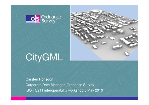
<strong>CityGML</strong><br />
Carsten Rönsdorf<br />
Corporate Data Manager, Ordnance Survey<br />
<strong>ISO</strong> <strong>TC</strong><strong>211</strong> interoperability workshop 5 May 2010
The world is flat!
3D: Not a truly cartesian<br />
coordinate system!<br />
X<br />
Z<br />
Y
The 3 dimensions of 3D (side view)<br />
1. Earth Surface ► DTM<br />
2. Above ground ► building models<br />
3. Below ground ► utility assets, underground structures
common information model<br />
+ product encoding
Software supporting <strong>CityGML</strong> (citygmlwiki.org)<br />
University of Bonn: Aristoteles Viewer (free)<br />
Snowflake software: Go Publisher WFS<br />
Interactive Instruments: WFS<br />
Oracle 11g: 3D data types and <strong>CityGML</strong> loader<br />
Tech. University of Berlin: Oracle schema/loader/updater/citygml4j, an open-source Java<br />
class library and API for the processing of 3D city models (free)<br />
Bentley: Bentley Map<br />
Autodesk: LandXplorer <strong>CityGML</strong> Viewer (free) + studio (authoring/management)<br />
Safe Software FME (reader & writer)<br />
ESRI: ArcGIS10 (import)<br />
CPA: SupportGIS3D<br />
GTA: Tridicon CityDiscoverer<br />
MetGeoInfo: CityGRID<br />
Bitmanagement: BS Contact Geo 3D<br />
Ptolemy3D: virtual globe <strong>CityGML</strong> plugin<br />
RhinoTerrain: <strong>CityGML</strong> support in development<br />
FH GK: <strong>CityGML</strong>-Toolchain , different tools incl. Sketch-Up plugin (free)<br />
FZ Karlsruhe: FZKViewer, viewer for IFC and <strong>CityGML</strong> data (free)
Continuum of scales<br />
Image: T. Kolbe, 2007
Levels of Detail – multiple representation<br />
LOD 0—Regional Model<br />
Digital terrain model<br />
LOD 1—City model<br />
Block model, no roof structures<br />
LOD 2—City/Site model<br />
Roof structures, optional textures<br />
LOD 3—Site model<br />
Detailed architectural model<br />
LOD 4—Interior model<br />
Walkable interior spaces
<strong>CityGML</strong><br />
Modules<br />
and<br />
Extensions<br />
Building<br />
New<br />
Attrib<br />
City Furniture<br />
Transportation<br />
New<br />
feature<br />
Water<br />
Vegetation<br />
Land Use
ADEs
Appearance
<strong>CityGML</strong> innovates Geospatial Information<br />
• Strong semantic structure<br />
• Implicit and explicit geometries: focus on features, geometries as<br />
attributes<br />
• LODs: relate features from different data sources: Integrate data<br />
• Perspective views: Combine more than 1 resolution in 1 dataset,<br />
away from output scale => pick-and-mix<br />
• Extensibility through ADE and Generics<br />
• Modularisation: dataset families / SDI-type integration<br />
• Raster/Vector integration
(>50km2)<br />
Large models:<br />
55 000 detailed buildings<br />
Image: Reality maps, Berlin 3D
Image: Reality maps, Berlin 3D
Image: Reality maps, Berlin 3D
Image: Reality maps, Berlin 3D
Large to small scale data integration<br />
Image: Reality maps, Berlin 3D
2D-3D interoperability<br />
LOD 0—2D footprints<br />
on top of digital terrain model<br />
LOD 1—City model<br />
Block model, no roof structures<br />
LOD 2—City/Site model<br />
Roof structures, optional textures<br />
LOD 3—Site model<br />
Detailed architectural model<br />
LOD 4—Interior model<br />
Walkable interior spaces