Water treatment by plasticized organic membrane - German-Arab ...
Water treatment by plasticized organic membrane - German-Arab ...
Water treatment by plasticized organic membrane - German-Arab ...

You also want an ePaper? Increase the reach of your titles
YUMPU automatically turns print PDFs into web optimized ePapers that Google loves.
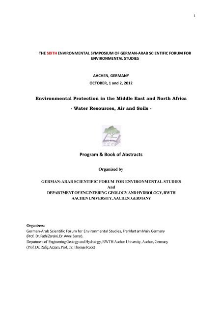
THE SIXTH ENVIRONMENTAL SYMPOSIUM OF GERMAN‐ARAB SCIENTIFIC FORUM FOR<br />
ENVIRONMENTAL STUDIES<br />
AACHEN, GERMANY<br />
OCTOBER, 1 and 2, 2012<br />
Environmental Protection in the Middle East and North Africa<br />
- <strong>Water</strong> Resources, Air and Soils -<br />
Program & Book of Abstracts<br />
Organized <strong>by</strong><br />
GERMAN-ARAB SCIENTIFIC FORUM FOR ENVIRONMENTAL STUDIES<br />
And<br />
DEPARTMENT OF ENGINEERING GEOLOGY AND HYDROLOGY, RWTH<br />
AACHEN UNIVERSITY, AACHEN, GERMANY<br />
Organizers:<br />
<strong>German</strong>‐<strong>Arab</strong> Scientific Forum for Environmental Studies, Frankfurt am Main, <strong>German</strong>y<br />
(Prof. Dr. Fathi Zereini, Dr. Awni Sarrar).<br />
Department of Engineering Geology and Hydrology, RWTH Aachen University, Aachen, <strong>German</strong>y<br />
(Prof. Dr. Rafig Azzam, Prof. Dr. Thomas Rüde)<br />
1
Monday, October 1.2012<br />
13:30 – 14:15 Registration<br />
14:15 – 14:30 Opening and welcome<br />
Session 1: <strong>Water</strong> Resources, Protection and Management (Chairman: Mr. Martin<br />
Rother)<br />
14:30 – 14:55 Rother, M., Schlote, A., Bluemel, M., Helms, F.: Facing <strong>Water</strong><br />
Scarcity in Arid Regions: From Monitoring to <strong>Water</strong> Balancing in the<br />
Aleppo Basin, Syria<br />
14:55 – 15:20 Steinel, A., Hamdan, I., Schelkes, K., Subah, A.: On the Designation<br />
of Areas for Managed Aquifer Recharge in the Amman-Zarqa and<br />
Azraq Basins, Jordan<br />
15:20 – 15:45 Andreas Renck, Carol Chouchani Cherfane: Shared <strong>Water</strong><br />
Resources in Western Asia: Contributions <strong>by</strong> the ESCWA-BGR<br />
Cooperation<br />
15:45 – 16:10 Maßmann, J., Huber, M., Hennings, V., Schelkes, K., Droubi, A.:<br />
Dissemination and Development of the WEAP-MODFLOW DSS -<br />
Lessons Learnt from 5 Years of Experience -<br />
16:10 – 16:40 Break and Poster Presentation<br />
16:40 – 17:05 Heike Neukum (née WERZ), Maren Rapp, Leif Wolf, Wasim Ali,<br />
Heinz Hötzl: Artificial recharge in NW-Jordan: Existing Studies and<br />
Identification of potential sites<br />
17:05 – 17:30 Harald Kirsch, Mahmoud Abu-Rumman: The Royal Department for<br />
Environment Protection / Rangers in Jordan: Tasks and Specific Roles<br />
in <strong>Water</strong> Resource Protection<br />
19:00 Conference Dinner<br />
2
Tuesday, October 2.2012<br />
Session 2: Air Pollution and Protection (Chairman:Prof. Dr. Boris Bonn)<br />
9:00 – 9:25 Boris Bonn: Effect of air pollution on the emission of plants and local<br />
aerosol particle<br />
9.25 – 9:50 Eberhard Reimer: Long Term Transports of PM10 over Tehran<br />
Province and Northern Iran<br />
9:50 – 10:15 Sahar Sodoudi, Eberhard Reimer, Ines Langer: Micro climate<br />
Simulation in new Town ‘Hashtgerd’ / Iran<br />
Session 3: <strong>Water</strong> conflicts (Chairman: Dr. Fawzy Naji)<br />
10:15 – 10:40 Victoria van der Land, Diana Hummel: Climate change, Land<br />
Degradation, and Mobility in Mali and Senegal: Examining the Social-<br />
Ecological Conditions of Migration<br />
10:40 – 11:05 Fawzy Naji: <strong>Water</strong> Conflicts in the Middle East: The Jordan River<br />
Basin<br />
11:05 – 11:30 Break and Poster Presentation<br />
Session 4: Environmental Protection (Chairman: Dr. Heike Neukum)<br />
11:30 – 11:55 Ahmad Salem Jumah, Qasem Abu-Haija, Mahmud Aburoman,<br />
Raed Abusamen: The Experience of Jordan Police in the Field of<br />
Environment Protection<br />
11:55 – 120:20 Kurt Heinrichs: Investigation of salt weathering on stone monuments<br />
<strong>by</strong> use of a modern wireless sensor network exemplified for the rockcut<br />
monuments in Petra / Jordan<br />
12:20 – 12:45 Anika Braun, Christoph Neukum, Rafig Azzam: Transport of<br />
engineered silver nanoparticles through saturated porous media<br />
12:45 – 13:10 Shahrazad Abu Ghazleh, Stephan Kempe: Shrinkage of the Dead<br />
13:10 – 14:30 Lunch Break<br />
Sea, Jordan: Problems and Alternative Solutions.<br />
3
Session 4: Environmental Protection (Chairman: Dr. Kurt Heinrichs)<br />
14.30 – 14:55 Achite Mohammed: Drought Analysis in the lower cheliff – Mina area<br />
(Northwest Algeria): Using the PCA method<br />
14:55 – 15:20 Melegy, A.A., Shaban, A.M., Hassan, M.M., Salman, S.A.:<br />
Distribution of heavy metals in groundwater of Sohag Governorate,<br />
Egypt<br />
15:20 – 15:45 Ykhlef Laidani, Salah Hanini, Ghania Henini: Adsorption of<br />
phenolic compounds from wastewater using vegetal cords<br />
15:45 – 16:10 Kabri Fatima Zahra, Zatout Ahlam, Imane Yahia Samet, Ouagued<br />
Abdallah, Djafer lahcène: <strong>Water</strong> <strong>treatment</strong> <strong>by</strong> <strong>plasticized</strong> <strong>organic</strong><br />
<strong>membrane</strong><br />
4
Poster<br />
ZATOUT Ahlam, KABRI Fatima Zahra, Imane Yahia Samet & OUAGUED Abdallah:<br />
Effect of chemical fertilizers on the underground water in EL-AMRA State Ain Defla.<br />
Algeria<br />
Ahmed Melegy, Ismael S. Ismael: Paleoenvironmental implications of Messinian Gypsum<br />
deposits from the Northern Coast Egypt<br />
Paul Miessner, Thomas R. Rüde: The influence of anthropogenically affected water types<br />
on the solubility of Morrocan Jurassic dolomites (Sefrou; Middle Atlas)<br />
Ghania HENINI, Ykhlef LAIDANI, Salah HANINI, Fatiha SOUAHI: A New material for<br />
the removal of heavy metals in aqueous waste<br />
S. ROCHDANE, A. EL MANDOUR, M. JAFFAL, M. HIMI, M. Amrhar,A. Casas:<br />
Contribution of the gravimetry to the hydrogeological study of the eastern Haouz plain and<br />
Tassaout, Western Morocco<br />
Bessedik Amina, Allam R, Abdallah-Bouamrane K, Bekkouche-Benziane N.:<br />
Characterization and antimicrobial activity of essential oil of Nigella sativa<br />
Fathi Elosta: Proposed study in the environmental geological to explore for oil shale valley<br />
Tanezzuft Murzuq basin for use in power generating in Li<strong>by</strong>a<br />
F. Guitarni, A. Djafer , S. Kouadri Moustefai: BIODEGRADATION OF RED BIMACID<br />
DYE BY IMMOBILIZED CELLS ON POUZZOLANA FIXED BED<br />
Naїma BETTAHAR, Soumia KOUADRI MOUSTEFAI: - The factors of nitrate leaching<br />
in semi-arid zones - Case of the valley of the Middle Western Cheliff (North Algeria)<br />
Wahiba Mahouche, Soumia Kouadri Moustefai, Mustapha Douani: Numerical modeling<br />
of atmospheric pollutants dispersion<br />
Imane Yahia Samet, ZATOUT Ahlam, KABRI Fatima Zahra & OUAGUED Abdallah:<br />
Physical-chemical analysis of leachate from domestic waste to the town of Chlef<br />
(Discharge Meknassa<br />
BEN MESSAOUD Btissam, ABOUMERIEME Imane, LAHRACH Zakaria, ISMAILI<br />
Mohammed, IBIJBIJEN Jamal & NASSIRI Laila: BIOFERTILIZERS: A way to fight<br />
against soil pollution<br />
5
Session 1: <strong>Water</strong> Resources, Protection and Management<br />
6
Facing <strong>Water</strong> Scarcity in Arid Regions:<br />
From Monitoring to <strong>Water</strong> Balancing in the Aleppo Basin, Syria<br />
Rother, M. (*) , Schlote, A., Bluemel, M., Helms, F.<br />
Bundesanstalt für Geowissenschaften und Rohstoffe (BGR), Hannover<br />
(*): corresponding author: Martin.Rother@bgr.de<br />
Abstract:<br />
Extensive parts of the <strong>Arab</strong> World are found among the driest areas on earth. Syria, along<br />
with many of its neighboring countries, suffers from water scarcity on the large scale. Its<br />
water demand exceeds estimated renewable water resources <strong>by</strong> 10-20 percent according to<br />
different authors. Over the past years this deficit led to a considerable drawdown of water<br />
tables in many parts of the country. The Aleppo Basin is situated in northwestern Syria,<br />
covering an area of about 12,000 km 2 . Once, part of the famous “Fertile Crescent” with more<br />
favorable climatic conditions in the past, recent rainfall ranges from around 500 mm/a in the<br />
northwestern hilly regions to 100 mm/a in the southeastern planes only.<br />
Under the pressure of a fast growing population, increased groundwater abstraction and a<br />
warming climate, the region is in need of an improved water resources management. A vital<br />
precondition for this task is the provision of means for proper monitoring and thorough<br />
examination. In the Aleppo Basin these requirements are fulfilled <strong>by</strong> a groundwater<br />
monitoring network consisting of 278 wells, 38 of which currently are equipped with<br />
automatic probes to measure water level, temperature and electrical conductivity. In addition,<br />
the remaining wells are monitored manually on a regular basis. To support the approval,<br />
storage and processing of all data, a data management system based on open source software<br />
(PostgreSQL) was developed. Accompanied <strong>by</strong> an user-friendly graphical interface it<br />
facilitates the generation of reliable reports as well as the exchange of data with different<br />
external programs.<br />
In combination with further information such as water demand, abstraction from rivers, soil<br />
maps, as well as remotely sensed data on precipitation and land use, this system enables the<br />
Syrian water authorities to derive a realistic water balance of the basin. For this purpose, the<br />
modeling software WEAP was applied, allowing for the integration of all relevant water<br />
supplies and demands as well as related costs. Furthermore, it enables the development of<br />
scenarios to assess the influence of different factors, such as population growth, climate<br />
variability or changes in the cultivation, on the available groundwater resources. This<br />
provides not only the means for a better water resources planning, but also assists in achieving<br />
a more sustainable economic development of the area.<br />
7
On the Designation of Areas for Managed Aquifer Recharge<br />
in the Amman-Zarqa and Azraq Basins, Jordan<br />
Steinel, A.* (1) , Hamdan, I. (2) , Schelkes, K. (1) , Subah, A. (3)<br />
(1): Federal Institute for Geosciences and Natural Resources (BGR), <strong>German</strong>y<br />
(2): formerly Federal Institute for Geosciences and Natural (BGR), Amman<br />
(3): Ministry of <strong>Water</strong> and Irrigation (MWI), Jordan<br />
(*): Corresponding author (anke.steinel@bgr.de)<br />
In almost all aquifers in Jordan, groundwater levels are falling due to over abstraction of<br />
groundwater. Exploiting mainly unutilized water resources like the sporadic runoff in<br />
ephemeral wadis (so called ‘flash floods’) for local groundwater recharge is therefore a worthwhile<br />
measure to increase groundwater resources. In a bilateral project, the BGR supports the Jordanian<br />
Ministry of <strong>Water</strong> and Irrigation (MWI) in their potential to successfully use managed aquifer<br />
recharge (MAR) via infiltration of storm water runoff. The year-long study, funded <strong>by</strong> the <strong>German</strong><br />
Federal Ministry of Economic Cooperation and Development (BMZ), focuses on the two most<br />
overexploited basins: Amman-Zarqa and Azraq.<br />
Based on a review of international practices for infiltration of surface runoff recommendations for<br />
future implementation of managed aquifer recharge sites in Jordan were developed. A number of<br />
challenges were identified in Jordan. One limitation, for example, is the restricted supply of water, as<br />
rainfall can be as low as 50-100 mm/a. In such areas flash floods might occur only once a year or even<br />
less often and hence, the cost-benefit analysis for building and maintaining the needed infrastructure is<br />
low. Another problem is the high amount of fine suspended solids in the runoff leading to the clogging<br />
of infiltration structures and high maintenance costs. In addition, the remoteness of large areas also<br />
leads to some limitations and last but not least, limited data on runoff quantity and quality as well as<br />
on soil and aquifer characteristics reduces the successful identification of good recharge sites. It is<br />
worthwhile that a feasibility study for a MAR site should hence be based on a solid database and will<br />
generally require a lead time to collect representative data over some years.<br />
The main tasks for this study comprise the development of a map for MAR potential, the subsequent<br />
identification of suitable sites for pilot projects and the preparation of a guideline for the<br />
implementation and regulations of MAR in Jordan. The practicability of the identification scheme was<br />
successfully tested, even if most of the suitable MAR sites in the pilot areas were already used for<br />
water harvesting or had to be skipped due to various constraints. In addition, the partially scarce data<br />
base as well as the short time span of the study allowing for only some additional field work hindered<br />
a more accurate and robust result.<br />
Generally, the support of BGR to the partner institution in the application of the MAR concept and its<br />
implementation in the context of the Jordanian national water strategy is of high relevance in the<br />
context of development aid policy. By focusing on small scale initiatives, the project provides locally<br />
suitable solutions for the improvement of the critical water situation in the semiarid regions including<br />
aspects of adaptation to climate change.<br />
8
Andreas Renck 1 , Carol Chouchani Cherfane 2<br />
Shared <strong>Water</strong> Resources in Western Asia:<br />
Contributions <strong>by</strong> the ESCWA‐BGR Cooperation<br />
(1) BGR Principal Advisor and Team Leader, ESCWA-BGR <strong>Water</strong> Cooperation, andreas.renck@bgr.de<br />
(2) Chief, <strong>Water</strong> Resources Section, Sustainable Development and Productivity Division, ESCWA,<br />
chouchanicherfane@un.org<br />
United Nations Economic and Social Commission for Western Asia (UN ESCWA), Sustainable Development and<br />
Productivity Division (SDPD), P.O. Box 11-8575, Riad El-Solh 1107 2270, Beirut, Lebanon,<br />
ABSTRACT<br />
The management of shared water resources is of paramount importance in the arid <strong>Arab</strong> region, where<br />
most water resources are shared between countries and where the availability of freshwater is<br />
becoming increasingly scarce. Shared water basins have always played a significant role in linking<br />
populations and cultures, and creating hydrological, social and economic interdependencies between<br />
countries. Enhancing inter-state cooperation on shared water issues is one of the main objectives of the<br />
regional water cooperation program implemented <strong>by</strong> the <strong>German</strong> Federal Institute for Geosciences and<br />
Natural Resources (BGR) in partnership with the United Nations Economic and Social Commission<br />
for Western Asia (UN-ESCWA). The program has engaged in several activities at technical,<br />
institutional and legal levels to support ESCWA member countries in the assessment, management and<br />
governance of shared water resources.<br />
“The Inventory of Shared <strong>Water</strong> Resources in Western Asia” is the first UN-led effort to take stock of<br />
both shared groundwater and surface water resources in the region in a comprehensive, systematic and<br />
unified manner. The inventory aims at (1) documenting the state of shared water resources and their<br />
use, (2) improving the knowledge base and facilitating access to information on shared water<br />
resources, (3) creating awareness for the importance of shared water resources among decision<br />
makers, experts and the general public (4) stimulating an informed discussion within and among<br />
riparian countries, and (5) supporting regional processes towards improved dialogue and cooperation<br />
over shared water resources. The inventory covers all <strong>Arab</strong> countries in Western Asia, and also<br />
includes ground- and surface water resources shared with non-<strong>Arab</strong> riparian countries, namely Iran,<br />
Israel and Turkey. Detailed information on shared basins is presented in 27 chapters, of which 18 are<br />
on shared aquifer systems (Table 1). All chapters follow a unified structure, presenting up-to-date<br />
information on hydrology, hydrogeology, water resources development and use, as well as the status<br />
of cooperation and management. The inventory is the result of a scientific process, which gains added<br />
value through a comprehensive review and consultation process with experts and country<br />
representatives.<br />
ESCWA and BGR also support the <strong>Arab</strong> Ministerial <strong>Water</strong> Council in the formulation of a legal<br />
framework for shared waters in the <strong>Arab</strong> region which is built on accepted principles and customary<br />
law as well as regional specificities and experiences. Adoption of such a legal instrument <strong>by</strong> <strong>Arab</strong><br />
countries would lead to a unified legal position of the region towards cooperation, allocation and<br />
management of shared water resources and strengthen <strong>Arab</strong> solidarity <strong>by</strong> encouraging cooperation<br />
over this vital resource.<br />
9
Table 1: Shared surface water basins and aquifer systems identified in the Inventory<br />
Geographical<br />
Sub-region<br />
Shared water basin/Inventory chapter<br />
Surface water<br />
Riparian countries<br />
THE MASHREK Jordan River Basin Israel, Jordan, Lebanon,<br />
Palestine, Syria<br />
Orontes River Basin Lebanon, Syria, Turkey<br />
Nahr el Kabir River Basin Lebanon, Syria<br />
Qweik River Basin Syria, Turkey<br />
MESOPOTAMIA Euphrates River Basin Iraq, Syria, Turkey<br />
Shared Tributaries of the Euphrates River Syria, Turkey<br />
Tigris River Basin Iran , Iraq, Syria, Turkey<br />
Shared Tributaries of the Tigris River Iran, Iraq, Turkey<br />
Shatt El <strong>Arab</strong> sub-basin including Karkheh and<br />
Karun Rivers<br />
Groundwater<br />
Iran, Iraq<br />
THE ARABIAN Saq-Ram Aquifer System (West) Jordan, Saudi <strong>Arab</strong>ia<br />
PENINSULA Wajid Aquifer System Saudi <strong>Arab</strong>ia, Yemen<br />
Wasia–Biyadh-Aruma Aquifer System (South):<br />
Tawila-Mahra/Cretaceaous Sands<br />
Saudi <strong>Arab</strong>ia, Yemen<br />
Wasia–Biyadh-Aruma Aquifer System (North):<br />
Sakaka-Rutba<br />
Iraq, Saudi <strong>Arab</strong>ia<br />
Umm er Radhuma-Dammam Aquifer System Oman, Saudi <strong>Arab</strong>ia, United<br />
(South): Rub‘ al Khali<br />
<strong>Arab</strong> Emirates, Yemen<br />
Umm er Radhuma-Dammam Aquifer System Qatar, Saudi <strong>Arab</strong>ia, United <strong>Arab</strong><br />
(Center): Gulf<br />
Emirates<br />
Umm er Radhuma-Dammam Aquifer System<br />
(North): Widyan-Salman<br />
Iraq, Kuwait, Saudi <strong>Arab</strong>ia<br />
Tawil Quaternary Aquifer System: Wadi Sirhan<br />
Basin<br />
Jordan, Saudi <strong>Arab</strong>ia<br />
THE MASHREK Anti-Lebanon Aquifer System Lebanon, Syria<br />
Western Mountain Aquifer Basin Israel, Palestine (Egypt)<br />
Coastal Aquifer Basin Israel, Palestine (Egypt)<br />
Basalt Aquifer System (West): Yarmouk Basin Jordan, Saudi <strong>Arab</strong>ia, Syria<br />
Basalt Aquifer System (South East): Azraq<br />
Basin<br />
Jordan, Saudia <strong>Arab</strong>ia, Syria<br />
MESOPOTAMIA Taurus-Zagros: Bekhme Pila Spi Iran, Iraq, Turkey<br />
Jazeera Tertiary Limestone Aquifer System Turkey, Syria<br />
Neogene Aquifer System (North West), Upper<br />
and Lower Fars: Jezira Basin<br />
Iraq, Syria<br />
Neogene Aquifer System (South East), Iraq, Kuwait, Saudi <strong>Arab</strong>ia<br />
Dibdibba-Kuwait Group: Dibdibba Delta Basin<br />
Neogene Aqiufer System (East): Bai Hassan<br />
Mukdadia<br />
Iran, Iraq<br />
10
Dissemination and Development of the WEAP-MODFLOW DSS<br />
‐ Lessons Learnt from 5 Years of Experience ‐<br />
Maßmann, J. (1) , Huber, M (2) , Hennings, V. (1) , Schelkes, K. (1) , and Droubi, A. (3)<br />
(1): Federal Institute for Geosciences and Natural Resources, <strong>German</strong>y (BGR)<br />
(2): GeoTools, München<br />
(3): formerly at The <strong>Arab</strong> Center for the Studies of Arid Zones and Dry Lands, Syria (ACSAD)<br />
(*): Corresponding author (jobst.massmann@bgr.de)<br />
Keywords: Groundwater, water management, WEAP, MODFLOW, DSS<br />
Within the framework of an <strong>Arab</strong>‐<strong>German</strong> technical cooperation project, the Federal Institute for<br />
Geosciences and Natural Resources (BGR) and the <strong>Arab</strong> Center for the Studies of Arid Zones and Dry<br />
Lands (ACSAD) had started with the development and testing of an easy to use and inexpensive<br />
Decision Support System (DSS) for integrated water resources management. Now, they can look back<br />
on more than 5 years of practical experience in the dissemination and enhancement of the WEAP‐<br />
MODFLOW DSS. Today, this WEAP‐MODFLOW DSS is implemented in several catchment areas in the<br />
<strong>Arab</strong> region located in Morocco, Tunisia, Jordan, Syria and Palestine. It supports the local decision<br />
makers in the general understanding of the development of the water budget with time and the<br />
assessment of water relevant issues. Many application studies were initiated <strong>by</strong> workshops and have<br />
been accompanied <strong>by</strong> on‐the‐job training over years. The feedback and evaluation of the workshops<br />
as well as many discussions with WEAP trainers and users led to a continuous improvement of the<br />
workshop concept.<br />
Furthermore, suggestions for the enhancement of WEAP had been seized and discussed with<br />
software developers resulting in new software solutions. The most crucial one is the linkage between<br />
WEAP and MODFLOW. Since groundwater is the most important water resource in many <strong>Arab</strong><br />
regions, the consideration of groundwater flows and drawdowns is essential. Recently, the tool<br />
which creates the linkage between WEAP and MODFLOW has been enhanced. It provides now a<br />
graphical interactive user interface allowing the user to link WEAP to MODFLOW without any need of<br />
additional software.<br />
Other important enhancements are the integration of a functional soil water balance model, based<br />
on the FAO 56 paper, the particle tracking model MODPATH and an optimization tool for abstraction<br />
rates, taking into account the drawdown of the water table, water prices and water quality.<br />
The software developments have been done in cooperation with the Stockholm Environment<br />
Institute (SEI, www.weap21.net), GeoTools and the National Institute of Agronomy of Tunisia (INAT).<br />
This contribution will focus on the lessons learnt from the dissemination and implementation of a<br />
DSS in the <strong>Arab</strong> region as well as on the recent software developments.<br />
11
Applying of new technologies in frame of a Integrated <strong>Water</strong> Resources Management<br />
Concept for the Jordan Valley<br />
Associate Professor Dr. Wasim Ali, Institute of Applied Geosciences, Section Hydrogeology,<br />
Karlsruhe Institute of Technology (former Karlsruhe University), Karlsruhe, <strong>German</strong>y<br />
Email: Wasim.ali@kit.edu<br />
Abstract<br />
The Jordan Valley is a region in the Middle East with mainly an arid to semiarid climate. This<br />
region is characterized through water resources scarcity and draught.<br />
The SMART project supported <strong>by</strong> the <strong>German</strong> Ministry of Science and Research (BMBF) in<br />
the Jordan Valley Region try to apply new technologies to come up with a concept for a<br />
balanced integrated water resources management Strategy as an example for water planner<br />
and stake holder in similar Regions. This concept can in the same time be applied in other<br />
countries in the Middle East and North Africa. In this paper the main objectives of SMART<br />
project and some new results will be presented and discussed.<br />
In addition to the presented results, this paper try to appeal and emphasis water resources<br />
scientists, researchers and experts to set together and to analyze the achieved results of<br />
many other projects in this region dealing with water management in the last decades. The<br />
goal of these activities is to propose a practicable water management and water security<br />
strategy for some regions in the Middle East and North Africa. At least for similar neighboring<br />
countries in both regions.<br />
This strategy or strategies will help planner and stake holder to secure the <strong>Water</strong> demand of<br />
the populations and develop practical solutions for normal and for emergency situations<br />
which occur often and unexpected.<br />
12
The Royal Department for Environment Protection / Rangers in Jordan:<br />
Tasks and Specific Roles in <strong>Water</strong> Resource Protection<br />
- Dr. Harald Kirsch, c/o GIZ, P.O. Box 926238, Amman 11190, Jordan, haraldcm@hotmail.com<br />
- Lt. Colonel Mahmoud Abu-Rumman, c/o Royal Department for Environment<br />
Protection, P.O. Box 935, Amman 11110, Jordan,<br />
mahmoudaburumman@hotmail.com<br />
The duties assigned to the Royal Department for Environment Protection (Rangers)<br />
include the preservation and protection of the natural resources in Jordan and the safety and<br />
well-being of the public using these resources.<br />
<strong>Water</strong> is a limiting factor in Jordan’s development efforts. <strong>Water</strong> abstraction exceeds<br />
the long-term safe yield. Natural factors such as arid to semiarid climate as well as<br />
demographic changes, socio-economic growth and the subsequent intensification of irrigated<br />
agriculture are all aspects that strain a sustainable management of scarce water resources in<br />
the country. To ensure that drinking water of good quality and sufficient quantity is made<br />
available to the people of Jordan, all water resources have to be protected efficiently.<br />
New guidelines on <strong>Water</strong> Resources Protection are officially effective in Jordan since<br />
November 2011. These guidelines are used to delineate and control the <strong>Water</strong> Recourses<br />
Protection Zones (WPZ) 1, 2 and 3 regarding the specific and defined limitations of activities.<br />
The Rangers are supporting the implementation of the regulations in water protection zones<br />
through patrolling and participation in environmental awareness campaigns. Therefore they<br />
are cooperating closely with their strategic partner institutions like the Ministry of <strong>Water</strong> and<br />
Irrigation (MoWI) and the associated <strong>Water</strong> Authority of Jordan (WAJ). Particularly they are<br />
involved in the <strong>Water</strong> Aspects in Land Use Planning Project of the MoWI and the <strong>German</strong><br />
Federal Institute for Geosciences and Natural Resources (BGR).<br />
A <strong>Water</strong> Resources Protection (WRP) Team at the Technical Office at the Rangers’<br />
HQ in Amman processes and updates reports and data obtained from the Rangers’ control<br />
room and from other institutions, and acts as an extension team to the branches in the whole<br />
Kingdom. The team is directly supported and coached <strong>by</strong> a GIZ adviser in the subjects of<br />
Hydrology and the application of GPS (Global Position System) and GIS (Geographic<br />
Information System). BGR provides technical input as well as financial support, hardware<br />
and data through the technical cooperation project with MoWI.<br />
Dumping and discharging of solid and liquid waste or other hazardous material /<br />
objects can have a negative impact on the quality of water resources and thus on human<br />
health. Since 2011 the WRP team is systematically analysing all reports collected and filed in<br />
the control room. Any suspicions case has to be geographically verified <strong>by</strong> coordinates. Field<br />
officers should capture the GPS coordinates of incident sites. In order to assess whether it<br />
implies a violation against the WPZ protection guidelines, the team then uses GIS to verify<br />
the distance of the incident sites to water resources (springs, wells, dams, rivers). Incidents<br />
classified as effecting water resources are entered into a separate database.<br />
Geo-referencing of incidents which are related to water pollution and the application<br />
of GIS are important supportive procedures to provide sufficient information on what has<br />
happened where, and thus to assess the real danger that can arise for the respective water<br />
resources. It makes it possible to map environmental hotpots and consequently plan<br />
appropriate countermeasures such as campaigns to raise the level of awareness or to<br />
increase the number of inspections, and it enables responsible institutions to follow up on<br />
reported incidents.<br />
13
The Rangers' campaigns are supported <strong>by</strong> a network of organizations working<br />
together to protect one of it's most precious environmental resources – water -from the<br />
dangers of irresponsible actions, and thus contributing to the human rights and health for<br />
all people in Jordan.<br />
Keywords: Environmental Rangers, <strong>Water</strong> Protections Zones, GPS, GIS, <strong>German</strong>-Jordanian<br />
Cooperation<br />
14
Artificial recharge in NW‐Jordan: Existing Studies and Identification of<br />
potential sites<br />
Dr. Heike NEUKUM (née WERZ) 1 , Maren RAPP 2 , Dr. Leif WOLF 3 , Dr. Wasim ALI 4 , Prof. Dr. Heinz HÖTZL 4 ,<br />
hneukum@lih.rwth‐aachen.de<br />
Phone: +49 (0)241 / 80‐96794<br />
Mobile: +49 (0)179 70 44 370<br />
Fax: +49 (0)241/80‐92280<br />
1<br />
RWTH Aachen University, Department for Engineering Geology and Hydrogeology, Lochnerstr. 4‐20, 52064 Aachen,<br />
.<strong>German</strong>y.<br />
2<br />
Institute of Mineralogy and Geochemistry, Karlsruher Institute of Technology (KIT), Kaiserstraße 12, 76128 Karlsruhe,<br />
.<strong>German</strong>y.<br />
3<br />
CSIRO EcoSciences Precinct ‐ Dutton Park 41 Boggo Road Dutton Park QLD 4102, Australia.<br />
4<br />
Institute of Applied Geosciences Division of Hydrogeology, KIT ‐ Karlsruhe Institute of Technology, Kaiserstr. 12<br />
76131 Karlsruhe <strong>German</strong>y.<br />
Keywords: artificial recharge, managed aquifer recharge, Jordan, thematic layer approach, water<br />
resources, water reuse, water management.<br />
The highest precipitation of Jordan, between 700 mm to 800 mm per year, is recorded for the NW<br />
Highlands, while the main part of the country is dominated <strong>by</strong> semiarid climate. Precipitation is<br />
restricted to the winter period with heavy rainfalls inducing fast storm water runoff with a low<br />
infiltration rate. Therefore the natural aquifer recharge is limited. Additionally, NW Jordan shows the<br />
highest groundwater abstraction of entire Jordan. The abstraction rates exceed the natural recharge<br />
rate of the aquifers, resulting in continually declining groundwater levels.<br />
The increasing water demand due to climatic conditions, high population growth, prevalent irrigated<br />
agriculture and management deficits, results in overexploitation of the water sources.<br />
Artificial recharge encompasses the process of infiltrating water in the underground into existing<br />
voids of permeable rocks with the overall intention to increase the volume of water in aquifers <strong>by</strong><br />
storage and <strong>treatment</strong> of water. Surface infiltration is the favoured artificial recharge method in<br />
regions with abundant land availability, highly permeable surface over unconfined aquifers because<br />
of best clogging control and soil/aquifer <strong>treatment</strong> and low installation and maintenance costs.<br />
The purpose of this work was to evaluate the potential of artificial recharge via surface infiltration in<br />
northwest Jordan for an area of about 9800 km². A artificial recharge potential map scaled 1:200.000<br />
was prepared based on several parameters, considered to be the basis for artificial recharge site<br />
selection such as hydraulic characteristics of the near surface lithology, topography, land use and<br />
availability of water to be infiltrated. The map was prepared in a GIS‐based thematic layer overlay<br />
approach. The resulting areas of the combined thematic layers were delineated to four different<br />
artificial recharge potential classes (low, medium, high very high). 30 % of the delineated artificial<br />
15
echarge potential classes show high potential, 14 % very high potential. An example for a mapped<br />
site with very high potential is the area around Fuheis (governorate of Balqa, approximately 20 km<br />
NW of Amman), where several favourable basic conditions for artificial recharge via surface<br />
infiltration exist: karstic aquifers covered <strong>by</strong> alluvial deposits with a low gradient and developable<br />
water sources near<strong>by</strong>.<br />
Additionally, the map show that 1388 km² in NW Jordan have been evaluated to fulfil the high<br />
potential criteria for artificial recharge via surface infiltration. This means that at these locations an<br />
aquifer crop out at the surface, or are covered <strong>by</strong> permeable sediment layers, with hydrogeological<br />
characteristics allowing artificial recharge (mainly limestone and alluvial aquifers with sufficient<br />
hydraulic conductivity). In addition the unsaturated zone is thick, the slope at the surface is < 5 %,<br />
urban areas are absent, and finally the proximity to at least one water source exists. The water<br />
sources comprise dams, waste water <strong>treatment</strong> plant and surface runoff. In that context all water<br />
sources suitable for artificial recharge in the study area were listed and described regarding their<br />
capacity, catchments and purpose.<br />
The results of this overview artificial recharge map can be understood as basis that identifies<br />
potential areas for further studies that aim for a detailed planning of surface infiltration artificial<br />
recharge sites in NW Jordan. All existing artificial recharge sites in Jordan are located in areas<br />
mapped with high artificial recharge potential. In Jordan artificial recharge has not only the benefit of<br />
reducing evaporation losses and of enhancing protection from contamination, it can also play an<br />
important role in water reuse, <strong>by</strong> improving the water quality and storage opportunities to balance<br />
seasonal differences between supply and demand for reclaimed sewage effluent. Furthermore,<br />
artificial recharge can be valuable to store the strong episodic rainfall runoff from the highlands<br />
towards the Jordan Valley and the Dead Sea during the rainy season.<br />
16
Session 2: Air Pollution and Protection<br />
17
Effect of air pollution on the emission of plants and local aerosol particles<br />
Boris Bonn<br />
WG Aerosol and Environmental Research, Institute for Atmospheric and Environmental Sciences,<br />
Goethe University, Frankfurt/Main, <strong>German</strong>y.<br />
Abstract<br />
It is known since centuries that ambient pollution such as ozone causes severe damages to<br />
ecosystems and depending on the concentration of the pollutants the functionality is partly<br />
destroyed. Therefore ecosystems depend on defensive strategies to counteract these stresses as a<br />
function of their sensitivity to the degree of pollution. This contribution focuses on volatile <strong>organic</strong><br />
compound emissions, which are partly titrating the ambient ozone and oxidant levels causing the<br />
plant to survive in a more healthy state. Here a clear link between sesquiterpene emissions and<br />
ambient ozone levels will be shown. As temperature rises emission increases in an exponential<br />
behavior. But as ozone exceeds about 35 ppb of ozone the plant starts emitting even more in a small<br />
time delay <strong>by</strong> minutes to two hours after the initiative stress.<br />
As a <strong>by</strong>product of this reaction local aerosol particles will be formed and grown to sizes at which they<br />
can interact with cloud properties as cloud condensation and ice nuclei. An overview on recent group<br />
activities will be provided and a short outlook will be given.<br />
18
Long Term Transports of PM10 over Tehran Province and Northern Iran<br />
Eberhard Reimer<br />
Freie Universität Berlin / Institut für Meteorologie<br />
Abstract:<br />
Urban emissions of PM10 and their precursors are very important in relation to the EU<br />
council directives and national strategies, because the knowledge about the contribution of<br />
anthropogenic urban sources and long term transports of anthropogenic and natural ectories<br />
Therefore investigations on the formation and transport of PM10/PM2.5 are needed.<br />
In the greater area of Tehran high concentrations of PM10 were observed within the last<br />
decades along with observed transports from outside. In this project part the importance of<br />
transports of dust and PM10 into the greater Tehran area is analysed.<br />
The 3D- trajectories are determined <strong>by</strong> a mixed kinematic/dynamical procedure and pay<br />
attention to the formation of mixing height, clouds and precipitation.<br />
A dense net of 3d backward trajectories is used to analyse the seasonal and episodic<br />
relationships between measurements and possible source areas. By special statistics the<br />
surface contacts of 3d trajectories are integrated over a 1 km² grid and weighed <strong>by</strong> the<br />
concentration matrices for all observational sites are combined and, as a result, special<br />
source areas or transport paths are determined.<br />
In comparison to the model results the weighted source/receptor matrices for<br />
determined <strong>by</strong> backward trajectories are used to solve for the quantitative<br />
contribution from outside Tehran to the City area.<br />
For the years of 2006 to 2010 trajectories have been determined <strong>by</strong> the TRAMPER<br />
procedures at the Institute for Meteorology, FU Berlin, for each hour at observational sites in<br />
Northern Iran and East-Turkey. Besides the transport from the desert areas especially in<br />
summer times there are often strong transports from the West, Near East, which can<br />
dominate the smog events in Tehran in addition to the strong local emissions.<br />
Some example for source/receptor relationships and statistics are presented. .<br />
19
Micro climate Simulation in new Town ‘Hashtgerd’ / Iran<br />
Sahar Sodoudi, Eberhard Reimer, Ines Langer<br />
Freie Universität Berlin / Institut für Meteorologie<br />
Abstract: One of the objectives of climatological part of the project Young Cities<br />
‘Developing Energy-Efficient Urban Fabric in the Tehran-Karaj Region’ is to simulate<br />
the micro climate (with 1m resolution) in 35ha of new town Hashtgerd, which is<br />
located 65 km far from mega city Tehran. The overall project aims are to develop,<br />
implement and evaluate building and planning schemes and technologies which<br />
allow to plan and build sustainable, energy-efficient and climate sensitive housing<br />
settlements in arid and semi-arid regions (“energy-efficient fabric”).<br />
Climate sensitive also means designing and planning for climate change and its related<br />
effects for Hashtgerd New Town. By configuration of buildings and open spaces according to<br />
solar radiation, wind and vegetation, climate sensitive urban form can create outdoor thermal<br />
comfort. To simulate the climate on small spatial scales, the micro climate model ENVI-met<br />
has been used to simulate the micro climate in 35 ha. The Eulerian model ENVI-met is a<br />
micro-scale climate model which gives information about the influence of architecture and<br />
buildings as well as vegetation and green area on the micro climate up to 1 m resolution.<br />
ENVI-met has been run with information from topography, downscaled climate data with<br />
neuro-fuzzy method, meteorological measurements, building height and different vegetation<br />
variants (low and high number of trees)<br />
The first results were compared with each other and show:<br />
• In semi-arid climates the protection from solar radiation is of major importance.<br />
This can be achieved <strong>by</strong> implementation of vegetation and geometry of<br />
buildings. Technical constructions and vegetation scenarios have to be<br />
implemented.<br />
• A second important factor is wind: The design follows the idea to block the<br />
prevailing winds from west and northwest as well as the hot and dusty winds in<br />
summer time from the southeast but at the same time to allow the cooler<br />
north-south winds from Alborz Mountains to channel through the site. The<br />
quarter’s low skyline follows the topography and therefore the buildings have a<br />
maximum of three floors (carpet style). This style of buildings allows free<br />
movement of air, which is of high importance for fresh air supply. The<br />
simulation results also show calm wind in inner courtyards in 2 m height.<br />
• A third factor of importance is the vegetation with its positive effects on the<br />
microclimate and water cycles. The increase of inbuilt areas in 35 ha reduces<br />
the heat island effect through cooling caused <strong>by</strong> vegetation and increase of air<br />
humidity which caused <strong>by</strong> trees evaporation. The simulation results show that<br />
high number of trees leads to lower soil moisture about 3 g/ kg and low wind<br />
speed near the surface. Vegetation on the road sides leads to a surface<br />
temperature decrease of 9 °K. Increase of planting distance caused<br />
turbulence near the surface and the close planting increased the Turbulent<br />
Kinetic Energy (TKE)<br />
20
Session 3: <strong>Water</strong> conflicts<br />
21
The Sixth Environmental Symposium of <strong>German</strong>‐<strong>Arab</strong> Scientific Forum for Environmental Studies<br />
Topic: Environmental Protection in the Middle East and North Africa.<br />
‐ <strong>Water</strong> Resources, Air and Soils ‐<br />
Aachen, <strong>German</strong>y – October, 1 st and 2 nd , 2012<br />
Authors: Victoria van der Land / Diana Hummel<br />
Institute for Social‐Ecological Research (ISOE)<br />
Hamburger Allee 45<br />
60486 Frankfurt<br />
vanderland@isoe.de<br />
Climate change, Land Degradation, and Mobility in Mali and Senegal: Examining the Social‐<br />
Ecological Conditions of Migration<br />
To date there is little scientific knowledge about the relation between climate change, environmental<br />
changes, and migration. Attempts to quantify the numbers of environmental migrants are based on<br />
calculations that project physical climate change on an exposed population. However, these<br />
approaches do not consider that migration decisions – particularly in the context of slow-onset<br />
environmental changes like land degradation - are usually not only affected <strong>by</strong> environmental changes<br />
but are multi-causal and shaped through interacting social, economic, political, and ecological factors.<br />
Thus, our research investigates the social-ecological conditions under which population movements<br />
take place to gain a deeper understanding on the complex relation between climate change and<br />
population movements. In a transdisciplinary approach, we integrate natural-scientific and socialscientific<br />
methods and data as well as local knowledge. Our research focuses on the effects of slowonset<br />
environmental changes, such as land degradation, on migration in two study regions: Bandiagara<br />
in Mali and Linguère in Senegal. Both areas are located in the West African Sahel, which is<br />
particularly affected <strong>by</strong> climate change, and show high out-migration rates.<br />
The presentation will illustrate results from the social-empirical analysis, which is based on a<br />
combination of quantitative and qualitative data, collected in Senegal and Mali in the beginning of<br />
2012: A standardised survey with 900 people – 700 people in the selected study regions and 200<br />
people from these regions now living in the capitals Bamako and Dakar. In addition, we draw on about<br />
70 qualitative interviews with people from these areas. The natural-scientific research includes spatial<br />
and temporal analyses of data from remote sensing and ground truthing, focusing on climate change<br />
and land degradation on a local and regional scale. The work is based on data archives from previous<br />
project and own field work. In addition, we integrate the knowledge of local people into our analysis.<br />
Main activities of the population in the two regions are (subsistence) farming and livestock breeding.<br />
Thus, the people are highly vulnerable to climatic and environmental changes. We show that migration<br />
is a strategy to ensure food security as a response to climatic changes. However, people have different<br />
objectives for migration. On a local level, we illustrate the different migration patterns and the specific<br />
ways in which people perceive and assess environmental changes and migration options.<br />
From a social-scientific perspective, we demonstrate that climatic aspects, like changes in precipitation<br />
and temperature during the past 30 years as well as the extreme droughts in the 1970s and 1980s are<br />
perceived as important drivers of vegetation changes in the two regions <strong>by</strong> the local people. However,<br />
environmental changes are not only caused <strong>by</strong> climate variability but also <strong>by</strong> human action. The<br />
22
human impact on the environment in our study regions results from different forms of land use and<br />
different levels of environmental protection, which are often linked to legal frameworks. In addition,<br />
population growth linked to scarcity of cultivable land and an increasing number of livestock puts<br />
pressure on the soil and vegetation.<br />
23
Abstract<br />
<strong>Water</strong> Conflicts in the Middle East: The Jordan River Basin<br />
Dr. Fawzy Naji<br />
<strong>Arab</strong>isches Institut Hannover<br />
Statiusweg 2A<br />
30419 Hannover<br />
Tel.: 0511 80096240<br />
Fax: 0511 80098462<br />
aih‐naji@hotmail.de<br />
www.aih‐hannover.de<br />
Conflicts over water arise through the improper allocation of water resources, through natural<br />
disasters, environmental pollution, population growth and a poisoned political environment.<br />
The significance of water for every community in enhancing its socio‐economic progress makes water<br />
a cooperation or conflict issue. In the Middle East the scarcity of water, ineffective water resources<br />
management and political conflicts increase the effective use of water as a political instrument. The<br />
unsolved Israeli‐<strong>Arab</strong> conflict and the Kurdish conflict in Turkey, Syria, Iraq and Iran prevent the<br />
needed regional cooperation.<br />
<strong>Water</strong> <strong>treatment</strong> facilities were military targets during times of war. One of the main triggers of the<br />
war between Israel and the <strong>Arab</strong>ic Countries was the project on the diversion of the Jordan River.<br />
The US Army also bombed water pumping stations in Iraq in 1991.<br />
<strong>Water</strong> conflicts in peaceful regions can be solved through the establishment of joint committees,<br />
such as the Rhine River Basin. This can not be done during times of war or semi war.<br />
Since the independence of the Republic of South Sudan on 9 th July, 2011, the water conflict over the<br />
Nile River Basin has become more complicated.<br />
This paper focuses on the Jordan River Basin and the water conflict between the Israelis and the<br />
Palestinians. The Jordan River is an international one. It originates in Lebanon, while its main<br />
tributary, the Yarmouk River, originates in Syria. Different proposals for the allocation of its water<br />
have been made since 1939, during the British Mandate of Palestine. In 1964 Israel began to divert<br />
around 400 mcm/year from the water of Lake Tiberias to middle and south Israel, through the<br />
National <strong>Water</strong> Carrier. In 1965 Syria began building dams to divert water from the Banias and Dan<br />
Rivers in the Golan Heights. Israel sent fighter planes to destroy the working sites. In 1967 Israel<br />
occupied the Golan Heights, West Bank, Gaza Strip and Sinai and expanded its control over water<br />
resources in the area.<br />
It is crucial to build a joint committee between Lebanon, Syria, Jordan, Israel and the Palestinian<br />
Territories in order to solve the water conflict of the Jordan River Basin, and to implement regional<br />
water projects for the benefit of all nations in the region. This could be a reality only if peace nests in<br />
the mind of the politicians and decision makers in the Middle East.<br />
24
Session 4: Environmental Protection<br />
25
The Experience of Jordan Police in the Field of Environment Protection.<br />
1. Brig. Gen. Eng. Ahmad Salem Jumah, Director of the Royal Department for Environment Protection<br />
2. Lt. Col. Qasem Abu‐Haija, Chief of Environment and Nature Division, Royal Department for<br />
Environment Protection<br />
3. Lt. Col. Mahmoud Abu‐Rumman, Chief of Coordination section, Royal Department for Environment<br />
Protection<br />
4. Lt. Col. Raed Abusamen, Chief of Middle Region, Royal Department for Environment Protection<br />
Contact: Royal Department for Environment Protection (Rangers), P.O. Box 935, Amman 11110, Jordan,<br />
mahmoudaburumman@hotmail.com<br />
The Royal Department for Environment Protection‐Rangers (Environmental<br />
Police) was established in 2006 with the Endorsement of His Majesty King<br />
Abdullah II in order to protect the environment and its components, to support<br />
the relevant authorities in enforcing the environmental legislations, and working<br />
as an executive arm of the Ministry of Environment.<br />
The Rangers have developed a strategic plan that can achieve the national goals<br />
and the Ministry of Environment’s vision in protecting the Jordan’s environment,<br />
in which the Rangers identified their vision and mission as a pioneer and<br />
distinguished department.<br />
Through their mission the Rangers contribute to the protection the environment’s<br />
components and to the conservation of natural resources through the<br />
enforcement of relevant legislations, through raising of environmental awareness<br />
among the citizens, and <strong>by</strong> strengthening partnership and cooperation with all<br />
partners and recipients of the service.<br />
26
The duties of the department include controlling the violation of the environment<br />
components (air, water, soil, and biodiversity) and provide the best service to the<br />
citizen through tackling their complaints through the field sections in various parts<br />
of the Kingdom cooperatively with strategic partners.<br />
The achievements in the field are verified according to the environmental<br />
violations’ statistics which have been handled <strong>by</strong> the fields sections of the<br />
department in coordination with the relevant authorities.<br />
The main activities of the department comprise e.g. participating in activities with<br />
the relevant ministries and international institutions in enforcing the<br />
environmental laws <strong>by</strong> both proactive and reactive police patrols, investigation of<br />
complaints and document their findings, raising the environmental awareness,<br />
and building the capacities of the Rangers’ officers in various environmental fields<br />
through conducting specialized training courses such as: using GPS devices, noise<br />
measurement, water sampling, environmental inspection and investigation, the<br />
prevention of logging and overfishing.<br />
As a result of the Rangers efforts in enforcing the environmental laws many<br />
advantages were achieved; among them: the increase of the public environmental<br />
awareness in the environmental issues, and the decrease in the number of certain<br />
violations.<br />
27
Investigation of salt weathering on stone monuments <strong>by</strong> use of a modern wireless<br />
sensor network exemplified for the rock-cut monuments in Petra / Jordan<br />
Kurt Heinrichs<br />
Department of Engineering Geology and Hydrogeology / RWTH Aachen University<br />
Lochnerstr. 4 – 20, 52064 Aachen, <strong>German</strong>y<br />
heinrichs@lih.rwth-aachen.de<br />
ABSTRACT<br />
Historical stone monuments represent an important part of world cultural heritage. All stone<br />
monuments are affected <strong>by</strong> weathering. The awareness of increasing weathering damage on<br />
stone monuments coupled with the danger of further irretrievable loss of cultural heritage has<br />
resulted in great efforts worldwide for monument preservation. Findings obtained from in-situ<br />
investigation, laboratory experiments and weathering simulation during the last decades<br />
have revealed salt weathering as a major cause of damage on stone monuments worldwide.<br />
Thus, salt weathering represents a phenomenon of significant cultural and economic<br />
consequence. Despite many years of intensive research, processes and mechanisms of salt<br />
weathering are still rather poorly understood. This is due to the heterogeneity of the systems<br />
“stone”, “salt” and “environmental influences” and the complexity of their dynamic interaction.<br />
The lack of knowledge impedes reliable damage prognosis as well as selection and<br />
implementation of appropriate and sustainable monument preservation measures.<br />
Assessment of the dynamics of salt crystallization – dissolution processes has become a<br />
main focus of modern salt weathering research. From the experts´ point of view, better<br />
understanding of salt weathering deserves further comprehensive in-situ investigation jointly<br />
addressing active salt weathering processes, controlling factors and salt weathering damage.<br />
The ‘petraSalt’ research project takes this approach. The rock-cut monuments of Petra /<br />
Jordan were selected for studies, since stone type and spectra of monument exposure<br />
regimes, environmental influences, salt loading and weathering damage are representative<br />
for many stone monuments worldwide. The ancient Nabataean city of Petra represents<br />
outstanding cultural heritage. In 1985 UNESCO inscribed Petra on the list of World Heritage.<br />
In 2007 Petra was elected to represent one of the “New Seven Wonders of the World”. The<br />
project aims at real-time / real-scale weathering models that depict characteristic<br />
interdependencies between stone properties, monument exposure regimes, environmental<br />
influences, salt loading and salt weathering damage. These models are expected to allow<br />
reliable rating and interpretation of aggressiveness and damage potential of the salt<br />
weathering regimes considering their variability. The methodological approach combines in-<br />
28
situ assessment of weathering damage and monument exposure characteristics, laboratory<br />
analysis of salt loading and continuous monument environmental monitoring. Besides<br />
established investigation methods, very innovative technologies are applied in the course of<br />
investigation such as high-resolution 3D terrestrial laser scanning (TLS) and wireless sensor<br />
network (WSN). In the frame of the ‘petraSalt’ research project, an autonomously operating<br />
wireless sensor network system has been developed for continuous temporal and spatial<br />
high-resolution monitoring of environmental conditions affecting stone surface and stone<br />
interior of the monuments in Petra and acting as driving forces for the salt weathering<br />
processes. Considerable advantages of this innovative technology compared to conventional<br />
measuring techniques are possibility of complex sensor setups, high-resolution monitoring<br />
and remote access to system and data. The extraordinary data output will provide an<br />
important basis for a differentiated analysis of salt crystallization-dissolution processes in<br />
dependence upon monument exposure characteristics, salt load, environmental influences,<br />
state of weathering and stone properties, considering diurnal, seasonal and spatial variation.<br />
The research project is funded <strong>by</strong> DFG. It is carried out in close cooperation with the<br />
Department of Antiquities of Jordan and with the Petra Development & Tourism Region<br />
Authority / Petra Archaeological Park & Cultural Heritage Commission. Methodological<br />
approach and results of the ‘petraSalt’ research project are presented.<br />
29
Shrinkage of the Dead Sea, Jordan: Problems and Alternative Solutions.<br />
Shahrazad Abu Ghazleh and Stephan Kempe<br />
Darmstadt University of Technology, Schnittspahnstrasse 9, 64287, Darmstadt, <strong>German</strong>y.<br />
shahrazad@geo.tu‐darmstadt.de, kempe@geo.tu‐darmstadt.de<br />
The surface of the Dead Sea has always been the lowest spot on Earth. However, it is dropping even<br />
further, i.e. 30 m within the last 70 years. Now it stands at ‐422 m and continues to drop with an<br />
alarming rate of ~ 0.7 m/a (Abu Ghazleh et al., 2009a). The analysis of Shuttle Radar Topography<br />
Mission (SRTM) data using ArcGIS shows that the Dead Sea shrunk on average <strong>by</strong> 5 km²/a in area and<br />
<strong>by</strong> 0.5 km³/a in volume amounting to an accumulative loss of 14 km³ in the last 30 years (Abu<br />
Ghazleh et al., 2009). The calculated volume loss of 0.5 km³/a and the groundwater discharge to the<br />
Dead Sea (0.5 km³/a) suggest that the lake needs ~ 1 km³/a in order to stop its lowering (Abu Ghazleh<br />
et al., 2009). The rapid lowering of the lake level not only threatens the Dead Sea as a unique natural<br />
resource but also caused serious environmental hazards all around the lake.<br />
The amount of energy consumed <strong>by</strong> Israel to move water from Lake Tiberias to the Mediterranean<br />
coast and Al‐Negab desert could be used to desalinate Mediterranean Sea water, allowing an amount<br />
of 0.6 km 3 of the Jordan water to flow into the Dead Sea as it used to do (Abu Ghazleh et al., 2011).<br />
However, it is not expected that the Jordan can be rehabilitated due to increasing stress on the<br />
freshwater resources and the complex political situation there. The long‐term alternative of the Red‐<br />
Dead Canal seems to be of high potential with several positive implications. It would not only save<br />
the Dead Sea, but could also utilize the altitude difference of ca. 400 m to produce sustainably<br />
hydroelectric energy and consequently freshwater <strong>by</strong> desalinization.<br />
References<br />
Abu Ghazleh, S., Hartmann, J., Jansen, N. & Kempe, S. 2009: <strong>Water</strong> input requirements of the<br />
rapidly shrinking Dead Sea. Naturwissenschaften 96, 637‐643. Springer.<br />
Abu Ghazleh, S., Abed, A.‐A. & Kempe, S. 2011: The dramatic drop of the Dead Sea: background,<br />
rates, impacts and solutions. – In: Badescu, V. & Cathcart, R.B. (eds.), Macro‐engineering<br />
Seawater in Unique Environments; Arid Lowlands and <strong>Water</strong> Bodies Rehabilitations; Springer.<br />
30
Transport of engineered silver nanoparticles through saturated porous media<br />
Anika Braun, Christoph Neukum, Rafig Azzam<br />
RWTH Aachen University, Department of Engineering Geology and Hydrogeology, Lochnerstraße 4‐<br />
20, 52064 Aachen, <strong>German</strong>y<br />
Contact: braun@lih.rwth‐aachen.de<br />
Increasing production volumes of engineered nanomaterials and their growing application in<br />
products of every‐day use is causing concerns regarding the release of nanoparticles into the<br />
environment and their potential threat for drinking water resources. It has already been shown that<br />
many types of engineered nanoparticles are harmful for the health of humans and other organisms.<br />
Additionally, it is very likely that engineered nanoparticles will be released into the environment. In<br />
order to assess the risk of this emerging contaminant it is crucial to understand the mechanisms of<br />
transport and retention in soils and aquifers.<br />
Engineered silver (Ag) nanoparticles are the most frequently used nanomaterial, applied for their<br />
antibacterial effect in many products of every‐day use like clothes, door knobs, medical products or<br />
washing machines. In this study the transport of Ag nanoparticles in columns packed with inert glass<br />
beads as a reference material and natural soil is investigated. In these column experiments the effect<br />
of parameters relevant for particle transport, like flow velocity or ionic strength and valence of<br />
background electrolyte is analysed. As a comparison for each column a preliminary experiment with<br />
a conservative tracer is carried out. The break through curves of the column experiments are used<br />
for establishing mathematical models of particle transport and for proving if existing laws of particle<br />
transport are applicable for engineered nanoparticles.<br />
One major challenge when investigating engineered nanoparticles is their analysis and<br />
characterisation, especially in environmental samples. In this study the technique of flow‐field flow<br />
fractionation (Fl‐FFF) is applied and developed for this task. The technique allows the size separation<br />
of a particulate sample from 1 nm up to 1 µm. A UV‐detector and a multi angle laser light scattering<br />
detector coupled to the Fl‐FFF allow the determination of concentration and particle size<br />
distribution. This technique is used for analysing the nanoparticle samples prior to and after the<br />
column experiments for determining the concentration and for detecting possible changes in particle<br />
size distribution which may be related to aggregation.<br />
The results obtained until now indicate that Ag nanoparticles have a high mobility in sandy soils,<br />
which is mainly depending on the chemistry of the background electrolyte solution, but also on flow<br />
velocity. However, the experiments reflect only a simplified excerpt of the whole problem. Since<br />
environmental systems and the abundance of different commercial nanosilver products are far more<br />
complex, further investigation, e.g. of different soil types or different Ag nanoparticles, is necessary.<br />
31
Distribution of heavy metals in groundwater of Sohag<br />
Governorate, Egypt<br />
Melegy 1* , A.A., Shaban 2 , A.M., Hassan 3 , M.M., and Salman 4 , S.A.<br />
1,4 Department of Geological Sciences, National Research Centre, Dokki, Egypt<br />
2 <strong>Water</strong> pollution Research Department, National Research Centre, Dokki, Egypt<br />
3 Department of Geology, Faculty of Science, Al Azhar University, Egypt<br />
* Email of corresponding author: amelegy@yahoo.com<br />
Abstract<br />
Forty‐two groundwater samples were collected From the Quaternary<br />
aquifer and eight samples from surface water of Sohag governorate, Egypt. The<br />
study reveals that the surface and groundwater of the area are highly<br />
contaminated with cadmium and lead. A bout 50% of samples are also found to<br />
contain iron and manganese at an alert level. The concentrations of zinc in the<br />
water of the area are within the world guideline for drinking water. A positive<br />
relationship between contaminated groundwater of Sohag with some heavy<br />
metals (i.e. Cd and Pb) and renal failure rate (R.F.R.=26 patient/10 5 capita) has<br />
been identified in this study (r=0.62 and 0.28, respectively). Statistical results<br />
show that all the metals under study exhibit an asymmetric distribution in the<br />
area. The spatial distribution of these two metals showed that they<br />
accumulated in the southern part around Albalina district and in the<br />
northwestern part at Gehina District, which have the highest R.F.R. The study<br />
area needs more studies to assess the different pollutants and their relation to<br />
chronic diseases.<br />
Key‐Words: Groundwater, Sohag, Egypt, Renal failure, Heavy metals, Spatial distribution<br />
32
Abstract<br />
ADSORPTION OF PHENOLIC COMPOUNDS FROM WASTEWATER USING VEGETAL CORDS<br />
Ykhlef LAIDANI a* , Salah HANINI b , Ghania HENINI a<br />
a Hassiba Ben Bouali University, PO. Box 151, Chlef, Algeria<br />
b LBMPT, Medea University, street Aïn d'Heb, 26000, Algeriae<br />
Correspondant Author*: l.ykhlef@gmail.com<br />
Tel: +213 7 92 41 63 87, Fax: +213 27 72 17 94<br />
It is very well known at present that different industries agro‐food sector generally produce<br />
considerable quantities of wastewater should be treated imperative for preserving the environment,<br />
and thus avoid a real danger to the ecosystem. These waters are usually loaded with <strong>organic</strong><br />
pollutants (phenol).<br />
The pollutants of phenol and related compounds are widely produced <strong>by</strong> the coal conversion,<br />
petroleum refining, resin and plastic industries, …etc. These compounds are toxic to humans and<br />
aquatic lives, causing oxygen demand in receiving waters. Their presence in water supplies is noticed<br />
as a bad taste and odor. Therefore, the wastewaters containing phenolic compounds must be treated<br />
before their discharge into the water streams.<br />
This study was motivated <strong>by</strong> the fact that no quantitative study concerning the physico‐ chemical<br />
behavior of luffa cylindrica cords, hence the idea to use the capacity of retention <strong>by</strong> adsorption of<br />
contaminants. The vegetable sponge of luffa cylindrica, a natural product which grows in the north of<br />
Algeria, was used for phenol removal from wastewater.<br />
In the first step, we studied the adsorption kinetics (static adsorption system phenol / luffa cylindrica<br />
cords) using the phenol pollution model for practical reasons justified (actual presence in industrial<br />
wastewater, analysis and determination easy) and as a method of analysis the UV<br />
spectrophotometry, in a second step we valued with quantification the adsorption isotherms<br />
obtained in relation to other commonly used isotherms (activated carbon / phenol)<br />
Treatment results of thermodynamic adsorption system luffa cylindrica cords / phenol shows that<br />
the adsorption phenomena involved are very complex, however, were obtained three kinds of<br />
isotherms of type {(II) + (IV)}, (IV) and (II) and last step of an optimization problem was conduct, the<br />
results are fully presented and discussed taking into account<br />
The effects of various parameters such as contact time, initial phenol concentration, temperature,<br />
bleaching and granularity were investigated, at solution pH of 8.5 and agitation rate 150 rpm.<br />
Of all the protocols described from the adsorption kinetics, it is difficult to express a point of view of<br />
both general and objective, however, shows that the adsorption of phenol <strong>by</strong> luffa cylindrica cords<br />
can be clearly improved in terms of adsorption rate, it is especially important:<br />
- The equilibrium time approximates to 20 min,<br />
- The high pH (pH = 8.5),<br />
- The temperature increases and approaches the ambient temperature,<br />
- The duration time increases (t = 60 min),<br />
- The initial concentration is high ;<br />
- The washing time and bleaching is pushed.<br />
So the possibilities for optimizing the adsorption of industrial wastewater <strong>by</strong> FCM are in fact real, and<br />
leave the industrial look of interesting perspectives, especially for <strong>organic</strong> species located in low<br />
concentrations, and that although some fundamental points remain unclear, especially the<br />
33
hydrodynamic behavior of the luffa cylindrica cords, the adsorption dynamics and the interaction of<br />
these cords with other types of chemical solution as phenol.<br />
Finally this study has led us to better understand and quantify in a quantitative manner the physico‐<br />
chemical phenomena experimentally observed during the adsorption of industrial wastewater. She<br />
has to allow appreciating the margin of gain of efficiency for the existing industrial installations.<br />
Keywords: Luffa Cords, phenolic compounds, static adsorption, modeling<br />
34
<strong>Water</strong> <strong>treatment</strong> <strong>by</strong> <strong>plasticized</strong> <strong>organic</strong> <strong>membrane</strong><br />
KABRI Fatima Zahra*, ZATOUT Ahlam,, Imane Yahia Samet, OUAGUED Abdallah & DJAFER<br />
lahcène<br />
Laboratory water - Environment, Department of Process Engineering, Faulty of Technology<br />
UHB Chlef. 151, Hay Es-salem 02000 Chlef - Algeria<br />
*Corresponding author; kabrizahra@yahoo.fr<br />
Abstract<br />
In order to get a conform water to the standards; certain elements have to be<br />
eliminated, in contrast of what requires the diversity of separation techniques which allow to<br />
reach its goal. Among the most known techniques we have the <strong>membrane</strong> techniques. That’s<br />
for an <strong>organic</strong> cellulose triacetate <strong>membrane</strong> is elaborated and <strong>plasticized</strong> <strong>by</strong> the DEP. Only<br />
the <strong>membrane</strong>s having a good mechanic behaviour and good strength are selected for<br />
filtration tests <strong>by</strong> solutions of different molecular masses such as (water, Eriochrome Black T<br />
(EBT) with M=461,38g/mol, λ= 521 nm and the murexide with M= 284.19 g/ mol, λ= 519<br />
nm). The experiments shows that for a EBT solution of C= 0.4g/mol and a pressure of 3.25<br />
bar the obtained filtrate is clear and a simple spectroscopy UV- visible analysis shows that<br />
the concentration was decreases up to 0.008 g/l.<br />
Key words: filtration, <strong>organic</strong> <strong>membrane</strong>, cellulose acetate, natural polymers...<br />
35
Drought Analysis in the lower cheliff – Mina area (Northwest Algeria): Using<br />
the PCA method<br />
ACHITE Mohammed<br />
<strong>Water</strong> – Environment Laboratory, B.P 151, Chlef (02000), Algeria.<br />
E‐Mail: achite_meddz@yahoo.fr<br />
Abstract: drought is one of the most serious problems for human societies and ecosystems, caused<br />
<strong>by</strong> climate variability. This phenomenon is of great importance in the world, especially in North Africa<br />
Countries like Algeria.<br />
In this study, rainfall of 30 stations in the lower cheliff – Mina area, in the Northwest of Algeria were<br />
statistically analysed over a 40 years period (1970/71–2009/10. The principal component analysis<br />
(PCA) application showed that the first principal component [PC1] explains more than 60% of the<br />
variance. Rainfall data showed two different periods: a wet period from 1970 to 1980 and a dry<br />
period from 1980 until now. The basic characteristics of drought; duration, intensity and frequency<br />
were studied.<br />
Several recommendations are proposed for a good water management to alleviate the impact of<br />
these climatic changes. Strategic measures will be taken, such as, sensitizing the population for water<br />
economy, generalization of localised irrigations systems (drip irrigation), rehabilitation of the<br />
purification station, fighting the dam silting <strong>by</strong> soil conservation.<br />
Key words: Drougt, Climatic changes, <strong>Water</strong> management, lower cheliff – Mina area, Algeria<br />
36
Poster Presentation<br />
37
Physical-chemical analysis of leachate from domestic waste to the town<br />
of Chlef (Discharge Meknassa)<br />
Imane Yahia Samet, ZATOUT Ahlam, KABRI Fatima Zahra & OUAGUED Abdallah<br />
Laboratory water - Environment, Department of Process Engineering, Faulty of Technology<br />
UHB Chlef. 151, Hay Es-salem 02000 Chlef - Algeria<br />
Corresponding author; E-mail: imaneyhmd@hotma il.fr<br />
Abstract<br />
The landfill of the town of Chlef "Meknassa" is eight (08) kilometers<br />
southwest of the province of Chlef , It became operational in 2004, witch receives all kinds<br />
of solid waste in its raw state (household, medical and agricultural), in volume about 70<br />
tons per day ,the waste disposal was adopted as technical management of household waste at<br />
the expense of other processes (incineration, recycling, composting, etc ...), without granting a<br />
preliminary study and thorough evaluation of the life cycle of waste.<br />
The objective of this study is to quantify the characteristics of leachate generated <strong>by</strong> the<br />
discharge of Meknassa.<br />
Periodic follow-up of physical-chemical (pH, electrical conductivity, turbidity, NO3 -<br />
, NH4 + , PO3 - , BOD5, COD, Cl - , NO3 - , SO2 - , Mg and Ca), <strong>organic</strong> matter were made during the<br />
year 2012.<br />
The results of the physic-chemical leachate showed a double pollution: <strong>organic</strong> pollution<br />
resulted in a high burden of COD and BOD5 and in<strong>organic</strong> pollution expressed <strong>by</strong> a value of<br />
electrical conductivity of 25.7 mS/cm which indicates that these emissions pose a serious<br />
health problem and environmental in this region.<br />
Keywords: Household, Waste Management, leachate, pollution, pollutant analysis.<br />
38
Numerical modeling of atmospheric pollutants dispersion<br />
Wahiba Mahouche, *Soumia Kouadri Moustefai, Mustapha Douani<br />
Laboratoire eau et Environnement, Faculty of Technology, Hassiba Benbouali University of Chlef<br />
151, Hay Esa-salem 02000 Chlef, Algeria.<br />
Corresponding author: kouadrimostefa@yahoo.fr, s.kouadrimoustefai@univ-chlef.dz<br />
Abstract<br />
Air pollution is one of the major environmental challenges facing humankind today. Apart<br />
from its undeniable impact on human health in urban areas, the pollution steadily growing<br />
over the past five decades contributes to an imbalance of the ecosystem to bring profound<br />
changes in climate at a global scale. It should be noted that most of domestic and industrial<br />
energy is produced <strong>by</strong> combustion processes of fossil materials, whose result is, obviously, of<br />
pollutant species extremely toxic, such as carbon oxides, nitrogen oxides, sulfur oxides and<br />
aerosols. The transport and dispersion of these pollutants in ambient air are influenced <strong>by</strong><br />
many complex factors including meteorological and local topographical, solar radiation and<br />
the nature of the pollutants themselves.<br />
The purpose of this study is to analyze and predict the potential impact of new sources or<br />
industrial projects before they are built as well as how new pollution will be dispersed in<br />
order to preserve its environment. So computer models are used to assess pollutants<br />
concentrations from a wide variety of sources associated with an industrial complex, <strong>by</strong><br />
considering the performance and limitations of various parameters (ejection conditions, wind<br />
velocity,…) influencing the dispersion of pollutants at regional level. This work is devoted to<br />
describe diffusion of gaseous species emitted from an industrial chimney of 15m high over a<br />
large scale of the troposphere. The model consists of coupling transport and energy equations<br />
for:<br />
- Non reactive turbulent flow ;<br />
- Newtonian incompressible fluid ;<br />
- Coriolis and flotation forces are negligible.<br />
- Radiation energy is negligible.<br />
- Soret effect is considered.<br />
Taking into account the boundary conditions specific to the system, the simulations are<br />
performed for sulfur oxide transport through a square geometry size (15 x 15 km) containing<br />
air. In the first case, we adopted a potential wind velocity equal to 0. The second part is<br />
devoted to analyze the influence of wind circulation, in the range 5 to 20 m/s, with boundary<br />
layer and potential flows.<br />
For all ejection conditions (temperature, concentration and velocity), the simulation results<br />
show similar behavior of SO2 dispersion. In fact, pollution is very important to the exit of the<br />
chimney for a height ≤ 1000 m where the effect of gravity is very little perceptible. The<br />
pollution is more intense in case of windy conditions (trapping pollutants in the atmospheric<br />
boundary layer) and lower for the absence of wind which suggest that it is denied any<br />
establishments’ housing and farms in the peripherical industries. The concentration is below<br />
the toxic value of SO2 above 5000m, it decreases exponentially with altitude. For horizontal<br />
dispersion, we found that 30% of the ejected hot particles can migrate long distances ; 70% of<br />
sulfur oxide are sedimented within 200m meters around the chimney in the absence of wind<br />
circulation and 90% in the presence of wind, where the effect of temperature on the density is<br />
dominant.<br />
Key words: Dispersion modeling; Atmosphere; Gaseous pollutants; Turbulent flow;<br />
Boundary layer.<br />
39
The factors of nitrate leaching in semi‐arid zones<br />
- Case of the valley of the Middle Western Cheliff (North Algeria)<br />
Naїma BETTAHAR. , Soumia KOUADRI MOUSTEFAI<br />
* Laboratory <strong>Water</strong> & Environement, Hassiba Benbouali University of Chlef, P.O. Box 151, Hay<br />
Essalem Chlef (02000) Algeria<br />
E‐mail address: bettaharn5@yahoo.fr, koadrimostefa@yahoo.fr<br />
Abstract<br />
Nitrogen fertilizer applications have been increased for higher yield crops<br />
in the valley of the Middle Western Cheliff areas (North Algeria) in recent years.<br />
This generated nitrate (NO3) contamination of the alluvial aquifer situated in<br />
centre of this zone which is exploited for the drinking water supply, the<br />
irrigation and industry.<br />
The main cultures are arboriculture and the garden farming; this last is a<br />
large consumer of N‐fertilizers. The appraisal of the mineral nitrogen<br />
contributions shows that 97% of these last come from N‐fertilizers against 3%<br />
only result from water of irrigation. As for the <strong>organic</strong> nitrogen contributions,<br />
the breeding constitutes the dominant share (95%) compared to the domestic<br />
wastewater (5%). This pollution is essentially bound to agriculture and more<br />
especially to the N‐ fertilizers; the yearly nitrogenous excess that ensues is 238<br />
kg /ha. However, these phenomenal quantities of nitrogen brought to the soil<br />
of the valley do not seem to reach the aquifer. Indeed, the middle<br />
concentration of nitrate recorded in the groundwater oscillates around 60<br />
mg/l.<br />
The weak infiltration and the nature of the soil (fine texture, pH and rate of<br />
limestone) play against the nitrate leaching.<br />
Keywords: Aquifer, Nitrate, Fertilizer, Soil, Infiltration, North Algeria.<br />
40
BIODEGRADATION OF RED BIMACID DYE BY IMMOBILIZED CELLS<br />
ON POUZZOLANA FIXED BED<br />
F. Guitarni ; A. Djafer ; S. Kouadri Moustefai ;<br />
Laboratoire Eau et Environnement, Hassiba Benbouali University of Chlef<br />
151, Hay Es-Salem- 02000 Chlef - Algérie<br />
fatimag_26@hotmail.com ; ab‐dj@hotmail.fr ; kouadrimostefa@yahoo.fr ; s.kouadrimoustefai@univ‐chlef.dz<br />
Abstract<br />
Nowadays, the presence of toxic pollutants in liquid effluents has become an issue of<br />
growing concern for humanity and its ecosystem. Wastewater generated as a result of domestic,<br />
industrial and agricultural activities often contains various regulated compounds, both <strong>organic</strong> and<br />
in<strong>organic</strong> in nature. The effluents emanating from industries such as textiles, paper, plastics and<br />
leather contain many dyes.<br />
Dyes are generally believed to be toxic and carcinogenic or prepared from other known<br />
carcinogens. Apart from the toxicological properties of dyes, their colour is one of the first signs of<br />
contamination recognized in a wastewater. The <strong>treatment</strong> of these effluents is essential to reduce<br />
the potential toxicity of its pollutants and minimize their concentrations to the acceptable limits prior<br />
to their discharge.<br />
This work is devoted to study the possibility to treat an industrial effluent containing a red<br />
bimacid dye <strong>by</strong> bacteria. We designed a process, in which bacterial cells are immobilized on a<br />
support consisting of a local material, namely the pozzolana. The experiments of dye biodegradation<br />
were performed in a fixed bed column at laboratory scale (height = 42 cm diameter = 2.7 cm).<br />
Synthetic solutions of red bimacid dye in the range [05 mg/l ‐ 80 mg/l] of concentration are treated<br />
<strong>by</strong> biosorption.<br />
The experimental results show that the percentage of removal of red bimacid dye from<br />
synthetic wastewater solutions <strong>by</strong> immobilized cells on the pozzolana is significant (> 90%). When its<br />
concentration is below 10 mg/l, the red bemacid can be removed in almost entirely.<br />
The study of biosorption in a fixed‐bed column led us to analyze its performance <strong>by</strong> varying<br />
both the flow of polluted effluent than its height. It appears from the results that:<br />
‐ The removal capacity of the pollutant increases with increasing bed height. Consequently the<br />
contact time at the interface between bacteria and pollutant is more important.<br />
‐ A situation quite the opposite is obtained when increasing the effluent flow from 1 to 12 ml/mn. A<br />
rate of 2 ml/min seems to be the optimum. However, it is important to consider biodegradation tests<br />
of dyes in dynamic column to pilot scale and for industrial waste effluents.<br />
41
Proposed study in the environmental geological to explore for oil<br />
shale valley Tanezzuft Murzuq basin for use in power generating in<br />
Li<strong>by</strong>a<br />
Fathi Elosta<br />
Waha Oil Company<br />
Tripoli Li<strong>by</strong>a<br />
ABSTRACT<br />
Li<strong>by</strong>a has been about 400 years ago to the geological activity that led formation of<br />
sedimentary basins contain huge oil reservoirs where it is believed that Li<strong>by</strong>a is located on<br />
Lake of the floating oil and Gas and groundwater and all eyes today in the oil industry<br />
international to oil due to the ease rock extracted, where the materials contain heavy<br />
hydrocarbons and oil shale sedimentary rock containing <strong>organic</strong> matter, solid combustible and<br />
distillation.<br />
The process of exploring oil shale is through research and exploration of the detectors rock<br />
that may contain kerogan is a substance net yet ripe to become the oil black due to lack and<br />
they Occur under conditions off heat required and oil shale is defined as sedimentary rock<br />
containing <strong>organic</strong> matter ,solids are of the composition and distillation contain a proportion<br />
of <strong>organic</strong> matter their heavy intervention in the composition of nitrogen and oxygen called<br />
eriosn dissolved between the particle and the <strong>organic</strong> matter which is called the kerogan<br />
decompose and produce when exposed to heat and accumulated <strong>organic</strong> matter with<br />
sedimentary during because of the deposition was saved because of the availability of<br />
appropriate conditions for the conservation but the difference here is that the <strong>organic</strong> matter<br />
not mature enough and so needs to step in to take them out the containment of oil shale on a<br />
percentage increase of 10% of the weight in the form of oil and 5% in the form of gas and<br />
calorific value of the rock shale about 1500 kcal per kg makes oil shale is an important source<br />
of energy .<br />
The present oil rock in platform rock and deep surface bituminous limestone rocks was<br />
present in the rocks brown light clay mixed with layers of dark and all kerogan tons of oil shale<br />
is given 100 kg of oil equivalent barrels of crude oil.<br />
We believe that the valley tanezzuft in the western basin Murzuq of the most important sites<br />
in Li<strong>by</strong>a which may contain large quantities of oil shale and the area is located was of basin<br />
Murzuq oil is a part of this region that contain detectors rock rise during the Silurian which<br />
occurred a decline in offshore large and contain this valley formation almunyat sand of the era<br />
Ordovician upper rocks of clay alluvial and there are some fossils such as Graptullaat.<br />
the configuration tanezzuft with an economic value because it is rocks the source which<br />
formed the materials hydrocarbon is believed that the time fourth Geological may form most<br />
of features of this region and it seems that the time region has been to the process of carling<br />
and deposit during the cretaceous and where Jurassic include deposits of sandstone and<br />
limestone clay deposit a class topped with sand dune beneath the reservoirs contain water<br />
and oil are concentrated in the southern and center and these deposits vary in age concrete ,it<br />
also has the surface year some ripples and light cones of volcanic and spills of the sand dunes<br />
and demolition<br />
and construction to be our sand sea the great and configuration sediment erosion and<br />
deposits shallow and rock and sand dunes and deposits of basalt that all of these landscapes<br />
42
were deposited during the demolition which was exposed during the Li<strong>by</strong>a territory in<br />
Oligocene.<br />
The depth of the shale ranges in the region up from 300m to 1000m approximately, the valley<br />
Contains are three rocks unit:‐<br />
1‐Al‐amunyat formation<br />
2‐Mleshqrat formation<br />
3‐Al‐shibutes formation<br />
These three formation are believed to contain kerogan in the shallow marine environmental formed<br />
in the upper age Ordovician also came to the period snow lower Paleozoic.<br />
We are trying through this study to explore these areas to determine oil shale reserves and quality<br />
economic process of exploration for new energy is possible generate electric power from them.<br />
43
Characterization and antimicrobial activity of essential oil of Nigella sativa<br />
Bessedik Amina 1* , Allam R 1 , Abdallah-Bouamrane K, Bekkouche-Benziane N.<br />
1 Laboratoire de Bioressources Naturelles Locales, Faculté des Sciences, Université Hassiba<br />
Benbouali de Chlef, B.P 151, Route de Sendjas, Chlef, Algérie.<br />
*Corresponding author GSM:0559907275;Te./Fax:21327773260; E-mail: bessedikamina@hotmail.fr<br />
Abstract<br />
The objectif of our study is to test the antimicrobial effects of essential oil extracted from<br />
Nigella sativa strains on gram+ and gram- (staphylococcus aureus, Echerechia coli, Klebsiella<br />
pneumonia) as well as fungi (Candida and Aspergillus Niger albicans). The study is based on<br />
extraction <strong>by</strong> steam distillation and analysis of organoleptic and physico-chemical properties<br />
of the essential oil of Nigel.<br />
The results show that the yield of essential oils is affected <strong>by</strong> the mass, the shape of the grains<br />
and the duration of the extraction. The organoleptic properties of this essential oil are<br />
comparable to those cited in AFNOR standards. The physicochemical properties of this<br />
essential oil show stability for all conditions tested. The antibacterial and antifungal properties<br />
of this oil reveal an important antimicrobial effect. Moreover, it shows an excellent activity<br />
against the Gram+ strains studied compared to Gram- strains. The determination of the<br />
minimal inhibition concentration (MIC) allows us to deduce that the activity of this essential<br />
oil can be triggered at a very low concentration.<br />
The essential oil of Nigella sativa possesses is a very interesting antimicrobial effect against<br />
the pathogenic bacteria and fungi studied so far.<br />
Keywords : Antimicrobial effect, Essential oils, Staphylococcus aureus, Aspergillus Niger,<br />
Medicinal plants.<br />
44
Contribution of the gravimetry to the hydrogeological study of the eastern<br />
Haouz plain and Tassaout, Western Morocco<br />
S. ROCHDANE 1 , A. EL MANDOUR 1 , M. JAFFAL 2 , M. HIMI 3 , M. Amrhar 1 ,A. Casas 4<br />
1 GEOHYD laboratory, Cadi Ayyad University, Faculty of Science Semlalia. Marrakesh,<br />
Morocco.<br />
2 GEORESSOURCES laboratory, Cadi Ayyad University, Faculty of Science and techniques.<br />
Marrakesh, Morocco.<br />
3 National School of Applied Sciences, Al Hoceima, Morocco.<br />
4 Faculty of Geology, University of Barcelona, Marti & Franques, s/n. 08028 Barcelona,<br />
Spain.<br />
samia.rochdane@gmail.com<br />
Located in Western Morocco, the Haouz plain is an area of 6000 km2, that is divided into three parts:<br />
the Western Haouz, the central part and Eastern Haouz. Our study area is the eastern Haouz and the<br />
area of Tassaout, which is located 60 km in the east of Marrakesh . The compilation of geological and<br />
drilling data lead us to identify the reservoir cover, which is formed <strong>by</strong> the Mio‐Pliocene and the<br />
Quaternary formation; and the underlying formation composed <strong>by</strong> the series of Triassic and Permo‐<br />
Carboniferous especially (Stephano‐Autunian) forming the bedrock of the aquifer.<br />
In order to improve the knowledge of the geometry of the eastern haouz and the area of Tassaout<br />
reservoir using gravity data analysis. First of all, a residual anomaly map was computed from the<br />
Bouguer anomaly, greatly affected <strong>by</strong> an important regional gravity gradient. The calculated map<br />
provides information on the ground density variations mainly attributed to the top of the Paleozoic<br />
basement undulations under the sedimentary cover. However, in order to further study this map, it<br />
has been later analyzed with a method that allows evidencing different buried geological structures,<br />
combining the horizontal gradient and the upward continuations processing. The obtained results<br />
allows us to establish a geometry map of the eastern Haouz and the area of tassaout basin which<br />
shows the areas where the socle rises forming an anticline, and where the socle is deep.<br />
The piezometric map established in April 2011 shows that the groundwater recharge is <strong>by</strong><br />
anastomosis in contact with limestone outcropping of the High Atlas, at Oueds Lakhdar Tassaout and<br />
Rdat, and <strong>by</strong> infiltration of irrigation water at the perimeter of the upstream Tassaout. We can also<br />
distinguish another recharge located downstream to the plain in the contact of Jebilet.<br />
The groundwater flow is imposed <strong>by</strong> a divided line of groundwater oriented North West‐South East;<br />
we distinguish two flow axis, the first one oriented North‐South, is parallel to the surface flow of<br />
oueds Lakhdar and Tassaout, the second, oriented East‐West is feeding Tensift. The hydrodynamic<br />
behavior of the groundwater of eastern Haouz and the area of Tassaout is controlled <strong>by</strong> the divided<br />
line of groundwater as evidenced <strong>by</strong> the gravimetric study and <strong>by</strong> the synthesis of drilling data.<br />
Keywords: Gravity, piezometry, structure, Haouz, Morocco.<br />
45
The influence of anthropogenically affected water types on the solubility of<br />
Morrocan Jurassic dolomites (Sefrou; Middle Atlas)<br />
Paul Miessner & Thomas R. Rüde<br />
RWTH Aachen University, Institute of Hydrogeology, Lochnerstraße 4‐20, 52064 Aachen, <strong>German</strong>y;<br />
miessner@hydro.rwth‐aachen.de<br />
As in all Northern African and Middle Eastern countries karstic aquifers play a crucial role in the<br />
Morrocan water supply. Up to 70 % of useable groundwater is from carbonate areas, especially in the<br />
High and Middle Atlas, where karstified Jurassic limestones and dolomites cover an area of about<br />
30.000 km². In general these waters have a good quality and a minor mineralisation making them<br />
useful for drinking water supply. In recent years, and most probably in the future too, a growing<br />
urbanisation, the intensification of agriculture as well as the ongoing climatic change and<br />
overexploitation put an increasing pressure on these resources, leading to a loss in quality (e.g.<br />
nitrate, heavy metals) and quantity respectively.<br />
The present study focuses on the question, if anthropogenically influenced waters have a different<br />
ability to dissolve carbonate minerals and there<strong>by</strong> increase or decrease the karstification of such<br />
rocks. Investigation area is the town of Sefrou, at the foothills of the Middle Atlas approximately 30<br />
km south of Fez, where Jurassic dolomites are gradually overlaid <strong>by</strong> Plio‐Quaternary sediments of the<br />
northwards adjoining Saiss basin. In addition to representative rock samples (consisting of almost<br />
pure dolomite), water samples were taken out of Oued Aggai, which cuts deeply into the city centre,<br />
before entering the medina of Sefrou and after passing it. Both samples are Mg‐Ca‐HCO3‐waters,<br />
indicating dolomite dissolution as the main process in the natural development, and have slightly<br />
elevated nitrate concentrations. Secondary the urban water sample shows raised concentrations of<br />
various other dissolved ingredients (Cl ‐ , Na + , K + , B 3+ ) and small amounts of different heavy metals<br />
(e.g. Ni, Cu, Zn).<br />
The dissolution experiments with the Moroccan dolomite where conducted in two different<br />
approaches. In a first step batch tests were executed, where finely crushed rock was shaken with the<br />
different water types for 48 h. Results indicate an incongruent dolomite dissolution, leading to an<br />
elevated release of Ca 2+ in comparison with Mg 2+ , and the total amount of dissolved minerals seems<br />
to be slightly higher in the anthropogenically influenced waters. In a second long term experiment in<br />
pressure cells both water types were forced through cored rock samples to calculate more natural<br />
dissolution rates. Because the hydraulic conductivity of the non fissured rock matrix is very low, with<br />
K values of 4.5*10 ‐11 m s ‐1 and a hydraulic permeability of 4.6*10 ‐18 m 2 respectively, the cores were<br />
cut to simulate a longitudinal joint and guarantee a high enough water breakthrough. In the<br />
experimental time of more than four months both water types show different phases of dolomite<br />
dissolution and precipitation, leading to varying concentrations of Ca 2+ and Mg 2+ , but the results do<br />
not clearly confirm if there is a considerable affect of the anthropogenic influence on the solubility of<br />
dolomitic rocks.<br />
46
THE SIXTH ENVIRONMENTAL SYMPOSIUM<br />
OF GERMAN-ARAB SCIENTIFIC FORUM FOR ENVIRONMENTAL STUDIES<br />
AACHEN, GERMANY<br />
OCTOBER, 1 and 2, 2012<br />
A NEW MATERIAL FOR THE REMOVAL OF HEAVY METALS IN AQUEOUS WASTE<br />
Ghania HENINI 1, 2 , Ykhlef LAIDANI 2 , Salah HANINI 3 , Fatiha SOUAHI 4<br />
1 Laboratory Environment-<strong>Water</strong><br />
2 Chlef University, Postal Box. 151, Hay Essalem 02000, Chlef, Algeria<br />
3 LBMPT, Medea University, street Aïn d'Heb, 26000, Algeria<br />
4 ENP, Postal Box. 182, El Harrach, 16200 Algérie, Algeria<br />
Corresponding author: g.henini@gmail.com<br />
Abstract<br />
The chemical industry is an important source of pollution, because it contains a number of<br />
processes related to water use. Wastewater are found in rivers and lakes with huge qualities of<br />
copper, phosphorus, iron, many acids, toxic agents and other harmful substances, and their<br />
elimination is the subject of much research .<br />
The accumulation of toxic industrial waste has become for the man and his environment, a<br />
current problem.<br />
It exists in the literature of numerous studies on plant fiber but few are devoted to the study<br />
of fibers of the Luffa Cvlindrica, hence the idea to direct a study in this direction and use the<br />
retention capacity the luffa <strong>by</strong> adsorption of contaminants.<br />
Indeed, the Luffa cylindrica is an annual herb of the gourd family gives a result of cylindrical<br />
shape slightly angular variable in size.<br />
The aim of our study is to develop a materail that is luffa cylindrica, and evaluate its<br />
performance removal of heavy metals (Cu 2+ ) in industrial wastewater <strong>by</strong> adsorption<br />
In the first step, we studied the morphological and structural properties of the material. The<br />
main chemical groups identified <strong>by</strong> infrared analysis are carboxyls, amines and hydroxyl. However,<br />
major groups involved in the binding of carboxyl functions are copper.<br />
In the second, we studied the adsorption kinetics (system copper / fiber of luffa cylindrica)<br />
using the model of copper pollution and the method of analysis as UV spectrophotometry, estimating<br />
the specific surface area (0.082m 2 / g) revealed a porous biomaterial too, although its maximum<br />
47
adsorption capacity (0.101mg / g) under optimal conditions is low. After two comparative models<br />
(Langmuir and Freundlich) were tested for the adsorption isotherms obtained.<br />
We completed this work <strong>by</strong> studying the possibility of regeneration (30.2%) and reuse of this<br />
material. For that several parameters have been optimized: the nature of the desorbent, the pHi<br />
(1.5), the content of Luffa cylindrica to desorb, making it a very promising method for <strong>treatment</strong> of<br />
water loaded with heavy metals. She can concentrate and get into a smaller volume, making the<br />
process more economical.<br />
Keywords: Fiber of Luffa cylindrica, waste water <strong>treatment</strong>, biosorption, desorption.<br />
48
Paleoenvironmental implications of Messinian<br />
Gypsum deposits from the Northern Coast Egypt<br />
Ahmed Melegy 1 and Ismael S. Ismael 2<br />
1 Department of Geological Sciences, National Research Centre, Dokki, Cairo, Egypt<br />
2 Faculty of Science, Suez Canal University, Suez, Egypt<br />
Abstract:<br />
Messinian gypsum deposits from Dir El-Baraqan area, Northern Coast Egypt, were<br />
investigated for stable sulfur isotope, IR, optical microscope and SEM to differentiate features<br />
formed under substantial microbial influences as indicator on paleoenvironments<br />
implications. Gypsum deposits were classified into three zones; biolaminated gypsum,<br />
disordered selenite and swallow-tail selenitic crystals. Biolaminated gypsum is characterized<br />
<strong>by</strong> regular alternating dark and light laminas, which was formed due to the seasonal<br />
environmental changes in Dir El-Baraqan area. Stable sulfur isotope data showed that the<br />
gypsum deposits are characterized <strong>by</strong> δ 34 S values ranging from +19.0 ‰ to +27.5 ‰. In<br />
swallow-tail gypsum zones, the δ 34 S values are characterized <strong>by</strong> a narrow range (from +19.0<br />
‰ to +20.2 ‰) which is considered as the primary phase. In biolaminated zones, the δ 34 S<br />
values exhibit variation between the white laminae (δ 34 S = +23.55 ‰) and the dark laminae<br />
(δ 34 S = +27.5 ‰) which is considered as the secondary phase. The high δ 34 S values of dark<br />
laminae are considered probably due to the increasing activity of sulfate-reducing bacteria.<br />
49
Effect of chemical fertilizers on the underground water in EL-AMRA<br />
State Ain Defla. Algeria<br />
ZATOUT Ahlam, KABRI Fatima Zahra, Imane Yahia Samet & OUAGUED Abdallah<br />
Laboratory water - Environment, Department of Process Engineering, Faulty of Technology<br />
UHB Chlef. 151, Hay Es-salem 02000 Chlef - Algeria<br />
Corresponding author; E-mail: abouagued@yahoo.fr<br />
Abstract<br />
The commune of El AMRA in state of Ain Defla is situated 15 Km to the Northern<br />
West of the state. It is characterized <strong>by</strong> it huge fields of divers culture that present 77% from<br />
the total area of the EL AMRA. The use of chemical fertilizers is already entered in the habits<br />
of farmers’ productions. The quantity of used limes was assessed at 32569 ton.<br />
The aim of this study is to learn the combined effect of limes applications of NPK<br />
15.15 type on the quality of consumption and irrigation water also for developing this aspect a<br />
sampling was carried out in wells water and the hydro basin of irrigation in order to realize<br />
the physico-chemical analyzes.<br />
The results show the presence of pollution <strong>by</strong> chemical limes in consumption and<br />
irrigation water, essentially <strong>by</strong> nitrates and phosphorus with amounts that reach the OMS<br />
standards with good mineralization that has a bed drinking.<br />
Key words: chemical fertilizer, underground water, irrigation water, nitrate, phosphorus, state<br />
Ain Defla.<br />
50
BIOFERTILIZERS:<br />
A way to fight against soil pollution<br />
BEN MESSAOUD Btissam, ABOUMERIEME Imane, LAHRACH Zakaria, ISMAILI Mohammed, IBIJBIJEN<br />
Jamal & NASSIRI Laila<br />
Microbiology of Soil & Environnement Unit, Faculty of Sciences, Moulay Ismail University, Meknes<br />
(Btissam.benmessaoud@gmail.com)<br />
Abstract:<br />
Background:<br />
The preservation of the biodiversity often sought is mainly provided <strong>by</strong> the environmental balance.<br />
However, it still affected <strong>by</strong> various constraints due to the climatic changes and also to the abusive<br />
use of chemicals as fertilizers, pesticides, etc... In many soils, particularly in agricultural areas, these<br />
abusive uses lead to rising the amount of chemicals in soils and water tables as this can be toxic in<br />
the long term. Further to this environmental degradation, the establishment of a rehabilitation<br />
process is required. In this work, we report the effect of phosphorus solubilizing bacteria (PSB)<br />
associated with the insoluble phosphorus supply on the growth of the leguminous plant Bituminaria<br />
bituminosa using the available form of phosphorus.<br />
Methods: We have evaluated the effect of PSB associated with the insoluble phosphorus supply as a<br />
tricalcium phosphate [Ca3(PO4)2] on the growth of Bituminaria bituminosa. Furthermore, the effect of<br />
PSB was tested on the Bituminaria bituminosa rhizobia symbiosis. Several parameters were<br />
evaluated: height of the plant, weight of aerial part and of the roots and the presence and numbers<br />
of nodules<br />
Results: The exposure of Bituminaria bituminosa to the phosphorus supply associated to the PSB<br />
inoculums led to an increase on its growth. However none of PSB strains could nodulate the<br />
leguminous plant.<br />
The inoculation alone showed a low beneficial effect on the height and the biomass production for<br />
the four PSB strains applied. While the effect of the inoculation combined to the supply of<br />
phosphorus fertilization is more important for the three PSB strains S1, S2 and S3 although the last<br />
strain shows the same results as those taken in the absence of the fertilization.<br />
Conclusion: The application of phosphorus fertilisers combined to the most efficient PSB strains<br />
affect positively the growth of Bituminaria bituminosa. As so, this complex can be used once to<br />
reduce the excess of the amount of phosphorus in polluted soils <strong>by</strong> its solubilization as so the<br />
phosphorus will be in available form for the growth of Bituminaria bituminosa which is a good fodder<br />
shrub for ruminants.<br />
Keywords: soil pollution, biofertilizers, phosphorus solubilising bacteria, Bituminaria bituminosa,<br />
rehabilitation.<br />
51