Clapham - Yorkshire Dales National Park
Clapham - Yorkshire Dales National Park
Clapham - Yorkshire Dales National Park

You also want an ePaper? Increase the reach of your titles
YUMPU automatically turns print PDFs into web optimized ePapers that Google loves.
Conservation Area Appraisals<br />
in the <strong>Yorkshire</strong> <strong>Dales</strong> <strong>National</strong> <strong>Park</strong><br />
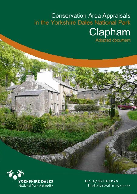
<strong>Clapham</strong><br />
Adopted document
2<br />
Table of Contents<br />
PART I<br />
1.0 Introduction 4<br />
1.1 The Area 4<br />
1.2 The Appraisal 4<br />
1.3 Summary 5<br />
2.0 Planning Policy Framework 6<br />
2.1 What Is a Conservation Area? 6<br />
2.2 Benefits of Designation 7<br />
3.0 Definition of Special Interest 9<br />
3.1 General 9<br />
3.2 Summary of the Special Interest of the <strong>Clapham</strong> Conservation<br />
Area 9<br />
4.0 Assessing Special Interest 10<br />
4.1 Location and Setting 10<br />
4.2 Historic Development and Archaeology 13<br />
4.3 Spatial Analysis 16<br />
4.4 Character Analysis 21<br />
5.0 Community Involvement 43<br />
6.0 Suggested Boundary Changes 44<br />
7.0 Local Generic Guidance 49<br />
8.0 Summary of Issues 50<br />
9.0 Useful Information, Appendices and Contact Details 51<br />
9.1 References and Further Reading 51<br />
9.2 Glossary of Terms and Abbreviations 53<br />
9.3 Contacts 53<br />
9.4 Maps of <strong>Clapham</strong> 54<br />
PART II<br />
10.0 Management Proposals 57
List of Figures<br />
Figure 01: Location maps 10<br />
Figure 02: Built-environment map regression 11<br />
Figure 03: Landscape features 13<br />
Figure 04: Map of 1842 14<br />
Figure 05: Later historical development 15<br />
Figure 06: Definition of space 17<br />
Figure 07: Key Views 18<br />
Figure 08: View 1 18<br />
Figure 09: View 2 18<br />
Figure 10: View 3 19<br />
Figure 11: View 4 19<br />
Figure 12: View 5 19<br />
Figure 13: View 6 19<br />
Figure 14: View 7 20<br />
Figure 15: View 8 20<br />
Figure 16: View 9 20<br />
Figure 17: View 10 20<br />
Figure 18: View 11 21<br />
Figure 19: View 12 21<br />
Figure 20: View 13 21<br />
Figure 21: Character zones 22<br />
Figure 22: Proposals for local list 26<br />
Figure 23: Base to Cross 27<br />
Figure 24: Brokken Bridge 27<br />
Figure 25: Bull and Cave Farmhouse 28<br />
Figure 26: Church Bridge 28<br />
Figure 27: Church of St James 29<br />
Figure 28: <strong>Clapham</strong> Bridge 29<br />
Figure 29: Cottage at Gildersbank 30<br />
Figure 30: Fall View 30<br />
Figure 31: Gildersbank Cottage & Spindle Tree Cottage 31<br />
Figure 32: Hall Garth 31<br />
Figure 33: New Inn 32<br />
Figure 34: Rose Cottage 32<br />
Figure 35: Servants’ Tunnel to Ingleborough Hall 33<br />
Figure 36: The Beeches (lower cottage) 33<br />
Figure 37: The Beeches (middle cottage) 34<br />
Figure 38: The Beeches (upper cottage) 34<br />
Figure 39: The Old Manor House 35<br />
Figure 40: Yew Tree Cottages 35<br />
Figure 41: Front gardens 37<br />
Figure 42: Public realm 38<br />
Figure 43: Negative factors 40<br />
Figure 44: Modern development 41<br />
Figure 45: Proposed new boundary (public consultation) 44<br />
Figure 46: Hill setting 45<br />
Figure 47: Small barn along Cross Haw Lane 45<br />
Figure 48: Estate cottages along The Green 46<br />
Figure 49: Part of Home Farm and development along Old Road 46<br />
Figure 50: Proposed new boundary (post consultation) 47<br />
Figure 51: Garden at Ingleborough Hall and Farrer’s rock garden 47<br />
Figure 52: Buildings on Station Road 48<br />
Figure 53: New adopted boundary 48<br />
Figure 54: Map of <strong>Clapham</strong> 55<br />
Figure 55: <strong>Clapham</strong> in 1851 56<br />
Figure 56: <strong>Clapham</strong> in 1894 56<br />
3
PART I<br />
4<br />
1 DCLG et al. (2010) PPS5:<br />
Historic Environment<br />
Planning Practice Guide,<br />
paragraphs 5, 6 & 8.<br />
2 English Heritage (2006)<br />
Guidance on the<br />
management of conservation<br />
areas, paragraph 3.5.<br />
1.0 Introduction<br />
The historic environment provides a tangible link with our<br />
past and contributes to our sense of national, local and<br />
community identity. It also provides the character and<br />
distinctiveness that is so important to a positive sense of<br />
place. […] The historic environment is a unique, fragile and<br />
non-renewable resource which contributes to the economy,<br />
society and daily life. Once lost, it cannot be replaced 1 .<br />
This document provides the first comprehensive appraisal of the<br />
<strong>Clapham</strong> Conservation Area, although a brief report on the conservation<br />
area was written by Michael Lamb as part of An Appraisal of Settlements<br />
in the <strong>Yorkshire</strong> <strong>Dales</strong> <strong>National</strong> <strong>Park</strong> in 1991. Most of the Conservation<br />
Area lies within the <strong>Yorkshire</strong> <strong>Dales</strong> <strong>National</strong> <strong>Park</strong> but 8.97% of the<br />
conservation area is outside the <strong>National</strong> <strong>Park</strong> and thus the responsibility<br />
of Craven District Council.<br />
Although the appraisal tries to cover the main aspects of the designated<br />
area, it cannot be completely comprehensive; omission of particular<br />
buildings, features or spaces should not be taken to imply that they are of<br />
no interest 2 .<br />
Throughout the text, the <strong>Yorkshire</strong> <strong>Dales</strong> <strong>National</strong> <strong>Park</strong> Authority will be<br />
referred to as ‘we’, or ‘the Authority’.<br />
1.1 The Area<br />
<strong>Clapham</strong> was given conservation area status on 21 June 1978. It is now<br />
one of thirty-seven such designations within the <strong>Yorkshire</strong> <strong>Dales</strong> <strong>National</strong><br />
<strong>Park</strong>. An area of 9.55 hectares – of which 0.9501 hectares lie outside the<br />
<strong>National</strong> <strong>Park</strong> – encompasses most of the village and some of its<br />
immediate surroundings to the north. The overall character of the place is<br />
both linear in terms of its historical development and rural due to its<br />
vernacular architecture and natural landscape setting (see front cover).<br />
<strong>Clapham</strong> is a very pleasant and attractive conservation area and<br />
generally in good condition (see 4.4.g).<br />
1.2 The Appraisal<br />
Purpose. Every conservation area has a distinctive character which has<br />
been shaped over time by its natural and man-made surroundings. This<br />
appraisal is an opportunity to re-assess the <strong>Clapham</strong> Conservation Area,<br />
to evaluate and record its special interest (see 3.0-4.0). It will set out how<br />
the place has evolved, draw out the key elements of its character and<br />
quality as it is now, and define what is positive and negative, and<br />
opportunities for beneficial change. However, neither the designation nor<br />
appraisal should be seen as an end in itself, but as a step towards the<br />
preservation and enhancement of <strong>Clapham</strong>’s character and appearance,<br />
providing a basis for making sustainable decisions about its future.<br />
Conservation areas can be susceptible to incremental and dramatic<br />
change due to neglect caused by economic decline, as well as overinvestment<br />
and pressure for development. Hence the appraisal aims to<br />
counteract threats which would alter what made the area attractive and<br />
unique in the first place, and to help promote positive change.<br />
The appraisal provides information about the <strong>Clapham</strong> Conservation<br />
Area for residents, the wider public and other stakeholders. However, it is<br />
always advisable to contact the local planning authority before<br />
undertaking any work on listed buildings or structures within the vicinity of<br />
designated heritage assets.
Scope. This document is divided into two parts: The core of Part I<br />
assesses the special interest of the <strong>Clapham</strong> Conservation Area, while<br />
Part II contains draft management proposals.<br />
The appraisal was mainly created through use of primary sources like<br />
historical maps and aerial photographs from the Authority’s Historic<br />
Environment Record as well as secondary sources and input from the<br />
local community. Literature and websites which may be of further interest<br />
are listed at the back (see 9.1). In addition, site visits to analyse the<br />
current physical evidence and condition of the conservation area were<br />
undertaken during May and June 2010.<br />
A draft version of this document was available for public consultation from<br />
21 June to 15 August 2010 (see 5.0). The comments received during that<br />
period were reviewed by the Authority before proposed changes were put<br />
forward to the Members for approval at the Authority’s meeting on 25<br />
January 2011. The <strong>Clapham</strong> Conservation Area Appraisal was finally<br />
adopted on 25 January 2011.<br />
1.3 Summary<br />
The <strong>Clapham</strong> Conservation Area at One Glace:<br />
Date of designation: 21 June 1978 see 1.1<br />
Date of last review: none see 1.0<br />
Location: grid ref. SD 745 694 (North <strong>Yorkshire</strong>) see 4.1.a<br />
Current size: 9.55ha: 8.5999ha in YDNP, 0.9501ha in Craven see 1.1<br />
Current boundary: see map see 9.4<br />
Changes to boundary: proposed see 6.0<br />
---<br />
General character: rural & vernacular see 4.1.b<br />
Special interest: 1. historical pattern of settlement see 4.1.b<br />
2. beautiful landscape setting see 4.1.c,<br />
4.3.b, 4.4.f<br />
3. variety of well-related spaces see 4.3<br />
4. working farms in the centre of village see 4.4.b<br />
5. shallow front gardens & strips of vegetation see 4.4.e<br />
on road edges<br />
6. dominance of pre-twentieth-century buildings see 4.4.c,<br />
demonstrating a range of vernacular styles, 4.4.d,<br />
mainly constructed from limestone<br />
7. survival of large percentage of traditional see 4.4.e<br />
windows<br />
General condition: good see 4.4.g<br />
Scheduled monuments: 1 (in YDNP) see 4.2.b<br />
Listed buildings: 18: 16 in YDNP, 2 in Craven see 4.4.c<br />
Listed buildings at Risk: none see 4.4.d<br />
Negative factors: 1. road surfaces see 4.4.g<br />
2. building maintenance & alterations<br />
3. clutter & other visual detractions<br />
Potential threats: 1. uPVC windows see 4.4.h<br />
2. future development<br />
5
6<br />
1 Planning (Listed Buildings<br />
and Conservation Areas) Act<br />
1990, section 69(1)(b).<br />
2 English Heritage (2006)<br />
Guidance on the<br />
management of conservation<br />
3<br />
areas, paragraph 3.14.<br />
ibid, paragraphs 3.15 & 3.16.<br />
4<br />
Planning (Listed Buildings<br />
and Conservation Areas) Act<br />
1990, section 69(2).<br />
5<br />
English Heritage (2006)<br />
Guidance on conservation<br />
area appraisals & Guidance<br />
on the management of<br />
conservation areas.<br />
6<br />
Planning (Listed Buildings<br />
and Conservation Areas) Act<br />
1990, section 71.<br />
7<br />
ibid, section 72.<br />
2.0 Planning Policy Framework<br />
The YDNP Authority’s policies for conservation areas, along with other<br />
related policies concerning development and the use of land, are set out<br />
in the <strong>Yorkshire</strong> <strong>Dales</strong> Local Plan 2006; the policies contained within<br />
chapter 10 – built heritage and the historic environment – are particularly<br />
relevant. This plan is in compliance with the <strong>Yorkshire</strong> and Humber Plan,<br />
as well as national legislation, policy and guidance which include<br />
Planning Policy Statement 5: Planning for the Historic Environment and<br />
PPS5 Planning for the Historic Environment: Historic Environment<br />
Planning Practice Guide. Further policies may be found in Planning<br />
Policy Statement 7: Sustainable Development in Rural Areas. All national<br />
legislation, policy and guidance are material to individual planning and<br />
heritage consent decisions.<br />
Policies specific to listed buildings or conservation areas in the Craven<br />
District Local Plan (1999) were not saved as because they either<br />
repeated or were superseded by national planning policies.<br />
2.1 What Is a Conservation Area?<br />
Section 69(1)(a) of the Planning (Listed Buildings and Conservation<br />
Areas) Act 1990 defines a conservation area as:<br />
an area of special architectural or historic interest the<br />
character or appearance of which it is desirable to preserve<br />
or enhance<br />
Designation. It is the duty of the local planning authority to designate<br />
such areas 1 , preferably with input from the local community. Yet this<br />
should never be undertaken solely in response to local pressure, to<br />
provide an additional control to actual or perceived threats to the<br />
character of an area or to secure the future of a particular building, but<br />
only if an area is of sufficient special interest 2 . The quality and interest of<br />
the overall built historic environment rather than of individual buildings<br />
should be the prime consideration. Whilst the immediate setting of the<br />
area also needs to be considered carefully and within reason, included in<br />
the boundary[, … c]onservation area designation is not generally an<br />
appropriate means of protecting the wider landscape 3 .<br />
Review. It is also the duty of the local planning authority to regularly<br />
review its conservation areas and, where appropriate, designate new<br />
parts 4 . Likewise, if the original interest is so eroded by subsequent<br />
changes that it is no longer special, boundary revisions or cancellation<br />
should be considered.<br />
<strong>Clapham</strong>, like most of the conservation areas within the <strong>Yorkshire</strong> <strong>Dales</strong><br />
<strong>National</strong> <strong>Park</strong>, was designated prior to 1990 when there was no statutory<br />
requirement for an in-depth character appraisal. Therefore the existing<br />
designation may not be considered as sound by current standards. The<br />
opportunity has consequently been taken to review the area in<br />
accordance with current guidance from English Heritage 5 . This has the<br />
additional advantage of producing a more robust and consistent<br />
document that can be of greater influence in the planning process.<br />
Performance. Further duties of the local planning authority comprise, in<br />
consultation with the public, formulating and publishing proposals for the<br />
preservation and enhancement of the conservation areas 6 . It will also<br />
seriously consider the desirability of preserving or enhancing their<br />
character or appearance when exercising planning powers 7 . <strong>National</strong><br />
<strong>Park</strong> family indicators provide a tool to monitor the <strong>National</strong> <strong>Park</strong><br />
Authority’s performance regarding these functions.
8 Planning (Listed Buildings<br />
and Conservation Areas) Act<br />
1990, section 72. This duty<br />
also applies to the Planning<br />
Inspectorate when<br />
determining planning<br />
appeals or conducting<br />
examinations into the<br />
soundness of development<br />
plans.<br />
9 Planning (Listed Buildings<br />
and Conservation Areas) Act<br />
1990, section 74(1).<br />
10 Town and Country Planning<br />
Act 1990, section 211(3).<br />
11 Town and Country Planning<br />
(General Permitted<br />
Development) Order 1995,<br />
schedule 2 part 1.<br />
12 English Heritage (2006)<br />
Guidance on the<br />
management of conservation<br />
areas, paragraph 5.22.<br />
Implications. Conservation area designation may result in resource<br />
implications for owners, developers and residents because of the<br />
increased statutory controls and particular requirements for the repair and<br />
alteration of existing, or the construction of new, buildings. However,<br />
designation also brings considerable benefits which are outlined below.<br />
2.2 Benefits of Designation<br />
Conservation area status offers advantages to both the public and the<br />
local planning authority.<br />
The public. Conservation areas can enhance economic well-being and<br />
quality of life, as well as offer a certain amount of continuity and stability<br />
in a rapidly changing world. At the same time, conservation-led change<br />
can make a positive contribution enabling communities to regenerate.<br />
When considering investment, appraisals should guide the form and<br />
content of development, enhancement of the public realm, traffic<br />
management and outdoor advertisement. This value of an area is<br />
beneficial to both owners and developers, and estate agents are likely to<br />
put increasing emphasis on such a location when advertising properties.<br />
Conservation area appraisals are educational and informative documents<br />
about our cultural inheritance that aim to raise public awareness and<br />
support, and upon which the prosperity of an area is sustained. They are<br />
necessary if funding is sought for grant-aid, offering financial assistance<br />
for owners to encourage repairs and preventative maintenance.<br />
The local planning authority. Designation helps us to manage change<br />
by applying robust conservation policies to an area.<br />
Decision-making – In exercising any planning functions affecting land or<br />
buildings within a conservation area, the local planning authority has a<br />
general duty 8 to pay special attention to the desirability of preserving or<br />
enhancing the character and appearance of that area. Planning functions<br />
include both the formulation of planning policies and the determination of<br />
planning applications. In order to be able to assess the impact of a<br />
planning policy or application upon a conservation area, the local<br />
planning authority needs to understand what the special architectural or<br />
historic interest of that area is. Conservation area designations and their<br />
character appraisals help to do this and therefore inform decisions about<br />
the impact that a planning policy or proposal will have.<br />
Although conservation area designations and character appraisals help to<br />
inform planning decisions, they alone do not determine whether<br />
development will or will not be acceptable. The impact of development<br />
upon the special architectural and historic interest of a conservation area<br />
needs to be weighed against other planning considerations in reaching a<br />
decision. In the <strong>National</strong> <strong>Park</strong> the 2006 Local Plan currently forms the<br />
basis for most planning decisions and its policies allow a variety of<br />
development types within conservation areas. The Local Plan policies will<br />
be gradually replaced in coming years by the Local Development<br />
Framework, starting with a review of housing policy.<br />
Planning control – Designation automatically brings additional<br />
safeguards, such as the need for consent when demolishing unlisted<br />
buildings and walls 9 or lopping and felling trees 10 . Within the <strong>National</strong><br />
<strong>Park</strong> conservation area status only has a very limited effect on ‘permitted<br />
development’ (those minor works that do not require planning<br />
permission). This is because the <strong>National</strong> <strong>Park</strong> designation already<br />
restricts permitted development rights 11 .<br />
Article 4 of the same order enables local planning authorities to further<br />
withdraw permitted development rights. This would be justified where<br />
there is firm evidence to suggest that permitted development which could<br />
damage the character or appearance of a conservation area is taking<br />
7
13 PPS5: Planning for the<br />
Historic Environment (2010).<br />
14 Planning (Listed Buildings<br />
and Conservation Areas) Act<br />
1990, section 71.<br />
8<br />
place or is likely to take place, and which should therefore be brought into<br />
full planning control in the public interest 12 . Policy HE4.1 of PPS5<br />
advises local planning authorities to consider the use of Article 4<br />
directions where the exercise of permitted development rights would<br />
undermine the aims for the historic environment, to ensure new<br />
development is given due consideration 13 .<br />
Management plans – Neither the designation of a conservation area or<br />
the preparation of a character appraisal is an end in itself. The local<br />
planning authority is also required, in consultation with the public, to<br />
formulate management plans to help preserve and enhance conservation<br />
areas 14 . These management plans may set out a variety of measures<br />
designed to help safeguard, manage and improve the area within its<br />
historic context. The appraisal is the basis for developing a management<br />
plan for the conservation area.
1 English Heritage (2006)<br />
Guidance on conservation<br />
area appraisals, paragraph<br />
4.3.<br />
2 English Heritage (2006)<br />
Guidance on the<br />
management of conservation<br />
areas, paragraph 4.1.<br />
3.0 Definition of Special Interest<br />
The purpose of this appraisal is to define the special interest of the<br />
<strong>Clapham</strong> Conservation Area that warrants its designation, as<br />
summarised below. A detailed analysis is provided in the next chapter<br />
(see 4.0).<br />
3.1 General<br />
The special architectural or historic interest of a conservation<br />
area is reflected in its character or appearance which it is<br />
desirable to preserve or enhance.<br />
When searching for the special interest of the <strong>Clapham</strong> Conservation<br />
Area, its significance, identity and distinctiveness is judged alongside<br />
local or regional criteria, while also recognising values attributed to the<br />
area by the local community and all those with a legitimate interest in it 1 .<br />
The more clearly special interest is defined, the sounder will be the basis<br />
for local policies, development control decisions and management<br />
proposals. This helps reduce the potential uncertainty for owners and<br />
others when investment or development in the area is considered 2 .<br />
3.2 Summary of the Special Interest of the<br />
<strong>Clapham</strong> Conservation Area<br />
The special character of <strong>Clapham</strong> lies in the following:<br />
� historical pattern of settlement along watercourse (see<br />
4.1.b)<br />
� beautiful and peaceful landscape setting, as well as<br />
attractive beck area with plenty of mature trees (see<br />
4.1.c, 4.3.b and 4.4.f)<br />
� variety of well-related spaces (see 4.3)<br />
� working farms in the centre of the village (see 4.4.b)<br />
� shallow front gardens and strips of vegetation on road<br />
edges (see 4.4.e)<br />
� dominance of pre-twentieth-century buildings<br />
demonstrating a range of vernacular styles, mainly<br />
constructed from limestone (see 4.4.c+d)<br />
� survival of large percentage of traditional windows (see<br />
4.4.e)<br />
9
10<br />
4.0 Assessing Special Interest<br />
This chapter at the core of the appraisal comprises a detailed analysis of<br />
the special interest of the <strong>Clapham</strong> Conservation Area with regard to its<br />
location and setting, historic development and archaeology, spatial<br />
issues, and character. A summary of the special interest has already<br />
been provided (see 3.2).<br />
4.1 Location and Setting<br />
This section describes the location and context, general character and<br />
plan form, and landscape setting of the <strong>Clapham</strong> Conservation Area.<br />
a) Location and Context<br />
Village. <strong>Clapham</strong> lies in North <strong>Yorkshire</strong>, England, on the western edge<br />
of the <strong>Yorkshire</strong> <strong>Dales</strong> <strong>National</strong> <strong>Park</strong> and close to the Forest of Bowland<br />
Area of Outstanding Natural Beauty (<strong>National</strong> Grid Reference SD 745<br />
694). It is located just north of the A65 between Settle and Ingleton<br />
(figure 01). The <strong>Yorkshire</strong> <strong>Dales</strong> <strong>National</strong> <strong>Park</strong> Authority is the local<br />
planning authority for the main part of <strong>Clapham</strong> cum Newby Parish, with<br />
Craven District Council responsible for the remainder.<br />
Figure 01: Location maps (left<br />
@ 1:200,000, conservation area<br />
boundary in pink. Based on<br />
Ordnance Survey © Crown<br />
<strong>Yorkshire</strong> <strong>Dales</strong><br />
copyright. All rights reserved<br />
100023740 2010; right – not to<br />
scale, graphics © Gaby Rose,<br />
<strong>National</strong> <strong>Park</strong><br />
YDNPA, 2010) <strong>Clapham</strong><br />
N<br />
Conservation Area. The <strong>Clapham</strong> Conservation Area as designated in<br />
1978 does not comprise the entire village but most of the buildings that<br />
have stood here since the mid nineteenth century or earlier (figure 02).<br />
Despite their closeness, the landscaped grounds around Ingleborough<br />
Hall were not included. The conservation area comprises a small area<br />
south of the B6480 which is the responsibility of Craven District Council<br />
and where their planning policies apply. For a holistic view of the<br />
settlement, both the built heritage in the village outside the conservation<br />
area boundary and the Craven part are analysed in this appraisal.<br />
A detailed map of <strong>Clapham</strong> can be found in the appendix (see 9.4).
Figure 02: Built-environment<br />
map regression @ 1:5,000<br />
(graphics © Gaby Rose,<br />
YDNPA, 2009)<br />
b) General Character and Plan Form<br />
Conservation<br />
area boundary<br />
(as designated<br />
in 1978)<br />
Ingleborough<br />
Hall<br />
<strong>Clapham</strong> is a very pleasant and attractive conservation area. Nestled at<br />
the bottom of a hillside, it is a leafy, peaceful and quiet haven filled with<br />
birdsong. Despite proximity to the A65, the noise of the traffic is little<br />
heard. Buildings cover a range of materials, style, scale and periods.<br />
Whilst vernacular architecture and local building materials dominate,<br />
examples of polite architecture and classical details are also present. The<br />
buildings do not dominate the place but form an interrelationship with the<br />
magnificent landscape setting.<br />
<strong>Clapham</strong> grew along both sides of its tree-lined beck linked by three<br />
attractive bridges within the conservation area, two of which carry<br />
vehicles. Today the nucleus around the bridge that carried the Keighley<br />
and Kendal Turnpike Road, now the B6480, is the principal public area<br />
offering commercial facilities, although there are suggestions that the<br />
earlier centre was closer to the church. South of <strong>Clapham</strong> Bridge the<br />
beck continues a strong linear landscape element which relieves and<br />
overcomes a short length of ribbon development, most of which is, with<br />
the exception of three groups of estate cottages, rather undistinguished<br />
and outside the present conservation area boundary. The north end of<br />
<strong>Clapham</strong> is effectively terminated by the parish church and dense<br />
N<br />
Buildings since:<br />
Before 1851<br />
1852-1893<br />
1894-1909<br />
1910-today<br />
Solid: still existing<br />
today<br />
Outline: demolished<br />
in period of dot<br />
colour<br />
<strong>Yorkshire</strong> <strong>Dales</strong><br />
<strong>National</strong> <strong>Park</strong><br />
boundary<br />
11
12<br />
woodland. The sawmill and sawmill cottage are also part of the northern<br />
margin of the village.<br />
The approach off the A65 from the west with the modern houses and<br />
bungalows, whilst not included in the conservation area, does not offer an<br />
attractive gateway to the historic setting. The west side of the village is<br />
the only side to have been developed in depth. Between Cross Haw Lane<br />
and Riverside, development is loosely arranged and narrow footpaths<br />
give glimpses of the tree-lined beck. Recent development at the north<br />
end of Cross Haw Lane fits comfortably into the pattern of development,<br />
and the western boundary of the village as a whole is still clearly defined.<br />
The approach from the east along the B6480 offers a rather detrimental<br />
gateway to the village, in particular due to the derelict state of the former<br />
Mercedes garage site just outside the conservation area boundary. The<br />
eastern boundary of the village is more diffuse with a mixture of open<br />
space, a large car park with toilet facilities provided by the Authority, farm<br />
buildings and woodland but is nevertheless held together by the parkland<br />
of Ingleborough Hall.<br />
The character of the <strong>Clapham</strong> today is largely determined by its<br />
nineteenth-century development as an estate village. Although<br />
Ingleborough Hall itself is now in separate ownership, the Ingleborough<br />
Estate is still a major influence on the character of the village and<br />
surrounding landscape. The extent of tree cover – much of it planted by<br />
the estate – is unusual for a village in the southern <strong>Dales</strong>.<br />
c) Landscape Setting<br />
Topography. <strong>Clapham</strong> lies on the western edge of the Pennines. It is<br />
backed by steeply rising ground to the north – most notably Ingleborough<br />
mountain, one of the Three Peaks – and faces open country to the south<br />
and west towards the Bowland Fells and parkland to the east, giving a<br />
different character to each side of the built-up area. Heavily wooded<br />
rising ground to the north end and above the village and the tree-lined<br />
beck running through the entire length of the settlement are major<br />
features of the whole setting (figure 03). <strong>Clapham</strong> Beck is fed by Fell<br />
Beck from the slopes of Ingleborough. At Gaping Gill, England’s highest<br />
waterfall, Fell Beck drops 110 metres vertically down a pothole and exists<br />
via Ingleborough Cave into <strong>Clapham</strong> Beck. Above the village is a manmade<br />
lake, supplying a small turbine-powered sawmill, with the lake<br />
outflow feeding an artificial waterfall.<br />
Geology. The South Craven Fault runs through <strong>Clapham</strong> churchyard in<br />
the northern part of the conservation area. To the north the landscape is<br />
dominated by the Carboniferous limestone of the Ingleborough massif.<br />
This is a karst landscape of limestone scars, pavements and caves with<br />
in places a thin cover of till and peat deposits and generally very thin<br />
soils. South of the Fault the Wenning valley provided an easy route for<br />
ice flowing from Chapel le Dale and the Lune valley and, overlying<br />
millstone grit and coal measures, are much more extensive deposits of till<br />
and fluvio glacial deposits of sands, gravels and silts which form a much<br />
softer, more rounded landscape. There is also a drumlin, formed by<br />
glacial movements, just to the southeast of the village.
Figure 03: Landscape features,<br />
not to scale (based on<br />
Ordnance Survey © Crown<br />
copyright. All rights reserved<br />
100023740 2010)<br />
1 Winstone, P J (2007) A<br />
History of the Church in<br />
<strong>Clapham</strong>, page 6.<br />
2 Pearce, Ken (2010)<br />
‘<strong>Clapham</strong> Conservation Area<br />
– draft Appraisal’ letter to<br />
Gaby Rose on 17 August.<br />
160m<br />
155m<br />
Conservation<br />
area boundary<br />
(as designated<br />
in 1978)<br />
A65<br />
190m<br />
<strong>Yorkshire</strong><br />
<strong>Dales</strong> <strong>National</strong><br />
<strong>Park</strong> boundary<br />
Bank Wood<br />
<strong>Clapham</strong> Beck<br />
235m<br />
B6480<br />
drumlin<br />
4.2 Historic Development and Archaeology<br />
This section describes the origins, archaeology and historic development<br />
of the <strong>Clapham</strong> Conservation Area.<br />
a) Origins and Historic Development of the Area<br />
The Lake<br />
Plantation<br />
Distinctive<br />
woodland edge<br />
A manor of <strong>Clapham</strong> was held by Thorfinnr prior to the Norman<br />
Conquest, and was held by the king in 1086. The present village is<br />
believed to be originally an Anglian settlement and its early importance is<br />
indicated by the granting of a market in 1201, of which the restored<br />
market cross is the only remaining evidence.<br />
A priest is first recorded for <strong>Clapham</strong> in 1160 but Whittaker suggests that<br />
a church was erected between 1100-1135. In the early fourteenth century<br />
the village was burnt down during a Scottish raid following the Battle of<br />
Bannockburn 1 . The new parish church is believed to have been built<br />
c.1400 and is regarded as an example of ‘Pennine Perpendicular’. Most<br />
of the tower still stands but the medieval nave was demolished and<br />
rebuilt at twice its former width in the years 1812-14 2 .<br />
N<br />
250m<br />
13
Figure 04: Map of 1842, not to<br />
scale © Dr J A Farrer’s private<br />
archive<br />
3 Winstone, P J (2007) A<br />
History of the Church in<br />
<strong>Clapham</strong>, pages 12, 32-33.<br />
4 Innerdale, James (2010)<br />
‘<strong>Clapham</strong> Conservation Area<br />
Appraisal’, email to Gaby<br />
Rose on 06 August.<br />
14<br />
In the mid-seventeenth century there was little woodland in <strong>Clapham</strong>. The<br />
main road crossed the church bridge, which was a clapper bridge and the<br />
only one in the village.<br />
Key:<br />
Demolished<br />
New<br />
Land taken by Hall<br />
5<br />
6<br />
4<br />
7<br />
3<br />
1 Ingleborough Hall<br />
2 Stables<br />
3 Thomas Johnson’s house<br />
4 Vicar’s house<br />
5 Tithe barn<br />
6 Burton’s house & gardens<br />
7 Cottages & pottery yard<br />
8 Dog kennels<br />
Until the eighteenth century <strong>Clapham</strong> had been a parish of prosperous<br />
yeoman farmers and small landowners. In the nineteenth century most of<br />
the farms were bought by the Farrer family and <strong>Clapham</strong> effectively<br />
became an estate village 3 . Clear physical evidence of this can be seen in<br />
the numerous estate cottages – of which a significant number were<br />
adapted and re-fronted eighteenth-century or possibly earlier building 4 –<br />
the 1864 school – a memorial to John William Farrer (1785-1863) – and<br />
the rebuilt church as well as the extensive landscaped grounds<br />
surrounding the c.1814 Ingleborough Hall. Ingleborough Hall itself is<br />
hidden from the village by a large earthen bank overlooking Church<br />
Avenue and extensive planting. That this was deliberate is further<br />
demonstrated by the unusual tunnels which hide Thwaite Lane and<br />
originally also provided an underground tradesmen and servants’ access<br />
to the Hall.<br />
� The first Farrer to live within the village was James Farrer<br />
(1719-66) who bought what is now called Yew Tree<br />
Cottage (figure 40) in 1741 or 42.<br />
� The building which became the Hall was acquired by<br />
Oliver Farrer (1742-1808) in 1807 when it was still a farm.<br />
The same year he extended and adapted it as a shooting<br />
lodge, <strong>Clapham</strong> Lodge. On his death he left the Lodge to<br />
his nephews James William Farrer (1785-1893) and<br />
Oliver Farrer (1786-1866). Over the period 1827-43 they<br />
8<br />
1<br />
2
5 Pearce, Ken (2010)<br />
‘<strong>Clapham</strong> Conservation Area<br />
– draft Appraisal’ letter to<br />
Gaby Rose on 17 August.<br />
6 Fawcett, Jane (1977)<br />
‘<strong>Clapham</strong> Conservation Area<br />
– Recommended Policy’,<br />
YDNPA archive.<br />
7 BBC (2003).<br />
Figure 05: Later historical<br />
development, not to scale<br />
(graphics © Gaby Rose,<br />
YDNPA, 2010)<br />
remodelled the Lodge and grounds to become<br />
Ingleborough Hall as we see it now. The main building<br />
works were carried out in 1835-38 to plans by S B<br />
Wilson 5 .<br />
� In the early nineteenth century the Farrers carried out<br />
extensive tree planting, constructed the present<br />
Ingleborough Hall and lake on <strong>Clapham</strong> Beck and the<br />
landscaped grounds around the Hall, rerouted roads and<br />
demolished buildings, including a vicarage and a tithe<br />
barn, transforming the north end of the village around the<br />
church (figure 04). They also built the present vicarage<br />
on the west side of the beck 6 .<br />
� The botanist Reginald Farrer (1880-1920) – after whom<br />
the plant Geranium Farreri is named after – was born and<br />
lived at <strong>Clapham</strong>. Between 1914 and 1920 he collected<br />
many species of rhododendrons, shrubs and alpines in<br />
China, Tibet and Burma. On his travels he searched for<br />
new plants and brought back seeds that have shaped<br />
and formed the British garden today. Many of these he<br />
planted on the Ingleborough estate. In one famous<br />
incident he fired seeds at cliff faces from a shotgun to<br />
give a ‘natural’ spread to his rock plants 7 . The<br />
rhododendrons still give a good show for a short time<br />
each year.<br />
The above map shows how the Farrer family changed the character of<br />
<strong>Clapham</strong>’s northern end by removing the nucleus around what had been<br />
the village green. Later development was rather sparse until the twentieth<br />
century when the village expanded significantly, especially to the south<br />
and west (figure 05).<br />
Before 1851 1852-1893<br />
1894-1909 1910-today<br />
Until recently, the main road, the former Keighley-Kendal turnpike –<br />
whose development coincided with that of the Romantic movement and<br />
the aesthetic appreciation of the <strong>Yorkshire</strong> <strong>Dales</strong> landscape – passed<br />
through the village, but the resultant major traffic intrusion was removed<br />
15
8 Pearce, Ken (2010)<br />
‘<strong>Clapham</strong> Conservation Area<br />
– draft Appraisal’ letter to<br />
Gaby Rose on 17 August.<br />
9 Johnson, David (2008)<br />
Ingleborough Landscape and<br />
History.<br />
16<br />
when <strong>Clapham</strong> was bypassed in 1973 8 . Today <strong>Clapham</strong> is a popular and<br />
at times busy centre for walking and caving.<br />
b) Archaeology<br />
No archaeological excavations are recorded from within the conservation<br />
area and there are no records of casual finds although there is extensive<br />
evidence for prehistoric activity on the limestone uplands to the east of<br />
the village. <strong>Clapham</strong> lies on the edge of the Craven Corridor, a natural<br />
routeway in between the limestone uplands of Craven and the Bowland<br />
Fells. During the Neolithic period this was one of the main routes<br />
between the Lake District and its stone axe factories and the <strong>Yorkshire</strong><br />
Wolds. Although there is no firm evidence, this communications corridor<br />
is likely to have been followed by a Roman road between Skipton and<br />
Ingleton, drove routes, and later the Keighley and Kendal Turnpike Road<br />
of 1752/3 and, in part by the North Western Railway Company’s line from<br />
Skipton to Lancaster, opened in 1850. An “Old Turnpike House” stood at<br />
the northwest edge of the village at the junction between Old Road and<br />
Eggshell Lane in 1851. In the medieval period an important east–west<br />
routeway, now marked by the bridleways of Laithbutts Lane and Thwaite<br />
Lane, also passed through the village 9 . Immediately south of this<br />
routeway a group of now demolished buildings, including a tithe barn,<br />
vicarage and pottery yard, is shown surrounding a former village green<br />
south east of the parish church in 1842 (figure 04). The area now lies<br />
within the grounds of Ingleborough Hall.<br />
To the north of the village lies an extensive, visually prominent, area of<br />
lynchets, probably of medieval date, which are evidence for former arable<br />
agricultural activity in what is now a largely pastoral landscape,<br />
subdivided by dry-stone walls.<br />
The market cross is a scheduled monument.<br />
Information about individual surveys, monuments or other features can<br />
be found on the <strong>Yorkshire</strong> <strong>Dales</strong> <strong>National</strong> <strong>Park</strong> Historic Environment<br />
Record (HER), which is a comprehensive and dynamic computer<br />
database linked to a Geographic Information System (GIS).<br />
4.3 Spatial Analysis<br />
This section describes the character and interrelationship of spaces, as<br />
well as the key views and vistas of the <strong>Clapham</strong> Conservation Area.<br />
a) Character and Interrelationship of Spaces within the Area<br />
Facades and boundary walls play a key role in defining space within the<br />
<strong>Clapham</strong> Conservation Area (figure 06). They form four distinct groups:<br />
� Principal area along the B6480 and north of <strong>Clapham</strong><br />
Bridge (1): This zone is dominated by the built historic<br />
environment, but softened by the many mature trees<br />
around the beck area, especially further to the north<br />
(figures 15-18). The buildings are linearly yet informally<br />
arranged and face each other over both the road and the<br />
beck, forming a generous public space in between.<br />
� The church as a focal point and the buildings it is<br />
surrounded by, including those over the beck (2): This<br />
loosely formed group is surrounded and intersected by<br />
vegetation, providing a very lush and rural feel (figures<br />
11, 12, 20 & cover).<br />
� The strong urban edge comprising building facades<br />
(often end gables and few windows) and tall boundary<br />
walls along the east side of Cross Haw Lane (3), which<br />
almost gives the impression of a fortification (figure 14).
Figure 06: Definition of space<br />
@ 1:5,000 (based on Ordnance<br />
Survey © Crown copyright. All<br />
rights reserved 100023740<br />
2010)<br />
N<br />
� Twentieth-century housing in the northern part of the<br />
village (4). This is predominantly private space with the<br />
buildings set well back from the road (figure 9).<br />
3<br />
4<br />
b) Key Views and Vistas<br />
1<br />
Prominent<br />
building frontage<br />
Prominent<br />
boundary wall<br />
Landmark<br />
Good internal<br />
space<br />
The terrain and extensive tree cover around and within the village means<br />
views from the village centre are limited, especially to the east and west<br />
and towards Ingleborough.<br />
The key views into and within the <strong>Clapham</strong> Conservation Area are as<br />
follows (figure 07).<br />
2<br />
17
Figure 07: Key views @<br />
1:10,000 (based on Ordnance<br />
Survey © Crown copyright. All<br />
rights reserved 100023740<br />
2010)<br />
Figure 08: View 1 (photo ©<br />
Gaby Rose, YDNPA, 2010)<br />
Figure 09: View 2 (photo ©<br />
Gaby Rose, YDNPA, 2010)<br />
18<br />
N<br />
1<br />
2 3<br />
7<br />
10<br />
11<br />
External view<br />
Internal view<br />
Landmark<br />
(1). Distant panoramic view from the southwest onto village with church<br />
tower in the background. Lynchets are visible on the hillside (figure 08).<br />
(2). External view from the northwest onto more recent housing with<br />
church tower in the background. Lynchets are visible on the hillside<br />
(figure 09).<br />
8<br />
9<br />
5<br />
6<br />
4<br />
13<br />
12
Figure 10: View 3 (photo ©<br />
Gaby Rose, YDNPA, 2010)<br />
Figure 11: View 4 (photo ©<br />
Gaby Rose, YDNPA, 2010)<br />
Figure 12: View 5 (photo ©<br />
Gaby Rose, YDNPA, 2010)<br />
Figure 13: View 6 (photo ©<br />
Gaby Rose, YDNPA, 2010)<br />
(3). View north from village edge onto hillside (figure 10).<br />
(4). View eastwards from designated viewpoint on Riverside along the<br />
landscaped beck towards Ingle Bridge (figure 11).<br />
(5). View south from the top of Riverside with <strong>Clapham</strong> Beck to the left<br />
and The Beeches cottages to the right (figure 12).<br />
(6). View up Riverside with <strong>Clapham</strong> Beck to the right and Yew Tree<br />
cottages to the left (figure 13).<br />
19
Figure 14: View 7 (photo ©<br />
Ross Cannon, YDNPA, 2010)<br />
Figure 15: View 14 (photo ©<br />
Gaby Rose, YDNPA, 2010)<br />
Figure 16: View 9 (photo ©<br />
Gaby Rose, YDNPA, 2010)<br />
Figure 17: View 10 (photo ©<br />
Gaby Rose, YDNPA, 2010)<br />
20<br />
(7). View along east side of Cross Haw Lane with fortification-like<br />
boundary walls and gable ends (figure 14).<br />
(8). View northeast taken from Riverside towards Brokken Bridge (figure<br />
15). The cover photograph provides a different aspect of the bridge.<br />
(9). View north from the bottom of Riverside with cottages to the left<br />
(figure 16).<br />
(10). View northwest along B6480 with Rose Cottage to the right and<br />
farm buildings in the background (figure 17).
Figure 18: View 11 (photo ©<br />
Gaby Rose, YDNPA, 2010)<br />
Figure 19: View 12 (photo ©<br />
Gaby Rose, YDNPA, 2010)<br />
Figure 20: View 13 (photo ©<br />
Gaby Rose, YDNPA, 2010)<br />
(11). View north from the bottom of Church Avenue with New Inn on the<br />
right and <strong>Clapham</strong> Beck to the left (figure 18).<br />
(12). View down Church Avenue with the grounds of Ingleborough Hall to<br />
the left and Gildersbank cottages in the background (figure 19).<br />
(13). View up Church Avenue with playground and picnic area to the left<br />
and Church of St James in the background (figure 20).<br />
4.4 Character Analysis<br />
This section is key to the appraisal. It unravels the character of the<br />
<strong>Clapham</strong> Conservation Area by considering its different character zones,<br />
land uses, buildings and other heritage assets, traditional materials, local<br />
details and the public realm, biodiversity, the general condition of the<br />
conservation area including positive, neutral and negative factors, as well<br />
as potential problems, pressures and the capacity for change.<br />
a) Definition of Character Areas or Zones<br />
The <strong>Clapham</strong> Conservation Area can be divided into two character zones<br />
and a transitional zone (figure 21):<br />
� a heavily vegetated zone in the northeast with extensive<br />
green space, mature trees and only few buildings (1)<br />
21
Figure 21: Character zones @<br />
1:5,000 (based on Ordnance<br />
Survey © Crown copyright. All<br />
rights reserved 100023740<br />
2010)<br />
22<br />
N<br />
� a more densely built up zone in the south and northwest<br />
of the conservation area (2)<br />
� a transitional zone within the built up area along the treelined<br />
beck (t)<br />
2<br />
The first zone draws much attention on its lush landscape setting, while<br />
the second zone mainly focuses on the built historic environment. Both<br />
character zones compliment each other and merge with a marked<br />
transitional zone around the beck.<br />
b) Activity and Prevailing or Former Uses and Their Influence on<br />
Plan Form and Buildings<br />
The current uses within the <strong>Clapham</strong> Conservation Area are:<br />
t<br />
� Agricultural: Bull and Cave Farm, Home Farm and<br />
Jaques Farm<br />
� Commercial: food & drink and merchandise along the<br />
B6480 and the southern half of Church Avenue<br />
� Education: school on The Green<br />
� Leisure & tourism: the whole village is a popular<br />
destination for walkers, locals and tourists alike. ‘Trail and<br />
Cave’ offers a walk that starts within the conservation<br />
2<br />
1<br />
Conservation<br />
area boundary<br />
(as designated<br />
in 1978)<br />
<strong>Yorkshire</strong><br />
<strong>Dales</strong> <strong>National</strong><br />
<strong>Park</strong> boundary
area (at the old sawmill) leading towards Ingleborough<br />
Cave.<br />
� Religious: church and graveyard<br />
� Residential: mainly the area west of <strong>Clapham</strong> Beck, with<br />
fewer homes along Church Avenue and Old Road<br />
(B6480)<br />
Overall, there are a variety of uses within the conservation area which<br />
contribute to the vibrancy of the whole community. <strong>Clapham</strong> is fairly<br />
unusual for a <strong>Yorkshire</strong> <strong>Dales</strong> village in that it still has working farms<br />
within the village centre.<br />
Although there appears to have been a pre-nineteenth-century focus<br />
southeast of the parish church with buildings, including a tithe barn and<br />
vicarage surrounding a small village green, <strong>Clapham</strong> has developed with<br />
a commercial centre along the former turnpike road, now the B6480<br />
(east-west orientation) and residential development mainly between<br />
Riverside and Cross Haw Lane (north-south orientation). In more recent<br />
times and currently outside the conservation area, housing spread one<br />
row further west, and other new development has taken place south of<br />
the B6480 along both sides of the beck. This linear pattern of<br />
development is also reflected in the originally prevalent building type –<br />
terraces – in contrast to the more recent detached housing.<br />
c) Quality of Buildings and Their Contribution to the Area<br />
The <strong>Clapham</strong> Conservation Area comprises a mixture of architectural<br />
styles. The old cottages, some of which date from the seventeenth<br />
century, and traditional farm buildings were built in a simple vernacular<br />
fashion. However, the houses on Gildersbank display drawn joints on<br />
render to mimic ashlar facades, thus showing an element of polite<br />
architecture. Hall Garth, the Old Vicarage, Deighton Cottage and the<br />
Servants’ Tunnel’s portals are examples of true polite architecture.<br />
Buildings are predominantly two storeys high, but New Inn and Yew Tree<br />
Cottages have three storeys. The conservation area also incorporates<br />
more recent houses. Most of them fit well into the built historic<br />
environment, with a few exceptions discussed later on (see 4.4.g). It also<br />
includes a number of former farm buildings which have been converted<br />
into residential use. Some of these conversions may date from the<br />
nineteenth century, although the majority are more recent.<br />
Listed buildings. It should be noted that the designation includes the<br />
inside as well as the outside of a listed structure. Furthermore, the listing<br />
name may not refer to the main building only; related structures fixed to it<br />
or within its curtilage and pre-dating 1948, such as boundary walls,<br />
outbuildings, enclosures, gates and other features, can also be protected<br />
by the listing. It is always advisable to contact the Authority or Craven<br />
District Council when planning to undertake work to a listed building or<br />
any structures nearby.<br />
The <strong>Clapham</strong> Conservation Area contains eighteen grade-II-listed<br />
buildings, which are marked red on the map in the appendix (see 9.4).<br />
� Base to Cross<br />
� Brokken Bridge<br />
� Bull and Cave Farmhouse - outside <strong>National</strong> <strong>Park</strong><br />
� Church Bridge<br />
� Church of St. James<br />
� <strong>Clapham</strong> Bridge - outside <strong>National</strong> <strong>Park</strong><br />
� Cottage at Gildersbank<br />
� Fall View<br />
� Gildersbank Cottage and Spindle Tree Cottage<br />
� Hall Garth<br />
� New Inn<br />
23
10 DCLG et al. (2010) PPS5:<br />
Historic Environment<br />
Planning Practice Guide,<br />
paragraph 15.<br />
24<br />
� Rose Cottage<br />
� Servants’ tunnel to Ingleborough Hall<br />
� The Beeches (lower cottage)<br />
� The Beeches (middle cottage)<br />
� The Beeches (upper cottage)<br />
� The Old Manor House<br />
� Yew Tree Cottages<br />
A detailed description of each building can be found in the next section<br />
(see 4.4.d).<br />
Unlisted buildings. Structures that are not nationally listed but are<br />
significant nevertheless, may receive some protection by being<br />
designated as locally listed buildings. Though lacking the statutory<br />
protection of other designations, formal identification […] is material in<br />
planning decisions 10 . For inclusion in a local list, unlisted structures that<br />
contribute positively to the special character or appearance of the<br />
<strong>Clapham</strong> Conservation Area should comply with some of the following<br />
criteria:<br />
� Architectural qualities in the overall design or detailed<br />
features, which may either be unusual or characteristic to<br />
the overall style of the conservation area<br />
� Association with a historical event or person of local,<br />
regional or national note<br />
� Group value or related to a designated structure<br />
� Landmark qualities<br />
� Reminder of a former use within the area<br />
� Respect for the surrounding historical structures, spaces<br />
and setting<br />
� Positive contribution to the overall character or<br />
appearance of the conservation area<br />
Local list. The following buildings make a particular positive<br />
contribution to the conservation area and should be considered for<br />
inclusion on a local list (Figure 22):<br />
� Deighton Cottage, Riverside (1): Date stone of 1855,<br />
square moulded frame within quatrefoil. Built for Dr<br />
Christopher Deighton MD who became the <strong>Clapham</strong><br />
doctor. Architecturally unusual for the area, with pyramid<br />
roof and overhanging eaves. Roughcast render recently<br />
removed revealing raised edging to quoins at each<br />
corner, the bulk of the large quoins dressed/set back to<br />
face of rubble masonry. To frontage and part side<br />
elevations, two to three light dressed stone mullioned<br />
windows with hood moulds over, planer window and door<br />
surround to rear.<br />
� Gates to Ingleborough Hall, Church Avenue (2):<br />
Records refer to stone for gates dated 1835, although<br />
this may be for the lower gates at entrance to Home<br />
Farm as maps up to late C19 do not show drive to the<br />
Hall from here. Gates form approach to Hall from within<br />
village, with properties on Gildersbank/Church Avenue<br />
re-rendered in smooth ashlar and possibly re-fenestrated<br />
to improve approach. Date stone in a wall close to the<br />
front door of the Hall which dates completion of the<br />
gardens, paths, drives etc. at 1841. No record of<br />
blacksmith who made gates or if they are contemporary<br />
with posts. Railings replaced/re-formed in 2003.<br />
� Memorial Fountain, Riverside (Figure 42, image 5):<br />
Erected in 1897 to mark Queen Victoria's Diamond<br />
Jubilee. Fish water fountain with shell bowl below set on<br />
marble panel. To left return of shelter commemoration
11 Innerdale, James (2010)<br />
‘<strong>Clapham</strong> Conservation Area<br />
Appraisal’, emails to Gaby<br />
Rose on 31 August and 29<br />
November.<br />
plaque. Panel set in rubble masonry shelter with stone<br />
slate roof. Character suggests may have been<br />
constructed at a later date to house fountain but no<br />
record of this. Repaired 1989 by Tommy Lund, a local<br />
builder who still lives in the village.<br />
� School, The Green (3): Built 1864 following demolition of<br />
original school to west corner of churchyard (built 1669,<br />
footprint still evident), opened in 1865. Built by the<br />
Farrers, Oliver (1786-1866), William (1788-1868) and<br />
James (1812-79) in memory of James William Farrer<br />
(1785-1863) who was brother to Oliver and William,<br />
father to James. T-shaped plan form with memorial<br />
plaque above doorway within lower single-storey<br />
entrance bay at north end. Building uses slope to rise<br />
from single to two storey at south end. Semi-dressed and<br />
coursed exposed masonry with large quoin stones.<br />
Dressed and moulded three or four light ecclesiastical<br />
style lancet and windows. Hood moulds over doorway<br />
and principle window in west gable. Carved head stop<br />
end to both sets of hood moulds. Expressed chimney<br />
stack to left of centre to south end. Upper floor created<br />
within south end in 2000s.<br />
� Ivy cottages, Riverside (4): Probably originally mid to<br />
late C18 with C19 and C20 re-fenestration/re-modelling<br />
by the Farrers. Early plans suggest originally two houses<br />
(now four cottages), with central quoins to right of<br />
blocked doorway suggesting left-hand side earlier than<br />
right. Unusual central round chimney (to right end of left<br />
cottages), detail common in Lake District, but only few<br />
examples locally. Shadows of blocked/lost mullioned<br />
windows to left half, otherwise openings C19 or C20.<br />
Right half has retains of moulded C18 window surrounds<br />
to first floor windows, also part repaired/re-formed (?)<br />
hood mould over originally three/four light mullioned<br />
window to ground floor.<br />
� No.s 1 & 3 Gildersbank: Prominent buildings which are<br />
regularly photographed, appearing on postcards etc.,<br />
probably with early C20 stucco render. No.1 (5): early<br />
C19 with classic small double-pile plan form, stone slate<br />
pantry shelves to rear, and distinctive multi-pane fourcentred<br />
arched windows within moulded surrounds. No.3<br />
(6): C19 front with C18 origins (early maps show as Lshape<br />
farmhouse with attached farm buildings – now no.s<br />
5 & 7), basement, and short arched stair window and<br />
original multi-pane sash to rear.<br />
� The Old Vicarage, Riverside (7): Prominent building built<br />
in 1832 following demolition of original vicarage on east<br />
side of the village as part of the various alterations by the<br />
Farrer family. Stopped being used as vicarage as part of<br />
amalgamation of the parishes in 1984. Stuccoed main<br />
elevation with unusual parapetted pediment. Mainly two<br />
and three-light mullioned windows with splayed<br />
surrounds and hood moulds. Full height bay and righthand<br />
extension likely to be later.<br />
� Rose Bank Cottages, Riverside (8): Those still owned<br />
by Ingleborough Estate retain C19 roughcast lime render<br />
to street elevation. Building likely to have been<br />
improved/altered as part of the Farrer village<br />
improvements in early/mid C19. Quoins to central cottage<br />
and to door head indicate earlier origins, with cottages to<br />
right having been enlarged from earlier single storey<br />
structures. Windows generally plain C19 sashes, but<br />
central cottage has earlier doorway. Central cottage has<br />
shallow arched head and plain chamfered jambs 11 .<br />
25
Figure 22: Proposals for local<br />
list (photos 1-4 © Gaby Rose,<br />
YDNPA, 2010; photos 5-8 ©<br />
James Innerdale, 2010)<br />
26<br />
1 2<br />
3 4<br />
5 6<br />
7<br />
The residents of <strong>Clapham</strong> are invited to suggest other heritage<br />
assets they think should be included on a local list, and give<br />
appropriate reasons, evidence and references for their<br />
nominations.<br />
d) Audit of Designated Heritage Assets<br />
This section describes the appearance and condition of the eighteen<br />
listed buildings within the <strong>Clapham</strong> Conservation Area. Their locations<br />
are marked red on the map at the back (see 9.4). The descriptions in the<br />
following paragraphs are based on the listing entries, unless stated<br />
otherwise.<br />
Base to Cross (figure 23), grade II listed and scheduled monument –<br />
� Remnant of ancient market cross<br />
� Probably C14<br />
� Millstone grit<br />
� c. 60cm square and 40cm high, raised on three steps<br />
8
Figure 23: Base to Cross (photo<br />
© Gaby Rose, YDNPA, 2010)<br />
12 Pearce, Ken (2010)<br />
‘<strong>Clapham</strong> Conservation Area<br />
– draft Appraisal’ letter to<br />
Gaby Rose on 17 August.<br />
Figure 24: Brokken Bridge<br />
(photo © Gaby Rose, YDNPA,<br />
2010)<br />
� Cross added to base in 1897<br />
� Current condition: good, though several cement mortar<br />
joints beginning to crack (no damage to stone)<br />
Brokken Bridge (figure 24), grade II listed –<br />
� Footbridge<br />
� Probably C18; rebuilt in 1845 after being swept away;<br />
date stone shows that it was repaired in 1913 12<br />
� Slobbered rubble<br />
� Single-span segmental arch<br />
� Current condition: good, though some cement loose<br />
Bull and Cave Farmhouse (figure 25), grade II listed –<br />
� Farmhouse<br />
� Dated 1725 with C19 and C20 alterations<br />
� Rendered rubble, stone dressings, stone slate roof<br />
� Central staircase plan<br />
� 2-storey double-fronted building; central entrance with<br />
inscribed lintel; former right-hand entrance and upperfloor<br />
mullioned window blocked; missing mullions on<br />
ground-floor window<br />
� Current condition: good<br />
27
Figure 25: Bull and Cave<br />
Farmhouse (photo © Gaby<br />
Rose, YDNPA, 2010)<br />
13 Pearce, Ken (2010)<br />
‘<strong>Clapham</strong> Conservation Area<br />
– draft Appraisal’ letter to<br />
Gaby Rose on 17 August.<br />
Figure 26: Church Bridge<br />
(photo © Gaby Rose, YDNPA,<br />
2010)<br />
28<br />
Church Bridge (figure 26), grade II listed –<br />
� Bridge<br />
� Probably C18; widened on the downstream side by the<br />
wapontake in 1798 from eight to twenty feet 13<br />
� Rubble to upstream side, ashlar to downstream side and<br />
parapets<br />
� Single-span segmental arch with pilasters to either end of<br />
parapet and ‘newel post’ stops to wing walls<br />
� Cast-iron West Riding boundary posts to east and west<br />
on upstream side<br />
� Current condition: fair with some plant growth on external<br />
face and several deeply eroded or loose mortar joints.<br />
Underside of bridge has not been inspected.<br />
Church of St. James (figure 27), grade II listed –<br />
� Parish church<br />
� Potentially late C14/early C15 tower, rest 1814 with<br />
c.1900 alterations<br />
� Slobbered rubble, stone dressings, thin blue slate roof<br />
� South porch (1899), three-stage west tower, four-bay<br />
nave, north and south aisles, one-bay chancel<br />
� Church was rebuilt by Farrer family of Ingleborough Hall<br />
� Current condition: good
Figure 27: Church of St James<br />
(photo © Gaby Rose, YDNPA,<br />
2010)<br />
Figure 28: <strong>Clapham</strong> Bridge<br />
(photo © Gaby Rose, YDNPA,<br />
2010)<br />
<strong>Clapham</strong> Bridge (figure 28), grade II listed –<br />
� Bridge<br />
� C18 with late C19 alterations<br />
� Ashlar and slobbered rubble<br />
� Single-span segmental arch<br />
� Widened on downstream side<br />
� Current condition: good<br />
Cottage at Gildersbank (figure 29), grade II listed –<br />
� Cottage<br />
� Early C19 with C17 origins<br />
� Rendered with drawn masonry joints, stone slate roof<br />
� Central staircase plan<br />
� 2-storey 3-bay building with central entrance; sash<br />
windows with plain surrounds; C17 stair turret to rear<br />
� Included for group value<br />
� Current condition: good<br />
29
Figure 29: Cottages at<br />
Gildersbank (photo © Gaby<br />
Rose, YDNPA, 2010)<br />
Figure 30: Fall View (photo ©<br />
Gaby Rose, YDNPA, 2010)<br />
30<br />
Fall View (figure 30), grade II listed –<br />
� House<br />
� Mid C18 with early-C19 alterations<br />
� Pebbledash, painted stone dressings, stone slate roof<br />
� Central staircase plan<br />
� 2-storey 3-bay building; entrance with Tuscan pilasters,<br />
open pediment and fanlight; sash windows with plain<br />
surrounds and projecting sills; original former entrance at<br />
rear with moulded surround now blocked<br />
� Current condition: good<br />
Gildersbank Cottage & Spindle Tree Cottage (figure 31), grade II listed –<br />
� Reputedly former Spindle Tree Inn, now two cottages<br />
� Late C18 with C19 alterations<br />
� Rendered with drawn masonry joints, stone dressings,<br />
stone slate roof<br />
� Gildersbank Cottage: central staircase plan<br />
� 2-storey building; sash windows with plain surrounds<br />
� Current condition: good
Figure 31: Gildersbank Cottage<br />
& Spindle Tree Cottage (photo<br />
© Gaby Rose, YDNPA, 2010)<br />
14 Pearce, Ken (2010)<br />
‘<strong>Clapham</strong> Conservation Area<br />
– draft Appraisal’ letter to<br />
Gaby Rose on 17 August.<br />
Figure 32: Hall Garth (photo ©<br />
Gaby Rose, YDNPA, 2010)<br />
15 Pearce, Ken (2010)<br />
‘<strong>Clapham</strong> Conservation Area<br />
– draft Appraisal’ letter to<br />
Gaby Rose on 17 August.<br />
Hall Garth (figure 32), grade II listed –<br />
� Former land agent’s house with office at one end; still<br />
used as both house and Ingleborugh Estate office<br />
� Late C18; finished in 1833 14<br />
� Ashlar, slate roof<br />
� Central staircase plan<br />
� 2-storey 5-bay building; central entrance with engaged<br />
Tuscan columns; sash windows; ground-floor tripartite<br />
windows with engaged columns; chimney stacks with 5<br />
and 8 flues<br />
� Built for the agent of Ingleborough Estate<br />
� Current condition: good<br />
New Inn (figure 33), grade II listed –<br />
� Inn<br />
� Reputedly 1745 with C20 alterations<br />
� Rendered, painted stone dressings, slate roof<br />
� Central staircase plan<br />
� 3-storey 4-bay building; shown on a plan of 1807 as<br />
having only two storeys, so third storey was added<br />
afterwards with 1776 rainwater hopper being reused 15 ;<br />
central entrance with slate hood; tripartite sash windows<br />
with flat-faced mullions<br />
31
Figure 33: New Inn (photo ©<br />
Gaby Rose, YDNPA, 2010)<br />
Figure 34: Rose Cottage (photo<br />
© Gaby Rose, YDNPA, 2010)<br />
16 Pearce, Ken (2010)<br />
‘<strong>Clapham</strong> Conservation Area<br />
– draft Appraisal’ letter to<br />
Gaby Rose on 17 August.<br />
32<br />
� Current condition: good, although render is a bit grubby<br />
in places<br />
Rose Cottage (figure 34), grade II listed –<br />
� Cottage<br />
� Mid C18 with C20 alterations<br />
� Slobbered rubble, stone dressings, stone slate roof<br />
� 2-storey building with continuous hoodmould over<br />
rusticated stone doorway and three ground-floor windows<br />
� Current condition: good<br />
Servants’ tunnel to Ingleborough Hall (figure 35), grade II listed –<br />
� Principal purpose to provide new route for Thwaite Lane,<br />
further from the Hall, as Farrers were insistent on their<br />
privacy; northern tunnel leads to former stables (southern<br />
tunnel for servants and tradesmen 16 currently not within<br />
conservation area boundary)<br />
� Dated 1833<br />
� Rubble with ashlar dressings<br />
� Round arch with rock-faced voussoirs and parapet with<br />
engaged pilasters<br />
� Current condition: good
Figure 35: Servants’ tunnel to<br />
Ingleborough Hall (photo ©<br />
Gaby Rose, YDNPA, 2010)<br />
Figure 36: The Beeches, lower<br />
cottage (photo © Gaby Rose,<br />
YDNPA, 2010)<br />
The Beeches (lower cottage) (figure 36), grade II listed –<br />
� Cottage<br />
� Early C19; door head dated 1686<br />
� Pebbledash, painted stone dressings, stone slate roof<br />
� 2-storey double-fronted building with central mid-C19<br />
wooden entrance porch; sash windows with plain<br />
surrounds<br />
� Included for group value<br />
� Current condition: good, though paint of window<br />
surrounds is flaking off; vegetation may be harmful to<br />
façade if roots take hold in wall<br />
The Beeches (middle cottage) (figure 37), grade II listed –<br />
� Cottage<br />
� Probably C18 with C19 alterations; date stone 1689<br />
� Slobbered rubble, painted stone dressings, stone slate<br />
roof<br />
� 2-storey double-fronted building with curve to street and<br />
central quoins to left-hand bay; sash windows with plain<br />
surrounds<br />
� Included for group value<br />
� Current condition: good, though paint of window and door<br />
surrounds is flaking off<br />
33
Figure 37: The Beeches, middle<br />
cottage (photo © Gaby Rose,<br />
YDNPA, 2010)<br />
Figure 38: The Beeches, upper<br />
cottage (photo © Gaby Rose,<br />
YDNPA, 2010)<br />
17 Pearce, Ken (2010)<br />
‘<strong>Clapham</strong> Conservation Area<br />
– draft Appraisal’ letter to<br />
Gaby Rose on 17 August.<br />
34<br />
The Beeches (upper cottage) (figure 38), grade II listed –<br />
� Formerly part of Fall View, now separate cottage<br />
� Probably mid-C18 with early-C19 alterations<br />
� Slobbered rubble, stone dressings, stone slate roof<br />
� 2-storey 1-bay building; sash windows with plain or flatfaced-mullioned<br />
surrounds; pilaster marks junction with<br />
Fall View<br />
� Current condition: good, though paint of window and door<br />
surrounds is flaking off<br />
The Old Manor House (figure 39), grade II listed –<br />
� Formerly manor house; community centre 1885-1942;<br />
one of the Farrers’ home 1947-52; bought by WRCC in<br />
1968, then transferred to YDNPA; sold in 2006 17 ; now<br />
shop, café and bunk accommodation<br />
� Dated 1701 with early-C20 alterations<br />
� Strap-pointed rubble, stone dressings, stone slate roof<br />
� 2-storey 5-bay building; projecting 2-storey entrance<br />
porch with pigeon holes in gable; chamfered mullioned<br />
windows and various hoodmoulds<br />
� Interior: massive original inglenook fireplace and bread<br />
ovens<br />
� Current condition: good
Figure 39: The Old Manor<br />
House (photo © Gaby Rose,<br />
YDNPA, 2010)<br />
18 Pearce, Ken (2010)<br />
‘<strong>Clapham</strong> celebrates Queen<br />
Victoria’s Jubilee’,<br />
www.claphamyorkshire.co.uk<br />
/images/Newsletter_No64_<br />
April_2010.pdf, page 12.<br />
Figure 40: Yew Tree Cottages<br />
(photo © Gaby Rose, YDNPA,<br />
2010)<br />
Yew Tree Cottages (figure 40), grade II listed –<br />
� Formerly house and cottage, now four cottages<br />
� C18, re-fronted early C19<br />
� Yew Tree Cottage […] was the home of James Farrer,<br />
probably the first Farrer to live in the village […]. James<br />
seems to have bought the house about 1741, when he<br />
was an Ingleton solicitor, and lived there until 1763 when<br />
he lost most of his fortune and had to sell the house to<br />
pay off his debts. His son Oliver was also a solicitor but<br />
became sufficiently wealthy to buy back Yew Tree<br />
Cottage and most of the other <strong>Clapham</strong> property which<br />
his father had lost. Oliver’s purchases became the<br />
foundation for the Ingleborough estate […] 18 .<br />
� Slobbered rubble, stone dressings, stone slate roof<br />
� 3-storey 4-bay house with pigeon holes in right-hand<br />
gable and 2-storey 3-bay cottage; sash windows with<br />
plain surrounds and projecting sills<br />
� Current condition: good, though some of window<br />
surrounds are starting to decay<br />
e) Traditional Building Materials, Local Details and the Public Realm<br />
Traditional building materials, local details, as well as features and<br />
surfaces within the public realm can contribute positively to the<br />
35
19 DCLG et al. (2010) PPS5:<br />
Historic Environment<br />
Planning Practice Guide,<br />
paragraph 124.<br />
20 Pearce, Ken (2010)<br />
‘<strong>Clapham</strong> Conservation Area<br />
– draft Appraisal’ letter to<br />
Gaby Rose on 17 August.<br />
36<br />
significance of a conservation area as they have the potential of providing<br />
unique elements to the buildings and their setting, given they are well<br />
kept and in good condition. Likewise, inappropriate materials, surfaces<br />
and street furniture as well as lost or altered details will have a<br />
detrimental effect to some extent and, in extreme cases, even put the<br />
whole conservation area at risk. In addition, [t]ransport proposals can<br />
affect the setting of heritage assets and highways authorities are advised<br />
to consult with the local planning authority in such circumstances 19 .<br />
Traditional materials. The historic buildings of the <strong>Clapham</strong><br />
Conservation Area are all built in locally sourced stone, a theme that is<br />
echoed by the stone walls and bridges inside the village. The boundary<br />
walls are either laid dry or in mortar, with several being in slobbered<br />
rubble. There is a variety of coping treatment to wall tops: dressed semicircular<br />
or triangular cross-section stones contrast with undressed angled<br />
field boundary style copings. A few walls are capped by limestone<br />
pavement slabs, a practice which was fashionable during Victorian times,<br />
or by more recent flat-topped finishes.<br />
Today many buildings in <strong>Clapham</strong> have exposed stone or slobberedrubble<br />
facades. The front façade of the <strong>Yorkshire</strong> <strong>Dales</strong> Millennium Trust<br />
offices is in watershot masonry. Some houses are rendered, either roughcast<br />
or to imitate a stone or ashlar finish. The latter finish on the buildings<br />
at Gildersbank was probably intended to enhance the approach to<br />
Ingleborough Hall. Only the Servants’ Tunnels to Ingleborough Hall and<br />
Church Bridge show real ashlar (figures 26 & 35). The Ingleborough<br />
Estate made many changes with the estate cottages to follow fashion.<br />
Some of them have gone from bare stone to slobbered, to lime washed,<br />
to rough-cast, to smooth render, to drawn joints, to dashed work and<br />
back to bare stone – though not necessarily in this order 20 . The few<br />
buildings that are painted add variation to the street scene. Stripping<br />
existing renders or limewashes from historic buildings can destroy the<br />
group value of terraced or semi-detached buildings and leave a ‘new’<br />
finish that detracts from its surroundings. Stone window and door<br />
surrounds are mainly plainly dressed and slightly project as a design<br />
feature. Many houses display quoins. Windows and doors are deeply<br />
recessed within the walls and usually provide a vertical emphasis to the<br />
facade. Roof surfaces are mostly in slate, although some have local<br />
stone slabs, generally laid in diminishing courses. Concrete tiles have<br />
sometimes been used as a replacement cover, mainly on farm buildings.<br />
The prevalent building material, particularly for pre-nineteenth-century<br />
buildings, is limestone although some late-nineteenth-century buildings<br />
are of sandstone.<br />
Timber is used for windows and doors and the occasional porch. Historic<br />
shop fronts still exist at the junction of Riverside with Old Road.<br />
Local details. A particular characteristic of the <strong>Clapham</strong> Conservation<br />
Area is the number of properties with very shallow front gardens or strips<br />
of vegetation on the road edge. Some of garden entrances still have<br />
stone gate posts in place. At Gildersbank, a short cobbled path leads to<br />
the entrance door. A terrace just north of the fork in Cross Haw Lane has<br />
stone flags for paving, as do the paths towards the church entrance in the<br />
graveyard, but on a larger scale. Garden boundaries are very individual:<br />
some have dry or mortared stone walls, while others have merely a stone<br />
kerb or lines of cobbles (figure 41), or even vertically aligned slabs of<br />
limestone pavement. At the north-western end of the village, timber<br />
access doors are incorporated within some of the tall boundary walls.<br />
Several walls of parapet height show evidence for former cast-iron<br />
railings, although railings have managed to survive in a few locations.<br />
The wrought-iron gates to Ingleborough Hall are an attractive feature on<br />
the east side of Church Avenue.
Figure 41: Front gardens<br />
(photos © Gaby Rose, YDNPA,<br />
2010)<br />
21 Pearce, Ken (2010)<br />
‘<strong>Clapham</strong> Conservation Area<br />
– draft Appraisal’ letter to<br />
Gaby Rose on 17 August.<br />
The <strong>Clapham</strong> Conservation Area includes several outbuildings, usually<br />
attached to tall boundary walls, which have not been developed. These<br />
include the survival of a toilet block in the garden at the fork of Cross Haw<br />
Lane.<br />
More distinct yet less common vernacular details are gable dove cotes,<br />
drip moulds, date stones, ornate door lintels and surrounds, and timber<br />
porches. The arched entrance to the barn at the south end of Cross Haw<br />
Lane has a heart shape embossed keystone.<br />
Along the northern half of Riverside, the architecture is much more formal<br />
providing several classical elements, such as the surround of the<br />
entrance door to Fall View (figure 30). In addition, the rainwater gutters<br />
are carried by eaves modillions.<br />
Public realm. The absence of pavements in the <strong>Clapham</strong> Conservation<br />
Area contributes positively to the rural feel of the place; the only<br />
pavement within the village is along Station Road and was added in<br />
1898, financed by public subscription 21 . There are several footpaths<br />
which provide shortcuts between two parallel roads, for example<br />
Riverside and Cross Haw Lane, while other paths provide access to the<br />
beck. The absence of yellow lines on roads is noticeable. Road surfaces<br />
are generally metalled in asphalt, with only The Green and the lane up<br />
the Servants’ Tunnels being gravelled. A cobbled surface can be found in<br />
front of the village hall. Along Cross Haw Lane, imported granite kerbs<br />
contribute to a tidy yet non-traditional finish. Where the Lane forks, a<br />
short stretch of sandstone kerbing adds character to the area. There is<br />
only little street lighting which is in keeping with the traditional <strong>Dales</strong><br />
villages, although several houses are individually lit at night, some of<br />
them too brightly such as the floodlit New Inn. In the past, some street<br />
lighting was powered by the hydroelectricity from the lake.<br />
The <strong>Clapham</strong> Conservation Area has some interesting features in the<br />
public realm (figure 42):<br />
� Ornate gateway to church (1); the design of the gate<br />
doors is repeated in the gates further east in the wall.<br />
� A ‘telephone exchange’ sign at the bottom end of Cross<br />
Haw Lane indicates the former function of the building<br />
plot (2)<br />
� Historic stone post and large-stone-slab kerbing (3), an<br />
unusual feature which is repeated at the private gardens<br />
of Yew Tree Cottages further north (figure 40). The<br />
horizontal relief dressing is a characteristic of <strong>Clapham</strong>,<br />
also found on quoins, window surrounds and even<br />
troughs.<br />
� West Riding County Council signposts – although in the<br />
example illustrated the additional car park signpost is a<br />
detractor – and bridge markers (4)<br />
� Queen Victoria’s Diamond Jubilee memorial drinking<br />
fountain (5). Conservation work to this was grant aided by<br />
the Authority in 1995.<br />
37
Figure 42: Public realm (photos<br />
© Gaby Rose, YDNPA, 2010)<br />
38<br />
� Open-air exhibition at ‘Cave & Trail’ (6). This is the<br />
starting point of the nature trail leading by the bobbin mill<br />
along the west side of the lake to the Ingleborough<br />
caves; the path has been accessible to the public on<br />
payment of a small fee since the late nineteenth century<br />
� Churn stands on Eggshell Lane (7) and at Bull and Cave<br />
Farm. These roadside platforms, dating from the late<br />
nineteenth and early twentieth centuries, allowed easy<br />
loading of milk churns onto carts and trucks. Full milk<br />
churns awaiting collection would have been a common<br />
sight along <strong>Dales</strong> roads, so these functional structures<br />
provide an attractive link to <strong>Clapham</strong>’s agricultural past.<br />
� The Millennium Stone (8) opposite the church<br />
1 2<br />
3 4<br />
5 6<br />
7 8<br />
In addition, several benches are provided on the east side of the beck<br />
and Church Avenue, inviting people to take a break and enjoy the<br />
surroundings.
22 Pearce, Ken (2010)<br />
‘<strong>Clapham</strong> Conservation Area<br />
– draft Appraisal’ letter to<br />
Gaby Rose on 17 August.<br />
23 DCLG et al. (2010) PPS5:<br />
Historic Environment<br />
Planning Practice Guide,<br />
paragraph 148.<br />
f) Contribution Made to the Character of the Area by Green Spaces<br />
and Its Biodiversity Value<br />
Trees. The trees within <strong>Clapham</strong> make a significant contribution to the<br />
character of the conservation area.<br />
The beech opposite New Inn and the sycamore to the northeast of the<br />
playground and picnic area opposite the church are good examples of<br />
trees providing focal points within a village. The overarching large trees<br />
either side of Church Avenue form a shady tunnel which is a major<br />
feature of <strong>Clapham</strong>. They were planted in 1832-33 when the avenue was<br />
laid out 22 . The large sycamore, beech, ash and lime on either side of<br />
<strong>Clapham</strong> Beck vary in size and form. They had space to grow into their<br />
natural form and have now established a mature environment. Birch,<br />
cherry, horse chestnut, elm and poplar also grow along the beck, with the<br />
odd holly, yew and spruce providing evergreen colour and texture.<br />
Hawthorn, rowan and whitebeam, along with cherry, provide attractive<br />
blossoms in spring, adding to the visual variety of the beck-side trees.<br />
The natural regeneration in these areas is good with healthy young trees<br />
growing where gaps occur. This has been supplemented with new<br />
planting in places.<br />
This variety of trees is also found in the gardens between Cross Haw<br />
Lane and Riverside. The dominant trees within this area are the mature<br />
sycamore, particularly around Hall Garth. Many of the gardens have<br />
holly, pine, larch, cedar and Leyland cypress, providing a variety of<br />
different textures and shapes.<br />
The trees to the east of Church Avenue, around Ingle Bridge and within<br />
the woodland leading up to Ingleborough Cave mirror the beck side, with<br />
sycamore, beech, horse chestnut, lime, elm, yew and holly being<br />
dominant. Natural regeneration is good with a varied canopy structure<br />
evident.<br />
The trees around Clapdale Way planted on the open grass areas and<br />
within the gardens include willow, birch, hawthorn, field maple and rowan.<br />
Biodiversity. <strong>Clapham</strong> Beck runs through the conservation area. Rivers<br />
and streams are a local BAP habitat. In terms of protected species, the<br />
<strong>National</strong> Biodiversity Network has records for Pipistrelle bats and Whiteclawed<br />
crayfish in the proximity of the conservation area.<br />
g) General Condition of the <strong>Clapham</strong> Conservation Area<br />
Despite a number of negative factors, the general condition of the<br />
<strong>Clapham</strong> Conservation Area is currently good. <strong>Clapham</strong> benefits from a<br />
vibrant community which has instigated a wide range of environmental<br />
projects other the past few years. These include beck-side vegetation<br />
management, re-hanging the church bells and other major improvements<br />
to the tower, a community composting project, bio-diesel project,<br />
community orchard, bees and potatoes project, and computer software to<br />
undertake carbon foot printing for the whole community. They are<br />
currently working on a community-led hydro scheme.<br />
However, the good work needs to continue. In addition, there is room for<br />
improvement regarding repair or maintenance issues, which are<br />
discussed in Part II.<br />
Good conservation of heritage assets is founded on appropriate routine<br />
management and maintenance. Such an approach will minimise the need<br />
for larger repairs or other interventions and will usually represent the<br />
most economical way of sustaining an asset 23 . When repairing heritage<br />
assets it is strongly advised to employ professionals with the appropriate<br />
experience and qualifications, as modern construction methods are often<br />
harmful to the historic fabric.<br />
39
Figure 43: Negative factors<br />
(photos © Gaby Rose, YDNPA,<br />
2010)<br />
40<br />
Negative factors. Features that harm the character or appearance of the<br />
area should either make way for positive change or, if that is not possible,<br />
be excluded from the boundary. Elements which detract from the special<br />
interest of the <strong>Clapham</strong> Conservation Area include (figure 43):<br />
� Buildings in need of maintenance: barn with cracks in<br />
gable wall along the B6480 (1), and run-down terrace on<br />
Back Lane (2)<br />
� Damaged or badly patched road surfaces throughout the<br />
historic core of the village (3)<br />
� Highly visible external clutter at Church View (4)<br />
� The designs of building alterations on Church Avenue (5)<br />
and houses on Cross Haw Lane (6), although granted<br />
planning permission by the Authority have a detrimental<br />
effect on the Conservation Area. This appraisal should be<br />
used to help inform future planning decisions to ensure<br />
that new development does not have an adverse impact<br />
on the character and appearance of the conservation<br />
area.<br />
� The village notice board indicates an active community<br />
but requires management to prevent litter accumulating in<br />
the adjacent light well (7)<br />
� Rusted sign posts and damaged road signs (such as on<br />
Eggshell Lane (8)) and signage clutter<br />
� Timber telegraph poles and overhead wires especially<br />
along Cross Haw Lane (9) or on The Green<br />
� Obstrusive yellow or green salt bins at the church (10),<br />
Riverside and The Green<br />
1 2<br />
3 4<br />
5 6
Figure 44: Modern development<br />
(photo © Gaby Rose, YDNPA,<br />
2010)<br />
24 English Heritage (2009)<br />
Research into the Thermal<br />
Performance of Traditional<br />
Windows: Timber Sash<br />
7 8<br />
9 10<br />
Some of the above negative effects are easier to remedy than others.<br />
Actions for their improvement are proposed in Part II.<br />
Neutral areas. An area which neither enhances nor detracts from the<br />
character or appearance of the <strong>Clapham</strong> Conservation Area is the more<br />
recent housing site on the north-western tip of the village (figure 44).<br />
Their design quality, material choice (limestone facades and timber<br />
windows) and arrangement is generally good; however, the poorly<br />
executed rubble walling creating a ‘crazy-paving’ wall pattern and the<br />
concrete lintels detract from the overall appearance.<br />
h) Problems, Pressures and Capacity for Change<br />
Problems. Current negative factors within the <strong>Clapham</strong> Conservation<br />
Area were mentioned earlier (see 4.4.g). There are no general underlying<br />
problems to the issues listed, except for the lack of road surface<br />
maintenance.<br />
Pressures. Salesmen and window contractors often lead homeowners to<br />
believe that the original windows of their houses need to be replaced by<br />
uPVC substitutes. However, properly fitted timber windows can also be<br />
energy-efficient (see recent English Heritage research 24 ), coupled with<br />
the additional advantage of (re-)using more eco-friendly and sustainable<br />
resources. In the long-term, the costs of maintaining timber windows will<br />
normally be cheaper because they can be repaired – contrary to uPVC<br />
products which need replacing as a whole – thus reducing the<br />
41
25<br />
DCLG et al. (2010) PPS5:<br />
Historic Environment<br />
Planning Practice Guide,<br />
paragraph 25.<br />
26<br />
ibid, paragraphs 34 & 44.<br />
42<br />
consumption of building materials and energy and generation of waste.<br />
Moreover, the aesthetic qualities of uPVC and its mass-produced items<br />
are generally very low. By removing original design features from a<br />
historic structure, it may not only lose its heritage but also its market<br />
value.<br />
The use of inappropriate uPVC products severely erodes the special<br />
interest of the historic environment, putting the character and appearance<br />
of the conservation area at risk. To counteract this threat, an Article 4<br />
direction (see 2.2) could be served on the <strong>Clapham</strong> Conservation Area,<br />
which would require planning consent for all new uPVC replacement of<br />
historic features.<br />
A window audit of the <strong>Clapham</strong> Conservation Area was undertaken<br />
comparing the number of timber to uPVC windows, as perceived from the<br />
public right of way. Although the results do not take account of all the<br />
windows within the boundary as some facades or even entire buildings<br />
can be hidden from view, it still gives a rough indication of the potential<br />
loss of character. In the <strong>Clapham</strong> Conservation Area there are some 136<br />
uPVC windows and 846 made of timber, making the number of uPVC<br />
windows around sixteen percent. The survival of a large percentage of<br />
traditional timber windows in <strong>Clapham</strong> is an important part of the village’s<br />
character, but also one which in the absence of an Article 4 Direction is<br />
very vulnerable.<br />
Typically with building conservation issues, there are often financial<br />
pressures to do repair and maintenance works using inappropriate<br />
materials and techniques, which not only harm the authenticity of a<br />
building, but also are likely to damage its fabric. To counteract this threat,<br />
awareness has to be raised of how historic structures function and which<br />
treatments apply, as well as what fund-raising opportunities exist. Quite<br />
often out of ill-knowledge or convenience, the style of a building is altered<br />
by removing historical features or adding inappropriate or inferior modern<br />
elements, which can devalue the entire structure. Here, too, education<br />
work needs to be carried out, explaining the necessity for minimum or<br />
sensitive intervention using the expertise of a conservation specialist, so<br />
the character of a building can be enjoyed for generations to come.<br />
Capacity for change. Where the ongoing energy performance of a<br />
building is unsatisfactory, there will always be some scope for suitable<br />
adaptations to be made without harm to the asset’s significance […]<br />
Intrusive interventions, such as the external mounting of microgeneration<br />
technology, can harm the significance of a heritage asset. Where such<br />
interventions are proposed, a temporary, reversible installation will<br />
generally be preferable to one that causes irrevocable harm to an asset’s<br />
significance 25 . Likewise, when mounting satellite dishes or other<br />
contemporary equipment, the manner and location of their installation<br />
must be carefully considered.<br />
Recognising how design (scale, proportion, massing), materials and<br />
pattern of land use (plan form, layout) of the built historic environment<br />
provide distinctiveness and definition to the conservation area will help<br />
guide appropriate new development so that it contributes positively to the<br />
significance of <strong>Clapham</strong>. By encouraging applicants to consider both how<br />
existing valued heritage assets can inform high quality design that is<br />
inspired by its local context and how the best contemporary design can fit<br />
comfortably into its surroundings, the local planning authority can help<br />
deliver sustainable communities and places that residents highly value. It<br />
is important to recognise that new development that relates well to its<br />
surroundings is likely to last longer before its replacement is considered<br />
and therefore makes a greater contribution to sustainability 26 . New<br />
pastiche development that attempts to replicate historic building styles in<br />
detail is not encouraged. It is strongly advised to employ professionals<br />
with the appropriate experience and qualifications when working with<br />
heritage assets.
1 Planning (Listed Buildings<br />
and Conservation Areas) Act<br />
1990, section 71(2).<br />
5.0 Community Involvement<br />
Purpose. Although there is no statutory requirement to consult prior to<br />
designation or cancellation of designation, the Authority considers it<br />
highly desirable that there should be consultation with local residents,<br />
businesses and other local interests such as amenity bodies. It is<br />
required by law to publish any proposals for the preservation and<br />
enhancement of conservation areas, and submit these for consideration<br />
to a public meeting 1 . We appreciate that what is valued by the<br />
community may add a new perspective to what is considered special by<br />
the Authority. The greater the public support and ‘ownership’ that can be<br />
enlisted the more likely it is that property owners are encouraged to take<br />
the right sort of action for themselves and that conservation policies<br />
succeed.<br />
Public consultation on<br />
www.yorkshiredales.org.uk/conservationarea-appraisals<br />
from 21 June to 15 August 2010<br />
Scope. As part of the consultation process, a copy of the draft document<br />
was available on the Authority’s website, together with a feedback form.<br />
This had mainly multiple-choice questions, but also some fields that<br />
allowed more detailed comments.<br />
In addition, we approached the county, district and parish councils, and<br />
groups and organisations directly that were likely to have a special<br />
interest in the <strong>Clapham</strong> Conservation Area. The contact list at the back<br />
(see 9.3) gives a good idea about who was targeted, in addition to people<br />
living inside the designated boundary. There was also a press release<br />
and advertisement through leaflets for each individual household. Paper<br />
copies of the document and feedback forms were available at the Village<br />
Hall, and at the <strong>National</strong> <strong>Park</strong> Offices in Grassington and Bainbridge. On<br />
10 July 2010 an event for displaying the draft document was staged by<br />
Ken Pearce at the Village Hall.<br />
Findings. Altogether, 14 people filled out the questionnaire, most of them<br />
long-time residents of the conservation area. In addition we received<br />
several letters and emails with more detailed comments and also some<br />
phone calls. We would like to thank everybody who took part in the public<br />
consultation process. Your input has been very helpful indeed!<br />
The main issues raised were as follows:<br />
� <strong>National</strong> <strong>Park</strong> car park not fully used with tourists parking<br />
on the roads<br />
� Poor state of road surfaces<br />
� Some building maintenance issues<br />
� Support for Article 4 direction regarding uPVC windows<br />
� Proposed boundary changes welcome<br />
The points above were put forward to the Members at the Authority’s<br />
meeting on 25 January 2011. Any actions arising from it are laid out in<br />
Part II, Management Proposals.<br />
43
Figure 45: Proposed new<br />
boundary (public consultation)<br />
@ 1:10,000 (based on<br />
Ordnance Survey © Crown<br />
copyright. All rights reserved<br />
100023740 2010)<br />
44<br />
6.0 Suggested Boundary Changes<br />
The Authority has a target to review conservation areas on a ten-year<br />
cycle, including a re-assessment of their boundaries. This section makes<br />
suggestions how the current boundary of the <strong>Clapham</strong> Conservation Area<br />
could be improved. Some of the changes would be the responsibility of<br />
Craven District Council as local planning authority.<br />
Pre-consultation. Overall, the <strong>Clapham</strong> Conservation Area boundary is<br />
well drawn, including mainly old but also several new buildings and part<br />
of the immediate landscape setting that contribute positively to the built<br />
historic environment. However, five changes to the boundary are<br />
suggested (figure 45) for public consultation, for reasons stated below.<br />
N<br />
Proposed new<br />
conservation<br />
area boundary<br />
<strong>Yorkshire</strong><br />
<strong>Dales</strong> <strong>National</strong><br />
<strong>Park</strong> boundary<br />
3<br />
1<br />
4<br />
(1). The inclusion of the rising ground to the north of the village with its<br />
very characteristic medieval lynchet system and wooded top, as it<br />
significantly contributes to the setting of the <strong>Clapham</strong> Conservation Area<br />
(figure 46). This hillside also has strong lines of stone walls and several<br />
singular trees which form characteristic landscape features in themselves<br />
as well as provide a distinct backdrop to the conservation area. Bank<br />
Plantation to the left-hand side of the till top predominantly comprises<br />
ash, one of the last trees to come in to leaf. This area is not walled or<br />
fenced and is open to grazing, hence the lack of ground and shrub<br />
cover. The semi-natural ancient woodland represented by Limekiln<br />
Plantation to the right appears to be walled and therefore stock-proof.<br />
5<br />
2
Figure 46: Hill setting, with<br />
village to the right (photo ©<br />
Gaby Rose, YDNPA, 2010)<br />
1 Pearce, Ken (2010)<br />
‘<strong>Clapham</strong> Conservation Area<br />
– draft Appraisal’ letter to<br />
Gaby Rose on 17 August.<br />
Figure 47: Small barn (on the<br />
right) along Cross Haw Lane<br />
(photo © Gaby Rose, YDNPA,<br />
2010)<br />
2<br />
ibid.<br />
(2). The inclusion, despite their hidden nature, of the main formally<br />
landscaped grounds of Ingleborough Hall which is so closely tied to the<br />
history of <strong>Clapham</strong> (see 4.2.a). This area comprises further listed<br />
buildings:<br />
� Ingleborough Hall, Grade II*: formerly country house, now<br />
outdoor education centre; c.1814; by William Atkinson for<br />
James Farrer; ashlar, slate roof; 2 stories; Greek revival;<br />
birthplace of Reginald Farrer<br />
� Icehouse in the Grounds of Ingleborough Hall, Grade II:<br />
c.1815; ashlar and rubble; vaulting; circular ice well. The<br />
filling shaft is above the entrance passage and not the<br />
icewell. Traces of the middle insulating door survived in<br />
1991.<br />
� The remainder of Servants’ Tunnels to Ingleborough Hall<br />
(figure 35) and gateway (dated 1833, ashlar, with round<br />
arch and wrought-iron gates); the latter is currently in<br />
need of repair. These structures form a direct physical<br />
link between the village and the Hall.<br />
Further parts of the estate’s parkland were also considered for inclusion,<br />
but rejected. For example, the original beech avenue leading to the Hall<br />
from Old Road only exists in a fragmented form and has no direct link to<br />
the <strong>Clapham</strong> Conservation Area.<br />
(3). The inclusion of a small barn along Cross Haw Lane (figure 47)<br />
which is within the Craven District Council part of the conservation area.<br />
It forms a pleasant group with the larger barn on the left which is currently<br />
within the conservation area. The barns occupy the site of a tollhouse<br />
erected c.1824 to control access to the new road to Ingleton, built in<br />
place of the old turnpike road at the head of the village 1 .<br />
(4). The inclusion of semi-detached estate cottages along The Green<br />
(figure 48). They were built c.1884 to designs reputed to have been<br />
approved by Prince Albert (died 1861) as ‘enlightened dwellings for the<br />
labouring classes’ 2 . Despite a number of uPVC window replacements<br />
which detract from their group appearance , these buildings appear<br />
otherwise in a remarkable original condition, including their<br />
45
Figure 48: Estate cottages<br />
along The Green (photo © Gaby<br />
Rose, YDNPA, 2010)<br />
Figure 49: Part of Home Farm<br />
and development along Old<br />
Road (photos © Gaby Rose,<br />
YDNPA, 2010)<br />
46<br />
conservatories. Their distinctive architecture makes a positive<br />
contribution to the <strong>Clapham</strong> Conservation Area and is indicative of the<br />
nineteenth century development of <strong>Clapham</strong> as an estate village. They<br />
are within the Craven District Council part of the conservation area.<br />
(5). An area suggested for removal from the designation is a group of<br />
very undistinguished twentieth-century structures, part of Home Farm, as<br />
well as more recent development along Old Road (figure 49). Although<br />
the latter houses are of a good standard design, they do not contribute to<br />
the character of the <strong>Clapham</strong> conservation area in the regard that they<br />
are physically too removed – especially with the New Inn car park in<br />
between – and thus do not feel part of the historic core. Regarding Home<br />
Farm, the make-shift structures have no physical qualities that are<br />
reflected in the appearance of the <strong>Clapham</strong> Conservation Area. If they<br />
are excluded from the revised boundary, any future replacement will need<br />
to take account of their close proximity to the conservation area and<br />
consider a more sympathetic design.<br />
Post-consultation. During the public consultation process further areas<br />
for inclusions were identified (figure 50).
Figure 50: Proposed new<br />
boundary (post consultation) @<br />
1:10,000 (based on Ordnance<br />
Survey © Crown copyright. All<br />
rights reserved 100023740<br />
2010)<br />
Figure 51: Garden at<br />
Ingleborough Hall and Farrer’s<br />
rock garden (photos © Gaby<br />
Rose, YDNPA, 2010)<br />
3 Pearce, Ken (2010)<br />
‘<strong>Clapham</strong> Conservation Area<br />
– draft Appraisal’ letter to<br />
Gaby Rose on 17 August.<br />
N<br />
Proposed new<br />
conservation<br />
area boundary<br />
<strong>Yorkshire</strong><br />
<strong>Dales</strong> <strong>National</strong><br />
<strong>Park</strong> boundary<br />
4a<br />
2b 2a<br />
(2a & b). The inclusion of a larger extent of the garden at Ingleborough<br />
Hall and Reginal Farrer’s rock garden (figure 51). The latter is now<br />
relocated from its original location on the Hall’s grounds and in private<br />
ownership.<br />
4b<br />
(4a & b). The inclusion of a pair of semi-detached houses, a terrace and<br />
cottage along Station Road (figure 52) within the Craven District Council<br />
part of the conservation area. The semi-detached houses are dated<br />
1893, and one bears James Anson’s Farrer’s initials on the doorhead, the<br />
other those of his wife Elizabeth Georgina Anne. They were built at Mrs<br />
Farrer’s expense, reputedly also to a design approved by Prince Albert<br />
for the labouring classes. The terrace was built c. 1845 in a vernacular<br />
style. Water Gap Cottage is immediately to the south of it. All these<br />
buildings are shown on the 1847 tithe map. The footpath on Station Road<br />
is the only one in <strong>Clapham</strong> and was built in 1898 largely by public<br />
subscription 3 .<br />
47
Figure 52: Buildings on Station<br />
Road (photos © Gaby Rose,<br />
YDNPA, 2010)<br />
Figure 53: New adopted<br />
boundary @ 1:10,000 (based on<br />
Ordnance Survey © Crown<br />
copyright. All rights reserved<br />
100023740 2010)<br />
48<br />
Adopted boundary. The January Authority meeting approved the<br />
proposed boundary changes within the <strong>Yorkshire</strong> <strong>Dales</strong> <strong>National</strong> <strong>Park</strong><br />
(figure 53). Boundary changes to the Craven side have not been formally<br />
approved by the district council.<br />
N<br />
New adopted<br />
conservation<br />
area boundary<br />
<strong>National</strong> <strong>Park</strong><br />
boundary
1 YDNPA (date?).<br />
2 YDNPA (2005).<br />
3 YDNPA (2002).<br />
7.0 Local Generic Guidance<br />
Policy guides. The Authority has issued the following policy guides<br />
which address repair and maintenance issues in regard to the historic<br />
built environment:<br />
� Summary Guide for Property Owners and Developers 1<br />
� Advice Note 1: Replacement Windows & Doors 2<br />
Design guides. Furthermore, the Authority has issued a Design Guide 3<br />
which sets out the general design principles we promote for use<br />
throughout the <strong>Yorkshire</strong> <strong>Dales</strong> <strong>National</strong> <strong>Park</strong>.<br />
All of the above information is available on our website (see 9.1).<br />
Further guidance will be issued by the Authority and published in form of<br />
Supplementary Planning Documents (SPDs).<br />
49
50<br />
8.0 Summary of Issues<br />
Concerns. Providing an overview, the main detractors, problems and<br />
pressures for the <strong>Clapham</strong> Conservation Area (see 4.4.g+h) were<br />
identified as the following:<br />
� Damage to public realm, in particular road surfaces<br />
� Building issues: lack of maintenance, and inappropriate<br />
materials and conversions<br />
� External clutter and other visual detractions<br />
Actions. Some of these issues need to be addressed through statutory<br />
action by the Authority. For example, Article 4 directions can provide<br />
better control on alterations within the conservation area (see 2.2).<br />
All proposals for the management of the <strong>Clapham</strong> Conservation Area are<br />
outlined in Part II.
9.0 Useful Information, Appendices and<br />
Contact Details<br />
This section comprises references to principal sources of information, a<br />
short glossary of architectural and geological terms, as well as useful<br />
names and addresses of both national and local organisations for<br />
enquiries and comments.<br />
9.1 References and Further Reading<br />
Note: All internet sources were accessed between March and June 2010,<br />
unless stated otherwise.<br />
a) General Publications<br />
English Heritage (2006) Guidance on conservation area appraisals.<br />
Available on www.english-heritage.org.uk and www.helm.org.uk<br />
English Heritage (2006) Guidance on the management of conservation<br />
areas. Available on www.english-heritage.org.uk and www.helm.org.uk<br />
English Heritage (2009) Research into the Thermal Performance of<br />
Traditional Windows: Timber Sash Windows. Available on<br />
http://www.climate changeandyourhome.org.uk<br />
Government Office for <strong>Yorkshire</strong> and the Humber (2008) The <strong>Yorkshire</strong><br />
and Humber Plan. Regional Spatial Strategy to 2026. London: TSO.<br />
Available on www.goyh.gov.uk<br />
b) Topic-specific Publications<br />
BBC (2003) ‘Inside Out: The Shotgun Gardener’, www.bbc.co.uk/insideo<br />
ut/yorkslincs/series3/gardening_shotgun_yorkshire_reginald_farrer.shtml<br />
Lamb, Michael (1991) An Appraisal of Settlements in the <strong>Yorkshire</strong> <strong>Dales</strong><br />
<strong>National</strong> <strong>Park</strong>. A Report to the <strong>Yorkshire</strong> <strong>Dales</strong> <strong>National</strong> <strong>Park</strong> Committee.<br />
Johnson, David (2008) Ingleborough Landscape and History. Lancaster:<br />
Carnegie Publishing Ltd<br />
Winstone, P J (2007) A History of the Church in <strong>Clapham</strong>. Available at<br />
the village store.<br />
c) Publications by the <strong>Yorkshire</strong> <strong>Dales</strong> <strong>National</strong> <strong>Park</strong> Authority<br />
YDNPA (2002) ‘Design Guide’, www.yorkshiredales.org.uk/designguide_web.pdf<br />
YDNPA (2005) ‘Advice Note 1: Replacement Windows & Doors’,<br />
www.yorkshiredales.org.uk/windows_and_doors_advice_note.pdf<br />
YDNPA (2006) <strong>Yorkshire</strong> <strong>Dales</strong> Local Plan 2006<br />
YDNPA (2009) Corporate Plan 2009/10<br />
YDNPA (date?) ‘Summary Guide for Property Owners and Developers’,<br />
www.yorkshiredales.org.uk/summary_guide_for_property_owners_and_<br />
developers.pdf<br />
d) Government Legislation and Guidance<br />
Department for Communities and Local Government (2010) Planning<br />
Policy Statement 5: Planning for the Historic Environment. London: TSO.<br />
Available on www.communities.gov.uk<br />
51
52<br />
Department for Communities and Local Government, Department for<br />
Culture, Media and Sport, English Heritage (2010) PPS5 Planning for the<br />
Historic Environment: Historic Environment Planning Practice Guide.<br />
Available on www.english-heritage.org.uk<br />
Department for Culture, Media and Sport (2010) The Government’s<br />
Statement on the Historic Environment for England 2010. Available on<br />
http://www.culture.gov.uk.<br />
Office of the Deputy Prime Minister (2004) Planning Policy Statement 7:<br />
Sustainable Development in Rural Areas. Available on<br />
www.communities.gov.uk<br />
Planning (Listed Buildings and Conservation Areas Act) 1990. Available<br />
on www.opsi.gov.uk<br />
Town and Country Planning Act 1990. Available on www.opsi.gov.uk<br />
Town and Country Planning (General Permitted Development) Order<br />
1995 (as amended). Available on www.opsi.gov.uk<br />
e) Websites<br />
<strong>Clapham</strong> village website: www.claphamyorkshire.co.uk<br />
Ingleborough Hall Outdoor Education Centre: www.ingleboro.co.uk<br />
9.2 Glossary of Terms and Abbreviations<br />
Ashlar Dressed stone wall of smooth surface, usually made of<br />
rectangular stone blocks and very thin mortar joints.<br />
Designation The way of marking that a building, monument or<br />
landscape has special interest in the national context,<br />
and protecting it by law. In the United Kingdom, there are<br />
currently seven categories: listed buildings, conservation<br />
areas, scheduled monuments, registered parks and<br />
gardens, registered historic battlefields, protected wreck<br />
sites, and World Heritage Sites.<br />
Domesday The Domesday Book is the record of the great survey of<br />
England, which was completed in 1086. To achieve this,<br />
William the Conqueror sent men all over the country to<br />
find out what or how much each landholder had in land<br />
and livestock, and what it was worth. Mention in<br />
‘Domesday’ implies that a settlement has existed since at<br />
least 1086 but not necessarily in the same location.<br />
Double-fronted House with a central door, its front symmetrical about an<br />
axis through the door.<br />
Drumlin Elongated whale-shaped hill or ‘humps’ in the landscape,<br />
formed by glacial deposition. The pattern of the drumlins<br />
can be used to identify the direction of ice movement.<br />
Fanlight Window immediately over a door to light the passage or<br />
room behind.<br />
Grade I, II*, II Within the listed buildings designation, there are three<br />
rankings. The highest is grade I, which applies to<br />
buildings with exceptional interest, followed by grade II*,<br />
which are particularly important buildings of more than<br />
special interest. However, the vast majority of listed<br />
buildings are grade II, which are of special interest.
Hood mould Horizontal moulding or string course for throwing water<br />
off and thus protecting windows below.<br />
Heritage asset Building, monument, site or landscape of historic,<br />
archaeological, architectural or artistic significance,<br />
whether designated or not. Conservation areas are<br />
designated groups of heritage assets where the whole is<br />
greater than the sum of its parts.<br />
Listed building Structure or feature designated by the Secretary of State<br />
for its special historic and/or architectural interest.<br />
Lynchet Feature of old field systems: earth bank that has built up<br />
on the slope of a ploughed field. The disturbed soil<br />
slipped down the hillside creating a positive lynchet, while<br />
the area reduced in level became a negative lynchet.<br />
Some believe they were passively formed under the longterm<br />
action of gravity and weathering on the loosened<br />
soil of a ploughed slope, while others think they may<br />
have been intentionally formed to prevent erosion and<br />
slippage of the field.<br />
Modillion Ornamental bracket used in series under a cornice,<br />
seemingly supporting the eaves of an overhanging roof.<br />
Mullion Upright (stone) member dividing the lights of a window.<br />
Newel post Primary vertical post to support handrail of a staircase.<br />
Pediment Classical equivalent of a gable which is triangular in<br />
shape and often used without any relation to the roof or<br />
simply over an opening.<br />
Pilaster Flat version of a column, a slim rectangle on plan, as part<br />
of the relief of a façade/wall surface.<br />
Rock-faced Dressed stone, well jointed but worked on the face to<br />
stone give the appearance of being naturally broken.<br />
Slobbered Mortar splattered over stonework, instead of neatly filled<br />
rubble joints.<br />
Voussoir Wedge-shaped stone used in building an arch.<br />
Watershot Dressed stone or squared rubble, laid with sloping beds<br />
masonry and faces tilted slightly over toward the ground so that<br />
water does not penetrate the joints.<br />
9.3 Contacts<br />
English Heritage (<strong>Yorkshire</strong> regional office)<br />
Address: 37 Tanner Row, York, North <strong>Yorkshire</strong>, YO1 6WP<br />
Phone: 01904 601 901<br />
Email: yorkshire@english-heritage.org.uk<br />
Web: http://www.english-heritage.org.uk<br />
North Craven Building Preservation Trust<br />
Address: c/o Pendle Heritage Centre, Colne Road, Barrowford,<br />
Nelson, BB9 6JQ<br />
Phone: 01282 877 686<br />
Web: http://www.ncbpt.org.uk<br />
North of England Civic Trust<br />
Address: Blackfriars, Monk Street, Newcastle upon Tyne, NE1 4XN<br />
Phone: 0191 232 9279<br />
Email: admin@nect.org.uk<br />
53
54<br />
Web: http://www.nect.org.uk<br />
<strong>Yorkshire</strong> <strong>Dales</strong> Millennium Trust<br />
Address: Old Post Office, Main Street, <strong>Clapham</strong>, LA2 8DP<br />
Phone: 015242 51002<br />
Web: http://www.ydmt.org<br />
<strong>Yorkshire</strong> <strong>Dales</strong> <strong>National</strong> <strong>Park</strong> Authority<br />
Address: Conservation & Policy, Yoredale, Bainbridge, Leyburn, North<br />
<strong>Yorkshire</strong>, DL8 3EL<br />
Phone: 0300 456 0030<br />
Email: info@yorkshiredales.org.uk<br />
Web: http://www.yorkshiredales.org.uk,<br />
http://www.outofoblivion.org.uk<br />
9.4 Maps of <strong>Clapham</strong><br />
See following pages.<br />
Note: All maps show the conservation area boundary at the time of<br />
review that is being reviewed, not any boundary that may be adopted as<br />
a result of the review. A map of the newly adopted line can be found<br />
under ‘Suggested Boundary Changes’ (see 6.0).
Figure 54: Map of <strong>Clapham</strong> @<br />
1:5,000 (Based on Ordnance<br />
Survey © Crown copyright. All<br />
rights reserved 100023740<br />
2010)<br />
N<br />
A65<br />
3<br />
10<br />
12<br />
<strong>National</strong> <strong>Park</strong><br />
boundary<br />
Current<br />
conservation area<br />
boundary (as<br />
designated in<br />
1978)<br />
Listed buildings: 1. Base to Cross - 2. Brokken Bridge - 3. Bull and<br />
Cave Farmhouse - 4. Church Bridge - 5. Church of St James - 6.<br />
<strong>Clapham</strong> Bridge - 7. Cottage at Gildersbank - 8. Fall View - 9.<br />
Gildersbank Cottage and Spindle Tree Cottage - 10. Hall Garth -<br />
11. New Inn - 12. Rose Cottage - 13. Servants’ tunnel to<br />
Ingleborough Hall and gateway (only northern one is currently<br />
within the conservation area) - 14. The Beeches (lower cottage) -<br />
15. The Beeches (middle cottage) - 16. The Beeches (upper<br />
cottage) - 17. The Old Manor House - 18. Yew Tree Cottages<br />
2<br />
1<br />
6<br />
11<br />
18<br />
9<br />
17<br />
16<br />
15<br />
14<br />
4<br />
7<br />
8<br />
5<br />
13<br />
Ingleborough<br />
Hall<br />
55
Figure 55: <strong>Clapham</strong> in 1851 @<br />
1:10,000 (Based on Ordnance<br />
Survey © Crown copyright. All<br />
rights reserved 100023740<br />
2010)<br />
Figure 56: <strong>Clapham</strong> in 1894 @<br />
1:10,000 (Based on Ordnance<br />
Survey © Crown copyright. All<br />
rights reserved 100023740<br />
2010)<br />
56
PART II<br />
10.0 Management Proposals/Strategy<br />
General. The management strategy for the <strong>Clapham</strong> Conservation Area<br />
is contained in a separate section as it may need to be updated more<br />
frequently than the remainder of the document. It is based on the findings<br />
of Part I, having evolved from an understanding of the place and an<br />
assessment of its significance and values, as well as its weaknesses and<br />
threats.<br />
In January 1987 a generic draft of management guidelines for the<br />
<strong>Clapham</strong> village was set up by the Ministry of Agriculture, Fisheries and<br />
Food. It is unclear from the Authority’s archive how much of this, if any<br />
was implemented.<br />
Proposed actions. During the public consultation period for the <strong>Clapham</strong><br />
conservation area appraisal (see 5.0), the Authority identified the need<br />
for the following management actions:<br />
� Change of the conservation area boundary (see 6.0)<br />
� Article 4 direction on the future use of uPVC replacement<br />
products (see 4.4.h)<br />
� Local list for unlisted buildings that are of particular<br />
significance to the character and appearance of the<br />
conservation area (see 4.4.c)<br />
� ‘Raising awareness for the historic environment’ event for<br />
residents of the village, possibly with the support of the<br />
local history group etc.<br />
� Following an audit of the public realm, approach NYCC<br />
Highways to repair damaged road surfaces, and to<br />
replace or remove damaged or unnecessary poles and<br />
road signs<br />
� Disguise salt bins in a less obtrusive colour, and possibly<br />
in a natural material such as timber<br />
� Persuade United Utilities and BT to underground timber<br />
telegraph poles and overhead wires, if possible<br />
Action Plan. The final strategy, as outlined below, has evolved from the<br />
above proposals and will be subject to regular monitoring and review.<br />
Action Who Status Date<br />
Change conservation area boundary YDNPA Scheduled Jan 2011<br />
Article 4 direction on uPVC replacement<br />
products<br />
YDNPA Pending TBC<br />
Local List for unlisted buildings YDNPA Pending TBC<br />
‘Raising awareness for the historic<br />
environment’ event for residents<br />
Liaise with Highways to repair, de-clutter<br />
and improve features in the public realm<br />
Underground telegraph poles and overhead<br />
wires<br />
YDNPA, J<br />
Innerdale, K<br />
Pearce, J<br />
Quartermaine,<br />
D Johnson<br />
YDNPA,<br />
NYCC<br />
YDNPA,<br />
statutory<br />
undertakers<br />
Under<br />
preparation<br />
On-site<br />
audit<br />
No funding<br />
currently<br />
available<br />
Spring<br />
2011<br />
Oct 2010<br />
On hold<br />
57
© 2010<br />
Conservation & Policy<br />
Yoredale<br />
Bainbridge<br />
Leyburn<br />
North <strong>Yorkshire</strong><br />
DL8 3EL<br />
0300 456 0030<br />
info@yorkshiredales.org.uk<br />
http://www.yorkshiredales.org.uk<br />
http://www.outofoblivion.org.uk<br />
58