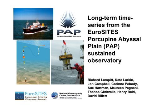
Long-term time- series from the EuroSITES Porcupine Abyssal Plain ...
Long-term time- series from the EuroSITES Porcupine Abyssal Plain ...
Long-term time- series from the EuroSITES Porcupine Abyssal Plain ...

Create successful ePaper yourself
Turn your PDF publications into a flip-book with our unique Google optimized e-Paper software.
<strong>Long</strong>-<strong>term</strong> <strong>time</strong><strong>series</strong><br />
<strong>from</strong> <strong>the</strong><br />
<strong>EuroSITES</strong><br />
<strong>Porcupine</strong> <strong>Abyssal</strong><br />
<strong>Plain</strong> (PAP)<br />
sustained<br />
observatory<br />
Richard Lampitt, Kate Larkin,<br />
Jon Campbell, Corinne Pebody,<br />
Sue Hartman, Maureen Pagnani,<br />
Thanos Gkritzalis, Henry Ruhl,<br />
David Billett
North<br />
60<br />
55<br />
50<br />
45<br />
40<br />
35<br />
30<br />
The <strong>Porcupine</strong> <strong>Abyssal</strong> <strong>Plain</strong><br />
Study site<br />
3000m 2000m<br />
JGOFS<br />
Madeira<br />
<strong>Abyssal</strong> <strong>Plain</strong><br />
1000m<br />
4000m<br />
Rockall Bank<br />
PAP<br />
Iberian<br />
<strong>Abyssal</strong> <strong>Plain</strong><br />
<strong>Porcupine</strong><br />
<strong>Abyssal</strong> <strong>Plain</strong><br />
Rockall Trough<br />
-25 -20 -15 -10 -5 0<br />
West<br />
200m<br />
1: <strong>Abyssal</strong> (4800m)<br />
2: Far <strong>from</strong> slope and ridge<br />
3: Flat seabed<br />
4: Close to EU ports<br />
5: Time <strong>series</strong> since 1989<br />
6. Surface to seafloor<br />
49°N, 16.5°W
Henson et al. 2009
PAP <strong>time</strong>-<strong>series</strong> data: Essential as validation of<br />
models for global open ocean processes
Chlorophyll<br />
(median) (μg/l)<br />
0.5<br />
Seasonal and Interannual variability at PAP<br />
2003 2004<br />
Chlorophyll Concentration<br />
over <strong>the</strong> <strong>Porcupine</strong> <strong>Abyssal</strong> <strong>Plain</strong><br />
(<strong>from</strong> SeaWIFFS weekly composites)<br />
Jan<br />
Feb<br />
Mar<br />
Apr<br />
May<br />
Jun<br />
Jul<br />
Aug<br />
Sep<br />
Oct<br />
Nov<br />
Dec<br />
2.0 1997<br />
1998<br />
1999<br />
1.5<br />
2000<br />
2001<br />
2002<br />
1.0<br />
2003<br />
2004<br />
0.0<br />
0 50 100 150 200 250 300 350<br />
Day Number<br />
(Mid-week)<br />
Primary<br />
productivity <strong>from</strong><br />
SeaWiFS<br />
Courtesy: Tim Smyth, PML
In order to monitor and<br />
understand <strong>the</strong> marine system<br />
we need to make sustained<br />
multidisciplinary observations<br />
at appropriate temporal<br />
resolution.
Sustained, high frequency, in situ <strong>time</strong>-<strong>series</strong><br />
at a fixed-point to study a range of temporal<br />
processes:<br />
• Short-<strong>term</strong> variation and ecosystem<br />
dynamics<br />
• Capture episodic events e.g. storm surges<br />
• <strong>Long</strong>-<strong>term</strong> change and climatic trends
-Remote sensing<br />
How can we understand this system?<br />
-Research cruises<br />
-Ships of opportunity<br />
-Lagrangian observatories<br />
-Eulerian observatories<br />
-Coupled models
Water column
Ships of Opportunity through <strong>Porcupine</strong> region<br />
CARBOOCEAN - CAVASSOO: CTD, CO 2, nutrients (manual)<br />
transects (green). 2000 – 2010.
Continuous<br />
Plankton Recorder (CPR)<br />
1948 - present<br />
North<br />
CPR sample locations<br />
-25 -20 -15 -10 -5 0<br />
60<br />
55<br />
50<br />
45<br />
40<br />
35<br />
30<br />
3000m 2000m<br />
Madeira<br />
<strong>Abyssal</strong> <strong>Plain</strong><br />
1000m<br />
Rockall Bank<br />
Iberian<br />
<strong>Abyssal</strong> <strong>Plain</strong><br />
Rockall Trough<br />
-25 -20 -15 -10 -5 0<br />
West<br />
200m
Eulerian observatories<br />
At PAP
Multidisciplinary autonomous sensors<br />
Fluorescence<br />
Downward particle flux<br />
Nutrients<br />
CO 2<br />
CTD<br />
Water<br />
currents
Instrument frame prior to<br />
Deployment in NE Atlantic<br />
Biofouling<br />
After 12 months at 45m depth<br />
NE Atlantic
Multidisciplinary <strong>time</strong>-<strong>series</strong><br />
Vertical coverage: Surface to seafloor<br />
• Temperature<br />
• Salinity<br />
• Currents<br />
• Nutrients<br />
• Chl-a<br />
• CO 2<br />
• O 2<br />
• Particle flux<br />
• Benthic biology<br />
• Geohazards<br />
Real-Time Telemetry
Nitrate<br />
(UV and<br />
wet<br />
chemistry)<br />
CO 2<br />
CTD<br />
Fluorometer<br />
(Chlorophyll-a)
PAP surface buoy with full data transmission capability<br />
deployed June 2007
PAP Data<br />
www.eurosites.info<br />
ftp://ftp.ifremer.fr/ifremer/oceansites/
PAP: pCO 2 2003-2004<br />
(Körtzinger et al. 2007)
Seasonal and inter-annual nitrate at <strong>the</strong> PAP site<br />
NO2+3 (mmol m-3)<br />
10<br />
8<br />
6<br />
4<br />
2<br />
0<br />
Nitrate data at PAP<br />
CAVASSOO (44N 10W) and in situ (NAS) (all data)<br />
2003 2004 2005<br />
1/7/02 1/1/03 1/7/03 1/1/04 1/7/04 1/1/05 1/7/05<br />
Time (d/m/yy)<br />
S.O.O.<br />
In situ (NAS)<br />
(Hartman et al.<br />
In press DSRII)<br />
At PAP <strong>the</strong> seasonal cycle is driven by deep winter mixing and<br />
phytoplankton growth.
PAP <strong>time</strong>-<strong>series</strong> <strong>time</strong> <strong>series</strong> 2009
Nitrate: ISUS – NAS comparison
Flourescence (Chl Chl-a): a): Wetlabs – Cyclops comparison
PAP Deployment May 2010<br />
• The mooring configuration is much more<br />
robust than <strong>the</strong> previous ones.<br />
� Basic layout is similar, materials and<br />
dimensions are different<br />
� Able to survive in harsh conditions<br />
(20 m waves, 25 m/s wind speed,<br />
1m/s current).
Collaboration with<br />
UK Met Office<br />
ODAS K-<strong>series</strong><br />
buoy array<br />
In May 2010 <strong>the</strong> array<br />
will now include PAP
Variable (*r-t) Depths measured (m) Sensor(s) used<br />
Temperature*<br />
Salinity *<br />
Chl-A * 30*<br />
Nitrate* 30*<br />
30*,40,60,75,90,110,130,150,20<br />
0,250,300,1000<br />
30*,40,60,75,90,110,130,150,20<br />
0,250,300,1000<br />
Microcat (Seabird SBE-37<br />
IMPs)<br />
Microcat (Seabird SBE-37<br />
IMPs)<br />
fluorometer (WETLabs<br />
FLNTUSB)<br />
NAS3 (Chemical), SATLANTIC<br />
ISUS (UV)<br />
PAR* (Irradiance) 30*<br />
Satlantic OCR-507 ICSW and<br />
OCR-507 R10W + Bioshutter2<br />
Dissolved CO2* 30* ProOceanus CO2-Pro<br />
Dissolved O2* 30* Aandera optode<br />
Current* 30* Aanderaa RCM<br />
Turbidity* 30* fluorometer (see above)<br />
Pressure*<br />
PAP ocean variables 2010<br />
30*40,60,75,90,110,130,150,20<br />
0,250,300,1000<br />
Microcat (Seabird SBE-37<br />
IMPs) + fluorometer (30m)<br />
POC 3000,3050,4700 McLane Sediment Trap<br />
Zooplankton sampler 30 McLane ZPS<br />
Total dissolved gas pressure 30 ProOceanus GTD-Pro
PAP science missions: Water Column<br />
e.g. Deep ocean oxygen consumption: CNRS<br />
lead <strong>the</strong> in situ measurement of oxygen<br />
dynamics (down to 6000 m depth) with an<br />
Oxygen Dynamic Auto-sampler (IODA6000).<br />
Deployments so far include at <strong>the</strong> cabled<br />
ANTARES site (at 2200m depth) and at <strong>the</strong><br />
PAP site (moored and drifting) in 2009.<br />
e.g. Mesozooplankton abundance: NOC,S<br />
lead. McLane ZPS deployed short-<strong>term</strong> in<br />
2009 and long-<strong>term</strong> in 2010.<br />
Moorings
Particle and export flux
Downward flux: From ocean interior to seafloor<br />
Sediment Trap mooring
Downward particle flux at <strong>the</strong> PAP site
Sampling <strong>the</strong><br />
abyssal<br />
seafloor at<br />
PAP
Bathysnap <strong>time</strong> lapse benthic camera system<br />
1989 to present -
Time lapse<br />
photographs<br />
Of <strong>the</strong> seabed at<br />
4000m on<br />
eastern side of<br />
PAP.<br />
Mound is<br />
18cm across.<br />
Lampitt<br />
1985
Wigham et al.
Science missions:<br />
Seafloor<br />
e.g. Benthic biology monitoring (NERC-<br />
NOCS)<br />
- Benthic fauna monitoring as indicators of<br />
climate change<br />
- Time-lapse camera system (digital)<br />
- ESONET-EMSO: <strong>Porcupine</strong> node
Bathysnap System 2010<br />
Bathysnap goes digital……<br />
IMENCO camera<br />
~4800m: Bathysnap camera system<br />
(<strong>time</strong>-lapse photography)<br />
•Phytodetritus % cover<br />
•Activity<br />
•Bioturbation rates<br />
•Abundance
In situ collaboration at PAP<br />
-ESONET DM MODOO, NE Atlantic<br />
-Link to existing <strong>EuroSITES</strong><br />
<strong>time</strong>-<strong>series</strong> infrastructure<br />
Mobile and mOdulary Deep Ocean<br />
Observatory (MODOO)<br />
� Link water column, seafloor, and sub-seafloor<br />
observatories for more comprehensive science<br />
applications.<br />
� Develogic acoustic telemetry<br />
� Partners: IFM-GEOMAR, NOCS, NIOZ, MRI,<br />
UNIAB, AWI<br />
� 350.000 €<br />
� May 2009 – October 2010<br />
� Associated project: MODOO Connect<br />
www.modoo.info
www.noc.soton.ac.uk/pap
Outputs and dissemination activities<br />
Promotion at meetings, popular press, media, exhibitions
DEEP-SEA RESEARCH II: PAP Special Volume<br />
Available Online <strong>from</strong> February 2010
PAP is part of a global OceanSITES network of Deep<br />
ocean Eulerian observatories
Contacts and Funding<br />
Coordinators:<br />
Richard Lampitt: rsl@noc.soton.ac.uk<br />
David Billett: dsmb@noc.soton.ac.uk<br />
Project office:<br />
Kate Larkin: kel1@noc.soton.ac.uk<br />
Data manager:<br />
Maureen Pagnani mred@noc.soton.ac.uk<br />
Funding:<br />
U.K. NERC Oceans2025 (Theme 10)<br />
EU FP7 CP <strong>EuroSITES</strong> (2008-2011)<br />
www.noc.soton.ac.uk/pap www.eurosites.info