

1. expedition ant-xxii/3 - CLIVAR & Carbon Hydrographic Data Office
1. expedition ant-xxii/3 - CLIVAR & Carbon Hydrographic Data Office
1. expedition ant-xxii/3 - CLIVAR & Carbon Hydrographic Data Office

You also want an ePaper? Increase the reach of your titles
YUMPU automatically turns print PDFs into web optimized ePapers that Google loves.
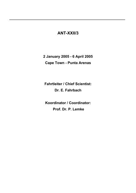
ANT-XXII/3<br />
2 January 2005 - 6 April 2005<br />
Cape Town - Punta Arenas<br />
Fahrtleiter / Chief Scientist:<br />
Dr. E. Fahrbach<br />
Koordinator / Coordinator:<br />
Prof. Dr. P. Lemke
3<br />
CONTENTS<br />
<strong>1.</strong> EXPEDITION ANT-XXII/3: Fahrtverlauf und<br />
Zusammenfassung 4<br />
EXPEDITION ANT-XXII/3: cruise narrative and summary 13<br />
2. Weather conditions 21<br />
3. Sea ice conditions 25<br />
4. Large scale processes and decadal variations in the<br />
Weddell Sea (Weddell Sea Convection Control, WECCON<br />
2005) 27<br />
5. Distribution of carbon dioxide in the Weddell gyre 63<br />
6. Air-sea CO2 fluxes in the Southern Ocean with CARIOCA<br />
buoys 66<br />
7. Dissolved barium distribution in the Antarctic Circumpolar<br />
Current and the Weddell Gyre 67<br />
8. Automatic detection of marine mammals in the vicinity of<br />
RV POLARSTERN 68<br />
9. Introduction to ANDEEP: 77<br />
Antarctic benthic DEEP-sea biodiversity - colonization<br />
history and recent community patterns (ANDEEP III)<br />
9.1 Meiobenthos 85<br />
9.2 Macrobenthos 107<br />
9.3 Megabenthos 160<br />
9.4 Depositional Environments 192<br />
10. Bathymetry 212<br />
1<strong>1.</strong> Acknowledgements 216<br />
APPENDIX 217<br />
A.1 Participating Institutions 218<br />
A.2 Cruise Particip<strong>ant</strong>s 222<br />
A.3 Ship's Crew 224<br />
A.4 Station list 226
<strong>1.</strong> EXPEDITION ANT-XXII/3: FAHRTVERLAUF UND<br />
ZUSAMMENFASSUNG<br />
Eberhard Fahrbach<br />
AWI Bremerhaven<br />
Am 22. Januar 2005 um 13:00 Uhr lief FS Polarstern von Kapstadt zur Antarktisreise<br />
ANT-XXII/3 aus. An Bord waren 57 Fahrtteilnehmer/innen aus 30 Instituten in 10<br />
Ländern. Zunächst führte der Kurs bis 34°11’S 14°33’E nach Westen. Dort wurde der<br />
erste Provor-Float ausgesetzt und FS Polarstern drehte nach Südwesten. Von nun<br />
an bis 53°00.3’S 00°02.1’E folgte der Kurs der Laufbahn des Jason-Satelliten. Mit 80<br />
Expendable Bathythermographs (XBT), die im Abstand von jeweils zwei Stunden<br />
geworfen wurden und die Wassertemperatur in den oberen 700 m der Wassersäule<br />
messen, dem Thermosalinographen, der Temperatur und Salzgehalt quasi<br />
kontinuierlich im Bugstrahlerschacht (6 m) und am Kastenkiel (11 m) misst, und dem<br />
Acoustic Doppler Current Profiler (ADCP), der die Meeresströmung vom fahrenden<br />
Schiff aus erfasst, fanden ozeanographische Messungen auf der Kurslinie statt, auf<br />
der der Jason-Satellit mit einem Altimeter die Auslenkung der Meeresoberfläche<br />
misst. Entlang der Kurs-Linie wurden im Rahmen des GOODHOPE-Projekts 9<br />
weitere Provor-Floats (vertikal profilierende Driftkörper) ausgelegt. Ein weiterer Drifter<br />
wurde im Rahmen des französischen CARIOCA-Programms ausgebracht. Ferner<br />
wurden 2 Bodendruckmesser mit nach oben schauendem Echolot (PIES) aufgenommen<br />
und 3 wieder neu ausgelegt. Die Arbeiten des Tiefsee-Biologieprogramms<br />
ANDEEP III begannen am 25. Januar bei 41°08’S 09°55’E und einer Wassertiefe von<br />
4725 m im Kapbecken mit einer sedimentprofilierenden Kamera (SPI), 3 Großkastengreifern<br />
(GKG), 3 Multicorern (MUC), dem Epibenthosschlitten (EBS) und dem<br />
Agassiz-Trawl (AGT). Eine zweite Station erfolgte südwestlich des Meteor-Rückens<br />
mit der gleichen Gerätepalette am 28. Januar bei 47°40.0’S 04°15’E in 4560 m<br />
Wassertiefe. Das Bathymetrie-Programm fand aufgrund der Auflagen des Umweltbundesamts<br />
nur in sehr eingeschränkter Form statt. Auf der Anreise und der Abreise<br />
konnte ein Teil des gepl<strong>ant</strong>en deutschen Bathymetrie-Programms ausgeführt<br />
werden. Es musste bei 60°S beendet werden. Südlich davon wurde aufgrund der<br />
Auflagen des Umweltbundesamts nur noch das russische Programm ausgeführt.<br />
Bei 53°S erreichte FS Polarstern den Meridian von Greenwich. Von da an führte der<br />
Kurs direkt nach Süden und das ozeanographische Hauptprogramm im Rahmen von<br />
WECCON (WEddell Sea Convection CONtrol) wurde mit Messungen mit der CTD-<br />
Sonde (conductivity, temperature, depth = Leitfähigkeit, Temperatur, Tiefe) und der<br />
Aufnahme und Wiederauslegung von Verankerungen durchgeführt. Auf diesem<br />
Schnitt wurden 43 CTD-Messungen in 30 sm Abstand ausgeführt. Über stark veränderlicher<br />
Topographie wurde der Stationsabstand verringert. Zusätzlich zu den CTD-<br />
Messungen wurden Wasserproben genommen, um die Konzentration von gelösten<br />
Nährstoffen, Sauerstoff, FCKWs, Barium und CO2 zu messen. Die FCKW-Proben<br />
wurden eingeschweißt und werden im Bremer Institut für Umweltphysik gemessen.<br />
Einen wesentlichen Anteil des Programms der physikalischen Ozeanographie stellte<br />
die Aufnahme und Auslegung von Verankerungen dar. Auf dem Greenwich-Meridian<br />
wurden 8 Verankerungen aufgenommen und 9 ausgelegt. Eine Verankerung konnte<br />
4
<strong>1.</strong> EXPEDITION ANT-XXII/3: FAHRTVERLAUF UND ZUSAMMENFASSUNG<br />
nicht wieder gefunden werden. Bei den Verankerungsarbeiten hat sich das schiffseigene<br />
POSIDONIA-System vielfach bewährt. Die genaue Verfolgung des Absinkens<br />
bei der Auslegung und des Aufsteigens bei der Aufnahme stellen einen erheblichen<br />
Gewinn an Sicherheit für die Wiederaufnahme und Genauigkeit bei der räumlichen<br />
Zuordnung der Daten dar. Die Verankerungen enthalten Strömungs-, Temperaturund<br />
Leitfähigkeitsmessgeräte, Schallquellen zur Ortung von Driftkörpern und Eisecholote<br />
(upward looking sonar, ULS) zur Messung der Eisdicke. Auf dem Meridian<br />
von Greenwich wurden 22 APEX- (Profiling Autonomous Lagrangian Circulation Explorers)<br />
und NEMO-(Navigating European Marine Observer) Driftkörper (Floats) ausgebracht.<br />
Zur Qu<strong>ant</strong>ifizierung des Süßwassereintrags durch Eisberge wurden im<br />
südlichen Weddellmeer 5 Eisberge mit Satellitensendern ausgestattet, die mit dem<br />
Hubschrauber auf Eisbergen abgesetzt wurden.<br />
-<br />
-<br />
-<br />
-<br />
-<br />
Abb. <strong>1.</strong>1: Karte des Fahrtgebiets und Fahrtroute der FS Polarstern-Reise ANT-XXII/3<br />
vom 22. Januar bis zum 6. April 2005<br />
Fig. <strong>1.</strong>1: Map of the area of observations and cruise track during RV Polarstern leg ANT-XXII/3 from<br />
22 January to 6 April 2005<br />
5<br />
-<br />
-<br />
-<br />
-<br />
-
ANT-XXII/3<br />
Am 9. Februar wurden bei 67°S die Arbeiten auf dem Meridian von Greenwich unterbrochen,<br />
um zur Neumayer-Station abzulaufen. Am 25. Januar war das deutsche<br />
Polarflugzeug POLAR 4 auf dem Rückflug nach Deutschland bei einer harten Landung<br />
an der britischen Station Rothera zu Bruch gegangen und konnte den Flug<br />
nicht mehr fortsetzen. Dadurch wurde es notwendig, das Expeditionsprogramm der<br />
FS Polarstern zu ändern. Dabei war zu berücksichtigen, dass der Umweg über<br />
Rothera ohne zu große Einschnitte für das wissenschaftliche Programm erfolgen<br />
sollte. Als erste Möglichkeit der Zeitersparnis wurde die Versorgung der Neumayer-<br />
Station um einige Tage nach hinten verschoben. Dies brachte einen erheblichen<br />
Zeitgewinn mit sich, da das verkürzte Hin- und Zurücklaufen doppelt einging. Ferner<br />
wurde die Bergung einer Verankerung östlich der Maudkuppe aus dem Programm<br />
genommen. Auf dem Weg zur Neumayer-Station wurde am 10. Februar bei<br />
69°30’S 5°23’W eine Amphipodenfalle ausgebracht und in der Nähe ein Hol mit dem<br />
Agassiz-Trawl ausgeführt.<br />
Am 1<strong>1.</strong> Januar erreichte FS Polarstern bei strahlendem Sonnenschein – nach Auflösung<br />
des morgendlichen Seerauchs - die Atkabucht. Schnell war ein passender Anlegeplatz<br />
an der Rampe gefunden. In unmittelbarer Nachbarschaft fand auch das<br />
südafrikanische Versorgungsschiff SA Agulhas einen geeigneten Platz, um Versorgungsgüter<br />
und Fahrzeuge von der 227 km entfernten südafrikanischen Station<br />
SANAE zu laden. Die Versorgungsaufgaben der FS Polarstern konnten zügig<br />
durchgeführt und noch am Abend abgeschlossen werden. Etwa 150 Kubikmeter<br />
Treibstoff wurde in Tankcontainer für die Station gefüllt. Eine Schneefräse,16<br />
Container und mehrere Schlitten mit 120 Tonnen Gewicht wurden geladen. Ein<br />
Fahrtteilnehmer des SANAP ging von Bord, um in SANAE zu überwintern. Während<br />
der Beladung hatten die Fahrtteilnehmer die Gelegenheit, die Neumayer-Station zu<br />
besuchen. Das wunderbare Wetter brachte viele dazu, den 8 km langen Weg,<br />
zumindest in einer Richtung, zu Fuß zurück zu legen. Die Helikopter waren im<br />
Einsatz, um Geräte und Personen zu transportieren. Sie waren besonders hilfreich,<br />
um die Arbeiten an einer Außenstation in der Nähe der Schelfeisk<strong>ant</strong>e<br />
durchzuführen. Hier soll in Zukunft mit einem Hydrophon den Geräuschen aus dem<br />
Meer gelauscht werden, wobei diese direkt nach Bremerhaven übertragen werden<br />
sollen. In der jetzt erreichten Vorstufe werden allerdings erst der automatische<br />
Betrieb und die Datenübertragung getestet, die besonders im Winter eine<br />
Herausforderung darstellen. Wenn sich das System als zuverlässig erwiesen hat,<br />
wird ein Loch durch das Schelfeis gebohrt und das Hydrophon in das Meerwasser<br />
darunter versenkt.<br />
Am frühen Abend waren die Lade- und Pumparbeiten abgeschlossen, und Besatzung<br />
und Wissenschaft konnte den sonnigen Abend auf dem Eis mit einer kleinen<br />
Feier zu Verabschiedung der Überwinterer genießen. Zu unseren Gästen von der<br />
Neumayer-Station gesellten sich noch Besatzungsmitglieder der SA Agulhas hinzu.<br />
Sie mussten mit dem Helikopter abgeholt und wieder zurück gebracht werden, da die<br />
SA Agulhas nach Abschluss ihrer Ladearbeiten den Eisrand verlassen hatte und nun<br />
im freien Wasser der Bucht lag. Weitere Gäste waren die Besatzung der DC3 und<br />
eine Gruppe finnischer Forscher, die mit einem Flugzeug der ALCI eingetroffen war.<br />
Zusammen mit den deutschen Teilnehmern der Sommerkampagne und den noch an<br />
6
<strong>1.</strong> EXPEDITION ANT-XXII/3: FAHRTVERLAUF UND ZUSAMMENFASSUNG<br />
der Station befindlichen Überwinterern des Vorjahrs sollten alle über die russische<br />
Novolazarewskaya-Station nach Kapstadt fliegen.<br />
Für den 12. Februar war die Treibstoffübernahme von der SA Agulhas gepl<strong>ant</strong>, die<br />
den zusätzlichen Verbrauch für den Umweg über Rothera sicherstellen sollte. Doch<br />
das Wetter hatte sich geändert. Der Wind trieb so viel Eis vor die Rampe, dass hier<br />
das Tankmanöver nicht wie gepl<strong>ant</strong> möglich war. FS Polarstern fand im Süden der<br />
Bucht einen anscheinend akzeptablen Platz an der Eisk<strong>ant</strong>e. Doch auch hier stellte<br />
sich heraus, dass die angetriebenen Eisschollen die Betankung nicht erlaubten. Ein<br />
weiterer Versuch erfolgte im Osten der Bucht mit Unterstützung durch die Hubschrauber.<br />
Hier schien die Schelfeisk<strong>ant</strong>e zuerst dazu geeignet, beide Schiffe parallel<br />
zueinander mit der Nase an das Eis zu legen, um so eine sichere Lage zu gewährleisten.<br />
Ein Abbruch an der K<strong>ant</strong>e machte aber deutlich, dass auch dies keine<br />
sichere Position war. Schließlich erfolgte die Betankung im offenen Wasser. FS<br />
Polarstern fuhr in langsamer Fahrt voraus, die SA Agulhas hinterher. Zuerst wurde<br />
eine Leinenverbindung hergestellt, dann ein Schlauch gelegt und schließlich gepumpt.<br />
Am späten Abend war die Aktion beendet und FS Polarstern hatte 170<br />
Tonnen Treibstoff erhalten. Mit Hornsignalen verabschiedeten sich die beiden<br />
Schiffe. FS Polarstern lief in Richtung Nordosten ab. Am 13. Februar wurde die<br />
Amphipodenfalle, die bei der Anreise ausgelegt worden war, wieder aufgenommen.<br />
Der Schnitt auf dem Meridian von Greenwich wurde am 14. Februar bei 67°30’S mit<br />
einer weiteren ANDEEP-Station fortgesetzt, die bis zum 16. Februar dauerte. Mit<br />
CTDs, dem Aussetzen von Floats und dem Austausch von Verankerungen erfolgte<br />
die Fortsetzung nach Süden. Bei 69°15’S fand am 18. Februar die letzte Station auf<br />
dem Greenwich-Meridian-Schnitt in Sichtweite des Fimbul-Schelfeises statt. Bei<br />
69°01’S waren wir das erste Mal auf eine geschlossene Meereisfläche getroffen.<br />
Nach Abschluss der ersten Phase des Programms auf dem Meridian von Greenwich<br />
lief FS Polarstern nach Westen in Richtung Atkabucht ab. Bei etwa 70°32’S 9°2’W<br />
sollten zwei Fischfallen und eine Amphipodenfalle geborgen werden, die vor einem<br />
Jahr wegen der Eisverhältnisse nicht aufgenommen werden konnten. Trotz guter<br />
Verhältnisse konnte nur eine Fischfalle gefunden werden. Aufgrund des Zustands<br />
der geborgenen Falle muss angenommen werden, dass die anderen beiden Fallen<br />
durch Korrosion verloren gegangen sind. Der Bergungsversuch einer Verankerung<br />
mit Sinkstofffallen bei 70°57’S 10°33’W am 19. Februar war ebenfalls nicht erfolgreich.<br />
Hier liegt es nahe, dass diese Verankerung das Opfer eines der zahlreichen<br />
Eisberge wurde.<br />
Die zweite Phase der physikalischen und biologischen Arbeiten zwischen Kapp<br />
Norvegia und der Nordspitze der Antarktischen Halbinsel begann am 20. Februar bei<br />
71°18’S 13°57’W. Hier lag der Schwerpunkt der tiefseebiologischen Arbeiten mit 9<br />
großen Stationen im Rahmen von ANDEEP III. Vier dieser Stationen fanden am<br />
Kontinentalabhang vor Kapp Norvegia in 1040, 2170, 3090 und 4410 m Wassertiefe<br />
statt. Dieser Schnitt war am 24. Februar beendet. Die Arbeiten der physikalischen<br />
Ozeanographie gingen mit 54 CTD-Stationen in etwa 30 sm Abstand und der Auslegung<br />
von 3 Verankerungen und 18 Floats weiter. Bei 68°04’S 20°28’W in 4933 m,<br />
66°37’S 27°10’W in 4892 m, 65°34’S 36°31’W in 4802 m und 65°00’S 43°02’W in<br />
7
ANT-XXII/3<br />
4701 m Tiefe fand jeweils eine weitere ANDEEP-Station statt. Am 1<strong>1.</strong> März erreichten<br />
wir bei 64°30’S 45°15’W das erste Mal auf der Reise ausgedehnte Meereisfelder,<br />
die zeitweise zu einer merklichen Reduzierung der Fahrtgeschwindigkeit<br />
führten. Sie waren Teil einer Eiszunge, die sich über dem Kontinentalabhang vom<br />
südlichen Weddellmeer bis in das Powellbecken erstreckte. Zwar nahm die Eisbedeckung<br />
zum Schelf hin deutlich ab, war aber stärker als in den Satellitenbildern<br />
wiedergegeben. Bei 63°41’S 50°44’W erfolgte am 14. März eine weitere ANDEEP-<br />
Station. Der westlichste Punkt auf dem Schnitt durch das Weddellmeer wurde am 16.<br />
März bei 63°04’S 54°37’W und 440 m Wassertiefe erreicht.<br />
Die verhältnismäßig geringe Eisbedeckung und das sehr ruhige Wetter hatten es ermöglicht,<br />
die Arbeiten auf dem Weddellmeer-Schnitt so zügig durchzuführen, dass<br />
noch genügend Zeit verblieb, um die als Option gepl<strong>ant</strong>en Arbeiten im Powellbecken<br />
auszuführen. Sie bestanden aus einen CTD-Schnitt von 63°04’S 54°37’W bis<br />
61°39’S 46°33’W mit 20 Profilen und drei ANDEEP-Stationen in 3405, 2000 und<br />
1180 m Tiefe auf der östlichen Seite des Beckens. Bis 62°02’S 48°45’W mussten die<br />
Ausläufer der Eiszunge aus dem Weddellmeer durchquert werden. Auch dieser Abschnitt<br />
der Reise konnte unter optimalen Wetterbedingungen zügig durchgeführt<br />
werden. Am 2<strong>1.</strong> März waren die Arbeiten im Powellbecken abgeschlossen und FS<br />
Polarstern lief in die Bransfieldstraße ab. Einen Teil der Strecke mussten wir gegen<br />
Westwind der Stärke 8 und den entsprechenden Seegang anfahren.<br />
Allerdings beruhigte sich das Wetter bis zu unserer Ankunft in der Maxwellbucht am<br />
23. März wieder. Am Ufer des angrenzenden Potter Coves liegt die argentinische<br />
Jubany-Station, der das deutsche Dallmann-Labor angeschlossen ist. Obwohl wir<br />
deutlich früher als erwartet angekommen waren, waren dort die Vorbereitungen so<br />
weit voran geschritten, dass wir die günstigen Wetterbedingungen nutzen und sofort<br />
mit den Helikopterflügen zur Beladung beginnen konnten. Neben den Transporten<br />
vom Dallmann-Labor waren auch Transporte von der von Uruguay betriebenen<br />
Station Base Cientifica Antárctica Artigas und der russischen Station Bellingshausen<br />
zur FS Polarstern notwendig. Ganz zum Schluss brachten wir noch Teilnehmer der<br />
Sommerkampagne nach Bellingshausen, wo sie warteten, bis ihr Flug nach Hause<br />
abging. Zwei weitere Fahrtteilnehmer, ein argentinischer Bobachter und ein<br />
Logistiker des AWI, die uns für den Rest der Reise begleiteten, kamen an Bord.<br />
Während dieser Transportaufgaben war es möglich, durch Besuche der Fahrtteilnehmer<br />
an mehreren Stationen und von Bewohnern der Jubany- und der Artigas-<br />
Stationen an Bord die freundschaftlichen Beziehungen zu pflegen. Überall wurden<br />
wir herzlich empfangen. Während der Nacht und einer Schlechtwetterphase am<br />
Vormittag nutzten wir die Zeit, um in der Bransfieldstraße eine weitere ANDEEP-<br />
Station in 1995 m Tiefe zu beginnen. Sie wurde nach dem Abschluss der Versorgungsarbeiten<br />
fortgesetzt. In der Nacht zum 24. März liefen wir in Richtung der<br />
britischen Station Rothera ab.<br />
Am 24. März passierten wir Deception-Insel, doch die Insel verbarg sich hinter einer<br />
Nebelwand. Die Akustikgruppe nutzte die lange Dampfstrecke, um den Streamer zu<br />
schleppen und Walgeräusche aufzunehmen. Die Wetterbedingungen während der<br />
Dampfstrecke waren nicht sehr viel versprechend, und wir bereiteten uns auf eine<br />
längere Wartezeit vor. Am 25. März erreichten wir die Marguerite-Bucht und lagen<br />
8
<strong>1.</strong> EXPEDITION ANT-XXII/3: FAHRTVERLAUF UND ZUSAMMENFASSUNG<br />
vor Rothera Point. Das Wetter hatte sich erstaunlich verbessert. Nachdem schon<br />
eine Gruppe britischer Fahrtteilnehmer im Laufe des Tages voraus geflogen war, um<br />
lebende Muscheln von Jubany nach Rothera zu bringen, erfolgte das erste offizielle<br />
Zusammentreffen mit unseren britischen Partnern am Abend auf der FS Polarstern.<br />
Wir hatten den Kapitän der RSS Ernest Shackleton, die vor Rothera an der Pier lag,<br />
und den Stationsleiter zu einem Besuch eingeladen. Auch hier war sofort ein freundschaftliches<br />
Verhältnis aufgebaut, und die Aktionen des folgenden Tages konnten<br />
ausführlich gepl<strong>ant</strong> und vorbereitet werden, bis der Helikopter unsere Gäste bei Einbruch<br />
der Dunkelheit wieder zurück brachte. Dann kam schließlich am 26. März der<br />
große Tag, auf den unsere ganze Fahrtplanung ausgerichtet werden musste, nämlich<br />
die Übernahme der POLAR 4. Sie wurde dadurch erschwert, dass die Wassertiefe<br />
an der Pier für FS Polarstern nicht ausreichend ist und wir das Flugzeug mit<br />
Hilfe der RSS Ernest Shackleton übernehmen mussten. Wieder verwöhnte uns das<br />
Wetter, kein Wind und Sonnenschein schufen optimale Bedingungen. Die RSS<br />
Ernest Shackleton lud die Tragfläche und den Flugzeugrumpf an der Pier. Dann<br />
legten sich FS Polarstern und RSS Ernest Shackleton 0,85 sm von der Pier im<br />
offenen Wasser parallel nebeneinander. Die Flugzeugteile konnten in 22 Minuten mit<br />
unserem 15-to-Kran auf dem Helikopterdeck der FS Polarstern abgestellt werden.<br />
Während der Übernahme waren die Fahrtteilnehmer bereits an Land und genossen<br />
die britische Gastfreundschaft, die wir am Nachmittag mit einer Einladung auf die FS<br />
Polarstern zu Bier und Würstchen erwiderten. Am 26. März um 19:00 Uhr liefen wir<br />
mit einem weiteren Fahrtteilnehmer, einem Techniker der DLR, der zur Beladung<br />
nach Rothera gekommen war, an Bord ab. Die Polartaufe und das Osterfest verbrachten<br />
wir vom schlechten Wetter geschützt in der Gerlache-Straße auf dem Weg<br />
zu den letzten Stationen dieser Reise.<br />
Vom 29. bis zum 3<strong>1.</strong> März fanden bei 63°19’S 64°37’W in 2080 m und bei 62°31’S<br />
64°39’W in 3802 m Tiefe zwei weitere ANDEEP-Stationen statt. Sie waren westlich<br />
der Drakestraße und des Hero-Bruchzone im Pazifik gelegen und konnten interess<strong>ant</strong>es<br />
Vergleichsmaterial liefern. Den Abschluss der Arbeiten bildete ein CTD-<br />
Schnitt durch die östliche Drakestraße entlang des Shackleton-Bruchzone von<br />
60°53’S 53°50’W nach 55°04’S 65°04’W, der am 4. April abgeschlossen war.<br />
Während der gesamten Reise wurden hydroakustische Messungen und Infrarot-Beobachtungen<br />
ausgeführt, die zur Weiterentwicklung eines Systems beitragen, das es<br />
erlaubt, Warmblüter zu orten. Damit soll ermöglicht werden, in Zukunft die Auflagen<br />
des Umweltbundesamts zu erfüllen und unterschiedliche hydroakustische Messverfahren<br />
von FS Polarstern aus einzusetzen.<br />
Die wissenschaftlichen Arbeiten wurden durch Programme zur Öffentlichkeitsarbeit<br />
begleitet, zu dem auch ein Expeditionsmaler gehört, der die Stimmung jeden Tages<br />
mit einem Ölbild festhielt. Ferner wurde der Verlauf der Reise auf der AWI-Web-site<br />
eXpeditions site file/ext/www-bhv/Polar/Polarstern/ANT-XXII-3/ExpeditionSummary,<br />
der CeDAMar-site www.cedamar.org und bei Senckenberg dokumentiert.<br />
Am 6. April 2005 lief FS Polarstern um 08:00 Uhr in Punta Arenas ein.<br />
9
ANT-XXII/3<br />
Die Arbeiten der Tiefsee-Biologie sind in das ANDEEP-III-Projekt (ANtarctic benthic<br />
DEEP-sea biodiversity: colonization history and recent community patterns) eingebunden,<br />
das ein internationales Projekt zur Erforschung der Biologie von Tiefseeorganismen<br />
im Scotia- und Weddellmeer darstellt. Das ANDEEP-Projekt wurde ins<br />
Leben gerufen, um das Ökosystem Tiefsee im Südlichen Ozean zu charakterisieren.<br />
Die Hauptziele sind, den Einfluss der Habitatvielfalt des Meeresbodens auf die biologische<br />
Vielfalt zu untersuchen und festzustellen, ob und in welchem Maße das<br />
Scotia- und das Weddellmeer Ursprungsgebiete für das Benthos angrenzender Tiefwassergebiete<br />
sind. Im Verlaufe von ANDEEP I und II im Sommer 2002 waren<br />
bereits mehrere Gebiete im Atl<strong>ant</strong>ischen Sektor beprobt worden. In ANDEEP III<br />
wurde die Probennahme fortgesetzt und so ein unvergleichbarer Datensatz<br />
geschaffen.<br />
Die Tiefsee des Scotia- und des Weddellmeeres gehört zu den am wenigsten untersuchten<br />
Gewässern der Weltozeane, und wir wissen nahezu nichts über die dort am<br />
und im Boden lebenden Tiere. Erste Ergebnisse von ANDEEP I und II haben<br />
Eindrücke über die Artenzusammensetzung und mögliche Wege der Evolution der<br />
Tiefseefauna des Südlichen Ozeans vermittelt. ANDEEP III hat unsere bisher<br />
gewonnenen Erkenntnisse vertieft, und zwar in einem erweiterten<br />
Untersuchungsgebiet, das außer dem Becken des Weddellmeers das Powellbecken,<br />
die Bransfieldstraße, die südwestliche Drakestraße und auch das Kapbecken<br />
umfasste.<br />
ANDEEP ist eines von zwei Projekten, die den ursprünglichen deutschen Beitrag zu<br />
CeDAMar (Census of the Biodiversity of Abyssal Marine Life) leisten. CeDAMar ist<br />
ein für zehn Jahre ausgelegtes Projekt, das der Erforschung benthischer Lebensgemeinschaften<br />
in den Becken des Atl<strong>ant</strong>iks von Pol zu Pol gewidmet ist und gehört zu<br />
dem weltweiten Programm CoML (Census of Marine Life), das 2000 gegründet<br />
wurde und bis 2010 dauern soll. Bislang sind Wissenschaftler aus mehr als 70 Nationen<br />
beteiligt, die mit standardisierten Methoden Proben nehmen und eine globale<br />
Datenbank zusammenstellen, die als frei zugängliche Referenz für spätere Untersuchungen<br />
dienen soll. Mit CeDAMar soll versucht werden, Taxonomie und Systematik<br />
wieder als zentrale Disziplinen der Biologie zu etablieren. Artbeschreibungen gehören<br />
zu den zentralen Aufgaben, die CeDAMar sich gestellt hat.<br />
Um ein möglichst vollständiges Bild über die bodenlebenden Organismen zu erhalten<br />
wurden verschiedene Geräte standardisiert eingesetzt. Die CTD für Messungen der<br />
Temperatur, des Salzgehalts, der Dichte und der Nährstoffe des Wassers, in dem<br />
diese Tiere leben. Mit einer Sedimentprofilkamera (SPI) wurden Organismen und<br />
ihre Lebensspuren auf dem Meeresboden anhand von Fotos identifiziert. Ihre<br />
Grabspuren und die Korngrößen und Qualität des Sedimentes wurden<br />
aufgezeichnet. Die Eindringtiefe des Sauerstoffes in das Sediment wurde gemessen,<br />
um zu zeigen, bis in welche Tiefen im Sediment grabende Organismen überhaupt zu<br />
erwarten sind. Ein Gerätepark bestehend aus Multicorer, Großkastengreifer,<br />
Epibenthosschlitten und Agassiz-Trawl wurde eingesetzt, um Organismen ganz verschiedener<br />
Größenklassen zu sammeln und zu bearbeiten, von den kleinsten<br />
Formen, die im Sandlückensystem leben bis hin zu den großen Tieren, die man auf<br />
den Unterwasserfotos erkennen kann.<br />
10
<strong>1.</strong> EXPEDITION ANT-XXII/3: FAHRTVERLAUF UND ZUSAMMENFASSUNG<br />
Insgesamt wurden 18 ANDEEP-Stationen ausgeführt, bei denen jeweils eine CTD,<br />
die SPI, mindestens je zwei GKGs (Großkastengreifer) und zwei MUCs (Multicorer)<br />
eingesetzt wurden sowie die geschleppten Geräte, der Epibenthosschlitten und das<br />
Agassiz-Trawl. Bei fast allen ANDEEP-Stationen wurde außerdem eine Amphipodenfalle<br />
(AT) ausgelegt. Diese Stationen verteilten sich über verschiedene<br />
Schnitte. Ein Schnitt wurde entlang des Greenwich-Meridians nach Süden mit je<br />
einer Station im Kapbecken, im Agulhasbecken und im nördlichen Weddellmeer-<br />
Becken südwestlich der Maudkuppe genommen. Ein weiterer Schnitt mit Stationen in<br />
ca. 1000 m, 2000 m, 3000 m und 4000 m Tiefe erfolgte vor Kapp Norvegia in das<br />
tiefe Weddellmeer. Ein dritter Schnitt führte durch das tiefe Weddellmeer und<br />
bestand aus 5 Stationen, wobei sich eine Station im Ausstrom des Weddellmeer-<br />
Bodenwassers befand. Ein weiterer Schnitt aus drei Stationen erfolgte im Powell<br />
Becken in 1000 m, 2000 m und 3000 m. Danach wurden noch eine Station in der<br />
Bransfieldstraße in 2000 m Tiefe sowie zwei Stationen vor Anvers Island in 2000 und<br />
4000 m Tiefe beprobt.<br />
Das Ziel des WECCON-Programms (Weddell Sea convection control) der physikalischen<br />
Ozeanographie besteht darin, die Bedeutung des atl<strong>ant</strong>ischen Sektors des<br />
Südlichen Ozeans für die großräumigen klimatischen Bedingungen besser zu verstehen.<br />
Die Intensität und Struktur der thermohalinen Zirkulation bestimmen die Rolle<br />
des Ozeans für das Klima. Im atl<strong>ant</strong>ischen Sektor des <strong>ant</strong>arktischen zirkumpolaren<br />
Wassergürtels wird die globale Zirkulation durch die Bildung von Antarktischem<br />
Bodenwasser beeinflusst. Messungen im Tiefen- und Bodenwasser des<br />
Weddellmeeres haben gezeigt, dass sich seine Eigenschaften im Zeitraum der<br />
letzten 10 bis 15 Jahren merklich verändert haben. Zum Ende der 80er Jahre fanden<br />
eine Erwärmung und Salzgehaltszunahme des von Norden einströmenden Zirkumpolaren<br />
Tiefenwassers statt. Im weiteren Verlauf wurde die Temperaturzunahme in<br />
den tieferen Schichten des Boden- und Tiefenwassers sichtbar und breitete sich bis<br />
in das westliche Weddellmeer aus. Inzwischen ist die Erwärmung im Zirkumpolaren<br />
Tiefenwasser des Weddellmeeres zum Stehen gekommen und wurde von einer<br />
merklichen Abkühlung gefolgt, im Bodenwasser hält die Erwärmung aber weiter an.<br />
Die Variationen in den verschiedenen Meeresgebieten können hypothetisch als Teile<br />
einer längerfristigen Wirkungskette interpretiert werden. Die Wassermassencharakteristik<br />
im Weddellmeer hängt vom Zustrom aus dem Antarktischen Zirkumpolarstrom<br />
ab. Er erfolgt allerdings nicht nur im östlichen Weddellmeer, wie früher angenommen,<br />
sondern auch schon westlich des Meridians von Greenwich. Vermehrter Einstrom<br />
kann zur Erwärmung im Weddellmeer führen. Andererseits ist in der Folge der<br />
großen Weddell-Polynja der 70er Jahre das Tiefenwasser im Weddellmeer durch<br />
Konvektion im offenen Ozean abgekühlt worden und wird nun wieder durch<br />
wärmeres ersetzt. Demnach wäre die gegenwärtige Erwärmung eine Reaktion auf<br />
ein vorhergehendes Abkühlungsereignis.<br />
Da die Entstehung der großen Weddellmeer-Polynja noch nicht geklärt ist, kann nicht<br />
ausgeschlossen werden, dass sie durch Veränderungen im Einstrom von Zirkumpolarem<br />
Tiefenwasser ausgelöst wurde, indem die Stabilität der Wassersäule abnahm.<br />
Fluktuationen des Einstroms könnten durch die Variation der atmosphärischen An-<br />
11
ANT-XXII/3<br />
triebsbedingungen ausgelöst werden, die z. B. im Rahmen der Antarktischen Zirkumpolaren<br />
Welle, des Südlichen Ringmodes oder des Antarktischen Dipols auftreten.<br />
Andererseits könnten aber auch lokale Veränderungen der Antriebskräfte im<br />
Weddellmeer von Bedeutung sein.<br />
Die Wassermassenformation erfordert, dass warmes, salzreiches Wasser in größerer<br />
Tiefe in den <strong>ant</strong>arktischen Bereich einströmt, dort durch Auftrieb in der Antarktischen<br />
Divergenz an die Oberfläche kommt und im Kontakt mit der Atmosphäre abgekühlt<br />
wird, bis die Dichtezunahme das Absinken ermöglicht. Der Süßwassergewinn durch<br />
Niederschlag und durch den Zustrom von Schmelzwasser vom Kontinent, der zum<br />
Teil durch das Abbrechen von Eisbergen erfolgt, führt aber zur Dichteabnahme, die<br />
erst durch Salzfreisetzung bei der Meereisbildung kompensiert werden muss, bevor<br />
die Boden- oder Tiefenwasserbildung einsetzen kann. Daher ist der Salz- oder Süßwasserhaushalt<br />
von besonderer Bedeutung.<br />
Im Rahmen globaler Programme haben unsere Messungen das Ziel, einen mittleren<br />
Zustand des Weddellmeer-Systems und dessen Veränderlichkeit zu charakterisieren,<br />
um über die regionalen Untersuchungen hinaus globale Zusammenhänge zu beschreiben.<br />
Ferner sollen die Daten großräumigen Modellrechnungen als südliche<br />
Randbedingung dienen und zur Validierung regionaler Modelle herangezogen werden.<br />
Da sich gezeigt hat, dass merkliche Veränderungen des Systems über einen<br />
Zeitraum von Dekaden erfolgen, erfordert die Untersuchung der Ursachen und der<br />
Auswirkungen dieser Fluktuationen Wiederholungsmessungen hoher Qualität über<br />
einen entsprechenden Zeitraum.<br />
Die physikalischen Untersuchungen auf hydrographischen Schnitten entlang dem<br />
Meridian von Greenwich, durch das Weddellmeer von Kapp Norvegia nach Joinville<br />
Island, durch das Powellbecken und über die Drake-Straße wurden durch ein Programm<br />
zur Messung von Tracern (FCKWs) erweitert, die zur Wassermassencharakterisierung<br />
herangezogen werden. Der Beitrag des atl<strong>ant</strong>ischen Sektors des<br />
Südpolarmeers als Quelle oder Senke im globalen Kohlenstoffkreislauf wurde in<br />
einem Projekt zur Messung von Nährstoffen und den Komponenten des CO2-<br />
Systems bearbeitet.<br />
Das Ausbringen der Floats erfolgte im Rahmen des internationalen ARGO-Programms,<br />
das zum Global Ocean Observing System (GOOS) beiträgt. Ziel des internationalen<br />
ARGO-Projekts ist es, permanent ca. 3000 profilierende Floats (Messung<br />
von Druck, Temperatur und Salzgehalt) im Weltozean zu unterhalten. Im Rahmen<br />
dieses Projekts wurden während der Expedition 40 Floats (10 GOODHOPE, 9<br />
MERSEA und 21 deutsches ARGO) hauptsächlich in Regionen, in denen bisher<br />
keine Floatdaten vorhanden waren, ausgelegt. Die 30 AWI-Floats (MERSEA/dt.<br />
ARGO) sind alle mit einem Meereis-Erkennungsalgorithmus ausgestattet, um ein<br />
Auftauchen zwischen Eisschollen, die die Floats zerstören könnten, zu verhindern.<br />
Bis zum 28.03.05 wurden 84 Profile, die sich in sehr guter Übereinstimmung mit in<br />
der Nähe liegenden CTD-Messungen befinden, übermittelt.<br />
Die WECCON-Arbeiten fanden im Rahmen des BMBF-Verbundes <strong>CLIVAR</strong>/marin-2<br />
statt, der im Rahmen des Climate Variability and Predictability (<strong>CLIVAR</strong>) Programms<br />
12
des World Climate Research Programme (WCRP) der UNESCO angesiedelt ist. Die<br />
Untersuchungen bei der Maudkuppe sind im Rahmen des von SCOR (Scientific<br />
Committee of Oceanographic Research) betreuten iAnzone Programms zu sehen,<br />
das einen Beitrag zum Climate and Cryosphere (CLIC) Programm des WCRP liefert.<br />
In diesem Programm ist besonders die Ausbringung der Eisbergsender und der Upward<br />
Looking Sonars (ULS) von Bedeutung. Die ULS sind ein Beitrag zum Antarctic<br />
Sea Ice Thickness Project (AnSITP). Im Rahmen der internationalen Programme erfolgt<br />
besonders enge Zusammenarbeit mit dem Bjerknes Centre in Bergen, Norwegen,<br />
das am Verankerungsprogramm beteiligt ist. Die gesamte Expedition ist ein<br />
Beitrag zum MARCOPOLI-Programm der Hermann von Helmholtz-Gemeinschaft<br />
Deutscher Forschungszentren (HGF) im Rahmen der Arbeitspakete MAR1 und<br />
POL2.<br />
EXPEDITION ANT-XXII/3: CRUISE NARRATIVE<br />
AND SUMMARY<br />
Eberhard Fahrbach<br />
AWI Bremerhaven<br />
On 22 January 2005 at 13:00 h local time RV Polarstern left Cape Town to the<br />
Antarctic cruise ANT-XXII/3 with 57 cruise particip<strong>ant</strong>s from 30 institutes in 10 countries<br />
on board. First we steamed to the west up to 34°11’S 14°33’E. At this location<br />
the first Provor float was deployed and RV Polarstern turned to the southwest. From<br />
now on up to 53°00.3’S 00°02.1’E the course followed to the bottom track of the<br />
Jason satellite. With 80 Expendable Bathythermographs (XBT) which were launched<br />
every two hours, the water temperature was measured in the upper 700 m of the<br />
water column. The thermosalinograph measured temperature and salinity quasi<br />
continuously with sensors in the bow thruster tunnel (5 m) and the boxkeel (11 m).<br />
An Acoustic Doppler Current Profiler (ADCP) recorded the ocean currents in the<br />
upper few hundred meters below the ship. Along its track the Jason satellite<br />
observes with its altimeter the sea level elevation. Along the track line 9 Provor floats<br />
(vertically profiling floats) were deployed in the context of the GOODHOPE project. A<br />
drifting buoy was launched in the framework of the French CARIOCA programme.<br />
Two inverted echosounders with bottom pressure sensors (PIES) were recovered<br />
and 3 deployed. The activities within the deep-sea biology programme ANDEEP III<br />
commenced on 25 January at 41°08’S 09°55’E at a water depth of 4725 m in the<br />
Cape Basin with the deployment of a sediment profile imaging camera (SPI), 3 box<br />
corers (GKG), 3 multicorers (MUC), the epibenthic sledge (EBS) and the Agassiz<br />
trawl (AGT). A second station was done to the southwest of the Meteor Rise with the<br />
same sequence of instruments on 28 January at 47°40.0’S 04°15’E in 4560 m water<br />
depth. The bathymetry programme had to be signific<strong>ant</strong>ly reduced due to the<br />
restrictions from the Federal Environmental Agency. On the way towards Antarctica<br />
and back, north of 60°S a small part of the German bathymetry programme could be<br />
done. However, south of 60°S only the Russian Programme could be realised.<br />
13
ANT-XXII/3<br />
At 53°S RV Polarstern reached the Greenwich meridian. From now on the course<br />
was due south and the main programme in physical oceanography WECCON<br />
(WEddell Sea Convection CONtrol) started with measurements with the CTD sonde<br />
(conductivity, temperature, depth) and recovery and deployment of moorings. On the<br />
Greenwich meridian transect 43 CTD-profiles were measured in a distance of 30 nm.<br />
The station distance was reduced when the bottom topography varied considerably.<br />
Together with the CTD profiles, water samples were taken to measure the<br />
concentrations of dissolved nutrients, oxygen, CFCs, Barium and CO2. An essential<br />
part of the physical oceanography programme consisted in the recovery and deployment<br />
of moorings. On the transect 8 moorings were recovered and 9 deployed. One<br />
mooring was lost. The POSIDONIA system of RV Polarstern proved to be highly<br />
efficient and allowed a precise monitoring of the recovery and deployment process.<br />
This improves the safety in respect to the recovery and the quality of data. The<br />
moorings contain instruments to measure currents, temperature and conductivity,<br />
sound sources to navigate floats and upward looking sonars (ULS) to measure ice<br />
draft. On the transect 22 APEX (Profiling Autonomous Lagrangian Circulation<br />
Explorers) and NEMO (Navigating European Marine Observer) floats were deployed.<br />
To assess the fresh water input by icebergs, 5 bergs were equipped with satellite<br />
transmitters which were deployed with the helicopters.<br />
On 9 February at 67°S the scientific work on the Greenwich meridian had to be interrupted<br />
and RV Polarstern steamed off towards Neumayer Station. On 25 January the<br />
German polar plane POLAR 4 has had such a hard landing at the British Rothera<br />
Station on its flight back to Germany that it was not able to continue the flight.<br />
Therefore the cruise plan of RV Polarstern had to be modified in a way to include a<br />
detour to Rothera without losses too serious for the scientific programme. The first<br />
step in this direction was to delay the supply of Neumayer Station by some days to<br />
advance farther to the south on the transect before steaming to Neumayer. This<br />
resulted in signific<strong>ant</strong> gain of time since the shortened way to and from the station<br />
counted twice. Additionally the recovery of a mooring east of Maud Rise was postponed.<br />
On 10 February on the way to Neumayer Station an Amphipod trap was<br />
deployed at 69°30’S 5°23’W and a haul with the Agassiz trawl was carried out.<br />
On 11 February RV Polarstern arrived in Atka Bight in the bright sun after some sea<br />
smoke had dissolved. Fast we found an appropriate landing-place at the ice shelf<br />
ramp. Little later the South African vessel SA AGULHAS landed in close vicinity and<br />
loaded material and trucks from the South African station SANAE which is 227 km<br />
away. The team from the Neumayer Station, consisting of summer guests and<br />
overwinterers, arrived soon with trucks and goods to start the loading operations.<br />
About 150 cubic metres of fuel were filled into the tank containers from the station. A<br />
snow mill, sledges and 16 containers, altogether 120 tons were loaded on board.<br />
One cruise particip<strong>ant</strong> from SANAP left RV Polarstern to overwinter at SANAE.<br />
During the loading activities those of us who had free time were able to visit the<br />
Neumayer Station. The bright weather allowed many of the visitors to walk at least<br />
one way to the station covering a distance of 8 km.<br />
The helicopters were highly demanded to transport persons and goods. In particular<br />
they supported the work at an annex of the station near to the ice shelf front from<br />
14
EXPEDITION ANT-XXII/3: CRUISE NARRATIVE AND SUMMARY<br />
where a hydrophone shall transmit the noises of the ocean directly to Bremerhaven.<br />
The first step which is reached at present was the installation of an automated station<br />
with a direct data link. If it proves to work successfully even under harsh winter<br />
conditions, a hole will be drilled through the ice shelf and the hydrophone will be<br />
lowered into the ocean below.<br />
In the early evening, the loading and pumping operations were successfully finished<br />
and crew and scientists from RV Polarstern could enjoy the sunny evening with a<br />
little party on the ice. The people from the Neumayer Station and some crew<br />
members from the SA Agulhas were our guests. We had to pick them up and to bring<br />
them back with our helicopter, since SA Agulhas left the ramp after achieving its<br />
loading operations and spent the night in open water. Further guests were a group of<br />
Finnish scientists and the crew of the DC3 plane from ALCI which brought them from<br />
the Finnish station to Neumayer. Together with the remaining German members of<br />
the summer campaign and former overwinterers, they flew in the night from 12 to 13<br />
February to the Russian Novolazarevskays station and from there to Cape Town and<br />
back home.<br />
On 12 February we planned to pump additional fuel from the SA Agulhas to the RV<br />
Polarstern. The evening before everything looked easy, but during the night the wind<br />
carried an ice field against the ramp so that it was not possible any more to lay there<br />
next to each other as during the day before. We searched with RV Polarstern for an<br />
appropriate alternative location deeper in the bight and thought that we had found<br />
one. But when SA Agulhas came to the place, it appeared that there as well, there<br />
was too much ice. A further attempt, supported by a reconnaissance flight with the<br />
helicopter, started on the eastern shore of the bight where SA Agulhas had found an<br />
appropriate spot. Here both ships should lay stable in parallel with the bows against<br />
the ice front and the wind. However, when RV Polarstern approached, a signific<strong>ant</strong><br />
lump of ice broke from the shelf ice front, giving evidence of its instability. Finally it<br />
was decided to transfer the fuel in open water. RV Polarstern went in front, SA<br />
Agulhas followed. Both ships steamed slowly when first ropes were transferred to fix<br />
them at a stable distance and then the fuel pipe was lined up between them.<br />
Pumping occurred until late in the evening when 170 tons of fuel had been received<br />
on RV Polarstern. When all the gear was back on board, both ships blew their horns<br />
for farewell and RV Polarstern left to the northeast back to our transect on the<br />
Greenwich meridian. On the way the Amphipod trap was recovered successfully<br />
which had been deployed on our way to Neumayer Station.<br />
The work on the Greenwich meridian section was continued on 14 February at<br />
67°30’S with another ANDEEP station which lasted until 16 February. With CTD<br />
stations, deployment of floats and replacement of moorings the section was<br />
continued to the south. The last station on the Greenwich meridian transect was<br />
done at 69°15’S on 18 February in sight of the Fimbul Ice Shelf. At 69°01’S we met<br />
for the first time a signific<strong>ant</strong> ice field.<br />
After having finished the first phase on the Greenwich meridian RV Polarstern<br />
steamed to the west in the direction of Atka Bight. At 70°32’S 09°02’W two fish traps<br />
and an Amphipod trap were to be recovered which had to be left behind a year ago<br />
15
ANT-XXII/3<br />
due to the ice conditions. In spite of good conditions only one fish trap could be<br />
recovered. The state of the recovered trap suggested that the other two might have<br />
been lost due to corrosion. The attempt to recover a mooring with a sediment trap at<br />
70°57’S 10°33’W at 19 February failed as well. It is possible that it was destroyed by<br />
the frequent icebergs in the area.<br />
The second phase of physical oceanography and deep-sea biology stations occurred<br />
between Kapp Norvegia and Joinville Island at the northern tip of the Antarctic<br />
Peninsula. It began on 20 February at 71° 18’S 13°57’W. The focus of the deep-sea<br />
biology programme ANDEEP III was with 9 stations on that transect. Four of these<br />
stations were located on the continental slope off Kapp Norvegia in 1040, 2170, 3090<br />
and 4410 m depth. The Kapp Norvegia transect was finished on 24 February. The<br />
physical oceanography work continued with 54 CTD stations in approximately 30 nm<br />
distance and the deployment of 3 further moorings and 18 floats. At 68°04’S 20°28’W<br />
in 4933 m, 66°37’S 27°10’W in 4892 m, 65°34’S 36°31’W in 4802 m and 65°00’S<br />
43°02’W in 4701 m depth further ANDEEP stations were sampled. On 11 March we<br />
reached for the first time at 64°30’S 45°15’W an extended ice field which at times<br />
slowed down the ship’s speed signific<strong>ant</strong>ly. The ice tongue reached from the<br />
southern Weddell Sea along the continental slope up to the Powell Basin. Even<br />
though the ice concentration decreased signific<strong>ant</strong>ly towards the shelf, it was still<br />
higher as than displayed by the satellite images. At 63°41’S 50°44’W another<br />
ANDEEP station was carried out on 14 March. The westernmost point on the<br />
transect across the Weddell Sea was reached on 16 March at 63°04’S 54°37’W and<br />
440 m water depth.<br />
The comparatively light ice conditions and the calm weather allowed to achieve the<br />
work in the Weddell Sea so fast that there was still enough time left to realize the<br />
work in the Powell Basin included in the plan as an option. There was time for a CTD<br />
section from 63°04’S 54°37’W to 61°39’S 46°33’W and three ANDEEP stations, in<br />
3405, 2000 and 1180 m depth at the eastern side of the basin. This part of the cruise<br />
as well could be done in favourable weather conditions. Up to 62°02’S 48°45’W the<br />
northward extension of the ice tongue from the southern Weddell Sea had to be<br />
crossed without remarkable delay. On 21 March the work in Powell Basin was<br />
terminated and RV Polarstern steamed toward Bransfield Strait and King George<br />
Island. During part of the way, we had to go against westerly winds of force 8 and the<br />
corresponding waves.<br />
The wind calmed down until we reached Maxwell Bay on 22 March at noontime. The<br />
Argentine Jubany Station, to which the German Dallmann Laboratory is connected, is<br />
located at the shore of the adjacent Potter Cove. In spite of being earlier than<br />
originally planned, the preparations were sufficiently advanced that we were able to<br />
use the good weather and start immediately with the helicopter flights to bring<br />
material from the station to RV Polarstern. Additionally, material was brought from<br />
the Uruguayan station Base Cientifica Antárctica Artigas and the Russian<br />
Bellingshausen Station to RV Polarstern. Finally scientists who had spent the<br />
summer at the Dallmann Laboratory were taken to Bellingshausen, where they had<br />
to wait for their flights home. Two further cruise particip<strong>ant</strong>s, an Argentine observer<br />
16
EXPEDITION ANT-XXII/3: CRUISE NARRATIVE AND SUMMARY<br />
and an AWI logistic specialist, came on board RV Polarstern to join us for the rest of<br />
the cruise.<br />
During the time of the transport operations, scientists and crew members from RV<br />
Polarstern had the occasion to get on shore to enjoy the Argentine hospitality, and<br />
some of us were able to visit other stations. Everywhere we were received in a very<br />
friendly manner. We invited the crews of the Jubany Station and the Base Cientifica<br />
Antárctica Artigas to a visit of RV Polarstern which enforced our friendly relations.<br />
During the night and a phase of bad weather, we began a further ANDEEP station in<br />
Bransfield Strait. It was finalized after the end of the supply operations.<br />
In the night to 24 March we left for the British Rothera Station. In the morning we<br />
passed by Deception Island which remained hidden in the fog. The acoustic group<br />
used the long steaming routes to tow their streamer in order to record the<br />
vocalisations of marine mammals. The weather conditions on the way to Rothera<br />
were not very promising and we expected a longer waiting period. On the afternoon<br />
of 25 March we reached Marguerite Bay and lay off Rothera Point. Surprisingly, the<br />
weather had improved. During the day a group of British cruise particip<strong>ant</strong>s were<br />
flown ahead to Rothera to bring there living mussels from Jubany. The first meeting<br />
with our British partners occurred in the evening when we invited the captain of the<br />
RSS Ernest Shackleton, which lay at the Biscoe wharf, and the Rothera base<br />
commander to a visit on board RV Polarstern. A friendly relationship was quickly<br />
established and the operations of the coming day cold be planned in all detail until<br />
the helicopter had to bring back our guests at nightfall. Finally, on 26 March the long<br />
expected day for which we had to reschedule our entire cruise was there and we had<br />
to load the German plane POLAR4 to be carried back to Punta Arenas. Because<br />
near the Biscoe wharf the water depth is not sufficient that RV Polarstern could<br />
approach close enough, this was not a straight forward task. The loading had to<br />
occur with the help of the RSS Ernest Shackleton.<br />
Once again, we were spoiled by the weather. No wind and sunshine were optimal<br />
conditions not only for the loading but also for the visiting programme. The RSS<br />
Ernest Shackleton loaded the wing and the fuselage of the plane at the wharf and<br />
displaced to RV Polarstern which was waiting at a distance of 0.85 nm. Both ships<br />
went alongside and within 22 minutes the parts of the plane were picked up by RV<br />
Polarstern 15-to crane and set on the helideck. During this operation the cruise<br />
particip<strong>ant</strong>s and the free crew members had started the visit to the station and the<br />
adjacent magnificent landscape and enjoyed the British hospitality. During the<br />
afternoon, we received the crew members of the RSS Ernest Shackleton and the<br />
Rothera Station on board and could spend a pleas<strong>ant</strong> afternoon together in the<br />
friendly and relaxed mood. At 19:00 h we left Rothera with a further particip<strong>ant</strong> on<br />
board, a technician from the DLR who came in to participate at the loading. We<br />
steamed well protected against uncomfortable weather conditions through Gerlache<br />
Strait towards the last scientific stations during this cruise. On the way we celebrated<br />
the polar baptism and spent Easter in front of a well-known picturesque landscape<br />
almost completely hidden by snow showers and clouds.<br />
17
ANT-XXII/3<br />
From 29 to 31 March two further ANDEEP stations could be done at 63°19’S<br />
64°37’W in 2080 m and at 62°31’S 64°39’W in 3802 m depth off Anvers Island. The<br />
stations were located west of Drake Passage and the Hero Fracture Zone in the<br />
Pacific. The last part of the scientific programme was a CTD section with 26 stations<br />
across the eastern Drake Passage along the Shackleton Fracture Zone from 60°53’S<br />
53°50’W to 55°04’S 65°04’W, which ended on 4 April.<br />
During the complete cruise hydroacoustic measurements and infrared observations<br />
were done to develop a system which allows to detect marine mammals. By this<br />
system it is expected to fulfil in future the requirements of the Federal Environmental<br />
Agency to apply in future hydroacoustic methods again from RV Polarstern.<br />
The scientific programme was accompanied by public relation activities which<br />
included an <strong>expedition</strong> painter who documented the mood of each day by an oil<br />
painting. The progress of the cruise was regularly displayed on the AWI eXpeditions<br />
site file/ext/www-bhv/Polar/RVPOLARSTERN/ANT-XXII-3/ExpeditionSummary, the<br />
CeDAMar site www.cedamar.org and the Senckenberg web site.<br />
On 6 April 2005 RV Polarstern called at 08:00 h local time to port in Punta Arenas.<br />
The international ANDEEP III project (ANtarctic benthic DEEP-sea biodiversity:<br />
colonization history and recent community patterns) aims to investigate the deepwater<br />
biology of the Scotia and Weddell Seas from RV Polarstern. The ANDEEP<br />
programme was established to provide baseline data on the Southern Ocean deepwater<br />
ecosystem.<br />
Its main objectives are<br />
• To investigate the influence of seafloor habitat diversity on biodiversity and<br />
• To determine if the Weddell/Scotia Seas are a source for deep-water benthos<br />
in other oceans.<br />
Sampling has been undertaken on ANDEEP I & II during 2002 and will be completed<br />
during ANDEEP III.<br />
The deeper waters of the Scotia and Weddell Seas are some of the least explored<br />
parts of the world’s oceans and we know almost nothing about the bottom dwelling<br />
animals that inhabit them. First results from ANDEEP I/II have shed some light on the<br />
composition and possible evolutionary pathways of the Southern Ocean deep-sea<br />
fauna. ANDEEP III will deepen our knowledge gained so far with a somewhat larger<br />
geographical scope, spanning not only the Weddell Sea Abyssal Plain and adjacent<br />
areas of the Southern Ocean but also the Cape Basin.<br />
ANDEEP is one of the two German pioneering field programmes of CeDAMar<br />
(Census of the Biodiversity of Abyssal Marine Life), a ten-year project dedicated to<br />
the investigation of benthic communities in abyssal plains in the Atl<strong>ant</strong>ic from pole to<br />
pole. CeDAMar in turn belongs to the global project CoML (Census of Marine Life)<br />
which was launched in 2000 and is planned to run until 2010. Scientists from more<br />
18
EXPEDITION ANT-XXII/3: CRUISE NARRATIVE AND SUMMARY<br />
than 70 countries are participating so far, sampling with standardised methods and<br />
creating a global database that is designed to provide a benchmark for future<br />
research efforts. With taxonomic descriptions of deep-sea species being a major<br />
component, CeDAMar is promoting the revival of taxonomy and systematics as<br />
import<strong>ant</strong> disciplines in biology. ANDEEP will help to provide answers to two basic<br />
questions raised by CeDAMar:<br />
How species rich is the deep sea, and how much of the total world species live in the<br />
ocean? How large is the area a deep-sea species inhabits?<br />
What factors drive speciation processes in homogeneous environments where<br />
ecological factors are uniform over wide distances and therefore have little influence?<br />
Specific objectives of ANDEEP are<br />
• To conduct the first comprehensive survey of megafaunal, macrofaunal and<br />
meiofaunal deep-water communities in the Scotia and Weddell Seas and to<br />
investigate their similarity at the taxonomic (morphological) and genetic<br />
(molecular) levels to the fauna of Atl<strong>ant</strong>ic basins and the Antarctic shelf.<br />
• To describe the variety of seafloor habitats in tectonically active and inactive<br />
regions and to determine the influence of ‘habitat diversity’ on species and<br />
genetic diversity over a variety of spatial scales.<br />
• To determine the importance of life history strategies and larval biology in<br />
influencing species distributional patterns and geographical ranges.<br />
• To investigate the evolutionary processes having resulted in the present<br />
biodiversity and distributional/zoogeographical patterns in the Southern Ocean<br />
deep sea.<br />
• To investigate the colonisation and exchange processes of the deep-sea<br />
fauna, in particular the role of tectonic structures (for example ridges or<br />
seamounts).<br />
• To assess the importance of the Antarctic as a region where shallow-water<br />
species may enter the deep sea by conducting experimental studies on the<br />
pressure and temperature tolerances of shallow and deep-water invertebrate<br />
larvae.<br />
The physical oceanography WECCON (Weddell Sea convection control) programme<br />
intends to investigate the role of the Weddell Sea in the global climate system. The<br />
Antarctic Ocean contributes through atmosphere-ice-ocean interaction processes to<br />
the variability of the climate system. The ice cover has a strong control on the albedo<br />
and on the ocean-atmosphere heat exchange. At the same time the advective heat<br />
supply from the ocean controls the ice cover. Atmosphere-ice-ocean interactions lead<br />
to water mass conversion which occurs in the open ocean and on the shelves.<br />
19
ANT-XXII/3<br />
Whereas the shelf processes affect a reservoir limited through the shallow water<br />
depth and the cross frontal transports at the shelf edges, open ocean processes can<br />
affect deeper layers directly if the stability of the water column is weak. A major<br />
contribution of the global deep and bottom water formation occurs in the Weddell<br />
Sea. It is controlled by the transport of source waters into the Weddell Sea, processes<br />
within the Weddell Sea, and the transport of modified water out of the Weddell<br />
Sea.<br />
In the Weddell Sea, Circumpolar Deep Water enters from the north and circulates in<br />
intermediate layers within the large scale cyclonic gyre. By upwelling and<br />
entrainment heat and salt is transported from that water mass into the surface layers.<br />
The vertical transport of heat and salt counteracts to the heat loss and the fresh<br />
water gain at the sea surface. The delicate balance controls the stability of the water<br />
column. The vertical transports can be signific<strong>ant</strong>ly affected by vertical flow and<br />
enhanced mixing in the vicinity of topographical features like Maud Rise. Even<br />
relatively small scale topographical structures have a signific<strong>ant</strong> effect on the water<br />
flow and mixing due to the generally weak stratification in polar oceans.<br />
Under conditions of a relatively stable water column, shallow open ocean convection<br />
represents a preconditioning for the shelf processes through heat extraction and salt<br />
redistribution of the source waters which are involved in frontal processes over the<br />
continental slope. In the case of relatively unstable conditions, open ocean<br />
convection can reach deeper layers and contribute directly to the deep water<br />
formation. Unstable conditions enhance the heat transport from the ocean towards<br />
the surface to an extent that large areas of the winter sea ice are melted and a open<br />
ocean polynya is formed which then allows large heat losses of the ocean increasing<br />
the water mass conversion.<br />
Recent observations indicate that the water mass properties of the Warm Deep<br />
Water are subject to signific<strong>ant</strong> variations. After an initial warming and salinity<br />
increase observed until 1996 a cooling followed during the last years which kept on<br />
accord to our observations. The variations are most likely due to changes in the<br />
inflow from the circumpolar water belt, in combination with changes in the ice-oceanatmosphere<br />
interaction in the Weddell Sea induced by changes in the atmospheric<br />
forcing conditions. The time variability of the Antarctic Circumpolar Wave, the<br />
Southern Annular Mode, or the Antarctic Dipole might affect the Weddell Sea and<br />
generate the observed variations. Whereas the properties of the Weddell Sea Deep<br />
Water remained essentially const<strong>ant</strong>, the Weddell Sea Bottom Water was subject to<br />
signific<strong>ant</strong> changes as well. The warming observed since the late 80s still continues.<br />
Since the Warm Deep Water is the source water of bottom water, the variations of<br />
the two water masses seem to be related through the formation process.<br />
The deployment of floats occurs in the framework of the international ARGO<br />
programme which contributes to the Global Ocean Observing System (GOOS). Aim<br />
of the ARGO programme is to maintain ca. 3000 profiling floats (measuring pressure,<br />
temperature and salinity) in the global ocean. In the context of this project 40 floats<br />
(10 GOODHOPE, 9 MERSEA and 21 German ARGO) were deployed mainly in<br />
20
EXPEDITION ANT-XXII/3: CRUISE NARRATIVE AND SUMMARY<br />
areas were up to now no float data exist. The 30 floats owned by AWI (MERSEA/<br />
German ARGO) are all equipped with a sea ice detection algorithm to inhibit them to<br />
surface in ice fields where the float might be destroyed. Until 28 March, 84 vertical<br />
temperature and salinity profiles were transmitted which are in good agreement with<br />
adjacent CTD measurements.<br />
WECCON aims to investigate processes which occur in the Weddell Sea in<br />
cooperation with the Bjerknes Centre for Climate Research in Bergen, Norway in the<br />
framework of iAnZone, a programme associated to SCOR (Scientific Committee of<br />
Oceanographic Research). The cruise occurs in the context of the MARCOPOLI<br />
programme of the Hermann von Helmholtz Association of German Research Centres<br />
(HGF) as part of work packages MAR1 and POL2. It is a contribution to the Climate<br />
Variability and Predictability (<strong>CLIVAR</strong>) and the Climate and Cryosphere (CliC)<br />
projects of the World Climate Research Programme (WCRP). The ULS are a<br />
contribution to the Antarctic Sea Ice Thickness Project (AnSITP). The studies of<br />
convection in the Weddell Sea and the influence of variations of the inflow from the<br />
Antarctic Circumpolar Current on the conditions in the Weddell Sea occur in the<br />
framework of the German <strong>CLIVAR</strong>/marine-2 programme supported by the German<br />
Federal Ministry of Education and Research (BMBF).<br />
2. WEATHER CONDITIONS<br />
Manfred Gebauer and Hartmut Sonnabend<br />
DWD Hamburg<br />
When RV Polarstern left Cape Town on the 22 January, the wind direction changed<br />
from the usually southeast quickly to south accompanied by wind force 3-5 Bft. We<br />
were lucky not to be confronted with the stormy “Cape Doctor”, an orographic wind<br />
system that frequently blows in this area with sometimes 7-8 Bft from southeast.<br />
Later, when a small low passed south of us on the 24 January, the wind increased to<br />
7 Bft. During the next days the influence of cyclones passing north of us produced<br />
partly rainy and foggy weather and sometimes stormy southeasterly wind. Finally we<br />
crossed an extensive high pressure system that often dominates the South Atl<strong>ant</strong>ic<br />
between 35° S and 50° S.<br />
The ship made headway to southwest accompanied by fresh winds. Finally we<br />
reached the area around Bouvet Island, one of the stormiest region of the oceans.<br />
And in fact on the 31 January first troughs of a cyclone leaving the Drake Passage<br />
eastwards arrived at this area. Caused by the strong pressure gradient between a<br />
high near 40°S and the cyclones at 60°S mentioned above the wind blew with 7-9 Bft<br />
from West for more than 2 days. Finally the ship proceeded to the south along the<br />
Greenwich meridian. As usual in this area between 50°S and 60°S several cyclones<br />
passed on their way to the east.<br />
21
ANT-XXII/3<br />
Until 10 February RV Polarstern had crossed the Antarctic circle and approached the<br />
area near the Antarctic. Finally we arrived at the Neumayer Station.<br />
After having done the supply of Neumayer the ship stayed in the area north of<br />
Dronning Maud Land, e.g. the area where Neumayer as well as the station SANAE<br />
and among others Kapp Norvegia are situated. North of it the work on the Greenwich<br />
meridian continued. On the 15 February a low passed closely north of us and<br />
produced northeasterly winds with wind force 8 Bft. Then, RV Polarstern moved<br />
further south-westwards. Near Kapp Norvegia again a cyclone passed us in the<br />
north. There RV Polarstern experienced easterly winds with 7 Bft strengthened by<br />
orographic effects.<br />
From now on the ship began the crossing of the Weddell Sea in direction of<br />
Bransfield Strait. Various low pressure systems passed the Weddell Sea during that<br />
time and the weather and wind conditions changed quickly. Mostly we experienced<br />
wind forces between 4 and 6 Bft, but sometimes also 7 and 8 Bft (fig. 2.1). From the<br />
southern Pacific intensive cyclones had arrived at the Antarctic Peninsula and had<br />
born finally in its lee a new cyclone in the western part of the Weddell See. In the<br />
me<strong>ant</strong>ime another cyclone had found a similar way across the Antarctic Peninsula a<br />
few days ago. It had intensified when moving to the eastern part of the Weddell Sea.<br />
Thus a system of two cyclones often exists at the same time in the Weddell Sea (s.<br />
weather analysis of the 13 March, fig. 2.2). Finally Jubany was reached on 22 March.<br />
From then on RV Polarstern steamed southwards along the western part of the<br />
Antarctic Peninsula in direction of Rothera . The weather conditions were favourable<br />
due to mostly northerly winds. The weather at Rothera was initially dominated by<br />
intermediate high pressure influence, but finally during leaving the station a new low<br />
was arriving accompanied by strongly increasing northerly winds.<br />
The weather conditions during the way back north-eastwards along the Antarctic<br />
Peninsula and later in the Bransfield Strait as well on the track across the Drake<br />
Passage were dominated by intensive cyclones and its troughs. Visibility and wind<br />
conditions changed quickly between calmness and gale-force wind. On 6 April the<br />
RV Polarstern sailed into harbour at Punta Arenas.<br />
22
Frequency [%]<br />
Frequency [%]<br />
Frequency [%]<br />
Distribution of wind directions between Capetown<br />
and Kapp Norvegia<br />
20<br />
18<br />
16<br />
14<br />
12<br />
10<br />
8<br />
6<br />
4<br />
2<br />
0<br />
25<br />
20<br />
15<br />
10<br />
5<br />
0<br />
30,0<br />
25,0<br />
20,0<br />
15,0<br />
10,0<br />
5,0<br />
0,0<br />
N NE E SE S SW W NW VRB<br />
Wind directions 22.0<strong>1.</strong>-19.02.05<br />
Distribution of wind directions between<br />
Kapp Norvegia and Jubany<br />
N NE E SE S SW W NW VRB<br />
Wind directions 20.02.-22.03.05<br />
Distribution of wind directions between<br />
Jubany and Tierra del Fuego<br />
N NE E SE S SW W NW VRB<br />
Wind directions 22.03.-04.04.05<br />
Fig. 2.1: Statistics of wind directions and wind forces during the cruise<br />
23<br />
Frequency [%]<br />
Frequency [%]<br />
Frequency [%]<br />
30<br />
25<br />
20<br />
15<br />
10<br />
5<br />
0<br />
40<br />
35<br />
30<br />
25<br />
20<br />
15<br />
10<br />
5<br />
0<br />
40<br />
35<br />
30<br />
25<br />
20<br />
15<br />
10<br />
5<br />
0<br />
Distribution of wind forces between<br />
Capetown and Kapp Norvegia<br />
2. WEATHER CONDITIONS<br />
0 1 2 3 4 5 6 7 8<br />
Wind forces [Bft] 22.0<strong>1.</strong>-19.02.05<br />
Distribution of wind forces between<br />
Kapp Norvegia and Jubany<br />
0 1 2 3 4 5 6 7 8<br />
Wind forces [Bft] 20.02.-22.03.05<br />
Distribution of wind forces between<br />
Jubany and Tierra del Fuego<br />
0 1 2 3 4 5 6 7 8<br />
Wind forces [Bft] 22.03.-04.04.05
ANT-XXII/3<br />
Fig. 2.2: Weather analysis of the 13 March<br />
24
3. SEA ICE CONDITIONS<br />
Elin Darelius 2, Olaf Klatt 1 , Ismael<br />
Nunez-Riboni 1 , Michael Planer 1 ,<br />
Inger Thoma 3 , Ralf Timmermann 1 ,<br />
Hannelore Witte 1 , Qiang Wang 1<br />
25<br />
1 AWI Bremerhaven<br />
2 Bjerknes Centre, Bergen<br />
3 IFM-GEOMAR, Kiel<br />
Sea ice observations were conducted on an hourly basis from the bridge of RV<br />
Polarstern. They are a contribution to the Antarctic Sea Ice Processes and Climate<br />
(ASPeCt) programme, which aims at an improved understanding of the role of<br />
Antarctic sea ice in the global climate system. The sea ice thickness data collected in<br />
this framework form the only circumpolar ice thickness dataset available for the<br />
Southern Ocean and have, e.g., recently been used for model validation studies.<br />
According to the ASPeCt protocol, total ice concentration, and the thickness,<br />
concentration and morphology (ridge height, areal fraction of ridged ice, floe size;<br />
snow thickness) of the three domin<strong>ant</strong> ice types within a 1 km radius from the ship<br />
were recorded while the ship moved through the pack ice. The observations were<br />
complemented by records of sea surface temperature, near-surface air temperature,<br />
wind speed and direction, and total cloud cover.<br />
As the cruise was conducted in austral summer, during the time of minimum ice<br />
extent, rather little sea ice was encountered. On our way to and from Neumayer<br />
Station a floe field following the Antarctic Coastal Current was crossed which did not<br />
provide a serious obstacle to RV Polarstern. The first serious ice field was<br />
encountered north of the Fimbul Ice Shelf between 69°01’S and 69°24’S. This ice<br />
field was not visible on the ice map derived from satellite data (fig. 3.1). It was<br />
dominated by brash and multi-year, heavily deformed floes, which were often broken<br />
and had a typical size of not more than 20 m. Concentration of these floes normally<br />
amounted to 60%, but at times reached 100% and slowed down the progress. Since<br />
air temperatures ranged between -2 and -3° C, only very little sea ice formation in the<br />
open water areas occurred. South of this ‘ice tongue’ the coastal polynya extended<br />
about 18 km up to the edge of the Fimbul Ice Shelf.<br />
Thick, multiyear floes (along with several icebergs) were found drifting with the local<br />
surface currents in Atka Bay, but total ice coverage was low with only very little fast<br />
ice left, so that RV Polarstern reached the loading point at the ice shelf edge without<br />
difficulty.<br />
The first encounter of an extended sea ice field took place in the northwestern<br />
Weddell Sea, i.e. at the western end of the Weddell Sea section at 64°30’S 45°15’W.<br />
This ice tongue located over the continental slope reached up to the shelf and from<br />
the southern Weddell Sea into the western Powell Basin. We left it at 62°02’S<br />
48°45’W on our section across the Powell Basin to the east. This was not fully<br />
consistent with the ice map derived from satellite data (fig. 3.1) which displayed a<br />
clear western boundary of that ice tongue. Approaching the Antarctic Peninsula on<br />
our Weddell Sea section from the east in a weather situation with mainly southwesterly<br />
winds and temperatures below -10°C, we were able to observe the full cycle
ANT-XXII/3<br />
of sea ice formation. Grease and frazil ice were followed by large areas of pancake<br />
ice, which further to the west consolidated into grey and white first-year ice, along<br />
with an increase in the abundance of multi-year floes. It was not uncommon to find<br />
floes with a level ice thickness (including a probably signific<strong>ant</strong> proportion of ice that<br />
has been converted from flooded snow) of more than 2 m. Ridges with a sail height<br />
of more than 5 m were observed. Vast floes (i.e. floes of more than 2 km of size)<br />
considerably delayed progress.<br />
Further north, in the Powell Basin, the composition and areal coverage of multi-year<br />
ice was very similar, but due to the warmer temperatures there, no sea ice formation<br />
occurred in the open water areas. Since vast floes were less abund<strong>ant</strong> here than<br />
further south, it was possible to keep RV Polarstern within leads or areas of relatively<br />
thin ice.<br />
South of Adelaide Island, while approaching Rothera Station, we crossed a narrow<br />
tongue of brash and, later, small floes of decaying multi-year ice. Ice concentration in<br />
this area rarely exceeded 10% and always remained below 50%.<br />
All data collected were sent to the ASPeCt database immediately after the cruise.<br />
Fig. 3.1: Regional sea ice distribution and relev<strong>ant</strong> parts of cruise track in the vicinity of the<br />
Greenwhich meridian and in the western Weddell Sea (www.seaice.de, Institut für Umweltphysik,<br />
University of Bremen, Germany)<br />
26
4. LARGE SCALE PROCESSES AND DECADAL<br />
VARIATIONS IN THE WEDDELL SEA (WEDDELL<br />
SEA CONVECTION CONTROL, WECCON 2005)<br />
Olaf Boebel 1 , Elin Darelius 2 , Eberhard<br />
Fahrbach 1 , Olaf Klatt 1 , Matthias<br />
Monsees 4 , Ismael Nunez-Riboni 1 ,<br />
Michael Planer 6 , Gerd Rohardt 1 , Harald<br />
Rohr 4 , Inger Thoma 6 , Ralf Timmermann<br />
1 , Qian Wang 1 , Evaline van<br />
Weerlee 3 , Hannelore Witte 1<br />
27<br />
1 AWI Bremerhaven<br />
2 Bjerknes Centre,Bergen<br />
3 NIOZ, The Netherlands<br />
4 OPTIMARE, Bremerhaven<br />
5 IFM-GEOMAR, Kiel<br />
6 IUP Bremen<br />
Objectives<br />
The Antarctic Ocean contributes through atmosphere-ice-ocean interaction<br />
processes to the variability of the climate system. The ice cover has a strong control<br />
on the albedo and on the ocean-atmosphere heat exchange. At the same time the<br />
advective heat supply from the ocean controls the ice cover. Atmosphere-ice-ocean<br />
interactions lead to water mass conversion which occurs in the open ocean and on<br />
the shelves. Whereas the shelf processes affect a reservoir limited through the<br />
shallow water depth and the cross frontal transports at the shelf edges, open ocean<br />
processes can affect deeper layers directly if the stability of the water column is<br />
weak. A major contribution of the global deep and bottom water formation occurs in<br />
the Weddell Sea. It is controlled by the transport of source waters into the Weddell<br />
Sea, processes within the Weddell Sea, and the transport of modified water out of<br />
the Weddell Sea.<br />
In the Weddell Sea, Circumpolar Deep Water enters from the north and circulates in<br />
intermediate layers within the large scale cyclonic gyre. By upwelling and<br />
entrainment heat and salt is transported from that water mass into the surface layers.<br />
The vertical transport of heat and salt counteracts to the heat loss and the fresh<br />
water gain at the sea surface. The delicate balance controls the stability of the water<br />
column. The vertical transports can be signific<strong>ant</strong>ly affected by vertical flow and<br />
enhanced mixing in the vicinity of topographical features like Maud Rise. Even<br />
relative small scale topographical structures have a signific<strong>ant</strong> effect on the water<br />
flow and mixing due to the generally weak stratification in polar oceans.<br />
Under conditions of a relatively stable water column shallow open ocean convection<br />
represents a preconditioning for the shelf processes through heat extraction and salt<br />
redistribution of the source waters which are involved in frontal processes over the<br />
continental slope. In the case of relatively unstable conditions, open ocean<br />
convection can reach deeper layers and contribute directly to the deep water<br />
formation. Unstable conditions enhance the heat transport from the ocean towards<br />
the surface to an extent that large areas of the winter sea ice are melted and a open<br />
ocean polynya is formed which then allows large heat losses of the ocean increasing<br />
the water mass conversion.
ANT-XXII/3<br />
Recent observations indicate that the water mass properties of the Warm Deep<br />
Water are subject to signific<strong>ant</strong> variations on decadal time scales. After an initial<br />
warming and salinity increase observed up to 1996 a cooling followed during the last<br />
years. The variations are most likely due to changes in the inflow from the<br />
circumpolar water belt, in combination with changes in the ice-ocean-atmosphere<br />
interaction in the Weddell Sea induced by changes in the atmospheric forcing<br />
conditions. The time variability of the Antarctic Circumpolar Wave, the Southern<br />
Annular Mode or the Antarctic Dipole might affect the Weddell Sea and generate the<br />
observed variations. Whereas the properties of the Weddell Sea Deep Water<br />
remained essentially const<strong>ant</strong>, the Weddell Sea Bottom Water was subject to<br />
signific<strong>ant</strong> changes as well. Since the Warm Deep Water is the source water of<br />
bottom water, the variations of the two water masses seem to be related through the<br />
formation process.<br />
The detailed objectives of the project are:<br />
• To determine the variation in water mass properties in the Weddell gyre<br />
including the convective area north and west of Maud Rise.<br />
• To determine the variability in characteristics and the amount of the inflowing<br />
Circumpolar Deep Water.<br />
• To determine the variability of the structure of the Weddell gyre.<br />
• To determine the effect of variations in the elements of the fresh water budget<br />
as sea ice transport and iceberg melt on the stability of the water column.<br />
• To estimate the effect of relative small scale topographic features on<br />
horizontal flow regimes and vertical mixing.<br />
• To estimate the potential of abrupt changes.<br />
• To provide a long term data set which can serve to validate numerical models.<br />
The observations will be accompanied by a hierarchy of modelling efforts. High<br />
resolution models have to be used to investigate the effect of variations in the<br />
atmospheric forcing and the inflow from the north. The effect of the shape of the<br />
bottom topography, in particular structures like Maud Rise must be investigated in an<br />
ice-ocean interaction model with sufficient horizontal resolution.<br />
WECCON aims to investigate processes which occur in the Weddell Sea in<br />
cooperation with the Bjerknes Centre for Climate Research in Bergen, Norway in the<br />
framework of iAnZone, a programme associated to SCOR (Scientific Committee of<br />
Oceanographic Research). The cruise occurs in the context of the MARCOPOLI<br />
programme of the Hermann von Helmholtz Association of German Research Centres<br />
(HGF) as part of work packages MAR1 and POL2. It is a contribution to the Climate<br />
Variability and Predictability (<strong>CLIVAR</strong>) and the Climate and Cryosphere (CliC)<br />
projects of the World Climate Research Programme (WCRP). The ULS are a<br />
contribution to the Antarctic Sea Ice Thickness Project (AnSITP). The deployment of<br />
floats occurs in the framework of the international ARGO programme which<br />
contributes to the Global Ocean Observing System (GOOS). The study of convection<br />
in the Weddell Sea and the influence of variations of the inflow from the Antarctic<br />
28
4.LARGE SCALE PROCESSES AND DECADAL VARIATIONS IN THE WEDDELL SEA<br />
(WEDDELL SEA CONVECTION CONTROL, WECCON 2005)<br />
Circumpolar Current on the conditions in the Weddell Sea occur in the framework of<br />
the German <strong>CLIVAR</strong>/marine-2 programme supported by the German Federal<br />
Ministry of Education and Research (BMBF).<br />
Work at sea<br />
In order to detect regional variations with sufficient time resolution to avoid the effect<br />
of aliasing, the observations have to cover at least a decadal time period with<br />
sufficient spatial coverage. Furthermore the measurements need sufficient accuracy<br />
to assure that even small variations can be distinguished from observational noise.<br />
With this background the following works were planned:<br />
Recovery and deployment of moorings<br />
A moored observing system on the Greenwich meridian is maintained since 1996.<br />
Current meter moorings were exchanged in 1998 and 1999, 2001 and 2003. Some<br />
mooring positions were modified and additional ones were added during this period.<br />
During the present leg the moorings deployed in 2002 (fig. 4.1, 4.2 and table 4.1)<br />
were recovered and a new set was deployed (fig. 4.1, 4.3 and table 4.2).<br />
The two southernmost moorings covered the area of the coastal current. Westward<br />
of Maud Rise there are three moorings equipped with temperature-conductivity<br />
recorders from approximately 250 to 750 meters depth to monitor the change in the<br />
stratification between the Winter Water and the Warm Deep Water. These data<br />
should indicate the potential pre-conditioning for the occurrence of a Polynya. The<br />
four northern moorings are at the westward flowing branch of the Weddell Gyre and<br />
the transition into the Antarctic Circumpolar Current (ACC). This region is<br />
characterized by fronts, which also effect the elevation of the sea surface. Thus<br />
bottom pressure recorders in the three northernmost moorings are used to record the<br />
change of the sea surface elevation and from these records the meridional shift of<br />
the southern boundary of the ACC can be determined. The sea surface elevation<br />
was compared with the satellite sea surface height measurements from<br />
TOPEX/Poseidon. The stratification can also be derived from a series of<br />
temperature-conductivity recorders.<br />
The number of redeployed upward looking sonars (ULS) was reduced from six to four<br />
instruments based on the analyzed data which have been gathered so far. The sea<br />
ice reached the location of the mooring AWI227 only for a short period. Further on<br />
the sea ice thickness did not signific<strong>ant</strong>ly differ between AWI230 and AWI231 and<br />
therefore AWI230 was no longer equipped with an ULS to be able to deploy it in the<br />
Weddell Sea proper.<br />
Three RDI Longranger ADCPs were placed in the moorings AWI229, 231 and 232<br />
faced upwards at approximate 350 m depth and can measure the speed of the<br />
drifting sea ice too. These additional data combined with the ULS measurements will<br />
improve the estimate of the volume transport of sea ice.<br />
29
ANT-XXII/3<br />
The ADCPs have been acoustically calibrated before the cruise to use the<br />
backscatter intensity to determine variations of phytoplankton. For this purpose the<br />
instrument must record single pings in short intervals. Due to limited memory and<br />
battery power the ADCPs in this configuration can only measure for a period of one<br />
year. It is planned to exchange these moorings during the coming Antarctic season<br />
on cruise ANT-XXIII/2. The other moorings should be exchanged during the Antarctic<br />
summer season 2007/2008.<br />
Two sound sources were installed in moorings AWI229 and AWI231 to locate floats.<br />
Further details are given in the later section on floats.<br />
All moorings were equipped with an ARGOS satellite transmitter which sends the<br />
position to be notified if a mooring would surface unplanned. This has happed with<br />
mooring AWI239 on 20 October 2003. RV Polarstern recovered the float-package<br />
with the ARGOS alarm transmitter on its transit from Cape Town to Neumayer<br />
Station during ANT-XXI/2. It was assumed that the remaining string may still stay at<br />
its location. Therefore the mooring work starts with searching AWI239 using<br />
POSIDONIA. No replies were received while staying at the location and during<br />
steaming in a 2 nm search circle around the location. Based on the good experiences<br />
with POSIDONIA and since the most likely reason for the mooring to disappear is the<br />
displacement by an iceberg no attempts to dredge were done.<br />
AWI239 was not redeployed because it was planned to shift the mooring further<br />
southwards between AWI238 and AWI228 and AWI239 was continued as a mooring<br />
number AWI241; see fig. 4.1 and 4.2. This should allow to better resolve the<br />
transition from the ACC to the northern part of the Weddell Gyre between AWI238<br />
and AWI228.<br />
With very good weather and sea ice conditions the mooring work was carried out<br />
without any serious difficulties. The instruments returned in good conditions. E.g.<br />
compared to former recoveries the ULS did not show any scratches resulting from<br />
icebergs. The data from the instruments memories were transferred to PC. It was<br />
found that one instrument was flooded and another one did not reply. But here is a<br />
good chance that the manufacturer is able to retrieve the data; see table 4.<strong>1.</strong> Apart<br />
from the loss of one mooring an outstanding complete dataset was retrieved during<br />
this cruise with a data rate of 98% for the recovered moorings. This good result is<br />
mainly due to the fact that acoustic current meters which had a high failure rate in the<br />
past were no longer used since ANT-XX/2.<br />
A new set of moorings were deployed in the Weddell Sea proper between Kapp<br />
Norvegia and Joinville Island (fig. 4.1, 4.4 and table 4.2). They are located at<br />
positions where there have been moorings deployed from ANT-VIII/2, 1989 until<br />
ANT-XV/4, 1998. The longest lasting records were measured at the mooring sites<br />
AWI207, AWI208 and AWI209 showing a continuous increasing temperature of the<br />
WSBW in the central Weddell Sea. For this reason these mooring locations were<br />
selected to be continued. The instruments were focussed on the WSBW layer. Sea<br />
ice draft measurements with ULS were also continued at AWI208 and AWI207. Due<br />
to the low current in the centre of the Weddell Gyre a RDI Longranger ADCP was<br />
30
4.LARGE SCALE PROCESSES AND DECADAL VARIATIONS IN THE WEDDELL SEA<br />
(WEDDELL SEA CONVECTION CONTROL, WECCON 2005)<br />
installed in AWI208 at 300 m depth to support the estimates of the sea ice volume<br />
transport. All these moorings were equipped with sound sources at approximately<br />
2000 m depth. An exchange of these moorings will take place during the Antarctic<br />
season 2007/2008.<br />
Location and recovering of moored instruments with POSIDONIA<br />
The POSIDONIA ultra short base line positioning system was used to locate the<br />
moorings before sending the release command. After the release POSIDONIA<br />
provides the depth and position of the releaser. During this cruise POSIDONIA<br />
operated the first time with updated software ABYSS <strong>1.</strong>42 which is able to display a<br />
history list of the depth and position. This option is very useful in tracking the mooring<br />
and finally to get sight of it. POSIDONIA was also used to determine the accurate<br />
position when the mooring was deployed with the anchor last. It was found, that the<br />
anchor falls almost straight down where it was dropped and did not swing back<br />
towards the top in the direction the mooring string was trawled during the<br />
deployment.<br />
A problem occurred when mooring AWI208 was deployed and POSIDONIA was<br />
started for tracking of the dropped anchor. For this operation POSIDONIA must send<br />
an enable command to the POSIDONIA compatible acoustic releaser/transponder.<br />
This command will switch the releaser into a mode to communicate with<br />
POSIDONIA. Exactly this was done as it was done seven times successfully before.<br />
As soon as POSIDONIA received the first replies it showed clearly that the mooring<br />
returned to the surface. AWI208 was recovered and an open release hook was<br />
found. The releaser was replaced be another one and the mooring was deployed<br />
again. This time the POSIDONIA transponder which was placed in the mooring top<br />
was used to determine the accurate location instead of repeating to communicate<br />
with the release/transponder.<br />
All commands which were transmitted from POSIDONIA were logged. The<br />
instrument specific command codes and frequencies were taken from the instrument<br />
configuration file which exists for each individual instrument. These files were<br />
supplied by the manufacturer. The log-file and the configuration file were checked<br />
carefully and no indication was found which could explain the inadvertent release.<br />
For a further check the instrument which failed was lowered 100 m deep with a winch<br />
and the same procedures were repeated. This time the release did not open the hook<br />
as it should be the case.<br />
31
ANT-XXII/3<br />
-75° -60° -45° -30° -15° 0° 15°<br />
-30° -30°<br />
-40° -40°<br />
-50° -70°3<strong>1.</strong>80'<br />
-50°<br />
-60° -60°<br />
-70° -70°<br />
-75°<br />
-60°<br />
-70°3<strong>1.</strong>68'<br />
-70°3<strong>1.</strong>70'<br />
-70°3<strong>1.</strong>72'<br />
-70°3<strong>1.</strong>74'<br />
-70°3<strong>1.</strong>76'<br />
-70°3<strong>1.</strong>78'<br />
-70°3<strong>1.</strong>82'<br />
-70°3<strong>1.</strong>84'<br />
-70°3<strong>1.</strong>86'<br />
C<br />
-9° 2.2' -9° 2.0' -9° <strong>1.</strong>8' -9° <strong>1.</strong>6' -9° <strong>1.</strong>4' -9° <strong>1.</strong>2' -9° <strong>1.</strong>0'<br />
239<br />
238<br />
241<br />
228<br />
227<br />
207<br />
-45°<br />
208<br />
-30°<br />
32<br />
209<br />
B<br />
Werder-M3<br />
-15°<br />
A<br />
229<br />
230<br />
231<br />
232<br />
233<br />
0°<br />
ANT-7-2<br />
ANT-9-1<br />
ANT-11-1<br />
Fig. 4.1: Distribution of moored instruments recovered and deployed during ANT-XXII/3 in the Atl<strong>ant</strong>ic<br />
sector of the Southern Ocean, along the Greenwich meridian and in the Weddell Sea between Kapp<br />
Norvegia and Joinville Island<br />
0<br />
1000<br />
2000<br />
3000<br />
4000<br />
5000<br />
240<br />
ANT-5-1<br />
lost<br />
239 238 228 227 229 230 231 232 233<br />
Aanderaa Current Meter<br />
Aanderaa Current Meter with SBE37<br />
CT Recorder<br />
CMR Upward Looking Sonar<br />
String of SBE CT-Sensors<br />
Current Velocity, Temperature, Conductivity<br />
Temperature, Conductivity<br />
Bottom Pressure Recorder<br />
SOFAR Sound Source<br />
52 54 56 58 60 62 64 66 68 S 70<br />
Latitude<br />
Fig. 4.2: Vertical section along the meridian of Greenwich with the moorings which were recovered.<br />
AWI239 was lost completely.<br />
15°
4.LARGE SCALE PROCESSES AND DECADAL VARIATIONS IN THE WEDDELL SEA<br />
(WEDDELL SEA CONVECTION CONTROL, WECCON 2005)<br />
0<br />
1000<br />
2000<br />
3000<br />
4000<br />
5000<br />
238 241 228 227 229 230 231 232 233<br />
Aanderaa Current Meter<br />
SBE CT or CTD<br />
LongRanger ADCP<br />
CMR Upward Looking Sonar<br />
String of SBE CT-Sensors<br />
Bottom Pressure Recorder<br />
Sound Source<br />
Sound Recorder<br />
52 54 56 58 60 62 64 66 68 S 70<br />
Latitude<br />
Fig. 4.3: Vertical section along the meridian of Greenwich with the moorings which were deployed.<br />
AWI239 was not re-deployed. Instead a new mooring AWI241 was placed further south.<br />
0<br />
500<br />
1000<br />
1500<br />
2000<br />
2500<br />
3000<br />
3500<br />
4000<br />
4500<br />
5000<br />
207-7<br />
208-4<br />
0 200 400 600 800 1000 1200<br />
33<br />
ADCP<br />
209-4<br />
Distance (nm)<br />
Aanderaa Current Meter<br />
SBE CT or CTD<br />
LongRanger ADCP<br />
CMR Upward Looking Sonar<br />
Sound Source<br />
Sound Recorder<br />
Fig. 4.4: Vertical section along the transect from Kapp Norvegia towards Joinville Island with the<br />
moorings which were deployed.
ANT-XXII/3<br />
Table 4.1: Moorings recovered on the Greenwich meridian<br />
Mooring Latitude<br />
Longitude<br />
Water<br />
Depth<br />
(m)<br />
Date<br />
Time<br />
depl-recov.<br />
34<br />
Type SN Depth<br />
(m)<br />
AWI233-6 69° 23.66’ S 1948 15.12.2002 ULS 49 165 (5)<br />
00° 03.98’ W 22:48 AVTP 8367 237 794<br />
17.02.2005 AVTPC 8395 738 794<br />
15:16 SBE37 1604 1891 794<br />
AVT 10499 1892 794<br />
AWI232-6 68° 59.87’ S 3369 16.12.2002 ULS 50 175 (5)<br />
00° 00.32’ E 14:46 AVTP 11887 252 793<br />
17.02.2005 AVTPC 8396 765 793<br />
08:00 AVT 10498 1809 793<br />
SBE37 1605 3314 793<br />
RCM 11 127 3315 793<br />
AWI231-5 66° 30.56’ S 4542 18.12.2002 ULS 39 178 (5)<br />
00° 02.03’ W 10:55 AVTPC 8400 220 783<br />
09.02.2005 SBE37 2609 220 783<br />
08:40 SBE37 211 270 782<br />
SBE37 2610 320 783<br />
SBE37 214 370 783<br />
SBE37 215 420 783<br />
SBE37PuP3 2392 470 783<br />
SBE37 220 520 783<br />
SBE37 222 570 (1)<br />
SBE37 223 620 783<br />
SBE37 2234 670 783<br />
SBE37Pu 2382 720 783<br />
AVTPC 9215 731 783<br />
SQ 19/W2 882 (6)<br />
AVT 9768 1837 783<br />
SBE37Pu 2383 4492 783<br />
RCM 11 133 4498 783<br />
AWI230-4 66° 00.30’ S 3477 18.12.2002 ULS 38 177 (5)<br />
00° 10.29’ E 20:53 AVTPC 8401 220 (2)<br />
08.02.2005 SBE37Pu 2384 220 782<br />
16 :14 SBE37Pu 2385 320 782<br />
SBE37P3 249 420 782<br />
SBE37 445 520 782<br />
SBE37 446 620 782<br />
SBE37Pu 2386 720 782<br />
AVTPC 9995 731 782<br />
RCM 11 134 1627 782<br />
SBE37Pu 2087 3427 782<br />
RCM 11 135 3433 782<br />
Days
Mooring Latitude<br />
Longitude<br />
4.LARGE SCALE PROCESSES AND DECADAL VARIATIONS IN THE WEDDELL SEA<br />
(WEDDELL SEA CONVECTION CONTROL, WECCON 2005)<br />
Water<br />
Depth<br />
(m)<br />
Date<br />
Time<br />
depl-recov.<br />
35<br />
Type SN Depth<br />
(m)<br />
AWI229-5 63° 57.23’ S 5200 10.12.2002 ULS 38 147 (5)<br />
00° 00.21’ W 18:45 AVTP 8402 193 789<br />
07.02.2005 SBE37P3 2387 200 789<br />
10:37 SBE37 250 250 789<br />
SBE37 448 300 789<br />
SBE37 449 350 789<br />
SBE37Pu 2086 400 789<br />
SBE37PuP3 2393 450 789<br />
SBE37Pu 2088 500 780<br />
SBE37Pu 2089 550 789<br />
SBE37Pu 2090 600 789<br />
SBE37 2611 700 589<br />
SBE37 PuP7 1564 750 780<br />
AVTP 9783 704 789<br />
SQ 14/W1 859 (6)<br />
RCM 11 144 2005 789<br />
SBE37Pu 2388 5150 789<br />
RCM 11 145 5156 789<br />
AWI227-8 59° 04.20’ S 4566 07.12.2002 ULS 41 162 (5)<br />
00° 04.47’ E 09:01 AVTPC 10004 274 790<br />
04.02.2005 AVT 3570 704 790<br />
14:12 SBE37PuP3 2395 705 680<br />
AVT 10503 2011 790<br />
SBE37Pu 2091 4616 790<br />
RCM 11 146 4622 790<br />
AWI228-6 56° 57.64’ S 3699 04.12.2002 AVTPC 8405 190 791<br />
00° 0<strong>1.</strong>62’ E 23:00 SBE16P1 1973 191 791<br />
03.02.2005 SBE37PuP3 2235 241 791<br />
09:00 SBE37Pu 2092 291 791<br />
SBE37Pu 2093 341 791<br />
AVTPC 9201 402 791<br />
SBE37Pu 2391 403 791<br />
SBE37PuP3 2396 562 791<br />
AVT 9389 728 791<br />
SBE37Pu 2094 729 791<br />
SBE37Pu 2095 979 791<br />
SBE37PuP7 1565 1227 791<br />
RCM 11 100 1934 791<br />
RCM 11 101 3635 791<br />
SBE37Pu 2389 3636 791<br />
SBE26 276 3699 (5)<br />
Days
ANT-XXII/3<br />
Mooring Latitude<br />
Longitude<br />
Water<br />
Depth<br />
(m)<br />
Date<br />
Time<br />
depl-recov.<br />
36<br />
Type SN Depth<br />
(m)<br />
AWI238-4 54° 30.63’ S 1718 03.12.2002 AVTP 11892 187 790<br />
00° 0<strong>1.</strong>81’ E 14:20 SBE16P3 2420 188 790<br />
0<strong>1.</strong>02.2005 SBE37Pu 2096 238 790<br />
09:43 SBE37Pu 2097 288 790<br />
SBE37Pu 2098 338 790<br />
AVTP 10491 399 790<br />
SBE37Pu P3 2236 400 790<br />
SBE37Pu 2099 570 790<br />
AVT 9390 745 790<br />
SBE37Pu P3 2237 746 790<br />
SBE37Pu 2100 1000 790<br />
SBE37Pu 2101 1250 790<br />
RCM 11 102 1651 790<br />
SBE37Pu 2390 1652 790<br />
SBE26 257 1718 (5)<br />
AWI239-3 53° 00.49’ S 2483 02.12.2002 AVTPC 8419 240 (3)<br />
00° 0<strong>1.</strong>96’ E 18:03 SBE37Pu 2231 241 (3)<br />
SBE37Pu 2102 291 (3)<br />
SBE37Pu 2103 341 (3)<br />
SBE37Pu 2104 391 (3)<br />
AVT 9401 441 (3)<br />
SBE37Pu P3 2394 442 (3)<br />
SBE37Pu 2105 613 (3)<br />
AVT 9458 797 (3)<br />
SBE37Pu P3 2238 798 (3)<br />
SBE37Pu 2233 1043 (3)<br />
SBE37PuP7 1566 1293 (3)<br />
RCM 11 103 1793 (3)<br />
SBE37 2232 1804 (3)<br />
RCM 11 104 2429 (3)<br />
SBE26 261 2483 (3)<br />
Table 4.2: Moorings recovered off Atka Bay<br />
Mooring Latitude<br />
Longitude<br />
Trap 1 70° 3<strong>1.</strong>84' S<br />
9° <strong>1.</strong>14' W<br />
Trap 2 70° 3<strong>1.</strong>73' S<br />
9° <strong>1.</strong>47' W<br />
„Werder M3“ 70° 56.67' S<br />
10° 32.13' W<br />
Date<br />
Time<br />
19.02.05<br />
06:11<br />
19.02.05<br />
06:45<br />
19.02.05<br />
16:21<br />
Water<br />
Depth<br />
(m)<br />
Type Depth<br />
(m)<br />
306 FT 306<br />
308 FT 308 (4)<br />
304 ST 277 (4)<br />
Days<br />
Rem.<br />
RCM9 292 (4)
4.LARGE SCALE PROCESSES AND DECADAL VARIATIONS IN THE WEDDELL SEA<br />
(WEDDELL SEA CONVECTION CONTROL, WECCON 2005)<br />
Table 4.3: Moorings deployed at the Greenwich meridian<br />
Mooring Latitude<br />
Longitude<br />
Water<br />
Depth (m)<br />
Date<br />
Time<br />
37<br />
Type SN Depth<br />
(m)<br />
AWI233-7 69° 23.60’ S 1950 17.02.2005 ULS 46 150<br />
00° 04.29’ W 21:06 AVTP 11890 202<br />
RCM11 100 699<br />
SR W402 1700<br />
SBE37PuP35 3810 1903<br />
RCM 11 146 1904<br />
AWI232-7 68° 59.75’ S 3370 17.02.2005 ULS 47 151<br />
00° 00.11’ W 12:43 ADCP 5373 375<br />
AVTPC 10927 752<br />
AVT 9186 1808<br />
SBE37 230 3313<br />
AVT 6854 3314<br />
AWI231-6 66° 30.66’ S 4540 09.02.2005 ULS 56 151<br />
00° 0<strong>1.</strong>91’ W 15:47 SBE37PuP3 1237 200<br />
SBE37 216 300<br />
ADCP 3813 353<br />
SBE37 224 400<br />
SBE37 227 500<br />
SBE37 229 600<br />
SBE37P3 242 700<br />
AVTPC 10928 700<br />
AVT 9391 1802<br />
SQ W2-2 1900<br />
SBE37 231 4493<br />
AVT 9180 4494<br />
AWI230-5 66° 00.66’ S 3450 08.02.2005 AVTPC 9204 194<br />
00° 1<strong>1.</strong>28’ E 21:00 SBE37P3 243 200<br />
SBE37 233 300<br />
SBE37 232 400<br />
SBE37 235 500<br />
SBE37 236 600<br />
SBE37PuP35 2721 700<br />
AVTP 9214 700<br />
SR A401 1550<br />
AVTP 9998 1590<br />
SBE37 238 3400<br />
RCM 11 25 3400<br />
AWI229-6 63° 57.16’ S 5200 07.02.2005 ULS 57 147<br />
00° 00.37’ W 15:58 SBE37PuP3 1236 200<br />
SBE37 240 300<br />
ADCP 0825 380<br />
SBE37Pu 435 400<br />
SBE37Pu 436 500<br />
SBE37Pu 438 600<br />
SBE37P3 248 700<br />
AVT 9769 700<br />
SQ W1-2 1814<br />
AVT 9188 2002<br />
SBE37 439 5153<br />
AVT 9770 5154
ANT-XXII/3<br />
Mooring Latitude Water Date<br />
Type SN Depth<br />
Longitude Depth (m) Time<br />
(m)<br />
AWI227-9 59° 04.11’ S 4627 04.02.2005 AVTP 10003 231<br />
00° 04.92’ E 18:39 AVTPC 10926 723<br />
SBE37PuP10 1234 724<br />
AVT 11937 2019<br />
SBE37Pu 1603 4581<br />
AVT 9767 4582<br />
AWI228-7 56° 57.56’ S 3700 03.02.2005 AVTP 9763 191<br />
00° 0<strong>1.</strong>07’ E 16:03 SBE37PuP3 1232 197<br />
SBE37 441 247<br />
SBE37 442 297<br />
SBE37PuP3 1233 347<br />
AVTP 10539 401<br />
SBE37 447 403<br />
SBE37P3 247 582<br />
AVTP 8037 747<br />
SBE37PuP3 1230 749<br />
SBE37 444 998<br />
SBE37 440 1247<br />
RCM 11 214 2003<br />
RCM 11 26 3654<br />
SBE37Pu 1607 3656<br />
SBE26 257 3700<br />
AWI241-1 55° 3<strong>1.</strong>94’ S 3810 02.02.2005 AVTPC 9200 212<br />
00° 00.05’ W 15 :37 SBE37P3 246 317<br />
AVTP 9785 424<br />
AVT 10532 770<br />
SBE16P3 245 772<br />
RCM 11 216 2017<br />
SBE37 269 2000<br />
RCM 11 219 3744<br />
SBE26 228 3810<br />
AWI238-5 54° 30.76’ S 1700 0<strong>1.</strong>02.2005 AVTP 10541 201<br />
00° 0<strong>1.</strong>39’ E SBE16PuP3 1235 208<br />
SBE37P3 244 257<br />
SBE37 218 306<br />
SBE37PuP35 2719 356<br />
AVTP 9211 402<br />
SBE37PuP35 2720 403<br />
SBE37 225 573<br />
AVTP 7727 748<br />
SBE37PuP35 2722 750<br />
SBE37PuP35 2723 1000<br />
SBE37 437 1250<br />
RCM 11 215 1644<br />
SBE37PuP35 3811 1646<br />
SBE26 227 1700<br />
38
4.LARGE SCALE PROCESSES AND DECADAL VARIATIONS IN THE WEDDELL SEA<br />
(WEDDELL SEA CONVECTION CONTROL, WECCON 2005)<br />
Table 4.4: Moorings deployed along transect from Kapp Norvegia towards Joinville<br />
Island<br />
Mooring Latitude Water<br />
Type Depth<br />
Longitude Depth (m)<br />
(m)<br />
AWI209-4 66° 37.08’ S 4860 0<strong>1.</strong>03.2005 SBE37PuP35 3814 282<br />
27° 06.29’ W 10:08 SQ W4 1840<br />
SBE16P10 319 4799<br />
SBE37 226 4848<br />
RCM 11 101 4849<br />
AWI208-4 65° 37.15’ S 4740 05.03.2005 ULS 42 154<br />
36° 23.53’ W 18:31 ADCP 5691 291<br />
SBE37P3 241 300<br />
SQ W5 2014<br />
SBE37 228 4678<br />
SBE37Pu 1606 4728<br />
AVT 9182 4729<br />
AWI207-6 63° 42.20’ S 2500 14.03.2005 ULS 36 148<br />
50° 52.22’ W 2:47 AVTP 9193 246<br />
SBE37PuP35 3812 248<br />
AVTPC 10929 750<br />
SR C403 1457<br />
SQ W6 2000<br />
SBE37 239 2099<br />
SBE37PuP35 3813 2297<br />
AVT 10497 2303<br />
SBE37Pu 2097 2488<br />
AVT 10496 2489<br />
Remarks:<br />
(1) Instrument flooded, no data recorded (2) Water leakage damaged conductivity<br />
(3) Mooring lost (4) Mooring lost<br />
(5) Full data memory but data not processed (6) Passive instrument<br />
Abbreviations:<br />
ADCP RD-Instruments, Self Contained Acoustic Doppler Current Profiler<br />
AVTCP Aanderaa Current Meter with temperature, conductivity, and<br />
pressure sensor<br />
AVTP Aanderaa Current Meter with temperature and pressure sensor<br />
AVT Aanderaa Current Meter with temperature sensor<br />
RCM 11 Aanderaa Doppler Current Meter<br />
SBE16P# SeaBird Electronics intern recording CTD measures temperature,<br />
conductivity, and pressure, Type: Seacat; P# indicates the depth<br />
Rating, e.g. P1 up to 1000psi or P3 up to 3000psi<br />
ULS Upward Looking Sonar; Christian Michelsen Research Inc.<br />
SBE26 SeaBird Electronics to measure the bottom pressure<br />
SBE37 SeaBird Electronics, Type: MicroCat, to measure temperature and<br />
conductivity<br />
SBE37Pu SeaBird Electronics, Type: MicroCat, to measure temperature and<br />
conductivity including external pump<br />
39
ANT-XXII/3<br />
SBE37PuP# SeaBird Electronics, Type: MicroCat, to measure temperature and<br />
conductivity including external pump and pressure sensor;<br />
P# indicates the depth rating, e.g. P3 up to 3000psi or P7 up<br />
to 7000psi and P35 for 3500 dbar<br />
SQ Sound source for SOFAR floats<br />
SR Sound recorder<br />
ST Sediment trap<br />
FT Fish trap<br />
CTD transects<br />
Moored systems are not able to measure in the near surface layers and can not<br />
provide sufficient horizontal resolution. Therefore ship-borne measurements are<br />
required. <strong>Hydrographic</strong> surveys were carried out along the Greenwich meridian, from<br />
Kapp Norvegia to the northern end of the Antarctic Peninsula, across the Powell<br />
Basin and across Drake Passage with a CTD (Conductivity/Temperature/Depth)<br />
probe and a rosette water sampler. Samples were taken for the components of the<br />
CO2 system, oxygen, nutrients, and tracers.<br />
A total number of 143 CTD stations were carried out during the cruise. We used a<br />
SBE911plus CTD system in combination with a rosette SBE32 with 24 12-l bottles.<br />
To determine the distance to the bottom we used an altimeter from Benthos. In<br />
addition to this a transmissiometer from Wetlabs, a SBE43 oxygen sensor from<br />
Seabird Electronics and a Dr. Haardt Fluorometer has been used. The water depth<br />
was calculated from the CTD measurements and the corresponding altimeter value.<br />
Lacking an altimeter value the depth was taken from the ships echo sounder, which<br />
has been corrected with the actual sound speed.<br />
The CTD was equipped with two independent CT sensor groups. Each one of them<br />
with its own pump to flush the group at a const<strong>ant</strong> flow of water. The oxygen sensor<br />
was integrated in the first group. The serial numbers, the type of each sensor and the<br />
calibration dates of each device can be taken from tables 4.5 and 4.6.<br />
Table 4.5: Serial numbers of the different devices<br />
CTD SBE911plus SN 0561 with rosette SBE 32 SN273<br />
Pressure (Type/SN, Cal.-date)<br />
Sensors in groups:<br />
Digiquartz 419K-105/SN 75659, 29.10.02<br />
Group 1 Group 2<br />
Pump (Type/SN) SBE 05T/2878 SBE 05T/XXX<br />
Temperature (Type/SN, Cal.-Date) SBE 03P/2678, 14.09.04 SBE 03P/2685, 14.09.04<br />
Conductivity (Type/SN, Cal.-Date) SBE 04C/2446,19.06.03 SBE 04C/2325, 14.09.04<br />
Oxygen (Type/SN, Cal.-Date) - SBE 43/0743,17.09.04<br />
40
4.LARGE SCALE PROCESSES AND DECADAL VARIATIONS IN THE WEDDELL SEA<br />
(WEDDELL SEA CONVECTION CONTROL, WECCON 2005)<br />
Table 4.6: Additional Sensors:<br />
Sensor Type Cal.-date Analog<br />
channel (Voltage)<br />
Altimeter Benthos SN 189 - 0<br />
Transmissiometer WET labs C-Star SN CST-267DR 23.07.99 2<br />
Fluorometer Dr Haardt SN 8060 - 4<br />
Oxygen (Type/SN) SBE43/0743 17.09.04 6<br />
Temperature (Type/SN) SBE35/027 07.1<strong>1.</strong>03 -<br />
The salinity is given in Practical Salinity Units (PSU). Salinity samples were analysed<br />
with an Autosal salinometer 8400B from Guildline Instruments to check and probably<br />
correct the conductivity measurements of the CTD. Therefore 730 samples were<br />
taken from depth levels which show no signific<strong>ant</strong> gradient in the salinity profile. In<br />
this way up to 4 double samples were taken at nearly all deep stations. The salinity<br />
measurements were directly compared with the CTD measurements. The water<br />
samples were measured in reference to 44 bottles of Standard water batch no P144<br />
(k15=0.99987) from 23 September 2003. The difference from the Autosal<br />
measurement minus the CTD measurements were calculated and plotted (fig. 4.5). A<br />
detailed depth dependence analysis was not carried out. The sensors are known to<br />
be well pressure corrected and there was no indication on a deviation. A drift of 0.004<br />
during the cruise was identified for both sensors. Additionally the sensors differed by<br />
0.00<strong>1.</strong> No jumps occurred in the sensor behaviour of the conductivity cells.<br />
Deviations from linear drift occurred only around station 63. However, this is due to<br />
the salinometer, because one heater lamp did not work during the measurements. A<br />
failure of one conductivity cell would have been seen in the comparison of both<br />
sensor groups. The external thermometer SBE35 from Seabird Electronics was used<br />
to check the temperature probes. Since the thermometer is very accurate, but slow,<br />
this was always done when a bottle was closed. The comparison shows no<br />
unexpected differences.<br />
A final correction will be carried out after the calibration from the manufacturer. But,<br />
the preliminary results show, that the conductivity sensors worked very well during<br />
the cruise. One can assume that complicated corrections should not be needed. With<br />
respect to these good preliminary results, one should be able to provide salinity<br />
values better than +/- 0.002 and temperature values better than +/- 0.001 K.<br />
41
ANT-XXII/3<br />
Fig. 4.5: Differences between the bottle samples and the salinities derived<br />
from the CTD sensors for both sensor pair<br />
The data were directly preliminary processed on board. This processing covers the<br />
following steps:<br />
• The conversion and first processing of the data with the Seasoft software from<br />
Seabird.<br />
• The conversion of the data into a special data format. At this state the data are<br />
linked with meta information, like the station number, water depth.<br />
• The despiking of the data in a graphical editor. The data were rated according<br />
to several criteria, like density inversions or outliers in the TS-diagram, to<br />
decide if they are deleted or interpolated.<br />
• A comparison of the station with each other, which means from station to<br />
station to see if any failures occurred.<br />
The temperature and salinity data are presented as vertical sections in fig. 4.7 to<br />
4.10.<br />
42
Nutrient measurements<br />
4.LARGE SCALE PROCESSES AND DECADAL VARIATIONS IN THE WEDDELL SEA<br />
(WEDDELL SEA CONVECTION CONTROL, WECCON 2005)<br />
Methods<br />
A Traacs 800 autoanalyser is used for spectrophotometric determination of the<br />
different nutrients using classical methods.<br />
Phosphate:<br />
Ortho-phosphate is measured at a wavelength of 880 nm as a blue reduced<br />
molybdo-phosphate complex formed at pH 0.9-<strong>1.</strong><strong>1.</strong> Potassium<strong>ant</strong>imonyltartrate is<br />
used as a catalyst and ascorbic acid as the reduct<strong>ant</strong>. The method is described in<br />
Murphy and Riley (1962).<br />
Nitrate and nitrite:<br />
Nitrite can be determined after diazotation with sulfanylamide and N-(1-Naphtyl)ethylene<br />
diammonium dichloride which forms a reddish-purple dye, that is measured<br />
at 550 nm. Nitrate is separately reduced first in a copperized Cd-coil using imidazole<br />
as a buffer and is then measured as nitrite. The method is fully described by<br />
Grasshoff (1983).<br />
Dissolved silica:<br />
Measured as a blue reduced siliconmolybdenium complex at 880 nm. Ascorbic acid<br />
is used as reduct<strong>ant</strong> and oxalic acid is used to prevent interference of phosphate.<br />
Described by Strickland and Parsons (1972).<br />
Sample handling<br />
CTD rosette<br />
All samples were collected from rosette Niskin bottles after rinsing three times in high<br />
density polyethylene sample bottles with a volume of 125 ml. Prior to analysis the<br />
samples were stored in the dark at 4°C. Analyses were carried out within 24 hours<br />
after sampling for almost all stations.<br />
Bottom water from the multicorer<br />
A plastic syringe with a volume 10 ml was rinsed twice with water from boxcores or<br />
multicores. A filter with 0.2 μm pore size was attached to the syringe and the first<br />
2 ml were used to rinse the disc filter. The filtrate was collected in a polyethylene vial<br />
and stored in a refrigerator prior to the analysis.<br />
Calibration and standards<br />
Calibration curves were produced daily by diluting stock standards in plastic<br />
calibration flasks. All calibrated laboratory “glassware” were calibrated at the home<br />
lab at NIOZ before the cruise. Depleted aged surface ocean water was used as the<br />
diluent for the calibr<strong>ant</strong>s and as a baseline for the autoanalyser analysis. As a daily<br />
check for the calibration, a lab made cocktail-standard containing all nutrients was<br />
43
ANT-XXII/3<br />
measured with every run. This cocktail was diluted hundredfold in the same ocean<br />
water, as a kind of reference standard.<br />
Performance<br />
For the CTD station 59/8, at which all 24 rosette bottles were fired at the same depth,<br />
the precision was estimated to be:<br />
average (μM) standard deviation (μM) standard deviation (%)<br />
Silica 136.64 0.43 0.31<br />
Phosphate 2.279 0.009 0.40<br />
Nitrate 33.91 0.06 0.17<br />
For the CTD station 110/12, where the same procedure was followed, the precision<br />
was estimated to be:<br />
Silica 135.60 0.89 0.65<br />
Phosphate 2.283 0.016 0.69<br />
Nitrate 33.42 0.08 0.23<br />
All CTD stations were sampled, resulting a total of 2986 water samples (excluding<br />
Drake Passage) that were analysed. Additionally, 116 bottom water samples were<br />
analysed from 13 stations.<br />
Oxygen measurements<br />
To calibrate the oxygen profiles that were collected with the optode sensor which is<br />
attached to the CTD, 5 samples of water were taken from station 26 to station 171,<br />
yielding a total of 665 samples (in shallow stations only 3 or 2 samples were taken).<br />
The oxygen was measured according to the manual “WOCE operation and methods”<br />
(C.H. Culberson, July, 1991). Immediately after the sampling, the dissolved oxygen<br />
was fixed with MnCl2.4H2O and NaOH+NaI. Then, the bottles were stored under<br />
water to prevent intrusion of air. To measure the dissolved oxygen, sulphuric acid<br />
50% (H2SO4) was added to the samples and a solution of sodium thiosulfate<br />
(Na2S2O3�5H2O) was titrated with a 665 Dosimat Metrohm automatic pipette provided<br />
with a transmissometer. Potassium iodate (KIO3) was used as standard.<br />
Preliminary results of these measurements show a standard deviation of 0.0158 ml l -1<br />
(less than 1% of the mean oxygen value). The comparison with the oxygen profiles of<br />
the CTD was good up to station 55, but the following stations showed that the oxygen<br />
sensors tended to drift.<br />
44
4.LARGE SCALE PROCESSES AND DECADAL VARIATIONS IN THE WEDDELL SEA<br />
(WEDDELL SEA CONVECTION CONTROL, WECCON 2005)<br />
Fig. 4.6.: Map of the location of the CTD stations carried out during ANT-XXII/3. Open circles indicate<br />
stations for which the station numbers are displayed<br />
45
ANT-XXII/3<br />
Fig. 4.7: Vertical transect of potential temperature and salinity along the Greenwich meridian<br />
46
4.LARGE SCALE PROCESSES AND DECADAL VARIATIONS IN THE WEDDELL SEA<br />
(WEDDELL SEA CONVECTION CONTROL, WECCON 2005)<br />
Fig. 4.8: Vertical transect of potential temperature and salinity across the Weddell Sea from Kapp<br />
Norvegia (right) to Joinville Island (left)<br />
47
ANT-XXII/3<br />
Fig. 4.9: Vertical transect of potential temperature and salinity across the Powell Basin from the South<br />
Orkney shelf (right) to Joinville Island (left)<br />
48
4.LARGE SCALE PROCESSES AND DECADAL VARIATIONS IN THE WEDDELL SEA<br />
(WEDDELL SEA CONVECTION CONTROL, WECCON 2005)<br />
Fig. 4.10: Vertical transect of potential temperature and salinity across the Drake Passage from South<br />
America (left) to the Antarctic continent (right)<br />
49
ANT-XXII/3<br />
Underway measurements<br />
Underway measurements with a vessel mounted 150 kHz-Ocean Surveyor ADCP<br />
from RD Instruments and two SBE45 thermosalinographs from Seabrid Electronics<br />
were conducted along the whole track to supply temperature, salinity and current<br />
data at a high spatial resolution (fig. 4.11 and 4.12). The thermosalinographs are<br />
mounted in 6 m depth in the bow thruster tunnel (TSB) and in 11 m depth in the keel<br />
(TSK). Both instruments were controlled by taking water samples each day which<br />
were measured on board with the Autosal 8400B.<br />
Fig. 4.11: a) Near surface temperature and salinity from the thermosalinograph along the trackline<br />
from South Africa (right) to the Antarctic continent (left). b) Vertical transect with XBTs from South<br />
Africa (left) to 53°S (right). TSK is solid, TSB is dashed.<br />
50<br />
A<br />
B
S<br />
T<br />
S<br />
T<br />
35<br />
34<br />
33<br />
4.LARGE SCALE PROCESSES AND DECADAL VARIATIONS IN THE WEDDELL SEA<br />
(WEDDELL SEA CONVECTION CONTROL, WECCON 2005)<br />
32<br />
0 500 1000<br />
distance [km]<br />
1500 2000<br />
1<br />
0<br />
-1<br />
-2<br />
0 500 1000<br />
distance [km]<br />
1500 2000<br />
35<br />
34<br />
33<br />
0 200 400<br />
distance [km]<br />
2<br />
0<br />
-2<br />
0 200 400<br />
distance [km]<br />
B<br />
S<br />
T<br />
36<br />
34<br />
32<br />
0 200 400 600 800 1000 1200<br />
distance [km]<br />
10<br />
5<br />
0<br />
0 200 400 600 800 1000 1200<br />
distance [km]<br />
Fig. 4.12: Near surface temperature and salinity from the thermosalinograph (a) across the Weddell<br />
Sea from Joinville Island (left) to Kapp Norvegia (right), (b) across the Powell Basin from Joinville<br />
Island (left) to the South Orkney shelf (right) and (c) across Drake Passage from South America (left)<br />
to the Antarctic continent (right). TSK is solid, TSB is dashed.<br />
51<br />
A<br />
C
ANT-XXII/3<br />
Iceberg tracking<br />
To estimate the fresh water transport by icebergs, 14 satellite tracked transmitters<br />
should be deployed but pre-deployment checks displayed in a number of<br />
malfunctions. Only five instruments could be brought to operation. One iceberg<br />
marker failed after a few days.<br />
The markers determine their position once per day at noon with a GPS receiver. The<br />
positions are transmitted via satellite using the ARGOS system. The ARGOS<br />
transmitter is switched on for 6 hours once a week, to send the positions from the<br />
past seven days. The transmitter’s on-time lasts long enough to ensure that all data<br />
can be received by CLS in Toulouse, France. This weekly transmission mode was<br />
chosen to save CLS service costs. The iceberg markers are designed to operate for<br />
up to two years. Due to environmental aspects, the housing is slightly enlarged<br />
compared to previous versions. Thus the new markers have positive buoyancy.<br />
Markers from melted icebergs are likely to leave the Antarctic Ocean by drifting<br />
northwards and being entrained into the Antarctic Circumpolar Current. Tilt sensors<br />
are installed to detect when an iceberg begins to capsize. The ARGOS transmitter<br />
will switch into a continuous mode as soon as the tilt exceeds a fixed limit.<br />
The markers were deployed on icebergs by helicopter. Fig. 4.13 shows a map with<br />
the marked icebergs. The icebergs were chosen along the cruise track with<br />
maximum flight distances of 20 nautical miles. Three markers were deployed during<br />
the unloading activities at NEUMAYER. A digital photograph was taken to describe<br />
the shape of the iceberg. The length and width was measured with the GPS, flying<br />
along and across the iceberg. The height above sea level is taken from the radar<br />
altimeter of the helicopter. Table 4.7 gives a summary of all icebergs marked.<br />
OPTIMARE, Bremerhaven, is assigned to collect the data from CLS via direct<br />
computer link and to process and validate the data.<br />
Fig. 4.13: Map with the location of the<br />
marked icebergs. 8056 transmitted for a<br />
few days only.<br />
-14 ° 00' -12 ° 00' -10 ° 00' - 8 ° 00' - 6 ° 00' - 4 ° 00' - 2 ° 00' 0 ° 00'<br />
-69 ° 00'<br />
-69 ° 30'<br />
-70 ° 00'<br />
-70 ° 30'<br />
-71 ° 00'<br />
-71 ° 30'<br />
-72 ° 00'<br />
-72 ° 30'<br />
-73 ° 00'<br />
52<br />
14962<br />
14953<br />
8056<br />
8059 8058<br />
Neumayer
4.LARGE SCALE PROCESSES AND DECADAL VARIATIONS IN THE WEDDELL SEA<br />
(WEDDELL SEA CONVECTION CONTROL, WECCON 2005)<br />
Table 4.7: Deployment of iceberg tracking Argos transmitters<br />
Transmitter Iceberg<br />
Argos ID Date Time<br />
(UTC)<br />
Latitude Longitude length<br />
(m)<br />
53<br />
width<br />
(m)<br />
Free<br />
board<br />
(m)<br />
Description<br />
8058 12.02.05 13:07 70°22.740 S 07°49.729 W 401 401 2<strong>1.</strong>5 8058_<strong>1.</strong>jpg;<br />
8058_2.jpg<br />
8059 12.02.05 13:47 70°24.685 S 08°55.357 W 463 185 30.5 8059_<strong>1.</strong>jpg;<br />
8059_2.jpg<br />
8056 12.02.05 14:15 70°28.366 S 08°2<strong>1.</strong>641 W 1018 370 27.5 8056.jpg<br />
14962 19.02.05 14:47 70°4<strong>1.</strong>666 S 10°19.549 W 1823 921 49.0 14962_<strong>1.</strong>jpg;<br />
14962_2.jpg<br />
14953 19.02.05 15:22 70°53.227 S 10°34.668 W 2111 1148 33.5 14953.jpg<br />
Preliminary results<br />
In spite that final data processing including laboratory calibrations can not be done on<br />
board the quality of data is sufficient to provide insight in the progress of the<br />
variations in the water mass properties considered during the last 15 years.<br />
The changes of the mean temperature the Warm Deep Water (WDW) and the<br />
Weddell Sea Bottom Water (WSBW) continued and proved to be of decadal time<br />
scale (fig. 4.14). A temperature increase was observed at the Greenwich meridian<br />
since in the late 70ties or early 80ties. It continued until 1996 und since then the<br />
warming and cooling by about 0.06°C is comparable. The Weddell Sea Bottom<br />
displays an opposite sense of change. At the Greenwich meridian it cooled from the<br />
80ties until 1992.<br />
Fig. 4.14: Time series of mean<br />
temperature of the Warm Deep<br />
Water (WDW) and the Weddell Sea<br />
Bottom Water (WSBW) from CTD<br />
sections at the Greenwich meridian
ANT-XXII/3<br />
potential Temperature (°C)<br />
-0.8<br />
-0.84<br />
-0.88<br />
-0.92<br />
-0.96<br />
AWI 208<br />
1988 1992 1996 2000 2004<br />
Fig. 4.15: Time series of mean temperature of the Weddell Sea Bottom Water (WSBW) from CTDs<br />
and moored instruments in the Weddell Sea proper<br />
Since then it warmed by 0.02°C. However, if one looks on to the local changes the<br />
rates are much higher. In the Weddell Sea proper two moorings and CTD profiles<br />
indicate a steady temperature increase of 0.08°C from 1989 to 2005 (fig. 4.15).<br />
Whereas the warming in the WDW and the WSBW is associated with a salinity<br />
increase, the cooling in the WDW occurs with nearly const<strong>ant</strong> salinity (fig. 4.16). The<br />
joint increase of temperature and salinity suggests that changes in the inflow cause<br />
the variations with a more intense inflow of circumpolar deep water. However the<br />
cooling with const<strong>ant</strong> salinity requires heat loss only.<br />
pot. Temperature<br />
Record from Mooring<br />
CTD Profiles<br />
0.4<br />
0.38<br />
0.36<br />
0.34<br />
0.32<br />
Fig. 4.16: Time series of mean temperature and salinity of the Warm Deep Water (WDW) from CTD<br />
sections at the Greenwich meridian<br />
54<br />
potential Temperature (°C)<br />
-0.8<br />
-0.84<br />
-0.88<br />
-0.92<br />
-0.96<br />
1992 1996 2000 2004<br />
AWI 209<br />
Record from Mooring<br />
CTD Profiles<br />
1988 1992 1996 2000 2004<br />
34.682<br />
34.681<br />
34.68<br />
34.679<br />
34.678<br />
34.677<br />
Sliit
4.LARGE SCALE PROCESSES AND DECADAL VARIATIONS IN THE WEDDELL SEA<br />
(WEDDELL SEA CONVECTION CONTROL, WECCON 2005)<br />
This is consistent with a period of intensive inflow from the ACC up to 1996 and the<br />
subsequent relaxation. The warmer and saltier source water induced in increase of<br />
temperature and salinity of the newly formed bottom water. The time scale of<br />
interaction between WDW and WSBW is longer than a decade and consequently<br />
temperature and salinity increase in the WSBW still continues.<br />
PIES recovery and deployment<br />
Pressure Inverted Echo Sounders (PIES) deliver bottom pressure and travel times of<br />
sound signals from the bottom to the sea surface, effectively providing a measure of<br />
average temperatures, bottom pressure variations and sea surface height. PIES data<br />
are used to extract baroclinic and possibly barotropic transport variations within the<br />
gap spanned by the PIES array.<br />
As part of the AWI and GOODHOPE programmes to observe the decadal variability<br />
of the Antarctic Circumpolar Current (ACC) transport, 2 PIES were recovered and 3<br />
new PIES were deployed across the ACC. The instruments are located on the Jason<br />
(previously TOPEX/Poseidon) ground track number 133 (fig. 4.<strong>1.</strong>7). It thereby<br />
complements a PIES array deployed along the same satellite ground track between<br />
the South African coast and about 40°S by Deidre Byrne, University of Maine.<br />
Table 4.8: PIES recovery. The mooring “PIES ANT-7-1” was previously called “PIES-<br />
1, while “PIES ANT-11-1”used to be “PIES-2”. Clock offsets are positive if early with<br />
regard to UTC/GMT.<br />
mooring ANT-7-1<br />
PIES-1<br />
55<br />
ANT-11-1<br />
PIES-2<br />
station book PS67/19-1 PS 67/23-169<br />
Sn. 67 69<br />
start date & time [UTC] 26.1<strong>1.</strong>02<br />
18:46:37<br />
launch date & time [UTC] 27.1<strong>1.</strong>02<br />
16:42<br />
launch latitude & longitude 44°39.75’S<br />
07°05.03’E<br />
28.1<strong>1.</strong>02<br />
16:09:55<br />
29.1<strong>1.</strong>02<br />
21:56<br />
50°15.01’ S<br />
01°25.00’ E<br />
release date & time [UTC] 27.0<strong>1.</strong>05<br />
30.0<strong>1.</strong>05<br />
18:28<br />
18:42<br />
surface date & time [UTC] 27.0<strong>1.</strong>05<br />
30.0<strong>1.</strong>05<br />
20:04<br />
20:18<br />
surface latitude & longitude 44°39.85’S<br />
50° 14,50' S<br />
07°05.53’E<br />
01° 26,14' E<br />
depth [m] 4619 3897<br />
Clock offset +67 s<br />
05.02.05<br />
09:40<br />
-46 s<br />
30.0<strong>1.</strong>05<br />
21:35:30
ANT-XXII/3<br />
Table 4.9: PIES deployments. ANT-9-1 used with one of POSIDONIA transponders<br />
392, 391, 390 or 389, match unresolved.<br />
mooring ANT-5-1 ANT-7-2 ANT-9-1<br />
Station book PS67/16-12 PS67/19-02 PS67/21-09<br />
Sn 113 135 125<br />
start date & time<br />
[UTC]<br />
launch date & time [UTC] 26.0<strong>1.</strong>05<br />
19:20<br />
26.0<strong>1.</strong>05 16:12:56 26.0<strong>1.</strong>05 22:50:59 29.0<strong>1.</strong>05 17:06:12<br />
56<br />
27.0<strong>1.</strong>05<br />
20:37<br />
30.0<strong>1.</strong>05<br />
02:29<br />
launch latitude & longitude 41°08,04'S 9°56,63'E 44°39,84'S 7°04,93'E 47°39,36'S<br />
4°15,70'E<br />
POSIDONIA: bottom date &<br />
time [UTC]<br />
POSIDONIA:<br />
bottom latitude & longitude<br />
contact lost at 3643 m 27.0<strong>1.</strong>05<br />
21:52<br />
- 44° 39,79' S<br />
7° 5,32' E<br />
POS. ID 387 388 ?<br />
depth [m] 4733 4616<br />
4568<br />
PopUp - 135-1135-2 -<br />
Auto release date & time<br />
[UTC]<br />
24.0<strong>1.</strong>09<br />
16:00<br />
25.0<strong>1.</strong>09<br />
16:00<br />
no reception<br />
no reception<br />
4568<br />
26.0<strong>1.</strong>09<br />
16:00<br />
PIES were released by helicopter. As this procedure was employed for the first time,<br />
it will here be described in some detail. The helicopter departed from RV Polarstern<br />
approximately 2h before dawn, which coincided with the estimated time of arrival of<br />
RV Polarstern at the PIES mooring site. At the mooring site, first a sonobuoy<br />
(courtesy of Forschungsanstalt der Bundeswehr für Wasserschall und Geophysik,<br />
Kiel) was dropped from the helicopter to verify the PIES presence and functionality.<br />
Circling at about 1000 ft height, the sonobuoy’s radio signal was received and<br />
visualized using WinRadio and Ishmael software to produce real time spectrograms.<br />
The audio signal was monitored using Bose NoiseCancelling Headphones to overcome<br />
the helicopters noise. The PIES’ 10 minutely pings were clearly discernable in<br />
the spectrogram at 12 kHz. The pings' offset with regard to UTC was recorded.<br />
After verification of the PIES presence and activity, the helicopter descended to a<br />
height of about 60 ft over water. A transducer was lowered into the water, with a<br />
cable and weight preceding the hydrophone to ground the helicopter and onboard<br />
electronics before the hydrophone would touch the water. The release code was<br />
issued using a Benthos deck unit. While the Benthos deck unit did only sporadically<br />
receive acoustic confirmation signals, the respective signals showed up clearly in the<br />
spectrograms received by means of the sonobuoy. When the PIES release activity<br />
was thus confirmed, the hydrophone was recovered and the helicopter returned to<br />
the ship.<br />
When the ship was within short distance from the PIES nominal position, darkness<br />
had struck and the PIES flasher became clearly visible in the forward sector.<br />
Concurrently, the PIES radio beacon confirmed its position at the sea surface.
4.LARGE SCALE PROCESSES AND DECADAL VARIATIONS IN THE WEDDELL SEA<br />
(WEDDELL SEA CONVECTION CONTROL, WECCON 2005)<br />
Fig. 4.17: Positions of PIES recovery and<br />
deployment during ANT-XXII/3. White line:<br />
transect and track 133 of<br />
TOPEX/Poseidon. Labels east of transect:<br />
recovery, labels west of transects:<br />
deployment<br />
To assist the deployment of PIES and subsequent transport calculations based on<br />
the PIES’ data, a high resolution bathymetric profile was measured between Cape<br />
Town and the Greenwich meridian with the Hydrosweep multi-beam echo sounder<br />
(fig. 4.18). The position of PIES ANT-5-1 and PIES ANT-9-2 had to be moved slightly<br />
to the north-east (along track 133) to avoid ANT deployment 5- in region of highly variable<br />
bottom topography (at the position intended for ANT-9-2 the box corer had tipped).<br />
ANT 11-<br />
ANT 7-<br />
ANT 9-<br />
ANT 7-<br />
Fig. 4.18: Hydrosweep depth profile (black) along track 133 based on a resolution of 1000 m. Dots<br />
indicate PIES positions ANT 5, 7, 9, and 1<strong>1.</strong> The grey curve indicates topography according<br />
to Smith and Sandwell TOPEX/Poseidon analysis.<br />
ARGO float deployments<br />
The international ARGO (Array of Real Time Global Oceanography) project aims to<br />
set on the order of 3000 profiling floats into the world ocean, to establish a real-time<br />
57
ANT-XXII/3<br />
operational data stream of mid- and upper (< 2000 m) ocean temperature and salinity<br />
profiles. In addition the array will provide the mid-depth oceanic circulation pattern.<br />
Since 2001, the AWI contributed about 10 floats annually to this programme. During<br />
ANT-XXII/3, however, floats were provided by various programmes: 10 floats from<br />
GOODHOPE, 9 floats from MERSEA, and 21 from the German ARGO programme.<br />
The instruments were launched at quasi-regular intervals along the cruise track, with<br />
preference given to poorly sampled regions and boundary currents (fig. 4.19 and<br />
table 4.10). Most of the float launches were preceded by a CTD cast, as indicated in<br />
table 4.10.<br />
Fig. 4.19: Deployment positions of ARGO floats during ANT-XXII/3. Symbols mark various float types:<br />
APEX (*), APEX with RAFOS option (x), APEX with RAFOS and Optode options (+), NEMO (�),<br />
Provor (star). Contour lines indicate the coast (i.e. land-sea boundary, thick black,) the<br />
1000m isobath (thin black) and the 3000 m isobath (grey).<br />
APEX floats<br />
A total of 21 APEX floats were launched. Of these, 15 were equipped with RAFOS<br />
Navigation System, of which 3 were additionally equipped with an Aanderaa Oxygen<br />
Optode 3830 (financed by A. Koertzinger, IfM-Geomar Kiel). All APEX floats were<br />
equipped with Ice Sensing Algorithm (ISA) set to -<strong>1.</strong>79°C. <strong>Data</strong> from profiles aborted<br />
due to ISA are lost. The floats were ballasted to drift at a depth of 800 m and will<br />
58
4.LARGE SCALE PROCESSES AND DECADAL VARIATIONS IN THE WEDDELL SEA<br />
(WEDDELL SEA CONVECTION CONTROL, WECCON 2005)<br />
acquire profiles from 2000 m up. APEX floats are produced by Webb Research<br />
Corporation, USA.<br />
Table 4.10: ARGO float launch positions and times. The table indicates various<br />
identifiers and possible optional sensors. APEX and NEMO floats were equipped with<br />
Ice Sensing Algorithm, set to -<strong>1.</strong>79°C for APEX floats and -<strong>1.</strong>75°C for NEMO floats<br />
(-<strong>1.</strong>79°C for NEMO’s #1 & 7). Project abbreviations: G = Coriolis GoodHope 3, A =<br />
German ARGO, M = MERSEA.<br />
AWI float<br />
number<br />
ARGOS-HEX<br />
ARGOS-DEC<br />
Float type<br />
and Serial Nr.<br />
RAFOS<br />
Optode<br />
Project<br />
CTD Station<br />
NA 3CBECAD 46634 OIN03S2061 G - 4424 34° 10,58' S 14° 33,07' E 23.0<strong>1.</strong>2005 04:45<br />
NA 3CBECBE 46635 OIN03S2062 G - 4846 35° 57,63' S 13° 28,41' E 23.0<strong>1.</strong>2005 16:10<br />
NA 3CBECC7 46636 OIN03S2063 G - 5142 38° 0,14' S 12° 9,42' E 24.0<strong>1.</strong>2005 05:25<br />
NA 3CBECD4 46637 OIN03S2064 G - 4740 40° 1,48' S 10° 45,48' E 24.0<strong>1.</strong>2005 19:05<br />
63 7A794 24222 APEX 1735 ÷ ÷ A 16 4700 41°08,21' S 9°56,60' E 26.0<strong>1.</strong>2005 20:47<br />
NA 6F7CEAD 52106 OIN03S2065 G - 4663 41° 52,27' S 9° 22,82' E 27.0<strong>1.</strong>2005 01:42<br />
NA 6F7CEBE 52107 OIN03S2066 G - 4485 43° 50,77' S 7° 47,01' E 27.0<strong>1.</strong>2005 14:37<br />
NA 6F7CEC7 5218 OIN03S2066 G - 4580 45° 49,90' S 6° 2,30' E 28.0<strong>1.</strong>2005 05:30<br />
NA 3CBBF5F 44885 OIN04S201 G - 4079 48° 55,27' S 2° 55,81' E 30.0<strong>1.</strong>2005 11:35<br />
NA 3CBBFF2 44895 OIN04S202 G - 2568 52° 59,71' S 0° 1,70' E 3<strong>1.</strong>0<strong>1.</strong>2005 18:53<br />
NA 3CBEC98 46633 OIN04S2060 G - 1759 55° 00,28' S 0° 1,06' E 0<strong>1.</strong>02.2005 22:45<br />
64 A1936 26724 NEMO 7 A 24 2723 51°25,25' S 0°00,14' E 3<strong>1.</strong>0<strong>1.</strong>2005 05:01<br />
65 A8F8F 10814 NEMO 1 A 27 2431 54°00,08' S 0°00,43' W 0<strong>1.</strong>02.2005 06:02<br />
66 7B0D3 24259 APEX 1846 M 46 5371 62°30,07' S 0°00,53' E 06.02.2005 18:57<br />
67 7B139 24260 APEX 1847 M 49 5199 63°55,04’ S 0°00,41' W 07.02.2005 20:30<br />
68 C890C 29220 NEMO 14 A 51 3765 64°59,69' S 0°01,05' E 08.02.2005 07:51<br />
69 79FE4 24191 APEX 1729 ÷ A 53 3599 65°59,46' S 0°08,38' E 08.02.2005 23:47<br />
70 F7A0C 24195 APEX 1730 ÷ A 56 4727 67°00,31' S 0°00,11' E 09.02.2005 22:29<br />
71 7A413 24208 APEX 1734 ÷ ÷ A 60 4533 67°59,89' S 0°00,24' W 16.02.2005 17:34<br />
72 9246C 9361 APEX 401 M 61 4287 68°30,21' S 0°00,62' W 16.02.2005 23:26<br />
73 79B98 24174 APEX 1727 ÷ A 63 3410 68°59,75' S 0°00,10' W 17.02.2005 12:45<br />
74 7BA46 24297 APEX 1850 M 67 2000 69°23,58' S 0°04,47' W 17.02.2005 21:11<br />
75 C5B90 29038 NEMO 11 A 78 2154 71°09,15' S 13°58,10' W 2<strong>1.</strong>02.2005 23:40<br />
76 79DDA 24183 APEX 1728 ÷ A 80 2924 70°40,81' S 14°42,26' W 23.02.2005 05:02<br />
77 C56FE 29019 NEMO 8 A 82 4651 70°28,33' S 15°05,91' W 24.02.2005 18:03<br />
78 C751E 29140 NEMO 13 M 84 4734 69°35,94' S 16°48,90' W 25.02.2005 06:09<br />
79 7B2BE 24266 APEX 1848 M 86 4813 68°43,50' S 18°28,27' W 25.02.2005 18:57<br />
80 7943D 24144 APEX 1723 ÷ M 88 4933 68°02,00' S 20°28,42' W 27.02.2005 21:36<br />
81 C5B36 29036 NEMO 10 A 90 4890 67°32,74' S 22°46,62' W 28.02.2005 09:55<br />
82 79584 24150 APEX 1729 ÷ A 92 4847 67°03,74' S 25°02,87' W 28.02.2005 22:00<br />
83 790B4 24130 APEX 1721 ÷ A 94 4898 66°36,77' S 27°10,17' W 03.03.2005 06:58<br />
84 791AB 24134 APEX 1722 ÷ A 96 4846 66°21,40' S 29°32,83' W 03.03.2005 20:24<br />
85 7A170 24197 APEX 1732 ÷ A 99 4825 65°58,39' S 33°07,77' W 04.03.2005 16:03<br />
86 7A123 24196 APEX 1731 ÷ A 102 4800 65°35,48' S 36°33,26' W 07.03.2005 11:20<br />
87 79B60 24173 APEX 1726 ÷ A 105 4800 65°10,02' S 39°56,70' W 08.03.2005 04:51<br />
88 C6034 29056 NEMO 12 A 108 4694 64°43,36' S 43°18,83' W 08.03.2005 23:58<br />
89 79B3E 24172 APEX 1725 ÷ A 114 4292 64°11,44' S 47°10,67' W 12.03.2005 02:48<br />
90 7A185 24198 APEX 1733 ÷ ÷ A 117 3707 63°56,76' S 48°48,85' W 13.03.2005 01:54<br />
91 7B78E 24286 APEX 1849 M 121 2725 63°46,57' S 50°16,71' W 13.03.2005 19:14<br />
92 C5ADC 29035 NEMO 9 M 123 1311 63°29,44' S 51°48,65' W 15.03.2005 18:07<br />
59<br />
Water depth<br />
[m]<br />
Latitude<br />
Longitude<br />
Date (UTC)<br />
Time (UTC)
ANT-XXII/3<br />
NEMO floats<br />
A total of 9 NEMO floats (Navigating European Marine Observer) were deployed.<br />
NEMO floats were ballasted to a drift depth of 800 m and profile from 1000 m up.<br />
NEMO floats are equipped with an adjustable Ice Sensing Algorithm (ISA), set to -<br />
<strong>1.</strong>79°C (#1 & #7) and to -<strong>1.</strong>75°C for the remaining floats. An interim data storage<br />
system (iStore) saves profiles that could not be transmitted due to abortion of the<br />
ascend by ISA (implemented for all floats but # 1). For floats #7 & #14 iStore will<br />
activate the delayed mode data transfer at the earliest possibility, i.e. at the first<br />
successful surfacing after aborted profiles. For all other floats iStore will delay the<br />
transmission of aborted profiles to the 15 February – 15 March period (i.e. time of<br />
minimal ice concentration). NEMO floats are produced by Optimare, Germany.<br />
Provor floats<br />
Provor floats were deployed for S. Speich (University of Brest) as part of the<br />
GOODHOPE project, with floats provided courtesy of the Coriolis and ARGO<br />
programme. The floats were ballasted to drift at 1000 m depth and to profile from<br />
2000 m up. Provor floats are produced by MARTEC SERPE IESM, France.<br />
First results of AWI floats (APEX and NEMO)<br />
During the cruise 30 AWI floats were deployed. Up to date (28.03.05), 28 of these<br />
surfaced and transmitted in total 84 profiles. Four floats were launched in high ice<br />
concentrations and are not expected to surface during the remainder of this season.<br />
As initial quality check, every first float profile is compared with its corresponding<br />
CTD cast. To compensate the effect of internal waves, which induce coupled<br />
variation in temperature and salinity, the comparison is performed in �-S-space (fig.<br />
4.20). Assuming temperature to be correct – as recommended by the ARGO delayed<br />
mode quality procedures - the differences between the float data and the ship-CTD<br />
are approximately 0.0015 in salinity. Even the larger differences of the floats<br />
AWI_0086 and AWI_0087 fit into the requirements of the ARGO project which aims<br />
for an accuracy of 0.005°C for temperature and 0.01 for salinity. The comparison<br />
proves the high quality of the float data, at least immediately after the floats’ launch.<br />
60
4.LARGE SCALE PROCESSES AND DECADAL VARIATIONS IN THE WEDDELL SEA<br />
(WEDDELL SEA CONVECTION CONTROL, WECCON 2005)<br />
61<br />
Fig. 4.20: Scatter theta-S diagram of data<br />
from each first float profile (black dots) and its<br />
corresponding CTD stations (grey dots). Only<br />
data deeper than 400m are shown; physically<br />
unreasonable outliers were manually<br />
excluded from the data.<br />
Sound Source moorings<br />
The Ranging and Fixing of Sound (RAFOS) technology has been used widely in<br />
moderate latitudes to provide high-resolution trajectories of neutrally buoy<strong>ant</strong> floats<br />
by means of underwater acoustics. It is based on travel time measurements of a<br />
coded sound signal between a moored sound source and the moving float. However,<br />
at high latitudes, this technique is expected to work at considerable shorter ranges<br />
only. A test experiment started by the AWI in 2002 showed that ranges of about 500<br />
km can be expected in the Weddell Gyre throughout the year with Webb Research<br />
RAFOS sources. Based on this experience, an array of 5 sound sources was<br />
designed to a) enable location of RAFOS sensor equipped ARGO floats while drifting<br />
under ice in the interior Weddell Sea, and b) to provide location for RAFOS floats<br />
deployed during MaudNESS, a US lead programme, which will study wintertime<br />
convection around Maud Rise during 2005.<br />
Table 4.11: Sound sources recovered. The offset of 60 s for W2 needs further<br />
verification, as it might be due to offset of the reference (wrist) watch.<br />
site hull elec AWI Transmission depth Lat Lon<br />
W1 49 14 229-5 00:35 5200 63°57.23’S 0°00.21 W<br />
W2 19 19 231-5 01:05 4542 66°30.56’S 0°02.03 W<br />
site launch recover offset<br />
W1 10.12.2002 18:45 07.02.2005 14:57 08.02.2005 -3s (late)<br />
W2 18.12.2002 10:41 09.02.2005 14:00 10.02.2005 +60s (early)
ANT-XXII/3<br />
The test array deployed in 2002 was based on refurbished sources, with some major<br />
problems that could only provisionally be fixed in 2002 before shipment. Sound<br />
Source 21 showed signs of previous leakage at the high voltage feedthrough, which<br />
was mended with Scotch Fill. Sound Sources 19 and 21 could only be addressed<br />
through the internal interface and hence could not be vacuum checked before<br />
deployment. Sound Source 49/14 had the high voltage feedthrough replaced and<br />
spliced to the external cable leading to the transducer. Nevertheless, all three<br />
sources functioned flawlessly. Upon recovery, source 49/14 contained a small<br />
amount of water, while the stud located on the electronics’ side between resonator<br />
and battery housing is lose (fig. 4.21). Source 19 was internally dry. Both sources<br />
were active at recovery, and the clock offset with respect to GPS time (not<br />
UTC/GMT!) was measured by waiting for the next scheduled transmission before<br />
switching off the source (table 4.11).<br />
62<br />
Fig. 4.21: Photo of source 49 after recovery. The<br />
left arrow points to the lose stud, the right arrow<br />
to an alternative source of leakage due to a<br />
provisional fix prior to launch.<br />
The new array is intended to provide both acoustic navigation for the Maud Rise<br />
region as well as for the interior Weddell Gyre. Hence the sites W1 and W2 were<br />
refitted with sources, and 3 more sources were deployed along the Weddell Sea<br />
transect. The new sources are manufactured by Tom Rossby and colleagues of the<br />
University of Rhode Island and feature a more compact design than the Webb<br />
Sources. Their output is slightly lower than that of the Webb Sources. The new<br />
design enables deeper deployment depths, which was approximately 2000 m for the<br />
five new sound source deployments.<br />
Table 4.13: Sound source deployments. All clock offsets 0 seconds.<br />
Locat- Source AWI Trans- depth depth latitude longitude Launch Launch<br />
ion ID ID mission<br />
Date time<br />
W1-a 15 229-6 00:30 1814 5200 63°57.16' S 00°00.37' W 07.02.05 15:58<br />
W2-b 18 231-6 01:00 1900 4540 66°30.66' S 00°0<strong>1.</strong>91' W 09.02.05 15:43<br />
W4 16 209-4 01:30 1840 4860 66°37.08' S 27°06.29' W 0<strong>1.</strong>03.05 10:08<br />
W5 19 208-4 00:30 2014 4740 65°37.14' S 36°23.53' W 05.03.05 18:31<br />
W6 17 207-6 01:00 2000 2500 63°42.20' S 50°52.22'W 14.03.05 02:47<br />
First results from APEX floats equipped with RAFOS sensors show that the acoustic<br />
range of the newly deployed sources is less than of those previously deployed.<br />
Whether this is due to a lower source level or due to the sources’ deeper deployment
depth (nominally 2000 m instead of 1000 m), or due to a reduced match between<br />
signals emitted and expected (by the RAFOS receiver) is, as yet, unclear.<br />
Fig. 4.21: Sound source deployment sites with an assumed acoustic range of 500 km<br />
indicated by co-centric circles<br />
5. DISTRIBUTION OF CARBON DIOXIDE IN THE<br />
WEDDELL GYRE<br />
Mario Hoppema 1 and Rob Middag 2<br />
1 AWI Bremerhaven, Germany<br />
2 NIOZ, The Netherlands<br />
Objectives<br />
Perturbations of the global carbon cycle, principally by the burning of fossil fuels and<br />
changes in land use, have led to a steady rise in atmospheric carbon dioxide (CO2)<br />
which has the potential to enhance the greenhouse effect, in turn leading to global<br />
warming. The world oceans are a main player in the global carbon cycle and, in<br />
principle, able to absorb almost all of the excess CO2. However, they can only<br />
achieve this on time scales which are much longer than those associated with the<br />
<strong>ant</strong>hropogenic perturbations. This is related to the typical mixing and residence times<br />
of the deep and bottom waters of the oceans, which are of the order of 1000 years.<br />
Uptake of atmospheric CO2 occurs in many regions of the world oceans, but<br />
transferring the absorbed CO2 down the water column into deep layers is hampered<br />
by the strong pycnocline separating the upper mixed layer from the deep ocean.<br />
Thus studies in areas where major interaction between the deep and the surface<br />
ocean occurs, such as the Southern Ocean with the Weddell Sea, are extremely<br />
import<strong>ant</strong> for increasing our knowledge about CO2 uptake and its distribution.<br />
While the atmospheric CO2 increase is well documented, the oceanic increase is<br />
hard to monitor due to the high natural variations and the large amount of CO2<br />
63
ANT-XXII/3<br />
present in the oceans. Our overall objective is to trace the <strong>ant</strong>hropogenic CO2 in the<br />
deep and surface waters of the Antarctic Ocean and to investigate which factors<br />
exert influence on the CO2 distribution. Subst<strong>ant</strong>ial progress in these issues can only<br />
be made when time series data over sufficiently long times become available. <strong>Data</strong><br />
from this cruise will extend the longest combined oceanic time-series (since 1984) of<br />
CO2 and transient tracers, hydrography, nutrients and oxygen at the Greenwich<br />
meridian. This study is part of the Integrated Project CarboOcean (2005-2009) within<br />
the 6th framework programme of the European Union.<br />
Work at sea<br />
CO2 parameters have been investigated along a section at the Greenwich meridian<br />
crossing the eastern Weddell Gyre, and along a section across the Weddell Sea from<br />
Kapp Norvegia to Joinville Island near the tip of the Antarctic Peninsula. Additionally,<br />
a shorter section across the Powell Basin was sampled. Parameters that were<br />
measured are the total inorganic carbon concentration (TCO2) and the partial<br />
pressure of CO2 (pCO2). Vertical TCO2 profiles of the entire water column were<br />
determined from discrete water samples taken from the rosette sampler. A total of<br />
2374 water samples were analyzed, i.e. at almost all hydrographic stations, where<br />
generally a duplicate analysis was done for each sample. Measurements of pCO2<br />
were carried out in the surface water quasi-continuously from the sailing ship.<br />
Additionally, the pCO2 of marine air was determined every two hours.<br />
TCO2 was determined by the high-precision coulometric method using an automated<br />
sample stripping system. Briefly, a sample of seawater is acidified with phosphoric<br />
acid and stripped with high-purity N2 gas. The extracted CO2 is, with the N2 carrier<br />
gas, passed through a solution containing ethanolamine and an indicator. This<br />
solution is electrochemically back-titrated to its original colour where the amount of<br />
coulombs generated is equivalent to the amount of CO2 in the sample. The<br />
measurements were calibrated and corrected against widely used certified reference<br />
material for TCO2 (obtained from Prof. A. Dickson of Scripps Institution of<br />
Oceanography, U.S.A.), batches 53 and 66. Two coulometer-extraction systems<br />
were used.<br />
Continuous measurements of the pCO2 in water and marine air were done using an<br />
infra-red analyzer (Li-Cor 6252). A continuous water supply is passed through an<br />
equilibrator, where every minute the headspace gas is analyzed for its CO2 content,<br />
thus giving pCO2 in the surface water. Marine air was pumped continuously from the<br />
crow's nest into the laboratory and subsampled every two hours. The measurements<br />
were calibrated with standard NOAA gases. As the pCO2 is strongly dependent on<br />
temperature changes, final data will only be available after corrections for the<br />
temperature increase of the water while flowing from the ship`s keel into the lab.<br />
Analyses of TCO2 and online pCO2 were performed using equipment of Royal<br />
Netherlands Institute for Sea Research which was also used at previous cruises in<br />
the Weddell Sea by the P.I.<br />
64
5. DISTRIBUTION OF CARBON DIOXIDE IN THE WEDDELL GYRE<br />
Preliminary results<br />
Total carbon dioxide<br />
We cannot as yet present final results for TCO2 and pCO2. Some general patterns<br />
can be discerned, though. A general feature of the TCO2 distribution is that, although<br />
the TCO2 values in the Southern Ocean surface water are high compared to other<br />
surface ocean regions, they are low in comparison with the deep and bottom water.<br />
The TCO2 minimum in the surface water is due to phytoplankton which utilizes CO2.<br />
Below the thermocline, a TCO2-maximum is found, associated with the temperature<br />
maximum of the Warm Deep Water. Near the bottom relatively low TCO2 values were<br />
measured in Weddell Sea Bottom Water. This water mass originates partly from the<br />
shelf waters of the Weddell Sea, which are low in TCO2. At the western continental<br />
slope bottom water with the lowest TCO2 was detected. The bottom water in the<br />
Powell Basin has a somewhat higher concentration of TCO2 than that at the Antarctic<br />
Peninsula.<br />
At two stations calibration casts were done, where all rosette water bottles were fired<br />
at the same depth. The depth was chosen to be in a weak gradient of hydrographic<br />
parameters. We found that the precision of the coulometric TCO2 measurements as<br />
determined from the measurements of 12 samples was 1 μmol/kg or better.<br />
Partial pressure of CO2<br />
The measurement of pCO2 during the entire cruise resulted in a large, high spatial<br />
resolution data set. Mostly modest undersaturation was observed in the area of<br />
investigation, which may well be caused by the starting of the cooling of the surface<br />
layer in this time of the year. Especially in the eastern Weddell Gyre it was surprising<br />
that in those regions where sea ice was found the pCO2 values were particularly low,<br />
more than 150 μatm below saturation. As this reduction cannot be explained by<br />
cooling, this points to relatively recent biological activity in these ice-covered areas<br />
(which were not very frequent, though). In the western Weddell Sea, where more sea<br />
ice was met, the pCO2 did not appear to be so low. The highest pCO2 was found in<br />
the marginal regions of the Antarctic Peninsula.<br />
65
6. AIR-SEA CO2 FLUXES IN THE SOUTHERN<br />
OCEAN WITH CARIOCA BUOYS<br />
Mario Hoppema, Olaf Klatt<br />
AWI Bremerhaven<br />
This project was carried out for Jacqueline Boutin, Liliane Merlivat (not on board)<br />
Laboratoire d’Océanographie Dynamique et de Climatologie (LODYC/CNRS), Paris<br />
Objectives<br />
This study aims at assessing air-sea CO2 fluxes and their spatial and temporal<br />
variability in the Sub<strong>ant</strong>arctic Zone of the Southern Ocean. We concentrate on the<br />
Sub<strong>ant</strong>arctic Zone for which some evidence exists that it may be a major sink region<br />
for atmospheric CO2. In order to complement ship measurements, we deployed<br />
CARIOCA drifting buoys. CARIOCA buoys measure oceanic CO2 partial pressure<br />
(pCO2), temperature, salinity and fluorescence of surface water pumped at 2 m<br />
depth. Additionally the buoys measure atmospheric pressure and surface windspeed.<br />
Measurements are transmitted in near-real time via ARGOS. CARIOCA<br />
drifters are autonomous instruments with a theoretical lifetime of 1 year.<br />
The ultimate goal of the study is to derive air-sea CO2 flux monitoring in the<br />
Sub<strong>ant</strong>arctic Zone of the Southern Ocean by combining in situ and satellite<br />
measurements. To achieve this goal, several steps are necessary. In situ and<br />
satellite (sea surface temperature and ocean colour) measurements are used to<br />
analyse processes controlling observed pCO2 variability. From this mechanistic<br />
understanding, methods for extrapolating pCO2 at regional scale using satellite<br />
measurements are derived. The region under study is divided in biogeochemical<br />
provinces characterized by varying domin<strong>ant</strong> factors controlling pCO2. Thence<br />
empirical relationships between pCO2, sea surface temperature and ocean colour<br />
established in each province are used to map oceanic pCO2 at regional scale. The<br />
regional air-sea flux is computed using a CO2 air-sea exchange coefficient derived<br />
from satellite wind-speed.<br />
This study is supported by the French national programme PROOF/FLAMENCO2. It<br />
is also part of the EU Integrated Project CarboOcean. Since 2002, six CARIOCA<br />
drifting buoys have been deployed in the central and eastern Indian Ocean from the<br />
Marion Dufresne during the 2002 and 2003 OISO campaigns (coll. N. Metzl, France)<br />
and from the Tangaroa during the 2004 SAGE experiment (coll. K. Currie, New<br />
Zealand). These 6 buoys monitored pCO2 in the Sub<strong>ant</strong>arctic Zone during a total<br />
period of 42 months (2 buoys are still active at sea). The specific objective of<br />
deploying new CARIOCA drifters from RV Polarstern is to spatially extend CARIOCA<br />
measurements towards the central Atl<strong>ant</strong>ic Ocean and eventually to the western<br />
Indian Ocean, taking adv<strong>ant</strong>age of the Antarctic Circumpolar Current (ACC).<br />
66
Work at sea<br />
A CARIOCA buoy has been deployed on the 27 of January 2005 at 43° 50.43´S 7°<br />
47.44´E at an ocean depth of 4486 m by MH and OK, while the buoy data are<br />
transmitted to the Paris Laboratory of JB and LM where data processing will be done.<br />
The buoy took a northeastern course. On 31 March 2005 it was at 40°06'S, 15°42'E.<br />
The pCO2 measured by the buoy varied during its northeastern course in its first 2<br />
months from about 330 to 365 �atm, which means that in this region the ocean was<br />
clearly undersaturated with respect to atmospheric pCO2 and thus as expected was a<br />
sink for atmospheric CO2.<br />
7. DISSOLVED BARIUM DISTRIBUTION IN THE<br />
ANTARCTIC CIRCUMPOLAR CURRENT AND<br />
THE WEDDELL GYRE<br />
Mario Hoppema 1 and Rob Middag 2<br />
1 AWI Bremerhaven<br />
2 NIOZ, The Netherlands<br />
This project was carried out for Stéphanie Jacquet, Frank Dehairs (not on board)<br />
Vrije Universiteit Brussel<br />
Objectives<br />
Over the last decade it has become increasingly clear that Barium-barite has great<br />
potential as a proxy of oceanic export production and paleoproductivity, but in order<br />
to have this proxy tool fully operational, further research is needed especially<br />
regarding the translocation between particulate and dissolved barium and the<br />
oceanic distribution of dissolved Barium (Ba). The particulate Ba distribution in the<br />
water column of different subsystems of the Southern Ocean has been documented<br />
quite extensively and the relationship with export production and mesopelagic<br />
mineralization highlighted (Dehairs et al., 1990; 1992; 1997; Cardinal et al., 2001,<br />
2005). Recently, we also documented further the dissolved Ba distribution in the<br />
Southern Ocean (Jacquet et al., 2004, 2005). Efforts were focused on the Indian<br />
Ocean (Crozet-Kerguelen Basin and WOCE CIV, A-1 line along 30°E) and the<br />
Australian sector (WOCE SR3 line along 145°E). Results indicate that, although<br />
hydrodynamic control is predomin<strong>ant</strong>, biogeochemical control on dissolved Ba is<br />
occasionally detectable, especially in the mesopelagic waters. However, there is<br />
need for further documenting the dissolved Ba distribution in the Southern Ocean,<br />
especially in the Weddell Gyre, for which very few data exist. RV Polarstern<br />
<strong>expedition</strong> XXII/3 offers an excellent opportunity to detail the dissolved Ba distribution<br />
in the Weddell Gyre region.<br />
This work is part of the Belc<strong>ant</strong>o II project EV/03/7A (“Assessing the Sensitivity of the<br />
Southern Ocean’s Biological <strong>Carbon</strong> Pump to Climate Change”), funded in the<br />
framework of the Belgian Federal Science Policy <strong>Office</strong> programme on Antarctica.<br />
67
Work at sea<br />
During the cruise, 1070 water samples were collected from the rosette by MH and<br />
RM. Samples from all through the water column were taken. The sampling was done<br />
such that both the Greenwich meridian section and the western Weddell Sea section<br />
are well described for dissolved Ba. The samples were acidified with hydrochloric<br />
acid on board, and will be transported to the laboratory in Brussels, where they will<br />
be analyzed by Isotope Dilution ICP-MS for dissolved Barium by SJ.<br />
8. AUTOMATIC DETECTION OF MARINE<br />
MAMMALS IN THE VICINITY OF RV<br />
POLARSTERN<br />
Lars Kindermann, Holger Klinck, Olaf Boebel<br />
AWI Bremerhaven<br />
Objectives<br />
The ship based detection of marine mammals has a broad range of applications.<br />
Population ecologists focussing on whale distributions and migratory patterns are<br />
interested in effective methods for conducting marine mammal censuses. Users of<br />
hydroacoustic instruments are interested in implementing reliable mitigation methods<br />
most effectively, provided adverse reactions of marine mammals to the ship’s<br />
presence are to be apprehended. Because whales spend considerable periods of<br />
time both at the surface as well as submerged, multiple methods need to be<br />
employed in parallel to ensure detection regardless of their location. Under water,<br />
vocalizing mammals can be detected by passive sonar. Its usefulness, however, is<br />
currently compromised by intrinsic vessel noise, which masks particularly low- to midfrequency<br />
vocalizations of the mammals. Near the surface, whales might be<br />
recognized by means of their warm blow, which stands out against the cold Antarctic<br />
environment.<br />
During ANT-XXII/3, a passive acoustic streamer and two infrared cameras were<br />
evaluated for their capability to detect, identify and localize marine mammals in the<br />
vicinity of RV Polarstern. To compare the ship based passive acoustic data with<br />
recordings from an acoustically less disturbed environment, several sonobuoys were<br />
deployed by helicopter far from RV Polarstern and/or in the acoustic shade of<br />
icebergs or islands. Three long term time series of acoustic recordings were started<br />
by deploying long term recording devices as part of three oceanographic moorings in<br />
the Weddell Sea. Our overall goal of these efforts was a) to test the feasibility of the<br />
various detection methods in the context of Antarctic research and b) to collect<br />
signific<strong>ant</strong> amounts of data to facilitate the development and optimization of<br />
automatic pattern recognition algorithms. These – in the long run – shall form the<br />
kernel of a fully automated marine mammal detection system.<br />
68
8. AUTOMATIC DETECTION OF MARINE MAMMALS IN THE VICINITY OF RV POLARSTERN<br />
Work at sea<br />
Passive Acoustic Streamer: Three 10 m long, oil (ISOPAR M) filled streamer<br />
sections, each containing 5 hydrophones, were towed at a distance of 200, 500 and<br />
600 m behind the ship (fig. 8.1). They were connected by a steel armed tow cable<br />
containing 48 wires. The hydrophone separation within each group was <strong>1.</strong>2 m.<br />
Hydrophone sensitivity, including a 20 dB preamplifier, was –184 dB re 1 V /μPa, the<br />
frequency response 20 Hz to 200 kHz (3 dB points). The streamer was deployed<br />
using a dedicated 10 kN, IP 67 protected Nyblad winch, certified to -50°C and<br />
equipped with a slip ring for continuous connection to the electronics in the lab. The<br />
winch maintained a hauling speed of 1 m/s, independently of the ship’s speed.<br />
Deployment and recovery of the streamer lasted about 10 min each and required one<br />
scientist and one crew. The analogue signals were conditioned by a 16 channel<br />
KEMO VBF40 filter/amplifier with programmable hi/lo-pass settings from 1 Hz to<br />
256 kHz and gains from -20 dB to 90 dB. A studio sound device, RME Fireface,<br />
recorded 8 selectable channels at full bandwidth (192 kHz sampling rate and 24 bit<br />
resolution) continuously to disk using Steinberg’s WaveLab. <strong>Data</strong> rate was 4.4 MB<br />
per second or 15.4 GB per hour. <strong>Data</strong> was stored in one minute blocks as ‘wav’ files<br />
on exchangeable 500 GB external hard disks, which could host about 30 hours of<br />
uncompressed audio each. The data was compressed offline by about 50% using<br />
FLAC (Free Lossless Audio Compression) and backed up on 200 GB LTO2 tapes.<br />
Some of the remaining 7 channels were fed into devices like click and envelope<br />
detectors, computers running online spectrogram displays (Ishmael) and automatic<br />
call detection software (IFAW programme suite). For monitoring purposes several<br />
channels could be mixed and processed for optimal human perceptibility with Bose<br />
NoiseCancelling headphones. The maximum certified operating speed of the<br />
streamer was 13 kn, though it was used at speed up to 15 kn for extended periods of<br />
time. The streamer’s maximum operating depth is 60 m, while its survival depth<br />
reads 120 m. As the actual depth, measured by depth gauges in each streamer<br />
segment, was speed dependent (fig. 8.2) the system had to be recovered when RV<br />
Polarstern slowed down below a speed of 6 kn. The streamer was deployed regularly<br />
between stations during cruising for a total of 2160 nm and 194 h, respectively (table<br />
8.1, fig. 8.3). It was also used under ice-covered conditions as long as RV Polarstern<br />
could cruise foreseeable with at least 7 kn. During these occasions it was towed<br />
several times across ice floes without any damage.<br />
100m<br />
300m<br />
Fig. 8 1: Schematic drawing of the acoustic streamer<br />
69<br />
200m<br />
Winch Electronics<br />
max15 kn
ANT-XXII/3<br />
Fig 8.2: Streamer depth as a function of tow<br />
speed. The markers at zero distance<br />
indicate the height of RV Polarstern's working<br />
deck.<br />
Table 8.1: Streamer Deployments<br />
70<br />
]<br />
m<br />
[<br />
h<br />
t<br />
p<br />
e<br />
D<br />
5<br />
0<br />
-5<br />
-10<br />
-15<br />
-20<br />
-25<br />
-30<br />
-35<br />
-40<br />
Streamer-Depth @ 7, 10 and 14 knots<br />
Depth @ 7 knots<br />
Depth @ 10 knots<br />
Depth @ 14 knots<br />
-45<br />
0 100 200 300 400 500 600 700<br />
Distance from Polarstern [m]<br />
Deployment Recovery Hours nm<br />
1: 03.02. 16:52 56° 57.84' S 0° 0<strong>1.</strong>61' E 03.02. 20:04 57° 27.45' S 0° 00.07' E 03:12 29.62<br />
2: 05.02. 11:39 60° 0<strong>1.</strong>09' S 0° 00.45' W 05.02. 14:20 60° 28.44' S 0° 00.02' W 02:41 27.35<br />
3: 06.02. 12:51 62° 00.48' S 0° 00.08' W 06.02. 15:36 62° 28.56' S 0° 00.44' W 02:45 28.08<br />
4: 08.02. 13:59 65° 39.14' S 0° 0<strong>1.</strong>33' E 08.02. 15:33 65° 57.47' S 0° 90.06' E 01:34 18.60<br />
5: 13.02. 10:03 69° 24.01' S 5° 09.30' W 13.02. 10:32 69° 2<strong>1.</strong>09' S 5° 00.39' W 00:29 4.29<br />
6: 13.02. 13:30 69° 05.85' S 4° 16.20' W 13.02. 18:40 68° 26.60' S 2° 29.33' W 05:10 55.12<br />
7: 13.02. 19:07 68° 25.39' S 2° 26.29' W 14.02. 01:09 67° 34.02' S 0° 10.61' W 06:02 72.26<br />
8: 18.02. 12:10 69° 15.19' S 0° 00.89' W 19.02. 02:16 70° 14.77' S 8° 24.56' W 14:06 184.05<br />
9: 24.02. 18:12 70° 28.00' S 15° 07.21' W 24.02. 21:08 70° 02.38' S 15° 56.74' W 02:56 30.60<br />
10: 25.02. 12:48 69° 04.55' S 17° 47.97' W 25.02. 15:19 68° 45.57' S 18° 23.30' W 02:31 22.84<br />
11: 27.02. 21:54 68° 00.78' S 20° 3<strong>1.</strong>39' W 28.02. 00:31 67° 48.30' S 21° 32.24' W 02:37 26.07<br />
12: 28.02. 16:15 67° 17.65' S 24° 00.03' W 28.02. 18:50 67° 04.59' S 24° 58.97' W 02:35 26.32<br />
13: 03.03. 13:48 66° 29.08' S 28° 20.75' W 03.03. 17:20 66° 2<strong>1.</strong>81' S 29° 28.82' W 03:32 28.18<br />
14: 04.03. 16:09 65° 58.54' S 33° 08.43' W 04.03. 19:49 65° 5<strong>1.</strong>19' S 34° 13.52' W 03:40 27.56<br />
15: 07.03. 11:44 65° 34.80' S 36° 4<strong>1.</strong>72' W 07.03. 13:51 65° 28.25' S 37° 33.10' W 02:07 22.27<br />
16: 07.03. 17:14 65° 26.92' S 37° 43.28' W 07.03. 19:49 65° 19.21' S 38° 43.55' W 02:35 26.26<br />
17: 08.03. 11:16 65° 00.48' S 41° 08.14' W 08.03. 13:50 64° 52.80' S 42° 08.16' W 02:34 26.55<br />
18: 1<strong>1.</strong>03. 03:38 64° 59.52' S 43° 0<strong>1.</strong>82' W 1<strong>1.</strong>03. 10:25 64° 25.73' S 45° 32.60' W 06:47 72.73<br />
19: 1<strong>1.</strong>03. 17:39 64° 2<strong>1.</strong>53' S 46° 03.97' W 1<strong>1.</strong>03. 19:03 64° 17.58' S 46° 33.90' W 01:24 13.56<br />
20: 15.03. 15:37 63° 32.10' S 51° 36.39' W 15.03. 16:27 63° 28.17' S 51° 50.68' W 00:50 7.49<br />
21: 2<strong>1.</strong>03. 10:19 61° 45.68' S 47° 07.92' W 22.03. 14:31 62° 17.29' S 58° 40.92' W 04:12 326.17<br />
22: 24.03. 03:07 62° 22.45' S 58° 04.20' W 24.03. 09:50 62° 59.62' S 60° 29.45' W 06:43 76.31<br />
23: 24.03. 12:16 63° 09.65' S 60° 53.52' W 25.03. 17:35 67° 4<strong>1.</strong>16' S 68° 1<strong>1.</strong>43' W 29:19 326.48<br />
24: 26.03. 23:49 67° 47.92' S 68° 38.07' W 27.03. 16:00 65° 18.35' S 65° 56.99' W 16:11 162.69<br />
25: 27.03. 18:38 65° 13.12' S 65° 40.25' W 28.03. 00:19 64° 5<strong>1.</strong>42' S 63° 13.56' W 05:41 65.59<br />
26: 28.03. 15:46 64° 3<strong>1.</strong>72' S 62° 28.61' W 29.03. 02:55 63° 18.09' S 64° 36.48' W 11:09 92.63<br />
27: 29.03. 19:00 63° 19.03' S 64° 37.21' W 29.03. 23:57 62° 35.44' S 64° 36.76' W 04:57 43.59<br />
28: 3<strong>1.</strong>03. 01:03 62° 30.89' S 64° 33.62' W 3<strong>1.</strong>03. 23:30 60° 54.84' S 53° 54.45' W 22:27 317.30<br />
Total: 194:46 2160.56
8. AUTOMATIC DETECTION OF MARINE MAMMALS IN THE VICINITY OF RV POLARSTERN<br />
Infrared Cameras: Two FLIR ThermoVision A 40 infrared (IR) cameras, contained in<br />
protective housings, were mounted on the “Peildeck” of RV Polarstern. Each was<br />
supplemented by visual video camera. The cameras were connected to two PCs on<br />
the bridge via an optical FireWire link, where the image stream was displayed and 5<br />
second long sniplets stored every 15 minutes. A video signal of the infrared image<br />
could also be displayed on a monitor and could be recorded continuously to video<br />
tape. The spatial coverage of each camera was nominally 24° at a resolution of 320 x<br />
240 pixels at 25 frames per second. The computer based system was running since<br />
7 February. Some interruptions occurred, mainly resulting from system crashes due<br />
to software or hardware problems, which however, could be fixed during the cruise.<br />
The IR image data stream was fed to a Matlab based, pattern recognition software,<br />
designed to automatically detect whale blows (original version developed DeveLogic,<br />
Germany). However, as the detection algorithm had to be developed from only 3<br />
previously recorded IR whale blows, it was considered an experimental setup only,<br />
with one of our goals being the multiplication the data base for further developments.<br />
Therefore, upon visual sighting of whales by the bridge officers, the acoustic team<br />
was summoned to the bridge to supervise the functionality of the camera system. In<br />
case of the software not automatically triggering detection, recordings were started<br />
manually. On occasion, the ship was turned to bring an animal into focus as the<br />
cameras were pointing in a fixed direction. Alternatively and weather permitting, the<br />
cameras were pointed manually towards a whale.<br />
<strong>Data</strong> Loggers (PODs): Three autonomous data loggers, PODs (Porpoise Detectors<br />
by Chledonia Inc, custom modified for deep water operation) were deployed at three<br />
oceanographic moorings (table 8.2). For three years they will record click events in<br />
the frequency bands around 9, 22, 41 and 70 kHz which most probably constitute<br />
echolocation clicks of toothed whales. The data will only be accessible after recovery<br />
of the moorings and will be used to develop a data base of seasonal marine mammal<br />
distribution in the Weddell Sea.<br />
Table 8.2: POD deployments<br />
POD ID Mooring ID Position Lat Position Lon Deployment Date Water Depth POD Depth<br />
A401 AWI 230-5 66° 00.66' S 00° 1<strong>1.</strong>28' E 08.02.2005 21:00 3450 m 1557 m<br />
B402 AWI 233-7 69° 23.60' S 00° 04.29' W 17.02.2005 21:06 1950 m 1700 m<br />
C403 AWI 207-6 63° 42.20' S 50° 52.22' W 14.03.2005 02:47 2500 m 1457 m<br />
Sonobuoys: Using one of RV Polarstern’s helicopters, 10 sonobuoys were deployed<br />
on 8 independent occasions at considerable distances from the vessel to obtain<br />
recordings from an acoustically undisturbed environment (table 8.3). These will be<br />
used in comparison with the recordings from the streamer to understand the later’s<br />
limitations. The sonobuoys (Sparton SSQ 41-B) were kindly provided by the FWG<br />
(Forschungsanstalt der Bundeswehr für Wasserschall und Geophysik) and could<br />
record and transmit underwater sound for up to 8 hours from a selectable depth of up<br />
to 300 m. A Winradio 1550E receiver was used to receive the signals at a distance of<br />
71
ANT-XXII/3<br />
up to 2 to 10 nm. A notebook with a NI DAQPad 5062 AD-converter recorded the<br />
sound and provided on line visualization using Ishmael software. In some cases it<br />
was possible to land on an iceberg to allow for extended recording times. A total of<br />
10.5 h of helicopter flight time was needed for these measurements which produced<br />
8 hours of recorded sounds.<br />
Table 8.3: Sonobuoy Deployments. Buoy #1 was deployed from the ship, buoy #9<br />
was defective.<br />
Buoy # Date Start End Position Platform Minutes<br />
1 25.0<strong>1.</strong>2005 12:22 21:00 41,12435 S 09,93530 E Ship 518<br />
2 27.0<strong>1.</strong>2005 17:42 18:38 44,64051 S 07,09188 E Heli 56<br />
3 30.0<strong>1.</strong>2005 18:20 18:56 50,25235 S 01,41073 E Heli 36<br />
4 16.02.2005 11:36 12:51 67,49902 S 00,00133 E Heli 75<br />
5 19.02.2005 11:07 11:44 70,52102 S 08,22202 W Heli 37<br />
6 22.02.2005 16:06 17:02 70,52500 S 14,58500 W Heli 56<br />
7 15.03.2005 13:23 14:06 63,63500 S 52,22167 W Heli 43<br />
8 15.03.2005 14:18 15:58 63,43500 S 51,55333 W Heli 100<br />
9 16.03.2005 --- --- 62,48412 S 52,45087 W Heli ---<br />
10 16.03.2005 15:53 16:28 62,48412 S 52,45087 W Heli 35<br />
11 25.03.2005 18:42 18:56 69,38358 S 67,70520 W Heli 14<br />
12 25.03.2005 19:31 19:58 69,23683 S 67,70833 W Heli 27<br />
PALAOA: The Perennial Acoustic Observatory in the Antarctic Ocean. At the<br />
shelf-ice border near Neumayer Station, an acoustic recording station for underwater<br />
sounds is being constructed over the course of two austral seasons. During this<br />
cruise’s visit to Neumayer, parts of the hard- and software were installed and tested.<br />
The autonomous energy module and the wireless LAN connection were activated<br />
and ice sounds and webcam images are now being transmitted to Bremerhaven<br />
continuously. The station is planned to become fully operative in January 2006 after<br />
three shelf ice drillings will have been concluded and a hydrophone array will have<br />
been placed in the water column below the shelf-ice.<br />
Preliminary results<br />
Only few whales were detected by the acoustic streamer. 4 sperm whales and one<br />
fin whale were clearly audible (table 8.4). A signific<strong>ant</strong> amount of hence unidentified<br />
sound events will have to be checked later after processing the recordings in<br />
Bremerhaven. The first sperm whale detection and the fin whale were confirmed by<br />
visual sighting of the animals from the bridge.<br />
72
8. AUTOMATIC DETECTION OF MARINE MAMMALS IN THE VICINITY OF RV POLARSTERN<br />
Table 8.4: Detections made by means of the acoustic streamer. The fin whale<br />
approached the streamer very close at a distance of only a few meters. Sperm<br />
whales could be heard at a distance of at least <strong>1.</strong>5 kilometres.<br />
No. Time Position Species<br />
1 13.02.2005 16:30 68,7158 S 03,2167 W Sperm whale<br />
2 15.03.2005 16:09 63,5102 S 52,7857 W Fin whale<br />
3 3<strong>1.</strong>03.2005 05:31 62,2274 S 62,2805 W Sperm whale<br />
4 3<strong>1.</strong>03.2005 06:45 62,1488 S 61,6728 W Sperm whale<br />
5 3<strong>1.</strong>03.2005 07:38 62,0909 S 61,2430 W Sperm whale<br />
Fig. 8.3: Map of the Weddell Sea with tracks of streamer deployments, POD mooring sites, sonobuoy<br />
drop sites and locations of acoustic whale detections<br />
73
ANT-XXII/3<br />
The rotation of the propellers produced a non stationary soundscape, which was<br />
further influenced by ship movements, waves and bubble clouds which resulted in<br />
two opposing effects: Bubbles around the propellers produced loud spikes, while a<br />
bubble cloud behind the ship shielded the hydrophones very efficiently from the<br />
noise. Hence, typical oscillations between loud and silent phases occurred, which<br />
need to be considered when deciding whether detected spikes are sperm whale<br />
clicks or cavitation noise induced by the propellers.<br />
The available commercial and free software packages for completely automated<br />
detection of underwater vocalizations turned out to be not very efficient when<br />
confronted with RV Polarstern's underwater sound background. The further development<br />
of specific methods to deal with these conditions is necessary. A major problem<br />
is posed by the fact that the spectrum of baleen whale vocalizations overlaps with the<br />
frequency range where RV Polarstern emits most of it’s sound energy, so that this<br />
unw<strong>ant</strong>ed noise cannot be filtered out in the frequency domain. However, considering<br />
the geometry of the hydrophone array, a sound from the ship arrives at each hydrophone<br />
with specific time lag, different from that of signals from any other direction.<br />
The recorded data will help to fit an adaptive sound propagation model for the<br />
acoustic emissions of the ship. Part of the noise can then probably be removed which<br />
should increase the signal to noise ratio. This might reveal more vocalisations buried<br />
within the recorded data and help to build a fully automated detection system.<br />
Fig. 8.4: Click train of sperm whale #1 together with Hydrosweep signals. This plot<br />
results from band pass filtering the original signal between 5 and 10 kHz.<br />
74
8. AUTOMATIC DETECTION OF MARINE MAMMALS IN THE VICINITY OF RV POLARSTERN<br />
Fig. 8.5: Bearings (projected into 2D, thin black lines) of sperm whale clicks as determined by time of<br />
arrival differences from hydrophones of the passive acoustic streamer. The cruise track (thick black<br />
line) is superposed to the local bathymetry. This is sperm whale #1 from streamer deployment #6 on<br />
13 February (table 8.4). The first bearings probably do not intersect because the streamer was not yet<br />
in a straight line due to a recent course change of RV Polarstern.<br />
The sonobuoy’s deployed far enough from RV Polarstern recorded several Orca<br />
whistles and some lower frequency calls, probably produced by fin whales. However,<br />
in most cases, no vocalizations (incl. clicks) were recorded during these periods. In<br />
particular, humpback whales remained silent in all cases, even when a hydrophone<br />
was placed only few meters away.<br />
Fig. 8.6: Spectrograms of a fin whale call (left), recorded with the streamer and orca<br />
whistles (right), recorded with a sonobuoy<br />
The infrared cameras detected eight whale blows automatically. On most occasions<br />
the whales were also observed by humans and could occasionally be identified as<br />
humpback and fin whales. Minke whales turned out to be difficult to detect by IR, due<br />
75
ANT-XXII/3<br />
to their relatively small and faint blow. However, in some cases the recordings were<br />
started manually and – retrospectively - the minkes’ blow proved to be just visible.<br />
During 11 encounters with single individuals or groups a total number of 41 blow<br />
events could be recorded as avi videos. Many false detections were triggered by<br />
seals or penguins on ice floes and birds dropping excrements in front of the cameras.<br />
Reflected sunrays on waves and ice structures also posed a problem for the pattern<br />
recognition algorithm. However, the large amount of data now available will be used<br />
to improve the system further.<br />
Fig. 8.7: Infrared images of a humpback whale blow and three seals on an ice floe<br />
Additionally, the bridge crew was asked to fill out sighting forms for each whale<br />
sighting. From 4 February till 31 March a number of 31 encounters with single<br />
individuals or groups were reported by them.<br />
76
9. INTRODUCTION TO ANDEEP:<br />
ANTARCTIC BENTHIC DEEP-SEA BIODIVERSITY<br />
- COLONIZATION HISTORY AND RECENT<br />
COMMUNITY PATTERNS (ANDEEP III)<br />
Angelika Brandt 1 , Claude De Broyer 2 ,<br />
Andrew J. Gooday 3 , Brigitte Hilbig 4 and<br />
Michael R.A. Thomson 5<br />
77<br />
1 Zoological Institute and Zoological<br />
Museum, Hamburg<br />
2 Institut Royal des Sciences Naturelles<br />
de Belgique, Bruxelles<br />
3 Southampton Oceanographic Centre<br />
4 Ruhr University of Bochum<br />
5 Centre for Polar Sciences, School of<br />
Earth Sciences, University of Leeds<br />
An introduction to ANDEEP was given by Fütterer et al. (2003) for the ANDEEP I<br />
& II <strong>expedition</strong>s, but is elaborated here in order to explain the background to the<br />
project and the reports of ANDEEP III (ANT-XXII/3) printed in this volume.<br />
Biodiversity - defined as the variety and variability of genomes, species and<br />
populations, communities and ecosystems in space and time - is a central aspect<br />
of modern biology, especially in a time of vanishing species and concerns about<br />
a “biodiversity crisis”. The assessment of Antarctic biodiversity, the<br />
understanding of its role in ecosystem functioning, and the requirements for its<br />
conservation, are of particular importance in the context of global environmental<br />
changes. Biogeography, which is closely linked to biodiversity, describes the<br />
geographic distribution of species and taxa in our biosphere and tries to explain<br />
patterns of distribution on the background of phylogenetic analyses and historic<br />
reconstructions (plate tectonics, palaeontology, palaeoceanography, etc.).<br />
Biogeographical research might help to identify the origin of species in certain<br />
areas on the basis of their phylogenetic relationships which are investigated<br />
using both morphological and molecular techniques. Knowledge of biodiversity<br />
and biogeography is absolutely central to any attempt to conserve species and<br />
their habitats. Without reliable information about species assemblages and<br />
communities, one will not be able to adequately protect the environment and<br />
conserve its living organisms. When considering marine biodiversity, we must<br />
always remember that roughly three quarters of the earth is ocean, of which less<br />
than 10% consists of coastal or shelf areas and more than 90 % is deep sea.<br />
The faunas living in this vast area are very poorly known, especially in the<br />
Southern Ocean where there has been a notable lack of intensive biological<br />
sampling effort. Without doubt, the Antarctic deep-sea harbours many unknown<br />
taxa, despite the intensification of Antarctic marine research activities by many<br />
nations during the last 20 years.
ANT-XXII/3<br />
Modern deep-sea biological research started in the early 60s when Howard<br />
Sanders and co-workers postulated, on the basis of samples collected with a<br />
fine-meshed epibenthic sledge, that species richness increased with water depth<br />
while faunal densities decreased (e.g., Sanders et al. 1965, Sanders and Hessler<br />
1969). Since then, attempts to describe and explain patterns of species diversity<br />
have become a major goal in deep-sea biological research. On regional (e.g.,<br />
basin-wide) spatial scales, diversity is influenced by environmental factors such<br />
as organic matter fluxes, bottom-water oxygen concentrations, current velocity,<br />
and sediment type (Levin et al. 2001). There is also evidence for the existence of<br />
patterns in biodiversity at larger (global) scales; in particular, an apparent<br />
decrease in species richness among a number of taxa from the equator towards<br />
the poles (Poore and Wilson 1993, Rex et al. 1993; Thomas and Gooday 1996,<br />
Rex 1997; Culver and Buzas 2000). In contrast to what is known about the<br />
benthos of other deep-sea areas, and especially shelf areas around the Antarctic<br />
continent, our knowledge of the Southern Ocean deep-sea faunas is meagre. As<br />
in other oceans of the world, the Antarctica deep-sea floor is the largest single<br />
benthic habitat, yet it remains the least studied (Clarke & Johnston 2003). In<br />
2002, the ANDEEP I and ANDEEP II <strong>expedition</strong>s (Brandt & Hilbig 2004)<br />
recovered a tremendous number of organisms of all size classes, making it<br />
possible for the first time to compare Southern Ocean deep-sea faunas to those<br />
collected elsewhere using similar sampling strategies and the same array of<br />
gear.<br />
Biodiversity research in Antarctica based on evolutionary biology and<br />
biogeography has particular significance because the Antarctic ecosystem is of<br />
considerable age. Climatic cooling can be dated back at least to the Oligocene,<br />
about 35 million years ago (Clarke and Crame 1992). Because of the <strong>ant</strong>iquity of<br />
this ecosystem, Southern Ocean organisms, especially those living on the<br />
continental shelf, have had a long time available in which to evolve. This long<br />
history may explain the adaptive radiation events observed in many benthic or<br />
benthopelagic taxa (e.g., Notothenioidei, Amphipoda, Isopoda, Gastropoda).<br />
Watling and Thurston (1989) memorably characterised the Antarctic as an<br />
‘evolutionary incubator’ for the amphipod family Iphimediidae. These radiation<br />
processes, and the long time span available for evolution, probably explain the<br />
high degree of endemism that characterises Antarctic communities. However,<br />
these generalisations apply specifically to shelf faunas. At the beginning of the<br />
ANDEEP project, we did not know whether the biological characteristics of the<br />
Antarctic fauna, such as gig<strong>ant</strong>ism, late maturity, decreased number of offspring,<br />
long life spans etc., also apply to Antarctic deep-sea organisms. The ANDEEP<br />
<strong>expedition</strong>s were carried out in order to address these basic gaps in our<br />
knowledge of Antarctic biology.<br />
Another import<strong>ant</strong> question concerns the potential faunistic links between South<br />
America and Antarctica, and a possibly still on-going faunal exchange, either by<br />
island hopping or migration through the deep-sea basins. In other words, does<br />
the Antarctic deep sea constitute a barrier or a route of faunal migration between<br />
South America and the Antarctic Peninsula? The formation of the Weddell Sea<br />
began during Jurassic time (165 million years ago), but a continental link<br />
between South America and Antarctica persisted until perhaps 30 million years<br />
78
9. INTRODUCTION TO ANDEEP: ANTARCTIC BENTHIC DEEP-SEA BIODIVERSITY<br />
ago. Geographical and climatic changes during that time, including intermittent<br />
periods of global warming and global sea-level rise and fall, are likely to have<br />
influenced the movement of species in and out of the Antarctic region.<br />
The considerations outlined above led us to pursue the following specific<br />
objectives during the ANDEEP surveys:<br />
• To conduct the first comprehensive survey of megafaunal, macrofaunal<br />
and meiofaunal deep-water communities in the Scotia and Weddell seas.<br />
• To investigate the similarity of the faunas of the Scotia and Weddell Sea<br />
at the taxonomic (morphological) and genetic (molecular) levels to the<br />
faunas of Atl<strong>ant</strong>ic basins, on the one hand, and Antarctic shelf on the<br />
other.<br />
• To describe the variety of seafloor habitats in tectonically active and<br />
inactive regions and to determine the influence of 'habitat diversity' on<br />
species and genetic diversity over a variety of spatial scales.<br />
• To determine the importance of life history strategies and larval biology in<br />
influencing species distributional patterns and geographical ranges.<br />
• To investigate the evolutionary processes that have resulted in the<br />
present biodiversity and distributional/zoogeographical patterns in the<br />
Antarctic deep sea.<br />
• To investigate the colonisation and exchange processes of the deep-sea<br />
fauna, in particular the role of tectonic structures (for example ridges or<br />
seamounts).<br />
Samples collected during the three ANDEEP <strong>expedition</strong>s have provided, for the<br />
first time, a firm basis for addressing these questions. In a broader sense,<br />
ANDEEP may enhance our understanding of some import<strong>ant</strong> general issues in<br />
deep-sea biology. The project will certainly provide a wealth of new information<br />
about the scale and patterns of species diversity in the deep ocean (Etter and<br />
Mullineaux 2000; Levin et al. 2001), add to our knowledge of deep-sea species<br />
ranges and the relationship between local and regional diversity (Stuart and Rex<br />
1994), and may ultimately lead to a better understanding of the origins of faunas<br />
inhabiting these remote regions. It has particular relevance to the controversial<br />
issue of global (latitudinal) diversity gradients. There is evidence that diversity<br />
decreases from the tropics to the poles in some deep-sea taxa. Gradients are<br />
particularly pronounced in the Northern Hemisphere, a fact that probably reflects<br />
the geologically recent origin of the Arctic Ocean. This hypothesis was first<br />
published by Poore and Wilson (1993) and also supported by Rex et al. (1993)<br />
on the basis of epibenthic sledge samples taken down to 4000 m depth. In a<br />
response to the publication of Rex et al. (1993), Brey et al. (1994) examined<br />
diversity gradients in the Southern Hemisphere, using data from the shelf and<br />
upper slope of the eastern and southern Weddell Sea. They demonstrated that<br />
species richness for bivalves, gastropods, and isopods is comparable to that<br />
79
ANT-XXII/3<br />
found in tropical regions around 20°S. However, the conclusions of Brey et al.<br />
(1994) are weakened by the fact that they compared Agassiz trawl and box corer<br />
data with epibenthic sledge data from Rex et al. (1993) and Poore and Wilson<br />
(1993). ANDEEP I & II samples and those from ANDEEP III did and will provide<br />
a rich source material that can be used in comparison with material collected<br />
during DIVA 1 and 2 (Diversity of the Abyssal Atl<strong>ant</strong>ic) to test whether or not a<br />
latitudinal diversity gradient really exists in the Southern Hemisphere. A more<br />
precise and detailed description of latitudinal diversity trends in the deep ocean<br />
may help to promote a better understanding of some fundamental controls on<br />
patterns of biodiversity in marine ecosystems over geological and ecological time<br />
scales.<br />
Sampling programme<br />
Seven potential target areas were selected for the ANDEEP programme (see<br />
figure 9.1). During ANDEEP I (ANT-XIX/2) and ANDEEP II (ANT-XIX/3) target<br />
areas 1, 3, 4 (in part) and 6 were investigated (for more details see the cruise<br />
report, Fütterer et al., 2003). During ANDEEP III, target areas 2 and 5 were<br />
sampled together with a station transect on the Greenwich meridian in the Cape,<br />
Agulhas and northern Weddell Sea Basins. It was also possible to sample some<br />
additional sites not envisaged in the original cruise programme; these were<br />
located on the NE Antarctic Peninsula slope, in the Bransfield Strait, and in the<br />
Bellingshausen Sea off Anvers Island.<br />
As in the case of ANDEEP I and II, a variety of sampling gears was used during<br />
ANDEEP III to collect animals of all different size classes living in and on the sea<br />
floor. A CTD profile of the water column was obtained at the beginning of each<br />
biological station. The sediment profile imaging system (SPI) was then deployed<br />
in order to obtain still photographs and video footage of the surface of the<br />
seafloor and profiles through the sediment-water interface and upper sediment<br />
layers. Next, two multicorers (57 mm and 100 mm tube diameter) and two box<br />
corers were used to recover sediment samples of different, but well defined<br />
surface areas together with the overlying bottom water. The multicores were<br />
used principally for the smallest size fraction, the meiofauna (32-300 !m size<br />
range), and for the characterisation of sediment parameters. The box corers<br />
were used mainly to sample the macrofauna (size class >300 !m). Two other<br />
biological sampling devices were towed across the bottom and obtained material<br />
from a much larger but less well-defined area of seafloor. The epibenthic sledge<br />
was used for the macrofauna and the Agassiz trawl for the larger animals, the<br />
megafauna. Additionally, a baited trap was deployed at the beginning of each<br />
ANDEEP station to attract and catch scavenging animals, mainly amphipods, not<br />
usually collected by other gears. It was recovered approximately 48 h later at<br />
the end of the station work. A brief introduction to the three main sized-based<br />
faunal categories follows.<br />
80
55°S<br />
70°W<br />
60°S<br />
9. INTRODUCTION TO ANDEEP: ANTARCTIC BENTHIC DEEP-SEA BIODIVERSITY<br />
65°S<br />
Burdwoood Bank<br />
50°W<br />
N o r t h S c o t i a R i d g e<br />
3<br />
81<br />
2<br />
PB<br />
AB<br />
BB<br />
JB<br />
DB<br />
0 500 1000 km<br />
AB Aurora Bank<br />
BB Bruce Bank<br />
DB Discovery Bank<br />
HB Herdman Bank<br />
JB Jane Bank<br />
SOI<br />
7<br />
HB<br />
PB Pirrie Bank<br />
NGR North Georgia Rise<br />
SOI South Orkney Islands<br />
un-named bank SSI<br />
Fig. 9.1: Target areas of the ANDEEP programme<br />
NGR<br />
South Georgia<br />
30°W<br />
South<br />
Sandwich<br />
Islands<br />
Meiofauna. Three meiofaunal groups are particularly abund<strong>ant</strong> in the deep sea -<br />
the foraminifera (protistan meiofauna), harpacticoid copepods and nematodes<br />
(metazoan meiofauna). These taxa were the main focus of attention for<br />
meiofaunal studies during the ANDEEP project. Since the beginning of the 20 th<br />
century, there have been many studies of foraminifera in the Southern Ocean.<br />
However, the earlier investigations were qualitative while most later ones were<br />
conducted by geologists and concerned the hard-shelled, fossilizable taxa<br />
(mainly calcareous) which often constitute a fairly minor component of deep-sea<br />
foraminiferal assemblages (Cornelius and Gooday 2004). During ANDEEP II and<br />
III, particular attention was paid to the diverse and usually neglected soft-shelled<br />
species (e.g., allogromiids, saccamminids, komokiaceans), the vast majority of<br />
which are new to science. Many of the much better-known calcareous species in<br />
ANDEEP samples also occur in the Northern Hemisphere. For example,<br />
Epistominella arctica, which is fairly common on the Weddell Abyssal Plain, was<br />
first described from the Arctic Ocean. Specimens from these two areas are<br />
morphologically identical.<br />
Prior to the ANDEEP <strong>expedition</strong>s, far less was known about the metazoan<br />
meiofauna in the Antarctic deep sea. A handful of papers dealt with meiofauna at<br />
the higher taxon level. Two ANDEEP studies focussed on nematodes at the<br />
levels of genera (Vanhove et al. 2004) and species (Vermeeren et al. 2004).<br />
These revealed a high diversity, even at generic level, with as many as 40<br />
genera being present in individual samples. Very little was known about<br />
harpacticoid copepods at the species level in the Southern Ocean. One new<br />
6
ANT-XXII/3<br />
species was described from ANDEEP II material (Veit-Köhler 2004) and many<br />
other new species collected during the second ANDEEP <strong>expedition</strong> are currently<br />
under investigation. <strong>Data</strong> on the entire metazoan size fraction (32-1000 !m) from<br />
the South Sandwich Trench (Vanhove et al. 2004) revealed unexpectedly high<br />
standing stocks (predominately nematodes), situated above the regression line of<br />
meiobenthic abundance against water depth for the World Ocean. In particular,<br />
the deepest trench sample (6300 m water depth) yielded unusually high<br />
meiofaunal abundances, despite low values for indicators of food availability.<br />
Macrofauna. <strong>Data</strong> from the Southern Ocean deep sea have shown that, in very<br />
general terms, the macrofauna does not differ too much in composition at a<br />
higher taxonomic level from that of other deep-sea regions of the World oceans.<br />
Nevertheless, many, if not most, of the macrofaunal species are new to science.<br />
For example, Southern Ocean deep-sea Isopoda show a high degree of<br />
endemism, probably due to the negligible sampling effort in the Southern Ocean<br />
deep sea in the past. Most import<strong>ant</strong> taxa are Polychaeta, Crustacea<br />
(Peracarida) and Mollusca (Bivalvia and Gastropoda) (Brandt et al. 2004).<br />
The brooding Peracarida were characterised by a high diversity including many<br />
rare and new species, and only very few of the species were known from other<br />
deep-sea basins (De Broyer et al. 2004). By contrast, within the Polychaeta we<br />
found many more species that seem to have crossed the barrier between the<br />
Southern Ocean and adjacent oceans and, although we do not know the reasons,<br />
we assume differences in the biology are responsible (Hilbig 2004). For example,<br />
brooding is much less common among polychaetes (at least as far as we know),<br />
making larval dispersal a possibility for wide distribution, perhaps together with a<br />
particularly high physiological flexibility in coping with large temperature and<br />
pressure changes. <strong>Data</strong> on reproductive stages of some polychaetes suggest that<br />
species limited to abyssal depths are reproducing there. Other species with<br />
broader depth ranges may be receiving recruits from slope depths.<br />
Our knowledge of the deep-water bivalve fauna of Antarctica is poor. However,<br />
the deep-water bivalve fauna sampled during ANDEEP was species rich. This<br />
indicates that there is no decline in diversity with depth in Antarctic bivalves, but<br />
it does provide evidence for underestimated species richness in deep water<br />
because of lack of sampling (Linse 2004).<br />
Megafauna. Megafauna was found to be distinctively less diverse than the other<br />
two size classes. Most import<strong>ant</strong> taxa were Porifera, Mollusca, Echinodermata,<br />
and Brachiopoda. Within the Porifera, new Hexactinellida from the deep Weddell<br />
Sea are moderately diverse and include 14 species belonging to 12 genera<br />
(Janussen et al. 2004).<br />
The cephalopod fauna of the Southern Ocean deep sea yielded an unusual and<br />
relatively large collection of octopods comprising four species in two genera. One<br />
genus was new to science (Allcock et al. 2004).<br />
ANDEEP would have never existed without financial and logistic help. We are<br />
therefore grateful to the German Science Foundation and all national funding<br />
82
9. INTRODUCTION TO ANDEEP: ANTARCTIC BENTHIC DEEP-SEA BIODIVERSITY<br />
agencies of the ANDEEP collaborators. Thanks are also due for logistical support<br />
to the Alfred-Wegener-Institute for Polar and Marine Research.<br />
References<br />
Allcock, A.L., Collins, M. A., Piatkowski, U., & M. Vecchione (2004):<br />
Thaumeledone and other deep water octopodids from the Southern<br />
Ocean. Deep-Sea Reasearch II, 51 (14-16): 1883-1903.<br />
Brandt, A. and Barthel, D. (1995): An improved supra- and epibenthic sledge for<br />
catching Peracarida (Crustacea, Malacostraca). Ophelia 43 (1): 15–23.<br />
Brandt, A. and Hilbig, B. (2004): ANDEEP (ANtarctic benthic DEEP-sea<br />
biodiversity: colonization history and recent community patterns) - a<br />
tribute to Howard L. Sanders. Deep-Sea Reasearch II, 51 (14-16): 1457-<br />
1919.<br />
Brandt, A., Brökeland, W., Brix, S. and M. Malyutina (2004): Diversity of<br />
Southern Ocean deep-sea Isopoda (Crustacea, Malacostraca) – a<br />
comparison with shelf data. Deep-Sea Reasearch II, 51 (14-16): 1753-<br />
1769.<br />
Clarke, A. and Crame, J.A. (1992). The Southern Ocean benthic fauna and<br />
climate change: a historical perspective. Philosophical Transactions of<br />
the Royal Society of London B 338: 299–309.<br />
Clarke, A. and N. M. Johnston (2003): Antarctic marine benthic diversity.<br />
Oceanogr. Mar. Biol.: ann. rev. 41: 47-114.<br />
Cornelius, N. and A. J. Gooday (2004): “Live” (stained) deep-sea benthic<br />
foraminiferans in the western Weddell Sea: trends in abundance,<br />
diversity and taxonomic composition along a depth transect. Deep-Sea<br />
Reasearch II, 51 (14-16): 1571-1617.<br />
Culver, S.J. and Buzas, M.A. (2000): Global latitudinal species diversity gradient<br />
in deep-sea benthic foraminifera. Deep-Sea Research.<br />
De Broyer, C., Nyssen, F. and P. Dauby (2004): The crustacean scavenger guild<br />
in Antarctic shelf, bathyal and abyssal communities. Deep-Sea Research<br />
II, 51 (14-16): 1733-1752.<br />
Etter, R.J., Mullineaux, L.S. (2000): Deep-sea communities. In: M.D. Bertness, S.<br />
Gaines, M. Hay (Eds) Marine Ecology, Sinauer, Sunderland, MA, pp.<br />
367–393.<br />
Fütterer, D. K. Brandt, A. and G. C. B. Poore (2003): The <strong>expedition</strong>s Antarktis-<br />
XIX/3 and XIX/4 of the Research Vessel Polarstern in 2002 (ANDEEP I<br />
and II: Antarctic benthic deep-sea biodiversity: colonization history and<br />
recent community patterns). Berichte Polarforsch Meeresforsch. 470: 1-<br />
174.<br />
Hilbig, B.(2004): Polychaetes of the deep Weddell and Scotia Seas - composition<br />
and zoogeographical links. Deep-Sea Reasearch II, 51 (14-16): 1817-<br />
1827.<br />
Janussen, D. Tabachnick, K. R.and O. S. Tendal (2004): Deep-sea<br />
Hexactinellida (Porifera) of the Weddell Sea. Deep-Sea Reasearch II, 51<br />
(14-16): 1857-1883.<br />
Levin, L.A., Etter, R. J., Rex, M.A., Gooday, A.J., Smith, C. R., Pineda, J., Stuart,<br />
C.T., Hessler, R.R. and D. Pawson (2001): Environmental influences on<br />
83
ANT-XXII/3<br />
regional deep-sea species diversity. Annual Review of Ecology and<br />
Systematics 200, 32: 51–93.<br />
Linse, K. (2004): Scotia Arc deep-water bivalves: composition, distribution and<br />
relationship to the Antarctic shelf fauna. Deep-Sea Reasearch II, 51 (14-<br />
16): 1827-1839.<br />
Poore, G.C.B. and G.D.F. Wilson (1993): Marine species richness (with reply<br />
from R.M. May). Nature 361: 597–598.<br />
Rex, M.A.(1997): An oblique sl<strong>ant</strong> on deep-sea biodiversity. Nature 385:<br />
577–578.<br />
Rex, M.A., Stuart, C.T., Hessler, R.R., Allen, J.A., Sanders, H.L. and G.D.F.<br />
Wilson (1993): Global-scale latitudinal patterns of species diversity in the<br />
deep-sea benthos. Nature 365: 636–639.<br />
Sanders, H.L. and R.R. Hessler (1969): Diversity and composition of abyssal<br />
benthos. Science 166: 1033–1034.<br />
Sanders, H.L., Hessler, R.R. and G.R. Hampson (1965): An introduction to the<br />
study of deep-sea benthic faunal assemblages along the Gay Head-<br />
Bermuda transect. Deep-Sea Research 12: 845–867.<br />
Vanhove, S., Vermeeren, H. and A. Vanreusel (2004): Meiofauna towards the<br />
South Sandwich Trench (750-6300 m), focus on nematodes. Deep-Sea<br />
Reasearch II, 51 (14-16): 1665-1689.<br />
Vermeeren, H., Vanreusel, A. and S. Vanhove, (2004): Species distribution<br />
within the free-living marine nematode genus Dichromadora in the<br />
Weddell Sea and adjacent areas. Deep-Sea Reasearch II, 51 (14-16)<br />
1643-1664.<br />
Veit-Köhler, G. (2004): Kliopsyllus andeep sp. n. (Copepoda: Harpacticoida) from<br />
the Antarctic deep sea – a copepod closely related to certain shallowwater<br />
species. Deep-Sea Reasearch II, 51 (14-16): 1629-1643.<br />
Watling, L. and M.H. Thurston (1989):. Antarctica as an evoltionary incubator:<br />
evidence from the cladistic biogeography of the amphipod family<br />
Iphimediidae. Pp. 297-313 in Crame, J.A. (ed.), Origins and evolution of<br />
the Antarctic biota. . Geological Society Special Publication 47.<br />
Thomas, E., and A.J. Gooday (1996): Cenozoic deep-sea benthic foraminifers:<br />
Tracers for changes in oceanic productivity? Geology 24: 355-358.<br />
84
9.1 Meiobenthos<br />
9. INTRODUCTION TO ANDEEP: ANTARCTIC BENTHIC DEEP-SEA BIODIVERSITY<br />
9.<strong>1.</strong>1 Introduction to work at sea: Multicorer sampling during ANDEEP III<br />
Armin Rose 1 , Nils Cornelius 2 , Ilse<br />
DeMesel 3 , Stacy Doner 4 , Andrew J.<br />
Gooday 2 , Annika Henche 1 , John A.<br />
Howe 5 , Jereon Ingels 3 , Bhavani E.<br />
Narayanaswamy 2<br />
85<br />
1 FIS, Dept. DZMB<br />
2 Southampton Oceanography Centre<br />
3 University of Gent<br />
4 ENSR Marine and Coastal Center,<br />
Woods Hole<br />
5 SAMS<br />
During the ANT-XXII/3 campaign of ‘RV Polarstern, multicorer and megacorer<br />
samples were obtained for several scientific projects which are explained in<br />
detail in other contributions to this volume. These two different kinds of gear had<br />
to be used in order to ensure comparability of data with earlier <strong>expedition</strong>s.<br />
Along the transect from Cape Town to Neumayer, 3 stations (table 9.1) were<br />
sampled qu<strong>ant</strong>itatively with a megacorer (MUC10: 95 mm inner tube diameter,<br />
fig. 9.2). This gear was used so that data from the present campaign could be<br />
compared directly with that from the DIVA 1 (2000) and DIVA 2 (2005)<br />
<strong>expedition</strong>s of RV Meteor to the Angola Basin, Northern Cape Basin and Guinea<br />
Basin. At all other stations (table 9.1), sampling took place with the smaller<br />
multicorer (MUC6: 57 mm inner tube diameter, fig. 9.2) for comparability with the<br />
multicorer stations of former ANDEEP I and II campaigns (2002). In general, two<br />
(12 out of 18 stations) or three (3 stations) replicate deployments were made at<br />
each site. At Stns 78 and 88 on the Kapp Norvegia transect, the multicorer was<br />
deployed 4 times in order to provide cores for the meiofaunal incubation<br />
experiments (De Mesel & Ingels this volume). At Stn 59, five megacorer<br />
deployments were made for the comparison with the DIVA data set (Rose &<br />
Henche this volume).<br />
cm<br />
60<br />
50<br />
40<br />
30<br />
20<br />
10<br />
0<br />
1<br />
8<br />
MUC10<br />
-10<br />
-10 0 10 20 30 40 50 60<br />
7<br />
MUC6<br />
a) b) b)<br />
6<br />
2 3 4<br />
5<br />
cm<br />
60<br />
50<br />
40<br />
30<br />
20<br />
10<br />
0<br />
12<br />
1<br />
11<br />
10<br />
2 3 4 5 6<br />
-10<br />
-10 0 10 20 30 40 50 60<br />
Fig.9.2: Spatial arrangement and assignment of a) megacorer (MUC10), and<br />
b) multicorer (MUC6) tube positions<br />
9<br />
8<br />
7
ANT-XXII/3<br />
The total number of cores recovered varied between deployments and therefore<br />
different numbers were available for the participating scientific projects (table<br />
9.1). To ensure that the best use was made of the samples, cores were shared<br />
between certain working groups when possible. Foraminifera and metazoan<br />
macrofauna (table 9.1) were sorted at sea soon after sample collection and<br />
these cores could therefore be shared during the cruise. For other groups<br />
(Nematoda, Harpacticoida, other taxa), cores will be shared later after sorting out<br />
major taxa in the institutional labs.<br />
Preliminary results<br />
Nine megacorer and 37 multicorer deployments took place during the ANDEEP<br />
III <strong>expedition</strong>. These provided a total of 392 (64 MUC10 + 328 MUC6) sediment<br />
cores. Some were used for the above-mentioned incubation experiment, but<br />
most will be analysed for foraminiferal and metazoan meiofauna, metazoan<br />
macrofauna, sediment characteristics and other environmental parameters. In<br />
the case of the megacorer, 7.1 out of 8 possible tubes (89 %) were filled with<br />
sediment on average. The multicorer provided an average of 8.9 out of 12<br />
possible filled tubes (74 %). The overall average core length was about 26 cm.<br />
However, the individual core lengths varied widely, from 8 to 60 cm, with sandier<br />
sediments on the continental slope (e.g., Stns 150, 151) generally yielding<br />
shorter cores. The total surface area of the recovered cores was <strong>1.</strong>291 m 2 , while<br />
a total sediment volume of 0.378 m 3 was collected with both gears. Although this<br />
does not sound impressive, it is more than in most other biological deep-sea<br />
<strong>expedition</strong>s and represents a very subst<strong>ant</strong>ial addition to the material available<br />
for meiofaunal studies from the Southern Ocean.<br />
86
9. INTRODUCTION TO ANDEEP: ANTARCTIC BENTHIC DEEP-SEA BIODIVERSITY<br />
Table 9.1: Deployments of megacorer (MUC10) and multicorer (MUC6) at the<br />
ANDEEP III stations (AvgLg = average core length; NeD = nematode<br />
morphological diversity analysis; NeM = nematode molecular diversity analysis;<br />
NeI = stable isotope analysis; NePFA = lipid analysis; NeE = environmental<br />
factors; NeEx = nematode feeding experiment; Har = harpacticoid morphological<br />
diversity analysis; For = foraminiferan morphological and molecular diversity<br />
analysis; Mac = macrofaunal diversity and community analysis; FoMa =<br />
foraminifera/ macrofauna shared cores; Sed = sediment analysis; rem = remains<br />
of sediment from failed deployment); further information on the stations in the<br />
appendix of this volume.<br />
Station/Dpl. Wire Gear Cores AvgLg NeD NeM NeI NePFA NeE NeEx Har For FoMa Mac Sed<br />
[m] [cm]<br />
PS67/016-6 4695 MUC10 7 40.5 0 0 0 0 0 0 3 1 0 2 1<br />
PS67/016-8 4702 MUC10 8 40 0 0 0 0 0 0 3 2 0 3 0<br />
PS67/021-4 4524 MUC10 5 25 0 0 0 0 0 0 2 2 0 1 0<br />
PS67/021-6 4529 MUC10 8 33.5 0 0 0 0 0 0 3 2 0 2 1<br />
PS67/059-4 4590 MUC10 7 29.5 0 0 0 0 0 0 5 0 0 1 1<br />
PS67/059-7 4591 MUC10 7 3<strong>1.</strong>5 0 0 0 0 0 0 5 0 1 1 0<br />
PS67/059-9 4592 MUC10 7 28.5 0 0 0 0 0 0 5 0 1 1 0<br />
PS67/059-11 4588 MUC10 8 18.5 0 0 0 0 0 0 5 2 0 1 0<br />
PS67/059-13 4588 MUC10 7 23.5 0 0 0 0 0 0 5 1 0 1 0<br />
PS67/074-4 1015 MUC6 0 0 0 0 0 0 0 0 0 0 rem 0 0<br />
PS67/074-5 990 MUC6 0 0 0 0 0 0 0 0 0 rem 0 0 0<br />
PS67/078-3 2106 MUC6 12 20 1 0 1 1 1 6 0 1 0 0 1<br />
PS67/078-5 2102 MUC6 12 20 1 0 1 1 1 6 0 1 0 1 0<br />
PS67/078-7 2104 MUC6 12 20 1 0 1 1 1 6 0 1 0 1 0<br />
PS67/078-8 2107 MUC6 11 17 0 1 0 0 0 0 3 2 0 5 0<br />
PS67/080-4 3031 MUC6 7 30 3 0 0 0 1 0 0 1 0 1 1<br />
PS67/080-7 3032 MUC6 5 30.5 2 0 0 0 1 0 0 1 0 1 0<br />
PS67/081-4 4351 MUC6 10 30 3 1 0 0 1 0 0 2 0 2 1<br />
PS67/081-6 4353 MUC6 12 30 3 1 0 0 1 0 1 2 0 4 0<br />
PS67/088-4 4867 MUC6 12 36 1 0 1 1 1 6 0 1 0 0 1<br />
PS67/088-6 4868 MUC6 12 36 1 0 1 1 1 6 0 1 0 1 0<br />
PS67/088-9 4870 MUC6 11 36 1 0 1 1 1 6 0 0 0 1 0<br />
PS67/088-12 4866 MUC6 12 36 1 1 0 0 1 0 3 2 0 4 0<br />
PS67/094-5 4830 MUC6 12 36.5 1 1 0 0 1 0 3 2 0 3 1<br />
PS67/094-7 4830 MUC6 12 37 1 1 0 0 1 0 3 2 0 4 0<br />
PS67/094-9 4831 MUC6 11 32 1 1 0 0 1 0 3 2 0 3 0<br />
PS67/102-7 4738 MUC6 12 34 1 1 0 0 1 0 3 2 0 3 1<br />
PS67/102-9 4738 MUC6 12 38 1 1 0 0 1 0 3 2 0 4 0<br />
PS67/110-4 4637 MUC6 11 35 1 1 0 0 1 0 2 2 0 3 1<br />
PS67/110-6 4628 MUC6 11 37.5 1 1 0 0 1 0 3 2 0 3 0<br />
PS67/121-4 2545 MUC6 3 31 1 0 0 0 0 0 0 0 1 0 1<br />
PS67/121-6 2577 MUC6 11 30 1 1 0 0 1 0 2 2 0 4 0<br />
PS67/142-4 3337 MUC6 7 35 1 1 0 0 1 0 0 1 1 1 1<br />
PS67/142-9 3339 MUC6 4 32 2 0 0 0 0 0 0 1 1 0 0<br />
PS67/150-2 1888 MUC6 10 13 1 1 0 0 1 0 3 1 1 1 1<br />
PS67/150-4 1959 MUC6 6 13.5 1 1 0 0 1 0 0 1 0 2 0<br />
PS67/150-8 1884 MUC6 11 10 1 1 0 0 1 0 5 0 0 3 0<br />
PS67/151-3 1150 MUC6 5 10 2 0 0 0 0 0 0 1 0 1 1<br />
PS67/151-5 1140 MUC6 10 8 2 1 0 0 1 0 1 2 0 3 0<br />
PS67/151-8 1130 MUC6 7 10 2 1 0 0 1 0 1 0 0 2 0<br />
PS67/152-2 1931 MUC6 12 48.5 1 1 0 0 1 0 3 2 0 3 1<br />
PS67/152-4 1931 MUC6 12 50.5 2 0 0 0 1 0 3 2 0 4 0<br />
PS67/153-3 1930 MUC6 0 0 0 0 0 0 0 0 0 0 0 0 0<br />
PS67/153-5 1928 MUC6 12 26 3 0 0 0 1 0 2 2 0 3 1<br />
PS67/154-3 3746 MUC6 7 10 2 0 0 0 1 0 0 1 0 2 1<br />
PS67/154-5 3740 MUC6 2 12.5 1 0 0 0 0 0 0 1 0 0 0<br />
total 392 48 19 6 6 29 36 83 56 6 86 17<br />
87
ANT-XXII/3<br />
9.<strong>1.</strong>2 Diversity and biogeography of deep-sea benthic foraminifera –<br />
a combined molecular and morphological approach<br />
Andrew J. Gooday 1 , Tomas Cedhagen 2 , Nils Cornelius 1<br />
1 Southampton Oceanography Centre<br />
2 Department of Marine Ecology, University of Aarhus<br />
Introduction and objectives<br />
Foraminifera and closely related large testate (shell-bearing) protists, the<br />
xenophyophores and gromiids, are a signific<strong>ant</strong> and often visually conspicuous<br />
component of the deep-sea meiofauna and macrofauna. In addition to the<br />
geologically import<strong>ant</strong> and well-known calcareous foraminifera, deep-sea<br />
assemblages include subst<strong>ant</strong>ial numbers of soft-shelled, often singlechambered<br />
species, the vast majority of which are undescribed. These<br />
frequently overlooked organisms include the allogromiids and saccamminids<br />
among the smaller size fraction (meiofauna) and the komokiaceans among the<br />
larger size fraction (macrofauna).<br />
Literature records, combined with our own studies on North Atl<strong>ant</strong>ic faunas,<br />
suggests that many foraminiferal morphospecies have wide geographical ranges<br />
in the deep sea. However, whether all of these morphospecies constitute single<br />
taxonomic entities at the molecular level over their entire geographical ranges<br />
remains an open question. In order to test the general hypothesis that deep-sea<br />
foraminiferan species do indeed have cosmopolitan distributions, we will<br />
compare ANDEEP species with similar morphospecies collected from Arctic sites<br />
during RV Polarstern and RRS James Clarke Ross cruises later this year. The<br />
comparison will combine molecular analyses with conventional morphologybased<br />
species descriptions in order to determine whether or not genetic<br />
divergence has occurred between widely separated populations of the same<br />
morphospecies. An additional objective is to improve knowledge of benthic<br />
foraminiferal and gromiid biodiversity by describing some of the many new<br />
species and higher taxa collected during the ANDEEP III <strong>expedition</strong>.<br />
Work at sea<br />
Foraminifera, gromiids and xenophyophores were studied during the cruise from<br />
all ANDEEP stations. Samples collected with the Agassiz trawl (AGT), epibenthic<br />
sledge (EBS), megacorer (MUC10), multicorer (MUC6) and box corer (GKG)<br />
were sieved on one or more sieves (mesh sizes 500, 300, 125, 63 !m) and<br />
sorted for benthic foraminifera under a binocular microscope. The AT and<br />
particularly the EBS samples provided a rich variety of larger species while the<br />
core samples yielded mainly smaller species. Many specimens were<br />
photographed using a Nikon CoolPix 4500 digital camera attached to a Leica<br />
binocular microscope.<br />
A total of 5,566 specimens was assigned either to formally described or informal<br />
morphospecies. Of these, 4,526 were fixed in formalin for further morphological<br />
analysis and 28 were fixed in glutaraldehyde buffered with sodium cacodylate for<br />
ultrastructural examination. The remainder were either fixed in guanidine buffer<br />
88
9. INTRODUCTION TO ANDEEP: ANTARCTIC BENTHIC DEEP-SEA BIODIVERSITY<br />
(358) or frozen in liquid nitrogen (694) for molecular analyses. This material will<br />
form the basis for our planned comparison of Arctic and Antarctic<br />
morphospecies. Komokiaceans dominated the sorted specimens and species<br />
with saccamminids and tubular agglutinated taxa also representing a subst<strong>ant</strong>ial<br />
proportion of the picked assemblages (table 9.2). Over 1000 photographs of<br />
individual specimens or groups of specimens were taken. A total of 341<br />
morphospecies was recognised among this voluminous material. Of these, we<br />
were able to assign only 46 (13.5%) to known species. Additional study and<br />
better access to taxonomic literature will undoubtedly increase this number, but<br />
there must be >200 undescribed species in our sorted material. There was not<br />
time to sort all specimens into species and those that were picked from the<br />
samples but not examined in detail will certainly include many additional<br />
undescribed species.<br />
Table 9.2: Proportions of specimens and species belonging to different major<br />
groups picked from samples collected using the multicorer, megacorer, box<br />
corer, epibenthic sledge and Agassiz trawl. In the case of specimens, separate<br />
data are given for total specimens and those to be used for molecular analyses<br />
(frozen or fixed in guanidine) and for morphological descriptions (fixed in<br />
formalin). Total specimen numbers do not include fragments or mixed collections<br />
of several species. Note also that specimens were often picked selectively and it<br />
was sometimes impossible to distinguish between live and dead specimens.<br />
Except for the final row, all numbers are percentages.<br />
Specimens Species<br />
Total Molecular Morphological<br />
Komoki 33.1 19.6 36.1 22.9<br />
Calcareous 4.76 19.2 <strong>1.</strong>44 7.62<br />
MAF 8.44 8.65 8.40 6.45<br />
Saccamminid 16.6 13.9 17.2 15.5<br />
Allogromiid 4.31 5.67 4.00 9.67<br />
Tubes 17.1 14.5 17.7 18.8<br />
Other Monothalamous 8.43 7.90 8.55 8.80<br />
Xenophyophores 0.99 0.3 <strong>1.</strong>15 2.34<br />
Gromiids 6.31 10.2 5.41 7.92<br />
Total numbers 5566 1040 4526 341<br />
In addition to the samples sorted on the ship, two multicores from each station<br />
were sliced into layers (0-1, 1-2, 2-3, 3-4, 4-5, 5-7.5, 7.5-10 cm) and fixed in<br />
buffered 4% formalin. These will be used for a detailed study of the composition<br />
and diversity of foraminiferal assemblages.<br />
Preliminary results<br />
Shipboard sorting revealed very diverse assemblages of testate protists at all<br />
stations. The qualitative data on the 341 morphospecies recognised during the<br />
cruise cannot be easily summarised and so we confine ourselves to some<br />
remarks about the main groups, a brief account of the gromiid assemblages, and<br />
some comments on biogeography. These remarks are based on unstained<br />
89
ANT-XXII/3<br />
material. Particularly in the case of large agglutinated species with thick, opaque<br />
test walls, the picked specimens will include a large proportion of dead<br />
individuals.<br />
General faunal characteristics<br />
Very large, agglutinated foraminiferans were easily visible on box core surfaces<br />
from some continental margin stations, including Stns 78 (Rhabdammina<br />
inaequalis, Nodosinum gaussicum), 80 (Rhabdammina sp.), 121 (extremely<br />
delicate, undescribed agglutinated tube), 150 (Rhabdammina discreta), 152<br />
(Hormosina normani, Hyperammina crassatina and R. discreta),153 (huge<br />
undescribed Rhabdammina sp., N. gaussicum). These and other large tubular,<br />
spherical and multichambered agglutinated foraminiferans often dominated the<br />
coarser sample residues at these stations. The other species included the<br />
following: Ammobaculites spp., Clavulina communis, Cribrostomoides<br />
subglobosa, C. scitulus , Cyclammina cancellata, C. orbicularis, C. pusillus,<br />
Hormosinella distans, Hyperammina spp., Marsipella cylindrica,<br />
Psammosphaera fusca, Reophax spp. Rhabdammina spp., Vanhoeffenella spp.<br />
However, some of these species also occurred at abyssal sites; for example,<br />
Cyclammina cancellata in the Agulhas Basin (Stn 21).<br />
Calcareous foraminifera were always less abund<strong>ant</strong> than the agglutinated taxa.<br />
The most frequently encountered species were Epistominella exigua, Gyroidina<br />
sp., Nutallides umboniferus and Oridorsalis umbonatus. Nutttalides umboniferus<br />
was fairly common at Stn 21 in the Agulhas Basin. Tiny specimens of<br />
Epistominella exigua were very common in fluff balls from Stns 102 and 110 on<br />
the Weddell Abyssal Plain. Other species were common at particular stations,<br />
notably Bulimina marginata at Stn 78 off Kapp Norvegia, Laticarinata pauperata<br />
at Stn 80 off Kapp Norvegia, and a Cibicides-like species in the Powell Basin<br />
(Stns 150, 151).<br />
Komokiaceans were the most conspicuous faunal component at abyssal plain<br />
sites and particularly on the Weddell Abyssal Plain (Stns 88, 94, 102,110).<br />
Almost 80 species were recognised in the ANDEEP samples, many of them new<br />
to science. The two most common and widely distributed species were Septuma<br />
sp (possibly S. brachyramosa Kamenskaya) and Normanina tyloda. An Ipoa<br />
species and a second distinct species resembling Ipoa were also common on the<br />
Weddell Sea transect. These species were characterised by a sparse tubule<br />
system without intervening sediment, creating an open, ‘bushy’ appearance.<br />
Compact komokiaceans in which the interstices between the tubules is partly or<br />
completely filled with sediment to create a mudball structure were also common<br />
on the abyssal plain. These include species of Edgertonia, Reticulum and<br />
Staphylion. Komokiaceans were less abund<strong>ant</strong> at the continental slope sites.<br />
Here, mudballs and more compact Septuma-like species predominated and the<br />
delicate ‘bushy’ komokiaceans were uncommon or absent.<br />
Saccamminids were abund<strong>ant</strong> and diverse, a typical observation in the deep<br />
sea. More than 50 species were recognised. All but one of them are believed to<br />
90
9. INTRODUCTION TO ANDEEP: ANTARCTIC BENTHIC DEEP-SEA BIODIVERSITY<br />
be undescribed and many probably represent new genera. Many are visually<br />
very striking. Some species have test walls constructed from plate-like mineral<br />
grains which impart a brilli<strong>ant</strong>, silvery or silvery-gold lustre to the surface while<br />
others are pure white. Organic-walled allogromiids were less abund<strong>ant</strong> and<br />
diverse than the saccamminids. Some of the species recognised belonged to the<br />
genera Nemogullmia (fairly common at Stn 80 and 121) and Cylindrogullmia.<br />
Because of their potential phylogenetic importance, brown-walled allogromiids<br />
resembling the genera Nodellum and Resigella were a particular target during<br />
this cruise. A few tiny specimens of this type were recovered at Stns 16 (Cape<br />
Basin), 21 (Agulhas Basin), 102, 110 (Weddell Sea Abyssal Plain) and preserved<br />
for molecular studies.<br />
Xenophyophores, which we include within the foraminifera, were confined to<br />
continental margin sites. Plate-like and cylindrical psamminid xenophyophore<br />
fragments were fairly common in samples from Stns 59, 78. An intact specimen<br />
and several fragments of Reticulammina were recovered in a box core from Stn<br />
80 (3000 m) off Kapp Norvegia, probably the most southerly record for a<br />
xenophyophore. The final box core of the cruise, from Stn 153 in the<br />
Bellingshausen Sea, yielded a dead specimen of a new Syringammina species.<br />
Gromiids<br />
Gromiids (genus Gromia) are large testate protists related to the Foraminifera.<br />
Until recently, the group was known from a single morphospecies (Gromia<br />
oviformis – probably a complex of cryptic species) found mainly in coastal<br />
habitats around the world. Recently, however, abund<strong>ant</strong> gromiids belonging to a<br />
number of spherical, sausage- and grape-shaped morphotypes were discovered<br />
at depths between 1000 and 2000 m in the deep Arabian Sea (Gooday et al.<br />
2000).<br />
During this cruise, we found many gromiids belonging to a similar variety of<br />
morphotypes in samples obtained from continental slope sites in water depths<br />
ranging from 1000 to 4400 m. A total of 20 ‘morphospecies’ was tentatively<br />
recognised (table 9.3). A smaller, gromiid-like species (no. 211) was present at<br />
some of the abyssal stations, but otherwise gromiids were confined to the<br />
continental slope. Particularly notable were: 1) a spherical species (no. 254)<br />
which was very abund<strong>ant</strong> in the epibenthic sledge haul from Stn 133; 2) a<br />
species (no. 143) from Stns 80 and 81 with a test wall divided into honeycomblike<br />
cells - Aranda da Silva et al. (submitted) describe a similar wall structure in<br />
an Arabian Sea species; 3) a species (no 248) from Stn 121 in which the organic<br />
test is sometimes partly enclosed within an agglutinated casing. This new<br />
evidence from the Southern Ocean suggests that deep-water gromiids are<br />
widespread on continental margins around the world. The occurrence of the<br />
cosmopolitan shallow-water species G. oviformis in Explorers Cove (McMurdo<br />
Sound) (Bowser et al. 1996) indicate that these large protists are able to<br />
disperse widely.<br />
91
ANT-XXII/3<br />
Table 9.3: Occurrence of gromiid morphospecies in the ANDEEP sampling<br />
areas. Species are identified by test morphology and, in most cases, a reference<br />
number; their recognition on the basis of morphological characteristics is very<br />
preliminary. WB = Weddell Basin (Stn 59); NS = NEUMAYER slope (57); CN =<br />
Kapp Norvegia transect (74-81); WSAP = Weddell Sea Abyssal Plain (88-110);<br />
PS = Antarctic Peninsula slope (121, 133); PB = Powell Basin (142-151); BS =<br />
Bransfield Strait (152); AI = slope off Anvers Island, Bellingshausen Sea (153,<br />
154). Gromiids were not noticed in the Cape and Agulhas Basins.<br />
Sampling area WB NS CN WSAP PS PB BS AI<br />
Water depth (m) 4550 1820 1025- 4600- 1580- 1140- 1930 2100-<br />
4400 4900 2630 3400<br />
3600<br />
76) Carrot-shaped x x x<br />
120) Grapeshaped<br />
x x<br />
73+74) Sausage:<br />
thick<br />
x<br />
Elongate, irregular x<br />
143) Grape:<br />
honeycomb wall 1<br />
x<br />
211) Oval: small,<br />
brown<br />
x x<br />
248)<br />
Sausage:<br />
agglutinated case<br />
x<br />
254) Spherical:<br />
grey-green<br />
x<br />
Sausage: granular,<br />
grey-violet<br />
x x<br />
257) Sausage:<br />
grey<br />
x x<br />
145) Spherical:<br />
pale<br />
x x x<br />
Spherical: milky<br />
test<br />
x<br />
Grape: elongate x x<br />
269) Sausage,<br />
milky test<br />
x<br />
263) Sausage,<br />
silver grey<br />
Sausage - small,<br />
brown<br />
x<br />
293) Sausage: fat,<br />
rusty<br />
x<br />
Grape: honeycomb<br />
wall 2<br />
x<br />
297) Sausage:<br />
pale brown<br />
x<br />
298) Grape: pale,<br />
oval<br />
x<br />
92
9. INTRODUCTION TO ANDEEP: ANTARCTIC BENTHIC DEEP-SEA BIODIVERSITY<br />
Comments on species biogeography<br />
Little can be said with confidence about biogeographic patterns within the<br />
Antarctic region based on information derived from our selective shipboard<br />
sorting. Some species are widely distributed across the study area while others<br />
are found only at one or two stations; e.g., a distinctive new Vanhoeffenella<br />
species from Stn 133. However, at a larger geographical scale, it is notable that<br />
the majority of the described species recognised in our Southern Ocean samples<br />
are well known from the Northern Hemisphere, for example, the upwelling area<br />
off NW Africa, the Greenland Norwegian Sea and the Barents Sea. Examples<br />
include Ammolagena clavata, Bathysiphon rusticus, Cribrostomoides<br />
subglobosa, C. scitulus, Clavulina communis, Cyclammina cancellata, C.<br />
orbicularis, Hormosinella distans, Hyperammina crassatina, Rhabdammina<br />
discreta, Rh. neglecta (agglutinated), Edgertonia floccula, E. argillispherula,<br />
Normanina tyloda (komokiaceans), Bulimina marginata, Nuttallides umbonatus,<br />
Epistominella exigua, Oridorsalis umbonatus (calcareous). This list could be<br />
expanded subst<strong>ant</strong>ially. Many of the undescribed komokiaceans are also familiar<br />
from areas such as the Porcupine Abyssal Plain in the NE Atl<strong>ant</strong>ic. The material<br />
collected during this cruise therefore supports the suggestion of Cornelius and<br />
Gooday (2004) that the foraminiferal faunas of the bathyal and abyssal Southern<br />
Ocean are typical for these habitats and exhibit a close affinity with those from<br />
the North Atl<strong>ant</strong>ic Ocean.<br />
Acknowledgements<br />
Cruise participation by AJG and NC was supported by funds from the Core<br />
Strategic Project (BICEP) of the George Deacon Division, Southampton<br />
Oceanographic Centre (UK). TC was supported by the Danish Research Agency<br />
(Project number 95091435).<br />
References<br />
Aranda da Silva, A. S. S., Pawlowski, J. and A.J. Gooday (submitted): Marine<br />
Biology.<br />
Bowser, S.S., Marko, M., Bernhard, J.M., (1996): Occurrence of Gromia<br />
oviformis in McMurdo Sound. Antarctic Journal of the United States, 31:<br />
122-124.<br />
Cornelius,N., Gooday, A. J. (2004): Live’ (stained) deep-sea benthic<br />
foraminiferans in the western Weddell Sea: trends in abundance,<br />
diversity and taxonomic composition along a depth transect. Deep-Sea<br />
Reasearch II, 51: 1571-1617.<br />
Gooday, A. J., Bowser, S. S. (in press): Protist.<br />
Gooday, A. J., Bett, B. J., Bowser, S. S., Smith, C. R. (2000): A large testate<br />
protist, Gromia sphaerica sp. nov. (Order Filosea), from bathyal Arabian<br />
Sea. Deep-Sea Reasearch II, 47: 55-73.<br />
93
ANT-XXII/3<br />
9.<strong>1.</strong>3 Metazoan meiofauna communities in the Antarctic and Sub<strong>ant</strong>arctic<br />
deep sea<br />
Armin Rose, Annika Henche<br />
FIS, Dept. DZMB<br />
Objectives<br />
Meiofaunal organisms, animals smaller than 1 mm but retained by sieves of 32<br />
(resp. 40 or 63) !m mesh size, play a major role in Antarctic benthic ecosystems.<br />
They are not only import<strong>ant</strong> decomposers of detritus. By their often high density<br />
they bare also a high potential as a food resource for larger organisms.<br />
However, little is known about meiofaunal communities in the Antarctic and<br />
Sub<strong>ant</strong>arctic deep sea. Former <strong>expedition</strong>s (ANDEEP I, ANDEEP II) started to<br />
improve the situation (some published results for meiofauna: Cornelius & Gooday<br />
2004, Fonseca et al. 2004, Gooday & Pawlowski 2004, Gooday et al. 2004,<br />
Gutzmann et al. 2004, Vanhove et al. 2004, Veit-Köhler 2004, Vermeeren et al.<br />
2004), but had to concentrate on certain regions (see Brandt et al. 2004).<br />
ANDEEP III was initiated to complement the former ANDEEP I and II<br />
programmes in this respect.<br />
One objective was to investigate the diversity of meiofaunal assemblages along<br />
gradients and stations in the Antarctic and Sub<strong>ant</strong>arctic deep sea, taking into<br />
account food availability and other factors. It is of interest which factors correlate<br />
strongest with meiofaunal major taxa abundance as well as harpacticoid species<br />
diversity. Furthermore, small scale vs. large scale diversity differences in the<br />
Antarctic and Sub<strong>ant</strong>arctic will be analysed. The results will complement those of<br />
former ANDEEP programmes as well as investigations conducted during former<br />
EASIZ programmes.<br />
Another import<strong>ant</strong> objective was to complement a latitudinal transect along West<br />
African deep-sea basins (Angola Basin, Guinea Basin, Northern Cape Basin)<br />
taken by the DIVA 1 & 2 <strong>expedition</strong>s of RV Meteor (2000, 2005), towards the<br />
Southern Ocean (all DIVA and ANDEEP campaigns are part of CeDAMar<br />
(Census of the Diversity of Abyssal Marine Life) which again is part of the CoML<br />
(Census of Marine Life)). Therefore, one station in the Southern Cape Basin and<br />
another one south of it were sampled twice with a megacorer. A third station in<br />
the Weddell Basin was sampled by 5 megacorer deployments. Since the DIVA<br />
stations of the latitudinal transect were sampled in the same way (5 or more<br />
replicates), it is for the first time possible to receive information on deep-sea<br />
meiofaunal diversity at 3 different spatial scales (inter-core, inter-replicate, interstation)<br />
along an equatorial to polar latitudinal transect. The analysis of all these<br />
samplings will greatly contribute to the assessment of the overall deep-sea<br />
diversity.<br />
94
9. INTRODUCTION TO ANDEEP: ANTARCTIC BENTHIC DEEP-SEA BIODIVERSITY<br />
Work at sea<br />
At the transect from Cape Town to NEUMAYER, 3 stations (PS67/16, PS67/21,<br />
PS67/59) were sampled qu<strong>ant</strong>itatively with a megacorer (MUC10; see Rose et al.<br />
this volume). This gear had to be taken for comparative purposes, since the same<br />
methodology had to be used as with DIVA 1 and 2 <strong>expedition</strong>s (see objectives).<br />
One of these stations (PS67/59, Weddell Basin) was sampled by 5 replicated<br />
megacorer hauls, the other stations by 2 replicated hauls each. At all Cape Town<br />
to NEUMAYER transect stations the rinse water was sieved with 40 !m mesh size<br />
for comparability with DIVA samplings. MUC deployment PS67/21-4 was<br />
considered as semi qu<strong>ant</strong>itative sampling; the gear came up in a horizontal<br />
position due to wire problems, which caused disturbance of the cores.<br />
At Kapp Norvegia, meiofauna was sampled qu<strong>ant</strong>itatively at stations PS67/78,<br />
PS67/80, and PS67/8<strong>1.</strong> At these and all following stations sampling took place<br />
with the smaller multicorer (MUC6; see Rose et al. in this volume) and the rinse<br />
water was sieved with 32 !m mesh size, for comparability with the multicorer<br />
stations of former ANDEEP campaigns.<br />
Furthermore, meiofauna was collected with the MUC6 at the Central Weddell<br />
Sea stations PS67/88, PS67/94, PS67/102, PS67/110 and PS67/121, and at<br />
stations PS67/142, PS67/150 and PS67/151 in the Powell Basin. Additional<br />
stations were sampled in the Bransfield Strait (PS67/152) and west of Anvers<br />
Island (PS67/153, PS67/154).<br />
The received MUC cores were sliced at least to 5 cm depth (more layers<br />
optional, see table 1), and the upper layer(s) fixed with 5 % formalin on board.<br />
Table 9.4 gives an overview on all MUC samplings that are stored at<br />
Senckenberg Research Institute (FIS), Dept. DZMB (Wilhelmshaven, Germany).<br />
Most of these, as well as additional samplings that are to be sorted out by RU<br />
Ghent (not shown in table 9.4; see De Mesel & Ingels, this volume), will be<br />
shared between DZMB (Harpacticoida) and RUG (Nematoda).<br />
All qu<strong>ant</strong>itative MUC samplings shown in table 1 (81 cores) will be sorted out and<br />
qu<strong>ant</strong>ified to major taxa level at DZMB after the <strong>expedition</strong>. The sorted material<br />
will be made available to other institutes for systematic, biogeographic and other<br />
analysis on request. Harpacticoid copepods will remain at the DZMB for further<br />
investigation.<br />
Additional qualitative meiofauna samplings (table 9.4) were taken by sieving (40<br />
!m) water and sediment from elutriated macrofauna cores (formerly sieved with<br />
250 !m) from the MUC6 and MUC10. Further material was taken from the gi<strong>ant</strong><br />
box corer (GKG), as well as by sorting out copepods from the epibenthic sledge<br />
(EBS) and Agassiz Trawl (AGT). These samplings were fixated with 70-80 %<br />
ethanol or 5 % formaldehyde and partly investigated at major taxa level on<br />
board.<br />
95
ANT-XXII/3<br />
Table 9.4: ANDEEP III deep-sea stations with qu<strong>ant</strong>itative, semiqu<strong>ant</strong>itative, or<br />
qualitative meiofauna samplings to be stored at and investigated by DZMB,<br />
Wilhelmshaven (MUC10, MUC6: see Rose et al., this volume; fractions:<br />
w = water sieved, w1 = water and first cm, w5 = water and first 5 cm,<br />
others = depth in cm); see fig. 9.2 in Rose et al. (this volume) for tube positions<br />
(Tube #).<br />
Station Date Position Dep. Gear Tube Sample Fraction(s)<br />
PS67/16-5 25.0<strong>1.</strong>05 41° 07.51' S 9° 56.30' E 4713 GKG - qual. w<br />
PS67/16-6 25.0<strong>1.</strong>05 41° 07.61' S 9° 56.05' E 4695 MUC1 1,4,5 qu<strong>ant</strong>. w,1,2,3,5,10,<br />
0<br />
15<br />
PS67/16-8 25.0<strong>1.</strong>05 41° 07.82' S 9° 56.11' E 4702 MUC1 2 qu<strong>ant</strong>. w,1,2,3,5,10,<br />
0<br />
15<br />
PS67/16-8 25.0<strong>1.</strong>05 41° 07.82' S 9° 56.11' E 4702 MUC1<br />
0<br />
3,6 qu<strong>ant</strong>. w,1,5,10,15<br />
PS67/21-4 29.0<strong>1.</strong>05 47° 40.00' S 4° 15.13' E 4524 MUC1 1,5 semiqua w5,10,15<br />
0<br />
nt.<br />
PS67/21-5 29.0<strong>1.</strong>05 47° 39.37' S 4° 15.65' E 4530 GKG - qual. w<br />
PS67/21-6 29.0<strong>1.</strong>05 47° 39.36' S 4° 15.66' E 4529 MUC1 5 qu<strong>ant</strong>. w,1,2,3,5,10,<br />
0<br />
15<br />
PS67/21-6 29.0<strong>1.</strong>05 47° 39.36' S 4° 15.66' E 4529 MUC1<br />
0<br />
1,4 qu<strong>ant</strong>. w,1,5,10,15<br />
PS67/21-6 29.0<strong>1.</strong>05 47° 39.36' S 4° 15.66' E 4529 MUC1<br />
0<br />
6 qual. w5<br />
PS67/59-4 14.02.05 67° 30.99' S 0° 00.16' E 4590 MUC1<br />
0<br />
1 qu<strong>ant</strong>. w1,5,10,15<br />
PS67/59-4 14.02.05 67° 30.99' S 0° 00.16' E 4590 MUC1<br />
0<br />
2,3,5,6 qu<strong>ant</strong>. w5<br />
PS67/59-5 14.02.05<br />
67° 29.74' S<br />
67° 29.61' S<br />
0° 0<strong>1.</strong>93' E<br />
0° 02.19' E<br />
4655<br />
4655<br />
EBS - qual. supra-net<br />
PS67/59-6 14.02.05 67° 3<strong>1.</strong>10' S 0° 00.11' E 4572 GKG - qual. surface<br />
PS67/59-7 14.02.05 67° 3<strong>1.</strong>05' S 0° 00.27' E 4591 MUC1<br />
0<br />
2 qu<strong>ant</strong>. w1,5,10,15<br />
PS67/59-7 14.02.05 67° 3<strong>1.</strong>05' S 0° 00.27' E 4591 MUC1<br />
0<br />
3,4,5,6 qu<strong>ant</strong>. w5<br />
PS67/59-7 14.02.05 67° 3<strong>1.</strong>05' S 0° 00.27' E 4591 MUC1<br />
0<br />
8 qual. w5<br />
PS67/59-9 15.02.05 67° 30.99' S 0° 00.02' E 4592 MUC1<br />
0<br />
7 qu<strong>ant</strong>. w1,5,10,15<br />
PS67/59-9 15.02.05 67° 30.99' S 0° 00.02' E 4592 MUC1<br />
0<br />
2,3,4,8 qu<strong>ant</strong>. w5<br />
PS67/59-11 15.02.05 67° 30.96' S 0° 00.02' E 4588 MUC1<br />
0<br />
5 qu<strong>ant</strong>. w1,5,10,15<br />
PS67/59-11 15.02.05 67° 30.96' S 0° 00.02' E 4588 MUC1<br />
0<br />
4,6,7,8 qu<strong>ant</strong>. w5<br />
PS67/59-13 16.02.05 67° 30.91' S 0° 00.02' E 4588 MUC1<br />
0<br />
8 qu<strong>ant</strong>. w1,5<br />
PS67/59-13 16.02.05 67° 30.91' S 0° 00.02' E 4588 MUC1<br />
0<br />
2,3,4,7 qu<strong>ant</strong>. w5<br />
PS67/59-13 16.02.05 67° 30.91' S 0° 00.02' E 4588 MUC1<br />
0<br />
1,5 qual. w<br />
PS67/78-5 2<strong>1.</strong>02.05 71° 09.38' S 13° 59.94' W 2102 MUC6 12 qual. w5<br />
PS67/78-6 2<strong>1.</strong>02.05 71° 09.45' S 14° 00.32' W 2121 GKG - qual. water,<br />
surface<br />
PS67/78-8 2<strong>1.</strong>02.05 71° 09.48' S 14° 00.12' W 2107 MUC6 2,4,12 qu<strong>ant</strong>. w5<br />
PS67/78-9 2<strong>1.</strong>02.05<br />
71° 09.39' S<br />
71° 09.36' S<br />
13° 59.30' E<br />
13° 58.81' E<br />
2156<br />
2147<br />
EBS - qual. supra-net<br />
PS67/80-4 22.02.05 70° 39.32' S 14° 43.51' W 3031 MUC6 12 qual. w5<br />
PS67/80-5 22.02.05 70° 39.32' S 14° 43.51' W 3035 GKG - qual. w,surface<br />
PS67/80-7 22.02.05 70° 39.32' S 14° 43.51' W 3032 MUC6 1 qual. w5<br />
96
9. INTRODUCTION TO ANDEEP: ANTARCTIC BENTHIC DEEP-SEA BIODIVERSITY<br />
Station Date Position Dep. Gear Tube Sample Fraction(s)<br />
PS67/80-9 23.02.05<br />
70° 39.07' S<br />
70° 39.22' S<br />
14° 43.36' E<br />
14° 43.39' E<br />
3103<br />
3102<br />
EBS - qual. epi-net<br />
PS67/81-4 23.02.05 70° 3<strong>1.</strong>49' S 14° 34.95' W 4351 MUC6 1 qual. w5<br />
PS67/81-5 23.02.05 70° 3<strong>1.</strong>59' S 14° 35.05' W 4335 GKG - qual. surface<br />
PS67/81-6 23.02.05 70° 3<strong>1.</strong>53' S 14° 35.07' W 4353 MUC6 2 qu<strong>ant</strong>. w5<br />
PS67/81-8 24.02.05<br />
70° 32.02' S<br />
70° 32.19' S<br />
14° 35.05' E<br />
14° 35.13' E<br />
4392<br />
4385<br />
EBS - qual.<br />
epi-, supranet<br />
PS67/88-5 26.02.05 68° 03.68' S 20° 27.75' W 4872 GKG - qual. surface<br />
PS67/88-6 26.02.05 68° 03.68' S 20° 27.68' W 4868 MUC6 2 qual. w5<br />
PS67/88-12 27.02.05 68° 03.63' S 20° 27.98' W 4866 MUC6 7 qu<strong>ant</strong>. w1,5,10,15<br />
PS67/88-12 27.02.05 68° 03.63' S 20° 27.98' W 4866 MUC6 8,9 qu<strong>ant</strong>. w1,3,5,10,15<br />
PS67/94-5 0<strong>1.</strong>03.05 66° 37.43' S 27° 09.77' W 4830 MUC6 6 qu<strong>ant</strong>. w5,10,15<br />
PS67/94-5 0<strong>1.</strong>03.05 66° 37.43' S 27° 09.77' W 4830 MUC6 1,5 qu<strong>ant</strong>. w1,3,5,10,15<br />
PS67/94-7 02.03.05 66° 37.37' S 27° 09.78' W 4830 MUC6 10 qu<strong>ant</strong>. w5,10,15<br />
PS67/94-7 02.03.05 66° 37.37' S 27° 09.78' W 4830 MUC6 8,9 qu<strong>ant</strong>. w1,3,5,10,15<br />
PS67/94-9 02.03.05 66° 37.47' S 27° 09.82' W 4831 MUC6 8 qu<strong>ant</strong>. w5,10,15<br />
PS67/94-9 02.03.05 66° 37.47' S 27° 09.82' W 4831 MUC6 9,1 qu<strong>ant</strong>. w1,3,5,10,15<br />
PS67/102-7 06.03.05 65° 34.39' S 36° 3<strong>1.</strong>21' W 4738 MUC6 8 qu<strong>ant</strong>. w5,10,15<br />
PS67/102-7 06.03.05 65° 34.39' S 36° 3<strong>1.</strong>21' W 4738 MUC6 7,9 qu<strong>ant</strong>. w1,3,5,10,15<br />
PS67/102-8 06.03.05 65° 34.37' S 36° 30.93' W 4734 GKG - qual. surface<br />
PS67/102-9 06.03.05 65° 34.40' S 36° 3<strong>1.</strong>07' W 4738 MUC6 7 qu<strong>ant</strong>. w5,10,15<br />
PS67/102-9 06.03.05 65° 34.40' S 36° 3<strong>1.</strong>07' W 4738 MUC6 8,9 qu<strong>ant</strong>. w1,3,5,10,15<br />
PS67/110-4 10.03.05 64° 59.95' S 43° 0<strong>1.</strong>97' W 4627 MUC6 7,12 qu<strong>ant</strong>. w1,3,5,10,15<br />
PS67/110-5 10.03.05 64° 59.97' S 43° 0<strong>1.</strong>97' W 4635 GKG - qual. surface<br />
PS67/110-6 10.03.05 64° 59.98' S 43° 02.00' W 4628 MUC6 4 qu<strong>ant</strong>. w5,10,15<br />
PS67/110-6 10.03.05 64° 59.98' S 43° 02.00' W 4628 MUC6 5,6 qu<strong>ant</strong>. w1,3,5,10,15<br />
PS67/121-6 14.03.05 63° 39.01' S 50° 44.23' W 2577 MUC6 7 qu<strong>ant</strong>. w5,10,15<br />
PS67/121-6 14.03.05 63° 39.01' S 50° 44.23' W 2577 MUC6 12 qu<strong>ant</strong>. w1,3,5,10,15<br />
PS67/121-7 14.03.05<br />
63° 34.92' S<br />
63° 34.65' S<br />
50° 4<strong>1.</strong>97' E<br />
50° 4<strong>1.</strong>68' E<br />
2616<br />
2617<br />
AGT - qual. -<br />
PS67/12110 15.03.05 63° 39.01' S 50° 44.23' W 2557 GKG - qual. surface<br />
PS67/142-7 18.03.05 62° 1<strong>1.</strong>61' S 49° 29.45' W 3343 GKG - qual. surface<br />
PS67/150-2 20.03.05 61° 48.59' S 47° 27.45' W 1888 MUC6 1,12 qu<strong>ant</strong>. w1,3,5<br />
PS67/150-2 20.03.05 61° 48.59' S 47° 27.45' W 1888 MUC6 2 qu<strong>ant</strong>. w5<br />
PS67/150-3 20.03.05 61° 48.63' S 47° 27.67' W 1897 GKG - qual. surface<br />
PS67/150-8 20.03.05 61° 48.56' S 47° 27.48' W 1884 MUC6 5,6 qu<strong>ant</strong>. w1,3,5<br />
PS67/150-8 20.03.05 61° 48.56' S 47° 27.48' W 1884 MUC6 1 qu<strong>ant</strong>. w5<br />
PS67/150-8 20.03.05 61° 48.56' S 47° 27.48' W 1884 MUC6 10,12 qual. surface<br />
PS67/151-4 2<strong>1.</strong>03.05 61° 45.50' S 47° 07.57' W 1144 GKG - qual. surface<br />
PS67/151-5 2<strong>1.</strong>03.05 61° 45.55' S 47° 07.52' W 1140 MUC6 11 qual. surface<br />
PS67/151-8 2<strong>1.</strong>03.05 61° 45.67' S 47° 07.23' W 1130 MUC6 2 qual. surface<br />
PS67/152-2 23.03.05 62° 19.95' S 57° 54.00' W 1931 MUC6 11,12 qu<strong>ant</strong>. w1,3,5,10,15<br />
PS67/152-2 23.03.05 62° 19.95' S 57° 54.00' W 1931 MUC6 10 qu<strong>ant</strong>. w5,10,15<br />
PS67/152-3 23.03.05 62° 19.98' S 57° 54.02' W 1931 GKG - qual. surface<br />
PS67/152-4 23.03.05 62° 19.98' S 57° 54.00' W 1931 MUC6 7,8 qu<strong>ant</strong>. w1,3,5,10,15<br />
PS67/152-4 23.03.05 62° 19.98' S 57° 54.00' W 1931 MUC6 9 qu<strong>ant</strong>. w5,10,15<br />
PS67/153-4 29.03.05 63° 19.35' S 64° 36.79' W 2032 GKG - qual. surface<br />
PS67/153-5 29.03.05 63° 19.41' S 64° 36.82' W 1928 MUC6 4 qu<strong>ant</strong>. w1,3,5,10,15<br />
PS67/153-5 29.03.05 63° 19.41' S 64° 36.82' W 1928 MUC6 5 qu<strong>ant</strong>. w5,10,15<br />
PS67/154-4 30.03.05 62° 3<strong>1.</strong>46' S 64° 39.42' W 3753 GKG - qual. surface<br />
97
ANT-XXII/3<br />
Preliminary results and discussion<br />
Preliminary results are only available for some qualitative and semiqu<strong>ant</strong>itative<br />
samplings (table 9.5). Although numbers of specimens are shown for many taxa,<br />
these counts will not be representative for the meiofauna community as a whole.<br />
Especially for the MUC cores formerly sieved by 250 !m only a very small size<br />
fraction of organisms is retained by sieving with 40 !m mesh size (which was<br />
done with all qualitative samplings). In contrast, the GKG samplings contain the<br />
whole meiofauna size spectrum, but cannot be put in relation to certain qu<strong>ant</strong>ities<br />
of sediment. Nevertheless, the countings may give an impression of the<br />
dominance of certain meiofaunal taxa.<br />
Nematodes turned out to be the dominating meiofaunal major taxon in most of<br />
the investigated samplings (except for EBS samplings). This is not surprising,<br />
since this group is known to dominate the meiofauna in Antarctic deep-sea and<br />
shallow-water multicorer, multigrap, and boxcorer samplings (e.g., Dahms et al.<br />
1990, Gutzmann et al. 2004, Herman & Dahms 1992, Lee et al. 2001a, 2001b,<br />
Vanhove et al. 1995, 1998, 2004).<br />
Copepods are also quite abund<strong>ant</strong> in most samplings, even though they do not<br />
reach the same level of dominance as the nematodes. This finding is also<br />
consistent with results presented in the literature mentioned above. Cerviniidae<br />
were found in most investigated EBS samplings. This was to be expected, since<br />
this group is known to occur in supra- and epinet catches (George, pers. comm.).<br />
Less abund<strong>ant</strong> taxa in the samplings were Monobryozoa, Kinorhyncha,<br />
Priapulida, Loricifera, Bivalvia, Polychaeta, Tardigrada, Ostracoda, Amphipoda,<br />
Cumacea, and Isopoda.<br />
Other major taxa with possible meiofaunal representatives were shown to live in<br />
Antarctic waters in literature (e.g., Dahms et al. 1990, Vanhove et al. 1995,<br />
Gutzmann et al. 2004), but were yet not found in the few investigated MUC and<br />
GKG samplings. These are Porifera, Hydrozoa, Turbellaria, Echinodermata,<br />
Tunicata, Gastrotricha, Rotifera, Gastropoda, Halacarida, Tanaidacea,<br />
T<strong>ant</strong>ulocarida, Euphausiacea, and Sipunculida.<br />
It is of special interest that the phylum Loricifera, described about 20 years ago<br />
(by other authors treated as a class of Aschelminthes) (Kristensen 1983), which<br />
was for the first time recorded for the southern hemisphere by Herman & Dahms<br />
(1992), and later-on shown to live in the Antarctic deep sea in considerable<br />
numbers (Vanhove et al. 1995, Gutzmann et al. 2004), was for the third time<br />
sampled from this habitat during ANT-XXII/3 <strong>expedition</strong> of RV Polarstern.<br />
98
9. INTRODUCTION TO ANDEEP: ANTARCTIC BENTHIC DEEP-SEA BIODIVERSITY<br />
Table 9.5: Metazoan major taxa distribution in some investigated<br />
semiqu<strong>ant</strong>itative and qualitative samplings during ANDEEP III campaign (p =<br />
partim; sq = semiqu<strong>ant</strong>itative sampling [rest qualitative samplings]; sup = supranet;<br />
epi = epi-net; w = water sieved).<br />
Region Cape Town - Weddell Sea Weddell Sea<br />
NEUMAYER (Kapp Norvegia) (abyssal plain)<br />
Gear MUC10 GKG MUC6 GKG EBS EBS EBS EBS EBS MUC10 AGT<br />
Sampling Sq W p sup epi epi sup sup<br />
Station 21-4 21-5 78-5 78-6 78-9 80-9 81-8 81-8 59-5 59-7 121-7<br />
MUC Tube # 1 12 8<br />
Bryozoa + +<br />
Nematoda >><br />
206<br />
40 87 1076 49<br />
Kinorhyncha 14<br />
Priapulida 3<br />
Loricifera 1<br />
Bivalvia 1 +<br />
Annelida 15 16<br />
Tardigrada 1<br />
Acari 1<br />
Ostracoda 4 2 1 +<br />
Copepoda<br />
(adults,<br />
copepodids)<br />
76 8 5 153 1 20 12 6 17 6 5<br />
Calanoida<br />
Harpacticoida:<br />
1 1 1 19 11 4 13 5<br />
Cerviniidae 1 1 2 4<br />
Pontostratiotes)<br />
+<br />
Ectinosomatidae<br />
cf. Harpacticidae + + + + +<br />
cf. Laophontidae +<br />
Paramesochridae<br />
+ + +<br />
cf. Tisbidae + +<br />
Nauplii 41 6 81 17<br />
Amphipoda 1<br />
Cumacea 1<br />
Isopoda (total) 1 1<br />
Cryptoniscidae<br />
larva<br />
1<br />
others ! 5 3 10<br />
99
ANT-XXII/3<br />
References<br />
Brandt, A., De Broyer, C., Gooday, A.J., Hilbig, B. and M.R.A. Thomson (2004):<br />
Introduction to ANDEEP (ANtarctic benthic DEEP-sea biodiversity:<br />
colonization history and recent community patterns) — a tribute to<br />
Howard L. Sanders. - Deep-Sea Research II, 51: 1457-1465.<br />
Cornelius, N. and A.J. Gooday (2004): ‘Live’ (stained) deep-sea benthic<br />
foraminiferans in the western Weddell Sea: trends in abundance,<br />
diversity and taxonomic composition along a depth transect. - Deep-Sea<br />
Research II, 51: 1571-1602.<br />
Dahms, H.-U., Herman, R. L. and E. Schockaert (1990): Meiobenthos on the<br />
Halley Bay and Kapp Norvegia transects. - Berichte zur Polarforschung<br />
68: 91-96.<br />
Fonseca, G., Vanhove, S. and A. Vanreusel (2004): Free-living nematodes from<br />
the South Sandwich Trench, with special attention to the biodiversity of<br />
the genera Molgolaimus and Manganonema. - Master’s Thesis, Ghent<br />
University.<br />
Gooday, A. J., Holzmann, M., Guiard, J., Cornelius, N. and J. Pawlowski (2004):<br />
A new monothalamous foraminiferan from 1000 to 6300m water depth in<br />
the Weddell Sea: morphological and molecular characterisation. - Deep-<br />
Sea Research II, 51: 1603-1616.<br />
Gooday, A.J. and J. Pawlowski (2004): Conqueria laevis gen. & sp. nov., a new<br />
soft-walled, monothalamous foraminiferan from the deep Weddell Sea. -<br />
Journal of the Marine Biological Association of the United Kingdom 84:<br />
919-924.<br />
Gutzmann, E., Martínez Arbizu, P., Rose, A. and G. Veit-Köhler (2004):<br />
Meiofauna communities along an abyssal depth gradient in the Drake<br />
Passage. - Deep-Sea Research II, 51: 1617-1628.<br />
Herman, R. L. and H.-U Dahms (1992): Meiofauna communities along a depth<br />
transect of Halley Bay (Weddell Sea - Antarctica). - Polar Biology 12:<br />
313-320.<br />
Kristensen, R. M. (1983): Loricifera, a new phylum with Aschelminthes<br />
characters from the meiobenthos. - Zeitschrift für zoologische Systematik<br />
und Evolutions-Forschung 21: 163-180.<br />
Lee, H. J., Gerdes, D., Vanhove, S. and M. Vincx (2001a): Meiofauna response<br />
to iceberg disturbance on the Antarctic continental shelf at Kapp<br />
Norvegia (Weddell Sea). - Polar Biology 24: 926-933.<br />
Lee, H.J., Vanhove, S., Peck, L.S. and M. Vincx (2001b): Recolonisation of<br />
meiofauna after catastrophic iceberg scouring in shallow Antarctic<br />
sediments. - Polar Biology 24: 918-925.<br />
Vanhove, S., Wittoeck, J., Desmet, G., van den Berghe, B., Herman, R.L., Bak,<br />
R.M., Nieuwland, G., Vosjan, J.H., Boldrin, A., Rabitti, S. and M. Vincx<br />
(1995): Deep-sea meiofauna communities in Antarctica: structural<br />
analysis and relation with the environment. - Marine Ecology Progress<br />
Series 127: 65-76.<br />
Vanhove, S., Lee, H.J., Beghyn, M., v. Gansbeke, D., Brockington, S. and M.<br />
Vincx (1998): The Metazoan Meiofauna in its Biogeochemical<br />
environment: The case of an Antarctic Sediment. - Journal of the Marine<br />
Biological Association of the U.K. 78: 411-434.<br />
100
9. INTRODUCTION TO ANDEEP: ANTARCTIC BENTHIC DEEP-SEA BIODIVERSITY<br />
Vanhove, S. Vermeeren, H. and A. Vanreusel (2004): Meiofauna towards the<br />
South Sandwich Trench (750–6300 m), focus on nematodes. - Deep-<br />
Sea Research II, 51: 1665-1687.<br />
Veit-Köhler, G. (2004): Kliopsyllus andeep sp. n. (Copepoda: Harpacticoida) from<br />
the Antarctic deep sea—a copepod closely related to certain shallowwater<br />
species. - Deep-Sea Research II, 51: 1629-164<strong>1.</strong><br />
Vermeeren, H., Vanreusel, A. and S. Vanhove (2004): Species distribution within<br />
the free-living marine nematode genus Dichromadora in the Weddell Sea<br />
and adjacent areas. - Deep-Sea Research II, 51: 1643-1664.<br />
9.<strong>1.</strong>4 Biogeography, diversity and feeding ecology of metazoan<br />
meiobenthos in the Antarctic deep-sea, with emphasis on freeliving<br />
nematodes<br />
Ilse De Mesel & Jeroen Ingels<br />
Marine Biology Section – Ghent University<br />
Objectives<br />
Free-living marine nematodes are generally the most abund<strong>ant</strong> and diverse<br />
metazoan component of the meiofauna (32!m - 1mm) in marine environments.<br />
In the deep sea they become increasingly import<strong>ant</strong> in terms of abundance and<br />
species richness in comparison to other taxa.<br />
While the meiobenthic community in shallow Antarctic water has already been<br />
studied, the deep-sea fauna of the Southern Ocean is still largely unknown. Until<br />
recently, the deepest stations sampled were at 2000 m water depth along a<br />
transect off Kapp Norvegia and off Halley Bay. The ANDEEP sampling<br />
programme offered a unique opportunity to explore the fauna in bathyal and<br />
abyssal Antarctic sediments.<br />
Our aims in the study of the Antarctic deep-sea meiobenthic communities are (1)<br />
to get an idea of community composition and biodiversity (alpha diversity) at<br />
different depths in the Southern Ocean, (2) to relate the biodiversity patterns and<br />
occurrence of genera and species to environmental, bathymetrical and<br />
geographical characteristics, (3) to estimate species turn-over (beta diversity) by<br />
comparing the communities from the different sites sampled during the ANDEEP<br />
campaigns, (4) to compare Antarctic deep-sea diversity with other bathyal and<br />
abyssal areas, (5) to perform molecular analysis on some of the domin<strong>ant</strong> taxa in<br />
order to get a preliminary idea on the genetic radiation and to compare between<br />
different sites and (6) to gain information on the feeding ecology of the benthic<br />
community.<br />
Work at sea<br />
Of the 2 or 3 drops performed at each site (see Rose et al., this volume),<br />
generally 3 cores per drop were sliced: one (0-1 cm, 1-3 cm, 3-5 cm, 5-10 cm<br />
and 10-15 cm) was preserved on formaldehyde for meiofaunal analysis, one (0-<br />
1 cm, 1-2 cm, 2-3 cm, 3-4 cm and 4-5 cm) was preserved in acetone for<br />
molecular analysis, and one (0-0.5 cm, 0.5-1 cm, 1-2cm, 2-3 cm, 3-4cm and 4-<br />
101
ANT-XXII/3<br />
5 cm, 5-10 cm and 10-15 cm) was frozen at -30°C and will be used for organic<br />
carbon, grain size and pigment analysis.<br />
At the 2000-m station along the Kapp Norvegia transect and station PS67/81 in<br />
the Weddell Sea (4700 m) focus was put on the feeding ecology of the benthic<br />
fauna. Samples were collected in order to study so called biomarkers (stable<br />
isotopes and fatty acids), which allow, to a certain extent, diet reconstruction.<br />
Additionally, natural benthic communities were incubated with either 13 C labelled<br />
bacteria or 13 C labelled diatoms. After sorting the samples in the laboratory,<br />
uptake of the label by different benthic groups can be analysed. We assume a<br />
rather diatom based food web in the shallower station, and a more bacterial<br />
based one in the deepest station. At each site, 3 drops with the multicorer were<br />
performed. From each drop, 4 cores were sliced (0-1 cm, 1-2 cm, 2-3 cm, 3-4 cm<br />
and 4- 5cm), of which one was preserved in formaldehyde for community<br />
analysis, and three were frozen: one for environmental parameters (organic<br />
carbon, grain size, pigments), one for stable isotope analysis and one for fatty<br />
acid analysis. From each drop, 6 cores were incubated at 1°C ± 1°C. In total 18<br />
cores were obtained at each depth; half of them were inoculated with 13 C<br />
labelled diatoms, the other half with 13 C labelled bacteria. The experiment was<br />
run for 14 days, in this period samples were taken 3 times (after 1, 7 and 14<br />
days). At each sampling occasion, 3 replicates (cores) of each treatment were<br />
sliced (0-1 cm, 1-2 cm, 2-3cm, 3-4 cm and 4-5 cm) and preserved at -30°C.<br />
9.<strong>1.</strong>5 Morphological and genetic studies on Antarctic Ostracoda<br />
Simone N. Brandão<br />
Zoological Institute and Zoological Museum Hamburg<br />
Objectives<br />
The aims of the present study are:<br />
<strong>1.</strong> to collect qualitatively the Ostracoda specimens, record the taxa occurring in<br />
the sampled area, describing the new ones; 2. to contribute to the knowledge<br />
about the ostracod soft-part morphology, by describing the appendages and<br />
genitalia of the different taxa; 3. to analyse the possible environmental<br />
characteristics influencing their distribution; 4. to compare deep and shallow<br />
ostracod faunas around Antarctica; 5 to extract DNA for population and<br />
phylogenetic studies (in the last case, of the Infraorder Cypridocopina).<br />
Work at sea<br />
Because the objective of this work was collecting Ostracoda for both<br />
morphological and genetic studies, different chemicals were used to fixate the<br />
animals. First, the live specimens sorted from box corer, multicorer, epibenthic<br />
sledge and Agassiz trawl samples were preserved in 2.5% glutaraldehyde. This<br />
chemical was used, in spite of its high toxicity, because it provides the best<br />
results for electron microscopy. For the genetic study, the EBS material was<br />
used (fixation in pre-cooled ethanol, see Brandt & Hilbig, this volume). The work<br />
102
9. INTRODUCTION TO ANDEEP: ANTARCTIC BENTHIC DEEP-SEA BIODIVERSITY<br />
on board also included a preliminary identification of the Ostracoda (see tables<br />
9.6 and 9.7). In addition to the morphological work, the DNA from 24 specimens<br />
was extracted for population and phylogenetic analyses (table 9.6).<br />
Preliminary Results<br />
Until now 35 samples provided ostracod specimens: 14 from EBS, 7 from GKG,<br />
4 from multicorer and 10 from the Agassiz Trawl. The material analysed until<br />
now consisted on approximately 1000 live specimens and more than 100 empty<br />
valves. More than 60 species, contained in at least 16 families are recorded (see<br />
tables 9.7 and 9.8). The family Macrocyprididae Müller, 1912 was both the most<br />
speciose (8 species) and most abund<strong>ant</strong> (about 30% of the specimens).<br />
Together the paraphyletic families Hemicytheridae Puri, 1953 and<br />
Tracyleberididae Sylvester-Bradley, 1948 also include approximately 30% of the<br />
specimens and at least 14 species. In addition to that, the ANDEEP III material<br />
provides the first record of recent species of the Order Platycopida from<br />
Antarctica, previously only one platycopid species was recorded from the<br />
Mesozoic of King George Island.<br />
When compared to the more than 200 species recorded from the Antarctic<br />
shallow waters (Kornicker 1993, Hartmann 1997), the number of species<br />
recorded herein is low. On the other hand side, the work in shallow waters has<br />
involved until now a much greater effort than the one in the deeper regions.<br />
Furthermore, comparing the present results to the only comprehensive<br />
publication on live (= with soft parts) deep-sea ostracods, the area sampled<br />
herein is much less speciose than the Challenger Plateau (Tasman Sea) and the<br />
Campbell Plateau (Southern Ocean), New Zealand, were Jellinek and Swanson<br />
(2003) recorded "some 150 species of about 40 genera". It might be related to<br />
the fact that the Weddell Sea is a highly oligotrophic region. Similarly, as<br />
discussed by Jellinek and Swanson (2003), although most of the previous<br />
studies on ostracods involve material collected by corers, the EBS provided<br />
more than 86% of the ostracod specimens containing soft parts, suggesting that<br />
this gear might be more efficient for sampling ostracods.<br />
Most of the species found in the ANDEEP III material differ from that previously<br />
recorded from shallow Antarctic waters (Hartmann 1997), indicating a shift<br />
between shallow and deep water fauna around Antarctica. The exceptions are<br />
the three shallowest stations (#57, 1812 m; #74, 1408 m, #133, 1582 m), which<br />
provided species typical of the Antarctic shelf. This indicates that the depth were<br />
the shift on the ostracod fauna occurs might not be shallower than 1800 m. In<br />
addition, at least 16 of the species found on ANDEEP III were not present in the<br />
ANDEEP I and II material, which indicates that the ostracod species number<br />
occurring in the deep Weddell Sea was underestimated before the ANDEEP III<br />
cruise.<br />
103
ANT-XXII/3<br />
References<br />
Hartmann, G. (1997): Antarctic and sub<strong>ant</strong>arctic Podocopa (Ostracoda). Theses<br />
Zoologicae 26, 1-355.<br />
Jellinek, T. and M. Swanson (2003): Report on the taxonomy, biogeography<br />
and phylogeny of mostly living benthic Ostracoda (Crustacea) from<br />
deep-sea samples (Intermediate Water depths) from the Challenger<br />
Plateau (Tasman Sea) and Campbell Plateau (Southern Ocean), New<br />
Zealand. Abhandlungen der Senckenbergischen Naturforschenden<br />
Gesellschaft 558, 1-329.<br />
Kornicker, L.S. (1993): Antarctic and sub<strong>ant</strong>arctic Myodocopina (Ostracoda).<br />
Theses Zoologicae 22, 1-8<strong>1.</strong><br />
Table 9.6: Species found on the samples analysed and their code number<br />
N. Taxon<br />
1 cf. Leguminocythereis sp. 1<br />
2 Trachyleberididae sp. 2<br />
3 cf. Bradleya sp. 3<br />
5 Macroscapha opaca Maddocks, 1990<br />
6 Krithidae spp. 6<br />
7 Halocyprida spp. 7<br />
8 Platycopida sp. 8<br />
15 cf. Henryhowella sp. 15<br />
19 Macromckenziea glacierae Maddocks,<br />
1990<br />
22 Macroscapha tensa (G. W. Müller,<br />
1908)<br />
23 Myodocopa spp. 23<br />
26 Xestoleberididae spp. 26<br />
31 Macromckenziea sp. nov. 31<br />
36 Macroscapha turbida (Müller, 1908) (a)<br />
38 Macroscapha inaequalis (Müller, 1908)<br />
40 Thaumatocyprididae spp. 40<br />
41 Polycopidae spp. 41<br />
46 Cylindroleberididae sp. 46<br />
49 Cylindroleberididae sp. 49<br />
61 cf. Cytheroptherinae sp. 61<br />
64 Sarsiellidae sp. 64<br />
67 cf. Cytheroptherinae sp. 67<br />
68 Bairdioidea sp. 68<br />
69 cf. Trachyleberis sp. 69<br />
71 cf. Bythoceratina sp. 71<br />
72 Macrocyprididae sp. 72<br />
74 cf. Pontocyprididae sp. 74<br />
75 cf. Trachyleberididae sp. 75<br />
77 cf. Trachyleberididae sp. 77<br />
79 Leguminocythereis sp. 79<br />
81 Anchistrocheles sp. 81<br />
82 Macrocyprididae sp. 82<br />
83 Hemicytheridae sp. 83<br />
84 Pontocyprididae sp. 84<br />
104<br />
N. Taxon<br />
85 Abyssocypris sp. 85<br />
86 Pontocyprididae sp. 86<br />
87 Xestoleberididae sp. 87<br />
88 Cytheroidea sp. 88<br />
89 Myodocopida sp. 89<br />
90 Myodocopida sp. 90<br />
91 cf. Trachyleberididae sp. 91<br />
92 cf. Hemicytheridae sp. 92<br />
93 cf. Vargula sutura sp. 93<br />
94 cf. Hemicytheridae sp. 94<br />
95 cf. Hemicytheridae sp. 95<br />
96 cf. Anchistrocheles sp. 96<br />
97 Cypridinidae sp. 97<br />
98 Bairdioidea sp. 98<br />
99 Bairdioidea sp. 99<br />
100 Bairdioidea sp. 100<br />
101 Bairdioidea sp. 101<br />
102 Macrocyprididae sp. 102<br />
103 Myodocopa sp. 103<br />
104 Hemicytheridae sp. 104
105<br />
Table 9.7: Qu<strong>ant</strong>ity of live specimens from each species collected on the stations<br />
9. INTRODUCTION TO ANDEEP: ANTARCTIC BENTHIC DEEP-SEA BIODIVERSITY<br />
Station Depth 1 2 3 5 6 7 8 15 19 22 23 26 31 36 40 41 46 49 60 61 64 67 68 69 71 72 74 75 77 79 81 82 83 85 86 88 89 90 91 93 94 95 96 97 98 99 100 101 102 103 104 cf. Total<br />
16 - 7 GKG 4723 1 1 1 3<br />
16 - 10 - E 4721 1 1 1 3<br />
16 - 10 - S 4721 1 4 2 1 2 5 2 1 1 19<br />
16 -11 AGT 4727 3 1 1 1 2 1 1 10<br />
21 - 4 MUC 4559 1 1 2<br />
21 - 5 GKG 4566 0<br />
21 - 7 - E 4518 0<br />
21 - 7 - S 4518 1 3 4<br />
57 - 2 AGT 1812 1 2 3<br />
59 - 5 - E 4651 2 1 1 4<br />
59 - 5 - S 4651 1 1 2 1 5<br />
59 - 5 - Ü 4651 1 1<br />
74 - 6 - E 1048 83 1 27 1 5 38 8 4 12 15 1 1 86 282<br />
74 - 6 - S 1048 14 1 1 3 24 2 18 2 29 3 5 11 32 145<br />
78 - 4 GKG 2164 5 1 6<br />
78 - 5 MUC 2163 2 1 1 4<br />
78 - 8 MUC 2167 1 1 4 6<br />
78 - 9 - E 2185 1 1 1 1 1 5<br />
78 - 9 - S 2185 5 1 5 3 3 5 2 6 1 2 33<br />
78 - 9 - U 2185 1 1 1 3<br />
80 - 6 AGT 3095 2 1 3<br />
80 - 8 GKG 3092 1 1<br />
80 - 9 - E 3136 1 2 1 3 3 2 2 1 2 1 1 19<br />
80 - 9 - S 3136 1 2 3 1 7<br />
80 - 9 - U 3136 1 1 2 1 9 3 17<br />
81 - 8 - E 4420 3 1 3 2 9<br />
81 - 8 - S 4420 1 1 1 1 4<br />
81 - 8 - U 4420 5 2 7
106<br />
Station Depth 1 2 3 5 6 7 8 15 19 22 23 26 31 36 40 41 46 49 60 61 64 67 68 69 71 72 74 75 77 79 81 82 83 85 86 88 89 90 91 93 94 95 96 97 98 99 100 101 102 103 104 cf. Total<br />
81 - 9 AGT 4413 1 1<br />
88 - 8 - E 4927 1 1 1 1 4<br />
88 - 8 - S 4927 2 2 6 2 3 1 16<br />
88 - 8 - U 4927 2 5 1 6 2 2 1 19<br />
88 - 11 AGT 4931 1 1<br />
94 - 11 AGT 4894 1 5 2 7 5 4 1 1 2 1 29<br />
94 - 14 - E 4889 1 2 1 4<br />
94 - 14 - S 4889 1 2 1 3 1 1 9<br />
102-10 GKG 4801 1 1<br />
102 - 13 - E 4818 1 1 1 1 1 5<br />
102 - 13 - S 4818 1 1 1 3<br />
102 - 13 - U 4818 1 7 1 1 3 8 3 24<br />
110 - 8 – U 4696 2 5 1 2 1 1 12<br />
121 - 7 AGT 2618 1 1 4 6<br />
121-10 GKG 2621 3 1 4<br />
133 - 2 – U 1582 3 4 3 30 1 3 1 45<br />
142 -4 MUC 3408 1 1<br />
142 - 6 AGT 3405 1 1<br />
142 - 7 GKG 3406 1 1 1 3<br />
150 - 5 AGT 1 2 3<br />
151 - 1 AGT 1 1<br />
Total 7 5 1 100 37 37 3 15 51 7 8 4 5 60 19 67 34 2 4 2 22 17 2 1 2 1 23 4 2 5 1 37 2 1 26 7 1 11 1 1 118 1 1 3 1 1 9 5 1 2 17 797
9. INTRODUCTION TO ANDEEP: ANTARCTIC BENTHIC DEEP-SEA BIODIVERSITY<br />
Table 9.8: Specimens with DNA extracted<br />
Station Depth (m) Specimen<br />
16 - 11 4727 Macrocyprididae sp. 82: (DNA 18, SNB 0115).<br />
74 - 6 - E 1048 Macroscapha turbida: (DNA 1, SNB 0098); (DNA 2, SNB 0099);<br />
(DNA 12, SNB 0109). Macroscapha opaca: (DNA 3, SNB 0100);<br />
(DNA 5, SNB 0102); (DNA 6, SNB 0103); (DNA 7, SNB 0104);<br />
(DNA 11, SNB 0108). Macromckenziea glaciera: (DNA 23, SNB<br />
0120).<br />
78 - 6 2168 Krithidae sp. 6: (DNA 4 SNB 0101).<br />
78 - 8 2165 Krithidae sp. 6 (DNA 0, SNB 0097).<br />
78 - 9 - S 2185 Macroscapha tensa: (DNA 19, SNB 0116); (DNA 20, SNB 0117).<br />
78 - 9 2185 Macroscapha tensa: (DNA 10, SNB 0107).<br />
81 - 8 - E 4420 Macrocyprididae sp. 102: (DNA 21, SNB 0118).<br />
81 - 8 - S 4420 Macrocyprididae sp. 102: (DNA 16, SNB 0113).<br />
Macrocyprididae sp. 72: (DNA 17, SNB 0114).<br />
94 - 10 4893 Pontocyprididae sp. 74: (DNA 8 SNB 0105 ). Abyssocypris sp.<br />
85: (DNA 9 SNB 0106).<br />
102 - 13 4818 Bairdioidea sp. 101: (DNA 13, SNB 0110).<br />
110 - 8 4696 Bairdioidea sp. 101: (DNA 14, SNB 0111). Trachyleberididae sp.<br />
83: (DNA 15, SNB 0112).<br />
121 - 7 2603 Macroscapha turbida: (DNA 22, SNB 0119).<br />
9.2 Macrobenthos<br />
9.2.1 Introduction to work at sea<br />
Angelika Brandt 1 , Brigitte Hilbig 2<br />
1 Zoological Institute and Zoological Museum Hamburg<br />
2 Ruhr University of Bochum<br />
The biodiversity of benthic macroinvertebrates in the Southern Ocean deep sea will<br />
be investigated during ANDEEP III on the basis of 19 samples taken with the<br />
epibenthic sledge (EBS) (stations PS 67-16-10; -21-7; -59-5; -74-6; -78-9; -80-9; -81-<br />
8; -88-8; 94-14, 102-13, 110-8, 121-11, 133-2, 142-5, 150-6, 151-7, 152-6, 153-7,<br />
154-9) and 27 samples taken with the 0.25 m 2 -box corer (GKG).<br />
On most of these stations the following additional gear was employed: CTD, a<br />
sediment profile imaging system (SPI), Agassiz trawl (AGT), and the multicorer<br />
(MUC). Systematic sampling of the scavenger component of these communities was<br />
done by baited amphipod traps (AT) (for details see station list).<br />
107
ANT-XXII/3<br />
EBS<br />
The epibenthic sledge (EBS) was successfully employed at all 19 stations. While the<br />
epibenthic sampler extends from 27 to 60 cm above the seafloor, the suprabenthic<br />
sampler (fixed on the top of the epibenthic box; figure 9.3) extends from 100 to<br />
133 cm above the bottom. A plankton net is attached to each sampler, of 0.5 mm<br />
mesh size for the epinet and supranet and 0.3 mm for the cod ends. When the<br />
sledge touches the seafloor, a shovel fixed to the box door of the epibenthic sampler<br />
opens both boxes. The doors are closed mechanically when the sledge leaves the<br />
bottom<br />
110<br />
35<br />
12<br />
10<br />
15<br />
30<br />
80<br />
60<br />
Fig. 9.3: Schematic illustration of the epibenthic sledge (Nils Brenke, University of Bochum)<br />
After lowering with 1 m/sec (ship stops until the EBS reaches the ground, then the<br />
ship speed compensates for the lowering in order to lay the wire straight in front of<br />
the gear on the ground) to <strong>1.</strong>5 cable length to water depth, the sledge was hauled<br />
over the ground for 10 min at a mean velocity of 1 kn. Afterwards the ship stopped<br />
and holstering was done with –0.7 m/sec until the EBS had left the ground, then it<br />
was holstered with –1 m/sec until it reached the deck of RV Polarstern. The haul<br />
distances were calculated from the time the sledge travelled on the ground while<br />
heaving (0.7 m/sec) had to be added after the ship stopped. The tension meter of the<br />
winch indicated when the gear left the ground. Haul lengths varied from 1183 to<br />
3488 m; for the comparative analysis the data will be standardised to 1000-m hauls,<br />
equivalent to a bottom area of 1000 m 2 sampled by the sledge. In total, 44.852 m 2<br />
ocean bottom were sampled. On deck the complete samples were immediately<br />
transferred into pre-cooled 96% ethanol and kept at least for 48 h in -20°C for DNA<br />
extraction. First extractions of DNA have already been done on board. Specimens<br />
were partly sorted on board, and sorting will be completed later in the laboratory in<br />
the Zoological Museum of the University of Hamburg. Peracarid species will then be<br />
sorted and identified.<br />
108<br />
240<br />
18<br />
45°<br />
32<br />
k<br />
500�m<br />
300�m
9. INTRODUCTION TO ANDEEP: ANTARCTIC BENTHIC DEEP-SEA BIODIVERSITY<br />
GKG<br />
The box corer (GKG) was successfully, or at least partly successfully, deployed at 15<br />
stations (table 9.9) covering a depth range from roughly 1000 to 4900 m. At<br />
approximately 50 m off the bottom, the winch was stopped for about a minute, the<br />
wire tension noted, and the box corer was then lowered onto the sea floor at a lower<br />
speed, usually 0.5 m/sec, in very soft bottom 0.3 m/sec. The winch was stopped<br />
when the wire was slackening and after a very short time on the bottom the box<br />
corer was retrieved with 0.5 m/sec, in very soft bottom 0.7 m/sec to create the<br />
necessary tension to close the box. At 50 m off the bottom, the winch was again<br />
stopped to check the added weight, and if the wire tension indicated a successful<br />
sampling it was brought back on deck. In case of no weight increase, it was lowered<br />
once again and then pulled back on deck.<br />
Contrary to earlier plans, the vegematic boxes were not used, but the box was<br />
deployed undivided and the necessary number of 10x10-cm subcores were pushed<br />
into the sample on deck. This method was used to avoid damage of the subcores by<br />
dropstones which were present at nearly all locations while taking adv<strong>ant</strong>age of the<br />
gentle processing facilitated by the usage of subcores. Samples were removed from<br />
the box in the following sequence:<br />
Table 9.9: Box corer stations and remarks on success and samples achieved<br />
Station Deployments Successful<br />
Samples<br />
Qu<strong>ant</strong>itative Qualitative<br />
PS67/16 3 2 2<br />
PS67/21 2 2 2<br />
PS67/59 3 1 1<br />
PS67/74 2 0 0<br />
PS67/78 2 2 2<br />
PS67/80 2 2 2<br />
PS67/81 2 2 1 1<br />
PS67/88 2 2 2<br />
PS67/94 3 0 0<br />
PS67/102 2 2 2<br />
PS67/110 3 1 1<br />
PS67/121 3 2 2<br />
PS67/150 2 2 2<br />
PS67/151 2 2 2<br />
PS67/152 2 1 1<br />
PS67/153 2 2 1 1<br />
PS67/154 2 2 2<br />
� Bacteria: Bruno Danis, University of Ghent and in samples from more than<br />
4000 m depth Gisela Wegener for Jens Harder, University of Bremen (no<br />
defined surface area)<br />
� Large Foraminifera visible by naked eye, picked from the surface: Nils<br />
Cornelius, SOC (entire surface)<br />
109
ANT-XXII/3<br />
� Macroinfauna to be live sorted: Bhavani Narayanaswamy SAMS and Stacy<br />
Doner, ENSR (4 subcores)<br />
� Macroinfauna for qu<strong>ant</strong>itative studies: Brigitte Hilbig, RUB and Kari Ellingsen,<br />
University of Oslo (10 subcores)<br />
� Sedimentology: John Howe, SAMS (1 subcore of 1 box corer)<br />
� Ostracoda: Simone Brandao, University of Hamburg (1-2 subcores)<br />
� Meiofauna: Annika Henche, DZMB (remaining surface)<br />
9.2.2 Biodiversity patterns of deep-water macrofauna in the Antarctic<br />
Bhavani E. Narayanaswamy 1 and Stacy A.Doner 2<br />
1<br />
Scottish Association for Marine Science, Dunstaffnage Marine<br />
Laboratory, Oban, Argyll<br />
2<br />
ENSR Marine and Coastal Center, Woods Hole<br />
Introduction<br />
Large-scale biodiversity pattern, and the present-day and historical processes<br />
causing it, are now thought to be import<strong>ant</strong> determin<strong>ant</strong>s of high local-scale species<br />
richness seen in samples from the deep sea. Although depth related patterns have<br />
been detected these vary from site to site. The pattern observed of macrobenthos in<br />
the northern hemisphere appears to be absent from that in the southern hemisphere;<br />
from preliminary data these basins appear to support as high diversity as that at low<br />
latitudes in the northern hemisphere.<br />
We propose to test the following hypothesis:<br />
The benthos of the deep basins of the Antarctic shows taxonomic continuity with the<br />
global deep ocean in conjunction with clinal gradients reflecting a source for<br />
speciation into other oceans.<br />
There are several major objectives for this project, which in turn will contribute to the<br />
overall objectives of the ANDEEP programme.<br />
1) To develop data that will help to understand the origins of the deep-sea benthic<br />
infauna in relation to the Antarctic shelf and linkages to the deep-sea faunas of<br />
the Atl<strong>ant</strong>ic and Pacific oceans;<br />
2) To test hypotheses proposed to explain high biodiversity in the deep sea;<br />
3) To develop data to describe the deep-sea benthic community structure in the<br />
Southern Ocean and in particular to compare the shelf, slope and abyssal<br />
communities in the ANDEEP areas; and<br />
4) To collect samples to understand biological processes including reproduction and<br />
larval development of benthic invertebrates.<br />
110
9. INTRODUCTION TO ANDEEP: ANTARCTIC BENTHIC DEEP-SEA BIODIVERSITY<br />
Methods<br />
Sample collection<br />
A total of 18 stations was sampled during ANDEEP III. For detailed sample collection<br />
using the megacorer and multicorer see Rose et al. (this volume) and for box corer<br />
sample collection see Hilbig et al. (this volume). At each deployment four boxcorer<br />
subcores were collected and on average 2 multicorer tubes were also collected. The<br />
samples were extruded to a depth of 5 cm, cut, and placed into sample carriers.<br />
Water overlying each core was filtered through a 250 �m sieve. The samples were<br />
refrigerated and kept on ice until elutriation.<br />
Elutriation of samples<br />
A 500-ml distillation flask was used to elutriate each sample. Elutriated water flowed<br />
over a 250-�m sieve. The material collected on the sieve was washed carefully into a<br />
container after elutriation was completed. The samples were stored in a cool<br />
container until sorting could be undertaken. Wet ice was used to keep standing<br />
samples cold during this procedure.<br />
Sample handling, sorting and observation<br />
In the laboratory, the specimens retained on the sieve were examined using a Wild<br />
M-5 Stereomicroscope equipped with fibre optics. Polychaetes and other<br />
invertebrates were picked out and recorded on a datasheet. All polychaetes were<br />
examined for the presence of eggs or sperm. Following sorting, the specimens were<br />
identified to the lowest possible taxonomic level permitted in the shipboard<br />
laboratory. Specimens were immediately preserved in either 10% buffered formalin<br />
or cold 90% Ethanol. The latter was used for specimens planned for DNA extraction.<br />
Live specimens intended for further observation were set aside prior to the<br />
preservation methods mentioned above. All data were entered into a notebook and<br />
later transferred to a spreadsheet.<br />
<strong>Data</strong>base development<br />
All data were entered into Excel spreadsheets. Initially data for each sample have<br />
been kept separate. As was found for results from ANDEEP II, data will later be<br />
manipulated to include some pooling of stations as a result of the low standing stock,<br />
species richness and density.<br />
Preliminary Results<br />
Of 18 stations sampled as part of ANDEEP III, 17 yielded fully useable samples from<br />
the box corer and multicorer. At the 1000-m station on the Kapp Norvegia transect<br />
the multicorer failed to penetrate the sediment and a decision was taken not to<br />
deploy the box corer after a preliminary viewing of photographs from the sediment<br />
profile imaging camera and Parasound. However, some material remained on the<br />
closing plate of the multicorer and was collected by A.J. Gooday and N. Cornelius for<br />
foraminiferal analysis. The sorting of this sediment yielded many polychaetes which<br />
we were able to use. Of the 17 stations sampled with the corers, a total of 86 useable<br />
111
ANT-XXII/3<br />
subcores from the multicorer/megacorer and 88 from the box corer were elutriated<br />
and processed for macrofauna.<br />
A total of 1157 macrofaunal benthic invertebrates were collected (excluding<br />
nematodes). The annelids accounted for 57.5%, peracarid crustaceans for 27% and<br />
molluscs for 10.5%. The echinoderms and minor phyla accounted for the remaining<br />
5%. There were 38 polychaete families present with the domin<strong>ant</strong> families including:<br />
Paraonidae (12.5%), Cirratulidae (10.5%), Spionidae (10%) and Syllidae (5%). The<br />
domin<strong>ant</strong> crustaceans were the Tanaidacea and Isopoda.<br />
Samples were also collected from one station situated in the Bransfield Strait and two<br />
off Anvers Island. These stations however were not sorted on the ship and will be<br />
processed in the laboratory.<br />
Acknowledgements<br />
The first author would like to thank the Trans-Antarctic Association, Scottish<br />
Association for Marine Science and J.A. Blake. Logistic and material support for this<br />
study was funded by Gr<strong>ant</strong> No. OPP-0086665 from the National Science Foundation<br />
to James A. Blake, University of Massachusetts. s OPP-0086665. Support for the<br />
second author (S. Doner) was provided by Gr<strong>ant</strong> No. DEB-0118693 (PEET), also<br />
from the National Science Foundation to James A. Blake.<br />
9.2.3 Qu<strong>ant</strong>itative analysis of soft-sediment macrobenthos community<br />
structure<br />
Kari E. Ellingsen 1 and Brigitte Hilbig 2<br />
1 Department of Biology, University of Oslo<br />
2 Ruhr University of Bochum<br />
Objectives<br />
There is a variety of indices and methods for the measurement of biodiversity (e.g.,<br />
see Magurran 2004 for an overview). In this project we will emphasise species<br />
richness and beta diversity over different spatial scales using similar methods to<br />
those used in Ellingsen (2001) and Ellingsen & Gray (2002). The number of species<br />
has been the traditional measure of biodiversity in ecological and conservation<br />
studies, but the abstract concept of biodiversity as the 'variety of life' cannot be<br />
encapsulated by a single measure. Distributions of species and community<br />
differences will be taken into account in addition to species richness. The partitioning<br />
of species diversity into alpha (�), beta (�) and gamma (�) components to<br />
characterise different aspects of diversity was first proposed by Whittaker (1960).<br />
Here one sample (0.1 m 2 ) will be used to describe �-diversity, while �-diversity will be<br />
computed by merging a number of samples over a larger spatial scale. Most marine<br />
studies of species richness have been done on small scales, and there are few<br />
studies of diversity at different spatial scales (but see Clarke & Lidgard 2000,<br />
Ellingsen & Gray 2002). Beta diversity may be based on ratios of species richness of<br />
areas of different sizes, or differences in faunal composition between sites or areas.<br />
112
9. INTRODUCTION TO ANDEEP: ANTARCTIC BENTHIC DEEP-SEA BIODIVERSITY<br />
Compared with the knowledge of �-diversity, �-diversity has been far less studied in<br />
marine systems (Gray 2000).<br />
During the ANT-XIX/3 and ANT-XIX/4 RV Polarstern <strong>expedition</strong>s in 2002 (ANDEEP I<br />
& II) box corer samples were taken from 14 sites in the Scotia and Weddell seas<br />
(across the Drake Passage, off Eleph<strong>ant</strong> and King George islands, east of the<br />
Antarctic Peninsula, east of the South Sandwich Islands, Weddell Sea abyssal plain)<br />
using the same procedures as during ANDEEP III. The water depth at these sites<br />
ranged from 1166 to 5194 m.<br />
The data from the 29 sites collected during ANDEEP I, II & III will provide a unique<br />
possibility to examine patterns of Antarctic deep-sea soft-sediment biodiversity. The<br />
main aspects are how biodiversity varies with water depth, geographical location,<br />
sediment type and spatial scale.<br />
Work at sea<br />
For samples intended to be used in qu<strong>ant</strong>itative studies of the benthic infauna, well<br />
established processing methods were used that have become standard over the last<br />
20 years or so, ensuring comparability of our data with those available in deep-sea<br />
literature worldwide. Samples were taken with a Sandia box corer (surface 50 � 50<br />
cm, divided into 10 � 10 cm subcores). The upper 10 cm of sediment were sliced off<br />
10 subcores and gently washed through 300 �m-mesh screens, when necessary<br />
after pre-softening the samples in buckets with seawater. Samples were fixed in 4%<br />
buffered formalin and, as far as time allowed, transferred into 70% ethanol for<br />
preservation after a few days. They will be transferred to the German Centre of<br />
Marine Biodiversity Research (DZMB) for sorting. All whole animals or <strong>ant</strong>erior<br />
fragments will be separated from the sediment, counted, and sent to specialists for<br />
identification to species level. Raw data will be generated as number of individuals in<br />
a matrix of stations and species. The yet undescribed taxa, typically at least 50% of<br />
the sampled fauna, are assigned preliminary names and given to taxonomists for<br />
formal description in the framework of CeDAMar. At each site one additional subcore<br />
was taken for analyses of sediment grain size. Water depth at the 15 sites ranged<br />
from 1880 to 4934 m.<br />
References<br />
Clarke, A. and S. Lidgard (2000): Spatial patterns of diversity in the sea: bryozoan<br />
species richness in the North Atl<strong>ant</strong>ic. Journal of Animal Ecology 69: 799-<br />
814.<br />
Ellingsen, K.E. (2001): Biodiversity of a continental shelf soft-sediment macrobenthos<br />
community. Marine Ecology Progress Series 218: 1-15.<br />
Ellingsen, K.E. and J.S. Gray (2002): Spatial patterns of benthic diversity – is there a<br />
latitudinal gradient along the Norwegian continental shelf? Journal of Animal<br />
Ecology 71: 373-389.<br />
Gray, J. S. (2000): The measurement of species diversity: an example from the<br />
continental shelf of Norway. Journal Experimental Marine Biology and<br />
Ecology 250: 23-49.<br />
113
ANT-XXII/3<br />
Magurran, A. E. (2004): Measuring biological diversity. Blackwell Publishing, Oxford<br />
Whittaker, R. H. (1960):Vegetation of the Siskiyou Mountains, Oregon and California.<br />
Ecological Monographs 30: 279-338.<br />
9.2.4 Spatial patterns of Antarctic deep-sea soft-sediment biodiversity<br />
Kari E. Ellingsen 1 , Angelika Brandt 2 ,<br />
Brigitte Hilbig 3 , Katrin Linse 4 and Andrew<br />
J. Gooday 5<br />
114<br />
1<br />
Department of Biology, University of Oslo<br />
2<br />
Zoological Institute and Zoological<br />
Museum Hamburg<br />
3<br />
Ruhr University of Bochum<br />
4<br />
British Antarctic Survey, Natural<br />
Environmental Research Council,<br />
Cambridge<br />
5<br />
Southampton Oceanography Centre<br />
Objectives<br />
This project involves post-<strong>expedition</strong> analyses of benthic deep-sea data from the<br />
Atl<strong>ant</strong>ic sector of the Southern Ocean (SO). The objectives are to (1) study whether<br />
patterns of biodiversity vary with the taxa (protozoan as well as metazoan) or sizegroup<br />
of fauna considered and (2) explain how faunal patterns vary with geographical<br />
location, water depth, habitat type and spatial scales.<br />
Using data from ANDEEP I, II and III we aim to examine spatial patterns of benthic<br />
biodiversity. The data include organisms from the near bottom water, living on the<br />
sediment surface and within the sediment; some data are qu<strong>ant</strong>itative and some are<br />
qualitative. It is well known that comparative studies of diversity may be problematic<br />
due to the use of different sampling procedures, variable sampling effort, analyses at<br />
different spatial scales, use of different measures of biodiversity and application of<br />
varied statistical analyses (e.g., Arntz et al. 1997; Clarke 1992). However, we would<br />
like to study whether patterns of biodiversity vary with the taxa or size-groups of<br />
fauna considered. In this project we will therefore first examine patterns of<br />
biodiversity for each taxonomic group separately and then test if these patterns are<br />
different.<br />
Both marine (e.g., deep sea: Grassle & Maciolek 1992; continental shelf: Ellingsen &<br />
Gray 2002) and terrestrial studies (Gaston 1994) have shown that rare species (both<br />
with regard to abundance and spatial distribution) make up a considerable proportion<br />
of the total number of taxa. In this study we will compare the distributional patterns of<br />
the different taxonomic groups (polychaetes, isopods, bivalves, gastropods and<br />
foraminifera), and test if some sites or areas have higher numbers of rare species,<br />
and if the number of rare species at a site is related to habitat characteristics. We will<br />
also examine whether species are distributed across the Atl<strong>ant</strong>ic sector of the SO or<br />
confined to restricted areas of the deep sea and whether the presence or absence of<br />
biogeographic patterns is related to body size, as suggested by Finlay, Fenchel and<br />
colleagues (e.g., Finlay & Fenchel 2004).
9. INTRODUCTION TO ANDEEP: ANTARCTIC BENTHIC DEEP-SEA BIODIVERSITY<br />
In this project we will emphasise species richness and beta diversity over different<br />
spatial scales using similar methods to those used in Ellingsen (2001) and Ellingsen<br />
& Gray (2002). Beta diversity can be measured in many different ways (see<br />
Magurran 2004 for an overview) and may be based on ratios of species richness of<br />
areas of different sizes, or differences in faunal composition between sites or areas.<br />
We will also test the relationship between patterns of species richness and beta<br />
diversity and geographical location, water depth and habitat type for each of the<br />
taxonomic groups.<br />
The sparseness of data from the southern hemisphere, particularly the deep SO,<br />
limits our understanding of deep-sea benthic biodiversity patterns at the global scale.<br />
Thus a large-scale study of benthic biodiversity and distributional patterns in the SO<br />
will provide import<strong>ant</strong> new knowledge on patterns of biodiversity in the sea.<br />
Work at sea<br />
During ANDEEP III box corer, multicorer, epibenthic sledge and Agassiz trawl were<br />
used at 18 sites to collect samples of a variety of taxa from the small meiofauna,<br />
macrofauna and large-sized epibenthos. At each site a sample was also taken for<br />
analysis of sediment properties. The water depth ranged from 1035 to 4934 m.<br />
During the ANT-XIX/3 and ANT-XIX/4 RV Polarstern <strong>expedition</strong>s (ANDEEP I and II)<br />
in 2002, samples were taken from 22 sites in the Scotia and Weddell seas (across<br />
the Drake Passage, off Eleph<strong>ant</strong> and King George islands, east of the Antarctic<br />
Peninsula, east of the South Sandwich Islands, and on the Weddell Sea abyssal<br />
plain) using the same procedures as during ANDEEP III. The water depth at these<br />
sites ranged from 774 to 6348 m.<br />
References<br />
Arntz, W.E., Gutt, J. and M. Klages (1997): Antarctic marine biodiversity: an<br />
overview. In Battaglia B, Valencia J & Walton DWH (eds) Antarctic<br />
Communities: Species, Structure and Survival. Cambridge University Press,<br />
Cambridge, pp 3-14.<br />
Clarke, A. (1992): Is there a latitudinal diversity cline in the sea? Trends in Ecology<br />
and Evolution 7: 286-287.<br />
Ellingsen, K.E. (2001): Biodiversity of a continental shelf soft-sediment macrobenthos<br />
community. Marine Ecology Progress Series 218: 1-15.<br />
Ellingsen, K.E. and J.S. Gray (2002): Spatial patterns of benthic diversity – is there a<br />
latitudinal gradient along the Norwegian continental shelf? Journal of Animal<br />
Ecology 71: 373-389.<br />
Finlay, B. J. and T. Fenchel (2004): Protist 155: 237-244.<br />
Gaston, K. J. (1994): Rarity. Chapman and Hall, London.<br />
Grassle, J.F. and N.J. Maciolek (1992): Deep-sea species richness: regional and<br />
local diversity estimated from qu<strong>ant</strong>itative bottom samples. The American<br />
Naturalist 139: 313-34<strong>1.</strong><br />
115
ANT-XXII/3<br />
Gray, J.S. (2000): The measurement of species diversity: an example from the<br />
continental shelf of Norway. Journal of Experimental Marine Biology and<br />
Ecology 250: 23-49.<br />
Magurran, A.E. (2004): Measuring biological diversity. Blackwell Publishing, Oxford.<br />
256 pp.<br />
9.2.5 Phylogeny of deep-sea Asellota (Crustacea, Isopoda) and the<br />
colonisation of the deep sea using molecular markers<br />
Michael J. Raupach<br />
Lehrstuhl für Spezielle Zoologie, Ruhr-Universität Bochum<br />
Objectives<br />
The Asellota are one of the most numerous and import<strong>ant</strong> elements of the deep sea<br />
in all oceans (Wolff 1962, Hessler et al. 1979, Wägele 1989). However, little is known<br />
about their phylogeny (Wägele 1989, Brandt 1999). Numerous deep-sea Asellota<br />
were already collected during the ANDEEP I and II-<strong>expedition</strong>s (2002, ANT-XIX/3+4)<br />
(Brandt et al. 2003) and preserved for molecular studies while additional shelf taxa<br />
were sampled during ANT-XXI/2 (2003/2004) (Raupach 2005). With the already<br />
available ssu rDNA sequences we gained in previous projects the new collected<br />
specimens will be used to complete the study of the radiation of deep-sea taxa of the<br />
Asellota. First results indicate a multiple colonisation of the Antarctic deep sea<br />
(Raupach et al. 2004). Some families are still missing or only represented by one<br />
species in our data set, but several specimens of import<strong>ant</strong> genera were sampled<br />
during ANDEEP III (e.g. Vemathambena, Xostylus), helping to complete the data set<br />
(see table 9.10).<br />
Work at sea<br />
In total, DNA of 406 asellote specimens from 13 different families and at least 40<br />
genera (see table 9.10) was extracted and purified from several separated legs of the<br />
specimens, using the QIAmp Tissue Kit (Qiagen GmbH, Hilden), following the<br />
manufacturer’s extraction protocol. Most specimens used for DNA extractions of the<br />
Asellota were found within the samples of the epibenthic sledge (400 = 98.5%), a<br />
much lower number in the catches of the Agassiz trawl (6 = <strong>1.</strong>5%). The whole sample<br />
of the epibenthic sledge was placed in precooled ethanol 96% directly after sampling<br />
to avoid DNA degradation by enzymatic activity. Specimens collected with the<br />
Agassiz trawl were transferred into precooled ethanol as fast as possible after sorting<br />
and sieving the sample.<br />
In addition, DNA of 25 specimens from other isopod suborders was extracted (see<br />
table 9.11). All amputated animals were preserved in 96% ethanol for future<br />
morphological and molecular studies.<br />
All further steps (PCR, DNA sequencing, phylogenetic analysis) will be carried out in<br />
the laboratories of the Ruhr-Universität Bochum and the Museum Alexander König in<br />
Bonn.<br />
116
9. INTRODUCTION TO ANDEEP: ANTARCTIC BENTHIC DEEP-SEA BIODIVERSITY<br />
Table 9.10: DNA extractions of asellote isopods on board of RV Polarstern during<br />
ANDEEP III<br />
Family Genus<br />
(number of different species)<br />
117<br />
Number of DNA<br />
extractions<br />
Ac<strong>ant</strong>haspidiidae Ac<strong>ant</strong>haspidia (4) 7<br />
I<strong>ant</strong>hopsis (2) 2<br />
Dendrotiidae Dendromunna (1) 3<br />
Dendrotion (1) 1<br />
Echnothambematidae Vemathambema (1) 1<br />
Haplomunnidae Haplomunna (1) 1<br />
Thylakogaster (4) 19<br />
Haploniscidae Antennuloniscus (3) 15<br />
Chaulidoniscus (4) 4<br />
Haploniscus (7) 37<br />
Hydroniscus (1) 2<br />
Mastigoniscus (3) 3<br />
Ischnomesidae Haplomesus (2) 3<br />
Ischnomesus (1) 2<br />
Stylomesus (2) 2<br />
Macrostylidae Macrostylis (2) 2<br />
Mesosignidae Mesosignum (2) 2<br />
Munnidae Echinomunna (1) 2<br />
Munna (1) 2<br />
Munnopsididae Ac<strong>ant</strong>hocope (3) 29<br />
Bathybadistes (1) 1<br />
Betamorpha (2) 102<br />
Disconectes (2) 11<br />
Echinozone (2) 5<br />
Eurycope (5) 68<br />
Ilyarachna (1) 19<br />
Lipomera (1) 2<br />
Mimocopelates (1) 2<br />
Munneurycope (1) 2<br />
Munnopsurus (2) 3<br />
Storthyngura (2) 2<br />
Storthyngurella (2) 3<br />
Syneurycope (3) 33<br />
Tytthocope (1) 1<br />
Nannoniscidae Nannoniscus (1) 2<br />
Paramunnidae Paramunna (1) 4<br />
Pleurogonium (1) 1<br />
Stenetriidae Tenupedunculus (2) 3<br />
Stenetrium (1) 1<br />
? Xostylus (1) 2
ANT-XXII/3<br />
Table 9.11: DNA extractions of non-asellote isopods on board of RV Polarstern<br />
during ANDEEP III<br />
Suborder Family Genus<br />
(number of different species)<br />
118<br />
Number of DNA<br />
extractions<br />
Cymothoida Dajidae Zonophryxus (1) 3<br />
“Cryptoniscid” larvae ? (at least 3) 21<br />
Valvivera Antarcturidae Fissarcturus 1<br />
References<br />
Brandt, A. (1991): Zur Besiedlungsgeschichte des <strong>ant</strong>arktischen Schelfes am<br />
Beispiel der Isopoda (Crustacea, Malacostraca). Berichte zur Polarforschung,<br />
98, 246 pp.<br />
Brandt, A. (1999): On the origin and evolution of Antarctic Peracarida (Crustacea,<br />
Malacostraca). Scientia Marina 63 (Suppl. 1): 261-274.<br />
Brandt, A., Brökeland, W., Raupach, M., Strieso, G. and G. Wegener (2003):<br />
Investigations on the systematics, zoogeography, and evolution of Antarctic<br />
deep-sea isopods (Crustacea, Malacostraca). In: Fütterer D.K., Brandt A.,<br />
Poore G.C.B. (eds.): The <strong>expedition</strong>s ANTARKTIS-XIX/3-4 of the Research<br />
Vessel Polarstern in 2002 (ANDEEP I and II: Antarctic benthic deep-sea<br />
biodiversity – colonization history and recent community patterns). Berichte<br />
zur Polar- und Meeresforschung 470: 86-87.<br />
Hessler, R.R., Wilson, G.D.F. and D. Thistle (1979): The deep-sea isopods: a<br />
biogeographic and phylogenetic overview. Sarsia 64: 67-75.<br />
Raupach, M.J., Held, C. and J.-W. Wägele (2004): Multiple colonization of the deep<br />
sea by the Asellota (Crustacea: Peracarida: Isopoda). Deep-Sea Research II<br />
51: 1787-1795.<br />
Raupach, M.J. (2005): Analysis of Biogeography, Speciation and Biodiversity of<br />
Antarctic Asellota (Crustacea: Peracarida: Isopoda) using Molecular Markers.<br />
In: The <strong>expedition</strong> ANTARKTIS-XXI/2 of the Research Vessel RV Polarstern<br />
in 2003/2004. Berichte zur Polar- und Meeresforschung, in press.<br />
Wägele, J.-W. (1989): Evolution und phylogenetisches System der Isopoda. Stand<br />
der Forschung und neue Erkenntnisse. Zoologica 140: 1-262.<br />
Wolff, T. (1962): The systematics and biology of bathyal and abyssal Isopoda<br />
Asellota. Scientific Results of the Danish Deep-Sea Expedition Round the<br />
World 1950-52. Galathea Report, Volume 6, 320 pp.<br />
9.2.6 Dispersal and intraspecific differentiation of selected deep-sea isopods<br />
(Crustacea: Asellota) in the Weddell Sea<br />
Michael J. Raupach<br />
Lehrstuhl für Spezielle Zoologie, Ruhr-Universität Bochum<br />
Objectives<br />
Beside the colonisation of the deep sea by the Asellota, another research topic is<br />
focused on the genetic differentiation of abyssal asellote populations across the<br />
Weddell Sea. A possible model species for genetic differentiation in the deep sea<br />
might be Betamorpha fusiformis (Barnard, 1920), a Munnopsididae known from
9. INTRODUCTION TO ANDEEP: ANTARCTIC BENTHIC DEEP-SEA BIODIVERSITY<br />
several deep-sea regions in the Atl<strong>ant</strong>ic and the Southern Ocean (Thistle & Hessler<br />
1977). During ANDEEP III numerous specimens were sorted out from the epibenthic<br />
sledge (EBS) and Agassiz trawl (AGT) samples (table 9.12). In combination with<br />
previously collected specimens during the <strong>expedition</strong>s ANDEEP I and II, a largescale<br />
analysis of population dynamics and genetics of abyssal isopods will be<br />
possible.<br />
Work at sea<br />
In total, DNA of 100 specimens of Betamorpha fusiformis from nine different stations<br />
has been extracted on board (table 9.12).<br />
Table 9.12: Station, depths and number of DNA extractions of Betamorpha fusiformis<br />
on board of RV Polarstern during ANDEEP III<br />
Station Number of DNA extractions<br />
PS 67/16-10 EBS 8<br />
PS 67/21-7 EBS 6<br />
PS 67/74-6 EBS 4<br />
PS 67/80-9 EBS 3<br />
PS 67/81-8 EBS 1<br />
PS 67/88-8 EBS 2<br />
PS 67/94-11 AGT 2<br />
PS 67/94-14 EBS 5<br />
PS 67/102-13 EBS 12<br />
PS 67/110-8 EBS 57<br />
All further steps (PCR, DNA sequencing, phylogenetic analysis) will be carried out in<br />
the laboratories of the Ruhr-Universität Bochum and the Museum Alexander König in<br />
Bonn.<br />
References<br />
Thistle, D. and R.R. Hessler (1977): A revision of Betamorpha (Isopoda: Asellota) in<br />
the world ocean with three new species. Zoological Journal of the Linnean<br />
Society 60: 275-295.<br />
119
ANT-XXII/3<br />
9.2.7 Investigations on the systematics, zoogeography, and evolution of<br />
Antarctic deep-sea isopods (Crustacea, Malacostraca)<br />
Angelika Brandt 1 , Wiebke Brökeland 1 ,<br />
Madhumita Choudhury 1 , Marina<br />
Malyutina 2 , Michael Raupach 3 and<br />
Gisela Wegener 1<br />
120<br />
1 Zoological Institute and Zoological<br />
Museum Hamburg<br />
2 Institute of Marine Biology, Vladivostok<br />
3 Ruhr University of Bochum<br />
Background and objectives<br />
It is supposed that in the Pliocene and Pleistocene the Antarctic ice shelf never<br />
completely eradicated the Antarctic benthic shelf fauna. In the recent geological past<br />
Gondwana broke up and Antarctica subsequently isolated. This accompanied by<br />
climatic changes involving intermittent periods of global warming and global sea-level<br />
changes might have determined faunal zoogeographic ranges, migration processes<br />
in and out of the Antarctic, and limits. Extensions of the ice sheet may have<br />
enhanced speciation (as demonstrated for the Serolidae and Antarcturidae) on the<br />
Antarctic continental shelf, suitably named the Antarctic “diversity pump.”<br />
The abyssal fauna of the Southern Ocean deep sea was not investigated in detail<br />
until now. A summary of the few data available, published in widespread taxonomic<br />
literature, was published by Brandt (1991). Some new Antarctic Isopoda were<br />
described since Brandt’s (1991) monograph of the Southern Ocean isopod fauna<br />
(e.g., Brandt 1999; Brandt & Malyutina 2002; Kussakin & Vasina 1997, 1998;<br />
Kussakin & Rybakov 1995; Malyutina 1997, 1999; 2003; Malyutina & Brandt 2004a,<br />
b, c; Mezhov 1992; Park & Wägele 1995; Pirez & Sumida 1997; Teodorczyk &<br />
Wägele 1994; Winkler 1992, 1994a, b). Brandt (1991) already indicated that some<br />
genera might be cosmopolitic in the deep sea (e.g., Desmosoma, Ac<strong>ant</strong>homunna,<br />
Munna, Munnopsurus, Eurycope, Disconectes, Ilyarachna, Echinozone, Haploniscus,<br />
Lept<strong>ant</strong>hura, a.o.), some, however, are endemic for the Southern Ocean deep sea<br />
(e.g., Ac<strong>ant</strong>harcturus, Rectarcturus, Furcarcturus, Fissarcturus, Tuberarcturus,<br />
Antennulosignum, Glyptonotus, Coulmannia, Echinomunna, Lionectes,<br />
Euneognathia, a.o.) (see Brandt 1991: 101). Closely related to some of these<br />
Southern Ocean deep-sea genera are eyeless species or species with rudimentary<br />
eyes, whose related shelf species possess well developed eyes and are endemic for<br />
the Southern Ocean. The Antarcturidae, for example, occur in the Atl<strong>ant</strong>ic deep sea<br />
down to >7200 m (Kussakin & Vasina 1993). In these cases we have to conclude<br />
submergence into the deep sea from shelf ancestors (Hessler & Thistle 1975). For<br />
some Janiroidea, like the families Ac<strong>ant</strong>haspidiidae, Munnidae and Paramunnidae,<br />
Brandt (1991) hypothesised polar submergence because the abund<strong>ant</strong> shelf species<br />
(genus I<strong>ant</strong>hopsis) possess highly developed eyes. Within the Asellota, the typical<br />
shallow-water species which globally thrive on the continental shelves, can also be<br />
found at greater depths in the Southern Ocean deep sea [submergence of the<br />
Janiridae, Joeropsidae, Stenetriidae, Munnidae (down to 6110 m), Ac<strong>ant</strong>haspididae<br />
(down to 7720 m)] which supports the theory of enhanced eurybathy of the Southen<br />
Ocean benthic taxa (Brey et al. 1996). Kussakin (1973) was also in favour of the<br />
submergence theory of Southern Ocean Isopoda.
9. INTRODUCTION TO ANDEEP: ANTARCTIC BENTHIC DEEP-SEA BIODIVERSITY<br />
Other authors think that the Isopoda have developed in the deep sea in situ where<br />
they also radiated before they have emerged to the continental shelves, especially in<br />
higher latitudes (e.g., Hessler & Thistle 1975; Hessler & Wilson 1983; Wilson &<br />
Hessler 1987). In the Southern Ocean many species of the deep-sea suborder<br />
Asellota are also represented on the continental shelf. Emergence has been<br />
postulated in Antarctica for example for the Munnopsididae, Haploniscidae,<br />
Desmosomatidae, Nannoniscidae and Ischnomesidae (Brandt 1991; Wilson 1998;<br />
1999). Brandt (1991) explained that both sub- and emergence can be observed<br />
simultaneously. We cannot consider the evolution of the shelf taxa isolated from that<br />
of the deep-sea fauna.<br />
It is likely that the deep sea of the Southern Ocean bears a similar importance as a<br />
centre for evolution to the Antarctic shelf. The Antarctic shelf is characterized by a<br />
high degree of endemism (e.g., Crame 2000) and can be considered as a centre of<br />
evolution and radiation for nototheniiform fish (Eastman 2000), isopods (Brandt 1991,<br />
Wägele 1994), amphipods (Watling & Thurston 1989) and molluscs (Zinsmeister<br />
1982). Single records support the idea that even in the abyss of the Southern Ocean<br />
the evolution of Isopoda has taken place simultaneously and separated from that of<br />
the shelf taxa, as illustrated for example for the Haploniscidae by Brökeland (2004)<br />
and Raupach (2004). Unpublished results imply that specialisation of populations to<br />
certain depths leads to speciation in Antarctica. It is therefore import<strong>ant</strong> to compare<br />
superficially similar specimens collected in different depths to determine the degree<br />
of genetic divergence between populations. Brökeland (2004) described the<br />
Haploniscus cucullus complex. Species complexes were described for the asellote<br />
family Munnopsididae (Eurycopinae) (Wilson 1983a, b; 1987 a, b; 1989) and varying<br />
theories about the origin, evolution and speciation of isopod taxa in the deep sea<br />
were published (e.g., Brandt 1991; Kussakin 1973; Wägele 1989; Wilson 1987a, b).<br />
In addition to traditional morphological studies, molecular methods have become<br />
more and more useful and import<strong>ant</strong> tools in modern systematics and have<br />
contributed essentially to our understanding of the phylogeny and biogeography of<br />
Isopoda, for example the family Serolidae (Held 2000). The importance of molecular<br />
analyses as an additional tool to discriminate species in deep-sea biodiversity studies<br />
has recently also been stressed by Etter et al. (1999) for molluscs. The authors<br />
demonstrated that the deep-sea shelters some cryptic species. Sequence data from<br />
nuclear and mitochondrial genes can help to determine the population genetics,<br />
phylogeny and biogeography of deep-sea isopods of the Southern Ocean. Genetic<br />
distances will be used as a proxy for biodiversity. On the basis of these data we aim<br />
to develop a method for comparison of these data with species numbers identified by<br />
morphologists. The extraction of DNA of selected species was the first and most<br />
import<strong>ant</strong> step for further molecular studies and has been successful on board. For<br />
this treatment it was necessary that the specimens were fixed as soon as possible in<br />
cooled ethanol to prevent digestion of the DNA. With the already available ssu rDNA<br />
gene sequences gained in previous projects the study on the radiation of deep-sea<br />
asellotes will be completed. First results indicate a multiple colonisation of the<br />
Antarctic deep sea (Raupach et al. 2004). In addition to this, analyses of fast evolving<br />
genes (e.g. 16S rRNA, Cytochrome Oxidase I) and high resolution AFLP fingerprints<br />
will be used to test if geological structures (ridges, basins) or differences in water<br />
121
ANT-XXII/3<br />
masses and depth are barriers to gene flow, if dist<strong>ant</strong> localities harbour different<br />
populations or cryptic species, if mere geographical distance correlates with genetic<br />
distance, if local radiations occur within deep-sea basins, and if and how the local<br />
fauna differs from neighbouring ocean regions. While systematics and phylogenetic<br />
work will be done in Hamburg using traditional methods (Dr. Wiebke Brökeland),<br />
molecular systematics will be carried out in the laboratories of the Ruhr-Universität<br />
Bochum and the Museum Alexander König in Bonn by Dr. Michael Raupach.<br />
The Antarctic shelf is well isolated and the zoogeographic distribution of the 371<br />
isopod species, which show a degree of endemism of 88%, is well documented<br />
(Brandt 1991). During the <strong>expedition</strong>s ANDEEP I&II with RV Polarstern from January<br />
to April 2002, 317 species of deep-sea Isopoda were sampled and discriminated<br />
from 5525 specimens yielded from the epibenthic sledge material of these<br />
<strong>expedition</strong>s. Of these, 277 were new to the area or even to science, 50 were known<br />
from adjacent deep-sea areas, and 27 of these from the Southern Ocean (SO),<br />
yielding a percentage of 84.7% of deep-sea endemism. During ANDEEP III,<br />
questions like the potential origin of Antarctic benthic taxa and colonisation of the<br />
deep sea from the Antarctic (submergence versus emergence of species) still remain<br />
major objectives especially off the Kapp Norwegia shelf in the deep eastern Weddell<br />
Sea. However, the incredible isopod biodiversity reported opens new questions for<br />
ANDEEP III like: is the degree of endemism of the SO deep-sea Isopoda really so<br />
high, or is this an artefact due to the little knowledge of the isopod faunas of the<br />
adjacent deep-sea basins? Which are the domin<strong>ant</strong> isopod taxa in the SO deep-sea,<br />
will we find a similar composition of asellote families as during ANDEEP I&II? Are the<br />
deep-sea Isopoda widely distributed or patchy? At which depths can we find a shift<br />
from the shelf to the deep-sea isopod fauna? (At the 1030 m station – 74-6 – we<br />
sampled a typical shelf fauna, indicating that the shelf break must even lie much<br />
deeper than that). Is there a northern limit of the SO deep-sea isopod fauna towards<br />
the Cape Basin? Have some of the isopod deep-sea families radiated in the SO?<br />
Where do the closest relatives of selected taxa live? How can we describe the<br />
phylogenetic relationship of some selected and import<strong>ant</strong> and speciose families?<br />
Some specific aims of ANDEEP III are<br />
• To expand and deepen insights in the potential origin of Antarctic benthic<br />
Isopoda, collected during ANDEEP I and II<br />
• To continue the analysis of evolutionary biology and current community<br />
patterns on Southern Ocean deep-sea Isopoda.<br />
• To test whether the present distributions of Isopoda is the result of<br />
progressive retractions of the species from a former more cosmopolitic<br />
distribution, which was established during Jurassic or Cretaceous periods,<br />
when Gondwana was still clustered, or whether these are Gondwanian<br />
relicts.<br />
• To analyse whether some taxa of the Isopoda have radiated in the Antarctic<br />
because of the extinction of potential competitors (brachyurans), i.e., has<br />
the emergence of new, adaptive zones and occurrence of mass extinctions<br />
in the Antarctic in the Tertiary opened up previously occupied adaptive<br />
zones, and thus provided opportunities for spectacular adaptive radiations?<br />
122
9. INTRODUCTION TO ANDEEP: ANTARCTIC BENTHIC DEEP-SEA BIODIVERSITY<br />
• To analyse whether the Antarctic deep sea serves as a reservoir of high<br />
species diversity within all isopod taxa.<br />
• To investigate whether the Antarctic deep-sea fauna differs from that of the<br />
deep sea of the other oceans.<br />
• To analyse whether there is still faunal exchange with the isopod fauna<br />
found in the area of the Antarctic Peninsula and the Magellan area or<br />
whether there are distinct topographical barriers to migration in and out of<br />
Antarctica via the deep sea.<br />
• To analyse whether there is a link between the Antarctic shelf and the<br />
deep-sea fauna of the Southern Ocean in present and past.<br />
Work at sea<br />
The sampling procedure referring to the investigations on the Antarctic deep-sea<br />
isopods is described in 9.2.<strong>1.</strong><br />
Preliminary results<br />
The Asellote family Haploniscidae was found in almost all deep-sea EBS-samples<br />
sorted on board. It consists of seven genera of which five were found in the samples:<br />
Haploniscus Richardson, 1908, Hydroniscus Hansen, 1916, Antennuloniscus<br />
Menzies, 1962, Mastigoniscus Lincoln 1985, Chauliodoniscus Lincoln, 1985.<br />
Haploniscus is represented by at least 8 species, which can not be identified so far.<br />
Numerous tissues were taken for DNA-extraction.<br />
The genus Mastigoniscus was recorded for the first time during ANDEEP I and II and<br />
has been sampled as well during ANDEEP III in the Southern Ocean. It was<br />
previously known only from the Pacific Ocean with a probable centre of radiation in<br />
the Southern Pacific.<br />
Besides the Haploniscidae, most deep-sea isopods sorted so far belonged to the<br />
families Munnopsididae, Ischnomesidae, Desmosomatidae, Nannoniscidae,<br />
Macrostylidae, Thambematidae, Echinothambematidae, Ac<strong>ant</strong>haspidiidae,<br />
Munnidae, Paramunnidae and Haplomunnidae. The most numerous family at each<br />
station Munnopsididae (swimming asellots) is represented by at least 7 subfamilies:<br />
Ilyarachninae (4 genera, about 10 species), Betamorphinae (2 genera, 4 species),<br />
Syneurycopinae (1 genus, 3 species), Ac<strong>ant</strong>hocopinae (1 genus, 3 species),<br />
Storthyngurinae (5 genera, about 10 species), Lipomeriinae (5 genera, about 10<br />
species), and Eurycopinae (about 10 genera and about 30 species). The last<br />
subfamily is the most difficult for identification and its taxonomical structure has to be<br />
revised. Numerous tissue samples were taken for DNA extraction.<br />
As the size of the animals usually ranges between 1 and 3 mm, dissections and<br />
exact species identification will have to be done later in the laboratory in Hamburg.<br />
123
ANT-XXII/3<br />
Some known species of Isopoda were collected during ANDEEP III.<br />
family species<br />
Haploniscidae<br />
Haploniscus rostratus<br />
Haploniscus nondescriptus<br />
Haploniscus spinifer<br />
Antennuloniscus armatus<br />
Echinothambematidae Vemathambema elongata<br />
Munnidae Echinomunna cf. horrida<br />
Ac<strong>ant</strong>haspidiidae Tenopedunculus acutum<br />
I<strong>ant</strong>hopsis cf. nasicornis<br />
I<strong>ant</strong>hopsis cf. multispinosa<br />
Ac<strong>ant</strong>haspidia cf. pleuronotus<br />
Ac<strong>ant</strong>haspidia cf. drygalskii<br />
Ischnomesidae Haplomesus aff. corniculatus<br />
Mesosignidae Mesosignum cf. weddellensis<br />
Munnopsididae „Eurycope“ gen. 1 acutitelson<br />
„Eurycope“ gen. 1 nodosa<br />
„Eurycope“ gen. 2 sarsi<br />
„Eurycope“ gen. 3 ovatum<br />
Ac<strong>ant</strong>hocope annulatus<br />
Ac<strong>ant</strong>hocope galatheae<br />
Bathybadistes multispinosus<br />
Betamorpha africana<br />
Betamorpha fusiformis<br />
Disconectes vanhoeffeni<br />
Eurycope glabra<br />
Ilyarachna triangulata<br />
Storthyngura <strong>ant</strong>arctica<br />
Storthyngura elegans<br />
Storthyngura kussakini<br />
Storthyngurella menziesi<br />
Storthyngurella triplispinosa<br />
Munnopsididae Sursumura praegrandis<br />
Sursumura robustissima<br />
Syneurycope hanseni<br />
Syneurycope heezeni<br />
Syneurycope multispina<br />
Vanhoeffenura scotia<br />
References<br />
Brandt, A. (1991): Zur Besiedlungsgeschichte des <strong>ant</strong>arktischen Schelfes am<br />
Beispiel der Isopoda (Crustacea, Malacostraca). Berichte zur Polarforschung<br />
98: 1-240.<br />
Brandt, A., Crame, A., Polz, H. and M. Thomson (1999): Late Jurassic Tethyan<br />
ancestry of recent southern high latitude marine isopods (Crustacea,<br />
Malacostraca). Palaeontology 42 (4): 663-675.<br />
Brandt, A. and M. Malyutina (2002): Storthyngura kussakini sp. nov. from the<br />
Southern Ocean. Mitt. Mus. Nat.kd. Berl., Zool., Reihe 78 (1): 97-107.<br />
124
9. INTRODUCTION TO ANDEEP: ANTARCTIC BENTHIC DEEP-SEA BIODIVERSITY<br />
Brey, T., Dahm, C., Gorny, M., Klages, M., Stiller, M. and W. Arntz (1996): Do<br />
Antarctic benthic invertebrates show an extended level of eurybathy?<br />
Antarctic Science 8 (1): 3-6.<br />
Brökeland, W. (2004): Systematics, zoogeography, evolution and biodiversity of<br />
Antarctic deep-sea Isopoda (Crustacea: Malacostraca). Dissertation thesis,<br />
Zoological Institute and Museum, University Hamburg: 245 pp.<br />
Etter, R.J. ; Rex, M.A.; Chase, M.C. and J.M. Quattro (1999): A genetic dimension to<br />
deep-sea biodiversity. Deep-Sea Res. I 46: 1095-1099.<br />
Held, C. (2000): Phylogeny and biogeography of serolid isopods (Crustacea,<br />
Isopoda, Serolidae) and the use of ribosomal expansion segments in<br />
molecular systematics. Molecular Phylogenetics and Evolution 15 (2): 165-<br />
178.<br />
Hessler, R.R. and D. Thistle (1975): On the place of origin of deep-sea isopods. Mar.<br />
Biol. 32: 155-165.<br />
Hessler, R.R. and G.D.F. Wilson (1983): The origin and biogeography of<br />
malacostracan crustaceans in the deep sea. In: Sims, R. W., Price, J. H. and<br />
Whalley, P. E. S. (eds.): The emergence of the biosphere. Systematic<br />
Association 23: 227-254.<br />
Kussakin, O.G. (1973): Peculiarities of the geographical and vertical distribution of<br />
marine isopods and the problem of deep-sea fauna origin. Marine Biology 23:<br />
19-34.<br />
Kussakin, O.G. and G. S. Vasina (1993): Description of Globarcturus angelikae gen.<br />
et sp. nov., the first Antarctic hadal arcturid from the South Sandwich Trench<br />
(Crustacea, Isopoda: Arcturidae). Zool. Inst. St.Petersb., 2: 241-245.<br />
Kussakin, O. G. and G.S. Vasina (1997): Description of Globarcturus angelikae gen.<br />
et sp. n., the first Antarctic hadal arcturid from the South Sandwich Trench<br />
(Crustacea, Isopoda: Arcturidae). Zool. Inst. St. Petersb. 2: 241-245.<br />
Kussakin, O.G. and G.S. Vasina (1998): New bathyal and abyssal arcturids from the<br />
western Antarctic and Sub<strong>ant</strong>arctic (Crustacea: Isopoda: Arcturidae).<br />
Zoosystematica Rossica 7 (1): 55-75.<br />
Kussakin, O.G. and A.V. Rybakov (1995). Protognathia waegelei, sp. n. (Crustacea,<br />
Isopoda, Flabellifera) - a new species of rare and poorly known family<br />
Protognathiidae from the Antarctic. Biologia Morja 21(1): 21-28.<br />
Malyutina, M.V. (1997): Disconectes vanhoeffeni sp. n., a new species of isopod of<br />
the family Munnopsidae from the South Sandwich Trench of the Antarctic.<br />
Russ. J. Marine Biol. 23 (3): 152-156.<br />
Malyutina, M.V. (1999): Storthyngurella, a new genus of Munnopsidae (Crustacea:<br />
Isopoda), with descriptions of three new species from deep-sea basins of the<br />
southern hemisphere.<br />
Malyutina, M. (2003) Revision of Storthyngura Vanhöffen, 1914 (Crustacea: Isopoda:<br />
Munnopsididae) with descriptions of three new genera and four new species<br />
from the deep South Atl<strong>ant</strong>ic. Organisms, Diversity & Evolution 3, Electr.<br />
Suppl. 13: 1– 10<strong>1.</strong><br />
Malyutina, M. and A. Brandt (2004a): Antarctic species of the subfamily<br />
Storthyngurinae. Mitt. Mus. Nat.kd. Berl., Zool., Reihe. 80 (1): 3-32.<br />
Malyutina, M. and A. Brandt (2004b): Rectisura menziesi sp. nov. - a new deep-sea<br />
isopod from the Weddell Sea, Southern Ocean (Storthyngurinae:<br />
Munnopsididae: Asellota). Mitt. Hamb. Zool. Mus. Inst. 101: 237-247.<br />
125
ANT-XXII/3<br />
Malyutina, M. and A. Brandt (2004c): Ac<strong>ant</strong>hocopinae (Crustacea: Isopoda:<br />
Munnopsididae) from the Southern Ocean deep sea with the description of<br />
Ac<strong>ant</strong>hocope eleg<strong>ant</strong>a sp. nov. ZOOTAXA 550:1-20.<br />
Mezhov, B.V. (1992): Two new species of the genus Macrostylis G.O. Sars, 1864<br />
(Crustacea Isopoda Asellota Macrostylidae) from the Antarctic. Arthropoda<br />
Selecta 1 (2): 83-87.<br />
Park, J.-Y. and J.W. Wägele (1995):On a small collection of Valvifera (Crustacea,<br />
Isopoda) from the Magellan Strait, with description of Platidotea magellanica<br />
n. gen. n. sp.. Bull. Zool. Mus. 14 (6): 57-99.<br />
Pirez, A.M. and P.Y.G. Sumida. (1997): The valviferan isopods (Crustacea<br />
Peracarida) from Bransfield Strait and adjacent waters, Antarctica. Ophelia<br />
46 (1): 11-34.<br />
Teodorczyk, W. and J.W. Wägele (1994): On Antarctic species of the genus Munna<br />
Krøyer, 1839 (Crustacea, Isopoda, Asellota, Munnidae). Bull. Mus. nat. Hist,<br />
Paris, 16: 111-20<strong>1.</strong><br />
Raupach, M.J. (2004): Molekulargenetische Analyse von Biogeographie, Speziation<br />
und Biodiversität der Asellota (Crustacea: Isopoda) der <strong>ant</strong>arktischen<br />
Tiefsee. Dissertation thesis, Fakultät für Biologie, Ruhr-Universität Bochum:<br />
148 pp.<br />
Raupach, M.J., Held, C. and J.-W. Wägele (2004). Multiple colonization of the deep<br />
sea by the Asellota (Crustacea: Peracarida: Isopoda). Deep-Sea Res II 51:<br />
1787-1795.<br />
Wägele, J.-W. (1989): Evolution und phylogenetisches System der Isopoda. Stand<br />
der Forschung und neue Erkenntnisse. Zoologica (Stuttgart) 140: 1-262.<br />
Wilson, G.D.F. (1983a): Systematics of a species complex in the deep-sea genus<br />
Eurycope, with a revision of six previously described species (Crustacea,<br />
Isopoda, Eurycopidae). Bulletin of the Scripps Institution of Oceanography<br />
25: 1-64.<br />
Wilson, G.D.F. (1983b): Variation in the deep-sea isopod, Eurycope iphthima<br />
(Asellota, Eurycopidae): Depth related clines in rostral morphology and in<br />
population structure. Journal of Crustacean Biology 3: 127-140.<br />
Wilson, G.D.F. (1987a): The road to the Janiroidea: comparative morphology and<br />
evolution of the asellote isopod crustaceans. Zeitschrift für Zoologische<br />
Systematik und Evolutionsforschung 25: 257-280.<br />
Wilson, G.D.F. and R. Hessler (1987b): Speciation in the deep sea. Annual Review<br />
of Ecology and Systematics 18: 185-207.<br />
Wilson, G.D.F. (1998): Historical influences on deep-sea isopod diversity in the<br />
Atl<strong>ant</strong>ic Ocean. Deep-Sea Res. II 45 (1-3): 279-30<strong>1.</strong><br />
Wilson, G.D.F. (1989): A systematic revision of the deep-sea subfamily Lipomerinae<br />
of the isopod crustacean family Munnopsidae. Bulletin of the Scripps<br />
Institution of Oceanography 27: i-xiii,1-138.<br />
Winkler, H. (1992): On two Magellanic Munnidae: a new species of Munna and<br />
Uromunna nana (Nordenstam, 1933) (Crustacea: Isopoda: Asellota). J. nat.<br />
Hist 26(2): 311-326.<br />
Winkler, H. (1994): Charakterisierung der Isopodenfauna (Crustacea, Malacostraca)<br />
des Scotia Bogens aus biogeographischer Sicht: Ein multivariater Ansatz.<br />
Ber. Polarforsch. 139: 1-196.<br />
126
9. INTRODUCTION TO ANDEEP: ANTARCTIC BENTHIC DEEP-SEA BIODIVERSITY<br />
9.2.8 Biodiversity and zoogeography of Crustacea Peracarida and Polychaeta<br />
Angelika Brandt 1 , Wiebke Brökeland 1 ,<br />
MadhumitaChoudhury 1 ,Brigitte Hilbig 2 ,<br />
Marina Malyutina 3 ,<br />
Michael Raupach 3 and Gisela Wegener 1<br />
127<br />
1 Zoological Institute and Zoological<br />
Museum Hamburg<br />
2 Institute of Marine Biology, Vladivostok<br />
3 Ruhr University of Bochum<br />
Objectives<br />
During this study, the zoogeography, and biodiversity of peracarid crustaceans and<br />
polychaetes were investigated using an epibenthic sledge. The results will be<br />
compared with data from ANDEEP I & II, existing data on the peracarid fauna of the<br />
Magellan area, European Northern Seas, and the polychaete fauna of deep-sea<br />
regions in the Atl<strong>ant</strong>ic and northeastern Pacific oceans.<br />
Work at sea<br />
Qu<strong>ant</strong>itative and qualitative samples were taken at 22 stations between 750 m and<br />
6348 m in environments with different topographical and sedimentary conditions<br />
during ANDEEP I & II. During ANDEEP III samples were taken at 19 stations<br />
between 1032 and 4933 m, and haul lengths varied between 711 and 3488 m (table<br />
9.13). These catches covered a trawled area of 44.852 m 2 . For further details please<br />
see Macrobenthos, introduction to work at sea.<br />
Table 9.13: EBS stations, depth, calculated trawling distance, start and end position<br />
station depth trawling long (start) long (end) lat (start) lat (end)<br />
(m) distance (m)<br />
16-10 4720 3198 41°07.55 S 09°55.94 E 09°55.94 E 09°54.85 E<br />
21-7 4577 2923 47°39.87 S 04°15.79 E 47°38.52 S 04°14.94 E<br />
59-5 4655 2878 67°30.75 S 00°00.23 W 67°29.81 S 00°0<strong>1.</strong>94 E<br />
74-6 1032 711 71°18.42 S 13°58.21 W 71°18.33 S 13°57.65 W<br />
78-9 2149 2376 71°09.52 S 14°00.76 W 71°09.34 S 13°58.85 W<br />
80-9 3100 1778 70°38.45 S 14°42.86 W 70°39.18 S 14°43.43 W<br />
81-8 4382 2935 70°3<strong>1.</strong>08 S 14°34.82 W 70°32.23 S 14°34.90 W<br />
88-8 4931 3488 68°03.84 S 20°3<strong>1.</strong>39 W 68°03.64 S 20°27.49 W<br />
94-14 4891 3476 66°39.08 S 27°09.26 W 66°37.16 S 20°10.13 W<br />
102-3 4801 3283 65°33.18 S 36°33.24 W 65°34.32 S 36°3<strong>1.</strong>05 W<br />
110-8 4695 2904 64°59.20 S 43°02.05 W 64°00.91 S 43°02.10 W<br />
121-11 2659 1945 63°38.27 S 50°37.16 W 63°37.31 S 50°38.04 W<br />
133-2 1584 1164 62°46.73 S 53°02.57 W 62°46.33 S 53°04.14 W<br />
142-5 3405 2251 62°1<strong>1.</strong>36 S 49°27.62 W 62°1<strong>1.</strong>36 S 49°29.57 W<br />
150-6 1984 1567 61°49.13 S 47°27.51 W 61°48.52 S 47°28.16 W<br />
151-7 1183 1383 61°45.67 S 47°07.19 W 61°45.42 S 47°08.07 W<br />
152-6 1998 2113 62°20.64 S 57°53.12 W 62°19.91 S 57°53.68 W<br />
153-7 2096 1954 63°19.82 S 64°36.44W 63°19.18 S 64°37.53W<br />
154-9 3803 2525 62°32.52 S 64°39.45W 62°3<strong>1.</strong>31 S 64°38.66W
ANT-XXII/3<br />
Preliminary results<br />
Peracarida<br />
Peracarida (Amphipoda, Cumacea, Isopoda, Mysidacea, Tanaidacea) is the most<br />
successful taxon of Crustacea in the Southern Ocean, with a high percentage of<br />
endemic species (� 90%) on the Antarctic continental shelf and slope. ANDEEP I & II<br />
data on Isopoda have documented that the percentage of endemism is also high for<br />
this taxon (� 85 %) in the Southern Ocean deep sea sampled so far. Before the<br />
<strong>expedition</strong> ANDEEP I & II, knowledge on the composition of Antarctic deep-sea<br />
isopods was generally scarce. A comparison of the biodiversity of Southern Ocean<br />
deep-sea Isopoda with that of the high-latitude European seas and with the deep sea<br />
of the Agulhas, Cape, Angola, and Guinea Basins (ANDEEP I – II; DIVA 1-2) will<br />
later contribute to discussions concerning latitudinal biodiversity gradients.<br />
Preliminary results from sorting of some ANDEEP III EBS stations are summarised in<br />
table 9.14 and figure 9.4.<br />
Table 9.14: Peracarid individuals sorted from ANDEEP III stations taken with the<br />
EBS<br />
stations depth Isopoda Amphipoda Cumacea Tanaidacea Mysidaecea<br />
16-10 4720 225 88 69 23 2<br />
21-7 4577 69 16 12 5 0<br />
59-5 4655 108 43 11 19 7<br />
74-6 1032 738 1057 984 392 31<br />
78-9 2149 406 416 641 79 19<br />
80-9 3100 616 516 158 27 10<br />
81-8 4382 377 195 50 94 3<br />
88-8 4931 268 94 20 31 0<br />
94-14 4891 92 69 8 4 1<br />
102-13 4801 93 21 4 6 1<br />
110-8 4695 499 55 14 22 3<br />
121-11 2659 375 322 109 87 8<br />
151-7 1183 91 394 60 40 17<br />
Total 3957 3286 2140 829 102<br />
In the ANDEEP III material Isopoda were most abund<strong>ant</strong>, comprising 38 % of the<br />
total fauna of Peracarida sorted so far, followed by Amphipoda with 32 %. Cumacea<br />
contributed 21 % to the peracarid fauna, Tanaidacea 8 % and Mysidacea were rare<br />
and occurred only with 1 %. Interestingly, we have found very similar results during<br />
ANDEEP I & II when Isopoda also dominated with 38 % of the peracarid fauna,<br />
followed by Amphipoda, with 32 % as well, Cumacea with 24 %, Tanaidacea with 4<br />
% and Mysidacea with 2 %.<br />
128
Fig.9.4 : Total and<br />
relative abundance of<br />
peracarids sorted from<br />
13 stations<br />
9. INTRODUCTION TO ANDEEP: ANTARCTIC BENTHIC DEEP-SEA BIODIVERSITY<br />
Cumacea; 2140;<br />
21%<br />
129<br />
Tanaidacea;<br />
829; 8%<br />
Amphipoda;<br />
3286; 32%<br />
Mysidaecea;<br />
102; 1%<br />
Isopoda; 3957;<br />
38%<br />
During ANDEEP III 13 stations (epi- and supranet, stations 16, 21, 59, 74, 78, 80, 81,<br />
88, 94, 102, 110, 121 and 151), were sorted on board of RV Polarstern. The highest<br />
abundance of peracarida was found at station 74 with a depth of 1032 m (fig. 9.4).<br />
This station shows a typical shelf composition with respect to the Peracarida and the<br />
composition of isopod families. This is also true for station 151, which shows in<br />
contrast a lower total abundance of Peracarida. At both stations the Amphipoda are<br />
the dominating taxon, followed by the Cumacea and Isopoda; within the Isopoda high<br />
numbers of Anthuridae, Munnidae and Paramunnidae were found; these are families<br />
which are known to have evolved on the shelf and submerged into the deep sea.<br />
number of individuals<br />
700<br />
600<br />
500<br />
400<br />
300<br />
200<br />
100<br />
0<br />
74-6-E<br />
74-6-S<br />
78-9-E<br />
78-9-S<br />
80-9-E<br />
80-9-S<br />
81-8-E<br />
81-8-S<br />
94-14-E<br />
94-14-S<br />
Other Isopoda<br />
Stenetriidae<br />
Other Janiroidea<br />
Haplomunnidae<br />
Paramunnidae<br />
Munnidae<br />
Macrostylidae<br />
Desmosomatidae/<br />
Nannoniscidae<br />
Ischnomesidae<br />
Haploniscidae<br />
Munnopsididae<br />
stations<br />
Fig. 9.5: Numbers of individuals of families of Isopoda from the first stations sorted
ANT-XXII/3<br />
The Munnopsididae were the most abund<strong>ant</strong> isopod family followed by the<br />
Haploniscidae, Ischnomesidae, and Desmosomatidae. Other families, like for<br />
example the Nannoniscidae, Macrostylidae, Paramunnidae or Haplomunnidae were<br />
much rarer.<br />
In the following figures we present the differences in isopod composition in the<br />
epibenthic sledge samples at family level for three stations (figures 9.6-9.8).<br />
.<br />
Mesosignidae; 2;<br />
Macrostylidae;<br />
1%<br />
9; 4%<br />
Desmosomatidae<br />
Nannoniscidae;<br />
60; 27%<br />
Ischnomesidae;<br />
16; 7%<br />
130<br />
Echinothambematidae;<br />
1;<br />
9. INTRODUCTION TO ANDEEP: ANTARCTIC BENTHIC DEEP-SEA BIODIVERSITY<br />
other Asellota; 4;<br />
1%<br />
Haplomunnidae;<br />
9; 2%<br />
Macrostylidae; 5;<br />
1%<br />
Desmosomatidae<br />
Nannoniscidae;<br />
51; 11%<br />
Ischnomesidae;<br />
8; 2%<br />
Haploniscidae;<br />
12; 3%<br />
Bopyridae; 2; 0%<br />
131<br />
Munnopsididae;<br />
386; 80%<br />
Fig. 9.7: Abundance of isopod families at station 110 in the Weddell Sea<br />
The station in the Cape Basin is characterized by a high number of Haploniscidae<br />
and relatively few Munnopsididae, while all other stations show the typical pattern<br />
with higher numbers of Munnopsididae (stations 74 and 110 in the Weddell Sea).<br />
The relatively high number of Ischnomesidae at stations 78, 80 and 81 is also<br />
remarkable, where this family distinctly exceeds the number of Haploniscidae, who<br />
were completely absent at station 78 and rare at stations 80 and 8<strong>1.</strong><br />
Stenetriidae; 1;<br />
ANT-XXII/3<br />
Typical deep-sea asellote isopods sorted so far belong to the families Munnopsididae<br />
(primarily Ilyarachninae, Eurycopinae), Haploniscidae, Ischnomesidae,<br />
Desmosomatidae, Munnidae, Ac<strong>ant</strong>haspidiidae, Nannoniscidae, and Macrostylidae.<br />
Antarcturidae, Serolidae and Gnathiidae were much rarer.<br />
Polychaeta<br />
Polychaetes were sorted to family level and enumerated from four stations, including<br />
two stations in the Agulhas Basin and two in the Weddell Sea, one at 4600 m and the<br />
other at about 1000 m. Not unexpectedly, the total number of individuals was about<br />
an order of magnitude lower at all abyssal stations than on the single 1000-m station<br />
(Fig. 9.9). In all four samples, a total of 38 families was found. The families can be<br />
divided into two groups, those that are generally abund<strong>ant</strong> and ubiquitous and those<br />
that are rare and confined to either the shallow or one or more of the deep stations<br />
(Figs 9.10, 9.11). In both groups, the variety of families is much higher at 1000 m<br />
than at >4000 m, which may be a reflection of the topographical variety of the<br />
respective environments. Nonetheless, if diversity is calculated, it is very likely to be<br />
considerably higher at the abyssal stations than at the shallow station because of the<br />
very low number of individuals at the former among which the species are distributed.<br />
Generally, the composition of the fauna at 1000 m resembled that of shallower<br />
stations sampled during ANDEEP I and II (2002) and EASIZ II (1998). Large-scale<br />
distributional patterns of polychaetes from abyssal depths have to await taxonomic<br />
work, i.e., identification to species level and description of new species. One of the<br />
major results of ANDEEP I and II was the large increase of true deep-sea species,<br />
known to live at abyssal depths and not occurring on the shelf; this number is likely to<br />
increase again with the examination of the material collected during ANDEEP III.<br />
relative abundance<br />
100%<br />
90%<br />
80%<br />
70%<br />
60%<br />
50%<br />
40%<br />
30%<br />
20%<br />
10%<br />
0%<br />
most abund<strong>ant</strong> polychaete families, relative abundance<br />
Agulhas Basin, 4700 m Weddell Sea, 4600 m Weddell Sea, 1000 m<br />
16-10 21-7 59-5 74-6<br />
stations<br />
132<br />
Paraonidae<br />
Amphinomidae<br />
Terebellidae<br />
Opheliidae<br />
Cirratulidae<br />
Nephtyidae<br />
Sphaerodoridae<br />
Ampharetidae<br />
Hesionidae<br />
Syllidae<br />
Polynoidae<br />
Spionidae<br />
Fig. 9.9: Abundance of most common polychaete families in epibenthic sledge samples from four<br />
stations, normalised to 100%
elative abundance<br />
100%<br />
90%<br />
80%<br />
70%<br />
60%<br />
50%<br />
40%<br />
30%<br />
20%<br />
10%<br />
0%<br />
9. INTRODUCTION TO ANDEEP: ANTARCTIC BENTHIC DEEP-SEA BIODIVERSITY<br />
rare polychaete families, relative abundance<br />
Agulhas Basin, 4700 m Weddell Sea, 4600 Weddell Sea,<br />
1000<br />
16-10 21-7 59-5 74-6<br />
stations<br />
133<br />
Euphrosinidae<br />
Apistobranchidae<br />
Trochochaetidae<br />
Polygordiidae<br />
Chrysopetalidae<br />
Pholoidae<br />
Maldanidae<br />
Dorvilleidae<br />
Aphroditidae<br />
Goniadidae<br />
Sternaspidae<br />
Pilargidae<br />
Fig.9.10.: Abundance of rarest polychaete families in epibenthic sledge samples from four stations,<br />
normalised to 100%
ANT-XXII/3<br />
134<br />
Fig. 9.11: Individuals per polychaete family<br />
in the EBS catches
9. INTRODUCTION TO ANDEEP: ANTARCTIC BENTHIC DEEP-SEA BIODIVERSITY<br />
9.2.9 Biodiversity, phylogeny and trophodynamics of amphipod crustaceans<br />
of the Antarctic deep sea<br />
Claude De Broyer 1 , Bruno Danis 1 & Vincent Hétérier 2<br />
1<br />
Royal Belgian Institute of Natural Sciences, Bruxelles<br />
2<br />
ULB, Brussels<br />
Objectives<br />
The ANDEEP I & II cruises in 2002 have revealed an overwhelming biodiversity in<br />
different faunal components of the Southern Ocean deep-sea ecosystem. The<br />
ANDEEP III <strong>expedition</strong> was planned to test hypotheses resulting from these data,<br />
corroborate results of the previous cruises and seek for the potential origin of some<br />
of the taxa which seem to have radiated in the Southern Ocean deep sea like others<br />
on the shelf.<br />
The peracarid crustaceans, and in particular the Amphipoda, are known to count<br />
among the most speciose animal groups in the Antarctic coastal and shelf<br />
communities (De Broyer & Jazdzewski 1996). For the Antarctic deep sea, the<br />
ANDEEP I-II results showed that Amphipoda contributed up to 32% of the large<br />
material collected by the epibenthic sledge (EBS), just after Isopoda (38%), the usual<br />
domin<strong>ant</strong> group in the deep sea (Brandt et al. 2004). In terms of species richness,<br />
the very limited deep-sea investigations in the Southern Ocean before ANDEEP<br />
revealed the presence of only 21 benthic amphipod species below 2000 m, all<br />
belonging to relatively primitive families characterized by free-swimming males<br />
(Thurston 2001). The successful ANDEEP I-II deep-sea amphipod sampling allowed<br />
discovering numerous species belonging to at least 28 different families. The ongoing<br />
identification work has already shown a high percentage of unknown species in most<br />
families (De Broyer et al. 2004; Berge pers. comm.; Thurston pers. comm.).<br />
Concerning the origin of the Antarctic deep-sea fauna, pioneer molecular studies<br />
(16s rRNA, 18s rRNA and CO1 data) on polar submergence in Antarctic serolid and<br />
arcturid isopods (Held 2000) and Asellota Janiroidea indicated multiple colonisation<br />
events of the deep sea from the Antarctic shelf (Raupach et al. 2004), all of which<br />
occurred independently and may be related to the glaciation history in Antarctica. It is<br />
presently unknown if the amphipod crustaceans, which present a different<br />
evolutionary history, exhibit similar trends.<br />
Investigations on the trophic role of the rich and diverse amphipod taxocoenosis of<br />
the Antarctic shelf have revealed a rather large diversity of trophic types (Dauby et al.<br />
2001a, b) and a stable isotope approach (Nyssen et al. 2002) and a fatty acid<br />
analysis (Graeve et al. 2001) confirmed the trophic structure. How far can the trophic<br />
structure of the deep-sea benthic communities compare with the shelf communities?<br />
The ANDEEP III project aimed at completing the previous results by pursuing the<br />
investigations on:<br />
135
ANT-XXII/3<br />
<strong>1.</strong> Patterns and processes of amphipod biodiversity<br />
• To document species composition and as far as possible ecological traits (e.g.<br />
habitats, mode of life) of the Antarctic deep sea amphipod taxocoenoses on<br />
latitudinal and bathymetrical scales, and to compare it to the Antarctic shelf fauna<br />
and to the fauna of the (south) Atl<strong>ant</strong>ic abyssal basins.<br />
• To investigate the determin<strong>ant</strong>s of the deep-sea amphipod species richness in<br />
comparison to the shelf fauna.<br />
• To contribute by taxonomical material, photographic records, distribution and<br />
ecological data to the revision of the Antarctic fauna, the synthesis of its<br />
distributional and ecological traits and the preparation of new identification tools<br />
by the “Antarctic Amphipodologist Network” (see www.naturalsciences.be/amphi),<br />
and to the SCAR Marine Biodiversity Information Network.<br />
2. Molecular phylogeny and phylogeography<br />
• To attempt to establish the phylogeny and phylogeography of selected amphipod<br />
taxa (mostly the Lysianassoidea) through parallel molecular and morphological<br />
approaches.<br />
• To investigate the role of the Antarctic shelf species pool in the colonisation<br />
history of the (Atl<strong>ant</strong>ic) deep-sea basins and vice versa.<br />
3. Trophodiversity and trophodynamics<br />
• To characterise the domin<strong>ant</strong> trophic types and to determine the trophodynamic<br />
role of the Antarctic deep-sea amphipod biocenosis in comparison with the shelf<br />
communities.<br />
The trophic approach relies on digestive tract analyses and ethological observations<br />
in aquaria. This will be completed by the use of stable isotope (carbon and nitrogen)<br />
ratios and fatty acids as amphipod diet tracers to delineate the trophic relationships<br />
involving amphipods in Antarctic deep sea food webs.<br />
Work at sea<br />
Sampling: Amphipods crustaceans were collected from benthic and suprabenthic<br />
samples taken at 19 deep-sea stations by using the following gears: epibenthic<br />
sledge (EBS), Agassiz trawl (AGT), large box corer (GKG) and autonomous baited<br />
trap system (AT). The whole EBS material and selected material from AGT and AT<br />
was fixed in cooled ethanol for allowing further DNA analyses.<br />
Sorting and identification: All trap samples, most of the AGT material and part of the<br />
EBS material was sorted to the species level and identified as far as time and<br />
available documentation permitted.<br />
Photographic documentation: an extensive macro- and micro-photography database<br />
focusing on new species was built up during the cruise to feed the existing amphipod<br />
database (Ant’phipoda). Over 700 high-quality pictures were taken using either for<br />
macrophotography a Nikon D70 (AF 105mm f2.8 Nikkor lense, 2 external electronic<br />
flashes (Nikon SB24&SB80),) or for microphotography a Nikon Coolpix 9500 and a<br />
Leica binocular microscope.<br />
136
9. INTRODUCTION TO ANDEEP: ANTARCTIC BENTHIC DEEP-SEA BIODIVERSITY<br />
Selection of material for DNA analyses, bacterial gut content studies, contamin<strong>ant</strong><br />
biokinetics studies, and trophic characterization by stable isotopes was done. DNA<br />
extractions were performed on selected species.<br />
Maintenance and observation of living animals: Living amphipods and isopods were<br />
kept in different aquaria (of 6 to 30 l) aerated with air bubblers and provided with<br />
artificial substrate (nylon gauze). Some ethological observations (mostly on mobility<br />
and locomotion mode) were performed as well as systematic gut clearance<br />
observations on selected species.<br />
Preliminary results<br />
<strong>1.</strong> Faunistic survey<br />
Material collected: Among the collected amphipod specimens, 7297 (Gammaridea<br />
and Corophiidea) were sorted.<br />
EBS. Thirteen stations (of 19) provided 3286 specimens. Part of the samples have<br />
been sorted to the family level, and in few cases to the genus and species level. The<br />
most common families represented were: Ampeliscidae, Corophioidea (mostly<br />
Ischyroceridae and Podoceridae, few Caprellidae), Eusiridae, Hyperiopsidae,<br />
Lepechinellidae, Liljeborgiidae, Lysianassoidea (adeliellids, Lysianassidae,<br />
Uristidae), Melphidippidae, Oedicerotidae, Pardaliscidae, Phoxocephalidae,<br />
Stegocephalidae, Stilipedidae, Synopiidae, and Urothoidae.<br />
AGT. Sixteen AGT samples provided 225 specimens from at least 12 families.<br />
GKG. Three specimens were recorded so far (partial results).<br />
AT. Fourteen baited trap deployments allowed collecting 3783 amphipod specimens<br />
as well as specimens from 2 cirolanid isopods (table 9.15) belonging to 30 species<br />
from at least 9 families (table 9.16). In most cases, these species were not collected<br />
by the other gears.<br />
137
ANT-XXII/3<br />
Table 9.15: Summary of ANDEEP III trap samples. For the different taxa, numbers<br />
indicate the number of species, numbers in parentheses correspond to the number of<br />
individuals.<br />
Station Depth (m) Soak Time (hrs) Amphipoda Isopoda Mysidacea Pisces<br />
057 AT 1831 64 4 (108)<br />
059 AT 4553 30 11 (687) 1 (1) 1 (2)<br />
074 AT 927 9 6 (132) 1 (11)<br />
078 AT 2123 17 4 (397)<br />
080 AT 2880 22 12 (445) 1 (1)<br />
081 AT 4439 28 8 (653)<br />
088 AT 4934 27 5 (180) 1 (1)<br />
094 AT* 4850 34 4 (65)<br />
102 AT* 4754 34 4 (23)<br />
110 AT 4587 27 4 (350)<br />
142 AT 3337 18 4 (16)<br />
150 AT 1125 34 5 (714) 1 (82)<br />
153 AT 2001 15 1 (10) 1 (4)<br />
154 AT 3689 17 2 (3)<br />
Total 30 (3783) 2 (98) 1 (2) 1(2)<br />
* bait in container<br />
Table 9.16: List of amphipod and isopod species collected in the baited traps<br />
Species Stations<br />
AMPHIPODA<br />
Abyssorchomene plebs 150<br />
Abyssorchomene cf scotianensis 57, 59<br />
Abyssorchomene sp.1 59<br />
Abyssorchomene sp.2 78, 80, 81<br />
Abyssorchomene sp.3 80, 81, 110<br />
Eurythenes gryllus 57, 59, 78, 80, 81, 88, 94, 110, 142<br />
Lepedipecreellid n.gen. n.sp.1 80<br />
Lysianassoidea gen. sp.1 59<br />
Lysianassoidea gen. sp.2 59, 110<br />
Lysianassoidea gen. sp.3 59<br />
Lysianassoidea gen. sp.4 59<br />
Lysianassoidea gen. sp.5 74<br />
Lysianassoidea gen. sp.6 80<br />
Lysianassoidea gen. sp.7 81<br />
Orchomenopsis cf cavimanus 57, 80, 150<br />
Orchomenopsis sp.1 80, 150<br />
Paracallisoma n.sp.1 59, 80, 88, 94, 110, 154<br />
Paralicella cf fusiformis 110<br />
Paralicella sp.1 59, 80, 81, 154<br />
Parschisturella simplex 74, 150<br />
Pseudorchomene cf coatsi 57<br />
Pseudorchomene n.sp.1 150<br />
Stegocephalidae gen.sp.1 78<br />
Stegocephalidae gen.sp.2 88, 94<br />
Stegocephalidae gen.sp.3 81, 110<br />
Stilipedidae gen.sp.1 59<br />
Tryphosinae gen. sp.1 59<br />
Tryphosinae gen.sp. 2 74<br />
Tryphosinae gen.sp. 3 80<br />
Tryphosinae gen.sp. 4 81<br />
Valettiopsis n.sp.1 153<br />
ISOPODA<br />
Natatolana albinota<br />
Natatolana intermedia<br />
138<br />
150<br />
74, 153
9. INTRODUCTION TO ANDEEP: ANTARCTIC BENTHIC DEEP-SEA BIODIVERSITY<br />
2. Molecular phylogeny and phylogeography<br />
Selected samples for molecular phylogeny studies comprise, in addition to the rich<br />
and diverse EBS samples, 34 lysianassoid species (including several new species)<br />
belonging to 18 genera and 10 families and 10 species from 5 other amphipod<br />
families provided by AGT and AT. Particular attention was paid to the selection of<br />
potential cryptic species.<br />
Specimens for molecular analyses were preserved in 96 % cooled ethanol as soon<br />
as possible after sampling, preferably live, in order to avoid DNA degradation by<br />
enzymatic activity. As a rule, a little part of each specimen was taken for DNA<br />
extraction, usually the pereopod 6 as a whole or a part of it, depending of the size of<br />
the animal. About 50 DNA extractions and purifications were carried out using<br />
QIAamp DNA Mini Kit (Qiagen), from specimens belonging to 44 different<br />
morphospecies from 23 genera and 17 families.<br />
All this material will be processed at the Royal Belgian Institute of Natural Sciences<br />
(IRSNB), in order to obtain DNA fragment sequences of at least 18S, CO1 and<br />
possibly ITS2 genes. These genes have proven to be useful for different<br />
phylogenetic levels and to give complementary information.<br />
3. Maintenance of living amphipods and isopods and observations of feeding<br />
eco-ethology<br />
Living specimens of 11 amphipod and 2 isopod species collected mostly by traps and<br />
occasionally by AGT and EBS were kept in a cool container at a temperature of<br />
+1°C: the scavenging lysianassoids Abyssorchomene plebs, A. scotianensis, A. sp.1,<br />
A. sp 2, A. sp.3, Orchomenopsis sp.1, Eurythenes gryllus, Parschisturella simplex,<br />
Pseudorchomene coatsi, and Valettiopsis n.sp.1, the detritivore Paraceradocus cf<br />
gibber, and the scavenging cirolanid isopods Natatolana intermedia and N. albinata.<br />
Some ethological observations (mostly mobility and locomotion mode) were carried<br />
out.<br />
4. Gut clearance follow-up<br />
Several experiments have been conducted on 3 living crustacean species (E. gryllus,<br />
P. simplex, N. intermedia) maintained in cooled aquaria, in order to estimate gut<br />
clearance rates. Stomach content analyses were also carried out in order to extend<br />
the existing database on Antarctic amphipod feeding habits.<br />
Gut clearance was followed in a total of 40 individuals, at 8 different times (table<br />
9.17). Interesting differences were spotted between the three considered species. At<br />
the end of the observations (42 d), the gut content of E. gryllus was still import<strong>ant</strong>,<br />
though well homogenized. Dissection showed that the guts were still relatively full<br />
and that the gut content (fish from the baits) had the form of a homogenous white<br />
paste. At the end of the experiment (39 d), the gut content of P. simplex had almost<br />
entirely disappeared, in most individuals. P. simplex was found to produce a black<br />
oily substance (which has been isolated for further study), which is formed during the<br />
139
ANT-XXII/3<br />
digestion process. Along time, this substance spread through the whole length of the<br />
digestive tube. This substance was not found in the other considered species.<br />
Finally, individuals of N. intermedia showed a very high variability in the digestion<br />
process, some individuals having almost emptied their gut at the end of the<br />
experiment, while others were still displaying the same content as that of the<br />
beginning of the experiment.<br />
In order to qu<strong>ant</strong>ify the remaining proportion of gut content in the individuals, digital<br />
pictures were taken at various intervals. Image analyses software (NIH Image © ) will<br />
be used to measure the variations in gut content along time.<br />
Table 9.17: Gut clearance follow-up. Number of individuals considered in the<br />
experiment (n) and duration of the experiment.<br />
Species n Time (d)<br />
E. gryllus 10 42<br />
P. simplex 20 39<br />
N. intermedia 10 39<br />
5. Gut content bacteriology (B. Danis).<br />
At three stations, the gut content of detritus-feeding amphipods was sampled for<br />
bacteria population analyses. The study of these samples will bring import<strong>ant</strong><br />
information about barophilism in intestinal bacteria from deep-sea organisms, and on<br />
their role in the nutrition, which still is not well understood. For details, see Danis in<br />
the present cruise report.<br />
6. Selected heavy metal levels and biokinetics in deep-sea Antarctic<br />
amphipods (B. Danis).<br />
A total of 275 individuals of Eurythenes gryllus collected by traps at stations 81, 94<br />
and 102 were immediately frozen for subsequent heavy metal analyses. Amphipods<br />
belonging to the species Abyssorchomene plebs (Amphipoda, Lysianassidae, n=250)<br />
and Parschisturella simplex (Amphipoda, Lysianassidae, n=250) were captured using<br />
AT at station 150 and kept alive to be sent to the International Atomic Energy Agency<br />
facilities (IAEA-MEL, Monaco). For details, see Danis in the present cruise report.<br />
References<br />
Brandt, A., Brökeland, W., Brix, S. and M. Malyutina (2004): Diversity of Southern<br />
Ocean deep-sea Isopoda (Crustacea, Malacostraca) – a comparison with<br />
shelf data. Deep-Sea Research II, 51: 1753-1768.<br />
Dauby, P., Scailteur, Y., Chapelle, G. and C. De Broyer (2001a): Trophic impact of<br />
benthic amphipod populations on the eastern Weddell Sea shelf ecosystem<br />
(Antarctica). Polar Biology 24 (9): 657-662.<br />
Dauby, P., Scailteur, Y. and C. De Broyer (2001b): Trophic type diversity within the<br />
eastern Weddell Sea amphipod community. Hydrobiologia 443: 69-86.<br />
140
9. INTRODUCTION TO ANDEEP: ANTARCTIC BENTHIC DEEP-SEA BIODIVERSITY<br />
De Broyer, C., Nyssen, F. and P. Dauby (2004): The crustacean scavenger guild in<br />
Antarctic shelf, bathyal and abyssal communities. Deep-Sea Research II, 51:<br />
1733-1752.<br />
De Broyer, C. and K. Jazdzewski (1996): Biodiversity of the Southern Ocean:<br />
towards a new synthesis for the Amphipoda (Crustacea). Bolletino del Museo<br />
Civico di Storia Naturale di Verona, 20(2): 547-568.<br />
Graeve, M., Dauby, P. and Y. Scailteur (2001): Lipid, fatty acids and digestive tract<br />
analyses: a powerful combination for estimating feeding modes of Antarctic<br />
amphipods. Polar Biology 24: 853-862.<br />
Held, C. (2000): Phylogeny and biogeography of serolid isopods (Crustacea,<br />
Isopoda, Serolidae) and the use of ribosomal expansion segments in<br />
molecular systematics. Molecular Phylogenetics and Evolution 15(2): 165-<br />
178.<br />
Nyssen, F., Brey, T., Lepoint, G., De Broyer, C., Bouquegneau, J.M. and P. Dauby<br />
(2002): A stable isotope to the eastern Weddell Sea trophic web: focus on<br />
benthic amphipods. Polar Biol. 25: 280-287.<br />
Raupach, M., Held, C. and J.-W. Wägele (2004): Multiple colonization of the deep<br />
sea by the Asellota (Crustacea: Peracarida: Isopoda). Deep-Sea Research II,<br />
51: 1787-1796.<br />
Thurston, M.H. (2001): Benthic Gammaridea (Crustacea: Amphipoda) in the deep<br />
sea. Polskie Archivum Hydrobiologii 47 (3-4): 353-377.<br />
9.2.10 Selected heavy metal levels and biokinetics in deep-sea Antarctic<br />
amphipods<br />
Bruno Danis and Claude De Broyer<br />
Royal Belgian Institute of Natural Sciences, Bruxelles<br />
Background and objectives<br />
Pollution of the ocean by heavy metals such as Co, Zn, Ag, Cu, Pb and Cd is a major<br />
environmental problem in many parts of the world (Clark 2001). When reaching<br />
marine waters, heavy metals mainly concentrate in the sediments due to their<br />
generally low solubility in sea water and their tendency to adsorb onto particles.<br />
Sediments therefore constitute the bulk of <strong>ant</strong>hropogenic contamin<strong>ant</strong>s in the coastal<br />
environment and may be a major source of contamination for numerous organisms<br />
living in or close to them (Stebbing et al. 1992, NSTF 1993, Karbe et al. 1994, Alzieu<br />
& Michel 1998). Heavy metals reach the environment via natural sources (which<br />
account for a background exposure), increased by <strong>ant</strong>hropogenic inputs. To<br />
differentiate between natural and <strong>ant</strong>hropogenic metal inputs, which is one of the<br />
main objectives in biomonitoring, natural background concentrations of chemicals in<br />
organisms and their fluctuations have to be well established (Fialkowski et al. 2000).<br />
In this respect, investigations in remote areas such as the Antarctic Ocean are<br />
extremely interesting (Bargagli et al. 1996, 1998, Duquesne et al. 2000) because in<br />
these areas <strong>ant</strong>hropogenic metal inputs are considered to be of minor importance.<br />
Among candidate bioindicator organisms in these areas, amphipods are particularly<br />
interesting, being widespread and key components of Antarctic marine ecosystems<br />
(Rainbow 1995).<br />
141
ANT-XXII/3<br />
One of the aims of the present study was to determine the concentrations of four<br />
heavy metals (Zn, Cd, Cu, and Pb) in sediments and in the widely distributed and<br />
abund<strong>ant</strong> amphipod Eurythenes gryllus, in order to compare and integrate the<br />
information gathered through these two indicators. This information can give an<br />
insight in certain biological processes (such as uptake, regulation, elimination, etc.)<br />
occurring during life time exposure of the organisms. For this purpose, heavy metal<br />
levels will be determined in different organs of E. gryllus. This information will be put<br />
in relation with heavy metal levels measured in sediments (see Section below).<br />
Investigations on the time course of uptake and loss of metals in organisms are a<br />
pivotal step in assessing the potential of test organisms for biomonitoring.<br />
Toxicokinetic studies usually focus on the uptake of waterborne heavy metals<br />
because this is regarded as the major source for uptake in various organisms<br />
(Warnau et al. 1996, 1999; Bustam<strong>ant</strong>e et al. 2004). Nevertheless, other sources<br />
also have to be considered, such as dietary or sediment uptake.<br />
Another objective of this study is to evaluate the suitability of two Antarctic amphipod<br />
species (Orchomene plebs and Parschisturella simplex) as biomonitors for 4 heavy<br />
metals (Co, Zn, Ag, Cd) and 2 <strong>ant</strong>hropogenic radionuclides ( 134 Cs and 241 Am) of<br />
environmental concern, and to analyse whether toxicokinetic models can be used as<br />
a tool to assess the metal uptake. Sampled organisms will be maintained aboard RV<br />
Polarstern in controlled conditions, and sent by air transport to the Marine<br />
Environment Laboratory (MEL) facilities at the International Atomic Energy Agency<br />
(IAEA, Monaco). Prior to experimentation, specimens will be acclimated to laboratory<br />
conditions for 1 month (const<strong>ant</strong>ly aerated open circuit aquaria (400 l), 34‰,<br />
1±0.5°C, 24/24 h dark). Antarctic organisms, mainly amphipods, have already been<br />
successfully maintained in these facilities for extensive periods of more than one<br />
year. Biokinetics will be studied using multi-element exposures with carrier-free or<br />
high specific activity radiotracers in order to measure fluxes at realistic contamin<strong>ant</strong><br />
concentrations (Nakamura et al. 1986).<br />
Work at sea<br />
At 5 stations (table 9.18), a total of 275 individuals of Eurythenes gryllus (Amphipoda,<br />
Lysianassoidea) was collected using autonomous amphipod traps (AT), at depths<br />
ranging from 3000 to 4900 m. Specimens were immediately placed in plastic bags<br />
and frozen (-30°C) for subsequent heavy metal analyses. To account for possible<br />
cross contamination via ingestion of the bait (salmon and herring) used in the traps,<br />
subsamples of bait were equally stored for analyses.<br />
Animals destined for contamin<strong>ant</strong> biokinetics studies were captured using AT (Station<br />
PS67/150, depth: 1125 m, 34 hrs on bottom). Amphipods belonging to the species<br />
Orchomene plebs (Amphipoda, Lysianassidae, n=250) and Parschisturella simplex<br />
(Amphipoda, Lysianassidae, n=250) were kept in aquaria for 16 days until the end of<br />
the cruise (30-l aquaria, closed circuit, const<strong>ant</strong> aeration, 1±0.5°C, 35‰, 24/24 h<br />
dark, seawater renewal every second day). For transfer to the International Atomic<br />
Energy Agency facilities (IAEA-MEL, Monaco), animals will be packed in strong<br />
plastic bags, in seawater, under O2-enriched atmosphere. Plastic bags will be stored<br />
142
9. INTRODUCTION TO ANDEEP: ANTARCTIC BENTHIC DEEP-SEA BIODIVERSITY<br />
in an isothermic box, together with ice-blocks to keep the ambient temperature as<br />
const<strong>ant</strong> as possible during transportation.<br />
Table 9.18: Eurythenes gryllus. Sampling of individuals for heavy metals analyses in<br />
the different stations, using autonomous amphipod traps<br />
Station Depth (m) Time at bottom (hrs) n<br />
PS67/59 4553 30 100<br />
PS67/80 3074 22 25<br />
PS67/81 4439 28 100<br />
PS67/88 4934 27 30<br />
PS67/110 4587 27 20<br />
Expected results<br />
Heavy metal analyses requiring atomic emission spectrometry (AES), samples (E.<br />
gryllus) will be processed in the Marine Biology Laboratory (Université Libre de<br />
Bruxelles, Belgium), which has a strong expertise in heavy metal analyses in various<br />
marine matrixes (viz. biota, sediments). Sediment analyses will be carried out by Dr.<br />
John Howe (Scottish Association for Marine Sciences (SAMS), Oban, Scotland).<br />
As all envisaged biokinetics studies require the use of radiotracers, they could not be<br />
carried out on board for obvious safety reasons. Experiments will therefore be carried<br />
out in the IAEA-Marine Environment Laboratory (Monaco), after a 1-month<br />
acclimation period. Depending on the survival rates of the exported animals, heavy<br />
metal uptake and loss biokinetics in O. plebs and P. simplex will be addressed in<br />
animals exposed to environmentally realistic concentrations via all possible<br />
contamination routes: seawater, sediments and food.<br />
References<br />
Alzieu, C. and P. Michel (1998): L’étain et les organoétains en milieu marin.<br />
Biogéochimie et écotoxicologie, Repère océan, vol. 15. N<strong>ant</strong>es, France:<br />
French Institute for Exploitation of the Sea.<br />
Bargagli, R., Nelli, L., Ancora, S., and S. Focardi (1996): Elevated cadmium<br />
accumulation in marine organisms from Terra Nova Bay (Antarctica). Polar<br />
Biol. 16: 513–520.<br />
Bargagli, R., Sanchezhernandez, J.C., Martella, L. and F. Monaci (1998): Mercury,<br />
cadmium and lead accumulation in Antarctic mosses growing along nutrient<br />
and moisture gradients. Polar Biol. 19:316–322.<br />
Bustam<strong>ant</strong>e, P., Teyssié, J.L., Danis, B., Fowler, S.W., Miramand, P., Cotret, O. and<br />
M. Warnau (2004): Uptake, transfer and distribution of silver and cobalt in<br />
tissues of the common cuttlefish Sepia officinalis at different stages of its life<br />
cycle. Mar. Ecol.Prog.Ser. 269:185-195.<br />
Clark, R.B. (2001): Marine pollution, fifth edition. Oxford University Press, 248 pp.<br />
Fialkowski, W., Rainbow, P.S., Fialkowska, E. and B.D. Smith (2000): Biomonitoring<br />
of trace metals along the Baltic coast of Poland using the sandhopper<br />
Talitrus saltator (Montagu) (Crustacea: Amphipoda). Ophelia 52:183–192.<br />
143
ANT-XXII/3<br />
Karbe, L., Aletsee, C.D., Diirselen, K., Heyer, U., Kammann, M. and H.J. Kraux<br />
(1994): Bioaccumulation and effects of plankton and benthos on the fate of<br />
contamin<strong>ant</strong>. In: Sündermann J (ed). Circulation and fluxes in the North Sea.<br />
Berlin: Springer-Verlag, pp. 556–597.<br />
Nakamura, R., Nakahara, M., Suzuki, Y. and T. Ueda (1986): Relative importance of<br />
food and water in the accumulation of radionuclides by sea urchin<br />
Strongylocentrotus nudus. Bulletin of the Japanese Society of Scientific<br />
Fisheries 52:703-710.<br />
North Sea Task Force (1993): North Sea quality status report. Oslo and Paris<br />
commission. London: International Council for the Exploration of the Sea,<br />
346 pp.<br />
Rainbow, P.S. (1995): Physiology, physicochemistry and metal uptake-a crustacean<br />
perspective. Mar. Pollut. Bull. 31:55–59.<br />
Stebbing,A.R.D., Dethlefsen, V. and M. Carr (1992): Biological effects of<br />
contamin<strong>ant</strong>s in the North Sea. Mar. Ecol. Prog. Ser. (special edition) pp 1 –<br />
361 (whole issue).<br />
Warnau, M., Teyssié, J.L. and S.W. Fowler (1996): Biokinetics of selected heavy<br />
metals and radionuclides in the common Mediterranean echinoids<br />
Paracentrotus lividus: sea water and food exposures. Mar. Ecol. Prog. Ser.<br />
141:83-94.<br />
Warnau, M., Teyssié, J.L. and S.W. Fowler (1999): Biokinetics of radiocobalt in the<br />
asteroid Asterias rubens : sea water and food exposures. Mar. Pollut. Bull.<br />
39:159-164.<br />
9.2.11 Metals and microbial communities associated to deep-sea Antarctic<br />
sediments<br />
Bruno Danis<br />
Royal Belgian Institute of Natural Sciences, Bruxelles<br />
Background and objectives<br />
Once in the marine environment, many contamin<strong>ant</strong>s, including heavy metals,<br />
accumulate in sediments (Calmano & Förstner 1996). It is generally agreed that<br />
bacteria, as the most abund<strong>ant</strong> sediment organisms, have a major role in the fate of<br />
these contamin<strong>ant</strong>s (Ford & Ryan 1995). Bacteria may volatilize, precipitate and<br />
transform metals into toxic organic derivatives (Calmano & Förstner 1996, Ford &<br />
Ryan 1995, Thayer & Brinckman 1984). They can also produce anionic polymers<br />
which can in turn complex metals (Ehrlich 1997). According to the type of physicochemical<br />
environment and of microbial metabolism, metals may be released from<br />
sediments into the water column. In such cases, marine sediments become a<br />
secondary source of pollution leading to the possible contamination of benthic<br />
organisms living in their contact, and in fine to all the benthic food chain (Calmano &<br />
Förstner 1996).<br />
Despite their importance for environmental and human health risks, the interactions<br />
between microorganisms and metals are poorly known in marine sediments (Gillan et<br />
144
9. INTRODUCTION TO ANDEEP: ANTARCTIC BENTHIC DEEP-SEA BIODIVERSITY<br />
al. 2004). For example, of the three studies which were published about the effects of<br />
copper on the genetic diversity of marine microbial communities, only one included<br />
sediment communities (Jonas 1989, Webster et al. 2001, Gillan 2004). The effects of<br />
the other metals on the microbial diversity of sediments are virtually unknown. And,<br />
of the few reports that have been published about the effect of metals on bacterial<br />
diversity in marine sediments, most of them lack import<strong>ant</strong> ecological information<br />
such as that offered by 16S rRNA sequencing or in situ hybridization (Rasmussen &<br />
Sørensen 1998, Frischer et al. 2000, Powell et al. 2003).<br />
The aim of the present project is to understand the complex interactions between<br />
heavy metals and the microorganisms living in deep Antarctic sediments. The<br />
microbial communities living at the surface of the sediments will be studied using<br />
molecular biology tools (denaturing gradient gel electrophoresis –DGGE- (Muyzer<br />
1999), sequencing, and fluorescent in situ hybridization –FISH- (Amann et al. 1990)).<br />
Bioavailability of the metals (Cd, Pb, Cu, Zn) will be evaluated using HCl extraction<br />
and biosensors (Gillan et al. 2004, Ivask et al. 2002). Mineralogical composition of<br />
the sediments and organic matter content will also be determined. All these<br />
microbiological data will be collected at each station considered. Multivariate<br />
statistics will then be used to determine the importance of metals in the composition<br />
and structure of the sediment-associated microbial communities.<br />
Work at sea<br />
Sediments for bacterial analyses were sampled during box corer (GKG) operations,<br />
at 16 stations (see GKG report for details). Subcores (first 4 cm) of the sample were<br />
taken using 50 ml sterile plastic syringes. Subcores were taken away from the<br />
borders of the untouched core, in satisfyingly undisturbed areas. Samples were<br />
processed immediately in the dry laboratory on board RV Polarstern, using all<br />
precautions to avoid bacteriological contamination. Three cryotubes were filled with<br />
ca. 1 ml of sediments for DGGE analyses, added with 1 ml 100% ethanol, and stored<br />
at -30°C. Three other cryotubes were completely filled with sediments, and<br />
immediately deep-frozen in liquid N2 (-196°C). After 48 hrs, the latter samples were<br />
transferred to the cold storage room (-30°C). For FISH analyses, 20 Eppendorf tubes<br />
were filled (ca. 1 ml) with sediments and added with 1 ml freshly prepared<br />
formaldehyde (4% in filtered seawater (FSW)). Fixation was carried out for 3 h at<br />
4°C. After this period, samples were centrifuged (10,000 RPM, 10’, room temp.) and<br />
formaldehyde was discarded. Sediments were resuspended in FSW (1 ml) and<br />
recentrifuged (10,000 RPM, 10’, room temp.). The supernat<strong>ant</strong> was discarded and<br />
replaced by 50% ethanol (in FSW). Sediments were resuspended and stored at<br />
-30°C.<br />
Expected Results<br />
Bacteriological analyses will imply the use of molecular techniques such as DGGE,<br />
FISH, epifluorescence microscopy, DAPI, sequencing, cloning, which could not be<br />
performed on board RV Polarstern. Therefore, bacteriological samples will be<br />
processed on land, in collaboration with Dr. David Gillan, Marine Biology Laboratory<br />
(Université Libre de Bruxelles (ULB), Belgium).<br />
145
ANT-XXII/3<br />
All sediment physico-chemical analyses (contamin<strong>ant</strong> levels, granulometry, organic<br />
matter) will be carried out by Dr. John Howe (SAMS, Oban, Scotland), and data will<br />
be cross-linked using multivariate statistics in order to determine the impact of<br />
sediments composition and structure on deep-sea microbial communities.<br />
References<br />
Amann, R.I., Binder, B.J., Olson, R.J., Chisholm, S.W., Devereux, R. and D.A. Stahl<br />
(1990): Combination of 16S rRNA-targeted oligonucleotide probes with flow<br />
cytometry for analyzing mixed microbial populations. Appl.Environ.Microbiol.<br />
56:1919-1925.<br />
Calmano, W. and U. Förstner (eds), (1996): Sediments and toxic substances.<br />
Springer-Verlag, Berlin, 335 pp.<br />
Ehrlich, H.L. (1997): Microbes and metals. Appl.Microbiol.Biotechnol 48:687-692.<br />
Ford, T. and D. Ryan (1995): Toxic metals in aquatic ecosystems : a microbiological<br />
perspective. Environ. Health Perspect. 103 (1):25-28.<br />
Frischer, M.E., Danforth, J.M., Newton Healy, M.A. and F.M. Saunders (2000):<br />
Whole-cell versus total RNA extraction for analysis of microbial community<br />
structure with 16S rRNA-targeted oligonucleotide probes in salt marsh<br />
sediments. Appl.Environ.Microbiol. 66:3037-3043.<br />
Gillan, D.C. (2004): The effect of an acute copper exposure on the diversity of a<br />
microbial community in North Sea sediments as revealed by DGGE analysis<br />
– The importance of the protocol. Mar.Pollut.Bull. 49:504-513.<br />
Gillan, D.C., Danis, B., Pernet, P., Joly, G. and P. Dubois (2004): Structure of the<br />
sediment-associated microbial communities along a heavy metal<br />
contamination gradient in the marine environment. Appl.Environ.Microbiol. (in<br />
press).<br />
Ivask, A., Virta, M. and A. Kahru (2002): Construction and use of specific luminescent<br />
recombin<strong>ant</strong> bacterial sensors for the assessment of bioavailable fraction of<br />
cadmium, zinc, mercury and chromium in the soil. Soil Biol.Biochem.<br />
34:1439-1447.<br />
Jonas, R.B. (1989): Acute copper and cupric ion toxicity in an estuarine microbial<br />
community. Appl.Environ.Microbiol. 55:43-49.<br />
Muyzer, G. (1999): DGGE/TGGE a method for identifying genes from natural<br />
ecosystems. Curr. Opinion Microbiol. 2:317-322.<br />
Powell, S.A., Bowman, J.P., Snape, I. and J.S. Stark (2003): Microbial community<br />
variation in pristine and polluted nearshore Antarctic sediments. FEMS<br />
Microbiol.Ecol. 45:135-145.<br />
Rasmussen, L.D. and S.J. Sørensen (1998): The effect of longterm exposure to<br />
mercury on the bacterial community in marine sediment. Curr. Microbiol.<br />
36:291-297.<br />
Thayer, J.S. and F.E. Brinckman (1984): The biological methylation of metals and<br />
metalloids. Adv.Organometallic Chem. 20:313-356.<br />
Webster, N.S., Webb, R.I., Ridd, M.J., Hill, R.T. and A.P. Negri (2001): The effects of<br />
copper on the microbial community of a coral reef sponge. Environ. Microbiol.<br />
3:19-3<strong>1.</strong><br />
146
9. INTRODUCTION TO ANDEEP: ANTARCTIC BENTHIC DEEP-SEA BIODIVERSITY<br />
9.2.12 Patterns in phylogeny and biogeography of Antarctic brittle stars<br />
(Echinodermata: Ophiuroidea): molecular genetic signatures within the<br />
genus Ophiocten<br />
Bruno Danis<br />
Royal Belgian Institute of Natural Sciences, Bruxelles<br />
Background and objectives<br />
Brittle stars (Echinodermata: Ophiuroidea) are key elements of benthic ecosystems<br />
in Antarctic waters. Despite their general ecological significance, for most species<br />
open questions still exist with respect to origin, speciation, taxonomic status and<br />
distribution range in relation to biological traits (reproduction mode) and geological<br />
history (plate tectonics, climate oscillations). Here, we propose a case study on the<br />
abund<strong>ant</strong> and widespread genus Ophiocten in order to reconcile patterns in<br />
phylogenetic relationship and biogeographic distribution of Arctic, Atl<strong>ant</strong>ic and<br />
Antarctic species with the course of drastic environmental changes at evolutionary<br />
time scales. Molecular methods will be applied to elucidate genetic similarity patterns<br />
at both species and population levels. The molecular genetic signatures will be used<br />
to deduce the phylogenetic relationships between species and, hence, the course of<br />
speciation and colonisation of the polar seas, to solve the taxonomic status of closely<br />
related taxa, to track the dispersal routes of meroplanktic larvae and to identify<br />
genetically distinct populations.<br />
During the cruise, the genetic study (restricted to regions covered by the ANDEEP III<br />
cruise) will include all ophuiroid morphotypes sampled with the Agassiz trawl,<br />
prepared for further DNA analyses.<br />
Work at sea<br />
Brittle stars were collected in 18 stations using the Agassiz trawl (AGT) (table 9.19).<br />
After sieving and sorting of the whole sample, brittle stars were separated in<br />
morphotypes, in function of general, spine, and oral plates morphology. A sample of<br />
each morphotype (part of an arm) was placed in Eppendorf tubes with 100% ethanol<br />
and stored at -30°C for subsequent genetic analyses. Samples (whole organisms) of<br />
each morphotypes were fixed in 70% ethanol and placed in plastic vials.<br />
Results/expected results<br />
A total of 739 ophiuroid specimens was collected during the cruise using AGT.<br />
Results of sampling were roughly analysed using descriptive statistics. Regarding the<br />
number of specimens collected and the number of morphotypes, no signific<strong>ant</strong><br />
differences or clear trends were found among the stations when considering factors<br />
such as depth (fig. 9.12) or substrate quality (mud/rock proportion). When empirically<br />
grouping depth in 4 categories (1000-2000 m, 2000-3000 m, 3000-4000 m, 4000-<br />
5000 m), no signific<strong>ant</strong> differences were found regarding the number of specimens<br />
(pANOVA=0.113), but signific<strong>ant</strong> differences were found when considering the number<br />
of morphotypes (pANOVA=0.001), indicating possible variation of diversity in function of<br />
the considered depth category (fig. 9.13).<br />
147
ANT-XXII/3<br />
All brittlestars collected during ANDEEP III cruise will be forwarded to Dr Dieter<br />
Piepenburg (Institute for Polar Ecology, University of Kiel), via Dr. Angelika Brandt,<br />
for further determination/observation. All DNA analyses will also be carried out by Dr.<br />
D. Piepenburg.<br />
Table 9.19: Ophuiroid specimens collected with the Agassiz trawl during the<br />
ANDEEP III. Distribution of the number of specimens for each morphotype (MT).<br />
Station MT1 MT2 MT3 MT4 MT5 MT6 MT7 MT8 TOTAL<br />
PS67/016 - - - - - - - - 100<br />
PS67/021 - - - - - - - - 50<br />
PS67/057 20 3 1 1 25<br />
PS67/059 5 1 2 1 9<br />
PS67/074 70 30 19 5 1 1 3 129<br />
PS67/078 2 2 1 5<br />
PS67/080 41 17 7 5 6 1 1 78<br />
PS67/081 1 1 2<br />
PS67/088 1 1<br />
PS67/094 7 12 19<br />
PS67/102 2 1 1 4<br />
PS67/110 1 1 2<br />
PS67/121 10 9 3 22<br />
PS67/142 59 8 44 29 10 1 2 1 154<br />
PS67/150 1 1 1 1 1 5<br />
PS67/151 15 2 2 2 1 22<br />
PS67/153 48 3 6 2 2 2 1 64<br />
PS67/154 6 27 11 2 2 48<br />
.<br />
148
p<br />
10<br />
9<br />
8<br />
7<br />
6<br />
5<br />
4<br />
3<br />
2<br />
1<br />
0<br />
9. INTRODUCTION TO ANDEEP: ANTARCTIC BENTHIC DEEP-SEA BIODIVERSITY<br />
Fig. 9.12: Number of ophiuroid specimens collected with the Agassiz trawl during the ANDEEP III<br />
cruise, as a function of depth<br />
200<br />
180<br />
160<br />
140<br />
120<br />
100<br />
80<br />
60<br />
40<br />
20<br />
0<br />
a,b<br />
a,b<br />
1000-2000 2000-3000 3000-4000 4000-5000<br />
Depth categories (m)<br />
0 1000 2000 3000<br />
Depth (m)<br />
4000 5000 6000<br />
Fig. 9.13: Number of ophiuroid morphotypes (mean±SD), in function of depth categories (m).<br />
Histograms sharing the same superscript do not differ signific<strong>ant</strong>ly (r 2 =0.05)<br />
149<br />
a<br />
b<br />
Fig
ANT-XXII/3<br />
Work at sea<br />
a. Brown sea ice sampling<br />
At station PS67/121, a sample of brown sea ice was taken at sea using a metallic<br />
cage. After visual examination, the most densely coloured parts, presumably<br />
containing the highest algae concentrations were crushed and separated in 5 plastic<br />
bags (ca. 15 l each), before being placed in the cold storage room (-30°C). This<br />
sample will be sent to the IAEA facilities to complete the algaetheque. Using<br />
cultivation techniques, it will be used in future studies addressing contamin<strong>ant</strong>s<br />
transfer along Antarctic trophic chains.<br />
b. Gut content bacteriology<br />
At seven stations, the gut content of various detritivores (Amphipoda, Holothuroidea,<br />
Asteroidea) was sampled for bacteria population analyses using DGGE (table 9.20).<br />
Animals were carefully dissected with sterilized instruments. The gut was opened<br />
and its content transferred to separate cryotubes, in function of the different gut<br />
regions. The same procedure as that used for sediment samples was applied for the<br />
gut contents (see description in section above). The study of these samples could<br />
bring import<strong>ant</strong> information about barophilism in intestinal bacteria from deep-sea<br />
organisms, and on their nutritious role in the ecosystem, which still is not well<br />
understood. Bacterial analyses will be conducted by Dr. David Gillan, ULB (Brussels)<br />
Table 9.20: Sampling of bacteria from the gut content of different deposit-feeders<br />
during ANDEEP III. (RDT=number of regions of digestive tract; MT=Morphotype;<br />
AGT=Agassiz trawl; AT=Amphipod traps; EBS=Epibenthic sledge).<br />
Station Gear Taxa RDT<br />
PS67/16 AGT Asteroidea 1<br />
PS67/57 AGT Holothuroidea, MT1 3<br />
Holothuroidea, MT2 3<br />
PS67/94 AT Amphipoda 2<br />
PS67/133 EBS Amphipoda 2<br />
PS67/142 AGT Echinoidea 3<br />
Holothuroidea 3<br />
PS67/151 AGT Echinoidea 3<br />
PS67/153 AGT Amhpipoda 2<br />
150
9. INTRODUCTION TO ANDEEP: ANTARCTIC BENTHIC DEEP-SEA BIODIVERSITY<br />
9.2.13 Mollusca collected during ANDEEP III – preliminary results<br />
Katrin Linse 1 , Enrico Schwabe 2 , Angelika Brandt 3<br />
1 British Antarctic Survey, Cambridge<br />
2 Zoologische Staatssammlung München<br />
3 Zoologisches Institut und Museum, Universität Hamburg<br />
Objectives<br />
The Scotia Sea and the Weddell Sea sector of the Southern Ocean were chosen as<br />
the study areas of ANDEEP. During ANDEEP I & II the focus of the sampling was on<br />
the Scotia Sea. The break-up of the continental bridge between South America and<br />
the Antarctic Peninsula, the development of deep-sea basins and deep-water<br />
currents were major events that influenced the evolution of the Antarctic marine<br />
benthic fauna. The molluscan material collected on ANDEEP I & II provided an ideal<br />
opportunity to study the missing faunal link between the temperate South America<br />
(Victor Hensen & Vidal Gomaz cruises; Linse 2002), the South Atl<strong>ant</strong>ic deep sea<br />
(ANDEEP I & II; Fütterer et al. 2003, Linse et al. 2003a) and the Antarctic shelf fauna<br />
(EPOS, EASIZ; Hain 1989, Brandt et al. 1999, Linse et al. 2003b, Linse & Cope<br />
2005). First analyses of the mollusc distributions in the Southern Ocean deep sea of<br />
the Antarctic Peninsula and Scotia Sea region showed relations to and overlap with<br />
the Antarctic shelf fauna but relations to the deep-sea bivalves reported from south<br />
off South Africa. ANDEEP III gives us the opportunity to sample deep-sea molluscs<br />
from the Cape Basin to Kapp Norvegia and across the Weddell Sea and will throw<br />
further light on the evolution and radiation of the present fauna. The stations off<br />
Anvers Island (western Antarctic Peninsula) will serve as preliminary and first<br />
comparisons to the deep-sea molluscs of the Pacific sector of the Southern Ocean.<br />
The material collected will be the basis for species descriptions, critical taxonomic<br />
revisions and zoogeographic analyses. The biodiversity of different molluscan<br />
classes will be assessed and latitudinal species diversity gradients will be studied.<br />
Studies on the phylogeny and population dynamics of selected taxa, especially<br />
taxodont bivalves, trochid gastropods and scaphopods, using traditional and modern<br />
methods, may elucidate the role of the Southern Ocean as a centre of radiation for<br />
Atl<strong>ant</strong>ic taxa and possibly as a continuing portal for colonisation from the Indo-<br />
Pacific. These studies may also explain the origin of the recent Southern Ocean<br />
molluscan fauna.<br />
Work at sea<br />
We sorted and pre-identified Mollusca from 12 (of 19) EBS stations (1000 – 4900 m)<br />
as well as from 19 AGT stations (1000 – 4900 m). The material collected by the EBS<br />
in Powell Basin, Bransfield Strait and Brab<strong>ant</strong> Island has still to be sorted and<br />
identified. To date we have found 186 molluscan morphospecies of six classes and<br />
3801 specimens in the samples from both gears. With 100 morphospecies,<br />
gastropods are the domin<strong>ant</strong> group in terms of species numbers followed by bivalves<br />
with 60 species. Aplacophoran species were quite common with 1 morphotype of<br />
Caudofoveata and 9 morphotypes of Solenogastres. Nine species of scaphopods,<br />
five species of cephalopods and one species of polyplacophorans were found. The<br />
ratio of <strong>1.</strong>66 gastropod to bivalve species is quite interesting bearing in mind that<br />
151
ANT-XXII/3<br />
three times more gastropod species are known from the Southern Ocean than<br />
bivalve species. In the samples from ANDEEP I and II this ratio was lower (<strong>1.</strong>37) and<br />
therefore this ratio is not const<strong>ant</strong> for the Southern Ocean deep sea. Hain (1989),<br />
Powell (1958) and Egorova (1982) reported ratios for gastropods (G) and bivalves<br />
(B) in the range of <strong>1.</strong>94-2.94 in their studies on the Antarctic shelf (93 G: 39 B -<br />
Weddell Sea, 97 G: 33 B – Enderby Land to Ross Sea, 98 G: 50 B – Davis Sea).<br />
The epibenthic sledge was very efficient in collecting macrobenthic molluscs. To date<br />
we have identified 137 species belonging to six molluscan classes and have<br />
collected 2426 specimens (table 9.21). With 68 species, gastropods are the domin<strong>ant</strong><br />
group in terms of species numbers followed by bivalves with 50 species.<br />
Aplacophoran species were quite common with 1 morphotype of Caudofoveata and 9<br />
morphotypes of Solenogastres. Also nine species of scaphopods were found. Similar<br />
to the results from ANDEEP I & II, the species populations seem to be small and very<br />
patchy in distribution. Almost two-thirds of all species found, especially gastropod<br />
morphospecies, are represented in the material by specimens only found at one or<br />
two locations or by single specimens. High numbers of specimens were observed<br />
only for Dacrydium sp. 2, Kingiella cf sirenkoi, Thyasiridae sp. 2, Pulsellum sp. 1 and<br />
Siphonodentalium sp..<br />
Table 9.21: Molluscan morphospecies collected from the EBS samples<br />
021-7<br />
059-5<br />
016-10<br />
Station<br />
Aplacophora<br />
Solenogastres<br />
Solenogaster sp. 1 1 1 1 4 7<br />
Solenogaster sp. 2 1 1 2 4 3 11<br />
Solenogaster sp. 3 18 18<br />
Solenogaster sp. 4 1 2 3 5 9 1 2 1 24<br />
Solenogaster sp. 5 4 1 2 3 2 1 13<br />
Solenogaster sp. 6 1 6 7<br />
Solenogaster sp. 7 1 1<br />
Solenogaster sp. 8 5 5<br />
Solenogaster sp. 9<br />
Caudofoveata<br />
1 1<br />
Falcidens sp.<br />
Monoplacophora<br />
1 2 1 3 2 9<br />
Monoplacophora sp.<br />
Gastropoda<br />
1 1<br />
Anatoma euglypta 6 1 41 48<br />
Anatoma sp. 4 4<br />
Balcis cf <strong>ant</strong>arctica 2 2<br />
Balcis cf tumidula 4 4<br />
Balcis sp. 1 1<br />
Brookula sp. 1 1 1 39 41<br />
Brookula sp. 2 3 1 4<br />
Brookula sp. 3 2 2<br />
Brookula sp. 4 1 1<br />
152<br />
074-6<br />
078-9<br />
080-9<br />
081-8<br />
088-8<br />
094-12<br />
102-13<br />
110-8<br />
133-2-Ü<br />
Sum
9. INTRODUCTION TO ANDEEP: ANTARCTIC BENTHIC DEEP-SEA BIODIVERSITY<br />
021-7<br />
059-5<br />
016-10<br />
Station<br />
Buccinidae juvenil 6 6<br />
Bulla sp. 1 1<br />
Calliotropis pelseneeri rossiana 1 2 3<br />
Calliotropis sp. 1 2 2<br />
Capulus compressus 1 1<br />
Cerithiella lineata 1 1<br />
Cerithiopsidae sp. 1 1 1<br />
Chlanidota sp. 2 1 1<br />
Cylichna sp. 2 2<br />
Diaphana sp. 1 5 5<br />
Diaphana sp. 2 1 1<br />
Diaphana sp. 3 1 1<br />
Eulimidae sp. 1 4 4<br />
Eulimidae sp. 2 1 2 2 5<br />
Pleurobranchiidae sp. 2 1 1<br />
Leptocollonia sp. 2 2<br />
Limacina cf helicina 1 2 3<br />
Liotella sp. 7 7<br />
Lissotesta sp. 1 7 36 1 1 4 49<br />
Lissotesta sp. 2 1 1<br />
Lissotesta sp. 3 1 1<br />
Lissotesta sp. 4 3 3<br />
Lissotesta sp. 5 1 5 6<br />
Littorinidae sp. 2 1 1 4 6<br />
Littorinidae sp. 3 1 1<br />
Littorinidae sp. 4 3 3<br />
Littorinidae sp. 5 1 1<br />
Margarella sp. 13 13<br />
Mesogastropoda sp. 2 2 2<br />
Mesogastropoda sp.3 1 1<br />
Microdiscula sp. 17 17<br />
Naticidae juvenil 1 1<br />
Naticidae sp. 1 1 1<br />
Naticidae sp. 2 1 1<br />
Naticidae sp. 4 2 2<br />
Nothoadmete juvenil 2 1 3 6<br />
Nothoadmete sp. 1 2 2<br />
Nothoadmete sp. 2 1 1<br />
Nothoadmete sp. 3 4 4<br />
Philine sp. 1 2 10 12<br />
Philine sp. 2 1 1<br />
Philine sp. 3 1 1<br />
Pteropod sp. 3 1 1<br />
Pyramidellidae sp. 1 1 2<br />
Sequenzia sp. 1 1 2<br />
Stilapex cf polaris 2 2<br />
Toledonia sp. 1 1 1<br />
Toledonia sp. 2 1 1<br />
153<br />
074-6<br />
078-9<br />
080-9<br />
081-8<br />
088-8<br />
094-12<br />
102-13<br />
110-8<br />
133-2-Ü<br />
Sum
ANT-XXII/3<br />
021-7<br />
059-5<br />
016-10<br />
Station<br />
Torellia cf cornea 1 1<br />
Torellia insignis 1 1<br />
Trochidae sp. 2 1 1<br />
Trochidae sp. 3 2 2 1 1 6<br />
Turbinidae sp. 1 2 2<br />
Turbinidae sp. 2 7 7<br />
Turridae sp. 11 2 2<br />
Turridae sp. 12 1 1<br />
Turridae sp. 2 1 1<br />
Tyaerborgia sp. 1 1 3 4<br />
Tyaerborgia sp. 2<br />
Bivalvia<br />
1 1<br />
Adacnarca sp. 2 1 1<br />
Adacnarca sp. 3 48 48<br />
Bathyarca sinuata 2 1 3<br />
Cardiomya sp. 1 1 1<br />
Cardiomya sp. 2 5 1 6<br />
Cardiomya sp. 3 2 2<br />
Cuspidaria sp. 1 3 5 3 11<br />
Cuspidaria sp. 2 4 4 2 9 2 21<br />
Cuspidaria sp. 3 4 12 4 1 3 24<br />
Cuspidaria sp. 4 5 2 7<br />
Dacrydium sp. 2 29 19 25 70 15 29 28 215<br />
Ennucula sp. 2 2<br />
Thyasira dearborni 21 21<br />
Kingiella cf sirenkoi 11 3 48 47 5 4 88 26 72 164 468<br />
Limatula (A.) sp. 1 1 1<br />
Limatula (A.) sp. 2 3 11 14<br />
Limatula (A.) sp. 3 1 3 4<br />
Limatula (L.) sp. 1 1 3 1 1 7<br />
Limopsis "Deep I" 1 1<br />
Limopsis juvenil 1 1<br />
Limopsis tenella Antarctica 3 3 6<br />
Limopsis tenella South Africa 1 1 2<br />
Lyonsiidae juvenil 5 5<br />
Malletia sp. 1 1 1<br />
Malletia sp. 2 3 3<br />
Mysella sp. 54 54<br />
Nucula sp. 1 1<br />
Nuculanidae sp. 1 4 6 10<br />
Nuculanidae sp. 2 1 3 10 2 6 2 2 26<br />
Nuculidae juvenil 1 1<br />
Nuculidae sp. 1 1 1 2<br />
Nuculidae sp. 2 5 1 6<br />
Propeamussiidae sp. 1 3 1 4<br />
Propeamussiidae sp. 1 8 7 2 1 2 1 21<br />
Propeamussiidae sp. 1 1 1<br />
Silicula sp. 2 2<br />
154<br />
074-6<br />
078-9<br />
080-9<br />
081-8<br />
088-8<br />
094-12<br />
102-13<br />
110-8<br />
133-2-Ü<br />
Sum
9. INTRODUCTION TO ANDEEP: ANTARCTIC BENTHIC DEEP-SEA BIODIVERSITY<br />
021-7<br />
059-5<br />
016-10<br />
Station<br />
Taxodont bivalve juvenil 3 10 4 1 18<br />
Taxodont bivalve sp. 1 1 2 2 5<br />
Taxodont bivalve sp. 2 22 1 23<br />
Taxodont bivalve sp. 3 1 1<br />
Thracia meridionalis 1 1<br />
Thyasiridae sp. 1 5 5<br />
Thyasiridae sp. 2 3 13 10 62 4 63 22 20 36 233<br />
Thyasiridae sp. 3 1 6 2 9<br />
Thyasiridae sp. 4 1 1<br />
Waldo sp. 1 9 9<br />
Yoldiella cf ecaudata 21 11 2 34<br />
Yoldiella cf sabrina 12 2 14 7 2 14 42 93<br />
Yoldiella sp. 2 7 7<br />
Yoldiella valettei<br />
Scaphopoda<br />
7 49 25 1 8 1 91<br />
Cadulus sp. 1 1 2 2 5<br />
Cadulus sp. 2 2 1 3<br />
Dentalium sp. 2 2<br />
Fissidentalium sp. 2 2 2<br />
Fissidentalium sp. 3 1 1 1 1 4<br />
Pulsellum sp. 1 16 8 155 2 1 15 2 12 8 219<br />
Pulsellum sp. 2 1 86 3 2 92<br />
Siphonodentalium sp. 5 5 1 96 9 9 3 5 9 1 143<br />
The AGT catches of ANDEEP III were not as rich as the EBS ones, but still 112<br />
molluscan species and 1384 specimens were collected (table 9.22). Again, with 53<br />
collected species, gastropods were the species richest group, followed by bivalves<br />
with 43 species and scaphopods with seven species. Polyplacophorans (1 sp),<br />
aplacophorans (3 spp) and cephalopods (5 spp) were scarce and often occurred at<br />
one station only. Highlights of the AGT catches were the findings of a large-sized<br />
deep-water limpet at station PS67/102-10 and of the second living specimen of<br />
Lyonsiella angelika at PS67/121-7.<br />
During ANDEEP III only one single specimen of the molluscan class Polyplacophora<br />
was discovered. The species of this class are well known from the Weddell Sea (e.g.,<br />
Götting 1993) and most of the species occurring in this region are circum<strong>ant</strong>arctic.<br />
Compared to the results published by Sirenko & Schrödl (2001) of the last ANDEEP<br />
<strong>expedition</strong>, the new finding is noteworthy, as it represents probably a rediscovery of a<br />
species, that had fallen into oblivion. The single specimen collected with the AGT on<br />
the PS 67/074-7 station (1053-1064 m) was tentatively identified as Stenosemus<br />
simplicissimus (Thiele, 1906), a species that is so far known from the holotype only,<br />
which was collected in the Bellingshausen Sea in 1898 (500 m). The only other<br />
species of Polyplacophora that occurs deeper than 1000 m in the Antarctic region,<br />
namely Leptochiton kerguelensis (Haddon, 1886) reported from the Ross Sea (1335<br />
m) by Dell (1990) may be excluded, as it differs morphologically. Unfortunately the<br />
sole recently collected specimen allows no conclusion as to why chitons do not<br />
155<br />
074-6<br />
078-9<br />
080-9<br />
081-8<br />
088-8<br />
094-12<br />
102-13<br />
110-8<br />
133-2-Ü<br />
Sum
ANT-XXII/3<br />
inhabit the Antarctic deep water. Normally they live on hard substratum, which was<br />
also found in high qu<strong>ant</strong>ity in several other samples. More material and detailed<br />
analyses of the abiotic factors would help to get a better understanding of this<br />
distribution.<br />
Table 9.22: Molluscan morphospecies collected from the AGT samples<br />
Gear AGT 1<br />
AGT 2<br />
021-8<br />
AGT 3<br />
057-1<br />
AGT 4<br />
059-10<br />
AGT 5<br />
074-7<br />
AGT 6<br />
078-11<br />
016-11<br />
Station<br />
Aplacophora<br />
Solenogastres<br />
Solenogaster sp. 2 1<br />
Solenogaster sp. 3<br />
Caudofoveata<br />
1<br />
Falcidens sp.<br />
Polyplacophora<br />
1<br />
Stenosemus simplicissimus<br />
Gastropoda<br />
1<br />
Brookula sp. 1 5<br />
Brookula sp. 2 1 1 5<br />
Buccinidae sp. 1 1<br />
Buccinidae sp. 2 1<br />
Cerithiopsidae sp. 1 1<br />
Chlanidota sp. 1 1<br />
Chlanidota sp. 2 1 1<br />
Cylichna sp. 69 2<br />
Diaphana sp. 1 1 1<br />
Doridacea sp. 1 1<br />
Eulimidae sp. 1 1 1<br />
Cornisepta <strong>ant</strong>arctica 2 1<br />
Harpovoluta charcoti 1<br />
Iothia sp. 1<br />
Pleurobranchiidae sp. 1 1 1<br />
Limacina cf helicina 74<br />
Limacina retroversa 2<br />
Limpet sp. 1<br />
Lissotesta sp. 1 1 1 1 1<br />
Lissotesta sp. 5 2 2<br />
Littorinidae sp. 2 14 3<br />
Littorinidae sp. 3 2<br />
Mesogastropoda sp. 1 1<br />
Microdiscula sp. 1<br />
Naticidae sp. 1 1 1<br />
Naticidae sp. 3 2<br />
Philine sp. 1 1<br />
Pteropod sp. 1 1<br />
Pteropod sp. 2 1 4<br />
AGT 7<br />
080-6<br />
156<br />
AGT 8<br />
081-9<br />
AGT 9<br />
088-10<br />
AGT 10<br />
094-10<br />
AGT 11<br />
102-10<br />
AGT 12<br />
110-2<br />
AGT 13<br />
121-7<br />
AGT 14<br />
142-6<br />
AGT 15<br />
150-7<br />
AGT 16<br />
151-1<br />
AGT 17<br />
152-7<br />
AGT 18<br />
153-8<br />
AGT 19<br />
154-8
9. INTRODUCTION TO ANDEEP: ANTARCTIC BENTHIC DEEP-SEA BIODIVERSITY<br />
Gear AGT 1<br />
AGT 2<br />
021-8<br />
AGT 3<br />
057-1<br />
AGT 4<br />
059-10<br />
AGT 5<br />
074-7<br />
016-11<br />
Seguenzia sp.<br />
Station<br />
3 7<br />
Toledonia sp. 1 1<br />
Torellia cf cornea 1<br />
Tractolira sp. 1<br />
Trochidae sp. 1 1 1<br />
Trochidae sp. 3 1<br />
Trophon coulmanensis 1<br />
Trophon drygalskii 1<br />
Trophon sp. 1<br />
Turbinidae sp. 1 8<br />
Turbinidae sp. 2 11<br />
Turridae sp. 1 1<br />
Turridae sp. 10 5<br />
Turridae sp. 13 3<br />
Turridae sp. 14 1<br />
Turridae sp. 3 2<br />
Turridae sp. 4 1<br />
Turridae sp. 5 1<br />
Turridae sp. 6 1<br />
Turridae sp. 7 5 1 4 1 1<br />
Turridae sp. 8 2<br />
Turridae sp. 9 1<br />
Tyaerborgia sp. 1 1<br />
Volutomitra sp.<br />
Bivalvia<br />
1<br />
Adacnarca sp. 1 3<br />
Adacnarca sp. 2 1<br />
Adacnarca sp. 3 3 1<br />
Cuspidaria sp. 2 1<br />
Cuspidaria sp. 3 6<br />
Dacrydium sp. 1 1<br />
Dacrydium sp. 2 1 3 44 4 3 3<br />
Ennucula sp. 18 18<br />
Thyasira dearborni 2 7<br />
Kingiella cf sirenkoi 44 1 4 16 16 12 10 4<br />
Limatula (A.) sp.1 2<br />
Limatula (A.) sp.4 10<br />
Limatula (L.) sp. 1 5 1 2<br />
Limopsis marionensis 2 2<br />
Limopsis tenella ANT 16 1 8 6 10<br />
Limopsis tenella SA 5<br />
Lucinidae sp. 1 1<br />
Lyonsiella angelika 1<br />
Malletia sp. 1 4<br />
Malletia sp. 2 83<br />
Nuculanidae sp. 1 38 19<br />
AGT 6<br />
078-11<br />
AGT 7<br />
080-6<br />
157<br />
AGT 8<br />
081-9<br />
AGT 9<br />
088-10<br />
AGT 10<br />
094-10<br />
AGT 11<br />
102-10<br />
AGT 12<br />
110-2<br />
AGT 13<br />
121-7<br />
AGT 14<br />
142-6<br />
AGT 15<br />
150-7<br />
AGT 16<br />
151-1<br />
AGT 17<br />
152-7<br />
AGT 18<br />
153-8<br />
AGT 19<br />
154-8
ANT-XXII/3<br />
Gear AGT 1<br />
AGT 2<br />
021-8<br />
AGT 3<br />
057-1<br />
AGT 4<br />
059-10<br />
AGT 5<br />
074-7<br />
AGT 6<br />
078-11<br />
016-11<br />
Nuculanidae sp. 2<br />
Station<br />
21 13 3 13 2 2<br />
Nuculidae sp. 1 14 5<br />
Nuculidae sp. 2 4<br />
Propeamussiidae sp. 1 2<br />
Propeamussiidae sp. 1 4 9 2<br />
Propeamussiidae sp. 1 2<br />
Propeamussium sp. 10<br />
Silicula rouchi 2<br />
Silicula sp. 2<br />
Taxodont bivalve juvenil 30 2 3<br />
Taxodont bivalve sp. 1 4 1 2<br />
Taxodont bivalve sp. 2 8 3<br />
Taxodont bivalve sp. 3 1 2<br />
Thyasiridae sp. 1 1<br />
Thyasiridae sp. 2 7 1 3 10 2<br />
Thyasiridae sp. 3 19<br />
Tindaria sp. 4<br />
Yoldiella cf ecaudata 1 1 9 30<br />
Yoldiella cf sabrina 17 10 14 3 4 4 20 1<br />
Yoldiella sp. 2 2<br />
Yoldiella sp. 1 1<br />
Yoldiella valettei<br />
Scaphopoda<br />
1 8 1 3<br />
Cadulus sp. 1 1 6 6<br />
Dentalium sp. 16<br />
Fissidentalium sp. 1 1 2<br />
Fissidentalium sp. 3 2 5 1 6 3<br />
Pulsellum sp. 1 1 16 1 6 8 4 10 4 31 12<br />
Pulsellum sp. 2 3 99 29 2 7 3<br />
Siphonodentalium sp.<br />
Cephalopoda<br />
1 2 2 1 4<br />
Octopodid sp. 2<br />
Pareledone sp. 1 2<br />
Teuthoidea sp.1 1 1<br />
Teuthoidea sp. 2 1<br />
Squid 1 1 1<br />
AGT 7<br />
080-6<br />
158<br />
AGT 8<br />
081-9<br />
AGT 9<br />
088-10<br />
AGT 10<br />
094-10<br />
AGT 11<br />
102-10<br />
AGT 12<br />
110-2<br />
AGT 13<br />
121-7<br />
AGT 14<br />
142-6<br />
AGT 15<br />
150-7<br />
AGT 16<br />
151-1<br />
AGT 17<br />
152-7<br />
AGT 18<br />
153-8<br />
AGT 19<br />
154-8
9. INTRODUCTION TO ANDEEP: ANTARCTIC BENTHIC DEEP-SEA BIODIVERSITY<br />
There seems to be no relation between increasing water depth and species or<br />
specimen numbers (figures 9.14, 9.15). The species numbers per station are more or<br />
less consistent over the depth range from 1050 m to 4900 m when both gears, EBS<br />
and AGT, are included. The stations including a cast number show AGT or EBS data<br />
(133-2-material above cod end) only.<br />
Number of species<br />
Number of specimens<br />
50<br />
45<br />
40<br />
35<br />
30<br />
25<br />
20<br />
15<br />
10<br />
5<br />
0<br />
600<br />
500<br />
400<br />
300<br />
200<br />
100<br />
0<br />
074<br />
151-1<br />
133-2-Ü<br />
153-8<br />
152-7<br />
150-7<br />
057<br />
078<br />
121-7<br />
080<br />
159<br />
142-6<br />
Station<br />
Aplacophora Polyplacophora Gastropoda Bivalvia Scaphopoda Cephalopoda<br />
Fig. 9.14: Species – station distribution. Stations are ordered by increasing depth<br />
074<br />
151-1<br />
133-2-Ü<br />
153-8<br />
152-7<br />
150-7<br />
057<br />
078<br />
121-7<br />
080<br />
142-6<br />
Station<br />
Aplacophora Polyplacophora Gastropoda Bivalvia Scaphopoda Cephalopoda<br />
Fig. 9.15: Specimen – station distribution. Stations are ordered by increasing depth<br />
Further DNA extractions were carried out on board on taxodont and limid bivalves. In<br />
total 75 nuculanid, limopsid and limid specimens were extracted. PCRs and DNA<br />
sequencing will be done in the labs in Cambridge.<br />
154-8<br />
154-8<br />
081<br />
081<br />
021<br />
021<br />
110<br />
110<br />
059<br />
059<br />
016<br />
016<br />
102<br />
102<br />
94<br />
94<br />
088<br />
088
ANT-XXII/3<br />
References<br />
Brandt, A., Hilbig, B., Linse, K. and G. Wegener (1999): Biodiversity and<br />
zoogeography of Mollusca, Polychaeta, and Crustacea Peracarida. Berichte<br />
zur Polarforschung 301: 135-149.<br />
Dell, R.K. (1990): Antarctic Mollusca with special reference to the fauna of the Ross<br />
Sea. Bulletin of the Royal Society of New Zealand, Wellington 27 : 1–31<strong>1.</strong><br />
Egorova, E.N. (1982): Molluscs from the Davis Sea (the Eastern Antarctic region).<br />
Biological results of the Soviet Antarctic <strong>expedition</strong>s, 7. Explorations of the<br />
Seas, Leningrad, 26 (34): 1-144.<br />
Fütterer, D., Brandt, A., and G.C.B Poore (2003): The Expeditions ANTARKTIS-<br />
XIX/3-4. Berichte zur Polar- und Meeresforschung 470: 1-174.<br />
Götting, K.-J. (1993): Polyplacophora des Weddell-Meeres und von King George<br />
Island, Süd-Shetlands, Antarktis. Archiv für Molluskenkunde 122 : 171–187.<br />
Hain, S. (1989): Beiträge zur Biologie der beschalten Mollusken (Kl. Gastropoda &<br />
Bivalvia) des Weddellmeeres, Antarktis. Dissertation. Biology II, Bremen.<br />
Linse, K. (2002): The shelled Magellanic Mollusca: with special reference to<br />
biogeographic relations in the Southern Ocean. Theses Zoologicae Vol 74.<br />
A.R.A. G<strong>ant</strong>er Verlag KG, Ruggell, Liechtenstein. 251 pp, 21 plates.<br />
Linse, K., Schrödl, M., Mc Clain, C. and L. Allcock (2003a): Mollusca in the Antarctic<br />
deep sea – preliminary notes on their taxonomy, biogeography and diversity.<br />
In: The Expeditions ANTARKTIS-XIX/3-4. D. Fütterer, A. Brandt, G.C.B.<br />
Poore (eds). Berichte zur Polar- und Meeresforschung 470: 95-10<strong>1.</strong><br />
Linse, K., Schrödl, M. and D. Zelaya (2003b): Biodiversity, biogeography and<br />
evolution of Magellanic and Antarctic Mollusca. In: The Expedition<br />
ANTARKTIS XIX/5 (LAMPOS) of RV Polarstern in 2002. W.E. Arntz, T. Brey<br />
(eds). Berichte zur Polar- und Meeresforschung 462: 19-28.<br />
Linse, K. and T. Cope (2005): Genetic variability in Antarctic marine organisms. In:<br />
Arntz, W.E., Brey, T. (Eds). The <strong>expedition</strong> ANTARKTIS XXI/2 (BENDEX) of<br />
RV Polarstern in 2003/2004. Berichte zur Polar- und Meeresforschung.<br />
Powell, A.W.B. (1958): Mollusca from the Victoria-Ross Quadrates of Antarctica.<br />
B.A.N.Z. Antarctic Research Expedition (1929-1931). Reports Series B<br />
(Zoology & Botany), 6 (9): 165-215.<br />
Sirenko, B.I. and M. Schrödl (2001): Mollusc biodiversity and ecology. Berichte zur<br />
Polar- und Meeresforschung 402 : 85–95.<br />
9.3 Megabenthos<br />
9.3.1 Introduction to work at sea<br />
Katrin Linse 1 , Angelika Brandt 2<br />
1 British Antarctic Survey, Cambridge<br />
2 Zoologisches Institut und Museum, Universität Hamburg<br />
Work at sea<br />
The large-sized AGT from the AWI (3 m width) was deployed on 19 occasions during<br />
ANDEEP III. At the stations PS67/074-7, PS67/078-11 and PS67/081-9 the cod end<br />
mesh size was 10 mm while at all other stations an inlet of 500�m mesh size was<br />
160
9. INTRODUCTION TO ANDEEP: ANTARCTIC BENTHIC DEEP-SEA BIODIVERSITY<br />
inserted to trap smaller sized animals. Allcock et al. (2003) assumed that animals<br />
smaller than 10 mm had passed through the wider cod end during ANDEEP I and II.<br />
The deployment protocol was standardised. While the AGT was lowered, the ship<br />
had to compensate for the wire lowering speed of 1m/sec by steaming with at least 2<br />
kn until the full trawling wire length was put out. The full trawling cable length was <strong>1.</strong>5<br />
times the water depth. The net was then trawled at 1 kn for 10 min. With the ship<br />
stationary, the AGT was hauled with 0.7 m/sec in order to avoid damaging animals in<br />
the net. At station PS67/059-10 the AGT was trawled for 20 min. When the trawl<br />
reached the deck, the samples were either sorted straight away to higher taxonomic<br />
level or were sieved through 300 �m and 500 �m on deck. If the latter happened,<br />
mega- and larger macrobenthos were separated by eye on deck and the remainder<br />
in the sieves were fixed in 96% ethanol. After 48 hours the sieve residue was sorted<br />
under stereomicroscopes. The different taxa were distributed to the various<br />
taxonomists on board being responsible for the taxa.<br />
9.3.2 Megabenthos collected by the Agassiz trawl<br />
Katrin Linse 1 , Angelika Brandt 2 , Jens<br />
Bohn 3 , Bruno Danis 4 , Claude De<br />
Broyer 4 , Vincent Heterier 5 , Brigitte<br />
Hilbig 6 , Dorte Janussen 7 , Pablo J.<br />
López González 8 , Enrico Schwabe 3 ,<br />
Michael R.A. Thomson 9<br />
1<br />
British Antarctic Survey, Cambridge<br />
2<br />
Zoologisches Institut und Museum,<br />
Universität Hamburg<br />
3<br />
Zoologische Staatssammlung<br />
München<br />
161<br />
4<br />
Royal Belgian Institute of Natural<br />
Sciences, Bruxelles 5 Université Libre<br />
de Bruxelles, Laboratoire de Biologie<br />
Marine<br />
6<br />
Lehrstuhl für spezielle Zoologie, Ruhr-<br />
Universität Bochum<br />
7<br />
Forschungsinstitut Senckenberg und<br />
Naturmuseum, Frankfurt am Main<br />
8<br />
Departamento de Fisiología y<br />
Zoología, Facultad de Biología,<br />
Universidad de Sevilla<br />
9<br />
School of Earth Sciences, University<br />
of Leeds<br />
Work at sea and preliminary results<br />
In total 19 Agassiz trawl samples were taken, sorted and the taxa were preliminary<br />
identified to morphospecies. Numbers of species and specimens were counted to<br />
determine the abundance and species richness of major taxonomic groups (tables<br />
9.23-9.26).<br />
Cape Town – Atka Bay Transect<br />
Four Agassiz trawls were taken on the way from Cape Town to Atka Bay, the first<br />
stations in the Cape Basin (PS67/016-11), in the Agulhas Basin (PS67/021-8), and<br />
the later south off Maud Rise (PS67/059-10 and PS67/057-2) (table 9.23). These<br />
trawls were taken to detect evidence for biogeographic separation between the South<br />
Atl<strong>ant</strong>ic African basins and the Southern Ocean Weddell Sea basin.<br />
Echinoderms and molluscs dominated species and specimen numbers in the African<br />
Basins. Holothurians accounted for the highest biomass, while ophiuroids and small,<br />
less than 5 mm long, bivalves were most numerous. Of special interest in the first two
ANT-XXII/3<br />
AGT samples were the occurrences of Nematocarcinus, a shrimp genus well known<br />
from Antarctic waters, and of deep-sea grenadier and tripod fishes. The AGT<br />
samples from the Antarctic basins were dominated by echinoderms, especially<br />
holothurians, in biomass and species numbers. Specialties in these two trawls were<br />
40 cm long-legged, gi<strong>ant</strong> pycnogonids and two specimens of different deep-sea<br />
octopodid species.<br />
Kapp Norvegia Transect<br />
Four Agassiz trawls were taken off Kap Norvegia from 1000 m to 4000 m water<br />
depths (stations PS67/074-7 to PS67/081-9; table 9.24). The 1000-m station was<br />
characterised by a clean sample that was dominated by hundreds of specimens of<br />
Nematocarcinus, dozens of ophiuroids, a mid-sized, about 40 cm long pelagic<br />
octopus and the only polyplacophoran collected during ANDEEP III. This station<br />
revealed also the most diverse sponge fauna with 22 species (65 specimens),<br />
including 3 large specimens of the typical shelf genus Rossella and also predatory<br />
deep-sea sponges of the family Cladorhiszidae. At 2000 m and 3000 m the trawl<br />
came up filled with mud and rocks, which crushed the collected animals, especially<br />
the regular sea urchins, ophiuroids and holothurians. One specimen of Epimeria cf.<br />
inermis was caught at 2000 m, the deepest record for this species. The 4000-m trawl<br />
came up nearly empty but had collected some benthic animals as well as a redspotted,<br />
10 cm long squid.<br />
Weddell Sea Transect<br />
On the stations across the Weddell Sea from Kapp Norvegia to Joinville Island<br />
(stations PS67/088-10 to PS67/121-7) animals were collected from the abyssal<br />
Weddell Sea basin between 4500 and 4900 m and at 2500 m water depth (table<br />
9.25). The sampled sediment on the eastern side mostly consisted of fine mud, which<br />
passed easily through 300 �m sieve meshs, while on the western side the mud was<br />
sticky with a high clay content (stations PS67/110-2 and PS67/121-7). Numerous<br />
drop stones occurred of which some were colonised by solitaire hydrozoans and<br />
sponges. The part of the catch that was sorted by hand on deck was dominated by<br />
holothurians and cnidarians of the genera Umbellula, Antipatharia gen.1, and<br />
Galathe<strong>ant</strong>hemum, while the residue of the sieved samples contained numerous<br />
taxodont and heterodont bivalves. At four stations of the five, solitaire and colonial<br />
stalked ascidians similar to the genera Octacnemus and Megalodicopia, typical deepsea<br />
ascidians, were collected. Megafaunal taxa were low in abundance and biomass,<br />
with holothurians, ophiuroids and cnidarians (Antipatharia) being the richest ones.<br />
Bivalves and scaphopods showed highest species and specimen numbers, followed<br />
by isopods, but these taxa can be accounted as macrofaunal elements.<br />
The shallowest station (2500 m) at the western end was the richest and most diverse<br />
one (table 9.26). Next to the taxa that occurred regularly across the deep Weddell<br />
Sea, three echiurids, three octopods and several colonial ascidians were found. This<br />
station revealed a rich sponge fauna including one of the rare calcareous species<br />
and the first complete specimen of the hexactinellid Malacosaccus coatsi from the<br />
Antarctic. An unexpected find was the occurrence of a ripped-off thallus of the brown,<br />
phaeophyt seaweed Desmarestia.<br />
162
9. INTRODUCTION TO ANDEEP: ANTARCTIC BENTHIC DEEP-SEA BIODIVERSITY<br />
Powell Basin Transect<br />
In the Powell Basin, a deep basin between the shelves of the Antarctic Peninsula and<br />
the South Orkney Islands, three AGTs were deployed in about 1000 m, 2000 m and<br />
3000 m depth. The deepest trawl catch (PS67/142-6) was very different to those of<br />
comparable depth sampled in the deep Weddell Sea. It was characterised by high<br />
biomass, diversity and abundance. At all three stations echinoderms dominated the<br />
catch, with high specimen numbers, for all classes (table 4). Various species of a<br />
ophiuroids, asteroids and holothurians occurred in the sample and numerous<br />
specimens of single species of irregular sea urchins, cidaroid sea urchins, and<br />
crinoids. The highlight was one stalked crinoid (Bathycrinus?) at PS67/142-6. Further<br />
abund<strong>ant</strong> taxa were serolid isopods of the genus Ac<strong>ant</strong>hoserolis.<br />
Bransfield Strait and Brab<strong>ant</strong> Island<br />
A further AGT (PS67/152-7) was deployed in deepest part (1988 m) of the Bransfield<br />
Strait off King George Island. The trawl contained about 400 l of greenish and<br />
orange, anoxic mud. The only fauna collected were epibenthic scale worms, a few<br />
deep-water shrimps and limid bivalves as well as a long nemertine (table 9.27).<br />
The AGT was deployed at 2 stations in the vicinity of Brab<strong>ant</strong> Island/ Bellingshausen<br />
Sea in about 2000 m and 4000 m. The megafauna at the 2000 m station was<br />
dominated by stalked crinoids, more than 250 specimens were collected (table 9.27).<br />
The AGT catch from the deeper station was characterised by sessile cnidarians and<br />
echinoderms.<br />
For an initial analysis of species and specimen richness of the AGT samples, the<br />
different taxa are grouped as follows: Porifera, Cnidaria, Mollusca, Polychaeta,<br />
Crustacea, Echinodermata and “others”. The “others” group combines the taxa that<br />
occurred with few species only: Ascidiacea, Brachiopoda, Bryozoa, Nemertea,<br />
Pisces, Pycnogonida and Sipunculida. The general pattern is a positive correlation<br />
between species and specimen richness (fig. 9.16).<br />
163
ANT-XXII/3<br />
Number of species<br />
Number of specimens<br />
180<br />
160<br />
140<br />
120<br />
100<br />
80<br />
60<br />
40<br />
20<br />
0<br />
1400<br />
1200<br />
1000<br />
800<br />
600<br />
400<br />
200<br />
0<br />
016-11<br />
021-8<br />
021-8<br />
057-2<br />
057-2<br />
059-10<br />
059-10<br />
074-7<br />
074-7<br />
078-11<br />
078-11<br />
080-6<br />
081-9<br />
088-10<br />
164<br />
094-11<br />
102-11<br />
110-2<br />
121-7<br />
142-6<br />
Po Cn Mo Pol Cr Ech others<br />
080-6<br />
081-9<br />
088-10<br />
094-11<br />
102-11<br />
110-2<br />
121-7<br />
Po Cn Mo Pol Cr Ech others<br />
Fig. 9.16: Species and specimen numbers of the AGT stations. Abbreviations: Cn – Cnidaria, Cr –<br />
Crustacea, Ech – Echinodermata, Mo – Mollusca, Po – Porifera, Pol – Polychaeta<br />
At stations with high numbers of specimens the number of species was high as well.<br />
The stations with the highest species and specimen numbers were PS67/057-2,<br />
PS67/074-7 and PS67/121-7. The major six taxa occurred at all stations, but<br />
echinoderms, crustaceans and molluscs dominated the diversity. For example station<br />
PS67/121-7 accounted for 58 species and 272 specimens of crustaceans and 49<br />
spp/ 727 individuals of polychaetes. The average number of species over all stations<br />
were 58, the averaged number of specimens 326.<br />
An effect of the small-sized inner net and cod end has also been observed. Macroand<br />
megafaunal groups like molluscs, crustaceans and polychaetes show higher<br />
species and specimen numbers compared to typical megafaunal taxa like sponges,<br />
cnidarians and fishes, which are less frequent. But in fact the effect of the small-sized<br />
inner net can also be seen in the richness of typically larger faunal elements like<br />
sponges. Signific<strong>ant</strong>ly more small-sized sponge species were collected during this<br />
cruise than is normally the case.<br />
142-6<br />
150-5<br />
150-5<br />
151-1<br />
151-1<br />
152-7<br />
152-7<br />
153-8<br />
153-8<br />
154-7<br />
154-7
9. INTRODUCTION TO ANDEEP: ANTARCTIC BENTHIC DEEP-SEA BIODIVERSITY<br />
The Agassiz trawl samples taken on the five transects during ANDEEP III enable us<br />
to compare 1) latitudinal and longitudinal trends of the taxon richness in the Southern<br />
Ocean deep-sea basins and 2) bathymetric trends along the slopes of Kapp<br />
Norvegia, Powell Basin and Anvers Island. For the detection of latitudinal trends in<br />
the species and specimen numbers, the stations from 41°S to 71°S with depths<br />
greater than 4000 m (PS67/016-11, PS67/021-8, PS67/110-2, PS67/102-11,<br />
PS67/094-11, PS67/059-10, PS67/088-10, PS67/081-9) were compared with each<br />
other (fig. 9.17). With the exception of the most northern station PS67/016-11, which<br />
is the richest in species and specimen numbers, no sharp latitudinal trend could be<br />
detected.<br />
450<br />
400<br />
350<br />
300<br />
250<br />
200<br />
150<br />
100<br />
50<br />
0<br />
40 45 50 55 60 65 70 75<br />
Latitude S<br />
No of species No of specimens<br />
Fig. 9.17: Latitudinal trends<br />
In order to examine longitudinal trends, the stations north of 60°S as well as those<br />
shallower than 4000 m were excluded. This left six stations deeper than 4000 m to<br />
be compared (from W to E: PS67/110-2, PS67/102-11, PS67/094-11, PS67/088-10,<br />
PS67/081-9, PS67/059-10). The results on species and specimen numbers of these<br />
stations indicate that the diversity is higher in the middle and western Weddell Sea<br />
than at the eastern side (fig. 9.18).<br />
165
ANT-XXII/3<br />
250<br />
200<br />
150<br />
100<br />
50<br />
0<br />
-50 -40 -30 -20<br />
Longitude (W - E)<br />
-10 0 10<br />
No of species No of specimens<br />
Fig. 9.18: Longitudinal trends<br />
The three transects along the continental slopes of Kapp Norvegia, Powell Basin and<br />
Anvers Island will enable us to study and compare bathymetric trends in species<br />
richness and abundance. During the cruise the richness of Kapp Norvegia and<br />
Powell Basin transects were compared to each other (fig. 9.19). While at Kapp<br />
Norvegia species and specimen richness decreased with increasing depth, the<br />
opposite trend was observed in the Powell Basin.<br />
Number of species<br />
120<br />
100<br />
80<br />
60<br />
40<br />
20<br />
0<br />
Depth (m)<br />
1000<br />
2000<br />
3000<br />
PB<br />
4000 KN<br />
166<br />
Number of specimens<br />
800<br />
700<br />
600<br />
500<br />
400<br />
300<br />
200<br />
100<br />
0<br />
Depth (m)<br />
1000<br />
2000<br />
3000<br />
4000 KN<br />
Fig. 9.19: Bathymetric trends in species and specimen numbers at Kapp Norvegia (KN) and Powell<br />
Basin (PB)<br />
Comparisons on taxon composition of our recent AGT data with those of ANDEEP I<br />
and II (Fütterer et al. 2003, Allcock et al. 2003) can only be done roughly. Two<br />
import<strong>ant</strong> changes have occurred to the AGT deployment between the cruises from<br />
2002 and 2005. Then a 1 m wide trawl with 10-mm cod end was used while now a<br />
PB
9. INTRODUCTION TO ANDEEP: ANTARCTIC BENTHIC DEEP-SEA BIODIVERSITY<br />
3 m wide trawl with 500-�m cod end was used. Both taxon composition and qu<strong>ant</strong>ity<br />
has increased on the recent cruise. Especially species of sizes less than 10 mm were<br />
caught more frequently and in higher specimen numbers. For the megafauna that<br />
was collected with both gears now and then, it is noticeable that in the recent<br />
samples holothurians and cnidarians are frequent and sometimes even abund<strong>ant</strong>. On<br />
the other hand, amphipods that occurred at most of the former stations during<br />
ANDEEP I & II were very rare this time. More detailed information on the taxonomic<br />
differences between ANDEEP I & II and ANDEEP III will be given in the taxonomic<br />
cruise reports (Brandt et al.; Bohn, Danis & Heterier; De Broyer et al.; Janussen;<br />
Linse et al.; López González; all this volume).<br />
References<br />
Allcock, L., Lockhart, S., Ellingsen, K.E., Mooi, R. And C. De Broyer (2003):<br />
Megabenthos. In: The Expeditions ANTARKTIS-XIX/3-4. D. Fütterer, A.<br />
Brandt, G.C.B. Poore (eds). Berichte zur Polar- und Meeresforschung 470:<br />
91-95.<br />
Fütterer, D., Brandt, A., and G.C.B. Poore (2003): The Expeditions ANTARKTIS-<br />
XIX/3-4. Berichte zur Polar- und Meeresforschung 470: 1-174.<br />
167
ANT-XXII/3<br />
Table 9.23: Taxon richness Cape Town – Atka Bay transect<br />
AGT 1 AGT 2 AGT 3 AGT 4<br />
Station PS67/016-11 PS67/021-8 PS67/057-2 PS67/059-10<br />
Date 26.0<strong>1.</strong>05 29.0<strong>1.</strong>05 10.02.05 15.02.05<br />
Depth (m) 4699 - 4694 4578-4579 1812-1822 4654-4647<br />
Sediment mud mud mud mud, rocks<br />
Volume (about) 20l 30l > 200l 50l<br />
Phylum Class spp/ind spp/ind spp/ind spp/ind<br />
Porifera 0/0 0/0 2/2 3/3<br />
Cnidaria Hydrozoa 0/0 0/0 0/0 0/0<br />
Scyphozoa<br />
Alcyonacea<br />
0/0 0/0 0/0 0/0<br />
Anthozoa (soft cor.)<br />
Alcyonacea<br />
0/0 0/0 0/0 0/0<br />
(gorg.) 0/0 0/0 0/0 0/0<br />
Pennatulacea 0/0 1/1 0/0 1/2<br />
Actinaria 1/1 0/1 2/8 1/1<br />
Corallimorpharia 0/0 0/0 0/0 1/1<br />
Scleractinia 0/0 0/0 1/6 0/0<br />
Zo<strong>ant</strong>hidea 0/0 1/1 1/1 0/0<br />
Ceri<strong>ant</strong>haria 0/0 0/0 2/1 0/0<br />
Antipatharia 0/0 0/0 0/0 1/3<br />
Nemerteans 1/3 0/0 2/2 0/0<br />
Mollusca Bivalvia 16/117 10/70 5/67 5/7<br />
Gastropoda Prosobranchia 7/10 1/1 11/30 0/0<br />
Opisthobranchia 5/67 1/4 2/70 0/0<br />
Polyplacophora 0/0 0/0 0/0 0/0<br />
Scaphopoda 5/6 5/11 4/118 0/0<br />
Cephalopoda Octopoda 0/0 0/0 1/1 1/1<br />
Squid 0/0 0/0 0/0 0/0<br />
Annelida Polychaeta Sedentaria 4/10 1/1 19/137 1/1<br />
Err<strong>ant</strong>ia 6/7 1/6 9/54 0/0<br />
Sipunculida 0/0 0/0 1/21 0/0<br />
Echiurida 0/0 0/0 0/0 0/0<br />
Crustacea Ostracoda 7/9 0/0 1/3 0/0<br />
Cirripedia 0/0 0/0 0/0 1/1<br />
Malacostraca Amphipoda 0/0 0/0 9/29 4/5<br />
Tanaidacea 0/0 0/0 3/18 1/1<br />
Cumacea 0/0 0/0 4/39 0/0<br />
Isopoda 0/0 0/0 8/19 1/2<br />
Mysidacea 1/6 1/1 1/7 0/0<br />
Nat<strong>ant</strong>ia 1/5 0/0 1/20 0/0<br />
Chelicerata Pycnogonida 0/0 0/0 0/0 1/1<br />
Tentaculata Bryozoa 1/4 1/2 0/0 0/0<br />
Brachiopoda 0/0 0/0 1/? 0/0<br />
Echinodermata Ophiuroidea 3/ca.100 5/ca.50 4/25 4/9<br />
Asteroidea 2/2 2/5 6/26 2/6<br />
Echinoidea Regularia 1/1 0/0 0/0 0/0<br />
168
9. INTRODUCTION TO ANDEEP: ANTARCTIC BENTHIC DEEP-SEA BIODIVERSITY<br />
AGT 1 AGT 2 AGT 3 AGT 4<br />
Station PS67/016-11 PS67/021-8 PS67/057-2 PS67/059-10<br />
Date 26.0<strong>1.</strong>05 29.0<strong>1.</strong>05 10.02.05 15.02.05<br />
Depth (m) 4699 - 4694 4578-4579 1812-1822 4654-4647<br />
Sediment mud mud mud mud, rocks<br />
Volume (about) 20l 30l > 200l 50l<br />
Phylum Class spp/ind spp/ind spp/ind spp/ind<br />
Irregularia 0/0 0/0 1/1 0/0<br />
Crinoidea 0/0 0/0 3/4 0/0<br />
Holothuroidea 9/50 5/16 11/69 4/34<br />
Chordata Ascidiacea 0/0 0/0 1/1 1/1<br />
Pisces 1/1 3/4 1/4 2/2<br />
Table 9.24: Taxon richness Kapp Norvegia transect<br />
AGT 5 AGT 6 AGT 7 AGT 8<br />
Station PS67/074-7 PS67/078-11 PS67/080-6 PS67/081-9<br />
Date 20.02.05 2<strong>1.</strong>02.05 22.02.05 24.02.05<br />
Depth (m) 1066-1063 2191-2146 3095-2970 4413-4351<br />
Sediment rocks mud, rocks mud, rocks clean<br />
Volume (about) 50l >200l >200l 1l<br />
Phylum Class spp/ind spp/ind spp/ind spp/ind<br />
Porifera 20/50 6/15 4/5 0/0<br />
Cnidaria Hydrozoa 0/0 0/0 0/0 0/0<br />
Scyphozoa 0/0 0/0 0/0 1/1<br />
Anthozoa<br />
Alcyonacea (soft<br />
cor.) 0/0 1/2 0/0 0/0<br />
Alcyonacea (gorg.) 0/0 2/4 0/0 0/0<br />
Pennatulacea 1/1 0/0 0/0 0/0<br />
Actinaria 4/9 0/0 1/1 0/0<br />
Corallimorpharia 0/0 1/1 0/0 0/0<br />
Scleractinia 0/0 1/8 0/0 0/0<br />
Zo<strong>ant</strong>hidea 1/1 0/0 0/0 0/0<br />
Ceri<strong>ant</strong>haria 0/0 0/0 0/0 0/0<br />
Antipatharia 0/0 0/0 0/0 0/0<br />
Nemerteans 1/5 1/3 0/0 0/0<br />
Mollusca Bivalvia 2/7 4/20 6/54 0/0<br />
Gastropoda Prosobranchia 1/1 1/1 9/18 0/0<br />
Opisthobranchia 0/0 2/2 0/0 0/0<br />
Polyplacophora 1/1 0/0 0/0 0/0<br />
Scaphopoda 0/0 4/42 1/8 0/0<br />
Cephalopoda Octopoda 1/1 0/0 0/0 0/0<br />
Squid 0/0 0/0 0/0 1/1<br />
Annelida Polychaeta Sedentaria 2/3 11/26 4/6 0/0<br />
Err<strong>ant</strong>ia 0/0 4/9 0/0 0/0<br />
Sipunculida 0/0 1/6 0/0 0/0<br />
169
ANT-XXII/3<br />
AGT 5 AGT 6 AGT 7 AGT 8<br />
Station PS67/074-7 PS67/078-11 PS67/080-6 PS67/081-9<br />
Date 20.02.05 2<strong>1.</strong>02.05 22.02.05 24.02.05<br />
Depth (m) 1066-1063 2191-2146 3095-2970 4413-4351<br />
Sediment rocks mud, rocks mud, rocks clean<br />
Volume (about) 50l >200l >200l 1l<br />
Phylum Class spp/ind spp/ind spp/ind spp/ind<br />
Echiurida 0/0 0/0 0/0 0/0<br />
Crustacea Ostracoda 0/0 0/0 1/1 1/1<br />
Cirripedia 0/0 0/0 0/0 0/0<br />
Malacostraca Amphipoda 3/4 1/1 0/0 0/0<br />
Tanaidacea 0/0 0/0 4/4 0/0<br />
Cumacea 0/0 0/0 0/0 0/0<br />
Isopoda 3/6 2/6 4/6 0/0<br />
Mysidacea 1/5 1/3 0/0 0/0<br />
Nat<strong>ant</strong>ia 1/290 1/153 0/0 0/0<br />
Chelicerata Pycnogonida 2/10 0/0 0/0 0/0<br />
Tentaculata Bryozoa 3/7 5/5 0/0 0/0<br />
Brachiopoda 0/0 1/3 0/0 0/0<br />
Echinodermata Ophiuroidea 7/129 3/5 7/78 1/2<br />
Asteroidea 5/7 4/9 2/3 1/1<br />
Echinoidea Regularia 0/0 2/14 0/0 0/0<br />
Irregularia 0/0 1/2 0/0 0/0<br />
Crinoidea 2/30 0/0 0/0 0/0<br />
Holothuroidea 11/149 9/72 0/0 0/0<br />
Chordata Ascidiacea 0/0 0/0 2/4 0/0<br />
Pisces 3/3 3/3 0/0 1/1<br />
Table 9.25: Taxon richness Weddell Sea transect<br />
AGT 9 AGT 10 AGT 11 AGT 12<br />
Station PS67/088-10 PS67/094-11 PS67/102-11 PS67/110-2<br />
Date 27.02.05 02.03.05 06.03.05 09.03.05<br />
Depth (m) 4931-4930 4894-4985 4805-4802 4702-4697<br />
Sediment mud mud mud mud, rocks<br />
Volume (about) 150l 300l >300l<br />
Phylum Class spp/ind spp/ind spp/ind spp/ind<br />
Porifera 4/4 6/5 7/90 1/100<br />
Cnidaria Hydrozoa 1/1 0/0 0/0 0/0<br />
Scyphozoa 1/19 1/29 1/38 1/33<br />
Anthozoa<br />
Alcyonacea (soft<br />
cor.)<br />
Alcyonacea<br />
0/0 0/0 0/0 0/0<br />
(gorg.) 0/0 0/0 0/0 0/0<br />
Pennatulacea 1/2 1/2 1/3 0/0<br />
Actinaria 1/2 1/2 1/2 1/1<br />
Corallimorpharia 0/0 0/0 0/0 0/0<br />
170
9. INTRODUCTION TO ANDEEP: ANTARCTIC BENTHIC DEEP-SEA BIODIVERSITY<br />
AGT 9 AGT 10 AGT 11 AGT 12<br />
Station PS67/088-10 PS67/094-11 PS67/102-11 PS67/110-2<br />
Date 27.02.05 02.03.05 06.03.05 09.03.05<br />
Depth (m) 4931-4930 4894-4985 4805-4802 4702-4697<br />
Sediment mud mud mud mud, rocks<br />
Volume (about) 150l 300l >300l<br />
Phylum Class spp/ind spp/ind spp/ind spp/ind<br />
Scleractinia 0/0 0/0 0/0 0/0<br />
Zo<strong>ant</strong>hidea 0/0 0/0 0/0 0/0<br />
Ceri<strong>ant</strong>haria 0/0 0/0 0/0 0/0<br />
Antipatharia 1/5 1/2 1/15 1/9<br />
Nemerteans 0/0 0/0 0/0 0/0<br />
Mollusca Bivalvia 7/35 7/86 8/45 4/23<br />
Gastropoda Prosobranchia 1/1 1/1 3/6 1/1<br />
Opisthobranchia 0/0 0/0 0/0 0/0<br />
Polyplacophora 0/0 0/0 0/0 0/0<br />
Scaphopoda 1/4 1/2 3/23 1/4<br />
Cephalopoda Octopoda 0/0 0/0 0/0 0/0<br />
Squid 0/0 0/0 0/0 0/0<br />
Annelida Polychaeta Sedentaria 4/4 2/3 5/10 4/5<br />
Err<strong>ant</strong>ia 4/9 3/4 2/2 0/0<br />
Sipunculida 0/0 1/2 1/3 0/0<br />
Echiurida 0/0 0/0 0/0 0/0<br />
Crustacea Ostracoda 2/2 9/27 1/2 1/1<br />
Cirripedia 0/0 0/0 0/0 0/0<br />
Malacostraca Amphipoda 1/5 2/8 1/1 1/1<br />
Tanaidacea 4/8 1/4 1/1 0/0<br />
Cumacea 1/1 1/2 1/1 1/1<br />
Isopoda 6/11 11/30 2/3 5/11<br />
Mysidacea 0/0 1/2 2/4 0/0<br />
Nat<strong>ant</strong>ia 0/0 1/1 0/0 0/0<br />
Chelicerata Pycnogonida 0/0 0/0 0/0 1/1<br />
Tentaculata Bryozoa 0/0 0/0 1/5 0/0<br />
Brachiopoda 0/0 0/0 0/0 0/0<br />
Echinodermata Ophiuroidea 1/1 2/19 1/2 2/2<br />
Asteroidea 2/4 6/6 1/1 0/0<br />
Echinoidea Regularia 0/0 0/0 0/0 0/0<br />
Irregularia 0/0 0/0 0/0 0/0<br />
Crinoidea 0/0 0/0 0/0 0/0<br />
Holothuroidea 2/2 10/20 3/7 0/0<br />
Chordata Ascidiacea 2/2 1/1 1/1 0/0<br />
Pisces 1/1 2/2 0/0 1/1<br />
171
ANT-XXII/3<br />
Table 9.26: Taxon richness Western Weddell Sea and Powell Basin transect<br />
AGT 13 AGT 14 AGT 15 AGT 16<br />
Station PS67/121-7 PS67/142-6 PS67/150-7 PS67/151-1<br />
Date 14.03.05 18.03.2005 20.03.2005 20.03.2005<br />
Depth (m) 2618-2620 3403-3403 1978-2020 1179-1187<br />
Sediment mud mud rocks mud<br />
Volume (about) >500l > 500l 100l 100l<br />
Phylum Class spp/ind spp/ind spp/ind spp/ind<br />
Porifera 17/52 2/3 1/1 1/1<br />
Cnidaria Hydrozoa 0/0 0/0 0/0 0/0<br />
Scyphozoa 0/0 1/1 1/1 0/0<br />
Anthozoa<br />
Alcyonacea (soft<br />
cor.) 0/0 0/0 0/0 0/0<br />
Alcyonacea (gorg.) 0/0 1/1 0/0 0/0<br />
Pennatulacea 0/0 1/1 0/0 0/0<br />
Actinaria 0/0 4/6 0/0 2/2<br />
Corallimorpharia 0/0 0/0 0/0 0/0<br />
Scleractinia 0/0 1/1 0/0 0/0<br />
Zo<strong>ant</strong>hidea 0/0 0/0 0/0 1/1<br />
Ceri<strong>ant</strong>haria 0/0 0/0 0/0 0/0<br />
Antipatharia 0/0 0/0 0/0 0/0<br />
Nemerteans 1/1 0/0 0/0 0/0<br />
Mollusca Bivalvia 4/10 12/184 4/6 3/11<br />
Gastropoda Prosobranchia 2/4 11/37 7/13 1/3<br />
Opisthobranchia 0/0 2/3 0/0 0/0<br />
Polyplacophora 0/0 0/0 0/0 0/0<br />
Scaphopoda 1/31 2/15 1/4 0/0<br />
Cephalopoda Octopoda 2/3 0/0 0/0 1/2<br />
Squid 0/0 1/1 0/0 0/0<br />
Annelida Polychaeta Sedentaria 39/664<br />
Err<strong>ant</strong>ia 10/63<br />
Sipunculida 5/23 1/1 1/1 2/2<br />
Echiurida 1/4 1/1 1/1 1/1<br />
Crustacea Ostracoda 0/0 1/1 5/5 1/1<br />
Cirripedia 1/2 1/3 0/0<br />
Malacostraca Amphipoda 18/108 25/38 9/12 3/3<br />
Tanaidacea 14/95 8/31 1/1 1/1<br />
Cumacea 1/1 2/9 3/5<br />
Isopoda 15/67 23/66 12/14 1/1<br />
Mysidacea 0/0 0/0 2/7<br />
Nat<strong>ant</strong>ia 0/0 0/0 1/133 1/51<br />
Chelicerata Pycnogonida 3/4 0/0 2/2 3/4<br />
Tentaculata Bryozoa 3/3 0/0 0/0 0/0<br />
Brachiopoda 0/0 0/0 0/0 0/0<br />
Echinodermata Ophiuroidea 3/22 8/148 5/5 5/22<br />
Asteroidea 2/3 5/50 1/1 1/2<br />
Echinoidea Regularia 1/10 1/50 1/10 1/33<br />
Irregularia 1/2 3/57 0/0 0/0<br />
Crinoidea 0/0 2/>30 1/4<br />
Holothuroidea 3/5 7/44 7/22<br />
Chordata Ascidiacea 1/2 1/1 1/3 1/1<br />
Pisces 1/1 1/1 2/4 2/4<br />
172
9. INTRODUCTION TO ANDEEP: ANTARCTIC BENTHIC DEEP-SEA BIODIVERSITY<br />
Table 9.27: Taxon richness Bransfield Strait and Brab<strong>ant</strong> Island/Bellingshausen Sea<br />
AGT 17 AGT 18 AGT 19<br />
Station PS67/152-7 PS67/153-8 PS67/154-7<br />
Date 23.03.2005 38440 37771<br />
Depth (m) 1997-1998 2069-2108 3813-3801<br />
Sediment mud mud rocks<br />
Volume (about) > 400l 50l 200l<br />
Phylum Class spp/ind spp/ind spp/ind<br />
Porifera 0/0 1/1 1/2<br />
Cnidaria Hydrozoa 0/0 0/0 0/0<br />
Scyphozoa 0/0 1/1 1/3<br />
Anthozoa Alcyonacea (soft cor.) 0/0 0/0 0/0<br />
Alcyonacea (gorg.) 0/0 0/0 2/2<br />
Pennatulacea 0/0 0/0 2/4<br />
Actinaria 0/0 2/3 3/4<br />
Corallimorpharia 0/0 0/0 0/0<br />
Scleractinia 0/0 0/0 0/0<br />
Zo<strong>ant</strong>hidea 0/0 0/0 0/0<br />
Ceri<strong>ant</strong>haria 0/0 0/0 0/0<br />
Antipatharia 0/0 0/0 1/4<br />
Nemerteans 2/3 0/0 0/0<br />
Mollusca Bivalvia 1/10 1/1 1/2<br />
Gastropoda Prosobranchia 0/0 3/3 2/3<br />
Opisthobranchia 0/0 1/1 0/0<br />
Polyplacophora 0/0 0/0 0/0<br />
Scaphopoda 0/0 0/0 0/0<br />
Cephalopoda Octopoda 0/0 0/0 0/0<br />
Squid 0/0 0/0 0/0<br />
Annelida Polychaeta Sedentaria 1/4<br />
Err<strong>ant</strong>ia 1/14<br />
Sipunculida 0/0 1/1 0/0<br />
Echiurida 0/0 1/1 0/0<br />
Crustacea Ostracoda 0/0 5/5 0/0<br />
Cirripedia 0/0 0/0 0/0<br />
Malacostraca Amphipoda 2/3 11/14 1/1<br />
Tanaidacea 0/0 1/1 0/0<br />
Cumacea 0/0 3/5 0/0<br />
Isopoda 0/0 1/14 1/4<br />
Mysidacea 0/0 0/0 0/0<br />
Nat<strong>ant</strong>ia 1/5 1/138 0/0<br />
Chelicerata Pycnogonida 0/0 2/6 1/3<br />
Tentaculata Bryozoa 0/0 0/0 0/0<br />
Brachiopoda 0/0 0/0 1/1<br />
Echinodermata Ophiuroidea 0/0 7/64 5/48<br />
Asteroidea 0/0 7/18 5/13<br />
Echinoidea Regularia 0/0 0/0<br />
Irregularia 0/0 0/0<br />
Crinoidea 0/0 1/250 0/0<br />
Holothuroidea 0/0 4/20 5/8<br />
Chordata Ascidiacea 0/0 0/0 2/2<br />
Pisces 0/0 2/2 0/0<br />
173
ANT-XXII/3<br />
9.3.3 Collection of Porifera (sponges) during ANDEEP III<br />
Dorte Janussen<br />
Forschungsinstitut und Naturmuseum Senckenberg, Frankfurt<br />
Introduction<br />
An up-to-date introduction into the Porifera of the Antarctic deep-sea has been given<br />
in earlier publications (Janussen 2003, Janussen et al. 2003, Janussen et al. 2004).<br />
A short review is given here for the understanding of the tasks and preliminary results<br />
of this <strong>expedition</strong>.<br />
The Antarctic shelf sponge fauna is unique. Most famous are the gi<strong>ant</strong> sized and<br />
probably very old Rossellidae, class Hexactinellida (largest Rossella spp. individuals<br />
are up to 2 m high and have been calculated to an age of 1515 years, Gatti 2002).<br />
According to present knowledge, more than half of the today known species of<br />
Antarctic Hexactinellida are endemic, and the genus Rossella, except for one<br />
species, has been recorded circum<strong>ant</strong>arctically (Barthel & Tendal 1994). Of the<br />
Demospongiae, 352 species and 127 genera have been listed mostly from shallow<br />
water, of which more than 60 % are endemic to the Southern Ocean and occur<br />
circum<strong>ant</strong>arctically, including the Magellan area (Sará et al. 1992). Some 20 species<br />
of Antarctic Calcarea have been so far recorded (Koltun 1976), but before the<br />
ANDEEP II-<strong>expedition</strong>, no occurrence of calcareous sponges deeper than 850 m was<br />
known (Janussen et al. 2003).<br />
During the ANDEEP I and II <strong>expedition</strong>s 45 poriferan species were collected. These<br />
include: --29 species of Demospongiae, 1 new to science and 13 new for the<br />
Antarctic. --4 species of Calcarea, 2 (or 3) new to science and 3 new for the<br />
Antarctic. --11 species of Hexactinellida, 4 new to science and 5 new for the<br />
Antarctic. For the first time, we found calcareous sponges in the Antarctic deep sea:<br />
4 species of the Calcarea, 3 of which are new to science (Janussen et al. 2003).<br />
However, Calcarea seem to be rare in the Antarctic. For many taxa, we could<br />
signific<strong>ant</strong>ly extend the depth ranges of their occurrences. The distribution and<br />
richness of sponges proved to be strongly dependent on depth but also on types of<br />
sediment and availability of substrates. Richest and most diverse were the stations<br />
132 and 133, east of the Antarctic Peninsula, where many larger stones were<br />
observed in the trawl. To the east towards the South Sandwich Islands, sponge<br />
diversity decreased. The bathyal sponge fauna was found to extend very far down<br />
the slope: down to about 2500 m we had primarily eurybathic shelf species.<br />
However, also a faunal mixture of shallow and deep-sea elements was observed.<br />
The abyssal plain (stations 134-139 at about 4000 m depth) exhibits a specific<br />
association of deep-sea predatory demosponges and also some hexactinellid<br />
species, mostly of the genus Caulophacus, well adapted to life on soft bottoms. The<br />
abyssal sponge community is fundamentally different from the bathyal one: Whereas<br />
most of the bathyal sponges are shelf species, many of which occur only in the<br />
Southern Ocean, the abyssal sponge community shows more affinity to the faunas of<br />
other deep-sea areas, notably the Atl<strong>ant</strong>ic.<br />
174
9. INTRODUCTION TO ANDEEP: ANTARCTIC BENTHIC DEEP-SEA BIODIVERSITY<br />
Based on the results of the first two ANDEEP <strong>expedition</strong>s, we set out with the<br />
scientific purpose for this ANDEEP III <strong>expedition</strong> to answer at least some of the<br />
following questions:<br />
- How far does the zone of faunal mixture between the bathyal and the abyssal<br />
sponge communities extend, and is there a boundary to the true deep-sea<br />
fauna?<br />
- Will new sampling confirm a decrease in sponge diversity from W to E in the<br />
Weddell Sea?<br />
- Does the poriferan fauna change signific<strong>ant</strong>ly towards the neighbouring<br />
oceans?<br />
- Is “gig<strong>ant</strong>ism” a general feature of at least some Antarctic sponge taxa, also in<br />
the deep sea?<br />
Work at sea<br />
- Sorting of samples and collection and immediate documentation of deep-sea<br />
sponges, fixation for histology, electron microscopy, etc. Freezing samples of<br />
sponge tissue for biochemical investigations and molecular biology.<br />
- Preparation and preliminary identifications of gross taxa.<br />
Work after return<br />
- Taxonomical identification and proper description of all species from this new<br />
material.<br />
- Research of the bathymetric and zoogeographic distribution of Antarctic deepsea<br />
Porifera including zoogeographic affinities.<br />
- Investigation of the range and phylogenetic significance of morphological<br />
variation within the Antarctic Rossellidae (Hexactinellida) by means of<br />
mitrochondrial and nuclear markers.<br />
First results of ANDEEP III<br />
Sponges were found at all ANDEEP-stations (including AGT #57 and EBS #133),<br />
either by the epibenthic sledge (EBS), agassiz trawl (AGT), or both. All together, 386<br />
sponges were collected during this <strong>expedition</strong>. The following table gives an overview<br />
of the sponge catches by both sampling gears according to stations, including their<br />
distribution within the three Poriferan classes. It is remarkable that all catches of the<br />
EBS (as far as already sorted out) contained sponges. Some bigger individuals were<br />
caught in front of the net, and smaller ones are found within the net together with the<br />
other macrofauna.<br />
175
ANT-XXII/3<br />
Table 9.28: Distribution of sponge catches, numbers of species and specimens<br />
(spp/ind.), according to stations and sponge classes, Hexactinellida, Demospongiae<br />
and Calcarea.<br />
Station # 016 021 057 059 074 078 080 081 088 094 102<br />
� Depth, m 4695 4578 1820 4650 1065 2180 3050 4400 4930 4890 4805<br />
spp/ind. :<br />
Hexactinell. 4/4 6/18 2/4 1/1 2/3 4/5<br />
Demospong. 3/4 2/2 2/2 2/3 16/47 10/20 4/4 3/5 4/4 4/4 4/86<br />
Calcarea 1/1<br />
Total , ssp/ind 3/4 2/2 2/2 6/7 22/65 10/20 6/8 4/6 5/5 6/7 7/91<br />
Station # 110 121 133 142 150 151 152 153 154<br />
� Depth, m<br />
spp/ind. :<br />
4700 2600 1500 3300 1970 1093 1997 1778 3800<br />
Hexactinell. 2/8 4/4 2/3 1/1 1/2<br />
Demospong. 3/100 15/44 3/3 1/1 1/1 1/1<br />
Calcarea 1/1 1/1<br />
Total,<br />
spp/ind.<br />
3/100 18/53 8/8 2/3 1/1 1/1 1/1 1/1 1/2<br />
Cape Town – Atka Bight transect: At the first two stations (# 016 and # 021, both ><br />
4500 m depth) the AGT yielded no sponges, but the EBS caught several small (1-<br />
2 mm) sponges, probably all species of the genus Asbestopluma belonging to the<br />
deep-sea predatory sponge family Cladorhiszidae. No hexactinellids were collected<br />
from these two deep stations. However, both trawl and sledge of station # 021<br />
contained isolated (up to 20 cm long) hexactinellid spicules, proving that some<br />
hexactinellids must be there, even if they are probably rare at this locality. At station<br />
# 057 the AGT yielded only 2 sponges, both eurybathic shelf species of the family<br />
Polymastidae. Station # 59 (at 4650 m water depth) shows a different taxonomic<br />
composition: 3 larger Hexactinellida were caught by the AGT, whereas the EBS<br />
contained another hexactinellid fragment and 3 Asbestopluma specimens.<br />
Kapp Norvegia transect: These 4 stations (074, 078, 080, 081) revealed a highly<br />
diverse poriferan fauna. The 1000-m station (074) brought about the maximal<br />
number of 22 species (conservative estimate), including 6 rossellide Hexactinellida<br />
and 16 species of Demospongiae, mostly eurybathic (Polymastidae, Myxillidae and<br />
Halichondridae) normally found in shallower depths, but also including 3 species of<br />
the carnivorous Cladorhiszidae taken by EBS. Station 078 (about 2150 m) yielded<br />
only Demospongiae, mostly eurybathic, but also 2 cladorhiszide species. The<br />
3000-m station (080) revealed mainly deep-sea species (Hexactinellida and<br />
Cladorhiszidae) and only few eurybathic Polymastidae. At station 081 (about<br />
4400 m), no larger sponges were found in the AGT, but 6 very small (1-<strong>1.</strong>5 mm)<br />
specimens were collected by EBS, 5 of which were identified as Cladorhiszidae and<br />
1 belonging to the Calcarea – the first calcarean sponge of this <strong>expedition</strong>.<br />
176
9. INTRODUCTION TO ANDEEP: ANTARCTIC BENTHIC DEEP-SEA BIODIVERSITY<br />
Weddell Sea transect: The two deepest stations (088 and 094, both about 4900 m)<br />
show different faunal compositions: sta. 88 was poor in megafauna and contained<br />
only few demosponges and 1 hexactinellid fragment. Station 094 yielded two<br />
hexactinellids of the genus Caulophacus, one large Caulophacus (Oxydiscus) cf.<br />
weddelli (second specimen of this species, the first one was taken at ANDEEP II, sta.<br />
137; Janussen et al. 2004) and 4 Demospongiae (Cladorhiszidae and Polymastidae).<br />
The stations 102 and 110 (depths 4800 m and 4700 m) again revealed very different<br />
sponge faunas: Whereas sta. 102 was rich, including 4 hexactinellids species and 4<br />
species, 85 specimens, of Demospongiae, sta. 110 contained only 2 species of<br />
Polymastidae in high numbers (about 100 specimens) and 1 cladorhiszide caught by<br />
EBS. High diversity was observed at station 121 with 17 species all together: 2 of<br />
Hexactinellida, including 1 very large specimen of the Euplectellidae, identified as<br />
Malacosaccus cf. coatsi (known so far only from one damaged specimen from the<br />
eastern Weddell Sea; Barthel & Tendal 1994), 14 species of Demospongiae,<br />
including both eurybathic and cladorhiszide species, and 1 of the Calcarea. Station<br />
133, EBS (still unsorted), also proves to be very rich: From the front of the sledge<br />
and from the water above the net, 8 sponge species, 4 Hexactinellida, 3<br />
Demospongiae and 1 Calcarea, were identified<br />
.<br />
Powell Basin transect: Here the 3000-m, 2000-m and 1000-m stations (142, 150,<br />
151) yielded a highly diverse megafauna. However, the trawl at sta. 142 contained<br />
only 3 hexactinellids (2 spp), at sta. 150 it caught 1 demosponge, and at sta. 151 1<br />
hexactinellid was collected. Also the stations in the Drake Passage provided only a<br />
few sponges, mostly dead, mud-filled skeletons.<br />
First conclusions<br />
- All EBS samples contained sponges. The most interesting deep-sea sponges,<br />
small Cladorhiszidae and Calcarea were collected by EBS.<br />
- A general observation during the ANDEEP <strong>expedition</strong>s is the fact that deepsea<br />
stations poor in other megafauna are generally rich in sponges, and vice<br />
versa.<br />
- The sponge fauna of the deep Weddell Sea differs signific<strong>ant</strong>ly from that of the<br />
adjacent Scotia Sea and Cape Basin: The first is rich in Hexactinellida and<br />
larger eurybathic Demospongiae, whereas the latter yielded almost exclusively<br />
very small predatory sponges of the family Cladorhiszidae.<br />
- Calcareous sponges are a comparably rare component of the Southern Ocean<br />
deep-sea fauna.<br />
- Large Hexactinellida in abyssal samples show that gig<strong>ant</strong>ism occurs also in<br />
the Southern Ocean deep sea.<br />
- Apparently high species turnover may be a result of the sampling deficiency in<br />
the Southern Ocean deep sea.<br />
177
ANT-XXII/3<br />
References:<br />
Barthel, D. and O.S. Tendal (1994): Antarctic Hexactinellida. Synopsis of the<br />
Antarctic benthos 6: 154 pp.<br />
Gatti, S. (2002): High Antarctic carbon and silicon cycling – how much do sponges<br />
contribute?. Abstr. VI Int. Sponge Conf. 20.09.-5.10.02, p. 76, Rapallo.<br />
Janussen, D. (2003): First report on the deep-sea Porifera from the Northern Weddell<br />
Sea and the slope of South Sandwich Trench. Berichte zur Polarforschung<br />
470: 104-108.<br />
Janussen, D., Rapp, H.T. and O.S. Tendal (2003): A myth vanished: Calcareous<br />
sponges are alive and well at abyssal depths. Deep-Sea Newsletter 32: 17-<br />
19.<br />
Janussen, D. Tabachnick, K.R. and O.S. Tendal (2004): Deep-sea Hexactinellida<br />
(Porifera)of the Weddell Sea. Deep-Sea Reasearch II 51 (14-16): 1857-1883.<br />
Koltun, V.M. (1976): Porifera _ part I: Antarctic sponges.- B.A.N.Z. Antarctic Research<br />
Exped. Reports, ser. B, vol. 9: 151-198, Univ. Adelaide.<br />
Sarà, M., Balduzi, M., Bavastrello, G. And B. Burlando (1992): Biogeographic traits<br />
and checklist of Antarctic demosponges. Polar Biology 12: 559–585.<br />
9.3.4 Biodiversity of deep-sea benthic <strong>ant</strong>hozoans during ANDEEP III<br />
Pablo J. López-González<br />
Departamento de Fisiología y Zoología. Universidad de Sevilla<br />
Objectives<br />
Anthozoans are commonly one of the major components in benthic sessile<br />
communities in terms of both abundance and diversity (Arntz 1997; Arntz et al. 1997;<br />
Gili et al. 1999), offering a good substrate (e.g. refuge, feeding) to many other<br />
benthic mobile animal groups (crustaceans, polychaetes, echinoderms). The<br />
Antarctic fauna of <strong>ant</strong>hozoans is still poorly known (Winston 1992, Clark & Johnston<br />
2003), and undescribed genera and species are continuously described (e.g., López-<br />
González & Gili 2000, 2001, López-González et al. 2002; López-González & Williams<br />
2002; Rodríguez & López-González 2001, 2002, 2003).<br />
Knowledge of the total number of Antarctic and Sub<strong>ant</strong>arctic Anthozoan species is<br />
still very imprecise, several species-rich genera should be revised, preferably using<br />
newly collected material in combination with the type specimens deposited in<br />
museums.<br />
Three main explanations have been suggested to explain the origin of recent<br />
Antarctic benthic communities: derivation from indigenous fauna components,<br />
immigration from the deep sea, or recent dispersal from neighbouring shallow-water<br />
areas (Crame 1989, 1994, Clarke 1990, Clark & Crame 1989, 1992). According to<br />
preliminary results of the <strong>ant</strong>hozoan fauna from previous EASIZ, ANDEEP and<br />
LAMPOS cruises, the Antarctic alcyonaceans apparently include elements derived<br />
from all three hypotheses (López-González & Gili 2001), while pennatulaceans are<br />
mainly immigr<strong>ant</strong>s from the deep sea of surrounding oceans (Umbellula,<br />
178
9. INTRODUCTION TO ANDEEP: ANTARCTIC BENTHIC DEEP-SEA BIODIVERSITY<br />
Kophobelemnon) and secondarily from shallow waters (Pennatula) (López-González<br />
& Williams 2002).<br />
The main objectives on board were: <strong>1.</strong> to look for the presence of possible<br />
boundaries in the distribution of <strong>ant</strong>hozoans at different taxa levels (family, genus,<br />
species) in the deep Weddell Sea, 2. to evaluate the potential origin of the Antarctic<br />
<strong>ant</strong>hozoan fauna according to the known distribution of genera/species in this and<br />
other biogeographical areas, 3. to identify any undescribed species that might<br />
eventually assist with a better understanding of the relationship between Antarctica<br />
and other deep-sea and continental shelf areas in the past and present, and 4. to<br />
augment the bank of tissues useful for molecular studies (already initiated since<br />
EASIZ III).<br />
Work at sea<br />
The material was obtained mainly by Agassiz trawls (AGT), although some additional<br />
specimens were also collected by the epibenthic sledge (EBS) and the box corer<br />
(GKG). When necessary, individuals or colonies were relaxed by adding menthol<br />
crystals to the surface of the sea water, and storing them in the cold room for several<br />
hours. Cnidarians were fixed for anatomical studies in buffered 6% formaldehyde in<br />
sea water (pH 8-9). Selected specimens of fragments were fixed in 96% ethanol for<br />
further molecular studies. All specimens will be preserved in 96% ethanol once in the<br />
laboratory.<br />
Preliminary results<br />
The <strong>ant</strong>hozoan material collected during ANDEEP III was obtained from 15 of the 19<br />
AGT hauls carried out. These hauls come be arranged in five transects: Cape Town-<br />
Atka Bay (4 hauls), Kapp Norvegia (3 hauls), Weddell Sea (4 hauls), Powell Basin (2<br />
hauls), and north of Anvers Island (2 hauls).<br />
A total of 133 individuals/colonies was identified, although some of them were only<br />
present in a fragmentary state, e.g., bases of <strong>ant</strong>ipatharians or gorgonians. These<br />
specimens were grouped in 36 morphospecies, some of which were identified on<br />
board to species level, although most are awaiting further morphological studies in<br />
the laboratory, e.g., histological sections, light and electron microscopy. Ten species<br />
belonged to the Octocorallia, and 26 to the Hexacorallia. The octocoral classification<br />
used here, which is considered to be the most natural currently available, considers<br />
only three orders: Helioporacea, Alcyonacea, and Pennatulacea, only the last two are<br />
present in the Southern Ocean. Among the octocoral species there were 4<br />
pennatulaceans, and 6 alcyonaceans (1 soft coral, and 5 gorgonians). The hexacoral<br />
species consisted of 16 actiniarians, 2 scleractiniarians, 1 ceri<strong>ant</strong>harian,<br />
<strong>ant</strong>ipatharians, and 3 zo<strong>ant</strong>hideans. Table 9.30 includes all specimens collected by<br />
AGT during the ANDEEP III cruise.<br />
According to the above arrangement of the AGT hauls (see also Linse et al. this<br />
volume, for the additional characteristics of the transects), the following comments<br />
about the diversity and distribution of the <strong>ant</strong>hozoan species can be made:<br />
179
ANT-XXII/3<br />
Cape Town-Atka Bay.- A total of 12 species was collected, five of them in the<br />
shallowest station (~1800 m). Station PS67/059-11 is worthy of special mention<br />
because of a typical deep-sea species/group composition that will be repeated in the<br />
Weddell Sea transect (see below), and an individual attributable to the<br />
corallimorpharian species Corallimorphus profundus. In the vicinities of the Southern<br />
Ocean, this species has been previously reported with certainty only in the Pacific<br />
Basin, in latitudes no higher than 60ºS (Dunn 1983). No gorgonian colonies were<br />
collected on this transect.<br />
Kapp Norvegia.- A total of 10 species was collected. Gorgonians of the families<br />
Primnoidae and Isididae (both in PS67/078-11), as well as the species Umbellula<br />
magniflora (in 74-7), all well represented on the Antarctic shelf, were collected for the<br />
first time on this cruise.<br />
Weddell Sea.- This deep-sea transect from the eastern to the western Weddell Sea<br />
(4 AGT with a depth range ~ 4700 to 5000 m) is linked to the station 59-11 (final<br />
station of the transect Cape Town-Atka Bay). All these stations show a nearly<br />
const<strong>ant</strong> species/group composition, as in the deep sea in other oceans:<br />
Galathe<strong>ant</strong>hemum profundale (Actiniaria), Antipatharia gen.1 (Antipatharia), and<br />
Umbellula cf. thomsoni (Pennatulacea). These three species have not been found in<br />
any previous shelf cruises carried out in the Weddell Sea and near the Antarctic<br />
Peninsula (e.g., EASIZ cruises, LAMPOS, BENDEX). Material of the two first species<br />
was also collected during ANDEEP II, all in depths > 4000 m. Galathe<strong>ant</strong>hemum<br />
profundale is well known to occur in Kermadec Trench, and in Antarctic waters<br />
between 15º and 130ºW (4000-5000 m depth) (Carlgren 1956; Dunn 1983), species<br />
of Antipatharia gen.1 and U. thomsoni were already reported for the deep Southern<br />
Ocean by Pasternak (1961, 1962). None of these species are present in the Antarctic<br />
or Sub<strong>ant</strong>arctic shelf areas. The genus Umbellula is well represented in the Antarctic<br />
shelf by two species, U. magniflora and U. lindalhi (Pasternak 1962; López-González<br />
unpubl. data).<br />
Powell Basin.- A total of 10 species was collected. This transect showed a high<br />
diversity of actiniarians, lacking G. profundale, but with deep-sea elements, such as<br />
U. cf. thomsoni and Fungiacyathus sp. Because of the scarcity of data currently<br />
available, any discussion of the bathymetric distribution of the <strong>ant</strong>hozoan fauna is<br />
tentative, the deeper station is more diverse.<br />
North of Anvers Island.- A total of 10 species was collected, eight of them in the last<br />
station. Both stations PS67/153-8 and PS67/154-7 were dominated by actiniarians.<br />
At the deeper station (PS67/154-7), four specimens of Umbellula cf thomsoni were<br />
collected, in this case accompanied by four colonies of Antipatharia gen.2, as well as<br />
a single specimen of Liponema sp. (Actiniaria), a well know deep-sea species in this<br />
area (Dunn, 1983).<br />
Some characteristic features of the <strong>ant</strong>hozoan fauna observed on ANDEEP III are<br />
worth of further study: <strong>1.</strong> An increase in the diversity of zo<strong>ant</strong>hidean in Antarctic<br />
waters. Only one genus, Parazo<strong>ant</strong>hus, with a single species P.<strong>ant</strong>arcticus Carlgren,<br />
180
9. INTRODUCTION TO ANDEEP: ANTARCTIC BENTHIC DEEP-SEA BIODIVERSITY<br />
was previously known in the area, and restricted to the shelf (also collected in early<br />
shelf cruises such as EASIZ III, LAMPOS, and BENDEX). During this cruise at least<br />
two species of Epizo<strong>ant</strong>hus were collected. 2. The possible distribution of<br />
Corallimorphus profundus in deep Antarctic waters. This species can be considered<br />
a deep-sea immigr<strong>ant</strong> in Antarctica, and a possible deep-sea circumpolar distribution<br />
could be expected. 3. The presence of a homogeneous deep-sea faunal composition<br />
across the Weddell Sea in depths ~ 4000 to 5000 m.<br />
References<br />
Arntz, W.E. (1997): Investigación <strong>ant</strong>ártica en biología marina: situación actual,<br />
proyectos internacionales y perspectivas. Bol.R.Soc.Esp.Hist.Nat.Secc.Biol.<br />
93: 13-44.<br />
Arntz, W.E., Gutt, J. And M. Klages (1997): Antarctic marine biodiversity: an<br />
overview. In: Battaglia B, Valencia J, Walton DWH (eds) Antarctic<br />
communities, species, structure and survival. Cambridge University Press,<br />
Cambridge, pp 3-14.<br />
Carlgren, O. (1956): Actiniaria from depth exceeding 6000 metres. Galathea Rep. 2:<br />
9-16.<br />
Clarke. A. (1990): Temperature and evolution. Southern Ocean cooling the Antartic<br />
marine fauna. In: Kerry KR, Hempel G (eds) Antarctic ecosystems.<br />
Ecological change and conservation. Springer Berlin, pp 9-22.<br />
Clarke, A. and J.A. Crame (1989): The origin of the Southern Ocean marine fauna.<br />
In: Crame J.A. (ed) Origins and evolution of the Antarctic biota. The<br />
Geological Society London (Geological Society Special Publication 47), pp<br />
253-268.<br />
Clarke, A. and J.A. Crame (1992): The Southern Ocean benthic fauna and climate<br />
change: a historical perspective. Phil Trans R Soc Lond B 338: 299-309.<br />
Clarke, A. and N.M. Johnston (2003): Antarctic marine benthic diversity. Oceanogr.<br />
Mar.Biol.Ann.Rev. 41: 47-114.<br />
Crame, J.A. (1989): Origins and evolution of the Antarctic biota. London: The<br />
Geological Society London (Geological Society Special Publications, 47).<br />
Crame, J. A. (1994) Evolutionary history of Antarctica. In: Hempel G (ed) Antarctic<br />
science - global concerns. Springer, Berlin, pp 188-214.<br />
Dunn, D. (1983): Some Antarctic and sub-Antarctic sea anemones (Coelenterata:<br />
Ptychodactiaria and Actiniaria). Biology of the Antarctic Seas XIV, Antarctic<br />
research series 39, AGU, Washington, D.C., pp. 1-67.<br />
Gili, J. M., Arntz, W.E., Filipe, P., López, P., Orejas, C., Ros, J. and N. Teixido,<br />
(1999): The role of benthic suspension feeders in Antarctic communities. In:<br />
The Expedition ANTARKTIS XV/3 (EASIZ II) of RV Polarstern in 1998.<br />
Berichte zur Polarforschung 301: 30-83.<br />
López-González, P.J. and J.M. Gili (2000): A new octocorallian genus (Cnidaria:<br />
Anthozoa) from Antarctic waters. Polar Biol. 23: 452-458.<br />
López-González, P.J. and J.m. Gili (2001): Rosgorgia inexspectata, new genus and<br />
species of Subergorgiidae (Cnidaria, Octocorallia) from off the Antarctic<br />
Peninsula. Polar Biol. 24: 122-126.<br />
López-González, P.J., Gili, J.M. and C. Orejas (2002): A new primnoid genus<br />
(Anthozoa: Octocorallia) from the Southern Ocean. Sci.Mar. 66(4): 383-397.<br />
181
ANT-XXII/3<br />
López-González, P.J. and G.C. Williams (2002): A new genus and species of sea<br />
pen (Octocorallia: Pennatulacea: Stachyptilidae) from the Antarctic<br />
Peninsula. Invert. Syst. 16: 919-929.<br />
Pasternak, F.A. (1961): Pennatularia (Octocorallia) and Antipatharia (Hexacorallia)<br />
obtained by the Soviet Antarctic Expedition in 1955-1958. Trudy Instituta<br />
ockeanilogii, Academiya Nauk SSSR 46, 217-230.<br />
Pasternak. F.A. (1962): Pennatularia of the genus Umbellula Cuvier (Coelenterata:<br />
Octocorallia) from Antarctic and Sub<strong>ant</strong>arctic waters. Biological Reports of<br />
the Soviet Antarctic Expedition 61, 107-130.<br />
Rodríguez, E. and P.J. López-González (2001): A new species of Hormathia<br />
(Actiniaria, Hormathiidae) from the eastern Weddell Sea, Antarctica.<br />
Helgol.Mar.Res. 55: 116-123.<br />
Rodríguez, E. and P.J. López-González P. J. (2002): A new species of Halcampella<br />
(Actiniaria, Halcampoididae) from the eastern Weddell Sea and Antarctic<br />
Peninsula. Sci Mar 66(1): 43-52.<br />
Rodríguez, E., López-González (2003): Steph<strong>ant</strong>hus <strong>ant</strong>arcticus, a new genus and<br />
species of sea anemone (Actiniaria, Haloclavidade) from the South Shetland<br />
Islands, Antarctica. Helgol.Mar.Res. 57: 54-62.<br />
Winston, J.E. (1992): Systematics and marine conservation. In Eldredge N (ed)<br />
Systematics, ecology and biodiversity crisis. Columbia University Press, New<br />
York, pp. 144-168.<br />
182
9. INTRODUCTION TO ANDEEP: ANTARCTIC BENTHIC DEEP-SEA BIODIVERSITY<br />
Table 9.30: Anthozoans collected by Agassiz trawls during ANDEEP III<br />
Transect / area covered Cape Town- Atka Bay Kapp Norvegia Weddell Sea<br />
183<br />
Powell<br />
Basin<br />
N. Anvers<br />
Is.<br />
Station number 16-11 21-8 57-2 59-11 74-7 78-11 80-6 88-11 94-11 102-11 110-2 142-6 151-2 153-8 154-7<br />
Depth range (m)<br />
4722-<br />
4692<br />
4579-<br />
4580<br />
1811- 4648-<br />
1828 4646<br />
1046-<br />
1057<br />
Subclass Octocorallia<br />
Order Alcyonacea<br />
Alcyoniidae sp. 2<br />
Primnoella sp. 1 6<br />
2154- 2970-<br />
2146 3003<br />
4928-<br />
4930<br />
4992-<br />
4995<br />
4793- 4697-<br />
4797 4704<br />
Primnoella sp. 2 1<br />
3405- 1181-<br />
3405 1187<br />
2109- 3797-<br />
2119 3800<br />
Primnoidae sp. 1<br />
Thouarella sp 1<br />
Isididae sp. 2<br />
Order Pennatulacea<br />
Kophobelemnon sp. 1<br />
Umbellula sp. 2 1<br />
Umbellula magniflora 1<br />
Umbellula cf thomsoni 2 2 3 1 3<br />
Subclass<br />
Hexacorallia<br />
Order Alcyonacea<br />
Actiniaria sp. 1 9<br />
Actiniaria sp. 2 1<br />
Actiniaria sp. 3 5<br />
Actiniaria sp. 4 1<br />
Actiniaria sp. 5 1<br />
Actiniaria sp. 6 3<br />
Actiniaria sp. 7 1<br />
Actiniaria sp. 8 2<br />
Actiniaria sp. 9 2<br />
Actinostolidae sp. 1 1 1<br />
Actinostolidae sp. 2 1<br />
Actinostolidae sp. 3 1<br />
Bolocera sp. 1 1<br />
Galathe<strong>ant</strong>hemum profundale 1 2 1 2 1<br />
Hormatia cf lacunifera 1<br />
Liponema sp. 1<br />
Order<br />
Corallimorpharia<br />
Corallimorphus cf profundus 1<br />
Corallimorphus ? 1<br />
Order Zo<strong>ant</strong>hidea<br />
Epizo<strong>ant</strong>hus sp.1 1<br />
Epizo<strong>ant</strong>hus sp.2 1 1<br />
Epizo<strong>ant</strong>hus sp.3 1<br />
Order Scleractinia<br />
Fungiacyathus sp. 2<br />
Caryophyllia sp. 10 8
ANT-XXII/3<br />
Transect / area covered Cape Town- Atka Bay Kapp Norvegia Weddell Sea<br />
184<br />
Powell<br />
Basin<br />
N. Anvers<br />
Is.<br />
Station number 16-11 21-8 57-2 59-11 74-7 78-11 80-6 88-11 94-11 102-11 110-2 142-6 151-2 153-8 154-7<br />
Depth range (m)<br />
4722-<br />
4692<br />
4579-<br />
4580<br />
1811- 4648-<br />
1828 4646<br />
1046-<br />
1057<br />
2154- 2970-<br />
2146 3003<br />
4928-<br />
4930<br />
4992-<br />
4995<br />
4793- 4697-<br />
4797 4704<br />
3405- 1181-<br />
3405 1187<br />
2109- 3797-<br />
2119 3800<br />
Order Antipatharia<br />
Antipatharia gen. 1 3 5 2 15 9<br />
Antipatharia gen. 2 4<br />
Order Ceri<strong>ant</strong>haria<br />
Ceri<strong>ant</strong>haria sp. 2<br />
Total number of species 1 2 5 4 4 5 1 3 3 3 2 7 3 2 8<br />
Total number of indiv/colonies 1 2 26 7 8 19 1 9 5 20 10 10 3 3 14<br />
9.3.5 The Crinoidea and Holothuroidea (Echinodermata) collected during<br />
ANDEEP III<br />
Jens Michael Bohn<br />
Zoologische Staatssammlung München<br />
Objectives<br />
Holothuroidea are an import<strong>ant</strong> part of the deep-sea megafauna community because<br />
of their abundance, biomass, nutrition and respiration, but the knowledge on deepsea<br />
holothurians in general is quite scarce. Some areas are very well sampled (e.g.,<br />
the North Atl<strong>ant</strong>ic Ocean), while others only have been sampled rarely (e.g., the<br />
South Atl<strong>ant</strong>ic Ocean or the Southern Ocean). The ANDEEP I-III <strong>expedition</strong>s for the<br />
first time offer the possibility to fill this gap and answer such questions as: (1) What is<br />
the composition of the holothurian fauna of this area? (2) What are the relationships<br />
of the Antarctic, the South American and the Scotia Arc shelf fauna to the<br />
surrounding deep sea? (3) Are there links between the Antarctic deep-sea fauna and<br />
the deep-sea fauna of other areas (e.g., South Atl<strong>ant</strong>ic Ocean)?<br />
Work at sea<br />
During ANDEEP III Crinoidea and Holothuroidea have been collected from four<br />
different gears (Agassiz trawl, epibenthic sledge, gi<strong>ant</strong> box corer and multicorer, see<br />
tables 9.31 and 9.32). The specimens were sorted to species level, specimens in<br />
good condition were photographed to document colouration, and all specimens were<br />
fixed in ethanol (for molecular studies) or formalin (for histological studies).<br />
Preliminary results<br />
(1) Crinoidea (table 9.31). In total, the crinoid fauna was not very diverse. About<br />
seven different species have been found during the cruise (five Comatulida, one<br />
Bathycrinus sp., one Hyocrinus). Two of the Comatulida (from shallow station PS<br />
67/074, depth 1060 m) are typical high Antarctic shelf species with a circum<strong>ant</strong>arctic<br />
distribution. Remarkable is a new record of a single specimen of Hyocrinus<br />
bethellianus Thomson, 1876 from the Powell Basin (station PS 67/142-6, 3403 m).
9. INTRODUCTION TO ANDEEP: ANTARCTIC BENTHIC DEEP-SEA BIODIVERSITY<br />
This species seems to have a worldwide distribution, though it is only known from<br />
three localities (Southern Ocean: off Kemp Coast, southern Indian Ocean: off Crozet<br />
Island, northern Pacific Ocean: off Near Islands) and inhabits a depths from 2915-<br />
4636 m (Mironov & Sorokina 1998).<br />
Table 9.31: Crinoidea specimens (determined to genus) collected during ANDEEP III<br />
with different gears (Agassiz trawl, epibenthic sledge, multi corer). F: fragments<br />
57-2<br />
59-5<br />
59-10<br />
59-13<br />
74-6<br />
Comatulida 2 – – 1 4, F 30 1 4 1 21 4 – –<br />
Bathycrinidae – F F – – – – – – – – – –<br />
Bathycrinus 1 – – – – – – – – – – 1 250<br />
Hyocrinidae – – – – – – – – – – – – –<br />
Hyocrinus – – – – – – – – – 1 – – –<br />
(2) Holothuroidea (table 9.32). The holothurians collected during ANDEEP III are<br />
quite diverse, with at least 40 different species belonging to 26 genera. The<br />
Elasipodida are dominating with 22 different species, followed by the Apodida with<br />
nine species. Several of the species found are well known and have a wide<br />
distributional range, e.g. Psychropotes longicauda Théel, 1882 (distribution:<br />
worldwide, ANDEEP III: 6 stations), and Scotoplanes globosa (Théel, 1879)<br />
(distribution: Southern Ocean and Indo-Pacific Ocean, ANDEEP III: 3 stations) (all<br />
from Hansen 1975). Kolga hyalina Danielssen and Koren, 1879 on the other hand<br />
seems to be an example for a bipolar species. It is well known from the Arctic Ocean<br />
and the North Atl<strong>ant</strong>ic, but also has been described from the Southern Ocean (see<br />
Hansen 1975). The specimens collected at station PS 67/80-9 are the first record of<br />
this species for the Weddell Sea area. New to the Southern Ocean is also<br />
Cherbonniera utriculus Sibuet, 1974, a small molpadiid holothurian, described from<br />
the North Atl<strong>ant</strong>ic Ocean, which has recently also been found off the Falkland Islands<br />
(Pawson et al. 2001). This species has been collected at three ANDEEP III stations<br />
(see table 9.32). Also a so far undescribed species of the genus Labidoplax which<br />
has been found during ANDEEP I off the Antarctic Peninsula (Gebruk et al. 2003)<br />
seems to have a wide distributional range in the Weddell Sea area, where it has<br />
been collected on six ANDEEP III stations (table 9.32).<br />
These very preliminary results show that a detailed study of the holothurian species<br />
collected during ANDEEP will contribute much to our understanding of the taxonomy<br />
and the zoogeographical relationships of the Antarctic deep-sea holothurians.<br />
185<br />
74-7<br />
78-11<br />
80-6<br />
81-8<br />
142-6<br />
150-7<br />
153-7<br />
153-8
ANT-XXII/3<br />
Table 9.32: Holothuroidea specimens (determined to genus) collected during<br />
ANDEEP III with different gears (Agassiz trawl, epibenthic sledge, gi<strong>ant</strong> box corer,<br />
multi corer)<br />
16-5<br />
16-7<br />
16-10<br />
16-11<br />
21-7<br />
21-8<br />
Holothuroidea – – – – – 2 4 – 2 – 9 9 – – –<br />
Cucumariidae – – – – – – – – – – – – – – –<br />
Staurocucumis – – – – – – 13 – – – – – – – –<br />
Paracucumidae – – – – – – – – – – – – – – –<br />
Crucella – – – – – – – – – – 18 2 – – –<br />
Psolidae – – – – – – – – – – 22 60 – – –<br />
Ypsilothuriidae – – – – – – – – – – – – – – –<br />
Echinocucumis – – – – – – – – – – 2 – – – –<br />
Synallactidae – – – 10 – – 9 – – – – – – – –<br />
Bathyplotes – – – – – – – – – – – 30 – – –<br />
Deimatidae – – – 1 – – – – – – – – – – –<br />
Deima – – – 1 – – – – – – – – – – –<br />
Laetmogonidae – – – – – – – – – – – – – – –<br />
Laetmogone – – – – – 1 2 – – – – – – – –<br />
Psychropotidae – – – – – – – – – – – – – – –<br />
Benthodytes – – – – – 1 – – 2 – – – – – –<br />
Psycheotrephes – – – 1 – – – – – – – – – – –<br />
Psychropotes – – – 4 – 4 – – 1 – – – – – –<br />
Elpidiidae – – 2 1 2 10 42 2 – 4 – 5 – – –<br />
Amperima – – – – 1 – – – – – – – – – –<br />
Ellipinion – – – – – – – – – – – – – – –<br />
Elpidia – – – – 3 – – 15 – – 1 – – – –<br />
Kolga – – – – – – – – – – – – – – –<br />
Peniagone – – – – – 14 – 1 29 – – 2 – – –<br />
Scotoplanes – – – – – – – – – – – – – – –<br />
Rhipidothuria – – – – – – – – – – 2 38 – – –<br />
Molpadiidae – – – – – – – – – – – – – – –<br />
Cherbonniera – – 14 – – – – 1 – – 2 – – – –<br />
Molpadia – 1 – 24 – – – – – – – – – – –<br />
Chiridotidae – – – – – – – – – – – – – – –<br />
Chiridota – – – – – – – – – – 3 – – – –<br />
Paradota – – – – – – – – – – – 3 – – –<br />
Taeniogyrus – – – – – – – – – – 1 – – – –<br />
Synaptidae – – – – – – – – – – – – – – –<br />
Labidoplax – – – – – – 1 – – – – – 1 1 1<br />
Protankyra 1 – – 8 – – – – – – – – – – –<br />
Myriotrochidae – – – – – – – 1 – – – – – – –<br />
Ac<strong>ant</strong>hotrochus – – 1 – – – – – – – – – – – –<br />
Myriotrochus – – – – – – – – – – 4 – – – –<br />
Prototrochus – – – – – – – 18 – – 3 – 1 – –<br />
Holothuroidea – 5 2 – – 4 3 – 1 – – 10 1 – 2<br />
Cucumariidae – – – – – – – – – – – – – – –<br />
Staurocucumis – – – – – – – – – – – – – – –<br />
Paracucumidae – – – – – – – – – – – – – – –<br />
Crucella – – – – – – – – – – – – – – –<br />
Psolidae – 1 – – – – – – – – – 2 – – –<br />
Ypsilothuriidae – – – – – – – – – – – – – – –<br />
Echinocucumis 12 32 – – – – – – 15 – – 1 2 – 3<br />
186<br />
57-2<br />
59-5<br />
59-10<br />
70-1<br />
74-6<br />
74-7<br />
78-4<br />
78-6<br />
78-8
16-5<br />
9. INTRODUCTION TO ANDEEP: ANTARCTIC BENTHIC DEEP-SEA BIODIVERSITY<br />
16-7<br />
16-10<br />
16-11<br />
21-7<br />
21-8<br />
Synallactidae – – 1 – – 2 3 2 2 – – 8 6 16 1<br />
Bathyplotes – – – – – – – – – – – – – – –<br />
Deimatidae – – – – – – – – – – – – – – –<br />
Deima – – – – – – – – – – – – – – –<br />
Laetmogonidae – – – – – – – – – – – – – – –<br />
Laetmogone – 4 – 1 – – – – – – – – – – –<br />
Psychropotidae – – – – – – – – – – – – – – –<br />
Benthodytes – 1 – – 1 1 – – – – – 1 – – –<br />
Psycheotrephes – – – – – – – – – – – – – – –<br />
Psychropotes – – – – – 3 1 1 3 – – – – – –<br />
Elpidiidae 4 5 2 – – 1 – 2 – 2 9 – – 3 1<br />
Amperima – 1 – – – 2 – – – – – – – – –<br />
Ellipinion – – – – – – – – 17 – – – – – –<br />
Elpidia 3 – 10 1 – – – – – – – – – – –<br />
Kolga – – 108 – – – – – – – – – – – –<br />
Peniagone – 19 6 1 1 6 – – 1 – – – 4 – 1<br />
Scotoplanes – – – – – 1 – – 3 – – – 57 – –<br />
Rhipidothuria – – – – – – – – – – – – – – –<br />
Molpadiidae – 1 – – – – – – 1 – – – 1 1 –<br />
Cherbonniera – – – – – – – – – – – – – – –<br />
Molpadia – – – – – – – – – – – – – – –<br />
Chiridotidae – – – – – – – – – – – – – – –<br />
Chiridota – – – – – – – – – – – – – – –<br />
Paradota – – – – – – – – – – – – 1 – –<br />
Taeniogyrus – – – – – – – – – – – – – – –<br />
Synaptidae – – – – – – – – – – – – – – –<br />
Labidoplax 68 – 1 – – – – – – – – – – – –<br />
Protankyra – – – – – – – – – – – – – – –<br />
Myriotrochidae 9 – – – – – – – – – – – – – –<br />
Ac<strong>ant</strong>hotrochus – – – – – – – – – – – – – – –<br />
Myriotrochus 1 3 – – – – – – – – – – – – –<br />
Prototrochus – – 1 – – – – – – 1 – – – – –<br />
References<br />
Gebruk, A.V., Bohn, J.M. and B.D. Wigham (2003): Antarctic deep-sea holothurians.<br />
pp. 115–120 in Fütterer, D.K., Brandt, A. & Poore, G.C.B. The Expeditions<br />
ANTARKTIS-XIX/3-4 of Research Vessel Polarstern in 2002 (ANDEEP I and<br />
II: Antarctic benthic deep-sea biodiversity-colonizaion history and recent<br />
community patterns). Reports on Polar and Marine Research 470: 174 pp.<br />
Hansen, B. (1975): Systematics and Biology of the Deep-Sea Holothurians. Part <strong>1.</strong><br />
Elasipoda. Galathea Report 13: 262 pp., 14 pls.<br />
Mironov, A.N. and O.A. Sorokina (1998): Sea lilies of the order Hyocrinida<br />
(Echinodermata, Crinoidea). Zoologicheskie Issledovania 2: 117 pp.<br />
Pawson, D.L., Vance, D.J. and C. Ahearn (2001): Western Atl<strong>ant</strong>ic sea cucumbers of<br />
the order Molpadiida (Echinodermata: Holothuroidea). Bulletin of the<br />
Biological Society of Washington 10: 311–327.<br />
187<br />
57-2<br />
59-5<br />
59-10<br />
70-1<br />
74-6<br />
74-7<br />
78-4<br />
78-6<br />
78-8
ANT-XXII/3<br />
9.3.6 Biodiversity of Antarctic echinoids and their symbionts<br />
Vincent Hétérier<br />
Laboratoire de Biologie Marine, Université Libre de Bruxelles<br />
Summary<br />
This project investigates, at different structural and functional levels, the biodiversity<br />
of the Antarctic echinoids; it also investigates the symbionts harboured by echinoid<br />
hosts. The echinoids constitute an abund<strong>ant</strong> and widely distributed component of the<br />
megabenthos of Antarctic communities. Thus far, 79 species of echinoids have been<br />
recorded and revisited (David et al. in press). Relying on the exploration of new or<br />
poorly known Antarctic regions, this study will examine the nature and distribution of<br />
echinoid biodiversity, and the associated symbionts of cidaroids.<br />
Objectives<br />
Biodiversity and evolution of echinoids<br />
A conspicuous and import<strong>ant</strong> component of the benthic community is the cidaroid<br />
echinoids (colloquially known as pencil-spine sea urchins). The cidaroid assemblage<br />
of the Southern Ocean belongs to the subfamily Ctenocidarinae and comprises<br />
approximately 21 ext<strong>ant</strong> species within five genera. In spite of the suitability of this<br />
taxon for studying major biological factors in the Southern Ocean, problems with the<br />
systematics of the group require investigation. In the process, many data relating to<br />
the evolution of benthic Antarctic faunas can be uncovered. Among the<br />
ctenocidarines, the status of taxa at every rank is uncertain. The confusion<br />
surrounding the systematics of this group is due in part to a lack of consistent, welldelineated<br />
features that can be used to identify unequivocally some species.<br />
Morphological techniques, along with advanced molecular analyses of several genes<br />
will be used to elucidate the systematics of this group. This will provide, for the first<br />
time, well supported data to construct a comprehensive phylogenetic tree. By<br />
studying phylogenetic trees one can map the events that signify environmental<br />
change, such as alterations in biogeographic and bathymetric distributions, and in<br />
reproductive behaviours.<br />
Although the full ranges of these species are poorly known, many have a circumpolar<br />
distribution: a remarkable feat for species without dispersive larvae. Generally, the<br />
production of pelagic larvae is the domin<strong>ant</strong> mode of development for benthic<br />
organisms of the Antarctic. However, there exist a number of speciose clades that<br />
protect their brood. The ctenocidarines are one such clade. Brood-protection has<br />
been reported in 13 ctenocidarine species to date and suspected in the remaining.<br />
How so many brood protecting taxa, such as these urchins, have come to be so<br />
diverse in the Antarctic compared to the other areas of the world’s oceans is<br />
unknown. It has been proposed that the unique oceanographic conditions of the<br />
Southern Ocean, afforded by the opening of Drake Passage initiating the Antarctic<br />
Circumpolar Current (ACC), have contributed to the radiation of these clades.<br />
Indeed, a larger number of brood-protecting benthic invertebrate species are found in<br />
the region of the Scotia Arc than in surrounding areas. Through the analysis of the<br />
188
9. INTRODUCTION TO ANDEEP: ANTARCTIC BENTHIC DEEP-SEA BIODIVERSITY<br />
morphological and molecular phylogenetic trees elucidated for this group, and careful<br />
calibration for an accurate timeline, we will be able to reconstruct their evolutionary<br />
history. Support for the theory will be gained if the majority of genera are 23 million<br />
years old or younger, i.e., if the radiation of this group occurred mainly after the final<br />
isolation of Antarctica and the initiation of the ACC.<br />
The proposed cruise track of ANDEEP III covered poorly sampled areas of the<br />
Atl<strong>ant</strong>ic sector of the Sub<strong>ant</strong>arctic sea and, therefore, will greatly enhance the<br />
morphology based taxonomy and distribution, as well as the molecule-based<br />
phylogeny. Sampling these islands ‘downstream’ of Drake Passage, and discovering<br />
how many, and which, species occur there, will be key to understanding the radiation<br />
hypothesis outlined above.<br />
The sampling of these areas, particularly the abyssal biome, will greatly expand the<br />
biodiversity data already collated on all the Antarctic echinoids – not just of the<br />
cidaroids but also of the other six echinoid families, both regular and irregular, that<br />
occur in the Southern Ocean. Investigations of these poorly sampled regions will<br />
greatly enhance both taxonomic and biogeographic data. New data collected during<br />
the ANDEEP cruises, and taxonomic revisions that result from these collections, will<br />
be combined to produce a new edition of the cd-rom database "Antarctic Echinoids"<br />
already fully accessible to the scientific community. Digital colour images of live<br />
specimens taken during the ANDEEP cruises will be included in this database,<br />
allowing easier, and more accurate, identification by the non-specialist.<br />
Biodiversity of symbionts in cidaroids<br />
A crucial problem for marine sessile organisms is the availability of hard substrates<br />
on which to settle and attach. This problem is particularly intense when hard<br />
substrates are lacking or make up a relatively small portion of the sea floor, a<br />
situation well illustrated in the deep sea. As a consequence, competition for living<br />
space typically occurs among taxa requiring hard bottom for settlement (Dayton et al.<br />
1970). Therefore, any hard substrate (lacking an <strong>ant</strong>ifouling substance or<br />
mechanism) would rapidly be colonised, regardless of its abiotic or biotic origin.<br />
Correlatively, one may expect abundance and diversity of sessile benthos to be<br />
increased on soft bottom by the presence of hard supports, even if those are<br />
scattered. In that context, cidaroid sea urchins are of particular interest: (1) they<br />
occur on soft and hard bottoms, (2) their large pencil-like primary spines are usually<br />
densely coated by sessile symbionts and are also colonized by vagile organisms<br />
which find adequate microhabitats there (Dearborn & Allen 1972, Dearborn et al.<br />
1982, Gutt 1991). This latter feature is related to the absence of an epithelium along<br />
the shaft that is instead covered by a polycrystalline layer called the cortex, a unique<br />
situation among echinoids (Märkel & Röser 1983). The settlement of ectosymbionts<br />
on cidaroid spines could, in theory, lead to an increase of biodiversity in the local<br />
environment, particularly the deep sea and Antarctic environments where cidaroids<br />
are a prominent taxon on soft substrates from shallow to deep waters. The main aim<br />
of this part of the project is to assess the importance of ectosymbiosis regarding<br />
cidaroids on deep-sea Antarctic biodiversity. This will be done in close collaboration<br />
189
ANT-XXII/3<br />
between the two teams and will take adv<strong>ant</strong>age of the phylogenetic approach being<br />
developed on the same urchin clade.<br />
Work at sea<br />
Sea urchins were expected to occur mostly in the Agassiz trawl samples. The first<br />
objective was to observe living ectosymbionts kept in aquaria. More particularly, to<br />
examine the behavior of vagile ectosymbionts in order to determine specific attraction<br />
for a particular host (using Y tube experiments). Unfortunately, no living animals were<br />
found in the Agassiz trawl, and consequently no attraction experiments could be<br />
carried out. Pictures of the ectosymbionts and of their hosts were taken. After these<br />
observations, the animals and their symbionts were preserved in ethanol. When<br />
enough individuals had been collected, ten of them were dissected to analyse later<br />
the isotopic ratios in the digestive gut and in the gonads. All the tissue samples have<br />
been placed in the cold storing room. Dissection was performed for five Ctenocidaris<br />
speciosa (station PS-67 151-1), for ten Aporocidaris milleri (station PS-67 142-6) and<br />
for ten irregular sea urchins, Anterechinus sp (station PS-67 142-6).<br />
In addition, “classical” samplings and preservations of echinoids and of their load of<br />
ectosymbionts have been realized in order to update the biodiversity data (taxonomic<br />
and biogeographic) on Antarctic echinoids (so far 81 species of echinoids have been<br />
recorded and revisited). Not all species could be identified because some<br />
identifications need a cleaning of the test, and in the case where only one specimen<br />
was present, therisk of losing the sample was too high.<br />
Preliminary results<br />
The large majority of the echinoids collected with the Agassiz trawl were regular sea<br />
urchins (7<strong>1.</strong>4%). Among the regular sea urchins, four cidaroids were collected at<br />
station PS67/078-11, 50 at station PS67/142-6, 40 at station PS67/151-1 and two in<br />
station PS67/154-7. The cidaroids represented the majority of regular sea urchins in<br />
the deep sea, for this sampling (6<strong>1.</strong>6%). Half of the species found were cidaroids.<br />
190
9. INTRODUCTION TO ANDEEP: ANTARCTIC BENTHIC DEEP-SEA BIODIVERSITY<br />
Table 9.33: Summary of the Agassiz trawl samples during ANDEEP III<br />
Station Location Depth (m) Regular sea urchins Irregular sea urchins<br />
N<br />
Species<br />
191<br />
N<br />
Specimens<br />
N<br />
Species<br />
N<br />
Specimens<br />
PS67/016-11 41°07’S - 9°55’E 4699 1 1 0 0<br />
PS67/057-2 69°24’S - 5°19’W 1819 1 11 1 1<br />
PS67/059-10 67°30’S - 0°03’E 4648 1 1 0 0<br />
PS67/074-7 71°18’S - 13°58’W 1055 1 5 1 1<br />
PS67/078-11 71°9’S - 13°59’W 2157 2 9 0 0<br />
PS67/080-6 70°40’S - 14°43’W 3006 1 5 0 0<br />
PS67/081-9 70°32’S - 14°34’W 4390 0 0 1 1<br />
PS67/121-7 63°34’S - 50°41’W 2616 1 10 1 1<br />
PS67/142-6 62°9’S - 49°30’W 3403 1 50 3 57<br />
PS67/150-7 61°48’S - 47°27’W 2007 1 23 0 0<br />
PS67/151-1 61°45’S - 47°07’W 1255 1 40 0 0<br />
PS67/154-7 62°32’S - 64°38’W 3689 1 2 0 0<br />
Total - - 12 157 7 62<br />
Table 9.34: Echinoid species list for the different Agassiz trawl stations<br />
Station Species of Regular echinoids Species of Irregular echinoids<br />
PS67/016-11 Kamptosoma asterias -<br />
PS67/057-2 Sterechinus Agassiz ?<br />
PS67/059-10 Only fragments -<br />
PS67/074-7 Pseudechinus sp ?<br />
Sterechinus agassiz, Ctenocidaris<br />
PS67/078-11 -<br />
nutrix<br />
PS67/080-6 Only fragments -<br />
PS67/081-9 - ?<br />
PS67/121-7 Sterechinus sp ?<br />
PS67/142-6 Aporocidaris milleri<br />
Antrechinus sp, Plexechinus sp,<br />
Echinosigra amphora<br />
PS67/150-7 Sterechinus sp -<br />
PS67/151-1 Ctenocidaris speciosa -<br />
PS67/154-7 Ctenocidaris speciosa -
ANT-XXII/3<br />
References<br />
David, B., Chonet, T., Mooi, R. and C. De Ridder (eds) Antarctic echinoidea.<br />
Synopses of the Antarctic benthos Urban & Fisher Verlag, München (in<br />
press).<br />
Dayton, P.K., Robilliard, G.A. and R.T. Paine (1970): Benthic faunal zonation as a<br />
result of anchor ice at McMurdo sound, Antarctica. In : Antarct. Ecol.,<br />
Holdgate (ed). Academic Press Lond.), 1 : 244-258.<br />
Dearborn, J.H. and K.W. Allen (1972): Ecological and taxonomic studies of<br />
echinoderms, mollusks and fishes from the Antarctic Peninsula. Antarct. J. U.<br />
S. VII(4): 80-83.<br />
Deaborn, J.H., Watling, L.E., Edwards, K.C. and D.B. Fratt (1982): Echinoderm<br />
biology and general benthic collecting along the Antarctic peninsula. Antarct.<br />
J. U. S. XVII(5): 162-164.<br />
Gutt, J. (1991): Are Weddel Sea holothurians typical representative of the Antarctic<br />
benthos? Meeresforsch. 33: 312-329.<br />
Märkel, K. and U. Röser (1983): Calcite Resorption in the spine of the Echinoid<br />
Eucidrais tribuloïdes. Zoomorph. 103: 43-58.<br />
9.4 Depositional Environments<br />
9.4.1 Benthic habitat characterization of physical and biological processes<br />
influencing surface sediment structure across the Southern Ocean,<br />
Northern Weddell and Bellingshausen Seas, Antarctica: ANDEEP III<br />
Lawrence W. Carpenter and Robert J. Diaz (not on board)<br />
1 College of William and Mary, Virginia Institute of<br />
Marine Science, Gloucester Pt<br />
Background and objectives<br />
The factors structuring surface sediments, down to 20–30 cm from the sedimentwater-interface<br />
(SWI), in the deep sea are a combination of physical and biological<br />
processes. While physical processes deliver sediment to the sea floor, it is the<br />
activities of benthic organisms, or bioturbation, that alter primary physical<br />
sedimentary structures and produce secondary structures such as graded beds<br />
below the SWI and mounds or pits at the SWI. Surface and near-surface sedimentary<br />
structures are then a time-integrated record of recent biological and physical<br />
processes, which can be used to evaluate the importance of biology versus physics<br />
in structuring the benthic boundary layer Diaz & Carpenter (2003).<br />
In order to characterize the benthic boundary layer, sediment-surface and profile film<br />
cameras and video were used. Surface and video cameras have been routinely used<br />
in the deep sea to characterise benthic fauna and geological features of the seabed.<br />
The use of a sediment profile camera in the deep sea is relatively recent, see Diaz et<br />
al. (1995). Rhoads & Cande (1971) initially developed sediment profiling as a means<br />
of obtaining in situ data to investigate processes structuring the SWI. The technology<br />
of remote ecological monitoring of the sea floor (REMOTS) or sediment profile<br />
192
9. INTRODUCTION TO ANDEEP: ANTARCTIC BENTHIC DEEP-SEA BIODIVERSITY<br />
imaging (SPI) has encouraged the development of a better understanding of the<br />
complexity of sediment dynamics, from both a biological and physical point of view<br />
(for shallow water examples see: Rhoads & Germano (1982, 1986), Diaz & Schaffner<br />
(1988), Valente et al. (1992), Bonsdorff et al. (1996), Nilsson & Rosenberg (2000),<br />
and Rosenberg et al. (2001). This approach to evaluating the SWI and benthic<br />
boundary layer can be combined with geochemical and benthic community data to<br />
give a holistic view of processes structuring deep-sea surface sediments Diaz &<br />
Carpenter (2003).<br />
The primary objective of this project is to document and characterise sediment<br />
structures and fabric from the SWI to a depth of 20-30 cm using a combination of<br />
surface and sediment -profile cameras (Diaz & Carpenter 2003). Information will be<br />
generated on the processes influencing the structure of surfical sediments within a<br />
range of stations in the Southern Ocean, Weddell Sea, Powell Basin and the<br />
Bellinghausen Sea, that can be linked to biological fauna and geochemical data<br />
collected by multicorer and box corer.<br />
Specific questions to be addressed are the same as for ANDEEP I & II:<br />
(1) what is the relative importance of biological and physical processes in structuring<br />
bottom sediments?<br />
(2) how far into the sediments does bioturbation extend and can mixed layer depth<br />
be estimated?<br />
(3) what faunal components are responsible for major biogenic structures? and<br />
(4) is small-scale variation (within a station) in sediments, form both biological and<br />
physical factors, of the same magnitude as large-scale variation?<br />
In addition to the primary objectives, collaborations have been and will continue to be<br />
developed with the other investigators to assist in interpreting patterns on biodiversity<br />
and geochemistry. The surface and profile images will provide data on in situ<br />
sedimentary and benthic conditions Diaz & Carpenter (2003).<br />
Work at sea<br />
The sediment profile camera comprised of a Benthos deep-sea housing model 3137,<br />
a Canon EOS D60 digital camera and a Speedlite 220 EX flash, both of which were<br />
controlled by a Canon remote timer TC-80N3. This configuration will image a 15 by<br />
24-cm cross-section of the sediment. A Benthos model 371 utility camera and strobe<br />
were attached to the profile camera frame and photographed a 0.7 to 0.8 m 2 area in<br />
front of the sediment profile prism. A Sony DCR-TRV10 digital camcorder was placed<br />
into a housing and attached to the frame at an oblique angle to image the seabed<br />
from 0.4 to 2.0 m away from the edge of the frame (an area of approximately 1 to<br />
2 m 2 ). Illumination was provided by 180 white LEDs. At each station the camera<br />
system was lowered to the seabed and 12 to 15 replicates collected. 100 kg of lead<br />
were attached to the frame to improve prism penetration and frame stability<br />
throughout deployment. The profile camera was programmed to take nine pictures<br />
during each replicate at 3-second intervals after bottom contact. <strong>Data</strong> were then<br />
written to a SanDisk 1 GB compact flash disc. The surface camera used 400 ASA<br />
193
ANT-XXII/3<br />
Ektachrome. Film was developed onboard RV Polarstern and results made available<br />
to other investigators.<br />
Preliminary results<br />
A total of 19 stations was sampled from 25 January to 29 March 2005 (table 9.35).<br />
The stations ranged in depth from 1050 m at station PS76-074 to 4870 m at station<br />
PS67/094. Station 016 was sampled twice, first on 25 January (016) and again on<br />
26 January (016a) due to equipment failure. Sediment profile images were<br />
successfully collected at 16 of the 19 stations sampled, failures were as following;<br />
station 016 (minor leak), 016a (over exposed) and 110 (failed memory card). Surface<br />
images were successfully collected at 17 of the 19 stations sampled, failures were as<br />
follows; 016 - wiring harness and 075 - failed power supply. The video camera<br />
successfully collected images at 16 of the 19 stations sampled, failures were as<br />
follows; 016 - jammed VT, 016a and 075 - power failure to the isolation timer.<br />
Table 9.35: Summary of sediment profile camera, surface camera, and video images<br />
collected on ANDEEP III. Notes * This station was repeated to collect lost data due to<br />
equipment failure.<br />
STATION DEPTH(m) SPI SURFACE VIDEO<br />
016 4732 NO NO NO<br />
016a* 4737 NO YES NO<br />
021 4560 YES YES YES<br />
059 4522 YES YES YES<br />
074 1050 YES NO NO<br />
078 2105 YES YES YES<br />
080 3030 YES YES YES<br />
081 4325 YES YES YES<br />
088 4870 YES YES YES<br />
094 4833 YES YES YES<br />
102 4752 YES YES YES<br />
110 4645 NO YES YES<br />
121 2550 YES YES YES<br />
142 3345 YES YES YES<br />
150 1955 YES YES YES<br />
151 1150 YES YES YES<br />
152 1940 YES YES YES<br />
153 2030 YES YES YES<br />
154 3697 YES YES YES<br />
All Ektachrome film were digitized and transferred to CD, and will be available on the<br />
Pangaea <strong>Data</strong> System maintained by the Stiftung Alfred-Wegener-Institut für Polarund<br />
Meeresforschung. Images were labeled with the cruise number, station number,<br />
gear code, gear id, image number(s) and depth. For example:<br />
194
9. INTRODUCTION TO ANDEEP: ANTARCTIC BENTHIC DEEP-SEA BIODIVERSITY<br />
PS67-074-3-SPI-12-2-1050 is the twelfth sediment profile image (SPI) of station<br />
PS67-074, which is also the second of three exposures of that replicate and PS67-<br />
080-3-SUR-11-3030, is the eleventh surface or plane image (SUR) from station<br />
PS67/080.<br />
The video camera recorded the entire time the camera frame was collecting profile<br />
and surface images. Upon return to the surface the videotape was removed and<br />
reviewed in order to determine the sedimentary characteristics of the bottom and<br />
suitability for sampling with the box corer and multicorer. After some initial powersupply<br />
issues, the quality of the recorded video was good. Video clips from each<br />
station were compiled onto a single mini-DV tape that will be archived at the Alfred-<br />
Wegener-Institut für Polar- und Meeresforschung.<br />
The surface camera produced high-resolution images of the bottom over an area of<br />
approximately 0.7 to 0.8 m 2 with a resolution of approximately 1 mm. The living<br />
positions of many invertebrate species were determined from the surface images.<br />
For example, a large ophiuroid was photographed atop a Mn-clast at 2105 m (image<br />
PS67-78-9-SUR-08-02). Stations PS67-081 through to 102, exhibited high<br />
concentrations of Mn-coated clast on the Weddell Abyssal Plain, see images PS67-<br />
81-3-SUR-06-11-4325 and PS67-81-3-SUR-23-34-4325, and a vigorous bottom<br />
current was captured by the Video camera at PS67-142. Most surface sediments<br />
were dominated by biogenic structures such as mounds, pits and traces with many<br />
examples of sedentary and mobile megafauna.<br />
Sediment profile images provided detail on SWI structure and subsurface sediments<br />
down to approximately 20 cm. The shallowest prism penetration occurred at station<br />
PS67-074 at 1050 m, on the upper continental slope of Kapp Norvegia. Some of the<br />
deepest penetrations occurred at stations PS67-152 at 1940 m in the central basin of<br />
Bransfield Strait. A detailed description of sediment characterization can be found in<br />
Howe (this volume). Completion of image and sedimentological analyses will occur<br />
upon return to respective home institutions.<br />
Acknowledgements<br />
This work is supported by a gr<strong>ant</strong> from the National Science Foundation.<br />
References<br />
Bonsdorff, E., Diaz, R.J., Rosenberg, R., Norkko, A. and G.R. Cutter (1996):<br />
Characterization of soft-bottom benthic habitats of the Åland Islands,<br />
northern Baltic Sea. Marine Ecology Progress Series 142: 235–245.<br />
Diaz, R.J. and L.C. Schaffner (1988): Comparison of sediment landscapes in the<br />
Chesapeake Bay as seen by surface and profile imaging. p. 222-240 in: M.<br />
P. Lynch and E. C. Krome, eds. Understanding the estuary; Advances in<br />
Chesapeake Bay research. Chesapeake Research Consortium Publication<br />
129, CBP/TRS 24/88.<br />
195
ANT-XXII/3<br />
Diaz, R.J., Cutter, G.R. And D.C. Rhoads (1994): The importance of bioturbation to<br />
continental slope sediment structure and benthic processes off Cape<br />
Hatteras, North Carolina.- Deep-Sea Research II 41:719-734.<br />
Diaz, R.J. and L.W. Carpenter (2003): Depositional environments. Rep. Polar Marine<br />
Res 470: 120-124.<br />
Howe, J.A. (2005): Recent sedimentation and geochemistry across the Northern<br />
Weddell Sea and adjacent deep-water regions, Antarctica. Seas, Rep. Polar<br />
Marine Res. (In press).<br />
Nilsson, H.C. and R. Rosenberg (2000): Succession in marine benthic habitats and<br />
fauna in response to oxygen deficiency: analyzed by sediment profile<br />
imaging and by grab samples. Marine Ecology Progress Series 197: 139-<br />
194.<br />
Rhoads, D.C. and S. Cande (1971): Sediment profile camera for in situ study of<br />
organism sediment relations. Limnology and Oceanography 16: 110-114.<br />
Rhoads, D.C. and J.D. Germano (1982): Characterization of organism-sediment<br />
relations using sediment profile imaging: an efficient method to remote<br />
ecological monitoring on the seafloor (REMOTSsystem). Marine Ecology<br />
Progress Series 8: 115-128.<br />
Rhoads, D.C. and J.D. Germano (1986): Interpreting long-term changes in benthic<br />
community structure: a new protocol. Hydrobiologia 142: 291–308.<br />
Rosenberg R., Nilsson, H.C. and R.J. Diaz (2001): Response of benthic fauna and<br />
changing sediment redox profiles over a hypoxic gradient. Estuarine Coastal<br />
and Shelf Science 53: 343–350.<br />
Valente, R.M., Rhoads, D.C., Germano, J.D. and V.J. Cabelli (1992): Mapping of<br />
benthic enrichment patterns in Narragansett Bay, Rhode Island.- Estuaries<br />
15: 1-17.<br />
9.4.2 Recent sedimentation and geochemistry across the Northern Weddell<br />
Sea and adjacent deep-water regions, Antarctica<br />
John A. Howe<br />
The Scottish Association for Marine Science, Dunstaffnage Marine Laboratory,<br />
Dunbeg, Oban, Argyll<br />
Introduction and objectives<br />
Sedimentation within the deep-water basins of the Southern Ocean are<br />
fundamentally controlled by basement topography and the oceanographic setting.<br />
Topography produces regions of erosion and deposition in response to alongslope<br />
bottom current flow and pelagic settling can result from surface oceanographic<br />
conditions. Other, perhaps more minor, contributing factors include down-slope<br />
resedimentation and iceberg rafting, particularly import<strong>ant</strong> closer to the Antarctic<br />
margin. Across the region the Antarctic Circumpolar Current (ACC) strongly<br />
influences deposition (Pudsey and Howe 1998, Howe and Pudsey 1999, Howe et al.<br />
1997). The current can produce mounded contourite drifts or zones of hemi pelagic<br />
drape. Biological productivity is controlled by the position of the Polar Front and by<br />
the location of the seasonal sea-ice edges.<br />
196
9. INTRODUCTION TO ANDEEP: ANTARCTIC BENTHIC DEEP-SEA BIODIVERSITY<br />
Powell Basin, located in northern Weddell Sea, has sediment inputs from both alongslope<br />
and down-slope currents. An active field of mud waves is located near the base<br />
of the continental slope in water depths of 2800-3100 m. Deposition appears to be<br />
maintained by fine-grained sediment supply as a result of the lateral transfer of distal<br />
turbidites from the basin floor channels by bottom currents (King et al. 1997; Howe et<br />
al. 1998).<br />
During ANDEEP II, two transects were sampled across the north-western Weddell<br />
Sea and South Sandwich Forearc, Antarctica. Cores from the base of the Weddell<br />
Continental Slope recovered laminated contourites with an uppermost layer of<br />
hemipelagites with abund<strong>ant</strong> ice rafted debris, possibly the result of the 1995 Larsen<br />
A and 2002 Larsen B ice shelf disintegration. The Weddell Abyssal Plain recovered<br />
hemipelagites. The 210Pb profiles revealed a sedimentation rate of 0.024 cm per<br />
year, with the 206/207 Pb isotope ratios suggesting a principle sediment source from<br />
ice rafting. The South Sandwich Trench cores recovered both pelagic and turbiditic<br />
sediments, interpreted as a region with a high surface biogenic productivity combined<br />
with localised downslope mass movements (Howe et al. 2005).<br />
The sedimentary history of the Bellingshausen Sea, in the region of offshore Anvers<br />
Island, on the western Antarctic Peninsula, has been described by Rebesco et al.<br />
(1997) and Larter et al. (1997). Down slope turbidites are entrained by southwestflowing<br />
Antarctic Bottom Water to produce gi<strong>ant</strong> hemi pelagic sediment drifts<br />
bisected by channels, which are confined to the lower slope. Eight gi<strong>ant</strong> drifts have<br />
been identified. The continental rise northwest of Anvers Island contains drifts 1 to 3.<br />
Building upon these previous studies, this project examines the recent sediment<br />
history of the deepwater areas of the Southern Ocean from Cape Town, South Africa<br />
to the northern Weddell and Bellingshausen Seas, Antarctica. The study aims to<br />
examine the depositional environments through the use of sediment texture,<br />
structure combined with trace metal (e.g., Ba, U and Mn) and radioistope (210Pb)<br />
geochemistry. The sampling stations focussed on the southern sectors of the South<br />
Atl<strong>ant</strong>ic (the Agulhas Basin and a minor basin south west of Meteor Rise), the<br />
northern and eastern Weddell Sea (including the Powell Basin and the Bransfield<br />
Strait) and the Bellingshausen Sea. These regions cover a wide variety of<br />
depositional deep-sea environments from mid-latitude sub-tropical to high-latitude<br />
slope and abyssal plain settings.<br />
Work at sea<br />
Samples were taken using both the box corer (GKG) and the multicorer. The box<br />
corer provided an undisturbed sample enabling later study of sedimentary structures,<br />
particle size analysis, x-radiography and magnetic susceptibility. The multicorer<br />
provided the sediment slices that will form the basis of further geochemical and<br />
radioisotope (210Pb) work. Sediment descriptions were made using the box corer,<br />
multicorer and from the video and camera equipment (see Carpenter this volume).<br />
For the methods of the camera system see Carpenter (this volume).<br />
197
ANT-XXII/3<br />
Once the box corer was secured inboard, the visible sediment surface was<br />
described. Visual descriptions of the sediment colour, type, texture, structure, level of<br />
bioturbation and any appearance of clasts were taken. The box corer was then<br />
subsampled using a 10 cm diameter, 60 cm long polyurethane core tube. The core<br />
tube was pushed into the sediment, cut, capped and stored in the 4°C cold store<br />
onboard RV Polarstern. The multicore was extruded and 0.5-2 cm slices taken below<br />
the sediment-water interface. The core slice samples were also stored in the 4°C<br />
cold store. Smear slides were made from 0.00 cm, 5.00 cm and 10.00 cm below sea<br />
floor. These slides were examined using the procedure adopted by the Ocean Drilling<br />
Programme (ODP) and based on a pro forma previously used on ANDEEP II.<br />
The criteria used are: acoustic character and geometry (from parasound) sediment<br />
sorting, levels of bioturbation, sand/silt/clay content and any bedforms/structures<br />
visible (from the camera).<br />
Preliminary results: Station Summary and Interpretation<br />
A summary of each station sediment type and interpretation are presented in<br />
table9.36.<br />
Cape Town – Queen Maud Land transect (Stations 16, 21 and 59)<br />
PS67/16 4732 m. The Agulhas Basin Abyssal Plain<br />
Parasound profile. The 12.5-km poor quality parasound profile shows a gently<br />
dipping, irregular reflective seabed. No internal reflectors were noted.<br />
Sediment description. The sediment is a light yellowish brown mud with a munsell<br />
colour of 2.5Y 6/3. The sediment is intensely bioturbated, with some open burrows<br />
visible on the surface of box core. Pteropod shells and some calcareous foraminifera<br />
are also present. The sediment consists of siliceous biogenic material; diatoms,<br />
radiolarians, silicoflagellates and sponge spicules with subordinate calcareous<br />
foraminifera. The burrow system Zoophycos is visible in the sliced multicore sections<br />
below 20cm depth. Monosulphide is common throughout. The camera shows a<br />
bioturbated, pale muddy seabed with abund<strong>ant</strong> fecal traces and little or no bottomcurrent<br />
activity. The sediment is interpreted as a siliceous pelagite (diatomaceous<br />
‘ooze’). The environment is very low energy, with sediment supply via surface and<br />
intermediate water high biogenic productivity. Pelagites commonly display >30%<br />
biogenic material. Pelagic sedimentation rates may be as low as 1-5 mm per 1000<br />
years.<br />
PS67/21 4541 m. The Agulhas Basin, southwest of the Meteor Rise<br />
Parasound profile. An 11-km parasound profile displays a small basin in water depths<br />
of 4515-4540 m. Approximately 80 m of acoustic penetration with parallel, wellstratified<br />
reflectors are displayed.<br />
Sediment description. The sediment is a light yellowish brown sandy mud, with a<br />
Munsell colour of 2.5Y 6/3. Intense bioturbation with common foraminifera, mostly<br />
198
9. INTRODUCTION TO ANDEEP: ANTARCTIC BENTHIC DEEP-SEA BIODIVERSITY<br />
planktic forms restricted to the top
ANT-XXII/3<br />
Sediment description. A bioturbated, olive grey sandy mud with a munsell colour of<br />
5Y 4/2. 25 cm below sea floor, a stiff, highly cohesive 10Y 4/1 dark greenish grey<br />
sandy mud is present. Angular and sub angular quartz and feldspar dominate the<br />
sands with abund<strong>ant</strong> lithic and mineral grains. Centric diatoms and the radiolaria<br />
Eucampia <strong>ant</strong>arctica are common. Some corroded, planktic carbonate foraminifera<br />
are present on the surface. The sediment is interpreted as a hemipelagite. Deposition<br />
in a quiet, low energy environment sediment inputs may be from settling in the water<br />
column and downslope turbidites from the steep continental margin to the southeast.<br />
Channels are visible on the hydrosweep and may indicate some recent downslope<br />
activity.<br />
PS67/80 3090 m. Eastern Weddell continental slope, Kapp Norvegia<br />
Parasound profile. A 3.5-km profile extends over the southwestern flank of the<br />
Wegener Canyon. The profile begins at the sampling station and displays up to 10 m<br />
of acoustic penetration consisting of parallel, well-stratified reflectors. The canyon<br />
sides descend in a series of three terraces, displaying a highly reflective to<br />
discontinuous, irregular acoustic character. The terraces are up to 30 m and occur in<br />
water depths between 3090 and 3150 m.<br />
Sediment description. A bioturbated, foraminiferal-rich, olive grey sandy mud with a<br />
munsell colour of 5Y 4/2. Angular to sub angular quartz and feldspar with abund<strong>ant</strong><br />
lithics and minerals comprise the sands. Radiolaria, including Eucampia <strong>ant</strong>arctica,<br />
and some centric diatoms are common. The camera shows an intensely bioturbated<br />
pale seabed with a weak bottom current and abund<strong>ant</strong> feeding and fecal traces.<br />
Clasts were common both within the sediment and visible on the sediment surface. A<br />
xenophyophore was found on the surface of the box core. Sediment can be<br />
interpreted as a hemipelagite. The sampling station lies only 3 km from the<br />
southwestern edge of the Wegener Canyon.<br />
PS67/81 4410 m. Eastern Weddell continental slope, Northwest of the mouth of the<br />
Wegener Canyon, Kapp Norvegia<br />
Parasound profile. The 11-km profile was obtained to the north of the main sampling<br />
station. Here the acoustic character is one of irregular, discontinuous reflectors with<br />
an acoustic penetration of about 15 m. Towards the north the seafloor becomes more<br />
reflective with a diffusive sub-seafloor acoustic character. The seabed descends in a<br />
series of steps to over 4500 m.<br />
Sediment description. The sediment is an olive grey sandy mud with a munsell colour<br />
of 5Y 4/2. The sediment is very poorly sorted and contains abund<strong>ant</strong> Mn-coated<br />
clasts. The sands consist of angular quartz, lithic and mineral grains. Camera shows<br />
seabed with over 70% coverage in Mn-coated clasts and a strong-moderate bottom<br />
current. Ophiuroids, crinoids and anemones are all visible on large (>50 cm) Mn-<br />
200
9. INTRODUCTION TO ANDEEP: ANTARCTIC BENTHIC DEEP-SEA BIODIVERSITY<br />
coated clasts. The sediment can be interpreted as a hemipelagite and a contourite.<br />
Sedimentation is the product of a combination of both alongslope resedimentation by<br />
bottom currents and settling from the water column. Sediment originally may have<br />
derived from the steep continental margin to the southeast and from ice rafting.<br />
Manganese derives from oxygen-rich bottom waters and precipitates a crust at a rate<br />
of 1 mm per million years (Kennett 1982). The presence of Mn crusts is an indicator<br />
of very low sedimentation rates, possibly maintained by the bottom current.<br />
Weddell Abyssal Plain transect (Stations 88, 94, 102 and 110)<br />
PS67/88 4932 m. Weddell Abyssal Plain<br />
Parasound profile. In total, 8 km of parasound data was collected. The profiles<br />
display parallel, well-stratified and continuous reflectors with over 25 m of acoustic<br />
penetration. A smooth seabed gently dips towards the north.<br />
Sediment description. The sediment is a greyish brown mud with a munsell colour<br />
code of 2.5Y 5/2. The sediment is moderately well sorted consisting of angular<br />
quartz, lithic and mineral grains. Some minor amounts (10%) of diatoms, notably<br />
common centrics and Eucampia <strong>ant</strong>arctica, and radiolarian fragments are present.<br />
Some organic tubes were observed in smear slides – possibly these are worm tubes.<br />
Camera showed a bioturbated seabed with scattered Mn-coated clasts. Some<br />
feeding and fecal traces noted. Sediment can be interpreted as a hemipelagite.<br />
PS67/94 4887 m. Weddell Abyssal Plain<br />
Parasound profile. A total of 12 km of parasound data was collected. The profile is<br />
oriented NW to this station. The profile displays parallel, well-stratified and<br />
continuous reflectors with over 25 m of acoustic penetration, with a smooth seabed.<br />
Sediment description. The sediment is a greyish brown mud with a munsell colour of<br />
2.5Y 5/2. The texture is moderately well sorted with angular quartz, lithic and mineral<br />
grains. Some minor amounts (10%) of diatoms are present, notably common centrics<br />
and radiolarian fragments. Camera shows bioturbated seabed with some scattered<br />
Mn-coated clasts. Some feeding and fecal traces noted. Sediment can be interpreted<br />
as a hemipelagite.<br />
PS67/102 4804 m. Weddell Abyssal Plain<br />
Parasound profile. An 8-km profile was obtained steaming NE. The profile displays<br />
an asymmetric seabed depression, interpreted as a 50 m deep and 2.5 km wide<br />
channel with levee. The acoustic penetration varied from
ANT-XXII/3<br />
Reflectors are discontinuous and chaotic on the SE and floor of the channel<br />
becoming parallel, well stratified and continuous within the levee.<br />
Sediment description. The sediment is a greyish brown mud with a munsell colour of<br />
2.5Y 5/2. The texture is a moderately well sorted mud, consisting of angular quartz,<br />
lithic and mineral grains. Some minor amounts (10%) of diatoms are present, notably<br />
common centrics and radiolarian fragments. The camera shows a bioturbated<br />
seabed with some scattered Mn-coated clasts, and some possible sponges. A weak<br />
bottom current is visible. The sediment can be interpreted as a hemipelagite. The<br />
nearby location of the channel suggests that sediment may also be supplied to the<br />
region via downslope turbidity currents. It is not known if this channel is presently<br />
active.<br />
PS67/110 4694 m. Weddell Abyssal Plain<br />
Parasound profile. Two long profiles were obtained in this location. A 32-km long<br />
profile steaming SW displayed rough, reflective basement topography with isolated<br />
basins containing >10 m of parallel, well stratified reflectors. Towards the SE the<br />
rougher, reflective basement topography (presumably oceanic basalt from a fracture<br />
zone lineament trending NW-SE – possibly extending from the Endurance Ridge)<br />
gives way to a smooth, flat-lying seabed with over 30 m of acoustically parallel wellstratified<br />
reflectors. A notable acoustically transparent zone occurs approximately 8-<br />
10 m below sea floor. These sediments are interpreted as thick sequences of abyssal<br />
plain hemipelagites and turbidites with near seafloor exposure of oceanic crust. The<br />
final profile, slightly north of former is oriented SE to NW and is 15 km long. The<br />
profile displays acoustically parallel well-stratified reflectors with over 30 m of<br />
penetration. Towards the NW a minor rise occurs with condensed reflectors over a<br />
basement high.<br />
Sediment description. The sediment is a greyish brown mud, with a munsell colour<br />
code of 2.5Y 5/2. The sediment is moderately well sorted mud, consisting of angular<br />
quartz, lithic and mineral grains. Some minor amounts (10%) of diatoms are present,<br />
notably common centrics and some radiolarian fragments. Camera shows<br />
bioturbated seabed with some scattered Mn-coated clasts. A weak bottom current is<br />
visible. The sediment can be interpreted as a hemipelagite.<br />
Powell Basin Transect (Stations 121, 142, 150, 151)<br />
PS67/121 2609 m. Weddell continental slope, entrance to Powell Basin<br />
Parasound profile. A 23-km profile was obtained from the margin in water depths<br />
between 2600 and 2700 m. The profile shows parallel, continuous, well stratified<br />
reflectors and a smooth seabed with a gentle slope towards the southeast. Acoustic<br />
penetration is >25m, indicating soft, fine-grained sediments.<br />
202
9. INTRODUCTION TO ANDEEP: ANTARCTIC BENTHIC DEEP-SEA BIODIVERSITY<br />
Sediment description. The sediment is an olive grey mud, with a munsell colour of 5Y<br />
4/2. Minor amounts of sand are present at the core top. The sediment texture is a<br />
poorly sorted mud (silt and clay) consisting of angular quartz, lithic and mineral<br />
grains, and some minor diatom and radiolarian fragments. Abund<strong>ant</strong> sponge spicules<br />
are present in the surface sediment. The camera shows bioturbated seabed with<br />
large (20 cm) crater-like burrows and some scattered clasts. The seabed is dusted<br />
with phytodetritus. A very weak bottom current is visible on the video. The sediment<br />
is interpreted as a hemipelagite.<br />
PS67/142 3408 m Central Powell Basin<br />
Parasound profile. A 6-km profile was obtained from the central Powell Basin, in<br />
water depths of 3400 m. The profile shows a smooth seabed with continuous parallel,<br />
well stratified reflectors. The acoustic penetration is over 50 m indicating fine-grained,<br />
soft sediments. A very bright continuous reflector was noted at 10 m below sea floor.<br />
Sediment description. The sediment is an olive grey mud, with a munsell colour of 5Y<br />
4/2. The sediment texture is a moderately well sorted mud with angular quartz, lithic<br />
and mineral grains with some minor diatom and sponge spicules. The camera shows<br />
bioturbated seabed with large burrows and some scattered clasts. Crag and tail<br />
structures around the dropstone clasts and seabed roughening all indicate strong,<br />
persistent current activity. A strong bottom current is visible on the video with an<br />
estimated current speed of 50-100 cm/sec. The seabed is dusted with phytodetritus.<br />
The particles in the water column may indicate an active nepheloid layer. The<br />
sediment is interpreted as a contourite, possibly deposited under persistent flow of<br />
Weddell Sea Deep Water.<br />
PS67/150 1953 m. Continental slope of the South Orkney Islands, Powell Basin<br />
Parasound profiles (Stations 150 and 151). A single 23-km profile was run upslope,<br />
heading NE. The profile initially displayed a bright, reflective seabed with<br />
discontinuous, irregular reflectors with >10 m acoustic penetration. The slope<br />
towards station 151 consisted of a bright, reflectors with no acoustic penetration.<br />
Station 151 displays discontinuous parallel and well stratified reflectors with about<br />
10 m penetration. A distinctive wave-form morphology was noted on the slope<br />
sediments, interpreted as being possible bottom current controlled deposition.<br />
Sediment description. The sediment is an olive grey sandy mud with a munsell colour<br />
of 5Y 4/2, and consists of poorly sorted sandy mud composed of angular quartz, lithic<br />
and mineral grains. Abund<strong>ant</strong> diatoms, radiolarians, silicoflagellates and some<br />
foraminiferans are present, especially in the phytodetritus. The sandy muds are very<br />
stiff and coherent below about 5 cm. Numerous scattered angular clasts, some larger<br />
clasts (>5 cm) are visible on the box core surface. The video camera shows a sandy,<br />
coarse-grained sea bed with occasional crater-like burrows and some scattered<br />
clasts. No Mn-coating was noted on the clasts. Some clasts are over 1 m in size. The<br />
seabed is dusted with abund<strong>ant</strong> phytodetritus. A weak bottom current is visible.<br />
203
ANT-XXII/3<br />
Seabed roughening and small crag and tail structures are common around the clasts.<br />
The sediment is interpreted as a contourite. Specifically a sandy silty contourite.<br />
PS67/151 1180 m. Continental slope of the South Orkney Islands, Powell Basin<br />
Sediment description. The sediment is a sandy mud, munsell colour 5Y 4/2 olive, at<br />
the surface changing to 5Y 5/1 gray below 10 cm interpreted as a redox layer. The<br />
texture is moderately well-sorted. The surface sediment is phytodetritus consisting<br />
almost solely of diatom spicules and frustules. The sands consist of angular quartz,<br />
lithic and mineral grains. The sandy muds are very stiff and coherent below about<br />
15 cm. Numerous scattered angular clasts, some larger clasts (>5 cm) are present<br />
on and throughout the box core sample. The video showed a fine-grained,<br />
bioturbated sea bed with some rare scattered clasts. The seabed is covered with<br />
abund<strong>ant</strong> phytodetritus. A very weak bottom current is visible. No Mn coating was<br />
noted on the clasts possibly indicative of higher sedimentation rates. Sediment can<br />
be interpreted as a sandy silty contourite.<br />
Bransfield Strait (152)<br />
PS67/152 1999 m. Central Bransfield Strait<br />
Parasound profile. A 30-km profile was obtained, heading east from Potter Cove,<br />
King George Island to the central basin of Bransfield Strait. Reflectors on the slope<br />
were bright with little acoustic penetration, interpreted as indicating little or no<br />
sediment cover on the steep slope. However below about 1500 m, isolated mounded<br />
reflectors occur with about 10 m acoustic penetration, overlying rough basement<br />
topography. The base of slope is characterised by a 10-15 m thick mound of chaotictransparent<br />
acoustic character interpreted as a debris flow. East of the mound the<br />
acoustic character is one of continuous, parallel and well stratified reflectors with up<br />
to 50 m acoustic penetration. This is interpreted a thick, fine-grained sediment fill of<br />
the basin floor.<br />
Sediment description. The sediment is a dark greenish grey mud, with a munsell<br />
colour on the Gley 1 chart, 10Y 4/<strong>1.</strong> Monosulphide spots are common throughout the<br />
cores. The sediment is poorly sorted, and consists of abund<strong>ant</strong> diatoms and<br />
radiolarians. The terrigneous fraction consists of angular quartz, lithic and mineral<br />
grains. Clasts are rare. The camera shows a very fine-grained seabed covered with<br />
abund<strong>ant</strong> tree-like structures, possibly produced by polychaete worms. No bottom<br />
current is visible. The sediment is interpreted as a hemipelagite.<br />
204
9. INTRODUCTION TO ANDEEP: ANTARCTIC BENTHIC DEEP-SEA BIODIVERSITY<br />
Bellingshausen Sea, Northwest of Anvers Island (153 & 154)<br />
PS67/153 2079 m. Northwest of Anvers Island<br />
Parasound profile. A 5-km profile displays a highly reflective seabed on a smooth<br />
slope, with little acoustic penetration. This may reflect the sandy slope sediments.<br />
Sediment description. An olive grey sandy mud with a munsell colour of 5Y 4/2. The<br />
sediment is poorly sorted with abund<strong>ant</strong> siliceous biogenics, especially diatoms and<br />
radiolarians. The terrigneous fraction consists of angular quartz, lithic and mineral<br />
grains. Pebble and granule-sized clasts scattered throughout. A slight colour change<br />
(darkening to gray) occurs below 10 cm. Large (
ANT-XXII/3<br />
Howe, J.A., Livermore, R.A. and A. Maldonado (1998): Mudwave activity and currentcontrolled<br />
sedimentation in Powell Basin, northern Weddell Sea, Antarctica<br />
Marine Geology 149 (1-4): 229-24<strong>1.</strong><br />
Howe, J.A. and C.J. Pudsey (1999): Antarctic Circumpolar Deepwater: a Quaternary<br />
palaeoflow record from the northern Scotia Sea, south Atl<strong>ant</strong>ic Ocean.<br />
Journal of Sedimentary Research 64 (4): 847-862.<br />
Howe, J.A., Shimmield, T.M. and R. Diaz (2005): Deep-water sedimentary<br />
environments of the northwestern Weddell Sea and South Sandwich Islands,<br />
Antarctica. Deep-Sea Research II.<br />
Kennett, J.P. (1982): Marine Geology. Prentice-Hall.<br />
King, E.C., Leitchenkov, G., Galindo-Zaldivar, J., Maldonado, A. and E. Lodolo<br />
(1997): Crustal structure and sedimentation in Powell Basin. In: Barker, P.F.<br />
and Cooper, A.K. (Eds) Geology and seismic stratigraphy of the Antarctic<br />
margin, Part 2. Antarctic Research Series Vol. 71: 75-93.<br />
Larter, R.D., Rebesco, M., Vanneste, L.E., Gamboa, L.A.P. and P.F. Barker (1997):<br />
Cenozoic tectonic, sedimentary and glacial history of the continental shelf<br />
west of Graham Land, Antarctic Peninsula. In: Barker, P.F. and Cooper, A.K.<br />
(Eds) Geology and seismic stratigraphy of the Antarctic margin, Part 2.<br />
Antarctic Research Series, Vol. 71: 1-27.<br />
Pudsey, C. J. and J.A. Howe (1998): Quaternary history of the Antarctic Circumpolar<br />
Current: evidence from the Scotia Sea. Marine Geology 148 (1-4): 83-112.<br />
Rebesco, M., Larter, R.D., Barker, P.F., Camerlenghi, A. and L.E.Vanneste (1997):<br />
The history of sedimentation on the continental rise west of the Antarctic<br />
Peninsula. In: Barker, P.F. and Cooper, A.K. (Eds) Geology and seismic<br />
stratigraphy of the Antarctic margin, Part 2. Antarctic Research Series Vol.<br />
71: 29-49.<br />
.<br />
206
Table 9.36: Summary Sediment <strong>Data</strong><br />
Station<br />
Number<br />
PS67/16<br />
PS67/21<br />
PS67/59<br />
PS67/78<br />
PS67/80<br />
PS67/81<br />
PS67/88<br />
PS67/94<br />
PS67/102<br />
PS67/110<br />
Position<br />
(Box core)<br />
41 o 8.00’S<br />
09 o 56.66’E<br />
47 o 39.37’S<br />
04 o 15.65’E<br />
67 o 3<strong>1.</strong>01’S<br />
00 o 00.00’W<br />
71 o 9.49’S<br />
13 o 59.92’W<br />
70 o 39.40’S<br />
14 o 43.47’W<br />
70 o 3<strong>1.</strong>55’S<br />
14 o 34.83’W<br />
68 o 3.68’S<br />
20 o 27.75’W<br />
66 o 37.42’S<br />
27 o 9.97’W<br />
65 o 34.37’S<br />
36 o 30.93’W<br />
64 o 59.95’S<br />
43 o <strong>1.</strong>97’W<br />
Water<br />
Depth<br />
General Area Sediment Type Interpretation Comments<br />
4732m Agulhas Basin<br />
4566m<br />
4650m<br />
2164m<br />
3086m<br />
4410m<br />
Agulhas Basin, SW of<br />
Meteor Rise<br />
Eastern Weddell Abyssal<br />
Plain, S. of Maud Rise and<br />
E.of Sanae Canyon<br />
Eastern Weddell Slope,<br />
Kapp Norvegia<br />
Eastern Weddell Slope,<br />
Kapp Norvegia, SW of<br />
Wegner Canyon<br />
Eastern Weddell<br />
Continental<br />
Slope, NW of the mouth of<br />
the Wegener Canyon, Kapp<br />
Norvegia<br />
Light Yellowish Brown<br />
clay<br />
Light Yellowish Brown<br />
sandy mud<br />
Olive Grey muddy<br />
sand<br />
207<br />
Siliceous Pelagite Diatomaceous<br />
Siliceous Pelagite Diatomaceous<br />
Hemipelagite with<br />
turbiditic sands<br />
Olive Grey sandy mud Hemipelagite<br />
Olive Grey sandy mud Hemipelagite<br />
Olive Grey sandy mud<br />
with abund<strong>ant</strong> Mncoated<br />
clasts<br />
Contourite<br />
Stiff coherent, sand and<br />
abund<strong>ant</strong> consolidated mud<br />
clasts with zoophycos traces.<br />
Dark Greenish Grey stiff sandy<br />
mud below 25cm<br />
<strong>Carbon</strong>ate, Foraminiferal-rich<br />
sands at surface.<br />
Mn-crusts, active bottomcurrent.<br />
4933m Weddell Abyssal Plain Grayish Brown mud Hemipelagite Mn-coated clasts<br />
4887m Weddell Abyssal Plain Grayish Brown mud Hemipelagite Mn-coated clasts<br />
4803m Weddell Abyssal Plain Grayish Brown mud Hemipelagite<br />
4700m<br />
Weddell Abyssal Plain –<br />
Revisit of Andeep II 135<br />
Station<br />
Mn-coated clasts. Channel<br />
imaged on Parasound.<br />
Grayish Brown mud Hemipelagite Mn-coated clasts
Station<br />
Number<br />
PS67/121<br />
PS67/142<br />
PS67/150<br />
PS67/151<br />
PS67/152<br />
PS67/153<br />
PS67/154<br />
Position<br />
(Box core)<br />
63 o 4<strong>1.</strong>74’S<br />
50 o 42.99’W<br />
62 o 1<strong>1.</strong>61’S<br />
49 o 29.45’W<br />
61 o 48.63’S<br />
47 o 27.67’W<br />
61 o 45.50’S<br />
47 o 7.57’W<br />
62 o 19.98’S<br />
57 o 54.02’W<br />
63 o 19.35’S<br />
64 o 36.79’W<br />
62 o 3<strong>1.</strong>53’S<br />
64 o 39.72’W<br />
Water<br />
Depth<br />
2621m<br />
General Area Sediment Type Interpretation Comments<br />
Weddell Continental Slope,<br />
Entrance to Powell Basin<br />
Olive Gray mud Hemipelagite<br />
3406m Central Powell Basin Olive Gray mud Contourite<br />
1956m<br />
1181m<br />
SW Continental Slope of<br />
the South Orkney Islands,<br />
Powell Basin<br />
SW Continental Slope of<br />
the South Orkney Islands,<br />
Powell Basin<br />
1995m Central Bransfield Strait<br />
2079m<br />
3803m<br />
NW Anvers Island,<br />
Bellingshausen Sea<br />
NW Anvers Island,<br />
Bellingshausen Sea<br />
Olive Gray sandy mud Contourite<br />
Olive sandy mud &<br />
Gray sandy mud<br />
Dark Greenish Gray<br />
mud<br />
Olive Gray sandy mud<br />
Olive Gray sandy mud<br />
&<br />
Greenish Gray mud<br />
Contourite<br />
Hemipelagite<br />
Hemipelagite with<br />
turbdites<br />
Hemipelagite<br />
Cratered burrows and<br />
phytodetritus present.<br />
Vigorous bottom-current<br />
activity >50cm/sec<br />
Abund<strong>ant</strong> large clasts. Stiff<br />
sandy muds rich in biogenic<br />
material.<br />
Well-defined Redox layer in<br />
the box core at 10cms<br />
Tree-like features on the<br />
seafloor. Very soft sediment.<br />
Crinoids on the seafloor.<br />
Very stiff sandy muds between<br />
20-30cms with monosulphide.
9. INTRODUCTION TO ANDEEP: ANTARCTIC BENTHIC DEEP-SEA BIODIVERSITY<br />
9.4.3 Lone-stones<br />
Michael R. A. Thomson<br />
Centre for Polar Sciences, School of Earth Sciences, University of Leeds<br />
Introduction<br />
Whilst the collection of rocks in biological sampling equipment (Agassiz trawls in<br />
particular) may perhaps sometimes be seriously detrimental to the biological catch, in<br />
Antarctic waters it is inevitable. Sea-bed imagery shows that, even in the deepest<br />
and most remote parts of the Southern Ocean and Weddell Sea, scattered pebbles<br />
and cobbles are present almost everywhere. Given that nearly all occur far away<br />
from any possible submarine rock outcrops and lie on thick layers of soft oceanic<br />
sediment, any mechanism for the occurrence of such ‘lone-stones’ has to involve<br />
long-distance transport. In a few cases, it may be that they were brought in by debris<br />
flows channelled along so-called submarine canyons, but, away from such channels<br />
on the abyssal plain, the only possibility is that they were dropped from floating ice<br />
and may be referred to specifically as ‘drop-stones’. Deep scratches on some clasts,<br />
now overgrown with manganese, are a testament to glacial transport. Mechanisms<br />
for the incorporation of rock debris into marine sediments by ice-sheets and glaciers<br />
are summarised in Thomson (2003).<br />
Objectives<br />
Stones in Agassiz trawls were examined and identified by eye to broad lithological<br />
categories, with a view to gaining some insight into the ice-covered geology of the<br />
hinterland and also the origin of fine clastic material within the sediments. Although it<br />
is difficult to distinguish in a hand specimen between, say, mudstones of widely<br />
differing ages from different provinces, certain rocks are diagnostic or at least known<br />
primarily from only one province. However, it must be borne in mind that the only<br />
knowledge of rock types and their distribution on land comes from what can be seen<br />
in outcrop, which is considerably less than 1% of the surface of Antarctica. The<br />
extent to which the rocks we see in the mountains may extend under the ice is a<br />
matter for speculation, and there may even be hidden rock units we do not see at the<br />
surface.<br />
The lone-stones of ANDEEP III<br />
Weddell Sea and Powell Basin<br />
Ice flowing into the Weddell Sea crosses three major geological provinces:<br />
Province 1- Basement area of Dronning Maud and Coats Lands - mainly Precambrian<br />
gneisses (typically 1000 Ma old or older) with local areas of Precambrian and<br />
Palaeozoic sedimentary rock (>245 Ma), and areas of Permian sediments<br />
intruded by dolerite sheets (e.g. Theron Mountains).<br />
Province 2 – Palaeozoic sedimentary rocks of Pensacola and Ellsworth mountains –<br />
Cambrian to Permian (550-245 Ma); in Pensacola Mountains there is also a<br />
large intrusion of layered gabbro (Dufek Intrusion).<br />
Province 3 - Volcanic arc of Antarctic Peninsula - volcanic and associated plutonic<br />
rocks (mainly 240 to 20 Ma) plus terrestrial and marine sedimentary rocks from<br />
flanking basins. There are also very young basaltic rocks (10 Ma) along the<br />
209
ANT-XXII/3<br />
north-eastern coast, and a small area of 1000 Ma gneisses at Haag Nunataks,<br />
southernmost Antarctic Peninsula.<br />
Each of these is a potential source for the drop-stones collected in the Weddell Sea<br />
region.<br />
Bergs containing rock material derived from the Weddell Sea hinterland will drift<br />
around under the influence of the clockwise current known as the Weddell gyre. Thus<br />
hauls from close to the Dronning Maud Land coast are likely to be sourced only from<br />
East Antarctica. By contrast, drop-stones dredged from north-western Weddell Sea<br />
could come from anywhere between western Dronning Maud Land and the Antarctic<br />
Peninsula. In particular, many bergs leaving the Weddell Sea move into Powell Basin<br />
and commonly accumulate around the South Orkney shelf. Hence a high<br />
concentration of varied stones could be expected there. Agassiz trawls made in<br />
transit from Cape Town southward to Antarctica, from SW of Meteor Rise (47º 40’S)<br />
all probably lie within the influence of the eastern Weddell gyre and are in areas<br />
where icebergs transit.<br />
Without a detailed petrological analysis and comparison with the known geology, it is<br />
nevertheless not unreasonable to suggest that all rocks obtained on the northern<br />
approach to Kapp Norvegia and from the transit across the Weddell Sea can be<br />
matched with rock units already known on land. Two rock types stood out in almost<br />
every haul: banded white quartz-feldspar and black biotite-amphibolite gneiss, and<br />
dark pink indurated sandstones. Several gneisses were garnet bearing and there<br />
were rare occurrences of true garnet gneiss, and a distinctive gneiss with blue quartz.<br />
Doleritic rocks were commonly present and probably came from the early Jurassic<br />
Ferrar Group, related to Gondwana break up. Poorly consolidated, almost white fine<br />
grained sediments rich in trace fossils, collected near Maud Rise (PS67/ 059) appear<br />
to be of very recent age. Similar rocks were collected from eastern Powell Basin<br />
(PS67/1 51) and perhaps both are from young formations in situ.<br />
Most of the stones obtained from Powell Basin could be matched with Antarctic<br />
Peninsula types, notably deformed mudstone and greywacke from the Trinity<br />
Peninsula Group, felsic to andesitic volcanic rocks (Antarctic Peninsula Volcanic<br />
Group), sandstones of which one had an Upper Cretaceous ammonite, and basaltic<br />
volcanic rocks, some with palagonitic alteration (James Ross Island Volcanic Group).<br />
A notable exception was the common occurrence of the white quartz-feldspar gneiss<br />
with mafic bands of biotite and amphibole, found in most hauls across the Weddell<br />
Sea.<br />
Bransfield Strait<br />
Opportunity was taken to sample a site on the floor of the Bransfield Basin en route to<br />
Jubany/Dallmann Station. Interest in the location lies in the fact that, in addition to<br />
Deception Island (an active volcano) and the volcanic remn<strong>ant</strong> of Bridgeman Island,<br />
the axis of the basin is occupied by a chain of submarine volcanic edifices, identified<br />
on swath bathymetry maps by Graciela et al. (1997). This raised the possibility of the<br />
presence of deep-water faunas modified by volcanic activity.<br />
210
9. INTRODUCTION TO ANDEEP: ANTARCTIC BENTHIC DEEP-SEA BIODIVERSITY<br />
The sea bed at the chosen site was extremely soft with Parasound penetration to<br />
50 m. Sea-bed imagery showed very few lone-stones and only a handful was<br />
retrieved by the Agassiz trawl.<br />
Bellingshausen Sea<br />
Two sites NNE of Anvers Island sampled on the continental slope and the abyssal<br />
plain, just south of the Hero Fracture Zone produced rock hauls with many lithological<br />
types that might be readily matched with those from the Antarctic Peninsula, notably<br />
felsites and andesites from the Antarctic Peninsula Volcanic Group and Tertiary<br />
volcanic provinces, the granodiorite-diorite complexes of Mesozoic–mid Cenozoic<br />
age, and basaltic volcanic rocks of the late Cenozoic. Distinctive green-coloured<br />
schists and phyllites and quartzite sandstones, however, are not so easy to match.<br />
Manganese coating<br />
With few exceptions, stones were coated with a dark mahogany or even black<br />
coating, presumed to be a mixture of manganese and iron oxides, with typically less<br />
than one quarter of the stone (that part buried in the sediment) showing a clean rock<br />
face. A few pebble-sized stones had a manganiferous coating on all surfaces,<br />
suggesting that they had been rolled at some stage. Evidence from manganese<br />
nodules suggests growth rates of approximately 3 mm per million years (Broeker &<br />
Peng 1982) or 1 to 4 mm per million years (Kennett 1982, p.499). Whilst most of the<br />
coatings seen on the drop-stones from the Weddell Sea can only be fractions of a<br />
millimetre thick, they nevertheless are likely to have taken hundreds or even<br />
thousands of years to build up. Stones from Station PS67/080 (south side of Wegener<br />
Canyon) constitute an exception in that several had coatings approaching 1 mm thick.<br />
They were further distinguished by the presence of small angular ‘satellite’ stones<br />
adhering to one or more faces by limonitic cement. Using even the most conservative<br />
of the above growth rates for manganese could suggest that such stones may have<br />
been exposed on the sea bed for a hundred thousand years or more.<br />
Comments<br />
Many stones serve as substrates for a variety of animals, such as foraminifers, corals<br />
and anemones, sponges, bryozoans, inarticulate brachiopods, and stalked barnacles<br />
and crinoids. Given that the sea-bed consists typically of extremely soft mud, it is a<br />
moot point whether such animals could inhabit the deep waters of the Weddell Sea at<br />
all, without the presence of drop-stones. Hence, it may be argued that drop-stone<br />
accumulations play a signific<strong>ant</strong> role in enhancing the diversity of benthic animals in<br />
the circum-Antarctic deep sea.<br />
Several hauls were a complete surprise in that they appeared not to reflect the seabed<br />
as seen by the imaging systems. Thus the largest hauls of rocks were those from<br />
Stations PS67/110 and 154, locations where almost no drop stones were visible, and<br />
perhaps either the stones lay just under the surface of the sediment or, more likely,<br />
the trawl went over a localised dump. As might well be expected, the sea-bed at the<br />
mouth of Wegener Canyon has the greatest concentration of stones seen anywhere<br />
211
(> 50% stones to mud) yet the trawl brought back a mere handful of small pebbles,<br />
suggesting that it had failed to function properly.<br />
References<br />
Broeker, W.S. and T.-H. Peng (1982): Tracers in the sea.- Palisades, New York:<br />
Lamont Doherty Geological Observatory, Columbia University. 690 pp.<br />
Graciela, E., Canals, M., Farràn, M.L., Sorribas, J, and R. Pallàs (1997): Central and<br />
eastern Bransfield basins (Antarctica) from high-resolution swath bathymetry<br />
data. - Antarctic Science. 9: 168-180.<br />
Kennett, J.P. (1982): Marine Geology.- Englewood Cliffs, N.J., Prentice Hall. 813 pp.<br />
Thomson, M.R.A. (2003): 3.4.3 Drop-stones. In: Fütterer, Brandt, A. and Poore,<br />
G.C.B. (Eds) The Expeditions ANTARKTIS-XIX/3-4 of the research vessel<br />
Polarstern in 2002.- Ber. Polar- Meeresforsch. 470: 128-130.<br />
10. BATHYMETRY<br />
Nathalia Kourentsova 1 , Steffen Gauger 2<br />
1 GEOKHI, Moscow<br />
2 Fielax<br />
Objectives<br />
The main task of the bathymetric programme was to conduct multibeam (MB)<br />
surveys in order to enlarge and, specifically, to densify the data base for mapping the<br />
Southern Ocean. The data will in particular be used for the compilation of the new<br />
International Bathymetric Chart of the Southern Ocean (IBCSO). The obtained data<br />
are further used for geomorphological studies. An import<strong>ant</strong> aim was also to evaluate<br />
the newly implemented Hydrosweep operation modes HDBE (High Definition Bearing<br />
Estimation) and ASLC (Automatic Source Level Control) by comparing the results<br />
from this <strong>expedition</strong> to existing multibeam data from previous surveys.<br />
Work at sea<br />
During the <strong>expedition</strong> ANT-XXII/3, 72 days of Hydrosweep DS2 (15.5 kHz)<br />
measurements were obtained. The multibeam sonar system was operated in the<br />
HDBE softbeam mode, in which the seafloor is represented by 240 single values for<br />
water depths, forming a depth profile orthogonal to the ship’s long axis. During all<br />
surveys a receiving beam coverage of 100° was used. Under optimal operation<br />
conditions a horizontal coverage of 2.4 times the water depth can be obtained. For<br />
the sl<strong>ant</strong> range correction of the sonar beams, the CTD measurements (performed in<br />
context of the oceanographic programme) were utilized. In general, the automatic<br />
self calibration process is activated when no actual Sound Velocity Profile (SVP) is<br />
available for the correction. Throughout the entire <strong>expedition</strong> the observed depths<br />
ranged between 200 m in the shelf regions at the coastal regions of Antarctica and<br />
5600 m in the deep sea.<br />
212
213<br />
10. BATHYMETRY<br />
Continuous MB data recording was performed on the transect along the Greenwich<br />
meridian, across the Weddell Sea, and along the Antarctic Peninsula (fig. <strong>1.</strong>1<br />
Polarstern trackplot of the cruise). Except of three large scale surveys were carried<br />
out: One in the area of the Weddell Abyssal Plain and two on the continental slope<br />
off Kapp Norvegia and Fimbulisen. However, MB data was recorded along all<br />
tracklines of RV Polarstern and preprocessed on board.<br />
In general, the Hydrosweep DS-2 system worked reliable and the recorded<br />
bathymetric data are of a high quality. Disturbances occurred during ice-breaking and<br />
in stormy weather conditions which decreased slightly the data quality and qu<strong>ant</strong>ity.<br />
Erroneous depth values were edited using the Caris HIPS software.<br />
For preparation of bathymetric maps and other visualisations of the seafloor<br />
topography, the Generic Mapping Tool (GMT) software was utilized. GMT was also<br />
used to determine digital terrain models (DTM) from edited MB-data. DTMs are the<br />
base for the derivation of contour line maps, 3D visualizations and the creation of<br />
shaded colour coded maps, used for morphological interpretation of the seafloor<br />
topography.<br />
The sub-bottom profiling (SBP) system Atlas Parasound DS-2 was used to survey<br />
and investigate the sediment structure below the seafloor. In order to achieve a<br />
sediment penetration from 5 to 100 m, a parametric signal with a frequency of 4 kHz<br />
(+/- 150 Hz) is used. The 4 kHz parametric signal with a beam width of approx. 4.5°<br />
is the result of the superimposition of the primary frequencies 18 kHz and 22 kHz by<br />
which a penetration of up to 300 m can be achieved under optimal conditions. Large<br />
scale high resolution sub-bottom surveys (5 km to 25 km profile length) were<br />
performed in the surrounding of each biological sampling site. Figure 10.1 shows an<br />
example of a Parasound sediment profile.
ANT-XXII/3<br />
Preliminary Results<br />
Fig.10.1: Sediment profile at station PS67/21<br />
Weddell Abyssal Plain – North eastern part<br />
On the transit along the Greenwich meridian two hitherto unknown seamounts with a<br />
relative height of more than 1000m were discovered by MB north-east of the slope to<br />
the Weddell Abyssal Plain. In the transition area to the Weddell Abyssal Plain a hilly<br />
morphology prevailed. Five minor submarine features were surveyed and mapped.<br />
Their heights above the surrounding seafloor vary between 150 and 600 m.<br />
Bungenstock Plateau – North eastern part<br />
The Bungenstock Plateau is located between 69°30’S, 9°00’W and 68°24’S, 4°0’W<br />
(cf. www.ngdc.noaa.gov/mgg/underseafeatures.html) north of the Jelbertisen,<br />
Antarctica. East of the Bungenstock Plateau, RV Polarstern crossed the Sanae<br />
Canyon. The canyon, trending in almost meridional direction, has a steep slope on its<br />
western flank and showed a maximum depth of 4400 m<br />
At the central part of the Bungenstock Plateau (69°27’S, 05°21’W) the observed<br />
minimum depth was 1750 m which is in good agreement to the AWI BCWS<br />
1:<strong>1.</strong>000.000. The south-western region of the plateau is also characterized by steep<br />
slopes which are carved by distinct deep-sea channels.<br />
214
215<br />
10. BATHYMETRY<br />
Antarctic Continental Slope – off Kapp Norvegia<br />
A short systematic MB survey with four nearly parallel lines was conducted at the<br />
medium and upper part of the continental shelf between Kapp Norvegia and<br />
Wegener Canyon (fig. 10.2). The water depth varies between 600 and 2300 m. The<br />
morphology of this region is characterized by a relatively smooth upper continental<br />
shelf between 600 and 1600 m depth, and a topographically well pronounced<br />
northern area (1600 to 2300 m depth), which is part of the Wegener Canyon gully<br />
system. The morphology of this area is formed by glaciation/de-glaciation processes<br />
in conjunction with sediment transports down the continental shelf. The collected MB<br />
data is an enlargement of the high resolution bathymetric chart of the Wegener<br />
Canyon system.<br />
Weddell Abyssal Plain<br />
The transect across the Weddell Sea was placed parallel to an earlier track of RV<br />
Polarstern (fig. <strong>1.</strong>1). MB data were collected along the profile in order to improve the<br />
knowledge about this widely uncharted region of the Southern Ocean and to extend<br />
the existing data base. The topography of the central Weddell Sea is relatively<br />
smooth and only marked by minor submarine features, s.a. hills and knolls, ranging<br />
between several decametres and hundred metres. The maximum depth was<br />
encountered with 5076 m at the position of 67°34’S and 22°20’W. The characteristics<br />
of the seafloor changed when approaching the foot of the western slope of the<br />
Weddell Sea basin south of the Powell Basin at 63°32’S and 51°32’W, where the<br />
seafloor gently rises up to 1500 m exhibiting a rather hillocky relief.<br />
Powell Basin<br />
Two profiles in nearly E-W direction were placed crossing the Powell Basin. Several<br />
submarine hills with relative heights of only few hundred meters were discovered with<br />
the MB-system. The greatest depth encountered during this survey in the Powell<br />
Basin was 3380 m. A small hill showing a relative height of 350 m and an oval shape<br />
trending in meridional direction was discovered in the eastern part of the Powell<br />
Basin at location 61°50’S, 48°00’W (see fig. 10.3). This feature is also shown on the<br />
Centenary Edition of the GEBCO Digital Atlas 2003 at the same location, but the<br />
relative height is 250 m less than the height measured during this <strong>expedition</strong>.
ANT-XXII/3<br />
Fig.10.2: Bathymetric survey in front<br />
of Kapp Norvegia (contour line<br />
interval 25 m)<br />
1<strong>1.</strong> ACKNOWLEDGEMENTS<br />
Fig. 10.3: Unnamed Seamound in Powell Basin (Contour<br />
line interval 25 m), who is included in the GEBCO 2003<br />
CE, but 250 m to small<br />
We collected extensive data sets and outstanding samples during the cruise. We<br />
achieved all our logstistic tasks which to some extend came upon us rather<br />
unexpectedly. Part of our success is due to calm weather and optimal ice conditions,<br />
but we are aware that, well beyond the excellent technical equipment of RV<br />
Polarstern, it is the crew who, with their outstanding professionalism, astounding<br />
involvement, willingness to help, and warmheartedness made our lives and our work<br />
on board so easy and enjoyable. For that we would like to express our heartfelt and<br />
sincere thanks to Master Schwarze and his entire crew for another example of the<br />
traditionally good cooperation on board. We w<strong>ant</strong> to thank as well to all those, even if<br />
we are not able to call them all by name, who contributed to the success of the cruise<br />
by their support on shore during planning, preparation and while we have been at<br />
sea.<br />
216
APPENDIX<br />
APPENDIX<br />
A.1 PARTICIPATING INSTITUTIONS<br />
A.2 CRUISE PARTICIPANTS<br />
A.3 SHIP'S CREW<br />
A.4 STATION LIST<br />
217
A.1 PARTICIPATING INSTITUTIONS<br />
AWI Alfred-Wegener-Institut für Polar- und Meeresforschung<br />
in der Helmholtz-Gemeinschaft<br />
Postfach 120161<br />
27515 Bremerhaven<br />
Germany<br />
BAS British Antarctic Survey<br />
High Cross, Madingley Road<br />
Cambridge, CB3 0ET<br />
UK<br />
DFZ Department Fisiologia y Zoologia<br />
Fac. Biologia<br />
Avda. Reina Mercedes, 6<br />
41012 Sevilla<br />
Spain<br />
DLR DLR Oberpfaffenhofen<br />
Münchener Str. 20<br />
82234 Weßling<br />
Germany<br />
DME Department of Marine Ecology<br />
Institute of Biological Sciences<br />
University of Aarhus<br />
Finlandsgade 14<br />
8200 Aarhus<br />
Denmark<br />
DWD Deutscher Wetterdienst<br />
Geschäftsfeld Seeschifffahrt<br />
Bernhard-Nocht-Str. 76<br />
20359 Hamburg<br />
Germany<br />
ENSR Marine & Coastal Center<br />
89 Water street<br />
Woods Hole, MA 02543<br />
USA<br />
FIELAX FIELAX<br />
Gesellschaft für wissenschaftliche Datenverarbeitung mbH<br />
Schifferstraße 10-14<br />
27568 Bremerhaven<br />
Germany<br />
218
219<br />
A.1 PARTICIPATING INSTITUTIONS<br />
FIS Forschungsinstitut Senckenberg<br />
Abt. DZMB<br />
Südstrand 44<br />
26382 Wilhelmshaven<br />
Germany<br />
FSN Forschungsinstitut Senckenberg und Naturmuseum<br />
Sektion Marine Evertebraten I<br />
Senckenberganlage 25<br />
60325 Frankfurt am Main<br />
Germany<br />
GEOKHI Vernadsky Institute of Geochemistry and Analytical Chemistry<br />
Russian Academy of Sciences<br />
19, Kosygin Street<br />
Moscow<br />
119991 Russia<br />
GFI Geophysical Institute<br />
University of Bergen<br />
Allegaten 55<br />
5007 Bergen<br />
Norway<br />
HeliTransair HeliTransair GmbH<br />
Am Flugplatz<br />
63329 Egelsbach<br />
Germany<br />
IFM-GEOMAR Leibniz-Institut für Meereswissenschaften<br />
Düsternbrooker Weg 20<br />
24105 Kiel<br />
Germany<br />
IMB Institute of Marine Biology<br />
FEB of RAS<br />
Palcheoskogo St. 17<br />
Vladivostok – 41<br />
690041 Russia<br />
IRSN Royal Belgian Institute of Natural Sciences<br />
Rue Vautier, 29<br />
1000 Bruxelles<br />
Belgium<br />
IUP Institut für Umweltphysik<br />
Universität Bemen<br />
Otto-Hahn-Allee, NW1<br />
D-28334 Bremen,<br />
Germany
ANT-XXII/3<br />
NIOZ Koninklijk Nederlands Instituut vor Onderzoek der Zee<br />
Department for Marine Chemistry and Geology<br />
P.O. Box 59<br />
1790 AB Den Burg<br />
The Netherlands<br />
OPTIMARE Optimare Sensorsysteme AG<br />
Am Luneort 15a<br />
27572 Bremerhaven<br />
Germany<br />
RUB Lehrstuhl für spezielle Zoologie<br />
Ruhr-Universität Bochum<br />
Geb. ND 05/780, Universitätsstr. 150<br />
44780 Bochum<br />
Germany<br />
SAMS Scottish Association for Marine Science<br />
Dunstaffnage Marine Lab.<br />
Dunbeg, Oban<br />
Argyll, PA37 IQA<br />
UK<br />
SANAP Department of Environmental Affairs and Tourism<br />
Directorate: Antarctica and Islands<br />
44 Hertzog Boulevard<br />
Southern Life Building, 4 th floor<br />
Foreshore, 8001<br />
South Africa<br />
SIHN Departamento Oceanografia<br />
Servicio de Hidrografia Naval.<br />
Argentina<br />
SES School of Earth Sciences<br />
University of Leeds<br />
Leeds, LS2 9JT<br />
UK<br />
SOC Southampton Oceanography Centre<br />
European Way<br />
Southampton, SO14 3ZH<br />
UK<br />
UG Marine Biology<br />
University of Gent<br />
Krijgslaan 281/S8<br />
9000 Gent<br />
Belgium<br />
220
ULB Université Libre de Bruxelles<br />
Laboratoire de Biologie Marine<br />
CP 160/15<br />
50 av. F. D. Roosevelt<br />
1050 Bruxelles<br />
Belgium<br />
UO Institute of Biological Sciences<br />
University of Oslo<br />
PB 1064 Blindern<br />
0316 Oslo<br />
Norway<br />
VIMS School of Marine Science<br />
Virginia Institute of Marine Science<br />
College of William & Mary<br />
Gloucester Point, Virginia 23062-1346<br />
USA<br />
ZIM Zoologisches Museum Hamburg<br />
Universität Hamburg<br />
Martin-Luther-King-Platz 3<br />
20146 Hamburg<br />
Germany<br />
ZSM Zoologische Staatssammlung München<br />
Münchhausenstr. 21<br />
81247 München<br />
Germany<br />
221<br />
A.1 PARTICIPATING INSTITUTIONS
A.2 CRUISE PARTICIPANTS<br />
Name Institut/ Institute<br />
Adaro, Martin Pablo Cesar SIHN since Jubany station<br />
Banda, Gracious SANAP until Neumayer Station<br />
Boebel, Olaf AWI<br />
Bohn, Jens ZSM<br />
Brandt, Angelika ZIM<br />
Brökeland, Wiebke ZIM<br />
Carpenter, Lawrence W. VIMS<br />
Cedhagen, Thomas DME<br />
Choudhury, Madhumita ZIM<br />
Cornelius, Nils SOC<br />
Danis, Bruno IRSN<br />
Darelius, Elin GFI<br />
De Broyer, Claude IRSN<br />
De Mesel, Ilse UG<br />
Doner, Stacy A. ENSR<br />
Ellingsen, Kari Elsa UO<br />
Fahrbach, Eberhard AWI<br />
Gauger, Steffen FIELAX<br />
Gebauer, Manfred DWD<br />
Gooday, Andrew John SOC<br />
Heinlein, Harald HeliTransair<br />
Henche, Annika FIS<br />
Heterier, Vincent ULB<br />
Hilbig, Brigitte RUB<br />
Hoppema, Mario AWI<br />
Howe, John Alexander SAMS<br />
Ingels, Jeroen UG<br />
Janussen, Dorte FSN<br />
Kindermann, Lars AWI<br />
Klatt, Olaf AWI<br />
Kleffel, Guido AWI since Dallmann Laboratory<br />
Klinck, Holger AWI<br />
Kourentsova, Natalia GEOKHI<br />
Lahrmann, Uwe HeliTransair<br />
Linse, Katrin BAS<br />
222
Name Institut/ Institute<br />
Lopez Gonzales, Pablo José DFZ<br />
Malyutina, Marina IMB<br />
Middag, Rob NIOZ<br />
Monsees, Matthias OPTIMARE<br />
Narayanaswamy, Bhavani SAMS<br />
Nunes Brandao, Simone ZIM<br />
Nunez Riboni, Ismael AWI<br />
Planer, Michael IUP<br />
Raupach, Michael RUB<br />
Rießbeck, Gerhard Künstler<br />
Rohardt, Gerd AWI<br />
Rohr, Harald OPTIMARE<br />
Rose, Armin FIS<br />
Schwabe, Enrico ZSM<br />
Sonnabend, Hartmut DWD<br />
Stimac, Mihael HeliTransair<br />
Thoma, Inger IFM-GEOMAR<br />
Thomson, Michael R. SES<br />
Timmermann, Ralph AWI<br />
Wang, Qiang AWI<br />
Weerlee, van, Evaline NIOZ<br />
Wegener, Gisela ZIM<br />
Winter, Stefan HeliTransair<br />
Witte, Hannelore AWI<br />
Wolf, Alexander DLR since Rothera Station<br />
223<br />
A.2 CRUISE PARTICIPANTS
A.3 SHIP'S CREW<br />
Besatzungsliste Reise ANT XXII/3<br />
Name of Ship : POLARSTERN<br />
Nationality : GERMAN<br />
Cape Town - Punta Arenas<br />
No. Name Rank<br />
0<strong>1.</strong> Schwarze, Stefan Master German<br />
02. Grundmann, Uwe <strong>1.</strong>Offc. German<br />
03. Farysch, Bernd Ch. Eng. German<br />
04. Thomas, Rainer <strong>1.</strong>Offc./L. German<br />
05. Bratz, Herbert 3.Offc. German<br />
06. Wunderlich, Thomas 3.Offc. German<br />
07. Kapieske, Uwe Doctor German<br />
08. Hecht, Andreas R.Offc. German<br />
09. Erreth Monostori, Gyula 2.Eng. German<br />
10. Minzlaff, Hans-Ulrich 2.Eng. German<br />
1<strong>1.</strong> Ziemann, Olaf 2.Eng. German<br />
12. Kahrs, Thomas Electron German<br />
13. Muhle, Helmut Electron. German<br />
14. Nasis, Ilias Electron. German<br />
15. Scholz, Manfred Elec.Tech German<br />
16. Verhoeven, Roger Electron. German<br />
17. Loidl, Reiner Boatsw. German<br />
18. Reise, Lutz Carpenter German<br />
19. Bäcker, Andreas A.B. German<br />
20. Guse, Hartmut A.B. German<br />
2<strong>1.</strong> Hagemann, Manfred A.B. German<br />
22. Hartwig-Labahn, Andreas A.B. German<br />
23. Schmidt, Uwe A.B. German<br />
24. Vehlow, Ringo A.B. German<br />
25. Winkler, Michael A.B. German<br />
26. Preußner, Jörg Storek. German<br />
27. Elsner, Klaus Mot-man German<br />
28. Grafe, Jens Mot-man German<br />
29. Hartmann,Ernst-Uwe Mot-man German<br />
30. Ipsen, Michael Mot-man German<br />
3<strong>1.</strong> Voy, Bernd Mot-man German<br />
32. Silinski, Frank Cook German<br />
224
33. Möller, Wolfgang Cooksmate German<br />
34. Völske, Thomas Cooksmate German<br />
35. Jürgens, Monika <strong>1.</strong>Stwdess German<br />
36. Wöckener, Martina Stwdss/KS German<br />
37. Czyborra, Bärbel 2.Stwdess German<br />
38. Gaude, Hans-Jürgen 2.Steward German<br />
39. Hu, Guo Yong 2.Steward China<br />
40. Huang, Wu-Mei 2.Steward Taiwan<br />
4<strong>1.</strong> Silinski, Carmen 2.Stwdess German<br />
42. Sun, Yong Sheng Laundrym. China<br />
43. Niehusen, Arne Trainee German<br />
44. Scholl, Christoph Trainee German<br />
225<br />
A.3 SHIP'S CREW
ANT-XXII/3<br />
A.4 STATION LIST<br />
Station Date Time Latitude Longitude Depth Gear Remark<br />
12-1 23.0<strong>1.</strong>05 04:45 34°10.58' S 14°33.07' E 4424.6 PFLOAT deployed<br />
13-1 23.0<strong>1.</strong>05 16:10 35°57.63' S 13°28.41' E 4846.0 PFLOAT deployed<br />
14-1 24.0<strong>1.</strong>05 05:25 38°0.14' S 12°9.42' E 5142.0 PFLOAT deployed<br />
15-1 24.0<strong>1.</strong>05 19:05 40°<strong>1.</strong>48' S 10°45.48' E 4740.0 PFLOAT deployed<br />
16-1 25.0<strong>1.</strong>05 02:15 41°8.05' S 9°56.44' E 473<strong>1.</strong>0 CTD/RO start cast<br />
25.0<strong>1.</strong>05 03:47 41°7.96' S 9°55.36' E 4712.0 at depth<br />
25.0<strong>1.</strong>05 05:00 41°7.91' S 9°54.73' E 4690.0 end cast<br />
16-2 25.0<strong>1.</strong>05 05:45 41°8.12' S 9°56.59' E 4732.0 SPI start cast<br />
25.0<strong>1.</strong>05 07:10 41°8.12' S 9°56.50' E 4730.0 at depth<br />
25.0<strong>1.</strong>05 09:01 41°8.44' S 9°56.81' E 4732.0 end cast<br />
16-3 25.0<strong>1.</strong>05 09:25 41°8.00' S 9°56.67' E 4730.0 GKG start cast<br />
25.0<strong>1.</strong>05 10:53 41°7.87' S 9°56.66' E 4732.0 at depth<br />
25.0<strong>1.</strong>05 12:20 41°7.46' S 9°56.35' E 4723.0 end cast<br />
16-4 25.0<strong>1.</strong>05 12:21 41°7.46' S 9°56.33' E 4723.0 SON start cast<br />
16-5 25.0<strong>1.</strong>05 12:53 41°8.00' S 9°56.69' E 4730.0 GKG start cast<br />
25.0<strong>1.</strong>05 14:20 41°7.51' S 9°56.30' E 4723.0 at depth<br />
25.0<strong>1.</strong>05 15:44 41°7.11' S 9°55.94' E 4712.0 end cast<br />
16-6 25.0<strong>1.</strong>05 16:15 41°7.95' S 9°56.59' E 4732.0 MUC start cast<br />
25.0<strong>1.</strong>05 17:45 41°7.61' S 9°56.05' E 4719.0 at depth<br />
25.0<strong>1.</strong>05 19:09 41°7.25' S 9°54.96' E 4695.0 end cast<br />
16-7 25.0<strong>1.</strong>05 19:45 41°7.99' S 9°56.49' E 4728.0 GKG start cast<br />
25.0<strong>1.</strong>05 21:16 41°7.75' S 9°56.06' E 4723.0 at depth<br />
25.0<strong>1.</strong>05 22:48 41°7.71' S 9°56.33' E 4726.0 end cast<br />
16-8 25.0<strong>1.</strong>05 23:10 41°7.70' S 9°56.34' E 4729.0 MUC start cast<br />
26.0<strong>1.</strong>05 00:34 41°7.82' S 9°56.11' E 4726.0 at depth<br />
26.0<strong>1.</strong>05 02:02 41°7.93' S 9°55.95' E 4722.0 end cast<br />
16-9 26.0<strong>1.</strong>05 02:25 41°8.04' S 9°56.75' E 4737.0 SPI start cast<br />
26.0<strong>1.</strong>05 03:59 41°7.70' S 9°55.98' E 4724.0 at depth<br />
26.0<strong>1.</strong>05 05:51 41°7.17' S 9°55.50' E 4707.0 end cast<br />
16-10 26.0<strong>1.</strong>05 06:37 41°7.77' S 9°56.43' E 4725.0 EBS start cast<br />
26.0<strong>1.</strong>05 09:35 41°7.06' S 9°54.88' E 4687.0 start trawling<br />
26.0<strong>1.</strong>05 09:45 41°6.99' S 9°54.75' E 4669.0 stop trawling<br />
26.0<strong>1.</strong>05 12:20 41°7.00' S 9°54.75' E 467<strong>1.</strong>0 end cast<br />
16-11 26.0<strong>1.</strong>05 13:20 41°7.87' S 10°<strong>1.</strong>96' E 4796.0 AGT start cast<br />
26.0<strong>1.</strong>05 15:00 41°7.66' S 9°56.26' E 4727.0 AGT at depth<br />
26.0<strong>1.</strong>05 15:33 41°7.46' S 9°55.11' E 4699.0 start trawling<br />
26.0<strong>1.</strong>05 15:43 41°7.42' S 9°54.92' E 4730.0 stop trawling<br />
26.0<strong>1.</strong>05 18:44 41°6.99' S 9°54.13' E 4619.0 end cast<br />
16-12 26.0<strong>1.</strong>05 19:20 41°8.04' S 9°56.63' E 4733.0 PIES start deployment<br />
26.0<strong>1.</strong>05 20:45 41°8.15' S 9°56.54' E 4700.8 PIES end deployment<br />
26.0<strong>1.</strong>05 20:47 41°8.21' S 9°56.60' E 4700.3 AFLOAT deployed<br />
17-65 27.0<strong>1.</strong>05 01:42 41°52.27' S 9°22.82' E 4663.0 PFLOAT deployed<br />
18-1 27.0<strong>1.</strong>05 14:27 43°50.43' S 7°47.44' E 4486.0 COD deployed<br />
18-2 27.0<strong>1.</strong>05 14:37 43°50.77' S 7°47.01' E 4485.0 PFLOAT deployed<br />
19-1 27.0<strong>1.</strong>05 18:28 44°27.21' S 7°15.90' E 4472.0 PIES released<br />
27.0<strong>1.</strong>05 20:15 44°39.85' S 7°5.53' E 4619.0 PIES recovered<br />
19-2 27.0<strong>1.</strong>05 20:37 44°39.84' S 7°4.93' E 4616.0 PIES start deployment<br />
27.0<strong>1.</strong>05 21:52 44°39.79' S 7°5.32' E 4585.9 PIES end deployment<br />
20-1 28.0<strong>1.</strong>05 05:30 45°49.90' S 6°2.30' E 4580.0 PFLOAT deployed<br />
21-1 28.0<strong>1.</strong>05 18:07 47°39.93' S 4°15.11' E 4557.0 CTD/RO start cast<br />
226
227<br />
A.3 SHIP'S CREW<br />
Station Date Time Latitude Longitude Depth Gear Remark<br />
28.0<strong>1.</strong>05 19:38 47°39.84' S 4°15.68' E 4565.0 at depth<br />
28.0<strong>1.</strong>05 21:14 47°39.92' S 4°16.02' E 4734.0 end cast<br />
21-2 28.0<strong>1.</strong>05 21:42 47°39.91' S 4°15.20' E 4560.0 SPI start cast<br />
28.0<strong>1.</strong>05 23:05 47°39.83' S 4°15.11' E 4558.0 at depth<br />
29.0<strong>1.</strong>05 01:00 47°40.06' S 4°15.02' E 4558.0 end cast<br />
21-3 29.0<strong>1.</strong>05 01:19 47°39.89' S 4°15.23' E 4564.0 GKG start cast<br />
29.0<strong>1.</strong>05 02:41 47°40.05' S 4°14.84' E 455<strong>1.</strong>0 at depth<br />
29.0<strong>1.</strong>05 04:04 47°40.30' S 4°14.12' E 4539.0 end cast<br />
21-4 29.0<strong>1.</strong>05 04:30 47°39.95' S 4°15.22' E 4563.0 MUC start cast<br />
29.0<strong>1.</strong>05 05:56 47°40.00' S 4°15.13' E 4559.0 at depth<br />
29.0<strong>1.</strong>05 07:18 47°39.91' S 4°15.14' E 4562.0 end cast<br />
21-5 29.0<strong>1.</strong>05 08:22 47°39.42' S 4°15.49' E 4564.0 GKG start cast<br />
29.0<strong>1.</strong>05 09:44 47°39.37' S 4°15.65' E 4566.0 at depth<br />
29.0<strong>1.</strong>05 11:04 47°39.27' S 4°15.74' E 4576.0 end cast<br />
21-6 29.0<strong>1.</strong>05 11:15 47°39.30' S 4°15.79' E 4569.0 MUC start cast<br />
29.0<strong>1.</strong>05 12:41 47°39.36' S 4°15.66' E 4564.0 at depth<br />
29.0<strong>1.</strong>05 14:07 47°39.47' S 4°16.07' E 4583.0 end cast<br />
21-7 29.0<strong>1.</strong>05 14:29 47°40.53' S 4°16.27' E 4575.0 EBS start cast<br />
29.0<strong>1.</strong>05 17:18 47°38.73' S 4°15.20' E 4555.0 start trawling<br />
29.0<strong>1.</strong>05 17:28 47°38.59' S 4°15.07' E 4552.0 stop trawling<br />
29.0<strong>1.</strong>05 19:53 47°38.07' S 4°14.93' E 4539.0 end cast<br />
21-8 29.0<strong>1.</strong>05 20:50 47°43.02' S 4°17.62' E 4535.0 AGT start cast<br />
29.0<strong>1.</strong>05 22:51 47°39.19' S 4°16.50' E 4578.0 start trawling<br />
29.0<strong>1.</strong>05 23:01 47°39.03' S 4°16.51' E 4579.0 stop trawling<br />
30.0<strong>1.</strong>05 01:57 47°38.19' S 4°19.39' E 458<strong>1.</strong>0 end cast<br />
21-9 30.0<strong>1.</strong>05 02:29 47°39.36' S 4°15.70' E 4568.0 PIES start deployment<br />
21-9 30.0<strong>1.</strong>05 03:07 47°39.19' S 4°16.10' E 4540.4 PIES end deployment<br />
22-1 30.0<strong>1.</strong>05 11:35 48°55.27' S 2°55.81' E 4079.0 PFLOAT deployed<br />
23-1 30.0<strong>1.</strong>05 18:43 49°58.84' S 1°44.56' E 3775.0 PIES released<br />
30.0<strong>1.</strong>05 20:50 50°14.50' S 1°26.14' E 3897.0 recovered<br />
24-1 3<strong>1.</strong>0<strong>1.</strong>05 05:01 51°25.25' S 0°0.14' E 2723.0 NFLOAT deployed<br />
25-1 3<strong>1.</strong>0<strong>1.</strong>05 13:46 53°0.33' S 0°2.11' E 252<strong>1.</strong>4 MOR search<br />
25-2 3<strong>1.</strong>0<strong>1.</strong>05 17:00 53°0.49' S 0°<strong>1.</strong>81' E 2539.0 CTD/RO start cast<br />
3<strong>1.</strong>0<strong>1.</strong>05 17:51 53°0.10' S 0°<strong>1.</strong>99' E 2540.0 at depth<br />
3<strong>1.</strong>0<strong>1.</strong>05 18:45 52°59.77' S 0°<strong>1.</strong>87' E 2559.0 end cast<br />
25-3 3<strong>1.</strong>0<strong>1.</strong>05 18:53 52°59.71' S 0°<strong>1.</strong>70' E 2568.0 PFLOAT deployed<br />
26-1 3<strong>1.</strong>0<strong>1.</strong>05 22:32 53°30.06' S 0°0.32' E 2690.0 CTD/RO start cast<br />
3<strong>1.</strong>0<strong>1.</strong>05 23:27 53°29.99' S 0°0.40' E 2688.0 at depth<br />
0<strong>1.</strong>02.05 00:24 53°29.99' S 0°0.55' E 2687.0 end cast<br />
27-1 0<strong>1.</strong>02.05 04:16 53°59.83' S 0°0.35' E 2483.0 CTD/RO start cast<br />
0<strong>1.</strong>02.05 05:06 53°59.96' S 0°0.23' E 2487.0 at depth<br />
0<strong>1.</strong>02.05 05:55 54°0.08' S 0°0.28' W 2427.8 end cast<br />
27-2 0<strong>1.</strong>02.05 06:02 54°0.08' S 0°0.43' W 2430.9 NFLOAT deployed<br />
28-1 0<strong>1.</strong>02.05 09:44 54°30.77' S 0°2.20' E 1767.0 MOR released<br />
0<strong>1.</strong>02.05 13:06 54°30.69' S 0°3.71' E 1779.0 recovered<br />
28-2 0<strong>1.</strong>02.05 13:35 54°30.72' S 0°<strong>1.</strong>93' E 1764.0 CTD/RO start cast<br />
0<strong>1.</strong>02.05 14:12 54°30.87' S 0°<strong>1.</strong>96' E 1763.0 at depth<br />
0<strong>1.</strong>02.05 14:51 54°3<strong>1.</strong>03' S 0°<strong>1.</strong>81' E 1725.0 end cast<br />
28-3 0<strong>1.</strong>02.05 14:57 54°3<strong>1.</strong>08' S 0°<strong>1.</strong>92' E 1712.0 MOR start deployment<br />
0<strong>1.</strong>02.05 16:41 54°30.79' S 0°<strong>1.</strong>29' E 1730.0 end deployment<br />
29-1 0<strong>1.</strong>02.05 21:23 55°0.13' S 0°0.77' E 1722.0 CTD/RO start cast<br />
0<strong>1.</strong>02.05 22:03 55°0.08' S 0°<strong>1.</strong>29' E 1728.0 at depth<br />
0<strong>1.</strong>02.05 22:41 55°0.26' S 0°<strong>1.</strong>29' E 1729.0 end cast
ANT-XXII/3<br />
Station Date Time Latitude Longitude Depth Gear Remark<br />
29-2 0<strong>1.</strong>02.05 22:47 55°0.28' S 0°<strong>1.</strong>06' E 1759.0 PFLOAT deployed<br />
30-1 02.02.05 06:48 55°30.07' S 0°0.41' E 3775.0 CTD/RO start cast<br />
02.02.05 08:01 55°30.30' S 0°0.48' E 379<strong>1.</strong>0 at depth<br />
02.02.05 09:10 55°30.60' S 0°0.92' E 3900.0 end cast<br />
31-1 02.02.05 10:12 55°34.11' S 0°0.36' E 3659.0 CTD/RO start cast<br />
02.02.05 11:15 55°34.35' S 0°0.97' E 3396.0 at depth<br />
02.02.05 12:03 55°34.34' S 0°<strong>1.</strong>57' E 3337.0 end cast<br />
32-1 02.02.05 13:30 55°3<strong>1.</strong>85' S 0°3.96' E 3646.0 MOR start deployment<br />
02.02.05 15:37 55°32.03' S 0°0.52' W 3873.0 end deployment<br />
33-1 02.02.05 20:55 56°0.13' S 0°0.00' W 3852.0 CTD/RO start cast<br />
02.02.05 22:08 56°0.24' S 0°0.20' E 377<strong>1.</strong>0 at depth<br />
02.02.05 23:14 56°0.42' S 0°0.57' E 3663.0 end cast<br />
34-1 03.02.05 03:03 56°29.82' S 0°0.14' E 4097.0 CTD/RO start cast<br />
03.02.05 04:19 56°29.80' S 0°0.22' E 4083.0 at depth<br />
03.02.05 05:30 56°29.84' S 0°0.43' E 4052.0 end cast<br />
35-1 03.02.05 09:00 56°57.60' S 0°0.98' E 3778.0 MOR released<br />
03.02.05 10:43 56°57.88' S 0°0.43' E 381<strong>1.</strong>0 MOR recovered<br />
35-2 03.02.05 11:08 56°57.69' S 0°<strong>1.</strong>63' E 3775.0 CTD/RO start cast<br />
03.02.05 12:21 56°57.85' S 0°2.41' E 3773.0 at depth<br />
03.02.05 13:27 56°57.77' S 0°2.92' E 3778.0 end cast<br />
35-3 03.02.05 14:10 56°57.68' S 0°5.51' E 3813.0 MOR start deployment<br />
03.02.05 16:04 56°57.62' S 0°0.67' E 379<strong>1.</strong>0 end deployment<br />
35-4 03.02.05 16:52 56°57.84' S 0°<strong>1.</strong>61' E 3776.0 STR start cast<br />
03.02.05 20:04 57°27.45' S 0°0.07' E 3704.0 end cast<br />
36-1 03.02.05 20:29 57°29.95' S 0°0.26' W 3989.0 CTD/RO start cast<br />
03.02.05 21:45 57°30.07' S 0°0.69' W 3976.0 at depth<br />
03.02.05 22:53 57°30.44' S 0°0.55' W 3975.0 end cast<br />
37-1 04.02.05 02:05 57°59.69' S 0°0.02' W 4562.0 CTD/RO start cast<br />
04.02.05 03:30 57°59.76' S 0°0.23' E 4554.0 at depth<br />
04.02.05 04:45 57°59.62' S 0°0.39' E 4546.0 end cast<br />
38-1 04.02.05 08:08 58°29.89' S 0°0.47' W 429<strong>1.</strong>0 CTD/RO start cast<br />
04.02.05 09:29 58°29.87' S 0°0.40' W 4275.0 at depth<br />
04.02.05 10:41 58°30.11' S 0°0.62' W 4389.0 end cast<br />
39-1 04.02.05 14:12 59°4.33' S 0°4.56' E 4699.0 MOR released<br />
04.02.05 18:39 59°3.96' S 0°4.57' E 4695.0 recovered<br />
39-3 04.02.05 20:15 59°5.86' S 0°7.00' E 4689.0 CTD/RO start cast<br />
04.02.05 21:47 59°5.35' S 0°7.75' E 4709.0 at depth<br />
04.02.05 23:07 59°5.00' S 0°7.47' E 4696.0 end cast<br />
40-1 05.02.05 01:58 59°30.01' S 0°0.49' W 468<strong>1.</strong>0 CTD/RO start cast<br />
05.02.05 03:24 59°30.47' S 0°0.24' W 4690.0 at depth<br />
05.02.05 04:44 59°30.42' S 0°0.07' W 4686.0 end cast<br />
41-1 05.02.05 08:10 60°0.01' S 0°0.37' W 5379.0 CTD/RO start cast<br />
05.02.05 09:52 59°59.87' S 0°0.10' E 5386.0 at depth<br />
05.02.05 11:25 59°59.92� S 0°0.69� E 5400.0 end cast<br />
41-2 05.02.05 11:39 60°<strong>1.</strong>09� S 0°0.45� W 538<strong>1.</strong>0 STR start cast<br />
05.02.05 14:20 60°28.44� S 0°0.02� W 5397.0 end cast<br />
42-1 05.02.05 14:43 60°29.95� S 0°0.04� W 5395.0 CTD/RO start cast<br />
05.02.05 16:22 60°30.18� S 0°0.16� E 5395.0 at depth<br />
05.02.05 17:43 60°30.09� S 0°0.38� W 5394.0 end cast<br />
43-1 05.02.05 21:03 60°59.94� S 0°0.25� E 5423.0 CTD/RO start cast<br />
05.02.05 22:48 60°59.88� S 0°0.63� W 542<strong>1.</strong>0 at depth<br />
06.02.05 00:16 61°0.01� S 0°<strong>1.</strong>18� W 5415.0 end cast<br />
44-1 06.02.05 03:23 61°29.92� S 0°0.03� W 5415.0 CTD/RO start cast<br />
228
229<br />
A.3 SHIP'S CREW<br />
Station Date Time Latitude Longitude Depth Gear Remark<br />
06.02.05 05:04 61°29.78� S 0°0.35� W 5420.0 at depth<br />
06.02.05 06:28 61°29.66� S 0°0.68� W 542<strong>1.</strong>0 end cast<br />
45-1 06.02.05 09:40 61°59.86� S 0°0.19� E 5389.0 CTD/RO start cast<br />
06.02.05 11:22 61°59.98� S 0°0.39� E 539<strong>1.</strong>0 at depth<br />
06.02.05 12:43 61°59.82� S 0°0.14� W 539<strong>1.</strong>0 end cast<br />
45-2 06.02.05 12:51 62°0.48� S 0°0.08� W 5392.0 STR start cast<br />
06.02.05 15:36 62°28.56� S 0°0.44� W 537<strong>1.</strong>0 end cast<br />
46-1 06.02.05 15:50 62°29.84� S 0°0.52� W 5368.0 CTD/RO start cast<br />
06.02.05 17:29 62°30.14� S 0°0.13� W 5367.0 at depth<br />
06.02.05 18:51 62°30.06� S 0°0.42� E 5370.0 end cast<br />
47-1 06.02.05 22:07 63°0.05� S 0°0.22� E 5332.0 CTD/RO start cast<br />
06.02.05 23:50 62°59.68� S 0°0.23� E 5332.0 at depth<br />
07.02.05 01:15 62°59.47� S 0°0.28� E 5330.0 end cast<br />
48-1 07.02.05 04:29 63°29.74� S 0°0.09� W 5268.0 CTD/RO start cast<br />
07.02.05 06:06 63°29.55� S 0°0.20� E 5266.0 at depth<br />
07.02.05 07:28 63°29.35� S 0°0.39� E 5265.0 end cast<br />
49-1 07.02.05 10:37 63°57.23� S 0°0.46� W 5198.8 MOR released<br />
07.02.05 12:48 63°57.27� S 0°0.40� E 5198.3 recovered<br />
49-2 07.02.05 14:02 63°57.28� S 0°6.23� W 5195.6 MOR start deployment<br />
07.02.05 15:57 63°57.27� S 0°0.36� E 5199.4 end deployment<br />
49-3 07.02.05 17:24 63°55.28� S 0°0.22� W 520<strong>1.</strong>3 CTD/RO start cast<br />
07.02.05 19:02 63°55.15� S 0°0.08� W 5202.5 at depth<br />
07.02.05 20:22 63°55.04� S 0°0.41� W 520<strong>1.</strong>9 end cast<br />
50-1 07.02.05 23:42 64°29.88� S 0°0.06� W 4650.3 CTD/RO start cast<br />
08.02.05 01:11 64°29.86� S 0°0.47� E 4660.5 at depth<br />
08.02.05 02:27 64°29.92� S 0°0.62� E 4660.7 end cast<br />
51-1 08.02.05 05:33 64°59.79� S 0°0.11� W 3722.6 CTD/RO start cast<br />
08.02.05 06:44 64°59.48� S 0°0.40� E 3710.8 at depth<br />
08.02.05 07:47 64°59.54� S 0°0.64� E 3709.0 end cast<br />
51-2 08.02.05 07:51 64°59.69� S 0°<strong>1.</strong>05� E 3706.2 NFLOAT deployed<br />
52-1 08.02.05 11:03 65°35.06� S 0°0.45� W 383<strong>1.</strong>0 CTD/RO start cast<br />
08.02.05 12:14 65°34.93� S 0°0.24� E 3819.0 at depth<br />
08.02.05 13:24 65°34.86� S 0°0.47� E 3786.3 end cast<br />
52-2 08.02.05 13:59 65°39.14� S 0°<strong>1.</strong>33� E 3704.0 STR start cast<br />
08.02.05 15:33 65°57.47� S 0°9.06� E 3548.0 end cast<br />
53-1 08.02.05 16:14 66°0.26� S 0°10.15� E 3487.6 MOR released<br />
08.02.05 17:48 65°59.86� S 0°9.95� E 3528.0 recovered<br />
53-2 08.02.05 19:17 65°59.20� S 0°7.59� E 3643.0 MOR start deployment<br />
08.02.05 20:34 66°0.75� S 0°1<strong>1.</strong>50� E 3489.0 end deployment<br />
53-3 08.02.05 21:31 65°59.18� S 0°7.74� E 3616.3 CTD/RO start cast<br />
08.02.05 22:42 65°59.25� S 0°7.85� E 3635.0 at depth<br />
08.02.05 23:43 65°59.26� S 0°7.84� E 3637.0 end cast<br />
54-1 09.02.05 01:33 66°15.42� S 0°0.31� W 3758.0 CTD/RO start cast<br />
09.02.05 02:46 66°15.50� S 0°0.19� W 3770.0 at depth<br />
09.02.05 03:53 66°15.40� S 0°0.53� W 3748.0 end cast<br />
55-1 09.02.05 05:25 66°28.70� S 0°<strong>1.</strong>97� W 4523.0 CTD/RO start cast<br />
09.02.05 06:51 66°28.50� S 0°<strong>1.</strong>98� W 4529.0 at depth<br />
09.02.05 08:01 66°28.51� S 0°2.04� W 4530.0 end cast<br />
55-2 09.02.05 08:40 66°30.51� S 0°<strong>1.</strong>99� W 4548.3 MOR released<br />
09.02.05 10:46 66°30.25� S 0°<strong>1.</strong>29� W 4570.0 recovered<br />
55-3 09.02.05 12:42 66°30.69� S 0°<strong>1.</strong>78� W 4573.0 MOR start deployment<br />
09.02.05 15:49 66°30.66� S 0°<strong>1.</strong>91� W 4576.0 end deployment<br />
56-1 09.02.05 19:41 66°59.88� S 0°0.26� W 4729.0 CTD/RO start cast
ANT-XXII/3<br />
Station Date Time Latitude Longitude Depth Gear Remark<br />
09.02.05 21:12 67°0.06� S 0°0.19� W 4730.0 at depth<br />
09.02.05 22:24 67°0.26� S 0°0.06� E 4728.0 end cast<br />
57-1 10.02.05 15:10 69°29.92� S 5°23.67� W 1827.0 ATC deployed<br />
57-2 10.02.05 18:03 69°23.00� S 5°15.05� W 1810.0 AGT start cast<br />
10.02.05 18:59 69°24.50� S 5°19.37� W 1819.0 start trawling<br />
10.02.05 19:09 69°24.62� S 5°19.68� W 1822.0 stop trawling<br />
10.02.05 20:22 69°24.67� S 5°19.72� W 1823.0 end cast<br />
58-1 13.02.05 06:41 69°29.82� S 5°23.62� W 1829.0 ATC released<br />
13.02.05 09:18 69°29.66� S 5°23.32� W 1808.2 recovered<br />
58-2 13.02.05 10:03 69°24.01� S 5°9.30� W 187<strong>1.</strong>0 STR start cast<br />
13.02.05 10:32 69°2<strong>1.</strong>09� S 5°0.39� W 2065.0 end cast<br />
58-3 13.02.05 13:30 69°5.85� S 4°16.20� W 290<strong>1.</strong>0 STR start cast<br />
13.02.05 18:40 68°26.60� S 2°29.33� W 422<strong>1.</strong>0 end cast<br />
58-4 13.02.05 19:07 68°25.39� S 2°26.29� W 4237.0 STR start cast<br />
14.02.05 01:09 67°34.02� S 0°10.61� W 4660.0 end cast<br />
59-1 14.02.05 01:52 67°29.99� S 0°0.10� E 4625.3 ATC deployed<br />
59-2 14.02.05 02:16 67°30.00� S 0°0.12� W 4625.0 CTD/RO start cast<br />
14.02.05 03:45 67°29.91� S 0°0.20� W 4650.0 at depth<br />
14.02.05 05:00 67°30.22� S 0°0.25� W 4650.0 end cast<br />
59-3 14.02.05 05:37 67°3<strong>1.</strong>03� S 6°0.00� E 465<strong>1.</strong>0 SPI start cast<br />
14.02.05 07:11 67°3<strong>1.</strong>03� S 0°0.14� E 4649.0 at depth<br />
14.02.05 09:09 67°3<strong>1.</strong>07� S 0°0.17� E 4653.0 end cast<br />
59-4 14.02.05 09:23 67°3<strong>1.</strong>08� S 0°0.25� E 4650.0 MUC start cast<br />
14.02.05 10:49 67°30.99� S 0°0.16� E 4652.0 at depth<br />
14.02.05 12:16 67°3<strong>1.</strong>00� S 0°0.10� E 4649.0 end cast<br />
59-5 14.02.05 12:29 67°3<strong>1.</strong>00� S 0°0.11� E 4650.0 EBS start cast<br />
14.02.05 14:35 67°29.74� S 0°<strong>1.</strong>93� W 4655.0 start trawling<br />
14.02.05 14:45 67°29.61� S 0°2.19� W 4655.0 stop trawling<br />
14.02.05 17:30 67°29.85� S 0°3.39� W 4658.0 end cast<br />
59-6 14.02.05 18:08 67°3<strong>1.</strong>07� S 0°0.04� E 4648.0 GKG start cast<br />
14.02.05 19:29 67°3<strong>1.</strong>10� S 0°0.11� E 4648.0 at depth<br />
14.02.05 20:55 67°3<strong>1.</strong>01� S 0°0.23� E 4652.0 end cast<br />
59-7 14.02.05 21:04 67°3<strong>1.</strong>01� S 0°0.22� E 4649.0 MUC start cast<br />
14.02.05 22:26 67°3<strong>1.</strong>05� S 0°0.27� E 4654.0 at depth<br />
14.02.05 23:52 67°30.98� S 0°0.12� E 4649.0 end cast<br />
59-8 15.02.05 00:13 67°3<strong>1.</strong>07� S 0°<strong>1.</strong>31� E 4649.0 CTD/RO start cast<br />
15.02.05 01:09 67°3<strong>1.</strong>06� S 0°0.81� E 4648.0 at depth<br />
15.02.05 01:50 67°3<strong>1.</strong>05� S 0°0.33� E 465<strong>1.</strong>0 end cast<br />
59-9 15.02.05 02:43 67°3<strong>1.</strong>03� S 0°0.33� E 465<strong>1.</strong>0 MUC start cast<br />
15.02.05 04:09 67°30.99� S 0°0.02� W 4649.0 at depth<br />
15.02.05 05:33 67°3<strong>1.</strong>02� S 0°0.21� W 4649.0 end cast<br />
59-10 15.02.05 12:16 67°32.65� S 0°9.65� W 4663.0 AGT start cast<br />
15.02.05 14:30 67°30.37� S 0°3.74� E 4648.0 start trawling<br />
15.02.05 14:50 67°30.27� S 0°4.34� E 4648.0 stop trawling<br />
15.02.05 17:47 67°30.67� S 0°4.97� E 4649.0 end cast<br />
59-11 15.02.05 19:34 67°3<strong>1.</strong>13� S 0°0.21� W 4650.0 MUC start cast<br />
15.02.05 21:01 67°30.96� S 0°0.02� W 4653.0 at depth<br />
15.02.05 22:27 67°3<strong>1.</strong>02� S 0°0.14� E 4652.0 end cast<br />
59-12 15.02.05 22:49 67°3<strong>1.</strong>01� S 0°0.16� E 4650.0 GKG start cast<br />
16.02.05 00:11 67°3<strong>1.</strong>03� S 0°0.11� E 4648.0 at depth<br />
16.02.05 01:39 67°3<strong>1.</strong>01� S 0°0.02� E 465<strong>1.</strong>0 end cast<br />
59-13 16.02.05 01:53 67°30.98� S 0°0.00� W 4650.0 MUC start cast<br />
16.02.05 03:17 67°30.91� S 0°0.02� W 4652.0 at depth<br />
230
231<br />
A.3 SHIP'S CREW<br />
Station Date Time Latitude Longitude Depth Gear Remark<br />
16.02.05 04:41 67°30.80� S 0°0.32� W 4649.0 end cast<br />
59-14 16.02.05 05:17 67°30.89� S 0°0.36� W 4652.0 GKG start cast<br />
16.02.05 06:41 67°3<strong>1.</strong>01� S 0°0.00� W 4650.0 at depth<br />
16.02.05 08:07 67°3<strong>1.</strong>04� S 0°0.27� W 465<strong>1.</strong>0 end cast<br />
59-15 16.02.05 08:41 67°30.05� S 0°0.04� E 4624.9 ATC released<br />
16.02.05 11:14 67°30.08� S 0°0.20� E 465<strong>1.</strong>0 recovered<br />
60-1 16.02.05 14:39 67°59.98� S 0°0.06� E 4533.0 CTD/RO start cast<br />
16.02.05 16:02 68°0.25� S 0°0.22� W 453<strong>1.</strong>0 at depth<br />
16.02.05 17:12 67°59.91� S 0°0.18� W 4535.0 end cast<br />
61-1 16.02.05 20:51 68°30.07� S 0°0.68� W 4293.0 CTD/RO start cast<br />
16.02.05 22:13 68°30.24� S 0°0.81� W 429<strong>1.</strong>0 at depth<br />
16.02.05 23:24 68°30.26� S 0°0.79� W 4289.0 end cast<br />
62-1 17.02.05 01:03 68°44.99� S 0°3.20� W 3503.0 CTD/RO start cast<br />
17.02.05 02:10 68°45.12� S 0°3.36� W 3490.0 at depth<br />
17.02.05 03:15 68°45.11� S 0°3.31� W 3486.0 end cast<br />
63-1 17.02.05 04:51 68°57.92� S 0°0.22� E 3419.0 CTD/RO start cast<br />
17.02.05 05:56 68°57.80� S 0°0.31� E 3418.0 at depth<br />
17.02.05 06:53 68°57.78� S 0°0.67� E 3407.0 end cast<br />
63-2 17.02.05 08:00 68°59.97� S 0°<strong>1.</strong>18� W 3379.5 MOR released<br />
17.02.05 09:54 68°59.28� S 0°2.43� W 3394.5 recovered<br />
63-3 17.02.05 10:44 68°59.72� S 0°0.37� W 3408.3 MOR start deployment<br />
17.02.05 12:43 68°59.75� S 0°0.11� W 3413.8 end deployment<br />
64-1 17.02.05 15:16 69°20.59� S 0°4.41� W 2202.6 MOR released<br />
17.02.05 18:09 69°22.92� S 0°12.36� W 1935.3 recovered<br />
64-2 17.02.05 19:50 69°23.65� S 0°4.23� W 1967.9 MOR start deployment<br />
17.02.05 21:06 69°23.60� S 0°4.33� W 1969.7 end deployment<br />
65-1 18.02.05 01:00 69°34.77� S 0°8.14� W 1718.5 CTD/RO start cast<br />
18.02.05 01:33 69°34.59� S 0°7.92� W 1735.0 at depth<br />
18.02.05 02:11 69°34.63� S 0°7.92� W 173<strong>1.</strong>4 end cast<br />
66-1 18.02.05 03:48 69°29.54� S 0°9.57� E 1777.0 CTD/RO start cast<br />
18.02.05 04:23 69°29.26� S 0°9.29� E 1800.2 at depth<br />
18.02.05 05:05 69°29.13� S 0°9.56� E 1815.9 end cast<br />
67-1 18.02.05 05:50 69°24.99� S 0°0.02� W 1938.9 CTD/RO start cast<br />
18.02.05 06:27 69°24.94� S 0°0.09� E 1945.3 at depth<br />
18.02.05 07:07 69°24.91� S 0°0.00� E 1939.7 end cast<br />
68-1 18.02.05 07:56 69°20.00� S 0°0.01� E 2356.0 CTD/RO start cast<br />
18.02.05 08:44 69°20.01� S 0°0.10� E 2355.8 at depth<br />
18.02.05 09:28 69°19.99� S 0°0.04� E 2357.4 end cast<br />
69-1 18.02.05 10:24 69°15.00� S 0°0.00� E 2584.0 CTD/RO start cast<br />
18.02.05 11:16 69°14.90� S 0°0.00� E 2546.0 at depth<br />
18.02.05 12:00 69°14.96� S 0°0.08� E 2584.1 end cast<br />
69-2 18.02.05 12:10 69°15.19� S 0°0.89� W 2558.3 STR start cast<br />
19.02.05 02:16 70°14.77� S 8°24.56� W 1600.5 end cast<br />
70-1 19.02.05 06:08 70°3<strong>1.</strong>88� S 9°<strong>1.</strong>49� W 436.9 TRAPF released<br />
19.02.05 06:37 70°3<strong>1.</strong>81� S 9°<strong>1.</strong>40� W 435.6 recovered<br />
71-1 19.02.05 06:45 70°3<strong>1.</strong>80� S 9°<strong>1.</strong>64� W 438.4 TRAPF searching<br />
72-1 19.02.05 07:01 70°3<strong>1.</strong>84� S 9°2.18� W 438.1 TRAPF searching<br />
72-2 19.02.05 07:03 70°3<strong>1.</strong>86� S 9°2.24� W 437.3 TRAPF searching<br />
72-3 19.02.05 07:05 70°3<strong>1.</strong>90� S 9°2.30� W 438.4 TRAPF searching<br />
73-1 19.02.05 16:20 70°56.72� S 10°32.50� W 317.2 MOR searching<br />
74-1 20.02.05 08:10 71°18.26� S 13°57.51� W 1050.0 CTD/RO start cast<br />
20.02.05 08:34 71°18.23� S 13°57.67� W 1059.0 at depth<br />
20.02.05 08:50 71°18.27� S 13°57.72� W 105<strong>1.</strong>0 end cast
ANT-XXII/3<br />
Station Date Time Latitude Longitude Depth Gear Remark<br />
74-2 20.02.05 09:15 71°17.88� S 13°54.55� W 969.2 ATC deployed<br />
20.02.05 09:34 71°18.08� S 13°56.42� W 1017.4 at depth<br />
74-3 20.02.05 10:11 71°18.35� S 13°58.09� W 105<strong>1.</strong>0 SPI start cast<br />
20.02.05 11:00 71°18.28� S 13°57.73� W 105<strong>1.</strong>0 at depth<br />
20.02.05 12:21 71°18.29� S 13°57.83� W 1049.0 end cast<br />
74-4 20.02.05 12:31 71°18.31� S 13°57.70� W 104<strong>1.</strong>0 MUC start cast<br />
20.02.05 12:56 71°18.25� S 13°57.82� W 1060.0 at depth<br />
20.02.05 13:19 71°18.27� S 13°57.63� W 1049.0 end cast<br />
74-5 20.02.05 14:11 71°18.05� S 13°56.23� W 1037.0 MUC start cast<br />
20.02.05 14:34 71°18.11� S 13°56.33� W 1035.0 at depth<br />
20.02.05 14:56 71°18.14� S 13°56.21� W 1022.0 end cast<br />
74-6 20.02.05 15:32 71°18.42� S 13°58.29� W 1053.0 EBS start cast<br />
20.02.05 15:50 71°18.42� S 13°58.22� W 1048.0 at depth<br />
20.02.05 15:58 71°18.35� S 13°57.71� W 1030.0 start trawling<br />
20.02.05 16:08 71°18.28� S 13°57.31� W 1040.0 stop trawling<br />
20.02.05 16:39 71°18.46� S 13°58.40� W 1053.0 end cast<br />
74-7 20.02.05 17:09 71°18.89� S 14°0.62� W 1173.0 AGT start cast<br />
20.02.05 17:40 71°18.48� S 13°58.55� W 1055.0 start trawling<br />
20.02.05 17:50 71°18.40� S 13°58.14� W 1047.0 stop trawling<br />
20.02.05 18:31 71°18.44� S 13°58.10� W 1036.0 end cast<br />
74-8 20.02.05 18:53 71°18.04� S 13°54.77� W 973.7 ATC released<br />
20.02.05 19:35 71°18.44� S 13°55.96� W 953.5 recovered<br />
75-1 20.02.05 21:10 71°28.78� S 13°3<strong>1.</strong>25� W 242.8 CTD/RO start cast<br />
20.02.05 21:21 71°28.77� S 13°3<strong>1.</strong>64� W 24<strong>1.</strong>2 at depth<br />
20.02.05 21:32 71°28.75� S 13°3<strong>1.</strong>80� W 242.6 end cast<br />
76-1 20.02.05 22:46 71°20.03� S 13°45.29� W 308.5 CTD/RO start cast<br />
20.02.05 22:58 71°20.07� S 13°45.28� W 31<strong>1.</strong>4 at depth<br />
20.02.05 23:12 71°20.05� S 13°45.39� W 308.2 end cast<br />
77-1 20.02.05 23:47 71°17.04� S 13°50.21� W 948.5 CTD/RO start cast<br />
2<strong>1.</strong>02.05 00:08 71°17.01� S 13°50.26� W 962.7 at depth<br />
2<strong>1.</strong>02.05 00:36 71°17.14� S 13°50.67� W 944.8 end cast<br />
78-1 2<strong>1.</strong>02.05 01:49 71°9.52� S 14°<strong>1.</strong>18� W 2188.0 ATC deployed<br />
2<strong>1.</strong>02.05 02:40 71°9.91� S 14°4.80� W 2194.0 at depth<br />
78-2 2<strong>1.</strong>02.05 02:57 71°9.51� S 14°0.03� W 2168.0 CTD/RO start cast<br />
2<strong>1.</strong>02.05 03:42 71°9.47� S 14°0.12� W 2167.0 at depth<br />
2<strong>1.</strong>02.05 04:25 71°9.46� S 14°0.03� W 2166.0 end cast<br />
78-3 2<strong>1.</strong>02.05 04:35 71°9.48� S 14°0.03� W 2165.0 MUC start cast<br />
2<strong>1.</strong>02.05 05:20 71°9.46� S 13°59.97� W 2163.0 at depth<br />
2<strong>1.</strong>02.05 06:02 71°9.44� S 14°0.05� W 2166.0 end cast<br />
78-4 2<strong>1.</strong>02.05 06:28 71°9.46� S 14°0.00� W 2166.0 GKG start cast<br />
2<strong>1.</strong>02.05 07:08 71°9.49� S 13°59.92� W 2164.0 at depth<br />
2<strong>1.</strong>02.05 07:51 71°9.44� S 13°59.85� W 2163.0 end cast<br />
78-5 2<strong>1.</strong>02.05 08:02 71°9.45� S 13°59.95� W 2169.0 MUC start cast<br />
2<strong>1.</strong>02.05 08:48 71°9.38� S 13°59.94� W 2163.0 at depth<br />
2<strong>1.</strong>02.05 09:29 71°9.44� S 14°0.08� W 2165.0 end cast<br />
78-6 2<strong>1.</strong>02.05 09:48 71°9.46� S 14°0.12� W 2166.0 GKG start cast<br />
2<strong>1.</strong>02.05 10:28 71°9.45� S 14°0.32� W 2168.0 at depth<br />
2<strong>1.</strong>02.05 11:09 71°9.41� S 14°0.30� W 2167.0 end cast<br />
78-7 2<strong>1.</strong>02.05 11:21 71°9.45� S 14°0.05� W 2165.0 MUC start cast<br />
2<strong>1.</strong>02.05 12:06 71°9.45� S 14°0.06� W 2165.0 at depth<br />
2<strong>1.</strong>02.05 12:48 71°9.48� S 14°0.17� W 2168.0 end cast<br />
78-8 2<strong>1.</strong>02.05 13:13 71°9.46� S 14°0.01� W 2164.0 MUC start cast<br />
2<strong>1.</strong>02.05 13:55 71°9.48� S 14°0.12� W 2167.0 at depth<br />
232
233<br />
A.3 SHIP'S CREW<br />
Station Date Time Latitude Longitude Depth Gear Remark<br />
2<strong>1.</strong>02.05 14:35 71°9.47� S 14°0.15� W 2167.0 end cast<br />
78-9 2<strong>1.</strong>02.05 14:47 71°9.60� S 14°0.05� W 2174.0 SPI start cast<br />
2<strong>1.</strong>02.05 15:54 71°9.55� S 14°0.16� W 2172.0 at depth<br />
2<strong>1.</strong>02.05 17:17 71°9.39� S 13°59.78� W 216<strong>1.</strong>0 end cast<br />
78-10 2<strong>1.</strong>02.05 17:37 71°9.56� S 14°<strong>1.</strong>06� W 2186.0 EBS start cast<br />
2<strong>1.</strong>02.05 18:35 71°9.39� S 13°59.30� W 2156.0 start trawling<br />
2<strong>1.</strong>02.05 18:45 71°9.36� S 13°58.81� W 2147.0 stop trawling<br />
78-11 2<strong>1.</strong>02.05 19:23 71°9.37� S 13°58.91� W 215<strong>1.</strong>0 ATC released<br />
78-10 2<strong>1.</strong>02.05 19:48 71°9.33� S 13°58.61� W 2147.0 EBS end cast<br />
78-11 2<strong>1.</strong>02.05 20:35 71°9.60� S 14°2.47� W 2190.0 ATC recovered<br />
78-12 2<strong>1.</strong>02.05 20:58 71°10.31� S 14°5.66� W 2214.0 AGT start cast<br />
2<strong>1.</strong>02.05 21:59 71°9.39� S 13°59.33� W 2157.0 start trawling<br />
2<strong>1.</strong>02.05 22:09 71°9.35� S 13°58.81� W 2147.0 stop trawling<br />
2<strong>1.</strong>02.05 23:36 71°9.33� S 13°58.28� W 2143.0 end cast<br />
78-13 2<strong>1.</strong>02.05 23:42 71°9.15� S 13°58.10� W 2145.0 AFLOAT deployed<br />
79-1 22.02.05 01:44 70°52.56� S 14°23.79� W 2294.0 CTD/RO start cast<br />
22.02.05 02:28 70°52.55� S 14°23.89� W 2295.0 at depth<br />
22.02.05 03:10 70°52.57� S 14°23.84� W 2296.0 end cast<br />
80-1 22.02.05 04:45 70°4<strong>1.</strong>01� S 14°40.11� W 2899.0 ATC deployed<br />
22.02.05 05:45 70°40.78� S 14°4<strong>1.</strong>24� W 2928.0 at depth<br />
80-2 22.02.05 06:24 70°39.42� S 14°43.50� W 3090.0 CTD/RO start cast<br />
22.02.05 07:23 70°39.45� S 14°43.64� W 3085.0 at depth<br />
22.02.05 08:19 70°39.42� S 14°43.43� W 3078.0 end cast<br />
80-3 22.02.05 08:22 70°39.42� S 14°43.42� W 3078.0 SPI start cast<br />
22.02.05 09:27 70°39.41� S 14°43.54� W 3083.0 at depth<br />
22.02.05 11:00 70°39.41� S 14°43.47� W 3085.0 end cast<br />
80-4 22.02.05 11:12 70°39.42� S 14°43.50� W 3084.0 MUC start cast<br />
22.02.05 12:15 70°39.32� S 14°43.51� W 3093.0 at depth<br />
22.02.05 13:11 70°39.43� S 14°43.60� W 3092.0 end cast<br />
80-5 22.02.05 13:24 70°39.40� S 14°43.44� W 3088.0 GKG start cast<br />
22.02.05 14:20 70°39.40� S 14°43.47� W 3086.0 at depth<br />
22.02.05 15:19 70°39.30� S 14°43.62� W 3099.0 end cast<br />
80-6 22.02.05 15:54 70°37.09� S 14°42.22� W 3566.0 AGT start cast<br />
22.02.05 17:18 70°40.23� S 14°43.78� W 3006.0 start trawling<br />
22.02.05 17:29 70°40.42� S 14°43.83� W 2978.0 stop trawling<br />
22.02.05 19:35 70°40.82� S 14°44.24� W 2940.0 end cast<br />
80-7 22.02.05 20:24 70°39.41� S 14°43.43� W 308<strong>1.</strong>0 MUC start cast<br />
22.02.05 21:23 70°39.40� S 14°43.50� W 3088.0 at depth<br />
22.02.05 22:22 70°39.36� S 14°43.44� W 3090.0 end cast<br />
80-8 22.02.05 22:45 70°39.40� S 14°43.43� W 3084.0 GKG start cast<br />
22.02.05 23:44 70°39.40� S 14°43.46� W 3092.0 at depth<br />
23.02.05 00:37 70°39.45� S 14°43.65� W 3084.0 end cast<br />
80-9 23.02.05 01:06 70°38.42� S 14°42.61� W 3138.0 EBS start cast<br />
23.02.05 02:27 70°39.07� S 14°43.36� W 3103.0 start trawling<br />
23.02.05 02:37 70°39.22� S 14°43.39� W 3102.0 stop trawling<br />
80-10 23.02.05 03:31 70°39.20� S 14°43.42� W 3102.0 ATC released<br />
80-9 23.02.05 04:10 70°39.24� S 14°43.59� W 3103.0 EBS end cast<br />
80-10 23.02.05 04:54 70°4<strong>1.</strong>02� S 14°4<strong>1.</strong>82� W 2908.0 ATC recovered<br />
81-1 23.02.05 06:27 70°30.01� S 14°30.89� W 4497.0 ATC deployed<br />
81-2 23.02.05 07:02 70°3<strong>1.</strong>50� S 14°34.92� W 4415.0 CTD/RO start cast<br />
81-1 23.02.05 07:52 70°3<strong>1.</strong>63� S 14°35.00� W 4412.0 ATC at depth<br />
81-2 23.02.05 08:24 70°3<strong>1.</strong>50� S 14°35.08� W 4413.0 CTD/RO at depth<br />
23.02.05 09:30 end cast
ANT-XXII/3<br />
Station Date Time Latitude Longitude Depth Gear Remark<br />
81-3 23.02.05 09:45 70°3<strong>1.</strong>51� S 14°34.77� W 4409.0 SPI start cast<br />
23.02.05 11:09 70°3<strong>1.</strong>50� S 14°34.97� W 441<strong>1.</strong>0 at depth<br />
23.02.05 13:07 70°3<strong>1.</strong>48� S 14°34.86� W 4410.0 end cast<br />
81-4 23.02.05 13:17 70°3<strong>1.</strong>50� S 14°34.90� W 4412.0 MUC start cast<br />
23.02.05 14:39 70°3<strong>1.</strong>49� S 14°34.95� W 4407.0 at depth<br />
23.02.05 16:01 70°3<strong>1.</strong>49� S 14°34.95� W 4412.0 end cast<br />
81-5 23.02.05 16:14 70°3<strong>1.</strong>59� S 14°34.87� W 4409.0 GKG start cast<br />
23.02.05 17:35 70°3<strong>1.</strong>59� S 14°35.05� W 441<strong>1.</strong>0 at depth<br />
23.02.05 19:01 70°3<strong>1.</strong>65� S 14°35.10� W 4412.0 end cast<br />
81-6 23.02.05 19:14 70°3<strong>1.</strong>49� S 14°35.31� W 4414.0 MUC start cast<br />
23.02.05 20:39 70°3<strong>1.</strong>53� S 14°35.07� W 4413.0 at depth<br />
23.02.05 22:00 70°3<strong>1.</strong>55� S 14°34.94� W 441<strong>1.</strong>0 end cast<br />
81-7 23.02.05 22:20 70°3<strong>1.</strong>52� S 14°34.75� W 4409.0 GKG start cast<br />
23.02.05 23:41 70°3<strong>1.</strong>49� S 14°34.89� W 4408.0 at depth<br />
24.02.05 01:01 70°3<strong>1.</strong>55� S 14°34.83� W 4410.0 end cast<br />
81-8 24.02.05 01:20 70°30.85� S 14°34.98� W 4427.0 EBS start cast<br />
24.02.05 03:20 70°32.02� S 14°35.05� W 4392.0 start trawling<br />
24.02.05 03:30 70°32.19� S 14°35.13� W 4385.0 stop trawling<br />
24.02.05 05:44 70°32.77� S 14°35.15� W 439<strong>1.</strong>0 end cast<br />
81-9 24.02.05 06:42 70°27.90� S 14°35.77� W 4526.0 AGT start cast<br />
24.02.05 08:38 70°32.94� S 14°34.40� W 4390.0 start trawling<br />
24.02.05 08:48 70°33.15� S 14°34.10� W 4392.0 stop trawling<br />
81-10 24.02.05 11:00 70°33.72� S 14°30.00� W 4449.0 ATC released<br />
81-9 24.02.05 11:32 70°33.83� S 14°28.62� W 4283.0 AGT end cast<br />
81-10 24.02.05 13:59 70°30.25� S 14°3<strong>1.</strong>80� W 4448.0 ATC recovered<br />
82-1 24.02.05 15:29 70°28.09� S 15°6.02� W 465<strong>1.</strong>0 CTD/RO start cast<br />
24.02.05 16:55 70°28.20� S 15°6.23� W 4652.0 at depth<br />
24.02.05 18:00 70°28.33� S 15°5.97� W 4652.0 end cast<br />
82-3 24.02.05 18:12 70°28.00� S 15°7.21� W 4654.0 STR start cast<br />
24.02.05 21:08 70°2.38� S 15°56.74� W 4752.0 end cast<br />
83-1 24.02.05 21:21 70°<strong>1.</strong>92� S 15°57.75� W 4753.0 CTD/RO start cast<br />
24.02.05 22:53 70°<strong>1.</strong>91� S 15°57.78� W 4754.0 at depth<br />
25.02.05 00:04 70°<strong>1.</strong>99� S 15°57.77� W 4754.0 end cast<br />
84-1 25.02.05 03:25 69°35.80� S 16°48.81� W 473<strong>1.</strong>0 CTD/RO start cast<br />
25.02.05 04:55 69°35.85� S 16°48.61� W 4733.0 at depth<br />
25.02.05 06:06 69°35.90� S 16°48.84� W 473<strong>1.</strong>0 end cast<br />
84-2 25.02.05 06:09 69°35.94� S 16°48.90� W 4734.0 NFLOAT deployed<br />
85-1 25.02.05 09:28 69°9.73� S 17°38.48� W 4786.0 CTD/RO start cast<br />
25.02.05 10:58 69°9.64� S 17°38.35� W 4782.0 at depth<br />
25.02.05 12:08 69°9.72� S 17°38.23� W 478<strong>1.</strong>0 end cast<br />
85-2 25.02.05 12:48 69°4.55� S 17°47.97� W 4789.0 STR start cast<br />
25.02.05 15:19 68°45.57� S 18°23.30� W 480<strong>1.</strong>0 end cast<br />
86-1 25.02.05 16:13 68°43.57� S 18°27.23� W 4813.0 CTD/RO start cast<br />
25.02.05 17:42 68°43.58� S 18°28.10� W 4814.0 at depth<br />
25.02.05 18:53 68°43.51� S 18°28.14� W 4813.0 end cast<br />
87-1 25.02.05 22:18 68°16.06� S 19°17.17� W 4883.0 CTD/RO start cast<br />
25.02.05 23:51 68°16.11� S 19°17.33� W 4885.0 at depth<br />
26.02.05 01:05 68°16.17� S 19°17.46� W 4885.0 end cast<br />
88-1 26.02.05 04:22 68°<strong>1.</strong>68� S 20°27.75� W 4935.0 ATC deployed<br />
88-2 26.02.05 05:17 68°3.65� S 20°27.77� W 4932.0 CTD/RO start cast<br />
88-1 26.02.05 05:58 68°3.70� S 20°27.68� W 4934.0 ATC at depth<br />
88-2 26.02.05 06:49 68°3.54� S 20°27.95� W 4933.0 CTD/RO at depth<br />
26.02.05 08:08 68°3.60� S 20°27.97� W 4933.0 end cast<br />
234
235<br />
A.3 SHIP'S CREW<br />
Station Date Time Latitude Longitude Depth Gear Remark<br />
88-3 26.02.05 08:14 68°3.59� S 20°27.87� W 4934.0 SPI start cast<br />
26.02.05 10:04 68°3.61� S 20°27.78� W 4932.0 at depth<br />
26.02.05 11:57 68°3.64� S 20°27.76� W 4932.0 end cast<br />
88-4 26.02.05 12:08 68°3.68� S 20°27.88� W 4933.0 MUC start cast<br />
26.02.05 13:47 68°3.64� S 20°27.84� W 4932.0 at depth<br />
26.02.05 15:15 68°3.63� S 20°27.78� W 4933.0 end cast<br />
88-5 26.02.05 15:30 68°3.62� S 20°27.87� W 4932.0 GKG start cast<br />
26.02.05 17:01 68°3.68� S 20°27.75� W 4933.0 at depth<br />
26.02.05 18:32 68°3.73� S 20°27.78� W 4930.0 end cast<br />
88-6 26.02.05 18:42 68°3.71� S 20°27.76� W 4932.0 MUC start cast<br />
26.02.05 20:16 68°3.68� S 20°27.68� W 4933.0 at depth<br />
26.02.05 21:44 68°3.62� S 20°27.87� W 4934.0 end cast<br />
88-7 26.02.05 22:02 68°3.60� S 20°27.89� W 4932.0 GKG start cast<br />
26.02.05 23:32 68°3.61� S 20°27.99� W 4934.0 at depth<br />
27.02.05 01:04 68°3.49� S 20°27.85� W 493<strong>1.</strong>0 end cast<br />
88-8 27.02.05 01:32 68°3.87� S 20°3<strong>1.</strong>81� W 4929.0 EBS start cast<br />
27.02.05 03:48 68°3.66� S 20°27.90� W 4929.0 start trawling<br />
27.02.05 03:58 68°3.61� S 20°27.52� W 493<strong>1.</strong>0 stop trawling<br />
27.02.05 06:33 68°3.58� S 20°27.36� W 493<strong>1.</strong>0 end cast<br />
88-9 27.02.05 07:00 68°3.70� S 20°27.70� W 4932.0 MUC start cast<br />
27.02.05 08:32 68°3.70� S 20°28.05� W 493<strong>1.</strong>0 at depth<br />
27.02.05 10:05 68°3.64� S 20°27.72� W 4935.0 end cast<br />
88-11 27.02.05 10:58 68°3.54� S 20°38.33� W 4933.0 AGT start cast<br />
27.02.05 13:13 68°3.58� S 20°24.58� W 4930.0 start trawling<br />
27.02.05 13:23 68°3.57� S 20°24.22� W 493<strong>1.</strong>0 stop trawling<br />
27.02.05 16:49 68°3.66� S 20°24.41� W 4929.0 end cast<br />
88-12 27.02.05 17:24 68°3.59� S 20°28.04� W 493<strong>1.</strong>0 MUC start cast<br />
27.02.05 18:58 68°3.63� S 20°27.93� W 4929.0 at depth<br />
88-13 27.02.05 19:32 68°3.68� S 20°27.83� W 4932.0 ATC released<br />
88-12 27.02.05 20:15 68°3.64� S 20°27.65� W 4933.0 MUC end cast<br />
88-13 27.02.05 21:28 68°2.00� S 20°28.28� W 497<strong>1.</strong>0 ATC recovered<br />
88-14 27.02.05 21:36 68°2.00� S 20°28.42� W 4933.0 AFLOAT deployed<br />
88-15 27.02.05 21:54 68°0.78� S 20°3<strong>1.</strong>39� W 4937.0 STR start cast<br />
28.02.05 00:31 67°48.30� S 21°32.24� W 4939.0 end cast<br />
89-1 28.02.05 00:55 67°47.10� S 21°37.64� W 4940.0 CTD/RO start cast<br />
28.02.05 02:27 67°47.10� S 21°37.41� W 4937.0 at depth<br />
28.02.05 03:48 67°47.20� S 21°37.77� W 4938.0 end cast<br />
90-1 28.02.05 07:01 67°32.75� S 22°46.90� W 492<strong>1.</strong>0 CTD/RO start cast<br />
28.02.05 08:33 67°32.68� S 22°46.82� W 4890.8 at depth<br />
28.02.05 09:50 67°32.73� S 22°46.81� W 4890.4 end cast<br />
90-2 28.02.05 09:55 67°32.74� S 22°46.62� W 4890.9 NFLOAT deployed<br />
91-1 28.02.05 13:07 67°18.24� S 23°55.17� W 486<strong>1.</strong>6 CTD/RO start cast<br />
28.02.05 14:39 67°18.22� S 23°55.10� W 4862.0 at depth<br />
28.02.05 15:52 67°18.26� S 23°55.03� W 4863.9 end cast<br />
91-2 28.02.05 16:15 67°17.65� S 24°0.03� W 4858.0 STR start cast<br />
28.02.05 18:50 67°4.59� S 24°58.97� W 4848.2 end cast<br />
92-1 28.02.05 19:07 67°3.76� S 25°2.96� W 4847.3 CTD/RO start cast<br />
28.02.05 20:43 67°3.79� S 25°2.92� W 4692.0 at depth<br />
28.02.05 21:58 67°3.76� S 25°2.95� W 4846.4 end cast<br />
93-1 0<strong>1.</strong>03.05 01:11 66°49.34� S 26°9.98� W 4847.6 CTD/RO start cast<br />
0<strong>1.</strong>03.05 02:45 66°49.37� S 26°9.85� W 4845.7 at depth<br />
0<strong>1.</strong>03.05 04:03 66°49.29� S 26°9.71� W 4826.1 end cast<br />
94-1 0<strong>1.</strong>03.05 07:18 66°34.80� S 27°7.47� W 4866.2 ATC deployed
ANT-XXII/3<br />
Station Date Time Latitude Longitude Depth Gear Remark<br />
94-2 0<strong>1.</strong>03.05 08:27 66°35.59� S 27°1<strong>1.</strong>60� W 4863.0 MOR start deployment<br />
94-1 0<strong>1.</strong>03.05 09:00 66°36.28� S 27°9.46� W 4863.0 ATC at depth<br />
94-2 0<strong>1.</strong>03.05 10:07 66°37.19� S 27°5.79� W 4862.2 MOR end deployment<br />
94-3 0<strong>1.</strong>03.05 10:58 66°37.40� S 27°9.84� W 4864.2 CTD/RO start cast<br />
0<strong>1.</strong>03.05 12:30 66°37.33� S 27°9.78� W 486<strong>1.</strong>5 at depth<br />
0<strong>1.</strong>03.05 13:46 66°37.39� S 27°9.80� W 4862.7 end cast<br />
94-4 0<strong>1.</strong>03.05 14:42 66°37.48� S 27°9.48� W 4860.8 SPI start cast<br />
0<strong>1.</strong>03.05 16:13 66°37.41� S 27°9.92� W 0.0 at depth<br />
0<strong>1.</strong>03.05 18:29 66°37.43� S 27°9.88� W 4896.0 end cast<br />
94-5 0<strong>1.</strong>03.05 18:44 66°37.42� S 27°9.73� W 4894.0 MUC start cast<br />
0<strong>1.</strong>03.05 20:13 66°37.43� S 27°9.77� W 4894.0 at depth<br />
0<strong>1.</strong>03.05 21:46 66°37.40� S 27°9.92� W 4862.1 end cast<br />
94-6 0<strong>1.</strong>03.05 22:05 66°37.41� S 27°9.96� W 489<strong>1.</strong>0 GKG start cast<br />
0<strong>1.</strong>03.05 23:31 66°37.40� S 27°9.75� W 4895.0 at depth<br />
02.03.05 01:04 66°37.37� S 27°9.84� W 4897.0 end cast<br />
94-7 02.03.05 01:24 66°37.37� S 27°9.93� W 489<strong>1.</strong>0 MUC start cast<br />
02.03.05 02:56 66°37.37� S 27°9.78� W 4892.0 at depth<br />
02.03.05 04:33 66°37.41� S 27°9.93� W 4889.0 end cast<br />
94-8 02.03.05 04:47 66°37.43� S 27°9.84� W 4890.0 GKG start cast<br />
02.03.05 06:14 66°37.42� S 27°9.97� W 4887.0 at depth<br />
02.03.05 07:40 66°37.38� S 27°9.85� W 4893.0 end cast<br />
94-9 02.03.05 07:50 66°37.37� S 27°9.98� W 4893.0 MUC start cast<br />
02.03.05 09:22 66°37.47� S 27°9.82� W 4893.0 at depth<br />
02.03.05 10:53 66°37.46� S 27°9.82� W 4892.0 end cast<br />
94-11 02.03.05 11:43 66°36.08� S 27°18.02� W 4893.0 AGT start cast<br />
02.03.05 13:57 66°38.05� S 27°5.90� W 4893.0 start trawling<br />
02.03.05 14:08 66°38.10� S 27°5.46� W 4894.0 stop trawling<br />
02.03.05 17:25 66°38.61� S 27°3.33� W 489<strong>1.</strong>0 end cast<br />
94-12 02.03.05 18:09 66°35.00� S 27°7.20� W 4894.0 ATC released<br />
02.03.05 21:04 66°34.94� S 27°7.84� W 4895.0 recovered<br />
94-13 02.03.05 21:33 66°37.39� S 27°9.89� W 4892.0 GKG start cast<br />
02.03.05 23:09 66°37.42� S 27°9.79� W 4894.0 at depth<br />
03.03.05 01:03 66°37.52� S 27°9.75� W 4893.0 end cast<br />
94-14 03.03.05 01:50 66°39.32� S 27°9.08� W 4890.0 EBS start cast<br />
03.03.05 04:04 66°37.48� S 27°9.83� W 4892.0 start trawling<br />
03.03.05 04:14 66°37.37� S 27°9.99� W 489<strong>1.</strong>0 stop trawling<br />
03.03.05 06:49 66°36.68� S 27°10.09� W 4895.0 end cast<br />
95-1 03.03.05 11:00 66°29.16� S 28°20.14� W 4872.0 CTD/RO start cast<br />
03.03.05 12:30 66°29.14� S 28°20.20� W 487<strong>1.</strong>0 at depth<br />
03.03.05 13:42 66°29.18� S 28°20.43� W 4873.0 end cast<br />
95-2 03.03.05 13:48 66°29.08� S 28°20.75� W 4872.0 STR start cast<br />
03.03.05 17:20 66°2<strong>1.</strong>81� S 29°28.82� W 4844.0 end cast<br />
96-1 03.03.05 17:40 66°2<strong>1.</strong>45� S 29°32.54� W 4846.0 CTD/RO start cast<br />
03.03.05 19:10 66°2<strong>1.</strong>49� S 29°32.84� W 4847.0 at depth<br />
03.03.05 20:21 66°2<strong>1.</strong>41� S 29°32.75� W 4844.0 end cast<br />
97-1 04.03.05 00:26 66°12.72� S 30°46.86� W 4840.0 CTD/RO start cast<br />
04.03.05 01:57 66°12.78� S 30°46.77� W 4844.0 at depth<br />
04.03.05 03:16 66°12.86� S 30°46.78� W 4843.0 end cast<br />
98-1 04.03.05 07:02 66°5.98� S 31°56.24� W 4820.0 CTD/RO start cast<br />
04.03.05 08:33 66°6.00� S 31°56.43� W 4820.0 at depth<br />
04.03.05 09:46 66°6.01� S 31°56.45� W 4818.0 end cast<br />
99-1 04.03.05 13:04 65°58.34� S 33°7.65� W 482<strong>1.</strong>0 CTD/RO start cast<br />
04.03.05 14:43 65°58.28� S 33°7.61� W 4825.0 at depth<br />
236
237<br />
A.3 SHIP'S CREW<br />
Station Date Time Latitude Longitude Depth Gear Remark<br />
04.03.05 15:57 65°58.33� S 33°7.55� W 4825.0 end cast<br />
99-3 04.03.05 16:09 65°58.54� S 33°8.43� W 4828.0 STR start cast<br />
04.03.05 19:49 65°5<strong>1.</strong>19� S 34°13.52� W 4822.0 end cast<br />
100-1 04.03.05 20:12 65°50.60� S 34°18.56� W 4819.0 CTD/RO start cast<br />
04.03.05 21:42 65°50.59� S 34°18.74� W 4827.0 at depth<br />
04.03.05 22:57 65°50.59� S 34°18.74� W 4824.0 end cast<br />
101-1 05.03.05 02:43 65°42.94� S 35°29.06� W 4805.0 CTD/RO start cast<br />
05.03.05 04:13 65°42.92� S 35°29.25� W 4803.0 at depth<br />
05.03.05 05:29 65°42.89� S 35°29.51� W 4803.0 end cast<br />
102-1 05.03.05 08:21 65°36.31� S 36°29.91� W 4808.0 ATC deployed<br />
102-2 05.03.05 08:54 65°34.34� S 36°3<strong>1.</strong>10� W 4804.0 CTD/RO start cast<br />
05.03.05 10:24 65°34.36� S 36°3<strong>1.</strong>16� W 4802.0 at depth<br />
102-1 05.03.05 10:30 65°34.34� S 36°3<strong>1.</strong>15� W 4800.0 ATC at depth<br />
102-2 05.03.05 11:36 65°34.42� S 36°3<strong>1.</strong>26� W 4802.0 CTD/RO end cast<br />
102-3 05.03.05 12:08 65°35.51� S 36°26.22� W 4799.0 MOR start deployment<br />
05.03.05 13:46 end deployment<br />
102-4 05.03.05 14:30 65°38.43� S 36°30.04� W 4796.0 MOR surfaced<br />
05.03.05 16:18 65°37.48� S 36°29.96� W 4800.0 recovered<br />
102-5 05.03.05 16:46 65°35.18� S 36°26.61� W 4800.0 MOR start deployment<br />
05.03.05 18:31 65°37.72� S 36°22.94� W 4799.0 end deployment<br />
102-6 05.03.05 20:01 65°34.36� S 36°3<strong>1.</strong>02� W 480<strong>1.</strong>0 SPI start cast<br />
05.03.05 21:24 65°34.36� S 36°3<strong>1.</strong>08� W 4802.0 at depth<br />
05.03.05 23:26 65°34.45� S 36°3<strong>1.</strong>17� W 4800.0 end cast<br />
102-7 05.03.05 23:44 65°34.42� S 36°3<strong>1.</strong>12� W 4802.0 MUC start cast<br />
06.03.05 01:13 65°34.39� S 36°3<strong>1.</strong>21� W 4804.0 at depth<br />
06.03.05 02:42 65°34.35� S 36°3<strong>1.</strong>29� W 4802.0 end cast<br />
102-8 06.03.05 03:03 65°34.42� S 36°3<strong>1.</strong>02� W 4803.0 GKG start cast<br />
06.03.05 04:31 65°34.37� S 36°30.93� W 4803.0 at depth<br />
06.03.05 05:56 65°34.44� S 36°30.84� W 4799.0 end cast<br />
102-9 06.03.05 06:06 65°34.44� S 36°30.86� W 480<strong>1.</strong>0 MUC start cast<br />
06.03.05 07:33 65°34.40� S 36°3<strong>1.</strong>07� W 4804.0 at depth<br />
06.03.05 09:02 65°34.35� S 36°3<strong>1.</strong>16� W 4802.0 end cast<br />
102-10 06.03.05 09:23 65°34.39� S 36°3<strong>1.</strong>10� W 4802.0 GKG start cast<br />
06.03.05 10:52 65°34.34� S 36°3<strong>1.</strong>22� W 480<strong>1.</strong>0 at depth<br />
06.03.05 12:18 65°34.41� S 36°3<strong>1.</strong>16� W 480<strong>1.</strong>0 end cast<br />
102-11 06.03.05 13:07 65°3<strong>1.</strong>29� S 36°36.40� W 4795.0 AGT start cast<br />
06.03.05 15:20 65°35.40� S 36°29.00� W 4794.0 start trawling<br />
06.03.05 15:30 65°35.51� S 36°28.83� W 4797.0 stop trawling<br />
102-12 06.03.05 18:20 65°36.38� S 36°27.48� W 4802.0 ATC released<br />
102-11 06.03.05 18:41 65°36.42� S 36°27.38� W 480<strong>1.</strong>0 AGT end cast<br />
102-12 06.03.05 20:24 65°36.00� S 36°29.89� W 4797.0 ATC recovered<br />
102-13 06.03.05 20:56 65°33.16� S 36°33.32� W 4822.0 EBS start cast<br />
06.03.05 23:06 65°34.32� S 36°3<strong>1.</strong>32� W 4805.0 start trawling<br />
06.03.05 23:16 65°34.40� S 36°3<strong>1.</strong>07� W 4803.0 stop trawling<br />
07.03.05 11:18 65°35.43� S 36°33.04� W 4799.0 end cast<br />
102-15 07.03.05 11:44 65°34.80� S 36°4<strong>1.</strong>72� W 4797.0 STR start cast<br />
07.03.05 13:51 65°28.25� S 37°33.10� W 4768.0 end cast<br />
103-1 07.03.05 14:12 65°27.42� S 37°39.19� W 4768.0 CTD/RO start cast<br />
07.03.05 15:40 65°27.53� S 37°39.34� W 4764.0 at depth<br />
07.03.05 16:53 65°27.59� S 37°39.14� W 4770.0 end cast<br />
103-2 07.03.05 17:14 65°26.92� S 37°43.28� W 4766.0 STR start cast<br />
07.03.05 19:49 65°19.21� S 38°43.55� W 4800.0 end cast<br />
104-1 07.03.05 20:08 65°18.66� S 38°47.67� W 480<strong>1.</strong>0 CTD/RO start cast
ANT-XXII/3<br />
Station Date Time Latitude Longitude Depth Gear Remark<br />
07.03.05 21:38 65°18.63� S 38°47.90� W 4803.0 at depth<br />
07.03.05 23:00 65°18.63� S 38°48.00� W 4795.0 end cast<br />
105-1 08.03.05 01:56 65°9.87� S 39°56.43� W 4809.0 CTD/RO start cast<br />
08.03.05 03:28 65°9.88� S 39°56.26� W 4806.0 at depth<br />
08.03.05 04:45 65°9.91� S 39°56.53� W 4809.0 end cast<br />
105-2 08.03.05 04:51 65°10.02� S 39°56.70� W 4809.0 AFLOAT deployed<br />
106-1 08.03.05 08:04 65°<strong>1.</strong>03� S 41°4.57� W 4760.0 CTD/RO start cast<br />
08.03.05 09:34 65°0.94� S 41°4.51� W 4782.0 at depth<br />
08.03.05 10:47 65°0.80� S 41°3.74� W 4783.0 end cast<br />
106-2 08.03.05 11:16 65°0.48� S 41°8.14� W 4783.0 STR start cast<br />
08.03.05 13:50 end cast<br />
107-1 08.03.05 14:19 64°52.54� S 42°1<strong>1.</strong>47� W 4737.0 CTD/RO start cast<br />
08.03.05 15:46 64°52.49� S 42°10.70� W 4734.0 at depth<br />
08.03.05 17:00 64°52.19� S 42°10.57� W 4736.0 end cast<br />
108-1 08.03.05 21:09 64°43.19� S 43°18.89� W 4693.0 CTD/RO start cast<br />
08.03.05 22:36 64°43.22� S 43°18.92� W 4695.0 at depth<br />
08.03.05 23:55 64°43.26� S 43°18.96� W 4695.0 end cast<br />
108-2 08.03.05 23:58 64°43.36� S 43°18.83� W 4694.0 NFLOAT deployed<br />
109-1 09.03.05 03:17 64°34.56� S 44°25.91� W 4608.0 CTD/RO start cast<br />
09.03.05 04:43 64°34.57� S 44°25.85� W 4608.0 at depth<br />
09.03.05 05:54 64°34.65� S 44°26.20� W 4605.0 end cast<br />
110-1 09.03.05 14:17 64°56.35� S 43°8.02� W 4695.0 ATC start cast<br />
110-2 09.03.05 14:30 64°56.92� S 43°6.96� W 4700.0 AGT start cast<br />
09.03.05 16:35 65°0.79� S 43°0.41� W 470<strong>1.</strong>0 start trawling<br />
09.03.05 16:45 65°0.85� S 43°0.25� W 4704.0 stop trawling<br />
09.03.05 19:44 65°2.00� S 42°58.33� W 4695.0 end cast<br />
110-3 09.03.05 20:34 64°59.96� S 43°2.04� W 4699.0 SPI start cast<br />
09.03.05 21:48 64°59.96� S 43°<strong>1.</strong>99� W 470<strong>1.</strong>0 at depth<br />
09.03.05 23:50 64°59.99� S 43°<strong>1.</strong>96� W 4702.0 end cast<br />
110-4 10.03.05 00:11 64°59.99� S 43°<strong>1.</strong>94� W 4703.0 MUC start cast<br />
10.03.05 01:42 64°59.95� S 43°<strong>1.</strong>97� W 4700.0 at depth<br />
10.03.05 03:08 64°60.00� S 43°<strong>1.</strong>87� W 4700.0 end cast<br />
110-5 10.03.05 03:33 65°0.05� S 43°2.15� W 4700.0 GKG start cast<br />
10.03.05 05:00 65°0.00� S 43°2.01� W 4702.0 at depth<br />
10.03.05 06:28 65°0.06� S 43°<strong>1.</strong>88� W 470<strong>1.</strong>0 end cast<br />
110-6 10.03.05 06:38 65°0.04� S 43°<strong>1.</strong>90� W 4702.0 MUC start cast<br />
10.03.05 08:11 64°59.98� S 43°2.00� W 4700.0 at depth<br />
10.03.05 09:38 65°0.01� S 43°2.01� W 4700.0 end cast<br />
110-7 10.03.05 09:49 65°0.00� S 43°2.00� W 470<strong>1.</strong>0 GKG start cast<br />
10.03.05 11:15 65°0.01� S 43°<strong>1.</strong>99� W 4700.0 at depth<br />
10.03.05 12:38 64°59.98� S 43°2.05� W 4697.0 end cast<br />
110-8 10.03.05 13:05 64°58.95� S 43°<strong>1.</strong>97� W 470<strong>1.</strong>0 EBS start cast<br />
10.03.05 15:20 65°0.52� S 43°2.09� W 4698.0 start trawling<br />
10.03.05 15:30 65°0.68� S 43°2.16� W 4696.0 stop trawling<br />
10.03.05 17:52 65°<strong>1.</strong>44� S 43°2.09� W 4695.0 end cast<br />
110-9 10.03.05 18:49 64°56.43� S 43°8.11� W 4693.0 ATC released<br />
10.03.05 20:58 64°56.45� S 43°7.64� W 4699.0 end cast<br />
110-10 10.03.05 21:45 65°0.02� S 43°2.16� W 4703.0 GKG start cast<br />
10.03.05 23:14 65°0.02� S 43°<strong>1.</strong>97� W 4704.0 at depth<br />
1<strong>1.</strong>03.05 00:39 65°0.07� S 43°<strong>1.</strong>95� W 4700.0 end cast<br />
110-11 1<strong>1.</strong>03.05 00:56 65°0.05� S 43°2.04� W 470<strong>1.</strong>0 CTD/RO start cast<br />
1<strong>1.</strong>03.05 02:27 65°0.02� S 43°2.01� W 4700.0 at depth<br />
1<strong>1.</strong>03.05 03:25 65°0.02� S 43°<strong>1.</strong>94� W 470<strong>1.</strong>0 end cast<br />
238
239<br />
A.3 SHIP'S CREW<br />
Station Date Time Latitude Longitude Depth Gear Remark<br />
110-12 1<strong>1.</strong>03.05 03:38 64°59.52� S 43°<strong>1.</strong>82� W 4703.0 STR start cast<br />
1<strong>1.</strong>03.05 10:25 64°25.73� S 45°32.60� W 4486.0 end cast<br />
111-1 1<strong>1.</strong>03.05 10:42 64°25.72� S 45°32.77� W 4486.0 CTD/RO start cast<br />
1<strong>1.</strong>03.05 12:08 64°25.67� S 45°32.81� W 4483.0 at depth<br />
1<strong>1.</strong>03.05 13:22 64°25.46� S 45°32.88� W 449<strong>1.</strong>0 end cast<br />
112-1 1<strong>1.</strong>03.05 15:02 64°2<strong>1.</strong>38� S 46°4.60� W 4480.0 CTD/RO start cast<br />
1<strong>1.</strong>03.05 16:27 64°2<strong>1.</strong>32� S 46°3.80� W 4479.0 at depth<br />
1<strong>1.</strong>03.05 17:32 64°2<strong>1.</strong>22� S 46°3.21� W 4475.0 end cast<br />
112-2 1<strong>1.</strong>03.05 17:39 64°2<strong>1.</strong>53� S 46°3.97� W 4477.0 STR start cast<br />
1<strong>1.</strong>03.05 19:03 64°17.58� S 46°33.90� W 4434.0 end cast<br />
113-1 1<strong>1.</strong>03.05 19:33 64°17.21� S 46°39.08� W 4419.0 CTD/RO start cast<br />
1<strong>1.</strong>03.05 21:01 64°16.99� S 46°38.73� W 4420.0 at depth<br />
1<strong>1.</strong>03.05 22:11 64°16.52� S 46°37.96� W 4419.0 end cast<br />
114-1 12.03.05 00:15 64°12.52� S 47°1<strong>1.</strong>43� W 4292.0 CTD/RO start cast<br />
12.03.05 01:37 64°1<strong>1.</strong>84� S 47°10.71� W 4294.0 at depth<br />
12.03.05 02:44 64°1<strong>1.</strong>44� S 47°10.65� W 4294.0 end cast<br />
115-1 12.03.05 05:07 64°7.83� S 47°45.24� W 4188.0 CTD/RO start cast<br />
12.03.05 06:26 64°8.25� S 47°45.10� W 4187.0 at depth<br />
12.03.05 07:35 64°8.65� S 47°44.40� W 4190.0 end cast<br />
116-1 12.03.05 10:17 64°4.54� S 48°17.23� W 3999.0 CTD/RO start cast<br />
12.03.05 11:32 64°3.86� S 48°16.63� W 4013.0 at depth<br />
12.03.05 12:35 64°3.32� S 48°16.58� W 402<strong>1.</strong>0 end cast<br />
117-1 12.03.05 23:34 63°58.51� S 48°50.68� W 3744.0 CTD/RO start cast<br />
13.03.05 00:49 63°57.52� S 48°49.39� W 3733.0 at depth<br />
13.03.05 01:51 63°56.80� S 48°48.87� W 371<strong>1.</strong>0 end cast<br />
118-1 13.03.05 06:23 63°53.23� S 49°26.40� W 3389.0 CTD/RO start cast<br />
13.03.05 07:28 63°53.18� S 49°25.46� W 3385.0 at depth<br />
13.03.05 08:24 63°53.05� S 49°24.27� W 338<strong>1.</strong>0 end cast<br />
119-1 13.03.05 12:12 63°45.72� S 49°52.83� W 2957.0 CTD/RO start cast<br />
13.03.05 13:09 63°44.90� S 49°52.88� W 2943.0 at depth<br />
13.03.05 13:58 63°44.33� S 49°53.01� W 2927.0 end cast<br />
120-1 13.03.05 17:19 63°47.01� S 50°18.07� W 2716.0 CTD/RO start cast<br />
13.03.05 18:13 63°46.89� S 50°17.59� W 2718.0 at depth<br />
13.03.05 19:11 63°46.59� S 50°16.76� W 2726.0 end cast<br />
121-1 13.03.05 21:32 63°45.67� S 50°53.19� W 2534.0 CTD/RO start cast<br />
13.03.05 22:24 63°44.93� S 50°52.58� W 2539.0 at depth<br />
13.03.05 23:18 63°44.03� S 50°52.39� W 2545.0 end cast<br />
121-2 13.03.05 23:35 63°44.68� S 50°50.75� W 2555.0 MOR start deployment<br />
14.03.05 02:47 63°42.20� S 50°52.22� W 2544.0 end deployment<br />
121-3 14.03.05 04:24 63°4<strong>1.</strong>62� S 50°45.45� W 2597.0 SPI start cast<br />
14.03.05 05:13 63°4<strong>1.</strong>64� S 50°44.92� W 2602.0 at depth<br />
14.03.05 07:04 63°4<strong>1.</strong>12� S 50°44.47� W 2606.0 end cast<br />
121-4 14.03.05 07:18 63°4<strong>1.</strong>04� S 50°44.51� W 2606.0 MUC start cast<br />
14.03.05 08:08 63°40.99� S 50°44.29� W 2609.0 at depth<br />
14.03.05 09:00 63°4<strong>1.</strong>09� S 50°44.31� W 261<strong>1.</strong>0 end cast<br />
121-5 14.03.05 09:28 63°4<strong>1.</strong>07� S 50°44.23� W 2610.0 GKG start cast<br />
14.03.05 10:19 63°40.50� S 50°44.37� W 261<strong>1.</strong>0 at depth<br />
14.03.05 11:08 63°39.94� S 50°44.52� W 2610.0 end cast<br />
121-6 14.03.05 11:22 63°39.74� S 50°44.48� W 2612.0 MUC start cast<br />
14.03.05 12:17 63°39.01� S 50°44.23� W 2618.0 at depth<br />
14.03.05 13:11 63°38.31� S 50°43.59� W 2627.0 end cast<br />
121-7 14.03.05 14:07 63°37.43� S 50°45.11� W 2603.0 AGT start cast<br />
14.03.05 15:15 63°34.92� S 50°4<strong>1.</strong>97� W 2616.0 start trawling
ANT-XXII/3<br />
Station Date Time Latitude Longitude Depth Gear Remark<br />
14.03.05 15:25 63°34.65� S 50°4<strong>1.</strong>68� W 2617.0 stop trawling<br />
14.03.05 17:03 63°33.85� S 50°4<strong>1.</strong>12� W 2614.0 end cast<br />
121-8 14.03.05 20:22 63°42.25� S 50°52.25� W 2545.0 MOR location<br />
121-9 14.03.05 22:00 63°4<strong>1.</strong>94� S 50°43.14� W 262<strong>1.</strong>0 GKG start cast<br />
14.03.05 22:50 63°4<strong>1.</strong>74� S 50°42.99� W 262<strong>1.</strong>0 at depth<br />
14.03.05 23:48 63°4<strong>1.</strong>46� S 50°42.79� W 2624.0 end cast<br />
121-10 15.03.05 01:24 63°38.62� S 50°37.67� W 2665.0 EBS start cast<br />
15.03.05 02:34 63°37.73� S 50°38.09� W 2663.0 start trawling<br />
15.03.05 02:44 63°37.55� S 50°38.37� W 2659.0 stop trawling<br />
15.03.05 04:06 63°36.93� S 50°37.78� W 2658.0 end cast<br />
121-11 15.03.05 04:44 63°36.52� S 50°37.18� W 2658.0 GKG start cast<br />
15.03.05 05:32 63°36.19� S 50°37.15� W 2657.0 at depth<br />
15.03.05 06:28 63°36.02� S 50°37.26� W 2654.0 end cast<br />
122-1 15.03.05 13:02 63°36.79� S 51°24.22� W 2179.0 CTD/RO start cast<br />
15.03.05 13:45 63°36.52� S 51°24.03� W 2169.0 at depth<br />
15.03.05 14:27 63°36.23� S 51°24.00� W 216<strong>1.</strong>0 end cast<br />
122-2 15.03.05 15:37 63°32.10� S 51°36.39� W 1866.0 STR start cast<br />
15.03.05 16:27 63°28.17� S 51°50.68� W 123<strong>1.</strong>0 end cast<br />
123-1 15.03.05 16:55 63°29.67� S 51°48.14� W 1329.0 CTD/RO start cast<br />
15.03.05 17:25 63°29.47� S 51°48.11� W 1327.0 at depth<br />
15.03.05 18:01 63°29.43� S 51°48.60� W 1314.0 end cast<br />
123-2 15.03.05 18:07 63°29.44� S 51°48.65� W 131<strong>1.</strong>0 NFLOAT start cast<br />
124-1 15.03.05 19:53 63°27.94� S 52°18.38� W 74<strong>1.</strong>3 CTD/RO start cast<br />
15.03.05 20:11 63°28.04� S 52°18.39� W 743.5 at depth<br />
15.03.05 20:32 63°28.13� S 52°18.37� W 746.3 end cast<br />
125-1 15.03.05 22:24 63°22.75� S 52°49.32� W 468.1 CTD/RO start cast<br />
15.03.05 22:38 63°22.75� S 52°49.69� W 467.0 at depth<br />
15.03.05 22:53 63°22.81� S 52°50.02� W 468.4 end cast<br />
126-1 16.03.05 00:49 63°17.73� S 53°17.01� W 430.1 CTD/RO start cast<br />
16.03.05 01:02 63°17.69� S 53°17.09� W 429.5 at depth<br />
16.03.05 01:16 63°17.65� S 53°17.18� W 429.8 end cast<br />
127-1 16.03.05 04:25 63°13.69� S 53°4<strong>1.</strong>27� W 334.8 CTD/RO start cast<br />
16.03.05 04:36 63°13.71� S 53°4<strong>1.</strong>15� W 338.3 at depth<br />
16.03.05 04:53 63°13.74� S 53°40.92� W 343.3 end cast<br />
128-1 16.03.05 07:22 63°8.67� S 54°9.04� W 263.2 CTD/RO start cast<br />
16.03.05 07:30 63°8.72� S 54°9.05� W 260.9 at depth<br />
16.03.05 07:40 63°8.76� S 54°9.01� W 26<strong>1.</strong>8 end cast<br />
129-1 16.03.05 09:26 63°3.92� S 54°37.14� W 457.4 CTD/RO start cast<br />
16.03.05 09:37 63°3.79� S 54°37.34� W 440.3 at depth<br />
16.03.05 09:53 63°3.73� S 54°37.54� W 420.9 end cast<br />
130-1 16.03.05 11:33 62°58.12� S 54°5.66� W 319.0 CTD/RO start cast<br />
16.03.05 11:44 62°58.09� S 54°5.54� W 318.3 at depth<br />
16.03.05 11:55 62°58.09� S 54°5.44� W 317.8 end cast<br />
131-1 16.03.05 13:33 62°52.65� S 53°34.36� W 379.8 CTD/RO start cast<br />
16.03.05 13:43 62°52.48� S 53°34.14� W 37<strong>1.</strong>4 at depth<br />
16.03.05 14:00 62°52.33� S 53°33.71� W 355.8 end cast<br />
132-1 16.03.05 14:57 62°50.27� S 53°19.56� W 583.4 CTD/RO start cast<br />
16.03.05 15:13 62°50.15� S 53°19.49� W 592.4 at depth<br />
16.03.05 15:32 62°50.19� S 53°19.60� W 588.5 end cast<br />
133-1 16.03.05 16:54 62°47.54� S 53°3.86� W 1368.0 CTD/RO start cast<br />
16.03.05 17:22 62°47.48� S 53°3.75� W 1383.0 at depth<br />
16.03.05 17:52 62°47.40� S 53°3.82� W 139<strong>1.</strong>0 end cast<br />
133-2 16.03.05 18:35 62°46.95� S 53°<strong>1.</strong>72� W 1549.0 EBS start cast<br />
240
241<br />
A.3 SHIP'S CREW<br />
Station Date Time Latitude Longitude Depth Gear Remark<br />
16.03.05 19:17 62°46.49� S 53°3.50� W 1584.0 start trawling<br />
16.03.05 19:27 62°46.38� S 53°3.98� W 1579.0 stop trawling<br />
16.03.05 20:13 62°46.23� S 53°4.54� W 156<strong>1.</strong>0 end cast<br />
134-1 16.03.05 21:21 62°45.36� S 52°48.61� W 2514.0 CTD/RO start cast<br />
16.03.05 22:10 62°45.30� S 52°49.02� W 2467.0 at depth<br />
16.03.05 22:53 62°45.41� S 52°49.17� W 2446.0 end cast<br />
135-1 17.03.05 00:00 62°42.37� S 52°34.52� W 2839.0 CTD/RO start cast<br />
17.03.05 00:54 62°42.51� S 52°34.56� W 2823.0 at depth<br />
17.03.05 01:44 62°42.67� S 52°34.45� W 2808.0 end cast<br />
136-1 17.03.05 02:45 62°39.94� S 52°17.94� W 3042.0 CTD/RO start cast<br />
17.03.05 03:43 62°40.05� S 52°17.84� W 3040.0 at depth<br />
17.03.05 04:39 62°40.07� S 52°17.35� W 3043.0 end cast<br />
137-1 17.03.05 05:39 62°37.36� S 52°2.38� W 3122.0 CTD/RO start cast<br />
17.03.05 06:39 62°37.77� S 52°2.03� W 3128.0 at depth<br />
17.03.05 07:31 62°38.12� S 52°<strong>1.</strong>48� W 3134.0 end cast<br />
138-1 17.03.05 09:26 62°32.20� S 51°32.33� W 3284.0 CTD/RO start cast<br />
17.03.05 10:29 62°32.34� S 51°32.81� W 3283.0 at depth<br />
17.03.05 11:25 62°32.50� S 51°32.90� W 3282.0 end cast<br />
139-1 17.03.05 13:15 62°27.46� S 51°3.01� W 3373.0 CTD/RO start cast<br />
17.03.05 14:20 62°27.48� S 51°2.62� W 3373.0 at depth<br />
17.03.05 15:27 62°27.49� S 51°2.65� W 3374.0 end cast<br />
140-1 17.03.05 17:40 62°2<strong>1.</strong>58� S 50°3<strong>1.</strong>11� W 3408.0 CTD/RO start cast<br />
17.03.05 18:45 62°2<strong>1.</strong>36� S 50°30.10� W 3413.0 at depth<br />
17.03.05 19:37 62°2<strong>1.</strong>31� S 50°29.65� W 3416.0 end cast<br />
141-1 17.03.05 21:30 62°16.00� S 50°0.76� W 3448.0 CTD/RO start cast<br />
17.03.05 22:37 62°15.43� S 50°0.04� W 3437.0 at depth<br />
17.03.05 23:36 62°15.11� S 49°59.67� W 3438.0 end cast<br />
142-1 18.03.05 01:13 62°12.40� S 49°3<strong>1.</strong>67� W 341<strong>1.</strong>0 ATC deployed<br />
142-2 18.03.05 01:39 62°10.93� S 49°32.10� W 3409.0 CTD/RO start cast<br />
18.03.05 02:46 62°1<strong>1.</strong>00� S 49°3<strong>1.</strong>80� W 3407.0 at depth<br />
18.03.05 03:45 62°1<strong>1.</strong>16� S 49°30.89� W 3409.0 end cast<br />
142-3 18.03.05 03:56 62°1<strong>1.</strong>18� S 49°30.61� W 3407.0 SPI start cast<br />
18.03.05 05:02 62°1<strong>1.</strong>28� S 49°29.80� W 3405.0 at depth<br />
18.03.05 06:58 62°1<strong>1.</strong>85� S 49°28.99� W 3407.0 end cast<br />
142-4 18.03.05 07:13 62°1<strong>1.</strong>84� S 49°29.02� W 3407.0 MUC start cast<br />
18.03.05 08:18 62°12.02� S 49°27.67� W 3408.0 at depth<br />
18.03.05 09:26 62°12.11� S 49°26.33� W 3403.0 end cast<br />
142-5 18.03.05 09:46 62°1<strong>1.</strong>65� S 49°27.68� W 3406.0 EBS start cast<br />
18.03.05 11:18 62°1<strong>1.</strong>21� S 49°29.40� W 3408.0 start trawling<br />
18.03.05 11:28 62°1<strong>1.</strong>24� S 49°29.68� W 3405.0 stop trawling<br />
18.03.05 13:13 62°1<strong>1.</strong>41� S 49°29.87� W 3405.0 end cast<br />
142-6 18.03.05 13:47 62°12.49� S 49°25.17� W 3403.0 AGT start cast<br />
18.03.05 15:21 62°9.93� S 49°30.47� W 3403.0 start trawling<br />
18.03.05 15:31 62°9.80� S 49°30.59� W 3404.0 stop trawling<br />
18.03.05 17:44 62°9.84� S 49°30.88� W 3406.0 end cast<br />
142-7 18.03.05 18:30 62°1<strong>1.</strong>08� S 49°29.68� W 3406.0 GKG start cast<br />
18.03.05 19:31 62°1<strong>1.</strong>61� S 49°29.45� W 3406.0 at depth<br />
18.03.05 20:37 62°12.12� S 49°28.14� W 3408.0 end cast<br />
142-8 18.03.05 20:43 62°12.18� S 49°28.18� W 3407.0 ATC released<br />
18.03.05 22:49 62°12.36� S 49°30.20� W 3413.0 recovered<br />
142-9 18.03.05 23:17 62°1<strong>1.</strong>09� S 49°29.49� W 3408.0 MUC start cast<br />
19.03.05 00:20 62°10.67� S 49°28.87� W 3407.0 at depth<br />
19.03.05 01:30 62°10.36� S 49°28.45� W 3403.0 end cast
ANT-XXII/3<br />
Station Date Time Latitude Longitude Depth Gear Remark<br />
142-10 19.03.05 01:47 62°10.27� S 49°28.28� W 3407.0 GKG start cast<br />
19.03.05 02:47 62°10.36� S 49°28.43� W 3405.0 at depth<br />
19.03.05 03:53 62°10.51� S 49°27.86� W 3408.0 end cast<br />
143-1 19.03.05 05:54 62°5.48� S 49°<strong>1.</strong>09� W 3395.0 CTD/RO start cast<br />
19.03.05 07:00 62°5.75� S 49°0.57� W 3394.0 at depth<br />
19.03.05 07:56 62°6.05� S 49°0.26� W 3394.0 end cast<br />
144-1 19.03.05 09:54 62°0.39� S 48°30.44� W 3339.0 CTD/RO start cast<br />
19.03.05 10:59 62°0.21� S 48°30.45� W 3337.0 at depth<br />
19.03.05 11:50 62°0.14� S 48°30.53� W 3338.0 end cast<br />
145-1 19.03.05 13:32 61°55.15' S 48°<strong>1.</strong>95' W 325<strong>1.</strong>0 CTD/RO start cast<br />
19.03.05 14:35 61°55.18' S 48°<strong>1.</strong>96' W 3250.0 at depth<br />
19.03.05 15:33 61°55.22' S 48°2.05' W 3249.0 end cast<br />
146-1 19.03.05 17:21 61°49.76' S 47°3<strong>1.</strong>29' W 2528.0 CTD/RO start cast<br />
19.03.05 18:09 61°49.76' S 47°30.84' W 2480.0 at depth<br />
19.03.05 18:51 61°49.52' S 47°30.76' W 2432.0 end cast<br />
147-1 19.03.05 19:43 61°47.21' S 47°16.92' W 1402.0 CTD/RO start cast<br />
19.03.05 20:11 61°47.12' S 47°16.64' W 1427.0 at depth<br />
19.03.05 20:40 61°47.02' S 47°16.45' W 1426.0 at depth<br />
148-1 19.03.05 21:53 61°44.63' S 47°2.15' W 1284.0 ATC deployed<br />
148-2 19.03.05 22:15 61°44.36' S 47°<strong>1.</strong>04' W 1202.0 CTD/RO start cast<br />
19.03.05 22:41 61°44.40' S 47°<strong>1.</strong>01' W 1199.0 at depth<br />
19.03.05 23:03 61°44.27' S 47°<strong>1.</strong>23' W 1215.0 end cast<br />
149-1 20.03.05 00:40 61°39.45' S 46°32.81' W 464.1 CTD/RO start cast<br />
20.03.05 00:54 61°39.51' S 46°32.73' W 466.0 at depth<br />
20.03.05 01:06 61°39.49' S 46°32.75' W 465.5 end cast<br />
150-1 20.03.05 04:05 61°48.61' S 47°28.38' W 2018.0 SPI start cast<br />
20.03.05 04:47 61°48.57' S 47°28.14' W 1982.0 at depth<br />
20.03.05 06:19 61°48.59' S 47°27.88' W 1967.0 end cast<br />
150-2 20.03.05 06:31 61°48.61' S 47°27.70' W 1956.0 MUC start cast<br />
20.03.05 07:10 61°48.59' S 47°27.45' W 1953.0 at depth<br />
20.03.05 07:51 61°48.56' S 47°27.45' W 194<strong>1.</strong>0 end cast<br />
150-3 20.03.05 08:05 61°48.58' S 47°27.49' W 1943.0 GKG start cast<br />
20.03.05 08:41 61°48.63' S 47°27.67' W 1956.0 at depth<br />
20.03.05 09:20 61°48.67' S 47°28.25' W 2030.0 end cast<br />
150-4 20.03.05 09:27 61°48.60' S 47°28.34' W 2015.0 MUC start cast<br />
20.03.05 10:10 61°48.46' S 47°28.69' W 2017.0 at depth<br />
20.03.05 10:50 61°48.63' S 47°28.59' W 2048.0 end cast<br />
150-5 20.03.05 11:04 61°48.61' S 47°28.64' W 2045.0 GKG start cast<br />
20.03.05 11:46 61°49.08' S 47°28.20' W 215<strong>1.</strong>0 at depth<br />
20.03.05 12:27 61°48.96' S 47°28.34' W 2150.0 end cast<br />
150-6 20.03.05 12:50 61°49.20' S 47°27.50' W 1982.0 EBS start cast<br />
20.03.05 13:43 61°48.70' S 47°28.04' W 1996.0 start trawling<br />
20.03.05 13:53 61°48.57' S 47°28.19' W 1993.0 stop trawling<br />
20.03.05 14:56 61°48.52' S 47°28.38' W 1999.0 end cast<br />
150-7 20.03.05 15:25 61°50.01' S 47°26.53' W 1938.0 AGT start cast<br />
20.03.05 16:21 61°48.32' S 47°28.45' W 1970.0 start trawling<br />
20.03.05 16:31 61°48.20' S 47°28.64' W 1954.0 stop trawling<br />
20.03.05 17:57 61°48.28' S 47°29.27' W 2022.0 end cast<br />
150-8 20.03.05 18:37 61°48.60' S 47°27.37' W 1940.0 MUC start cast<br />
20.03.05 19:14 61°48.56' S 47°27.48' W 1942.0 at depth<br />
20.03.05 19:55 61°48.49' S 47°27.85' W 1963.0 end cast<br />
151-1 20.03.05 21:25 61°46.21' S 47°6.40' W 1188.0 AGT start cast<br />
20.03.05 21:57 61°45.46' S 47°7.57' W 118<strong>1.</strong>0 start trawling<br />
242
243<br />
A.3 SHIP'S CREW<br />
Station Date Time Latitude Longitude Depth Gear Remark<br />
20.03.05 22:07 61°45.34' S 47°7.78' W 1188.0 stop trawling<br />
20.03.05 22:53 61°45.37' S 47°7.78' W 1188.0 end cast<br />
151-2 20.03.05 23:17 61°45.56' S 47°7.41' W 1179.0 SPI start cast<br />
20.03.05 23:40 61°45.58' S 47°7.48' W 1180.0 at depth<br />
2<strong>1.</strong>03.05 01:00 61°45.64' S 47°7.99' W 1186.0 end cast<br />
151-3 2<strong>1.</strong>03.05 01:14 61°45.58' S 47°7.10' W 1175.0 MUC start cast<br />
2<strong>1.</strong>03.05 01:42 61°45.50' S 47°7.50' W 1180.0 at depth<br />
2<strong>1.</strong>03.05 02:07 61°45.62' S 47°7.51' W 1180.0 end cast<br />
151-4 2<strong>1.</strong>03.05 02:21 61°45.47' S 47°7.67' W 1183.0 GKG start cast<br />
2<strong>1.</strong>03.05 02:45 61°45.50' S 47°7.57' W 118<strong>1.</strong>0 at depth<br />
2<strong>1.</strong>03.05 03:09 61°45.57' S 47°7.52' W 1180.0 end cast<br />
151-5 2<strong>1.</strong>03.05 03:20 61°45.56' S 47°7.55' W 1180.0 MUC start cast<br />
2<strong>1.</strong>03.05 03:44 61°45.55' S 47°7.52' W 1180.0 at depth<br />
2<strong>1.</strong>03.05 04:08 61°45.55' S 47°7.38' W 1179.0 end cast<br />
151-6 2<strong>1.</strong>03.05 04:27 61°45.56' S 47°7.49' W 1180.0 GKG start cast<br />
2<strong>1.</strong>03.05 04:52 61°45.55' S 47°7.56' W 1180.0 at depth<br />
2<strong>1.</strong>03.05 05:16 61°45.59' S 47°7.40' W 1180.0 end cast<br />
151-7 2<strong>1.</strong>03.05 05:32 61°45.67' S 47°7.18' W 1179.0 EBS start cast<br />
2<strong>1.</strong>03.05 06:04 61°45.52' S 47°7.68' W 1182.0 start trawling<br />
2<strong>1.</strong>03.05 06:14 61°45.42' S 47°8.04' W 1185.0 stop trawling<br />
2<strong>1.</strong>03.05 06:51 61°45.32' S 47°8.14' W 1187.0 end cast<br />
151-8 2<strong>1.</strong>03.05 07:14 61°45.71' S 47°7.34' W 118<strong>1.</strong>0 MUC start cast<br />
2<strong>1.</strong>03.05 07:37 61°45.67' S 47°7.23' W 1179.0 at depth<br />
2<strong>1.</strong>03.05 08:02 61°45.56' S 47°7.27' W 1180.0 end cast<br />
151-9 2<strong>1.</strong>03.05 09:37 61°44.74' S 47°2.12' W 1269.0 ATC recovered<br />
151-10 2<strong>1.</strong>03.05 10:19 61°45.68' S 47°7.92' W 1183.0 STR start cast<br />
22.03.05 14:31 62°17.29' S 58°40.92' W 437.7 end cast<br />
152-1 23.03.05 00:46 62°20.06' S 57°54.11' W 1996.0 SPI start cast<br />
23.03.05 01:25 62°20.00' S 57°53.98' W 1996.0 at depth<br />
23.03.05 02:56 62°19.98' S 57°54.01' W 1999.0 end cast<br />
152-2 23.03.05 03:10 62°20.01' S 57°53.99' W 1998.0 MUC start cast<br />
23.03.05 03:48 62°19.95' S 57°54.00' W 1996.0 at depth<br />
23.03.05 04:28 62°19.87' S 57°53.99' W 1998.0 end cast<br />
152-3 23.03.05 04:46 62°20.10' S 57°54.24' W 1998.0 GKG start cast<br />
23.03.05 05:25 62°19.98' S 57°54.02' W 1995.0 at depth<br />
23.03.05 06:06 62°19.88' S 57°53.81' W 1997.0 end cast<br />
152-4 23.03.05 06:17 62°20.16' S 57°54.33' W 1997.0 MUC start cast<br />
23.03.05 06:58 62°19.98' S 57°54.00' W 2000.0 at depth<br />
23.03.05 07:39 62°19.92' S 57°54.05' W 1998.0 end cast<br />
152-5 23.03.05 07:59 62°19.98' S 57°53.88' W 1996.0 GKG start cast<br />
23.03.05 08:40 62°19.94' S 57°53.88' W 1996.0 at depth<br />
23.03.05 09:17 62°19.91' S 57°53.74' W 1997.0 end cast<br />
152-6 23.03.05 09:43 62°20.81' S 57°52.88' W 200<strong>1.</strong>0 EBS start cast<br />
23.03.05 10:41 62°20.11' S 57°53.59' W 1996.0 start trawling<br />
23.03.05 10:51 62°19.96' S 57°53.78' W 1999.0 stop trawling<br />
23.03.05 11:54 62°19.80' S 57°53.44' W 1998.0 end cast<br />
152-7 23.03.05 22:27 62°20.89' S 57°50.50' W 2006.0 AGT start cast<br />
23.03.05 23:23 62°19.95' S 57°53.73' W 1998.0 start trawling<br />
23.03.05 23:33 62°19.87' S 57°54.09' W 1998.0 stop trawling<br />
24.03.05 00:54 62°19.85' S 57°53.87' W 1997.0 end cast<br />
152-8 24.03.05 01:11 62°19.90' S 57°53.72' W 1995.0 CTD/RO start cast<br />
24.03.05 01:49 62°19.85' S 57°53.80' W 1997.0 at depth<br />
24.03.05 02:35 62°19.71' S 57°53.88' W 1997.0 end cast
ANT-XXII/3<br />
Station Date Time Latitude Longitude Depth Gear Remark<br />
152-9 24.03.05 03:07 62°22.45' S 58°4.20' W 1984.0 STR start cast<br />
24.03.05 09:50 62°59.62' S 60°29.45' W 66.3 end cast<br />
152-10 24.03.05 12:16 63°9.65' S 60°53.52' W 794.4 STR start cast<br />
25.03.05 17:35 67°4<strong>1.</strong>16' S 68°1<strong>1.</strong>43' W 547.2 end cast<br />
152-11 26.03.05 23:49 67°47.92' S 68°38.07' W 250.0 STR start cast<br />
27.03.05 16:00 65°18.35' S 65°56.99' W 39<strong>1.</strong>0 end cast<br />
152-12 27.03.05 18:38 65°13.12' S 65°40.25' W 513.0 STR start cast<br />
28.03.05 00:19 64°5<strong>1.</strong>42' S 63°13.56' W 28<strong>1.</strong>9 end cast<br />
152-13 28.03.05 15:46 64°3<strong>1.</strong>72' S 62°28.61' W 604.1 STR start cast<br />
29.03.05 02:55 63°18.09' S 64°36.48' W 2158.0 end cast<br />
153-1 29.03.05 03:00 63°18.17' S 64°36.57' W 2160.0 ATC deployed<br />
153-2 29.03.05 03:55 63°19.36' S 64°36.88' W 2087.0 SPI start cast<br />
29.03.05 04:40 63°19.38' S 64°36.80' W 2079.0 at depth<br />
29.03.05 06:10 63°19.37' S 64°36.55' W 2068.0 end cast<br />
153-3 29.03.05 06:36 63°19.34' S 64°36.96' W 2088.0 MUC start cast<br />
29.03.05 07:16 63°19.41' S 64°36.77' W 2077.0 at depth<br />
29.03.05 07:57 63°19.34' S 64°36.78' W 2083.0 end cast<br />
153-4 29.03.05 08:14 63°19.33' S 64°36.87' W 2087.0 GKG start cast<br />
29.03.05 08:52 63°19.35' S 64°36.79' W 2079.0 at depth<br />
29.03.05 09:37 63°19.36' S 64°36.99' W 2092.0 end cast<br />
153-5 29.03.05 09:43 63°19.37' S 64°36.98' W 2090.0 MUC start cast<br />
29.03.05 10:22 63°19.41' S 64°36.82' W 2079.0 at depth<br />
29.03.05 11:04 63°19.39' S 64°37.04' W 2089.0 end cast<br />
153-6 29.03.05 11:16 63°19.43' S 64°36.97' W 2080.0 GKG start cast<br />
29.03.05 11:56 63°19.41' S 64°36.85' W 208<strong>1.</strong>0 at depth<br />
29.03.05 12:37 63°19.57' S 64°36.87' W 2063.0 end cast<br />
153-7 29.03.05 12:57 63°19.86' S 64°36.37' W 2006.0 EBS start cast<br />
29.03.05 13:51 63°19.31' S 64°36.94' W 2092.0 start trawling<br />
29.03.05 14:01 63°19.15' S 64°37.18' W 2118.0 stop trawling<br />
29.03.05 15:08 63°19.35' S 64°37.89' W 2102.0 end cast<br />
153-8 29.03.05 15:50 63°2<strong>1.</strong>16' S 64°36.43' W 1766.0 AGT start cast<br />
29.03.05 16:48 63°19.21' S 64°37.07' W 2108.0 start trawling<br />
29.03.05 16:58 63°19.10' S 64°37.13' W 2124.0 stop trawling<br />
153-9 29.03.05 18:40 63°19.03' S 64°37.21' W 2132.0 ATC recovered<br />
153-10 29.03.05 19:00 63°19.03' S 64°37.21' W 2130.0 STR start cast<br />
29.03.05 23:57 62°35.44' S 64°36.76' W 3780.0 end cast<br />
154-1 30.03.05 00:19 62°32.95' S 64°37.66' W 374<strong>1.</strong>0 ATC deployed<br />
154-2 30.03.05 00:47 62°3<strong>1.</strong>35' S 64°39.84' W 380<strong>1.</strong>0 SPI start cast<br />
30.03.05 01:54 62°3<strong>1.</strong>50' S 64°39.52' W 3802.0 at depth<br />
30.03.05 03:47 62°3<strong>1.</strong>49' S 64°39.72' W 3802.0 end cast<br />
154-3 30.03.05 04:08 62°3<strong>1.</strong>47' S 64°39.68' W 3802.0 MUC start cast<br />
30.03.05 05:18 62°3<strong>1.</strong>52' S 64°39.64' W 380<strong>1.</strong>0 at depth<br />
30.03.05 06:29 62°3<strong>1.</strong>46' S 64°39.54' W 380<strong>1.</strong>0 end cast<br />
154-4 30.03.05 06:47 62°3<strong>1.</strong>53' S 64°39.69' W 3800.0 GKG start cast<br />
30.03.05 07:54 62°3<strong>1.</strong>46' S 64°39.42' W 3802.0 at depth<br />
30.03.05 09:07 62°3<strong>1.</strong>51' S 64°39.78' W 3799.0 end cast<br />
154-5 30.03.05 09:14 62°3<strong>1.</strong>50' S 64°39.80' W 3797.0 MUC start cast<br />
30.03.05 10:22 62°3<strong>1.</strong>55' S 64°39.47' W 380<strong>1.</strong>0 at depth<br />
30.03.05 11:35 62°3<strong>1.</strong>49' S 64°39.52' W 380<strong>1.</strong>0 end cast<br />
154-6 30.03.05 11:48 62°3<strong>1.</strong>51' S 64°39.51' W 3800.0 GKG start cast<br />
30.03.05 12:55 62°3<strong>1.</strong>50' S 64°39.54' W 3802.0 at depth<br />
30.03.05 14:06 62°3<strong>1.</strong>53' S 64°39.72' W 3803.0 end cast<br />
154-7 30.03.05 14:56 62°32.84' S 64°32.19' W 3922.0 AGT start cast<br />
244
245<br />
A.3 SHIP'S CREW<br />
Station Date Time Latitude Longitude Depth Gear Remark<br />
30.03.05 16:39 62°3<strong>1.</strong>37' S 64°40.20' W 3798.0 start trawling<br />
30.03.05 16:49 62°3<strong>1.</strong>33' S 64°40.52' W 3799.0 stop trawling<br />
30.03.05 19:17 62°3<strong>1.</strong>40' S 64°42.05' W 3807.0 end cast<br />
154-8 30.03.05 20:31 62°33.46' S 64°37.57' W 3744.0 ATC recovered<br />
154-9 30.03.05 20:50 62°32.63' S 64°39.47' W 3774.0 EBS start cast<br />
30.03.05 22:30 62°3<strong>1.</strong>47' S 64°39.45' W 3804.0 start trawling<br />
30.03.05 22:40 62°3<strong>1.</strong>36' S 64°39.25' W 3808.0 stop trawling<br />
3<strong>1.</strong>03.05 00:33 62°3<strong>1.</strong>80' S 64°38.47' W 3812.0 end cast<br />
154-10 3<strong>1.</strong>03.05 01:03 62°30.89' S 64°33.62' W 3914.0 STR start cast<br />
3<strong>1.</strong>03.05 23:30 60°54.84' S 53°54.57' W 904.7 end cast<br />
155-1 3<strong>1.</strong>03.05 23:55 60°53.23' S 53°50.45' W 830.8 CTD/RO start cast<br />
0<strong>1.</strong>04.05 00:13 60°53.30' S 53°50.36' W 83<strong>1.</strong>2 at depth<br />
0<strong>1.</strong>04.05 00:33 60°53.38' S 53°50.25' W 832.4 end cast<br />
156-1 0<strong>1.</strong>04.05 01:23 60°45.21' S 53°50.81' W 1636.0 CTD/RO start cast<br />
0<strong>1.</strong>04.05 01:53 60°45.42' S 53°5<strong>1.</strong>07' W 1412.0 at depth<br />
0<strong>1.</strong>04.05 02:20 60°45.61' S 53°5<strong>1.</strong>03' W 1338.0 end cast<br />
157-1 0<strong>1.</strong>04.05 03:12 60°37.16' S 53°50.69' W 2806.0 CTD/RO start cast<br />
0<strong>1.</strong>04.05 04:07 60°37.28' S 53°50.50' W 2803.0 at depth<br />
0<strong>1.</strong>04.05 04:52 60°37.19' S 53°49.84' W 279<strong>1.</strong>0 end cast<br />
158-1 0<strong>1.</strong>04.05 07:38 60°2<strong>1.</strong>46' S 54°33.59' W 3288.0 CTD/RO start cast<br />
0<strong>1.</strong>04.05 08:40 60°2<strong>1.</strong>36' S 54°33.10' W 3287.0 at depth<br />
0<strong>1.</strong>04.05 09:33 60°2<strong>1.</strong>37' S 54°33.12' W 3288.0 end cast<br />
159-1 0<strong>1.</strong>04.05 12:10 60°5.95' S 55°15.74' W 3524.0 CTD/RO start cast<br />
0<strong>1.</strong>04.05 13:17 60°5.90' S 55°16.18' W 3524.0 at depth<br />
0<strong>1.</strong>04.05 14:14 60°5.85' S 55°16.34' W 3522.0 end cast<br />
160-1 0<strong>1.</strong>04.05 16:50 59°49.50' S 55°58.95' W 3585.0 CTD/RO start cast<br />
0<strong>1.</strong>04.05 17:58 59°49.72' S 55°59.54' W 3583.0 at depth<br />
0<strong>1.</strong>04.05 18:56 59°50.11' S 56°0.89' W 3590.0 end cast<br />
161-1 0<strong>1.</strong>04.05 21:35 59°32.84' S 56°4<strong>1.</strong>05' W 3579.0 CTD/RO start cast<br />
0<strong>1.</strong>04.05 22:42 59°33.04' S 56°4<strong>1.</strong>34' W 3579.0 at depth<br />
0<strong>1.</strong>04.05 23:40 59°33.36' S 56°4<strong>1.</strong>60' W 3579.0 end cast<br />
162-1 02.04.05 02:35 59°15.35' S 57°25.50' W 362<strong>1.</strong>0 CTD/RO start cast<br />
02.04.05 03:43 59°15.19' S 57°25.64' W 3622.0 at depth<br />
02.04.05 04:45 59°15.35' S 57°25.53' W 3620.0 end cast<br />
163-1 02.04.05 08:13 58°57.49' S 58°5.94' W 3785.0 CTD/RO start cast<br />
02.04.05 09:25 58°57.38' S 58°5.72' W 3780.0 at depth<br />
02.04.05 10:27 58°57.32' S 58°5.90' W 3782.0 end cast<br />
164-1 02.04.05 13:25 58°37.96' S 58°47.68' W 3915.0 CTD/RO start cast<br />
02.04.05 14:38 58°38.29' S 58°47.40' W 3920.0 at depth<br />
02.04.05 15:40 58°38.23' S 58°47.46' W 3922.0 end cast<br />
165-1 02.04.05 18:43 58°19.78' S 59°3<strong>1.</strong>06' W 3266.0 CTD/RO start cast<br />
02.04.05 19:42 58°19.86' S 59°30.66' W 3080.0 at depth<br />
02.04.05 20:32 58°19.82' S 59°30.61' W 3078.0 end cast<br />
166-1 02.04.05 23:43 57°59.52' S 60°13.39' W 4507.0 CTD/RO start cast<br />
03.04.05 01:09 57°59.63' S 60°13.30' W 4495.0 at depth<br />
03.04.05 02:17 57°59.59' S 60°13.68' W 450<strong>1.</strong>0 end cast<br />
167-1 03.04.05 05:14 57°39.12' S 60°56.07' W 3435.0 CTD/RO start cast<br />
03.04.05 06:19 57°38.88' S 60°56.13' W 3385.0 at depth<br />
03.04.05 07:18 57°38.82' S 60°56.38' W 3368.0 end cast<br />
168-1 03.04.05 10:16 57°18.24' S 61°39.47' W 3793.0 CTD/RO start cast<br />
03.04.05 11:28 57°18.16' S 61°39.39' W 3794.0 at depth<br />
03.04.05 12:28 57°18.18' S 61°39.53' W 3795.0 end cast<br />
169-1 03.04.05 15:22 56°56.19' S 62°2<strong>1.</strong>36' W 4112.0 CTD/RO start cast
ANT-XXII/3<br />
Station Date Time Latitude Longitude Depth Gear Remark<br />
03.04.05 16:42 56°55.87' S 62°2<strong>1.</strong>05' W 4100.0 at depth<br />
03.04.05 17:46 56°55.64' S 62°2<strong>1.</strong>56' W 4104.0 end cast<br />
170-1 03.04.05 20:40 56°33.31' S 63°4.32' W 4044.0 CTD/RO start cast<br />
03.04.05 21:54 56°33.08' S 63°5.17' W 4045.0 at depth<br />
03.04.05 22:56 56°32.91' S 63°5.81' W 4044.0 end cast<br />
171-1 04.04.05 01:38 56°9.68' S 63°45.96' W 4155.0 CTD/RO start cast<br />
04.04.05 02:57 56°9.62' S 63°46.17' W 4163.0 at depth<br />
04.04.05 04:05 56°9.57' S 63°45.87' W 4162.0 end cast<br />
172-1 04.04.05 07:09 55°45.10' S 64°29.50' W 3778.0 CTD/RO start cast<br />
04.04.05 08:22 55°44.74' S 64°29.20' W 3795.0 at depth<br />
04.04.05 09:23 55°44.74' S 64°28.93' W 3796.0 end cast<br />
173-1 04.04.05 10:43 55°36.73' N 64°43.87' E 3684.0 CTD/RO start cast<br />
04.04.05 11:51 55°36.50' S 64°43.52' W 3699.0 at depth<br />
04.04.05 12:51 55°36.52' S 64°43.22' W 3706.0 end cast<br />
174-1 04.04.05 15:33 55°28.13' S 64°57.50' W 2568.0 CTD/RO at depth<br />
04.04.05 16:14 55°27.76' S 64°56.79' W 2560.0 start cast<br />
04.04.05 16:15 55°27.74' S 64°56.74' W 2556.0 end cast<br />
175-1 04.04.05 17:26 55°20.51' S 65°1<strong>1.</strong>44' W 1615.0 CTD/RO start cast<br />
04.04.05 18:00 55°20.29' S 65°1<strong>1.</strong>14' W 1618.0 at depth<br />
04.04.05 18:15 55°20.14' S 65°10.90' W 1626.0 end cast<br />
246
