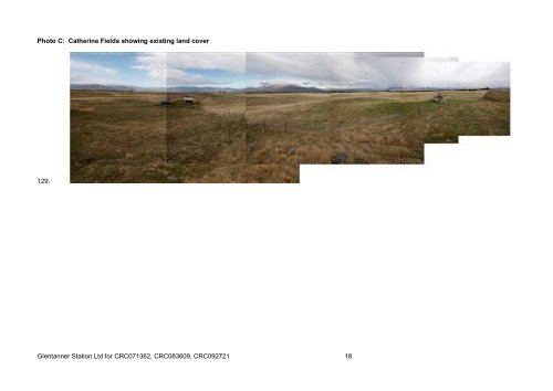
Photo C: Catherine Fields showing existing land cover 129. Glentanner Station Ltd for CRC071362, CRC083609, CRC092721 18
APPENDIX C: PROPOSED CONDITIONS 130. CRC Proposed conditions used with track changes 131. Please note that conditions relating to water quality and FEMP are still to be added CRC083609 – To take and use surface water 1. WP01 Water shall only be taken from Tekapo Stilling Basin, at surface water abstraction point H38/0227, at or about map reference between NZMS 260: H38:8842-7328 and NZMS 260: H38:8820-7260, at a maximum rate of 116 litres per second, with an annual volume not exceeding 1,060,000 1,200,000 cubic metres between 1 st July and the following 30 th June. Map references do not correspond to amendment made to location. Insert tranching regime from Derogation Approval 2. WP04 Water shall be used only for spray irrigation of 200 hectares of crops and pasture for grazing sheep, beef cattle, deer or non-milking dairy cows, as described in the application, on the area of land shown in attached plan CRC083609, which forms part of this consent. Do not wish to limit stock type. FEMP will ensure N and P discharges are not exceeded. 3. Irrigation shall not occur within the following areas: i. on soils with an average water holding capacity of 25mm or less; ii. within 130 metres of the bed of the Pukaki River; iii. within 50 metres of the bed of any watercourse; iv. within moraine areas containing ephemeral wetlands or tarns; v. within any area unsuitable for use of centre pivot irrigators due to natural topography. The final FEMP can now deal with this more appropriately and is also covered by WP05 below. 4. There shall be no leveling of glacial moraine landforms to enable use of centre pivot irrigation. Only minor leveling of glacial moraine landforms shall occur to enable pivot tracks 5. There shall be no disturbance of, or damage to, the historic Rabbit Fence constructed in 1888 resulting from the use of water for centre pivot irrigation. Outside Ecan jurisdiction. 6. This consent shall not be exercised concurrently with consent CRC071362. 7. WP0809 Fish Screen 8. WP05 Avoid wastage of water 9. WP06 Backflow prevention 10. Whenever the level of Lake Tekapo is at or below 701.8 metres above mean sea level in the months April to September inclusive, and at or below 704.1 metres above mean sea level in the months October to March inclusive, abstraction shall cease. 11. Metering condition – MIC Conditions 12-15 – from Tekapo Stilling Basin 12. ME04 Certification Datalogger required as per MIC/MEL conditions 13. ME05 Certification 14. Metering condition – MIC Conditions 12-15 – from the irrigation supply canal at the boundary of Simons Pass Station, such that all flow to Simons Pass Station passes the metering device Not considered necessary. Take is metered at the location of the take, being Tekapo Canal. 15. ME04 Certification Not considered necessary as above 16. ME05 Certification Not considered necessary as above 17. AD03 Review 18. AD04 Lapse CRC071362 – To take and use surface water 19. WP01 Water shall only be taken from either the Lake Pukaki, at surface water abstraction point H38/0249, at or about map reference NZMS 260 H38:8214-6511 or NZMS H38: 822-652 and the Pukaki Canal at or about map reference NZMS 260: H38:805-641, at a maximum rate of 116 litres per second, with an annual volume not exceeding 1,060,000 1,200,000 cubic metres between 1 st July and the following 30 th June. Insert tranching regime from Derogation Approval 20. WP04 Water shall be used only for spray irrigation of 200 hectares of crops and pasture for grazing sheep, beef cattle, deer or non-milking dairy cows, as described in the application, on the area of land shown in Glentanner Station Ltd for CRC071362, CRC083609, CRC092721 19